PORTFOLIO
Danlei Zhang
SELECTED WORKS2022-2023
For the Application to The University College London MLA Landscape Architecture
Application Number:24181803

Danlei Zhang
SELECTED WORKS2022-2023
For the Application to The University College London MLA Landscape Architecture
Application Number:24181803
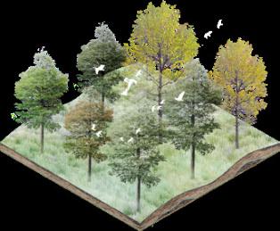
01 Boundaries And UNatural Symbiosis
Brownfield Transformation Project For Abandoned Shipyard
01-04
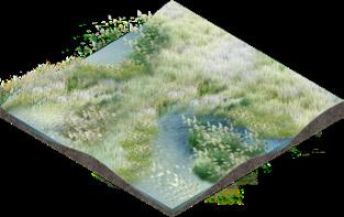
02 Boundaries And Human Intervention
Sustainable Shorelines Tackle Marine Plastic Hazards
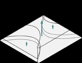
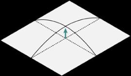
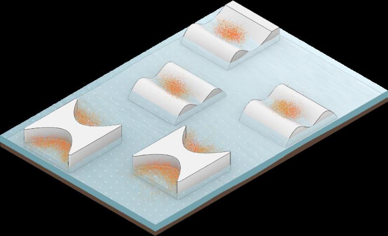
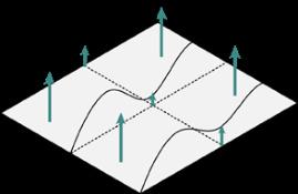
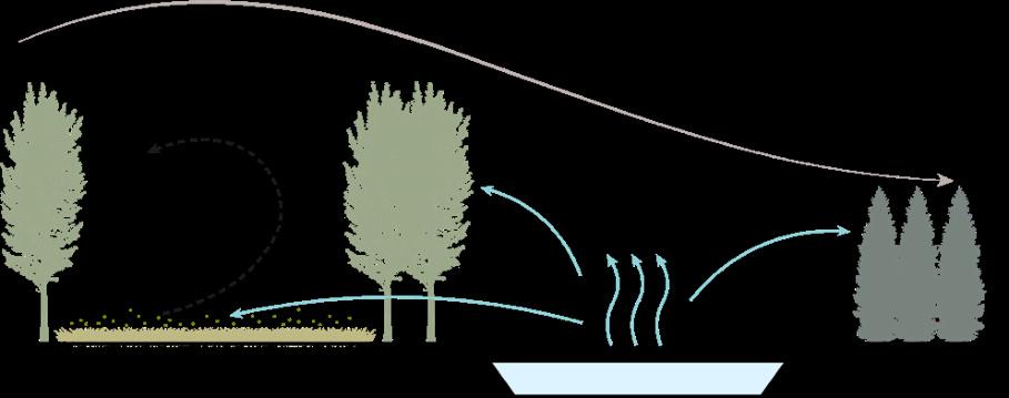
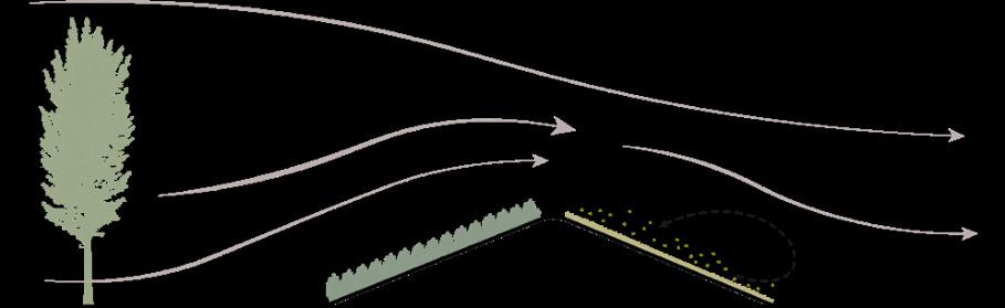
In the realm of landscape, the existence and nature of boundaries profoundly affect the interaction between humans and nature. Landscape boundaries do not just delineate the extent of land, they also carry information about culture, history, and ecosystems. Boundaries can be barriers or connections, defining our perception and understanding of nature. As Jan Gehl's book Life Between Buildings suggests about flexible boundaries, we need boundary spaces that are thick, inclusive, harmonious, symbiotic, and blurred. Today, the growing conflict between urban development and the destruction of nature and ecology, resulting in increasing global climate anomalies, is the theme and mission of the public landscape. We need to break down borders, not create barriers
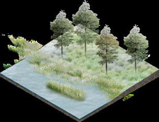
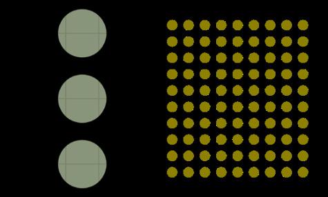
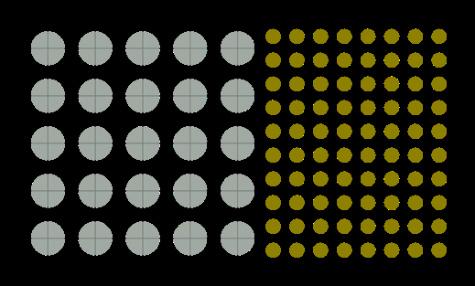
03 Boundaries And Planting Pattern
Human-friendly Planting Patterns In Sustainable Development
05-07
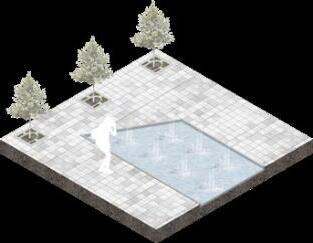
04 Boundaries And Urban Functioning
Urban Design Projects From The Perspective Of Crime Rates And Access Safety
08-10
11-13
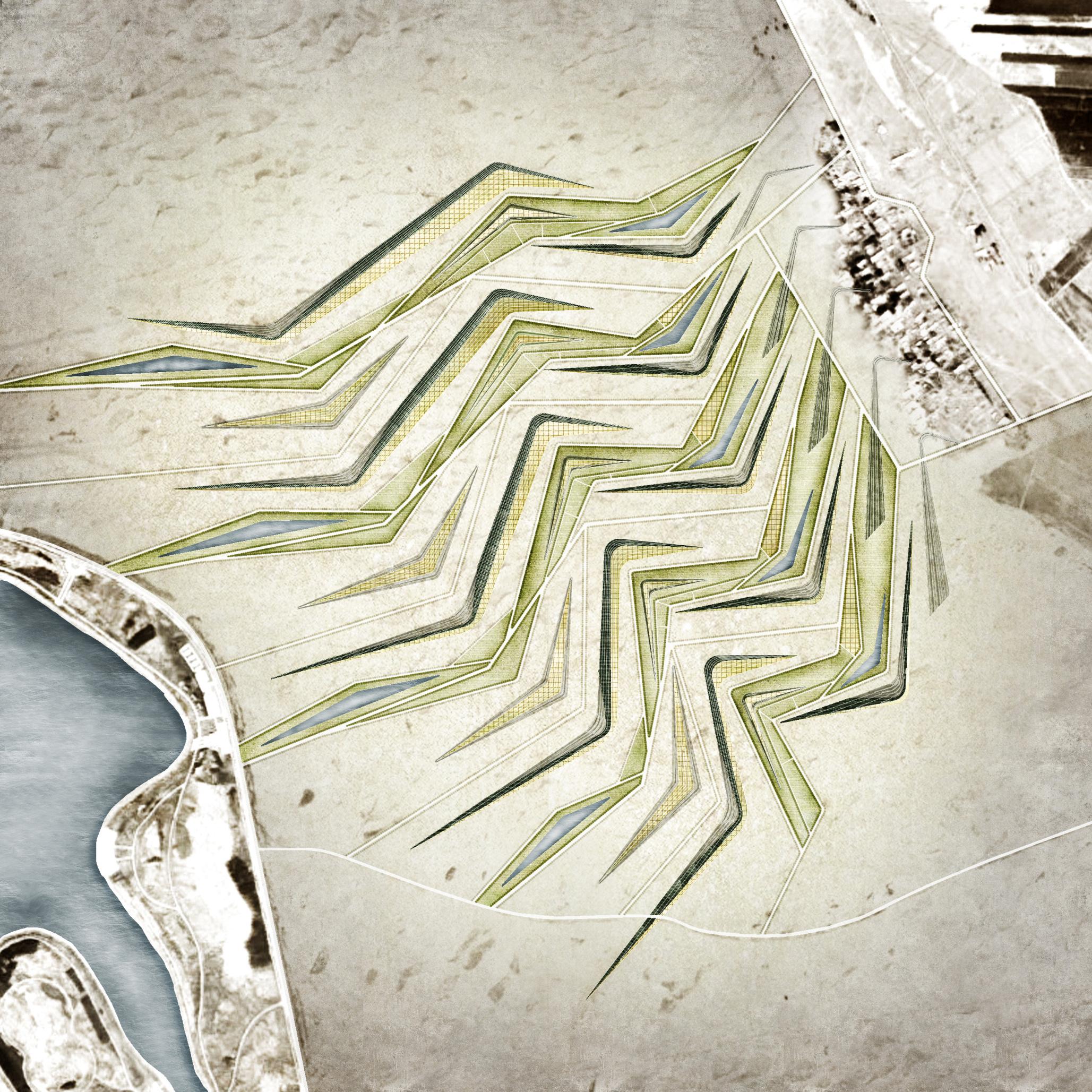
Browntield Transtormation and Ecological Integration Design
Instructor : Nan Hu
Type : Individual work
Date :
June to July,2023
Area :
43ha
Location : Wuxi,Jiangsu
Key Concern :
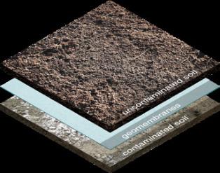
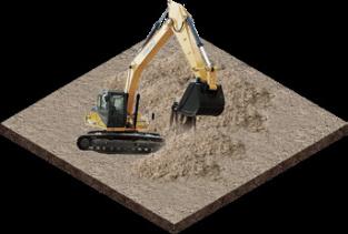
Soil remediation;Continuation of industrial memory;Ecological restoration;Resilient landscape
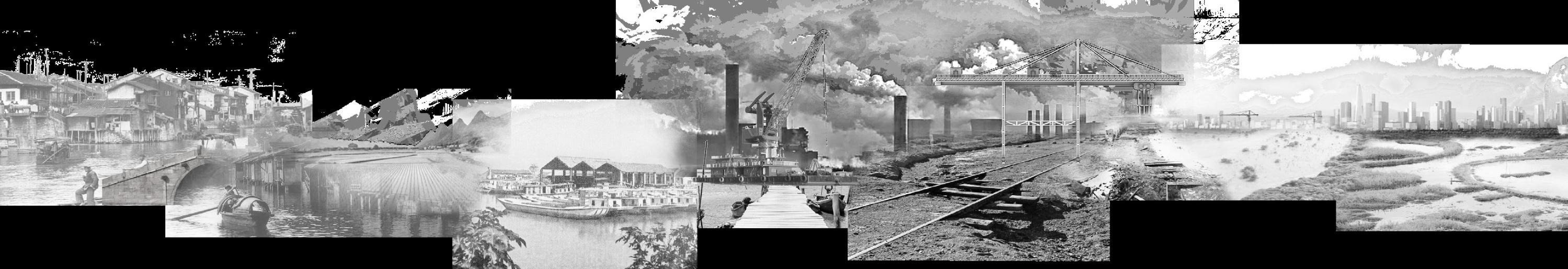
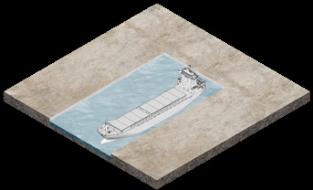
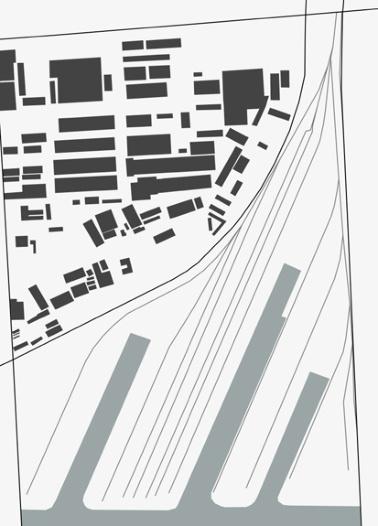
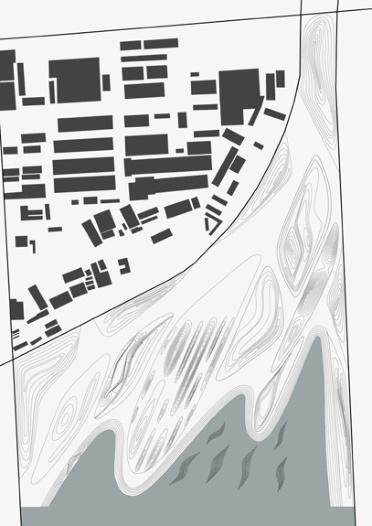
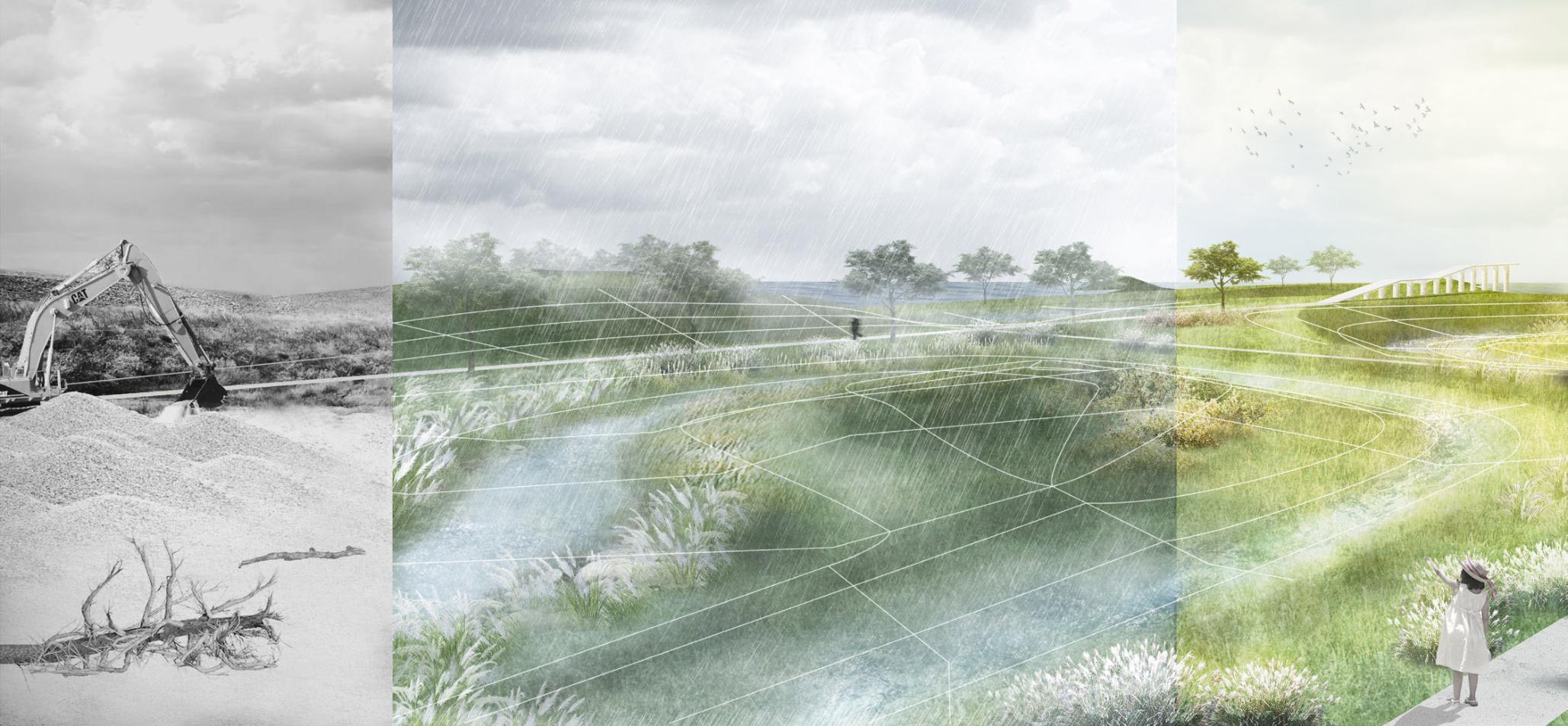
Background: Abandoned Wuxi Shipyard Cut Off From The Surrounding Areas And Threatened By Flooding
The
Current Problems: Soil Pollution & Flood Threat & Obsolete Relics
In
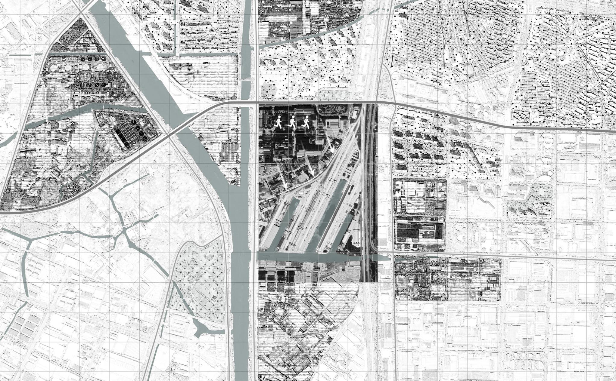
portPrimary goods
Issue1:Flood threat
The site has a fIat topography and is susceptible to extreme weather conditions, posing a risk of flooding
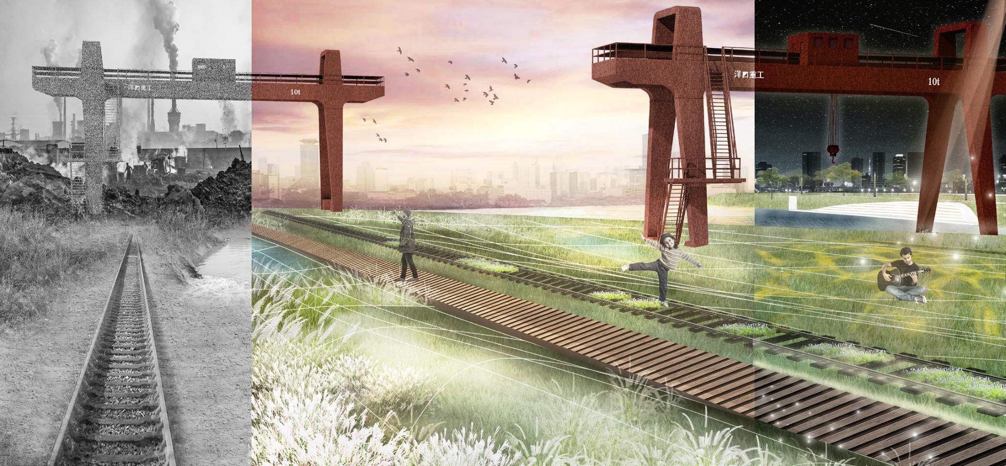
Issue2:Obosolete relics
The industrial facilities within the site have been abandoned for a long time, leading to disorder in the site's organization
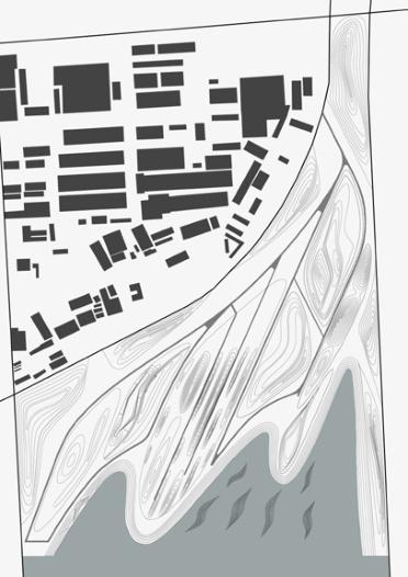
Mitigation Strategies: Building A Vibrant And Resilient Site
Issue3:Soil pollution
The current soil has experienced various degrees of oil pollution, resulting in a degraded ecological environment
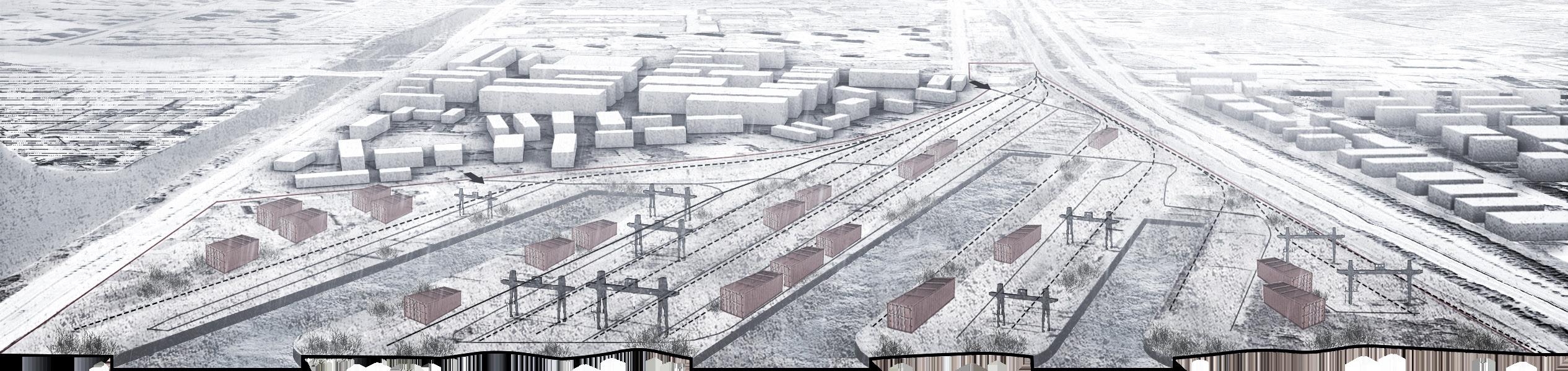
Step1:Soil remediationStep2:Set the rainwater collection pointsStep3:Partitioning functional zones

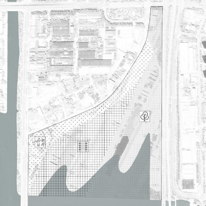
Specific Measures: Enhancing Site Sustainability While Preserving Industrial Memory
Soil remediation strategyRainwater adaptability landscapeMeasures for repurposing obsolete relics
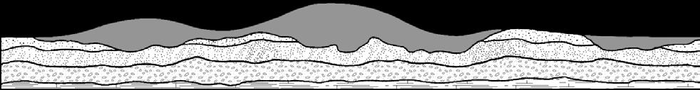
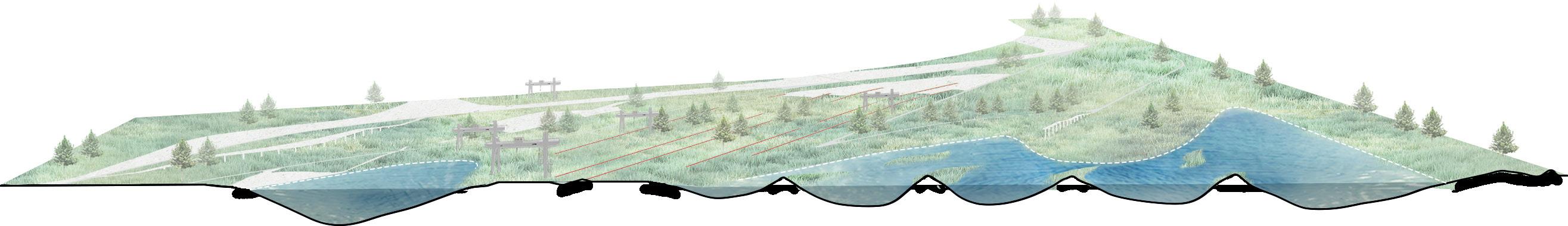
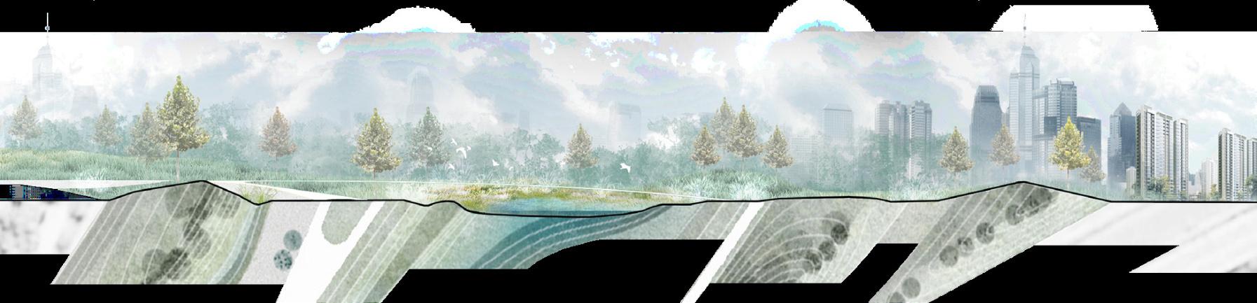
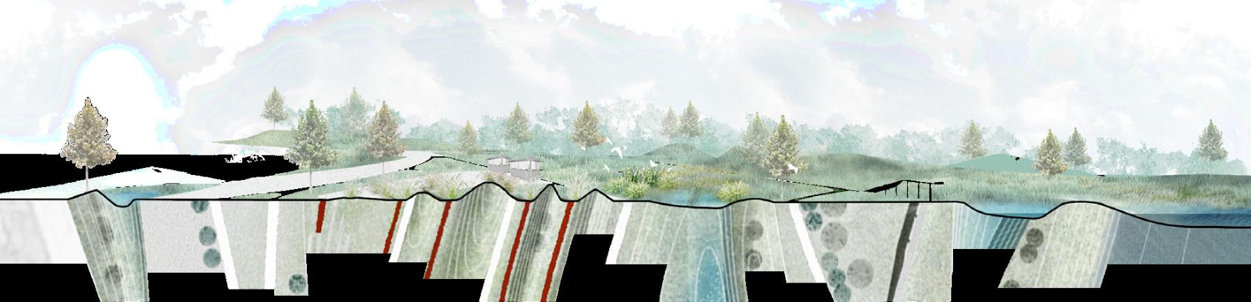
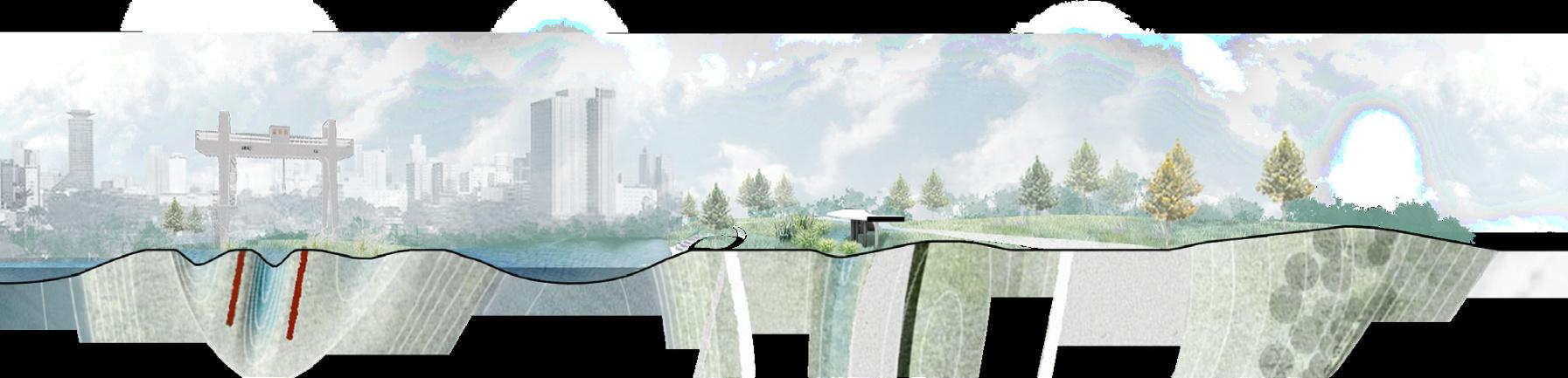
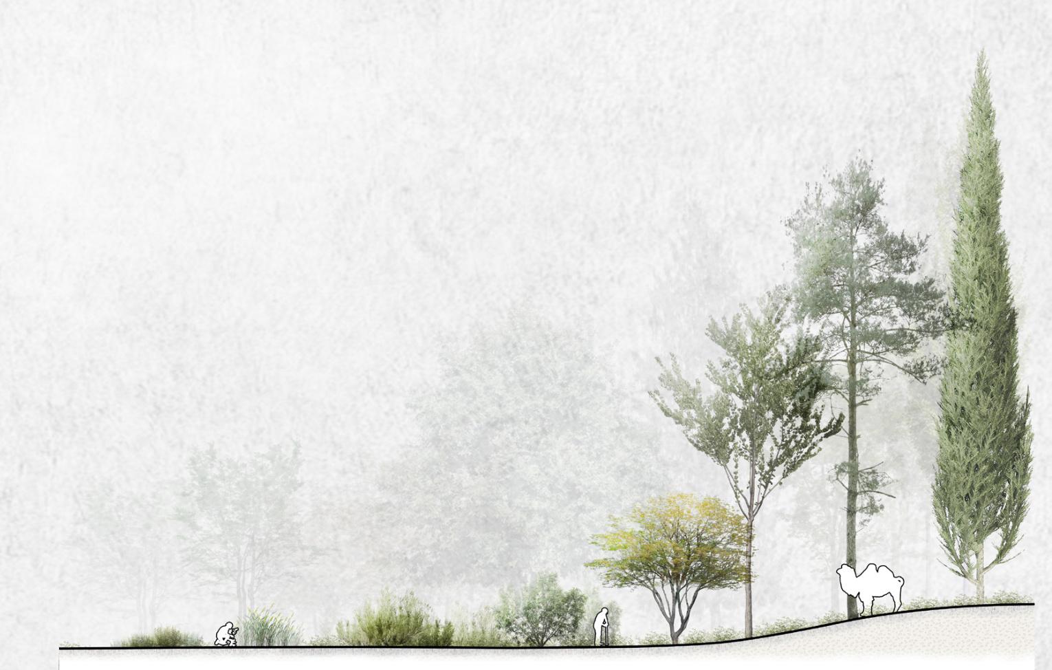
Site's new landscape cross-sectional view:Vibrant and resilient
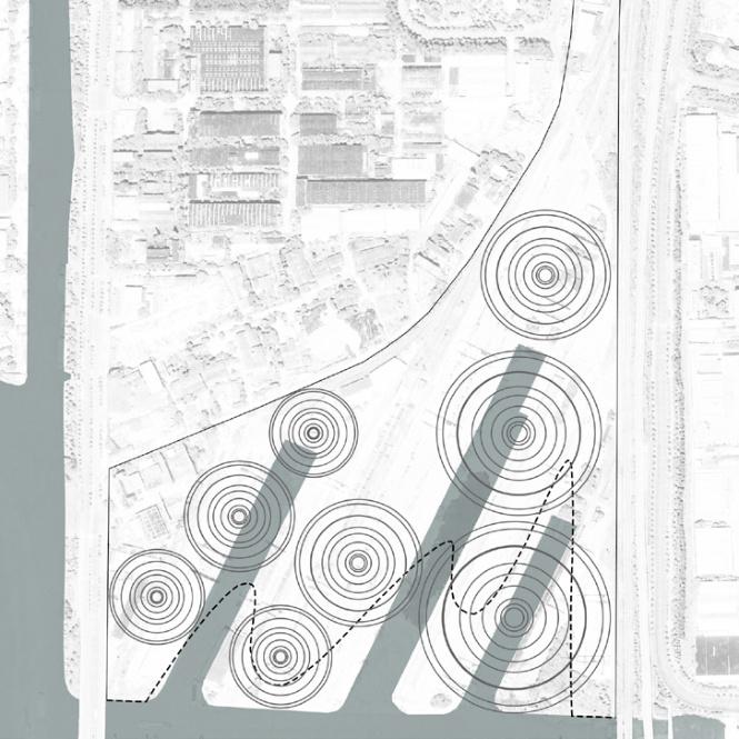
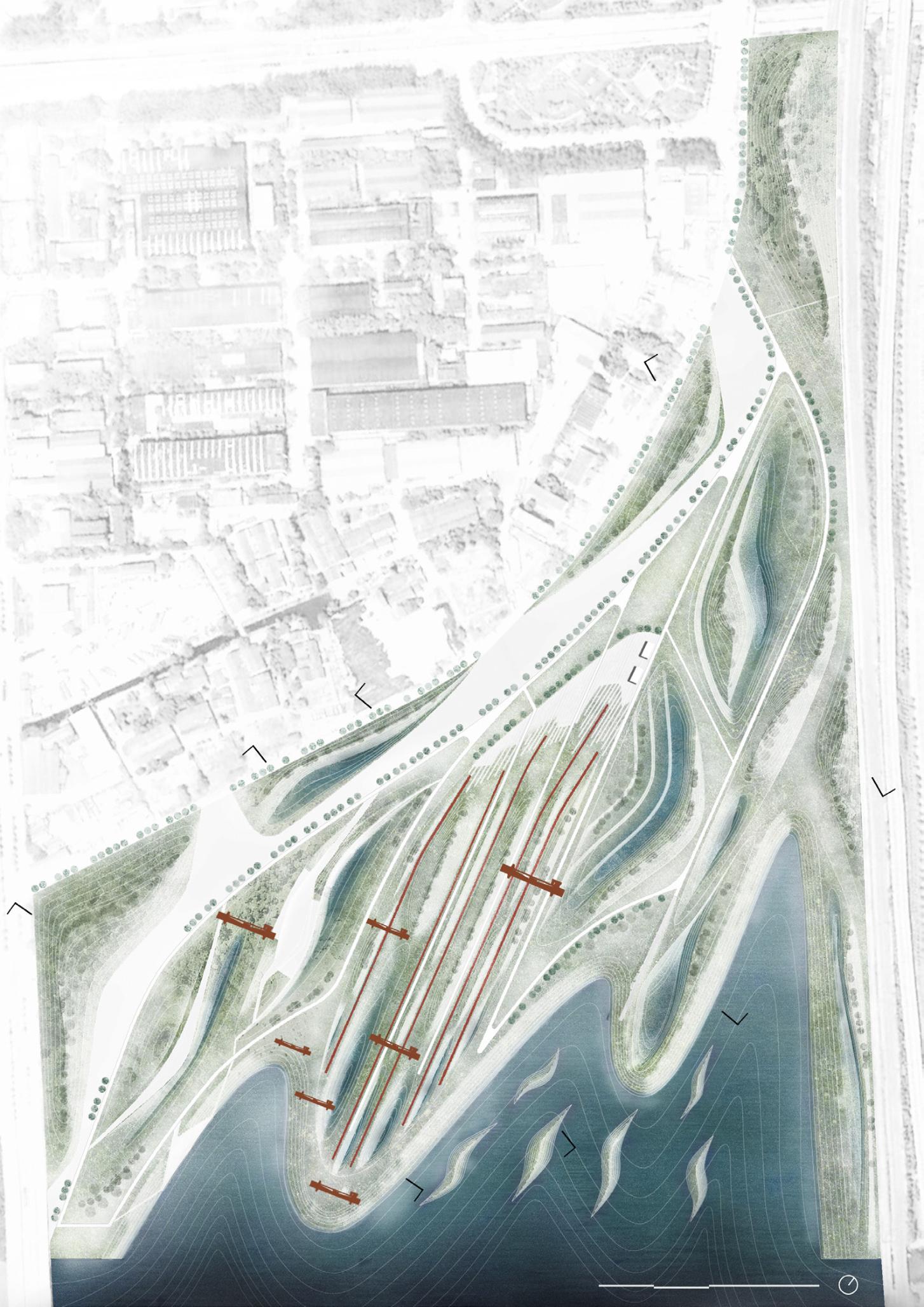
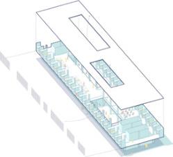
Plan Generation
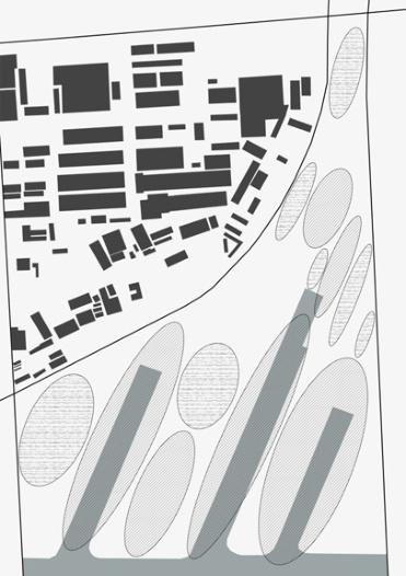
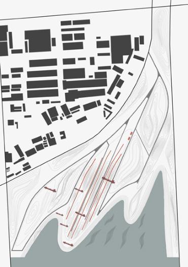
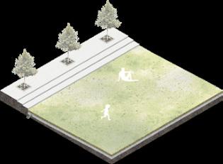
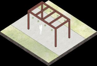
Master Plan
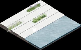
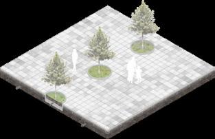
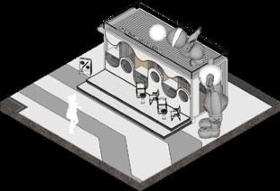
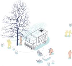
1.Container Café
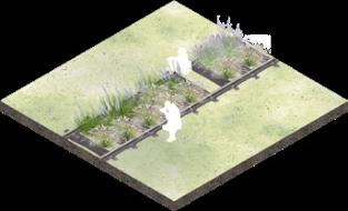
2.Railway Garden
3.Rain Garden
4.Sunken Public Green Space
5.Skateboard Area
6.Viewing Platform
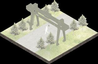
7.Retained Gantry Cranes
8.Infiltration Basin
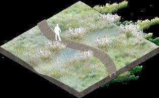
9.Plank Road
10.Wetlands
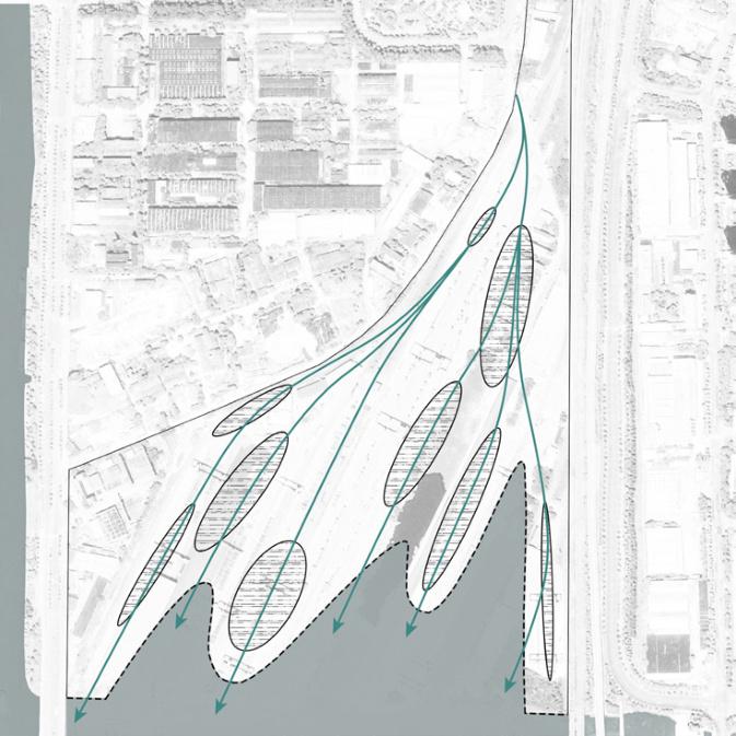
Terrain & Flooding Situation
Site inundation under varying degrees of fIooding
level 2nd level 3rd level


Construction Drawing Section
Pervious concrete pavement
A-A Section
20mm thick M5 cement mortar 150mm thick C15 concrete compacted native soil 3000mm
350H X 100W X 600L red granite kerbstone

30mm thick 6mm particle size C25 plain pervious concrete
90mm thick 10mm particle size C25 pervious concrete
30mm thick sand filtration layer
200mm thick graded sand and gravel (compacted) compacted native soil
Natural gently sloping inlet barge
B-B Section


C-C Section
3000mm
2000mm
+0.50
aquatic plant a chunk of natural stone (Specification buried depth ≤200mm,out of the ground height 250~450mm)
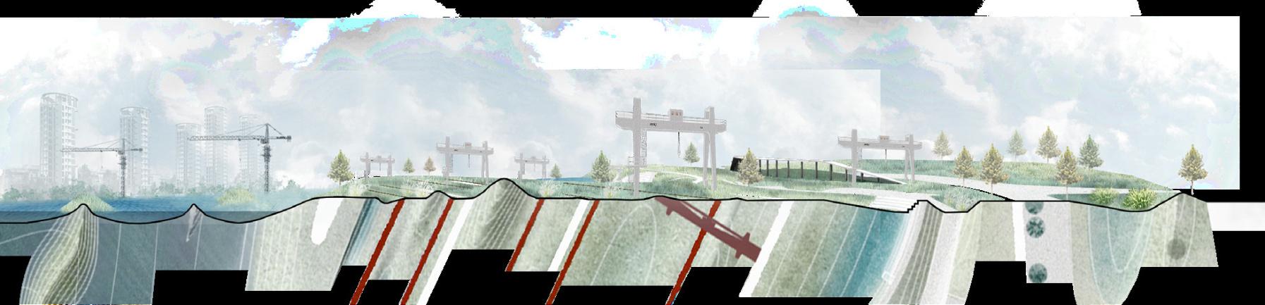
Industrial exploration zone
planting soil ±0.00(standing water level)
-0.40

The old soil at the bottom is tamped in layers with the right amount of clayey soil
D-D Section


Instructor: Wei Kuang
Type : Individual work
Date : September to October,2023
Area : 12ha
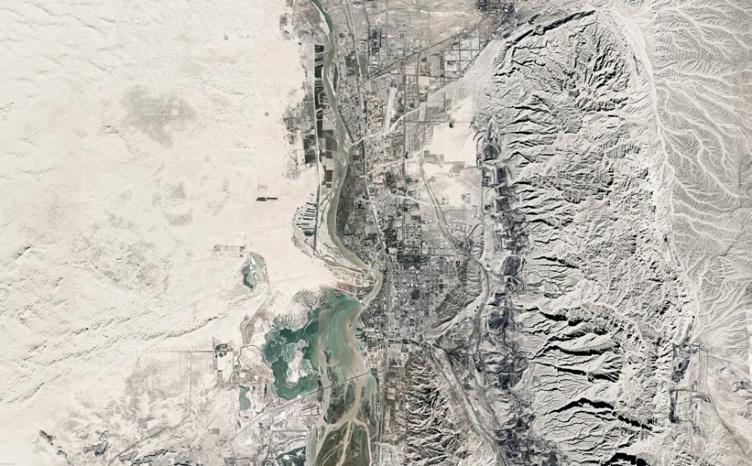
Location : Henderson Island North Beach
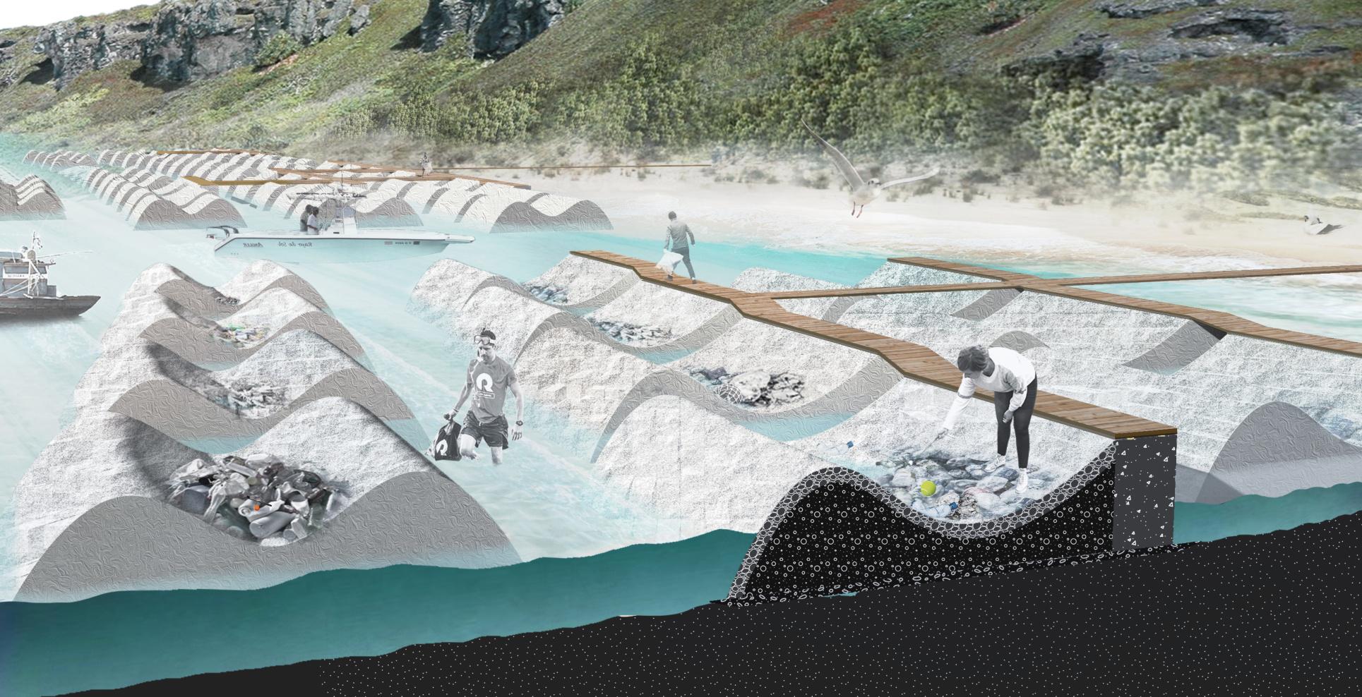
Key Concern :
Marine plastic pollution;Habitat for wildlife;Human intervention
Henderson
Livingcoral cover around Henderson Island
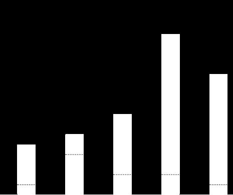
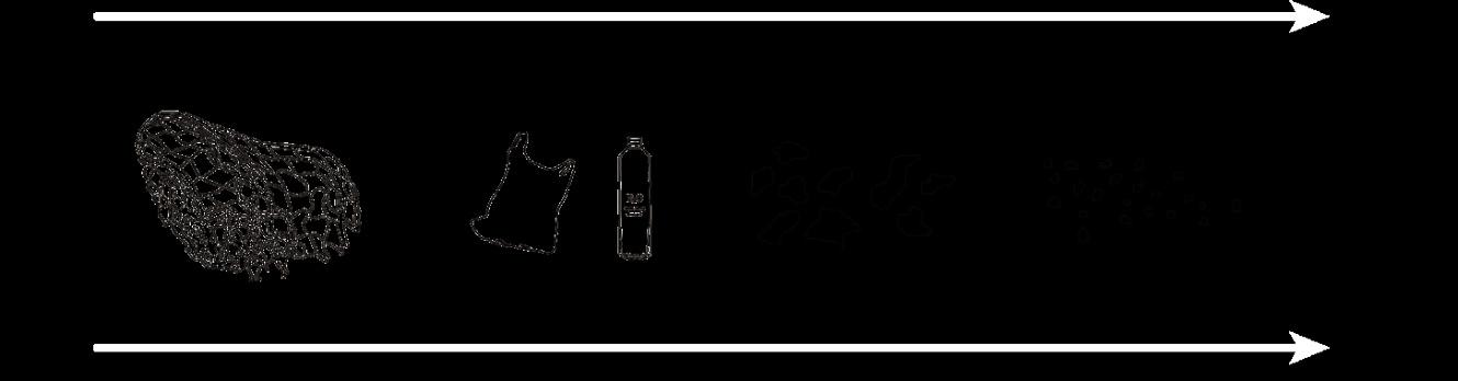
The proportion of plastic of different sizes on Henderson Island beaches

Sizes of plastic debris in our oceans
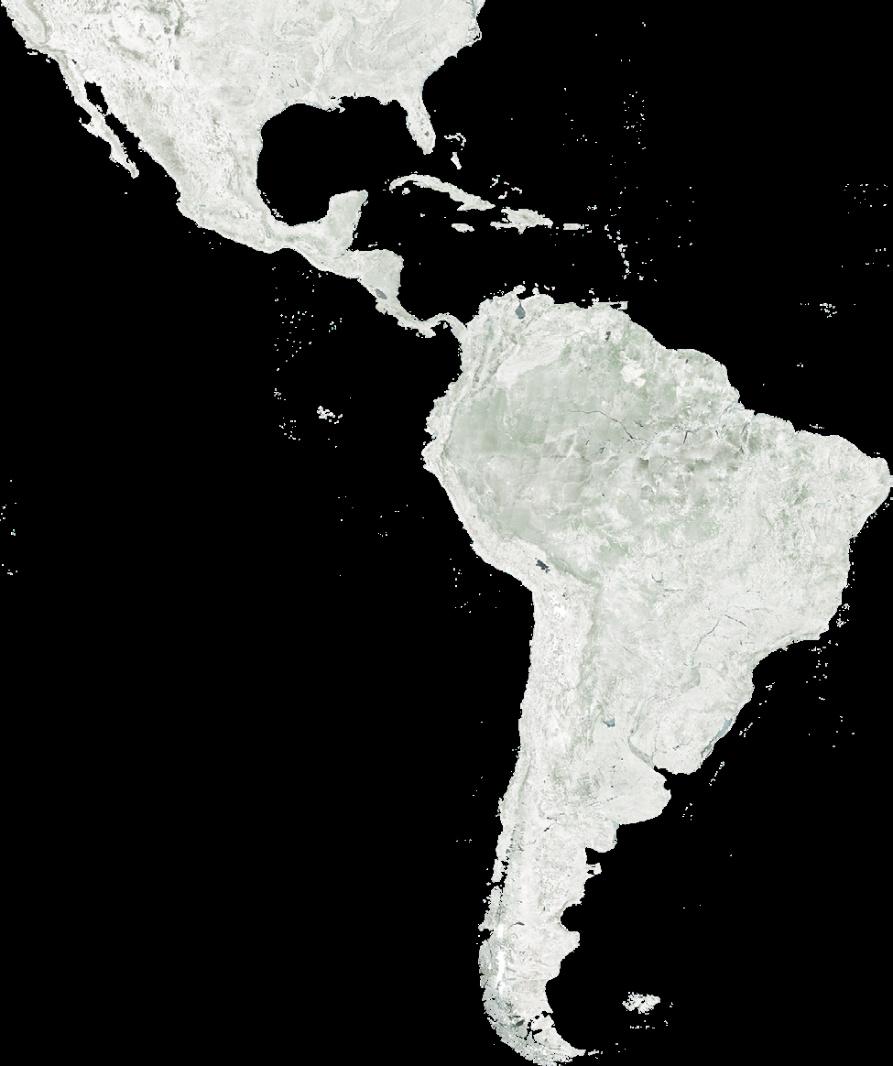
Location of Henderson Island
Currents carry trash onto Henderson Island Negative

Herderson Island

SOUTH
Threats
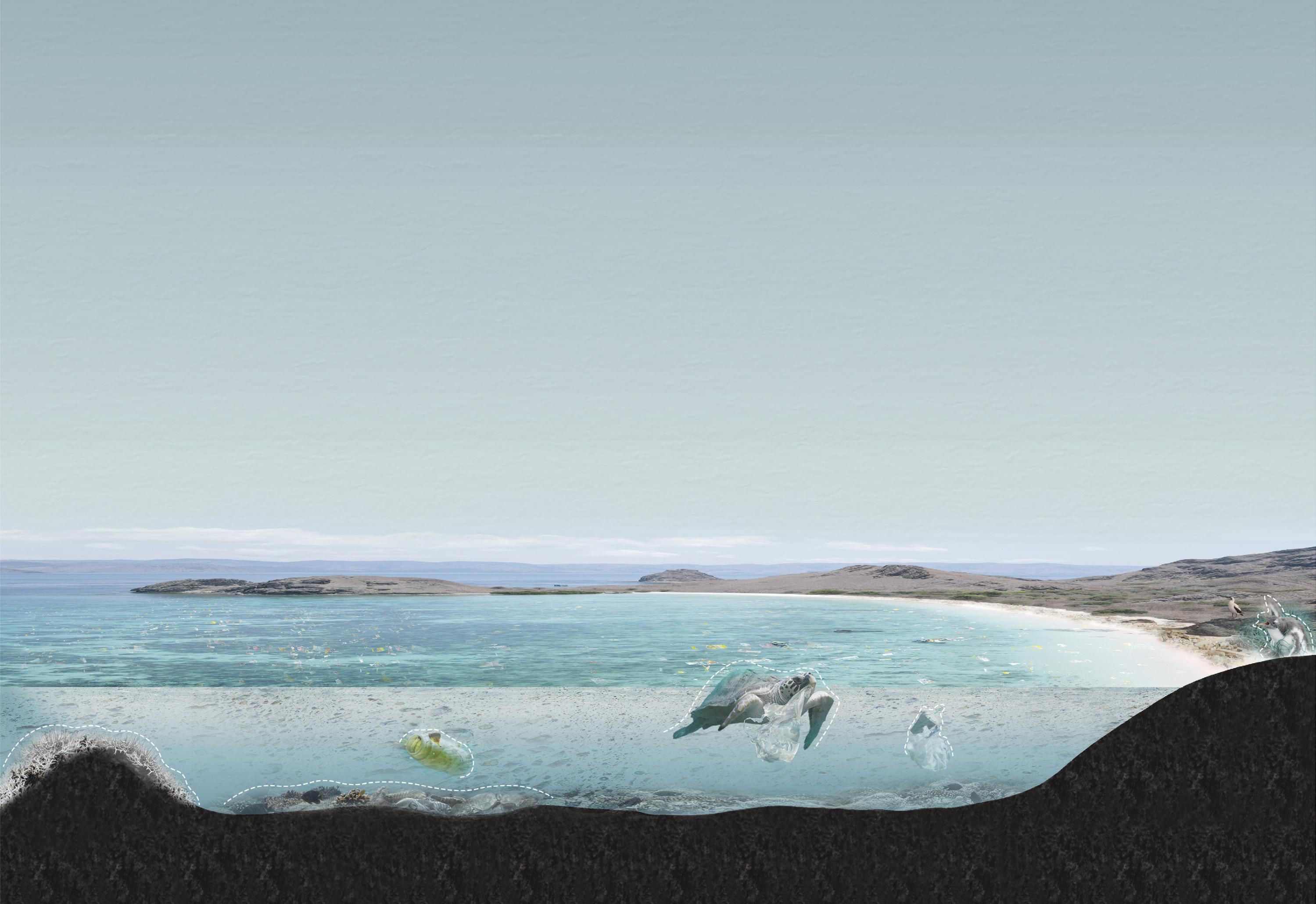
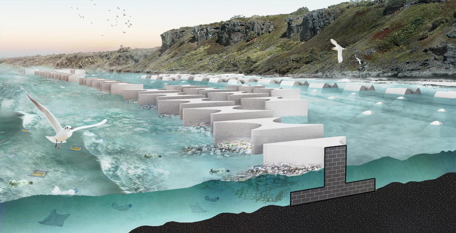
The most polluted place in the world
Scattered across Henderson Island's beaches are 38 million pieces of plastic with a total weight of more than 18,000 kilograms
Mitigating waste pollution
Severe plastic pollution
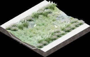
Habitat rehabilitation
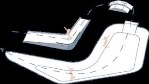
Manual intervention Precast block Intercept
Slow down
Gather Collect
Regularly arrange on the reef fIat
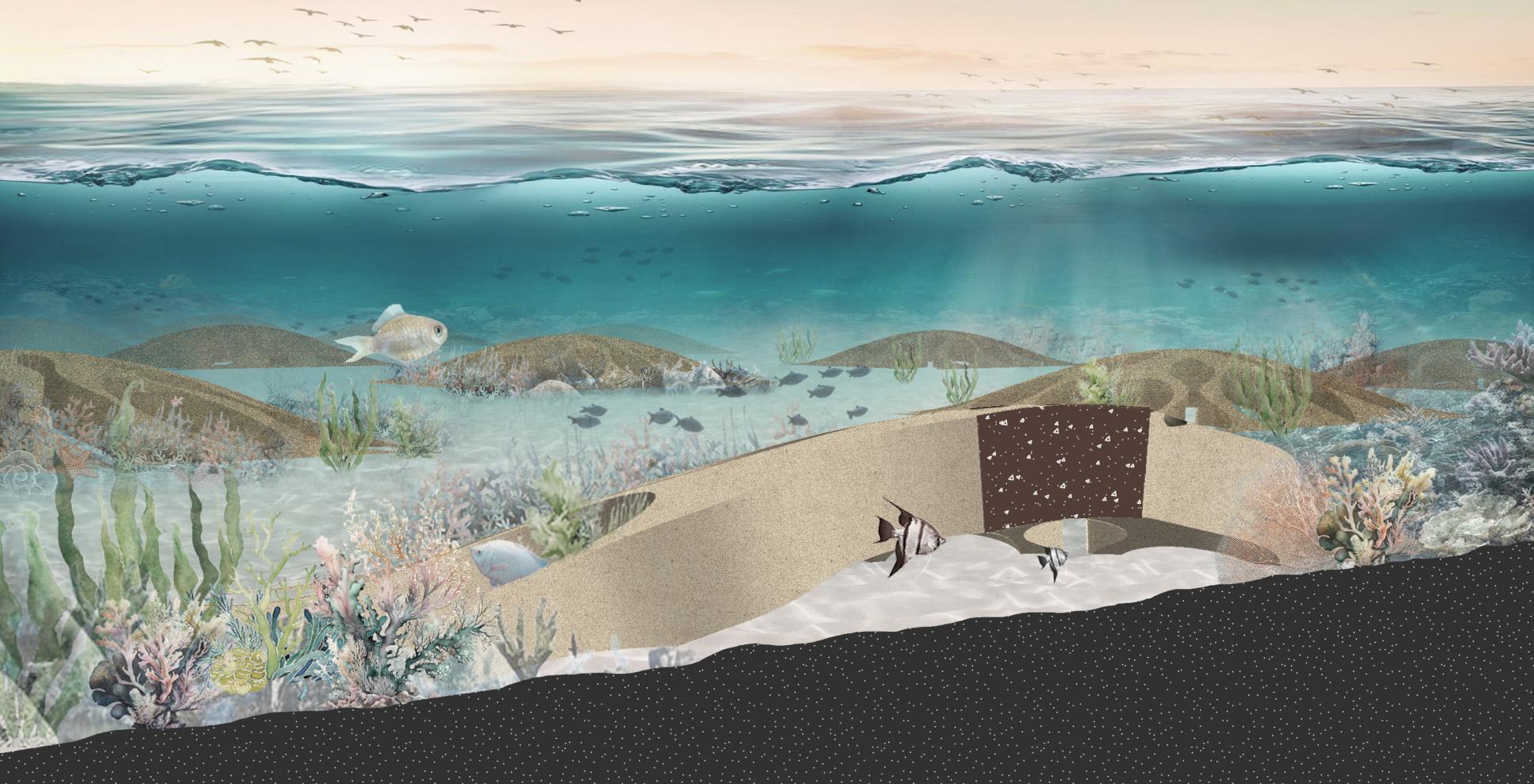
Restore biological habitat & Maintain ecosystem balance
ProblemPurposeMethodologyVision
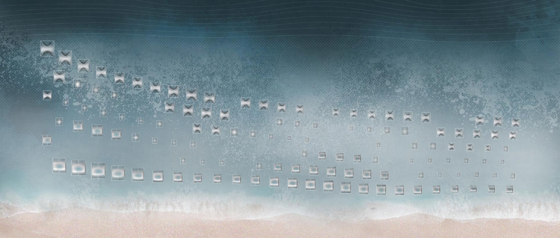
Points: Artificial Interventions
Basic unitFormsSectionModuleWaterfIowExpected effect


New waste management measures


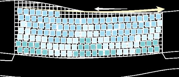
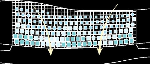
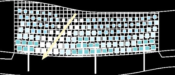
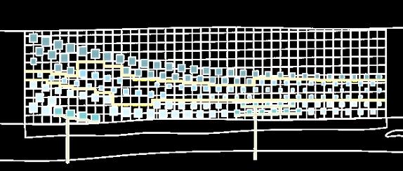
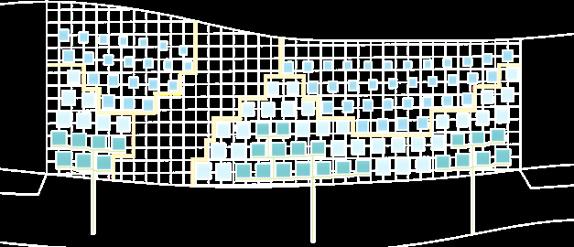
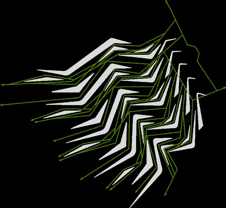
Lines & Surfaces: Grid System For Three Different Types Type1 Type2 Type3
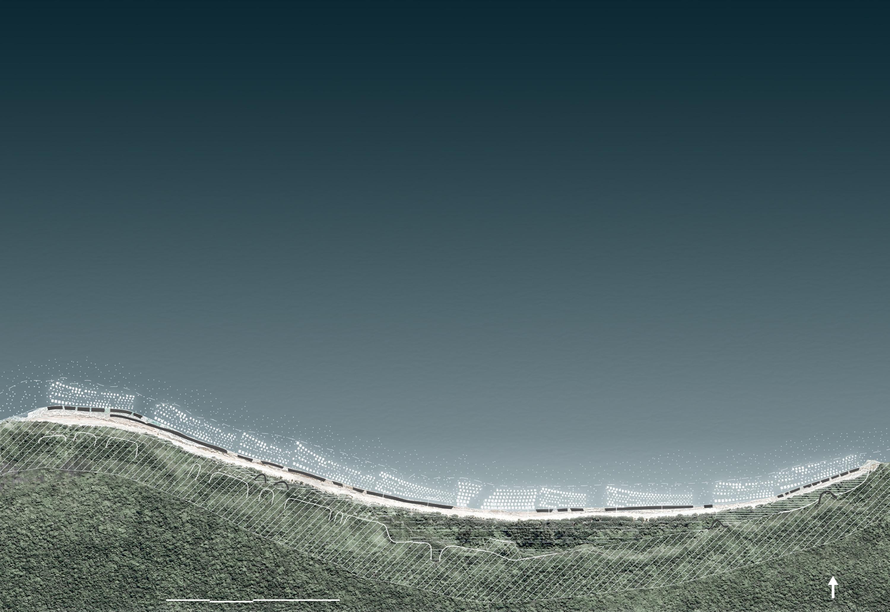
main animal migratory routes
wooden boardwalk
wooden boardwalk
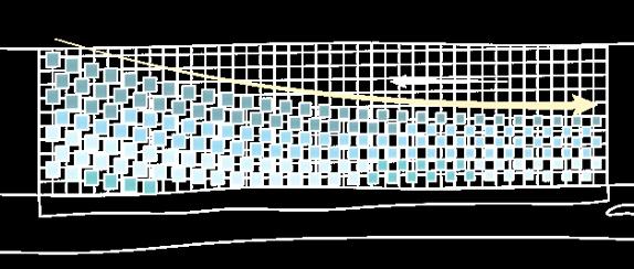
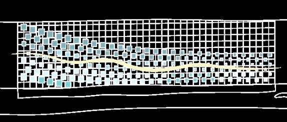
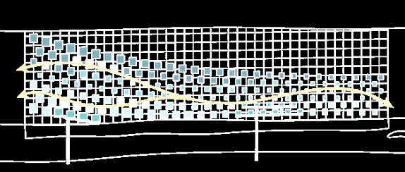
The North Beach of Herderson Island is divided into three different types based on its topography
manual interventions position for type 1: no beachridge/incipient sand dunes
manual interventions position for type 2: no beachrock
manual interventions position for type 3: both include


module1module2module3module4


New habitat for biodiversity coralseaweed fishturtlebird
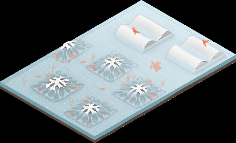
Type 1 : Bilateral InterceptionType 2 : Central Guard Master planMaster plan Perspective
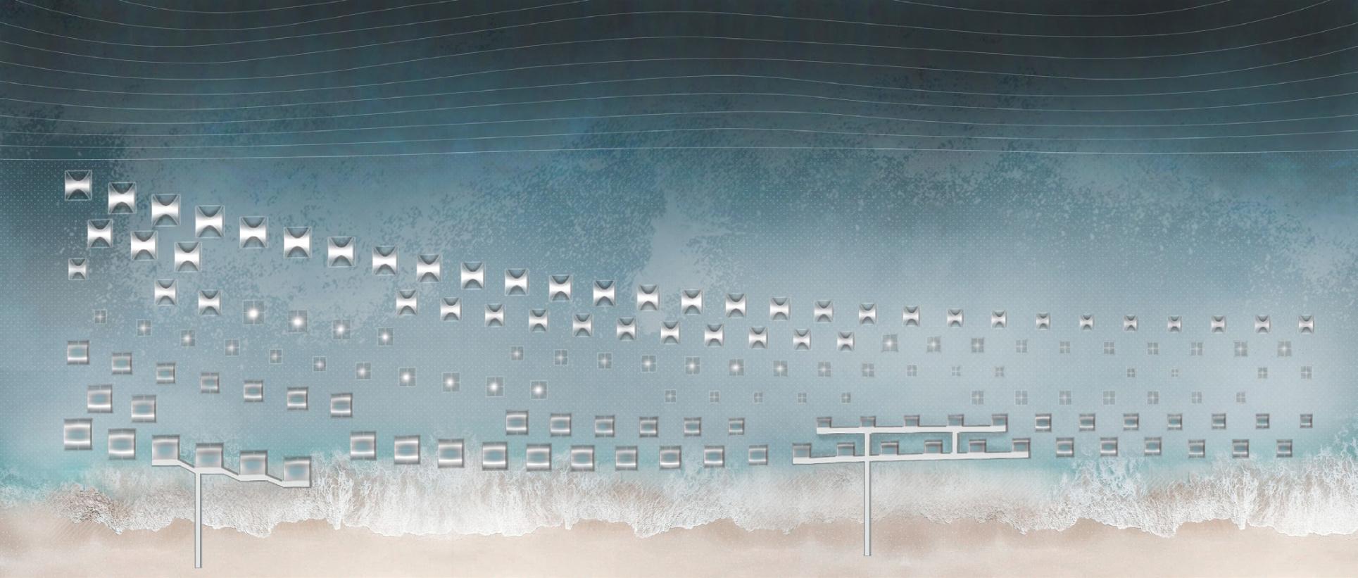


Type 3 : Offshore Collection Master plan
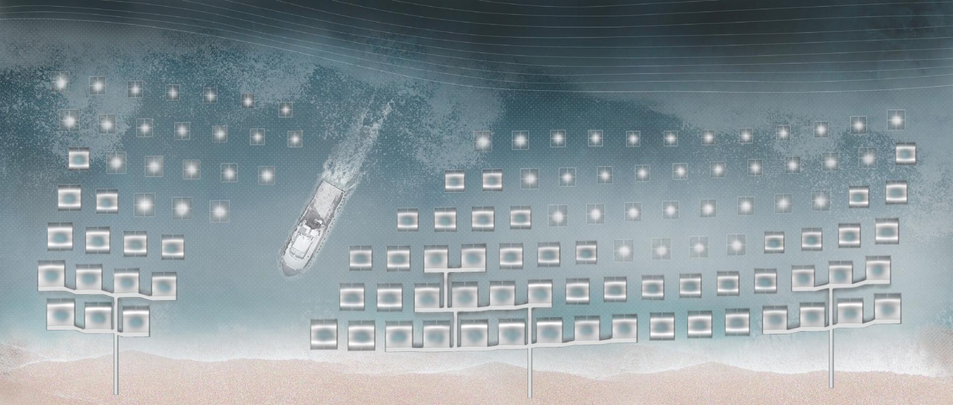

Step3:Inshore refuse collection


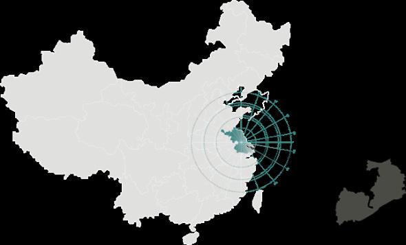
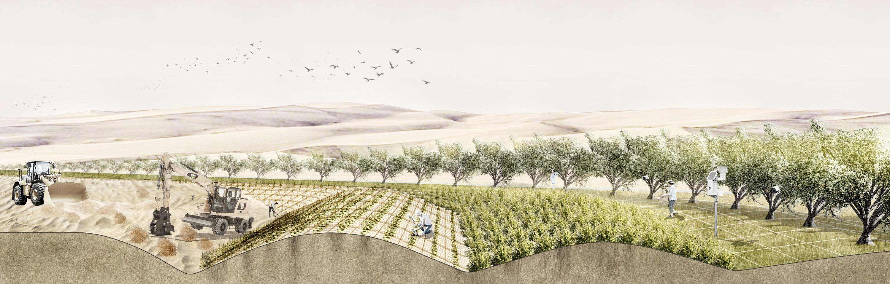
The Three-North Shelterbelt Program, sand dune system, and desertification affected areas map of China
75'0"E80'0"E85'0"E90'0"E95'0"E100'0"E105'0"E110'0"E115'0"E120'0"E125'0"E130'0"E
gobi desert mobile dune oasisfarmland shelter-belt regions with desertification occuring scope of the Three-North Shelterbelts forest urban area lake water systems yardang vegetated dune
Instructor: Hao Wu
Type : Individual work
Taklimakan Desert
Gurbantunggut Desert
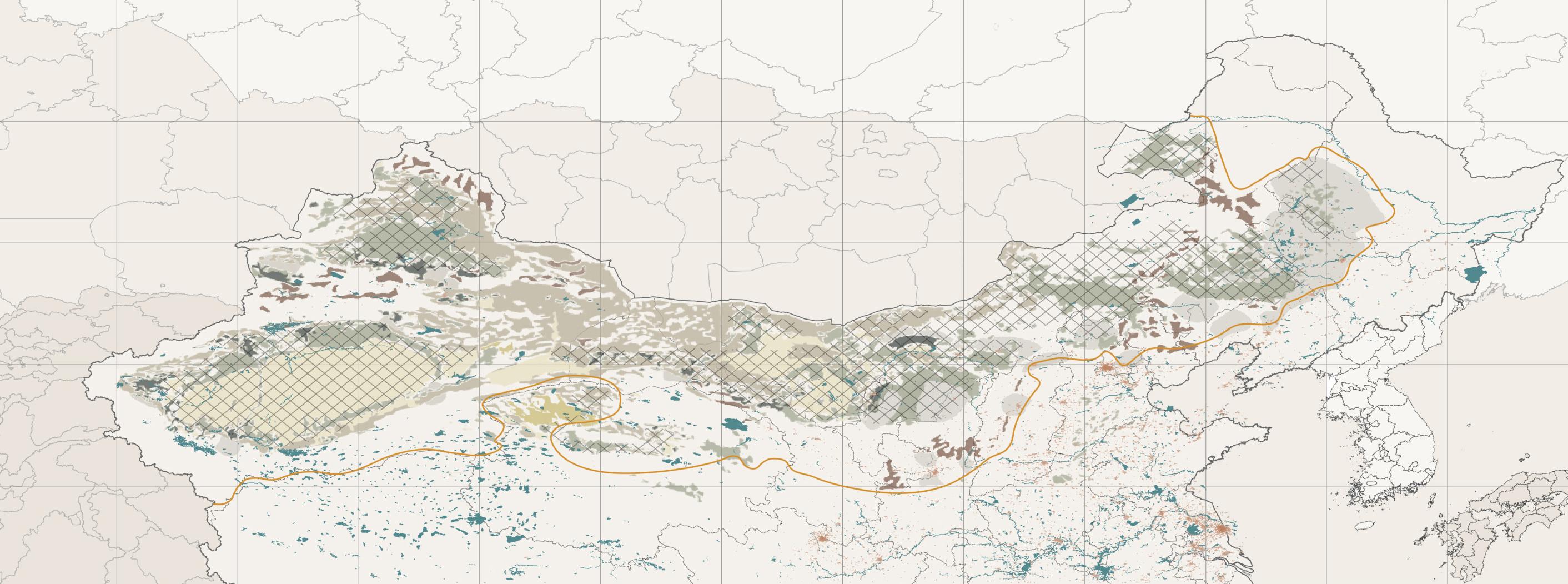
50'0"N
Badain Jaran Desert Hulunbuir Desert
Hunshandak Desert Magolia
Bohai Sea Kazakhstan
Tibet Plateau
Kumutage Desert
Qaidam Desert
Tengger Desert Horqin Desert Ordos Desert Hobq Desert
+ SITE
Date :
October to December,2023
Area : 1050ha
Location :
The outskirts of Bayan Khoshuu Village in Alxa Zuoqi
Key Concern :
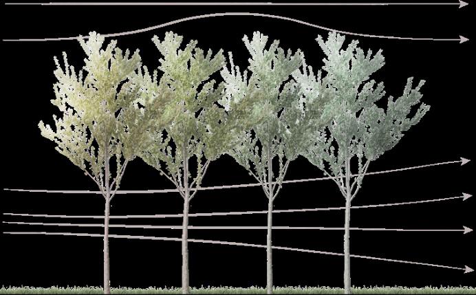
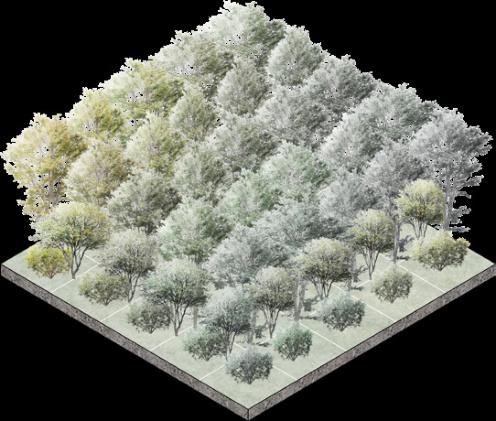
Planting stragety Protection Forest System,Pollen Allergy,Human-friendly
75'0"E80'0"E85'0"E90'0"E95'0"E100'0"E105'0"E110'0"E115'0"E120'0"E125'0"E130'0"E
Source : The spatial trends for natural forests, farmland shelterbelts, and shifting-sand shelterbelts were compiled based on data from Xiao (1994), and the China Forestry Yearbook((1949–1986) (bound volume), 1987–2006). The trends for dune systems are from IGFDR (1974) and CAREERI (2005).
the forest coverage rate in the construction area
belt of trees and grid of grass sand barriers desert to oasis
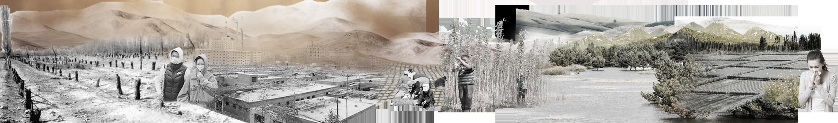
In the Three-North region, severe wind erosion buries large areas in sand, leading to frequent sandstorms
pollen allergy
45'0"N
40'0"N
35'0"N
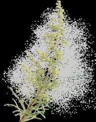
Artemisia artemisia,as a pioneer plant for sand fixation, produces pollen that is a major allergen barren land
First
Second stage
tree shurb herb ## year/day growth circle
0m
2

18year Artemisia ordosica with both medicinal, forage, environmental and economic values, but its pollen spreads and becomes a major allergen. Pollen allergy
Artemisia ordosica Psammochloa villosa Haloxylon ammodendron Salix cheilophila Elaeagnus angustifolia Populus alba Pinus sylvestris Populus nigra
habitat windproof sand retention salinity fecundity
water-wetness resistance economic value ground ground ground ground ground & sand dunes ground & sand dunes sand dunes sand dunes
Growth environment: soil
Sparse forest belt Major tree species

Roads are arranged in two common ways
Dense forest belt
Populus alba Populus simonii Populus tomentosa
Floating poplar catkins bring environmental pollution
Artemisia ordosica planting area
Haloxylon ammodendron planting area
Elaeagnus angustifolia planting area
Ulan Buh Desert
Herbaceous ground cover oasis
Ulan Buh Desert
Major tree species

Pinus sylvestris Elaeagnus angustifoli Salix cheilophila

Susceptible to pests and diseases
Growth environment: sand dunes
Straw checkerboard barrier
The most powerful sandfixing ability
Strongest wind protection 50m 50m 5m
Major tree species
Artemisia ordosica Psammochloa villosa Haloxylon ammodendron
Artemisia artemisia pollen was the main allergen
Yellow River
Village SITE + Table Mountain
Wuhai City
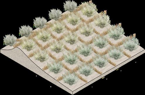
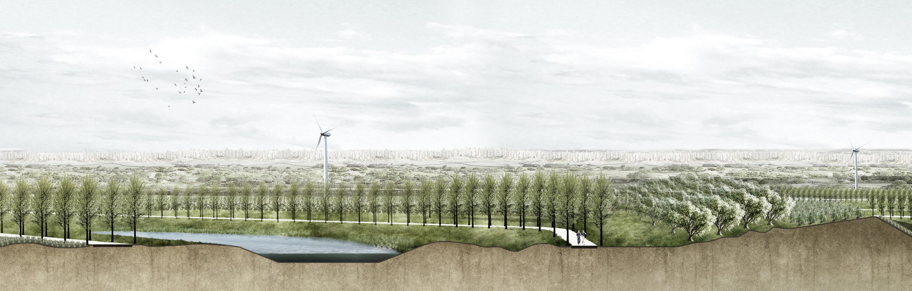
The design site is located on the edge of the desert, overlooking Wuhai City across the river. It aims to serve as a pilot perception area for Wuhai City, exploring a planting model that integrates windbreak, sand fixation, and the suppression of Artemisia ordosicapollen spread.
wind defense process

road system
Lake
Proposed planting model
AProposed planting model BProposed planting model C
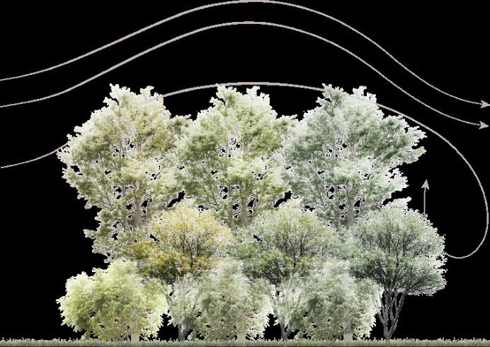
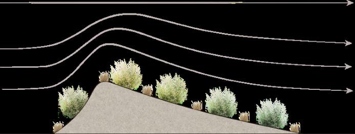
Introducing a desert oasis to increase the relative humidity and suppress the dispersion of black sagebrush pollen
Plane layout

Section
The outer peripheral tall trees and elevated topography work together to suppress the internal black sagebrush pollen dispersion
Planting black sagebrush on the leeward side, utilizing the terrain to suppress pollen dispersion
6m4m4m


Original siteArtemisia ordosica---plating
environmental quality monitoring devices wind turbine
 Artemisia ordosica
roadgrassgrassgrassroadoasis
Artemisia ordosica---growingElaeagnus angustifolia on the periphery
Elaeagnus angustifolia
topography shaping oasis
wheatgrass grids plant growth detector
poplar
Haloxylon ammodendron
Artemisia ordosica
Artemisia ordosicaroadgrassgrassgrassroadoasis
Artemisia ordosica---growingElaeagnus angustifolia on the periphery
Elaeagnus angustifolia
topography shaping oasis
wheatgrass grids plant growth detector
poplar
Haloxylon ammodendron
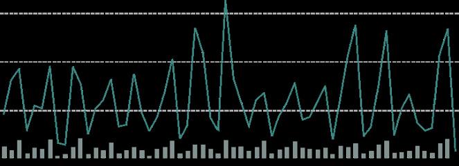
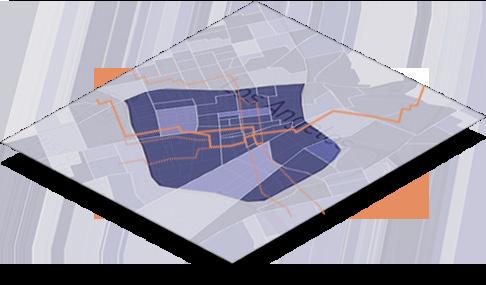
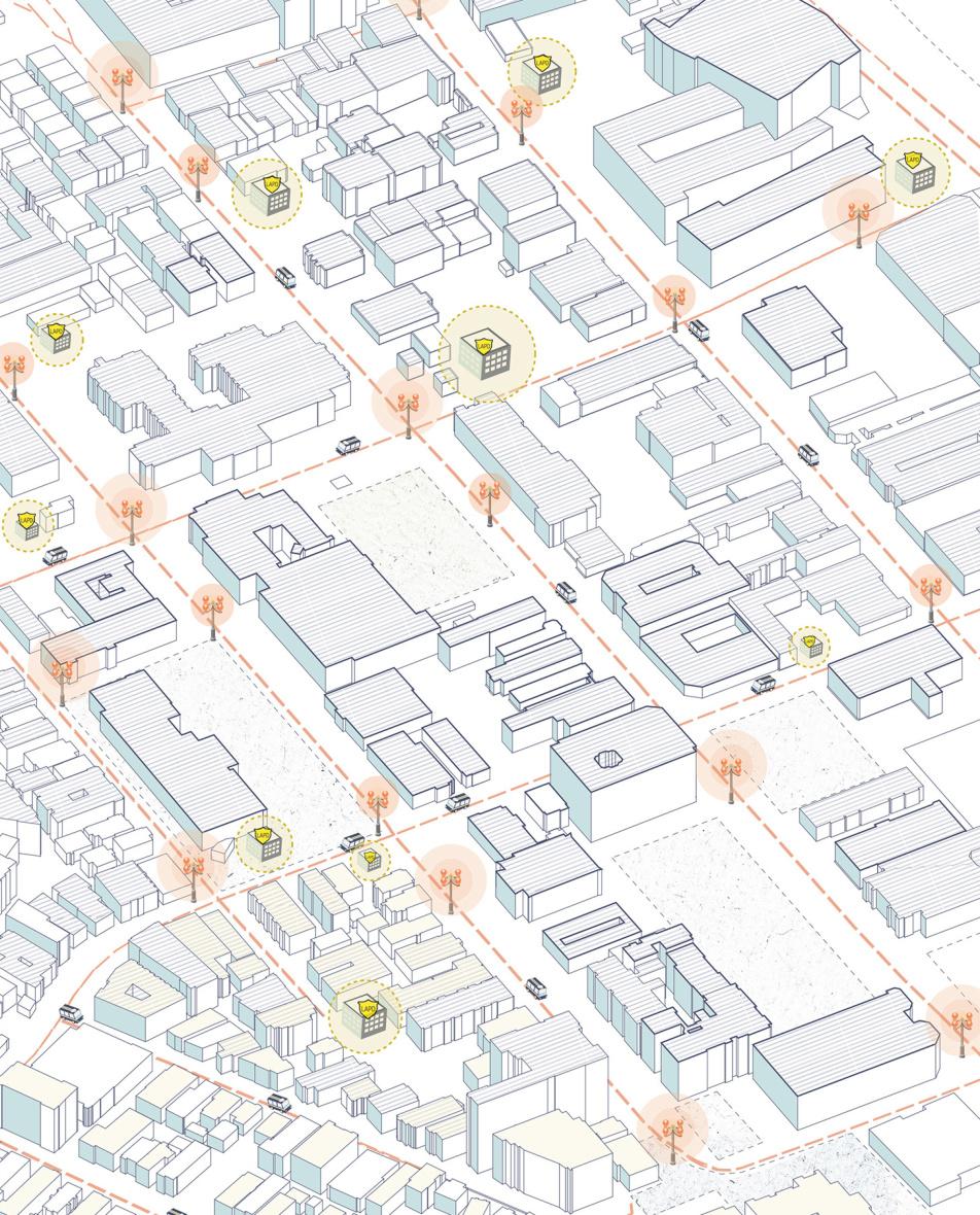
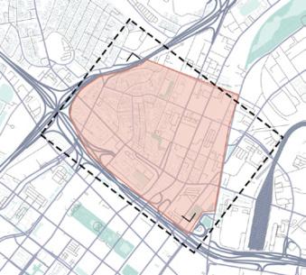
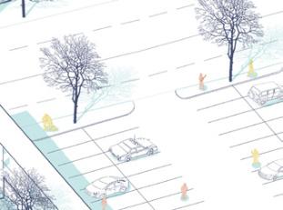
Los Angeles: Globalized Metropolis Or City Of Danger?
LA crime situation overview
Crime rates were rising
2015 The "Emergency Policing Plan for Downtown Los Angeles"has been proposed 2019
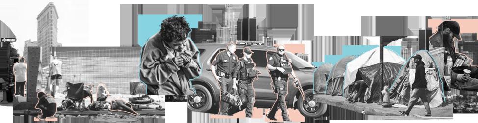
2017
LAPD had ramped up its police presence
Instructor: Shiyang Zhang
Type : Individual work
Date : November to December,2023
Area : 5016ha
Location :
Downtown and surrounding areas, Los Angeles
Key Concern :
Urban crime rate; Pedestrian safety;optimal solution
2020
During the COVID-19 pandemic in 2019, crime rates in downtown Los Angeles saw an increase
Daily crime in downtown(per 100,1000 people)
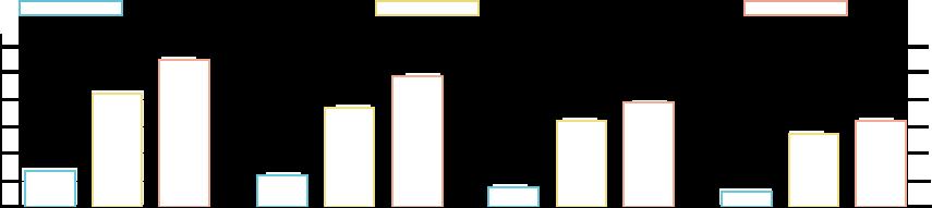
DowntownLos AngelesCalifoniaNational
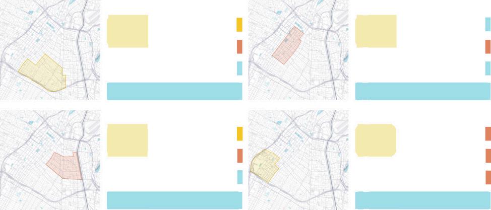
Neighborhood-level reported general crime information
Fashion DistrictDowntown Skid Row South Park F rating F rating
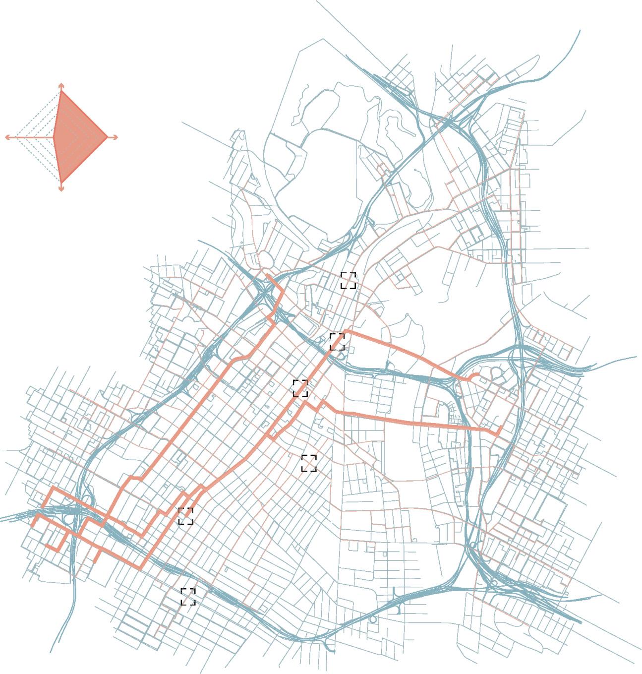
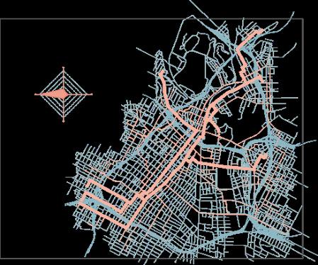
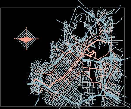
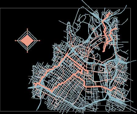
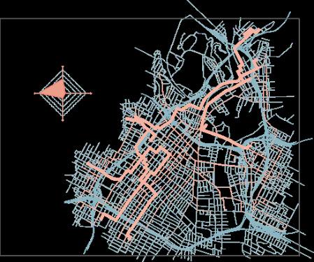
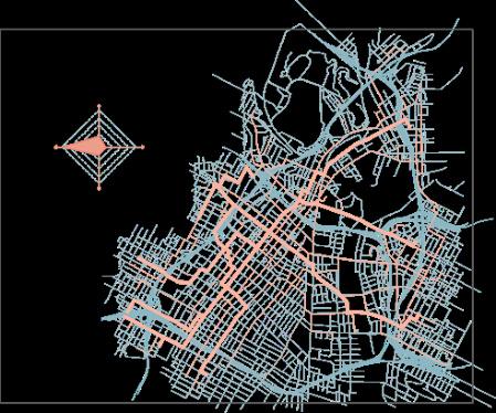
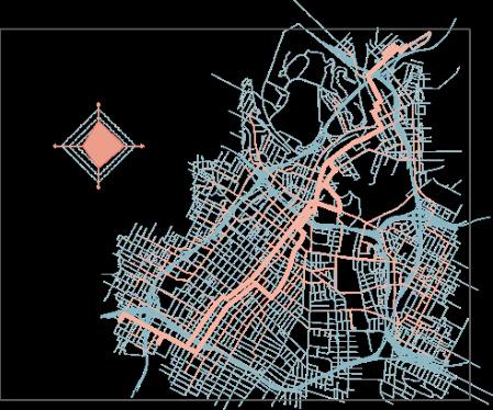
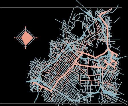
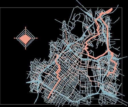
Downtown area road network
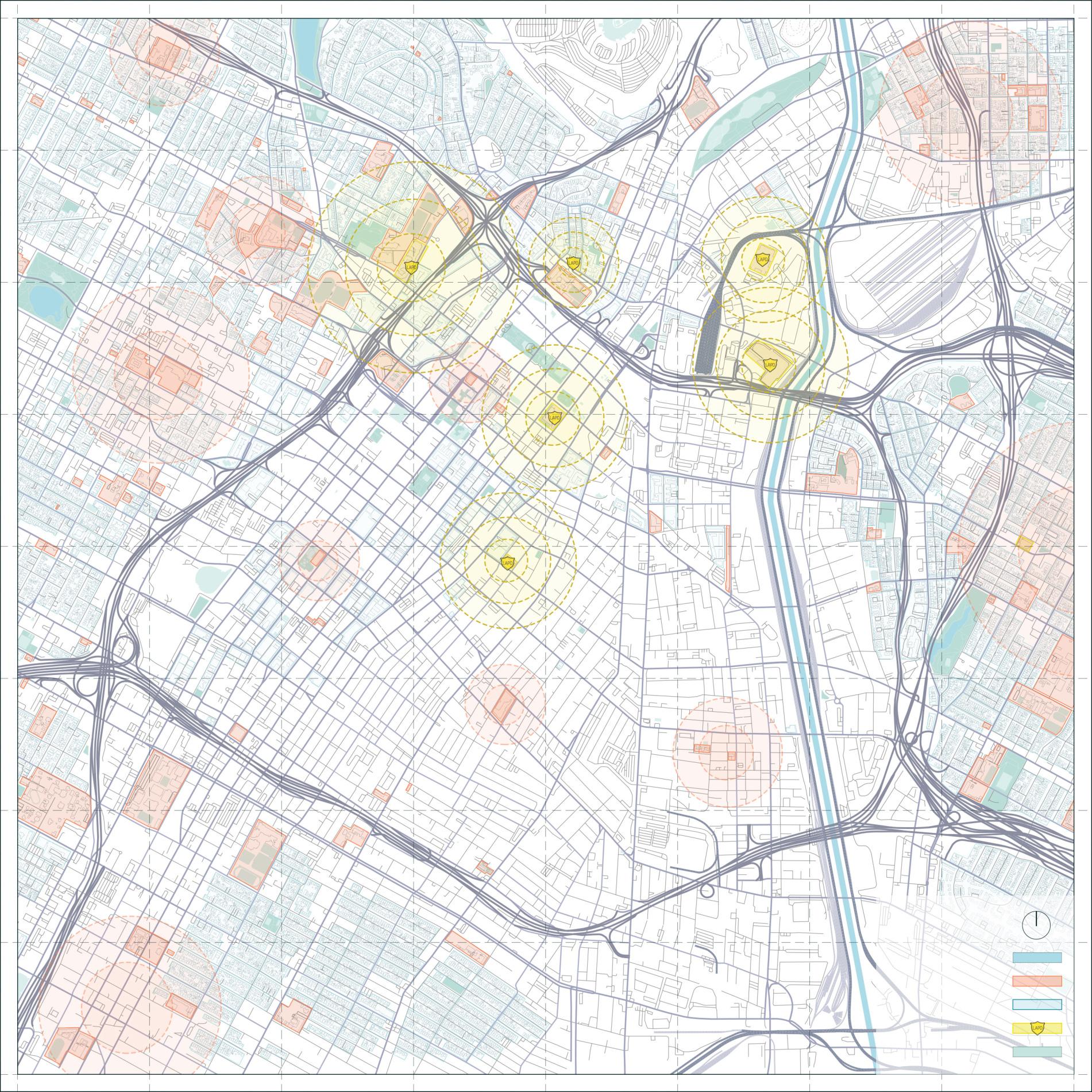
waterways schools
stations public spaces
Network in downtown and surrounding areas

schools to LAPD residentials to LAPD Genetic Algorithm


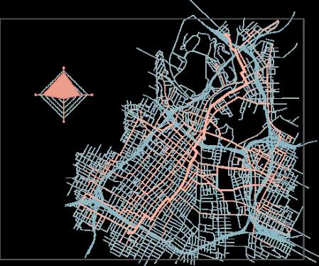
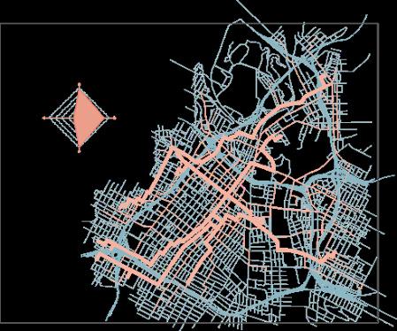
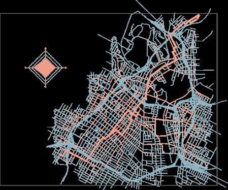
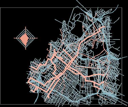
passing through open and well-lit areas more turns are required walking in areas with a low probability of crime occurrence
Objective 1
Objective 2

a police station is located within close proximity
Objective 3
Objective 4
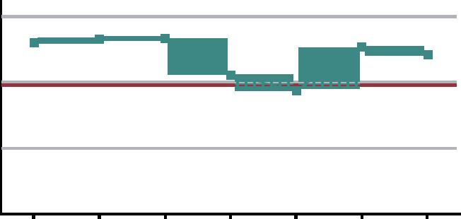
Standard Deviation
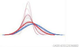
parallel cordinate plot
Fitness Values
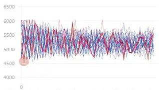
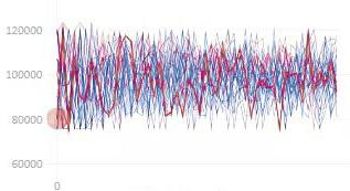
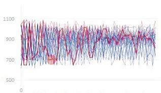
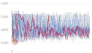
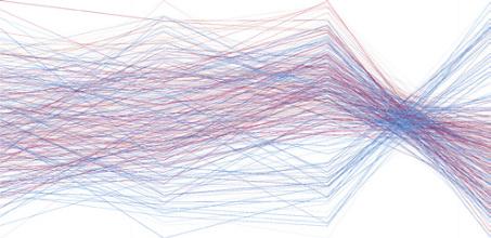
There are a total of 20 generations, each generation has 50 options for the road, 1000 solutions are randomly divided into 4 groups, each group chooses the best solution, each group is biased towards a goal or overall average.
Gen.
FO1: Value:6032.516834
Rank:1981/1999
FO2: Value:119161.969004
Rank:1949/1999
FO3: Value:1049
Rank:1951/1999
FO4: Value:-3040
The design principles focus on enhancing the safety of the downtown area through the introduction of security facilities and lighting system facilities. Therefore, the principle prioritizes the addition of police stations, homeless shelters and the brightening of the existing road system
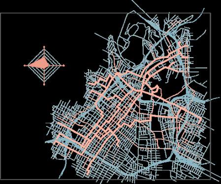
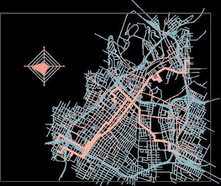
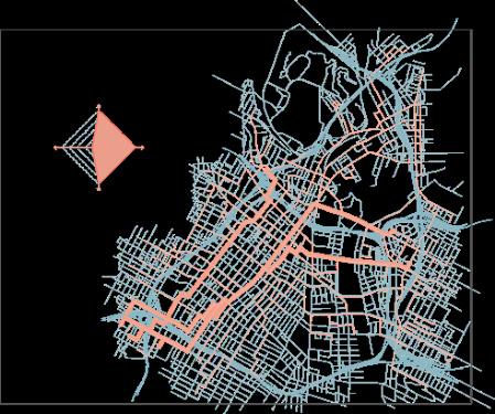
Variation 01
shortest commuting path across the station serving areas(m)
Gen.37 | Indv.1
V1:4568.69 V2:97690.11 V3:815V4:-2273
Gen.36 | Indv.18
FO4
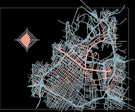
Variation 02: close to public space(m)
Gen.32 | Indv.0
FO4
V1:4840.39 V2:80292.59 V3:642V4:-1899
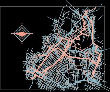
Variation 03: lowest crime rate along the commuting path(%)
Gen.24 | Indv.11
V1:5602.36 V2:100722.3 V3:700V4:-1899
Variation 04: Maximum segements along the commuting path(t)
Gen.14 | Indv.2
FO4
V1:5797.99 V2:106971.6 V3:1040V4:-3066
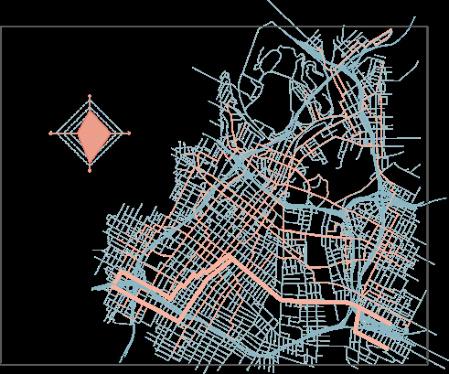
Intergral Analysis: Cross-Boundary
Gen.7 | Indv.30
FO4 FO1 FO2 FO3
V1:5152.32 V2:97845.4
V3:874V4:-2564
Gen.16 | Indv.25
FO4 FO1 FO2
Gen.34 | Indv.14
Gen.17 | Indv.15
FO4 FO1 FO2
Gen.9 | Indv.37
FO4 FO1 FO2 FO3

Rank:38/1999 Traffic
High pedestrian traffic and dense crowds
The surroundings are open and well-lit public spaces with broad visibility
Close to LAPD headquarters, the neighborhood has relatively good security management
The neighborhood's significant concentration of homeless individuals may be involved in criminal activities
An area with a relatively low crime rate over an extended period No nearby police station and public spaces
V1:4700.49 V2:100176.6 V3:785V4:-2392
Gen.22 | Indv.31
V1:4818.5 V2:82665.05 V3:872V4:-2434 FO4 FO1
Gen.16 | Indv.16
V1:4700.79 V2:100176.6 V3:785V4:-2592
V1:5096.79 V2:85669.67 V3:946V4:-2551
Gen.8 | Indv.31
V1:5260.64 V2:89820.6 V3:945V4:-2537
Gen.3 | Indv.45
V1:5217.28 V2:75885.64 V3:702V4:-2018
V1:5168.51 V2:83078.46 V3:691V4:-2026
Gen.37 | Indv.45

V1:5419.18 V2:83053.2 V3:670V4:-2253
Gen.38 | Indv.5
V1:4900.18 V2:80869.66 V3:618V4:-1920
V1:5339.6 V2:99935.9 V3:980V4:-2809
Gen.24| Indv.44 FO4
V1:5273.96 V2:102371.5 V3:894V4:-2724
Gen.38 | Indv.5
V1:4900.18 V2:80869.66
V3:618V4:-1920
V1:5139.16 V2:97381.53
V3:841V4:-2575
Gen.6 | Indv.33
FO4 FO1 FO2 FO3
V1:5037.69 V2:95148.73
V3:908V4:-2579
Gen. 13| Indv.1
FO4
V1:6032.5 V2:119161.97
V3:1049V4:-3060
population
36.12k(relative high)
relative high medium population density crime rate police station schools public spaces
1055k(medium)
relative high relative low crime distribution
Risks & Challeges Solutions
Type1 ACTIVE Type2 PASSIVE Type3 SUPERVISE poor quality of construction lack of spaces useless parking lot lack of public spaces night roads&gansters traffic congestion
a.renovation of old houses
b.additions
c.event venues
d.landscape&park
e.infrastuctures additions
f.government departments
g.road system carding
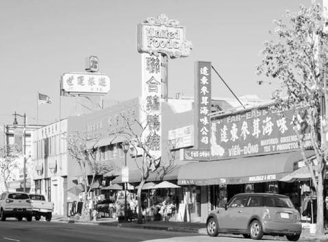
Chinatown
Mission Junction
Sacred Heart Catholic Church
San Julian Park
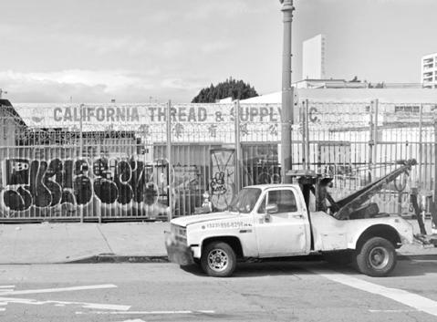
Broadway is a renowned street in Los Angeles but is also known for being a highcrime area, especially the S Broadway region, which is far from LAPD, posing a higher risk
[Risk & Opportunity]
1900 S Broadway high low crime rate police station schools public spaces high relative low
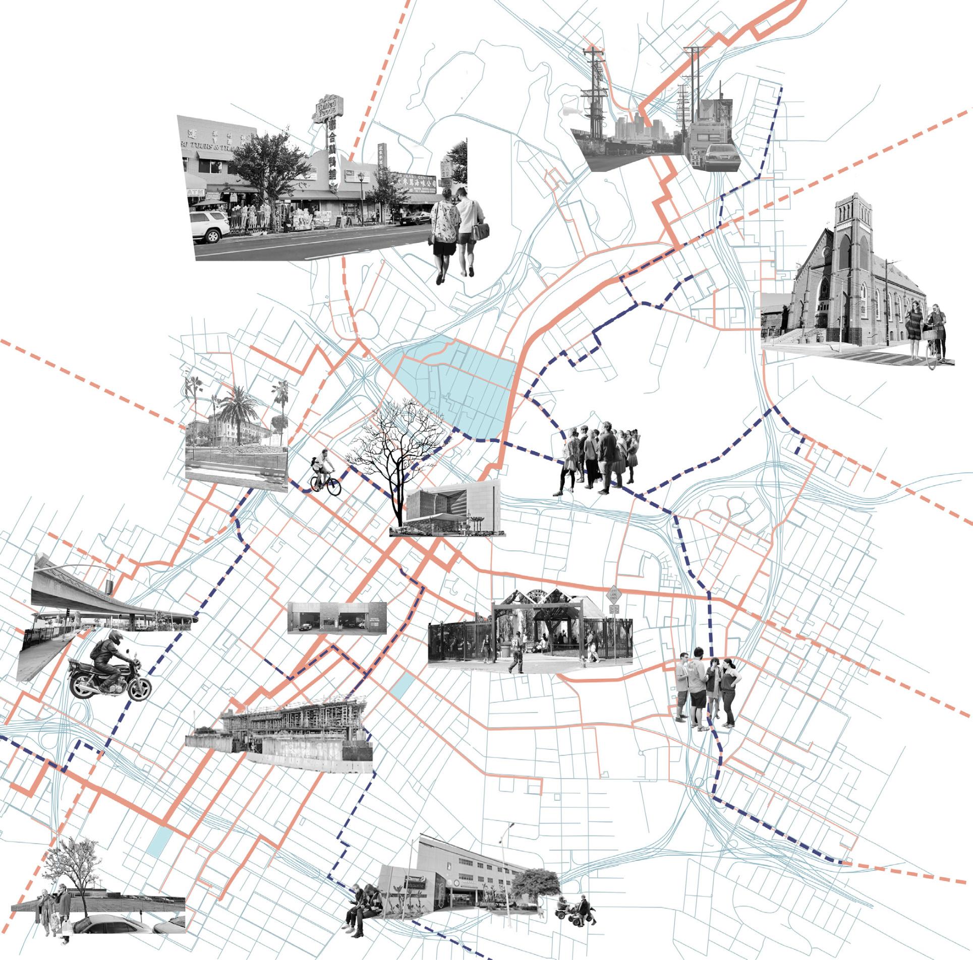
Viaduct
Crime rates in Los Angeles Chinatown areinfluenced by a number of factors, includingsocioeconomic status, population density, andlaw enforcement.
[Risk & Opportunity]
North Hill Broadway high relative low crime rate police station schools public spaces
[Risk & Opportunity]
relative high relative high relative low
maximum fIoors:1
green ratio:51.1%
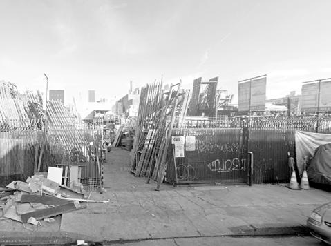
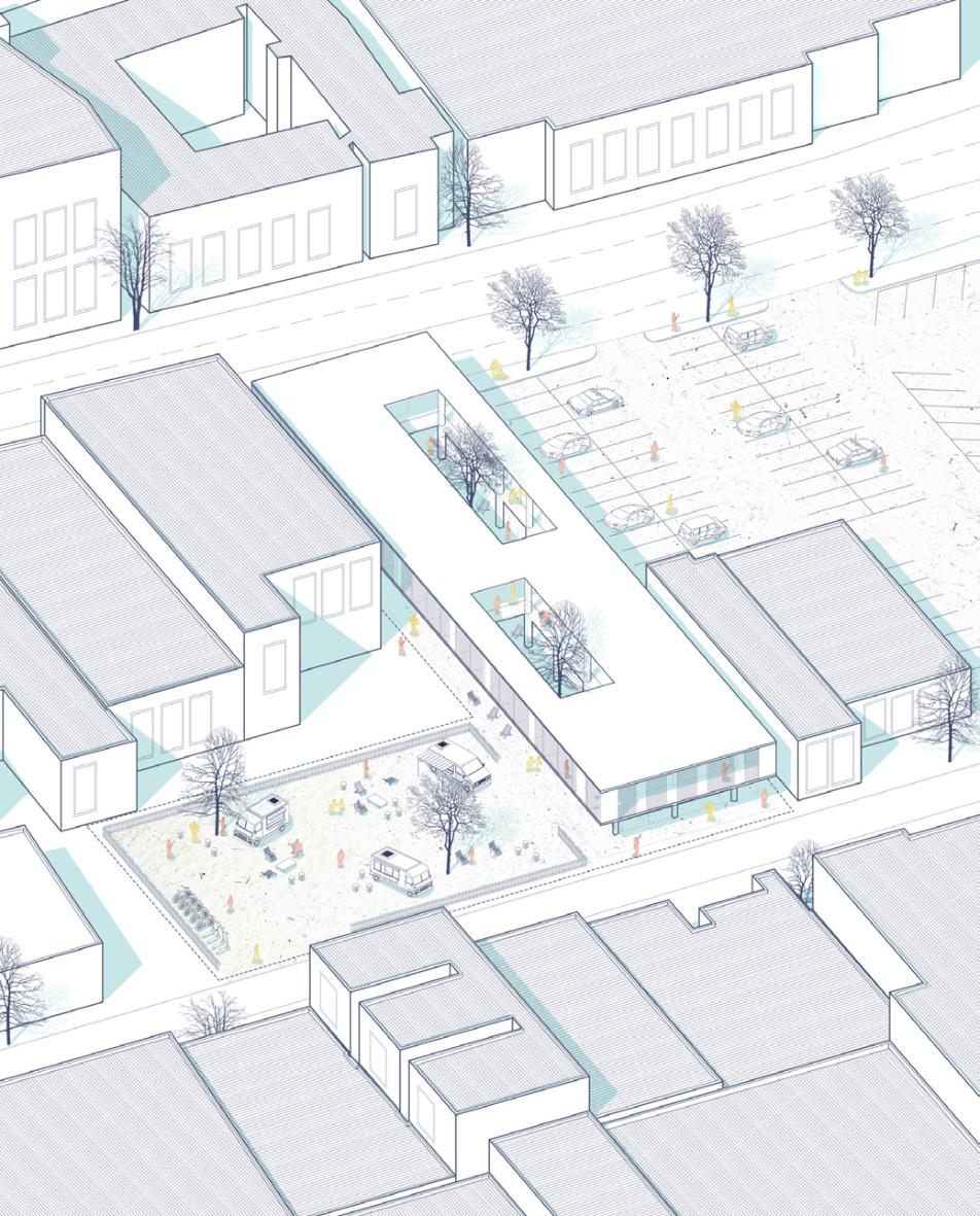
The site has been abandoned and idle,but at the same time,there are still a large number of homeless people on the street who need to be settled
Cafe
Add social and leisure elements, attracting a broader audience and enhancing the vibrancy of the site
parking space:/
649 Croker St high medium crime rate police station schools public spaces relative low
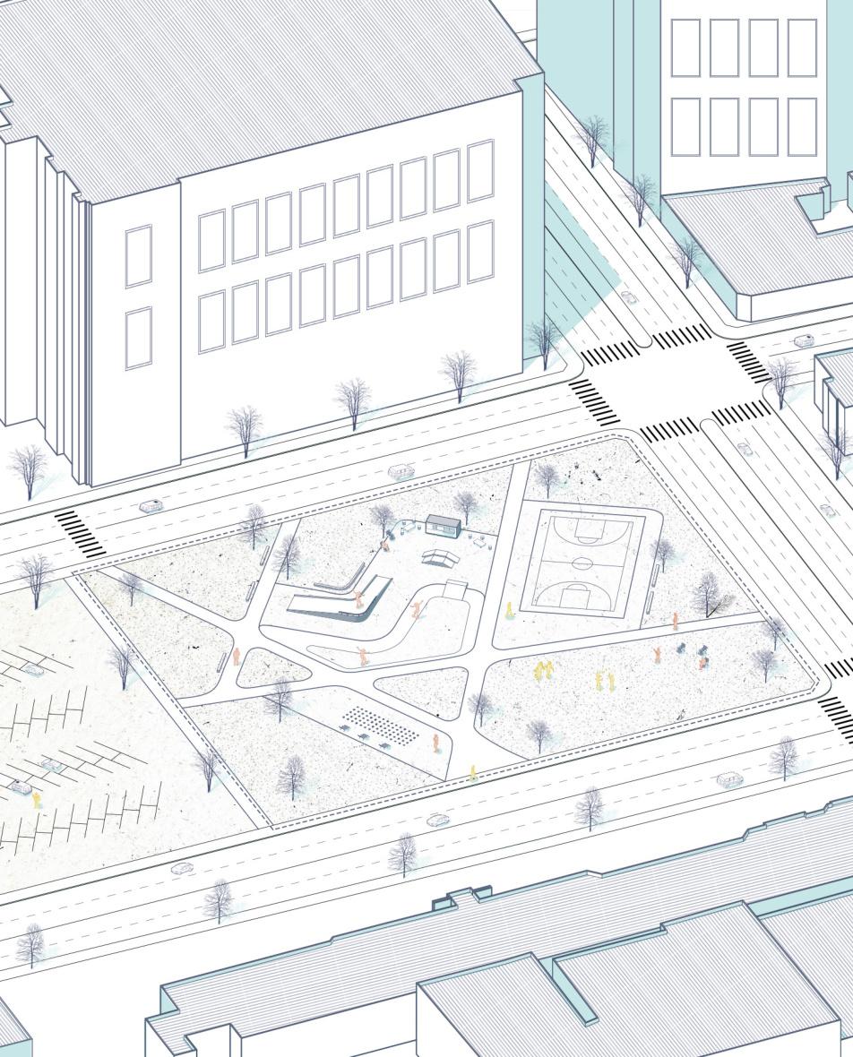
project detail located in the southern part of downtown, close to residential areas and schools. This design caters to the youth demographic, providing a place for physical activity while also serving as a leisure and entertainment spot for nearby office workers and residents total site area:10431m
facilities:resting seats
Skatepark
It offers a secure space for the targeted audience to pursue their interests and hobbies
Event lawn
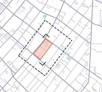
As a green public space, provides a venue for a diverse range of activities for the nearby community Shelter
The beds are arranged in the way

project detail
total site area:3880m
maximum fIoors:2
green ratio:34.3%
parking space:12
facilities:/
Site located in the center of downtown, and there should be enough shelter to accommmodate a surplus of homess people,and the designon considers 3 types of people, only bedding, RV people and tent people.
project detail
maximum fIoors:4
green ratio:30%
residents:100k
Los Angeles Chinatown is located in the heart of Los Angeles, California, USA, and has the 6th highest crime rate in San Francisco, 12% higher than the San Francisco average, with 752 violent crimes per 100,000 people total site area:499500m
facilities:post/streetlight