What can we learn by looking at a map of Mexico?

Enquiry Questions
1. Where is Mexico?

2. How is Mexico similar to the UK?

3. How is Mexico difference to the UK?
4. How does Tocuaro compare with Kearsley?

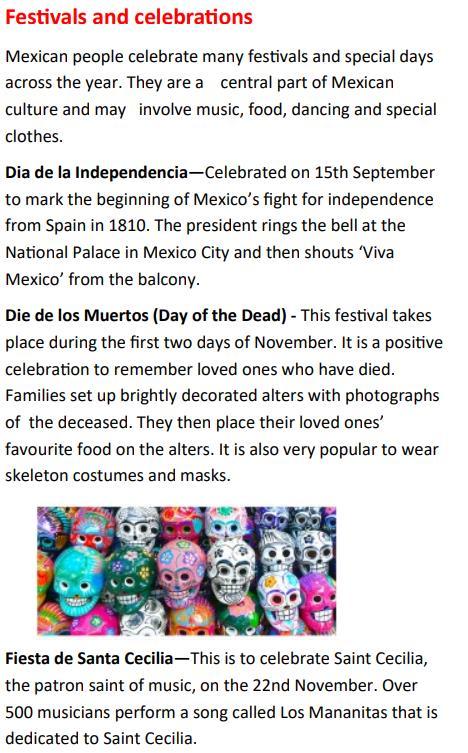
5. What is the culture like in Mexico?
6. Why is Mexico a popular tourist destination?

Vocabulary
Terrain The dimensions of land surface.
Multicultural Incorporates ideas, beliefs or people from many different countries and cultural backgrounds.
Equator A line between the northern and southern hemispheres that divides the earth around its circumference.
Population The number of people who live in a country
Landmark A building or part of the landscape which is easily recognised by people. (Big Ben, Loch Ness, Giant’s Causeway, Snowdonia)
Human feature A manmade feature on the landscape (roads, cities, statues)
Physical feature A natural feature on the environment (mountains, beaches, forests)
Climate What the weather is like over an extended period of time.
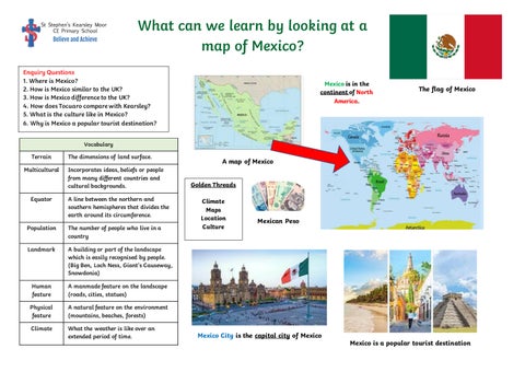
A map of Mexico
Golden Threads
Climate Maps
Location Culture
Mexico is in the continent of North America.
The flag of Mexico
 Mexican Peso
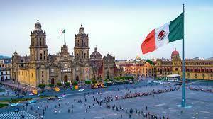
Mexico City is the capital city of Mexico
Mexico is a popular tourist destination
Mexican Peso
Mexico City is the capital city of Mexico
Mexico is a popular tourist destination
Facts
Basic Facts Mexico is located in North America, directly south of the United States. Mexico is the 14th largest country by land area. There are 31 states in Mexico as well as the capital city (Mexico City).

Human Feature
Some of the most widely spoken languages in Mexico, aside from Spanish, are Nahuatl, which has more than 1.7 million speakers, Maya, spoken by around 850,000 people, and Mixtec.
Physical Features Mexico contains a wide range of terrain. There are deep canyons, tall mountains, dry deserts, 67 national parks and jungle full of all kinds of creatures.
Climate and weather patterns
The climate varies, but there are usually two seasons, wet and dry. Coastal areas are hot and dry from November to April. In the wet season it’s still hot but there are big rainstorms. The north of the country is the driest region but it gets cold in the winter months.
Global Issues
The history of Mexican immigration to the United States is best characterised as the movement of unskilled, manual labourers pushed northward, mostly by poverty. This continues to be a geopolitical issue.
