Road to Garstang
Beacon Fell Country Park
Riv
A6
Key Public footpath Concessionary path Roads Track River
Brock picnic area
er B roc k
Garstang Heatherway Farm
Higher Brock Bridge
er
Waddecar Scout Camp
P
private road public footpath to Bleasdale
Calder Vale
A586
Road to Chipping Footpath to Brock Picnic Area
Disabled only
village hall
Cald
Wickins Lane End
St. Eadmer's
school
Delph Quarry Common Layby
Higher Brock Bridge
River Brock
N
Admarsh Barn
Rive r
Norwyn, Preston
A footpath runs through Bleasdale Estate from the main road at Higher Brock Bridge. Car parking is available at nearby Beacon Fell or Delph Quarry Common Layby. If you wish to park in the estate on either the shared village hall and school car park or the church car park you will need to obtain permission. Please avoid school start and finish times and church service days. As access to the circle is across fields through 3 kissing gates on a concessionary path. It can be very muddy; wellingtons or boots are recommended.
Tootle Hall
Circle
Oakenclough
anal
P
M6
C ter
Broadgate Farm
Delph Quarry Common Layby Road to Claughton
Access to the circle is across private land on a concessionary footpath. Please look out for the waymarks and keep to the route. There is an information point next to the village hall and one at the circle.
Vicarage Farm Admarsh St Eadmers Barn Church Bleasdale School and Village Hall P (disabled only)
y re
Bleasdale Tower
Vicarage Farm
A6
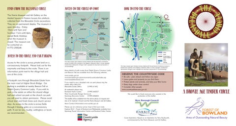
BLEASDALE CIRCLE
rW
Footpath to Calder Vale
Access to the Circle and car parking
HOW TO FIND THE CIRCLE
as nc La
The Harris Museum and Art Gallery on the Market Square in Preston houses the artefacts collected from the Bleasdale Circle excavations. They are on permanent display. The museum is open Monday - Friday 10am until 5pm and Sundays 11am until 4pm, except Bank Holidays when the museum is closed. The museum can be contacted on 01772 258248.
Access to the circle on foot
Riv e
FINDS FROM THE BLEASDALE CIRCLE
Mway
Beacon Fell Country Park P
P
This map is based upon Ordnance Survey material with the permission of Ordnance Survey on behalf of the Controller of her Majesty’s Stationery Office © Crown copyright. Unauthorised reproduction infringes Crown copyright and may lead to prosecution or civil proceedings.
More details of walk routes from Delph Quarry Common Layby and Beacon Fell are available from the following websites. www.wyrebc.gov.uk www.lancashire.gov.uk/environment/countryside/index.asp www.forestofbowland.com If you need to use a disabled only car park please ring the estate office (Mon-Fri) Bleasdale Estate Office 01995 61492 At weekends please ring Bowland Visitor Centre 01995 640557 Wyre Countryside Ranger Service at Garstang Discovery Centre 01995 606654
Road
M6
Private Road & Public Footpath River Canal Parking
This map is based upon Ordnance Survey material with the permission of Ordnance Survey on behalf of the Controller of her Majesty’s Stationery Office © Crown copyright. Unauthorised reproduction infringes Crown copyright and may lead to prosecution or civil proceedings.
OBSERVE THE COUNTRYSIDE CODE • Be safe - plan ahead and follow any signs • Leave gates and property as you find them • Protect plants and animals, and take your litter home • Keep dogs under close control • Consider other people www.countrysideaccess.gov.uk We would like to thank everyone who assisted in the production of this leaflet.
This leaflet will be available from the above places on request and also at St. Eadmer’s Church and the Harris Museum and Art Gallery. More Contact Information:www.wyrebc.gov.uk Please use an ordnance survey map to find your route: Explorer 0L41 - Forest of Bowland and Ribblesdale available from Garstang Tourist Information Centre and Bowland Visitor Centre.
Cover illustration: Based on an illustration by Terry Rushworth, commissioned by the Harris Museum and Art Gallery.
A BRONZE AGE TIMBER CIRCLE