HIKING GUIDE
Edition
A guide to some of the best hikes in the Pacific Northwest


Edition
A guide to some of the best hikes in the Pacific Northwest

Garbage kills wildlife and destroys waterways.
Salmon use these areas to lay eggs.
Do not get close to cliff edges or wildlife.
Human food can harm our furry and feathered friends.
It’s easier than you might think to get lost.
Dog feces pollute waterways with harmful bacteria.
Packing correctly can save your life. See page 3 for details.
I will pack out everything I pack in.
I will take selfies without harming myself.
I will pick up after my dog.
I will not disturb branches in the rivers.
I will not go off the trail.
I will not feed or touch wildlife. I will pack the 10 essentials.
Nakashima
Cutthroat Lakes
Big Four Ice Caves
Mount Dickerman
Barlow Point
Goat Lake
North Fork Sauk Falls Beaver Lake
Glacier Peak Meadows Old Sauk Trail
Eight Mile Creek & Squire Creek Pass
Fortson Ponds & Whitehorse Trail Suiattle River & Image Lake Monte Cristo Lime Kiln River Meadows County Park
White Chuck Bench
Granite Falls Fish Ladder
River
Horse Regional Park
Paradise Valley Conservation Area
Dorothy
Lord Hill Regional Park
Park
Tye
Borlin Park
Sultan River Canyon Trail
Evergreen Mountain Lookout Wallace Falls
Bridal Veil Falls & Lake Serene Heybrook Ridge Johnson Ridge & Scorpion Mountain Greider Lakes
West Cady Ridge Heybrook Lookout Flowing Lake Park
Stillaguamish,

Mount Baker-Snoqualmie
National Forest
www.Fs.usda.gov/mbs
Darrington Ranger Station
1405 Emens Avenue North Darrington, WA 98241 360-436-1155 www.Fs.usda.gov/mbs
U.S. Forest Service Mission: Caring for the land, and serving the people.
Skykomish Ranger Station 360-677-2414
Washington State Parks Parks.Wa.gov
Wallace Falls State Park 360-793-0420
Washington Department of Natural Resources Dnr.Wa.gov
Northwest Region Office 360-856-3500
Snohomish County Parks SnocoParks.org 425-388-6600
Washington Department of Fish and Wildlife Wdfw.wa.gov
Sky Valley Chamber of Commerce & Visitor Info Center
320 Main Street Sultan, WA 98294 360-793-0983
SkyValleyChamber.com VisitSkyValley.com
We sell hunting and fishing licenses, Discover Passes, and USFS NW Trailhead Passes. Learn about local history, cultural lore and the most current information about what’s happening in the Sky Valley.
Lake Stevens Chamber of Commerce & Visitor Info 10108 Lundeen Park Way Building B Lake Stevens, WA 98258 (425) 334-0433
SeattleNorthCountry.com/visitor -regions/sky-sno-valleys/lakestevens
Monroe Chamber of Commerce & Visitor Info Center
125 S Lewis Street Monroe, WA 98272 360-794-5488
ChooseMonroe.com
Monroe has gourmet restaurants, river access, boutique stores and a bustling Downtown. Stop in the Visitor Center to learn about activities, grab dining and shopping information, local maps or where to stay.
Verlot Public Service Center
33515 Mountain Loop Highway Granite Falls, WA 98252
360-691-7791
Fs.usda.gov/mbs
Verlot is a headquarters for hiking, camping, hunting, and fishing information. Current weather and hiking information is available, as are maps, and hiking and outdoor books.
Stilly Valley Chamber Depot
Visitors Center
104 N. Olympic Ave
Arlington, WA 98223
360-659-5453
StillyValleyChamber.com
Washington Trails Association
Wta.org
Visit WTA to find even more hikes, read recent trip reports, get driving instructions, and learn the history behind the trails you’ll be exploring.
Everett Mountaineers
EverettMountaineers.org
Friends of Lord Hill
Facebook.com/FriendsOfLordHill
Friends of Heybrook Ridge
HeybrookRidge.org
TREAD Map App
StateofWaTourism.com/ tread-map-app/
This app incorporates Washington’s extensive trail systems, waterways,
mountain bike trails, and other outdoor recreation areas to provide alerts and real-time updates on issues impacting the recreation experience, including crowding, parking, and trail impediments.
Scan to Download
Mountain Loop Highway GPS App
SnohomishMountainLoop.oncell. com/en/index.html
This app ensures you always have access to real-time GPS alerts when you approach a place of interest with poor cell service. Download maps and trail info ahead of time, all within the app.
Scan to Download
Bit.ly/SnoPud-EV-charging-map
SnoPUD’s website features an interactive and up-to-date map tool for finding EV charging stations near you. Just search the town you’re nearest to in the search field!
Scan to find a charging station near you
Hiking in Seattle NorthCountry, Snohomish County, WA is delightful, invigorating, and extremely rewarding; but it’s important to be well-prepared before setting out.
Proper footwear should be a priority on all of the region’s hikes.
Such as a
Such as a
Stay hydrated. Even on short trails, it’s easy to dehydrate. Consider all sources of water in the backcountry to be contaminated; treat any water you intend to drink with purification tablets or a filtering pump.
Always carry extra food. Granola bars, energy bars, nuts, and fruit make for convenient trail snacks.
When setting out on wilderness and backcountry hikes, ensure that you carry the 10 Essentials (see side bar left). Carry rain gear and extra clothing. Weather can change rapidly within the region. Be prepared for all conditions. Before setting out it’s also important to consider your fitness level. Be sure that you’re capable of completing the hike before heading out. A mile up a steep mountain is not the same as a mile on a flat paved trail. Give yourself sufficient time to complete and enjoy your hike.
Our Hiking Guide is a wonderful resource and great introduction to the trails of the region, but it’s not a comprehensive guide. Consider buying one of the many fine trail guides available to supplement this brochure. Day Hiking North Cascades, Day Hiking Central Cascades, and Backpacking Washington (Mountaineers Books), by this author are excellent guides teeming with hiking options. Also, when heading out on wilderness trails, take along a good map. Green Trails makes excellent
detailed maps of all the national forest hikes in this guide. They can be purchased at National Forest ranger stations, and many outdoor specialty shops, convenience stores, and sporting good stores throughout the region.
Some of the hikes on National Forest lands within this guide require a Northwest Forest Parking Pass or Interagency Pass (such as an America the Beautiful Pass) at the trailhead; which you display on your rearview mirror. Northwest Forest Passes sell for $5 per day or $30 for an annual pass good throughout Washington and Oregon. America the Beautiful passes sell for $80 for the year and are good at all national forests and parks countrywide. Be sure to purchase before you hit the trail. You can purchase NW Forest passes at any national forest ranger station within the county, from several outdoor retailers and area businesses or online (fs.fed. us/r6/passespermits). America the Beautiful passes can be purchased online (store.usgs.gov/pass/index.html) or at a national park ranger station.
Hikes in this guide on state park lands require a Discover Pass, which you also display on your rearview mirror. These sell for $10 per day or $30 for an annual pass and are good at all state parks, DNR lands, and Washington Department of Fish and Wildlife properties. You can purchase one from several outdoor retailers and area businesses or online (discoverpass.wa.gov).
What about dogs? Dogs make great hiking partners if they are well-behaved. Most of the hikes in this guide are open to them. But, leashes may be required. Please obey these regulations, or you may forfeit the privilege of bringing along your furry friend. Please clean up after your buddy too.
Be sure to respect the land that you are traveling across. Stay on the trail. Don’t cut switchbacks for this increases erosion and causes unsightly scars. Don’t litter. Pack it out with you. Use restrooms when available and if you need to heed the call of nature while out on the trail, heed at least 200 feet from any water source. Be sure to bury your waste. Leave wildflowers for others to enjoy and keep a safe distance when viewing wildlife. Take only pictures; leave only footprints. If in a federal Wilderness Area, adhere to all special wilderness rules and regulations.
And one final note. Trails and roads can and do change. They can wash-out, be buried in snow, or destroyed by wildfire. Occasionally they’re closed for wildlife management or other reasons. Always check with the appropriate governing land agency, before setting out on your hike. Contact information for these agencies is included in each hike’s introduction.
And finally; have fun! Enjoy the region’s hiking trails. They are among some of the finest and most scenic in America.
Seattle

Seattle NorthCountry has four distinct visitor regions. The Coastal Communities, the Urban Basecamp, the Stillaguamish/Sauk River Valleys in the north, and the Skykomish/Snohomish River Valleys in the south. Abundant hiking opportunities are found throughout these regions, the valleys especially offering stunning hikes – this guide focuses primarily on the hikes found in the river valleys, but you can read about the Coastal Communities and Urban Basecamp regions on our website! Scan QR codes to learn more.


The coastal region runs alongside Puget Sound in the Salish Sea. Hikes in this region tend to be near cities, easier, and more accessible, often with stunning sunsets and seaside views.
URBAN BASECAMP In the Urban Basecamp, you will find a home base with everything you need to enjoy the great outdoors and some delightfully accessible trails too. Forgot some gear? Need to rent snowshoes? You’ll find it all in the Urban Basecamp.
STILLAGUAMISH/SAUK The upper Stillaguamish/Sauk River Valleys is the most “off the grid” experience of the four regions. The Mountain Loop Highway features some of the best hiking opportunities in the state.
SKYKOMISH/SNOHOMISH Staggering mountain views and tiny towns are abundant in the Skykomish/Snohomish River Valleys. Hike to alpine lakes and waterfalls, then refuel in a tiny mountain village.


Hike to an abandoned mining village, view the mouths of ice caves, and spend an afternoon at an alpine lake tucked between prehistoric glaciers. The Stillaguamish-Sauk Rives Valleys offer wild and wonderful places to explore.
Big Four Ice Caves. Photo by Jake Campbell
Hike from a historic farm to a pretty little lake.
ROUNDTRIP: Up To 9 miles
ELEVATION GAIN: Minimal SEASON: Year round START: 32328 WA-9, Arlington
The paved 29-mile Centennial Trail travels from the Skagit County border to the city of Snohomish. With ten trailheads, this county-spanning railtrail can easily be accessed from Arlington, Marysville, Lake Stevens, and Snohomish. The trail skirts these communities traversing farmland, forests, wetlands, and pockets of rural countryside. The northern section includes some of the trail’s prettiest terrain.
Start your hike at a restored historic barn. Farming began here in the early 1900s by Daniel Waldo Bass and his wife Sophie, whose grandfather was A. A. Denny, the “Father of Seattle.” In 1937 Bass sold the farm to JapaneseAmerican Takeo Nakashima who continued a dairy operation on the property. However, after the Japanese bombing of Pearl Harbor, the Nakashima family was sent in 1942 to internment camps and was forced to sell their farm. In 1997 the Trust for
Public Land purchased 89 acres of the farm to become a park. In 2007 the barn was listed on Washington’s heritage barn register, becoming the state’s first and only one so far belonging to an Asian-American farming family.
While the farm once encompassed 1,200 acres, most of the surrounding land is still rural. The county park preserves mainly wetland meadows. Most of the land west of the park belongs to the Pilchuck Tree Farm and is managed for sustainable forestry, recreation and wildlife management.
Follow the Centennial Trail through a forest of maple, alder, fir and the occasional Sitka spruce, coming to Pilchuck Creek at about 2.6 miles.
This is a good spot to turn around. Otherwise, cross the creek on a high bridge and continue another 1.4 miles to Bryant and just beyond, the Washington Department of Fish and Wildlife’s Bryant Lake property.
Lake McMurrayan up-and-down, but always delightful journey through stands of impressive timber, bountiful berry patches, and bird and bug boasting bogs. At about 1.0 mile enter WA DNR’s Morning Star Natural Resource Conservation Area, an area off limits to logging and road building. After reaching a 3,640-foot high point the trail drops 200 feet to parkland meadows.
Scenic alpine lakes set among bountiful berry patches.
ROUNDTRIP: 9 miles
ELEVATION GAIN: 1,900 feet
SEASON: July - October
START: Cutthroat Creek Road 400
Follow the Walt Bailey Trail to a series of small alpine lakes scattered about the rugged slopes of Bald Mountain. Walt and his Civilian Conservation Corps (CCC) buddies built this trail not in the 1930s, but in the 1990s, when they were in their 70s! Start your hike on the edge of an old cut on Mallardy Ridge. Enter mature forest and begin
Now skirt a cliff, cross a rocky avalanche slope, and drop another 200 feet. Then start climbing again— steeply. After 3.0 miles, arrive at the first of the Cutthroat Lakes; a series of small tarns surrounded by heather meadows tucked beneath the long ridge of Bald Mountain. Campsites dot the area, and social paths diverge in every direction. Treat these fragile meadows with care by avoiding traveling on the paths that cut across heather patches.
After admiring reflecting peaks in the placid waters, consider carrying on to higher ground. The trail continues another mile climbing 500 more feet to connect with the Bald Mountain Trail. Turn right and amble for a half mile through gorgeous meadows on the slopes of Bald Mountain. Enjoy breathtaking views out over Puget Sound, to Mount Rainier, and directly below to the Spada Reservoir (Everett’s water supply). Bald Mountain’s 4,851foot rocky summit requires some scrambling, but experienced hikers may not find it too difficult.
Marvel at the snowy catacombs of the Mountain Loop Highway.
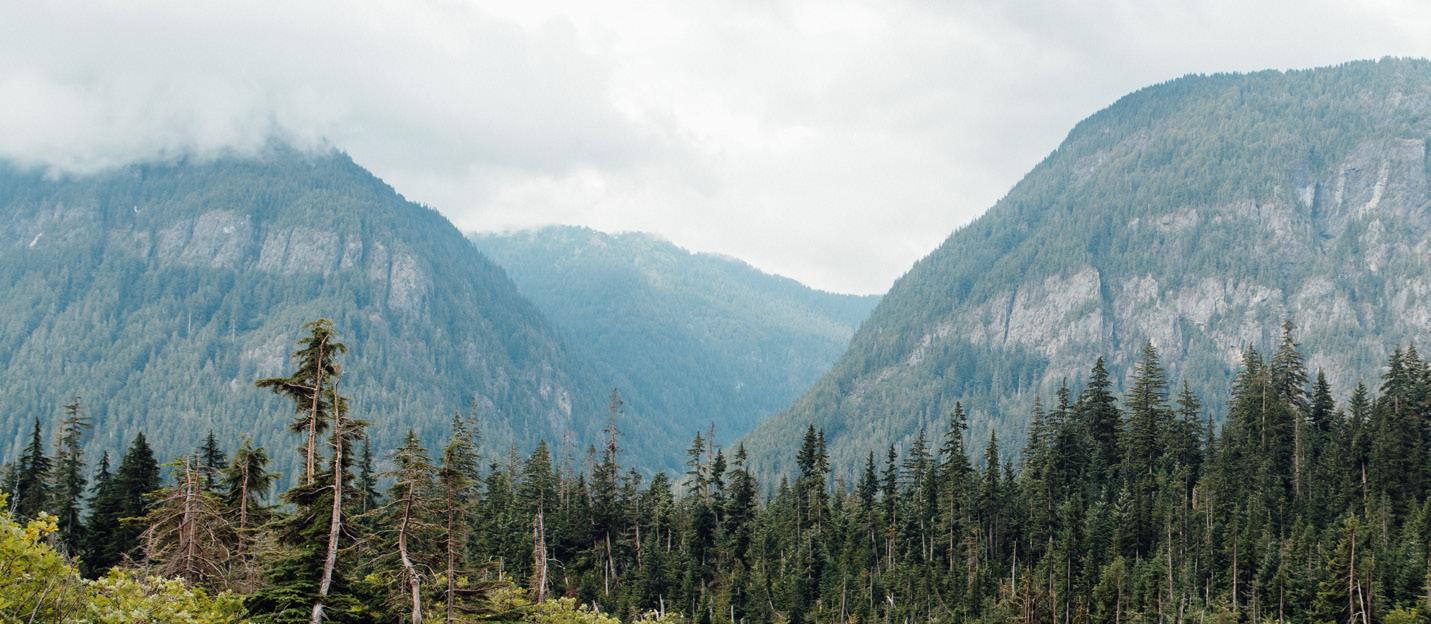
ROUNDTRIP: 2.2 miles
ELEVATION GAIN: 200 feet
SEASON: May - November
START: Forest Road 4059
PARKING: Northwest Forest Pass
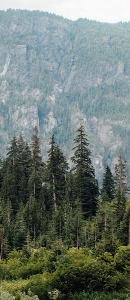
The hiker bridge over the S. Fork Stillaguamish river was removed to avoid it collapsing when the river channel moved. Replacement is planned for late 2022.
Each year, cascading water and warm winds create hollowed tunnels hid den in heaps of avalanche-deposited snow. These tunnels, dubbed “ice caves” become visible by mid-summer and fluctuate in size from year to year. These unstable formations are extremely dangerous, but interest ing to view from the designated trail end. Big Four Mountain’s impressive features have been attracting admirers for decades. A grand hotel once stood at what is now the picnic area where thousands of train-arriving
tourists came to this unique, and ever-changing point of interest.
From the trailhead a paved path heads right a quarter-mile on a former rail bed to the picnic grounds. It’s worth the diversion for the views and to learn more about the hotel that stood there from 1921 to 1949. Then follow a trail from the hotel site 0.25 miles across wetlands to a junction. The trail left returns to your vehicle. Continue straight to a bridge crossing the South Fork Stillaguamish River and another soon afterwards spanning Ice Creek. Now on wide tread, the trail gently winds through open forest. After crossing Ice Creek once more, you’ll reach the ice caves in a barren flat beneath the north face of Big Four Mountain.
ABSOLUTELY DO NOT VENTURE INTO THE CAVES, OR ONTO THEM, AS THEY REGULARY COLLAPSE CAUSING FATALITY ESPECIALLY IN THE WARM SUMMER MONTHS. FOLKS HAVE DIED.
To Granite Falls
Picnic Area
Supreme viewing post along the Mountain Loop Highway.
ROUNDTRIP: 8.6 miles
ELEVATION GAIN: 3,900
SEASON: Mid July - October
START: Mount Dickerman trailhead
PARKING: Northwest Forest Pass
Starting low and then heading high, you’ll gain much elevation on your way to Mount Dickerman’s 5,723foot summit. But sweeping views and legendary blueberry patches make all the effort needed to do this hike well worth it.
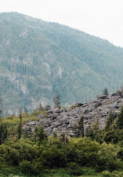
Starting in thick timber the way soon commences into switchback rhythm. After two miles of continuous clambering under a dark canopy, the grade eases as the way breaks out into boundless blue and huckleberry flats. Snack a bit, then continue to climb, cresting Dickerman’s western shoulder. Now steeply wind through hemlock groves and heather
meadows. The stunning view south to Big Four, Del Campo and the Monte Cristo peaks should help keep your mind off of the grind. Finally, you’ll reach the open summit.
Sheer cliffs drop from the north face, so keep dogs, children, and vertigo sufferers away from the edge. From a secure post admire the Perry Creek Basin below flanked by Mount Forgotten and Stillaguamish Peak. Look at all the surrounding mountains! Prominent to the north are Baker and White Chuck. To the east, it’s Pugh, Sloan and Glacier. To the south, Big Four and Del Campo practically leap out at you while Rainier peeks above a wall of jagged summits. To the west, Pilchuck and Three Fingers proudly stand out. No wonder this hike is so darned popular!
Mount Baker-Snoqualmie National Forest

Old lookout site at edge of historic Monte Cristo mining district.
ROUNDTRIP: 2.5 miles
ELEVATION GAIN: 850 feet
SEASON: June - November
START: Barlow Point trailhead, Granite Falls
PARKING: Northwest Forest Pass
A little knob of a peak just above Barlow Pass and just below Mount Dickerman, Barlow Point is oft overlooked by area hikers. Straddling the Sauk-Stillaguamish Divide, this little summit hosted a fire lookout from 1935 to 1964. Much of the surrounding forest went up in flames in 1905, sparked by a locomotive heading to the mines of Monte Cristo. And while the surrounding forest has recovered

nicely since that conflagration, Barlow Point’s rocky summit still remains semi-open providing some pretty nice views of an impressive wall of surrounding peaks.
The hike starts from the parking area at Barlow Pass, once the site of a Forest Service Guard Station. A side trail immediately branches left following the old railroad grade that once connected Monte Cristo to Everett. A quarter mile farther, the old Government Trail branches left. They can be hiked as a loop. The Barlow Point Trail continues right climbing steeply under a cool canopy of evergreens. It’s a short climb. In no time you’ll be sitting on the 3,222-foot point soaking up close-up views of Sheep Mountain, Twin Peaks, Mount Dickerman, Stillaguamish Peak, and Big Four Mountain. Be sure to peek down at the rocky ground for a profusion of penstemon. This little showy flower resembling pink and purple trumpets, adorns Barlow’s ledges.

A great place to bring the kids.
ROUNDTRIP: 10 miles
ELEVATION GAIN: 1,400 feet
SEASON: Late May - November
START: Forest Road 4080
PARKING: Northwest Forest Pass
An all day hike to a pleasant wilderness lake, but don’t let the distance scare you. The going is fairly easy and the grade gentle. One of the larger and more popular lakes off of the Mountain Loop Highway, Goat Lake has been attracting tourists for over a century. A grand hotel once graced its northern shore. And not far from Goat Lake outlet, at the base of a tumbling cascade, a busy little mining community once stood. A campsite has replaced the hotel and nothing remains except for a few decaying relics of the late 19th century settlement. The lake however, is once again in a wild state—and completely protected within the 103,591-acre Henry M. Jackson Wilderness.
Two trails lead to Goat Lake and they can be combined to form a loop. Take the one left (the easier one) to begin.
Following an abandoned logging road this trail meets up with the other one in about 3.5 miles. After another half mile enter the Jackson Wilderness. Traverse a lush grove of old-growth cedar before climbing to the lake
basin. Pass magnificent McIntosh Falls en route.
Five miles from the trailhead, sparkling Goat Lake is reached. Continue along the lake’s northern shore for delightful spots to picnic or swim. The old hotel once stood at this locale. Enjoy views of impressive Cadet Peak hovering above the lake. On your return follow the Elliot Creek Trail out alongside the tumbling waterway and through patches of old growth forest.
Thundering cataract is a spectacular sight in the spring.
ROUNDTRIP: 0.5 miles
ELEVATION GAIN: 100 feet
SEASON: April - November
START: Forest Road 49
Note: The hiker bridge over the S. Fork Stillaguamish river was removed to avoid it collapsing when the river channel moved. Replacement is planned for late 2022.
This is a short and easy hike to one of the prettiest waterfalls in the North Cascades. The North Fork of the Sauk River thunders through a rocky chasm plummeting over 50 feet into a mossy-rimmed punchbowl. During autumn rains and spring thaws witness a hydrological force that is simply staggering.

Starting in a grove of alder and second growth conifers, follow the good trail to the bellowing river. Losing about 100 feet of elevation the trail winds its way to the misty gorge housing the roaring falls. Handrails offer assistance
To Mountain Loop Hwy
for the not-so-sure-footed and act as barriers of prudence for keeping the hyper-curious from getting too close to this stunning but potentially dangerous natural feature. Admire the falls safely from the secure viewing areas and try to stay dry while being a gawker in the mist! Stare into the maddening waters and see if you can spot daring dippers, aquatic robin-like birds intent on finding aquatic morsels and unfazed by the fury of water surrounding them.
Since this trail is pretty short, you may want to combine it with a trip to the nearby Harold Engles Memorial Grove of ancient giant cedars. This wonderful
0.5 mile kid friendly hike is located about 2.5 miles beyond the falls on Forest Road 49.
North Fork Sauk River
Follow an old logging railroad along a wild river.
ROUNDTRIP: 2.6 miles
ELEVATION GAIN: 100 feet
SEASON: Year round
START: Beaver Lake Trailhead, Dar rington
PARKING: Northwest Forest Pass
This is an easy near-level familyfriendly trail along the Wild and Scenic Sauk River to a series of beaver ponds in an old slough. The way follows an old logging railroad grade still harboring old ties and trestle remains. The trail is a birdwatcher’s delight too. Scan the river and surrounding wetlands for eagles, dippers, mergansers and kingfishers.
Starting on a bluff above the confluence of the Sauk and White Chuck River, dip slightly onto the old
To Darrington
logging railway grade. Then hike on a near straight-away through a thick stand of second growth hemlocks and a tunnel of alders. Soon swing left onto a high bank enjoying a good view out to Mount Pugh while the Sauk River churns below. The mighty river continuously pounds the gravellayered riverbank causing portions of the trail to slump. But volunteer work crews from the Washington Trails Association have kept the trail in good shape.
After passing through skunk cabbage patches you’ll come to the trails end at Beaver Lake at 1.3 miles. Sadly the bridge here built upon some of the original railroad trestles was damaged by falling trees in 2018. The likelihood of the Forest Service receiving any cash to replace it soon is bleak.
Before turning around, admire the lake, which is actually an old channel of the river. A good place to observe wildlife, its namesake isn’t in abundance here, but plenty of avian residents are.
Mountain Loop Hwy
Be aver La ke
An adventurous backpacking trip on the Pacific Crest Trail.
ROUNDTRIP: 25 miles
ELEVATION GAIN: 5,325 feet
SEASON: Mid July - October
START: Forest Road 49
PARKING: Northwest Forest Pass
Set up camp near the headwaters of the serenading White Chuck River in tranquil parkland meadows within the shadow of snowy showy 10,541-foot Glacier Peak. Reaching this idyllic setting however requires an arduous journey of several days. First through deep primeval forest—then up steep slopes bursting with wildflowers—and finally dropping over a high barren pass through stark alpine tundra.
Start by immediately entering majestic primeval forest and the sprawling
Glacier Peak Wilderness. Through groves of gargantuan cedars, head up valley. Pass the Pilot Ridge Trail (another great multi-day trek) and reach good camps near Red Creek at 4.5 miles. Find more good camps at 5.8 miles near the collapsed Mackinaw Shelter.
The trail now climbs steeply up hot southern exposed slopes. Stunted trees eventually give way to blueberry bushes further yielding to magnificent meadows. At 9.0 miles you’ll reach the Pacific Crest Trail (PCT). Good camping spots at 5,900-foot White Pass lie a half mile right. You want to head left traversing high windswept meadows where the only thing more impressive than the floral show is the sweeping alpine views! Reach 6,450-foot Red Pass and descend into a barren high basin where snow often lingers long. Pass a faint path leading left to a small tarn beneath the White Chuck Cinder Cone and continue descending leaving tundra for greenery. Glacier Peak soon reveals itself in all its glory. At about 12.5 miles near an old shelter site (el. 5,500 feet) find wonderful camps scattered about the parkland Glacier Peak Meadows. Let the cascading White Chuck and its many tributaries soothe you to sleep.

Riverside trail invites hikers of all ages and abilities.

ROUNDTRIP: 6.0 miles/1.3 miles
ELEVATION GAIN: 150 feet
SEASON: Year round
START: Forest Road 2200
PARKING: Northwest Forest Pass
A major tributary to the Skagit River, the federally-protected Wild and Scenic Sauk River provides critical habitat for Puget Sound salmon. And like the Skagit, this important river also provides winter habitat for scores of bald eagles. The Old Sauk Trail hugs the riverbank of this ecologically important and strikingly beautiful waterway for three nearly flat miles.
Begin in a thick stand of mature forest. Logged in the 1930s, many old-growth
Douglas-fir trees still stand here. After skirting alongside a slough, reach the Sauk. Behold its beauty and ever changing mood. Cross a bridge over a small creek and then hike alongside the churning river. Walk this way in springtime and be treated to brilliant displays of wildflowers carpeting the forest floor. Look for birds too— thrushes, wrens, jays, eagles and dippers.
At 1.9 miles you’ll reach a junction with the new Old Sauk Interpretive Loop ADA-accessible trail. This 1.3 mile loop is accessed from the Mountain Loop Highway 2 miles south of the trailhead you started from. It’s perfect not only for wheelchairs, but for young hikers and folks looking for a shorter option.
The Old Sauk Trail continues south to another junction with the Interpretive Loop Trail. It then veers left crossing a channel and traversing a grove of big trees. Cross another channel and come to a big riverside rock. The trail then leaves the raucous river to follow Murphy Creek through a tunnel of moss-draped maples and under a canopy of towering cottonwoods. At 3.0 miles you’ll reach the trail’s southern terminus on the Mountain Loop Highway. Now turn around and enjoy hiking this trail downriver.
Big cedars, polished granite, awesome views of the Three Fingers.
ROUNDTRIP: 6.0 miles
ELEVATION GAIN: 2,300 feet
SEASON: Mid July - October
START: Forest Road 2065, Arlington
PARKING: Access road requires high clearance vehicles
The close-to-town Squire Creek Trail to Squire Creek Pass is slowly being rehabilitated. But it’s still rough and brushy in places making Eightmile Creek (despite its rough trailhead access road) the preferred way to get to stunning Squire Creek Pass. This trail is in decent shape, abounds with views and passes through an impressive stand of old-growth.
Starting on an old road through an old cut, the way enters the Boulder Creek Wilderness after about a half mile. Weave around some of the largest and oldest cedars in western Washington. Now climbing more steeply, the trail
crosses an open avalanche chute granting good views to the cliffs of Helena Peak. There are some impressive cliffs above you too; and it’s quite possible a handful of climbers may be clambering up them.
The way then re-enters primeval forest, skirts a slick rock creek bed, and resumes steadily climbing. Cross numerous slick rock creeks and traverse bountiful huckleberry patches. At 3.0 miles you’ll reach 4,075-foot Squire Creek Pass adorned with shiny granite slabs and blocks. Enjoy breathtaking views of Three Fingers, Whitehorse Mountain, and Jumbo Mountain. They form a large and forbidding wall around the pass. Scramble an easy ledge south for even better views—and good berry picking too!
Creek
North Fork
Stillaguamish River
To Arling ton Mill Ruins
Fortson Mill Road
Fish Hatchery
Picnic Areas
Whi tehorse
Tr ail
SR 530 To Darrington
Explore a new park at an old mill site and old rail line.
ROUNDTRIP: 2.0 miles
ELEVATION GAIN: None
SEASON: Year round
START: Fortson Mill Road
Once the site of a bustling mill and community of over 300 residents, all that remains now of Fortson are some concrete walls and two beautiful mill ponds. While the concrete walls of the old mill aren’t exactly pretty—the mill’s ponds are quite the contrary. The man-made walls of the old mill now feature extensive and interesting graffiti art. These expressive walls stand in contrast to the natural habitat of the Fortson Mill ponds. Lined with
stately cottonwoods, the two ponds reflect these tall trees as well as the rugged mountains surrounding them. This historic site was recently purchased by Washington Fish and Wildlife. Snohomish County Parks will manage the site as a new trailhead for the adjacent Whitehorse Trail—a 27mile long trail-in-the-works.
From the trailhead, walk north on a wide path left of the old mill remains. Soon come to the Whitehorse Trail. Stretching from Darrington to Arlington, this 27 mile trail follows alongside the North Fork of the Stillaguamish River to connect with the 30-plus mile
Centennial Trail. Hike east on the trail to Darrington, or west to the Oso Landslide Memorial.
Head right crossing a creek on a bridge and eventually come to a path leading right to one of the mill ponds. Once housing the mill’s de-barker, this pond now serves as a spawning ground for coho and chum salmon. Look for them—and for eagles, kingfishers and herons too.
Walk along the pond and come to a junction. The trail left leads back to the Whitehorse Trail. The trail right circles around the first mill pond returning to the mill ruins and trailhead in 0.5
miles. Walk it enjoying Mount Higgins reflecting in the pond. Then return to the Whitehorse Trail and walk east traversing a large marshy area near the second mill pond. The view here to glacier-capped Whitehorse Mountain is impressive.
Continue hiking the Whitehorse Trail reaching 379th Street in about 0.8 mile. Consider walking left to the Whitehorse Fish Hatchery. Then either retrace your steps one mile back to the trailhead—or continue walking east on the Whitehorse Trail six miles to Darrington. Arrange for a shuttle and walk the trail one way.


Iconic lake beautifully reflects Glacier Peak.
ROUNDTRIP: 33.0 miles
ELEVATION GAIN: 4,700 feet
SEASON: Mid July - October
START: Forest Road 26
PARKING: Northwest Forest Pass
You haven’t experienced the full grandeur of the Cascades until you’ve watched morning’s first rays of sunlight waltz across the snow and ice of Washington’s most remote volcano perfectly reflected upon Image Lake’s placid waters. It’s a long trip to this famed spot, but camping spots along the way are plentiful. And if Image Lake is too far, a short hike along the beautiful Suiattle River will satisfy your wilderness wanderlust.
Immediately enter the sprawling Glacier Peak Wilderness following the glacier-fed Suiattle River through miles of old-growth forest. Cross several boot-wetting creeks along
the way. At 6.6 miles, come to good camps at Canyon Creek spanned by an impressive suspension bridge. At 6.9 miles continue left on the Pacific Crest Trail. At 9.4 miles, follow the Miners Ridge Trail relentlessly climbing out of the valley. Stay left at a junction with the Miners Cabin Trail and continue steeply grinding upward to 6,100-foot Miners Ridge. Hike left 0.4 miles to the Miners Ridge Fire Lookout to reap some of the finest views anywhere. Then retrace your steps and hike through berry patches and meadows 0.4 miles to a junction. Here a trail departs right 0.5 miles for Image Lake (elev. 6,050 feet) and camps below the lake basin. The trail left contours around and above the lake providing vantages for capturing the famous image of Image Lake reflecting Glacier Peak. Sunrise is best.
Suiattle River
Glacier Peak Wilderness Canyon Creek
Campsite
Suspension Bridge
Miner’s Ridge Lookout
Im ag e La ke
Campsite
Hike to a ghost town deep within wilderness.
ROUNDTRIP: 8.2 miles
ELEVATION GAIN: 500 feet
SEASON: May - November
START: Trailhead at Barlow Pass
PARKING: Northwest Forest Pass
Hike to a ghost town surrounded by towering craggy peaks. Only about a half dozen structures remain in Monte Cristo, a once booming gold and silver
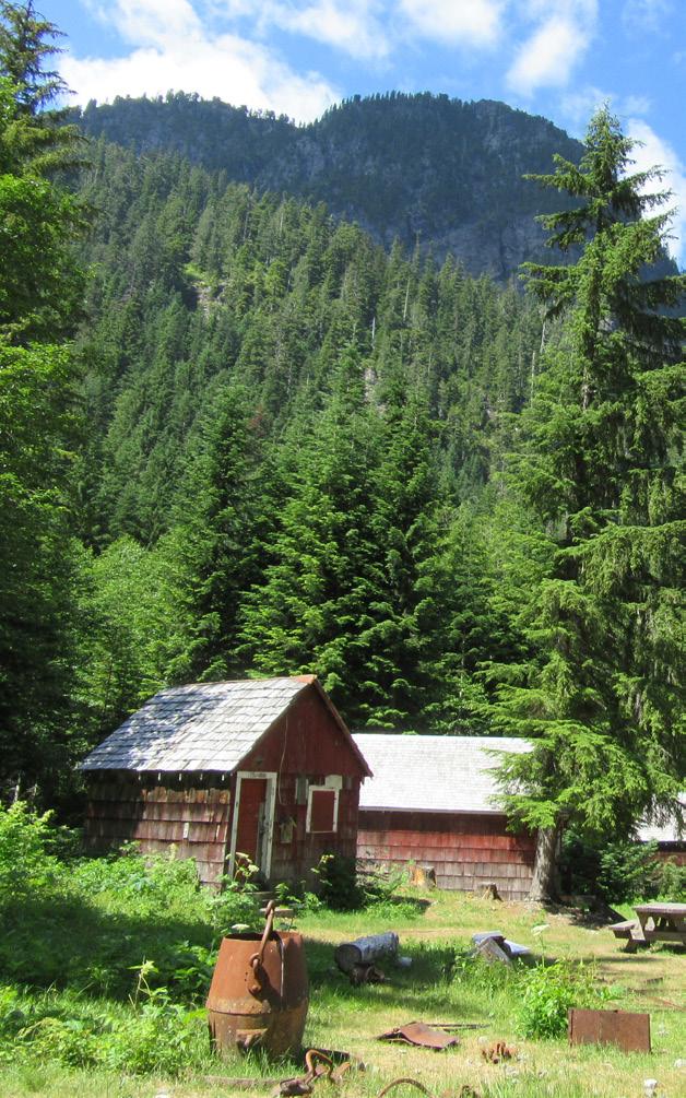
mining town of nearly 2,000. Five hotels, a school, store, rows of homes, and a huge concentrator used to line the streets of this now deserted locale. Ore was transported to town via tramways from the steep surrounding peaks. It was then sent to Everett by rail.
Founded in 1889, Monte Cristo like most mining towns was short-lived. By the 1930s it was abandoned and rapidly decaying. A county road connected the townsite to the outside world in the 1940s, and several attempts were made to convert a couple of the hotels into mountain resorts. But these ultimately failed, and by 1980 a flood had destroyed sections of the road and the county abandoned it.
Start your hike on the old road, now closed to vehicular traffic (except for a few permit owners). Pass the trail for Gothic Basin and continue on the

road and its bypass trails around washouts. At 1.1 miles you’ll reach the Twin Bridges over the South Fork Sauk River. In 2006 the river jumped course rendering them useless. You must now cross the river by fording (safe only in low water late in the season) or on a large fallen log located to the south of a privy.
Once across, continue hiking on the generally delightful old road. Stay right at a junction and come to a former car campground at 4.0 miles. Then cross the South Fork Sauk on a bridge, entering the townsite (Respect private property and structures and leave all artifacts).

Linger around the old town or if you want to continue hiking, head to Silver Lake near 4,350-foot Poodle Dog Pass via a challenging 2.1 mile

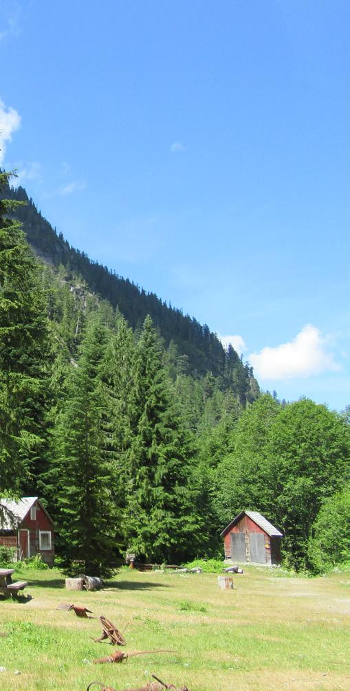
trail. The lake sits in a cirque beneath Silvertip Peak. The setting, like the metals that were extracted from the surrounding slopes, is precious.
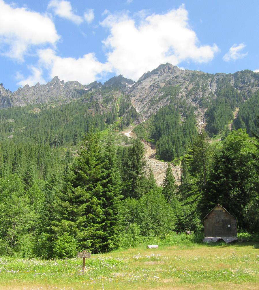
Historic hike along the South Fork Stillaguamish River.
ROUNDTRIP: 7.0 miles
ELEVATION GAIN: 625 feet
SEASON: Year round
START: Robe Canyon Historical Park, Granite Falls
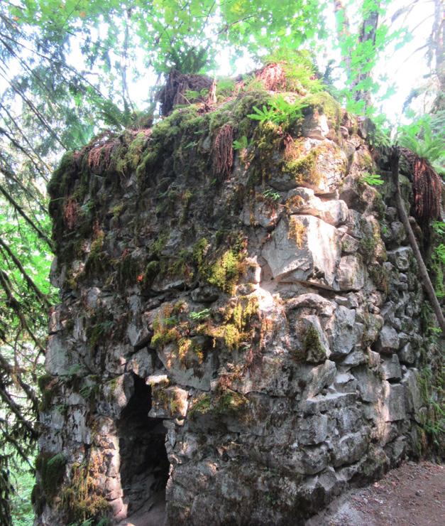

Hike back in time through a deep lush canyon carved by the South Fork Stillaguamish River. This delightful trail takes you into the heart of the region’s 970-acre Robe Canyon Historical Park. Start your journey by hiking over rolling terrain and through young forest. Pass Hubbard Lake, a shallow body of water surrounded by old cedars. Then cross its outlet creek on a sturdy bridge and follow an old road to a junction.
Head left and descend into a lush, emerald ravine emerging high above
the roaring waters of the South Fork Stilly. Now using the former railbed of the old Everett and Monte Cristo Railway, the trail travels upriver through a narrow canyon under a canopy of towering moss-draped maples.
En route pass historical relics littering the forest floor. Old saw blades, bricks, bottles, stove parts, and bed frames testify that this remote locale once supported a thriving community, Cut-Off Junction (leave all artifacts in place for others to enjoy). Just up ahead at 2.6 miles lies the limekiln, a 20-foot tall stone structure once used to cook limestone. The powdered lime was then transported by railway to smelters and mills in Everett. Built in 1892 and abandoned in 1934, it remains remarkably intact. (Stay off of it to ensure it stands another hundred years).
Beyond the kiln, the trail continues for 0.8 miles, ending at where a rail bridge once spanned the river. A short loop path takes off left, leading to a graveled bar on the river—a perfect spot to savor the area’s natural beauty.
The Stillaguamish River flows between wide open meadows in this beautiful county park.
HIKING: Short nature trails SEASON: Year round PARK ENTRANCE: 20416 Jordan Rd, Arlington
Situated on 150 acres of wide open meadows and dense forests running along the banks of the Stillaguamish River, River Meadows Park was originally a Native American trading destination, and then, in the late 1800s, a homestead. Traces of the original farmhouse and garden remain in the park.
Visitors can fish in the Stillaguamish River, stay in a yurt village situated in an old orchard, camp along the river, go swimming in the summer and snowshoeing during some parts
of the winter. In the fall, the park is the perfect place to watch the leaves change. You can also use River Meadows as a base camp to explore nearby attractions such as the Mountain Loop Highway and the tiny town of Granite Falls.
Every August, the park hosts the Stillaguamish Tribe’s Festival of the River and Pow Wow celebrating the many ways a clean, free-flowing river system contributes to the benefit of our community and to our entire natural environment. The festival features a giant storytelling turtle tent, interpretive salmon habitat tours, live music, arts and craft vendors, and a salmon barbecue prepared by the Stillaguamish Tribe.


Hike above a glacier-fed crashing creek.
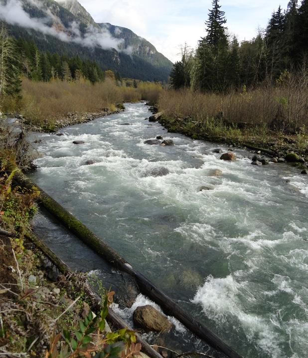
ROUNDTRIP: 14 miles
ELEVATION GAIN: 1,500 feet
SEASON: Year round
START: White Chuck Bench west beyond White Chuck Boat Launch or White Chuck Bench east at Crystal Creek
Easily accessible from Darrington and offering seven miles of snow free winter hiking along the glacier-fed White Chuck River, the White Chuck Bench Trail is surprisingly lightly hiked. Deriving its name from the Chinook jargon word for whitewater, the appropriately named White Chuck River lives up to its name. Originating from Snohomish County’s highest mountain, Glacier Peak, the river roars on its way to the Sauk River.
While there is not too much of an elevation change between the trail’s two termini, with all its ups and downs you’ll gain more than 1500 feet of
elevation on a roundtrip hike. Consider a car shuttle for a one way hike. And hiking a few miles from either end is a good option too for a shorter hike. From the western trailhead, the way starts on a high bench above the crashing river. Gaps in the forest cover provides good views out to Mounts Pugh, Forgotten, Bedal and Sloan. Pass huge stumps attesting to the great forest that once grew in this lush valley before it was logged in the last century.
At 6.0 miles the trail switchbacks down a steep embankment to a bridged crossing of cascading Crystal Creek. The way then steeply climbs out of the ravine. Cross another creek and steeply descend to the trail’s eastern trailhead on Forest Road 23.

Peer down the fish ladder at thrashing whitewater and sculpted granite.
ROUNDTRIP: 1.4 miles
ELEVATION GAIN: 98 feet

SEASON: Year round
START: 10630 Mountain Loop Hwy, Gran ite Falls, WA 98252
The waterfall located along the Mountain Loop Highway, is the natural feature after which the nearby town of Granite Falls was named. It acted as a barrier to many breeding fish, so, in 1954 the longest vertical slot fish ladder in the world was built to allow fish to bypass the Falls and breed upstream. A 280-foot long tunnel was blasted through the solid granite to complement the stair-step design that permits fish to work their way upstream. The vertical rock wall across
from the fish ladders is a test for expert rock-climbers (and occasionally for local rescue crews). Finally, the bridge just upstream is worth a look in itself. Funded in February 1934, it was completed five months later, and opened the area east of here to both trucking and tourism. Truck roads soon replaced rails in the woods, and the completion of the Mountain Loop took a huge step forward. The bridge opening ceremony bragged of it being the “Entrance to God’s Mountain Playground”.
Low country old-growth forest is a highlight.
ROUNDTRIP: 8.6 miles
ELEVATION GAIN: 700 feet
SEASON: Year round
START: Boulder River Trailhead
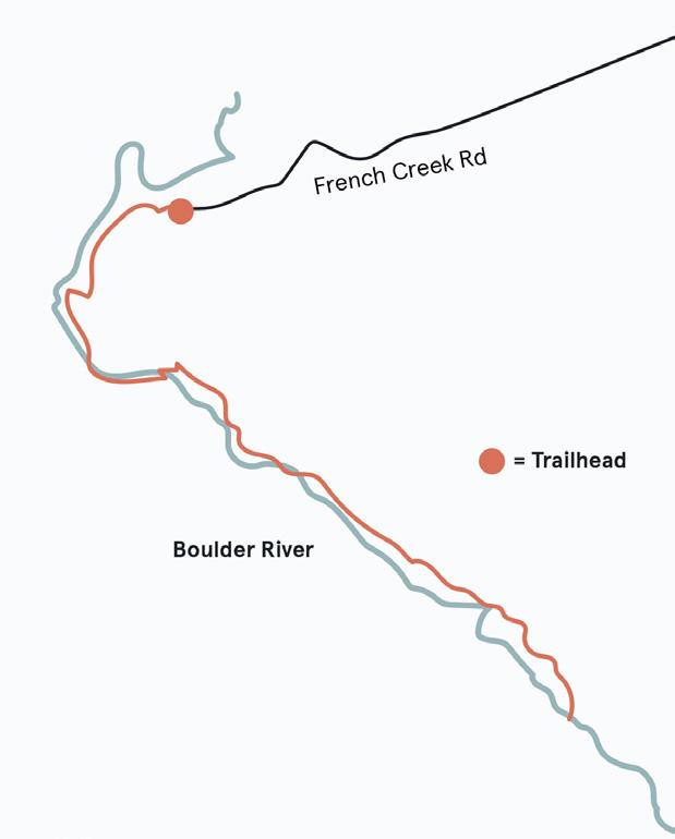
The Boulder River Trail makes for a good hike anytime of the year. Take to this trail to avoid summer heat, savor autumn color, spot spring wildflowers, or to be wooed by waterfalls swollen by winter rains. But the one thing on this trail that remains constant throughout the year is the trees. They’re ancient, grand and awe inspiring! The moss-draped giants of
the Boulder River Valley make up one of the forests remaining in Snohomish Country. Protected now within the 49,000 Boulder River Wilderness, this primeval forest is as impressive as the wild river it embraces.
The Boulder River Trail travels 4.3 miles into a deep canyon. Numerous waterfalls tumble down the narrow canyon walls into the rushing river. These cascades are especially impressive during the winter and spring rains. Because this trail remains at such a low elevation (950 to 1,550 feet), it is rarely covered in snow, allowing for year-round wilderness hiking.
At about one mile, pass the wilderness boundary and soon afterwards reach a spectacular unnamed twin waterfall crashing down into the river. This is a good turn around spot for young children and hikers who just need a quick wilderness fix. For those intent to carry on, the trail continues up the moisture laden emerald valley ending at a campsite along the river. It once crossed the river and continued all the way to Tupso Pass and Three Fingers. Long abandoned, the forest has reclaimed it. Retrace your steps back to the trailhead to once again admire the ancient giants and cascading waters.
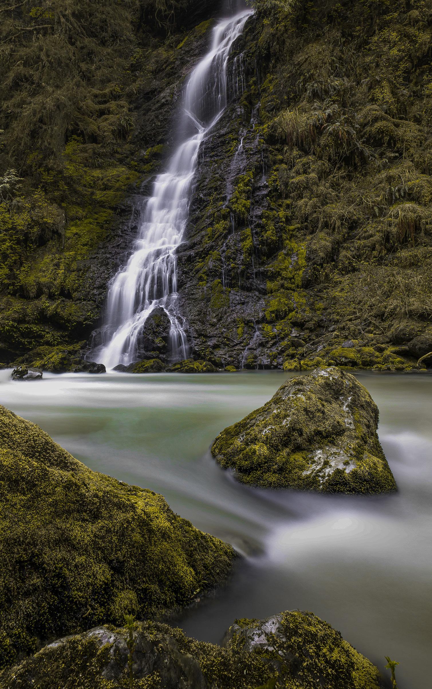 Boulder River. Photo by Jasper Gronewold
Located just outside the Town of Darrington, Whitehorse Regional Park Campground becomes the ultimate “gate-a-way” in Snohomish County, with close access to the Whitehorse Trail, North Mountain bike trails, and other DNR and Forest Service lands. Fifteen of the 18 spacious sites have water, 50 amp power, and sewer connections.
IMPORTANT: At this time there are no trails connecting to the park. The closest equestrian trailhead is the Darrington Trailhead (in downtown Darrington) which connects to the Whitehorse Trail.
The campground has 18 campsites, a dump station and a timber-framed picnic shelter. Fifteen of the sites are full-utility (two of which are ADA compliant) and five are equestrian sites, each with two corrals and highlines. Water, electricity and sewer are winterized and closed NovemberMarch. Trees and native shrubs were planted fall 2021.
Phase II construction includes plans to add 12 non-utility (1 ADA compliant) campsites and a restroom/shower facility. The estimated completion date is summer/fall 2022.
Reservations can be made up to 270 days in advance and (to avoid double-bookings) no later than 3 days prior to the check-in date. Weekend reservations require both a Friday and Saturday night stay (1-night reservations are accepted for all other nights).
Drop-in camping is allowed for sites that have not been reserved. Bookings can be made online at Snoco. UseDirect.com/SnohomishWeb or by contacting the Call Center (M-F, 8:30am-4:30pm) at 425-388-6600. Please be aware that transaction fees will apply.
Due to Health Department requirements, all RVs must empty their waste tanks prior to connecting to full-utility sites. There is no dumpfee charge for full-utility Whitehorse campers. Dump-fee charges will apply to all other users. The dump station is winterized and closed NovemberMarch.

The campground includes five equestrian campsites (two full-utility and three non-utility). Site 14D is ADA compliant. Equestrian sites have deeper driveways and include two 12’x12’ corrals and a highline. For identification purposes, these sites
have an “E” designation. A compost bin is located within the loop so that equestrian campers can clean their corrals prior to checking-out. Water, electricity and sewer are winterized and closed November-March.
FROM I-5: Take exit 208 and turn eastbound onto WA-530. In approximately 3.5 miles, turn left (north) onto WA-9. In 0.3 miles turn right (back) onto WA-530 (aka Burke Ave). Continue on WA-530 for 27.7 mi. Turn left onto WA-530 (Emens Ave) and follow for 1.1 mi. Turn left onto N Mountain Rd and follow for 0.3 miles. Campground (2nd) entrance is on the right.


In the Skykomish-Snohomish River Valleys, hikers can take in a mountain view from a historic fire lookout, hunt for wildflowers, and get up close and personal with a wild waterfall pouring from towering Mount Index.Wallace Falls. Photo by Jake Campbell

ROUNDTRIP: 0.5 to 13 miles
ELEVATION GAIN: 0 to a few hundred feet
SEASON: Year round
START: 23210 Paradise Lake Rd, Woodinville
Iconic lake beautifully reflects Glacier Peak. To Maltby Whispering Firs Trail
Consisting of nearly 800 forested acres on the edge of suburbia, Paradise Valley is not only a hiking heaven with its 13 miles of trails, but also a haven for wildlife. Originally homesteaded in the 1880s, Paradise Valley now provides refuge for bear, cougar, deer, and a myriad of other critters both furry and feathered. And the park protects the headwaters of Bear Creek, an important salmon rearing stream.
Before setting out, pick up a map of the park’s extensive trail system at the kiosk at the main trailhead. Then have fun exploring this sprawling conservation area! The hiker-only Whispering Firs Trail makes a nice half mile escape perfect for young hikers and older ones short on time. Follow the Mainline Trail through the core of the park to access other trails deeper within the Paradise Valley. The Bigleaf and Ephemeral Trails lead
past wetlands that burst with birds and blossom with wildflowers in the springtime. The Wetland Plateau Trail offers a fair degree of solitude while the Southern Traverse Trail undulates over small ridges through mature forests. Combine the Southern Traverse with the Wetland Plateau, Bigleaf, Red Alder and Cascara Trails for a 5.0-plus mile grand walkabout around the park’s periphery.
Two mile long subalpine lake surrounded by towering timber.
ROUNDTRIP: 3.8 miles
ELEVATION GAIN: 800 feet
SEASON: May - November
START: Forest Road 6410, Skykomish
PARKING: Northwest Forest Pass
Trailhead access road is currently washed out four miles from trailhead. Contact Ranger Station for current road status.
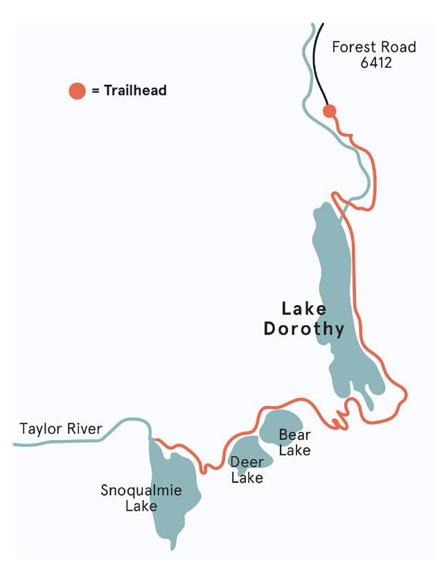
Lake Dorothy is one of the largest bodies of water within the sprawling 414,000-acre Alpine Lakes Wilderness. It’s also one of the easier ones to hike to—just don’t expect to be alone. But there is plenty of room for all, as the trail continues nearly 2 more miles along this large lake’s shoreline. Surrounded by towering virgin forest centuries old and shiny rocky ledges scoured by ancient ice flows, Dorothy Lake is a stunning destination. But it’s also a fragile environment, so be sure to practice “Leave No Trace” principles and treat this special area with care.
The well-built and maintained trail takes off into primeval timber entering the Alpine Lakes Wilderness. Soon afterward come upon cascading Camp Robber Creek, which you’ll cross on a sturdy bridge. Here among polished granite slabs the creek plunges into a deep pool; an inviting spot on a hot afternoon. The trail then begins to climb more steeply reaching Dorothy
Lake’s littered with logs outlet at 1.9 miles. Enjoy the view south to Big Snow Mountain.
The outlet is a good place to relax, but if you feel compelled to explore more of the lakeshore, continue hiking. The trail continues on a rocky at times route for nearly two miles along Dorothy’s eastern shoreline. Pass backcountry campsites, ledges perfect for lounging, and plenty of scenic spots along the way. At the south end of the lake the trail turns west crossing a tumbling inlet creek before steeply ascending to Bear and Deer Lakes. They’re worth exploring too, but out of the realm for hikers looking for a short and easy day.

Explore wildlife-rich wetlands tucked on a lofty hill.
ROUNDTRIP: 2.2 miles Beaver Lake Loop/3.7 miles Temple Lake Loop
ELEVATION GAIN: 200/150 feet
SEASON: Year round
START: 12921 150th St SE, Snohomish
The largest county park in the region, Lord Hill Regional Park protects over 1,460 acres of forested slopes, lush ravines, basaltic outcroppings, scores of wetland ponds, and a wild undeveloped stretch of the Snohomish River. There are over eleven miles of trail and several miles of old woods roads traversing this park named for Mitchell Lord who homesteaded here in the 1880s. Lots of loop options exist from short leg stretchers to allday explorations. Here are two good suggestions to get you exploring.
Beaver Lake Loop: Head down the main trail through a cool forest of big trees coming to a junction in 0.4 miles. Turn left on the Beaver Lake Trail and follow it through a tunnel of alders to marshy Beaver Lake. Take a right on the Pipeline Trail, a right on the Pipeline Cut-off Trail, then another right on the Main Trail and return to the parking lot.

Temple Pond: From the Beaver Lake Trail junction head right continuing
on the Main Trail for another 0.6 miles coming to a four-way junction. Continue straight on the Main Trail Cut-off coming to another four-way junction in 0.2 miles. Continue straight once again, this time on the Temple Pond Loop trail. Follow this delightful near level path in 1.6 miles to Temple Pond, the largest body of water within the park and then back to the Pipeline Trail. Continue straight on the Pipeline Cut-off Trail returning to the Main Trail. Turn right retracing familiar territory back to the trailhead.

Roam along a rushing river with ample wildlife spotting opportunities.
ROUNDTRIP: 3+ miles of trails
ELEVATION GAIN: Minimal
SEASON: Year round
START: 705 1st St, Sultan, WA 98294
Wander on a series of delightful near level interconnected trails through lush riparian forest along the churning Sultan River. Have fun crossing sturdy bridges spanning river channels that were constructed to aid spawning salmon. And delight in witnessing salmon swimming in this important waterway. Kids will absolutely love exploring here.
The 76-acre Osprey Park came about as a result of the relicensing of the Jackson Hydroelectric Dam upriver, requiring that salmon habitat downriver be enhanced. This resulted in the Snohomish County Public Utilities District constructing new channels in the park favoring the spawning fish and other wildlife. Roam the trails looking for woodpeckers, eagles, kingfishers, thrushes, and yes, ospreys. Come in the fall to witness spawning Chinook, Coho, chum and pink salmon. In the spring, look for returning migrating birds setting up nests. Listen to their songs and choruses from amorous frogs. Osprey Park consists of a series of loop trails and a longer connecting trail to Riverside Park. You can easily
hike more than 4 miles here. At the trailhead just north of the adjacent playfields is a kiosk with a decent map of the park. And check out a kiosk displaying an interpretive map designed by local artist Jacquie Miner. While this map is a little confusing for navigation, it’s beautifully illustrated showing you all of the park’s wonderful attributes—wildlife, plant life, and recreational opportunities.
After roaming the park’s various short loops, wander down Susie’s Trail. Named for Susie Hollenbeck; she along with Bob Knuckey were two Sultan residents who worked tirelessly to improve this park. Susie’s Trail crosses a channel and skirts a pasture before traveling along the Sultan River beneath a canopy of towering cottonwoods. It ends at Riverside Park off of Main Street where you can check out the statue of Chief Tseul-Ted (also known as Sultan John) for whom the city was named. Then walk across the river on an expansive pedestrian bridge to Sportsman’s Park before returning to Osprey Park.

Town meets country at this lovely park.
TRAIL LENGTH: 1.63 miles
ELEVATION GAIN: None SEASON: Year round
Lake Tye is the Monroe community’s gathering place. This 60-acre park boasts triathlons, water sports, community events, and sports such as baseball, softball, tennis, and basketball games for young and old, resident or visitor. The synthetic turf field has been upgraded with lights that shine bright as late as 10 o’clock in the evening. There are concerts in the park and movies, complete with a state of the art mobile stage with a sound system. There is often a party in the park.
A 1.63 mile paved trail circumnavigates the 42-acre Lake Tye. The trail is lined with beautiful trees that add brilliant colors to the landscape come fall. The park is also a good place for birdwatching. Moorhens, cormorants, and herons are year-round residents, while geese, grebes, swans, and other waterfowl visit seasonally. Rest on one of the many park benches along the trail to observe the birds and watch the fishermen cast their lines. If you desire a longer walk, paved paths extend throughout the adjacent neighborhoods connecting to several community parks or, head south to Main Street, take a left and the sidewalks will lead you to Historic Main Street.
Enjoy woodland and riverside trails at Monroe’s largest park.

ROUNDTRIP: 1.2 miles
ELEVATION GAIN: None
SEASON: Year round (unless flooded)
START: Lewis Street Park entrance
On the City of Monroe’s southern edge, Al Borlin Park gives residents and visitors a whole other kind of park experience. With its 90 acres, it is the largest and among the oldest parks in the city, it’s also the most natural. It sits on a small peninsula created by the Skykomish River and Woods Creek. Cross Woods Creek over a footbridge, located at Lewis Street Park traverse the black cottonwood
forest, and dip your toes in 1,000 feet of pebble-strewn shoreline of the Skykomish River; known for its annual salmon and steelhead runs. A large parking area to the south provides easy access to the park as well as the Washington State Department of Fish & Wildlife’s Boat Launch on the west side of the bridge. Al Borlin Park is also accessible at a second location at the end of Simons Road, be prepared as this location is much more secluded.
This picturesque park offers stunning views of the Skykomish River trailing beneath the rugged Cascade Range. Bring a picnic, enjoy the views, and enjoy a relaxing hike on the 1.2 mile ever changing nature loop. The loop is unpaved and untamed, also please be advised, due to the park’s proximity to the river, it is prone to annual flooding and may have limited access during winter months.
Hike into a remote canyon graced by big trees and a wild river.

ROUNDTRIP: 4.4 miles
ELEVATION GAIN: 850 feet
SEASON: April - November
START: Sultan Basin
Opened in 2015, this new trail takes you deep into the Sultan River Canyon where towering old growth trees and steep slopes shade a remote section of the Sultan River. The hike starts on a gated dirt road near the en trance of the parking area. Walk this road through pleasant forest gradually climbing about 250 feet.
After 1.0 mile, come to the begin ning of the actual trail which is clearly signed. Now begin your descent into the deep dark canyon. Via a good grade, the trail switchbacks downward
into the rugged canyon. The steep slopes here prevented past loggers from harvesting the canyon’s towering old trees. You’ll pass some impressive ancient giants and some nice small seasonal cascades too.
At 2.2 miles you’ll reach the canyon’s lush bottom and the rippling Sultan River. During the summer months, sunlight reaches the canyon floor allowing you to prop on a riverside rock and enjoy a sunny spot along the river. Watch for dippers flitting in the cool waters. After enjoying this quiet and remote spot prepare for your return journey where a 600 foot climb out of the canyon waits for you.
A short, sweet and a tad bit steep hike to historic fire lookout.
ROUNDTRIP: 3.0 miles
ELEVATION GAIN: 1,400 feet
SEASON: July - October
START: Forest Road 6554
PARKING: Northwest Forest Pass
Starting at a high elevation and beginning in an old burn surrounded by old cuts, the way steeply climbs. Between switchbacks, take in sweeping views south of the broad U-shaped Beckler River Valley. At 0.6 miles enter the Wild Sky Wilderness leaving young regenerating forest for groves of old-

growth mountain hemlock. Now on a gentler grade, traverse ridge reaching a small gap. Then continue along ridge crest leaving forest for meadows that burst with wildflowers. Swing around the north side of the mountain and after one final push reach the 5,587foot summit with its restored fire lookout.
Look south to Mounts Stuart and Daniel, the Snoqualmie Pass peaks and big beautiful Mount Rainier hovering above them all. Look north to the Monte Cristo Peaks and east to the high alpine meadow country of the Henry M. Jackson Wilderness. Of course take time to appreciate the 1935 lookout. It can be rented out for overnight stays (reservations are required: reserveamerica.com). Restored by the Everett Mountaineers and the Seattle Explorer Search and Rescue in the 1990s, it stands now as a sentinel in Washington’s newest wilderness area, the Wild Sky.
Wild Sky Wilderness
Get your fill of tall, crashing waterfalls.
ROUNDTRIP: 5.5 miles
ELEVATION GAIN: 1,200 feet SEASON: Year round PARKING: Discover Pass
Wallace Falls is the most popular hike in the Sky Valley and is very busy. Monday – Friday is the best time to visit.
A series of falls, nine in all, two that are stunning and one-the tallest at 265 feet-that’s absolutely spectacular! Or a pretty lake-not quite backcountry, not quite alpine, but a wonderful destination never-the-less! The falls attract plenty of hikers. But the lake, reached by the Greg Ball Trail; a path built by and honoring one of Washington’s greatest trail advocates, is often quiet.
Wallace Falls: Head up the main trail to a junction. Left heads to the falls via an old logging railroad grade. It
makes a nice loop option adding about a mile. Continue right on the Woody Trail through dank forest dropping to river’s edge before climbing. At 1.4 miles, come to a junction. Left heads to the Railroad Grade and Greg Ball Trails. Proceed straight crossing the North Fork Wallace River before beginning a short and steep climb to the Lower Falls Viewpoint and Picnic Shelter. At 2.2 miles you’ll reach the Middle Falls, the park’s highest and the ones you can see from US 2. The Upper Falls are another half mile and 500 vertical feet beyond.
Wallace Lake: Take the Railroad grade or Woody Trail to the Greg Ball Trail. Ascend wooded slopes along the North Fork Wallace River reaching a gravel road. Head right on the road 0.1 miles to the old road taking off left. Follow this level forested way for 0.5 miles to Wallace Lake.

 Wallace Falls. Photo by Jake Campbell

Frantic falls and a placid lake beneath spiraling Mount Index.
ROUNDTRIP: Bridal Veil Falls 4.4 miles/ Lake Serene 7.2 miles
ELEVATION GAIN: 850/1900 feet
SEASON: May - November
START: Lake Serene Trail 1068
PARKING: Northwest Forest Pass
Towering and formidable, Mount Index is perhaps the most awesome sight along the Stevens Pass Highway. And Bridal Veil Falls emanating from beneath the mountain’s austere crags is not a scene you’ll forget. But to really appreciate this impressive landmark, you’ll need to leave your vehicle and hit the trail.
Start by following an old road lined with mossy maples and alders gradually ascending 1.7 miles to a junction. For Bridal Veil Falls, head right a half mile climbing steeply via a series of short switchbacks and stairways to viewing areas often soaked in spray.
For Lake Serene continue on the main trail dropping a little into a damp ravine. Cross Bridal Veil Creek and then begin climbing. The trail makes a long sweep east and then a long sweep west working its way under, over and around cliffs. Take in fine views of the Skykomish Valley below as well as out to Ragged Ridge and other peaks of the Wild Sky Wilderness.
Lake Serene greets you in a tight basin beneath the ramparts and parapets of Mount Index. Cross the lake’s outlet on a sturdy bridge and head to Lunch Rock above the shores of the icy lake (keep children close by). Now stare straight up those surrounding 3,000 vertical foot stark walls. Hardly serene; it’s awe-inspiring! But when the basin is calm, those imposing rock faces reflect upon the lake’s surface.
Hike above the forks of the wild Skykomish River.

ROUNDTRIP: 3.4 miles
ELEVATION GAIN: 780 feet
SEASON: Year round START: Index Galena Road
Amble through mossy forest ascending an emerald ridge above the confluence of the forks of the wild Skykomish River. Marvel at the hamlet of Index below perched at the foot of sheer cliffs. And savor a stunning view of formidable Mounts Index and Persis with Bridal Veil Falls careening from that daunting wall of towering crags.
Opened in 2017, this trail is quickly becoming a favorite for hikers from near and far. Where a well-built trail now meanders up a steep ridge—in 2006 this century old forest was slated to be clear-cut logged. But residents of tiny Index rallied to preserve their scenic green backdrop. They formed a nonprofit organization, the Friends of Heybrook Ridge and began negotiating with the logging company that owned the land to buy it.
Through a determined fundraising campaign, and with the help of the conservation group Forterra, Snohomish County, and an anonymous donor later identified as Conrad Leovy, the Friends were able to purchase the 145-acre property. Snohomish County Parks eventually took ownership of the protected hillside with the Friends
involved as an overseer creating a solid partnership. The Washington Trails Association was contracted to develop a network of topnotch trails.
Near a kiosk with historical information on the ridge and the movement to protect it, find the trailhead. Then start hiking. Pass the short ADA-accessible Erinswood Loop, skirt a wetland and cross a small creek before starting to climb. The grade is moderate with a few steep pitches, but switchbacks and stone steps help ease the ascent. Pass by giant cedar stumps, evidence of past logging. A mature second growth forest of cedars, firs, hemlocks and maples shades the stumps and a luxuriant forest floor.
Quarter-mile posts along the way help you measure your progress. Eventually the climb eases. Crest the ridge, cross a powerline swath, and come to trail’s end. Now stare across the Skykomish Valley at massive Mounts Index and Persis. Admire Bridal Veil Falls crashing down from beneath Index’s spiraling towers. Look east to the ever impressive Baring Mountain. The views from this spot are more captivating than from the nearby Heybrook Fire tower. There are plans to construct a trail to that 67foot lookout tower perched 400 feet higher on the ridge. Plan on returning to hike it!
 Erinswood Loop, Heybrook Ridge. Photo by Nichole Gaertner
 Johnson Ridge. Photo by David Lang
Sunrise Mountain
Supreme wildflower hike in the Wild Sky Wilderness.
ROUNDTRIP: 9.0 miles
ELEVATION GAIN: 2,650 feet
SEASON: July - October START: Forest Road 6520
One of the finest meadow-traversing, ridge-walking, view-granting trails in the Skykomish Valley, Johnson Ridge is also surprisingly one of the quieter trails in the region.
The way begins steeply through an old clear-cut rapidly regenerating. After 0.75 miles the grade eases, the trail now traveling through mature forest and soon entering the Wild Sky Wilderness. Established in 2008, the Wild Sky is Washington’s newest federally protected wilderness area.
At 2.0 miles round the heathergraced 5,050-foot summit of Sunrise Mountain, outstanding views can be had of surrounding summits and snowy sentinel Glacier Peak, the highest peak
in the region. Sunrise makes a fine destination for a shorter hike.
But if it’s Johnson’s Scorpion Mountain you wish to strike out for, continue, steeply dropping over 300 feet to a narrow saddle. Commence climbing once reaching sprawling meadows replete with resplendent wildflowers. At about 4.4 miles at the edge of a meadow reach an unmarked junction. Head left if Scorpion Mountain’s 5,540-ft summit is your objective. From this outpost enjoy a stunning 360-degree view of the Central Cascades. To the east, directly below, twinkling Joan Lake may catch your attention. To reach it, retreat to the unmarked junction and follow a brushy steep trail. Reach the isolated lake after a half mile and 500 feet of elevation loss. Fish are fairly abundant at the lake—so are the mosquitoes.
A pair of sparkling backcountry lakes in the Sultan Basin.

ROUNDTRIP: 9 miles
ELEVATION GAIN: 1,600 feet
SEASON: June - November
START: South Shore Recreation Site
Set in a remote basin high above sprawling Spada Lake lie two quiet backcountry lakes that beg to be explored. Start by following the trail to a decommissioned road. The hike to the Greider Lakes used to be fairly short, but it’s nearly twice the distance now with the road conversion. Encounter more than a dozen creek crossings along the way. Two may soak your boots. One of those however may be bypassed, but you’ll miss the pretty cascade falling at the crossing.
After 2.3 miles of easy going, come to the original trailhead. Now follow the original trail skirting the Reflection Ponds, two little insect-incubating wetland pools responsible for feeding area frogs, dragonflies, flycatchers, and sparrows. A side trail diverts left to circle the ponds. Consider it for a slight variation on the return; or as an easy kid-friendly destination. Waste no time gaining elevation—you’ll ascend 1,000 feet on 40 switchbacks over a course of 1.5 miles. Much
of the surrounding original forest succumbed to wildfire many years ago leaving behind large charred snags as testaments. But eventually the way enters old growth forest at placid Little Greider Lake. Find some decent campsites (first come first serve) here, but you’ll want to keep hiking, for Big Greider Lake is just a mere 0.4 miles farther.
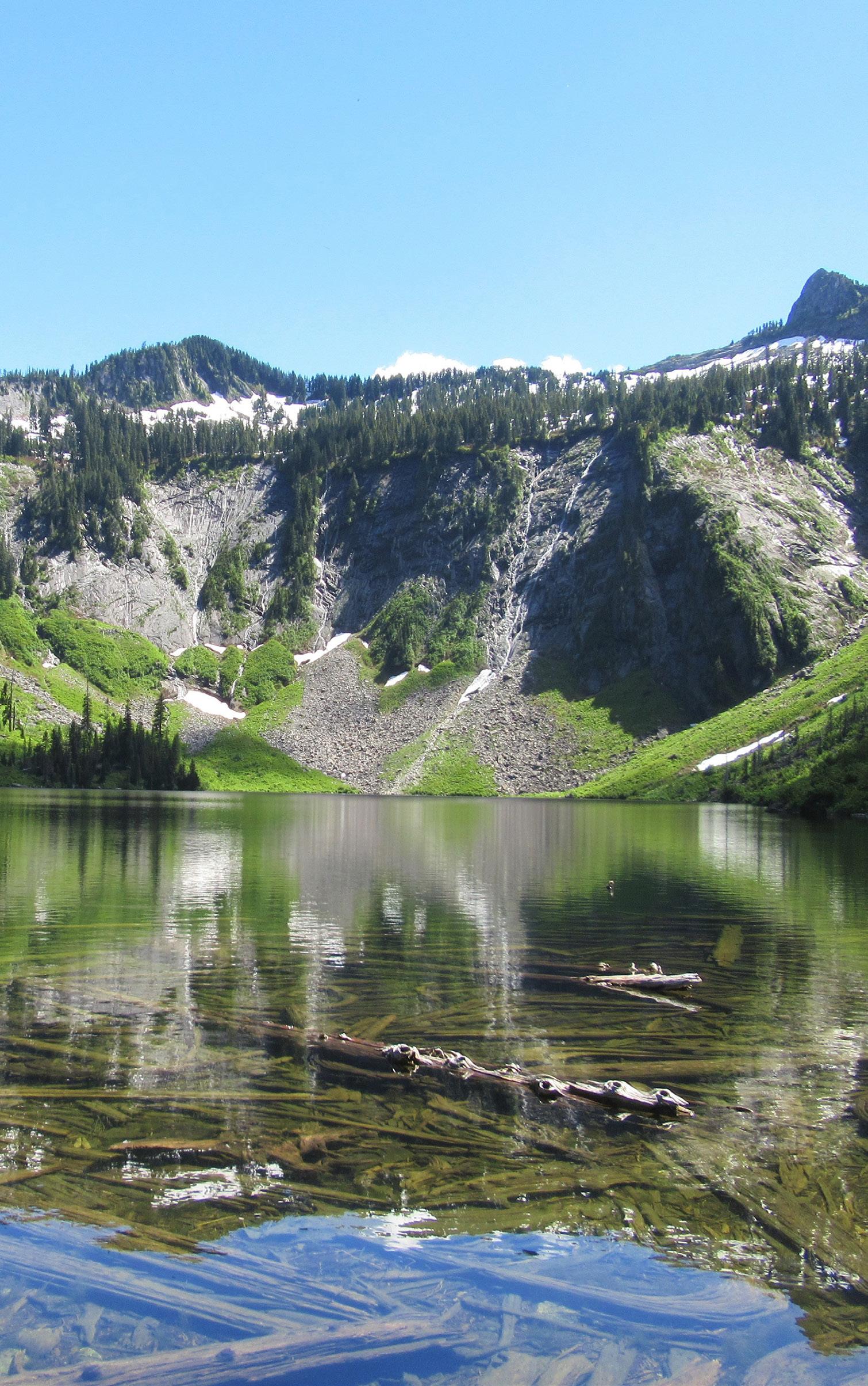
Cross Greider Creek on a big bridge and carry on. While Big Greider is only 35 feet higher in elevation than Little Greider, its surroundings are entirely different. Cradled in a mostly open bowl flanked by slopes of exposed cliffs and avalanche chutes, in early summer water crashes down the open surrounding walls. And although Big Greider sits at an elevation just shy of 3,000 feet, it has the appearance of being much higher thanks to heavy winter snows due to its location within the Puget Sound Convergence Zone. There are a handful of backcountry camps at this lake as well (first come first serve). Scoot yourself down on one of the large smooth logs lining the lake outlet and savor the scene.
Savor miles of flowering alpine meadows.

ROUNDTRIP: 8.0 miles
ELEVATION GAIN: 2,300 feet
SEASON: July - October
START: Forest Road 63
PARKING: Northwest Forest Pass
FR63
To US 2 Skykomish West C ady Ridge
Wild Sky Wilderness
= Trailhead
Henry M. Jackson WildernessOne of the most spectacular ridgeline hikes in the Central Cascades, the only thing superseding West Cady’s flowers is its views. Start your hike in luxurious ancient forest. After crossing the North Fork Skykomish River on a bridge above a small gorge, begin to climb. The trail winds through some of the biggest and oldest trees in the Skykomish Ranger District, all protected within the Wild Sky Wilderness.
At approximately 2.0 miles you’ll reach a densely forested gap between West Cady Ridge and Excelsior Mountain. The way now becomes much steeper
marching up the spine of West Cady. Views begin to grow. Traversing berry fields and heather meadows, reach a 4,750-foot knoll just shy of 4.0 miles. This is a good spot to call it quits if you’ve had enough climbing for the day. Sit back and enjoy breathtaking views north across the North Fork Skykomish Valley to Columbia and Monte Cristo Peaks and west across Jack Pass to snowy-faced Spire Mountain.
If you have more energy however, the views and meadows only get bigger and better if you continue hiking up the trail. A good objective is Bench Mark Mountain, a 7.2 mile one way trip from the trailhead. From this 5,816foot mountain’s elongated summit savor dazzling displays of wildflowers and jaw-slacking views of peaks that span the horizons.

Staggering alpine and valley views from atop the lookout.
ROUNDTRIP: 2.6 miles
ELEVATION GAIN: 850 feet
SEASON: Year round PARKING: NW Forest Pass

Short and sweet and a tad bit steep, the hike to the restored Heybrook Lookout makes for a good spring warm up or a late fall frolic when the surrounding high country is buried deep in snow. From the lookout’s lofty balcony you can scan the scenic Skykomish Valley below and stare straight across it to the imposing Mount Index.
Leave busy US 2 behind for cool forest and immediately begin climbing. The trail meanders upward under an emerald canopy, first angling east, then angling west, and then utilizing
a series of tight switchbacks. After passing through a mossy boulder garden, the trail swings east once again to crest the ridge. Soon bust out of the forest onto a ledge just below Heybrook’s fire lookout. The views here are good, but they’re far better from the top of the 67-foot lookout tower perched on the 1,700 foot-ridge.
Ascend seven sets of stairs to claim your visual rewards of the whitewaterenhanced Skykomish Valley, ominous Baring Mountain, and the massive and awesome rock fortress Mount Index. Stare at Index’s precariously perched snowfields and Bridal Veil Falls careening out of a cleft within its stark spires. Don’t forget to give thanks to the Everett Mountaineers for making all of the viewing possible. It was their hard work that restored the 1964 lookout.
A lakeside retreat for the whole family.
HIKING: Short Nature Trails
ELEVATION GAIN: None SEASON: Year round ENTRANCE: 17900 48th St SE, Snohomish PARKING: Daily fee

Situated on the site of a mid-century lakefront resort, Flowing Lake Park is a recreational destination for the whole family.
The park features myriad of recreational opportunities and is one
the few parks in the region that allows for motorized watercraft and water skiing. You’ll also find a fullservice campground. Not interested in camping? Cozy cabins are available to rent (two are even pet-friendly).
During the day, visitors can wander a nature trail, swim in the lake, fish off the dock, use the volleyball courts and kids can hit the playground.
Amphitheater
Beach
Boat Launch
Cabins
Disabled Parking
Fishing
Picnic Shelter
Picnic Tables
Playground
Restrooms/ Sanicans
RV Campsites
Swim Area (No Lifeguard)
Tent Campsites
Trails
Water Skiing
Craig Romano is an award winning author of more than 25 guidebooks on hiking in Washington State and the Pacific Northwest. He has hiked trails all over the world; from Alaska to Argentina, Sicily to South Korea, and concludes that some of the best hiking in the world is right here in Snohomish County. Content provider for Hikeoftheweek.com and the Tread Map app, Craig also regularly contributes to Washington Trails, Mountaineers Magazine, and Tracing the Fjord.
For scores of other hikes in the region check out his books; Day Hiking Central Cascades 2nd edition, Day Hiking North Cascades 2nd edition, and Backpacking Washington 2nd edition (Mountaineers Books). All photos by Craig Romano except otherwise noted. Visit him at CraigRomano.com.
This Hiking Guide made possible in part by assistance from the Snohomish County Hotel-Motel Tax Fund