
GPS Tracking Collars and Geo-fences
GPS (global positioning system) tracking collars are a highly accurate satellite-based navigation and location system that are fitted onto elephants to monitor their movements in real-time across landscapes.

Save the Elephants (STE) use GPS-tracking equipment to understand elephant lives, decisions and needs.

STE founder Iain Douglas-Hamilton was the first to track elephants using radio collars (1995) and STE remains at the forefront of tracking technology.

Collars contain advanced GPS satellite tracking devices that allow scientists and wildlife rangers to monitor, in real time, when and where individual animals are moving across the landscape.
As a migratory species, elephants spend most of their time outside protected areas, meaning some are most likely to either cross through or near villages and farms.

Increase in human population has prompted the development of human settlements and roads that completely block or restrict passage through important wildlife migratory routes (Okello and Kiringe, 2004).
Collaring elephants attempts to mitigate conflict and ensures safety of both people and elephants.
Read more on: -Tracking - Real Time Monitoring. (2022, March 11). Save the Elephants.
Kenya uses satellite-linked GPS collars to protect elephants, people. (2016, September 9). Save the Elephants.
 Watch: War of Space | Human/Elephant Conflict in the Maasai Mara. (2022, May 16).
Bull elephant called Wide Satao with a fitted collar © Naiya Raja/Save the Elephants
Watch: War of Space | Human/Elephant Conflict in the Maasai Mara. (2022, May 16).
Bull elephant called Wide Satao with a fitted collar © Naiya Raja/Save the Elephants
When collared elephants are approaching farmlands/community areas or are in any danger, rangers are able to inform rapid response units and ground patrol to make their way to the site and attempt to safely scare the elephant away, using various deterrent methods such as noise and chilli bombs.


Case studies
In and around Samburu Game Reserve in Northern Kenya, elephants often come in contact with herders and their livestock at water points such as rivers.
The need to understand patterns of elephant movement and interactions with farmlands allows us to compile effective mitigation methods to reduce levels of conflict and promote tolerance of elephants in rural communities.

Collared elephants around Samburu are monitored to prevent them from coming in conflict with humans, as some clashes can be fatal to both elephant and people.


Collars also help to understand important elephant corridors and inform the community to be more careful.

A notorious male elephant named Mangelete was collared in Tsavo West National Park (2022) and was then translocated. He frequently broke into fences and raided crops in the nearby village and the community was not happy.


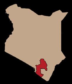
Tsavo, Kenya

Components of the collar
The collar consists of a VHF transmitter and a battery, a counterweight and a belt.
Accelerometer provides immediate data on elephant activity, e.g., when the elephant suddenly streaks/runs, is moving slowly, and when it is not moving at all and is perhaps resting.
He is currently monitored by authorized officers.
Tim, an iconic tomato-loving male elephant from Amboseli grew a taste for farmed foods and so he was a good target for collaring. His tracking data provided insight into his crop-raiding behaviour and enabled conservation partners to improve rangers patrol strategies so that villagers can live more harmoniously with elephants.
Amboseli, Kenya
Rangers tracked Tim using EarthRanger and were able to chase him and other elephants out of farms, preventing many crop raids.
Kahumbu, P. (2021, October 29). The day we collared Tim, the great tusker. The Guardian.
The collar goes around the elephant’s neck with the tracking device resting on top, where the signal will be strongest, while the weight hangs between the two ends of the belt under the elephant’s chin, to keep the collar in balance.

The outer shell of the equipment is made of resin which provides a tough protection to prevent all the equipment inside from breaking.
Collar designs have evolved after many years of experience in the field.
A satellite collar can last up to 3-4 years after which it is replaced or removed.
Collars do not affect the lifestyle of elephants
Collar designs vary depending on the type of manufacturer.

Common types of collars used in Africa include; African Wildlife Tracking, Savannah Tracking and Vectronics.
How GPS collars work?
GPS system gives information about the location/position of the elephant, typically every hour (time could be adjusted).

Transmitters in the collar send a signal to a satellite, which sends information to a Central database, or to an application on the phone, known as WildTracks & Earth-Ranger.

If the collar fails, a directional antenna is used to detect signals emitted by VHF (Very High Frequency) Transmitters inside the collar. A “beep-beep-beep” sound is produced in the radio as the elephant gets closer to the receiver.
Read the whole story on: Relocating a Troublesome Bull
VHF Transmitter Battery
Counterweight + belt
Accelerometer
GPS satellite tracking device Protective outer layer made of resin
The signal can sometimes be distorted by obstacles in the landscape, like hills/ mountains, gullies, dense vegetation, etc.
Earth-Ranger/WildTracks app
Earth Ranger is a software developed by Vulcan Inc. used in several protected areas across the globe that displays all animal movements to help tackle challenges such as human-wildlife conflict
Elephant Movement Animation on EarthRanger, MEP.

WildTracks has powerful advantages where animal movements are displayed to highlight the speed at which they are moving and where they travel by day and night.
If the elephants approach human settlements, these apps will send an alert to rangers, allowing them to respond before an incident takes place.


Elephants can be tracked by foot, car or aircrafts.
Read more on: First GPS Collars for Elephant Tracking , Save the Elephants GIS Elephant Tracking , Tracking elephants using mobile phone technology
Collars have radio transmitters with different frequencies, so that each elephant can be located using a unique frequency

Geo-fences
Geo-fencing is a feature that uses GPS or radio frequency identification (RFID) to create virtual geographical boundaries on a device. These boundaries are called Geo-fences.
There are no actual physical barriers on the ground, so people and elephants cannot see them with their eyes.
Geo-fences can be virtually “marked” around reserve fences, local villages, farmlands etc.
Lucy King using a VHF antenna to locate a collared elephant © Madi Chan. VHF tracking to locate collared elephants at Lake Jipe. Elephants & Bees. Tracking elephant movement through WildTracks app © Save the Elephants EarthRanger Tracking Platform © Mara Elephant Project Read more on: STE Tracking App & The conservation apps revolutionizing how rangers work.If the elephant strays outside of its known range and either breaks a “marked” fence or enters a local village to raid crops, the collar sends an SMS text message, email or WhatsApp message to authorized officials alerting them of the immediate and the location of the elephant, enabling rapid action.


Although GPS and GSM collaring is widely used, geofencing is still primarily applied in Kenya and some other African countries. However, it can be a great tool for other species as well.

Physical boundaries are costly in terms of time and money and also cause habitat fragmentation which can raise conflict and migration blockage on affected species.
Read more on Geo-Fencing, Save the Elephants.
General information
However promising, this technology comes with challenges: Collars are only be fitted on elephants by persons of higher authorities and sensitive data can only be accessed by them, as this data can be mishandled with the wrong intentions.
Advanced knowledge and training are needed to use this technology.


Collar disfunctions can occur and wear out every few years so they need to be replaced.

Sometimes communities think placing a collar on an elephant implies ownership and responsibility for the havoc it causes.
Case studies
An elephant bull named Kimani was the first elephant to be collared and tested under the Geofencing (Ol Pajeta) due to his skills in breaking fences and raiding crops.
Kenya


STE placed a mobile phone SIM card in Kimani’s collar, then set up a virtual “geofence” that surrounded the conservatory’s boundaries.
Whenever Kimani approached the virtual fence, his collar sent a text message to rangers


Kegol is one of Mara Elephant Project’s (MEP) larger male elephants that was collared and monitored in partner with STE (2015).
He’s known to leave the safety of the Mara North Conservancy and so Geofences have been positioned around vulnerable villages and farmlands.
Collaring operations are both labour-extensive and is expensive to fit a collar on an elephant which is why not all elephants have a collar fitted on them.
Collaring involves immobilizing the elephant which may be risky to the elephant.

If Kegol crossed into an un-safe zone to crop raid, for example, MEP would receive an alert to let them know that he’s in danger of human-elephant conflict.
Credits and Disclaimer:
We have collected the information above from multiple sources that are sourced throughout the document. Main sources are Save the Elephants and Mara Elephant Project. To learn more and explore about GPS Tracking Collars and Geo-fences, see References. Some original words commonly used have been simplified for easy understanding. Save the Elephants advises caution with all the information collected and presented in this toolbox. Further research may be required before each site-specific implementation.
* Save the Elephants is not liable for any costs, damages or injuries incurred by the use of these methods or information.
