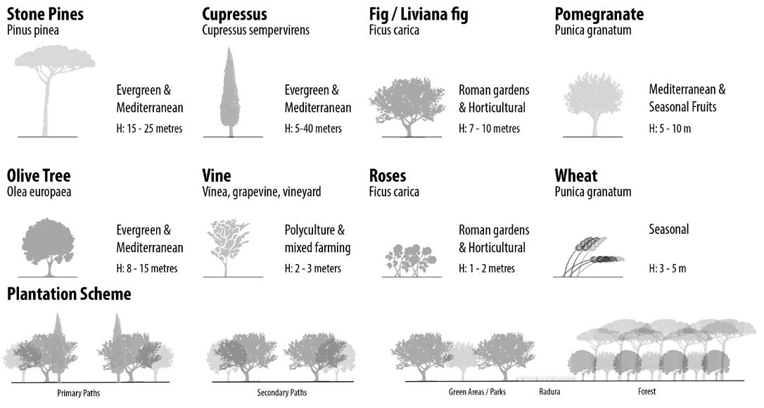
architecture, urbanism, landscape & archaeology
portfolio of satyajit mal architect . urban designer .
erasmus mundus scholar - architecture, landscape & archaeology.
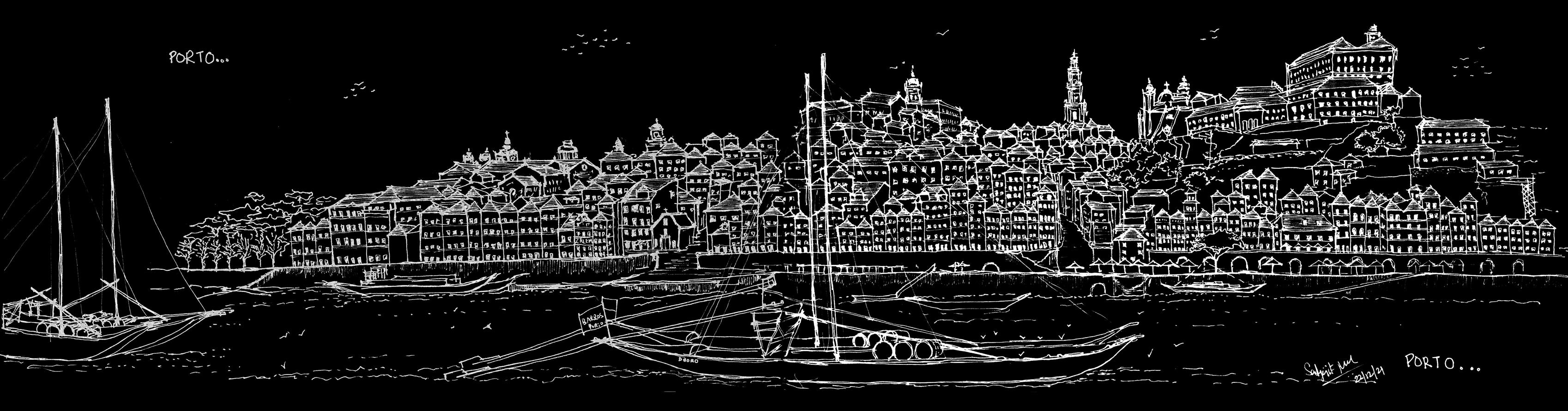
Satyajit Mal

Urban designer | Architect | Erasmus scholar - Architecture, Landscape & Archaeology
Erasmus Mundus Joint Diploma (cum laude) in Architecture, Landscape and Archaeology (ALA), Erasmus Mundus Scholarship 2020 financed by the European Commission for Second Level Professional Master Course, at Sapienza University of Rome, University of Coimbra, National Technical University of Athens and University of Naples Federico II, March 2021 - Feb 2023
First Place Diploma, Assistant International Baikal Winter University of Urban Planning, Irkutsk, Feb 2020
Master of Urban Design (First Class)
School of Planning and Architecture, New Delhi, July 2014 – May 2016
Bachelor of Architecture (First Class with Distinction)
School of Planning and Architecture, Vijayawada, September 2009 – May 2014
Satyajit Mal is an accomplished professional in urban design/planning, architecture, and landscape enthusiast, with 6 years of experience across multiple countries. His career began under the guidance of B.V. Doshi, India's First Pritzker Winning Architect, setting the stage for his exceptional skillset in the field. He excels in Sustainable BlueGreen Infrastructure, climate-resilient strategies, place-making principles, landscape design, ecological, and participatory planning, driven by his passion for holistic and multidisciplinary approaches. His portfolio includes the successful management and delivery of diverse projects worldwide, ranging from large-scale masterplans, transitoriented developments, vision plans, tourism initiatives, mixed-use developments, residential townships, industrial plans, policy frameworks, urban regeneration frameworks and island-based developments. Satyajit's proficiency extends to team management, project coordination, bid management, and fostering effective collaboration with consultants and stakeholders.
As an Erasmus Mundus Scholar, he further enhanced his expertise through a European master's degree in Architecture, Landscape, and Archaeology. His broad interests encompass context-specific urban design, accessibility, transit-oriented development, urban ecology, landscape, and archaeology.
Experience
landscape & archaeology
transit oriented development housing masterplans
in mobility nodes through urban regeneration
• Urban Landscape and Heritage, Rome, Italy
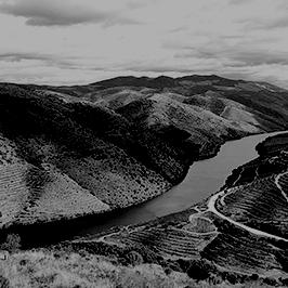
• Landscape Archaeology and Territory, Duoro Valley, Portugal
• Archaeology and Urban Public Space, Naples, Italy
• Torre Rinalda's Afterlife, Italy
urban development
• Thailand HSR TOD Guidelines & Masterplan, Thailand
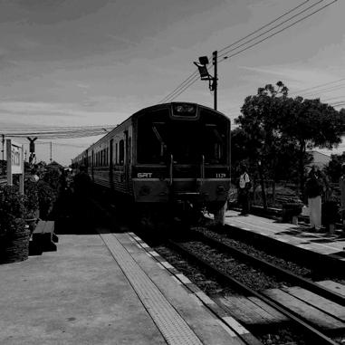
• Urban Design Schemes for Railway Station Redevelopment, India
for city's dwelling
• Master Planning for Urban Area
• Hai Duong City, Vietnam
• Vision Plan for Cua Luc Bay and
• Minh Khai, Vietnam
• Hill City Housing Masterplan, India
• Emaar TOD Township, India
planning guidelines & policies
• Urban Design Guidelines for ITCNInfant, Toddler & Caregiver Friendly Neighbourhood
• KSA Streets Guidelines, Saudi Arabia
memorial & musuems architecture & urbanism
• National War Memorial, New Delhi, India
• National War Museum, New Delhi, India
• Regenerating inner city through the tram as a catalyst – Kolkata
• Revitalization of Heritage Tram
• Corridor – Esplanade Square, Kolkata
participatory planning workshops & research
multidisciplinary approach
• Redevelopment of Uncomfortable City Districts, Irkutsk, Siberia
• An Investigation into the Transition of Human Settlements in the Himalayan Region
• ISOCARP Young Planning Professionals’ Workshop, Jakarta-Bogor, Indonesia
sensitive & blue-green infrastructure
sustainable tourism
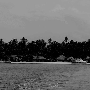
• Holistic Development of Islands –Lakshadweep & Andaman, India
• Shivalik Tourism Masterplan, India
• Namami Gange – Bihar Towns and Patna Riverfront Revitalization Project Master Plan
smart city & visions
• Vision Document for Taj Trapezium Zone (TTZ)
• Aligarh Smart City Project, India
• Smart City Project – Karnal, India
trams as a catalyst for placemaking in eco
Centocelle Urban Radura
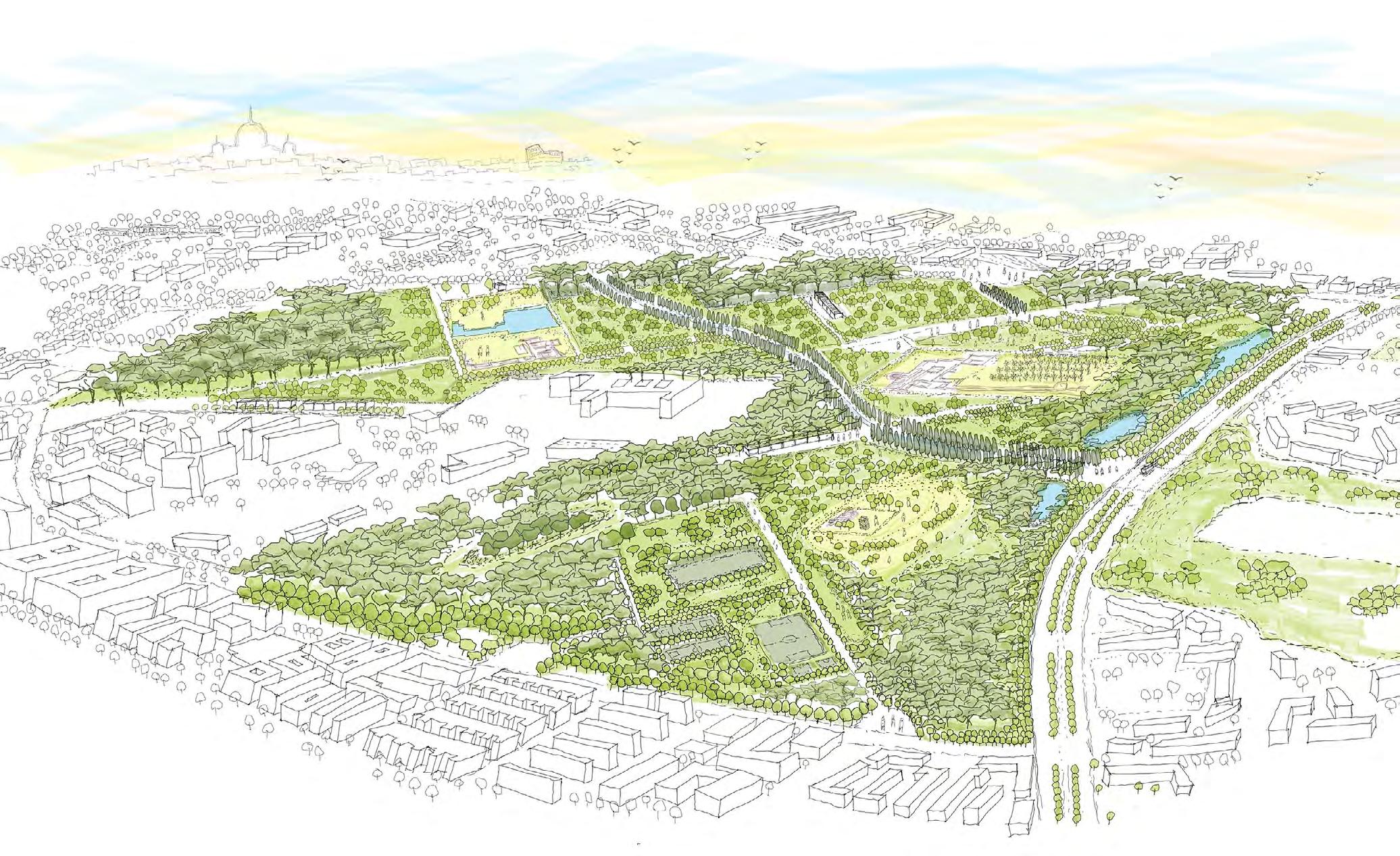
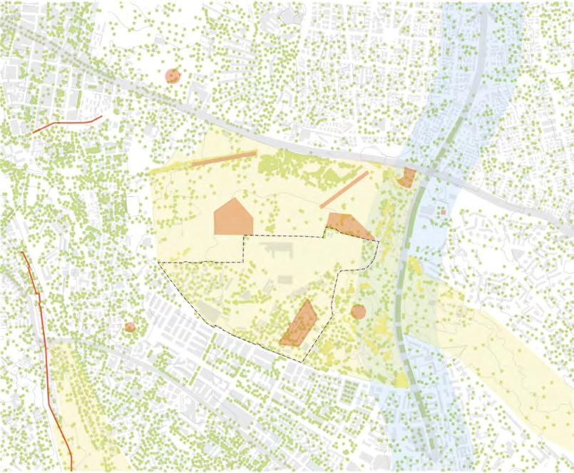
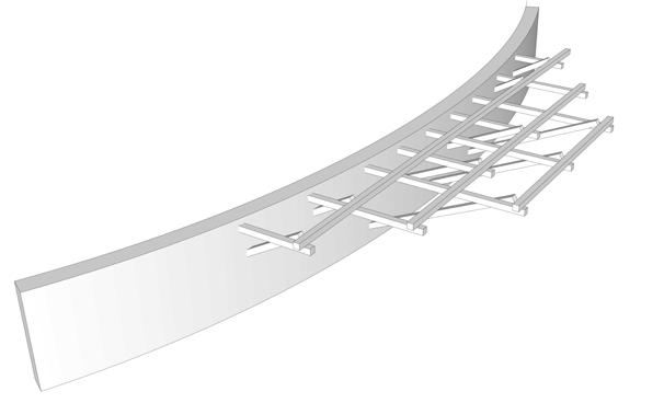
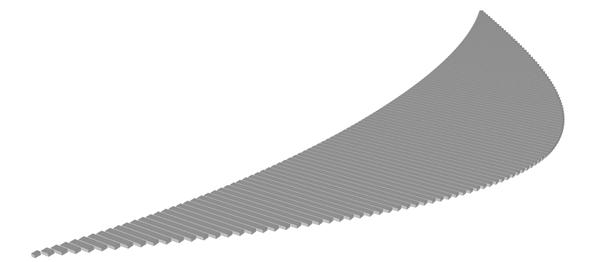
landscape within landscape - trails of fragments
Site - Centocelle Park, Rome, Italy; Area - 4 sq km
University - Sapienza University of Rome, Italy
Duration - May 2021
Responsibilities - Urban Analysis, Field Investigations, Design Narrative, 3d sketch visualisation, Design intervention and Strategies, Detailed Plan of Intervention
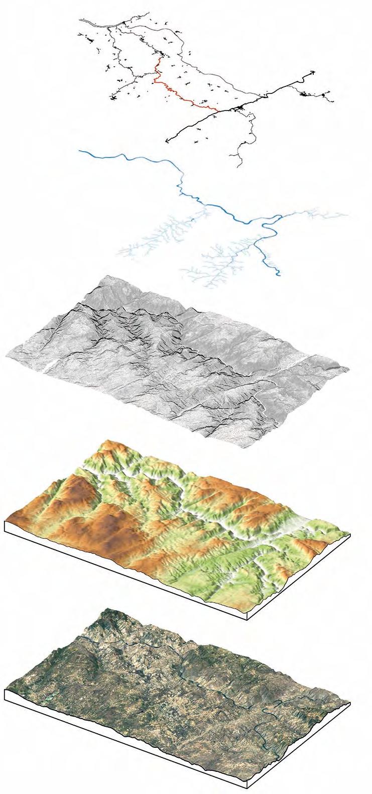
Workflow: Sketches, Autocad, Qgis, Adobe Suite, Sketch Up, Autodesk Sketchbook
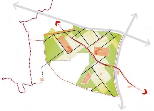
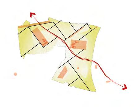
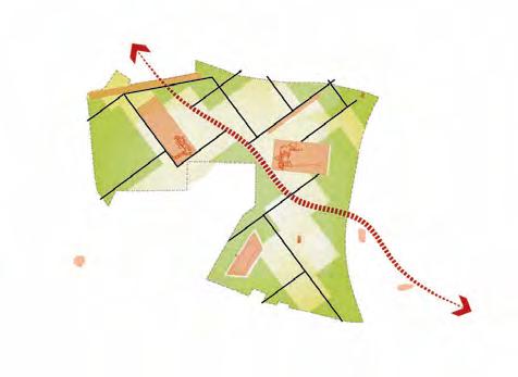
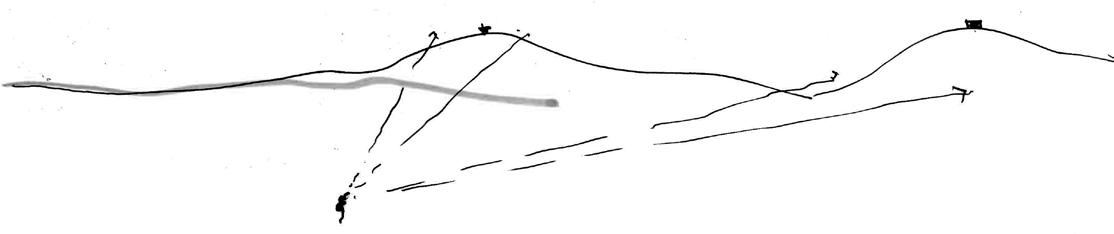
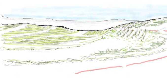
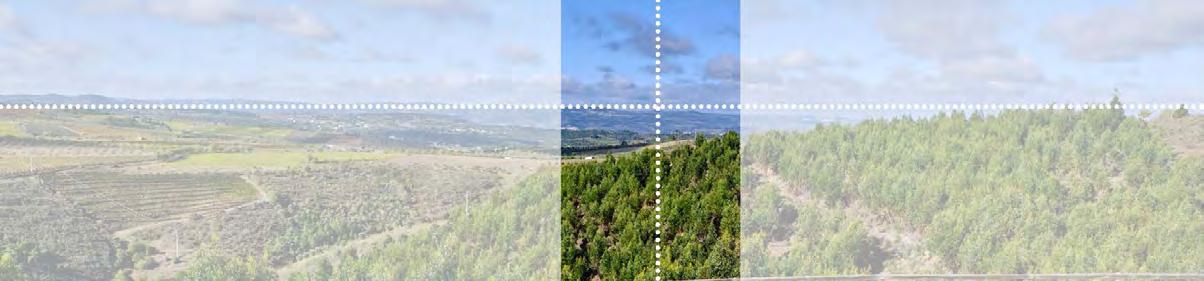
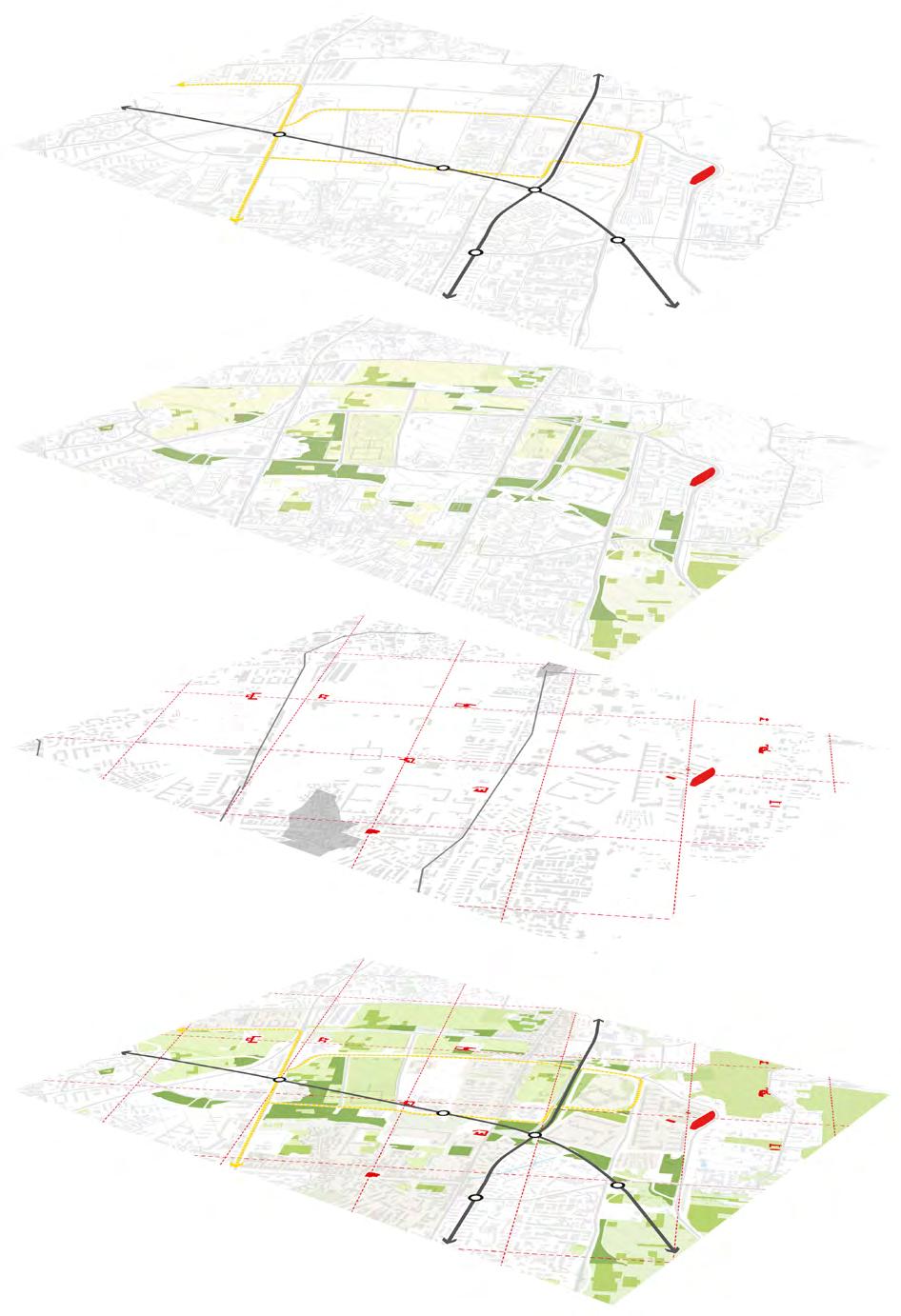
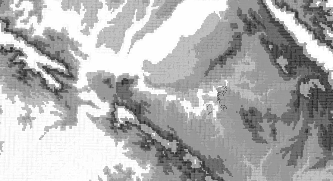
The Centocelle Urban Radura project integrates a natural landscape into eastern Rome, bridging fragments of the past with the present and uniting the park and the city. Cycling along themed Heritage Trails offers insight into the original cultural context of fragmented ruins. Reclaiming heritage sites from a military base and removing fences improves accessibility to the archaeological sites. Planting forests and wetlands within populated areas strengthens the connection between humans and nature. This project not only enhances biodiversity but also empowers the community and revitalizes the region's identity. By reconnecting villas, mausoleums, and aqueducts along the invisible ancient Roman road, the project evokes the past through architectural design, achieving a harmonious balance between past and present.
ENVIRONMENTAL Biodiverse Forest Heritage and Identity Community Empowerment CULTURAL SOCIAL
Landscape within Landscape Grids
Landscape in Between Connections
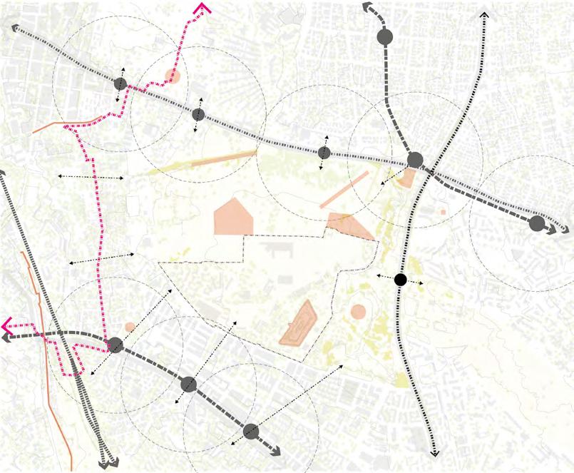
Archaeological Connections Villa Delle Piscine Villa Ad Duas Lauros Villa Delle Terme Via Casilina Airport Strip Osteria Tunnel Aquaducts Villa delle Terme Environment & Green Systems Via Casilina Via Papiria Military Area Via Togliatti Water Catchments Existing Trees Green Areas Mobility Via Casilina Connections from GRAB Route Military Area Via Papiria Via Togliatti Proposed Tram Station Primary Road Network Tram Routes Proposed Tram Routes Railway Line Metro Line Metro Stations ArcheoGRAB Line 5 min Walk 400m Radius) Activities and vegetation along the Park Projects Centocelle Park Via Togliatti Archaelogical Area Active Park Community Park Forte Casilina Tuscolano Neighborhood Torre Spaccata Neighborhood Via Togliatti Arcaheological Area Archaeological Area Active Park Villa della Piscina Pool Active Park Children Playground Torre Spaccata Neighborhood Tuscolano Neighborhood Piazza of the Water Plan Pergola Cafe Dense Forest Grass Villa delle Piscine Water Plan Meadow Path connection Via di Frammenti Soil Brick Wall Softscape Brick Wall Piazza Vineyard Garden (Promiscuous agriculture) Villa Ad Duas Lauros Archaeological Area Piazza Villa delle Terme archaeological area Softscape Hardscape Lookout Tower Grass
Urban Analysis
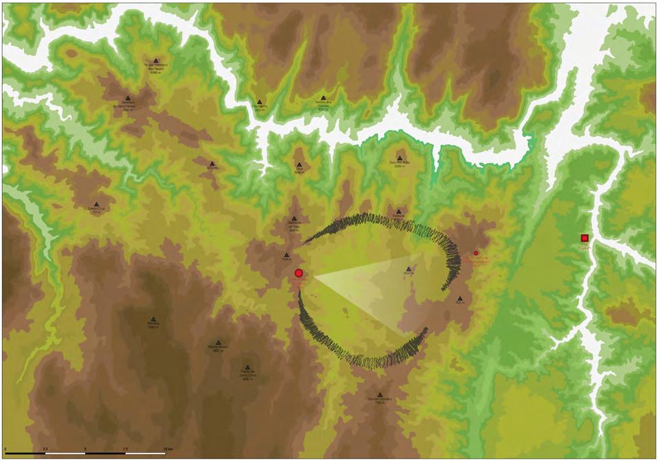
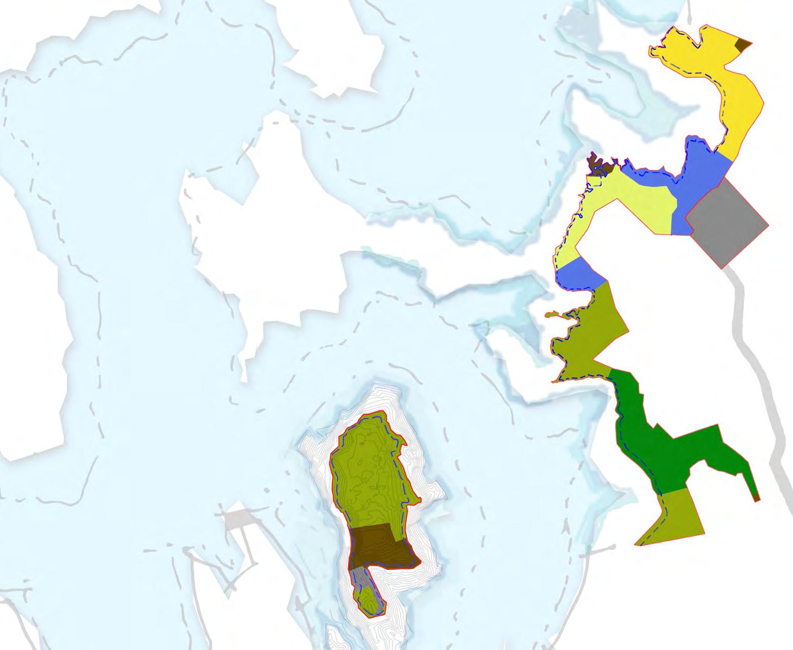
Castanheiro do vento
a public space within landscape
Site - Castanheiro do vento, Portugal; Area - 4 sqkm University - University of Coimbra, Portugal
Duration - Sept 2021 to Jan 2022

Responsibilities - Territorial Analysis, Landscape Visual Impact Analysis ( LVIA), Field Investigations, Design Narrative, Analysing Landscape & Archaeology, Archaeological & Landscape Site Design intervention, Strategies
Workflow: Sketches, Autocad, Qgis, Adobe Suite, Sketch Up
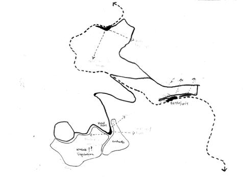
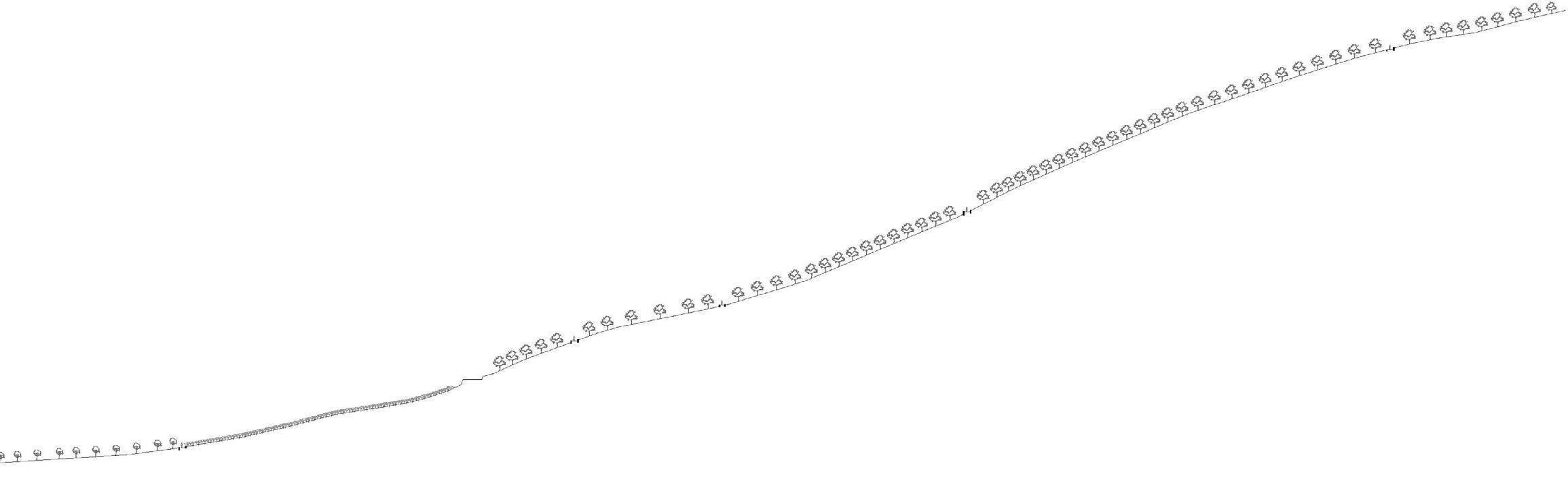
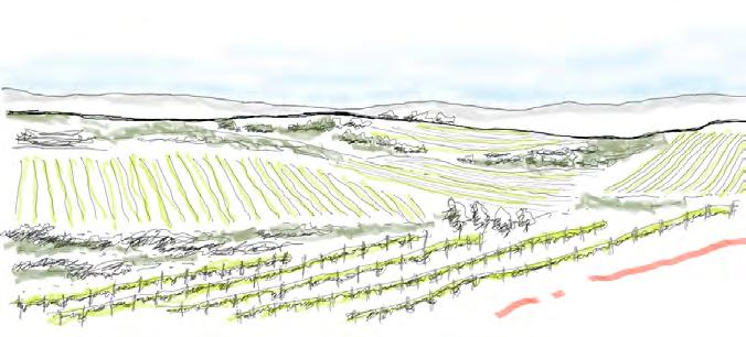
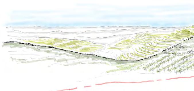
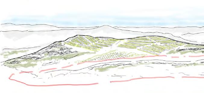
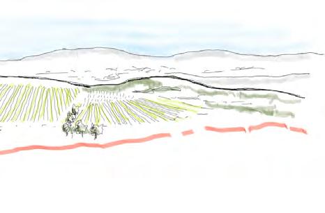
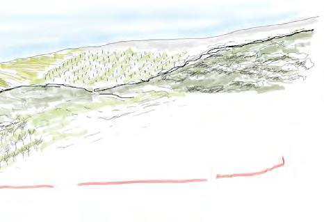
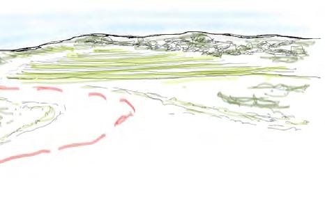
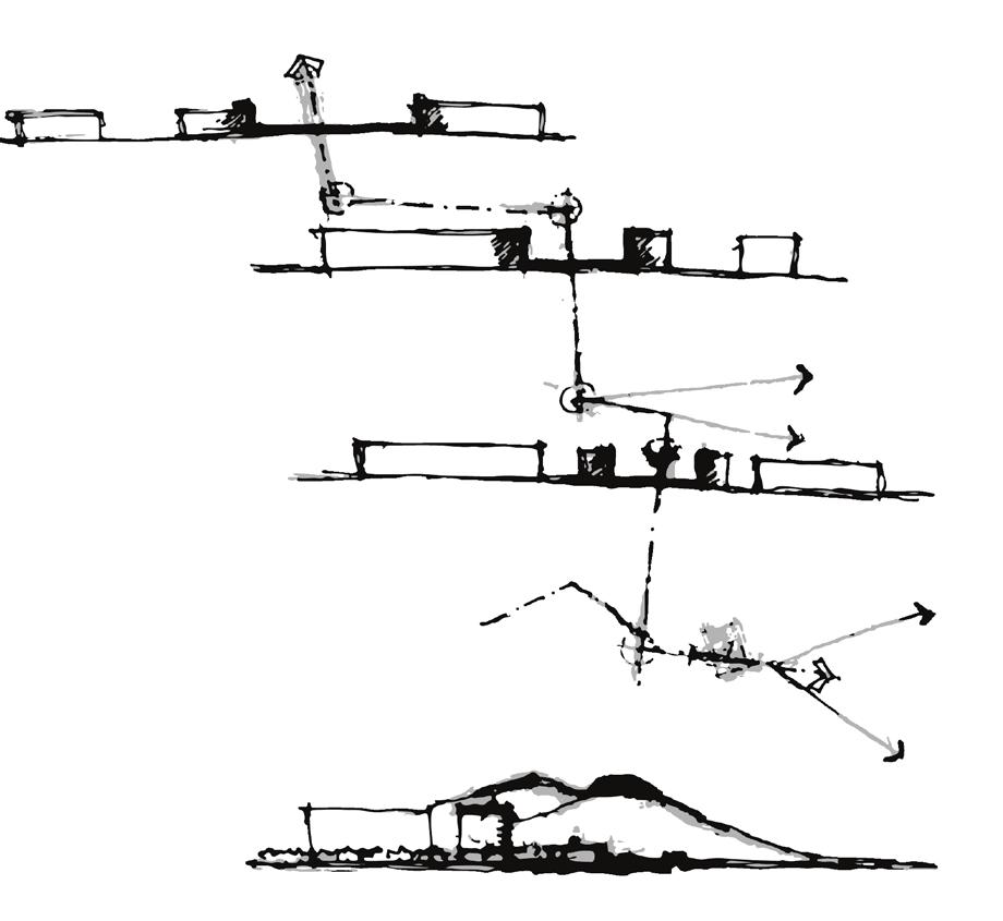
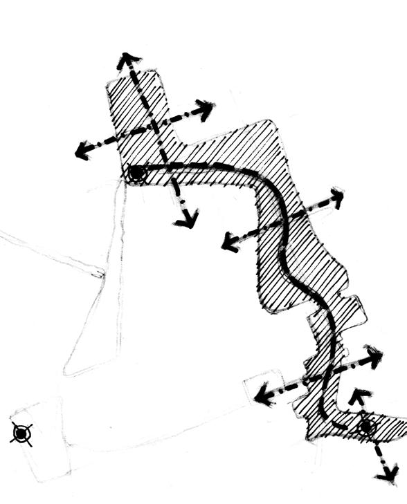
The landscape path integrates existing agricultural traces and topographic relations, emphasizing the journey from the village to Castanheiro do Vento and its influence on the territorial landscape. With minimal and sustainable construction, the land is shaped using cut and fill methods for accessibility. Wood and schist retaining walls define the path's boundaries without disrupting agricultural routes. The path traverses diverse vegetation and agricultural lands, reflecting the territory's identity. Connecting Castanheiro do Vento and Horta village, the path engages the community, while miradouros offer rest points and panoramic views. This fosters a connection between dwellers, archaeological sites, research teams, students, and tourists, promoting community-led archaeology and informed exploration.
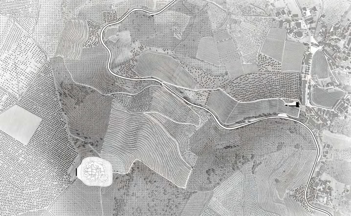
Towards Porto Towards Foz Coa Access Point Community Center Olive Plantations Vineyards Vineyards Landscape Path
Almond Plantations Horta Village N Topography Agriculture Paths Vegetation Patterns Viewpoint Pattern Lines
Miradouro Miradouro
Landscape Path and Miradouro / Viewpoint
Journey of path - Character of the proposed path through different vegetations

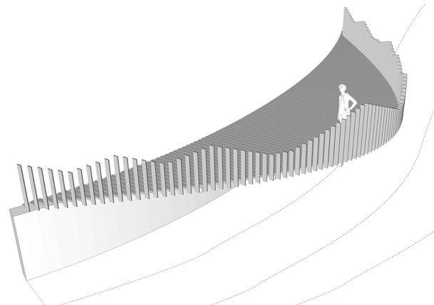
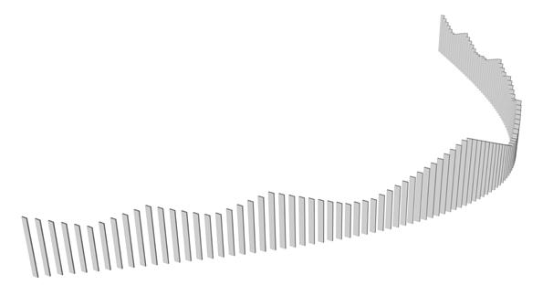


Wooden Structural System Wooden Platform Metal Support Schist Retaining Wall Existing Road Viewpoint Design Viewpoint Design Elements Mulch/Gravel/Sand(100 mm) Compact Base - Earth(150mm) Drainage Channel Schist Wall Typical Details Viewpoint in the path At Grade Slope 10 - 25% Slope > 40% Slope 25 - 40% Olive Plantations Vineyards Almond Plantations Patterns Platform Structural System Wall & the miradouro
Visual experience of approaching Castanheiro do Vento from Foz Coa as a Journey of Memory in time
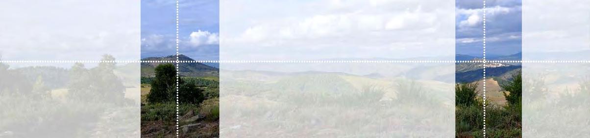
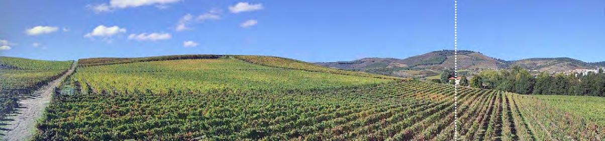
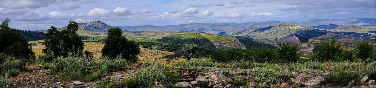
Reading of the landscape has been done during the site visits of Duoro Valley, Foz Coa Region, Castanheiro Do Vento, Horta, Castelo de Numão, Castelo Velho de Freixo de Numão, São Gabriel, Prehistoric rock arts in Parque Arqueológico do Vale do Coa settled between the vineyards, amond, chestnut and olive plantations. Interpreting the landscape through territorial mapping, GIS Analysis, Visual assesments, pictures, sketches, maps and diagrams helps to understand the place.
Viewpoints
 Senhro do viso Castelo de Numao
Towards Foz
Towards Porto
Castelo Velho de Freixo de Numão
Coa
Castanheiro
Communities Landscape Patterns
do vento
Foz Coa
Towards Porto
Castanheiro do Vento
Understanding of Territory
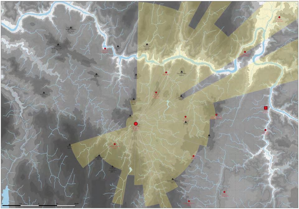
Infrastructure and Communities
Hydrology
Topography

Hypsometry
Main Artery
Digital Elevation Model
Douro River
Ribero de Teja
Coa River
Senhora do Viso Castelo Velho de Freixo de Numão
Valley formation in front Castanheiro do Vento
Horizon Lines Horizon Lines Horizon Lines Patterns Horizon Lines Patterns
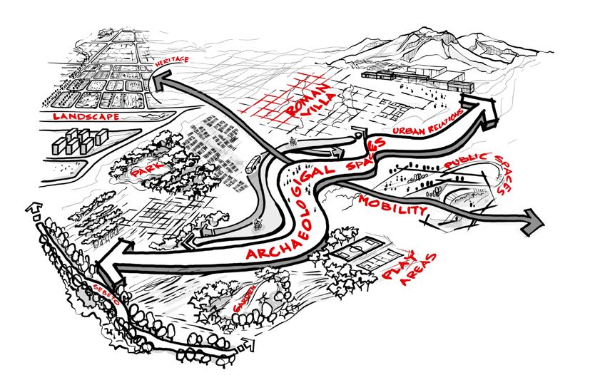
Accessible Archaeology: Integrating Urban Mobility in archaeological Heritage to create New Public Space
- the case of Roman Villa in Eastern Naples
Site - Roman Villa, Naples, Italy; Area - 4 sq km
Internship - Archaeological Superintendence of Naples (SABAP)
University - University of Naples Federico II, Italy
Duration - Feb 2022 - Feb 2023, Masters Thesis
Responsibilities - Workshop, Urban Analysis, Field Investigations and archaeological excavations, Cost Estimation, Design Narrative, 3d sketch visualisation, Design intervention and Strategies, Landscape Streategies , Detailed Plan of Intervention
Workflow: Workshop, Archaeological Excavation, Measured drawing, 3D Point Cloud FARO & Recap, Sketches, Autocad, Qgis, Adobe Suite, Sketch Up, Enscape
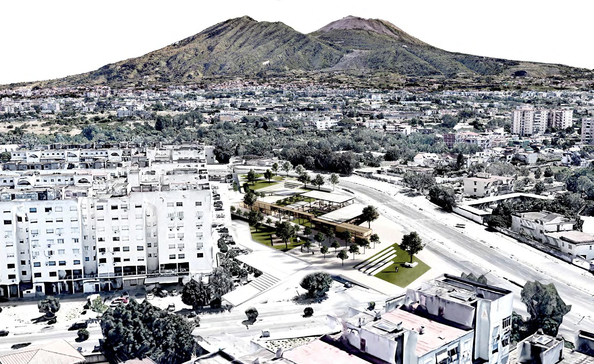
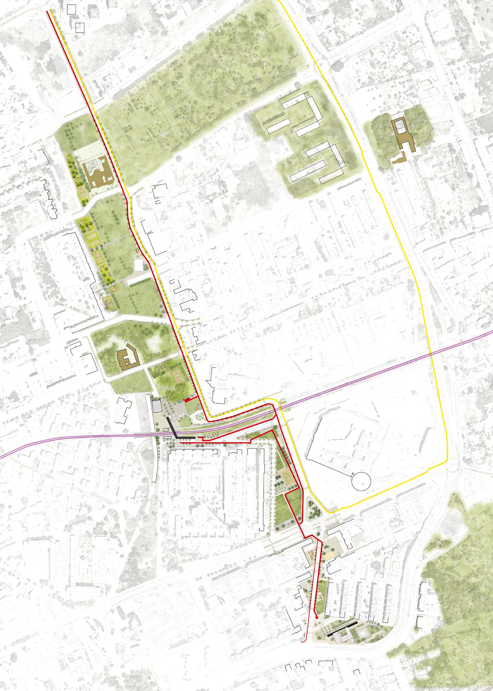
Archaeological heritage conservation is crucial, requiring sustainable strategies for development. Urbanization creates an opportunity to integrate heritage into everyday life, enhancing community accessibility through placemaking. Ponticelli, in eastern Naples, has undergone changes, urging urban inclusion and merging heritage with mobility infrastructure. This project redefines connections, inspired by Roman times, using new mobility infrastructures to unite heritage, place, and community. A connecting path around the Roman Villa forms an Archaeological Park, integrating mobility nodes with suburban Ponticelli.
Strategies
Parco Fratelli De Filippo
Parco Dei Murales
Villa Tropeano
Church
Community Agricultural Gardens
Play Area
Villa Visconti Mobility NodeCircumvesuviana & BRT
Community Agricultural Gardens
S. Pietro/Morabito Heritage Building
Vesuvio de Mies Mobility Node - Circumvesuviana & BRT
Play Area
Community Agricultural Gardens
Play Area
Villa Garden
Archaeological Hertitage
Node - Roman Villa Caius
Olius Ampliatus
N 0 300 50 100 600m
Masterplan Stretegy
Archaeology and Heritage grids and footptints Urban Strategy Pedestrain Spaces Play Areas, Community Gardens and Agriculture Mobility BRT and Bike Lane Urban Elements
Urban Paths, Nodes and Public Space
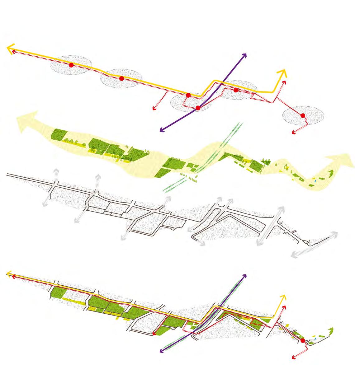
The strategy focuses on the development of the urban path, nodes and public spaces by designing them to achieve the conceptual interpretations discussed above. As Tim Ingold has mentioned “ In the landscape, the distance between two places, A and B, is experienced as a journey made, a bodily movement from one place to the other, and the gradually changing vistas along the route” (Ingold, Oct.1993). The design strategy looks into this perspective through the urban landscape of eastern Naples to create the journey of experience through different spaces of everyday life by connecting the everyday activities of the community.
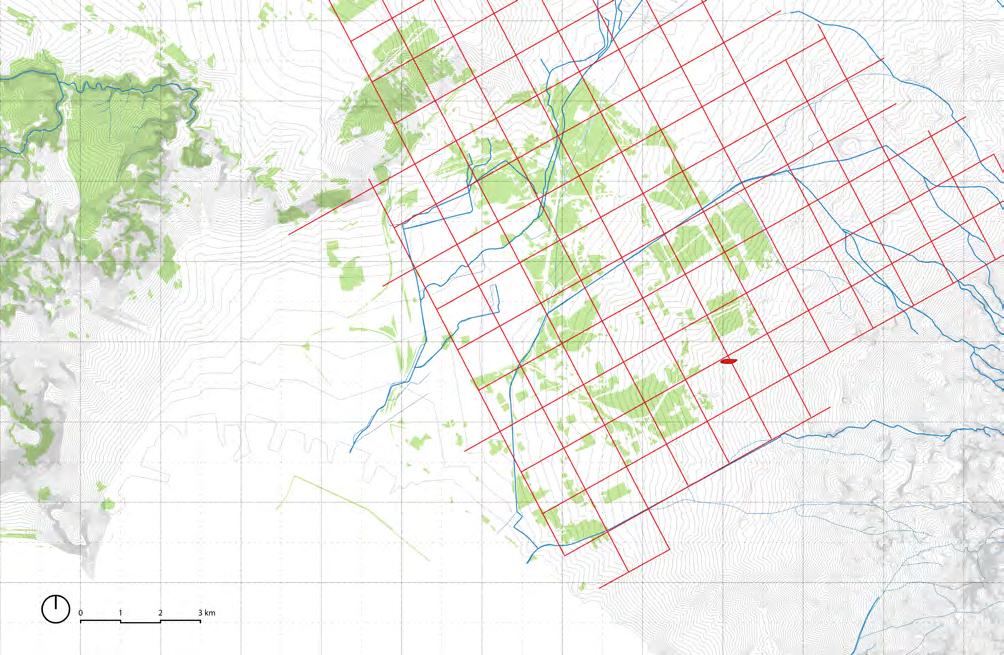
Overlaying of Analysis Layers
Mobility Roman Villa Vesuvio De Meis Superimposed with Landuse
Archaeological Sites and Heritage Topography and River Opens spaces
Layers
Open Space System Analysis & Interpretation Mobility & Connections Roman Villa Roman Roads Historic Settlements Circumvesiviana Proposed BRT Train Stops Roads Legend Centuriation Water Streams 5m Contours Green Spaces Sebeto Plains Argine Legend Roman Villa
Villa Garden
Sidewalks and Public Spaces

Gardens and Softscapes


Garden Villa 2 Pathways Stormwater Road Sidewalk Seating Areas Kids Play Area Bike Lane Street Lights Church Basketball Court Stormwater Road Pedestrian Space Kids Play Area Table Top Crossings Bike Lane Street Lights
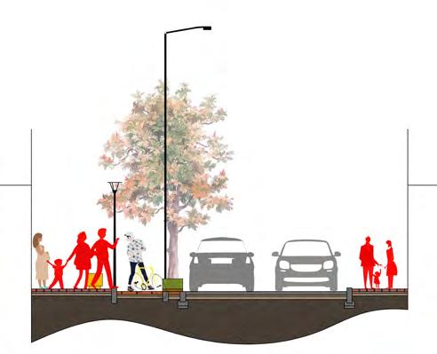
2 Way Car Lane BRT Lane Bike Lane Pedestrian Sidewalk 3m 3m 3m 3m 6m Bus Stop & Pedestrian Sidewalk 2.50 Pedestrian Sidewalk 6.00 2-Way Car Lane 3.00 BRT lane 3.00 Bike Lane Bus Stop & Pedestrian Sidewalk 3.00 Park Bike Lane
Vision


To create a walkable and accessible network of public spaces to connect the Roman Villa in the Lotto 0 with contemporary mobility using place-making strategies and making Roman Villa Node as a Public Space thriving in the vesuvian landscape.
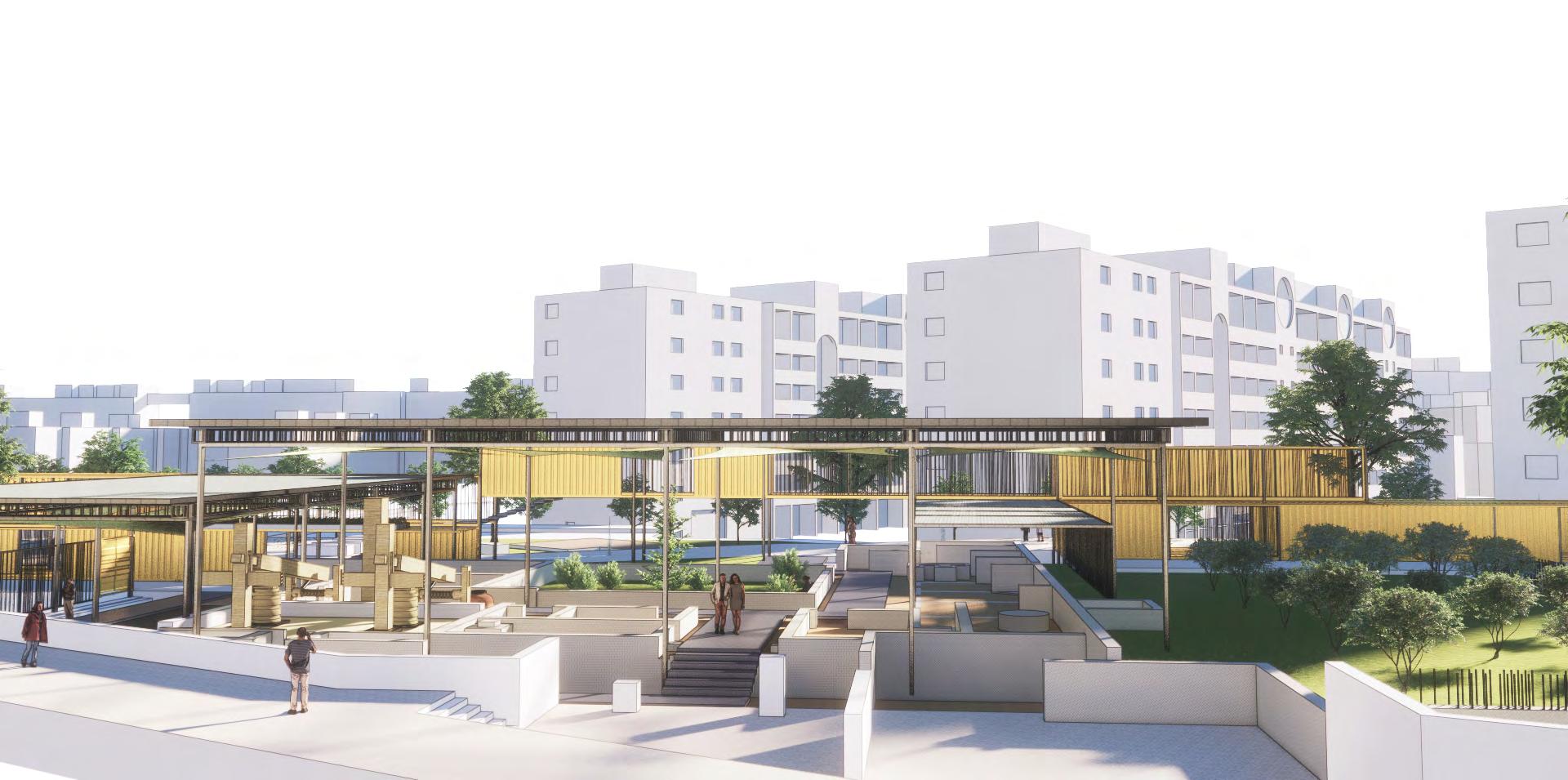
The design project revolves around the idea of how archaeological ruins could be integrated into a public space. The urban element been inserted toa regenerate and activate the space and connecting the mobility node.
 Urban Element & the Ruins
Entrance Plaza
Cella Vineria / Vine Cellar
Urban Element & the Ruins
Entrance Plaza
Cella Vineria / Vine Cellar
Plaza Details


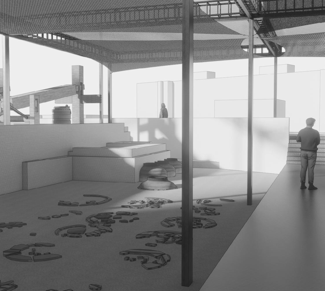
Pathway through Cella Vineria


Site Plan


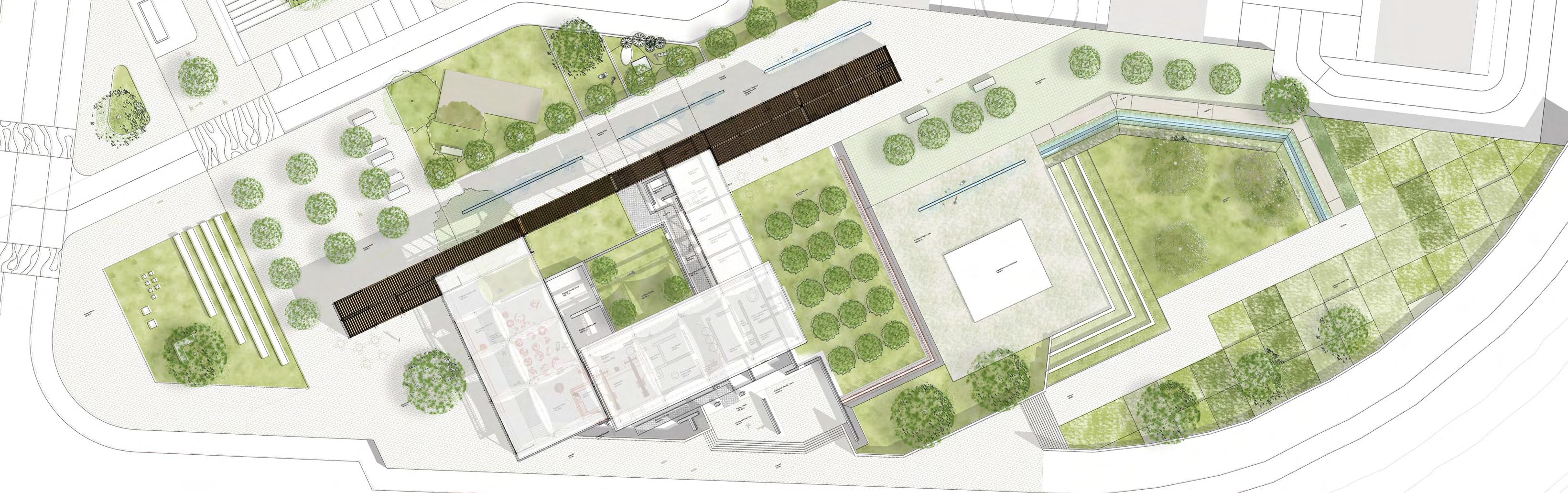
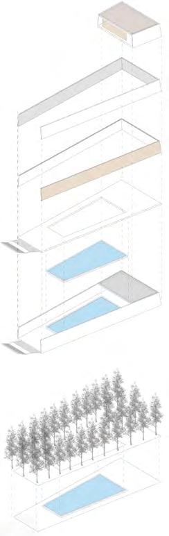
0 10 30m 6 N Entry 4 5 1 3 2 3 7 6 9 10 12 13 14 8 15 16 18 17 19 11 1. Bike Parking 2. Car Parking 3. Entrance Plaza 4. Services and Coffee Bar 5. Information Centre 6. Cella Vineria Entry 7. Garden 8. Kids Play Area Water Element 7 9. Necropolis 10. Restaurant & Vine Tasting Area 11. Services 12. Hortus Garden 13. Pars Urbana 14. Pars Rustica 15. Entrance 16. Amphitheatre and Activity Zone 17. Bio Swale 18. Lawn 19. Community Agriculture Gardens Support Members 10mm Metal Grating 10 cm Steel Pillars Foundation Lava Stone Paving block 30 60 cm Travertine Stone Edge block 30 90 cm Coarse Aggregate Metal Tree Pit Sand Cusion Travertine Stone Seating
Support Members 10mm Metal Grating 10 cm Steel Pillars Foundation 0.50 1.00 0.50 0.10 0.05 0.45 Lava Stone Paving block 30 x 60 cm Travertine Stone Edge block 30 x 90 cm Coarse Aggregate Metal Tree Pit Sand Cusion Travertine Stone Seating 0.24 2.00 0.24 0.64
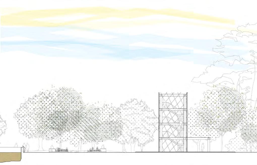
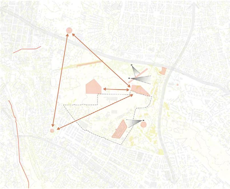
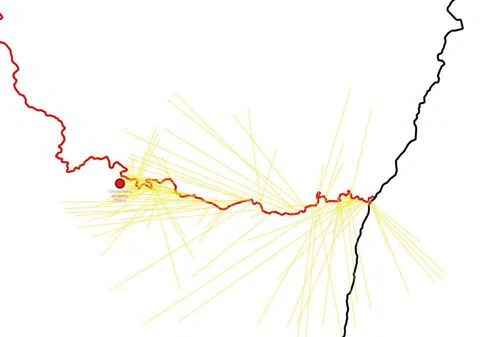
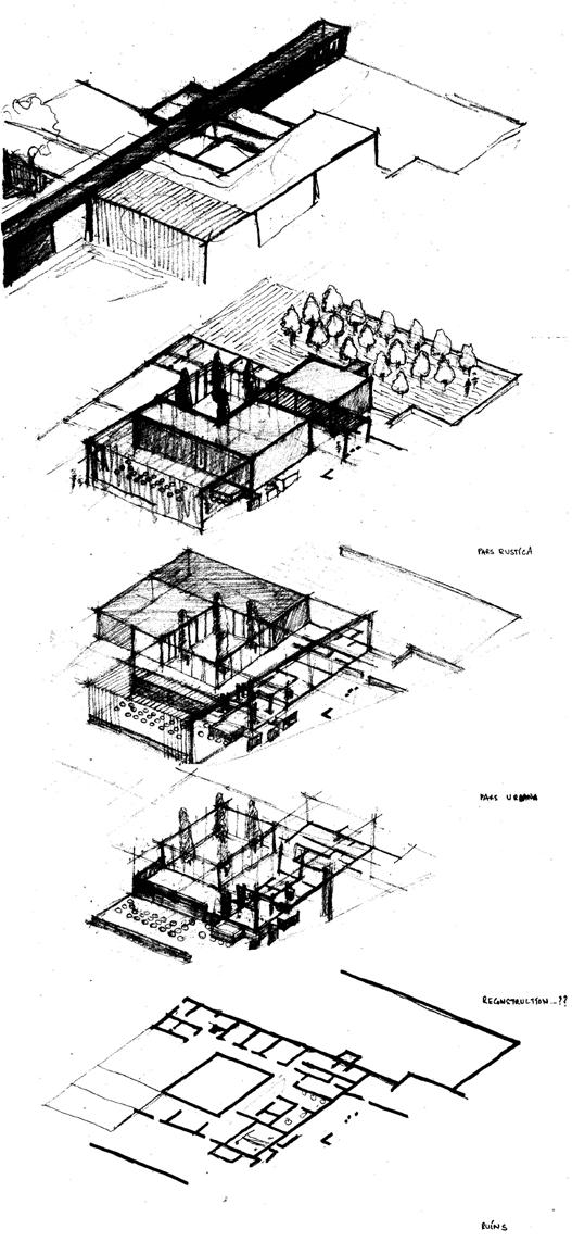
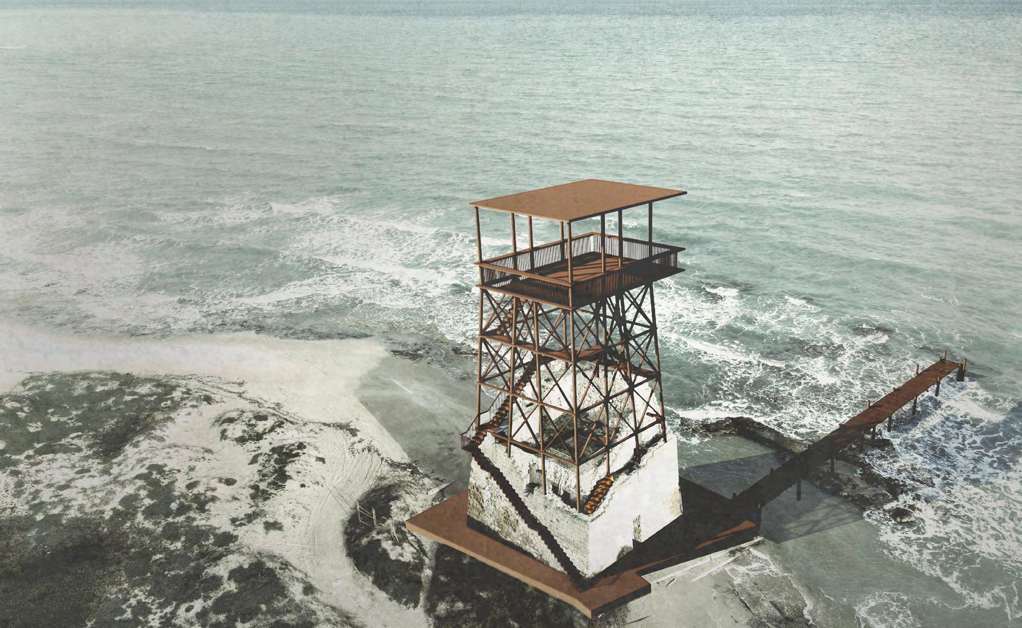
Torre Rinalda's Afterlife
Site - Torre Rinalda, Italy; Area - 200 sq m
Organisation - Re Use Italy Competition Project
Duration - May 2023 - June 2023
Responsibilities - Urban Analysis, Design Narrative, 3d sketch visualisation, Design intervention and Strategies, Landscape Strategies , Detailed Plan of Intervention
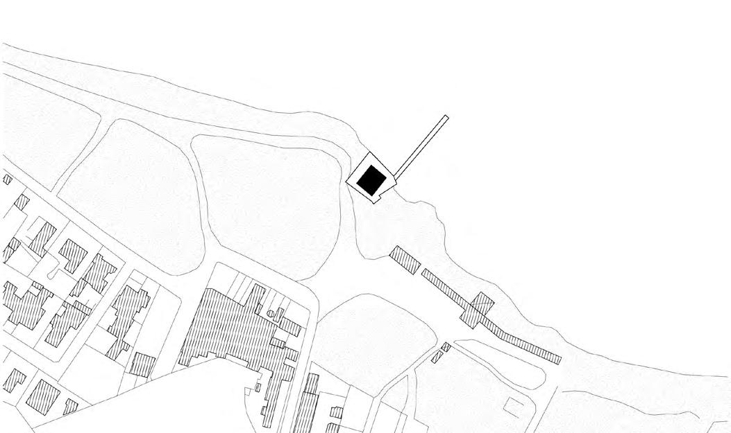
Workflow: Sketches, Autocad, Adobe Suite, Sketch Up, Enscape
The idea behind Kingdom’s Watchtower, ‘so that they could see each other,’ has been instrumental in establishing a strong relationship between architecture, nature and people. The reconstruction of the viewpoint aims to connect the sea, the surrounding landscape and the collective identity of the region. By implementing a thoughtfully designed mobility infrastructure, including dedicated bike lanes, we will establish a strong territorial link while forging connections with other towers along the coast which will create an inclusive public space capable of hosting various temporary activities and events, fostering a shared sense of identity among the community. Our vision is to give an “afterlife” to Torre Rinalda, preserving its historical significance while transforming it into a vibrant public space that embodies the spirit of the community and becomes a reference place for the territory.
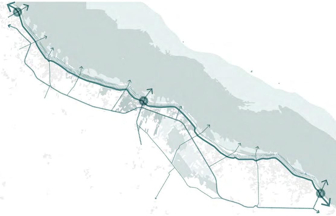
“A new lighthouse to-from-by the sea like a sort of infrastructural landmark that marks the contemporary presence of the ancient tower. A public space that grows up”
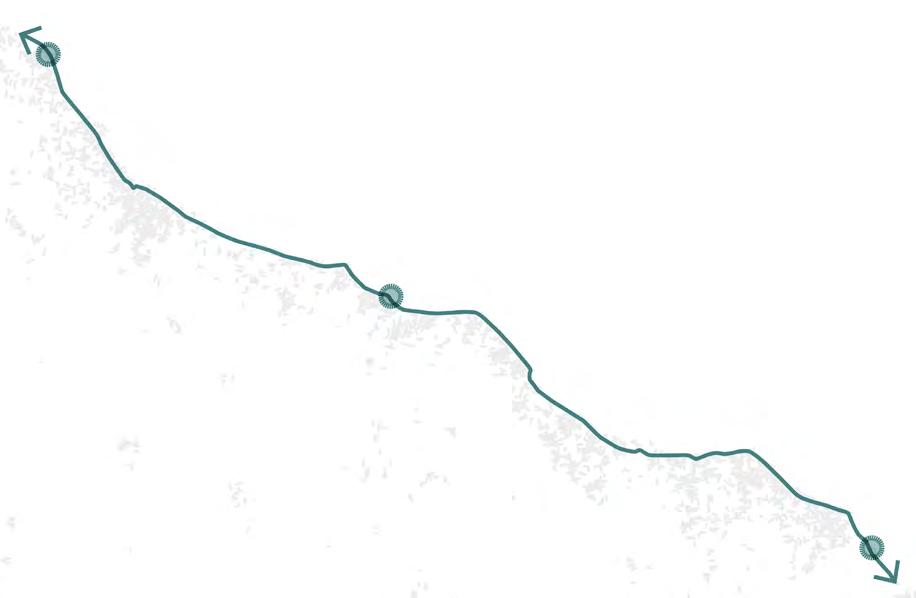
Torre Rinalda Bike Parking Bike Lane & Lungomare Promenade Accessibility with Bike Pedestrain Infrastructure
Chianca Torre Specchiolla Parco Naturale Regionale Bosco Paludi di Rauccio Agricultural Lands Towards Masseria Rauccio
Torre Rinalda
Torre
View Point Design
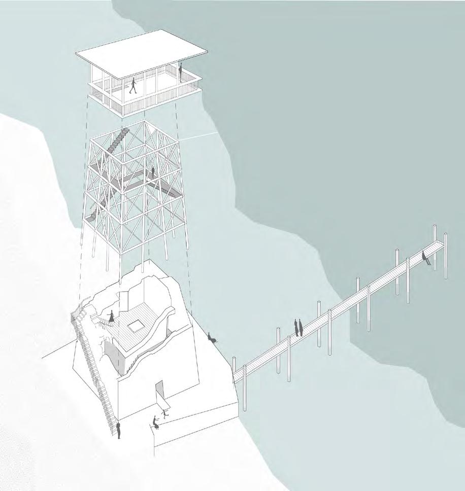
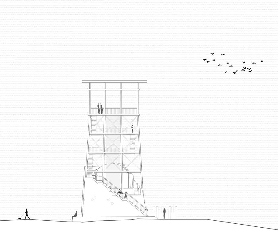
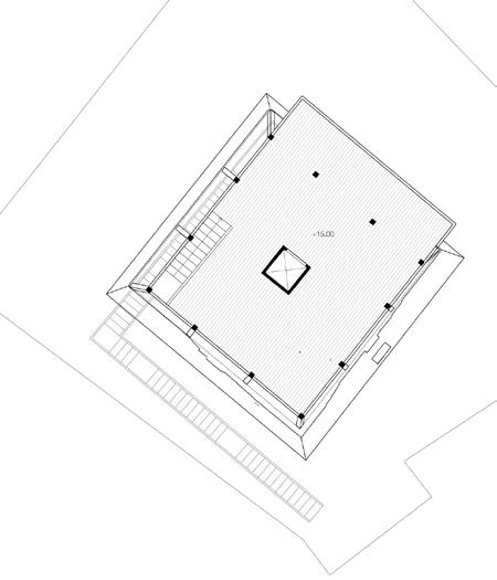
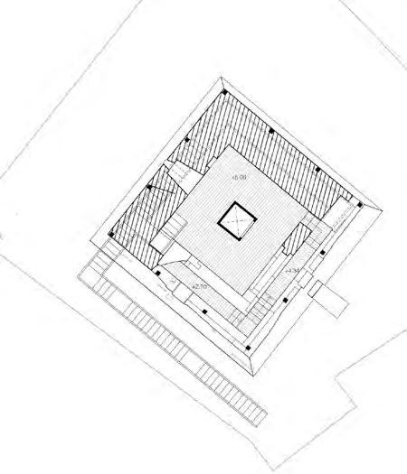
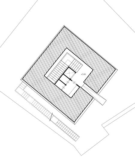
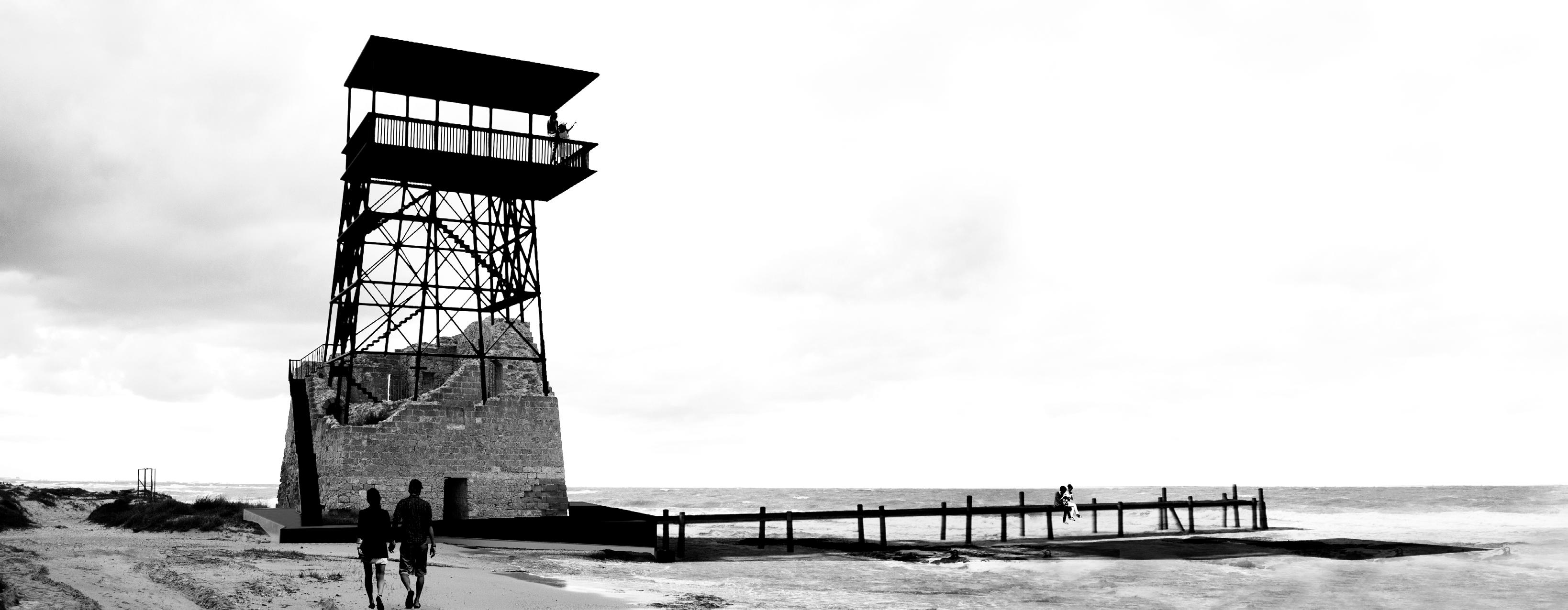
Elevation Ground floor plan Intermediate floor plan Top floor plan Elements of Design Ruins & AccesibilityPath as a journey Reconstruction - Visualising the ruins Shelter & Volume - to see the Sea
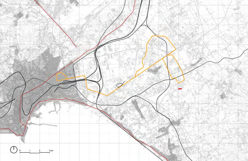
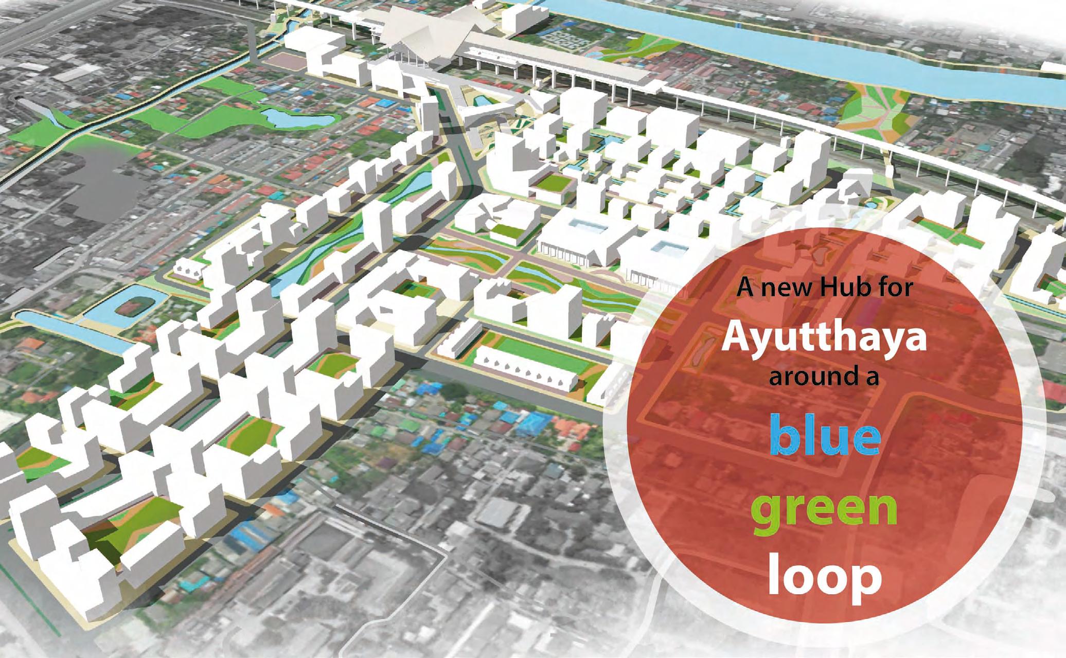
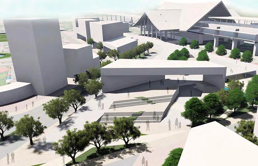
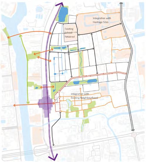
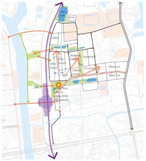
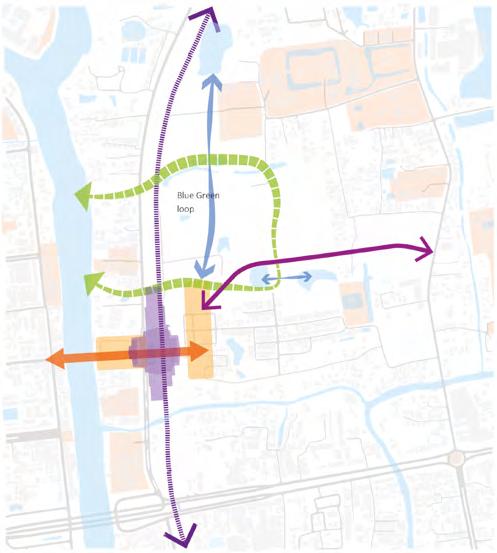
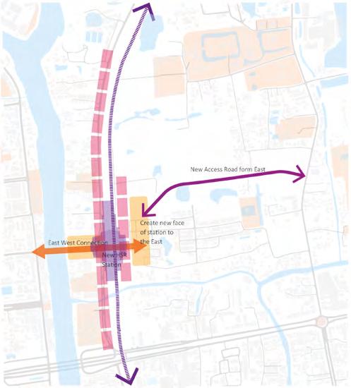
Thailand High Speed Railway TOD Masterplan
Transit oriented development (TOD) and station area development Masterplans
Site - Ayutthaya, Khon Kaen & Pattaya, Thailand; Area - 2-3 sq km
Client - The Office of Transport and Traffic Policy and planning
Duration - July 2019 to Jan 2020
Organisation - BDP
Responsibilities - TOD Guidelines, Detailed Masterplan, Land & built use mix, Road network, Landscaping , Plot clustering, detailed area chart, field visits with clients and interdisciplinary consultants, Client co-ordination for visioning workshop
Workflow: Sketches, Adobe Suite, Autocad,M-Colour, Sketch Up, Lumion
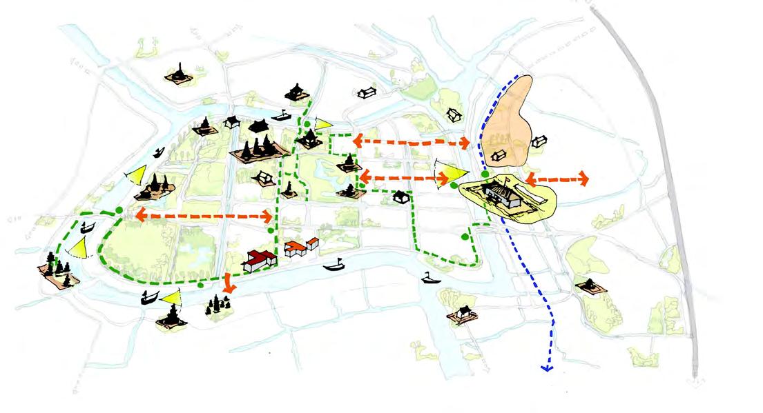
The Thailand TOD project aimed to create a new hub for Ayutthaya, centered around a Blue-green loop. The focus was on integrating the existing landscape assets, such as water bodies and green spaces, and connecting them with nearby Heritage sites and Tourism attractions, as well as those within the city. Cultural hubs were established to offer immersive experiences of the local culture, arts, and crafts. Efforts were made to provide access to nature, including rivers, water bodies, and parks, while designing infrastructure to promote walking and cycling. Well-designed public spaces were created. By incorporating mixed-use and themed developments, the project added value to the land and generated new employment and business opportunities for the community.
Illustrative Masterplan
Strategy
Creating Connections
Blue Green Loop
Building the Masterplan grid
Integration with Neighbourhood and Heritage Sites
Station Plaza
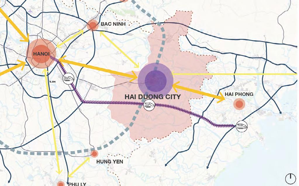
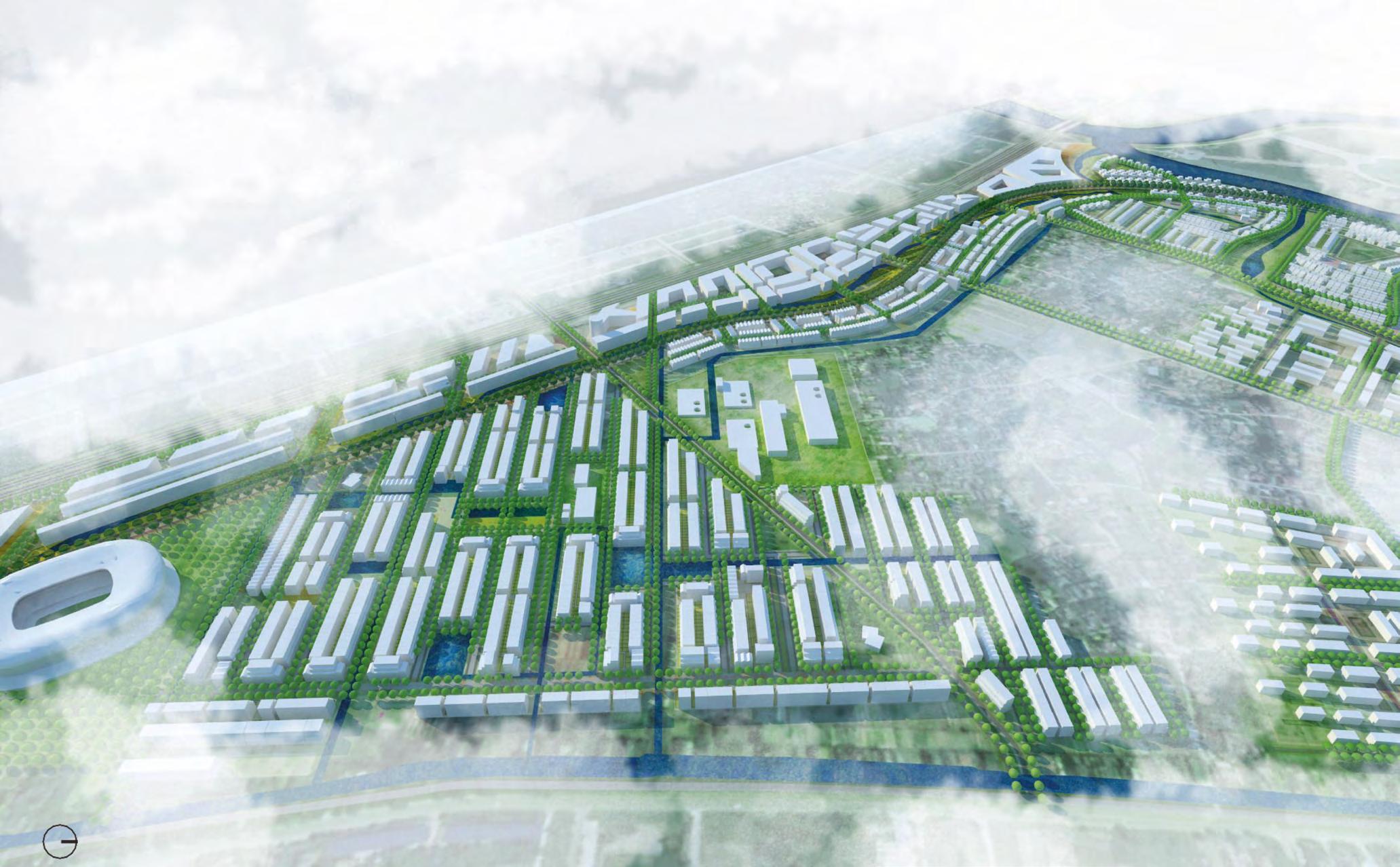
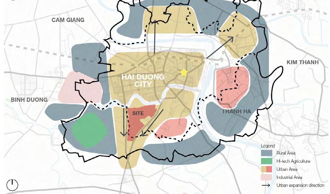
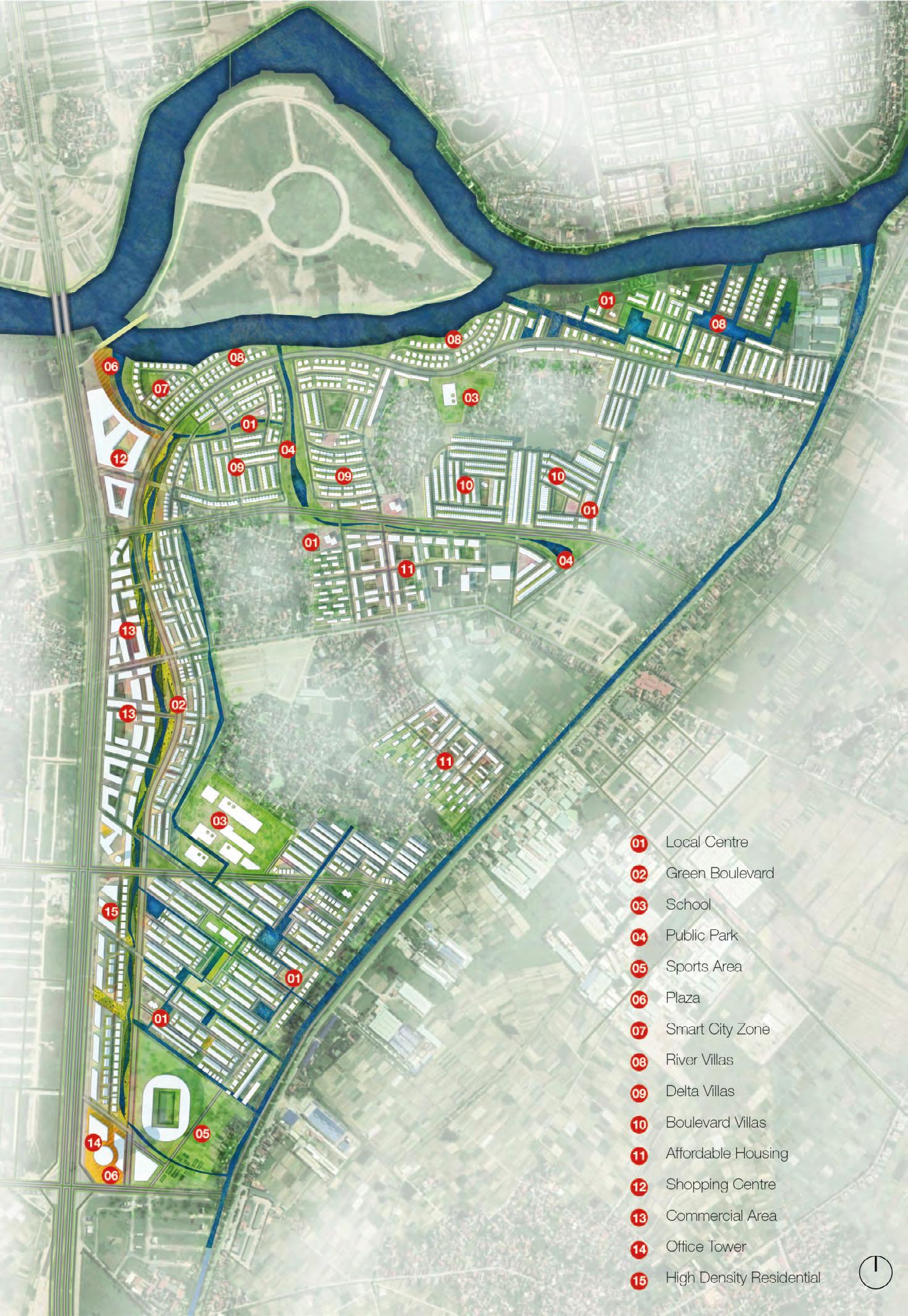
Hai Duong Urban Delta
the new smart wetland community
Site - Hai duong, Vietnam; Area - 341 Acres
Client - Eco Park
Duration - May 2019- Sep 2019
Organisation - BDP
Responsibilities - Detailed Master Plan, Urban Design Concept Development, Site Analysis, Design development Sketches, Detailed Township Layouts & Typologies, Design Coordination for Detail Master Planning including zoning, land use & schedule, Road network and hierarchy, Landscaping, plot clustering and detailed area chart, Road sections.
Workflow: Sketches, Adobe Suite, Autocad,M-Colour, Sketch Up, Lumion
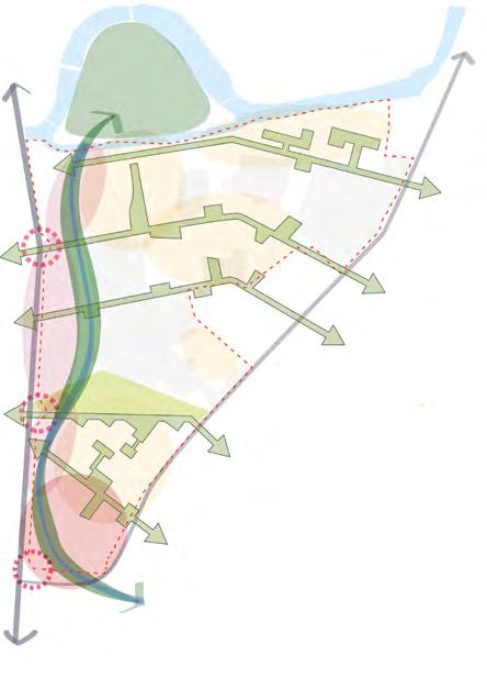
The Hai Duong Urban Delta envisions a smart, connected, and nature-integrated living environment, inspired by the local context of water. The masterplan consists of three steps: driven by the existing setting, forming urban clusters, and creating future communities. It focuses on establishing sustainable, walkable, and well-connected neighborhoods through a network of blue-green corridors. The boulevard serves as a commercial corridor, anchored by a strategic landmark and complemented by a health and wellness cluster. This visionary project aims to inspire waterfront communities in Hai Duong's new smart city center.
 Hai Duong Urban Delta Inspired by the local context of living with water
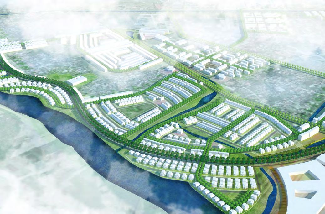
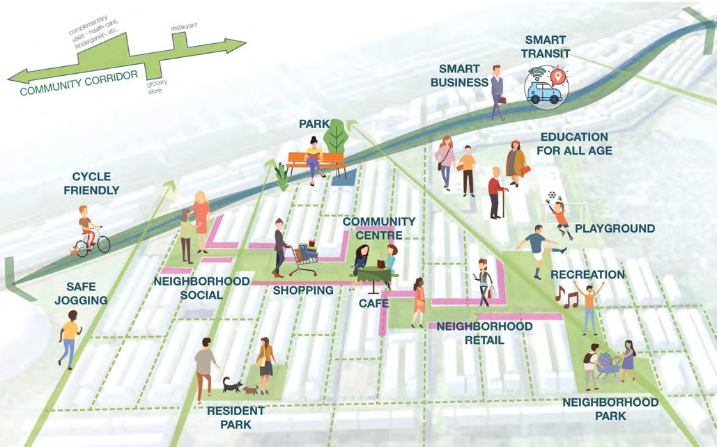
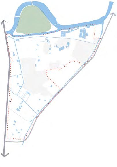


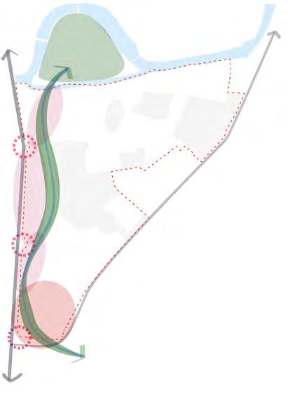
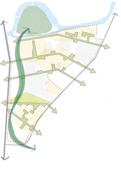

Community Corridor Garden Villas Proposed urban growth area for Hai Duong Strategic masterplan concept Masterplan to rail station to rail station sport commercial retail Green Ribbon play commercial leisure existing village existing urban park existing village Strategic Masterplan Concept STEP 1: DRIVEN BY THE EXISTING SETTING STEP 2: FORMING URBAN CLUSTERS • North-South Green Ribbon • Along the Green Ribbon, urban clusters with different characters and activities are formed, as engines for the whole area development. • 30-10 Highway connect the site between the city and the natural farming STEP 3: FUTURE COMMUNITIES naturalfarming citylife 30-10 Highway QL37Road to rail station to rail station to rail station sport commercial retail communitycorridor community corridor Green Ribbon play commercial leisure existing village existing urban park existing village Strategic Masterplan Concept STEP 1: DRIVEN BY THE EXISTING SETTING STEP 2: FORMING URBAN CLUSTERS • North-South Green Ribbon • Along the Green Ribbon, urban clusters with different characters and activities are formed, as engines for the whole area development. • Create future communities within the site • The green corridors is the key approach of our future community, emerging the ecological asset, social activities, and smart technologies. • 30-10 Highway connect the site between the city and the natural farming STEP 3: FUTURE COMMUNITIES naturalfarming citylife 30-10 Highway QL37Road to rail station to rail station to rail station sport commercial retail communitycorridor community corridor Green Ribbon communitycorridor play commercial leisure existing village existing urban park existing village Strategic Masterplan Concept STEP 1: DRIVEN BY THE EXISTING SETTING STEP 2: FORMING URBAN CLUSTERS • North-South Green Ribbon • Along the Green Ribbon, urban clusters with different characters and activities are formed, as engines for the whole area development. • Create future communities within the site • The green corridors is the key approach of our future community, emerging the ecological asset, social activities, and smart technologies. • 30-10 Highway connect the site between the city and the natural farming STEP 3: FUTURE COMMUNITIES naturalfarming citylife 30-10 Highway QL37Road Driven by Existing Setting Forming Urban Clusters Future Communities
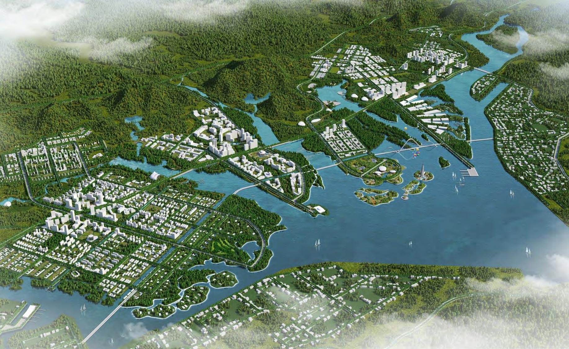
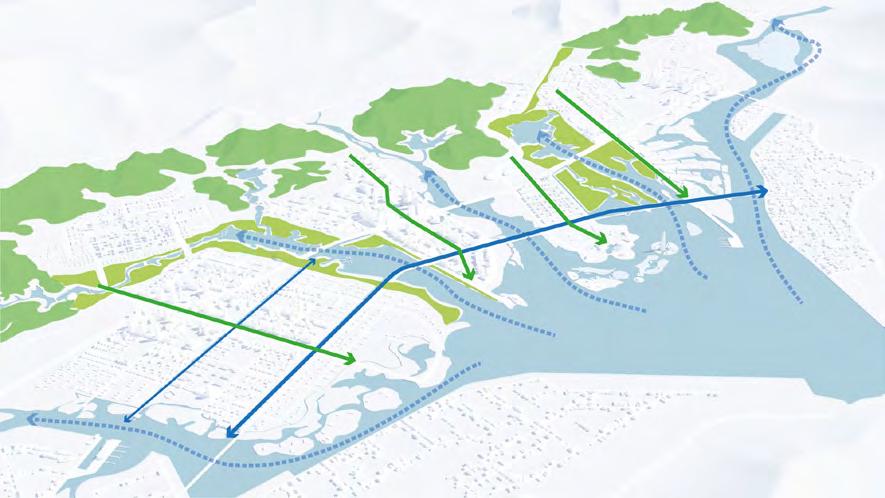
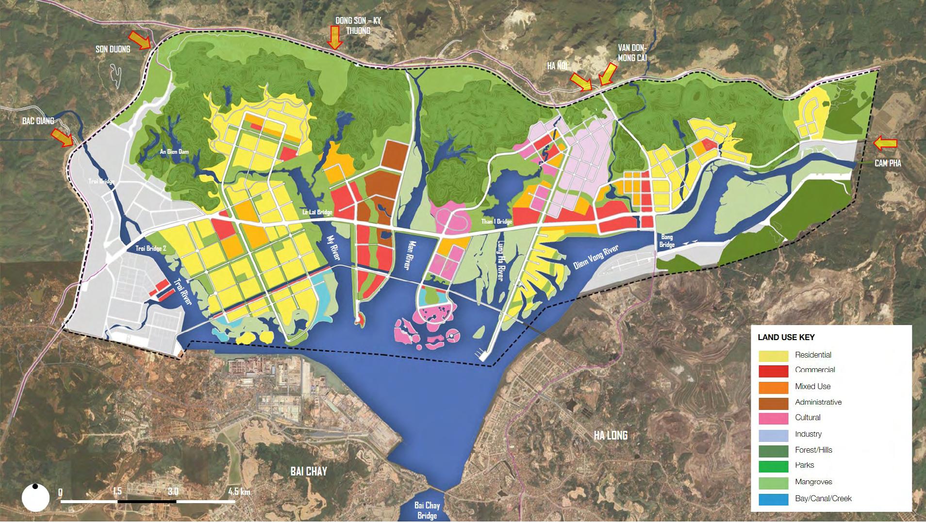
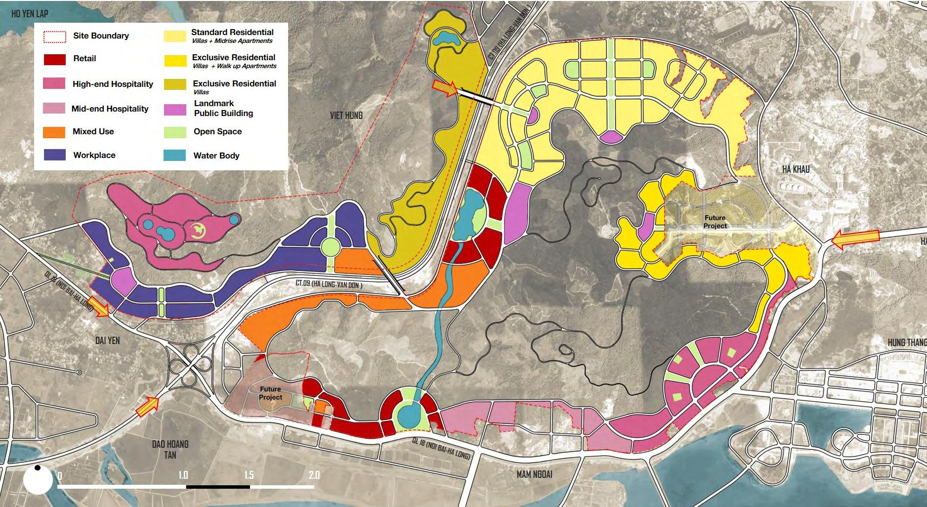
Vision Plan for Cua Luc Bay
Mixed use development with sustainable strategies
Site - Cua Luc Bay, Vietnam; Area - 11300 Ha
Client - Sun Group
Duration - April 2019 – Nov 2019
Organisation - BDP
Responsibilities - Detailed Master Plan, Urban Design Concept Development, Site Analysis, Formulating Strategy, Detailed Township Layouts & Typologies, 3d built form development, Design Coordination, Developing zoning, land use, road network hierarchy, plot clustering and detailed area chart
Workflow: Sketches, Adobe Suite, Autocad,Sketch Up
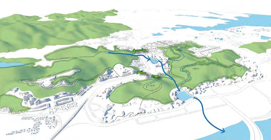
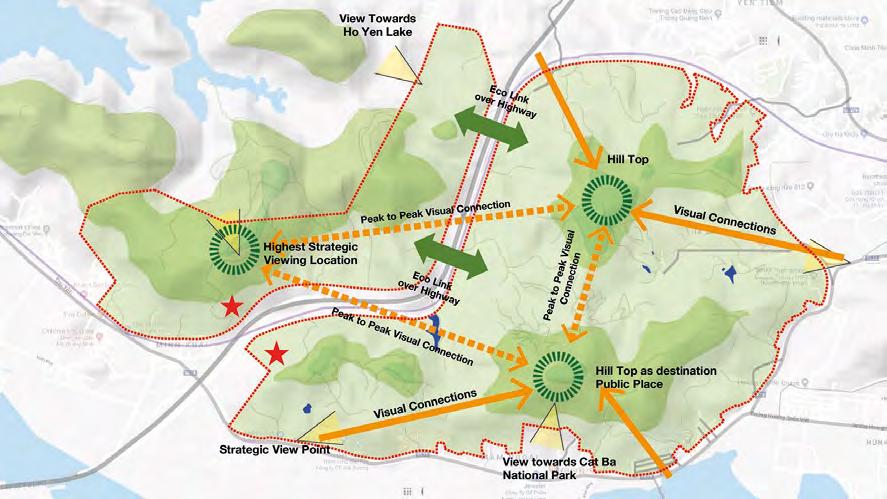
The masterplan envisions a sustainable future for Vietnam's Cua Luc Bay region, spanning 110 sq km along the northeastern coast. With its boundary shared by Ha Long Bay, a UNESCO world heritage site, the region faces challenges from industries like mining, cement production, aquaculture, and fisheries. The masterplan vision addresses pollution issues while creating an inclusive and cohesive region. It proposes integrated design solutions for the vibrant landscape, promoting a mix of residential, tourism, mixed-use developments, and high-tech industries. The goal is to establish an international destination in Vietnam that combines sustainability, modern amenities, and a deep connection to nature.
Vision is to create a smart, iconic mixed-use development that will be a world-class model for sustainable urban development and fulfill each sites’ strategic potential. To combat environmental and population challenges, each master plan utilises a people-first, eco-driven approach that taps into the traditional culture of the region, but with modern amenity, creating unique places unlike anywhere else.
Development
Character Areas
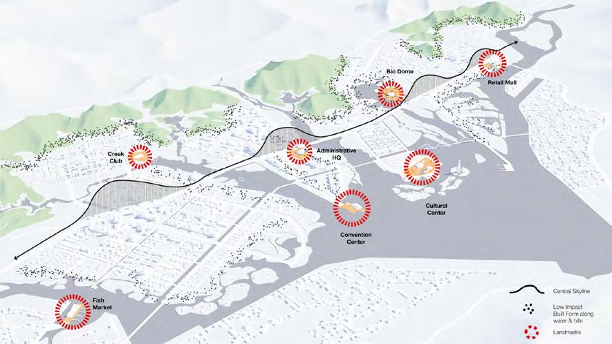
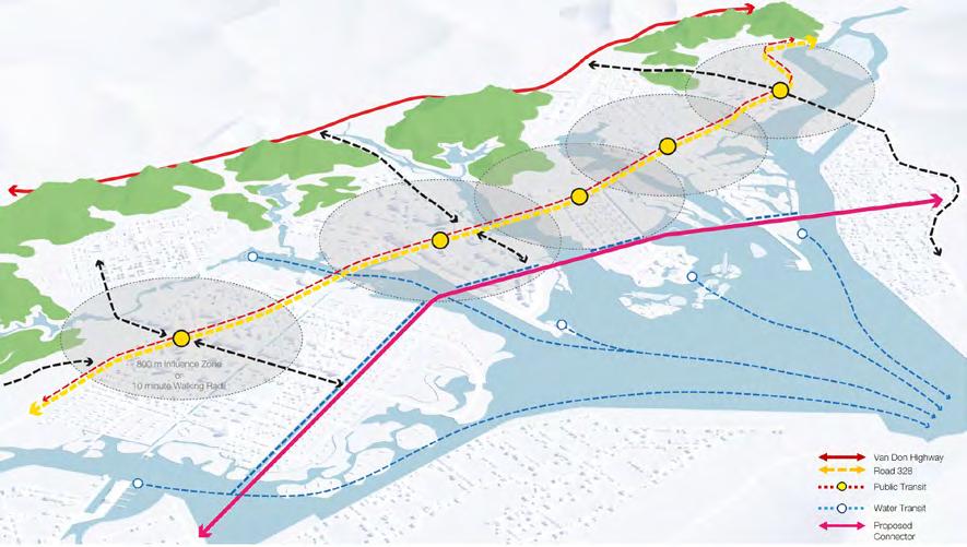
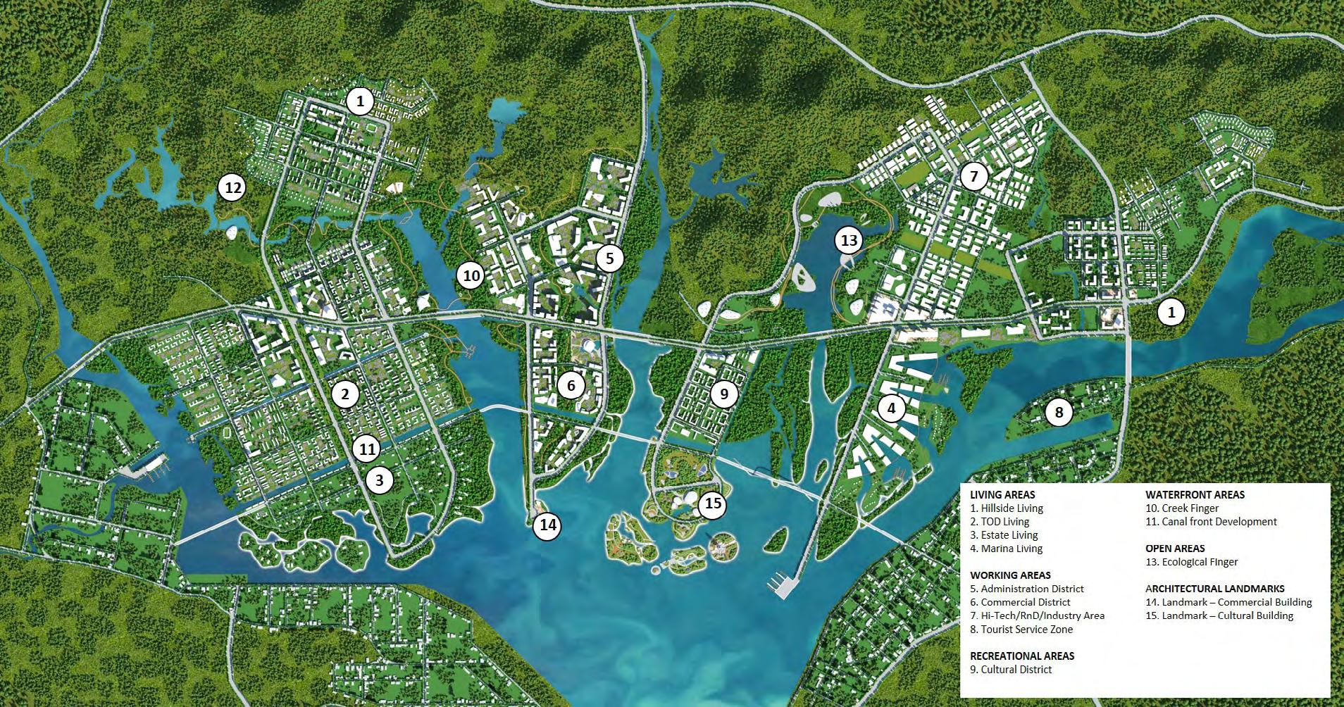
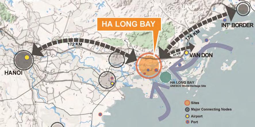
Ha Long Bay - A Global Destination
Strategies for
Cua Luc Bay Landuse Plan
Protect, Celebrate + Connect Natural Landscape Connect to Ha Long Bay by public transit - Train, Bus, Road and Water Sensitive Built Form, Strategic Landmarks
Vision Plan for Minh Khai
Mixed use development with sustainable strategies
Site - Minh Khai, Vietnam; Area - 1300 Ha
Client - Sun Group
Duration - April 2019 – Nov 2019
Organisation - BDP
Responsibilities - Detailed Master Plan, Urban Design Concept Development, Site Analysis, Formulating Strategy, Detailed Township Layouts & Typologies, 3d built form development, Design Coordination, Developing zoning, land use, road network hierarchy, plot clustering and detailed area chart
Workflow: Sketches, Adobe Suite, Autocad, Sketch Up
Vision is to create a smart, iconic mixed-use development that will be a world-class model for sustainable urban development and fulfill each sites’ strategic potential. To combat environmental and population challenges, each master plan utilises a people-first, eco-driven approach that taps into the traditional culture of the region, but with modern amenity, creating unique places unlike anywhere else.
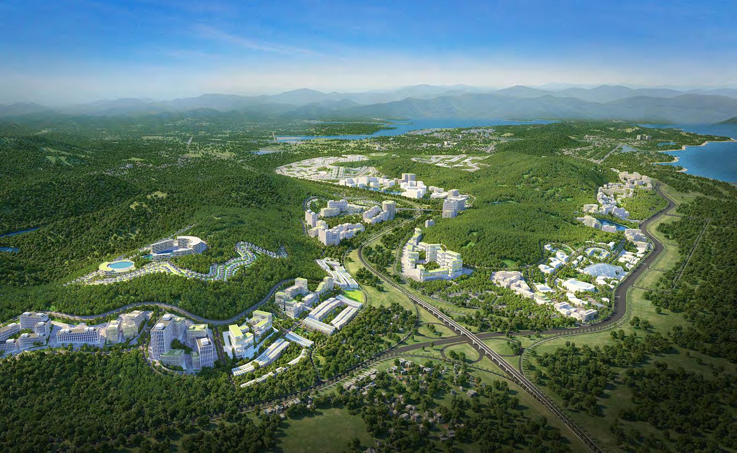
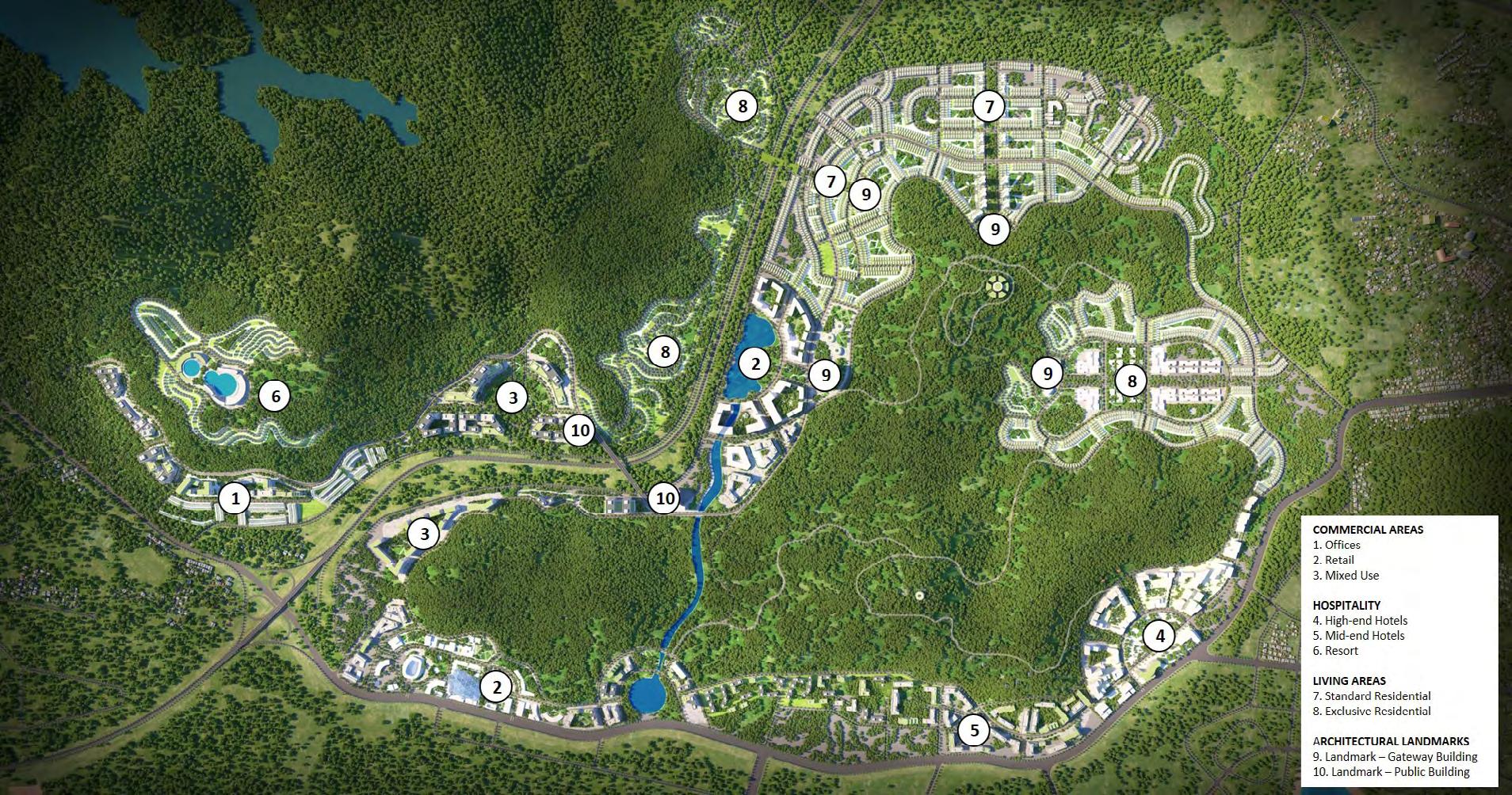
The masterplan envisions a gateway region located on Vietnam's northeastern coast, encompassing Ha Long Bay and the wider Cam Pha region. Spanning 110 hectares, the site is known for its stunning natural topography, including mountains, valleys, and lakes. Despite limited developable land, our vision emphasizes the preservation of the area's natural beauty. The masterplan carefully situates residential and commercial developments to maintain the integrity of the landscape. We aim to create a harmonious blend of development and nature in this highly-contoured region inspired by the captivating scenery of Min Khai.
Strategies for Development
Character Areas
Connections & Visual Relationships
Landscape
Ha Long Bay - A Global Destination
Protect, Celebrate, Connect Natural
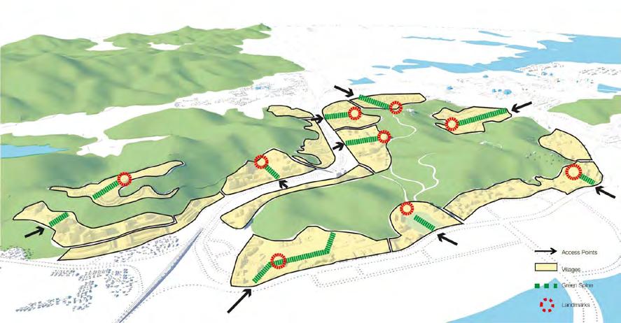
Create villages; define by green spine and landmarks
Minh Khai Landuse Plan
Hill Retreat Masterplan Housing Project
Residential masterplan
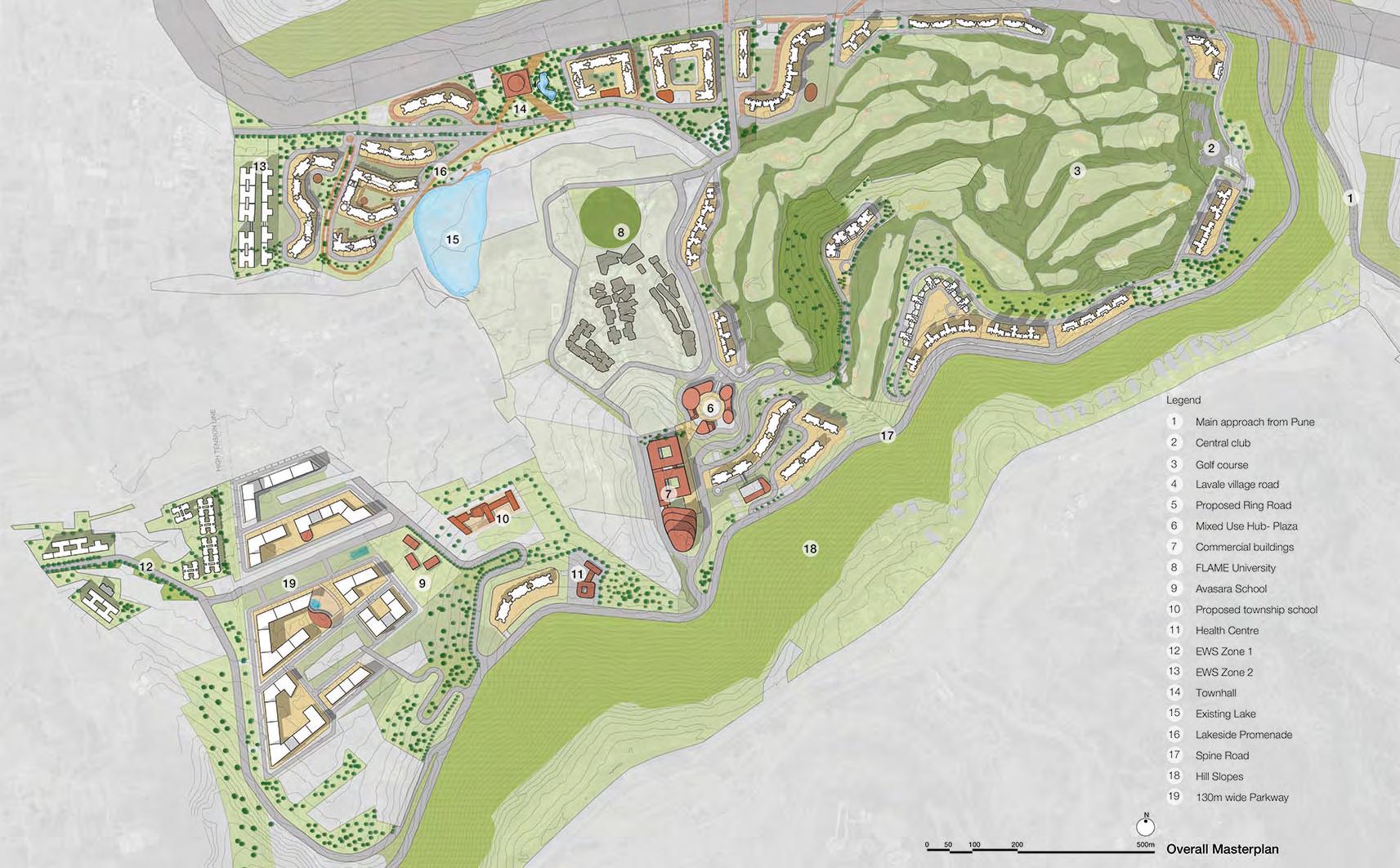
Site - Pune, India; Area - 900 acres
Client - Shapoorji Pallonji (SPRE)
Duration - Aug 2018 – Dec 2018
Organisation - BDP
Responsibilities - Detailed Master Plan & Urban Design Concept Development of residential township, Housing Typologies and Public Space Design Schemes
Workflow: Sketches, Adobe Suite, Autocad, Sketch Up
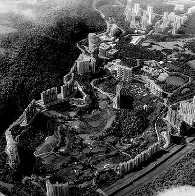
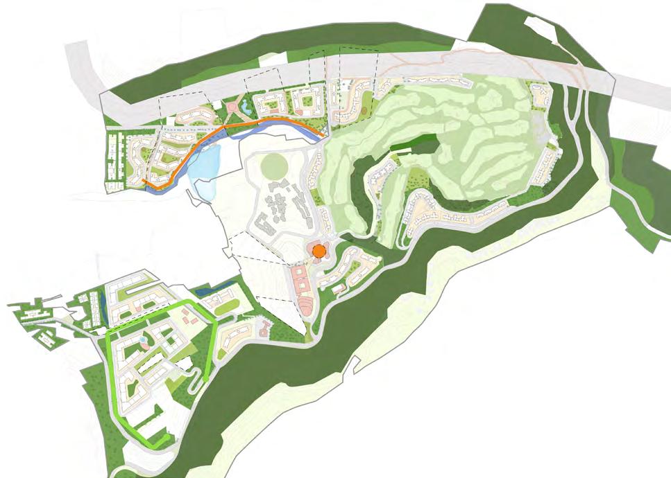
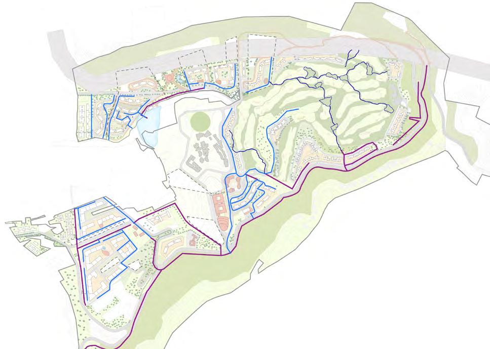
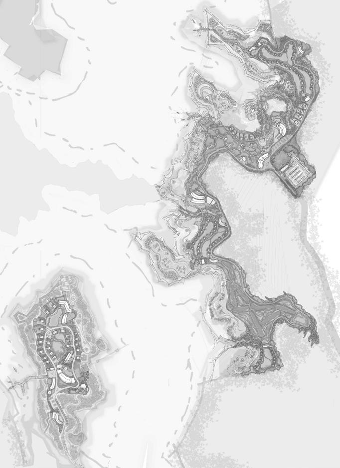
A 150-year-old real estate company collaborated to masterplan a 900-acre site on the outskirts of Pune, India. The site encompasses a 260-acre golf course surrounded by hills. The masterplan incorporates the site's challenging landforms and steep contours with sensitivity. The development aims to create self-sustainable neighborhoods with top-notch educational facilities, innovative workspaces, pleasant living areas, and diverse leisure options. Emphasizing walkability, cycling, and access to the natural landscape, the masterplan comprises four distinct neighborhoods, each drawing inspiration from existing features. The development accommodates 16,100 homes, with an estimated population of 65,000, alongside a mixed-use hub offering office, residential, and commercial spaces totaling 2.5 million sq ft.
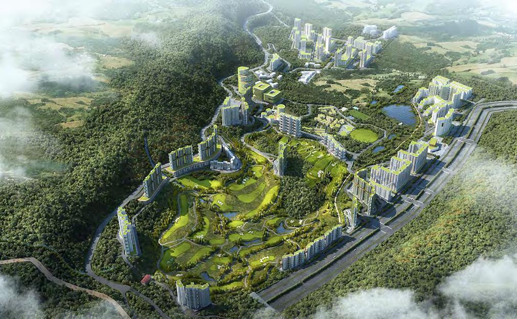
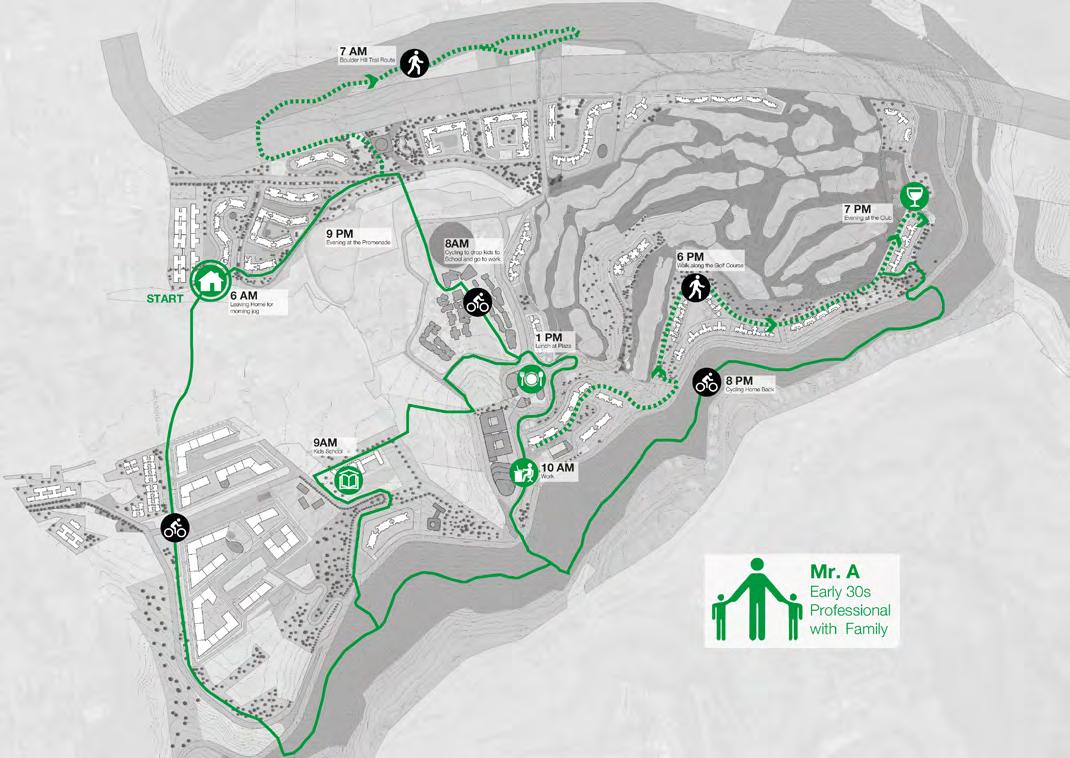
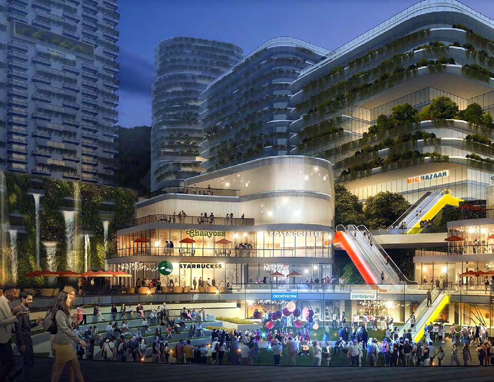
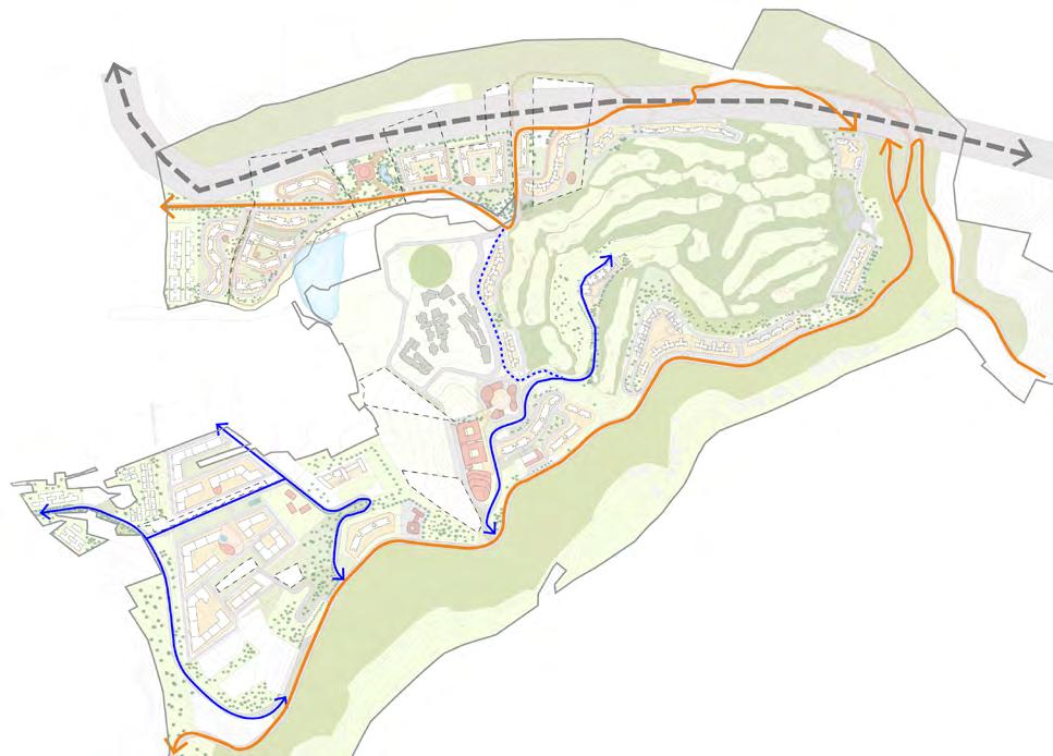
A day in the Hill Retreat Mixed Use Hub & Plaza Strategies Masterplan
Open Space System Water Catchments and Swales
Connections
Urban Design Guidelines
for ITCN - Infant, Toddler & Caregiver Friendly Neighbourhood
Site - Pan India; Area - Neighourhood Level
Client - Ministry of Housing and Urban Affairs with Bernard van Leer Foundation under theSmart Cities Mission, GoI
Duration - Nov 2018 – March 2019
Organisation - BDP
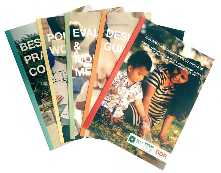
Responsibilities - Urban Design Concept Development for formulating Child Friendly Neighbourhood Guidelines –1. Framework, 2. Evaluation Metrics, 3. Design Guidelines, 4. Policy Workbook & 5. Best Practices Compendium
Workflow: Sketches, Adobe Suite, Autocad,MS Office, Sketch Up
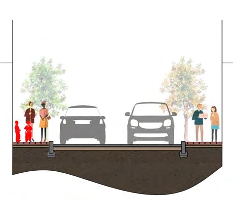
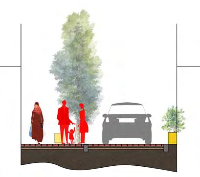
This project is a part of the Indian Smart Cities Mission and funded by the Bernard van Leer Foundation, offers a comprehensive urban design package to enhance the health and wellbeing of children up to the age of five in Indian neighborhoods. It focuses on creating safe and playful spaces for infants and toddlers, inclusive areas for caregivers, and implementing green strategies. The package includes a framework, evaluation tools, design guidelines, policy recommendations, and best practices. Its goal is to promote the development of child-friendly neighborhoods that prioritize the needs of families and support a nurturing environment for early childhood.
Inclusive
• Listening and responding to needs of residents through engagement
• Even and thorough implementation of interventions
• Transparent processes
• Fair to all, not just “owners”
• Objective, informed by data
Accessible
• Legible
• Flexible
• Free of physical and virtual obstacles
• Clusters of services/convenient
• Predictable and dependable, well-communicated services
Playful ITCN
• Attention focusing (not grabbing)
• Enveloping and protecting from distraction
• Challenging
• Committed to culture
• Authored by and memorializing of the childhoods belonging to it
Green
• Comfortable and protected from the elements
• Quiet
• Bio Diverse
• Renewable and non-carbon energy sources
• Future-oriented, green technologies
• Safe to walk/ bike while daydreaming/ mentally distracted
• Structured, demarcated, space is assigned
• Eyes on the street, trust of neighbors
• Slow
• Respectful of privacy
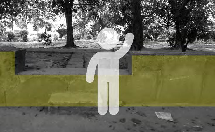
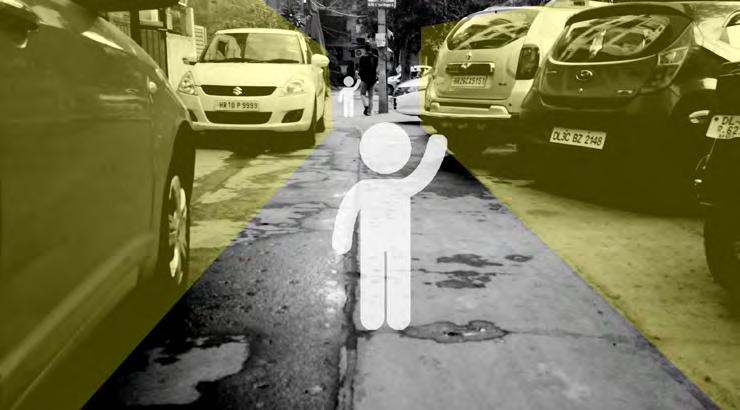
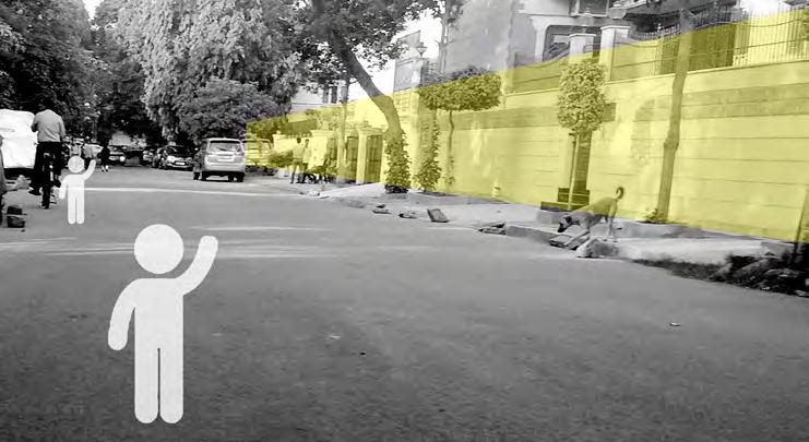
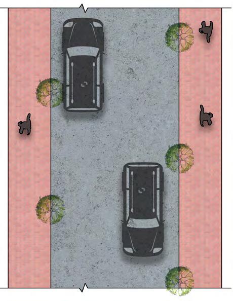
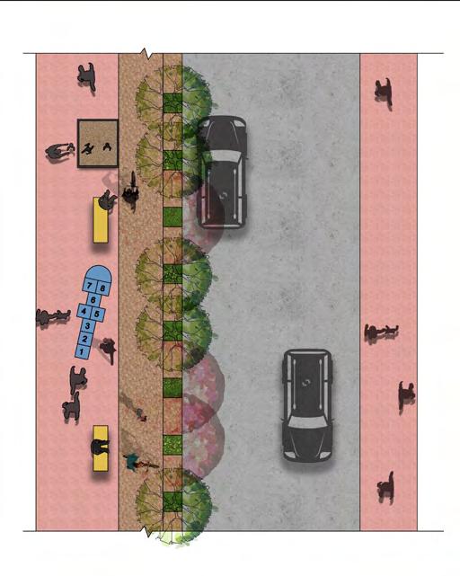
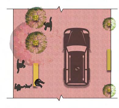
An intimidating view for a toddler consisting of a wall of cars. Presence of double side parking on a narrow neighbourhood street without a footpath forces walking on the road. A toddler has higher exposure to polluted air from cars, being closer to the exhaust pipes (30cm). The grade of park is higher than the road. Additionally it is edged with a wall which is an obstacle for ITCs to navigate. High boundary walls on both sides of the road make it secluded and is perceived as unsafe for ITCs.
Safe
Walking range and access by age
Home zone
Table crossing specially designed with ITC-friendly materials and exciting for kids

Pop-up play zone with materials like play sand, rubber mulch
Seating spaces
Neighbourhood model for ITC
Resting spaces for caregivers overlooking the kids’ playing zone, to keep a watchful eye on their toddlers, kids
Sidewalk play zone with ITC-friendly materials and equipments
Leftover urban space for pop-up play area/ interactive art zone
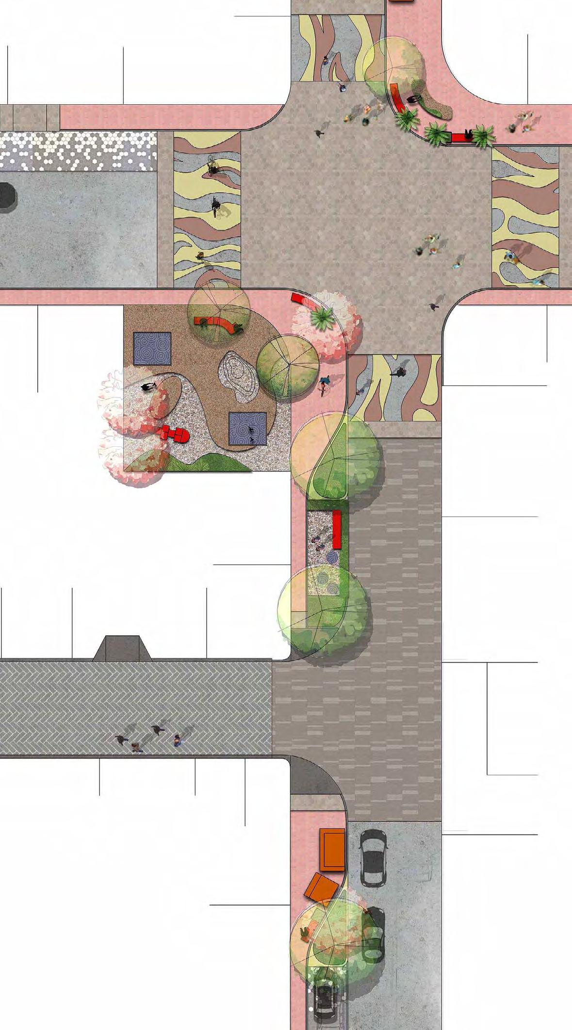
Table-top crossover with different materials for paving for traffic calming and easy crossing for ITCs
Wider footpath with seating spaces
Interactive green spaces at regular intervals
Shared Street / Woonerf
Dedicated kiosks/ food stalls
Shared street with different surface paving for traffic calming and convenient ITC movement
12 m 6 m 9 m
Parking
max. 300m
Block/Neighbourh ood6 0 0 m Street400 m Home2 0 m0 Physical Developemnt as it relates to range/distance accesible 0 - 2 Years 0-3Years 0-5 Years Clinic Nursery School Market Shopping Area Toddler Pre-school Kid Infants Home Primary School Tot-lot Play Ground Neighbourhood Level Park Bus Stop Grocery Shop Daycare Crèche Milk Booth Anganwadi Community Centre
6-15 TOT LOTS 50sqm-125sqm at max. 300m 3-6 HOUSING PARKS 2 Parks of 5,000sqm 4 Parks of 1,000-2,500 sqm at max. 0-300m 3-4 PLAYGROUNDS 4,500-6,000sqm each at 200-300m 6-15 DAYCARE/ CRÉCHES at
each
Shivalik Tourism Masterplan
in the Foothills of Himalayas
Site - Punjab, India; Area - 74.76 Acres
Client - Punjab Infrastructure and Development Board (PIDB)
Duration - Oct 2018 – Feb 2021
Organisation - BDP
Responsibilities - DPR Revisions, Design of Temporary Structures & Pathways, , Site Visits for Environment & Forest Analysis, Site Zoning, Interdepartmental Coordination for Forest Clearance and Environment Impact Assesment ( EIA) with Consultants & GoI, Support for RFP Formulation
Workflow: Sketches, Adobe Suite, Autocad,MS Office, QGis, DEM
The masterplan envisions a state-of-the-art tourism destination around Punjab's Ranjit Sagar Lake, spanning 300 acres. With a focus on preserving ecological sensitivity, it integrates natural features, considers flooding constraints, and creates a traditional Himalayan village ambiance. The destination offers premium eco resorts, nature appreciation zones, amusement parks, retail centers, Lakeview hotels, family resorts, spas, convention centers, and golf clubs. The plan includes development control regulations, eco-sensitive mapping, infrastructure and landscape design, feasibility studies, and environmental impact assessments.
0 50 300m Zoning Plan Interpretation cum Convention Centre Nature Zone Parking Legend Eco Friendly Accomodation Greens (Unbiildable) Eco Resort Support Facilities 531 m above MSL Site Boundary
Site 2 - Faugli Tikka Kulara Island Area = 18.54 Acres
Site 1- Niloh Tikka Palangi Area = 56.22 Acres
Topography and Drainage Analysis Detail Design of Roads & Pathways
View Corridors and Bufer Zones
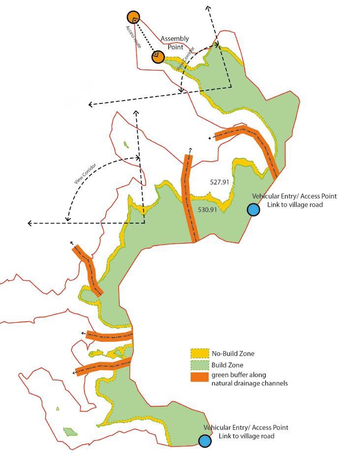
Details of Swales and Paths


Parking Site 13.05.2019 Z2 (90) UP 011 Detail Layout Plan DC RM 100 200 400 800 Drainage Plan RM R1 MB 15.03.18 Tertiary Drainage Channels Gully) Primary Drainage Channels Secondary Drainage Channels Site 2 Site 1 Legend 531m MSL Site Boundary SITE 1 NALOH TIKKA PALANGI = 56.22 acre SITE 2: FAUGLI TIKKA KULARA ISLAND = 18.54 acre 6m Shared Street 9m Street 12m Street Greening on the sides at intervals Sitting spaces Dedicated 1.8m clear walkway Paved surface helps in calming traffic Trees at regular interval also act as a barrier from the motorable traffic Shaded resting places Dedicated sidewalks Paved surface helps in traffic calming Continuous planters also act as a barrier from the motorable traffic 6m Shared Street Section and Plan as shared surface Dedicated cycle lane with specific material treatment Continuous planting zone acts as a buffer for the strollers/cycles Seating at regular intervals Sidewalk play zone 12m Street Section and Plan with two-sided footpath & two-way traffic Dedicated 1.8m clear walkway Shared Street Planters 5.50 m 0.50 m Street lights for safe movement after dark Dedicated stroller/cycle lane 1.8m clear walkway Footpath Cycle Path Trees Footpath Driveway 2.60 m 1.40 m 1.80 m 5.60 m 0.60 m 1.8m clear walkway Driveway Footpath 1.80 m 5.40 m 9m Section and Plan with two-sided footpath & two-way traffic
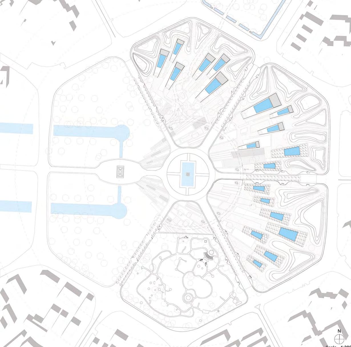
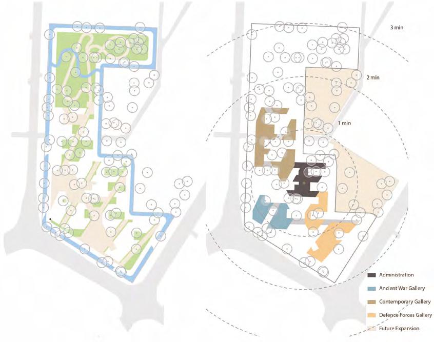
International competition National War Memorial
memorial as public space
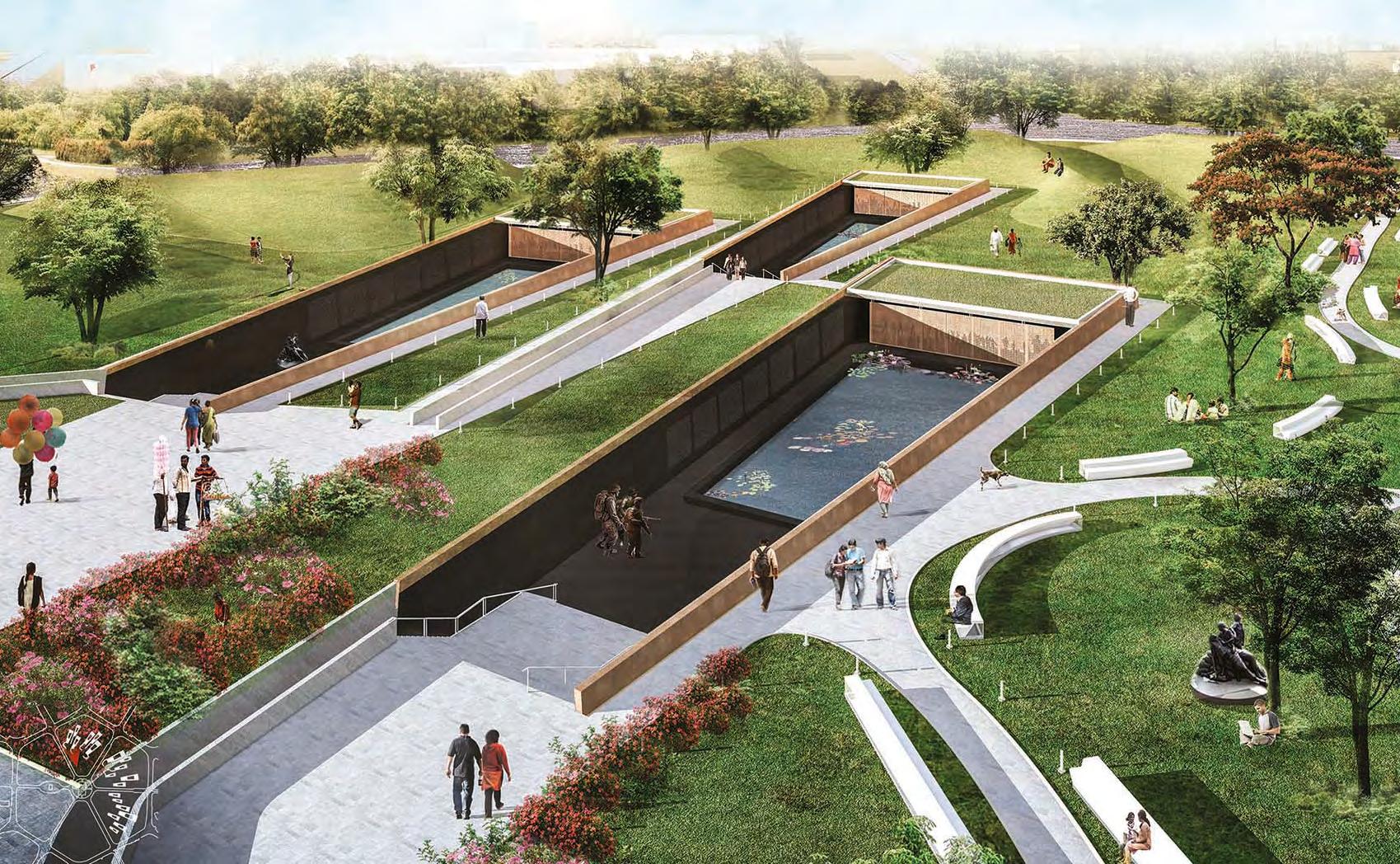
india gate axis
Site - India Gate, New Delhi, India; Area - 60 acres
Client - International Competition, GoI
Duration - August 2016 – January 2017
Organisation - Sangath – Vastu Shilpa Consultants
Responsibilities - Concept Development, Design Development, 3d Visualisation, Model Making, International Competition
Presentation & Drawings
Workflow: Sketches, Models, Adobe Suite, Archicad, Artlantis Studio
The project embodies the allegorical notion that public space & freedom are hard-won through countless sacrifices for liberty. The concept centers around a memorial & park that pay tribute to the profound losses incurred in securing these freedoms. Through the integration of figurative sculpture and personal narratives of servicemen, the project symbolizes the inseparable connection between public space, personal freedom, & soldiers' sacrifices. The park's design & the sculptures emphasize the enduring spirit of humanity, prioritizing it over glorifying war. By engaging the public with the park's leisurely atmosphere and thought-provoking elements, it aims to deepen their understanding of the nation's military history & the significance of bearing arms for the country.
scroll of honour hall of rememebrance wall of stories ceremonial plaza
pool of reflection
future site for sunken plaza/ baoli with silver oa trees
Components of sunken plaza/baoli
Concept development
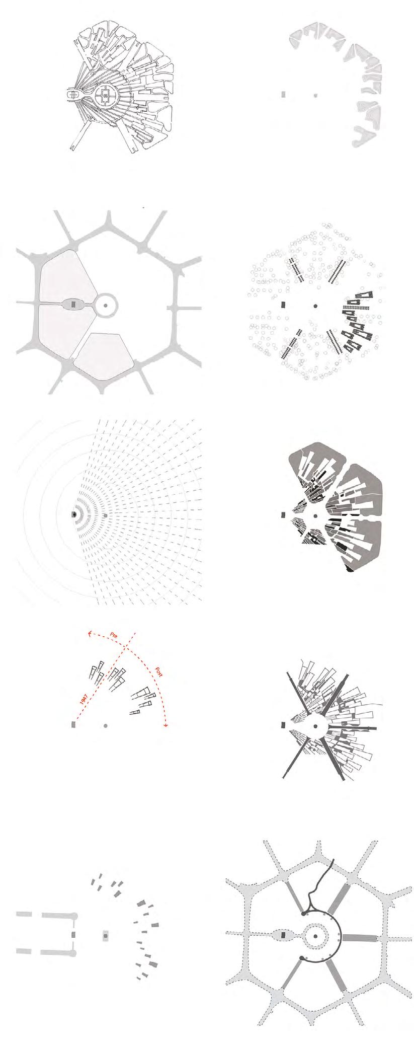
Ground
existing site
trees - existing & new
the first memorial gardens
many memorials walkways & plazas
water parking, public amenitities
idea
land
Floor Plan
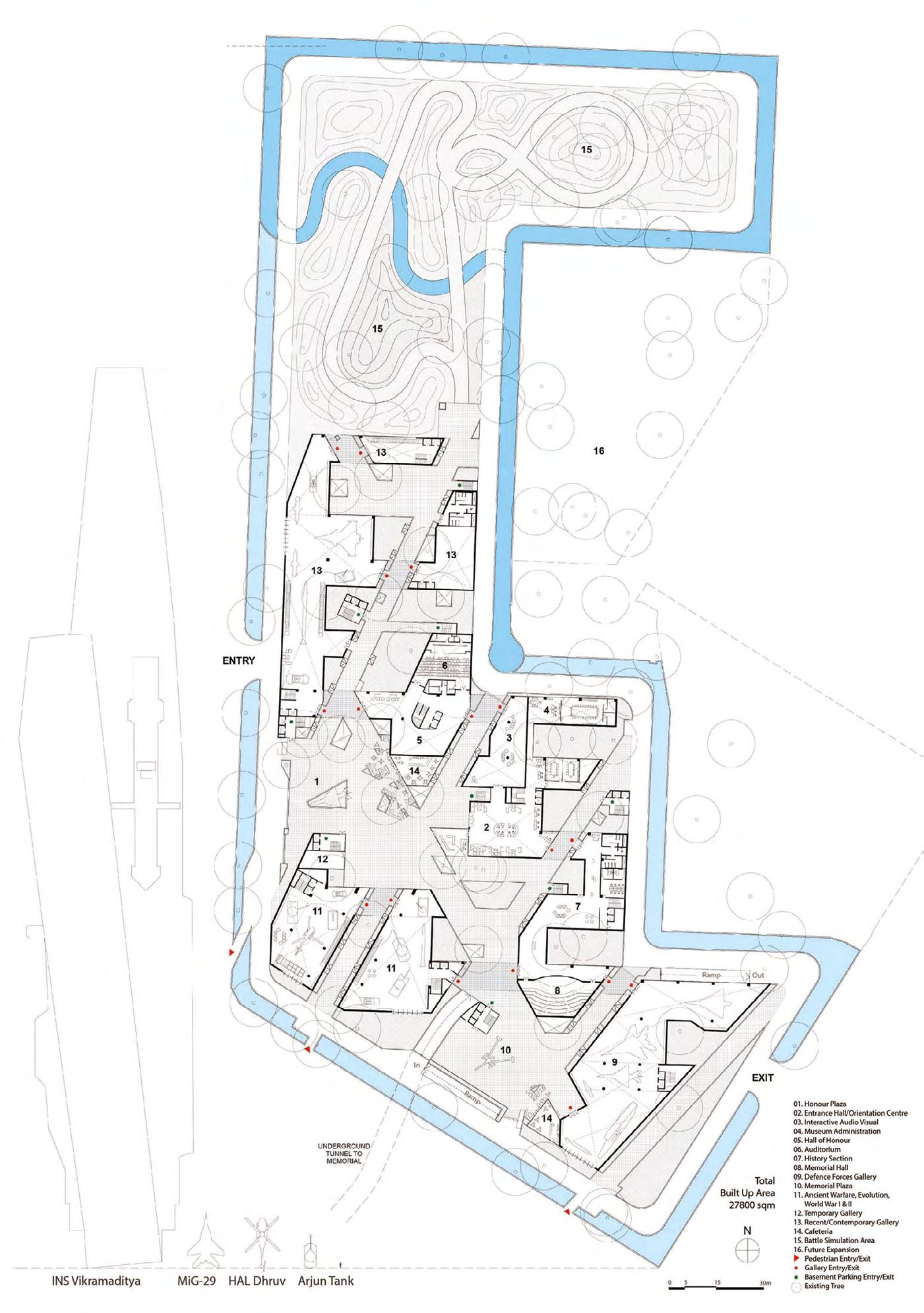
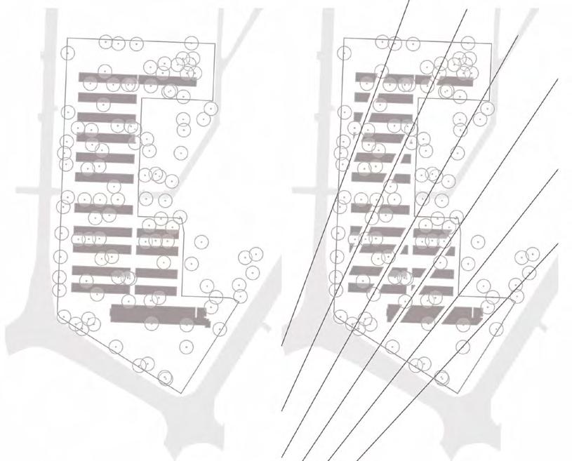
International competition National War Museum
museum as public space
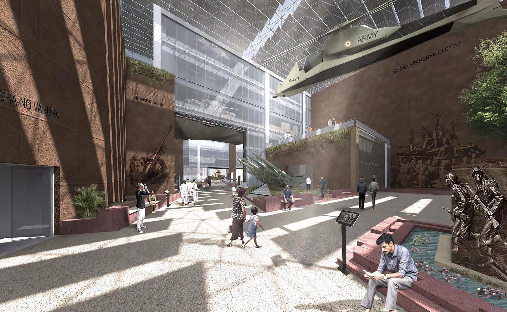
Site - India Gate, New Delhi, India; Area - 10 acres
Client - International Competition, GoI
Duration - August 2016 – January 2017
Organisation - Sangath – Vastu Shilpa Consultants
Responsibilities - Concept Development, Design Development, 3d Visualisation, Model Making, International Competition Presentation & Drawings
Workflow: Sketches, Models, Adobe Suite, Archicad, Artlantis Studio
The project's design concept is rooted in the allegorical idea that public space and freedom are achieved through the sacrifices of servicemen and women for liberty. The aim is to engage the public within the plazas, surrounded by mature trees and the war museum's buildings. Figurative walls, sculptures, quotations, and weapon displays inspire visitors to embrace military traditions and understand the ethos of defending the country. These plazas, part of the war museum, remain accessible to the public even when the museum is closed. The surrounding cafes, art galleries, lecture halls & spaces serve as a true public space, situated prominently in the theater & art district along Copernicus Marg. Preserving trees planted by service officers and their families, the design honors their legacy in the Princess Park hostel barracks.
india gate axis
Concept development Built form distribution
existing site sightlines from india gate
infills plazas and pathways
water - green space diagram hub and spoke
volumetric distribution
scale comparison with ground floor plan
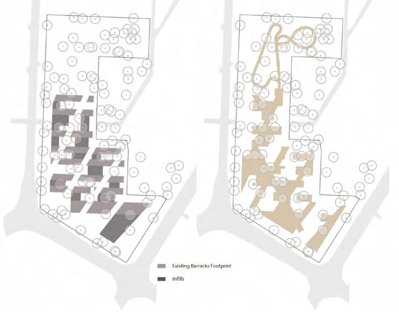
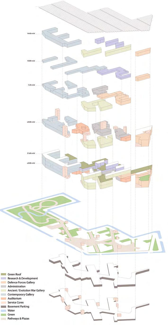
Ground floor plan
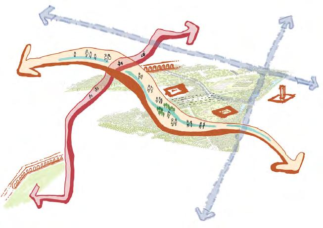
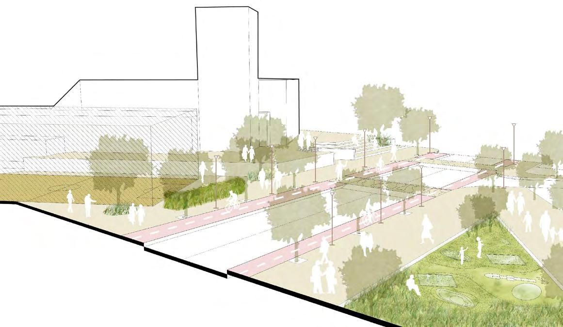
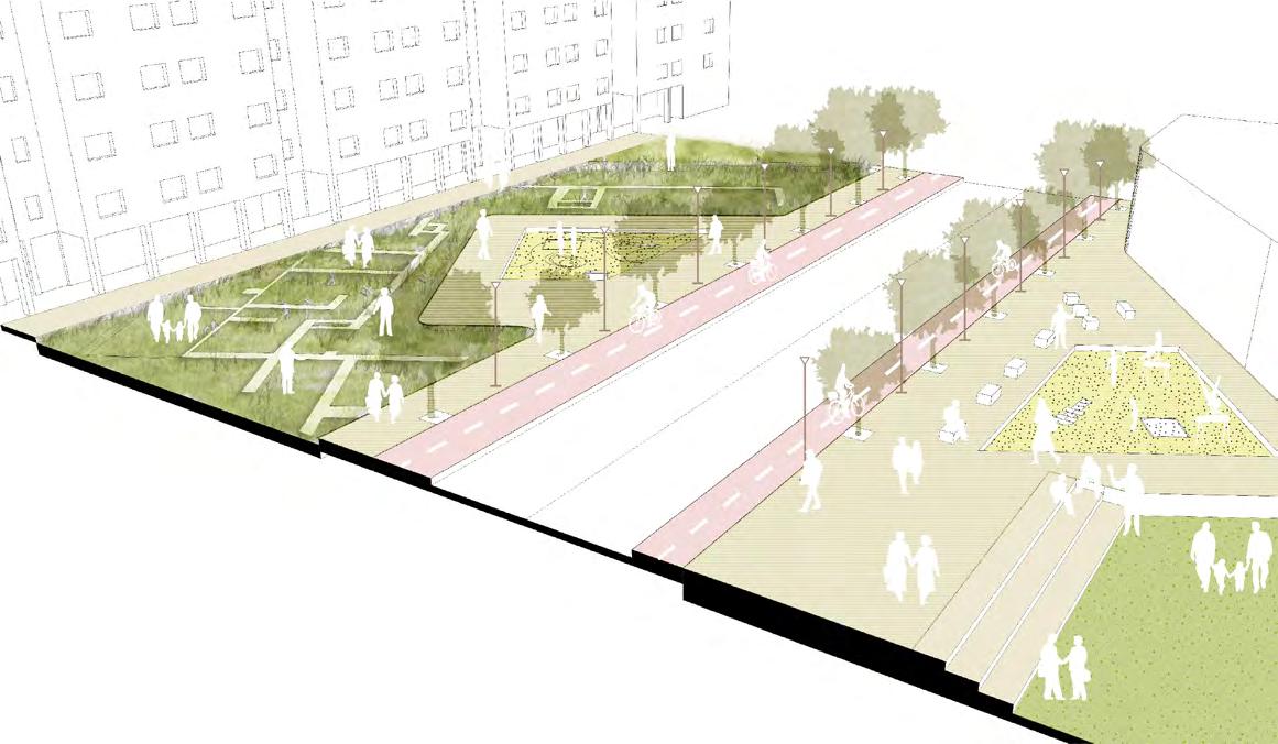
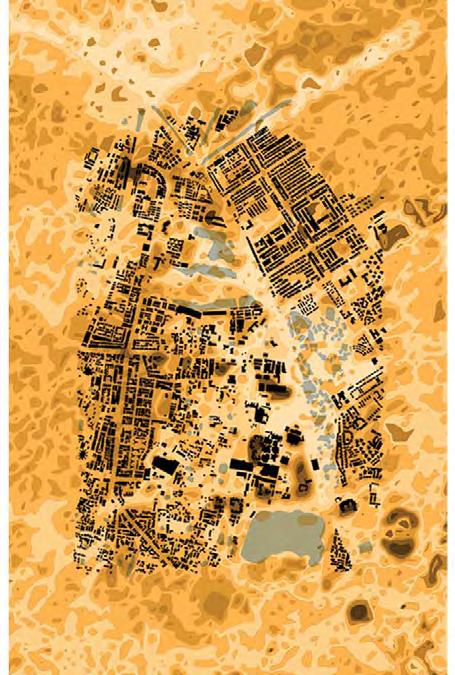
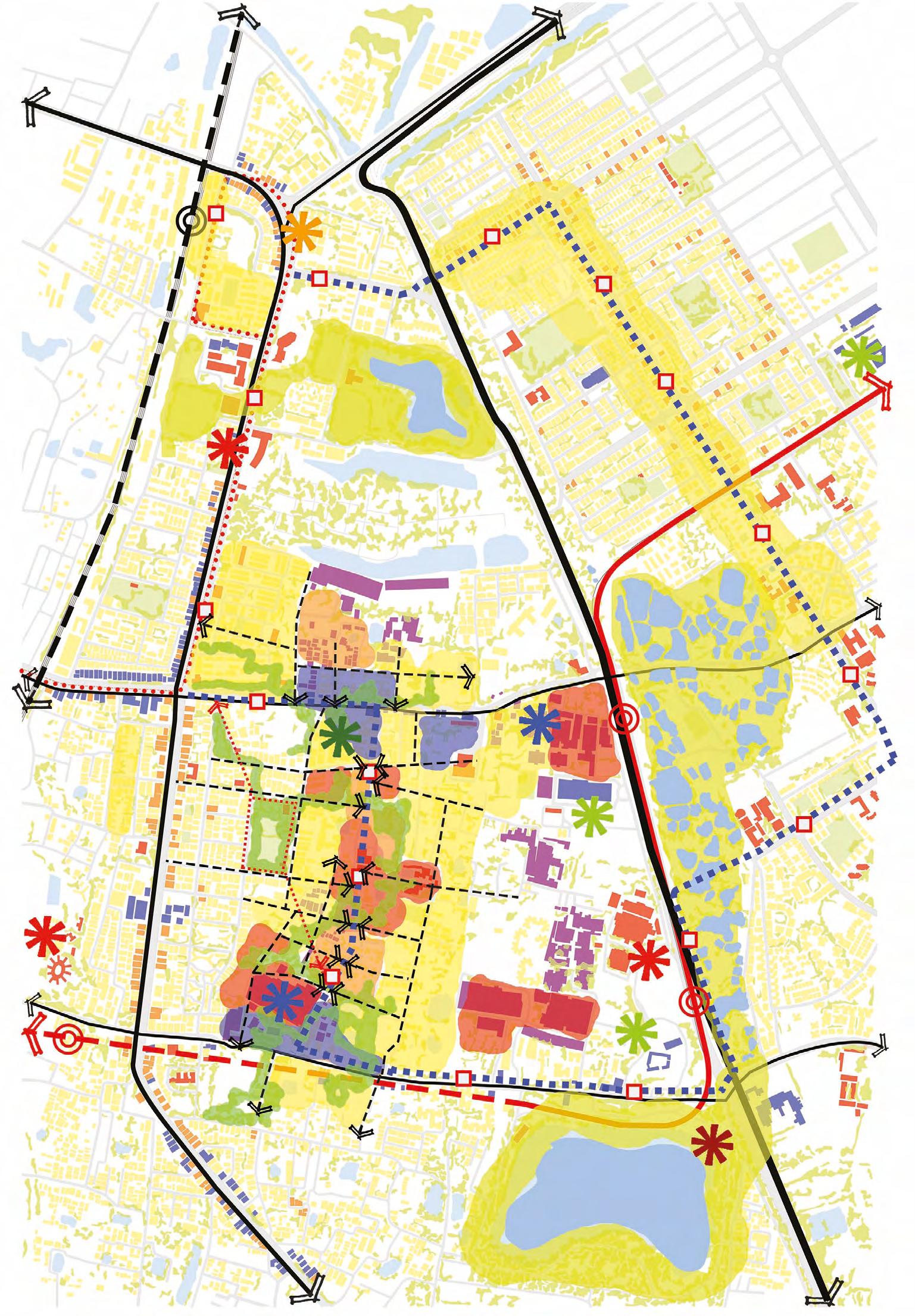
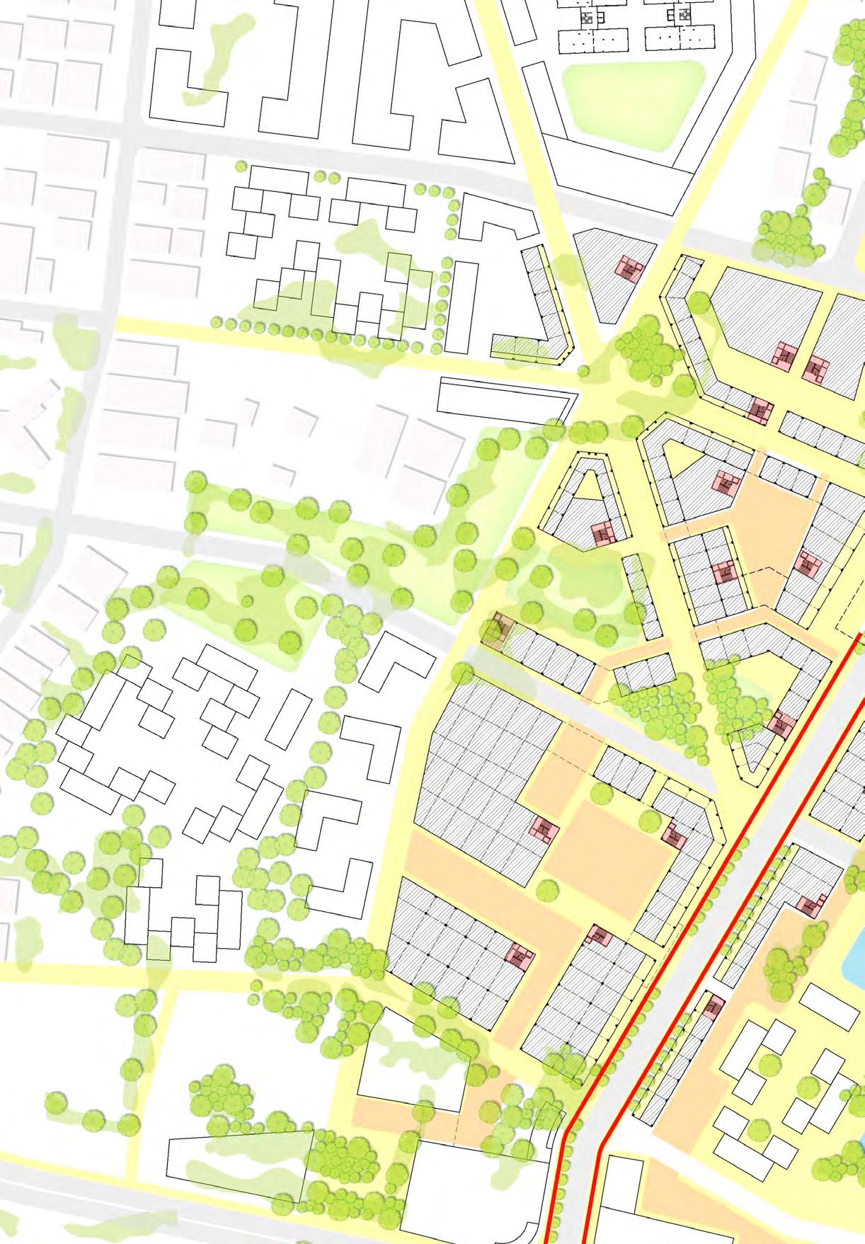
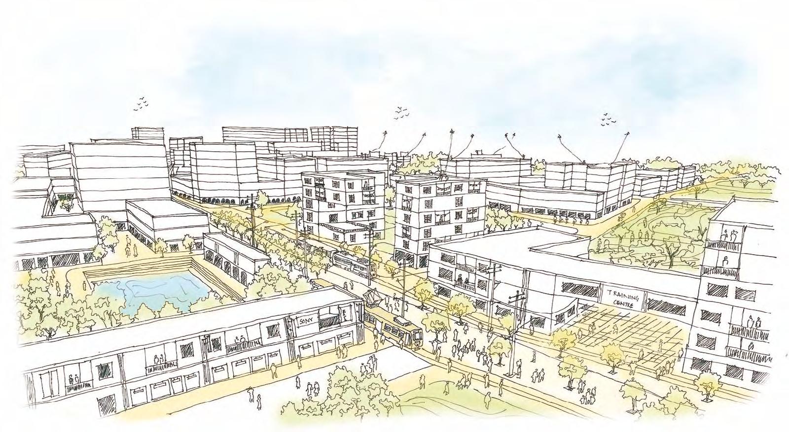
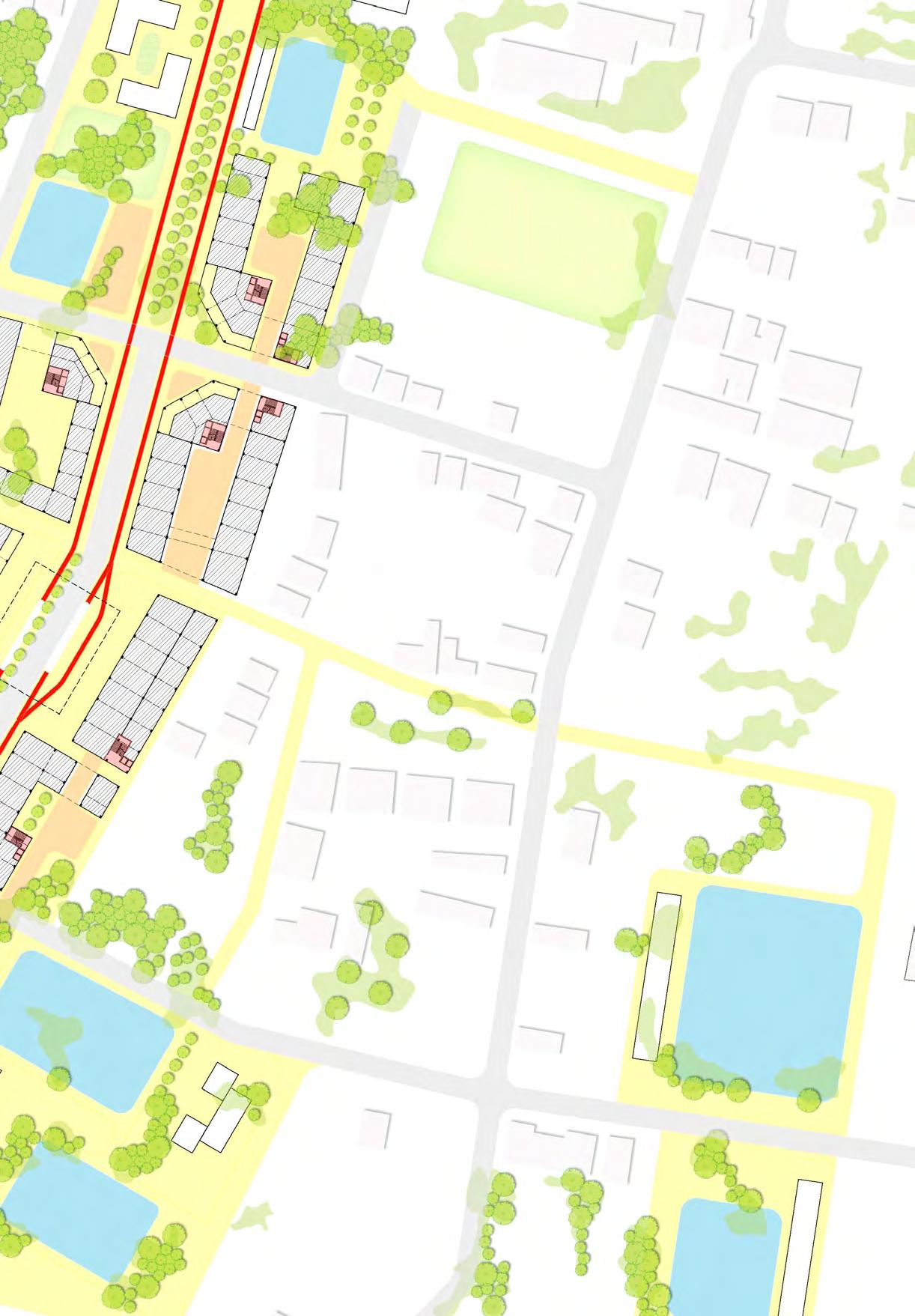
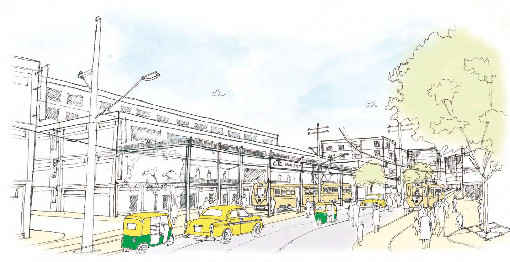
Regenerating inner city through the tram system as
a catalyst for urban regeneration plan
Site - maniktala - kankurgachi, kolkata, India; Area - 2 sq km University - School of Planning and Architecture, New Delhi Duration - Jan 2016 to May 2016, Masters Thesis
Responsibilities - Urban Analysis, Field Investigations, Vision Formultaion, Urban Design Strategies, Structure Plan, Land and Built Use plan, Concept Masterplan, Ground Floor Plan, TOD Guidelines
Workflow: Sketches, Adobe Suite, Autocad, Sketch Up
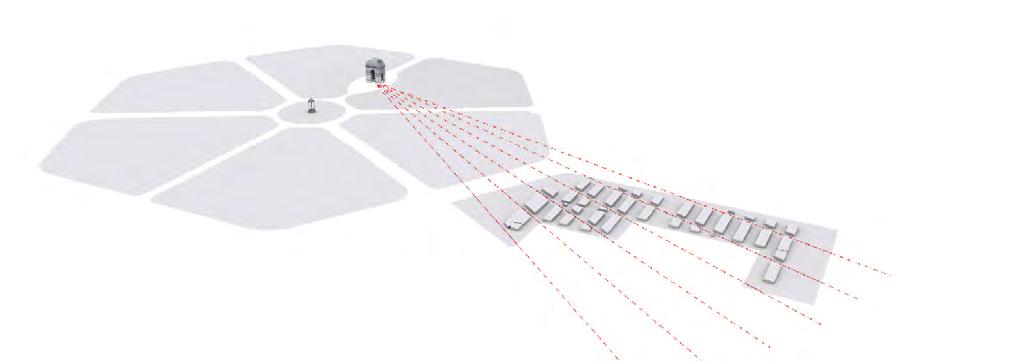
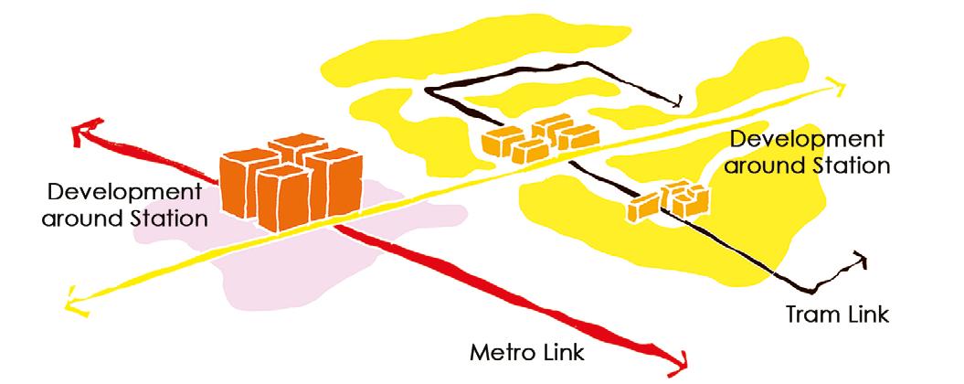
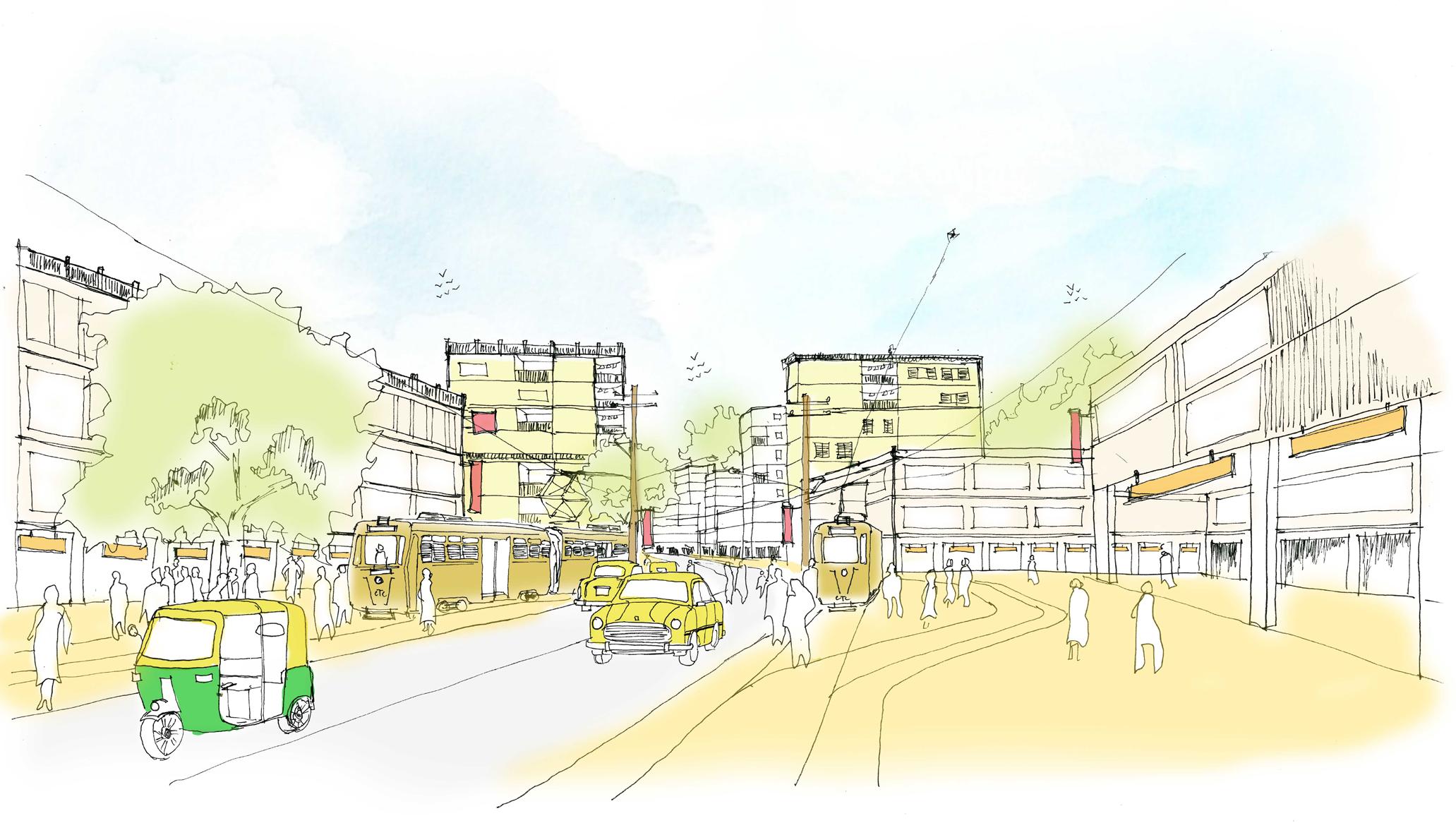
The inner city of Kolkata is adorned with buildings deeply rooted in community traditions, socio-cultural practices, and more. However, many neighborhoods in north Kolkata have suffered a decline over the years. Conversely, the suburban areas, now the city's vibrant core, thrive with distinct communities and rich cultural heritage spanning generations. Embracing its uniqueness, the iconic trams of Kolkata possess the transformative power to rejuvenate these communities. With a nod to modernization and emerging trends, trams can evolve into a Community Based Transportation system, fostering cohesion and vitality. By implementing strategic urban design measures and revitalization guidelines, we can address the decay and restore a sense of identity to the innercity precincts.
Urban Analysis
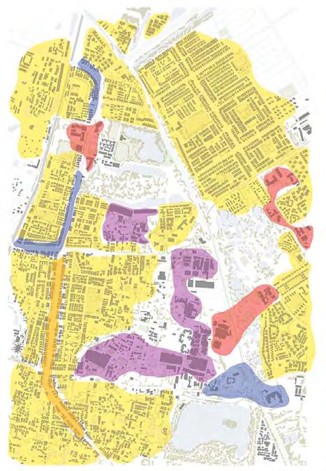
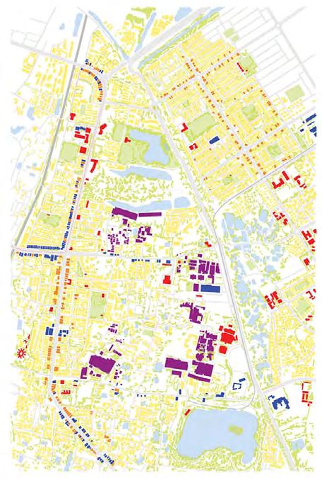
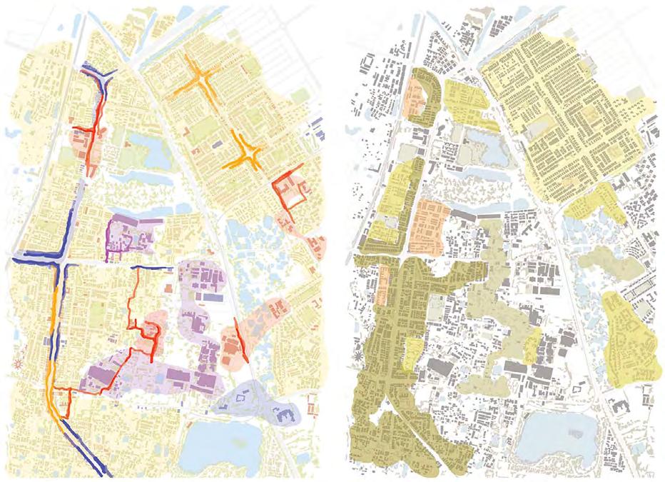
Structure plan - Area level
redevelopment of KIT schemes
redevelopment of KIT schemes (SIH & BRS)
contour map with built form open spaces
commercial stretch in manicktala main road
built use functional district
neighbourhood level recreation
activity mapping community mapping
mixed use developement zone
public facilities & amenities for communities
work centres & office spaces
slum redevelopment schemes
green corridors needs to be developed
city level recreation
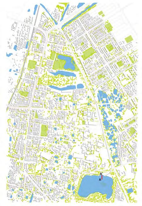
preserving the wetlands & reviving the ecological corridor
proposed work centre & offices
relocation of slum dwellers and maintaining the wetlands
residential transformation due to tram conection
Legend
Residential District
Public Use Zone
Small scale industries
Commercial Strip
Industrial Pockets
Mixed Use Strip
Existing Public Anchors
Proposed Public Anchor
Existing Visual Anchor
Proposed Visual Anchor Node
Proposed Connections
Proposed NMV/Pedestrian
Tram Roue & Stop
Small Tanks in Communities Street
The pedestrianised stretch is connected with the small tanks in the communities and parks. This pedestrianised area is designed in proximity with the institutional zone.
Picture
Ground Floor Plan
Tram Station Plaza
The Tram station will become as one of the pedestrian friendly area with many other related function around it.
Satyajit Mal
Urban Designer || Architect || Erasmus ScholarArchitecture, Landscape & Archaeology satyajit.mal@gmail.com

+39-340 9989692
