Drone Report

Page 1

DRONE REPORT Gate A-4

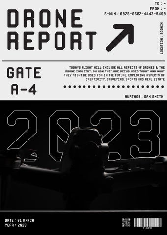
Todays flight will include all aspects of drones & the drone industry. On how they are being used today and what they might be used for in the future. Exploring aspects of creativity, sruveying, sports and real estate

.....................
to :From :S-NUM
Location : Bodmin
Aurthor : Sam Smith
: 0075-6687-4443-9450

What are Drones?

Ever since the start of time humans have been wanting to fly and look at the world from a whole new angle. The world from up above. From attempts with gliders and hot air balloons, man could not find a reliable way to touch the clouds. Not until 1901 when the Wright brothers built the first airplane and the world of aviation started to take off. Over the years innovations arrived that made the world of flight better and easier, lowering the barrier of entry. It wasn’t until 1935 until that the first modern drone was created by the royal air force but only being used for target practise.

Using low-cost radio components to keep the drone in the air long enough before it came crashing to the ground again. Drones in the beginning were mainly used by militaries all over the world but it wasn’t until the 2000’s when drones finally became more accessible to average people. With the explosion of the internet at the same time, it launched drones into a golden age. With drones made by companies such as DJI, making the software easy to understand and having safety checks in place to keep drone flying fun and affordable. Modern drones today can be manned or unmanned aircraft, formally known as unmanned aerial vehicles or UAVs.

A drone can be remotely controlled by the user or by special software, allowing the drone to be preprogramed beforehand. Drones can be used for many different purposes such as search and rescue, videography, sports, photography, surveying and recently delivery services. Drones use a whole load of different sensors and electronics that keep it in the air. These can be gyroscopes to keep the orientation, cameras to see where it’s going, accelerometers and altimeters to measure speed and altitude. All these features that also include transmitters and receivers allow a user to have a live view on a flight controller, first person view goggles, or a smart phone with a phone app.

Page No. Latitude : 50.458319
Page No. 1 Latitude : 50.458319 Longitude : -4.708413
.............. ........... ..............

世界を見る新しい方法

PF000618.04 MODELRC231 Page No. 2
...........................

Drone Regulations

Authoization Zones

Enhanced warning zones restricted zones

When flying a drone, you must always keep you and other people safe. As new technolohy comes along, legislation and regulation won’t follow long after. Over the years new regulations have been introduced to keep drone flying safe within the air, keeping the drone itself and other aircraft safe. Sometimes regulations may be introduced due to current events and incidents in the real world. One event caused the United Kingdom Civil Aviation authority to bring in new legislation after many complaints of DJI phantom drones were seen flying near and into Gatwick airport in 2018, causing aircraft to be grounded and needing to land whilst the drone were taken out of the air.

To keep drone pilots and other aircraft in the air safe there are a set of rules that a drone pilot that must follow. One rule is to keep the drone below 400 feet or 120 metres. This is in place to keep drones out of the flight path of civilian aircraft such as airplanes. Another rule is that you must keep the drone always in sight, even if you need binoculars to keep an eye on the drone. This is done to make sure the drone doesn’t fly into obstacles or any animals, such as birds, that might be flying in the sky near to the drone due to the camera systems on drones not having a wide field of view. Making it harder to see through the live view.

Another rule that’s been put in place is to not fly within 50m of people, buildings or transport. To keep people on the ground safe. The flight zone extends upwards like a cylinder, meaning you must always keep 50m horizontal distance depending on the weight of the drone. Another rule is to keep people involved and updated in what you’re doing, making sure they know where you’re flying the drone and what you’re planning on doing, just so they don’t stand or interrupt your flight. An exception to this rule is if the drone is below 250g you are allowed to fly within 50m of other people and meaning the horizontal boundary doesn’t apply. One rule that has no exceptions is flying over crowds of people, such as over the top of sports events and music festivals. This is due to safety concern if the drone has no place to safely land.

Page No. 3 Latitude : 50.440671 Longitude : -4.994542

Source: BBC News

One rule that has been put in place after events in 2018 is flying near or close to airports or military installations. Airports are surrounded by restricted zones. You can only fly near airports unless you have permission to do so and must always avoid other aircraft that may be using the runways or in the air. Airports will have a 5km restricted zone around the airfields and runways, in these areas you are prohibited to fly a drone and if you do you will most likely result in fines or jailtime if caught.

All these rules have been put in place to keep the public safe and sound. Meaning for some drones you may need to get certain licences and pass certain tests before you can fly. When flying a drone over the weight of 250g you need to apply for an operator ID and flyer ID. A flyer ID requires you to pass a theory test beforehand. Making you through all the rules and flying code before you’re getting a licence. An operator ID is needed for every drone that isn’t a toy and ensures that you’re maintaining the drone when it isn’t in the sky, labelling and keeping the drone in flying order. Drones over the weight of 20kg need third party insurance due to the weight causing damage of property if it does fall out of the sky.

PF000618.04 MODELRC231 Page No. 4
Page No. 5 Latitude : 50.547254 Longitude : -5.035089 50.549180,-5.035087 50.549053,-5.035969 50.549966,-5.037879 50.550416,-5.036656 50.550307,-5.034510 50.548562,-5.033352 50.546967,-5.034124 → 10mph Wind 17:47 Time 47% Battery 24/02/22 Date

Drone Photography

Aerial photography is a type of photography that involves photographs taken from a manned or unmanned aircraft or any other airborne platform. The concept of aerial photography first started with the use of hot air balloons and the first ever cameras. Being able to capture images from the sky for the first time. Later this kind of technology was used in both world wars to get a better visualisation of the battleground and of your enemies lands. Taking thousands of images flying over enemy lands and risking their lives, to be later stitched back together and used as intel.

With the invention of drones, it allowed for people to get a different perspective of the world from up above. Becoming more accessible and less expensive has allowed for creative people to get access to this new reality and kind of photography. Drone photography has been used by many different organisations and for different purposes. Such as independent creatives taking pictures for social media to businesses using drone photography to advertise a product or place. Coming in small and large sizes allows for better and more compact cameras to be attached to these drones to get the best imagery possible. With the rise of social media there are more and more people out there with drones taking pictures of places from up above.

One type of photography that drones are perfect for is tilt shift photography. Tilt shift is a type of photography that uses focus and depth of field on the lens to make it look like objects are smaller than they appear. Making the world look like a small train or Lego set. It does this by changing the position of the lens with the cameras image sensor, which then allows them to shift the focus plane and allowing them to alter the depth of field. This can be done on the camera itself with specific lenses or afterwards in photo editing programs such as photoshop.

PF000618.04 MODELRC231 Page No. 6
Page No. 7 Latitude : 50.332861 Longitude : -5.174122

Drone Videography

With drones becoming more accessible in the consumer world and the professional world there has been major developments for the possibility of drone videography. Drone videography is the process of using a manned or unmanned aircraft to record films, short films, documentaries and passion projects. For a drone to record video it needs to have an appropriate camera system for what kinds of jobs it is needed to capture. This can depend in size, from small drones with small camera systems to large drones with cinema grade film cameras attached. With accessibility of drones, it makes it easier and much cheaper for companies to get dreamlike and floaty footage, like it’s never been seen before. As before drone were widely used, they may need a complex crane that takes time to setup or needing a helicopter which don’t have access to build up areas compared to drones.

With the explosions of online video, the rise of online content creators and social media there have been more access and knowledge about videography and most importantly has spread the word all about drones. As online creators want to be different from other creators, they are using different ways to tell a story. This can be done with drones showing the world from above at a different angle or have a cinematic shot that might have only been possible beforehand only with a helicopter or expensive camera rig. Being able to make the world feel smaller or to imitate a plane and bird, It enables a new way of making something interesting for the end user. Even the drone manufac- turers are recognising the importance of drones in film and short films by making them more accessible to average people and low- er the price of entry with software that is easy to use.

PF000618.04 MODELRC231 Page No. 8

Drone Surveying

Being able to see the world from above and capture it in such high quality allows for researchers and surveyors to study the landscape. Being able to use a drone unlocks a new perspective of the world and allows for drones to fly as far or as close as possible to the target. Drone surveying can be done with a drone as small as a DJI FPV mini with an average camera and to specialised equipment. This specialised equipment can be things such as LIDAR sensors which uses lasers to measure distance from an object or surface.

Using a drone and specific software allows for a use to capture aerial data that can be later used in many ways. One of the ways this data can be used is to reconstruct on area using photogrammetry. Which is a process of taking many pictures of an object or area and using a photogrammetry program such as Metashape to then build a 3D model. This model can be as small or as big as they want. A 3D model of an area can be useful for construction companies that might want to keep up with progress on a build or for arcitects to see what kinds of environment and current buildings they are working with.

The benefits of using a drone over regular surveying equipment is huge. One of the main benefits would be time based. As a drone can be preprogramed to a specific area and set off running once it arrives. Another benefit would be that drones don’t require as much man power to get the job done, such as with team of people setting up surveying equipment and mov- ing it around the site. Another benefit for sur- veying with drone is being able to survey hard to reach places, as for one it allows for new information to be collected but also being able to get more accurate information compared to before where it was equipment may have not been suited to the location, causing inaccuracies in the data collection process.

Page No. 9 Latitude : 50.470671 Longitude : -4.718322
PF000618.04 MODELRC231 Page No. 10 260m 163m

Drone Delivery Services

Name: Drone Report

Address:Bodmin

Postcode:PL31

Name:You

Address:Your hands

Postcode:Pl31

PRODUCT DESCRIPTION

With the rise of drones into the sky and the rise of delivery services such as amazon, DHL and FEDEX there are more and more companies that are trying to use drones to help delivery packages to remote or hard to access locations. Delivery drones never started with sending customers their amazon package. Drones can be used for many different purposes to deliver many different things, such as medical supplies, food and other goods.

For medical use drone can come in handy for transporting vital supplies between hospitals or locations. In some application it being used to transport blood in vital situations and to being used to transport organs to save a patient’s life. Drones are unobstructed within the air which means that vital supplies will not get stuck in traffic and end up not making it. These drones can also be used to transport vital supplies to places where average transport is inaccessible. This could be after a natural disaster where corridors for supplies could be cut off. An example of drones being used in medical situations would be during the COVID-19 pandemic, delivering thousands of COVID 19 vaccine vials to Ghana.

Another realm that drones are being used is in the world of postal delivery. With companies such as Amazon trialling delivery drones in California and Texas. Allowing for packages to be transported in the air, instead of getting stuck on the ground. This method of delivery is not full proof, as drone won’t be able to fly during bad weather, meaning they will be unsuitable for locations that experience a lot of rain or high winds. So far there have only been test of delivery drones by amazon but they set to fly in 2024.

Page No. 11 Latitude : 50.263558 Longitude : -5.041084
SHIP TO SHIP FROM
PF000618.04 MODELRC231 Page No. 12 Express Delivery Express Delivery Express

Turn static files into dynamic content formats.

Create a flipbook
Issuu converts static files into: digital portfolios, online yearbooks, online catalogs, digital photo albums and more. Sign up and create your flipbook.