4. Sustainable approach towards Water Management Strategies, Australia
5. Melbourne Future Park, Australia
6. Beach Club, Chalus, Iran
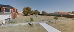
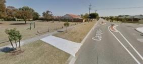
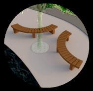
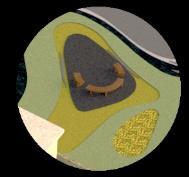
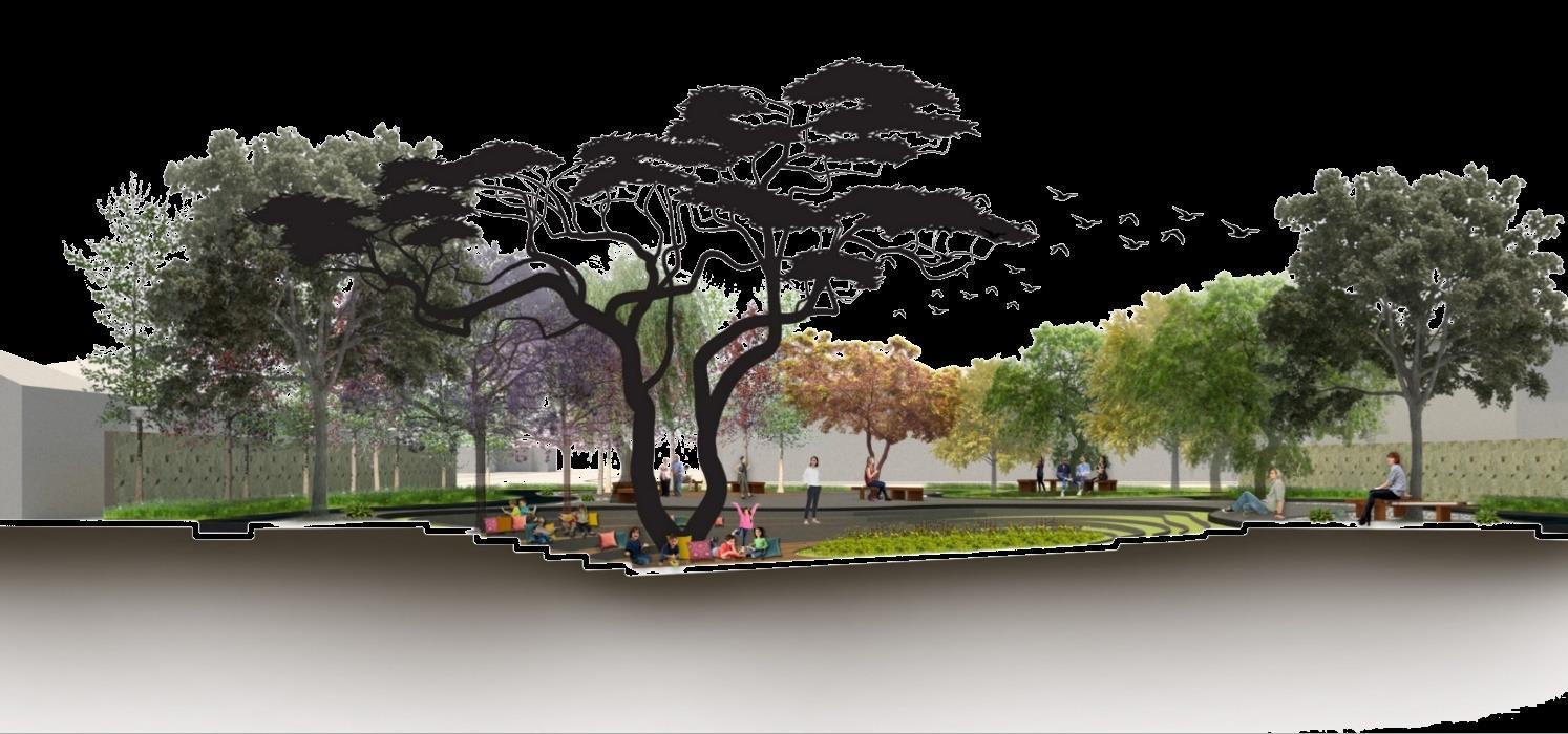
7. Campion Local Learning Garden Design, Australia
8. Akhtar Garden, Tehran, Iran
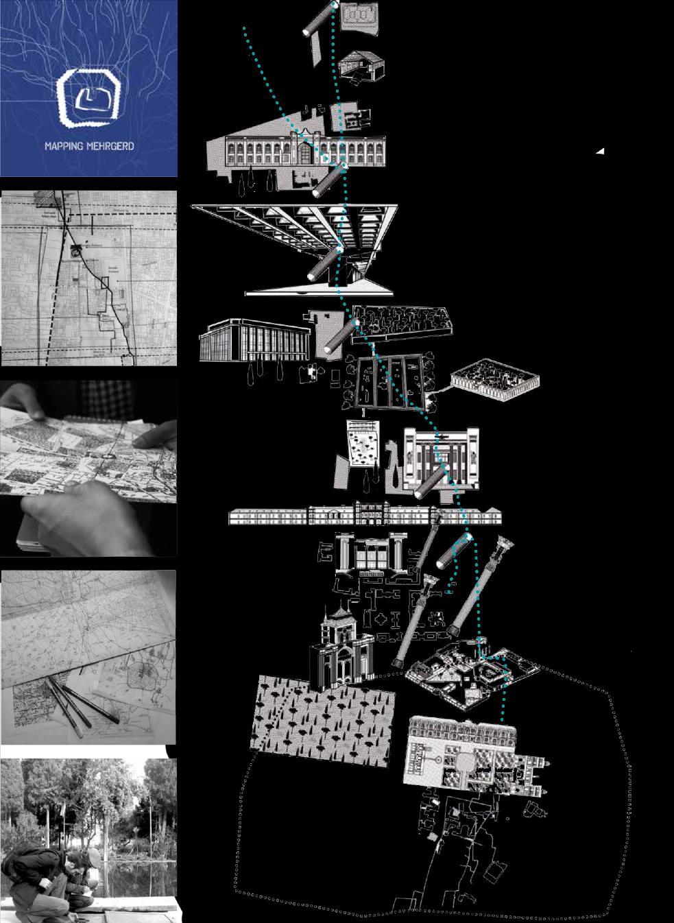
9. Mapping Mehrgerd qanat (ancient Iranian water supply system), Iran
10.Flood Management in Paris, France
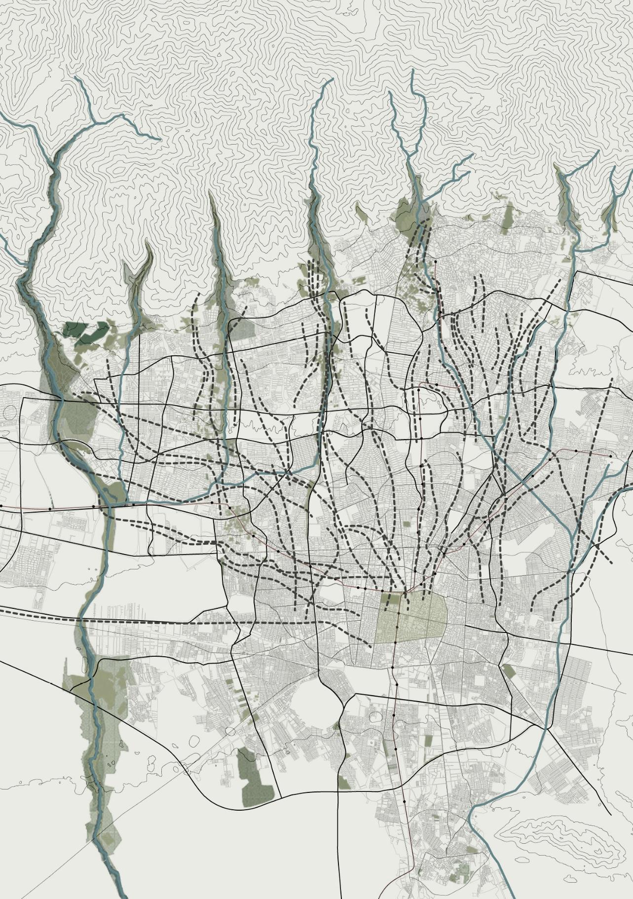
11.Image of a Seismic City, Iran
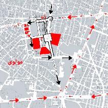
12.Molavi Upholstery Bazar Urban Landscape Planning, Iran
13.Enqelab St. Pedestrian-Oriented Urban Landscape Design, Iran
II. Competitions
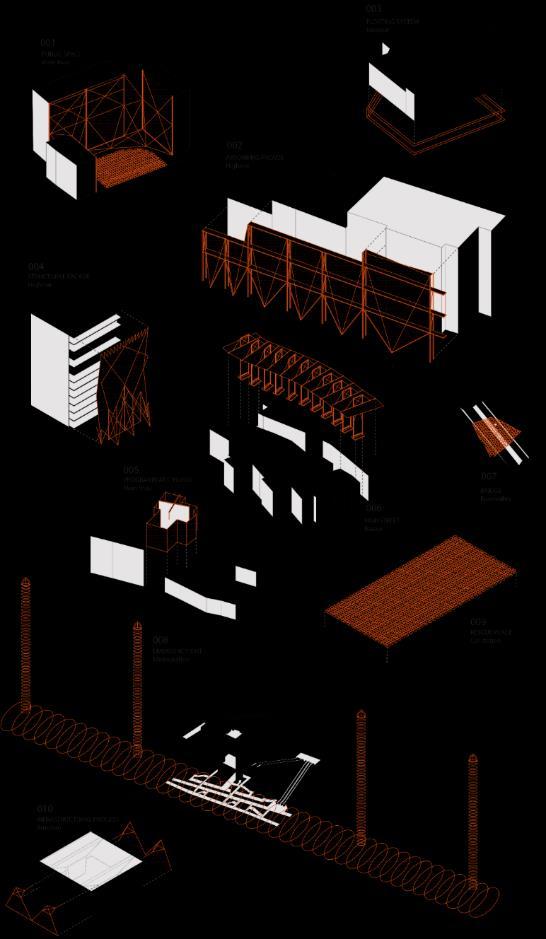
1. TEHRAN Institute, IFLA, Child-Friendly Public Space Design, Honorable Mentioned
2. LO:NOTRE Institute, International Competition Garden Design, Honorable Mentioned
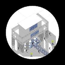
3. TURO, Tabriz Subway Station Entry & Landscape Design, Third Palace
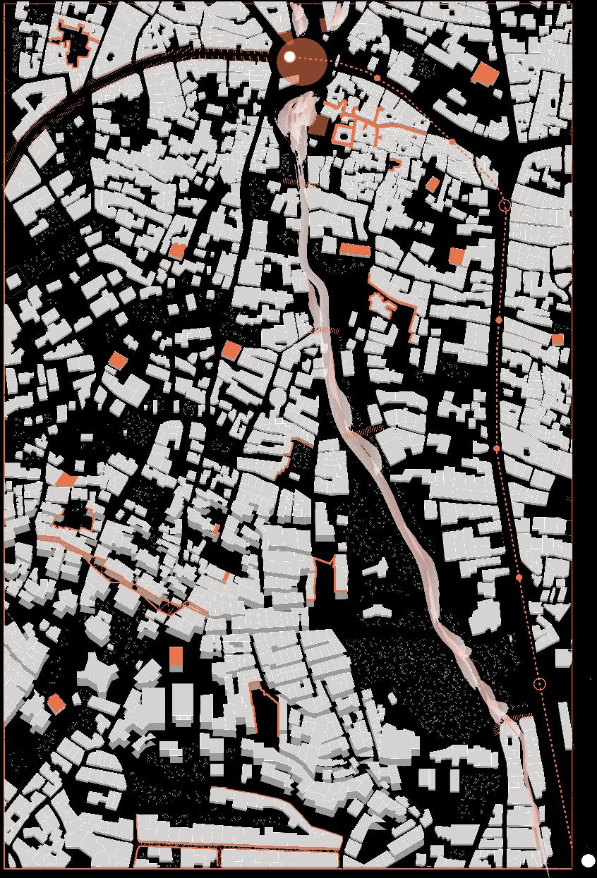
T.C.L (Taylor Cullity Lethlean)- Spark, 2020
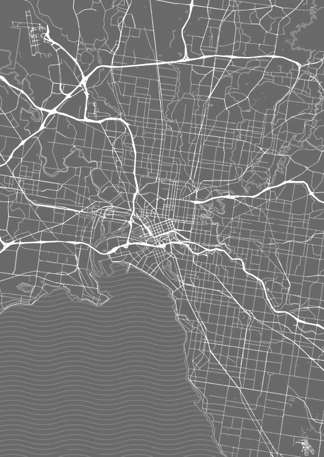
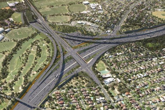
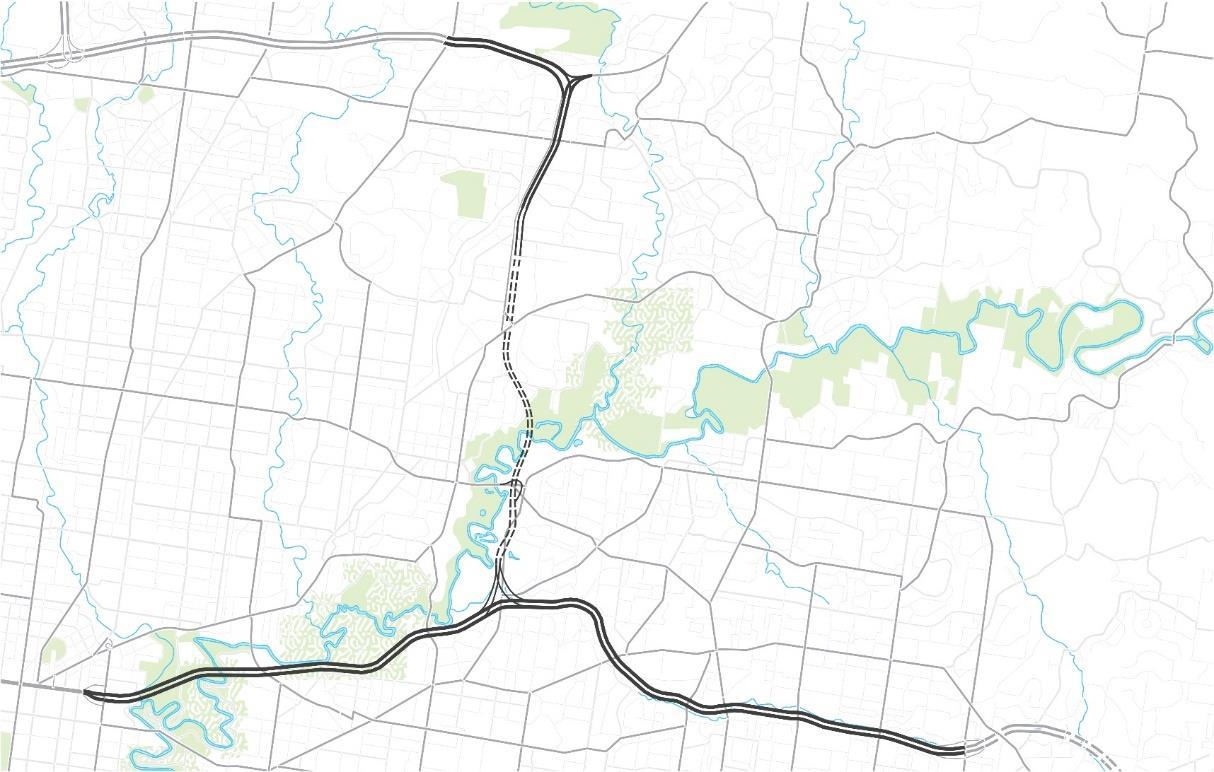
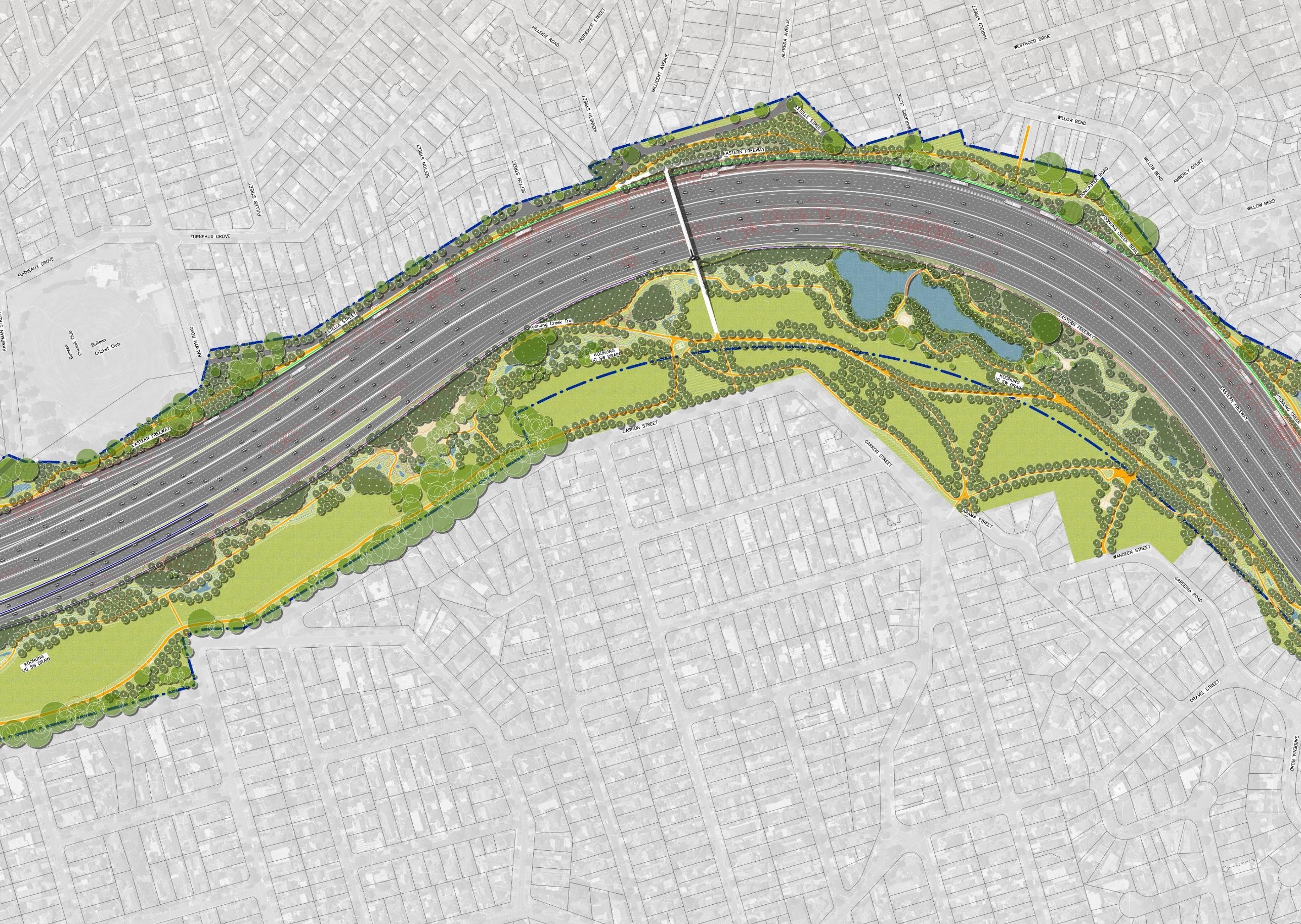
North East Link Project
Location: Victoria, Australia
North East Link will fix the missing link in Melbourne’s freeway network, connecting the M80 with an upgraded Eastern Freeway It will be a safe and efficient freeway connection for up to 135,000 vehicles a day, linking key growth areas in the north and southeast.
My responsibilities range from Water Sensitive Urban Design, Landscape concept design, design development, and documentation to cost estimation, preparing project briefs, tender documents and reports.
Eastern Freeway
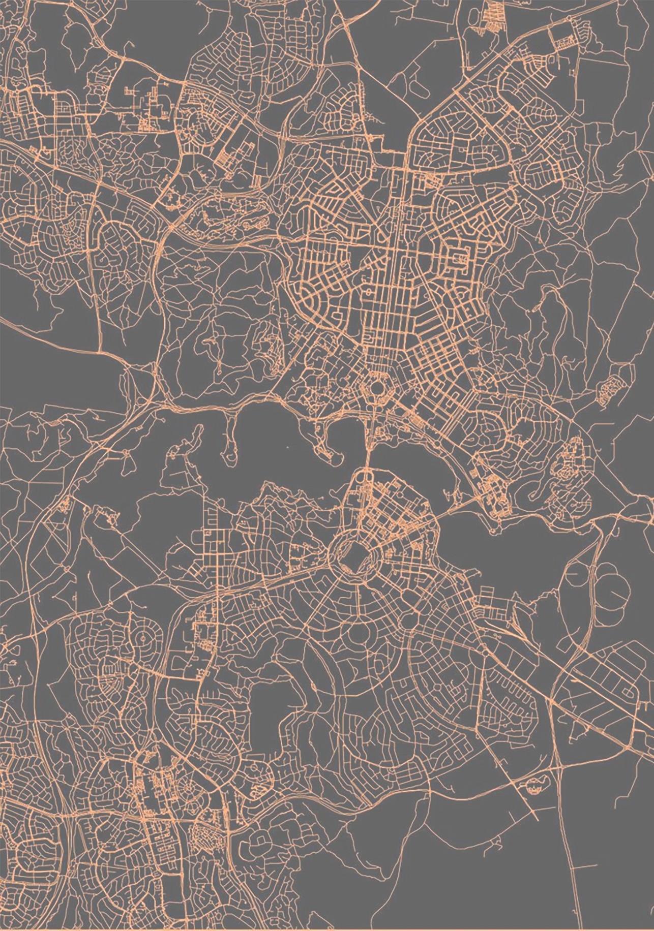
North East Link Project Map
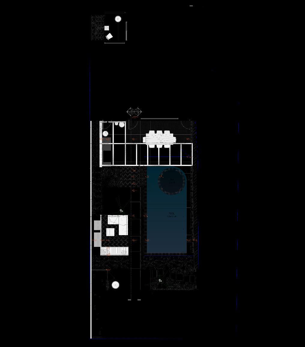
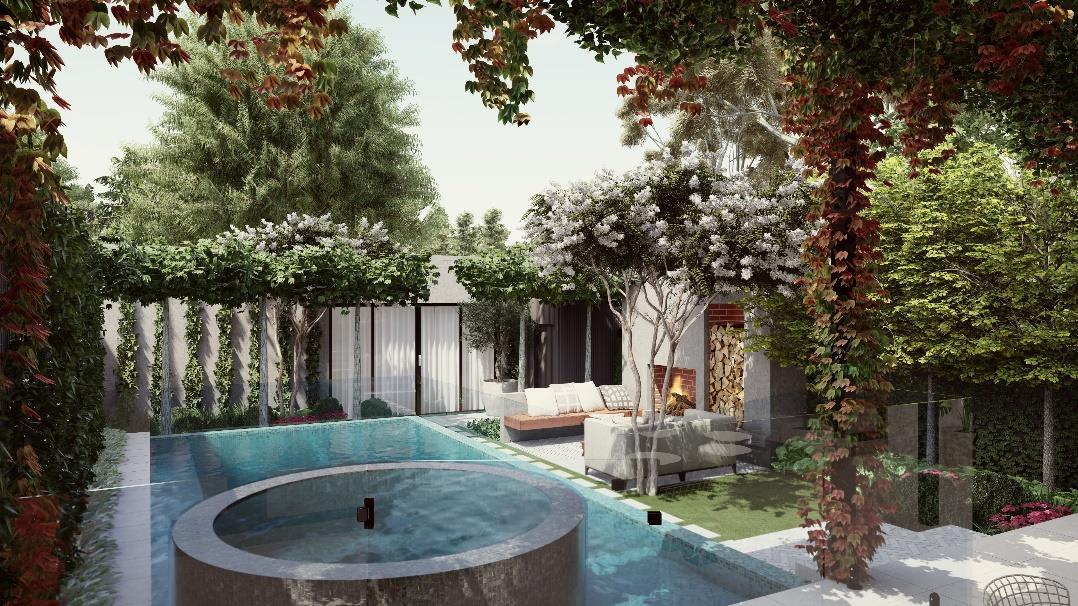
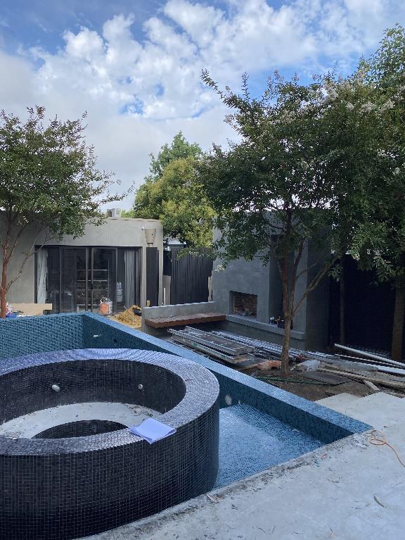
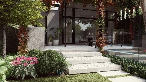
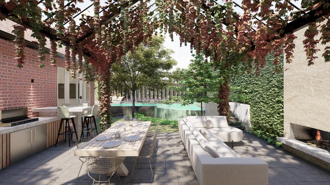
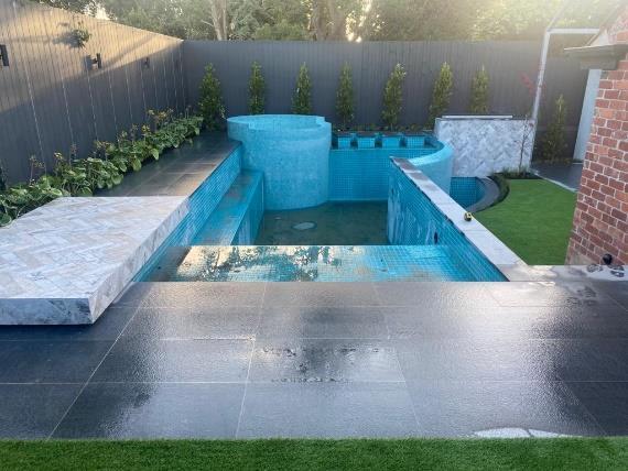
Franklin Landscape & Design, 2022-2023
Boxshall Street, Brighton,VIC
Location: Melbourne, Australia
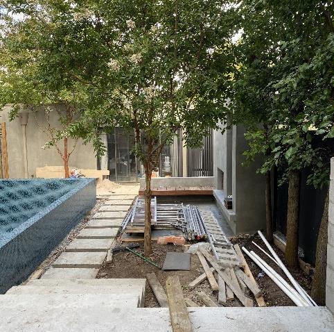
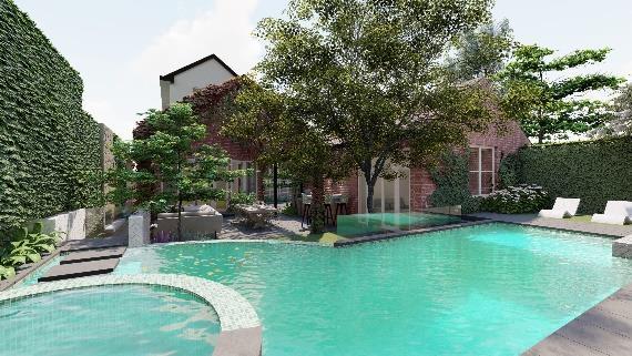
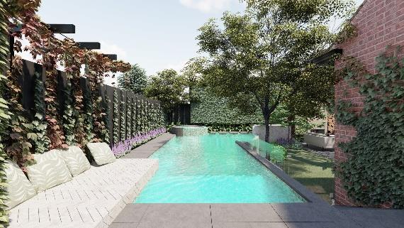
Franklin Landscape & Design, 2021-2023
Nicholas Street, Ashburton, VIC
Location: Melbourne, Australia
UNDP-Tehran University Project, 2019
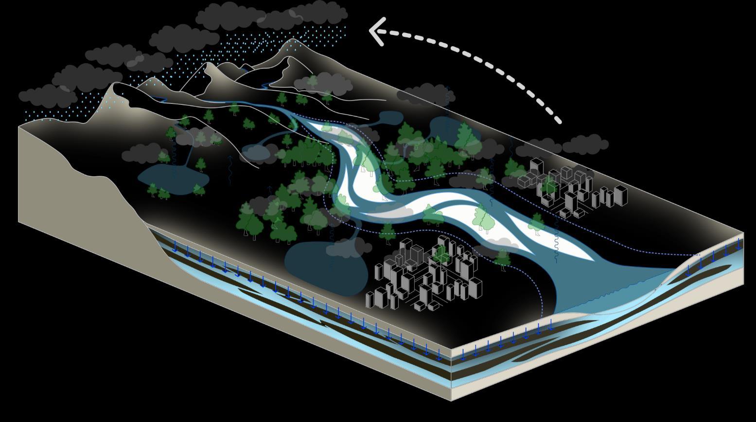
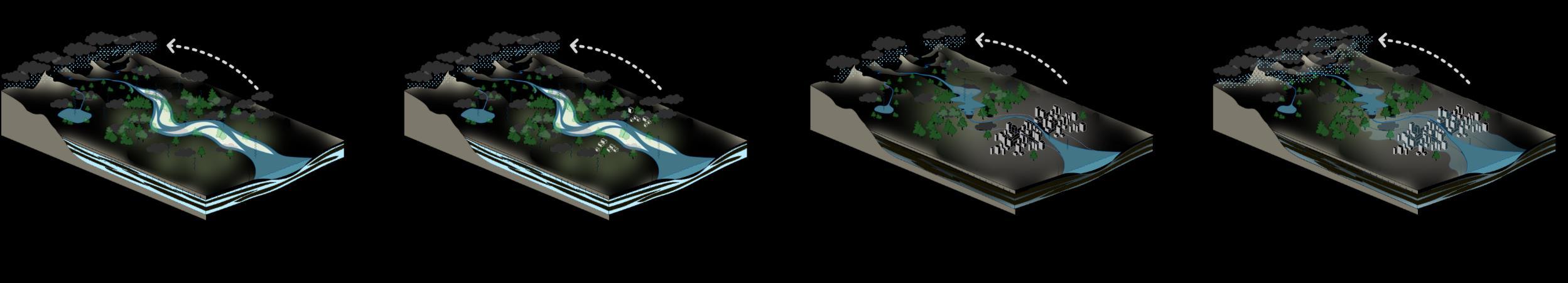
Sustainable Approach Towards Water
Management Strategies
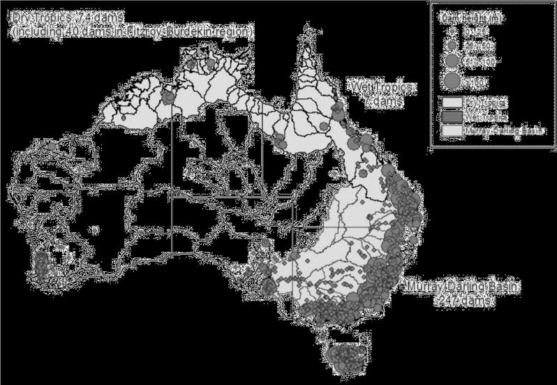
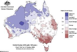
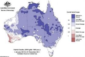
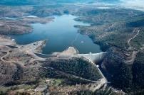
Australia Dams Map
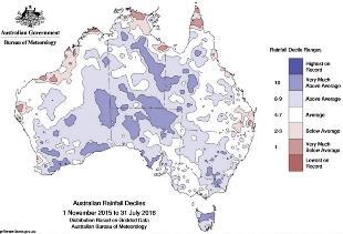
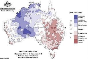
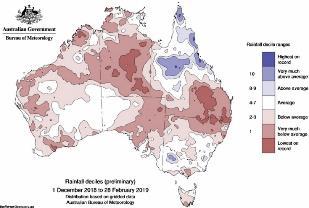
A glance at meteorology maps over the last 20 years demonstrates an overall reduction in rainfall, leading to an increase in dry lands. Dams can be one of the main reasons for this change as they unsustainably modify the natural water cycle This is achieved by concentrating water in some limited spots while limiting water flow by narrowing rivers in larger areas.
The construction of dams often occurs in areas with lower rainfall, where megacities are located However, there is an interaction between dams and the aridity of regions. Dams can intensify dryness, and in turn, aridity intensifies the need for water reservation.
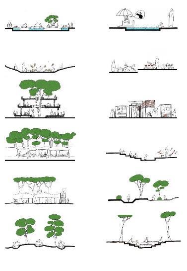
Prospective Landscape
Model of Sustainable Water Management Infrastructure For Supplying water and Controlling Flood
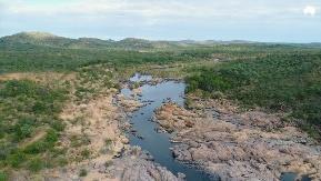
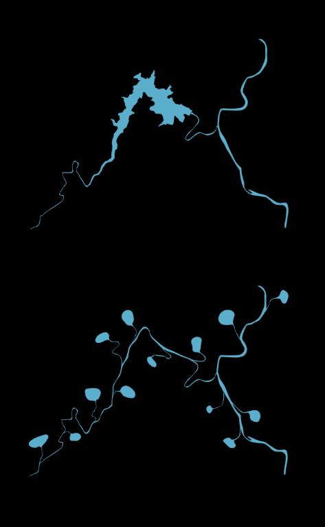
Australia Water Spots
Water spots can be found in three scales in Australia: Reservoirs (Dams), Lakes, and Ponds, all of which are interconnected by Rivers Reserving water on a large scale through dams can wreak havoc on the environment and lead to unsustainability Instead, drawing inspiration from the concept of ponds, a more sustainable method of supplying water and controlling floods can be suggested
Natural Water Cycle Sustainable Water Cycle in Rural Context
Urbanism, Dams & Unsustainable Water Cycle in Dry Period
Dams generate very large water reservoirs that upset the natural water structure balance They can be likened to cancerous tumors, disturbing the functionality of the natural environment.
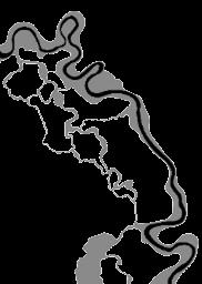
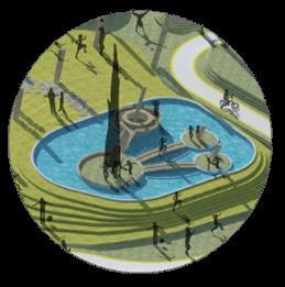
What if we had connection of small ponds rather than Cotter Dam on Cotter river?
If the water spots are divided into smaller sections and repeated along the entire length of the river, a more equitable and sustainable change occurs in the water structure Furthermore, the volume of water flowing out of the river can be controlled through the use of control gates.
Urbanism, Dams & Unsustainable Water Cycle in Flood Period
Keeping the balance of the natural water cycle is of paramount importance for the preservation of natural resources Rivers are to the lands what blood vessels are to the human body. Maintaining the balance of rivers is essential for ensuring a sustainable natural water supply, and several factors come into play, including city size, the quantity and size of man-made water supplying facilities such as dams, and the rate of construction growth
Lakes Ponds Reservoirs
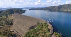
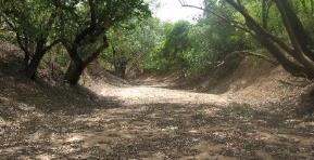
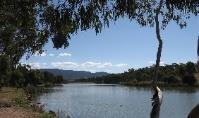
Cotter Reservoir Lake
Tuggeranong Stranger Pond
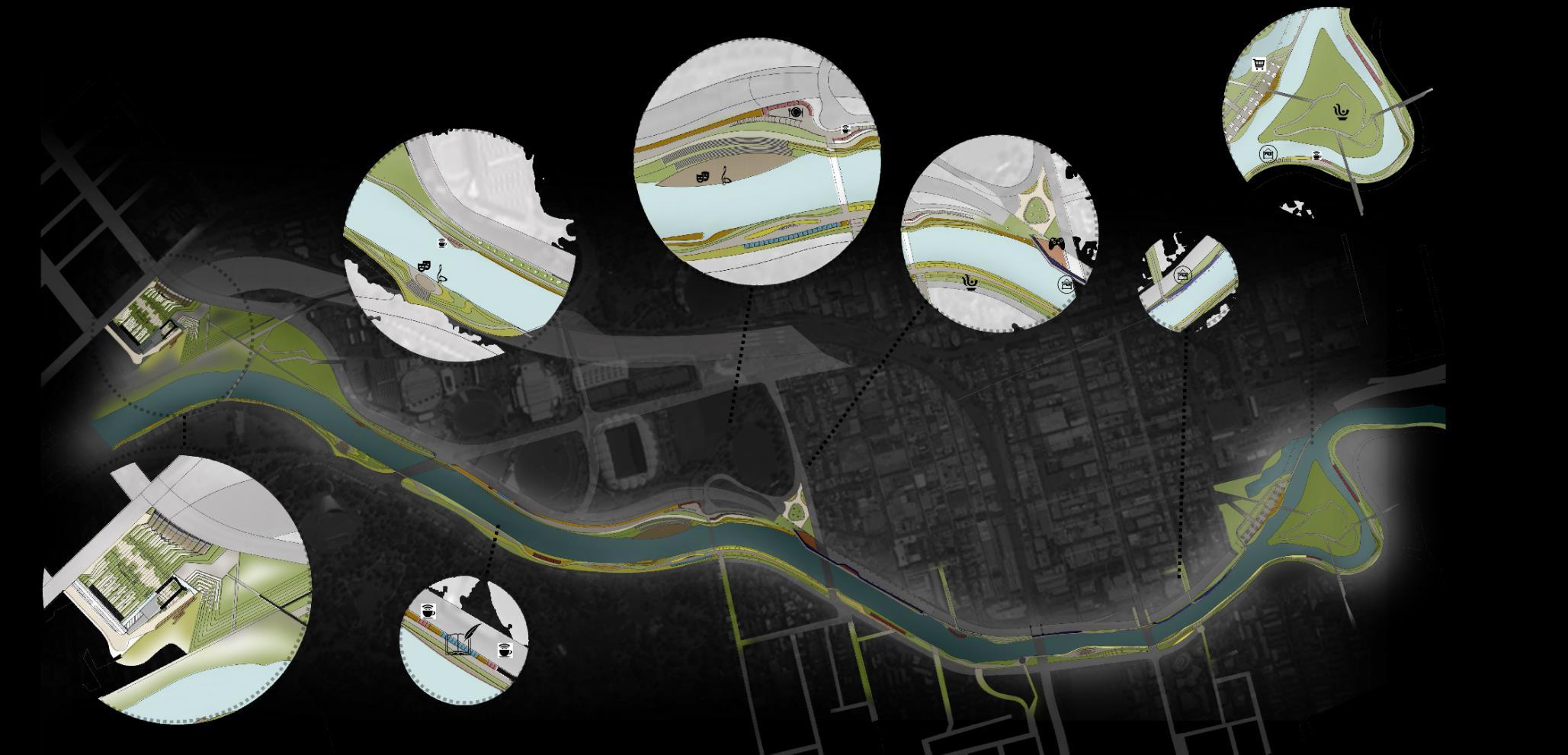
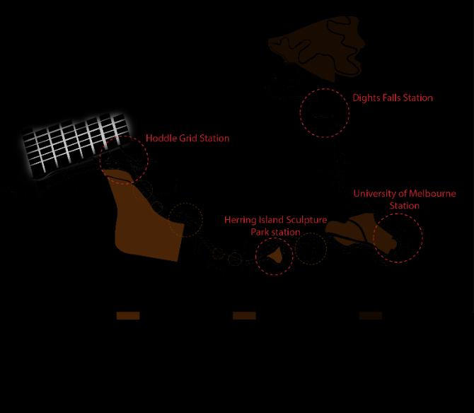
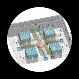
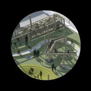
The Future Park Design Idea Competition
University of Melbourne + AILA , 2019
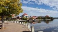
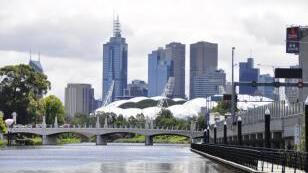
Melbourne Literature Park
Location: Melbourne, Australia
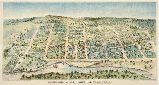
In 2003, Melbourne was designated as a UNESCO City of Literature. The future Melbourne Park will feature an integrated format along the Yarra riverside, hosting numerous contemporary festivals, events, music venues, galleries, and museums.
Foundation of Melbourne
The foundation of Melbourne was based on two main elements:
Yarra River Exploration: In 1803, Charles Grimes explored the Yarra River, and in 1835, John Batman located the Melbourne village in the area.
Hoddle Grid: In 1837, the Hoddle Grid was established as the initial layout for the city.
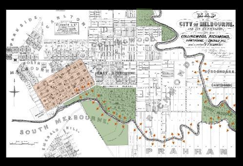
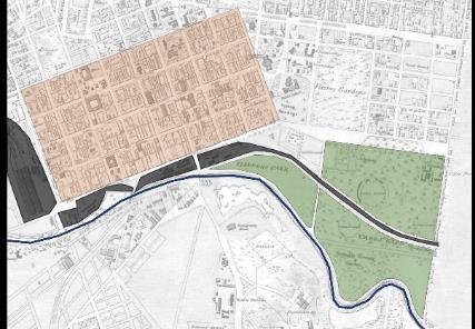
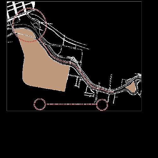
Melbourne‘s Core Urban Structure
The foundation of Melbourne and its urban expansions over the decades have both been built upon Melbourne's strong urban structure: Yarra River and Hoddle Grid
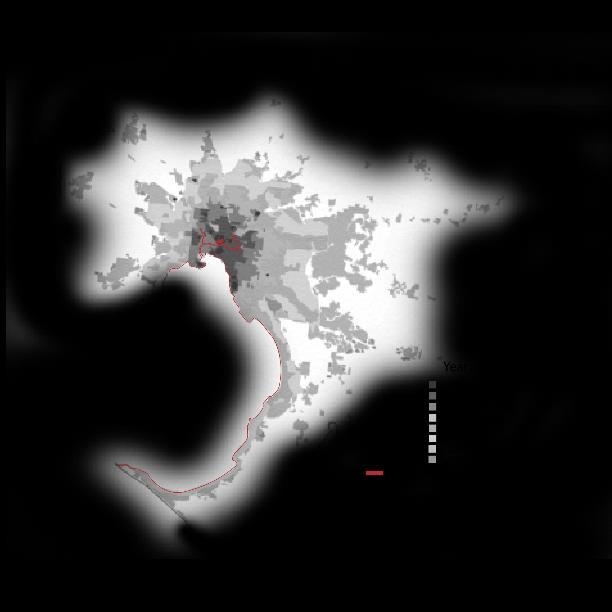
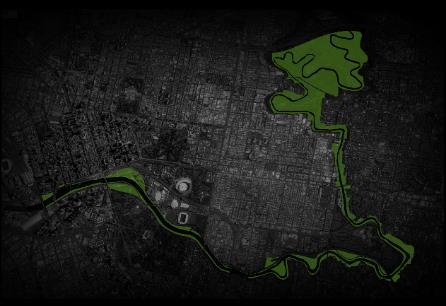
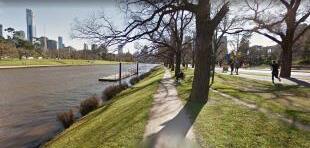
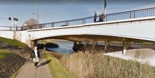
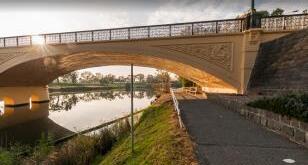
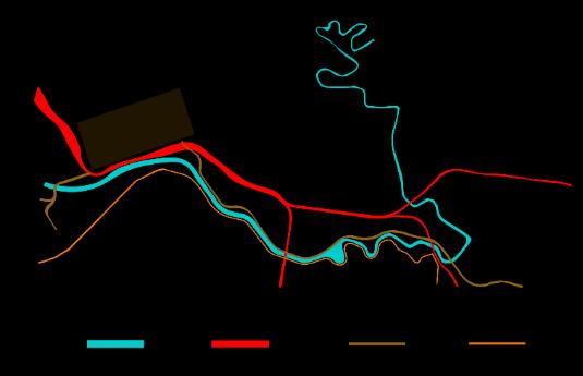
Yarra Riverside Existing Situation
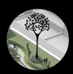
Main Yarra Trail
In certain areas where the riverside is interrupted by highways, bridges, and streets, efforts have been made to preserve trail connections by constructing pedestrian ways and underpasses
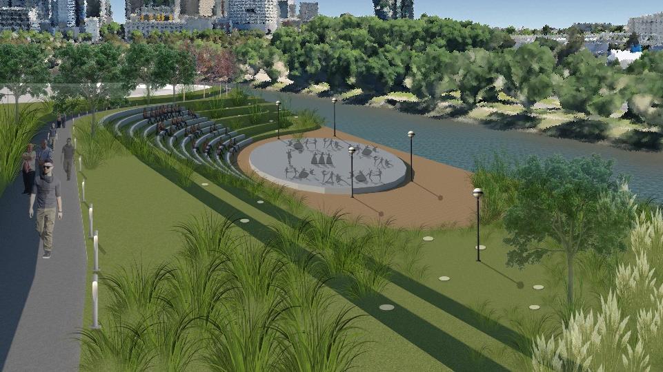
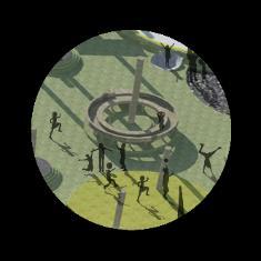
The existing green margin of the Yarra River has the great potential to become the accessible and extendable future park of Melbourne. It is also an essential part of the
structure of Melbourne.
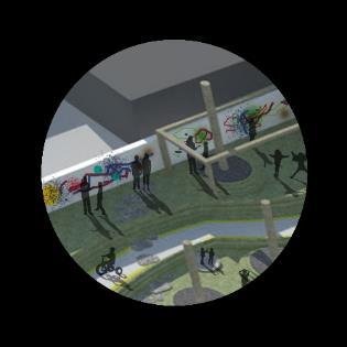
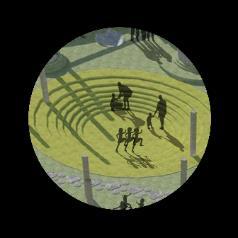
Yarra Riverside Amphitheatre hosts many events, performances and gatherings.
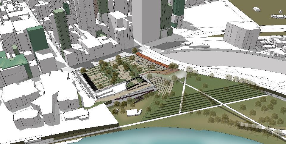
Locating The Melbourne Future Park…
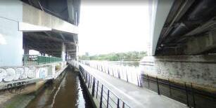
Yarra Riverside‘s Main Issue
One of the main issues confronting urban areas is the disconnection between neighborhoods and the riverside caused by the construction of transportation infrastructures.
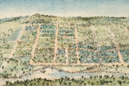
In the Past...
Before the construction of the railway in Melbourne, there existed a robust connection and interaction between the Hoddle Grid, Riverside Gardens, neighborhoods, and the Yarra River
Hoddle Grid
After 1852 and the construction of the railway in Melbourne, the riverside gardens and the connection between the Hoddle Grid and the Yarra River were disturbed.
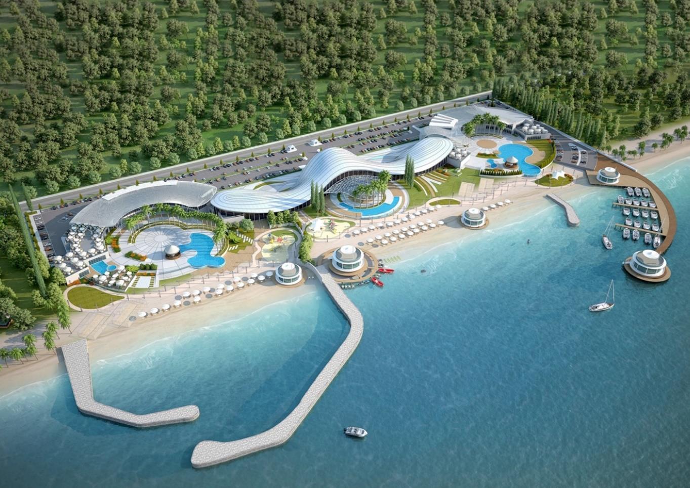
Consultants, 2017 -2019
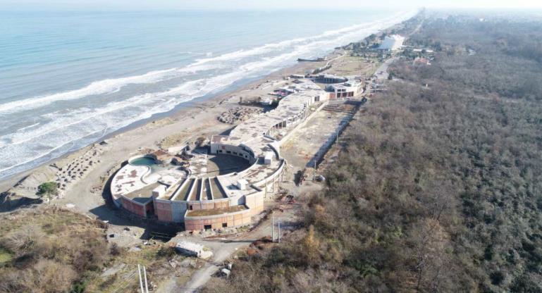
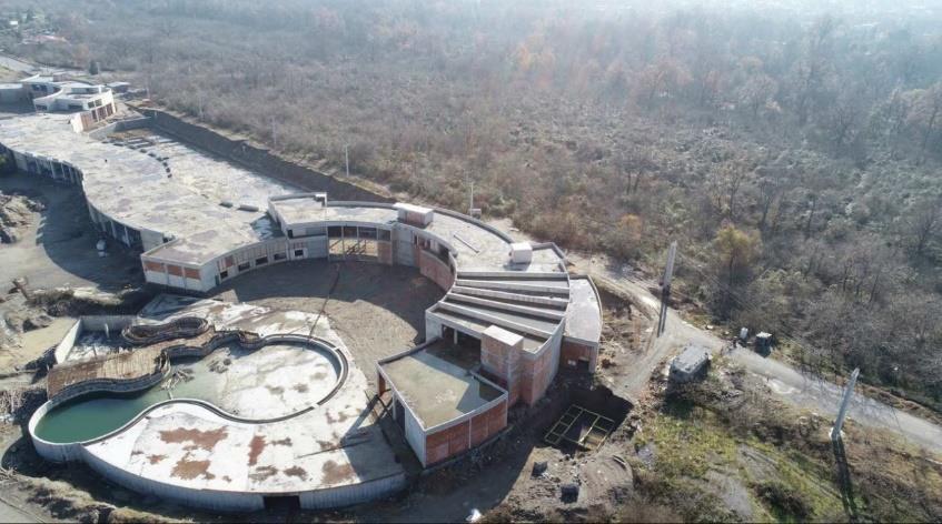
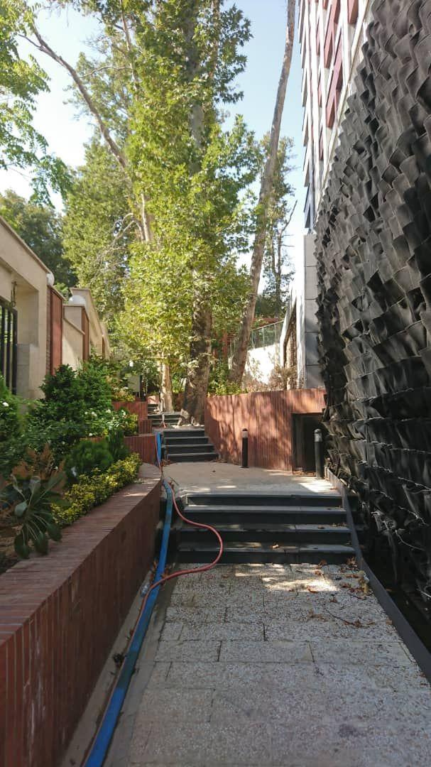
Beach Club Landscape
Location: NamakAbroud, Mazandaran, Iran
Chalus Beach Club comprises various amenities, including swimming pools, a spa, gym, massage rooms, traditional bathrooms (Turkish bath and Moroccan bath), rain showers, a snow room, café, and restaurant in the indoor area, while the outdoor zone features infinity swimming pools, a lounge, landscaped areas, and a café.
My responsibilities ranged from landscape 2D drafting and 3D modeling to documentation, resolving site topographic challenges and surface water collection issues, optimizing views of the sea and jungle, addressing privacy concerns, and preparing construction documents. Additionally, I handled project management and contract administration.
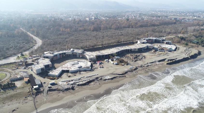
Chalus Beach ClubUnder Construction-2019
STP Consultants, 2019
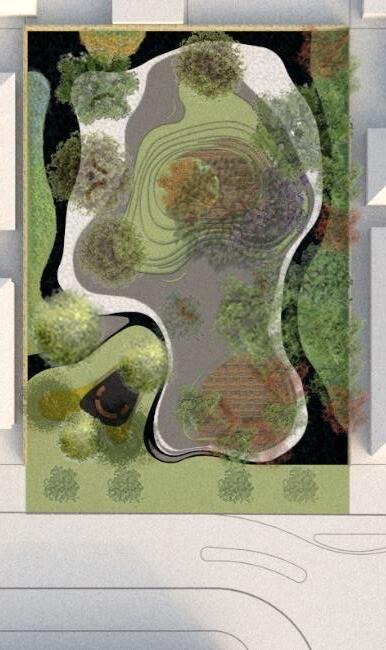
ampion Local Learning Garden
Location: Perth, Australia
The main concept of the Learning Garden is to familiarise local people, especially children, with the history and natural heritage of Perth and Western Australia. It utilizes various symbols such as the Swan River, Gold Mines, Red & Green Kangaroo Paw plant, Boab tree, and the colors of Golden and Black Additionally, Perth's endemic plants and trees, including Eucalyptus, Peppermint, Succulents, and Banksia, play a significant role in transferring basic geographical knowledge to children The garden creates a warm and casual environment, featuring soft, home-inspiring furniture like pillows,
a
a. Eucalyptus Spathulata
London Plane
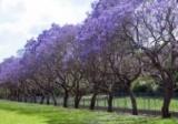
Blue jacaranda
Liquidambar styraciflua
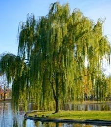
Weeping Willow
f. Peppermint b. Ficus Hillii
Ajuga q. Banksia menziesii
o. Eutaxia obovata
Myoporum parvifolium prostratum
Kidney Weed
h. Lamb's Ear
Low-growing succulents
White Pebble
Campion St.
all under the comforting shade of
large Eucalyptus tree.
Black Water inspired from swan river
n. Boab tree p. Red & Green Kangaroo Paw
White Pebble
Low-growing succulents & White Pebble
Main Sitting inspired from Gold Mines
Acacia Pulchella & Black Pebble Gold & Black Colors in Garden Enterance
Main Sitting inspired from Gold Mines
Lamb's Ear and River stone
Wooden Benches with Tree shade Garden Enterance
Consultants, 2018
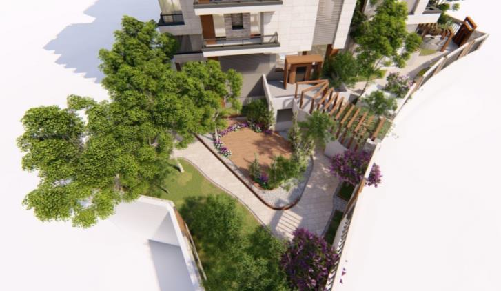
Akhtar Garden
Location: Tehran, Iran
3D rendered Visualisations
Akhtar Garden- Under construction Right: Green Wall ,2019
The Akhtar Garden Residential Building is situated in the northern area of Tehran on a sloped site. Due to limited space for horizontal gardens, our emphasis was on incorporating vertical landscapes, such as green walls and waterfalls, along with traditional gardens.
9
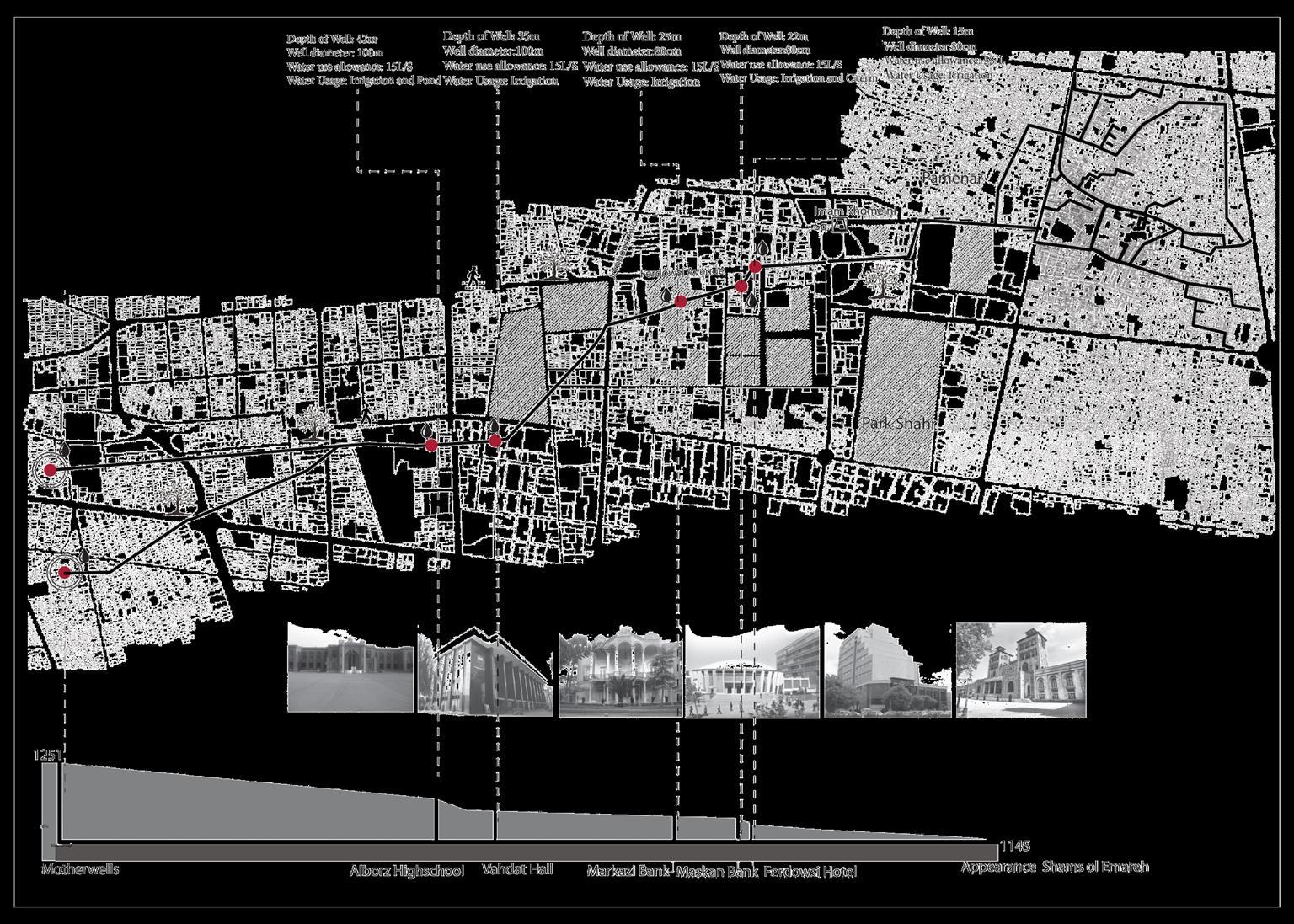
Mapping Mehrgerd Qanat
Location:
Tehran, Iran
Tehran once boasted 3000 qanats, sourced from the Alborz foothills, which served as the city's primary water supply and irrigation system until 50 years ago. Unfortunately, due to unsustainable urban expansions, many of these qanats have been eradicated and dried up However, some have managed to survive, and a significant amount of high-quality mountain water still flows underground in Tehran. Regrettably, much of this water now mingles with urban waste due to a lack of management
Among these qanats, the Mehrger qanat stands as the oldest, with a history spanning 700 years It continues to yield excellent water quality, with some of its wells even providing drinkable water To make the most of this valuable resource, efforts have been made to map the qanat and identify the locations of its wells
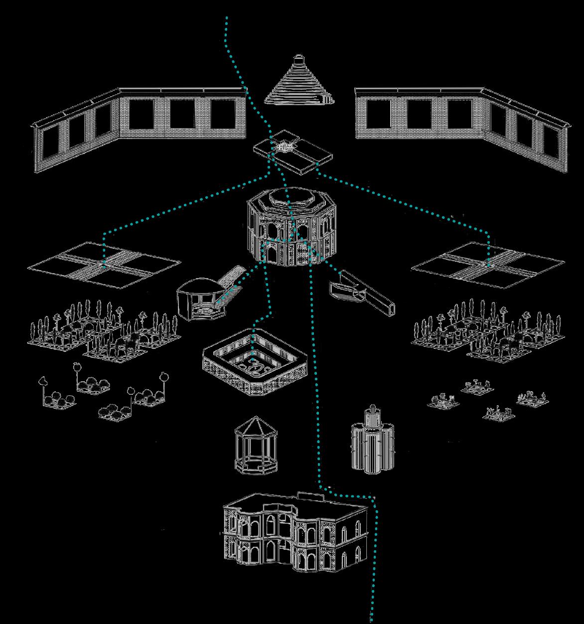
ehran Filtering Gardens Stations
Gardens in Five Sequences
A large-scale management project for the entire qanat network may seem unfeasible, but in times of water scarcity, it is no longer viable to let this water go to waste. As a result, the gardens will play a crucial role in reclaiming the water provided by the qanats, which has unfortunately been contaminated by mixing with wastewater from the city's newer neighborhoods To achieve this, the gardens will incorporate a purifying function, allowing for the reuse of water, even if it is not intended for drinking purposes The water recycling process will rely on natural purification techniques involving plants, charcoal, gravel, and other means.
The project is situated in Tehran's 12th district, which holds historical significance dating back to the 16th century and is where the oldest qanats resurface. The design will incorporate elements of the traditional Persian garden in a sequential procession.
Chahar
Bagh
Reservoir (abanbar)
Mazhar)
(Hesar)
Mother Well (Behjat Abad Garden)
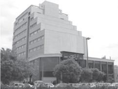
Alborz School Well
Hafez Bridge Well
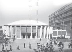
Vahdat Hall
Ghurkhaneh
National Garden( baghmeli)
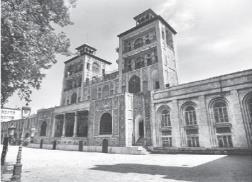
Shams ol emareh( Apearance)
The active involvement of people in creating the gardens and their dedication to utilizing endemic plants and fruits, as well as their efforts to preserve natural habitats and soil, constituted one of the main objectives of this project.
Public spaces revival
Garden-City revival & endemic plants cultivation
Water supply improvement & qanat revival
Community Garden Site-Oudlajan conflict effected context
Access to Mehrgerd qanat Galleries
Mehrgerd qanat Galleries with qualified underground water
Versailles University, 2016
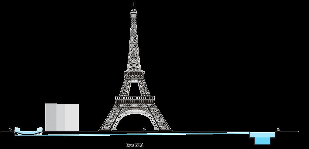
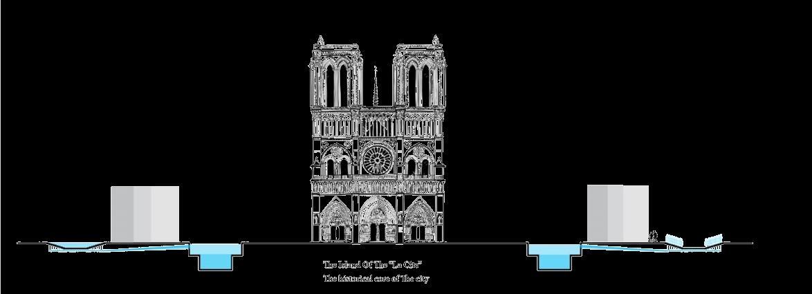
Flood Management in Paris
Location: Paris, France
Paris has been facing the challenge of flooding since its inception, and this issue demands serious attention The significance of the city's iconic landmarks, such as Museums, Notre Dame, and the Eiffel Tower, being located along the riverside emphasizes the importance of addressing this concern. However, the lack of responsive green and permeable lands exacerbates the impact of heavy flooding
The Seine River bank, made of concrete, is a subject of controversy While enhancing the permeability of the river bank could be beneficial for flood control, the concrete bank holds a unique allure and is a central attraction of Paris
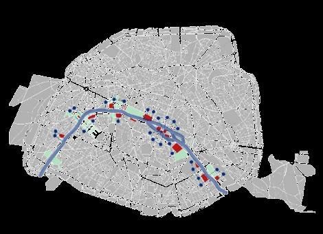
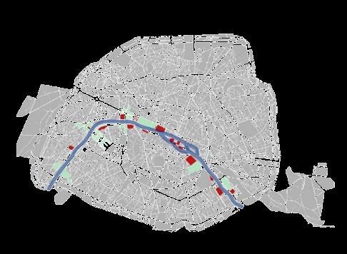
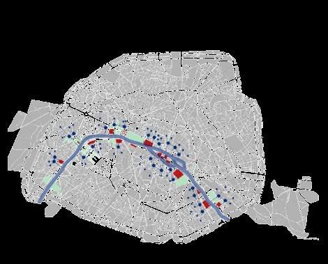
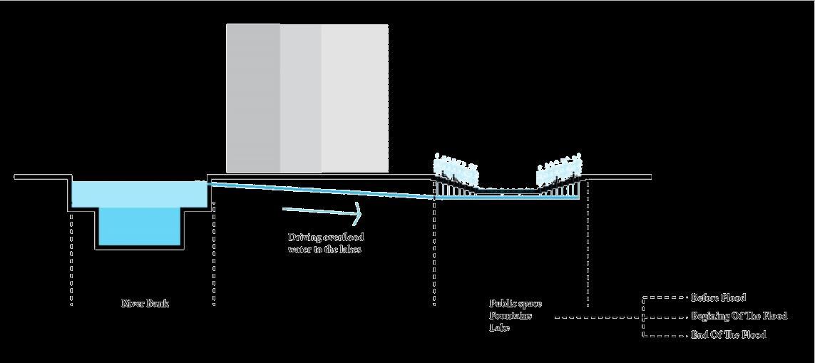
During flood situations, the excess floodwater will be channeled through underground channels to urban lakes, ponds, and fountains within the city. Normally, these lakes and ponds have a low water level and serve as performative landscapes However, during floods, they gradually begin to fill up, and the fountains start operating.
Lakes, Ponds and Flood Fountains
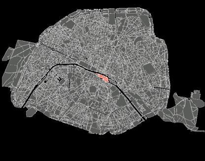
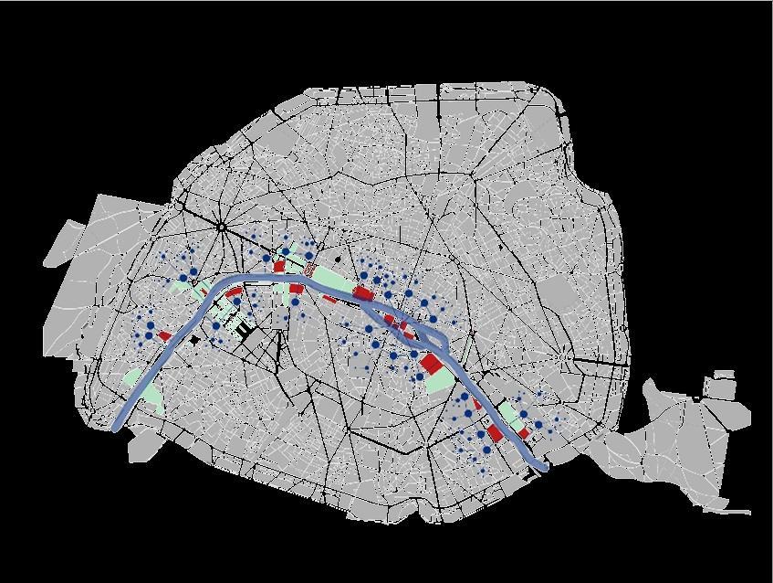
The island, which is the city center of the historical core, is highlighted in red. The map displays important buildings and green penetrative lands
Lakes: Floodwater is channeled to urban lakes through underground channels Ponds: Depending on the magnitude of the flood, ponds may remain free of floodwater
Lakes, ponds, and fountains are interconnected through a water network. During the most serious floods, the fountains become operational
Versailles University, 2016
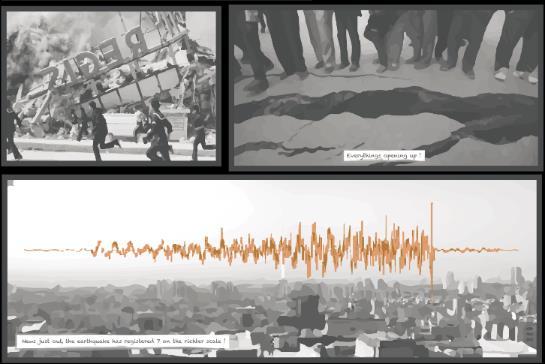
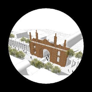
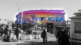
Image of a Seismic City
Location: Tajrish Sq., Tehran, Iran
Retrofitting Systems
Tehran is situated in a seismic zone, requiring retrofitting measures at various levels and scales, in compliance with seismic building codes Different systems can be employed to strengthen various types of buildings, including small-scale residential structures, large-scale official and commercial buildings, emergency centers, hospitals, governmental and security buildings, as well as religious and cultural centers. These retrofitting systems encompass braces, dampers, base isolation, urban shelters, and more
While earthquakes pose a vulnerability and threat, they also present an opportunity to enhance the city's image Retrofitting systems, which have historically disrupted the city's aesthetic, be reimagined and managed
n the fictitious image of Tajrish narrating the earthquake story in Tehran, we witness a deep fault passing to the north of the city. As the earthquake strikes, old nonretrofitted buildings are eradicated. However, amidst the devastation, some buildings stand strong, adorned with braces featuring intricate Iranian patterns. The walls are constructed using mountain stone layers, adding to the structural resilience Notably, the floating shrine is uniquely fortified with a base isolation system, allowing it to withstand the seismic forces
Retrofitting systems
Mapping in Tajrish Zone
Tajrish sq.
Tehran University, Faculty of Fine Arts
Master Thesis Project, 2017
19 out of 20, Excellent
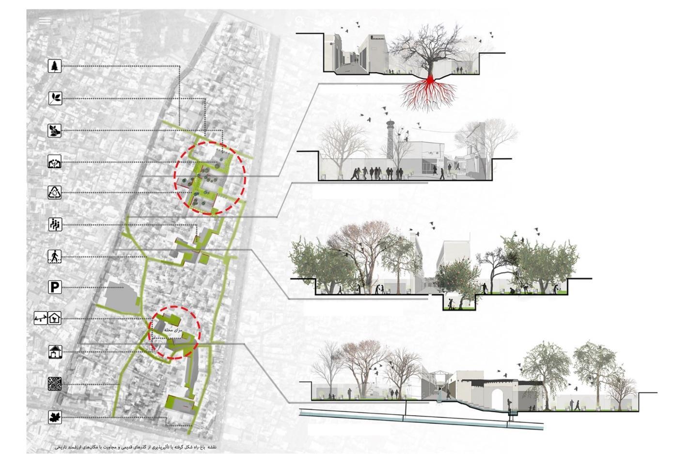
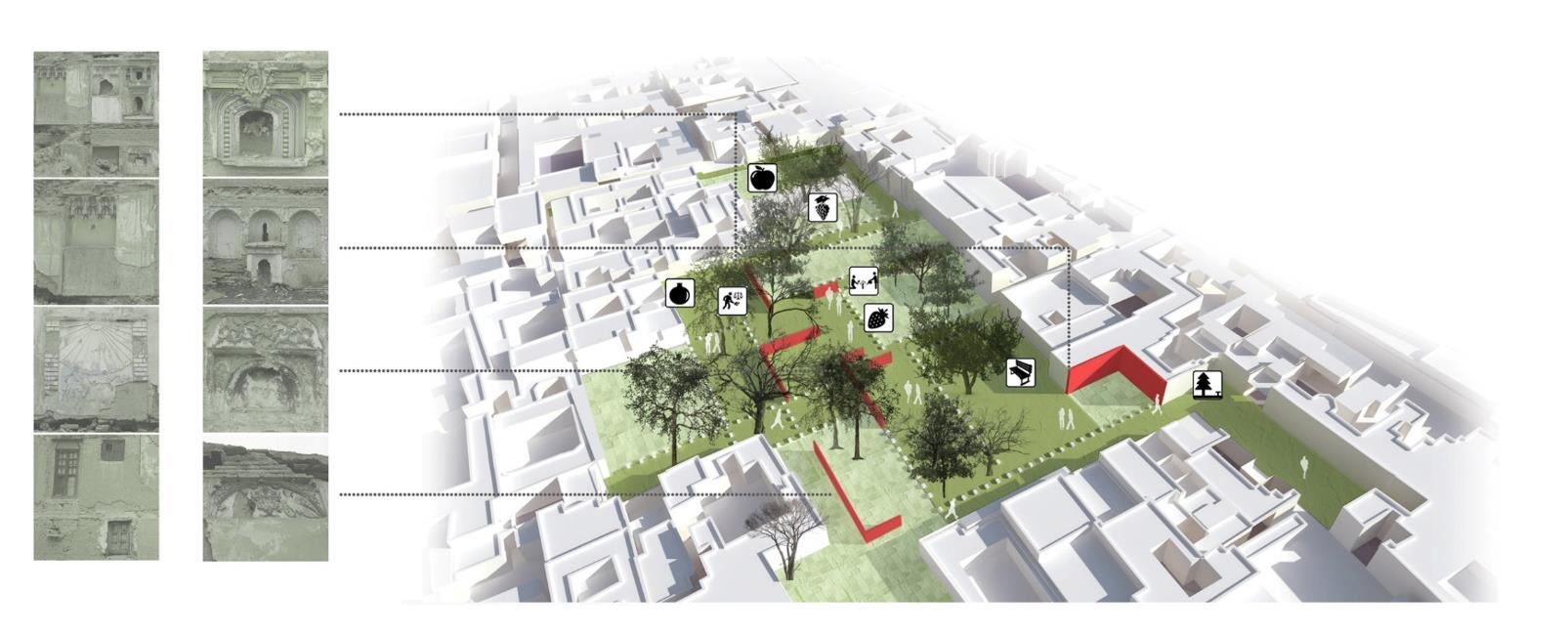
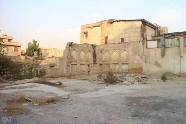
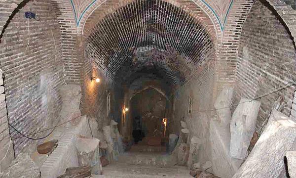
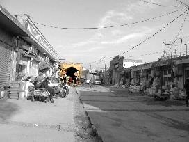
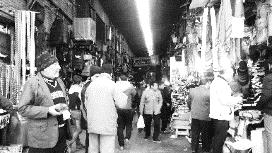
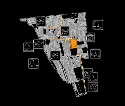
Molavi Upholstery Bazar Urban Landscape Planning
Location: Tehran, Iran
After a rapid urban expansion in Tehran, the grand bazaar, which was the main structure shaping the city, suffered severe damage, leading to the abandonment of many neighborhoods connected to the bazaar. Consequently, the Molavi area, once rich with hidden treasures, became a haven for displaced individuals and criminals.
In Iranian cities, the linear structure of the bazaar plays a crucial role in forming the city's main structure The bazaar structure consists of a line with two anchoring heavy spots on both ends. In the past, the anchoring spots of Tehran's bazaar were "Sabze-Meydan" (Green Square) and "Amin Al Soltan" Square. While Green Square still exists, "Amin Al Soltan" Square has been eradicated
This project aims to rehabilitate the Molavi urban context by restoring the demolished structure of the grand bazaar Planning was necessary for "Amin Al Soltan" Square and other important historical spots around it Moreover, the project focuses on strengthening the economy of Molavi, with a particular emphasis on the upholstery sector
Ghabr-Agha Tombstone Entry Open Public Space
Southern Port & Belvedere Building
Khanat Caravanserai
Transparent Pavilion
Khanat Caravanserai Entrance Building
Iranian Carpet Garden square reviving Old Amin Al Soltan Square
Pedestrian Street with different layers of movement
Northern Port and Belvedere Building inspired from ancient Iranian City Ports
Public Amphitheatre & Media Arts
Grand Bazar Map
Main Streets
Mapping Amin Al Soltan Sq.
Highlighting different functions
Tehran University, Faculty of Fine Arts Urban Landscape Design Studio,2016
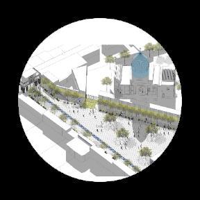
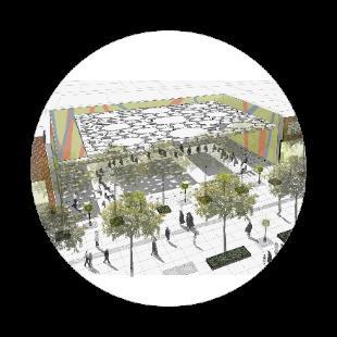
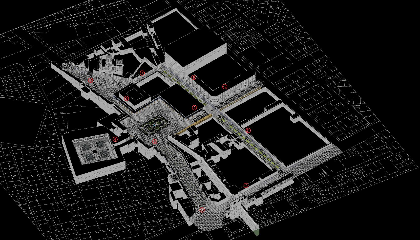
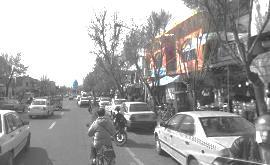
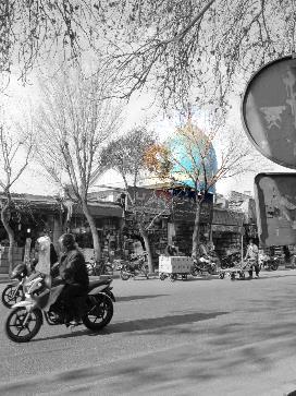
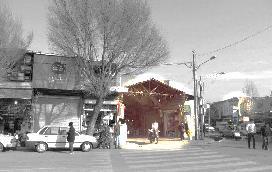
Enqelab St. Pedestrian
Zone Design
Location: Tehran, Iran
Enqelab Street, situated between Enqelab Square and Valiasr Crossroad, holds a prominent position as the cultural center of Tehran Within this area, more than 5 colleges and numerous Enlightenment Cafés thrive It is also the main book hub of the country, boasting hundreds of bookstores. However, being located in the city center, the street faces challenges of overcrowding, noise, and pollution due to heavy car traffic and the presence of certain incompatible activities that contradict the nature of this area.
The objective of this project is to find solutions that can effectively organize the functions of the street and transform it into a vibrant recreational, commercial, and cultural hub, free from disruptive cars, noises, and pollution
Sculpture
TEHRAN Institute, IFLA
Landscape & Urban Planning Competition
Honorable Mentioned, 4th Place
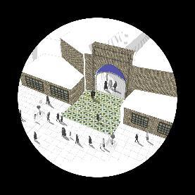
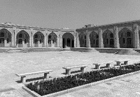
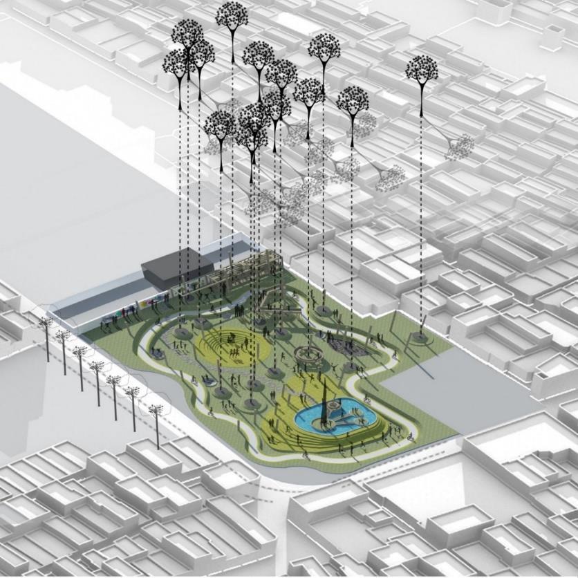
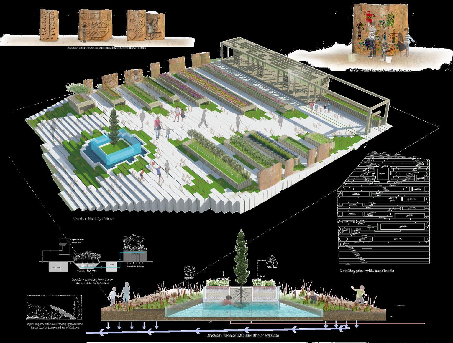
1Child Friendly Public Space Design
Location: Haft-Chenar, Tehran, Iran
Haft-Chenar Park, situated in an inner-city neighborhood, holds historical significance as the remnant of a historical garden Its name, "Haft-Chenar," translates to "7 oriental plane trees," and it is renowned for its abundance of ancient oriental planes, particularly the holy seven trees that share a common root Over the years, the garden has transformed into an unplanned urban park, but it still retains valuable elements, including certified registered old trees and a unique pond.
LO:NOTRE Institute
International Competition Garden Design, Antalya Expo 2016
Honorable Mentioned, 4th Place
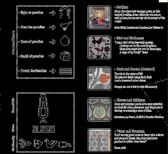
A Garden Beyond Paradise For Children
Location: Antalya, Turkey
Anatolia, with its rich history of diverse communities and civilizations, stands as the cradle of magnificent Turkish culture Within the region, the concept of paradise holds great significance and is beautifully reflected in carpets and other handicrafts from Antalya. In this project, we aim to harness the essence of Antalya's cultural and natural heritage, drawing inspiration from its archetypes and potentials, and "weave" them together to construct a green future and breathe new life into the lives of children
3
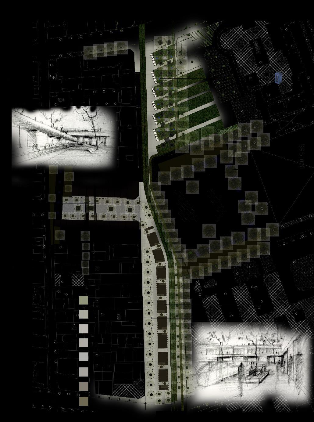
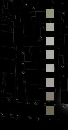
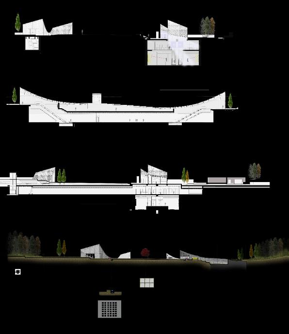
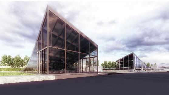
Tabriz Urban Railway Organization
Subway Station Architectural & Landscape Competition,2016
3rd Place Award Winner
T
abriz
Subway Station Entry & Landscape Design
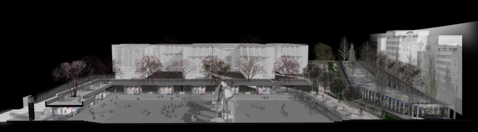
Location: Tabriz, Iran
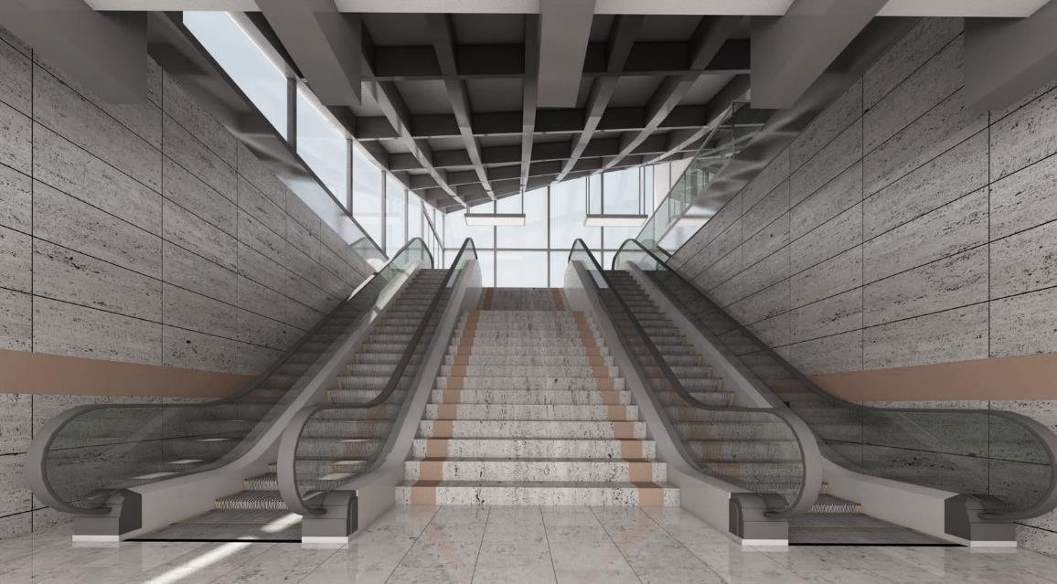
The design of the Tabriz Subway station was a dedicated effort to blend architecture with the surrounding landscape. The station entries were meticulously crafted to create the impression of gracefully emerging from the underground Surrounding these entries are bicycle lanes, walking paths, public spaces, and outdoor galleries, seamlessly integrating the station with its environment
The interior spaces were thoughtfully designed with side windows, allowing sunlight to permeate the station and establishing a connection with the outside This enables a dynamic and vibrant ambiance, inviting both passengers inside the station and people in the surrounding areas to experience the space