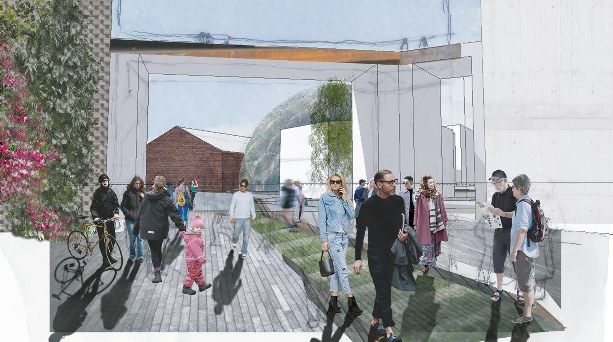
PROJECT
PORTFOLIO
A collection of multidisciplinary projects, focused towards a Landscape Architecture future
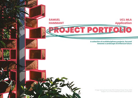
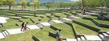
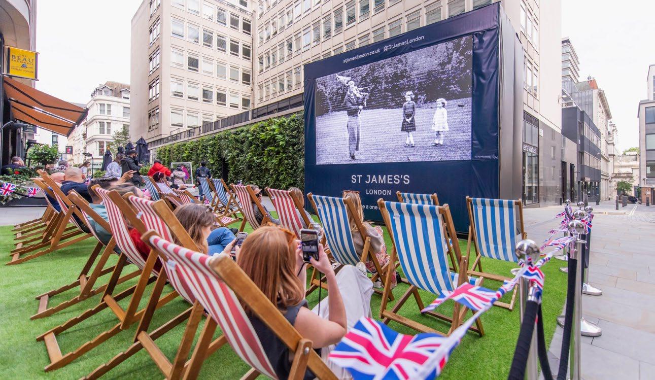
 Image: Samuel Hammant, RHS Chelsea Flower Show, 2022
Subject: Out of the Shadows, Kate Gould Garden
Image: Samuel Hammant, RHS Chelsea Flower Show, 2022
Subject: Out of the Shadows, Kate Gould Garden
I have arranged recent academic, professional and personal projects by scale to showcase the full range of my analytical, technical and presentation skills.
Where appropriate, I have detailed my ‘MLA Aspirations’, which highlight specific aspects of each project that motivate me to pursue post-graduate studies in Landscape Architecture.
SOFTWARE COMPETENCY:
Adobe Creative Cloud
Autodesk AutoCAD
SketchUp Pro
V-Ray
Notion Project Management
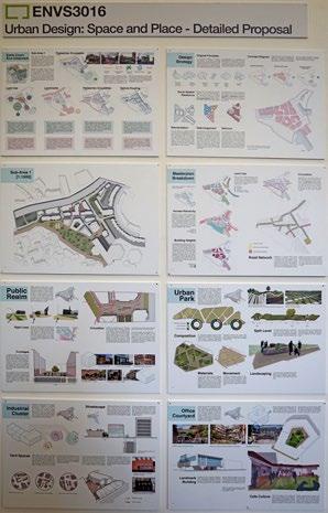
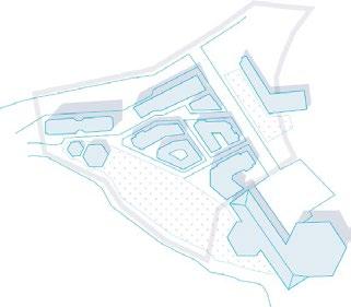
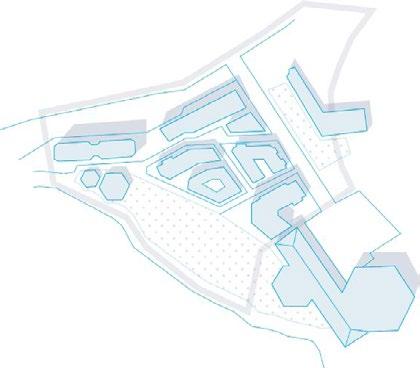
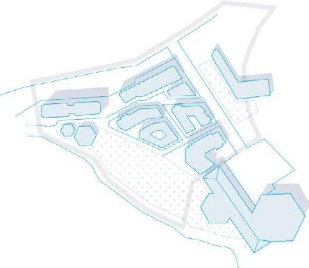
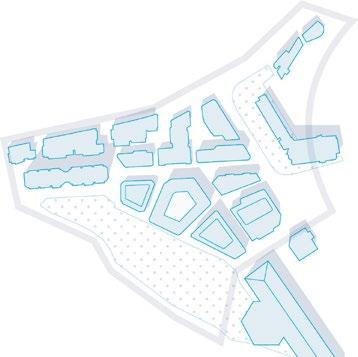
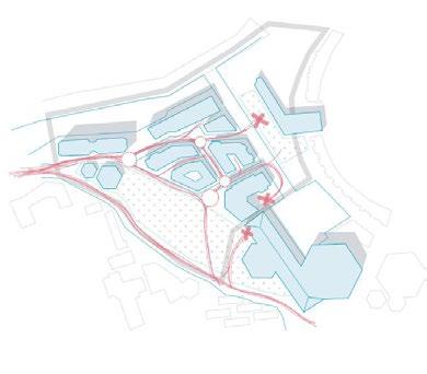
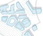
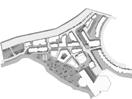
MACRO: EARLS COURT
Area: 8.6ha
MASTERPLAN, URBAN DESIGN & DETAIL; 2017
Production of a masterplan and overall design strategy, balancing form, heritage and competing end-users.
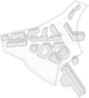
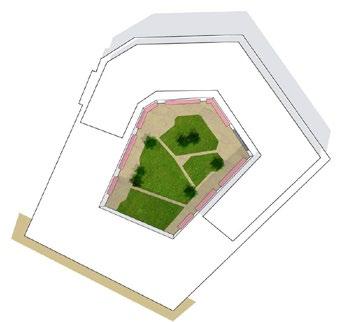
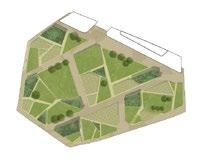
MIRCO: GIBBS GREEN PARK
Area: 0.7ha
PARKLAND DESIGN; 2023
Development of the masterplan’s natural form and landscape features in greater detail.
NEIGHBOURHOOD: JERMYN STREET
Area: 0.36ha
PLACEMAKING ACTIVATION; 2022
End-to-end production of high-profile outdoor events for corporate clients.
GARDEN: MALLORCA
Area: 0.27ha
GARDEN DESIGN; 2022
Principal landscape design of a high-value, ongoing residential development and associated land west of Palma.
STREET: PHOTOGRAPHY
Area: ∞ha
DWELLING: DORSET
Area: 0.0425
2D & 3D SURVEY; 2023
A range of technical survey work of private properties and land.
01.
SAMUEL HAMMANT UCL MLA APPLICATION
SPATIAL SCALE:
MACRO: MASTERPLAN
Role: Urban Designer, UCL Student
Client: The People’s Estates
Location: Earls Court Masterplan
Date: Summer 2017
Budget: NA, Masterplanning Only
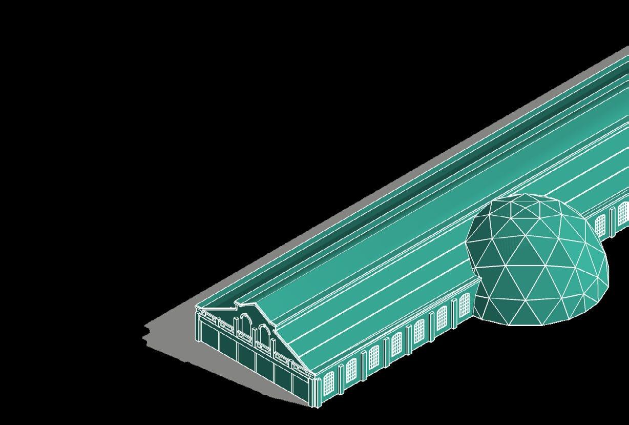
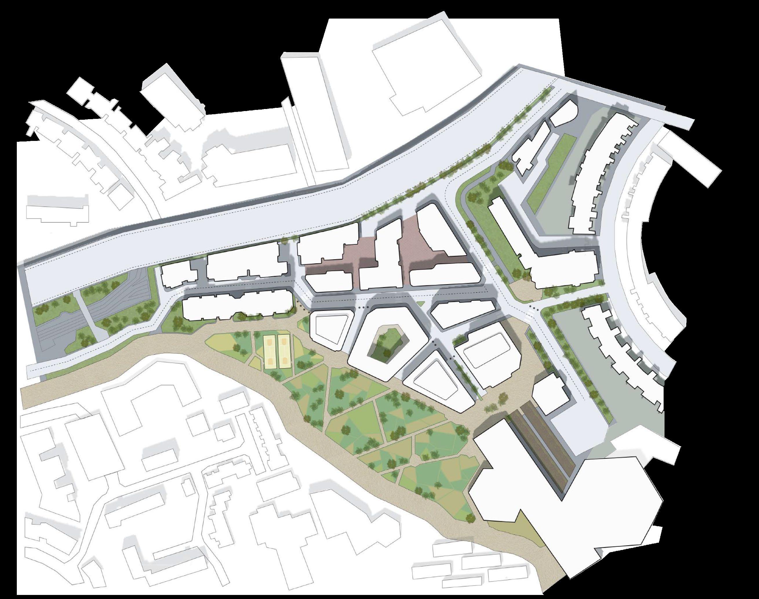
Project Team: Individual Project Individually tasked by The People’s Estate community action group to combat Earls Court’s approved Farrells masterplan, my guiding principles were to better promote access to open space and place greater empathises on the retained architectural features of the area, including the Lillie Holdings building and it’s ‘bio-dome’ upgrade.
SH
02.
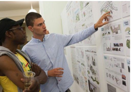
Top-Left: Samuel Hammant presenting to The People’s Estate Board Member, Dioscore, at The Bartlett Degree Show, 2017
MACRO: URBAN DESIGN
The concept and detailed form of the masterplan were developed out of a thorough understanding of the existing site conditions. It was essential for the community to appreciate and visualise how their demands were being taking into account.
To achieve this, a series of practical and legible diagrams showcased the form and functionality of the space, helping to address contentions issues such as permeability and vehicular access.
MLA ASPIRATIONS:
The masterplan I created clearly distinguishes between urban and landscape functions.

To provide more equitable and numerous opportunities to access natural space and greenery, I am interested in learning about smaller interventions that can successfully increase the prevalence of nature at individual street level.
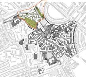
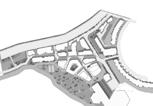
Earls Court
Eco-Urbanism
ANALYSIS:
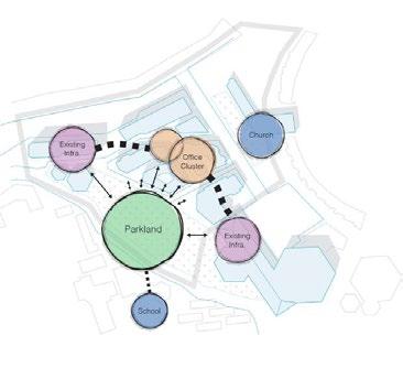
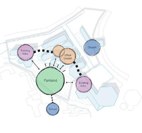
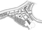
Earls Court Eco-Urbanism; a neighbourhood vision of environmentally standard-setting development and living. With the original Earls Court exhibition centre by now demolished, the site re-focuses around a series of ‘Bio-Domes’ containing botani cal gardens, public information facilities, demonstration and exhibition space.
Adjacent to this centre sits sub-area 1; an office-led commercial district bordered by which parkland which serves the en tire neighbourhood. So to maximise the socio-economic and environmental pros perity of the area, original Eco-Urbanism principles will be further developed based upon observed constraints, used then to strengthening the masterplan as it currently
Land Use
Vehicle Routing
[1:4000] 7.
+ The sub-area benefits from the adjacent cultural centres (4,5,7)

nomic processes in action here can be strengthened by refining the relationship of buildings to one another.
- The commercial cluster creates strong ‘edges’ and potential conflict with surrounding land uses, particularly with parkland area, whereby visitors and users of the park are faced with an inward looking working environment, and vice versa. This edge should be blurred with spatial intervention or alternatively, the use-classes of adjacent areas can converge.


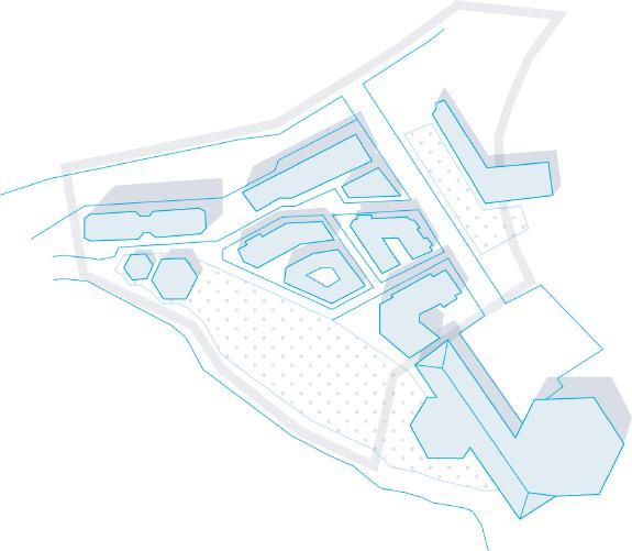
The sub-area benefits from the adjacent cultural centres (4,5,7) which provide spill-over pedestrian activity. The retention of existing landmark buildings (1 Ashfield House, 5 Lillie Holdings Building, 6 St. Cuthberts Church) is also significant, but these should be could highlighted and emphasised further with public realm

- The A4 flyover (2) to the north of the sub-area has been neglected in the original proposal, with it’s visual and audible impact continuing to harm the overall attractiveness and character of the sub-area character. Furthermore, the highlighted office building (3) serves as the natural centre to the site yet this is not recognised by its form nor public use-value.
Identification of key constraints and opportunities of the original proposal has been carried out alongside fresh site visits. It is clear that whilst the preservation of ‘landmark architecture’ is commendable, the overall success of the masterplan is limit-
The relatively simple block shapes and layout create a district of high permeability, with a num ber of activity nodes where pedestrian routes converge. Ensuring changes to built form allow this interaction to occur is a key characteristic of the desired socio-economic environment looking

- As shown above, a number of cross-site pe destrian routes are ‘destination-less’, whereby pedestrians are drawn to a dead-end. The result of this is that landmarks such as the church which are a strengths of the sub-area go under-utilised and under-appriciated. Readdressing building massing and block patterns can solve this.
ed by the under-developed northern edge. The decision to keep above ground District Line rail operations is not in keeping with the strategy taken elsewhere and represents an impassable physical edge.
CONCEPT DEVELOPMENT: TECHNICAL DETAIL:
2 Socio-Spatial Rebalance Reorientation With the retention existing landmark buildings, their spatial relationship forms a strong triangular axis between the boundaries of sub-area 1. Whilst the existing built from acknowledges this, the orientation within and around this axis can be strengthened. In doing so; pedestrian and vehicle routing will be further simplified, public realm can be better linked and overall site morphology will align with the language used across the whole masterplan. Working within the original Eco-urbanism framework, the below objectives take largely functional approach to addressing site inefficiencies, prescribing changes under the overarching strategy banner of socio-spatial rebalance’. Taking lessons from Spatial Syntax urban theory (http:// www.spacesyntax.com, 2017), whereby design thinking is driven by detailed accounts of how space is be used, a process of reorientation, rearrangement and re-focusing will take place. These concepts and their application to sub-area is explored further below. Strengthen Landmark architecture Leading commercial district Pedestrian friendly massing Connected public realm Mitigate ‘edges’ created Integrated Energy In the original masterplan, the vision Eco-Urbanism is achieved principally through the central activities zone. The site character derives from built form set there. When refining sub-area 1, the design principles used previously will again be adhered too. Presented below are those principles most applicable the commercial and parkland nature the sub-area 1. By working these in the forthcoming proposal, changes to building form, pedestrian routing and nodes of activity are be expected whilst overall character remains constant. Rearrangement characteristic the overall masterplan almost indefinite public access to space, particularly surrounding cultural facilities. As sub-area characterised by commercial use this is not suitable here and the relationship and access of spaces must be clarified. Defined according to their socio-economic function, the hierarchy of public, semi-public and private spaces should be immediately evident to users. Suitable links then be made between such contrasting spaces, particularly regarding public realm. Refocus The relatively isolated cluster of business activity proposed in the sub-area provides an opportunity to explore ‘best practice ‘commercial environments in London. This involves provision diverse use-class facilities and against the cities ever diminishing industrial space, small scale workshops and creative spaces will. In line with Spatial Syntax lessons, such buildings should relate both their surrounding streetscape, their everyday use by employees and their appearance as observed by all site users. Concept Diagram Design Strategy Original Principles Presented below are initial spatial interpretations the desired rebalancing process. When overlaying the reorientation, rearrangement and refocusing processes clear block pattern emerges, the detailing and practicalities of which are further developed the masterplanning stages. Landmark building axis Utilising available space Opening key areas of public realm [1:2000] New London Architecture, (2015). Public London: Ten Years of Transforming Spaces. 1st ed. London: NLA.
1
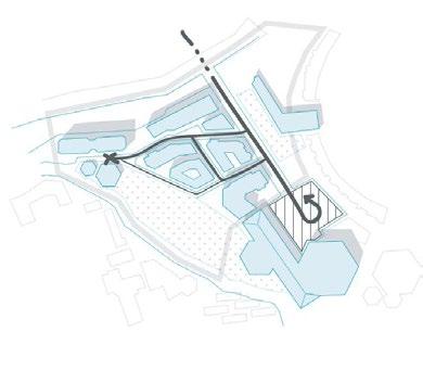
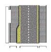
Pedestrian Circulation [1:4000] 1 cal gardens, public information facilities, demonstration and exhibition space. Adjacent to this centre sits sub-area 1; an office-led commercial district bordered by which parkland which serves the entire neighbourhood. So to maximise the socio-economic and environmental prosperity of the area, original Eco-Urbanism principles will be further developed based upon observed constraints, used then to strengthening the masterplan as it currently stands. Land Use [1:4000] Identification of key constraints and opportunities of the original proposal has been carried out alongside fresh site visits. is clear that whilst the preservation of ‘landmark architecture’ is commendable, the overall success of the masterplan is limited by the under-developed northern edge. The decision to keep above ground District Line rail operations is not in keeping with the strategy taken elsewhere and represents an impassable physical edge. A4 Flyover Barrier Underdeveloped Space Landmark Building Ambiguous Space Road Barrier 3. 4. 5. 6. 7. Landmarks Pedestrian Circulation [1:4000] adjacent areas can converge. + The proposed street network is simple and the flow of required service vehicles as not over ly constrained. Whilst this simplicity should be retained, it must not be prioritised over a functioning that operates within the objectives set by the original Eco-Urbanism vision e.g. human focused development encouraging foot traffic over vehicular traffic. - With cross-transit limited by the parkland, dead-end vehicle routes are an inevitability. Greater clarity of road destination and hierarchy would limit problems caused here. The use of one-way streets can also avoid unnecessary congestion and more clearly direct vehicles through junctions.
Earls Court Eco-Urbanism Earls Court Eco-Urbanism; neighbourhood vision of environmentally standard-setting development and living. With the original Earls Court exhibition centre by now demolished, the site re-focuses around series of ‘Bio-Domes’ containing botanical gardens, public information facilities, demonstration and exhibition space. Adjacent to this centre sits sub-area 1; an office-led commercial district bordered by which parkland which serves the entire neighbourhood. So to maximise the socio-economic and environmental prosperity of the area, original Eco-Urbanism principles will be further developed based upon observed constraints, used then to strengthening the masterplan as it currently stands. Land Use [1:4000] Identification of key constraints and opportunities of the original proposal has been carried out alongside fresh site visits. It is clear that whilst the preservation of ‘landmark architecture’ is commendable, the overall success of the masterplan is limited by the under-developed northern edge. The decision to keep above ground District Line rail operations is not in keeping with the strategy taken elsewhere and represents an impassable physical edge. A4 Flyover Barrier Underdeveloped Space Landmark Building 1. 2. 3. 4. 5. 6. 7. Landmarks [1:4000] Sub-Area 1 Pedestrian Circulation [1:4000]
3. 4. 5. 6. 7. Pedestrian Circulation [1:4000] Vehicle Routing [1:4000] Pedestrian Circulation [1:4000] Despite the rearranged massing and building relationship, building use-casses are carried over from the original proposal, with the key difference the provision of B2 light industrial units on space previously used for rail operations. [1:4000] Revisions made to building massing and thus open spaces provide greater clarity regarding accessibility of space. The area of parkland remains publicly accessible, with this extending forming areas of public realm. significant change is the provision of private commercial areas the form of yard space the north and semi-public courtyard space semi-public, to contain cafe and restaurant units. [1:4000] Not highlighted the Ashfield House TFLfice building, sitting at storeys high (37m). This to remain the tallest building the sub-area, with the proposed office buildings ranging from to storeys, increasing height on approach to Ashfield House. This is relatively low-rise for commercial buildings, ensuring a human connection retained and preventing the open character of parkland being overshadowed. Taller buildings are however used screen the A4 flyover on the northern edge of the sub-area. [1:4000] Establishing functional street network is integral to the economic success of the commercial district being created. A primary East-West route allows service vehicles to enter the sub-area and reach destination building and yard spaces. Whilst streets in the direction of the park also require vehicular access, these are designated as shared spaces, with access controlled by remote bollard systems as and when necessary. The sub-area benefits from the A4 flyover to the north, where traffic free flowing and thus there would be little incentive to use the created street network as cut-through. [1:4000] Represented by the thicker strokes, the main pedestrian routing through the sub-area now aligned to the new axis, as mentioned in the reorientation project strategy. clear east/west routing has been created that draws pedestrians from outside the sub-area past the key landmark buildings and through the centre of the site, where all facilities are most easily accessible. [1:4000] Land Use Access Hierarchy Circulation Road Network Building Heights Masterplan Breakdown Church Residential Cultural Commercial Office Commercial Industrial Public Semi-Public Private 2/3 Storey Storey Storey Direction of traffic Service bay and yard space Restricted/Shared Space The previous massing offered here for visual comparisson.
A4 Flyover Barrier Underdeveloped Space Landmark Building Ambiguous Space Barrier
1 Earls Court Eco-Urbanism Earls Court Eco-Urbanism; neighbourhood vision of environmentally standard-setting development and living. With the original Earls Court exhibition centre by now demolished, the site re-focuses around series of ‘Bio-Domes’ containing botanical gardens, public information facilities, demonstration and exhibition space. Adjacent to this centre sits sub-area 1; an office-led commercial district bordered by which parkland which serves the entire neighbourhood. So to maximise the socio-economic and environmental prosperity of the area, original Eco-Urbanism principles will be further developed based upon observed constraints, used then to strengthening the masterplan as it currently stands. + The sub-area is defined as primarily a commercial district. This physical clustering of business activity can lead to heightened economic success as cross-firm collaboration and employee interaction is encouraged. The socio-eco-
Land Use [1:4000] Identification of key constraints and opportunities of the original proposal has been carried out alongside fresh site visits. It is clear that whilst the preservation of ‘landmark architecture’ is commendable, the overall success of the masterplan is limited by the under-developed northern edge. The decision to keep above ground District Line rail operations is not in keeping with the strategy taken elsewhere and represents an impassable physical edge. A4 Flyover Barrier Underdeveloped Space Landmark Building Ambiguous Space Road Barrier 1. 2. 3. 4. 5. 6. 7. Landmarks [1:4000] Pedestrian Circulation [1:4000]
The commercial cluster creates strong ‘edges’ and potential conflict with surrounding land uses, particularly with parkland area, whereby visitors and users of the park are faced with an inward looking working environment, and vice versa. This edge should be blurred with spatial intervention or alternatively, the use-classes of adjacent areas can converge.
-
which provide spill-over pedestrian activity. The retention of existing landmark buildings (1 Ashfield House, 5 Lillie Holdings Building, 6 St. Cuthberts Church) is also significant, but these should be could highlighted and emphasised further with public realm interventions. - The A4 flyover (2) to the north of the sub-area has been neglected in the original proposal, with it’s visual and audible impact continuing to harm the overall attractiveness and character of the sub-area character. Furthermore, the highlighted office building (3) serves as the natural centre to the site yet this is not recognised by its form nor public use-value. + The relatively simple block shapes and layout create a district of high permeability, with a number of activity nodes where pedestrian routes converge. Ensuring changes to built form allow this interaction to occur is key characteristic of the desired socio-economic environment looking to be created within the sub-area. - As shown above, a number of cross-site pedestrian routes are ‘destination-less’, whereby pedestrians are drawn to dead-end. The result of this is that landmarks such as the church which are a strengths of the sub-area go under-utilised and under-appriciated. Readdressing building massing and block patterns can solve this. + The proposed street network is simple and the flow of required service vehicles as not overly constrained. Whilst this simplicity should be retained, it must not be prioritised over a functioning that operates within the objectives set by the original Eco-Urbanism vision e.g. human focused development encouraging foot traffic over vehicular traffic. - With cross-transit limited by the parkland, dead-end vehicle routes are an inevitability. Greater clarity of road destination and hierarchy would limit problems caused here. The use of one-way streets can also avoid unnecessary congestion and more clearly direct vehicles through junctions. Vehicle Routing [1:4000] Sub-Area 1 Pedestrian Circulation [1:4000]
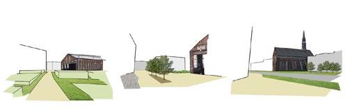
03. SAMUEL HAMMANT UCL MLA APPLICATION
MASSING: SKETCH:


MACRO: DESIGN DETAIL
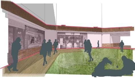
To further demonstrate to residents that the overall plan is well suited to their assessed community requirements, I developed examples and 2D and 3D sketches to illustrate the site’s design language.

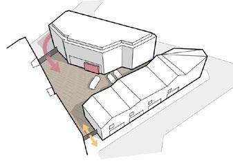

Above, the translation of a pedestrian corridor from ‘sketch’ to ‘section’ demonstrates how a conceptual, idealistic environment becomes an achievable street-scape arrangement that meets accessibility requirements.


3.5m

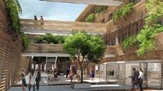
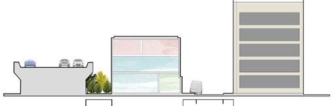
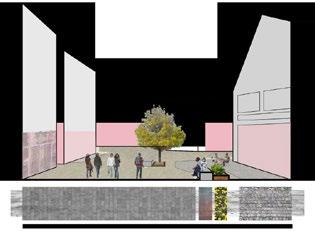
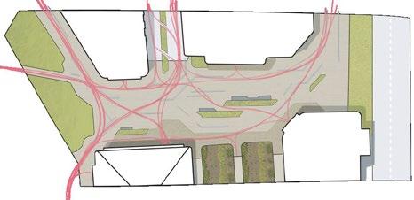
Greater provision of public realm is key characteristic of the sub-areas socio-spatial rebalancing. Serving as a natural place of convergence between commercial space, parkland and the cultural centre, the focus has been on creating space of sufficient permeability yet also quality of place. Whilst the location of public realm areas emphasise landmarks of St. Cuthberts Church and holdings building, their frontages should also be activated and interest. Part of the rational for site reorientation has been to open up key sight corridors and desire lines; from the park to the Lillie Holding and between the holdings building public realm towards St. Cuthberts Church. Presented here serial vision of movement from west to east across the site, visualizing how significant buildings act as points interest to guide pedestrians and create destinations. Despite the area being a key destination and meeting space, efficiency and ease of circulation is also key determinant of its form. Space is loosely divided between areas of seating (cafe culture) and regions that are remain empty, account for pedestrian flow and entrance into office buildings. Making such provisions part of overall strategy of spatial rearrangement. Active routing systems are also used, using changes in surface material and placement of natural infrastructure such as trees and planted boxes to guide users through the space. The above diagram also highlights the urban farming facilities associated with the Eco-Exhibition centre to the south. Accessed from both the exhibition Holdings Building and directly from the public realm, the area provides demonstration of what is possible produce in confined urban environment such as this. Carriageworks, Sydney, Australia Constellations Bar, Liverpool In creating an area of activity outside the cultural Lillie Holdings building, it is important that street-frontages and ground floor entrances of surrounding buildings are activated, contributing to overall streetscape. The section drawing to the right brieflylustrates the use of the area, highlighting the frontages that need must be active and demonstrating the equitable street to building enclosure ration, ensuring human scale is enduring. Yale University, USA Also presented to the on the far right side of the page are number of example frontages that are to be used as guidance when architectural styles are considered. Divided between commercial frontages and cultural/cafe frontages, each example engages the street user to the benefit of overall streetscape. More London, Southwark Foyles Bookshop Building, Soho Sight Lines Circulation Frontages
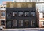
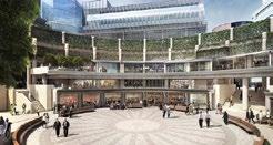
20m Queens Yard, Hackney Wick Trinity Buoy Wharf, Tower Hamlets Acton Park Industrial Centre, Ealing Taking lessons from currently functioning light industrial and creative spaces, adjacent yard spaces that can be used for service access and deliveries is essential. The example presented here of Queens Yard Hackney Wick is particularly well formed, with one entrance from the main road which allows for larger vans and trucks to enter, and one entrance at the opposite side of the site to be used for foot traffic only. With multiple units facing onto this yard, is highly utilised space that can also encourage collaboration amongst similar and complementary business activities. En r gy t n C labo t L g du y Whilst the commercial focus of the original proposal was highlighted as strength, diversification through the provision of light industrial units increases the viability the district at time when industrial space across London is decline. Within the framework of the original Eco-Urbanism vision, environmentally focused firms are to be encouraged. Directly below are principles that guide this industrial district. 7m The two main yard spaces provided within the sub-area are both accessed by the main road on the northern boarder the site, running parallel to the A4. Within the yards are small number of parking spaces for workers, and large garage-door style entrances to the buildings. Gated at all entrances, these yards are defensible spaces, used for commerce, yet pedestrian access is retained into the centre the sub-area and care must be taken with building frontages to maintain overall site character. A number of best practice examples are presented to the right. Yard Spaces Creating balanced relationship between light industrial buildings and the streetscape is important so to not harm both the overall character and economic potential of the sub-area. Shown here is section drawing of the western-most industrial unit. At storeys high (1 and a half heigh floor heights to ensure workshop activity is suitable) the A4 is shielded from the rest of the sub-area. Given the height of Ashfield House to the right, some over-shadown will occur here. With yard space more limited here, on street access/service bays have been provided at suitable locations. Streetscape Industrial Cluster 2.2m 2.2m 5m Newport Street Gallery (Previously Industrial), Lambeth Pedestrian Access Vehicle Access Belsham Street Warehouse, Hackney Manual for Streets. (2007). London: DCLG. Office for the Danish Government Agency, Copenhagen URSSAF Offices, Saint Etienne, France Broadgate Circle, London As the natural centre of the site, the highlighted building is a significant meeting point, bridging the edge as parkland meets the built form the commercial district. As high density office block, appropriate to encourage pedestrian activity in the internal courtyard, which can here be accessed from by the public for use as public square. Examples below prove popular destinations when cafés and eateries are located in such courtyards. Intimated here the desired architectural style of the building, particularly important as it considered landmark within the sub-area. At the entrance of the courtyard is an overhang above the main pedestrian walkway, offering degree cover above the public realm and edge of the park. Withthe courtyard the space becomes more secluded than other areas of public realm and is suitable for use throughout the year. Along the frontages the courtyard are various cafe, street-food and restaurant firms that create vibrant space throughout the day and evening as workers and visitors across the site pass through for food. The space in the middle the courtyard is left relatively empty allowing for users to sit on both cafe tables and the grass and enjoy the atmosphere. Visible in the above projection the opened archway that allows access to the courtyard from the centre of the sub-area as opposed to from the park. Show in both plan and isometric view, the courtyard created is both destination visitors can relax and enjoy, but can also be used to access the centre of the sub-area via northern archway, highlighted by the small grey area on the plan below. Whilst cafe seats and tables are not represented here, space is set aside for some restaurant and cafe units expand activity into the courtyard, particularly in summer months. Landmark Building Cafe Culture Office Courtyard Mitchell, W. (2008). New Urbanism and Beyond: Designing Cities for the Future. 1st ed. Stockholm, p.210.
Public Realm
04.
SAMUEL HAMMANT UCL MLA APPLICATION
SECTION:
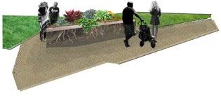
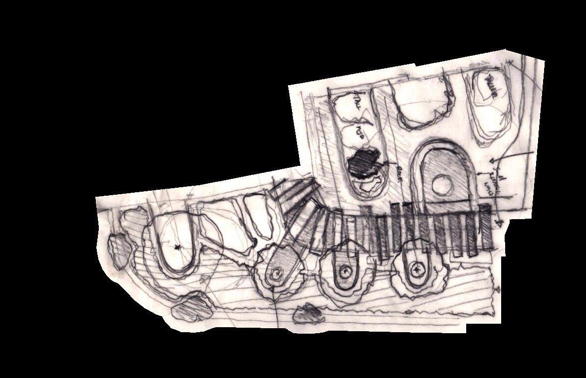
MICRO: PARK DESIGN


Role: NA, Personal Project
Client: NA, Personal Project
Location: Earls Court Masterplan

Date: 2023 & Beyond
MLA ASPIRATIONS:
The parkland area in the original masterplan was unresolved, and its split-level arrangement was unachievable. As a personal project, I enjoyed developing a focused area of the park into a compliant and usable space by researching industry-standard seating heights and gradients, and applying these dimensions to 3D visualization techniques. I am excited to learn more about the intricacies of these technologies, particularly render methods, which can be a fast and compelling tool.
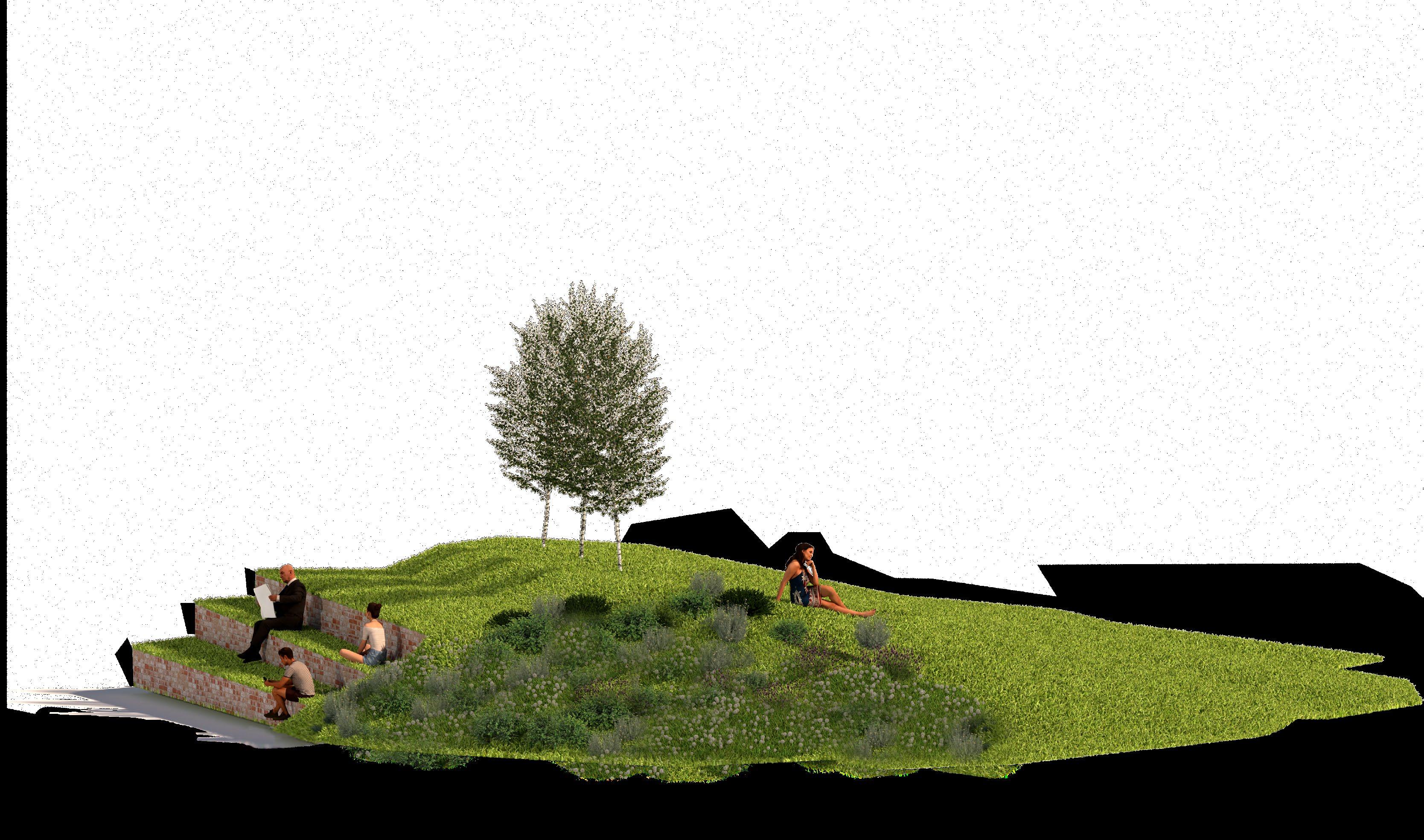
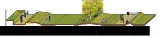
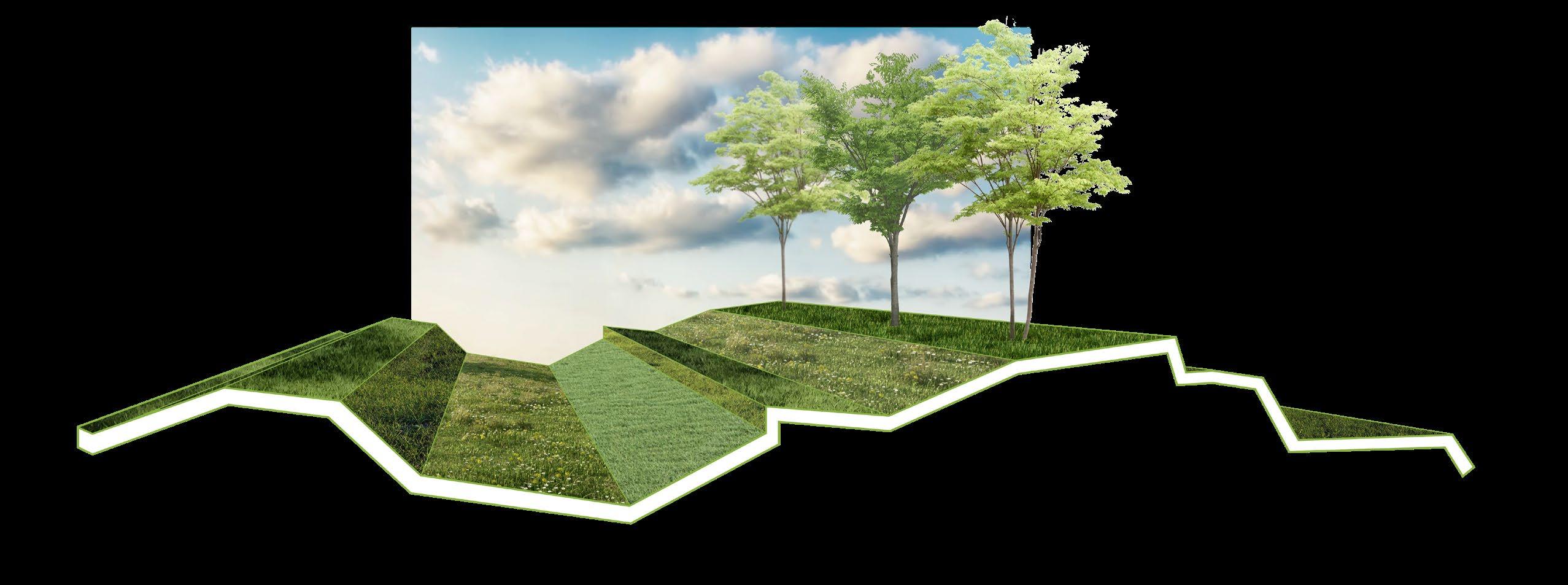
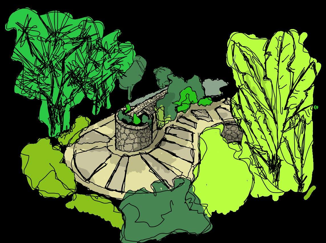
Particularly for site visitors, the sub-area characterised by parkland feature. Prescribed the original masterplan multi-level, multi-use park. strengthening this concept, the goal has beensure practicality by specifying dimensions, use space and materials, line with the design strategy to re-address functionality been taken, whereby open grass areas are complimented by paving, landscaping and clusters sport facilities and activity. 2.5m 8m 3m 5m 5m Top: Original Design Intention here, sensitively integrating different outdoor functions into the park. approximately 210m length suitable separate the park into three sections, with each section usable space (e.g. sports facilities, outdoor gym), grassland or decorative, landscaped features prevail. Composition With each park section serving separate overall function, use materials creates this differentiation. Within the ‘Usable Space’ category, some areas are paved, some ‘semi-paved’ where grass allowed grow within the paving and others dedicated sports facilities such as tennis courts. Pedestrian routes and pathways are too different texture, be used year round. hierarchy pathways offered throughout the park. the top and bottom are key routes across the whole masterplan. Within the park are primary walkways approximately 5-6m width, then secondary paths 3m be used intersect the main pathways. Urban Park The original multi-level park strength of the initial proposal, however much the spaces within are rendered inaccessible those of limited mobility and also presents safety challenges. The overall character has here been retained more appropriate scale, using minor changes heightcan too integrated into these changes height. Split Level % Paved/Usable Planted/Landscaped Open/Grassland Kyushu Sangyo University Materials Movement An element the multi-heigh make up the park are planted areas that can be raised planter boxes different heights, creating visual intrigue as users pass through the Landscaping
05.
SAMUEL HAMMANT UCL MLA APPLICATION
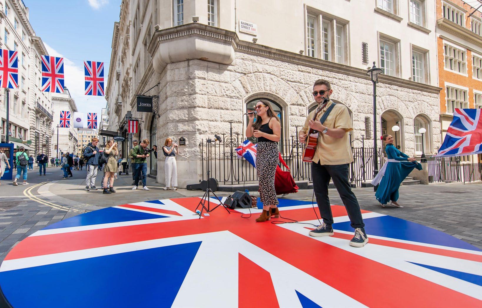
NEIGHBOURHOOD: JERMYN STREET
Role: Event Producer, We Are Placemaking
Client: The Crown Estate
Location: Jermyn Street, London

Date: 4th June 2022
Budget: £110,000
Project Team: Westminster CC, Made Up Ltd
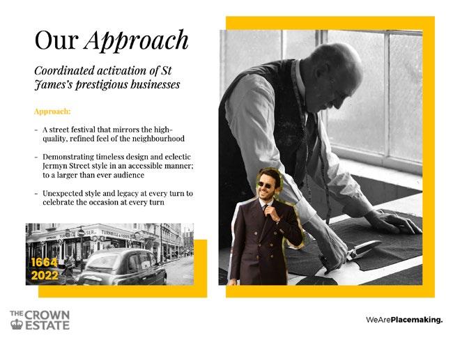
To celebrate Queen Elizabeth II’s Platinum Jubilee, TCE commissioned a street fête suited to the premium neighbourhood. As the Event Producer, I designed and implemented the delivery of all event inventory.
With a same-day build and break schedule, the production had to be planned meticulously.
PITCH DOCUMENTATION:
JERMYN STREET LB FS
06.
SAMUEL HAMMANT UCL MLA APPLICATION
NEIGHBOURHOOD: PLACEMAKING
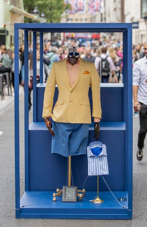
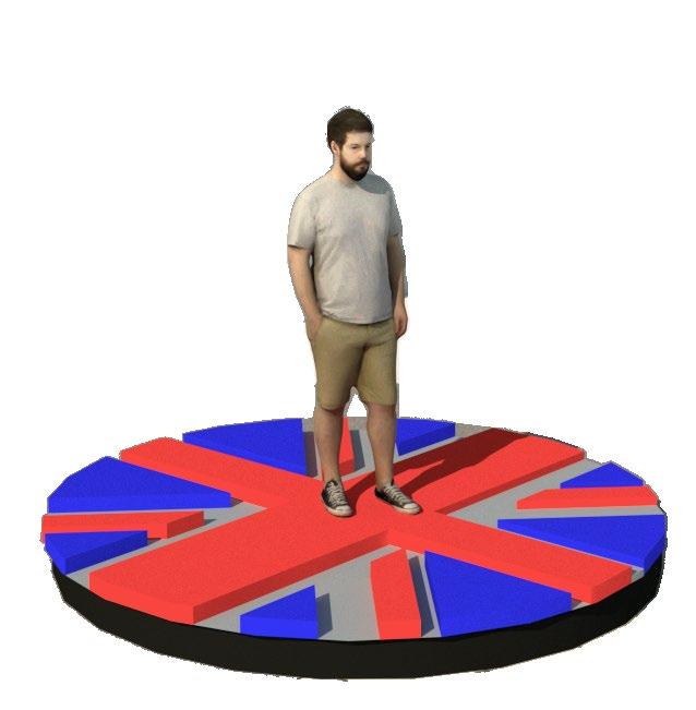
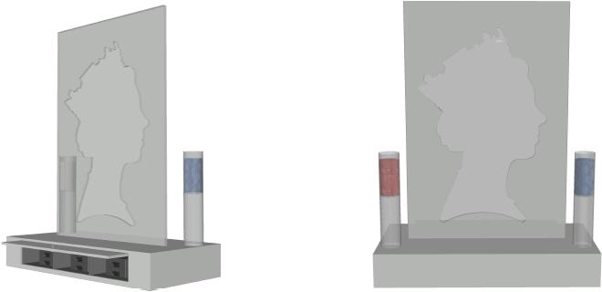
Together with a set-builder, I designed a series of ‘hero’ pieces for the event. The Queen’s head ‘open-sourced’ sculpture was especially popular among community users. Custombranded, recycled tokens from the hopper were placed into the sculpture, which filled up throughout the day to reveal the Queen’s silhouette.
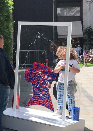
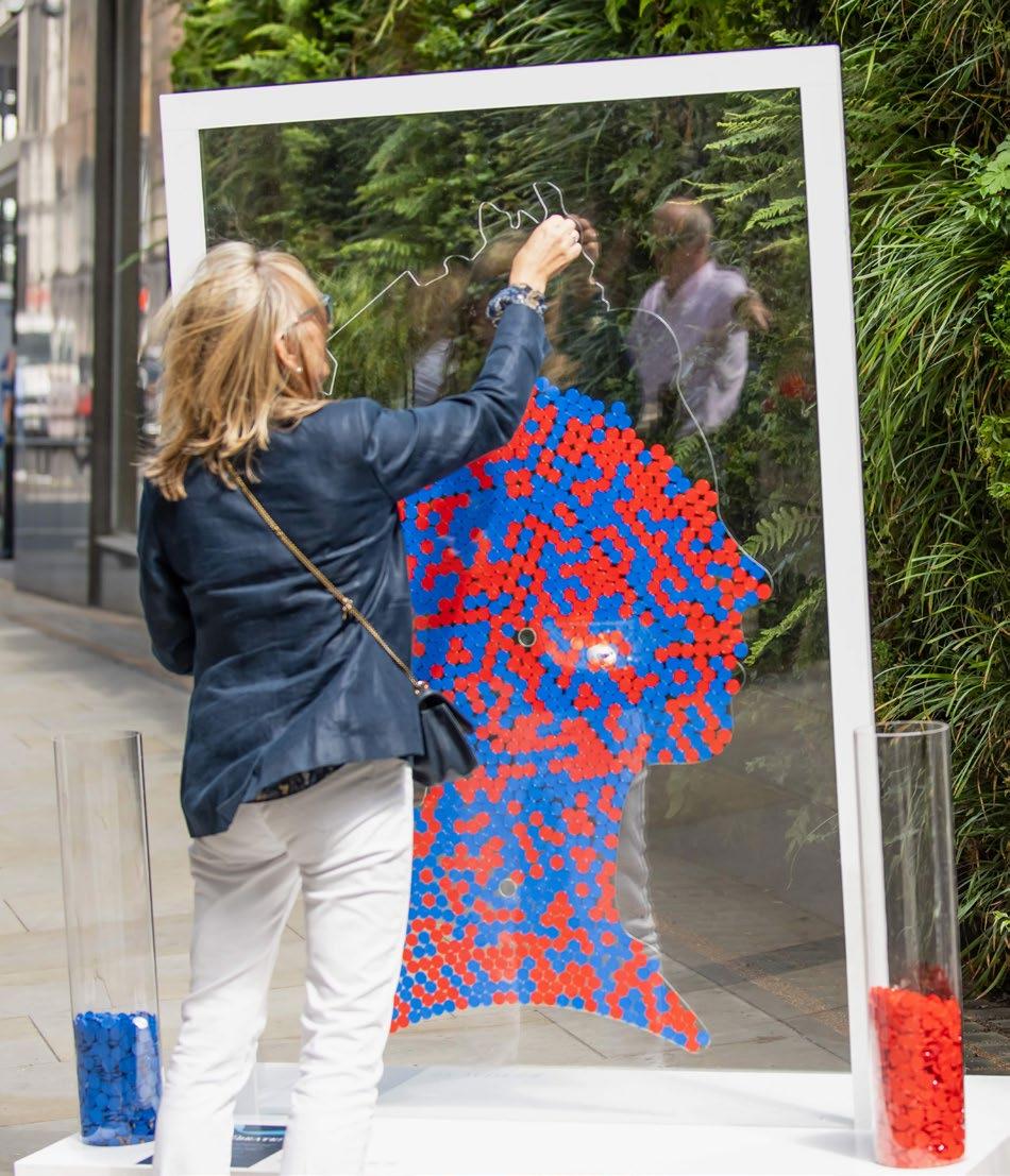

It was challenging to create an
item that was strong enough to be self-standing, pass Westminster County Council health and safety checks for wind loading, and remain economically feasible for one-day use. The information plinth also served as a store for counterweights.
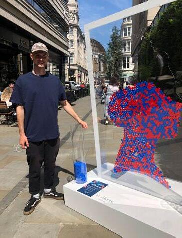
Overall, the event was a profitable production for We Are Placemaking, and received recognition in national press and social media, a client KPI.
 Activation Design: Samuel Hammant
07.
Activation Build: Made Up, Images: The Crown Estate
SAMUEL HAMMANT UCL MLA APPLICATION
GARDEN: MALLORCA
Role: Freelance Creative Project Manager (acting Landscape Designer)
Client: Neil Harbury, Private Property
Location: Mallorca, Spain
Date: September 2022 - Present
Budget: €160,000 Landscape Budget
Project Team: Company Studio
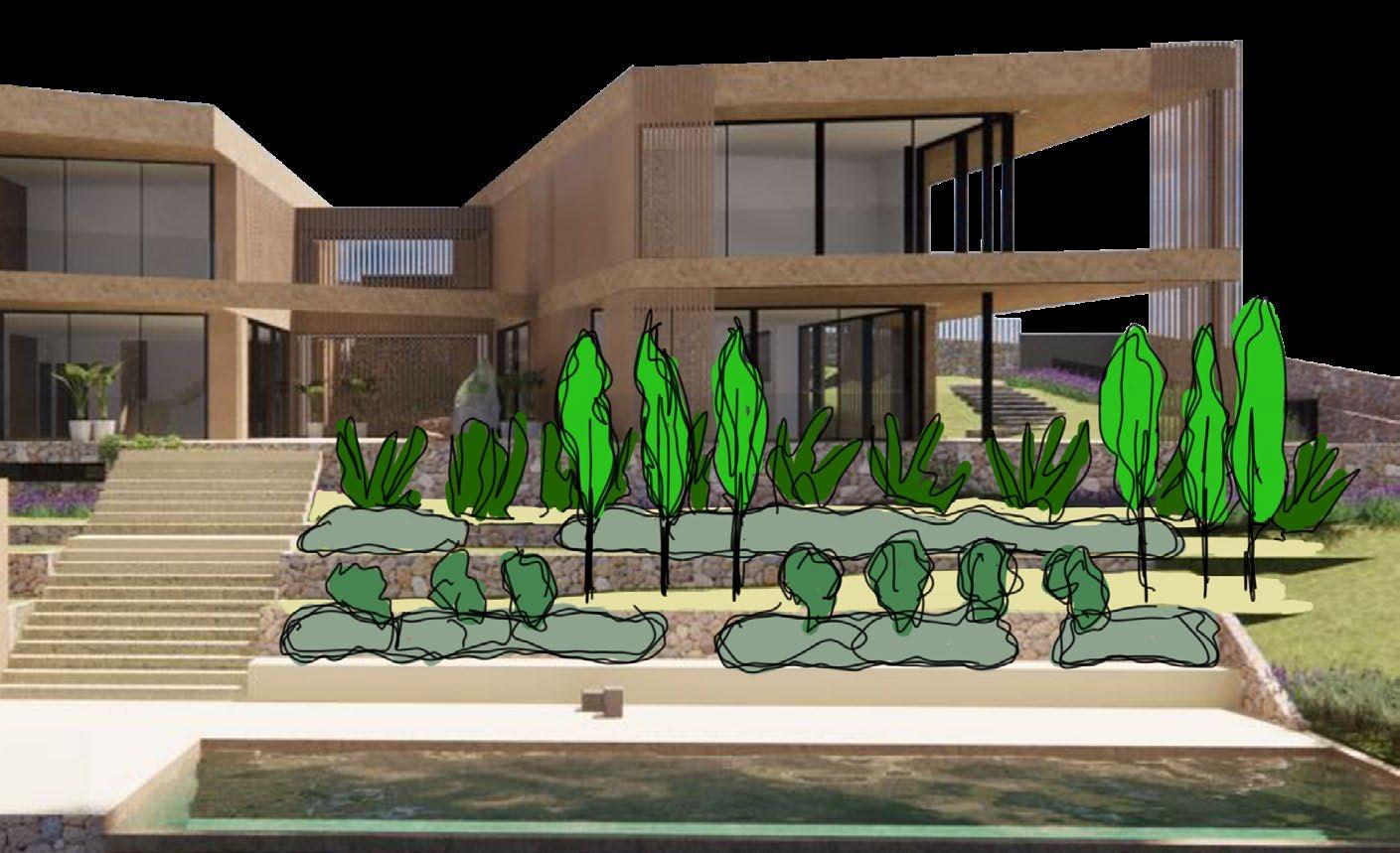
Following the submission of a ‘Basic Project’, equivalent to outline planning permission, the client commissioned a detailed landscape and planting plan.

I have worked together with the building contractor, to devise an achievable yet stimulating scheme - one that fits well into west Palma’s vernacular, and promotes the use of native and endemic species with the minimum possible maintenance burden.
MLA ASPIRATIONS:
I want to gain more detailed knowledge of planting, horticulture and construction techniques in landscape design.
This will help me to propose innovative plans, more closely aligned with contemporary planting trends and styling, and indeed have more confidence and certainty when responding to scrutiny from clients and project stakeholders.
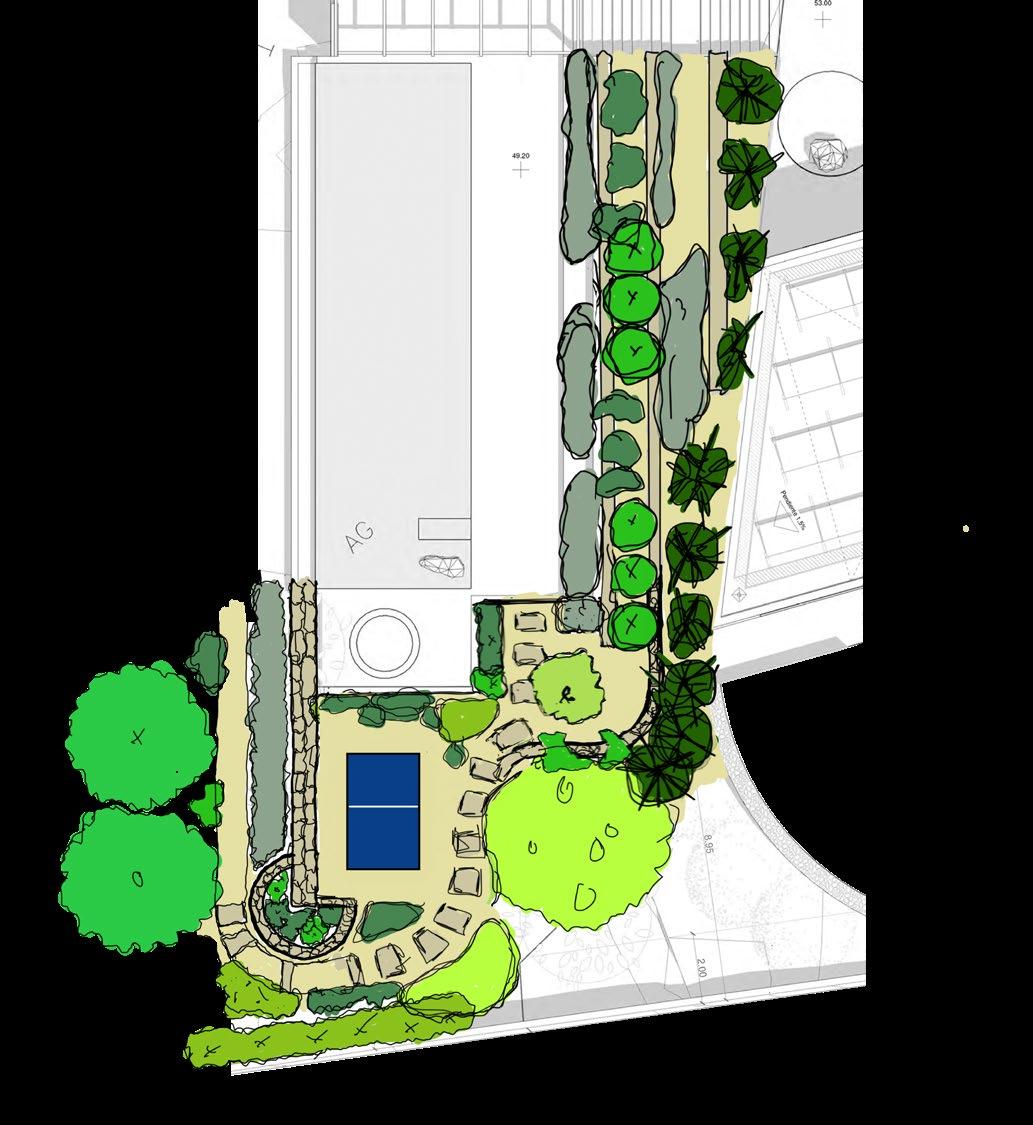
Landscape Plan: Samuel Hammant08. SAMUEL HAMMANT UCL MLA APPLICATION
Architectural Plan & 3D Render: Company Studio
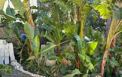
The property’s garden is more than 1,000m2, and as such, I divided my plan into distinct character areas. Each area will have a different selection of plants that complement each other. The ‘Exotic Zone’ which is detailed below will feature species from tropical climates that have been imported into the Mediterranean. A thriving Musa variety already in the zone demonstrates the appropriate light and soil conditions.


MLA ASPIRATIONS:
Knowledge of a broader range of species and sub-species would allow me to be more creative in my designs, and be able to better respond to budgetary constraints with an appropriate species range.

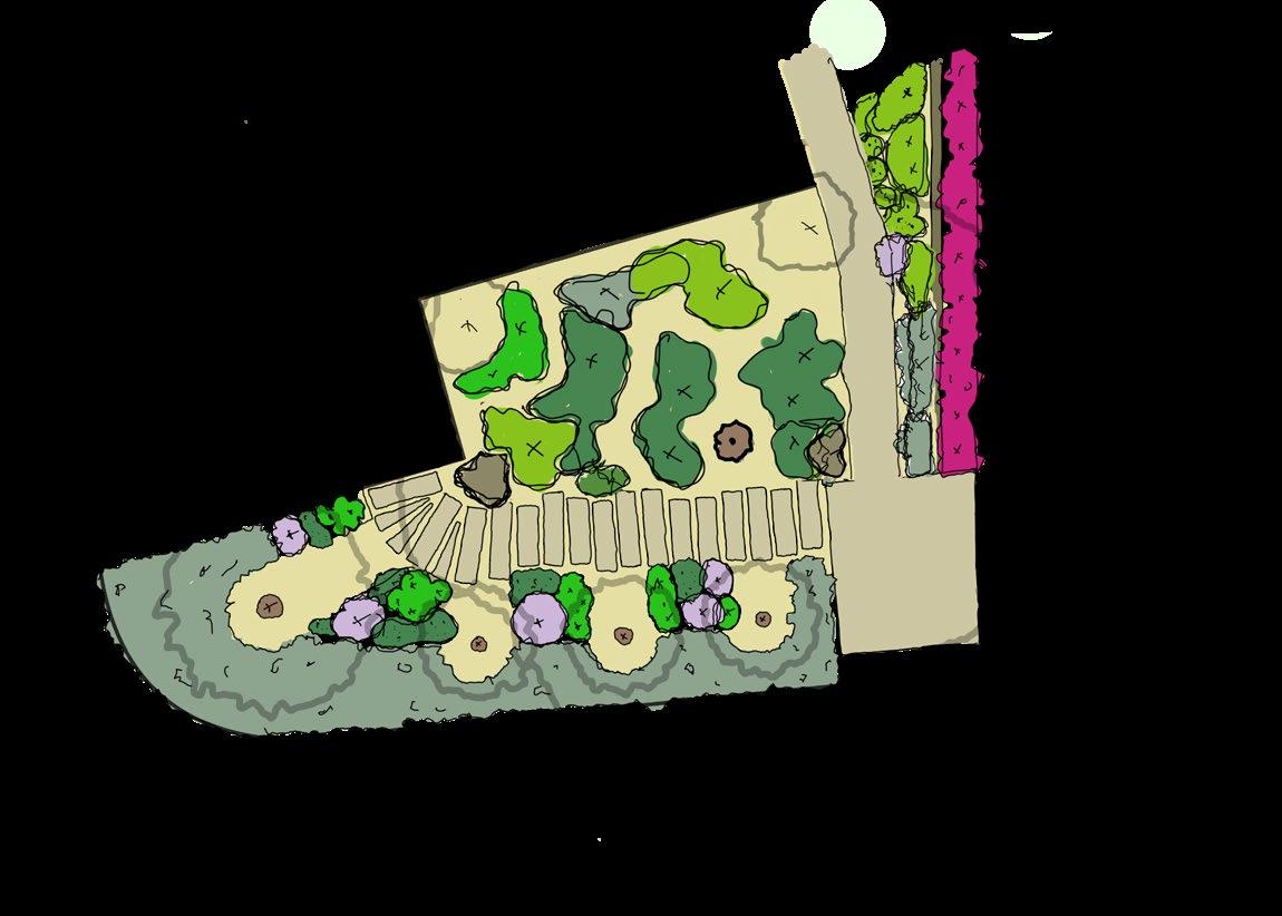
ZONE DETAIL:

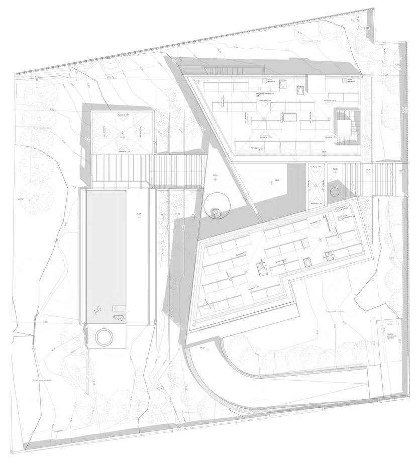
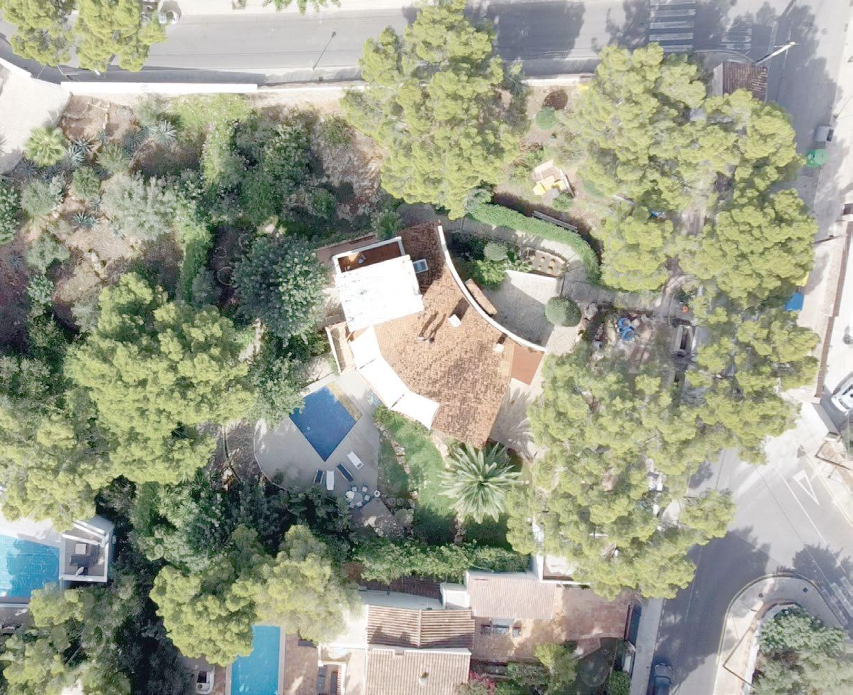
Aleppo Pine (1) (3) (2) (8) Aleppo Pine (5) (6) (15) (18) (20) (22) (24) (25) (27) (19) (30) Aleppo Pine Aleppo Pine Aleppo Pine Aleppo Pine Aleppo Pine Aleppo Pine Aleppo Pine Aleppo Pine Aleppo Pine (33) (34) (12) (28) (26) (29) (4) (7) (9) (10) (11) (13) (14) (16) (17) (21) (23) (31) (32) (35) (8) Aleppo Pine Aleppo Pine Aleppo Pine Aleppo Pine AERIAL ANALYSIS: 09. ZONE PLAN: Entrance Grove Arid Zone Central Terraces Exotic Zone Lower Garden
1. 2. 3. 4. 5. 6. 7.
1.
2.
2.
3.
4.
5.
6.
7.
Ficus Elastica
Yucca
SAMUEL HAMMANT UCL MLA APPLICATION
Stipa Tenuissima Citrus Agave Attenuata
MLA ASPIRATIONS:
I wish to develop my mixed-media drawing techniques to better visualise initial concepts, present preliminary ideas to the clients, and indeed be able to present a finalised plan with accurate planting structures and formation, building on the below digitally hand-drawn image further.
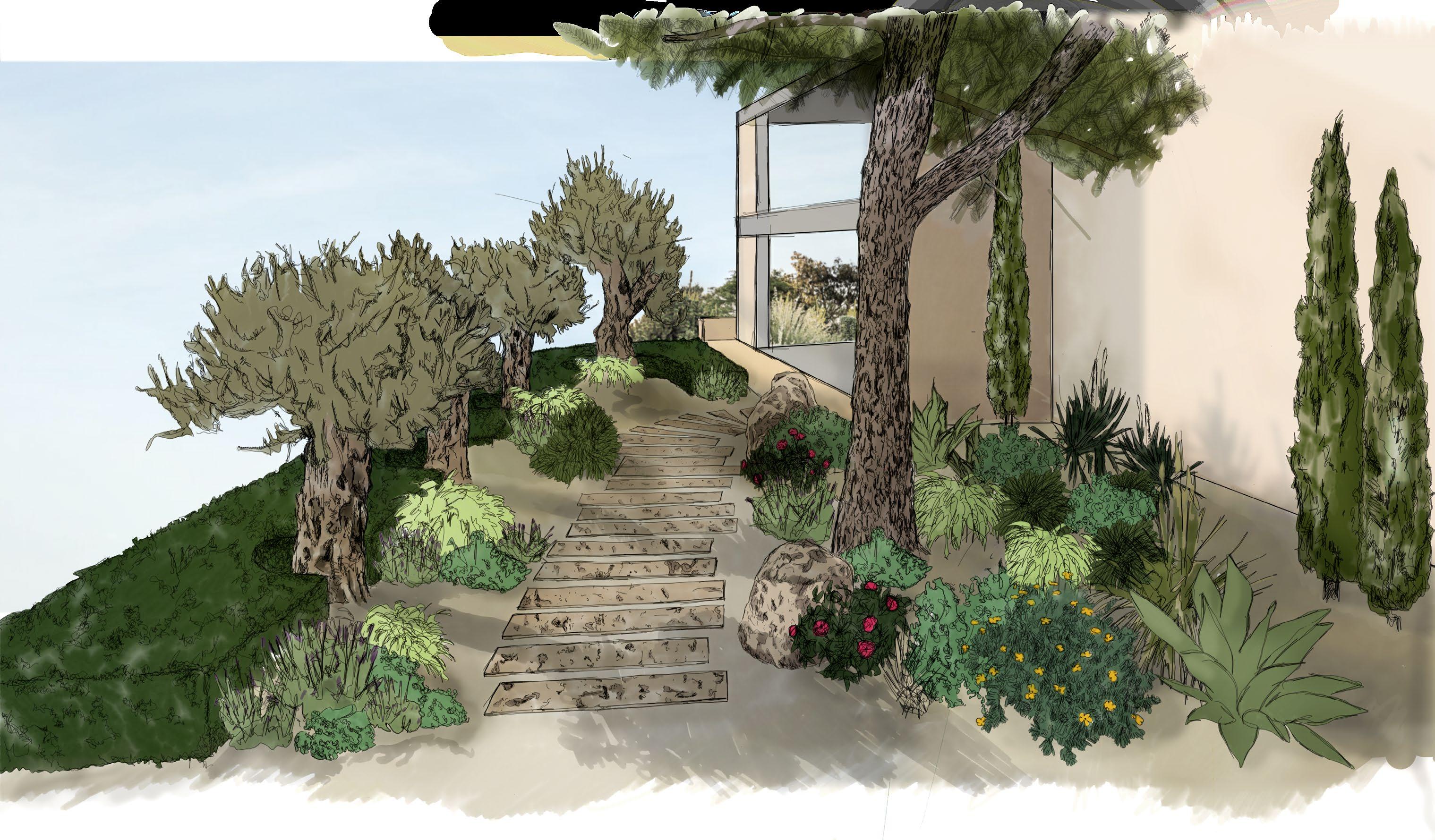
A greater understanding of automated 3D systems and presentation methods will also speed up workflow and output.
10. SAMUEL HAMMANT UCL MLA APPLICATION
STREET: PHOTOGRAPHY

 Left: Hoxton, London
11. SAMUEL HAMMANT UCL MLA APPLICATION
Top: British Museum, London, Bottom: Manhattan, New York
DWELLING: 2D SURVEY 3D SURVEY
LAYOUT PLAN:
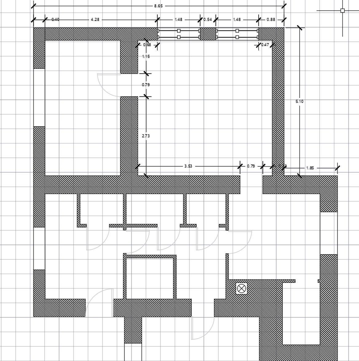
For my personal redevelopment project in the South Bohemia Region of the Czech Republic, I created a CAD plan based on detailed measurements, which will be used as the basis upon which to design and submit renovation plants to the local authority.
AERIAL PHOTOGRAMMETRY:
Using a commercially available drone and software, I completed an assessment of all trees on a private property in Dorset, UK. For tree’s requiring urgent work, I created 3D model to identify intervention areas, which were used as supporting evidence in the TPO Application to the Council.

12 . SAMUEL HAMMANT UCL MLA APPLICATION
DECLARATION:
I declare that the work and information contained within this document has been produced by the applicant unless expressly stated otherwise.
 SAMUEL CHARLES HAMMANT
13. SAMUEL HAMMANT UCL MLA APPLICATION