

SAGE MORRISON PORTFOLIO
URBAN PLANNING
URBAN DESIGN
ENVIRONMENTAL STUDIES
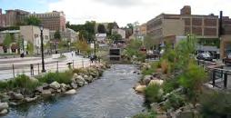
Toledo, Spain
SAGE MORRISON
URBAN PLANNER
(513)417-9901
Morri2sg@mail.uc.edu
Linkedin.com/in/sageamorrison 451 Ada Street Cincinnati, Ohio 45219
EDUCATION |
University of Cincinnati Cincinnati, Ohio
• College of Design, Architecture, Art, & Planning Class of 2026
• Bachelor of Urban Planning
• Environmental Studies Minor
• 3.84 GPA
Lebanon High School Lebanon, Ohio
• Class of 2021
• National Honors Society
• Academic Hall of Fame & Scholar Athlete
• 4.20 GPA
ACTIVITIES & AWARDS |
• College Dean’s List Fall 2021 - Present
• National Co-op Ambassador Scholarship
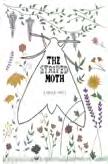
• Founder & Member of “The Striped Moth” Zines
• Selected to attend the Sustainability Summit
• ArtScape Lebanon
SKILLS |
Software
• Adobe: Photoshop, InDesign, Illustrator, Premiere
• Microsoft: Excel, Word, PowerPoint
• GIS: ArcGIS Pro, GIS Online, StoryMaps
• Additional: SketchUp, AutoCAD
Soft Skills
• Conversational Spanish
• Highly Organized & Detail-oriented
• Creative Thinking & Communication
• Leadership & Problem Solving
• Flexibility & Willingness to Learn
WORK EXPERIENCE |
Anderson Township Dept of Planning & Zoning
Anderson Township, Ohio
City Planning Co-op: May 2024 - August 2024
• Preparing & Presenting Staff Reports for Zoning Commission & Board of Zoning Appeals
• Assisting with the Fall Tree Planting Program & the Heritage Center Arboretum
• Creation of StoryMaps for Township Residents
• Assisting with Anderson Trails Sidewalk Planning
• Assisting with the Review of Development Plans, Zoning Applications, & Subdivision Proposals to ensure compliance with the Township Zoning Resolution & Comprehensive Plan
• Township Code Enforcement
• Participating in various Township Meetings
City of Cincinnati Dept of City Planning & Engagement
Cincinnati, Ohio
City Planning Co-op: August 2023 - February 2024
• Assisting with the “Connected Communities” Zoning & Land-use Policy Reforms Website, StoryMap Graphics, Engagement Meetings, Interdepartmental Meetings, & Public Notices
• Preparing & Presenting Staff Reports for City Planning Commission
• Additional: Assisting with Contributing/NonContributing Building Assessments in Urban Design Overlay Districts, Environmental Reviews, Coordinated Site Reviews, Housing Summit Preparation, City’s Community Engagement Policy, Electric Vehicle Charger Research for Dept of Environment & Sustainability, etc.
Michael Watkins Architect, LLC
Gaithersburg, Maryland
Urban Design Co-op January 2023 - April 2023
• Revitalization & Extension Plans for Existing & Proposed Communities
• Participating in week-long Urban Design Charrettes in Taylor, Texas & Barling, Arkansas
• Preparation & Editing of Master Plan & Planned Development Standards Booklets
Kroger Starbucks
Newport, Kentucky
Full-time Barista: August 2020 - Current
• Dedication to being a Full-time Student & Worker
• Leadership Skills: Barista Trainer Certified

Hello.
I am a fourth-year student at the University of Cincinnati studying Urban Planning and Environmental Studies. I consider myself to be experienced through a range of projects completed in Studios, as well as in my various different Co-op experiences. These include things such as urban design, master planning, sustainable planning, land-use and zoning policies, housing solutions, and community outreach projects/engagement.
My love for this field of work came about from my travels across Europe, whitnessing first-hand how vastly different and similar cities have grown and been planned in comparison to the U.S. Moving forward, I wish to make impactful influences on every community I work with by planning for a future that is resilient, sustainable, equitable, lively, and most importantly, people-oriented.
Contents
“Connected Communities” and additional planning projects - Fall 2023 - Spring 2024
SOUTH FAIRMOUNT
Neighborhood analysis and urban design proposal surrounding the Lick Run Greenway - Spring 2024
MICHAEL WATKINS ARCHITECT, LLC
Legacy Crossing charrete and additional master plan/planned development booklets for communities - Spring 2023
“Live Green. Breathe Green. Go Green.” Sustainable master plan proposal along the Hamilton Avenue BRT Corridor - Summer 2023
“A Healthy Findlay” master plan that combines a network of bike paths, living fresh, and green around Findlay Market - Fall 2022
Neighborhood analysis, typologies, impacts, and proposal of a “Forgotten Neighborhood” - Spring 2021
Consists of “The Striped Moth” Zines and a writing sample of “What is a Green Plan for a City?”

City of Cincinnati DCPE
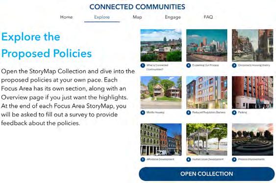
CONNECTED COMMUNITIES |
What is it?
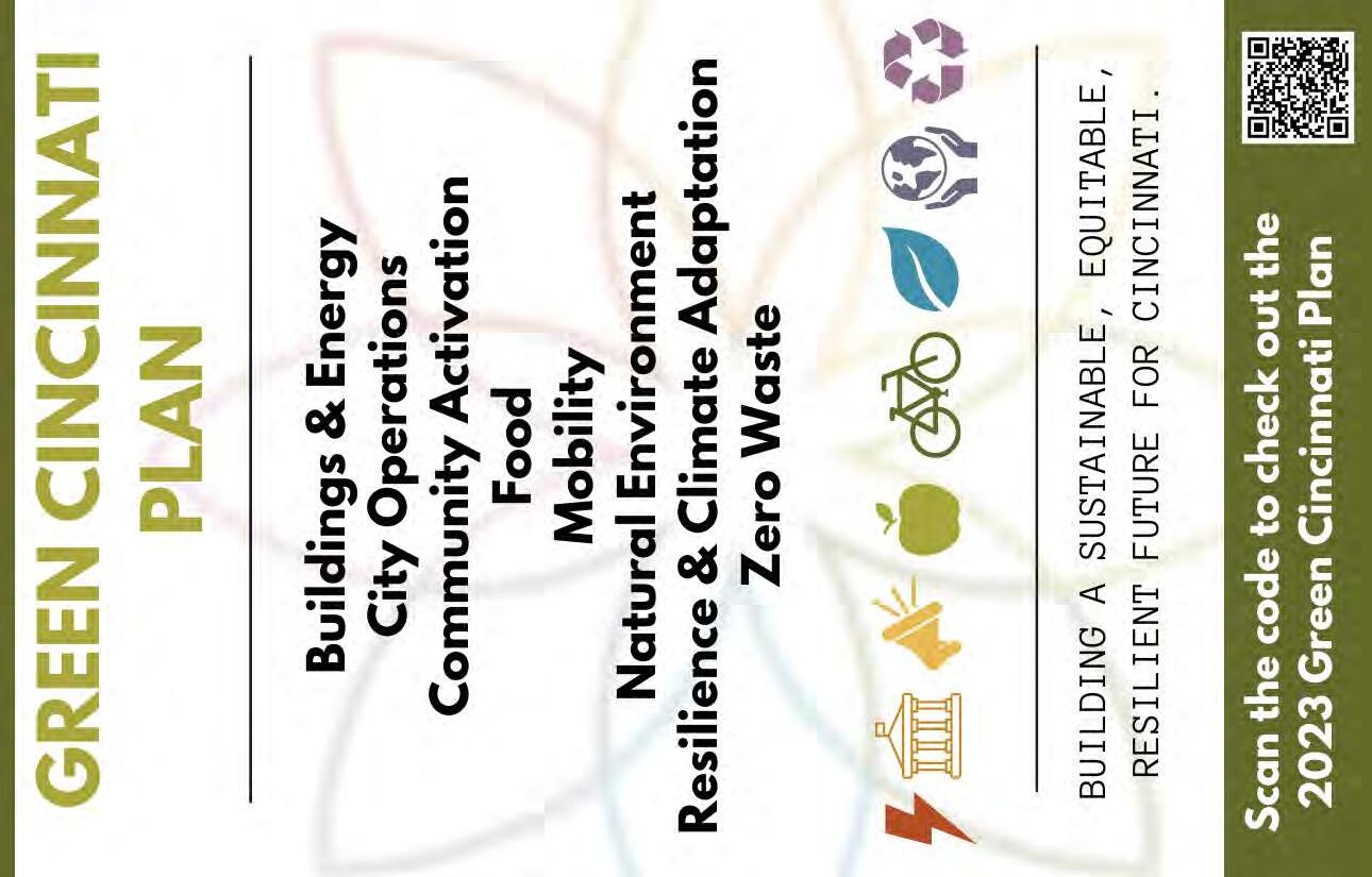
Connected Communities is a set of land use and zoning changes aimed at making Cincinnati more accessible, people-focused, diverse, and connected. To address the housing shortage and shifting population needs, outdated development regulations must be updated to follow best urban planning practices. Cincinnati is ready to join the national conversation and lead in this movement, focusing on three geographies and six key areas.
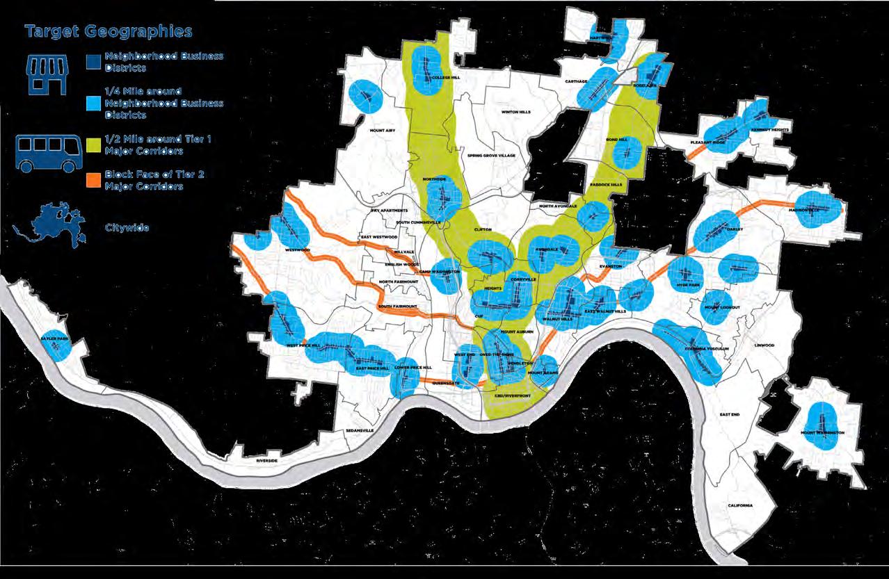
Focus Areas & Geographies
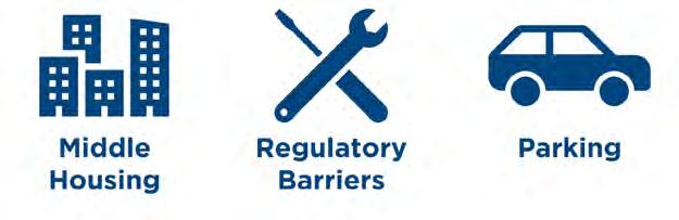
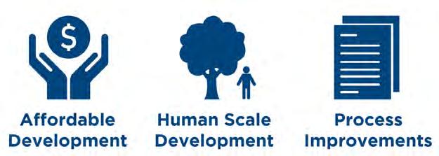
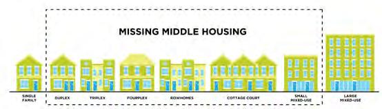
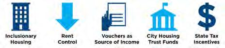
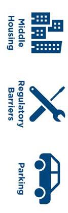
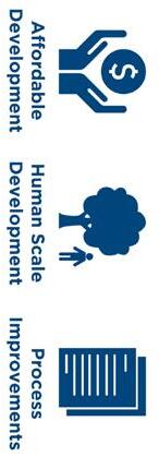
Connected Communities has been tailored to meet residents’ needs. It targets areas around neighborhood business districts, major corridors of the proposed Bus Rapid Transit, and citywide. The focus areas are Middle Housing, Reduced Regulatory Barriers, Parking, Affordable Development, Human-Scale Development, and Process Improvements. These policies, based on proven regulation changes, aim to control housing costs, increase supply, and create lasting, incremental change for a more equitable and prosperous Cincinnati over the next 50 years.
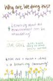
Background
Why are we doing this? Cincinnati’s housing supply isn’t keeping up with rising demand. In 2022, 37% of households were housing insecure, and for renters, it was 46%. One major barrier is the current zoning code, where 44% of the city is zoned for single-family homes, limiting housing options and increasing costs. Changing these zoning rules will make development easier and incentivize new housing types, ultimately aiming to house more people.
Engagement
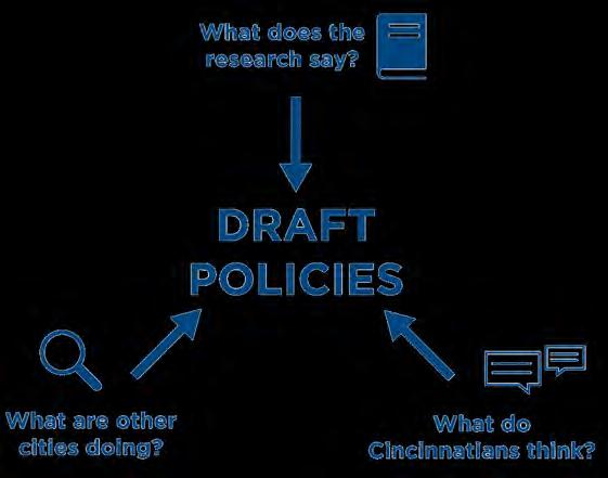
After more than a year of community engagement, the Connected Communities policy proposals are announced and have become a reality after passing earlier this year! Early efforts included in-person events, surveys, and pop-ups. Now, the public can engage through the Connected Communities StoryMap. This will be followed by more in-person events, a housing summit, and neighborhood summit. Explore the StoryMap linked on the next page to learn more!
CO-OP Accomplishments CC Storymap
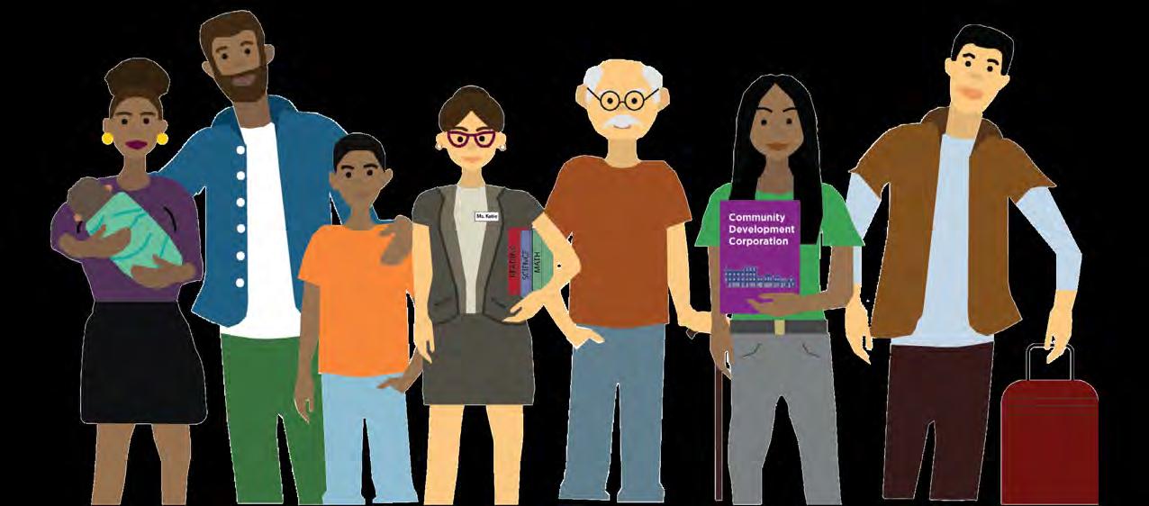
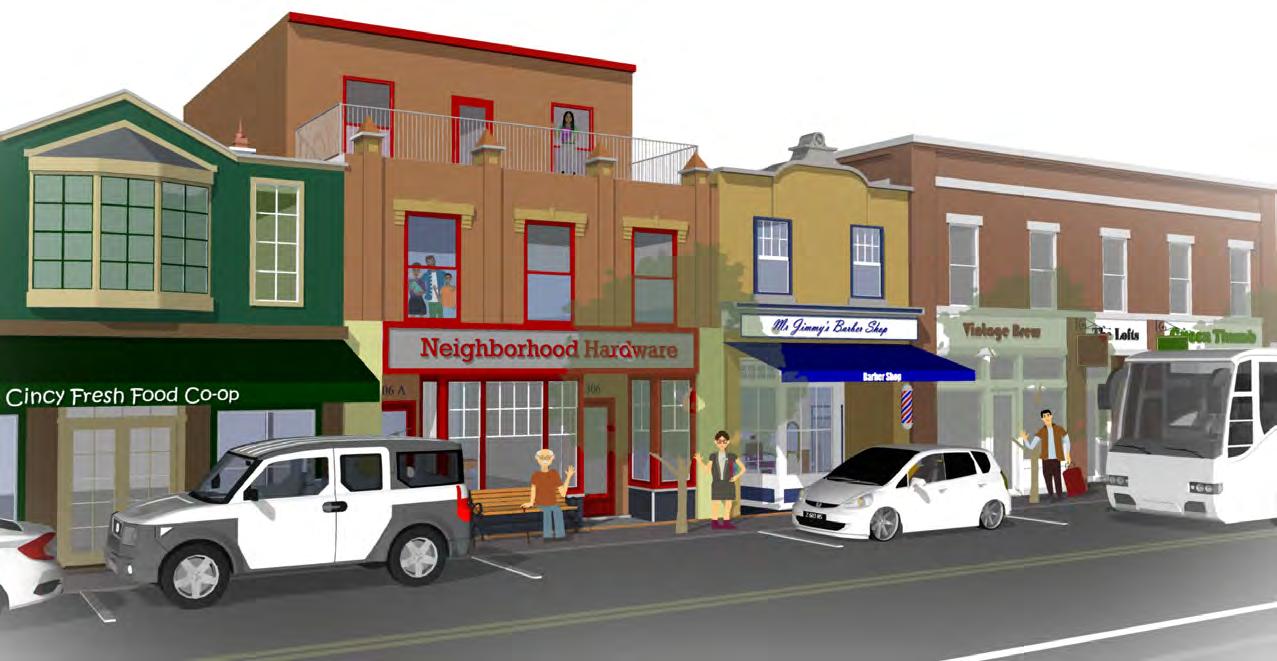
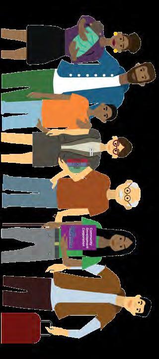
At DCPE, I contributed significantly to the Connected Communities StoryMap and its graphics, including illustrations of the famous characters that help tell the story of our fellow Cincinnatians. My responsibilities also included attending meetings with City Council, completing staff reports for CPC, conducting environmental reviews, creating event materials, research for the Office of Environment and Sustainability, and preparing notices, among other tasks.


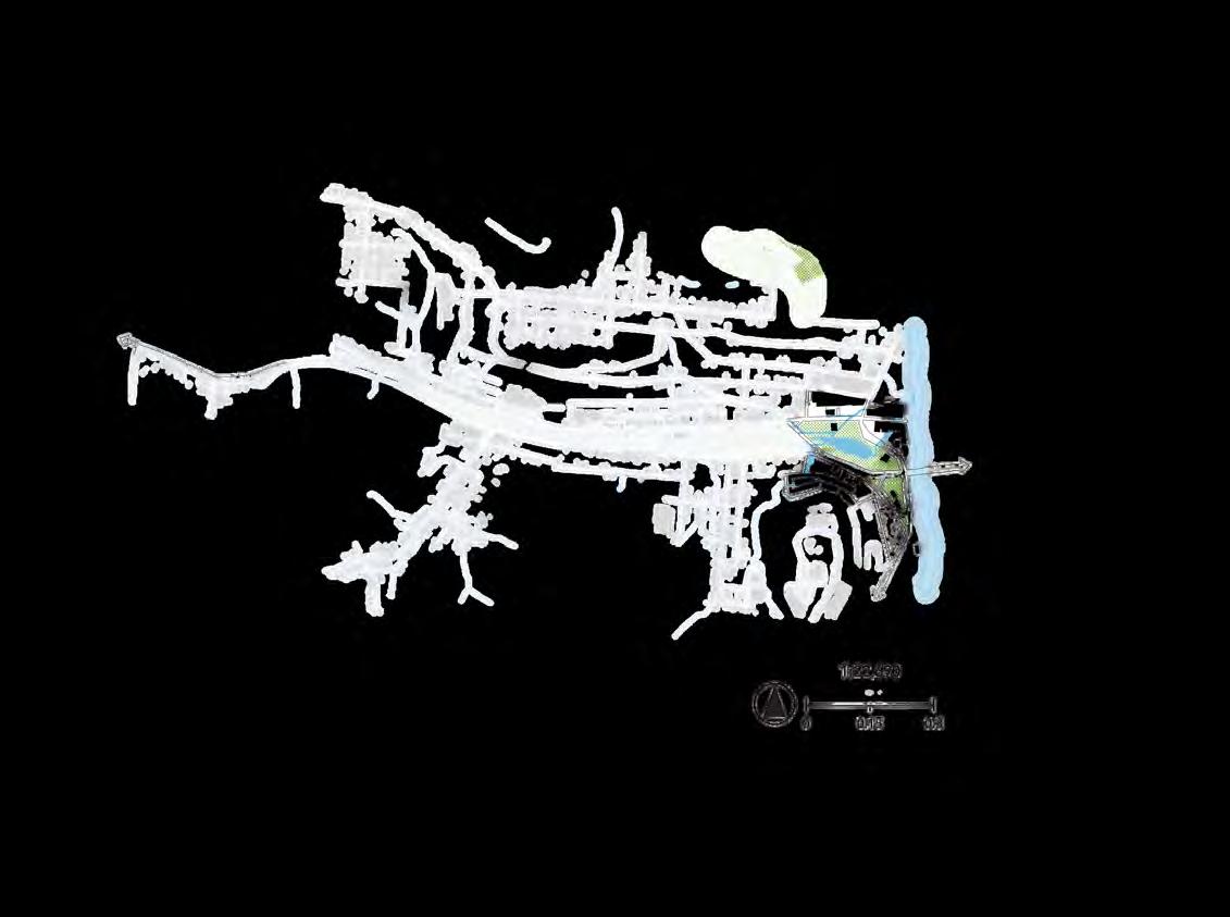
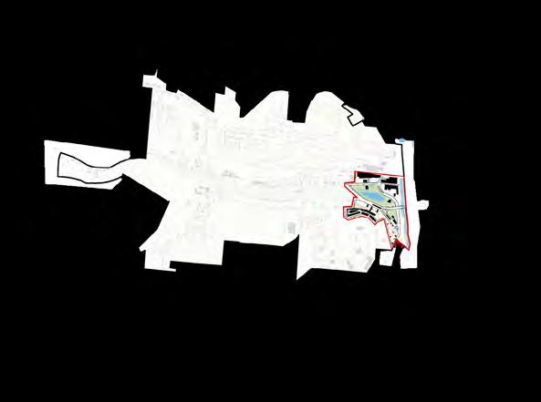
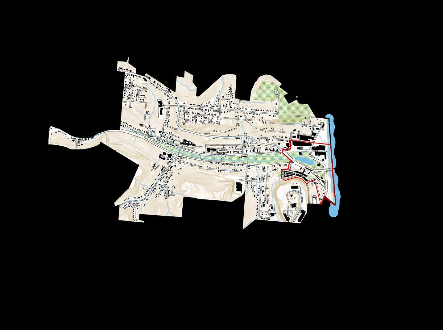
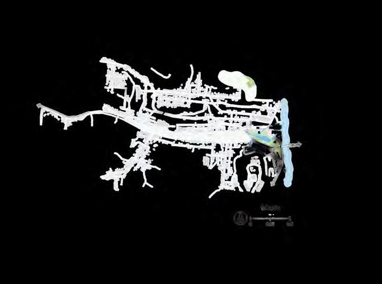
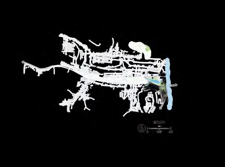
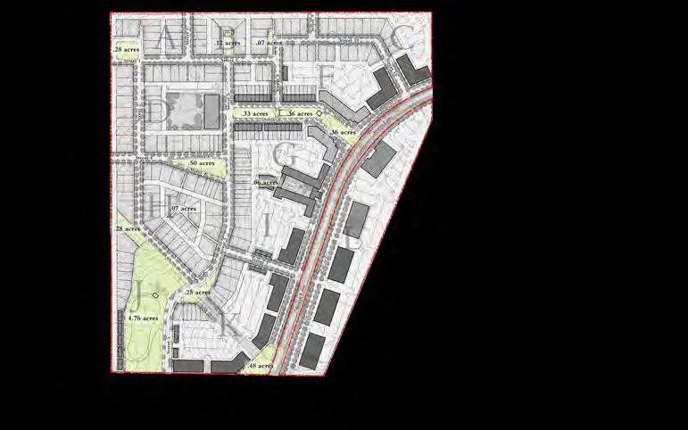
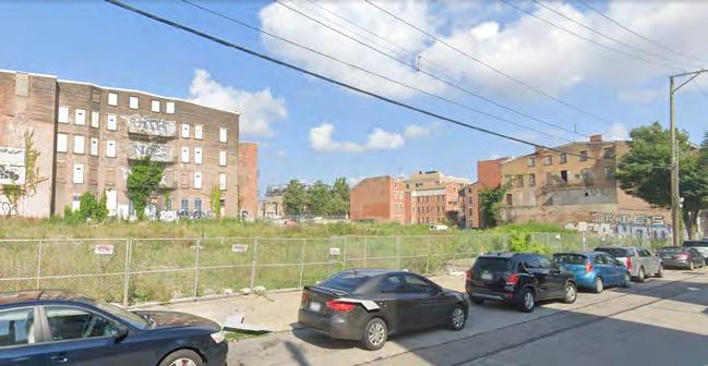
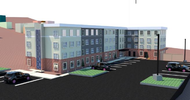
South Fairmount is 749 acres (1.17 sq. mi.) and the identified focus area is 54 acres (0.08 sq. mi.). This is approximately 7% of the total land area.


Västra Hamnen, Malmö, Sweden
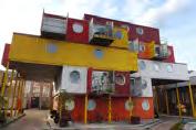
Container City, London
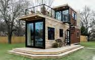
John Arthur Flats – Northside, Cincinnati
Individual Container Unit
John Hirsch Place (Woonerf) –Winnipeg, Canada
Saw Mill River, Yonkers, New York Cincinnati Zoo Rain Barrel Project
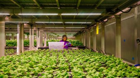
80 Acres Farms Vertical Farming –Florence, Kentucky
Ludlow Avenue – Clifton, Cincinnati
Findlay Market – OTR, Cincinnati
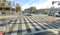
Enhance Outdoor Experiences - Santa Monica, California
Glass Storefronts with Increased Landscaping
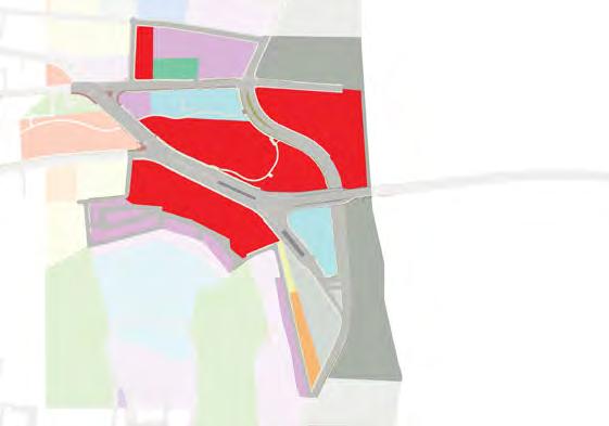
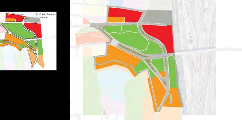
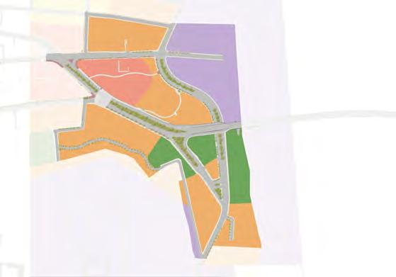
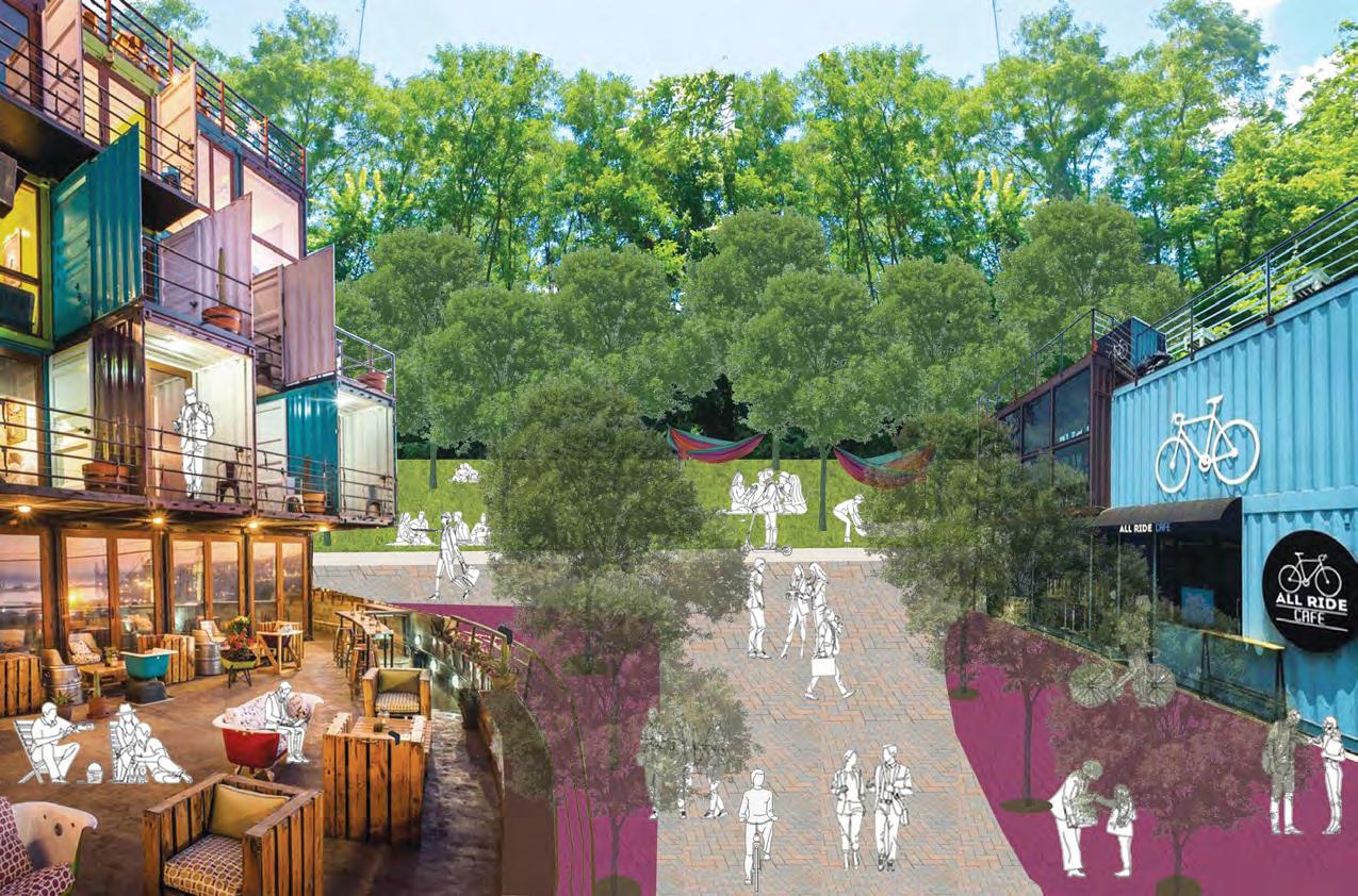
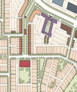
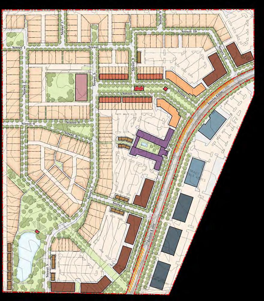
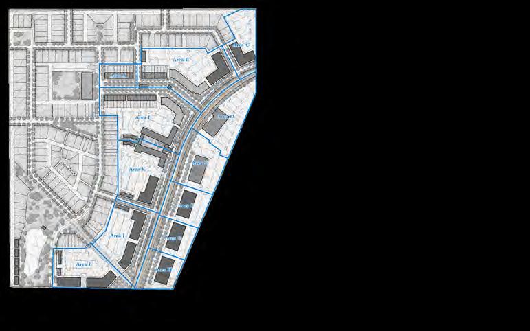
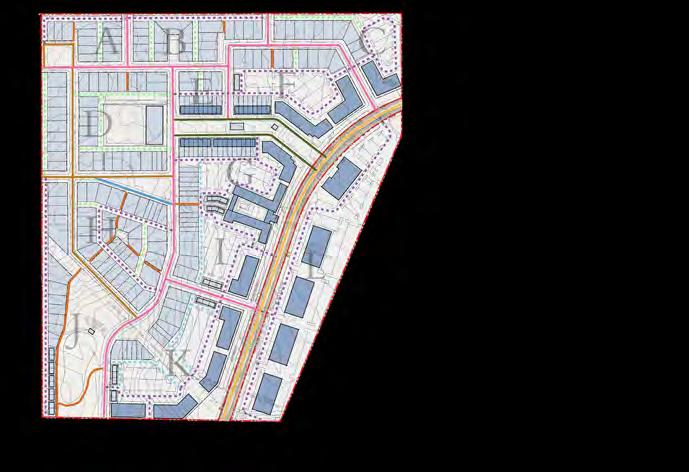
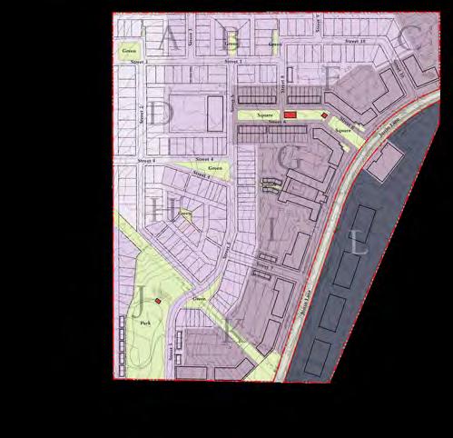
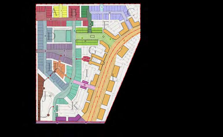
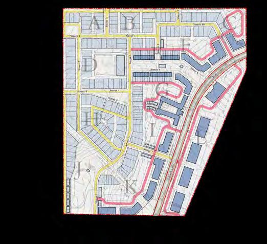
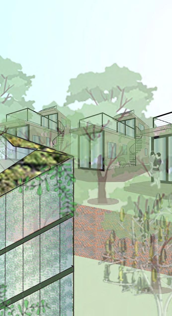
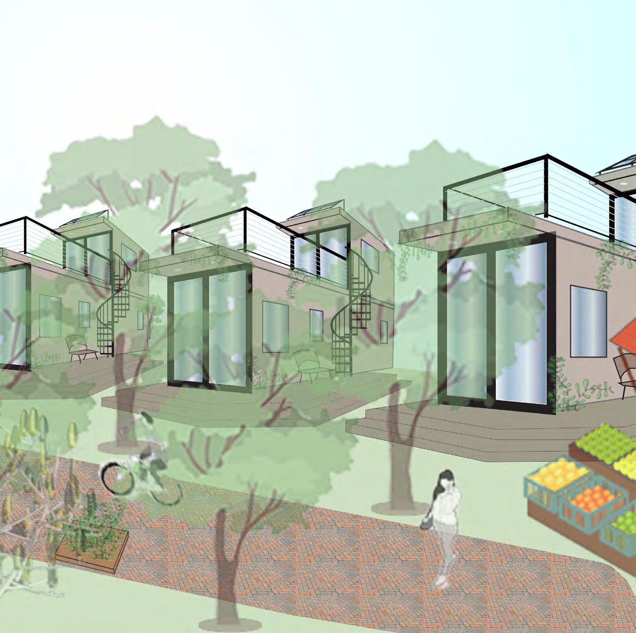
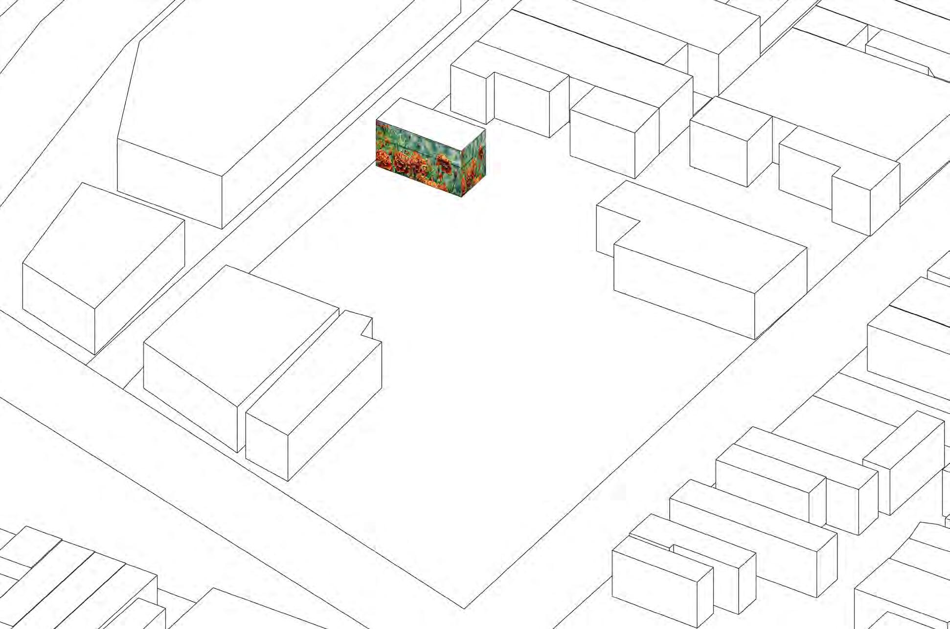
South Fairmount
URBAN DESIGN PROPOSAL|
Why Should We Care?
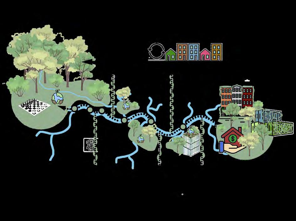
The vision for South Fairmount must growing population, capitalizing on exciting opportunities in Cincinnati, such as Lick Run Greenway and Connected Communities. We aim to support both young and old generations, ensuring that we grow without displacing current residents. promote diversity among people and businesses to foster identity, connection, and access. We also need to prepare for the future by building climateresilient communities that interact with nature daily. Finally, we want to make living , allowing residents to enjoy their community without struggling for basic necessities like housing.
Strategies
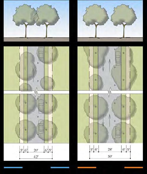
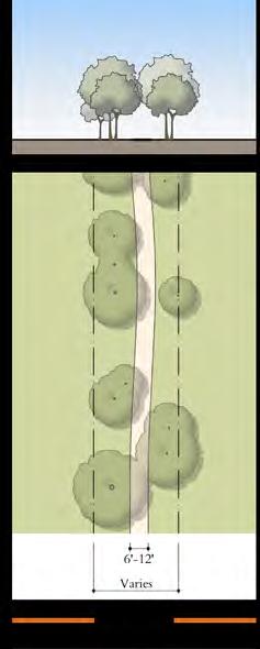
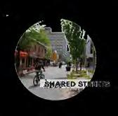
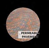
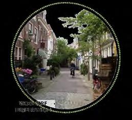
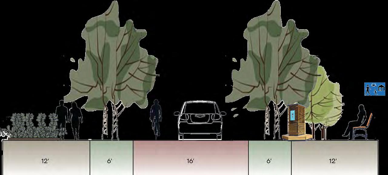
#1 Innovative Housing Solutions: Develop rowhomes, shipping containers, and container apartments. Implement affordable housing programs like Cincinnati’s Affordable Housing Trust Fund (AHTF) and Low-Income Housing Tax Credit (LIHTC). #2 Enhance Connections With Nature: Create green corridors, add street trees, and design shared streets (woonerfs). Use green infrastructure such as permeable pavers and green roofs. Develop unique parks with access to amenities within a five-minute walk, and promote climate resilience practices with monthly learning classes. #3 Diverse Local Businesses: Support a variety of local businesses, including grocery stores, bakeries, and wellness centers. Encourage mixeduse developments and enhance pedestrian experiences with wide sidewalks, street parking, and green infrastructure.
Total Area of All Land: Neighborhood: 749 acres (1.17 sq. mi.), Focus area: 54 acres (0.08 sq. mi.)
Number of Housing Units: Keep: 3 existing SF home (not many to begin with), Add: 79 Rowhomes, 9 Mixed-Use Buildings, 1 Apartment Complex, 256 Container Complexes, 44 Individual Container Units Types of Uses: Residential SF & 2F+, grocery (Aldi’s) /convenience store, pop-up farmers market, bakery, restaurant, bars, cafe, bookstore, plant stores, theater, clothing store, laundromat, gym, clinic/pharmacy, wellness center, yoga studio, bike store, and Community Development Corporation
Create innovative housing solutions that provide affordability for those living in South Fairmount as well as connect them to nature while building a sense of place & identity.


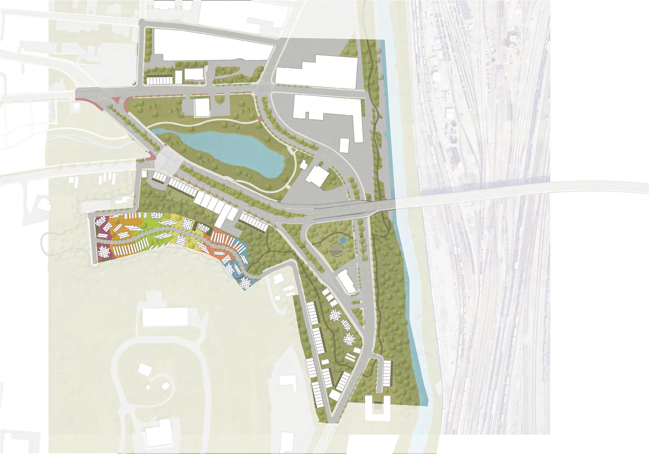
LEGACY CROSSING

Michael Watkins Architect, LLC 03.
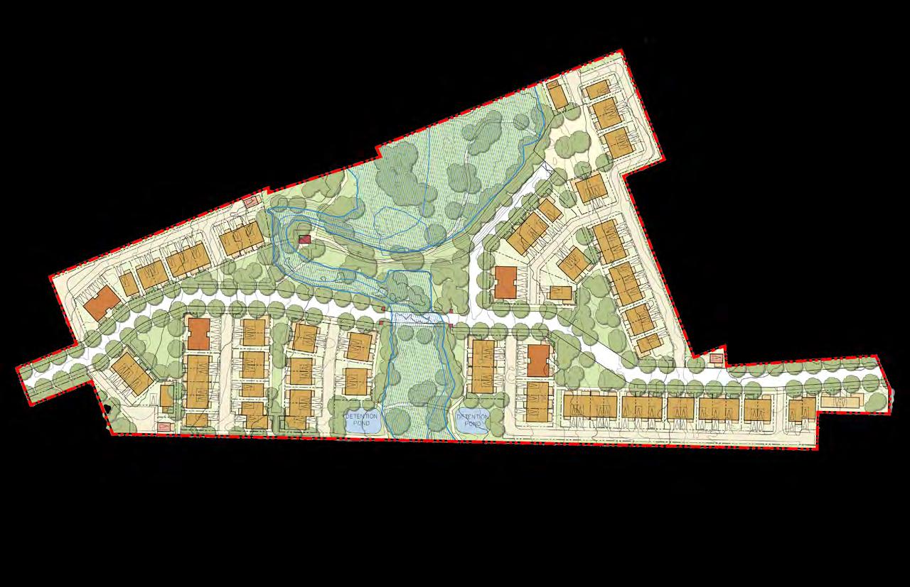
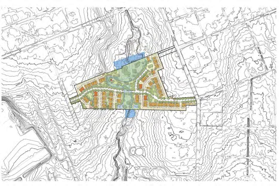
LEGACY CROSSING |
Charrette
At Michael Watkins Architect, I participated in two charrettes—one in Barling, Arkansas, and another in Taylor, Texas. In Taylor, we worked with two clients to create master plans and PD standards. These week-long charrettes included site visits, workshops, meetings, and presentations. The experience was invaluable, allowing me to work in a fast-paced environment and observe how different roles collaborate to finalize a plan efficiently.
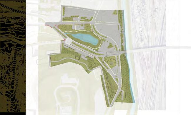
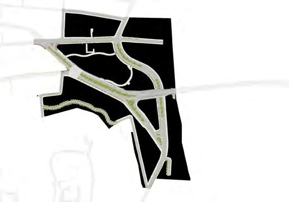
Site Visit
The Legacy Crossing site visit consisted of meeting with the client and the rest of the team working on the plan. We all toured the site which was an open space surrounded by a woods and had a flood plain going through the middle. It also included two detention ponds
Master Plan
Creating the master plan for Legacy Crossing was a valuable learning experience. Unlike previous projects where I edited existing plans, I started this one from scratch, with guidance from MWA. I drew the initial linework, measured distances, created the plan in AutoCAD, and made edits in Photoshop. The mentorship I received was extremely helpful in understanding how things work in the real world.
Booklets
The creation of the drafts for the master plan and PD standards booklets happened at the charrette and continued when the charrette had ended. Many updates had to be made after the fact.
Precedents
CO-OP Accomplishments
At Michael Watkins Architect, I worked on various projects across the US, including: 1. using Photoshop to create and edit master plans and diagrams; 2. using InDesign for master plan and development standards booklets; 3. using AutoCAD for thoroughfare diagrams, master plans, unit diagrams, and typical blocks; and 4. participating in weeklong charrettes to meet clients, visit sites, and prepare master plans and PD standards booklets.
TAYLOR HEIGHTS |
Master Plan Booklet


Contributors: Emily and Mckenzie
Clifton 04.
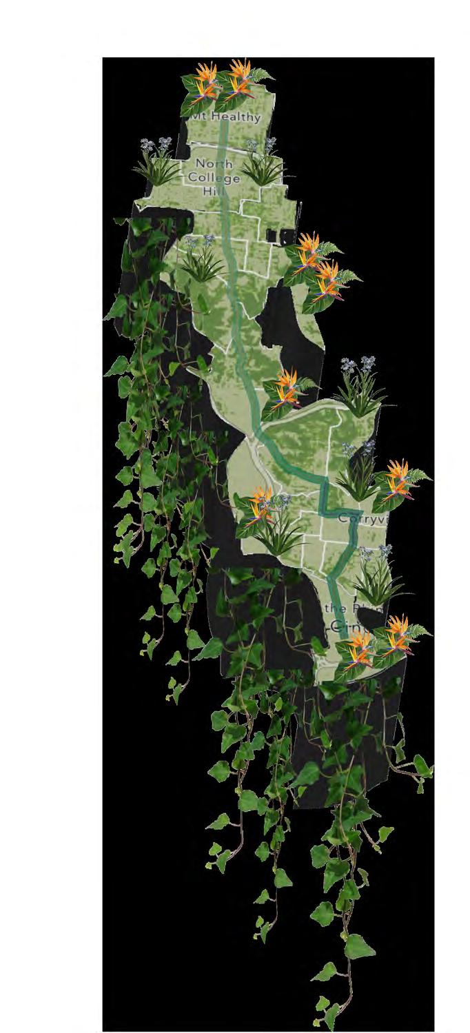
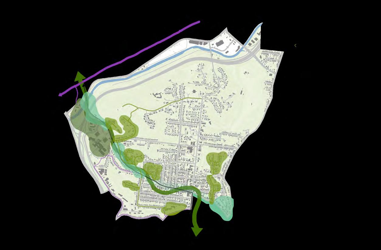
LIVE GREEN. BREATHE GREEN. GO GREEN. |
Research
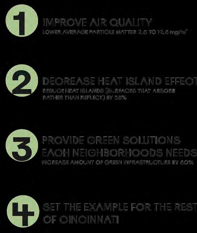
Cincinnati’s hilly terrain sets it apart from other Ohio cities, and the BRT presents an opportunity to enhance its strengths and address weaknesses. It can improve the ecological, economic, and social well-being of the area, but it’s crucial to prioritize environmental considerations during its development. Research should include mapping impervious surfaces, heat islands, tree canopy, air quality, and social vulnerability.
Master Plan
Cincinnati has the potential to become an environmental haven by using BRT to foster a healthy lifestyle and community along the corridor through green solutions. Clifton can serve as a starting point for implementing these initiatives, including eco-villages, improved walkability, increased tree canopy, bike paths, green jobs, vertical farming, solar panels, permeable surfaces, city trees, electric BRT, and farmers markets.
BRT
Bus rapid transit aims to reduce air emissions and automobile usage while boosting Cincinnati’s vibrancy. We plan to leverage this initiative for a more sustainable future along the Hamilton Ave corridor, prioritizing ecological, economic, and social outcomes. This is a significant opportunity to enhance the well-being of the environment and the communities surrounding the corridor.
Implementation
Clifton can be the starting point for implementing green solutions, including: 1. Eco-villages—creating pockets within a network of green streets to reduce car dependency and enhance daily access to nature; 2. Green Infrastructure—varying intensities along the BRT route based on area density; and 3. Industrial Transformation District and Bike Paths.
A Network of Green Streets


Hazard Vulnerability

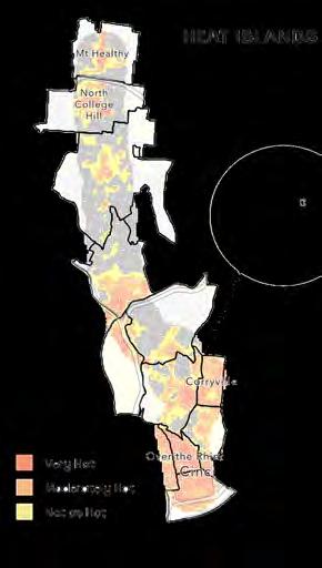


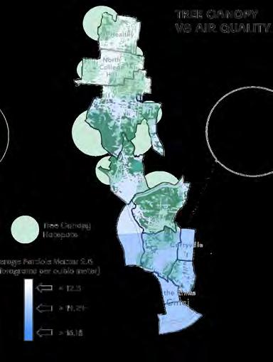
Green Elements
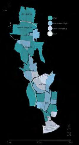
SOCIAL VULNERABILITY INDEX

Over-the-Rhine 05.
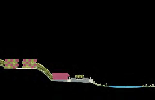
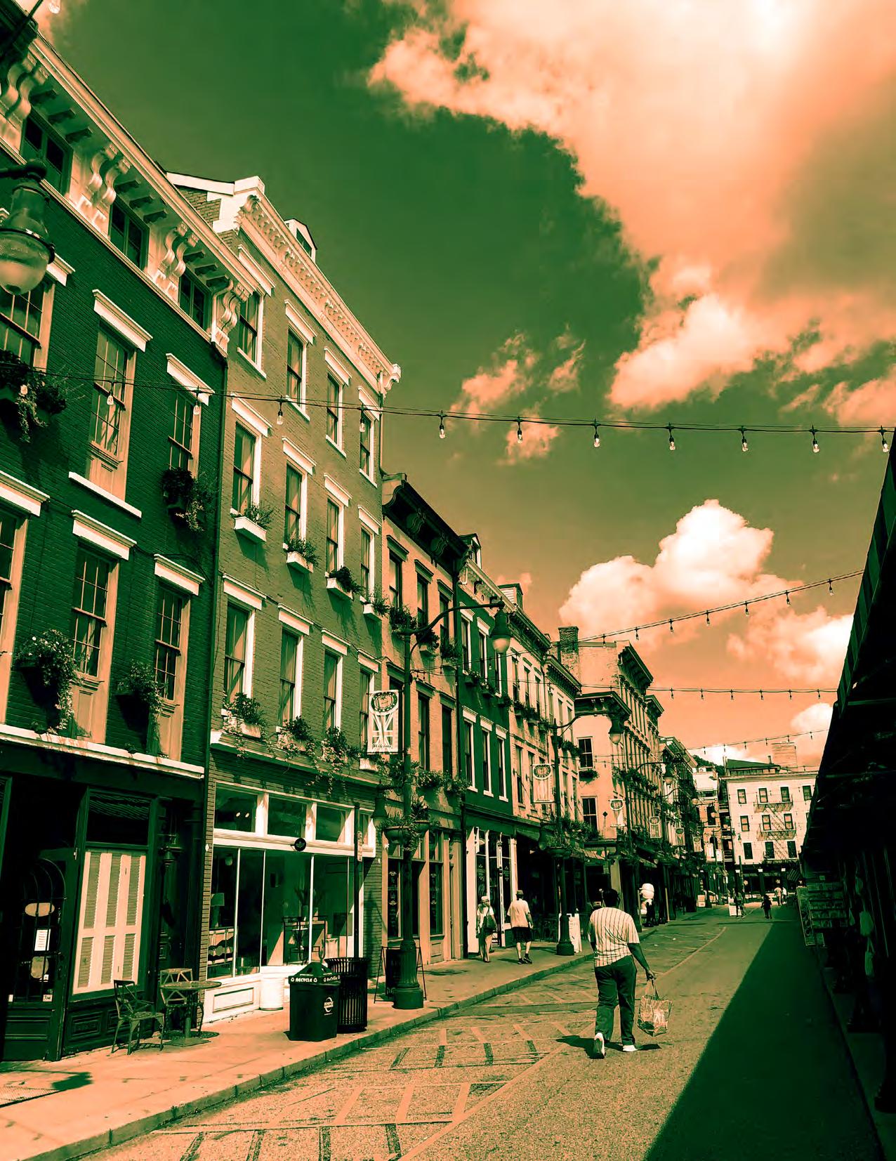
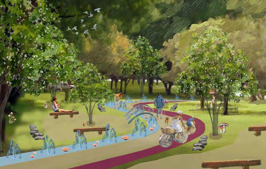
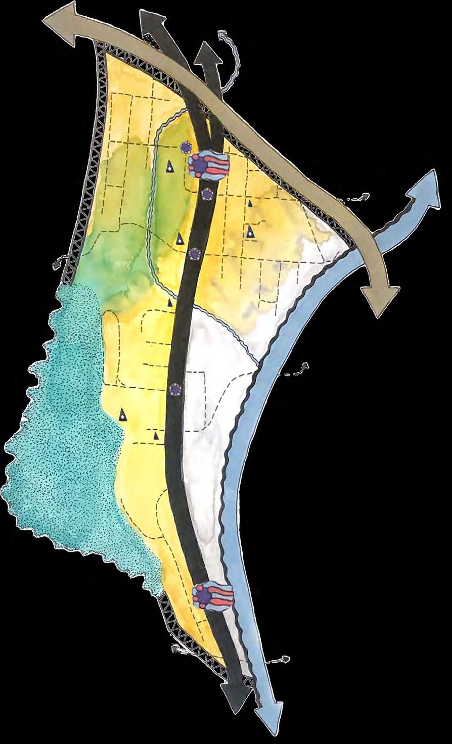
A HEALTHY FINDLAY |
Purpose
“A Healthy Findlay” aims to raise awareness about the Over-the-Rhine community and the necessary changes for its continued success, particularly in areas beyond Findlay Market that are often overlooked. Developing a network of bike paths and engaging green spaces will increase interest in these areas. Additionally, the Cincinnati Bell Connector Streetcar will support our goal, promoting ridership and alternative public transportation options in OTR.
Master Plan
The master plan “A Healthy Findlay” for the area around Findlay Market in Over-the-Rhine aims to create a “Biker’s Paradise” connecting the community with red bike stations. It also promotes “Living Fresh,” which enhances healthy activities through eco-friendly restaurants, green buildings, and outdoor engagement. Finally, “Green and the City” integrates environmental elements by adding trees, greenspace, water features, bioswales, and green roofs.
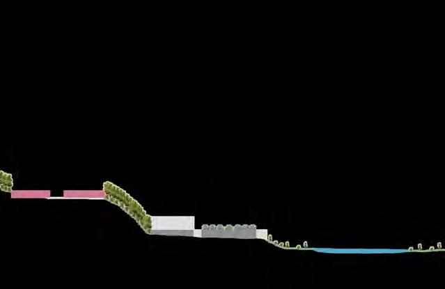
Good vs. Bad Uranism
Good Urbanism prioritizes pedestrians with features like gathering spots, greenery, public transportation, and local businesses, while minimizing vehicle spaces. In contrast, Bad Urbanism is vehicle-oriented, characterized by vacant lots, limited greenery, safety concerns, and neglected infrastructure. As planners, we must create safe, walkable environments that provide easy access to essential services.
Living Fresh Proposal
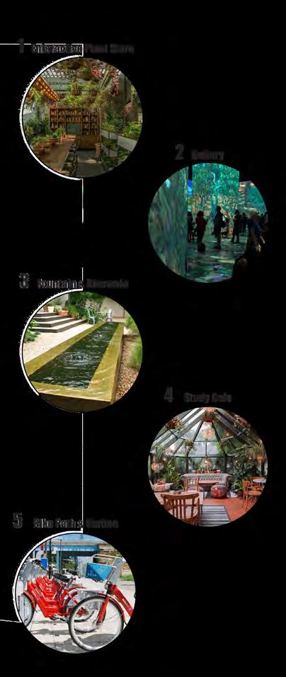
“Living Fresh” could be envisioned in a large vacant lot with empty buildings in southwest OTR, incorporating elements from our master plan. Key features of this green recreational space include numerous trees, a fountain, a bioswale, a late-opening café, and a bike path with a station. The vacant buildings will be repurposed into: 1. mixed-use residential with commercial spaces and rooftop seating; 2. an interactive plant store; and 3. a gallery for local artists.
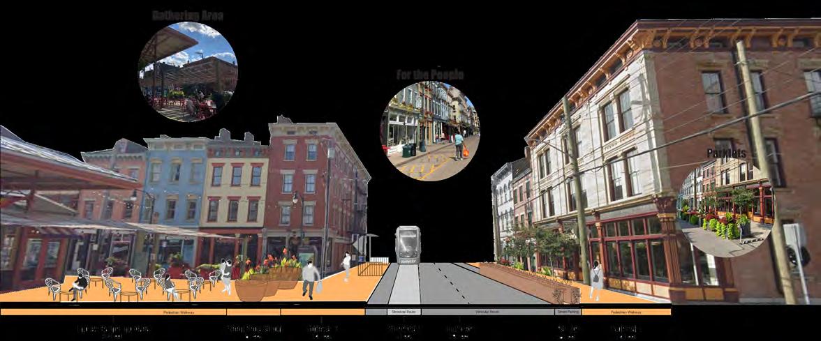
Good Urbanism Cross-section
A HEALTHY FINDLAY
Proposed Trees
Proposed Green Space
Proposed Water feature
Proposed Green Roofs
Proposed Bioswale & Trailway
Proposed Bike lane Legend
Proposed Bike Stations
Proposed Street Closure
Proposed Healthy Food
Proposed Green
Proposed Recreational Spaces
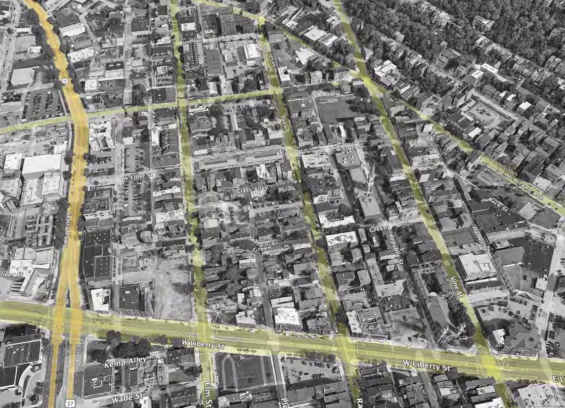


FINDLAY MARKET
Proposed Cross-section


3 4 5 5 3

Sidewalk & Bike Path Sidewalk
1ST IMPRESSIONS
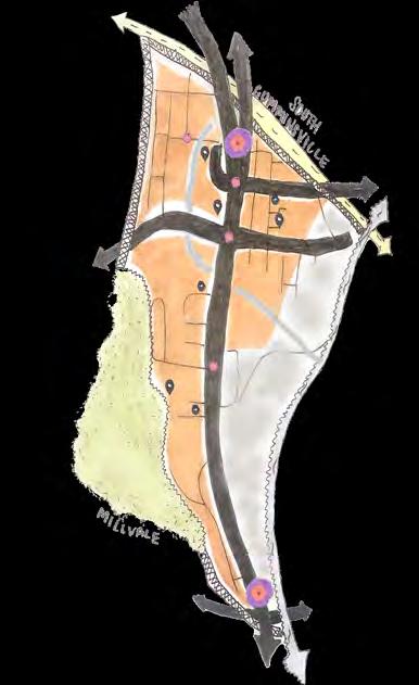
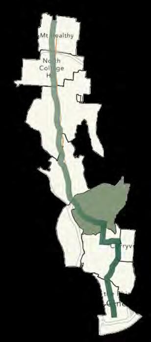
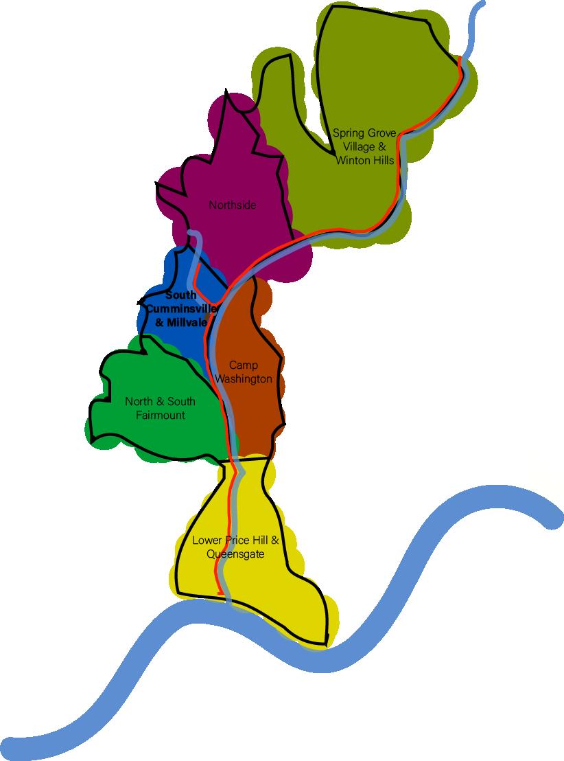
South Cumminsville & Millvale
NEIGHBORHOOD ANALYSIS & IMPACT |
“A forgotten Neighborhood”
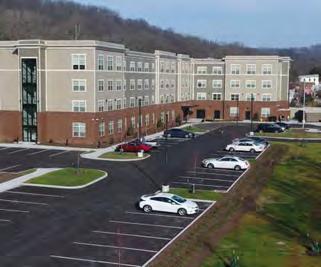
The focus is on the improvements happening in South Cumminsville and Millvale, which had long been neglected with little investment, leading to decline. This began to change in 2021 with The Commons at South Cumminsville, a development providing 80 low-income housing units for disabled individuals and veterans. These neighborhoods, home to generations of families, are mostly residential but haven’t received the same support as other areas. Creating more projects like The Commons will help revitalize these communities, bringing new life and reversing years of neglect. This is just the start of much-needed transformation.
SWOT Analysis
Connection Proposal
The neighborhoods along the Mill Creek have overlooked its importance as a connector. It’s essential to find ways to highlight this, as it could attract visitors to the more forgotten areas. An elevated, walkable, and bikeable trail along the Mill Creek will facilitate this and provide numerous benefits. The proposal outlines the trail’s path in South Cumminsville and Millvale, marked by a bold black arrow. Key focus areas include Waynefield Park, which lacks amenities, and the unused railway, where an entrance to the trail could provide recreational opportunities and insight into the neighborhood’s history.
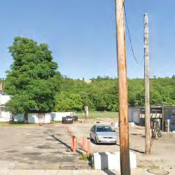
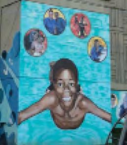
Strengths - strong community, lots of potential, Beekman Street main road, The Commons, Waynefield Park, Community Garden, Millvale Community, and murals. Weaknesses - not enough funding, extremely industrial, I-74 divide, no grocery (food desert), only seasonal activities, and lots of vacant lots and buildings.
Opportunities - connect neighborhoods along Mill Creek, bike paths, Bodega, amenities sign, improve entrance, access to un-used railroad, and increase amount of murals. Threats - trash on ground, hazardous Mill Creek, pollution, food desert.
Residential Elevation
VacantLots & Buildings
Mill Creek

StrongCommunity
The Commons

Trail Elements


Connect Neighborhoods along Mill Creek
HISTORY OF THE MILL CREEK


Land use and zoning policy changes that aim to help Cincinnati grow into a more accessible, people-focused, diverse, healthy, and connected community for all. To address Cincinnati’s housing shortage , appropriately accommodate the transitioning desire of our population, and follow best urban planning practices, our outdated development regulations and zoning code must be modified. It’s time for Cincinnati to become part of the national conversation and be a member of the leading wave of action. It consists of three geographies and six focus areas that were targeted


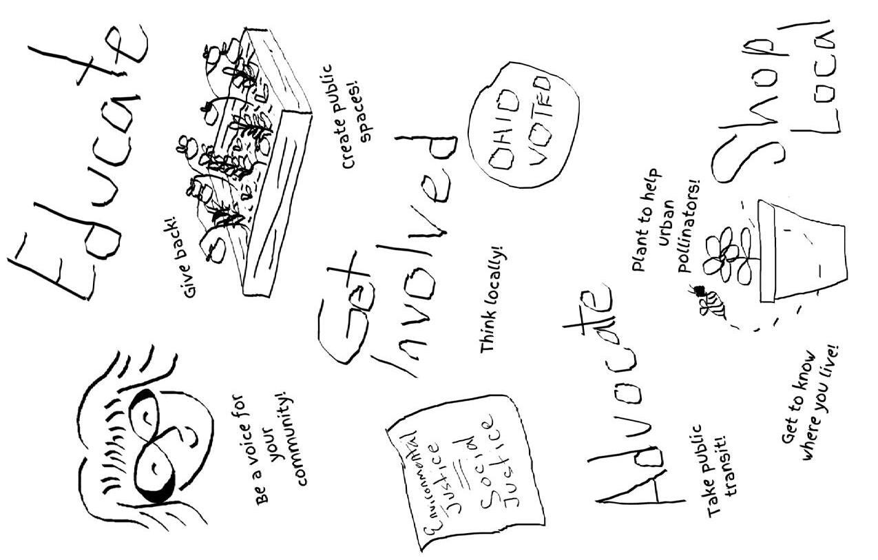
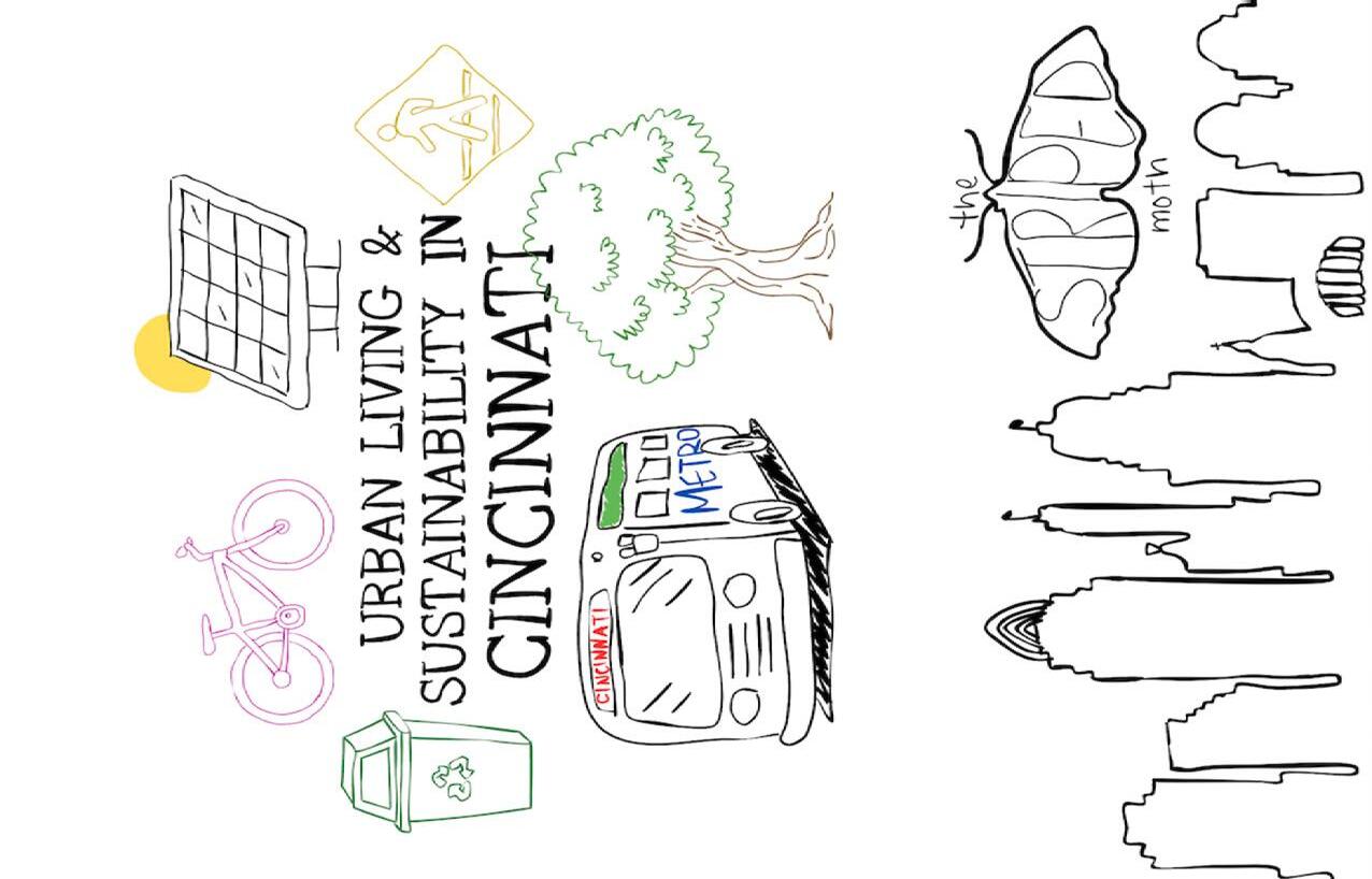
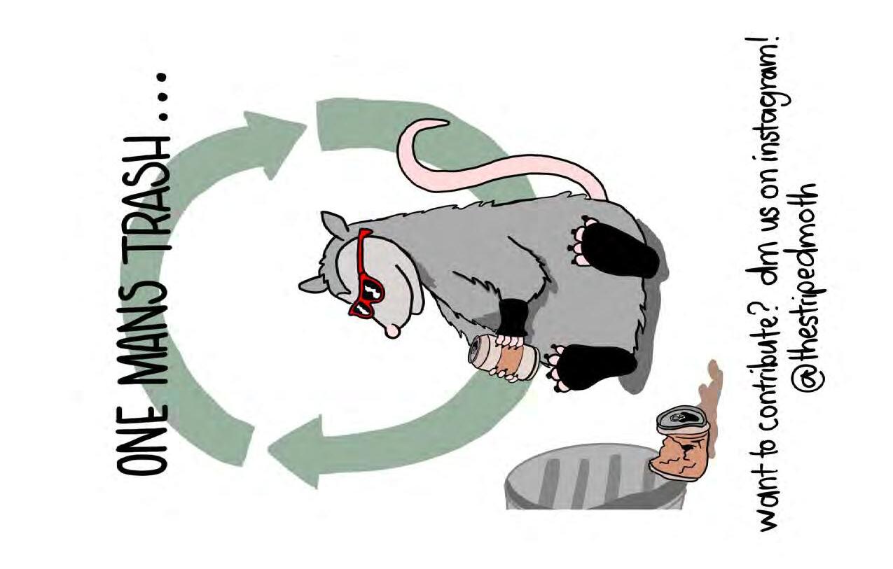
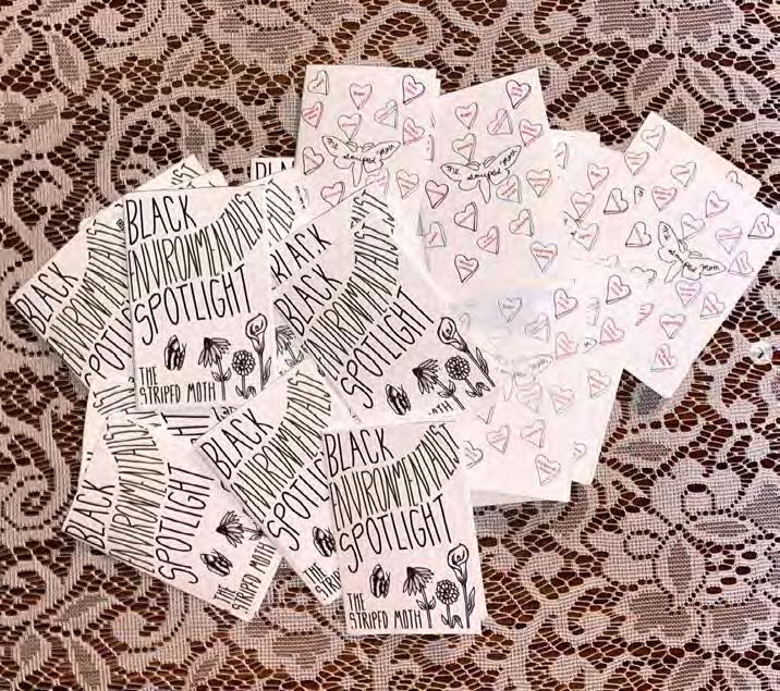
THE STRIPED MOTH ZINES |
Environmental Advocacy
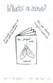
“The Striped Moth” is an environmental advocacy booklet/zine led by a small group of five UC students. Each member has a background in environmental studies. Every other week we all meet to come up with ideas on what our next months edition will be. Each member then picks 1-2 pages to complete within the set timeframe. Currently, we have five editions, but wish to continue to grow. We spread the zines out around campus and other spots like cafes to grab students attention on important issues.
How it Began:
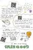
The University of Cincinnati holds a Sustainability Summit each year which is faculty and student led. 2023 was my first time going! The whole purpose of the trip is to learn about the environment whilst having a range of speakers and activities. At the end of the few days there, you’re tasked with a group to workshop ideas that UC could incorporate on campus to shine light on sustainable practices and environmental stewardship. The group that I was in came up with “The Striped Moth” zines.
3rd & 4th Editions


WRITING SAMPLE: WHAT IS A “GREEN” PLAN FOR A CITY? |
Cities across diverse geographies are proactively preparing for the challenges posed by climate change. In anticipation of the impending impacts on our environment, it is imperative to strategize for long-term shifts in temperatures, weather patterns, and various repercussions resulting from human activities. Recognizing that human actions are primary contributors to climate change, cities worldwide are formulating targeted goals to both mitigate and adapt to these changes. The core issue driving climate change lies in the combustion of fossil fuels, which generates greenhouse gases— predominantly carbon dioxide and methane. These gases form a metaphorical blanket around the Earth, trapping heat from the sun, leading to rising temperatures and a cascade of additional hazardous consequences.
Delving into the specifics of a city’s plan, I conducted research on the District of Columbia, commonly known as Washington, DC. Over the years, DC has developed an array of comprehensive plans addressing environmental, climate, sustainability, and green initiatives. The primary environmental plan, Sustainable DC 2.0, established in 2019, serves as the cornerstone for a suite of 18 family plans, each delving deeply into specific aspects of environmental management. This overarching plan provides an extensive overview covering 13 critical topics, including governance: ensuring plan implementation and accountability by the DC government, equity: improving equity in DC planning, starting with Sustainable DC, built environment: equitably accommodating population growth, strengthening existing neighborhoods, and making new and existing buildings more sustainable, climate: reducing GHG emissions (climate mitigation) and increasing resilience to climate change (climate adaptation), economy: growing green jobs and economy and training residents for green jobs, education: educating students about the environment and educating community members about sustainability, energy: improving energy efficiency, increasing renewable energy, and modernizing energy infrastructure, food:
expanding urban agriculture, increasing access to healthy food, growing the food economy, and reducing wasted food, health: enabling active lifestyles for residents, increasing healthy places for residents, and improving community level health, nature: protecting and expanding aquatic and land wildlife and habitat and improving residents’ access to nature, transportation: increasing transit use, increasing the number of bikers and walkers, reducing dependency on single occupant vehicles, and reducing emissions from transportation, waste: reducing the amount of waste created, increasing reuse and recovery of materials, and increasing recycling and composting, and water: making waterways fishable and swimmable, reducing the amount of stormwater runoff, reducing the amount of potable water used, and ensuring safe drinking water. Each of these topics encompasses a set of goals, targets, and actions, strategically outlined within short-, medium-, and long-term timeframes. Mayor Muriel Bowser encapsulates the essence of the plan, envisioning DC as “the healthiest, greenest, most livable city for all residents,” emphasizing a commitment to sustainability that balances environmental, economic, and social needs for current and future generations.
The process employed in crafting such plans, exemplified by Sustainable DC 2.0, follows a systematic and collaborative approach. The process involves initiation and visioning, stakeholder and community engagement, data collection and analysis, theme-specific working groups, drafting the plan, public input and feedback, revision and refinement, review and approval, implementation, monitoring and reporting, and continuous improvement. This structured approach ensures a holistic and inclusive strategy that aligns with the values and priorities of the community.
Numerous agencies and groups contributed to the creation of Sustainable DC 2.0 and its associated plans. Washington, DC stands out for its commendable inter-governmental agency collaboration, surpassing many other...