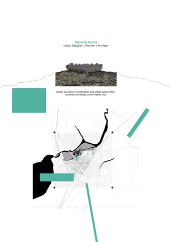
Master of Science in Architecture and Urban Design ‘2023 Columbia University, GSAPP (Dean’s List)
Rutwik Karra
Urban Designer | Planner | Architect
New York, NY | +1 917 346 2783 | rrk2158@columbia.edu
*About Me
Forward-thinking Urban Designer and Architect with 3+ years of multidisciplinary experience across the U.S. and India. Adept in community planning, land use design, and public engagement. Deeply committed to building equitable, sustainable, and beautiful communities through participatory design, GIS-based planning, and inclusive storytelling.
*Expertise
Urban Design • Placemaking Design • Master Planning • Community Planning • Public Space Programming • Cultural Design • 3D visualisation • Advanced Illustration
*Skills
Technical: ArcGIS Pro, QGIS, Adobe Creative Suite (InDesign, Illustrator, Photoshop), AutoCAD, Rhino-Grasshopper, SketchUp, Procreate, Enscape, Lumion, Twinmotion Planning & Engagement: Community outreach, visual storytelling, charrette facilitation, multimodal design support, land use and trail planning
Soft Skills: Public speaking, collaboration, problem-solving, cultural sensitivity, stakeholder communication
Network of Care revives the Sabana de Bogota, a wetland that people once inhabited with a sense of care that recognized water as not just blue but also green. Today, this wetland is severely depleted by a city’s impervious surfaces, polluted with trash, and disrupted by floods. Our strategy is to make water visible in its many shades of blue and green particularly in streets and existing concrete ditches built to drain water to the Bogota River, and to connect this growing visibility with current remnants of the wetland that currently stand isolated. Along with water visibility, we expand the ideals of Care Blocks, a social Infrastructure project initiated by the city, to care for and guide this revival of a wetland system and related natural ecosystems. Our aim is to create a city that is in the stewardship of a Care Network that considers water a partner in inhabiting the Sabana de Bogota. It is a shift from water fear to water trust.
Site Evolution: Origins to Present Day
Transect Study: Urban Ecology, Morphology, Policy
5 key pivotal points for change:
1. Rio Bogota | 2. Care Block, Patio Bonito | 3. Transmillenio Yard
4. La Vaca Wetland | 5. Kennedy Hospital and Housing
Social Issues Imposed Solutions PEOPLE
Physical Issues
RESTRUCTURING APPROACH: EXISTING SYSTEM
EXISTING INFRASTRUCTURAL NETWORK - ANALYSIS
Care block - a social infrastructure set-up for education, health, legal and financial literacy + supprort
PROPOSED SYSTEMIC CREATION OF CARE NETWORK Care block extending to Physical Blues & Green
a top-down system with a strong intent for action
Strategy on Site:
1. Existing Situation of Care Block
2. Added Green Initiatives via Community Eforts
3. A Network of Green and Blue jobs working towards an urban ecological restructure
2070 Vision for self-sustaining social & environmental ecology:
1. Sectional View of La Vaca Wetland
2. New Urban Interactions - Coexistence of Human, Nature, & Transit
A sectional vision of the Expanded La Vaca in 2070, negotiating edge with the Corabastos Market. A large low ground with water retaining plants along the edges, and biofiltration plants in the water create habitats and public spaces. A Public Space with water along with the community development is imagined.
2070 VISION
Integrating new forms of Mobility, structures of Care, and Landscape into the urban fabric.
2030 VISION
2050 VISION
The Last Great Necessity
Group | Academic | Columbia GSAPP
Contribution : Lead | Narrative & Strategy | Maps
Mentor : Emanuel Admassu | Chat Travieso
Location : Greenwood Cemetery, Atlanta
In a world after property, remebrance and memory are not a commodity. A cemetery shall be an everyday landscape of the ordinary; separating it from the institutionalised funeral industrial complex that makes death a commercial practice. To remember or memorialise someone, death is independent of the regulations, by pushing towards collective remembrance, stewardship and responsibility.
THE LAST GREAT NECESSITY, as an EVERYDAY LANDSCAPE
Death as a Socio-economic Practice
SOCIAL
Death as a Ritual
Death as a Spacial Event of Property
Existing Site of Delineations, Segregations and Marker
Markers are removed, Interconnecting segregation through Walking Trails
Expanding the nuance of Death beyond cemetery to the city, bypassing the funeral Industrial Complex.
The term ‘The Last Great Necessity’, the idea of it, demands us to think if it’s even a necessity. A large piece of land dedicated to memorialising people, demands us to re-evaluate how we even look at the urban. Especially, when memorialisation can happen anywhere. As the design proposal pushes for normalising death, the stigma attached to the same is also normalised, when its anywhere and everywhere.
The full cycle of life, Sectional View
A school, where values of life are taught, yet death is normalized.
If Atlanta is a city of cars and parking lots. Memorialisation can be on-wheels and anywhere.
A community altar can extend onto the belt line or the streets and sidewalks. Displaying the history of the ordinary everyday individual. It is their city afterall.
A ceremony begins with preparing the body, letting family & friends visit before the last rites. A grand marching parade takes the body into the cemetery, with hymns, songs and dance. A land for all and the everyday welcomes every identity, and accepts every type of grief. Deformalising the land into a ground of celebration, with temporal changes and ephemeral qualities.
Death isn’t expensive, but the socioeconomic regulations that entangle around the rituals related to death, makes death or memorialising someone a property. A cemetery’s proximity to the a housing neighbourhood, the plot, the location of the plot in the cemetery, family burial lots, religious and ethnic group based tombstones and gravestones are just a few physical properties attached to death.
The project ‘The Last Great Necessity’ aims at dismantling the institutionalised funeral industry by subtly deconstructing and deformalising the operations. While socially pushing towards a newer look to the landscape, understanding its newer connections to the city, de-isolating it from the urban, bringing back the original pre-colonial ways of play to how the dead is dealt with. Memorial grounds could invoke a feeling of remembrance only when life and death is in spatial continuity. This is achieved with nature taking over the dead organic matter in the form of a landscape of flowering plants and shrubs the continue the circle of life. Property blurs when demarcations are gone, the stone markers or the mowed grass is replaced with collective care of the space, with bringing in domesticity to the exteriors. By letting people place objects of the dead to create banal ground of personal belongings.
Reuse|Remediate|Reimagine
Urban Brownfield Revitalisation
Group | Academic | Columbia GSAPP
Contribution : Lead | Narrative & Strategy | Maps
Mentor : Nans Voron | Sagi Golan
Location : South Bronx & Randall’s Island, New York City
Social pradoxes by design exist around us, and the one in New York is at Randall’s Island and South Bronx. One stands for an exemplar olympic-grade field, while the other is a disinvested community of color and low income whose access to water is cut of through polluting industrial complexes, that inturn sufocate the people to the toxic emissions.
Revise, Remediate, Reimagine is strategic design to revitalise the brownfield at the water edge, while also keeping the economy in the circular loop by situating new age, clean and green industry on Randall’s Island.
Reuse
Remediate
Reimagine
Proposed Stakeholder Engagement Plan
Industrail Renewal Methodology for Swap : Policy Induced Rating System
Orange People Project, Nandanvan Case with Center for the Living City
Orange People Project, getting its name from ‘the Orange City’ of Nagpur where it’s focused, is an idea of a platform that acts as a display of common urban public grievances (focused largely on Physical and Social aspects of a City development), but through large sized cartographic boards; where anybody could pin up their concern. Physical and Social aspects of a city are those where public opinion is largely lost.
Open Streets - Plaza Program with NYC DOT
The team spent multiple days at the Beverley Road Open Street both during weekdays and weekdays to understand, through observation and conversation, the various ways in which people use this space.
Having observed that this site hosts a diverse set of ethno-linguistic groups, age groups and professional backgrounds, we developed a visual survey to engage with a larger group of people, surpassing barriers of language.
The visual survey aimed to understand what diferent age groups would envision for their ideal plaza at Beverley Road. Through this form of demographic division, we can enable the design of spaces that would cater to all age-groups and a diverse range of activities.
Along with the visual survey, we developed a short questionnaire which, with the assistance of the Department of Transportation, was refined and translated into Bengali and Spanish. This was sent out to various community groups through the Ofice of the Council Member, Shahana Hanif. This was to ensure that we gained the insights of residents and stakeholders that were not present at the site on the day of our engagement program.
Ephemeral Junction - Temporary Urban Design for Rural Religious Processions
Finalist: International Design Contest - TDB2021
Work Mapping Koliwadas (Indigenous Communities) of Mumbai using GIS
Left to Right
1. Mapping of the Indigenous Settlements (Koliwadas) in Pre-colonial Mumbai (Bombay) using historic maps and documentations. 2. Mapping the current Mumbai with 2022 OpenStreets data on QGIS with ESRI Standards interpolating koliwadas to current day geolocations.
3. Focused GeoMapping of one Koliwada of Dharavi, designated as the largest Slum in the world, emphasising on urban Wetlands. 4. Zoomed map with on-site civil survey data of a prime neighbourhood for design intervention and site activation possibilities.
This certificate hereby qualifies
Just Communities Accredited Practitioner
with all the benefits of an Accredited Practitioner and a commitment to advancing equity and sustainability in urban and community development.
February 11, 2025
Date of Issue
Expires2yearsfromDateofIssue
Nathaniel Q. Smith, Jr. Founder and Chief Equity Officer
Suzanne Burnes Just Growth Director
Glossary
Urban Design
Nandanvan Community Public Space Safety Strategy
The Last Great Necessity (Greenwood Cemetery) Water Visibility (Bogota, Colombia)
Urban Renewal at Randall’s Island (New York) Asia Initiatives, Case Studies for Global Consulting
Cultural
Visvesvaraya Statue Pedestal Redesign at VNIT Cafe Library
Break-Landscape (Univeristy Park)
Hyderbad Convention (Convention Center) Stage at Cultural Center (National Cultural Center)
Community Engagement
Orange People Project at Nandanvan NYC DOT at Beverly Road, Brooklyn
The Architectural League of New York Laurie Baker Center
Instituitional
Architecture School
Kindergarten Class (Anthropometric Study)
Painting Class (Anthropometric Study)
Health Care
Naissance Hospital (Gynecology & Neonatal Care)
Green Building
Indian Green Building Council Student Chapter Engagement as University Representative
Residential
Occassional House (KCA Design)
Long House (KCA Design)
No Wall House (KCA Design)
Habitat by the Street (EWS & LIG Township) Stack House (Freelance)
Arrow-Ville Layout (KCA Design)
Tech
Ford Motors Testing Simulation
Boston University Autonomous Testing Simulation
Research / Publications
Political Gaze in Planning Practicsces
Confronting Environmental Crisis : New Architectural Approaches
Interdependency of Urban Street Systems in easing Street Crime and Remedial Methodolgies in design using CPTED strategies Water and Economic Resilience : Transforming perspectives from Scarcity to Sacred Importance of Stage as an Architectectural element in Cultural Representation
Book
Atlanta After Property Vol 2 The Production of Reality (TBA)