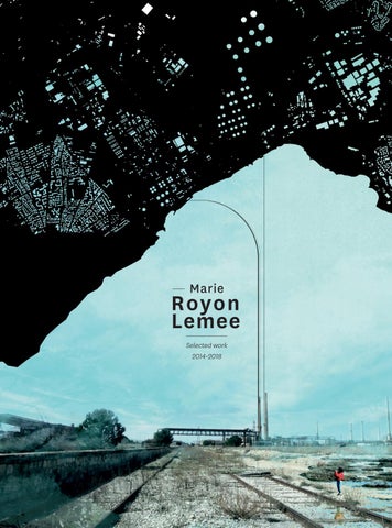
— Marie
Royon Lemee Selected work 2014-2018
CONTENTS
FINAL YEAR PROJECT ‘RESEARCH’ PROGRAM
04. FROM INFRASTRUCTURES’ SPECIES TO SPECIES’ INFRASTRUCTURES ‘De-Fragmentation’ Strategy Urban and Political Strategy ‘Project’ Master Thesis (88 p.) V.A.T - Ville, Architecture & Territoires (City, Architecture, Territories) ENSA Paris-Malaquais ; 2017-2018
URBAN TRATEGIES & PROSPECTIVE STUDIES
12. THE BLOCK Architectural ; Urban & Landscape Requalification PARIS 12e ; Urban Program Co-operation Project with inhabitants & social housing landlord URBAN ACT - architecture & rban-planning Master InternShip ENSA Paris-Malaquais ; july-september 2016
— RELATED TO THE RESEARCH MASTER THESIS :
SHAREABILITY, COUGAR IN TOWN To re-connect Los Angeles ‘wild’ and urban habitats (165 p.) Research Program : “The animal of Architecture” ; lead by D.ROUILLARD L.I.A.T - Laboratory of Infrastructures, Architecture & Territories ENSA Paris-Malaquais ; 2015-2017
COVER Introduction ; ‘Final Year Project’ Poster
URBAN STUDIES EXHIBITION, SCENOGRAPHY
16. UP-RISING BODIES Measure on Measurelessness MAASVLAKTE I - Rotterdam Experimental work : the link between capital, infrastructure, measurelessness & human body TEXTS & SCENOGRAPHY Collaborative work ; with Julien L. CARBONI
ARCHITECTURE SCENOGRAPHY, DESIGN
20. LIGHTHOUSE European School of Photography Île de Nantes - West Project Studio Architectural Brief ENSA Strasbourg ; 2015
22. INTERSTICE — RELATED TO THE EXHIBITION :
MEGAPORTS - Rotterdam “Changing Cities” Studio Lead by Susan Dunne ENSA Paris-Malaquais Delft University (Rotterdam) 2016-2017
Reflective Environments Paris-Malaquais ; MELPOMÈNE Great Hall Theory as a tool to redefine space Collaborative work with Sophie LAMARQUE T.H.P - Theory, History, Project ENSA Paris-Malaquais ; 2016
24. UNIT/MODULE From details of a booth to the Global Market Place Technical details ; flows ; materiality ; Units Assembly Collaborative work with Aline COUSOT & Hélène RICOUP Integrated Design Studio ENSA Strasbourg ; 2015
Final Year Project
From infrastructures’ species to species’ Infrastructures A ‘DE-FRAGMENTATION’ STRATEGY 03.2016 — 06.2016 Course Unit : Urban Project Studio Cities, Architecture and Territories
-4-
Final Year Project associated to a ‘RESEARCH EDUCATIONAL PROGRAM’ (L.I.A.T) — Laboratoire Infrastructure, Architecture, Territoire
The project From infrastructures’ species to species’ infrastructures arises from the research seminar investigation «The animal of Architecture». I developped the notion SHAREABILITY — i.e, a way for humans to share territories with all beings. Helped by this theorical background, this was an opportunity to develop a SHAREABLE urban strategy within a french local area — around the ‘étang de Berre’, or Berre Pond, near Marseille, South of France. This project was intented as a starting point to include fauna in City-Planning, territorial legislation and policy.
« RE-ENCHANTING THE CITY » Berre Pond suburbs, appear as a patchwork : a real fragmented and contrasting landscape (fig.3), seat of both great oil industry and many fauna species (fig.4). They materialize a hot spot to deal with the forthcoming transformations of AixMarseille Provence, reflecting the economic and environmental issues of a young metropolitan area.Thinking and acting for a shareable space – where all beings can live together – requires first
FIG.2 ‘Final Year Project’ Thesis Cover FIG.3 ‘BERRE PATCHWORK’ - land use map
*Jennifer WOLCH, in Zoöpolis
an uprising regarding our lifestyles on this planet : new human praxis, correlated to fauna and flora’s futures. As a result, through a reconsideration of the actual city-planning, and of this industrial and productionist system actually driven by the metropolis, the animal appears like the opportunity of « re-enchant the city ».
BERRE PATCHWORK
MAN-USED LANDS Urban fabric Petrochemical site Shipping infrastructures Airport infrastructures Landfills Quarry sites
AGRARIAN LANDS Main agrarian lands Complex agrarian crop Vineyard, orchard
NATURAL HABITATS Various forests Maquis, scrublands Pastures Grasslands
DES ESPÈCES D’INFRASTRUCTURES AUX INFRASTRUCTURES D’ESPÈCES
MARINE HABITATS
Mediterranean lagoons Marine marshes Interior marshes Salt marshes
ROADS & FLOWS River flows Highways Main roads
Stratégies pour une défragmentation Marie Royon-Lemée R10 - VAT - 18.06.2018 Encadr. - S.MELEMIS, D.KANELLOPOULOU
MAPPING ANIMALS
MAP
FIG.8 - Cartographie du vivant : localisation des espèces qui constituent la chimère
HYBRID ANIMAL AS AN ACTOR FOR THE PROJECT As architects, we imagine a species infrastructure as a multidimensional project, for animals and, partly, by animals. It links political strategy and equipments to generate essential conditions to take care of the chimera and, thus, of the territory. Species’ Infrastructure is considered as a development project whose precise shape is not defined yet. Built or not, it can generate a great mesh/network, or only be a part of it. Its aim is the RECLAMATION of the territory. We refer reclamation to a reappropriation process of what has been altered, fragmented, put down, not with the aim to return to a prior state, but to transform, to reinvent, to renew. Thus, in order to reclaim, we propose here a DEFRAGMENTATION of Berre Pond Territory. It refers to the connexion/connectivity in Landscape
FIG.4 MAPPING THE 4 SPECIES
Ecology : actions, structures or landscape design that aim to re-connect habitats that have been split, in particular due to human activities. Suggesting more a de-fragmentation than a reconnection, we wanted to propose new paths and new connections between natural and human habitats, to allow animals to disperse themselves, to reappropriate the ground, and even existant infrastructures. The prefix « de » highlights a shut down, or a way to undo established systems. We propose an alternative trail to wildlife crossing structures (and other existing equipments). De-fragmentating the Territory is a process which aims is to disrupt, disturb, even paralyze human-made infrastructures, using the systems and devices from infrastructures themselves.
RECLAMATION
FIG.5 Main challenges of the species’ infrastructure
LES PRINCIPAUX ENJEUX MAN-USED LANDS
Urban fabric Petrochemical site Airport infrastructures AGRARIAN LANDS
NATURAL HABITATS
Various forests Maquis, scrublands Grasslands MARINE HABITATS
Main agrarian lands
Mediterranean lagoon
Complex agrarian crop
Wet meadow Salt marshes
Vineyard, orchard
BERRE L’ETANG PETROCHEMICAL AREA EDGES / BORDERS
-7-
MORTAL ‘FAUNA-ROADS’ COLLISION DEGREE OF INTENSITY
DE-FRAGMENTATION
ACTIONSTOTO« TAKE « TAKE CARE OF THETERRITORY SITE ACTIONS » OF» BERRE ACTIONS POUR UNCARE « PRENDRE SOIN » DU TERRITOIRE
SIGNAGE & DATA COLLECTION SYSTEMS FOR ANIMAL MOVEMENTS
ADDITIONAL BUS LINES ESTABLISHMENT encouraging not to use the car
-8-
BUS STOPS
FAUNA-TOLL BOOTH
car-toll structures to limit traffic
-9-
INFRA-ACTIONS DE-FRAGMENTATION TOOLS AND DEVICES First, an ‘information strategy’ (devices as sensors connected to data centers) allows the operators to generate and collect data, revealing animals movements and species populations distribution within the territory. (fig 6.1). The progressive implementation of different bus lines as an alternative to individual cars (fig 6.2) arrives before the traffic disruption on departmental roads (fig 6.3). The disturbance is permitted by «faunatoll-booths» : specific structures from linear transport infrastructures themselves.
FIG. 6 DE-FRAGMENTATION Actions to « take care » of the territory FIG. 7 THE « TOLL BOOTH » ; SIGNAGE On the road ; from Berre to St-Chamas
Furthermore, species observations revealed a «3 meters/minute and 20 cm from the ground» animal lifestyle. Thus, we imagined habitat-devices shaping as concrete foundations, where animal shelters can be plugged (fig.7). As a real base for new possibilities (in terms of architecture, landscape design, urban programming...), they stimulate species movements and dispersal.
REAPPROPRIATING THE EDGES OF BERRE PETROCHEMICAL MAIN SITE SPECIES’ INFRASTRUCTURE, thanks to information and de-fragmentation, raises animals as agent of the territory : protagonists able to affect city-planning and development. Reclamation arises from these new faunal movements. Oil industry is no longer the main market in the region, leading to reclassification, partial dismantling, reduction of developped areas.
REMEDIATION PROCESS Progressive phytoremediation of Berre petrochemical site edges
- 10 -
FIG. 8
In these circumstances, a progressive phytoremediation strategy (fig.8-9), correlated to the car traffic regulation (toll booths), can help the reappropriation of the territory by local common (so, dispersive) species, in particular at the edges of the area of activity.
LAND COVER
PHYTOREMEDIATION PROCESS
BITUMEN
ORCHARDS
MAQUIS, GARRIGUE
RIPARIAN FLORA
COMPLEX AGRARIAN CROPS
MOORS, STEPPES
WETLANDS
ANIMAL MOVES
FIG. 11
FIG. 9.1
CHANGING EDGES
FIG. 9.2
EXPERIMENTATION STEPS Phyto-degradation ; habitats and flora diversification
Soil remediation, mainly affected by oils and hydrocarbon, is allowed by a combination of REGIONAL GRASS, LEGIMINOUS PLANTS ; by a supply of soil and by remediation containers. The process outlines, gradually, a new landscape where fauna and flora may ‘reassert themselves’. Thereby, by making more porous the existing edges and borders of the pretrochemical site of Berre (Aubette), new places are defined : they prefigure the future development of these new areas, released by the progressive dismantling of the industrial infrastructures.
The Block ARCHITECTURAL, URBAN, AND LANDSCAPE REQUALIFICATION Charenton-Meunier, Paris 12e
PLOT : 22 494 m² CONSTITUTION DU BÂTI : 378 social housing (+) 122 housing ORIGINAL PROJECT : 1963/1964 PROJECT OWNERSHIP : PARIS HABITAT
- 12 -
07.2016 — 09.2016 URBAN ACT, architecture & urban-planning Diagnostic ; Pre-operational phase studies Scenarii / Public Spaces / Feasibility
FIG. 10;11 12;13
Photos - First design workshop / commented visit with the inhabitants and the social landlord
FIG. 14 @URBANACT Parking Lot ; edge MEUNIERS street
Pre-operational phases, following the first meetings and design workshops with the inhabitants of the block, led to the realization of a ‘DIAGNOSIS’ document. It includes, on the one hand, a restitution of the issues that have been mentionned during the collective/commented walks ; on the other hand, a report of all the features of the site and calculation performed (albedo, soil permeability, landscape elements, waste management, pedestrian/traffic flows, service areas...). It has been written in partnership with Landscape Architects and local associations.
- 13 -
PHASE 1 - WORKSHOPS REVIEWS & ENVIRONMENTAL DIAGNOSIS
FIG. 15
COMMENTED VISITS REPORT
FIG. 16
Main pedestrian flows
SUNSHINE ; PROJECTION ALBEDO - 0.16
Qualities Weaknesses
19% BUILT AREAS 45% IMPERMEABLE 36% PERMEABLE
FIG. 17 TRANSVERSAL SECTION ; dimensions & soil compositio
PHASE 2 - SCENARII BY COMBINATION ISSUES / FEASIBILITY STUDIES FIG. 18
SCENARIO
PUBLIC ‘HEART’
0
5m
‘PUBLIC HEART’ scenario came out from a matrix, generated during the second workshop. It crossed both the issues pictured in the diagnosis and different ’first drafts’ scenarii, regarding landscape; feasibility/constructibility (Local Town Plan) ; pedestrian/traffic flows ; parking lot ; public/ private borders...
- 14 -
EXISTING BUILDING
FEASIBILITY integrating Local Town Plan
DENSIFICATION
Plot Limits Public/Private Borders Pedestrian Accessibility External and Underground Car Park Waste management and collect + selective sorting
- 15 -
DENSIFICATION
EXISTING BUILDINGS
INTERIOR STREET DENSIFICATION
up-rising bodies MEASURE ON MEASURELESSNESS Rotterdam, The Netherlands
10.2016 -- 01.2017 Course Unit : Studio de Projet international Paris-Malaquais - Delft University (Rotterdam) « Changing Cities », Exhibition / Scenography Collaborative work with Julien Lafontaine Carboni
FIG.19 MEGAPORTS FORGOTTEN TERRITORIES Exhibition Entrance @Anne Lemieuvre FIG.20 ROTTERDAM : FROM THE PORT TO THE CITY Land Use & Activities
- 16 -
Experimental work : the link between capital, infrastructure, measurelessness, and human body (through its fragility). Related to the SCENOGRAPHY : "MEGAPORTS, ROTTERDAM"
BIBLIO SASSEN Saskia, Expulsions : Brutality and Complexity in the Global Economy, Cambridge, Ed. HARVARD UNIVERSITY PRESS, 2014.
Changing Cities is an exploratory studio investigating urban mutations, combining a tripartite approach between professors in architecture, landscape design and anthropology. As a multidisciplinary and bilingual work, the investigations were led by 17 students from different backgrounds and included large interscale inter-thematic research going. We tried to question both how infrastructures and logistics are shaping and impacting territory and habitat and what role architects can play in regard to such massive engineering systems. Rotterdam Port was taken as the main case study, firstly as a generic infrastructure where we looked at how transport logistics are influencing territorial development in the digital age, but also as specific entity with its own geographical and cultural characteristics. We’ve tried to understand how global ports have become measureless multimodal,
commercial and industrial hubs, connected to an ever growing number of global sea routes. We chose an exhibition format open to the public in order to share our explorations, understanding and concerns. Our aims were to inform, to help visitors understand what defines global shipping and the major ports today and to raise awareness regarding the impact of global maritime trade on our socio-economic and natural environment, both on land and at sea.
PERSONAL CONTRIBUTION I focused more specifically with Julien Lafontaine Carboni on MAASVLAKTE I, the first Rotterdam Port’s extension, entirely made of reclaimed lands. After analyzing the site regarding global environmental issues, the body, by a ‘LandArt’ act, appeared as our main weapon against MEASURELESSNESS.
PROTECTED GREEN AREAS
BEACH & FOREST
GRASS
OTHER
FARMLAND
PROGRAMMATIC AREAS INDUSTRIAL AREAS
PUBLIC AREAS
DOCK TERMINAL
OIL & OIL PRODUCT
CHEMICALS BIOFUELS & EDIBLE OILS
GAS & POWER COAL & BIOMASS
RESIDENTIAL AREAS
INFRASTRUCTURES HIGHWAYS
MAJOR WAYS
ROAD
RAILWAYS
Global Map
- 17 -
MAASVLAKTE I
For the last three decades, we have « won the war » of destruction : the biosphere, getting too alternated, is no longer able to renew, indicating our entrance in an era characterized by a huge impact of humans on their environment. Such a brutality on the planet can be explained by dynamics of expulsion. They are a face of contemporary capitalism which has evolved since the 1980’s from an « inclusive » system to « expulsive logics ».
a place where the body wanders, though, an uninhabited space. As a geocide, Maasvlakte allows us to experiment a human body that can’t touch or feel the ground. Deprived of any way of communication with this territory, we can only contemplate the disaster, the MEASURELESSNESS, and the impossibility of emerging urbanity.
MAASVLAKTE appears as one of these territories. An an excrescence, a tumor, it is shaping EXURBIA:
EROTICISM generates the MEASURE, becoming a weapon against EXURBIA.
FIG.21 ‘MEGAPORTS’ EXHIBITION Personal work exhibited, Paris Malaquais @Anne Lemieuvre
FIG.22 FINAL INSTALLATION ON SITE :
- 18 -
New territories emerged from this global system, in which extreme conditions, or expulsions, take place. They are emptied of all their constitutive elements to serve intensive exploitations : local populations, local economic systems, fauna and flora are expelled from their own life spaces, becoming « uninhabitants ». Lands and waters, severely damaged, shape holes in the biosphere.
Within EXURBIA, our body stands like a stranger, and becomes the weapon of a SILENT UPRISING. Indeed, our own body generates an organic Territoriality: the act of MEASURING through an artistic act (fig.33) expresses the UPRISING. Though, creating such a Territoriality by the gesture suggests an erotic relationship with the uninhabitable place, which finally becomes inhabited.
https://www.youtube.com/watch?v=C3LiMLIVxM4
- 19 -
Lighthouse EUROPEAN SCHOOL OF PHOTOGRAPHY Ile de Nantes - Westside
- 20 -
03.2015 -- 06.2015 Unit : Project Studio Architectural Brief
Situated of the southeast border of the parcel, the school highlights the existing public area (docks and greener spaces). Several concrete platforms give a structure to these spaces ; they don’t have any specific function and allow a lot of different activities. The main entrance is highlighted by a central path (the extension of the central exhibition area of the building) as well as the western façade : a kind of belvedere of 4.5 meters high, offering a nice view on the Loire and the City. It also reveals to the passers-by works from the students of the school. I had the ambition of a dynamic global shape for this building. In this way, the heights are variable, digressively from the back (east) to the belvedere. Moreover, the use of concrete allows a « sculptural » global aspect.
FIG 23.1
MASTERPLAN
FIG 23.2 3RD FLOOR PLAN FIG 23.3 GROUND FLOOR FIG 23.4 EAST FAÇADE FIG 24.1 GLOBAL PERSPECTIVE - Main Entrance FIG 24.2 SECTIONS
0
10m
0
10m
- 21 -
Interstice REFLECTIVE ENVIRONMENTS
Paris-Malaquais ; Melpomène entrance hall
- 22 -
10.2015 -- 01.2016 Course Unit : Project Studio Theory ; History ; Project Architecture / Scenographic Design Collaborative work with Sophie LAMARQUE
FIG.25 GENERAL SCENO. DESIGN (droite) axonometry - combination of all the different equipments FIG.26 STAIRWAY TO ‘MELPOMÈNE’ New atmospheres and free-appropriation
How can we reconfigure a transition space between three different and ‘impermeable’ functions — from the National Architecture School to the Art College ; at the bottom of the main starway to Melpomène great exhibition space ?
and screen-printed glass walls, superimposed to each other ; suspended flat roofs and galleries : all of these elements disrupt the perceivedborders between the three existing places and their different functions.
INTERSTICE scenography aims to disturb visitor’s perception of space. The installations, repeted and systematized, link several environments with different architectural and material features. Tall stanchions unpredictably distributed ; Reflective
As a result, the equipments generate new uses, atmospheres, and behaviours : seats, platforms (sometimes stuck within the stairway), and temporary suspended art galleries allow the visitors to freely appropriate the spaces.
PROPOSITION DE PROJET
PERSPECTIVE D’AMBIANCE
PERSPECTIVE D’AMB
FIG.27 STAIRS ; STRUCTURE (above) Twisted use of stairs and stanchions FIG. 28,29
PLAN ; CROSS SECTION Materials permeation
AXONOMETRIES DE PROJET
- 23 -
AXONOMETRIES DE P
COUPE TRANSVERSALE 0
3
5m
COUPE TRANSVERSALE 0
3
5m
Sophie LAMARQUE & Marie ROYON-LEMEE
ENSA Paris-Malaquais / Studio de Master : From A to B via C - Architectures sensibles de l’invisibilité, La stratégie du tiers / Enseignants : Jean-Pierre VALLIER (ens. resp.) et Florian BOSC MALAVERGNE /
Sophie LAMARQUE & Marie ROYON-LEMEE
bac
OMÉTRIE
acier
pannes
Unit/Module
PLAN
1/200ème
MASSE
poutres en aile d’oiseau
FROM DETAILS OF A BOOTH TO THE GLOBAL MARKET PLACE 02.2015 — 04.2015 Course Unit : Integrate Design Studio Collaborative work with Aline COUSOT et Hélène RICOUP mur rideau en grille
croix Saint André
- 24 -
poteaux en a c i e r
The ‘Market Booth’ takes its style from traditional steel-made covered market, highlithed by transparency and a great light supply. Its MODULE/UNIT function is the essential feature of the project : thanks to wooden platforms dalle béton terrasse on each sides, the boothet opens itself and can be fixed to other booths to generate a ‘Market Place’, thus, a public space (fig.30).
(left) FIG.30 MASTERPLAN : booths fixed together to create the ‘Place’ FIG.31 FIRST SKETCH (right) FIG.32 THE ‘MARKET PLACE’ Global view FIG.33 BOOTH COMPOSITION Axonometry - framework & materials
STEEL TRAY
PURLINS
VARIABLE SECTION BEAM
steel sheet
glass
MUR RIDEAU
patinated steel panels
PLATFORM
wood
‘ST-ANDREW’ STRUCTURAL CROSS
SLAB & BASEMENT concrete
2 2 UEL 323 A
UEL 323 A
UPES UX
ET RÉSEA
BB’
PLANS, C OU ET RÉSEA PES UX BB’
AA’
- 26 -
TRANSVERSALE AA’
SVERSALE
FIG.34 PLAN design/framework bactray acier steel
zinc gutter cheneau en zinc développé 400 (150X90)
structural insulatedpanneau panelsandwich 80
epaisseur 80 gasket joint d’étanchéité trop plein overflow IPE 200 equerre200 de fixation I-beam
FIG.35 GUTTER Cross Section
IPE à inertie variable angle plate 500 à 200
DETAIL 1:10 COUPE TRANSVERSALE CHENEAU
DETAIL 1:10 COUPE JONCTION MENUISERIE TOITURE
TRANSVERSALE
SVERSALE
bandeau de faîtage support de couronnement panneau sandwich
epaisseur variable 80 à120 FIG.36 SECTIONS
IPE à inertie variable 500 à 200 platine baguette de serrage aluminium avec proflié de recouverement vitrage isolant 6/12/6
cheville de fixation d’isolation IPE 200
vitrage isolant 6/12/6 système de remontée mécanique par vérin
hollow square section 250x250
baguette de serrage aluminium insulating avec proflié de recouverement
angle plate
wooden floor
glass 6/12/6
terrasse rétractable
aluminium poteau à profilé carré 250X250
plancher en bois
screed
clamping rods
polystyrène support du plancher
polystyrene under chauffant floatting floor
equerre de fixation sur platine
retractable platform
canalisation plancher chauffant
underfloor laine de roche epaisse 80 heating pipes
3
jack : allowing a risingmecanic-system
dalle en béton
epaisseur 150 geotextile
Réseau d’électricité Luminaires
UEL 323 A
rockwool 80
Source d’électricité
chape
Interrupteurs
concrete slab 150
Prises
geotextile
Réseau hydraulique
FIG.37 JUNCTION FOUNDATION/JOINERY Cross Section
Regard existant
30 cm 0
Ventilation
DETAIL 1:10à chaleur Chambre froide : pompe
COUPE JONCTION FONDATION MENUISERIE
Interior space is organized thanks to a grid. Storage and service spaces are located at the edges of the booth, allowing a flowing circulation inside. Junction points have been detailed. They’re linked both to the steel-variable-section beam and to the retractable-platformssystem, main element for the modular function of the project.
ridge
FIG.38 JOINERY Aline COUSOT,Helène RICOUP, STEEL TRAY/GUTTER Cross Section
RÉSEAUX tray ÈME 1/50steel
dé
bandeau de faîtage bac acier
overflow
trop plein
gutter
cheneau IPE à inertie variable 500 à 200
rain water standpipes
IPE 200 cheville de fixation d’isolation
I-beam variable section rail de support - 500 to 200
I-beam 200
metal coping
baguette de serrage aluminium avec proflié de recouverement vitrage isolant 6/12/6
poteau à profilé carré 250X250 montant 150X100 tuyau de descente d’eau pluviale couvertine naissance (film bitumé et zinc)
support rail stile 150x100 insulating glass 6/12/6
aluminium clampind rods hollow square section 250x250
DETAIL 1:10 COUPE LONGITUDINALE COUPE LONGITUDINALE CHENEAU 1/50ÈME
BACK COVER Final Year Project Poster (2/2)