SPRING 2024 ISSUE 3
CARAVANSERAI The magazine for RSAA members

Sarukawa and Ainu Culture
Professor Hirofumi Kato
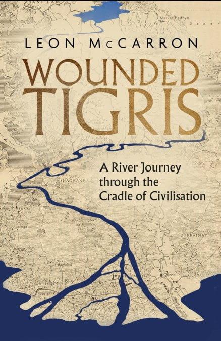
Tigris

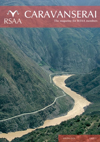
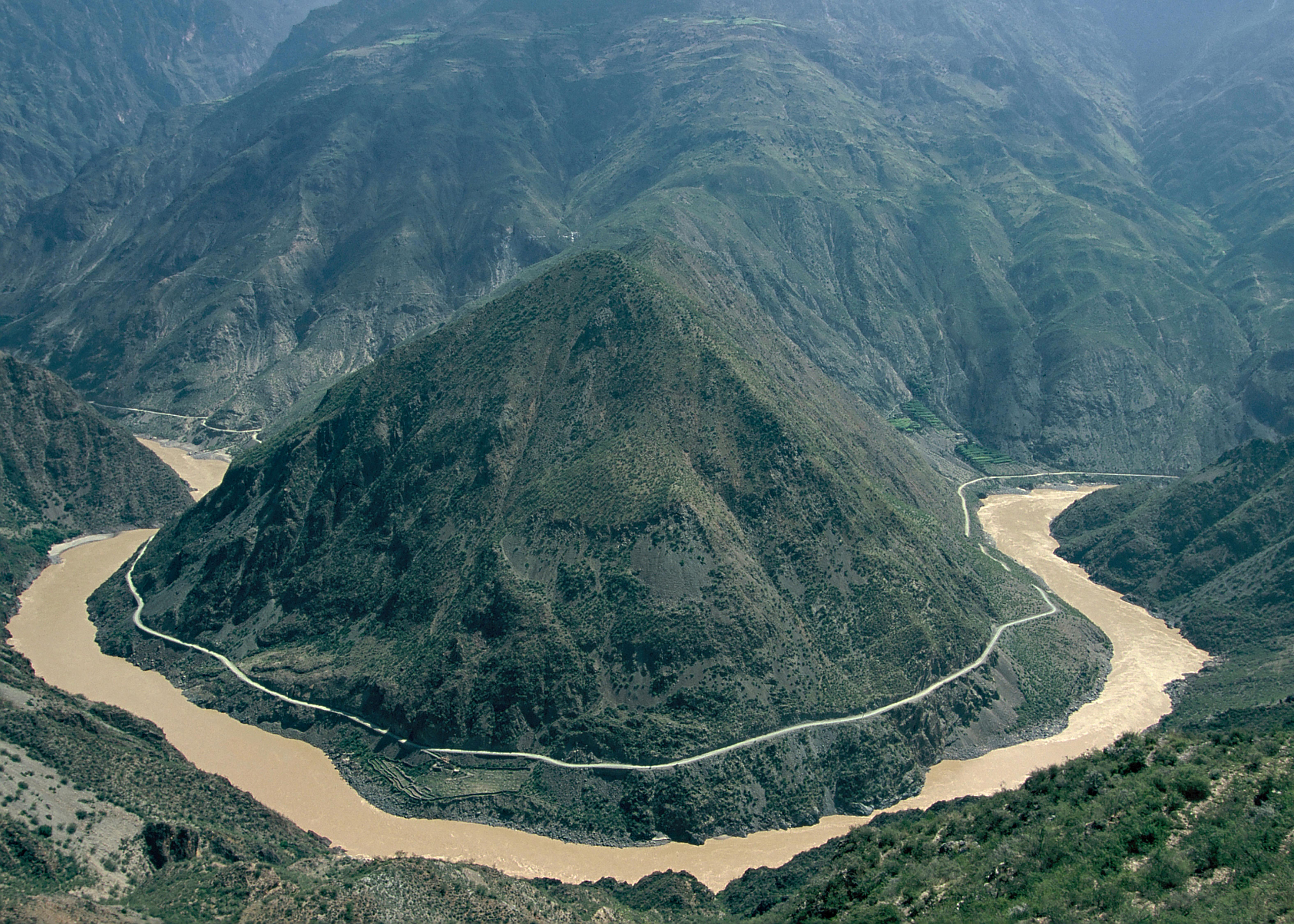
The cover image shows:
Yangtzekiang: The first bend of the Dri Chu River (Chinese: Jinsha River), the upper course of the Yangtze River, at Pontselang (Chinese: Benzilan), southwestern Kham, Yunnan, China © Christoph Baumer, photo 1998
info@rsaa.org.uk
https://rsaa.org.uk
Society for Asian Affairs 16 Old Queen Street London SW1H
Royal
9HP
Charlie Mackenzie Portlock
Editor of Caravanserai
Contents
Michael
2 3 7 13 18 20 24 31 28 Why the Ganges Must be Saved Victor Mallet Yamchun Fortress Sophie Ibbotson Oxus Expedition Sophia Nina Burna-Asefi Three Rivers - A Photo Diary Louise Teague Recent Lectures & The Reading Room RSAA Collections 33 23 38 39 Past and Present John Morris & Ronald F Rosner Society News Travel Awards Did you know? Yarlung Tsangpo 41 Gifts & Cards
The Wounded
Leon McCarron From the CEO
Ryder
FROM THE CEO
MICHAEL RYDER

Welcome to this, third, issue of Caravanserai Rivers are our theme Perhaps more fundamental to human development than any other geographical feature, rivers have from earliest times provided food, water, places of settlement and the ability to grow crops. Rivers divide. They are natural boundaries offering clear and defensible frontiers, but they also connect, providing the ability to travel hundreds, sometimes thousands, of miles, providing trade routes and connecting peoples, their cultures and their religions across vast distances We have articles on the complex cultural landscape of the Sarukawa in Japan, the modern threats to the Tigris and the people who depend on it, the cultural centrality of the Ganges and its vulnerability to climate change, and the Amu Darya or Oxus and the enduring disputes about its source among other rivers in this issue
Travel, whether by river or other means, has been a focus of our work over the last few months I am delighted to say that, thanks to the generosity of one of our members, we have been able to reinstate the RSAA Travel Awards this year We had a large, very strong and diverse field of applicants and the Awards Panel had a lot of work to do We are very grateful to Professor Neeti Nair (University of Virginia), Dr Winnie King (University of Bristol), Professor Kerry Brown (King’s College London), Professor Sajjan Gohel (LSE), Dr Bill Hayton (Chatham House) and Sophie Ibbotson (Chairman RSAA) for generously giving us the benefit of their expertise and in Sophie’s case additionally chairing the Panel
We have awarded £1,500 each to four very promising young researchers. You will find short profiles of each of them on page 39 Supporting young scholars with a passion for Asia has been at the heart of what the RSAA does, and with your help we would like to put it on a sustainable footing We will shortly be launching a long-term appeal to help us to support future generations of Asia-philes, so please watch out for it and I hope that you will consider contributing
Also on the “travel” theme, I am very pleased to announce that we have just reinstated relationships with two tour providers, Distant Horizons and Far Frontiers. We have worked closely with both in the past and they are our preferred travel providers Some of you will have experience of travelling with them and know that they provide excellent service They will offer both pre-packaged and tailor-made tours of the highest quality. These new arrangements will provide opportunities to visit some exceptional places with first-class guides in the company of RSAA members and others with similar interests. Information about their tours will feature regularly in the Society’s Newsletter, so please look out for that

2
Sarukawa and Ainu Culture
by Professor Hirofumi Kato
Rivers have always been important places in people’s lives They are a source of not only drinking water but also living materials such as plants and trees and food such as fish Traces of prehistoric human life have been preserved at archaeological sites, from which it has been shown that human activity on Hokkaido Island dates back to approximately 30,000 years ago. Since then, the island has become a place of residence for many peoples Currently, approximately 12,000 archaeological sites have been identified across Hokkaido Island. Many of these sites are located along riverbanks, indicating that rivers were deeply connected to people's lives.
The background of people living along rivers is also related to obtaining food Rivers provided food resources, primarily fish, which are essential to life The Taisho 3 site in Obihiro City is an archaeological site dating back to the incipient Jomon period (approximately 14,000 years ago), where the oldest pottery in Hokkaido has been excavated The site is located on the left bank of the Tobetsu River, a tributary of the Tokachi River, on a terrace approximately 97m above sea level. The results of the residue analysis of pottery excavated from the site has revealed fatty acids from marine products such as salmon and trout This indicates that the Taisho 3 site was used for boiling and cooking salmon and trout using pottery. This is currently the oldest archaeological evidence of boiling and cooking seafood anywhere in the world (Craig et al 2013) With the emergence of
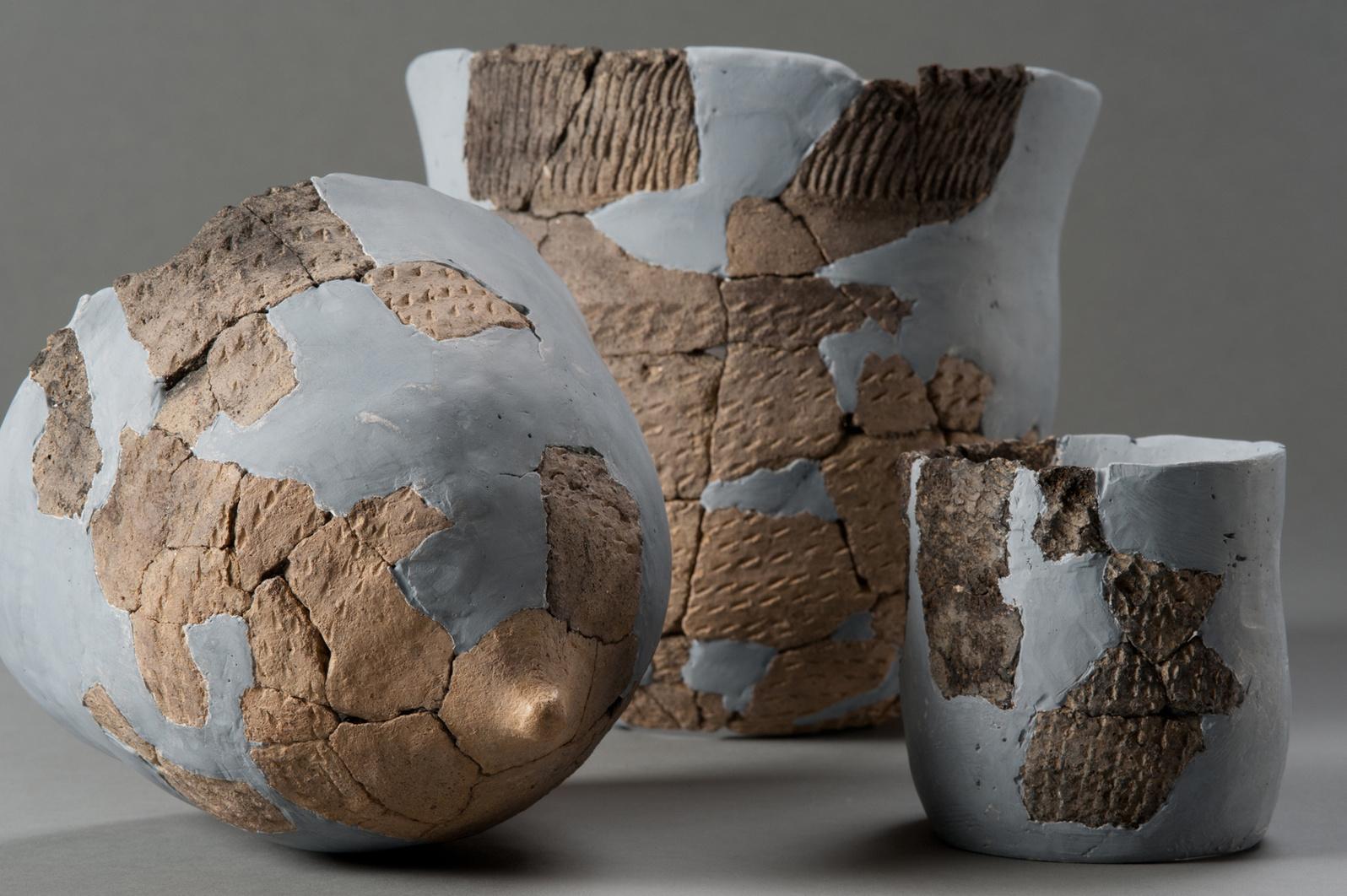
The oldest potteries in Hokkaido
pottery, the lifestyle of prehistoric peoples gradually changed from nomadic to sedentary Simultaneously, the tools of daily life also changed from portable tools suited to nomadic lifestyles to tools adapted to a sedentary lifestyles, such as pottery and large size stone tools. The pottery excavated from the Taisho 3 site shows the importance of maintaining a stable supply of food resources such as fish, and the significant role that rivers played in this process.
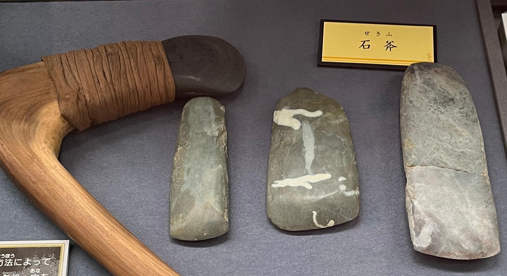
Rivers also play an important role in people’s lives beyond the exploitation of food resources, serving as migration routes for mobile life. In sedentary life, they connected settlements as centres of livelihood and served as a trade routes Prehistoric living materials, such as high-quality stone and trade goods, were transported to remote areas along river routes A greenstone known as “Aotora” from the foothills of the Hidaka Mountains on Hokkaido Island was an important raw material for stone axes for the Jomon people It is not clear why this stone material attracted the interest of the Jomon people but stone axes made of “Aotora” have been found at sites in Honshu across the Tsugaru Straits, including the Sannai-Maruyama site in Aomori City, showing that “Aotora” was an attractive trade item for prehistoric peoples
3
from Taisho 3 site (14,000 years old) Image courtesy of the Obihiro City Museum.
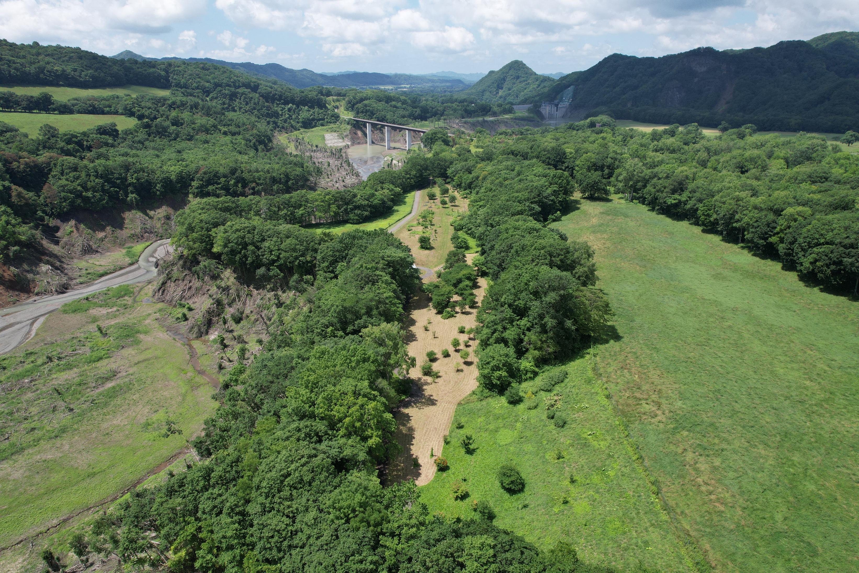
The Saru River
There are outcrops of “Aotora” in the upper baasin of the Saru River The Saru River is a first-class river that originates in the Hidaka Mountains, a mountain range that runs north to south through the central part of Hokkaido From its source in the Hidaka Mountains, it meanders in a north-easterly direction to the southwest, joining many tributaries such as the Niseu River, Nukuhira River, Nukibetsu River, and Abetsu Rivers, and flows through the town of Biratori to the Pacific Ocean The mainstream river has a channel length of 104 km and a basin area of 1,350 km2
Approximately 88% of the Saru River basin is covered by rich forests. The upper reaches of the river have a steep terrain with a valley landscape, and the Yezo spruce (Picea jezoensis) and conifer (Abies sachalinensis) communities are designated as a national natural monument, the “Saru River Headwaters Primeval Forest”. The name of the Saru River is said to have been derived from the Ainu word “ sar ” , meaning reed field Reeds, called “sarki” in Ainu, were used as material for the roofs and walls of the traditional Ainu house, the “cise” Reeds are a plant closely related to people’s daily lives, and here, too, we can see a deep connection between the river and the people Place names such as “Sarba” and “Horosari”, which derive from “Sar”, can also be found
in the Saru River basin The ancient name of the Saru River, “Sisirimuka”, also appears in the Kamuy Yukara, a sacred song of the Ainu people
The ‘Sarunkur’ and Saru River
The cultural anthropologist Seiichi Izumi, who investigated the regional groups of the Ainu in the Saru River basin, has reported cases in which people refer to their own group by the name of the river, indicated by “uko-kutcham-kor utar” (people of the same language), with the river basin as one unit (Izumi, 1952). More concretely, the people of the Saru River basin called themselves “Sarun-kur” (people of the Saru River), while the people of the Monbetsu River basin called themselves “Mopet-un-kur” (people of the Monbetsu River), and were also referred to as such by other communities.
Other researchers have pointed out that regional groups were formed along each of these river channels, and that the groups along the Saru River were called Sar-un-kur (Kono, 1932) The formation of regional groups along each of these riverbanks reflected the fact that the subsistence base of the so-called “traditional” Ainu communities was largely dependent on the living areas that extended along both banks of the main rivers.
“Susu” (willow trees) and other trees growing along the river were used to make “inau,” which were essential for praying to the “Kamuy”(gods), while “pukusa” (victory onion [Allinum victorialis]) and “pukusa kina” (wind flower [Anomone flaccida]) collected from the river slopes and “turep” (Hearleaf lily [Cardiocrinum cordatum]) from the floor of the haru elm forests were also used to make inau Turep (the Siberian lily), which grows on the forest floor,
4
"Aotora" stone axe from Saru River basin
is an important source of food for the Ainu The connection between the Ainu and the rivers was deeper than we can imagine today
This living area divided by the mountains and hills along the river is recognised as an area that includes riparian vegetation, resident animals and upstream fish, and in the paper by Izumi (1951) cited earlier, such an area that served as a living area is termed as “iwor” Thus, the living area of “Sar-un-kur” was called “Sar-unkur iwor ” The “iwor” were further grouped into “kotan”(village) units, which were the bases of daily life, and the “Sar-un-kur” river basin was divided into 17 “iwor” in “kotan” units The “iwor” can also be divided into “Ya-un iwor” (land-based hunting and gathering areas) and “ rep-un iwor” (sea-based fishing areas). “Ya-un iwor” can be further divided into “kim-un iwor” (mountain hunting and gathering areas) and pet iwor (river fishing areas)
The ”iwor” as living areas around the river axis, remain as a settlements today, and there remain “casi-kot” on the sides of the kotan to help identify the “iwor” as living areas A “casi” is a facility built on a hill or terrace cliff, often isolated by a moat The term is essentially derived from the term for a fence or other structure built around high places such as hills or mountains. However, it is difficult to pinpoint a single use for this type of structure. According to archaeologist Hiroshi Udagawa, who has studied the oral stories related to “casi,” the most common story is that they were used in battles, and he also noted that there were not a small number of “casi” mentioned in the stories of “kamuy” and heroes (Udagawa, 1980).
There are 30 “casi” identified in the Saru River basin However, only a few of these “casi” have been excavated. Some “casi” are located on steep cliffs, some have moats built on the tips of cape-like hills, and others are
Saru River Basin
5
divided by semi-circular moats on river terraces Iron products related to subsistence activities, such as iron arrowheads and fishing spears, as well as treasures acquired through trade, such as swords, armour, ceramics and old coins, have been excavated from “casi ” Based on oral stories and excavated materials, it seems reasonable to assume that the “casi” was a space that, in addition to its function as a fortification for warfare, also had a function as a watching post for salmon fishing and a sacred place for burying treasures.
Importantly, in the Saru River basin, “casi” built along the river are distributed in correspondence with the respective “kotan” and “iwor” The Saru River, “kotan”, “iwor” and “casi” are originally linked to each other and make up the cultural landscape
The Saru River as a cultural landscape
Geographer Yi-Fu Tuan stated that “seeing and thinking are closely interrelated” and that there are three types of space: mythological space, practical space and abstract or theoretical space (Yi-Fu Tuan 1988) He also pointed out that human beings have the characteristic that they are more likely to remember a series of movements than they are to remember a representation of the form of space, that is, a map
Regarding this point, it is true that many place names in the Ainu language remain in the Saru River basin, but most of them related to activities closely related to daily life such as “type of space ” or “continuous movement,” or to the characteristics of movement and place, such as rivers The names of places such as “Saru-ba” and “Horosari,” as seen earier, are places of daily life, while “Monbetsu” and “Sarufutu” are place names derived from the condition of rivers and their river mouths.
Landscapes are visible to all people in common For example, a landscape that is considered awe-inspiring by one ethnic group is often easily overlooked by another Tuan explains this as “culture influencing perception ” In the Saru River basin, the “chinomisiri,” which are objects of prayer for certain family members, are often part of the natural landscape, many of which have not been specially altered by humans. However, they are cultural landscapes of significance to the people who make them the object of their prayers When the “chipsanke” (boatlaunching ceremony) takes place, the place becomes a sacred site that is visible and linked to the ceremony; however, outside of the ceremony it appears to outsiders as an ordinary riverbank.
The Saru River forms a complex cultural landscape in which Ainu culture is embedded, beginning with the river itself, the lowlands and terraced surfaces of the riverbanks, and the foot of the mountains and mountainous areas where the tributaries extend In this space, the long history and memories of the Ainu people are preserved as place names and oral stories that overlap with the experiences of the people living there and are accumulated and further passed down to the next generation Currently, the Saru River basin has been registered as the “Cultural Landscape of the Saru River Basin with Ainu Traditions and Modern Development” by the Agency for Cultural Affairs. This layered and cumulative cultural landscape is not a residue of past memories. Rather, it can be said that the experiences and memories of the people living here have formed new layers of cultural landscape and continue to add new elements to the layered experiences and memories of the past
Hirofumi Kato is a professor of archaeology and Director of the Centre for Ainu & Indigenous Studies at Hokkaido University, Japan.
6
Wounded Tigris: What has happened to one of the great rivers of civilisation?
by Leon McCarron
In an Iraqi city called Amara, on the east bank of the river Tigris at dawn, around thirty men and women come to meet by the water. They wear white linen, loose and bound together by belts of rope, and pad around in bare feet The sounds of car horns and loud-hailers and muezzins drift across the river as the rest of the city slowly awakens, unaware or unbothered by the ancient ritual about to take place.
The gathered are Mandaeans who, despite some similarities, are a religious community completely distinct from Christianity. They claim lineage to Adam, who it is said passed on knowledge from the Garden of Eden to only them, and John the Baptist is revered as a greater prophet than Jesus. In Amara they
follow the guidance of a priest called Bashir, who tells me: “We are the oldest religion in the world ” There are at least two other religions in Iraq alone that would dispute that, but there’s no doubting they’ve been around for a long time. There are baptisms every Sunday, says Bashir Most here have been baptised within the last six weeks, which is about as long as Mandaeans feel comfortable without purification.
The women line up first and tentatively follow Bashir into the water One by one, he gently dunks them into the Tigris. There is no drama, just simple, quiet immersion with a few whispered words. After, they sit together on a bench, and Bashir walks along their line He carries a wooden stick and green myrtle

7
The Tigris
leaves A bearded man who is Bashir’s assistant says to me: “Life couldn’t start without this water Rivers and the sea give life ”
For Mandaeans, running water is a divine pathway to heaven, and the Tigris the essence of their faith They are tied to their lifesource, but the truth is that the vast majority of the Iraqi population is equally reliant on the river. The need might not always be so sacred, but the dependency for survival, in this realm at least, is the same.
I became interested in following the Tigris when I moved to the Kurdistan Region of Iraq in 2019. I was developing a long-distance walking trail in the mountains, and often thought of how the rain that snagged on those ranges would drain to tributaries that ran to the Tigris and washed out to the Persian Gulf I travelled to Baghdad and Basra, and spent a few days in the reeded marshlands which I was told might be the Garden of Eden. It was on this floodplain between the Tigris and its sister river, the Euphrates, that our ancestors first began to gather and work the river, experimenting with agriculture. From their successes grew the first city-states, eight thousand years ago, and early civilisation blossomed The important sites of Iraq, I realised, and Mesopotamia before it, are bound together as products of the TigrisEuphrates basin. Everything I saw existed because of the rivers, and was fastened to them as surely as a boat to a dock.
It was also clear that the rivers are struggling in modernity To learn why, I spent three months following the Tigris by boat through Turkey, Syria and Iraq It was not an easy task. It would, perhaps ironically, have been simpler a few thousand years ago Then the Assyrians – one of a number of competing
powers in antiquity - used rafts to carry goods downstream from the mountains. They even stored wine in the inflated goat skins that gave buoyancy to keep it cool. Depictions of these rafts can be seen on the 3000-year-old reliefs that now hang in exile in the British Museum
It would even have been more feasible just a couple of hundred years ago. The Ottomanera rafts, called keleks and similar to the Assyrian design, travelled all the way from Diyarbakır in modern-day Turkey to the seaport at Basra. But today the river is fragmented, split between three countries and a semi-autonomous region, and within Iraq between various groups vying for control Our small team included my partner, photojournalist Emily Garthwaite, who was also experienced in Iraq, and filmmaker Claudio von Planta In Turkey we had two Kurdish companions – Angel Istek and Bişar Içli, and in Iraq, Salman Khairalla and Hana Ibrahim They were, variously, journalists, translators, environmentalists and river experts I knew it was important to journey with people who would be bound to the river in a way that I, as an outsider, never would
The Tigris rises in the Taurus mountains, where a series of springs feed a stream that disappears into a limestone tunnel and then emerges under the carved relief of an Assyrian king The fledgling river picks up speed as it moves towards Diyarbakır but, as quickly as it grows, it is compromised The first attack comes from gravel mining operations. On countless occasions, all the way into Iraq, we witnessed construction machinery driving around man-made islands, digging out aggregate that is highly valuable as the primary component of both concrete and asphalt Its mining changes the shape of a
8
river, makes banks unstable, and affects biodiversity in the water and on nearby land Sand, including gravel, is the second most exploited natural resource in the world after water, and the mines are a scourge on the Tigris Most are also illegal As one man from a riparian village asked us, rhetorically, ‘what is a river without its bed?’
Punctuating the mines are the dams Since the 1970s, the Tigris and Euphrates have been exploited by the Turkish government for energy creation, with an eventual 22 dams built on the headwaters The development project is one of the largest in the world, and mired in controversy Most infamous is the Ilısu dam which recently drowned a town with 12,000 years of human history. Hasankeyf was a capital of the Ayyubid dynasty, established by Saladin himself, and said to be one of the oldest continuously inhabited settlements in the world. It was a nodal point on the Silk Road, with as many as three hundred medieval monuments in the valley. A ruined twelfth-century four-arch bridge
that once spanned the river, and likely carried Marco Polo and the great Ottoman traveller Evliya Celebi across, was survived by two piers and an arch
For 13 years, residents, environmentalists and engineers had come together to protest against Ilısu They took the case to the European Court of Human Rights. Nothing worked. An estimated 80,000 people were eventually displaced by reservoirs stretching back 90 miles from the dam wall on the Tigris, and another 150 miles on its tributaries. Habitats and biodiversity areas, which had become even more valuable after similar damage on the Euphrates, were now lost Over 300 archaeological sites were flooded in the area, and 200 towns and villages
We took a boat across the reservoir that submerged Hasankeyf. A man called Ridvan, who had been born one of its caves, told me: “ we are now passing history. It’s gone, and we’ll all pay the price If you don’t know your past, how can you know the future?” The area was ideal for wind and solar power installations,
9
The team walking to Taq Kasra near Salman Pak, Iraq
he said As hydroelectric dams are being reevaluated worldwide, it would have seemed wise to invest in alternative renewables But those suggestions were ignored.
There are many variations of loss along the Tigris It is a river on which trauma and tragedy flow like rapids. In Ninewa governorate in northern Iraq, which until relatively recently was occupied by ISIS, the landscape still wears devastation in layers Settlements often lie in ruins, cement roofs cracked, twisted metal protruding, and telegraph poles snapped in two like pencils. The river was empty of traffic and heavily policed by the army and militias In the city of Mosul, everyone had a story and every story was enough to break a heart in two A woman called Khitam, standing in the skeleton of what was once her home, told how her husband was killed by ISIS, and when the taps stopped running she took her children to the river to drink. It was all they had, and although they got sick from the pollution, it kept them alive.
Nobody escaped the suffering of that time but, as we were often reminded, the jihadists were just the latest in a long list of atrocities for Iraqis There was dictatorship under Saddam Hussein which saw a bloody, grinding war with Iran, followed by the Gulf War. Then there were sanctions that hit Iraqi civilians hardest and cut the country off from the world. 2003 saw the disastrous US and UK-led invasion, which tore a gaping hole in the civil service and infrastructure. That paved the way for various bad actors to step in, and catalysed sectarian conflict that has plagued the country ever since The rise of Al-Qaeda, ISIS, and the militia groups that were formed to fight them, came as a direct result of that void
And yet, somehow, perhaps because there was no choice, Iraqis have persevered. In Mosul a stately Ottoman home by the Tigris has been refurbished as a museum and events space. Those who remade the heritage house are part of a large collective of youth and civil society who are actively bringing culture back to their country. Salman and Hana, who were with us on the river, were part of that network, and we met their colleagues in every major city and town On the night we left Mosul, we joined students on a weekly litter clean-up along the river
There are different lenses through which to view the Tigris For every atrocity, there is an equally powerful opposing force of humanity, which speaks to the timeless hospitality and openness to strangers displayed by Iraqis and their predecessors In a village called Safina, an influential tribal sheikh killed two goats and had them served to us on platters of rice I wondered why the most desirable cuts of meat always had to wobble so much, but was grateful for the kindness. As we ate, the sheikh told us the important qualities in a leader. “You need three things,” he said. “The first is that you should be a hero ” He let this sink in. “The second is that if anyone asks for anything, you should give it to them The third is that you should understand everything about justice ”
The sheikh had the means to host visitors, perhaps. Others surely did not, yet served us anyway Even during Ramadan, villagers on the riverbanks insisted on making tea and, when the sun dropped and fasting ended, we were treated like visiting sheikhs ourselves. When the military insisted on accompanying us, through areas where there may still be scattered jihadists, they too were brought tea and evening banquets
10
Salman and Hana encouraged me to always remember this light that countered each darkness on the river The destruction of Mosul, and the rebuilding of its cultural monuments The endless pollution that we saw dumped into the river, and the young activists monitoring each site A massacre in Tikrit, where as many as 1700 young airforce recruits were killed by ISIS, and the actions of a woman called Um Qusay, who ferried survivors across the river to safety and hid them in her home.
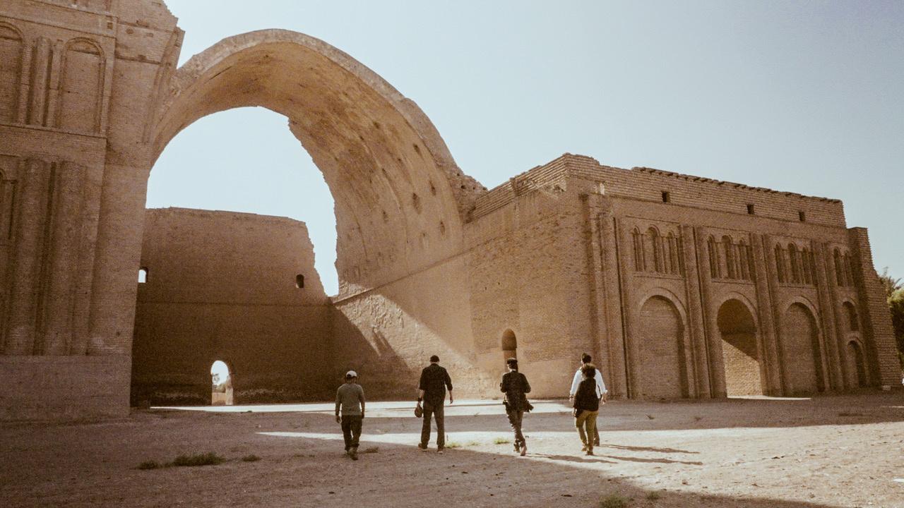
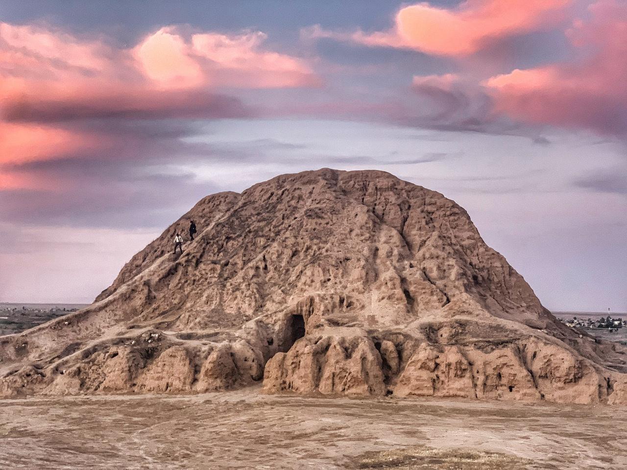
Heritage of the glorious past remains too. There are a number of important Assyrian sites, including Nineveh in Mosul, a capital of the neo-Assyrians, and Assur on the central river, home of the god that lent his name to the empire There, a 4000-year old ziggurat
still stands beside the Tigris, and the three broad mud-brick arches of a processional gateway glowed bronze when we arrived in evening light Heroic archaeologists watch over these places, with limited resources and staff, often doing so because they understand that this is a shared global heritage which they alone are in a position to protect.
The layers of civilisation slowly disentangle as one moves downstream, from the spiralling, snail-shell minaret of Malwiya in Samarra, built by an Abbasid Caliph eleven and a half centuries ago, to the third-century vaulted arch of Taq Kasra, put there by the Persians, now outside Baghdad. So many of the sites of the country remain largely unexcavated Salem Abdullah, director of the site at Assur, reckoned as much as 90% of that city still lay underground.
11
The ziggurat, pyramidal stepped temple, at Assur, Iraq
It is in the south of the country where the challenges facing the river are seen in starkest relief. In the Mesopotamian marshes, a unique way of life had continued uninterrupted for 5000 years until Saddam Hussein drained the wetlands in the 1990s They were reflooded after 2003, though now cover less than half their historic size A small population of marsh Arabs can still be found in traditional reed-built homes in the marshes Most, however, have moved to the margins
The water levels were lower than they had been in a lifetime, we heard, and what remained was poisoned with pollution and high saline levels. One man, Abu Jassim, told me: “Our life has always been simple,” he said. “We just need to be able to look after ourselves and our buffalo ” But now the buffalo were starving, and there were few fish to catch Abu Jassim wondered whether soon he would have to leave, just as his father had done under Saddam
Iraq now receives 60% less water from the Tigris than it did in 2015. That, clearly, is unsustainable There are regular conferences to attempt to thrash out a water-sharing agreement between Iraq and Turkey, but no results. At the other end of the country, a hundred square kilometres of arable land is lost each year to desertification, and pastoralists are on the move, heading to already crowded cities
From source to sea, we tried to look for hope It was often hard The future of the Tigris, and those who live along it, feels fragile Those who can leave often do. There are now 60,000 Mandaeans living outside Iraq
Those that I met in Amara are some of just 5000 left on the Tigris The minority communities that have historically made the country so diverse are disappearing But, as Salman often reminded me, the biggest
problem of all for Iraqis was their own poor governance Even Barham Salih, President from 2018-2022, wrote an op-ed recently of the need for a “root-and-branch reform ”
Iraq needs to move away from its dependency on oil revenue, and replace its broken constitution that serves corrupt kleptocrats
It’s hard to see how that would happen, but at least in theory it is possible It is also a country where the majority of the population has been born since the invasion of 2003. To have so many young people, Salman said, can only be a good thing. This is also the river where civilisations first emerged, where water management was first pioneered. Surely, we must be able to reverse the trend here, or it does not bode well for anywhere else.
Leon McCarron is an award-winning writer, broadcaster and explorer from Northern Ireland. He is a Fellow of the Royal Geographical Society and is known for longdistance expeditions and immersive multimedia storytelling He is currently based in Iraq.
12
Why the Ganges Must be Saved
by Victor Mallet
“I have seen the great cities of the east I have seen the Persian palaces of Susa and Ecbatana, but this is the greatest city in the world ” That was the reported verdict on Pataliputra and its 64 gates and 570 towers - the capital on the Ganges of the emperor Chandragupta Maurya - from Megasthenes, a Greek ambassador believed to be the first westerner to visit and describe the heart of India in about 302 BC
By the first century AD, India was arguably the world’s largest economy, greater than China or the Roman empire, three times the size of western Europe and accounting for about a third of the world’s gross domestic product, according to calculations by the economic historian Angus Maddison.
Even if we move forward by nearly another two millennia, the wealth and size of the cities along India’s great river were still being remarked upon, this time by India’s British occupiers. “This is indeed, a most rich and striking land,” wrote Reginald Heber, bishop of Calcutta, who travelled along the Ganges in the mid-1820s “Here, in the space of a little more than 200 miles, along the same river, I have passed six towns, none of them less populous than Chester, two (Patna and Mirzapoor) more so than Birmingham; and one, Benares, more peopled than any city in Europe, except London and Paris! And this besides villages innumerable.”
Patna, as Pataliputra became, is now one of India’s poorer and less prepossessing cities, and the country as a whole has suffered
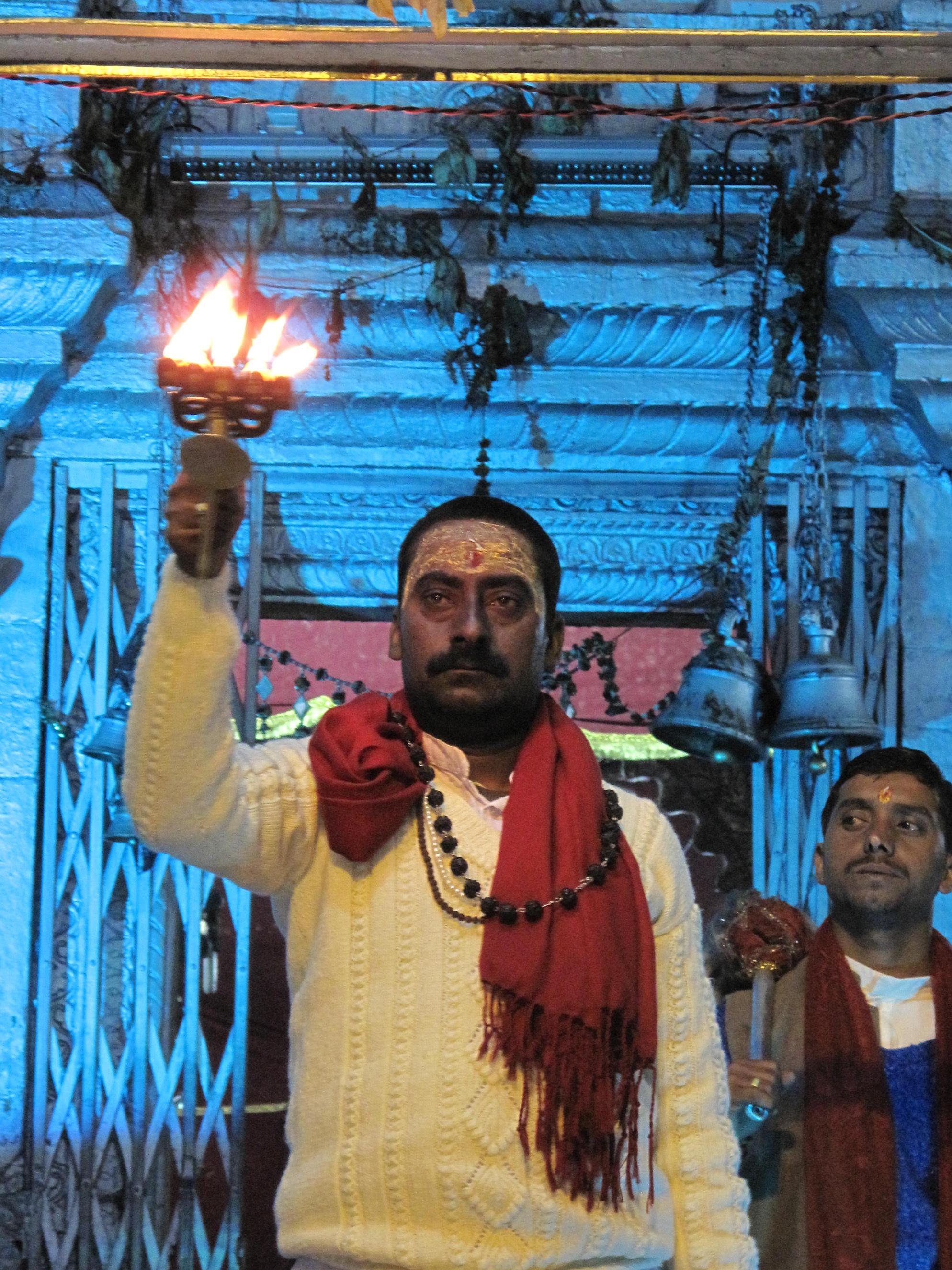
Evening fire ceremony at the temple of Ganga, the river goddess, in Gangotri (taken by Victor Mallet)
centuries of relative economic decline since Job Charnock, the East India Company agent, paid 3,000 rupees for the right to tax-free trade and landed in 1690 at Calcutta (Kolkata) on the banks of the Hooghly, one of the distributary rivers through which the Ganges disgorges its waters into the Bay of Bengal
And yet, with India having recently overtaken China as the world’s most populous nation and embarking on a period of growth that could eventually restore its lost economic power, the river Ganges is, and will remain, as important as ever.
This significance for the lands through which a river flows is true for almost all waterways, not just for the Ganges, even if city dwellers in modern times, easily transported across
13
bridges or through tunnels to their destinations and accustomed to running water from their taps and food in their refrigerators, sometimes forget the reason why they live where they do There is scarcely a great city anywhere not founded on an estuary, at a confluence or on the banks of a river to provide the water necessary for human life, as well as for irrigation, the distribution of fertile silt for farming, and as a means of carrying people and goods from place to place For centuries, rivers have powered mills to grind grain and provided water for factories, and for decades dams built across them have generated hydroelectricity They have been and still are used as drains. “Human civilization was born on a river bank,” concluded a WWF report on the world’s freshwater resources
The Ganges, however, is perhaps more important than any other river, as well as being among the most fragile, vulnerable as it is to pollution and the impact of climate
change on its seasonal flow It is not its length that makes it important. At 2,525km from source to mouth, it ranks about twentieth in Asia and forty-first in the world, far behind the Nile or the Amazon or even the lesser known Ob-Irtysh of central Asia.
One reason for the real significance of the river, known in India as Ganga or Ma Ganga and worshipped as a goddess, is the sheer number of people who depend on it Almost since the dawn of history, the silt its waters bring down from the Himalayas has fed and enriched a tenth of humanity, which made the Gangetic plain one of the most densely populated parts of the planet and for millennia one of the wealthiest, which in turn explains why the Mughals from central Asia and the British traders of the East India Company wanted to seize (and pillage) India. North India, across which the Ganges flows from west to east, is more densely populated than ever today Some 700 million people in India and Bangladesh live in the Ganges basin and
14
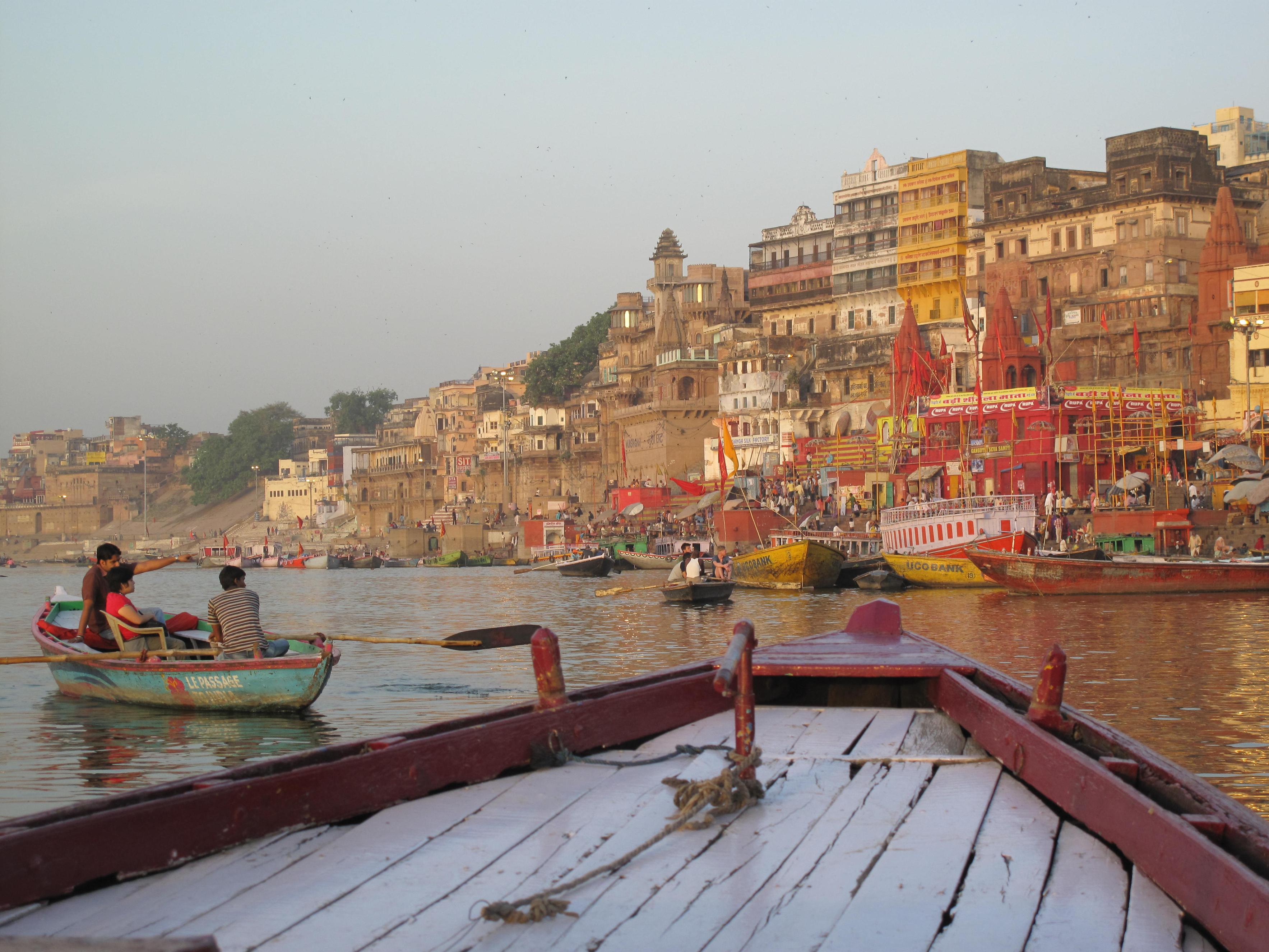
Varanasi, the holy city on the Ganges, at dawn (taken by Victor Mallet)
benefit from the rice, wheat and other crops grown in fertile sediment that in some places is over a kilometre deep. “If the Ganga lives, India lives,” said Vandana Shiva, an Indian scientist and environmental campaigner. “If the Ganga dies, India dies ”
But the Ganges is not merely of economic importance. As a Hindu goddess still actively worshipped today by hundreds of millions of Hindus, the river is of enormous religious, political and social significance to Indians across the country and in the diaspora. Muslim emperors praised the quality of its waters too, and for Hindus the river (or its water, bottled and transported - Amazon India sells bottles of it for a few hundred rupees) plays a central role in rituals of birth, marriage and death
Ralph Fitch, a merchant adventurer who led
an embassy in 1585 from Elizabeth I to Akbar (though the emperor was too busy to meet such an insignificant envoy from the outermost fringes of the world) witnessed scenes of river worship and daily life as he travelled down the Ganges that are identical to those that can be seen in Varanasi (Benares) today. Again, this kind of water worship was once true of rivers elsewhere in the world, whether the Nile in ancient Egypt or the Thames in Britain, where river confluences were deemed as sacred as they are now in modern India During the two months of the 2013 Kumbh Mela, the great religious festival in Allahabad at the triple confluence of the Ganges, the Yamuna and the mythical Saraswati, the number of pilgrims who bathed in the holy waters - the author of this article among them - was estimated from mobile telephone records to be 72 million, greater than the entire population of the UK
15
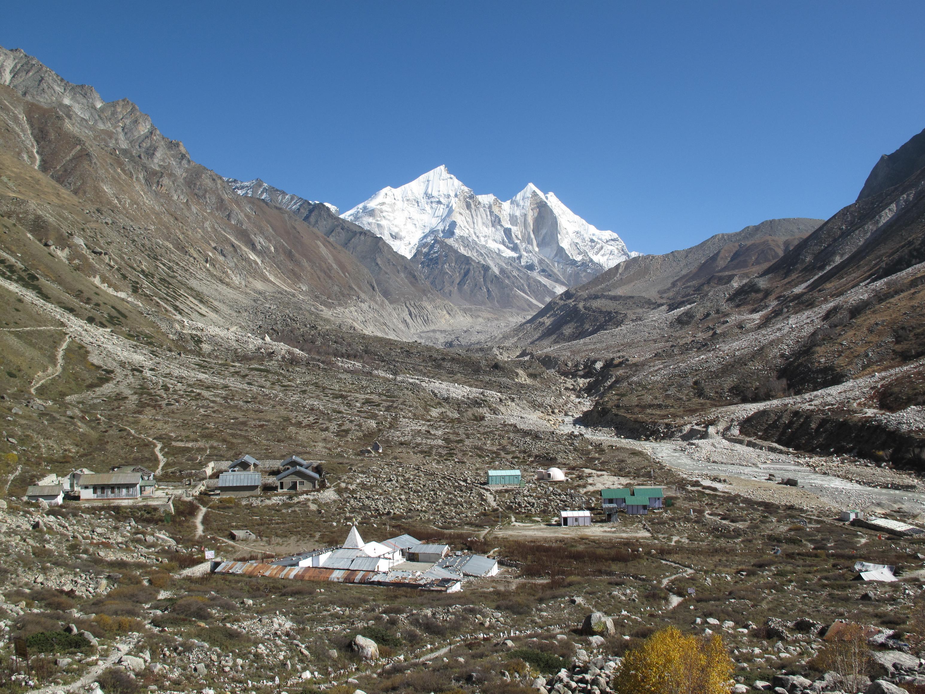
The valley where the Ganges has its source in a Himalayan glacier, with the ashrams of Bhujbas in the foreground (taken by Victor Mallet)
Narendra Modi, now the Hindu nationalist Indian prime minister but at the time the chief minister of the western state of Gujarat, deliberately stood for election as a member of parliament in Varanasi, the holy city on the Ganges in Uttar Pradesh, when he achieved his first national election triumph as the candidate of the Bharatiya Janata Party in 2014 “Ma Ganga is screaming for help,” he said in Varanasi after his victory “She is saying, ‘There must be one of my sons who will come and pull me out of this filth’ There are many tasks that perhaps God has set for me. ” Modi recognised the grave environmental plight of the Ganges and promised to save the river on which north India depends by curbing pollution and building sewage treatment plants for the cities along its banks
The pollution of the Ganges river system is serious but curable (although not currently being cured by the Modi government’s latest multi-billion dollar cleanup projects, which independent investigations show to be almost as poorly implemented and ineffective as their many predecessors) First, there is industrial pollution from tanneries and other factories along the river and its tributaries, which leaves heavy metals and other toxins in the water and the sediment below Then there is human sewage - lots of it. Measurements at eight points along the river by an independent foundation in mid-2023 found levels of faecal coliform bacteria to be one million times the legally permissible level Additional problems include the plastic waste routinely thrown into the river, and the presence of “superbugs” - bacteria resistant to antibioticsin the water
None of these pollutants is impossible to tackle, although the process will take time and money, as well as government leadership and popular support. After all, other rivers
around the world have been revived from the appalling state in which many of them were left by human waste and the global industrial revolution that began in Britain in the 18th century. The Thames in London was all but dead as recently as the 1960s - no fish other than eels were found in the tidal Thames in greater London and children were told by the mothers that they would need to have their stomachs pumped if they fell in and swallowed any river water Sixty years later, the Thames is so clean that fish have returned and cormorants can be seen fishing under Southwark Bridge, although the recent scandals about sewage flowing into England’s rivers demonstrate that effective pollution control requires constant effort and investment. In continental Europe, the Rhine, about which Samuel Taylor Coleridge said “I counted two and seventy stenches,/ All well defined, and several stinks!” in his poem Cologne in 1828, has also been restored to health, as has the Chicago River in the US, once so filthy that it used to catch fire.
A much harder crisis to solve, and one that India cannot achieve alone, arises from the baneful effects of global warming. The flow of the Ganges is naturally subject to intense seasonal variations. Parts of it can dry up completely before the monsoon because so much water is diverted for irrigation, but when the monsoon rains arrive the river and its tributaries can turn into rivers of aweinspiring width and power that thrash across the countryside, making and unmaking islands, demolishing villages, changing their courses and flooding farmland Climate change is already exacerbating these extremes The loss of glaciers and snow cover in the Himalayas means that there is less melting ice to keep the rivers flowing in the dry season, which combines with hotter temperatures to cause repeated severe
16

droughts in the Ganges basin Yet when the monsoon rains do come, their increasing violence can trigger catastrophic floods such as the so-called “Himalayan tsunami” that killed some 6,000 pilgrims on the upper reaches of the Ganges river system in 2013.
It is essential to save the Ganges for India’s economic, social, spiritual and ecological survival. Only then will the river - now sullied by sewage, toxic waste and plastic bags but still a living river fished by a few remaining dolphins and gharials - once again merit its Sanskrit epithets of “eternally pure ” , “ a light amid the darkness of ignorance” and the “sublime wine of immortality” Only then will Indians again be able to imagine, without suppressing the grim contemporary reality,
the god Krishna playing his flute amid a troupe of adoring gopis (the female cowherds) next to a natural paradise of lilies, turtles and bountiful fish.
Victor Mallet is author of River of Life, River of Death: The Ganges and India’s Future, and a senior editor and former South Asia correspondent at the Financial Times
17
Narendra Modi, now Prime Minister of India, campaigning for election in 2014 in the holy city of Varanasi on the Ganges (taken by Victor Mallet)
Yamchun: Guardian of the Wakhan Corridor
by Sophie Ibbotson
If the Royal Society for Asian Affairs has a spiritual home, it is surely the Wakhan Corridor This narrow sliver of territory divides the Pamir and the Hindu Kush and was designated to ensure the British and Russian Empires would never touch. In this valley lies the source of the Amu Darya, a subject of endless fascination for the Society.
The river and soaring peaks are the most dramatic features of the Wakhan’s scenery, but the landscape is marked with humanity's legacies, too The 6,000 petroglyphs at Langar comprise the largest rock art site in the Pamir; the Buddhist stupa at Vrang reminds us this is the route by which Buddhism spread from India to Central Asia; and the shrine of Shoh Kambari Oftab remembers the saint who brought Ismailism to the Wakhan. Bigger and more impressive than any other manmade structure, however,
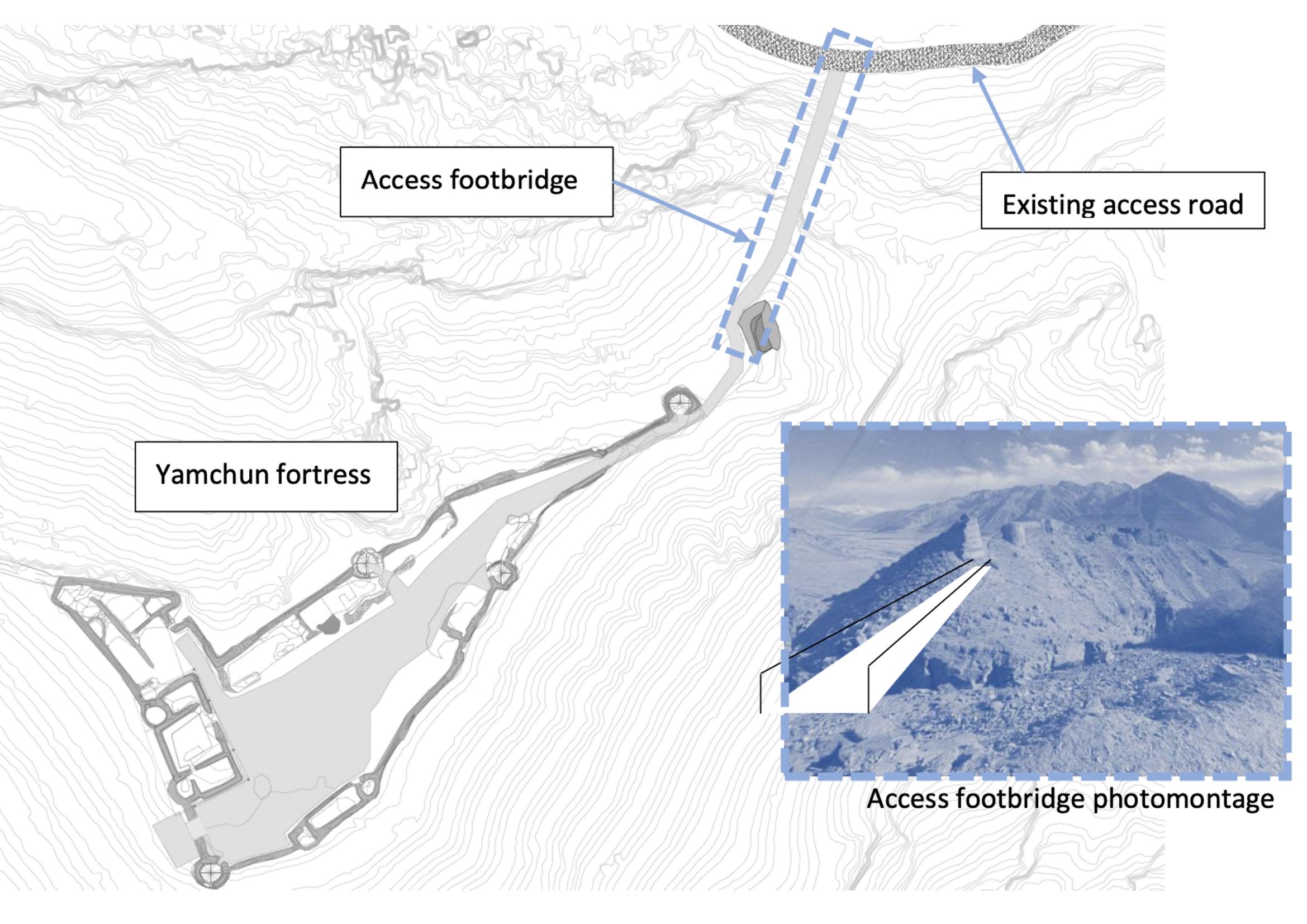
is the Yamchun Fortress Yamchun guarded the central part of the valley, ensuring the safe passage of the Kushan-era caravans travelling up from the Indian Subcontinent to join the Silk Roads criss-crossing Central Asia The fortress sits 500m above the main road, and from the battlements there are uninterrupted views in both directions along the valley, as well as south to Afghanistan
Yamchun is on the Tentative List for UNESCO World Heritage Sites due to the unique interplay between its architecture and the terrain Archaeologists believe the first fortifications were built here in the 3rd century BC, and the citadel was then strengthened and expanded around 1200 AD. This is when Yamchun’s 22 round towers were added. The structure is a combination of stone, clay mortar, and mud bricks, and much of the fortress still stands,
18
Image credit - INES Ingenieros
in spite of being in an earthquake-prone zone
The World Bank has identified Yamchun as the flagship historical site of the Pamir, and in 2019-24 is investing US$5 million for its conservation, working with the Government of Tajikistan and consultants from UNESCO and the University of Central Asia. I visited the site in 2019 and 2022 during the project’s preparatory phases, and construction work starts this spring
The first priority is to restore the monument’s stability, anchoring the foundations to the bedrock with metal bars and constructing terraces and stone gabions to compensate for soil erosion on the slope below Stiff metal rings will be added to the inside of the towers, combined with a flexible mortar, to increase their earthquake resistance Crowning the walls to protect against rainwater infiltration and installing drainage will both help restore Yamchun’s durability.
As tourism develops in the Pamir (and the sector is anticipated to grow significantly in the next few years), increased footfall will take its toll on Yamchun’s fragile structure and its surroundings. To mitigate this impact, fallen stones will be returned to the walls, up to the height of 4m recorded by Aurel Stein in 1928 A footbridge across the gully between the parking area and the fortress will improve access and keep visitors on designated paths; stairways will be installed in some of the towers, serving as designated viewpoints and deterring tourists from climbing haphazardly on the walls; and new paving in the citadel will reduce trip hazards and, at the same time, protect the original surface underneath from excessive wear. Interpretative signage will be added, too
The preservation of Yamchun is a complex project, not least because of difficulties getting materials, equipment, and skilled labour to the Wakhan; the short season when construction work can take place; and environmental and repetitional risks. COVID-19, the return of the Taliban, the closure of the Tajik-Afghan border, and the violent suppression of protests in the Pamir have all caused delays, and there are still questions about who will have the resources and experience to take on the ongoing management of Yamchun once the World Bank project ends The Aga Khan Trust for Culture would be the perfect partner given their extensive regional experience in cultural heritage conservation and management However, the Government of Tajikistan’s distrust of Aga Khan agencies and recent restrictions on their activities mean that this option is unlikely to be realised in the short- to mid-term, and finding an equally credible alternative will be challenging
Sophie Ibbotson is Chairman of the Royal Society for Asian Affairs and a consultant on economic development and water conflict in Central Asia and Afghanistan.
Image credit - INES Ingenieros
19
The Oxus Expedition: Source to Sea
by Sophia Nina Burna-Asefi
The longest river in Central Asia is the Amu Darya, known to the Greeks as the Oxus and to the Arabs as the Jaihun. The surrounding countries of Afghanistan and Central Asia consist of mountains and barren sandy deserts. People in this region would not have survived without the Amu Darya’s life-giving waters. The people who live along its banks use its water for drinking, washing, cooking, farming, energy and transport, carrying boats and people from place to place.
The Oxus is the most productive water source for Afghanistan and Central Asia The water of the Oxus is mostly used for agriculture and the competitive utilisation of the Oxus has led to frequent water conflicts in the region, and its allocation is a legacy of the policies of the former Soviet Union. The tensions over the water of the Oxus river, particularly its governance, environmental effects, and social impacts have historically been of great significance and are intensifying
Thus the Oxus expedition holds a dual purpose: firstly to unveil the enigmatic origin of the Oxus river, tracing its meandering path from source to sea, a journey spanning 2,540km across the heart of Central Asia Secondly, as an all-female team, we are poised to carve a new narrative, distinct from the exploits of our male predecessors.
Despite the Oxus river’s importance, no one could pinpoint just where it came from and the source of the Oxus remained a mystery for thousands of years Even with countless
explorers, military officers, and diplomats taking on the challenge to discover the origins, no one could agree on the exact starting point So with that in mind, in 2021 we began to dive deep into the annals of literature, maps, and archives devouring volumes on the Oxus river. Part of the preparations also involved employing and practicing modern water flow technology. We also went through rigorous training with high-altitude treks in the Lake District, the Atlas mountains in Morocco, and the Pamirs in Tajikistan as well as keeping up a high level of fitness in our day-to-day lives
In the summer of 2024, we will start our journey. We begin in the Pamir highlands of Afghanistan where the Oxus river originates and emerges through a confluence of the Panj and Vakhsh rivers We will then trek 8 hours a day at an altitude above 4000m and utilise modern technology to pinpoint the river’s true source Following this we will then trace the river’s 2,540km journey, passing through Afghanistan, Tajikistan, Uzbekistan, Turkmenistan, and back into Uzbekistan.
Therefore, the upcoming Oxus expedition has a dual mission of uncovering the river's mysterious origins and studying life along its banks We hope to chart a new narrative as an all-female team, navigating the peaks, valleys, and scaling altitude with curiosity and determination to get to the bottom of a longtime question
20
Sophie Ibbotson is a researcher, consultant, and writer specialising in Afghanistan and Central Asia. She is a 2023/24 Visiting Fellow at the Changing Character of War Centre at Oxford University, where she is researching water conflict Sophie is an advisor to the World Bank’s Rural Economy Development Project in Tajikistan and has led four previous expeditions to the Wakhan Corridor
Sophia Nina Burna-Asefi is an Associate at The Risk Advisory Group, where she specialises in Russia, Afghanistan, and Central Asia. She has a particular interest in infrastructure, and writes regularly for The Diplomat on topics such as rail and air corridors and the energy sector
Educated in Uzbekistan and the UK, Sophia speaks English, Dari, Russian, and Uzbek, and has travelled extensively in Afghanistan and Central Asia


Miskola Abdulloeva is an entrepreneur from Tajikistan. She co-founded Yeti Hostel in Dushanbe and Orom Travel, a leading tour operator; and is also a Representation Manager for The Adventure Connection. Miskola was Tajikistan’s first member of the Adventure Travel Trade Association (ATTA) and was a 2020/21 Chevening Scholar at the University of Greenwich, where she received her MA in Travel and Tourism.
21
Oxus River
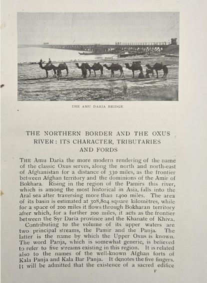
In 1906, Angus Hamilton delivered a lecture to the then Central Asian Society on the Oxus River or Amu Darya His account provides a unique insight into the geographic, socio-political and cultural context of the river 118 years ago to the month.
The source of the Oxus had been an issue of some geopolitical interest for decades. It was of particular interest to the British government, which was concerned that imperial Russian forces might be able to overcome the natural obstacles between the Oxus valley and India
As well as the importance of the Oxus in geopolitical and strategic terms, thirty years earlier it had also proven to be an important archaeological site with the discovery of the Oxus Treasure. The find included around 180 pieces of silver and gold metalwork and around 200 coins from the Achaemenid Persian period which are now on display at the British Museum
Hamilton’s lecture brings the reality of the Oxus to life and the Society is lucky to have a transcript of the talk in its collection Should you wish to read the full lecture, please email cararvanserai@rsaa org uk for a PDF version.
22
The first major bend of the Yarlung Tsangpo, later the Brahmaputra, after the hamlet of Tripe, Tibet, China It’s the entry to the famous Tsangpo Gorges explored by Pundit Kinthup in the 1880s, Frederick Marshman Bailey in 1913 and Frank Kingdom-Ward in 1924. © Christoph Baumer, photo 1996.
Yarlung Tsangpo - Did you know?
The Yarlung Tsangpo is the highest major river in the world and can be found flowing through Tibet Originating at the Angsi Glacier in western Tibet, the river flows 1,125 km through the South Tibet Valley before passing into India and becoming part of the Brahmaputra which flows through Bangladesh and into the Bay of Bengal. The river has the highest average elevation (4,000 meters/ 13,000 ft) of any major river in the world and stretches of it are some of the least-explored places in the world
As the river leaves the Tibetan Plateau it forms the world’s largest and deepest canyon on land, the Yarlung Tsangpo Grand Canyon Known as the “Everest of Rivers” the canyon reaches depths of over 6,000 meters (19,685 ft) and stretches over 500 km, making it longer and three times deeper than the Grand Canyon in the United States
Given the length and depth of the canyon, it is home to a unique ecosystem with a variety of animal and plant species barely explored or affected by human influence With a climate that ranges from subtropical to Arctic, it is home to several different vegetation zones and is also home to a Himalayan cypress tree which, at 102 3 metres (336 ft) is believed to be the tallest tree in Asia
In 2020, the Power Construction Corporation of China (PowerChina) announced plans to construct a 60-gigawatt mega-dam on the lower reaches of the Yarlung Tsangpo as part of its 14th Five-Year Plan If successful, this project would deliver the world’s largest hydroelectric dam
23
Three Rivers: A Photo Diary
by Louise Teague
Three Bridges Down - India
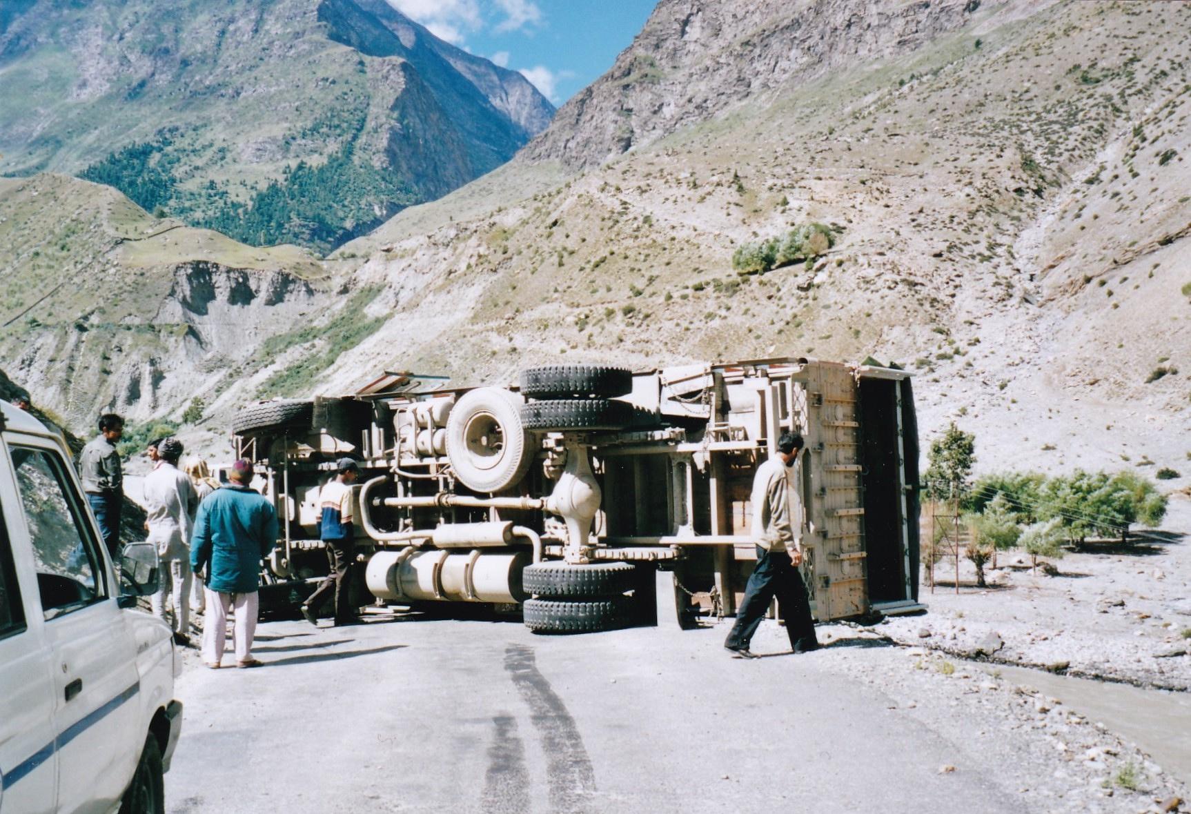
In 2006 Ken, my husband, was giving lectures on Buddhist Art at the British Museum So we were enthralled by the monasteries in Ladakh, especially Alchi We took a taxi down a vertical road to the Spiti Valley At the bottom we were delayed by a large lorry on its side at the sharp turn of the river Changing taxis we set off to Tabo Monastery The Dalai Lama has said he wishes to spend his last days there We nearly did
We came to the Spiti River, a branch of the Sutlej River It was crashing down from the melting snows. The old wooden bridge had gone years ago, the concrete bridge was down, and the last to be swept away was metal.
While doing obstetrics, I learnt that if a crisis was pending, the best plan was to visit the bathroom. This allows a few moments to clear the mind As I emerged from the bush, my husband said ‘Get in that lorry’. His tone did not invite argument I climbed into the little, short wheelbase, high wheeled lorry and we smashed in around boulders in the swirling water.
The plumbing in the guest room at Tabo Monastery was ambitious The hot water Ascot heater was joined to the toilet cistern. As a dear friend said ‘Well, that was a hot flush!’ While on a watery note, the sink tap filled the basin, and the water came out of the plug hole onto the floor We found a bucket
24
The next issue was to find a way home. We learnt that trying to go back the way we had planned, along the road by the river going south, you come to a permanent landslide
After a few days we were told to get up very early before the sun came up to melt the high mountain snows A taxi came and rescued us from five months in a snow bound Spiti Valley
On the way to Muktinath - Nepal
In October 1994 Ken and I walked behind (north of) Annapurna It was the worst trek I had ever done. The landslide that killed a young man from Kent was before us A slender path for one foot after another had been started
25
I kept freezing unable to move Our trusty interpreter, Naresh, had to take my hand and somehow, he got me across Half way I decided that to go back would be worse than going forward We then needed two nights in a small stone guest house at 13,500 feet to acclimatise Next day we got up at 4 00am (to get over the top before the winds got up) and met our Tibetan ponies which took us to the top of the Thorung-La at 17,500 feet
The pony drivers gave us tea at the top, and I said farewell to Tara, who may have saved my life, with her dainty hooves avoiding the crevices. We saw wooden grave crosses on the way
Travelling down the dazzling white scree, short of food and oxygen and now in the sun we stumbled to a rough track by the wide river Kali-Gandaki.
26
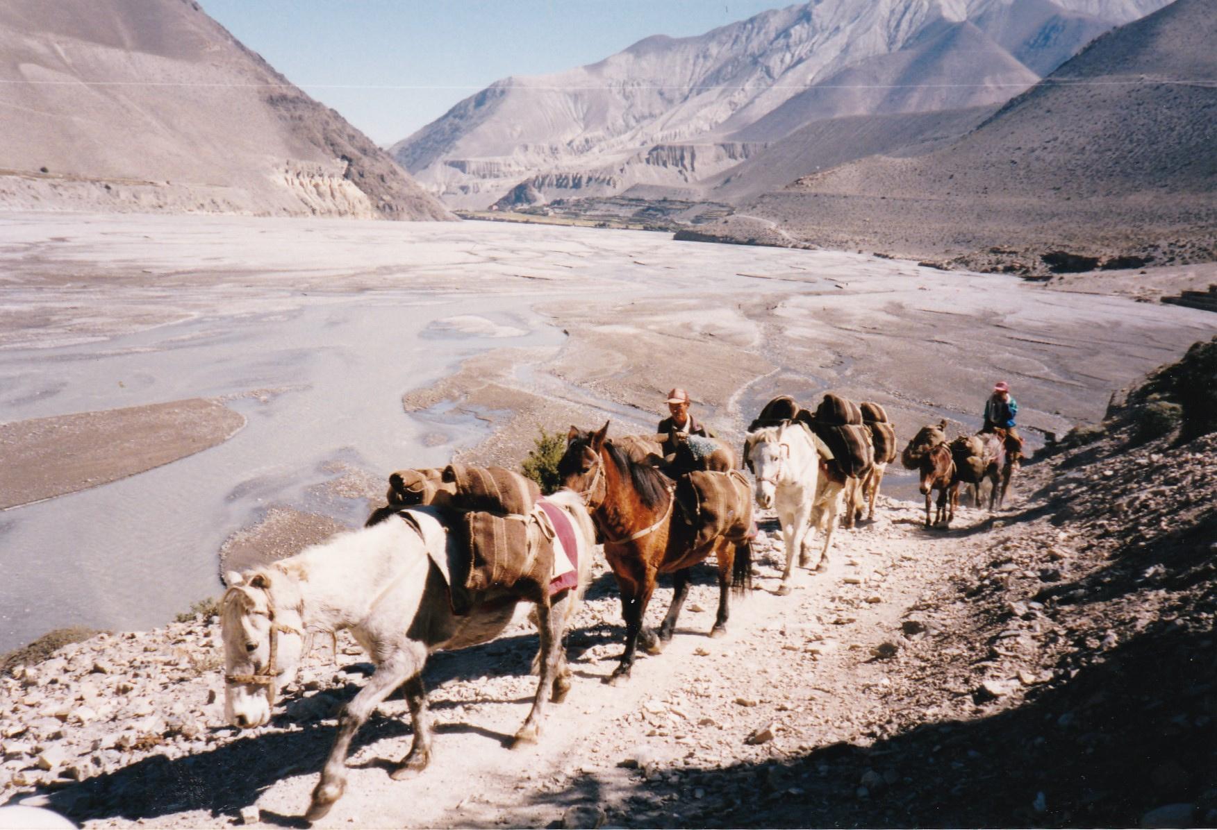
A charming horse caravan passed us, their cargo maybe salt, wrapped with Himalayan textiles A yak, or maybe horse hair, simple textile held the cargo, and a lovely Himalayan tie dye decorative band decorated the hind quarters of this white horse.
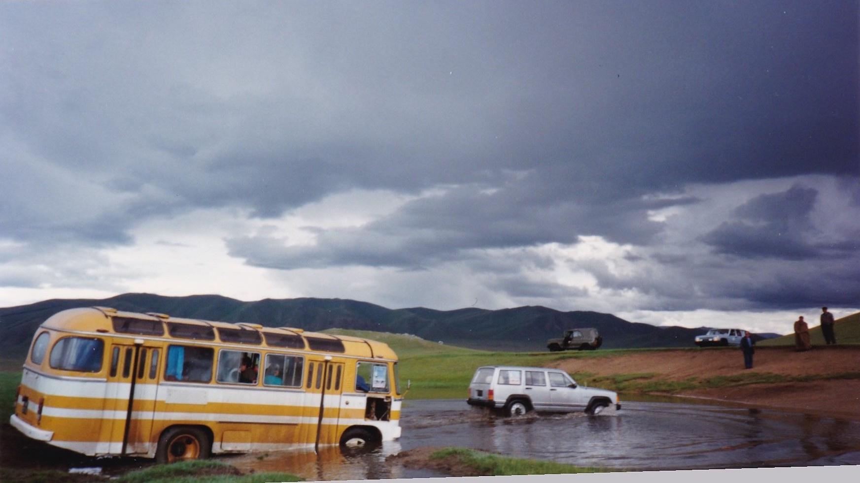
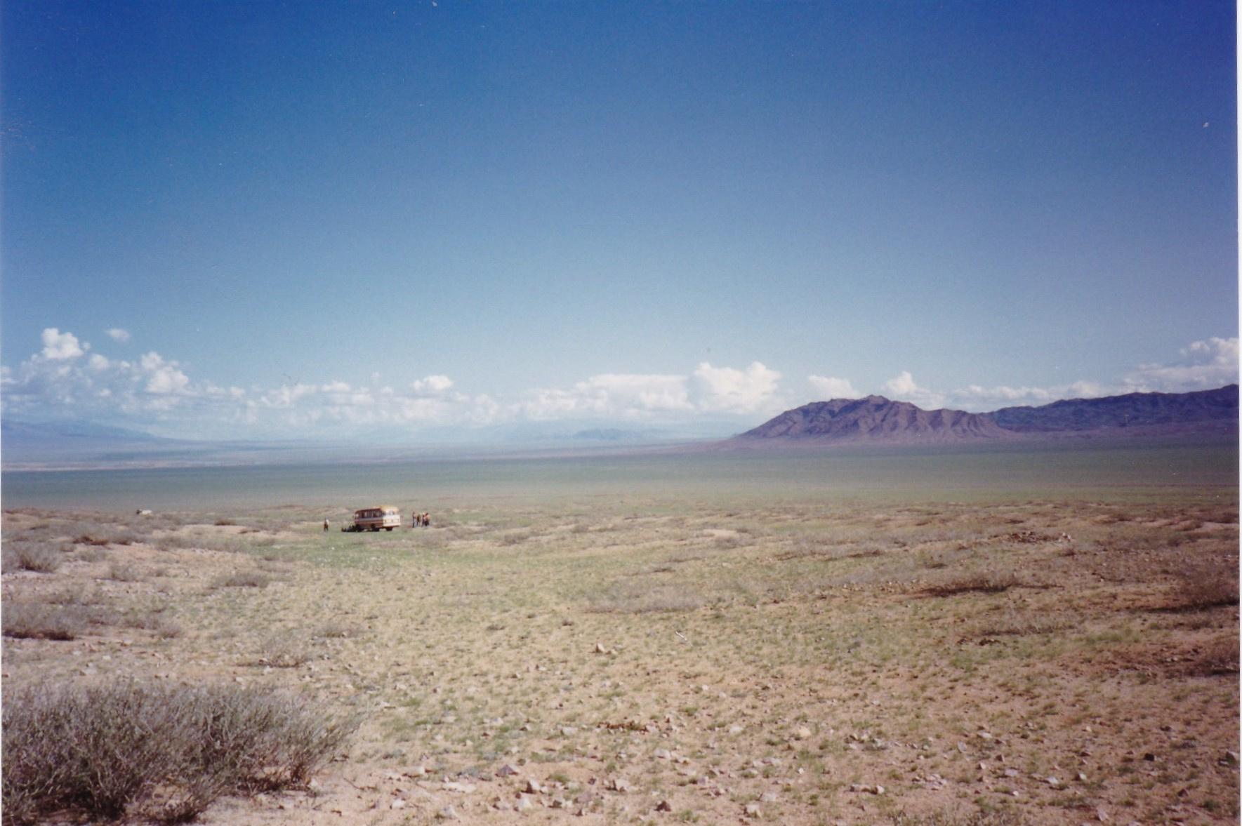
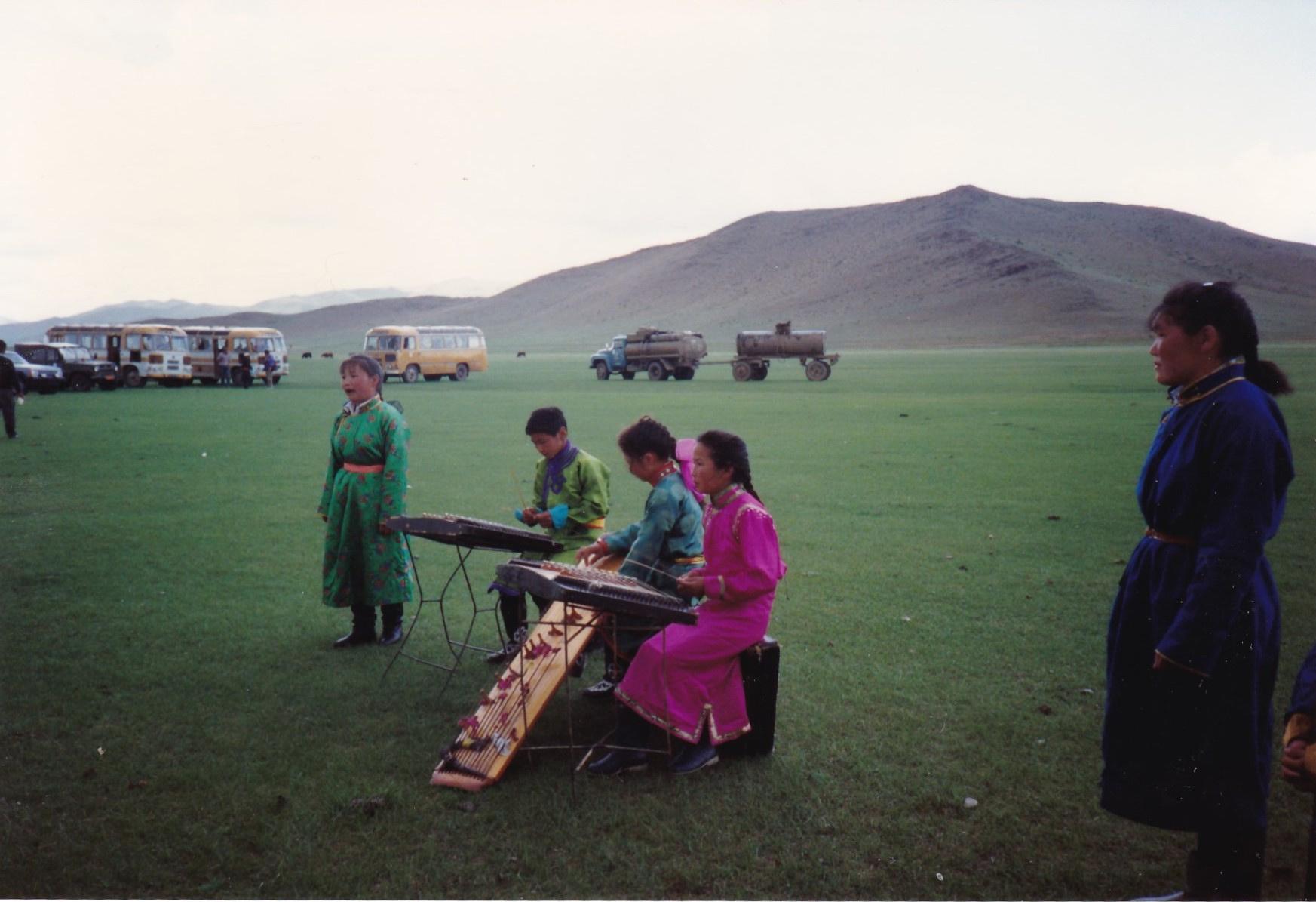
Stuck in the Gobi - Mongolia
In 1992 my husband was invited to join the Mongolia branch of the UNESCO Silk Roads Expedition.
I repeatedly phoned Paris to explain Ken needed me as his field assistant and to manage the video Finally they agreed, but I had to give a lecture at the final day seminar on Traditional Mongolian Medicine I was a GP in Wandsworth Ken gave me a stack of 10 books with yellow stickers in and I wrote the lecture.
It was an extraordinary experience. The invited ‘scholars’ were transported in three old yellow Russian buses. The journalists and photographers paid to travel in smart 4 wheeled drive Toyota Cherokees. A lorry transported our cooks; a tank of water and a cast iron furnace on wheels were towed, giving boiling water for tea and cooking noodles, freshly rolled out on a board on the grass
The old yellow buses used to break down in the Gobi Desert, requiring the driver to fish out his little tin repairs box; this had a screw driver, some wire and other handy bits. When we crossed borders between districts, musicians would pop up on the steppe to welcome us We were escorted to a large dining room and for a welcome feast, rissoles of horse meat and salad (presumably imported from China)
Louise Teague is a retired GP and formerly Chairman of the Oriental Rug and Textile Society Her husband, Dr Kenneth Teague, was Curator for Asia at the Horniman Museum
27
Recent Lectures
Transcripts of our most recent talks and panel discussions are available to download on the RSAA website, where you can also access recordings from our YouTube channel.
THECAUCASUSDURINGTHEWORLD WARS:CAUGHTBETWEENINDEPENDENCE ANDFOREIGNINTERVENTIONS DR CHRISTOPH BAUMER
Dr Baumer is a Swiss explorer and historian of Central Asia. This lecture explores the complex history of the Caucasus region from the early modern period through to today, paying special attention to the experience of the Caucasus during the two world wars It concludes by analysing how that history has shaped the contemporary Caucasus and looking at the challenges the region faces today

DOCTOR,TEACHER,TERRORIST:THELIFE ANDLEGACYOFAL-QAEDALEADERAYMAN ALZAWAHIRI DR SAJJAN GOHEL
Dr Gohel is the Director of International Security at the London-based Asia-Pacific Foundation and a guest teacher at the LSE His recent book forms the basis of this lecture in which he examines the life, development and rise of Ayman al-Zawahiri from an aspiring doctor in Egypt to one of the most wanted terrorists in the world. al-Zawahiri’s life story is closely linked to that of 9/11, Al-Qaeda and the NATO involvement in Afghanistan over the past two decades.
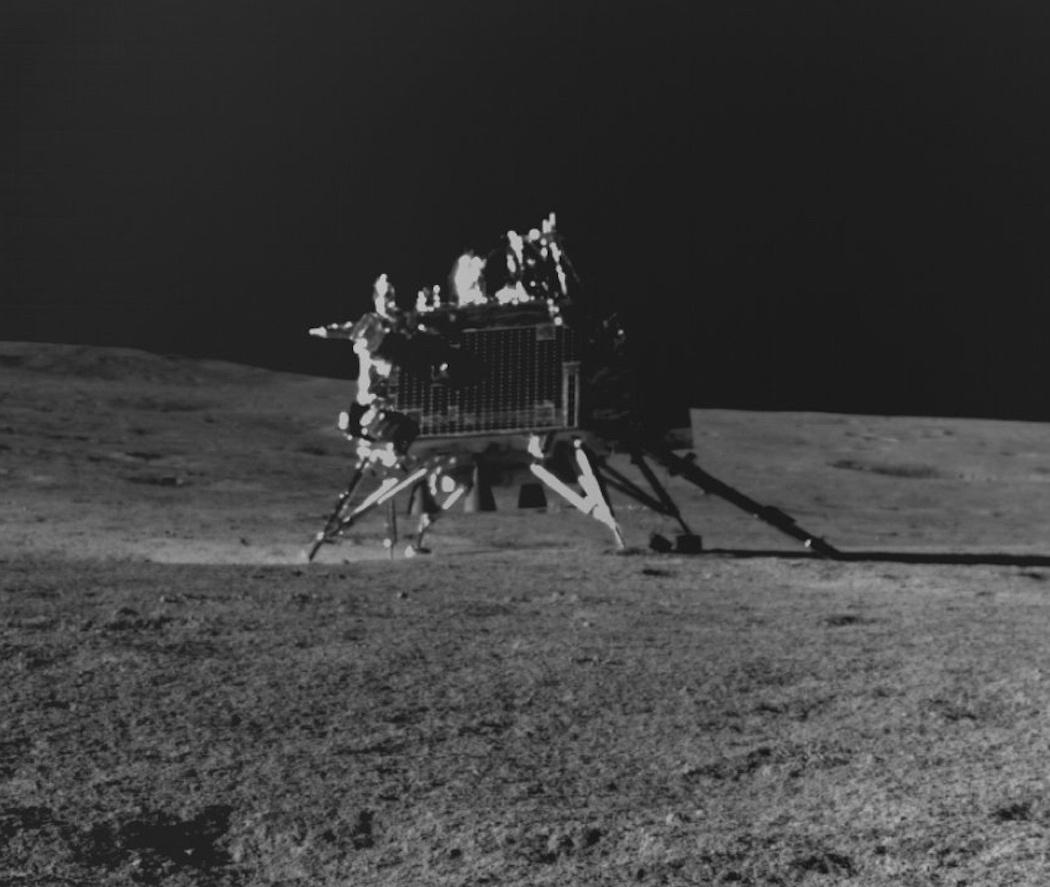
THEIMPLICATIONSOFINDIA’SMOON
LANDING DR RAJESWARI RAJAGOPALAN, MICHAEL KUGELMAN AND DR CHRISTOPHER NEWMAN
Following India’s successful landing on the lunar south pole last year, this event considered the implications of this achievement for India and for space exploration. The panel discussed the geopolitical impact of India proving itself as a serious astropolitical power, the questions this raises in the field of space law and governance and what this means for India’s domestic space industry
28
GESHE NGAKRAMPA THUPTEN SHERAB, TSERING PASSANG AND THE GYUTO MONKS
REINCARNATIONANDTHEFUTUREOF TIBET
This in person event saw six monks from the Gyuto Tantric Monastery in northern India chant prayers for world peace Following this, the groups leader Ngakrampa Thupten Sherab delivered a moving speech on the role of reincarnation in the Tibetan Buddhist tradition and the plight of the Dalai Lama To conclude the event, Tsering Passang, Founder and Chair of the Global Alliance for Tibet and Persecuted Minorities delivered an impassioned speech on the current situation in Tibet and its future.
*A recording of this event is not available.
DR ALEXANDRA GREEN
FROMBURMATOMYANMARATTHE BRITISHMUSEUM
Dr Alexandra Green is the Henry Ginsburg Curator for Southeast Asia at the British Museum and at this event she delivered a lecture to a group of RSAA members. The lecture took a deep dive into the history and development of Burma from the Bagan Dynasty (849-1297 C E) to the modern day The lecture was followed by a short Q&A session and the opportunity to explore the “Burma to Myanmar” exhibition, curated by Dr Green
*A recording of this event is not available

AUDI ARABIA: A CULTURAL ENAISSANCE RICHARD WILDING
Richard Wilding will be well known to members hrough his previous talks to the Society; he is a onsultant, writer and curator specialising in cultural eritage and identity across the Middle East. In this cture, he describes the dramatic changes he has itnessed across Saudi Arabia since his first visit back in 010. He explains the remarkable economic, social and cultural development of the country and how the Kingdom’s heritage, artisanal crafts and diverse regional identities are being preserved and revitalised through the development of heritage tourism
29
The Reading Room
The Reading Room gives RSAA members the opportunity to discuss a book with its author or another specialist commentator. As well as the chance to discuss excellent new books about the hugely diverse countries and regions of Asia, these meetings are great opportunities to connect with others in the RSAA network who share your interests. Below are past Reading Room events:
BLACKGHOSTS:AJOURNEYINTOTHE LIVESOFAFRICANSINCHINA
NOO SARO-WIWA
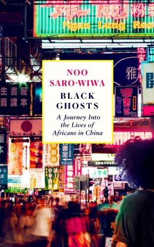

China today is a land of opportunity for African people blocked from commerce with most of Europe and Northern America. It is also an intersection of racism and prejudice
Noo Saro-Wiwa goes in search of China’s ‘Black Ghosts’, African economic migrants in the People’s Republic. Living in clustered communities, they are key to the trade between the continents Her fascinating encounters include a cardiac surgeon, a drug dealer, a visa overstayer and men married to Chinese women who speak English with Nigerian accents. This is a story of intersecting cultures told with candour and compassion, focusing on the shared humanity between the sojourner and their hosts.
Noo Saro-Wiwa was born in Port Harcourt, Nigeria, and raised in England She attended King’s College London and Columbia University in New York She is an author and journalist currently working for Conde Nast Traveller Her first book, “Looking for Transwonderland: Travels in Nigeria”, was published in 2012 and was named Sunday Times Travel Book of the Year, nominated by the Financial Times as one of the best travel books and included as one of the 10 Best Contemporary Books on Africa by the Guardian It was also shortlisted for the Authors’ Club Dolman Travel Book of the Year Award in 2013 and won the Albatros Travel Literature Prize in 2016
30
RSAA Collections
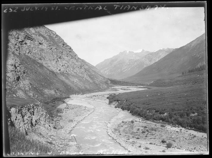
As we digitise our collection of glass slides we are able to share with you some of the wonderful images from the Society’s collection. In keeping with the theme of this issue here are some images of rivers in the Tian Shan mountain range, what was then Chinese Turkestan and Pakistan.
TIAN SHAN
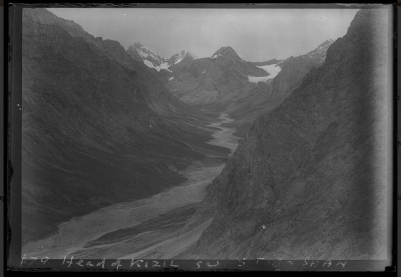
View of Kyzyl Asker mountain in the Tian Shan on the border between Kyrgyzstan and China in the Xingjiang region.
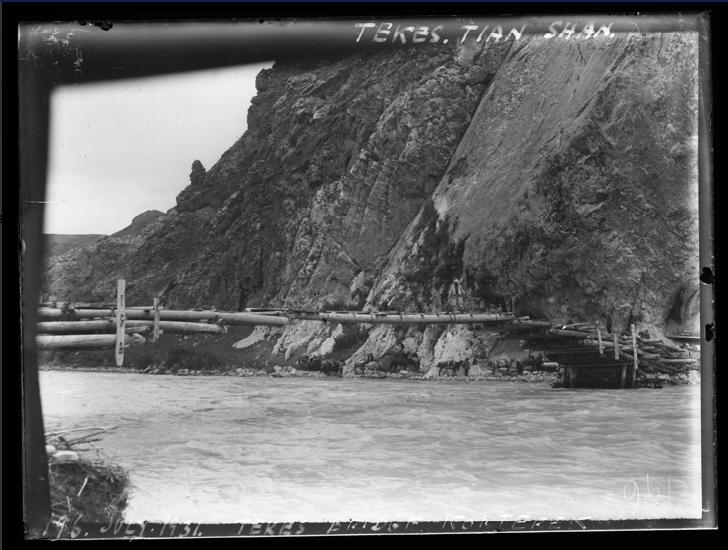
Bridge over the Tekes River which flows over the Kazakhstan-China border before becoming a tributary of the Ili River
Looking down the Surukwat River flowing down the Aghil Pass that connects Xinjiang Province in China and the Ladakh Region of India.
31
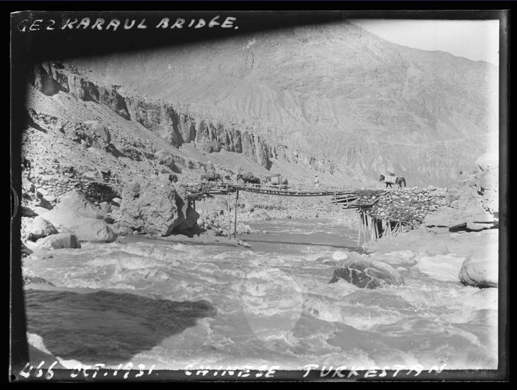
Gezkaraul Bridge over an unknown river in Chinese Turkestan.
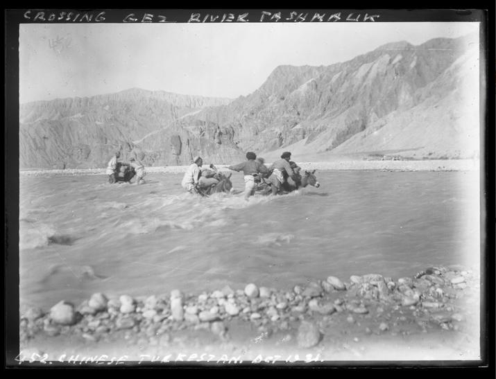
Crossing the Gez He (river) valley near the town of Tashmalik, west of Kashgar.
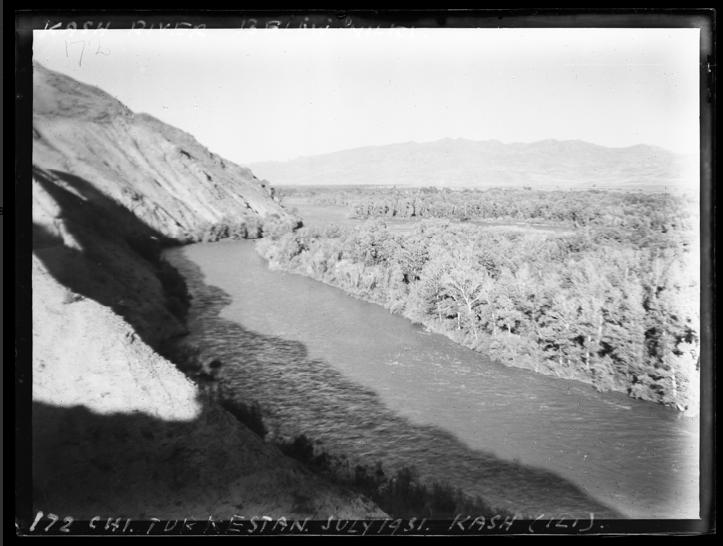
Image of the Ili River in Chinese Turkestan.
PAKISTAN
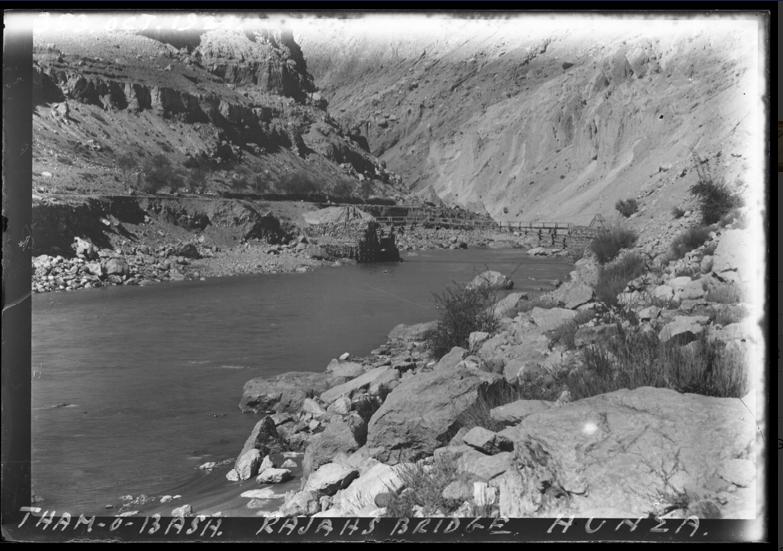
Rajahs Bridge crossing the Hunza River, the principal river within the Hunza region of Gilgit-Baltistan.
32 CHINESE TURKESTAN
Past and Present
PAST-JOHNMORRIS
by Donald S Johnson
Insights into the life and times of notable RSAA members past and present
Born in 1895, John Morris lived an adventurous and remarkably accomplished life as a soldier, mountaineer, pioneering Himalayan anthropologist, linguist, photographer, university lecturer, war correspondent, author, journalist, and an indefatigable traveller Like many of his generation, his life was shaped by the ethos of empire and participation in the Great War, propelling him into life-altering experiences - many along, and beyond, the outermost northern periphery of Britan’s Indian Empire
Morris was an infantry subaltern during World War One. Commissioned a Second Lieutenant in October 1915, he served with the 1/5th Leicestershire Regiment from early 1916 until the spring of 1917, often in the Gommecourt area of northern France, a troublesome moonscape-like salient and a dangerous German strongpoint. He was wounded in June 1916, and whilst recovering was present and under fire on July 1, the first day of the Battle of the Somme
Transferring to The Indian Army in 1917, he served initially in the 3/9th Gurkha Rifles, before joining the 2/3rd Queen Alexandra’s Own Gurkha Rifles in Palestine late in 1918 during the closing days of the war with the Ottoman Empire Morris met Ralph Turner, the battalion’s Adjutant (later the distinguished linguist Professor Sir Ralph Lilley Turner, MC), at this time. A kindred spirit (and subsequently life-long friend), Turner encouraged Morris to master the Nepali language and explore his interest in Gurkha culture
Morris would remain with his regiment until the end of his army career in 1935. He participated in the Third Anglo-Afghan War in 1919 with a unit of Gurkha Scouts, and, now a captain, during the 1920s and 1930s with his regiment in arduous campaigns on the Northwest Frontier of India During one such campaign in Waziristan, on December 11, 1921, Morris and his Company were ambushed by Mahsuds at Spinchilla Narai near Datta Khel, “ a nasty minor disaster” in which he barely survived Twenty-three members of his company died Afterwards, he wrote to
Portrait of John Morris by J.M.L. Gavin, 1936 British Mount Everest Expedition © RGS
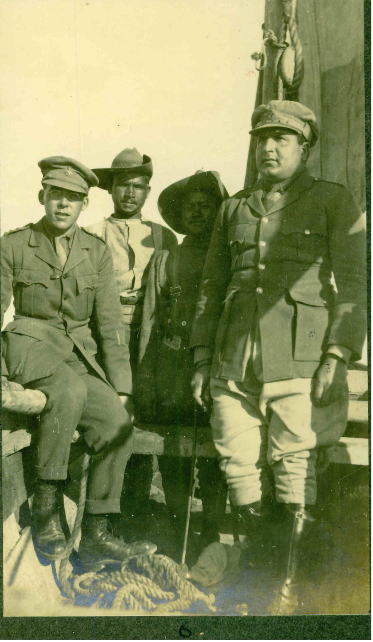
John Morris, two unidentified Gurkhas, J N Luthra, Indian Medical Service Port Tewfik, Egypt, January 1919. Photo: J.N. Luthra Courtesy of the family of Prof Sir Ralph Lilley Turner, M C
33
Ralph Turner: “Yes, we had a bad show the other day and I missed leaving this world by a very small margin indeed However, its all Kismet isn’t it?”
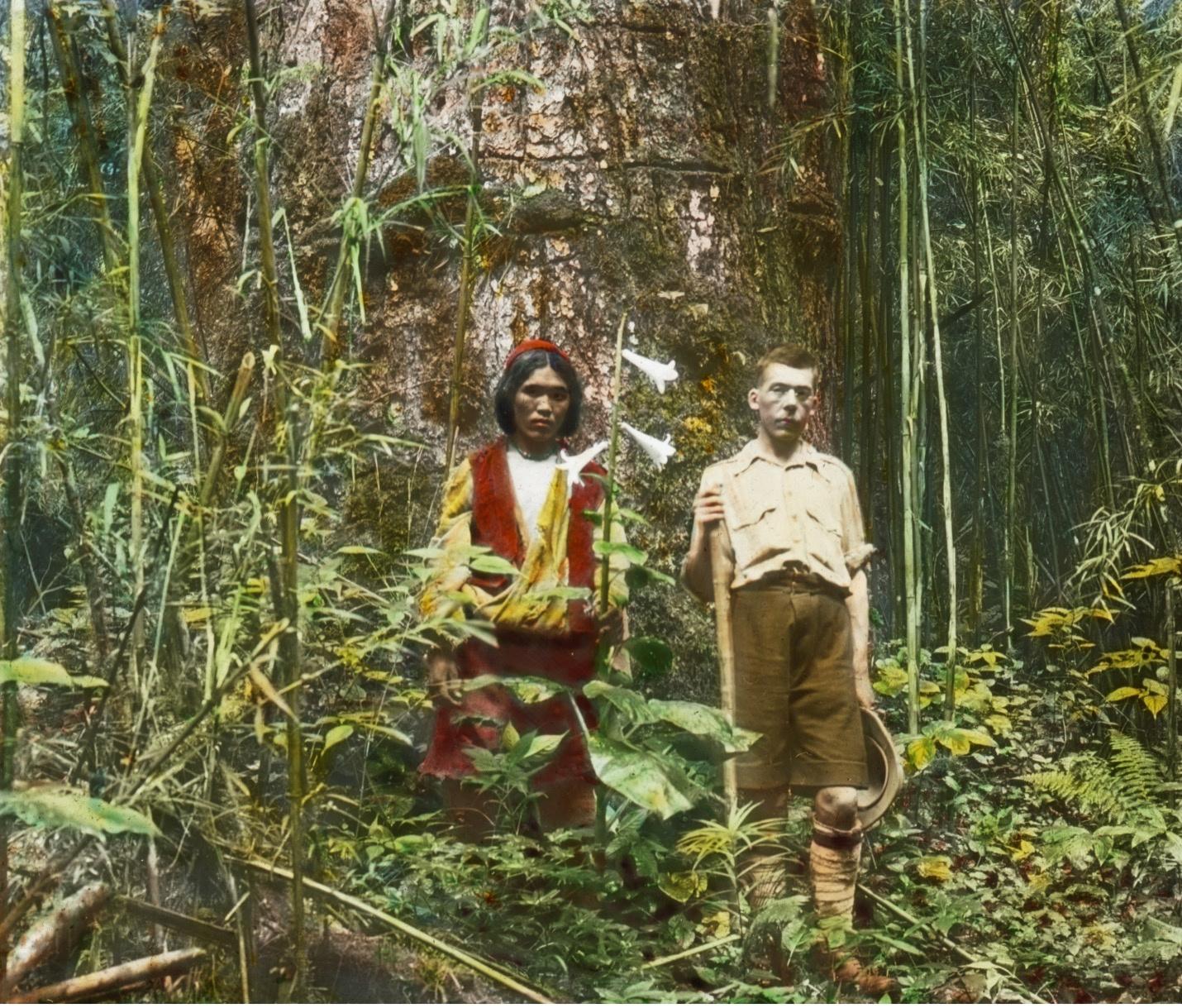
A member of the 1922 British Mount Everest Expedition, Morris was lauded by Brigadier General Charles Granville Bruce, leader of the expedition, for his invaluable work as transport officer and interpreter overseeing the bandobast along the expedition’s route through Sikkim and Tibet. On Mount Everest, he earned praise for his skill organizing the lines of communication between the lower camps ascending the Rongbuk Glacier to Camp Three at 21,000feet. Morris was impressed by the Sherpas of the expedition, noting later that they should play a greater role in any future expedition hoping to successfully climb Mount Everest Prior to returning to India, Morris, J B L Noel, expedition photographer, and a group of porters, successfully explored the Gorge of the Arun River Valley Often covered with leeches, the party spent several days climbing enormous hills hacking their way with
In 1927, accompanied by Henry F. Montagnier, surveyor Torabaz Khan, and a group of “most excellent porters,” Morris led an exploratory/surveying expedition to Hunza, and the valleys and glaciers of the Karakorum bordering Chinese Turkestan, an effort recognized by the Royal Geographical Society with the award of its Murchison Grant He returned to Mount Everest with the 1936 British Expedition, again, as a transport officer doing “splendid work,” though handicapped by two debilitating attacks of malaria, the second while “ lying half frozen in a tent not much bigger than a coffin” at Camp Two
The archetype of the unconventional soldier scholar and an astute observer of the human condition, Morris would author many ethnographic articles about the peoples of Nepal, Bhutan, Sikkim, and Tibet He completed two degrees in Anthropology at King’s College, University of Cambridge, in the early-mid 1930s while still serving in the Indian Army His first degree was undertaken whilst on medical leave from his regiment and undergoing treatment for tuberculosis in
34
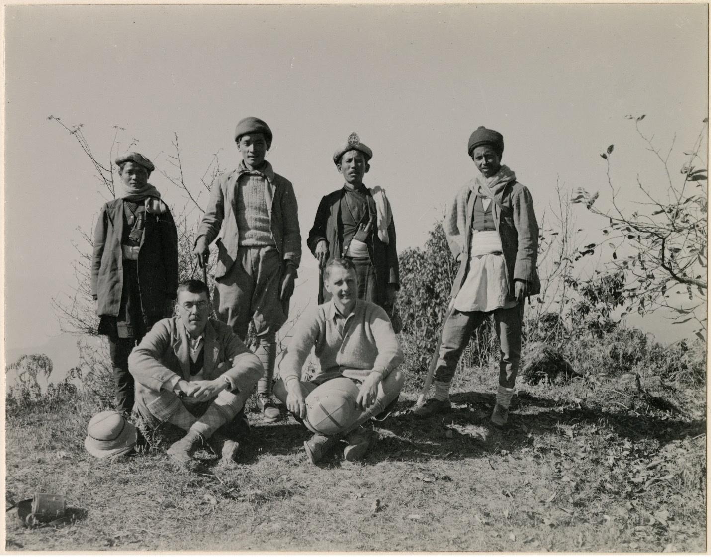
Sitting left to right: John Morris, William Brook Northey Standing: four unidentified Gurkhas, Nepal, 1926. Photo: Unknown. © Royal Geographical Society (with IBG).
anthropologist (one of the first to study complex Gurkha and Lepcha social organization as a trained observer utilising formal anthropological methods), he received the William Wyse Fellowship from Trinity College, Cambridge, and was named a Fellow of the Royal Anthropological Institute of Great Britain and Ireland In 1937, Morris engaged in field work with anthropologist Geoffrey Gorer among the Lepcha people of Sikkim living under the giant shadow of Kanchenjunga An early member of the Royal Central Asian Society, he published aspects of his research in the Society’s Journal.
In 1938, Morris accepted a position in Japan as a University lecturer, and concurrently, as Adviser on English Language to the Japanese Department of Foreign Affairs He was lecturing at Keio University at the onset of World War Two, and was later repatriated in July 1942, returning to England after a lengthy wartime voyage rather than facing internment. Morris soon joined the BBC, was named Head of the BBC’s Far Eastern Service in 1944 and served as an Official War Correspondent in East Asia in 1945-1946. He was Controller of the BBC’s Third Programme from 1952 until retirement in 1958, having previously been appointed CBE for services to broadcasting in the New Year Honours of 1957.
A fixture in London’s literary scene, Morris was a prodigious writer who published hundreds of reviews and articles. His literary friends included E.M. Forster, Charlotte Haldane, Rebecca West, William Plomer, J R Ackerley, and L H Myers, amongst others Still restless after retirement, he continued to write and travel until his death in 1980 at 85-years of age.
A selection of books by John Morris:
Living with Lepchas: A Book about the Sikkim Himalayas
Traveller from Tokyo
The Phoenix Cup: Some Notes on Japan in 1946
Hired to Kill: Some Chapters of Autobiography
A Winter in Nepal
Eating the Indian Air: Memories and Present-Day Impressions
From the Third Programme: A Ten-Years’
Anthology: Imagination, Argument, Experience, Exposition (as Editor)
Handbooks for the Indian Army: Gurkhas (as C.J. Morris)
The Gurkhas: Their Manners, Customs and Country (Co-Authored as C.J. Morris with William Brook Northey)
You might also enjoy:
Plain Tales from the Raj by Charles Allen
The Assault on Mount Everest 1922 by Charles Granville Bruce
Into the Silence: The Great War, Mallory, and the Conquest of Everest by Wade Davis
Everest: The Unfinished Adventure by Hugh Ruttledge
35
"Exploring the Forest" John Morris (right) and unidentified porter, A campsite in the Arun River Valley Photo taken during the latter stages of the 1922 British Mount Everest Expedition by J.B.L. Noel © Royal Geographical Society (with IBG)
PRESENT-RONALDFROSNER
Ronald Rosner was born on the 24th April 1935 in Chicago, Illinois At the age of eighteen he joined the 32nd Infantry Regiment of the US Army with whom he spent sixteenth months in Korea during his three years of service.
Following his discharge from the army he studied at the University of Chicago before joining the School of Foreign Service at Georgetown University in 1959. This latter experience kickstarted a decade of work in the US Foreign Service
Between 1961-1970, Rosner worked as a Foreign Service Officer for the US Department of State, he spent time posted in Kathmandu, Bogotá and Karachi During this period, he also spent time at the Foreign Service Institute of the Department of State studying Spanish and Urdu
In 1970, Rosner decided a change of career was necessary and so became an International Trade Executive, a role he continued in various forms for the next thirty years This job allowed him to travel widely including his first visit to China in 1977 and time spent living in Singapore. While his focus varied depending on the country he was working with emphasis was on sales of bulk agricultural inputs to the governments of India and China
At the turn of the century Rosner became a Maritime and Financial Industries Arbitrator, a role he continued until 2022 Following 9/11, he also spent time lecturing deploying American soldiers, college students and other interested audiences on Afghanistan.
Rosner is a member and Local Honorary Secretary for the RSAA in the USA; he has published articles and numerous book reviews in Asian Affairs. He is also a fellow of the Royal Geographical Society and of the Royal Asiatic Society

36
Mongolia, 2000
Korea, 1954
‘Trouble in Pakistan’
Interview with Ronald F Rosner
“The guy who was the head of the intelligence service, we used to see each other quite regularly at the bar in the Sind Club in Karachi. He was behind the arrest of Zulfikar Ali Bhutto and I don't think he liked some of the people that I was friendly with, on the basis of politics One day, I was having lunch in Karachi with a friend and Zulfikar Ali Bhutto came over and sat at our table and we were delighted We had a good conversation and when we’d finished my friend and I put together what was called the MEMCOM, Memorandum of the Conversation, which was standard practice and which we sent up to Rawalpindi, to our Ambassador ”
“The next day, we're called in by our boss, the Consul General and he said, "What have you guys been up to?" I said, "What do you mean?". He said, "Well, I just had a call from the Ambassador He was laid out on the carpet by the President, by Ayub Khan, because you two were seen in public supporting Bhutto." I said we were just minding our own business and doing what we were supposed to do.”
“Some years later as a trade executive, I returned to Pakistan with the aim of selling equipment to the Pakistani Army At that time the President of Poland was making a state visit to Pakistan and I was in Karachi with some old friends When the President arrives at Karachi airport, a fanatic Islamist drives a truck through the reception line killing the Deputy Foreign Minister and some of the others The government and intelligence service was very embarrassed and they decided "Uh-huh, Rosner was behind it all "
“So I was told to leave town and I left town forever, I've never been back ”
37
Pakistan, 1969
Pakistan, 1969
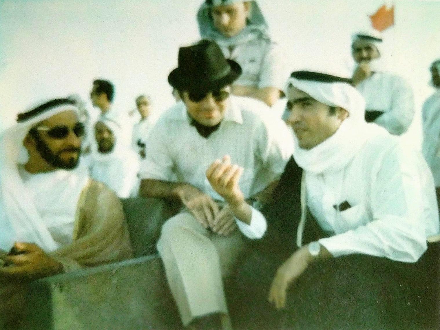
Abu Dhabi, 1970 with Sheikh Zayed (left) now President of the UAE and the ruler of Abu Dhabi
Obituary
JOHNMASSEYSTEWART1932-2023

John Massey Stewart was Honorary Librarian for 11 years, overseeing the RSAA library and using his tenure to put it on the scholarly map He took over from Frank de Halpert in 1967 and experimented with a variety of proposals to get more people in and using the facilities In 1973 he wrote an article for the journal about the twelve volumes of the Hakluyt Society’s publications, recently presented to the library by Mrs Elinor Sinclair.
John had learnt Russian during his two years of National Service subsequently developing a keen interest in Russia, and in 1961 drove a Mini across the country with his friend, David Ashwanden This was later written up into his book “Across the Russias ” He wrote several books on the environmental issues in Eastern Europe and the former Soviet republics. He was also a keen and very good photographer, his work being accessible through the Mary Evans Picture Library
Always a popular speaker, the RSAA know him more through his talks to us: “Discovering a Continent: Early Naturalists in Siberia” (1983); “East of Lake Baikal: Siberia’s Buryat Autonomous Republic” (1990); “Siberian Summer: Rubber Boat Trip down the Kulinna – above and below water in Lake Baikal and on to Vladivostok” (1991); “Travels in Siberia [1961-1994]” (2008) and his final one just before lock-down in 2020 “The Atkinsons’ Adventures in Siberia and Kazakhstan ”
He will be greatly missed.
Adopt-a-Book
The RSAA Library at Haileybury needs constant work to conserve and develop the collection
Can you help?
Donations are eligible for Gift Aid, increasing their value by 25%
Follow the link below to find out more about what a donation from you could help us to do
https://donorbox org/rsaa-adopt-a-book
RSAA Blog
The blog echoes the remit of the RSAA, covering current affairs, culture, travel, exploration and recent history from across Asia
Every week you can read a new article by experts, travel writers, academics and practitioners on a wide range of different topic
To see the latest article and access past articles head the the Blog section of the RSAA website.
38
Society News
Society News
RSAA Travel Awards 2024
We are very pleased to have been able, thanks to a generous donation, to reinstate the RSAA Travel Awards this year, following a three year, COVIDinstigated, suspension We had a strong field of applicants and are delighted to announce that we have made awards to four young researchers.
Mengyuan Tian

Mengyuan Tian is currently a PhD candidate at the University of Cambridge, Faculty of Asian and Middle Eastern, working on the topic of governmental involvement in the reconstruction of the Yellow Emperor Worship Ceremony in contemporary China
Her research interest lies in the state’s involvement, motivations, and strategies in the revival of popular religion; faith construction, nation-building, and the political apparatus behind; digitalisation, commercialisation, and secularisation of religious practices. The proposed project centers on the dynamic interplay between technology and the state Specifically, it seeks to provide fresh insights into the evolution of religious practices, with a focus on online worship ceremonies that have become prevalent during and after the pandemic period (2019–present).
Julius Kochan

Julius is a scholarship-holding PhD student at the University of Oxford, where he researches Contemporary Chinese Literature and Culture. Prior to this, he received an MPhil in Chinese Studies from Oxford, funded by an Ertegun scholarship, and worked for a number of years in the Chinese-speaking world. His first degree was in Russian and French from Cambridge and he maintains an active interest in Sino-Russian comparative studies.
In this project Julius will research the interactions between Russian, Chinese, and Mongolian identities in current-day Inner Mongolia The RSAA’s generous travel award will allow him to travel to the region, where he will gather vernacular cultural artefacts These texts will paint a lucid picture of the current state of this border region.
39

Yi-Ting Chang
Yi-Ting Chang is a political geographer specializing in hightech geopolitics and astropolitics, with a primary focus on East Asia Her research interests lie at the intersection of Science and Technology Studies (STS) and political geography She is currently a Clarendon Scholar at St. John’s College, University of Oxford

Her project, titled “From Geo- to Astropolitics: How Taiwan Constructs Vertical Territory within the Global Satellite Network,” aims to utilize the case study of FORMOSAT-5, the first locally manufactured Earth Observation satellite launched in 2017, to examine the role of high-end engineers in shaping contemporary geopolitics and astropolitics in East Asia The research will be conducted through historical documents, interviews, and a 9-month organizational ethnography at the Taiwan Space Agency (TASA)
Xueqing Zhang
Attracted by Kurdish linguistic beauty and cultural richness, Xueqing pursued a bachelor’s degree in Kurdish language, literature and civilization at INALCO In 2022, she visited Kurdish-speaking regions in Iraq and Turkey A spoken Sorani Kurdish textbook for Chinese learners that Xueqing completed as first author was published in 2023 Now, she is advancing her studies with a master’s in Modern Middle Eastern Studies at the University of Cambridge, specializing in Kurdish linguistics
Xueqing’s project aims to explore what the current status of Kurdish language education in Kurdistan is, after decades of advancement propelled by supportive policies yet impeded by the complex sociolinguistic landscape? This project seeks to answer this question by examining its implementation and the challenges it faces
40
Gifts and Cards
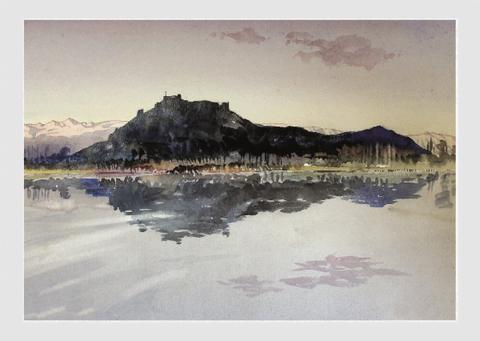
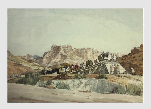
WARTIME INDIA
Five different cards with watercolour paintings from 1940s India by the late James FletcherWatson RI, RBA, with kind permission from the artist’s family £10 per pack of 5

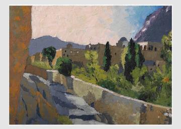
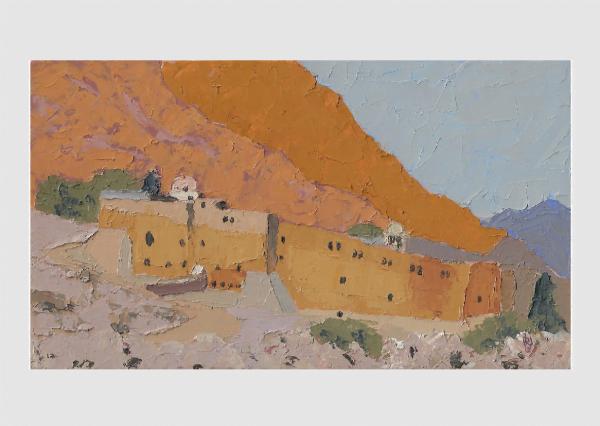
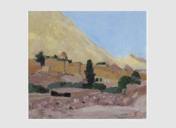
ST CATHERINE’S, SINAI
A pack of five cards with oil paintings of St Catherine’s Monastery, Sinai by Briony Watson £10 per pack of 5
STROLLINGABOUTONTHEROOFOFTHEWORLD:THE FIRSTHUNDREDYEARSOFTHERSAA-£25
BY HUGH LEACH & SUSAN FARRINGTON
This volume covers the first one hundred years of the Royal Society for Asian Affairs, formerly the Royal Central Asian Society It traces its origins in the Central Asian Question, within the context of the ‘Great Game’, and continues its fascinating chronology through the two World Wars to the present day There are separate chapters on its widely drawn membership, variety of activities and archive collection. Throughout the pages are glimpses and vignettes of some of its extraordinary, even eccentric, members and their astonishing adventures

JUSTHUGH:HUGHRAYMONDLEACHREMEMBERED£25
BY SUSAN FARRINGTON & NORMAN CAMERON
Memories of Hugh Leach – Arabist, explorer and author of the highly praised “Seen in the Yemen” and “Strolling About on the Roof of the World”, the centennial history of the Royal Society for Asian Affairs (RSAA) This special book combines anecdotes and recollections submitted by his friends and colleagues, together with Hugh’s own reminiscences in his later years A portrait of an end-of-era soldier, diplomat, traveller and, above all, charismatic enthusiast, Just Hugh is a testament to his work and legacy. Available from Arabian Publishing.
41
How to Contribute
Caravanserai
The editor of Caravanserai is always happy to receive articles and high quality images for possible inclusion in future issues of the magazine
We welcome all contributions, but we cannot guarantee to include all that we receive If you would like to submit a contribution please contact the editor at caravanserai@rsaa org uk
Leavealegacy

A gift in your will can help the RSAA fulfil its ambition to be a leading network on Asia for young professionals
Your support can ensure the continued exchange of interest, experience and expertise
If you would like to know more about how a gift in your will would help the RSAA in the future, please contact michael.ryder@rsaa.org.uk
ASIANAFFAIRS
Bill Hayton
Members are very welcome to submit articles and, in particular, book reviews to the Society’s quarterly journal, Asian Affairs It is currently edited by Bill Hayton, a former BBC journalist who has worked in Vietnam and Myanmar, among other places.
The focus of the journal is the current affairs and recent history of the whole continent of Asia and neighbouring regions with strong cultural affinities It is particularly interested in foreign policy, governance, diplomacy, business, and travel. The journal is aimed at a global audience ranging from students to academic specialists to those with practical experience and interests in Asia
Book reviews are a particularly significant feature of each issue Any member interested in writing one is invited to contact Bill by email at editor@rsaa.org.uk. Book reviews are typically 700 words long and are best when opinionated! Their primary purpose should be to communicate whether the reviewed book is worth reading and why Longer reviews that compare two or more books are also welcome Original articles on any of the areas covered by the journal are welcome. While the majority of our articles are written by academic researchers, we are also interested in publishing argumentative pieces, reflective analyses by practitioners and obituaries We can also include photographs and illustrations
In general, we look for articles that make an original contribution to the literature on the subject. They should have a strong central argument, offering something more than a review of developments, together with a compelling narrative The editor is happy to assist with copyediting, particularly where the author’s first language is not English. More information, including instructions for authors, can be found at the journal’s webpage.
All issues of the journal past and present are available digitally to members free of charge - just log into the RSAA website and head to the Journal page!