VISUALIZATION SERVICES


Visualization Services play a valuable role in depicting modern infrastructure projects, particularly within the realm of transportation and civil engineering.
DRMP’s Visualization Services provide real-world representations of projects and translate technical data into high-level visual narratives. These visualizations can help demonstrate the potential impacts of a project and aid in building consensus among all stakeholders and the public, which is essential for successful project implementation. Visual aids have evolved over the years with software/ hardware advancements and demonstrate a clearer understanding of a project’s aesthetic appeal, dimensions, and suitability within the local community.

- FROM I-75 TO SR 31
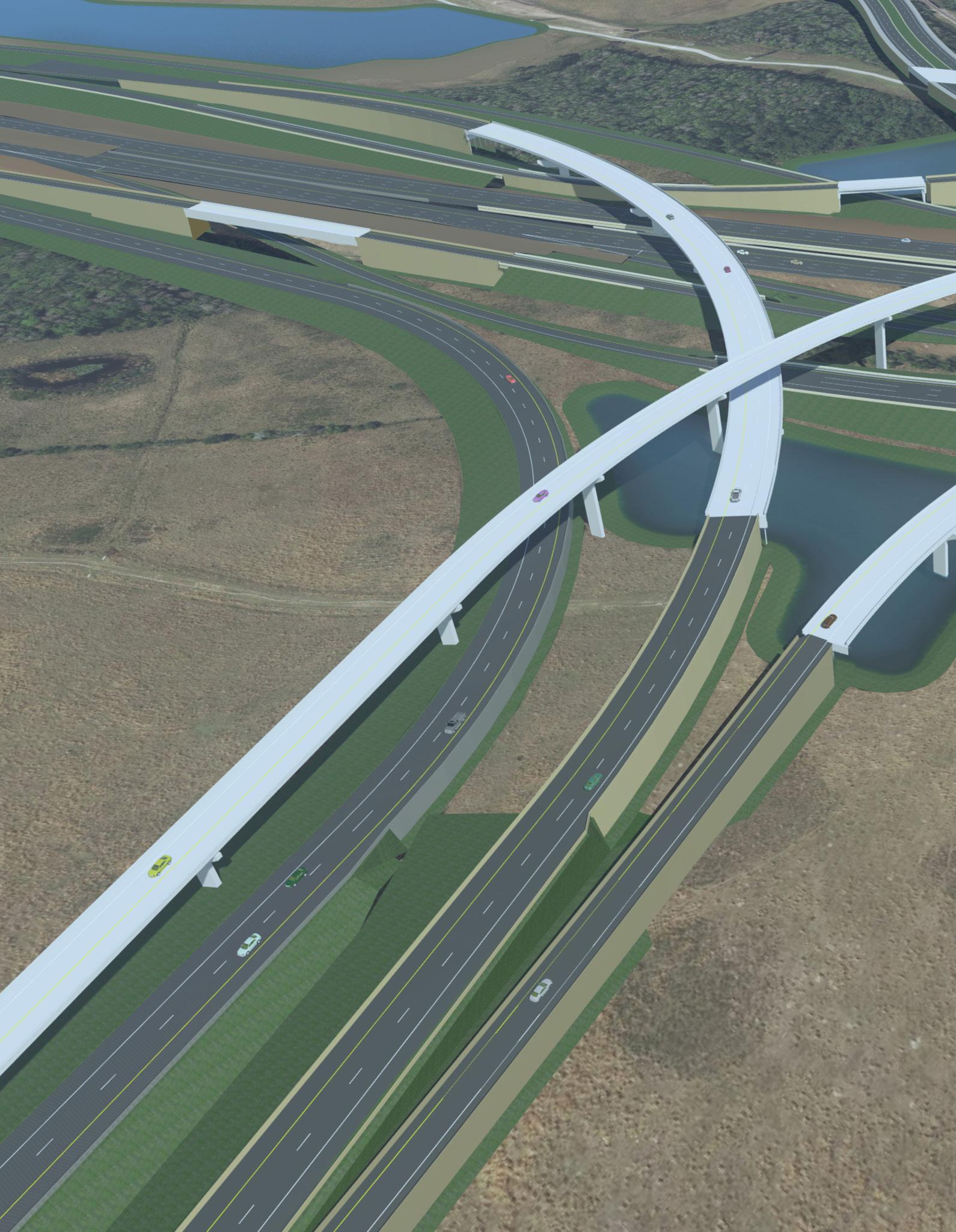
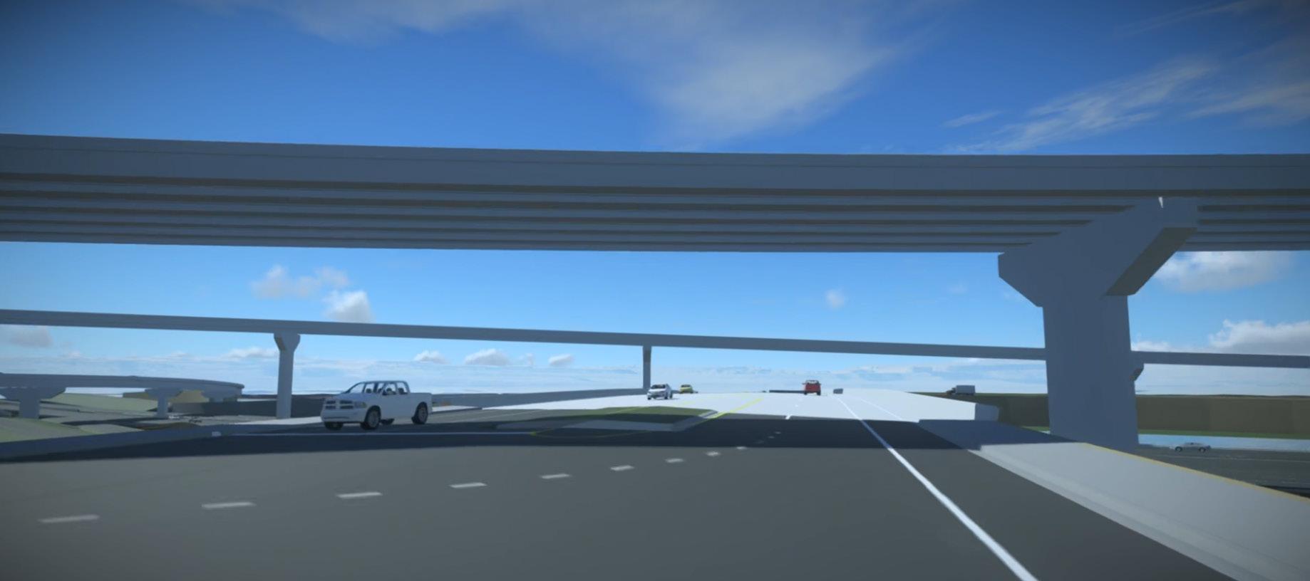
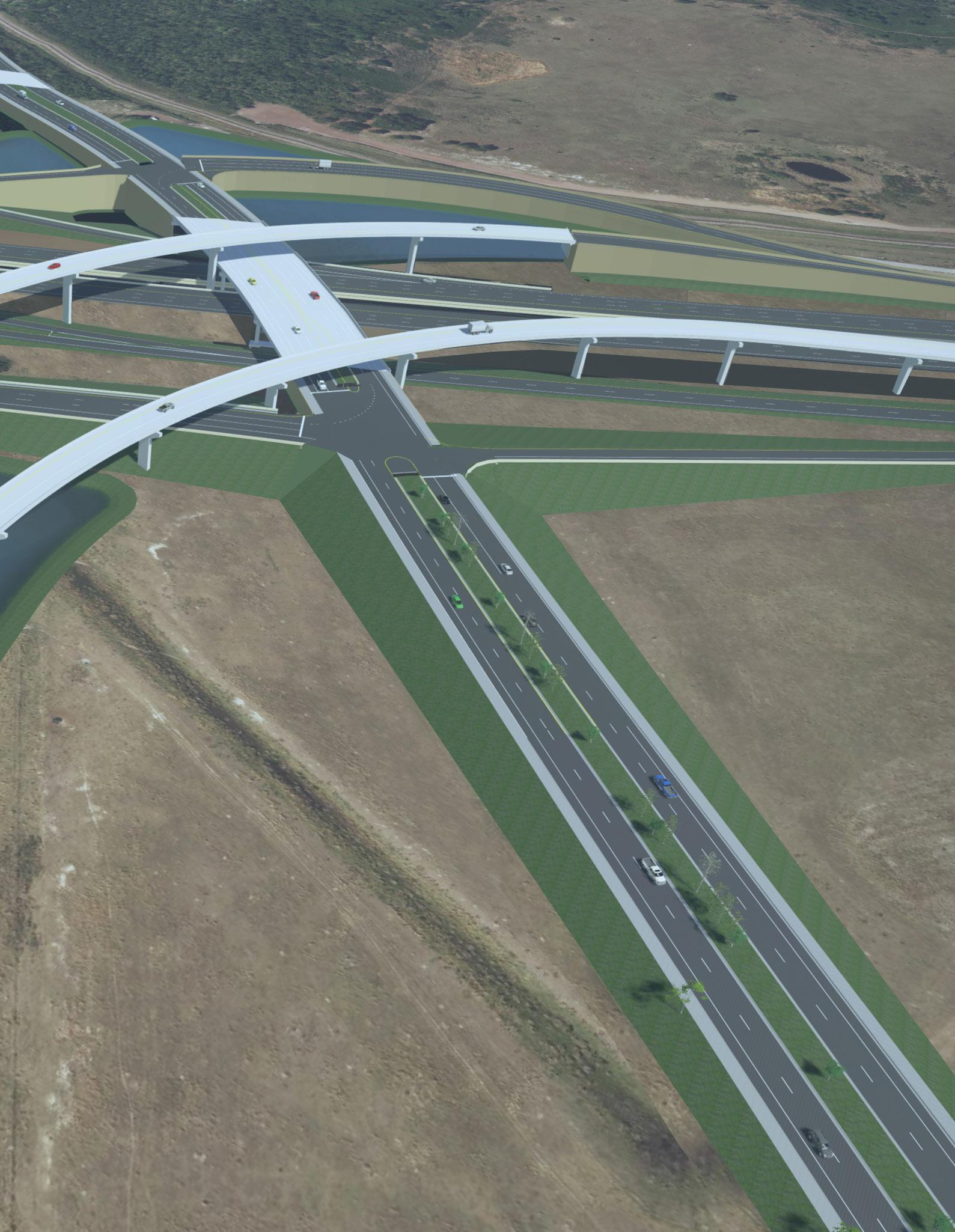
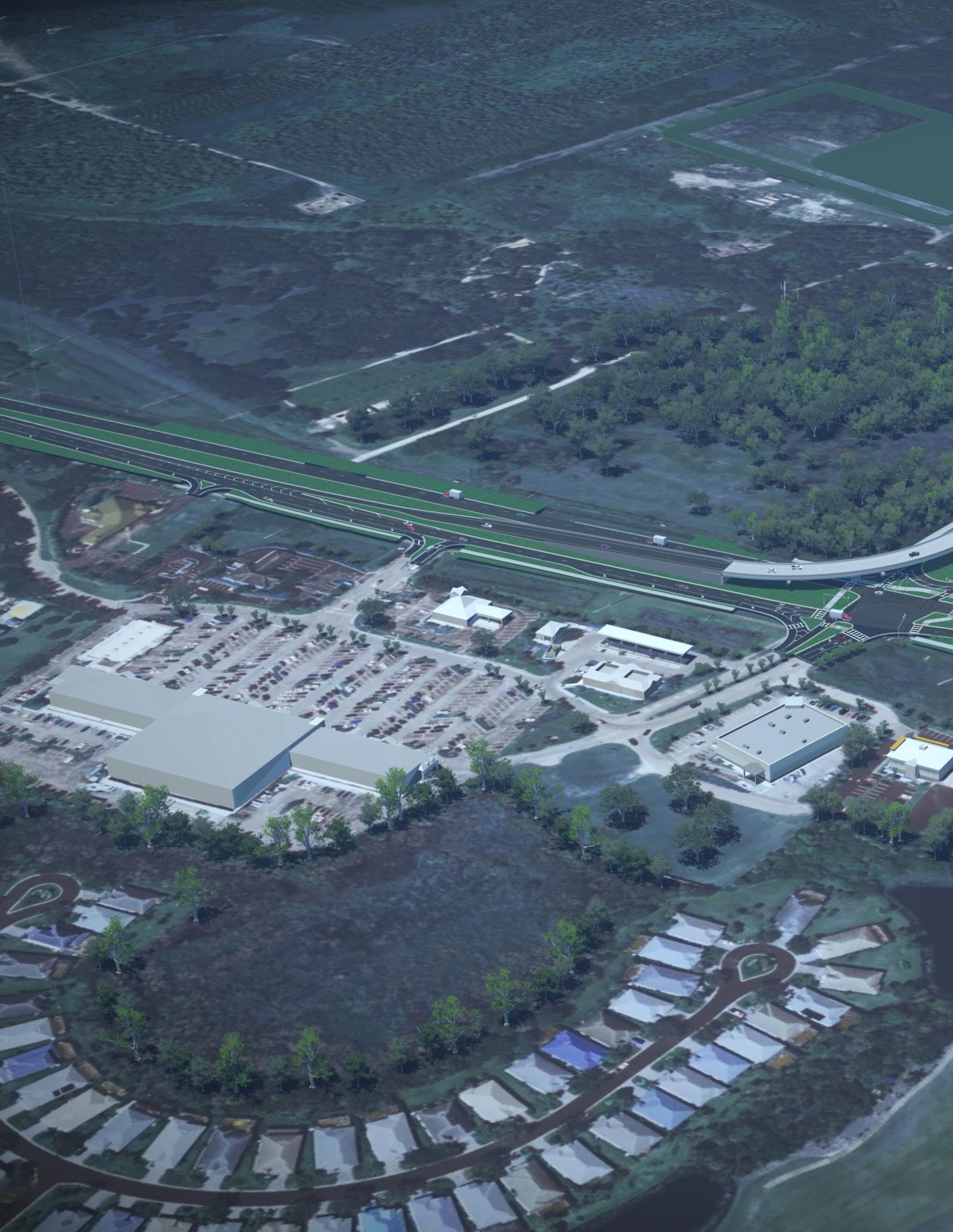
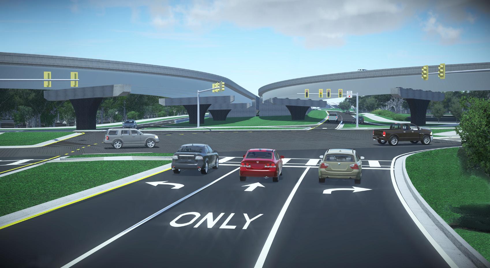
This project includes a systems interchange connecting SR 534 (Segment 1) to SR 417 to the east of the existing Boggy Creek Road/Jeff Fuqua Boulevard (South Access Road)/SR 417 systems interchange. A new service interchange will connect Medical City Drive to SR 417 within the footprint of the new SR 534/SR 417 systems interchange. The existing Lake Nona Boulevard/SR 417 service interchange is east of these proposed interchanges and will require ramp modifications to complete all traffic movements. The southern portion of SR 534 will bridge over Lake Nona Boulevard and terminate just north of Laureate Boulevard.
DRMP’s Visualization experts were asked to create conceptual renderings and fly-through animations of the proposed design using MicroStation’s ConceptStation and LumenRT. The Visualization team worked with the design engineers to develop a 3D model of this complex design. The 3D model and renderings were used to help illustrate the proposed design.
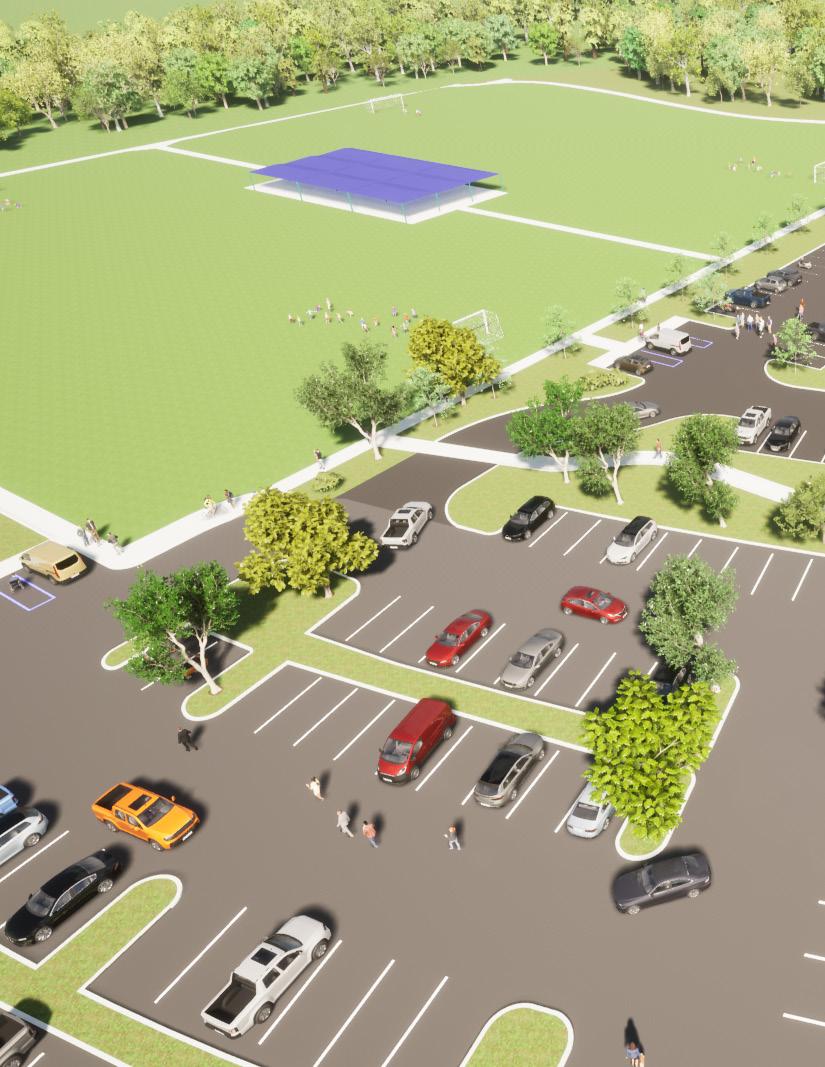
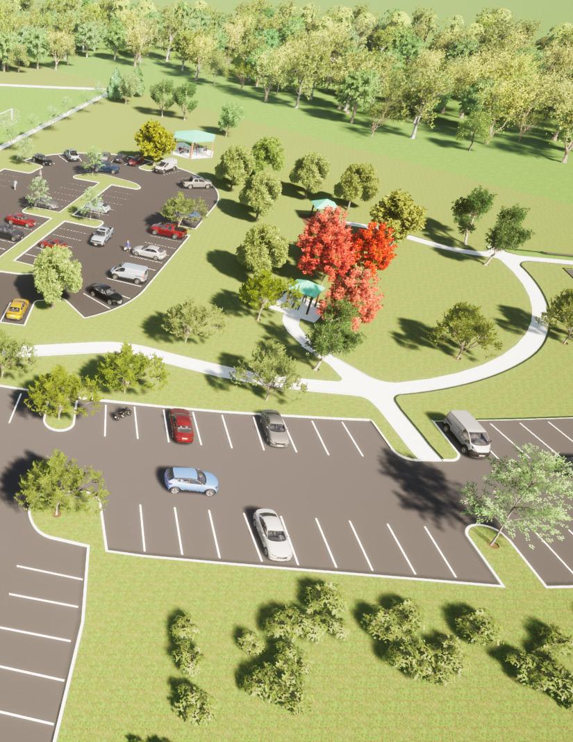
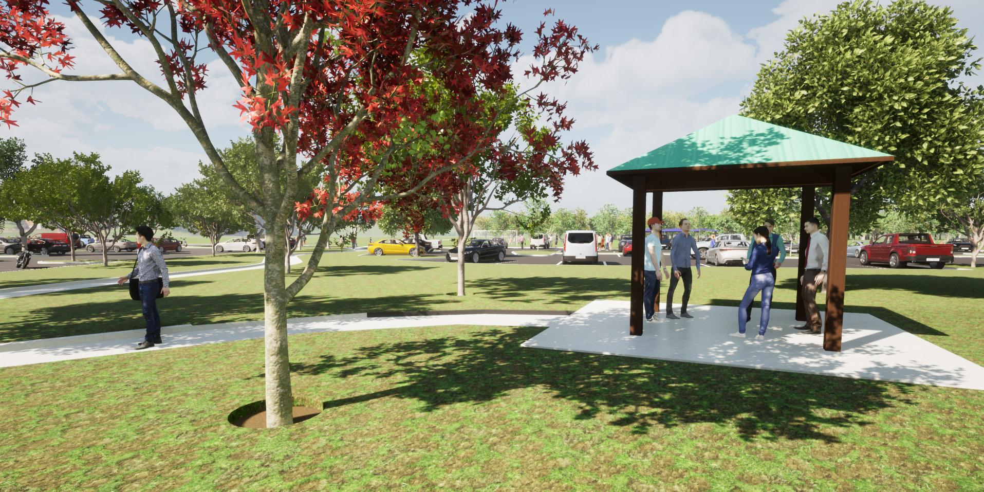
The parking lot at Terramar Park was expanded to accommodate an already crowded environment when operating at capacity. According to the City of Parkland,“This project consisted of expanding the under-sized, multi-purpose fields to league regulation size and modifying the existing parking lot to accommodate the expansion.”
DRMP’s Visualization experts were asked to create a 3D representation of the proposed design to help the City convey to the public the overall expansion and aesthetic treatments to the park.
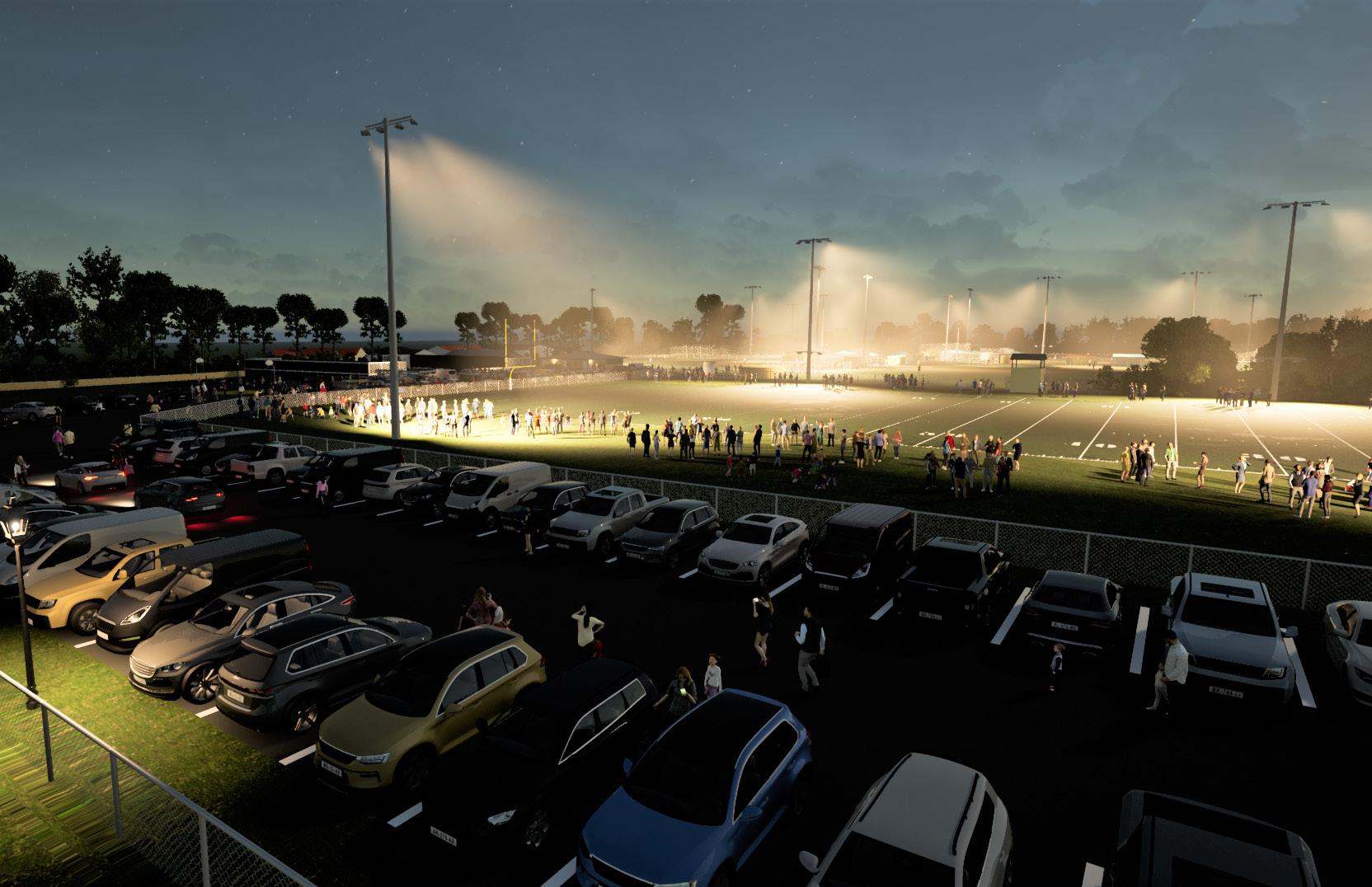
Cornerstone Park is a 12-acre community park located within The Plantation at Ponte Vedra Beach. Due to limited daylight hours and a substantial financial investment in local sports, Cornerstone Park has a need to install high-level lighting around its athletic facilities to accommodate evening sports activities. In addition, adjacent to the athletic facilities is the Ponte Vedra Concert Hall where there is a safety concern regarding night-time parking.
DRMP understood there was a request to place 17 (60-70) foot light poles around the athletic fields, four light poles surrounding the football/lacrosse (multi-use) field and 13 light poles surrounding the four baseball fields.
The Client requested that DRMP develop a fly-through of Cornerstone Park that would demonstrate the visual impact the new light poles could have on Ponte Vedra Beach and surrounding areas (including to SR A1A, the Ponte Vedra Concert Hall, neighboring residential areas, etc.) to address the City of Ponte Vedra’s ordinance that restricts light poles to 20-feet, as well as the local community’s concerns.
The Client requested that the fly-through show a viewpoint entering and leaving the park, as well as areas behind park. The fly-through also paused and highlighted the surrounding areas previously mentioned.
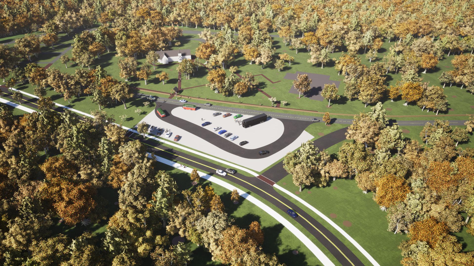
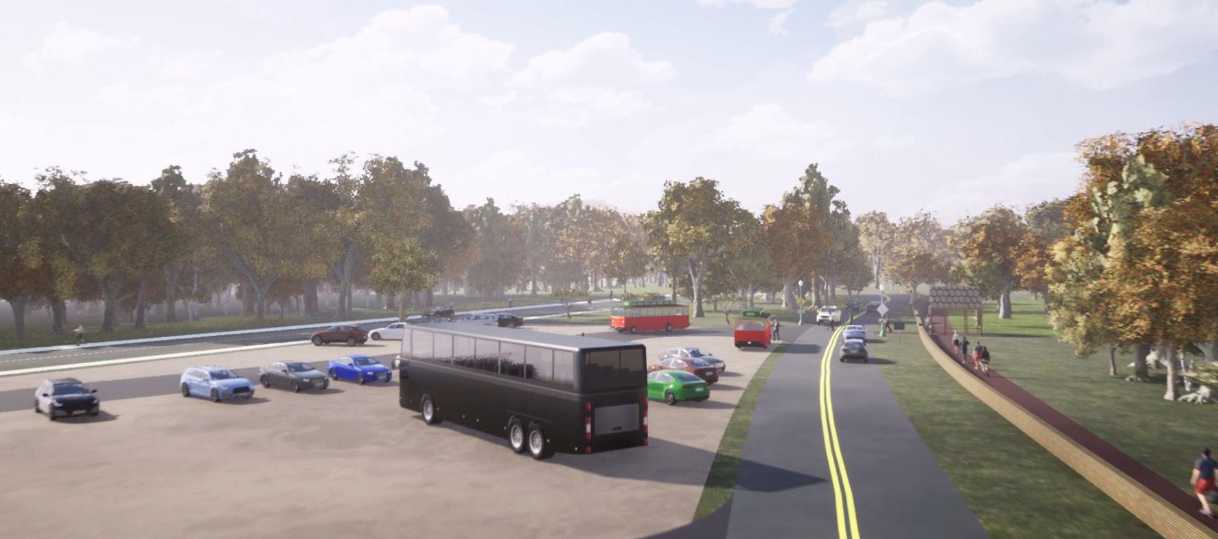
Fort Frederica National Monument and the adjacent Christ Church Frederica represent a significant “historic visitation node” on St. Simons Island for tourists and residents. As noted by the Golden Isles Conventions and Visitors Bureau, the more than 250,000 visitors per year to Fort Frederica, along with the 100,000+ visitors at Christ Church, equates to significant economic impact and 215 jobs (according to the 2012 National Park Service study). The renderings showed how the proposed roadway can be incorporated seamlessly with the church’s master plan for improvements and expansion. Every detail, including the depiction of a tour bus, trolleys, pedestrian traffic, cyclists, and vehicles helped bring the project to life.
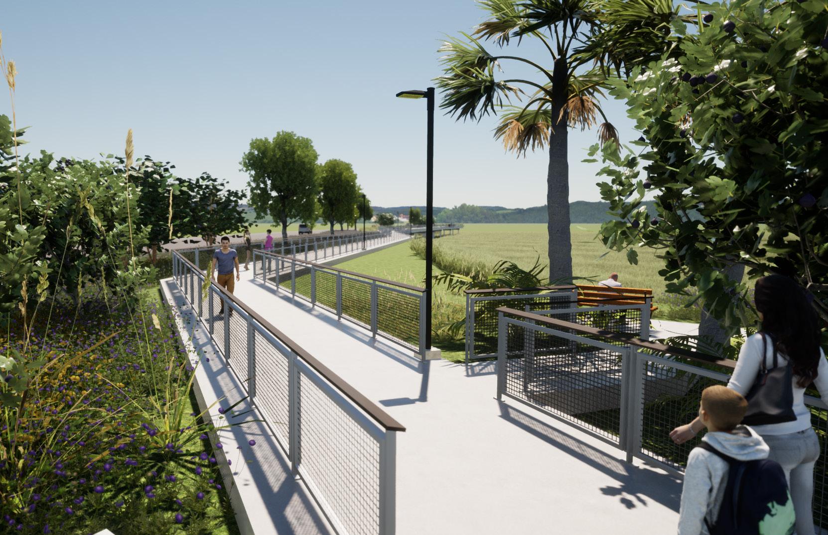
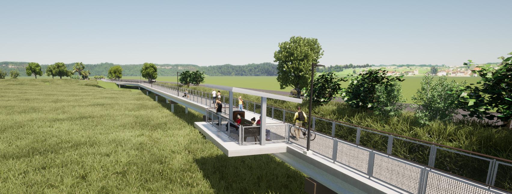
DRMP’s Visualization experts were asked to create 3D renderings and a fly-through of the proposed boardwalk and scenic overlooks for the Glynn Avenue Link Trail. CAD files were imported into Sketchup Pro and a 3D model was created. Along with the boardwalk, the client requested parts of the surrounding community be included to give the visuals a sense of place. Proposed vegetation, trees, and the adjacent wetlands were included to add realism to the fly-through animation. Final renderings and videos were created in Twinmotion and Adobe Premier Pro.
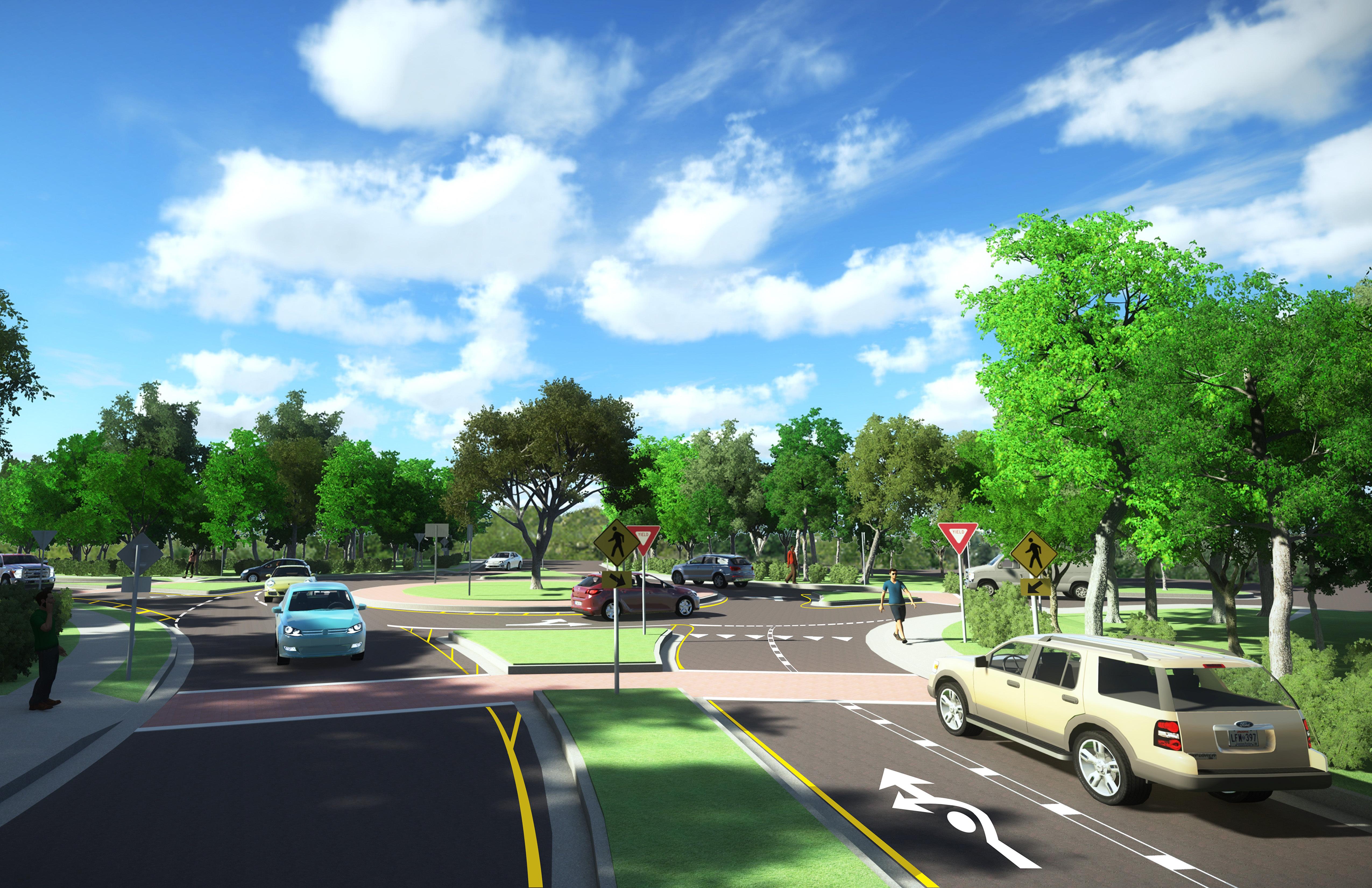
To support public involvement and project design, DRMP visualization experts created a virtual model of the Kinhega Drive roundabout to explain the project’s design and aesthetic approach to project stakeholders.
CAD files were imported into Sketchup Pro to create a 3D model, which included real-world textures, lighting, and animated vehicular/pedestrian traffic. Still images and fly-through animations were created using LumenRT to better illustrate the project goals from both the driver’s and bird’s eye perspectives.
The videos and models helped the County and design team explain to local business owners, residents, high school students, and parents how the new roundabout would improve access to existing and future commercial areas and ease traffic congestion during peak travel hours.
The project won the 2016 Transportation Project of the Year Award for the American Public Works Association (APWA) Big Bend Chapter.