Rhode Island History
THE JOURNAL OF THE RHODE ISLAND HISTORICAL SOCIETY
Rhode Island History
1
Published by
The Rhode Island Historical Society 110 Benevolent Street
Providence, Rhode Island 02906–3152
Roberta Gosselin, chair
Winifred E. Brownell, vice chair
Mark F. Harriman, treasurer
Peter J. Miniati, secretary
C. Morgan Grefe, executive director
publi Cations Committee
Charlotte Carrington-Farmer, chair
Catherine DeCesare
J. Stanley Lemons
Craig Marin
Seth Rockman
Luther Spoehr
Evelyn Sterne
staff
Richard J. Ring, editor
J. D. Kay, digital imaging specialist
Silvia Rees, publications assistant
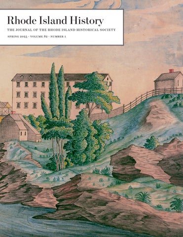
C over: Pawtucket Bridge and Falls, ca. 1810–1819. RIHS graphics paintings collection: 1971.23.1. rhi (X5) 22
3 Joseph Jenks Jr.: Seventeenth-Century Pioneer of Industry, Political Leader, and Visionary of Pawtucket Falls
Jonathan Cipriano
30 Fishermen’s Rights and the Governor’s Wall: The Birth of Recreational Shoreline Access Advocacy in Rhode Island, 1850–55 r obert g . Darst
Rhode Island History is a peer-reviewed journal published two times a year by the Rhode Island Historical Society at 110 Benevolent Street, Providence, Rhode Island 02906-3152. Postage is paid at Providence, Rhode Island. Society members receive each issue as a membership benefit. Institutional subscriptions to Rhode Island History are $40.00 annually. Individual copies of current and back issues are available from the Society for $20.00 (price includes postage and handling). Our articles are discoverable on ebscohost research databases. Manuscripts and other correspondence should be sent to editor@rihs.org.
The Rhode Island Historical Society assumes no responsibility for the opinions of contributors.
© The Rhode Island Historical Society Rhode Island History (issn 0035–4619)
JONATHAN CIPRIANO
Joseph Jenks Jr. Seventeenth-Century Pioneer of Industry, Political Leader, and Visionary of Pawtucket Falls
The BlaC kstone River serves as one of the many birthplaces of industrialization in North America. It flows from the headwaters located in present-day Central Massachusetts to Pawtucket Falls, where it drains into the Seekonk River, the northernmost tidewater of Narragansett Bay. In the eighteenth century, industrialists migrated to the Blackstone to utilize its waterpower. Samuel Slater, an immigrant from England, famously smuggled the most advanced textile machinery in the world into Rhode Island with the help of the illustrious Browns of Providence. He built his first mill directly north of Pawtucket Falls. A century earlier, Joseph Jenks Jr., another migrant from England, settled a short distance south of where Slater later established his mill. Athough his legacy does not match the renown of eighteenth-century industrialists, Jenks is still known in Pawtucket because he established a sawmill and Rhode Island’s first forge at Pawtucket Falls. His settlement is significant because it represents preindustrial technology and growth during the seventeenth century in southern New England.
In the late nineteenth century, soon after the City of Pawtucket was incorporated, historiography developed around “Pawtucket’s founder.” Robert Grieve wrote the first history of Jenks’s settlement in 1897, and many succeeding histories of Jenks were drawn from his narrative. In the late 1940s and into the 1950s, historians and archaeologists conducted research on the Saugus
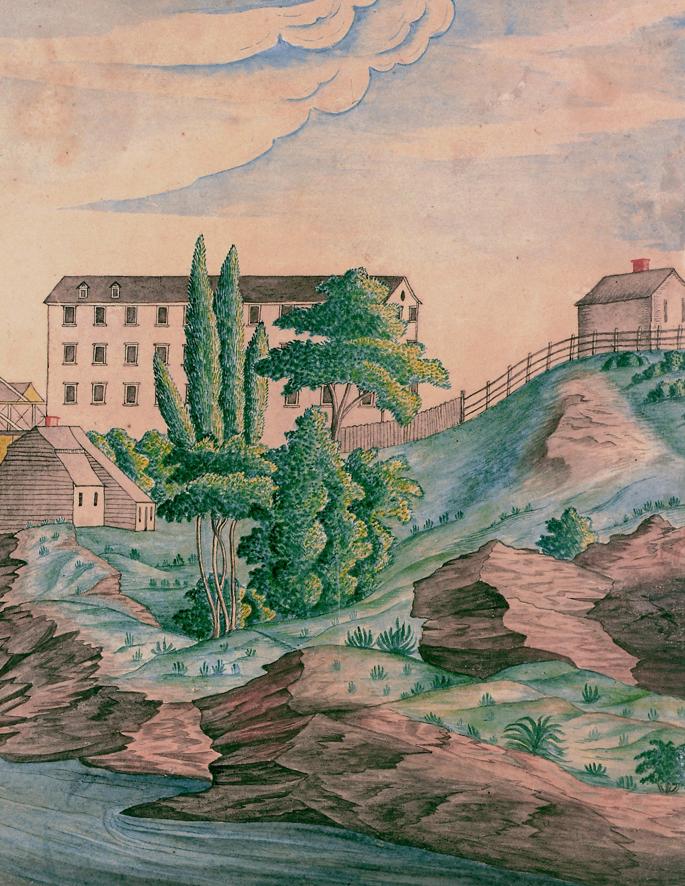
o pposite : Pawtucket Bridge and Falls, ca. 1810–1819. RIHS graphics paintings collection: 1971.23.1. rhi (X5) 22
Ironworks located in Lynn, Massachusetts. This coordinated effort uncovered documentary and archaeological evidence, including Joseph Jenks Sr.’s workshop. Jenks, a blacksmith at the Saugus Ironworks, came to North America with his son, Joseph Jenks Jr., in search of opportunity. Together, they worked on new technologies to improve production in labor-starved New England. By 1660, Jenks Jr. struck out on his own and resided in Concord, Massachusetts, before ultimately settling in Rhode Island. His prominence in Rhode Island stemmed in part from his successful father. The skills he learned in his youth from both his father and the massive enterprise at the Saugus Ironworks helped shape the industrial future of neighboring Rhode Island, originating from Jenks building and operating the first forge at Pawtucket Falls.1
To understand the impact of craftsmen like Jenks in the seventeenth century, we need to grasp the economic realities of colonial New England. In the 1630s, tens of thousands of immigrants settled in towns along the coast. Although religious considerations motivated some, economic opportunity also drove many to participate in the Great Migration. Skilled labor was scarce in the colonies, making craftsmen in high demand. One objective of this study is to show how economic forces shaped Jenks’s trajectory.2
With a landed estate and a successful industrial enterprise, Jenks made his way into colonial political history as well. He emerged as a well-respected freeman and leader in the Rhode Island colony, with his name frequently appearing in colonial records. He
actively participated in Rhode Island’s colonial government as a deputy and assistant, overseeing important intercolonial communications, boundary disputes, and interactions with England.3 This portion of Jenks’s story frequently is overlooked, but his involvement within town and colonial governments paints a fuller portrait of who he was, in addition to his larger impact on seventeenth-century colonial politics. The following analysis presents a case study of Pawtucket’s founder within the context of a growing English Atlantic world, where industry and political opportunity shaped the trajectory of an economic migrant into a skilled artisan, industrial entrepreneur, and colonial leader in seventeenth-century New England.
A Changing Colonial Economy
Industrial development projects in New England began out of necessity. Throughout the 1630s, the economy depended on imported goods arriving with settlers from England. As immigration to Massachusetts Bay increased during the decade, thousands of newcomers brought English goods with them, including finished products such as textiles, tools, and coinage. In return, colonial merchants provided much-sought-after natural resources, primarily fur, but also cod and surplus cattle and crops. By 1640, the influx of immigrants began to recede, partly due to the precarious political situation that erupted into the English Civil War by 1642. English Puritans decided to stay in the mother country as Parliament gained more power, and many who previously had emigrated returned to England.4 Colonists felt the full impact of this economic down-
turn. The lack of ships carrying new people from the mother country caused the supply of materials, finished goods, and hard money (coinage) in New England to dwindle. As coinage became scarce, prices plummeted, making it difficult to pay debts. The economic depression of the 1640s prompted leaders to “encourage the trades and processing industries vital to the colonial economy, including bounties, special concessions and monopolies for desired projects, tax abatements, and land grants.”5 By the late 1630s, John Winthrop Jr. was coordinating efforts to fund an ironworks operation in the colonies and secured Puritan investors in England through his extensive network of connections.
Negotiations between investors and the Massachusetts General Court led to the creation of the Company of Undertakers of the Iron Works in New England. This was a private joint-stock operation. In 1645, Richard Leader replaced Winthrop as the operations manager. By that summer, he secured state-sanctioned privileges from the Massachusetts General Court, including land guarantees, tax exemptions, and militia exemptions for full employees of the ironworks. According to the agreement, if the company produced enough iron for the colony within the first three years, the Massachusetts Bay government would grant it a twenty-oneyear monopoly on ironmaking within colonial bounds.6 Winthrop originally chose Braintree as the first location for the plant, but after the leadership change, Leader purchased land in Lynn along the Saugus River. There, he established a successful blast furnace and forge. By 1648, the Saugus Ironworks was producing eight tons of bar iron per week, making it the first
heavy industrial ironworks operation in North America. Although Leader was familiar with ironworks operations, he was not a skilled craftsman and primarily served as a manager. During the mid-1640s, obtaining skilled workmen posed a significant challenge in building a successful industrial operation.7
A Skilled Workman
Joseph Jenks Sr. was born in England and baptized in 1599 at St Ann Blackfriars Parish in London. His father, John, worked as a cutler producing cutlery and weapons, while his mother, Sarah Fulwater, was the daughter of a German emigrant who also was a cutler. Jenks apprenticed with his father before disappearing from the documentary record for a time. He reappeared in 1627 when he married Jone Hearne and had a son, Joseph Jenks Jr., who was baptized in 1628. Tragedy struck the young family when Jone passed away in 1635, followed by their daughter Elizabeth three years later in 1638.8
Throughout the 1630s, Jenks worked with cutler Benjamin Stone, who specialized in producing arms at Hounslow in Middlesex to supply for the Thirty Years’ War. The English government granted Stone a monopoly for hiring Germans to train English craftsmen. While at Hounslow, Jenks forged a sword in 1636 inscribed with “JENCKES JOSEPH;” it survives at the Powysland Museum in Wales. He then moved to Northumberland for a short time, receiving state sanction for a milling operation there until as late as 1639. Unfortunately, there is no record of the mill thereafter. By 1641, he migrated to North America in Aga-
menticus (later York), Maine. He left his son, Joseph Jr., with George Hearne, his late wife’s father. Jenks probably left England because regulation and competition increased barriers to mill working. Agamenticus was first settled in the 1620s; Jenks’s skill most likely played a role in his immigration, as noted by one historian of York that he “is undoubtedly our first worker in metals, and a man of unusual ability in that occupation.”9 In 1643, Hearne passed away, leading to the assumption that Joseph Jenks Jr. immigrated to New England to apprentice with his father, as was customary for his age. Jenks Jr. would have been 15 or 16 years old. Continuing the search for skilled workmen, John Winthrop Jr. visited Maine in the winter of 1643–44 and hired Jenks to work in Massachusetts at one of the furnace operations sanctioned by the company.10 Meanwhile, after establishing sites at Braintree and Nashaway, the Saugus blast furnace was erected, and operations began in earnest by 1648. The ironworking operation at Saugus became the largest industrial project attempted in North America at the time. Establishing a productive ironworks required immense manpower, natural resources, and capital. Building a blast furnace involved significant engineering and materials. It stood about twenty-one feet high and had a base width of twenty-six square feet. Workers operated the furnace continuously, day and night, for months at a time. First, they had to dam the water to generate enough power by rotating multiple waterwheels, which powered bellows and trip-hammers. Workers added a mixture of iron ore and flux to remove impurities in the furnace. They also needed a significant amount of charcoal to fuel the furnace.
The rotating waterwheels powered the massive bellows, which blasted heat reaching over three thousand degrees Fahrenheit inside the furnace. When enough iron had melted, it settled at the bottom of the furnace. Workers tapped the furnace to allow the iron to pool into molds known as pig iron or sows, resembling the shape of a sow and her piglets. They then transported the iron to the forge, where workers reheated and pounded it using a water-powered trip-hammer. They repeated this process several times until they removed enough impurities for the iron to be considered pure enough to be sold to blacksmiths, who would then create specialty tools.11
The Jenkses settled in Lynn as Saugus became the main ironworking plant, intertwining the family’s future with the ironworks. Having a skilled blacksmith on location would benefit the company: “A blacksmith on site at the Saugus Iron Works would be vital for the production of tools in high demand. Steel-edged axes and two-man felling saws supplied woodcutters with the implements to harvest the over 3,600 cords of wood fuel needed each year to run the ironworks. Scythes provided farmers with sharp reaping tools needed for harvesting the grain that would feed the workers.”12 Jenks did not work directly for the Company of Undertakers but used his skills to secure patents and to run his own operation. By 1646, he had petitioned the Massachusetts General Court “to make experience of his abilityes & inventions” including “engines for mills, to go with water” for “more speedy dispatch of worke then formerly,” as well as a mill for manufacturing “sithes & other edged tooles” for a “new invented sawmill.”13 The general court granted
Jenks the first patent in British North America, which lasted for fourteen years. In January 1648, Jenks struck an agreement with Richard Leader and established a toolmaking mill along the tailrace of the Saugus blast furnace.14 Sawmills in New England were constructed rapidly in the seventeenth century due primarily to the lack of skilled labor. Sawpits required large numbers of people whereas sawmills could be operated by fewer people. New England towns required processed timber not only to erect homes but also to support the various craftsmen within the colonies. One way of improving technology was Jenks’s “newly invented sawmill,” which “actually may have been a mechanized way of making saw blades.”15
The Jenks millworks relied on the company’s production of bar iron. His smithing benefited the ironworks; between 1648 and 1653, the company paid him “for making and setting saws, making a broadaxe, repairing iron fixtures for the Company’s boat, and steeling axes.”16 Evidence suggests that by 1652, the Jenks operation produced saw blades for sawmilling operations in Connecticut.17 Throughout his years in Lynn, Jenks petitioned the court numerous times: in 1654 to produce “ingins to Carry water in Case of fire;” in 1655 an “engine...for the more speedy cutting of grass;” in 1667 to draw wire; and even in 1672 to coin the “making of money.”18 Jenks, a skilled smith with an entrepreneurial spirit, trained Jenks Jr., who learned how to be a successful millwright and developed knowledge of cutting-edge colonial technology adjacent to the industrial operation at Saugus.
The massiveness of the Saugus Ironworks required both skilled and unskilled manpower. Not only were
founders, finers, colliers, and smiths required, but the operation also demanded labor for mining ore and fluxing agents, felling and cutting trees in sawpits to produce charcoal, laboring on the company farm, and transporting ore, iron, tools, and other materials. Many workers were full-time employees, but a large portion of the operation involved Lynn residents who worked part-time for the company. The Jenks family lived nearby and worked with these laborers, who came from diverse backgrounds, including Puritan neighbors and indentured Scottish prisoners of the English Civil Wars who held divergent religious beliefs. Colonists lived close to Native Massachusett villages and interacted with them frequently. They traded with them, and ministers sought to convert them. The records of the ironworks reflect that two Natives, Thomas and Anthony, received two shillings each for cutting wood for services performed at the ironworks.19 The workers at the Saugus operation built crude homes for themselves, developing a company village called Hammersmith. Hammersmith primarily consisted of small log-cabin homes with thatched roofs, though some more important individuals within the ironworks had better housing. On-the-books employees, as well as indentured servants and their families, lived in Hammersmith. The Jenkses had their own homestead in Lynn and most likely lived within or adjacent to Hammersmith. Many workers did not adhere to the rigid Puritan ideal. Hammersmith quickly gained a notable reputation documented primarily by colonial court records. Violations included cursing, assault, and drunkenness, along with issues unique to Puritan Massachusetts, such as not attending church ser-
vices, sumptuary infractions, and criticizing church members.20
By 1652, Joseph Jenks Jr. met Esther Ballard, daughter of William and Elizabeth Ballard of Lynn. William and his young family migrated to Massachusetts in 1635, but he died in 1639. Elizabeth remarried William Knight of Lynn, and Esther grew up in his household.21 Both Joseph and Esther lived in Lynn and likely courted; they married by November 1652. The young Jenks couple likely contributed to the reputation of Hammersmith and resisted the rigid social conformities. In 1651, the general court passed a sumptuary ordinance declaring that the “Lord hath...declare utter detestation & dislike that men or women of meane condition...should take upon them the garbe of gentlemen, by wearinge of gold or silver lace..., or women of the same ranke to weare silke or tiffany hoods or scarves.”22 In June 1653, the court fined “Ester, the wife of Joseph Jynkes, Junior, for wearing silver lace” and others for “wearing great boots and silk hoods.”23 These infractions among the Lynn population were not uncommon, but Esther’s case indicates that the young Jenkses enjoyed a touch of opulence and finer things and did not adhere strictly to Puritan social standards.
John Gifford replaced Leader as manager in 1650, and Gifford’s tenure faced a series of legal proceedings starting in 1653. The Jenkses became involved in some fallout from property transactions. In 1654, Jenks appears in the deed records as purchasing six acres of land from George Burrill in September 1650. In 1651, he mortgaged his land to Gifford, but by 1654, Jenks had failed to make payment on the property. Gifford
had transferred the deed to Edward Richards by then. In April 1655, Jenks brought a case against Richards for damages and won; unfortunately, the court records do not detail the specifics of the proceedings.24 Joseph and Esther had their first child in 1656 while he likely still lived in Lynn and probably worked with his father in some capacity. The various property transactions and legal proceedings, along with the company’s economic troubles, must have caused anxiety for the young family.
Leaving Lynn
Evidence confirms that Joseph Jenks Jr. moved to Concord, Massachusetts, by 1660, while his father remained in Lynn. The Saugus operation began to wind down, and the Massachusetts General Court approved an ironworks in Middlesex County along the Assabet River at Concord. In 1657, Concord residents petitioned the Massachusetts General Court to build an ironworks. The colonial government granted Concord “liberty to erect one or more iron workes within the limitts of theire oune toune bounds.”25 The project required experienced workers, and the shareholders hired some employees from the Saugus operation. Joseph Jenks Jr. was among these migrant workers. He purchased twelve acres in Concord and built a sawmill and a slitting mill.26
Not much evidence recounts the operation at Concord. Edward Hartley, historian of the Saugus Ironworks, presumes that it was a bloomery operation. The bloomery required less labor and resources compared with the blast furnace technology at Saugus,
which needed large amounts of capital, resources, and manpower. In the bloomery method, smiths in the forge worked directly with the bloomery furnace; the smith had to heat the iron in the furnace hearth, then use a water-powered hammer to work the impurities out, reheat it again, and repeat the process. Although Saugus was the first successful industrialscale ironworks operation, the older bloomery method continued to dominate the colonial landscape. We can only speculate about Jenks’s time in Concord. His apprenticeship under his father, along with his own landholdings and operations in Lynn, prepared him for success in Concord. Local sawmills dotted the colonial landscape, providing townships with necessary lumber for construction. Slitting mills processed iron into long rods, which were then primarily used to create nails, highly sought after in the seventeenth century.27
Jenks’s first years in Concord faced turmoil due to the growing political uneasiness within Massachusetts. In the 1660s, the restoration of Charles II reverberated throughout the English Atlantic world. King Charles II sent commissioners in the early 1660s to rein in the maverick tendencies of colonial leaders who had governed with impunity during the chaos of the English Civil Wars and Cromwell’s lordship. A political battle developed within Massachusetts. A “commonwealth” faction of residents argued that Massachusetts charter was the foundational underpinning of their authority as a colony, and therefore Massachusetts Bay Colony was an independent entity. A more moderate faction opposed political independence from England. Still, a small coterie of royalist colonial leaders with economic
and political ties to the Crown feared accusations of insubordination and were eager to demonstrate loyalty to the new king.28
It was during the backdrop of this heightened political tension, when Jenks traveled to Lynn to obtain “plates and moulds,” that he expressed his opinions of the new king to residents and workers. His words reached the leaders of Massachusetts and provoked a heavy-handed reaction. In April 1661, authorities imprisoned him on charges of treason. Nicholas Pinion and his son Robert testified that they “did heere Joseph Jinks, jun. say that if he hade the king heir, he wold cutte of his head and make a football of it.”
Another resident noted that Jenks questioned the king with credulity, asking “is he better than another man for ought as he knew he was as good as a man as he?” Thomas Tower testified that Jenks said of the restored Charles: “I should rather that his head were as his father’s, rather than he should come to England to set up popery there.” Jenks was alluding to the regicide of the new king’s father, Charles I, in 1649. These charges were quite serious. While imprisoned, Jenks wrote a letter to the court. In it, he swore “I doo not remember” the accusations of Pinion and his son but affirmed the conversation with Tower and expressed regret “being [consisted?] of my foolishness, in taking too much liberty of my tongue” which he was “both very sorry for and ashamed of.” He remained in prison until his discharge on May 24.29
Jenks’s imprisonment reveals his tendency to voice confrontational political opinions. This loose talk posed less danger during his years in Lynn. Unfortunately, the colonial government needed to sup-
press any dissent following the restoration of King Charles II. The experience must have been unnerving for him and his family. His wife, Esther, had the sole responsibility of maintaining the household and caring for their three young children; they likely traveled to Lynn to stay with other family members during this time. The months Jenks spent imprisoned not only placed his family under stress but also delayed work at his mills, potentially jeopardizing his fledgling operation in Concord. The encounter with the law may have taught Jenks to temper his political speech, especially as he continued to build his reputation in Concord. After Jenks was released, he stayed in Concord for nearly a decade, as evidenced by Middlesex court records. In 1666, Jenks sued a local resident for failing to pay a debt. He also appears in local court records in 1667 and 1668, confirming his residence.30
Rhode Island
Joseph Jenks Jr. first appears in the Rhode Island colony records in 1669. The town of Warwick deeded him land on the Pawtuxet River. Records confirm that in March 1669, they “granted land on both sides of the Pawtuxet river on condition that he would build a sawmill and cut boards at the rate of 4 shillings and 6 pence per 100 feet. He was also to have the right to cut the trees on either side of the river for a distance of half a mile.” His residence in Warwick is corroborated by his service as foreman to a jury in 1670.31 What caused him to leave Massachusetts Bay for the Rhode Island colony? To answer this question, we need
to analyze the push-and-pull factors in context. The Puritan colonies, in general, practiced heavy-handed governments where belief informed civil affairs, such as sumptuary laws dictating residents’ dress and fines coercing people to attend congregations. We do not know how socially rigid the Jenkses were compared with the Puritan ideal, but a few clues are available. Evidence suggests that he participated in the lively social engagements of Lynn’s Hammersmith. Jenks’s wife faced fines for sumptuary infractions, which indicates that luxury likely mattered to them in their youth. They lived and fraternized with Hammersmith laborers. The 1661 imprisonment suggests Jenks was rather loose-lipped in his political views. This portrait reflects a young man who was vocal about his beliefs, spoke his mind, and could be confrontational at times.32
Jenks’s political acumen became evident after he moved to the Rhode Island colony. Civic participation in Massachusetts differed from that in Rhode Island. All colonial governments required government officials and representatives to be freemen, a status reflecting colonial civic and political standing. In Massachusetts, freemen also had to be members of the Congregational Church until 1664, and thereafter confirmed by their minister to be orthodox in their religion, which served as a gateway for increased social conformity and status. Rhode Island’s 1663 Royal Charter uniquely enshrined “full liberty in religious concernments,” and religion was not linked in any way to freeman status. To become a freeman of the colony, one only needed a competent estate and colonial approval. After arriving in Rhode Island, Jenks quickly advanced politi-
cally. In 1677, he became a freeman and participated in local and colonial government for three decades. His political and civic aptitude may have been stifled in Massachusetts.33
Jenks had an entrepreneurial ambition to provide for his family. After working at the Concord sawmilling and bloomery operation, he felt ready to take on more responsibility. Although he did not own the Concord ironworks, he probably maintained a similar relationship with the owners as his father had with the Saugus Ironworks proprietors. Jenks owned property, a slitting mill, and a sawmill. Twelve acres provided a sufficient plot of land, but by 1668, with three male heirs and six children, he needed more holdings to secure land for his family. Rhode Island may have offered more land for development and the breathing space Jenks needed to grow his family.
Economic pull factors were just as primary. In the seventeenth century, the colonies needed natural resources to spark industry and manufacture. Colonial authorities throughout New England identified a lack of skilled labor and sought to address this by subsidizing the migration of skilled workers and relying on connections with wealthy Englishmen. Grieve, in his portrait of Pawtucket, asserts that “settlers in many places would readily have offered all the inducements in their power” to lure the Jenks’s brand of inventiveness, productivity, and mill working to their locations.34 The residents of Warwick required a sawmill on the Pawtuxet, and a decent plot of land with guaranteed work in exchange would qualify as quite an “inducement.” At the same time, colonial towns needed iron. Rhode Island did not have its own
ironworks but relied on a distant operation in Raynham along the Taunton River for its supply.35 Given the numerous boundary and sovereignty disputes between Rhode Island and its neighboring colonies, Rhode Island merchants and leaders recognized the advantage of having local industries within their colonial limits.
These realities illuminate the Pawtuxet deed, which tied Jenks to the land in exchange for his sawmilling. He resided in Pawtuxet for at least a year, if not two. By 1671, it is assumed he had migrated north to Pawtucket Falls. Abel Potter owned this land, which his wife originally received through Ezekial Holliman, one of the original proprietors of Providence. Jenks purchased “sixty Akers of Land More or Lesse... Near Patucket ffales together with a Comonidge.”36 Potter lived in Warwick, and Jenks likely formed a relationship with him during his residence there.
It is probable that among the many social engagements of New England colonial life, Potter and Jenks discussed the possibility of an ironworks within the colonial boundaries. Furthermore, Jenks’s land purchase included him in the “comonidge” held by Rhode Island’s original proprietors. This land, held in trust by a group of Rhode Island landowners included in the original Providence purchase, would be accessible to Jenks at a future date.
Jenks still owned property and the milling operations in Concord. In July 1673, he mortgaged his “house & land, sawmill, & slitting mill,” situated “neere the Iron Works at Concord,” to Nathaniel Paine of Rehoboth. The deed specified that if Jenks paid Paine “five tunn of good marchantable barr iron”
within one year, the transaction would “be voyd.”37 Nathaniel was the son of Stephen Paine, one of the original settlers of Rehoboth. The Paines were heavily involved in seventeenth-century politics, trade, and land transactions within Plymouth and Rhode Island. In 1672, a year after Jenks settled at the falls and a year before he deeded his Concord land, Potter sold shares of his interest in part of Providence to Stephen Paine with Jenks as witness.38 This connection suggests a loose confederation of acquaintances among wealthy citizens and merchants; Jenks was becoming part of this network. Geographically, Jenks and the Paines were practically neighbors. The Blackstone and Seekonk Rivers formed the border between Providence and Rehoboth. Jenks’s property at the falls put him in proximity to the original settlers and merchants in the region.
The wording in the 1673 deed to Paine indicates that the transaction depended on Jenks producing five tons of iron for the Paines. This meant Jenks’s Concord holdings served as collateral for one year. Since Jenks already had acquired the sixty acres at Pawtucket two years earlier, the Paines likely paid Potter for the land in exchange for Jenks mortgaging his Concord holdings. If Jenks could build his forge and produce the five tons of iron, the mortgage would be released. The Paines also might have supplied investment capital in the form of tools and materials to build the sawmill and forge. While the evidence is sparse and sometimes unclear, we can assert from the recorded deed and evidence of land transactions that Jenks resided at the falls most likely by spring 1672. He had sixty acres of land within Providence to
support his family and access to Pawtucket Falls to power a sawmill and forge.
Pawtucket Falls
Understanding the historical significance of Pawtucket Falls provides crucial context for Joseph Jenks Jr.’s industrial activities. The transformation of this land from an important tribal site of the Narragansett to a burgeoning center of colonial industry highlights the broader changes occurring in Southeastern New England. Various Algonquin linguistic tribal confederations inhabited the Southeastern New England woodlands. The Narragansett and Pokanoket both claimed rights to this land and used it for hunting, planting, and seasonal migration. The name Pawtucket derives from Algonquin for “place of the falls.” The falls served as a wading point for travel and a site to fish during the spring fishing season. Colonial settlement changed how this land was conceptualized and utilized. The English introduced their ideas and practices of property, sedentary settlements, monocrop agriculture, domesticated animals, fencing, and their legal system.39
When Roger Williams negotiated land rights with the Narragansett sachems in 1636, they included the lands from the “Pautuxet River” in the southwest, to “Neotaconkonitt Hill” in the northwest, to the “Rivers & fields of Pautuckett” in the east.40 Throughout the first decades, the proprietors of Providence distributed the land and began to settle. In 1765, much of the land from Pawtucket Falls to east of the Woonasquatucket was separated into the town of North Providence—
where Pawtucket in its jurisdictional bounds was a growing village. The City of Pawtucket was not incorporated until the late nineteenth century. When Jenks arrived in 1671, he was not the first colonial settler within present-day Pawtucket boundaries. However, his residence at the falls marked the first industrial enterprise utilizing its natural waterpower. His settlement attracted workers and other millwrights to the falls, leading to its growth as a village in the succeeding decades.
Upon arrival, the Jenks family needed to build the infrastructure for a homestead, sawmill, and forge. By this time, his eldest son, Joseph Jenks III, was an adolescent and assisted his father in construction. Jenks erected a wooden-frame house adjacent to the falls, where the Boys & Girls Club building stands today at 53 East Avenue. This likely occurred within the first months of settlement, followed shortly by the construction of the sawmill. Developing the forge was a complex process. It included damming the water at the falls and channeling the flow to rotate waterwheels. The waterwheels needed to be constructed and implemented to power both the bellows and the triphammer. To power the bloomery, Jenks likely “placed the ore in a small hearth with a charcoal fire blown with bellows.... Carbon monoxide from the fire reduced the ore to solid iron, and impurities in the ore simultaneously formed liquid slag.” Then, he “took a ball of white-hot iron and slag (the bloom) from the hearth and hammered it to consolidate the iron and expel the slag.” This process culminated in wrought iron, which was used for creating intricate shapes (think of a wrought-iron gate) or parts for “machinery and mech-
anisms.”41 Other labor included processing the lumber into tall mounds or pits and overseeing the laborintensive task of producing charcoal. Bog iron ore had to be mined from local swamps and transported to the forge. Secondary sources mention workers migrating with Jenks who would have built lodgings as well. These structures probably were temporary housing, perhaps similar to those in the Hammersmith village of Saugus. Unfortunately, this assertion is inferential, as no documented evidence exists of who and how many workers initially migrated with Jenks.42
Bog iron ore was plentiful at the local mineral spring adjacent to the Moshassuck River, about a mile and a half from the falls. Jenks was familiar with this process, as most of the iron at Saugus was mined from local swamps. Today, this area lies near where Mineral Spring Avenue crosses the river, just southeast of the Lorraine Mills. Seventeenth-century Providence town records consistently reference a “great swamp” that stretched from “Mineral Spring Avenue in Pawtucket to the North Burial Ground in Providence.”43 Maps provided by the National Park Service highlight the mineral spring/great swamp. One park ranger asserts
“based upon the map and the general geography of the region, that seems like the most logical location of the swamp where they were collecting the bog iron.”44 Multiple secondary sources indicate that Jenks erected a sawmill and Rhode Island’s first forge sometime before 1675, when King Philip’s War broke out across New England.45 Pokanoket, Narragansett, and Nipmuc warriors swept across Southern and Central New England that fall, razing and destroying colonial settlements, including Jenks’s home, sawmill, and forge.46 After the war receded in Southern New England with Metacom’s death in 1676, Jenks returned to the falls and had to rebuild his house and sawmilling operations. These were constructed within a few years; by 1679, “Joseph Jenckes & ye sawmill” was rated in the Providence records, indicating that Jenks had already resumed sawmilling.47 In 1678, the town council voted to “Settle at ye ffalls and there abouts a perpetual Comon for the Townes ffree fishing...and stake out a perpetual Convenient high way from ye Towne to ye Comon.” Jenks’s residence and sawmilling operation put him adjacent to the falls, potentially placing him in conflict with this plan. Gregory Dexter’s prop-
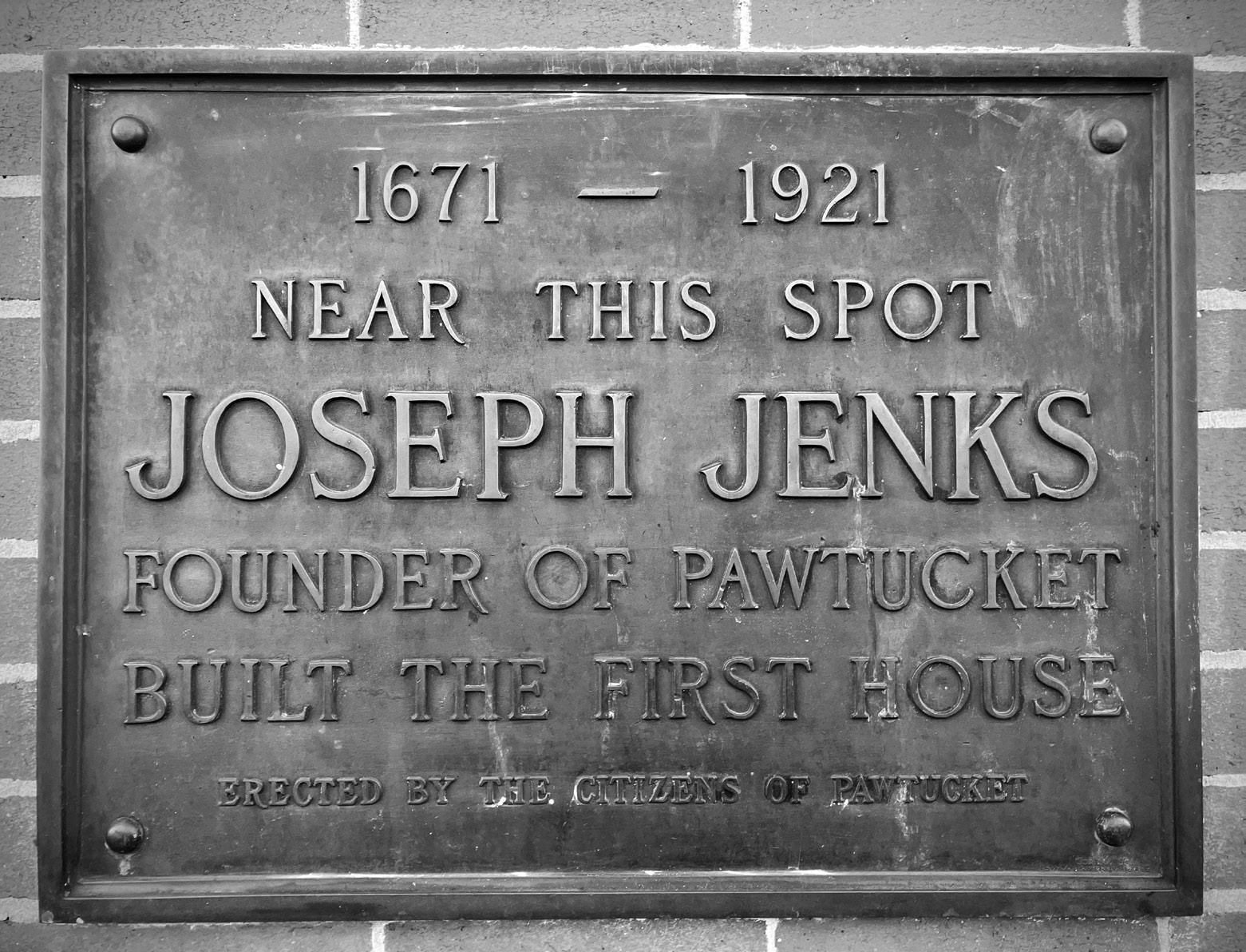
Image of Jenks site plaque taken by the author, location is 53 East Avenue, Pawtucket, RI.
erty was adjacent to Jenks’s and also would be affected by a highway to the falls. Both men probably attended the town meeting on April 27, “whereas there have been long debates this day about pautuckett ffalls.”
Placing a road and proclaiming eminent domain on Jenks’s property drew a guarantee from the town that if “any damage Come to mr Dexter or Jiencks theire landes there abouts,” they promised to “make them reasonably Sufficient sattisfaction out of ye Townes lands Elce where.” Jenks’s prime location along the Rehoboth/Pawtucket highway at the falls involved him with town residents. Townspeople visiting the fishing commons witnessed Jenks’s rebuilt sawmill. Jenks and his family probably fished with the townspeople, forming connections and building trust with Providence residents.48
Sawmilling likely served as the main source of income for the Jenks family following King Philip’s War due to the high demand for lumber to rebuild homes destroyed during the conflict. Finished boards could be transported just north to Providence along the highway or more easily along the Seekonk River from Jenks’s sawmill to the towns of Rehoboth and Providence farther to the Narragansett Bay towns. Throughout the 1680s, the settlement grew in size and stature. In 1679, Jenks “gave unto Joseph Woodward of this towne foure Acares of Land,” perhaps as a fulltime worker for the mill. In 1681, Joseph’s half-brother Daniel left Lynn and joined the Pawtucket Falls settlement “whereby he may learn and perfect his Trade of his Brother Joseph jenckes.” By 1685, sawmilling remained an integral part of his falls operation when the town requested “twenty shillings in boards belong-
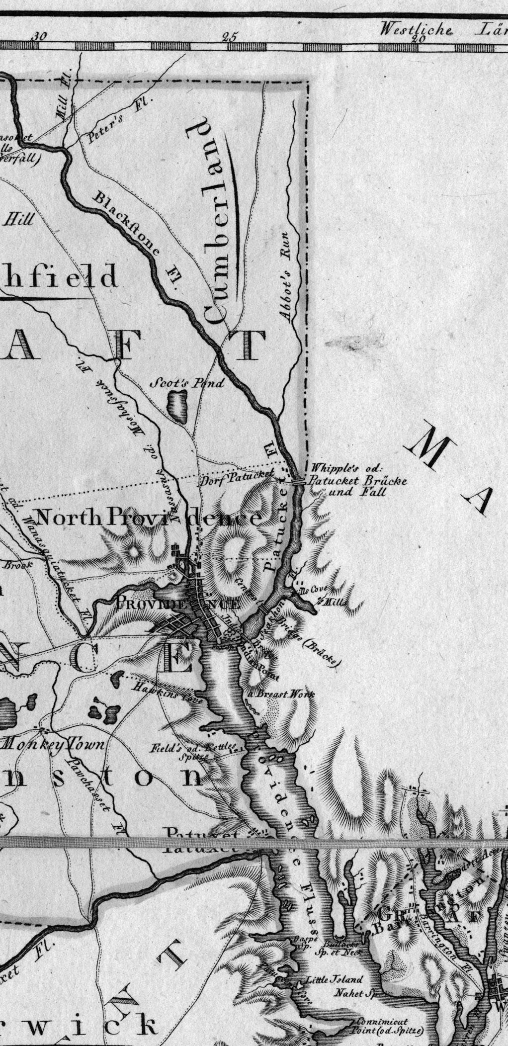
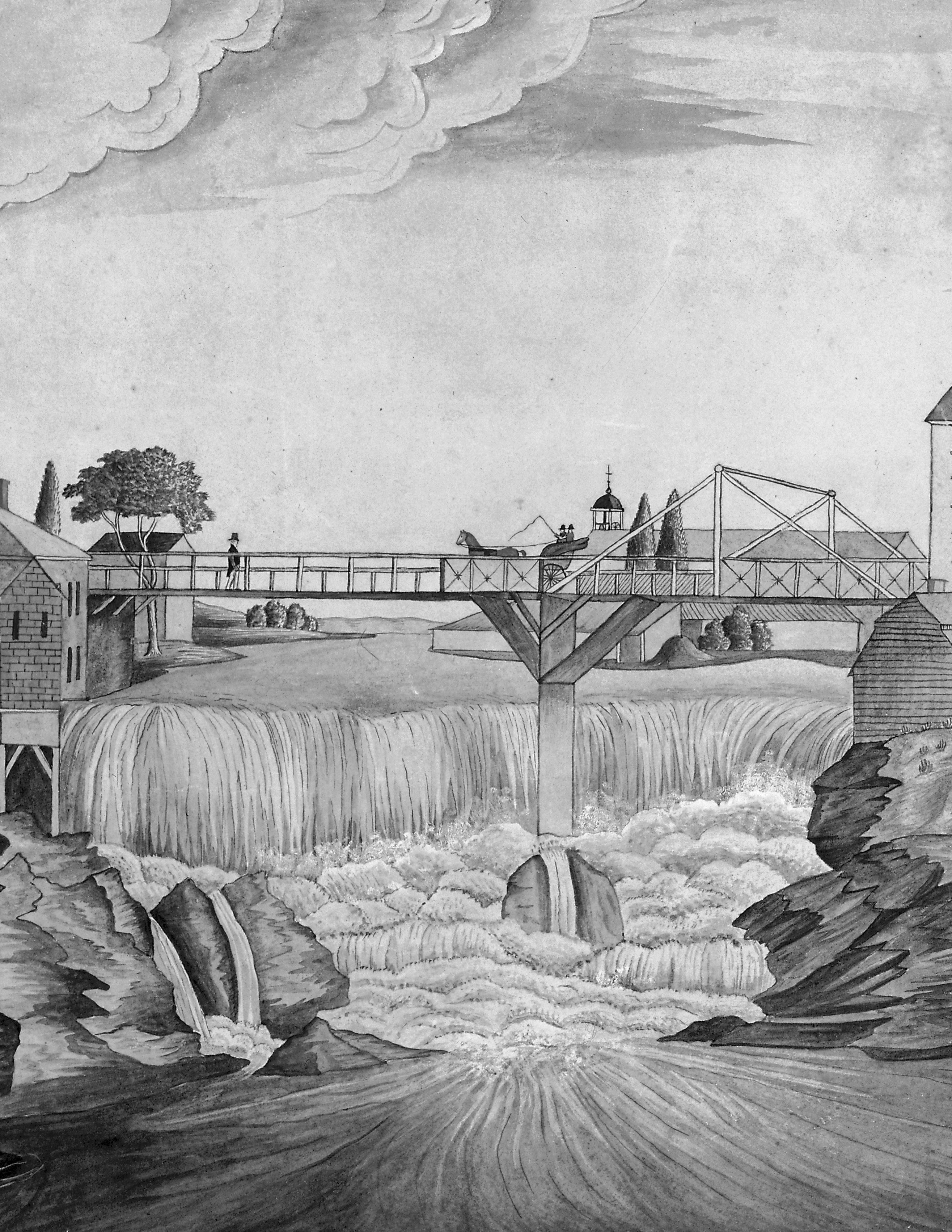
Detail of “Rhode Island” from the Ebeling-Sotzmann Atlas Von Nordamerika (Hamburg, 1797). “Patucket Brücke und Fall” (Pawtucket Bridge and Falls) in the center on the Massachusetts line.
ing to ye Towne” be delivered to Town Recorder John Sanford as payment for debts owed to him.49
Rebuilding the ironworks operation took some time. In January 1684, Jenks petitioned the town for the “Re building of my Iyron woorks” as well as “the liberty to make [use] of any lodgemine...in this towne-
shipe...that is not yet layd out [unto] any pertiqueller person....” This “lodgemine” presumably referred to making use of any common lands or original proprietor rights to lands containing bog iron ore. The ironworks operation was back online by 1688, when Jenks’s estate assessment included this entry: “my fordge.”50 The demand for iron among Rhode Island farmers and craftsmen included tools such as “chains for hauling logs, ox-plows, and carts, or for oaken buckets that hung in the wells, and also barrel hoops, locks, latches, and other ironwork for new houses.” Shipbuilding, a growing New England industry, required metal for “small anchors, bolts, and a variety of metal fittings for shipyards.”51
Pawtucket Falls grew into an important center of industrial production, and the Jenks family prospered as the colony’s agricultural and merchant industries expanded. In 1688, Providence estates underwent tax assessments, including those of Jenks and his two sons, Joseph III and Nathaniel, totaling thirteen shillings and two pence. This assessment included fortysix acres of land for Jenks, four for Joseph III, and two for Nathaniel, with “purchhis Right” on the land held in trust by the original proprietors; numerous domesticated animals for each, including cattle, horses, and pigs; “my sloope littell improved, my saw mill...”; and “my fordge.”52 The Jenks family continued to grow, multiply, and achieve success in Pawtucket. Through their daily interactions and business dealings with townspeople, merchants, and fellow landowners, the Jenkses earned the trust of their neighbors and gradually integrated themselves into a network of influential elites who held political power.
Joseph Jenks Jr., Freeman
Jenks’s move from Massachusetts to Rhode Island brought him under the jurisdiction of a new colonial government. Rhode Island’s Royal Charter of 1663 established a central colonial government with executive authority vested in the governor, his deputy, and ten assistants or magistrates. These offices, along with locally elected deputies from each town, formed the General Assembly of Rhode Island. The Rhode Island colonial town served as the nucleus of local civic authority. Roger Williams founded Providence as a communal democratic experiment where “all the heads of families would meet to decide what direction the community should take.”53 Over time, this evolved into regular town meetings that maintained a large degree of autonomy during the first decades of settlement. The Royal Charter continued to grant some degree of local autonomy, but town meetings had to include colonial assistants.54
The Rhode Island colony operated as a limited democracy. Freeman civic status, an English institution, connoted the ability to participate in civic and political life in the seventeenth century. Since the Rhode Island government functioned as a mixed government system, residents could obtain freeman status in both town and colonial capacities. Town freemen could vote for local appointments (town council, constable, etc). Freemen of the colony could vote for governor, assistants, and deputies to represent them from the towns and hold colonial office.55
On May 1, 1677, the Rhode Island General Assembly voted to admit Joseph Jenks and five others from
Providence as “freemen of this Collony.”56 He had an estate within the town and either petitioned the colony for permission or received a recommendation from officers of Providence. Jenks now could participate in voting for the civic leadership of his town, and colonial representatives could even hold office. In 1679, he was elected deputy to the colonial general assembly and served on the colonial trial court.57 In 1680, he was elected as an assistant, one of ten chosen to serve in an executive capacity for the colony under the governor and deputy governor. He was reelected to this post annually through 1686 and again from 1689 to 1691, 1695, 1696, and 1698.58
The growth of colonial Rhode Island did not happen in isolation. The New England colonies were connected to the mother country, and much of Jenks’s civic career involved colonial issues tied to the larger English Atlantic world. Throughout his years in office, Jenks served both Providence and Rhode Island in numerous capacities, playing a role in local matters and participating in Rhode Island’s larger political history, especially in the last two decades of the seventeenth century. Below, we will explore a sample of examples highlighting his political tenure, thereby illustrating his leading role within Rhode Island colonial civic life and his ascension politically.
Jenks’s first year in government as a Providence deputy focused primarily on intercolonial land disputes over the former Narragansett Country and the Mount Hope peninsula.59 In July, he joined a committee with six other assembly members, the governor, and the deputy governor. Their responsibilities included responding to a letter from King
Charles II earlier in the year. The committee had to establish “that a true account may be rendered his Majesty concerning Mount-hope Neck” and “That an account soe farr as we are able, may be given to his Majesty concerning the late warr with the Indians.”60 The committee completed the letter on August 1. The authors assessed Mount Hope’s arable land and value and also asserted that “wee humbly conceive by your Majesty’s gracious Charter to us granted... within which limmitts the said lands called Mounthope Neck...is situated.” They argued the boundaries of the 1663 Royal Charter, which stipulated that “the easterly bounds whereof [Narragansett Bay] extends itself to the eastward of the said Bay three English miles.” The authors addressed the Narragansett Country, accusing Massachusetts and Connecticut of “endeavor[ing] to insult over your loyall people, and have forbidden us the exercise of your Royall pleasure,” and of “consult[ing] to dispose of the said Province lands, as their conquest.” They ended with a plea, asking that “such of this your Collony, that want settlements, may be supplyed out of those vacant lands, unsettled in your said Province, before any others.”61 Appeals to authority from Rhode Island, Massachusetts, and Connecticut over Narragansett Country continued throughout the following decades.
Jenks’s competence as a representative quickly earned him esteem. As stated above, in 1680 he was elected colonial assistant. In this role, he served as one of ten advisers to the governor on administrative matters. Assistants met with deputies and the governor to form the general assembly, where colonial laws were legislated. They sat on the state courts and managed
administrative duties under the governor’s purview, including auditing, writing correspondence, enacting legislation, and handling boundary issues. They assessed taxable assets and served on town councils, helping to affirm deeds and wills and to administer town business. At the first general assembly meeting, where Jenks was elected an assistant, he was “chosen and empowered to purchase and procure a bell...for giving notice, or signifying the several times or sittings of the Assemblys and Courts of Tryalls, and Generall Councills.”62
Much of the assembly’s time focused on local matters. Rhode Island towns celebrated their autonomy and frequently resisted top-down colonial authority. Municipalities in Narragansett Country refused to accept the colonial government’s jurisdiction. In October 1681, the assembly voted that Jenks “goe to Kings Towne and require and receive the engagements of the Wardens and officers lately chosen in said towne.”63 At a following general assembly meeting in June 1682, Jenks reported that the inhabitants of Kingstown “evaded” their responsibilities. This insubordination “if not timely prevented” was “likely to bee prejudiciall to this Collony.” The assembly responded with resolve by appointing two “Conservators of the Peace” to maintain the abrogated responsibilities of the Kingstonians. They also required a delegation to “conveane the inhabitants” of Kingstown to “read the severall acts of the Generall Assembly for the raising of money for the payment of the Collony’s debts” and to enforce that “townesmen doe elect all their officers respectively.”64 Ultimately, Kingstown did not fully cede to Rhode Island jurisdictional authority until 1696.65
Jenks’s role in Providence also demanded much of his time. As an ex-officio member of the Providence Town Council, Jenks had to serve as a Providence councilman while fulfilling his duties as a colonial assistant. In a July 1680 meeting, the town council addressed the issue of wolves, which consistently plagued colonial New England by “causing ye great damage of our inhabitants.” The council voted that “ye whosoever killleth ye wolves...shall have for Each wolfe (so killed) upon demand payed to them by our Town Treasurer Twenty shillings in Cuntrey pay.” Jenks was among the residents responsible for levying the tax for the wolf bounty. He also took charge of levying taxes for Providence various times throughout his tenure.66
In 1685, King Charles II died, and his brother, James II, ascended to the throne. James prioritized asserting imperial dominance over the New England colonies. Starting in 1685, he worked to implement a unified administrative state known as the Dominion of New England. The king appointed Sir Edmund Andros as royal governor. In June 1686, Edward Randolph, secretary of the dominion, arrived in New England and delivered a letter of quo warranto to Rhode Island and Connecticut. This letter required both colonies to submit their charters to royal authority. Instead, Rhode Island leaders appointed a committee, composed of the governor, deputy governor, Jenks, and three others, to “draw up our humble address to his Majesty,” and to Randolph. The assembly initially resisted the request to submit the charter and pleaded that it should be upheld “both in religious and civil concernments.”67 But, as with other New England colonial governments,
Rhode Island eventually submitted to the new king’s authority. Only a month later, Jenks and Providence leaders confirmed this inevitability and recommended to the assembly “that our minds ar that ther be a surender or prosterating our Charter and the priviledges...unto our gratious sovereign lord King James the second.”68
The Dominion of New England was much different from what Roger Williams had envisioned. The new government was “highly centralized and oligarchic in character.” Rhode Island as a county of the dominion was represented by seven justices.69 Jenks and many other locally elected leaders did not participate in the new government (and probably were not invited to). They did not align with the same circles as the well-connected social elite who “liked its authoritarian quality, its bestowal of power on gentlemen of the place..., without sullying them with a requirement of being elected.”70 In fact, it may have centered more around wealth and influence rather than views on its “authoritarian quality.” All but one justice hailed from outside Providence and mostly represented the largest, wealthiest town of Newport. Jenks’s power centered in his locality, in the trust built in his local northern Providence where he had lived for years, where he hired workers, fished with neighbors, and performed marriages. He was a well-respected craftsman and businessman within the community. His deeds upheld democratic principles of local governance. He was not of the aristocratic-adjacent leaders that came to power during the period of the dominion and therefore maintained his individual capacity as a townsman. Overall, the dominion generally was ineffectual in Rhode Island
as it struggled to be implemented in its entirety.71 Its short reign was toppled in April 1689, when the Glorious Revolution swept King William and Queen Mary into power, overthrowing James II and quickly dismantling the dominion’s rule in Rhode Island. In response to the unfolding events in England, Bostonians revolted and deposed Andros. In Rhode Island, Walter Clarke and John Coggeshall, the prior governor and deputy governor in 1686, encouraged all freemen to meet in Newport on May 1, their traditional election day, to reassume their “ancient privileges.”72 When May 1 came, those in attendance wrote a resolve that “we can do no less but to declare that we take it to be our duty to lay hold of our former gracious privileges in our Charter contained, and so to continue the government, always yielding obedience to the Crown of England, and manifesting our allegiance thereunto.”73 The charter was then taken out of hiding from the former Governor Clarke, presented “to the open view of the Assembly,” and returned to his safekeeping. This occasion, which one historian notes as a “self-styled assembly,” was the first official meeting of the general assembly since its dissolution in 1686.74 Not all freemen were pleased with this hasty decision. Many royalists in the colony refused to observe the restoration of the 1663 charter.
During the May 1 assembly, “Mr. Joseph Jencks” was appointed to lead a “committee” with three others to retrieve the records of the colony. But, upon confronting their keeper, Thomas Ward, he “refuseth to deliver them without they be taken out of his hand by distraint.”75 Ward was not alone in resisting; Francis Brinely, the chief justice of the Rhode Island Court
under Andros, wrote in February 1690 that things had gotten out of control: “We can never govern ourselves with justice nor impartiality, unless there be a good government established here, as in the other Plantations.”76 As 1689 came to a close, the “republican” faction that included Jenks and other popularly elected representatives was successful in its assertiveness. They had their royal charter and the people behind them.
Eight months following the May 1 assembly, Jenks and several others sent a petition to the new monarchs justifying their actions:
“to extend your fatherly care in the granting a confirmation to our Charter, which although it was submitted to his late Majesty, nevertheless it was not condemned nor taken from us; and therefore since the late Revolution, concerning Sir Edmund Andros, his being deposed from the government, we your Majesties’ subjects, being destitute of government, saw cause under grace and favor, to re-assume the government according to our Charter, the 1st of May last past, being the Election day appointed by our said Charter, in which Assembly it was ordered, that the former Governor, Deputy Governor, and Assistants that were in place in the year of our Lord 1686....”77
Since the charter never was officially revoked, leaders in Rhode Island argued that since they were “destitute of government,” reverting to the Royal Charter was the most just, logical, and expedient remedy. These leaders knew what they were doing and took advantage of
the power vacuum in the American colonies created by the 1689 revolution. In actuality, they staged a peaceful coup—one that technically was legal since their charter had not been officially revoked. The ascension of William and Mary thrust England into a war with France. How the colonies would be governed was not their top priority in the immediate aftermath of the revolution. The gamble worked, and by 1690, the Rhode Island colonial government had fully resumed operation under its 1663 Royal Charter.
Two decades after the death of Metacom, colonial boundaries on the eastern line of the colony, where the Pokanoket originally had lived, still caused intercolonial flare-ups.78 One such flash point over the disputed land occurred in 1695. On July 2, the general assembly appointed a group including “Mr. Joseph Jencks,” to “run the eastern line of our Colony...according to the best of their understanding.”79 Jenks and his party journeyed to the boundary line with Massachusetts Bay and confronted the Freetown residents. Commander John Saffin, a leader of the Massachusetts colony, met the Rhode Island delegation late in the afternoon and “demanded to know the cause of their coming thither.” Jenks, the “chief speaker,” responded that they were there to run the Rhode Island boundary line. Jenks also asserted that they should read the queen’s letter to the colony so that “his Majesty’s Subjects in these parts might know their duty and privileges” according to the colonial boundaries under Rhode Island’s Charter. Saffin claimed that Jenks and his party were trying to “stir up the people.” He continued his discussion with “long winded Jenks” for most of the night and only managed to dismiss the
l eft: The Rhode Island General Assembly’s declaration dated May 1, 1689. Records of the General Assembly, State Archives, Providence, RI. Image taken by the author.
r ight: The Rhode Island General Assembly’s minutes dated May 1, 1689. Records of the General Assembly, State Archives, Providence, RI. Image taken by the author.
Rhode Islanders the next day. Saffin reassured the leaders of Massachusetts that “there is not one in ten of all the people in these parts...that desire to be under Rhode Island Government.” Jenks, an aging leader in his late sixties, embodied a general vitality and a commitment to civic duty. This instance also hints at his outspoken and argumentative personality reminiscent of his 1661 imprisonment, although probably somewhat refined over almost two decades of leadership experience. This event highlights Jenks’s belief in the mission of his colony: that those technically within the boundaries of Rhode Island should “know their duties and privileges;” that they too could participate in a more robust civic atmosphere.80
Jenks played a role in creating a bicameral legislature, a major shift in the colony’s government that reflected both English political traditions and the colony’s growth. In 1696, the number of colonial deputies increased as more towns joined Rhode Island. While serving as an assistant, Jenks and the general assembly passed a law establishing an upper house composed of the governor, deputy governor, and assistants, as well as a lower house of town-elected deputies. This change addressed “a great hindrance in the Managing of the Publick Affairs of the Government.”81 Ineffective tax collection and growing demands from localities led to the adoption of this new system, which thereby elevated the role of the Deputies.82 This bicameral structure continues to this day, with the upper and lower houses evolving into the modern State Senate and House of Representatives.
By the early 1700s, Jenks, in his seventies, began to slowly retreat from holding colonial office. He served
in a local capacity on the town council and in different town offices. His name continued to appear in local records in performing marriages and recording deeds. In 1708, he drew up his will, “being now Very aged & by Reason of age become weake of body.” He was still alive in 1713, working with his sons to help erect the first bridge over Pawtucket Falls, which connected Rehoboth and Providence. As earth was needed to support the construction of the bridge and more construction widened the river, a trench was beginning to be dug to the western side of his settlement as an avenue for fish to swim upstream. The falls were changing, and throughout the following decades, the growing Pawtucket village would attract more milling operations. Jenks in his final years undoubtedly spent time reflecting on how much the settlement had grown in the previous four decades. He died in 1717, at the presumed age of 89.83
All of his sons followed in his footsteps by holding public office. Joseph Jenks III surpassed his father’s record of service, boasting twelve terms as deputy of Providence, including two as speaker of the House of Deputies. He served as an assistant from 1708 to 1712. For all but one term from 1715 to 1727, he served as deputy governor under the stalwart leadership of Samuel Cranston. After Cranston’s death, Jenks became governor of the Colony of Rhode Island, serving from 1727 to 1732. His second son, Nathaniel Jenks, achieved the rank of major in the colonial militia, served in various capacities as deputy and town councilman, and helped build the Pawtucket bridge. Ebenezer, continuing Rhode Island’s tradition of religiously divergent leaders, became a minister for the
First Baptist Church. His youngest son, William, known as Judge William Jenks, also participated in local and colonial government, serving as chief justice of the Providence County Court and playing a significant role in boundary negotiations with Massachusetts in the 1740s. Joseph Jenks Jr. left “unto my Two sons, namely, Ebenezer and William: my Cole house and halfe of the fforge to be Equally betwene them two.”84 This implies that Jenks had partnered with another investor in the forge as it continued to grow well into the eighteenth century. All of his daughters married peers within their esteemed social class, including the Tefts, Whipples, Scotts, and Browns of Providence. The second and third generations continued to grow, and the Jenks legacy had become woven into the fabric of Rhode Island.
Conclusion
Joseph Jenks Jr.’s life exemplifies the transformation of an English economic migrant into a key figure in Rhode Island’s industrial development and political class. His industrial education at Saugus, under his father’s guidance and among a diverse group of workers, not only honed his technical skills but also exposed him to the broader socioeconomic dynamics of early colonial industry. Jenks’s hands-on experience in milling operations across colonial bounds, from Lynn to Pawtucket Falls, equipped him with the knowledge and expertise to found a successful settlement. His keen assessment of Pawtucket Falls as an ideal site for his sawmill and forge profoundly influenced the trajectory of Rhode Island’s industrial
development. His decision to settle there did not happen in isolation but was shaped by the larger forces of the expanding English Atlantic economy, which rewarded skilled artisans capable of capitalizing on available resources. The colony’s growing demand for industrial labor allowed ironworkers such as Jenks to thrive, planting the seeds of a future industrial economy at the falls. Rhode Island, founded by dissenters who valued liberty of conscience and democratic governance, proved a fertile ground for someone with Jenks’s temperament. His success in industry facilitated his rise in the colony’s political sphere, where his leadership helped shape both policy and civic governance, cementing his place at the forefront of Rhode Island’s most pressing colonial matters. Jenks looms large in Rhode Island’s history, but his fuller legacy has been overlooked. Researchers of industrial history tend to focus on succeeding generations, including Samuel Slater, the Wilkinsons, and the era of the first industrial revolution in America, with brief mention of Joseph Jenks Jr. While details of his forge and smithing operation at the turn of the seventeenth century are lacking and perhaps should spark further archeological research, ironworking in Pawtucket continued to play a large role in the local economy years after Jenks’s death. His sons continued their ownership and production at the forge, and Pawtucket Falls became synonymous with iron. This legacy influenced Oziel Wilkinson’s move to Pawtucket. When Samuel Slater came to Pawtucket, he relied on Wilkinson’s metalworking and engineering in building the first water-powered cotton mill in America.85
It is important to note that Jenks’s story of immigration from Massachusetts to Rhode Island was not only economically but also politically motivated. The trajectory of New England industrial history would have looked different had not the political atmosphere in Rhode Island been less stifling compared with that of Massachusetts in the 1660s. In Rhode Island, Jenks was welcomed as a freeman, trusted by his neighbors, and quickly rose through the colony’s political ranks. The depth of confidence he gained among his peers and constituents by consistently being elected and participating at the forefront of discussions—whether it be in resisting the Dominion of New England, staging a peaceful coup following the Glorious Revolution, negotiating boundary disputes, or presiding over the creation of a bicameral legislature—embodies his views on political life as supposing to be democratic, active, and robust. He actualized this belief through-
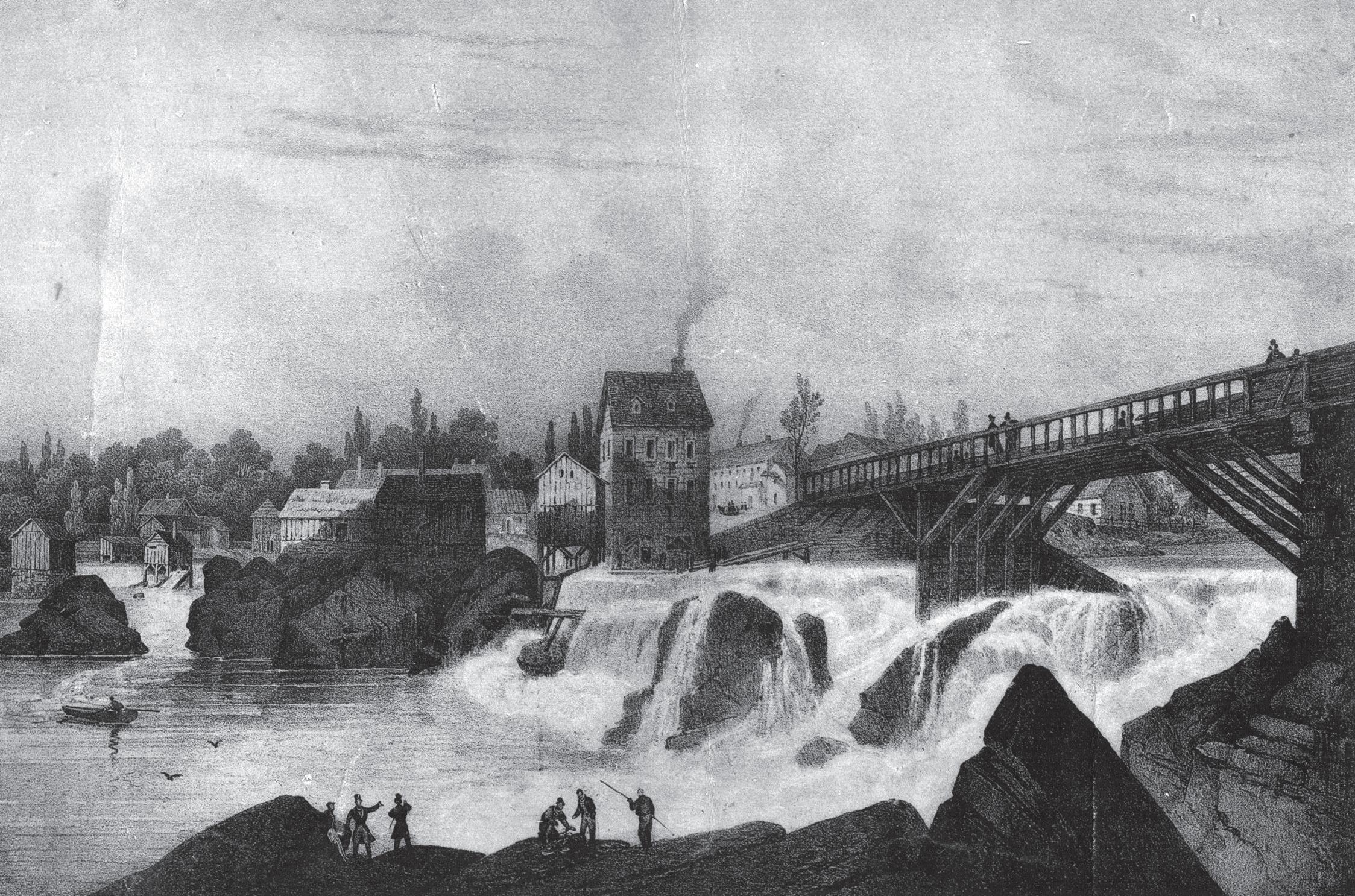
Print representing Pawtucket falls in 1815, courtesy of the Old Slater Mill Association in Pawtucket, RI. The artist is Jacques-Gerard Milbert.
notes
1. Robert Grieve, An illustrated history of Pawtucket, Central Falls, and vicinity: a narrative of the growth and evolution of the community (Pawtucket, RI: Pawtucket Gazette and Chronicle, 1897), PDF, https://www.loc.gov/item/86139384/; Slater Trust Company, Pawtucket, RI Pawtucket, Past and Present; Being a Brief Account of the Beginning and Progress of Its Industries and a Résume of the Early History of the City (Pawtucket, RI: Slater Trust Company, 1917), PDF, https://www.loc.gov/item/17003765/; John Williams Haley, The Lower Blackstone River Valley; The Story of Pawtucket, Central Falls, Lincoln, and Cumberland, Rhode Island; An Historical Narrative (Pawtucket, RI: Lower Blackstone River Valley District Committee of The Rhode Island and Providence Plantations Ter-
out his career, and passed this trait onto his children as their political successes surpassed his own.
Joseph Jenks Jr. is memorialized throughout the City of Pawtucket; a street near the original settlement and a middle school currently bear his name. He is buried at the historic Mineral Spring Avenue Cemetery with his sons. Industrial entrepreneurs, such as the Wilkinsons and Samuel Slater, followed in his footsteps and built upon his industrial vision. The Jenks clan continued to play a significant role in Rhode Island’s history and has since multiplied and migrated to every corner of the United States. Today, countless family histories proudly trace their lineage back to Joseph Jenks Jr., settler of Pawtucket Falls.
Jonathan Cipriano is a social studies teacher at Slater Middle School in Pawtucket, Rhode Island. He earned his bachelor’s degree in history from Rhode Island College and is currently pursuing a Master’s in American history at Gettysburg College.
2. Margaret Ellen Newell, From Dependency to Independence: Economic Revolution in Colonial New England (Ithaca, NY: Cornell University Press, 1998), 57–58, e-book accessed September 3, 2024.
3. Rhode Island (Colony), Records of the Colony of Rhode Island and Providence Plantations, in New England, Printed by order of the General Assembly, John Russell Bartlett (Providence, RI: A. C. Greene et al., 1856–1863) (hereafter referred to as RI Records).
4. Newell, 51–55.
5. Ibid., 55.
6. Hartley, 93
centenary Committee Inc./E. L. Freeman Co., 1937) First Edition; Susan Marie Boucher, The History of Pawtucket (Pawtucket, RI: Pawtucket Public Library, 1986). The coordinated efforts of the mid-twentieth century produced two important works regarding Joseph Jenks and his time at Saugus: E. N. Hartley, Ironworks On the Saugus: The Lynn and Braintree Ventures of the Company of Undertakers of the Ironworks in New England (Norman, OK: University of Oklahoma Press, 1957); William A. Griswold, Donald W. Linebaugh, and United States National Park Service, Saugus Iron Works: The Roland W. Robbins Excavations, 1948–1953 (Washington, DC: National Park Service, US Department of the Interior, 2010) (hereafter referred to as Saugus Iron Works).
7. Ibid., 128.
8. William Bradford Browne and Meredith B. Colket, The Jenks family of England; supplement, compiled under the terms of the will of Harlan W. Jenks, deceased (1956), 4–6; Stephen P. Carlson, Joseph Jenks, Colonial Toolmaker and Inventor, ([N.p.: Eastern National Park and Monument Association, 1981), 3.
9. Charles Edward Banks and Angevine W. Gowen, History of York, Maine, Successively Known as Bristol (1632), Agamenticus (1641), Gorgeana (1642), and York (1652), (Baltimore: Regional Publishing Company, 1967), 142.
10. Browne and Colket, 6–8; Carlson 3–6; Saugus Iron Works,
174–176. Browne and Colket argue Jenks Jr.’s migration after his grandfather’s death as well as David Benedict, Elizabeth J. Johnson, and James Lucas Wheaton, History of Pawtucket Rhode Island: Reminiscences & New Series of Reverend David Benedict: Origins of Pawtucket, East Side (Pawtucket, RI: Spaulding House Publications, 1986). Benedict was the nineteenth-century minister and local Pawtucket historian who communicated with descendents of the Jenks family.
11. Hartley, 171–184.
12. Saugus Iron Works, 178.
13. Massachusetts, Nathaniel Bradstreet Shurtleff, and Massachusetts General Court, Records of the Governor and Company of the Massachusetts Bay in New England: Printed by Order of the Legislature (Boston: W. White, 1853), V3: 65, (hereafter referred to as Massachusetts Records).
14. Carlson, 9; Hartley 127–128.
15. Saugus Iron Works, 180; Richard Candee, “Merchant and Millwright, the Water Powered Mills of the Piscataqua,” Old Time New England, 60, no. 220 (Spring 1970): 138.
16. Carlson, 10.
17. Saugus Iron Works, 182
18. Boston Records Commissioners, Second Report of the Records
Commissioners: Boston Town Records (Boston, 1877), 118; Massachusetts Records, V3: 386, V4 Pt. 1: 233–4; Ibid., V4 Pt. 2: 528 quoted in Carlson, 13–15.
19. We do not know the status of Thomas and Anthony. What obfuscates their status is that following the Pequot War of 1636–7, many Pequots were subjected to servitude throughout New England, by both Indigenous nations and English colonists: Margaret Ellen Newell, Brethren by Nature: New England Indians, Colonists, and the Origins of American Slavery (Ithaca, NY: Cornell University Press, 2015). At the same time, if they were not subject to servitude, ministers in New England such as John Eliot sought to impose Christianity on Native villages and to coerce them into assimilation while Native peoples continued to adapt: James Axtell, The Invasion Within: The Contest of Cultures in Colonial North America (New York: Oxford University Press, 1985); Neal Salisbury, “Red Puritans: The ‘Praying Indians’ of Massachusetts Bay and John Eliot,” The William and Mary Quarterly 31, no. 1 (1974): 27–54; Jacqueline M. Henkel, “Represented Authenticity: Native Voices in Seventeenth-Century Conversion Narratives,” The New England Quarterly 87, no. 1 (2014): 5–45.
20. Hartley, “Chapter 10.”
21. “Family of William Ballard of Lynn with wife Elizabeth,” in The Great Migration: Immigrants to New England, 1634–1635 (Boston: New England Historic Genealogical Society) V1: 148. PNG accessed on July 25, 2024.
22. Massachusetts Records, V3, 243.
23. Alonzo Lewis and James Robinson Newhall, History of Lynn, Essex County, Massachusetts: including Lynnfield, Saugus, Swampscot, and Nahant (Boston: J. L. Shorey, 1865), V1: 233.
24. Massachusetts Land Records, 1620–1986, Essex, Deeds 1639–1658, Vol.1: 54–55; Essex County Court Records, 1648–1655, image 494, accessed August 20, 2024; Carlson 11–12 also references the court proceedings as “vague”; it is clear that Jenks received damages upwards of seven pounds, but as to why is unknown.
25. Massachusetts Records, V4, pt.1: 311
26. Hartley, 278; “Deed from Joseph Jenks to Nathaniel Paine,”
Massachusetts Land Records, 1620–1986, Middlesex Deeds V4, 487–490, accessed August 24, 2024.
27. Hartley, 153; Benno M. Forman, “Mill Sawing in Seventeenth Century Massachusetts,” Old Time New England 60, no. 220 (1970): 116, PDF, accessed August 24, 2024.
28. Paul R. Lucas, “Colony or Commonwealth: Massachusetts Bay, 1661–1666,” The William and Mary Quarterly 24, no. 1 (1967): 88–107. For a broader discussion on the geopolitical situation in an Atlantic context: Jenny Hale Pulsipher, Subjects unto the Same King: Indians, English, and the Contest for Authority in Colonial New England (Philadelphia: University of Pennsylvania Press, 2005).
29. Massachusetts State Archives Collection, colonial period, 1622–1788, V102 “Political 1638–1700,” 28a–34a, images 458–469, accessed August 25, 2024.
30. Middlesex County Court Records, Card index to court papers, Gr-Mem 1636–1785 images 2961–2965, accessed June 22, 2024; Middlesex County Court Records, Court papers - Folios 27–60 1647–1672, Folio 40 Group 3 Image 580, accessed June 22, 2024.
31. Grieve, 34.
32. For a general analysis of Puritan society in practice: Francis J. Bremer, The Puritan Experiment: New England Society from Bradford to Edwards (Lebanon, NH: University Press of New England, 1995). Hartley also discusses the social life of the workers and their families at Hammersmith and their inflated number of court appearances in great detail: Hartley, 202–207.
33. There is much debate over freeman status in seventeenth-century Massachusetts, but it is undoubtedly clear that legally, the Bay Colony required a religious component: Robert Emmet Wall, “The Decline of the Massachusetts Franchise: 1647–1666,” The Journal of American History 59, no. 2 (1972): 303–10; B. Katherine Brown, “The Controversy over the Franchise in Puritan Massachusetts, 1954 to 1974,” The William and Mary Quarterly 33, no. 2 (1976): 212–41. For Rhode Island, the Rhode Island Secretary of State’s website created an annotated version of the Royal Charter for educational purposes, and it is just as useful for anyone to quickly and efficiently read and analyze the document in its
entirety: “Rhode Island Royal Charter, 1663,” Rhode Island Secretary of State, accessed August 23, 2024. To understand freeman status in Rhode Island: Patrick T. Conley, Democracy in Decline: Rhode Island’s Constitutional Development 1776–1841 (East Providence, RI: Rhode Island Publications Society, 1977, reprinted 2019), 46–48; Patrick T. Conley, “A History of Election Tickets in Rhode Island,” Small State Big History (website), February 23, 2024, https://smallstatebighistory.com/a-history-of-election -tickets-in-rhode-island/
34. Grieve, 37.
35. Carl Bridenbaugh, Fat Mutton and Liberty of Conscience: Society in Rhode Island, 1636–1690 (Providence, RI: Brown University Press, 1974) 79.
36. Providence. Record Commissioners, Daniel F. Hayden, William G. Brennen, and William C Pelkey, The Early Records of the Town of Providence, V. I-XXI ... Printed under authority of the City council, edited by Horatio Rogers, George Moulton Carpenter, Edward Field, and William E. Clarke, (Providence, RI: Snow & Farnham, city printers, 1892–1912), V4: 6–7, accessed August 22, 2024 (hereafter Providence Records).
37. “Deed from Joseph Jenks to Nathaniel Paine,” Massachusetts Land Records, 1620–1986, Middlesex Deeds Vol. 4, p 487–490, accessed August 24, 2024.
38. Providence Records, V3: 285.
39. “Pawtucket Falls” National Park Service, accessed August 22, 2024. Many scholars continue to use the larger distinction of Wampanoag confederation to relate information on Southern New England Indigenous peoples, but the Pokanoket are the tribal nation that resided in the region of this study; for more, see: Students of Roger Williams University, Pokanoket: The First People of the East Bay (Bristol, Rhode Island), PDF booklet, http://www .drweed.net/PokanoketBooklet.pdf. Scholarship on how colonial English and Native cultures changed by interacting with the environment includes William Cronon, Changes in the Land: Indians, Colonists, and the Ecology of New England, 1st rev. ed., 20th Anniversary ed. (New York: Hill and Wang, 2003); Neal Salisbury, Manitou and Providence: Indians, Europeans, and the Making of New England, 1500–1643 (Oxford: Oxford University Press, 1982).
40. Roger Williams, “Memorandum of original deed for Providence, December 10, 1666,” Rhode Island Secretary of State Catalog, accessed August 23, 2024. Throughout the past few decades, recent scholarship has brought new perspectives of the “Providence Purchase” that question and help reorient understandings of how the lands of Providence, and all of Rhode Island, were obtained throughout the first decades of colonization: Anne Keary, “Retelling the History of the Settlement of Providence: Speech, Writing, and Cultural Interaction on Narragansett Bay,” The New England Quarterly 69, no. 2 (1996): 250–86; Jeffrey Glover, “Wunnaumwáyean: Roger Williams, English Credibility, and the Colonial Land Market,” Early American Literature 41, no. 3 (2006): 429–53.
41. Without archaeological evidence, it is tough to recreate the operation that Jenks had built when he first arrived: Robert B Gordon, American Iron, 1607–1900 (Baltimore: Johns Hopkins University Press, 1996) 7–10, 14; he describes it as most likely a bloomery operation 65–66. There is a deposition from an 1812 federal court case of Benjamin Jenks that recounts the forge probably a century after its original construction: “Seargent’s Trench: Deposition of Benjamin Jenks,” The Flyer, Old Slater Mill Association, Vol III, no. 5 (May 1972): 11.
42. Grieve, 38, infers that he was able to operate a successful business “with work-men trained in his father’s shops at Lynn.” Grieve was unaware of Jenks’s residence in Concord, but it does not deter from the fact that Jenks and his firstborn would not have been able to build and operate a sawmill and forge by themselves.
43. Grieve, 41.
44. Mark Mello, Slater Mill Historic Site Park Ranger, email message to the author, January 21, 2024.
45. Grieve; John Osborne Austin and George Andrews Moriarty, The Genealogical Dictionary of Rhode Island; Comprising Three Generations of Settlers Who Came before 1690, with Many Families Carried to the Fourth Generation (Baltimore: Genealogical Publishing Company, 1887), and David Benedict mention this. Unfortunately, there is no documentary evidence confirming Jenks was able to erect a forge and sawmill prior to the war; this history seems to have been passed down orally through generations and reiterated through Benedict but cannot be confirmed.
46. After the Puritan-led forces mounted a horrific attack upon the neutral Narragansett in December, the Narragansett confederation entered the war on the side of Metacom. They were led by the fierce sachem Canonchet, who during the spring of 1676 initiated an offensive through the Blackstone River Valley. Jenks’s forge, sawmill, and all the houses in the vicinity were destroyed. Jenks likely joined his fellow Providence residents and fled to Aquidneck Island to wait out the war. Recent scholarship of King Philip’s War is fascinating and helps to reorient our understandings of the conflict: Lisa Tanya Brooks, Our Beloved Kin: A New History of King Philip’s War, Henry Roe Cloud Series on American Indians and Modernity (New Haven, CT: Yale University Press, 2018); Christine M. DeLucia, Memory Lands: King Philip’s War and the Place of Violence in the Northeast, Henry Roe Cloud Series on American Indians and Modernity (New Haven, CT: Yale University Press, 2018); Daniel R. Mandell, King Philip’s War: Colonial Expansion, Native Resistance, and the End of Indian Sovereignty (Baltimore: Johns Hopkins University Press, 2010).
47. Providence Records, V15: 189.
48. Ibid., V8: 25, 28.
49. Ibid., V8: 55, 107, 152.
50. Ibid., V17: 14, 119.
51. Brindenbaugh, Fat Mutton 79–80.
52. Providence Records, V17: 119.
53. Sydney V. James (Sheila L. Skemp and Bruce C. Daniels, eds.), The Colonial Metamorphoses in Rhode Island: A Study of Institutions in Change (Hanover, NH: University Press of New England, 2000), 16.
54. “Rhode Island Royal Charter, 1663,” Rhode Island Secretary of State, accessed August 23, 2024; Sydney V. James, Colonial Rhode Island: A History (New York: Scribner, 1975), 72–74; James, Metamorphoses, 52.
55. Conley, Democracy in Decline, 46–48; Patrick T. Conley, “A History of Election Tickets in Rhode Island,” Small State Big History, February 23, 2024, https://smallstatebighistory.com /a-history-of-election-tickets-in-rhode-island/.
56. RI Records, V2: 564.
57. Providence Records, V8: 47.
58. Osborne, The Genealogical Dictionary of Rhode Island, 113. One of the issues with the documentary record is that there was not just one civically engaged Joseph Jenks. Jenks’s eldest son, Joseph Jenks III, the future governor of Rhode Island, moved with his father to Rhode Island colony and frequently is referred to as “Joseph Jenks, Jr” in the colonial records. Both Jenkses served in various capacities at the local and state level and navigating between the two in the RI Records and Providence Records has caused inconsistencies in the historical record. According to my analysis, The Genealogical Dictionary is relatively accurate when cross-referencing both RI Records and Providence Records and taking into account age and political trajectory.
59. Narragansett Country, or King’s Province, refers to the lands previously inhabited by the Narragansett nation as subjects of the King of England, much of current-day Washington County. After King Philip’s War, the Narragansett nation was subject to servitude and deportation to the Caribbean, while some migrated to various tribal nations as part of kinship networks; this left Narragansett Country under the jurisdiction of the Crown. Mount Hope refers to the peninsula on Narragansett Bay including present-day Warren and Bristol, and after the destruction and dislocation of the Pokanoket during the war, this land also was under jurisdiction of the Crown. Both lands were vehemently contested by Massachusetts, Plymouth, Rhode Island, and Connecticut.
60. RI Records, V3: 36–39.
61. Ibid., V3: 43–46.
62. Ibid., V3: 85.
63. Ibid., V3: 103.
64. Ibid., V3: 114–115.
65. James, Metamorphoses, 94.
66. Providence Records, V8: 80.
67. RI Records, V3: 192–194.
68. Providence Records, V17: 77.
69. Viola Florence Barnes, The Dominion of New England: A Study in British Colonial Policy (New York: F. Ungar Pub. Co., 1960), 72–73.
70. James, Metamorphoses, 57.
71. Samuel Greene Arnold, History of the State of Rhode Island and Providence Plantations, Vol. 1 (New York: D. Appleton and Company 1859), 500; David S. Lovejoy, The Glorious Revolution in America (New York: Harper & Row, Publishers, 1972), 198–203.
72. RI Records, V3: 257.
73. RI Records, V3: 269: In Bartlett’s recording, he noted the date was 1690, but this is not correct. Upon visiting the state archives, I uncovered that the actual date was “this first of May Anno Domini 1689”: Proceedings of the General Assembly of Rhode Island, Vol. 5 1689–1700, Rhode Island State Archives, Providence, RI, 1.
74. James, Metamorphoses, 59.
75. RI Records, V3: 269: In Bartlett’s recording, he noted the date again was 1690; but this is not correct. Upon visiting the state archives, I uncovered that the actual date was “this first of May Anno Domini 1689”: Proceedings of the General Assembly of Rhode Island, Vol. 5 1689–1700, Rhode Island State Archives, Providence, RI, 2.
76. RI Records, V3: 259.
77. Ibid., 258.
78. John Hutchinson Cady, Rhode Island Boundaries 1636–1936 (Providence, RI: Rhode Island Tercentenary Commission, 1936), Internet Archive PDF, accessed September 1, 2024. After 1663, both Plymouth and Rhode Island had overlapping claims to land. The original Plymouth patent claimed land east of the Providence and Seekonk Rivers. Rhode Island’s 1663 Royal Charter stipulated Rhode Island had jurisdiction of “three English miles to the east and north-east Narragansett Bay.” In 1691, Plymouth merged
with Massachusetts and became part of the larger colony. The historic boundary between Rhode Island and Plymouth centered around Pawtucket Falls. North from the falls, the Blackstone River divided Rhode Island and Massachusetts. At this time, the settlement of Cumberland was under Massachusetts jurisdiction since it lay east of the Blackstone. Other towns east of the Runnins/ Barrington Rivers, including Warren, Bristol, Tiverton, and Little Compton, were part of Massachusetts. These towns were contested by both Massachusetts and Rhode Island until 1747. 79. RI Colonial Records, V3: 302.
80. John Saffin, “Joseph Jenks of Rhode Island, John Saffin’s account of said Jenks’s speeches, etc. at Freetown where the Rhode Islanders met to run the easterly line,” Massachusetts State Archives collection, V2: 76, image 1257, accessed September 1, 2024.
81. “Acts and laws, of His Majesty’s colony of Rhode-Island, and Providence-Plantations, in New-England, in America,” In the digital collection Evans Early American Imprint Collection, 24, accessed September 2, 2024, https://name.umdl.umich .edu/N04574.0001.001, University of Michigan Library Digital Collections.
82. James, Metamorphoses, 117.
83. “The Will of Joseph Jenks” in Browne, William Bradford, Genealogy of the Jenks Family of America, 1952, 4–6.
84. Ibid.
85. Brendan F. Gilbane, “Pawtucket Village Mechanics—Iron, Ingenuity and the Cotton Revolution,” Rhode Island History 34, no. 1 (1975).
Fishermen’s Rights and the Governor’s Wall
The Birth of Recreational Shoreline Access Advocacy in Rhode Island, 1850–55
Confli C ts over shoreline access are a recurring theme in Rhode Island and other coastal communities. Ever since the seashore emerged as a popular recreational destination in the second half of the nineteenth century, conflict has existed between those seeking to privatize access to the shore and those seeking to protect or expand public access to it. Despite this long history, few studies of the origins of shoreline access advocacy have been done, whether in Rhode Island or elsewhere. Most studies of shoreline access are legal in nature, focusing on the impact of legislation, court rulings, and legal variations from one jurisdiction to another.1 In these accounts, shoreline access advocates appear as litigants in court, but relatively little attention is paid to the origins of the advocacy groups involved, to the circumstances that shaped their emergence, or to tactics other than litigation employed to advance their goals. Beyond the legal literature, studies of the origins, goals, and tactics of shoreline access advocacy movements are few and focus overwhelmingly on developments from the 1970s onward, paying scant attention to earlier mobilization around this issue.2 How, when, and why did recreational shoreline access advocacy emerge in Rhode Island? Who were the early advocates, and what were the circumstances in which they emerged? What tactics did they adopt, which did they avoid, and why?
This article addresses these questions through a close examination of the most widely circulated origin story of recreational shoreline access activism in Rhode Island. This story, which appeared in complete
form in 1952 in Cleveland Amory’s The Last Resorts, sets the birth of the movement along the cliffs of Ochre Point in Newport in response to the actions of millionaire and former Rhode Island Governor William Beach Lawrence:
Having married the daughter of the wealthy New York merchant, Archibald Gracie, Lawrence purchased, in 1844, almost the whole of Ochre Point for fourteen thousand dollars; many years later he sold for the same sum one acre of this property to a friend of his named Pendleton.
No sooner had the sale been made than the Governor regretted it and proceeded to build a stone wall between the properties. This wall, which extended to the water’s edge, cut off the famous Cliff Walk, which even in those days had long been a favorite of native Newporters, and rising in rebellion, they pulled the wall down. Lawrence promptly rebuilt it, this time facing it with broken glass; he also bought a fierce bull which he pastured in the property. Despite the glass and the bull, Newporters once more pulled the wall down and this time they threw it into the sea. Lawrence promptly took to the courts. The case hinged on the discovery of an old right which gave the fisherman public access to the shore for fishing and collecting seaweed. Carried to the Supreme Court after years of litigation, the case was finally settled in favor of the natives and against Lawrence only after the staging of a test shipwreck. The case established a firm precedent. To this
day the right of Newport natives to walk between beach and lawn around the great estates, beginning at Forty Steps and traveling around Ochre Point, Rough Point and finally to Bailey’s Beach itself, is inviolate.3
This account subsequently was repeated, with only minor variations, in numerous books and articles about Newport.4 In these retellings, Lawrence is described as “an irascible, unpredictable millionaire”5 best remembered for “his long (and unsuccessful) contest against townspeople who wanted to preserve the right of public access to the cliffs along Newport’s eastern shore, even if this meant walking across Lawrence’s lawn.”6
Earlier versions of this story appeared long before the publication of The Last Resorts. In 1932, former U.S. Representative Herbert Pell, in a luncheon address on the deteriorating condition of Cliff Walk, observed, “There is at least one improvement since the days of my youth. There is no herd of cattle to terrorize small boys on the Governor Lawrence place.”7 Two years later, during a city council debate over asking for federal aid to repair Cliff Walk, Alderman John Mahan “recalled how Governor William Black [sic] Lawrence had built a wall, and how it was smashed down.”8 Since neither Pell nor Mahan could have witnessed the events in question, and since both assumed their listeners were familiar with the story, it was clearly in wide oral circulation by the early twentieth century.9 Like many legends, this story contains important
grains of truth. Lawrence did indeed build a wall studded with broken glass along the Newport cliffs in the early 1850s, and he raised cattle on his property. Lawrence’s wall sparked a campaign to protect recreational access along the path that later became Cliff Walk, and this campaign was grounded on the colonial concept of “fishermen’s rights.” Beyond these grains of truth, however, the legend presents an entirely incorrect picture of Lawrence’s motives, the reaction within Newport, the nature and outcome of the associated court case, and the strategy pursued by shoreline access advocates at the time.10
First, Lawrence’s wall was not provoked by real estate regret or an irascible determination to keep pedestrians off the grass. Instead, Lawrence built the wall to defend his property from a neighboring landowner, David Priestly Hall, who claimed the right to extract unlimited quantities of gravel, stones, and seaweed from a beach abutting Lawrence’s property. In 1849 and 1850, Hall’s tenant broke through Lawrence’s gate to gain access, and Lawrence responded by erecting a more formidable barrier.
Second, while the Lawrence-Hall dispute was litigated before the state supreme court, neither party invoked a “fishermen’s right” allowing public passage, nor did the court establish any such right in its ruling. Rather, the dispute and the subsequent ruling hinged on the allocation of private and exclusive rights to access and extract shoreline resources: either Lawrence alone had such a right, or both Lawrence and Hall did, but neither party conceded such a right to
anyone else. (No “test shipwreck” existed. This detail was imported from a much later conflict with a different ex-governor.)
Third, the reaction to Lawrence’s wall was far less confrontational—and the ensuing victory far less complete—than the legend claims. There was no loud public outcry, no municipal order to remove the wall, nor any evidence that the wall was torn down against Lawrence’s will. When the city took up the issue of shoreline access in earnest in 1854, Lawrence was mentioned only indirectly. Most of the city’s public ire and legal energies were directed at a different New York millionaire, Robert Lenox Maitland, over the latter’s obstruction of the right-of-way to the Newport Asylum for the Poor. The asylum dispute was not driven by concerns about recreational access, but its proponents quickly took advantage of the window of opportunity it provided, successfully framing both cases as violations of a broad public right to pass along the shoreline. Under mounting pressure, Lawrence agreed to remove his wall, most likely in late 1854. Finally, and most importantly, the legend’s political and legal origin story is diametrically opposed to historical reality. The proponents of recreational shoreline access avoided litigation with Lawrence, and there was not then, nor has there ever been, a judicial ruling establishing a public right to pass along the Newport cliffs. Instead, access advocates mounted a successful campaign to persuade Lawrence and other new arrivals to allow recreational passage along the cliffs, citing colonial “fishermen’s rights” as the normative justification. By allowing passage, the property owners themselves created the
legal right to do so, establishing easements that could not be revoked later. The terms of this victory also established its limits, however: public access along the Newport cliffs was restricted to the path that later became Cliff Walk and only for so long as that path did not fall into the sea.
Investigation of the Lawrence legend poses daunting methodological challenges. While Lawrence was a prominent legal and political figure and a prolific correspondent, few of his papers survive, and those that do survive are not from this period.11 The other primary protagonists, such as David Priestly Hall, William Cranston, and William Cozzens, either left behind no surviving papers or, in the case of Hall, none that shed additional light on the events in question.12 To make matters more difficult still, almost all documents related to the Lawrence-Hall litigation have disappeared from the Rhode Island State Judicial Archives, leaving behind, for the most part, only the supreme court rulings themselves. Surviving newspaper accounts are an essential source of information, but these accounts leave much unexplained: Lawrence’s own Newport Advertiser avoided any mention of the wall controversy, and other publications, such as The Newport Daily News and the Herald of the Times, mentioned the controversy only sporadically. The surviving archives of the Town and City of Newport confirm contemporaneous newspaper accounts but provide few additional details. These challenges may explain why investigation of the Lawrence legend has not previously been attempted. For example, Lowenthal (1988) did not refer to the Lawrence legend in his groundbreaking history of Cliff Walk but instead picked up
the story after the Civil War, when the pathway was much better established. Due to these limitations, two key questions about the wall controversy cannot be answered conclusively. First, the surviving sources do not specify when or why Lawrence removed his glass-studded wall. I infer from circumstantial evidence that he agreed to do so in late 1854 or early 1855, in response to pressure from the city government. There is likewise no direct evidence to explain why the proponents of shoreline access decided to avoid litigation over Lawrence’s wall and, by extension, the larger issue of recreational access along the Newport shoreline. Given the city’s willingness to press suit in the concurrent asylum case, and the city’s unwillingness, then or later, to seek a conclusive judicial decision in support of a right of lateral passage along the Newport cliffs, I hypothesize that the proponents of recreational access were justifiably concerned that their expansive interpretation of colonial “fishermen’s rights” would not prevail in court. These conclusions are necessarily speculative, however, and must remain hypotheses until additional evidence comes to light.
Investigation of the Lawrence legend, for all its difficulties, nevertheless sheds considerable light on the shoreline access conflicts that accompanied Newport’s explosive growth as a summer resort in the early 1850s.
First, the Lawrence-Hall dispute illustrates how “privileges of the shore” created in an earlier agricultural age became more controversial with the transition to an economy driven by recreation and construction. Second, the story of Lawrence’s wall, shorn of the veil of mythology, reveals the true nature of Rhode Island’s
first recreational shoreline access campaign, a campaign based not on confrontation, coercion, or litigation but on persuasion—the careful social construction of a legally untested public right to pass along the perimeter of the Newport cliffs.
This article will proceed as follows. First, I will explain who William Beach Lawrence was and why he was a controversial figure in Newport in the early 1850s. Second, I will examine the Lawrence-Hall dispute, which illustrates what was, at the time, the most highly prized (and most bitterly contested) “privilege of the shore”: natural resource extraction. Third, I will recount the subsequent emergence of recreational shoreline access advocacy and explain how Cliff Walk emerged through a process of social, not judicial, construction. Finally, I will conclude by explaining how the actual legal foundation of Cliff Walk—dedication by Lawrence and other coastal property owners, as opposed to judicial recognition of “fishermen’s rights”—has rendered it particularly vulnerable to the erosion of its physical foundation.
Who Was William Beach Lawrence?
William Beach Lawrence (1800–81) was the son of wealthy New York banker Isaac Lawrence (1768–1841).
Educated at Columbia College, Lawrence pursued a legal career, becoming one of the country’s foremost specialists in international law. In 1821, he married Esther Rogers Gracie (1801–57), daughter of wealthy New York merchant Archibald Gracie (1755–1829). From 1826 to 1829, Lawrence served in the U.S. Embassy in London, first as secretary of legation
and subsequently as charge d’affaires. His diplomatic career cut short by the election of Andrew Jackson, Lawrence returned to New York and resumed his legal career, lecturing and writing about a wide range of national and international political and legal matters (Hart, 1881). He also became active in the Democratic Party but was unsuccessful in his efforts to be nominated for elected office in New York.13
In 1836, Lawrence purchased roughly 60 acres of land in Newport, encompassing the whole of Ochre Point, and built a summer residence there (Wheeler, 1884). Lawrence’s on-again, off-again presence in Newport was uncontroversial until February 1851, when he was nominated as the Democratic candidate for lieutenant governor of Rhode Island, having only just announced his intention to make Newport his permanent residence. The Whig-aligned editor of the daily Newport Daily News and weekly Herald of the Times, William H. Cranston (1821–71), immediately objected that Lawrence was ineligible because candidates for state office were required to have lived permanently in the state for at least one year.14 Cranston subsequently produced evidence that Lawrence had, in July 1850, sworn under oath that his legal residence was New York City and so would not be eligible to run for office until July 1851 at the earliest.15 The Newport Board of Canvassers ruled in Lawrence’s favor, however, and Lawrence was elected lieutenant governor on April 2.16 In July, Lawrence ascended to the governorship when his running mate, Governor Philip Allen, departed for an extended trip to Europe.17 The following year, Lawrence lost his bid for reelection.18 He never again sought elected office, but he remained
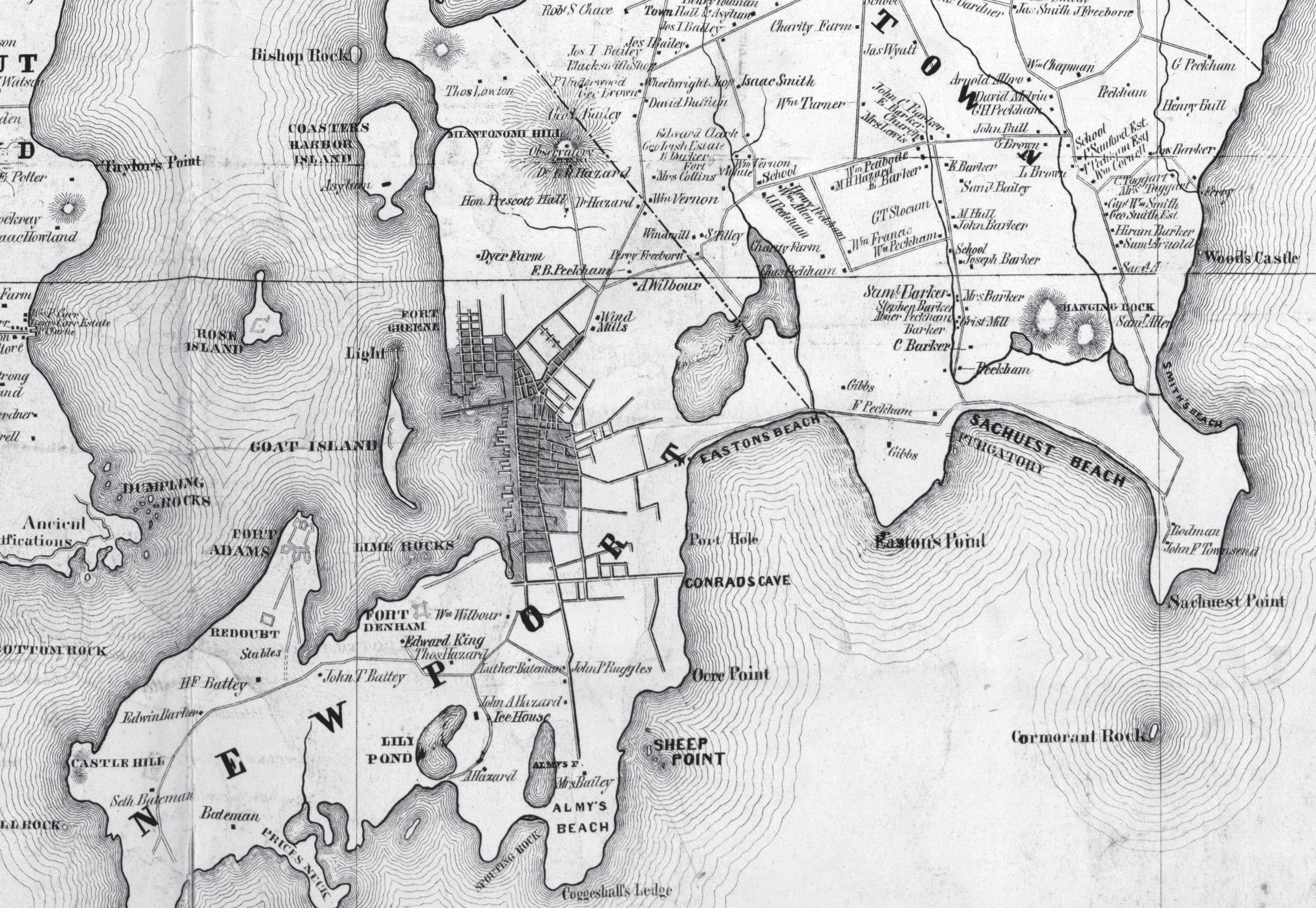
active and influential in Democratic Party circles until late in life.19
For a brief time after leaving the lieutenant governorship, Lawrence took up life as a gentleman farmer. Consistent with the legend, he did indeed raise cattle; at the second Aquidneck Agricultural Exhibition in September 1853, Lawrence won a certificate of merit for a ten-month-old Durham Bull and a $2 prize for a brood mare and foal.20 He continued to earn prizes in each of the next three annual fairs.21 Lawrence subsequently appears to have lost interest in this endeavor, however; he was not mentioned in press coverage of the 1857 fair,22 he spent 1858–60 in Europe,23 and he did not participate in subsequent exhibitions after his return to Newport.24
Lawrence was long remembered for several longrunning lawsuits.25 His legal dispute with neighboring landowner David Priestly Hall will be discussed in more detail below. A more widely publicized lawsuit,
a bove : From H. F. Walling, Map of Newport County, Rhode Island. ([Newport, RI]: W. H. Peek, 1850). Ochre Point is misspelled “Ocre Point.”
r ight: In 1850, the properties labeled “Duncombe” and “H. E. Pierrepont” were still part of Hall's estate. Narragansett Avenue (not yet an official street) is marked by a single line; Ellison's Rocks lie just off the coast. Taylor's Beach was located on the southern coast of Lawrence's property. Lawrence's wall most likely stood where the unnamed road on the western border of his property met the shore. From J. Bien, Map of the City of Newport, RI. (Newport, RI: M. Dripps and B. I. Tilley, 1859).
Portrait of William Beach Lawrence from E. G. Wheeler, “Ochre Point, and William Beach Lawrence” The Magazine of American History, 12 (JulyDecember 1884), 464.
Lawrence v. Staigg, did not involve shoreline access but nevertheless found its way into the legend of Lawrence’s wall. In the story as recounted by Amory, Lawrence built his wall after selling a lot to “a friend of his named Pendleton” and later regretting it. This was fellow Democrat George H. Pendleton of Ohio (1825–89), who served in the U.S. House (1857–65), as George McClellan’s running mate on the unsuccessful 1864 Democratic presidential ticket, and later in the U.S. Senate (1879–85). In 1876, Lawrence sold a lot to Pendleton and his wife, Alice Key Pendleton, for $1,200, and the Pendletons built a house there the following year.26 There is no evidence that Lawrence regretted the sale. In her memoir of her father, Esther Gracie Lawrence Wheeler wrote of Pendleton’s wife, “Mr. Lawrence often gallantly remarked to the accomplished wife of his brother Democrat, that he had sold her a portion of Ochre Point at a bargain, for the sake of having such a delightful neighbor.”27 Similarly, in a later account of Newport’s social history, the wife of John King Van Rensselaer observed, “Governor Lawrence gave a slice of his land to Mr. Pendleton so he should always have his friend as a near neighbor.”28 However, Lawrence definitely regretted an earlier sale. In September 1862, during a period of explosive growth in real estate values, Lawrence sold at auction a lot bordering the sea.29 The purchaser was Boston artist Richard M. Staigg (1817–81). A year later, Lawrence’s eldest son, William Beach Lawrence Jr., determined that the property had been incorrectly surveyed: Staigg had paid 5.25 cents per square foot for a lot of 43,918 square feet, but the lot was actually 55,680 square feet. Lawrence went to court to
rescind the sale and regain the property. Staigg, who had not yet begun to build on the lot, refused to comply, arguing that he had bid on the property as laid out, not on any particular number of acres.30 As the case dragged on, the stakes rose along with property values in Newport. In 1865, the state supreme court ruled that Staigg must either pay for the additional acreage at the originally agreed-upon price or rescind the purchase entirely. Lawrence, seeking to regain the entire property (and presumably to resell it at its now much inflated value), appealed the ruling, and the case was heard again in 1866, with the same result.31 Lawrence went to great lengths to avoid receiving payment from Staigg before the April 20, 1867, deadline, and then traveled to Staigg’s Boston studio to place the original purchase amount in gold onto the table. Staigg refused to accept the payment. The case returned to the supreme court, which found that Staigg had attempted to pay and extended the deadline to do so.32 Lawrence again appealed, but in February 1881, the supreme court again ruled in favor of Staigg.33 Staigg took possession of the property the following week, announcing through his attorney that workmen were enclosing it with a fence.34 Lawrence died the following month, and Staigg followed him in October. The lot was purchased in 1882 by Pierre Lorillard for 47.5 cents per square foot—nine times the price Staigg paid at auction twenty years earlier.35
This celebrated case appears to have found its way into the legend of Lawrence’s wall, but with Pendleton mistaken for Staigg. The property was on the coast, so the Cliff Walk ran along its perimeter, and Lawrence did indeed regret the sale. There is, however, no
evidence that Lawrence built a wall or fence to deny Staigg possession—the first mention of a fence comes in February 1881, when one was built by Staigg—and the question of shoreline access never arose in any of the case’s many appearances before the high court. If the Staigg case explains Pendleton’s appearance in the story, what explains the legendary court case over shoreline access? This part of the tale has its origins in yet another long-running lawsuit, variously heard as Lawrence v. Hazard, Hall v. Lawrence, and Lawrence v. Hall. This case involved not recreation but the right to extract gravel, stones, and seaweed from a beach on the fringe of Ochre Point.
Sand, Gravel, Stones, and Seaweed: Natural Resource Extraction along the Shore
Before the rise of shoreline recreation in the second half of the nineteenth century, the most prized “privilege of the shore” was the right to extract sand, gravel, stones, and seaweed from the shoreline. Seaweed— or “sea manure,” seaweed mixed with other organic material washed upon the shore—was used widely as an agricultural fertilizer, as was beach sand, which furnished lime through fine particles of broken shells.36 Sand, gravel, and stones were used in the construction of roads and buildings, and stones provided ballast for the shipping industry. Sand and gravel beaches were a convenient place to extract these materials, especially before the rise of large inland aggregate mining operations. First, access was relatively easy; horses, oxen, and carts could be brought to the water’s edge more easily than along marshy or rocky shores. Second,
the public trust doctrine, as incorporated into Rhode Island jurisprudence, stipulated public ownership of natural resources below the intertidal zone. Thus, seaweed still in the water was a common resource available to all, and after large storms passed, farmers would gather on the beach to pull horse-drawn rakes through the surf to collect seaweed pulled loose from the rocks.37
The ownership of seaweed landed upon the shore, and of sand and stones along the water’s edge, was less well-defined and therefore more contentious. In 1885, for example, popular author Thomas R. Hazard petitioned the state supreme court to rule whether others had the right (as they claimed) to access his coastal property in Middletown to take sand, gravel, stones, and landed seaweed from below the high-water mark. The court declined to accept Hazard’s petition on the grounds that it did not involve a specific individual case.38 It was not until 1901 that the state supreme court ruled in Carr v. Carpenter that the right to take these materials was attached exclusively to ownership of the adjacent land.39 Nevertheless, long before Carr v. Carpenter, it generally was accepted that the right to extract sand, gravel, stones, and landed seaweed somehow was attached to property ownership. Consequently, disputes usually hinged on the question of who, exactly, enjoyed extraction rights in a particular location, to the exclusion of all those who did not. Coastal landowners held extraction rights, of course, but others also could claim such rights based on property deeds or long-standing usage. When disputed, these claims could lead to litigation and even violence.40 This is precisely the kind of conflict in which
Lawrence was embroiled when he constructed his legendary wall.
On August 25, 1850, Lawrence swore out a warrant for the arrest of Charles Tillinghast Hazard for trespass. Hazard (1805–88) was a Newport farmer who operated other businesses at various times, including a grocery store, a slate quarry, a livery business, and a boarding house.41 At the time of the arrest warrant, Hazard was renting the farm of David Priestly Hall (1798–1868), a New York lawyer and Lawrence’s neighbor to the north. Lawrence charged that on April 5, 1849, and at other times thereafter, Hazard broke into his property and carried away 200 cartloads of building stones, 200 cartloads of gravel, 100 cartloads of ballast stones, and 300 cartloads of seaweed, valued at $1,000. In a subsequent complaint, Lawrence charged that Hazard again broke into his estate on December 16, 1850, and at other times thereafter, taking away another 100 cartloads of seaweed, 100 cartloads of gravel, and 100 cartloads of building stones, valued at $500, and that Hazard had excavated the banks of his property above the high-water mark and carried away 400 cords of building stones—over 50,000 square feet—valued at $500.42
The state supreme court heard the case at its March 1851 term. Hazard pleaded not guilty. He admitted that he had picked the lock of the gate to Lawrence’s property but argued that, as Hall’s tenant, he had the right to do so by virtue of a right appurtenant (legally attached) to Hall’s property. Hall, said Hazard, has had from the time whence the memory of man runneth not to the contrary have had and used and
have been accustomed to have and still of right ought to have and use for himself, Tenants and servants, the liberty and privilege of taking and carrying away at their convenience and pleasure from the South Shore or beach of the Plaintiff’s farm being the close of the Plaintiff mentioned, gravel and sea weed, and stones from below high water mark and of tipping the sea weed upon the Bank or upland of the Plaintiff’s farm, and to pass and repass at all times at their will and pleasure for the purpose aforesaid, doing as little damage as possible, and for the purpose aforesaid they did pass and repass, which is the supposed trespass complained of.
The court did not rule in the case, pending examination of Hall’s legal claim.43
In the meantime, the conflict took two important turns: Lawrence replaced the gate breached by Hazard with a more formidable barrier—either the legendary wall studded with broken glass or an immediate precursor—and Hall replaced Hazard as Lawrence’s principal legal antagonist. After the erection of the new wall, Hall sued Lawrence, asking the state supreme court for “an injunction to restrain the defendant from obstructing or hindering the plaintiff or his tenant, or the servants or agents of such tenant, in passing and repassing over a certain path or drift-way to the shore or beach, and procuring sand, gravel and sea-weed from said shore or beach upon or adjoining the defendant’s farm, and stones (below high water mark) thereon....” Hall also asked the court to force Lawrence to pay damages for his obstruction of the right-of-way to the beach.44
The supreme court heard Hall v. Lawrence in June 1851.45 The court’s ruling, issued in August 1852, rested upon a close examination of the origins of the dispute.46 The two properties originally were part of a single farm owned by Robert Taylor (1688–1762). In 1776, Taylor’s sons Nicholas (1753–1829) and Joseph Wanton Taylor (1755–1819) divided the land. Nicholas took 60 acres to the south, and Joseph 50 acres to the north. They agreed in the partition deed that Nicholas would have a right-of-way through Joseph’s land, and that Joseph would have “free liberty” to gather and carry away gravel, stones, and seaweed from the beach at the southern end of Nicholas’s land.
In 1803, Joseph sold 30 of his 50 acres to Nicholas, together with all privileges attached, and in 1812, he sold the remaining 20 acres to farmer and merchant George Armstrong (1772–1857), again with all privileges attached. In 1813, Nicholas mortgaged to the Bank of Rhode Island the 30 acres he had purchased from Joseph. In 1819, the bank took possession and in 1822 sold the lot to Armstrong, reuniting the original Joseph Taylor property in his hands. In July 1835, Armstrong sold the reunited property to Hall. In October 1850, Hall sold to Providence merchant Robert H. Ives (1798–1875) roughly half of the 20 acres that Joseph had sold to Armstrong in 1812, but Hall expressly reserved to himself all associated privileges to take stones and seaweed from the south shore of the former Nicholas Taylor property. In the south, Nicholas mortgaged his original 60 acres to Elisha Coggeshall in September 1808. In 1835, the executor of Coggeshall’s estate conveyed the title and mortgage to Armstrong and a partner, John Wilbour (1795–1859).
In January 1836, Armstrong conveyed his share to Wilbour, and in September Wilbour sold the entire property to Lawrence, with the caveat that the proprietor of the adjoining farm (now Hall) retained the right to extract stones and seaweed from the south shore of Lawrence’s estate.
The case before the supreme court turned on two key questions: (a) whether the shoreline privilege attached to the Joseph Taylor estate still existed, and (b) if so, the amount and purposes for which extraction could be made. Lawrence’s attorney, Samuel Ames, argued that the right attached to the Joseph Taylor property was extinguished, or at least greatly diminished, when the property was divided and sold. Once Nicholas became in 1803 sole owner of his original 60 acres and 30 acres of Joseph’s land, any privilege based on separate ownership of these 90 acres was extinguished. If any right remained, it inhered in the residual 20 acres retained by Joseph, and that right was in turn lost when Hall sold half of that property to Ives, or at the very most must be reapportioned to the 10 acres Hall still held. In making the argument that the shore privilege, if still extant, should be reapportioned, Ames raised the second issue at stake: What was the scope of this privilege? How much could Hall or his tenant extract, and for what purposes? Ames argued that the magnitude of the extraction could not be justified by the historical privilege upon which it was based: the materials were taken not for Hall’s own use but for sale to others and to an extent limited only by the rapidly growing demand for building and landscaping materials in booming Newport.
Hall’s attorneys argued that he had inherited the
entire privilege originally granted to Joseph and that “the privileges claimed need not be restricted to the land, to which they are appurtenant, so long as the party selling or leasing continues [to be] the owner of the land to which the privileges are appurtenant.”47
In other words, the fact that Hall’s property had been reduced to a fifth of the original 50 acres was irrelevant; since no limits had been placed upon Joseph’s shoreline privilege in the original deed of partition, Hall’s extraction rights were likewise unlimited, and he could transfer these rights to whomever he pleased. The court’s ruling conceded something to both parties. The court found that the original privilege was divisible—that is, it did not entirely disappear when Joseph divided his property in 1803—but that it was afterward appurtenant only to the 20 acres that Joseph did not sell to Nicholas. But, the court continued, the privilege was necessarily attached to the land and could not be severed from it. Therefore, when Hall sold 10 of those acres to Ives, he lost the privilege attached to them, the reservation in the deed notwithstanding. Hall nevertheless retained the privilege attached to his remaining 10 acres, and he retained the right to pass through Lawrence’s land to exercise it.
The court then took up the question of the scope of Hall’s privilege. How much could he extract, and for what purposes? Here the court came down firmly on the side of Lawrence. Though the Taylor brothers had not placed any limits on Joseph’s shore privilege, the court reasoned that, given the circumstances of the time, the brothers intended that Joseph should have free liberty to take whatever materials he wanted to use on his own property—otherwise, Joseph, having
no beach in the north, would have lost his fair share of the shoreline resources attached to the original farm. Hall’s privilege was therefore limited to the extraction of materials for use on his own property only.
This outcome was a Pyrrhic victory for Hall, since it drastically undercut the profitability of his shoreline privilege. Whatever raw materials Hall might plausibly claim for use on his remaining 10 acres, it could not have equaled the massive quantities extracted by Hazard in 1849–50. And, in fact, there is no evidence of any subsequent incursions. Lawrence did not press his suit against Hazard, who by this time had purchased and relocated to a farm of his own (Hazard, 1865, pp. 2–4). Lawrence nevertheless appealed the ruling and continued to press a countersuit, Lawrence v. Hall, that he had launched in June 1851.48 In the meantime, his wall remained standing.
If Hall v. Lawrence is the long-running lawsuit of the legend, it lost much in the retelling. The suit did not involve public access, and did not involve the town of Newport. Instead, it was a shoreline access conflict typical of the era, a dispute between property owners over the allocation of privileged access to natural resources. Neither Lawrence nor Hall claimed or conceded that these resources were accessible to anyone else or that a public right of way to them existed. The supreme court, likewise, did not consider or establish any such claims.
What of the legend’s “test shipwreck”? This detail seems to have been imported from a much later conflict with another litigious ex-governor, Charles Warren Lippitt (1846–1924). In May 1897, the Newport City Council gave Lippitt permission to build a sea-
wall at the edge of his property in the south of the city. Local fishermen objected that the seawall would make it impossible to draw boats onto the shore during foul weather, this being one of the few protected places to do so. In June, members of the city council met with the protesting fishermen at the site, and in November the city council ordered Lippitt to move the seawall, by then nearing completion, 12 feet landward.49 It is likely that a boat was drawn onto shore to demonstrate the problem and to determine the scope of alterations needed to address it: the legendary “test shipwreck.”
Lippitt may have influenced the Lawrence legend in other ways as well. First, while there is no contemporaneous evidence that Lawrence objected to recreational use of the perimeter of Ochre Point, Lippitt was wellknown for threatening legal action against those who strayed from the Cliff Walk onto his property.50 Second, in contrast to the Lawrence case, the city did order Lippitt to move his wall, and Lippitt did respond by filing suit against the city.51 There was, however, no long-running suit, as the dispute was settled out of court two years later. The wall was partially relocated and the beach regraded, and the city and Lippitt shared the cost.52 While this outcome certainly was a victory for the fishermen, it involved no court ruling in favor of “fishermen’s rights.”
The Social Construction of Cliff Walk
The legend of Lawrence’s wall is wrong in almost every detail, but it is correct on one very important point: Lawrence’s wall was the spark that lit the first campaign to preserve recreational access to the Newport
shoreline. Although there is no evidence that the wall was intended to block recreational access, it did have the effect of impeding passage by everyone else along the perimeter of Ochre Point. Had the Lawrence-Hall dispute erupted a decade or two earlier, the wall might have elicited no wider reaction. By 1851, however, Newport was experiencing a meteoric rise as a destination for recreational tourism, driven in part by the dramatic views along the cliffs. If Lawrence and other newly arriving summer residents were to block access, this might undermine Newport’s attractiveness as a “watering place” for other well-heeled vacationers. Consequently, a campaign to preserve recreational access emerged almost immediately. In contrast to the legend, however, this campaign was based not on direct action or litigation but on the establishment of a legally untested social norm based upon the historically hallowed principle of “fishermen’s rights.” In the legend, Lawrence’s wall generated a loud public outcry. In fact, the public reaction to the wall was quite muted. The conflict between Lawrence and Hall was mentioned in the Newport press only when the cases came before the supreme court and then only briefly.53 None of the memoirs of Newporters living in the mid-1800s mention Lawrence’s wall, and none who mention Lawrence describe him as disagreeable, apart from his well-known pro-slavery views.54 The quietest “dog that didn’t bark” was Lawrence’s chief nemesis, Whig newspaper editor William H. Cranston. When the controversy over Lawrence’s residency erupted in early 1851, Cranston opposed Lawrence politically while avowing personal friendship and respect for him.55 As the months passed, however, Cranston’s
editorials grew increasingly acidic. A complete rupture occurred in early 1852, after Lawrence insulted Cranston’s uncle, Senator Robert B. Cranston, in remarks before the senate; this was followed by the publication of an exchange of angry letters in which Lawrence and the elder Cranston re-litigated the effort to block Lawrence’s candidacy the previous year.56 The younger Cranston in turn denounced Lawrence as “a vain, ambitious, weak, silly and cowardly man” and severed all contact with him.57
Cranston’s mockery of Lawrence produced what may be the only surviving contemporaneous mention of the legendary glass-studded wall. In a November 1853 story in The Newport Daily News, Cranston recounted how Lawrence recently had asked a fellow Democrat, Rouse P. Gardner, to do some work on his property. When Rouse arrived at Lawrence’s house, Lawrence came out on the porch, pointed to the barn, and said coldly, “I wish to see you at the barn, Mr. Gardner.” Rouse was so insulted that he turned his horse and rode back to town. After the story first appeared, Lawrence let it be known that Rouse was upset because Lawrence had found a man to do the job for $50 less. Rouse stood by his story, however, and further elaborated:
Rouse intimates that the Governor is mad, because he would not build his wall on the shore; the Governor wanted glass bottles, with the necks broken off, placed in mortar on the top of the wall, and Rouse refused to do it, on the ground that it was not democratic for the Governor to do such a cruel thing, as some of the poor Democratic fishermen, who earn
a living for themselves and their poor families, by fishing along the shore, would be injured by these broken bottles. It is said that Rouse read Gov. Lawrence a very severe lecture upon this undemocratic movement; and that the Gov. reprimanded Rouse for what he conceived to be unpardonable impudence on the part of a poor laboring man toward a rich gentleman.58
This story underscores how little public furor Lawrence’s wall generated at the time. First, Cranston’s chief complaint against Lawrence is his hypocritical treatment of a working-class fellow Democrat; the wall is introduced in the follow-up story, humorously and satirically, toward the same end. Second, by this time the wall (or its precursor) had been in place for more than two years. Had its construction generated widespread outrage, Cranston would not have failed to mention it earlier and more often.
Lawrence’s wall nevertheless appeared at a critical juncture in Newport’s economic revitalization. Newport’s popularity as a summer destination ballooned in the early 1850s, and the surge in seasonal residents was accompanied by ever louder complaints about reckless riding, trespass, and property destruction. In June 1852, for example, John F. Townsend, trustee of a large farm on Sachuest Point in neighboring Middletown, published the following notice in the Herald of the Times:
Whereas many persons have recently been in the practice of entering the farm on Sachuest Point, both in carriages and on horseback, in small and
large parties, and pushing down to the point for the purpose of recreation, and fish-dinners, attended by servants and dogs, and have committed various damage to the tenant, in burning up his rails to cook their fish, turn their horses at large to feed on his grass, cutting up his growing crops of corn also for their sustenance,—throwing open all the gates and fences in their way, and worrying his cattle by their dogs, &c.—this notice is given to warn all such persons of the illegality of such entrance and the aforesaid practices,—that they are manifest trespasses on the rights of private property, and should they be repeated after one week from this date, they will be followed by prosecutions at law for the same. All strange horses found on the premises, will be placed in the Pound, and the dogs will be shot. All poor, industrious fishermen, passing on foot, and doing no damage, are excepted.59
If other coastal property owners were to follow the examples set by Lawrence and Townsend, this could threaten Newport’s emergence as a world-famous resort and, by extension, its economic future. As if on cue, the first published suggestion of a public right to pass along the perimeter of the Newport cliffs appeared within a few months of the wall’s construction—not in Newport, but in New York City.
The Rediscovery of “Fishermen’s Rights”
During the summer of 1851, up-and-coming travel writer George William Curtis, writing under the pen name of Howadji, wrote a series of dispatches from
American resorts for the New-York Daily Tribune. In September, Curtis reached Newport, the final stop on his tour. In a dispatch dated September 21, he described a walk along the cliffs:
A little further on are the finest cliffs in Newport, upon which, after southerly storms, the sea dashes itself in magnificent surfs that set the shore in flashing foam. These are the haunts of the bass-fishers. We must have left our horses behind, for there is only a foot-path along the cliffs, and walls and fences must be scaled. But by a happy old condition of the sale of these lands, the path will remain public. For when the colonists took the land from the Indians, a right of way along the sea was secured to them for fishing and the gathering of seaweed. At least so runs the tradition of Newport, and the convenient stiles and holes in the walls, even upon the properties already settled, confirm its practical truth. Or is it only, perhaps, that no man upon this pleasant island feels that he has the right to exclude others from the sea shore, the sea, like the air, being the unquestioned universal heritage in Nature? 60
From 1848 to 1850, Curtis wrote dispatches from Europe for the Tribune and the New York Courier & Enquirer, and in March 1851, he published a booklength account of his travels in Egypt.61 Curtis had visited Newport at least once previously, in August 1843, afterward waxing poetic of “a striking grandeur in the sea that I never beheld so plainly before.”62 His visit to Newport was the final stop in a two-month tour of the Northeast’s leading “watering places,” including
Newport’s archrival, Saratoga. The Tribune published Curtis’s dispatches as they were received, so most had appeared in print by the time he reached Newport.63
Curtis’s well-advertised visit thus presented an unrivaled opportunity to advertise Newport’s charms to the New York elite. It is significant, then, that Curtis’s interlocutors took great care to impress upon him the existence of a right to recreational passage along the cliffs, derived from the colonial-era right to access the shore for fishing and gathering seaweed. The message was twofold: first, the beauty of a walk along the cliff was a compelling reason to summer in Newport; and second, those seeking to build seaside summer residences must not obstruct the right of others to cross their property along the cliffs.
Curtis’s dispatch was reprinted promptly in The Newport Daily News. 64 A few weeks later, the Daily News published a letter to the editor from “Ellison’s Rocks”:
Of late, the right of the inhabitants of the town of Newport, to the shores of our island, for the purpose of fishing, has been questioned, and doubts are entertained by many, whether they ever had any legal right of the kind.
The following Act of the General Assembly of Rhode Island, before Rhode Island was associated in government with the Plantations in Providence, contained in the Old Colony Records, together with what is contained in relation to the subject in the charter of 1663 is no doubt what the framers of the present Constitution of our State had in mind, when they provided in the 17th Section of the Declaration
of Rights contained in the 1st Article of that instrument that “The people shall continue to enjoy and freely exercise all the rights of fishery, and the privileges of the shore to which they have been heretofore entitled under the charter and usages of this State. But no new right is intended to be granted, nor any existing right impaired by this declaration.
At a General Assembly of the body 6th March, 1639, it is ordered, that all the sea banks is free for fishing to the town of Newport.65
The author’s pseudonym was almost certainly a reference to the Lawrence-Hall dispute. Ellison’s Rocks, a rocky ledge popular with surf casters, extended into the ocean from the bottom of the Forty Steps, built by Hall,66 and the Forty Steps were accessed from the end of Narragansett Avenue, the dividing line between the Lawrence and Hall properties.67
“Ellison’s Rocks” provided the first detailed legal justification for the “right of way along the sea” described by Curtis. That right, the author argued, was based on three successive documents, drafted at different points in Rhode Island’s political evolution.
First, shortly after the founding of the Newport colony in early 1639, the leaders of the enterprise, styling themselves the “general assembly of the body,” declared all the sea banks free for fishing to the town. (“Ellison’s Rocks” dated this declaration to March 9, 1639, while Bartlett [1856, p. 99] dates it to March 9, 1640.) At this point, the town had no more than a few dozen inhabitants, and “Rhode Island” was simply an alternate name for Aquidneck Island, home to the colonies of Newport and Portsmouth. In 1644, with
the English Civil War already underway, Parliament recognized the towns of Newport, Portsmouth, Providence, and Warwick as the “Colony of Rhode Island and Providence Plantations”—Rhode Island, for short. Following the restoration of the monarchy, the 1644 patent was superseded by the Royal Charter of 1663 granted by Charles II.68 The Royal Charter guaranteed to the colonists “full and free power and liberty to continue and use the trade of fishing upon the said coast, in any of the seas thereunto adjoining, or any arms of the seas, or salt water, rivers and creeks, where they have been accustomed to fish” (Royal Charter 1663). The Royal Charter remained in force until 1842, when it was superseded by the state’s first written constitution, which included the section cited by “Ellison’s Rocks.”
Although “Ellison’s Rocks” ostensibly addressed only the right to pass along the shore for the purpose of fishing, the real issue at stake in 1851 was a novel one: the preservation of recreational access. If visitors were prevented from enjoying the scenic wonders described by Curtis, they might instead choose Saratoga or some other competitor. To avert this, the access advocates advanced a novel legal argument: the colonial “privileges of the shore” implied a right to purely recreational passage along the shoreline, and this right extended to elevated sections of the shoreline, such as the cliffs of Ochre Point. Curtis’s dispatch and the letter from “Ellison’s Rocks” were not the only salvos in this campaign. Following the sale in 1852 of a coastal property to the south of Ochre Point to yet another wealthy New Yorker, the merchant Francis Aquila Stout, an anonymous annotator scrawled the
text of the 1639/1640 declaration in the margin of the municipal record of the deed (Parker, 2024)—a notation that implied the existence of an easement but did not legally create one.
Over the next three years, the issue of shoreline access became entwined with, and amplified by, two other developments: a controversy over obstruction of the right-of-way to the Newport Asylum for the Poor and Newport’s transition from a town meeting form of government to a city form in which elected officials ran on party slates. The asylum controversy greatly increased the political salience of shoreline access, while the change in municipal government caused the issue to become more overtly partisan. This combustible combination came to a head in 1854 and 1855, when the Whigs swept to power and resolved both the asylum controversy and the problem of Lawrence’s wall.
The Road to the Asylum
The Newport Asylum for the Poor was constructed on Coasters Harbor Island from 1819 to 1820 to replace the preexisting poorhouse near the town center. Coasters Harbor Island was a town-owned property, previously used in 1819 for the quarantine of international shipping and as a smallpox hospital. It was accessible only by boat and that only after passage along a poorly developed road to the boat launch. The relocation of the asylum to Coasters Harbor Island was designed to improve conditions for the inmates and to make it more difficult for them to return to town; the new facility offered better accommodations and was supported by a working farm, but the inmates could
leave the island only with the permission of the keeper and then only for a defined period of time. The asylum was overseen by a board of commissioners, who in turn employed the keeper, physician, and other staff needed to operate the establishment. At least one commissioner was required to visit the asylum each week and to report to weekly meetings of the board. The board in turn reported annually to the municipal government. The initial purpose of the asylum was to provide housing and rehabilitation for those who could not support themselves, such as orphan children, the elderly poor, and the mentally ill, but as Newport grew in population and affluence, it increasingly did double duty as a place of criminal imprisonment.69
The way to the boat launch passed through the property known as the Dyer Farm, and it was not long before the increasingly affluent property owners sought to obstruct passage to and from the asylum. In May 1832, New Bedford merchant William Rotch Rodman (1786–1855) published a notice in the Newport press that no one would henceforth be allowed to pass through the farm, “now improved by the subscriber,” without his explicit permission and warned that violators would be prosecuted for trespass.70 At a town meeting in June, a committee was created to investigate the rights of townspeople to pass through the property, and this committee was directed to inform Rodman that the commissioners of the asylum would continue to pass through his property as before.71 The dispute appears to have been settled shortly thereafter, as it was not mentioned in the board’s 1833 annual report to the town.72
In 1850, native Newporter Charles Hunter (1813–73)
purchased the Dyer Farm from the Rodman family, and in March 1852, Hunter sold an oceanfront lot to New York merchant Robert Lenox Maitland (1818–70).73
Maitland swiftly moved to terminate passage through his property to the asylum. At a town meeting in July, the asylum board reported the closing of the way to and from Coasters Harbor Island. The town meeting in turn voted to authorize the town council to arrange a right-of-way to the asylum through Hunter’s remaining property.74 Hunter provided an alternative route, but the commissioners complained that the new road “is circuitous and runs some distance through a mirey swamp, and for a large portion of the year is almost or quite impassable by reason of mud and water and the snows in winter.”75
In March 1854, the newly created Newport City Council appointed a committee to examine and report on the city’s right-of-way through Dyer Farm. The committee recommended that immediate measures be taken to “establish and locate” the right-of-way, and the city council accordingly recommitted the matter to the committee along with the power to negotiate the matter or to commence a suit for the assertion of the city’s rights.76 The matter came to a head in June 1854, when the asylum dispute merged with the campaign to protect recreational shoreline access and the more sharply partisan politics that accompanied Newport’s transition to a city form of government.
Newport Becomes a City
Prior to May 1853, the centerpiece of municipal decisionmaking was the town meeting, an in-person assembly
open to all eligible voters. At the principal annual town meeting in June, the voters elected a town council and other municipal officials to handle week-to-week administration, but important questions of policy and budget were decided at town meetings, either in June or at other times, as the need arose. The issues involved could be quite complex and often could not be resolved in a single meeting. From 1840 to 1842, for example, at least ten separate town meetings tackled the excessive extraction of sand and gravel from the town beach (Easton’s or First Beach), where the rising demand for construction materials in Newport threatened the beach itself, the primary engine of the town’s revival. The attendees wrestled with thorny questions, such as the establishment of designated extraction zones, extraction fees for residents and nonresidents, the imposition of fines for excessive or unauthorized extraction, and the construction of a fence to keep windblown sand on the beach.77 This was, of course, only one of many issues confronting the town during this period.
In 1847, the rising pressure of business prompted the town to appoint a committee to consider the reform of Newport’s municipal government. The report’s authors succinctly summed up the problem at hand: “In a town of the population of Newport, where eleven hundred electors have the privilege of voting, the attempt to pass ordinances, in open town meeting, upon the great variety of topics which these statutes embrace, is found to be abortive, there being neither time for proper deliberation, nor a proper organization to mature the necessary enactments in the hurry and excitement of a large popular meeting.”78 After much debate, a new city charter was drafted and approved by the voters in
1853. The new charter introduced a much more powerful mayor and a bicameral city council, composed of a five-member Board of Aldermen, chaired by the mayor, and a ten-member Common Council.79 Elections to these new offices were explicitly partisan: in advance of the balloting, the Democrats and Whigs put forward slates of nominees, a practice that had not accompanied the selection of town councilors.80 The first elections under the new charter were held in June 1853. The Whigs won a majority of seats in both chambers of the city council, but the Whig mayor-elect, Robert B. Cranston (whose angry correspondence with Lawrence made headlines the previous year), stated that he had not sought the nomination and declined to serve.81 This necessitated a series of repeat elections, stretching over several months, in which no candidate gained a majority. Finally, in early October, Democrat George H. Calvert narrowly defeated Whig William H. Cranston, the newspaper editor, to become the first mayor of Newport.82
With the transition to a more partisan form of government, recreational shoreline access became a more partisan issue. Lawrence was the most prominent Democrat in Newport, so Calvert, unsurprisingly, did not take up the banner of “fishermen’s rights.” In April 1854, however, the Whigs swept the second city election, winning the mayoralty and retaining their majority in both chambers.83 The new mayor, William C. Cozzens, placed the issue of shoreline access at the very top of his June 1854 inaugural address:
Your attention will be directed to a still further investigation of the rights of the city; encroachments
are continually being made on streets and highways; and at this time, while property is advanced and changing hands so rapidly, it should be our duty to guard the interests of the city and save ourselves from trouble and litigation hereafter.—The shore privilege, as it is called, has been long enjoyed free and unmolested by our citizens as an inherent right derived from the first settlement and confirmed by the following Vote:—
“By the General Assembly of the Body (Rhode Island) March 6th, 1639, it is ordered that all the sea banks be free for fishing to the town of Newport.” This right and the privilege of the shore has been continued by the old charter, under which we existed so long, and the constitution, down to the present time. It becomes important to know the extent of these rights, especially at this time, as in several instances obstructions and objections have been made; and if no notice is taken of it, this privilege if it is one, may be lost forever. I have no doubt that many of those who have been attracted hither, and are at last becoming identified with us as citizens, have been influenced to do so in a great degree by their impressions while walking around the shores and banks of our beautiful island. Such being the case I cannot believe that those who have enjoyed this high privilege are willing to raise a perpetual barrier against the continuance of a like enjoyment to all who have a desire quietly to ramble where they can behold, unobstructed, the wonders of the mighty Ocean and inhale its refreshing breezes.84
Cozzens’s reference to “those who have been attracted
hither, and are at last becoming identified with us as citizens” was clearly aimed at Lawrence; memories of his eleventh-hour change in residency were still fresh. The efforts of the recreational access advocates over the preceding three years had now borne fruit. Whatever the original purpose of Lawrence’s wall, its continued presence was out of step with the city’s newfound interest in the protection of the public’s privilege of the shore.
By this time, however, the most pressing case of obstruction was not Lawrence’s wall but the obstruction of the city’s right-of-way to the asylum. The issues at stake in the two cases were not identical; Lawrence’s wall obstructed a recreational path enjoyed by the general public, while Maitland had obstructed a right of way used by municipal officials and their charges to access town property. The proponents of recreational access nevertheless were quick to take advantage of the window of opportunity created by the asylum dispute, successfully framing both disputes as encroachments upon the public’s time-honored shore privilege. Had it not been for the dispute over the road to the asylum, it is far less likely that shoreline access would have rocketed to the top of the municipal agenda in 1854. The asylum conflict thus provided the primary political fuel for the events of the next several months, which ended with the resolution of the asylum conflict, the removal of Lawrence’s wall, and the birth of Cliff Walk.
After Cozzens’s inauguration, the city energetically tackled the asylum dispute on multiple fronts. In early August, the preexisting committee on the right-of-way through Dyer Farm delivered a report recommend-
ing that the city not accept the new route laid out by Hunter unless it was kept in good condition, while a newly created committee on the right-of-way along the shore delivered a report demanding that Maitland remove all obstructions from the original route.85
Two weeks later, the Common Council resolved, “That the Committee recently appointed to inquire into and report in relation to various encroachments on the shore privileges guaranteed to each citizen of the island by the Constitution of the State, be and are hereby instructed and empowered to notify the proprietors of land violating this provision of the State Law, and in case of failure in removing such obstructions report all such cases to the Grand Jury at their next session for immediate action thereupon.” The Board of Aldermen voted to lay the resolution on the table.86 The following month, the Board of Commissioners again pressed the city to mark out a right-of-way different from the one provided by Hunter; the Common Council concurred, but the Board of Aldermen tabled this resolution as well.87 Throughout this period, Maitland and Hunter remained the only explicit targets of the city’s efforts to protect shoreline privileges. Lawrence’s wall presumably was among the “various encroachments” of concern to the Common Council, but he was not publicly identified by name.
Finally, on March 6, 1855, less than a week before the city’s suit against Maitland and Hunter was to be heard by the state supreme court, Mayor Cozzens informed the city council that Hunter was willing to renew a proposal that he had made in July but which had then been rejected. Hunter would release to the city a right-of-way over his property from Third
Street to the boat landing; since Third Street formed the inland boundary of Maitland’s property, no passage across the latter would be necessary. Moreover, if a bridge were built to Coasters Harbor Island, as the asylum commissioners had proposed two years earlier,88 Hunter would allow the city to place an abutment on his land. In exchange, the city would release all claims to any other rights-of-way across his property.89 Cozzens explained that he had taken the initiative in encouraging Hunter to renew his proposal. Three days earlier, he had written to Hunter’s attorney: “I feel free to guarantee that as the excitement which prevented the acceptance of Mr. Hunter’s proposition made on the 17th July (and which I thought then, and still think, was honorable to Mr. H.,) has passed away, that in case Mr. Hunter will, of himself, or through you, renew the propositions then made, that it shall be accepted forthwith and the suit withdrawn—dividing the court expenses between the parties.” Hunter agreed, and Cozzens swiftly secured the city council’s endorsement.90 On March 20, the city council approved the final agreement, which released all other rights-ofway the inhabitants of Newport had or claimed to have upon the properties of Hunter and Maitland for the purpose of going to and from Coasters Harbor Island.91 With that, the issue of recreational shoreline access largely disappeared from the city’s agenda for the next four decades.
What became of Lawrence’s wall? No contemporaneous account survives, but circumstantial evidence indicates that Lawrence, under pressure from the city government, agreed to remove it in late 1854. First, there is no evidence that the city ordered Lawrence to
remove the wall or that it was removed against his will. Either action would have been reported in the local press and likely would have provoked legal action by Lawrence. Second, in the fall of 1854, Lawrence suddenly showed renewed interest in his legal position visà-vis Hall. In June 1851, Lawrence had countersued Hall, and Hall responded, but Lawrence waited until September 1854 to file objections to Hall’s answers.92 The case files, including Lawrence’s objections, are missing from the state judicial archives, but the timing suggests that Lawrence, under growing pressure to remove the wall, sought to shore up the legal barriers to any resumption of incursions.93
The resolution of the Coasters Harbor Island affair also indicates that the problem of Lawrence’s wall had been resolved by early 1855. In the final settlement, the city completely surrendered its claim to any public right-of-way through Maitland’s property, even though only a few months earlier it had denounced his obstruction of this route as a violation of the public’s shoreline privilege. It is doubtful that Cozzens and the city council would have so readily abandoned this principle if it were still at stake in the dispute with Lawrence. Moreover, in his letter proposing the settlement, Cozzens observed that the “excitement” of the preceding summer “has passed away.” The mayor did not elaborate, but this observation likewise suggests that the dispute with Lawrence had ended. If the principle of public access had been vindicated at Ochre Point, where it mattered most, then the asylum dispute could be settled along narrower lines. Although city officials initially framed the actions of both Maitland and Lawrence as “encroachment[s] on the shore
privileges guaranteed to each citizen of the island by the Constitution of the State,” the actual complaint in Maitland’s case was in fact narrower; Maitland had obstructed the right-of-way used by town officials to reach town property. In modern parlance, the city’s concern was not lateral access along the shore, as in Lawrence’s case, but perpendicular access to a specific point on the shore; the boat launch and future bridge abutment. In the end, it did not matter whether that route passed along the shore or further inland, so long as it was convenient.
How were shoreline access advocates able to persuade Lawrence and other landowners to continue to allow public passage along the cliffs’ edge, despite the associated noise, litter, trespass, and property damage? Several factors came into play. First, Lawrence himself was sensitive to political appearances. The Whigs’ 1854 triumph demonstrated that acquiescence in the obstruction of public access by recently arrived millionaires was not a winning political position for Newport Democrats, and even after his 1852 electoral defeat, Lawrence remained hopeful of some future appointed office.94 Second, “fishermen’s rights” provided a plausible and historically hallowed normative foundation for public access. Third, as Cozzens pointed out, the ability to walk and ride along the cliffs was one of the virtues that had attracted Lawrence and other summer residents to Newport in the first place, so they shared an interest in maintaining access. Finally, Newport in the 1850s remained the haunt of a relatively small number of affluent summer residents. Middle-class vacationers and working-class daytrippers would begin to appear in significant numbers
only after rail service was expanded later in the century. By that time, Cliff Walk was an established legal reality.
Conclusion: The Legacy and Limits of the Campaign against Lawrence’s Wall
The legend of Lawrence’s wall not only is an account of Lawrence’s motives but also, and more importantly, is the political and judicial origin story of recreational shoreline access advocacy in Rhode Island. The political origin story is one of direct, forcible action: the townspeople, outraged by the violation of their timehonored right of access, took it upon themselves to demolish the hated wall. The legal origin story is one of decisive judicial vindication: Lawrence’s retaliatory lawsuit against the townspeople ended with a supreme court ruling that firmly established an inviolable public right to pass along the perimeter of the Newport cliffs. As we have seen, however, this story is fundamentally incorrect. No direct action was taken by the “people” against Lawrence’s wall, there was no litigation between Lawrence and the city, and no court established, then or since, a general “fishermen’s right” to pass along the Newport shore above the high-water line.
Cliff Walk’s true origin story is far more remarkable. It arose not from direct action or a judicial victory but from a much subtler process of social construction. Cozzens, Cranston, and their allies recognized that recreational passage along the cliffs was one of the keys to Newport’s rebirth as a mecca for wealthy tourists and that this asset would be devalued if newly arrived
residents obstructed it. And yet, then and since, the city demonstrated “a definite disinclination to bring on an all-out legal clash of the status of the Cliff Walk.”95 The city did not involve itself in the Lawrence-Hall litigation, and it did not order the removal of Lawrence’s wall. On the contrary, city leaders avoided direct confrontation. Cozzens’s oblique reference to Lawrence was a mild reproach, Cranston largely refrained from attacking Lawrence on this issue, and the Board of Aldermen tabled the resolution passed by the Common Council, in the “excitement” of summer 1854, to threaten legal action against “all such cases” of encroachments upon citizens’ shore privileges. In the absence of direct evidence of the access advocates’ internal deliberations, it is impossible to say for certain why they avoided litigating this issue in the courts. Lawrence had deep pockets and powerful legal allies, to be sure, but so did Maitland, and this did not prevent the city from credibly threatening litigation in the asylum dispute. A likely explanation, consistent with the known facts and the subsequent history of Cliff Walk, is that the access advocates lacked confidence that “fishermen’s rights” would prevail in court. It was not self-evident that the colonial “privileges of the shore” could be transposed to a cliff from which it was impractical to fish or to gather seaweed; nor that it implied any right of landward passage across upland private property to reach a spot suitable for such activities; nor that it translated into a general right of recreational passage along the cliffs. If a court were to rule that the public’s shoreline privileges were restricted to the intertidal zone or to areas from which fishing was practicable, then passage along the
cliffs legally could be obstructed, for there was no public right to cross private property to reach areas where these privileges could be exercised. Alternatively, a court might rule that free passage must be accorded only to those engaged in particular pursuits, such as fishing, which would allow coastal property owners to block access to anyone else—the situation that prevailed in neighboring Massachusetts.96 Given these potential dangers, it is not hard to imagine that persuasion seemed the safer course.
Cliff Walk thus came into existence not because a court-tested legal right compelled property owners to grant access but because the property owners’ granting of access created a legal right. This occurred through “dedication”: if a property owner allows access to a road or path, and the public exercises this access for a protracted period, this creates a permanent easement that cannot be revoked later. Writing a century later, City Solicitor James S. O’Brien described this process as follows:
From records available at the City Hall it is clear that the owners of various properties abutting the Cliffs, commencing in approximately 1840 through 1900, laid out a pedestrian walk in front of their various properties along the top of the Cliffs and some even built special tunnels, bridges, etc., to facilitate the public’s right of access along the Cliffs. By this dedication by the owners of the property and by the continued use by the general public there has arisen a public easement to pass and repass, for pedestrian purposes, a foot path around the edge of the Cliffs.97
Tellingly, many of these “special tunnels, bridges, etc.” were constructed after Cliff Walk had become an accepted reality—not to facilitate access but to remove the increasingly numerous (and increasingly ordinary) recreationalists as far as possible from the eyes and estates of the Gilded Age elite. That the wealthiest and most powerful persons in the United States were reduced to such extremities is testament to the strategic foresight of the shoreline access advocates of the early 1850s.
This victory nevertheless was limited in two important ways. First, the principle of an upland right of lateral shoreline passage across private property did not become widely accepted, either in Newport or in Rhode Island more broadly. On the contrary, subsequent court rulings and legislation narrowed the public’s right of passage to the intertidal zone or to beaches and tidal flats immediately adjacent to the intertidal zone, with no right of passage over upland property to reach them.98 Cliff Walk proved the exception, and Maitland’s victory the rule.
Second, the right-of-way along the Newport cliffs is highly vulnerable to erosion. As “the sea dashes itself in magnificent surfs that set the shore in flashing foam,” the cliffs are worn away and periodically experience spectacular collapse. If the right-of-way were based on a legally recognized “fishermen’s right” to pass along the edge of the cliffs, as the Lawrence legend would have it, then Cliff Walk automatically would move inward as the cliffs retreated—in contemporary parlance, it would be a “rolling easement.”99 A right-of way-created by dedication, however, does not automatically move if it is lost to erosion, particularly if its
boundaries are marked clearly, as along Cliff Walk, by adjoining walls, fences, and “No Trespassing” signs, measures designed not simply to prevent trespassing but also to avoid any further implication of dedication that might facilitate the inward migration of the rightof-way across the abutting properties. As a result of this precarious legal foundation, the strategy of persuasion and public pressure pioneered by the access advocates of the early 1850s has continued ever since. Whenever erosion has made it impractical to maintain Cliff Walk in its previous location, the city has worked to persuade reluctant landowners to adjust the path as needed, usually in conjunction with public funding for repairs to restore as much of the previous path as possible. Legal action has been threatened only rarely and only when landowners have obstructed the preexisting path.100 As erosion accel-
erates with climate change, however, it remains to be seen how much longer this strategy will suffice to preserve Cliff Walk along its entire length.101
Whatever the ultimate fate of Cliff Walk, its creation and survival into the early twenty-first century are remarkable achievements, the product of persistent advocacy and social norm construction. If, in the early 1850s, the access advocates had opted for a more aggressive strategy that provoked litigation by Lawrence, there is a very good chance that they would have lost. In that case, Cliff Walk as we know it might not have come into existence, and without the need for an origin story, neither would have the legend of Governor Lawrence’s wall.
Robert G. Darst is an associate professor of political science at the University of Massachusetts Dartmouth.
n otes
Abbreviations
HOTT Herald of the Times
NA Newport Advertiser
NDN Newport Daily News
NJWN Newport Journal and Weekly News
NM Newport Mercury
NMWN Newport Mercury and Weekly News
PJ Providence Journal
RIR Rhode Island Republican
1. Legal studies of shoreline access typically are framed in terms of the “public trust doctrine,” which stipulates that at some point natural resources (including but not exclusively those along the coast) cease to be privately owned and become a “public trust,”
access to which should be publicly managed. “At some point” is a necessarily vague qualifier; definitions of the public/private boundary are hotly contested and vary significantly from one jurisdiction to another. For overviews of the application of the public trust doctrine to coastal resources in the United States, see (Blumm and Wood, 2021; Slade, Kehoe, and Stahl, 1997; Pogue and Lee, 1999; Lyness, The Local Public Trust Doctrine, 2021). For analyses of the public trust doctrine in Rhode Island, see (Ruberto and Ryan, 1990; Nixon, 1990; Lyness, A Doctrine Untethered: “Passage Along the Shore” Under the Rhode Island Public Trust Doctrine, 2021).
2. Studies of shoreline access campaigns and advocacy groups include (Rubin and Nixon, 1990; Hales, Ware, and Lazarow, 2017; Poirier, 1996; Garciá and Baltodano, 2005; Kahrl, 2018).
3. Amory (1952), 183–184.
4. (O’Connor, 1974, pp. 20–21; Boss, 1981, p. 90; Sterngass, 2001, pp. 54–55; Davis, 2009, p. 27; Harrison and Carroll, 2005, p. 15). Rockwell Stensrud did not repeat the legend in his magisterial history of Newport, but he did include the legend’s legal punchline: “Every case brought by landowners to limit citizens’ use of Cliff Walk, all the way up to the supreme court, was ruled in favor of the people” (Stensrud, 2015, p. 404).
5. PJ, October 11, 1959, 28.
6. Harrison and Carroll, 2005, 15.
7. NMWN, April 22, 1932, 6.
8. NMWN, February 9, 1934, 8.
9. Mahan moved to Newport as a child in the late 1870s, more than twenty years after the events of the early 1850s (NMWN, July 22, 1949, p. 3). Pell was born in 1884, three years after the division and sale of Lawrence’s estate, and so could not have encountered cattle or anything else on Lawrence’s property as a boy.
10. Amory’s version contains a few minor errors as well. Lawrence purchased Ochre Point in 1836, not 1844; the purchase price was $12,000, not $14,000 (Wheeler, 1884, p. 457); and Pendleton paid $1,200 for his lot, not $14,000 (NDN, April 7, 1877, p. 2).
11. As of this writing, the only known surviving cache of Lawrence’s correspondence is a collection of letters written to Elisha Reynolds Jr., a fellow Rhode Island jurist and politician. A partial examination of these letters turned up nothing of relevance; the correspondence began in 1856, several years after the events analyzed here, and focused on state and national political affairs (Rhode Island Historical Society, MSS 629, Sub Group 3).
12. David Priestly Hall left behind a “commonplace book” and some correspondence with his son, David Prescott Hall, written in the 1860s; these documents chronicle Hall’s accelerating indebtedness but otherwise shed no additional light on the events of the early 1850s (Redwood Library and Athenaeum, RLC.Ms.005).
13. The New York Herald, October 24, 1848, 2; NDN, March 19, 1851, 2.
14. NDN, February 11, 1851, 2.
15. NDN, March 15, 1851, p. 2; HOTT, March 15, 1851, 2.
16. NDN, April 1, 1851, p. 2; PJ, April 3, 1851, 2.
17. NDN, July 8, 1851, 2.
18. NDN, April 9, 1852, 2.
19. See, for example, NDN, October 21, 1876, 2.
20. NM, September 24, 1853, 2.
21. NM, October 7, 1854, 2; NM, October 13, 1855, 1; NM, October 4, 1856, 1.
22. NM, September 19, 1857, 2.
23. Hart, 1881, 12.
24. NM, September 26, 1863; NM, September 24, 1864, 2.
25. The most famous of these, Lawrence v. Dana, stemmed from Lawrence’s charge that the editor of the 1866 edition of Wheaton’s Elements of International Law, Richard Henry Dana Jr. (1815–82), committed plagiarism and infringed the copyright of the 1863 edition, edited by Lawrence, by using Lawrence’s notes without permission. The ten-year legal case finally ended with Dana largely vindicated, but not before Lawrence’s presentation of his charges to the senate torpedoed Dana’s 1876 nomination to serve as ambassador to the United Kingdom (Adams, 1891).
26. NDN, April 7, 1877; NDN, May 7, 1877.
27. Wheeler, 1884, 456–457.
28. Van Rensselaer, 1905, 59.
29. Stensrud, 2015, 351.
30. Bradley, Brayton, and Durfee, 1871.
31. Bradley, Brayton, and Durfee, 1871.
32. Brayton and Durfee, 1907.
33. NDN, February 16, 1881, 2.
34. NDN, February 28, 1881, 2.
35. Despite the deaths of both principals, the Lawrence and Staigg estates continued to litigate the case. Finally, in July 1885, a jury of the U.S. Circuit Court awarded the Staigg estate $3,000 in damages for deprivation of possession of the property (NM, July 11, 1885, p. 1).
36. Jackson, 1840, 177–182, 206–208; Deane, 1797, 237–239, 290–291; Channing, 1868, 261.
37. Coolidge, 1881, 485–486.
38. NM, November 14, 1885, 7.
39. Stiness, Tillinghast, and Douglas, 1901.
40. See, for example, (Greene, Peleg Bailey et al. v. Lemuel Sisson et al., 1909–1910; Greene, Nathan G. Kenyon v. Jonathan Nichols, 1909–1910; Tillinghast, 1896).
41. RIR, June 7, 1827, 3; NDN, March 3, 1848, 2; NM, April 24, 1858; NDN, May 4, 1860, 3.
42. The arrest warrant and complaints are preserved in the Rhode Island Judicial Records Center in the records for the supreme court cases of Lawrence v. Hazard, March Term 1851, and Lawrence v. Hazard, March Term 1855. A “cord” was a widely used measure of stone, equal to 128 square feet.
43. Hazard’s 1851 testimony was recounted in the second hearing of Lawrence v. Hazard, March Term 1855 (Rhode Island Judicial Records Center). Lawrence did not send legal representation to the 1855 hearing, so the court ruled the case a nonsuit and ordered Lawrence to pay Hazard’s legal costs.
44. Durfee, n.d.
45. HOTT, July 3, 1851, 3.
46. Durfee, n.d.
47. Durfee, n.d., 225.
48. The content of Lawrence’s appeal and Lawrence v. Hall is unknown, as these documents are missing from the Rhode Island State Judicial Archives.
49. NDN, June 16, 1897, 8; NM, November 6, 1897, 6.
50. The New York Times, September 19, 1910, 18; NM, September 2, 1916, 1; NJWN, August 10, 1917, 1.
51. PJ, November 10, 1897, 3.
52. NDN, December 6, 1899, 3, 7.
53. HOTT, July 3, 1851, 3; NDN, March 14, 1855, 2.
54. Mason, 1884; Powel, 1915; Van Rensselaer, 1905; Elliott, 1944.
55. NDN, February 24, 1851, 2; NDN, March 7, 1851, 2.
56. PJ, March 16, 1852, 1–2.
57. NDN, March 19, 1852, 2; HOTT, April 29, 1852, 1.
58. HOTT, November 24, 1853, 3.
59. HOTT, June 24, 1852, 3.
60. New-York Daily Tribune, October 1, 1851, 6.
61. Curtis, 1851; Cary, 1895, 59–65; Dowling, 2021, 108–121.
62. Curtis, 1898, 108–112.
63. The earlier stops, and the dates when the dispatches from them appeared, were the Hudson (July 21), the Catskills (July 24 and 29), Trenton (August 1), Niagara (August 9 and 12), Saratoga (August 19), Lake George (September 11), and Nahant (September 16). All, together with Curtis’s two dispatches from Newport, subsequently were published in book form (Curtis, 1852).
64. October 3, 1851, 2.
65. NDN, October 28, 1851, 2.
66. According to family lore, Hall built the steps so that his children could reach the sea (NMWN, August 6, 1948, p. 4).
67. Dix, 1852, 52–58.
68. Stensrud, 2015, 24–70.
69. Nicolosi, 1989.
70. NM, June 9, 1832, 2. Rodman was not a native Newporter, but he was the descendant of an old Newport family. His father, Samuel Rodman (1753–1835) left Newport before William’s birth and made his fortune in the whaling industry (J. H. Beers & Co., 1912, pp. 484–485).
71. HOTT, June 7, 1832, 2.
72. HOTT, April 25, 1833, 2.
73. Kennedy, 2009.
74. Newport Town Meeting minutes, 1843–53, 240–241; NM, August 7, 1852, 2.
75. Letter to city council from the commissioners of the Newport asylum, September 5, 1854.
76. NM, March 11, 1854, 2; NM, April 22, 1854, 3; Board of Aldermen minutes, April 18, 1854.
77. HOTT, April 16, 1840, 3; HOTT, June 11, 1840, 2; HOTT, August 27, 1840, 3; HOTT, November 5, 1840, 2; HOTT, May 5, 1841, 2; NM, June 5, 1841, 3; HOTT, November 18, 1841, 2; NM, April 23, 1842, 3; HOTT, June 16, 1842, 3; HOTT, September 1, 1842, 2–3.
78. NM, October 2, 1847, 2.
79. HOTT, January 13, 1853, 4.
80. NM, June 4, 1853, 2.
81. HOTT, June 16, 1853, 1.
82. NM, October 8, 1853, 2. Cranston became a Democrat following the collapse of the Whig Party and was elected mayor in April 1857, a post he held for nine consecutive years (NDN, April 24, 1857, p. 2; NDN, October 11, 1871, p. 2).
83. HOTT, April 27, 1854, 1.
84. HOTT, June 8, 1854, 2.
85. NM, August 1, 1854, 2.
86. HOTT, August 17, 1854, 2; NM, August 19, 1854, 3.
87. NM, September 9, 1854, 2; Board of Aldermen minutes, September 5, 1854.
88. HOTT, December 30, 1852, 3.
89. NM, March 10, 1855, 3.
90. NM, March 10, 1855, 3.
91. NM, March 24, 1855, 2. After the Civil War, those placed at the asylum for mental illness or criminal offenses were transferred to a new state facility in Cranston. In 1881, the city council ceded Coasters Harbor Island to the state (and thence to the federal government) for the establishment of a naval training station. In 1884, the remaining inmates were transferred to a house on the northwestern fringe of town (Nicolosi, 1989, pp. 18–19). The asylum was renamed the Welfare Home in 1933 and finally was closed in 1956 (NM, April 5, 1933, p. 6; NDN, June 21, 1956, pp. 1, 8). The orig-
inal asylum on Coasters Harbor Island now houses the Naval War College Museum.
92. Hall refused to take cognizance of Lawrence’s exceptions, so Lawrence again brought the case before the supreme court. At its August 1855 term, the court ruled in Lawrence v. Hall that a complainant must file any exceptions to a defendant’s response within two months, unless otherwise expressly permitted by the court. The court nevertheless exercised its discretionary power to permit Lawrence to file his exceptions (Knowles, 1856).
93. Hall v. Lawrence and Lawrence v. Hall remained on the judicial calendar for the next 15 years, but neither came before the court again. The legal briefs associated with these continuances are lost. Hall’s property shrank in the 1850s through sale and foreclosure, further diminishing the magnitude of any claim he might make to the resources of Taylor’s Beach, were he inclined to do so.
In December 1857, Hall’s Newport summer home burned down, uninsured. Hall mortgaged his remaining property shortly afterward, and in 1860, it passed into receivership, mired in competing claims by Hall’s creditors (NM, December 19, 1857, p. 2; NDN, October 29, 1862, p. 3). Both cases were discontinued after Hall’s death in 1868.
94. In June 1852, for example, Lawrence sought unsuccessfully to be named president of the state Democratic Convention (HOTT, July 1, 1852, p. 1). After the 1852 U.S. presidential election, he reportedly (and, if so, unsuccessfully) sought appointment to a Cabinet position or diplomatic post in the administration of President Franklin Pierce (HOTT, January 13, 1853, p. 2; PJ, March 26, 1853, p. 2).
95. Lowenthal, 1988, 136.
96. Robinson, 1983.
97. O’Brien, 1969.
98. Lyness, 2021; Nixon, 1990; Farzan, 2023.
99. Meek, 2023.
100. Lowenthal, 1988.
101. NDN, March 18, 2022.
r eferen C es
Adams, C. F. (1891). RIchard Henry Dana: A Biography. Boston and New York: Houghton, Mifflin and Company.
Amory, C. (1952). The Last Resorts. New York: Harper & Brothers.
Bartlett, J. R. (1956). Records of the Colony of Rhode Island and Providence Plantations, in New England (Vol. 1). Providence, RI: A. Crawford Greene & Brother.
Bien, J. (1859). Map of the City of Newport, RI. Newport, RI: M. Dripps and B. I. Tilley.
Blumm, M. C. and Wood, M. C. (2021). The Public Trust Doctrine in Environmental and Natural Resource Law (Third ed.). Durham, NC: Carolina Academic Press.
Boss, J. A. (1981). Newport: A Pictorial History. Norfolk and Virginia Beach, VA: Donning Company.
Bradley, C. S., Brayton, G. A. and Durfee, T. (1871). William Beach Lawrence v. Richard M. Staigg. In S. Ames, J. P. Knowles, and C. S. Bradley, Reports of Cases Argued and Determined in the Supreme Court of Rhode Island, Volume 8 (pp. 256–273). Providence, RI: Hammond, Angell and Company.
Brayton, G. A. and Durfee, T. (1907). William Beach Lawrence vs. Richard M. Staigg. In J. F. Tobey, Reports of Cases Argued and Determined in the Supreme Court of Rhode Island, Volume 10 (pp. 582–605). Providence, RI: E. L. Freeman.
Cary, E. (1895). George William Curtis. Boston and New York: Houghton, Mifflin.
Channing, G. C. (1868). Early Recollections of Newport, R.I., From the Year 1793 to 1811. Cambridge, MA: John Wilson & Son. Coolidge, S. (1881, August). The Isle of Peace. Scribner’s Monthly, XXII(4), 481–497.
Curtis, G. W. (1851). Nile Notes of a Howadji. New York: Harper & Brothers.
Curtis, G. W. (1852). Lotus-Eating: A Summer Book. New York: Harper & Brothers.
Curtis, G. W. (1898). Early Letters of George Wm. Curtis to John S. Dwight: Brook Farm and Concord. (G. W. Cooke, Ed.) New York and London: Harper & Brothers.
Davis, D. (2009). Gilded: How Newport Became America’s Richest Resort. Hoboken, NJ: John Wiley & Sons.
Deane, S. (1797). The New England Farmer, Second Edition. Worcester, MA: Isaiah Thomas.
Dix, J. R. (1852). A Hand-Book of Newport, and Rhode Island. Newport, RI: C. E. Hammett Jr. Dowling, L. (2021). Galahad in the Gilded Age: A Life of George William Curtis. Xlibris.
Durfee, T. (n.d.). David P. Hall v. William B. Lawrence. In T. Durfee, Reports of Cases Argued and Determined in the Supreme Court of Rhode Island, Volume 2 (pp. 218–243). Providence, RI. Elliott, M. H. (1944). This Was My Newport. Cambridge, MA: A. Marshall Jones.
Farzan, A. N. (2023, July 18). Here’s everything to know about RI’s new shoreline access law before you head to the beach. The Providence Journal. Garciá, R. and Baltodano, E. F. (2005, November). Free the Beach! Public Access, Equal Justice, and the California Coast. Stanford Journal of Civil Rights and Civil Liberties, 2(1), 143–208. Greene, C. J. (1909–10). Nathan G. Kenyon v. Jonathan Nichols. In J. K. Angell, Reports of Cases Argued and Determined in the Supreme Court of Rhode Island, Volume 1 (pp. 411–420). Providence, RI.
Greene, C. J. (1909–10). Peleg Bailey et al. v. Lemuel Sisson et al. In J. K. Angell, Reports of Cases Argued and Determined in the Supreme Court of Rhode Island, Volume 1 (pp. 233–241). Providence, RI.
Hales, R., Ware, D. and Lazarow, N. (2017). Surfers and Public Sphere Protest: Protecting Surfing Environments. In Sustainable Surfing (pp. 125–136). London: Routledge. Harrison, E. C. and Carroll, R. F. (2005, Fall). Newport’s Summer Colony, 1830–1860. Newport History, 74(253), 1–34. Hart, C. H. (1881). William Beach Lawrence: A Discourse. Philadelphia: Edward Stern & Co. Hazard, T. R. (1865). Extraordinary Legislative and Judicial, Official, and Professional Proceedings in Rhode Island, in the Nineteenth Century: Fished from Dark Waters. Providence, RI: Printed for the author.
J. H. Beers & Co. (1912). Representative Men and Old Families of Southeastern Massachusetts. Chicago: J. H. Beers & Co. Jackson, C. T. (1840). Report on the Geological and Agricultural Survey of the State of Rhode-Island. Providence, RI: B. Cranston & Co.
Kahrl, A. W. (2012). The Land Was Ours: How Black Beaches Became White Wealth in the Coastal South. Chapel Hill, NC: The University of North Carolina Press.
Kahrl, A. W. (2018). Free the Beaches: The Story of Ned Coll and the Battle for America’s Most Exclusive Shoreline. New Haven, CT, and London: Yale University Press. Kennedy, T. (2009, Fall). Robert Lenox Maitland (1818–1870). The Green Light, 54(3), 15–18.
Knowles, J. P. (1856). William B. Lawrence v. David P. Hall. In J. P. Knowles, Reports of Cases Argued and Determined in the Supreme Court of Rhode-Island, Vol. 3 (pp. 150–151). Providence, RI: Knowles, Anthony & Co.
Lawrence, W. B. (1874). Administration of Equity Jurisprudence.
Caveat Filed February, 1874. In the Case of Lawrence vs. Staigg, In the Supreme Court, of Rhode Island, in Equity. Boston: Mudge. Lowenthal, L. (1988, Fall). The Cliff Walk at Newport. Newport History, 61(212), 110–143.
Lyness, S. (2021). A Doctrine Untethered: “Passage Along the Shore” Under the Rhode Island Public Trust Doctrine. Roger Williams University Law Review, 26(3), 671–698. Lyness, S. (2021). The Local Public Trust Doctrine. Georgetown Environmental Law Review, 34(1), 1–32. Mason, G. C. (1884). Reminiscenses of Newport. Newport, RI: Charles E. Hammett Jr. Meek, K. (2023). Rolling Easements as a Viable Tool to Address Rising Sea Levels in US Coastal Communities. UCLA Journal of Law and Policy, 41(1), 99–136. Nicolosi, A. S. (1989, February). The Newport Asylum for the Poor: A Successful Nineteenth-Century Institutional Response to Social Dependency. Rhode Island History, 47(1), 3–21. Nixon, D. W. (1990). Evolution of Public and Private Rights to Rhode Island’s Shore. Suffolk University Law Review, 24(2), 313–329.
O’Brien, J. S. (1969, March 28). Letter to A. H. Frechette, Real Estate Division, Army Corps of Engineers. In U. A. Engineers, Cliff Walk Beach Erosion Control Project: General Design Memorandum. Waltham, MA: New England Division, Corps of Engineers.
O’Connor, R. (1974). The Golden Summers: An Antic History of Newport. New York: G. P. Putnam’s Sons.
Parker, P. E. (2024, June 5). What forced rich New Yorkers to let everyday people walk on the cliffs in Newport? The Providence Journal.
Pogue, P. and Lee V. (1999). Providing Public Access to the Shore: The Role of Coastal Zone Management Programs. Coastal Management, 27, 219–237.
Poirier, M. R. (1996, Spring). Environmental Justice and the Beach Access Movements of the 1970s in Connecticut and New Jersey: Stories of Property and Civil Rights. Connecticut Law Review, 28(3), 719–812.
Powel, M. E. (1915, April). Some of Our Founders: Sixty Years Ago. Bulletin of the Newport Historical Society, 16, 1–31.
Ritchie, R. C. (2021). The Lure of the Beach: A Global History. Oakland, CA: University of California Press.
Robinson, M. H. (1983). Beach Ownership and Public Access in Massachusetts. University of Rhode Island: Theses and Major Papers, 151.
Rubin, M. and Nixon, D. W. (1990). Shoreline Access in Rhode Island: A Case Study of Black Point. Maine Law Review, 42(1), 95–113.
Slade, D. C., Kehoe, R. K., and Stahl, J. K. (1997). Putting the Public Trust Doctrine to Work (Second Ed.). Washington, DC: Coastal States Organization.
Stensrud, R. (2015, revised second edition). Newport: A Lively Experiment 1639–1969. Newport, RI: Redwood Library and Athenaeum.
Sterngass, J. (2001). First Resorts: Pursuing Pleasure at Saratoga Springs, Newport and Coney Island. Baltimore and London: Johns Hopkins University Press.
Stiness, J. H., Tillinghast, P. E., & Douglas, W. W. (1901). George C. Carr vs. George A. Carpenter Jr. In E. C. Stiness, Reports of Cases Argued and Determined in the Appellate Division of the Supreme Court of Rhode Island, Volume 22 (pp. 528–536). Providence, RI: E. L. Freeman & Sons.
Tillinghast, P. E. (1896). State vs. Isaac White and Emerson Ash. In G. B. Barrows, Cases Argued and Determined in the Supreme Court of Rhode Island, Volume 18 (pp. 473–480). Providence, RI: E. L. Freeman & Sons.
Van Rensselaer, M. K. (1905). Newport: Our Social Capital. Philadelphia and London: J. B. Lippincott.
Walling, H. F. (1850). Map of Newport County, Rhode Island. W. H. Peek.
Wheeler, E. G. (1884, July–December). Ochre Point, and William Beach Lawrence. The Magazine of American History, 12, 444–459.
Williamson, C. (1998). Rhode Island Suffrage since the Dorr War, 1842–1928. In P. T. Conley, Liberty and Justice: A History of Law and Lawyers in Rhode Island, 1636–1998 (pp. 355–365). East Providence, RI: Rhode Island Publications Society. Wolfson, L. W. (1959, October 11). Cliff Walk Is Perilous. The Providence Sunday Journal, pp. 1, 28.
The Rhode Island Historical Society
110 Benevolent Street
Providence, Rhode Island
02906–3152
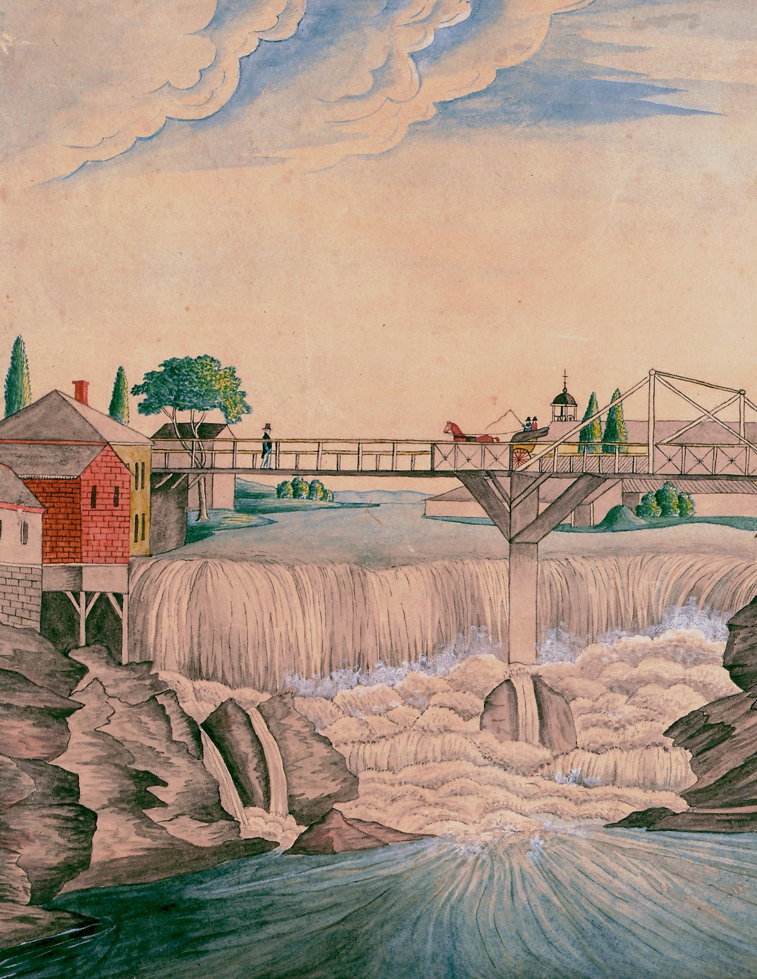
u.s. postage pai D m ilfor D , C t permit no. 80