+64 27 269 9542 ri�atata@gmail.com linkedin.com/in/ri�a-assifa


+64 27 269 9542 ri�atata@gmail.com linkedin.com/in/ri�a-assifa
Dedicating myself as a civil servant in Indonesia's government institutionengagedinconstructionsector.
Focused on providing reliable residential housing for low income communities in remote area. Previously worked as an Junior Architect in architecture studio producing detailed design of buildingsandlandscape.
Interested to enhance knowledge about disaster risk and resilience in correlationwithsettlementplanningin highereducation.
2015-2019
2024-present
Bachelor of Architecture (S.Ars.), Faculty of Engineering, Universitas Gadjah Mada
Master of Disaster Management (MDisMgt) Faculty of Engineering, The University of Auckland
2013-2015 Padmanaba Hiking Club
Staff of Living Environment Division 2016-2017 KMTA “Wiswakharman”
Staff of Talent and Interest Division 2016-2017 Symposium “Redefining Local Architecture” Coordinator Indonesia-Japan International Collaborative Symposium “Looking Beyond Disaster”
2017-2018 Coordinator
PT. Arsigraphi
Architect Intern
Participated in designing architectural projects and creating Detail Engineering Design for office, houses, and parks
CUDD (Centre of Urban Design and Diffabilities)
Intern
Moreids Architect
Junior Architect
Collected and mapped urban data around Purwosari Rail-Station for TOD (Transit Oriented Development) project
Participated from planning to construction on some projects such as private housing and government’s public space
Ministry of Public Works and Housing
Building Engineer
Planning, monitoring, evaluating, and doing some administration in housing and settlement construction
MinistryofPublicWork
TechnicalStaff
Volunteered in designing and building a Simple Instant House (RISHA) post-earthquake in Lombok, West Nusa Tenggara
FacultyofEngineering,UGM
Architect
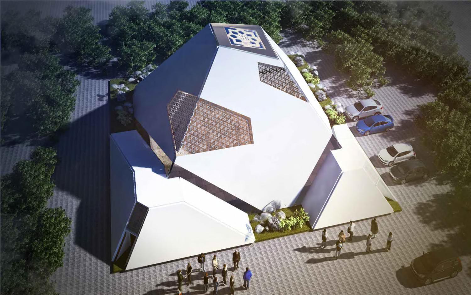
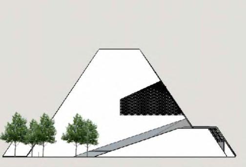
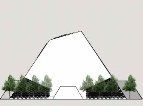
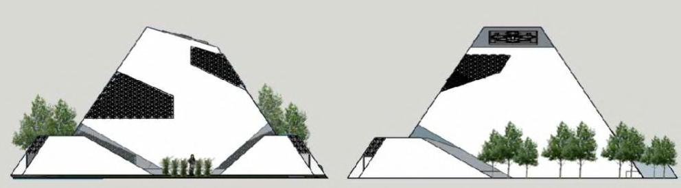
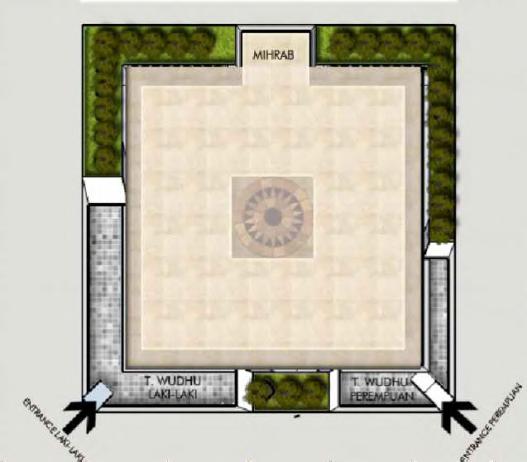
Designed mosque in Palu with local wisdom approach in context to post-disaster revitalization
Universitas Indonesia
Commuter Line Station, Depok
Ciganjur Urban Forest, Jagakarsa, South Jakarta
Trauma Healing Through Agriculture
Mangrove Conservation Center, Bantul
Trirenggo Agricultural Market
Redesign Imogiri
Traditional Market
Redesign Wisdom Park, Universitas Gadjah Mada
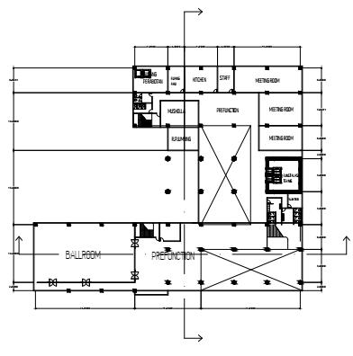
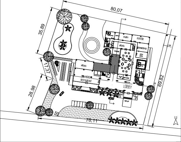
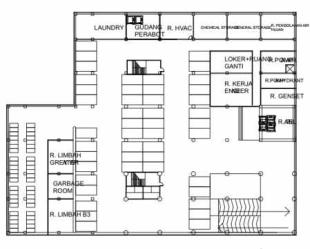
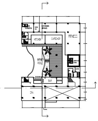
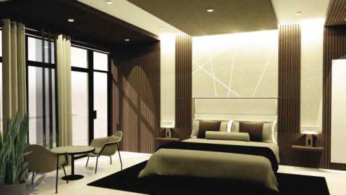
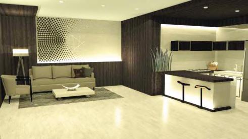
Cereparc City Hotel
other projects
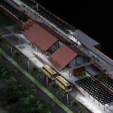
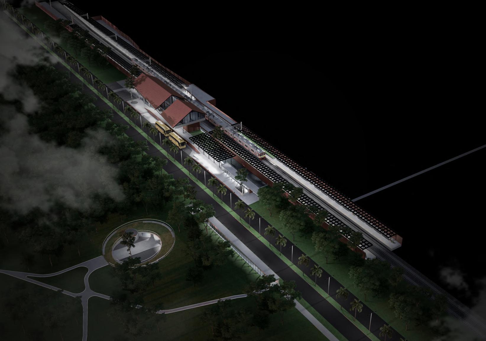
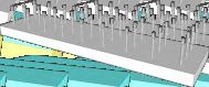
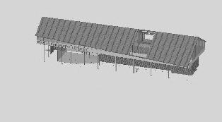
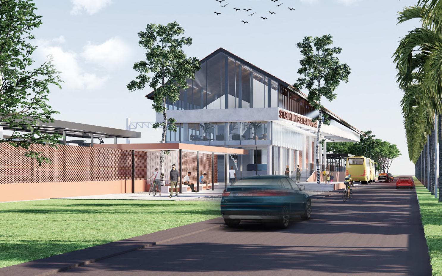
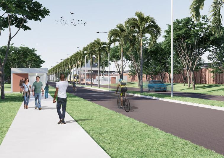
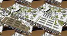
University of Indonesia is a campus that located in Depok, West Java. The UI campus area in its planning up still prioritizes environmentally friendly and tries to be inclusive, with integrated public transportation modes using KRL (Commuter Line). UI Station is the main gate for all UI academics who use this mode of transportation, and all KRL passengers will continue their journey on foot or delivered by Yellow Bicycle, facility provided by the campus. in line with the development of the city of Depok, the location of this station is also a door to the mode of transportation of public vehicles that cross the Margonda road through the residential neighborhood road that we know as Barel (turning rail). But in reality today, the use of the UI station is not only by the UI academic community,butalsoforpublicaroundtheUIcampusareafordailyactivities.
Pedestrian Private Vehicle Ui’s Yellow Bus
UI rail-station as a main gate
Universitas Indonesia
Transformed headbody-foot hierarchy
structure S i m p l e deconstructi on based on previousstyle
O N C E P T Development of UI Architecture
The search for a new identity.
adaptation.
CommuterLine
Controlling People’s Mobility around the site
Trying to answer the challenges
change, energy efficiency.
The pattern of development in t
U I a r e a follows the main c
m p a s s directiongrid.
transportation for all People’s Mobility
Focus on pedestrian and commuter line’s passenger
Impression of Architecture following
Using a vernacular architectural style, similar to the style
A combination of the UI grid with the urban fabric, aiming to merge t w o d
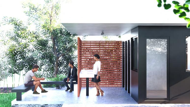
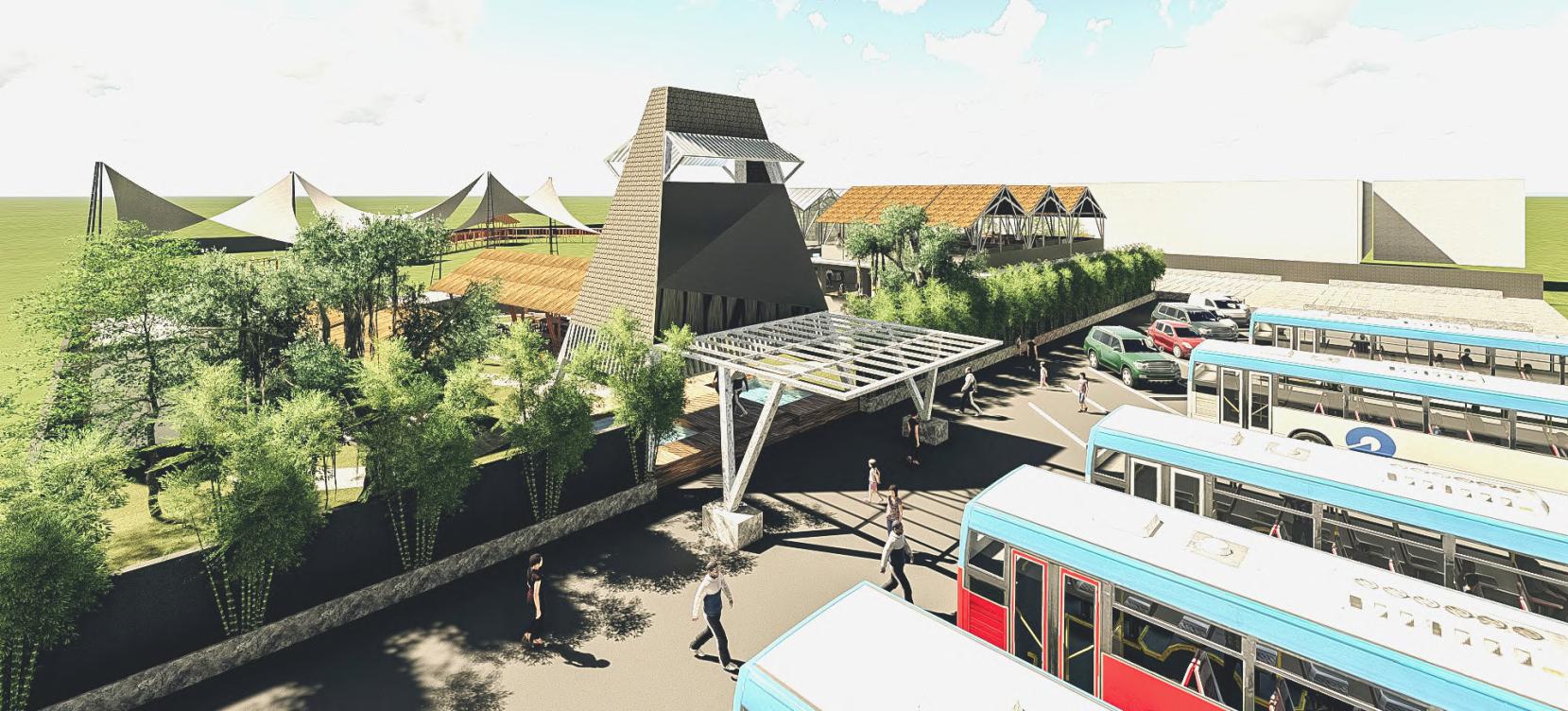
The activity node around the station became a meeting spot for pedestrians from Kober, stations, bus stops and vehicles from the entrance to the UI campus.
Because of its role as a meeting point, this area is always crowded with pedestrians a n d a n y v e h i c l e


ost buildings at Universitas Indonesia(UI).
s t i n c t ownerships.
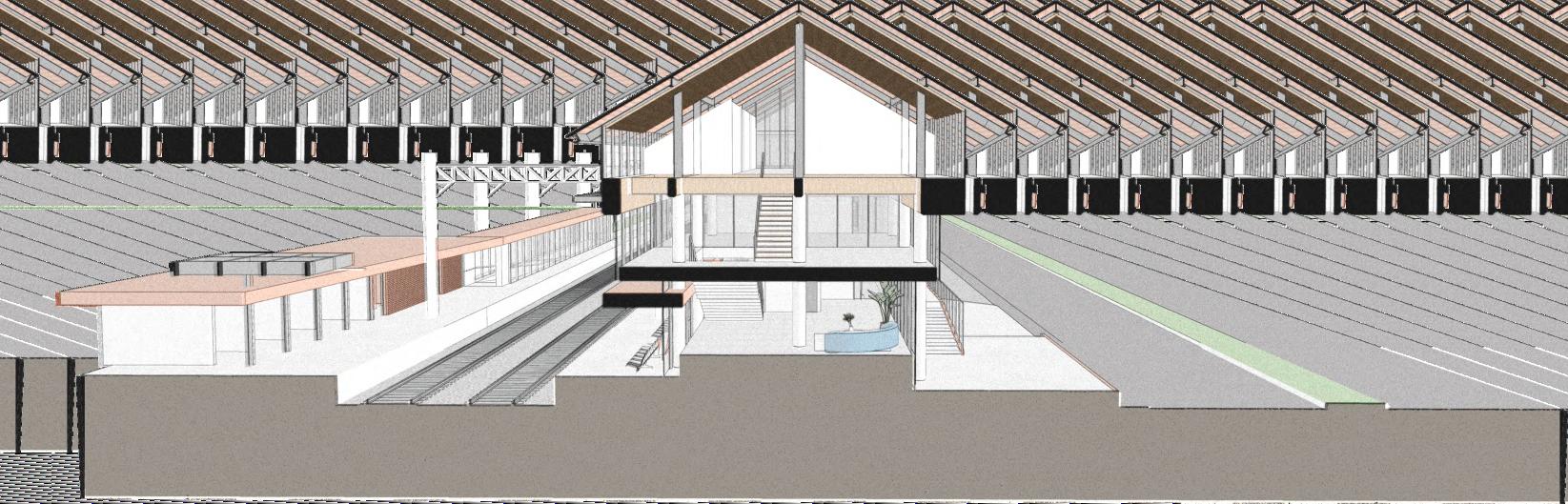
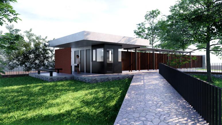
UI Station is located between the campus area and PT KAI's land. Where there is a negotiation between land owners to provide facilities for the UI academic community and the surrounding community. Its presence also appears as a negotiation between the two parties or even several parties. For the sake of facilitating trips to all destinations for further activities. Making this building close to the UI campus area either as a gate, KRL user transition space, or considered one of the UI campusareabuildings.
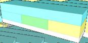
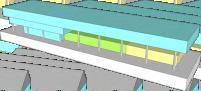
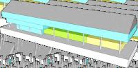
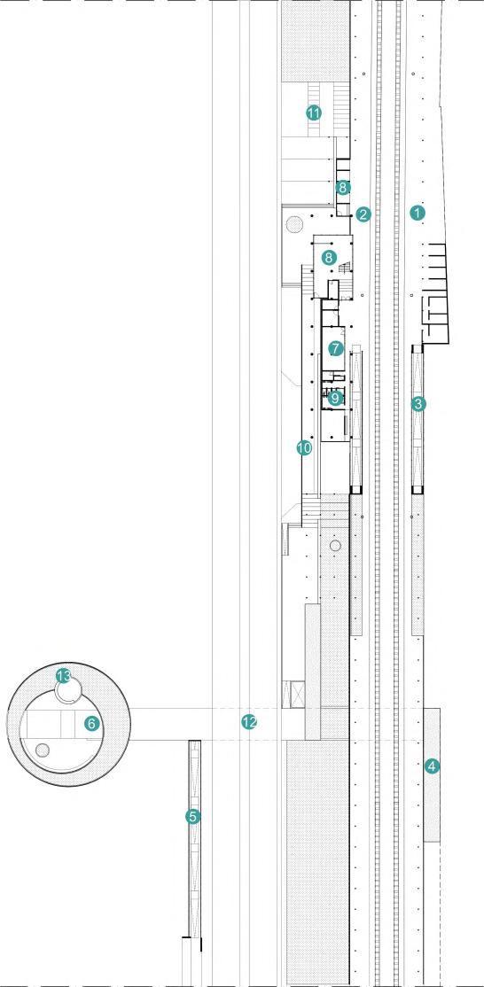
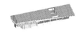
MEZZANINE as inspector room and waiting room for visitor
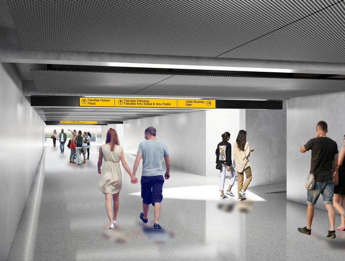
STATION PLATFORM waiting roo m for Commuter Line Passengers that connected with tunnel
KIOSK
4 kiosk for commercial needs around rail-station
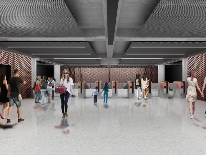
1st FLOOR as lobby/office visitor transit area


2nd FLOOR as staff’s office
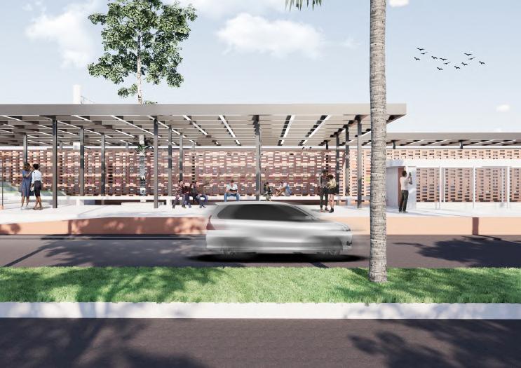
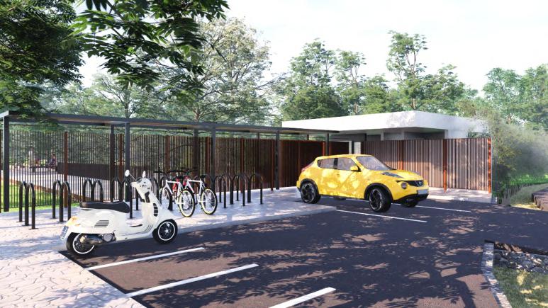
SHELTER
as waiting room for drivers and station visitors who continue their journey using taxibike. This area is connected to halte and entrance


IncollaborationwithFarrizkyandKunardi 2020
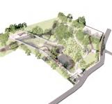
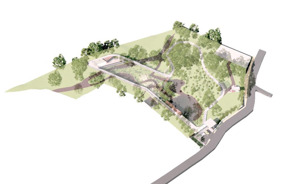
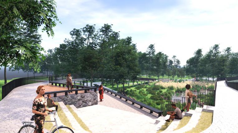
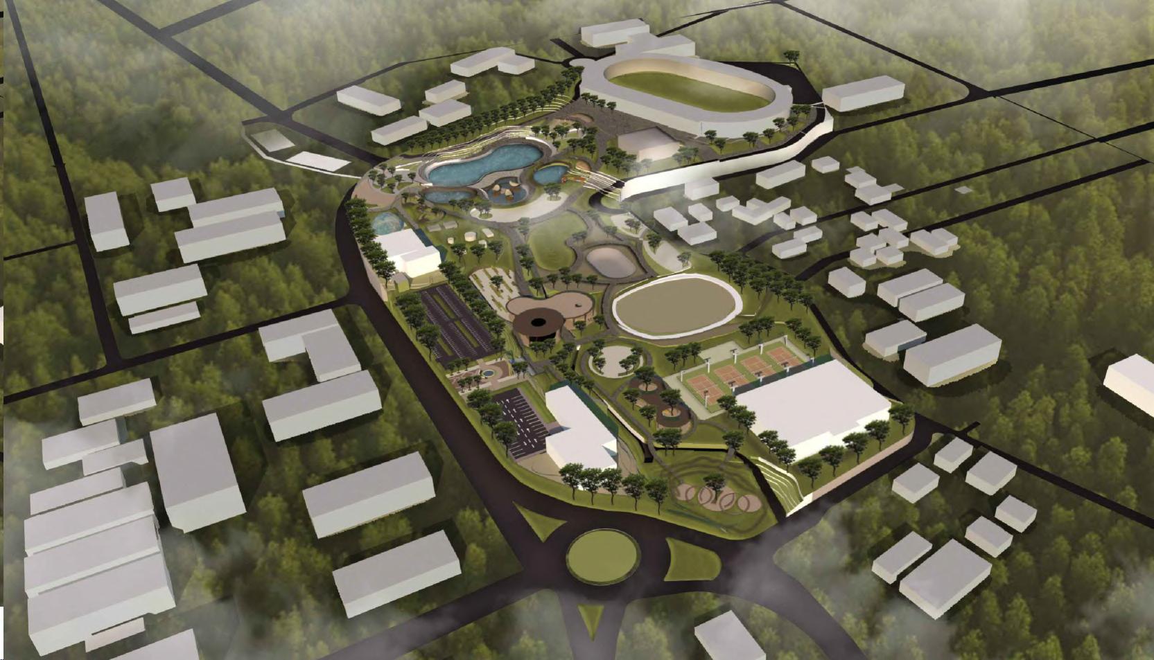
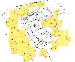
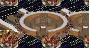
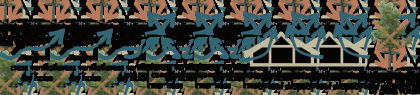
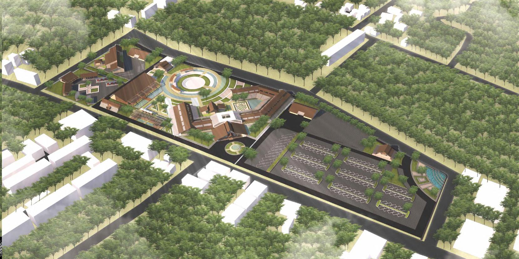
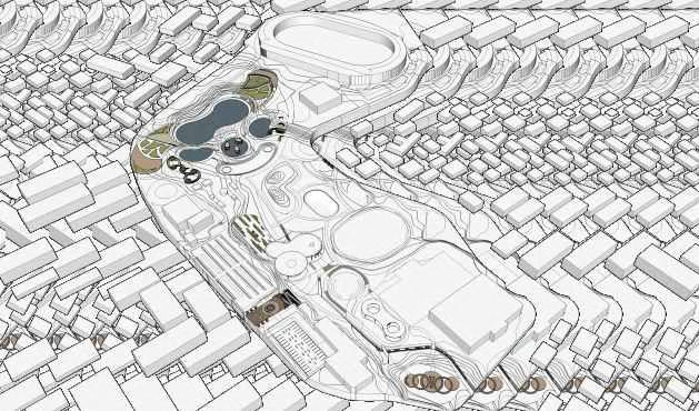
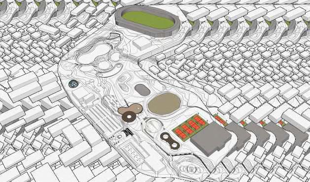
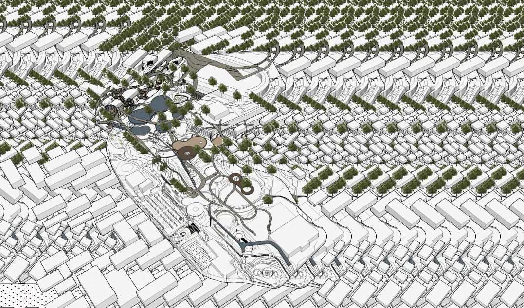
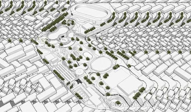
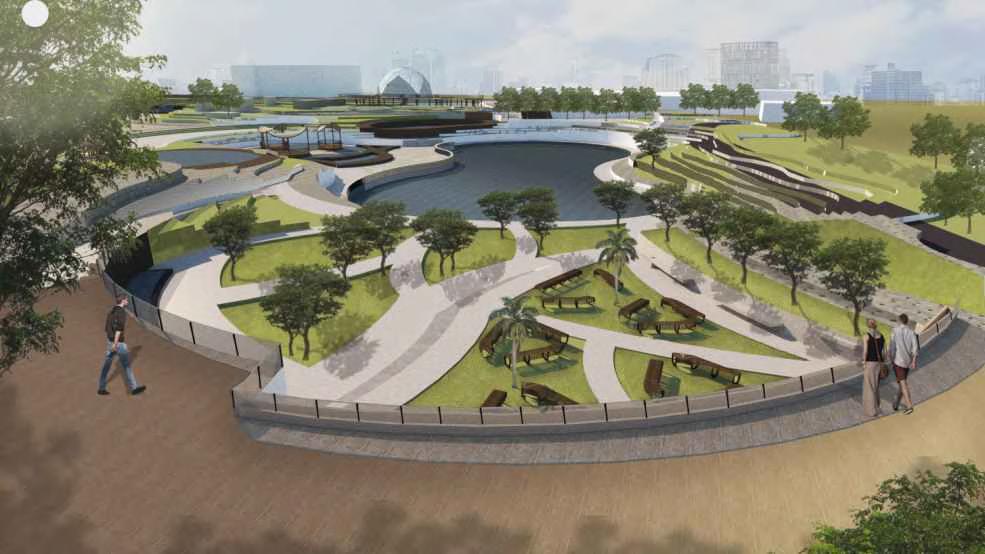
The presence of City Forests as a form of public green space with ecologicalfunctionscontributesto the conservation of biodiversity, the provision of clean air, water catchment areas, and at the same time gives a social function for interaction and cultural spaces for DKI Jakarta residents. The limitations of public green open space in Jakarta nowadays can give a negative impact through cities, ranged from reducedgroundwaterloads,increasedtemperatures,anduncontrolledairpollution.
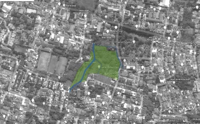
The Jakarta Province’s Park and Forest Service through the Forestry Sector in 2020 will conduct the utilization and development of urban forests in several areas in DKI Jakarta, specifically the City of South Jakarta. The one of construction sites are in Ciganjur that located in Jagakarsa, South Jakarta Regency.
The urban forest still needs to be developed to improve the quality of infrastructure facilities. This certainly will support the existence of the City Forest as a place of conservation, as well as being a recreational and educational area for residents around the City Forest. Therefore it is necessary to arrange a comprehensive, anticipatory and futuristic plan to support an urban forest that attracts its citizens to visit as well as a flora and fauna conservation area and supports biodiversity around the City Forestarea.
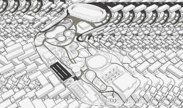
BACKGROUND ISSUES
Dense Pattern of Existing Vegetations
STRATEGY
Domination of Vegetations
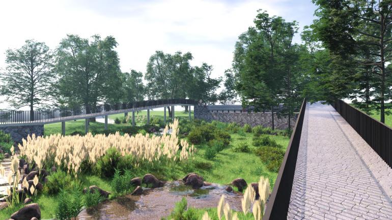
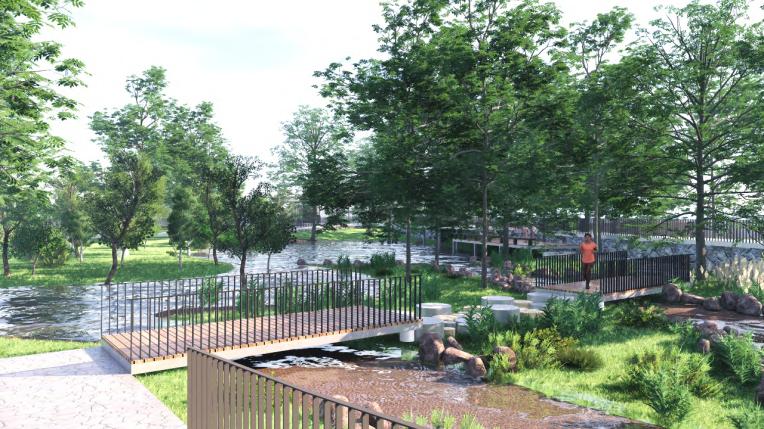
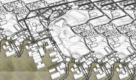
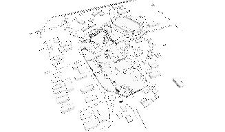
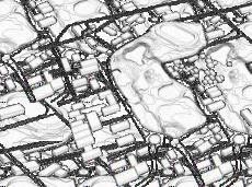
This 10,036 m2 land has a relatively flat topography. At present the site is a green space in a residential area in the form of a stretch of grass with a dense vegetation point.
Inside the site there is a river that flows from south to north. Soil conditions around the river tend to be always wet. This 3-4m wide river has the potential to overflow in the rainy season so it can floods the entire site especiallyatlowercontours.
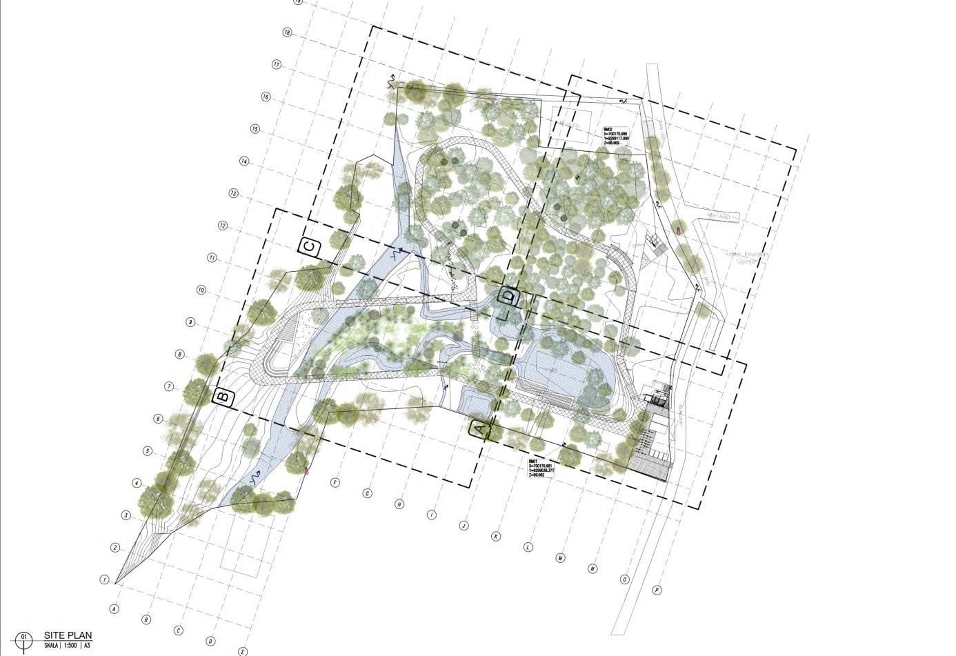
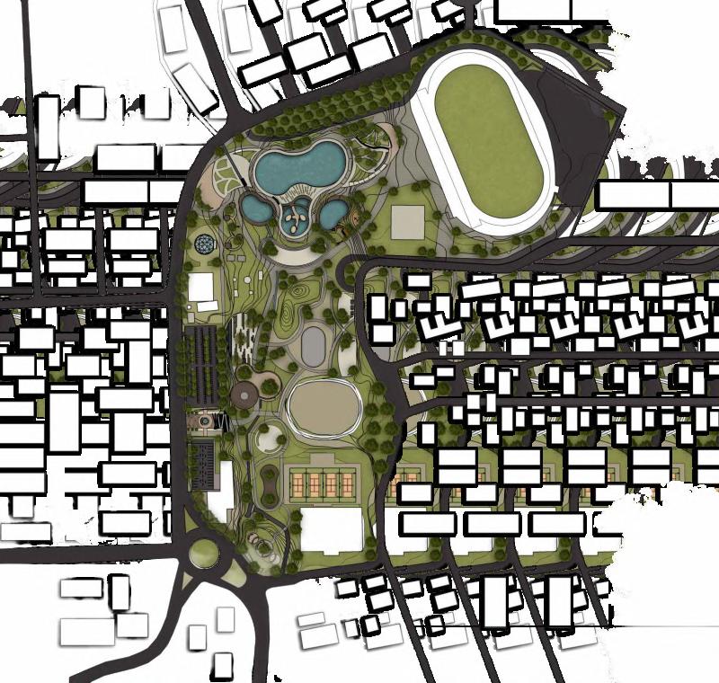
CONCEPT
Architecture as Nature’s Supporting Elements
Neighborhood Density
Separated Mass Pattern
Uncompact Features
“Forest Camuflage”
- Conservation - Nature Attraction
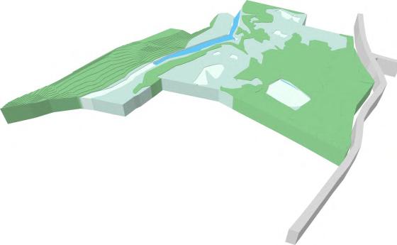
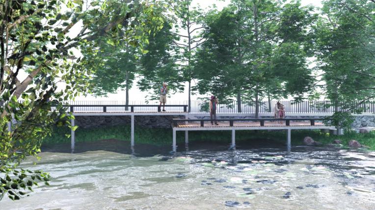
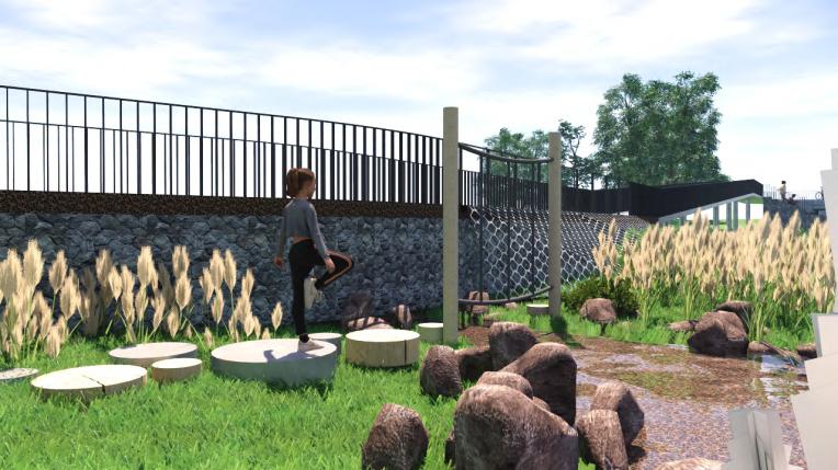
Existing contours tend to be flat. In the area around the pool, when it rains it is prone to flooding because there is no significant difference in height levelwhenriveroverflows.

The pond is used as a reservoir by increasing the depth and equipping with swales that connected to the source of water flow (river) The response to flooding is intended by making wetlandsinflood-proneareas
in collaboration with Auliya Hisyam, Pita Asih, Bimanova, Ancilla Krissanti, Kristania Debora Eri Fajrianik, Arie Pandi, Alifa Putri, Nafianty
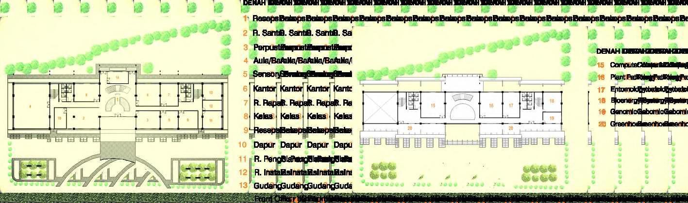
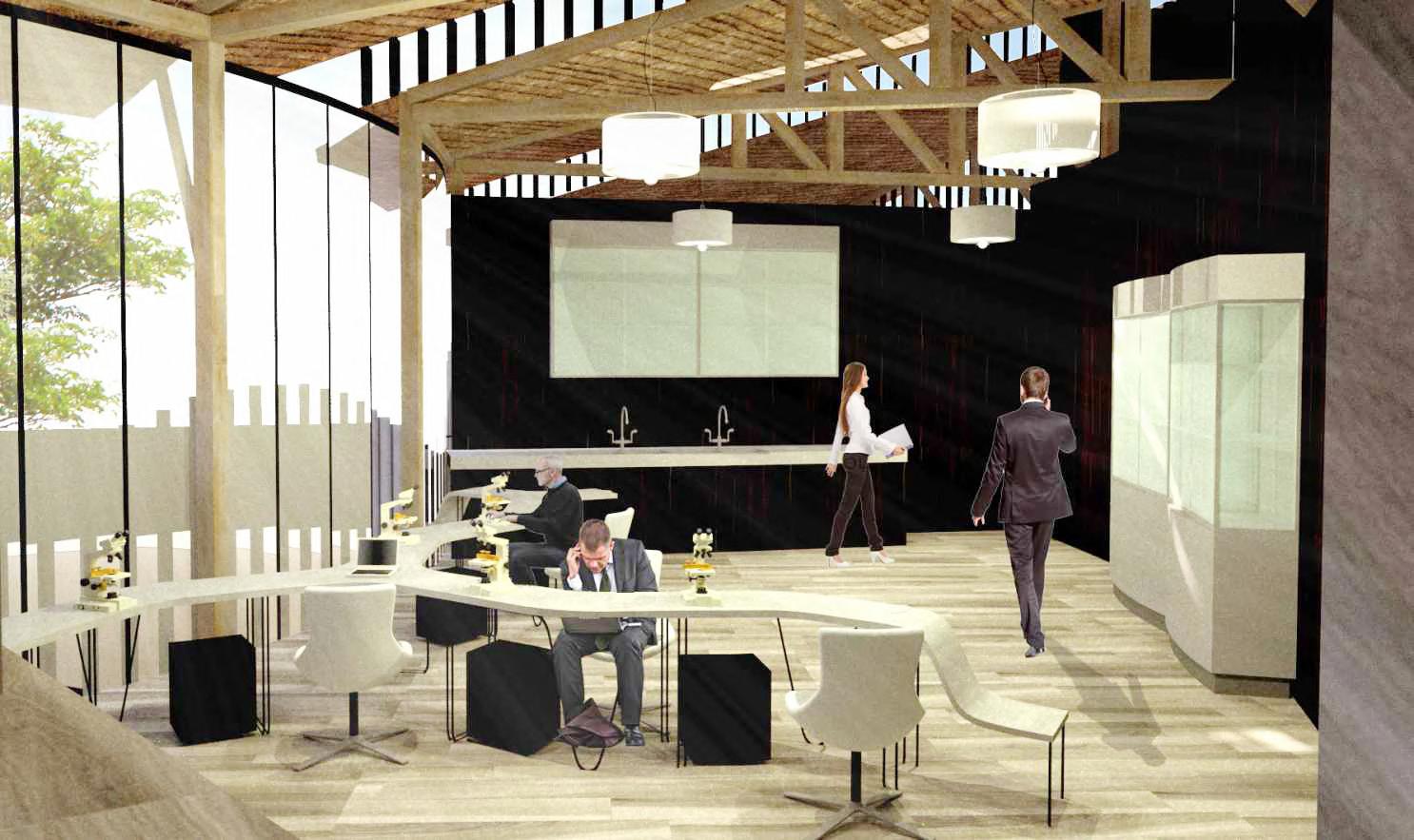
I participated in making layout of siteplan and designing research center
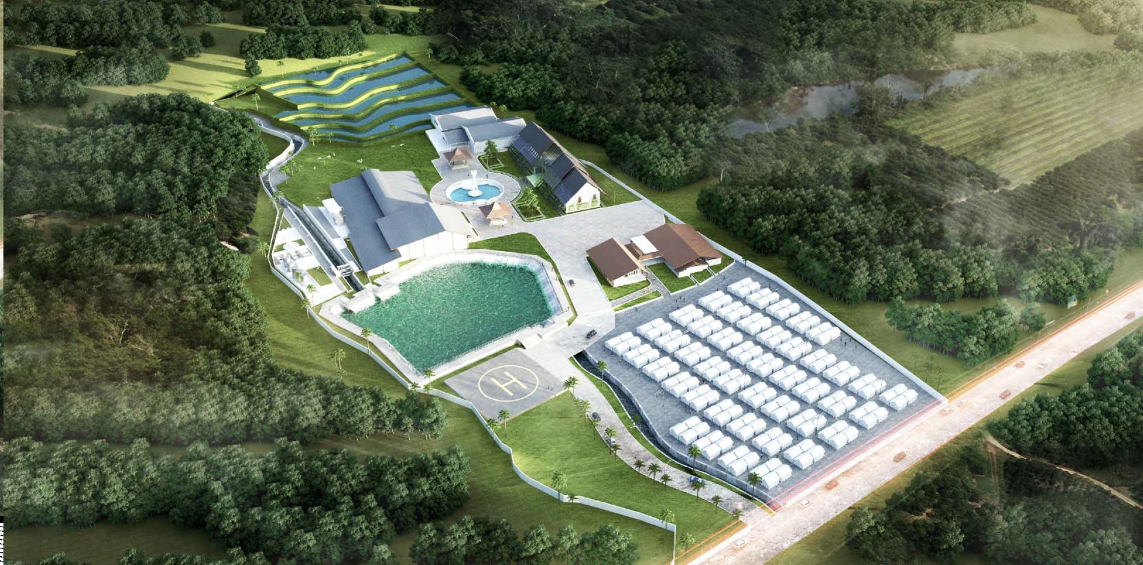
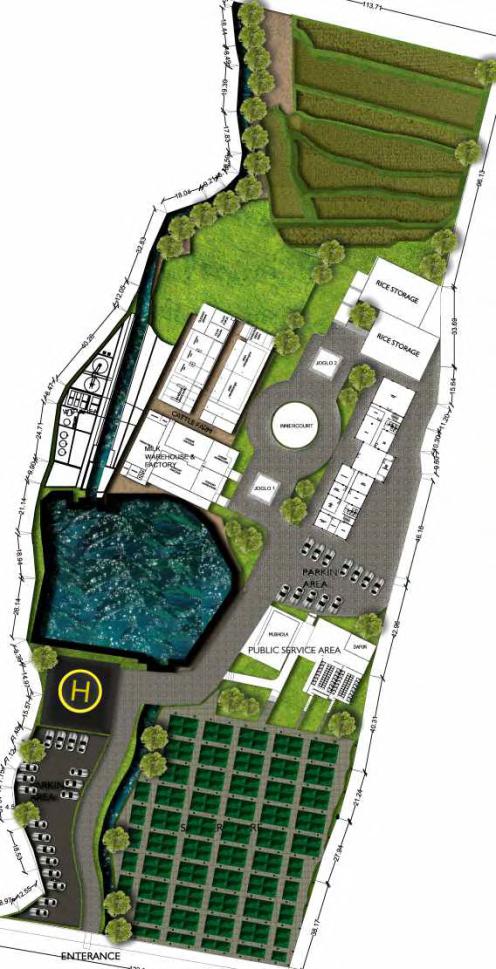
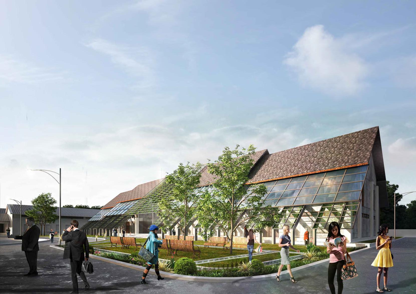
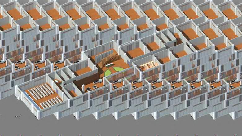
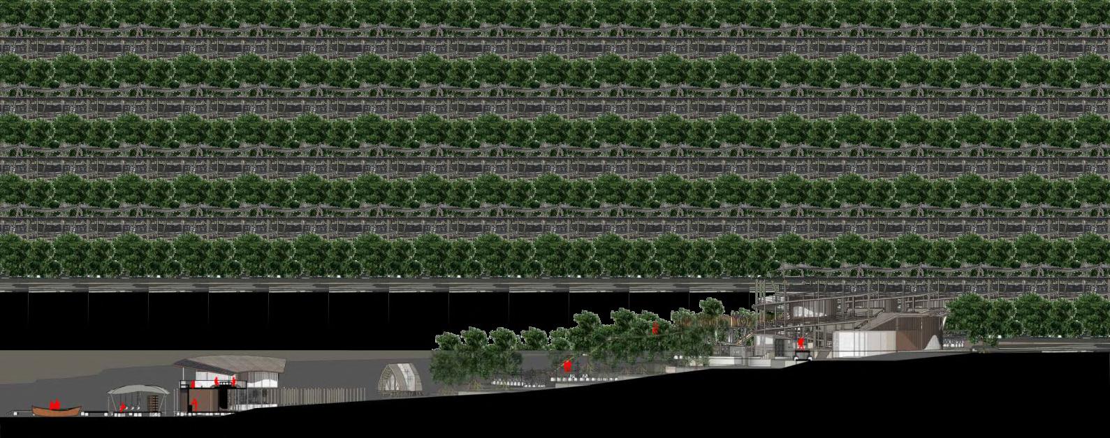
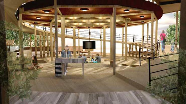
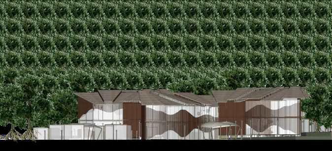
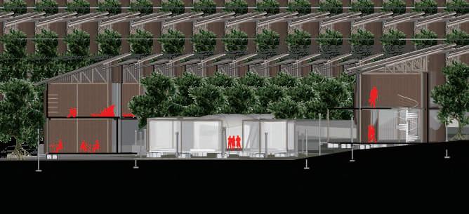
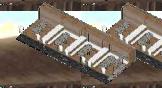
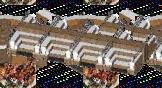
Eruption victim shelter, accompanied by the development of the Empowerment and Research Center for Food Materials. This facility focuses on the escapement stage in the mitigation process of eruption disasters and independent efforts to achieve sustainable energy through education and researchintheagrarian fiedthatisinlinewithpeople'slivelihoods.
Mount Merapi is one of the most active volcanoes in Indonesia. Eruptions of Merapi occur relatively frequently, which is attributed to the internal geometry of the volcanic system, generally happening on average every 5 years. The average volume of erupted material from Merapi is about 10 million cubic meterspereruption.
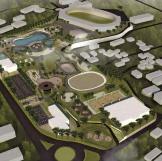
Conserved Forest
High Density Settlement Area
Medium Density Settlement Area
City Centre
Rural Settlement and Agricultural Development Area
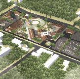
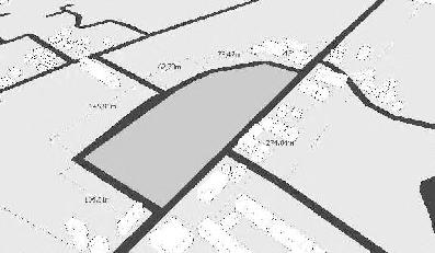
Distance from Jetis Suruh Site to Mount Merapi Peak: 16.07 km
Total Land Area: 356,491.4 m²
Land Surface Area: 314,707.44 m²
Reservoir Area: 30,000 m²
River Area: 11,784.11 m²
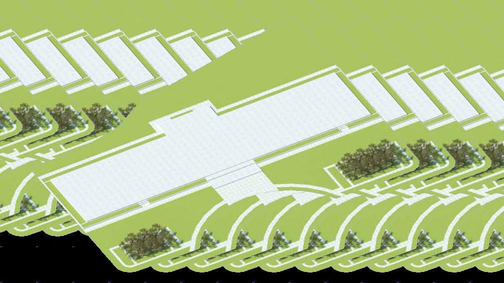
Jalan Palagan KM 13, Donoharjo, Ngaglik, Sleman. This place is an agricultural area supported by a reservoir as a water supplier. Its location is quite far from the peak of Merapi. This area is considered safe from the impacts of Merapi, thus able to provide an escape facility for the original settlements, which are disaster-prone areas.
TIMEFRAME SCENARIO
Occurs Potential damage to residents' houses and death of residents' livestock Decline in residents' psychologica l condition due to loss of property, and the emergence of trauma from the disaster
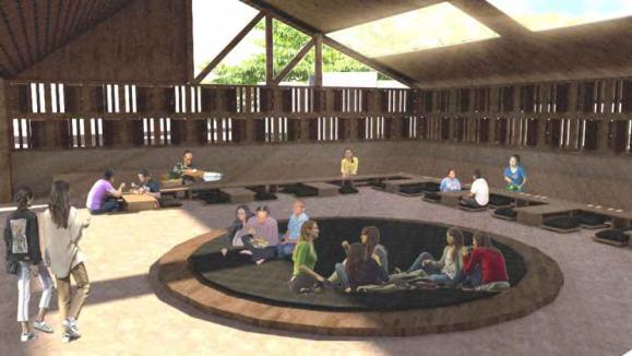
Residents gather in evacuation barracks, expected to calm psychological conditions and eliminate disaster trauma Disaster shelters are designed to reduce psychological problems and trauma through the development of regional potential, namely agriculture and livestock
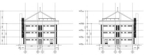
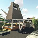
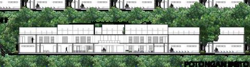
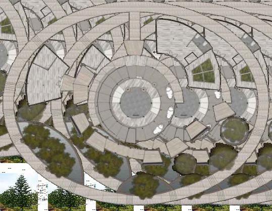
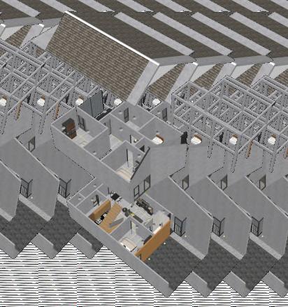
The research center zone is located on the eastern part of the site, with the building oriented facing north.
The building is designed in a longitudinal form with a single circulation path, to facilitate an efficient evacuation route
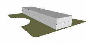
The building is constructed with two floors to accommodate spatial requirements and adapt to the local neighborhood context
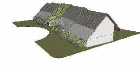
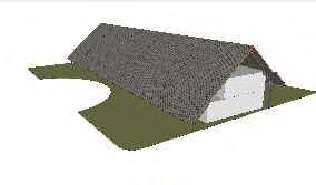
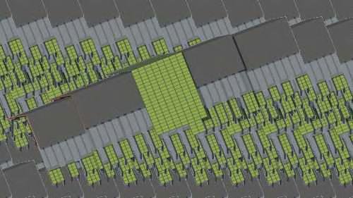
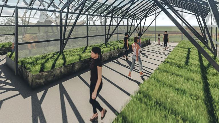
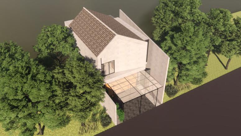
The greenhouse area is designed with transparent elements in the form of a glass roof to enable optimal plant growth.
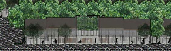
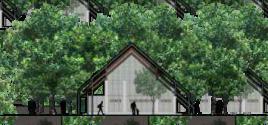
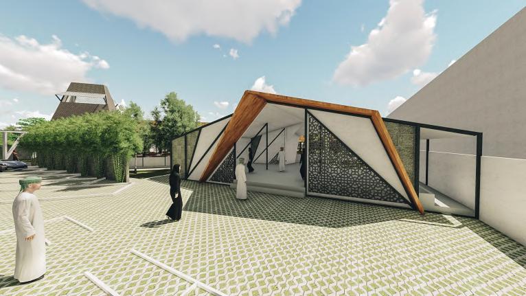
The building's placement considers the surrounding site conditions, so spatial expansion is carried out horizontally. This is because the surrounding buildings don’t have significant height, making the step design a base for the roof with a 45-degree slope.
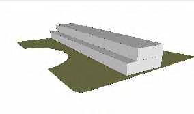
Because the need for space on the second floor is less than the first, the building mass is designed with a stepped form.
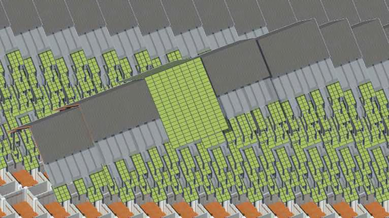
LEVEL 2
GREENHOUSE
COMPUTER WATER MODELLING PLANT
PATHOLOGY ENTOMOLOGY LAB
BIOENERGY SYSTEM
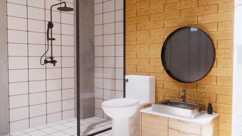
GENOMIC LAB TOILET


HANGING
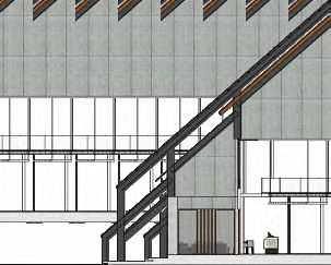
ROOFING ANGLE OF 45 DEGREE
Responding to the impact of the eruption so that the eruption's ejected material can quickly fall to the
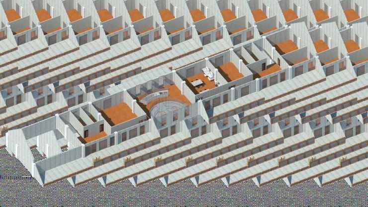
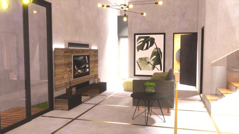
LEVEL 1
FRONT OFFICE AND ADMINISTRATION
LOUNGE
CONFERENCE ROOM
CLASSROOM OFFICE
LIBRARY MEETING ROOM
SENSORY EVALUATION
TER AND WASTE LAB
WASTE MANAGEMENT PLANT
WASTE INSTALLATION
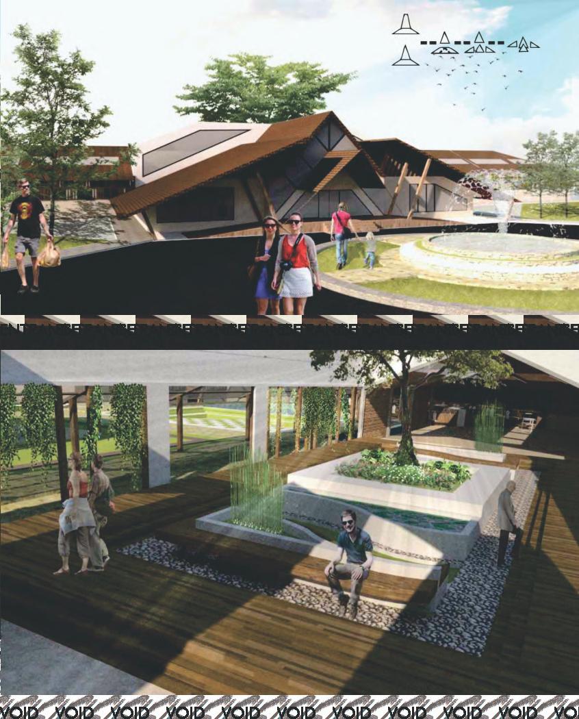
HANGING PLANT ROOF
To reduce the bulky appearance of the research center building and to emphasize agrarian characteristics in line with the building’s function
Bachelor’sofArchitectureFinalProject
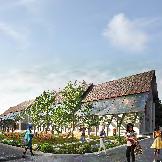
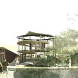
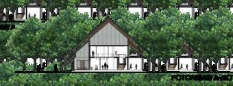
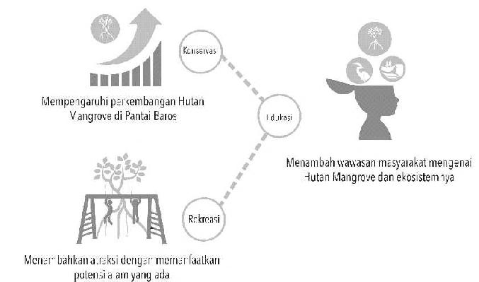
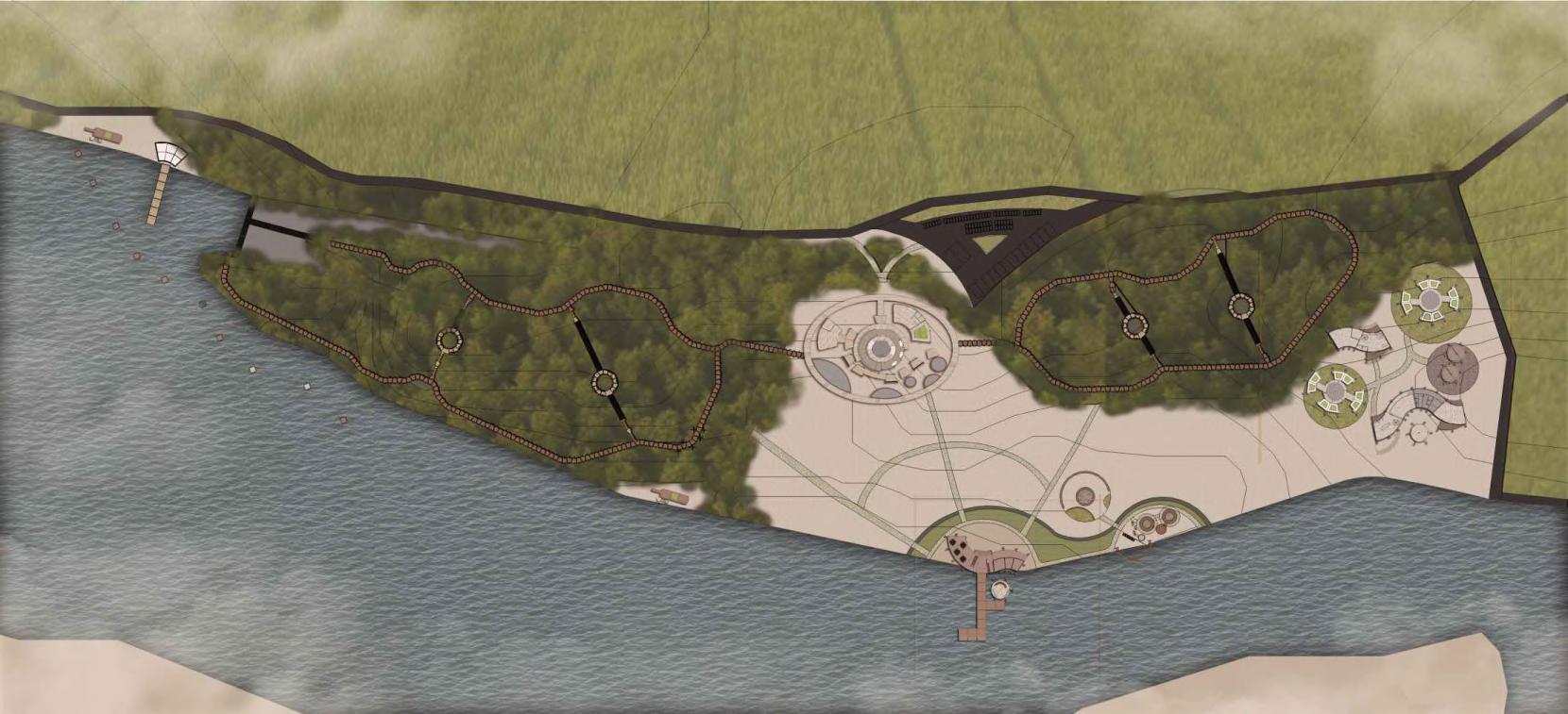
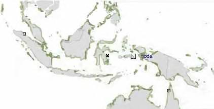
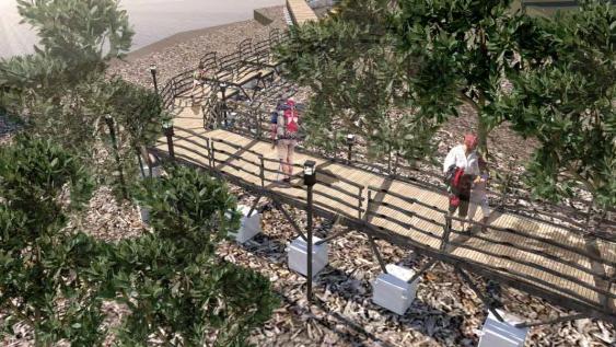
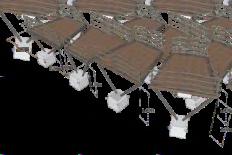
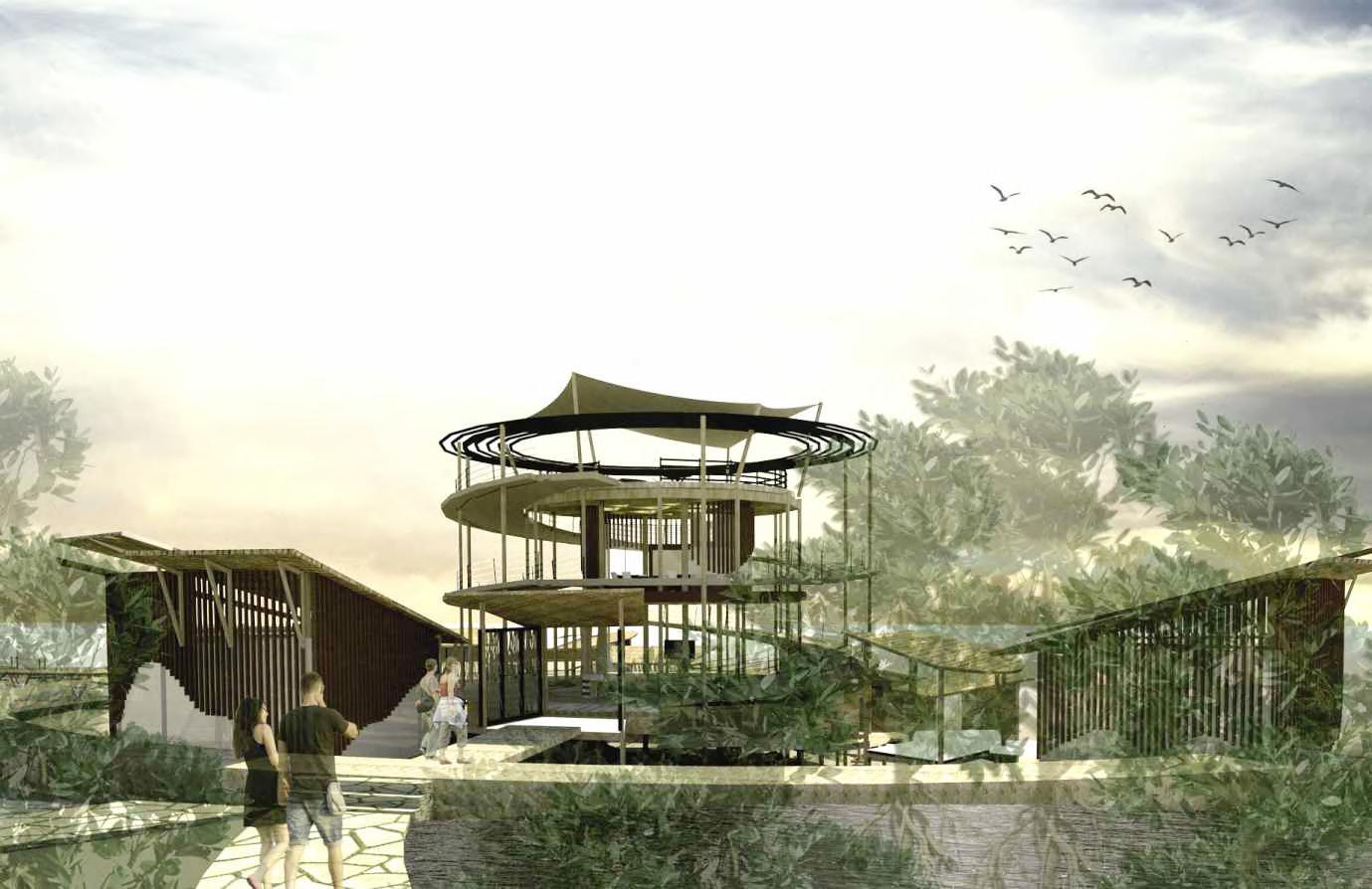
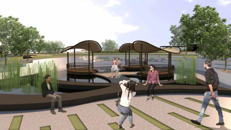
The design of the Mangrove Conservation Center is an effort to facilitate conservation, education and recreation activities in the Mangrove forest area at Baros Beach, Bantul Regency. Procurement of this facility specifically deals with mangrove plants and bioticabioticenvironment that compose the mangrove ecoystem.
Symbiosis in architecture as an approach in design is used to unite two different things into something new, to have a good impact on both parties and can achieve the prospects and expected feasibility and to synergise building masses as the main activity with the surrounding environment as supporting activities. By using the "Eduventure-Treehouse" concept, this facility provides edu-eco tourism activities which are packaged in natural adventure-based learning for tourists and forest management activities that take place in artificial structures that blend with the structure of mangrove forests, thus achieving the effectivenessofmangrove conservationactivitiesthatintegratedwiththeenvironment.
Give attractions by using existing natural conditions
Baros Mangrove

How can space enhance the effectiveness of conservation activities involving community participation?
How can the flow and characteristics of space educate visitors about its importance?
How can natural conditions become elements that bring out spatial characteristics that are enjoyable for users?
1.
A space that can enhance the effectiveness of conservation activities by the local community 2.
The flow and characteristics of a space that are educational and can encourage visitors to get involved in conservation
Attractions that utilize existing natural potential


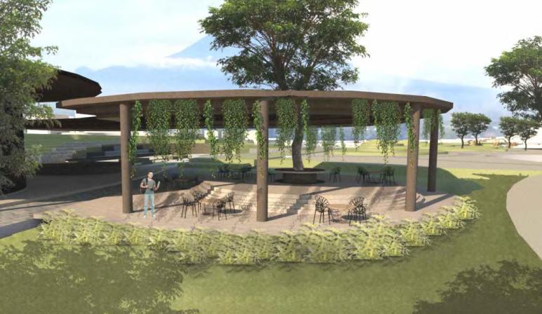
As thecitycontinuestogrowmoredensely populated,thereisaneed forafunctionalshift,frombeing a "necessary site" to becoming an "urban recreation" space. Urban recreation is represented by open publicareasthatoffervariousrecreationalfacilitieswithinthecity. However, in reality, the existing open spaces have not yet been able to fully accommodate public activities,astheyareprimarilyusedbyspecificgroupsonly.
The site is located in the Universitas Gadjah Mada area, specifically in Karangmalang, Sleman Regency, Special Region of Yogyakarta. It is flanked by two prominent universities in Yogyakarta as well as residentialneighborhoods.

“COMMUNITY-BASED
in collaboration with Adimas Arief and Thalia Putri under supervision of Kurnia Widiastuti, ST., M.T. and Ir. Ahmad Sarwadi,M.Eng.
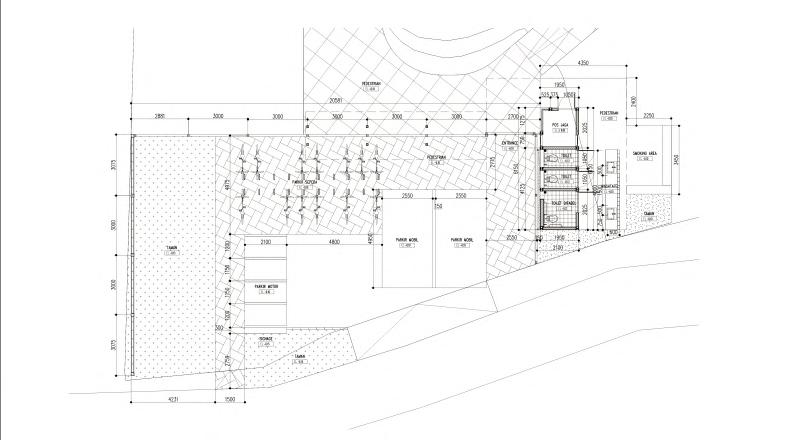
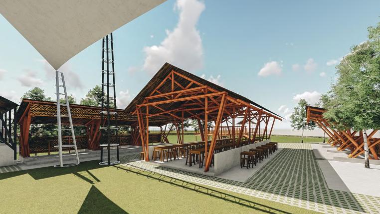
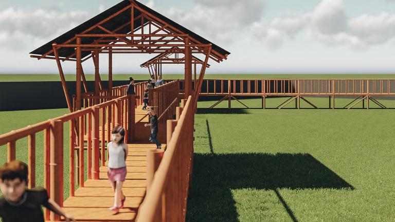
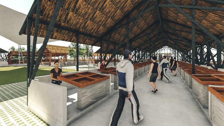
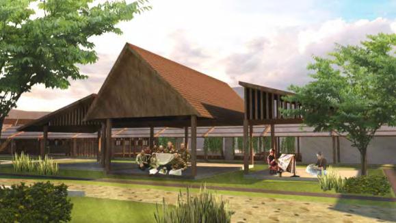
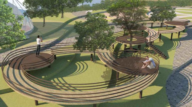
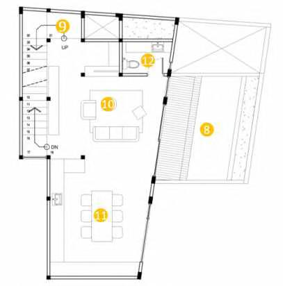
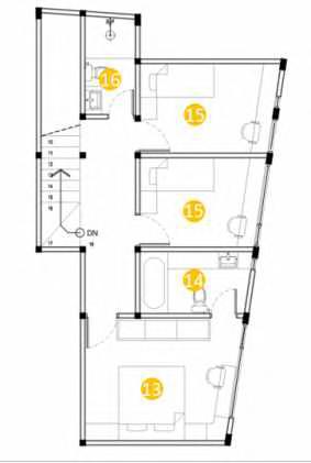
Traditional market sponsored by local government that can give place for community to do various productive agricultural activity, such as selling the village’s potential comodity, performing art or culture, and community (female farmers) enhancement. This market is also open for tourists, it provides some attraction based on village’s vibes and atmosphere that supported by adding ‘saung’building’forenjoyingricefieldsandnaturalmaterialuses.
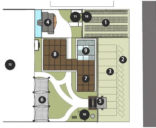

1. motorcycle parking
2. bus parking
3. car parking
4. musholla and toilets
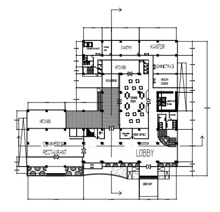
5. lobby
6. multifunction room
7. market and office
8. market and restaurant
9. glasshouse
10. playground
11. toilet
12. saung and bridge
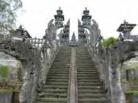
Imogiri is one of the sub-districts in Bantul Regency, Yogyakarta which has a lot of potentials in tourism that based on local wisdom. However, this potentials have not been widely known and are threatened by the lack of tourist interest in these tourist destinations, especially tourist village destinations with their community of artists. Imogiri Market is one of solutions to these problems. The market is built to become tourist destinations that will offer and showcase some local wisdom from Imogiri with the aim of prospering the community in Imogiri and rebranding Imogiri's distinctive culture that is slowly being forgotten.
By raising the concept of Interaction, buying, selling, and recreation activities in this market will lead to a mutually beneficial relationship between sellers who are local communities and tourists. Travelers will get education about creativity and culture from the local community, while local communities will get productivity so that the Imogiri culture can be preserved. In the pre-designed market, it also provides a network of tourist destinations in Imogiri by using traditional transportation in the form of rickshaws, horsecartsand onthelbicycles.
Increasing productivity and economy Rebranding Imogiri’s cultures Integrating among tourism villages


Address:
Imogiri Timur Street KM. 9, Garjayo, Imogiri, Bantul, Daerah Istimewa
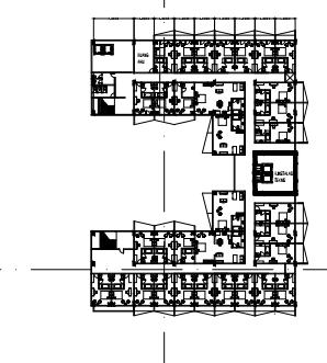
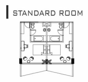
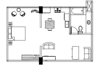
Max height: 12 m


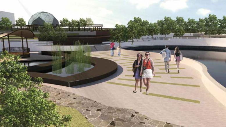
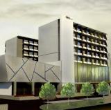
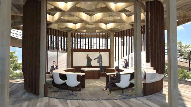
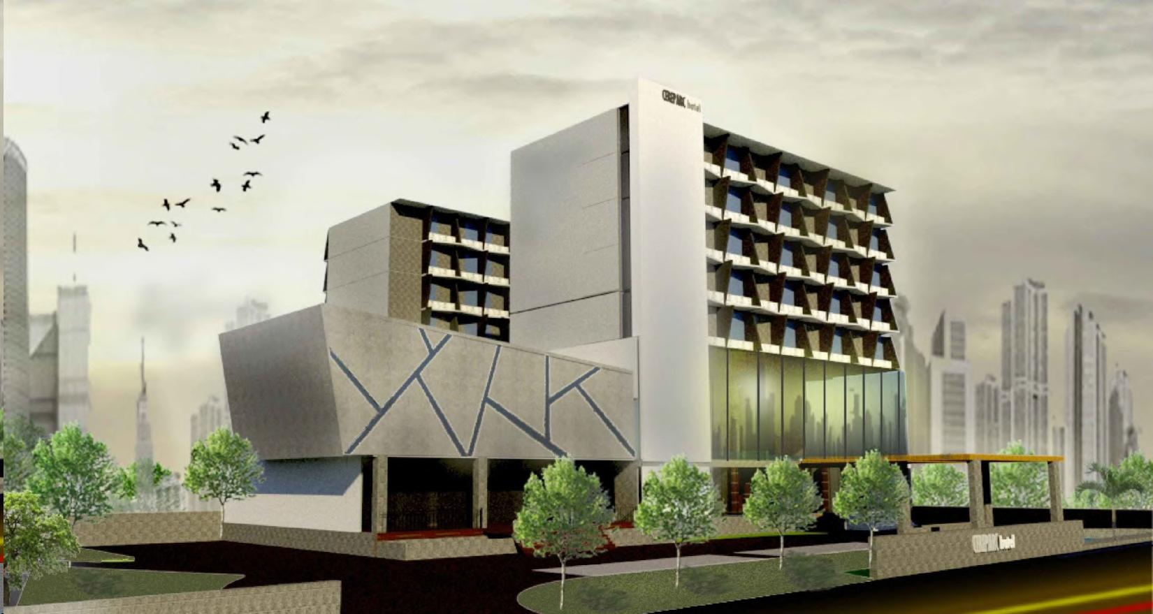
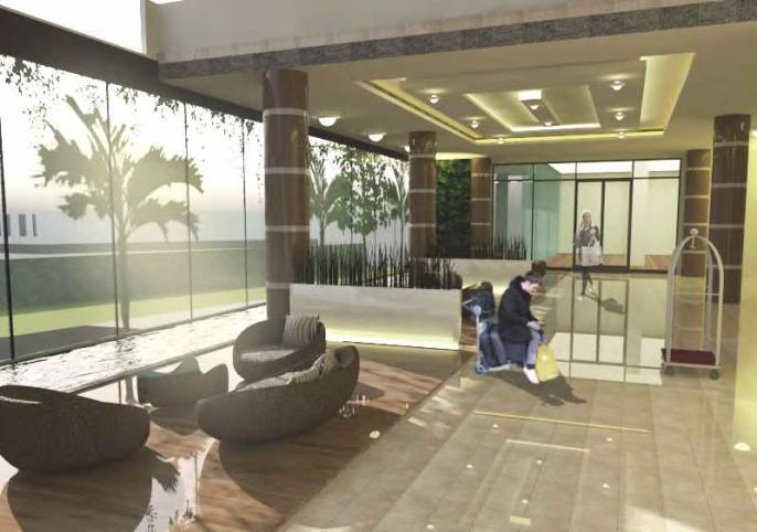
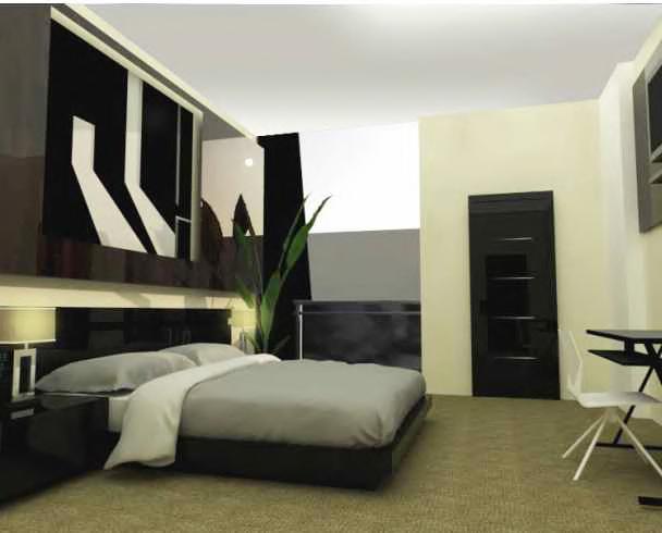
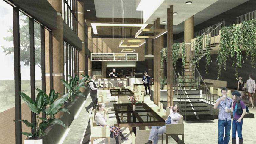
A city hotel that blends urban living with the natural ambiance of village life, infused with the local cultural wisdomofYogyakarta.
Located in the heart of the city and flanked by two of Yogyakarta’s prestigious universities, the site holds great potential as a resting place for tourists, businesspeople, and locals alike. By combining the dual charactersofurban&village,Cereparcpresentsahotelthatofferscomfortandcharm.
ThenameCereparcisderivedfromtwoLatinwords:Cereum(angular)andParco(garden).
-Cereumisreflectedinthebuilding’smodern,angularform,truetoitsurbancontext.
- Parco is embodied in the green balcony feature installed in every room, with amenities oriented toward UGM’sWisdomPark,offeringascenicview.
The hotel also incorporates cultural elements: an amphitheater and the use of traditional materials such astemplestoneandwoodevokethespiritofYogyakartaasacityofheritage.

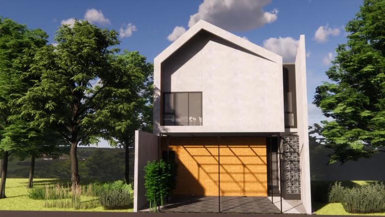
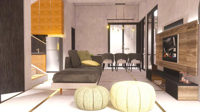

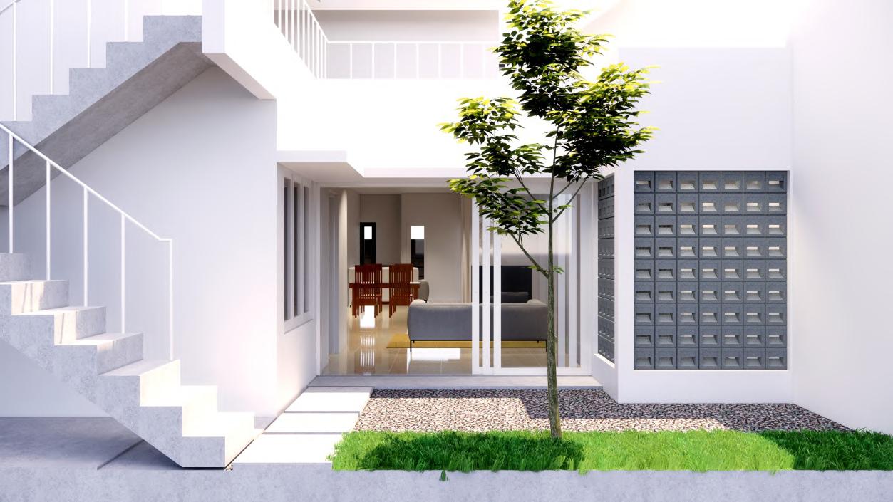
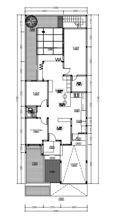
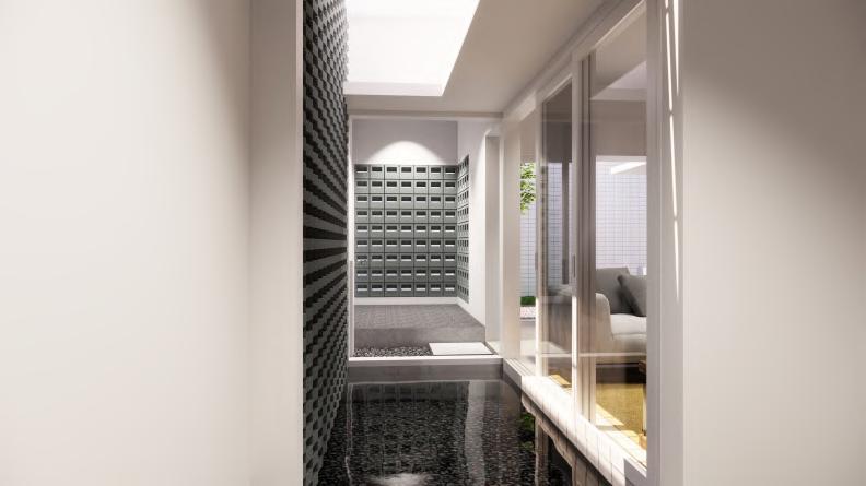
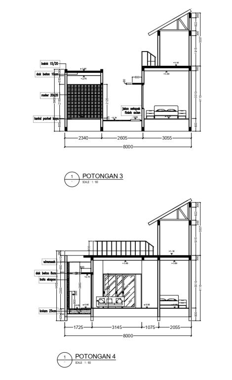
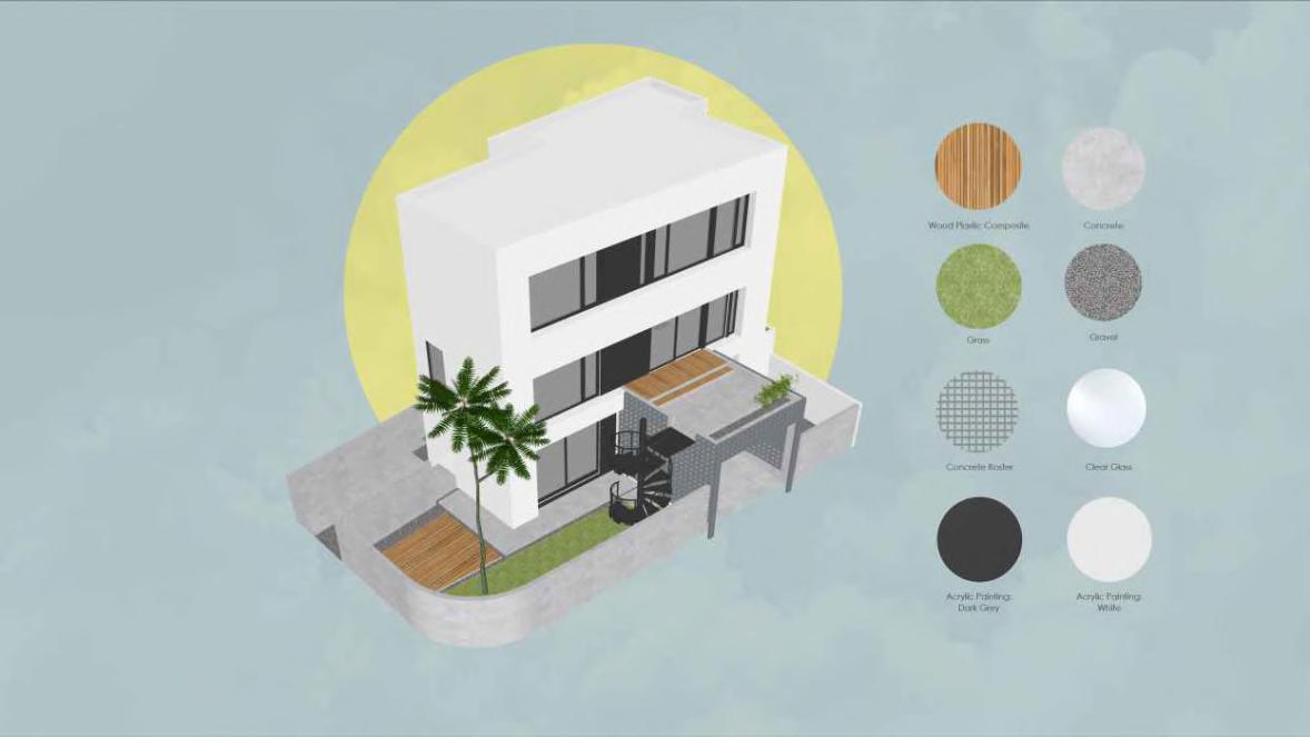
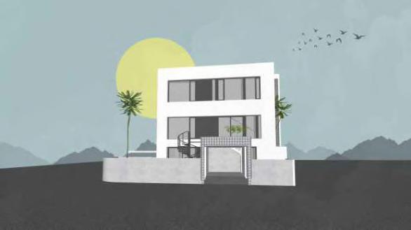
Renovation Project for Private House, Depok

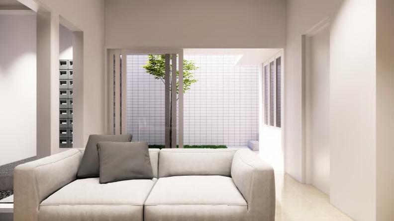
to post-disaster revitalization, 2017
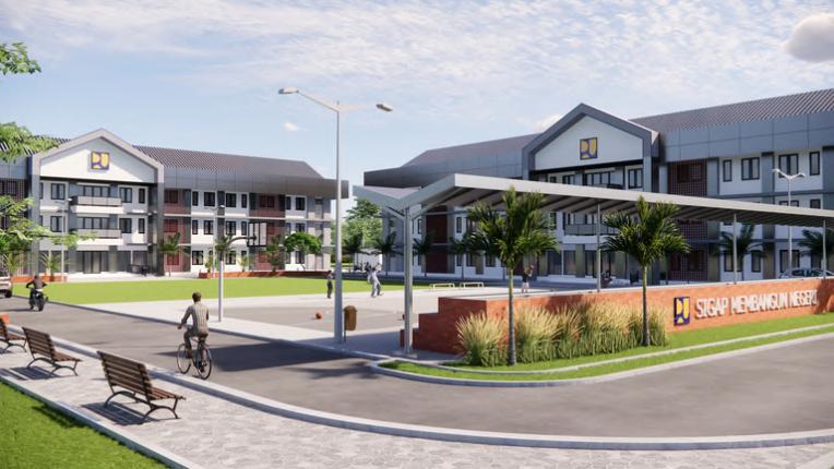
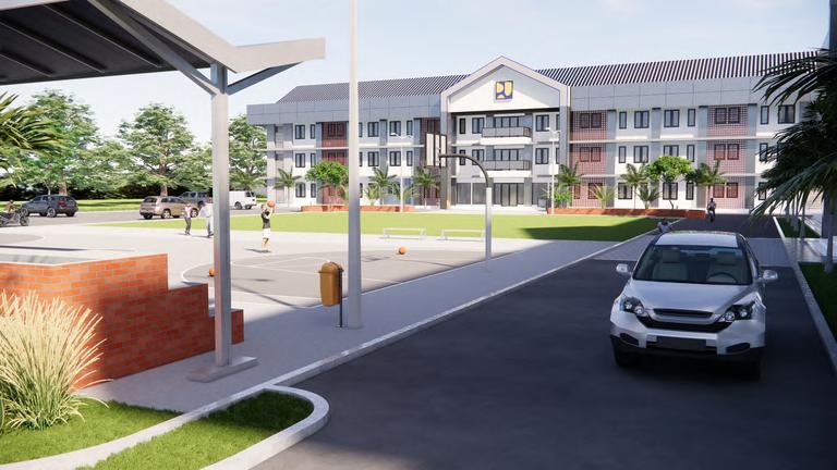
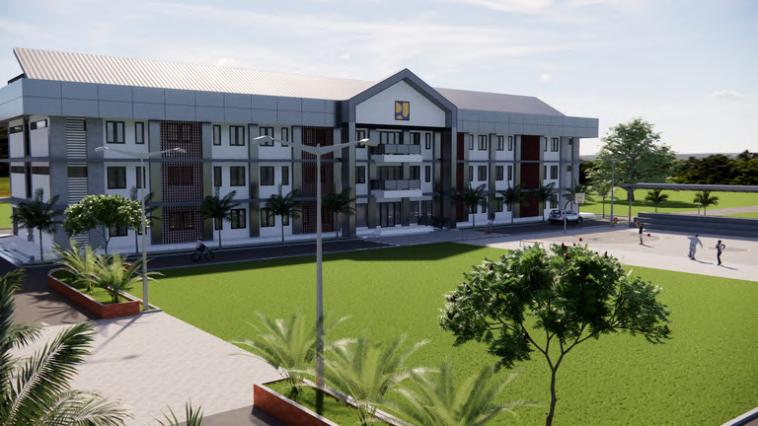
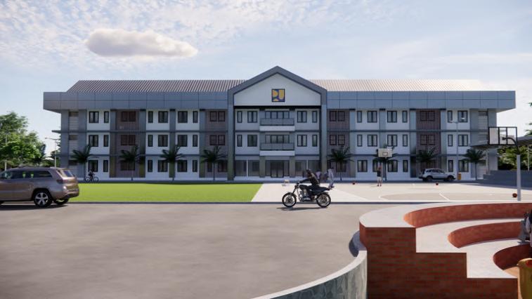
PUPR Vertical House, South West Papua as a part of New Autonomous of Papua Program, 2023-2025 other projects