GROWER’S GUIDE
We collect your field level data using ARVA’s CropForce TM software system. As Riceland’s MMRV (Measure, Monitor, Record, Validate) partner, ARVA provides software to track and quantify your data in order to generate environmental assets (i.e. carbon reductions, water savings, etc.) on your farms.
WHO IS PAYING YOU?
The Riceland customer base is providing the funding for the Riceland Carbon Ready™ Program.
The Riceland Carbon Ready™ program is currently focused on marketing environmental assets to Riceland’s valued customers. Environmental assets can be made up of greenhouse gas emission reductions, water savings, habitat creation, and others. Currently, Riceland customers are interested in purchasing greenhouse gas or supply chain emission reduction claims. These customers have a few reasons for purchasing these claims from you. They want to incentivize you to implement sustainable practices by paying for your results, as well as work towards their organization’s climate goals.
What are supply chain emissions reductions and why are companies paying for them?
Supply chain emissions are the upstream and downstream emissions throughout a company’s supply chain. In your case, the emissions associated with crop production are considered upstream emissions for Riceland customers after they purchase products that were produced from your crops. If you reduce the emissions associated with crop production, it decreases their supply chain emissions and helps them achieve their climate goals.
CONTRACT
Currently, Riceland Carbon Ready™ is offering one-year agreements for active farmers.
Prior to entering into a transaction on program acres after the growing season is completed, participating farmers can withdraw from the program at any time. Riceland has been earning our member’s trust for over 100 years and our sustainability team works hard to maintain that trust throughout the Riceland Carbon Ready™ process. If you feel uncomfortable with the questions and documentation required for this program, we want you to have a way out, no questions asked.
HOW IT WORKS
1. You fill out the Riceland Carbon Ready TM sign-up QR code showing your interest in participating in the program
2. You complete the “Grower Enrollment Form”
3. We collect your shape files or field boundaries from precision ag software’s, crop consultants, flying services, or input providers
4. We collect information about how your crop was grown throughout the year
5. We verify the practices occurred through your precision ag software or other forms of documentation
6. ARVA Intelligence quantifies the CO2e reductions that occurred on your farm
7. You sign a “Grower Attestation” after a final review
8. If acres qualify for a paying program, you get paid for your environmental assets
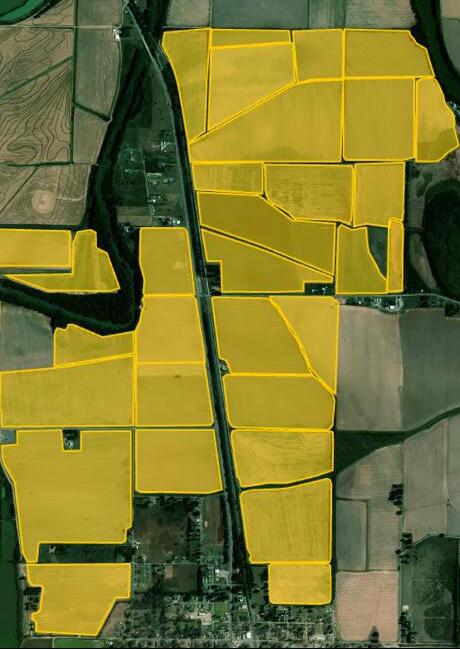
SHAPE FILES/FIELD BOUNDARIES
Shape files (or digital field boundaries) are a critical component of this program, and the first step to setting up your CropForce TM account. Every piece of information we collect is tied back to each field’s digital boundary in ARVA’s CropForce TM system.
Using APIs, we can pull your shape files directly into CropForce TM from software systems like MyJohnDeere Ops Center or Climate Field View. If you don’t use one of these systems, you can help us collect these files from your crop consultant, flying service, or input providers (or other sources if necessary).
INFORMATION WE COLLECT
To determine payment eligibility, we must collect field level information about how your crop was grown. We can collect this information through your precision ag software (MyJohnDeere Ops Center, Climate Field View, etc.), or by having a conversation on a field-by-field level.
TILLAGE INFORMATION
What type of tillage did you use prior to planting the program year’s crop (Conventional, Minimal, No Till)? What type of implements did you use during those tillage events?
PLANTING INFORMATION
What variety did you plant? What was your seeding rate? What timeframe was the crop planted in?
FERTILIZER INFORMATION
What type of fertilizer did you use? What was the method of application? At what rate did you apply the fertilizer? What was the timeline in which the fertilizer was applied?
IRRIGATION INFORMATION
What irrigation method was used (Tradational/Cascade, Multiple Inlet, Zero Grade, Row Rice)? Did you implement AWD (Alternate Wetting & Drying) on that field?
HARVEST INFORMATION
When did harvest occur? What was the yield?
SOIL SAMPLING INFORMATION
When was the last soil sample taken? What type of sampling was used?
OFF-SEASON MANAGEMENT
What offseason management practices were used? (Stubble management and waterfowl habitat)
RICELAND CARBON READY TM QUALIFYING PRACTICES
PRACTICES
ALTERNATE WETTING AND DRYING (AWD)
MULTIPLE INLET RICE IRRIGATION (MIRI)
FURROW IRRIGATED (ROW RICE)
ZERO GRADE
NUTRIENT INHIBITORS
SPLIT APPLICATIONS
VARIABLE RATE TECHNOLOGY (VRT)
NUTRIENT MANAGEMENT PLANS
SOIL SAMPLING
DESCRIPTION
IRRIGATION
ALLOWING THE FLOOD TO RECEDE TO A MUD STATE BEFORE REAPPLYING FLOOD
IRRIGATED USING POLY-TUBING
WATER DELIVERED DOWN FURROWS/ROWS
PRECISION LEVELED TO ZERO OR VIRTUALLY NO SLOPE
NUTRIENT MANAGEMENT APPLIED WITH NITROGREN FERTILIZERS
OPTIMIZED APPLICATION TIMING
O PTIMIZED FERTILIZER APPLICATION RATES
CUSTOMIZED APPLICATION PLANS
OR COMPOSITE
& AGRONOMY
WILDLIFE FLOODING NO SOIL DISTURBANCE
ROTATIONS
LESS THAN 4” TILLAGE DEPTH, MINIMAL SOIL DISTURBANCE
RICE/SOY ROTATION OR >2 CROPS IN OVER 3 YR PERIOD
IN LIEU OF FALLOWED FIELDS
FIELDS FLOODED TO CREATE WATERFOWL HABITAT
EVIDENCING
To maintain the integrity of Riceland Carbon Ready™, we must be able to verify data accuracy and practice implementation before quantifying the carbon reductions that occur on your farm.
Here are a few types of evidence that we will ask you for.
These records are helpful when verifying which crop was grown on a certain field/portion of a field.
Similar to CSP programs for AWD, photos are the primary means of verifying that the dry down occurred on a particular field. Please reach out to your Riceland Sustainability representative to further discuss verification options when claiming the implementation of AWD.
Your weekly scouting reports share much of the information that we collect for this program. By sharing those reports with us, we can verify certain information that we claim to have occurred on a given field.
These records might include, but are not limited to: soil sampling records, irrigation records, ag retailer invoices, etc.