Anderson Township Trails & Walkways
UPDATED APRIL 2023
DRAFT VERSION
Transportation Advisory Committee:
Viki Beck
Jeni Berreth
Kevin Comerford
Peg Fenner
Stephen Feagins
Jamie Grubert
Brian Gay
Joe Hice
Dave Habegger
Jay Lewis
Pinky Kocoshis
Karen Ringswald Egan
Ken Kushner
Paul Sheckles
Mike Niehaus
Karl Sieber
David Rose
Cynthia Sieber
Ken Vincent
Paul Sian
Trails Plan Update Subcommittee:
Brian Gay
Tim Kreimer
Karen Schwamberger
Mike Niehaus
Peg Fenner
Karen Ringswald Egan
Karl Sieber
Paul Sheckels
Vicki Beck
Matt Chaffin
Lindsey Griffis
Jim Willis
Township Staff:
Paul Drury, AICP
Sarah Donovan, AICP
Chris Cavallaro, Planner I
Ashley Reynolds, Co-op
Brendan Cloutier, Co-op
Township Trustees:
R. Dee Stone
Lexi Lousten
Joshua S. Gerth
Township Assistant Administrator for Operations:
Steve Sievers, AICP
Township Administrator: Vicky Earhart
Townsip Fiscal Officer: Kenneth G. Dietz

The 1993 Anderson Township Transportation Plan and the 1986 Sidewalk Plan identified the need for walkways, bike ways, and trails to facilitate non-vehicular movement and provide ready access to locations such as schools, post office, parks, retail centers, libraries, recreational facilities, health centers, and mass transportation.
As a legacy of the Anderson Township Bicentennial celebration, the Anderson Trails concept recognized the need and began the process to provide the links to connect desired destinations with areas which have existing walkways or are otherwise regarded as safe for pedestrians or bicyclists. Another goal of the Anderson Trails Program is improvement of the quality of life and community spirit by allowing leisurely movement between neighborhoods.
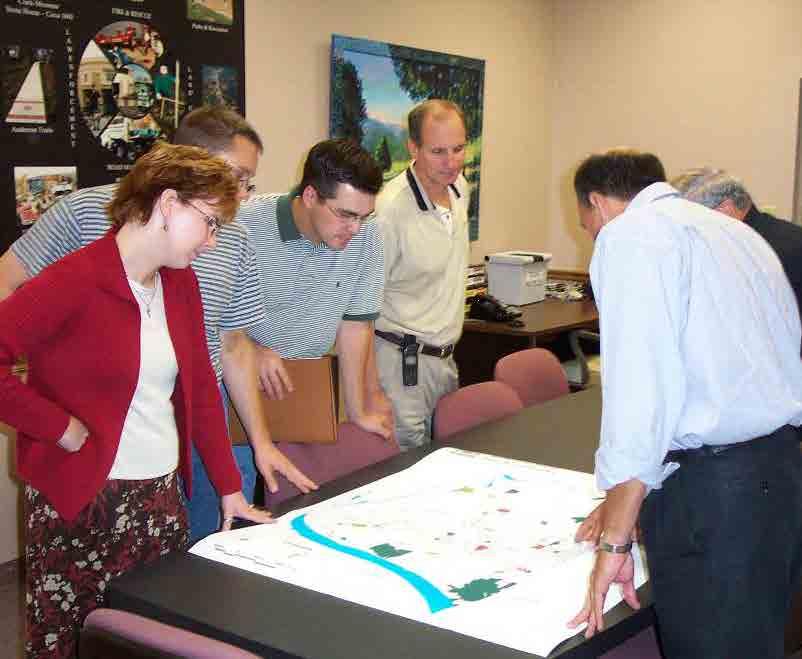
When this plan was first assembled by the volunteer Transportation Advisory Committee (TAC) in the spring of 1998, the intent was to identify and record specific possible sites from the general recommendations in the earlier Transportation Plan. Locations were inspected and data was gathered to determine the benefits that new walkways, bike ways, or trails would provide to the residents.
Developed on the basis of 1999 forecast of needs, the original plan was intended as a long range guide to help progressively improve walkway infrastructure by integration into annual planning and funding decisions and other opportunities prompted by related infrastructure improvements or land developments.
To provide a starting point for the comprehensive long range plan, the original document included an initial list of locations where linkage walkways could give high benefit to cost ratios. Such a list is included in this plan as well, for even as projects require professional services for design and costs estimates before funding of each, preliminary cost estimates provide a comparison of locations and for indication of magnitude of funding a long range plan.
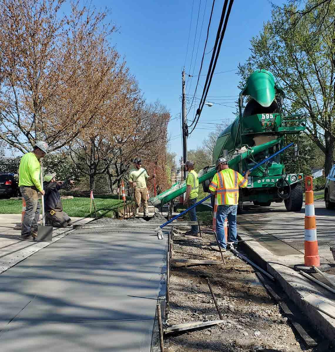
The completion of more than 30 projects over almost 25 years has resulted in positive feedback from citizens. Township and Park District surveys and comments by individuals indicate strong demand for the opportunity to safely enjoy leisure or recreational walking or bicycling. The completed sections have improved commercial access to facilities and “liberated” people from confined neighborhoods. To date, over 25 miles of sidewalks and trails have been built since the levy was passed in 1998. In addition, the Township is currently engaged in sidewalk projects throughout the community.
Many residential subdivisions, long existing as well as newly developed, have sidewalks constructed by the developer. Also, zoning regulations are in place requiring sidewalks on commercial properties for new construction or redevelopment. For the best utilization of these sidewalks, links between them are necessary. Those which are most needed are along the older roads maintained by Hamilton County and which are key parts of the roadway network for the Township residents and businesses.
The entities responsible for road maintenance is shown on the map on the next page. To date, walkways along those important connections have been achieved only by Township initiated action and funding.
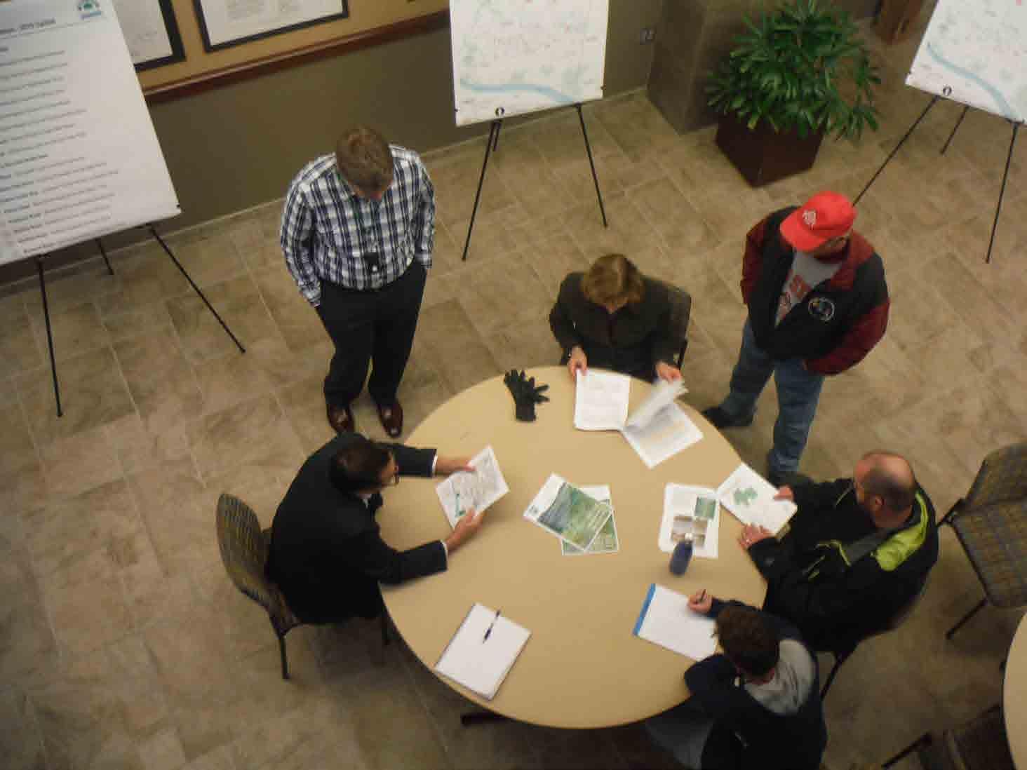
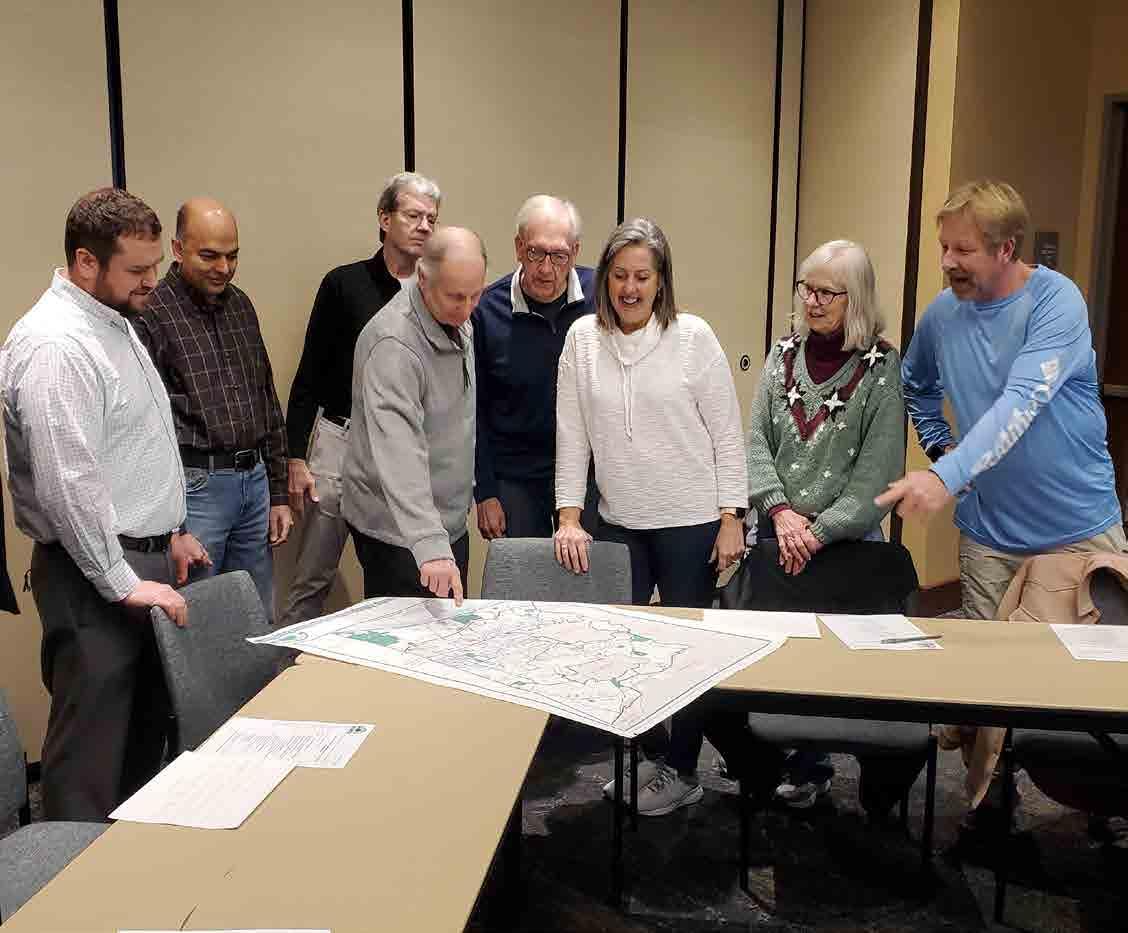
The Anderson Trails Plan Subcommittee of the Anderson Transportation Advisory Committee (TAC) has reviewed the 2018 Update to the Anderson Trails Plan document taking into account comments from the public as requested in the Anderson Insights newsletter, the Anderson Township Facebook page and from e-mail and phone calls. The Subcommittee also considered geographical balance in the development of the recommendations contained in the Anderson Trails Plan Priority Ranking Report as well as developing the plan with the concept of getting the “biggest bang for the buck”, meaning the greatest number of residents gain access to specific destinations or other neighborhoods for the least cost. This plan forms the TAC’s suggestions for trails improvements over the next 5 years, in an effort to continue the implementation.
1. Integration of walkways into ALL planning as the Township develops and evolves, consistent with the 1986 Sidewalk Plan
2. Development of a plan for on-going funding of this type of infrastructure improvements.
3. Creation of public recognition of the benefit and support of funding methods which may be developed.

ODOT (Ohio Department of Transportation)
Hamilton County Anderson Township
Source: CAGIS
Date: April, 2023
This year’s Anderson Trails Plan Update included a call for projects several times during 2022, including stories in several editions of Anderson Insights, the Township’s newsletter, and through social media. All suggestions were reviewed and considered by staff and the Trails Subcommittee, comprised of volunteer members of the Township’s Transportation and WeTHRIVE! Anderson committees. These groups generally met bimonthly beginning the spring of 2022.
Once a draft plan was developed, it was posted on the website and a second round of community outreach occurred using these same methods. This led to both an in-person, and online, community open house on May 24th, 2023 to review the draft projects. Input from this was used by staff and the Trails Subcommittee to update and finalize the plan for consideration by Hamilton County, The Township’s Zoning Commission, and Township Trustees. This process began in ________________.
The Trails Plan Subcommittee reviewed the original Anderson Trails Plan update to evaluate potential changes or additions.
Big changes for this year’s Update included an expansion of new topics. Namely, the focus was to look at safety improvements at crosswalk locations. Discussion and recommendations on the following pages relate to crosswalk striping, patterns, and possible signalization improvements. This also included the new topic area of on-street roadway striping to create pedestrian areas. These recommendations stem from school audit work undertaken by TAC in recent years, and striping changes from the Clough Pike Corridor Plan.
Another new area for this Update is the incorporation of non-motorized transportation recommendations from corridor studies on Beechmont Avenue and Clough Pike, as well as the Eastern Corridor. These projects are separated out as there may be additional Township TIF funds, or external monies, that may be able to advance implementation. TIF funds are monies collected from new development that must be used on capital improvments or purchases, like infrastructure, land purchases, and emergency vehicles.
A third focus for this year’s Plan, coming back to more traditional trails projects, entails the ranking criteria. Rather than using the number of households within 4,000 ft, this has been changed to 1200 ft (about 1/4 mile), a more realistic walking distance to arrive at a potential segment.
Also, with regards to ranking, the formula is no longer applied to shoulder projects. Due to the complexity of such projects, and need to work with Hamilton County or the Ohio Department of Transportation, a decision was instead made to address such roadways and work with these agencies on a case-by-case basis. These projects were prioritized to help facilitate implementation.
Perhaps the largest change in this year’s Update was the introduction of an Implementation Section. It was felt that a scheduled work plan or list would help to better facilitate the budgeting of financial and staff resources to guide implementation. This provides a realistic overview of what is actually possible to achieve, and also provides the community with a blueprint of projects through 2028, and the next Trails Update that is suggested by that time.
In the 2009 Trails Plan Update there was discussion on the need for roadway improvements, such as shoulder widening, which would advance the concept of Complete Streets in Anderson Township (a complete street is a roadway that serves all transportation modes, including cars, bicycles, pedestrians, etc). At that time, comments were made regarding the importance of allocating funding and identifying projects for roadway widening, and subsequent to this the Board of Township Trustees identified annual funding for this type of improvement. The intent was that these funds would be used for widening in areas of the Township where the density of housing was not high enough to warrant sidewalks, or where walks would not be consistent with the character of the area.
The hope was that these funds could be used in repaving projects initiated by the Hamilton County Engineer or area utility providers, to add roadway width with their restoratrion efforts. The first use of these road widening funds for this purpose occurred in 2008 on Eight Mile Road, between Woodruff and Greenleaf, consistent with the Anderson Trails Plan.
In 2013, Anderson Township partnered with the Hamilton County Engineer’s Office on the Salem Road Corridor Project to add approximately 1,000 feet of sidewalk, enhanced pedestrian crossing systems and repave and restripe the roadway to calm traffic and rationalize vehicular movements through the corridor.
Recent improvements, since the last Trails Plan, on Beechmont Avenue are certainly consistent with complete streets recommendations. In 2018, the Township introduced a “road diet”, to begin implementation of its Downtown Anderson Plan. This reduced lane widths in the area between Wolfangel Road and Asbury Road, and the previously wide shoulder was utilized to introduce sidewalks and other pedestrian improvements.
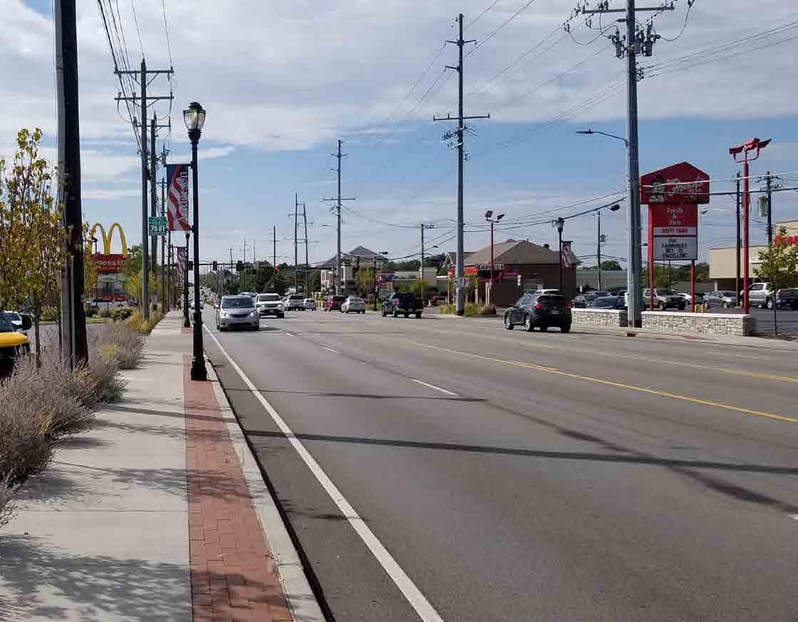
Another example, stemming from the Township’s 2018 Beechmont Plan, was to work with ODOT and their planned resurfacing of Beechmont planned for 2020. In advance of this, and consistent with the Plan, ODOT consulted with the Township on a possible new striping plan. The result of this was the introduction of bike lanes through much of the corridor. That project also upgraded handicapped ramps and introduced several sections of new sidewalks. This was the latest in years of Beechmont Corridor improvements, dating back to the early 1990’s, that have made it safer for all modes of transportation.
This was all produced by a trail crossing study that was prepared by TAC and Township staff in 2007. The study identified possible improvements for many locations. This study was also the catalyst for a Safe Routes to School grant, to introduce improvements at school area crossings.
However, the study also discussed other strategies, such as traffic calming techniques mentioned earlier, which may help lower the speed of traffic in high pedestrian areas.
In the past, the Township worked with the Hamilton County Engineer’s Office and Forest Hills School District to expand a school zone on Little Dry Run east of Wilson Elementary. The Township and County also installed a new school zone on Forest Road in front of Ayer Elementary and along Eight Mile Road north and south of Northport Drive.
Another aspect of complete streets entails bus transit and its relationship with Anderson Trails projects, TAC members continue a working relationship with METRO Staff to increase bus ridership in Anderson Township by helping METRO market their message to potential new bus passengers in Anderson Township. The Township is helping METRO identify aspects of their service that may hinder ridership in the future.
There has been a longstanding pattern of the Township supporting bus infrastructure. This is highlighted by the construction of METRO’s first suburban park and ride facility, Anderson Center Station, in 2005, which is currently being redeveloped into a new mixed use structured facility. Other METRO improvements have included, but not been limited to bus shelters and bus pull off areas and the Township has been fostering connection to these areas.
Hamilton County voters approved a 2020 tax to enhance infrastructure to support METRO, which included funding to local entities for related infrastructure improvements. The Township was fortunate to receive a grant in the inaugural 2021 cycle to construct forthcoming sidewalks on Elstun, and in 2022, for Beechmont Crosswalk improvements. This fund, and the potential expansion of METRO service with a crosstown route from Anderson Center Station to Kenwood, present opportunities to enhance infrastructure to such services.
The Township should continue its policy to help coordinate and encourage improvements with other government entities, non-profit, and private patrons/ partners.
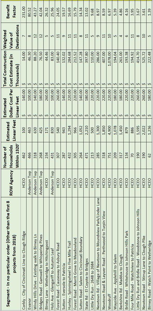
As outlined earlier, TAC met throughout 2022 and 2023 to revisit potential sidewalk segments and ratings that accompanied each segment. These ratings are based on the following criteria to arrive at a benefit factor (see Appendix A for more information):
• Distance - Estimated distance in linear feet of the project or segment.
• Costs - Anticipated costs of the project. These figures attempt to account for the terrain and other structure costs, but are only estimates. The Township may choose to enlist the services of an engineering firm to prepare estimates and compare with the figures in this report, all in an effort to obtain the most realistic anticipation of the projected costs.
• Approximate # of Homes - Utilizing GIS Mapping, this figure attempts to identify the number of potential housing units that could utilize the trail. Also, this count attempts to identify apartments or condominiums as separate housing units.
• Destinations - Indicates the weighted values of parks, schools, recreational facilities (such as the Five Mile or Ohio River Trail), shopping districts, public transportation facility, or other landmarks that will be served by the project.
The research from this Subcommittee also incorporated new segments that were not previously part of the Anderson Trails Plan, and the committee dropped some segments from the previous plan because of high cost to benefit factor, or plan duplication of other planned segments and not feasible for construction in the next 10 years.
As the subcommittee considered such streets for inclusion, various changes to the ranking formula were considered. A change was made to reduce the calculation of households from a distance of 4,000’ to 1,200’. Other modifications were studied, namely the introduction of criteria related to the speed limit, average speed, and traffic volume on roadways. These considerations or weights were suggested to help ensure that the Trails program does not only focus on Township streets where construction would generally be less expensive.
After working through various alternatives, a decision was made to not add these aspects to the formula. Rather, the subcommittee and staff felt that since the formula was not the only determinant of rankings and priorities, that the balance of projects on both Township and County roadways could be balanced in that manner (like geographic allocation has been for years).
It remains the intent that the Anderson Trails program does not seek to build sidewalks within neighborhoods. An assessment option exists for such situations, where nearby property owners finance such improvements. However, there is a recognition that some township roadways present key opportunities to link and complete the trails newtork.
Utilizing the data outlined in the priority ranking report, the Committee has outlined a suggested plan for sidewalks and other facilities beginning in 2023. This plan assumes that the regional trails and other previously funded projects will move forward in a manner that will not directly impact funding for the projects that appear in the following. The Trails Subcommittee recognized that in some parts of Anderson Township, constructing sidwalks would be cost prohibitive, based on our criteria of the number of houses to be served and the extreme building conditions the Township would face constructing these segments.
As in prior plans the Subcommittee hopes that alternatives to sidewalks will be built in these difficult areas of the Township, which in many cases have not been in close proximity to other Anderson Trails improvements. These projects include the use of shoulders or wider berms on some County right of ways and off road segments that may be built with public/ private joint projects.
Appendix B of this document includes a summary of the projects that are included for consideration for new trails.
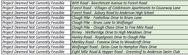
Many great ideas were suggested by the public, but the analysis focused on those that would be realistic for construction in the next 10 years. Projects that had few households in the vicinity, were very costly, or had environment/right of way limitations were removed from futher analysis. These are noted in Appendix C for it’s important to factor these into longterm Township planning.
From the list of possible projects, the summary of trails projects for consideration in the next 5 years are noted in the Implementation section. It’s important to note that for nearly all new trails projects external engineering consultant assistance is needed. As such it may take 2-3 years for a project to be built, and that is only after advances from this Plan into project development (which can take several years).
The key is to have numerous trails projects in the pipeline, as history has shown that for a variety of reasons, projects can slip or even be canceled or postponed. This will help to ensure the continued expansion of the trails network.
As mentioned earlier, this year’s Plan Update builds off the structure of past Plans, but includes one major change to shoulder improvements. Rather than ranking these in the Plan using the benefit factor, as was done in the past, we have found that many external factors have slowed the general introduction of this treatment.
As such, it is believed the best time to improve such roadways is when they are slated for improvement or resurfacing. Further, as roadway pavement condition does not necessarily correlate with roadways with limited shoulder areas, the pavement condition often dictates the improvement schedule with Hamilton County or ODOT.
Hence, rather than ranking, the list of possible roadways is intended to be a touch point to consider when those agencies look for future improvements or roadway pavings. It’s also a guide to the Township’s possible initiation of such improvements.
Like sidewalks, shoulders are an area that may take a number of years to implement.
High Priority:
• Newtown Road - Turpin View to Newtown Village
• Newtown Road - Clough Pike to Bartels Road
• Asbury Road - Ayers to Coldstream Drive
• Ayers Road - Five Mile to Asbury Road
• Little Dry Run - Wycliffe Drive to Overlook Hills Drive
• Eight Mile - Greenleaf to Hopper
• Hopper Road - Asbury to Eight Mile
Moderate Priority
• Wolfangel Road - Hampton Place to Clough
• Eversole Road - Chestnut Ridge to Salem
• Birney Lane - Watch Point to Five Mile
• Wayside Avenue - Apple Hill to Salem
Low Priority
• Nordyke - Koszo to Clermont County
• Hunley Road - Clough to Royalgreen
• Lawyer Road - Ravens Run to Newtown
Among the maps prepared with the original plan was an overall Anderson Township map with bicycle routes as well as walkways. The bicycle routes represented data from the 2009 Cincinnati Bike Route Guide produced by the Ohio Kentucky Indiana Regional Council of Governments rather than results of the study for this Anderson Trails Plan.
It is believed the walkways or sidewalks suggested in the original plan may be used by bicyclists, especially younger people. In certain locations, proposed walkways coincide with the bicycle routes of earlier regional bicycle plans. In some other locations where walkways have not been proposed due to a low benefit/ cost ratio, it is believed that widening a road berm to facilitate a bicycle route could be used by pedestrians in lieu of walkways.
As discussed above, in the original 1999 Trails Plan, as well as in subsequent updates, there was discussion about the need for bicycle improvements within the Township. Suggestions relating to this ranged from improved roadways, and better bike route signage, to dedicated bike lanes and multi-use trails.
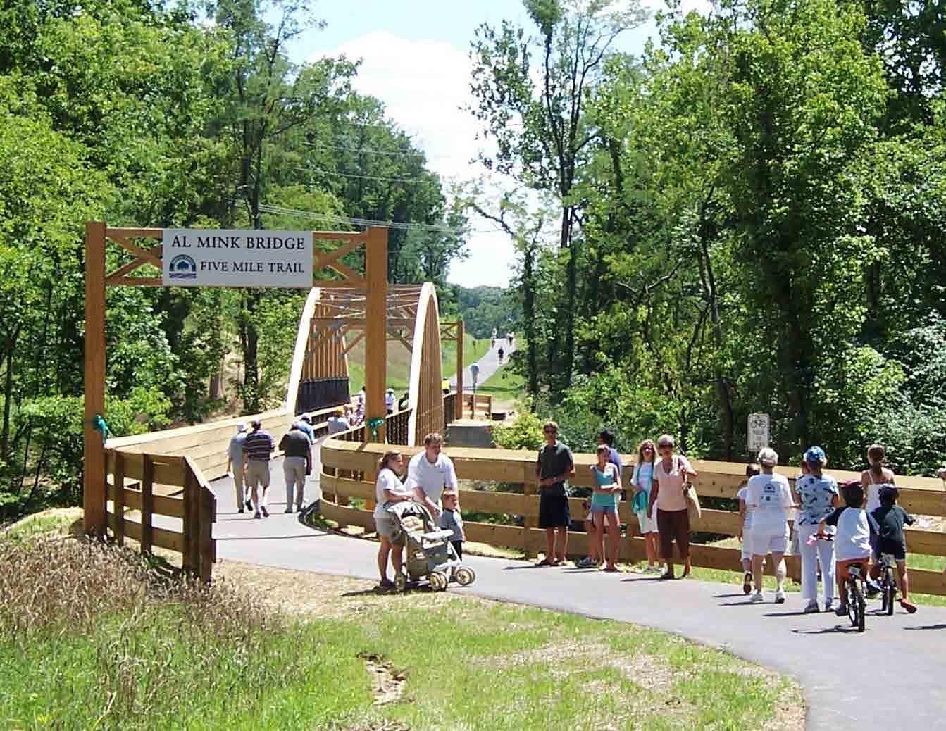
The Five Mile Trail, the Ohio River Trail, and the Little Miami Trail provide accommodations for bicyclists and such users will also benefit from roadway expansions. However, TAC felt the need to identify some key areas in which bike route efforts need to be focused in the coming years. These roadways were selected to foster connections to the Anderson Trails system, and role with regards to providing linkages from Anderson Township to forthcoming regional trails along the Little Miami and Ohio Rivers.
The suggested improvements for the aforementioned roadways vary, and could include at a minimum installation of bike route signs and other infrastructure changes such as changing of storm drain inlets to be bicycle friendly or improved lane striping. Many of these recommendations are discussed in more detail in the OKI Regional Bicycle Plan, and the improvements for a given area could vary depending on the environment.
• Round Bottom Road - Village of Newtown to Clermont County
• Salem Road - City of Cincinnati to Beechmont Avenue
• Beechmont Avenue - Cincinnati Corporation Line (Birney Lane) to Clermont County Line
• Five Mile Road - Nimitzview Drive to Kellogg Avenue (Ohio River Trail)
Natural trails including unpaved areas, can provide important neighborhood connections to the Trails network of destinations and due to their surrounding natural environment, typical asphalt or concrete trails may not be keeping in context with the surroundings (or prohibited, in the case of Township Greenspace properties).
Thus, in these areas consideration should be given to the modest improvements of existing trails with mulch, or establishment of future connections that could range from improved mulch to some sort of natural paver or eco-friendly dust free surface to facilitate their usage.
Examples of natural connections that have been made already in the Township include connecting the Heritage Center Property at Eight Mile, Forest to Ayer Elementary School through Anderson Township Greenspace and Forest Hills Schools District property.
As with past Trails Plan Updates, the TAC reviewed a myriad of connections, including sidewalks and trails, roadway widening, and natural connections such as these. While these were not ranked according to a priority system, like sidewalks, this effort resulted in a list of possible connections:
Opportunities for Natural Trail Pedestrian Connections:
• Rowanta Drive - Pedestrian connection from Rowanta Drive to Five Mile Shopping Center and office area through Anderson Township Open Space
• Shangrila Drive - Pedestrian connection from Shangrila Drive to Nimitzview Drive through Anderson Township Greenspace Parcel
• Forestlake Drive - Pedestrian connection from Forestlake Drive to Eight Mile Road near Stoney Bridge Drive along Hamilton County and Anderson Township open space and Anderson Greenspace
• Little Miami Scenic Trail - Connection from the Little Miami Scenic Trail to Anderson Township Greenspace at old farm road entrance
• Fox Brooke - Fox Brook Place to Wolfangel, linking Bruns Lane and neighborhoods off State Road through Clough United Methodist Church to forthcoming sidewalk and trail links along Wolfangel Road
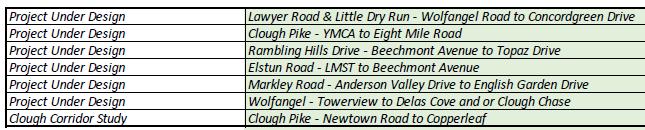
The Anderson Trails Plan has historically been the guide for the Township’s investment, planning-wise or financially, on non-motorized improvements. However, it’s not been the only such driver of projects. Funding provided by the Township for other projects, as well as external sources, has resulted in pedestrian and bicycle enhancements. Since the last Anderson Trails Plan Update in 2018, additional planning initiatives have added to the number of recommendations for sidewalks and bicycle improvements. This is highlighted by the updated Beechmont Plan and Eastern Corridor studies, as well as Clough Pike Corridor Study. Through discussions with the Transportation Advisory Committee, staff felt if would be helpful to separate these projects from trails planning, yet also ensure they are a component of the Plan, future planning/enginnering efforts, and ultimately implementation.
The following projects have been extruded from those Plans or studies and are identified below. They are also prioritized based on some of the following criteria:
• Completing missing gaps in pedestrian network, especially where other options (i.e. parking lots) do not exist
• The opportunity to coordinate with property redevelopment or companion public project
• Current use by pedestrians
• Relative cost/benefit of such a connection
It is also realized that due to the complexity, or in some cases multijurisdictional nature of these suggestions, the following projects could likely entail working with other agencies/communities, and/or securing grant funds.
Corridor Improvement Priority List:
High Priority:
• Beechmont Avenue - Mt. Washington Border to Anderson Parks RecPlex
• Beechmont Avenue - Voll to Tallberry
• Turpin Hills Drive to SR 32 Connection
Moderate Priority
• Beechmont Avenue - Witt to Tri-Health building
• Beechmont Avenue - APG to New England Club
• Beechmont Avenue - Grammas Pizza to Speedway
• Clough Pike - Gilchrest to Forestcrest Drive
Low Priority
• Beechmont Avenue - Taco Bell to Remax
• Beechmont Avenue - Eight Mile to Graeters
Another outgrowth of the Township’s prior Safe Routes to School and crosswalk planning work has been the enhancement of crosswalk markings, namely the use of piano or patterned crosswalks to help draw attention to these areas. This has included working with the Hamilton County Engineer’s Office and Ohio Department of Transportation to standardize such markings, since most higher volume crosswalks in the community fall under their jurisdiction.
The Hamilton County Engineer’s Office has allowed the decorative treatment, such as a brick pattern, with streetscape projects or on a trial basis. These have not yet been introduced at an ODOT crossing.
ODOT has generally allowed piano striping at all locations, including allowing the Township to install such crosswalks at all signalized intersections along Beechmont over 15 years ago. ODOT has since replaced these marking with new piano markings.
Otherwise, Hamilton Couny typically allows piano striping at mid-block crosswalks, and where a stop sign or traffic signal exists, uses two parallel lines to identify the croswalk. The school walk audit, undertaken by TAC and Township staff in 2018 identified opportunities for such markings near schools.
Regardless, it was suggested that the Township work closely with the schools on a case-by-case basis to improve the visibility and appearance of these locations, which are heavily used by students. The intersections below are suggested and were ranked into high, medium, and low priority based upon the following considerations:
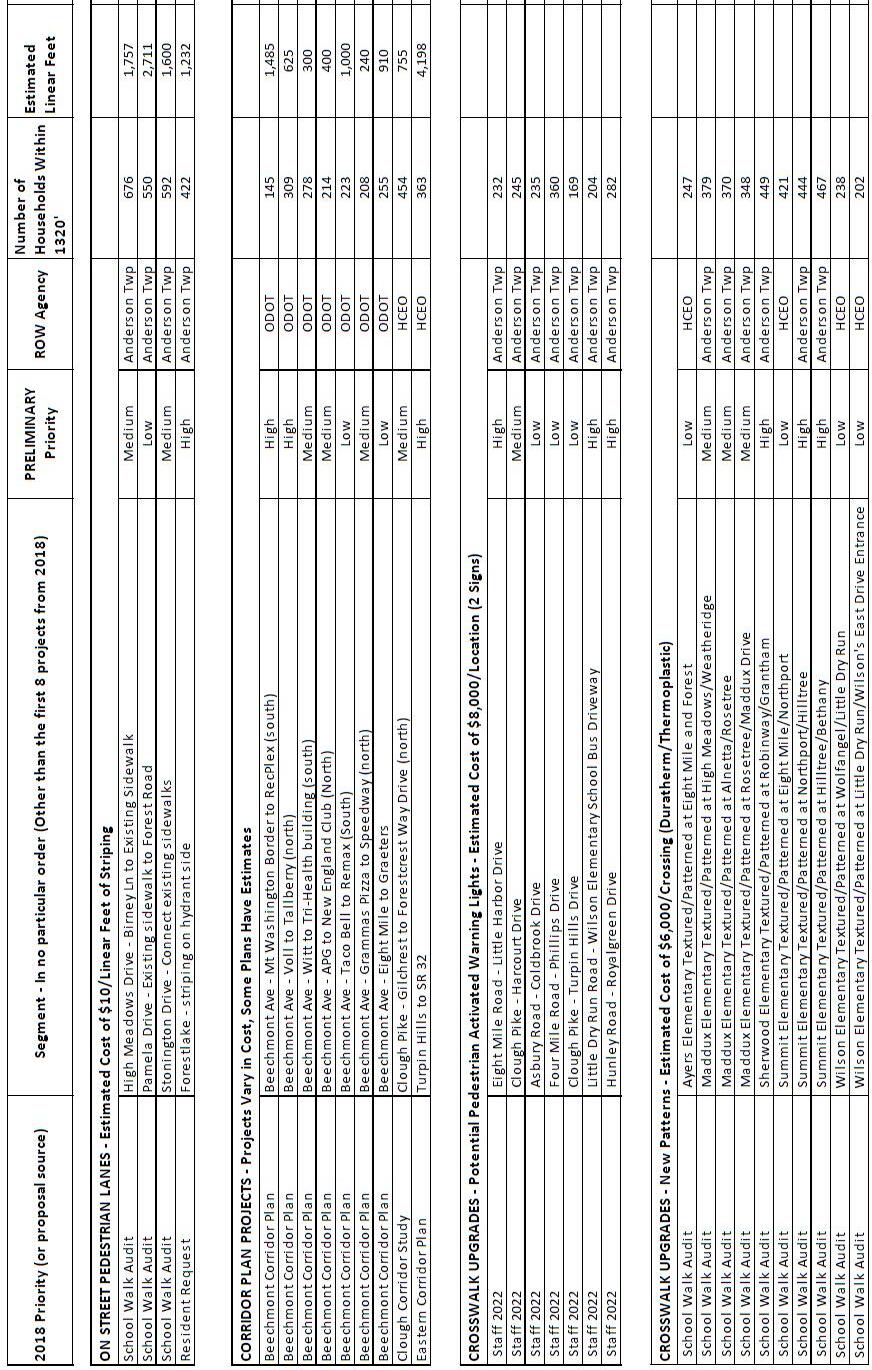
Crosswalk Enhancement Priority List:
High Priority:
• Sherwood Elementary Textured/Patterned at Robinway/Grantham
• Summit Elementary Textured/Patterned at Northport/Hilltree
• Summit Elementary Textured/Patterned at Hilltree/Bethany
Moderate Priority
• Maddux Elementary Textured/Patterned at High Meadows/Wetheridge
• Maddux Elementary Textured/Patterned at Alnetta/Rosetree
• Maddux Elemenatry Textured/Patterned at Rosetree/Maddux Drive
Low Priority
• Ayer Elementary Textured/Patterned at Eight Mile and Forest
• Summit Elementary Textured/Patterned at Eight Mile/Northport
• Wilson Elementary Textured/Patterned at Wolfangel/Little Dry Run
• Wilson Elementary Textured/Patterned at Little Dry Run/Wilson’s East Drive Entrance
As mentioned earlier, TAC’s and staff’s work associated with school walk audits identified other travel options that are incorporated into this Plan update for the first time. One such area which actually dates back over 15 years, is the improvement of existing crosswalk locations.
Anderson Township’s 2007 Safe Routes to School Plan identified key crosswalk locations for improvement. This included both new and existing walks, with recommendations including enhanced striping, possible user activated signals, and other suggestions.
Over the years, many of these were enhanced, with a boost from the Township’s 2008 award of the inaugural round of Safe Routes to School funding from the OKI Regional Council of Governments and Ohio Department of Transportation. The monies were used to introduce pedestrian activated flashing equipment to four crosswalks on county roadways in close proximity to elementary schools.
Similar equipment has since been introduced at four other locations in the community. New ODOT design standards for pedestrian crossing could present the opportunity for new locations.
Based on feedback received over the years from residents, and through the Anderson Trails Public input process, TAC and staff felt it timely to identify potential locations for such a treatment. A number of existing crosswalk locations share the following features that would make them good candidates for crossing systems.
• Current use by pedestrians
• Volume of traffic in crosswalk area
• Geometry of roadway in crossing location limits sight distance for motorists and/or pedestrians
Crossing Systems Priority List:
High Priority:
• Eight Mile Road @ Little Harbor Drive
• Little Dry Run Road @ Wilson Elementary School Bus Driveway
• Hunley Road @ Royalgreen Drive
Moderate Priority
• Clough Pike @ Harcourt Drive
Low Priority
• Asbury Road @ Coldbrook Drive
• Four Mile Road @ Philips Drive
• Clough Pike @ Turpin Hills Drive
Another crosswalk component, new to this Plan update, stems from the Township’s 2021 Clough Pike Corridor Study. That study, which was developed through 2020, solicited public input on a wide variety of improvements to the corridor, from vehicular, through public transit, pedestrians and bicycling. One short term, high-priority, recommendation from this study was the introduction/adjustment/standardization of crosswalk markings and stop bars for crossings that paralleled Clough (i.e., at intersecting roadways). The recommendation was to ensure stop signs were “behind” the crossing area, and that stop bars were added, along with two parallel lines, to bring attention to pedestrians.
Some locations also did not have a striping treatment, particularly where Township streets intersected County roadways. In 2021, staff undertook an inventory of these locations and developed striping improvement recommendations for intersections along Clough Pike. These were modified in early 2022.
Several comments were raised through the Trails Plan update by the public, noticing these changes, were suggesting the standardization of these across the community. Township staff believed this was a short term, high safety, low-cost project that would make improvements across the community, and the TAC agreed.
Hence, the suggestion in this Plan Update is to begin an effort to update over 80 such locations across the community, which will appear in appendix D. It is suggested this effort begin with those areas in the southwest part of the community (south of Beechmont Avenue and west of Five Mile Road), due to the number of intersections, presence of sidewalks in the area, and dense development pattern. Once these areas are addressed, which account for more than half of the locations, the same treatment could be introduced to remaining areas of the community.
In 2018, TAC, along with Township staff, undertook school walk audits around each of the six elemantary schools, along with Nagel Middle School. This process, along with a 2019 student transportation survey that was administered to Forest Hills School District parents of elementary school students, helped to identify transportation decisions/patterns, and barriers, for students walking or bicycling to school.
The audit prepared by staff and the TAC was incorporated into the trails plan in a variety of ways, including possible new sidewalk segments. A key focus, however, was the ability to make short term improvements to existing infrastructure.
Namely, there were sections of roadways where possible striping could be added to provide better awareness for non-motorized uses, as well as possible crosswalk striping enhancements. Ultimately, both on street pavement markings and crosswalks enhancement plans become new areas of focus in this Anderson Trails Plan.
Resulting from this work, a number of areas where on street pavement markings, in lieu of or in advance of future sidewalks, are suggested. The introduction of such striping on Woodcroft Road in 2020 provided a local example of such a roadway striping pattern, that could be introduced in other areas.
After soliciting community input on possible widespread pedestrian improvements, additional areas not necessarily near schools are identified for possible treatment. The conditions for such locations include areas where the following situation may exist:
• Gaps between existing walks or infrastructure
• Right of way or limitations to acquire easments to build sidewalks
• Wider roadways with limited use of on-street parking where pavement areas could be easily converted to such a use
• Roadways with ample line of sight for pedestrians and motorists and limited grade changes
• Current use by pedestrians and lower travel speeds where such uses can co-exist
• Identification in past studies, such as the School Walk Audits
After identifying potential streets for pavement markings, staff and the Committee then grouped the locations below into high and moderate priorities. This was done in order of ease of application and ability for the following roadways where improvements can facilitate the non-motorized travel experience.
High Priority:
• Forestlake - Lancelot to Clough Pike
Moderate Priority
• High Meadows Drive - Birney Lane to Existing Sidewalks
• Stonington Drive - Connect Existing Sidewalks
• Pamela Drive - Existing Sidewalk to Forest Road
Anderson Township is involved in regional trail or walkway projects, and has received grant funding for the study and/or construction of these facilities. Thus, due to the presence of a funding mechanism other than the Anderson Township Road Levy or TIF funds, or the fact that they are currently being studied independent of this plan, they have been excluded from this plan.
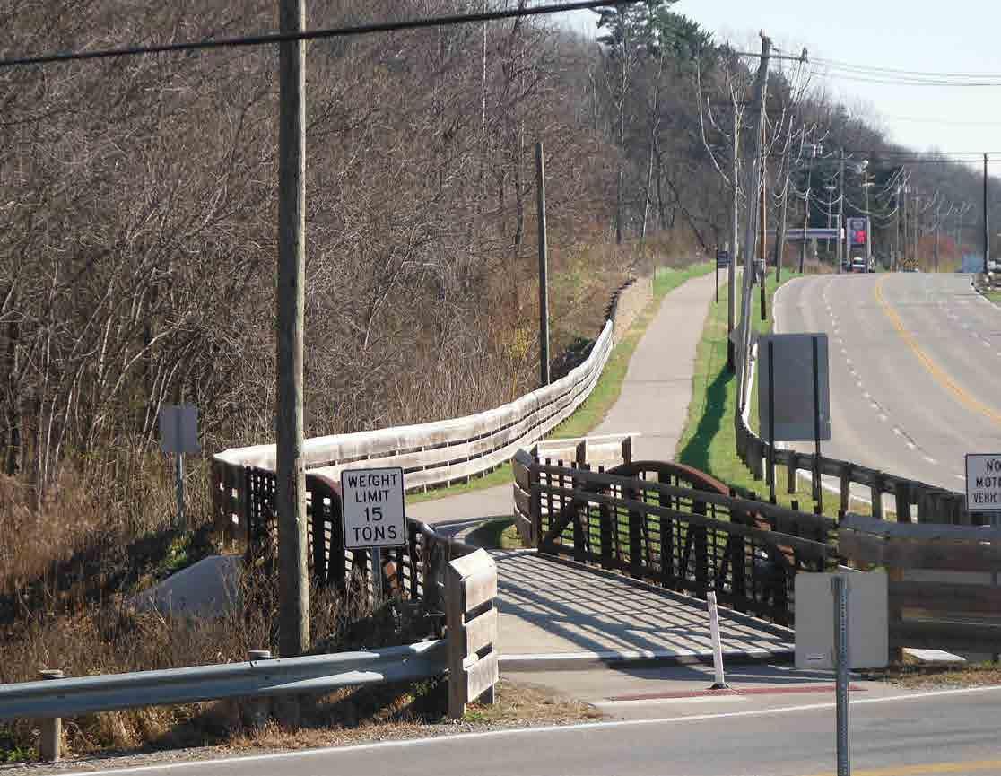
The Ohio River Trail is one such project. It is a 14+/- mile multimodal trail linking the City of Cincinnati from Lunken Airport through Anderson Township and terminating in the Village of New Richmond. With the initial guidance of the Ohio Kentucky Indiana Regional Council of Governments (OKI), and participation of each jurisdiction along the corridor, a yearlong study of this route concluded in 2000. This study identified the costs of various routes and identified a preferred alignment.
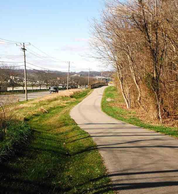
While additional detail study of this corridor is progressing, each jurisdiction, including Anderson Township, is now moving forward with its own implementation strategy. Similarly, other jursidictions are also studying and moving forward with segments within their community, but each working closely with the others as part of the Ohio River Trail Planning committee. The first phase of the Ohio River Trail is a 1.4 mile segment in Anderson Township between Sutton and Five Mile Road, with the alignment on the north side paralleling Kellogg Avenue. It was built in 2010 and 2011.
Anderson Township received a grant to complete preliminary engineering to determine opportunities and obstacles to implement the Ohio River Trail from Five Mile road to the Clermont County border. Currently, the Township is building on that work by collaborationg with the Ohio Department of Transportation and Duke Energy to look at options east of Five Mile Road. The Township is also working with other government entities to coordinate efforts to complete this important regional trail system to the east and west.
The Anderson Trails program is a glowing example of how citizen input and community desires have been incorporated into the planning process, and ultimately have translated into the implementation of community improvements. The initial Anderson Trails Plan in 1999 was recognized by the Ohio Planning Association, a chapter of the American Planning Association, with it’s community planning award. In the years following, the Plan or updates, have been lauded by other county and regional organizations.
As TAC was preparing the current Trails Plan update, and with the continued expansion of this guide into new areas (crosswalks, roadway striping, etc.), it was clear that there are a variety of projects that would enhance this network. In an effort to balance these, staff felt it would be beneficial to translate these projects into an annual work plan. This plan will help foster budgeting and implementation for these projects.
The following pages provide such a guide for recommendations to move from the Plan into project development. Thus the implementation diagram below seeks to illustrate this process.
The first step for a sidewalk, trail or similar project, where the services of an engineering consultant are required, would entail preengineering to determine feasibility or other challenges (environmental, right of way, cost, etc.). If a project makes it through that step and is deemed feasible, it would transition into engineering, and then ultimately into construction. Typically, this would be a 2-3 year process, or more.
The Plan has been updated four times, each adding more detail and guidance to staff and the Board of Township Trustees to make key decisions related to the Township’s non-motorized network. This has materialized to nearly 23 miles of new sidewalks and trails, and countless crosswalk or other safety improvements, with numerous projects in the planning and implementation stage.
Other projects, such as roadway striping, crosswalk improvements, etc. may be designed in house, by staff. Those are then able to move more quickly into implementation, more often due to the reduced complexity, need for engineering services, and general lower cost.
Staff hopes this guide helps to set a projection of the annual work plan for the coming years. Since this is a new part of the Trails Plan, it will likely have to adjust as necessary and situations change. Nonetheless, this provides a more realistic projection of what may be implemented in the next five years. It also is depending on the availability of staff, and considerable Township TIF funding (beyond the initial Road & Bridge levy funds that were allocated to the Anderson Trails Plan). That is an annual decision by the Board of Trustees, in setting the preliminary, and ultimately adopting the permanent, Township budget.
Lay Out/Design In House
• Northport & Hilltree
• Hilltree & Summit Elementary rear access
• SW & Central Township (Stop Sign/Crosswalks)
Pre-Engineering /Planning Engineer Build

• Birney Lane (Watch Point to Wetheridge
• Five Mile trail to Newtown (Road Widening w/HCEO)
• Turpin Hills to Turpin Lake Connection
• Clough & Wolfangel
• Clough (YMCA to Eight Mile)
• Elstun Phase 2
• Clough & Endovalley
• Beechmont Crosswalks
• Elstun Phase 1
• Rambling Hills
• Lawyer & Little Dry Run
Lay Out/Design In House
• Stop Sign/Crosswalks (all others)
• Sherwood Elementary
• SR/LMST Connection
• Forestlake (Striping on roadway)
Pre-Engineering /Planning Engineer Build
• Sutton Road (North of Salem)
• Corbly Road (North of Rainbow)
• Forest Road (Meadowcreek to Merritt Grove)
• Clough & Newtown Area
• Birney Lane (Watch Point to Wetheridge)
• Five Mile Trail to Newtown
• Newtown Road Widening
• Beechmont West
• Clough & Wolfangel
• Clough (YMCA to Eight Mile)
• Clough & Endovalley Crosswalk
• Elstun Phase 2
• Beechmont Crosswalks
• Hilltree & Summit Elementary Rear Access
• SW& Central Township
Legend
• High Priority Pedestrian Activated Flashing Locations
• Forestlake to Eight Mile Trail
• Evanor
• Bridges (Gamwell to Whispering Pines)
• Beechmont Infill Sidewalks East of Five Mile
• Sutton Road (North of Salem)
• Forest Road (Meadowcreek to Merritt Grove)
• Clough & Newtown Area
• Birney Lane (Watch Point to Wetheridge)
• Five Mile to Newtown Trail
• Sherwood Striping
• Stop signs/Crosswalks (all others)
• Newtown Road Widening
• Beechmont West
• Forestlake Striping
• Corbly Road
Legend
Lay Out/Design In House
• Maddux School Crossings
• Stonington & High Meadows
Pre-Engineering /Planning Engineer Build
• Four Mile (Watchview to Patricia)
• Windy Hills (Terminus to Birney Lane)
• Newtown Road (Mercer’s Point to Stirrup
• Evanor
• Bridges (Gamwell to Whispering Pines)
• Beechmont Infill Sidewalks East of Five Mile
• Sutton Road (North of Salem)
• Forest Road (Meadowcreek to Merritt Grove)
• High Priority Pedestrian Activated Flashing Locations
• SR 32/LMST Connection
• Forestlake to Eight Mile Trail Legend
Lay Out/Design In House
• Medium Tier Pedestrian Activated Flashing Locations
Pre-Engineering /Planning Engineer Build
• Hunley (Spinning Wheel to Royalgreen)
• Forest (Causeway to Asbury)
• Four Mile (Watchview to Patricia)
• Windy Hills (Terminus to Birney Lane
• Newtown Road (Mercer’s Point to Stirrup)
• Evanor
• Bridges (Gamwell to Whispering Pines)
• Maddux School Crossings
• Beechmont Infill Sidewalks
• Stonington & High Meadows
Legend
Lay Out/Design In House
• Medium Tier Natural Trails
Pre-Engineering /Planning Engineer Build
• Little Dry Run (2648-2684)
• Hunley Road (Spinning Wheel to Royalgreen)
• Forest (Causeway to Five Mile)
• Windy Hills (Terminus to Birney Lane)
• Four Mile (Watchview to Patricia)
• Medium Tier Pedestrian Activate Flashing Locations
Legend
The Anderson Trails and Walkway Plan dated June 15, 1999, was adopted by the Board of Township Trustees on July 15, 1999. the plan identifies and describes locations for potential authorization of engineering and construction, but does not establish a hierarchy of importance or a sequence for implementation.
To assist in establishing priorities, the Transportation Advisory committee presents a method including calculated Ratings, Rankings, and a common sense approach to other considerations, as outlined below. this method was periodically updated in subsequent plans.
A numerical rating is calculated by using a formula based on the concept of the greatest benefit for the most residents compared to the required expenditure. It utilized physical data and weighted values reflecting the character and volume of anticpated usage.
Benefit Rating
= (Number of housing units impacted multiplied by the sum of the weighted values assigned to destinations) divided by (costs in thousand of dollars)
The number of housing units is those within 1200 feet linear feet of accessible destinations
Weighted values assigned to certain/specific destinations that are made accessible:
The numerical calculation results in a Benefit Factor number (see Exhibit A) which will be used in the ranking process (see Step 2) Costs are the estimates of engineering and construction for a given segment. See Example 1 on Page 51 for application of the formula and data.
Weighted Values attached to Destinations
Rankings of High, Intermediate, or Low would be assigned to projects by grouping based upon the Benefit Factor number developed in Step 1; the High group would include those with the greatest numerical values.
Priority is given to those in the High group with allowance for the discretionary appication of other factors including but not limited to:
1. Additional connections byond the 1200 linear feet;
2. Coordination with other infrastructure improvements;
3. Cost Sharing from entities outside of the Township financial operation;
4. Improvement of a significant safety problem
Rankings (and Rankings if there are significant changes affecting the location) shall be reviewed annually by the Transportation Advisory Committee as it makes recommendations on projects at the time of budget review and preparation, customarily occurring in early Fall.
Future additions to the adopted plan that may be initiated by the Transportation Advisory Committee, Township Administration, or requested by other individuals or grops shall be evaluated in a manner similar to those in the original adopted plan. The Transportation Advisory Committee will develop the Rating and recommendation for Ranking, but any decision to amend the plan or implement a specific project will be made by the Board of Township Trustees.
For additional trails requested by individuals or groups on the basis of their sharing the project cost with the Township, certain limitations will apply. The township Trustees will evaluate each of these proposals on a case by case basis, to determine the Township’s share
Following are two examples of how the rating system was appplied to specific sections of the approved Anderson Trails Plan. Dollar estimates used are also from the approved plan, but are not necessarily firm estimates.
• # of households within 1,200 linear feet - 564
• Construction Cost Estimate (in thousands) - $103,000
• Weighted Value of Destinations - 7
(567 x 7) ÷ $103 = 38.33 Benefit Factor
• # of households within 1,200 linear feet - 506
• Construction Cost Estimate (in thousands) - $215,500
• Weighted Valiue of Destinations - 2
(506 x 2) ÷ $215.50 = 38.33 Benefit Factor
Not Feasible For Construction in the Next Five Years