selected work 2018-2022 portfolio. reka tundokova
/about me
CONTACT
reka.tundokova@gmail.com
+421911185792

www.linkedin.com/in/rekatundokova-a3a367109v
I am a research assistant at the University of Hong Kong, where I coordinate and conduct projects on the environmental driving factors of urban form. I also pursued a master’s degree in urban design at the same institution, after graduating from UCL with a BSc in urban planning, design and management. I have a keen interest in exploring how urban design can enhance the quality of life, health, and sustainability of cities and communities.
In addition to my academic and research work, I have gained valuable experience in the fields of AI, public participation, and public space design through various internships and work placements. I have worked as an associate at a platform that creates an ecosystem for career development, as a part of the department of participatory planning at the Metropolitan Institute of Bratislava, and as a recipient of the LDA Design Bursary. Through these roles, I have developed skills in business development, urban framework design, environmental analysis, and simulation. I am passionate about applying my knowledge and skills to create innovative and inclusive solutions for urban challenges. I believe I can bring diverse perspectives and experiences to the team, as well as a collaborative and supportive attitude.
RECENT OCCUPATION
Coordinator and researcher in projects evaluating the environmental driving factors of urban form, i.e. health and comfort, building energy, urban heat island, etc.
EDUCATION
Research assistant at HKU Master in Urban Design
UNIVERSITY OF HONG KONG, FACULTY OF ARCHITECTURE
BSc in Urban Planning, Design and Management
UNIVERSITY COLLEGE LONDON, THE BARTLETT SCHOOL OF PLANNING
SOFTWARE PROFICIENCY

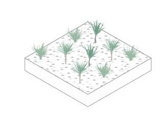
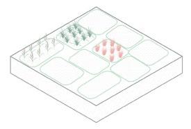
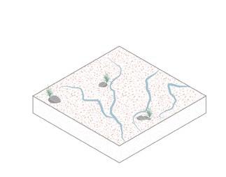
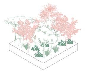
/contents 06 p. 39-44 MAPPING PEDESTRIAN HEAT STRESS 01 02 03 04 05 p. 03-10 p. 11-20 p. 21-24 p. 25-28 p. 29-38 SMART GREEN HOUSE PROTOTYPE | LAI CHI WO 1:1 WORKSHOP WOVEN STUDIO PING CHE | NORTHERN AGROPOLIS
AND INTENSIFICATION -
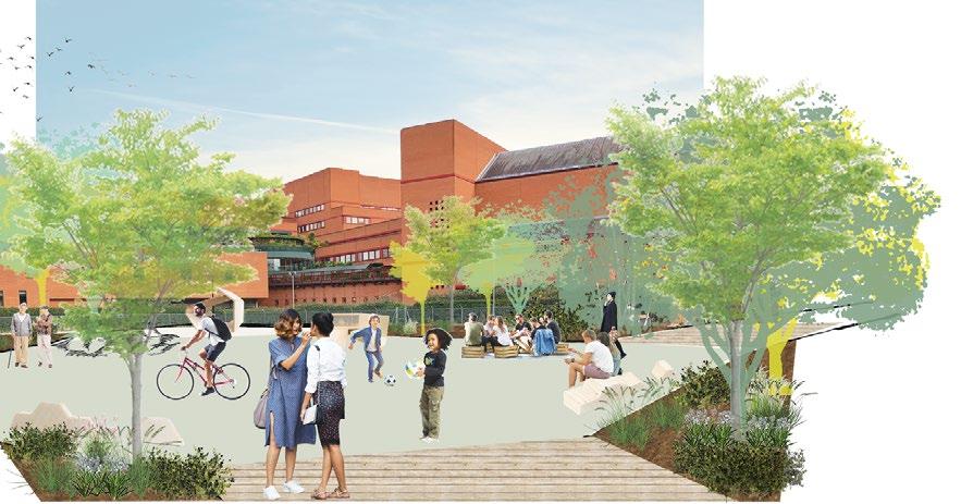
- PLACE OF BELONGING AND RESILIENCE
LIVEABILITY
REIMAGINED NEIGHBOURHOOD HOLLOWAY
HOLLOWAY - PLACE OF BELONGING AND RESILIENCE
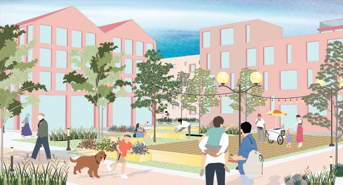
From floods and wildfires to a global pandemic, 2020 has highlighted the importance of sustainability and effective planning to help protect the Earth and ensure the wellbeing of city dwellers. Drawing lessons from the national lockdown and sustainable practices to mitigate development impacts on climate change, this proposal addresses the urgent need to create cohesive, sustainable and liveable neighbourhoods with low input, big impact strategies that ca be easily adapted and applied across neighbourhoods globally.
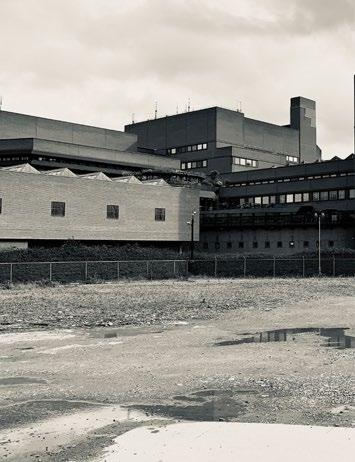
 Former prison site to be demolished
London, 2020 | UCL, BSc UPDM, Y3 |Supervisor - Dr. Martins, Juliana
Former prison site to be demolished
London, 2020 | UCL, BSc UPDM, Y3 |Supervisor - Dr. Martins, Juliana
01
03
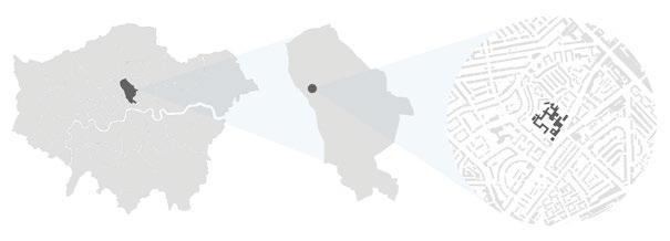
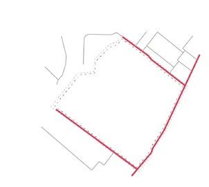
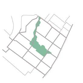
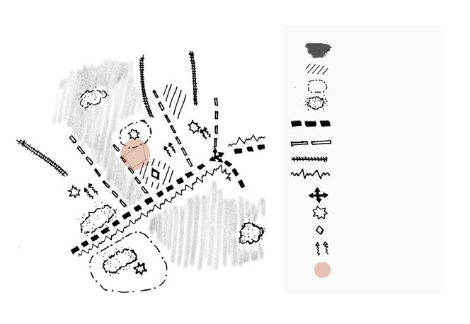
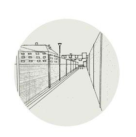
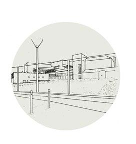
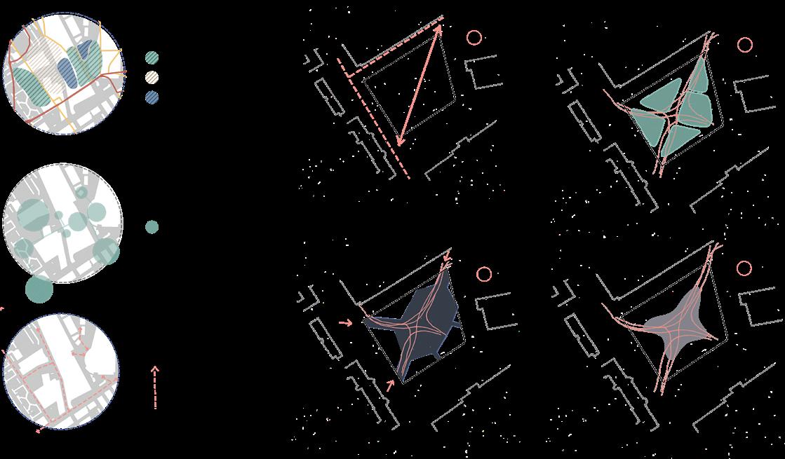
London, UK - Islington District - Holloway prison site
Public space
Landuse
• predominantly residential area with few public spaces
• lack of playgrounds and community gardens
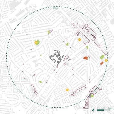
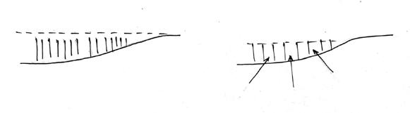
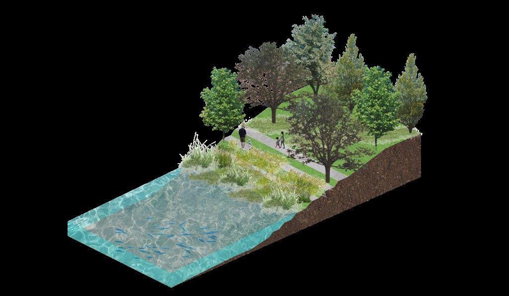
Evident lack of green infrastructure - no major open spaces in close vicinity to the site. Islington is one of the boroughs with the least amount of green space area per person. Existing and additional greenery can be considered to mitigate much of the noise and air pollution caused by the busy road next to site.
Framework development
Creating adaptable spaces with social infrastructure and green open spaces
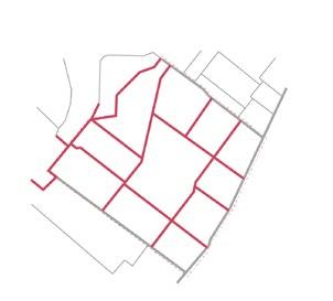
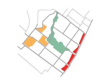
 Site post-demolition with context road access
Extending access with connected grid
Green space unites the grid
Catalysing local programs
Spreading social pockets
Connected and lively social structure
Site post-demolition with context road access
Extending access with connected grid
Green space unites the grid
Catalysing local programs
Spreading social pockets
Connected and lively social structure
04
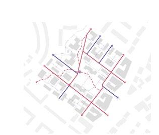
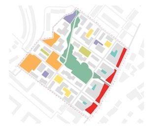
 Street hierarchy with new connections
strategy 05
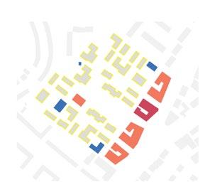
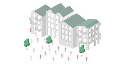
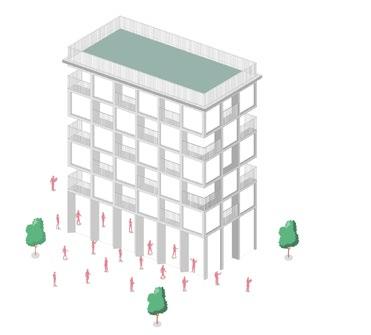
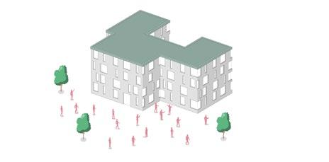
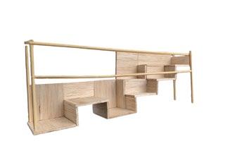
Mixed-use residential living Series of nodes with active frontages
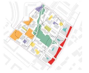
Design
Building type
Combinations which encourage social interraction in various open spaces
Traditional block
Incorporated green pockets
Flexible living
Efficient and adaptable development model

Modular unit representing one standard room size
Adaptable floorplan on different levels restaurant indoor play space for children daycare facility
Redistributed mass
Permeable block with social pockets

Modular units connected into living apartment units
Variations of 1-bed 2-bed 3-bed 4-bed housing units
grocery store
shared workspace
indoor sports facility
local coffee shop
community space
06
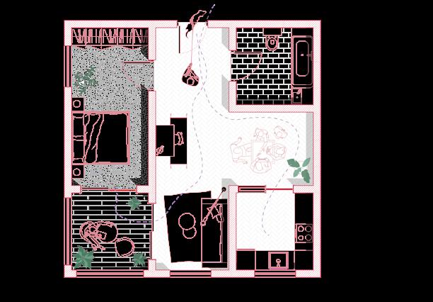
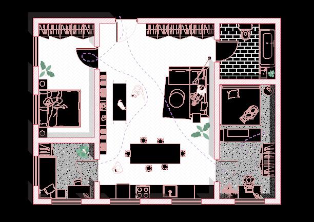
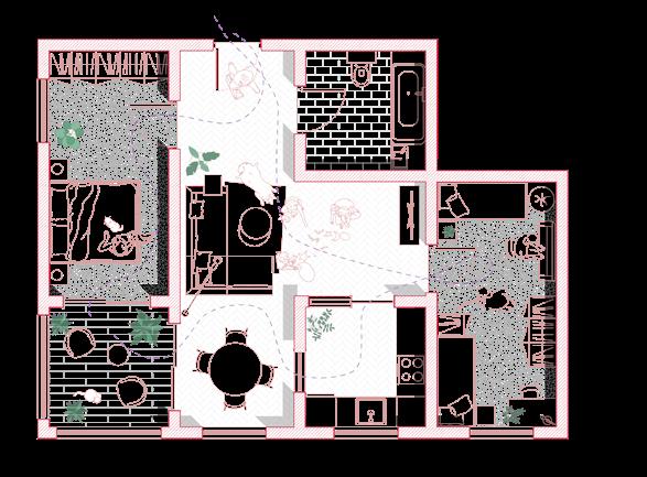
1 bedroom
2 bathroom
3 living room / common space
4 kitchen
5 balcony
1 bedroom
2 bathroom
3 living room / common space with kitchen
1 bedroom
2 bathroom
3 living room / common space
4 kitchen
5 balcony
Floorplan layout variations 07 1 1 1 2 2 2 3 3 3 4 4 5 5 1 1 1
Toolbox of typologies
Fostering different types of living for a functioning mixed-use community
Mixed-use pixel house Townhouse
Zig-zag house
Modern townhouse
08
09
Achieved strategies
A community that is able to absorb, recover and prepare for future economic, environmental and social shocks
Provide more entrance options and improve navigation

Ensure permeability and accessibility for all users
Distribute uses and activities
Embrace organic movement layout
Maximise sunlight and ventilation providing dual aspect units and smaller blocks
Extend green space and its integration
10
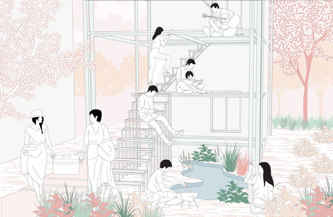
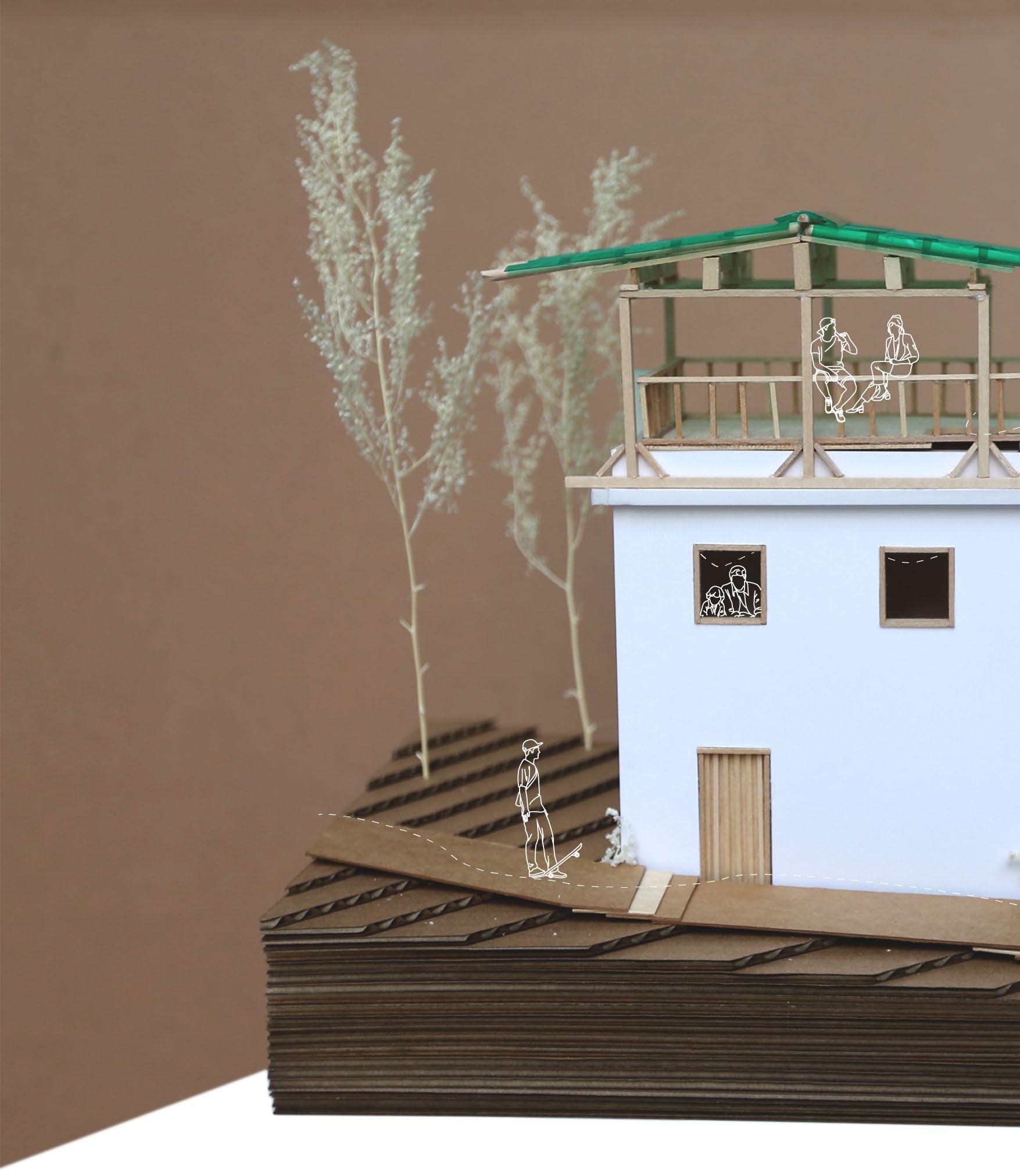
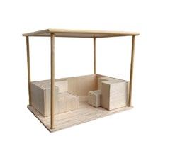
SMART GREEN HOUSE PROTOTYPE |
LAI CHI WO 02
Hong Kong, 2022 | HKU, MUD |Superviso - Dr. Jianxiang Huang
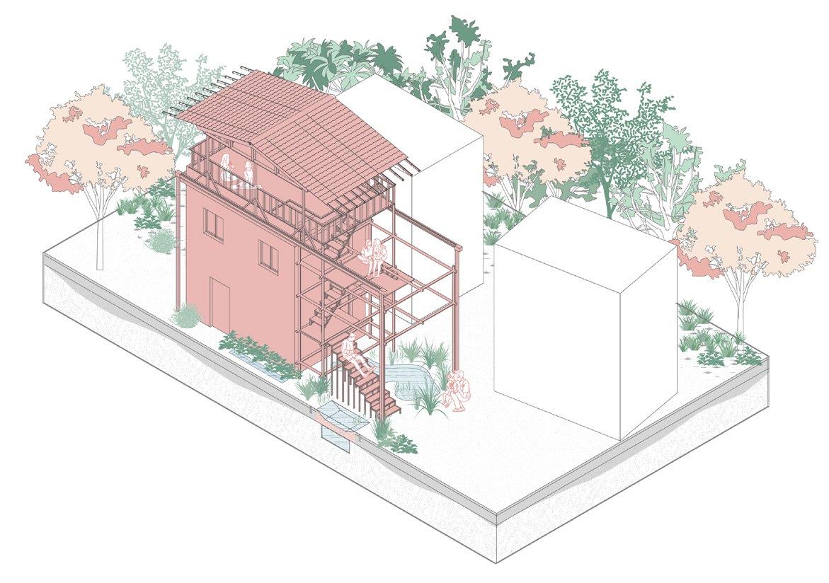
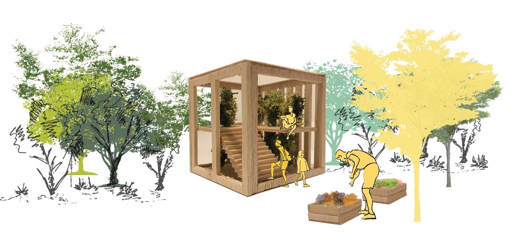
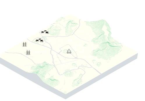
The proposed Smart Green House (SGH) serves the need of eco-tourism in Lai Chi Wo and the rest of Hong Kong’s countryside areas. A joint MIT Node and HKU team aims to collaborate on developing and testing a prototype of SGH 1.0, to be used for accommodation, management, and tourism services. The house uses rapidly renewable materials, such as bamboo, timber, earth, and rely on local supply chains for pre-fabricated modules, and it can be assembled quickly.
The multi-disciplinary team consists of architects, urban planners, building scientist, and IT specialists, drawing expertise from a university-industry partnership both locally and internationally.
11
house prototype site
1
water streams
Unique natural setting with cultural and environmental significance with a long-term interraction between humans and the natural environment.
3
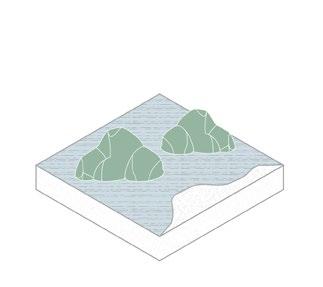
fung shui wood
2
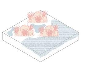
agricultural wetland
4
shrub land
mudflat 5
6
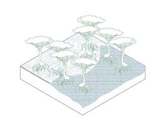
mangrove & sea grass
7
rocky shores
8
inner sea
West gate entrance
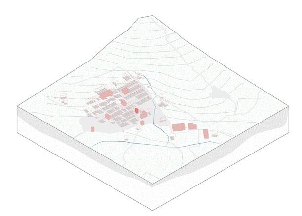
Ancestral hall
East gate entrance
Lai Chi Wo was set up by the Hakka nearly 400 years ago
Rich cultural history attracts visitors a boosts toursim in the area
2 1 3 4 5 6 7 8
Hip Tin temple house prototype site
Hok Shan Monastery
12
Existing structure
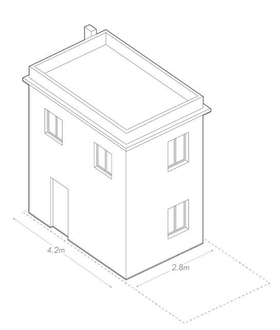
small footprint area on a narrow site
existing structure remains with new additional open space, roofing system and raingarden
Post-intervention
existing structure remains with new additional open space, roofing system and raingarden
drought tolerant grasses and wildflowers
rainwater storage and collection to grow vegetation
13
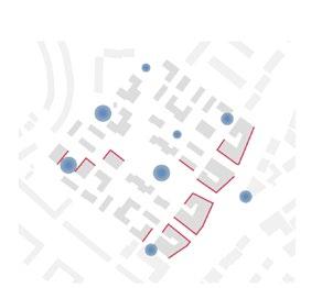
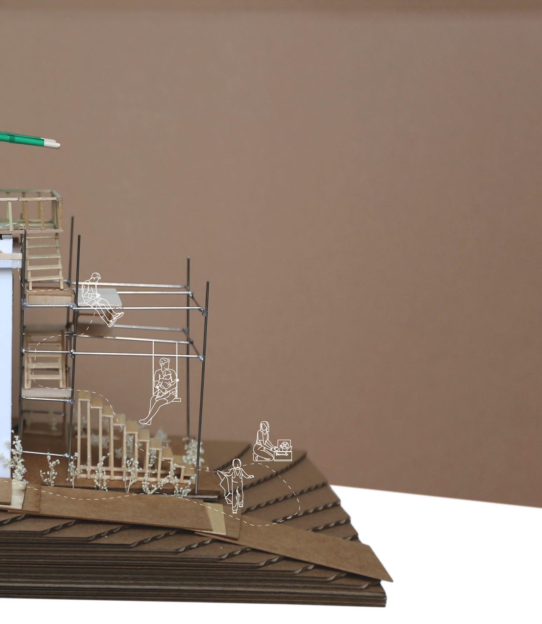
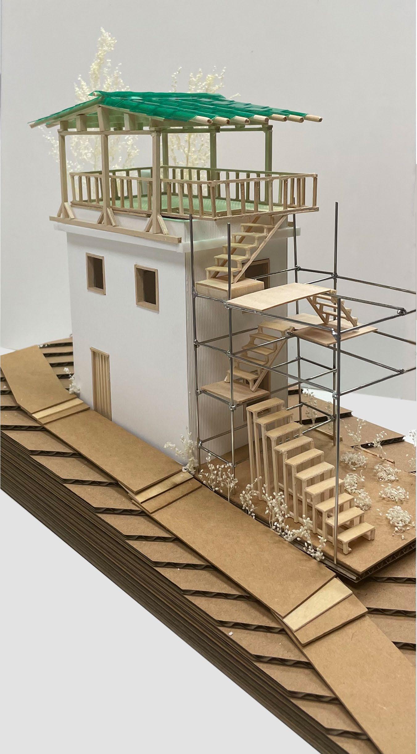
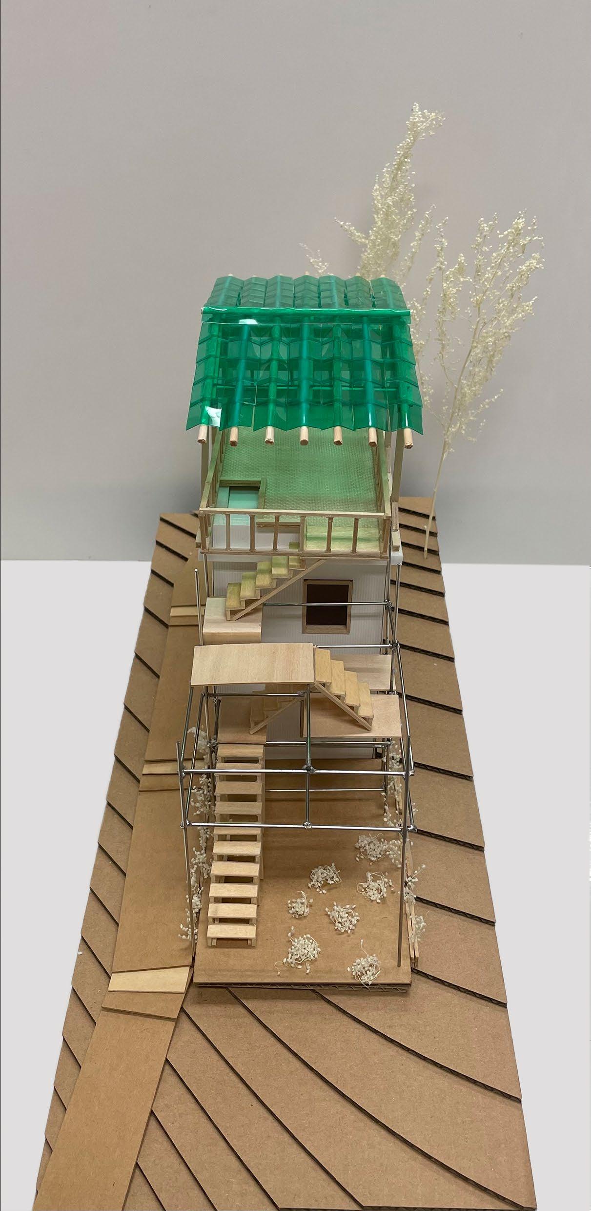
Structural details
The building is a small house with two-level concrete frame structure. It is currently vacant with decent structural quality. It occupies a prominent location with good views. It can serve as the focus of the first stage intervention of smart and green retrofit.
photovoltaic panels integrated in the roofing
bamboo roof skeleton inspired by traditional hakka roof design
rooftop terarce to allow movement on building top
modular scaffolding structure
timber planks for steps and seats

additional staircase for easy access
14
15
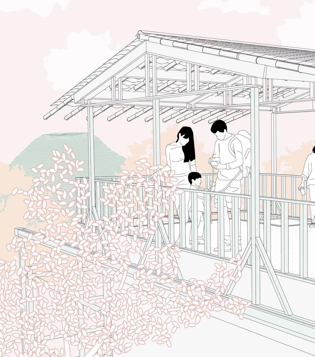
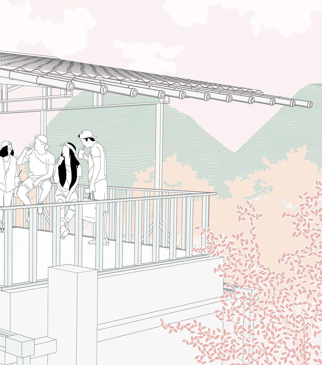
The proposal carefully considers local design features, a modern reinterpretation of traditional elements. The new roof, which is one of the key element, adapts a traditional Hakka village roof design style. While resembling tradition, the design is playful with alternative materials, respecting the local culture while embracing more sustainable conditions at the same time.
16
17
18
19
20
03
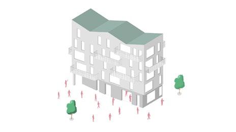
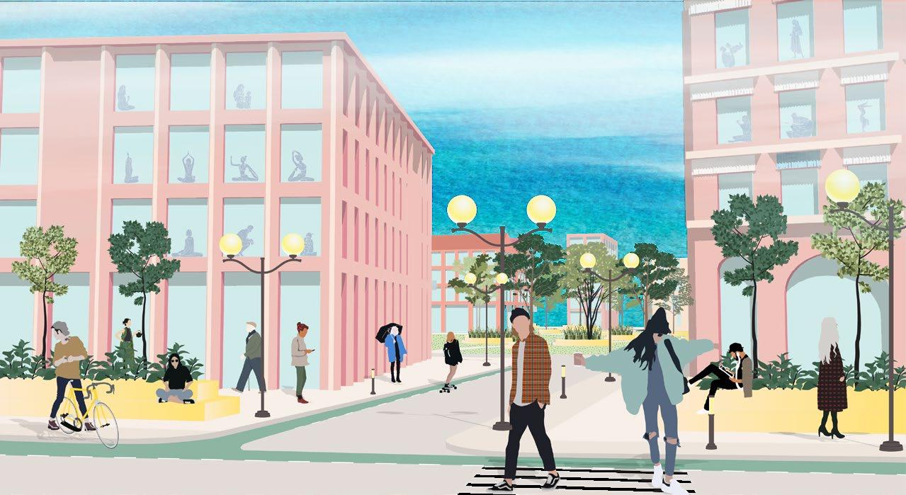
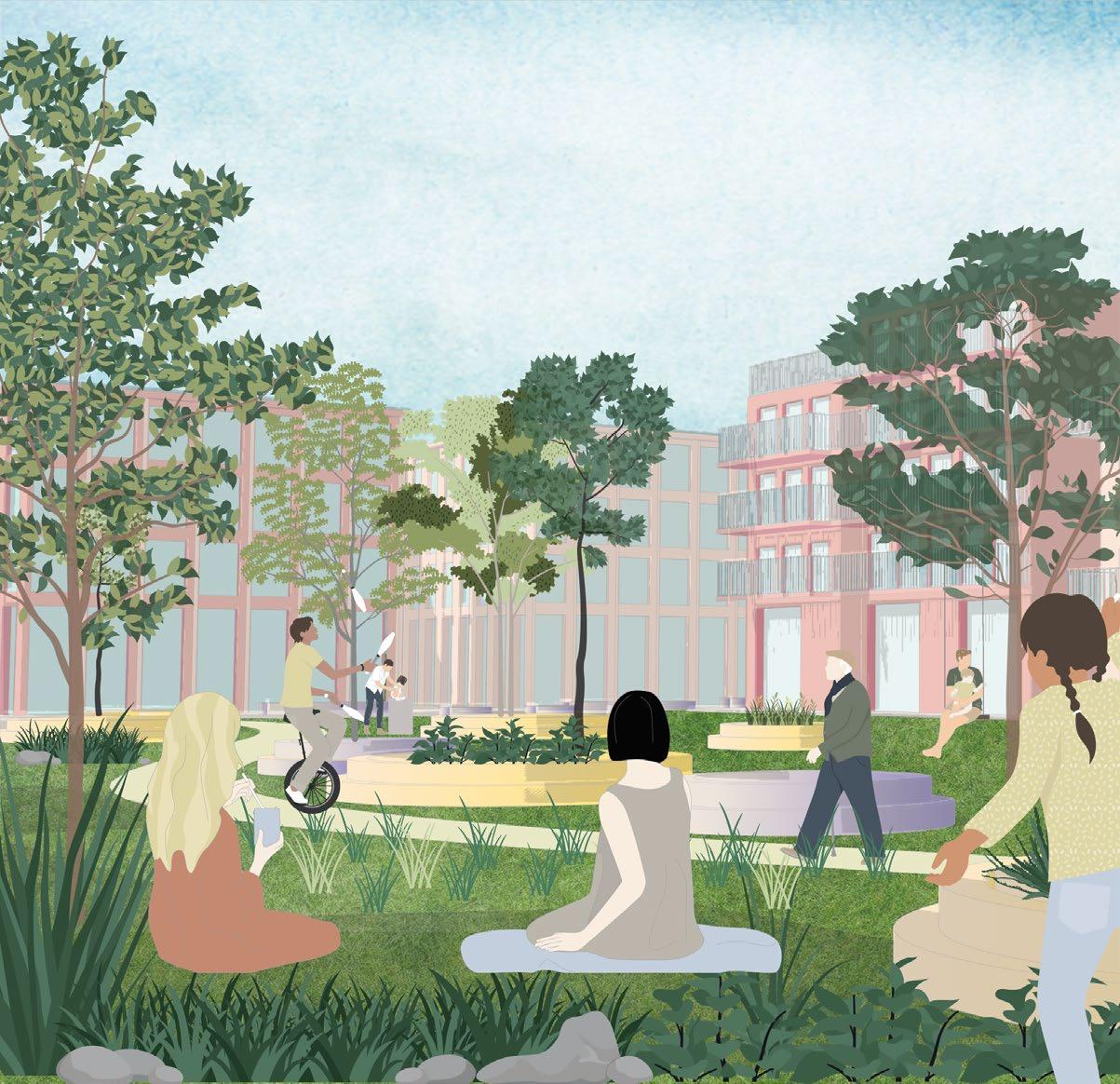
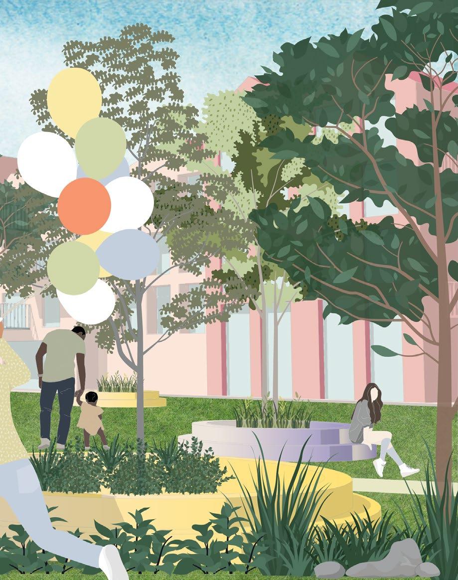
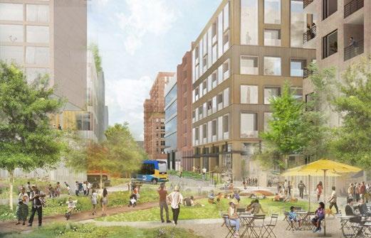
LIVEABILITY AND INTENSIFICATION | REIMAGINED NEIGHBOURHOOD
London, 2018 | UCL, BSc UPDM, Y1 |Superviso - Cidre, Elisabete
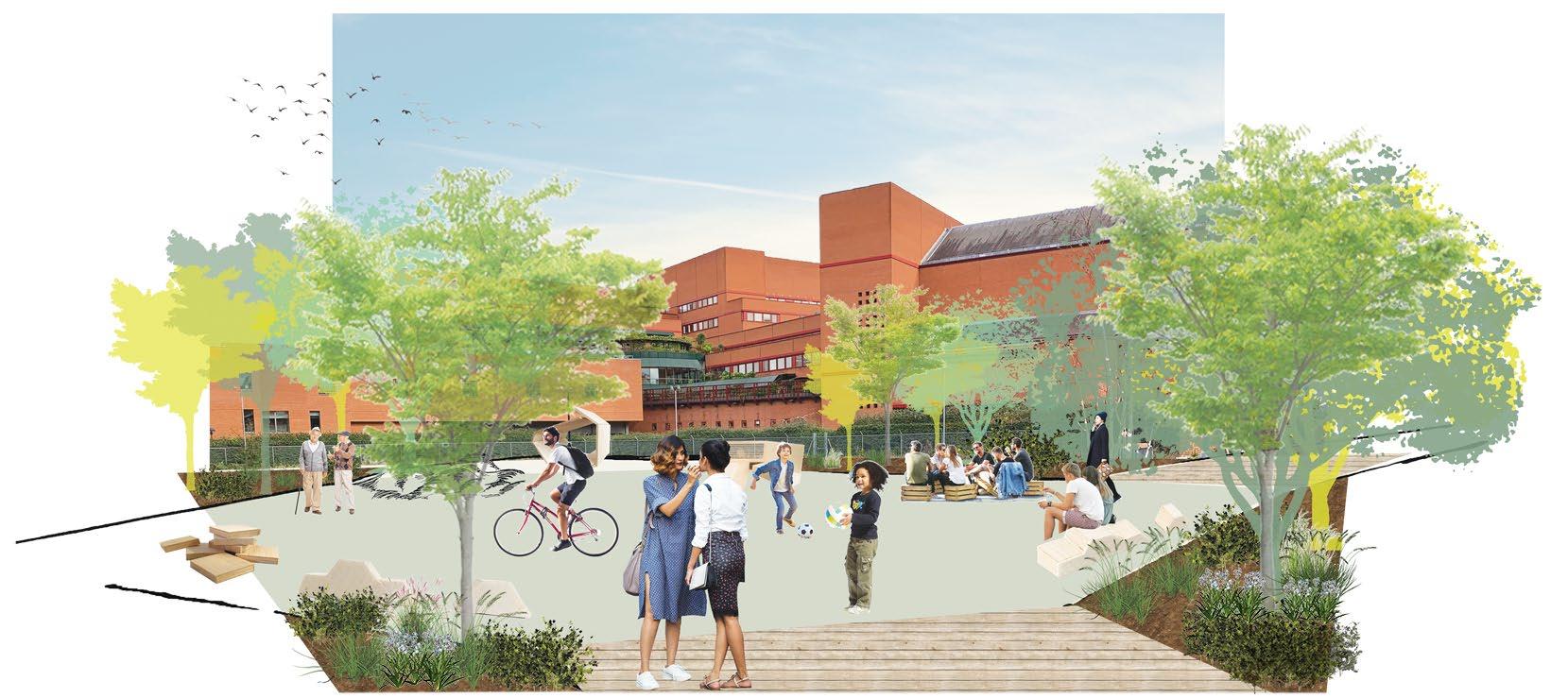
Located in King’s Cross, Site 28 was at the time a vacant site, situated between the British Library and the Francis Crick Institute. The research institute, train station and housing estates surrounding the site provide for its potential to bridge the gap between different land uses, becoming a common space for diverse users
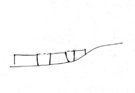
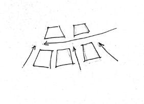
Site 28 was often taken as a shortcut to and from St Pancras International. This project focused on designing a public open space which seeks to transform an underutilised site into a destination for workers, residents or travellers passing by. The main elements of this space is transformable and mobile street furniture
before / after
21
Eastern entrance
Residential area
Commercial area
Education
Green space
Major road
Minor road
Railway
Noise pollution
Node
Focal point
Transport Studied site
Western entrance
22
Landmark
Commuting area 1 2 4 3 Residential area Leisure area
connection
a shortcut for pedestrians
and united space
concentration of movement
Main
points of
Creating
Accessible
Pedestrian flow defines space layout Expected
Main pedestrain routes
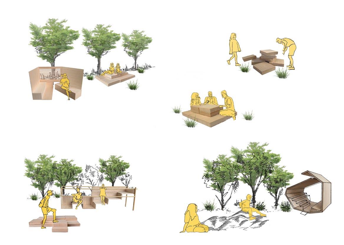
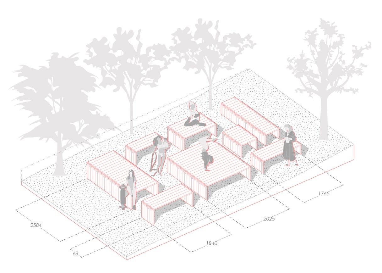
Street furniture design toolkit
Bench system on rotatin platforms, adjustable for more intimate or open space
leveled seating on scaffolding style step box system
/
terrace style seating with roofing to protect on rainy days
box system for various uses, including playing, seating
Community gardening within the surrounding estate courtyards
23
24
New public square behind the British Library
Space for everyone
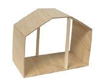
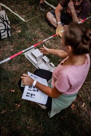
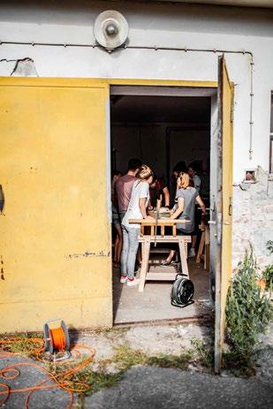
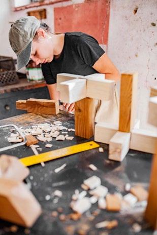
1:1 WORKSHOP WOVEN STUDIO 04
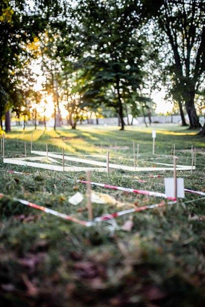
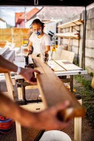
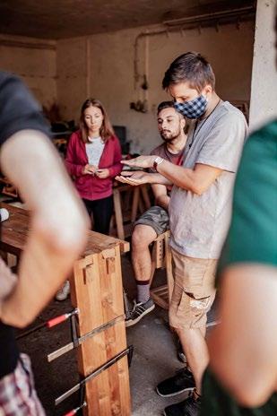
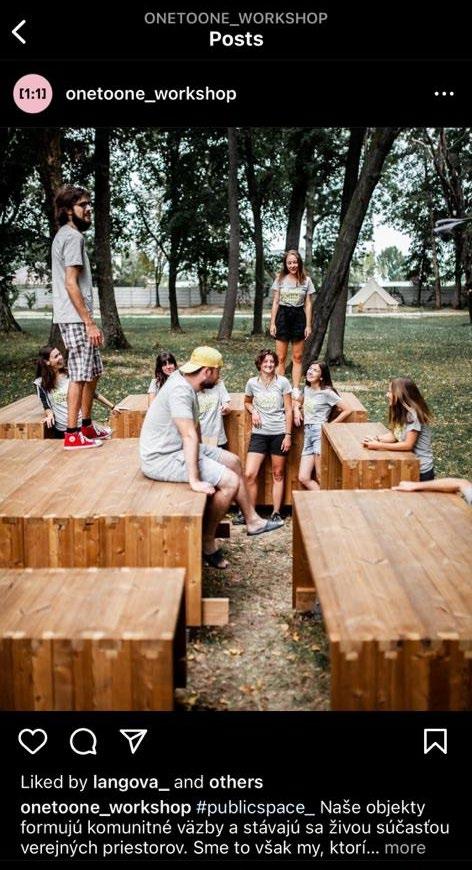
Slovakia, 2020 | [1:1] WORKSHOP | Woven studio
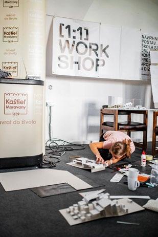
[1:1] WORKSHOP organized in Slovakia since 2013 is a design & build workshop for international students of architecture and design eager to learn and get experienced in the field of timber construction. Led by professional tutors and organized by the creative platform woven.
The workshop was led in the summer of 2020, in Moravany nad Váhom. The project site was located just behind the Moravany Castle, in the beatiful ambient park. The designed structure still sits on the little uphill of the park, surrounded by tall trees and direct view on the castle.The workshop explored the use of Japanese joints in woodworking photocredits: @Woven team
25
Conceptual design
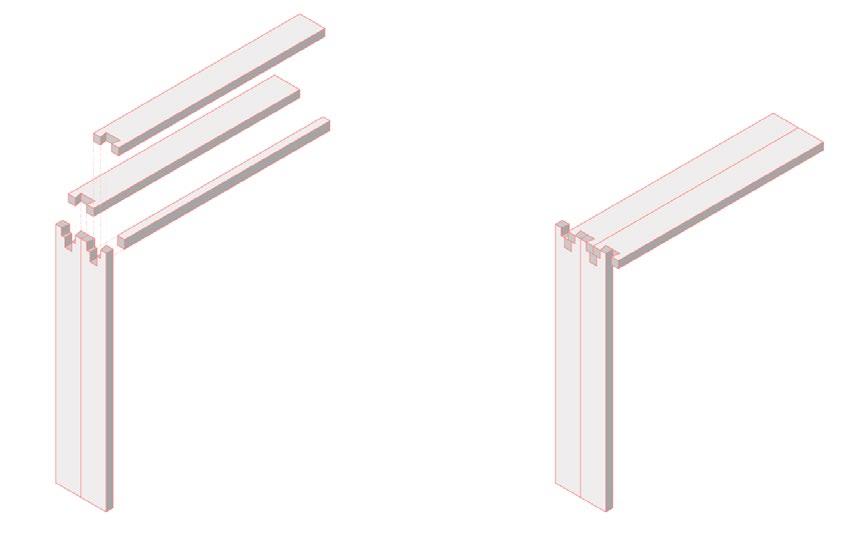
Applied structural detail
Half blind dovetail Japanese joint style structure with a supporting beam
26
27
28
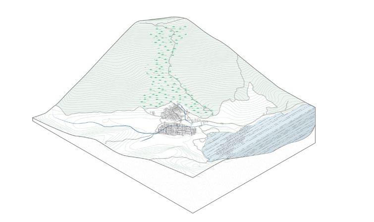
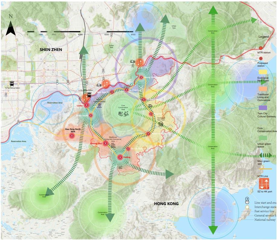
PING CHE |
NORTHERN AGROPOLIS
Hong Kong, 2022 | HKU, MUD |Superviso - Dr. Alain Chiaradia
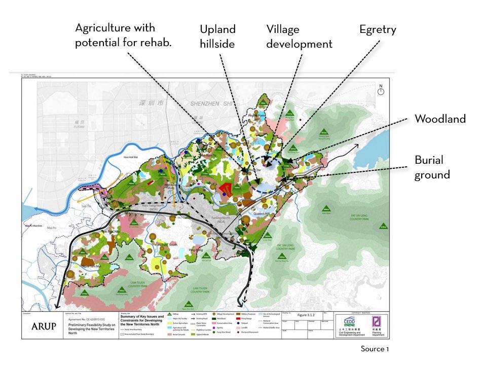
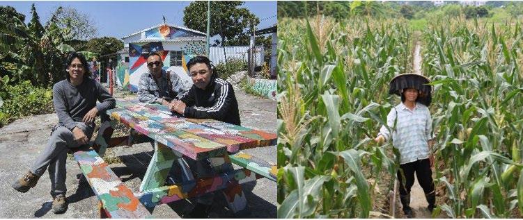
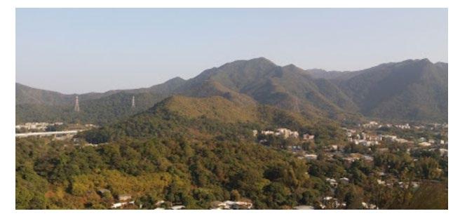
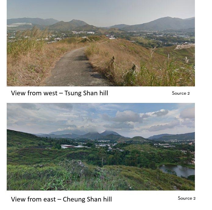
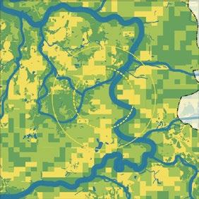
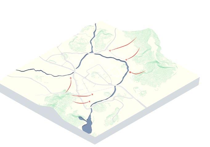
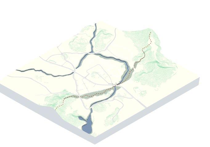
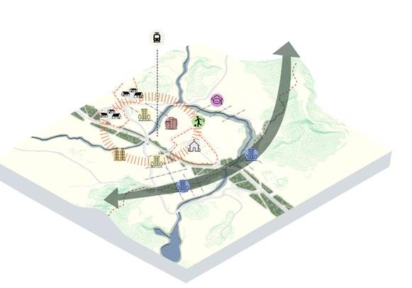
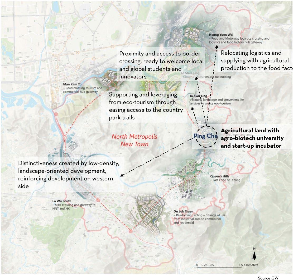
Ping Che is located on the east of North New Town in Hong Kong. While the area itself is relatively flat, it is surrounded by the mountains. The land is characterized by grasslands, farmlands, river channels and paths leading towards the hills. The current local population are villagers and farmers. Ping Che is also next to a regional corridor which makes it a lucrative area for future interconnections between Hong Kong and Shenzhen
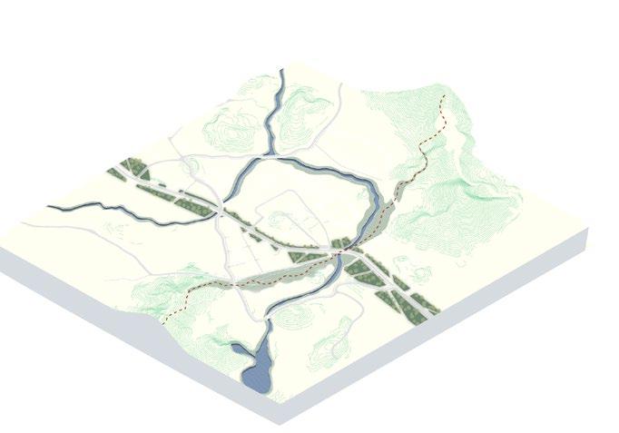
This project aims to transform Ping Che into an ecological hub, balancing a low-density population with a landscape restoration strategy, enhancing and building on the existing land and natural assets and supporting agricultural production. The existing natural conditions guide the vision for Ping Che – a landscape led and people centric strategy
29
05
30
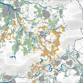
Existing water channels
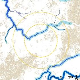
Primary water catchment direction
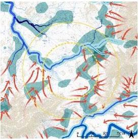
Water catchment and risk assessment
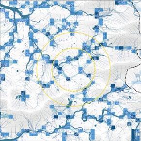
Integrating and re-naturalizing water
Water system and flooding
0 50 100 150M Robin’s nest trail High hill Tin Hau Temple Ta Kwu Ling rural centre government offices
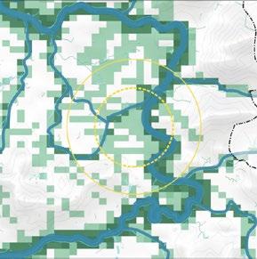
evaluation 1000m Above river channel 1m (highest risk area ) Above river channel 0 5m (high risk area ) River channel Potential other river channel 1000m 1000m High risk area Medium risk area Existing water Catchment connection 1000m Water Farmland Brownfield Village Suitable construction area Conditionla construction area No construction area Water system Identifying development potential 31 0 50 100 150M Ng Tung river extension Tan Shan river extension Ping Yuen river extension
Landuse Comprehensive
32 0 50 100 150M 0 50 100 150M
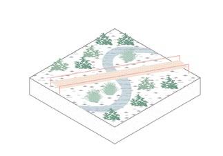
Creating a green link
Integrating water into the ecosystem
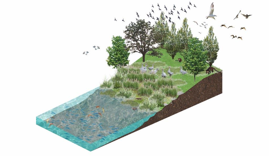
Increased biodiversity
Carbon sequestration
Improved water quality

Wildlife habitat
 Natural setting and connection to waterfront
Formal setting with stairs and platforms
Natural setting and connection to waterfront
Formal setting with stairs and platforms
Pedestrian-oriented network
Creating distinct areas
PHASE 1: 2022-2030
Landscape restoration and conservation
Allowing forests to regrow, restoring to restorative agricultural practices
PHASE 2: 2025-2035
Transportation, population and
Rain infrastructure and housing sustainable living through local food environmental restoration
PHASE 3: 2032-2052
Expansion, blending and distinctiveness
Environmental and technological production and education
the town and aligning streets
Cooling
35
provision, focused on more food production, job creation and innovations within agricultural
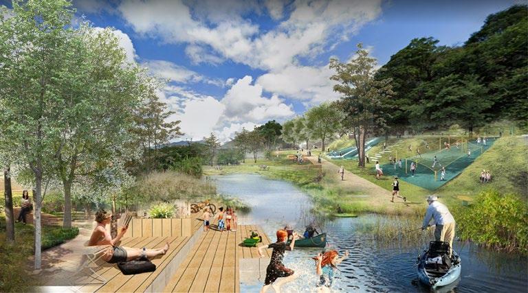
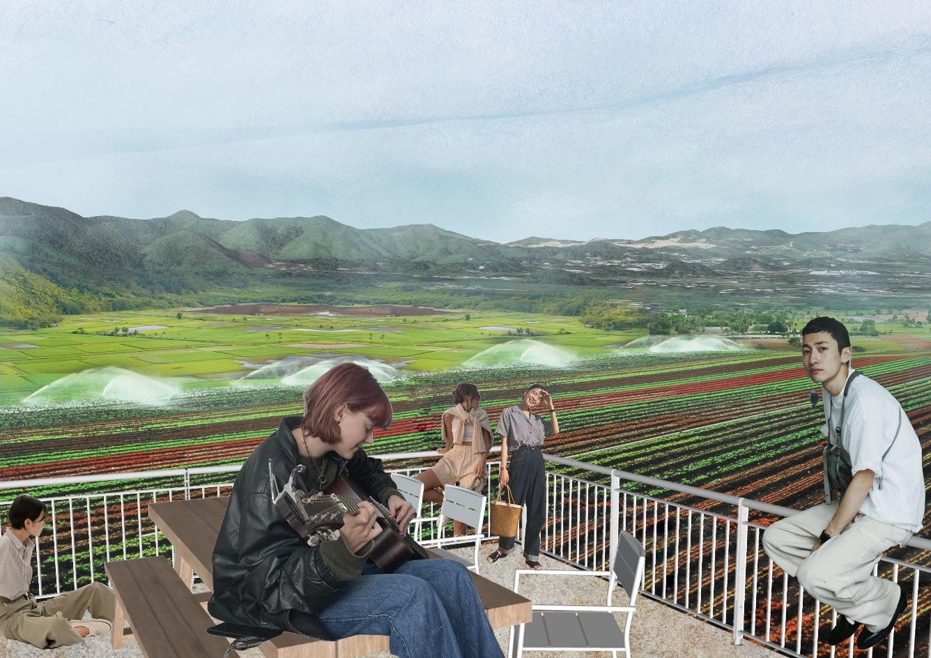
Sceneric views on the farmlands from the public housing residential neighbourhoods.
coastal wetlands, and switching conservation context integration distinctiveness 36
37

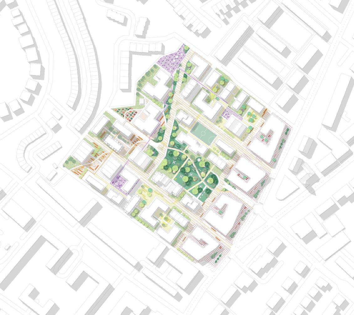
Public housing
Restored farmland
Mixed-use development
Sports ground
Modern campus
Private housing
38 0 50 100 150M
06
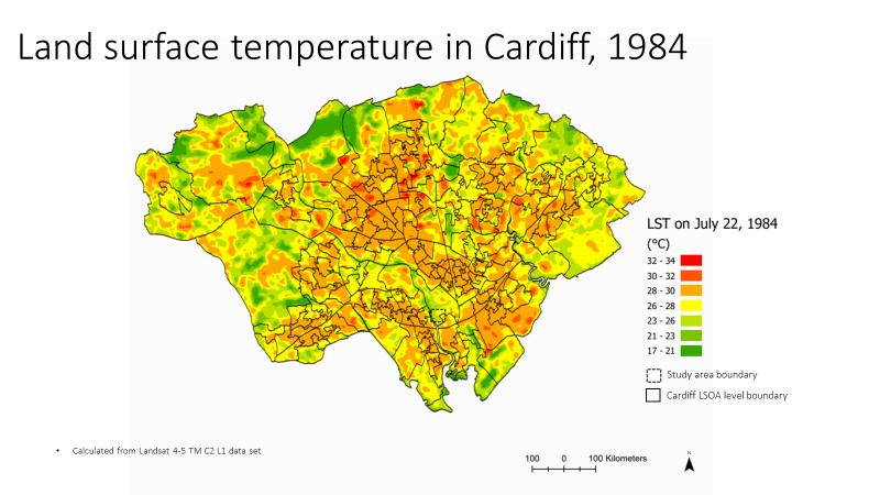
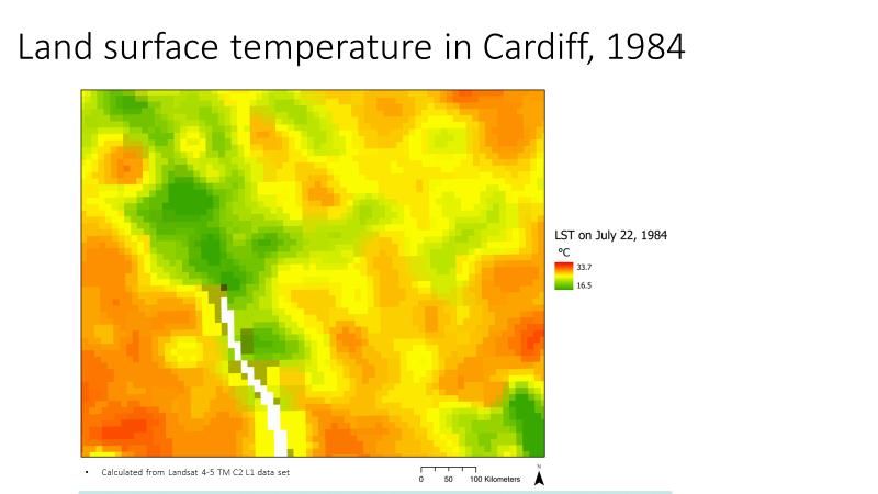
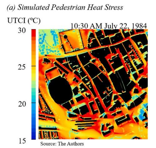
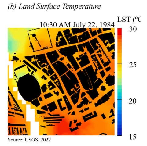
MAPPING PEDESTRIAN HEAT STRESS
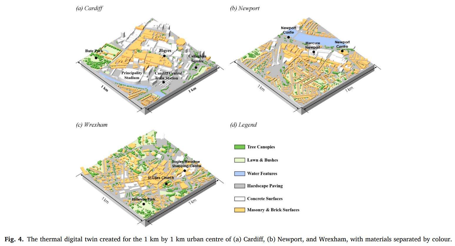
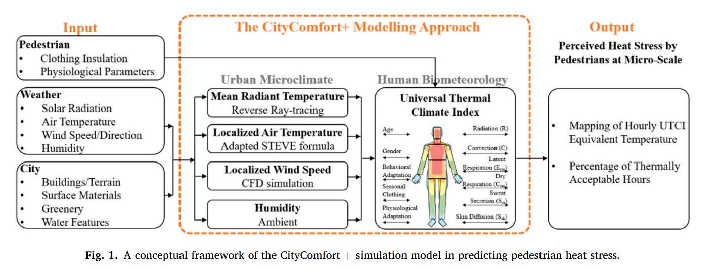
Jianxiang Huang, Xu Tang, Phil Jones, Tongping Hao, Reka Tundokova, Clive Walmsley, Simon Lannon, Peter Frost, Josie Jackson, (2024), Mapping Pedestrian Heat Stress in Current and Future Heatwaves in Cardiff, Newport, and Wrexham in Wales, UK, ScienceDirect
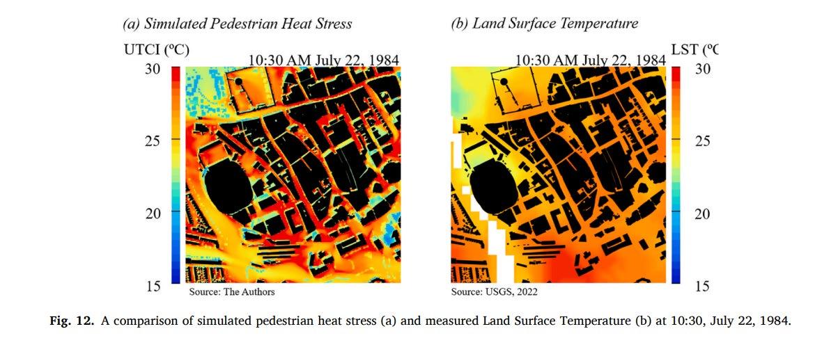
The research paper describes the mapping of heat stress experienced by pedestrians during past and future heat wave events. Computer simulation was used to assess the extent of heat stress experienced by pedestrians in three Welsh cities - Cardiff, Newport, and Wrexham.
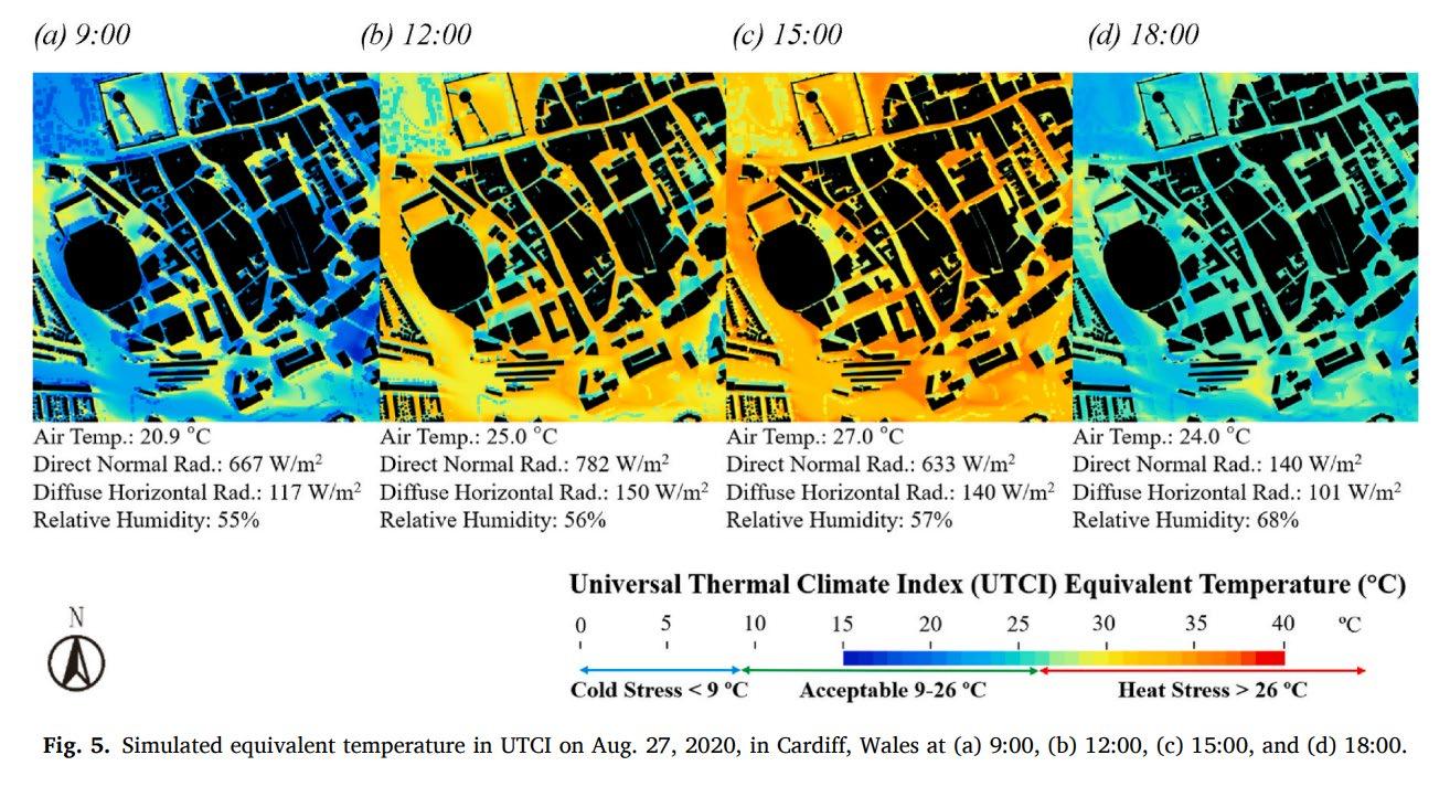
CityComfort+ was used to assess urban environmental parameters – it uses inputs of 3D urban geometries, localize radiant temperature, wind speed, air temperature, metabolic rate and clothing insulation. Results show significant implications for town planning and the model can serve as decision-making tool or planning-tool to evaluate human thermal comfort of public open spaces.
39
40
Responsibilities:
Land surface temperature mapping with Landsat data
Land surface temperature in Cardiff, 1984

41
(a) Simulated Pedestrian Heat Stress
(b) Land Surafce Temperature

42
43
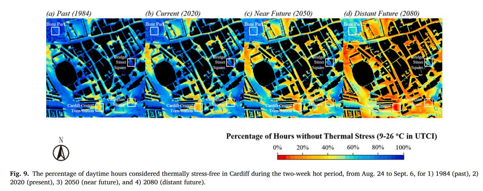
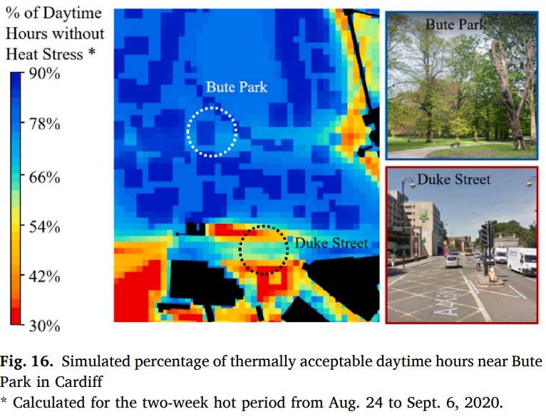
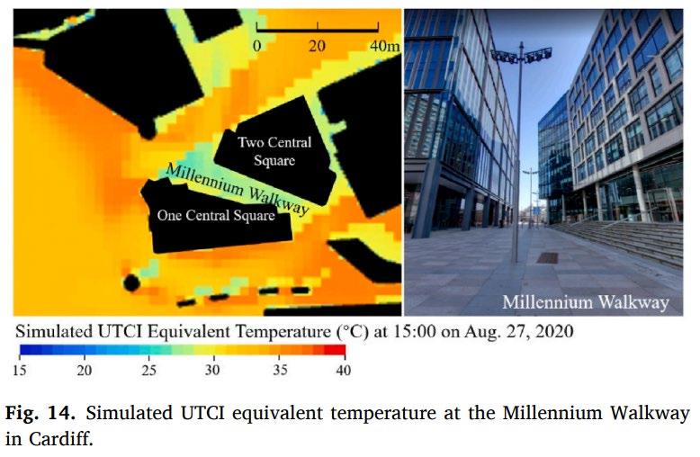
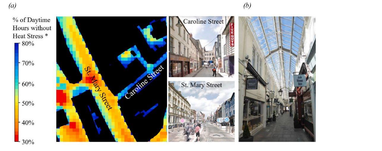
Model can serve as decision-making tool or planning-tool to evaluate human thermal comfort of public open spaces
Can be used to assess spatial-temporal comfort of public open spaces & spatial-temporal patterns of heat stress on an existing space as well as a proposed one
Can quantify the impact on heat stress from proposed development and assist decisionsmaking
Can reveal future risks from climate change and urge preventative measures to be taken in advance
44
thank
thank you.
