On behalf of the Staff and Management of Packard Realty at Chinquapin, let us take this opportunity to welcome you, and to sincerely thank you for choosing us to serve your lodging needs. We value your patronage, and it is very important to us that your stay will be a comfortable and enjoyable one. We take great pride in providing our guests with the utmost in professional and personalized service.
This directory is provided to familiarize you with the many services we offer, as well as acquaint you with the North Lake Tahoe area.
If there is anything we can do to make your visit with us more enjoyable, please feel free to ask our staff members.
We hope you have a great stay and we look forward to your next visit.
Sincerely,
Mitch Packard & Staff 530-583-6991
History of Chinquapin
Chinquapin has not always been Chinquapin. The land’s name has varied with its rich history. In the eighteen seventies – many years after the Washoe Tribe named the land after bushes they favored for their tasty nuts – Chinquapin came to be known by the old Sierra sourdoughs as Lousy Point, or Old Lousy. (The name hardly commends itself to anyone in search of nature’s splendors. But read on – the truth is something else!) There was, in those days, a famous –some say infamous – old land squatter named Griffin. And where did he squat? At Chinquapin. (Which says a lot for his eye for property if not for his character.)
Griffin was inclined now and again to drop into the saloon at the old Custom House in Tahoe City to warm himself with a glass or two. The Custom House regulars tended to regard the old man with less than enthusiasm, his peculiar habits – which included a change of clothes about once a year – leaving much to be desired. Finally one day a customer shouted out, “Hey Griffin, why don’t you go back to your lousy broken down shack on your old lousy point?” Hence was born Old Lousy.
In 1873, Old Lousy became Observatory Point, the result of an announcement in the old San Francisco Bulletin that “Lick Observatory will be situated 300 feet above Tahoe on a beautiful peninsula of land with its own stately trees.” James Lick had chosen the site for the observatory, to which he was contributing a million dollars because of the amazing clarity of its atmosphere. Ultimately, the observatory was built hundreds of miles away on Mount Hamilton.
Chinquapin has known only three owners since the Indians gathered food there. It continued to be called Observatory Point until its purchase from the original owner, the D.L. Bliss family, by Mrs. Lora Knight of St. Louis in 1916. Mrs. Knight named the promontory Wychwood, and carefully built at one end of the property a boathouse and a cluster of small chalets around a main house. These superb pieces of mountain architecture still stand today in total seclusion among the stately pines and firs.
In 1927, Mrs. Knight sold Wychwood to Robert Stanley Dollar, Sr. of San Francisco, the founder of the Dollar Steamship Company. The land hence became known as Dollar Point, and the family strove to conserve the area’s natural beauty.
Moana Development Corporation purchased the land in 1970 and restored the original Indian name Chinquapin to the area. The development was planned to provide privacy for the residents, while at the same time maintaining the integrity of the natural surroundings. Over 90 percent of the Chinquapin land still remains open and untouched.
Guest Information
Airport Transportation
The following companies provide transportation to and from the Reno-Tahoe Airport:
Fast Taxi .................................................................................................. 530-583-6699
Bank – ATM Service
The nearest ATM service is at the 7-11, at top of Dollar Hill or any bank in Tahoe City.
Check-Out
Check-out time is 10:00 a.m. We are happy to extend your stay if your unit is not occupied that same day.
Copies / Fax Machine
Copy, print, and e-mail service is available at the Rental Office. Fax service is available for your convenience as well, our fax number is 530-583-0937.
Credit Information
We accept Visa and MasterCard.
Emergency
In the event of an emergency, please contact the Rental Office at 530-583-6991. If you have a medical or fire emergency, please dial 911.
Exercise Facility
A Santé Lakeside Fitness, is located approximately 3 miles from Chinquapin in Tahoe City (behind Safeway). We sell discount passes in the office.
Fireplace
Each unit has firewood supplied. If you need assistance in building a fire, using the gas log lighter, emptying the ashes, or are low on firewood, contact the Rental Office. If you have a gas fireplace in your unit, please let us know if you have any questions or difficulty when operating it.
Housekeeping
Call our Rental Office for room make up service, extra linens or towels. The units are cleaned prior to and upon departure. Extra service runs $35.00 per hour.
Ice and Vending Machines
Ice and vending machines are located at the Pool/Tennis area.
Guest Information
Internet Services
Most Chinquapin Units offer wireless Internet access. If you are unsure if your unit offers Internet access, please contact the office. The Rental and Sales office does have wireless for anyone staying at Chinquapin. Please feel free to stop in.
Kitchen Appliances
All kitchens are fully equipped. If you need assistance with any of the appliances, or if you are missing any kitchen utensils, please contact the Rental Office.
Lost and Found
For articles lost or found, please contact the on-site Rental Office at 530-583-6991.
Mail and Packages
Mail and packages received at Chinquapin may be collected by either calling or stopping by the Rental Office.
Newspapers
Newspapers are available at the Pool / Tennis area.
Parking
Complimentary parking is available for all registered guests. The management cannot be responsible for items left in vehicles on the property. Please be sure your parking pass is hung on your interior rear view mirror, facing out your windshield.
Pet Policy
Homeowner’s Association rules do not allow pets in rental homes. Violation of this rule will result in an automatic charge of $500.00 to your credit card.
Postage Stamps
Postage is available at current postal rates at the Front Desk.
For sales information, please contact Mitch Packard in the Sales and Rental Office.
Swimming Pool / Sauna / Playground
Hours are 8:00 a.m. to 8:00 p.m. Children must be accompanied by an adult. No glass permitted in pool area. The swimming pool is open from Memorial Day through September.
Transportation
Guest Information
We will be happy to arrange for taxi service or make recommendations concerning your transportation needs.
Television / DVD
If you need assistance with your TV or DVD operation, please contact the Rental Office. .......................................................................................... 530-583-6991
Visitor Information Center
In addition to the information in our Rental Office, see the Visitor Information Center at 380 North Lake Blvd. in Tahoe City, 530-581-6900.
Recreation at Chinquapin
Heated Swimming Pool
50 x 30 feet
Pool Hours: 8:00 a.m. to 8:00 p.m. Memorial Day through September Pool Attendant Hours: 8:00 a.m. to 6:00 p.m. (during July and August). Children must be accompanied by an adult.
Saunas
Men’s and women’s saunas are located in the rest rooms next to the pool and tennis courts. The saunas are open from 8:00 a.m. to 8:00 p.m.
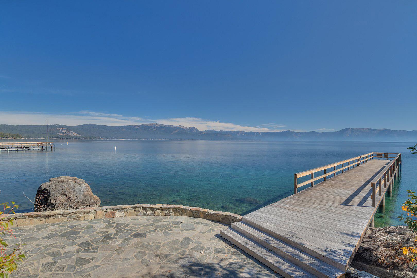
Pier and Buoys
Buoys are available to rent for homeowners and renters. All requests should be made through the Chinquapin Office (530-583-6991) or Western Maintenance Company (W.M.C. 530-583-2713).
Pier Attendant – is on duty from 8:00 a.m. to 8:00 p.m. during July and August. Weekend service is provided during the month of September. A rowboat is available when the pier attendant is not on duty.
Volleyball Court
A sand court is located near the pool area. A volleyball may be checked out from the Tennis Hostess.
Bocce Ball
There is a Bocce Ball court located next to the pool area. Stop by the Rental Office or Tennis Pro Shop for equipment.
Horseshoe Pit
Recreation at Chinquapin
There is a sand horseshoe pit located near the pier area. Horseshoes may be checked out from the pier attendant.
Walking, Jogging and Hiking Trails
A variety of trails are located on the Chinquapin property. The lakefront path provides almost one mile of beautiful, scenic terrain. The Chinquapin Hiking Trail starts at the Dollar House and winds up into the naturally forested area, then descends to meet the entry road near the office.
Tennis
There are 6 tennis courts situated centrally and a lakefront court located by the pier.
Court Reservations: Please call 530-583-0383. All courts are reserved on an hourly basis only. Proper soled shoes are required for play, shirts are required at all times. Please check with the tennis hostess if you have any questions. If you are looking for a match, please contact the tennis hostess who will make every effort to find you a partner.
Pro Shop: Located next to the main tennis courts, carries clothing and other tennis items.
Tennis Lessons and Clinics: Our teaching pro has a variety of clinics, round robins and private lessons designed to improve your game and meet other tennis players while at Chinquapin. Please call 530-583-0383 for additional information or stop by the pro shop.
Pickle Ball
Pickle Ball courts are located by the tennis courts. Please call or stop by the Tennis Pro Shop for equipment and reservations.
Fitness Center
A Santé Lakeside Fitness is available for use by Chinquapin guests at a special discounted rate. A Santé is located behind Safeway in Tahoe City (less than 3 miles from Chinquapin). The center includes the latest cardiovascular and weight lifting equipment and personal fitness trainers. Please contact the rental office for more information and for a special Chinquapin Discount Pass.
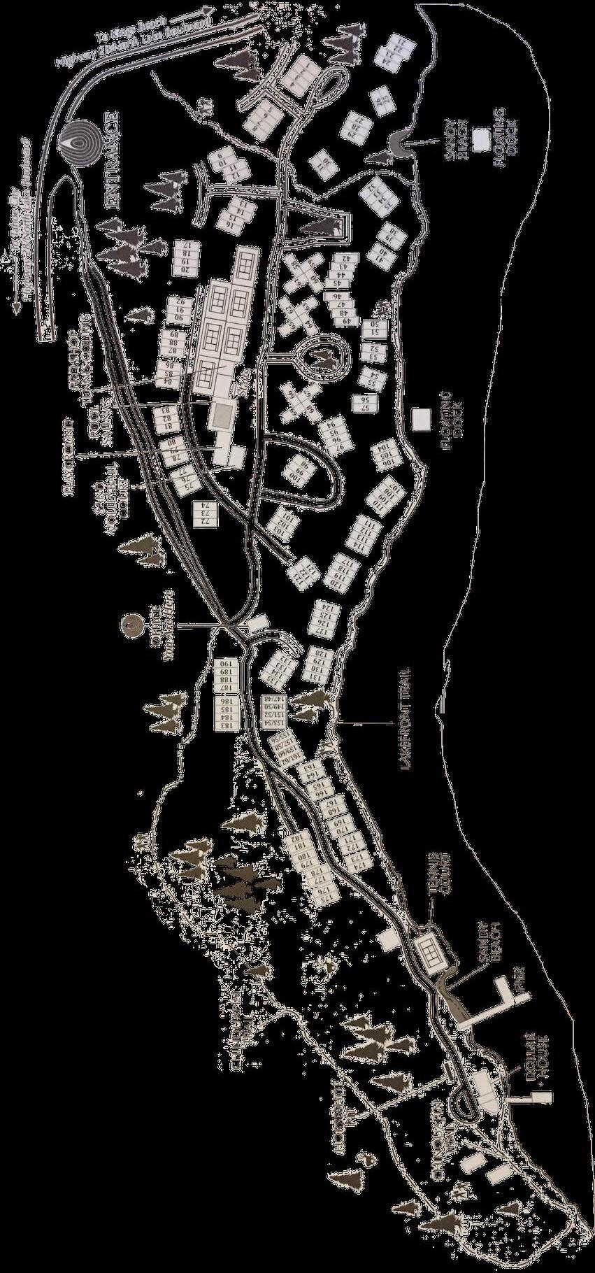
Property Layout
General Rules
Recreational Vehicles
Motor homes, campers, mopeds, motorcycles, off-road vehicles and parked boat trailers are not allowed on the property.
Pets
Homeowner’s Association rules do not allow pets in rental homes. Violation of this rule will result in an automatic charge of $500.00 to your credit card.
Balconies
Should be kept free of hanging towels, swimsuits, clothes, etc.
Noise
Musical instruments, radios and other loud noises are prohibited between the hours of 10:00 p.m. and 7:00 a.m.
Pier and Beach
Boats may be parked at the pier for loading and unloading only. The speed limit for boats and jet skis in and around the pier and buoy area is 5 mph. Water skiers must stay 200 feet from the pier area.
Smoking
All units are non-smoking.
Lake Tahoe History
In 1844 explorers John Fremont and Kit Carson discovered Lake Tahoe. In the summer Lake Tahoe Basin was a gathering place for three bands of peaceful Washoe Indians. The lake held spiritual meaning for the tribe and many sacred ceremonies were held along the southern shores.
Lake Tahoe had many names before Tahoe became official in 1945. The Washoe called it “Daowaga” meaning “edge of the lake.” It was called “Bon pland” after a French botanist and also “Mountain Lake” and “Bigler Lake” after California’s third governor.
The California Gold Rush lured immigrants and fortune seekers to the rugged Sierras. Prospective miners used Donner and Beck worth Passes to the north and Carson Pass to the south to circumnavigate the treacherous Tahoe Basin.
In 1859 Highway 50, then called the “Bonanza Road,” was the first West- to-East road across the mountains. The road was built to handle travelers eager to cash in on Virginia City’s Comstock Lode.
As traffic over the “Bonanza Road” increased, small businesses such as way stations, stables and toll houses began to spring up to collect fares for traveling the privately owned sections of the road. These stations were the basis for most development in the area, from Friday’s Station at Stateline, which served as a Pony Express stopover, to Yank’s Resort in Meyer’s which was built in 1851.
The Comstock Lode increased the flow of traffic and people to Lake Tahoe Basin which in turn inflated the use of natural resources in the Tahoe Basin. Between 1869 and 1890, Tahoe’s forests were nearly stripped of trees due to fuel needed to support the labyrinth of mines being constructed beneath Virginia City. Lumber was pulled to the Lake’s shores by steam train and horse, dragged to Glen brook by steamers, pulled to the top of Spooner Summit and sent by flume to Carson City. From there, the logs were loaded onto trains and wagons bound for the mines. The decline of the Comstock Lode may have been the saving of the Tahoe forests.
By the turn of the century, Lake Tahoe had become the haven for the rich because of the natural beauty of the area. This period marked the heyday of steamship transportation around the lake. Visitors would attend lavish parties on board while cruising across the waters. Many steamers also delivered mail and supplies to the resorts around the lake’s rim.
During the 20s and 30s, the roads through the mountains were paved. Lake Tahoe was no longer available only to the rich. Travel improvements also marked the decline of the steamship era. Use of the automobile enabled people from every level of society to enjoy the magnificent “Lake in the Sky.” Smaller, middle class lodges began to develop as the affluent retreated to elaborate family hideaways.
Harvey and Llewllyn Gross opened Harvey’s Wagon Wheel Saloon and Gambling Hall in 1944. It was a rustic cabin built with $10.00 worth of nails and displaying a weathered wagon wheel on the roof. At the same time, the Stateline area was far more crowded, but the Gross family faced competition from many other casinos in the area.
Development at Lake Tahoe began in earnest in the 1950s. Roads to the basin began to be plowed year round, enabling permanent residence. The 1960 Winter Olympics at Squaw Valley put Lake Tahoe firmly on the map as the skiing center of the western United States. Today, Lake Tahoe continues to offer visitors a bit of many historic eras. While hotels, casinos and ski resorts draw millions of guests each year, the main attraction continues to be the quiet beauty of the Sierras and timeless inspiration of the lake itself, little changed from the days of the Washoe Indians.
Lake Tahoe Facts
Lake Tahoe is the world’s second-largest alpine lake, and the second-largest lake in North America.
We have listed some facts and figures about our beautiful lake below for your enjoyment:
1. Lake Tahoe is 21.6 miles long and 12.2 miles wide.
2. Lake Tahoe’s average depth is 989 feet; its deepest known point is a remarkable 1,645 feet.
3. Lake Tahoe is 99.1% pure, and from the surface one is able to see objects at a depth of 100 feet.
4. Surface temperature of the lake is 50°F in winter and 68°F in summer.
5. 750 feet below the surface, the water temperature is a chilly 39.2°F to 41.5°F.
6. There is enough water in Lake Tahoe to cover the state of California with 14.5 inches of water!
7. 1,400,000 TONS of water evaporate from the lake every day! But this only lowers the lake level 1/10th of an inch.
8. Lake Tahoe’s elevation is 6,228 feet above sea level.
9. It is 72 miles around Lake Tahoe and is approximately a two-hour drive.
10. Lake Tahoe was formed by shifting of the Earth’s crust, with volcanic activity sealing both ends of the valley. Fed by 63 streams, its only outlet is the Truckee River, which flows east to Pyramid Lake.
11. The Upper Truckee River is the main source that feeds the lake.
12. Types of fish common to Lake Tahoe and the Truckee River are Silver, Brown and Cutthroat Trout, and Kokanee Salmon and Mackinaw.
13. The two highest peaks around Lake Tahoe are Mt. Tallac at 9,735 feet and Freel Peak at 10,881 feet. Mt. Tallac is famous for its “Snow Cross” marking.
14. Two-thirds of the lake lies within California, and 29 percent is in El Dorado County.
15. Lake Tahoe receives an average annual snowfall of 215 inches, and the upper elevations may receive 300 to 500 inches.
16. Lake Tahoe has its share of below-freezing days and nights, but the Lake itself has never frozen over. On occasion, Emerald Bay has been covered with a layer of ice, and ice forms in cold protected inlets. However, Lake Tahoe’s great depth and huge volume of water always in motion keep it from becoming the world’s largest ice rink.
17. Average days of sunshine are 307, and this is great for enjoying the six campgrounds, eleven parks and beaches around the lake.
18. There are two people known to have swam across the lake. The first woman was Earline Christopherson in 1962. She swam this in 13 hours and 37 minutes, and she was only 16 at the time! Fred Rogers from South San Francisco accomplished this feat in 1955.
19. A trip west on Highway 89 will bring you to “Vikingsholm” in Emerald Bay. Heiress Mrs. Lora Josephine Moore Knight built this beautiful home in 1928, and furnished it with pieces from Norway, Finland and Sweden. Of special interest is the single-room “Tea House” built on the island in the middle of Emerald Bay, where Mrs. Knight would take her guests by boat for afternoon “Tea”!
20. Lake Tahoe has had many names: Bonpland, Mountain Lake, Fremont’s Lake, Lake Bigler, and Big Truckee Lake, until it was officially named Lake Tahoe in 1945. This means “Big Water” in Washoe Indian language.
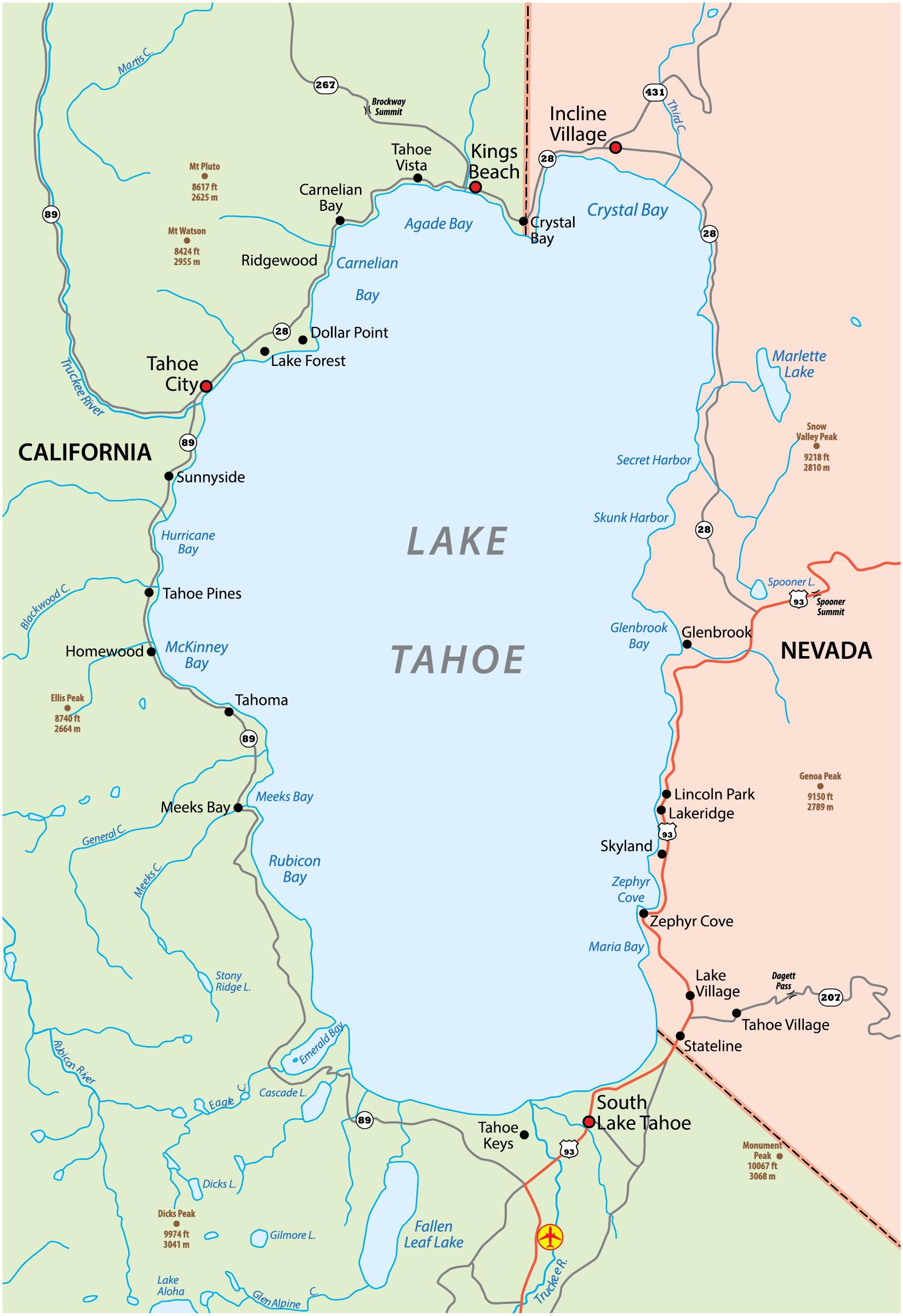
Points of Interest
BROCKWAY FIRE LOOKOUT – Spectacular views of the lake, nature trail, and picnicking. From Brockway Springs, turn right on Highway 28, turn left on Reservoir Drive (just past Crystal Bay, and the Tahoe Biltmore); turn right on Lake View Avenue and go to the top of the hill. Take your first left, take Forest Service Road to the lookout (paved road).
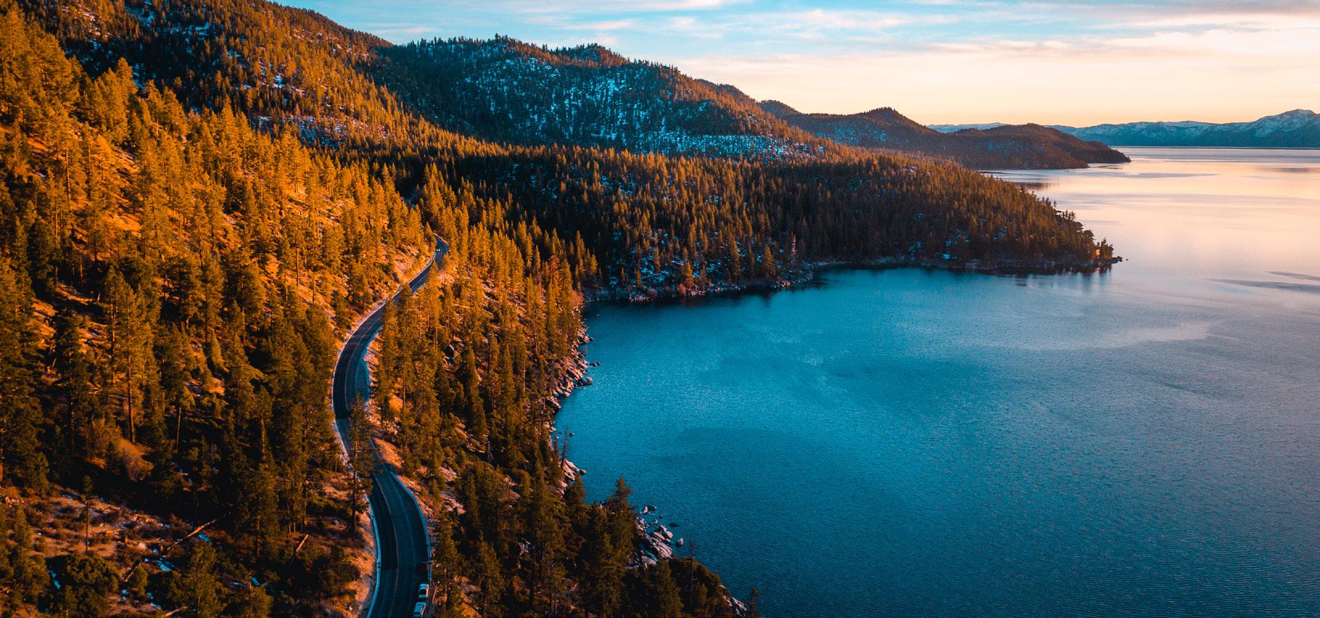
EMERALD BAY – Stay on Highway 89 and you can’t miss the most picturesque spot in the world. The highway here is hundreds of feet above lake level, and offers a spectacular view of Emerald Bay.
FANNY BRIDGE – It’s on Highway 89 in Tahoe City directly south of the Albertson’s supermarket. The Lake Tahoe outlet gates are used to control the flow of water into the Truckee River, and thereby raise or lower the water level of the entire lake. This is great for the kids because they can feed the rainbow trout.
LAKE TAHOE SHAKESPEARE FESTIVAL – Extraordinary entertainment! Exceptional setting! Located lakeside at Sand Harbor State Park, this season the Festival celebrates 40 years of presenting live, professional theater productions, concerts and performances seven nights a week (July 5-August 25). Complemented by an on-site gourmet kitchen that features a full bar, LTSF entertains in an unforgettable beach setting. www. laketahoeshakespeare.com or 800-74-SHOWS.
TAHOE CITY COMMONS BEACH – Situated right in the heart of Tahoe City, this beach provides a sandy shoreline, playground equipment, and weekly free music on the beach.
SAND HARBOR – Located 5 miles outside of Incline Village on Highway 28, this picturesque spot has a beautiful sandy beach, nature walks, and great views.
EAGLE ROCK – Located 4 miles south of Tahoe City on Highway 89, this ¼ mile hike brings you to the top of a volcanic rock, with panoramic views of Lake Tahoe.
VIKINGSHOLM – A beautiful estate situated on the shores of Emerald Bay, Vikingsholm was the vision of Mrs. Lora Josephine Knight, and is a beautiful example of Scandinavian architecture. Follow Highway 89 to Emerald Bay, and there is a parking area and signage for Vikingsholm. It is a one mile hike down to the estate and the mouth of Emerald Bay. In the summer, rent a kayak or paddleboard and make your way to Fannette Island, the only island in Lake Tahoe.
MEEK’S BAY – Follow Highway 89 20 miles past Tahoe City, and you will see signs for Meek’s Bay. Enjoy the long sandy beaches, sunshine, and stunning views. Perfect for a relaxing afternoon.
DL BLISS STATE PARK – Located 15 miles south of Tahoe City on Highway 89, this state park features gorgeous beaches, stunning vistas, and a variety of hiking trails with no shortage of views and secluded coves.
TAHOE DONNER – Tahoe Donner has many amenities open to the public. Two restaurants: Pizza on the Hill, and The Lodge Restaurant & Pub. Summer activities: Bikeworks for bike rentals and guided rides; Equestrian Center for trail rides and day camps; Alder Creek Campground, which has both tent and RV sites; and The Tahoe Donner Golf Course. For winter activities, visit their downhill and cross-country ski areas. Call 530-587-9400.
SQUAW VALLEY – Ride the cable car to High Camp that overlooks the valley. Bike riding, hiking, picnicking, swimming, and ice skating in the winter are available. The original Olympic Flame and five-ring Olympic insignia still mark the right side of the entrance to Squaw Valley, off Highway 89, about five miles north of Tahoe City.
Points of Interest
SUGAR PINE POINT STATE PARK – On Highway 89, nine miles south of Tahoe City. In addition to picnicking, hiking, and camping, Sugar Pine Point has the colossal Ehrman Mansion, formerly the vacation residence of a wealthy San Francisco family. There is a nature trail which describes the history of Tahoe and its habitants. State Park fee: $10 per car; bikers or hiker, $3 per person.
THUNDERBIRD LODGE ESTATE – A place you won’t forget, is one of the best examples of historic “Tahoe Society” estate and a six-acre historic district listed in the National Register of Historic Places, which is surrounded by more than 40,000 acres of Forest Service and Nevada State Parks land. Previously known as the Whittell Estate, it is located on the east shore of Lake Tahoe. This unique place is also available to host a simple business meeting or a complex conference. Available for tours that will take you through the lighthouse room, the old lodge, the maids quarters, the old kitchen, cook and butler’s house, the elephant house and an underground tunnel leading to infamous Card House and Boat House.
TRUCKEE – Was once a booming town with rowdy saloons and a busy red light district. Frequently, the lullaby for visitors attempting to sleep was the tinkle of money on the faro tables and player pianos cranking out music in the saloons. Times have changed, though, and Truckee has mellowed somewhat, but it still attracts plenty of visitors. Located just east of beautiful Donner Lake, Truckee is a bustling, year round recreational paradise. During the winter, skiers and snow-minded sports enthusiasts flock to town; in summer, the quaint shops and restaurants make Truckee a perfect spot for a day of sightseeing and learning about the local history.
VIRGINIA CITY – It’s the nation’s largest Historic District. Old buildings, steam engine rides, mine tours, a huge cemetery, countless exhibits (many free) and several blocks of downtown with covered wooden sidewalks makes this a worthwhile trip for all. Take Mt. Rose Highway (Rte. 431) from Incline to the stoplight at Route 395. Cross 395 and go straight ahead up the Geiger Grade to Virginia City (takes a little over an hour from midNorth Shore). Be sure to take the mine tour and ride the V & T steam train.
TAHOE AREA RAPID TRANSIT
Schedule varies by season.
800-736-6365 or 530-550-1212
TART = Accessible by public bus
FEED THE GIANT RAINBOW TROUT at Fanny Bridge (guess why it’s called that!), Hwys. 28 and 89, Tahoe City “Y.” Bring quarters to buy fish food from the vending machines supplied by the Girl Scouts (but don’t toss them crackers, bread, or other human food, please – it’s harmful to their health). Absolutely no fishing! TART
GRANLIBAKKEN SKI AND SNOWBOARD HILL (Winter) 530-581-7533
NORTH STAR AT TAHOE Winter ice skating Summer Roller Skating rink. Located in the Village at Northstar. 530-562-1010
TRUCKEE SKATEBOARD PARK (Free) Brockway Road. 530-582-7720
Area Activities
North Lake Tahoe offers asphalt-paved bike routes, maintained by the Parks and Recreation Departments of our Public Utility Districts. These trails are open to a variety of recreational uses. Bicyclists, joggers, strollers, people going fishing, and even horses may be found along the way. Users are urged to be tolerant and respectful of everyone’s mutual right to use the facility. Motor vehicles are strictly prohibited.
TAHOE CITY AREA
Tahoe City offers 17 miles of paved multi-use recreational trail extended out in three sections:
1. TO DOLLAR POINT, two and one-half miles, mostly level with a climb that lasts onehalf mile up Dollar Hill; access to Tahoe State Park, Burton Creek State Park, Skylandia Park, Pomin Park, Lake Forest Beach, Lake Forest Boat Ramp and Campground; fishing, picnicking, playgrounds, athletic fields. Access to some features, including the Nordic Center and mountain bike trails is over residential streets. TART
2. ALONG THE TRUCKEE RIVER, the trail is three miles to Alpine Meadows Road and approximately one mile continues along the river to Squaw Valley Road. This trail is very scenic, completely separate from the highway, and is mostly flatter terrain with a few short, gentle grades, trout fishing, river rafting, and picnicking. TART
3. WEST SHORE TO SUGAR PINE POINT STATE PARK, nine miles. Mostly separate from the highway, the trail does contain a few miles of highway shoulder and two miles of residential streets as well as several highway crossings. Terrain is varied with a few steep sections. Features include small communities, campgrounds, Kilner Park, tennis, picnicking, playgrounds, fishing, boating, beaches, scenic lake shoreline, and access to beautiful side trips up Ward and Blackwood canyons and Sugar Pine Point’s Ehrman Mansion. TART
TRUCKEE
There is a designated bike lane on Highway 89 from West River Street to the Squaw Valley entrance. TART
LEGACY TRAIL
Three-mile paved bicycling trail from Truckee Regional Park to Riverview Parks along the Truckee River.
SQUAW VALLEY
Squaw Valley has a two-mile long asphalt trail parallel to Squaw Valley Road on the south side along Squaw Valley Meadow. It runs from Squaw Valley Condos to Squaw Creek Road, and offers view of the meadow and surrounding peaks. TART
TAHOE VISTA
The North Tahoe PUD Parks and Recreation Department maintains a bike trail in Tahoe Vista from the end of the parking lot in North Tahoe Regional Park (up National Avenue through the woods to Pinedrop Street, then to Highway 267.) It is about one mile long from the park, three miles from the intersection of National Avenue and Highway 28.
INCLINE VILLAGE
Washoe County maintains two bike trails.
1. LAKESHORE DRIVE, two and one-half miles from the Chevron gas station to Highway 28. TART
2. VILLAGE BOULEVARD, two miles from Sierra Nevada College to The Lake. TART
OFF-ROAD BICYCLING
Scenic dirt trails at Highlands Community Center (Tahoe City), North Tahoe Regional Park, Blackwood Canyon, and Sugar Pine Point State Park. Truckee routes include Prosser to Boca Reservoir, Prosser to Stampede Reservoir, Verdi Peak, and Truckee to Tahoe City. Check local bike shops for maps—don’t ride unprepared.
Area Activities
USE CARE
Use the trails at your own risk. Beware of sand, rocks, pine needles or cones, and other debris, and watch for maintenance workers and equipment.
TART = Accessible on Tahoe Area Regional Transit
Please help to increase everyone’s enjoyment of the trails by observing the Rules of the Road.
BIKE TRAIL RULES
1. Never ride faster than safety and common courtesy dictate.
2. Keep to the right.
3. Helmets are recommended for bicyclists.
4. Obey all signs.
5. Bicyclists must obey all traffic laws.
6. Do not obstruct the trail. Move off the trail when stopping.
7. Ride or walk in single file.
8. Use your voice or bell when passing. The phrase “on your left” should proceed passing a slower trail user, and alert them to stay on their right.
9. Yield the right-of-way to pedestrians.
10. Where the trail is on the road shoulder, bicyclists should ride on the right in the bike lane. (Yes, even In Tahoe City.) Pedestrians should walk on the left, facing traffic.
11. Trails are for multiple use. Be courteous to your fellow trail users.
12. No littering.
13. Wear bright colors.
14. Use a headlight and reflectors at night.
Alpine
Boreal Ridge
Diamond Peak
Donner Ski Ranch
Granlibakken
Heavenly Valley
Homewood
Kirkwood
Mt. Rose
Northstar
Sierra Ski Ranch Sierra at Tahoe
Squaw Valley
Sugar Bowl
Tahoe Donner Downhill
Cross Country
Granlibakken
Northstar Cross Country
Royal Gorge
Tahoe Cross Country Area
Squaw Creek Sports
Tahoe Donner Cross Country
Area Activities
SKI AREAS
Information
530-426-3666
775-832-1177
(snow removal)
530-426-3376 • 530-426-3635
530-581-7533
775-586-7000
530-525-2992
209-258-6000
775-849-0704
(Resort Operator)800-466-6784
530-659-7453
530-583-6985
530-426-9000
530-587-9444
530-581-7533
530-562-1010
530-426-3871
530-583-5475
530-583-6300
530-587-9484
SLED HILLS
Snow Conditions
530-426-3666
530-426-3635
775-586-7000
530-525-2900
530-562-1010
530-659-7475
530-583-6955
530-426-1111
530-587-9400
530-581-7533
530-562-1330
530-426-3871
530-583-6300
530-587-9400
Caution: Some listed hills are private property; listing does not imply sledding is permitted or safe—only that people are often seen sledding there.
Granlibakken Resort – On Granlibakken Rd., 1 1/2 miles south of Tahoe City. Sled hill $17 per day. Cozy “OId Tahoe” ski hut.
Tahoe City – On Highway 89 about one-eighth mile south of the Truckee River. East side of highway. Gentle slope. Bring own equipment.
Truckee – Donner Pass Road near Interstate 80. Central Truckee Exit underpass, north side of freeway. Fairly steep. Bring own equipment.
Truckee – About 4 to 5 miles out of town toward Glenshire. From Commercial Row, turn right halfway up to I-80, then right on Glenshire Drive. On the left before the Truckee River bridge is a sunny, barren slope (early melt). Bring your own equipment.
Emigrant Gap – Laing Rd. off 1-80, 10 miles west of Soda Springs, south side of freeway. Medium steepness. Bring own equipment.
Boreal Ski Area – 10 miles west of Truckee on Interstate 80. Snowplay area at west end of parking lot. Open weekends only.
Spooner Summit – About 9 miles south of Incline Village where Hwy. 28 meets Hwy. 50, west side of Hwy. 28. Pretty steep. Bring own equipment.
Mt. Rose – Meadows and Summit - Sled hills ~8 miles up Mt. Rose Hwy 431, with more at Mt. Rose Summit (snow and traffic permitting). Bring your own equipment.
Tahoe Donner – Snow Play Area – Below town center on the driving range. Free for TD property owners and recreation-fee members; $3 (under 12) and $5 (13+). Kids under 12 need an adult. Equipment provided.
Tahoe Vista – North Tahoe Regional Park snow play area at the end of National Avenue off Hwy. 28.
Vacation Health Tips
Altitude Sickness
Altitude sickness is caused by reduced oxygen at Lake Tahoe’s elevation (about 6,225 feet; Northstar base 6,330, summit 8,610). Common symptoms include headache, fatigue, loss of appetite, nausea, shortness of breath with exertion, and restless sleep. These effects are due to chemical changes in the blood and usually resolve in 2–3 days. If affected, avoid overexertion, rest, and drink plenty of fluids; eat lightly and limit alcohol. See a doctor if symptoms worsen or become severe. Those with heart conditions or high blood pressure should consult a physician before visiting the mountains.
Dehydration
High-altitude air is dry and low in oxygen, causing faster breathing and greater fluid loss. When active outdoors here, you’ll need about double your normal fluid intake—at least eight glasses of water daily. Electrolyte drinks like Gatorade can help with severe dehydration but don’t count toward your water total. Avoid drinking from lakes or streams without proper purification; untreated water can cause illness requiring medical attention.
Frostbite
Frostbite occurs when water in cells freezes, usually affecting fingertips, ears, nose, toes, and cheeks. Symptoms include burning, tingling, numbness, and whitish skin. Deep frostbite can destroy tissue, making wounds prone to infection and tetanus. Prevent it by covering exposed skin, especially in cold, windy, or stormy weather, and have a friend check your face and ears for discoloration. If frostbite occurs, go indoors, avoid rubbing, and warm gently in lukewarm (not hot) water. Seek medical attention if color doesn’t return, blisters form, pain or numbness persists, or swelling develops.
Hypothermia
Hypothermia occurs when the body’s core temperature drops below normal (98.6°F) and can’t produce enough heat, causing organ malfunction and, if untreated, possible death. It’s more common in winter and during outdoor activity. Risk factors include cold temperature, prolonged exposure, age, health, alcohol use, and wet clothing. Prevent hypothermia by wearing warm, layered, dry clothing, taking indoor breaks, and avoiding alcohol. Early symptoms include fatigue, mood changes, confusion, and impaired motor skills. If symptoms appear, get indoors, change into dry clothes, and warm up. Seek medical help if symptoms worsen or don’t improve within two hours.
Sunburn
At Lake Tahoe’s high elevation, UV rays are about five times stronger than at sea level due to thinner atmosphere, especially affecting those with light hair and eyes. Use highprotection sunscreen with a PABA ester (SPF 15–20 for initial exposure) and lip balm with PABA or zinc oxide. For mild sunburn, apply cool compresses, take aspirin for pain, and Benadryl for itching. Blisters indicate a second-degree burn—don’t pop them, avoid sun, and see a doctor if facial blisters show cloudy or pus-like drainage. Sunglasses effective in blocking ultraviolet radiation are also necessary to protect your eyes, especially if you are out on the lake. Sunburned eyes need medical attention for significant pain, drainage, blurred vision or scratchy sensation.
Insect Bites
Most insect bites can be treated at home. Remove the stinger, apply a cool compress, and elevate the area. Seek medical care if you have an allergy—symptoms include rash, itching, or trouble breathing (call emergency services if breathing is difficult). Other warning signs include fever, abdominal pain, nausea, vomiting, diarrhea, redness, swelling, red streaks, or pus.
Prevention is key: use insect repellent, avoid perfume or scented products, and cover exposed skin, especially after dark. Many repellents contain diethyltoluamide (DEET), which can be toxic with repeated use on children’s skin—apply sparingly, only when needed, and for no more than 1–2 days, or apply to clothing instead.