Adopted November 12, 2024


Adopted November 12, 2024


Consultant Team

This document includes a number of hyperlinks for the reader’s convenience when using Adobe’s Portable Document Format (PDF) to view the plan. These links are provided for navigation and cross reference ease; links are also provided to external sources. Links to webpages or online sources may become inactive over time as websites continuously change.
Located at the top of most pages in the plan, a navigation a bar is provided to quickly jump to other chapters throughout the plan. Each chapter uses an icon to identify its subject. A green box indicates the chapter in which the reader is currently located. The icons align with the Table of Contents on the previous page spread. Click any icon in navigation bar to jump to the beginning of the selected chapter.
Plan SJC would not have been possible without the participation of residents, business owners, stakeholders, county officials, staff, and other governmental representatives who devoted their time and attention to the development of this document. The consultant team would like to thank each of the Task Force members for their leadership throughout the planning process, County officials, and the staff who made this planning effort possible. The consultant team would also like to recognize the sincere and passionate work of the Working Group members for lending their time, interest, and expertise to help develop the goals and recommendations found in this plan. Your dedication towards creating a better future for the County is inspiring.
County Council
Joe Thomas, District A
Amy Drake, District B
Daniel J. Schaetzle, District C
Rafael Morton, District D
Diana L. Hess, District E
Randall L. Figg, District F
Mark Catanzarite, District G
Bryan Tanner, District H
Mark Root, District I
Area Plan Commission
Adam J. DeVon, President
Robert M. Hawley, Vice President
Dr. Jerry Thacker, Executive Committee
Robert Kruszynski
Eugene Matzat
Molly Hannon, New Carlisle
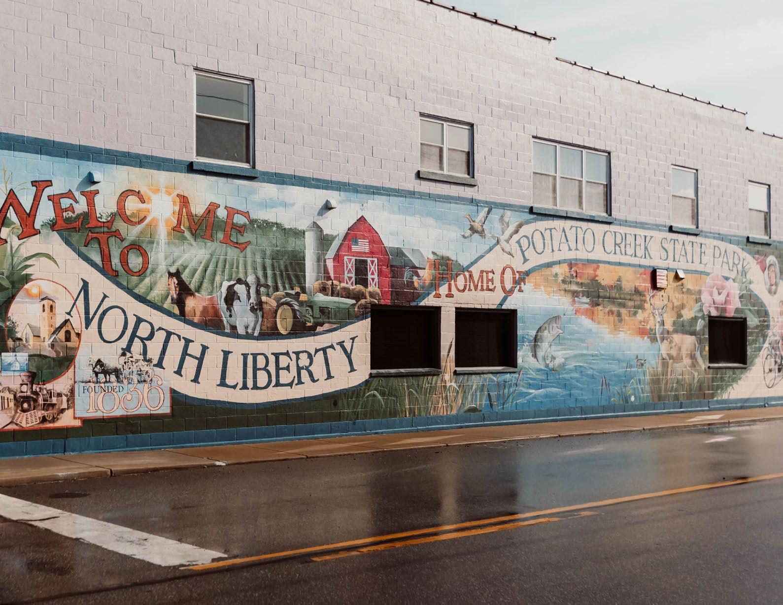
Tom England, North Liberty
DJ Tavernier, Osceola
Area Board of Zoning Appeals
Robert M. Hawley
Donny Ritsema
DJ Tavernier
Sidney Shafer
Tom Byers
Joe Velleman
Lance Roush
Plat Committee
Sky Medors
Randy James
Ron Melser
Mark Espich
Robert Kruszynski
Task Force Members
Jennifer Betz
DJ Tavernier
Tim Corcoran
Adam J. DeVon
Mike Dobson
Alyson Herzig
Marcy Kauffman
Vicki Kitchen
Kris Krouse
Sky Medors
Will Miller
Ken Prince
Jeff Rea
Donny Ritsema
Emily Rupchock
Tim Sexton
Steve Slauson
Working Groups
A special thank you to the 200+ residents who participated in the eight Pillar Working Groups.


Plan SJC is a guide for managing growth and development in St. Joseph County over the next 20 years. The Plan was developed over a multiyear planning effort that involved a broad cross section of the community. Residents, board and commission members, elected officials, and other stakeholders participated in public meetings, stakeholder interviews, working groups, and other forms of engagement. Throughout the three-year planning effort, more than 800 people participated, more than 1,800 comments were collected, and more than 2,400+ visits were made to the project website. This document is the product of that planning process. It articulates the County’s long-term vision for the next 20 years, with achievable goals and actionable recommendations to help realize the vision.
A comprehensive plan is a policy document prepared by a plan commission, with public input, that helps guide the growth and development of a community. Unlike a zoning ordinance, a comprehensive plan is not legally binding. The 500 Series of Indiana Code (IC) 36-7-4-500 and 36-7-4-502, outlines elements that a comprehensive plan must contain, but communities often decide to include more:
01. A statement of objectives for future development
02. A statement of policy for land use development


03. A statement of policy for developing public ways, public places, public lands, public structures, and public utilities
Plan SJC provides direction and support to county staff, elected officials, and decisionmakers to capitalize on opportunities, foster responsible growth and development, and continue to advance St. Joseph County


as an exceptional place to live, work, and innovate. Because the plan is a dynamic document, it should be reviewed and amended as conditions evolve in the county and region. It is recommended that County staff update the plan approximately every three to five years to ensure its continued relevance.
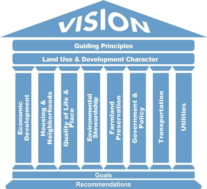
A vision statement reflects the shared values of the a community, which provides the overarching inspiration for the planning process, goals, and recommendations. It is the desired outcome of planning and development over the next 20 years. The vision is intended to be realistic, achievable, and flexible to accommodate changing dynamics.
St. Joseph County is a thriving, diverse community with high quality hometowns and is focused on economic development, responsible growth and sustainable development that respects the area’s natural features and its rural character.
The guiding principles help advance the vision and set the tone for the goals and recommendations in Plan SJC. The principles help guide how growth and development should occur in St. Joseph County:
• Focus development and redevelopment to areas with access to readily available utility services.
• Review the impacts of growth and development.
• Promote data-driven decision-making.
• Promote a variety of mixed uses along key corridors and where the County meets city and town jurisdictions.
• Offer a range of housing options.
• Create a strong sense of place.
• Support efficient intergovernmental cooperation to create a range of multimodal connections.
• Preserve open space, critical environmental areas, farmland, and places of natural beauty that contribute to the quality of life and economic well-being of St. Joseph County.
• Coordinate public investment and find a broad-based way to fund infrastructure.
• Retain, expand, attract, and diversify future economic opportunities.
• Make development decisions predictable, consistent, and cost-effective.


Land use planning considers the relationships between land uses and their compatibility with one another. St. Joseph County features a diversity of uses, with varying development intensities and aesthetics, ranging from urbanized cities to rural farmland. Land uses and development character are referenced throughout the plan, as they influence all goals and recommendations.
The future land use map visually communicates the idealized development direction for the unincorporated areas of the county (i.e. the study area) over the next two decades. The future land use map is likely the most frequently consulted work product to come out of the planning process. Because land use planning influences all goals and recommendations within Plan SJC, it is referenced throughout the entire document. Alhough the future land use map provides the overall direction for growth and development in the study area, it should be reviewed and updated as conditions change in the community.

Pillars are thematic focus areas, largely determined through public input during the planning process, with guidance from the Task Force and staff. The pillars should be viewed interconnected and complementary to one another. They also provide structure to the goals and recommendations contained within the plan.
Pillar Priority Areas
The Pillar Priority Areas map works alongside the future land use map. It helps the County further delineate priority areas for growth and development, and where future investment should be directed.
A set of goals and recommendations for each pillar were developed by Working Groups, then revised by the Plan SJC Task Force. Goals reinforce the vision and guiding principles. Recommendations outline specific tasks for the implementation strategy.
Recommendations in the comprehensive plan are evaluated by the estimated time to implement, level of importance, and level of difficulty. An implementation matrix, intended to guide the county in prioritizing the recommendations in the plan, can be found in the Implementation chapter.


Plan SJC was developed over a multi-year planning effort involving a broad cross section of the community. Residents, boards and commission members, elected officials, and other stakeholders participated in public meetings, stakeholder interviews, working groups, and through other forms of engagement. This document is the product of that planning process. It is a manual for managing growth and development in St. Joseph County over the next 20 years. It provides direction and support to St. Joseph County staff, elected officials, and decisionmakers to foster responsible growth, capitalize on opportunities, and continue to advance St. Joseph County as an exceptional place to live, work, and thrive. It is designed to be consulted for day-to-day planning matters, as well as a strategy document for long-term projects and endeavors. Because this plan is a dynamic document, it should be reviewed and amended as conditions evolve in the County and region.
A comprehensive plan is a policy document, prepared by the Area Plan Commission, with public input that helps guide the development of a community. Unlike a zoning ordinance, a comprehensive plan is not legally binding, but it is a requirement (pursuant to Indiana Code (IC) 36-7-4-601) for amending zoning and other similar ordinances.
The 500 Series of Indiana Code (IC 36-7-4500 and 36-74-503) outlines specific elements that a comprehensive plan must contain:
1. A statement of objectives for future development,
2. A statement of policy for land use development,
3. A statement of policy for developing public ways, public places, public lands, public structures, and public utilities.
The 2002 Comprehensive Plan for South Bend and St. Joseph County set the direction for two decades of planning and development in the county. At the time of the plan’s adoption, the City of South Bend was a member of the St. Joseph Area Plan Commission. In 2019, South Bend departed the County Area Plan Commission, establishing its own plan commission and board of zoning appeals.
During the 2002 public input process, strengths and challenges were identified. With this information, a policy plan was created that included five goals and an accompanying land use plan that served as the key components of the comprehensive plan. The goals of the plan were agricultural preservation, economic development, strengthening residential neighborhoods, environmental conservation, and providing adequate infrastructure. These goals were used to inform the land use plan, which sought to maximize existing urban service areas, while avoiding development encroachment in environmentally sensitive areas and productive agricultural land.
In addition to the five goals, policy plan, and land use plan, the 2002 plan also outlined significant recommendations for future growth and development in South Bend and St. Joseph County. These included:
• Retain the 20-acre per dwelling unit standard for residential uses in the A: Agricultural Zoning District.
• Prohibit septic use in inappropriate areas.
• Target key areas for expansion of municipal services.
• Implement a county-wide sewer and water district.
• Develop and implement a focused neighborhood improvement program based on quantitative measures of deterioration.
In the years following the adoption of the 2002 comprehensive plan, the county was faced with challenges that impeded its ability to progress toward some of the goals. These challenges included increasing failure rates of septic systems across St. Joseph County’s unincorporated areas and continued development of prime agricultural land contributing to urban sprawl. The plan’s recommendation to retain the 20acre per dwelling unit standard, thought to act somewhat as a barrier to discourage development in agricultural areas, still allowed for the construction of residential dwelling units in the County’s only agricultural zoning district for parcels meeting the size requirement. Despite the 20-acre standard, conversion of agricultural land for residential development continued, albeit at a slower pace, than if there
was no standard or plan recommendation.
Additionally, the 2002 plan projected that St. Joseph County’s population would grow from 265,559 (2000 population) to 300,000 residents, with total jobs in the County increasing to 180,000 by 2020. These projections did not materialize. Estimates were based on historical trends of consistent growth between 1950 and 2000 and a belief that this trajectory would continue into the 21st century. However, unforeseen events after the 2002 plan’s adoption drastically changed the trajectory of communities across the United States, including St. Joseph County. In particular, the 2008 financial crash and economic recession significantly impacted the Michiana region, and the recovery remains ongoing. More recently, COVID-19 has altered economic conditions, healthcare expectations, work/home dynamics, social norms, and various other customs and practices in American society. With this in mind, the 2045 comprehensive plan, Plan SJC, aspires to support:
• Collaborative and long-term planning efforts to improve the County’s resilience toward unforeseen events
• A shared vision that moves the many communities in the County toward the same future, and
• Proactively planning for challenges and opportunities facing the County and its towns and cities for improved resilience.
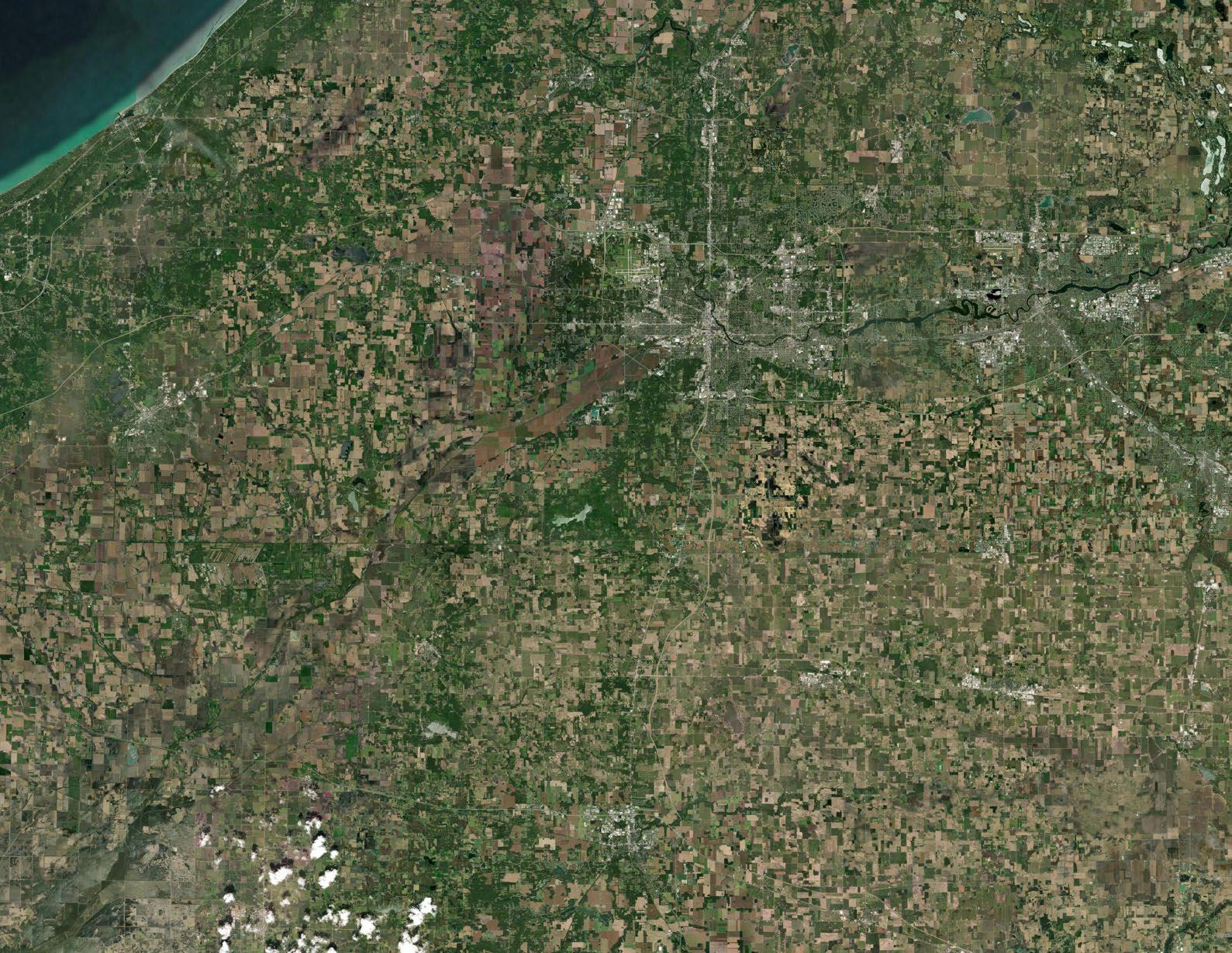
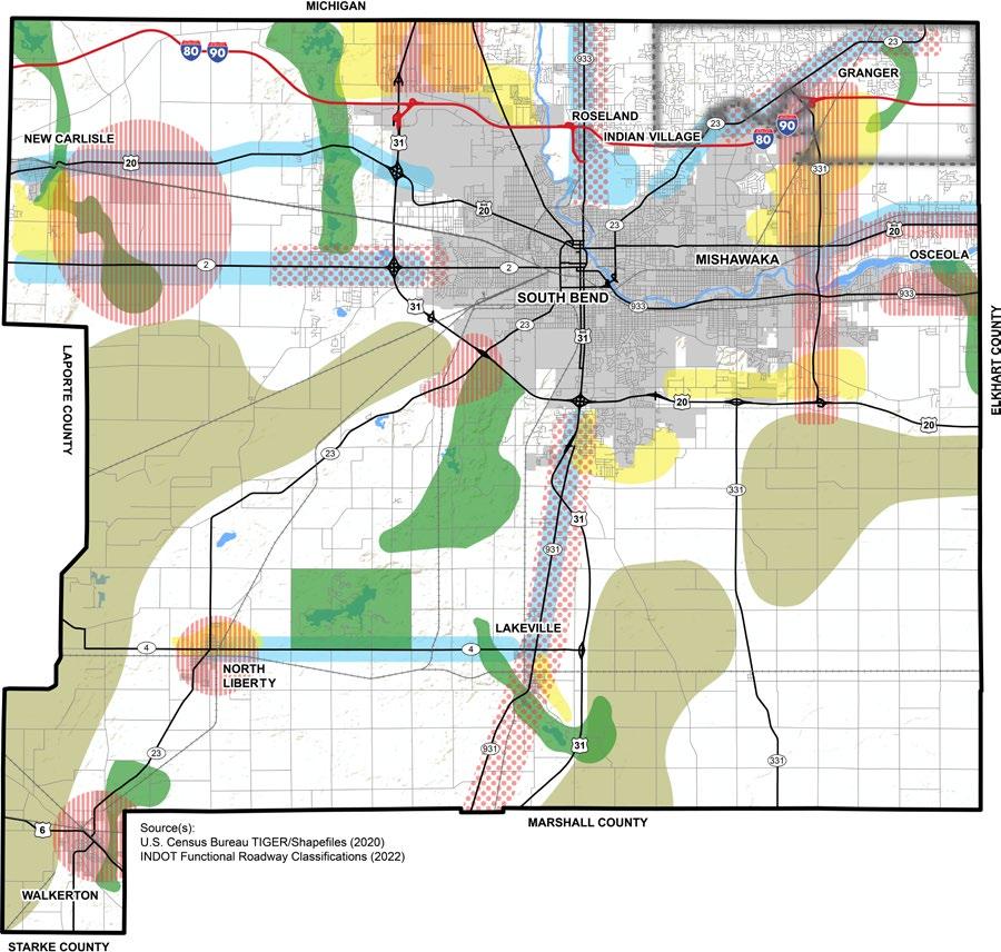
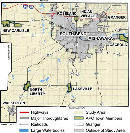
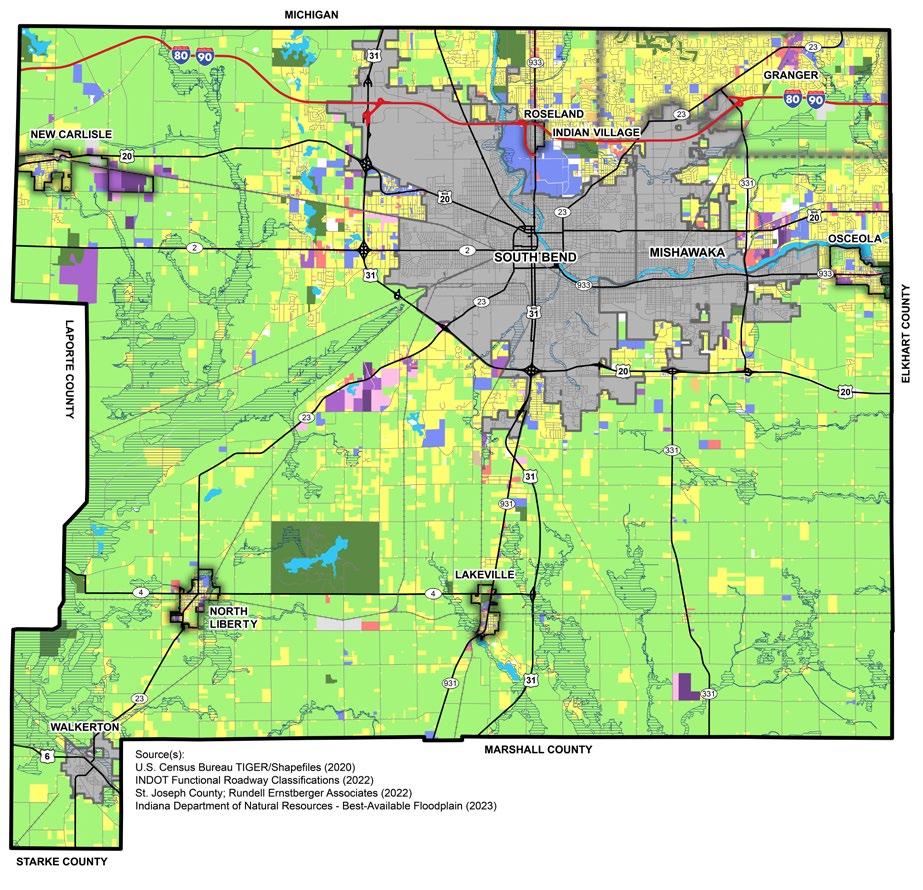
Plan SJC’s study area is the unincorporated areas of St. Joseph County. Though each APC-member town—Lakeville, North Liberty, New Carlisle, Osceola, and Roseland— has its own comprehensive plan, goals and recommendations that speak to the county’s relationship with the towns are included, to ensure that land use and other policies are coordinated and not in conflict with one another.
The study area for Plan SJC does not include the incorporated communities of South Bend, Mishawaka, Indian Village, and Walkerton. Yet, due to the interconnected nature of all St. Joseph County’s cities, towns, and unincorporated areas, local and regional intergovernmental collaboration is necessary, regardless of jurisdictional boundaries. The recommendations and implementation strategies offered by Plan SJC reference and consider existing or potential collaborations and partnerships and may mention the incorporated cities or towns outside of the APC.
In the summer of 2021, the St. Joseph County Board of Commissioners selected the consultant team of Rundell Ernstberger Associates (Indianapolis, IN), with subconsultants Abonmarche (South Bend, IN), CWC Latitudes LLC (Columbus, IN), and Engaging Solutions LLC (Indianapolis, IN), to facilitate the planning process for Plan SJC. The consultant team organized the planning process into four phases-- Discovery, Visioning, Framework, and Action. Public input was solicited throughout each of these four phases.
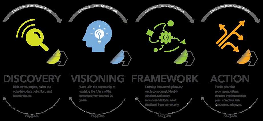
Discovery, which consists of an existing conditions analysis for the study area, is the initial phase of the planning process. This phase includes a review of previously completed reports, studies, and plans, data collection, and an assessment of the physical environment. The consultant team began Discovery with the evaluation of the 2002 Comprehensive Plan, noting progress and development trends that have occurred in the study area over the last 20 years. Results from Plan SJC’s Discovery phase were summarized and presented to the public during Community Meeting Series #1. At these meetings, participants were asked to contribute to the data collection efforts and assist the consultant team and Task Force in providing historical context, experiences, and opinions related to the conditions in St. Joseph County since the previous 2002 plan was adopted. Community Meeting Series #1 included four public meetings conducted over two weeks in the first quarter of 2022. The meeting results informed the next phase of the planning process.
Visioning involves working with citizens and stakeholders to imagine a best-case scenario for their community’s future. The vision statement is a product of the community and declares where St. Joseph County wants to be in 20 years. It is created when residents and stakeholders express, in written form, the community’s shared values with an inspirational outlook. plan SJC’s vision statement was crafted during this phase of the planning process, with significant contribution and support from the Area Plan Commission, Task Force, focus groups, and public meeting participants. The Visioning phase also produced the plan’s eight thematic pillars, providing the organizational structure for the plan’s goals, recommendations, and implementation strategy.
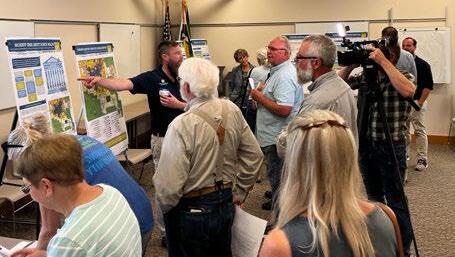
Framework is the phase in which goals and recommendations are developed based on the vision and the eight thematic pillars of Plan SJC. Leading up to this phase, reports of the existing conditions presented in the Discovery and Visioning phases were compiled into briefing booklets. These ‘briefing’ booklets provided an overview of public comments and data analysis relevant to each of the eight thematic Pillars. They were presented to the public at a countywide public meeting named the “Summit.” This event provided a progress update on the plan, garnering over 200 attendees and live coverage from multiple news stations.
At this event, residents had the opportunity to sign up for any of the eight Working Groups for the pillars. Online registration was also available on the project website for those who could not attend the event. Local expertise was called upon to help lead the Working Group discussions, which took place over three to four months. Each Working Group met approximately six times, during which the first draft of the plan’s goals and recommendations were created. These goals were then reviewed by the Task Force, Area Plan Commission members, and the County Council.
Action is the conclusive phase of the planning process. This phase involved finalizing the goals and recommendations. The recommendations were then organized into an Implementation Matrix which evaluates how to implement the recommendation based on three metrics:
• Time-to-Implement: the estimated time it will take to implement;
• Level of Importance: ranked from low to high, this helps determine when to start implementing a recommendation(s) based on how urgent it is to complete; and
• Level of Difficulty: the relative amount of resources it will take to implement.
In addition to these three metrics, the suggested partnerships to carry out implementation are identified for each recommendation. The Action phase also includes the drafting of the final plan, multiple presentations and meetings with the public for review, and the final adoption of the plan by the St. Joseph County Area Plan Commission and County Council. After adoption, it is then time for the County to begin implementing the plan.
Public input was continuously solicited to during the four phases of the planning process. There were numerous opportunities for citizen engagement, including a dedicated website, focus groups, in-person and virtual open houses, community meetings, Working Groups, and a Comprehensive Plan Task Force. Throughout the three-year planning effort, more than 800 people participated, more than 1,800 comments were collected, and more than 2,400+ visits were made to the project website, showing how engaged residents of St. Joseph County were to make this a community-driven plan. A complete summary of every meeting and event that took place over the three-year planning process can be found in Appendix B.
The Task Force was the backbone of the engagement process. It consisted of community leaders, representatives from the business community, nonprofits, advocacy groups, other jurisdictions, and County staff who provided guidance to the consultant team. Task Force members helped gather and analyze public input, review data with the consultant team, and refine the goals and recommendations that came from the eight Working Groups.

• The group consisted of volunteers, staff, government officials, and community leaders
• Responsible for helping direct and guide the consultants when developing the plan’s vision statement, and eight Pillars. Helped refine draft goals and recommendations.
• 200+ participants
• 1 group per pillar (8 total)
• 5 or 6 meetings per group (approx. 45 total)
• Developed first drafts of the goals and recommendations
• 30+ participants
• 12 distinct groups
• 11 meetings GENERAL PUBLIC
• Community Meeting
Series #1
• Community Meeting
Series #2
• Project website
○ Interactive map
○ Public forums
○ Document library
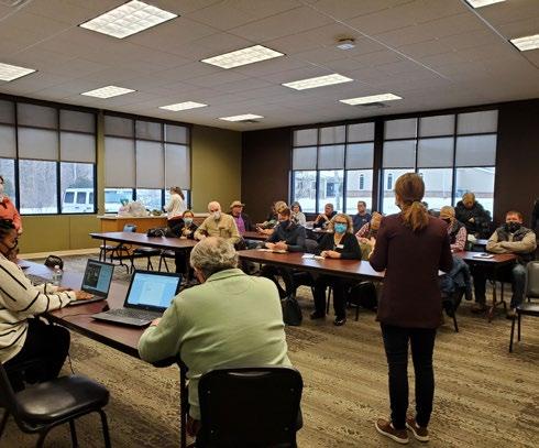
Working Group meetings were held from September through November 2022. These groups allowed any community member interested in the plan or specific topics to work directly with the consultant team, county staff, and Task Force to develop goals and recommendations. Residents and local experts on various topics were invited to join one or more groups. The plan’s identified Pillars informed the creation of eight Working Groups, and six meetings per group occurred bi-weekly, unless otherwise rescheduled. Over 200 people registered to participate.
Eleven focus groups were held during the first phase of the planning process in January and February 2022. Participants represented the following agencies, organizations, and interests:
• Residents,
• Commercial and Industrial Brokers,
• Transportation,
• Utility service providers,
• Township Trustees,
• Home Builders,
• Farmers and Other Agricultural Interests,
• Environmental and Open Space Protection,
• Regional Water and Sewer Representatives,
• City, Town, and Other Jurisdictions,
• School Superintendents,
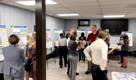
The consultant team and county staff held two Community Meeting Series. The meeting series included presentations, small group activities, and question-and-answer sessions to gather community input. The first series was in March 2022 to review existing trends and introduce the community to the project. A second Community Meeting Series was held in September 2024 to present and review the drafted plan with the community.
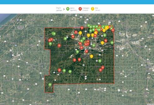
In addition to in-person public engagement, a dedicated project website (PlanSJC.com) was created for the planning process. This website allowed County residents to engage in the planning process online by:
• Learning about the plan’s purpose and background,
• Finding information about upcoming events and updates on the plan,
• Downloading previous presentations, meeting materials, briefing booklets, and other documents that were made publicly available on the website as they were completed, and
• Discussing ideas with other residents and providing feedback via an interactive map and public forums for each Pillar.

Data analysis is an essential part of Plan SJC. From the briefing booklets that informed the Working Groups to examining development trends with focus groups, data analysis has provided a solid foundation for informed decision-making and engagement throughout the planning process. This type of data analysis, qualified by community engagement, enables the creation of long-term strategies like Plan SJC that can provide data-based, publicly-backed solutions for current issues as well as potential issues before they become critical problems. Two key trends are compiled in this section. The complete data analysis for Plan SJC can be found in the appendices document.
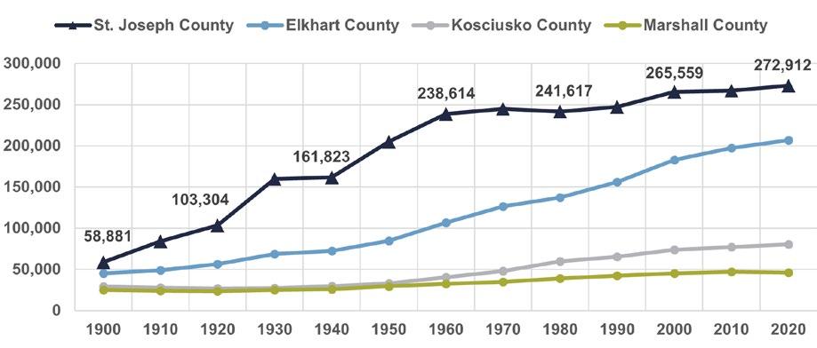
Between 2000 and 2020, the county’s population grew 2.8 percent, according to decennial census counts. The growth rates of prior 20-year periods were 9.9 percent (1980-2000) and 47.5 percent (1940-1960). Additionally, the growth since 2000 has not occurred evenly throughout the county. The Cities of South Bend and Mishawaka, and unincorporated areas of the county have largely remained the same, while the population in towns, such as the Towns of Osceola and Lakeville, has collectively increased by 5.1 percent.
KEY TREND #2: RESIDENTIAL USES HAVE HAVE DEVELOPED OUTWARD FROM TOWNS AND CITIES, WHILE AGRICULTURE CONTINUES TO DOMINATE.
As shown in Figures 2.6 and 2.7, the largest use of land is agricultural, accounting for 71.62 percent of land under the Area Plan Commission’s jurisdiction. The second largest is single-family residential (detached, one-unit residences) at 19.34 percent of land. All other land uses account for only 9.04 percent of land. Further analysis found that the existing land use of a parcel generally aligned with the intended uses of the zoning district in which the parcel was located.


Economic development is a vital component of Plan SJC because it influences quality of life for all County residents. Economic development planning explores the sources of revenue, funding, and implications of the comprehensive plan’s decisions and economic growth opportunities. Economic development brings a quantifiable value to this plan, principally defining the required public and private participation needed for implementation. While economic development efforts manifest themselves locally, it is most successful when approached as a regional, national, and global competition for community investment and jobs.
Building and sustaining a strong and resilient economy results in creating a place where people want to live and work. Housing choice, accessible transportation, and amenities coupled with affordability, employment and educational opportunities, and population growth all contribute to and are products of a community’s economic development initiatives. Investors want to invest in areas where the economic climate is welcoming, nurturing, supportive, promoted, and complementary.
To ensure that St. Joseph County offers this type of favorable environment, County leaders should focus on the following three directives:
• Policies that foster high employment and sustainable growth.
• Programs and projects that address infrastructure needs like connectivity, transportation, parks, and medical access.
• Policies and programs targeted at fostering a healthy business climate for retention, growth, and attraction, encouraging more housing choices, encouraging environmentally friendly initiatives, and improving technology transfer.
The County will know when its economic development efforts are progressing when the community responds to the improvements in housing choice, business and entrepreneur friendliness, transportation and infrastructure connectivity, and recreation options reflected through higher property values, increased enrollment in schools and lifelong learning programs, gainful employment, lower crime rates, and fewer demands on social services.
Efforts to generate and sustain wealth in the community, advancing its quality of life. It includes the attraction, retention, and expansion of business investment, entrepreneurship, employment opportunities, and the tax base.
There are multiple agencies, boards, and commissions that are directly involved in pursuing and fostering economic development. All these entities work closely and together for the success of economic development efforts. Work done by MACOG with its Comprehensive Economic Development Strategy and Collaborating for Regional Resilience and Economic Growth as well as the Indiana Enterprise Center’s Economic Opportunity Analysis provided a guide for examining economic development in St. Joseph County.
A community is never finished with economic development; it is a continual process. The market, community needs and wants, environmental circumstances, and other variables are continuously evolving. As such, St. Joseph County’s economic development efforts must continually evolve as well.
The following industries are identified as economic opportunities that have the potential to capitalize on St. Joseph County’s strengths and conditions for future economic investment success. These industries align with state priorities offering possible collaboration and financial assistance.
• Advanced Manufacturing
• Aerospace and Aviation
• Ag-Bioscience
• Defense
• Life Sciences
• Logistics and Transportation
• Technology
Each of the economic development priority areas identified in Figure 3.1 should be the subject of further study and analysis to determine the best economic development strategy that integrates future residential, commercial, and industrial uses within its environmental context and location. Considerations for each area include:
1. Zoning,
2. Sufficient Infrastructure (gas, water, sanitary, stormwater, fiber, and electric),
3. Enhanced Transportation (commercial corridors, roads, rail, air, trails, and walks).
With these contextual land use, regulatory, and infrastructural considerations, new development initiatives have a greater opportunity for compatibility ultimately leading to economic and investment viability.
The New Carlisle TIF district resides within this priority area, as well as the Indiana Enterprise Center (IEC), which was recently expanded in 2023. The County should use the IEC Area Management Plan to responsibly guide growth and development in the priority area. There also should be extensive collaboration with the Town of New Carlisle to ensure that the development and land use patterns identified within the town’s comprehensive plan are successfully implemented.
Area 2: Western State Road 2
Located west of South Bend along State Road 2, this priority area contains prime areas for commercial development and redevelopment as the surrounding areas are built out with residential neighborhoods. Commercial development should be easily and safely accessible from surrounding neighborhoods to promote walkability and reduce unnecessary traffic congestion.
Portage Prairie is a rapidly growing area along the Michigan border, with a mix of commercial, industrial, and residential uses within close proximity of each other. The County should work with the City of South Bend to ensure that future land uses remain compatible with adjacent existing uses, while pursuing initiatives that reduce the overall dependence on on-site wastewater (septic) systems. This priority is also located close to a critical wetland, Mud Lake, from which developments should be sufficiently buffered and water runoff mostly eliminated. More guidance for Mud Lake is available in the Environmental Stewardship Pillar chapter.
This priority area contains an essential commercial and active transportation corridor (LaSalle Trail) that connects to neighboring communities in Michigan. The Town of Roseland is also a prominent part of this area, as the town provides a suite of housing options for students of the nearby universities (Notre Dame, Holy Cross, and St. Mary’s). This priority overlaps extensively with Priority Area 3 under the Transportation Pillar, which means economic development efforts should include enhancements to safety and accessibility of the transportation network. These enhancements could include midblock crossings and appropriately scaling lighting along the corridor for bikes and pedestrians.
The Granger area is anticipated to continue growing, with recent investments and plans for more parks and improvements in the active transportation network. For this priority area, the County should focus on quality-of-life and continue improving transportation along State Road (SR) 23 by providing infrastructure for all modes of transportation. These improvements should be accessible to all, efficient, and easy and comfortable to use. SR 23 is also a major commuter corridor that contains many areas that prime for (re)development, such as:
• The north end of Capital Avenue, and
• Surrounding areas where the railroad meets SR 23 around Adams Road and Bittersweet Road.
The County should work extensively with the City of Mishawaka to accomplish recommendations along this corridor, building upon previously completed planning efforts such as the Fir Road Land Use Study, Capital Avenue Corridor Land Use Plan (2003), and the County Connections Plan (2021).
331) and McKinley Avenue (US 20 Business Hwy)
These two roads are major north-south and east-west connectors, respectively. Both roads have great potential to host additional commercial and density due to planned connections to Mishawaka’s water/sewer utilities. Developments along these roads can also take advantage of a high level of transportation access to other areas of the County. As indicated in the Capital Avenue
Land Use Plan and the future land use map, an office park is planned for near the northern end of Capital Avenue. However, Capital and McKinley Avenues are heavily auto-oriented corridors, which means the County should focus on building infrastructure for additional modes of transportation by working with the regional and local authorities, such as Transpo.
The Town of Osceola is in a prime location on the eastern border of the County between two major cities: South Bend and Elkhart. The County should work extensively with the town to help revitalize its downtown area and provide a greater variety of housing choices. The town is also partially served by Mishawaka’s water/ sewer utilities, which indicates the potential for denser development. The town also has many natural, or environmentally-based, amenities such as views of the St. Joe River, Baugo Bay, and Ferrettie/Baugo Creek County Park. The County should work to promote and improve these amenities, recognizing the connections between the Economic Development, Quality of Life and Place, and Environmental Stewardship Pillars, in order to better attract people and businesses to the town.
Located at the intersection of US 31 and SR 23, this node is prime for development due to its proximity to Four Winds Casino. This priority area could build on the success of the Four Winds Casino to attract tourists to the County. It is also an important gateway into the City of South Bend and connection to the southernly-located Town of North Liberty.
Hence, the County should work to improve the aesthetics of the gateway, which may include improvements to the street, alternative transportation infrastructure, signage, and revisions to the zoning and subdivision codes to better encourage development in the area. Before the County pursues improvements in this priority area, however, planners and officials should collaborate extensively with and involve the Pokagon Tribal Reservation, which owns the casino, and the City of South Bend to coordinate economic development efforts.
The County should collaborate with the Town of North Liberty and utilize the town’s comprehensive plan to guide development in a way that is desired by the town’s residents and government. Economic development efforts for the town could include reforms to the zoning and subdivision ordinances to encourage high-quality and well-connected developments. These zoning reforms should also ensure that residential developments do not conflict with existing agricultural operation in the area. Additionally, greenfield or “leapfrog” developments should be highly discouraged in order to preserve the surrounding farmland and encourage development that is well-connected to the town’s existing streets, utilities, and amenities.
Similar to Priority Area 9, the County should work with the Town of Walkerton when pursuing economic development efforts around the town. Although the town is not a part of the County’s Area Plan Commission, Walkerton serves as important southern gateway into the County and can greatly help efforts to attract investment into the County.
Serving as an important transportation corridor between the Town of Lakeville and the City of South Bend, SR 931 has great potential as a multi-modal and recreational amenity that can attract people and investment to the County. Hence, the County should work with MACOG to implement a planned, regional trail for the corridor. However, the County should not seek to encourage major development outside of Lakeville. As indicated in the future land use map, while certain areas are identified as transitional, the corridor should remain mostly agricultural to protect the character of the area. Instead, the County should pursue agritourism as a form of economic development.
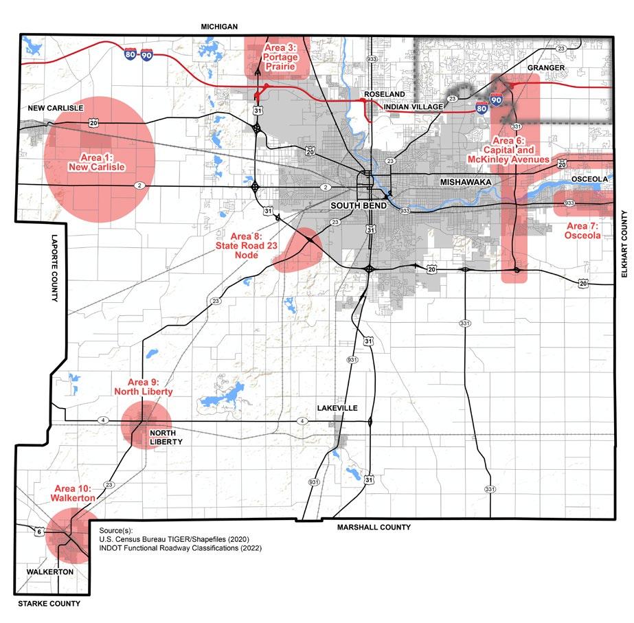


Development and redevelopment along transportation corridors with existing infrastructure is sensible, prudent, and sustainable growth. Infrastructure, particularly transportation and utilities, is paramount to future development and prosperity. This comprehensive plan highlights 11 key areas within St. Joseph County that are ready for new investment because of the existing presence of utilities and other infrastructure required for additional residential, commercial, and industrial developments. By focusing investment within these 11 areas, the County will be more deliberate and efficient with its resources. These areas represent strategic locations where economic development should be concentrated to achieve the most meaningful impact on this comprehensive plan’s vision for responsible growth and environmental sustainability.
Pursue “shovel ready” certification for identified key sites to expedite development.
“Shovel ready” certification refers to the completion of initial planning, engineering, infrastructure, and approvals to make a site prepared for immediate construction. Certified sites are featured on Indiana’s Site Selector Database and included in the Economic Development Corporation’s marketing materials.
Continue to invest resources in and market the Indiana Enterprise Center (IEC) as a premier economic development business park.
As a significant economic asset of St. Joseph County, plans and infrastructure for the IEC must remain up-to-date and continuously improve. This includes, but not limited to, transportation systems, utilities, fiber, marketing and promotions, incentives, and benchmarking leading business parks.
Continue to invest resources in and develop the Capital Avenue corridor.
The Capital Avenue Corridor Land Use Plan (2003) outlines how the corridor should be developed, including a land use plan that has been translated into the future land use plan of the 2043 St. Joseph County Comprehensive Plan. Strategies and recommendations in this plan should be reviewed and updated regularly to ensure economic development initiatives along this corridor remain relevant and responsive to evolving conditions.
Establish plans and nonfinancial incentives for priority areas.
Each of the identified economic development priority areas, illustrated on the map in Figure 3.0, should be studied individually to determine the most applicable and appropriate economic development tools and approaches to incite investment.
Identify opportunities and strategies to leverage transportation networks and utilities for economic development, including rail lines, interstates, and heavy haul routes.
Partnerships among St. Joseph County government, Michiana Area Council of Governments (MACOG), and modespecific transportation entities will optimize the county’s assets, connectivity opportunities, and logistical efficiency as attractive features in marketing economic development pursuits.
Countywide reinvestment and redevelopment of underutilized, declining, or challenging areas is a strategic approach in St. Joseph County intended to stimulate economic growth, enhance the quality of life, preserve cultural heritage, improve environmental conditions, and contribute to long-term resilience and community prosperity. Successful implementation of this goal is envisioned to lead to several of the following outcomes:
• Economic Revitalization: Boosting the local economy through businesses attraction and tax revenue increases.
• Job Creation: Generating new jobs initially through construction and then more longterm with the industries occupying the redeveloped spaces.
• Property Value Increase: Upgrading a property’s desirability and usability, strengthening its marketability, increasing market demand, and making it more attractive and valuable to current and future investors.
• Quality of Life Enhancement: Creating more livable spaces, improving infrastructure, and providing better amenities and services.
• Investment: Attracting new public and private money and development.
• Economic Resilience: Adapting to meet the changing needs and dynamics of the market.
• Public Safety: Reducing crime through protection and increased activity in previously desolate areas.
• Urban Sprawl Containment: Focusing redevelopment within existing urban areas with existing utilities and services, minimizing greenfield development, and eliminating the need for expanded infrastructure.
Establish a program to focus on revitalization and redevelopment of critical corridors.
This program should be designed and tailored to leverage the unique conditions of each corridor, in particular SR 2, SR 23 (including its intersections with Bittersweet, US31 Bypass, North Liberty, and Walkerton), 931/Old US 31, 933, Capital Avenue, and McKinley Highway.
Encourage investment for infill and redevelopment or the reuse of vacant, previously used, underutilized, or inefficient properties.
Vacant or underutilized properties can lead to a cycle of decline, where one unkempt lot can negatively influence the image or value of its surroundings and, ultimately, trigger additional blight and disinvestment for an entire block, neighborhood, or municipality. Infill development and redevelopment in economically challenging areas convert liabilities or potential liabilities into assets, creating opportunities for new businesses, housing, or community amenities.
Target funding and other resources to address code enforcement violations, demolition, and site preparation in critical areas.
Critical areas in transition or that need individualized attention should be assigned appropriate funding and resources to tackle building code violations, structural safety, and/or environmental remediation to clear the path for new development.
Use available planning tools to address vacant, obsolete, or underutilized nonresidential buildings.
Vacant, obsolete, or underutilized buildings also pose adverse effects on communities. Strategies could involve flexible zoning, tax incentives, grant assistance, or referrals to other resources.
St. Joseph County must create a desirable environment to attract economic investment. The approach should be holistic, with public commitments to support development and providing the necessary infrastructure and resources for businesses to thrive. Additionally, there is an interconnected and symbiotic relationship between a community’s quality of life and its economic vitality. Quality of life can include a variety of amenities, access to education and skill building, services, public safety, housing choice, and connectivity. By providing the basic requirements for business success and creating vibrant and desirable communities where people want and choose to live, the outcome is a place where business and its talented workforce want to be.
Encourage opportunities for business expansion and attraction that focus on job creation and tax base growth with diverse residential, commercial, and industrial development.
A variety of residential, commercial, and industrial developments helps to mitigate economic risks, strengthen economic resilience and stability. A focus on job creation ensures that efforts are directed toward offering employment opportunities for the local workforce, promoting economic prosperity for residents, and improving the standard of living for the community.
Identify and address potential barriers that may discourage investment in St. Joseph County.
St. Joseph County should study why businesses choose to operate or not operate in the County. Any obstacles or challenges to doing business should be identified, evaluated, and mitigated, if appropriate.
Work with local area economic development officials to market and promote the County through various forms of media.
St. Joseph County’s economic development professionals are using a variety of communication tools to strategically showcase the unique attributes, opportunities, and assets of the County to a wide audience. Leveraging various media channels, such as traditional advertising, digital marketing, social media platforms, and public relations efforts, allows the County to communicate its competitive advantages, economic potential, quality of life, and business-friendly environment with the intended outcome of future economic growth and development.
Direct potential employees and employers to agencies that provide workforce development and attraction efforts to recruit and keep talent in the region.
Workforce attraction and development is a strategic approach for St. Joseph County to meet the evolving needs of industries, maintain competitiveness in a rapidly changing global economy, and advance the education and skill set of residents. Investment in talent and increasing professional opportunities for County residents will keep trained and skilled workers in the community and available to meet the demand for human resources, growing both the local population and the employment base.
Support the development, growth, and retention of small businesses.
Small businesses are not only the backbone of our economy, but they also contribute to the unique character of our communities. Many resources exist for small businesses in St. Joseph County. The County can promote and connect businesses to these resources. The South Bend Regional Chamber, South Bend Elkhart Regional Partnership, University of Notre Dame, City of South Bend, Indiana Small Business Development Center, and others offer programming and resources for small businesses.
ECONOMIC
PROFESSIONALS HAVE THE TOOLS THEY NEED TO GROW AND DIVERSIFY THE TAX BASE, AND COMMUNICATE
TO THE PUBLIC.
Providing economic development professionals in St. Joseph County with the necessary tools and emphasizing effective communication with the public are key to fostering a robust, diverse, and resilient economy that benefits the entire community. For these reasons, ensuring that economic development professionals have the necessary tools to grow and diversify the tax base and to effectively communicate outcomes to the public are crucial because:
• Economic Growth and Diversification: Identify and seize opportunities for economic growth by attracting new businesses, supporting local enterprises, and retaining industries that diversify the tax base.
• Transparency and Public Trust: Trust in local government and economic development initiatives through transparency, educating the public on how economic strategies are benefiting their community and creating champions for investment and efforts.
• Informed Decision-Making: Data and analysis used to make informed decisions
that are more likely to yield positive economic results for the County.
• Community Engagement and Support: Public involvement in economic development processes to consider the needs and opinions of residents, earning community support for development projects and initiatives.
• Adaptability to Change: Flexibility to adjust focus and strategy to respond to shifts in market trends, technological advancements, or downturns, ensuring the County remains competitive in a rapidly changing economic landscape.
• Attracting Investment: A clear, articulated strategy for growth and development appealing to the needs and interests of potential investors.
• Enhancing Quality of Life: Jobs are created through successful economic development. Jobs provide opportunity for livelihoods for community residents, along with quality-of-life attributes and amenities, making St. Joseph County a desirable place to live and work.
• Long-term Stability and Growth: A prosperous future for the County and its residents.
ED.4.A
Develop predictable economic criteria/indicators that help prioritize projects that should receive direct investment and incentives.
This recommendation emphasizes the need to establish metrics to guide decision-making and resource allocation. With this understanding and by identifying key areas for investment and incentives, the County can plan for long-term growth compatible with its overall economic development goals.
ED.4.B
Publish specific public policy priorities that articulate economic development efforts.
Communicating the County’s priorities creates an evaluation process for economic development initiatives and outcomes, while opening the door for collaborative partnerships.
Create and publish an annual report informing the Redevelopment Commission of tax abatements and TIF district activity, including project descriptions, relevant tools, project performance, and status of development agreements.
This process promotes transparency, accountability, and the consideration of diverse perspectives.


A well-defined housing strategy is essential for St. Joseph County’s future growth and development. Housing is a fundamental aspect of people’s lives, directly influencing their quality of life. A variety of housing options helps attract businesses, employees, and investors to the area. It provides stability and security for workers, enabling them to live closer to their workplaces and spend less time commuting. This, in turn, helps boost local businesses, encourages entrepreneurship, and contributes to overall economic vitality. A thoughtfully designed housing strategy also considers proximity to essential services, transportation infrastructure, and recreational areas. By promoting connectivity and the integration of urban planning principles, the strategy aims to create complete and cohesive communities where residents live, work, and play.
Government has a critical role to play in meeting the housing needs of the community. By providing safe, affordable, and accessible housing options, the County can foster community, improve public health outcomes, and promote overall well-being. St. Joseph County can establish zoning regulations and
land use policies that encourage affordable housing, provide financial or other incentives to stimulate housing development, and collaborate with the development community to meet the diverse housing needs of the county. Additionally, governmental entities can invest in infrastructure and transportation systems to support housing development. By being proactive in developing and implementing a housing strategy, the County can work to address housing challenges, ensure adequate housing supply, create more livable communities.
This section compiles key findings of the existing conditions in the county as they relate to the Housing & Neighborhoods pillar. For a complete analysis of existing conditions, see the Housing & Neighborhoods Appendix.
1. St. Joseph County experienced a modest population increase of two percent during the 2010s. However, the county’s population is expected to slightly decrease during the 2020s.
Residential dwelling units, inclusive of all types.
2. Countywide, the number of housing units increased 2.85 percent between 2010 and 2020, while the number of vacant housing units decreased from 10.3 in 2010 to 9.2 percent in 2020.
3. In 2022, the average household size decreased to 2.42 from 2.48 in 2010. The average household size is likely to continue decreasing.
4. The 2002 Comprehensive Plan overestimated the 2020 projected population and housing needs. Over the last 20 years, housing developers responded to more accurate market conditions and constructed new housing units that could be absorbed by home buyers within the existing population plus the modest increase.
5. There is a demand and market for new housing. However, this demand does not come from an increase in population. Rather, the demand comes from current residents whose residences are no longer meeting their needs. More units are needed to house fewer occupants.
Chapter 6: Land
“Residential Requirements. The preferred scenario has the County’s total population increasing from approximately 265,000 in 2000 to about 305,000 in the Year 2020. Using a projected household size of about 2.45 persons (a decrease from the current 2.65) in the Year 2020 results in a demand for about 16,300 additional housing units (including Mishawaka and other areas not included in the Plan). Also, as the household size of the existing population continues to decrease, another 8,000 units will be required. The total anticipated residential demand is expected to be approximately 24,000 units by the Year 2020, or about 1,200 per year (compare to Chart 3-5 in Chapter 3, which shows that residential building permit activity over the past few years has averaged about 1,000 to 1,500 units per year).”
The Town of New Carlisle’s Comprehensive Plan has identified the areas south and east of its downtown as prime for further residential development. The identified developments are within walking and biking distance to job opportunities in the Indiana Enterprise Center (IEC), and infrastructure to support these modes of transportation, such as trails and bike lanes, should be provided as residential development occurs.
The Mud Lake wetland is a recreational amenity, but it is also a crucial environmentally sensitive area that exhibits one of the most diverse ecosystems in the County, both in terms of wildlife and plant life. Residential development, especially near the wetland, should be carefully planned to:
• Eliminate the majority, if not all water runoff, which can be accomplished through cluster-style development, conservation subdivisions, and green infrastructure within all developments,
• Preserve existing wildlife and plant life by discouraging destructive land clearing methods, such as clearcutting or stripping away the topsoil of the entire development site,
• Plant native plant life in open spaces while discouraging extensive over-mowing.
This priority area is currently agricultural land but is surrounded by existing residential subdivisions and planned for mixed density residential uses in the future land use map. This area has prime access to jobs in downtown South Bend via Portage Road. The county should consider how multi-modal access can be provided and/or improved to this area.
Due to its prime access to transportation, nearby employment opportunities, and an existing multi-modal trail along Capital Avenue, the County should encourage relatively denser residential developments in this priority area. Furthermore, this priority area has had extensive prior planning efforts by Mishawaka and St. Joseph County culminating in the Capital Avenue Land Use Plan (2003) and the Fir Road Land Use Study. These plans should provide further guidance for residential development, especially in relation to planned commercial and industrial development in the area.
This priority area has high potential for development and redevelopment with its excellent access to regional transportation corridors, proximity to job centers like downtown Mishawaka, and a mix of commercial and institutional uses along Ireland Road. Higherdensity development should be encouraged in this area, working in collaboration with South Bend and Mishawaka, to extend public sewer systems where possible. The US 20 Highway should act as a border at which development should stop in order to preserve prime soil for agricultural operations south of the highway.
The Town of North Liberty’s Comprehensive Plan identifies areas along SR 4 as prime for development, including a mixed-use corridor on the east side of town. Additionally, there are two regional trails planned to connect North Liberty with Potato Creek, Lakeville, and onward to South Bend along SR 931. The County should support North Liberty in developing this area and encourage residential development to have several connections between subdivisions and to the regional trails.
The Town of Lakeville’s Comprehensive Plan identifies the area southeast of town as prime for development and has excellent transportation access to US 31. Like Priority Area 7: Potato Creek, the regional development authority, MACOG, has regional trails planned for the town to which new residential development should be well-connected. This could be accomplished by providing pedestrian and/or bike facilities on Lake Trail (a street), Patterson Street, or on another nearby street.
This priority area consists mainly of the Gulivoire Park neighborhood near Forest G. Hay Elementary School. The future land use map identifies several housing opportunities, such as infill sites along Kern Road and US 31, repurposing vacant or abandoned properties, in collaboration with the City of South Bend, for future utility extensions. However, it is important to note that development should be strictly limited from extending south of Madison Rd on the east side of US 31, and south of Roosevelt Rd on the west side of US 31. These boundaries are meant to preserve prime agricultural lands and reduce urban sprawl from converting more farmland or inadvertently damaging nearby environmentally sensitive areas, such as Bowman Creek.
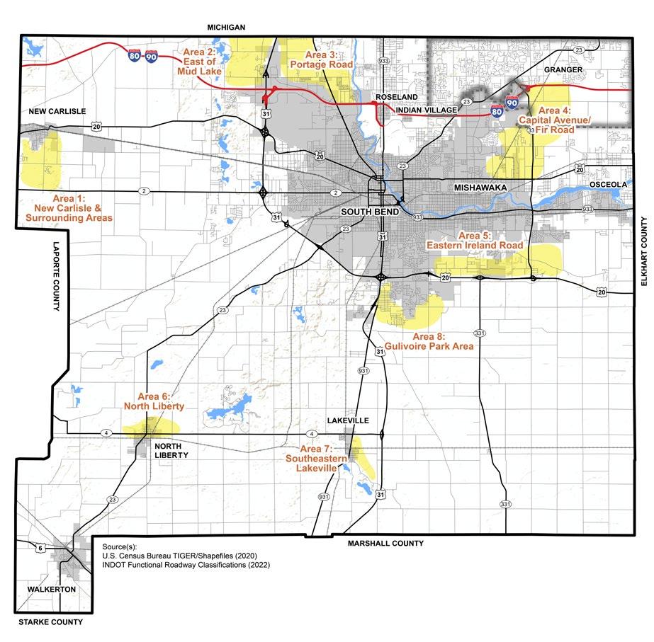
3.3: Housing and Neighborhoods Pillar Priority Areas
As the densest of the rural land use categories, suburban residential areas could be developed at a ratio of 1 home per acre of land, as opposed to a minimum lot size of 1 acre.
Estate residential areas should have medium density rural residential development, perhaps at 1 home per 5 acres, as opposed to a minimum lot size of 5 acres.

Agricultural areas should have very lowdensity residential growth, preserving as much agricultural land as possible, perhaps at 1 home per 20 acres.


MINIMUM LOT SIZE
The County aims to accommodate the preferences and household compositions of its residents by offering a range of housing options, including single-family homes, townhouses, apartments, and more. Some individuals may prefer a single-family home, while others may seek the convenience and affordability of an apartment. By acknowledging the market demands, the County offers an inventory of housing choices that meet the needs of its residents.
In addition to housing type preferences, this goal also addresses the critical issue of income levels. Housing options that range in price and across income brackets assist in providing opportunity for all County residents, regardless of financial circumstances, to attain safe, decent, and affordable housing. By offering a mix of housing options, the County encourages a balanced and integrated approach to growth and development.
Update the zoning ordinance to support varying densities.
To increase housing options, St. Joseph County can adjust its regulatory tools to create opportunity for a variety of housing types. Changes to land use regulations to meet housing demand could include increasing allowable densities and permitting Accessory Dwelling Units (ADU) on residential lots where appropriate.
HN.1.C
Support the development of new housing units to meet the current and projected needs of the community.
A diverse mix of housing types, tenures, and price points are needed to meet the needs of the community. The county can support the development of new housing, both owner-occupied and non- owneroccupied, by reducing regulatory barriers, providing infrastructure assistance, land acquisition, or other measures.
HN.1.B
Work with partners to assess countywide housing needs.
St. Joseph County can collaborate with local partners to assess the housing needs of the community, identifying gaps and trends in the housing market.
HN.1.D
Support the rehabilitation of existing housing stock.
Home renovation, rehabilitation, and the preservation of existing neighborhoods is a cost-effective and responsible way to maintain and increase the County’s housing supply. Repairing and updating older housing stock, in addition to new home construction, advances the goal of a variety of residential options throughout the region. Such rehabilitations could include improvements to increase energy efficiency
This goal addresses the need to connect residential areas and community destinations to vehicular and non-vehicular transportation systems. Making investments to connect residential areas with transportation infrastructure can result in significant economic and social benefits. These connections increase mobility and access, provide a greater choice of transportation modes, improve safety, enhance the visual appearance of communities and natural landscapes, and organize land uses. Efforts and investments made to connect citizens from where they live to where they need or want to go contribute to their quality of life.
Transportation connectivity is central to a desirable quality of life, which can prompt economic development by making it more attractive for businesses and residents to remain or relocate there. A connected area or community is part of a network, and the number of destinations within a reasonable travel time increases exponentially.
Similarly, attractive transportation routes, offering multiple modes of transportation and amenities, are a source of community pride and help determine a community’s identity and reputation.
Accessory Dwelling Unit (ADU) – is an additional or secondary dwelling located on the same property as a singlefamily residence. Often in the form of a basement/ attic apartment, granny flat, in-law suite, carriage house, backyard cottage, or similar. ADUs were common in traditional 20th-century neighborhoods, built to house family members or to provide supplemental income in the form of rent. Both primary and accessory units are located on the same lot and cannot be sold separately.
Encourage sidewalks, multi-use paths, bicycle lanes, landscaping, and other safety design elements in developed areas where motorized vehicles and nonmotorized pedestrians share a common space.
The inclusion of non-motorized transportation facilities and amenities, such as sidewalks, multi-use paths, and bicycle lanes, expand the mobility choices for County residents. Development standards and subdivision ordinances can encourage the provision of these nonmotorized transportation facilities and amenities to provide safe connections between residential communities and vital destinations.
Prioritize new housing in areas with job growth and safe access via multiple modes of transportation.
By strategically placing housing developments near employment hubs, commuting times, traffic congestion, and carbon emissions are reduced. Pedestrian-friendly infrastructure, wellconnected transportation networks, and thoughtful planning allows residents to efficiently access their workplaces.
Residents should have access to safe and reliable water and sanitation facilities. Access to safe water and adequate sewer facilities is crucial for promoting public health, protecting the environment, and strengthening economic growth. Maintaining a reliable water supply free from contaminants, such as harmful bacteria, viruses, chemicals, and pollutants, is essential to preventing the spread of waterborne diseases and maintaining good health. In addition to improving public health, adequate water and sewer facilities are essential for economic growth. Industries such as agriculture, manufacturing, and tourism depend on large quantities of water to operate effectively. Contaminated water sources have severe consequences for ecosystems and human health, leading to illnesses and even death in severe cases. Proper treatment and disposal of sewage are crucial for maintaining a healthy ecosystem, preventing water pollution, and ensuring the protection of natural resources.
HN.3.A
Encourage future residential development in the identified housing priority areas.
This plan identifies priority areas in the County that are suitable for new and additional housing development. Planning staff and the Area Plan Commission should evaluate each future housing development proposal carefully, consider the future land use map, and determine which priority area would provide the most reciprocal benefits.
Limit public sewer system expansion in areas outside of the identified housing priority areas or service areas determined by municipal providers.
St. Joseph County should direct resources to the identified housing priority areas. These areas were selected because future and additional development in these locations is prudent and capitalizes on available resources or momentum currently in place (see Water/ Sewer Services Area Map in Appendix J: Utilities).
Promote conservation subdivisions for developments served by municipal water and sewer.
Conservation subdivisions are designed to preserve natural, agricultural, and historic resources, minimize environmental and visual impacts, harmonize with the surrounding landscape, and provide continuity with open spaces and amenities. Conservation subdivisions reduce or eliminate stormwater run-off due to large preserved natural areas that absorb and filter water.
Develop a plan to address sanitary and water issues in the Granger area and continue to promote housing development in that area.
For decades, the Granger area has been a highly desirable place for residential development. For housing growth to continue in this area, and for it to remain a desirable place to live, it is necessary to address the community’s sanitary and water needs.
This page intentionally left blank


Quality of life and place refers to the overall well-being and satisfaction of individuals within the context of their surroundings. Access to housing, essential services, economic opportunities, education, health care, shopping and consumer services, recreation and cultural amenities, environmental conditions, and social connections are all factors that impact quality of life. The tangible and intangible relationships among these attributes contribute to a community’s character which influences the sense of belongingness, comfort, enjoyment, and pride experienced by residents and visitors. Additionally, civic pride, history, social organizations, and cultural and faith-based institutions help residents find outlets for their leisure time that make the place where they live a home where they feel that they belong.
St. Joseph County’s government plays a crucial role in creating an environment that allows residents to achieve a high quality of life. The County is responsible for providing essential services and infrastructure that can “make or break” a citizen’s day. For instance, the County’s roadway systems ensure that residents can reliably get to work
and to appointments on time and without disruption. The County funds schools, libraries, and educational programs, fostering a knowledgeable and skilled population. The County prioritizes public safety through law enforcement and emergency services, creating a sense of security and protection.
The Quality of Life and Place pillar identifies and addresses community needs, sets goals, and recommends implementation policies, programs, and projects that are intended to positively impact residents’ everyday lives and routines. Because the Quality of Life and Place pillar is wide-ranging and includes a broad variety of topics, this chapter emphasizes the relationships to the seven other pillars outlined in Plan SJC.
Quality of life and place was a common theme mentioned during public engagement process, noted by residents, Task Force members, and focus group participants. Key findings from public engagement include:
A wide-ranging and subjective way a citizen determines if a community is a desirable place to live. Evaluation factors can include (but are not limited to) culture, values, opportunities, education, entertainment, recreation, health, and safety.
• More amenities need to be accessible and connected through a variety of transportation modes,
• Better access to open space and recreational activities should be a priority to improve health and wellness,
• Partnering with the Michiana Area Council of Governments (MACOG) is a crucial step to build and fund infrastructure,
• Capacity and availability of schools, public
services, amenities, utilities, transportation networks, and other public support should be adequate for new and existing developments.
• Public investment oftentimes inspires additional investment from the private sector. As the County government continues to provide the essential and fundamental services to prepare for this additional investment, it can expect quality of life and place to improve, and to become more attractive to current and future residents.
Public investment oftentimes inspires additional investment from the private sector. As the County government continues to provide the essential and fundamental services to prepare for this additional investment, it can expect the St. Joseph County quality of life and place to improve, to become more appealing to current and future residents, and to be in a position to declare St. Joseph County as a place where people want to be
QLP.1.A
Work with local artists to identify areas where to highlight community identity and heritage.
Art in visible public spaces, such as parks, streetscapes, buildings, and community gathering locations, offers the opportunity to showcase local talent and creativity and affirm St. Joseph County as a distinctive destination.
St. Joseph County is located in a region with a rich history featuring unique communities with distinct characteristics and identities. Emphasizing this uniqueness and sense of place is central to the quality of life experienced by County residents. By preserving and enhancing the attributes of the County that set it apart from other places, leaders, investors, and decision-makers can direct development and strategies toward the celebration of this local personality and tradition. This goal emphasizes the importance of preserving historic sites, cultural landmarks, natural landscapes, and architectural heritage that tell the story of St. Joseph County.
Explore how other communities are utilizing their unique assets to attract new residents and leverage investment. By learning from peer communities that have successfully utilized their assets to attract and maintain their residential and business populations, County leaders can apply similar techniques and strategies to St. Joseph County’s recruitment and retention endeavors.
Work with the Historic Preservation Commission and partners to identify and preserve structures and sites that have historical and cultural significance to the County.
Preservation of St. Joseph County’s history and historic built environment is critical to its cultural identity. This approach should consider adaptive reuse, context-sensitive design, tourism, housing, and other economic drivers through collaborative and informed decision-making that aligns with future land use and priority area development goals.
Support Visit South Bend Mishawaka’s efforts to promote St. Joseph County as a tourist destination.
Tourism plays a significant role in driving economic growth, supporting local businesses, and showcasing the County’s unique offerings. Support for the VSBM allows the County to:
• Tap into existing resources and networks.
• Utilize research and data related to visitor preferences, market trends, and best practices in destination marketing.
• Assist with marketing initiatives and advertising campaigns that can also be used to attract additional economic development investment, outside of tourism.
• Coordinate a cohesive approach to tourism and economic development that is compatible with Plan SJC and the established 20-year vision.
Implement quality-of-life projects in identified priority areas.
New development is encouraged in the priority areas. As such, new or enhanced quality-of-life amenities should complement new developments in these same areas. Directing development to priority areas allows for economies of scale related to infrastructure projects and services, attracting additional investment, meeting the needs of current and future populations, and achieving a desired level of community vibrancy and economic viability.
A cooperative Area Plan Commission fosters mutually beneficial relationships among governmental units that work together to implement plan recommendations, ultimately leading to a thriving St. Joseph County.
Work with Area Plan Commission member jurisdictions to develop a cohesive strategy to increase St. Joseph County brand awareness across the region.
A St. Joseph County brand development initiative should be created to reinforce a sense of place for the unincorporated areas of the County and its member communities. A brand initiative would familiarize the public with St. Joseph County, creating a cohesive image, that could be used in planning and zoning documents, wayfinding projects, and other print or electronic materials.
Coordinate zoning and development to ensure design standards in ordinances reflect the desired character. Design standards play an important role in shaping the physical development of an area. Staff should work collaboratively with each of the Area Plan Commission member jurisdictions to incorporate design standards into the town ordinances that reflect the desired character of each community, promoting high-quality aesthetics in architecture, landscaping, and the public spaces.
Review APC-member and County zoning ordinances to ensure they support the development of community gathering spaces and recreational opportunities.
This review process includes making necessary adjustments to allow for the creation of parks, plazas, and other public gathering spaces that promote a sense of community. Ordinances should also accommodate recreational facilities for leisure and physical activity.
Scale vehicular and pedestrian street lighting to minimize light pollution.
Proper street light fixtures are designed to direct light downwards and minimize unnecessary upward light dispersion. Efficient and appropriately scaled artificial light balances safety and visibility with the need for dark skies to maintain natural circadian rhythms.
Parks and recreational opportunities are fundamental to a community’s quality of life. Availability of open space and amenities is often a part of the decision-making process when residents choose where to live and where businesses choose to invest. Investing in the County’s Parks & Recreation Department supports the health and well-being of residents through physical fitness, environmental stewardship, continuing education, leisure activity, and community engagement. Equally important is connecting parks and open spaces to residential neighborhoods, employment centers, cities, and towns is just as significant to the County’s quality of life. A connected network of multi-use paths and trails provides residents with additional opportunities for physical activity and outdoor recreation.
Maintain the updated 5-Year Parks Master Plan.
The County’s 5-Year Parks Master Plan should remain current. A plan update every five years assures that the programs and projects of the Parks & Recreation Department remain relevant, align with the evolving needs of residents, and inform where to invest public dollars. Regular updates also allow for a comprehensive assessment of the County’s park system, identification of areas for improvement, and strategic planning for future development.
Support new park development on County-owned land along Anderson Road.
Property along Anderson Road was procured by St. Joseph County Parks in 1999 and land-banked for a future park. A new 115-acre park is planned featuring wetlands, woodlands, and native plant restoration, as well as recreation for children, picnic shelters, and trail connections to Harris Township Park.
Identify areas underserved by parkland and acquire property offering unique, endangered, or priority habitat that supports the St. Joseph County Parks & Recreation Department’s vision and goals.
The Parks Department should consider additional property acquisition and capitalize on opportunities when they arise. Criteria for strategic park or recreation property acquisition includes procuring property immediately adjacent to existing parks or recreational facilities, pursuing property in areas of the County that are currently underserved, and seeking property that offers unique, endangered, or priority habitat that should be protected.
Pursue acquisition of properties adjacent to or near existing County or other parks.
The County has a desire to continue to expand and enhance its park system, delivering more extensive recreational opportunities to residents and visitors. Acquiring properties adjacent to existing parks, greenways, and trails, creates contiguous recreational spaces and systems that can offer a broader range of activities, provide cost savings and economies of scale, and protect natural landscapes and habitats.
Utilize parks, open spaces, and recreation centers as venues to host community events, recreational activities, and gathering places.
Parks, open spaces, and recreation centers are versatile venues that can be hubs of community activity. Coupling these venues with event and activity programming emphasizes these places as destinations for celebration, social interaction, and civic engagement.
Consider preserving a portion of land for future park and trail use when evaluating for reinvestment.
When the County acquires land for public use, whether purchased or donated, it has the opportunity to prepare for the long-term recreational and environmental needs of the community. Setting aside land for parks and trails ensures that there will be dedicated spaces for outdoor activities, gatherings, and natural habitats. This forward-thinking approach acknowledges the potential population growth in the County and the increasing demand for parks and recreation as it evaluates proposed investment projects.


Environmental stewardship involves the responsible use and protection of natural, ecological, and physical resources. Plan SJC’s Environmental Stewardship pillar focuses on these caretaker responsibilities to ensure the long-term health of the county’s natural resources. Being an environmental steward means taking responsibility to protect and preserve the natural environment for future generations. Environmental stewardship includes practices such as reducing waste and emissions, conserving natural resources, and advocating for policies that protect the environment. The county’s role in environmental stewardship is to develop the policy standards to ensure a healthy and resilient community. There are several branches of environmental stewardship and various approaches the county can pursue including:
• Protecting natural habitats: Create protected areas, such as parks or wildlife reserves, to ensure that natural habitats and species are not destroyed by development or other human activities.
• Implementing responsible land use practices: Encourage practices such
as low-impact development and green infrastructure.
• Encouraging conservation and responsible use of natural resources: Promote water conservation practices, such as rainwater harvesting, and sustainable forestry practices.
• Implementing environmental regulations and policies: Support environmental laws and regulations, such as those related to air and water quality, and advocate for policies that protect the natural environment at the local, state, and national level.
• Engaging the community: Include local communities in environmental protection efforts by providing education and outreach programs, and by involving them in decision-making processes.
Through the community engagement process, St. Joseph County community members defined the Environmental Stewardship Pillar as: protecting the natural environment from harmful activity; reducing air, water, and land
Protecting the natural environment from harmful activity; reducing air, water, and land pollution; nurturing biodiversity of species; implementing sustainable development; restoring ecological balance; and promoting climate resiliency.
pollution; nurturing biodiversity of species; implementing sustainable development; restoring ecological balance; and promoting environmental resiliency.
Major waterways in the County include the St. Joseph River and the Kankakee River. Ditches and tributaries mainly feed into these two waterways, which are also part of the St. Lawrence Continental Divide, a significant geographic feature that separates
the Great Lakes from southerly Atlantic Ocean watersheds. A continental divide determines what basin that water drains into. Additionally, large areas of the County have potential to become wetlands if desired, according to the Environmental Protection Agency (EPA), including the Kankakee River, southern parts of Granger area, and much of Madison Township. These potential wetlands often follow the outline of the 100-year floodplain and were historically wetlands before they were drained over centuries.
Many of the soil types in the County have characteristics that are prime for long-term and intensive farming. These same soils, however, are largely unsuitable for septicbased development due to their poor drainage characteristics.
These key findings present an overview of the data analysis and community engagement completed that are relevant to this pillar. An indepth analysis of relevant existing conditions can be found in Appendix D: Environmental Stewardship.
Area 1: New Carlisle Area
As the Indiana Enterprise Center (IEC) develops, there is an opportunity to designate land for parks and green spaces. These areas can provide ecological benefits and opportunities for recreation for New Carlisle residents, workers, and visitors to the IEC. Additionally, opportunities for bicycle and pedestrian pathways present a logical and convenient avenue to increase the walkability
of the area and connectivity to natural assets, such as the Bendix Woods and Spicer Lake County Parks.
The area containing Chain-O-Lakes, found just west of the City of South Bend, as well as Deer and Mud Lakes, extending north toward the Indiana/Michigan State Line, is considered to be one of the most ecologically sensitive areas in the County. Extra caution must be exercised when considering development proposals in and around this area to protect the natural character and ecological benefits this location provides.
Wharton Lake and its surrounding ecosystem represent a vital ecological zone that supports diverse wildlife habitats and aquatic ecosystems. Conservation efforts here will focus on maintaining water quality and enhancing habitat connectivity. Protecting this area from overdevelopment is crucial to sustaining its ecological health and providing recreational opportunities such as fishing, boating, and wildlife observation for the community.
APotato Creek and the areas adjacent play a critical role in water filtration, flood control, and providing habitat for wildlife. Conservation initiatives will aim to protect riparian buffers, restore native vegetation, and enhance public access to natural trails, promoting both
ecological integrity and recreational use.
Lakeville is home to several parks and natural areas that offer significant ecological and recreational value and are of great importance to the Town and surrounding community. Conservation priorities include expanding green spaces, protecting existing habitats, and further developing community parks that serve both ecological functions and public enjoyment.
The Walkerton Floodplain and its emergent wetlands are crucial for flood mitigation, water purification, and providing habitats for wetland species. Conservation efforts will concentrate on preserving these natural floodplain functions, restoring wetland areas, and preventing encroachment by development. Enhancing these wetlands will also offer educational and recreational opportunities, such as bird watching and nature walks, benefiting the local community.
Juday Creek, which originates in northeastern St. Joseph County and discharges into the St. Joseph River in the north central portion of the County, offers unique environmental and economic significance as a cold-water resource.
It is a 12-mile waterway that is legally classified as an open drain, regulated by the St. Joseph County Drainage Board. The creek is a notably a breeding brown trout stream. The riparian corridor along Juday Creek requires targeted conservation to protect water quality, prevent erosion, and maintain its ecological health. To that end, actions may include reducing erosion, establishing buffer strips, reducing mowing on the stream side of vegetation, and ensuring that any future development mitigates impact to the creek.
Area 8: Baugo Bay and Baugo Creek Watershed Corridor
Baugo Bay and the Baugo Creek Watershed Corridor are vital aquatic systems that play a key role in local water quality and biodiversity. Conservation strategies for this area should focus on protecting the watershed from pollution, restoring riparian buffers, and enhancing wetland areas to support diverse wildlife habitats. These efforts will also aim to improve public access for recreational activities such as kayaking, fishing, and hiking, fostering a greater connection between the community and its natural resources.
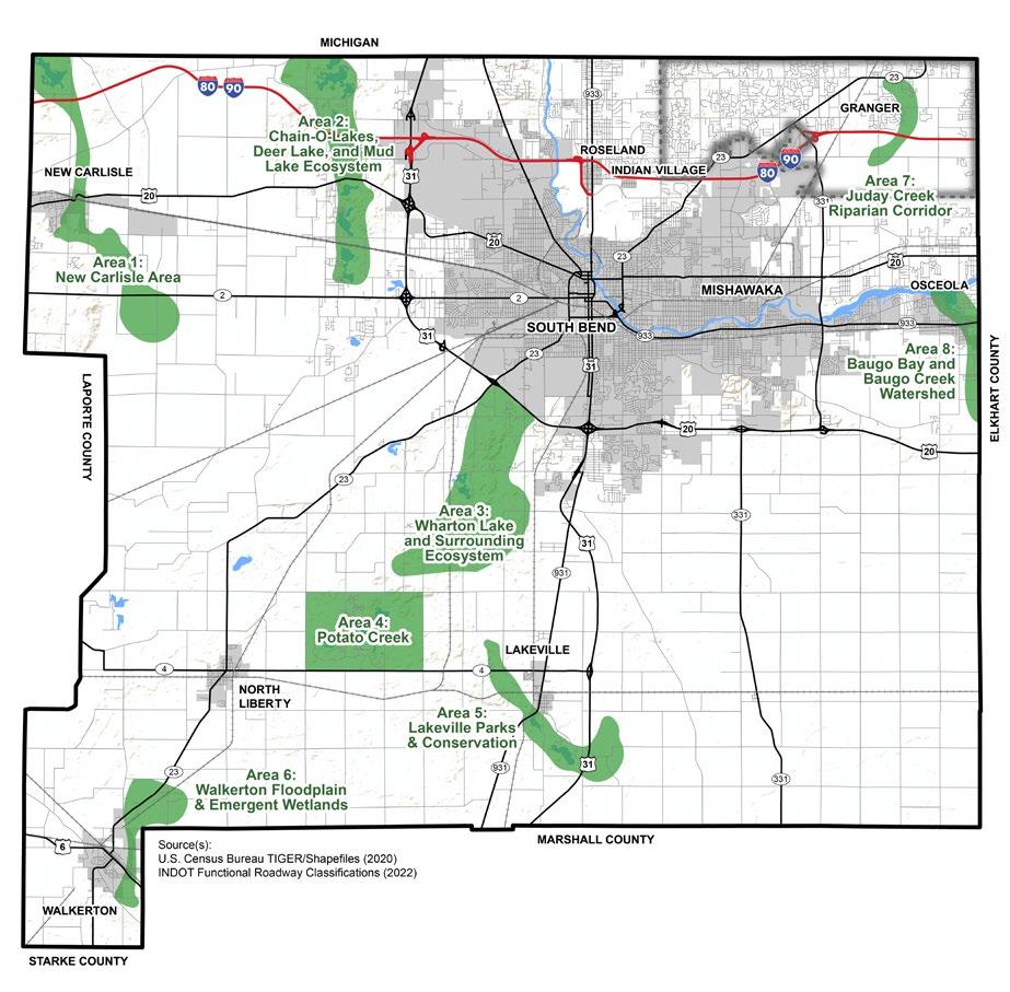
Safe and clean water sources are essential for human survival and the overall wellbeing of residents and ecosystems. Groundwater resources of the St. Joseph River Basin are among the most abundant in Indiana. To sustain this abundance and quality, it is crucial to manage these resources thoughtfully.
Groundwater and surface water are two different sources of water that exist in the natural environment. Groundwater exists below the earth’s surface, in underground aquifers or porous rock formations, and comes from rain and snow. Surface water is visible on the earth’s surface, such as in lakes, rivers, and streams. Groundwater is typically of higher quality than surface water because it is filtered through the earth’s layers, removing impurities and contaminants, and is less exposed to human interaction. However, naturally occurring elements like arsenic and animal waste in rocks, soils, and waters can also contaminate groundwater quality. Human activities can impact groundwater quality. Aging lead infrastructure used to transfer water can leak into supply, agricultural runoff, industrial waste, and waste disposal sites can
also diminish water quality. This goal considers the balance between today’s use of this vital resource with practices that are intended to preserve its quality and availability for future generations of St. Joseph County residents.
According to the St. Joseph River Basin Commission (SJRBC), “A watershed management plan is a strategy and work plan for achieving water resource goals for a geographically defined watershed.” Plans not only include hydrologic delineation and land use information but are developed with multiple stakeholders and public engagement. For example, the Juday Creek watershed management plan was developed in coordination with the University of Notre Dame and the Indiana Division of Soil Conservation. The plan provides agreed upon best practices for the watershed attainment strategies for implementing the plan.
ES.1.A
Incorporate green infrastructure into zoning and subdivision ordinances as options to reduce the amount of pavement and required landscaping.
The use of green infrastructure helps to reduce the burden on stormwater systems, prevent flooding, and improve water quality by filtering pollutants before they reach waterways. Integrating these techniques as options to address County development standards allows the County to promote innovative and efficient practices in new developments. ES.1.B
Encourage participation in the filter strip program and similar initiatives offered by partners.
Filter strips are areas of permanent vegetation used to intercept sediment, nutrients, and contaminants moving from contaminated areas to bodies of water. Additionally, they can provide valuable winter cover, nest sites, nectar and pollen for pollinating insects, and food for wildlife.
Employ erosion control strategies in new and existing developments.
Incorporate existing Watershed Management Plans into long-term planning efforts and collaborate with other jurisdictions to implement plans. Erosion control mitigates runoff to groundwater associated with construction activities and other land development. The employment of specific erosion control strategies, including proper stormwater storage techniques, allows the county to identify the potential sources of runoff and then determine the best technique to address adverse impacts on the natural environment. This may involve working directly with developers to determine the best systems for employing erosion control on projects.
By embracing existing Watershed Management Plans, the communities of St. Joseph County promote a comprehensive approach and shared responsibility to realizing the goal of improving ground and surface water for residents and businesses. Since issues like these cross jurisdictional lines, future countywide and sub-area planning initiatives should consult these Watershed Management Plans in collaboration with other jurisdictional partners.
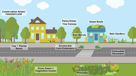
According to U.S. Green Building Council (USGBC), “Green infrastructure is any practice that uses or replicates natural systems to achieve a desired outcome. This includes green roofs, bioswales and rain gardens. Green roofs replicate meadows to retain water and restore habitats on the top of buildings. Green infrastructure does not exclusively mean vegetation. Permeable surfaces are considered green infrastructure as well, because they handle rainfall the same way natural landscapes do. Green infrastructure looks to nature for advice, restoring and replicating ecological systems to create human benefits.”
Natural resources are vital to maintaining a healthy and sustainable environment. By striving to improve and protect ecological resources, through regulatory practices, St. Joseph County demonstrates its commitment to the health, safety, and welfare of its residents. This goal requires implementing zoning, subdivision, and other policy changes to encourage the type of development that meets the needs of the present without compromising the environment of the future.
Explore the feasibility of creating environmental overlay districts to coincide with the priority areas identified on the future land use map.
An environmental overlay may have additional conditions or standards about natural resource conservation and protection that supplement or supersede the requirements of the underlying zoning district. Community engagement with stakeholders and natural resource specialists will be critical in developing an overlay district that protects priority areas.
Explore zoning incentives to protect environmentally sensitive areas.
Natural resource preservation is tied to the County’s and to the region’s environmental health. Zoning incentives are tools available to encourage landowners and developers to provide public environmental benefits. These could include tools such as transfer of development rights programs, establishment of green corridors, and bonuses for designated spaces for wildlife and native habitats. In this way, property owners and developers can participate in the conservation and protection efforts of environmentally sensitive areas and wildlife habitats, while still being permitted to develop their properties in appropriate and sustainable ways.
ES.2.C
Update zoning and subdivision ordinances to incorporate open space in developments.
Developments that incorporate open space into the overall design have many benefits. Open space can reduce impervious surface, stormwater pollutants, construction costs, and loss of natural areas. This recommendation is intended to be flexible and encourage creativity in open space design and use, creating a relationship between the built and natural environments. Updates to ordinance could include reducing the minimum number of off-street parking spaces to offset open space requirements in the zoning ordinance or updating the subdivision ordinance to encourage open space design that is multifunctional.
As more development and urbanization occurs in St. Joseph County, the surrounding environment will experience a level of disturbance. If not correctly managed or accounted for, these disturbances will have longterm damaging impacts on the environment. The County can lead by example by being conscientious in development decisions. To achieve this goal, the County should build on past efforts to reduce energy consumption through audits, grants, and other mechanisms. Promoting development and practices that respects the natural environment also reduces costs for upkeep and lowers maintenance costs. Finally, Area Plan Commission staff can ensure that new development is reviewed through a conservation lens, utilizing more robust data for wetlands, floodplains, and environmentally sensitive areas.
Explore options to include native plants in the landscapes of County owned properties to reduce maintenance costs.
Native plants are indigenous to and thrive in their natural environment, thus requiring less care and maintenance. County-owned areas, such as parks, road medians, and green spaces, can feature plants native to the Michiana Region that support biodiversity, provide habitat for wildlife, conserve water, and improve soil health while reducing the need for irrigation, fertilizers, and pesticides.
Figure 3.6: Examples of Native Plantings and Green Infrastructure.
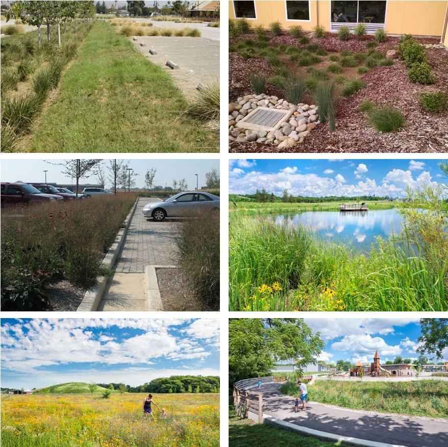
ES.3.B
Build on previous efforts to improve energy efficiencies and reduce costs for development.
Construction with energy efficiency in mind benefits the developer, the property owner, and the community through longterm cost savings and lower overall environmental impacts. Energy efficient developments have lower utility, water, and maintenance costs along with reduced reliance on fossil fuels and lower greenhouse gas emissions. The County can build off previous successes, including updates to county buildings, highway garages, water mains, and streetlights, to improve energy efficiencies and lower budgetary impacts.
Use the most current data to locate probable wetlands during the development review process.
Wetlands are key in sustaining a water supply and protecting native wildlife. By continually updating and researching the locations of actual and likely wetlands in the County, APC staff and decisionmakers can prioritize land conservation practices to protect these important habitats. Prioritization should consider both the economic and ecological values of a development site and its potential environmental impacts during the review process.
Continue to use the best available floodplain data in the development review process.
This recommendation recognizes the importance of proactive measures to address potential flooding risks and protect valuable water resources at every step of the development review process. With current and up-to-date floodplain data, APC staff, decision-makers, and developers can assess the vulnerability of a site to flooding, identify high-risk areas, and develop effective strategies to mitigate flood impacts.
St. Joseph County was awarded by the “Most Outstanding Project Overall” award in 2019 by the Indiana Energy Services Commission. The $10.1 million project guaranteed energy savings that resulted in a net zero budget impact. Building improvements were made to all 11 county buildings and seven highway garages, water conservation measures, and an energy leadership program. This highlights St. Joseph County’s ability to lead by example with program that have tangible results and create real efficiencies.
This page intentionally left blank


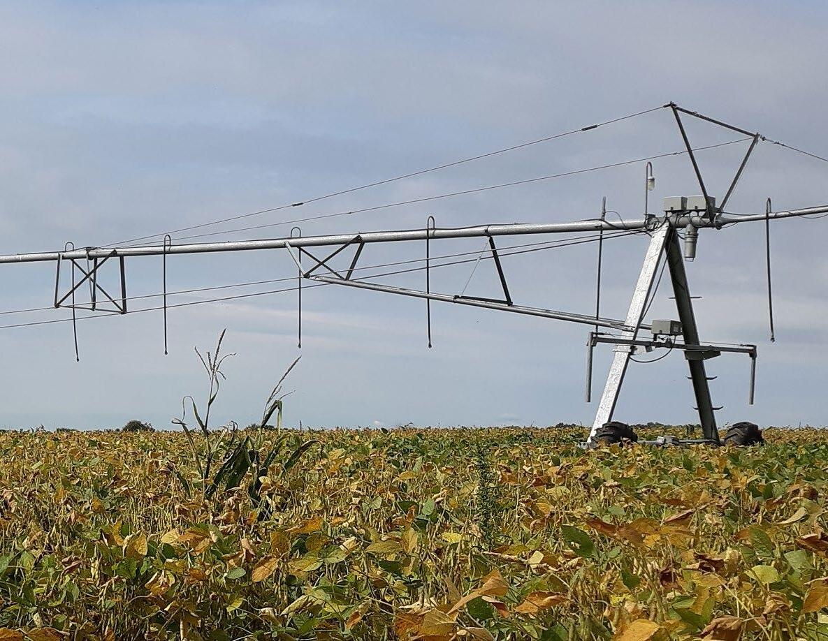

St. Joseph County has a rich agricultural history. In the nearly two centuries since its founding, agriculture has remained paramount to St. Joseph County’s way of life. Preserving productive farmland is critical to the future economy, growth management, and quality of life. Throughout the Midwest, agricultural land has been urbanized, with farmland rapidly converted to residential subdivision and other uses. One of the major impetuses of the plan was the long-term protection of prime farmlands.
The Farmland Preservation Pillar fulfills communal aspirations to maintain vibrant rural landscapes, for respite from urban areas, and to improve quality of life for rural communities. Additionally, it provides economic benefits by helping stem urban sprawl and promoting efficient use of land. Achieving the community vision requires coordination with the other seven pillars of this plan and intergovernmental collaboration for mutually beneficial outcomes.
St. Joseph County is almost entirely classified by the US Department of Agriculture (USDA) as “prime farmland.” The USDA defines prime farmland as “land that has the best combination of physical and chemical characteristics for producing food, feed, forage, fiber, and oilseed crops and is also available for these uses. The land could be cropland, pastureland, rangeland, forestland, or other land but not urban built-up land or water.” Since the County’s 2002 Comprehensive Plan, three trends have continued to impact agriculture:
1. Declining economic viability, especially for smaller farms;
2. Inefficient development patterns (urban sprawl); and
3. An aging workforce.
For a complete analysis the Farmland Preservation Pillar’s existing conditions, see the appendix.
Conserving land and rural landscape identified as best suited for producing crops, pasture, or range/forest for agricultural and educational use and enjoyment.
Area 1: Kankakee River Basin & Crumstown
Area 1, Kankakee River Basin & Crumstown, contains the County’s largest continuous area of ‘Farmland of Statewide Importance.’ This area is critical for ensuring that farmland is not disrupted by urban sprawl. The following factors make Area 1 the largest priority area:
1. Sprawl of low-density residential uses along the Crumstown Highway, resulting in the conversion of prime farmland;
2. Large concentration of Prime Farmland of Statewide Importance as identified by the US and Indiana State Department of Agriculture; and
3. The Kankakee River- the second largest waterway in the County and a significant resource for nutrients and supporting surrounding agricultural operations.
In order to counter sprawl and conversion of prime agricultural land, the County should
According to the USDA National Soil Survey Handbook, this is land designated by a state agency or agencies that is of statewide importance to agricultural production. This typically includes lands that economically produce high yields of crops when treated and managed accordingly.
begin implementing the Farmland Preservation goals and recommendations in this and other priority areas. The Farmland Preservation goals and recommendations identify strategies such as encouraging conservation easements, land banking, or zoning amendments.
Area 1 borders multiple townships-Olive, Greene, Warren, Liberty, and Lincoln-which presents an opportunity for the County to partner with various organizations and township trustees to preserve farmland.
Area 2, Yellow River and its tributaries, is located east of Lakeville and US 31. They contain several acres of Prime Farmland of Statewide Importance. Wetlands are distributed throughout Area 2, supporting healthy soils and preventing erosion.
There are two transportation projects by the Michiana Area Council of Governments (MACOG) that may impact conservation of this prime farmland. These include:
• The 2045 MACOG Transportation Improvement Plan’s planned connection of Pierce Rd/SR 4 from US 31 to Bremen Highway/SR 331; and
• The MACOG Active Transportation Plan’s rail-to-trail conversion of the defunct railroad between North Liberty and Lakeville into a multi-use recreational trail.
These two initiatives stress the importance of balancing the plan’s Pillars – in this case, the Transportation and the Quality of Life and Place Pillars with the Farmland
Preservation Pillar. The County must be proactive in preserving Area 2’s farmland as these planned improvements may incentivize farmland conversion. To prevent development leapfrogging away from Lakeville, the County should implement the Farmland Preservation goals and recommendations through partnering with agricultural groups to establish conservation easements and other identified strategies.
Area 3, Grimes Ditch and its tributaries, is located between Madison and Penn Township in east-central St. Joseph County. Grimes Ditch is a prominent natural feature for supporting long-term agricultural practices in the area. The County should prioritize Farmland Preservation this area to slow the recent development of low-density commercial uses south of the US 20 and Capital Avenue/SR 331 intersection.
Development should be limited south of US 20, except for improvements supported by the Capital Avenue Land Use Plan, as adopted in 2003 by the City of Mishawaka and the St. Joseph County Board of Commissioners.
Implementation of the Capital Avenue Land Use Plan should be done within the framework of this comprehensive plan- aligning new developments with the Community Vision, future land use map, and the eight pillars. The County should collaborate with the City of Mishawaka to encourage compact and walkable developments to minimize farmland conversion in Madison and Penn Townships and support efficient use of land.
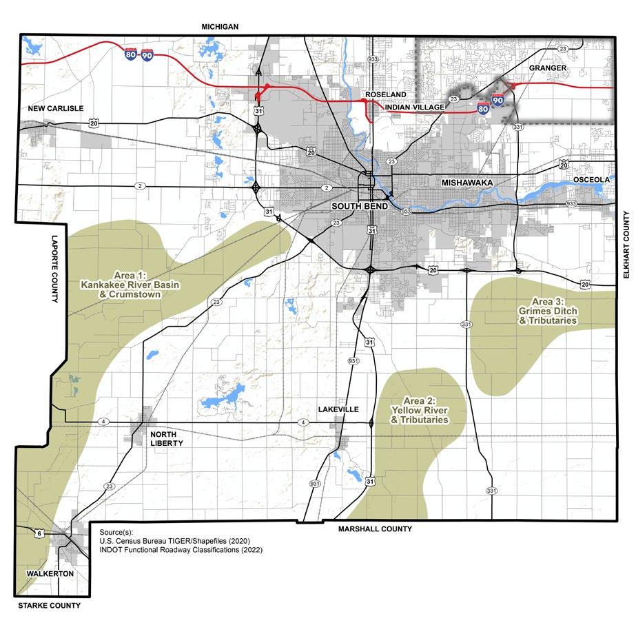
Agricultural operations account for more than 70 percent of the County’s land. Farmland preservation is important for:
1. Providing fresh produce to farmers’ markets,
2. Maintaining county-wide drainage and ditch systems that alleviate flooding,
3. Providing jobs and supporting the local economy,
4. Supporting rural living, and
5. Directing development to build up existing urban areas.
Farmland preservation must be balanced with land development. This requires alignment of land use policies, zoning regulations, and community values when making development decisions. The future land use map identifies areas for farmland preservation while recommending other areas for development.
The rate at which farmland is being converted to non-agricultural use in recent decades has increased at a rapid pace. The encroachment of
non-agricultural uses into rural areas decreases both the viability of long-term farming and the availability of open space, both of which are essential in preserving St. Joseph County’s rural character and agricultural heritage.
FP.1.A
Preserve highly productive agricultural areas identified on the future land use map and Farmland Preservation priority areas map.
The future land use map identifies two agricultural designations—General Agriculture and Intensive Agriculture. The Farmland Preservation Priority Areas Map identifies three priority areas for preserving Prime Farmland of Statewide Importance. These priority areas should be considered when making land use decisions, especially decisions that may affect areas of productive agriculture.
FP.1.B
Maintain the existing zoning standard that permits residential housing at one dwelling unit per 20 acres.
This standard applies to a minimum lot area for a buildable lot in the current A: Agricultural District. This standard has been in effect for more than 30 years and has been successful in preserving agricultural land. This standard should apply to the new agricultural districts of FP.1.C.
Develop two agricultural zoning districts, one focused on Intensive Agriculture uses and one focused on General Agriculture uses.
The creation of two agricultural districts will allow for effective management of non-agriculture uses within agricultural areas and allow the County to apply land use regulations specific to differing rural contexts. The Intensive Agriculture district strictly limits non-agricultural uses, while the General Agriculture district would allow some non-agricultural uses as special exceptions.
Create a special exception process for residential dwelling units in agricultural districts.
The existing A: Agricultural District covers 73.11% of the Unincorporated County. Single-family dwellings are currently permitted by right in the A: Agricultural District, which has allowed residential uses to be situated on a site without additional consideration. An additional consideration should be allowing residential uses by special exception, which would provide for additional review of the placement of new residential uses to maximum farmland preservation.
Encourage natural transitions between farmland and other non-agricultural uses through development standards.
Conflicts between agriculture and other land uses can be mitigated through the implementation of development standards and other guidelines in the Zoning and Subdivision Ordinances. Regulations should support natural and appropriate transitions through larger setbacks, lot sizes, and the establishment of natural areas, such as buffer strips or zones and specialized corridors.
A vegetative buffer strip in an uncultivated or non-crop portion of land, usually located on the edges of farms, that acts as a barrier between the cropped land and other features. Often, buffer strips are implemented to aid in erosion control or protect sensitive environmental features. From a land use perspective, adding buffer strips or buffer zones can aid in providing a barrier between less compatible uses.
Agriculture plays a crucial role in the local economy, contributing to food production, employment opportunities, and economic growth. The County can ensure the long-term preservation of agricultural land by promoting existing tools that support farmers and the preservation of agricultural lands.
Additionally, the County and its partners should explore opportunities that support farmers in navigating emerging trends, such as agritourism. This approach diversifies farmers’ income opportunities and supports the economic viability of farming while also promoting engagement with agriculture and the connection between consumers and locally-grown products.
Utilize voluntary programs, such as conservation easements or participation in agricultural land trusts, to encourage preservation of farmland.
Landowners may voluntarily enter into conservation easements, sell, or donate their land to a land bank or land trust to further protect sensitive areas and ensure land remains available for agriculture.
Encourage participation in programs that reduce financial burdens on farmers and agricultural land.
The County and its partners should promote programs available through the USDA’s Department of Agriculture, State of Indiana, and others that provide financial assistance to farmers in the form of loans, grants, and disaster support, as well as explore ways to reduce tax burdens on agricultural lands.
Expand and promote agritourism.
According to the Indiana State Department of Agriculture, there are nearly 300 agritourism destinations in Indiana, ranging from farm markets, farm tours, U-Picks, flower farms, Christmas tree farms, wineries, breweries, and others that bring the general public to agricultural activities. St. Joseph County offers many unique agritourism opportunities. Thistleberry Farm, southwest of South Bend, is a favorite fall destination with a corn maze, pumpkin patch, and more.
Agritourism is economic diversification for farmers and others in the agricultural profession, providing the opportunity to earn additional revenue while offering an interesting and engaging service to the experiential tourist market. Agritourism attractions allow members of the general public to view or enjoy rural life for recreational, entertainment, or educational purposes.
Connecting farmers with educational and training opportunities empowers them and supports the long-term viability of farms. These opportunities can offer a wide range of topics related to modern farming. By connecting farmers and other producers to these resources, the County supports their ability to make informed and independent decisions that would lead to improved agricultural productivity.
Support organizations that promote farming, including Purdue Extension 4-H, FFA, and the Indiana Farm Bureau.
Effective partnerships create mutuallybeneficial outcomes for the County and its partners. Farming organizations provide valuable educational resources, technical assistance, and advocacy. County partnerships with these organizations ensures access to resources, expert information, training, and networking to improve agricultural operations.
FP.3.B
Refer property owners to the Natural Resources Conservation Service (NRCS), the Soil and Water Conservation District (SWCD), and the County Health Department’s Well Water Resources Advisory Board for technical assistance.
Connecting property owners with specialized agencies that have local knowledge provides valuable resources for land management practices. The NRCS and SWCD have extensive knowledge in soil health, water management, and resource protection. They work with landowners to develop Conservation and Resource Management Plans that lead to improved long-term outcomes.
This page intentionally left blank


Cooperation among all governmental entities is essential for the successful implementation of Plan SJC. Transparency and data-sharing with the public are also critical components of effective government and policy. When the government operates transparently, it allows for public input and engagement opportunities, helps build trust and confidence in the planning process, fosters greater government accountability, and encourages data-driven decision-making. This helps ensure that future development is designed openly and collaboratively.
• Strategic growth and logical transition between densities and uses were the focal points in almost every public engagement, focus group discussions, and the Task Force meetings.
• Many residents desired a greater level of collaboration between jurisdictions in the County, as well as other jurisdictions in Michigan and regional planning authorities such as the Michiana Area Council of Governments (MACOG).
For a complete analysis of existing conditions that are relevant to this pillar, see Appendix F: Government & Policy.
The process of establishing, administering, and enforcing law, regulation, procedure, and incentive by staff and officials. It involves coordination among all levels of leadership and with adjacent towns, cities, counties, and state agencies, and is how the recommendations of this Comprehensive Plan will be implemented.
The purpose and intent of this goal is to ensure that new development in St. Joseph County occurs harmoniously and avoids adverse impacts on neighboring properties. Development that respects and aligns with the existing environmental and land use character of surrounding areas promotes a sense of continuity and visual appeal. Development considerations can include land use compatibility, building height and setbacks, landscaping, pedestrian and vehicular access, parking, and overall site design and layout.
Plan SJC should be the primary resource for all new development initiatives in the County and consulted throughout the development process. Area Plan Commission staff and decision-makers are the safeguards of the plan’s vision, goals, and recommendations; it is their responsibility to oversee the translation of the plan into action. Successful implementation ensures consistency and informed decisionmaking. Future growth and development should occur thoughtfully and inclusively with new projects contributing to the 20-year vision.
GP.1.A
Review the future land use maps against the existing zoning map to ensure consistency, and that land is available for all uses identified in the plan.
Zoning is a critical mechanism to establish appropriate land use patterns and development character to achieve the overarching goal. The County should first focus efforts on the established priority areas for rezonings, as needed. All rezone discussions should involve affected property owners and partner organizations to assure transparency and justification for government actions.
Encourage development standards that better facilitate compatible infill development and redevelopment in priority areas and along key corridors.
Clear and supportive development standards allow Area Plan Commission staff to manage infill and redevelopment in these preferred targeted areas and corridors, while ensuring compatibility with existing surroundings.
Develop criteria to determine when traffic and water impact studies are needed for industrial and commercial use changes.
The Area Plan Commission needs a set of articulated conditions stating when a new development proposal warrants additional study on its effects on the environment, infrastructure, and services. These specified conditions or criteria will assist in decision-making, particularly with industrial and commercial proposals as they are typically more demanding on resources.
Discourage leapfrog development throughout St. Joseph County to keep growth contiguous and accessible to existing infrastructure.
Leapfrog development creates a scattered and detached development pattern. It creates inefficiencies, strains services, and should be prevented. Contiguous development maximizes available resources, minimizes the need for costly infrastructure extensions, and enhances the viability of development. By concentrating growth in areas already serviced by infrastructure such as roads, utilities, and public services, the County can better manage its investment, improve connectivity between and among uses, and maintain an organized, functional built environment.
Consider a concurrency growth ordinance, also known as an “adequate public facilities ordinance,” that balances the availability of public facilities and the capabilities of small developers.
A concurrency growth ordinance typically requires public infrastructure, such as roads, schools, parks, water supply, and wastewater systems, to be in place before new development can proceed. The ordinance considers the challenges faced by small developers by providing flexibility and options that meet their capabilities while still fulfilling the public infrastructure needs and requirements.
Plan SJC’s success is dependent upon the County’s ability to work collaboratively with all levels of government. Productive cooperation among these entities can expedite the implementation, enforcement, and monitoring of the plan’s goals and recommendations. Cooperation and coordination are particularly important in addressing the shared consequences of development, such as transportation needs, infrastructure demands, and environmental impacts. By working with unincorporated and incorporated jurisdictions, and neighboring counties, St. Joseph County can align its development plans with the broader regional context, avoiding haphazard growth patterns while achieving an organized approach to land use.
Coordinate capital facility plans with municipalities, the Indiana Department of Transportation (INDOT), and MACOG to better fund road and sidewalk improvements.
Organized and coordinated capital facility planning allows for the deliberate use of funds and other resources. With intergovernmental coordination, infrastructure improvement projects are prioritized based on need and adherence to regional goals. It enables better preparation and execution of projects, minimizes duplication of efforts, and maximizes the return on investment.
GP.2.B
Establish designated growth areas with the input and assistance of cities and towns.
By creating mutually agreed-upon growth areas for St. Joseph County, all parties can better direct countywide growth and development, protect and conserve natural resources and agricultural lands, and target infrastructure investments. This helps to address urban sprawl more effectively, encourages investment within existing developed areas, reduces septic dependency, and makes better use of transportation and utility networks.
Collaborate with incorporated cities and towns to create suitable development areas for development adjacent to existing built-out areas, incorporated areas, and within priority areas defined by this comprehensive plan.
New development in St. Joseph County should be contiguous and adjacent to existing development. All affected communities, both incorporated and unincorporated jurisdictions, should be consulted and involved in the proactive planning process when responding to or initiating development proposals.
Continue to prepare the Comprehensive Emergency Management Plan to address the impacts from environmental and natural disasters.
A Comprehensive Emergency Management Plan (CEMP) provides a single, comprehensive framework for the management of emergency and disaster events within a given jurisdiction. The CEMP outlines the structure and mechanisms for coordinating local preparedness and response activities. It also acts as a general reference point for local agencies to develop contingencies to meet the needs for communities during emergency or disaster events. By working together and sharing resources to create an Emergency Management Plan, the governments and non-profit organizations within St. Joseph County can better serve their constituents through preparation, response approach, and resiliency.
Transparency and data-sharing with residents and stakeholders are critical to effective governance and policy development. When government decisions are made with public input and consideration, residents are generally more supportive of resolutions regarding projects, investments, policies, and other publicly funded interventions. The result is accountability, increased trust between citizens and their government, and confidence in County leaders, staff, and their decisionmaking abilities.
GP.3.A
Create a service that summarizes public hearings and new project proposals.
St. Joseph County should provide a summary of development projects, public hearings, and new projects to residents. This would keep residents updated on important events and allow them to actively engage in the planning process.
Develop a live link map illustrating ongoing public land use petitions, transportation projects, permit numbers, and violations.
Providing a live-link map that allows access to status updates and information about various countywide development projects and petitions would be an asset for residents and stakeholders. This technology facilitates information sharing and communication, fosters greater transparency and accountability, and encourages public participation.
GP.3.C
Encourage land use petitioners to inform and engage nearby neighbors before filing a petition.
Petitions that propose a land use change to a property are more likely to impact adjacent and surrounding properties than the existing use, especially if the change is remarkable. While the County should encourage a healthy mix of land uses, it should also encourage petitioners to solicit and consider feedback from surrounding property owners before presenting the petition to the Area Plan Commission or other governing bodies. This proactive approach can reduce the time and costs associated with the administrative process and will likely reduce unforeseen opposition during public hearings.


The connectivity of a transportation network and its accessibility to residential neighborhoods, commercial areas, and recreational facilities greatly impacts the quality of life for both residents and visitors. Providing a variety of routes for different modes of transportation can enhance the network, making it more efficient. Residents and visitors should be able to access their destinations safely and conveniently via all modes of transportation.
Development has a significant impact on the transportation system; more people, jobs, and economic success can increase traffic volumes and growth. Because of this, transportation and land use are highly intertwined. Geographically, St. Joseph County falls at a crossroads providing excellent accessibility to larger regional cities, including Chicago, Indianapolis, Detroit, Toledo, and Fort Wayne. All of these locations can be traveled to within 3 hours via interstates and highways such as I-80/I-90, US 31, and US 30. The County’s location provides residents with convenient routes for longer travel while benefiting manufacturers and warehouses wanting to transport goods to other parts of the country.
This section compiles key findings of the existing conditions related to the Transportation Pillar. For a complete inventory of existing conditions, see Appendix I: Transportation.
1. Private vehicles are the most used mode of transportation but efforts to diversify the network are widely supported.
2. MACOG is a key partner in the development of plans to address issues related to congestion, level of service, active transportation, and funding through the Transportation Improvement Program (TIP).
3. The Connect Transit Plan co-sponsored by MACOG and Transpo looks to develop longer-term plans for transit improvement and possible expansion.
4. South Bend International Airport, the second busiest airport in Indiana, provides air passenger service and drives cargo distribution and logistics expansions.
The way of moving of people or goods from one place to another by air, rail, vehicle, water vessel, foot, and bicycle.
5. Active transportation improvements are strongly desired in the community, especially expanded bike and pedestrian infrastructure.
6. IN/MI River Valley Trail is a regionally significant trail with connections to Elkhart County and Southwest Michigan.
Area 1: South Bend International Airport to New Carlisle
Area 1 includes US 20, which connects South Bend to the Town of New Carlisle, becoming Michigan Street as it enters the town limits. US 20 is under the Indiana Department of Transportation’s jurisdiction. To the extent that it can, the County should work collaboratively with INDOT to discourage truck traffic along this route.
Area 2: State Road 2 Corridor
State Road (SR) 2 is a currently a divided highway that handles large amounts of truck traffic, which is expected to grow with the buildout of the Indiana Enterprise Center (IEC). The County should work collaboratively with INDOT to ensure western segments of SR 2 can accommodate the growth expected from the IEC. Safety and mobility improvements, especially in the eastern segments, are encouraged near the developed commercial and residential areas near US 31.
Area 3: Notre Dame and SR 933
This priority area has a high number of crashes, both vehicular and non-vehicular, in the unincorporated County. Additionally, SR 933 is an existing multi-modal corridor with the LaSalle Trail, which connects the County with neighboring communities in Michigan, and bus service provided by Transpo. For this priority area, the County should focus investments in better connecting surrounding areas to the LaSalle Trail and improving safety, especially at intersections. There are also opportunities
to make SR 933 a gateway for the County, as well as denser, transit-oriented development as transportation improvements are completed.
State Road 23 (SR 23) is an important commuter corridor that has heavy traffic volumes during peak commuting hours. There are multiple trails and pathways planned for this area, including on Adams Road, Anderson Road, and Brick Road. The County should focus on creating a multi-modal, complete street corridor on SR 23 through the Granger area to Notre Dame University. This corridor will provide facilities for highly desired alternative forms of transportation, such as biking, that connect residences to shops, jobs, and intersecting streets along SR 23.
As indicated in the Capital Avenue Land Use Plan, published jointly by the City of Mishawaka and St. Joseph County, Capital Avenue (also known as SR 331) has great potential for more office, commercial, and industrial development if utilities become available. The County should continue to invest in multi-modal facilities along the corridor which are comfortable, safe, provide accessible routes to adjacent developments.
US 20 Business Corridor, or McKinley Hwy, is an important east/west route connecting the east side of Mishawaka and the west side of Mishawaka. McKinley Hwy, which is a mixeduse corridor featuring residential, commercial, and industrial uses, has seen redevelopment
and reinvestment over the last several years, furthering its significance in the local transportation network.
SR 931 is a major north-south, local corridor connecting Lakeville residents to shops and jobs in the urban core of the County, including South Bend and Mishawaka. A multi-use path of regional importance is planned for SR 931 by MACOG. These transportation improvements should build into the planned improvements for SR 4 between North Liberty, Potato Creek State Park, and Lakeville.
Area 8: State Road 4 Corridor
SR 4 connects residents of North Liberty and Lakeville to each town’s economic centers and Potato Creek State Park. These improvements should connect seamlessly with planned improvements for SR 931 heading north into South Bend.
3.8: Transportation Pillar Priority Areas
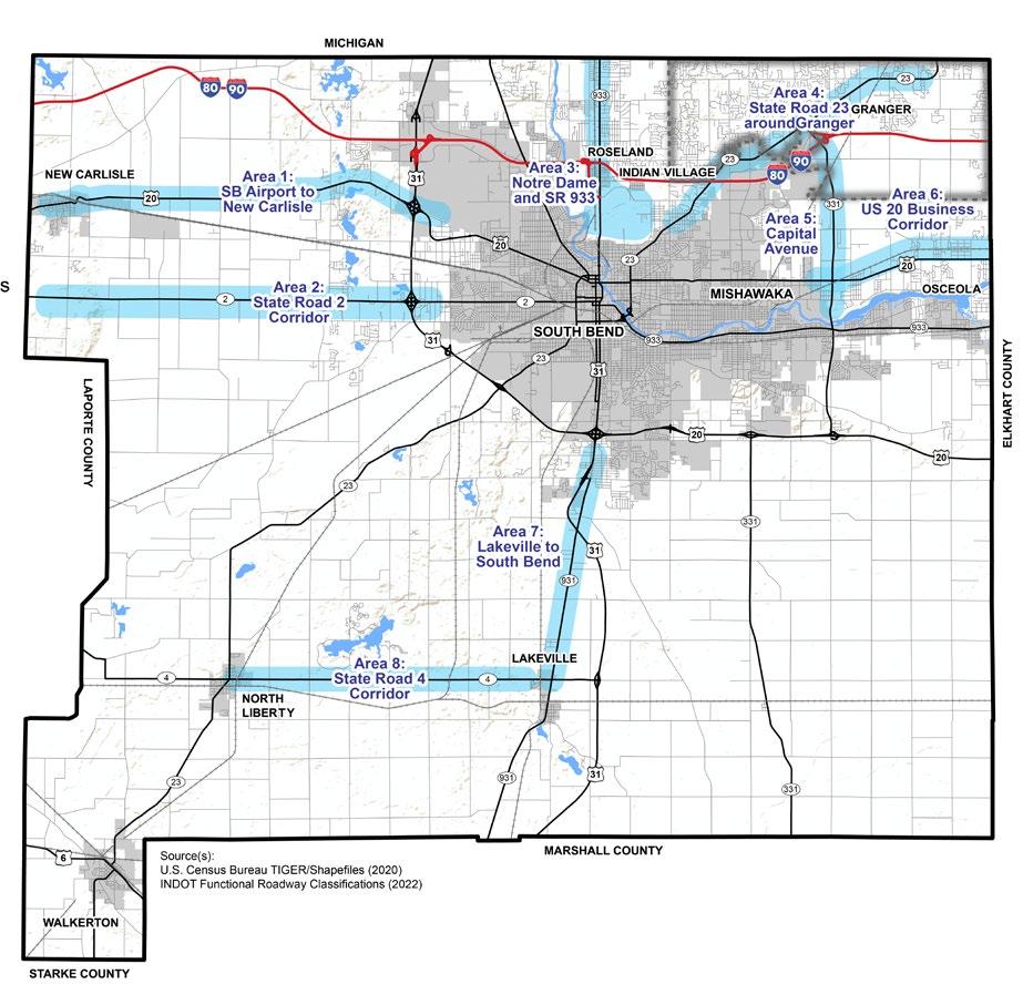
Transportation influences economic success and the viability of a community. Goods and people should travel to and through the County efficiently to support the local and regional economies, while contributing to a high quality of life for residents. Sufficient and effective transportation infrastructure also helps to attract and retain businesses, which in turn, supports the tax base. Transportation projects should be consistent with other comprehensive plan pillars and other identified priorities, such as protecting natural resources and improving the quality of life for residents.
This goal recognizes the interconnectedness between transportation infrastructure and land use planning. By aligning transportation investments with the desired development patterns, the County can promote efficient land use, reduce sprawl, and support sustainable growth. To achieve this goal, transportation infrastructure investments should be strategically targeted towards priority areas identified for the plan’s pillars to promote economic vitality, enhance accessibility, and create vibrant and connected communities.
Furthermore, aligning transportation infrastructure investments with the county’s development pattern helps ensure that transportation facilities are adequately sized, designed, and located to support anticipated growth and development. It involves conducting thorough assessments of current and future transportation needs, considering factors such as population growth, employment centers, and projected land use changes.
Work with developers to target private investment in areas that have infrastructure capacity for additional development.
This approach ensures that infrastructure capacities align with the demands generated by new projects. This can involve constructing or upgrading roads, utilities, sidewalks, and other essential components to support the development’s functionality and mitigate potential impacts on the surrounding community. By collaborating with developers, the County can strategically guide private investment toward areas that are well-equipped to handle new developments, reducing the strain on existing infrastructure.
Ensure public investment is matched with private investment in the identified priority areas and/or areas with available infrastructure capacity. Public investments matched with private investments allows the county to foster a fiscally balanced and strategic development approach that can be sustained for continued improvement of and growth in priority areas and areas with available infrastructure capacity. This approach maximizes the impact of infrastructure investments that can stimulate economic growth, leverage private sector contributions, and ensure that investments are strategically targeted in areas where they can have the most impact economic development and quality of life for residents.
Identify priority transportation corridors where new investment or reinvestment is needed.
By identifying priority transportation corridors, the county can strategically invest its limited funds in transportation projects that will have the highest return on investment. Since growth and development should be expected in these corridors, the county can also proactively ensure that new residents have a highquality transportation network with adequate spaces for safe, secure, and accessible facilities for all users while improving the lives of existing residents.
Coordinate traffic safety enhancements in priority areas with the Indiana Departments of Transportation (INDOT), Natural Resources (IDNR), and railroad companies.
As areas within St. Joseph County experience growth and development, it becomes crucial to address the associated increase in traffic volumes and the potential safety concerns for both vehicular and nonvehicular users. By focusing on priority growth areas, where new developments and population growth are anticipated, St. Joseph County can proactively implement measures to prevent traffic accidents and provide a safer transportation network for all users.
Throughout the planning process for Plan SJC, stakeholders showed support for more connectivity in the county, especially through alternate and active modes of transportation. Investments and policies regarding connectivity include proactively conversing and/or securing land to fill in gaps in the transportation network, especially between residential subdivisions, commercial areas, and employment centers. This can also include updates to the county’s subdivision ordinance, requiring or encouraging developers to allocate a small portion of developments for interconnected trails and sidewalks to facilitate alternate and safer walking and biking routes. Improvements to the transportation network, such as new roadway construction or reconstruction, should consider improvements different modes of transportation, including walking, biking, and public transit. The general objective of this goal is to provide residents with viable alternative transportation options that are convenient and efficient, while still maintaining the ease of vehicular access.
Require dedication of right-of-way along identified routes for multi-use paths and non-motorized users.
By dedicating and maintaining rights-ofway for active transportation, the County can proactively plan for and accommodate the expansion of trails, while ensuring safety for all road users and connectivity between major destinations. This helps the County avoid barriers that may arise as growth and development occurs.
T.2.B
Review proposed projects to ensure infrastructure accommodates multiple modes of transportation, including vehicles, buses, trucks, emergency vehicles, bicycles, and pedestrians, where feasible.
Proposed projects should ensure that any changes to the transportation network accommodate multiple modes of transportation where possible. By considering the needs of all modes of transportation, the County can create a multimodal, safe, and efficient transportation network that ensures mobility for people across all incomes and abilities.
Among County stakeholders, there is steadfast support for active transportation and transit planning to connect people and places throughout the county and region. It is widely recognized that active transportation, by way of walking, biking, or rolling, not only provides the opportunity for individuals to travel to/ from destinations, but also promotes healthy lifestyle choices, creates quality of place, and supports placemaking efforts.
In addition to active transportation, the integration of recreation facilities within priority transportation corridors contributes to enhancing community wellbeing. By incorporating recreational amenities such as parks, green spaces, and walking or cycling trails, these corridors become more than just transportation routes. They become spaces that promote physical activity, social interaction, and relaxation. This approach recognizes that transportation corridors can serve as community assets, providing opportunities for leisure, recreation, and overall quality of life improvement for residents.
Complete a countywide bike and pedestrian plan.
St. Joseph County is a growing and active community dedicated to improving the quality of life for residents by providing bicycle and pedestrian facilities which are convenient, comfortable, and safe. Plan SJC outlines several goals for increased connectivity within the County.
Explore regional trail connections using MACOG’s Active Transportation Plan.
MACOG’s Active Transportation Plan serves as a valuable resource for identifying and prioritizing trail connections within the region. By leveraging the insights and recommendations of this plan, the County can identify missing trail links and collaborate on funding and financing transportation improvements that extend beyond individual jurisdictions, strengthening regional and intergovernmental collaboration for the betterment of all residents.
T.3.C
Identify opportunities to connect county and regional destinations through trails.
The focus of this recommendation is to create a network of interconnected trails that provides convenient and safe pathways for pedestrians and cyclists. Connecting major destinations through trails not only facilitates recreational activities and tourism but also improves connectivity, promotes physical fitness, and enhances the overall quality of life for residents.
Work with partners to identify gaps in bike and pedestrian connections.
By working with more experienced organizations, governments, and other partners, the County can tap into their expertise and knowledge. These partnerships would allow for a more comprehensive and community-driven approach to improving connectivity, especially within priority areas.
Accommodate all ages and abilities in transportation improvements.
By adopting this approach, the County can ensure that facilities are accessible to everyone, regardless of physical limitations or age.
There are a number of bicycle advocacy groups in the Michiana Area. The Bike Michiana Coalition works to create healthy connected communities in Michiana by encouraging and promoting safe cycling for recreation and transportation. The Friends of Granger Paths partners with community residents, businesses and government agencies to advocate for the development of a communitywide multi-use paths and educates the public about health, community building, and environmental benefits of these amenities. Partnerships with partners such as these are vital in advancing active transportation goals in St. Joseph County.
One of the County’s responsibilities is ensuring that taxpayer dollars are spent in a fiscally responsible manner. There are opportunities to seek transportation funding from the State Government, Federal Government, and private grant providers. The County should utilize outside funding opportunities for new transportation projects while also balancing the maintenance needs of existing infrastructure.
T.4.A
Continue to work with MACOG to leverage state and federal funding for future road extensions and new construction projects.
By consistently engaging with MACOG, both the County and MACOG can tap into an expanded availability of funding at the state and federal levels.
Identify projects with the Redevelopment Commission that could be supported by Tax Increment Financing (TIF) funds.
This approach encourages the Redevelopment Commission to allocate funds toward projects that maximize community benefits of TIF funding, extend the lifespan of public improvements, and continue to invest in essential infrastructure projects that contribute to the overall quality of life and place of the community.
Investigate funding opportunities to establish a dedicated fund for the repair, maintenance, and rebuilding of infrastructure.
Operating costs, or in other words maintenance, may be the most difficult part of ensuring a high level of service and quality of a community’s infrastructure. Hence, establishing a dedicated fund for ongoing infrastructure maintenance, with a particular focus on active transportation facilities, can ensure a reliable and consistent source of financial support for providing essential services and facilities for new and current residents and businesses.
Identify strategies to fund bicycle and pedestrian projects.
Trail maintenance is an essential part of ensuring active transportation networks are a viable mobility option. No matter what strategies are identified, they should all ensure the longevity, safety, and connectivity of bicycle and pedestrian projects.
St. Joseph County benefits from its numerous road, rail, air, and path connections. INDOT, NICTD, Amtrak, Transpo, and South Bend International Airport are some of the major transportation providers that can continue to be essential partners in this sector. With this comes the need to coordinate with other organizations to achieve the goals of this comprehensive plan. The County should work with the appropriate organizations identified in the following recommendations to create a County that its residents can get to, from, and within easily by whatever means they chose. Many of these organizations have their own plans they are working to achieve, and the County can leverage common goals to create partnerships and potentially ease cost burdens.
Continue the relationship with the County’s municipalities to improve connectivity, safety, and maintenance related to transportation infrastructure.
Transportation networks extend beyond municipal limits, necessitating collaboration with neighboring jurisdictions to coordinate and provide a consistent, high-quality, and seamless mobility to all users.
Continue to review the MACOG Transportation Improvement Program (TIP) to identify projects.
The TIP serves as a comprehensive framework for prioritizing transportation projects in the four-county region of St. Joseph, Elkhart, Marshall, and Kosciusko Counties. By reviewing the TIP regularly, the County can leverage proposed road projects that are in line with priority areas, the future land use map, and other policy goals and recommendations.
Implement the recommendations of the County Connections Plan to better integrate the transportation networks of St. Joseph County and Elkhart County.
The County Connections Plan provides a strategic framework for improving transportation connectivity and promoting regional integration. By building onto aligning efforts and resources with the County Connections Plan, St. Joseph County and Elkhart County can forge stronger connections, promote collaboration, and enhance the mobility and accessibility options for their communities.
Continue to support multi-modal connections to the South Bend Airport.
South Bend International Airport (SBN) is a major driver of economic development in the region. The airport will continue to grow and attract new travelers as new flights are added, as identified in its master plan. As the terminus of the South Shore Line and connection to Amtrack via Transpo Bus, SBN is a critical multimodal hub connecting the South Bend/St. Joseph County region to Chicago, the nation’s third largest city, and Chicagoland.
Work with Amtrak, the City of South Bend, and other jurisdictions to explore options for a new station.
Locating and establishing a new Amtrak station offers various advantages, including improved regional connectivity, enhanced transportation options for residents and visitors, and potential economic growth through increased tourism and business opportunities.
Assess public transportation options within the County to adequately provide service to residents.
By working with transit providers to assess public transportation options, the County can better address the transportation needs of residents in unincorporated areas without access or desire to own a car.
As new technologies are developed, they should be evaluated and incorporated into the county transportation network. Policies and processes should include review and evaluation to make transportation decisions that are based on the technology’s ability to increase service, efficiency, and/or cost savings.
Integrating emerging transportation technologies involves identifying and implementing solutions such as electric and autonomous vehicles, smart traffic management systems, and mobility-as-aservice platforms. Smart traffic management systems utilize real-time data and analytics to optimize traffic operations and improve overall efficiency. Mobility-as-a-service platforms integrate various transportation options into a single platform, offering users seamless and convenient access to different modes of transportation.
Use GIS and community-driven data to map transportation infrastructure, analyze the motorized and non-motorized transportation systems, identify gaps, inventory conditions, and report safety issues.
Use Geographic Information Systems (GIS) and community-driven data to map and analyze the existing transportation system, including sidewalks, roads, paths, and trails. This data-driven approach enables the County to more accurately assess transportation networks, providing valuable insights into connectivity (e.g., sidewalk gaps) and accessibility (e.g. missing ramps), and safety (e.g. potholes).
T.6.B
Continue to work on a signal modernization plan, as resources allow.
A signal modernization plan involves upgrading traffic signal systems with advanced technologies, such as smart sensors, real-time data analysis, and adaptive signal controls. These innovations can detect the presence of traffic, including pedestrians and bicyclists, more accurately optimize traffic efficiency, safety, and overall experience of the transportation network.
T.6.C
Consider new partnership opportunities for shared mobility services.
Shared mobility devices, such as bikeshare programs, offer easy and flexible means of transportation, especially offering essential last mile connections from and to other transportation modes. These services can provide some of the necessary infrastructure to help achieve the other goals and recommendations outlined in this section.
Consider the inclusion of charging stations for electric bikes and vehicles as part of future development projects.
Electric bikes and vehicles are popular alternatives to car trips in communities with supportive infrastructure. Communities can support the growing adoption of electric mobility options and encourage multimodal transportation practices. Providing charging stations in future development projects and at significant destinations throughout the county will contribute to a well-connected and sufficient charging network.


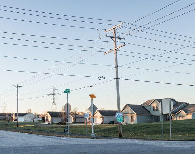
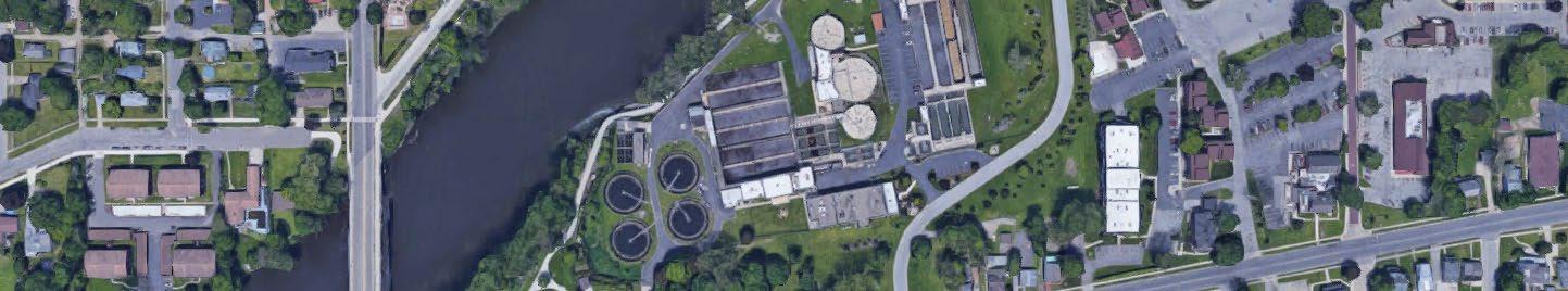
Existing and planned public and private utility systems are crucial in shaping land use decisions within St. Joseph County. Utilities significantly influence development by affecting the type, density, and location of property construction.
This section outlines key findings related to the county’s existing utility conditions, with a detailed analysis in the appendix.
• Municipal utilities can effectively manage development along the county’s periphery while mitigating urban sprawl.
• Access to municipal or managed sanitary sewer systems significantly impacts future development in terms of size, density, type, and location.
• Failing septic systems were a recurring concern, highlighting significant discomfort about their impact on the county’s housing stock, livability, and affordability.
• Effective solutions to wastewater management beyond existing municipal service areas are critical for the county’s environmental and economic sustainability.
• Expanding and strengthening the communications network is vital for economic development, improving quality of life, opportunities for new jobs, industries, and services for residents.
• Promoting renewable energy sources presents opportunities for consumer choice, economic growth, and compatibility with agricultural land use and applicable zoning districts.
The systems and physical structures, operated by a government or utility company, that manage the community’s basic functions, such as electric, gas, water, sanitary sewer, septic systems, stormwater, communications, and streets and roads.
To support St. Joseph County government’s decision-making process, gathering and sharing current, accurate information with elected officials, boards, commissions, and staff is crucial. Data collection and management tools improve as technology advances, offering valuable insights for identifying priority projects and service and infrastructure gaps. Quantitative data, such as permits issued, helps pinpoint future project needs. Additionally, integrating key performance indicators can supplement the understanding and evaluation of existing programs.
Include a feasibility review process for new developments to determine how the proposed project will impact infrastructure and services.
A feasibility review process for new developments ensures that growth aligns with the county’s mission to promote high-quality development in a way that protects the community’s health and safety. This review process will assess the project’s impact on existing and planned infrastructure and services, supporting critical decision-making during planning.
Develop an inventory of septicdependent subdivisions and understand the future viability of their septic systems to prioritize sewer connection projects.
Proactively working with property owners to collect data regarding their septic systems and the feasibility of repairing or replacing them to meet current standards will help prioritize sewer connection projects and facilitate strategies to address failing septic systems countywide.
Host a water quality data clearinghouse for individuals to self-report results.
High-quality data is critical for good decision-making, but this process can be very time-consuming and labor-intensive. Establishing a water quality clearinghouse allows individuals to self-report results and streamlines data collection efforts.
While St. Joseph County doesn’t control private or municipal utilities, collaboration with providers is essential to ensure adequate utility services across the county. Through strategic partnerships, the county can leverage specialized knowledge, technological advancements, and efficient management practices to address infrastructure challenges and enhance the delivery of utility services. Public-private partnerships enable targeted investments to extend services to underserved areas while amplifying financial resources for infrastructure development. These collaborations alleviate strain on public budgets, allowing for timely upgrades and expansions to utility services. By combining the strengths of both sectors, the goal seeks to improve the overall quality and reliability of utility services.
Work with utility providers to develop a plan that ensures priority areas and other areas targeted for development have access to sufficient and reliable utility services.
To support continued growth, the county should work with local energy providers to develop a utility plan that serves the priority growth areas as identified in Plan SJC.
Encourage the co-location of fiber cables and other utilities in the right-of-way.
To effectively encourage the co-location of fiber and other utilities, the County should work with providers to implement a “one-dig” policy on projects where feasible and develop a policy requiring co-location of services within the public ROW, whenever possible.
Work with internet service providers to develop a plan that ensures all areas of the county have access to high-speed internet.
The county, in partnership with service providers, can develop an internet service plan that would facilitate coordination, provide information to stakeholders, encourage shared infrastructure, and prioritize expansion in priority areas as defined in the Economic Development, Housing and Heighborhoods, and Transportation pillars
The goal of reducing reliance on on-site wastewater (septic) systems is crucial for safeguarding St. Joseph County’s potable water resources. Septic systems, prevalent in rural areas, pose contamination risks if not properly maintained or developed. By minimizing dependence on these systems, this goal aims to protect water quality and mitigate the potential for waterborne diseases.
This goal recognizes the potential contamination risks associated with on-site wastewater systems and prioritizes strategies to adopt alternative wastewater management approaches, such as centralized sewer systems and advanced treatment technologies. Achieving this requires thorough planning and collaboration with stakeholders, including local government and water authorities.
Coordinate service providers to install water and/or sewer services in identified areas with public health concerns.
The St. Joseph County Department of Health has effectively worked with public utilities in the county to address health concerns posed by septic failure and well water contamination. As other infrastructure improvements are made, coordination of installation of water or sewer services is critical to reduce costs while addressing failing infrastructure.
Evaluate the possibility of additional sewage treatment plants.
The county, in partnership with utility providers, should consider conducting a feasibility study to identify potential locations for additional sewage treatment plants to serve future development based on the priority area growth maps.
U.3.C
Survey the level of interest of residents living in septic-dependent subdivisions to connect to municipal water and wastewater utilities.
Septic failure is an issue within the county. To address the issue, it is essential to gauge residents’ interest in connecting to other utility systems. This can be achieved through targeted meetings with residents in critical subdivisions, where discussions can outline the connection process, costs, and ongoing service fees to support the development of plans connecting these areas to municipal utilities.
Support the Regional Water and Sewer District in addressing wastewater treatment issues.
St. Joseph County should work with the Regional Water and Sewer District (RWSD) to address expansion of wastewater treatment to priority growth areas and those areas plagued by septic failure.
Consider alternative wastewater treatment systems, such as cluster septic systems, in consultation with the St. Joseph County Health Department and the St. Joseph County Regional Water & Sewer District, where appropriate and where municipal utilities are not feasible.
Cluster septic systems offer an alternative wastewater solution for areas where traditional municipal treatment is not feasible. St. Joseph County Area Plan Commission staff should work with the Health Department, as well as the St. Joseph County Regional Water and Sewer District, to determine where the use of these systems are appropriate, to effectively manage them, and to seek funding opportunities for implementation.
St. Joseph County can mitigate health risks and protect communities by integrating public health initiatives, such as ensuring access to clean drinking water, promoting proper sanitation practices, and implementing pollution control measures. Additionally, promoting energy efficiency, water conservation, and renewable energy sources in infrastructure development, along with measures such as habitat conservation, land restoration, and responsible land use practices, reduces ecological impact and supports long-term environmental sustainability.
Encourage the diversification of energy sources to create a more reliable power grid and provide options for residents.
To strengthen community resilience, St. Joseph County should collaborate with energy utilities and consumers to promote the use of diverse energy sources. Diversifying energy sources not only improve reliability but also reduces vulnerability to market fluctuations, ensuring efficient energy delivery for local users.
Promote the use of vacant, abandoned, and underutilized parcels for potential alternative energy generation projects.
Innovative revitalization efforts could leverage vacant, abandoned, or underutilized parcels for alternative energy projects. These initiatives eliminate blight and provide jobs and opportunities within the community.
This page intentionally left blank


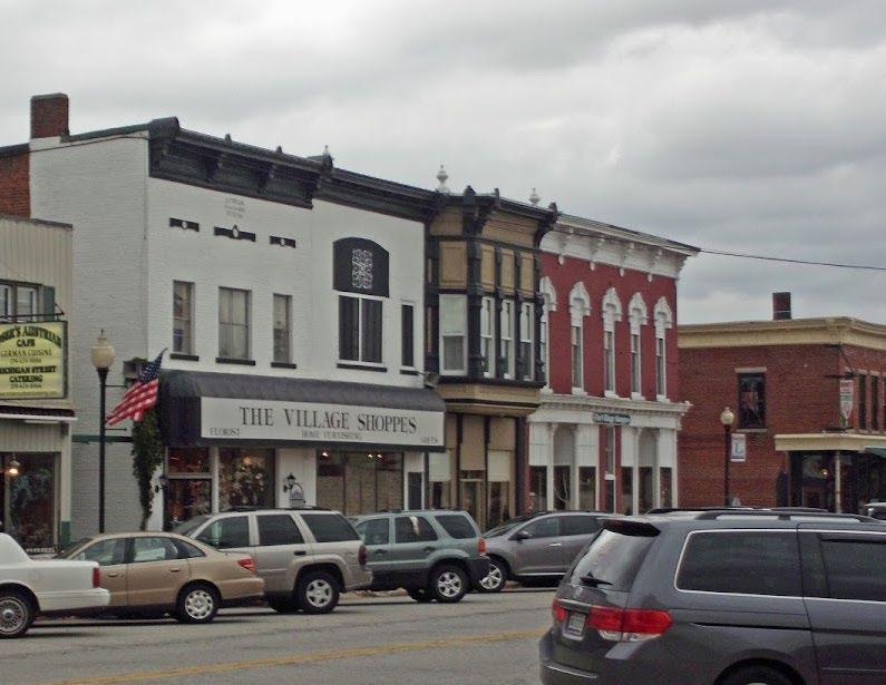
The Future Land Use Chapter provides a vision for where the County should encourage or limit different development types and land uses. The maps contained in this Chapter are intended to assist County staff, officials, developers, and the community in policy and land use decisions, as well as resource planning, to accomplish the comprehensive plan’s goals over the next 20 years. Future land use may include types of land uses, building design, development density, and more. Key factors that impact future land use include existing land use, the location of existing and planned roadways, natural features, and the ability to provide necessary infrastructure and public services. Classifications for existing land uses do not necessarily translate directly into classifications of future land uses.
The Future Land Use Chapter and maps should be reviewed every five years, in coordination with a general plan update, to ensure it reflects the County’s needs. The future land use map will be largely implemented through amendments to the County’s zoning and subdivision ordinances. County officials and staff should begin implementing the future land use map within Pillar Priority Areas, as defined in each Pillar’s respective chapter.
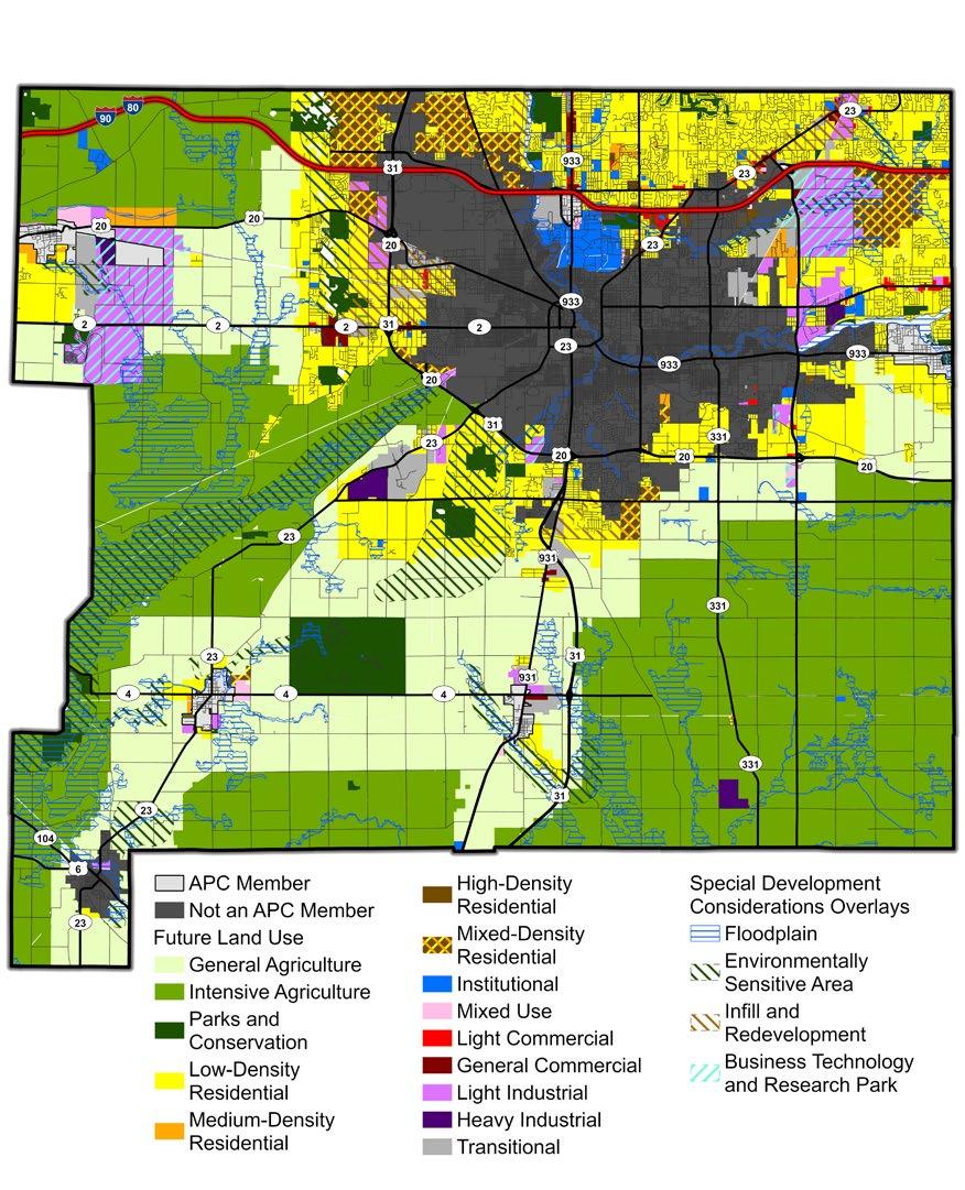
General Agriculture
The General Agriculture designation is intended to serve as a buffer between existing and/or planned areas of development and the Intensive Agriculture designation. These areas should allow both continued farming and established residential uses. General Agricultural areas are not intended to include more intense agricultural uses, such as confined feeding operations. Intense agricultural uses, such as confined feeding operations, are not recommended. Any new residential development, which would be in conjunction with an agricultural use, should be accommodating of adjacent agricultural uses.
Intensive Agriculture
The Intensive Agriculture designation is recommended for traditional farming practices such as crop production, livestock operations, such as grazing and confined animal feeding; and agricultural production and storage centers, such as grain elevators. Agricultural uses may diversify to include research facilities, stables, wineries, and other natural/ food production-related activities. Intensive Agricultural areas are mapped to limit frontage on the County’s major roads, leaving those frontages reserved for other development. There may be exceptions, such as floodplains or highly productive soils and prime farmlands near a major road.
Residential developments should be discouraged within Intensive Agriculture areas,
with the exception of farmsteads and minor subdivisions that separate existing residential structures from larger tracts of agricultural land. Existing single-family residential lots could incorporate agricultural-related uses, such as stables, small-scale, non-commercial food production, and limited livestock production.
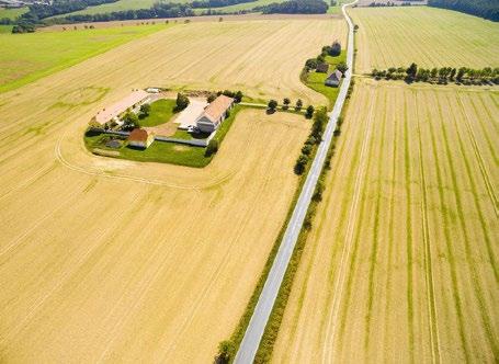
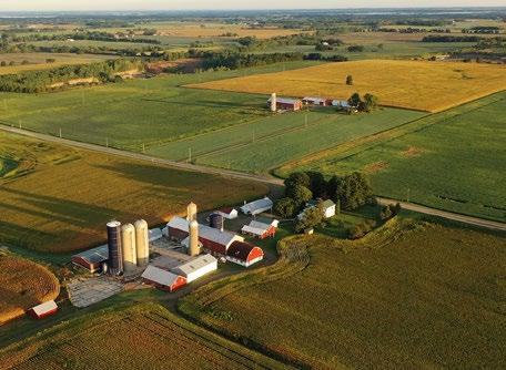
Parks and conservation uses apply to land suited for recreational or ecological activities. Conservation specifically applies to sensitive environments, including wetlands, forests, natural vegetation areas, and floodplains. The parks and conservation designation promotes protection and/or recreational use of undeveloped land. Uses may include sport fields, playground equipment, golf courses, open areas for stormwater detention, walking/ hiking/biking trails, and nature conservation— providing vital habitats for plants and wildlife.
Parks and conservation areas should incorporate bicycle and pedestrian facilities connecting to adjacent properties and between parks.
Parks
Parks may be public, private, or non-profit, and include active and/or passive recreational uses. Sports fields, for example, are active uses, while picnic areas and grassy meadows are passive uses. The Future Land Use Map has not mapped all existing parks, but parks are compatible with most land use categories, especially residential and mixed-use. Land use decisions affecting parks and conservation areas should involve the St. Joseph County Parks Department.
The Parks and Conservation designation also includes Greenways, which are trail systems that provide recreation as well as promote public health and active lifestyles. Greenways connect parks, neighborhoods, and urban areas. They can maximize unbuildable land, such as floodplains, environmentally sensitive
areas, or existing utility and access easements. Greenways should be hard-surface trails (asphalt, pavement), where possible, but may incorporate “soft-surface” nature trails (usually dirt or gravel).
Conservation refers to lands that are unsuitable for development due to potential negative impacts on the environment, such as pollution, sedimentation, erosion, and habitat destruction. These areas may be owned publicly, privately, or by non-profit organizations. Natural features in a conservation area might include floodways, wetlands, woodlands, and riparian corridors. Conservation also promotes the safety and protection of property in flood-prone areas or areas with other natural hazards. There should be minimal development in conservation areas. Adjacent uses should have an area of transition or and be buffered from a conservation area.
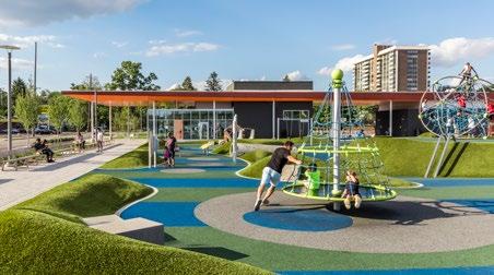
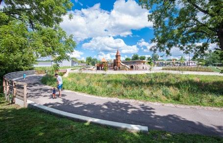
Unincorporated St. Joseph County features a range of residential densities, with the majority being low- or medium-density. Residential areas adjacent to or within incorporated communities are considered more appropriate for moderate densities (two to four dwelling units per acre) to higher densities (more than four dwelling units per acre) due to their proximity to existing utility services and amenities. Residential developments should be highly encouraged in the Priority Areas identified in the Housing and Neighborhoods Chapter, or near established areas where residents have a variety of transportation options. When possible, developments should not rely on well and septic systems to reduce the risk of contamination to groundwater and other environmental concerns. All residential designations may also include institutional uses, such as civic, religious, and educational facilities, where appropriate.
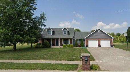
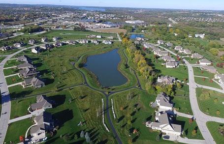
The low-density residential designation is intended for the development of detached single-family homes, typically less than or equal to one dwelling unit per acre. New developments should build upon existing residential infrastructure and avoid encroaching into agricultural areas. This designation may also include neighborhood institutional uses, such as civic, religious, and educational facilities.
The medium-density residential designation promotes traditional detached single-family subdivisions with two to four units per acre. Attached single-family dwellings, such as condominiums, duplexes, and triplexes, may be included as part of a larger development if the proposed density reflects adjacent development. Medium-density residential often
serves as a transition between low-density residential and commercial or institutional areas. New developments should connect to open spaces, amenities, and adjacent residential and non-residential uses. They should have adequate access to transportation and connect to public water and sewer utilities. Institutional uses may be included where appropriate.
The high-density residential designation allows a variety of housing types, including attached single-family homes, condominiums,
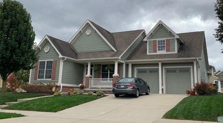
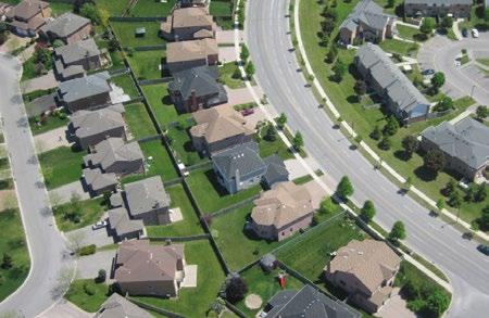
multi-family apartments, and mixed-use buildings. Typical density is four to six units per acre. This designation provides a range of housing options not typically found in the unincorporated areas of the County, especially those areas without readily available public utilities. This designation may buffer between commercial, office, and industrial uses and low to medium-density residential.
This designation generally applies to areas on the outer edges incorporated communities near existing infrastructure, public services, and utilities. These sites offer a wide range of development opportunities, including


small lot single-family housing, zero-lot line developments, townhouses, duplexes, and apartment complexes. New developments should have adequate access to transportation and connect to public water and sewer utilities. Institutional uses may be included where appropriate.
Mixed density residential areas should support a mix of housing options that may contain one or more of the following housing types: singlefamily homes at a range of lot sizes, attached housing types, missing middle, small or other multi-family developments. Areas identified for mixed density residential are ideally master planned developments and are complementary to surrounding area, designed with smooth transitions as residential density increases. Special consideration should be given to connectivity within and to the development, as well as integration of commercial and other amenities serving the area.
The Institutional designation includes public or semi-public uses. Examples include government facilities, private and public schools, religious organizations, correctional institutions, libraries, medical facilities, emergency services, and civic or social organizations. It is important to plan for expansions in response to residential, commercial, and industrial growth. New institutional facilities should reflect their area’s local character through site planning, architecture, and landscaping.

The Light Commercial designation includes smaller-scale commercial uses, often adjacent to residential areas, as well as office and business uses. Developments within this designation should be carefully planned to mitigate any impacts to adjacent residential areas. The Light Commercial designation is intended to serve as a buffer between residential areas and more intense General Commercial areas.
General commercial uses provide goods and services for the County. Uses may include grocery stores, “big box” retail, multi-tenant commercial centers, and shopping and dining centers. This designation applies to areas of heavy traffic along major corridors or at major intersections. Commercial developments should maintain high-quality development standards for site design, building materials/ architecture, landscaping, and signage to preserve the local character. Carefully planned access points, frontage roads, and synchronized traffic signals should be used to mitigate traffic congestion and safety concerns.
The Mixed Use designation provides for diverse land use combinations, and emphasizes a connected, walkable development pattern. The mixed-use designation may include restaurants, small-scale retail and professional services, offices, multi-family apartments, condominiums, townhouses, and recreational amenities. Characteristics include individual buildings containing a vertical mix of uses
(such as ground floor commercial with upperfloor apartments), or a cluster of multi-tenant buildings with connecting walkways and site amenities.
Mixed-use developments can provide a range of housing types for a variety of incomes, provide connections and infrastructure for walking and cycling, and enhance quality of place. Connections to outdoor green spaces, parks, pedestrian and bicycle amenities, and adjacent neighborhoods and commercial centers are key components of mixed-use development. Buildings should have quality architecture and include active street fronts

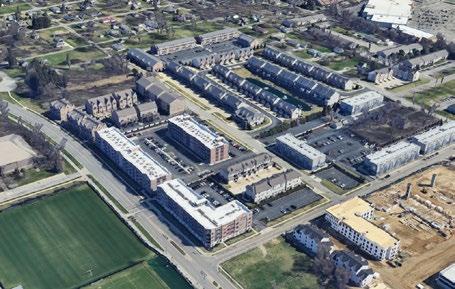
and storefronts. Building heights should range from two to four stories. Front building setbacks should be minimal unless located along a major thoroughfare.
The Mixed Use designation may include components of the Business Technology and Research Park designation to create walkable employment centers, with uses such as offices, research, light industry, small-scale warehousing, and supporting commercial uses. Site development may be campus-style groups of small-scale buildings, or multi-story mixed-use buildings. Building architecture should be compatible with adjacent uses, and all operations should be within enclosed buildings. Business Technology and Research Park (BTRP) mixed uses may serve as transitional “gateways” buffering between low intensity residential uses and heavy industrial or outdoor commercial uses.
The industrial designations include Light Industrial and Heavy Industrial, such as manufacturing, processing, and research facilities. Less intense non-residential land uses should buffer the impact of industrial land uses on residential property to preserve property values and quality of life. New or expanding industrial development should have planned access to highways and/or railroads. Special attention should be given to traffic management and road quality, especially for truck traffic. Connection to public water and sewer utilities is required.
Light Industrial development should be located along major roads and/or in designated areas. Uses within this classification should be wellbuffered from residential uses to reduce impacts from traffic, noise, and other effects of operations. Truck parking, loading and service bays, storage areas, equipment, and service areas shall be screened and maintain an orderly appearance.
The Heavy Industrial designation includes intense industrial uses not found in the Light Industrial designation. Heavy industrial and manufacturing uses may include outdoor storage and operations. Site considerations include those in the Light Industrial designation; however, these uses tend to have a greater impact for noise, air quality, odor, and other pollution. These uses should be clustered together along major thoroughfares to reduce their overall land area. Heavy industrial/ manufacturing uses should be buffered from residential uses to the greatest possible extent. Screening of all outdoor storage and operations from adjacent land uses and surrounding roadways is required.
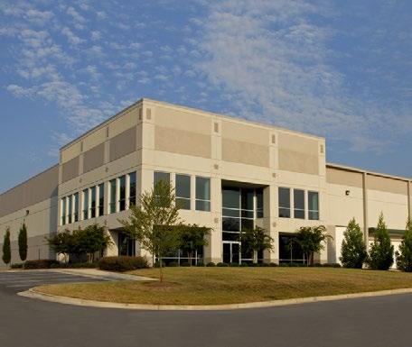
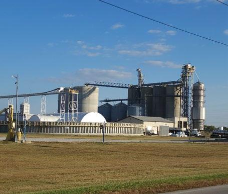
The Transitional designation is applied to areas of the County where conditions and development patterns are changing, suggesting a different land use category than what has historically been established and reinforced through past land use and zoning maps. In many cases, this has resulted from County roads gradually evolving in heavily trafficked corridors, a transition which has diminished the value of adjacent low density residential uses while simultaneously creating a suitable environment for commercial use and spurring demand for more intense development.
Additionally, the designation has been applied to areas where sewer and water service extensions or planned extensions create opportunities for industrial and commercial growth or more dense residential development. As new uses emerge in these areas, care must be taken to protect the ongoing use and value of neighboring established uses through development and design standards.
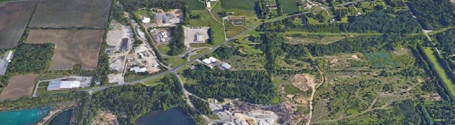
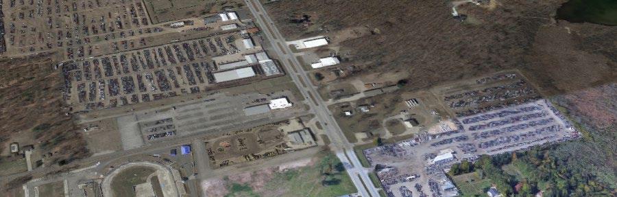
This overlay maps floodplains as designated by the Federal Emergency Management Agency (FEMA) and the Indiana Department of Natural Resources (DNR). Floodplains contain the floodway and the floodway fringe. The regulatory floodway is the channel of a river or watercourse that must be reserved in order to discharge the base flood, while the floodway fringe is the portion of the floodplain outside the regulatory floodway. New development in a floodway can worsen flooding downstream because it decreases the amount of space in which the water can flow. Responsible development in these areas will require thoughtful planning decisions and compliance with all applicable local, state, and federal requirements.
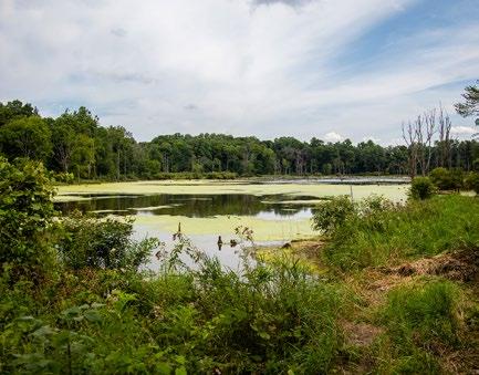
The Environmentally Sensitive Area (ESA) Overlay was created as part of the suitability analysis, which identifies areas containing critical natural resources and wildlife habitats.
The ESA Overlay aims to protect and support healthy ecosystems, improve flood mitigation, and to prevent hazardous development. It should apply to federally/state-protected environments, areas with substantial plant and wildlife, plus land with developmental constraints, such as high-water table, steep slopes, and poor soil conditions. These sites will be required to comply with all applicable local, state, and federal requirements. Examples of environmentally sensitive areas include:
• Federally designated wetlands;
• Fish and wildlife habitat conservation areas;
• Identified FEMA floodplains;
• Critical aquifer recharge areas;
• Geologically hazardous areas;
• Other natural resources
All development activities resulting in a land use change or the construction of new buildings in the ESAs should comply with all applicable regulatory provisions of local, state, and federal laws.

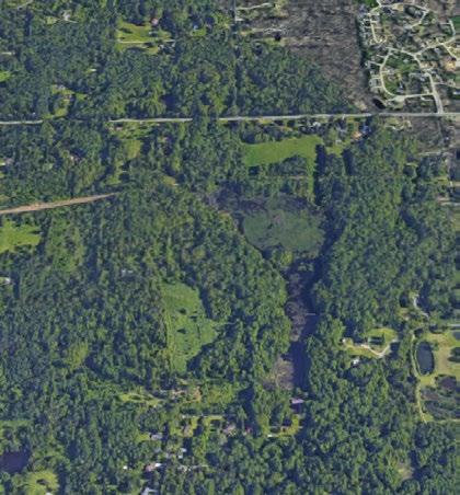
The Business Technology and Research Park (BTRP) classification designates areas of the County envisioned for master planned business, research facilities, and light industrial, with related office, shipping/distribution, wholesale, and other limited commercial uses. These areas should be master planned campuses with a high aesthetic visible from public streets. Activities predominately occur within enclosed buildings and have very limited outdoor storage and display. Sites should have adequate utilities and transportation access, possibly including rail access. Availability of technology-related amenities, such as highspeed Internet, are crucial for attracting and expanding economic opportunities.
The infill and redevelopment overlays were created in response to the suitability analysis, which identified sites with high development suitability within mostly built out areas.
Infill development is the development of vacant land within urban areas. Infill development supports several community goals: farmland preservation, promoting orderly growth and development, efficiency in use of resources, and leveraging existing infrastructure and amenities. Areas suitable for infill development include properties that are surrounded by existing development but are vacant or underdeveloped. Other important considerations include access to utilities and compatible uses based on the overall Future Land Use Map.
Similar to Infill Development, Redevelopment Areas might have sites or existing buildings that are underutilized, dilapidated, or abandoned. Former uses and buildings might have been of the highest and best use at the time they were developed, but over time, have become incongruous with their surroundings. Redevelopment projects can vary in significance and may include demolishing aging structures for redevelopment or remodeling existing buildings for adaptive reuse. As an example, underused parking lots are prime for redevelopment.

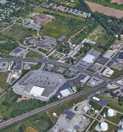
The following section breaks down the future land use map into St. Joseph County’s 13 townships, providing a detailed and more manageable view of the desired uses and development patterns. Each township will specify a focus area to inform County officials and staff decision-making, and direct prospective developers.
Interactive Elements
The township map (shown right) contains interactive elements that allow readers viewing the online/PDF version of the plan to jump to their township of interest by clicking on the name of township.
To return to this page, readers can click on the mini-map showing the township’s location in the County at the bottom left corner.
Click on the township’s name to explore that township.
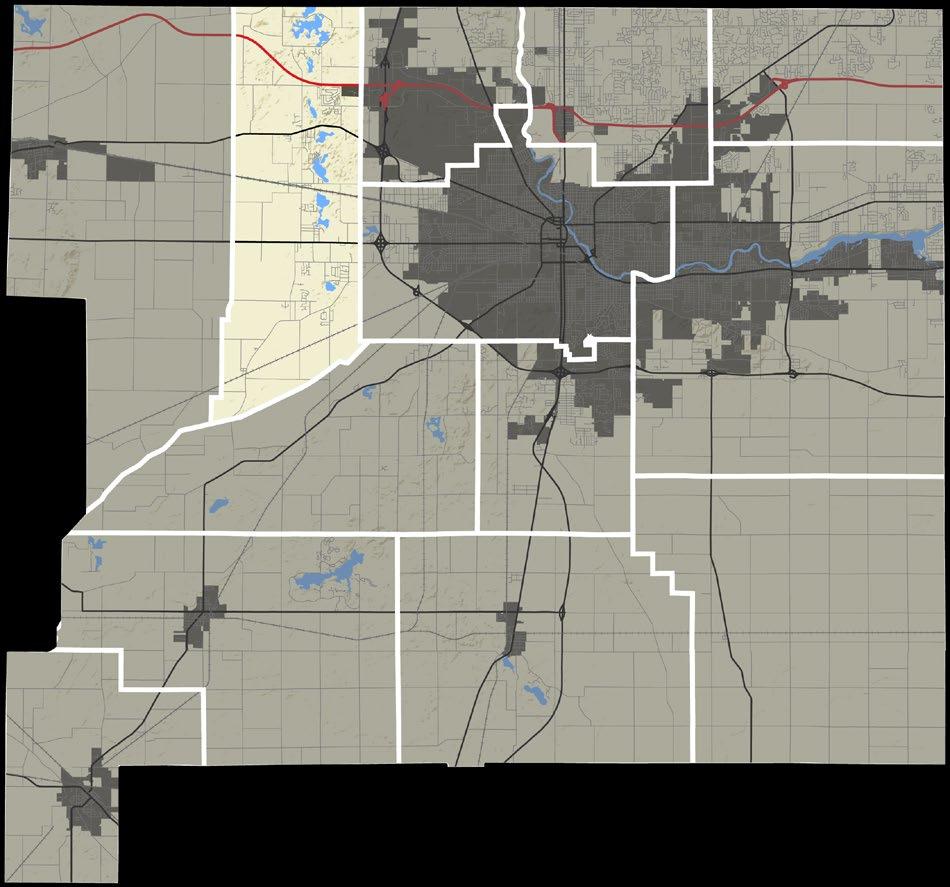
Centre Township is transected by several major thoroughfares, including US Highway 20, US Highway 31, and State Road 931. The intersection of US 20 and US 31 is located within the limits of the City of South Bend and provides excellent access for a variety of heavy commercial uses, ranging from hotels, restaurants, automobile-related uses, and more. In the event that development pressure pushes growth southward, an urban growth boundary should be given consideration. An overlay district could be implemented along the US 31 corridor to ensure compatible uses and a consistent character.
South of the US 20 Highway, there are a number of established residential neighborhoods, in both the City and County. Opportunities for residential infill exist at various densities, particularly in those areas adjacent to the City and with access to utilities. The area between SR 931 and US 31 is in transition, as many parcels were reconstructed as part of the US 31 construction and are no longer viable for agricultural uses. The south and southeastern portions of the township are and will continue to be shown as General Agricultural.
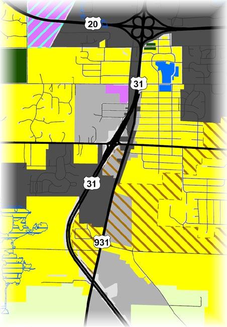
EXISTING LAND USE MAP LEGEND* FUTURE LAND USE MAP LEGEND
Single-Residential
Other significant plans for this area:
• South Bend
Comprehensive (Comp.) Plan
• County Parks
Master Plan
• MACOG Active
Transportation Plan
Special Development Considerations Overlays
Transitional Floodplain
Environmentally Sensitive Area
Infill and Redevelopment
Business
Technology and Research Park
*Existing land use classifications, and their color code on the map, do not translate directly into future land uses
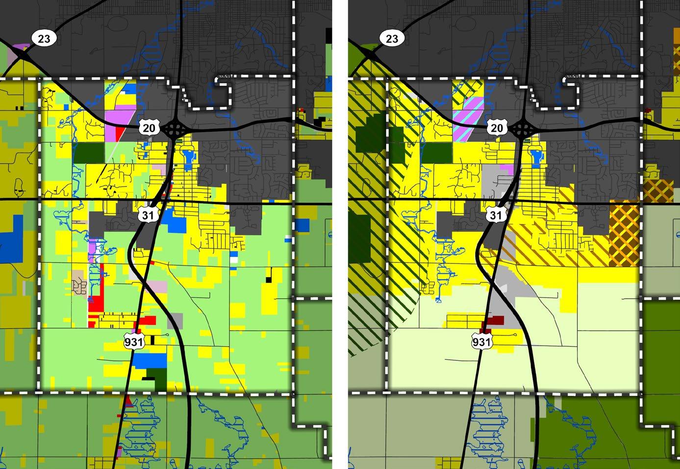
Clay Township is home to the University of Notre Dame, St. Mary’s College, and Holy Cross College. These higher learning institutions own a significant portion of the land surrounding the Town of Roseland. Students and faculty, and the workforce in South Bend, are driving demand for high-density residential, office/ flex space, and restaurants. This area is ideal for compact mixed-use neighborhoods, which support diverse housing options for County residents and the student population.
State Road 933 is a key gateway for the County, the Town of Roseland, Notre Dame University, and the City of South Bend. The area east of SR 933 is planned for Mixed Use, introducing residential density with townhomes and mixed unit buildings with upper-story apartment/ condo units. First floor commercial uses may include office-flex uses, restaurants and cafes, retail, and convenience markets. Stand-alone hotels and restaurants should emphasize pedestrian connectivity, and human-scaled design. Parking areas should be shared.
Properties north of Roseland along SR 933 will create a Light Commercial and General Commercial corridor. This corridor should prioritize infill and redevelopment. Development along 933 should have controlled access. Synchronized traffic signals will improve the flow of traffic, mitigate congestion, and improve overall safety.
The LaSalle Trail along SR 933 fosters local and regional connections for pedestrians and cyclists. This area should consider high-quality
development standards, including a zoning overlay district. Standards should include site design, building materials and architectural standards, landscaping, and sign standards.
Remaining developable areas are recommended for residential uses, with increased density in areas with access to municipal utilities. Existing single-family housing and multi-family developments should expect residential infill and redevelopment as the housing stock ages.
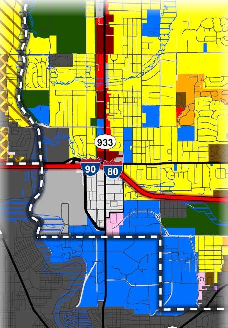
EXISTING LAND USE
MAP LEGEND*
FUTURE LAND USE MAP LEGEND
Agricultural General Agriculture
Outdoor Recreation
Intensive Agriculture
Single-Residential Parks and Conservation
Multi-Residential
Mobile Home Park
Institutional
Commercial
Industrial (Decommissioned)
Light Industrial
Heavy Industrial
Transportation or Utilities
Other Vacant
Floodplain
Other significant plans for this area:
• Roseland Comp. Plan
• South Bend Comp. Plan
• Mishawaka Comp. Plan
• County Parks
Master Plan
• SR 933 Corridor Plan
• Morningside
Neighborhood Plan
Low-Density
Residential
Medium-Density
Residential
High-Density
Residential
Mixed-Density
Residential
Institutional
Light Commercial
General Commercial
Mixed Use
Light Industrial
Heavy Industrial
Transitional Floodplain
Special Development Considerations Overlays
Environmentally Sensitive Area
Infill and Redevelopment
Business Technology and Research Park
*Existing land use classifications, and their color code on the map, do not translate directly into future land uses
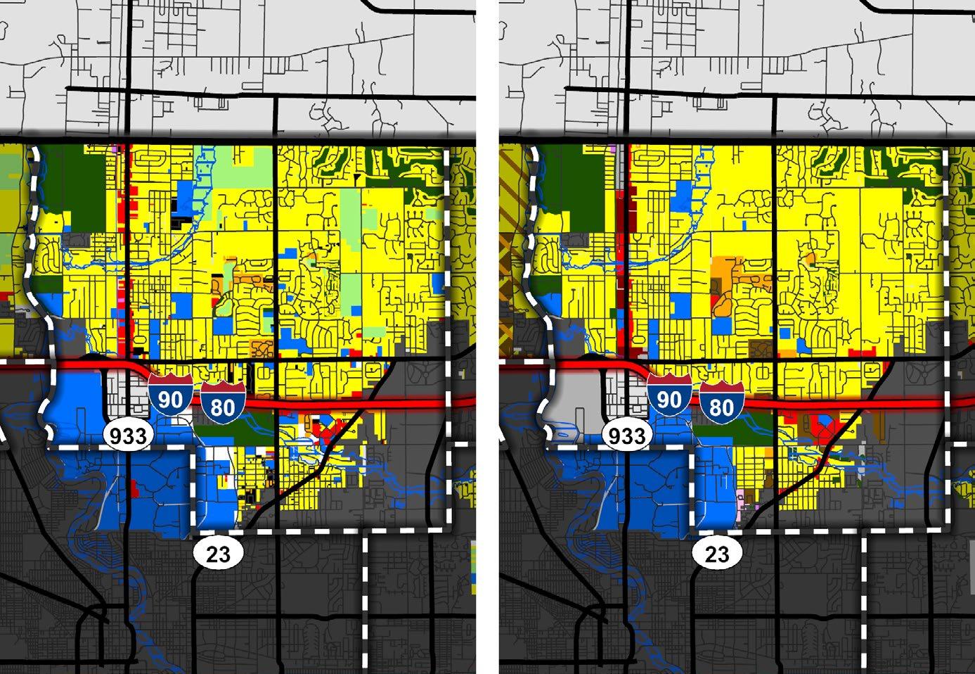
Bordering the Michigan state line, German Township is located to the northwest of the City of South Bend. The northern portion of the township is predominately low-density residential. Mixed-density, (including a combination of low, medium, and high density), infill residential development, with connections to public sewer and water, should be prioritized in these areas. Mixed density areas should be master planned in conjunction with the City of South Bend, considering neighborhood commercial and business services uses where appropriate.
Detailed Map: St. Joseph River and Portage Avenue Corridors Agricultural
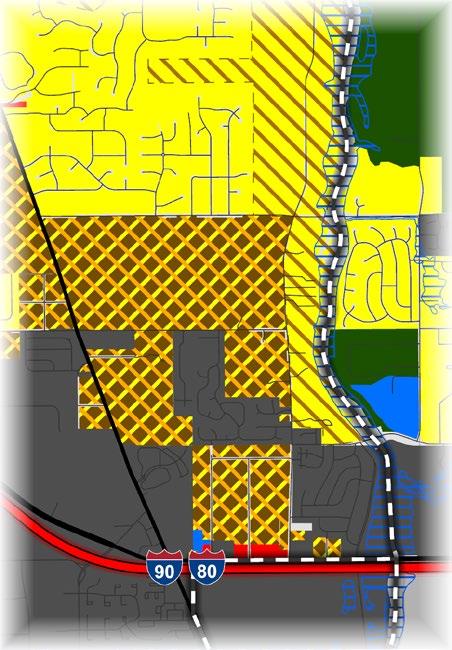
Opportunities for business and industrial development exist along the east side of Olive Road. This broader area should capitalize on its proximity to the South Bend International Airport for international, national, and regional trade, and the potential for higher-paying jobs. As the airport authority continues to acquire property along US 20/Lincolnway Highway, the Transitional land use category contemplates multiple scenarios. Specific land uses should be defined in the future. Other significant plans for this area:
*Existing land use classifications, and their color code on the map, do not translate directly into future land uses
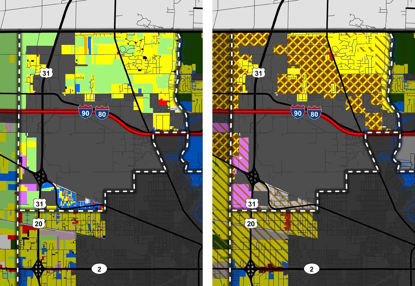
Greene Township is located southwest of the City of South Bend. The northeast section of the township is mostly low-density residential, with environmentally sensitive and conservation areas. A mix of established commercial, business, and light industrial uses can be found along State Road 23 from Ireland Road to Kern Road, while the area south of State Road 23 consists of more intense industrial uses. Additionally, a concentration of development can be found along Mayflower Road, south from the intersection of State Road 23. This area is shown as Transitional in the Future Land Use Map.
Existing farmland should be retained for longterm agricultural use, especially along the Kankakee River and in the floodplain areas. Residential Development should be limited in areas designated for agricultural use and in areas shown as environmentally sensitive.
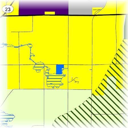
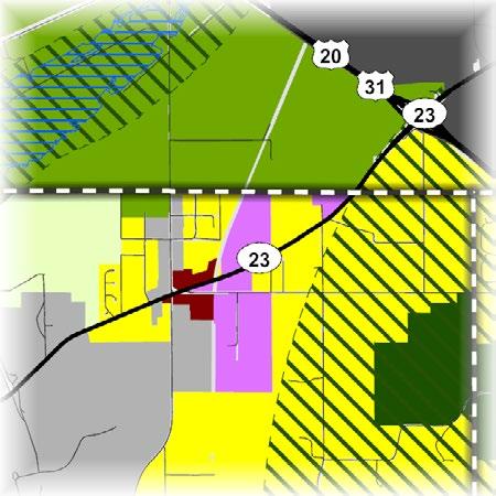
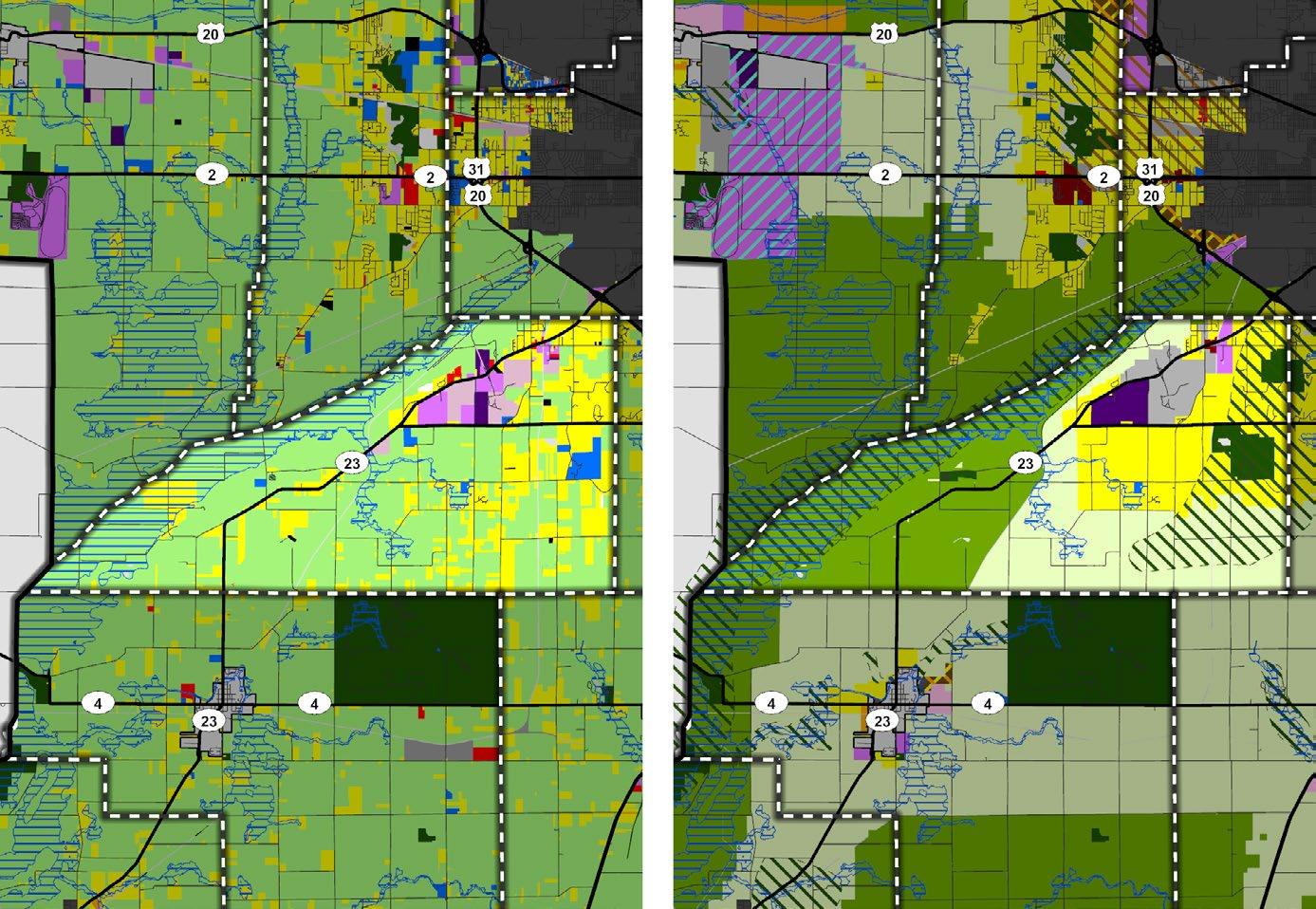
Harris Township is home to Granger, an unincorporated community of approximately 30,337 residents. Granger consists of predominately low-density residential uses, with higher density residential uses where utilities are available. As housing needs and demands continue to grow, it is imperative to plan for the longevity of septic and well infrastructure to help facilitate further residential development given the challenges presented by the lack of availability of municipal water and sewer services.
SR 23 serves as a commercial corridor and employment center, serving the Granger community and surrounding area. This corridor features a range of uses and development intensities, which is reflected in the Future Land Use Map. Light commercial uses are shown where SR 23 leaves the City of Mishawaka limits. More intense commercial uses are shown near the intersection of SR 23 and Fir Road, as well as SR 23 and Bittersweet Road, the latter serving as an economic center for the community. A number of transitional areas are shown along SR 23 to the west and east of the commercial center of Granger.
Reflecting the recommendations in the Capital Avenue Land Use Plan, property south of the I-80/I-90 Toll Road is shown as Business Technology and Research Park. Areas adjacent or in close proximity to the City of Mishawaka limits along Capital Avenue are also shown as Transitional.
A parcel containing approximately 115 acres on
Anderson Road is shown as future parkland. This undeveloped parcel is an ideal location for a new park. A sizeable portion of this parcel is in the environmentally sensitive overlay and partially in the floodplain. A park at this location would protect the existing landscape and expand the area’s recreational uses for the surrounding residents.
EXISTING LAND USE MAP LEGEND* FUTURE LAND USE MAP LEGEND
Agricultural General Agriculture
Outdoor Recreation
Intensive Agriculture
Single-Residential Parks and Conservation
Multi-Residential
Residential Mobile Home Park
Institutional
Commercial
Industrial (Decommissioned)
Light Industrial
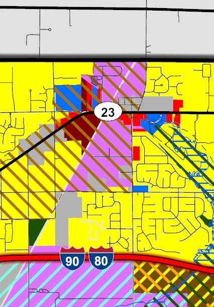
Heavy Industrial
Transportation or Utilities
Other
Vacant
Floodplain
Other significant plans for this area:
• County Connections
• MACOG Active Transportation Plan
• County Parks Master Plan
• Capital Avenue Corridor Plan (2003)
• Juday Creek Watershed Management Plan
Low-Density
Medium-Density
Residential
High-Density
Residential
Mixed-Density
Residential
Institutional
Light Commercial
General Commercial
Mixed Use
Light Industrial
Heavy Industrial Transitional Floodplain
Special Development Considerations Overlays
Environmentally Sensitive Area
Infill and Redevelopment
Business Technology and Research Park
*Existing land use classifications, and their color code on the map, do not translate directly into future land uses
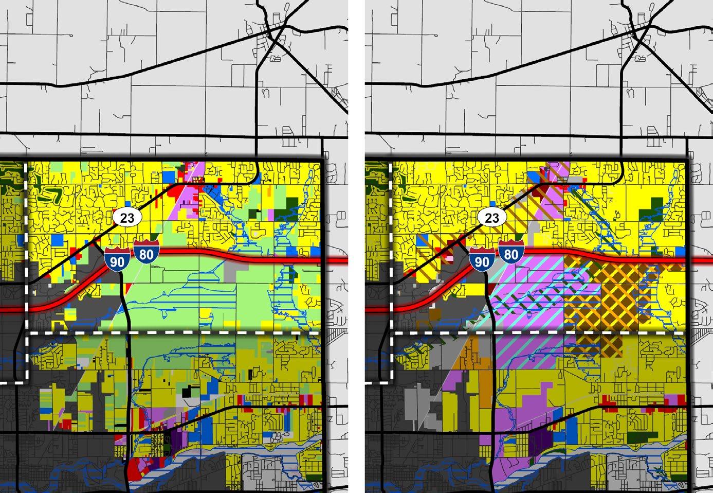
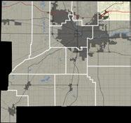
The Town of North Liberty is located centrally in the township, at the intersection of State Road 4 and State Road 23. The land uses shown in close proximity to the Town are taken directly from their 2022 Comprehensive Plan.
Potato Creek State Park is in the northeast corner of the township. Protecting Potato Creek State Park is highly important. The park is a regional destination for outdoor recreation, camping, and plant and wildlife observation. Land use decisions adjacent to the park should carefully consider environmental impacts. The surrounding area is general agricultural, creating a buffer of low-intensity uses.
The mapped Intensive Agriculture areas south of Riley Road and east of Walnut Road contain prime farmland with high-quality soils. These areas should be preserved for long-term agricultural use, and residential homesteads should be strictly limited.
The corridor east of SR 4 and SR 23 is Transitional. This area is primarily singlefamily residential, but is experiencing increased demand for higher residential density, and commercial and industrial uses. New commercial uses should fit the visual and architectural patterns established by the existing residential character. The Michiana Council of Governments (MACOG) has a planned a regional shared use path, the 4th District of the Wabash Railroad Trail, beginning at North Liberty and terminating at Lakeville in Union Township. Connections to this trail will be vital for adjoining developments.
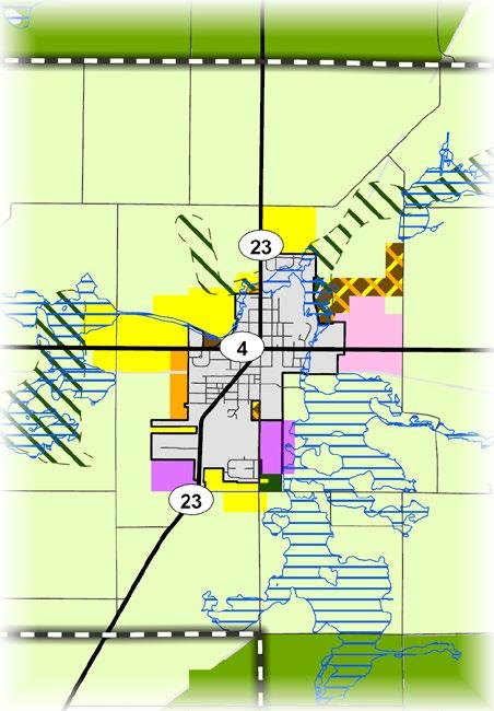
Other significant plans for this area: • North Liberty Comp. Plan • MACOG Active
Technology and Research Park
*Existing land use classifications, and their color code on the map, do not translate directly into future land uses
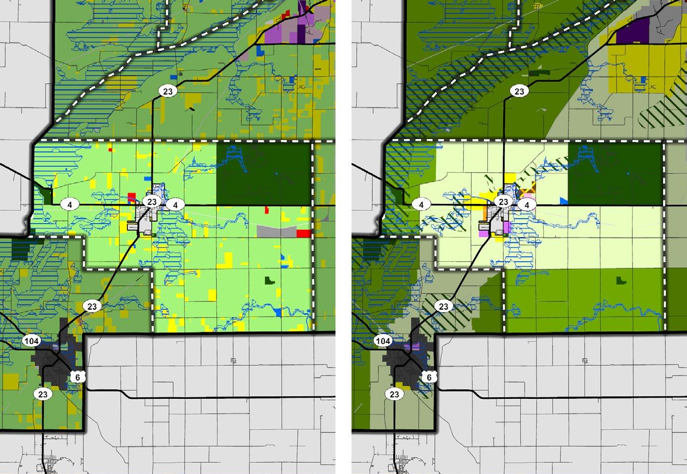
Located at the intersection of US Highway 6 and State Road 23, the Town of Walkerton is the residential and economic hub for Lincoln Township. Multiple wetlands are present to the east and north of the Town limits. These wetlands and the surrounding forests should be protected, as they provide habitats for local plants and wildlife, and reduce flooding. New development should be limited outside the existing town limits or identified priority areas for the Town of Walkerton.
EXISTING LAND USE MAP LEGEND*
FUTURE LAND USE MAP LEGEND
Agricultural General Agriculture
Outdoor Recreation
Intensive Agriculture
Single-Residential Parks and Conservation
Multi-Residential
Mobile Home Park
Institutional
Commercial
Industrial (Decommissioned)
Light Industrial
Heavy Industrial
Transportation or Utilities
Other
Vacant
Floodplain
Other significant plans for this area:
• Walkerton Comp. Plan
• MACOG Active
Transportation Plan
• Kankakee River
Watershed
Restoration Action Strategy
Low-Density
Residential
Medium-Density
Residential
High-Density
Residential
Mixed-Density
Residential
Institutional
Light Commercial
General Commercial
Mixed Use
Light Industrial
Heavy Industrial
Transitional Floodplain
Special Development Considerations Overlays
Environmentally Sensitive Area
Infill and Redevelopment
Business
Technology and Research Park
*Existing land use classifications, and their color code on the map, do not translate directly into future land uses
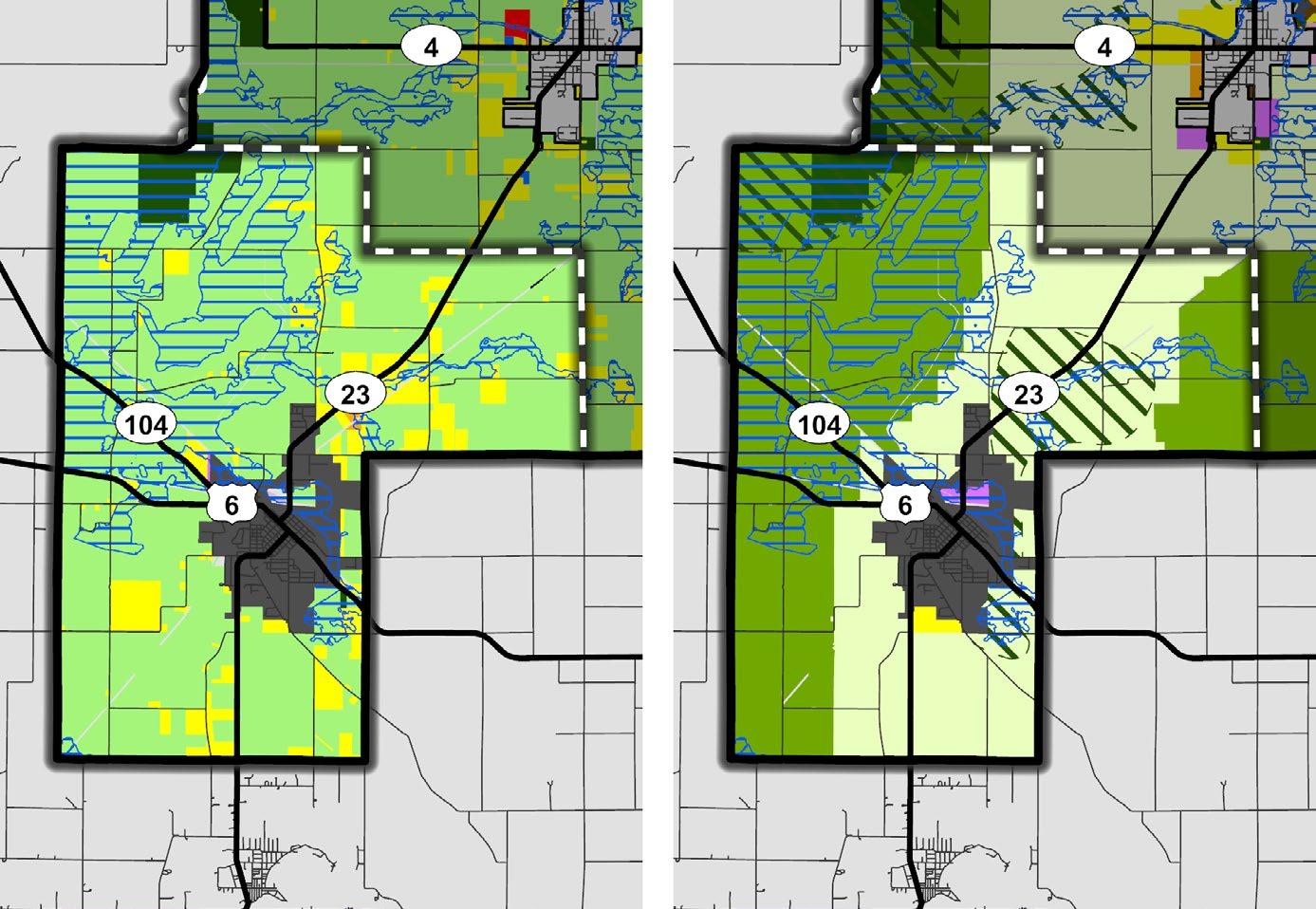
Madison Township is characterized by sprawling farm fields, agricultural structures, and rural homesteads. The two predominate land uses for Madison Township are Intensive Agriculture and General Agriculture. Established agricultural uses include grain storage, seed production, and raising poultry.
The unincorporated community of Wyatt is the only major settlement in Madison Township; it is home to various businesses that serve township residents. State Road 331 serves as the major road through the township. Development should be strictly limited, as existing public services and infrastructure are at capacity. New residential development should be limited to farmsteads and minor subdivisions that separate existing residential structures from larger tracts of agricultural land, provided adequate street access and public safety services are present.
Several existing religious institutions are within planned Intensive Agriculture areas. These institutions are generally compatible with agricultural uses. These properties are not required to seek land use changes. The Heavy Industrial/Manufacturing near the southwest portion of the township is an existing landfill. This area is also within a tax increment financing (TIF) district.
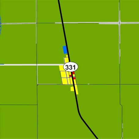
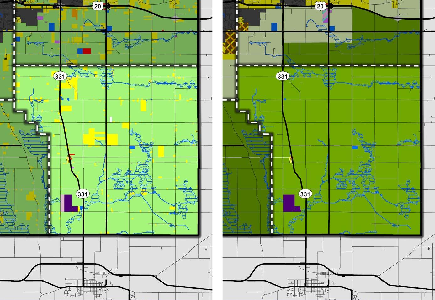
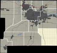
Three major roads run east to west across Olive Township—the Indiana Toll Road/ Interstate I-80/I-90, US Highway 20, and State Road 2. Though the Indiana Toll Road runs across northern Olive Township, there is no on/ off map providing access from the township. In the future, if a new interchange were constructed at any of the major cross streets— Timothy Road, Spruce Road, or Tamarack Road– it could provide opportunities for Mixed Use development.
The Historic Town of New Carlisle can be found in the western portion of the township, along US Highway 20, north of State Road 2. The Town of New Carlisle’s 2040 Comprehensive Plan defines land uses proposed within and around the town’s boundaries. As development pressure continues, intergovernmental coordination will be critical to ensure that land use decisions reflect the future Land Use Map.
The Business Technology and Research Park Overlay includes the Indiana Enterprise Center (IEC), limited to the Core Development Area. These uses should maintain a separation buffer from the existing and planned residential uses south of the Town of New Carlisle. Environmental impacts on the Niespodziany Ditch canal and Hooten Ditch should be
considered as the planned Industrial and Manufacturing uses found in the IEC expand.
Intensive Agriculture uses are planned in both southern and northern regions of the township. Long-term agricultural use will conserve the 100-year floodplains and retain prime farmland.
Suburban Gardens is an unincorporated community located at the intersection of Tulip Road and Edison Road and should remain sufficiently buffered from the encroaching industrial uses found to the west.
Detailed Map: New Carlisle
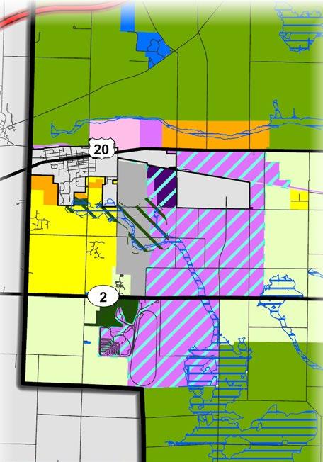
EXISTING LAND USE MAP LEGEND* FUTURE LAND USE MAP LEGEND
Agricultural General Agriculture
Outdoor Recreation Intensive Agriculture
Single-Residential Parks and Conservation
Multi-Residential
Residential Mobile Home Park
Institutional
Commercial
Industrial (Decommissioned)
Light Industrial
Heavy Industrial
Transportation or Utilities
Other
Vacant
Floodplain
Other significant plans for this area:
• New Carlisle Comp. Plan
• IEC Area Management Plan
• MACOG 2045 Transportation Plan
• MACOG Active Transportation Plan
• New Carlisle Station Feasibility Study
Low-Density
Medium-Density
Residential
High-Density
Residential
Mixed-Density
Residential
Institutional
Light Commercial
General Commercial
Mixed Use
Light Industrial
Heavy Industrial
Transitional Floodplain
Special Development Considerations Overlays
Environmentally Sensitive Area
Infill and Redevelopment
Business Technology and Research Park
*Existing land use classifications, and their color code on the map, do not translate directly into future land uses
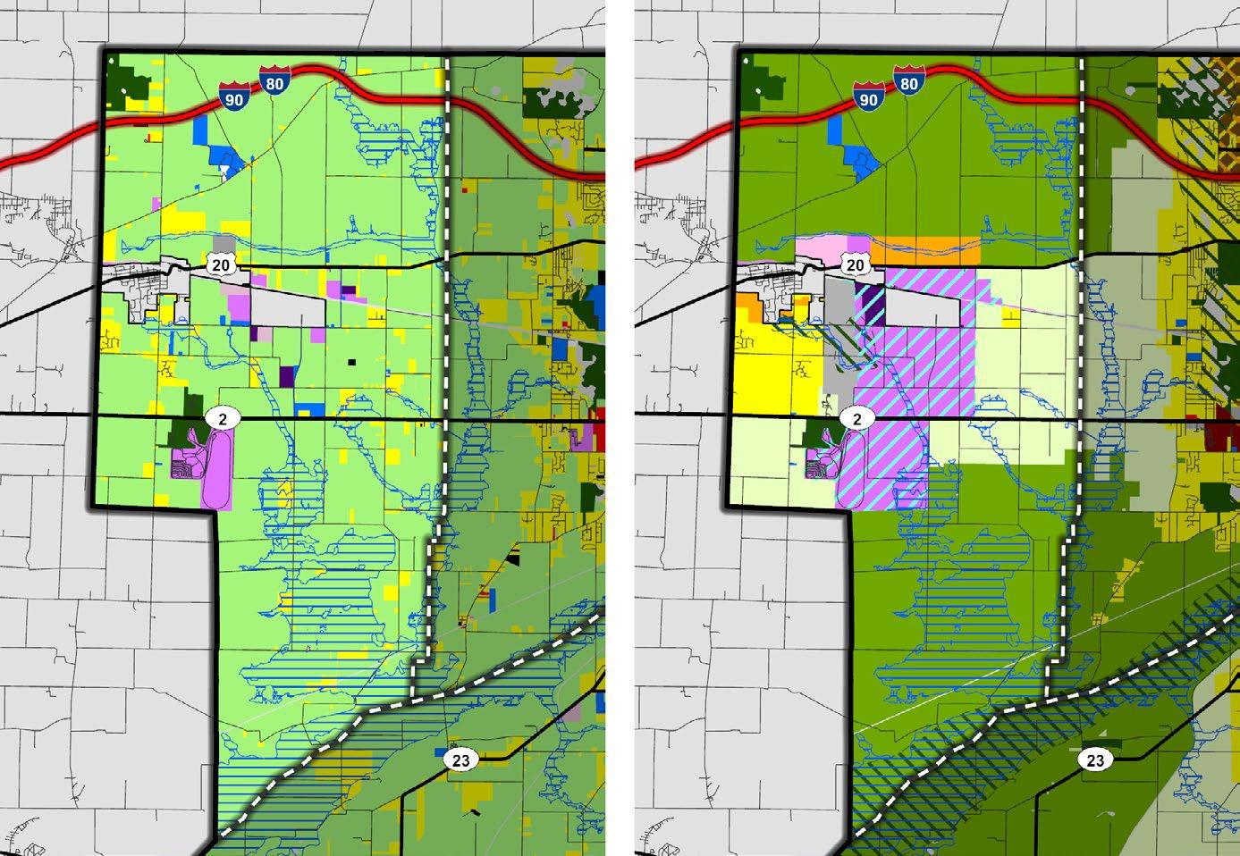
Located in eastern St. Joseph County, Penn Township encompasses the majority of the City of Mishawaka and the Town of Osceola. As shown in the Economic Development Priority Area Map, two priority areas are identified in Penn Township—Capital Avenue and Osceola.
The Capital Avenue Plan, jointly completed by the City of Mishawaka and St. Joseph County, provides recommendations and a land use plan for this priority area. Future land use within this priority area reflects the Capital Avenue Plan, showing portions as Business Technology and Research Park, General Commercial, Transitional, and other land use types.
The priority area shown around the Town of Osceola presents opportunities for varying uses and development types. Ferrettie/Baugo
Detailed Map: Osceola
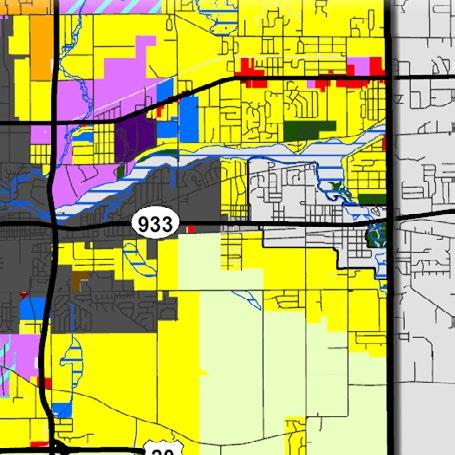
Creek County Park is a gateway into St. Joseph County and the Town of Osceola along State Road 933/Lincoln Way. The revitalization of the SR 933 corridor with commercial uses and transitional areas going west to the City of Mishawaka presents opportunities for development. The area south of Osceola is identified for low-density residential growth.
Detailed Map: Capital Avenue
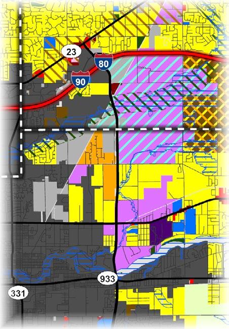
EXISTING LAND USE MAP LEGEND* FUTURE LAND USE MAP LEGEND
Agricultural
General Agriculture
Outdoor Recreation Intensive Agriculture
Single-Residential Parks and Conservation
Multi-Residential
Residential Mobile Home Park
Institutional
Commercial
Industrial (Decommissioned)
Light Industrial
Heavy Industrial
Low-Density
Medium-Density
Residential
High-Density
Residential
Mixed-Density
Residential
Institutional
Light Commercial
General Commercial Transportation or Utilities
Other Vacant Floodplain
Other significant plans for this area:
• Mishawaka Comp. Plan
• Capital Avenue Corridor Plan (2003)
• Fir Road Land Use Study
• County Connections
• MACOG Active Transportation Plan
• County Parks Master Plan
Mixed Use
Light Industrial
Heavy Industrial
Transitional Floodplain
Special Development Considerations Overlays
Environmentally Sensitive Area
Infill and Redevelopment
Business Technology and Research Park
*Existing land use classifications, and their color code on the map, do not translate directly into future land uses
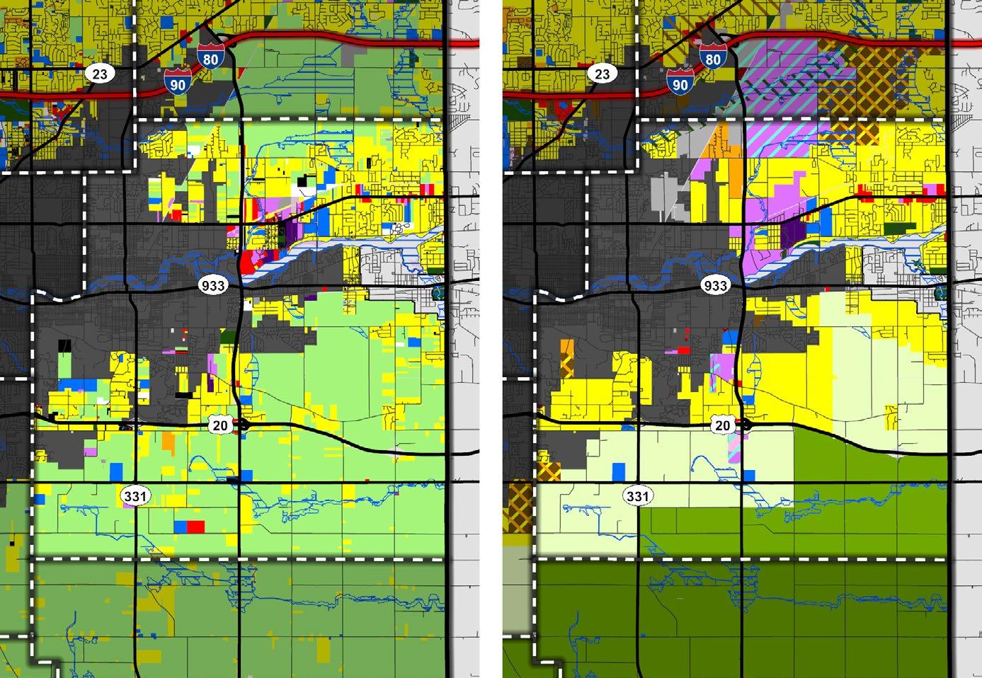
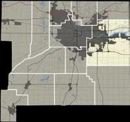
Portage Township contains a mix of commercial services and light industrial uses west of the City of South Bend. A portion of the University of Notre Dame, St. Mary’s College, and Holy Cross College are located in the northeastern corner of the Township.
The area west of U.S. 31 features automobilerelated uses, as well as light industrial uses. The future land use map in this area recommends General Commercial and lighter Industrial uses.
Residential land use patterns will continue at the northwestern portion of the township. Extending water and sewer infrastructure will provide opportunities for medium to highdensity residential development.
Portage Township includes the unincorporated community of Ardmore; properties along Ardmore Trail near the intersection with Mayflower Road act as a local business hub, which has potential for “main street”-style commercial development.
Detailed Map: Ardmore
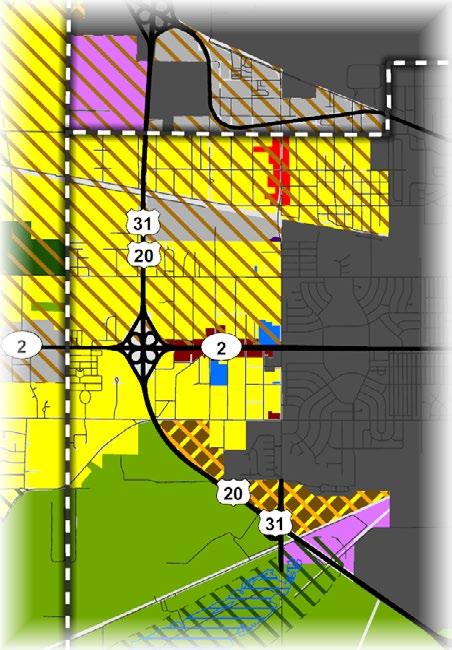
EXISTING LAND USE MAP LEGEND* FUTURE LAND USE MAP LEGEND
Single-Residential
Light Industrial
Other significant plans for this area: • South Bend Comp. Plan • MACOG Active
Action Strategy
• Rail Opportunity Plan • TRANSPO
Connect Plan
Business
Technology and Research Park
*Existing land use classifications, and their color code on the map, do not translate directly into future land uses
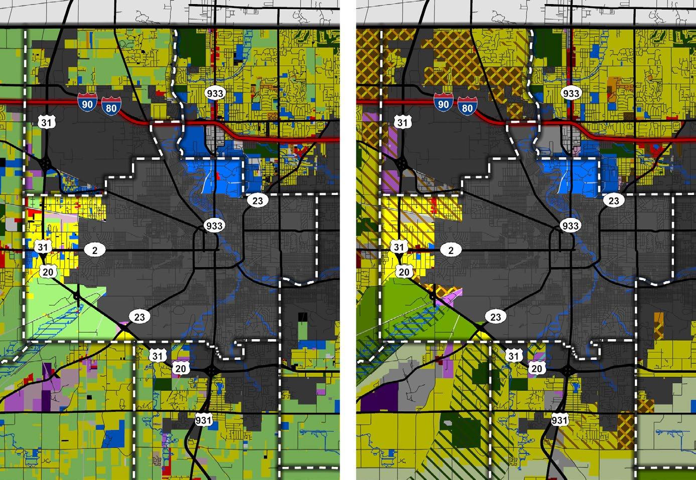

The Town of Lakeville is the population center and economic hub of Union Township. The Town’s Comprehensive Plan defines land uses within the town limits and in the identified priority areas. State Road 4 is a major eastwest connector between SR 931 and US 31, with transitional, commercial, and light industrial shown in the Future Land Use Map. Residential uses are shown to the south of the Town along Lake Trail.
Long-term production agriculture is recommended for the southwest and eastern portion of Union Township. General Agriculture is proposed as a buffer between the production agriculture areas and the developed areas near Lakeville. It is important to consider development impacts on Pleasant, Fites, and Riddles Lakes, as this area is within the Environmentally Sensitive Overlay.
Detailed Map: Lakeville
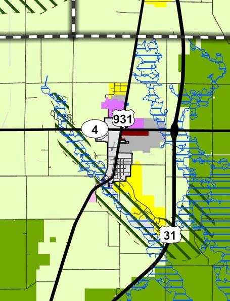
Detailed Map: State Road 4 Corridor - North Liberty to Lakeville
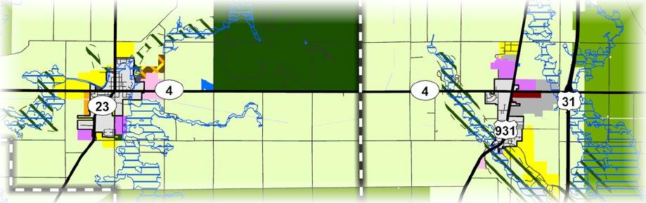
LAND USE MAP LEGEND*
LAND USE MAP LEGEND
Other significant plans for this area:
Lakeville Comp. Plan
Environmentally Sensitive Area Infill and Redevelopment Business Technology and Research Park
*Existing land use classifications, and their color code on the map, do not translate directly into future land uses
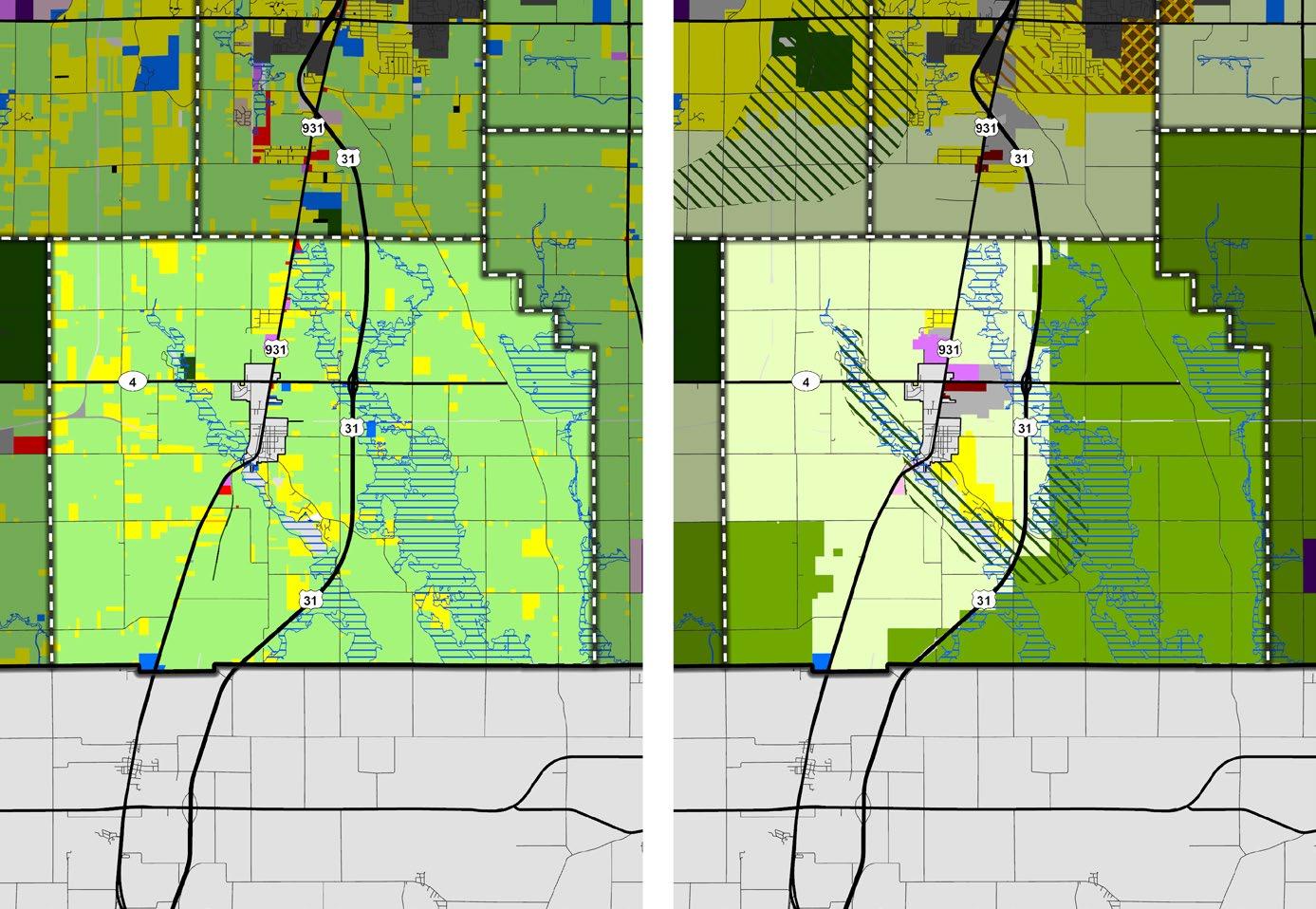
Located to the west of the City of South Bend, Warren Township is home to the Chain O’ Lakes—a regional recreation and tourist destination. Due to their ecological value, these lakes and wetlands are shown within the environmentally sensitive overlay. These areas should be buffered from higher intensity uses, preferably with parks and conservation uses containing natural features to protect the water quality. There is potential for desirable new and infill lakeside residential development, as proximity to parks and conservation areas like Chamberlain Lakes Nature Preserve are also attractive for residential growth. Connection to water and sewer will be critical for the development of this area.
The unincorporated communities of Chain O’ Lakes, Lydick, and Westfield are located along Quince Road. These central gathering places have potential for mixed use and increased development density. The intersection at Quince Road and Edison Road could serve as a local “main street” area for Lydick. State Road 2 acts as a commercial and service retail corridor. SR 2 should be developed as a key gateway into South Bend has and has been labeled transitional on the map.
The area along US 20 presents a prime opportunity for high-density, trail-oriented development. Long-term agricultural uses are planned for Harrison Road and the Crumstown Highway to the Kankakee River. Urban and suburban sprawl should be limited—especially west of Quince Road and south of Crumstown.
EXISTING LAND USE
MAP LEGEND*
Detailed Map: Chain O’ Lakes Communities
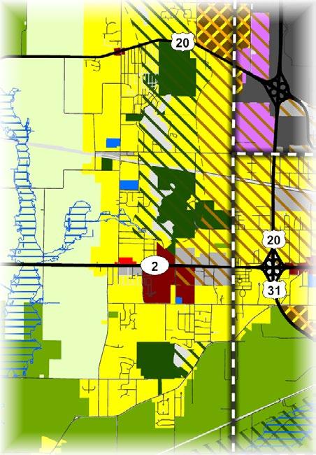
FUTURE LAND USE MAP LEGEND
Agricultural General Agriculture
Outdoor Recreation
Intensive Agriculture
Single-Residential Parks and Conservation
Multi-Residential
Residential Mobile Home Park
Institutional
Commercial
Industrial (Decommissioned)
Light Industrial
Heavy Industrial
Low-Density
Medium-Density
Residential
High-Density
Residential
Mixed-Density
Residential
Institutional
Light Commercial
General Commercial Transportation or Utilities
Other Vacant Floodplain
Other significant plans for this area:
• Kankakee River
Watershed
Restoration
Action Strategy
• MACOG Active Transportation Plan
• MACOG 2045
Transportation Plan
• TRANSPO
Connect Plan
Mixed Use
Light Industrial
Heavy Industrial Transitional Floodplain
Special Development Considerations Overlays
Environmentally Sensitive Area
Infill and Redevelopment
Business Technology and Research Park
*Existing land use classifications, and their color code on the map, do not translate directly into future land uses
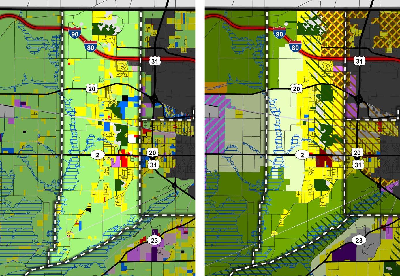

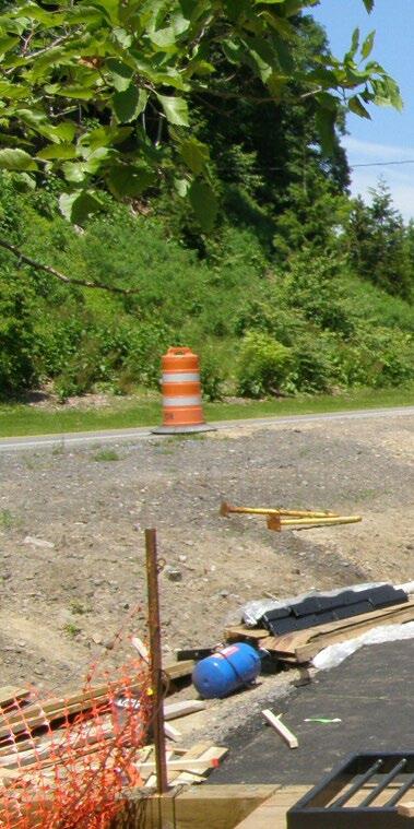
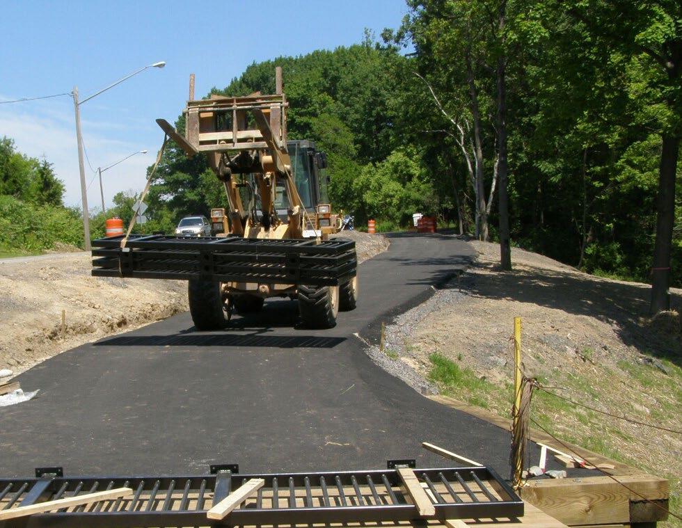

The Implementation section provides direction to operationalize Plan SJC. Implementation includes using the Plan as a guide for zoning decisions, prioritizing projects, progress reporting, and more.
Implementation translates Plan SJC’s vision and goals into meaningful change within the County. The primary initiatives section identifies priority initiatives identified during the planning process. For each goal and associated recommendations, the implementation matrix identifies the timing, importance, level of difficulty, key partners, and relationship to other pillars. While the goals and recommendations are organized under individual Pillars, they are all interconnected to one another. The implementation of this Plan relies on treating each goal and recommendation as a piece of a whole, in order to ultimately achieve the County’s Vision.
Extensive discussion occurred with the staff, Task Force, and Elected Officials to ensure the Plan reflects the desired land use pattern for the County. Based on input from the working
groups, the Plan identifies recommendations for the priority areas and the entire County. The 20-year lifespan of this Plan allows adequate time to implement the goals and recommendations in this Plan to achieve the desired land use patterns. It will take that 20year lifespan to continuously implement tools such as zoning reform, development incentives, infrastructure improvements, and more. A long lifespan enables the County sufficient time to plan for capital improvement strategies and identify funding sources to ultimately achieve the County’s Plan SJC Vision.
While the plan is designed to guide the next 20 years of decision-making, it should be treated as a living document that is reviewed annually and periodically updated. Updates are necessary to remain relevant as a guiding document. It is imperative that staff track the Plan’s progress and prepare an annual report to the appointed and elected bodies.
Flexible Approach
Plan SJC does not make the decision for the Area Plan Commission or County Council. Instead, the Plan serves as a guide and resource for decision-making by providing valuable data and establishing the County’s collective vision for how, where, and how much development should occur over time. In making decisions, staff, elected officials, and appointed officials should reflect on the County’s values, and make decisions that align with the intent and spirit of the Plan.
The Plan should inform day-to-day decisions concerning specific petitions that staff review. Staff should use the future land use map, goals, and recommendations to help determine how best to implement Plan SJC in both short-term and long-term planning. The recommendations and implementation strategies in this Plan should not be the only guidance document for the County to make decisions. The Plan cannot account for unknown future development projects that may arise over the next five to
20 years. The Plan is intentionally written with a vision and broad goals to give the elected and appointed officials the latitude to make the best decisions in approving or denying future development projects based on changing conditions and values of St. Joseph County.
Although the County intends to administer this Plan with available financial resources, funds may be needed to carry out some recommendations. Additionally, the County should seek funding from federal, state, or local grants, loans or other resources.
Several partners came together to provide input during this process. The implementation of this Plan requires on-going relationships between stakeholders, property owners, business owners, community leaders, the County, and State. Strong partnerships are needed to foster good communication, provide other alliances in implementing some recommendations, and explore funding opportunities.
This Plan was created to represent the community’s vision for the community’s future, and it is unlikely that this Plan has accounted for all types of development that may arise over the next 20 years. In addition to referencing the Plan, County staff, the APC, and County Council must use their best judgment and experience to determine if a project would be beneficial to the community.
The County is responsible for implementing the recommendations, reviewing the Plan, updating the Plan, and accomplishing the vision and goals in this Plan. As the needs of the community change, the Plan should be reviewed and updated regularly to align with those changing needs. It is recommended that this Plan is reviewed on an annual basis to ensure that the vision, goals, and recommendations are still applicable.
Planning is a dynamic process that responds as conditions change. Plan SJC will need to be revised periodically to ensure it stays consistent and relevant.
Minor updates, such as revising or adding goals, or making minor updates to the future land use map, should occur every three to five years or as necessary. These may include revisions to one or more sections of the plan due to changes within the market, infrastructure, a specific issue/policy change, or change in state law. A minor update may be as small as correcting text or including changes to the future land use map.
Major rewrites should occur every 10 – 20 years or as necessary. This process should include a thorough review and evaluation of the vision and development policies contained within the Plan. Policies that have been achieved or are not relevant should be changed or removed from the Plan. New policies should be developed, if necessary, to accommodate any changes in conditions and ensure the
Plan is still effective. A plan rewrite should also provide opportunities for public involvement.
An annual review of the plan, as discussed under Primary Initiatives later in this chapter, aids in plan implementation. During the annual review process, it’s important to note areas of success to help build support for future planning activities. Identifying less successful components may suggest a need for an update or rewrite of a chapter.
Plan SJC serves as St. Joseph County’s guide for land use and development policies to promote orderly growth and development within County limits. The long-range goals, objectives, and strategies, along with the supporting maps, are intended to guide development decisions towards the community’s collective vision of the future.
County staff, the Area Plan Commission, and County Council should interpret the goals and objectives as long-term and deliberately broad. County officials cannot anticipate all circumstances. However, the spirit of this Plan should be adhered to in order to ensure that the community’s values are maintained. Members of the APC and County Council should interpret the Plan recommendations by saying, “given our long-term goals and changing community conditions, these are the projects and programs that we want to complete in the short-term and long-term, and this is how we plan to accomplish them.”
Interpreting the Plan in this way will enable the members of both the APC and County
Council to justify their approval or denial, of any proposed development or redevelopment in St. Joseph County. When a new annexation, rezoning, or subdivision request is filed with the County, staff should review and evaluate the application against Plan SJC and the County’s other ordinances. Staff should provide a staff report with a formal recommendation that includes an evaluation of the development and the degree to which the proposed project conforms to the Plan’s goals, objectives, strategies, and future land use map. If the APC recommends approval to the County Council for numerous rezoning requests inconsistent with the future land use map, the Plan should be updated, as this is an indication that the County’s conditions, issues, or priorities are changing.
Plan SJC does not contain the actual decisions that should be made; however, it serves as a reference and provides guidance of the community’s collective vision for the future growth and development of the area, and should be interpreted as such.
Zoning and Development Review
Zoning protects the rights of individual property owners while promoting the general welfare of the community. The purpose of zoning is to locate specific land uses where they are most appropriate. In determining the most appropriate zoning designation, the County must consider such things as public utilities, road access, and the existing or established development pattern of the area in which development is proposed. From a
policy standpoint, the Plan provides guidance specifically for changes in land use through rezonings or future land use amendments. The County Council and APC should consider the relevant section(s) of the Plan when reviewing applications and desired changes.
If the application is supported by the relevant sections of the Plan, then the rezoning/ amendment should be given favorable consideration. If the application is not supported by the relevant sections of the Plan, then the County Council and APC should either deny the application or approve the application with specific written commitments that would make it consistent with the intent of the Plan.
In general, the APC and County Council should support a rezone under the following circumstances:
• When the requested rezoning is consistent with long range land use plans adopted by the County Council.
• When there was an error or oversight in the original zoning of the property.
• When changes have occurred to conditions in the vicinity of the property which prevent the reasonable use of the property as currently zoned.
• When the requested rezoning benefits the community at large. If the APC recommends approval to the County Council for numerous rezones that are substantially inconsistent with the future land use map included in this Plan, then the Plan should be amended. This is an indication that the area’s conditions, issues, or priorities have changed.
Considering the needs of the County, current conditions data, and ideas discussed throughout the planning process, several initiatives have been identified as priority projects. These primary initiatives and their associated action steps should be used as the first set of work plan items to be prioritized and completed.
Plan SJC is a statement of policy—not a regulatory document. The most common tool for implementing the plan is through the County’s zoning and subdivision ordinances, as these ordinances regulate land use and development. The zoning and subdivision ordinances define the permissible uses, size, density, and character of development. Additionally, subdivision regulations help control the construction of infrastructure and utilities that will be dedicated to the County upon completion. Throughout the plan, various goals and recommendations directly reference or allude to changes in policy that could be accomplished by updating the ordinances. Prioritizing updates to the ordinances helps ensure that development and land use are in line with the vision of the plan.
The existing conditions analysis uncovered a lack of connectivity within the County and the desire for more pedestrian and bicycle facilities. While this plan contains several recommendations for sidewalks, trails, and street enhancements, the County should develop a more detailed and long-term program to identify, fund, maintain, and construct these quality-of-life projects. The Bike and Pedestrian Master Plan should provide detailed cross sections and preliminary alignment options. The Bike and Pedestrian Master Plan should be developed in coordination with the County Parks and Recreation Department and be updated every five years to stay relevant to the County’s residents and project pursuits.
Capital Improvements Plans (CIP) are documents that cover a time frame of three to five years and are updated annually. CIPs aid in plan implementation by identifying and providing the necessary funding sources for short-range infrastructure and capital improvement projects. The CIP provides guidance and planning for capital improvements throughout the County and allocates financial resources to various community needs. The CIP states the County Council’s prioritization of available financial resources for capital projects by identifying which projects should be included, when they should be constructed, and how they will be financed.
A CIP represents the County’s tentative commitment to comply with the plan unless circumstances or priorities change in the future. The commitment is more certain in the first year of the CIP and becomes increasingly more tenuous in subsequent years. Nevertheless, the CIP should be used as the County’s present plan and priority over the next three to five years. While the CIP is a planning document, it should not be an automatic authorization of the construction of projects, given the procurement process and the allocation of resources.
Prepare an Annual Report for the APC regarding the Status of Each Pillar
An annual report ensures that County staff, officials, and residents remain engaged in long-term planning processes and ensure the County’s initiatives are aligned with the goals, priorities, and regulations of the Plan. It should present new data and development trends that may necessitate an update to the Plan to keep it relevant to desired planning outcomes. Additionally, it provides an opportunity to evaluate implemented strategies and incorporate new feedback from the public and elected officials that may have evolved since the Plan’s adoption. By completing this report, the County takes a proactive and adaptive approach to planning, effectively responding to emerging trends, and ensuring that future development aligns with the community’s vision.
The following matrix provides a framework for the County to partner with organizations and implement the goals and recommendation.
Time-to-Implement Assumptions
• Short-term: 0-5 years
• Mid-term: 5-10 years
• Long-term: 10+ years
• On-going: A recommendation that should be implemented into the daily, weekly, or monthly workflow of the County.
Level of Importance
The level of importance helps the County determine how to prioritize recommendations based on the estimated level of impact to the community. It is important to note that the High importance has all the characteristics of Medium; and Medium has some of the same characteristics as Low.
High Importance recommendations should be some of the first recommendations to be started (not necessarily completed), resources allowing, as they significantly move the community vision along the path to achievement.
Medium Importance recommendations may greatly impact certain areas within, but not the entire, County. They may be highlyinterconnected with the success of other recommendations.
Low Importance recommendations are not immediately urgent and could, where possible, be delegated to a willing partner.
Level 1 has no or relatively few challenges or constraints, and in some cases may be completed entirely by partnerships.
Level 2 has relatively minor challenges or constraints such as staff availability or the availability of other organizations to collaborate.
Level 3 has moderate challenges or constraints, such as seeking a grant for funding or coordinating long-term planning efforts between multiple parties.
Level 4 has multiple and significant challenges or constraints, such as financial, but are oftentimes also the most important recommendations to achieve the community vision.
Many parties will be identified on the following pages, categorized under primary or secondary responsibilities. County boards, departments, and officials are most likely to be identified


but community organizations are included as well. State and local government entities, non-profits, private consultants, and publicprivate partnerships may also be identified. The identification of responsibilities allows the County to know who should be involved in order to complete the recommendation.
The matrix is organized by Pillar in order of appearance in Plan SJC, starting with Economic Development and ending with Utilities. Each goal and recommendation has by a unique identifier for easier reference, using the identification system below:
[Pillar Initials].[Goal #].Recommendation ‘A’]
For readers viewing the plan online or via PDF, the pillar icons below can be clicked to jump its respective section in the matrix.


RECOMMENDATION
Goal ED.1: PROMOTE THE IDENTIFIED PRIORITY AREAS AND CORRIDORS AS PRIME LOCATIONS FOR NEW INVESTMENT.
ED.1.A
ED.1.B
ED.1.C
ED.1.D
ED.1.E
Pursue “shovel ready” certification for identified key sites to expedite development.

Continue to invest resources in and develop the Capital Avenue corridor.

Continue to invest resources in and market the Indiana Enterprise Center (IEC) as a premier economic development business park.


Establish plans and nonfinancial incentives for priority development.


• Revelopment Commissions
• Utility service providers
• SB Regional Chamber
• City of Mishawaka
• Redevelopment Commissions
• MACOG
• Redevelopment Commissions
• Town of New Carlisle
• SB Regional Chamber
• SB Regional Chamber
• MACOG
• Community organizations
Identify opportunities and strategies to leverage transportation networks and utilities for economic development, including rail lines, interstates, and heavy haul routes.

• SB Regional Chamber
• MACOG
• Utility service providers
Goal ED.2: PROMOTE REINVESTMENT AND REDEVELOPMENT.
ED.2.A
Establish a program to focus on revitalization and redevelopment of critical corridors.


• Cities and Towns in the County
• Redevelopment Commissions
• MACOG
Encourage investment of infill and redevelopment or reuse of vacant, previously used, underutilized, or inefficient properties.
Target funding and other resources to address code enforcement violations, demolition, site preparation in critical areas.
Use available planning tools to address vacant, obsolete, or underutilized nonresidential buildings.
• MACOG
• Redevelopment Commissions
• Indiana Finance Authority, Brownfield Program
• Redevelopment Commissions
• Countywide Land Bank (TBD)
• Code Enforcement
• Redevelopment Commissions
• Countywide Land Bank (TBD)
Goal ED.3: FOSTER OPPORTUNITIES FOR BUSINESS EXPANSION AND ATTRACTION.
Encourage opportunities for business expansion and attraction that focus on job creation and tax base growth with diverse residential, commercial, and industrial development.
Identify and address potential barriers that may discourage investment in St. Joseph County.
Work with local area economic development officials to market and promote the County through various forms of media.
• SB Regional Chamber
• South Bend Elkhart Regional Partnership
• SB Regional Chamber
• South Bend Elkhart Regional Partnership
• Visit South Bend & Mishawaka
• Indiana Destination Development Corporation
Direct potential employees and employers to agencies that provide workforce development and attraction efforts to recruit and keep talent in the region.
• SB Regional Chamber
• South Bend Elkhart Regional Partnership
• Local colleges and universities
ED.3.E
RECOMMENDATION
Support the development, growth, and retention of small businesses.
• SB Regional Chamber
• South Bend Elkhart Regional Partnership
• US Small Business Administration
Goal ED.4: ENSURE ECONOMIC DEVELOPMENT PROFESSIONALS HAVE THE TOOLS THEY NEED TO GROW AND DIVERSIFY THE TAX BASE, AND COMMUNICATE OUTCOMES TO THE PUBLIC.
ED.4.A
ED.4.B
ED.4.C
Develop predictable economic criteria/indicators that help prioritize projects that should receive direct investment and incentives.
Publish specific public policy priorities that articulate economic development efforts.
Create and publish an annual report informing the Redevelopment Commission of tax abatements and TIF district activity, including project descriptions, relevant tools, project performance, and status of development agreements.
• SB Regional Chamber
• South Bend Elkhart Regional Partnership
• Cities and Towns in the County
• Redevelopment Commission
• Redevelopment Commission
Goal HN.1: ENCOURAGE A VARIETY OF HOUSING TYPES TO MEET A RANGE OF PREFERENCES AND NEEDS.
Update the zoning ordinance to support varying densities.

• Area Plan Commission member communities
Work with partners to assess countywide housing needs.

• MACOG
• South Bend Elkhart Regional Partnership
• Home Builders Association of St. Joseph Valley
• Nonprofit housing partners
Support the development of new housing units to meet the current and projected needs of the community.
• Area Plan Commission member communities
Support the rehabilitation of existing housing stock.
• Area Plan Commission Member Communities
• Nonprofit housing partners
Goal HN.2: PROMOTE RESIDENTIAL DEVELOPMENT THAT IS CONNECTED TO TRANSPORTATION SYSTEMS.
Encourage sidewalks, multi-use paths, bicycle lanes, landscaping, and other safety design elements in developed areas where motorized vehicles and nonmotorized pedestrians share a common space.
Prioritize new housing in areas with job growth and safe access via multiple modes of transportation.
• MACOG
• Cities and Towns in the County
• County Engineering
• MACOG
• County Engineering
• Public transportation Agencies
Goal HN.3: ENSURE NEW HOUSING HAS ADEQUATE ACCESS TO WATER AND WASTEWATER MANAGEMENT FACILITIES.
Encourage future residential development in the identified housing priority areas.
• Cities and Towns in the County
• Homebuilders Association of St. Joseph Valley
Limit public sewer system expansion in areas outside of the identified housing priority areas or service areas determined by municipal providers.
Promote conservation subdivisions for developments served by municipal water and sewer.
Develop a plan to address sanitary and water issues in Granger and continue to promote housing development in that area.
• Regional Water and Sewer District
• Municipal Water/Sewer Providers
• Regional Water and Sewer District
• Municipal Water/Sewer Providers
• Area Plan Commission member communities
• Regional Water and Sewer District
• Township Trustees
Goal QLP.1: PRESERVE AND ENHANCE ST. JOSEPH COUNTY’S UNIQUE CHARACTER AND SENSE OF PLACE.
Work with local artists to identify areas where to highlight community identity and heritage.
• Community Foundation of St. Joseph County
• Indiana Arts Council
Explore how other communities are utilizing their unique assets to attract new residents and leverage investment.
Work with the Historic Preservation Commission and partners to identify and preserve structures and sites that have historical and cultural significance to the County.
• County Planning Division
• MACOG
• Historic Preservation Commission
• Indiana Landmarks
Support Visit South Bend Mishawaka’s efforts to promote St. Joseph County as a tourist destination.
• Visit South Bend Mishawaka
Implement quality-of-life projects in identified priority areas.
• Redevelopment Commissions
• South Bend Regional Chamber of Commerce
Goal QLP.2: WORK WITH AREA PLAN COMMISSION MEMBER JURISDICTIONS TO HELP ACHIEVE THIS PLAN’S VISION AND GOALS
Work with Area Plan Commission member jurisdictions to develop a cohesive strategy to increase St. Joseph County brand awareness across the region.
Coordinate zoning and development to ensure design standards in ordinances reflect the desired character.
Review APC-member and County zoning ordinances to ensure they support the development of community gathering spaces and recreational opportunities.
• Area Plan Commission Member communities
• Area Plan Commission Member communities
• Cities and Towns in the County
Scale vehicular and pedestrian street lighting to minimize light pollution.
• Area Plan Commission Member communities
• St Joseph County Parks Department
• County Engineering
• County Planning Division
• INDOT
Goal QLP.3: ADDRESS THE IMMEDIATE AND FUTURE RECREATIONAL NEEDS OF RESIDENTS.
Maintain the updated 5-Year Parks Master Plan.
• County Parks Department
Support new park development on County-owned land along Anderson Road.
Identify areas underserved by parkland and acquire property offering unique, endangered, or priority habitat that supports the St. Joseph County Parks & Recreation Department’s vision and goals.
Pursue acquisition of properties adjacent to or near existing County or other parks.
• County Parks Department
• Harris Township
• Indiana Department of Natural Resources
• County Parks Department
• Shirley Heinz Land Trust
• Indiana Department of Natural Resources
Utilize parks, open spaces, and recreation centers as venues to host community events, recreational activities, and gathering places.
• County Parks Department
• Shirley Heinz Land Trust
• Nonprofit partner organizations
• Visit South Bend Mishawaka
Consider preserving a portion of land for future park and trail use when evaluating for reinvestment.
• County Parks Department
• Redevelopment Commissions
RECOMMENDATION
Goal ES.1: IMPROVE THE HEALTH OF GROUNDWATER AND SURFACE WATER RESOURCES.
Incorporate green infrastructure into zoning and subdivision ordinances as options to reduce the amount of pavement and required landscaping.
Encourage participation in the filter strip program and similar initiatives offered by partners.
Employ erosion control strategies in new and existing developments.
Incorporate existing Watershed Management Plans into long-term planning efforts and collaborate with other jurisdictions to implement plans.
• County Engineering
• County Planning Division
• St. Joseph River Basin Commission
• Soil and Water Conservation District
• County Drainage Board
• St. Joseph River Basin Commission
• County Drainage Board
Goal ES.2: ENSURE THAT THE PROTECTION, CONSERVATION, AND ENHANCEMENT OF ECOLOGICAL RESOURCES ARE CARRIED OUT IN ALL PLANNING AND ZONING ORDINANCE UPDATES.
Explore the feasibility of creating environmental overlay districts to coincide with the priority areas identified on the future land use map.
• Area Plan Commission
Explore zoning incentives to protect environmentally sensitive areas.
Update zoning and subdivision ordinances to incorporate open space in developments.
• Area Plan Commission
• Area Plan Commission Member Communities ES.2.C
• Area Plan Commission
• Area Plan Commission Member Communities
Explore options to include native plants in the landscapes of County owned properties to reduce maintenance costs.
Goal ES.3: EMPLOY ENVIRONMENTALLY RESPONSIBLE PRACTICES IN COUNTY GOVERNMENT. ES.3.A
Build on previous efforts to improve energy efficiencies and reduce costs for development.
• County Engineering
• Development Community
• Utility Service Companies
• County Parks Department ES.3.B
ES.3.C
Use the most current data to locate probable wetlands during the development review process.
Continue to use the best available floodplain data in the development review process.
• Indiana Department of Environmental Management
• US Fish and Wildlife Service
• Indiana Department of Natural Resources
RECOMMENDATION
Goal FP.1: ENSURE LAND USE AND ZONING PRACTICES SUPPORT THE PRESERVATION OF AREAS DESIGNATED FOR AGRICULTURAL USE IN THE FUTURE LAND USE MAP.
Preserve highly productive agricultural areas identified on the future land use map and Farmland Preservation priority areas map.
Maintain the existing zoning standard that permits residential housing at one dwelling unit per 20 acres.
Develop two agricultural zoning districts, one focused on Intensive Agricultural uses and one focused on General Agriculture uses.
Create a special exception process for residential dwelling units in agricultural districts.
Encourage natural transitions between farmland and other non-agricultural uses through development standards.
• Soil and Water Conservation District
• Indiana Department of Agriculture
• Area Plan Commission
• Area Plan Commission
• Area Plan Commission
Goal FP.2: UTILIZE EXISTING AND NEW TOOLS TO SUPPORT AGRICULTURE.
Utilize voluntary programs, such as conservation easements or participation in agricultural land trusts, to encourage preservation of farmland.
• Area Plan Commission
• Area Plan Commission Member Communities
• Soil and Water Conservation Districts
• Purdue Extension
• US Department of Agriculture
Encourage participation in programs that reduce financial burdens on farmers and agricultural land.
• Indiana Farm Bureau
• Purdue Extension
Expand and promote agritourism.
• Purdue Extension
• Visit South Bend Mishawaka
Goal FP.3: CONNECT FARMERS TO EDUCATIONAL AND TRAINING OPPORTUNITIES AVAILABLE THROUGH PARTNER ORGANIZATIONS.
FP.3.A
FP.3.B
Support organizations that promote farming, including Purdue Extension 4-H, FFA, and the Indiana Farm Bureau.
Refer property owners to the Natural Resources Conservation Service (NRCS), the Soil and Water Conservation District (SWCD), and the County Health Department’s Well Water Resources Advisory Board for technical assistance.
• Purdue Extension
• Future Farmers of America
• Indiana Farm Bureau
• Natural Resource Conservation Service
• Soil and Water Conservation District
• County Health Department
Goal GP.1: ENSURE FUTURE DEVELOPMENT IS WELL-PLANNED, CONNECTED, FISCALLY RESPONSIBLE, AND COMPATIBLE WITH THE SURROUNDING LAND USE CHARACTER.
GP.1.A
Review the future land use maps against the existing zoning map to ensure consistency, and that land is available for all uses identified in the plan.
• County Planning Division
• Area Plan Commission Member Communities
Encourage development standards that better facilitate compatible infill development and redevelopment in priority areas and along key corridors.
Develop criteria to determine when traffic and water impact studies are needed for industrial and commercial use changes.
Discourage leapfrog development throughout St. Joseph County to keep growth contiguous and accessible to existing infrastructure.
Consider a concurrency growth ordinance, also known as an “adequate public facilities ordinance,” that balances the availability of public facilities and the capabilities of small developers.
• Redevelopment Commissions
• Area Plan Commission
• County Engineering
• St. Joseph County Drainage Board
• Redevelopment Commissions
• Area Plan Commission
• Regional Water and Sewer Districts
• Development Community
Goal GP.2: CONTINUE TO COMMUNICATE WITH ADJACENT JURISDICTIONS, AND FEDERAL, STATE, AND REGIONAL AGENCIES, TO COORDINATE PLANNING EFFORTS AND FUTURE DEVELOPMENT.
Coordinate capital facility plans with municipalities, the Indiana Department of Transportation (INDOT), and MACOG to better fund road and sidewalk improvements.
• INDOT
• MACOG
• Cities and Towns in the County
Establish designated growth areas with the input and assistance of cities and towns.
• Cities and Towns in the County
RECOMMENDATION
Collaborate with incorporated cities and towns to create suitable development areas for development adjacent to existing built-out, incorporated, and within priority areas defined by this comprehensive plan.
• Cities and Towns in the County GP.2.D
Continue to prepare the Comprehensive Emergency Management Plan to address the impacts from environmental and natural disasters.
• St. Joseph County Emergency Management Agency
Goal GP.3: UTILIZE A VARIETY OF TOOLS AND METHODS TO ENGAGE THE PUBLIC.
GP.3.A
GP.3.B
Create a service that summarizes public hearings and new project proposals.
Develop a live link map illustrating ongoing public land use petitions, transportation projects, permit numbers, and violations.
Encourage land use petitioners to inform and engage nearby neighbors before filing a petition.
• Area Plan Commission
• MACOG
• Area Plan Commission
Goal T.1: ALIGN TRANSPORTATION INVESTMENTS AND RESOURCES WITH THE FUTURE LAND USE MAP AND PRIORITY AREAS.
T.1.A
Work with developers to target private investment in areas that have infrastructure capacity for additional development.
• Development Community
• Home Builders Association of St. Joseph Valley
• SB Regional Chamber
Ensure public investment is matched with private investment in the identified priority areas and/or areas with available infrastructure capacity.
Identify priority transportation corridors where new investment or reinvestment is needed.
Coordinate traffic safety enhancements in priority areas with the Indiana Departments of Transportation (INDOT), Natural Resources (IDNR), and railroad companies.
• Redevelopment Commissions
• SB Regional Chamber
• Redevelopment Commissions
• MACOG
• County Engineering
• Public Transportation Agencies
• INDOT
• Indiana Department of Natural Resources
Goal T.2: PROMOTE CONNECTIVITY IN COUNTY ORDINANCES AND STANDARDS.
Require dedication of right-of-way along identified routes for multi-use paths and non-motorized users.
Review proposed projects to ensure infrastructure accommodates multiple modes of transportation, including vehicles, buses, trucks, emergency vehicles, bicycles, and pedestrians, where feasible.
Goal T.3: PLAN FOR ACTIVE TRANSPORTATION. T.3.A
Complete a countywide bike and pedestrian plan.
• County Engineering
• Cities and Towns in the County
• INDOT
• County Engineering
• County Planning Division
• Cities and Towns in the County
T.3.B
Explore regional trail connections using MACOG’s Active Transportation Plan.
• MACOG
T.3.C
RECOMMENDATION
Identify opportunities to connect county and regional destinations through trails.
T.3.D
T.3.E
Work with partners to identify gaps in bike and pedestrian connections.
Accommodate all ages and abilities in transportation improvements.
• MACOG
• Cities and Towns in the County
• Public Transportation Agencies
• Friends of Granger Paths
• MACOG
• Cities and Towns in the County
• Friends of Granger Paths
• MACOG
• Public Transportation Agencies
Goal T.4: IDENTIFY AND EXPLORE FUNDING SOURCES TO SUPPORT DEVELOPMENT AND MAINTENANCE OF TRANSPORTATION INFRASTRUCTURE.
T.4.A
T.4.B
T.4.C
Continue to work with MACOG to leverage state and federal funding for future road extensions and new construction projects.
Identify projects with the Redevelopment Commission that could be supported by Tax Increment Financing (TIF) funds.
Investigate funding opportunities to establish a dedicated fund for the repair, maintenance, and rebuilding of infrastructure.
• MACOG
• Redevelopment Commissions
• Division of Public Works
T.4.D
Identify strategies to fund bicycle and pedestrian projects.
• MACOG
• Redevelopment Commissions
Goal T.5: COORDINATE TRANSPORTATION INVESTMENTS WITH PARTNERS.
Continue the relationship with the County’s municipalities to improve connectivity, safety, and maintenance related to transportation infrastructure.
Continue to review the MACOG Transportation Improvement Program (TIP) to identify projects.
T.5.C
Implement the recommendations of the County Connections Plan to better integrate the transportation networks of St. Joseph County and Elkhart County.
Continue to support multi-modal connections to the South Bend Airport.
Work with Amtrak, the City of South Bend, and other jurisdictions to explore options for a new station.
Assess public transportation options within the County to adequately provide service to residents.
Goal T.6: COORDINATE TRANSPORTATION INVESTMENTS WITH PARTNERS.
Use GIS and community-driven data to map transportation infrastructure, analyze the motorized and non-motorized transportation systems, identify gaps, and inventory conditions, and report safety issues.
• Area Plan Commission Member Communities
• MACOG
• MACOG
• Elkhart County
• City of Elkhart
• Town of Osceola
• Public Transportation Agencies
• INDOT
• City of South Bend
• Amtrak
• City of South Bend
• Town of New Carlisle
• MACOG
• Area Plan Commission Member Communities
• MACOG
T.6.B
T.6.C
T.6.D
Continue to work on a signal modernization plan, as resources allow.
Consider new partnership opportunities for shared mobility services.
Consider the inclusion of charging stations for electric bikes and vehicles as part of future development projects.
• County Engineering
• INDOT
• MACOG
• Cities and Towns in the County
• Area Plan Commission Member Communities
Goal U.1: COLLECT AND ANALYZE INFORMATION TO SUPPORT DATA-DRIVEN DECISION-MAKING FOR DEVELOPMENT PETITIONS.
• Redevelopment Commission
U.1.A
Include a feasibility review process for new developments to determine how the proposed project will impact infrastructure and services.
• County Drainage Board
• County Engineering
• County Health Department
U.1.B
U.1.C
Develop an inventory of septic-dependent subdivisions and understand the future viability of their septic systems to prioritize sewer connection projects.
Host a water quality data clearinghouse for individuals to self-report results.
• Regional Water and Sewer Districts
• Municipal Water and Sewer Providers
• County Health Department
• Regional Water and Sewer Districts
• County Health Department
Goal U.2: SEEK OUT THE EXPERTISE OF UTILITY PROFESSIONALS AND FORM PUBLIC-PRIVATE PARTNERSHIPS TO EFFICIENTLY ALLOCATE RESOURCES.
Work with utility providers to develop a plan that ensures priority growth areas and other areas targeted for development have access to sufficient and reliable utility services.
U.2.B
Encourage the co-location of fiber cables and other utilities in the right-of-way.
Work with internet service providers to develop a plan that ensures all areas of the county have access to high-speed internet.
• Regional Water and Sewer Districts
• Utility Service Providers
• Indiana Utility Regulatory Commission
• Utility Service Providers
• Utility Service Providers
• Indiana Broadband Office
Goal U.3: REDUCE OVERALL DEPENDENCE ON ON-SITE WASTEWATER (SEPTIC) SYSTEMS.
Coordinate service providers to install water and/or sewer services in identified areas with public health concerns.
Evaluate the possibility of additional sewage treatment plants.
Survey the level of interest of residents living in septicdependent subdivisions to connect to municipal water and wastewater utilities.
Support the Regional Water and Sewer District in addressing wastewater treatment issues.
• Utility Service Providers
• County Health Department
• Regional Water and Sewer Districts
• Cities and Towns in the County
• County Health Department
• Regional Water and Sewer Districts
RECOMMENDATION
Consider alternative wastewater treatment systems, such as cluster septic systems, in consultation with the St. Joseph County Health Department and the St. Joseph County Regional Water & Sewer District, where appropriate and where municipal utilities are not feasible.
• County Health Department
• Regional Water and Sewer Districts
Goal U.4: PURSUE INITIATIVES THAT PROVIDE UTILITIES IN A MANNER THAT PROTECTS PUBLIC HEALTH AND NATURAL RESOURCES.
U.4.A
U.4.B
Encourage the diversification of energy sources to create a more reliable power grid and provide options for residents.
Promote the use of vacant, abandoned, and underutilized parcels for potential alternative energy generation projects.
• Indiana Office of Energy Development
• Utility Service Providers
• Utility Service Providers
• Redevelopment Commissions
The following is a list and description of agencies and organizations that could potentially provide technical assistance or help fund the implementation of the goals and recommendations of the comprehensive plan. The County should continue to research and monitor funding sources to identify new opportunities. Grants.gov, a federal website that hosts funding and technical assistance programs from every federal department and agency, is an excellent starting point.
Tax Increment Financing
Tax Increment Financing (TIF) is a financial tool that collects new property tax increment generated by new development within a legally defined area. The collected increment helps to pay for infrastructure improvements (streets, sewers, parking lots) in the area near a new development and for targeted property acquisition to support redevelopment purposes. The St. Joseph County Redevelopment Commission manages five Economic Development Areas within St. Joseph County.
Michiana Area Council of Governments
MACOG is a regional planning agency comprised of local representatives from St. Joseph, Elkhart, Marshall, and Kosciusko Counties. They are responsible for intergovernmental collaboration and planning for primarily transportation and economic development projects. MACOG provides
information about and disperses federal and state grants for these projects, including but not limited to public transit, trails, and street improvements. MACOG maintains several plans that guide the regional planning agency on how to allocate funds for projects around the four-county region, including the 2045 Transportation Plan, 2040 Active Transportation Plan (Michiana on the Move), and the Collaborating for Regional Resilience and Economic Growth plan.
St. Joseph County Soil & Water Conservation District
The St. Joseph County Soil and Water Conservation Partnership is a collaboration of two government agencies, working together to help landowners protect our country’s natural resources: The USDA Natural Resources Conservation Service (NRCS) and the St. Joseph County Soil and Water Conservation District (SWCD). The SJC SWCD provides technical assistance and other resources to St. Joseph County residents and businesses.
Community Foundation of St. Joseph County
The Community Foundation is a charitable resource devoted communities in the county. They receive donations that fund grants and scholarships for all sorts of activities such as street renovations, college scholarships, and public art.
A Community Development Financial Institution (CDFI) provides capital, credit, and financial services to markets and populations that are underserved by traditional financial institutions. Communities can rebuild their physical environments and help businesses create jobs by accessing the capital and services of a CDFI. There are several CDFIs currently serving Indiana communities.
Additionally, CDBG Friendly South Bend, which is a 501.c.3, serves as a matchmaker between local individuals and businesses looking for capital and CDFIs working in other places, regionally, or nationally.
Indiana Housing and Community Development Authority
The Indiana Housing and Community Development Authority (IHCDA) helps communities build upon their assets to create places with ready access to opportunities, goods, and services. They also promote, finance, and support a broad range of housing solutions, from temporary shelters to homeownership. IHCDA’s work is done in partnership with developers, lenders, investors, and nonprofit organizations that use their financing to serve low- and moderateincome Hoosiers. Programs may focus on preservation and construction of affordable housing, redevelopment and reuse of vacant and underutilized structures, and down payment assistance directly to borrowers.
The Indiana Department of Transportation (INDOT) offers funding to Indiana municipalities through its Local Public Agency Program. Specific funding opportunities and fiscal resources vary by year, but programs are typically in the form of partnerships between INDOT and Hoosier communities, both urban and rural, to invest in infrastructure projects that catalyze economic development, create jobs, and strengthen local transportation networks. Projects that are eligible for funding may include roads, bridges, and active transportation projects such as trails and multiuse paths.
The Indiana Arts Commission (IAC) is an agency of State Government funded by the Indiana General Assembly and the National Endowment for the Arts, a federal agency. The Arts Commission advocates arts development opportunities across the state, and stewards effective use of public and private resources for the arts. It stimulates public interest in, and participation with, Indiana’s diverse arts resources and cultural heritage. The Arts Commission works to enhance public awareness of the arts, life-long learning opportunities, and arts education programs. They support arts organizations with operational funds as well as fund individual public arts projects.
The Indiana Department of Natural Resources (DNR) administers programs utilizing both federal and state funds. Program goals and funding cycles vary; past and present programs focus on historic preservation; land conservation; parks and recreation planning, construction, and programming; and trail construction.
The Indiana Finance Authority (IFA) offers several financial programs and incentives to businesses, manufacturing facilities and communities. This includes assisting in the redevelopment of brownfield properties; providing low-interest loans for municipal water and wastewater infrastructure; and issuing taxexempt bonds to lower the cost of financing for manufacturing projects, health care facilities, private institutions of higher education and certain other qualified projects.
Indiana Landmarks makes grants available to nonprofit organizations to rescue and restore jeopardized historic properties. Some programs will fund professional architectural and engineering feasibility studies and other preservation consulting services, as well as organizational development, while others fund loans to buy and/or restore historic properties. In making loan decisions, special consideration is frequently given to projects that will save buildings listed in or eligible for the National Register of Historic Places or located in a National or State Register historic district.
The Indiana Office of Community and Rural Affairs (OCRA) works with Indiana communities to build relevant and economically thriving places where people want to live, work and grow. The Indiana Office of Community and Rural Affairs works with local, state and national partners to provide resources and technical assistance to aid communities in shaping and achieving their vision for community and economic development.
OCRA frequently operates a variety of programs funding many different types of improvements at any given time. Past and present programs have focused on preservation and rehabilitation of historic properties; economic development activities for sites, buildings, and equipment; public facilities; stormwater infrastructure; municipal water and wastewater systems; trails; and broadband infrastructure deployment.
Indiana Humanities offers a competitive grants program which awards funding to Indiana not-for-profit organizations, schools, and other institutions. These grants respond to initiatives from not-for-profit organizations that wish to sponsor public programs such as town hall meetings, workshops, lectures, exhibits, reading and discussion programs, and production of humanities resources.
The U.S. Department of Agriculture (USDA) offers loans, grants, and loan guarantees to support essential services such as housing, economic development, health care, first responder services and equipment, and water, electric and communications infrastructure. Technical assistance is also offered to help communities undertake community empowerment programs.
The U.S. Economic Development Administration (EDA) uses federal funds to establish a foundation for sustainable job growth and the building of durable regional economies throughout the United States. EDA encourages its partners around the country to develop initiatives that advance new ideas and creative approaches to address rapidly evolving economic conditions. EDA works directly with communities and regions to help them build the capacity for economic development based on local business conditions and needs. EDA’s grant investments in planning, technical assistance, and infrastructure construction are designed to leverage existing regional assets to support the implementation of economic development strategies that make it easier for businesses to start and grow.
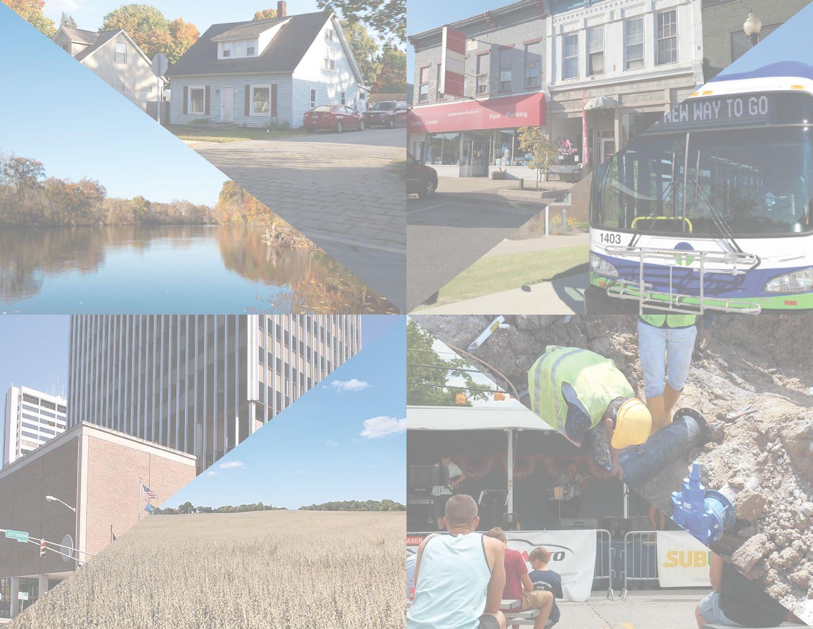


APPENDIX A: DEFINITIONS ............................................. A-2
APPENDIX B: SUMMARY OF EXISTING PLANS ............. A-4
APPENDIX C: COMMUNITY ENGAGEMENT .................. A-9
APPENDIX D: ECONOMIC DEVELOPMENT...................A-13
APPENDIX E: HOUSING AND NEIGHBORHOODS ...... A-25
APPENDIX F: QUALITY OF LIFE AND PLACE ............... A-34
APPENDIX G: ENVIRONMENTAL STEWARDSHIP....... A-41
APPENDIX H: FARMLAND PRESERVATION ................. A-51
APPENDIX I: GOVERNMENT AND POLICY .................. A-65
APPENDIX J: TRANSPORTATION .................................. A-74
APPENDIX K: UTILITIES .................................................. A-92
APPENDIX L: DATA SOURCES ...................................... A-100
APPENDIX A: DEFINITIONS ......................................................A-2
APPENDIX B: SUMMARY OF EXISTING PLANS ..................... A-4
Figure B.1: 2002 Plan - Tax Rates A-4
Figure B.2: Michiana on the Move - 2045 Population Projections .................. A-7
Figure B.2:
Figure D.1: Annual Percent Change in Jobs and Counts Every 5 Years A-13
Figure D.2: Major Employers ........................................................................ A-14
Figure D.3: Monthly Unemployment Rate (Dec 2000 - Dec 2020) ...............
Figure
Figure D.7: Employment by Occupation (2020) A-17
Figure D.8: Per Capita Income (adjusted for inflation in 2020-dollars) ......... A-18
Figure D.9: Commute Mode of St. Joseph County Residents ...................... A-18
Figure D.10: Origin of Workers Living Outside of St. Joseph County........... A-19
Figure D.11: Cumulative Change in Small Business* Employees A-20
Figure D.12: Cumulative Change in Large Business* Employees A-20
Figure D.13: TIF District Details (2021) A-22
Figure D.14: MACOG GDP by County by Selected Industries* ................... A-23
Figure D.15: Location Quotients (2010 - 2020) ............................................ A-24
APPENDIX E: HOUSING AND NEIGHBORHOODS ...............A-25
Figure E.1: Single-Family Building Permits A-25
Figure E.2: Multi-Family Building Permits A-25
Figure E.3: Housing by Number of Units in Building (2020) A-26
Figure E.4: Occupancy (2020)...................................................................... A-27
Figure E.5: Median Home Value (adjusted for inflation in 2020-dollars) ...... A-28
Figure E.6: Median Household Income (adjusted for inflation in 2020-$) .... A-29
Figure E.7: 2024 Housing Market Analysis A-30
Figure E.8: Homeownership Rate by Census Block Group Map (2020) ...... A-31
Figure E.9: Existing Residential Uses Map (2022) A-32
Figure E.10: Major Subdivisions by Decade Map A-33
APPENDIX F: QUALITY OF LIFE AND PLACE ....................... A-34
Figure F.1: 2024-2028 Parks and Recreational Master Plan ........................ A-34
Figure F.2: Parks Service Area Map ............................................................. A-35
Figure F.3: Existing Parks, Trails, and Planned Trails Map........................... A-36
Figure F.4: Crime Indices Data* A-37
Figure F.5: Educational Attainment of the Population 25+ Years Old (2020) A-38
Figure F.6: Enrollment by District and Grade (2018-2019 School Year) ....... A-38
Figure F.7: School Districts (i.e. School Corporations) Map ......................... A-39
Figure F.8: Income by Education (adjusted for inflation in 2020-dollars) ...... A-40
APPENDIX G: ENVIRONMENTAL STEWARDSHIP................ A-41
Figure G.1: Aquifer Systems Map A-43
Figure G.2: Natural Areas Map A-44
Figure G.3: Soil Types .................................................................................. A-46
Figure G.4: Soil Types Map .......................................................................... A-46
Figure G.5: Soil Drainage Characteristics Map ............................................ A-47
Figure G.6: Point and Nonpoint Pollution Sources Map A-48
Figure G.7: Environmental Checklist Example A-50
APPENDIX H: FARMLAND PRESERVATION .......................... A-51
Figure H.1. National Prime Farmlands Map (2022) ...................................... A-51
Figure H.2: Total Land Acreage in Farms (1987 - 2017) .............................. A-52
Figure H.3: Farm Operations by Tenure (1987 - 2017) ................................ A-53
Figure H.4: Total Acres Operated by Type of Organization (1987 - 2017) A-54
Figure H.5: Farmland by Tenure (1987 - 2017) A-55
Figure H.6: Farms by Acreage (1987 - 2017) A-56
Figure H.7: Acreage by Farm Size (1987 - 2022) ......................................... A-56
Figure H.8: Percent of Farmland by Size of Farm (1987 - 2017) ................. A-56
Figure H.9: Median Income of Ag Worker ** (2010 - 2020) .......................... A-57
Figure H.10: Farmers by Age* (1987 - 2022) A-58
Figure H.11: Average Age of a Farmer (1987 - 2017) A-58
Figure H.12: NCCPI Map for Northwest Indiana .......................................... A-59
Figure H.13: National Commodity Crop Productivity Index Map .................. A-60
Figure H.14: St. Joseph County Prime Farmland Soils (2022)..................... A-61
Figure H.15: Development and Prime Farmland Map A-62
Figure H.16: Conservation Easements and New Urban Development Map A-63
Figure H.17: Rezones (2004 - 2024)*........................................................... A-64
APPENDIX I: GOVERNMENT AND POLICY .......................... A-65
Figure I.1: Townships Map ........................................................................... A-67
Figure I.2: Zoning Map (2021) ...................................................................... A-69
Figure I.3: Rezones Map A-72
APPENDIX J: TRANSPORTATION ...........................................A-74
Figure J.1: Road Mileage by Functional Classification (2022) ..................... A-75
Figure J.2: Functional Road Classifications Map ......................................... A-76
Figure J.3: Average Daily Traffic Counts Map .............................................. A-77
Figure J.4: Crash Heat Map (Study Area Only) ............................................ A-78
Figure J.5: Crash Heat Map (Entire County) A-79
Figure J.6: MACOG Transportation Improvement Program (2022-2026) Map A-80
Figure J.7: Current Level of Service Map ..................................................... A-81
Figure J.8: Projected (2045) Level of Service Map ...................................... A-82
Figure J.9: Level of Service Degredation Map A-83
Figure J.10: Current Active Transportation Network Map A-84
Figure J.11: Current and Future (2045) Active Transportation Map A-85
Figure J.12: Current and Future Active Transportation Mileage ................... A-86
Figure J.13: Pedstrian/Bicyclist Crash Heat Map (Study Area Only) ............ A-87
Figure J.14: Pedstrian/Bicyclist Crash Heat Map (Entire County) ................ A-88
Figure J.15: Existing Public Transit and Multi-Modal Connections Map A-89
APPENDIX K: UTILITIES .......................................................... A-92
Figure K.1: Conditions for Septic Systems Map A-95
Figure K.2: Municipal Water/Sewer Systems Map ....................................... A-96
Figure K.3: Upload and Download Speeds across St. Joseph County ........ A-98
Figure K.4: Electric Service Areas Map. ....................................................... A-99
APPENDIX L: DATA SOURCES .............................................. A-100
Figure L.1: Data Sources A-100
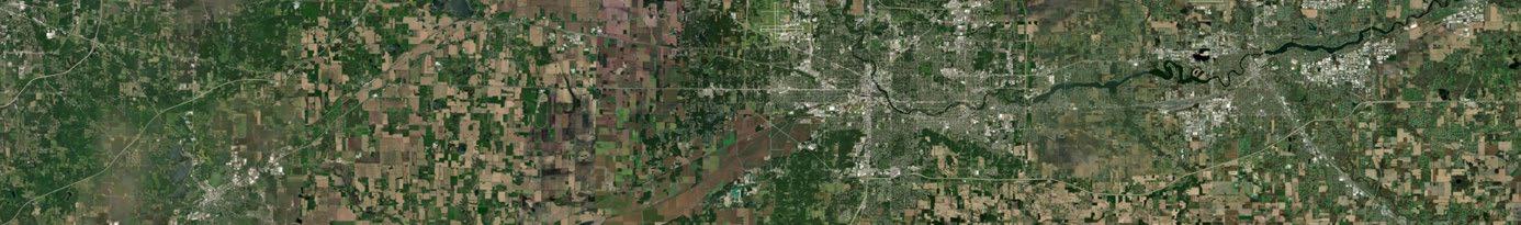

American Community Survey (ACS)
A survey conducted annually across the United States by the US Census Bureau that produces estimates for socioeconomic characteristics of a population and housing.
Area Plan Commission (APC)
The governmental authority responsible for planning and development for the member towns (New Carlisle, Lakeville, North Liberty, Roseland, and Osceola) and the unincorporated areas of St. Joseph County.
Census Designated Place (CDP)
Statistical geographic areas representing closely settled, unincorporated communities that are locally recognized and identified by name. They are the statistical equivalents of incorporated places, with the primary differences being the lack of a legally defined boundary and an active, functioning governmental structure, chartered by the state and administered by elected officials (definition from the US Census Bureau).
Granger
A large unincorporated area in the northeast corner of the County. It is also a “census designated place” by the US Census Bureau.
Incorporated Communities
Refers to all areas in the county that are incorporated into one of the municipalities in the county, which includes South Bend, Mishawaka, Walkerton, New Carlisle, Lakeville, Indian Village, North Liberty, Osceola, and Roseland.
Michiana Area Council of Governments (MACOG)
The regional planning and economic development authority for St. Joseph, Elkhart, Marshall, and Kosciusko Counties.
Member Jurisdictions
Refers to the towns that are part of the St. Joseph County Area Plan Commission, which includes New Carlisle, North Liberty, Lakeville, Roseland, and Osceola. This excludes the towns of Indian Village and Walkerton.
Small Towns
Refers to municipalities categorized as towns by the Indiana legislature, which includes New Carlisle, Lakeville, Roseland, Indian Village, North Liberty, Osceola, and Walkerton. This does NOT include South Bend and Mishawaka.
Study Area
Unincorporated St. Joseph County.
SSURGO – Soil Survey Geographic Database
A database that contains information about soil as collected by the National Cooperative Soil Survey over the course of a century, operated under the US Department of Agriculture and the Natural Resources Conservation Service. The soil information was gathered by walking and taking soil samples. Many samples were then analyzed in laboratories.
Unincorporated Communities
Refers to all areas that are not incorporated into one of the municipalities in the county, which includes some communities such as Granger, Wyatt, Lydick, and more.
The U.S. census counts each resident of the country, where they live on April 1, every ten years. The Constitution mandates the enumeration to determine how to apportion the House of Representatives among the states. This is NOT an estimate, unlike the American Community Survey.


This section summarizes plans from around the MACOG region that are critical for this comprehensive plan. County staff and officials should use these plans, along with Plan SJC, to better pursue intergovernmental collaboration, as well as understanding and building on the goals of previously completed planning efforts.
2002 Comprehensive Plan
During public input for the 2002 Comprehensive Plan, planning participants cited many aspects of government and public services as threats as part of a SWOT (Strengths, Weaknesses, Opportunities, and Threats) activity. This included “poor planning, potential annexation, perceived high crime levels, perceived local government parochialism, perceived lack of vision, and the existing tax structure.” Other concerns raised by County residents included the impacts of unrestricted growth, adequate infrastructure and public services, and rezonings. Additionally, concerns were noted about uncontrolled growth in rural areas, the use of septic fields, and how that could impact groundwater contamination.
Regarding law enforcement, St. Joseph County Sheriff’s Department was providing a Level of Service (LOS) of 1.34 officers per thousand versus the recommended 2 officers per thousand while the police vehicle level of service was above the standard. Fire service within the county was handled through ten different organizations comprised primarily of volunteers. South Bend fire was providing EMS service to the county with a level of service well above the recommended level.
The most widely used source of taxes was noted as property taxes, with a number of subcounty property tax districts occurring within St. Joseph County. While the county had relatively low property values compared to the state, the county had a higher property tax rate. Income taxes were the second source of income, including Economic Development Income Tax (EDIT) and County Option Income Tax (COIT). The State allows rates of between 0.1% and 0.5%, and St. Joseph County’s rate was 0.2%. The State allows between 0.2% and 1.0% on COIT, and the county’s rate was 0.6%. The income taxes are structured and named as shown in Table B.1.
Income taxes for each are distributed to taxing units according to statutory calculations. The County receipts their portion of the LIT Expenditure Rate into the General Fund (roughly $9 Million in 2022) and their portion of the LIT Economic Development Rate into the LIT Econ Dev Fund (roughly $12 Million in 2022) and their portion of the LIT Public Safety Rate into the LIT Public Safety Fund (roughly $6 million in 2022) and their portion of the LIT PSAP Rate into the PSAP Dispatch Operating Fund (roughly $10 million in 2022) and the LIT Property Tax Replacement Credit
is not distributed to anyone, it is held to offset taxpayer bills.
Three medical facilities serviced the county with a Level of Service (LOS) of 3.3 beds per 1,000, slightly below the recommend 4 beds per 1,000. The number of physicians was slightly higher than the recommend level of service of 1.5 per 1,000, at 1.53 per thousand. Elderly care availability was well above the recommended level of service.
The St. Joseph County Parks Department was actively operating 1,450 acres in six parks. Based on size, the department had four regional parks providing a level of service (LOS) of 6.2 acres per 1,000 persons, within range of the National Recreation and Park Association’s (NRPA) 5 to 10 acres per 1,000 population. They were operating two community parks with a deficiency in Level of Service of 2.5 acres per 1,000 population instead of the recommended 5 to 8 acres per 1,000 population. That said, the county also has access to Potato Creek State Park which serves as a NRPA “regional park reserve,” or a facility larger than 1,000 acres in size with water sources and several communities within one hour’s drive time.
The five principles of the 2002 Comprehensive Plan were:
• Agricultural Preservation
• Economic Development
• Strengthening Neighborhoods
• Environmental Conservation
• Providing Adequate Infrastructure
To address the issues and goals of the plan, a series of recommendations were made by the consultant, broken down into (1) follow-up studies and action programs, (2) intergovernmental coordination and community involvement programs, and (3) strategic planning programs. The recommendations are summarized here:
• Update the zoning and subdivision control ordinances.
• Create a Design Standards and Specifications Manual.
• Strategize ways to extend public water and sewer:
○ Have municipalities (i.e. South Bend and Mishawaka) extend their service boundaries to unincorporated areas.
○ Implement a Countywide Sewer and Water District.
• Implement sub-area plans (i.e. neighborhood and corridor plans).
○ Create Residential District Plans, especially for more urbanized but unincorporated areas north of South Bend and Mishawaka.
○ Create studies for Special Study Areas, including the Blackthorn Economic Development Area, the Capital Avenue Corridor, the US 31 Corridor, Southwest South Bend, and the US 20 (Bypass) interchanges.
○ Create Institutional District Planning Areas.
• Formulate a strategy of where and when municipalities can or should annex land.
• Make a disciplined schedule to review the Comprehensive Plan and update it as necessary when conditions change.
• Conduct an assessment of the activities that will implement the Comprehensive Plan.
• Coordinate/consolidate municipalities’ Capital Improvements Programs.
• Implement a Residential Area Policy that (1) assesses the building conditions of residential areas, (2) assigns an appropriate strategy and accompanying activities to each residential area based upon existing conditions, and (3) uses a tiered system of prioritization to direct where resources and fundings for activities and strategies in specific residential areas should be focused.
The 5-Year Parks and Recreation Master Plan was developed to guide the department through the next five years and beyond. It includes recommendations not just for physical improvements like new parks and amenities, but also existing facilities which need upgrades, recreational programming, and an analysis of staffing needs to continue delivering excellent service. The plan meets the requirements for the Indiana DNR to remain eligible for grant funding through the Indiana DNR and other state departments. The plan includes a summary of all county parks and properties managed or partially managed by the Parks Department, with recommendations for improvements and programming. The following properties are discussed in the plan:
• Anderson Road Property
• Bendix Woods County Park
• Beverly D. Crone Restoration Area
• Chamberlain Lake Nature Preserve
• Ferrettie/Baugo Creek County Park
• LaSalle Trail
• Leo Jasinski Public Access Canoe Launch
• St. Patrick’s County Park
• Spicer Lake Nature Preserve
The Plan also provides a benchmark study comparing St. Joseph County to peer counties on a number of items, including total park acreage, park acreage per population, trail mileage, and other amenities.
The following list of comprehensive and neighborhood plans have been adopted by their respective jurisdiction of or by the Area Plan itself, which should be referenced when development or other activity is planned near or around their community:
• 1992 Osceola Comprehensive Plan
• 2005 Roseland Comprehensive Plan
• 2024 New Carlisle Comprehensive Plan
• 2011 Lakeville Comprehensive Plan
• 2015 North Liberty Comprehensive Plan
• 2014 Morningside Neighborhood Land Use and Pedestrian Plan
Watershed Management Plans
County departments, commissions, and other environmental organizations have adopted management plans for many of the smaller, 10 – or 12-digit watersheds dealing with more localized areas of the County. The primary aims of a watershed management plan are to preserve, protect, and enhance environmental assets of a specific area, which may include soil and water health, erosion, flooding, and aquifer recharge. The following list of watershed management plans have been adopted by various agencies and departments in the County:
• St. Joseph River Watershed Management Plan (2005)
• Juday Creek Watershed Management Plan (1995)
The Indiana Department of Natural Resources (IDNR) developed action strategies in 2001 to restore and improve the health of every 8-digit watershed across the state. A watershed is an area or ridge of land that separates water flowing or falling onto the land through rainfall to different rivers, basins, or seas. St. Joseph County is split northwest to southeast along two major watersheds: Kankakee and St. Joseph. A third watershed, Little Calumet-Galien, sits within a small portion of the northwestern corner of the County. These watershed restoration action strategies should be referenced for future environmental planning and land stewardship efforts. These plans can be found on the IDNR website: https://www.in.gov/idem/ nps/resources/watershed-restoration-actionstrategies/.
MACOG Collaborating for Regional Resilience and Economic Growth (2021)
MACOG, or the Michiana Area Council of Governments, is a Metropolitan Planning Organization (MPO) that covers St. Joseph, Elkhart, Kosciusko, and Marshall Counties. The purpose of the MACOG Collaborating for Regional Resilience and Economic Growth plan (CRREG) is to address the current economic state of the four-county region and provide recommendations for economic recovery and resiliency against future economic shocks. MACOG was aided by a consultant, Fourth Economy, to ensure an inclusive and responsive plan that is unique to the region and future-facing.
Some of the major opportunities identified for the region’s economy were (1) increasing adoption of new technologies and advancements, especially for the manufacturing, education, and healthcare sectors, (2) focusing on innovation-based startup development, (3) maximizing the value of existing educational institutions and workforce development programs, (4) promoting the region’s low cost of living, proximity to major markets, and good transportation network, and (5) growing community amenities such as arts, culture, and outdoor recreation.
Some of the major challenges identified for the region were (1) job loss, (2) supply chain instability during the pandemic period, (3) low per capita income relative to the state and nation, (4) low startup and small business activity, (5) lagging population growth and high out-migration, (6) poor public health outcomes and lack of childcare, and (7) an aging housing stock.
MACOG Michiana on the Move: 2045 Transportation Plan
The purpose of the 2045 Transportation Plan is to guide where and how the MACOG region will address transportation needs. Additionally, it projects estimated changes in populations (see Figure B.2) and land use (see Figure B.3) across the region from 2020 to 2045 with input from government officials and members of the public. The rest of this summary will focus on plans aspecifically for St. Joseph County.
There are three growth scenarios in the plan: a high-growth scenario, a baseline scenario, and an urban growth scenario. The high-growth scenario showed large growth typically in the unincorporated areas of St. Joseph County, while incorporated communities typically saw a low growth or a loss in population. The baseline scenario resulted in less growth than the high-growth scenario, but showed most of the growth occurring in the suburban areas surrounding South Bend and Mishawaka. The urban growth scenario showed population declines in all of rural St. Joseph County and growth mostly in the central and northeast portions of the County in and around South Bend, Mishawaka, and the Granger area. Figure A.22 shows the results of each scenario.
In regard to freight transportation, St. Joseph County will be heavily affected by increased congestion, especially along Interstate 80/90, US 31, US 30, and US 20.
In public surveys to MACOG residents, over 77% of respondents agreed that technology will drastically change over the next 25 years from 2020 to 2045. The transportation plan accounts for this belief and on real trends in government funding and consumer preferences. The plan recommends that the MACOG region closely watch how connected/autonomous vehicles are adopted and which infrastructures are rapidly aging to prioritize investments.
The purpose of this plan is to provide strategies to local governments for improving the region’s active transportation network. It focuses specifically on the bicycle and pedestrian components of the Michiana on the Move Plan discussed previously. There are six goals created from data analysis and public input:
• Connectivity
• Accessibility
• Safety
• Culture
• Health
• Quality of Place
Figure B.2: Michiana on the Move - 2045 Population Projections
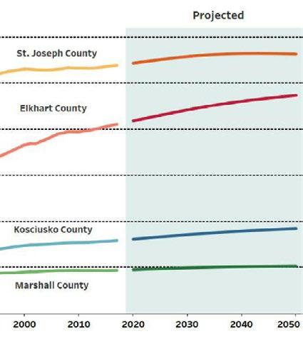
The rest of this section will review the MACOG Active Transportation Plan as it relates to St. Joseph County. During the existing conditions analysis, MACOG found that high demand for non-motorized facilities (i.e. active transportation options) are most prevalent in South Bend and Mishawaka, but also extend into the unincorporated County along State Road 2 and State Road 23 heading into the Granger area. Additionally, the analysis uncovered that many of the local roads in the small towns and the Granger area could be comfortably biked by most adults, but not by most children as a result of road design choices. Bicycle, pedestrian, and vehicular crashes occur most frequently in urbanized areas. However, there are still hot spots in the unincorporated County and small towns, usually at intersections between major thoroughfares and state roads.
Land Use Projections


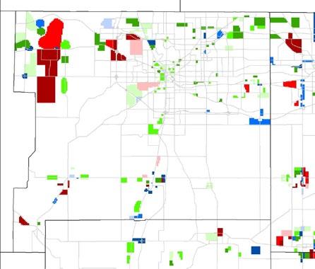
St. Joseph County is set to receive the most miles of investment into new or updated active transportation infrastructure out of the fourcounty region. Some of the key, regionally significant trail projects for the County are:
• Indiana Michigan River Valley Trail
• Capital Avenue Trail
• Old US 31/Michigan Road Trail
• Potato Creek State Trail
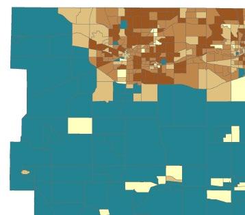
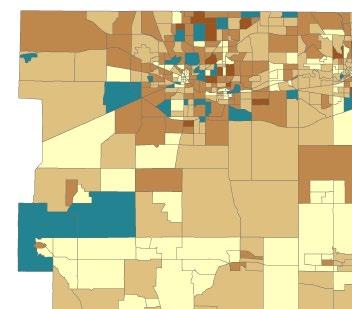


The following section describes the outcomes of each meeting or series of meetings in the community engagement process of this plan. In total, there were approximately 50+ opportunities for engagement, comprising of 3,500+ hours worked on the project, with over 800 participants in public meetings and stakeholder groups, and more than 1,800 comments gathered from the public through the project website, public forums, and meetings.
Consultants met with County staff discuss about desired project outcomes. The consultants also learned about development trends, current opportunities, and recent changes in land use and development.
Additionally, the consultant team and County staff discussed the creation of a Task Force and identified members of the public who should be invited to participate in these meetings related to the planning process.
The first Task Force meeting involved introductions to the consultant team, the project, and other Task Force members. During the meeting, Task Force members discussed how the plan should work with plans of other municipalities, the MACOG region, neighboring communities in Michigan, and the overall branding and identity of the plan.
A brief existing conditions summary was reviewed with the members to show the socioeconomic changes in St. Joseph County over the last couple of decades and to start thinking about a vision statement to guide the County into the future. The Task Force members also participated in a few activities and answered a series of questions to help direct the consultant team’s efforts.
A mapping activity was provided that asked the members to identify a place, thing, or characteristic in the County that was a positive aspect, opportunity, or something that needed to be addressed or corrected in the future. The feedback during this meeting helped identify strengths, weaknesses, opportunities, and threats (SWOT).
50+ PUBLIC INPUT MEETINGS HELD
3,500+ HOURS WORKED ON THE PROJECT 800+ PARTICIPANTS
1,800+ PUBLIC COMMENTS
2,400+ VISITS TO THE PROJECT WEBSITE
A series of focus group meetings were held from January through February 2022. Meetings were held both in-person and virtually to accommodate schedules and technology constraints.
Focus Groups were asked a series of questions to learn about what is working well and what could be better across the County. Many concerns and areas of opportunity were repeated across different focus groups. These groups also started to form thematic areas of interest that would later help identify the eight pillars of this plan. The focus groups also helped identify strengths, weaknesses, opportunities, and threats (SWOT) that are included in the SWOT analysis.
During the second Task Force meeting, the consultant team reviewed the feedback and findings of the Focus Groups. Conversations began to identify emerging themes from the first Task Force meeting and Focus Group discussions.
The consultant team dove deeper into land development trends including annexations, subdivisions, rezonings, and the transportation and utility networks. After presenting these findings in the meeting, the consultant team and Task Force members had a conversation about these trends and started talking more indepth about what future development patterns might look like for the County.
The purpose of the first Community Meeting Series was to gather feedback from the general public about socioeconomic and development trends in the County and to spread awareness of the comprehensive plan project within the community. In total, there were six meetings that the general public could attend. Five of these meetings were held in-person at the St. Joe Public Library and the New CarlisleOlive Township Library. One meeting was held virtually over Zoom, with a presentation and Q&A session. The in-person meetings included small group activities led by the consultant team and St. Joseph County planning staff.
All meetings included an exercise that asked participants to identify on a map the County’s assets and opportunities, issues and concerns, and other thoughts and ideas pertaining to the future growth and development of St. Joseph County.
To conclude Community Meeting Series 1, a meeting-in-a-box kit was assembled to allow community members and stakeholders to recreate the Comprehensive Plan community meeting and open house format at a time and place convenient to their schedules. Meetingin-a-box kits were checked out by citizens who agrees to facilitate these meetings. Materials were provided in the kit and the facilitator returned the kit with all recorded comments to the County planning office after completing the meeting. The meeting-in-a-box opportunity was available April and May 2022.
All feedback from the in-person, virtual, and meeting-in-a-box facilitators were used to update the SWOT analysis created during the Task Force and Focus Group meetings.
The third Task Force meeting focused on future land use patterns that members thought the County might experience in the future. The members were encouraged to consider all types of development (residential, commercial, industrial, parks and open space, agriculture, and more) and how they related to each other.
This information and feedback helped inform the consultant team’s first draft of the Future Land Use Plan found in the Future Land Use and Development Character chapter.
The fourth Task Force focused on creating a vision for the County. Prior to the meeting, the consultant team created a draft vision statement to be reviewed by the Task Force members based on feedback that had been collected from previous Task Force, Focus Group, and community meetings. The consultant team also identified major themes heard from previous community engagement opportunities and laid out the first draft of the eight pillars of this plan. During the meeting, the vision and pillars were presented to and refined by the Task Force members.
The fifth Task Force meeting was centered around preparing for a large-scale, public event to drive public participation in the plan. The consultant team scheduled a virtual meeting with the Task Force to begin sending invites to “subject matter experts” in each of the eight pillars of this plan. Task Force members helped identify people in the community who might be interested in participating in a Working Group for each pillar and could lend their insight to specific areas of interest in the County. These eight Working Groups would be jointly led by a Task Force member, a County staff person, or a consultant team member.
The Summit served as the official unveiling to the public of all the feedback and progress made so far on the plan. The event also discussed what was next in the planning process and was an invitation for residents who were interested in joining a Working Group for each pillar of the plan.
After the presentation, attendees were able to learn more about the project and each of the Pillars. Staff members from the County’s Infrastructure, Planning, and Growth Department and consultant team members were in attendance to help register people for the Working Groups and pass out materials for residents to spread awareness about the plan. Attendees could also pick up a briefing booklet for each of the pillars that reviewed the relevant existing conditions, trends, and public comments. Residents were able to sign up using sign-in sheets at the event and were able
to view materials and register for a Working Group electronically on the project website, if they couldn’t attend the Summit.
Over the course of four months and six meetings per Working Group (36 meetings total), the consultant team worked with County staff and Task Force members to facilitate the Working Group meetings. An outline and agenda of each of the six meetings was created to establish the objectives for the Working Groups.
The first two meetings were designed to encourage attendees to think critically about challenges and opportunities present across the County as they related to the specific working group, and how they could be addressed. A series of discussion questions for each Working Group was created based off the feedback from the Focus Group meetings and Community Meeting Series 1.
A mapping activity was planned for the third meeting that helped Working Group members think about the County spatially and begin identifying priorities related to their pillar. Some groups may have been focused on land use development patterns while others were focused on connectivity across the County. Each mapping activity was unique to the Working Groups of each pillar.
The fourth and fifth meetings were planned to focus on writing goal statements and identifying recommendations. Based on the feedback collected from the first three Working Group
meetings, the facilitators of each Working Group refined each goal and recommendation once developed and continued collaborating with the Working Groups as refinements were made. Once a general consensus was reached, the consultant team organized all goals and recommendations that were developed for a final review to determine if goals and recommendations could be added to or further refined.
A final review of the goals and recommendations for the sixth and final meeting. The Working Groups reviewed any goals or recommendations that had been added since the previous meeting. The facilitators of each group would assist in making any edits necessary to any goals or recommendations during the meeting. Some groups were able to complete a ranking activity which allowed the attendees to identify which of the goals they felt was the most important to achieve first before others.
Once the goals and recommendations were developed and all the meetings had concluded, the consultant team made any additional edits that were outstanding and created a consolidated list of each of the goals and recommendations from all eight groups. Upon a final review of the goals, the consolidated document was provided to County staff for their review. These goals and recommendations were also sent to the Task Force in early February to review in preparation of a larger work session during Task Force Meeting 6 and 7.
Once the consolidated goals and recommendations were reviewed, a meeting was scheduled for the end of January 2023 where all members of the public who signed up to be a part of the Working Groups could review the complete list of goals that were created. During the meeting, the consultant team gave a presentation that covered a review of the meetings, process, and goals by each Working Group.
#6 and #7 | 9 February and 16 March 2023
Task Force meeting six was a general review of the goals and recommendations produced by the working group with the Task Force. The complete list was sent to the Task Force prior to the meeting. While a formal presentation was given, the meeting operated more as a conversation where the Task Force could ask questions about the goals and recommendations and discussing various revisions and changes. Due to the number of goals and recommendations and length of discussion, a seventh Task Force meeting was scheduled for March 16th in which the Task Force members would make their final edits to the goals and recommendations.
Prior to the eighth Task Force meeting, the consultant team and St. Joseph County staff met to finalize the draft plan’s goals and recommendations. The final Task Force meeting focused on refining the details and providing targeted feedback on the final draft
to ensure the input gathered throughout the planning process was incorporated into the final draft. With the draft plan nearing completion, the Task Force also considered engagement strategies for the final public outreach phase. Plans were discussed for upcoming open houses, the public comment period, and the final timeline for adoption.
Area Plan staff and the consulting team hosted two public open houses on the draft plan in August 2024. Additionally, a virtual version of the meeting was also available on the project website. Boards summarizing the plan structure and vision, goals and recommendations for each pillar, the future land use map, and implementation plan were displayed. An afternoon meeting was held at the Centre Township Branch Library and an evening meeting was held at the German Township Community Center. Approximately 69 people attended the open houses. Additionally, attendees provided input on the prioritization of selected implementation items.
A-12


While economic development efforts manifest themselves locally, successful economic development is a regional, national, and global competition for community investment and jobs. There are multiple agencies, boards, commissions that are directly involved in pursuing and fostering economic development. All these entities work closely and together to for the success of economic development efforts. Work completed by MACOG with its Comprehensive Economic Development Strategy and Collaborating for Regional Resilience and Economic Growth, as well as the Indiana Enterprise Center’s Economic Opportunity Analysis, provided a guide for examining economic development in St. Joseph County.
Since 2000, according to the US Bureau of Economic Analysis (BEA), St. Joseph County has experienced a decrease of -2.5% in jobs (i.e. employment). Over the same period the State of Indiana has seen an increase of 7.1%. Elkhart County has seen an
of 11.7%, Marshall
and Kosciusko
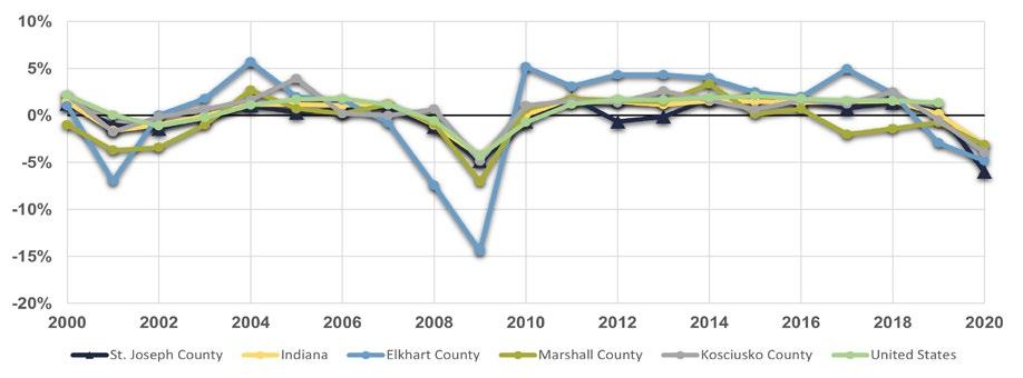
Elkhart County saw the most volatile changes in employment, being hit the hardest by the 2008 recession, with a -14.4% decrease in jobs in 2009. St. Joseph County saw the greatest drop in jobs at -6.0% in 2020, the largest in the MACOG region. Indiana’s largest one-year increase in jobs was 1.8% in 2011 and the largestt decrease was -4.3% in 2009. Overall St. Joseph County annual changes in employment only varied about 1.5%, except for years following the 2020 pandemic and 2008 economic recession. It was generally comparable to Indiana and Kosciusko County.
Figure D.2 shows the major employers in the South Bend Region. These regional employers are typically part of the education, healthcare, and/or manufacturing industries.
In December or 2022 St. Joseph County’s unemployment rate of 2.9% was below the State’s 3.1% unemployment rate, as well as the US unemployment rate of 3.5%. During the pandemic, St. Joseph County reached a peak unemployment rate of 19.8%, slightly higher than the State of Indiana at 16.8% and the US at 14.7%. During the recession from 2008 to 2010, the unemployment rate for St. Joseph County was 12.8%, compared to Indiana at 10.7% and the US at 9.8% It was not until September 2014 that the unemployment rate for St. Joseph County again aligned with Indiana and the US at 5.8%. During times of economic uncertainty such as a recession or pandemic the workforce for the county is more likely to be impacted, and unemployment rises higher than the state and national rates. This would also seem to indicate that diversifying the economic base in ways that would create more stability would be desirable.
Figure D.4 shows the effects of the economic downturn in 2009 and the recovery in the years following. Figure D.5 shows the spike in unemployment during the pandemic in April of 2020 and the recovery in the months after.
Figure D.3: Monthly Unemployment Rate (Dec 2000 - Dec 2020)
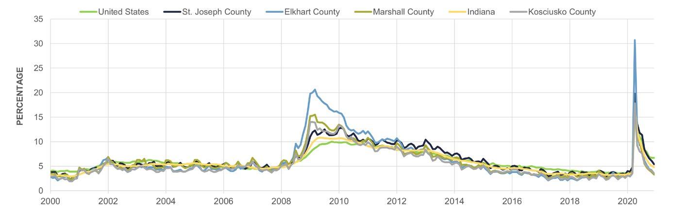
Source: US Bureau of Economic Analysis
Figure D.4: Monthly Unemployment Rate (Jan 2008 - Jan 2014)
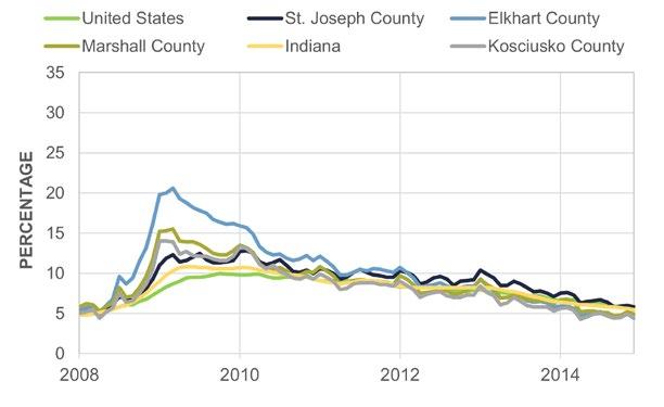
Description: Monthly unemployment rates around the 2008 Financial Crisis.
Source: US Bureau of Economic Analysis
Figure D.5: Monthly Unemployment Rate (Dec 2019 - Dec 2020)
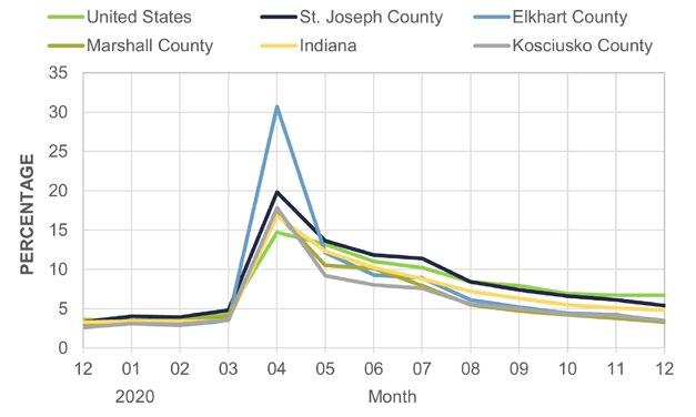
Description: Monthly unemployment rates around the 2020 COVID-19 Pandemic.
Source: US Bureau of Economic Analysis
As noted in the 2002 Comprehensive Plan, employment has gradually shifted from majority-manufacturing to majority-service jobs. This statement is supported by current employment trends in the county. In 2020, nearly 38,000 residents were employed by the educational/healthcare service industry, growing by about 5,000 people since 2010. The second largest employing industry is manufacturing at nearly 22,000 residents.
Figure D.6, which includes both the chart and table, shows changes in employment across all sectors from 2010 to 2020. It is important to note that these numbers only represent residents—they do not include people who commute into St Joseph County.
In addition to the industries in which residents are employed, their occupations within that industry are an important part in understanding the skillsets and professional experiences of the workforce. As shown in Figure D.7, the top five occupations are:
• Management,
• Education,
• Office and Administration,
• Sales and Related, and
• Production.
These occupations generally align with the occupational distribution of the state and the nation.
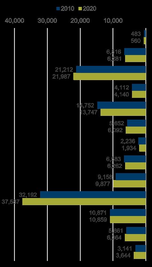
*TWU = Transportation, Wholesale, and Utilities. | **FIRE = Finance, Insurance, and Real Estate. | ***Professional Services includes professional, scientific, and management, and administrative and waste management services. | ****AERF = Arts, entertainment, recreation, and food.
D.7: Employment by Occupation (2020)
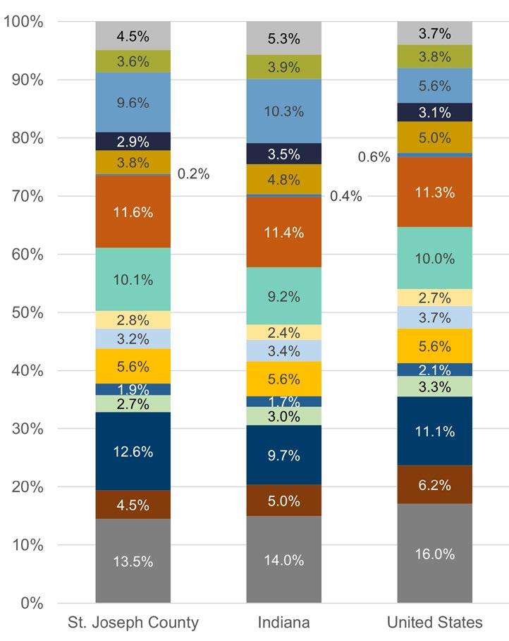
Per capita income is total personal income divided by the total population. From 2000 to 2020, St. Joseph County saw an increase in per capita income of 22.17% from $41,427 to $50,612. The State of Indiana, Kosciusko, Elkhart and Marshall Counties had similar increases at 23.68%, 26.90%, 119.50% and 23.68% respectively. Per capita income in St. Joseph County consistently lagged behind the United States, with the difference in 2002 at -$3,694, growing to -$9,162 in 2020. Generally, St. Joseph County has fluctuated between lagging and leading Indiana in terms of per capita income.
Figure D.10 shows the number of people commuting into St. Joseph County as of 2019. Similar to most of Indiana and the United States, most commuters drive to work alone. The second most used commute mode in the county is carpooling, followed by working from home. As a result of the COVID-19 pandemic, the number of residents working from home nearly doubled compared to 2010 estimates. Additionally, a larger percentage of residents are walking to work while the percentage of residents using private vehicles has decreased. These trends follow a national trend of fewer commuters choosing to travel to work in a private vehicle.
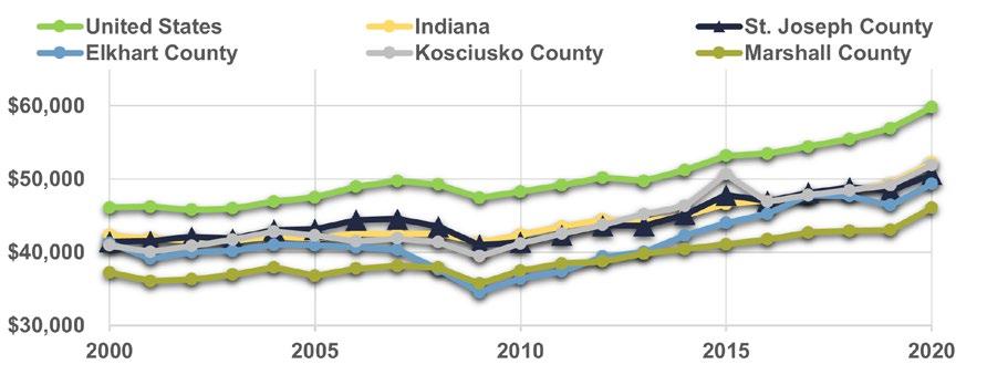


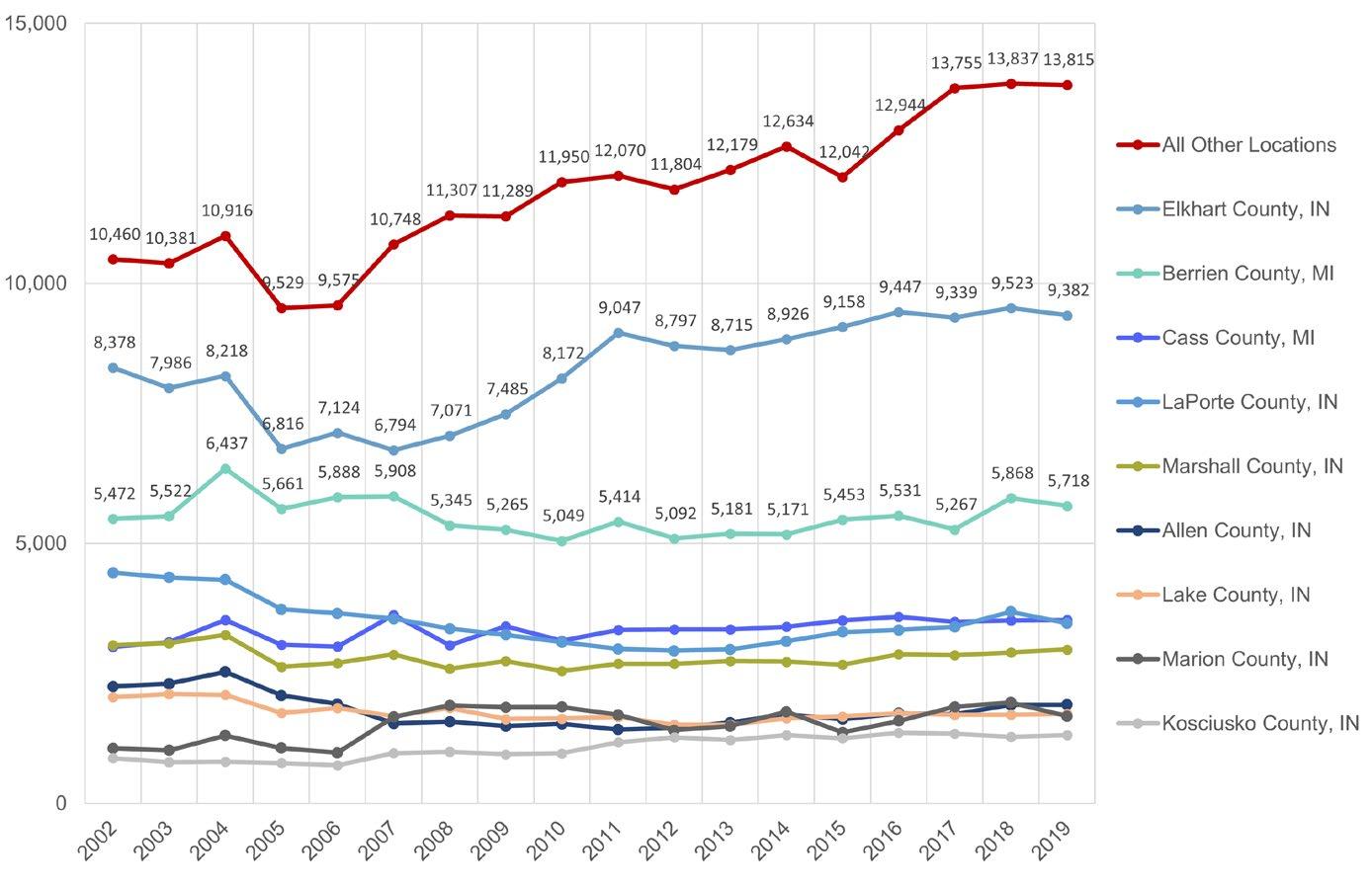
Source: US Census Bureau, OnTheMap (2019)
In 2000, small businesses (businesses with 1 to 19 employees) employed 19,395 people. This number decreased to 15,471 in 2022, according to the Quarterly Workforce Indicators Explorer by the US Census Bureau. On the other hand, people employed by large businesses (businesses with 500 or more employees) has slightly increased from 57,726 in 2000 to 57,926 in 2022.
Overall, the current trends in the region show the number of people employed by small businesses decreasing, while employment in large businesses is increasing. This trend is most exaggerated in Elkhart County and Kosciusko County.
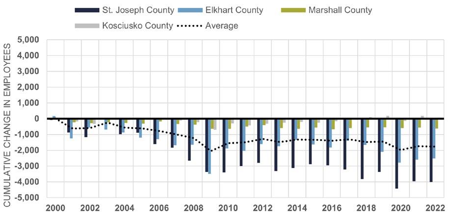
‘CUMULATIVE
Going by the dictionary, “cumulative” is defined as: increasing or increased in quantity, degree, or force by successive additions. It is calculated using the starting value of an asset (in this case employees in both small business and large businesses), the ending value of an asset, and a specified time period. Cumulative change gives an indication of how that asset has changed over that period of time.
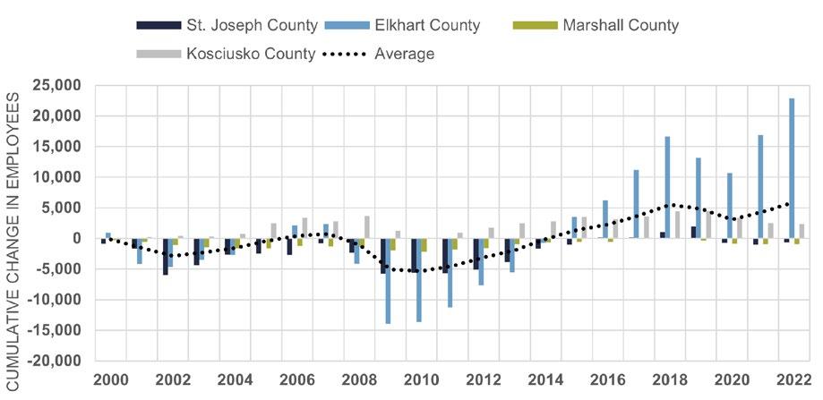
Source: US Census Bureau, Quarterly Workforce Indicators Explorer | *Large businesses are any business with 500+ employees.
Retail establishments provide essential services to residents. In 2022, these establishments accounted for 15.1% of all businesses in the County and employ approximately 13.0% of all County residents, according to an ESRI 2022 Business Summary report. The report also indicates that the most prevalent types of retail services are “Motor Vehicle & Parts Dealers” and “Food and Beverage Stores,” employing approximately 2.1 and 3.0% of all county residents, respectively.
Retail Spending Patterns
Retail demand in the County is expected to increase by about 19.0% over a five-year period from 2022 to 2027, according to an ESRI 2022 Retail Demand Outlook report. This indicates that residents are willing to spend more on retail services, which will likely result in more retail establishments being built, especially in the northern portion of the County where residential growth is expected to continue. According to the same ESRI report for the County, the top five spending categories, excluding bonds, stocks, and other financial expenditures, include:
• Home
• Food
• Insurance
• Transportation
• Entertainment/recreation
The ”Home” category includes items such as furniture, appliances, and other home improvements. “Food” includes groceries, home deliveries, and eating out at a restaurant or bar. “Insurance” includes any type of insurance, such as health, renters, and life insurance. “Transportation” includes the costs associated with buying, owning, or leasing a vehicle, such as gas and maintenance. “Entertainment/recreation” includes any activity that is purely for enjoyment, which includes many lifestyle/cultural activities, such as going to a theme park, the movie theatre, gambling, or a bar/night club.
Economic Development Areas (EDAs) are one of many tools for local governments, which are also part of the process to establish tax increment financing (TIF) districts. EDAs should not be confused with Plan SJC’s ‘Economic Development Priority Areas’. Prior to a TIF’s establishment, Indiana state statute requires evidence be provided to demonstrate that a development would not otherwise occur but for the establishment of a TIF district. Assessed property values are frozen with the establishment of the TIF, and only any increase in the assessed value (i.e. the increment) is collected as TIF revenue.
The resulting TIF district helps pay for infrastructure improvements (streets, sewers, parking) in the area and for targeted property acquisition to support redevelopment purposes.
There are three parts to a TIF district. First, an EDA is established by a Redevelopment Commission. The St. Joseph County Redevelopment Commission has established five economic development areas throughout the County. The second component is the TIF district itself. The third component is the TIF allocation area which is the area where TIF revenues collected in the TIF district are spent to improve infrastructure (i.e. redevelopment project area). The TIF district and allocation area are typically, though not always contiguous with each other.
This TIF district is located northwest of Mishawaka and has ideal utility access. It is coextensive of the AM General EDA. It consists of many large parcels of land, which are starting to develop as public and private dollars are invested into infrastructure in the area.
generated in the TIF district are allocated based on the location of the revenues received within the respective areas.
This TIF district is dominated by the General Stamping & Metalworks facility, which helps spur the growth and expansion here. It is coextensive with the Northwest Cleveland EDA.
The New Carlisle TIF district, also known as the IEC (Indiana Enterprise Center) is the largest TIF district in the County. There are several phases planned for the district. Currently, there are several developments, including an EV battery plant, a steelwork manufacturer, and a data center.
The County is looking into improvements including a toll road connection, a mega-plex concept, and a rail cross connection in the coming years Two allocation areas exist in the New Carlisle EDA, meaning the revenues
This EDA was created solely for a 150 megawatt solar farm, also known as Project Honeysuckle, in Olive Township. It established in this location to facilitate and support solar energy production in this area and encourage the project to move forward.
Comprised of 24 parcels of land, this TIF Area has a primary focus of exploring a connection between Pierce Road and Miami Road to improve access to U.S. 31 and State Road 4. It is coextensive with the Wyatt EDA. In 2022, an existing conditions report on the corridor was completed.
Gross Domestic Product (GDP) represents the total value of goods and services sold in an area. This analysis of GDP will cover the MACOG region, which includes St. Joseph, Elkhart, Kosciusko, and Marshall Counties. It is important to find the county’s place in the regional economy in order to better coordinate, collaborate, and prosper together in regional economic development efforts. Additionally, three industries are analyzed, which have historical and contemporary significance to the MACOG region: manufacturing, education/ healthcare, and retail trade.
St. Joseph and Elkhart Counties are the main contributors to the region’s GDP, though each of the four counties provide their own economic strengths to the region’s residents. In regard to the manufacturing industry, Elkhart County continues to gain a larger share in the region’s manufacturing GDP as both large and small industrial plants move their operations there to take advantage of the region’s low cost of living, but also its comparatively low wages to the statewide average. Many residents in St. Joseph County commute to Elkhart County to work these manufacturing jobs.
St. Joseph County dominates in the regional share of the education/healthcare and retail trade industries. Both are considered part of the service sector. In this sense, St. Joseph and Elkhart Counties complement each other’s economies, as many residents travel between the counties for their wants and needs.


The US Bureau of Economic Analysis defines location quotients (LQs) as an analytical statistic that measures a region’s industrial concentration relative to a larger geographic unit. For example, Figure D.16 shows St. Joseph County has an LQ of 1.0 in information, which means the county and the State have an equal concentration of jobs in the information industry. Likewise, an LQ larger than 1.0 means that the county has a higher concentration of jobs in an industry than the state. An LQ larger than 1.0 is typically identified as a local strength and can be a unique asset for economic development efforts. LQs are a valuable way of quantifying the concentration of socioeconomic characteristics in an area (St. Joseph County) in relation to an encompassing, larger economy (Indiana).
Of the 26 industries examined, 11 have become more strongly concentrated LQ’s than the state since 2010. Eight industries had location quotients of 1.0 or above, which is a decrease from 12 in 2010. The highest LQ’s in 2020 were Wholesale Trade and Educational Services. Overall, there has been a decrease in the average location quotient of all the industries since 2010, which may indicate a need for more industry concentration.
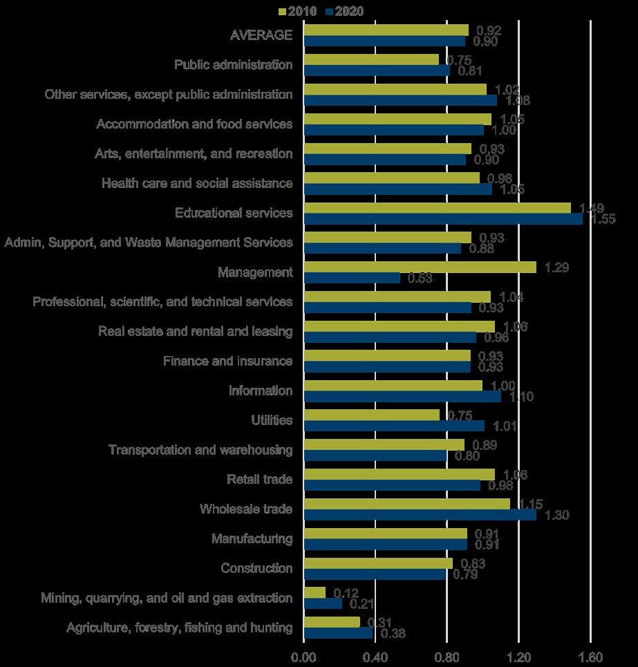
Source: REA Analysis using employment data from ACS 5-year estimates


This following analysis provides an overview of housing in St. Joseph County, with a focus on the County APC’s jurisdiction based on census data, county reports, and community feedback. This appendix summarizes demographic composition of county households, housing affordability and availability, real estate and residential building trends, housing in the context of land use and zoning, and community character. This chapter also outlines some key findings from the 2002 Comprehensive Plan for South Bend and St. Joseph County related to housing trends, needs, and forecasts.
Building Permits
Figures E.1 and E.2 display the rates at which building permits were obtained in St. Joseph County from January 2000 to January 2021, with data sourced from STATS Indiana. The low point was during the economic downturn in 2008 and 2009, with a total of 261 permits. The high point was January 2000, with a total of 1,665 permits.
Over the 2000 to 2021 time period, singlefamily and multifamily building permits were the most active. From 2001 – 2007 permits stayed steady at around 1,000 permits per year. Over the next 8 years, permit activity dropped with a low of 261 in 2009. 2017 saw a peak of 825 permits with the next low at 286 in 2020. Generally, St. Joseph County leads all other counties in the amount of building permits
obtained. Over that 21-year period, St. Joseph County has issued 15,331 permits, Elkhart County 11,447, Kosciusko County 5,913, and Marshall County 3,046.
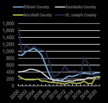
Source: STATS Indiana
Total housing stock in St. Joseph County is approximately 117,050 units. Of those units, 53.27% were built prior to 1970, and 66.73% have been built prior to 1980. Only about 10.92% of the housing stock was built during or after 2000. In the 1940s and 1950s, St. Joseph County far exceeded Indiana and the US in percentage of homes built. However, following the 1950s, St. Joseph County lagged behind Indiana in homes built, but then mirrored the overall statewide pattern of decline in construction since 2000. Approximately 10,000 units have been added since 2000.
The makeup of St. Joseph County’s housing stock is broken down in Figure E.3. The majority of the stock is single-family detached homes, at 74.8%. St. Joseph County’s mix is similar to Indiana with some variation. Indiana’s percentage of single-family homes is 73.1%. For multifamily homes, the state’s stock consists of 9.4% of total stock in 1-4 units and 12-6% in 5+ units. With regards to mobile homes, St. Joseph County is comparable to adjacent counties. St. Joseph County mobile home stock is 1.6% of the total.
Variation does exist among different communities. The Granger area has the highest percentage of single-family homes in the county with 98.5%. Mishawaka has the highest amount of 1-4 housing unit stock at 14.6%. South Bend has the highest percentage of 5+ units at 40.5%.
Source: ACS 5-Year Estimates
St. Joseph County communities saw decreases in owner occupied housing, and increases in renter occupied housing. The State of Indiana and the US have followed a similar trend. Mishawaka, Lakeville, and Roseland all have 50% or less of owner-occupied housing. Only Walkerton and North Liberty saw increases of owner occupancy from 2000. The unincorporated county has the highest rate of owner-occupied housing.
With the exception of Elkhart County, the percentage of owner occupied to renter occupied units decreased from 2000 to 2020 for adjacent counties, Indiana, and the US. The number of occupied rental units increased by roughly 17% from 2000 to 2020 (28,549 to 33,493 units) while the number of owner-occupied units decreased by roughly 1.8% (72,194 to 70,887). This likely means that about 1,307 units were converted from owner occupied to renter occupied, and about 3,637 new rental units were constructed. This increase may be in response to the number of universities in the county and the number of students seeking housing off campus.
Figure E.4 shows the occupancy rate of homes in unincorporated St. Joseph County, towns and cities in the County, as well as those in the US, Indiana, and adjacent counties, according to ACS 2020 5-year estimates. St. Joseph County’s vacancy rate is comparable to the statewide rate. Kosciusko and Marshall counties have slightly higher vacancy rates. South Bend, Mishawaka, New Carlisle, Lakeville, and Roseland all had higher vacancy rates than the overall county.
In general, housing is the largest expenditure of a household. The US Department of Housing and Urban Development (HUD) defines affordable housing as households not paying more than 30% of their gross income on housing, including utilities. HUD defines households spending more than that as costburdened, and the ability for these households to pay for other needs is severely reduced. Using this definition, in 2020, almost a quarter of all households (24,916 or 23.9%) in the county were cost burdened. There are more cost-burdened renter-households (13.7%) than owner-households (10.1%). Nationally, 30.3% of all households were considered costburdened in 2020.
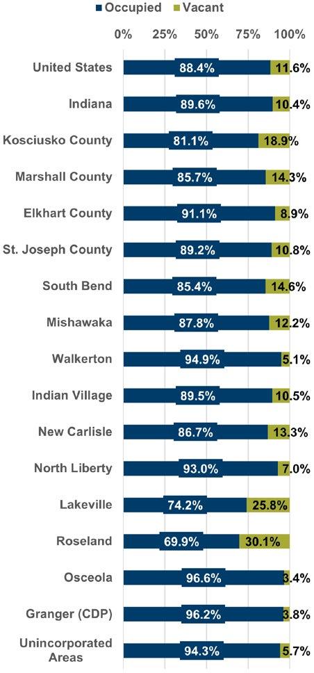
As shown in Figure E.5, St. Joseph County lags the US, Indiana, and adjacent counties in median home value. The 2020 median home value for St. Joseph County was $134,800. Comparatively, Marshall County’s median home value was at $144,400, Elkhart County at $149,300, and Kosciusko County at $153,500. The median home value for all of Indiana was $148,900 and the US was $229,800.
The average owner-occupied home value countywide was $134,800. The median gross rent in the county was $825 per month.
Generally, home values remain below $150,000 for communities in the County, with the exception of Indian Village, New Carlisle, and the Granger area. The Granger area had the highest home value at $230,200, followed
Figure
by New Carlisle at $157,800 and Indian Village at $153,100.
St. Joseph County is a stable community with 86.3% of the population living in the same residence as the previous year and 8.0% moving within the county. The 2022 American Community Survey estimates a total of 105,616 households in St. Joseph County. The average household size is 2.47 people, with family households having a larger average of 3.21 people. This is a slight increase from 2020, where there were 104,380 households (+1.17%).
Within the county’s 105,616 households, 44.1% are married couples, 7.3% are cohabiting couple households, and 15.2% are residents living alone without children. Additionally, 5.3%
are both living alone and 65+ years old. 31.5% of households have at least one or more member over 65 years of age.
Household income is a defining characteristic of a community’s economic strength because it demonstrates the purchasing power of residents. In 2020, according to the ACS 5-year estimates, the median household income was $54,433. Figure E.6 illustrates how household incomes vary across communities.
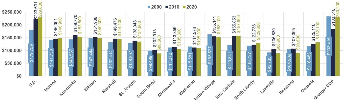
Source: Decennial Census (2000); ACS 5-Year Estimates (2010 and 2020)
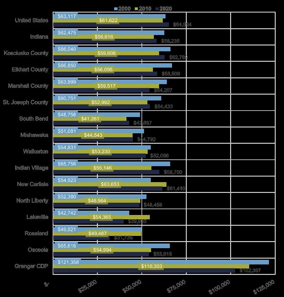
There are multiple ways to measure housing affordability. The following analysis will use two: the Housing Median Multiple method and the Housing Affordability Index (HAI) developed by ESRI, a leading GIS and data analysis company. In summary, these two method find housing to be relatively affordable in St. Joseph County compared to other parts of the nation. However, there are still a large number of households that are cost-burdened, as discussed in the previous “Housing Costs” section.
This affordability metric calculates the ratio between the median household income and median home value to determine the general affordability of housing for an area. Generally, an affordability value between less than 3.0 is considered affordable, while anything above 5.0 is unaffordable. St. Joseph County has an HMMI value of 2.47, meaning residents can generally afford local housing costs. However, this method does not account for many aspects of housing, such as mortgage interest rates and land values.
The Housing Affordability Index (HAI) measures the financial ability of a typical household to purchase an existing home in an area. An HAI of 100 indicates that the area’s median household income is sufficient to afford a typical home in the area. An index greater than 100 suggests homes are easily afforded by the average area household while
an HAI less than 100 suggests that homes are less affordable. This index is only applicable to owner-occupied housing units. Assumptions regarding interest rates, mortgage length, down payment, and debt service ratios are made to assess affordability.
The 2022 HAI in St. Joseph County is 154, meaning housing in the county is affordable. In comparison, the 2021 HAI nationally was 130, meaning. Therefore, homes in St. Joseph County are generally more affordable than elsewhere in the country. This aligns with the results of the HMMI.
In 2024, the St. Joseph County contracted with LandUseUSA to complete a residential target market analysis for northwestern St. Joseph County. This analysis explored the market potential for housing in four townships. The study provided information on expected tolerance for housing cost across 71 lifestyle
clusters. These lifestyle clusters classified groups based on multiple characteristics and attributes, shown in Figure E.7. Based on the clusters and other predictions, the analysis provided information on the types of housing needed in these townships, reinforcing the need for new building housing activity of a variety of unit sizes and price points. A summary of county wide housing needs was also provided under both aggressive and conservative/status quo scenarios.
Agricultural and residential uses are the primary land uses within the unincorporated areas of St. Joseph County. Agricultural uses comprise more than 70% of all land in the County (the study area of this plan), while residential uses account for around 20%, according to land use data from the County’s Planning Department. Within the residential use category, the singlefamily housing classification dominates other residential uses. Combined, less than 1%
Source: “Experian Decision Analytics.” Existing Lifestyle Clusters, St. Joseph County Residential Target Market Analysis (2024). More information on this housing study can be found on https://www.sjcindiana.gov/DocumentCenter/View/63672/St-JosephCounty-Real-Estate-Analysis
are dedicated to multifamily units and mobile homes. Multifamily housing in the County is mainly located near or adjacent to incorporated municipalities where developments can utilize municipal infrastructure and residents have access to city services and additional transportation networks.
The future land use map included in the 2002 Comprehensive Plan identified several focus areas for residential growth, including new development in the northwestern and southern parts of the City of South Bend, infill development in the northeastern part of the county, and rural growth in some of the smaller towns and unincorporated communities throughout the entire county. In the 20 years since the 2002 plan was adopted, residential growth and development has not followed the recommended land use patterns, resulting in continued undesirable sprawl and haphazard planning of subdivision/housing developments.
For instance, when the 2002 plan was written, residential growth in the Granger area was just beginning to demonstrate signs of slowing after the housing boom following World War II. However, the 2002 Plan’s future land use projections were formed using development data trends established in the 1990s. Based on these trends, areas of the Granger area along with the northeastern part of the county were considered a focus area for future residential growth. However, as shown in Figure G.7, there have been very few major subdivisions in the northeastern part of the County since 2000. Then, the economic downturn in the
St. Joseph/Elkhart County region in 2008 paused new investment until the end of that decade. As such, residential development did not flourish to the expected level in the other identified focus areas within Warren, German, and Centre townships between 2002 and 2020. During the economic recovery in the early 2010s, the number of residential developments was modest compared to the land use and projections and recommendations outlined in the 2002 plan. However, the 2002 plan did anticipate that some rural residential growth would occur in and around the southern portion of the county. This projection did manifest, and new residential development has emerged in areas adjacent to Walkerton, North Liberty, and Lakeville within the last dozen years.
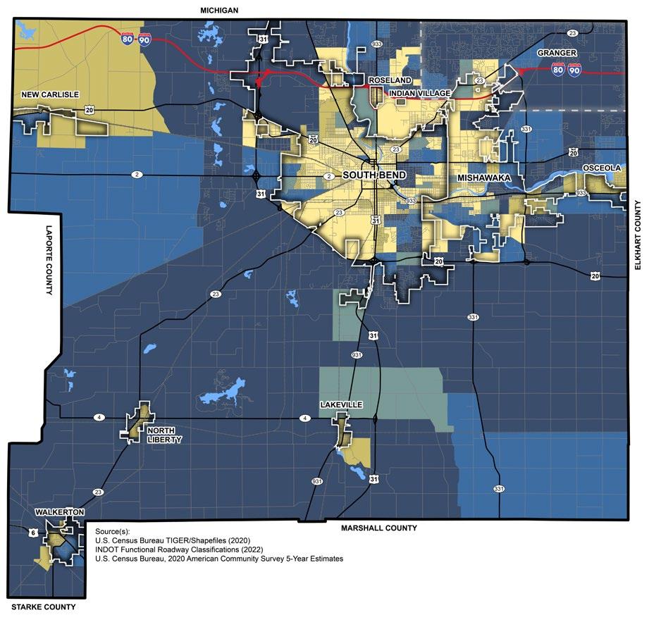
Figure E.9: Existing Residential Uses Map (2022)
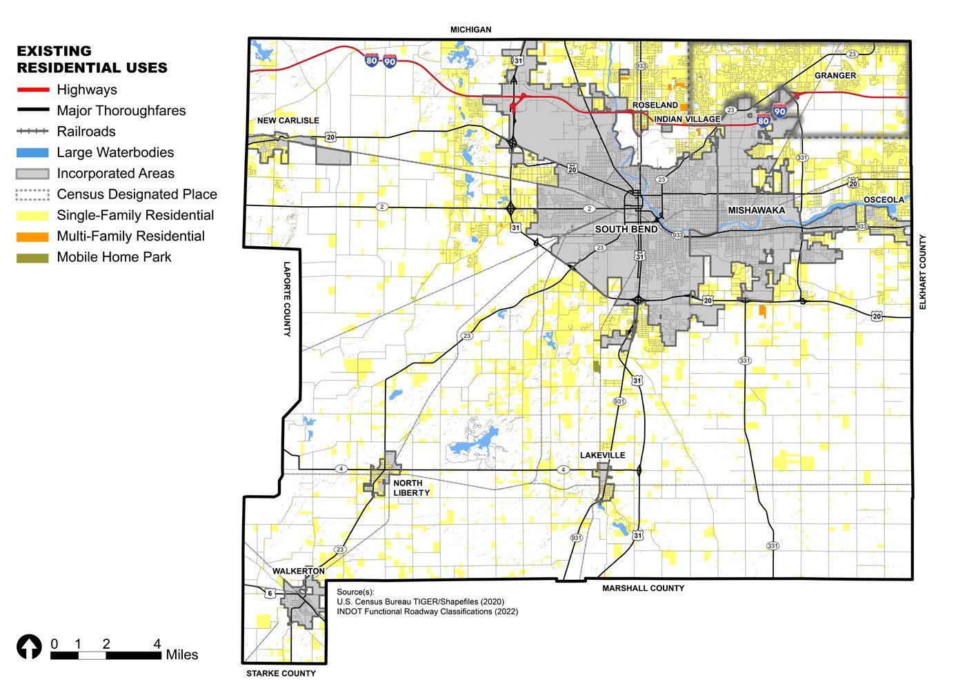
Figure E.10: Major Subdivisions by Decade Map
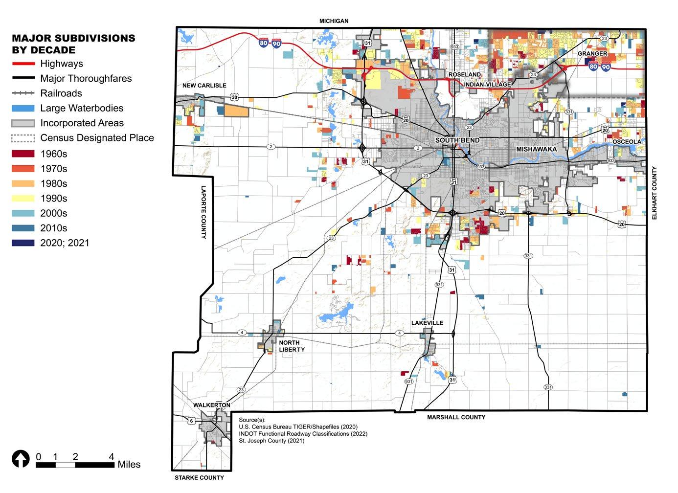


This section reviews the existing conditions that generally impact quality of life and efforts to build quality places in St. Joseph County. The term ‘quality of life’ encompasses a broad range of topics, including parks and recreation, education, safety, public services, and more. Some of these topics, such as public services, are already discussed in other appendices.
St. Joseph County has a county-wide parks system comprised of properties that are owned, managed, or partially-managed by the St. Joseph County Parks Department. These parks provide a variety of leisure activities including disc golf, geocaching, mountain bike trails, canoeing/kayaking, orienteering, running, and winter sports. Additionally, various events such as picnics or arts and cultural events are held at some of the parks throughout the year. Facilities are also available for rent for personal events.
Figure F.2 shows the park service area accounting for up to a 2.5-mile radius from each park location. The purpose of this graphic is to show possible gaps in access to
parks. Several factors including environmental constraints and lack of access may contribute to these gaps.
2024-2028 St. Joseph County Parks and Recreation Master Plan
The County’s current Parks and Recreation Master Plan, adopted in 2024, includes an inventory and analysis of park amenities with St. Joseph County. An analysis of existing events showcases what is available for people to use and participate in throughout the year. Through the master plan process, the County was able to identify where there may be gaps and overlaps in their recreational offerings for park users.
The plan reviewed several parks and facilities locations including St. Patrick’s County Park, Bendix Woods County Park, Ferrettie-Baugo Creek County Park, Spicer Lake Nature Preserve, the Lasalle Trail, Beverly D. Crone Restoration Area, Chamberlain Lake Nature Preserve, Jasinski Canoe Launch, and the Anderson Road Property, which has not yet been developed. Recommendations of the plan address not just physical improvements like new parks and amenities but also these
existing facilities. It also addresses need for staff to accommodate the anticipated level of service over the next years.
Potato Creek State Park, several smaller parks, golf courses, country clubs, sports practice fields, campgrounds, and school facilities provide additional opportunities for children, teenagers, and adults to visit and enjoy a wide variety of activities. Figure H.1 shows map of parks and outdoor amenities network locations across the County.
Figure F.1: 2024-2028 Parks and Recreational Master Plan
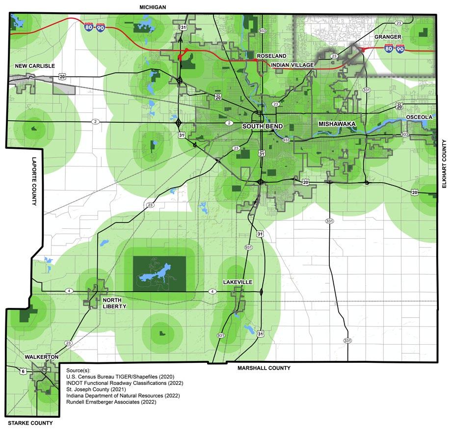


While connectivity is a topic primarily for the the Transportation pillar, it is also an important aspect of quality of life and place. It was brought up consistently with the Pillar Working Group, and it is seen as a major opportunity to better connect the St. Joseph County community both physically and socially.
There are major east-west routes across the northern half of the county, and several north-south routes connecting South Bend and Mishawaka to the southern portion of the County. All the major routes intersect with the Bypass (US 31/US 20) which acts as a “western edge” for South Bend and “southern edge” for South Bend and Mishawaka. The toll road (Interstate 80/90) runs east-west in the northern part of the county with three exits: US 31 (bypass), 933, and 331 (Capital Avenue). There are some barriers to east-west connectivity on the southern portion of the county. As US 31 was upgraded into a limited access highway as a new north-south route, SR 931, the main street of Lakeville, was no longer the primary north-south route.
Current activities offered by the County Parks Department can be viewed here: http://www.sjcparks.org/553/LeisureActivities
Bike and Trail Network
Figure F.3 shows the existing and planned active transportation routes located across the County. One of the major trails maintained by the County Parks Department is the LaSalle Trail, which starts in Roseland near the Roseland Town Park and runs north to the Indiana/ Michigan State Line, eventually connecting to Niles Township’s (Michigan) trails system. It is a 3.5-mile stretch that was once a part of the Interurban line that ran from South Bend to Niles, Michigan. The LaSalle Trail is the only trail that the Parks Department maintains. The LaSalle Trail is a dedicated trail separated from major roadways with the exception of when the trail may intersect a street.
Bike lanes are most commonly located within the City of South Bend, but a section of 931 in the County between Lakeville and South Bend has bike lanes as well. Since the construction of US 31, the daily traffic along SR 931 has reduced and the space once used for a vehicular lane is now used as a bike lane. Walking and shared-use paths can be found in some smaller towns like New Carlisle, North Liberty, and Walkerton, and within the Granger area. Most major roadways across St. Joseph County are not designed to support many users in a safe capacity, but South Bend and Mishawaka have been incorporating multi-modal strategies into their streets. More information about the transportation system, including planned improvements by MACOG, can be found in the Transportation (J) appendix.
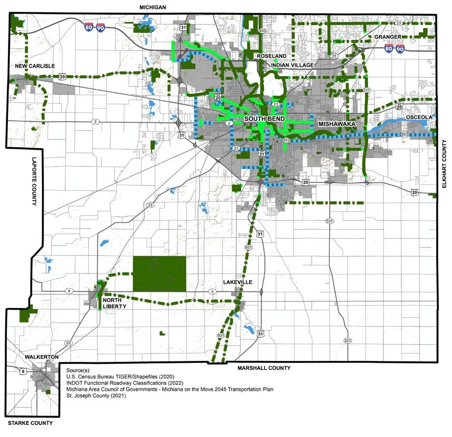
Public safety, including the perception of safety, is a critical part of improving the quality of life and place for residents. The chart in Figure F.4 shows a crime indices for different types of crimes for the counties within the MACOG region and the State of Indiana. The data were accessed via ESRI’s Community Analyst program and sourced from the firm, Applied Geographic Solutions. The base score (100) is the national average. A score that is higher than 100 means that area has a higher chance of crime occurring in general than the United States. The most recent version of these indices is from 2023 and can be found at https://appliedgeographic.com/ wp-content/uploads/2023/05/AGS-CrimeRiskMethodology-2023A.pdf.
St. Joseph County has a higher crime index rating than the other MACOG region counties in personal crimes, murder, robbery, assault, burglary, and motor vehicle theft. However, regarding the total crime index, St. Joseph County has relatively fewer crimes than across the United States, and the same relative number of crimes compared to the State, and to Kosciusko County.
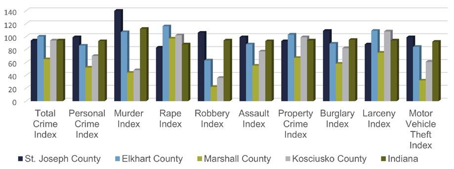
Based on the 2020 American Community Survey (ACS) 5-Year Estimates, 89.9% of people in St. Joseph County aged 25 years and older have a high school graduate degree or higher. These numbers are nearly the same to those at the state level. Approximately 90.7% Indiana’s population aged 25 or older have a high school graduate degree or higher.
High enrollment rates in a community’s schools are a prime indicator of educational quality and the ability for people to gain skills for future career opportunities. In total, 73,597, or 27.2%
of county residents are enrolled in some level of public and private school from preschool to graduate programs. The majority of children aged 5 to 17 years old, which encompasses preschool to high school graduation, is enrolled in school. One aspect of the County that these figures indicate is that education, at least through high school, is of high importance to residents. After high school, though, there is a large drop in college-aged residents, 20-24 years old, enrolled in school, indicating that many residents may either be leaving the County for other universities, are unable to afford higher education, or have no desire to pursue it.
St. Joseph County has an abundance of topnotch institutions of higher learning. Some of these include the University of Notre Dame, Saint Mary’s College, Holy Cross College, Bethel University, IU South Bend, Purdue PolyTechnic Institute, and Ivy Tech Community College. Additionally, a number of trade and vocational schools operate in St. Joseph County.
There are four public library systems in St. Joseph County: St. Joseph County Public Library, Mishawaka-Penn-Harris Public Library, New Carlisle-Olive Township Public Library, and the Walkerton-Lincoln Township Public Library. Across the four library systems, there are 15 branch locations throughout St. Joseph County.
St. Joseph County has six public school districts:
• John Glenn School Corporation,
• New Prairie United School Corporation,
• Penn-Harris-Madison School Corporation,
• School City of Mishawaka,
• South Bend Community School Corporation, and
• Union-North United School Corporation.
A complete list of schools and enrollment data can be found at https://sjcgis-stjocogis.hub. arcgis.com/
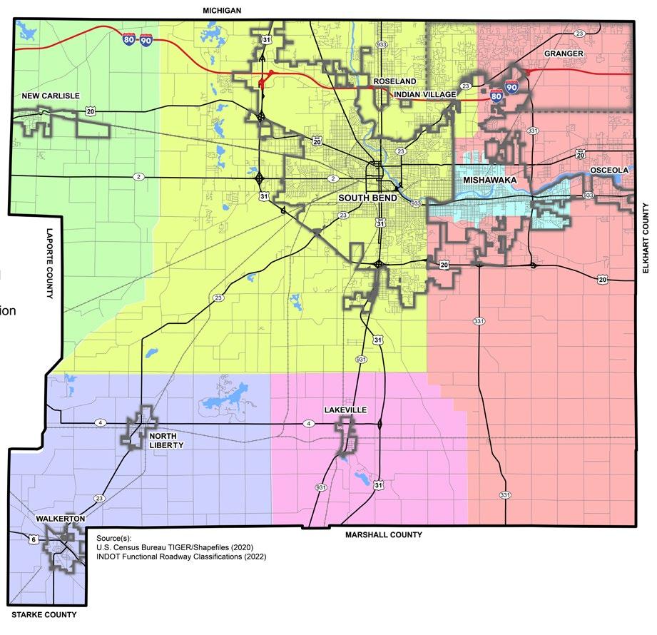
Penn-Harris-Madison School Corp.
On average, in 2020, County residents with a Bachelor’s Degree earned $46,214 and residents with a Graduate or Professional Degree earn $61,774/year. The difference in annual earnings between the degree-holding and non-degree population is approximately $15,000. Additionally, those who earned a Graduate or Professional Degree, on average, make about $16,000 more than those with a Bachelor’s Degree and $30,000 more than people with only a high school diploma.


Throughout the community engagement process, St. Joseph County community members defined the Environmental Stewardship Pillar as protecting the natural environment from harmful activity; reducing air, water, and land pollution; nurturing biodiversity of species; implementing sustainable development; restoring ecological balance; and promoting climate resiliency.
The following existing conditions analysis for the Environmental Stewardship Pillar are an addendum to the Key Findings section in the pillar’s respective chapter.
As an Environmental Steward, St. Joseph County is responsible for ensuring that development and growth occur in a way that enhances environmental resiliency and meets the needs of the present while protecting future generations. This section will provide an overview of some of the ecological and physical environmental factors found in St. Joseph County. Other pillars cover the social and cultural factors.
Consistent with the majority of northern Indiana, the landscape of St. Joseph County is dominated by plains and gently rolling hills. Except for areas directly adjacent to the St. Joseph River, a significant majority of the County has slopes less than 2%, making the area prime for development. Elevations within the County range from a high point of 930 feet on the south side of South Bend to a low point of 660 feet where the St. Joseph River exits the County into Michigan.
A St. Lawrence Continental Divide bisects the County, separating the north-south drainage basins of the Coutnty. The continental divide approximately splits the County in half running northwest to southeast. Waters that fall north and east of this divide drain to the Great Lakes and the St. Lawrence River. This is supported by the St. Joseph River that flows from the east and exits the County to the north, emptying into Lake Michigan. Conversely, waters that fall to the south and west of this divide drain to the Gulf of Mexico by way of the Kankakee, Illinois, then Mississippi Rivers.
Riverine
The St. Joseph and Kankakee Rivers are the two primary riverine systems within St. Joseph County, with additional ditches and tributaries feeding into them. The St. Joseph River has deviations into Willow and Juday Creeks. The appeal of this water feature has attracted development along its riverbank consistently throughout the County. The Kankakee River has been channelized into ditches to maximize the agricultural output of the basin. While it has been channelized and leveed in areas, the floodplain of the Kankakee River is vast, stretching miles wide at some points. These areas are prone to flooding but help provide yield for the adjacent agricultural uses that dominate the corridor. Altogether, over 25,400 acres, or nearly 40 square miles, of St. Joseph County sits within a floodplain. The Floodplain area equals 8.6% of the County’s total land area. Of that floodplain, nearly 80% of it is associated with the Kankakee River and its tributaries.
Less than 1% of land in the county, roughly 3.5 square miles, is covered by lakes. Worster Lake, a 327-acre man-made lake located within Potato Creek State Park, is the County’s largest open body of water. Chain-O-Lakes, comprised of Mud Lake (165 acres), North Chain Lake (78 acres), and South Chain Lake (95 acres), are naturally formed water bodies that are remnants of receded glaciers and the County’s geological history.
While not a consistent source or body of water, wetlands play a critical role in a watershed’s hydrology in that they filter toxins and pollutants from stormwater runoff before reaching the larger riverine or lacustrine systems. Because of this, wetlands are home to an abundantly diverse ecosystem of plants that create habitats for insects, mammals, and amphibians. Wetlands are identified by their distinct soil characteristics and associated plant communities. Classifications of wetlands present in St. Joseph County include freshwater emergent wetlands and freshwater forested/ shrub wetlands. Within St. Joseph County, there are 15,303 acres of identifiable wetlands. Because the north and east portions of the County have been heavily developed, many of the wetlands that may have been present in those areas no longer exist. The bulk of the County’s wetlands are located in the south and west portions and are associated with the watersheds of the Kankakee and Yellow Rivers.
There are eight aquifers in St. Joseph County, all associated with the corresponding St. Joseph or Kankakee River basins. According to the Indiana Department of Natural Resources publications, these are all unconsolidated deposits of glacial sand and are the primary groundwater source within the County. The Nappanee Aquifer System, the Hilltop Aquifer System, and the St. Joseph Aquifer System and Tributary Valleys are all generally associated with the St. Joseph River basin and located in the eastern and northern portions of the County. The Eolian Sands Aquifer System, the Maxinkuckee Moraine Aquifer System, the Valparaiso Outwash Apron Aquifer System, and Kankakee Aquifer System are all associated with the Kankakee River basin and are located in the southern and western areas of the County. The Valparaiso Moraine Aquifer System is located in northwestern St. Joseph County. Figure G.1 shows the aquifer systems serving St. Joseph County.
RIVERINE:
1. Relating to, formed by, or resembling a river.
2. Living or situated on the banks of a river.
LACUSTRINE:
Of, relating to, formed in, living, or growing in lakes.
PALUSTRINE:
1. Living or thriving in a marshy environment.
2. Being or made up of marsh.
An excellent resource for authoritative data and research about the natural environment and its relationship with and impacts on society is the EnviroAtlas:
https://enviroatlas.epa.gov/enviroatlas/ interactivemap/
This nationwide resource covers topics such as water supply, algal blooms, crop productivity, energy potential, and much more.
G.1: Aquifer Systems Map
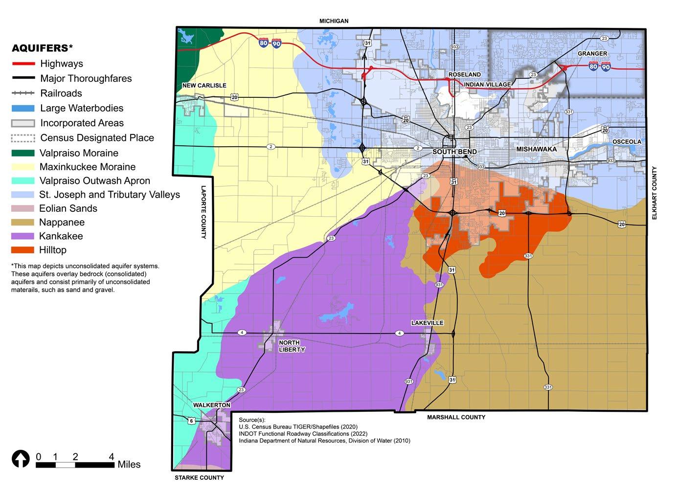
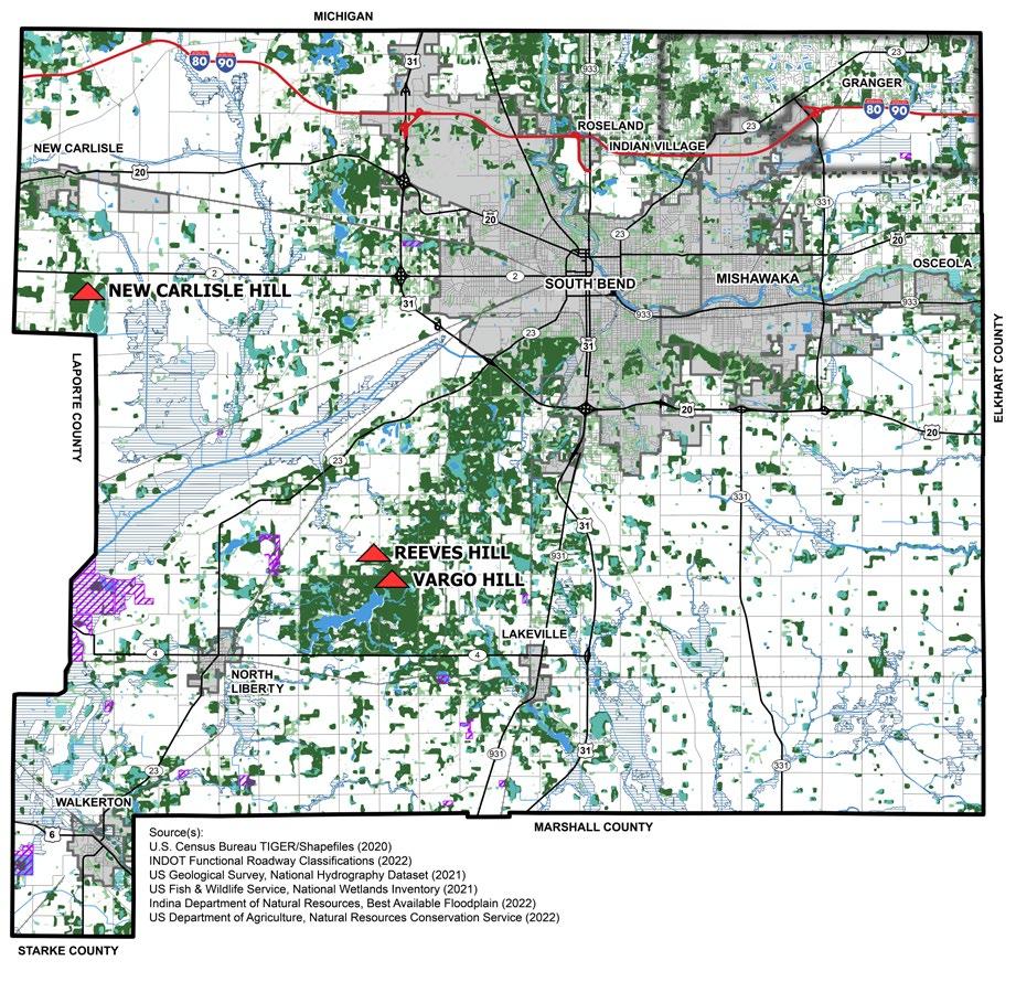

There are areas of St. Joseph County that have remained historically undeveloped or unfarmed due to constraints pertaining to soil quality, slope, or hydrologic patterns and tend to stay in their natural or near-naturally vegetated condition. While these areas may be undesirable from a development or agricultural perspective, they play a significant role in maintaining the natural integrity and aesthetic of the area, housing native vegetation and the habitat for local species. These ecosystems are acclimated to, and therefore thrive, in the area’s natural conditions.
The greatest concentrations of these areas often coexist within, or directly adjacent to, floodplains, for multiple reasons. Some poorly drained areas of floodplains have high water tables not conducive for agriculture or development. Alternatively, they lie at the extent of the floodplains where the land rises to higher ground and slopes make these activities non-feasible as well. As such, many of the remaining natural areas within St. Joseph County are found along the southern plateau of the County defined by the southern extents of both the Kankakee and St. Joseph River basins. Additionally, large areas within those river corridors, both in the western and northern portions of the County, are also home to large strands of vegetation. Aside from large swaths or parcels as described, undeveloped land throughout the County maintains vegetation and contributes to the overall native ecosystem of the area.
The largest and most pristine natural areas within the County are areas designated as public parks. Potato Creek State Park is one of Indiana’s 24 state parks. It is located 12 miles southwest of South Bend and three miles east of North Liberty. It includes restored prairies, matured woodlands, thriving wetlands, and the 327-acre Worster Lake. The State Park provides year-round respite and recreational opportunities for the public to enjoy, while also protecting the eco-systems native to St. Joseph County. It is operated and maintained by the Indiana Department of Natural Resources (IDNR).
Following the natural escarpment northeast from Potato Creek, and paralleling the headwaters of the Kankakee River basin, a corridor peppered with smaller water bodies and woodlots is the largest remaining contiguous natural corridor within the County. Rum Village is at the northern extent of this corridor, just before entering the urbanized area of South Bend. Rum Village is a 160acre park site operated and maintained by the City of South Bend Venues, Parks, and Arts and offers recreational opportunities, wildlife preservation, and education.
As glaciers once covered Indiana and later receded, they deposited till atop the already present bedrock. This mixture of sand, silt, clay, and boulders is the soil composition of St. Joseph County today. A significant portion of the land in the County is fertile and productive, making agriculture a logical and suitable use. Listed in Figure G.3 are the County’s soil types, in descending order of prevalence. Figure G.4 shows the soil types prevalent in St. Joseph County. Figure G.5 shows drainage characteristics of each soil type, or the ability for water to permeate the soil.
The predominant soil type within St. Joseph County is Tyner-Oshtemo, a deep, excessively drained soil formed in the sandy outwashes or beach deposits in the northern and southwestern portions of the County. The texture of this soil is loamy sand to fine loamy sand. Because of its excessive ability to drain, the potential for surface runoff is low and permeability high. This soil mixture is conducive to growing crops but is often supplemented with irrigation systems. The native vegetation of this soil is a deciduous forest.
Both Crosier-Brookston-Milford and the Rensselaer-Gilford-Maumee soils have poor drainage and relatively high-water tables ranging from six inches above the surface to one foot below. As a result, these soil types limit land use to agriculture almost exclusively. Oftentimes, the areas with these soil types are left as undeveloped pastures or woodlots. The native vegetation of this soil is a deciduous forest, marsh grasses, and edges.
Riddles-Miami-Crosier soils are deep, welldrained soils formed in loamy and dandy till on till plains and moraines. This is shown by the large swath of this soil type that lies in the southern portion of the County and follows the southern edges of both the Kankakee and St. Joseph River basins. Dominant use in these areas is agricultural due to the well-drained properties of both the surface and subsurface but can be limited due to the tendency of rolling slopes. The primary crops are corn, soybeans, and small grains. Where slopes preclude agriculture, the rolling areas tend to be permanent pastures or forests. The native vegetation for this soil type is deciduous forest.
The Houghton-Adrian-Palms soil type is located primarily in the tributary corridors of the Kankakee and Yellow Rivers. This soil is deep and exhibits poorly drained deposits of herbaceous organic material found in depressions and drainage ways. Its drainage is poor, and the water table is high, often reaching two feet above the surface. Use beyond agriculture is limited, and only select crops like mint will tolerate this soil. Native vegetation is primarily marsh grasses, sedges, reeds, and some water-tolerant tree species.
The remaining soil types within the County appear in smaller, less prevalent pockets often directly adjacent to, or surrounded by, those soils previously mentioned and share similar characteristics and land uses.
Additional soil information can be referenced in the Soil Survey of St. Joseph County, Indiana as published by the United States Department of Agriculture and the Natural Resources Conservation Service, in cooperation with Purdue University Agricultural Experiment Station and Indiana Department of Natural Resources Division of Soil Conservation and State Soil Conservation Board. The USDA also provides an interactive soil map available at https://websoilsurvey.sc.egov.usda.gov/App/ WebSoilSurvey.aspx
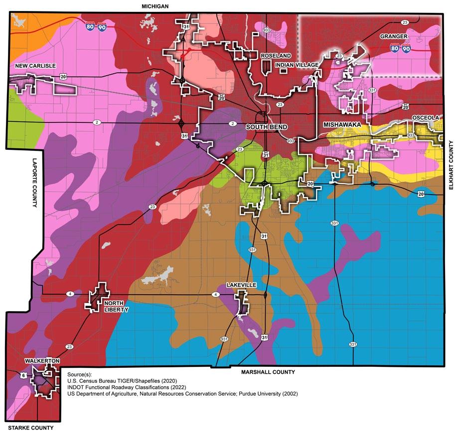
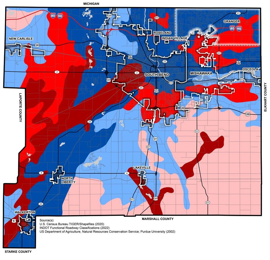
The largest and most important environmental constraint to development in the County is the suitability of different types of soil for septic tanks. As noted in the 2002 Comprehensive Plan, there are moderate to severe limitations on the use of septic systems on these soils:
• Tyner-Oshtemo
• Rensselear-Gilford-Maumee
• Crosier-Brookston-Milford
• Morley-Blount
• Riddles-Miami-Crosier
• Houghton-Adrian-Palms
The floodplain in the County will likely limit future development west of the Chain O’ Lakes, especially along the Kankakee River. Most of the land is currently being used agriculturally due to the massive floodplain covering much of that area. It is strongly recommended that development be severely limited in this area, otherwise, floodplain mitigation strategies will need to be implemented to reduce adverse impacts on residential health, safety, and wellbeing. Development should also be limited or severely restricted in the large floodplains east of Lakeville and south of I-80/90 in the Granger area.
There are also environmental constraints to development northeast of Potato Creek State Park, where there are many wetlands that enhance biodiversity and help protect the water supply in that area. This area also features two
summits, or high points, in the County: Reeves Hill and Vargo Hill. These summits can provide recreational opportunities for residents, as well as a chance to learn about natural systems in this environmentally sensitive area.
Point Source Pollution
St. Joseph County’s urbanized areas have a history of industrial development, specifically in the automobile industry. The historical base of the County’s economy, much of which developed prior to current environmental regulations, introduced a significant number of pollutants to the air, ground, and water decades ago. Threats to natural resources are located at and near the sites where byproducts and waste from these uses were released, intentionally or unintentionally, into the ground and waterways.
Former sites of point source pollution may be ideal candidates for brownfield redevelopment efforts. Brownfields are areas of land that have been previously developed, suffer from the presence of pollution or hazardous substances, and have been subsequently abandoned. Figure G.6 identifies brownfields in the County’s incorporated and incorporated areas. Brownfield redevelopment was noted as a priority of the community and can be an effective measure of preserving the environment. Brownfields in the County are largely centered around South Bend; however, two exist outside of South Bend’s city limits south along U.S. 31, as well as a site east of Mishawaka along U.S. 20.
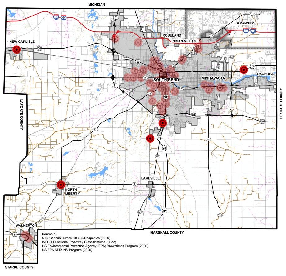

Nonpoint source pollution are ambiguous pollutants that cannot be traced to a single release point or cause but are broader in scale. An example is stormwater runoff from roadways, which may contain fluids leaked from automobiles, bits of tire rubber, dog waste, or trash. Nonpoint pollution prevails in urban areas where stormwater does not infiltrate where it falls, but rather travels across impervious surfaces and into drainage systems, carrying these pollutants when entering waterways. In addition to urban runoff, rural runoff can also contribute to nonpoint pollution by carrying agricultural pesticides and fertilizers from fields or sediment from soil erosion into nearby streams and waterways.
Figure D.9 also shows impaired waterways that do not meet federal standards for the seven beneficial standards set forth by the Clean Water Act, such as aquatic life habitat, drinking water supply, fish consumption, and water contact recreation.
While direct and indirect pollution negatively impact the environment, another threat is the depletion of natural resources. Removal of woodlands and wetlands not only damages ecosystems, but it also eliminates decades of growth and habitats from existence. This also applies to the ground itself; where certain soil types or landforms are conducive to agricultural use or provide flood remediation within a floodplain, the removal of those soils harms the natural systems. As such, where feasible, it is significantly more advantageous to redevelop land that has already been impacted by previous development. Infill development assists the natural environment in numerous ways. Firstly, it reuses land that may have previously been built upon but is no longer serving a beneficial use. This spares additional, non-developed land, referred to as greenfield, from being impacted. Secondly, infill areas are generally already serviced by infrastructure such as roadways and utilities and, therefore, can recapture lost use of that infrastructure instead of extending it and putting additional strain on its capacity.
While the protection of natural resources is vitally important in the world in which we live, it cannot always be the determining factor of the future of development within a community. Rather, some practices encourage responsible development and growth, while also protecting and respecting these resources. One such
set of recommended practices can be derived from a framework of criteria developed by the Sustainable SITES Initiative, and now part of the LEED (Leadership in Energy and Environmental Design) rating system, administered by the U.S. Green Building Council (USGBC). These criteria are broken into different qualifying categories, including site selection and context, design process, site design categories such as water, soil and vegetation, materials, human health, and wellbeing, and even the construction process and long-term operations and maintenance. An example of sustainable development criteria, sourced from the USGBC SITES Scorecard, can be seen in Figure D.10.
There is an increasing desire and demand for identifying and remediating brownfields to facilitate these sites being attractive for redevelopment and economically viable. MACOG has begun the process of identifying and categorizing sites in St. Joseph County. The next step will be to identify funding and/ or partners to remediate the sites. Indiana has a strong Brownfields program that assists in getting sites remediated and securing a “No Further Action” letter from IDEM which is a critical step in the redevelopment of the sites.
1: SITE CONTEXT
Limit development on farmland
Protect floodplain functions
Conserve aquatic ecosystems
Conserve habitats for threatened and endangered species
Redevelop degraded sites
Locate projects within existing developed areas
Connect to multi-modal transit networks
2: PRE-DESIGN ASSESSMENT + PLANNING
Use an integrative design process
Conduct a pre-design site assessment
Designate and communicate VSPZs
Engage users and stakeholders
Manage precipitation on site
Reduce water use for landscape irrigation
Manage precipitation beyond baseline
Reduce outdoor water use
Design functional stormwater features as amenities
Restore aquatic ecosystems
4:
DESIGN - SOIL + VEGETATION
Create and communicate a soil management plan
Control and manage invasive plants
Use appropriate plants
Conserve healthy soils and appropriate vegetation
Conserve special status vegetation
Conserve and use native plants
Conserve and restore native plant communities
Optimize biomass
Reduce urban heat island effects
Use vegetation to minimize building energy use
Reduce the risk of catastrophic wildfire
5: SITE DESIGN - MATERIALS SELECTION
Eliminate the use of wood from threatened tree species
Maintain on-site structures and paving
Design for adaptability and disassembly Use salvaged materials and plants Use recycled content materials
Use regional materials
Support responsible extraction of raw materials
Support transparency and safer chemistry
Support sustainability in materials manufacturing
9.
Protect and maintain cultural and historic places
Provide optimum site accessibility, safety, and wayfinding
Promote equitable site use
Support mental restoration
Support physical activity
Support social connection
Provide on-site food production
Reduce light pollution
Encourage fuel efficient and multi-modal transportation
Minimize exposure to environmental tobacco smoke
Support local economy
Communicate and verify sustainable construction practices
Control and retain construction pollutants
Restore soils disturbed during construction
Restore soils disturbed by previous development
Divert construction and demolition materials from disposal
Divert reusable vegetation, rocks, and soil from disposal
Protect air quality during construction
Plan for sustainable site maintenance
Provide for storage and collection of recyclables
Recycle organic matter
Minimize pesticide and fertilizer use
Reduce outdoor energy consumption
Use renewable sources for landscape electricity needs
Protect air quality during landscape maintenance
+ PERFORMANCE MONITORING
Promote sustainability awareness and education
Develop and communicate a case study
Plan to monitor and report site performance
OR EXEMPLARY PERFORMANCE
Innovation or exemplary performance
Project confident points are achievable


Agriculture plays a vital role in St. Joseph County, not only by preserving the community’s character but also by promoting farming as a cornerstone of the local economy. Farmland preservation is widely supported by residents, who recognize its numerous benefits, including enhancing food security, preventing sprawl, and maintaining the rural landscape as a valuable community asset. Recognizing the long-term economic, environmental, and social costs of losing farmland has led many communities to take steps to protect their agricultural lands. Local governments have adopted planning, regulatory, and programmatic strategies to preserve farmland and support the viability of their agricultural sectors.
Farmland Preservation is key to a wellrounded plan, offering a vision for protecting the County’s bountiful open spaces, limiting urban sprawl, and sustaining a meaningful economic asset to the County and region. Given its history of significance in shaping St. Joseph County’s landscape and rural heritage, farmland continues to play a critical role in the County’s long-term environmental health and economic prosperity.
St. Joseph County is located in one of the most fertile ecoregions found across the world. The soils found in the US Midwest region, and St. Joseph County specifically, are almost all classified by the US Department of Agriculture (USDA) as prime farmland (depicted in Figure H.1). The USDA defines prime farmland is as “land that has the best combination of physical and chemical characteristics for producing
Figure H.1. National Prime Farmlands Map (2022)
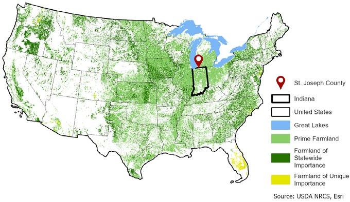
food, feed, forage, fiber, and oilseed crops and is also available for these uses. The land could be cropland, pastureland, rangeland, forestland, or other land but not urban builtup land or water.” More definitions of farmland classifications are provided later in this section. In general, farmland in the County has been converted to non-agricultural use for two main reasons: (1) weakening economic viability, especially on smaller farms, and (2) unsustainable development practices that result in the inappropriate conversion of farmland into nonagricultural uses.
The following analysis of farmer and farmland characteristics uses data predominantly from the Censuses of Agriculture from 1987 to 2017. The USDA’s National Agricultural Statistics Service publishes the Census of Agriculture every five years. The most recent Census of Agriculture was released in 2024, with data surveyed in 2022. Where trends have changed from the 2017 census data to the 2022 Census Data, the newer data has been incorporated. The Plan references the U.S. Census Bureau for data unavailable from the Census of Agriculture.
The total land in farms, shown in Figure H.2, grew by 15.9% from 1997 to 2007. Then, from 2007 to 2017, farmland decreased by 18.6%. Cropland, or land used for growing crops, saw the most significant decrease of 20.8% during this time period compared to the previous period of growth (14.1%) between 1997 and 2007. Pastureland has continuously declined since 1997, dropping by 44.6% from 1997 to 2007, then slowing to a drop of 8.2% from 2007 to 2017. From 2017 to 2022, the total land in farms increased by 2%.
The periods of growth (1997 to 2007) and decline (2007 to 2017) can be attributed to land taken out of production, labeled as “Other” in Figure H.2. This category comprised 9.0% of land in farms in 2017, as opposed to only 3.5% in 1997.

Cropland: Land that is used for growing crops.
Pastureland: Land that is used for pastures and/or livestock grazing.
Other: Land that is owned by a farm but not used for pastures or crops.
Source: US Department of Agriculture, National Agricultural Statistics Service,
(1987 - 2017).
Farm operations, or simply “farms,” are the backbone of the agricultural economy. The type of operation, ownership, and operational size are significant characteristics of farms because they can reveal the big trends in the farming community. America’s farms represent a diverse set of business operations and farm operators. The USDA has consistently defined a farm as “any place that, during a given year, produced and sold—or normally would have produced and sold—at least $1,000 of agricultural products (not adjusted for inflation).” Farm size is measured not by acreage, but by gross cash farm income (GCFI), which includes revenue made on the farm as well as government payments such as subsidies and crop insurance payouts. Most US farms and farms in Indiana are small family farms. Larger farms tend to have a larger share of gross income that is profit. Thus, they are less susceptible to financial liabilities than small farms or midsize farms.
1. The number of farms overall has decreased by 29.9% since 1987.
2. The average size of a farm has increased by 44 acres, or about 33 football fields, since 1987. From 2017 to 2022, the average size of a farm in acres in increased by 17%.
3. The number of midsize farms is much lower than the number of small and large farms, and the number of large farms are growing.
4. The majority of farms fully or partially own their land. However, the percent of farmland being rented has continued to outpace the percent of owned farmland, suggesting that farms that rent their land is a rising trend.
The 2017 Census of Agriculture recorded a 29.9% drop in the number of farm operations in the County from 1987 to 2017. This drop has coincided with an increase in the acreage of farms. An in-depth analysis of farm ownership (see Figures H.3 through H.5) finds that while family/individual remains the largest type of farm ownership organization, other types of farm owners have grown. From the data that is publicly available, farm partnerships (more than one owner-operator, which can include multiple families/individuals) have had the most significant growth since 1987 to 2017. However, during this same period, the number of partnerships has decreased from 73 to 31. This likely indicates some conglomeration of partnerships. It also means the number of farmers participating in partnerships in the County have gotten significantly larger since 1987. Meanwhile, family-held corporate farms have owned between 8 to 12% of farmland in the county since 1987. Two categories, “Other” and “Non-Family Corporations,” make up the remainder of the County’s farmland.
Source: US Department of Agriculture, National Agricultural Statistics Service, Census of Agriculture (1987 - 2017).
Source: US Department of Agriculture, National Agricultural Statistics Service, Census of Agriculture (1987 - 2017). *The “Other” category includes farms for research, education, cooperatives, other institutional uses, etc. (USDA).
In addition to the type of farm operations, knowing how much active farmland is owned versus rented may give insight into the expected future use of agricultural land (see Figure H.5). This data can be helpful as there may be different motivations between a landowner and renter to sell, develop, or preserve farm properties. From 1987 to 2017, farm operations renting their land dropped from 11.7% to 5.6%. However, during that
same period, the acreage of rented farmland increased from 47.1% to 54.1% of total available farmland in the County. The data suggests that farms have consolidated and expanded in size, which supports the trend of growing farm partnerships and a shrinking number of individual operators.
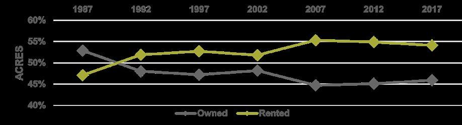
The acreage of a farm affects many aspects of its operations. Typically, larger farms require more expensive equipment, mainly grow commodity crops such as corn and soybeans, export their products to consumers outside the local economy, and are highly efficient due to advantages associated with their scale. Smaller farms are generally more cost-burdened by equipment, may have higher operating costs, and usually able to grow various seasonal products, including fruits and vegetables. They are also more likely to sell to local customers, via local venues such as farmers’ markets.
Analyzing farm size data reveals that farms have increased in acreage overall since 1987. As illustrated in Figure H.7 and H.8, total farmland acreage is mainly occupied by farms with 500 or more acres, which increased from 50.6% of farmland in 1987 to 72.3% in 2017. Meanwhile, farms with 50 to 499 acres have decreased from 45.2% to 23% of all farms, and the amount of farmland owned by farms with less than 50 acres has slightly increased from 4.1% to 4.7%. According to 2022 census data, the majority of farms in St. Joseph County (41%) are between 10 to 49 acres, but the number of larger farms has increased.
According to 2022 census data on farm size, St. Joseph County has 154 farms that make less than $2,000 (28% of total) and 173 farms making $100,000 or more (32% of total). This follows trends across the US and the State of Indiana, where there are a larger number of small farms and large farms, but less mid-size farms. Many of the farms that failed between 2017 and 2022 were farms with sales between $100,000 and $500,000 GCFI. However, a significant number of farms with sales with less than $10,000 also failed. Taking this data together with an increase in farm acreage, this likely means there has been conglomeration and consolidation within the farm industry with more large farms holding a larger share of profit.
Source: USDA, NASS, Census of Agriculture (1987
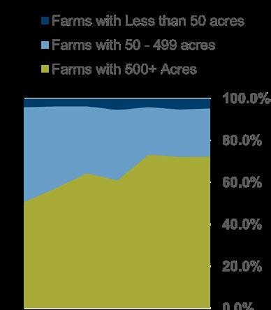
The following section on farmer demographics uses data from the USDA Census of Agriculture and the U.S. Census Bureau American Community Survey (ACS). St. Joseph County follows many national trends regarding the socioeconomic make-up of the county’s farming community. Three significant trends are taking place:
1. The average age of St. Joseph County farmers was 57.1 years old in 2017 and increased to 58.4 in 2022. It is likely to continue to increase.
2. Agricultural wages have grown significantly since 2010 but are still falling slightly behind the state average. Adjusted for inflation, the 2020 median income for St. Joseph County residents working in the agricultural industry in was $35,721 compared to the state average, $36,892.
3. The number of new and beginning farmers in St. Joseph County (operating for less than 10 years) has increased from 118 producers in 2017 to 124 producers in 2022, which is overlaps with the period when wages increased.
According to ACS 5-year estimates, the median income (adjusted for inflation) for agricultural workers in the County nearly doubled from $19,231 in 2010 to $35,721 in 2020. However, workers’ incomes have almost always been lower than both the state and national averages, as shown in Figure H.10. In the same graph, there are spikes in the County’s median agricultural worker’s income in 2016 and 2020.
The farming workforce is rapidly aging in the County. Since 1987, the average age of farmers has increased from 50.9 years old to 56.7 years older in 2012. This change in age has coincided with a rise in senior farmers and a drop in younger farmers. Between 1997 and 2012, the total number of farmers in St. Joseph County aged 70 years and older increased from 107 (11.9% of total farmers) to 123 (17.8%).
Simultaneously, the number of farmers under 34 years old decreased from 132 (14.7%) in 1987 to 45 (6.5%) in 2012. Figure H.11 shows a complete array of age data for county farmers.
From 2017, there is a spike in the total number of producers measured, which indicates that there is an increase in the number of farmers entering the industry at any age range. These producers are known by the USDA as “new and beginning farmers”—farmers who have operated a farm for 10 years or less. According to agricultural census data on operators from 2017 to 2022, the number of producers with 6-10 years of experience on an operation did increase from 118 producers to 124 (5.1%).
An aging workforce likely indicates that farm partnerships and consolidations will continue to become more prevalent because the expenses and time required to run a farm operation are shared between multiple
farmers. These workforce changes may also result in taking increasingly larger farms and/ or vacated farmland land out of production due to a labor shortage or disinterest from the following generation/landowner in continuing to farm. However, there is an increase in the number of new and beginning farmers. This increase occurs during the same time period during which there was an increase in income (from 2016 to 2020). This suggests that while the workforce is aging, if farms prosper, new people will join the industry.
H.11: Average Age of a Farmer (1987 - 2017)
Source: USDA, NASS, Census of Agriculture (1987 - 2022). *Age group data for the 2017 and 2022 Census was categorized by USDA different from previous censuses.
This soil analysis of the County is based on the USDA’s National Commodity Crop Productivity Index (NCCPI) and observations of drainage patterns and effects on farming activities. The NCCPI is a soil-based index that ranks the inherent capability of soils to grow commodity crops, such as corn and soybean, without irrigation.
The map in Figure H.12 shows the NCCPI ratings of soil productivity across the County’s various communities. Since the NCCPI does not take irrigation, a widespread agricultural practice, into account, most farmland is even more productive than what is displayed on the map. However, this analysis only considers the soils’ inherent capabilities for crop production to know which soils to conserve, protect from erosion, and encourage restrictions on urban development.
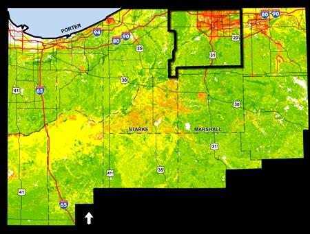
The County has some of the most productive soils in northwest Indiana, as illustrated in Figure H.12. Within the County itself, though, the soils with the lowest capability for commodity crop production are, most obviously, the urban core of the County. However, most of the Granger area, areas around Portage Road and Notre Dame University, and east of Mishawaka to the County border also display low capability for commodity crop production.
Soils with average or moderate capability are located near the Chain O’ Lakes (west of South Bend), north of New Carlisle, and south of Osceola. The land along State Road 23, heading toward North Liberty and Walkerton, has a high-to-moderate capability for commodity crop production; this area should be closely monitored since it contains a significant amount of the County’s “farmland of statewide importance,” shown in Figure H.15.
Drainage systems are vital for productive and arable farmland because they help to create favorable soil conditions. An effective drainage system also helps to prevent crops from being inundated during a heavy rainstorm by giving the water a manageable drainage route. The County’s drainage system consists mainly of ditches, along with a few creeks and rivers.
The County’s waterways drain into two major waterbodies: Kankakee River and St. Joseph River. A third river, Yellow River, has a smaller footprint in the County and serves far southeast farms in Madison and Union Townships.
Kankakee River, along with the ditches and creeks that feed it, make up one of the most vital parts of the County’s drainage system for farming. The major ditches and creeks of the Kankakee River, based on the number of tributaries, length, and generally how much water they carry are:
1. Grapevine Creek, located directly west of South Bend and the Chain O’ Lakes,
2. Niespodziany M. Ditch, which starts near New Carlisle between Wintergreen Road and Walnut Road, and
3. Potato Creek, which starts in Potato Creek State Park and travels through North Liberty to the Kankakee River.
Unlike the County’s western portion, much of the drainage systems in the southern and eastern portions are a collection of ditches that feed into one or two major waterways like Yellow River. The major ditches and creeks of the rest of the County for farmland are:
1. Rogers, O. #2 Ditch,
2. Grimes Ditch,
3. Maier Ditch/Kline Ditch,
4. Yellow River/Newcomer Ditch,
5. Juday Creek and Willow Creek
6. East Bunch Ditch
Figure H.13: National Commodity Crop Productivity Index Map
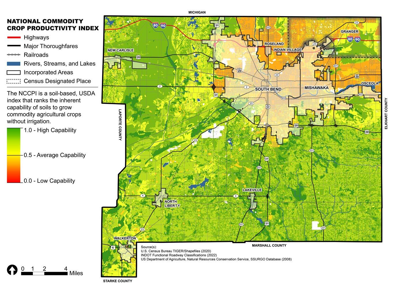
St. Joseph County is situated in one of the most fertile regions in northern Indiana, and contains the Kankakee River basin, a critical environmental and drainage feature for farmland. Figure H.15 illustrates prime farmland in the County with two designations from the USDA: prime farmland and farmland of statewide importance. The map is accompanied by Figure H.14, which details the acreage of each type of farmland and how much has been developed as of 2022.
The USDA National Soil Survey Handbook defines prime farmland as available land with the best physical and chemical characteristics for producing food, feed, forage, fiber, and oilseed crops. It has the combination of soil properties, growing season, and moisture supply needed to produce sustained high crop yields economically if treated and managed according to acceptable farming methods. Prime farmland generally has an adequate and dependable water supply from precipitation or irrigation, a favorable temperature and growing season, a proper acidity or alkalinity level, an acceptable salt or sodium content, and few or no rocks. The soils found in these areas are permeable to water and air. Prime farmland is not excessively eroded or saturated with water for long periods, and it either does not flood frequently during the growing season or is protected from flooding.
The USDA defines farmland of statewide importance is defined as land, in addition to being valuable for producing food, feed, fiber, forage, and oil seed crops, that is determined
to be prime and unique farmlands statewide by the Indiana State Department of Agriculture (ISDA). Unique farmland is land other than prime farmland that is used for the production of specific high-value food and fiber crops. It has the special combination of soil quality, location, growing season, and moisture supply needed to economically produce sustained high-quality and/or high yields of a specific crop when treated and managed according to acceptable farming methods.
The Kankakee River basin encompasses much of the southwest portion of the County. The basin contains the St. Lawrenche Continental Divide. State Road 23 runs parallel to he Kankakee River, the primary water source of the basin. It also defines the southern borders of Olive and Warren Townships. The basin contains the largest continuous area of prime farmland of statewide importance.
In the unincorporated County, east of New Carlisle, a large strip of farmland of statewide importance can be found along Grapevine Creek, as shown in Figure H.15. This creek is crucial because it is one of the northernmost waterways that flow south into the Kankakee River. This area is also found east of an extensive industrial development, the Indiana Enterprise Center (IEC). Possible pollutants from this development may impact farmland productivity and natural ecosystems in the southwestern parts of the County by traveling via Grapevine Creek. Careful consideration of development in this area should be taken, such as establishing riparian bufferways or containing water runoff on-site.
Situated in the southeast part of the county, Madison Township encompasses a large farming community. The township also has highly productive soils, perfect for intense agricultural practices, such as the long-term growing of commodity crops.
The Yellow River is located south of the unincorporated community of Wyatt in Madison Township, near State Road 331. The river and its tributaries consist of a patchwork of areas of prime farmland of statewide importance. This area has high soil productivity levels for agricultural uses, as shown in Figure E.19. Additionally, these areas of high productivity are consistent with the areas of prime farmland of statewide importance, indicating that they are highly productive agricultural lands to conserve.
The area south of New Carlisle and State Road 2 consists of a large swath of prime farmland of statewide importance. Currently, the area closest to State Road 2 is home to the Bendix Woods Nature Preserve, maintained by the St. Joseph County Parks Department. The IEC is north of the preserve, and to the east is the Navistar Proving Grounds. Like farmland near the Yellow River and its tributaries, this area has both highly productive soils for long-term agricultural use and a large amount of prime farmland of statewide importance.
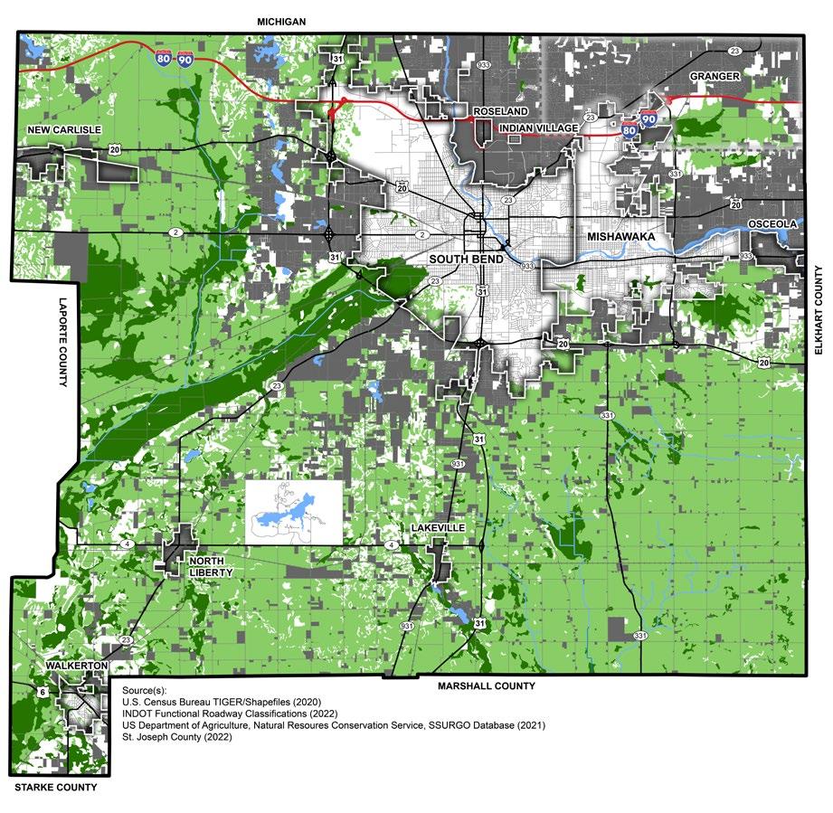
Property owners who participate in the Natural Resource Conservation Service’s (NRCS) conversation easement program have mainly been situated in the southwest portions of the County. Data for this map comes from the NRCS, part of the U.S. Department of Agriculture. Notably, the efforts to conserve land have been focused far from areas where urban development occurs in the County. These efforts are likely a proactive approach to preserving farmland and natural ecosystems. Furthermore, these practices may help discourage greenfield development because it encourages an orderly growth pattern near the incorporated towns and cities of the County.
According to the USDA Census of Agriculture, as of 2017, 23 farms had a conservation easement. These conservation easements comprised 4,132 acres of farmland in the County. The largest parcel with a conservation easement in the County is located west of North Liberty along State Road 4, as illustrated by Figure H.16. It is situated in the floodplain of the Kankakee River and prime farmland of statewide importance. This instance shows how the Environmental Stewardship pillar can work hand in hand with the Farmland Preservation pillar.
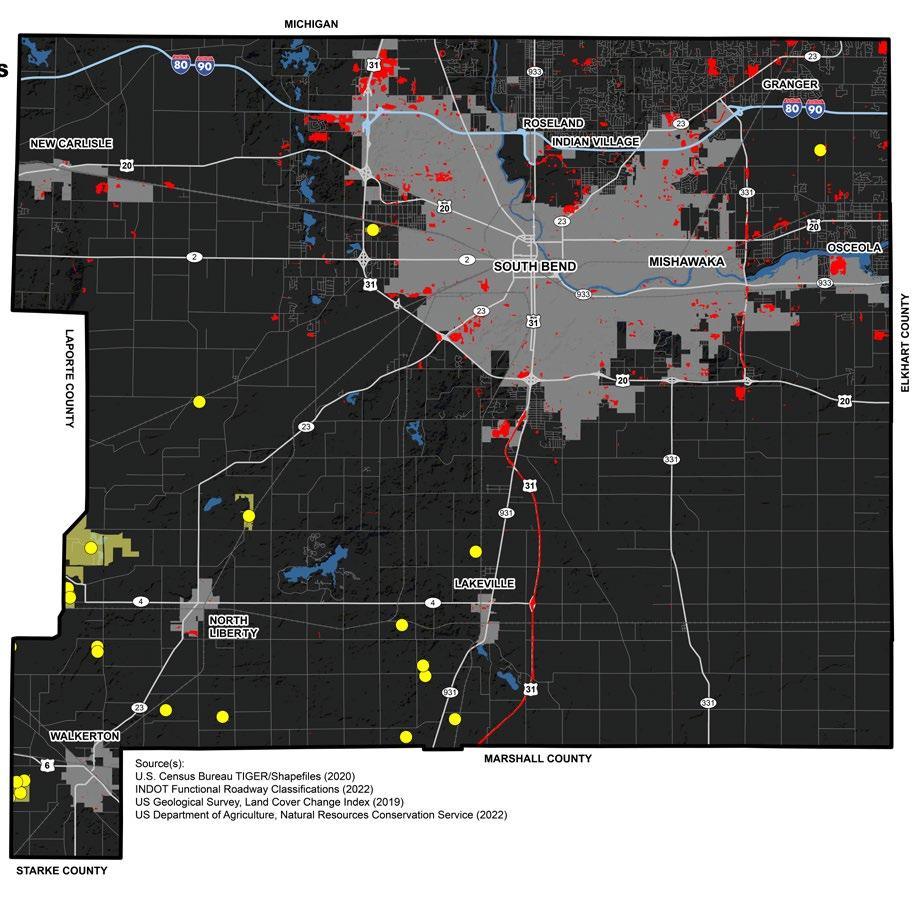
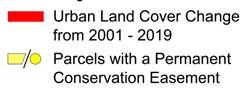
Area
Between 2001 and 2016, large areas of farmland in the unincorporated community of Granger area, located in the northeast, have been converted to low-density residential uses. This trend will likely continue as the area is recognized as a highly desired location to live.
The Michigan Border and US 31
Areas along U.S. 31 and Michigan border have seen large quantities of farmland converted into residential, light industrial, and commercial uses. This conversion is likely the result of better access to infrastructure, such as major thoroughfares and lower land acquisition costs for developers than within developed areas. Additionally, a Tax Increment Financing (TIF) district along North Cleveland Road has incentivized development in the area, which will likely spur additional residential developments for workers on nearby farmland.
The Indiana Enterprise Center (IEC) and New Carlisle
The Indiana Enterprise Center (IEC), located around eastern New Carlisle, is an extensive industrial development featuring manufacturing and other industrial uses. Its growth was encouraged by the New Carlisle TIF district. This development supported the recommendations of the 2002 Comprehensive Plan. However, it has also resulted in the conversion of large swaths of prime farmland. The balance between preserving farmland and encouraging economic development should
be a primary focus for the County government going forward. As the Economic Development chapter recommends, the ag-bioscience sector may be an opportunity to merge these two pillars with community support in this area.
State Road 331 (Capital Avenue) and Osceola
State Road 331 is a high-traffic corridor with highly desirable land for development per the 2003 Mishawaka Capital Avenue Corridor Land Use Plan. The growing interest in this area for development may increase property values for agricultural lots, incentivizing property owners to sell their land to developers. This should be expected and encouraged as it supports the Economic Development pillar. However, the County should pay special attention to the recent medical developments at State Road 331 and U.S. 20 Highway interchange. Further development in this area may want to be discouraged as it is far from existing amenities and may threaten highly productive, prime farmland in southern Penn Township and northern Madison Township.
Some areas of prime farmland south of Osceola have been converted to low-density, single-family land uses. Additionally, farmland near the U.S. 20 Business Highway, north of Osceola, will likely be converted to residential uses due to its proximity to jobs and urban amenities.
Rezoning refers to the process of changing the zoning classification of a particular parcel of land or area. The County’s zoning ordinance establishes the ‘A’ (Agricultural) District, which is intended primarily for agricultural uses.
Figure H.17 shows the total number of rezones between 2004 and 2024 in the middle column, no matter the original zoning district. Then, in the third column furthest to the right, the table details how many acres of those rezones were from the ‘A’ District to some other district.
A map of all rezones, no matter the original zoning district, is provided in Figure I.5 in the Government and Policy (I) appendix.


Within Indiana, it is typical for legislative power to be divided between the Board of Commissioners and the County Council. Typically, the County Council has jurisdiction over fiscal matters whereas the County Commissioners have jurisdiction over regulatory and administrative powers. St. Joseph County is one of three counties in the State of Indiana that operate in an atypical condition where full legislative power is vested to the County Council.
County Board of Commissioners
The Board of Commissioners is comprised of three elected officials representing individual County districts. Within the typical condition, commissioners have the power to vest themselves with additional regulatory powers, however, in St. Joseph County, the County Council maintains this power and can delegate additional powers to the commissioners if they desire. Commissioners typically have the power to pass ordinances related to:
• Controlling, maintaining, and supervising county property,
• Supervising construction and maintenance of roads, bridges, and traffic control,
• Developing economic development programs overseeing benefits’ packages for county employees,
• Administering elections with the county election board,
• Establishing minimum housing standards,
• Auditing and authorizing payments on behalf of the county,
• Incorporating new towns and altering townships,
• Receiving bids and authorizing contracts,
• Exercising appointive powers for boards, commissions, etc.,
• Planning and implementing strategies for solid waste management.
County Council
The County Council is comprised of nine elected positions, one from each district. The council has authority to view or review fiscal matters, determine proper policy, and set priorities for the allocation and expenditure of county funds.
The Indiana General Assembly determines the power of the county council, which typically includes:
• Approving and fixing annual operating budgets for county government,
• Establishing salaries, wages, per diems, and compensation for county officials and employees,
• Fixing tax rates and establishing levies,
• Appropriating public funds, authorizing certain,
• Purchases or sales of county owned land, and
• Non-binding review of budgets for certain non-elected boards in the county.
The Board of Commissioners and County Council work with the county’s elected finance team, and departments, which includes the Auditor, Treasurer, and Assessor, and the county’s property, election, and public safety and judicial functions teams which includes the Surveyor, Recorder, Clerk of the Circuit Court, Coroner, Prosecuting Attorney, Sheriff, and Judicial Officers.
St. Joseph County contains two incorporated cities: South Bend and Mishawaka.
South Bend is located in north-central St. Joseph County, along the St. Joseph River and multiple state and national highways including US 31, US 20, SR 933, SR 23, and SR 933.
The City of South Bend is the fourth largest in Indiana. The City is managed by a mayor and common council. South Bend maintains robust City services. The City separated from the Area Plan Commission in 2019 and now maintains its own Plan Commission.
The City of Mishawaka is the second largest City within St. Joseph County. It is located immediately east of South Bend on multiple highways including US 20 and SR 331, as well as the St. Joseph River. Mishawaka is managed by a mayor and nine city council members (six district and three at-large). The City of Mishawaka also maintains its own Plan Commission.
There are seven towns in the County: Lakeville, New Carlisle, North Liberty, Osceola, Roseland, and Walkerton. Walkerton and Indian Village are the only small towns that are not members of the Area Plan Commission. Each town can assign one member to the Area Plan Commission, with the exception of Roseland and Lakeville, who currently share a member.
Many of the towns have adopted their own Comprehensive Plans:
• 1992 Osceola Comprehensive Plan
• 2005 Roseland Comprehensive Plan
• 2011 Lakeville Comprehensive Plan
• 2022 North Liberty Comprehensive Plan
• 2024 New Carlisle Comprehensive Plan
These should be utilized when evaluating proposed developments in or near their respective jurisdictions.
There are many unincorporated communities scattered throughout the county. Most of these communities are formed around residential subdivisions. Some of the commonly known unincorporated communities are Ardmore, Chain-O-Lakes, Crumstown, Gulivoire Park, Lydick, Pleasant Valley, Wyatt, and Woodland.
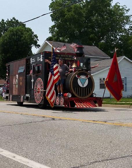
St. Joseph County is comprised of thirteen townships: Centre, Clay, German, Greene, Harris, Liberty, Lincoln, Madison, Olive, Penn, Portage, Union, and Warren.
Each township has a trustee appointed to a four-year term. These trustees are responsible for a range of services, including managing all township property interests; receiving and paying out township funds; administering township assistance to residents; providing for and maintaining cemeteries; providing fire protection in unincorporated areas; providing and maintaining township parks and community centers; and completion of annual reports, among other duties.
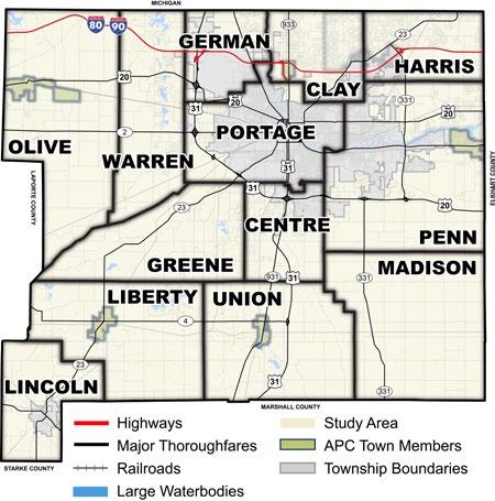
Michiana Area Council of Governments
Under state law, MACOG is defined as a Metropolitan Planning Organization (MPO), which coordinate regional investments with the four-county region (St. Joseph, Elkhart, Kosciusko, and Marshall). These investments can include, but are not limited to economic development, environmental planning, and transportation. MACOG’s plans have extensively to informed Plan SJC, such as:
• 2020-2024 Comprehensive Economic Development Strategy
• Collaborating for Regional Resilience and Economic Growth (Adopted 2021)
• Michiana on the Move: 2045 Transportation Plan
The County shares its northern border with Cass and Berrien Counties in Michigan. Multiple US and State highways extend into Michigan (and beyond) from Indiana, which bring thousands of commuters everyday into the incorporated cities of the County. US 31 extends north into Michigan, as does SR 933 and SR 23. Upon entering Michigan, SR 933 becomes Michigan SR 51, and SR 23 becomes Michigan SR 62. Besides commuting, many people cross the state border regularly to access amenities such as arts, entertainment, and outdoor recreation. The LaSalle Trail, managed by the County’s Parks Department, runs along SR 933 into Michigan, which provides an alternative mode of transportation for regional commuters.
The St. Joseph County Police Department is led by the County Sheriff and is comprised of nearly 300 individuals. In addition to routine police functions, the department is responsible for civil warrants, staffing the county jail, and protection of the three courthouses within the County. The St. Joseph County Jail services all nine police departments located within the county. Other law enforcement agencies in St. Joseph County include:
• IU South Bend Campus Police
• Lakeville Police Department
• Mishawaka Police Department
• New Carlisle Police Department
• North Liberty Police Department
• Notre Dame University Police
• Osceola Police Department
• Roseland Police Department
• Saint Joseph County Airport Authority
• South Bend Police Department
• Walkerton Police Department
For information about crime rates and rankings, refer to the Quality of Life & Place section in this chapter.
St. Joseph County is serviced by multiple fire departments. Most of the departments are volunteer and include:
• Clay Township Volunteer Fire Department
• Harris Township Volunteer Fire Department
• Liberty Township Fire Department
• New Carlisle Volunteer Fire Department Inc.
• Penn Township Fire Department
• Walkerton Volunteer Fire Department
• German Township Volunteer Fire Department
• Lakeville Volunteer Fire Department, Inc.
• Madison Township Volunteer Fire Department
• Osceola Volunteer Fire Department
• Southwest Central Fire Territory
• Warren Township Volunteer Fire Department
Additionally, the Cities of Mishawaka and South Bend each have fire departments with multiple station locations.
Multiple EMS providers are located throughout St. Joseph County. These are typically operated out of the local fire departments, and many are volunteer. EMS providers include South Bend EMS, Mishawaka Fire and EMS, Penn Township Fire Department, Clay Township Fire Department, New Carlisle Volunteer Fire Department inc., Liberty Township Fire Department, and Walkerton Volunteer Fire Department.
Emergency dispatch for St. Joseph County is provided by the St. Joseph County Public Safety Communications Consortium. Consolidated since 2014, the organization is the county’s 9-1-1 PSAP, or public safety answering point, and is responsible for dispatching all police fire, and EMS throughout the county.
In addition to the previously mentioned services, the St. Joseph County government also provides a multitude of social and planning-related services through its many county government departments. Planningrelated services, such as permitting and zoning, is provided by the Infrastructure, Planning, & Growth Department. Disaster response and planning is provided by the St. Joseph County Emergency Management Agency. Environmental-related planning and management is done through the Soil and Water Conservation District. Septic and wasterelated services are managed by the Solid Waste Management District. An extensive list of departments and services provided by the County can be found on the County’s website.
Zoning is the most common tool to regulate land development. In this system, land is classified under one of the zoning districts established in the St. Joseph County Zoning Ordinance. While the small towns included in the APC may have their own zoning ordinances, parcels under the Area Plan Commission’s jurisdiction can be classified into 10 zoning districts:
• Agricultural District (A),
• Single Family District (R),
• Multi-Family District (R-2),
• Office/Buffer District (O/B),
• Office District (O),
• Business District (B),
• Commercial District (C),
• Industrial District (I),
• Planned Unit Development (PUD), and
• University District (U).
The ‘U’ district is also called a “special district.” Additionally, there are four overlay districts established by the County’s zoning ordinance:
• Historic Preservation District (HP),
• Floodplain Regulations (FP),
• Landfill Overlay District, and
• Indiana Enterprise Center. Overlay districts lay on top of a zoning (or ‘base’) district, such as the ones mentioned in previously. Overlays typically add additional regulations, review processes, or development standards to the base zoning district.
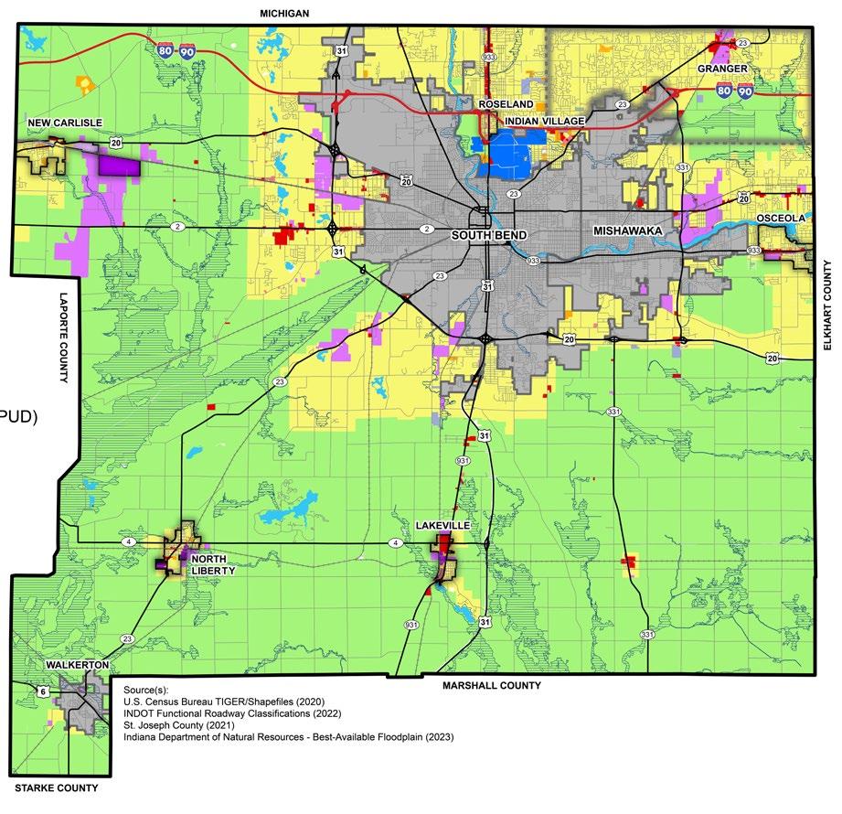
The Agricultural District is designated to preserve prime agriculture land and protect it from urban sprawl. They are generally intended for agricultural activities, often located in flood plains, natural areas, and rural areas beyond the limits of incorporated communities. Other permitted uses include childcare homes, cemeteries, golf courses, parks, libraries and other public facilities, utility substations, and veterinary clinics and hospitals among others. Special uses may include airports, boarding schools, conservation and hunting clubs, campgrounds, and concentrated animal feeding operations (CAFOs).
The Single-Family District is designated to protect, promote, and maintain the development of single-family dwellings and other compatible development on the periphery of an urban area. Beyond single family residence development, permitted uses include agriculture, cemeteries, childcare homes, golf courses, libraries and community centers, meeting halls, public and private parks, religious uses, residential facilities for mentally ill and developmentally disabled, and schools. Adult care facilities, community centers, and multi-family dwellings are only permitted as special uses.
The Residential District is designated to protect and promote the development of a wide range of housing from single family dwellings to multifamily complexes, as well as other compatible development. Permitted uses include police and fire stations, public
parks, religious uses, dwelling units of multiple sizes. Higher density (two-family to fourfamily) dwelling units in this district must be served by public or municipal sewerage and water systems. Multifamily accessory uses, including community centers, rental offices, and carports, are permitted in this district.
The Office/Buffer District is intended for areas of transition between business/commercial and residential districts. Permitted uses include offices not exceeding 5,000 square feet, police and fire stations, veterinary clinics and hospitals.
The Office District is intended for limited offices and businesses occurring in areas of transition between commercial and residential districts along arterial streets and at the intersections of arterial streets. The Office District is intended to be limited to the area in association with commercial uses and may serve as a buffer between residential uses and commercial developments. Primary uses include any office for professional business, banks and financial institutions, barber and beauty shops, childcare centers, funeral homes, medical and dental clinics, photography studios, and police or fire stations.
The Business District is intended for businesses which provide for the full range of convenience needs necessary to meet the daily needs of residential neighborhoods. Permitted uses include a variety of business types including
antique stores, banks, funeral homes, grocery stores, medical and dental clinics, taverns, restaurants, and department stores.
The Commercial District is intended for retail sales and service functions whose operations are typically characterized by outdoor display or sales of merchandise, major repair of motor vehicles, commercial amusement and recreational activities, and activities and operations conducted in structures that are not completely enclosed. Permitted, primary uses include all business types within the Business District, as well as amusement establishments, hotels, automobile service stations, boat showrooms, and many others. Special uses include all of those listed in the Business District, as well as contractor yards with outdoor storage over 50% of the lot area, automobile wrecking yards, fairgrounds and racetracks, asphalt plants, and others.
The Industrial District is intended for industrial uses that create heavy traffic, require extensive community facilities, and require outdoor storage and operation. Permitted, primary uses include agriculture, automobile service stations, distribution facilities and truck terminals, contractor yards and offices, and power generation facilities, among others.
The Planned Unit Development District is designed to allow mixed land uses in a compatible and efficient manner. It promotes flexibility and creativity, allowing for a
combination of land uses, however, it is not intended for development of residential subdivisions or to allow relief from the overall zoning ordinance. Primary uses typically vary and PUDs must specify development standards that are in keeping with the zoning ordinance.
The University District is intended to promote the development, expansion, and modernization of a major college or university campus that requires a diversity of uses. The district may allow for a wide range of commercial uses which are accessory to or typically associated with a college or university campus. Primary uses typically include administrative halls, assembly halls, athletic facilities, classroom buildings, libraries, student housing, airports, and childcare among others.
Historic Preservation Overlay District (HP)
The Historic Preservation Overlay District is a secondary zoning district intended to preserve historic and architecturally significant structures, sites, streets, and neighborhoods. Within the district, a Historic Preservation Commission reviews private redevelopment and new development plans to confirm there will be no adverse effect on the district.
The Landfill Overlay District is intended to allow the development and expansion of solid and liquid waste disposal facilities, landfills, and other similar facilities in a safe and responsible
manner. The primary uses within the district are those of the primary zoning district, as well as sanitary, solid, or liquid disposal facilities assuming they meet prescriptive development standards.
Floodplain Regulations
The Floodplain Regulations are intended to protect life and property within St. Joseph County. They outline development standards within the Special Flood Hazard Area (SFHA) on Flood Insurance Rate Maps (FIRM). The regulations outline requirements for development and the process of permitting development within flood prone areas.
Indiana Enterprise Center (IEC)
The IEC: Indiana Enterprise Center Overlay District is intended for a specific area in the northwestern portion of the County, east of the Town of New Carlisle. It is established to promote and support the types of development envisioned for the specific areas, which include advanced manufacturing base, smart logistics, agribusiness and agricultural uses, commercial and industrial opportunities, open space and conservation uses, while setting higher aesthetic and sustainability standards. Only the Area Plan Commission or the Board of County Commissioners may initiate an application to apply the IEC Overlay District to a given property.
The existing land use and zoning classifications generally align throughout the County, however there are several noteworthy differences. In general, there is a substantial amount of singlefamily residential use that occurs within areas zoned for Agriculture. While this is noted as a primary use within the Agricultural District, the amount of these homes has led to suburban style development throughout the county, away from urbanized areas, and particularly along county roads.
Immediately west of South Bend, there is significant agricultural land use that is zoned residential. This is logical considering the residential development pressure of South Bend towards the outskirts of the city. A similar condition exists to the north of South Bend, where residential development is slowly replacing agricultural land use.
Immediately southwest of South Bend and adjacent to SR 23, there is significant property zoned residential that is currently in or near industrial use. This area should be evaluated to determine if a change in zoning classification is needed.
Located adjacent to the northern boundary of South Bend and Notre Dame, a significant area of institutional land use is occurring within properties zoned Single-Family District. An expansion of the University District should be considered to align with the existing land use.
There are numerous institutional land uses occurring within the Agricultural District. These primarily consist of schools, churches, cemeteries, fire departments, and other miscellaneous items.
South of New Carlisle, there is significant property in agriculture use, despite being zoned industrial. It is assumed this land use will change as industrial development happens.
The map in Figure I.3 shows rezonings, no matter the district change, from 1966 to the present. Since 1966 there have been more than 863 rezonings approved by the APC. The largest category of rezonings was commercial districts, with 555 rezonings. The second was residential, with 129 residential rezonings. The third largest number was industrial, with 107 rezonings. There were 115 rezonings from the A District to some other district. Acreages for these values are not available until the year 2004. Data comes from the St. Joseph County Infrastructure and Planning Department. More details about rezonings are provided in Figure H.17 in the Farmland Preservation (H) appendix.
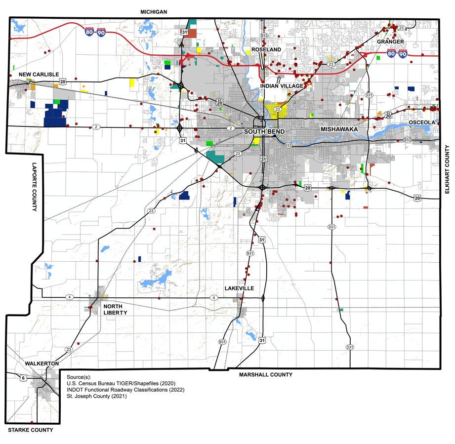
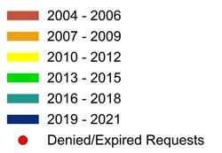
For most local governments, including St. Joseph County, property taxes are the largest source of revenue to fund projects, implement and enforce policies, and pay staff salaries. Property taxes are based on the total assessed value of a property minus any credits or exemptions.
In 2008, Indiana voters approved the Indiana Property Tax Cap Amendment to the state constitution, which capped the rates at which local governments can set property taxes. The current property tax rate caps are:
• 1% for owner-occupied residences,
• 2% for other types of residents,
• 2% for agricultural land,
• 3% for all other real and personal property, usually inferred as commercial and industrial land.
Rates may vary across the County. There are several county-wide and sub-county property tax districts that include unincorporated parts of the County and incorporated municipalities.
In addition to property taxes, the State of Indiana allows counties to levy local income taxes. Economic Development Income Tax (EDIT) is allowed for funding economic development projects, which can include acquisition costs, construction, infrastructure, administrative, operating expenses, and others. Allowable rates for EDIT range from 0.1% to 0.5%. The State of Indiana also allows the County Option Income Tax (COIT) which is a general-purpose, supplemental revenue source. These funds may be used on any activity where property taxes can be spent and allowable rates range from 0.2% to 1%.
TIF districts are another way for local governments to raise funds for infrastructure projects. The St. Joseph County Redevelopment Commission and the Economic Development staff manage five TIF districts within the County. This tool is discussed previously in the Economic Development section of this chapter.


St. Joseph County falls at a crossroads, providing excellent accessibility to larger regional cities including Chicago, Indianapolis, Toledo, Grand Rapids, and Fort Wayne. All of these locations can be traveled to within 3 hours via interstates and highways such as I-80/I-90, US 31, and US 30. This crossroads location not only provides local residents with convenient routes for longer travel, it also is a benefit for manufacturers and warehouses wanting to transport goods to other parts of the country.
At its most basic, the roadway network can be separated into three categories: the national highway system, state facilities, and local facilities. Furthermore, roadways are functionally classified—based upon their intended character of service—into interstates, expressways, principal and minor arterials, major and minor collectors, and local roads. Figures J.1 and J.2 provide more information on these roadway classifications. Since transportation networks are always evolving, it is important to identify and address changes, challenges, and opportunities that might occur in the future through the visioning of the transportation planning process.


Figure J.1: Road Mileage by Functional Classification (2022)
Figure J.2: Functional Road Classifications Map
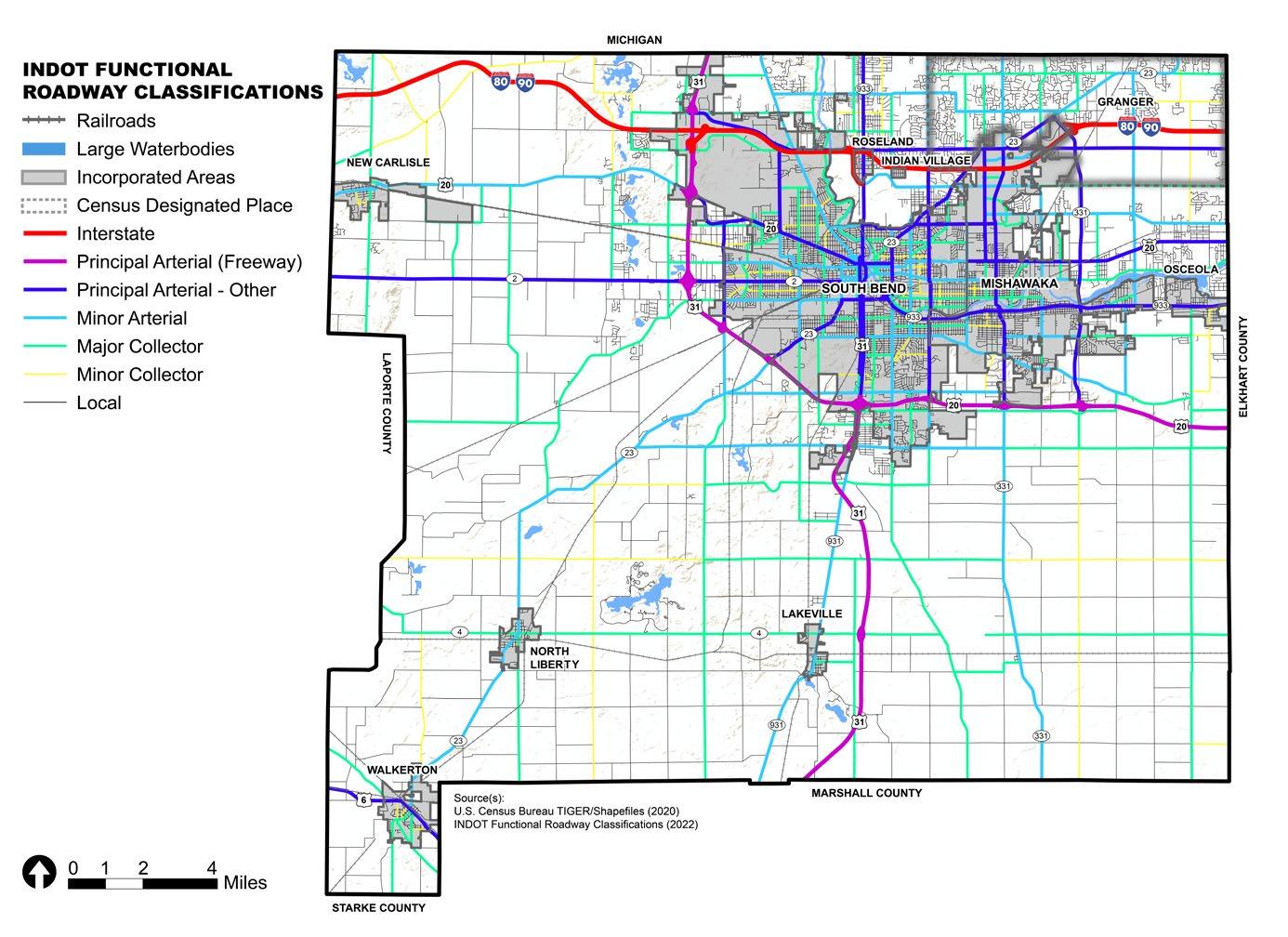
Traffic counts affect how well a road functions for vehicles, cyclists, pedestrians, and other modes of transportation. It is important to consider these counts to understand how to accommodate traffic and create safe roads.
Figure J.3 shows traffic counts for St. Joseph County, as provided by INDOT and MACOG. There are three main areas with the most traffic in St. Joseph County: the SR 933 corridor north of South Bend, the SR 23 corridor from South Bend through the Granger area, and the multiple county roads that connect eastern St. Joseph County and Elkhart County. These roads are major commuter corridors. Two major plans in this area, SR 933 Corridor Plan and the County Connections Plan, should be referenced in future planning of these areas.
Crash data helps provide insight into areas of the County that could be improved and made safer for users of all modes. Two crash heat maps show vehicular crashes in the county. J.4 shows crashes that occur within the Area Plan Commission’s jurisdiction (the study area for Plan SJC) only, while Figure J.5 shows crashes in the entire county. Most crashes in St. Joseph County correlate to the three areas of highest traffic counts. The high density of crashes and larger traffic counts in these areas also correlate to the density of jobs in these areas. For example, the main roads to the University of Notre Dame, a major regional employer, are SR 23 and SR 933, both of which have large traffic counts and crashes.
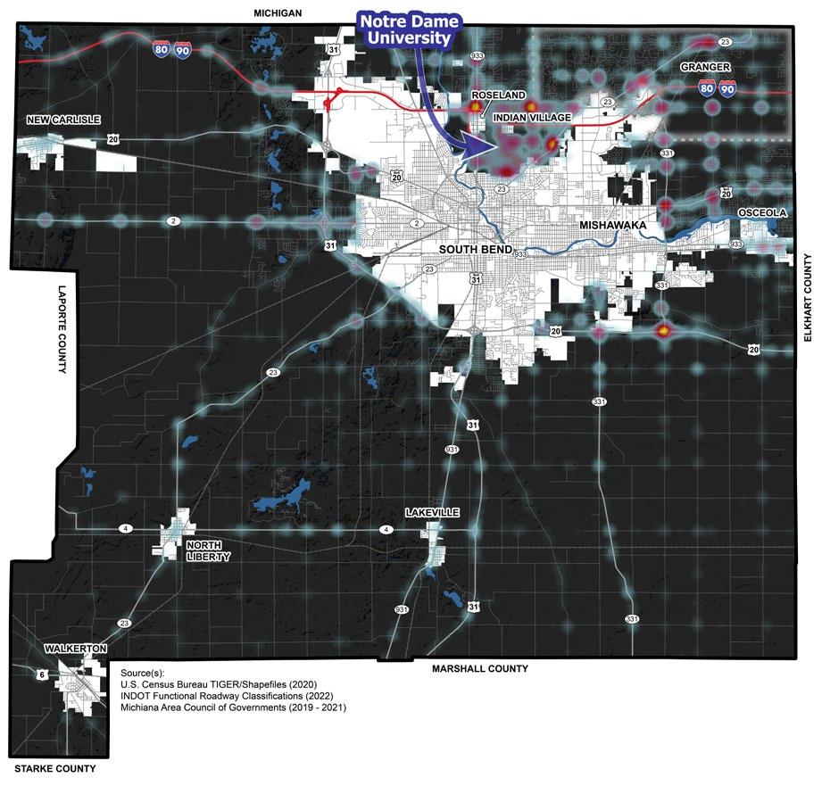

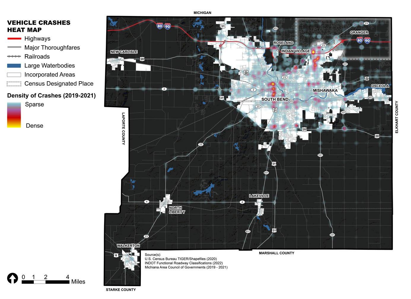
The Transportation Improvement Program (TIP) is a federally required, short-range plan that provides information regarding the schedule of multimodal transportation projects that are federally funded or deemed regionally significant in the Michiana Area Council of Governments (MACOG) region. The projects in this plan are shown in Figure J.6, broken down by the anticipated year that it will be open to the public after construction commences. Data on this map is from the 2022-2026 TIP. It should be noted that the TIP can be amended or modified to add or delete projects and adjust for changes in scope, cost, or timeframe. The current TIP has been adjusted and then adopted by the MACOG Policy Board and INDOT for FY 2024-2028, and can be found online at the MACOG website.
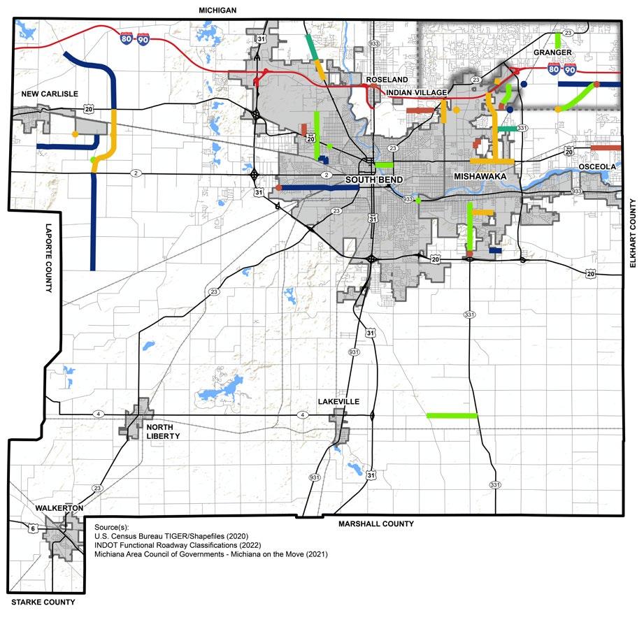
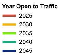
Level of service (LOS) is a measurement of how well a street handles vehicular traffic. Pedestrians and cyclists are not included in this measurement. Figure J.7 shows the current LOS for St. Joseph County roads. A road with an LOS of “F” is ‘failing’ to handle the number of vehicles which travel on that road. Currently, there are only a few road segments with a ‘failing’ or ‘highly restricted flow’ LOS, which include:
• SR 23 heading into the Granger area from downtown South Bend
• SR 20 BUS through Mishawaka
• Washington St. in downtown South Bend
• SR 933 (Lincolnway) through Mishawaka
Most congestion (and therefore a lower LOS) is found in and around downtown South Bend on major thoroughfares such as state roads.
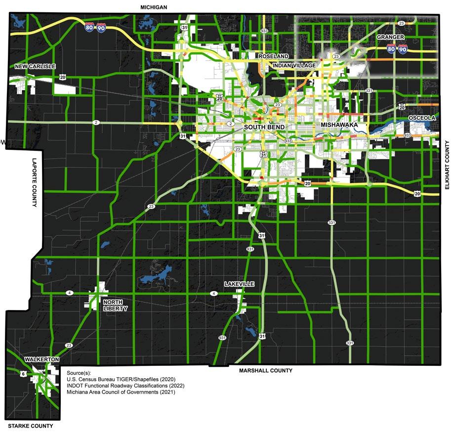
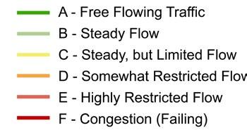
For the 2045 Transportation Plan, MACOG utilized scenario planning to identify the performance implications on multiple scenarios. These scenarios undertook several potential future changes to the region, including the impacts of significant historical growth compared to flat line future growth, as well as applying varying densities of growth compared to traditional trends. The scenario planning results show how different growth trends and land use patterns impact the transportation network. The map in Figure I.8 shows the impact of the High Growth Scenario on future LOS of roads within St. Joseph County. A summary of the Active Transportation Plan by MACOG is available in appendix B.
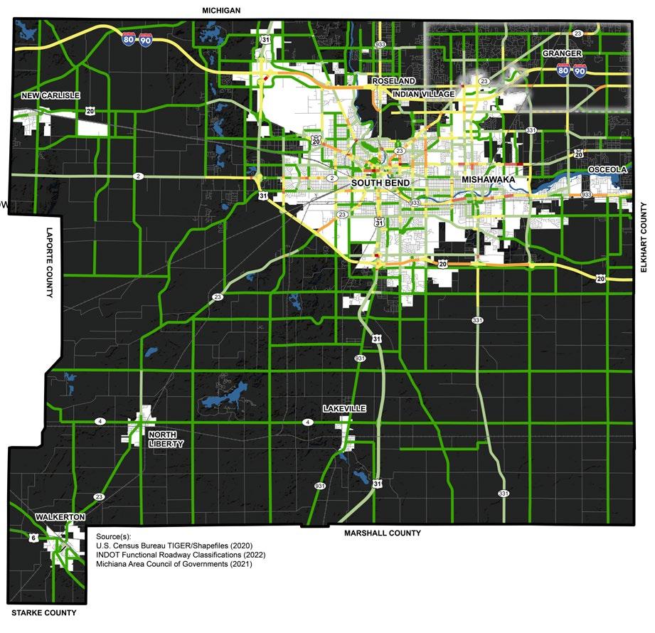
The map provided in Figure J.9 shows the amount of LOS degradation between the current and projected levels of service. Most of the degradation is projected to occur on streets in South Bend and Mishawaka, especially on the west side of South Bend. Some of the major roads that are projected to have degraded LOS are US Highway 20, Interstate 80/90, and a stretch of US Highway 31 near Lakeville and near the South Bend International Airport. Some of the major roads that are projected to have improved LOS are US Business Highway 20 east of Mishawaka, parts of State Road 23 near Notre Dame University, and Cleveland Road in the Granger area.
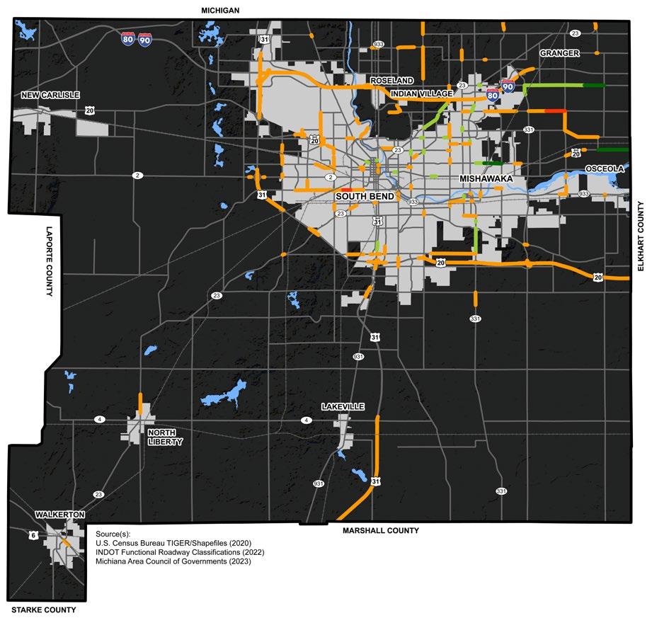
Bicycle and pedestrian projects are an important component of transportation planning. A transportation system that supports bicycling and walking expands residents’ mobility options and can complement multiple forms of transportation. A strong bicycle and pedestrian network can enhance a community’s quality of life by providing great economic, environmental, social, and health benefits. By reducing single occupant vehicle travel, air quality improves, and users can lead healthier lifestyles.
The map in Figure J.10 shows the active transportation network, as surveyed from 2021 and 2022 data sources. There are very few infrastructures in the unincorporated county as well as the APC towns for active transportation. South Bend has an extensive active transportation network near downtown. Pathways in the County include the LaSalle Trail, a multiuse path that extends into Michigan, the Granger Paths system, and a multiuse path running the length of Capital Avenue. The county mostly utilizes signed bike routes shared with vehicles, rather than designated lanes. An example of the difference between these can be found in the example pictures on the following pages.
Sidewalks are a critical component of the transportation network. No matter the destination, every trip starts and ends with pedestrian travel. Sidewalks should be connected and accessible. As part of
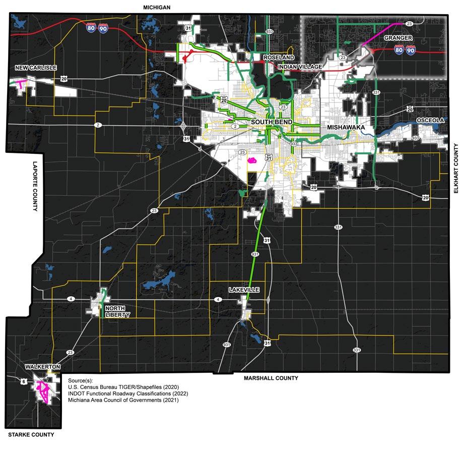

the MACOG Active Transportation Plan, communities have adopted Accessibility Guidelines for Pedestrian Facilities in the Public Right-of Way. These guidelines suggest that whenever there is an intersection improvement project or new construction project, any affected curb ramps, sidewalks, and crosswalks will be rebuilt to ADA (Americans with Disabilities Act) design guidelines, where feasible and reasonable.
Although it is unknown the exact location of all sidewalks in St. Joseph County, during the public engagement process, the public brought up concerns about walkability and pedestrian connectivity within the County. Participants desired new infrastructure and safety improvements throughout St. Joseph County. St. Joseph County can conduct sidewalk inventory using GIS, with updates as new sidewalks are installed whether by the County or private developers. This inventory should also include conditions, curb ramp locations, ADA compatibility, crosswalks, etc. Further recommendations on how to improve sidewalk networks in the County are in the Transportation Pillar Chapter.
Proposed Network by 2045
The map in Figure J.11 shows the proposed projects of the Michiana on the Move: 2045 Transportation Plan. These projects will significantly expand the active transportation network in St. Joseph County and are aimed to be completed by 2045. Figure J.12 illustrates the total mileage of active transportation networks that would exist if the proposed improvements of the plan were fully implemented.
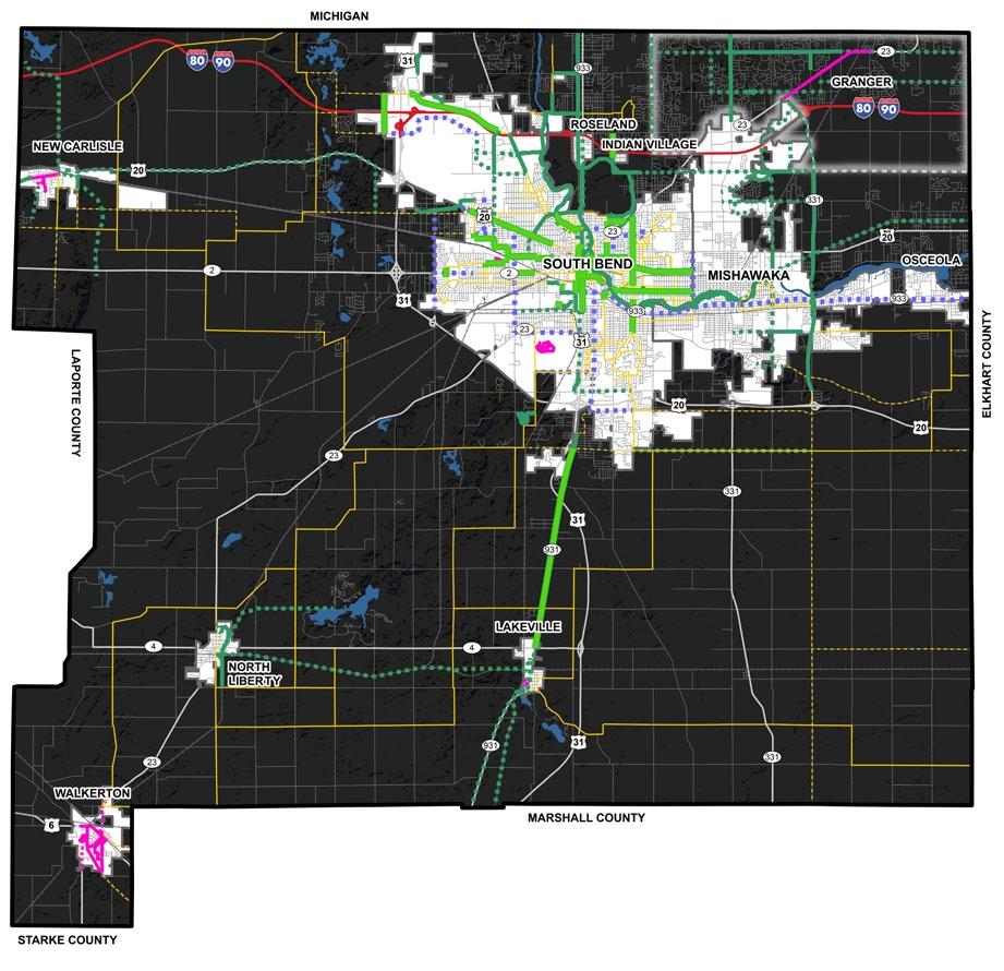


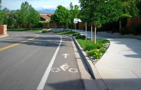
EXAMPLE: CYCLE TRACK

EXAMPLE: WALKING PATH
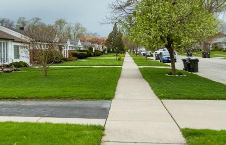
EXAMPLE: BIKE LANE
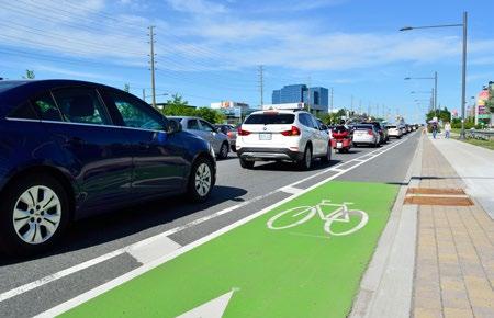
EXAMPLE: SHARED USE PATH

EXAMPLE: SIGNED ROUTE

Two crash heat maps show crashes in the county as related to active transportation such as bicyclists and pedestrians. Figure J.13 shows crashes that occurred within the Area Plan Commission’s jurisdiction only, while Figure J.14 shows pedestrian and bike crashes in the entire county. As was the case with vehicular crashes, many pedestrian and bike crashes occur near Notre Dame University.

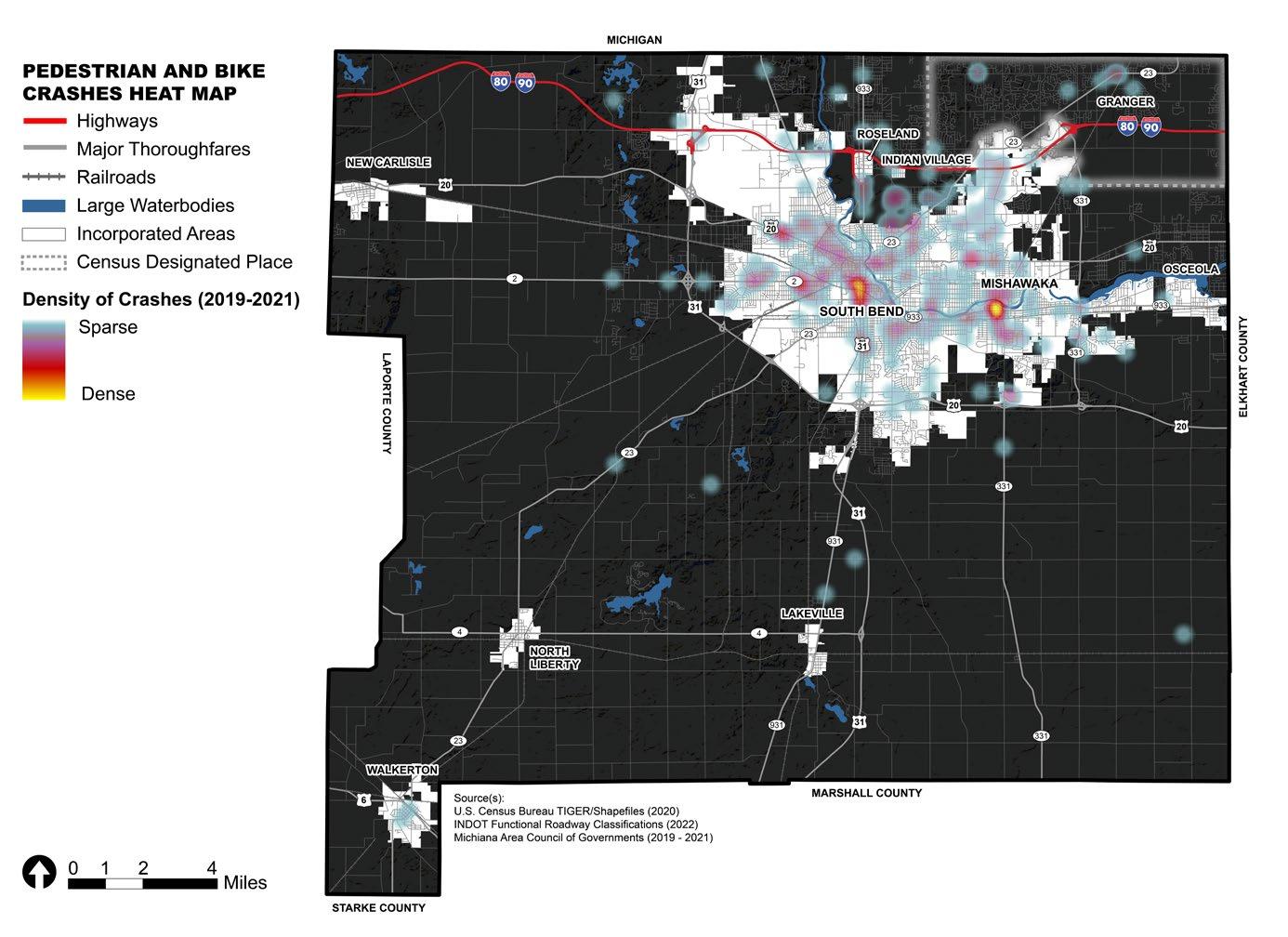
South Bend Public Transportation Corporation (SB Transpo) provides fixed route and paratransit service for South Bend and Mishawaka. SB Transpo operates routes throughout South Bend and Mishawaka, along with commercial and industrial destinations in primarily suburban St. Joseph County. SB Transpo does not currently serve the Towns of New Carlisle, Walkerton, North Liberty or Osceola.
The Interurban Trolley (operated by MACOG) is a fixed route transportation service in Elkhart County. SB Transpo and the Interurban Trolley jointly operate the Yellow Line, which is a route providing connectivity between the two systems and access to destinations within both counties.
Mishawaka encompasses two school districts that serve many residents in the unincorporated county: the School City of Mishawaka and Penn-Harris Madison School District. School City of Mishawaka does not provide bus transportation for students. SB Transpo offers both regular and special routes to Mishawaka schools providing students free transportation access with a valid student ID.
On call services include Transpo Access and Real Services that provide paratransit services for populations who cannot access traditional fixed route services based on disabilities.
Figure J.15: Existing Public Transit and Multi-Modal Connections Map
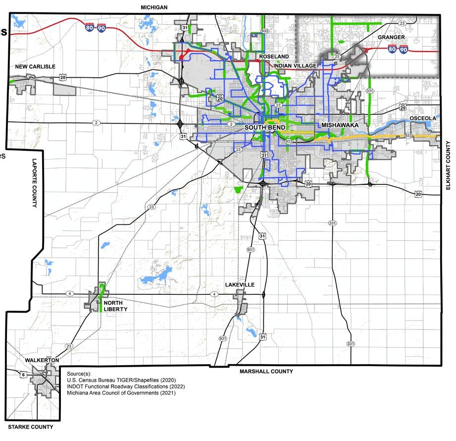

Transpo and the Interurban trolley serve the county’s public transportation needs. Both use busses only. Transpo provides local connectivity, mostly within South Bend and Mishawaka, while MACOG provides regional connectivity.
Transpo, in partnership with MACOG, created the CONNECT Transit Plan. The plan looks at alternative ways to balance important but competing priorities, like improving the frequency and span of service versus adding new service areas and new routes. The result is a 10-year plan to improve transit services across the region. The goals of the plan include: Identify efficiencies in the system; Reassess community priorities; Design a bus network to match those priorities; and Develop longer-term plans for transit improvement and possible expansion. Through public engagement, the intended network goal in the Transpo Connect plan is 60% ridership/40% coverage. The CONNECT Transit Plan’s study began in Summer of 2021, and the full plan was adopted in Spring 2023.
Two important components of the CONNECT Transit Plan are “Short Term Network changes” and an “Additional Funding Network.” The Short Term Network is a set of adjustments to improve service to major destinations within the current budget limits and the policy direction from the Transpo Board. The ShortTerm Transpo Network makes a number of changes to routing within the Downtown South Bend area. The proposed Additional Funding
Network component is a part of the plan intended to grow ridership, effecting residents and businesses across the region. The recommendations of the Additional Funding Network would need additional funding from cities, counties, businesses, or other institutions to be implemented.
The CONNECT Transit Plan also notes that industrial facilities, particularly those on the periphery of urban areas, present particularly hard challenges in providing fixed network service. Thus, as these new facilities continue to grow and employ more residents across the County, other options for transportation, such as carpools or vanpools, should be explored further.
The full Transpo’s CONNECT Transit Plan (and maps of the proposed networks) is available on MACOG’s website here:
https://www.macog.com/transportation. html
South Bend International Airport is Indiana’s second busiest airport in terms of passenger traffic with an estimated total air passenger volume of over 680,000 in 2020. The airport provides intermodal connectivity by rail (South Shore Line), air, and bus (Transpo). The airport is served by commercial airline partners –Allegiant, American Airlines, Breeze, Delta, and United – that provide nonstop flights to cities shown on the map below. In July 2019, SBN welcomed its first international commercial charter flight with the arrival of the Liverpool Football Club.
The South Bend International Airport completed an update to their Master Plan in 2023. This plan included expansions to both passenger and cargo/freight operations at the airport and is in the process of implementation.
See flight destinations offered at South Bend International Airport here: https://flysbn.com/
Passenger Rail
The South Shore Line is a commuter rail line operated by the Northern Indiana Commuter Transportation District (NICTD) between Millennium Station in downtown Chicago and the South Bend International Airport in South Bend, Indiana. The line travels through Lake, Porter and La Porte Counties, and the communities of Gary, Portage, Ogden Dunes, Dune Acres, Beverly Shores, Pines, and Michigan City, Indiana. In May 2014, the South Shore Line adopted a 20-year Strategic Business Plan that detailed proposed improvements to the South Shore. In 2024, one of the main components of the project to add a second track to the single-track route, and to move the street-running tracks along 10th and 11th Streets in Michigan City, was completed. Completion of these projects will allow the South Shore to add 14 weekday trains for more frequent service, reduce delays, and improve travel times. Additionally, St. Joseph County and the NICTD are exploring the possibility of constructing a new station in New Carlisle.
Beyond the South Shore, there is a South Bend Amtrak station located at 2702 West Washington Street in South Bend. It is served by the Lake Shore Limited between Chicago, Boston & New York City, and the Capitol Limited between Chicago & Washington DC.
See https://mysouthshoreline.com for more information about regional passenger rail services.
Freight Rail
CSX Transportation (CSX), Norfolk Southern (NS), Canadian National (CN), South Shore Freight (operated by NICTD), Elkhart & Western (EWR), Grand Elk (GDLK), and Chicago, Ft. Wayne & Eastern (CFER) all own tracks and operate freight trains within St. Joseph County.
Norfolk Southern operates the most miles of rail in the four counties, with east/west lines through South Bend and Elkhart as well as the southern part of Marshall and Kosciusko County. Norfolk Southern also operates a north/south line that splits into two sections in Goshen.
Canadian National, Grand Elk, and Elkhart & Western operate in the northern sections of St. Joseph and Elkhart Counties. Both Canadian National and Grand Elk connect to areas of Michigan. Elkhart & Western operates locally from Elkhart to the eastern portion of St. Joseph County.


Public and private utilities, both existing and planned, are critical elements of a comprehensive plan as they impact many of the land use decisions made by property owners, developers, or approving government bodies. The availability and capacity of utilities will influence the type and density of development that can occur on a property. It should be noted that none of the towns in the County had readily available GIS data of their
water or sewer systems, which may limit the effectiveness of countywide efforts to plan for growth.
Potable Water
104,380 HOUSEHOLDS
Source: ACS 5-Year Estimates (2020)
36,739 SEPTIC PERMITS
ISSUED SINCE 1970
Source: St. Joseph County Health Dept (2022)
~42,000 (~40.2%) HOMES
Source: St. Joseph County Health Dept (2022); Estimated homes not on municipal sewer divided by total households.
Access to utilities is severely limited for residents in unincorporated areas due to high extension costs. Historically, this limited access has led to hundreds of subdivisions, especially in the Granger area, constructed with septic systems. Today, these septic systems are failing at increasing rates, which has raised concerns over the contamination of the county’s aquifers that provide drinking water to residents. In conversations with a focus group on septic systems, several issues were discussed, including but limited to:
1. Many new residents moving in that are unaccustomed to living with and maintaining septic systems.
2. The possibility of and funding opportunities for establishing or expanding sewer districts.
3. Lack of resources to manage septic failures.
St. Joseph County has an abundant supply of groundwater that provides residents with drinking water from both private and municipal wells. Groundwater is stored in the open spaces and fractures within geologic materials such as soil, sand, and rock that occur beneath the surface. Aquifers are the geologic layers that are filled with water and that can transmit enough water to supply a well under normal hydraulic gradients. Water is drawn from these aquifers through wells. There are two main types of potable water wells: private and public water supply.
St. Joseph County also has its own set of rules related to surface and groundwater protection in Chapter 52 of the St. Joseph County Code. The approval and enforcement of these rules are managed by the St. Joseph County Health Department. The Health Department works in cooperation with the State of Indiana Department of Natural Resources to manage water resources in the County.
Municipal water services are susceptible to combined sewer overflow (CSO) events during periods of excessive stormwater. When CSO events occur, wastewater enters St. Joseph County’s rivers, threatening water quality. Municipalities in St. Joseph County are currently working with the EPA to combat this issue.
Public water supply is defined as a system for supplying potable water that has at least 15 service connections or regularly serves an average of at least 25 individuals daily. According to IDNR, there are 168 registered significant groundwater withdrawal facilities in St. Joseph County with 323 wells. Wells in this system are reported as one of the following types: irrigation, industrial, public supply, energy production and miscellaneous. This number includes the following municipal water systems that supply water to County residents:
• Lakeville Water Department
• Mishawaka Municipal Water Utility
• South Bend Water Works
• Town of New Carlisle
• Town of North Liberty
• Town of Walkerton
The Towns of Osceola and Roseland do not have municipal water service although some properties within their town limits do have access through another municipal water service agreement through the City of Mishawaka or City of South Bend.
Many residents of St. Joseph County obtain their drinking water from private wells. Private water supply is defined by St. Joseph County as one or more sources of groundwater other than those serving a public water supply. Water wells can also be used for irrigation, monitoring groundwater contamination, and geothermal heating. To ensure wells are properly constructed and the quality of the groundwater is not impacted, a permit is required to install a well in St. Joseph County. Wells must also be installed by a licensed contractor registered with the Department of Health.
To protect the health of residents, County Code 52 requires that the water quality be tested any time a new well is installed and any time a property with an on-site well is sold. This testing is very important to the health of residents because the process of drilling a well frequently introduces harmful bacteria into a well. Also, there are areas within the county that have high levels of arsenic and nitrates found in the groundwater, which can be very hazardous to health. The well-drilling company must properly disinfect your water system with chlorine bleach or by another acceptable method after they finish drilling the well.
St. Joseph County also requires an inspection of both on-site drinking water wells and septic systems prior to the sale of any property with these systems. The inspection for drinking water wells is to assess the physical condition of the wellhead and distance from on-site septic system components. This process is a method that the county has adopted to help
identify potential issues with drinking water wells before a property changes ownership to protect the health and safety of those consuming the water.
Wastewater in St. Joseph County is managed either through off-site treatment through a sanitary sewer system or on-site via a septic system.
Access to a sanitary sewer system has a significant effect on future development. Sanitary sewer service allows for dense, sustainable development such as higherdensity residential and larger employment uses. This type of development allows for new housing while protecting the agricultural areas of St. Joseph County. Sanitary sewer also reduces reliance on private septic systems, which is important to protect the County’s rivers, streams, and drinking water supply. Municipal sewer service is provided by the following communities:
• Lakeville Wastewater Treatment Plant
• Mishawaka Utilities
• South Bend Municipal Wastewater Treatment Plant
• Town of New Carlisle
• Town of North Liberty
• Town of Walkerton
• St. Joseph County Regional Water and Sewer District (RWSD)
The Towns of Osceola and Roseland do not have municipal wastewater service overall. However, some properties in their town limits have a service agreement with the City of Mishawaka, City of South Bend or the RWSD.
A septic system is a privately maintained small-scale wastewater treatment plant. The owner of a private septic system must have a good understanding of their system in order to maximize its life span and treatment capabilities. A septic system that is improperly maintained could cost a homeowner thousands of dollars and could also contaminate nearby sources of drinking water.
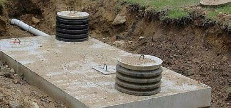
Septic systems are designed to let bacteria treat your wastewater and make it clean before it enters the groundwater. All of the wastewater flows through pipes into a concrete tank in the yard. Bacteria in the tank begin to break down the waste. Solids drop to the bottom of the tank and liquids flow into pipes in long trenches. The liquids slowly seep into the ground where it eventually enters the groundwater.
A permit from the Department of Health is required to install, replace, or repair a septic system in St. Joseph County. On-site septic systems must be properly designed, installed, and maintained in order to protect groundwater, surface water, and the health of St. Joseph County residents. The Department of Health also investigates complaints regarding failed septic systems as well as improper installation and maintenance of systems.
According to St. Joseph County Health Department records, there are approximately 42,000 homes in the county not connected to a municipal sewer. Additionally, 36,739 septic permits have been issued between 1970 and July 2022.
The County is already facing an increase in the number of septic failures according to the County Health Department. Since most septic development in the unincorporated County occurred within a relatively short time frame from the 1980s to the 2000s (see Figure E.10 in the Housing and Neighborhoods (E) appendix), the number of septic system failures is expected to continue increasing as more septic systems age out of their original lifespan.
In determining the suitable conditions for septic-based development, the type and characteristics of the underlying soils are the most significant factor. The map seen in Figure K.1 is based on the United States Department of Agriculture (USDA) SSURGO
database, which contains a large inventory of soil types and conditions such as drainage characteristics, erosion tolerance, water storage capabilities, and more.
Soils with ideal conditions for septic systems are commonly coarse-textured and have very high hydraulic conductivity (i.e. they have the capacity to move large amounts of water, such as amounts seen during a rainstorm) or are very shallow. Water is removed from these soils rapidly. According to the USDA, in these soils, water is available to plants throughout most of the growing season in humid regions and wetness does not inhibit growth of roots for significant periods during most growing seasons. This would mean areas that fall under “Ideal Conditions for Septic” often coincide with areas of prime farmland, but less often with areas of farmland of statewide importance (see Appendix H: Farmland Preservation for more information). Under these conditions, the soils may accommodate septic-based development, although connections to municipal water/sewer services should still be encouraged.
IIn these soils, water is removed slowly so that the soil is wet at a shallow depth for significant periods during the growing season. Soil wetness markedly restricts the growth of mesophytic crops (i.e. crops that can only survive under conditions with moderate amounts of water, meaning they do not do well in water-scarce or water-abundant conditions), unless artificial drainage is provided. These soils are wet for only a short time within the
rooting depth during the growing season, but long enough that most mesophytic crops are adversely affected. In these conditions, septic systems should be limited and when septicbased development occurs, there should be a somewhat larger reserve area to better protect environmental resources if/when a system fails.
In these soils, water is drained from the soil so slowly that free water remains at or very near the ground surface during much of the growing season. It is typically very shallow in depth and persistent or permanent, somewhat similar to a marsh or wetland. Unless the soil is artificially drained, most mesophytic crops cannot be grown. Under these conditions, septic-based development should be heavily restricted or denied building permits if there is not a sufficient amount of septic reserve area due to high environmental costs if/when a septic system fails.
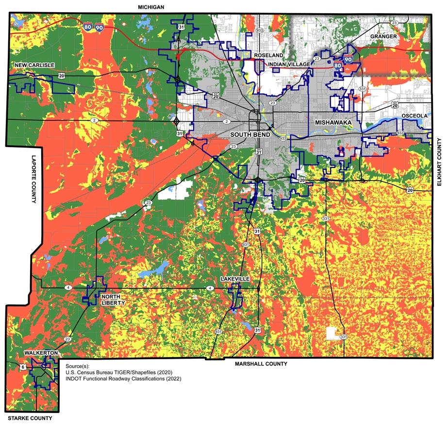


As public sanitary sewer and potable water utilities are most often managed through a local city or town, their policy on when and where to provide services is very important for the Comprehensive Plan process. As the utilities are generally not funded directly with tax dollars but through utility fees, municipalities can provide these services via agreements to areas outside of the corporate boundaries. In general, municipalities in St. Joseph County prefer to utilize their utilities as an incentive for development within their jurisdiction but will review a request for services when it is fiscally responsible and serve to further their stated development goals and policies. A summary of existing policies and practices are provided.
To have access to South Bend water and sewer service, property would need to be annexed into the City for services to be extended with two exceptions: (1) new homes constructed in established subdivisions where there is a written agreement or (2) Health Department Exceptions due to a declared public health hazard.
The City of Mishawaka examines requests for municipal wastewater and water utility extension and connection on a case-bycase basis as a part of the development review process. The City weighs a number of factors, including but not limited to capacity, connectivity, and construction costs as a
part of the decision-making process. The general approach involves incremental growth through logical extension of services to areas immediately adjacent to the corporate limits, with the properties connecting to the utilities generally being required to annex into the City of Mishawaka.
Beyond this incremental approach, the City of Mishawaka has identified areas south of the City toward the US 20 Bypass on Bremen Highway, and the areas east and northeast along Capital Avenue (SR 331) as key future growth corridors. The City has developed future plans to provide adequate utility capacities to support development in these areas. However, the extension of these facilities will be driven by sufficient future development to support the investment required for construction.
North Liberty has an agreement with property owners that are outside the corporate limits but would like to utilize their municipal services. This agreement outlines the terms and conditions for service and includes a waiver of the owner’s rights to remonstrate against annexation if the Town would choose to annex the property in the future.
Other towns within St. Joseph County will review extension of utilities and the requirements to annex on a case-by-case basis.
Open dumping of solid waste in Saint Joseph County is prohibited. Solid waste such as construction or demolition debris, appliances and furniture, and household garbage must be disposed in a permitted sanitary landfill or recycled if applicable. Open dumping of these items is considered a public and environmental health threat. Solid waste that is disposed of improperly can leach contaminants into our groundwater and create habitats for pests and vector breeding.
The St. Joseph County Solid Waste Management District serves all residents of the county. It was established in 1991 by ordinance number 79-90. The Board of the District is made up of representatives from the County, the Cities of Mishawaka and South Bend, and the Town of New Carlisle. The district offers recycling, household hazardous waste disposal and educational programs.
Garbage collection in incorporated areas of the County is managed either by the municipality or by individual residents. Collection in the unincorporated areas is managed by private contracts with property owners and service providers.
Residents in the unincorporated areas of St. Joseph County may sign up to participate in the voluntary leaf collection program. There is a fee for this service, but St. Joseph County
subsidizes all participating homeowners equally through direct payments to the vendor. The program includes 4 Fall Passes and 1 Spring Pass and service are provided only to registered participants. Prices range from $149 - $279 for all passes depending on timeliness of registration.
Northern Indiana Public Service Company (NIPSCO) is the service provider for natural gas in the service area that includes St. Joseph County. Although they are the only provider, a consumer does have a choice to purchase the natural gas from a certified supplier instead of NIPSCO. If a customer does choose to purchase gas from a different supplier, NIPSCO will continue to deliver the service, read the meter, perform safety checks and respond to emergencies.
In partnership with service providers, St. Joseph County is undertaking a substantial investment in fiber Internet access. Fiber is currently the fastest form of Internet connectivity. Fiber access is essential for high-technology job such as research centers and data centers. Everyday residents can also benefit from increased speeds, and reliability.
According to the Federal Communications Commission, nearly 100% of the County is covered by either fixed or mobile broadband. Fixed broadband includes technologies such as fiber, cable, DSL, satellite, and fixed systems that typically connect a single building. Mobile broadband includes technologies such as 3G, 4G LTE, and 5G coverage that allows residents to connect to the internet wirelessly as opposed to needing stationary, or wired, device to connect. The five providers with the largest coverage for fixed broadband are:
1. Viasat, Inc. (100%)
2. Hughes Network Systems, LLC (100%)
3. Space Exploration Holdings, LLC (100%)
4. T-Mobile USA, Inc. (92.03%)
5. Comcast Corporation (90.30%)
There are three mobile broadband providers in the county:
1. AT&T Inc. (99.63%)
2. Verizon Communications Inc. (99.16%)
3. T-Mobile USA, Inc. (93.86%)
According to the Indiana Broadband Map, (indianabroadbandmap.com), the speeds at which residents can upload and download data to use the internet are much lower in the rural southeastern and western portions of the County than in the more urban areas. Depicated in Figure K.3, town members of the Area Plan Commission generally have lower internet speeds than the urban cores of the County, South Bend and Mishawaka. Internet speeds shown in Figure K.3 start at 6 MBPS (megabytes per second), identified as the minimum download speed for videos calls, and end at 1000 MBPS. Learn more about internet speeds at: https://dailywireless.org/internet/ what-is-mbps/.
Figure K.3: Upload and Download Speeds across St. Joseph County
Brighter yellows/browns mean higher upload/download speeds are available in that area.
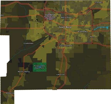
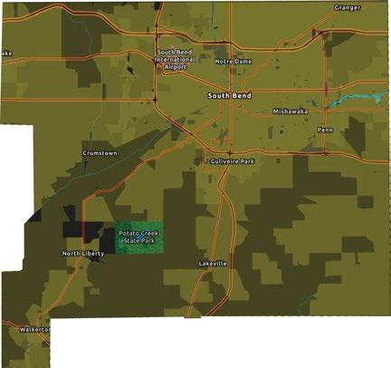
Source: IndianaBroadbandMap.com (December 2020).
Indiana Michigan (I&M) Power, Northern Indiana Public Service Company (NIPSCO) are two private electric service providers in St. Joseph County. Other electric providers include:
• Mishawaka Utilities
• Northern Indiana Public Service Company
• Kankakee River Valley Rural Electric Membership Company (REMC)
• Marshall County REMC
• Walkerton Electric Department
• Town of New Carlisle
According to the Indiana Office of Utility Consumer Counselor, rural electric membership companies (REMCs) are notfor-profit electric utility cooperatives in which customers are member-owners. The rates and charges of all REMCs in Indiana are regulated at the local level rather than at the state level. The two REMCs in the County are located near North Liberty and Walkerton.
There are four electric generating facilities in St. Joseph County. Three are owned by I&M, two hydroelectric and one solar. The fourth facility is natural gas and under contract with I&M.
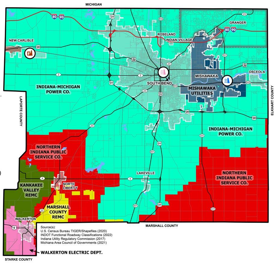

Data sources accompany ever figure in the appendices. Sources for table-based information are typically at the bottom of the table. Sources for map-based information are located at the bottom left side of the map to the right of the Town of Walkerton. Other types of graphics, such as charts, will have the data source listed at the bottom of the graphic.
2002 St. Joseph County-South Bend Comprehensive Plan
ESRI, Community Analyst
Federal Communications Commission
Federal Reserve Bank of St. Louis Economic Development Data (FRED)
Indiana (IN) Broadband Map
IN Department of Environmental Management
IN Department of Natural Resources
IN Enterprise Center (IEC): Economic Opportunity Analysis
IN Gateway: TIF District Viewer
IN Geographic Information Office
IN Utility Regulatory Commission
https://www.sjcindiana.gov/DocumentCenter/View/1172/ComprehensivePlan-for-South-Bend-and-St-Joseph-County-2002
Community Analyst is a paid GIS online service that provides data for Housing Affordability Index and Business Summary reports.
https://www.fcc.gov/general/broadband-deployment-data-fcc-form-477
https://fred.stlouisfed.org/
https://indianabroadbandmap.com/
https://www.in.gov/idem/resources/maps/
https://data-indnr.hub.arcgis.com/
https://www.sjcindiana.gov/1792/IEC-Opportunity-Analysis-Report
http://gateway.ifionline.org/TIFviewer/
https://www.indianamap.org/
https://www.in.gov/iurc/online-services/ OR https://indianamap-inmap.hub. arcgis.com/datasets/INMap::electric-service-territories-iurc/explore K
Michiana Area Council of Governments https://maps-macog.hub.arcgis.com/
Northern Indiana Public Service Company https://www.nisource.com/customers/where-we-serve
South Bend (SB) International Airport https://flysbn.com/ J
SB Region Economic Development https://southbendregion.com/ D
SB Regional Chamber https://www.sbrchamber.com/ D
St. Joseph County (SJC): Offical Website https://www.sjcindiana.gov/ I
SJC: Department of Infrastructure, Planning, and Growth https://www.sjcindiana.gov/2250/Infrastructure-Planning-Growth
E, F, G, H, I
SJC: Health Department https://www.in.gov/localhealth/stjosephcounty/ K
SJC: Park Department https://sjcparks.org/2251/Parks-Recreation F
SJC: Zoning Ordinance https://www.sjcindiana.gov/2295/St-Joseph-County-Zoning-Ordinances I
STATS Indiana https://www.stats.indiana.edu/
US Bureau of Economic Analysis https://www.bea.gov/tools/
US Census Bureau (USCB): American Community Survey 5-Year Estimates https://data.census.gov/
USCB: Decennial Census https://data.census.gov/
USCB: OnTheMap https://onthemap.ces.census.gov/
USCB: Quarterly Workforce Indicators Explorer https://qwiexplorer.ces.census.gov/
US Congressional Research Service https://crsreports.congress.gov/
US Department of Agriculture (USDA): National Agricultural Statistics Service https://www.nass.usda.gov/
USDA: Natural Resources Conservation Service https://datagateway.nrcs.usda.gov/
USDA: Web Soil Survey https://websoilsurvey.nrcs.usda.gov/app/
US Department of Transportation https://data-usdot.opendata.arcgis.com/
US Environmental Protection Agency, EnviroAtlas https://www.epa.gov/enviroatlas
US Federal Emergency Management Agency https://www.fema.gov/flood-maps/national-flood-hazard-layer
US Fish and Wildlife Service: Wetlands Mapper https://www.fws.gov/program/national-wetlands-inventory/wetlands-mapper
US Geological Survey: The National Map https://www.usgs.gov/programs/national-geospatial-program/national-map