
7 minute read
PUBLIC SURVEY KEY TAKEAWAYS


Improvements in connectivity between various sections of the bicycle and pedestrian network is needed. Traffic calming is needed to improve safety on on-street bicycle facilities and at street crossings. Most bicyclists are uncomfortable sharing the road with motor vehicle traffic, thus more off-street bicycle facilities are needed.
Sidewalks are missing or are in disrepair throughout the city, particularly in the downtown. Sidewalk repair and installation should be a priority. Also, many sections of shared use path are in disrepair, causing discomfort for users. Maintenance on the trails should also be a priority.
Advertisement
Bicyclists and pedestrians desire more lighting along the bicycle and pedestrian network.
Improved street crossings are needed throughout the city at high traffic speed and high traffic volume roadways.
Although most bicyclists prefer separated, off-street bicycle facilities, a number of bicyclists indicated that they desire on-road facilities, such as conventional bicycle lanes, buffered bicycle lanes, and bicycle routes. Therefore, the bicycle network should include a mix of both low-stress, off-street bicycle facilities and on-street facilities.
Public Meeting And Online Mapping Tool
A public meeting was held on June 20, 2019 to collect input from the public on current bicycle and pedestrian user experiences and network issues. In addition to the workshop, the public was invited to participate in an online mapping exercise, utilizing a tool called WikiMaps, to describe their preferred bicycle and pedestrian routes, important destinations, conflict points, and desired routes. Members of the public were invited to participate in the workshop and online mapping exercise through a media release and social media announcements. Thirtyeight individuals attended the workshop. A summary of the input collected at both the public meeting and on the WikiMaps online mapping tool is below.
Key Destinations
Public meeting participants were asked to identify destinations to which they want to bike and walk. The most common destinations identified include:
Downtown Columbus
Shopping centers along U.S. 31 / National Road, including Kroger, Target, Wal-Mart, and Lowe’s
Columbus North High School and Northside Middle School
Tipton Lakes area
North Columbus neighborhoods near Columbus Municipal Airport
Shopping areas along Jonathan Moore Pike, near the I-65 interchange .
Parks citywide .
Preferred Bicycle Facility Type


This Plan update utilized public input to measure the comfort level of bicyclists on existing facilities and also on facilities that are not in Columbus now but might be implemented in the future. Based on photos and descriptions provided at the meeting, participants were asked to indicate what their comfort level is or would be on various bicycle facilities. The graphic below summarizes the public input responses for facility type preference.
Existing Bicycle Routes
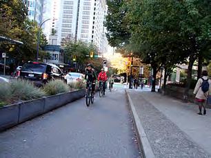
Routes currently used by local bicyclists are illustrated on the adjacent map. This map shows that bicyclists are already riding in many areas of the city.
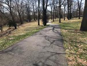
The paved trail system, including the Haw Creek Trail and the paved trail along Jonathan Moore Pike, are the most popular facilities for bicycling in the city. However, there is widespread use of existing bicycle lanes and bicyclists riding with traffic in the downtown area. Some of these routes were identified “high stress” routes on which bicyclists are not entirely comfortable or would not be comfortable riding with children. Downtown routes were identified in one-way pairs which indicates that bicyclists are following the law and riding with traffic while using these routes. The variety of current routes indicates not only the widespread demand for more bicycle and pedestrian facilities but also the range of bicycle skill levels in the city with many bicyclists choosing on-road facilities as well as off-road facilities.
Downtown Enlargement
EXISTING SHARED USE PATH
EXISTING BUFFERED BICYCLE LANE
EXISTING CONVENTIONAL BICYCLE LANE
EXISTING BICYCLE ROUTE
Desired Routes
The public was asked where they would like to ride or walk throughout Columbus. This map reflects the response from both the public meeting and the WikiMap online exercise.
The demand for regional routes, in addition to local routes, is evident through this exercise. Many participants expressed the desire to be able to ride their bikes to places like Brown County State Park and the Edinburgh Outlet Mall. Participants also sought a connection from the downtown area south along State Road 11 to the Bartholomew County Fairgrounds and the Woodside Industrial area and beyond.
These results also confirm the need to expand the bicycle and pedestrian network by connecting various sections of the existing system. Completing these routes will provide comfortable and safe connections between residents and their destinations.
DESIRED PEDESTRIAN ROUTE
DESIRED BICYCLE ROUTE
EXISTING SHARED USE PATH
EXISTING BUFFERED BICYCLE LANE
EXISTING CONVENTIONAL BICYCLE LANE
EXISTING BICYCLE ROUTE
CliftyCreek
Conflict Points
Participants were asked to identify locations where they experience conflicts with other user types, specifically where bicyclists and pedestrians conflict with motor vehicles and where bicycles and pedestrians conflict on shared spaces, such as on shared use paths and in crosswalks. The adjacent map reflects the locations identified during the public input process.
Conflicts between bicyclists/pedestrians and motor vehicles are frequent along high volume roadways such as Central Avenue, Jonathan Moore Pike, U.S. 31, Rocky Ford Road, and 17th Street.
The conflict points identified by the public are consistent with the crash data analysis, which also indicated a high frequency of collisions along high traffic corridors, such as U.S. 31, 17th Street, and 25th Street.
9
LOCATION OF PEDESTRIAN AND BICYCLIST CONFLICT
LOCATION OF VEHICLE AND BICYCLIST/PEDESTRIAN CONFLICT
EXISTING SHARED USE PATH
EXISTING BUFFERED BICYCLE LANE
EXISTING CONVENTIONAL BICYCLE LANE
EXISTING BICYCLE ROUTE
COLUMBUS PLANNING JURISDICTION (STUDY AREA)
Recent Project Impacts
Participants at the public workshop were presented with a selection of projects that had been completed since the adoption of the 2010 Bicycle and Pedestrian Plan. The list of projects included intersection improvements, bicycle route signage, and new shared use paths, buffered bicycle lanes, and conventional bicycle lanes. The participants were asked to identify the projects that have been most impactful for bicycle and pedestrian travel. The following are the top 5 selected projects, in order of most impactful.
The Haw Creek Trail Realignment at 25th Street / Newbern Bridge
Owen’s Bend Trail (Shared Use Path)
Rocky Ford Road Buffered Bicycle Lanes
Rectangular Rapid Flashing Beacons (RRFBs) Throughout the City
Pedestrian Hybrid Beacon (HAWK) Signal at 17th Street / Washington Street Intersection
Incomplete Project Impacts
Participants were also asked to identify incomplete projects from the 2010 Bicycle and Pedestrian Plan that they believed would be most impactful to the community if they were built. The following are the top 5 selected projects, in order of most impactful.
The Downtown Trail Connector (A Shared Use Path between Lafayette Avenue and the 3rd Street Bridge)
Washington Street Bicycle Lanes
State Road 11 Shared Use Path
Bicycle Routes Throughout the Downtown Indianapolis Road Shared Use Path
Public Meeting And Online Mapping Key Takeaways
Off-street and physically separated bicycle facilities are preferred by most bicyclists, especially by families and inexperienced bicyclists. Off-street physically separated facilities should be a priority for facility development.
The system of on-street bicycle facilities, such as bicycle lanes, is used and desired by experienced cyclists.
Safe bicycle and pedestrian crossings are needed along major vehicle thoroughfares, such as U.S. 31, Jonathan Moore Pike, and Central Avenue.
A better connection to shopping along U.S. 31, such as Target and Lowe’s, is needed.
Safe connections to areas outside of the city limits and to regional destinations, such as the Bartholomew County Fairgrounds, Brown County State Park, and the Edinburgh Outlet Mall, are desired.
More dedicated bicycle facilities are needed in the downtown area. .
As in 2010, the public still desires safe connections south of downtown, along Washington Street, on S.R. 11, and along Indianapolis Road. .
Stakeholder Interviews
Prior to the evening public workshop on June 20, 2019, a series of stakeholder interviews was conducted. Participants included a diverse cross-section of bicyclists and pedestrians, representatives of community organizations serving Columbus youth, and City of Columbus staff responsible for ongoing maintenance of the bicycle and pedestrian network.
Stakeholder Interview Key Takeaways
S.R. 46, I-65, U.S. 31, and other major roadway barriers impede connectivity throughout the community. Shared use paths adjacent to the roadway are confused with sidewalks, and bicyclists are often uncertain if they can or should use those facilities.
Fair Oaks Mall / NexusPark, Kroger, and several other commercial areas along U.S. 31 are important destinations for both bicyclists and pedestrians. Safe connections to these destinations should be established. .
Trail amenities, such as trailheads and water fountains, are desired throughout the trail network.
Downtown sidewalks need maintenance and repair. Pedestrians sometimes choose to use bicycle lanes and streets because they are in better condition than adjoining sidewalks.
Officially naming the various sections of trail would assist trail users and City maintenance staff in the identification of issues along the trail.
With respect to ongoing maintenance, wayfinding and directional information displayed on-pavement is preferred because signs are frequently vandalized or stolen.
A detailed plan for maintenance and operations is needed. .
Public Outreach Follow Up
Following the public outreach efforts in 2019, draft materials were prepared for additional public review. During the summer of 2021, the City presented the community with the draft bicycle and pedestrian facility maps and engaged the public in an exercise to help proiritize the recommended improvement projects. The results of this effort contributed to the implementation priorities described in Chapter 9.
Through use of the city website and other digital tools, the City created an online method for the public to vote on the improvements they felt were most important. To encourage participation in this exercise, the City ran a fullpage color advertisement in The Republic, the local newspaper, on July 18, 2021 which showcased the draft bicycle and pedestrian facility map and invited the public to vote online. The advertisement also presented the public with the option to mail in their votes using a printed survey included with the advertisement and to visit City staff at an upcoming Farmers Market to further discuss the draft recommendations. The City also (1) coordinated with First United Methodist Church to collect feedback on the most needed sidewalk improvements from attendees of their weekly Hot Meals site and (2) partnered with the Columbus Area Metropolitan Planning Organization to co-host a public open house to collect feedback on both the Bicycle and Pedestrian Plan update and the ongoing Metropolian Transportation Plan update.
In addition to the advertisement in the local newspaper, the City publicized the various opportunities to provide feedback through social media posts and email invitiations to local contacts. Over 250 people participated in the online survey and several more provided input at the various in-person events described above.


