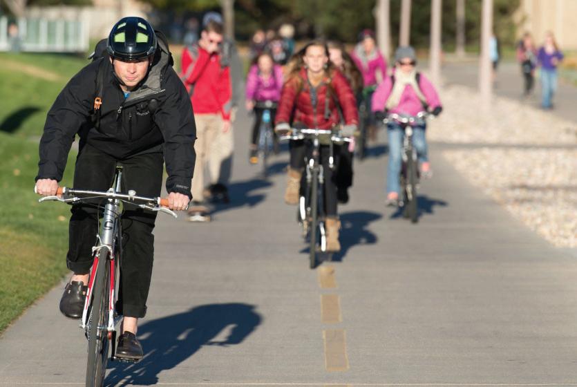
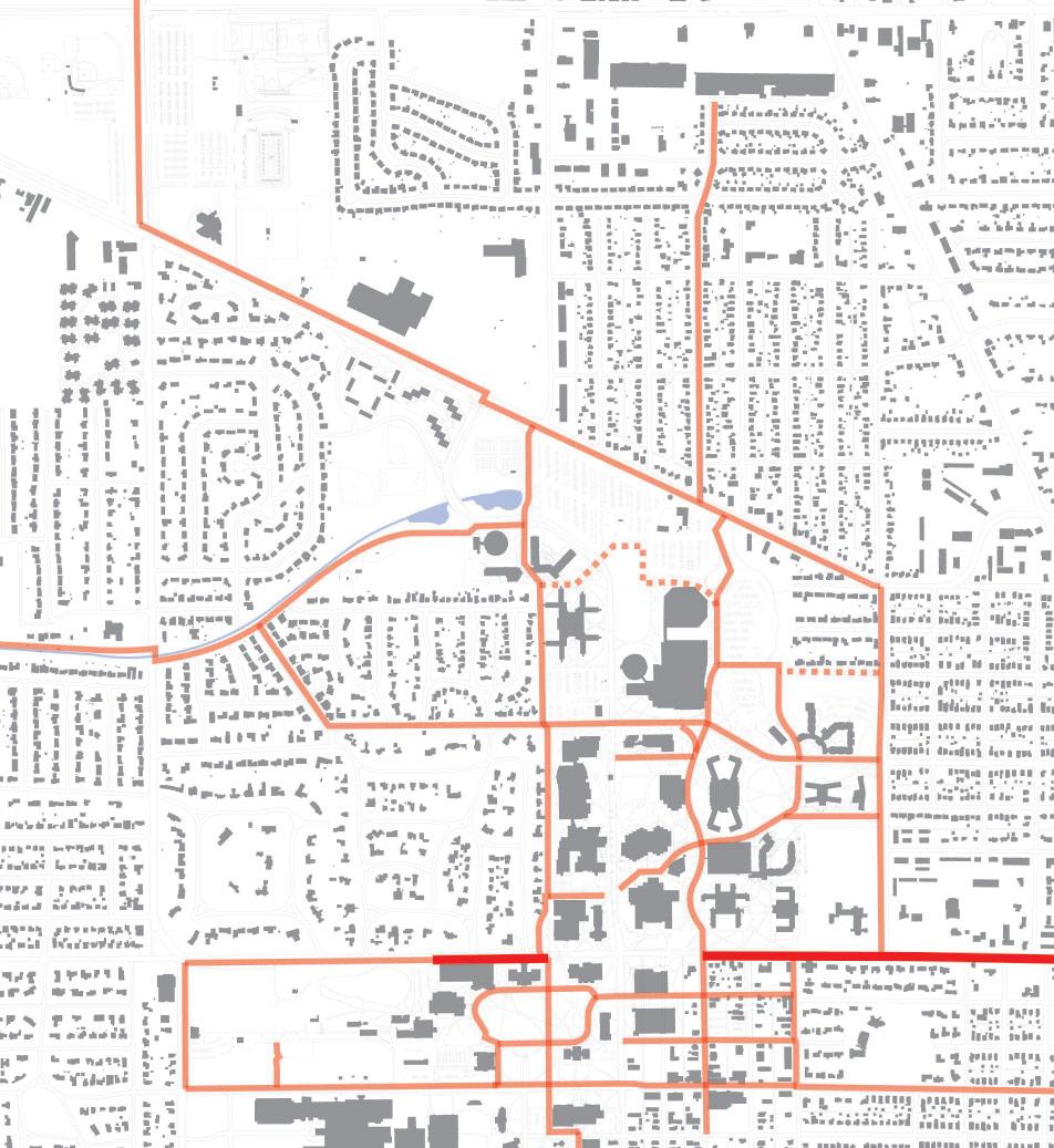
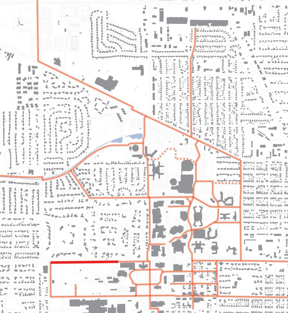
The Ball State University Bicycle Master Plan includes recommendations for a variety of bicycle route types including on-street and off-street facilities. For the purposes of plan, these recommendations have been organized into three types of improvements:
• Major Connectors: Major bicycle routes that make connections to the surrounding community and existing destinations.
• Village Connectors: Minor on-street bicycle facilities connecting to the Village.
• Campus Connectors: On-campus routes that make connections to important on-campus destinations.
Each bike path recommendation could be implemented according to the matrix below. However, future circumstances may necessitate some facilities be implemented sooner or later than proposed.
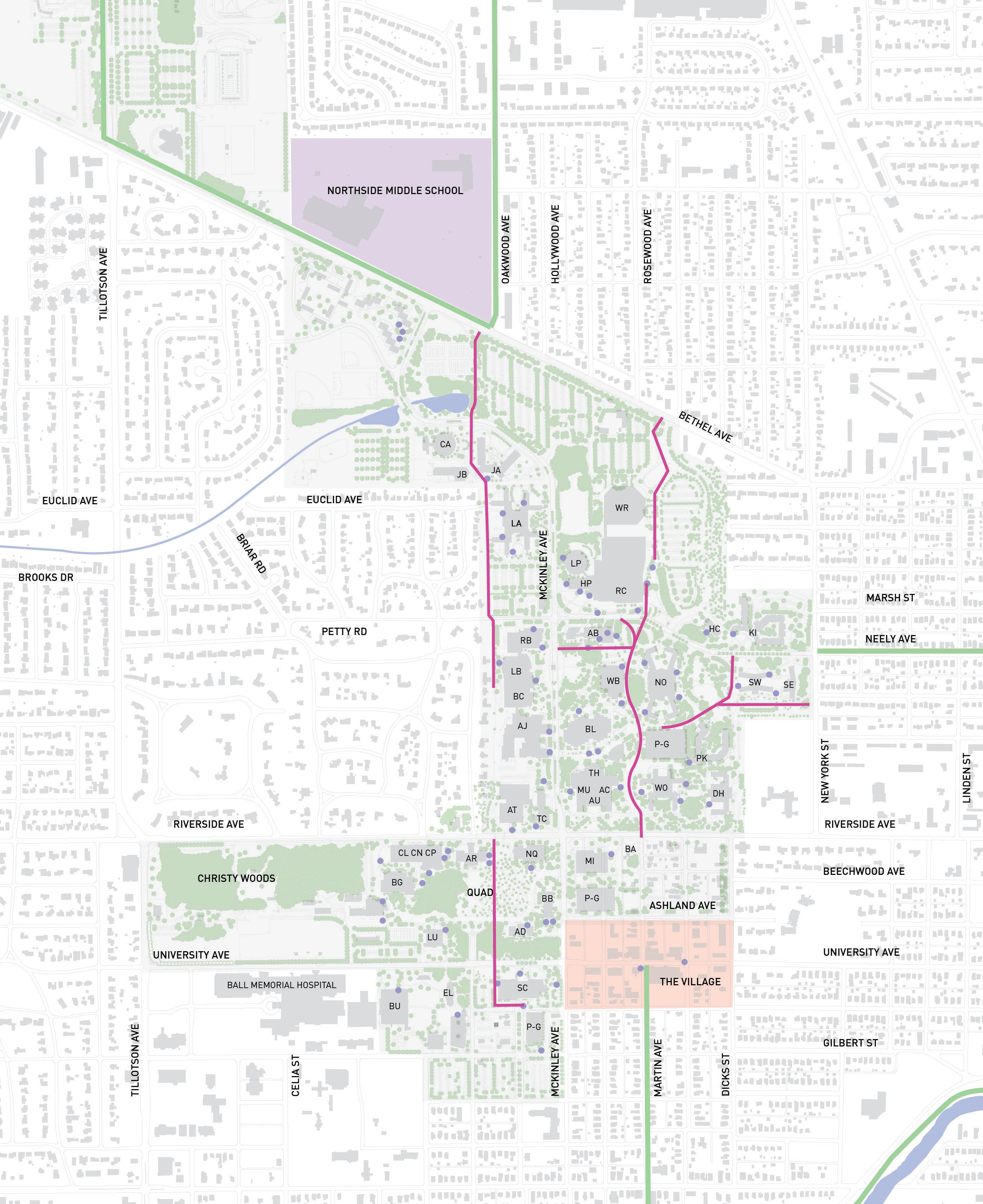
Early
Action Projects
• Martin Street
• NeelyAvenue
• Dicks Street
• Ashland Avenue
Coordination with the City of Muncie
• Riverside Avenue
• Bethel Avenue
• New York Avenue
• Dicks Street
• Ashland Avenue
• UniversityAvenue
• UniversityAvenue 2.2 5.8
• Martin Street
• CollegeAvenue
• Briar Road
• PettyRoad
milesofnew,on-streetfacilitiesforbicycles
milesofnew,off-streetfacilitiesforbicycles
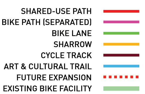
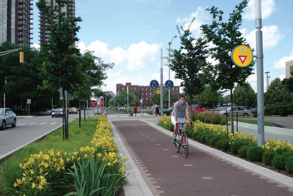
The Different Types of Bicycle Facilities
A variety bicycle route types were used to form the overall network plan. The four types of bicycle facilitiesincludethefollowing:
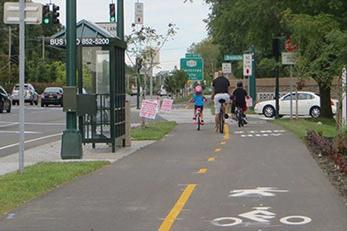
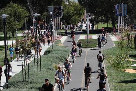
• Shared-Use Paths
• SeparatedBikePaths
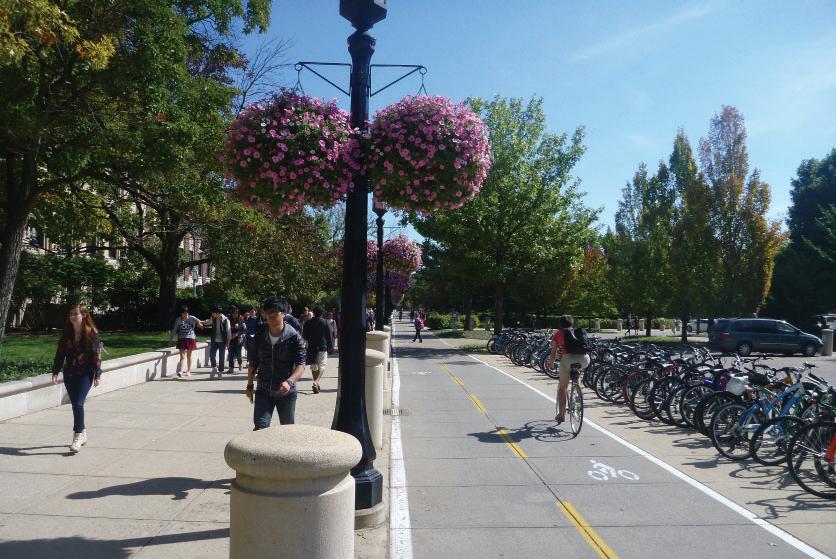
• Bike Lanes and Sharrows
• CycleTracks
Existing conditions such as right-of-way, average daily traffic counts, and potential implementation costdeterminedthetypesofroutesproposed. The chartgraphiconthefollowingpagefurtherdefines thefacilitytypeby:
• Level of Protection
• Installation Cost
• Durability
• Aesthetic Value
• Dedicatedbicyclespace
Types of Preferred Bicycle Facilities
A survey of the general public and the students, faculty and staff of Ball State University determined cycle tracks and shared-use paths (and bike paths) were the most preferred type of bicycle facility, both of which are located off-street. Protected bike lanes were somewhat important,whilebikelanesweretheleastpreferredtype ofbicyclefacility.
• Located alongside roadways
• Combined pedestrian and cyclist space, although some shared-use paths identify separate spaces were pedestrians and cyclists should be
• Typically more expensive to install than on-street bicycle facilities, but offer more protection from vehicles and are usually used by a larger cyclist user group
• Located outside of road right-of-way, usually on or throughout campus
• Separates pedestrians from cyclists, each receives their own dedicated space
• Typically more expensive to install than Shared-Use Paths; Unit Pavers may be used in lieu of concrete or asphalt to create a higher end aesthetic, but installation costs will increase
• Least level of protection from vehicles. Cyclists are expected to travel beside traffic (bike lanes) or in the flow of traffic (sharrows)
• Usually the most affordable bicycle facility to install, but on-going costs to reapply the bicycle markings should be expected
• Least visually appealing infrastructure improvement. Existing roadways are usually asphalt (alternate roadway materials are not ideal for cycling)
• Highest level of protection. Cyclists are separated from pedestrians and vehicles, and given a dedicated space to ride
• Typically the most expensive facility to install, but most likely offers the greatest durability
• Offers the greatest potential for high-quality aesthetics.
INSTALLATION
DURABILITY
AESTHETICS
DEDICATED
BIKE PATH (SEPARATED)
INSTALLATION
AESTHETICS
DEDICATED
BIKE LANES & SHARROWS
INSTALLATION
AESTHETICS
DEDICATED
CYCLE TRACKS
INSTALLATION
AESTHETICS
DEDICATED
Building a Successful Network
Intent of the Bicycle Master Plan
The purpose of the Ball State University Bike Master Plan is to develop a campus-wide plan and implementation strategy for a system of bicycle routes, which will help to improve bicycle circulation on campus as well as connections with adjacent neighborhoods and destinations.
The Master Plan will focus on improving campus mobility and circulation. Priority was placed on separating facilities for bicycles and pedestrians, and understanding where new shared-use routes could occur. Existing routes could be enhanced to connect to critical destinations on campus and in the City of Muncie. Two critical on-campus routes that were studied included the Cow Path enhancements and future considerations for the East Mall bike path.
The
5 E’s
A common metric for measuring the success of a bicycle network is called “The 5 E’s.” These categories were developed by the League of American Bicyclists and are used as a guide to determine the relative success of a state, community, business, or university when applying for a Bicycle Friendly entity. These categories should also be followed when developing a cohesive and successful bicycle network at Ball State University.
Goals and Recommendations of the Bicycle Master Plan
An inventory of the existing campus network and policies provided insight needed to develop the goals of the campus bike plan. Likewise, public meetings were held to gather input from students, faculty, staff, and citizens of Muncie to determine their desires for bicycle improvements on campus. The common goals that emerged were:
Connectivity to the Periphery: Provide bicycle routes that connect to destinations off campus.
Connectivity on Campus: Provided bicycle routes that connect to destination on campus.
Provide Safe Routes: Regardless of destination location, each route should be safe and easily used by a widerange of cyclists.
Develop a Bike Share Program: Determine the applicability of a campus and city-wide bike share program. The results of this study are available in a separate appendix.
Planning Process
Phase 01 - Discovery
• Collect and analyze relevant data, maps, programs, policies, and existing conditions of pedestrian and bicycle infrastructure
• Develop a project website, online user survey and online mapping tool to gather input from the public
• Field observations and site visits
Phase 02 - Visioning
• Engage with individuals and groups, from both the City of Muncie and Ball State University
• Develop a draft bicycle network plan including roadway improvement recommendations
Phase 03 - Master Planning
• Engage in a final public meeting to present the draft recommendations
• Determine implementation and phasing strategies
Phase 04 - Bike Share Study
• Determine the applicability of a bike share system including the University and City of Muncie
• Determine potentials costs, bike share type, and potential bike share station locations
DISCOVERY
VISIONING
MASTERPLAN BIKESHARE
Data Collection & Existing Campus Conditions
Current Ball State Bicycle Policies
Ball State University has four bicycle policies/ informational pages that guide how bikes are to be used on campus.
1. The first policy is Bicycle Registration, found within the University Police information on the Ball State website. The policy asks that students, faculty and staff register their bike through an online-form. Required information on the bicycle includes the manufacturer’s serial number and a basic description of the bicycle.
2. In the Housing and Residence Life policies, bicycles are noted to be allowed in a student’s room, provided it does not create an unsafe condition and the roommate has given permission for storage. Any motorized vehicles are not allowed within the residence halls.
3. Also noted in the Housing and Residence Life policies are opportunities for bike lockers. To rent a bike locker, a student, faculty, or staff member must fill out the bicycle locker rental agreement form.
4. Outdoor Pursuits offers a bicycle rental program at daily, weekend, and weekly rates. No policies regarding these bicycles are specifically listed on the Outdoor Pursuits website.
Current City of Muncie Bicycle Policies
The City of Muncie has a specific section (Chapter 74) in the City’s ordinance related to bicycles. The ordinance was approved in February of 2015. Key components of this ordinance include the following:
1. Bicyclists have all the rights of vehicles when traveling on public roadways.
2. Bicycles shall be properly and safely controlled, and not exceeding the number of persons for which it is designed or equipped.
3. Bicyclists shall not attach themselves to any moving vehicles.
4. Bicyclists may ride two abreast.
5. No cyclists shall carry packages that prevent two hands from being placed on the handlebars.
6. A front light and rear reflector must be used if cycling after dusk.
7. Bicyclists must follow the rules of the roadway.
8. Bicyclists must not be parked on sidewalks in a manner that interferes with pedestrian traffic or on a public roadway that interferes with vehicular traffic.
9. Designated bicycle facilities are not to be used by vehicles, for driving or parking. Bicyclists shall yield to pedestrians on shared-use paths.
10. Motorists shall provide three feet of space when passing a cyclist on a roadway without a designated bicycle facilities.
11. Cyclists shall not be harassed.
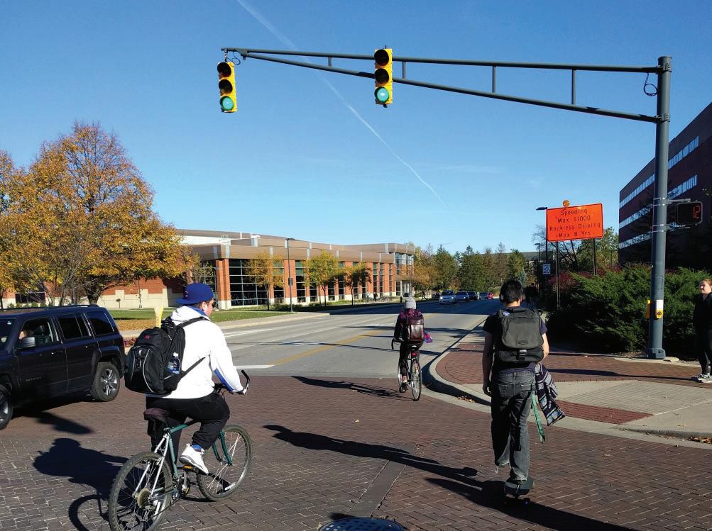
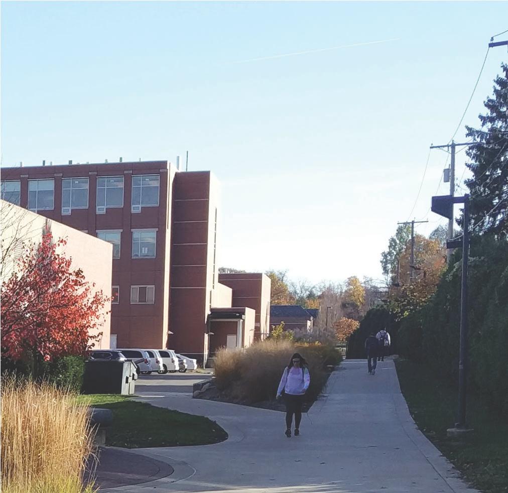
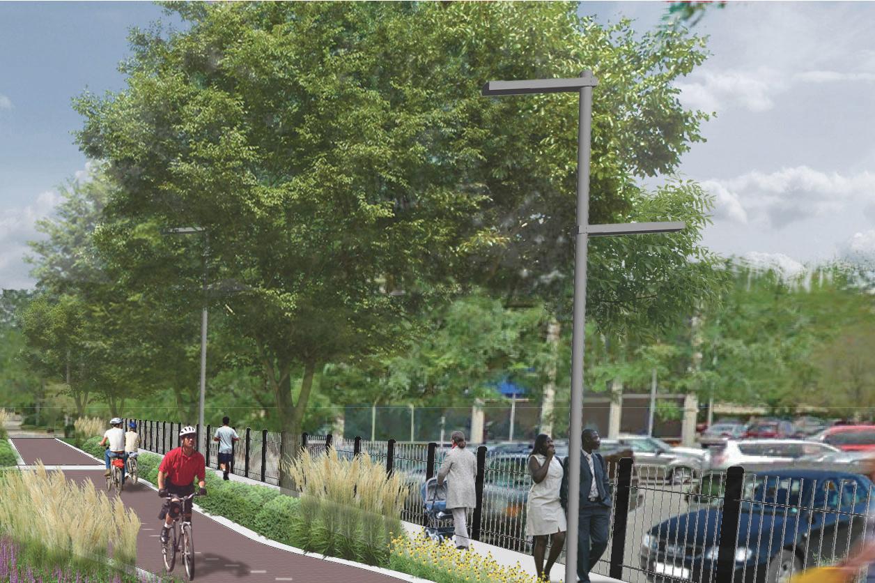
Pedestrians and cyclists mixing at Neely/McKinley intersection
Existing sidewalk near CAP
12. Penalties for violations of these ordinances include fines ranging, in order of accumulation of violations, from $100 to $500.
13. An advisory committee is established to provide advice on recommendations to other departments, agencies, board and commissions on matters that promote safe alternate transportation such as bicycling and walking. The Committee may develop programs, projects, and other initiatives to carry out the purpose of Chapter 74 policies. The committee of nine (9) should be comprised of the following groups:
• Transportation Planning
• Health/Medical
• Ball State
• Advocacy Groups
• Economic Development
• Law Enforcement
• Community Planning
• Trails/Greenways
• Four (4) members are appointed by the Mayor of Muncie
• One (1) member is appointed by the Muncie City Council
• Four (4) members shall serve by virtue of their position; Parks Department, Street Department, Cardinal Greenway E.D., MPO Director
Graphic icons provided by The Noun Project: 23 graphics, Arthur Shlain, Maria Kislitsina, Pham Thi Dieu Linh, Tatina Belkina, Ellen Zheng
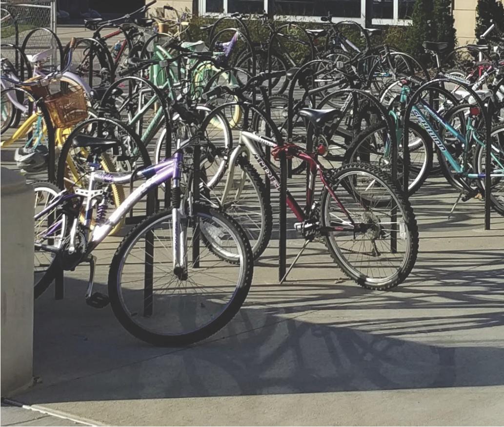
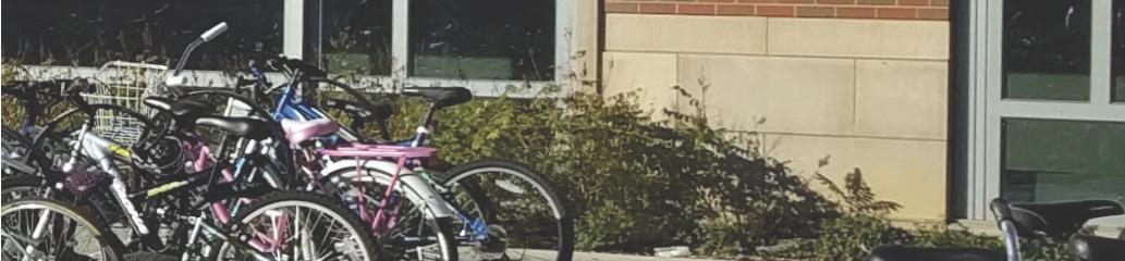
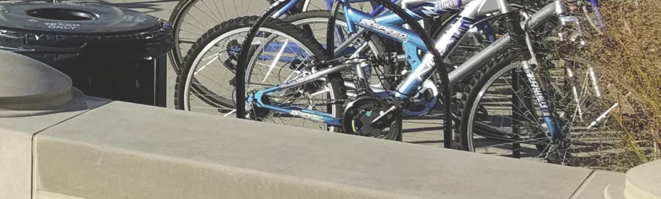
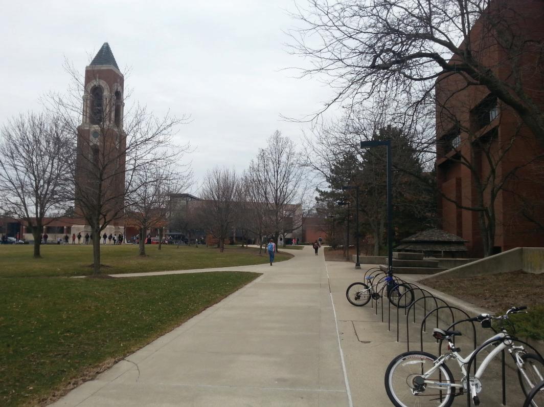
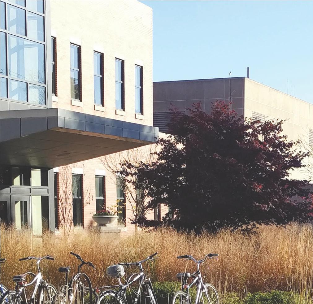
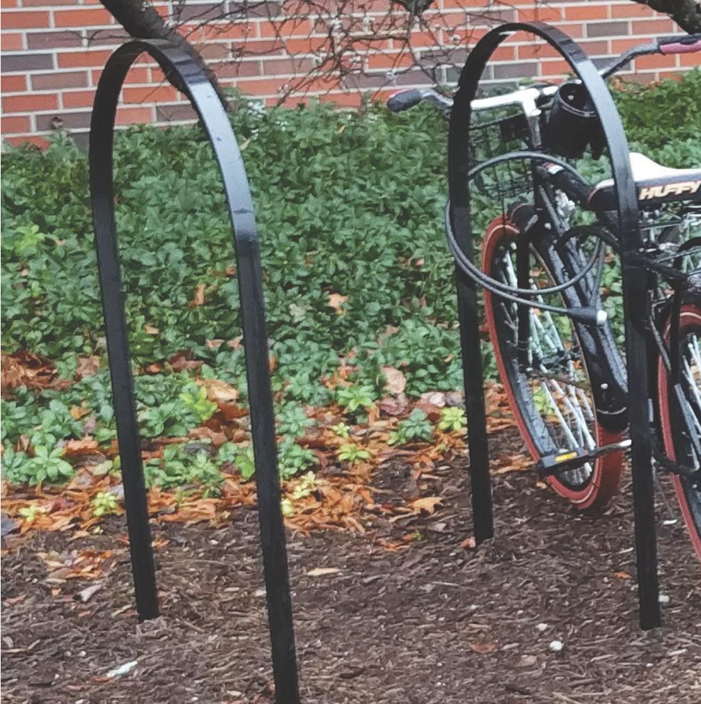
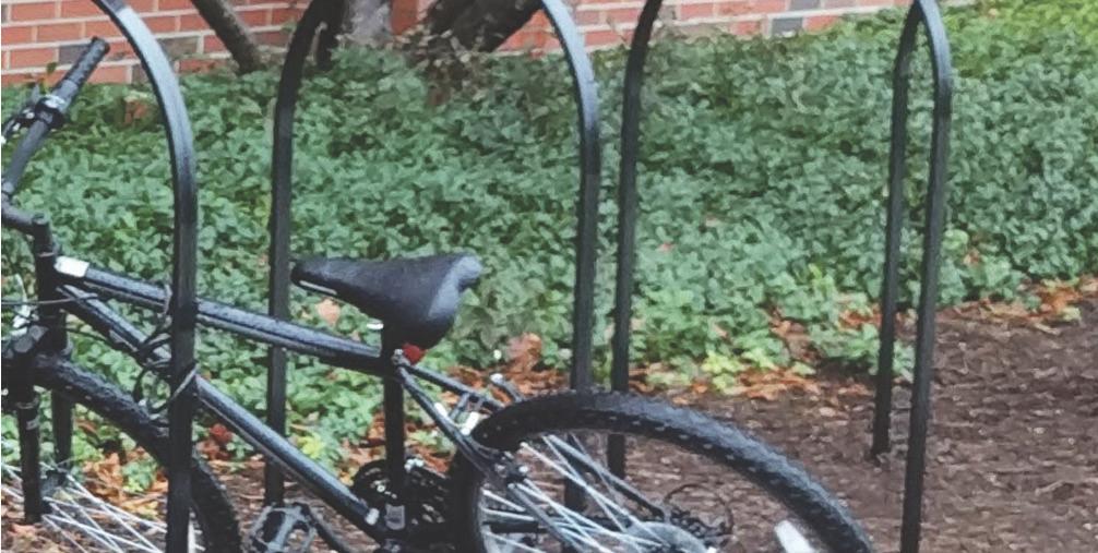
Existing Bicycle Parking Facilities
Existing Inventory
Parking is a critical part of building a successful bicycle system and network. A bicycle parking inventory was completed to document the types of bicycle racks throughout campus.
The three types of parking facilities found were loop-style racks, bracket-style racks and storage rooms. The site inventory shows that most of the campus was equipped with the loop-style parking facilities. However, some of the older buildings on campus are in need of bicycle rack
replacement, such as LaFollette Residence Hall, Cooper Science, and Emens Auditorium.
Capacity vs Demand
It is important to provide an adequate quantity of bicycle parking on campus. A lack of bicycle parking, or perceived lack of parking, can dissuade cycling. An inventory of parking on campus occurred during the Fall and Spring Semester of the 2016-2017 academic year. During these visits, bicycle parking capacity successfully met demand. However, as the University’s student body, staff and
faculty grows, additional bicycle parking may need to be provided. The following areas should be reviewed to ensure capacity meets demand:
• Art and Journalism Building: A limited amount of space near the entry to the building from McKinley Avenue may restrict future bicycle parking needs. Furthermore, placing additional parking on the east side of the building (near McKinley) may encourage cyclists to use the pedestrian sidewalks.
• Bracken Library: Currently, more than an adequate quantity of bicycle racks is located on the northwest side of the building. Ball State could consider moving some of these racks closer to the future East Mall bike path, to encourage the use of the future bike route.
• Future residence hall construction: High-dense residence halls usually require increased volumes of bicycle parking. In areas where a large number of bicycle racks are placed, careful consideration should be given to the circulation patterns of cyclists and pedestrians.
Bicycle Parking Recommendations
Based on the bicycle inventory, the following recommendations could be taken to improve bicycle parking on campus:
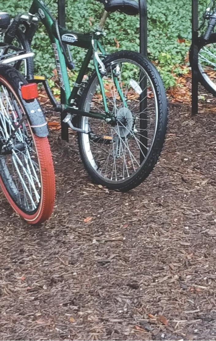
1. All racks should be black loop-style, secured to concrete. Bracket-style bicycle racks (surface and embedded) should eventually be replaced with the loop-style racks.
2. Any existing loop racks placed in mulch or rock-beds, should be transitioned to a concrete foundation.
3. It is important to locate bicycle parking in convenient locations. Parking should be near the Master Plan network but also within convenient access to important on-campus destinations.
4. Continue to provide bicycle storage rooms in new residence hall and academic building construction.
5. Provide bicycle parking in parking garages.
6. Continue to analyze existing bicycle parking oncampus to determine if demand exceeds capacity.
and descriptions courtesy of APBP EssentialsofBicycleParking. Additional information available from APBP at www.apbp.org. Color scheme used by the Princeton, NJ Bicycle Master Plan.
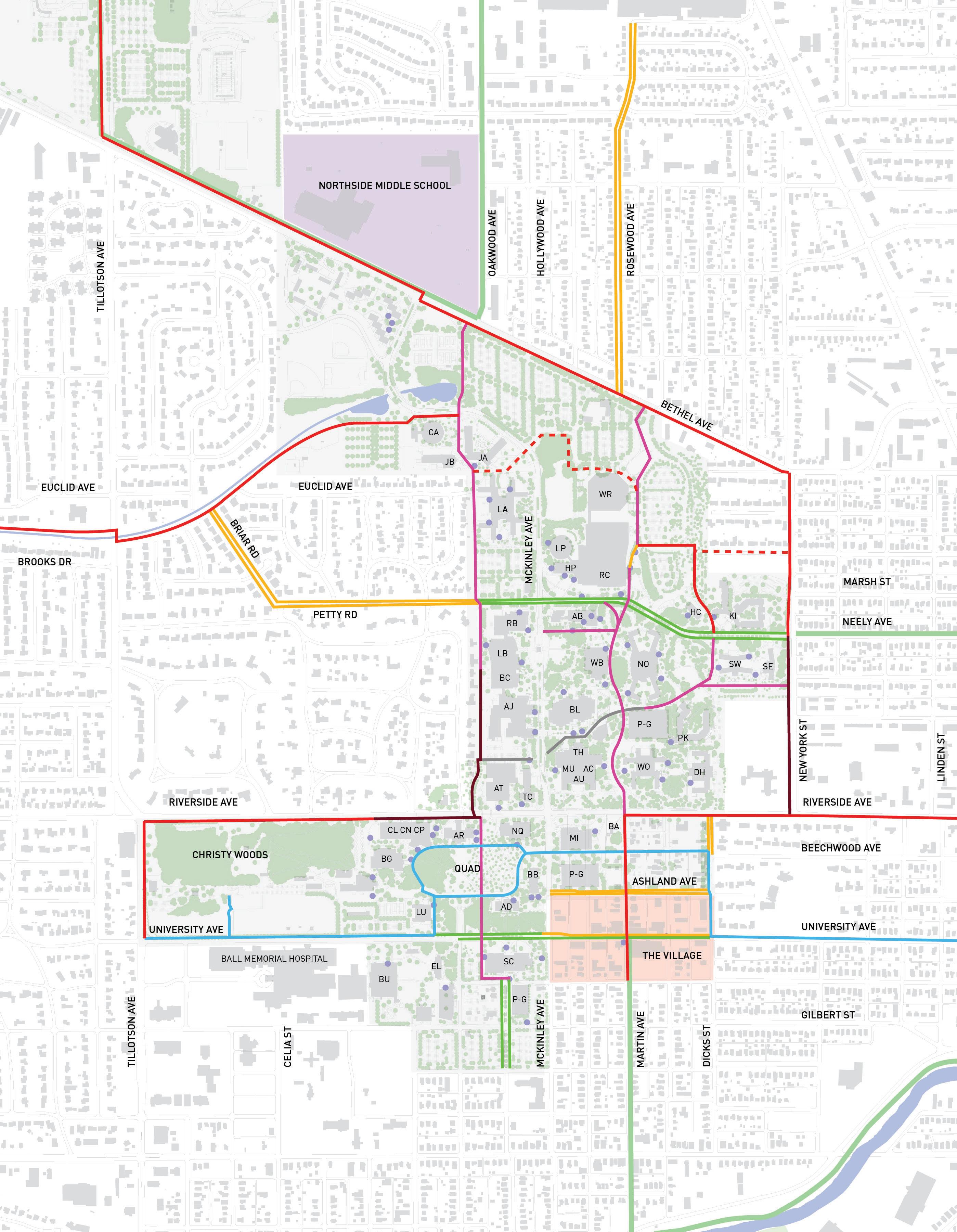
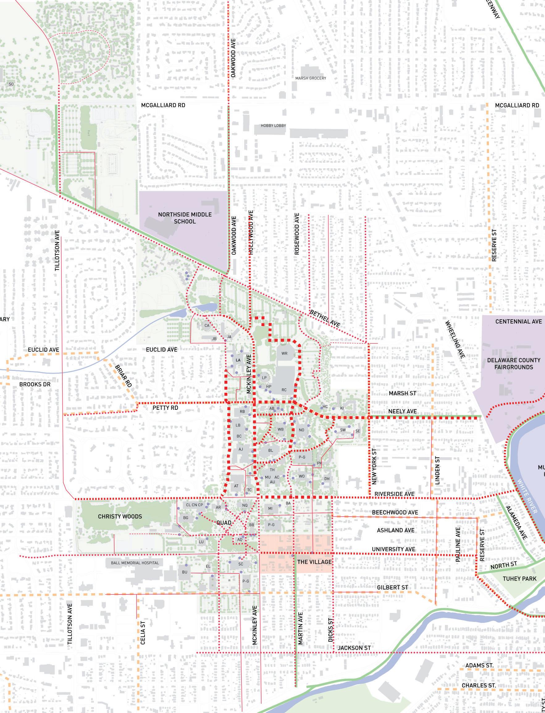
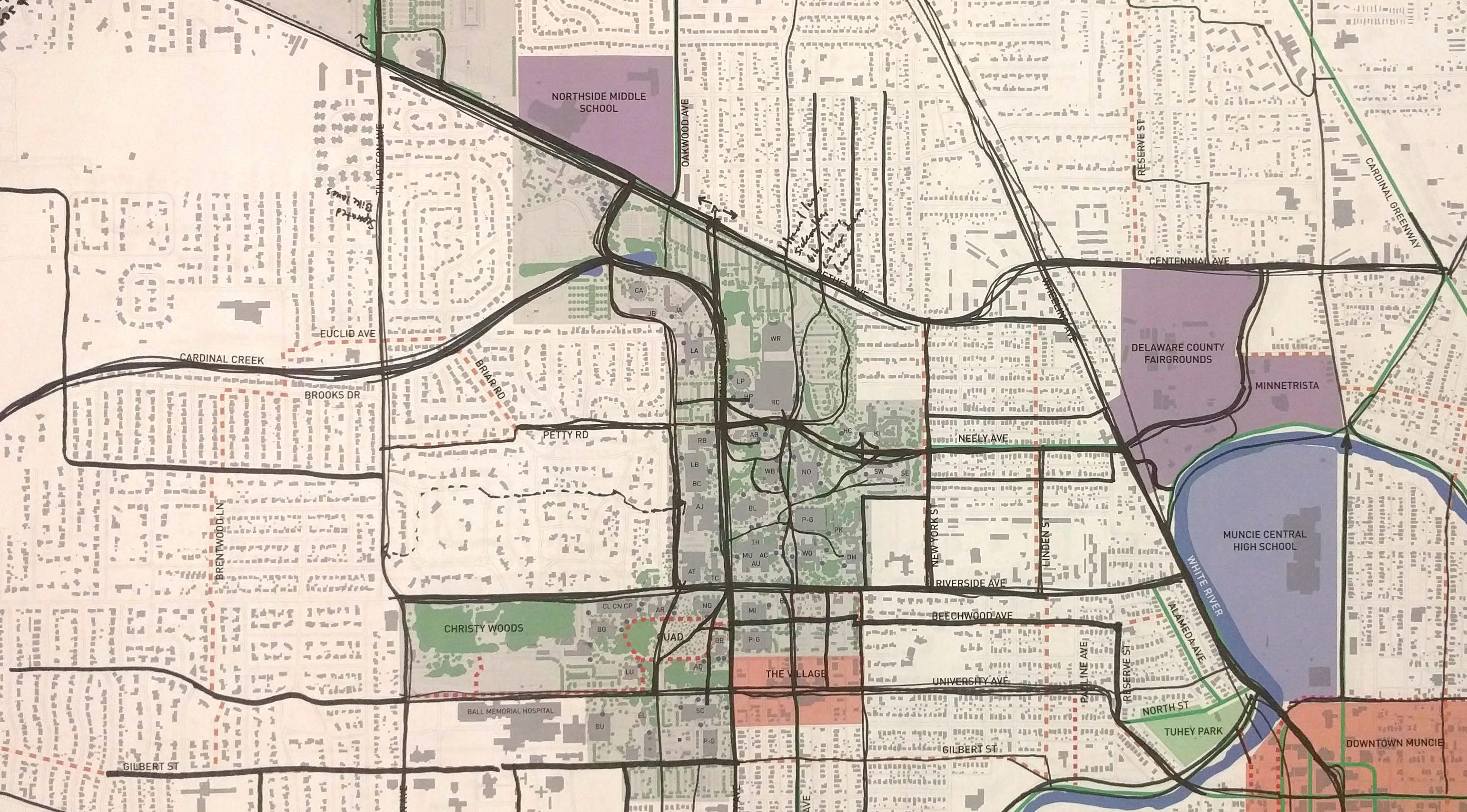
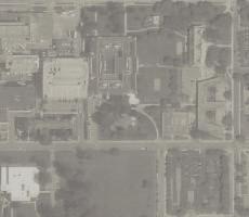
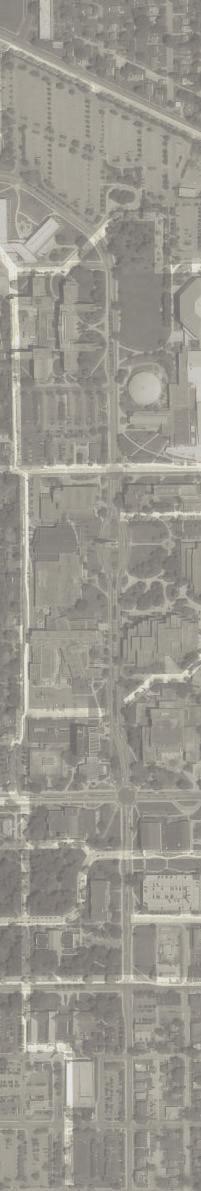
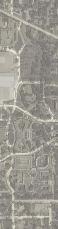
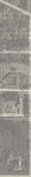
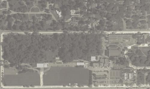
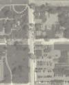
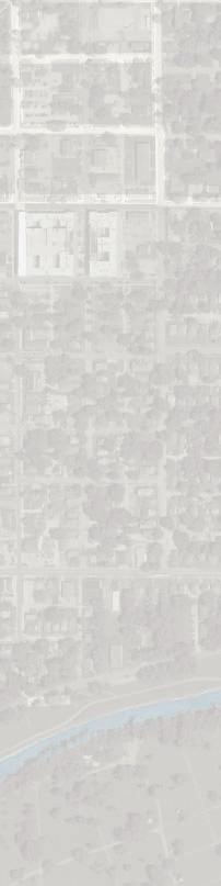
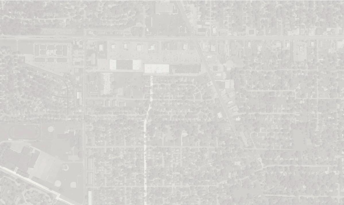
Existing Bicycle Routes
Determining Existing Routes
The existing routes on and to campus were determined through public meetings, online input, and site visits. The information gathered was used to generate the existing bicycle routes map. Existing marked bicycle routes on campus are not currently used.
The following routes were determined to be the most popular existing routes for cycling:
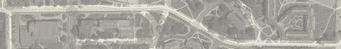
Most Popular Use: Neely Avenue is an important eastwest connector, from the Cow Path to Wheeling Avenue. The Cow Path between LaFollette and Riverside, and the north segment of the East Mall, between Bracken and Worthen Arena, was very popular. McKinley Avenue was also a popular destination to bike.
Heavy Use: New York Avenue, Oakwood Avenue, and University Avenue were popular routes that connect the surrounding community to campus.
Moderate Use: Riverside Avenue, University Avenue, Bethel Avenue and McKinley Avenue, north of Neely, received a moderate amount of use. Petty Road, west of Briar Road, was also a moderately traveled route connecting cyclist to Tillotson Avenue.
Light Use: Minor campus routes were commonly categorized as light use. Beechwood and McKinley, south of University Avenue, were lightly traveled as well.
Infrequent Use: Tillotson Avenue was the most common street to be left out of ideal biking locations because of high vehicle speeds, the quantity of vehicles, and the lack of protected cycling space.
Existing routes and destinations that are currently used on campus, as identified during the campus/public open house meeting.
Existing Bicycle Routes Map
MODERATE USE LIGHT USE
INFREQUENT USE
EXISTING BIKE FACILITY
EXISTING BIKE FRIENDLY ROAD
EXISTING BIKE PARKING
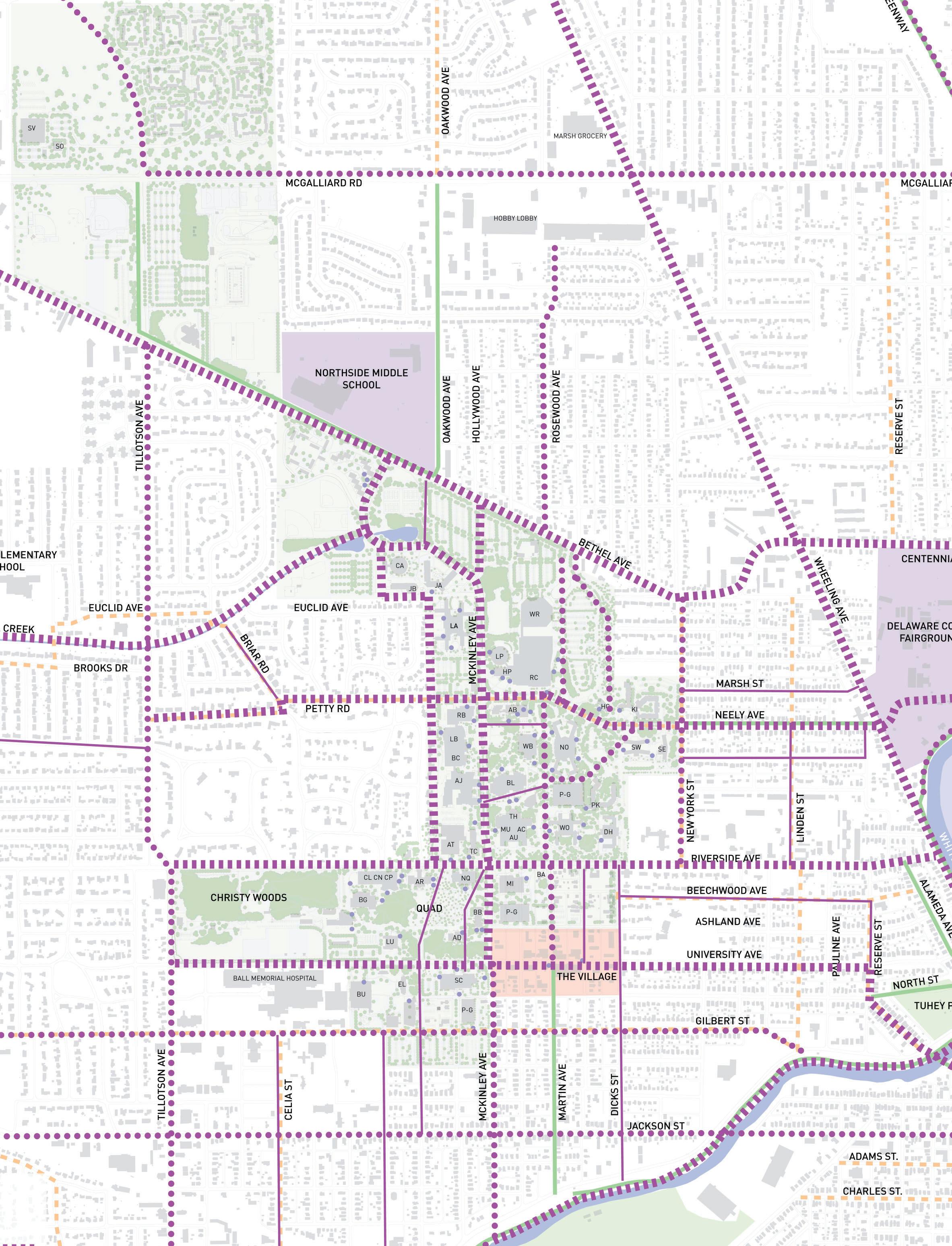
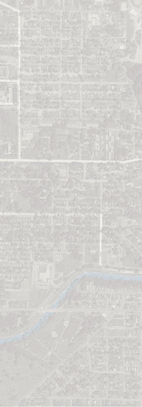
Desired Bicycle Routes
Determining Desired Routes
Similar to the Existing Campus Routes, the desired routes on and to campus were determined through public meetings, online input, and site visits.
No limitations were placed on individuals during the desired routes data collection process. Participants were encouraged to identify routes that would provide a more desirable, convenient, or safer route than what exists regardless of potential implementation challenges.
The following desired routes were identified as proposed routes for cycling:
Greatly Desired: Bethel Avenue, Cardinal Creek, McKinley Avenue, the Cow Path, Neely Avenue, Riverside Avenue, and University Avenue were highly desired new routes. The Greatly Desired routes were found along major roadways that could be used by cyclists to conveniently connect to destination points around campus.
Moderately Desired: New York, Tillotson Avenue, Gilbert Street, McGalliard Road, Rosewood Avenue, and Jackson Street were the moderately desired bicycle routes. Similar to the “Greatly Desired” routes, Moderately Desired routes were proposed along roadways that would conveniently connect cyclists to important destinations.
Lightly Desired: Lightly desired routes were typically on campus routes that connected to important on-campus destinations, such as Bracken Library or the Student Center.
Desired or proposed routes that were identified during the campus/public open house meeting.
GREATLY DESIRED
MODERATE DESIRED
LIGHTLY DESIRED
EXISTING BIKE FACILITY
EXISTING BIKE PARKING
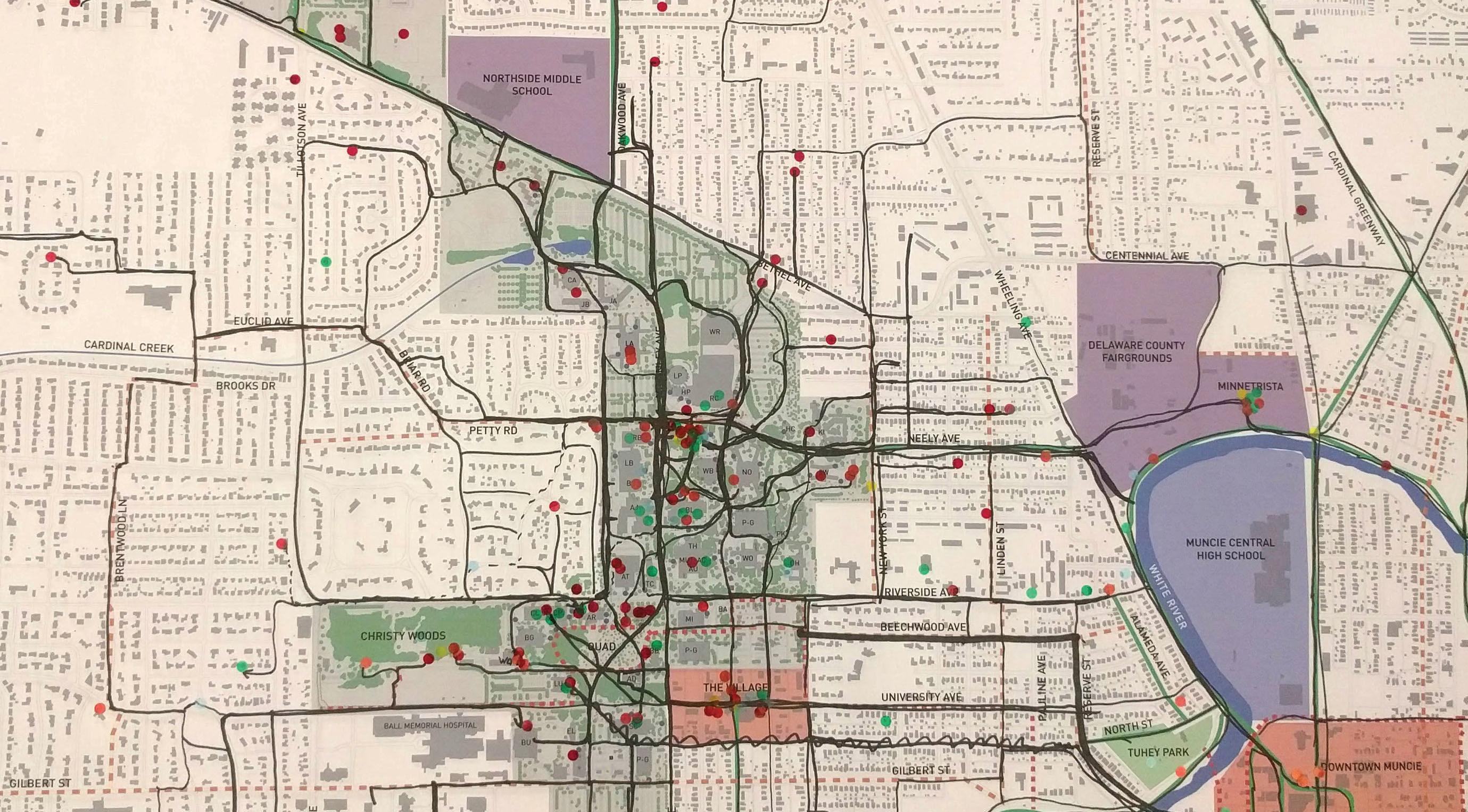
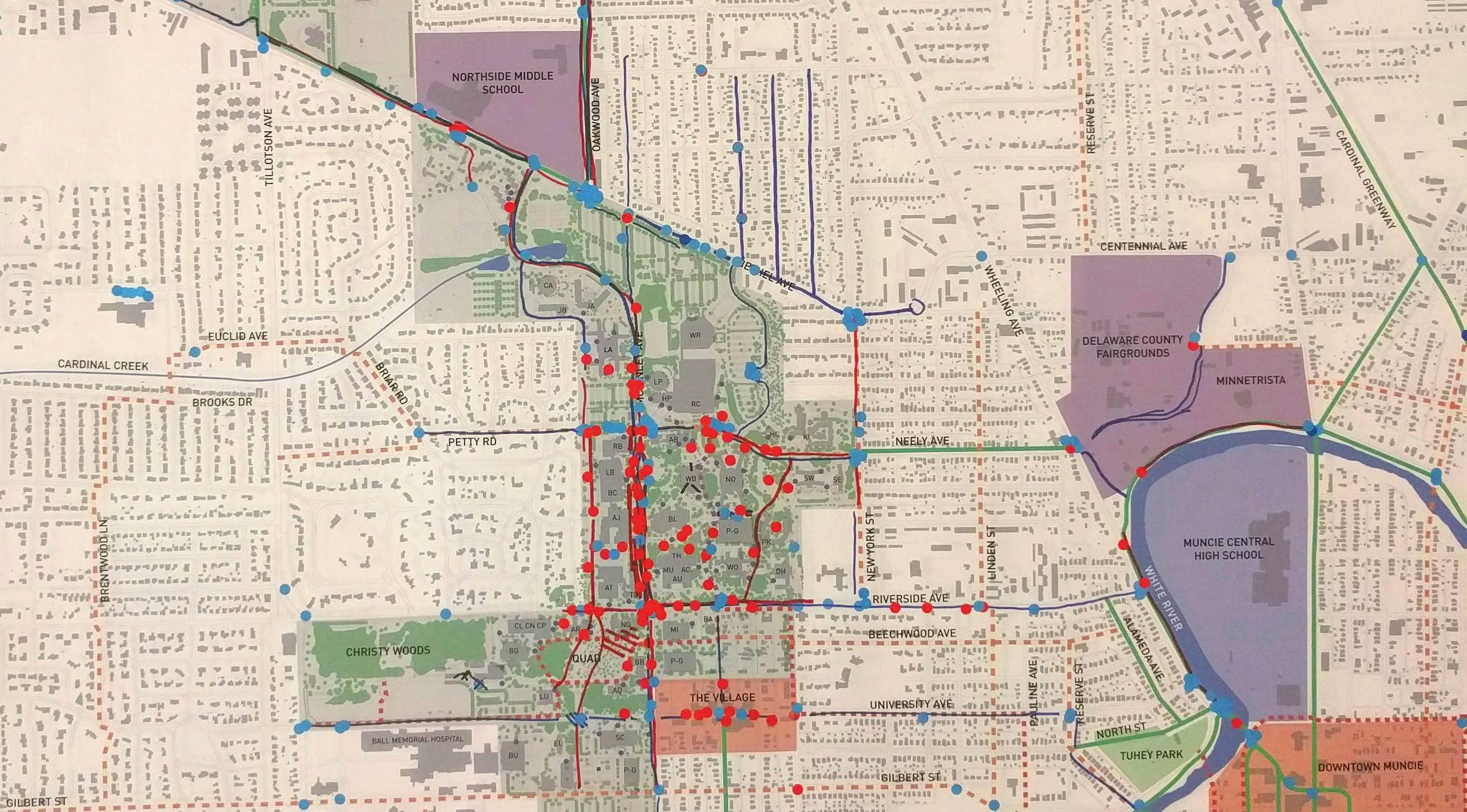
Points of Conflicts
Determining Existing Routes
Existing points of conflicts between cyclists and vehicles, and cyclists and pedestrians was collected from the attendees at the public meeting. Multiple site visits were also utilized to understand where cyclists ride and where these conflicts were likely to take place. The conflicts identified represent the information collected.
The following locations are where existing points of conflict occur:
Bicycle and Vehicle Conflicts: Most bicycle and vehicle conflicts occurred at intersections or common mid-block crossings found around the periphery of campus. Some individuals indicated conflicts points occurred along McKinley Avenue.
Bicycle and Pedestrian Conflicts: As expected, populated pedestrians areas of campus along McKinley Avenue and Riverside Avenue were common locations for bicycle and pedestrian conflicts. In less frequency, conflicts occurred along the Cow Path, Neely Avenue, and other locations scattered about campus near important destinations.
Existing bicycle/vehicle and bicycle/pedestrian conflict points that were identified during the campus/public open house meeting.
VEHICULAR CONFLICT
PEDESTRIAN CONFLICT
EXISTING BIKE FACILITY
EXISTING BIKE PARKING
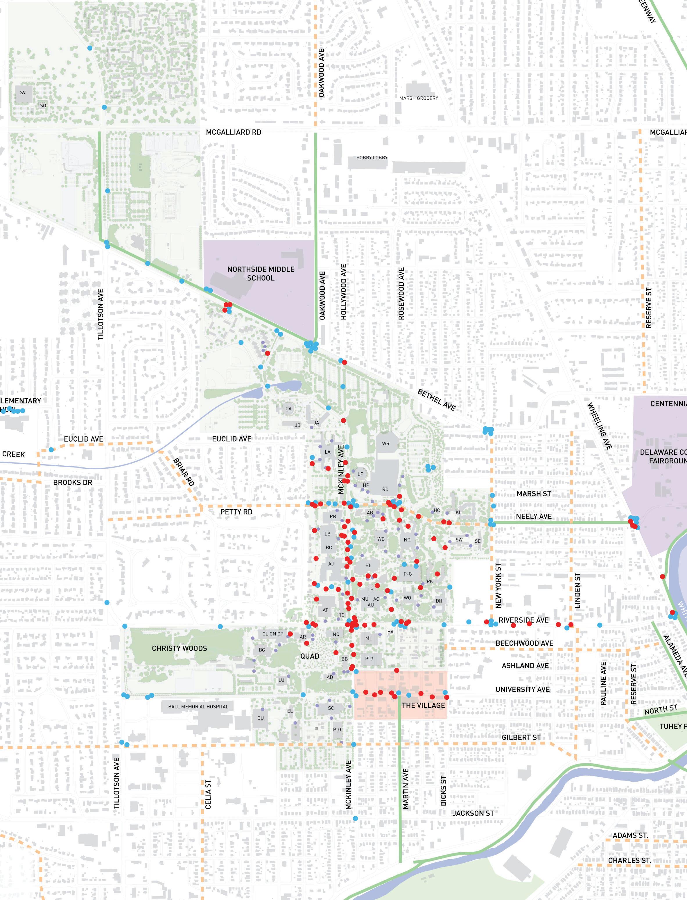
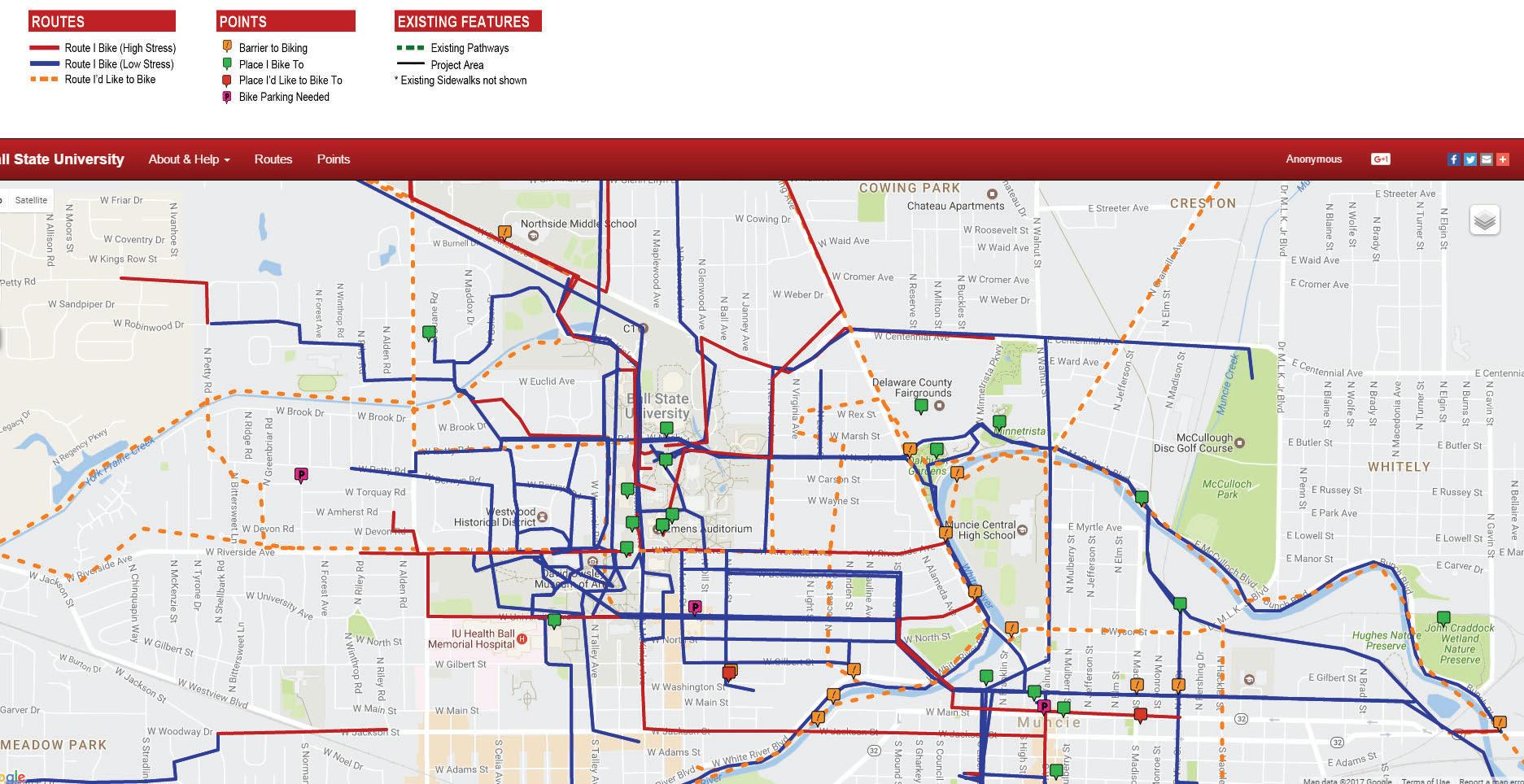
Wiki Map Results
Overview
Public feedback was solicited through WikiMap, an online, public mapping tool, that allowed users to respond to a variety of input options. Mapping options included the following:
• Existing Routes I Bike - High Stress
• Existing Routes I Bike - Low Stress
• Routes I Would Like to Bike
• Barrier to Biking
• Places I Bike To
• Places I’d Like to Bike To
• Bike Parking Needed
The information collected through the WikiMap and Online Survey was used in conjunction with community meetings to help identify existing and proposed bicycle routes.
Conclusions
Existing Low Stress Routes: The Cardinal Greenway and White River Greenway were popular existing off-campus routes that were considered low stress. A variety of existing on campus sidewalks were also preferred routes that were also considered low stress.
Existing High Stress Routes: Wheeling Avenue, Riverside Avenue, and Bethel Avenue were consistently considered stressful routes to bike. Some individuals even marked these routes as “Routes I’d Like to Bike”, inferring that these streets would be more desirable with dedicated bicycle facilities.
Proposed Routes: As noted, Wheeling Avenue, Riverside Avenue and Bethel Avenue were desired routes, but generally considered high stress routes. Other proposed routes included a trail along Cardinal Creek, New York Avenue, and Tillotson Avenue.
Barriers to Biking: Most barriers to cycling occurred when trying to cross the White River, especially on Wheeling Avenue.
Destination to Bike To: Common destinations were to locations on campus and to downtown Muncie. The user survey identified specific locations, both on and off campus, that were popular cycling destinations.
Online Survey Results
How
Often
do you Bike?
As expected, a majority of the survey respondents biked at least a few times per week.
Reasons for Biking
The most important reasons survey respondents biked was for fitness and to get to class. The least common reason to bike was to get to work.
Bike Share vs Campus Shuttle?
Most respondents would consider using a bike share program in lieu of the campus shuttle route.
Would you use a Bike Share?
Most respondents would consider the use of the a bike share if one existed. The lack of success with the existing “semester bike rentals” with Outdoor Pursuits at Ball State may have negatively impacted the perceived idea of a bike share.
How Often do you Bike?
Reasons for Biking
Biggest Factors to Discourage Biking
Biggest Factors to Discourage Biking
The most common factors to discourage biking included conflicts with pedestrians and vehicles. Lack of pathways was also a discouraging factor.
Most Visited On-Campus Destinations
Student Center
Bracken Library
Gora Rec Center
Scheuman/Alumni Center
Lack of Bike Parking
Most Visited Off-Campus Destinations
Lack of Pathways The Village
Unsafe Crossings
Due to the high number of CAP students partaking in the survey, CAP was one number one bicycling destination. Other common destinations were Bracken Library, the Gora Rec Center, and the Dining Halls on campus.
Pedestrian Conflicts Downtown Muncie
Vehicle Conflicts Minnetrista
Most Visited On-Campus Destinations
The most commonly visited off-campus destinations were Downtown Muncie and the Village. Minnetrista and nearby Parks and Greenways were also other popular off-campus destinations.
Parks/Greenways
Types of Preferred Bicycle Facilities
Cycle tracks and shared-use paths were the most preferred type of bicycle facility, both of which are located off-street. Protected bike lanes were somewhat important, while bike lanes were the least preferred type of bicycle facility. The Ball State Bicycle Master Plan network used these results to plan for off-street facilities (or protected on-street facilities) wherever possible.
Most Preferred
Policy Conclusions
Few existing policies regarding bicycles exist for Ball State University. The policies that do exist are spread across a variety of programs and divisions within the University, making it difficult to find and understand what the current bicycle policies are.
The City of Muncie has a more thorough set of policies regarding bicycles. However, few it any students, faculty or staff are likely aware of these policies even though the Bicycle Advisory Committee does a very good job promoting cycling through BikeMuncie.
Public Input Conclusions
The public input process provided valuable information which helped form the recommendations of this plan. Public input was received through a variety of media, but generally the input could be categorized three ways:
1. Existing Routes for Bicycles that are Currently Used
• Neely Avenue
• The Cow Path
• McKinley
• Northern half of the proposed East Mall route
2. Proposed Routes for Bicycles
• Bethel Avenue
• Neely Avenue
• Riverside Avenue
• The online survey identified that dedicated bicycle facilities that are off-street were preferred.
3. Existing Conflicts between Cyclists and Pedestrians, and Cyclists and Vehicles
• Most bicycle and pedestrian conflicts occurred along McKinley Avenue on campus
• Most bicycle vehicle conflicts occurred at intersection at the periphery of campus, and at location along Bethel where cyclists were trying to cross the street
Bicycle Master Plan
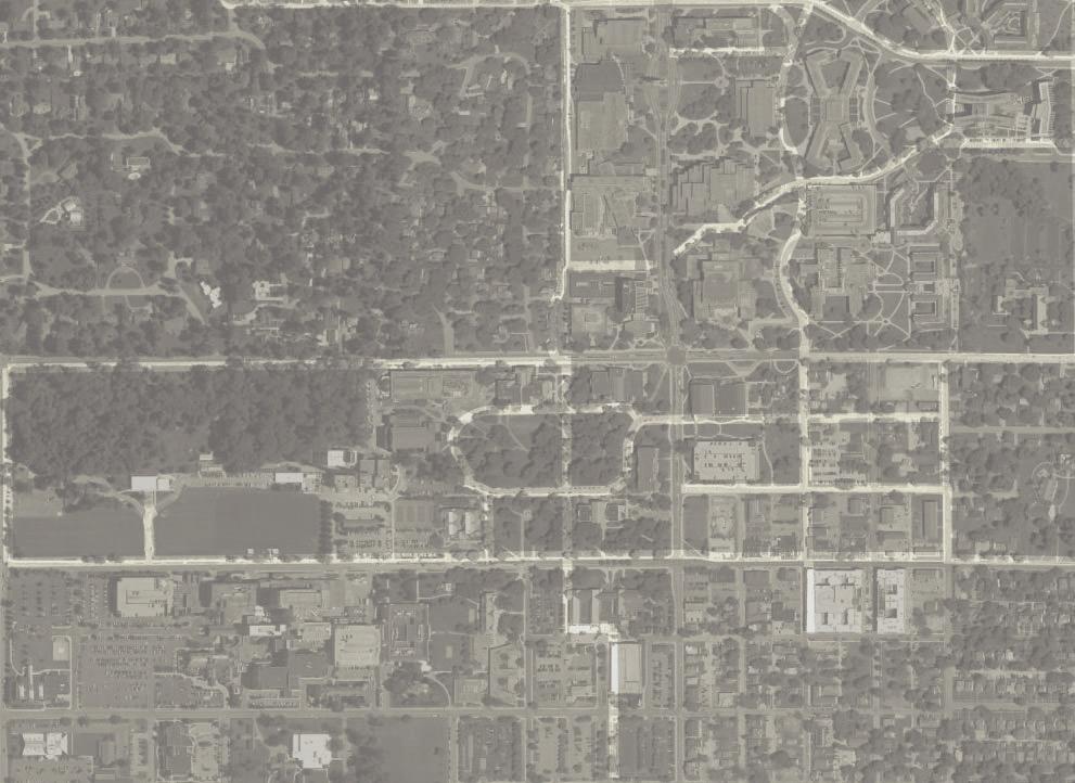
Overview
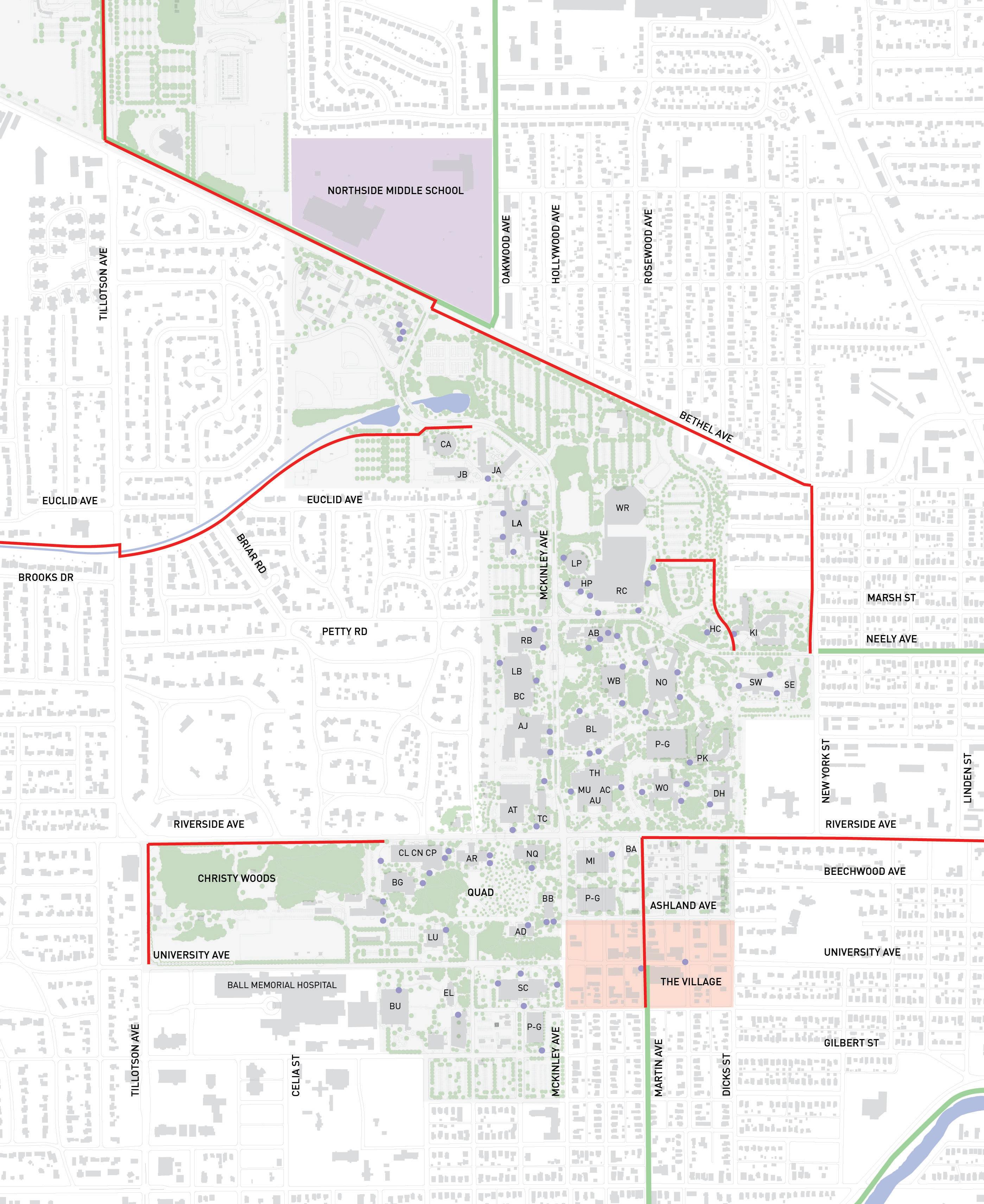
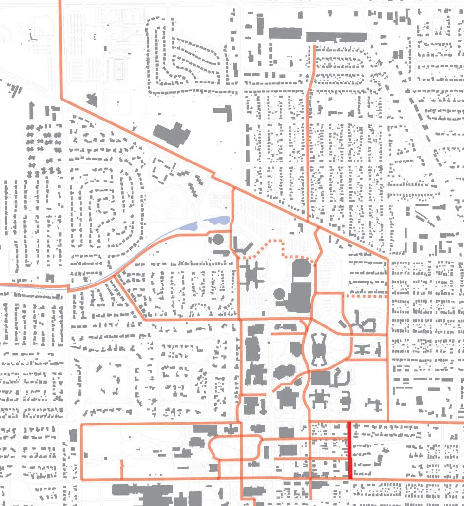
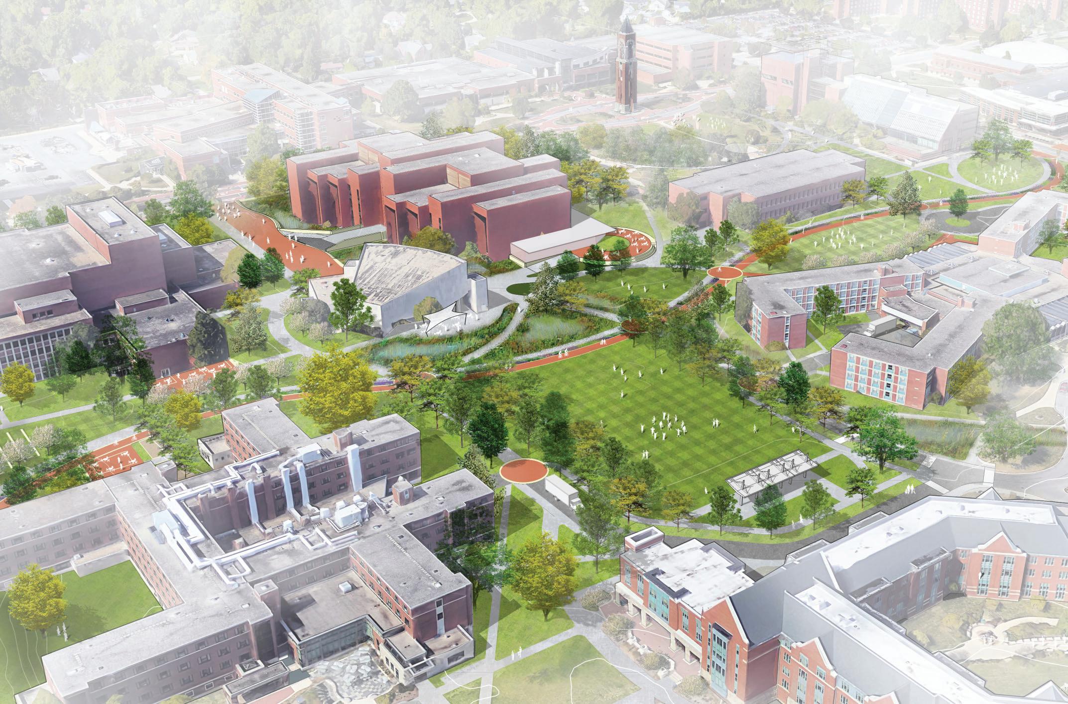
The Bicycle Master Plan recommends optimal routes for future bicycle infrastructure projects. The development of the network is based on careful consideration of the University’s grand vision for a bicycle friendly campus as well as space availability, safety, and anticipated level of use. The resulting plan is a thoughtfully integrated, highly interconnected system. If implemented, this system will provide cyclists the ability to travel safely and comfortably to key destinations on and off campus. As Ball State’s campus continues to mature, this map should act as guide to influence the implementation of new construction projects with regards towards the university’s goal of improving bicycle circulation.
A variety of bicycle routes is proposed to build the overall system network. The following types of routes are proposed:
• Shared-Use Paths
• Separated Bike Paths
• Bike Lanes and Sharrows
• Cycle Tracks
• Muncie Arts and Culture Trail
The Five C’s Connected
Easy to get from place to place without meeting dead ends; easy to get to the nearest station or bus stop.
Convenient
Direct routes without unnecessary detours, restrictions, underpasses or footbridges.
Comfortable
Smooth, wide and unobstructed routes; avoidance of steep hills and steps; no wind-tunnels or suntraps; good lighting and safety from traffic.
Convivial
Friendly, “busy” streets which are interesting to walk/bike in, meet people, go shopping or peoplewatch.
Conspicuous
Easy-to-read street and wayfinding signs and easily noticed store-front entries.
5 C’s developed by Tim Pharroh, PuttingLondon Back on It’s Feet, 1997
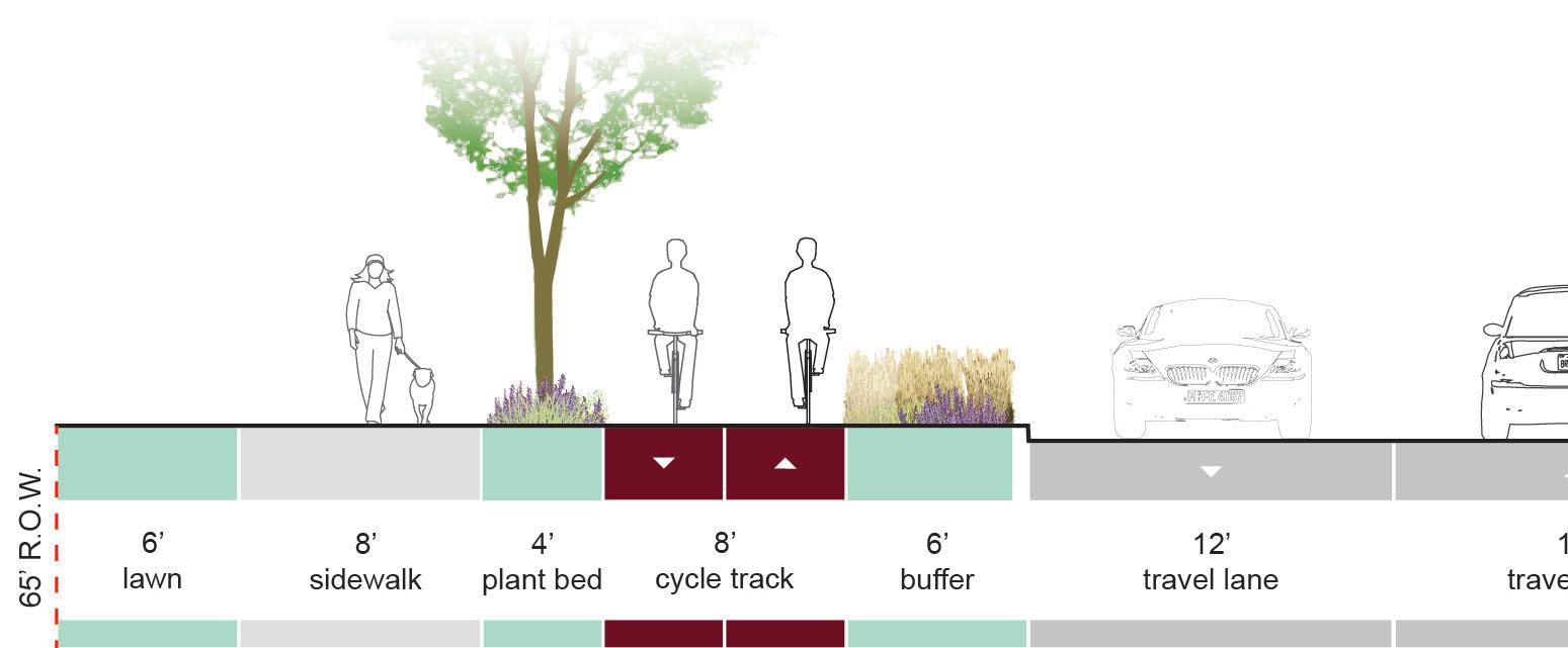
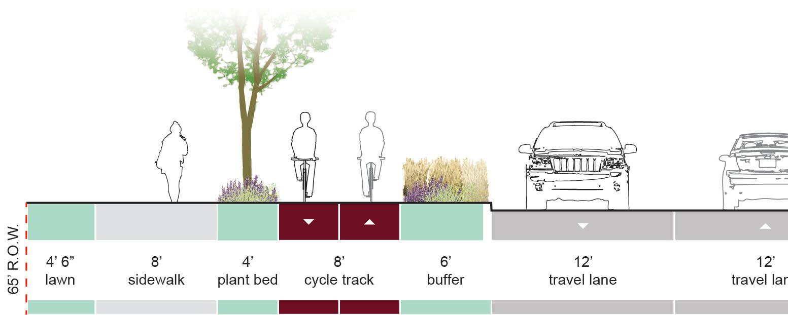
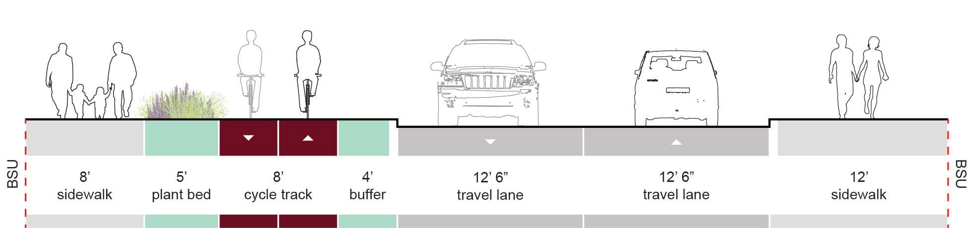
Overview
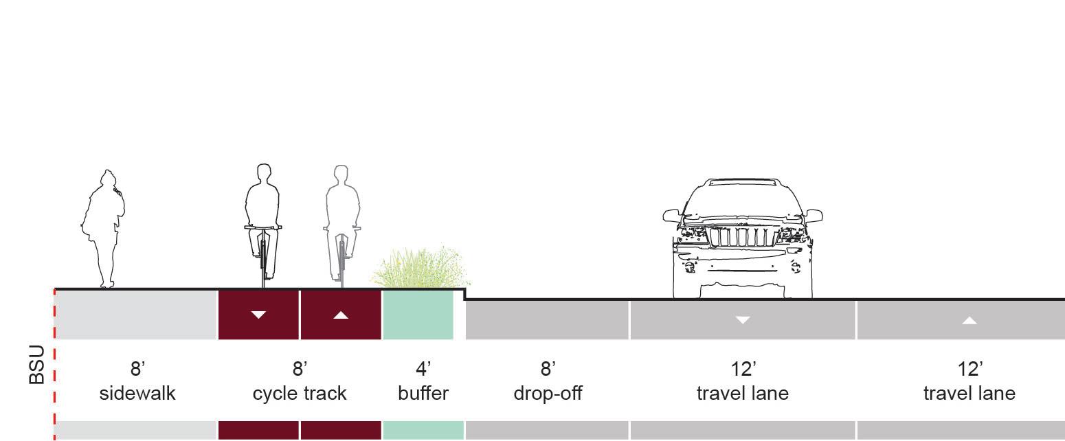
Cycle tracks are two-way, dedicated bicycle facilities, that are separated from pedestrian sidewalks and roadways. Cycle tracks are elevated above adjacent roadways to provide enhanced safety for cyclists. In most circumstances, the cycle track should be located adjacent (with proper buffer providing separation) to the roadway.
Cycle tracks are ideal in locations where adequate space is available to provide for separated facilities and where large numbers of cyclists and pedestrians are expected to be. Due to the increased infrastructure requirements, cycle tracks are usually the most expensive bicycle facility to implement.
Recommendations
Cycle tracks are recommended in the following locations:
• New York Avenue, between Neely Ave. and Riverside Ave.
• Cow Path
Refer to the implementation strategy for specific recommendations for these areas.
Cycle tracks may be implemented in areas where shareduse path are recommended, if the volume of cyclists and pedestrians dictate the requirement for separated facilities.
Design Guidelines
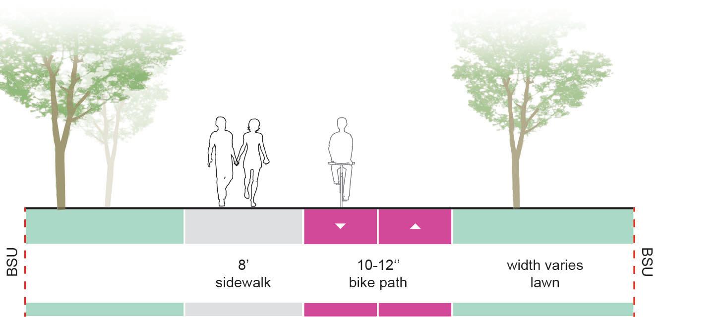
Two-Way CycleTrackWidth
Desired: 12’ Minimum: 8’
SidewalkBuffer (varies)
Two-Way CycleTrackWidth
Desired: 12’ Minimum: 8’
IntersectionSignalization:
“Provide a dedicated bicycle signal head. If a bicycle signal is used to separate through bicycle movements from right turning vehicles, then right turn on red shall be prohibited if it is normally allowed.” - NACTO Urban Bike Guide
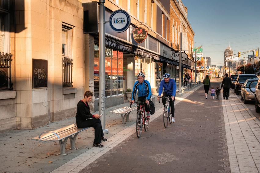
Indianapolis Cultural Trail, Indianapolis, IN
Academy Park Cycle Track Purdue University, West Lafayette, Indiana
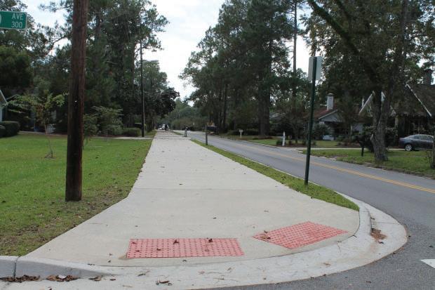
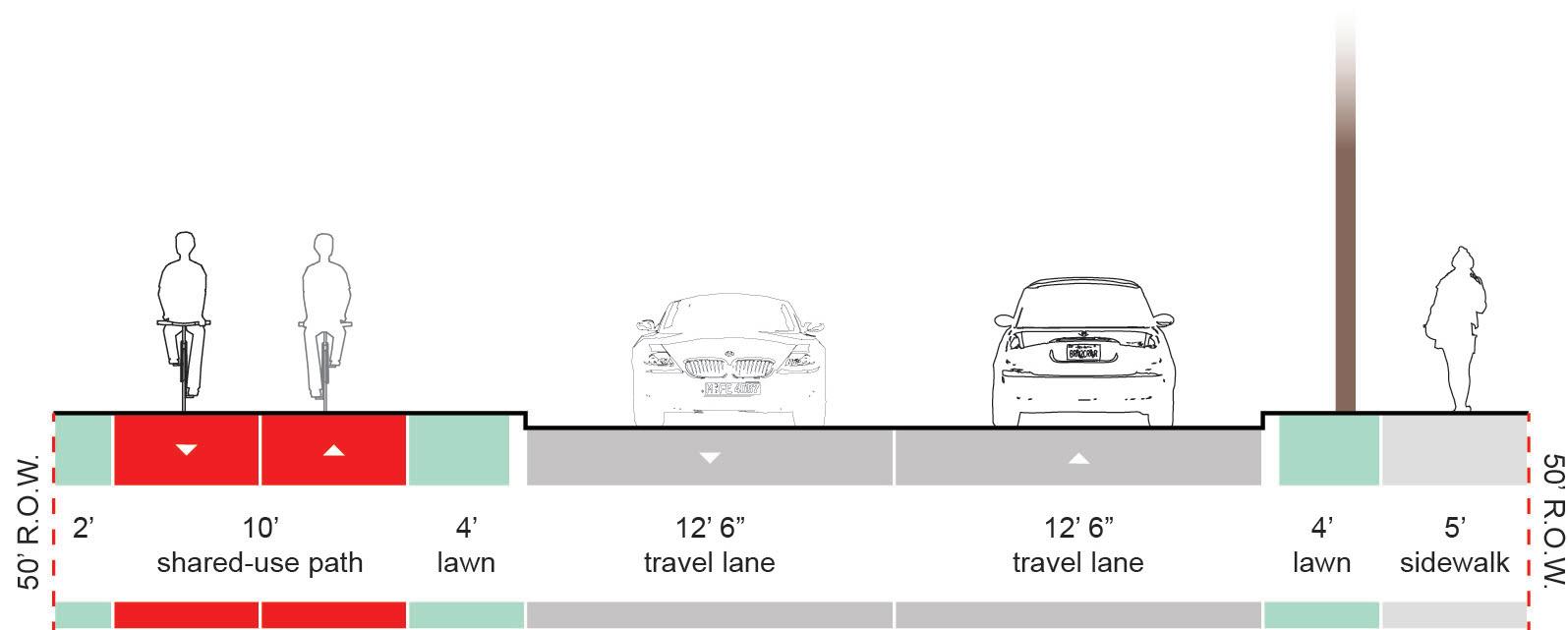
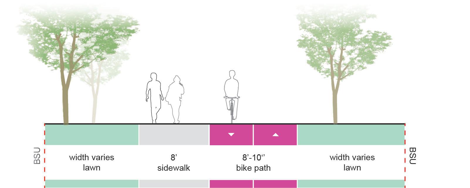
Overview
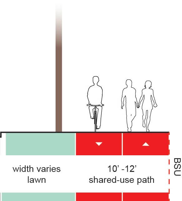
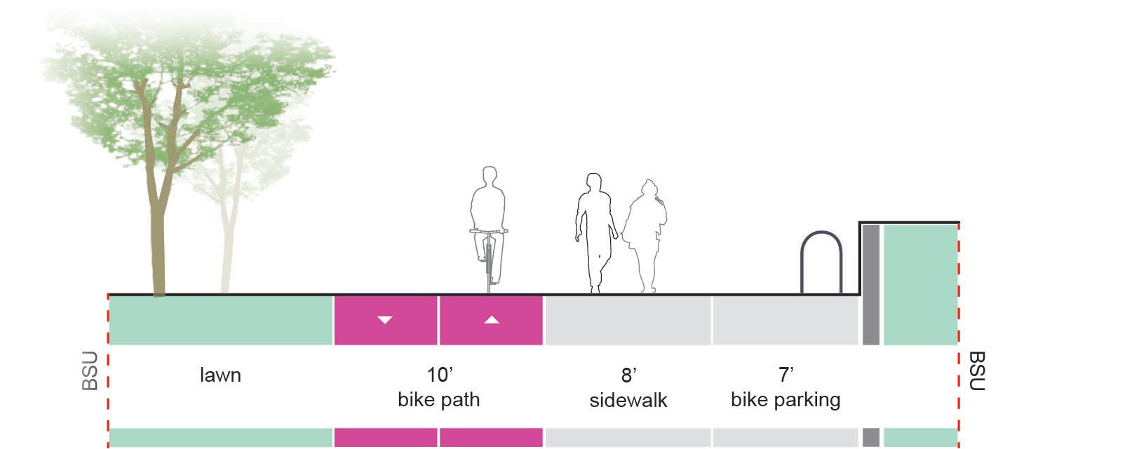
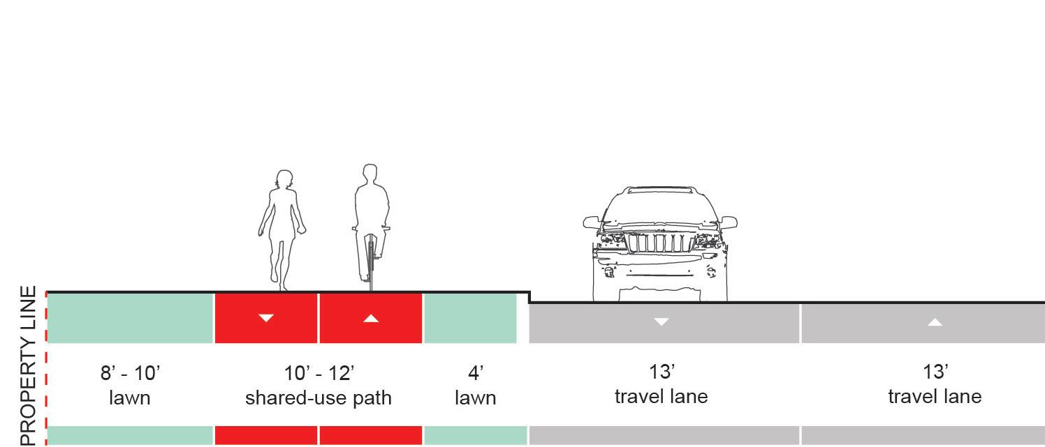
Shared-use paths provide a shared space for both cyclists and pedestrians, and are elevated above adjacent roadways to provide enhanced safety for cyclists and pedestrians. Shared-use paths should be used when pedestrian and cyclists volumes are low enough that conflicts rarely occur, or in areas where physical space is too constrained to provide for separated facilities.
Shared-use paths are typically more affordable than cycle tracks, but still more expensive than bike lanes.
Recommendations
Shared-use Paths are recommended in the following locations:
• Bethel Avenue, between Tillotson Ave. and New York Ave.
• Adjacent to Cardinal Creek, on the west side of campus
• Along Riverside Avenue, between Tillotson Ave. and Cooper Science, and between the Ball Honors House and Wheeling Ave.
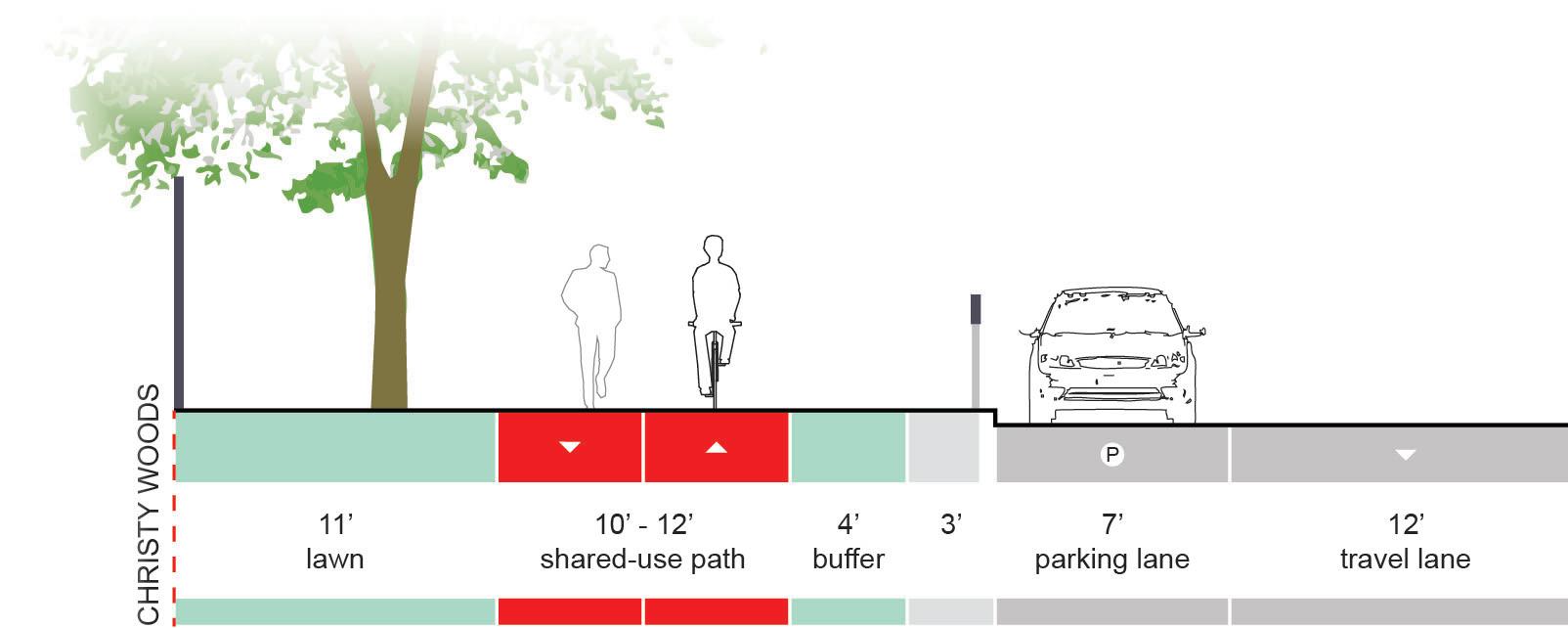
• Along Tillotson Ave., by Christy Woods
• East of the Gora Rec. Center, part of the East Loop path
Refer to the implementation strategy for specific recommendations for these areas.
Cycle tracks may be implemented in areas where shareduse path are recommended if the volume of cyclists and pedestrians dictate the requirement for separated facilities.
Design Guidelines
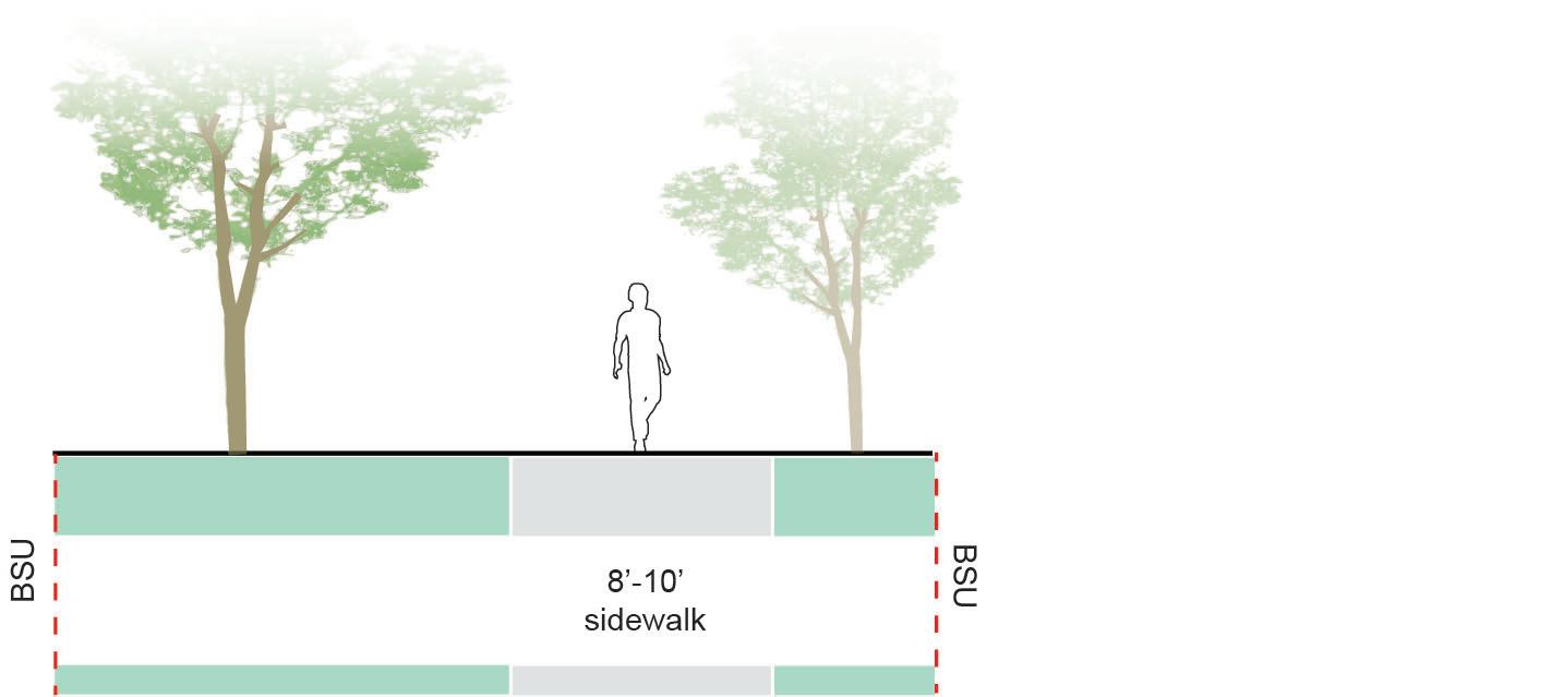
Shared-Use Path Width
Desired: 12’+
Minimum: 10’
Shared-use paths may have pavement markings designating the proper location for pedestrians and cyclists.
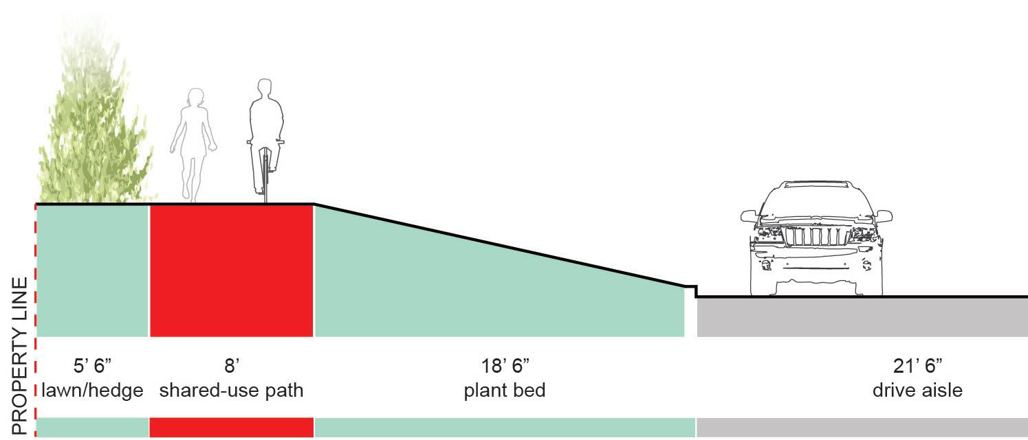
Overview
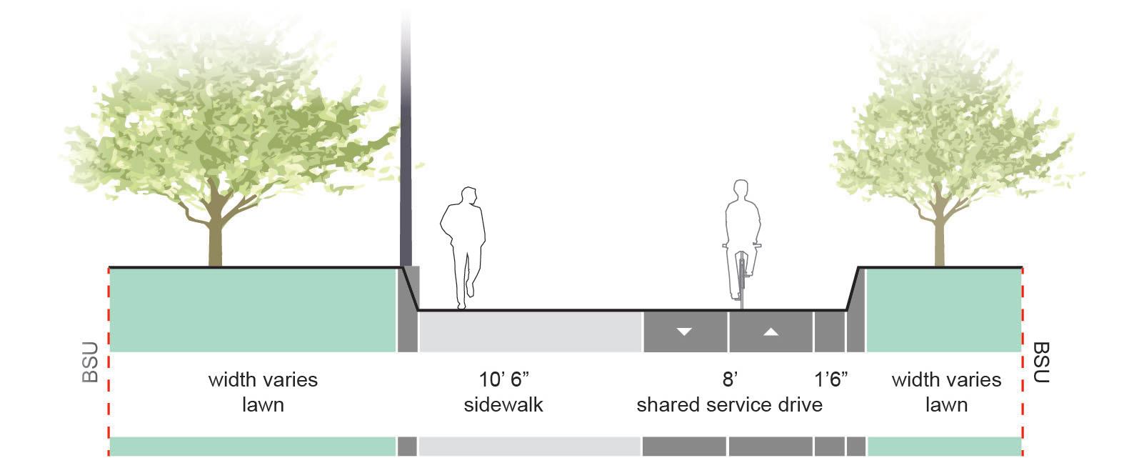
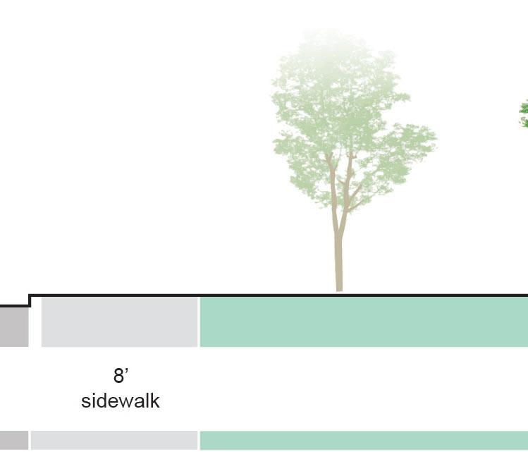
Separated bike paths are dedicated bicycle facilities on campus that are located next to or near pedestrian sidewalks. Bike paths are at the same elevation as the surrounding grade.
Recommendations
Separated Bike Paths are recommended in the following locations:
• Cow Path, between Bethel Ave. and Letterman Building, and the proposed Cow Path extension, between Riverside Ave. and University Ave.
• East Mall Connector, between Bethel Ave. and Ashland Ave.
• East Loop, between Noyer and Studebaker Hall West
Refer to the implementation strategy for specific recommendations for these areas.
Design Guidelines
Bike Path Width
Desired: 12’ Minimum: 8’
Sidewalk
Sidewalkmaybeadjacent, or buffered from the bike path.
Bike path in Colorado State University Fort Collins, CO
Bike path in University of California, Santa Babara Santa Babara, CA
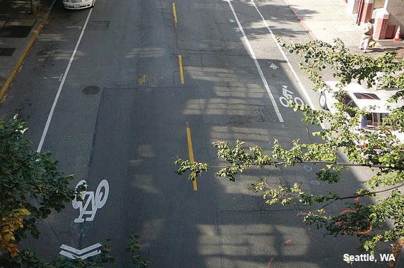
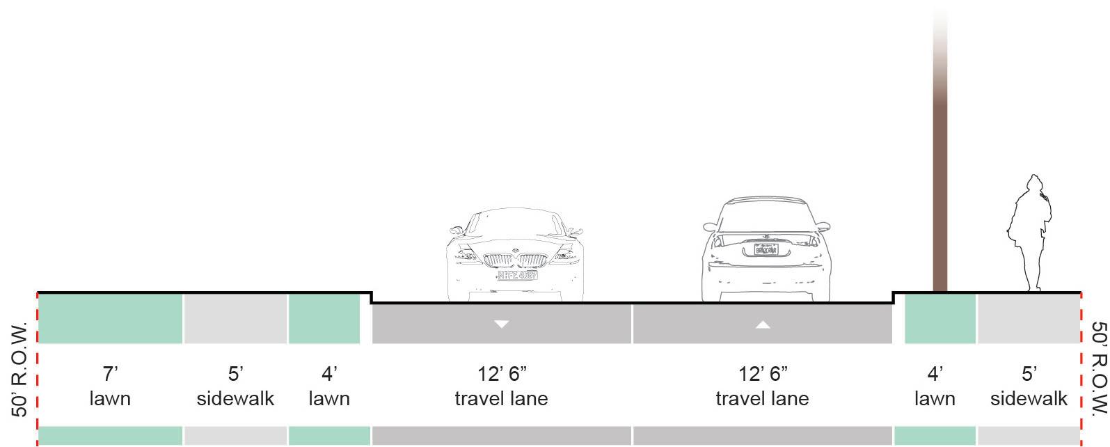
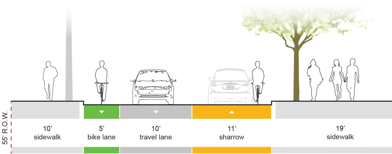
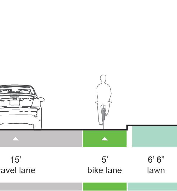
Overview
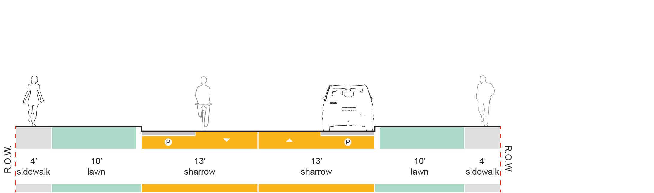
Bike Lanes and sharrows are on-street pavement markings that indicate the presence of cyclists to motorists. Bike lanes provide dedicated space for cyclists on the street.
Where bike lanes cannot be provided for two-way bicycle travel, sharrows may be used in addition to a bike lane.
Sharrows are pavement markings that remind motorists that cyclists will be using the roadway and careful consideration should be given to them. The image below shows how two-way bicycle travel may be provided where space for two bicycle lanes is not adequate.
Bike lanes and sharrows are typically the most affordable bicycle facility to implement. However, they offer the least protection from vehicles, which deter some individuals from using these facilities.
Recommendations
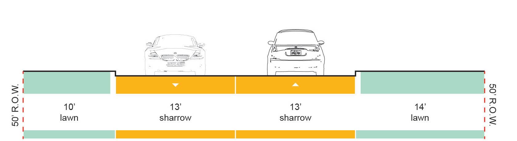
Bike Lanes and/or Sharrows are recommended in the following locations:
• Dicks Street, between Riverside Ave. and University Ave.
• Ashland Avenue, between Dicks St. and McKinley Ave.
• University Ave, between McKinley Ave. and Dicks St.
• Petty Road, between Briar Rd. and Robert Bell Building and Neely between McKinley Avenue and New York Avenue
• Briar Road
Refer to the implementation strategy for specific recommendations for these areas.
Design Guidelines
Optional Features
belocatedpriortothe beginningofthemarked
maybeusedtofurther delineate
Bike Lane Width Desired: 6’
BikeLane:Greenpaint
the bike lane.
Combination of Bike Lane and Sharrows Provides for two-way bicycle travel
Bike Lane with Pavement Markings
Bike Lane: Pavement markingsshallbeused to define the bike lane.
Sharrows: Pavement markingsshallbe used to indicate that bicyclistsmayusethe travel lane.
BikeLanesignsmay
bike lane.
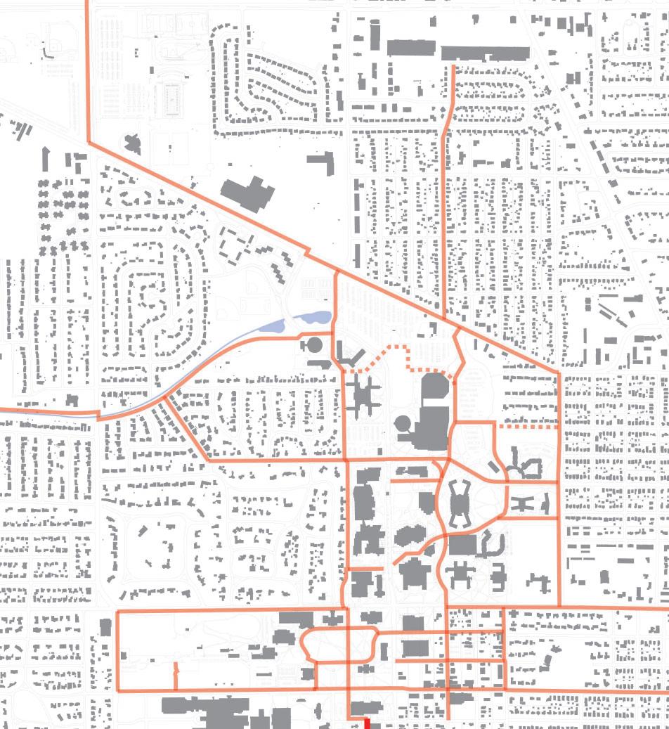
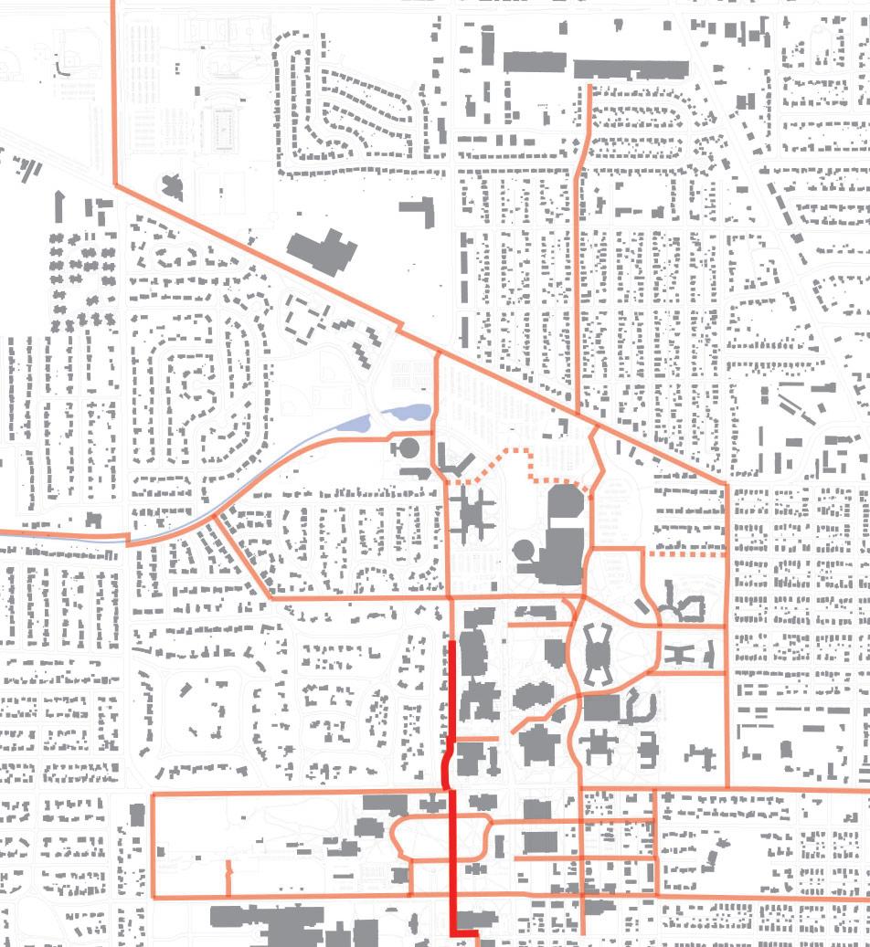
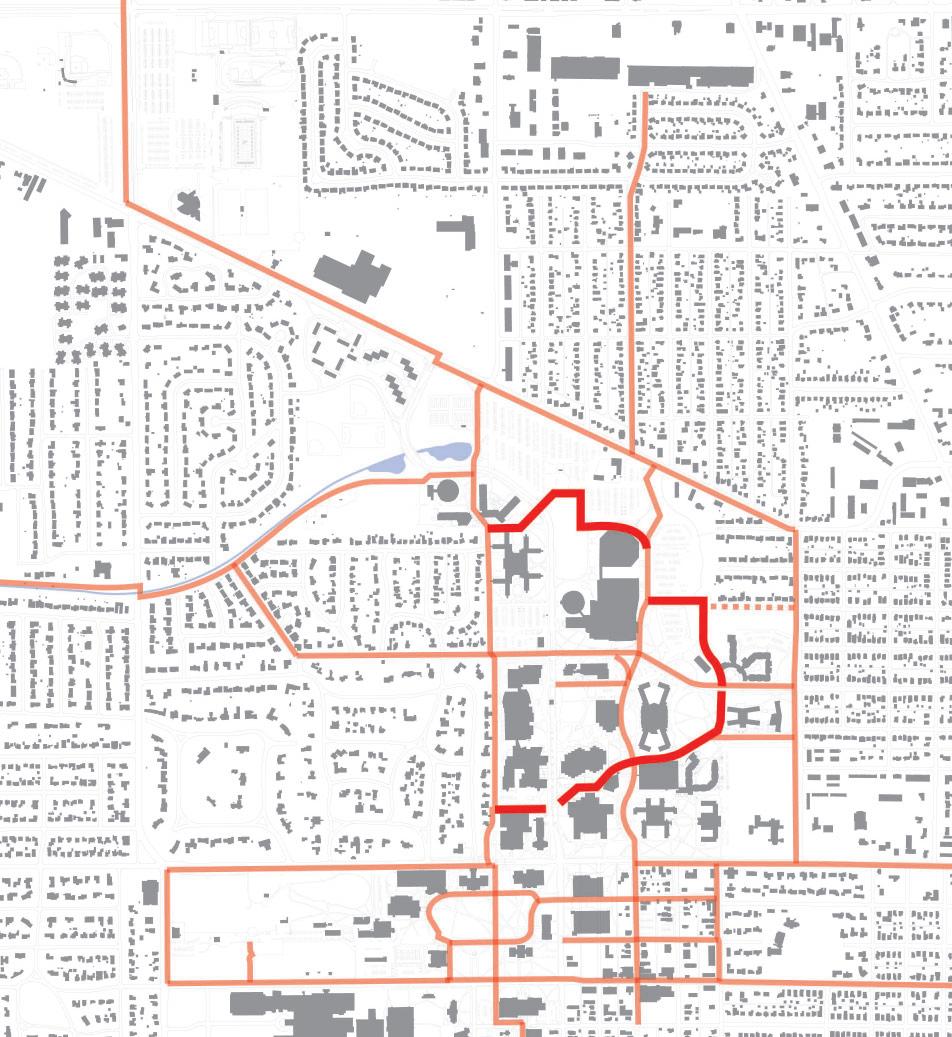
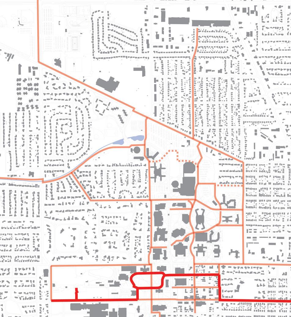
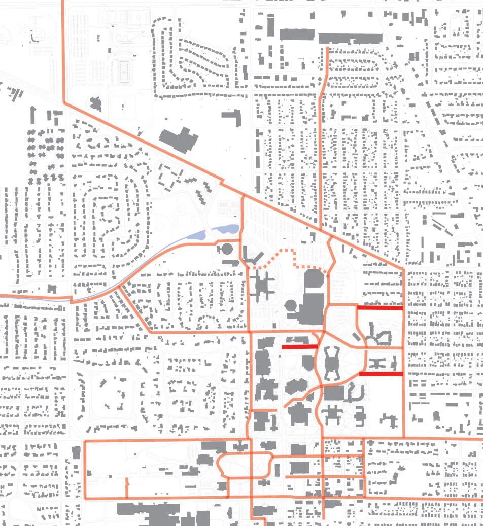
Implementation & Phasing Plan
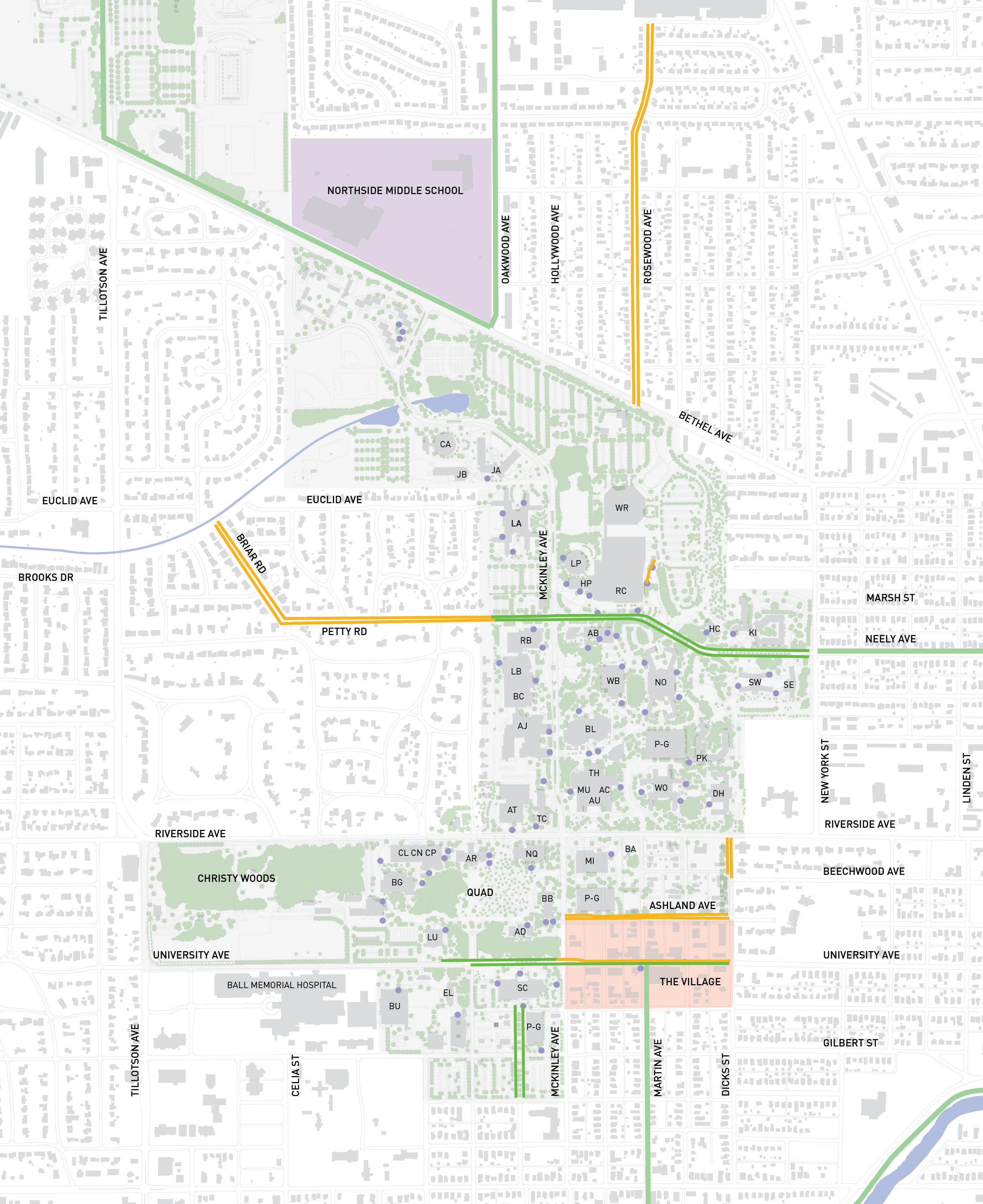
BRIARRD
MAJOR CONNECTORS
Overview
The purpose of this section is to promote bicycle accessibility, safety, and connectivity by making modifications to some of the prominent roadways in and around campus. When surveyed, many students indicated that they want to be able to bike on roads such as Bethel, Riverside, and New York, but they currently feel uncomfortable and unsafe doing so because these streets lack proper bicycle facilities. The major streets around campus are designed primarily for motorists, providing inadequate space for cyclists to safely travel. In current conditions, cyclists feel confined and unable to take advantage of city streets, which would otherwise provide a logical and convenient route to their desired destinations.
The streets studied in this section were chosen to create a broad framework to which the rest of the system can connect. Organizing the overall network in this manner ensures the network’s use at a city-wide level. Many faculty, staff, and commuting students are interested in biking to campus. This section outlines opportunities that major streets can be modified to provide dedicated space for these cyclists so that they can feel comfortable making their daily commute by bicycle.
Routes Identified
• Bethel Avenue
• New York Avenue
• Riverside Avenue
• Briar Road
• Petty Road
• Neely Avenue
• Tillotson Avenue
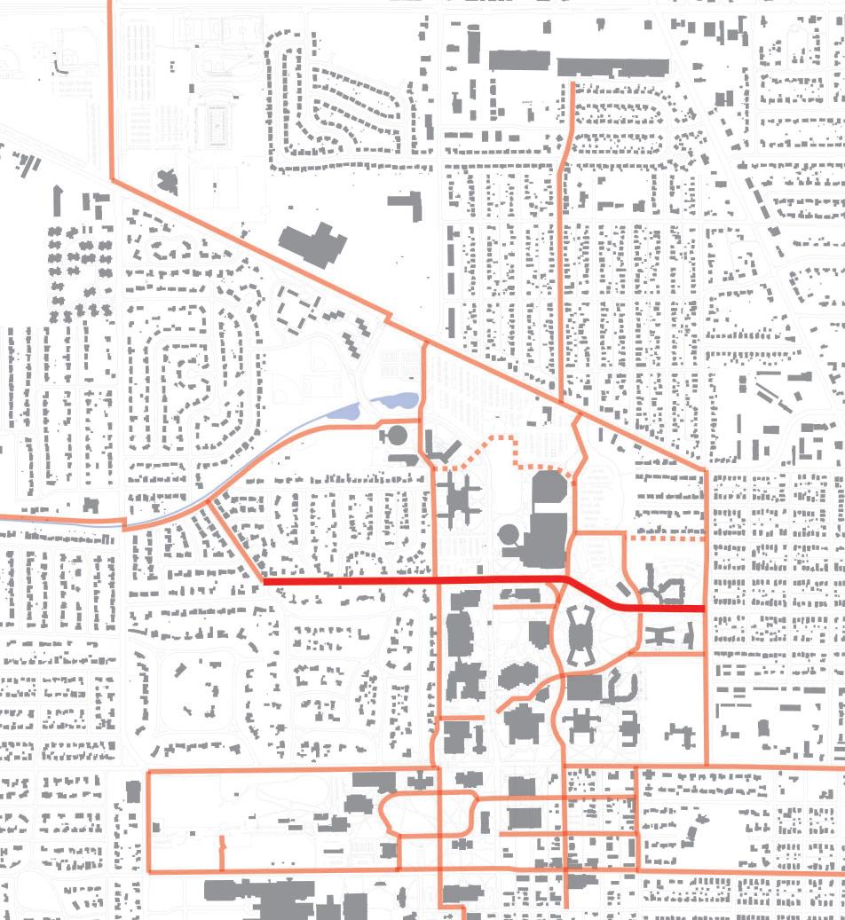
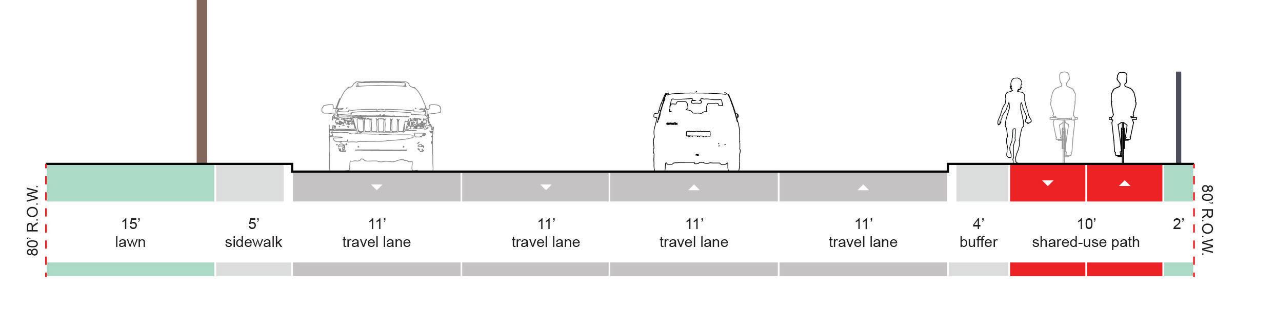
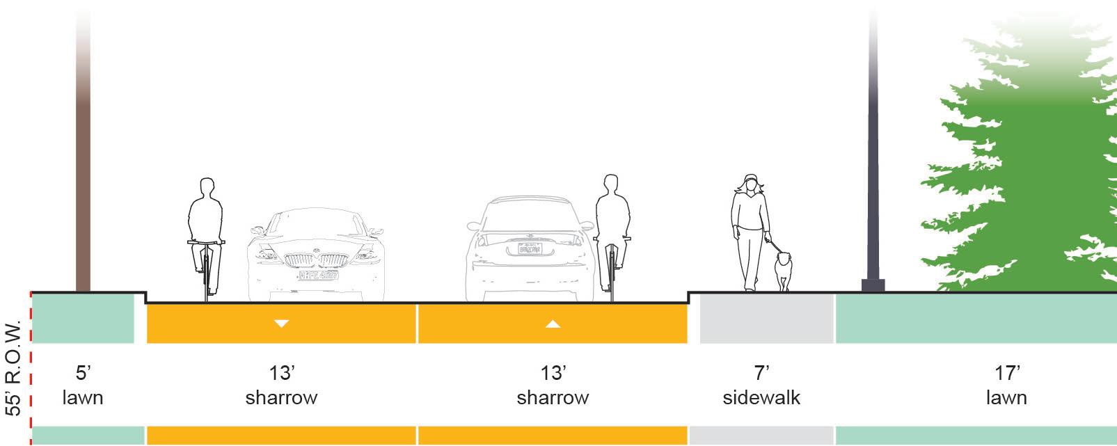
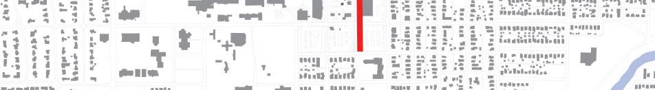
BETHEL AVE | Major Connectors
Overview
Bethel is one of the University’s main points of entry with strong connections to SR 332/McGalliard Road and the commercial areas north of campus. The road is heavily used by students traveling to campus from the parking lot at Scheumann Stadium. During public input gathering sessions, students and faculty routinely identified Bethel as a route they want to see improved for greater cyclist access.
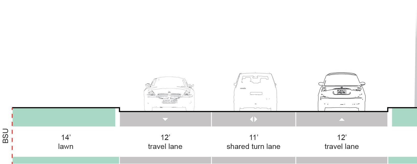
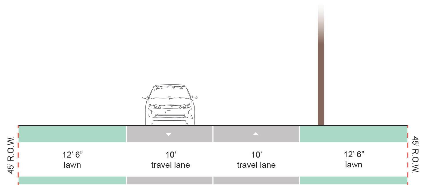
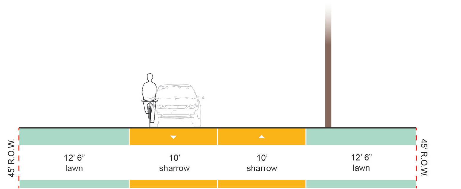
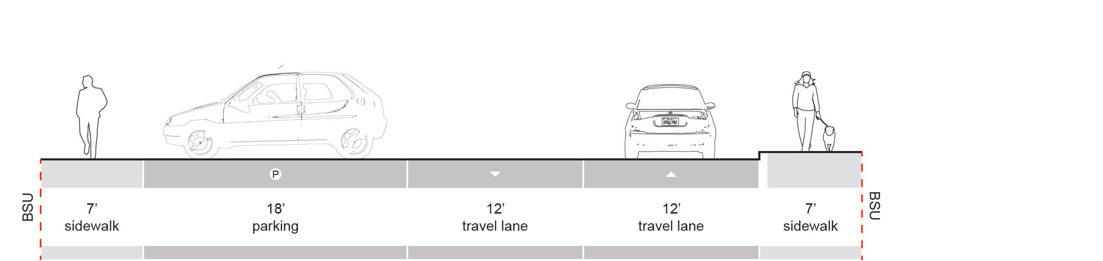
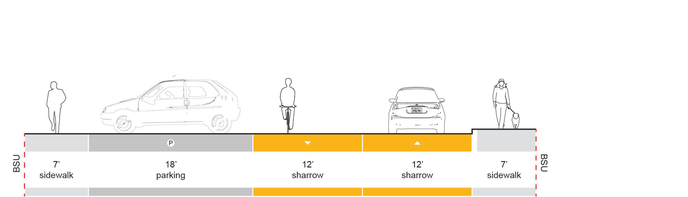
Existing Conditions
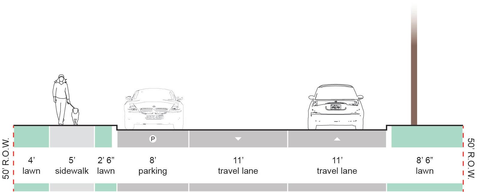
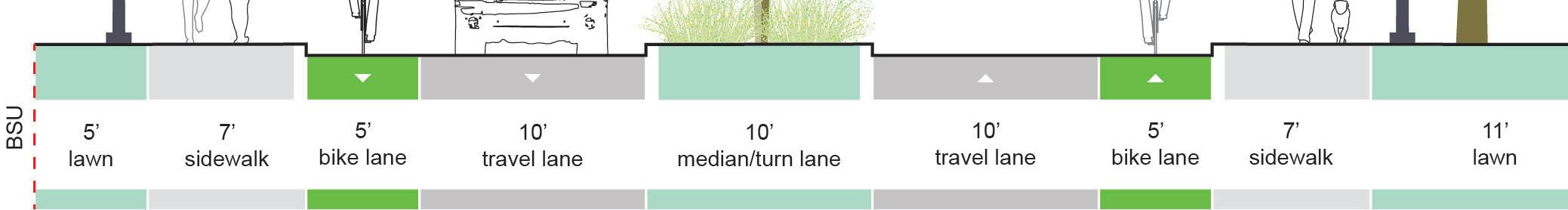
• Within the highlighted section, Bethel is a two-way street with multiple lanes traveling in both directions.
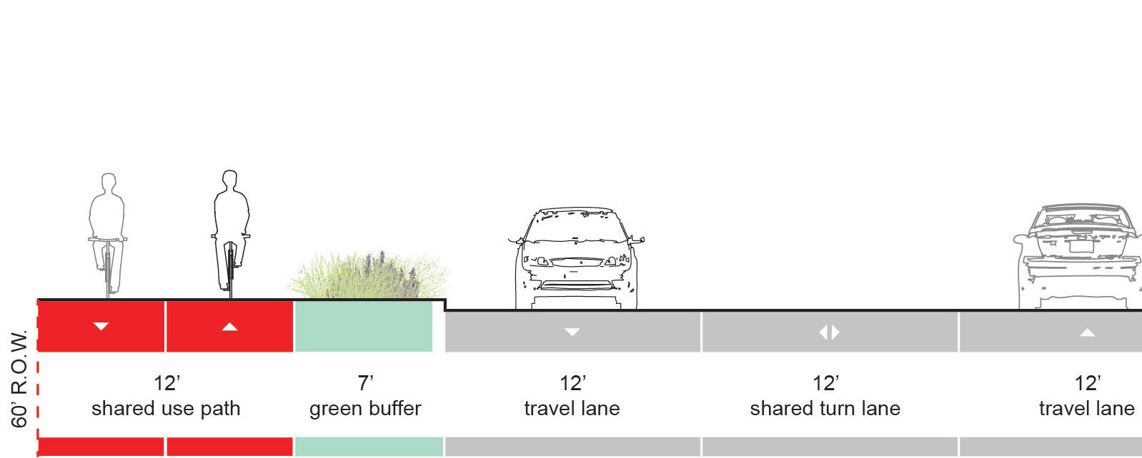
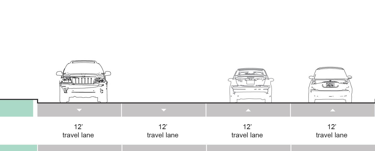
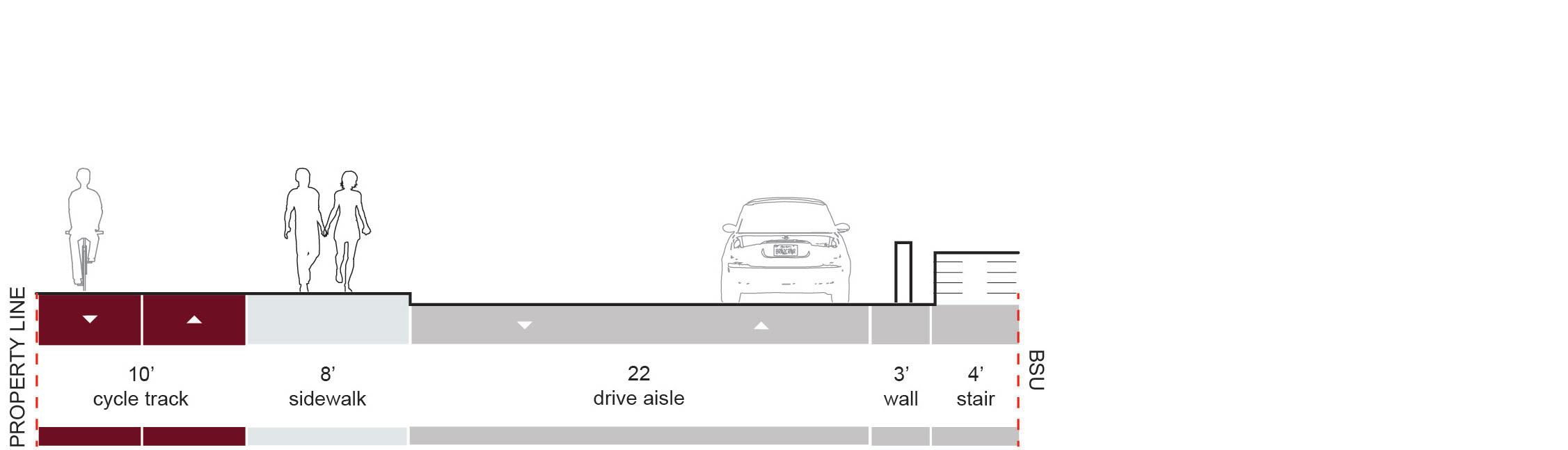
• Bethel is approximately 48 feet wide (curb face to curb face). Occasional turn lanes and drop-off areas increase Bethel’s overall width by 10 to 12 feet.
Recommendation
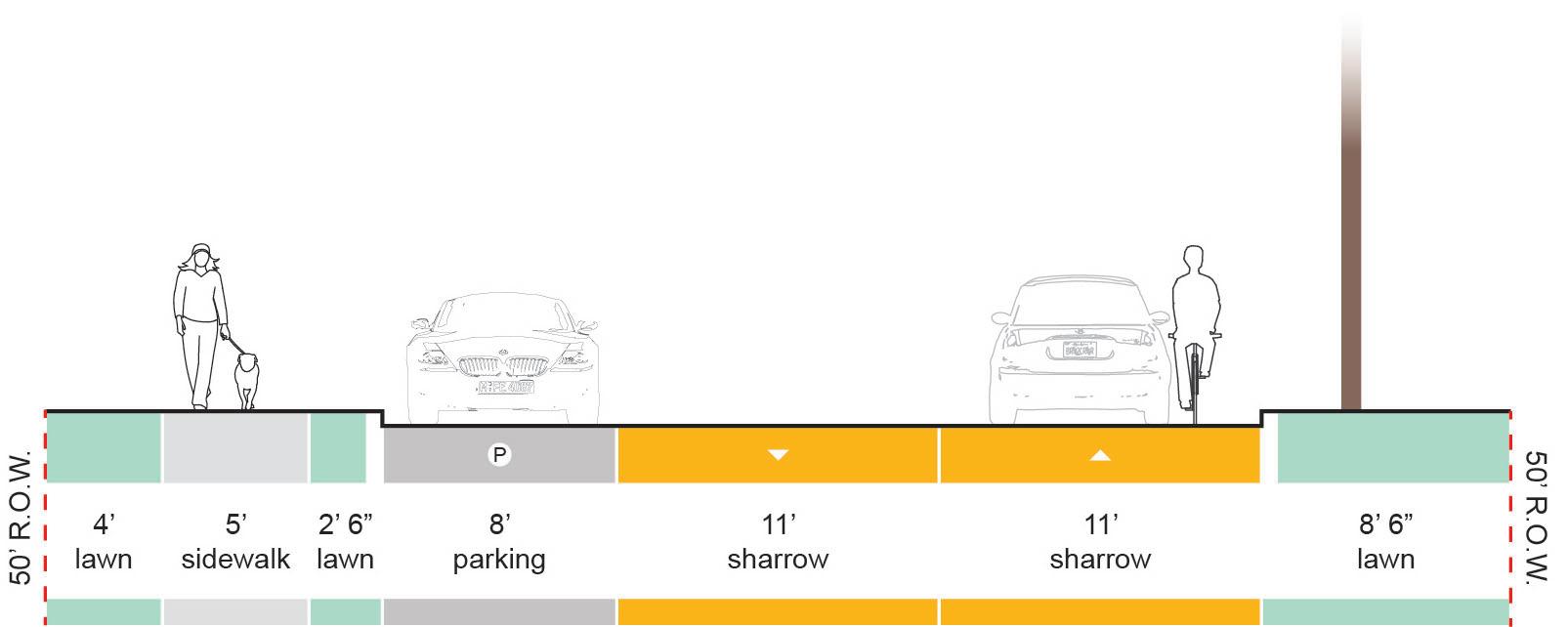
• Heavy vehicular traffic along Bethel restricts the use of combined bicycle/vehicle facility types. A vertically separated, multi-use bicycle path is recommended.
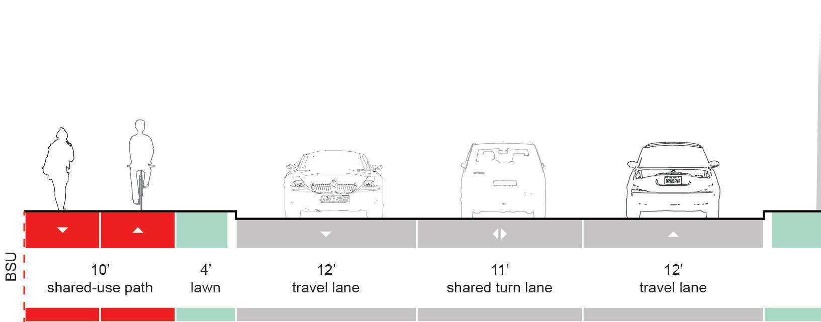
• Between the intersections of New York Ave and McKinley Ave, spatial constraints prevent the addition of a bicycle path to the street’s existing cross section. That said, average daily traffic counts indicate that it is feasible to remove a traffic lane through this section to create space for a path along the south side of the roadway.
EXISTING | Between New York Ave and McKinley Ave
| Between New York Ave and McKinley Ave
BETHEL AVE
Recommendation
(continued)
• Between McKinley Ave and Tillotson Ave, an existing path on the north side of Bethel can be improved to promote bicycle travel between the main campus and Schuemann Stadium.
EXISTING | At North Side Middle School
PROPOSED | At North Side Middle School
EXISTING | Between North Side Middle School and Tillotson Ave
PROPOSED | Between North Side Middle School and Tillotson Ave
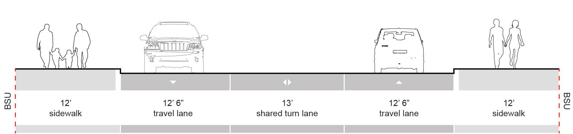
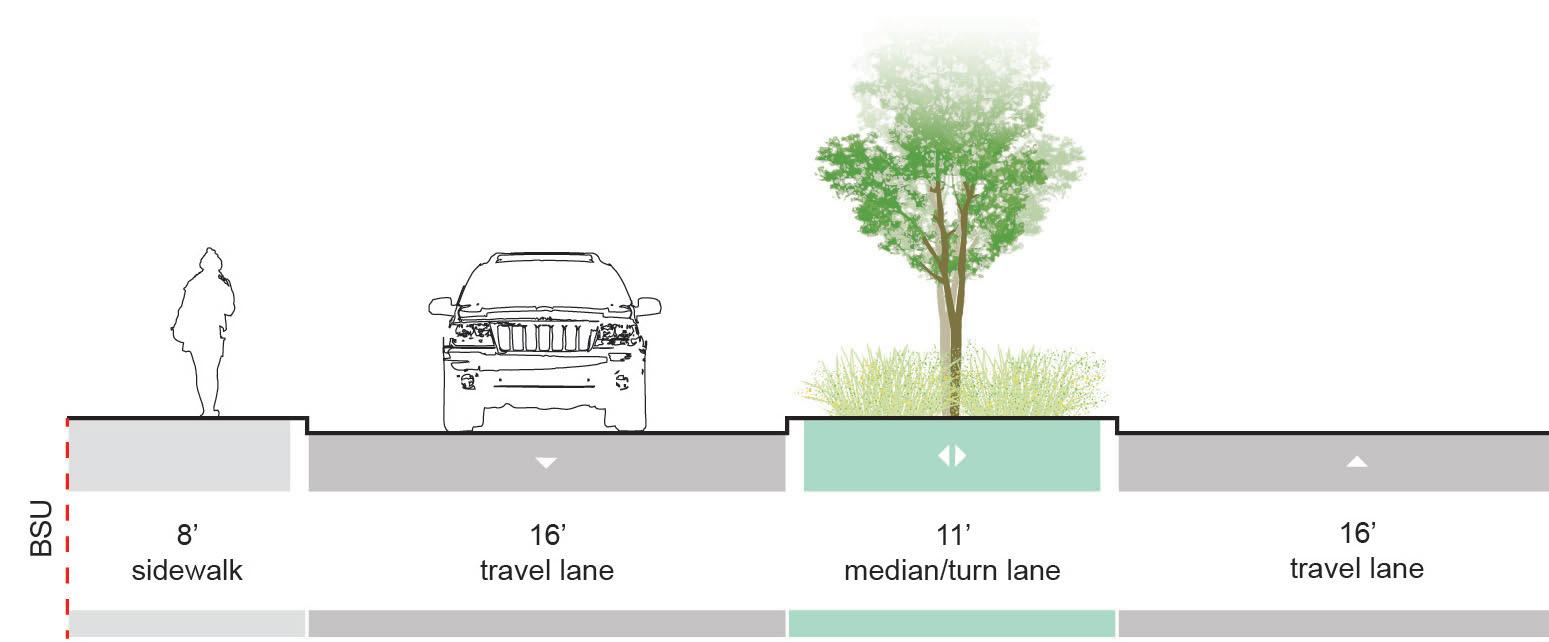
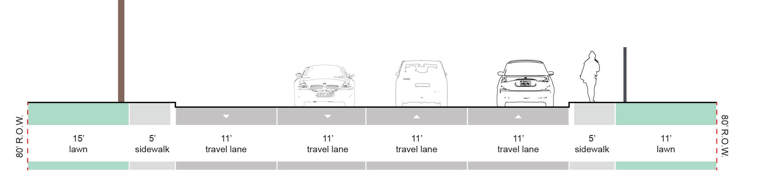
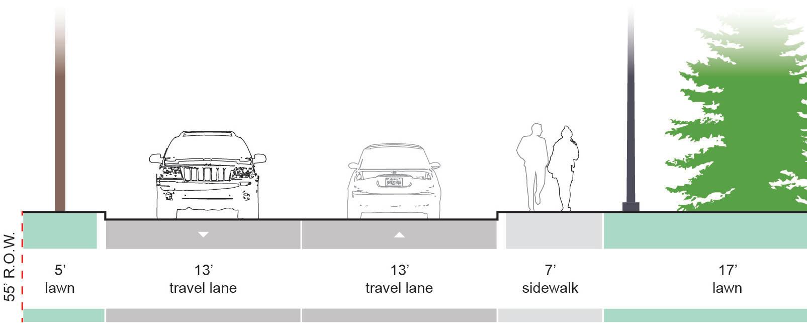
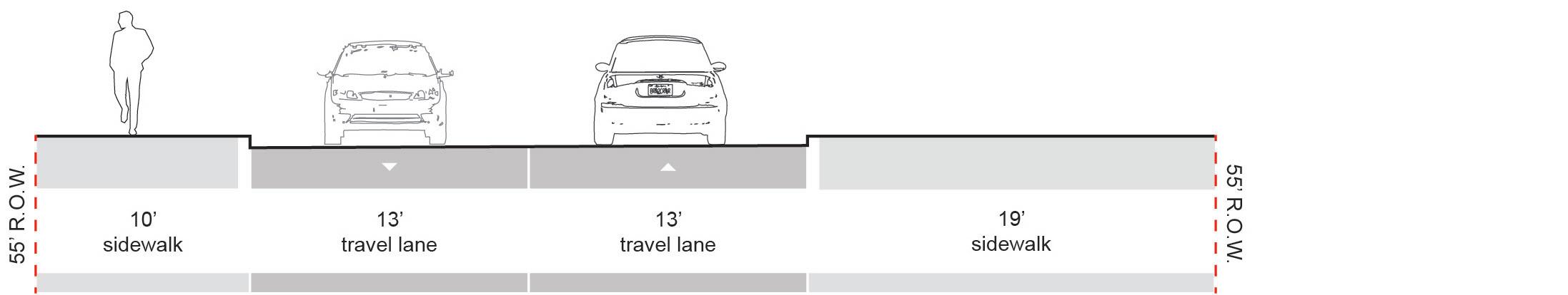
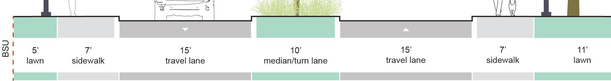
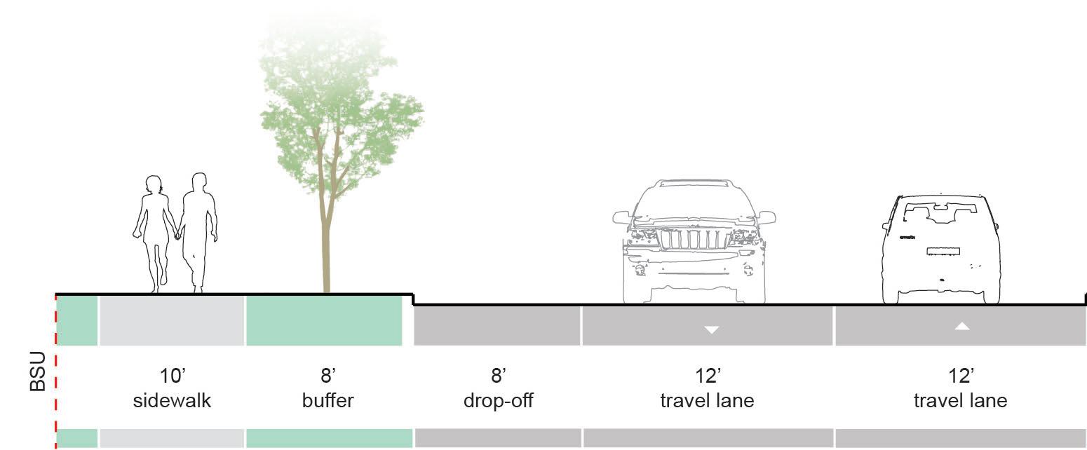
NEW YORK AVE | Major Connectors
Overview
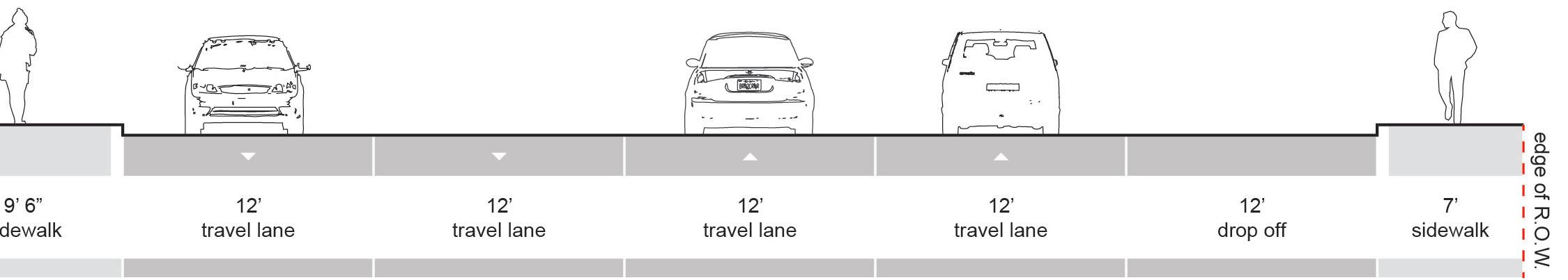
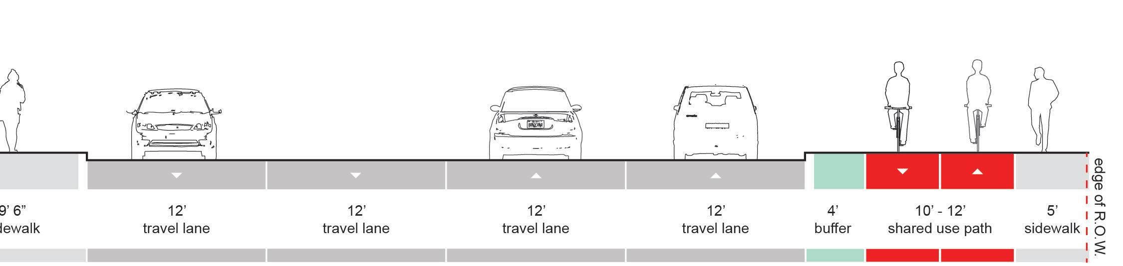
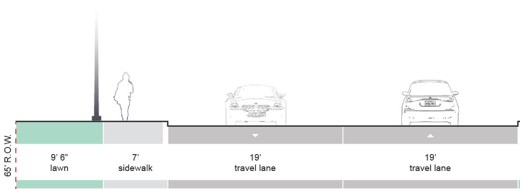
New York Avenue runs north/south along Ball State’s eastern perimeter. The corridor figures prominently into this plan because it connects three of the campus’ most highly traveled avenues: Bethel, Neely, and Riverside. New York’s existing cross section features extra-wide travel lanes and disconnected sidewalks which encourage high vehicle speeds and low pedestrian/cyclist use.
Existing Conditions
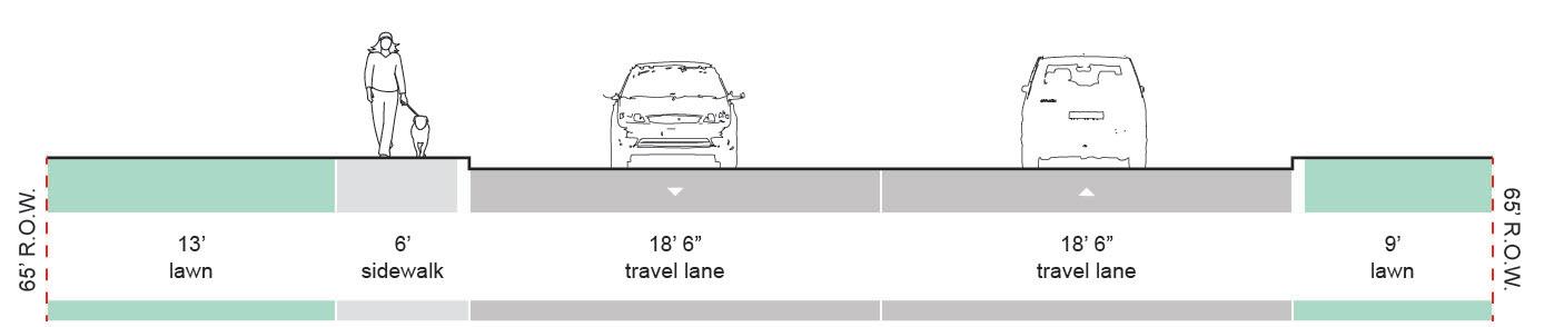
• Between Bethel and Riverside, New York is a twoway street with a single lane traveling each direction.
• The roadway is typically much wider than is required by standard practices. Travel lane widths range from 14feet to 19 feet. Standard practice recommends 10 feet to 12 feet lane widths.
• A sidewalk exists on the west side of New York Avenue, between Bethel and Riverside.
Recommendation
• Lane widths on New York Avenue should be reduced. Narrower lanes have a traffic calming effect that discourages speeding and creates a safer environment for pedestrians.
• With space taken from the roadway, add a gradeseparated bicycle path along New York’s western edge from Bethel to Riverside.
Recommendation
(continued)
• Add a 6 foot wide sidewalk along New York’s eastern edge to improve connections to residential communities east of campus.
EXISTING | Between Carson St and Neely Ave
PROPOSED | Between Carson St and Neely Ave
EXISTING | Between Neely Ave and Bethel Ave
PROPOSED | Between Neely Ave and Bethel Ave
RIVERSIDE AVE | Major Connectors
Overview
Survey participants highlighted Riverside Avenue as a route they want to bike. However, the street’s current condition forces them to find alternative paths. Improving Riverside for cyclists will create an excellent connection between campus and a bicycle path on Wheeling Ave, which will allow cyclists to travel safely to downtown.
Existing Conditions
• The roadway surface is in poor condition.
• Lanes are appropriately sized, but the frequency of surface issues along the curb forces motorists close to the center making the roadway feel narrower than it is.
• Sidewalks are generally present on both sides, but there are occasional breaks on the south side.
Recommendation
• Use available space along the southern edge of the street to add grade-separated, shared-use path between Martin St and Wheeling Ave.
• Between the Cow Path and Cooper, separate pedestrians and cyclists with a cycle track system. This area should accommodate large volumes of students during class turn over.
EXISTING | Between Martin St and New York Ave SG |eeeaSadeo Ave
PROPOSED | Between Martin St and New York Ave
EXISTING | Between Cooper Life Science Building and Cow Path
PROPOSED | Between Cooper Life Science Building and Cow Path
RIVERSIDE AVE (continued)| Major Connectors
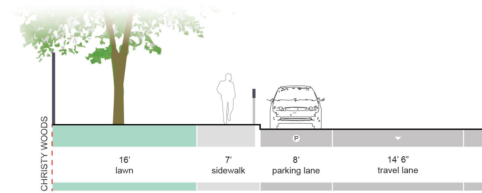
Overview
Riverside connects Tillotson Ave, one of Muncie’s main corridors, to the academic center of campus. Accordingly, the intersection of Tillotson Ave and Riverside is a main entry to campus for motorists, cyclists, and pedestrians. To accommodate multiple user types safely, this plan proposes dedicated cyclist facilities along this section of Riverside.
Existing Conditions
• This section of Riverside has metered, on-street parking along the south side of the street.
• The edge of Christy Woods creates southern boundary that cannot be exceeded.
Recommendation
• Use space along the south side of Riverside to add a shared-use path with a buffer zone that separates cyclists from parked cars.
• Within the buffer zone, add paved strip with occasional ties to the path for motorists exiting their vehicles.
PROPOSED | Between Cooper Life Science Building and Tillotson Ave
EXISTING | Between Cooper Life Science Building and Tillotson Ave
TILLOTSON
BRIAR RD | Major Connectors
Overview
Briar Road is a relatively insignificant roadway for motorists, but in the future it may play an important role connecting campus to a planned greenway along Cardinal Creek.
Existing Conditions
• Briar Road is a two-way, residential street with a single lane traveling each direction. No on-street pavement markings exist.
• Lawns flank the street on both sides.
• No sidewalks exist on either side of the roadway.
Recommendation
• Low volume of traffic, spatial constraints, and cost effectiveness make sharrows the ideal facility for Briar Road. Striping the roadway and adding the necessary sharrow symbols is sufficient to create the desired connection between campus and Cardinal Creek.
CARDINALCREEK
EXISTING | Between Cardinal Creek & Petty Rd
PROPOSED | Between Cardinal Creek & Petty Rd
PETTY RD
NEELY AVE & PETTY ROAD | Major Connectors
Overview
Neely Avenue and Petty Road provide a critical connection to BSU for students living on and off campus. Additionally, Neely connects campus to the Minnetrista Cultural Center, the historic homes of the Ball family, and the White River Greenway.
Existing Conditions
• Neely and Petty are two-way, east/west collectors.
• East of the Rec Center, Neely has planted medians and ample 16 foot wide travel lanes.
• West of the Cow Path, Petty is more narrow. The roadway is constrained by utilities on the north and fences/hedges on the south.
Recommendation
• Use Neely’s generous lane widths to add bicycle lanes. Spatial constraints make adding a gradeseparated bicycle facility difficult and potentially very expensive.
• Petty lacks the available space needed for bike lanes, which makes the addition of sharrows the most viable solution.
EXISTING | In front of Rec Center
PROPOSED | In front of Rec Center
EXISTING | Between Briar & Cow Path EXISTING Between Briar & Cow Path
PROPOSED | Between Briar & Cow Path
TILLOTSON AVE | Major Connectors
Overview
Tillotson Avenue creates crucial connections to two state highways (IN-32 and IN-332) and is one of Muncie’s most highly traveled roads. Within this plan, Tillotson is part of an important connection between BSU’s main campus and the stadium parking areas, student housing, and athletic facilities.
Existing Conditions
• Four lane road, with two lanes in each direction.
• At intersections, the roadways widen to accommodate for a dedicated left turn lane.
• Between Riverside Avenue and University Avenue a fence is located on the east side of the sidewalk, forming the western boundary to Christy Woods.
Recommendation
• Develop a shared-use path on the east side of the roadway.
• In order to implement the recommendations, the Christy Wood fence will need to be moved east.
• Provide a minimum 4’ buffer between the shareduse path and the roadway.
EXISTING | Between Riverside and University
This page intentionally left blank.
ASHLAND
MARTIN
THE VILLAGE
Overview
This section explores ways to provide safer streets in the village for cyclists. These routes have a significant role to play by connecting people on campus to the businesses in the village and to the larger commercial areas in downtown Muncie.
As Ball State develops the area directly north of the village, the streets in this area will become important gateways into campus.
Routes Identified
• Dicks Street
• Ashland Avenue
• University Avenue
• Martin Street
• College Avenue
DICKS ST | The Village
Overview
Dicks St is minor roadway that connects the east side of campus to the village. Current plans for the Muncie Arts and Culture Trail (MACT) show a new bicycle trail on Dicks St between University Ave and Beechwood Ave. In coordination with the planned route of the MACT, a bicycle facility along Dicks St should extend northward from Beechwood Ave to Riverside Ave to create a complete bicycle connection between campus and the village.
Existing Conditions
• Two-way street with a single lane traveling each direction.
• On-street parking along the western curb and a continuous sidewalk with a small buffer.
• Utility lines form a physical constraint on the east side of the roadway.
Recommendation
• With consideration of traffic volume, space availability, and on-street parking locations, sharrows are recommend for Dicks Street.
• If sharrow striping occurs prior to the construction of the MACT, stripe the entire section of Dicks Street between Riverside and University.
EXISTING | Between Riverside Ave and Beechwood Ave
PROPOSED | Between Riverside Ave and Beechwood Ave
ASHLAND AVE | The Village
Overview
Ashland Ave is another minor road in the village. As Ball State develops the area north of Ashland Ave, this street will most likely become more significant in terms of bicycle connectivity to on-campus destinations as well as to destinations in the village.
Existing Conditions
• Ashland Ave is a minor roadway that is typically used for access to a Ball State parking garage.
• Utility lines, light fixtures, and vegetation are physical barriers along both sides of Ashland.
• Sidewalks are disconnected along both sides of the street.
Recommendation
• Sharrows are the recommended facility type for Ashland.
• Extend the sidewalk along the northern edge of Ashland Ave from McKinley Ave to Dicks St.
EXISTING | Between Dicks St and McKinley Ave
PROPOSED | Between Dicks St and McKinley Ave
DICKS ST MCKINLEY AVE
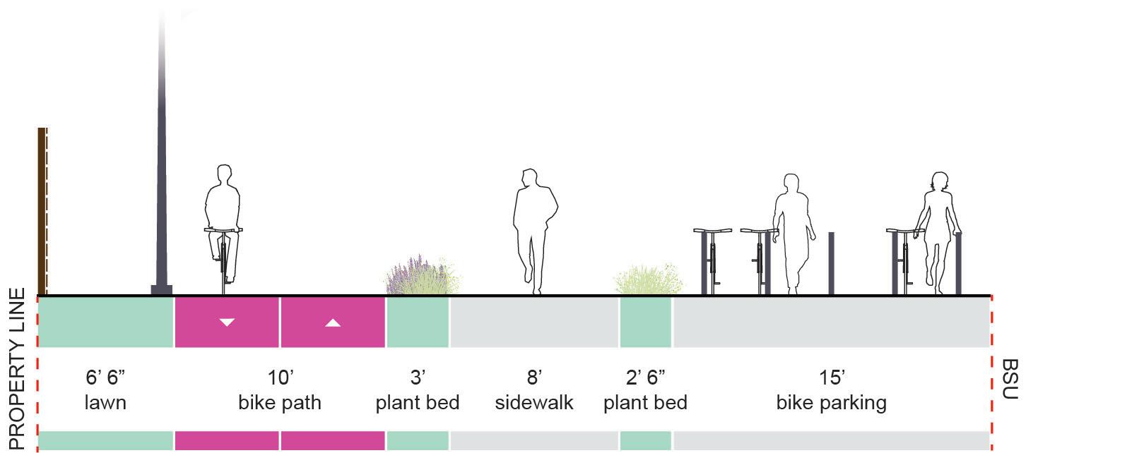
UNIVERSITY AVE | The Village
Overview
University Ave is the village’s most significant street, providing motorists and pedestrians with access to numerous businesses, restaurants, and bars. The Muncie Arts and Culture Trail will run along part of University, but will be routed around the portion of University that passes through the center of the village because of spatial constraints.
Existing Conditions
• University is a two-way street with one lane traveling each direction.
• The proximity of buildings, outdoor cafes, and various pieces of street furniture restrict the passage of cyclists outside the roadway
Recommendation
• The spatial limitations that prevented the MACT from being routed through the village should not close the door on cyclists in this area all together. Dedicated on-street facilities should be installed to promote bicycle travel along University Ave in the village.
Dicks St
EXISTING | Between Talley and McKinley
PROPOSED | Between Talley and McKinley
MARTIN ST | The Village
Overview
Martin St is a minor road in the village. In the future, Martin has potential to become a major cyclist route because it will become a convenient route between the planned East Mall trail and the existing White River Greenway.
Existing Conditions
• Martin is a two-way street with a single lane traveling each direction and some on-street parking.
• South of North St, an existing shared-use path runs along the east side of Martin St to the White River.
• North of Ashland Ave, Ball State intends to remove the roadway and replace it with the East Mall bicycle and pedestrian trail.
Recommendation
• Connect the planned East Mall project to the existing shared-use path on Martin St.
• To reduce cyclist/vehicular conflicts at intersections, a shared-use path along the east side of Martin St is recommended, similar to the path on Martin Street, south of North St.
NORTH ST
ASHLAND AVE
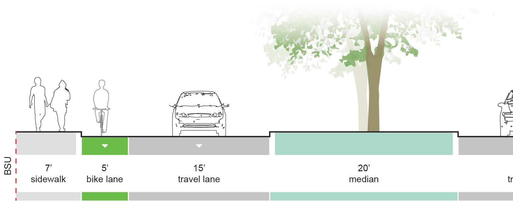
COLLEGE AVE | The Village
Overview
College Ave. will connect to the final leg of the extended Cow Path trail. Adding bicycle facilities along College Ave. will create a continuous route for cyclists that stretches from Bethel Ave to the White River Greenway.
Existing Conditions
• North of Washington Street, College Ave is a large boulevard with wide lanes and a 20 foot median.
• South of Washington Street, the roadway narrows to two unmarked travel lanes with on-street parking on both sides.
Recommendation
• Where space is available within the roadway, the addition of bike lanes is recommended.
• Where space is less available, the addition of sharrows is recommended.
PROPOSED | Between Student Center and Washington St
PROPOSED | Between Washington St and Jackson St
STUDENT CENTER
WASHINGTON ST
THE LOOP
THE LOOP
E/W ROUTE #1
E/W ROUTE #2
E/W ROUTE #3 THE LOOP
CAMPUS PATHWAYS
Overview
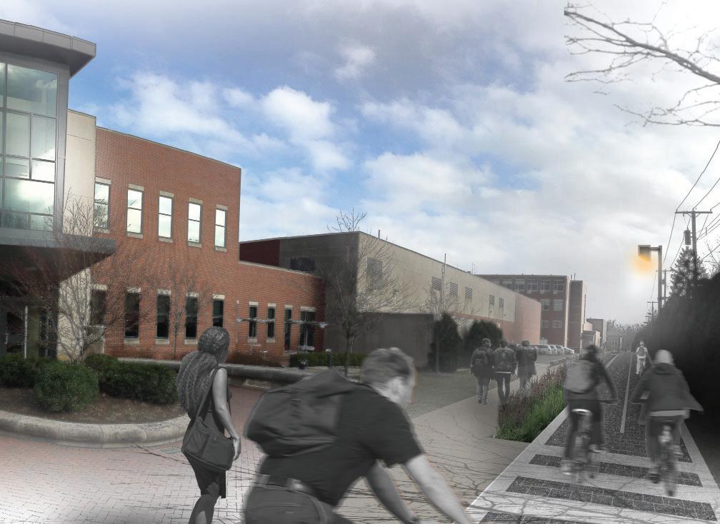
The purpose of this section is to look inward and develop pathways that will become the major work horses of this campus system. Currently, McKinley Avenue is the most highly traveled pedestrian/cyclist route on campus. Many students, faculty, and staff noted that the amount of traffic on McKinley creates conflicts between cyclists and pedestrians. These groups also raised concerns about conflicts with vehicular traffic making parts of McKinley unsafe for cyclists. This section explores ways to siphon bicycle traffic from McKinley by providing safer, more convenient routes separate from major roadways.
Routes Identified
• Cow Path
• East Mall
• East Loop
• Muncie Arts and Culture Trail
• East-West Connectors
• Cardinal Creek
COW PATH (north) | CAMPUS PATHWAYS
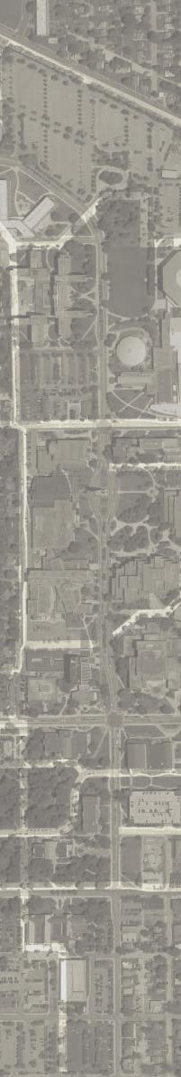
Overview
The Cow Path is an existing multi-use path that is located along the west side of campus, connecting LaFollette to Riverside Ave. Other than McKinley Ave., the Cow Path is the most heavily used north/south corridor on campus. In the future, the university should increase the Cow Path’s ability to safely handle large volumes of pedestrians and cyclists. Upgrading the Cow Path will reduce the amount of bicycle traffic on McKinley Ave making that corridor safer for pedestrians and motorists.
Existing Conditions
• The existing Cow Path is a paved 10 feet to 12 feet wide, multi-use path.
• Light poles, hedges, and fences line the western edge of the trail throughout.
Recommendation
• For a majority of the Cow Path’s run, a separated bicycle and pedestrian facility is recommended. Separating cyclists and pedestrians improves trail safety and user capacity.
• To maximize the trail’s usability and connectivity for on-campus and off-campus residents, the improved trail should extend northward to the Johnson residence halls and ultimately to Bethel Ave.
EXISTING | Between Bethel Ave and McKinley Ave
PROPOSED | Between Bethel Ave and McKinley Ave
JOHNSON HALLS
NEELY AVE
MCKINLEY AVE LETTERMAN BETHELAVE
EXISTING | Behind LaFollette Parking Lot
EXISTING | Behind LaFollette Parking Lot
PROPOSED | Behind LaFollette Parking Lot
EXISTING | Behind David Letterman Building
PROPOSED | Behind David Letterman
COW PATH (south) | CAMPUS PATHWAYS
Recommendation (continued)
• A separated bicycle/pedestrian facility should extend from the David Lettermen Building south across Riverside Ave and connect to the Student Center. Providing a convenient route from the academic center of campus to the Student Center will help reduce the number of cyclists who use McKinley to make this trip.
• To facilitate greater cyclist use of the Cow Path, bicycle parking areas should be located adjacent to the bike path.
RIVERSIDE AVE
UNIVERSITY AVE STUDENT CENTER
LETTERMAN
EXISTING | Behind Art and Journalism Building
PROPOSED | Behind Art and Journalism Building
EXISTING | Through Quad
PROPOSED | Through Quad
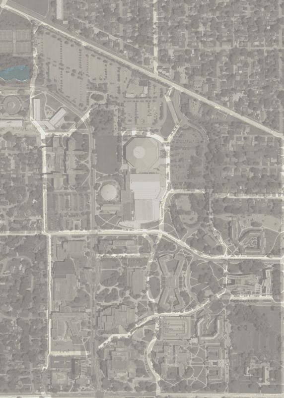
EAST MALL | CAMPUS PATHWAYS
Overview
The East Mall is a planned bicycle and pedestrian trail that will run north/south between Neely Ave and Beechwood Ave. Much like the Cow Path, the East Mall is meant to reduce the number of cyclists on McKinley by offering a safer and more comfortable route.
Existing Conditions
• Conditions vary greatly along the East Mall’s route. North of Emens Auditorium, the East Mall generally follows the path of existing 6 foot 10 foot sidewalks.
Recommendation
• In order to maximize the East Mall’s connectivity and convenience for potential users, bicycle facilities should extend north from Neely Ave to Bethel Ave.
• A separated bicycle and pedestrian facility is recommended adjacent to Worthen Arena.
• Space is limited on the east side of the Gora Rec Center. Place sharrows markings to provide cyclists safe passage.
EXISTING | At Rec Center
PROPOSED | At Rec Center
EXISTING | At Worthen Arena
PROPOSED | At Worthen Arena
EAST LOOP | CAMPUS PATHWAYS
Overview
The Loop is a critical component of this master plan. Once the East Mall and the upgraded/extended Cow Path are in place, new connection opportunities will arise. The Loop is a supplemental route that is designed with anticipation of new opportunities to optimize the overall system’s effectiveness long-term.
Existing Conditions
• Existing conditions vary greatly. Most of The Loop follows the paths of existing 6 foot to10 foot sidewalks.
• The southern portion of The Loop passes through the plaza between Bracken Library and Emens Auditorium. The plaza is a large paved area framed by multiple buildings with entries that face the plaza.
Recommendation
• Planned facilities should provide dedicated/ separated space for cyclists and pedestrians.
• Implement The Loop as a later phase once the Cow Path and East Mall are completed.
MUNCIE ARTS AND CULTURE TRAIL | CAMPUS PATHWAYS
Overview
Like the East Mall, the Muncie Arts and Culture Trail (MACT) is in the early phases of planning and design. The planned trail will be outfitted with separate cyclist and pedestrian pathways and will travel from downtown Muncie to Ball State’s campus.
Considerations
During the information gathering phase of this project, BSU students consistently ranked downtown as one of the most significant destinations they want to get to by bicycle. In light of this trend, it is reasonable to assume that the MACT will be well used by students, faculty and staff traveling to and from downtown. Therefore, it is important to carefully coordinate and design points where the MACT intersects other major trails in this master plan to ensure user safety.
BEECHWOOD
EAST/WEST CONNECTORS | CAMPUS PATHWAYS
Overview
Like The Loop, these east/west pathways are meant to be implemented in later phases. Each route creates new connections that will enable more people to easily access the primary trails in this network.
Existing Conditions
• Existing conditions vary greatly. In general, areas east of The Loop are residential; areas to the west are occupied by academic buildings.
Recommendation
• For routes east of The Loop, provide a shared-use path.
• Provide a separated bicycle/pedestrian facility on the south side of CAP where high levels of foot traffic make a shared-use path unfeasible
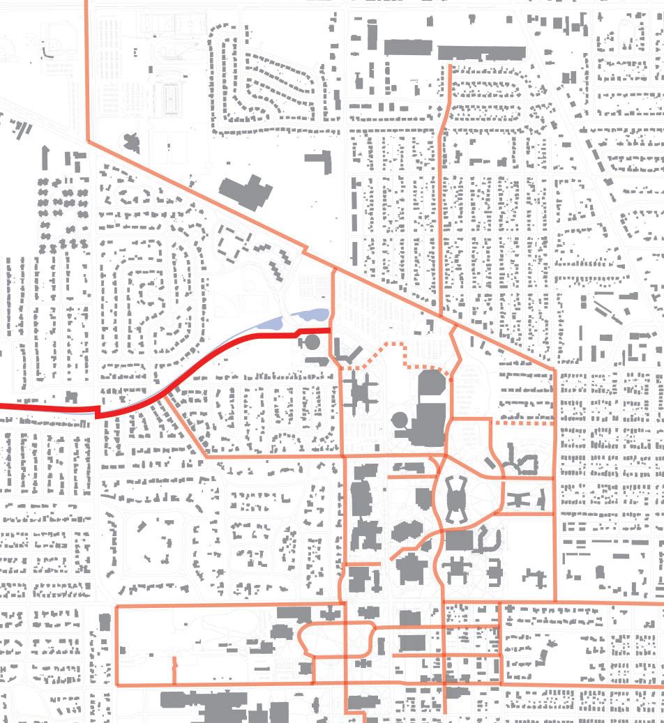
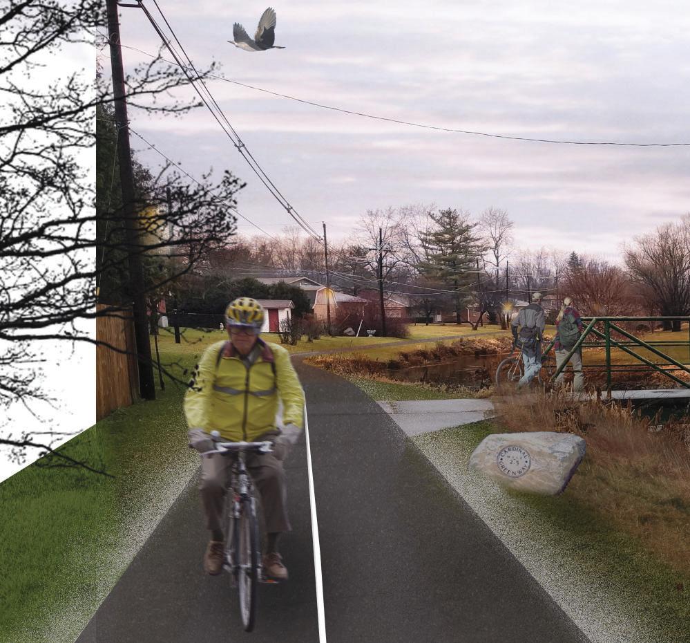
CARDINAL CREEK GREENWAY | CAMPUS PATHWAYS
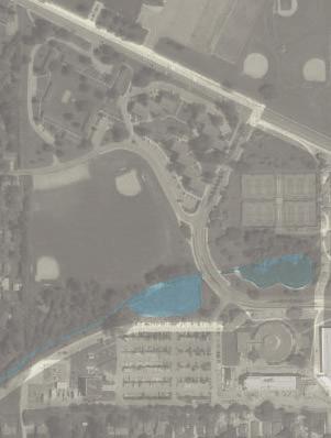
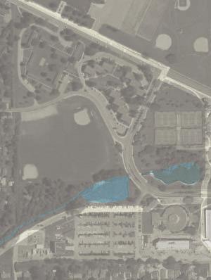
Overview
Cardinal Creek meanders from campus toward the southwest. The BSU Duck Pond is at the northeast end of Cardinal Creek.
Considerations
Consider implementing a trail on the south side of Cardinal Creek. The trail will likely need to be repositioned west of Tillotson Avenue to avoid conflicts with private property owners. Consider extending the trail to the Jackson Street/Morrison Road roundabout. The existing footpath that connects Briar Road to Maddox Road should be widened to make it easier for bicycles and pedestrians to cross at the same time.
Cardinal Creek Greenway
PHASING STRATEGY
Overview
The recommendations for physical improvements to the campus have been organized into three different categories; Major Connectors, Village Connectors, and Campus Connectors.
Each route should be coordinated with a variety of factors that may ultimately determine when a project may be implemented. Coordination should occur with the Ciy of Muncie on both city-owned streets and campus bike paths to ensure both have an understanding of the impact, if any, the project could cause. Factors that should be considered may include:
• City of Muncie Street roadway re-surfacing or improvement schedule
• University Athletic events, High-profile events on campus, and Concerts
• University Physical Planning and Construction Projects
• Funding availability
The potential cost identified in the matrix below are highlevel construction cost opinions. Cost for surveying, design, construction inspection, contingencies, and other Ball State University cost factors are not included. The scope and material selection, along with many other factors, will ultimately be the driving factors when determining more concise projects costs.
PHASING PLAN
Phase 1
Phase 2
Phase 3
Future Work
Programs & Policy Recommendations
Bike Friendly University & Policy Recommendations
Overview
The League of American Bicyclists maintains and operates a Bicycle Friendly University (BFU) and City program that “recognizes institutions of higher education for promoting and providing a more bikeable campus for students, staff and visitors. The BFU program provides the roadmap and technical assistance to create great campuses for cycling.”
Typically, college campus are unique, yet ideal locations that feature high-dense, walkable, and potentially bikable environments. To attract talented students, faculty and staff, university and colleges have turned toward the League of American Bicyclists and the Bicycle Friendly rating system as a way to compete and prove that their campuses have reached a measurable threshold.
Sustainable and planned development for bicyclists on campuses could “optimize space, save the university money on parking and healthcare, and provide affordable transportation options for students and staff.”
Competition
Universities are ranked on a scale from Platinum to Honorable Mention. Currently, two Universities in Indiana have achieved a BFU designation:
• Purdue University (Silver, 2016)
• Indiana University (Bronze, 2011)
As of 2014, Purdue University was unranked with the League of American Bicyclists. With a dedicated Bicycle Coordinator on campus and a recently completed Bicycle Master Plan of their own, Purdue has been able to achieve a Silver designation in just two years.
Universities similar in size to Ball State University could be schools within the Mid-American Conference:
• State University of New York at Buffalo (Bronze, 2012)
• Kent State University (Bronze, 2016)
• University of Toledo (Bronze, 2016)
With some work toward the recommendations identified in the Bicycle Master Plan, Ball State University has the opportunity to make it’s claim as the most Bike Friendly University in the Mid-American Conference.
Communities and Businesses can also achieve a BFU status. The following communities and local businesses have achieved a ranking:
• Bloomington (Gold)
• Muncie (Bronze)
• IU Ball Memorial Hospital (Bronze)
• Goshen (Bronze)
• South Bend (Bronze)
• Carmel (Bronze)
• Columbus (Bronze)
• Fort Wayne (Bronze)
• Zionsville (Bronze)
• Indianapolis (Bronze)
• Warsaw and Winona Lake (Bronze)
BFU Application
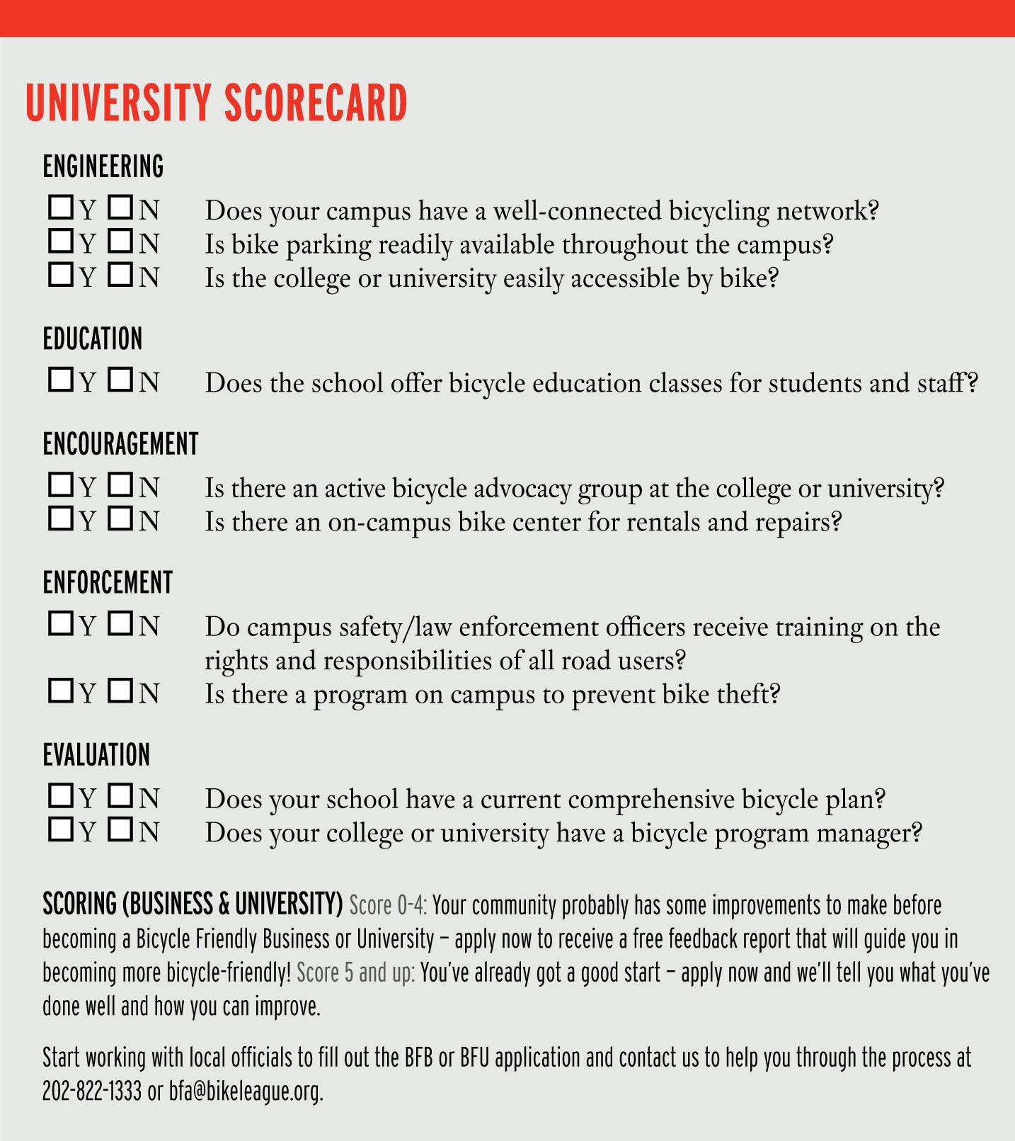
A successful application for a BFU designation should follow the “Five E’s.” The League of American Bicyclists scores universities across the “Five E’s” categories, which include Engineering, Education, Encouragement, Enforcement, and Evaluation, to determine their level of success or competency.
Policy Recommendations
The policy recommendations identify non-infrastracture programs that will serve an important role in developing and ultimately implementing a successful network and biking culture. Ball State should concentrate their Bicycle Planning efforts toward successfully meeting the requirements as outlined in the “Five E’s.”
Engineering
Physical infrastructure needed to create safe and convenient places to ride and park.
• Complete Street Policies
Work with the City of Muncie to fully implement the “Complete Street Policies”, especially where local streets intersect and have an impact on campus mobility. Connections to the White River Greenway, Minnetrista, and downtown Muncie should be considered.
• Facilities and Streetscapes
Review and implement the physical recommendations identified in the Bicycle Master Plan. Implementation considerations should include on-street and campus pathway recommendations, with the goal of connecting to critical destinations first.
• Bicycle Parking
Review the Bicycle Parking recommendations of the Ball State Bicycle Master Plan. Bike racks should be close to dedicated bicycle routes, functional, and low maintenance. Provide a campus standard to make replacement easy and to provide for a general aesthetic throughout campus.
Implement physical improvements to the campus to improve the bicycle network.
• Bikes and Transit
Work with MITS and the campus shuttle service to provide transportation options for users with bicycles. Provide convenient and accessible routes for cyclists to bus stations.
Education
Programs that ensure the safety, comfort and convenience of cyclists and fellow road users.
• Educate University Employees how to Drive Safely with Bicyclists
University employees and staff who drive vehicles represent a large portion of daily traffic. Educate staff on how to safely interact with bicyclists. Furthermore, educate grounds and maintenance staff on proper care and use of the shared-use and dedicated bicycle facilities.
• Provide Bicycle Education Materials for New Students and Staff
Universities are unique in the majority of their population turns over approximately every four years. Before arriving on campus, provide incoming and prospective students materials on how to safely use bicycle facilities and how to safely drive in a bicycle friendly environment. Currently, the University does not offer any education information regarding bicyclists on campus.
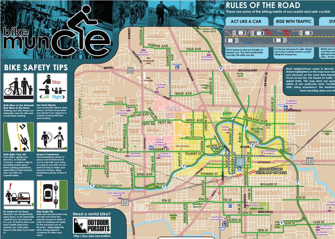
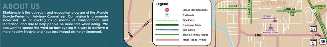
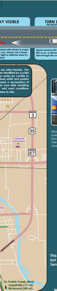
Bike Muncie has developed resources to help educate cyclists and motorists to share the road.
Encouragement
Incentives, promotions and opportunities that inspire and enable users.
• Campus Tours
Allow campus tours for prospective students, faculty and staff to be completed by bicycle, which would help demonstrate the bikability of the campus.
• Campus Bike Share Program
Review the Bike Share Recommendations that were completed as part of the Bicycle Master Plan. Coordinate implementation of the Bike Share program with a potential Campus Bike Center.
• Bike Maps
Provide and distribute a printed Bike Map, that identifies the types and locations of dedicated bicycle routes and shared-use routes. Coordinate with the City of Muncie and BikeMuncie to indicate routes that connect to important destinations near the University. Maps should be available at popular destinations on campus (AJ, Bracken, Student Center, Gora Rec Center).
• Campus Bike Center
Consider adding an on-campus bike center. This center could be an expansion of the current services provided by Outdoor Pursuits. The center should provide repair services, offer winter storage, or serve as the “hub” for bike-related events or activities.
Events and programs can be held to encourage bicycling.
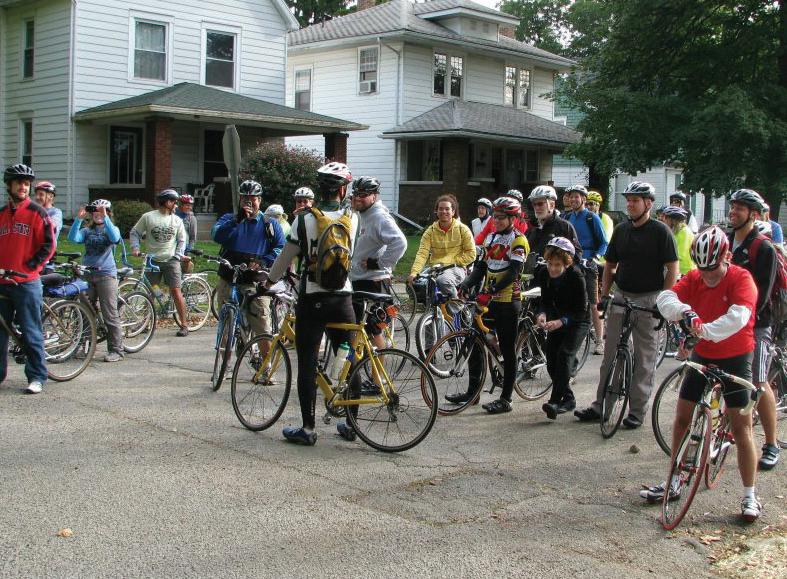
• Events, Annual Bike Rides
Hold annual events that encourage local families, staff and students to ride portions of the Campus. Use this cause to provide education on how cyclists and motorists are to interact. Events could become charitable to help support bicycle maintenance or activities on campus.
• Apply for BFU Designation
Review the policy recommendations provided in this report and compare the requirements of the BFU application. Many of the policy recommendations in this report will contribute toward a successful application for a BFU. See the BFU Scorecard to determine if the University is ready to apply. A designation as a BFU will promote and encourage the use of bicycling on campus. Work with the City of Muncie to help the city achieve an elevated Bicycle Friendly City status.
• Promote Ball State Police Bicycle Patrol
Promote the use of bicycle police officers from the Ball State University Police. Highly visible bicycle police officers would create a positive message about the bicycle culture on campus.
Bike Guides are produced by Bike Muncie to encourage bicycling in Muncie.
Enforcement
Equitable laws and programs that ensure motorists and cyclists are held accountable.
• Bike Registration
Continue to promote, encourage, and improve the Bicycle Registration program. Require registration of bicycles that are impounded and retrieved. A registration program will help to discourage theft.
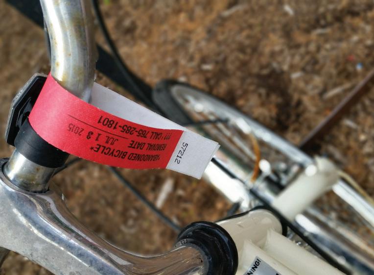
• Abandoned Bicycle Removal
Continue to engage in periodic abandoned bicycle removal, but not less than every semester. Consider implementing a campus tagging process, that allows student, faculty, and staff to tag bicycles they believe to be abandoned. This could make the removal process easier for Ball State’s maintenance staff.
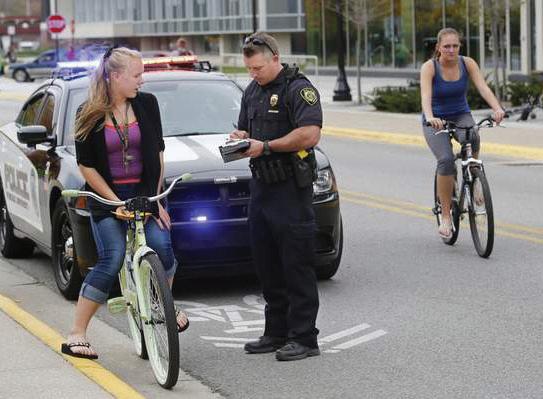
• Targeted Enforcement of Traffic Laws for Cyclists and Motorists (Require Bicycle Education Classes in lieu of fines)
Make efforts during the beginning of each semester during class change intervals, to monitor and enforce local traffic laws for both motorists and cyclists. Consider allowing traffic law offenders to bypass fines by participating in a bicycle education course.
Evaluation
Processes that demonstrate a commitment to measuring results and planning for the future.
• Campus Bicycle Master Plan
Review the Campus Bicycle Master Plan for future implementation work. Ensure the plan is available across University Departments and is kept up-to-date. Refer to the plan during new on-campus improvements to ensure routes and amenities are properly provided.
• Review System Functionality - Produce an Annual Report on Bicycling
Potentially developed by a Bicycle Coordinator, the annual report would identify bicycle parking, bicycle crashes, registration totals, maintenance reports, information/ evaluation on newly implemented bike paths and review/ evaluation on existing bike paths.
Abandoned bicycles should be tagged and removed at least once per semester.
Purdue University Police enforce traffic laws for both motorists and bicyclists each semester.
Evaluation - Organizational
Administrative procedures to ensure bicyclists on campus is monitored and the culture is encouraged.
• Designate or hire a Bicycle Coordinator
Coordinate with the City of Muncie to determine the organizational requirements for a shared bicycle coordinator. The coordinator should be involved in managing any future Bike Share Program, but also be involved with decisions regarding the Physical and Capital Planning at the University to ensure bicycles are accounted for as recommended in the Bicycle Master Plan. Likewise, this position should be involved in the planning functions of the City of Muncie to ensure bicycle facilities are appropriately reaching the campus. The coordinator should be included in any future work related to the Muncie Arts and Culture Trail. This position was recommended by The League of American Bicyclists for the City of Muncie’s application on ways to increase the City’s ranking to “Bronze” to “Silver.”
• Encourage a Bicycle Working Group
Create a group of University stakeholders across various campus departments (Grounds, Police, Physical Facilities, Outdoor Recreation, Parking, Student Organizations, etc.) that is responsible for the development and implementation of the Bicycle Master Plan. A bicycle coordinator would report to this group as frequently as necessary.
• Bicycle Policies from the City of Muncie
Consider adopting or publicizing the policies already put into place by the City of Muncie as a formal recognition of how bicycles should be used on campus. All newly adopted bicycle policies should be made easier to find through the campus website, and all bicycle policies should be located in one location, potentially a new Ball State web-page dedicated to bicycling. Existing Ball State bicycle policies are spread across a variety of University programs and divisions, making finding these policies difficult.
Potential City of Muncie & Ball State University Bicycle Coordinator
Bicycle Coordinator
Graphic icons provided by The Noun Project: 23 graphics, Arthur Shlain, Maria Kislitsina, Pham Thi Dieu Linh, Tatina Belkina, Ellen Zheng