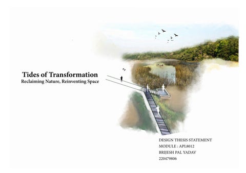
Tides of Transformation
Reclaiming Nature, Reinventing Space
DESIGN THESIS STATEMENT
MODULE : APL8012
BRIJESH PAL YADAV
220479806
CONTENT 1. Introduction ............................................................................................................................................. 1 2. Site survey.................................................................................................................................................. 2-3 3. Site analysis ............................................................................................................................................... 4-6 4. Precedent projects .................................................................................................................................... 7-8 5. Concept ..................................................................................................................................................... 9-12 6. Masterplan ................................................................................................................................................ 13-14 7. Detailed plan .............................................................................................................................................. 15-16 8. Construction .............................................................................................................................................. 17-18 9. Planting strategy ........................................................................................................................................ 19-20 10. Tidal Variation Visualization ................................................................................................................... 21-23 11. Visualization ............................................................................................................................................... 24-26 12. Professional manifesto ............................................................................................................................... 27 13. References .................................................................................................................................................... 28
VISIT
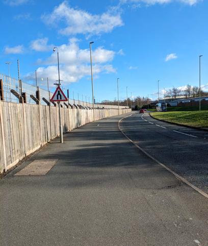
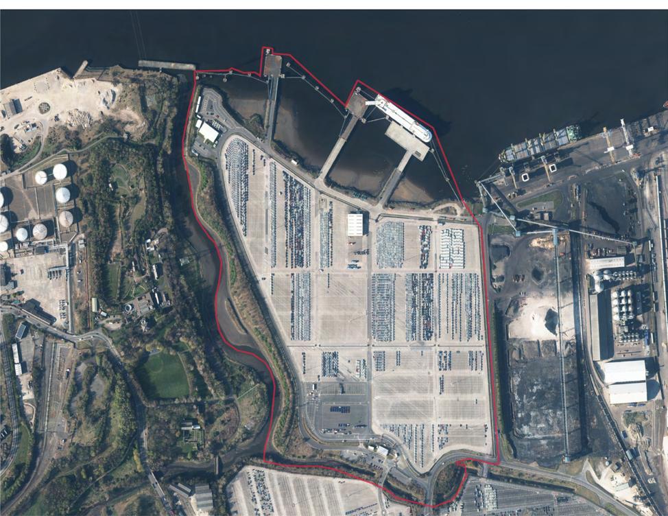
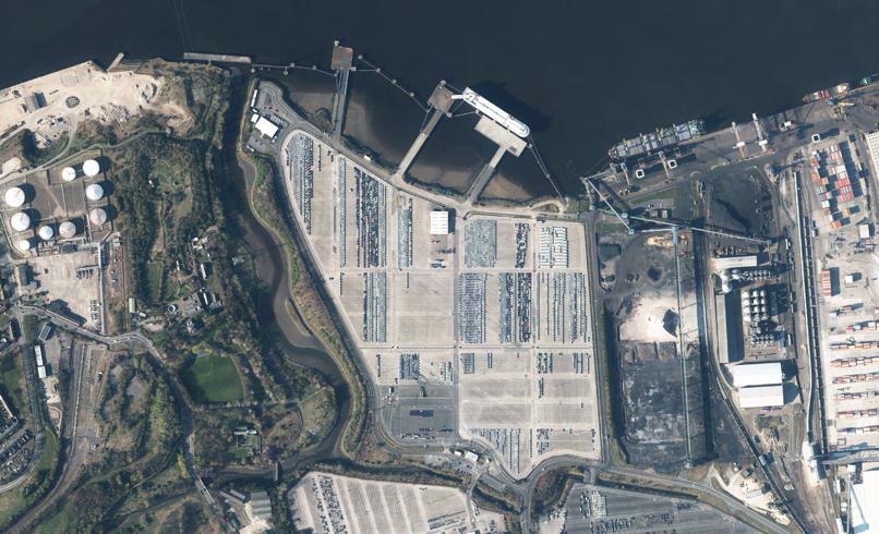
• Site Location - The site is situated in Jarrow, South Shields, encompassing an approximate area of 40 hectares.
• Current Usage - Currently, the site serves as a car park utilized by Nissan Automobile Company for parking vehicles before exportation.
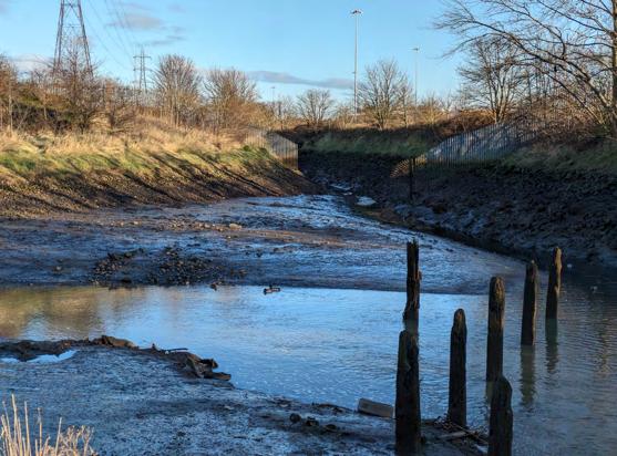
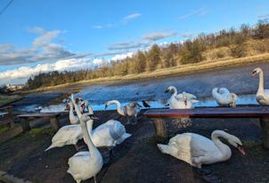
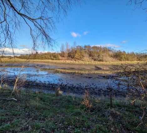
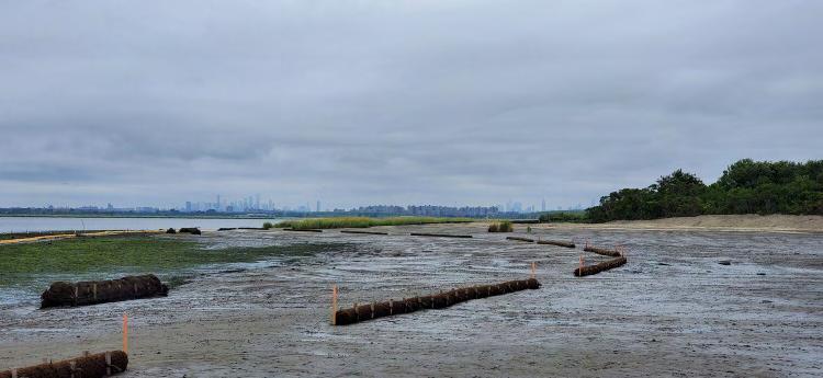
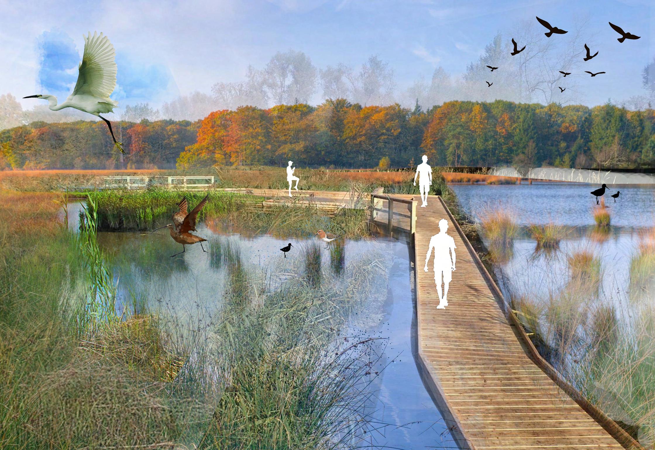
• Ecological Features: The areas along the site boasts rich ecological diversity, with intertidal mudflats lining the boundaries along both the River Tyne and the River Don. These mudflats contribute to the area’s biodiversity and serve as vital habitats for numerous plant and animal species. The western boundary is characterized by an existing woodland ecology, acting as a natural buffer between the car park and the River Don. Moreover, salt marsh ecology flourishes along the banks of the River Don, further enhancing the ecological significance of the site. These salt marshes support unique plant communities adapted to saline environments and play a crucial role in coastal protection and sediment stabilization.
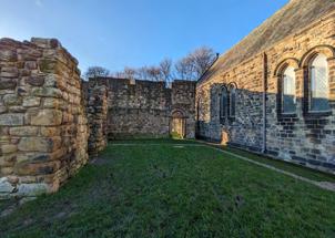
SITE SURVEY
SITE
Existing Natural Characterstics on the Site
 Existing Woodland
River Don
Existing Intertidal Mudflats
Existing Woodland
River Don
Existing Intertidal Mudflats
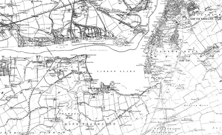
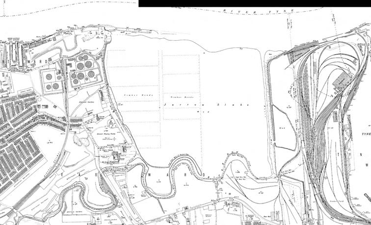
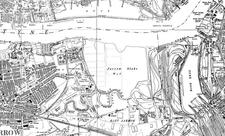
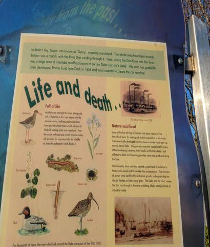
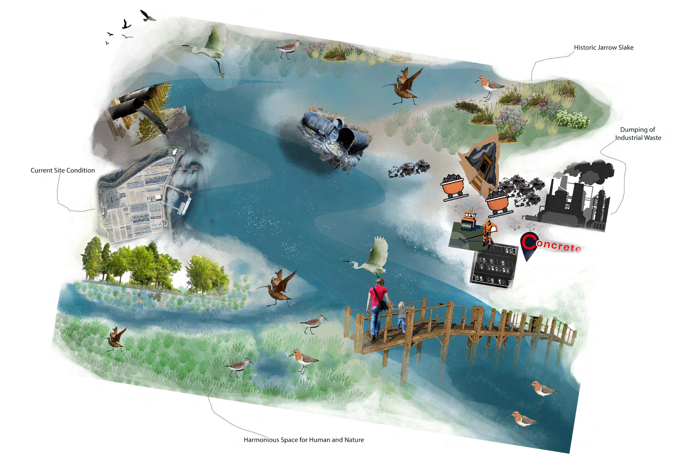
site history 1860s
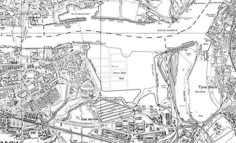
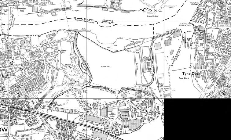
The historical analysis of the site at Tyneside Dock illustrates the complex interplay between industrialisation,environmental challenges, and urban development. From the serene beauty of Jarrow Slake to the industrialisation of Tyne Dock and the subsequent transformation into a car parking area, the site’s evolution reflects the broader narrative of regional history. Understanding this history is crucial for informing future landscape decisions and ensuring a balance between urban progress and environmental sustainability. The once pristine environment suffered from pollution, altering its ecological balance. In the 1980s, a significant transformation occurred when the original course of the River Don, which flowed through the site, was diverted to the western end. This decision played a pivotal role in shaping the site’s future. By the 1990s, the mudflat and slake area underwent a dramatic change as concrete filled the landscape, culminating in the creation of the current car park resulting in the loss of the biodiversity rich mudflat ecosystem.
HISTORICAL ANALYSIS 200 400 600 800 1000 1200 1400 1600 1800 2000m brijeshpalyadav NewcastleUniversity 02February202416:50 site history 1860s Projection:BritishNationalGrid Scale1:15000 Digimap G R U O O 0 50 100 150 200 250 300 350 400 450 500m brijeshpalyadav NewcastleUniversity 02February202416:44 site history 1940s Projection:BritishNationalGrid Scale1:5000 Digimap © C C O U O 100 200 300 400 500 600 700 800 900 1000m brijeshpalyadav NewcastleUniversity 02February202416:44 site history 1950s Projection:BritishNationalGrid Scale1:7500 Digimap G R U 100 200 300 400 500 600 700 800 900 1000m brijeshpalyadav NewcastleUniversity 02February202416:46 sitehistory1970s Projection:BritishNationalGrid Scale1:7500 Digimap G R U O O 100 200 300 400 500 600 700 800 900 1000m brijeshpalyadav NewcastleUniversity 02February202416:48 sitehistory1990s Projection:BritishNationalGrid Scale1:7500 Digimap © C C O U O site 50 100 150 200 250 300 350 400 450 500 Pio yR o d brijesh pal yadav Newcastle University 17 February 2024 19 18 Projection British National Grid Scale 1:4000 © Getmapping Ltd Contains OS data Crown copyright and database rights 2024
current site site history 1990s site history 1970s
FLOOD RISK ANALYSIS
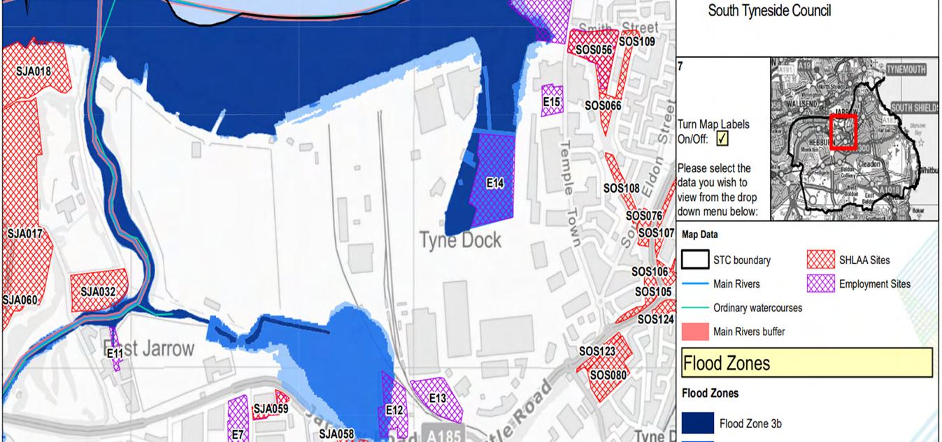
The current flood risk assessment conducted by South Tyneside Council indicates that few portions of the site and its adjacent areas fall within Flood Zone 3 and Flood Zone 2. These classifications denote areas with high and medium probability of flooding, respectively, based on existing environmental conditions and topographical features.
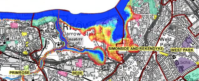
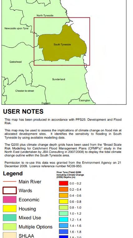
However, projections for future flood risk, influenced by anticipated sea level rise attributed to climate change, paint a concerning picture for the site and its surroundings. With forecasts indicating a potential sea level rise of approximately 1.5 meters by the year 2050, the extent of floodprone areas is expected to expand significantly. Consequently, parts of the site and neighboring regions are poised to experience an escalation in flood risk levels, with an increase in the prevalence of Flood Zone 3 and Flood Zone 2 designations.
This heightened risk underscores the imperative for proactive measures to address and mitigate the anticipated impacts of climate-induced sea level rise. Through strategic planning and implementation of resilient design interventions, such as nature-based solutions and sustainable land use practices, it is possible to enhance the site’s capacity to withstand and adapt to future flood events. By integrating innovative flood risk management strategies into the landscape design framework, the site can be transformed into a beacon of resilience, safeguarding both natural and human communities against the escalating challenges posed by climate
CURRENT FLOOD RISK MAP (Source - South Tyneside Council)
FLOOD RISK PREDICTION MAP - 2050 (Source - South Tyneside Council)
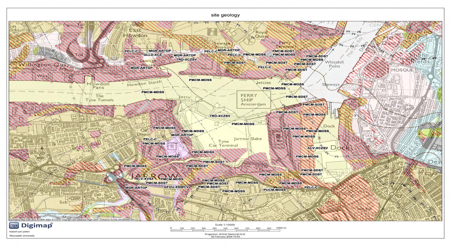
According to the available geological data site area is mostly consist of Made Ground (Undivided), Pennine Upper Coal Measures Formation - Mudstone, Siltstone And Sandstone (PUCM-MDSS), Tidal River Or Creek Deposits - Clay, Silt, Sand And Gravel (TRD-XCZSV). This indicates that human activities have altered the natural geology of most of the site area. These deposits suggest a history of tidal influence in the area, indicating that rivers or creeks have played a role in shaping the landscape. The presence of clay, silt, sand, and gravel indicates a mix of sediment types that could provide information about past water dynamics and depositional environments
Site Geology Analysis
WEST POND LIVING SHORELINE RESTORATION PROJECT RESTORATION PROJECT, NEW YORK, USA
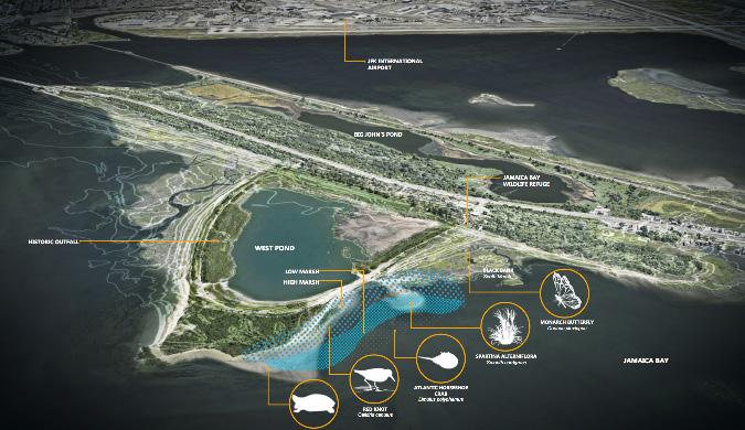
Project- The living shoreline project at the Jamaica Bay Wildlife Refuge, undertaken by the Jamaica Bay-Rockaway Parks Conservancy (JBRPC) in partnership with Dirtworks Landscape Architecture, PC and the National Park Service (NPS), represents a transformative restoration effort aimed at enhancing ecological resilience, protecting vulnerable
Lesson taken- The living shoreline project at Jamaica Bay Wildlife Refuge serves as a model for coastal resilience and habitat restoration initiatives, demonstrating the effectiveness of nature-based solutions in addressing shoreline erosion and enhancing ecosystem health. By engaging community stakeholders, leveraging partnerships, and implementing innovative design
PRECEDENT STUDY
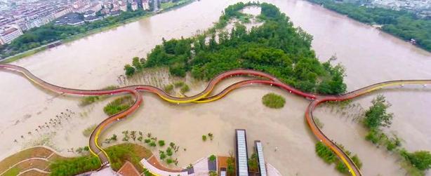
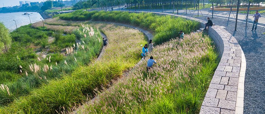
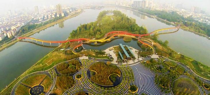
Yanweizhou Park, situated in the urban heart of Jinhua City, China, stands as a testament to resilient landscape design and adaptive urban planning. Developed by Turenscape Landscape Architecture, the park transforms a last remnant of natural riparian wetland into a vibrant public space that seamlessly integrates with the surrounding urban fabric. Completed in 2014, the park exemplifies innovative strategies for flood resilience, ecological restoration, and cultural identity preservation.
Lesson taken -
• Preservation of Natural Habitat Preservation of Natural Habitat
• Flood Resilience and Adaptation- The innovative flood-resilient design strategies employed in Yanweizhou Park, such as terraced river embankments and flood-adapted vegetation.
• Community Connectivity and Identity
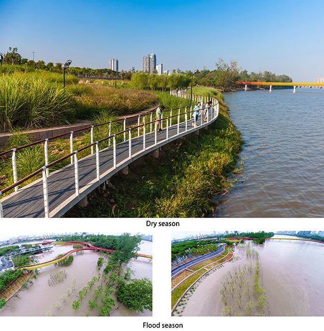
YANWEIZHOU PARK, JINHUA CITY, CHINA
CONCEPT DEVELOPMENT
Aim:-
• Restoring historical intertidal mudflats and salt marsh on the site.
• Revitalisng the existing woodland.
• Nature based solutions for the mitigation of flooding scenario in the nearby future due to climate change.
• Reconnecting human & nature by designing a space where human and non- human parts of the nature can co-exist.
• Enhancing the biodiversity.
Concept
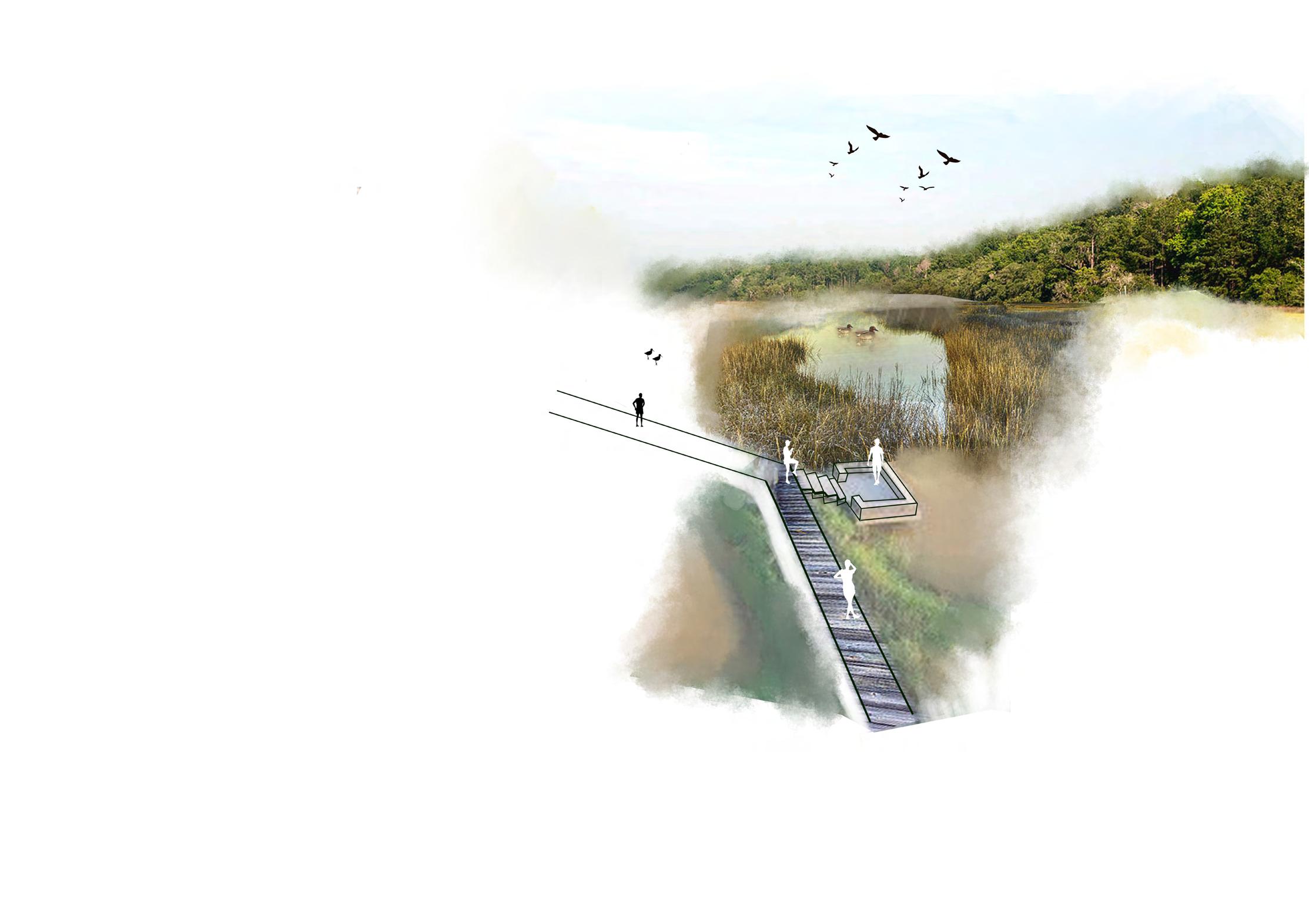
My design vision for the thesis is to transform Jarrow Slake into a resilient space prepared for future challenges. Envisioning a scenario in 2050 with reduced reliance on private vehicles, the project aims to repurpose the existing car park to adapt to rising sea levels, predicted to reach 1.5 meters due to climate change. Through innovative design interventions, the site will become a model of sustainability, balancing ecological resilience with the evolving needs of the community
Inspired by the principles of sponge city design and the site’s historical evolution, my concept seeks to harmonize human activities with nature’s rhythms. Embracing a philosophy of creating balanced spaces, the design endeavors to restore the site’s historical mudflat & salt marsh, introduces a riparian woodland and enhances the existing woodland ecosystem. Through these nature-based solutions, the project not only mitigates flood risks and enhances biodiversity but also revitalizes the human-nature relationship, fostering resilience and sustainability within the landscape.

REMOVING CONCRETE AND SUB-SOIL LAYER

PLANTING ALKALINE LOVING OR HARDY SPECIES


ADD MORE SOIL ON TOP OF THE MIXTURE TO FORM A NEW LAYER
TREATMENT OF CONCRETE LAYER ON THE SITE

CRUSHING CONCRETE PIECES OBTAINED FROM THE SITE


MIXING CRUSHED CONCRETE WITH SOIL

ADDING THE MIXTURE IN THE AREAS NEEDED TO BE UPLIFTED TO INCREASE THE CONTOURS
ADD A MULCH LAYER ON TOP OF IT
CONCRETE PIECES FOR ROCKY ECOLOGY XONE ON THE SITE SELL EXCESSIVE CRUSHED CONCRETE
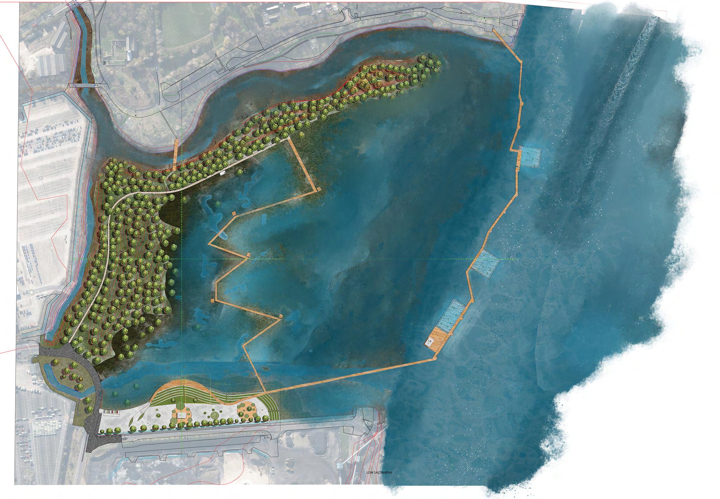
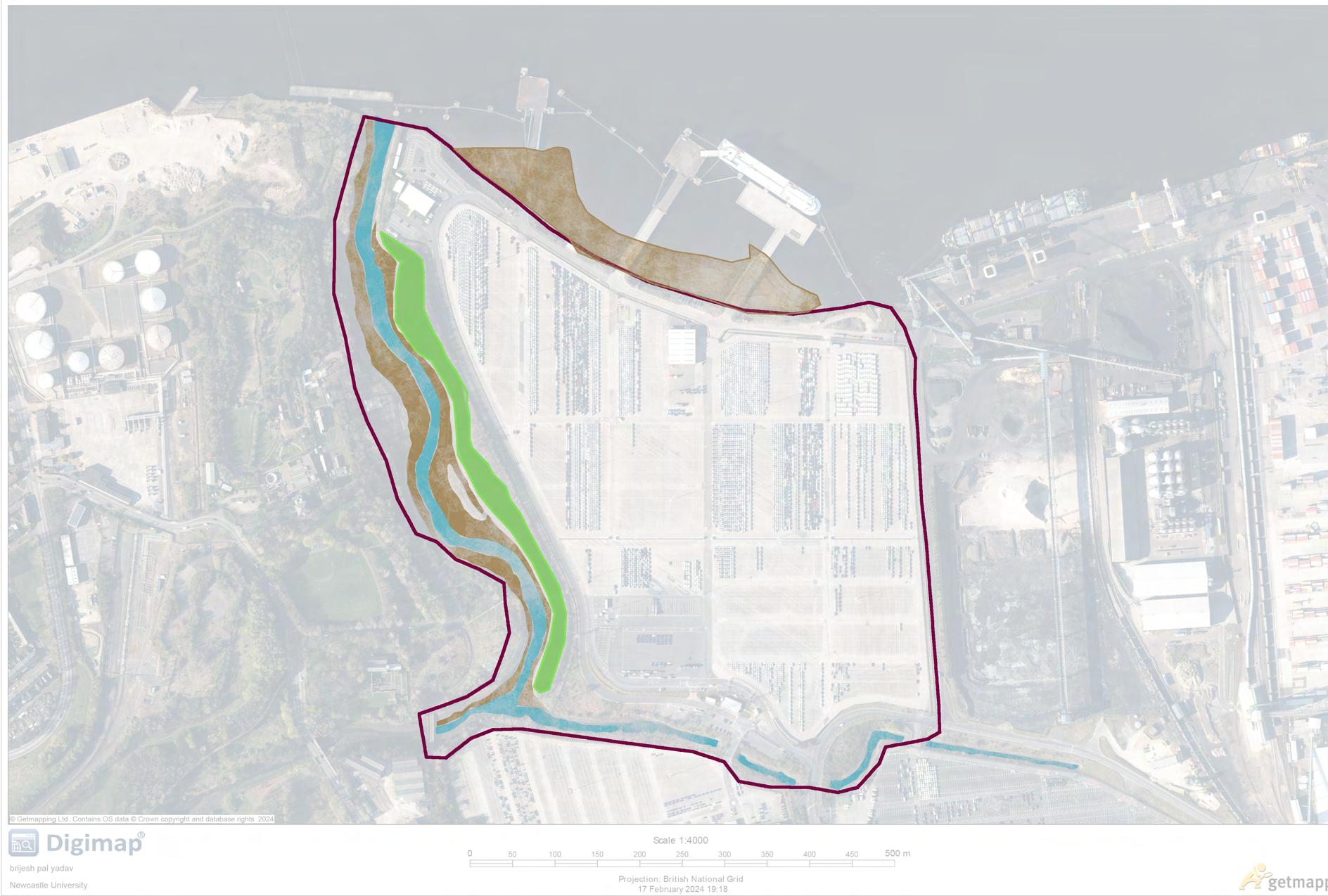
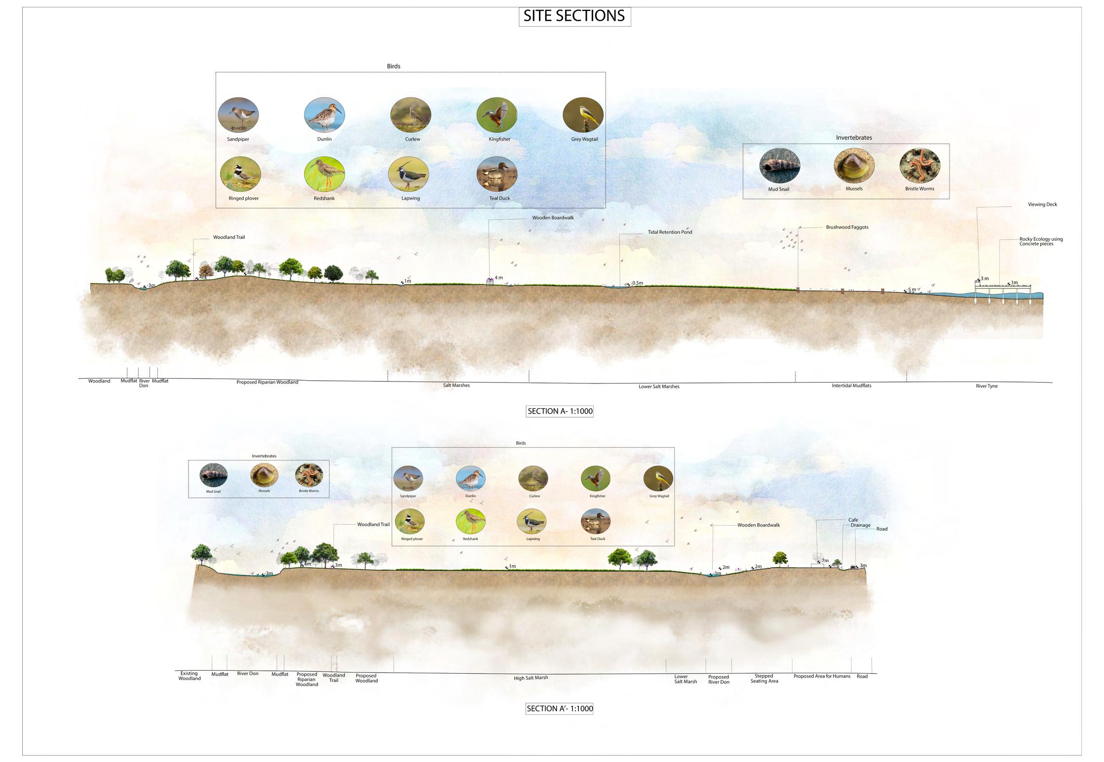
Nature Based Solutions
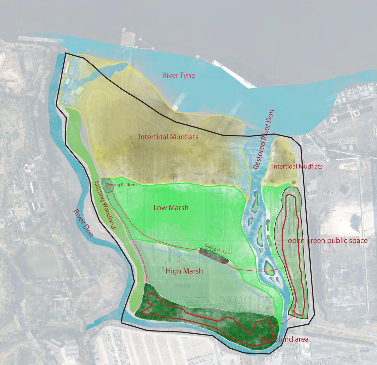
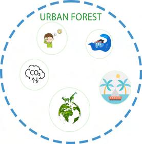
Urban Forest/Woodland
• Retaining & enhancing the existing woodland.
• Introducing Riparian type Woodland.
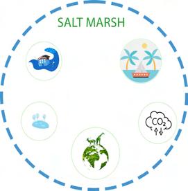
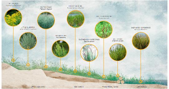
Salt Marsh
• One of the most diverse ecosystem
• Acting as a ecotone (transition b/w Riparian woodland and intertidal mudflats.
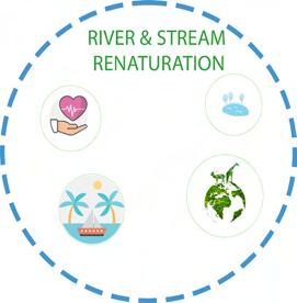
River & Stream Renaturalisation
• Reintroducing the historic channel for river Don.
• Soft natural edges for the river
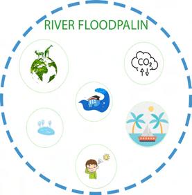
River Floodplain
• Intertidal Mudflats
• Gentle slope for sedimentation and use of brushwood faggots to prevent erosion
Action
Plan
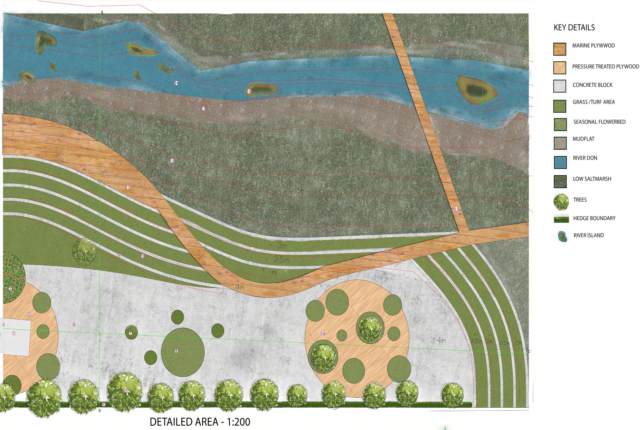
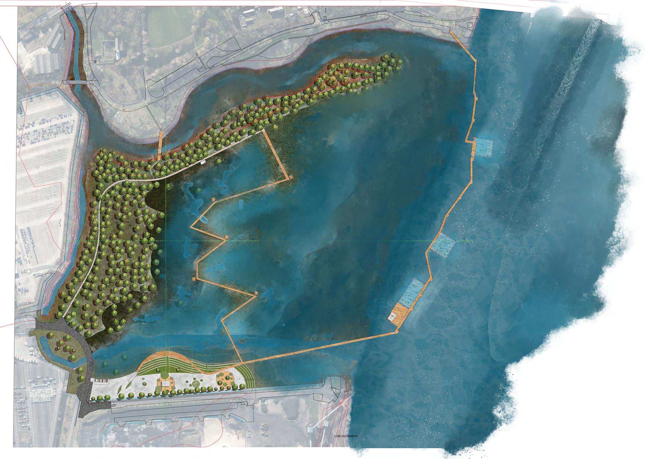
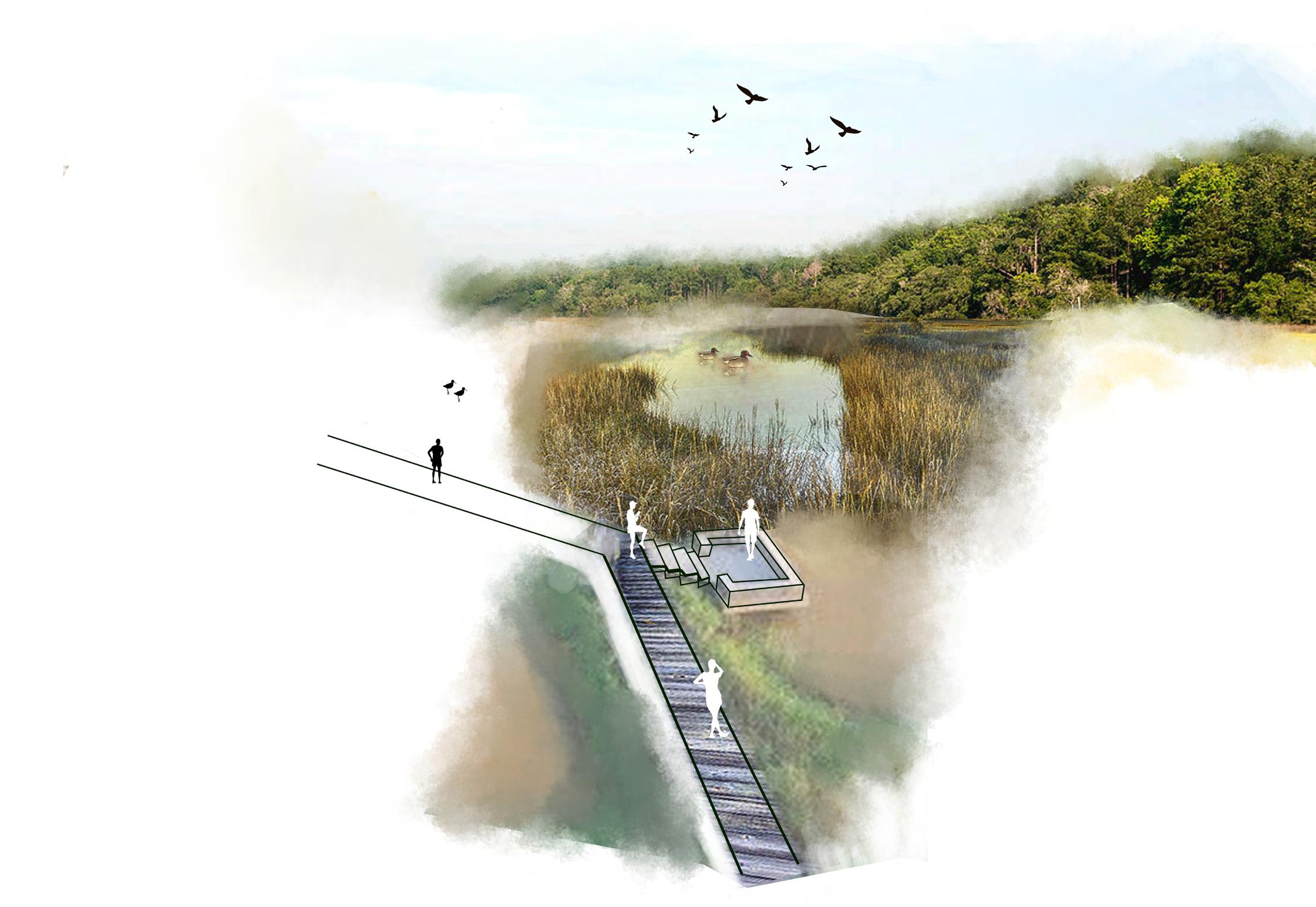
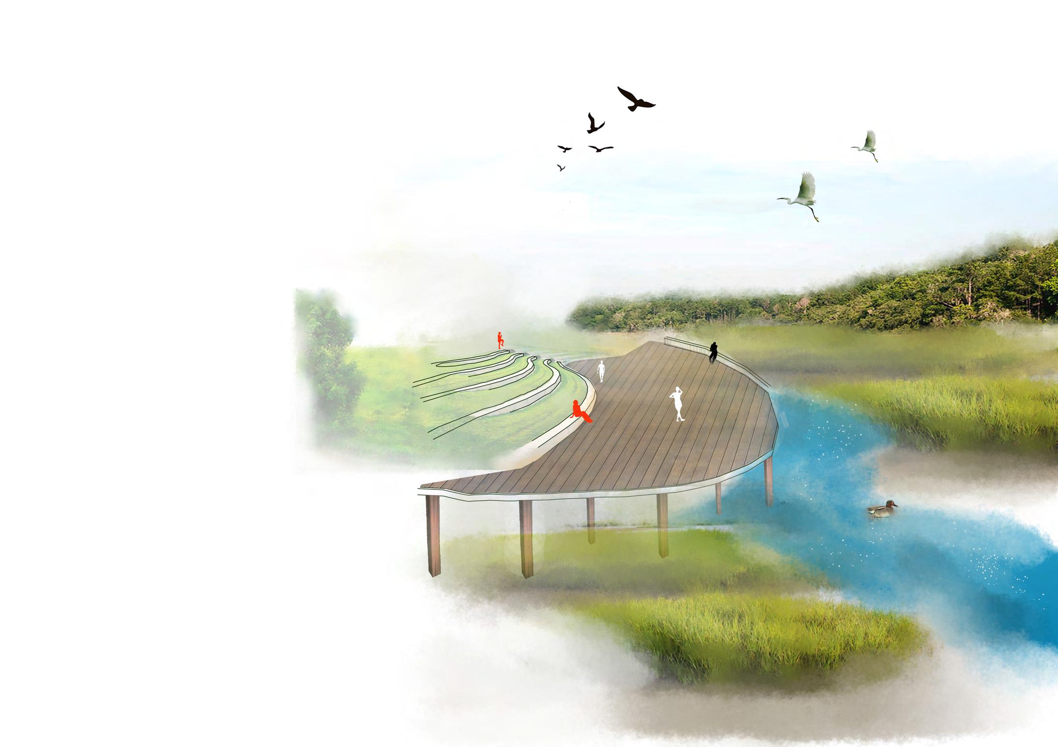
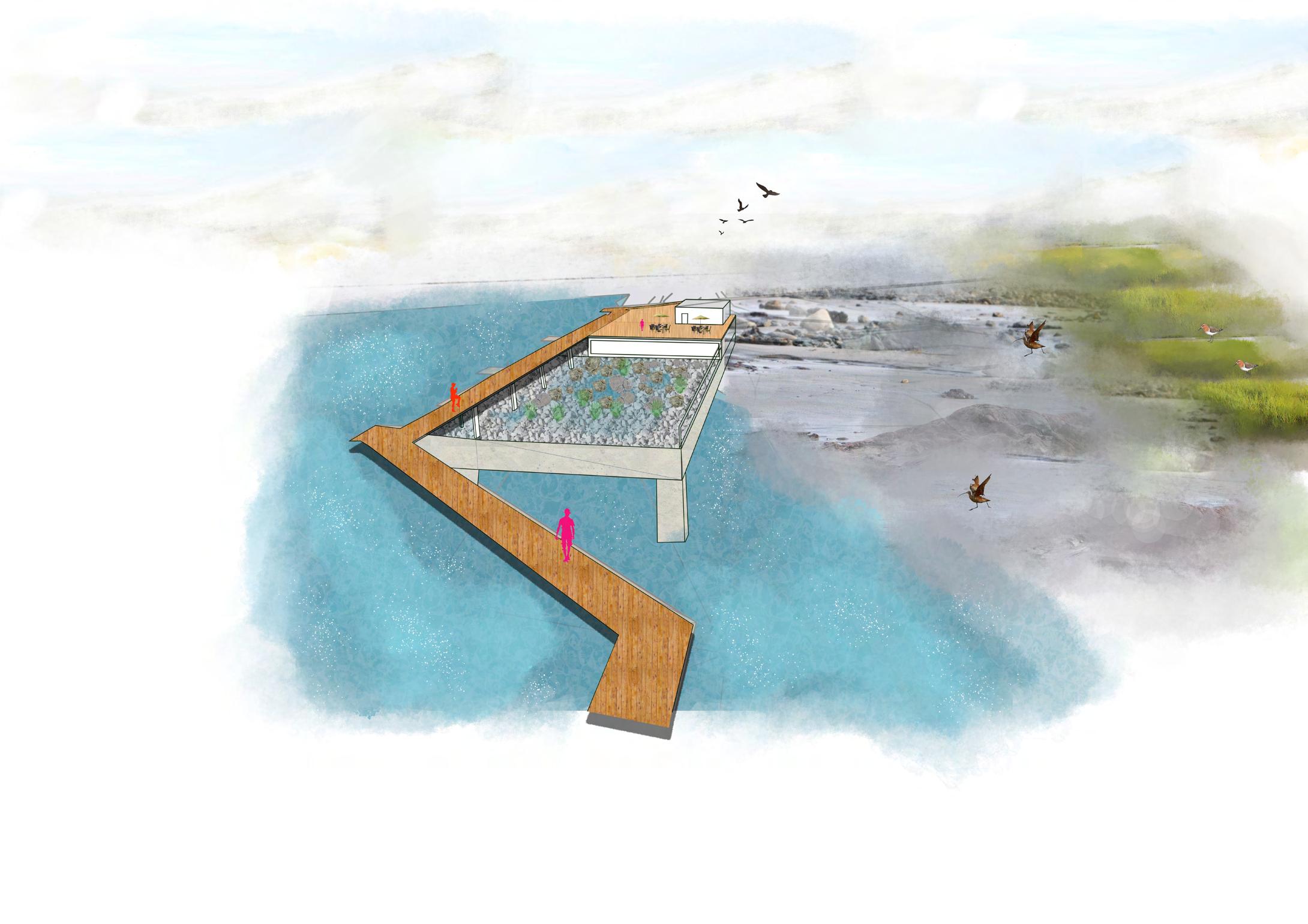
DETAILED AREA SECTIONS
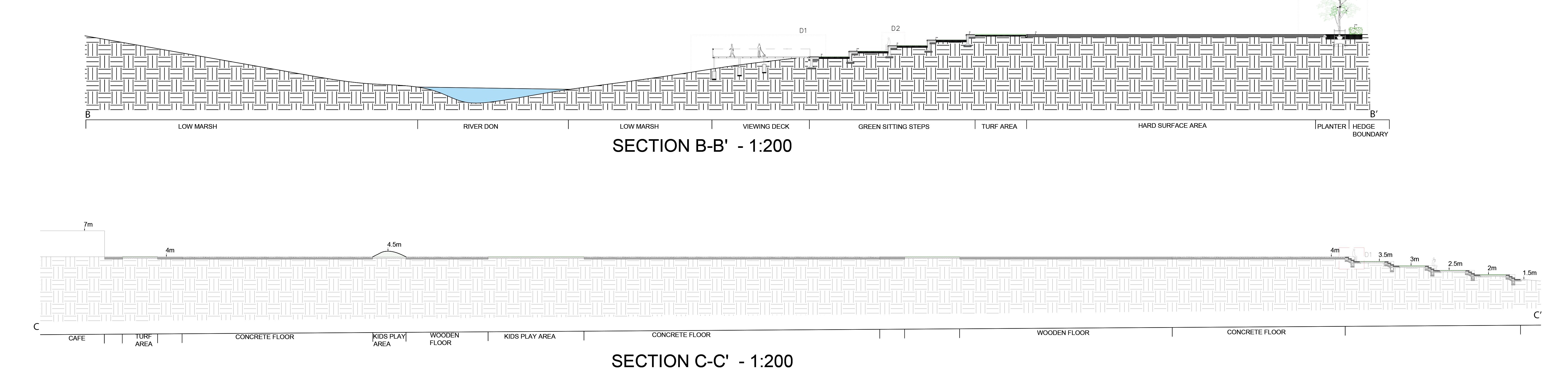
ELEVATION VIEW - 1:25
BOARDWALK CONSTRUCTION DETAILS
3,000 P.S.I. CONCRETE FOOTING WASHED
(INTERIOR VIEW) - 1:5
ANGLE AND JOIST HANGERS 870mm 2600 mm 50MM THK DECK 1000 MM X 100 MM CONCRETE SLAB 30 MM MORTAR BED 150 MM CONCRETE LAYER 150 MM THK SUB-BASE 30 MM THK STAINLESS STEEL PLATE BOLTS 98mmx250mm HAND RAIL (CONTINUOUS) ATTACH WITH GALVANIZED SCREWS.
STONE COMPACTED SUBGRADE MIN. 100mm 860mm 100mm RAILING POST SECTION VIEW
- 1:25
FOUNDATION DETAIL - 1:5 INSET
2.5m
DETAIL D2'A - 1:10
CONSTRUCTION DETAILS
Proposed concrete paving (sub base and foundations to engineer's specification)
Proposed concrete kerbs in the pavement
Double stakes 75mm dia x 1.8m long with rubber belting with spaces
Rootball trees with irrigation and ventilation system 75mm Depth bark mulch
1500mm Thick Hedge boundary
400mm Top soil
Loosen subsoil in accordance with BS8601:2013)
DETAIL D2'B - 1:10 PLANTER DETAIL(D3) - 1:20
REINFORCEMENT CAGE 100 MM THK SUB BASE SUB SOIL 150 MM THK SUB BASE 30 MM THK MORTAR BED 1200 MM X 80 MM X 1200 MM GRAY CONCRETE SLAB SUB SOIL 100 MM THK SUB BASE 25 MM THK MORTAR BED 650 MM X 100 MM GRANITE GRASS LAYER 150 mm TOP SOIL 25 MM THK MORTAR BED 375 MM X 100 MM GRANITE 75 mm 400 mm 1200 mm 500 mm
Underlayer Liner 50mm Geotextile Layer Layer of hardcore or rubble collected from the site Marginal Plantation Topsoil Sandbags or Polypropylene bags filled with rubble
3m
30 MM THK MORTAR BED 1000 MM X 100 MM CONCRETE BLOCK 150 MM THK SUB-BASE 150 MM THK CONCRETE LAYER 150 MM THK SUB-BASE GRASS LAYER 150 mm TOP SOIL
ISLAND
(SECTION X-X') - 1:20
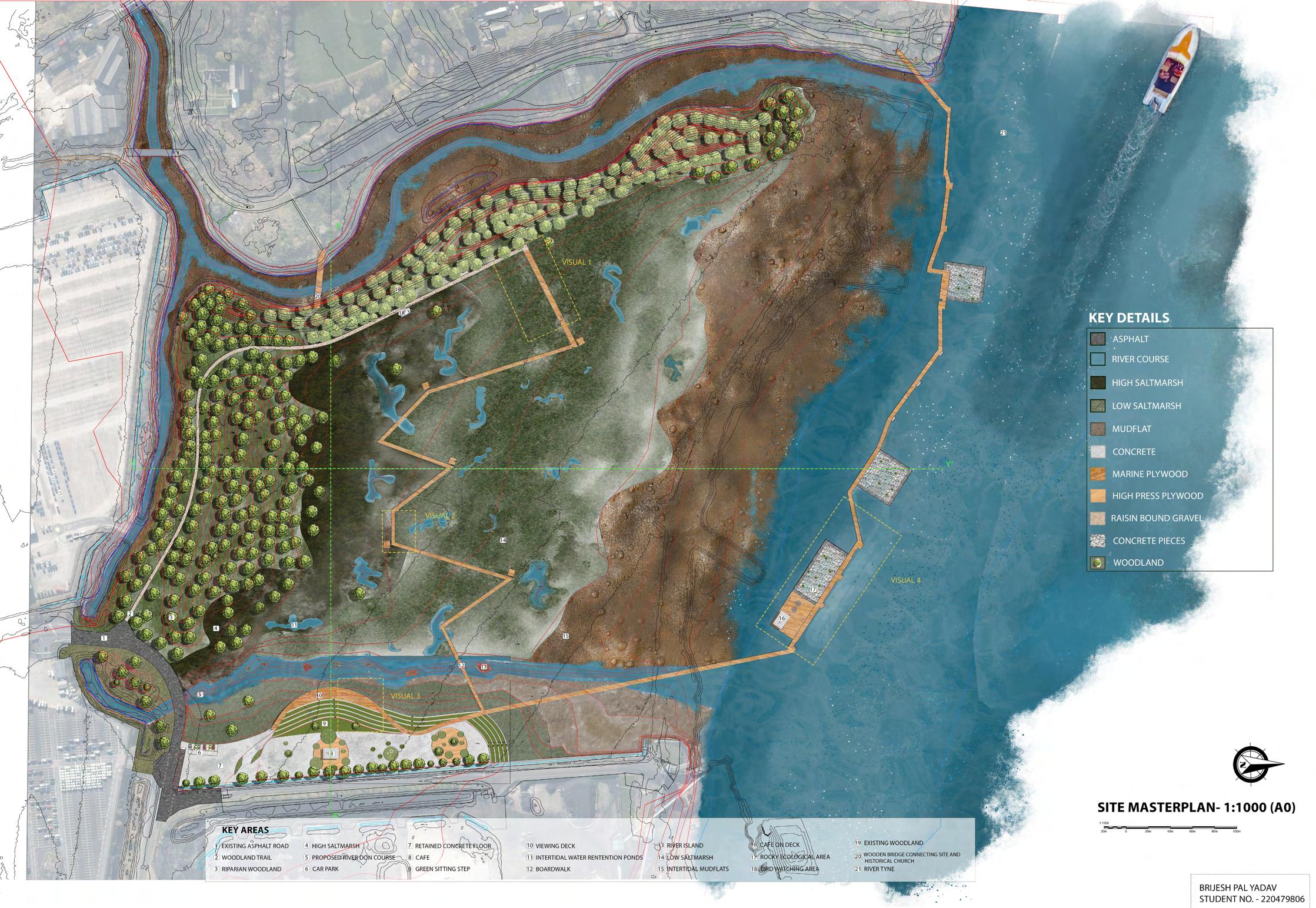
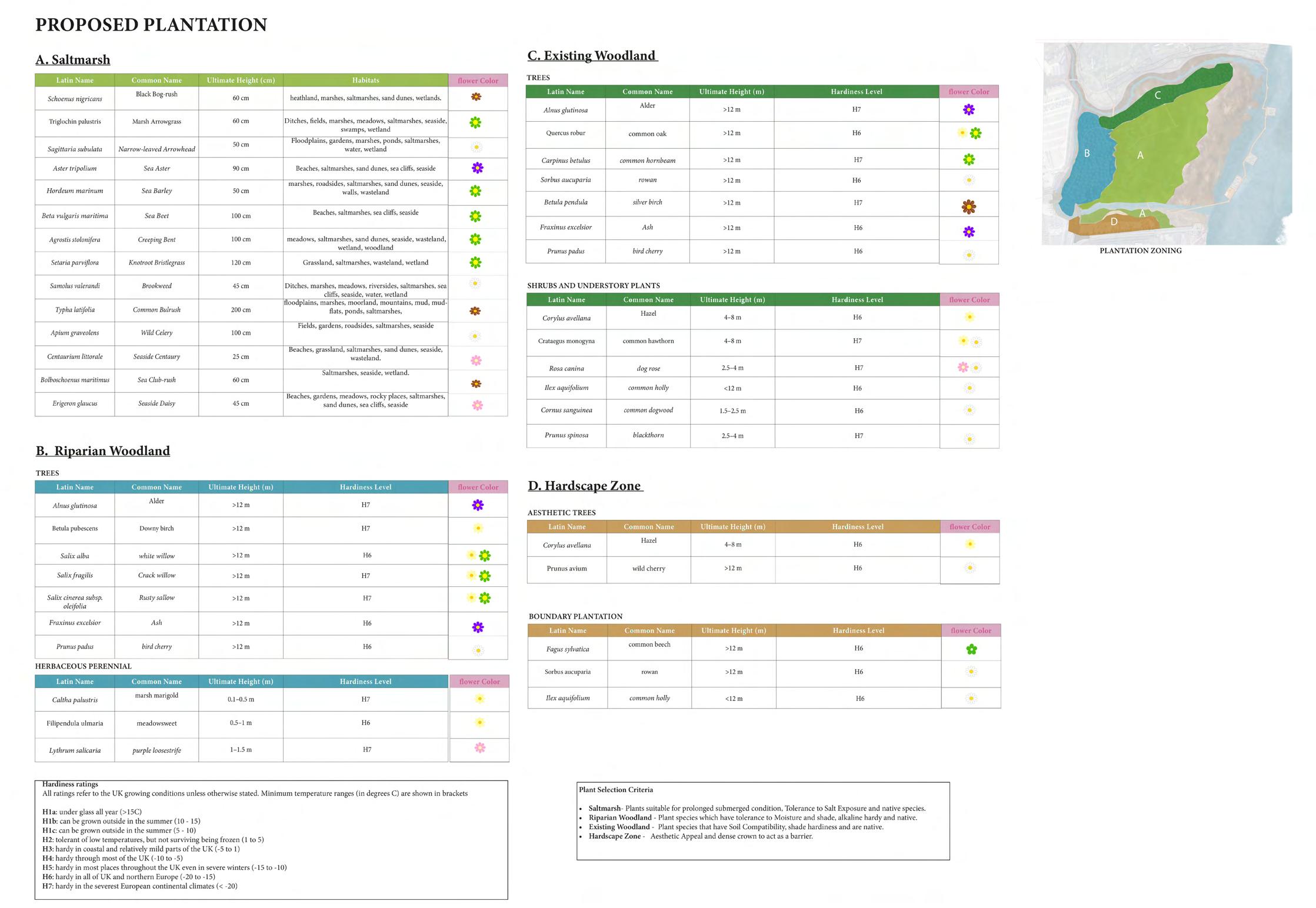
PLANTATION ZONING
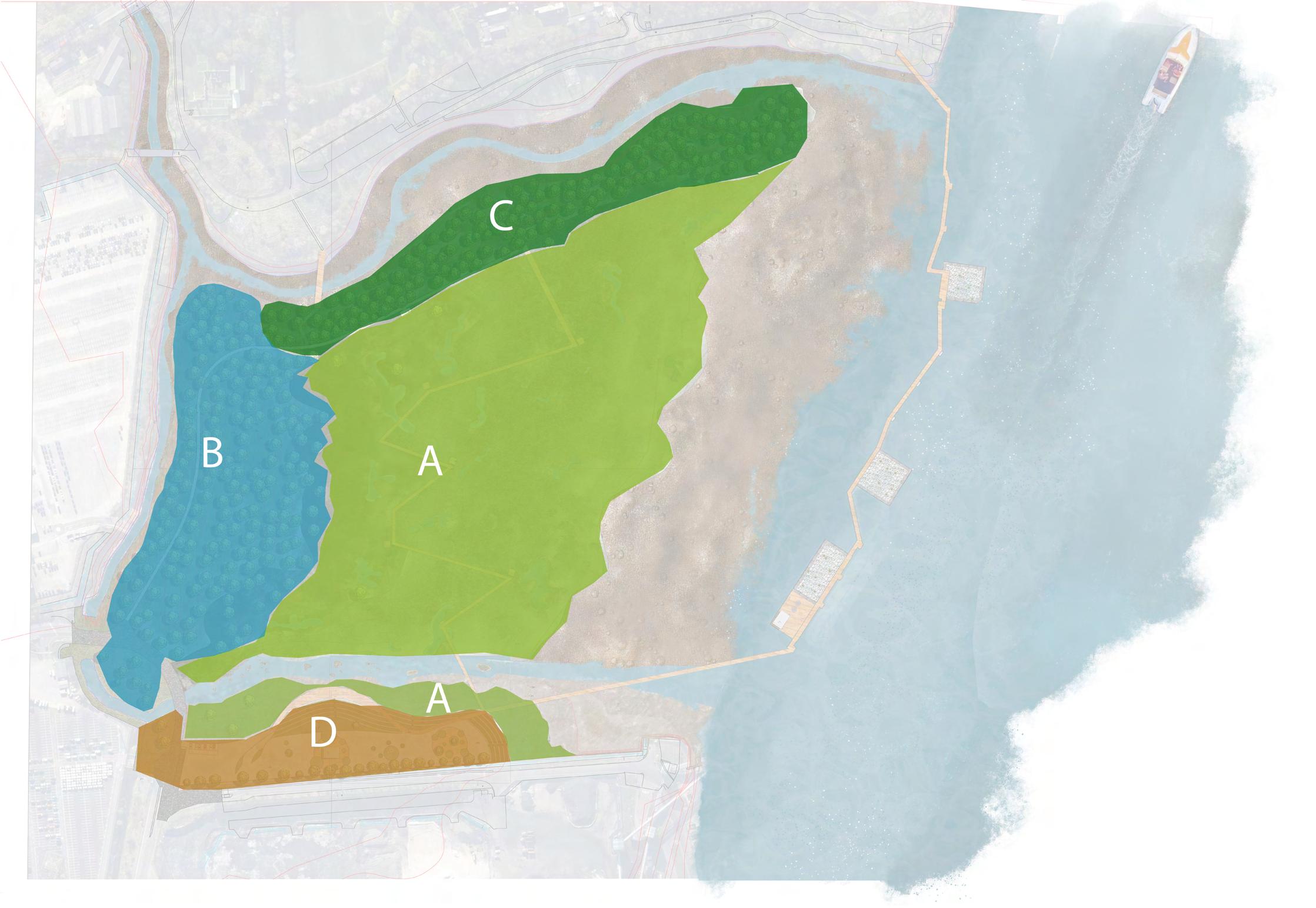
• A - SALTMARSH
• B - RIPARIAN WOODLAND
• C - EXISTING WOODLAND
• D - HARDSCAPE AREA
LOW TIDE LEVEL
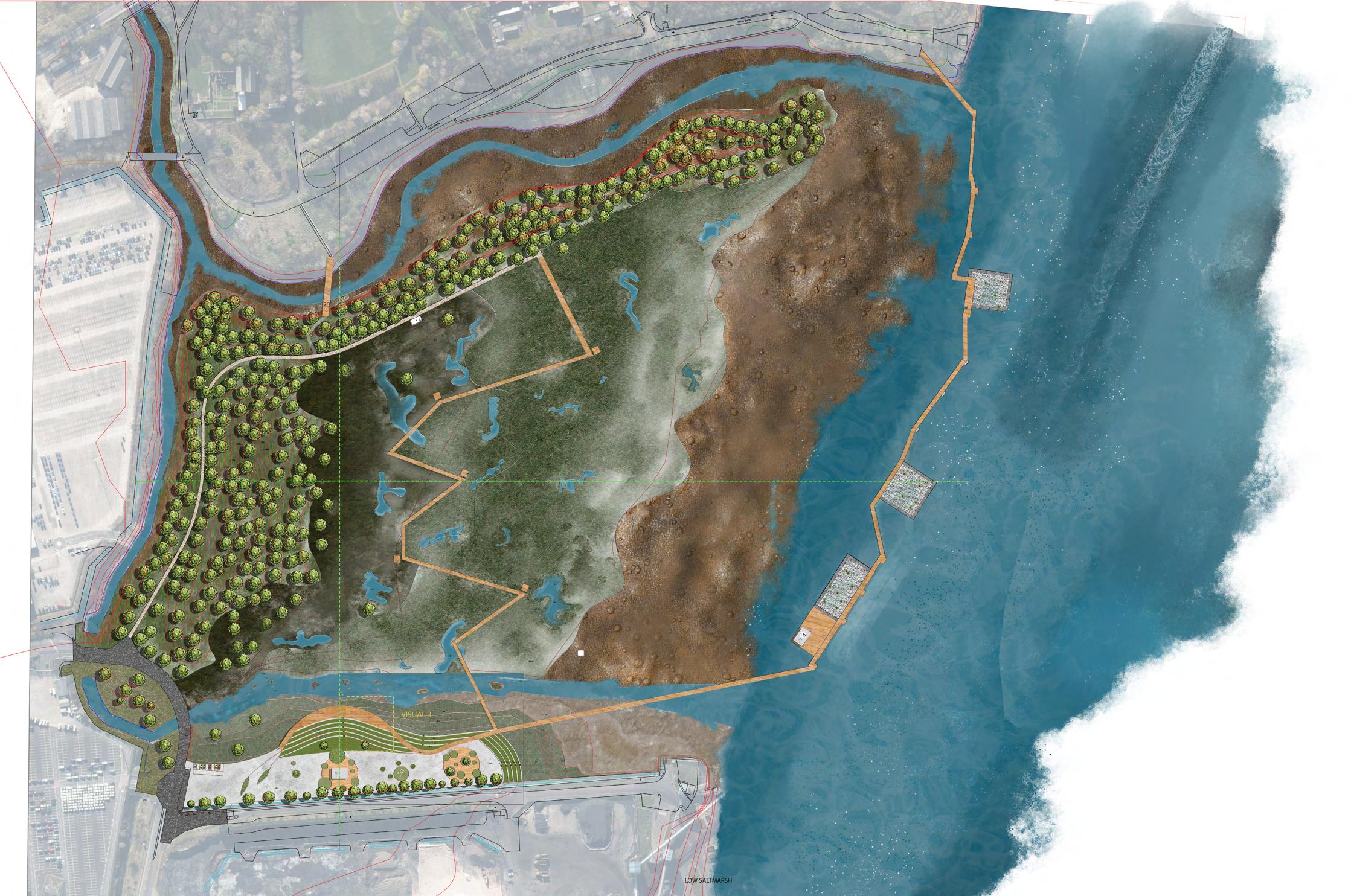
HIGH TIDE LEVEL
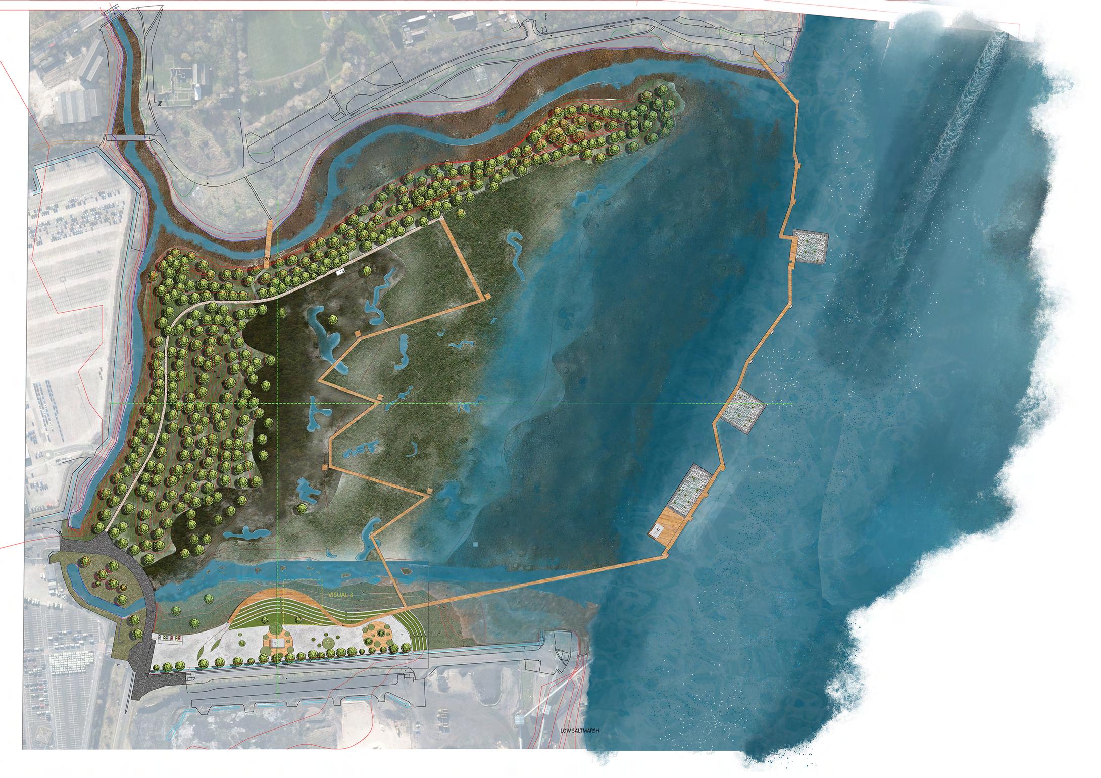
STORM SURGE LEVEL
PROFESSIONAL MANIFESTO
Tides of Transformation embodies my design philosophy of creating spaces that forge deep connections between people and nature, fostering a harmonious balance between the human and non-human elements of our environment. This project has been a journey of discovery, teaching me the profound importance of taking a holistic approach to design. It has shown me that every space has a rich history and ecological context that must be carefully considered, as we cannot truly understand a place without delving into its past.
Through Tides of Transformation, I have embraced the principles of adaptive design, recognizing the need to create resilient landscapes that can thrive in the face of changing environmental conditions. This project has been a catalyst for my creative thinking, pushing me to explore innovative solutions to complex design challenges. However, I have also learned the value of simplicity, understanding that sometimes the most effective solutions are found in the elegance of simplicity.
Tides of Transformation has been a transformative experience, shaping my approach to design and reinforcing my dedication to creating landscapes that are both beautiful and meaningful
REFERENCES
• Jamaica Bay-Rockaway Parks Conservancy. (n.d.). West Pond Living Shoreline Restoration Project. [online] Available at: https://www.jbrpc. org/westpond [Accessed 5 March 2024].
• Landezine. (n.d.). A Resilient Landscape: Yanweizhou Park in Jinhua City by Turenscape. [online] Available at: https://landezine.com/aresilient-landscape-yanweizhou-park-in-jinhua-city-by-turenscape/[Accessed 17 March 2024].
• Littlewood, M. (2012). Landscape Detailing Volume 4. Routledge.
• Littlewood, M. (2012a). Landscape Detailing Volume 2. Routledge.
• Salix Brushwood Faggots Building with Nature. (n.d.).
• South Tyneside Council Strategic Flood Risk Assessment Level 1 & 2 Final Report . (2011). JBA Consultancy.