LANDSCAPE ARCHITECTURE
PORTFOLIO
BRIJESH PAL YADAV

EDUCATION

SUMMARY
SUMMARY
Newcastle upon Tyne, United Kingdom, NE2 1 TZ
+44 -7435674223
brijeshpl92@gmail.com
Links - LinkedIn , Portfolio
Enthusiastic master's student in Landscape Architecture at Newcastle University, blending a strong foundation in Forestry with hands - on experience in sustainable landscape design. Passionate about crafting innovative, environmentally sensitive outdoor spaces, rooted in plant ecology and green material utilisation. Proficient in advanced design software tools such as AutoCAD and Adobe Creative Suite, adept at translating conceptual ideas into eco-friendly designs. Proactive, critical thinker poised to contribute to cutting-edge landscape architecture projects. Eager to apply academic learning and practical experiences to advance sustainable, aesthetically pleasing landscape solutions in a dynamic professional setting.
EXPERIENCE
PROFESSIONAL SKILLS
Young Horticulture Expert (Consultant), 01/2021- 07/2022
At National Highway Authority of India, Dehradun, India
• Developed sustainable plantation proposals, emphasizing ecological benefits.
• Led innovative green space proposals, prioritizing sustainability and ecological restoration.
• Collaborated with diverse team of engineers and contractors to integrate ecological principles into designs, ensuring project alignment and sustainability.
• Supervised landscaping and plantation operations.
• Conducted site surveys for project planning.
Horticulture Assistant, 08/2019 - 11/2020
At Haryana Nursery , Haryana, India
• Holistic Plant Care Management
• Species Expertise
• Assisted Landscape projects with Plant Selection
• Target-focused
• Passionate about Landscape
• Teamwork & Communication
• Horticulture Expertise
• Plantation Strategies
• Ecology
Master of Landscape Architecture (MLA), Newcastle University , Newcastle upon Tyne, UK
September 2022 - Present (2 Year Program)
• Engaged in advanced coursework focused on sustainable urban landscape design, ecological restoration, and Urban green spaces & Sustainability.
• Participated in design studios, applying theoretical knowledge to real-world scenarios, with emphasis on sustainable urban redevelopment, green infrastructure design, and revitalizing urban brownfield sites.
MSc Forestry, Forest Research Institute , Dehradun, India
July 2017 – June 2019 (2 Year Program)
• Specialization in Urban Forestry and Sustainable Forest Management
• Plantation Management
• Environment Impact Assessment
• Conducted a comprehensive study on the impact of urban development on local forest ecosystems, proposing strategies for integrating forest conservation in urban planning.
• Master’s Thesis on “Evaluation of Air Pollution Tolerance Index of Cascabela thevetia and Cascabela thevetia var. alba in Dehradun ”.
BSc (Hons.) Zoology, Delhi University , Delhi, India
July 2014 – May 2017 (3 Year Program )
• Ecology
• Environment Management
• Human Physiology
LANGUAGES English Hindi
SOFTWARE SKILLS
• Excellent Creative & Problemsolving Skills.
• Design Skills
• Sustainable Approach
• Conceptual Design
• Site Analysis
INTERESTS & HOBBIES
• Autocad
• Adobe creative cloud
• Indesign
• Adobe Photoshop
• GIS
• Microsoft Office
• Photography
• Volleyball
• Traveling
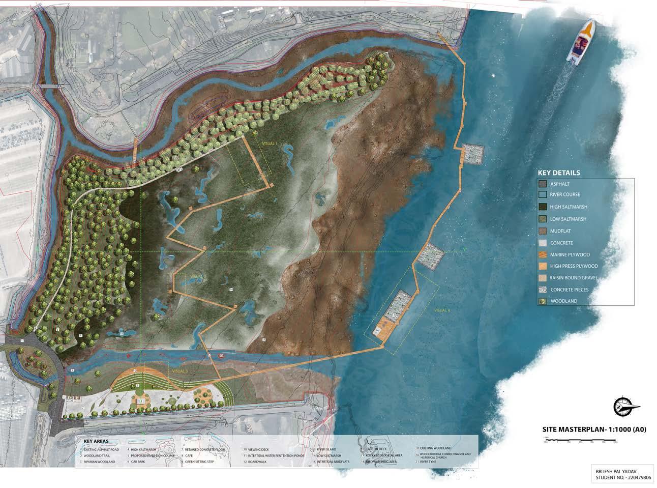
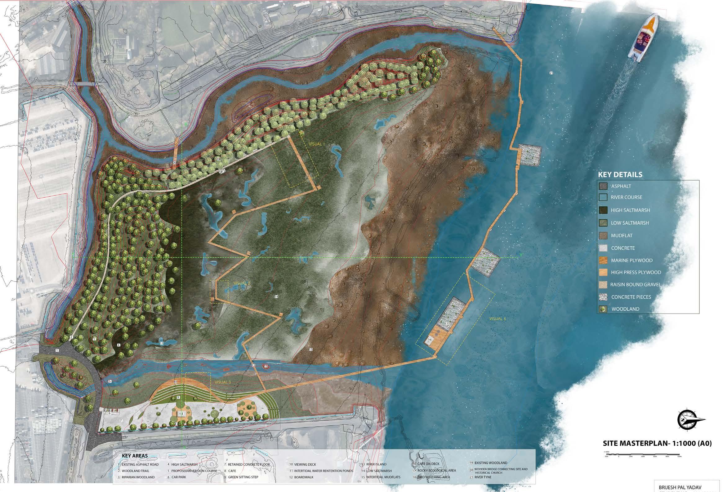
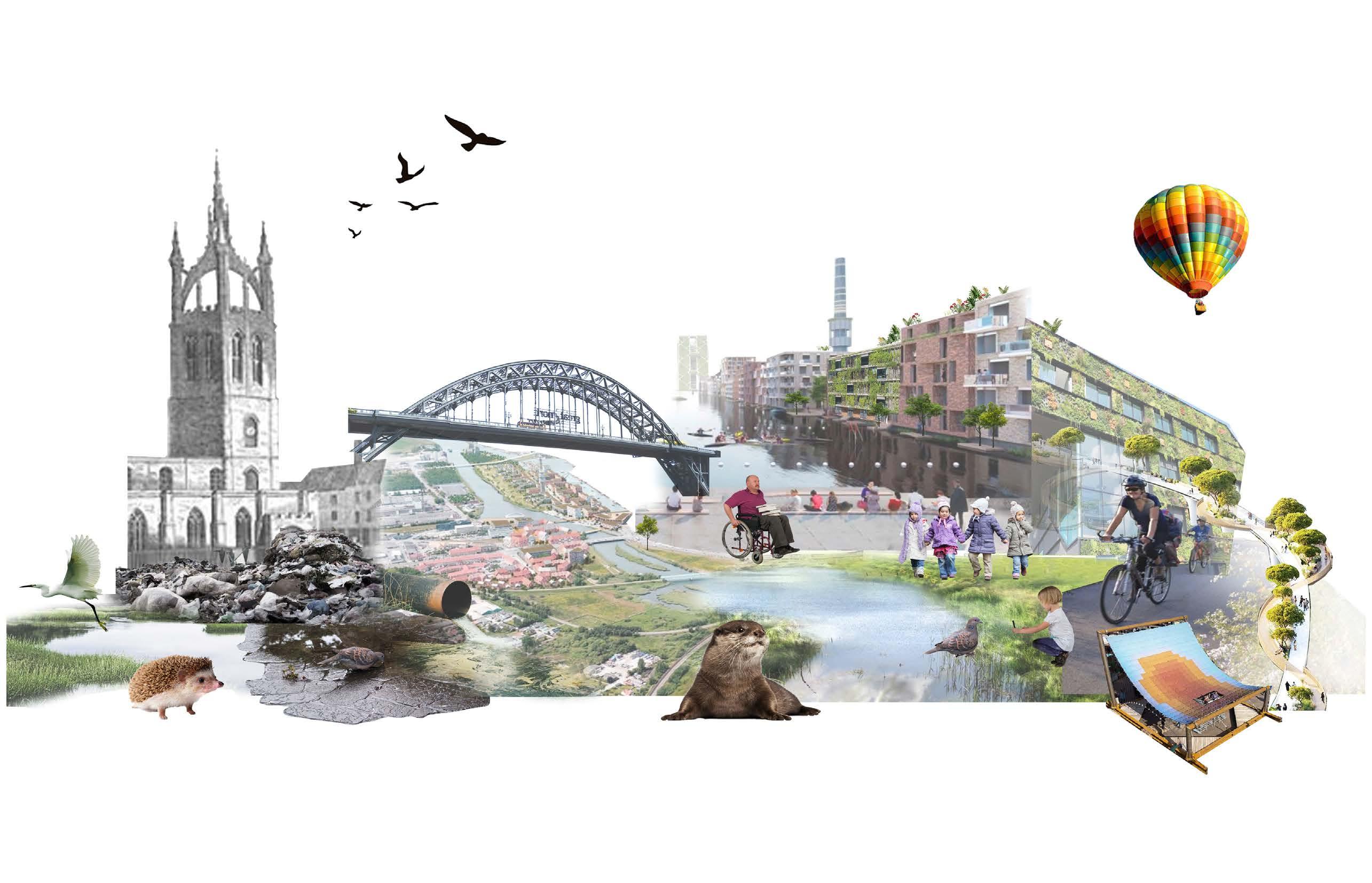
DESIGN THESIS - TIDES OF TRANSFORMATION
ECOLOGICAL RESTORATION PLANTATION DESIGN
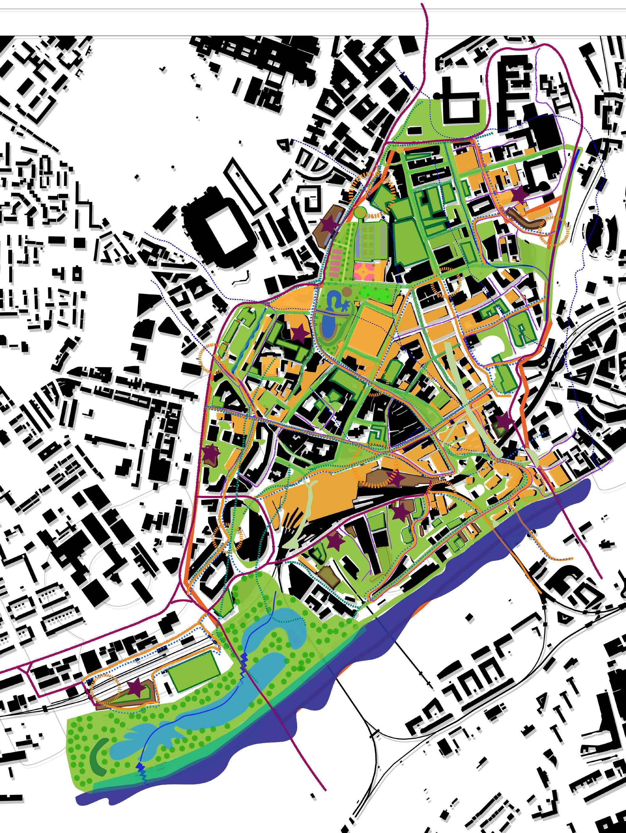
MASTERPLANNING NEWCASTLE ‘RESILIENT CITY- 2050’
PAGE : 5-8 PAGE : 1-4 PAGE : 9-12
MULTISPECIES MASTERPLAN

HIGHWAY PROJECT
PHOTOGRAPHY
Reclaiming Nature, Reinventing Space
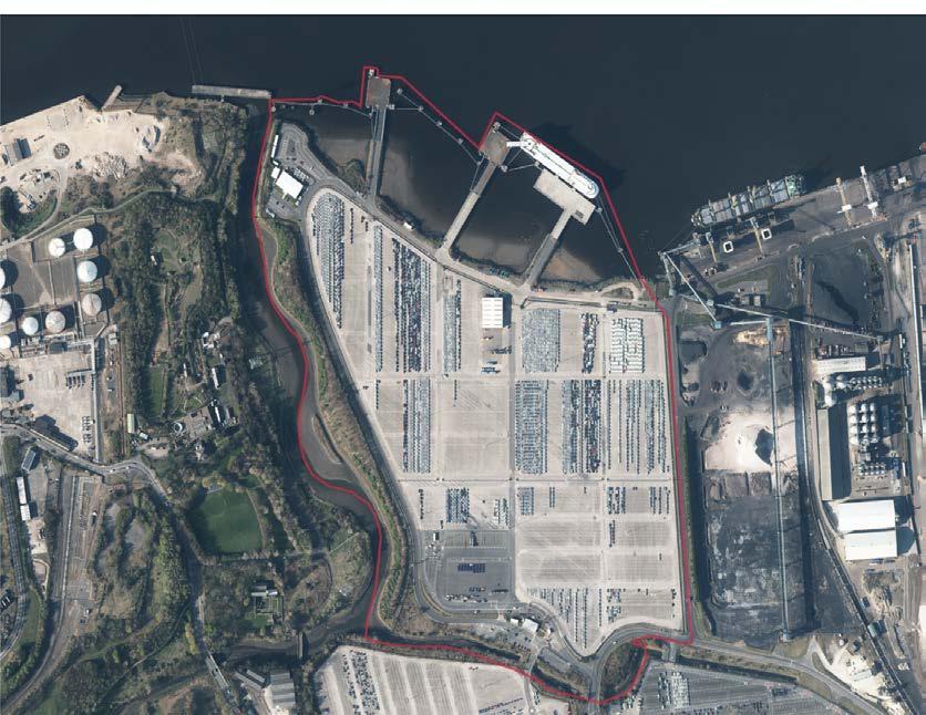
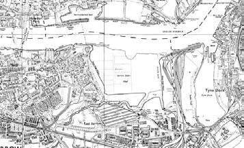
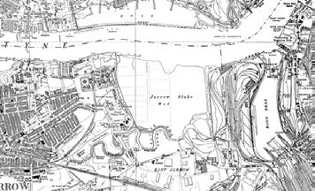
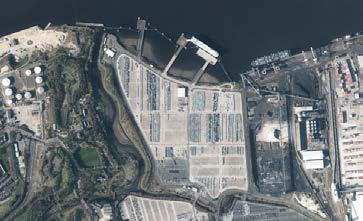
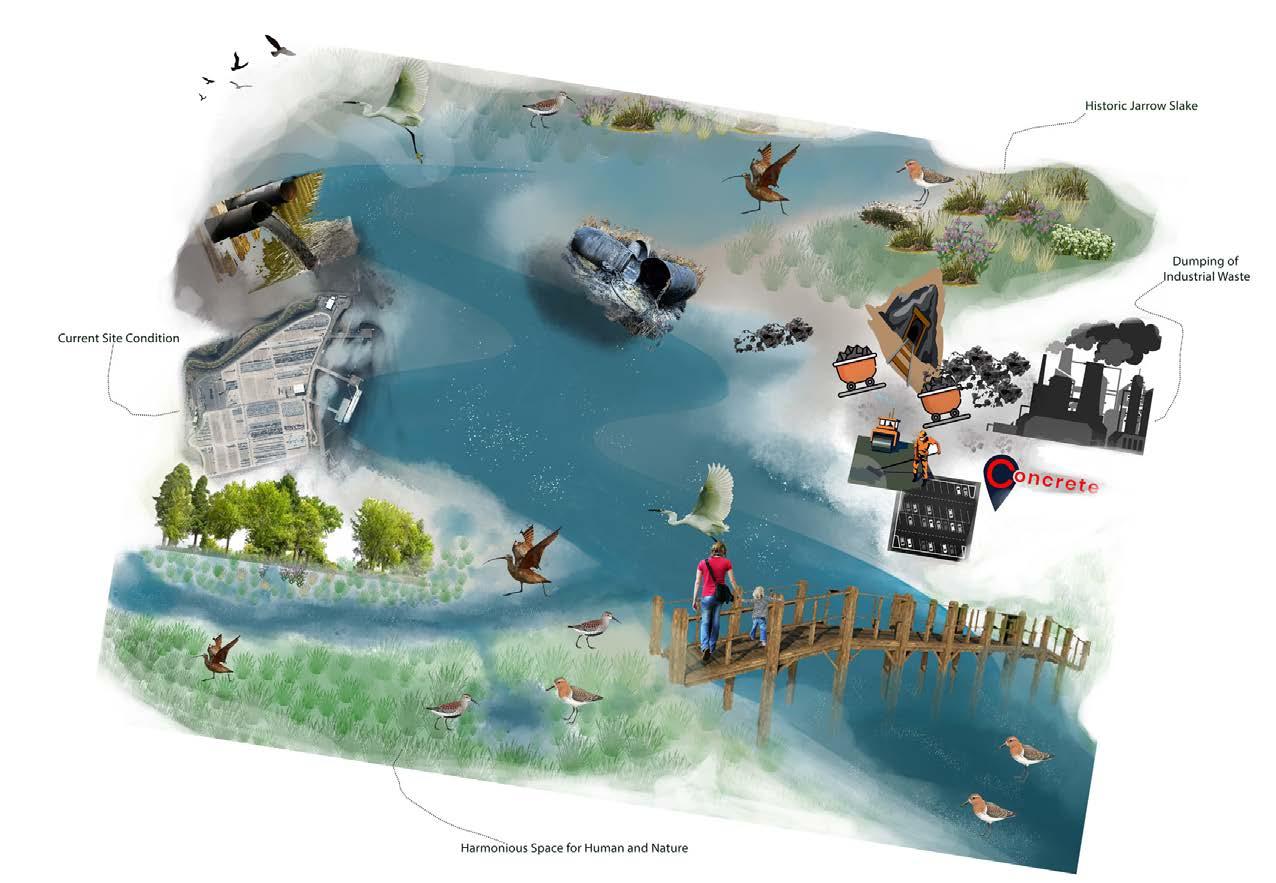
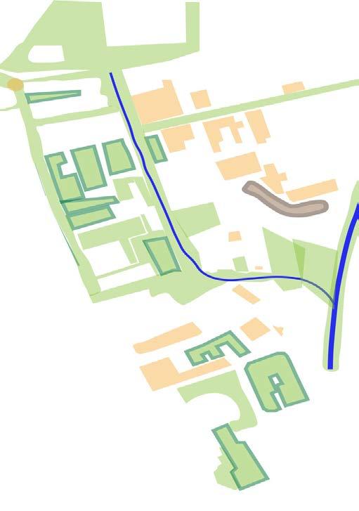
• Site Location - The site is situated in Jarrow, South Shields, encompassing an approximate area of 40 hectares.
• Current Usage - Currently, the site serves as a car park utilized by Nissan Automobile Company for parking vehicles before exportation.
• Historical Significance - site used to be a ecologically signifacnt mudflat and salt marsh area.
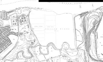
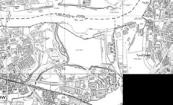
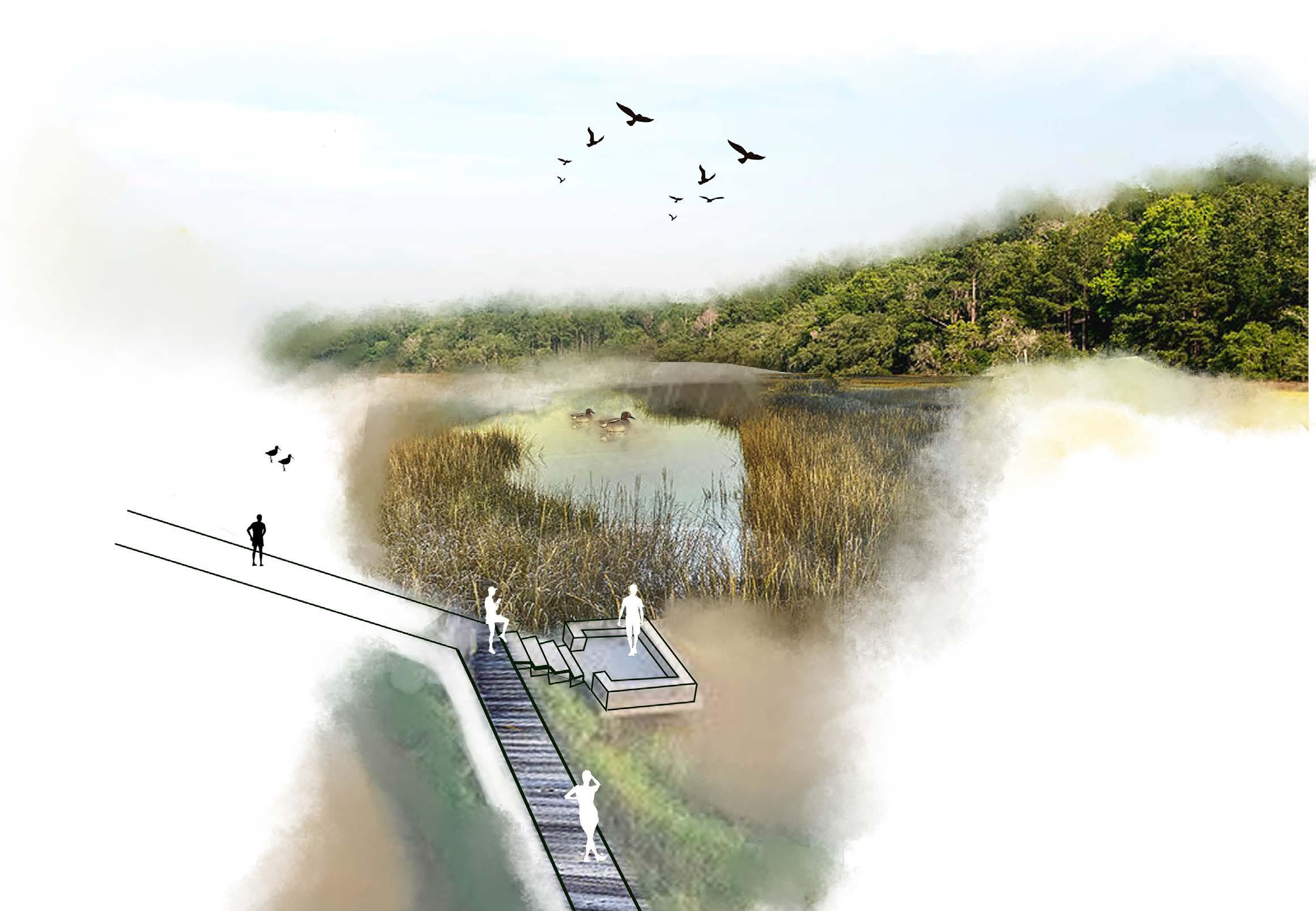
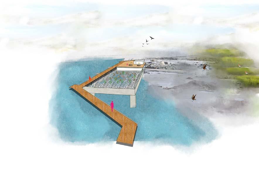
My design vision for the thesis is to transform Jarrow Slake into a resilient space prepared for future challenges. Envisioning a scenario in 2050 with reduced reliance on private vehicles, the project aims to repurpose the existing car park to adapt to rising sea levels, predicted to reach 1.5 meters due to climate change. Through innovative design interventions, the site will become a model of sustainability, balancing ecological resilience with the evolving needs of the community
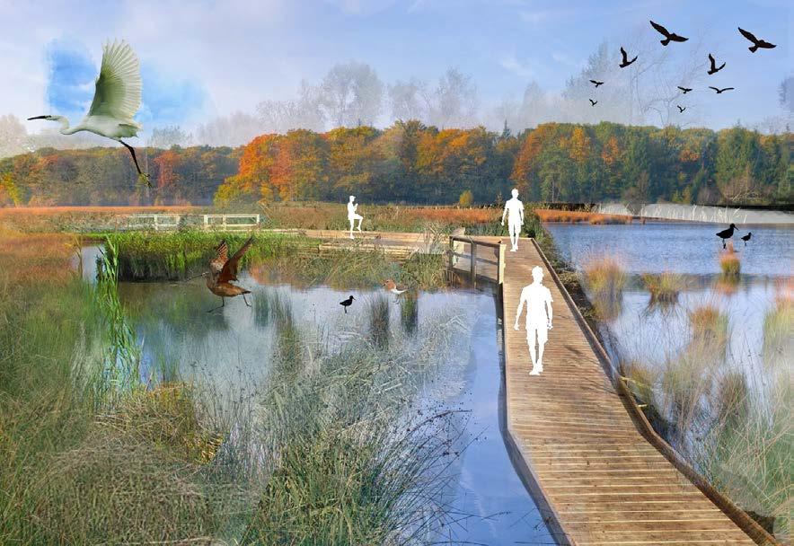
Inspired by the principles of sponge city design and the site’s historical evolution, my concept seeks to harmonize human activities with nature’s rhythms. Embracing a philosophy of creating balanced spaces, the design endeavors to restore the site’s historical mudflat & salt marsh, introduces a riparian woodland and enhances the existing woodland ecosystem. Through these nature-based solutions, the project not only mitigates flood risks and enhances biodiversity but also revitalizes the human-nature relationship, fostering resilience and sustainability within the landscape.
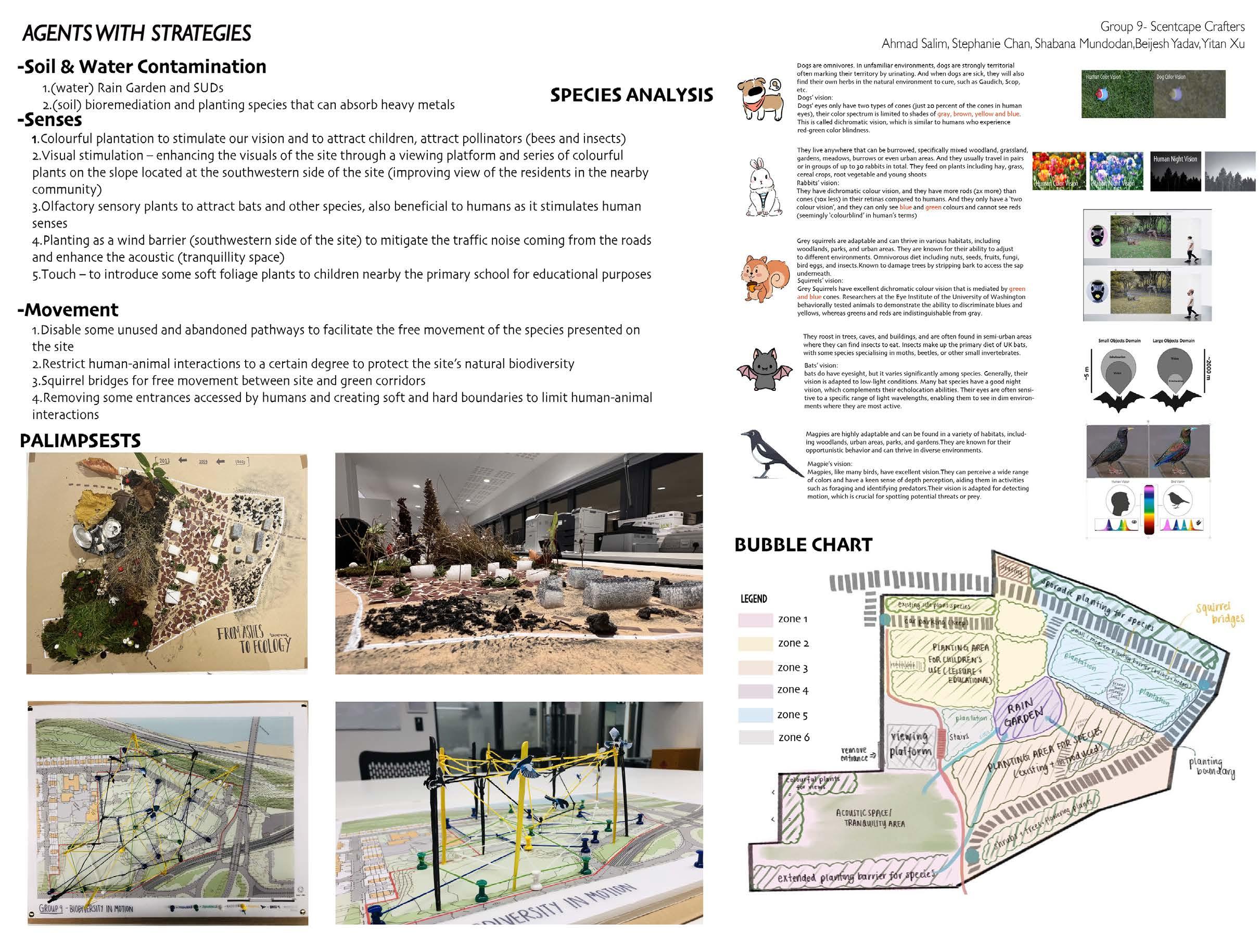
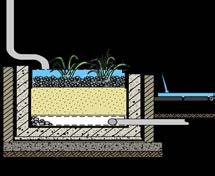
Soil & Water Contamination: -
1. (water) Rain Garden and SUDs
2. (soil) bioremediation and planting species that can absorb heavy metals
-Senses
1. Colourful plantation to stimulate our vision and to attract children, attract pollinators (bees and insects)
2. Visual stimulation - enhancing the visuals of the site through a viewing platform and series of colourful plants on the slope located at the southwestern side of the site (improving view of the resi dents in the nearby community)
3.0lfactory sensory plants to attract bats and other species, also beneficial to humans as it stimulates human senses
4. Planting as a wind barrier (southwestern side of the site) to mitigate the traffic noise coming from the roads and enhance the acoustic (tranquillity space)
5. Touch - to introduce some soft foliage plants to children nearby the primary school for educational purposes
-Movement
1. Disable some unused and abandoned pathways to facilitate the free movement of the species presented on the site
2. Restrict human-animal interactions to a certain degree to protect the site’s natural biodiversity
3. Squirrel bridges for free movement between site and green corridors
4. Removing some entrances accessed by humans and creating soft and hard boundaries to limit human-animal interactions
BUBBLE CHART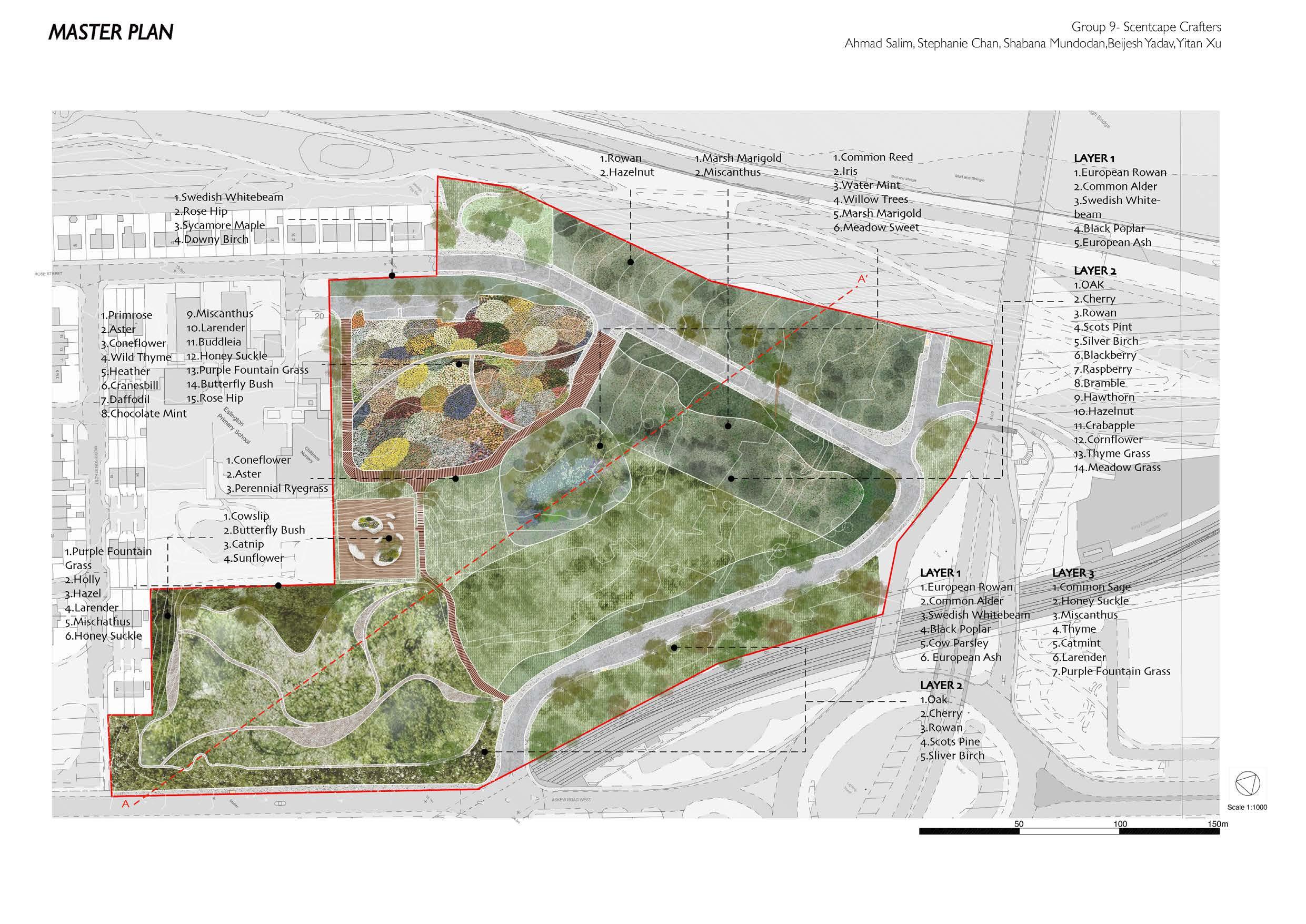
‘RESILIENT
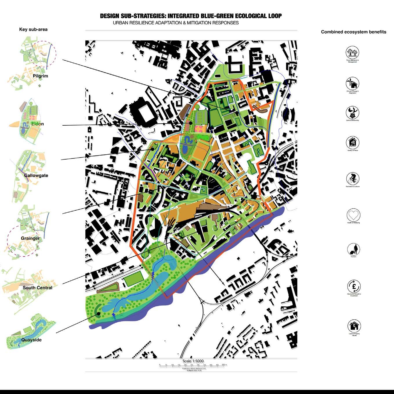
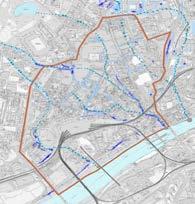
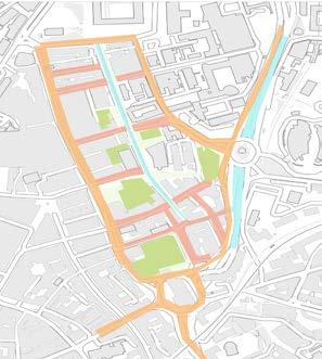
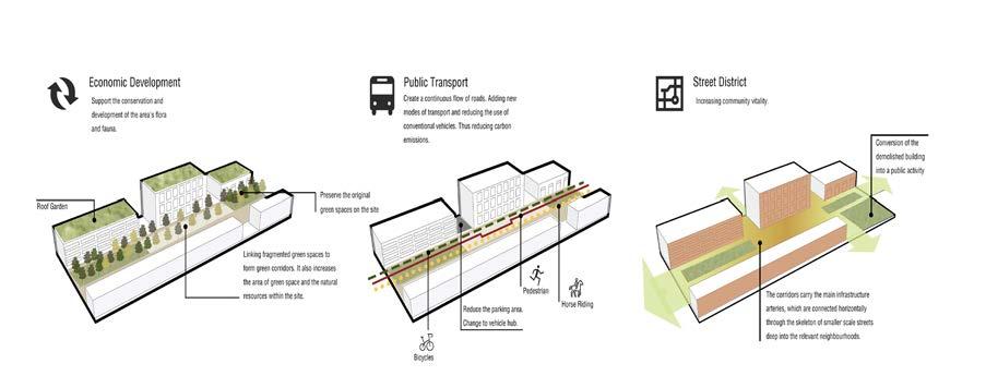
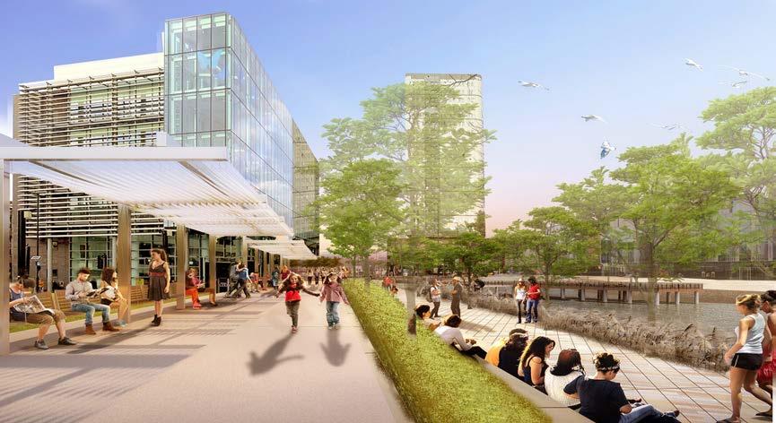
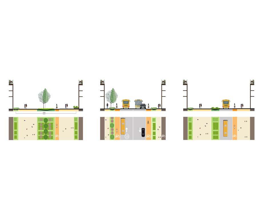
This is a large-scale master planning project devised to enable you to creatively apply advanced planning and design skills to contemporary landscape and urban issues which can occur in the nearby future. Cities are constantly evolving and adapting to social, economic and political changes. In the past couple of years, the Covid-19 pandemic has accelerated this change, bringing with it a need to reimagine city life.
In 2020, city centre footfall decreased dramatically as office workers shifted to home working, and retail and hospitality cores closed. 2020 also brought other changes through the need for social distancing and staying local or at home:
- a shift towards other forms of sustainable transport (walking and cycling), as public transport was discouraged.
- a reconnection with people’s immediate environments and communities.
- an urge to access green spaces for health and well-being – which are close by and safe.
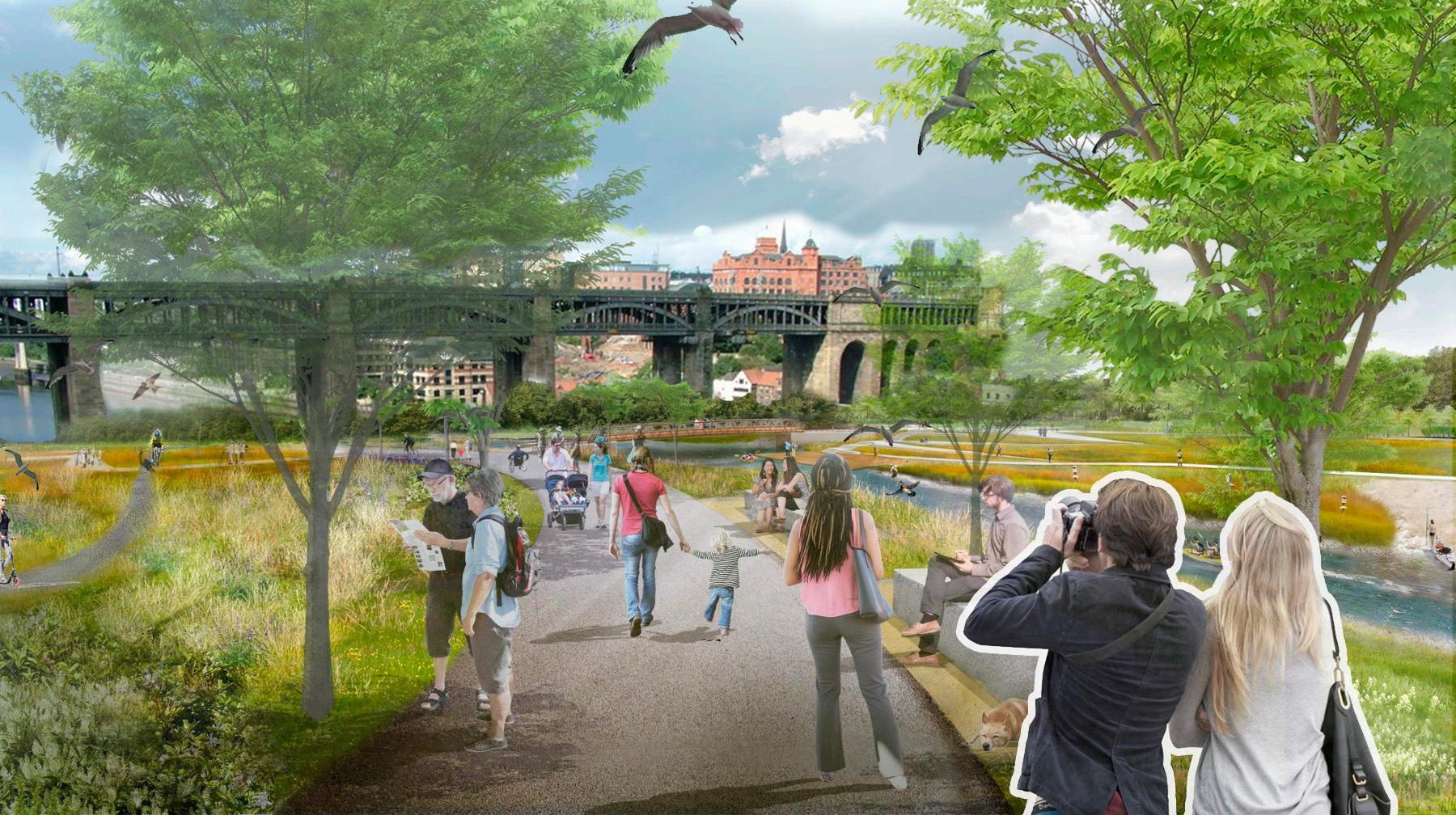
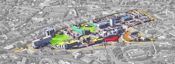
SYNCHRONICITY
happening, existing, or arising at precisely the same time
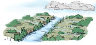
SYNCHRONICITY is a convergence: of times past, present and future, and of delivering co-benefits through greenblue infrastructure spatial design.
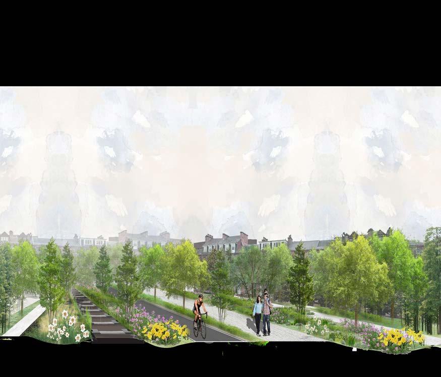
Our strategy jumps back to the past to find inspiration for streetscape character, landscape architecture and nature-based resilience.
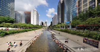
A signature design feature of SYNCHRONICITY is the partial daylighting of Newcastle’s lost urban rivers. Using the existing river hydrology and pluvial flood data we re-create a framework to map an integrated city-wide green-blue infrastructure.
In 2050 Newcastle’s lost rivers will be critical natural assets for urban resilience to climate impacts and population growth/density.
It is time for Newcastle’s lost rivers to be uncovered and brought into the light.
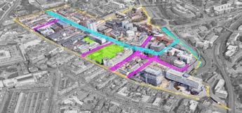
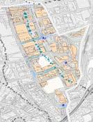

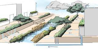
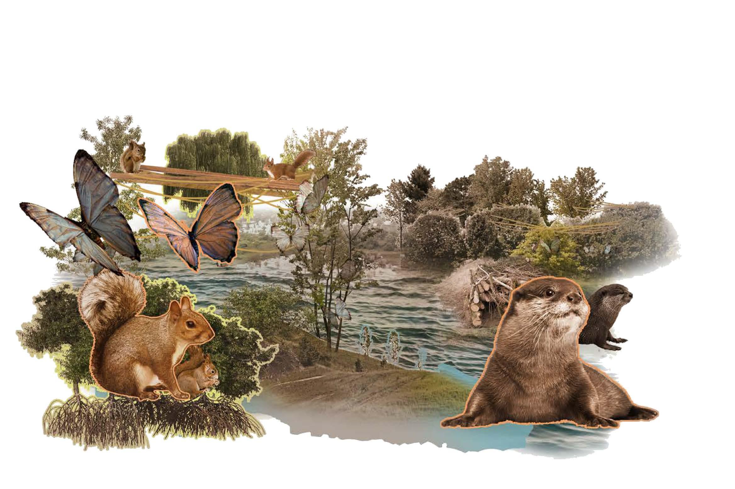
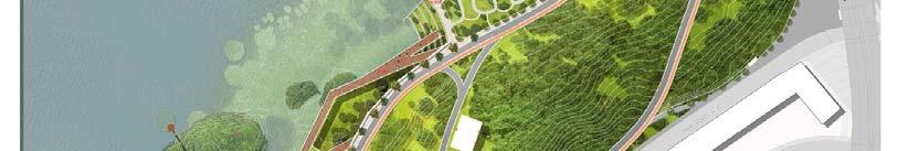
Riverside area can serve as a space where we can establish wetland habitat which will improve the biodiveristy of the site.
River island is introduced to diverge and slow down the river flow which will create a wetland habitat
Selected palnt species in wetland habitat will help in purifying riverwater by absorbing heavy metals and excessive component like nitrogen, and creates a fresh ecosystem for Otters and other species.
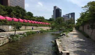
Existing Site View
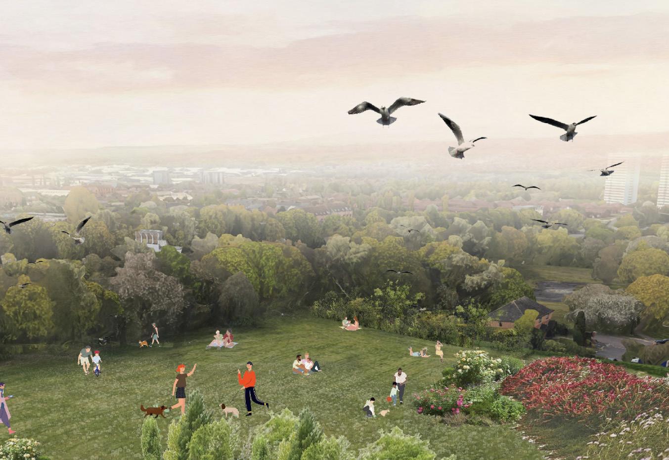
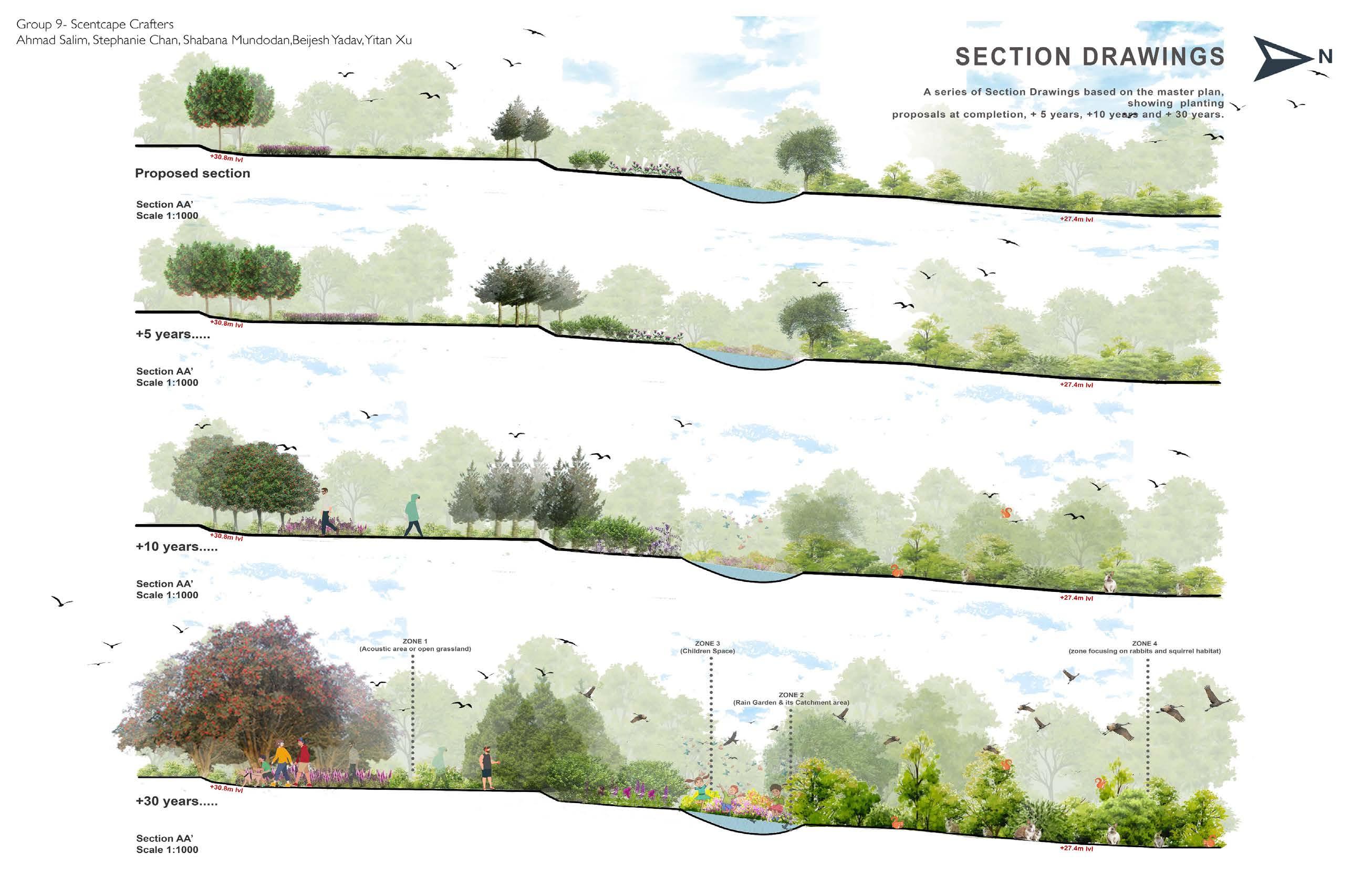
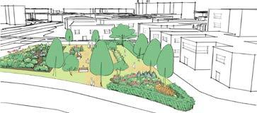
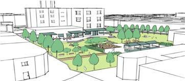
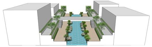
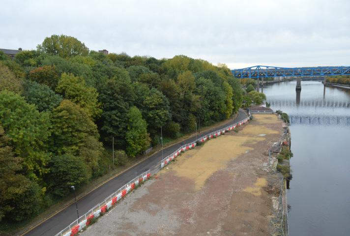
This project focuses on city inhabitants that are often overlooked in design: animals. The purpose of the project is to reflect on and consider non-humans as end users of a designed landscape. For this project we were given Gateshead riverside park as our final site for the masterplan. Gateshead Riverside Park can become a unique riverside asset, that links Gateshead Quays with Dunston Staithes and the communities which surround it. The park is located on the banks of the Tyne and has an extensive continuous woodland that runs parallel to the river, some pedestrian and cycle routes, and a road that currently bisects the park: Pipewellgate. The park is also home to an arts trail with several sculptures scattered throughout the park. Despite its high-profile location, the park is currently underused and has the potential to become a unique asset for leisure, recreation and arts venue activities.
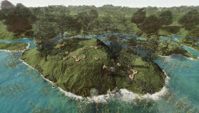
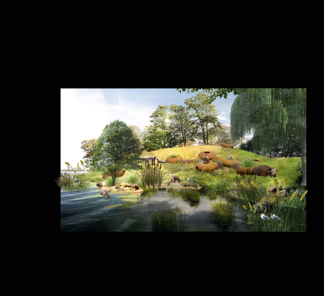

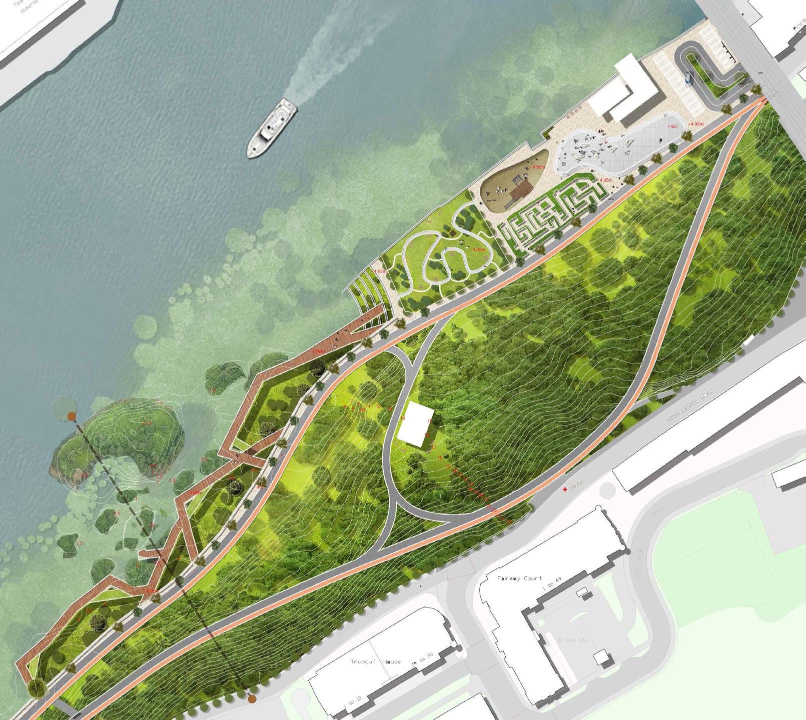
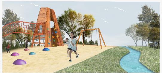
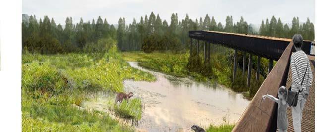
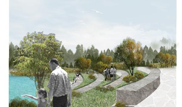
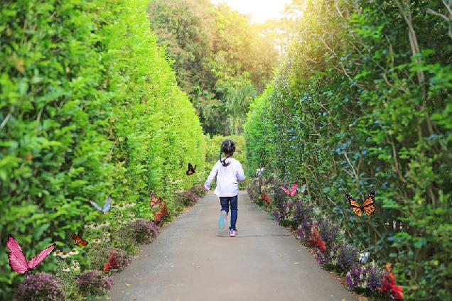
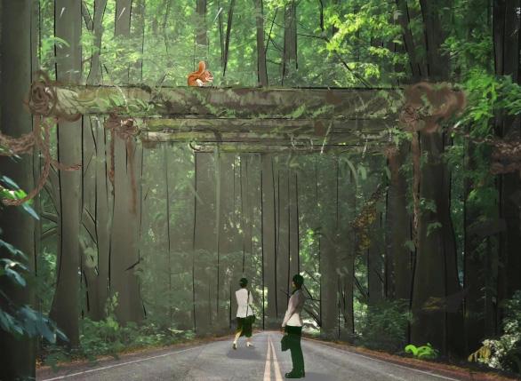 Illustration - Play Area
Illustration - Deck
Seating Area
Butterfly Maze
Illustration - Play Area
Illustration - Deck
Seating Area
Butterfly Maze
Site Constraints and Opportunites
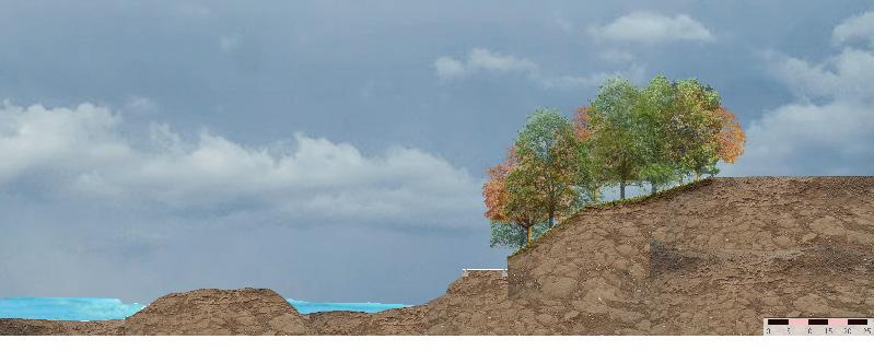
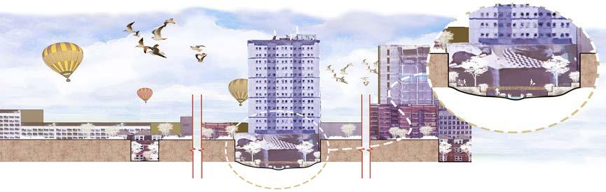
Existing Section with the Proposed Island created
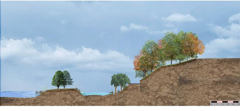
Site Zoning
Site Developmments
Planting interventions in 10 years time
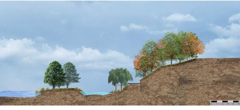
Planting interventions in 30 years time
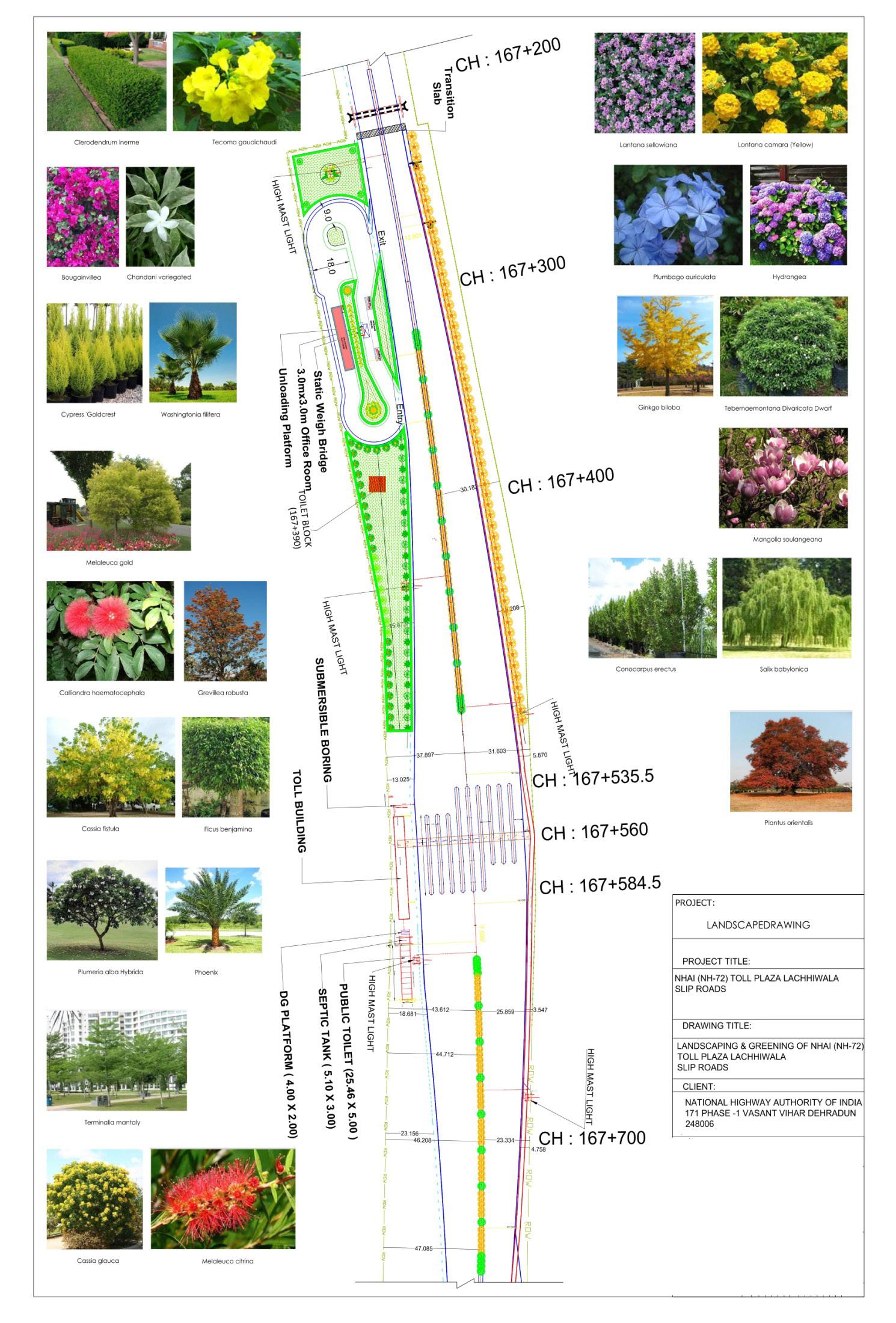
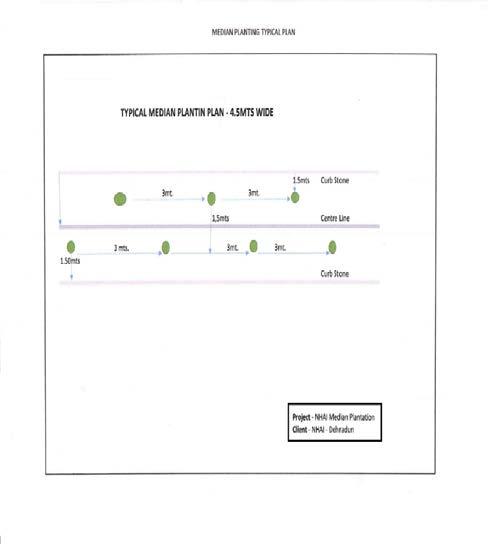
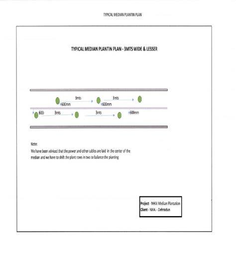
During 2021, I got the opportunity to work with the National Highway Authority of India (NHAI) as a Young Horticulture Expert for a period of one and half year during which I got involved in many plantation and landscaping related projects along the national highway72 which connects the National Capital – Delhi to the capital of Uttarakhand state (Dehradun). The total length of the project under our team stretches across 21.4 km, which crosses through urban areas, forest, and rural areas. Besides the beautification of these selected few selected sites, median plantation was an important part of the project as it was a necessary tool for mitigating vehicular air and noise pollution. So, it was very important to select plant species which along with beautifying this long stretch of highway median area also act as a natural barrier preventing traffic lights from the opposite sides to cross and distracting the drivers. Plant species are selected based on the soil and climatic conditions. Three plant species were selected for median plantation in the project area – Tecoma stans, Tabernaemontana divaricata (chandani – local name), Bougainvillea sps.
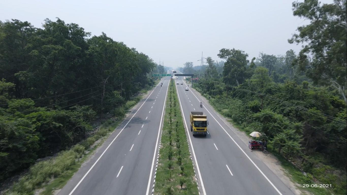
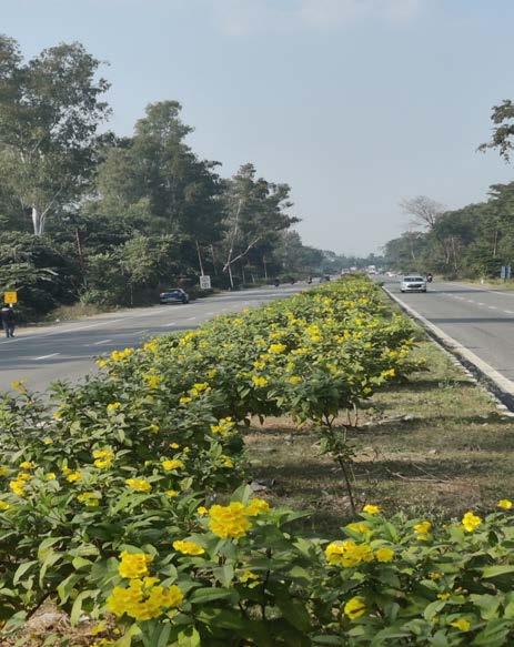
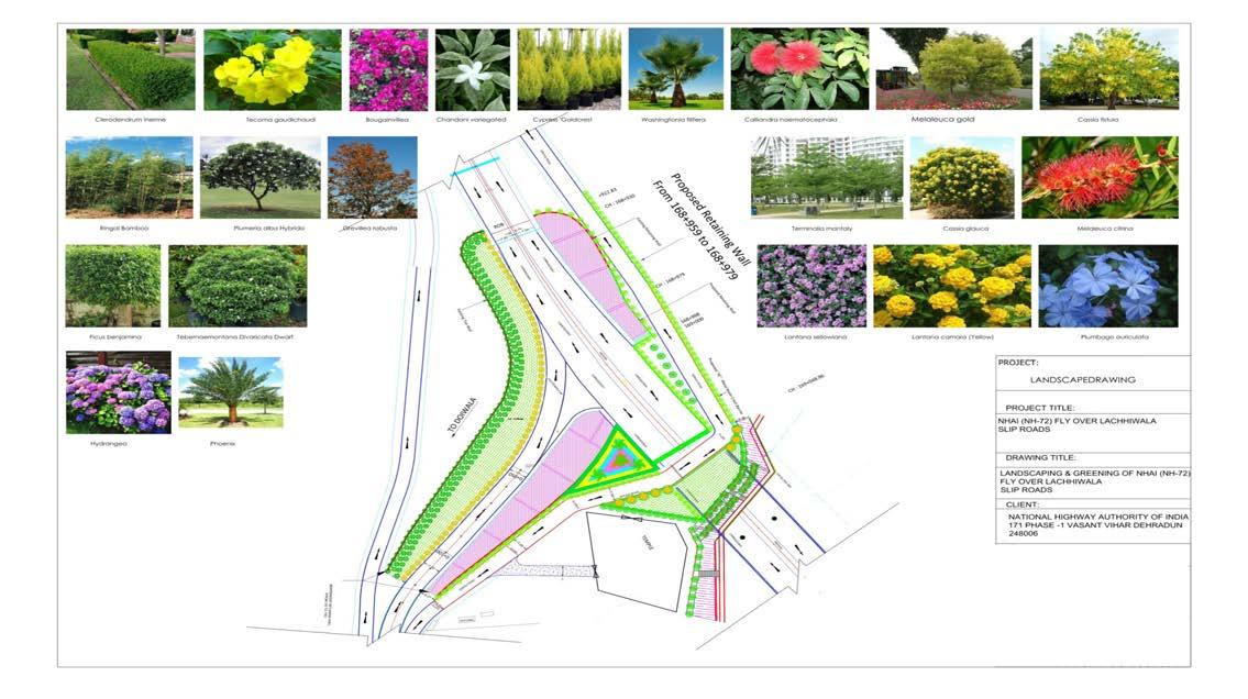
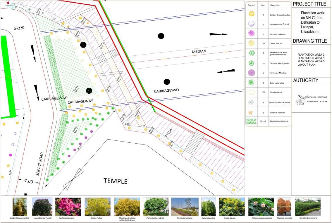 Aerial view of median plantation Median plantation in bloom
Three plant species were selected for median plantation in the project area – Tecoma stans, Tabernaemontana divaricata (chandani – local name), Bougainvillea sps.
Aerial view of median plantation Median plantation in bloom
Three plant species were selected for median plantation in the project area – Tecoma stans, Tabernaemontana divaricata (chandani – local name), Bougainvillea sps.
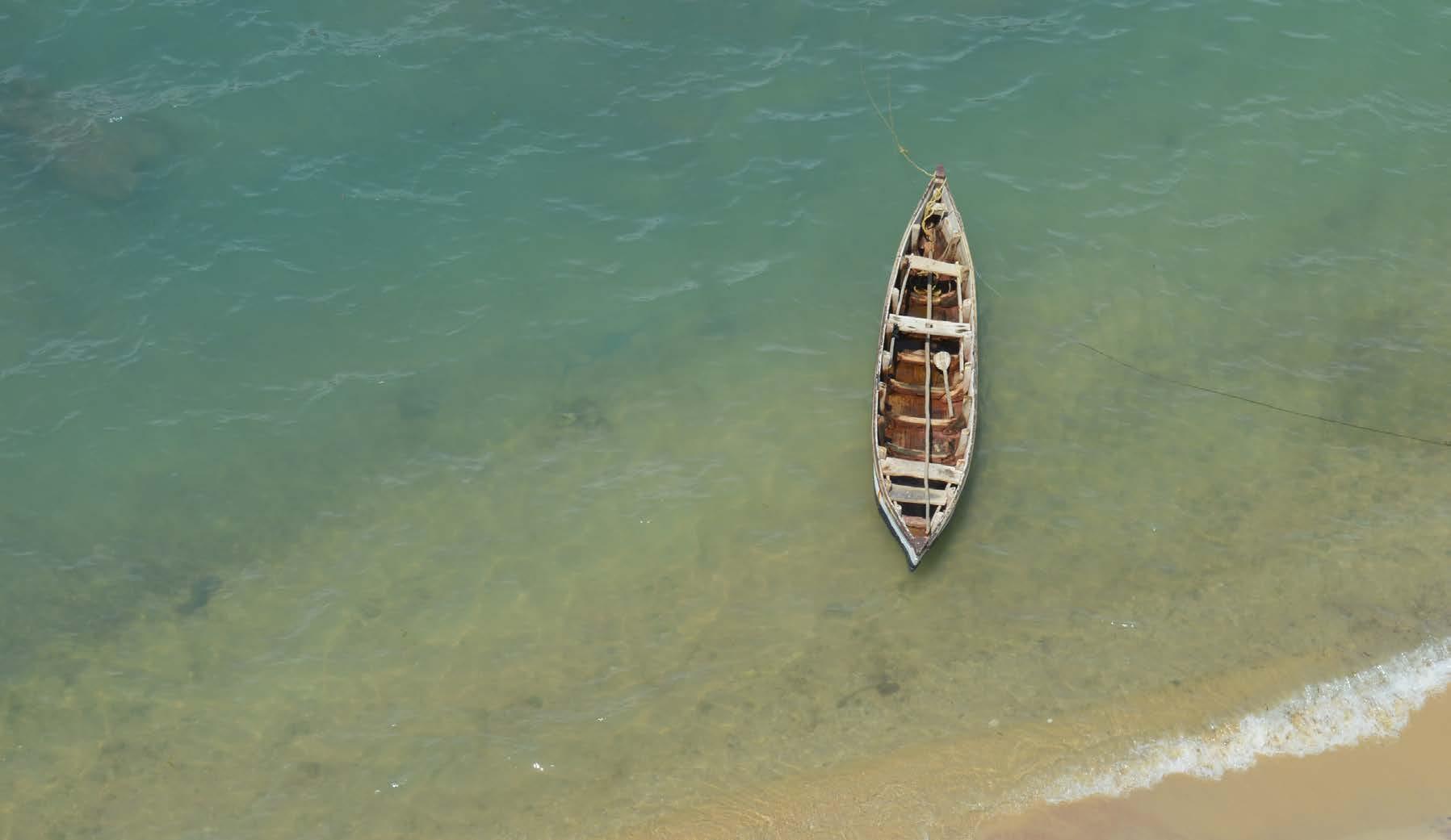
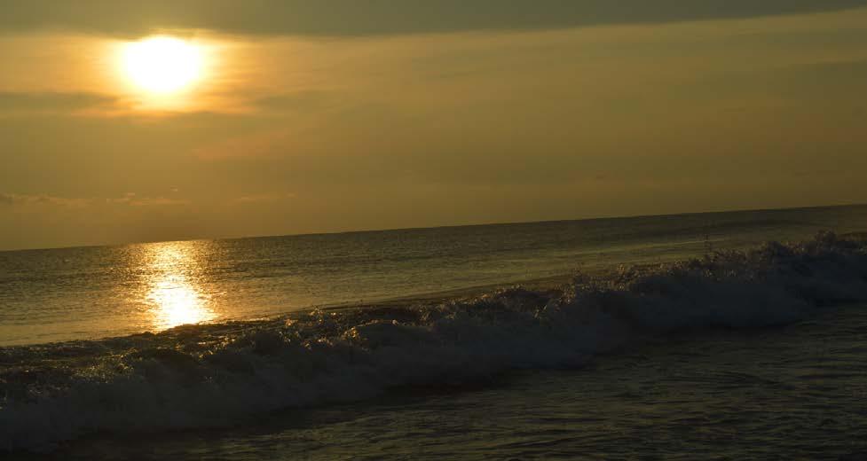
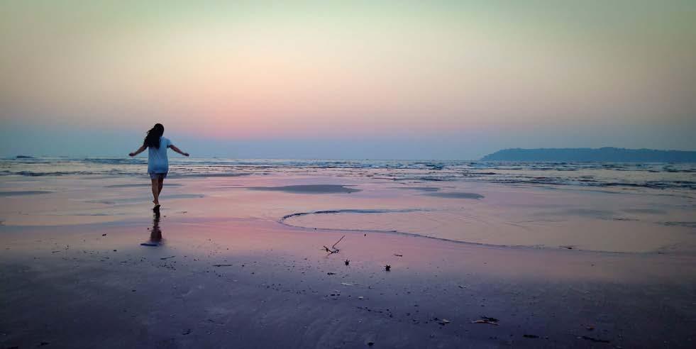
My photography collection encapsulates a visual odyssey through diverse landscapes, showcasing my passion for travel and photography alongside my expertise in landscape architecture. From the lofty peaks of the Himalayas to the rhythmic dance of ocean waves and some tranquil moments in the chaotic world of wildlife, my photography speaks to the soul of nature. These captured moments not only highlight my proficiency in the art of photography but also reveal the facets of my personality beyond the drafting table of landscape architecture. Through this collection, I invite you to witness the fusion of my skills and passions, seamlessly interwoven in a captivating showcase that extends beyond the boundaries of conventional design, resonating with the heart of every adventurer and nature enthusiast.


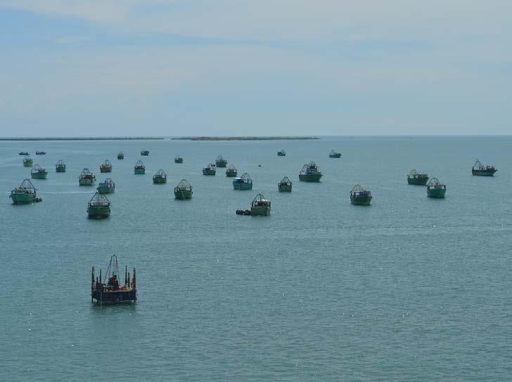 Rameshwaram, India
Indo-Srilanka Border
Tamil Nadu, India
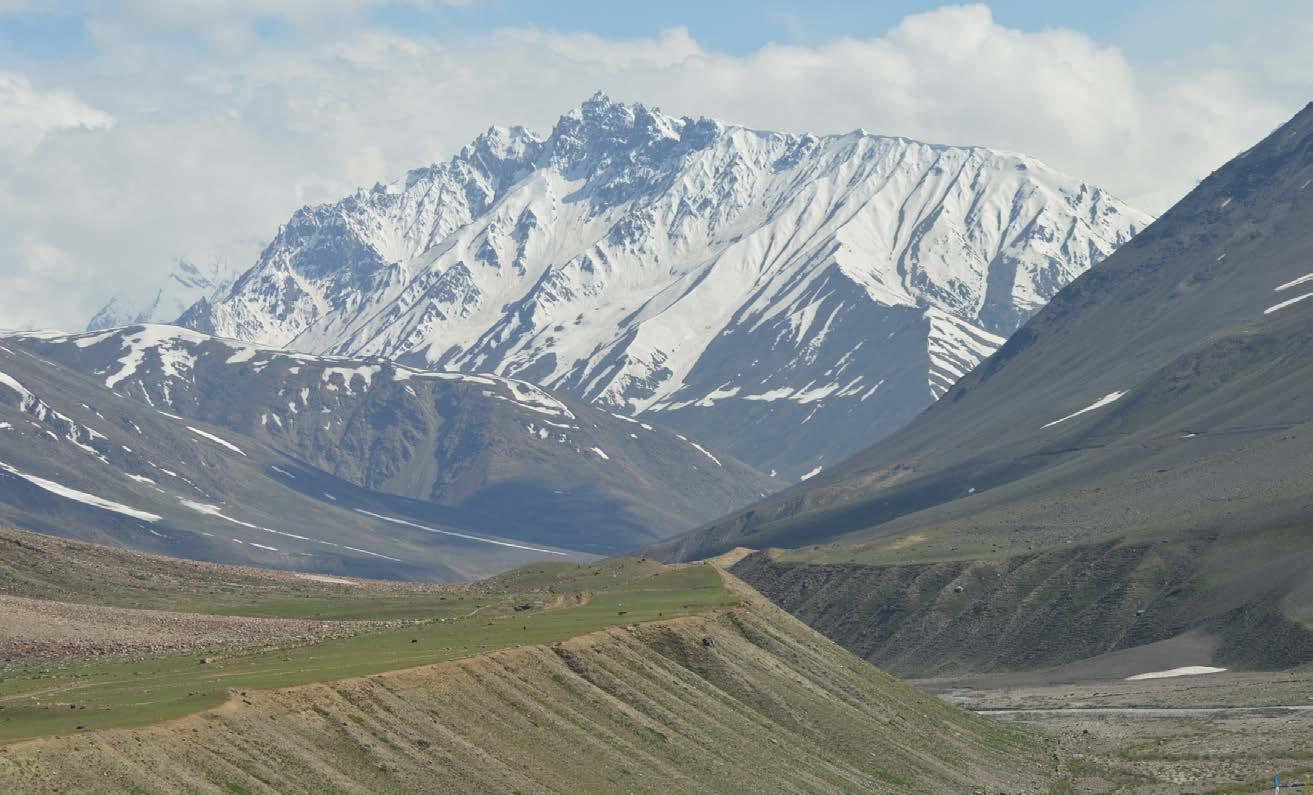
Pin Valley National Park, India
Rameshwaram, India
Indo-Srilanka Border
Tamil Nadu, India
Pin Valley National Park, India
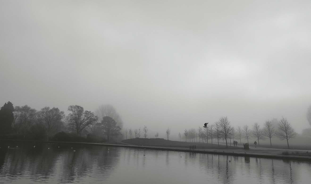
 Exhibition Park, Newcastle, UK
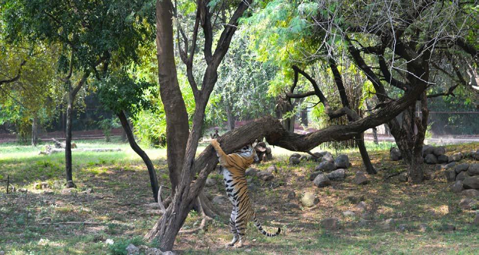
Bannerghatta National Park, India
Kerala, India
Goa, India
Himalyan Cold Dessert, Spitti, India
Exhibition Park, Newcastle, UK
Bannerghatta National Park, India
Kerala, India
Goa, India
Himalyan Cold Dessert, Spitti, India
b.p.yadav2@newcastle.ac.uk brijeshpl92@gmail.com
07435674223