
Curriculum Vitae of
Curriculum Vitae of
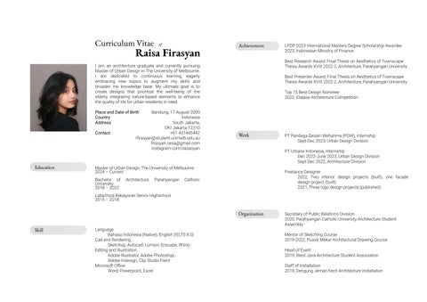
I am an architecture graduate and currently pursuing Master of Urban Design in The University of Melbourne. I am dedicated to continuous learning, eagerly embracing new topics to augment my skills and broaden my knowledge base. My ultimate goal is to create designs that prioritize the well-being of the elderly, integrating nature-based elements to enhance the quality of life for urban residents in need.
Place and Date of Birth
Country Address
Contact Bandung, 17 August 2000 Indonesia South Jakarta, DKI Jakarta 12310 +61 431445442 rfirasyan@student.unimelb.edu.au firasyan.raisa@gmail.com instagram.com/raisasyan
Education
Master of Urban Design, The University of Melbourne 2024 – Current
Bachelor of Architecture, Parahyangan Catholic University 2018 – 2022
Labschool Kebayoran Senior Highschool 2015 – 2018
Language
Bahasa Indonesia (Native), English (IELTS 8.0)
Cad and Rendering
Sketchup, Autocad, Lumion, Enscape, Rhino
Editing and Illustration
Adobe Illustrator, Adobe Photoshop,
Adobe Indesign, Clip Studio Paint
Microsoft Office
Word, Powerpoint, Excel
Achievement
Work
LPDP 2023 International Masters Degree Scholarship Awardee 2023, Indonesian Ministry of Finance
Best Research Award: Final Thesis on Aesthetics of Townscape Thesis Awards XVIII 2022-2, Architecture, Parahyangan University
Best Presenter Award: Final Thesis on Aesthetics of Townscape Thesis Awards XVIII 2022-2, Architecture, Parahyangan University
Top 15 Best Design Nominee 2022, Etalase Architecture Competition
Organisation
PT Pandega Desain Weharima (PDW), Internship Sept-Dec 2023, Urban Design Division
PT Urbane Indonesia, Internship Dec 2022-June 2023, Urban Design Division Sept-Dec 2022, Architecture Division
Freelance Designer
2022, Two interior design projects (built), one facade design project (built) 2021, Three logo design projects (published)
Secretary of Public Relations Division
2020, Parahyangan Catholic University Architecture Student Assembly
Mentor of Sketching Course
2019-2022, Puslat Mekar Architectural Drawing Course
Head of Event
2019, West Java Architecture Student Association
Staff of Installation
2019, Dengung Jemari Kecil Architecture Installation
curated design archive, 2019 - 2024 of

Content
Inside-Out Transit Oriented Development
Unpar Cikamuning Campus Masterplan
Omah Eyang Senior Housing
Final Thesis: Architectural Complementarity of Urban Natural and Man-Made Elements in Disclosing Functional Townscape
Architectural Hand Drawings
Architectural Media

Location
Year
Advisor
Project Type
Urban Design Studio B
Transit Oriented Development Box Hill, VIC 2024
Michael Powell, SOM
Academic, group work
Reimagining Box Hill as a thriving “transit hub where community meets nature,” this project aims to create a vibrant green urban center for its diverse community.
By relocating density to the site’s perimeter, this design keeps the heart of the transit area open and communityfocused, embracing human scale. With a fourfold increase in density, the project promotes sustainable living, social and physical connections, blending green spaces with an active city core.
Precedent and proximity study, 3D modelling of masterplan (community area, incubation hub, pedestrian bridge, streetscapes), 3D visualisation for man-eyed view and semi-aerial view illustrations, conceptual diagrams, massing strategy diagrams. All images displayed are of personal output and/or contains contribution.
Softwares used: Sketchup, Enscape, Adobe Illustrator, Adobe Photoshop, Adobe Indesign


The design process stems from the existence of the shopping centre, train station, tram line, bus terminal, and upcoming SRL
Preserved heritage and retail core, highlight on new transit and community core, and increase around 4 times the original FAR

To enhance connectivity and community amenity, we have introduced a pedestrian bridge that connects across various parts of the masterplan.
The elevated bridge serves many functions such as providing a safe and connected transit experience, connecting a variety of communal activities, and promoting health and wellness in living.
Bridge above Station St
The density is distributed along the outer edges, allowing to maintain a more human-scale central core with green open spaces surrounding the transit and community core
The elevated pedestrian bridge weaving across the various elements is added, providing ease of access throughout the site and enhancing the value of developments even those that are bordered by rail tracks and main roads

This is a view on the bridge showing the running track that runs across the loop, trees and canopy to provide shaded spaces, nature and planting to improve overall quality of space, and overall a safe pedestrian space that protects from the heavy traffic
Whitehorse Road Section


Adjustments to narrow the Whitehorse road, allowing to shift the tram station closer to transit plaza, set up bicycle lane , and the remaining space becomes a bioswale garden to store water as secondary water supply for surrounding

Bus station is relocated to Station St under the bridge and rainwater catchment system is utilised to collect resources from swale to pump water back to the elevated garden.


Street View Community Garden


Project
Function
Location
Year
Institution
Supervisor
Project Type
Closed Competition (Winner) University Campus Cikamuning 2023
PT Urbane Indonesia
Ismail Reza Professional, Team
Visioning masterplan of Parahyangan Catholic University located in Cikamuning, West Bandung. Coincidentally also my alma mater. The competition was held during my internship in PT Urbane Indonesia, urban design division.
I received the honour to learn from my supervisors and seniors, and was given the chance to contribute directly in this project starting from site visit through final presentation.
Precedent and proximity study, conceptual diagrams, design key points diagrams, facade designs (academic buildings, student housing, and student center), minor in planting schedule, 3D visualization for several man-eyed view illustrations. All images displayed are of personal output and/or contains contribution.


Seamless accessibility between vibrant social hubs, each dedicated to distinct functions like housing, sports, and libraries. Connecting these hubs is a lush green spine, adorned with diverse landscapes.
Campus activities significantly elevates the well-being of nearby residents. With a university hospital and sports hall, it fuels economic growth and ensures enhanced health and vitality within the community.
Phased development, planned for efficiency and functionality. Each phase encompasses specific facilities and infrastructure to meet evolving academic and community needs.

Planting schedule, part of my learning process (team coordination, minor personal contribution).
Contribution: Facade design for student housing, student center and academic buildings. Negative spaces landscape design and visualisation. Diagram is of personal output. Masterplanning not included in contribution.


Enhancing the utility of negative spaces on campus entails purposeful design. By strategically situating study corners and recreational zones, these once overlooked areas can become valuable, student-focused hubs.

Student center integrates grand stairs for fostering interaction. Sunlight-protecting facades optimise natural illumination, creating an inviting, sustainable space for learning, collaboration, and community engagement.

Modular student housing features units and located in minimum reach towards other campus facilities. Designed for annual influx, it ensures comfortable living spaces for incoming students, promoting a sense of community and inclusivity.
West Section Illustration
Contribution: Facade design for student housing and academic buildings (several modules adjusted to the placements) and negative spaces landscape design and visualisation. Diagram and rendering is of personal output. Masterplanning not included in contribution.


Additional design feature on the student housing incorporates a green roof and several green pockets in between floors, providing a sustainable and aesthetically pleasing environment

Optimising negative spaces involves landscape design for multifunctional use. Thoughtful placement of seating, study nooks, and recreational areas transforms previously negative areas into valuable student-centric spaces.

Designing modules based on contour steepness for effectivity. This approach ensures harmony between terrain and design, blending functionality and aesthetics seamlessly.
An elderly nursing home located in Indonesia’s number one city with the biggest number of elderly citizen. The main objective is to supply a safe, natural and activity-enhancing environment for the elderly in need. Lifting local context wisdom; “Manunggaling Kawulo Gusti”, which emphasises the relationship of human with God, human with nature, and human with human.

Omah Eyang
Sub-Urban, Elderly Nursing Home
Project
Function
Location
Year
Advisor
Project Type
Final Architecture Design Studio
Elderly Nursing Home
Yogyakarta
End 2021- Early 2022
Ir. F.X. Budiwidodo Pangarso, MSP., IAP
Academic, Individual


The initial step involved comprehending the natural contour, which subsequently led to the segmentation of the site into various viable areas for construction.
Sun path and local context influenced the orientation of the plan heavily. Grid dimensions are based on human antropometry (6x6).
Based on the flow of activity for residents and staffs. Refer to levels of privacy; yellow and green for public, red for semi-public, purple for private.


Is the core foundation of Omah Eyang’s zoning concept, in order to preserve cultural values which Yogyakarta citizens hold closely to heart.
The urban design of Yogyakarta reflects a harmonious blend of tradition and modernity. With a substantial elderly citizen ratio, this approach to architecture not only preserves heritage but also caters to the unique needs of the community’s senior population.


main lobby and communal space implementing javanese traditional architecture. materials used: concrete, steel, and wood.
human with nature
ourdoor activity enhancer. landscaping with broad trees for sun shading, allowing the elderly to relax and enjoy greeneries.
human with human
human with human human with human
housing and living ammenities such as rooms, pantries, reading and communal areas. ergonomic ramps are provided for ease of access.
housing facilities such as kitchens, inner court and dining rooms. this area is semi-public, a shared space for fellow inhibitants to interact as neigbors.
communal facilities such as library, multifunction room and nursing. a building to host events for inhibitants and visitors to gather and interact. human with God


Connectivity
Linked enclosure through each massing for ease of access

Comfortable dimensions for leisure and social activities


This thesis delves into the dynamic relationship between architecture and its contextual environment, with a particular emphasis on the city of Samarinda, distinguished by its meandering waterways. It underscores the notion that cities and nature need not be seen as opposing forces, but rather as complementary elements that can coexist harmoniously.
Utilizing a descriptive qualitative approach and pictorial graphic analysis, I assessed how the interplay of urban elements impacts the functionality of streetscapes.
This study extends beyond the purely visual realm, delving into the activities that unfold within these observed spaces. It uncovers distinct patterns in human behavior, shaped by these nuanced relationships between the built environment and nature. The findings hold valuable insights for shaping urban environments that are not only functional but also aesthetically enriching.
Samarinda, a city cradled by the Mahakam River and its tributary, the Karang Mumus River, serves as a vivid canvas for this investigation. Notably, the Karang Mumus River, despite being a tributary, boasts a substantial width of 40 meters, a geographical feature that profoundly influences the visual dialogue with the architectural elements in proximity. These interactions, observed across various sectors of the city, manifest in a spectrum of relationships, ranging from complementary to analogous.
By presenting a nuanced understanding of urban aesthetics, grounded in both theoretical literature and direct observations, this research aspires to contribute to the evolving discourse on urban design, particularly within the vibrant confines of the Segiri Market Area in Samarinda. This thesis also received two awards at the faculty level and a grade of A.
The city is not made in contrast to nature, but they are interconnected and support each other, creating a beautiful and unique harmony. This complementarity is supported by enhancing the core of each element to mutually provide an appealing impression, while eliminating static and monotonous characteristics.
Below is the research framework and literature sources that was used to form this thesis:
(2000)
Proportion between Natural and Man-made Elements
Comparison of unequal proportions with other elements, both dominant or invisible
Proportion comparisons tends to be unequal with other elements
Proportion comparisons tends to be unequal, secondary and/or temporary elements
Proportion comparisons tends to be equal, secondary and/or temporary elements.
Proportion comparisons tend to be equivalent to other primary elements
Comparison of proportions tends to be equivalent to other primary elements
et al. (2006)
F.X. Budiwidodo Pangarso (2002)
Position between Natural and Man-made Elements
The position of the elements is disorganized, scattered, and/or the boundaries between natural and manmade elements are unclear
Parameter
The positions of elements tend to be scattered and/or the boundaries between natural and man-made elements tend to be unclear
The position of elements tends to be scattered, secondary and/or temporary elements
The position of the elements tends to be tight, secondary and/or temporary elements
The position of elements tends to be orderly and tight, the boundaries between natural and manmade elements are quite clear
The position of the elements is orderly, structured, and the boundaries between natural and man-made elements are clearly visible
and pedestrian paths
Road barriers and pedestrian paths are well maintained
Located on Dr. Soetomo Street, main corridor. The observation area stands on the road beside Karang Mumus River, allowing expansive view towards the water.


Located on Perniagaan Bridge that floats through Karang Mumus river. It’s a busy bridge connected to the main road.


Complementary -> Very Functional and Functional


Urban spaces that have complementary and semi-complementary relationships consist of clear spatial boundaries and transition zones between natural and artificial elements. These limits affect security, diversity and open access for functional human activities.
Neutral -> Functional and Less Functional
Meanwhile, urban spaces that have neutral relationships tend to have less clear spatial boundaries. Natural and artificial elements are seen in random positions and merged, so that the clarity of function is less visible.
Analogous -> Functional and Less Functional
Lastly, urban spaces that have an analogous relationship and semi-analogous consists of one element (natural or artificial) that dominates the space. Based on the analysis of observation points, urban spaces that are dominated by natural elements have sufficient functionality, while urban spaces that are dominated by artificial elements have less functional value.


Looking forward to working with you,
thank you!