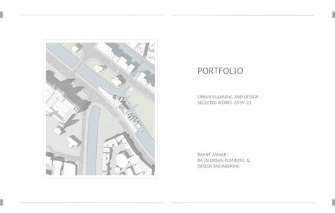
PORTFOLIO
URBAN PLANNING AND DESIGN SELECTED WORKS 2018-23
RAHAF ASMAR
BA IN URBAN PLANNING & DESIGN ENGINEERING
URBAN LANDSCAPE & DESIGN 01 TARTU ESTONIA 2 3 ACADEMIC PROJECTS ADVANCED SPATIAL PLANNING 02 BIRZEIT PALESTINE URBAN DEVELOPMENT AND REVITALIZATION 03 AL-MAZRAA AL-QIBLIYA PALESTINE PRINCIPALS OF SPATIAL PLANNING 1 04 BIRZEIT ABU-QASH & JIFNA PALESTINE PRINCIPALS OF SPATIAL PLANNING 2 05 JIFNA PALESTINE 06 JIFNA SURDA AND ABUQASH PALESTINE SKETCHES 07 GRADUATION PROJECT 46 54 36 04 14 26 66
URBAN LANDSCAPE & DESIGN
TARTU, ESTONIA

to develop a p an that implements and approaches different principles recommended for designing urban landscape spaces within green and blue infrastructure This course is consisting of 3 phases First an Urban Landscape Analysis Second creating program and conceptual plan for the selected site and third preparing a detai ed masterp an
01
4 5
SCALE INDIVIDUAL
URBAN
ABOUT THE SITE
Tartu is the second biggest city of Estonia located in the south of the country between the two biggest akes It is known for its history (tourist destination) and vivid student life What characterizes this town is the vast green wi d spaces that come into the urban fabric overlapping with new and older development
Estonians are very much into sports It can be surprising that many parks are places for different sports activities: running skiing and others
The study site is located along Tartu river which is called Emajõgi (mother river) It is f owing through the center of the city and characterized by a fu ly developed center nightlife and ca mer wild areas on the outskirts of the city (wet meadows forests)

DESIGN PREPOSITIONS & STATEGIES
FOREST
ESTONIAN NATIONAL MUSUEM
CONECTIONS
Connecting the site to other major zones surround ng and the res dent al area beside to maximize its potent al
making use of the direct connections that existed
MIX OF USES
Creating a mix of uses to cater to the demands of the neighborhood & the sports requ rements of Estonian citizens and vis tors
The mix of uses is affordable and incorporated with the existing recreationa blocks
EMU UNIVERSITY
STUDY SITE
TARTU UNIVERSITY
CITY CENTER
SENSE OF PLACE
Exp oiting the potential of the site to become a cultura & community hub with PUBLIC spaces that serves the ne ghborhood
The central Large patch of and can be converted into an active Public Space by creating dynamism in the site that interacts with nature characterizing the place
GREEN POCKETS
Large unbui t spaces which are abandoned can be conceived as Green pockets connecting the residentia neighborhood to th s potential recreationa zone
Draw the existing vegetation & Beach Park to be given a green connection to create a "Green" theme for the site
6 7


No clear access to the nside area
Not connected to the other bank of the river
The noise of construction around
The area with vegetation sits as a visua barrier
Residentia area fences appear as a separation element

8 9
L A N D S C A P E C H A R A C H T E R A N D A C T I V I T I I E S S E N S E O F S P A C E A L O N G T H E R I V E R U S E R S T Y P E S A N D I N T E N S I T Y
SITE ANALYSIS
THEORITICAL BASED
RESTORATION
IN ENVIRONMENTAL PSYCHOLOGY - exp ore the dynamic connection between individuals and their surrounding ‘HUMAN & NATURE’
It is about the Restoration of the Attention of individuals which comes with stages:
1 Clearer Head ‘concentration’ - A l thoughts observations and information pass through the mind and then fade away
2 Mental Fatigue Recovery - More focus and direct attention to the surrounding
3 Soft Fascination - Gent y distraction of individua s ' attention so it reduces internal noise and provides internal space to relax
4 Ref ection and Restoration - Spending a ong time in the environment individuals are ab e to relax restore their attention and ref ect on their lives
Since the area is surrounded by many recreational areas which are fu of activities that need a fu l body move the Gradient Concept is being proposed to transport human actions from fu movement and loud activ ties to stabi ity where he can experience meditation and re axation with n nature and b odiversity


10 11
PLAN
CONCEPT PROPOSED SITE
DESIGN DETAILS


RESTORATIVENESS VISUALISATION
RE-DESIGNED PARKING LOTS
ONE OF THE MAIN ENTRANCES

begin to observe the surrounding feel a l your senses ‘hear sme l see ” w in your mind then fade away.
d yourself getting into a genuine interest in the environment surrounding ect attention to it
cts of the natural environment start effort essly to capture your attention attention will reduce the internal noise and turn it into an interna space
re after spending a long time in the environment the final goa of restoring your attention

12 13
TYPES OF SPACES EMERGED
WOODEN PLATFORMS THE SNEAKY AREA
PEDESTRIAN PATHS 'SOFT/GREEN PATH AND HARD/PAVEMENT PATH
GROUPS OF VEGETATION
LOCATION OF SEATING FURNITURE
WOODEN BENCHES

ADVANCED SPATIAL PLANNING
BIRZEIT, PALESTINE
to design an industrial park in the se ected study site by taking into consideration the potential and constraints of this zone. After investigating the real world of industries in the context of the site
02
14 15
URBAN SCALE GROUP OF TWO
PROJECT DEFINITION

DESIGN PREPOSITIONS & STATEGIES
To manage obstacles facing industrial sector the industrial park approach was taken into consideration which is based on planned materials and energy exchanges that seek to minimize energy and raw materials use minimize waste and bui d sustainable economic eco ogica , and social re ationships
The main goa of the Industrial parks including light industries is to reduce pol ution of the surrounding environment and are structured to bring together complementary services and features that will benefit the companies that occupy space there
The industrial Zone of Birzeit at Rama lah & Al-Beireh Governorate where many industries are mainly concentrated random y without adequate infrastructures was chosen as a case study to design an industria park in the se ected site
INDUSTRIAL INFRASTRUCTURE
Development for integrated transportation infrastructure
Development of power/ energy infrastructure
Development of a central hub
Development of integrated uti ities
Development of communities infrastructure
SOCIAL INFRASTRUCTURE
Establishment of a integrated second hub
Provis on of emergency
Renewable energy Infrastructure
Deve opment of training
Integrated commercia Institutiona one socia deve opment
INDUSTRIAL PARK INFRASTRUCTURE
ENVIRONMENTAL INFRASTRUCTURE
Development of a waste co lection
Development of rainwater harvesting and treatment plants
Renewab e energy infrastructure
Development of green infrastructure from native plants and other p ants usefu for decreasing pol ution "Air Visua
16 17


18 19 SELECTED ANALYSIS STREETSCAPE SENSE OF SPACE - MAIN STREET PERCEPTION

REDEVELOPMENT PLAN

LAND-USE PLAN BASED ON BIRZEIT MASTERPLAN - BEFORE

LOPMENT PLAN ON THE PROGRAM ED - AFTER


20 21

22 23
PROPOSED MASTER PLAN

24 25
5
RECREATIONAL AND OPEN SPACES AREA
INDUSTRIAL AREA
MIXED-USE AREA

03
URBAN DEVELOPMENT AND REVITALIZATION
AL-MAZRAA' AL-QIBLIYA, PALESTINE
Conscious urban regeneration and deve opment in an existing urban and rural context Ba ance between the economic agenda and the needs of the local spatial context Urban aesthetics form and the existing cultural and architectural heritage A medium-scale urban design project.
LOCAL SCALE GROUP OF THREE
26 27
PROJECT BRIEF
The aim of the project is to understand the urban fabric of old towns in genera and how to co ect the data needed about these historica buildings to eva uate the need of each one and to so ve the problems situated in the building through coding each
This project took p ace in the historical center of Al-Mazra'a Al-Qib iya a small village in Rama ah governorate severa site visits were needed to take dimensions and evaluate each bui ding the site was divided into 5 parts distributed among 5 groups of 3 or 4 students


28 29
ANALYSIS
Data for each building was co lected based on an international form that helps with evaluating the damage of each bui ding to take into consideration with the development and revitalization plan GIS was used for analyzing these maps


30 31
FREDEVELOPMENT PLAN
VISION- Enabling the historica center of Al Mazraa Al Gharbia to be a residential area with a healthy and socially cohesive environment that ref ects the rural character and makes it a rura center that provides the needs of its citizens within loca economic activities that depend on the sustainable exploitation of natura resources
OBJECTIVES - Based on the strengths and weaknesses of the village priorities for future development were determined:
Improving social services:
1
Improving the street network in the region and strengthening its role in integrating regions
3
2 Providing a heath center
Enhancing community participation for women youth and chidren of the vi age especia y residents of the Od City through youth associations and cubs
Developing the loca economy of the vilage:
1 Operating some buildings for muti-purpose use that meets the needs of the ocal popuation and enhances the vilage economy as a whole Providing points of sale for loca products based on agricultural ands
3.
Alocating a group of empty lands for agricuture brings economic returns to the loca population
2 Taking care of natura resources Preserving and enhancing the agricultural aspect of the village Exploiting the open lands in the area to improve the green structure in it Developing a pedestrian path inking the area to each other


32 33
FREDEVELOPMENT
PLAN
The sports stadium s under the respons bil ty of the M n stry of Sports and Youth
Reusing the HOSH -space in between a group of buildings- to inc ude the fol owing and maintaining them periodical y as a necessary:
Government hea th center Gym: under the respons bil ty of the municipa ity and the manager is appointed by tender and the maintenance is Within the responsibil ty of the bidder
A youth c ub under the respons bil ty of the Ministry of Youth and Sports
A computer and printer room for univers ty students under the respons bil ty of the pr vate sector
A women s assoc ation for hand crafts under the responsibi ity of the Ministry of Interior

pedestr an path Under the responsibil ty of the townspeople to volunteer
pedestr an path Under the respons bil ty of the townspeople to volunteer
Loca market - under the responsibi ity of some of the residents of the Old City as it const tutes a private sector
Children's park under the responsibi ity of the mun cipal ty
Farmland Under the respons b lity of the owner of the land ownership so that t prov des a source of income for him and the participating farmers
34 35
PRINCIPALS OF SPATIAL PLANNING 1
A fina comprehensive plan is proposed for three urban areas after collecting al sectoral data re ated and analyzing them using GIS full report was submitted by the end of the course
36 37
SCALE GROUP OF 6 FINAL PHASE GROUP OF 2
04 BIRZEIT, ABU-QASH, & JIFNA PALESTINE
REGIONAL
PROJECT DEFINITION
Introduction to principles of spatial planning and theories at the local regional and nationa levels
Different scientific and strategic p anning approaches Decision-making mechanisms Sectora p anning 348 Field surveys and data analysis Deve opment of planning alternatives for selected urban areas An overview on p anning policies and planning practices in Palestine as wel as on the different institutions involved in this process Studio work concentrating on contemporary spatia planning issues
Urban areas selected for this project are Birziet Jifna and Abu-Qash they are all located in Rama ah governorate a group of 6 all worked on the analysis phase of analyzing different sectors at a regional sca e by the conceptual framework and fina phase a group of 2 students came up with a proposed master plan for the selected urban areas
STUDY SITE
This report presents three Pa estinian regions Abu Qish Birzeit and Jifna with an origina heritage It a so shows the detai s of these areas and analyzes them and studies their different aspects


SECTORAL ANALYSIS
POLITICAL LAND CLASSIFICATION
POLITICAL LAND CLASSIFICATION


REGIONAL SITUATION


38 39
L O C A T I O N O F T H E S T U D Y S I T E
BIRZEIT JIFNA
ABU-QASH
PATTERN
TOPOGRAPHY
LANDUSE PLANS POPULATION GROWTH
AND STRUCTURE OF URBAN CLUSTERS
EXISTING

SECTORAL ANALYSIS

HOUSING
FUTURE EXPANSION SERVICES

SOLID WASTE MANAGEMENT


TRANSPORTATION AND TRAFFIC

WATER SUPPLIES
ENERGY SUPPLY
ELECTRICAL SYSTEM

SEWAGE


ENVIRONEMENT

CULTURAL AND NATURAL HERITAGE

COMMUNITY FACILITIES

40 41
SWOT ANALYSIS

STRENGTH AND OPPORTNITIES


WEAKNESSES AND THREATS

42 43


44 45 LAN
05
PRINCIPALS OF SPATIAL PLANNING 2
JIFNA, PALESTINE
The master plan focuses on the main prob ems of the site and provides a strategic plan for future urban developments taking into consideration the existing elements
URBAN SCALE GROUP OF TWO
46 47
PROJECT DEFINITION
A review of contemporary planning issues such as urban spraw s smart growth and management sustainable development etc The deve opment of structural p ans and comprehensive planning strategies for future urban deve opments A study of the urban fabric its e ements and characteristics lega issues of and ownership and land division
site se ection was based on the areas that a l of the class had to work on with principals of spatia planning 1 each group of 4 chose an area which then was divided into 2 areas by half to work on the detai s
STUDY SITE
Jina is a smal village located in Ramal ah and Albireh governorate it has an interesting landscape to work on many issues are related to this vi lage based on its masterplan

SELECTED SITE ANALYSIS

BUILDING BLOCKS AND PLOTS
48 49
LOCATION & STUDY SITE
MENTAL MAP
CONCEPTUAL VISION

REDEVELOPMENT PLAN
Enhance the vil age of Jifna to be a residential area with a healthy and socially cohesive environment that reflects the rura character and makes it a rural center that provides the needs of its citizens within loca economic activities that depend on the exploitation of natura resources in a sustainab e manner

Objectives Based on the strengths and weaknesses of the vil age priorities for fu were determined
1 Improving social services Improving the street network in the region and enh integrating urban areas - Enhancing the education service in the village by design secondary school
2 Developing the local economy of the village - Allocating a group of lands for brings economic returns to the local population Multi-purpose use that meets the popu ation and enhances the village economy as a who e for local products based o Providing points sa e
3 Concern for natura resources Preserving and enhancing the agricu tura aspe Exploiting the open ands in the area to improve the green structure in it Deve oping linking the open green areas to each other

50
PEDESTRIAN ACCESS TO RECREATIONAL AREAS
MASTER PLAN & DETAILS
By the final phase each group of 4 students was divided into two groups to work on their part of the study site and provide details for it
OTHER GROUP HALF

52
PLAN M O D E L 3 D S H O T S
MASTER
GRADUATION PROJECT
JIFNA, SURDA, AND ABUQASH, PALESTINE
this section is more about the introduction of my graduation project, a group of 2 students which was finished by the previous semester of 2022-2023 academic year and I will continue working on it by the spring semester of the same year so you are about to see the theoretical part of the project.
06
54 55
CITY SCALE GROUP OF TWO


The region that was selected for this study stands in the peri-urban area where the urban and rural areas of Surda Abu Qash and Jifna meet and these two heterogeneous bodies are combined The study area wi be precisely on the main street connecting them Boundaries were demarcated based on; 1. Administration boundary where there is a direct interaction between both areas -mostly from Birzeit and Surda sides 2 The observation of the fuzziness of the built-up area where the fragmentation starts to get inside the fringe 3 The void where land use does not exist and stands between other and-use pans

Main key attributes that typically characterize this peri-urban area are: Disrupted pattern of residential deveopments; ow -density economic activity; incomplete range of urban utilities; lack of and-use pans; and uncoordinated zoning or planning reguations These characteristics shape the rura-urban area lying between the continuously built-up rura and urban areas of Surda Abu Qash and Jifna which can be described as a zone of transition in the urban andscape land use socia and demographic properties
The changes in land use and popuation dynamics of the rural-urban areas have gone towards the increasing demand for and for housing and economic development This has led to an infux of people with different demands for goods and services besides regional and municipa planning policies that alow for the construction of residentia neighborhood developments that are not weintegrated with the surrounding rura or urban areas
This case is implemented to work on a loca scae which wi serve the regions surrounded and connect them together


1 Administration boundary
2 Where fuzziness fragmentation starts
3 Where and use plans do not exist
56 57
Birzeit
Jifna
Abu-Qash
Surda
About 2556 Donum
3. 2.
1.
PROBLEM STATEMENT 1

In urban andscape land use socia and demographic properties

meable boundar es il -p anned and piecemeal deve opment
s pattern crossing Jifna masterp an boundary
f urban and rural functions


Host uses that may be unwanted by commun ties
Market actors and developers influencing the future for such areas
Absence of and-use plans for most of the study area
Land-use plans existed are separated each one be ongs to a different local community
Surrounded almost by residentia types A and B with part of residence Vila
Commercia zone is ocated at the ma n entrance of the study site


environmental gap between the peri-urban fringe and urban areas surrounding where it is targeted as a random dump
Loss of green structure


58 59
PHOTO 45,6) CONFLCTOF NTEREST LEFT COMMERCALCENTERS,OTHERS GATEDCOMMUNTESDEVELOPMENT SOURCE (RESEARCHERS 2023
3
PHOTO (7, 8): INCOMPLETE RANGE OF LAND-USE PLANS. LEFT: WAREHOUSES AND STORAGE, RIGHT: FARM SOURCE: (RESEARCHERS. 2023).
2
Direct interaction because of the transport route crossing or developers and commercia developments ic activity
PHOTO 45,6) CONFLCTOF NTEREST LEFT COMMERCALCENTERS,OTHERS GATEDCOMMUNTESDEVELOPMENT SOURCE (RESEARCHERS 2023
4
PHOTO (9, ): GREEN STRUCTURE. HOW URBAN RANDOM DEVELOPMENTS STAND AS A THREAT TO LOSING GREEN STRUCTURE SOURCE: (RESEARCHERS. 2023).
RESEARCH OBJECTIVES
METHODOLOGY
The overa objective would be to provide guidance for a land-use deve opment of Jifna Surda and Abu-Qash rural-urban fringe to ensure sustainable and uses along the area
To investigate the pattern and characteristics of the rura -urban fringe development along Jifna Surda and Abu-Qash peri-urban area
To create a guideline p an that wi direct urban development in Jifna Surda and Abu-Qash peri-urban areas towards sustainabi ity by considering the relationship between economic growth and land use
RESEARCH QUESTIONS

Through the app ication of the ana ytical framework the study will be able to answer the following questions:
Which planning approaches and strategies can be app ied to direct urban growth in fringe/peri-urban areas towards sustainable deve opment?
To what extent are existing land use p ans and current urban growth patterns adhering to sustainable planning principles?
How can general planning approaches and strategies be adapted for the sustainab e deve opment of Jifna Surda and Abu-Qash?

60 61

SITE ANALYSIS
MACROSCALE ANALYSIS - METROPOLITAN SCALE
62 63

SITE ANALYSIS
MICROSCALE ANALYSIS
64 65

SITE ANALYSIS
MICROSCALE ANALYSIS


66 67

68 69
SWOT ANALYSIS

CONCEPT

70 71
TOPOGRAPHY

72 73 VISION AND DESCRIPTION
DESIGN PROCESS


74 75
PROPOSAL
MICRO-SCALE VISION
Planning and design guide ines on how to approach the Peri-urban area regeneration processes
The suggested agenda is divided into 3 phases each composed of 4 actions detai ed with an examp e of site-specific steps

ZONING CONCEPT

76 78

79 80
DESIGN PROCESS ZONING

81 82 LAND - USE
PLAN SPATIAL MODEL
DETAILED AREAS SPATIAL MODEL


83 84

DETAILED AREAS SPATIAL MODEL


85 86

SKETCHES
87 88
07


89 90
BIRZEIT OLD TOWN


91 92
BIRZEIT OLD TOWN
UNIVERSITY SPOTS


POSTERS FROM HISTORY COURSE


93 94
PORTFOLIO
URBAN PLANNING AND DESIGN SELECTED WORKS 2018-23
RAHAF ASMAR
BA IN URBAN PLANNING & DESIGN ENGINEERING