RESHAPING THE TRINITY
The Dual Performance of Critical Infrastructure
Rachel Sasson | Advisor Joanne Aitken | Drexel Architecture Senior Project 2023-24
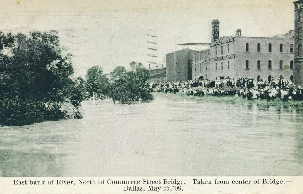
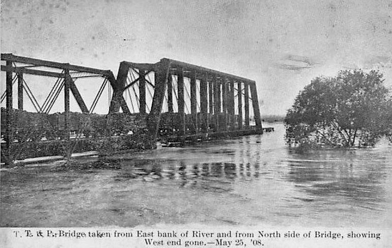


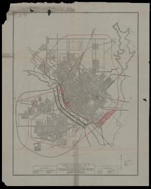

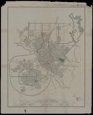

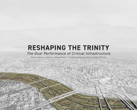
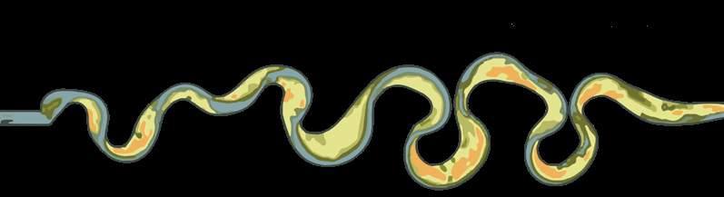
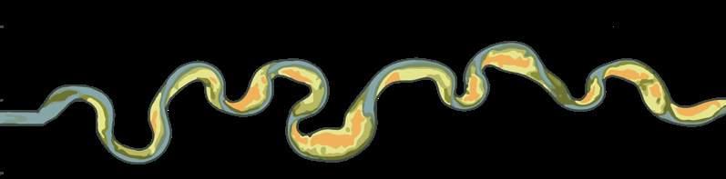
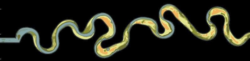
Downtown Dallas Existing Trinity River New Trinity River Floodway George Kessler 02 OPPORTUNITY Moving the river Downtown Dallas Existing Trinity River New Trinity River Floodway 01 THREAT The Great Flood of 1908
A physical and social divide
 William H. Whyte
The Social Life of Small Urban Spaces
William H. Whyte
The Social Life of Small Urban Spaces
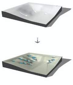
The process by which an external stimulus — such as a street performer or public art — encourages dialogue among strangers in a public space. Introducing performance onto the site will engage users, fostering spontaneous interaction.
Reshaping the Trinity

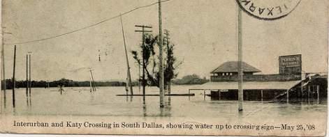
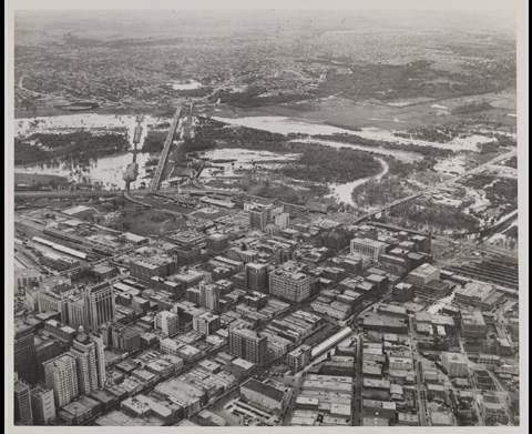
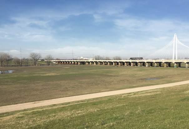
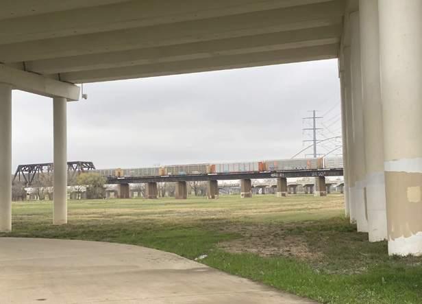
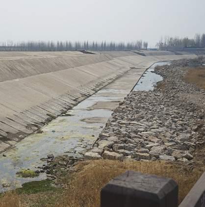
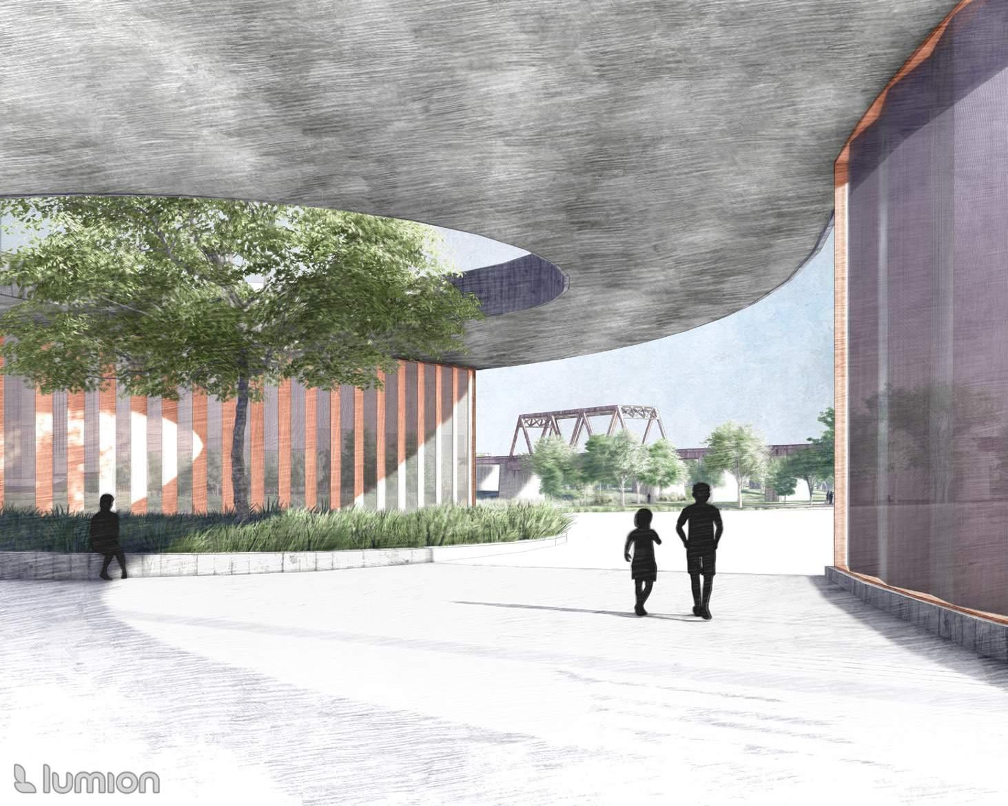
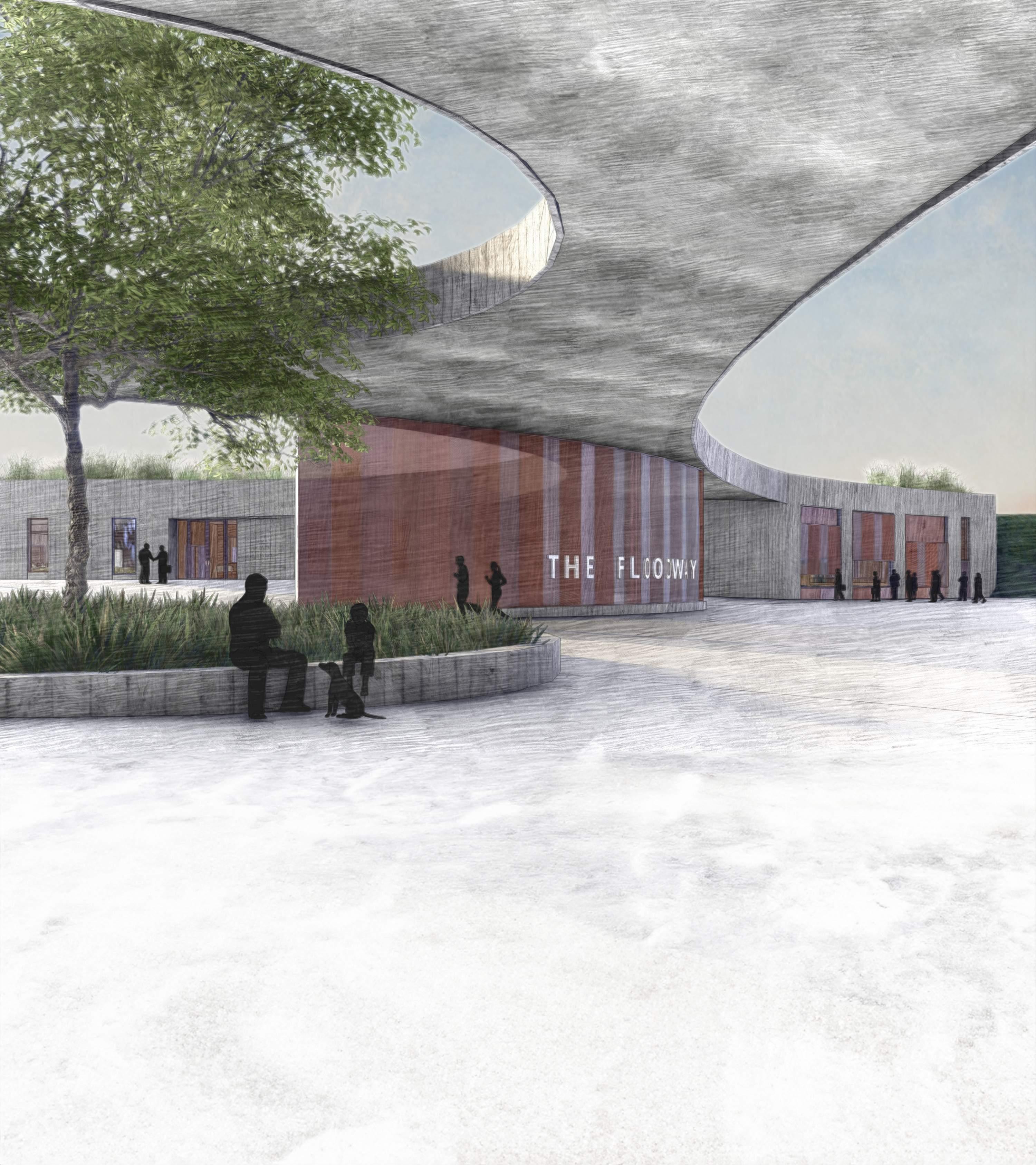
The Trinity River holds a storied past within the heart of Dallas, marked by both moments of prosperity and challenges. In May of 1908, the city faced a catastrophic flood that caused widespread displacement and damage, prompting urgent action from city leaders. They enlisted George Kessler, a renowned planner, who crafted “The Kessler Plan” in response. The visionary proposal sought to reroute the Trinity River away from Downtown Dallas, forging a new, straightened path west of its original course. The ambitious undertaking culminated in the construction of the Trinity River Floodway in 1928, a monumental engineering feat for the burgeoning city. Although effective in managing stormwater, imposing levees inadvertently divided Dallas — both physically and symbolically. The floodway disrupts the natural urban fabric, disconnecting West Dallas communities from the downtown core and hindering social cohesion.
Consider the dual ability of infrastructure to quietly support and dynamically re-energize Dallas communities.
The Trinity River Floodway can perform as both critical infrastructure for flood control and vibrant social infrastructure, introducing an ecologically considerate urban amenity to Dallas, strengthening connection via an iconic attraction.
“TRIANGULATION”
Individual Individual Enhanced Interaction Performance Individual Individual Individual Performance Enhanced Interaction 03 BARRIER
04 FUTURE
Typical Condition - October 2023
Flooded Condition - November 2015
0 27k 32k 35k 39k 43k 49k 58k 68k 100k >140k
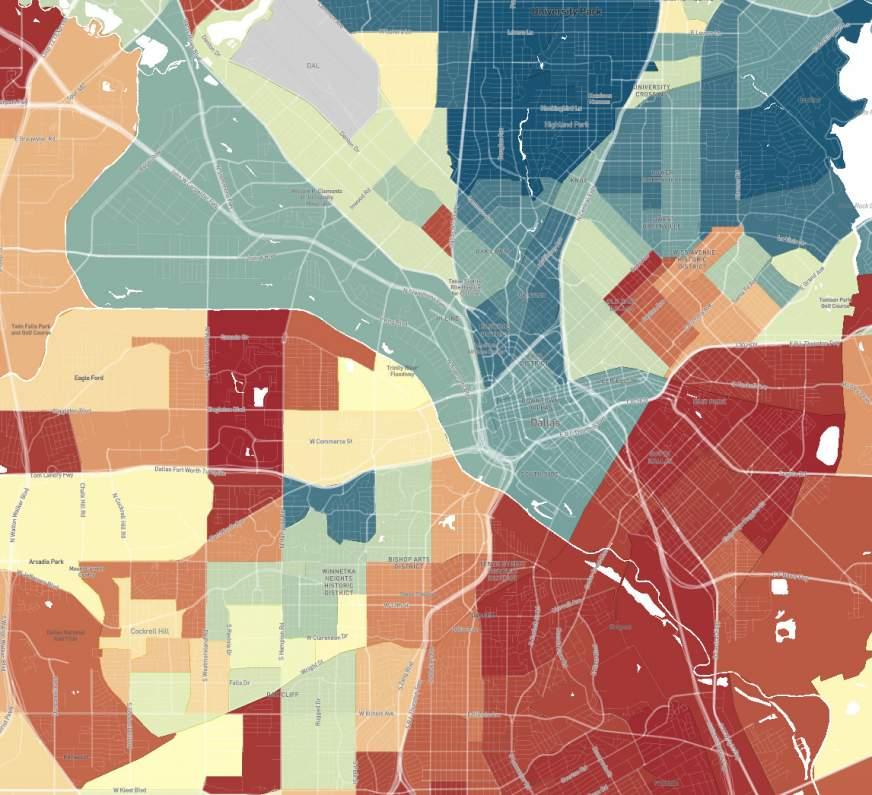
Dallas Median Household Income via Opportunity Atlas

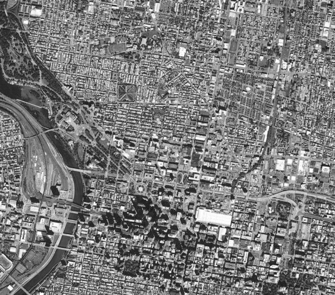
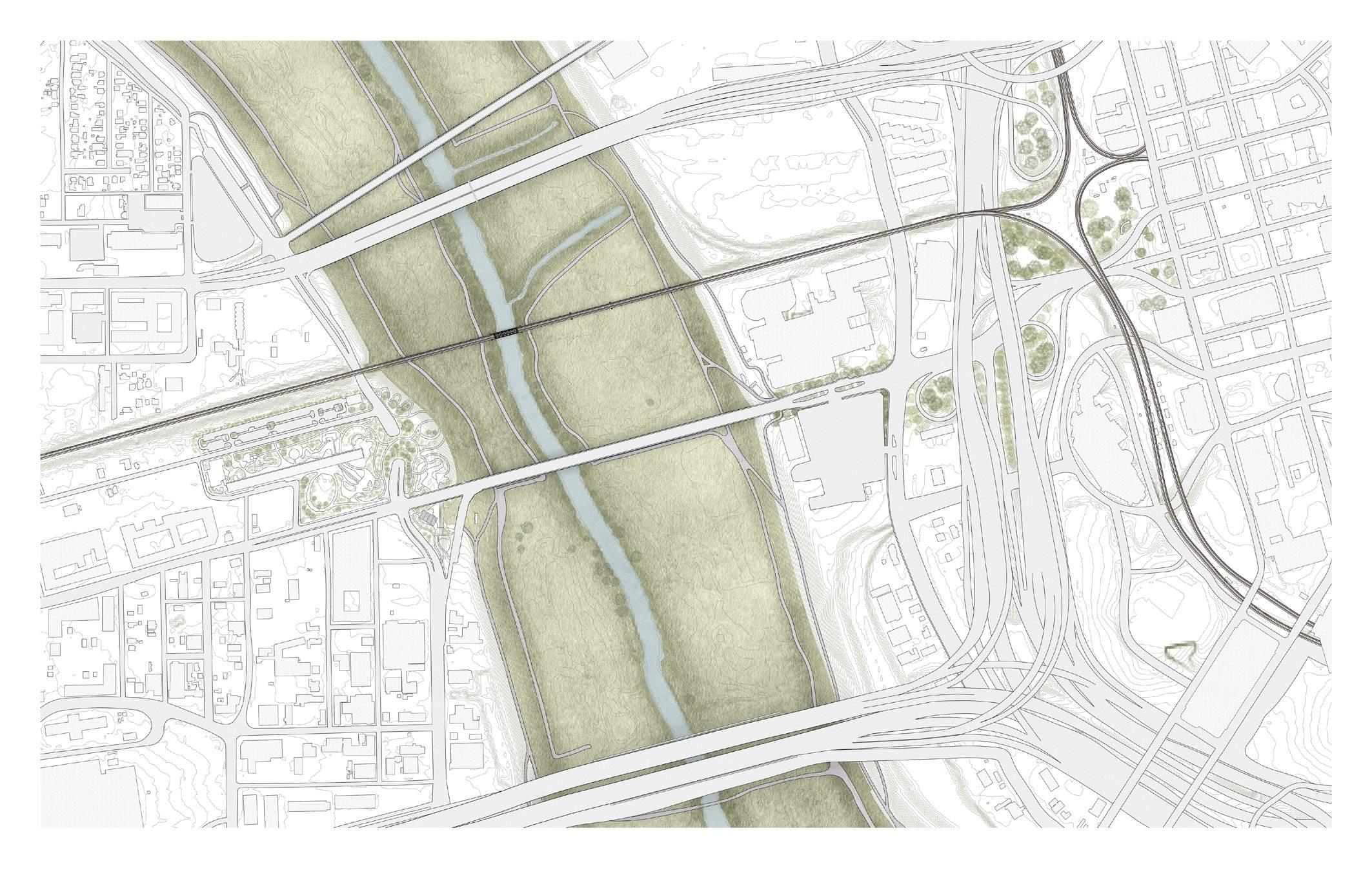
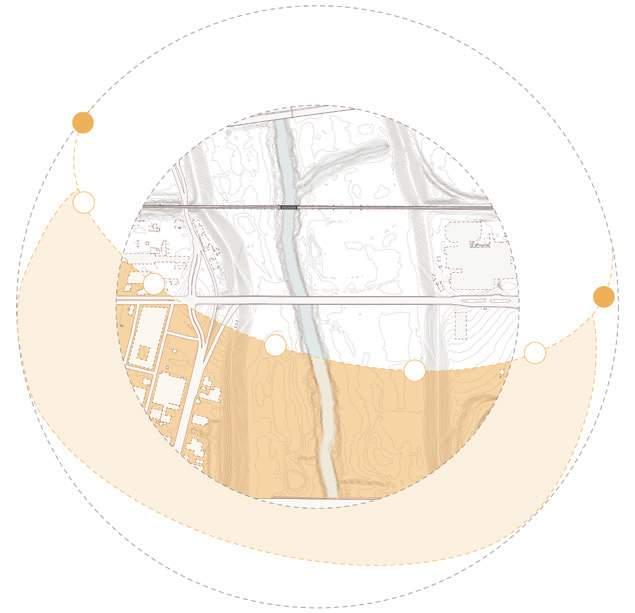
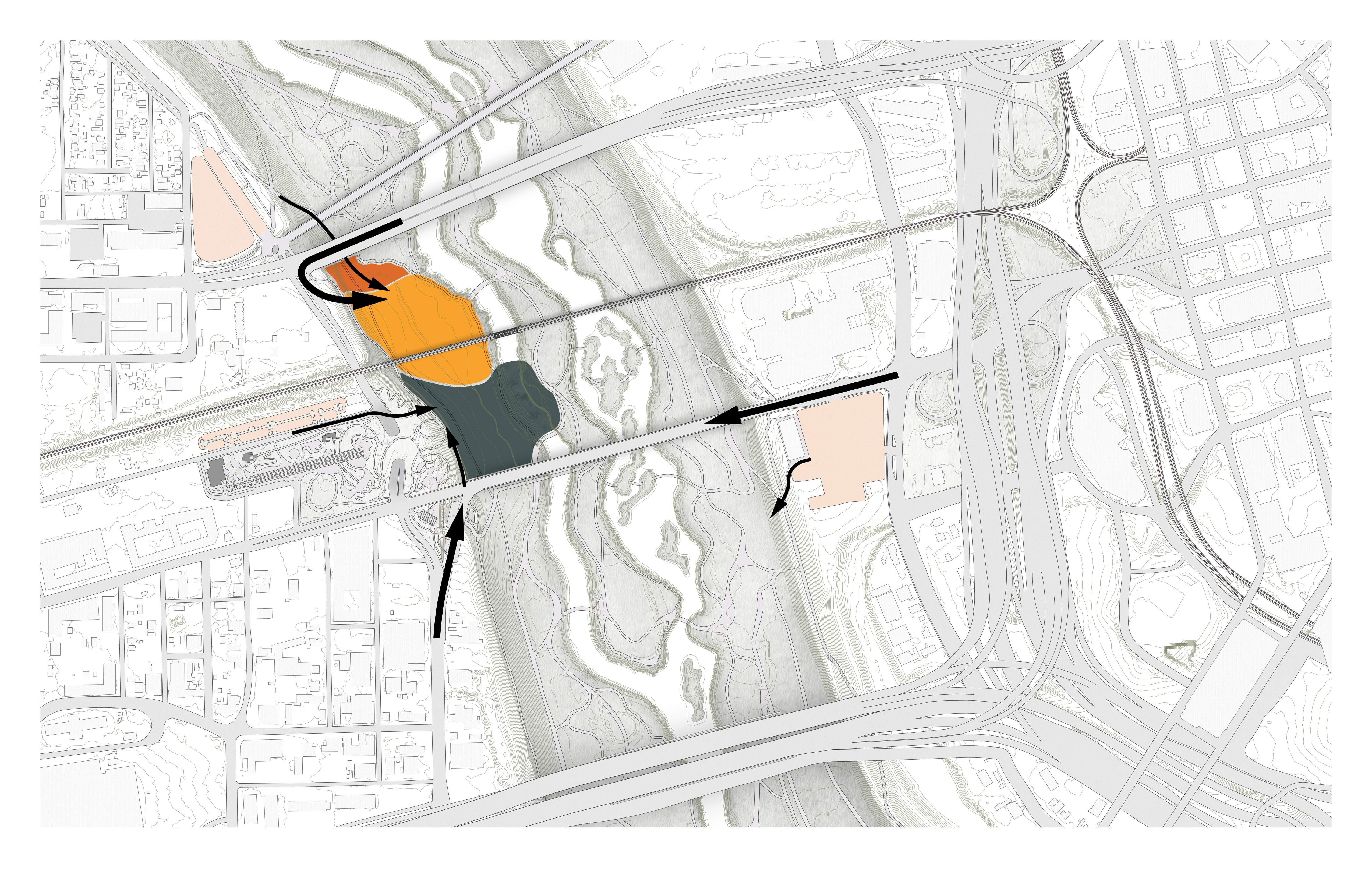
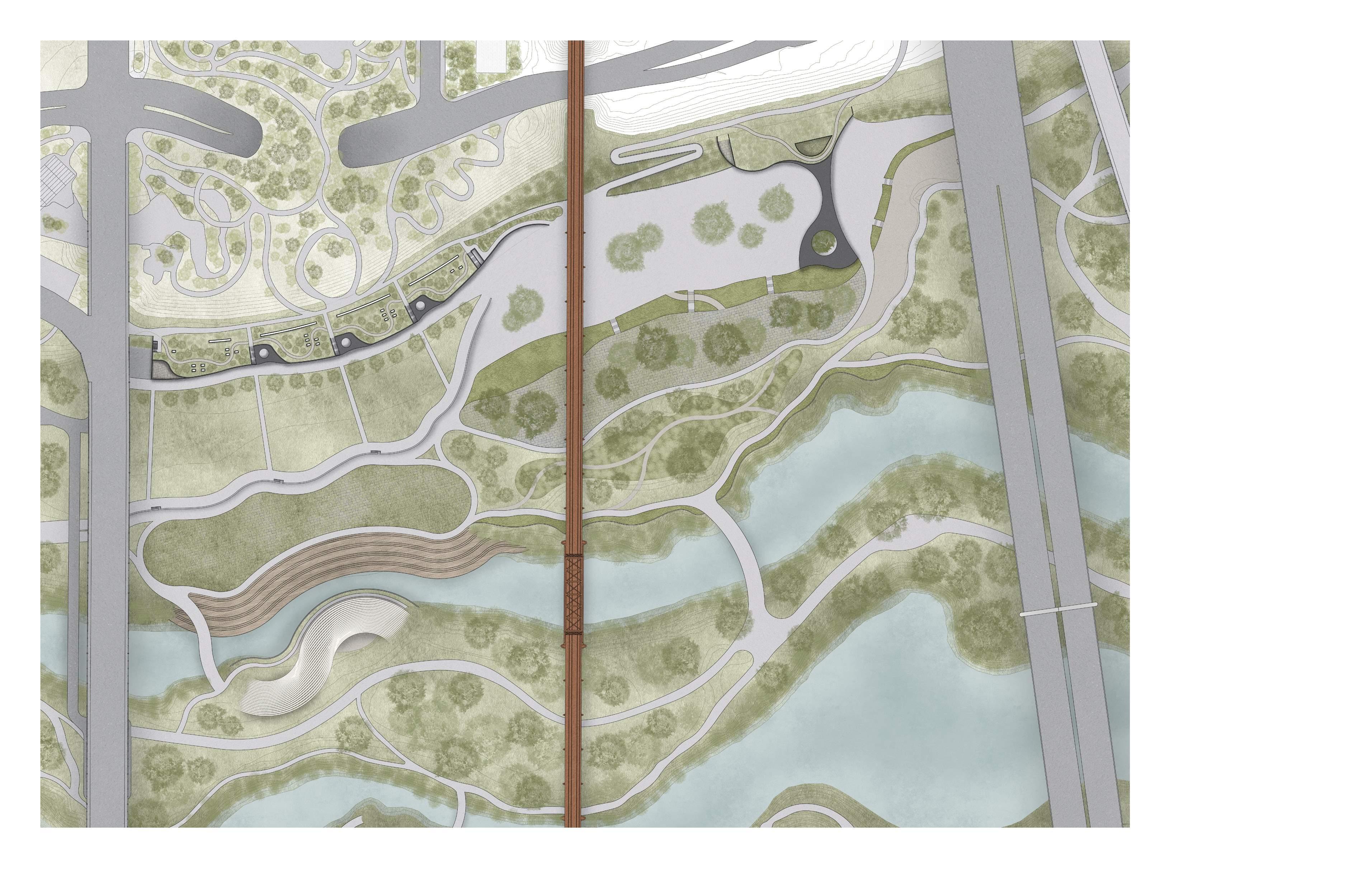
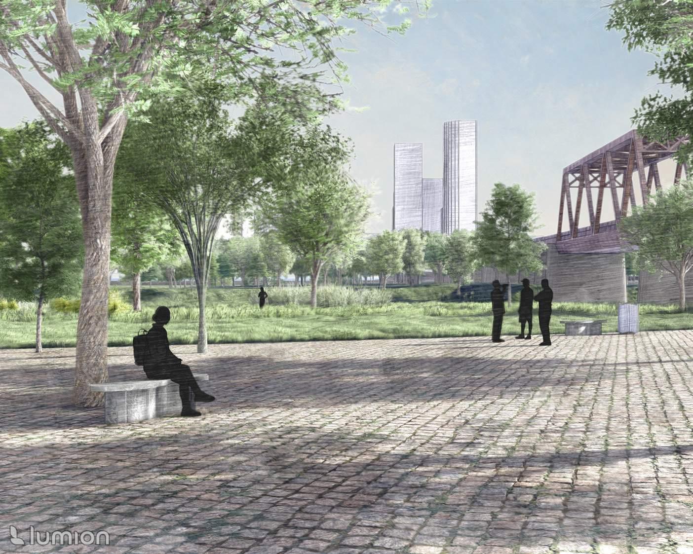
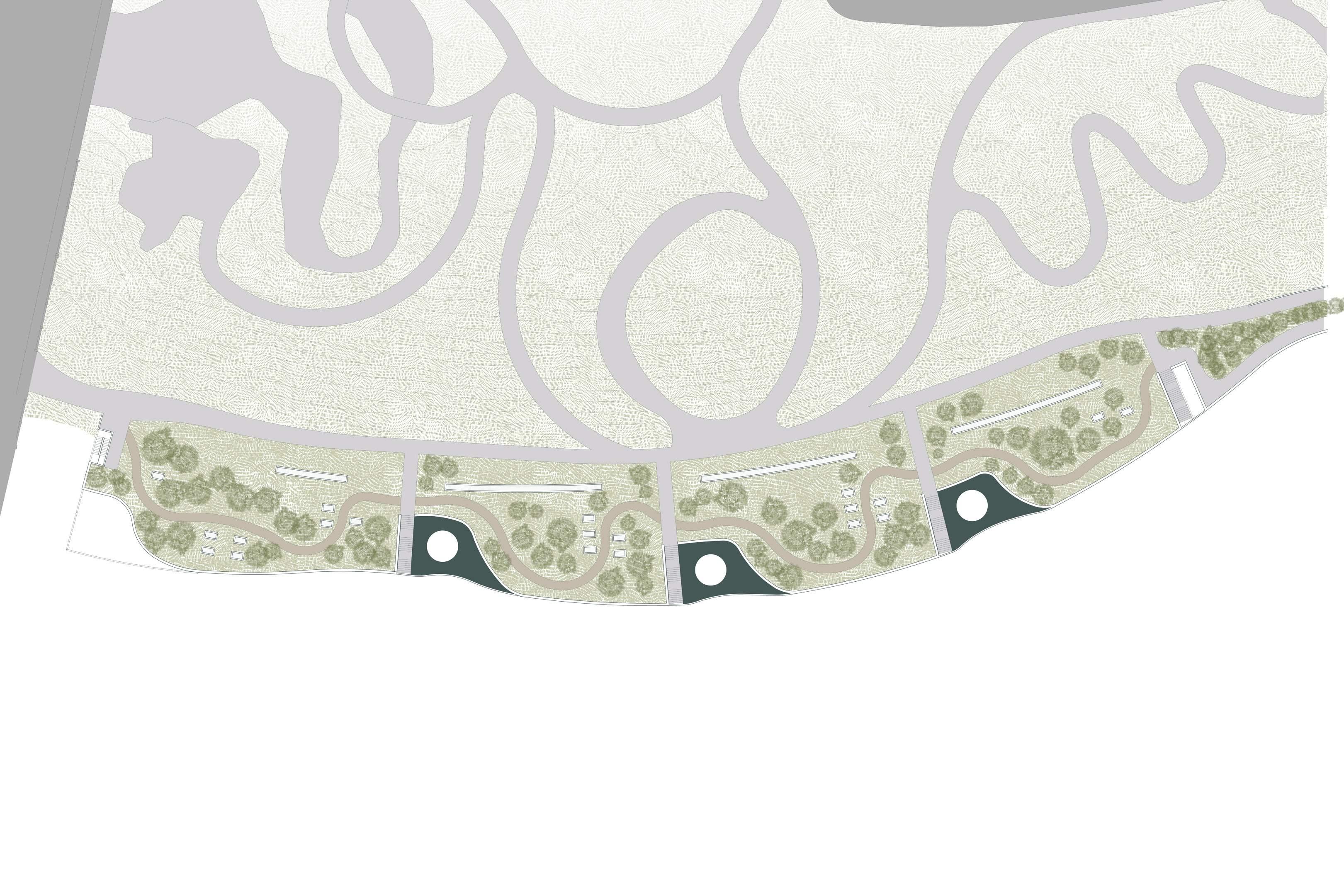
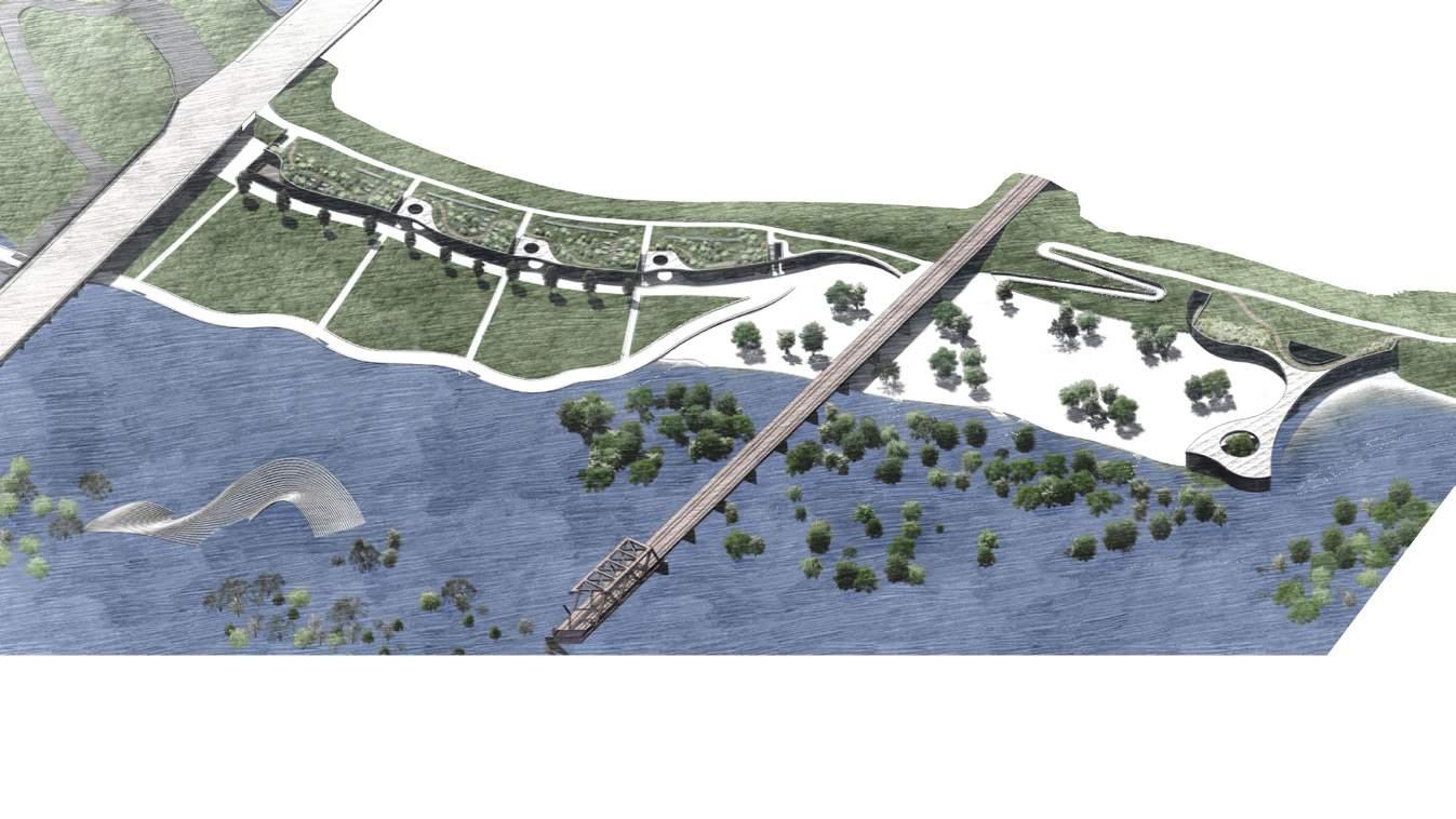
The site is comparable in length to the stretch of Philadelphia’s Benjamin Franklin Parkway between the Museum of Art and Logan Square. A 10-15 minute walk east of the site’s edge is Dealey Plaza — the gateway to Dallas’s historic district. To the west is Trinity Groves, a rapidly developing district known for its food and art scenes. The Trinity Park Conservancy recently announced plans for West Overlook Park by Lake Flato and Michael Van Valkenburgh Associates, breaking ground in Fall 2024.

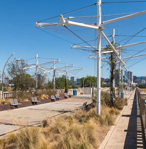
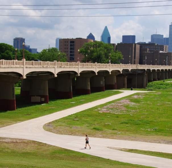
offers a network of basic pedestrian trails with potential for enhancement to promote safer and more active use.
1200’ 0 300 600
The site
TRINITY GROVES RESTAURANT PARK
WEST OVERLOOK AT HAROLD SIMMONS PARK
DEALEY PLAZA RENOVATION
RONALDKIRK PEDESTRIANBRIDGE
MARGARET HUNTHILLBRIDGE
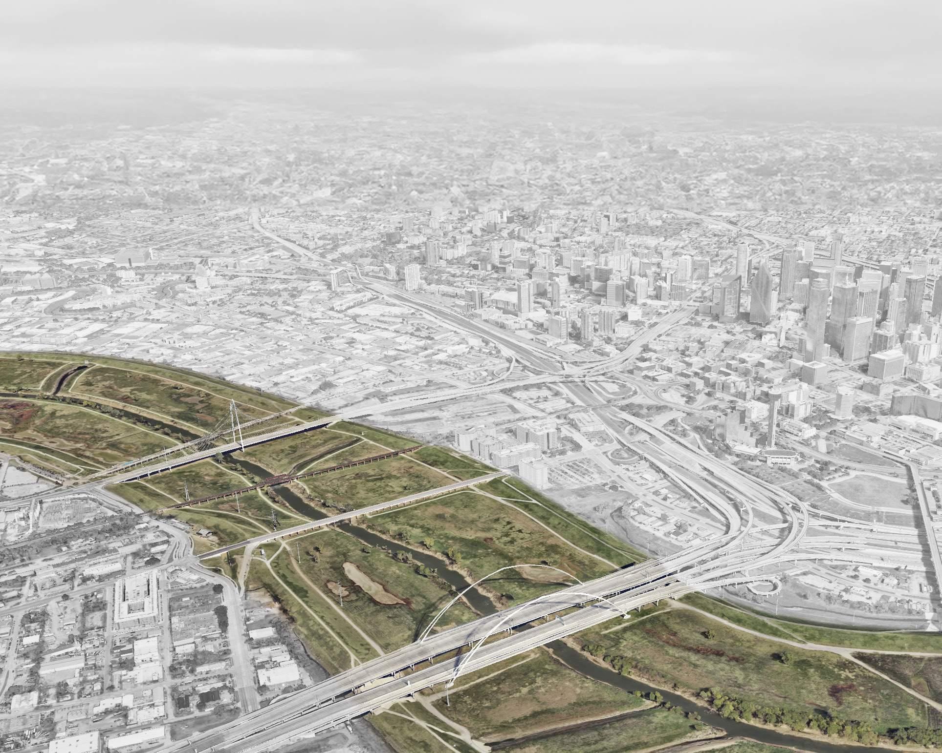
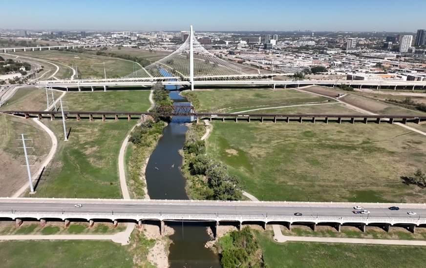
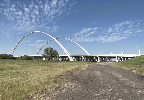
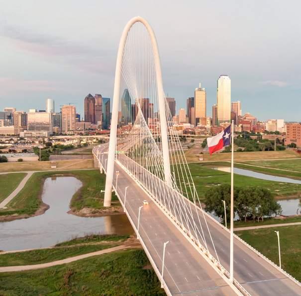
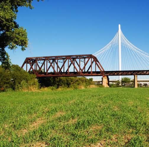
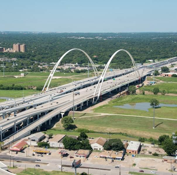
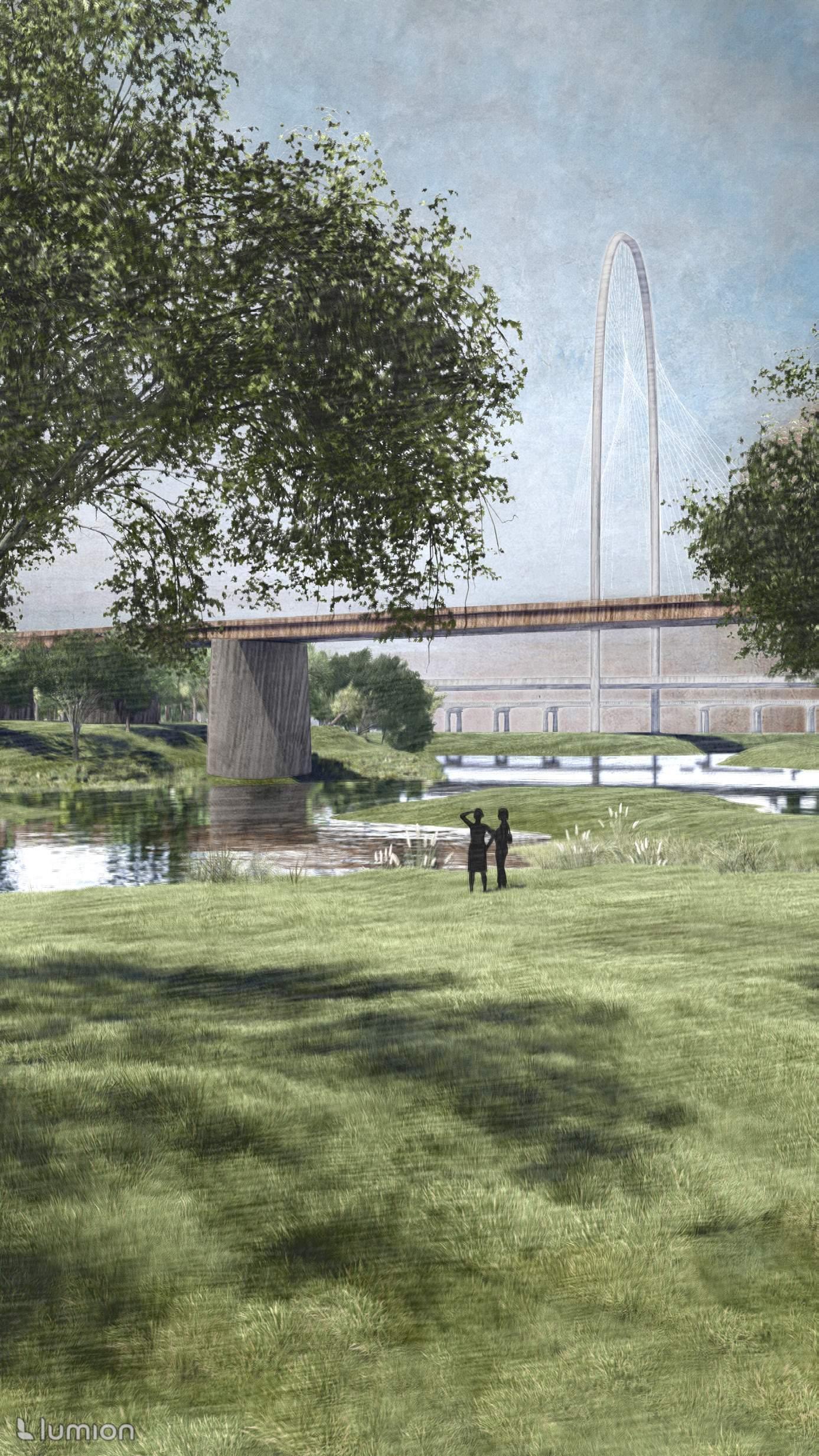
The site is bound by iconic bridges — the Margaret Hunt Hill Bridge to the north, and the Margaret McDermott Bridge to the south. Serving as vital transportation arteries, they also lend a distinctive character to the site.
TEXAS&PACIFIC R AILROADBRIDGE
 MARGARET
MCDERM OTT BRIDGE
COMMERCE STREET BRIDGE
MARGARET
MCDERM OTT BRIDGE
COMMERCE STREET BRIDGE
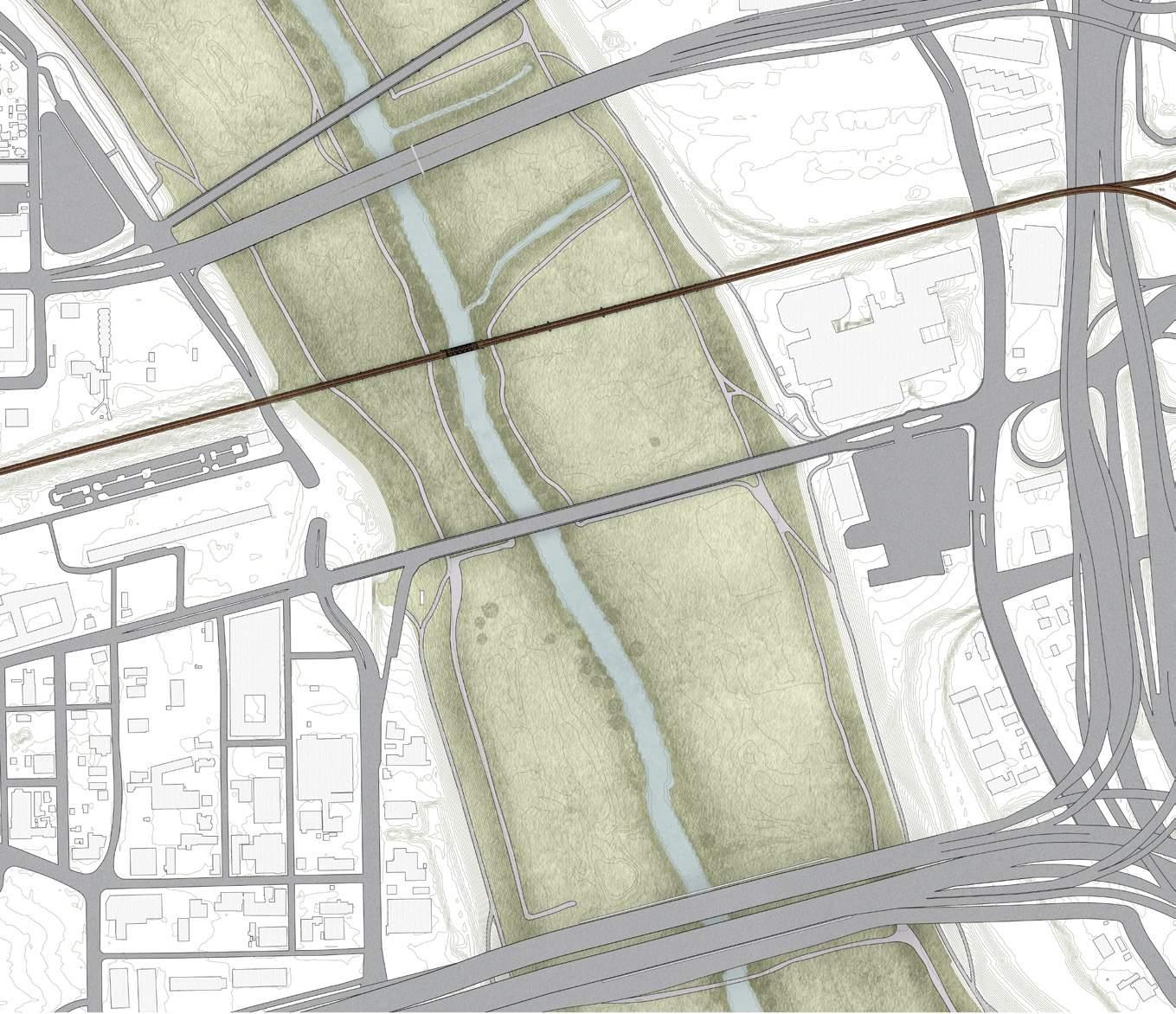
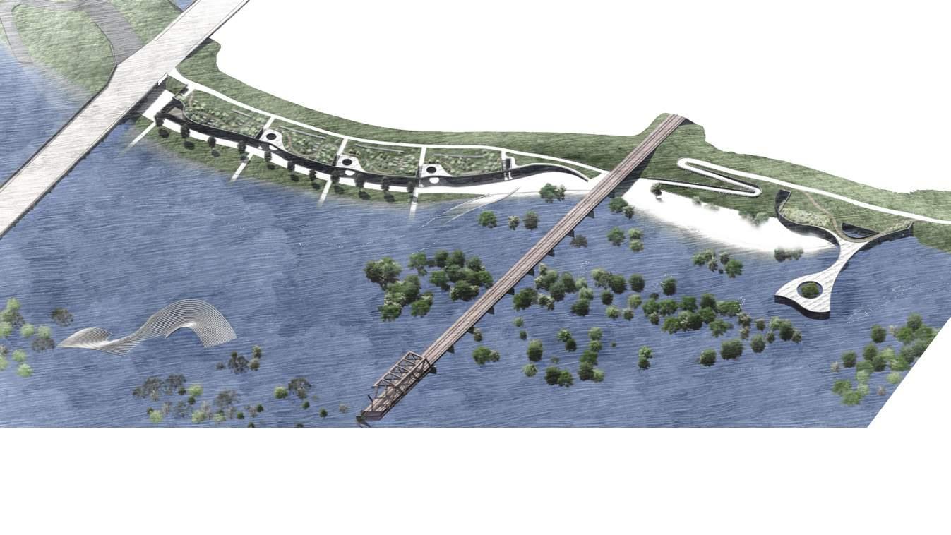
EXISTING LANDSCAPE
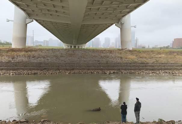
The channelized floodway functions as a machine to control, manage, and move water. During a rain event, the channel overflows, occupying a wider area between the levees.
SOLAR CONSIDERATIONS
Dallas sun is strong, heating up the site easily.
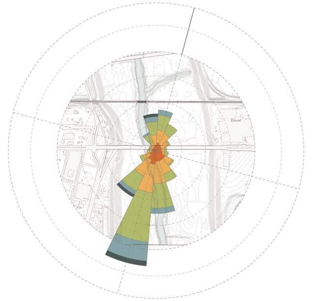
WIND AND VENTILATION CONSIDERATIONS
The site primarily experiences southern wind.
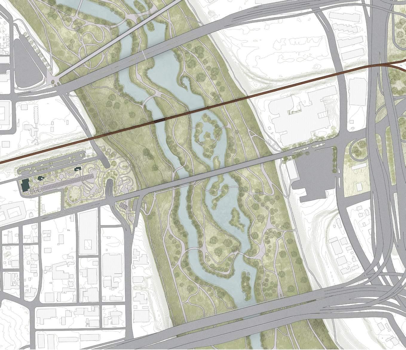
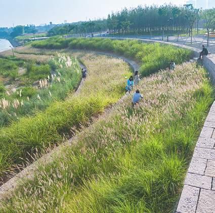
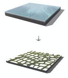
RESHAPED LANDSCAPE
The revised floodway retains water to slow down the flow — principles of the “Sponge City” ecological infrastructure model. The new terrain reflects the dynamism of the river.
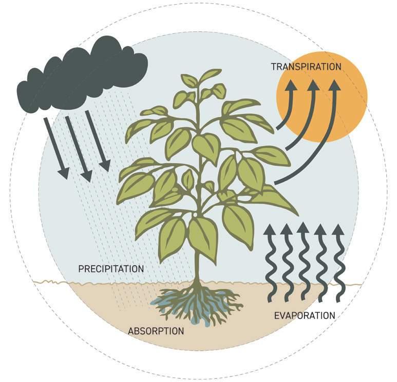
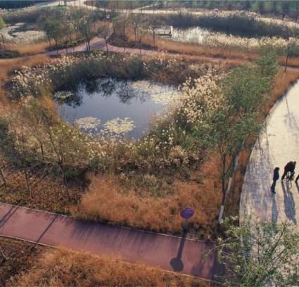
REWILDING THE SITE & EVAPOTRANSPIRATION
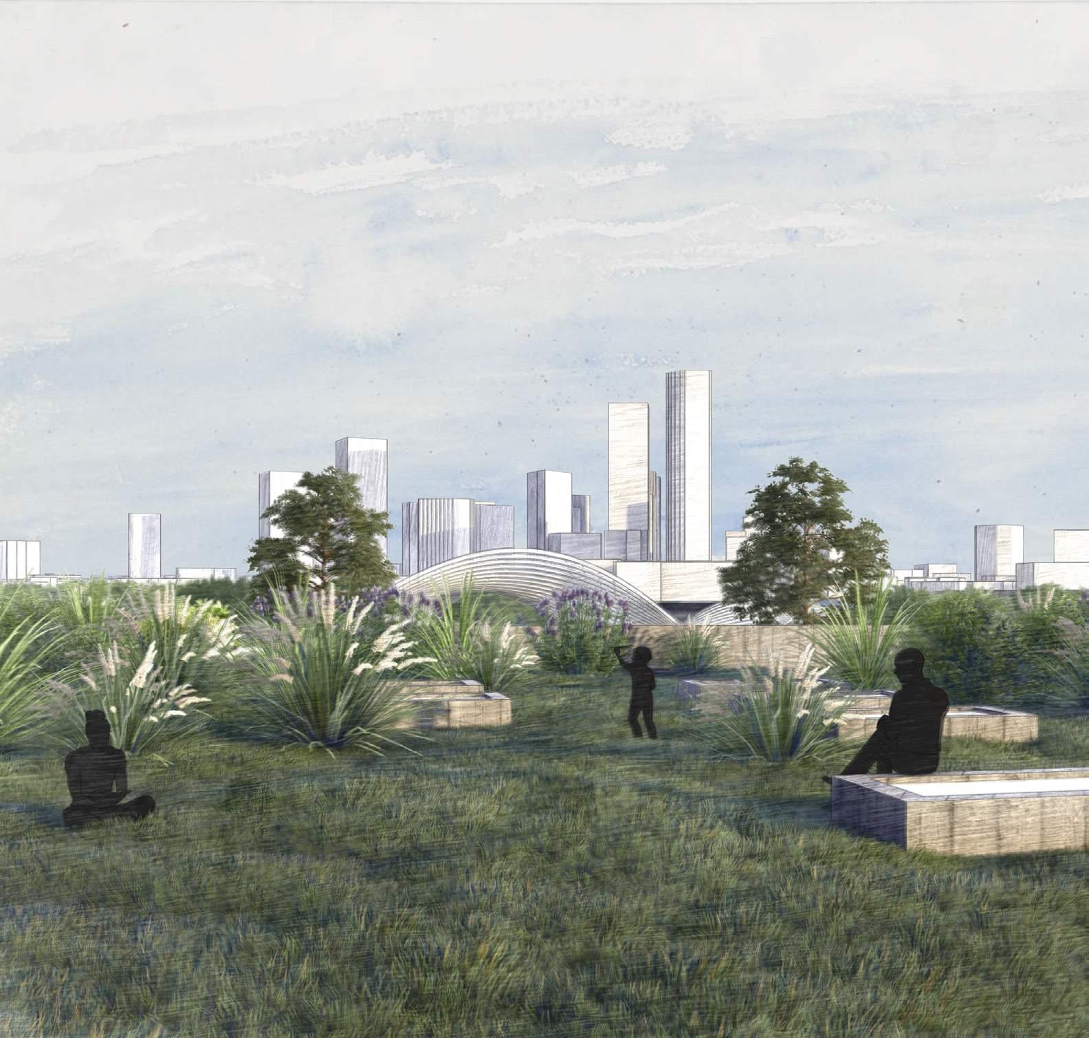
Acknowledging the scorching Dallas summers, the landscape design incorporates rewilding strategies to diversify vegetation, transforming the site into a lush meadow rather than a conventionally maintained landscape. Abundant plants enable an intentional effort to improve human comfort through evapotranspiration — plants’ release of moisture — cooling their immediate microclimate.
1200’ 0 300 600
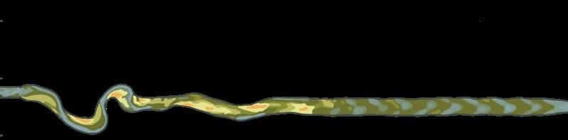
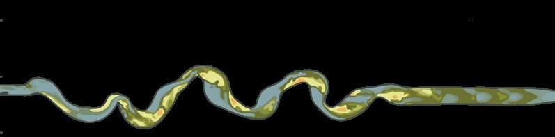
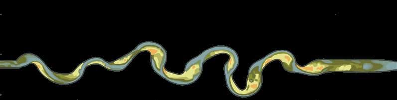
FLUVIAL GEOMORPHOLOGY
The design acknowledges the natural evolution of river systems. By understanding how flowing water shapes landscapes over time, the project anticipates and accommodates changes in the river’s course, ensuring resilience in response to


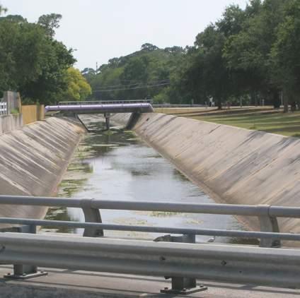

GREY INFRASTRUCTURE
The conventional solution to flooding, these systems accumulate water and risk, speed up flow, cause droughts, fail against floods, and worsen the climate in the meantime.
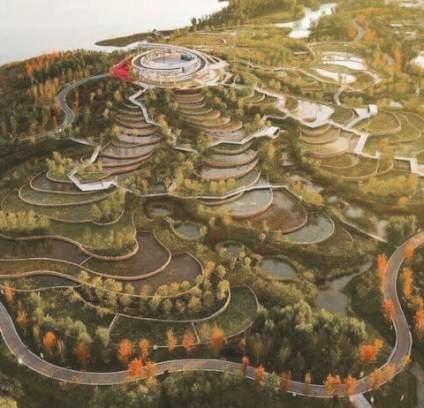

“SPONGE CITY”
An ecological infrastructure model by Kongjian Yu, Sponge City embraces natural systems and permeable surfaces to manage rainwater, reducing flood risks in urban areas.
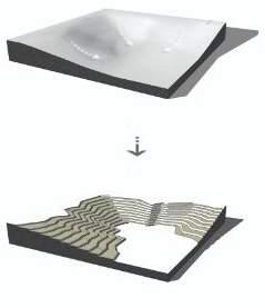
SCALABLE LANDSCAPE TECHNIQUES
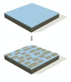
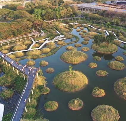
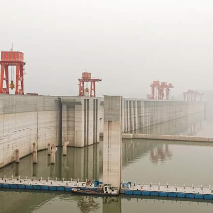
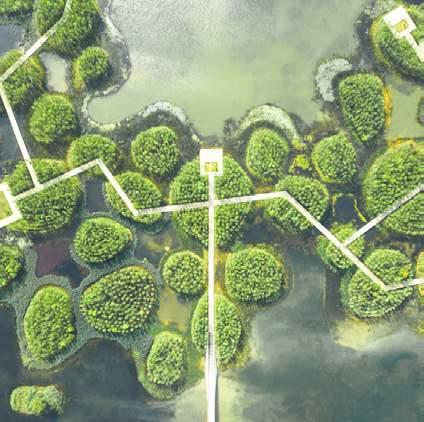
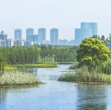
Terracing, ponding, dyking-and-ponding, and islanding via Turenscape
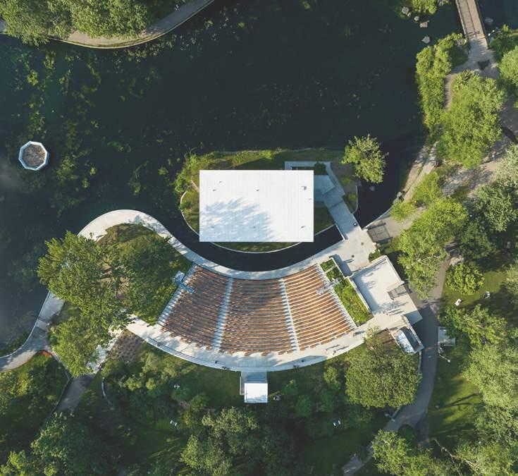
Hoover Dam Fish Tail Park Pinellas Park Ditch Yongning River Park Three Gorges Dam Fish Tail Park Daicun Dam Yanweizhou ParkThe Mann Center
for Performing Arts
Location
Architect Size
Philadelphia, PA
John Hayter MacFadyen, 1976
MGA Partners, 2002
14,000 person capacity
Crafts a thoughtful and exciting sequence for concert-goers: lining up at the gate, entering a shaded vending plaza, and ascending site pathways with skyline views before settling into their seats for the show.


RESTROOMS
PICNIC GROVE
NORTH GATE
Ride Share
Drop-off / Pick-up
TD PAVILION
13,000 person (4,500 covered)
PLAZA
Food + Drink
Merchandise
Restrooms
SOUTH GATE
Large event entry and ticketing
CRAWFORD
CIRCLE
SEPTA Loop
Drop-off / Pick-up
PARKING
APPROACH
+ ticketing
EXPERIENCE
Vending + services
PERFORMANCE
Stage + seating
Determining program location and adjacencies
The program is organized into three categories representing the sequence of a visitor’s path through the site: approach, experience, and performance. After studying the scale and organization of numerous outdoor venues, the site and context were carefully analyzed. Existing site entries, vehicular and foot traffic patterns, sun orientation, and skyline views

influenced the creation of nine initial options. Three options were considered in detail, with Option 2 ultimately selected for its strategic advantages:
1. Leverages proximity to Trinity Groves
2. Offers unobstructed skyline views
3. Distance between the levee and river aligns with typical dimensions of successful outdoor venues.
MOODY AMPHITHEATER 5,000 person capacity
HIGHEST CAPACITY RED ROCKS AMPHITHEATRE
LOWEST CAPACITY
POST PAVILION 19,000 person capacity THE FLOODWAY 18,500 person capacity TANGLEWOOD 20,000 person capacity GORGE AMPHITHEATRE 27,000 person capacity CASE STUDY
MERRIWEATHER
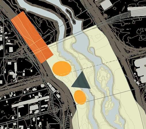
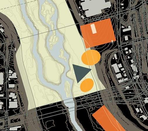
OPTION 1 West levee, south OPTION 2 West levee, north OPTION 3 East levee, south
Parking
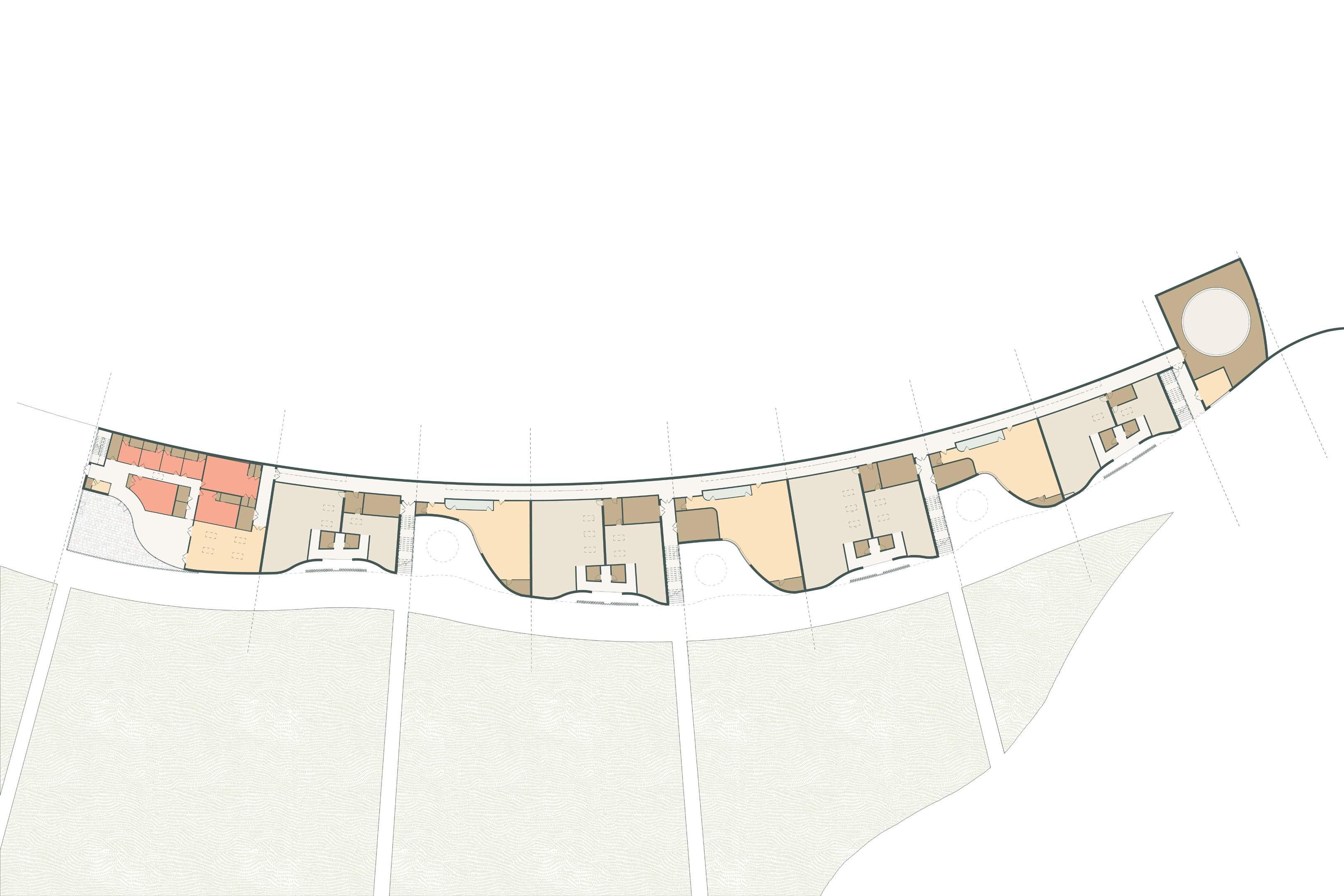
W COMMERCE STREET EXPERIENCE PERFORMANCE APPROACH MARGARET HUNT HILL BRIDGE PARKING 600’ 0 150 300 Venue STAGE Support LOADING Venue PRODUCTION SUPPORT Venue ARTIST ACCOMMODATIONS Experience PARK CONNECTION Venue FIXED SEATING Venue LAWN SEATING VENDING RESTROOMS Approach QUEUING Scale 10,000 sf Experience PAVED GATHERING GUEST SERVICES RESTROOMS Experience PLANTED GATHERING Approach TICKETS
Western Levee TOP TRAIL Venue STAGE Site Access N BECKLEY AVE Venue AMPHITHEATER SEATING Venue LAWN SEA 100 Year Floodplain 10 Year Floodplain W COMMERCE ST NBECKLEYAVE MARGARET HUNT HILL BRIDGE 13 1 6 7 2 3 4 5 8 9 11 10 12 14 Site Access N BECKLEY AVE Venue STAGE Venue AMPHITHEATER 1 2 3 4 5 6 7 9 10 11 13 14 12 Western Levee TOP TRAIL 200’ 0 50 100
Preliminary Design
The preliminary design leverages the Texas & Pacific Railroad bridge as a bisector of the site. The gatehouse, strategically placed near an existing trailhead and parking area, marks the venue’s entry. Beyond the gatehouse, terraced plazas follow the natural topography, leading to the stage situated on the opposite side of the railroad. This bridge acts as a threshold into the performance zone. The stage, safely positioned above the 100-year floodplain, ensures
ATING Entry + Ticketing Guest Services Concessions Plaza Seating Plaza Floodway Path Restrooms Venue Support 1 2 3 4 5 6 7
Entry Gate Stage Amphitheater Seating Lawn Seating Under the Lawn Artist Accommodations Private Patio Stage Loading 8 9 10 11 12 13 14
Under the Lawn Shaded
Gathering
Can a stage be built in the floodway?

Following the preliminary design review, a critical contradiction between the project’s thesis and its proposed design surfaced. The initial concept originated from the belief that “hard” infrastructure can be softened to better serve and connect populations. However, in the process of prioritizing the stage’s position above the floodplain, the performance structure inadvertently introduced more rigid elements to the site. This divergence from the project’s original intent prompted a reevaluation.
Recognizing the site’s inherent relationship with water and recalling the “Sponge City” principles, a new design should better dissolve the program into the existing terrain. Rather than adhering to conventional venue standards, can the stage be located in the center of the floodway? Utilizing the site’s natural slope, a reimagined site plan turns the first one on its head, abandons perceived limitations of a program, and results in a compelling and imaginative proposal for a performing arts venue.
DOWNTOWN DALLASA venue shaped by its terrain
Red Rocks Park & Amphitheatre
Location
Morrison, CO
Burnham F. Hoyt
1941
9,500 person capacity
Nestled within red sandstone formations, seating conforms to the contours of the landscape, offering concert-goers an immersive experience in nature.
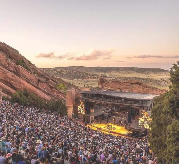
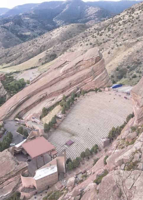

CASE STUDY
A building designed to flood
Columbia University Milstein Family Tennis Center
Location
Architect Year Size
New York, NY
Perkins and Will 2023
112,000 sf
Set below the 100-year floodplain adjacent to a river, the design acknowledges the inevitability of flooding by integrating resilient features in order to withstand and recoop from periodic inundation.

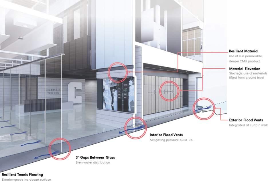
CASE STUDY
A stage that “floats”
Théâtre de Verdure
Location
Architect Year Size
Montreal, Canada Lemay
2022
2,500 person capacity
The amphitheater creatively incorporates water, allowing nature to become an integral part of the show for an immersive spectator experience.

CASE
Architect Year Size
STUDY
via Perkins and Will
W COMMERCE ST MARGARET HUNT HILL BRIDGE PEDESTR NBECKLEYAVE 1 6 7 2 3 4 5 8 9 11 10 12 200’ 0 50 100
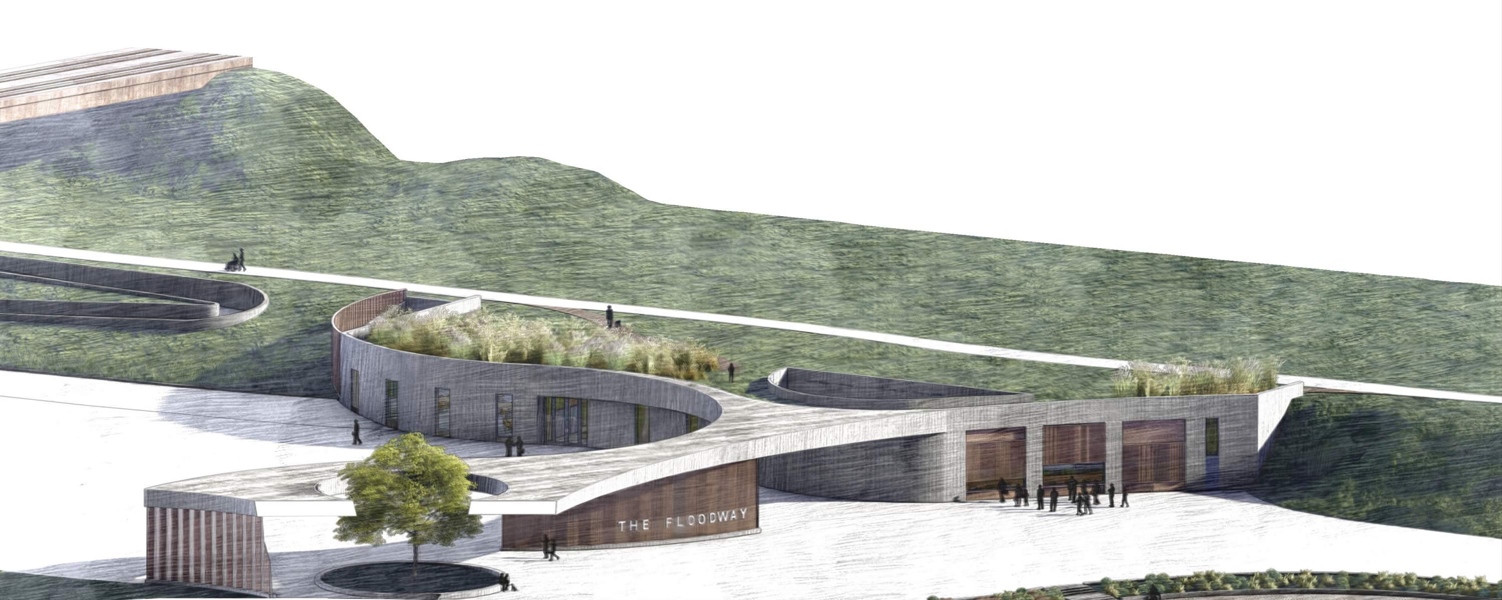
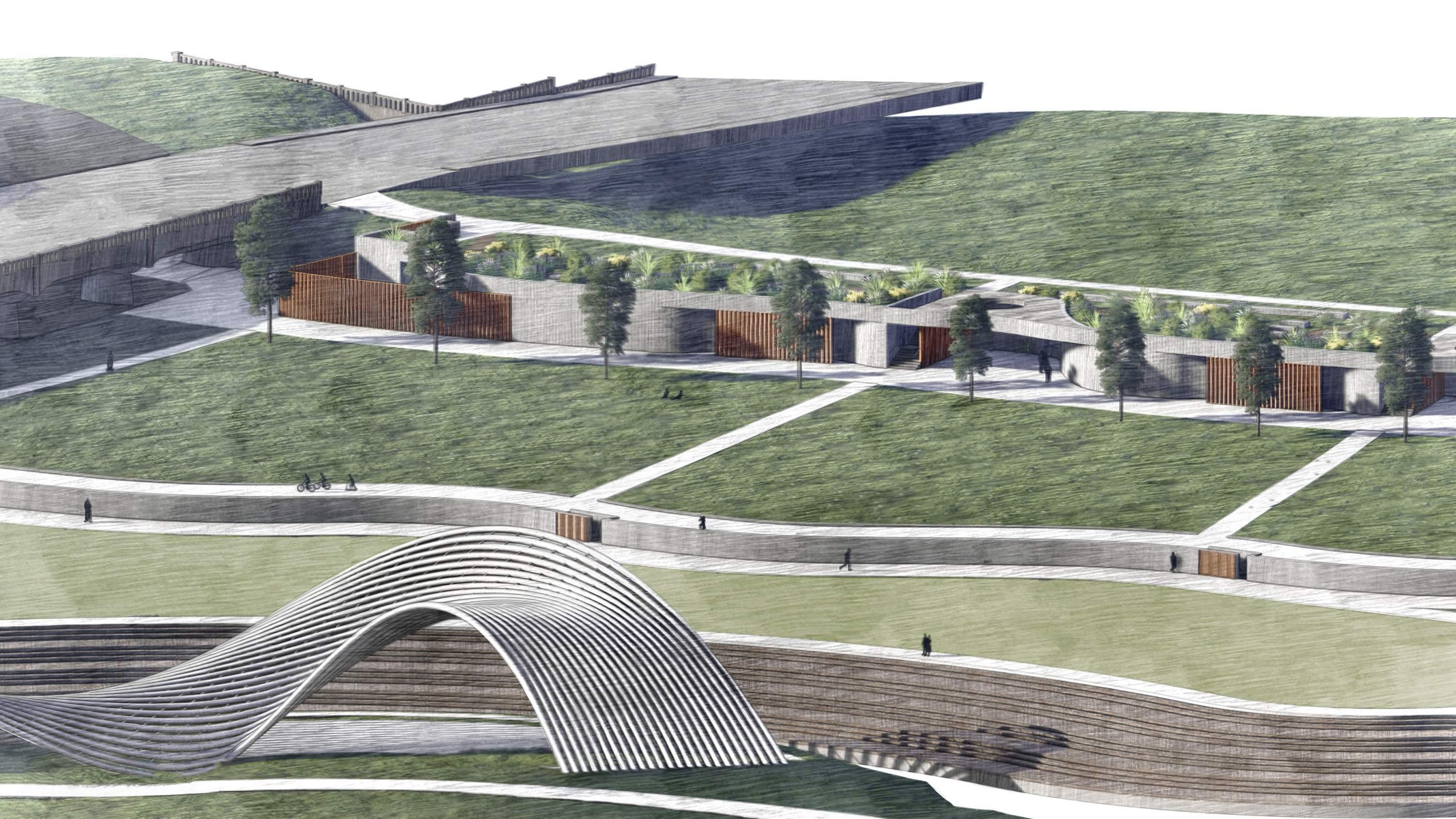
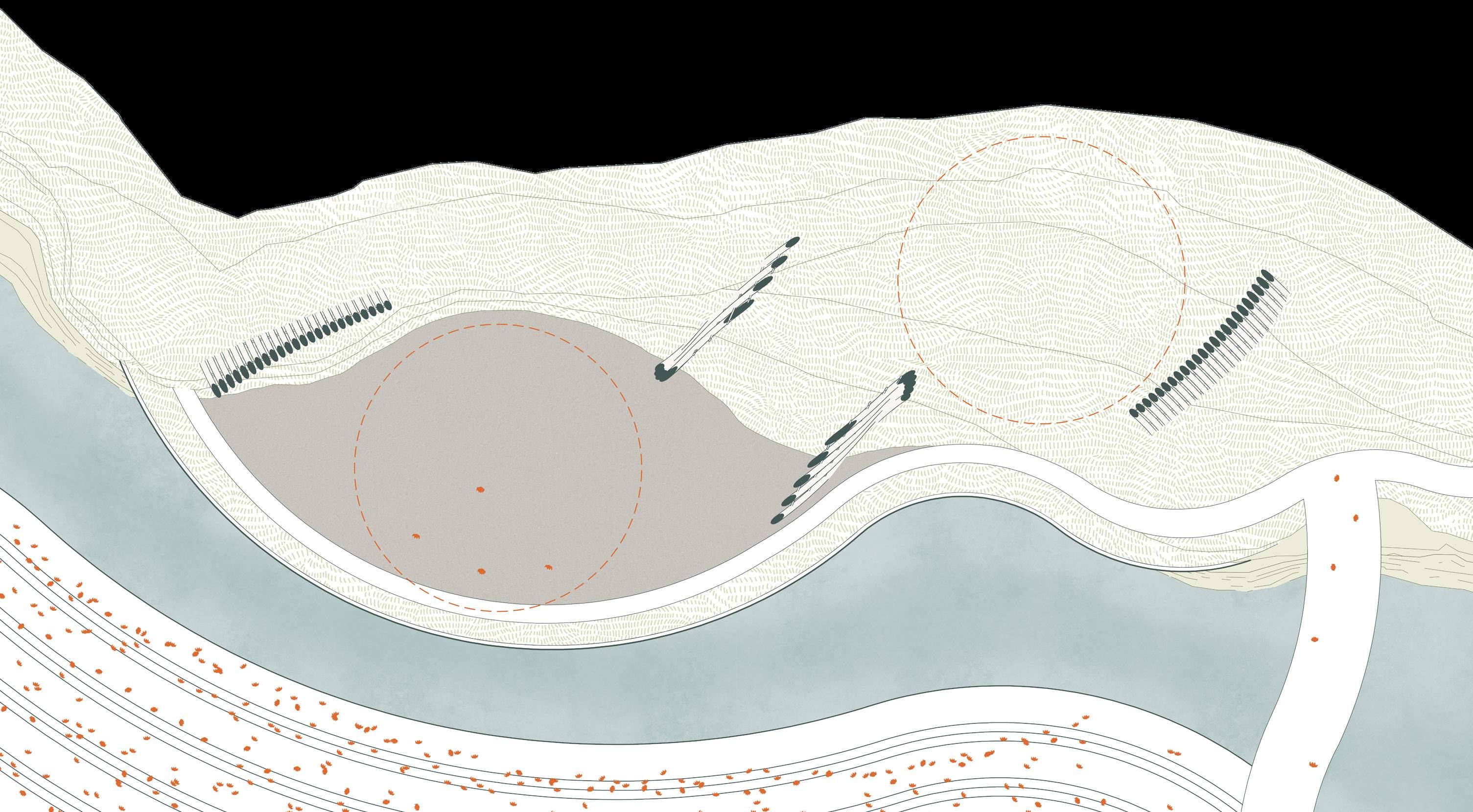
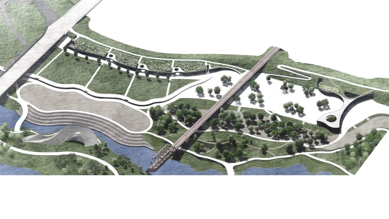
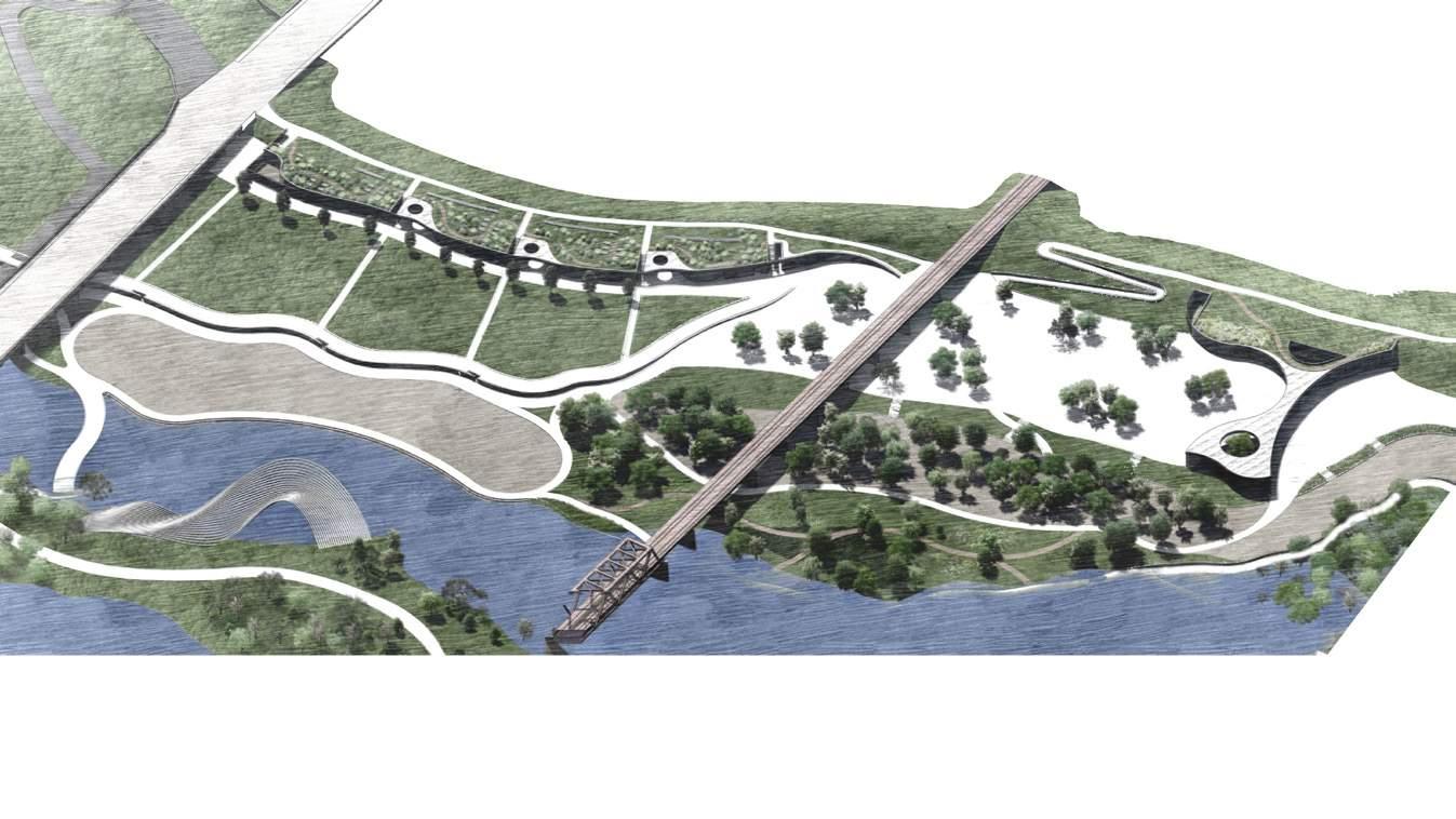
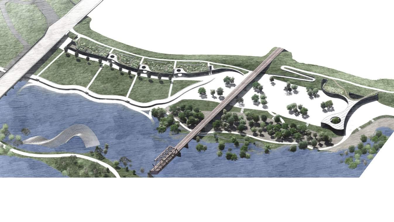
Reimagining the performing arts venue
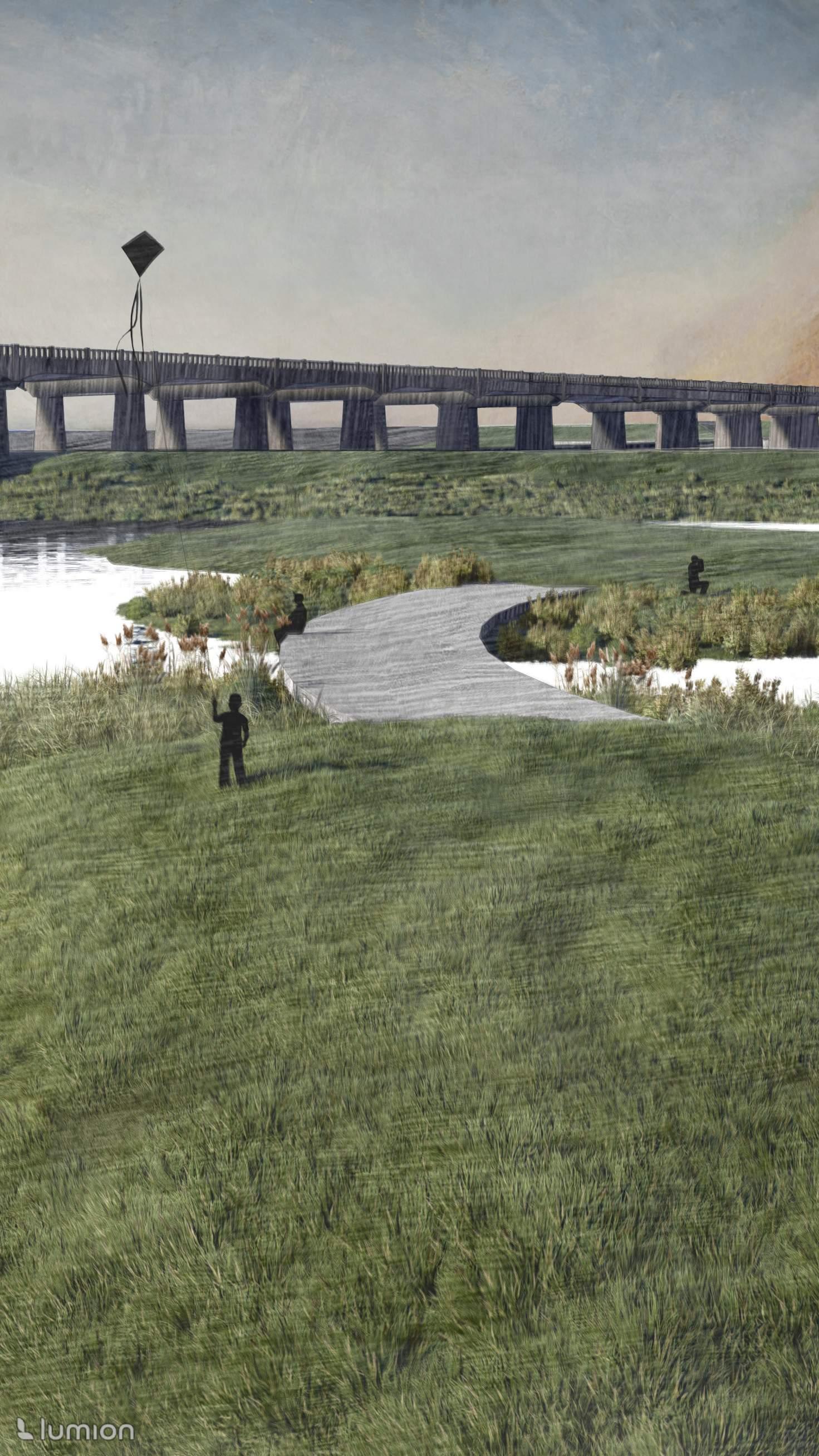
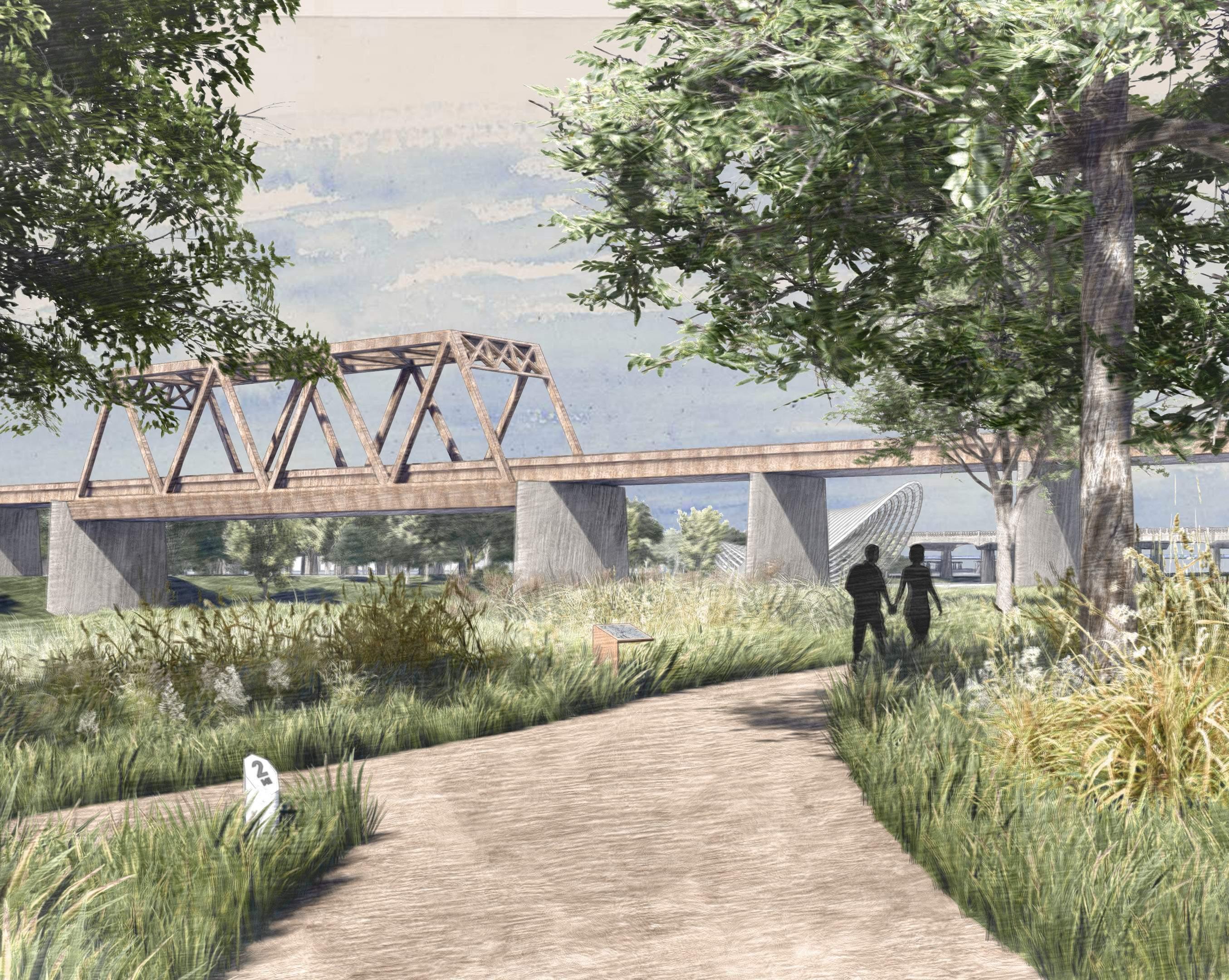
The venue’s organization values thoughtful sequence as one approaches and meanders through the site until settling in their seat for a show. The gatehouse building greets users as they pass under the Margaret Hunt Hill Bridge and proceed toward the ticketing office. A curved canopy signifies entry to the defined venue. A series of terraced plazas, varied in texture and character, provide places to gather, relax, or play. Pathways, wide and narrow, guide users toward the banks of the Trinity River. The Texas & Pacific Railroad frames views of the pavilion, located in the
center of the floodway. Its placement there is a unique and imaginitive opportunity to embrace the site’s intrinsic relationship with water. The pavilion, on a regular day, is a sculptural object in the landscape. On event days, it transforms into a stage for performance. Seating slopes up following the topography, offering standing, seated, and lawn options. At the top of the lawn, a second building is buried into the levee housing concessions, restrooms, and accommodations for visiting performers. Levee buildings are intentionally set just above the 100-year floodplain.
Existing Grade El. 416 / 100 year floodplain El. 430 / Top of Levee El. 410 / 10 year floodplain El. 400 / 6 month floodplain El. 386 / Typical water level
100’ 0 25 50 Western Levee TOP TRAIL Venue CONCESSIONS Venue LAWN SEATING Venue GREEN SEATING Venue BLEACHERS Trinity River MAIN CHANNEL Trinity River SIDE CHANNEL Venue PERFORMANCE PAVILION Entry + Ticketing Gatehouse Concessions Plaza Shaded Plaza Meadow Pavilion + Stage 1 2 3 4 5 6 Bleacher Seating Green Patio Seating Lawn Seating Concessions Restrooms Artist Accommodations 7 8 9 10 11 12 APPROACH EXPERIENCE PERFORMANCE

The gatehouse building serves as a hub for the venue, designed with flexibility in mind to accommodate a variety of activities.
40’ 0 10 20 Lower Level Entry Secure Storage Ticketing + Box Office Lounge Courtyard Lobby Reception Event Hall Patio Bar Kitchen Storage Medical Services Accessible Restroom Janitorial Closet Multipurpose Classroom Staff Kitchen Staff Restroom Staff Office Conference Room Open Workspace 1 2 3 7 8 9 10 11 12 4 5 6 13 14 15 16 17 18 19 20 21 Ground Floor Plan First Floor Plan 1 1 2 2 6 7 16 17 18 18 19 19 19 20 21 19 19 19 8 9 10 11 12 13 14 14 14 15 14 3 3 4 4 5 5
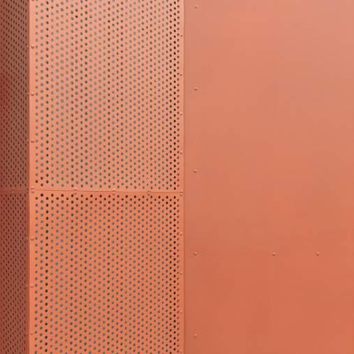
Operable metal screen at box office
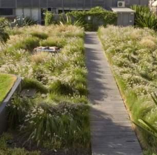
INTENSIVE GREEN ROOF
BOARD FORMED CONCRETE PARAPET
VEGETATION LAYER
DRAINAGE LAYER
RIGID INSULATION
WATERPROOFING MEMBRANE
SUSPENDED GYPSUM CEILING
OPERABLE SCREEN ON TRACK STOREFRONT SYSTEM
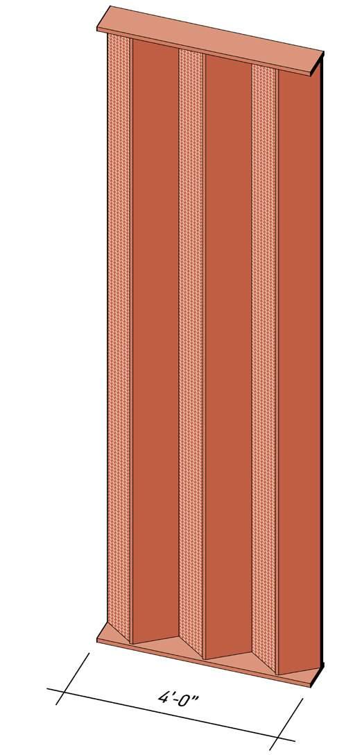
PERFORATED METALSCREEN
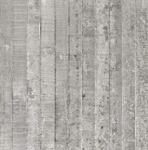
8’ 0 2 4 BOARD FORMED CONCRETE
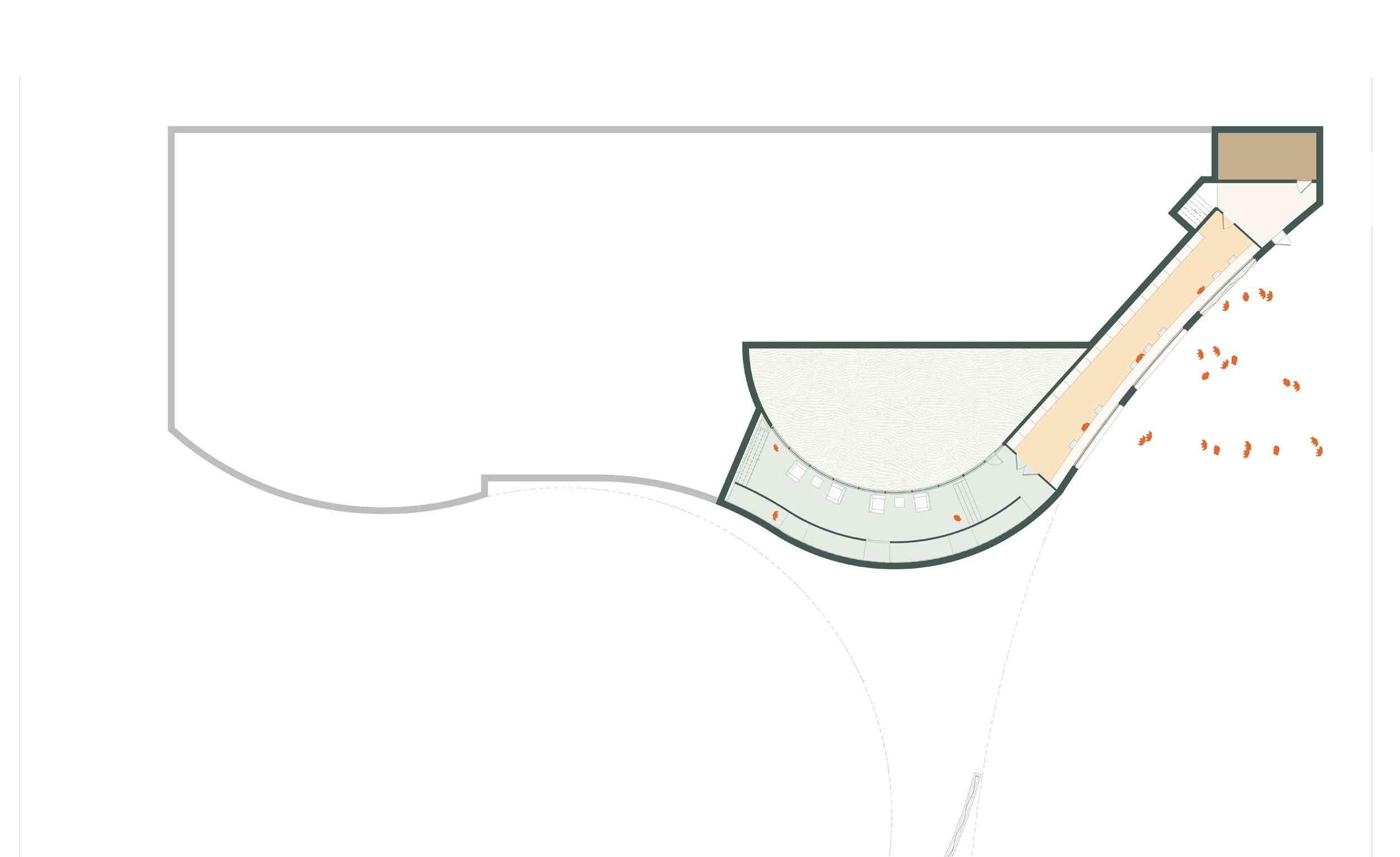
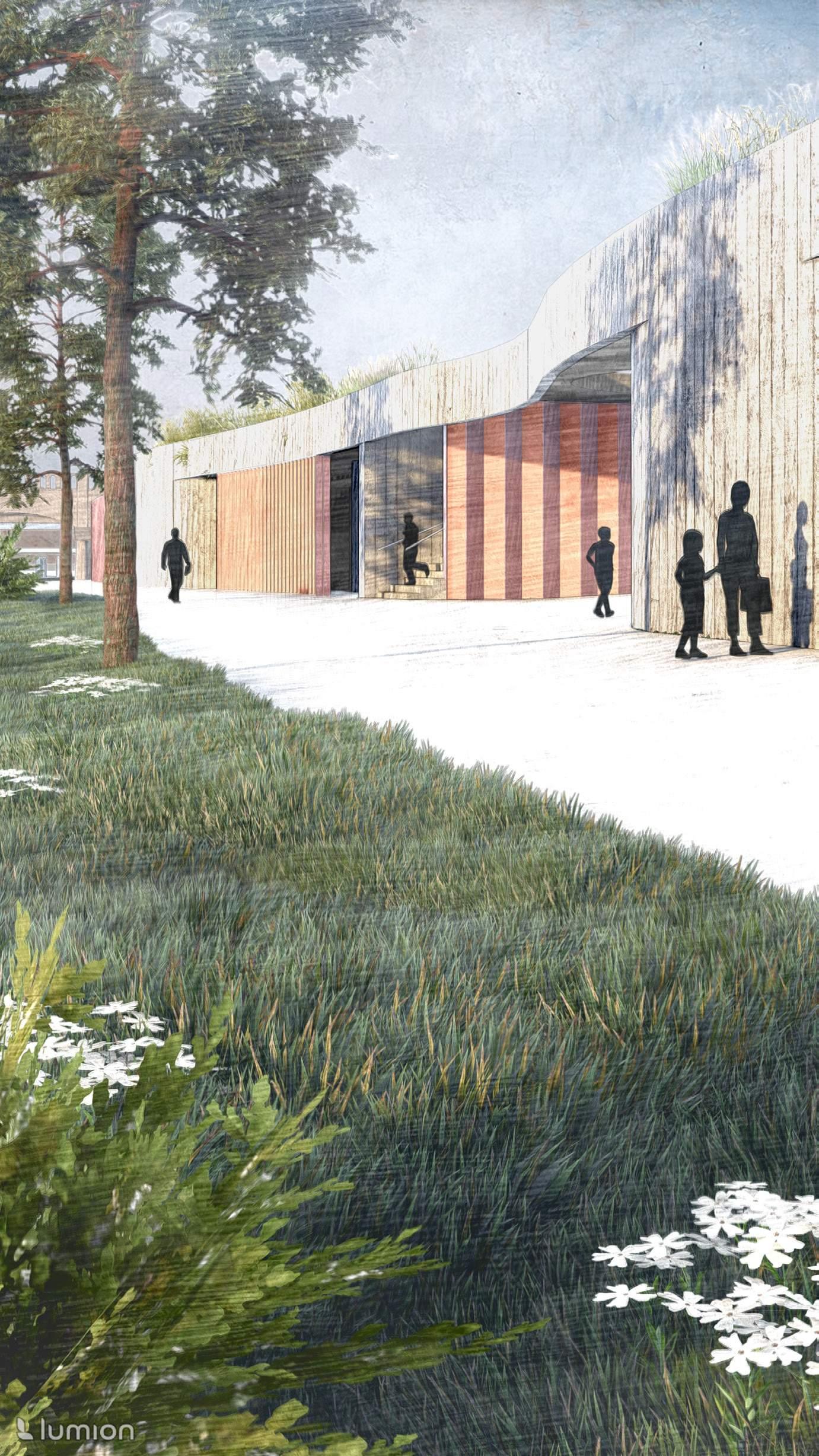
Terraced gathering plazas
Three distinct gathering spaces greet users as they enter the site from the north end. The paved plaza is a largely open concourse, making room for mobile vending booths or food trucks to set up before an event. The shaded, semi-permeable courtyard presents an alternate, more secluded feel. The meadow, closest to the river, is populated with lush native plantings.
Existing Grade El. 414 / 75 year floodplain El. 430 / Top of Levee El. 400 / 6 month floodplain El. 386 / Typical water level
The gatehouse canopy frames views of the site’s existing infrastructure. The shaded courtyard offers a peaceful setting to escape the heat.
Western Levee TOP TRAIL
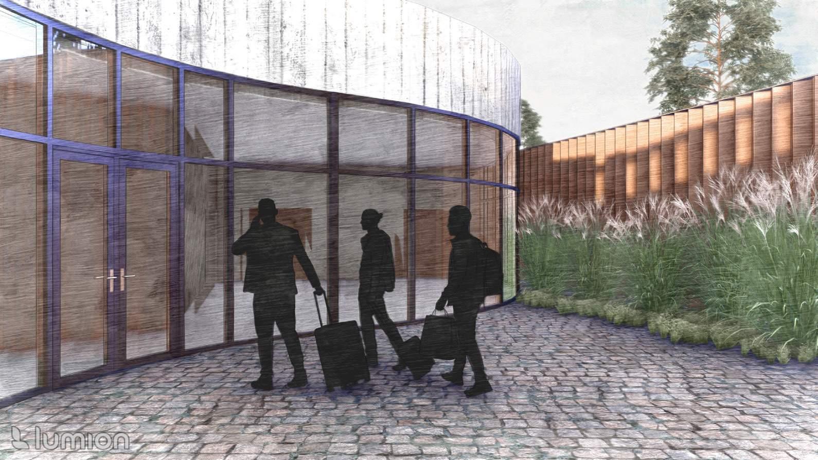
Western Prospect GATEHOUSE
Upland Terrace PAVED PLAZA
Upland Forest SHADED GATHERING
Riparian Bench MEADOW
Trinity River MAIN CHANNEL
100’ 0 25 50
Upland Forest SHADED HILLTOP
The venue’s primary entry is marked by the gatehouse and its dramatic concrete canopy.
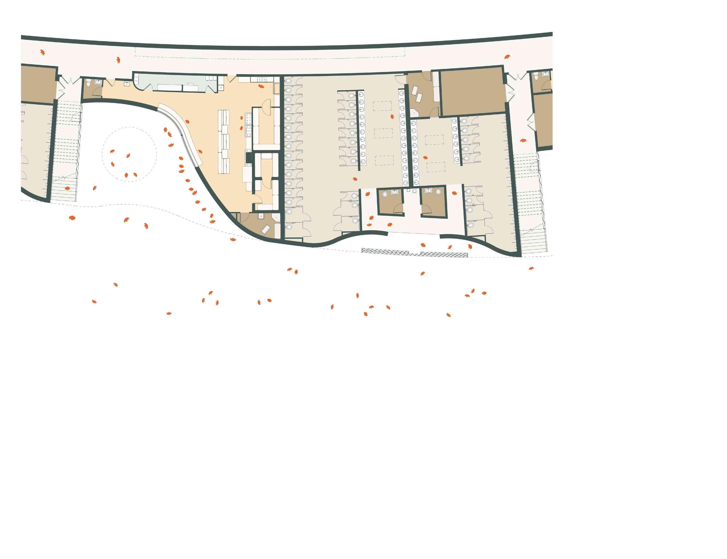
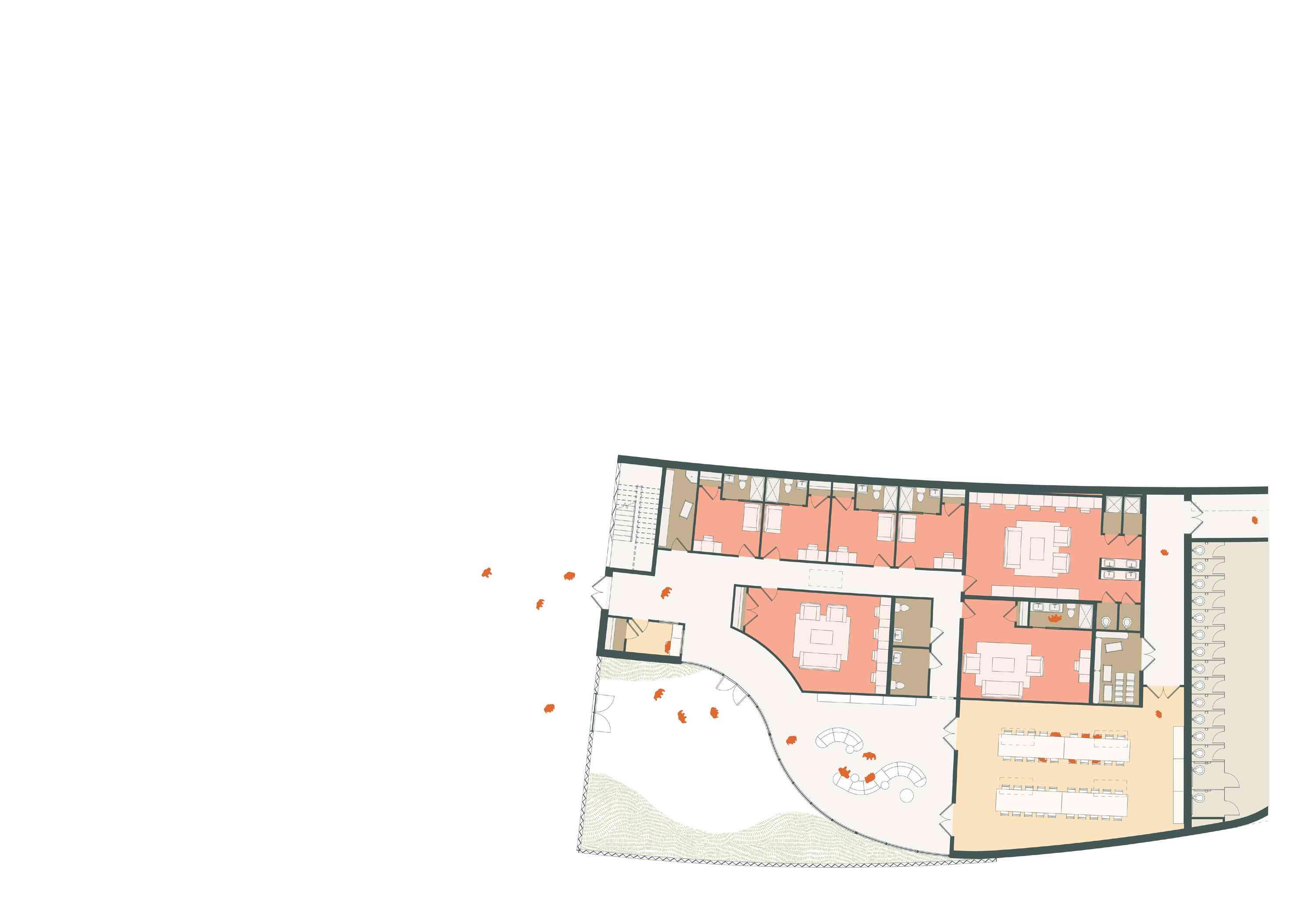
Organized by radial staircases facilitating seamless movement from the lawn to the green roof and levee top trail, the building contains a series of mostly restrooms and vending areas supported by a long service corridor.
Artist Accommodations Restrooms Restrooms Restrooms Restrooms Vending Vending Vending WaterStorage 64’ 0 16 32 Ground Floor Plan Roof Plan
Building in the levee
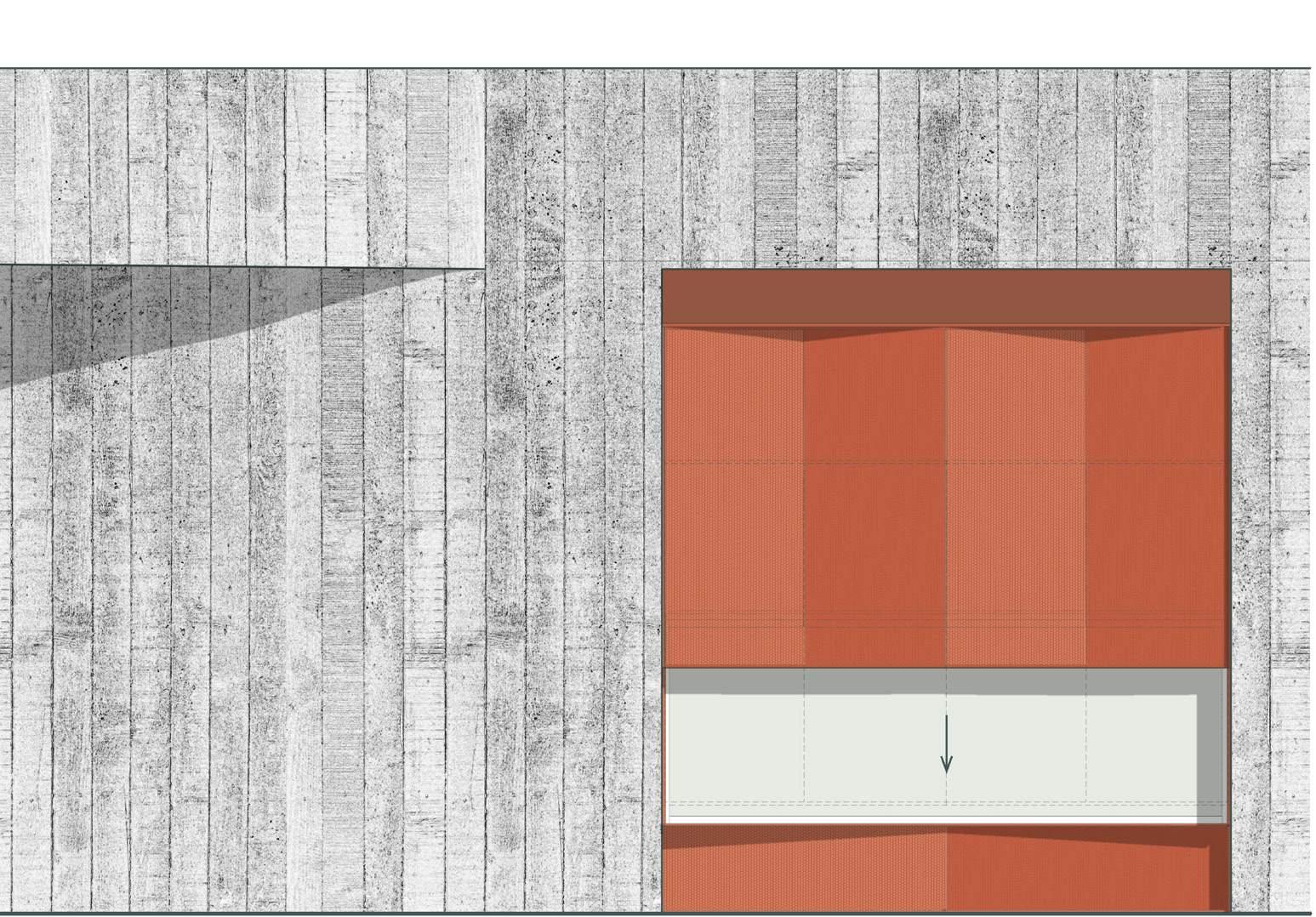
Massing undulates gently, blending in with the existing topography at the base of the western levee. The structure’s planted green roof aligns with the existing elevation of the levee, enabling roof pathways to merge with existing trails. Board formed concrete walls are complemented by colorful, perforated metal screens, creating a simple, yet refined material palette that is replicated across the site.
PERFORATED METALSCREEN BOARDFORM ED CONCRETE
INTENSIVE GREEN ROOF
24’ 0 6 12 24’ 0 6 12 Artist Accommodations Vending + Restrooms Arrival Courtyard Security Lobby Lounge Catering Room Storage Service Window Vending Office Kitchen Dry Food Storage Walk-in Freezer Walk-in Cooler Janitorial Closet Women’s Restroom Men’s Restroom Accessible Restroom Venue Storage Service Corridor 1 2 3 4 5 6 1 2 3 4 5 6 7 8 9 10 11 12 Service Corridor Private Dressing Room Group Dressing Room Green Room Accessible Restroom Loading Entry 7 8 9 10 11 12 1 1 2 3 4 5 6 7 8 8 9 10 11 11 12 8 8 8 2 3 4 5 6 7 7 8 9 10 10 11 12
Inviting spaces
Vending and artist accommodations are arranged deliberately with the human scale in mind. Facade walls curve inward to create a shaded alcove for queuing. Screens provide privacy or highlight vertical circulation. Views of the pavilion and skyline are encountered from many areas of the building.
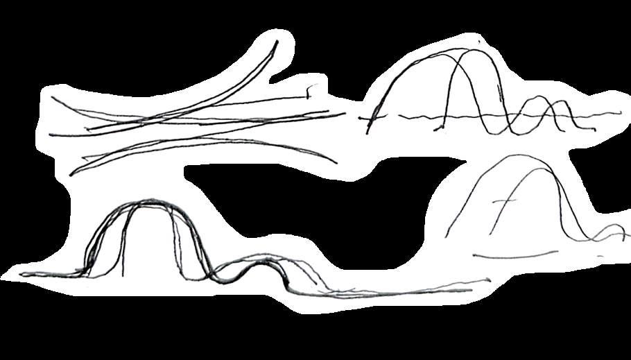
Finding form through sketching
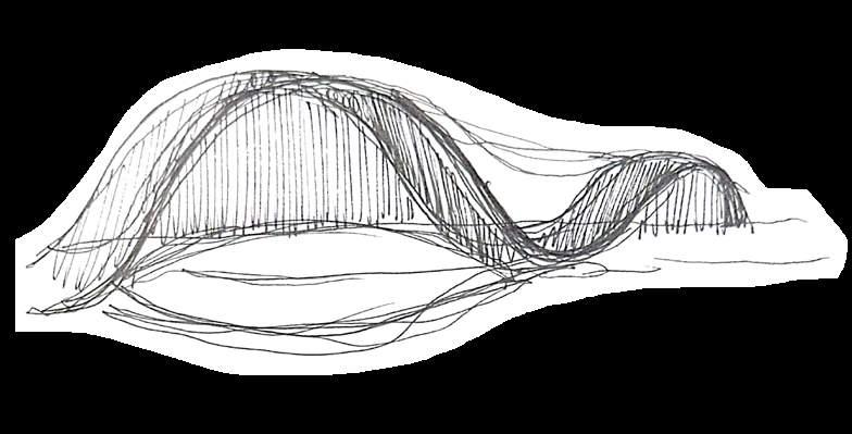
48’ 0 12 24 Pavilion
125’
62.5’
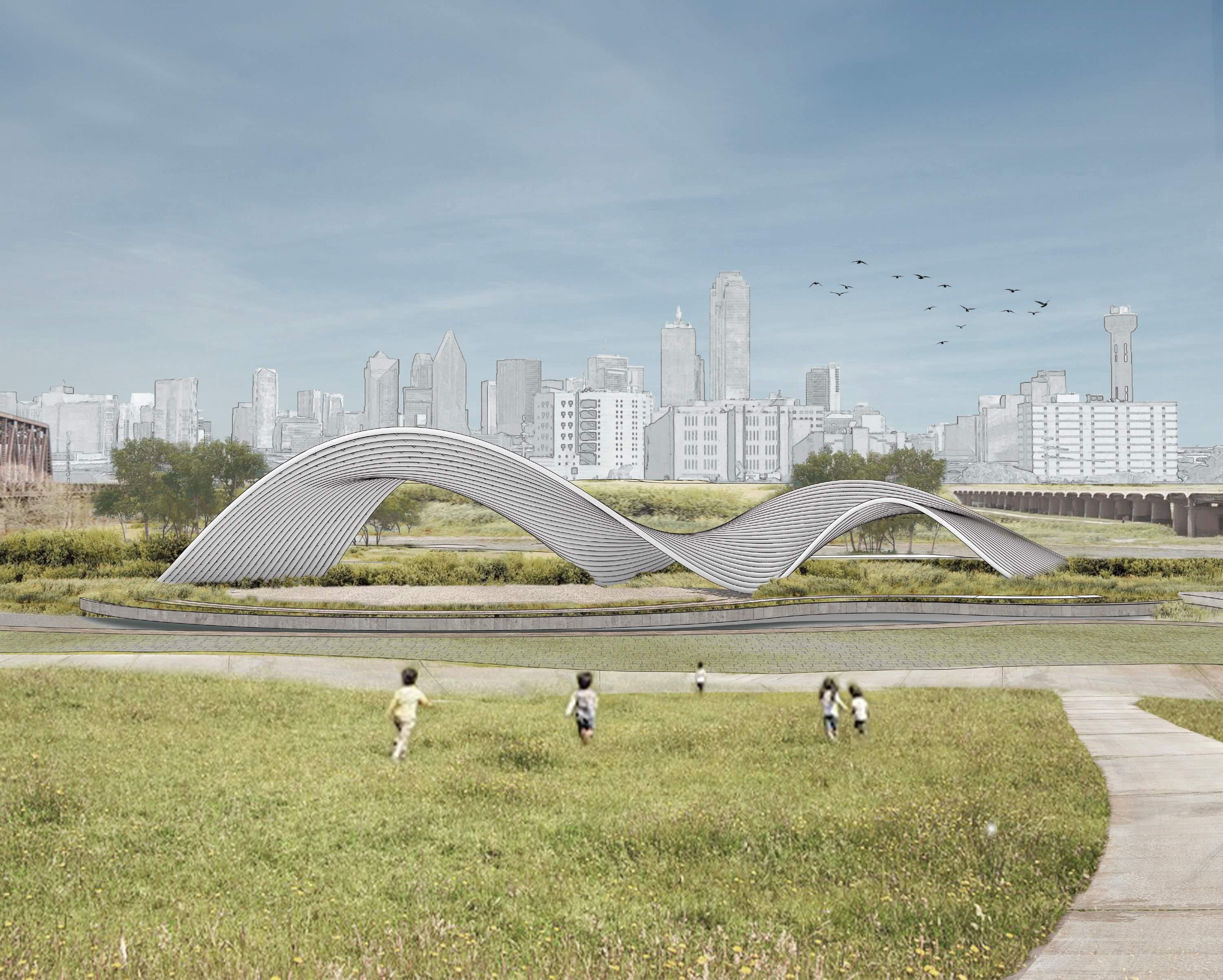
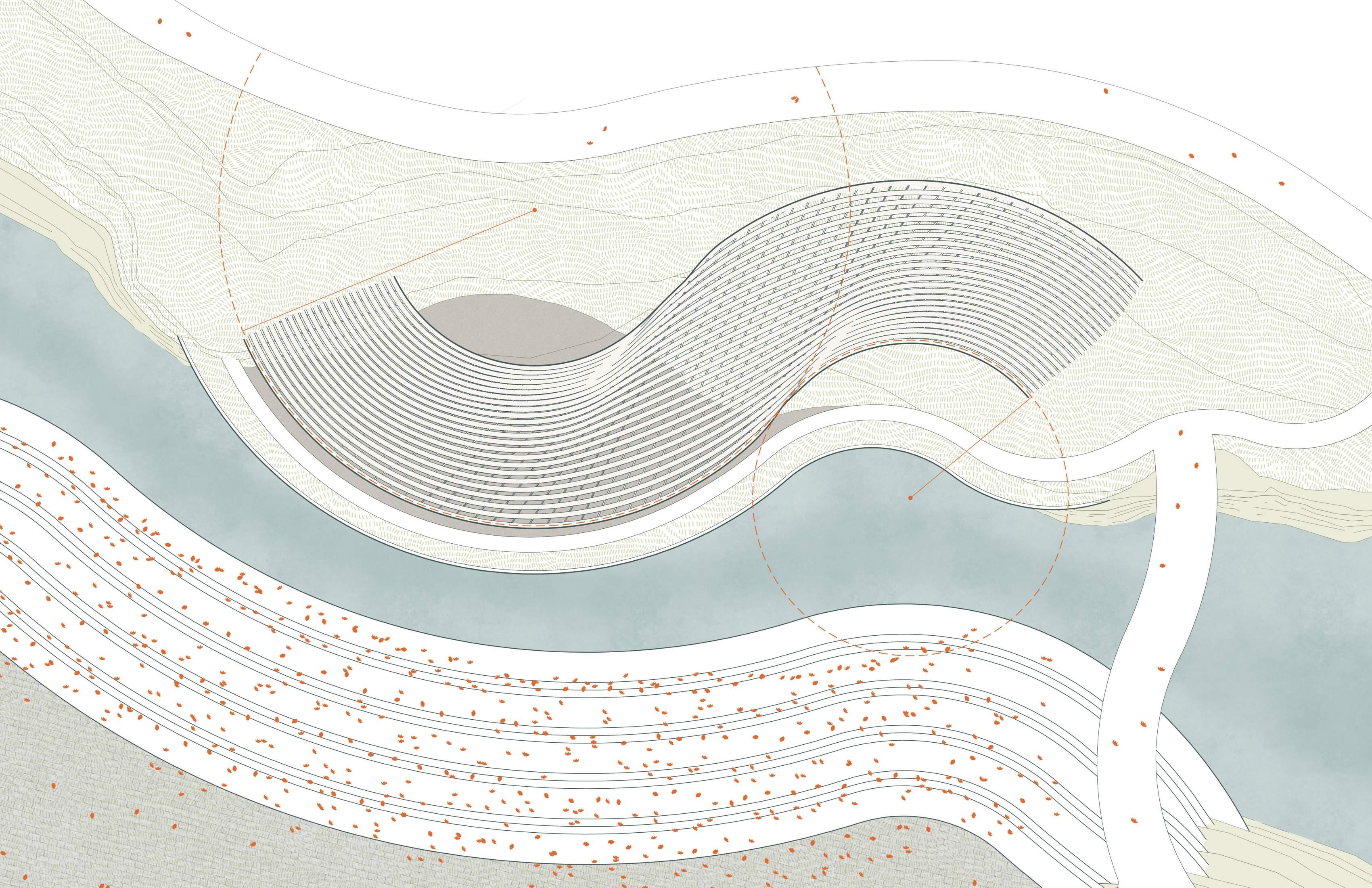
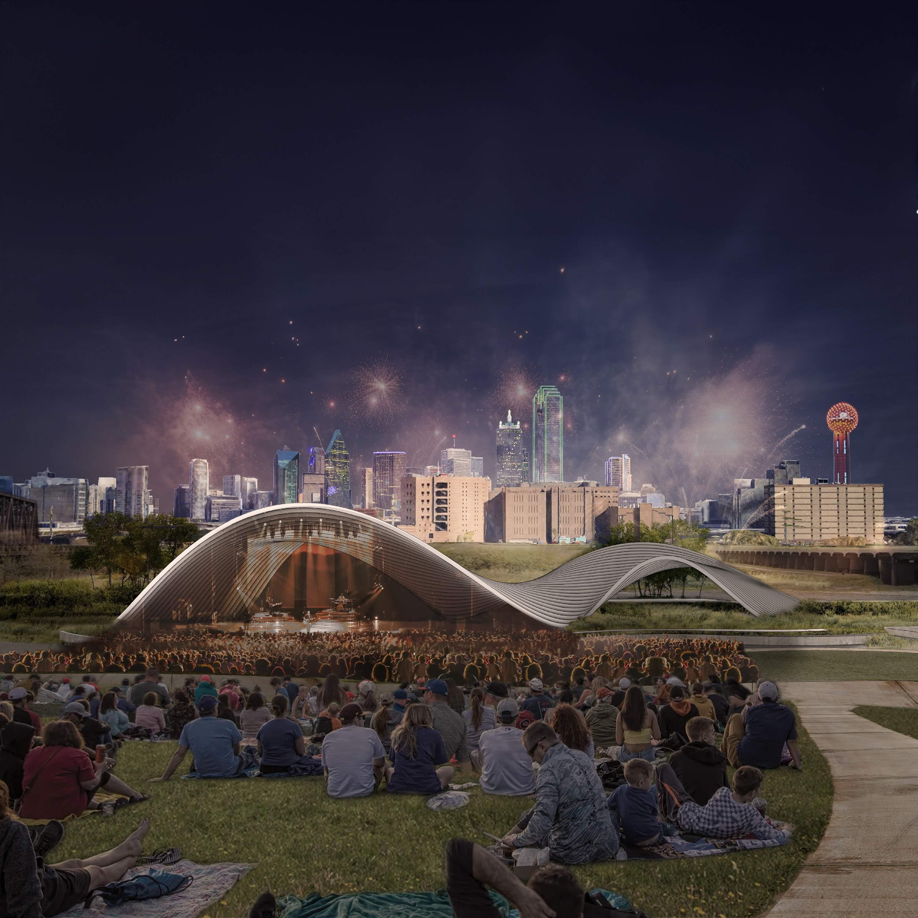
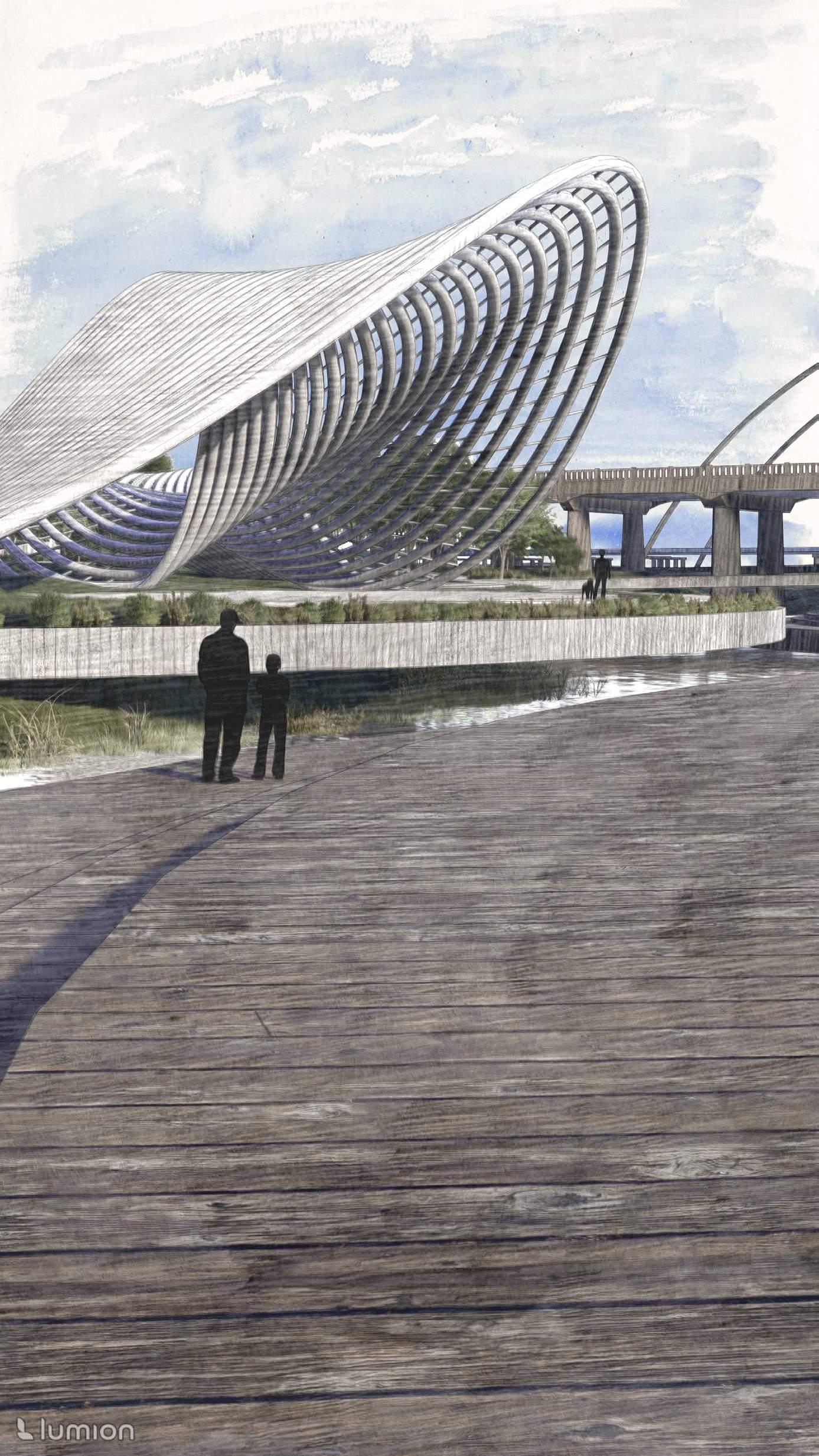
A sculptural object in the landscape
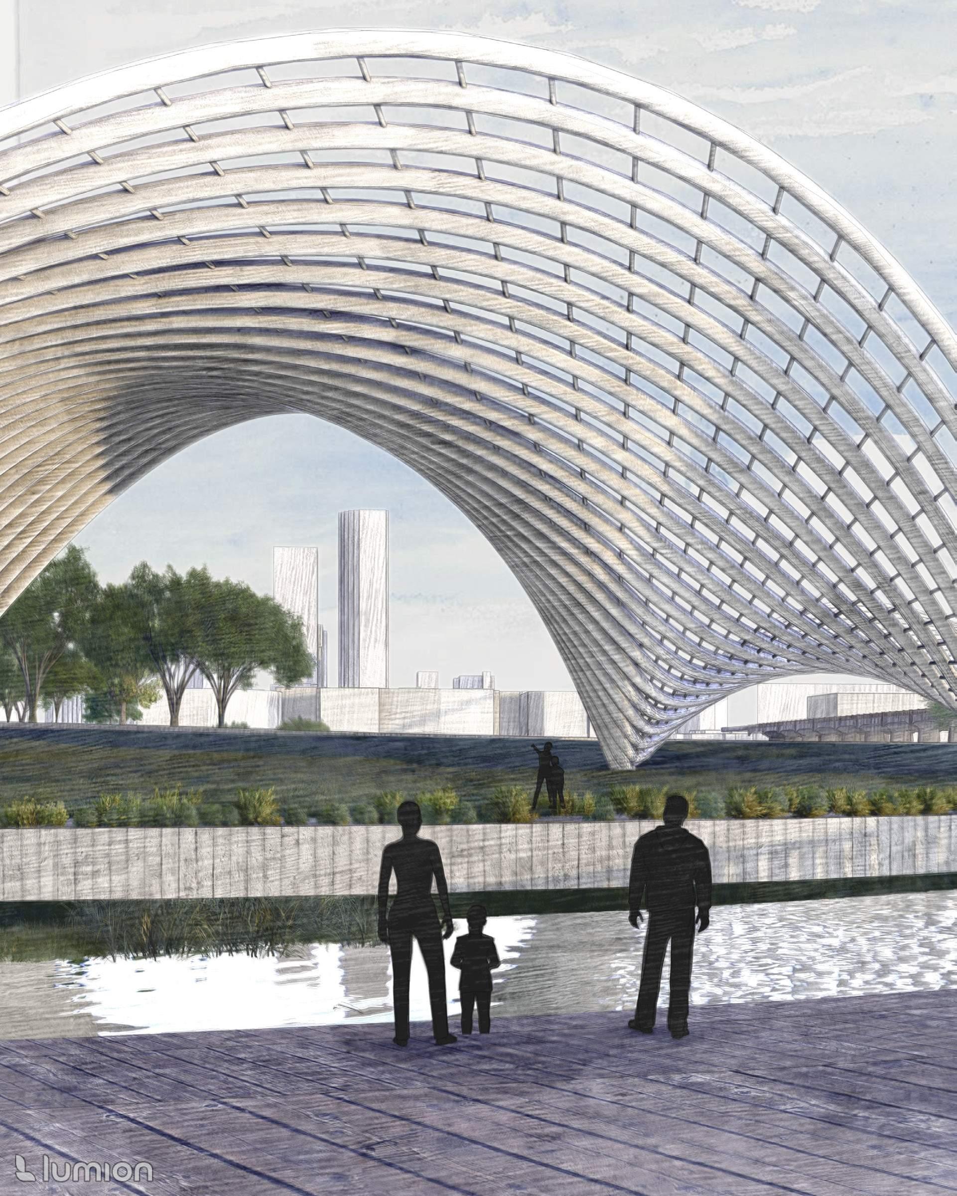
The pavilion is the focal point of the site. Its form is inspired by the geomorphological evolution of the river and landscape, composed of a primary and secondary curve. In plan, the shape was conceived from two circles at a 2:1 ratio. Assembled from curved steel pipes, the pavilion is structurally self-supported, sitting atop deep pile foundations. Made of white painted metal that is finished to withstand water, it is a monumental sculpture at an infrastructure scale.
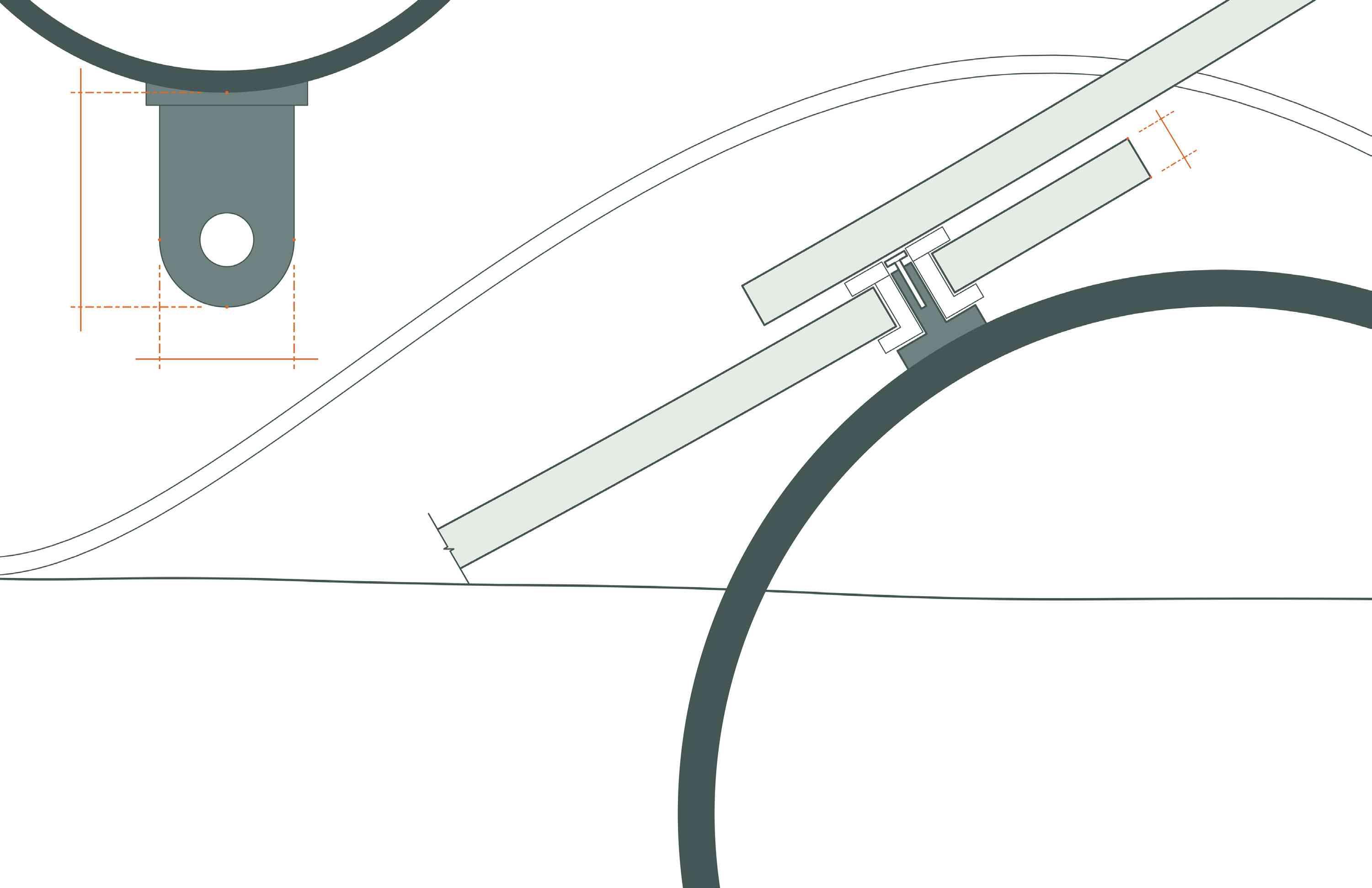
PLATE WELDED TO PIPE
ANCHOR TAB WITH MAX LOAD PERMANENTLY MARKED
ATTACHMENTSPRE-WELDEDALONGPIPES,SPACED24”
GLASSSHINGLE
PERFORMANCE ZONE
BACKSTAGE ZONE
48’ 0 12 24 Pavilion
24” DIAMETER PIPE
24” DIAMETER PIPE 8” TYP
TYP
2000 LBS LIVE LOAD MAX
5”
1”TYP
O.C.
A shell for performance
On an event day or night, the pavilion activates into a dynamic stage. Able to adapt to the needs of any show, pre-welded pipe attachments provide a convenient way for crews to efficiently assemble unique sets that may integrate with the structural form itself. The smaller pavilion curve houses and hides the backstage setup required for the largest productions. As a crowd gathers to spectate, the Dallas skyline paints a striking backdrop behind an iconic attraction.
PIPECONNECTIONATEND
GLASS SHINGLES FASTENED TO PIPE
ARCH PIPE, SLIP CONNECTION
ANCHOR BOLTS EMBEDDED IN CONCRETE FOUNDATION
STEEL PLATE WELDED TO ANCHOR PIPE
FLASHING TO PERIMETER DRAIN
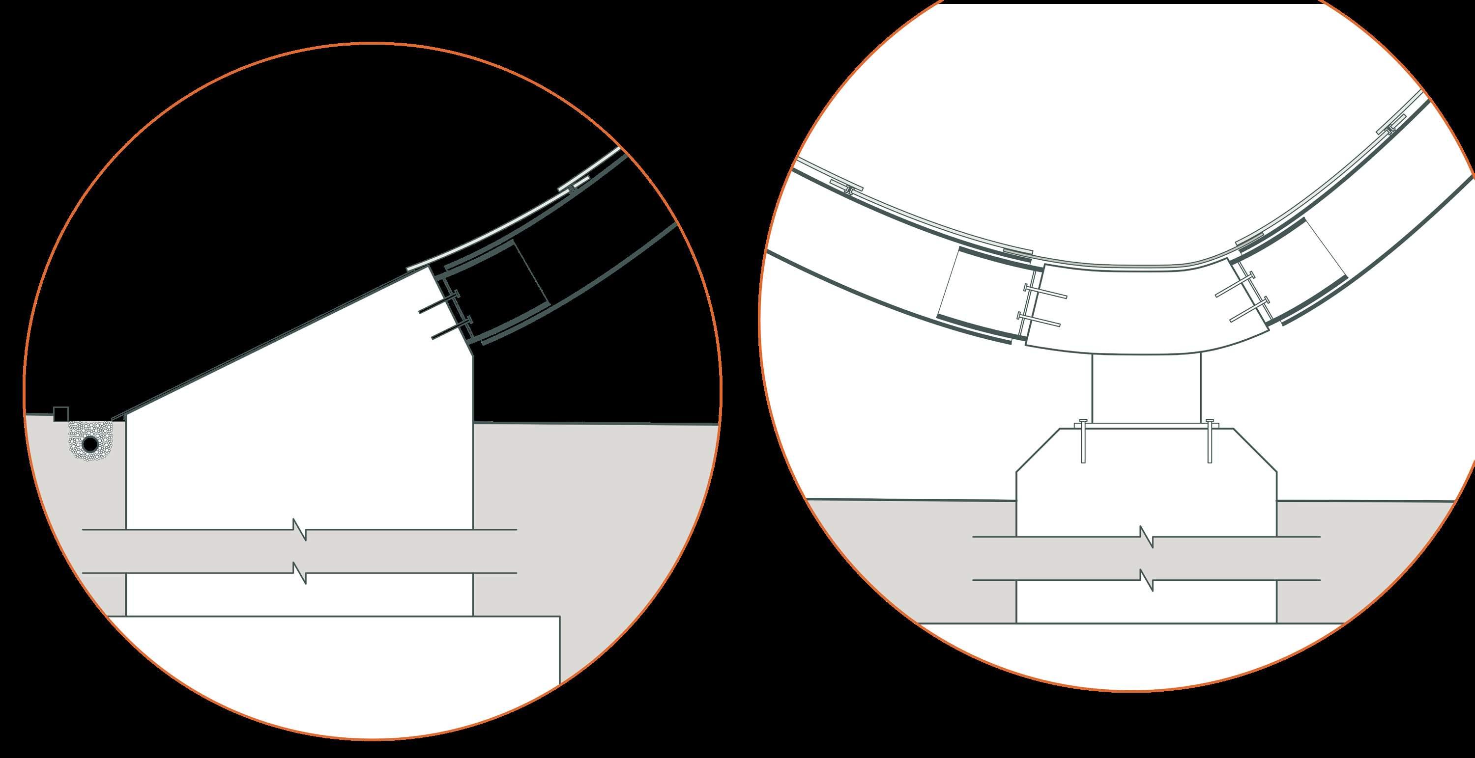
GLASS SHINGLES FASTENED TO PIPE
STEEL PLATE + ANCHOR PIPE BOLTED TO “Y” CONNECTOR
FLASHING TO PERIMETER DRAIN
FASTEN TO FOUNDATION
CONCRETE FOUNDATION
PILE CAP
ARCH PIPE, SLIP CONNECTION
“Y” CONNECTOR AT VALLEY
STEEL PLATE BOLTED TO CONCRETE FOUNDATION
CONCRETE FOUNDATION
PIPECONNECTION AT VALLEY

FASTEN TO FOUNDATION
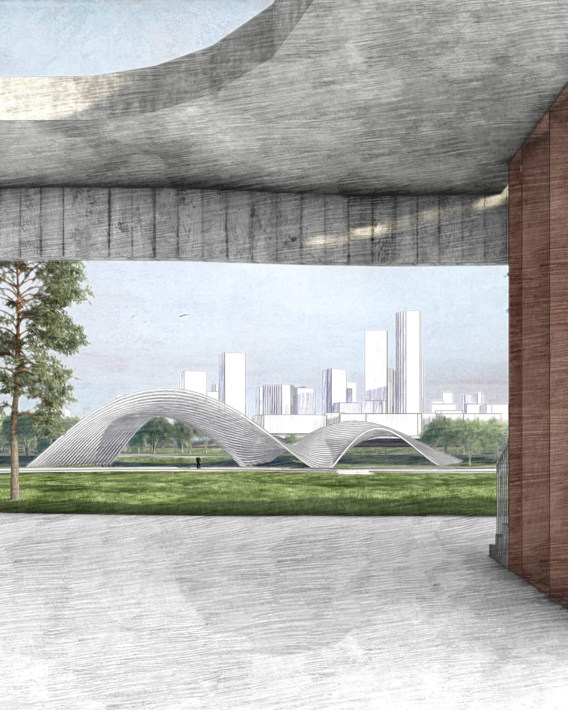
Views from near and far
At varied distances, the pavilion transforms in perception: up close, it embraces audiences like an enclosure. From afar, it stands as an elegant sculpture, seamlessly integrated with the landscape.
SOLAR CONSIDERATIONS
Dallas sun is strong, heating up the site easily.
Designed to flood
The character of the park is determined by the river’s fluctuation. During flood events, the site undergoes varying degrees of inundation. The typical water level rests 10-12 feet below the pavilion but may rise to the stage level 2-4 times annually. The 10-year and 100-year floodplains present more severe flooding scenarios, but essential program remains dry. Rather than a deterrent, a higher river becomes an attraction, drawing visitors to witness the dynamic presence of water. The landscape masterplan capitalizes on its ebb and flow, providing diverse opportunities for interaction with water including islands and bridges, encouraging people to engage intimately with the Trinity River.
6 MONTH (400) 2 YEAR (404) 10 YEAR (410) 100 YEAR (416) TYPICAL WATER LEVEL (386) TOP OF LEVEE (430) 6 MONTH (400) 2 YEAR (404) 10 YEAR (410) TYPICAL WATER LEVEL (386) TOP OF LEVEE (430)
WATER LEVEL (386) TOP OF LEVEE (430) 6 MONTH (400) TYPICAL WATER LEVEL (386) TOP OF LEVEE (430) 6 MONTH (400) 2 YEAR (404) TYPICAL WATER LEVEL (386) TOP OF LEVEE (430)
TYPICAL

Topographical model laser cut and assembled, pavilion 3D printed.

Project reflections
Throughout the year, the project fortunately received positive feedback from a supportive group of jurors, which was both reassuring and motivating. It was particularly exciting to engage with professionals who shared my enthusiasm for such an unconventional proposal.
Design is perpetual — given more time, I would focus on further development of the terraced plazas, dividing them into smaller, more intimate outdoor “rooms” with strategic plantings, shade structures, and other site furniture.
The design process was a challenging yet rewarding learning experience. Iterative by nature, it taught the importance of not being afraid to test out new ideas and make changes. I enjoyed pushing the boundaries of feasibility, finding real-world solutions for an idea that initially felt fictional. I am especially proud of remaining open-minded and willing to think differently, ultimately reworking the design into something more aligned with both the project’s vision and my own.
Many thanks to my advisor, Joanne Aitken, my classmates, friends, family, and the many others who offered input and support this year.
Rachel Sasson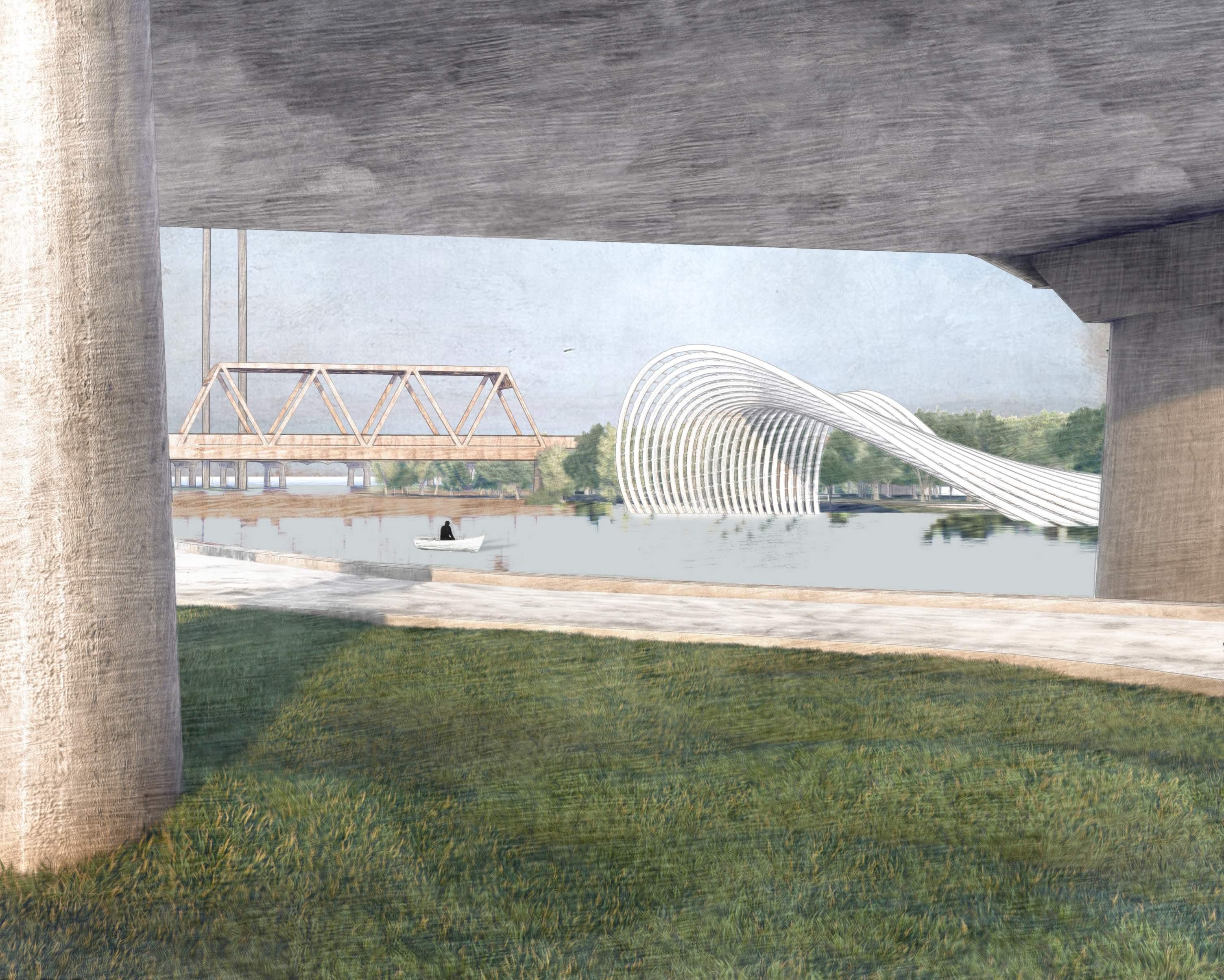
Senior Project 2023-24
Rachel Sasson | Drexel
Architecture