
PORTFOLIO
Education
University College London, UCL
Master of Science, Architectural Computation (2024.09 – present)
Core Modules:
Computer Vision and Programming: Computational Synthesis, Computational Analysis, Introduction to Programming for Architecture and Design, Morphogenetic Programming
Design and Theories: Digital Studio, Digital Ecologies, Design as a Knowledge-Based Process
National University of Singapore
Bachelor of Arts, Architecture (Honours with Distinction, 2020.08 - 2024.06)
Core Modules:
Architectural Design Studio, Design Thinking, Design and Make, Spatial Computational Thinking, Livable Cities, Tropical Envelope, Advanced Architectural Integration, Urban Design Theories & Praxis, Architectural Construction & Tectonics, Introduction to Business Analytics, Linear Algebra, Calculus for Computing, Programming Methodology, Ethics of Computing
/ PERSONAL PROJECT, DESIGN STUDIO WORKS,
INTRODUCTION TO URBANISM
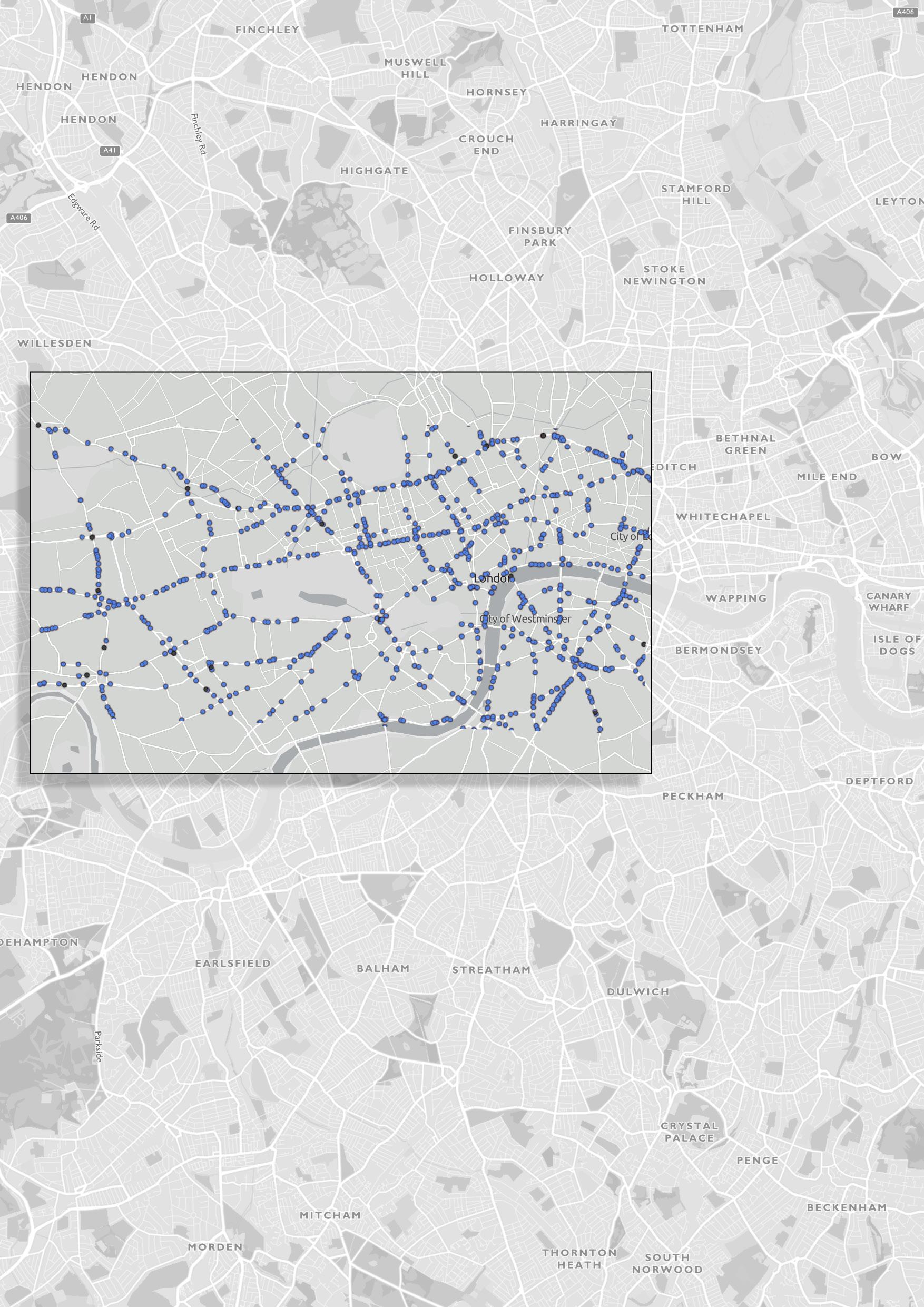
PERSONAL PROJECT | LONDON INTERACTIVE MAP PROTOTYPE
AR3102 | MANGROVE GROWS AND BLOWS
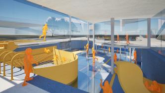
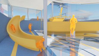
AR3101 | DIVING IN TIMELESS DIVES: YAN KIT SWIMMING POOL MUSEUM
AR3223 | POP-UP MARKET: ACCESSIBLE SOLUTION FOR ALL
AR2102 | THE SHIMMERING: KINETIC FACADE DESIGN OF THE HILLGROVE SECONDARY SCHOOL
LONDON INTERACTIVE MAP PROTOTYPE
PERSONAL PROJECT, 90% INDIVIDUAL (10% FOR BRAINSTORMING GROUPWORK OF 3)
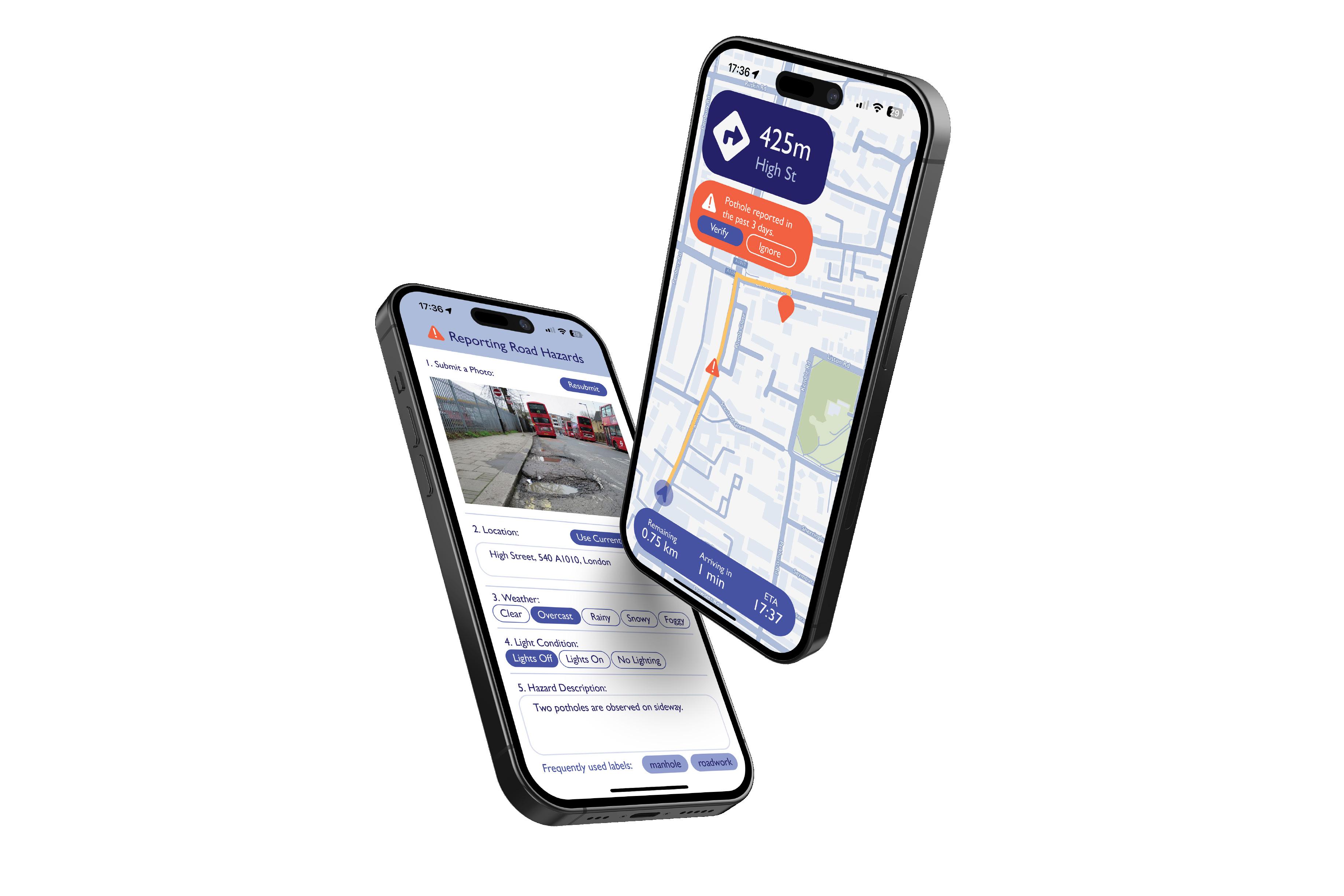

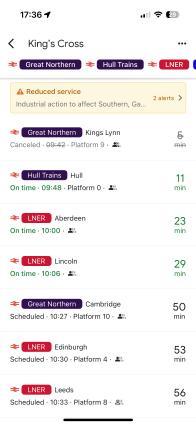
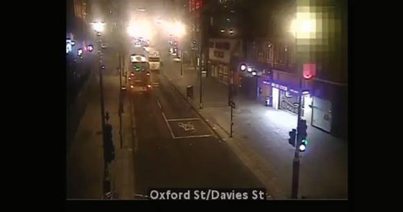
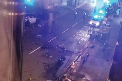
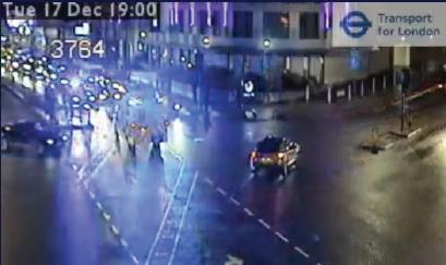
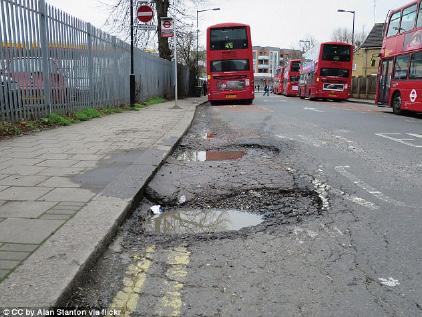
The London interactive map prototype processes real-time road hazard reports for predictive analyses, has been a pivotal experience. This project demonstrated the transformative potential of computational design within architecture, particularly in expanding the boundaries of user-centric urban design and promoting greater
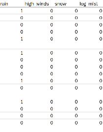
The map, employing machine learning techniques, serves to enhance road safety for London drivers. By analyzing past casualty datasets, it generates a predictive hazard warning model based on real-time road conditions. A user-friendly portal facilitates citizen reporting of road hazards, fostering public engagement and providing authorities with a tool to promptly address issues. The predictive model efficiently handles massive datasets beyond human processing capabilities, aiding in the identification of hidden yet significant hazard factors. This, in turn, inspires potential urban solutions for stakeholders and optimizes decision-making processes.
For instance, the interactive map improves accessibility and safety for diverse user groups on the road. It utilizes image processing technology on surveillance videos to detect road obstructions, offering alternative route guidance for wheelchair-bound individuals. Additionally, it provides early broadcasting notifications for commuters with visual impairments. The algorithm’s facilitation ensures the map’s ability to address emergencies and uncertainties that might elude human discovery. This experience has strengthened my resolve to delve deeper into the study and application of computational design, with the aim of uncovering unknown aspects that extend
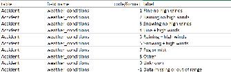
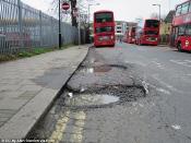
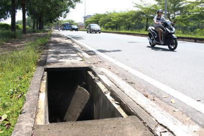
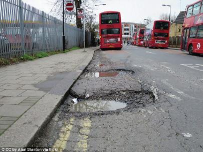
The UK Department of Transport releases annual road casualty accident data, which includes two provisional estimates and one final full-year estimate quarterly. However, all data collection relies on reports from authorities, specifically cases reported to the police. Instances of neglect occur when individuals involved in accidents choose not to report due to personal reasons, such as the fear of legal consequences for o enses like drunk driving. Additionally, some existing road hazards go unreported until accidents happen, like uncovered sewage wells. What if pedestrians were empowered to self-report observed obstructions and road hazards?
This project introduces an innovative solution—a prototype interactive map that processes real-time road hazard reports and past-year datasets for comprehensive predictive analyses of junctions and regions as well as the factors that contribute the most to the existing accidents. It also establishes a user-friendly portal for citizens to report road hazards, providing both a platform for public engagement and a tool for authorities to review and promptly address reported issues.
COLLECTION OF DATA DATA PROCESSING METHODOLOGY
Did accidents happen?


Scenario #1. observer of
c accident without injuries Scenario #2. Self-report of accident or near misses

Scenario #3. Self-report of road hazards observed
Past dataset: Predictive Analysis


Machine Learning: Processing of Existing Dataset
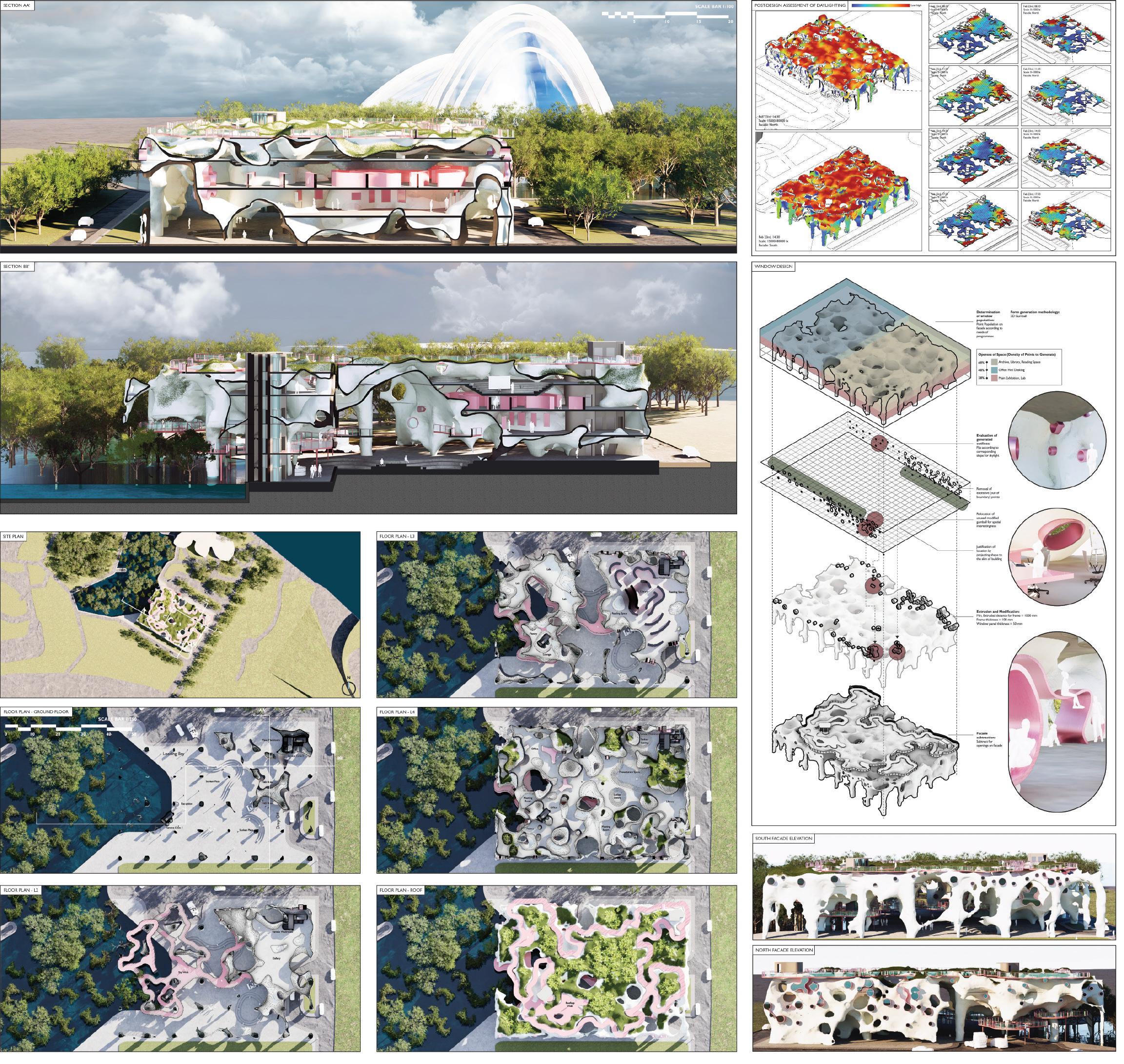
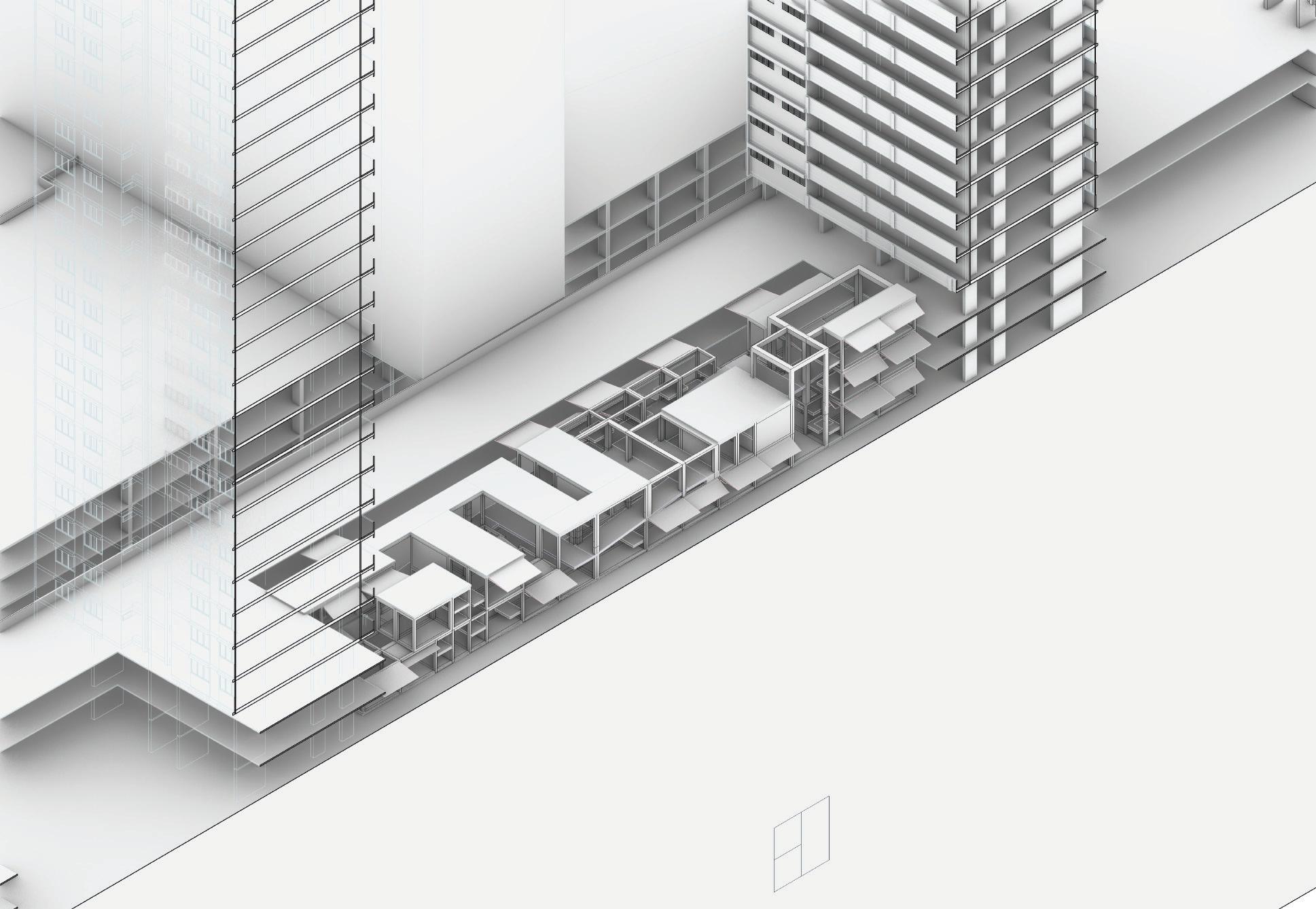
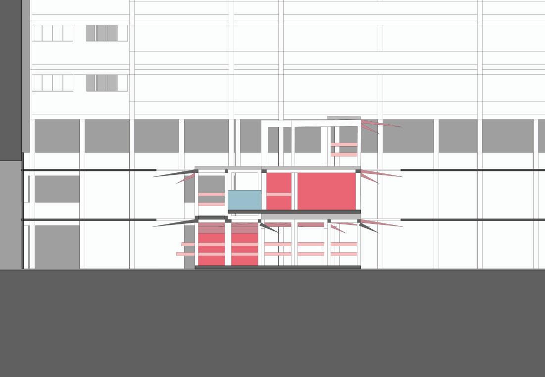
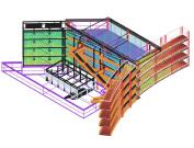
MANGROVE GROWS AND BLOWS
AR3102 DESIGN 6, INDIVIDUAL
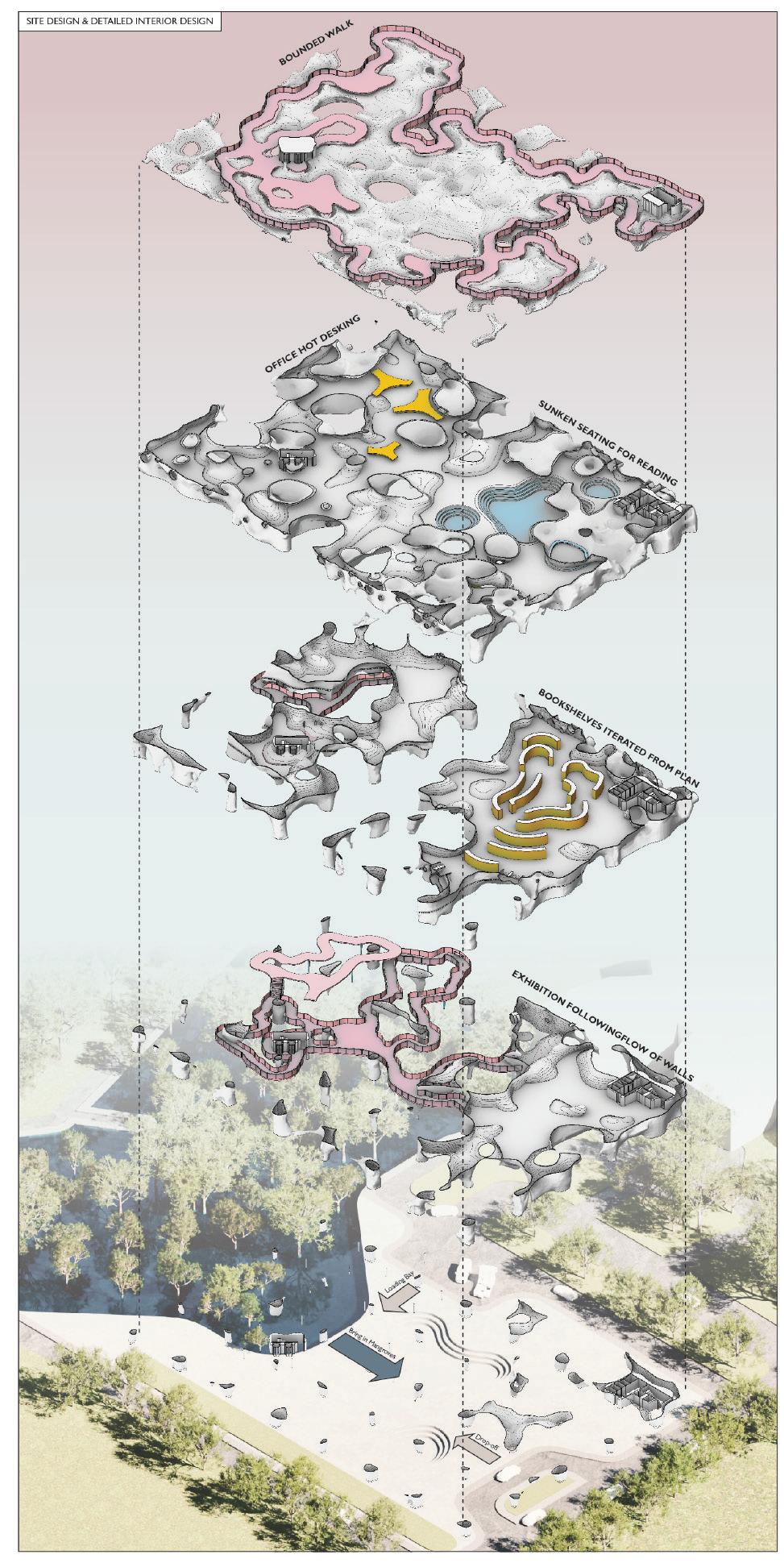

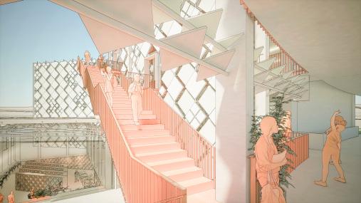
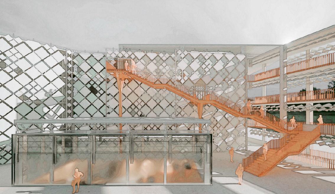
In this project, the architectural narrative draws inspiration from the intricate lattice-like structure of bone trabeculae, seamlessly weaving together form and function to address the crucial aspect of on-site relative humidity levels. By emulating nature’s blueprint, the design dynamically responds to environmental cues, optimizing interior spaces for human habitation based on humidity levels. As humidity decreases, interior spaces expand, prioritizing occupant comfort and well-being.
Echoing the marvel of biological systems, the skywalk and rooftop walk traverse the structure akin to Haversian canals, facilitating the flow of essential resources and nourishment throughout the building. This innovative circulation system not only serves a functional purpose but also serves as a testament to the project’s commitment to biomimetic design principles.
Furthermore, the integration of mangroves into the site expansion of the King Fisher Wildlife lookout showcases a dedication to environmental stewardship and biodiversity conservation. Rooted in a deep understanding of ecological interdependence, the design harmoniously coexists with its natural surroundings, fostering a symbiotic relationship between architecture and the ecosystem.
The architectural program transcends mere functionality, envisioning a dynamic hub for biodiversity research that invites public engagement. With accessible gallery, archive, and library segments, the building becomes a nexus of knowledge exchange, inspiring discovery and fostering a deeper appreciation for the natural world.
Embodying innovation, sustainability, and a profound reverence for nature, this architectural endeavor exemplifies the transformative potential of biomimicry in shaping the built environment. As we embark on this journey of exploration and discovery, we invite you to witness the convergence of art, science, and nature in a harmonious symphony of design excellence. Welcome to a future where architecture not only shelters but also nurtures, inspires, and thrives in harmony with the world around us.


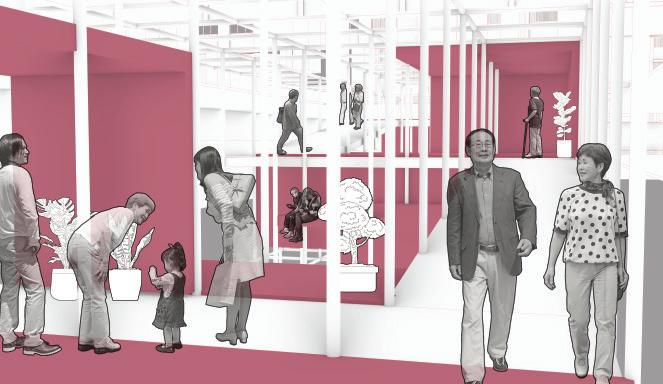
When we talk about ‘connectivity’, we think about social interactions, physical accessibility, transportation, relationships, and so on. These features are crucial points in urban analysis and design, bonding tightly with physical connections. But is it necessarily tangible? Do we solely assess what we can touch and where we can put our feet on and walk? Is urban renewal always bringing in new connectivity events, or do we actually lose some of the intangible things that we used to be so familiar with?
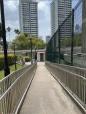
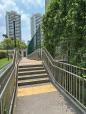
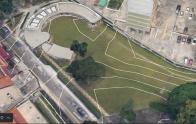
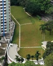
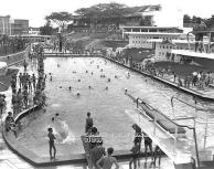
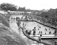
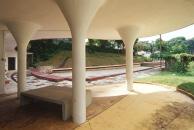
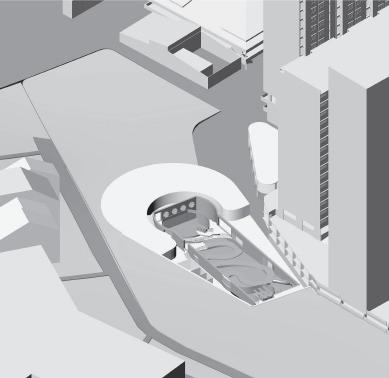
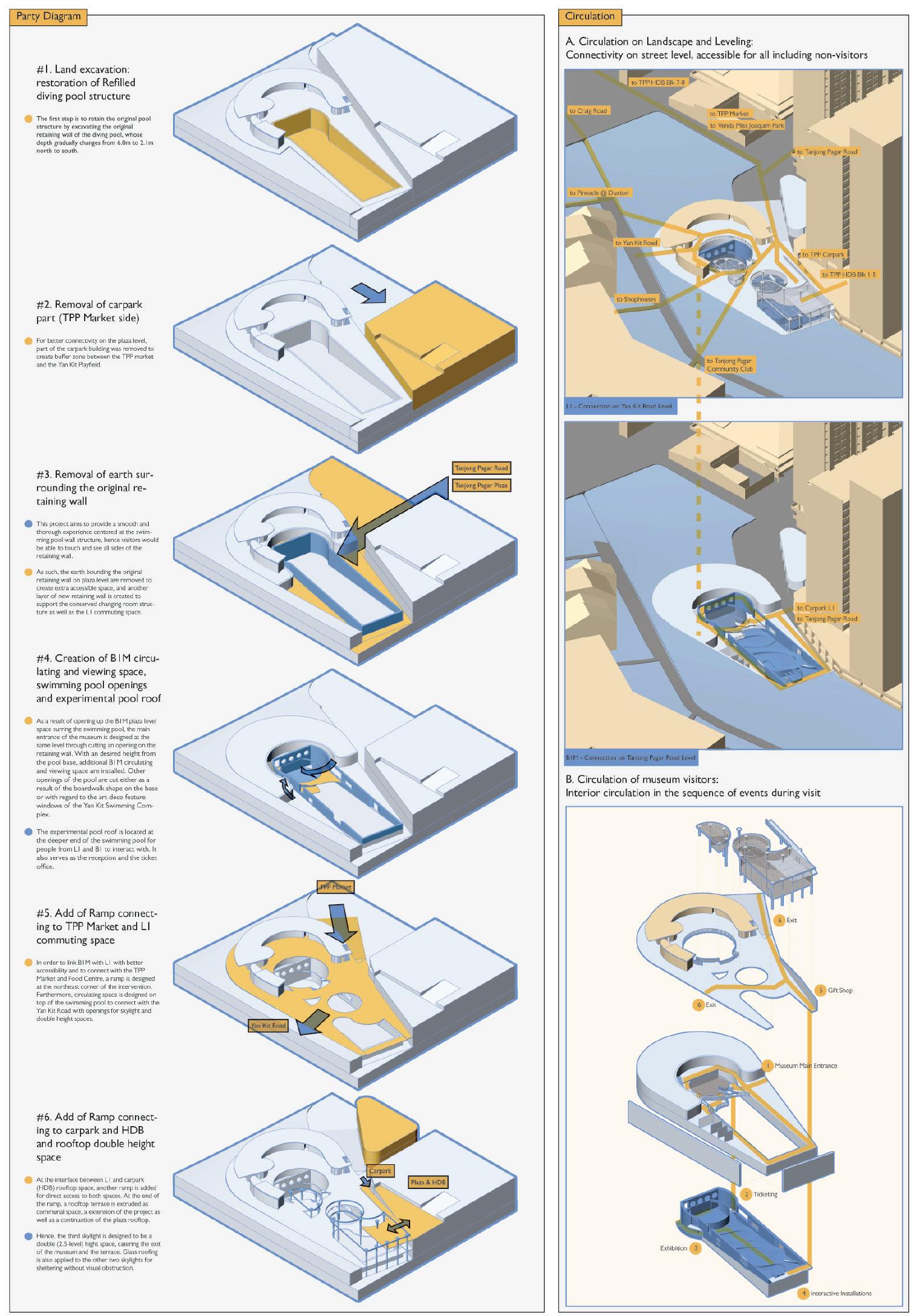
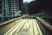
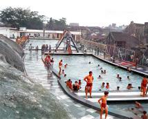
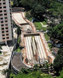
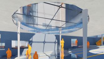
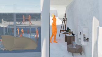
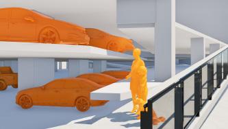
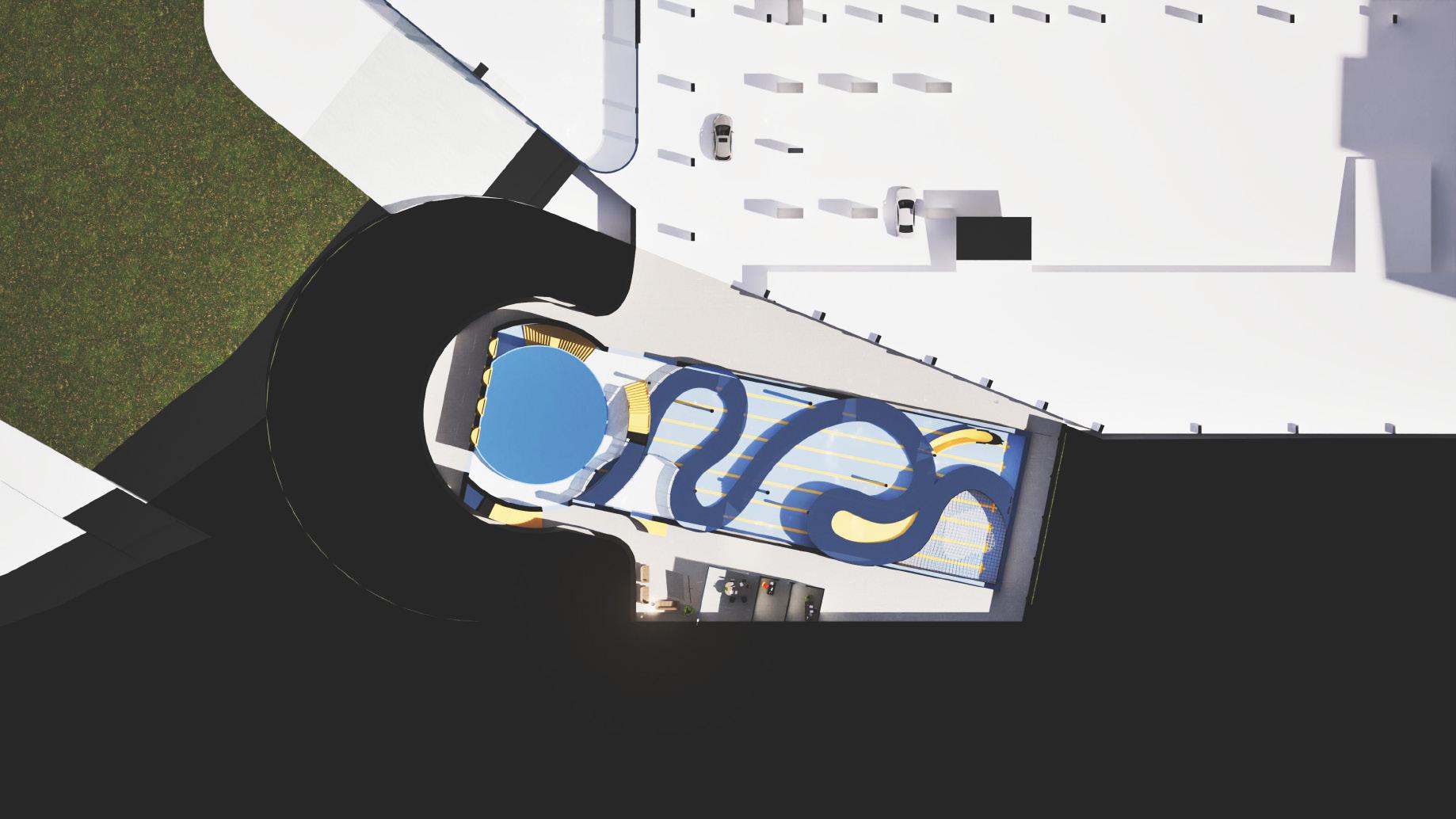
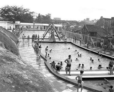
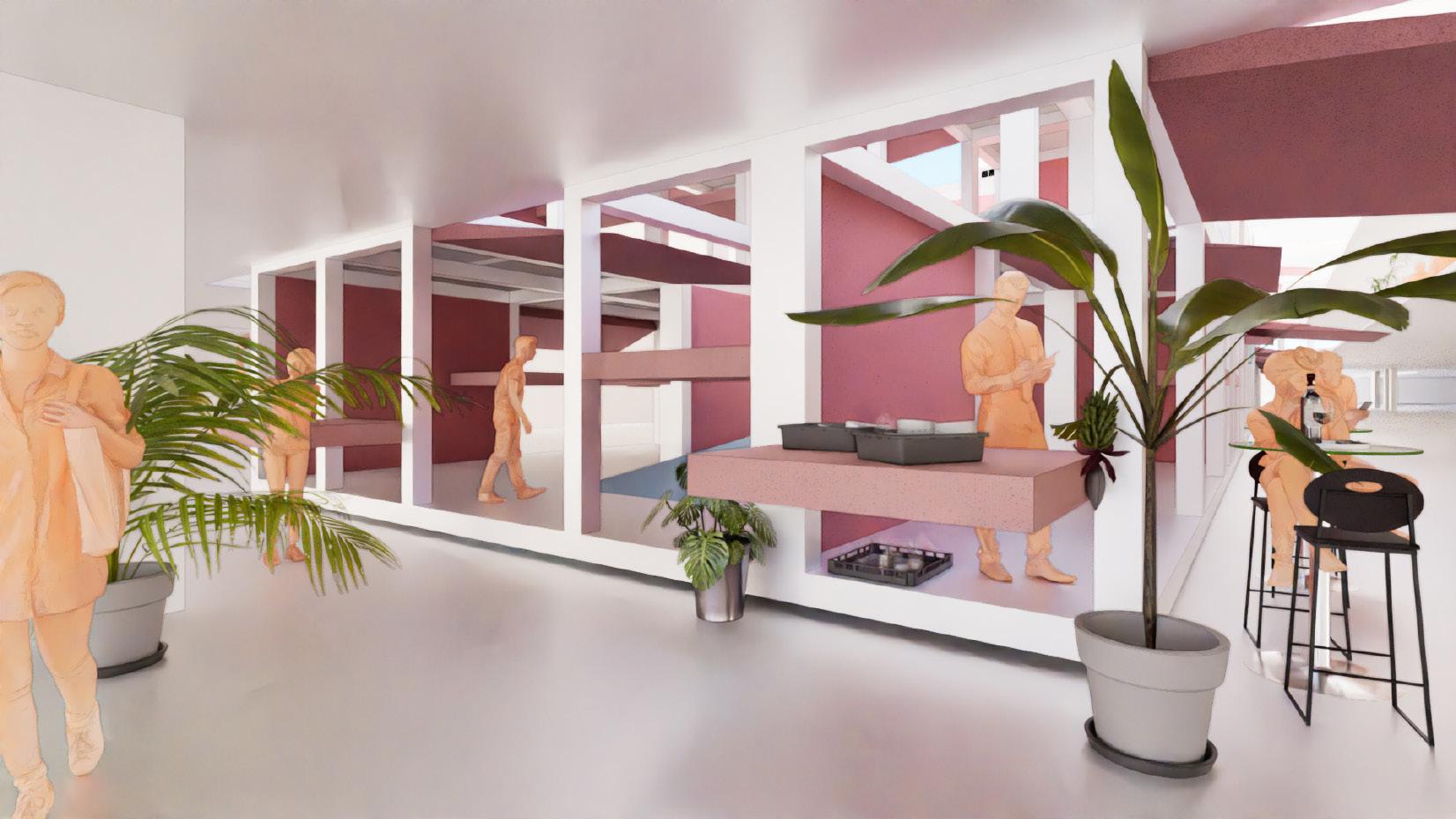
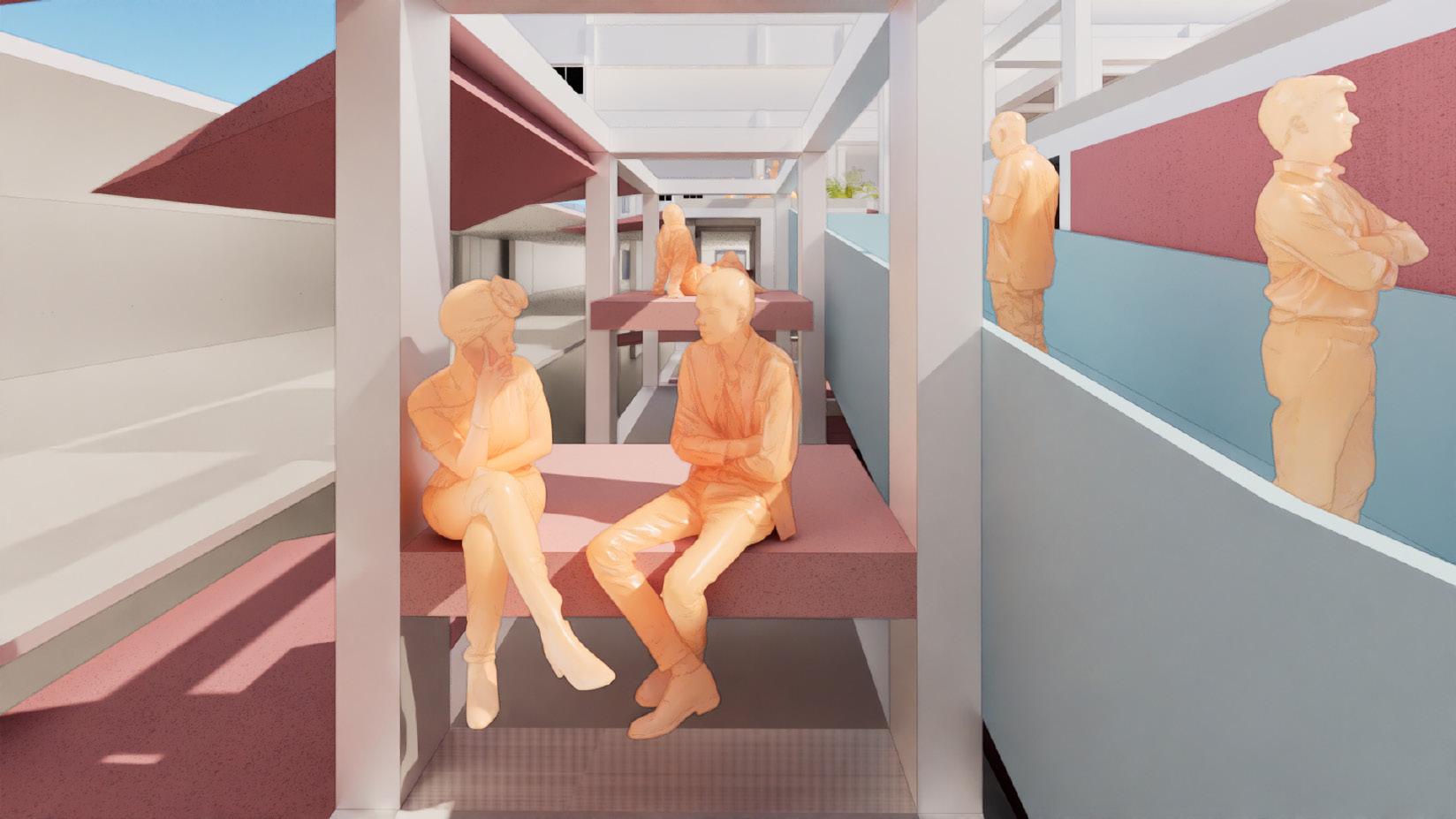
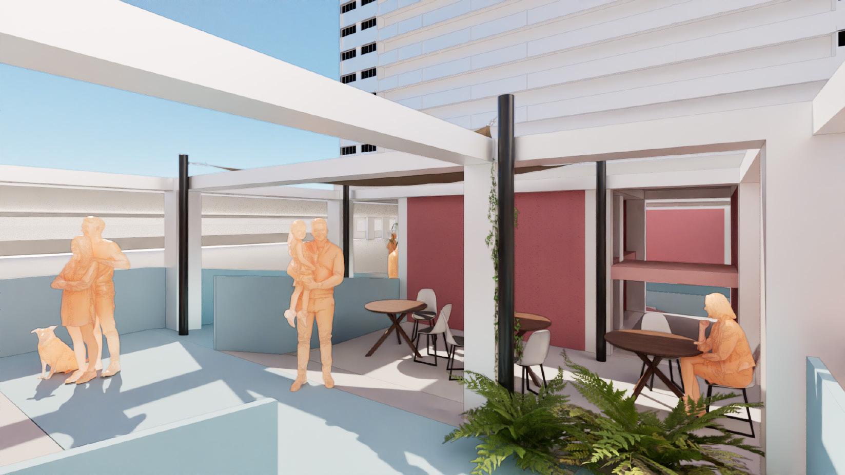
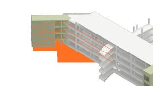
Focusing on the Yan Kit Road, Tanjong Pagar, there is a hidden space below the ground - The former Yan Kit Swimming Complex. Opened in 1952, it was Singapore’s second public swimming complex and used to host numerous swimmers, no matter amateurs or professionals. It even nurtured Singapore’s first Olympic swimmer Neo Chwee Kok, who went to attend games in Helsinki. However, it was closed in 2001 due to high maintenance fee and decline of swimmers. After being left abandoned for 10 years, this plot of land was refilled and was recently re-purposed to a play field.
During research, it was interesting to see that there are a lot of people sharing their past experience in the swimming complex - Some regarding the old days learning how to swim as a child, some about family activities, school life, good hawker food nearby... All illustrating a strong attachment to the land’s past. In view of the conservation projects happening within the meso site, it is regrettable that most of them focus on the shophouses - Also historical architecture but relating to much earlier or more ancient days of Singapore.
For the Tanjong Pagar community members, having a conservation project that they can directly resonates with is going to help build up a stronger sense of recognition and maintain the resilience of a wider span of generations. So, what if the memory of the past can also be conserved without repetition in program to avoid getting onto the same track as the Yan Kit Swimming Complex?
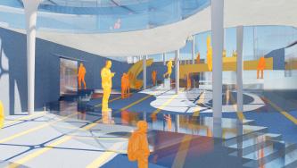
This project is an experiment of urban design in building up mental attachment. Meanwhile, physical connectivity issues are also attempted to be resolved with a systematic design workflow as prototype. Standing on the Yan Kit Road, you will be seeing the tides of past retrieved and shown in a brand new form of architecture.


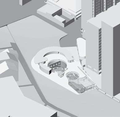


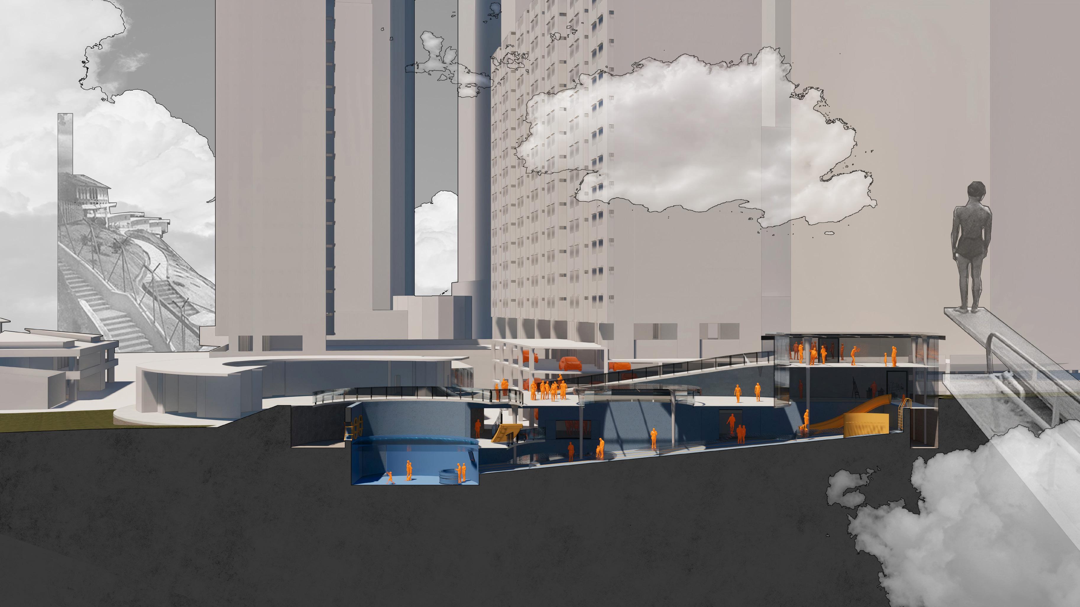
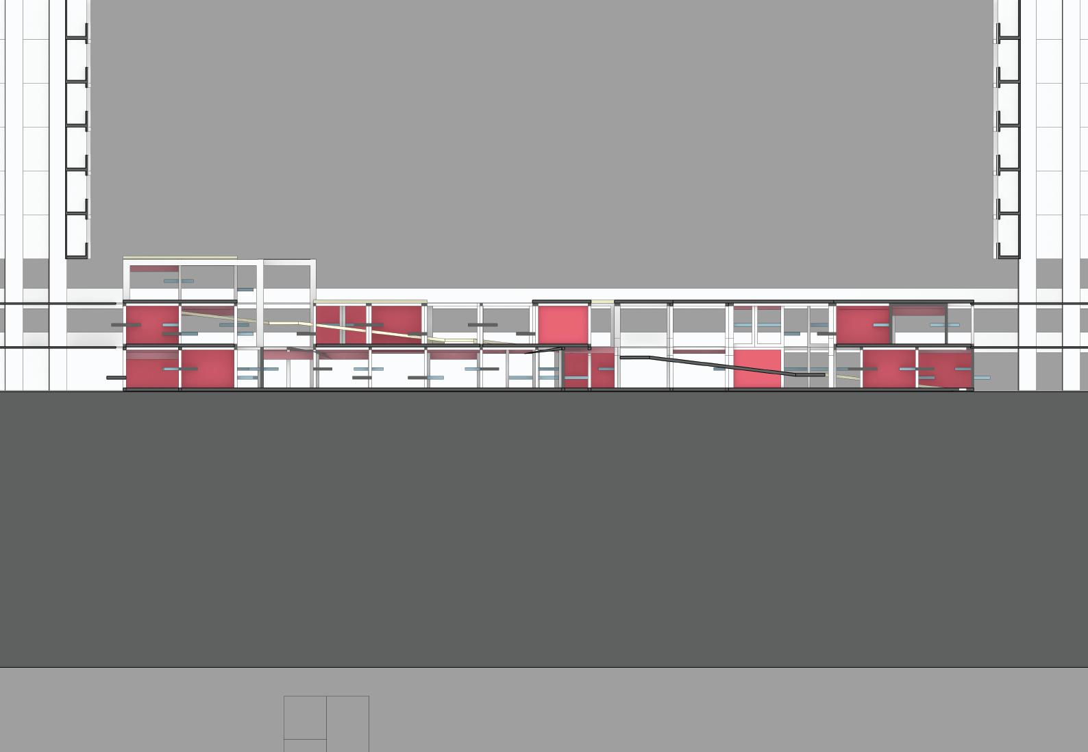
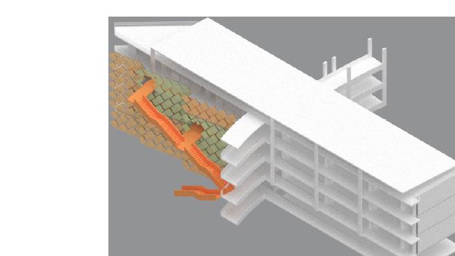
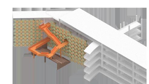
Sectional Perspective AA’

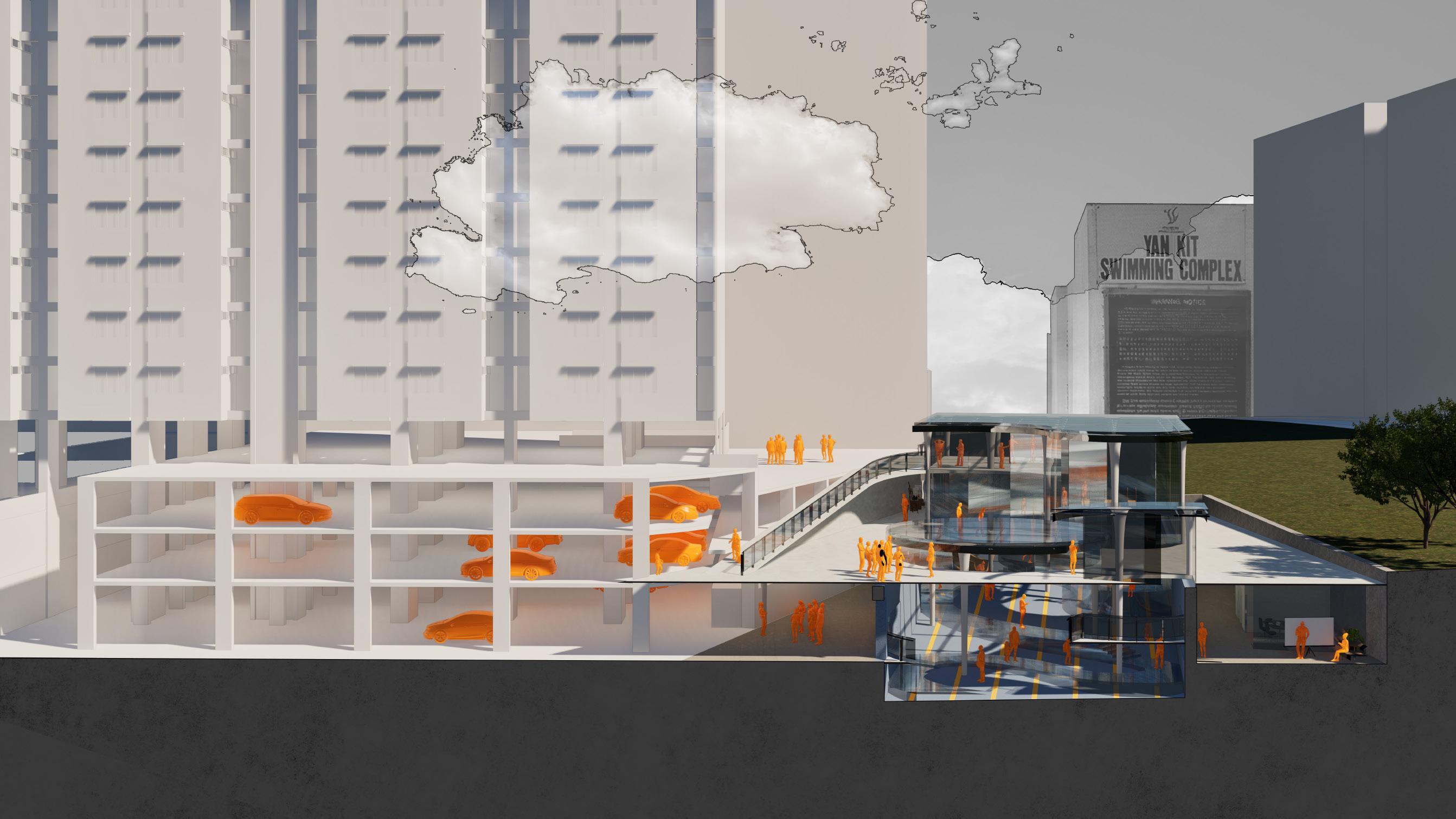
Sectional Perspective BB’
Beep beep
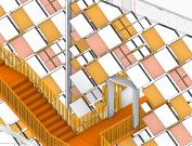
POP-UP MARKET: ACCESSIBLE URBAN SOLUTION FOR
ALL
AR3223 INTRODUCTION TO URBANISM, PAIR WORK
(CONTRIBUTION: SITE ANALYSIS, EOTM ANALYSIS, PROTOTYPE UNIT DESIGN, RENDERING)
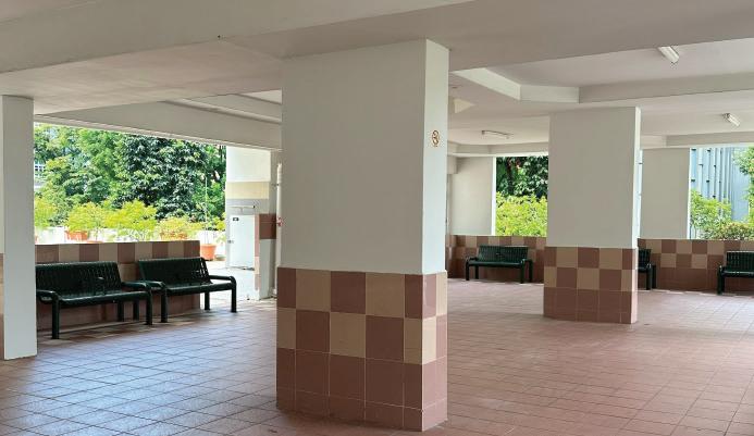
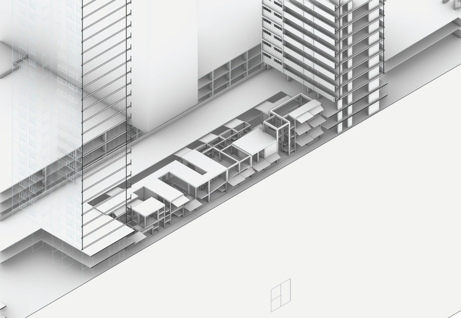
The Accessible Pop-Up Market located in Tanjong Pagar Plaza starts with the same site context as the Diving in Timeless Dives project since AR3223 and AR3101 are joint architectural design and urban planning courses. This project aims to provide a flexible urban solution for the HDB area and will serve as a prototype for other residential zones facing same urban issue: The lack of accessible ramps, interaction between neighborhoods, vibrency of small businesses and shelters for people with homelessness.
Site Study
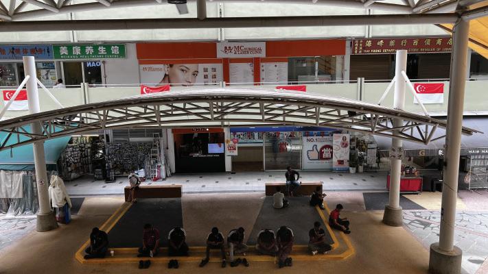
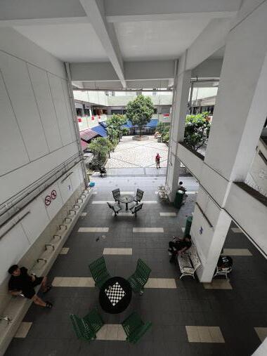
The study was conducted by quantifying the approximate number of people using a space, at 7am, 12 noon, and 7pm respectively. Through this, we identified that commercial regions are generally devoid of activity in the morning, aside from the occassional sighting of tourists leaving their hotel to start their day. At noon, the o ce lunch crowd fights for space in the hawker center alongside the residents in the area. This is unsurprisingly the most busy time of day. At night, the situation reverses from morning and the commercial zones comes to life, while the residential areas begin to empty out.
Prototype
Problems:
Earth

Goals: -Bring people in -Continue the spirit of shops changing (Lower rental price)
-Draw attraction to the 2nd/3rd floor
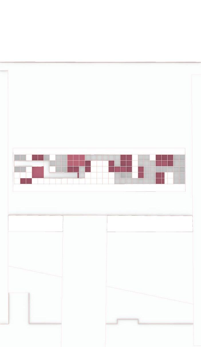
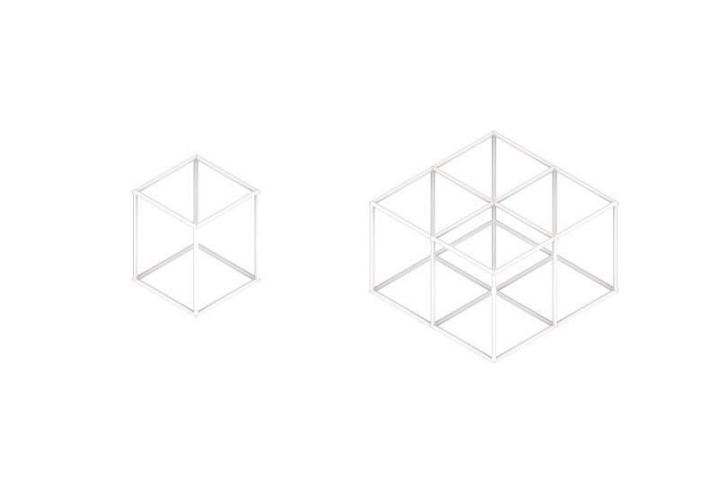
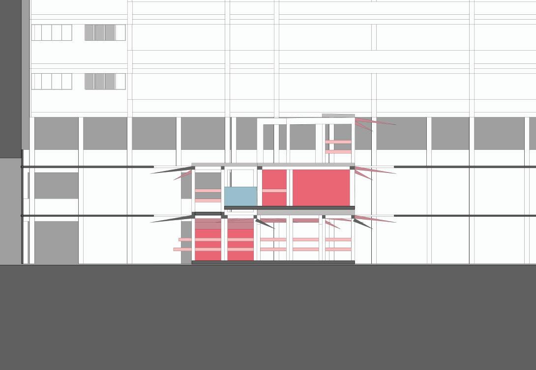
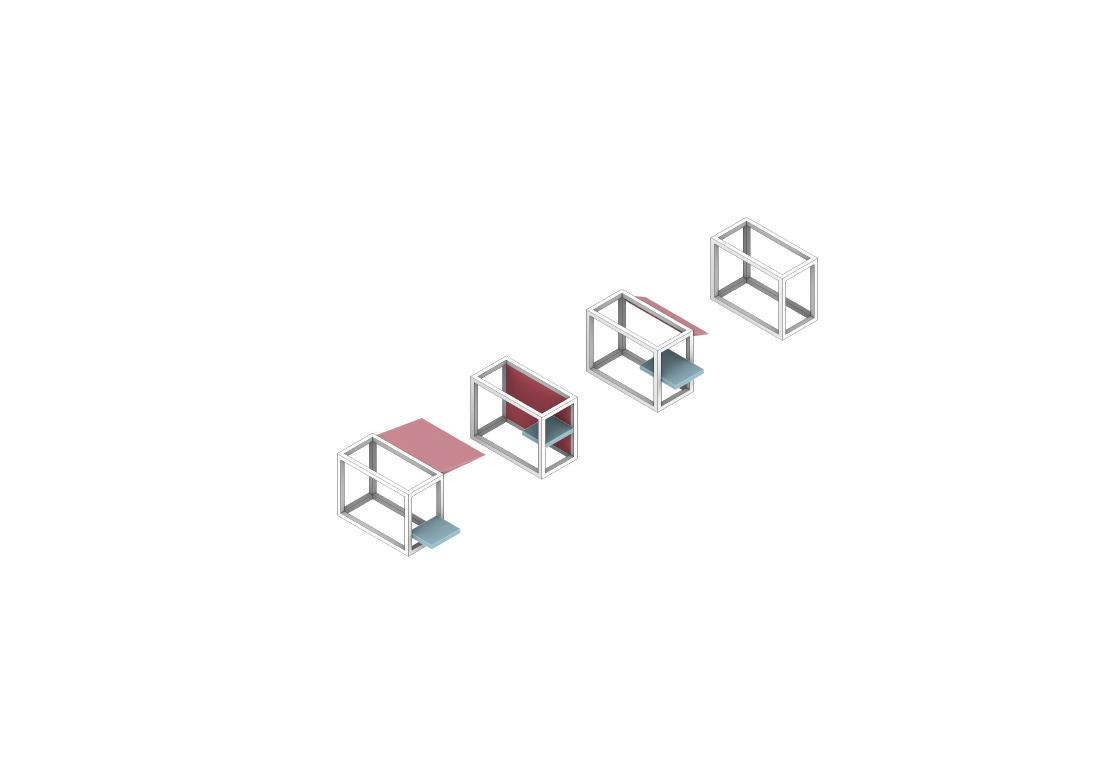
Wheelchair-accessible community pop-up market -Accessible ramps -Grid system market
-Shops changing frequent (High rental, low sales)
-Empty spaces
-Not wheelchair friendly for aging residential (lift is hidden, a lot of staircases) -2nd floor is less accessible hence nobody visit2nd/3rd floor
Branding
A Grid system is constructed around a new integrated ramp in Tanjong Pagar Plaza, allowing new retailers to rent at a lower price because it is temporary retail units.

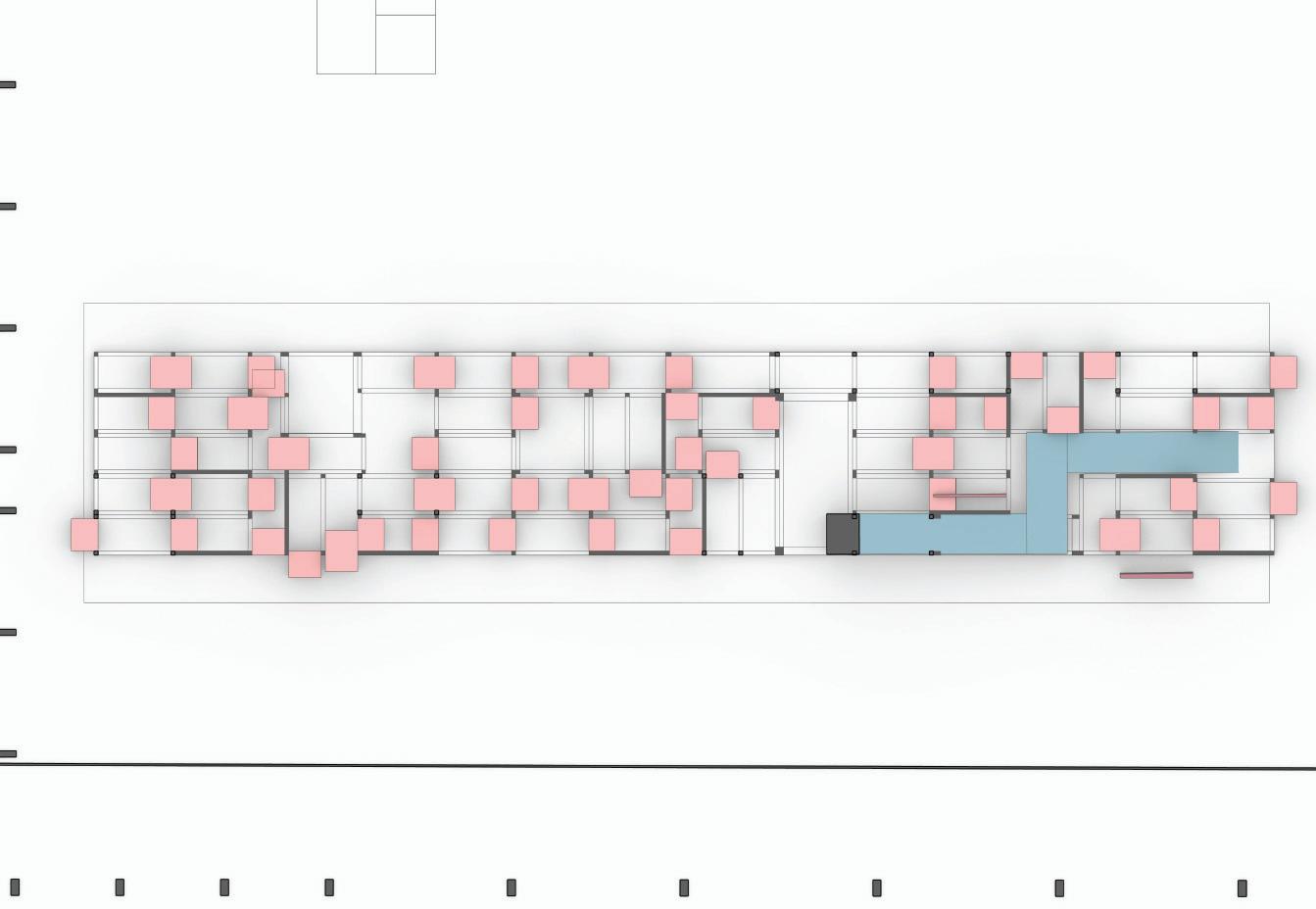
This prototype is intended to be an urban addition to any underutilised void decks or residential voids, with the purpose of bringing in constant fresh activites with everchanging pop-up retailers.
of


A fixed ramp provides accessibility for circulation, with pop-up shops arranged in a grid-like system around it

Incorporate WHO: Vendors, Residents, Tourists, O ce Workers, Elders, Disabled People
1st Storey:
Allowing the walls to be flexible results in interesting circulation within the new structures anytime ownership changes.
In keeping with the idea of a Pasar Malam with greater flexibility, a grid structural design that permits temporary modular storefronts also specifically accommodates wheelchair users by o ering a ramp.


2nd Storey:
The primary circulation consists of a ramp that allows the elderly to easily access the higher floors. It is also accessible from Tanjong Pagar Plaza.

This prototype is meant to be an urban addition to any vacant residential spaces or underutilised void decks, bringing


Perspectives for Units


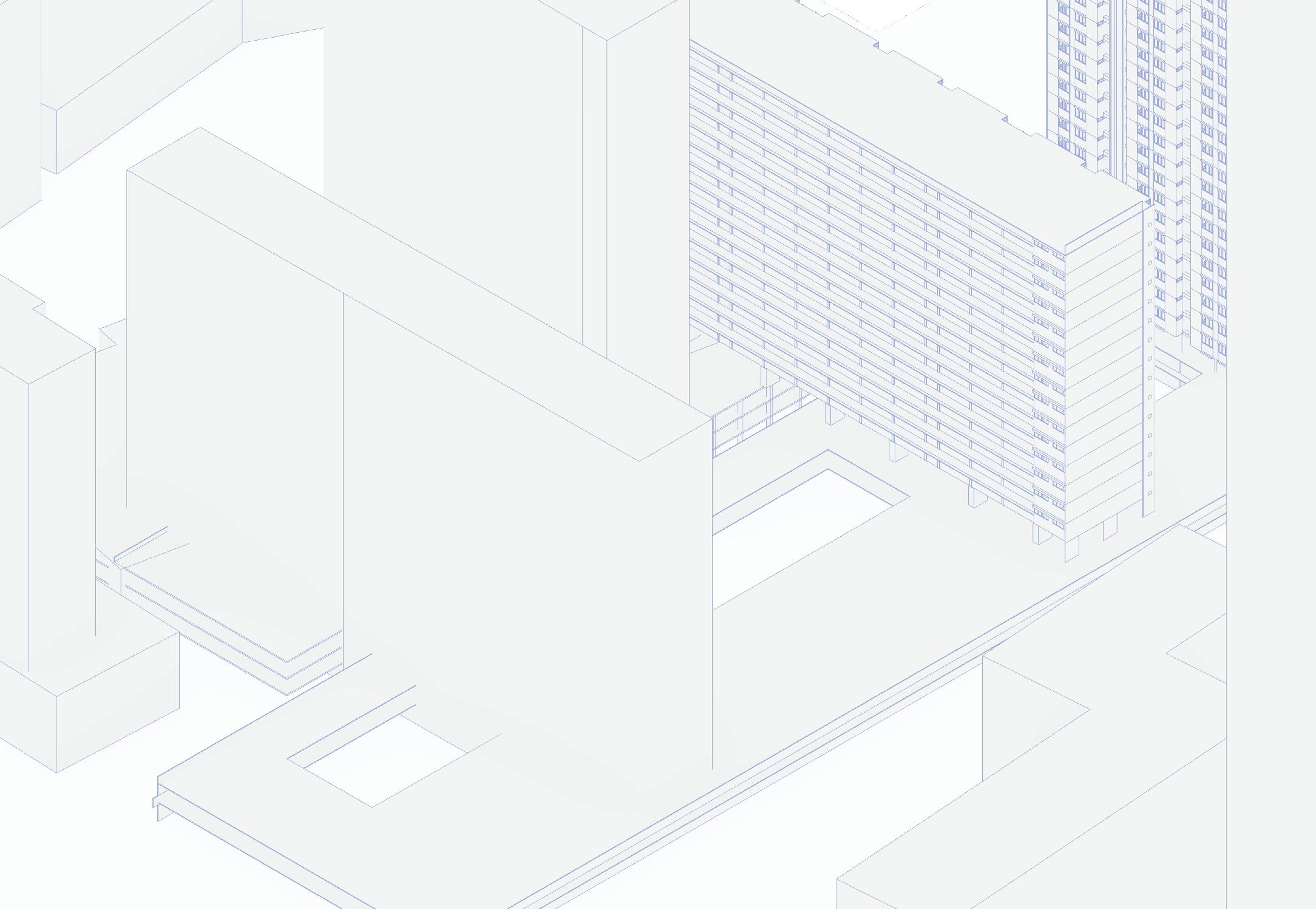
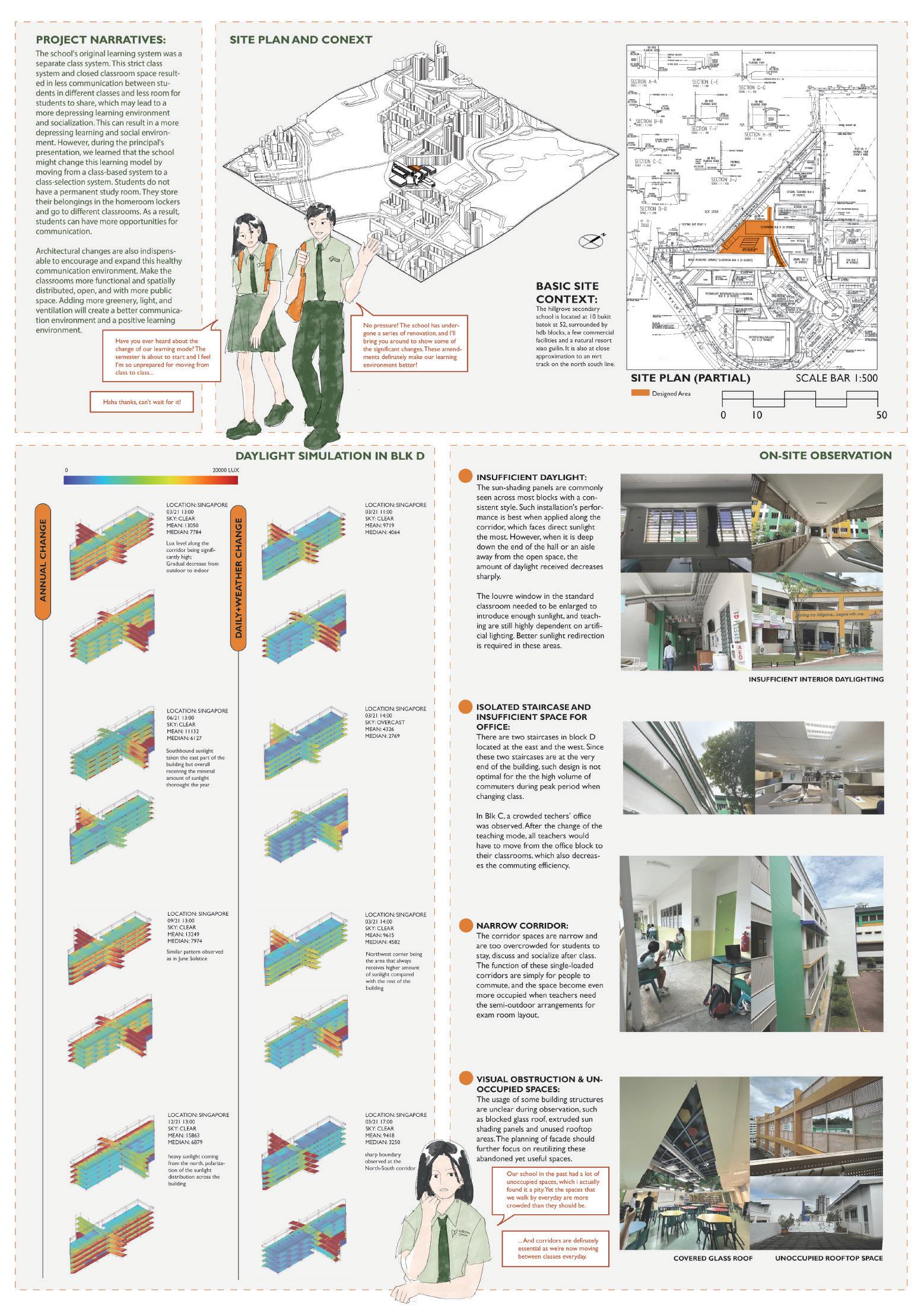
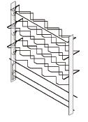
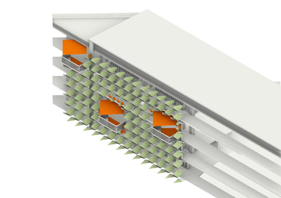
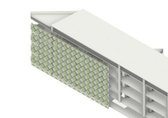
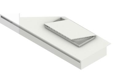
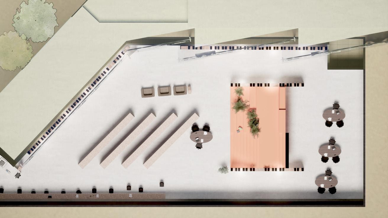
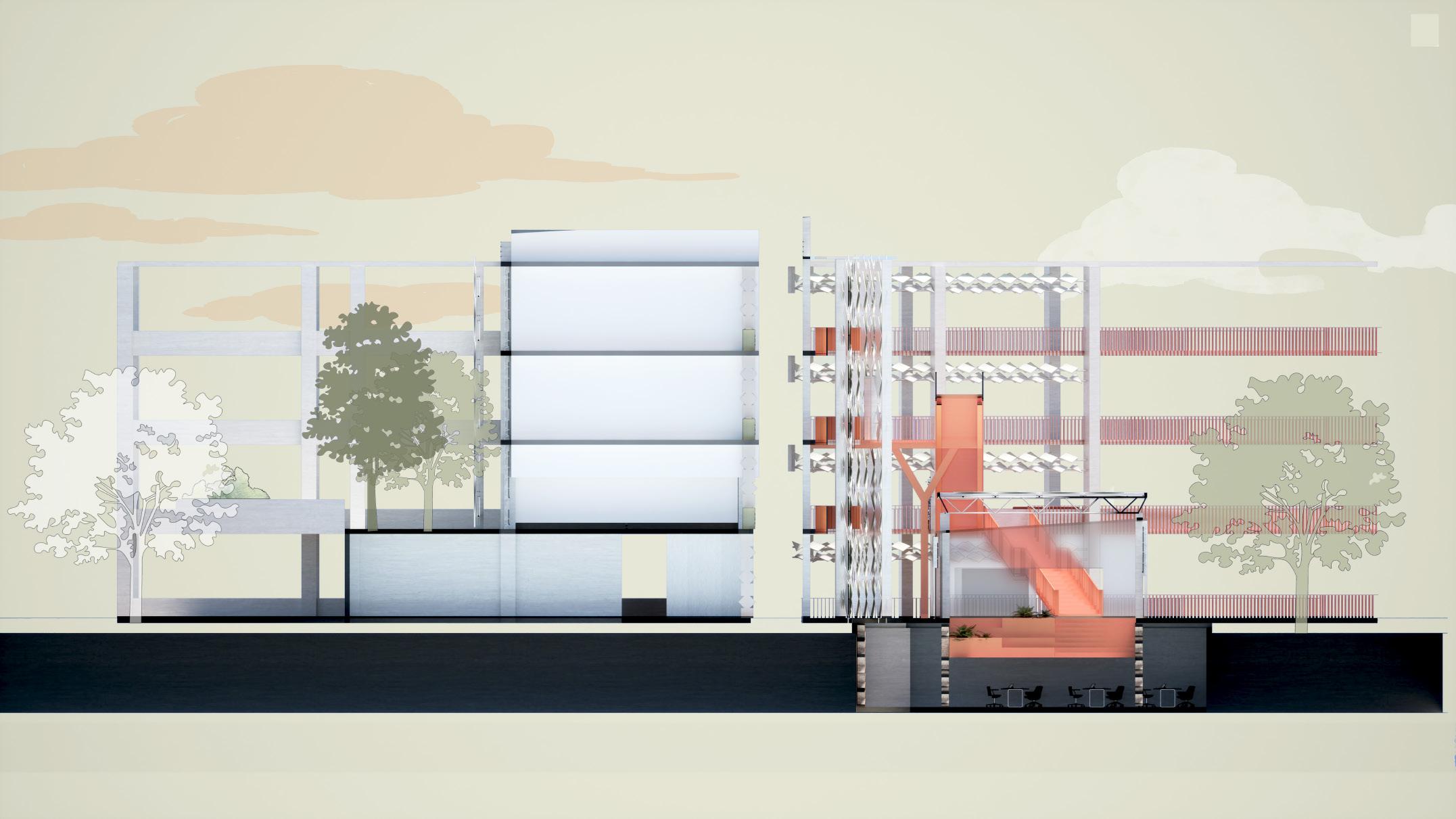
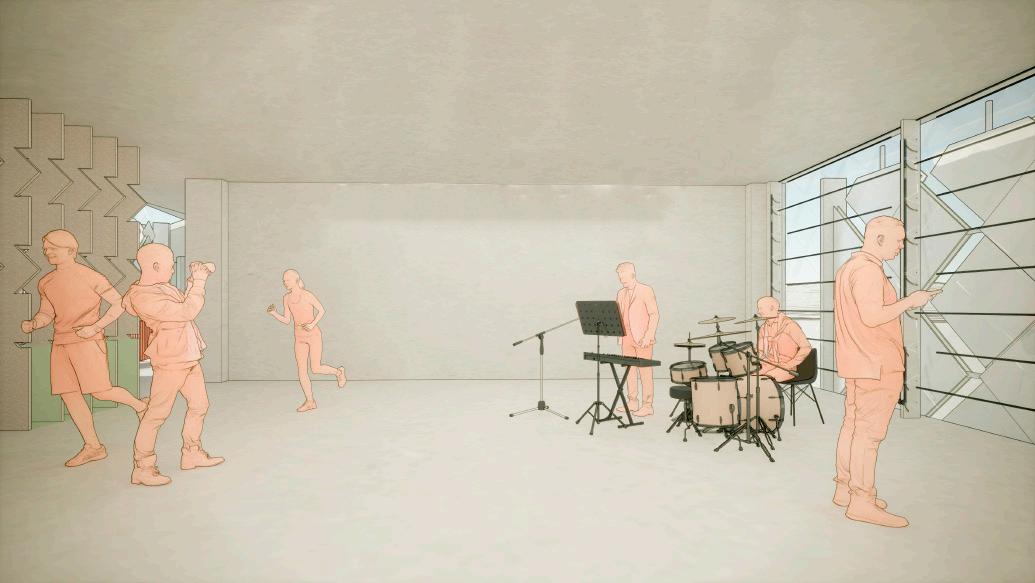
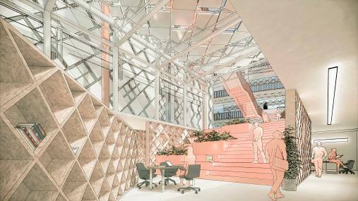
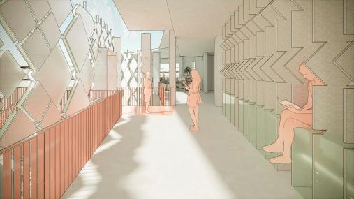
THE SHIMMERING: KINETIC FACADE DESIGN OF THE HILLGROVE SECONDARY SCHOOL
(CONTRIBUTION: DATA COLLECTION, RENDERING, GRASSHOPPER KINETIC
FACADE PROGRAMMING, LOUVRE WINDOW DIAGRAMS, CLIMATE STUDIO DAYLIGHT SIMULATIONS AND ANALYSES)
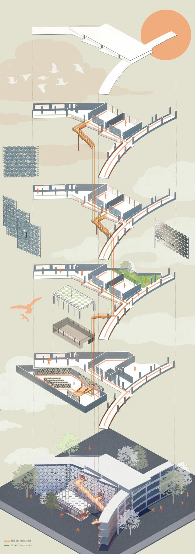
The hillgrove secondary school is located at 10 bukit batok st 52, surrounded by hdb blocks, a few commercial facilities and a natural resort xiao guilin. It is also at close approximation to an mrt track on the north south line.
The school’s original learning system was a separate class system. This strict class system and closed classroom space resulted in less communication between students in different classes and less room for students to share, which may lead to a more depressing learning environment and socialization. This can result in a more depressing learning and social environment. However, during the principal’s presentation, we learned that the school might change this learning model by moving from a classbased system to a class-selection system. Students do not have a permanent study room. They store their belongings in the homeroom lockers and go to different classrooms. As a result, students can have more opportunities for communication.
Architectural changes are also indispensable to encourage and expand this healthy communication environment. Make the classrooms more functional and spatially distributed, open, and with more public space. Adding more greenery, light, and ventilation will create a better communication environment and a positive learning environment.
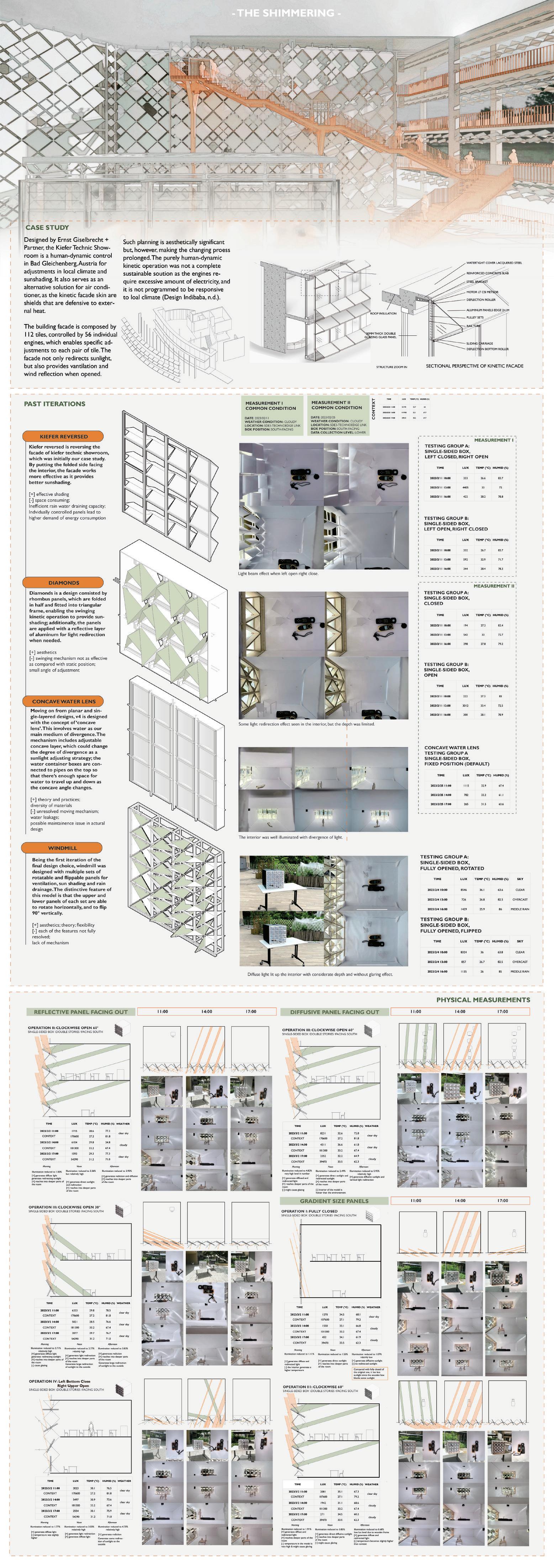


Please scan this QR code for video covering Kiefer model studies, process documentation and walk-through of the design.


PORTFOLIO / ZHANG LEWEN /RACHAEL