


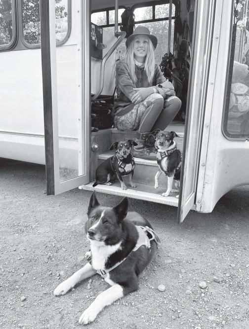
By Gretchen Wehmhoff
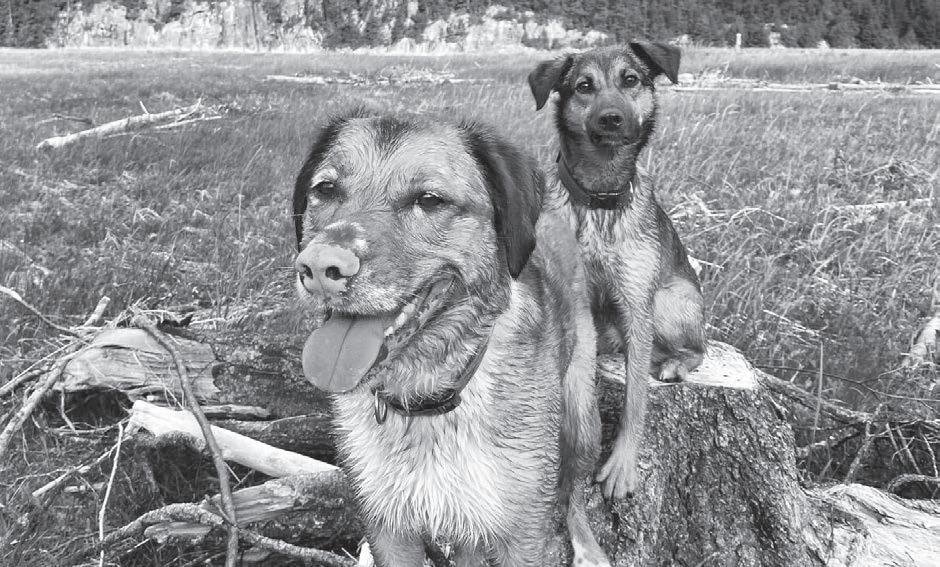
Skagwegians have always loved their pets. Included in this issue are two stories about the unique and pampered life dogs in Skagway enjoy. Cats have a good time, too, but corralling a pack of cats hasn’t been a successful project in town.
You won’t see stray domestic pets in town thanks to the work of the volunteer owners of our Paws & Claws Animal Shelter who work diligently to place furry friends needing homes. They even help to place village dogs needing a family.
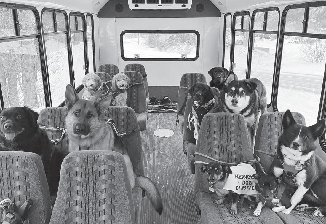
Our dogs have birthday parties, treats at most businesses and they even have their own bus that takes them, with their other fourlegged friends, to adventurous on and off-leash pack walks with local Mo Mountain Mutts.
History tells us there were some odd pets in Skagway who break the norms of domesticateds animals. By today’s standards, it would be illegal; but it was the wild times when Skagway and Dyea became booming Gold Rush towns. Just about anything could and did happen.
It was not unusual to see bear cubs on leashes and later pulling sleds. Some entrepreneurs ventured north with crates of chickens and kittens for sale. H.L. Miller, who floated the Yukon to Dawson with a milk cow, selling fresh milk for $30 a gallon or five dollars a mugful, found his business niche.
Monty Atwell’s business owned a wild ox that pulled an easy 500 pounds uphill eventually pulling a total of 5,400 pounds Atwell needed to get from Dyea to the Chilkoot Pass. The ox, named Marc Hanna after a political character, miraculously survived being buried by the April 1898 avalanche. He was found two days after the slide in a stable of snow

he had created while he chewed his cud.
Not all animals survived. Hundreds of horses died on the trails to gold, many falling over the cliffs from a deadly misstep.
The U.S. Government, in an attempt to curb starvation in the Yukon, shipped around 500 Norwegian reindeer to Dawson, on the Yukon River. A few made it. Most died along the way.
Speaking of ungulates, Captain William Moore, founder of Skagway, had a son, Ben, who took on raising a pet moose.
The moose, a male named Carnation, was captured near Dawson on the Klondike River. It was taken to Seattle, but eventually ended up living on the Moore homestead. Carnation mildly irritated the horses and mules in town, with each beast feigning a charge on occasion.
Carnation made it through a parade and a great deal of press coverage, including a popular photo of Carnation harnessed and hitched to a wagon carrying Ben’s daughter.
Carnation, according to reports, died, most likely from a poor diet of grazing on clover. His head was mounted and the body was buried near the end of Sixth Ave. You won’t find the wildlife being bothered anymore in Skagway. In fact, the town makes a great effort to educate visitors about the long-term dangers of feeding or harassing wild animals.
So, enjoy the unique beauty of this valley and the breathtaking natural views, but remember to view our wildlife from a distance with your camera. The animals live a lot longer when we leave them alone.
Sources: Klondike Gold Rush National Park and Jeff Brady’s book, Skagway – City of the Century.
PHONES: Skagway has good cell service in town but reception is spotty on the Dyea Road and cuts out a mile up the Klondike Highway. There is service in all Yukon towns. See page 10 for a Wi-Fi map.
PUBLIC RESTROOMS: Located on Congress Way Sea Walk, Shoreline Park, at National Park Service and AB Hall Visitor Centers, Mascot Saloon, Mollie Walsh Park, Pullen Park, Skagway Bazaar, ferry terminal and Small Boat Harbor parking lot.
MEDICAL/CLINIC: Skagway’s Dahl Memorial Clinic is located at the Rasmuson Health Center at 14th and Broadway, 907-983-2255. Clinic is open weekdays, 8 a.m. to 5p.m. For after-hours medical emergencies call 911, or contact the on-duty provider by calling dispatch at 907-983-2232.
POLICE: Phone 911 for emergency or 907-983-2232 for business. Located in Public Safety Building, 18th and State.
FIRE/AMBULANCE: Phone 911 for emergency or 907-983-2300 for business. Located in Public Safety Building 18th and State.
COUNSELING: Counseling services are located on the west side of the Rasmuson Health Center at 14th and State. Call 907-983-2255. Or call the national hotline at 988.
SKAGWAY VISITORS DEPARTMENT: Headquartered on Broadway in the Arctic Brotherhood Hall. Address correspondence to Tourism Director, P.O. Box 1029, Skagway, AK 99840; phone 907-983-2854; email: skagwayinfo@skagway.org; website: www.skagway.com
SKAGWAY CHAMBER OF COMMERCE: Phone 907-983-1898; P.O. Box 194, Skagway, AK 99840; chamber@aptalaska.net. Website: www. skagwaychamber.org
KLONDIKE GOLD RUSH NATIONAL PARK: Located at 2nd & Broadway. Visitor Center open daily, 9 a.m. to 5:30 p.m. in the summer. Call 907-983-2921 or write for brochure: P.O. Box 517, Skagway, AK 99840; www.nps.gov/klgo.
SKAGWAY TRADITIONAL COUNCIL: Office in Tribal Community Center on Broadway and 11th. Phone 907-983-3615, website: www.skagwaytraditional.org
NEWS: The Skagway News is published twice monthly. Available at Skaguay News Depot. Visit www.skagwaynews.com, call 907-983-2354 or write to P.O. Box 125, Skagway AK 99840-0498.
RADIO/TV: KHNS-FM: 91.9 FM, public radio for Haines-Skagway, also available online at www.khns.org; KINY-FM: 104.7 FM radio, Juneau; TV: 1 public, 35 cable channels, hundreds more via satellite dish.
SKAGWAY PUBLIC LIBRARY: located at 8th and State. Open weekdays, 10 a.m. to 7 p.m., weekends, 12 p.m. to 5 p.m. Watch for special programs. Wi-fi is available outside of the library daily from 10 a.m. to 10 p.m.
ASSEMBLY OF GOD Church: Located at 8th and State. Sunday morning service at 11 a.m. Call 907-983-2350.
CHURCH OF JESUS CHRIST OF LATTER DAY SAINTS: Located at 11th and State. Sunday Sacrament Meeting at 10 a.m. Call 1-867-3321299.
FIRST PRESBYTERIAN CHURCH: Located at 5th and Main. Sunday Service at 11 a.m., www.fpcskagway.org. Call 907-983-2260.
ST. THERESE CATHOLIC CHURCH: Located at 9th and State. Mass celebrated on Sundays at 4 p.m. and 7 p.m., and Mondays and Tuesdays at 12:10 p.m. Call 907-983-2271.
B.P.O.E. ELKS LODGE #431: Located at 6th and State. Meets second and fourth Thursdays at 7:30 p.m. Club room open for members at noon on weekdays and 11 a.m. on weekends. Emblem Club #111 meets third Thursday at 7 p.m. Call 907-983-2235.
F.O.E. EAGLES AERIE & AUXILIARY #25: Located at 6th & Broadway. Aerie meets first and third Wednesday at 7:30 p.m. Auxiliary meets second and fourth Tuesdays at 7 p.m. Club room open daily for members at 11 a.m. Call 907-983-2234.
WHITE PASS LODGE #1 F.&A.M.: Located on 4th near Broadway. Meets first Saturdays at 12 p.m. Call 907-612-0025.

Population: Skagway has 1,240 residents according to the 2020 Census, although numbers generally fluctuate from about 800 in January to more than 2,500 in July with the influx of summer workers. The largest minority, about 7% of residents, is Hispanic or Latino. Native Alaskans of mostly Tlingit origin make up the second largest minority group at 5.5% of the population.
Government: Skagway was the first incorporated city in Alaska on June 28, 1900, and remained that way until June 5, 2008, when it voted to become the state’s initial first class borough, the Municipality of Skagway. The muni elects a mayor and six assembly members, with five community members serving on the school board. The borough collects property tax (7 mills at the highest), 5% sales tax (3% winter) and an 8% room tax.
Skagway Traditional Council, a sovereign tribal government, has over 100 enrolled members, comprised mostly of Tlingit and Haida Alaska Natives. The council has been growing steadily since 1999.
School: Skagway School has an enrollment of about 130 students in grades K-12. Test scores averaged the highest of any district in Alaska last year. Mascot: Panthers.
Land/Elevation/Power: Skagway is in a classic U-shaped glacial valley that is slowly “rebounding” by 1-2 inches a year. Elevation ranges from sea level on the coast to peaks reaching nearly 7,000 feet. The municipality stretches from the Canada border to the Haines Borough, encompassing 452.4 sq. miles of land and 11.9 sq. miles of water. Power comes from three nearby AP&T hydroelectric facilities.
Climate: Average summer temperatures range from 45 to 67 F, although it occasionally reaches the 90s. On the summer solstice there are nearly 19 hours of daylight. Average winter temps are 18 to 37 F, but occasionally it will dip below zero. With a north wind, it can feel like 50-below. Skagway receives just 26 inches of rain a year and 39 inches of snow in town, although more than 20 feet can fall on White Pass each winter.
Summer Visitation: In 2019 the borough welcomed 1.1 million cruise ship passengers. The next year, cruise ships did not enter the port due to COVID-19. In 2021, the town celebrated a tiny recovery with less than 100,000 cruise passengers. In 2023 there were 1.2 million.
Economy/Values: Median household income, according to the 2020 Census, was $71,875, with average per capita income of $41,842. About 3.8% live below poverty level. Largest employers are the visitor and transportation industries and government. The largely seasonal economy gives Skagway the distinction of having one of the lowest unemployment rates in the state in summer (2-3%) and one of the highest in winter (22-27%). Skagway is actively marketing its year-round port to attract more shippers from Yukon mines and boost winter employment. A copper mine currently uses the port. Skagway is completing a $65 million port project to the longer ships.
The Basics: In early May, the price of unleaded gas was about $5.75 a gallon, milk approached $8 a gallon and houses were listing at over $500,000.
The Skaguay Alaskan is supported by the commercial entities of our city through advertising dollars. This allows the paper to be circulated free of charge by our newsies. The Skagway News tries to keep the paper to an historic 1898 format, hence no color advertising. It is also circulated on the ferries, the airport, SMART Bus and at various locations around Skagway, Alaska and the Yukon. To locate our advertisers, simply note the map key number in the ad, then find the establishment on the back map page of the Alaskan.

Visitor Center and Museum: Open daily 9 a.m. to 4:30 p.m., the National Park visitor center and main park museum are located in the restored 1898 railroad depot at 2nd & Broadway with free admission and activities for all ages. The Mascot, at 3rd and Broadway is open from 9 a.m. - 4:30 p.m. daily.
Want to learn more about history’s last great gold rush? Ranger presentations bring the events of 1898 to life through storytelling, photographs and scenic footage. Daily 25-minute-long Ranger Talks at begin at 9:30 a.m., 11a.m. and 3 p.m. The museum’s interactive exhibits showcase gold rush era characters and their hardships and adventures. Visitors can experience the journey by smelling sourdough and eulachon oil, stepping into a muddy boot print on the trail and by “rafting” the Yukon River. Ask about upcoming programs and special events including guest speakers and performing artists.
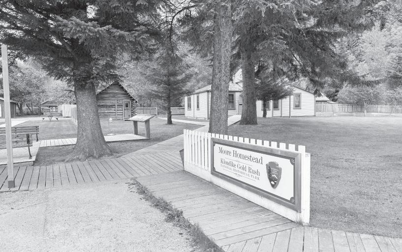
Moore Homestead: The historic Moore Homestead is located on 5th & Spring Street and will be staffed by rangers from 10 - 11 a.m. The Moore Cabin and restored Moore House feature the story of Skagway’s founding family and share the story of life in Skagway before and after the gold rush. The picturesque Moore Cabin is the oldest structure in Skagway. The Moore House is a free, fully furnished house and museum with exhibits depicting the life of an Alaskan pioneering family: Ben Moore, Klinget-sai-yet and their children. Victorian games will be offered outside the homestead daily from 11-11:30 a.m.
Jeff Smith’s Parlor Museum: Free tours are available daily at 1:00 p.m. Tours are lim-
ited to 14 people. Explore how gold rush outlaw Jeff “Soapy” Smith became a town legend and inspired a museum of curiosities, which is now one of the most unusual treasures of the National Park Service. The saga unfolds through gold rush artifacts, Martin Itjen’s wacky creations and many decades of Skagway curiosities. Now restored to its 1960s glory, come see “the greatest attraction in the world.” Tours are free. Tickets are distributed on a first come, first served basis at the park visitor center on the day of the tour and tours start in front of Jeff Smith’s Parlor Museum on Second Avenue.
Trail Center: Open daily 8 a.m. to 5 p.m., the Trail Center is located on Broadway between 5th & 6th Avenue. The Trail Center provides current trail conditions, maps and videos. Backcountry permits are issued here for the international Chilkoot Trail, the most famous trail in the North.
U.S. side of Chilkoot National Historic Trail to Open as far as Mile 4 for the 2024 Season. Reservation Line (1-800-661-0486).
For more information about Klondike Gold Rush National Historical Park, visit: https:// www. nps.gov/klgo/index.htm, or call the park at (907) 983-9200.


By Gretchen Wehmhoff
The Skagway News
Above the Skaguay News Depot on Broadway was once the Skagway News office. During the summer months, without the storm windows, the window sashes open tall enough for me to lean out to take in a view that stretches from the tall ships at the harbor to the mountains in the north.
There is something fitting about the office being upstairs in downtown. When I am there I feel like I’m almost in the middle of the action, which was certainly the case on Independence Day.
Normally, I would walk around town with my camera and capture the day, but today I stayed in the office.
We were awakened by Jeff Brady’s voice starting the Skagway 5K Run-Around. After a cup of coffee, I pulled a chair up to the front window as the Kiddie Parade began. Someone said “go” and a group of 4-year-olds tore down the block leading the short parade. The rest of the parade took a slower pace with wagons pulling teddy bears, scooters decked out in red, white and blue ribbons and costumes from fairies to bumble bees. One child sat in a wagon full of picture books reading “one more page” as her father towed her down the street.
Thirty minutes later the main parade started.
I leaned out for a picture towards the port. Two ships towered above the town and a White Pass & Yukon Route locomotive positioned itself across the street. The train whistle blew, the engine backed up and floats, vehicles and marchers crossed the tracks towards the crowd.
Parade participants tossed candy to the children. The street, lined with locals, Yukoners and people from around the world came alive with energy. The police, border patrol, park service and fire department had their rigs cleaned up. A large group of marchers wore black and carried signs in protest of the recent decision to overturn Roe v. Wade. That group seemed to get the most applause and women along the parade path stood up to clap.
After the parade, chalk drawing started right below my window. More cute kids.
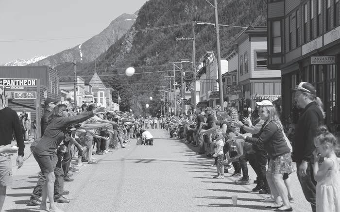
The Red Onion’s Pizza Toss began just to the left of me with Deb Potter handling the competition and Reba Hylton dishing extra sauce on the pizzas. The crowd loved it – cheering and clapping when the dough was caught and letting out loud sighs if one hit the ground.
The egg toss, an event that has
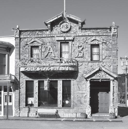
Skagway’s Visitor Information Center is located at Arctic Brotherhood Hall (Broadway between 2nd and 3rd).
A unique building built in 1899 and covered in thousands of pieces of driftwood, the AB Hall Visitor Center is open daily, 8 a.m. to 6 p.m.
Pick up a Skagway Visitor Guide, walking tour map or trail map to explore all that Skagway has to offer. Friendly and helpful staff is on hand to answer any questions. Watch for special programs and displays in the main hall.
Visit www.skagway.com for community information and utilize the messenger feature to get questions answered by a local.
earned Skagway an entry in the Guinness Book of World Records, was next.
People stretched down Broadway for blocks. Parents tossing with their kids, kids tossing with kids, strangers tossing with strangers. The line had to be one of the most international, yet casual games I’ve seen. Taking photos from the street last year was fun, but this view gave me a feel of the crowd. As eggs dropped and the line diminished, the crowd gathered around the last dozen or so teams. A few were experienced egg tossers who sent the eggs flying high and far, again, with the crowd breathing cheers of relief and sighs of loss over broken eggs.
Some of the best views from the window are when things are finished. I think my favorite is watching dogs pull at their leashes to lick up the egg from the street and the crows fighting over pizza crust.
In a way, the animals were the first line of quiet Skagway street cleaners.
The next morning the city’s street cleaning machine finished off the job and the crows cawed their displeasure. Even now, there’s a trace of chalk and a bit of egg to remind me of the energy outside the window on the street where Skagway plays.
Gretchen Wehmhoff Publisher - The Skagway News.
Dewey Lakes Trail System • Walk east on 3rd Ave. by the Westmark Inn until the railroad tracks. Trail begins on the other side of the tracks. Follow signs to Lower Dewey Lake (0.7 miles), Icy Lake (2.5 miles), Upper Reid Falls (3.5 miles), Sturgill’s Landing (4.5 miles), Upper Dewey Lake (3.5 miles), and the Devil’s Punch Bowl (4.2 miles). The trail to Lower Dewey Lake and return is a pleasant hour’s walk, though the switchback trail can be a bit steep in sections. Trails around the lake are fairly flat. Continuing north to Icy Lake and Reid Falls or south to Sturgill’s (an old wood camp by the bay) will add 2-3 hours. Camping and picnic sites abound. The hike to Upper Dewey Lake and Devil’s Punch Bowl is much steeper, great for a day hike or overnight trip. The cabin at Upper Lake may be booked at skagwayrecreation. org. Lakes are stocked with trout.
Skyline Trail to AB Mountain • Trail begins at Mile 3 on the Dyea Road and ascends AB Mountain. Allow at least five hours round trip for this often strenuous hike. Beautiful views of Skagway, Dyea, Lynn Canal, Haines and Chilkat Range.
For detailed information about these and other more remote trails, pick up a Skagway Trail Map/Brochure at the A.B. Hall or Klondike Gold Rush NHP visitor centers in downtown Skagway.

This QR Code takes you to the Skagway Trail Map PDF where you will see several local trails of varying difficulty from easy to strenuous.
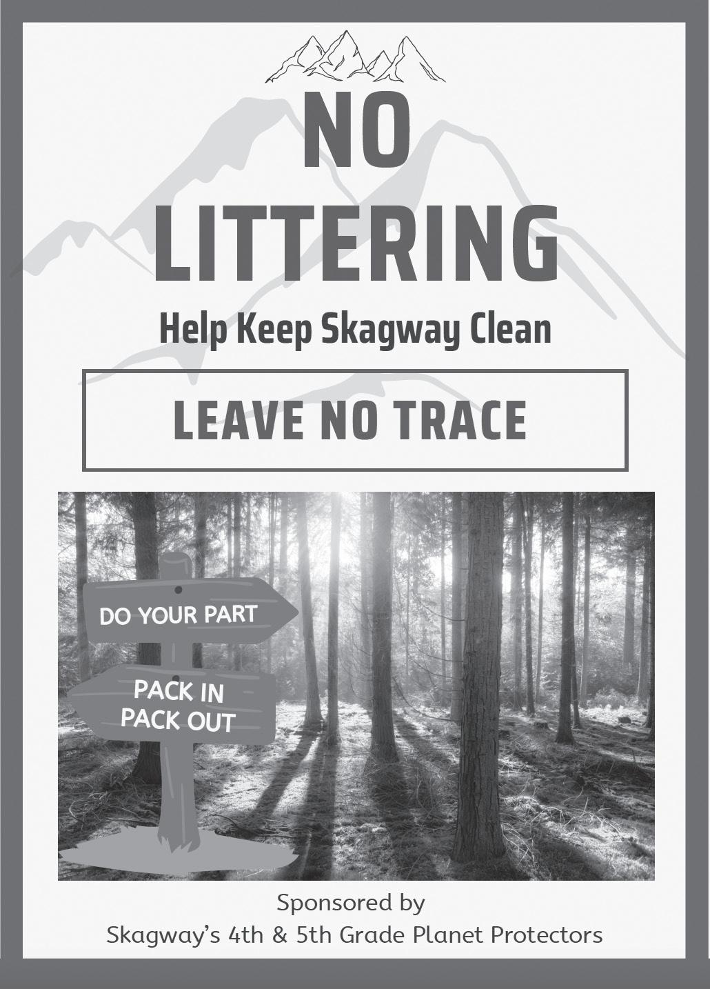
We are the Planet Protectors, a group of Skagway School’s fourth and fifth grade students who are dedicated to keeping Skagway clean and protecting our Earth. We pick up litter from our streets and streams.
Our club is proud to say that we have been accomplishing more and more initiatives as our group becomes more known and successful. The Planet Protectors are about ten fourth and fifth graders and we are not just picking trash up anymore. We are raising bear awareness throughout our community, to year-round and seasonal residents, and we also speak about our concerns with our mayor and city council members. As a result, Skagway’s Solid Waste Committee is supporting our efforts by addressing bear attrac-
Make sure to use our trash cans and put your cigarettes out in the attached cigarette canister.
tants and working to educate our community about how to live responsibly in bear country. In addition, we have been financially supported by the Westmark Hotel, Garden City Market, and the Eagles F.O.E. Aerie #25 to purchase two wagons, trash grabbers to pick up unsanitary garbage, and for a recycling center at Skagway School.
Please join us, the Planet Protectors, by doing your part! We ask you to throw your trash in the garbage cans located all along our downtown’s Broadway Avenue, and to support our efforts by picking up some trash if you see any during your visit here. You can be a “Planet Protector” too! As summer comes, more trash arrives, so please help us throw it away. Thank you!

Skagway Public Library offers free Wi-Fi from 10 a.m. to 1 p.m. daily. City Hall and Shoreline Park also provide free Wi-Fi, with a limit of 30 minutes. All internet access points are identified with a Wi-Fi symbol on the map below, courtesy of the Skagway Visitor Department. See a larger map on page 22
By Steve Hites
The map of the railroad shows general characteristics of the route from Skagway to Bennett. Use the numbers to follow points of interest along the way. For further information about your location, railroad milepost markers are set up alongside the tracks at window height and are placed exactly one mile apart. Stations and points of interest also are marked with signs. Now that you’re set, enjoy your ride on the “Scenic Railway of the World.”
1 (Mile 0) • White Pass Co. Wharf/Broadway Cruise Ship Dock/Ore Dock. The “Summit Excursion” departs from these docks and the WP&YR depot daily during the summer. Newsies in 1898 costumes usually greet the ships and give the train a send-off. Look for restored Steam Engines No. 73 and 69, which pull some trains from the docks to town, or takes special steam excursions to Bennett and Fraser. Diesel engines will take most trains up the mountain.
2 (Mile 0.3) • Skagway, Alaska, USA / White Pass Depot. “Gateway to the Klondike.” A city of 10-20,000 in 1898, Skagway’s downtown Historic District retains the flavor of the era. On 2nd Avenue stand the new and old White Pass depots. The new one serves as a company office and passenger terminal. Trains heading to Fraser, Bennett and Carcross leave from here. The old depot was restored by the National Park Service and serves as the Visitor Center and headquarters for Klondike Gold Rush National Historical Park.
3 (Mile 0.5) • Pullen House Grounds. One time “Best Hotel in Alaska,” run by the plucky Harriet Pullen who owned packhorses on the White Pass Trail in ‘98. President Warren G. Harding gave a brief speech here on his Alaskan tour of 1923. Mrs. Pullen’s grave rests above the tracks on the hillside.
4 (Mile 2.0) • White Pass Shops. All narrow gauge repairs and maintenance of engines and rolling stock are done here. New metal shops building replaced old roundhouse destroyed in the fire of 1969. Older buildings were constructed by the U.S. Army during its World War II operation of the railroad.
5 (Mile 2.5) • Gold Rush Cemetery. Outlaw Soapy Smith and town hero Frank Reid, who shot it out in ‘98, are buried here along with many other stampeders and early day residents. A quick eye will catch the “Largest Gold Nugget in the World” chained to a tree for protection from thieves by early tourist promoter Martin Itjen.
6 (Mile 5.8) • 5A Bridge & Denver Glacier Trail. A favorite local hike for many years, U.S. Forest Service trail leads three miles to an old hunting cabin and then to the bottom of the receding glacier. The caboose serves as a U.S. Forest Service cabin. Railroad crosses East Fork of Skagway River.
7 (Mile 6.9) • Rocky Point. An excellent view down the lower valley to Skagway. The town, wharfs and ships tied in port can be seen in the distance with Mt. Harding and Harding Glacier forming a dramatic backdrop. The Brackett Wagon Road of ‘98 crossed the railroad in the narrow cut at Milepost 7.
8 (Mile 8.6) • Clifton. Passing siding and section shack. A section gang lived in a two-story building here for many years. Name
derived from large rock ledge overhanging the north switch. Sign below tracks identifies Brackett Road. The “On to Alaska with Buchanan” sign on the far wall of the canyon was painted by a Buchanan Boys tour group from Cleveland, which operated in the late 1920s and 1930s. Highway skirts the canyon above the rock.
9 (Mile 9.0) • 9A Bridge & Pitchfork Falls. Easy to miss unless you’re quick with a camera pointing toward the mountainside. A landmark on the Trail of ‘98, the falls were once an excursion stopping place.
10 (Mile 10.4) • Black Cross Rock. During blasting of the right-of-way on August 3, 1898, a 100-ton granite slab buried two railroad workmen. The cross was set on the rock to mark the site, a memorial to the more than 30 men killed during construction of the WP&YR.
11 (Mile 11.5) • Bridal Veil Falls. Across the valley, several dozen cataracts can be seen in peak runoff season. The water comes down off the Mt. Cleveland glaciers, goes under the highway, and tumbles down to the Skagway River.
12 (Mile 11.5) • White Pass City. Below sprang a gold rush tent town on the White Pass Trail in ‘98. Other views of the town site, now covered by brush, can be had from the “High Line.”
13 (Mile 12.8) • High Line View. Several good breaks in the trees afford views of the 15 Mile High Line on the opposite mountainside. Michael Heney, WP&YR construction contractor in ‘98, called this the “weak link” in the survey route. Blasting out the narrow roadbed required men hanging from ropes off the smooth rock faces, and his grade crossed many wintertime snow slide chutes. Rotary snowplows kept the line open year-round in the age of steam. Now bulldozers, with help from Rotary #1, perform the annual snow removal ritual each spring.
14 (Mile 14.1) • Glacier Station. Passing siding and site of former section house. Once two water tanks quenched the thirsts of steam engines on the uphill trains here, spaced so as to water a lead locomotive and the “helper” engine at the same time. A U.S. Forest Service hiking trail by the south end of 14A Bridge winds up to Laughton Glacier, where a NFS cabin offers overnight shelter. To reserve the cabin see park rangers at the Visitor Center. Tickets can be purchased for Glacier, but remember to let the conductor know to stop the train.
15 (Mile 15.0) • Glacier Loop High Line. Enjoy the sensation of “flying by train.” View back to Glacier and the tracks below. Look for moose that sometimes feed in the valley. The track here was blasted across solid granite faces.
16 (Mile 16.0) • 15C Trestle & Old Tunnel. The engineer sounds his whistle to alert passengers to one of the high-point views of the trip. The railroad spans across “Glacier Gorge,” a yawning chasm in the cliffside, and then buries into Tunnel Mountain. With all the obstacles in the way, the 1898 construction required only this one tunnel.
17 (Mile 17.0) • Inspiration Point. Have your cameras ready! A lofty look at the Pacific Ocean. On a clear day the unparalleled view
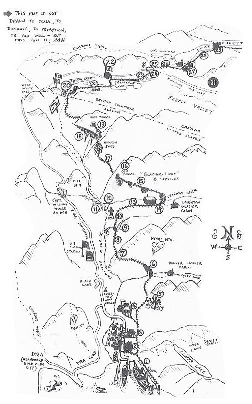
sweeps down to Skagway, with Mt. Harding showing across the bay, and the distant Chilkat Range beyond Haines, some 45 miles away. Excursions in the steam era stopped here for photos and to read the plaque on the monument at trackside dedicated to the 3,000 pack animals that died in the mad stampede of ‘98. The plaque has been relocated to the depot.
18 (Mile 18.6) • Steel Bridge. When constructed in 1901, this bridge was the tallest steel cantilever in the world. It replaced a dizzying switchback, which had been necessitated by the depths of Cutoff Canyon; trains had to head up the gorge and then back uphill across a timber trestle to the summit.
19 (Mile 18.8) • 19A Bridge/Tunnel & Trail of ‘98. New locomotives and heavier tonnage brought about the new bridge and tunnel in 1969. Excellent photo opportunity of train on “horseshoe” curve across the bridge and entering tunnel. Be ready as the train emerges into daylight for a view down the upper reaches of Dead Horse Gulch on the Trail of ‘98. As the track curves out of 19 Tunnel, travelers can peer over the cliff side at the visible remains of the White Pass Trail. Primarily a route for horses and pack trains, the Skagway trail competed against the Chilkoot Trail from Dyea to Lake Bennett in 1897-98. A sign marks the trail and several bleached horse skulls offer mute testimony to the hardships of the stampede.
20 (Mile 20.4) • White Pass Summit/International Boundary/Summit Lake. A narrow notch brings the railroad up to White Pass, elevation 2,865 feet above sea level and Skagway. Two flags fly during the summer on a rise to the west to mark the boundary between the United States’ Alaska and Canada’s British Columbia. White Pass station once boasted a detachment of North West Mounted Police sent to “show the flag” and hold the line on their rule that each stampeder have a ton of gear and supplies before entering the country -- enough to live unaided in the North for a year. A sliver of B.C. divides Alaska and the Yukon at the top of Southeastern Alaska. The
Use the map on back page to help find these attractions.
MUSEUMS & EXHIBITS
Corrington Museum of Alaskan History
This museum, located at 3rd and Broadway, adjacent to the old Golden North Hotel, tells the history of Alaska from pre-historic times to the present. More than 40 engraved walrus tusks and other exhibits detail events that shaped the evolution of the 49th state.
Alaska 360’s Dredge Town Located along the river about a quarter-mile after crossing the bridge, this attraction features a reassembled gold dredge that worked the Sixtymile District near Dawson City. It first arrived in the north in Skagway in 1941 and was transported on the railroad and steamers to the Klondike. It returned to its home port of Skagway in 19992000. Dredge Town will transport you back to the days of 1898 with costumed guides. There’s a sled dog demonstration with time to interact with dogs and puppies, gold panning, a 40-below Zero Experience, a restaurant and gift shop.
McCabe Building – Skagway Museum and Archives Located at the east end of 7th Avenue, this granite building was constructed in 1899-1900 as a Methodist college-preparatory school and was later sold to the federal government in 1901 when legislation provided public schools for Alaska. It served as the U.S. Court House until obtained by the city for a museum and offices in 1956. The U.S. Marshal’s office, the U.S. Commissioner’s office and the jail occupied the first floor. District Court was held on the second floor in the former chapel of McCabe College. In 2000, the City of Skagway celebrated its centennial at the McCabe Building, which has served as City Hall and Skagway Museum since 1961. After a two-year renovation project, the museum moved back into the first floor and city offices into the second floor. Across Spring Street is Veterans Memorial Park with a World War II Quonset hut and a monument dedicated to Skagway servicemen who lost their lives in World War II and the Korean War. Nearby on the 7th Avenue boardwalks are a Gold Rush Diorama and information panels on the Garden City of Alaska and Alaska Native culture. Across Pullen Creek on a trail leading south to 6th Avenue is a panel about the old Pullen House, a grand early hotel with nothing left in the woods but its stone fireplace and chimney.
SS Princess Sophia Exhibit New in 2018 at the Skagway Museum, this exhibit tells the story of the SS Princess Sophia, which left Skagway on Oct. 23, 1918 and then struck Vanderbilt Reef in a storm early the next morning. It was hoped the ship would float free, but the storm prevented any rescue and she broke apart and sank on Oct. 25. All 350-plus souls aboard, save a dog that swam ashore, perished, making it the worst marine disaster in the Pacific Northwest.
Skagway Public Library On 8th and State, read about the library’s history from its organization through the Skagway Women’s Club to present day. Old Skagway newspapers are available to peruse. Rotating displays in the glass case in entryway.
Skagway Centennial Park Located at 1st
and Broadway, this park features the city’s centennial statue of a Tlingit packer leading a prospector up the trail in 1897, Rotary Snowplow #1, a time capsule, monuments, orientation signs, covered waiting area, water fountain, benches and native plants.
Klondike Gold Rush National Historical Park Visitor Center at 2nd and Broadway
Pullen Creek Park & Stream Walk Park between the small boat harbor and the railroad depot for a sweet area to picnic and fish. King salmon run begins in late May, followed by pinks in August and silvers in September. A stream walk follows the creek. At one time the school managed a hatchery on the creek, and it was even named Alaska Vocational Education Program of the Year in 1989.
Footbridge to Yakutania Point & Smuggler’s Cove Located south of the airport terminal (see map), the bridge spans across the Skagway River to waterfront trails with outstanding views, an exercise course, picnic spots and the cherished Pet Cemetery.
Mollie Walsh Park Located at the east end of 6th Avenue, this play park was named for a woman who befriended miners on the trail at Log Cabin. Ex-lover Jack Newman placed a bust here after Mollie left with another man and met an untimely death.
Gold Rush Cemetery & Reid Falls About 1.5 miles from the Historic District, head north on State Street. Look for a sign just before the bridge. Follow signs a half-mile past the railroad shops to the graveyard. A cemetery guidebook can be purchased a the local bookstore, which tells the history of the cemetery and some of the characters buried therein, including desperado Soapy Smith and town hero Frank Reid. The falls, named for Reid, are a short walk up the hill.
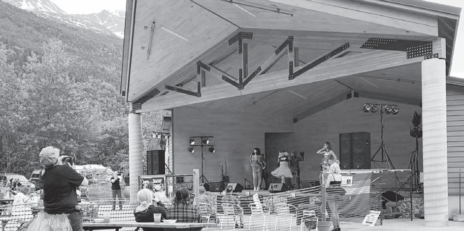
Seven Pastures Park Located just across the Skagway River highway bridge and also reached by the Pat Moore memorial footbridge, this large park features two softball fields, a soccer field, a disc golf course, bikecross area, picnic grounds and Dedman Stage that opened in 2015. Watch for signs about music acts at this outdoor facility.
Skagway Overlook This turnoff and platform, located at Mile 2 on Dyea Road, affords a wonderful view of the downtown area, waterfront and peaks above Skagway. It was originally built by the U.S. Army during World War II.
Dyea Unit - Klondike NHP The Dyea valley is accessed by an 8-mile mostly gravel road from Skagway. Turnoff is at Mile 2.1 on the highway. Narrow Dyea road is not recommended for long or wide vehicles. It passes a turnoff to Yakutania Point (Mile 3) and swings around Nahku or Long Bay (Mile 5), home of the remains of the bark “Canada” (seen at very low tides), and then winds around the point to the old townsite. Dyea was as large as Skagway during the gold rush, but all that’s left now is a cemetery and the scattered remains of a wharf and buildings in the old townsite (see Dyea article page 12).
Favorite stops are the Chilkoot Trailhead, Dyea Flats and Slide Cemetery, where 40 graves bear the date of the Palm Sunday avalanche on the Chilkoot Trail in 1898.
If continuing on the road out to Dyea Flats, stay on marked roadways. There is an information kiosk about the flats environment with photos of what the area looked like during the gold rush. The Municipality of Skagway controls most of the flats from the trees to tidewater. There is a small campground in the trees with a self-registration kiosk. Stay in numbered sites.
Yukon is about 25 miles down the tracks on Lake Bennett. The end of the line is 90 miles away in downtown Whitehorse alongside the Yukon River. The Summit Excursion turns around here at White Pass -- the engines will switch to the back of the train and then take passengers back down the mountain. The train to Fraser keeps going. To the west of the railroad is Summit Lake, one of a series of headwater lakes in the Yukon River system.
21 (Mile 23.0) • “Top of the World”. Stunted trees, glacial boulder fields and pothole lakes contrast with lush forests on the coast only a few miles away. In winter the White Pass Summit country can be a raging hell or a scene out of “Dr. Zhivago” with vistas of white peaks and valleys. Excellent cross-country skiing.
22 (Mile 28.0) • Fraser, B.C. Long a water stop for the rotary fleet battling the pass, Fraser had a balloon loop track in the meadow south of Bernard Lake, and engines and plows were turned
continued from page 8
here. The old two-story water tank building remains, the last such structure on the railroad. Canadian Customs and a Yukon Highways maintenance facility appear to the west. This is the bus transfer point -- either the beginning or the end of the rail portion of your journey between Skagway and Whitehorse.
23 (Mile 30.5) • Portage. Several fishing cabins and “boxcar homes” line the stream between two lakes. Famous view eastward toward Teepee Valley and distant lakes as you ascend Log Cabin Hill. Gold discovered on Lake Atlin in ‘98 caused a major construction shutdown when rail workers left en mass for the new diggings, taking most of the company’s picks and shovels. Most returned upon discovering the claims were already staked out.
24 (Mile 32.0) • Log Cabin. Tracks cross the Klondike Highway at site of Log Cabin, a tent city in ‘98 and Mounted Police Customs house. At one time a substantial depot and section
house were here, but now only two small sheds remain at the south siding, which is the highest point on the railroad at 2,916 feet above sea level. There’s no log cabin. Chilkoot Trail hikers walk eight miles up the tracks to Log Cabin from Lake Bennett to catch a ride.
25 (Mile 34.0) • Thirty-Four Flats. Meadows here are large and populated with beaver on the north end and occasionally by wandering caribou or moose. If you don’t see an animal, remember they aren’t usually about at the height of the day.
26 (Mile 36.5) • Beaver Lake. Beaver lodges can be observed at the lake’s edge. Tracks begin high above the lake and drop to lakeside at the north end. Visible at Mile 39.0 is Lake Lindeman. A tent city of 10,000 camped here during the gold rush, but the rapids to Lake Bennett wrecked many hastily built boats.
27 (Mile 40.6) • Bennett. The winter of ‘97-’98 found 30,000 stampeders camped here on the
shores of the lake, named after New York Herald editor James Gordon Bennett. The ice broke on May 26, 1898, and 7,000 homemade boats set sail down the lake to float down the Yukon to Dawson City. The railroad arrived in June of ‘99, and after constructing permanent facilities, operated a station/eating house until 1982. The old depot still stands, as does the old Bennett Church on the hill above the lake. Trails lead to the church, campsites and old graveyard. This area is now part of Canada’s new Chilkoot Trail National Park. The trail ends here. For highlights along the route between Bennett and Carcross, consult the “All Aboard” train guide on your rail excursion.
While braking on the WP&YR in the 1970s, local balladeer and historian Steve Hites scribbled this train guide. He has written and recorded many songs about the North and has entertained thousands. Steve also operates the Skagway Street Car Tour.
Meet Skeeter and Ivy. They can tell you about being a dog in Skagway - it’s pretty nice, really
Hello, our names are Skeeter and Ivy and we are rescue dogs living in Skagway, Alaska. Our human, Katherine, asked us to write this article so that we could share what it is like being a dog in Skagway. Our humans Katherine and Eric run the Paws & Claws Animal Shelter; a local rescue organization founded by Katherine 21 years ago. Paws & Claws has played a huge role in making sure that all dogs in Skagway have a home. There are no stray dogs here so sometimes the shelter helps dogs in remote Alaskan villages find homes. We originally came from the Prince of Wales Island in Alaska.
A typical day for us starts at 3:00am. Of course, this isn’t the time that the humans chose for us to wake up. But one of the four feline residents that we live with insists this is the best time of the day to be fed. So Ivy helps get Katherine up by gently tapping her with a paw. After breakfast we go back to sleep for a couple of hours before taking our first walk at 5:30am. This little nap after eating helps let our food settle before we exercise.
Each morning it is a surprise where we are going to walk. Some days we go on off-leash hikes where we chase squirrels and other days we do a leashed walk in town. We are lucky to live in a town with so many off-leash trails and rivers and lakes to play in. If we go on a leashed walk our human makes sure that we get plenty of time to sniff things. She calls these walks “sniffaris”. Sniffing is like meditation for us and helps us with any stress and anxiety that we may be feeling.
One of our favorite things about doing a walk in town is that some of the businesses give us treats. There aren’t that many people here in the winter so we always have a period of adjustment when all of the seasonal
workers and tourists come back in the summer time. Treats help us with this adjustment and our humans advocate for us and let people know that we may not always feel comfortable having a stranger pet us.
We attend dog birthday parties and tea parties all year round. Ivy even attends a special puppy play group one day a week so she can wrestle with her friends. We like doing agility and parkour but only for fun. We also like hanging out around the campfire, especially under the night sky when the Northern lights are dancing above. And it isn’t our favorite activity, but we do get groomed and our nails trimmed regularly at our local grooming shop. When we roll in dead rotting salmon we
have to get bathed more frequently.
Unfortunately, we have had some unpleasant experiences in Skagway with some pokey-like cats aka porcupines. Just a quick sniff of these fascinating creatures has had some not so good outcomes for us. Since we don’t have a veterinarian in Skagway we have to travel to Whitehorse, YT or Juneau, AK to seek emergency vet care. We do have visiting veterinarians that hold clinics here a few times a year. We usually get our routine vet care when these traveling vets are in town.
Skagway is a great place to be a dog and we consider ourselves lucky to live here! Enjoy your stay and don’t forget to always ask permission before petting a dog.
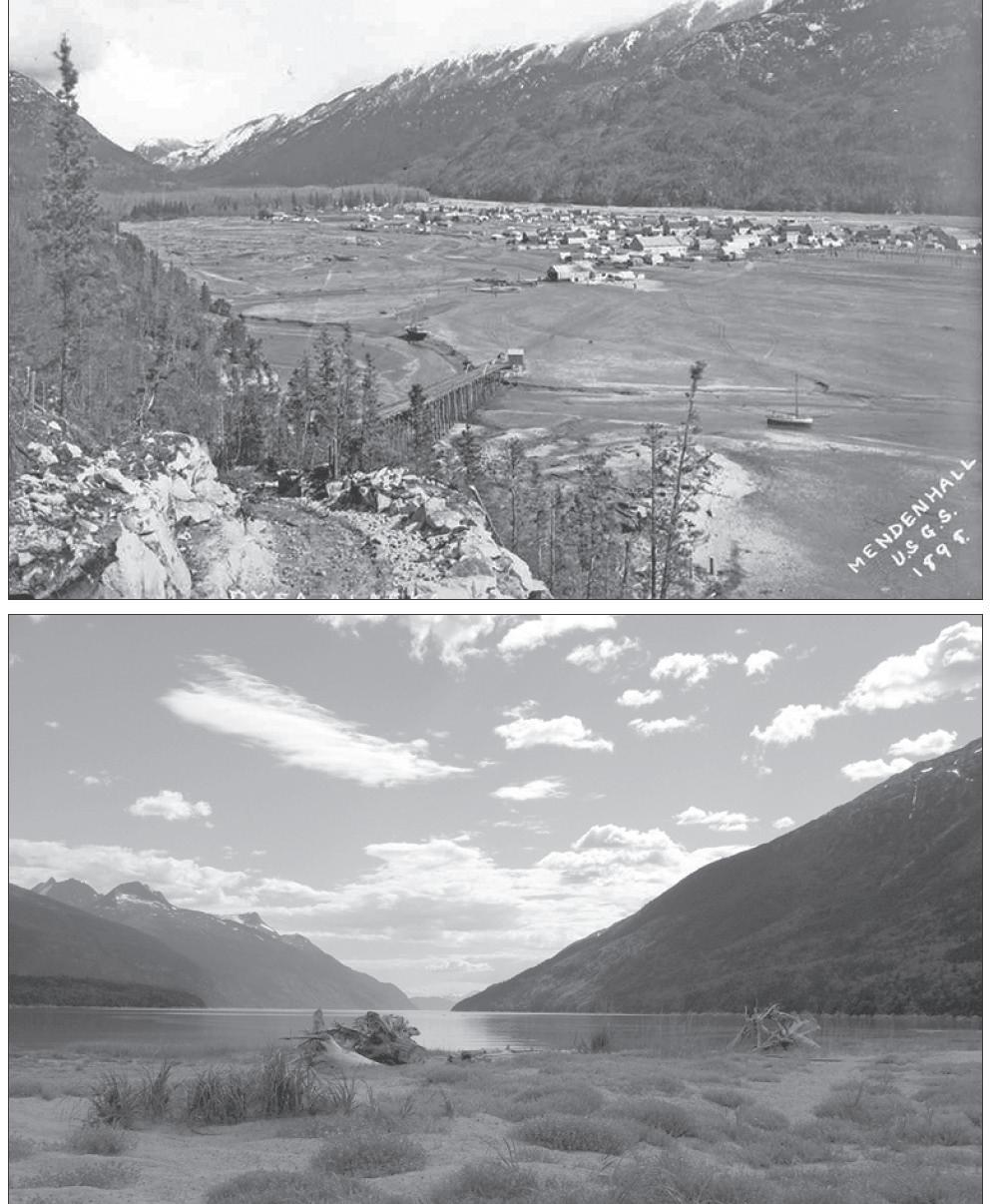
Skagway bustles today in the summer like the boomtown it was in 1897-1898, but a few miles away, and a couple of valleys over to the northwest, lies a place that local residents and visitors cherish for its quiet beauty.
This place is Dyea (pronounced Di-eee) and for a short time it was just as big and booming as old Skagway.
Dyea’s history as a settlement actually is much older than its rival gold rush city. At the foot of the Chilkoot Trail, Dyea was established several centuries ago as a summer camp by the Tlingit from more populated villages down the inlet near present-day Haines. These Chilkoots built the trail over the mountains to facilitate trade with Yukon and Alaska interior First Nations tribes. Dyea (Deiyaa, pronounced day-yah) and Taiya are really the same word (Deiyaa) in the Tlingit language, meaning “pack trail.”
The Tlingit’s camp on the Taiya saw its first visitors from afar after the United States purchased Alaska in 1867. The U.S. Navy had exerted control in the area and convinced the Tlingit to allow others over the Chilkoot Pass. George Holt was the first documented white man to cross it in 1874, and Alaska Natives began a commercial packing operation a few years later. Westerners John J. Healy and Edgar Wilson established a trading post on the site in 1884, while other coastal and interior tribes vied for control of the trade. It culminated in a Native packers battle in 1888 that resulted in the deaths of two chiefs and a truce of sorts. More and more white people kept crossing over the next decade.
Dyea had a post office by 1896, the year Tagish trader and frequent Dyea visitor Skookum Jim discovered the Klondike gold 600 miles from here. Nearly a year later, in July 1897, the first ships of stampeders arrived, and a city of 10,000 went up among the spruce and hemlock forest at the edge of a long tidal flat, connected by two mile-long wharves to the ships in the inlet.
During its yearlong heyday, Dyea boasted 150 businesses, including 19 freighting companies, 48 hotels, 47 restaurants, seven real estate agents and two newspapers. Taverns outnumbered churches 39 to 1.
But as quickly as it boomed, Dyea suddenly dwindled and almost disappeared. Two events played into its doom: an avalanche on the Chilkoot Trail in April 1898 that killed more than 60 stampeders, and the start of construction of the White Pass & Yukon Route railroad out of Skagway in May of that year. Dyea had boasted its own tramline and a future railroad of its own, but in 1899 the WP&YR owners bought it and shut it down. Business owners from Dyea flocked to Skagway, taking many of their buildings with them, and by 1900 the city of 10,000 was a mere village again of 250.
Three years later, there were just six people living in the Dyea valley.
Dyea did not go away. Original homesteaders Emil Klatt and William Matthews lived and worked there, and Harriet Pullen ran a dairy farm in the valley for her hotel in Skagway for many years. A few braved the Chilkoot Trail, even scouting it for a film in the 1920s. But what was left of the old gold rush buildings gradually crumbled into busted foundations
by the middle of the century.
Dyea became a destination again after the valley was connected by an eight-mile-long coastal road from Skagway in 1947. It became a favorite recreation area for local residents, and a few more residents built cabins there. The tourists came too.
In the late 1970s, much of the Taiya River valley was absorbed into the Dyea-Chilkoot Unit of the new Klondike Gold Rush National Historical Park. The historic trail was restored, as were some of the trails through the woods where the Dyea town site once stood.
Today, visitors can take a walking tour through the old town site and to the Slide Cemetery, where many of the 1898 avalanche victims were buried. There also are a limited number of commercial tours operating in the valley, but for the most part Dyea is there for the independent traveler to explore and photograph.
Wild irises bloom in mid-June on the Dyea Tide Flats, and fireweed join them in July and August. Currants and cranberries are found as well, when in season, and blueberries at higher elevations on the Chilkoot and Lost Lake trails or up West Creek Road (remote old logging road, 4WD vehicles only).
Birding is very popular on the Flats, especially when the eulachon (pronounced hooligan, a tiny smelt) run in the Taiya in May and during the arrival of pink salmon in Nelson’s Slough and other valley streams in August.
Eagles, great blue heron and other birds seek the spawning fish along with the occasional grizzly and black bear. Observe bears from a distance and pack bear spray for hiking. Also be mindful of the changing tides, which can catch an unobservant hiker or parked vehicle off guard on the Flats.
Adventurers looking for a spot to spend the night and see Dyea at its best in the early light have a few options. The Dyea Flats area, managed by the Municipality of Skagway, has its own campground. Another campground, located in a wooded area along the river at the entrance to Dyea (and closer to the Chilkoot Trailhead), is managed by the National Park Service. For those who want a bed and meal cooked for them, there are nice cabins to rent at the outpost at the entrance to Dyea.
The main thing about enjoying Dyea is not to rush through it. Those days were left behind in 1898.
SOURCES
• “Skagway: City of the New Century, The True Story of Skagway, Alaska including the White Pass, Dyea and the Chilkoot Trail,” Jeff Brady, ed., Lynn Canal Publishing, 2013, 2019.
• “Dyea, Alaska: The Rise and Fall of a Klondike Gold Rush Town,” M.J. Kirchhoff, 2012.
• “Legacy of the Gold Rush: An Administrative History of Klondike Gold Rush National Historical Park,” Frank Norris, 1996.
Jeff Brady is an author/historian, editor/publisher and bookstore owner who writes from his cabin in Dyea.
By Dr. X́unei Lance Twitchell
The history of Skagway is complex. Like many places throughout the United States, what is viewed as discovery and opportunity for wealth from the perspective of American culture is in reality the invasion of the traditional territory of an indigenous population. Many organizations celebrate the gold rush of Alaska without ever recognizing that it marks a time of tremendous suffering, loss and the onset of oppression for Skagway’s first people. Despite this, the Tribe is attempting to bridge the gaps that exist in and around our community from a tribal perspective; many of which originated with the gold rush.
Over the last hundred years, the geological and cultural landscape of Skagway has changed dramatically. Once a small valley full of trees and natural streams; modern Skagway is a collection of historic facades, gravel landfill and sizable docks that stretch out like fingers towards oncoming tourists. This place was once a vital bridge between coastal and interior indigenous groups, who relied upon routes into the interior to trade the riches of the sea for those of the land. Inland groups savored preserved salmon, fish and seal oils and sea vegetation; and bartered with invaluable copper, moose and caribou meat and
hides.
To this day, trade continues with coastal and inland tribal groups. These activities, until recently, had all but subsided because of the United States-Canada border, which effectively separated families, tribes and traditional relationships due to regulations and a reluctance to recognize cross-boundary indigenous rights and relationships. Recent meetings between the Skagway Traditional Council (STC) and the Carcross-Tagish First Nations have begun to address and resolve cross-border issues including traditional trading practices, historical migration patterns and the use and ownership of the Chilkoot Trail.
The STC is a federally recognized Indian Tribe pursuant to the Indian Reorganization Act of 1934, and is the governing body for Alaska Native and American Indian activities in the Skagway area. This means that the STC is a domestic sovereign body within the United States that has an inherent right to govern activities involving tribal members and the traditional tribal territory of Skagway’s indigenous Tlingit population. The Tribe has been strongly active since 1999, and recently constructed a 3,600 square foot Native community center.
The building was given the
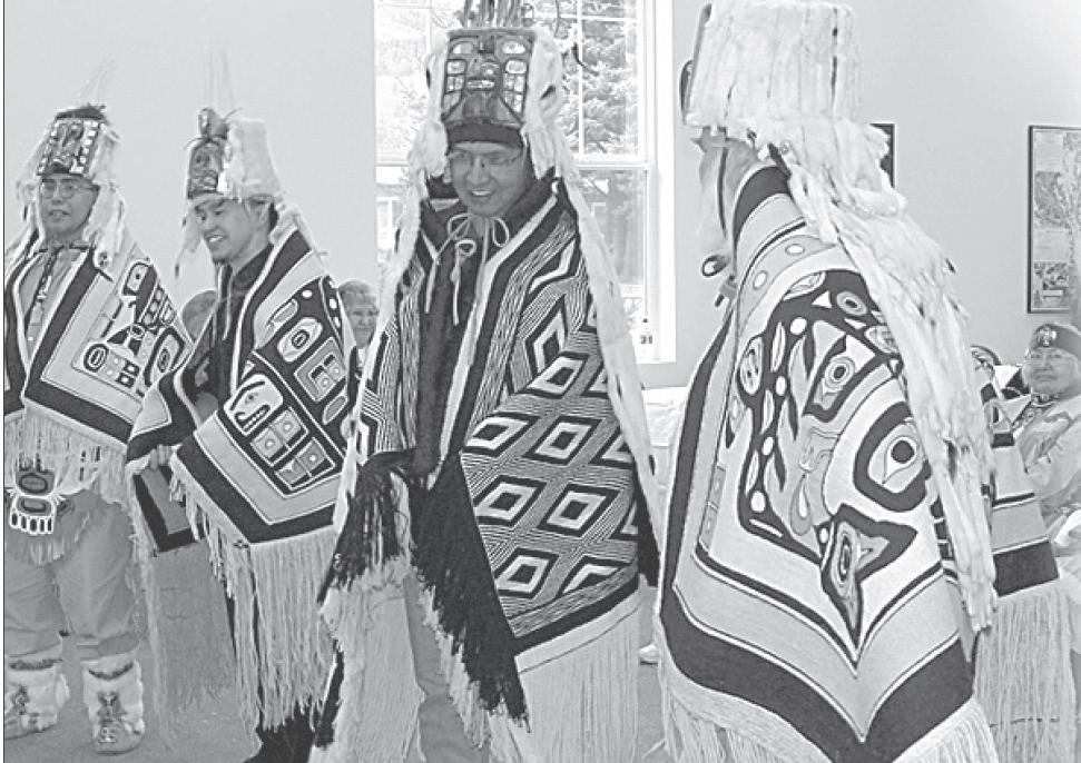
name: Héen Agunatáani Hít, which is “whitecaps on the Water House,” referring to an interpretation of the name Shgagwéi. To commemorate the event, the STC distributed 100 white baseball caps with the name of the building embroidered on the front. The dedication of the building was a true celebration, as the entire community helped breathe life into the only structure the Native community has owned in over a hundred years.
In all things, there is progress, and our people have always lived our life by the tides. The tide had gone out on our people in our ancestral land, but it has now returned. It is a wonderful time to be
alive; to see young people learning our endangered language, to see them dancing and understanding who they are by their heritage. And the sharing of this helps our entire community grow. Thank you for visiting, and for taking time to learn about Skagway’s first people.
Dr. X́unei Lance Twitchell, raised in Skagway, is an Alaska Native language associate professor at the University of Alaska Southeast. He is a storyteller, poet and formline artist. He also serves on the organizing faculty of Skagway’s North Words Writers Symposium.
By Chris Copley
Special to the Skaguay Alaskan
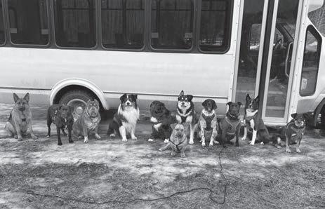
Can you corral 15 off-leash dogs, organize them to sit and stay for a photo, and release them on command? Mo the dog whisperer can.
Skagway resident Morgan “Mo” Nelson operates Mo Mountain Mutts, a local dog-training and -walking service that has a wide following on YouTube and Instagram. Nelson’s Mo Mountain Mutts TikTok page has 2 million followers. One of Nelson’s TikTok videos has been seen 64 million times.
Nelson offers many dog-related services, including packs walks, individual training, and pet-sitting. Key to Nelson’s success in oneon-one training is her personal relationship with each dog she works with – and a parallel relationship with the dog’s owner.
“Sometimes what people think is, ‘Here, take the leash, fix my dog and then give it back to me right.’ That will never work,” Nelson said. “Because the owner has to know how to apply the training. Getting the owner to understand that is the challenging part.”
Nelson likes to train through action. “It’s really boring for me and the dog to be in a room and work on obedience,” she said. “I’m, like, let’s just go on a walk and apply training.”
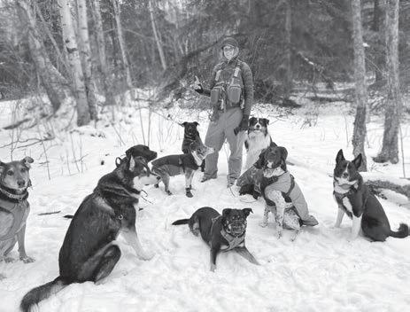
She is in demand among Skagway dog owners for her pack walks. When she takes on a
new client, she fits them into her schedule –three to five times a week depending on need.
“In the winter, I always have my first crew and my second crew each morning,” Nelson said. “Then I have my Old and Littles. It’s new as of last year, and now it’s my biggest group. It’s senior dogs and little, tiny dogs. Little tiny
dogs are not intimidated by slow, big dogs so they can go together. That group, they don’t have as high an energy, so they don’t need to go every day.”
Nelson said each of her parents and stepparents was a dog person. When she was 9,
Continued on page 15
As told by Si Dennis Sr. from “Skagway: City of the New Century”
I don’t know how authentic this story is. It was told to my brother and me years ago by my mother. The story is about the two Tlingit Indians who found the gold that started the stampede that was later known as the Klondike Gold Rush. It’s not the story of the gold rush itself, but events leading to the discovery of gold.
The story goes like this. It seems that one of the men was out hunting one day, and during his travels through the woods looking for game, he came upon a pool of water. He decided to rest by this pool, so he sat down. He noticed that this pool had high, steep sides, mostly clay, and it was awfully wet and slippery. And as he sat there, he noticed something moving in the murky water. He just sat there and watched it. It swam over to the side of the pool and started to climb out, and he noticed that it was a frog.
Now the frog almost made it to the top before it slid back into the water. So the man just sat there and watched to see what it was going to do. The frog made several attempts with the same results, and he noticed that the frog was getting tired. He figured that the frog must have been trying
for a long time. So the next time the frog started to climb out, the man walked over and lay down, reached out, grabbed hold of the frog, and took it out. He carried it over to a stream of water nearby and proceeded to wash the clay off the frog. While he was doing this he spoke to the frog like he was talking to another human being, telling him why he was out there, looking for game and food for his family.
I don’t know if the frog found him any luck in his hunting but that night when he went to sleep, he had a dream. He dreamt that he was standing by a body of water and as he stood there, he watched the frog swim directly toward him. When the frog got so close, it stood up and turned into a man like himself, and this man started talking to him. He said, “You saved my life and now I want to repay you.” And he pointed and said, “You see that mountain?” When the man looked, it was like looking into a big screen or picture, and he could see that mountain. Then the frog-man told him, “Study that mountain, memorize it. Because you’re going to start off from here, and you’re going to find that mountain, and that’s where your luck is going to be.” He tried to ask which direction he was supposed to be going, and the frog-man said, “Don’t worry,
you’ll find it.”
So the next day, he told his friend about what he’d done with the frog the day before and about the dream he had. And his friend said, “Let’s go and I’ll go with you.” So they got their provisions together and they took off. Their hunt went for days, looking for this mountain with no luck, and they traveled a good many miles away from home. They got down to the point where they had to take inventory to see what they had left. They were getting pretty low on their provisions and they knew they were a long ways from home. So they finally decided they were going to hunt one more day, and if they didn’t find that mountain, they were going to start back for home.
So the next day they started out. All this time, this one man had a feeling, for some reason, that he was always going in the right direction. And as the day wore on he became discouraged. Then, all of a sudden, he looked up, and he looked right at that mountain. He told his friend, “There it is.” And his friend asked him, “Are you sure?” The man said, “That’s the mountain. I recognize it.”
They went over there and discovered this gold that started the stampede that was later known as the Klondike Gold Rush.
Si Dennis Sr., the grandson of a
Tlingit packer, for years was elder of the local Native community. He “walked into the forest” in 1997. This story has been told in many forms over the years as a dream that came to gold discoverer Skookum Jim Mason. Some accounts say the dream occurred in Dyea, where Jim and his family traveled to often from their Tagish home. Two of his children are buried in the Dyea cemetery.
Present with Skookum Jim at the discovery on August 16, 1896 were his nephew, Dawson Charlie, and brother-in-law, George Carmack (he had married Jim’s sister Kate, who was nearby). Carmack, being the only white man in the party, filed the discovery claim on Rabbit Creek (now Bonanza), a tributary of the Klondike River near Dawson City. Jim and Charlie were given the ground above and below discovery. Many newspapers of the day and subsequent histories credited Carmack with the discovery, but it was really a shared discovery in which Jim should be given the most credit. It was his dream after all.
from page 14
her stepdad gave her a puppy to train – a red Siberian husky named Cinnamon. This puppy introduced Nelson to dog training. And working with dog packs.
“Doing things in packs allows the dogs to learn from other dogs,” she said. “People can only teach a dog so much. It’s important for a dog to learn ‘how to dog’ from other dogs. Also, pack walks are mentally and physically enriching.”
Nelson has been training and walking dogs in Skagway since 2016. Her husband Lee Thompson works with her, often gathering dogs on a white shuttle bus and bringing them to 7 Pastures, where Nelson walks and trains the dogs in groups. Each dog has an assigned seat on the bus – small or timid dogs seated
away from boisterous, licky puppies.
Thompson also shoots videos of Nelson at work with the dogs. Hundreds of Mo Mountain Mutts videos can be seen on Instagram, TikTok, and Facebook. Occasionally Vern, the couple’s 2-year-old son, works with mom and appears in the dog videos.
Viral videos are cool, but Nelson’s priority is to have dogs and their owners thrive together. She urges dog owners to try training every day in small ways. If your dog is jumpy and over-eager at feeding time, she said, wait until the dog sits, or looks at you, indicating they are engaged with you.
Training new habits is hard.
“It’s never going to be perfect the first time. It might take you 20 minutes to get the kibble
on the floor. But the next time it should be less than the first time,” Nelson said. “I think people struggle with perfection and a high expectation. And they should be looking for little wins – better than what it was. Tomorrow, it’ll be better. The next day, it’ll be even better.”
Compiled by Jeff Brady
Pre-1887 - Skaqua or Shgagwéi, as it is known by the Tlingit, a windy place with “white caps on the water,” is used by Chilkoots and Chilkats for hunting and fishing. A few of these Native Alaskans settle in the quieter areas of Smuggler’s Cove, Nahku Bay and Dyea, head of the Chilkoot trail, a centuries-old Native trading route becoming popular with early prospectors heading into the Yukon. In the 1880s, U.S. Navy and Army patrols establish federal presence in the area.
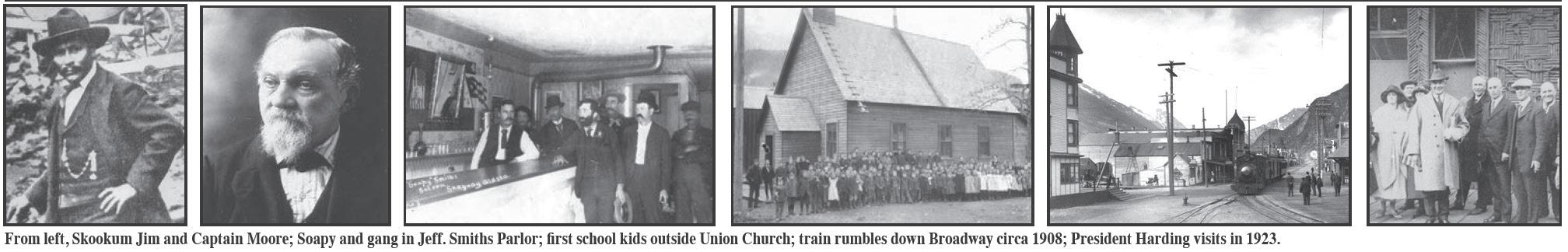
1887 - In June, Skookum Jim, a Tlingit packer from Dyea and Tagish, leads Capt. William Moore, a member of a Canadian survey party, over a new pass up the Skaqua river valley. It is later named White Pass for the Canadian Interior minister. In October, Moore returns with son, Bernard. They lay claim to 160 acres and begin work on a cabin and dock for “Mooresville.”
1894-95 - Northwest Mounted Police patrol lands in area on way to Yukon to establish Canadian presence. Early prospectors take Moore’s crude trail over White Pass.
1896 - On Aug. 16-17, gold is discovered by Skookum Jim, George W. Carmack and Dawson Charlie on Rabbit Creek, later called Bonanza, a tributary of the Klondike River, 600 miles from Skagway. They stake their claim to history.
1897 - Moore opens trail on July 14, just before steamships arrive in San Francisco and Seattle with famed “Ton of Gold,” setting off Klondike Gold Rush. On July 29, the steamer Queen lands at Moore’s wharf, the first of many stuffed with hundreds of gold seekers. The Moores are overrun: Mooresville is re-platted by surveyor Frank Reid as Skaguay. Later that fall, a post office, church and newspaper (Skaguay News) are established. Many pack animals perish on crude “Dead Horse Trail” out of Skagway. George Brackett builds toll road to White Pass City, a tent city 15 miles up the valley.
1898 - Skagway booms to nearly 10,000 people. Daily Alaskan newspaper appears. Chamber of commerce and volunteer fire de-
partment organize. Close Brothers of London buy out Brackett for railroad line. Construction begins in May on White Pass & Yukon Route Railroad. Unofficial city government forms and allows railroad tracks up Broadway. First school opens in Union Church in June. Criminal gang led by Soapy Smith reigns until he is shot and killed by an angry mob led by Frank Reid on July 8, four days after Smith stood on the podium with governor at Skagway’s first Independence Day celebration. U.S. Army, stationed in Dyea, restores order. Reid dies and gets a hero’s funeral at town cemetery. Spelling changed to Skagway by post office, and most businesses follow. Townspeople are called Skagwayans.
1899 - Railroad crews advance to summit and reach Lake Bennett in July. Building boom continues with construction of Arctic Brotherhood Hall and McCabe College (on land donated by Capt. Moore). He builds his own showplace home nearby. Some buildings are shipped over from declining Dyea. New school built on 11th. City becomes fire-weary after seven downtown buildings are destroyed, and a forest fire burns the Army post near Dyea. The troops, most of them Black, move to Skagway.
1900 - Census records 3,117 residents. On June 28, Skagway becomes the first incorporated city in Alaska on a vote of eligible property owners, 246-60. It beats Juneau by a day. On July 29, the WP&YR is completed between Skagway and Whitehorse with a golden spike ceremony at Carcross, Yukon. WP&YR depot and hospital constructed.
1901-02 - McCabe College closes and federal government buys it for courthouse. H.D. Clark farm established across river. Charley Walker sends vegetable display to Portland Exhibition. Moore town site claim settled, Moores get 60 of original 160 acres and compensation. Harriet Pullen purchases Moore’s stately home and opens Pullen House. Herman Kirmse organizes first garden show in 1902. On Sept. 14, a man attempts to rob the Canadian Imperial Bank of Commerce branch on Fifth and blows himself
up by accident, along with cash and gold dust, some of which is recovered after mining the street. The man is never identified. Dentist L.S. Keller ends up with skull. Army troops begin work on Fort Seward near Haines, where they will be transferred in 1904.
1903-05 - International Boundary dispute settled in 1903 with borders set at tops of mountain passes. Skagway News closes, leaving only the Daily Alaskan. Bobby Sheldon, 22, builds first automobile in Alaska for 1905 Fourth of July parade. He will later drive first car over Alaska’s first highway from Fairbanks to Valdez. Skagwayans discuss a road to eventually connect with the Valdez road.
1908-10 - Several buildings relocated to Broadway from other parts of city to develop business district along rail line, including Red Onion Saloon and the Golden North Hotel, owned by the Dedman family.
1912-13 - Fire on hillside above Lower Dewey Lake destroys P.E. Kern’s Castle, a hotel in the woods. J.M. “Si” Tanner, a popular marshal and hardware store owner, is elected to Alaska’s first Territorial Legislature in 1913.
1914 - Major Richardson of Alaska Road Commission approves rough four-mile road up east side of river.
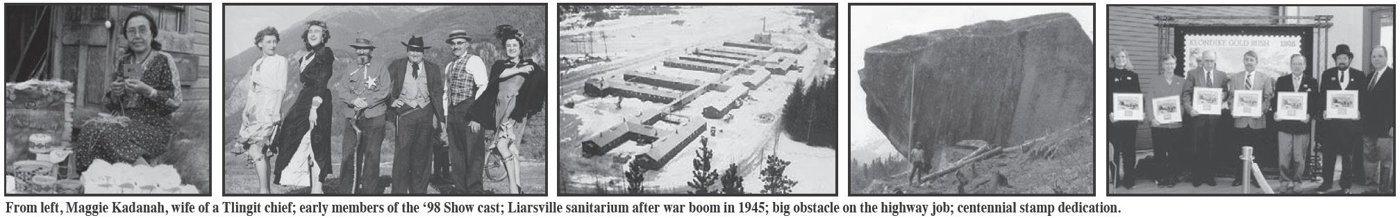
1915-17 - Alaska Women’s Temperance Union meets in Skagway and writes “Alaska Bone Dry Act,” which Legislature will later adopt ahead of national prohibition. Martin Itjen operates Skagway Hack, doubling as a taxi and coal truck. His business will evolve into the popular Skaguay Street Car Co. Itjen acquires Soapy’s Parlor for a museum; one of his artifacts is the bank robber’s skull acquired from Dr. Keller, who has taken over the fledgling Alaskan. Keller coins the term “Garden City of Alaska.” New Bank of Alaska opens in 1916. It will pioneer branch banking and grow under the Rasmuson family into the largest bank in Alaska. Itjen’s friend, George Rapuzzi, establishes Pet Cemetery across river where his dog loved to chase rabbits.
1918-19 - Saloons close. On Oct. 23, SS Princess Sophia
leaves Skagway with more than 350 aboard. She strikes Vanderbilt Reef in a blinding snowstorm near Juneau. Captain gambles on tide lifting ship off reef. After two days of weather deemed too rough for a rescue by smaller boats, she breaks apart and all aboard perish. After dodging the first wave of the Spanish flu that winter, Skagway lets its guard down and loses three residents in the spring of 2019.
1920-22 - Skagway Women’s Club forms in 1920 and establishes Skagway Library in 1921. First airplane lands on beach.
1923- President Warren G. Harding visits Skagway on Navy ship on July 11, 1923. He delivers address at the Pullen House and is the final inductee into the Arctic Brotherhood. George Rapuzzi, a member of the Alpine Club, climbs the mountain opposite Skagway and flashes presidential party with mirrors from the summit. Peak hereafter is named Mt. Harding for the president who would die shortly after his return from Alaska. Daily Alaskan shuts down after the death of publisher Keller.
1924-30 - Beginning of first tourism boom heralded by visible promoters Itjen and Pullen, along with WP&YR, which convinces ships to stay 36 hours so visitors may ride the train and take a Yukon lake steamer trip from Carcross to beautiful Ben-My-Chree. As a fund-raiser for the hockey club, townspeople hold a variety show for tourists at the White Pass Athletic Club. It will become The Days of ‘98 Show and move to the Eagles after the athletic club shuts down during the Great Depression.
1931 - St. Pius X Mission is established in Skagway under the wing of Father G. Edgar Gallant, who will operate the school for Native children from across Alaska for almost 30 years.
1932 - White Pass roundhouse burns Feb. 12.
1933-34 - Idea for a Gold Rush National Park in Skagway is first promoted by Chamber of Commerce. Prohibition repealed. First airfield constructed from 13th to 22nd Avenues along Main Street.
1935 - In a heavily promoted visit, Martin Itjen calls on sexy starlet Mae West in Hollywood,
invites her to “come up and see me sometime” in Skagway. Town hosts first convention as Newspaper Institute of America delegates arrive on ship.
1939 - Women’s Club raises $25,000 from Territory and $24,500 from federal Works Progress Administration to build a new school. It opens in 1940 behind the old one at State and 11th.
1942-44 - Skagway is literally invaded by U.S. Army troops, who take over the railroad for a major supply route to build the Alcan Highway. Three thousand troops are stationed here, and as many as 20 trains a day climb the pass. A pipeline is constructed along railway for fuel shipments. Army takes over fire department and promises 24-hour service, however major fires devastate ornate Elks lodge and Pullen House. Army has better luck assisting community when the Skagway River crests its banks twice and floods parts of the city.
1945 - After troops leave Skagway, U.S. Health Service opens a 90-patient tuberculosis sanitarium in the army hospital across the river. Nurses come from Sisters of St. Ann in Victoria, B.C. It closes in 1947.
1946-50 - WP&YR takes back railroad and assumes fuel operation. Tracks are removed from Broadway in 1947. A fire almost destroys the Mission School. Dyea Road constructed by Alaska Road Commission. Tourism pioneers Itjen and Pullen pass on. Pullen House eventually closes, but Rapuzzi keeps Itjen’s dream alive at Soapy’s.
1951 - White Pass becomes a pioneer in the shipping industry with containerized cargo: from the docks in Vancouver, loaded on the ship Clifford J. Rogers (first container ship in the world) for the journey to Skagway, then onto trains bound for its destination in Whitehorse.
1952 - Aluminum Company of America (ALCOA) announces plans to build a $400 million smelter in Dyea, powered by the mighty Tyee Project, a proposal to reverse the flow of the Yukon River with a dam in Whitehorse, and thence using that water from Yukon lakes through two tunnels down the old Chilkoot Trail
to power the smelter. A “mighty city of 20,000” will be needed to support the plant, which will need 20,000 acres in the valley floor. Juneau Empire starts weekly Skagway Alaskan newspaper. Townspeople are called Skagwayites.
1953 - ALCOA dream fades as negotiations fail to convince Canadians they would receive benefits of cheap power from the Tyee Project. Alternatives explored and Yukon later builds its own dam at Whitehorse Rapids. Newspaper promotes road to Carcross.
1954-55 - Railroad takes delivery of first two diesel-electric engines, in addition to new flat cars and tanker cars. Alaskan merges with Haines Herald to become Lynn Canal Weekly. ARC completes quarter-mile extension of road to Black Lake. But it won’t go further until Canadians support a road from Carcross to the border.
1956-60 - City of Skagway purchases McCabe building from federal government in 1956 for offices. ALCOA formally abandons smelter plans in 1957. Alaska and Skagway celebrate statehood in 1959, and Morgan Reed is elected to first of four terms in the State Legislature. Monsignor Gallant is transferred to Anchorage that year and the mission school closes without his leadership in 1960.
1961-62 - Another mile of road is built “to modern standards” to the sheer rock face past Black Lake. Upstairs of McCabe converted into the Trail of ‘98 Museum, using many artifacts donated by Skagway families. Work begins again on national park after State of Alaska shows interest. State selects land in Dyea valley for recreational use. Cy Coyne starts monthly North Wind newspaper.
1963-66 - First Alaska Marine Highway ferry arrives. Rep. Reed teams up with Sen. Elton Engstrom to pass bill to form Yukon-Taiya Commission and revive Tyee Project if state’s Rampart Dam doesn’t materialize. Chamber of Commerce organizes Clean Sweep.
1967 - Skagway River floods. Dikes breached and Pullen Creek culvert washes out. Gov. Wally Hickel flies up to inspect damage.
White Pass Hospital closes after serving community for 69 years, and city begins work on new Dahl Memorial Clinic, named for long-time doctor P.I. Dahl, which opens in 1968.
1968-69 - WP&YR builds new depot. Plans announced for Cyprus Anvil mine near Faro, Yukon, leading White Pass to upgrade its track and equipment for a huge lead-zinc haul. Company officials convince city council to grant 55-year tidelands lease for a new ore terminal and dock. White Pass roundhouse burns again in 1969.
1970-72 - Road support builds on both sides of border. Canadians build new bridge in Carcross and extend road to B.C.-Yukon border in 1971 with activity at Venus Mine. In 1972 Canadians agree to build remaining 33.6 miles to Alaska border, and Alaska agrees to construct their 9.4 miles. It will be called the South Klondike Highway. Park master plan is developed. White Pass donates old depot to National Park Foundation. Yukon-Taiya Commission disbands.
1973 - White Pass sold to Federal Industries. Alaska Congressional Delegation introduces first bills establishing Klondike Gold Rush National Historical Park. Final road surveys completed. First seasonal park rangers appear on Chilkoot Trail under authority of Glacier Bay National Monument.
1974-75- A $10.9 million contract is awarded to Central Construction of Seattle, a company affiliated with one of Alaska’s new Native corporations, for the Alaska portion of the Klondike Highway. Construction to take three years.
1976-77 - Congress passes park legislation in June 1976 and superintendent and historical architect arrive. A temporary visitor center opens in the old depot, and the park is dedicated in Skagway in June 1977. The park includes four components: Skagway unit, Dyea-Chilkoot unit, White Pass unit and Seattle-Pioneer Square unit. City forms Historic District Commission.
1978-1979 - Modern Skagway News started by Jeff Brady after North Wind retires. Taiya River threatens old Native cemetery
in Dyea, and first story the paper covers is controversial removal of remains by National Park Service to an area near the Slide Cemetery. Klondike Highway is punched through to border in September. Highway officially opens in spring. Final cost: $14.4 million on U.S. side and $12.2 million in Canada. In July, a scary fire destroys Sourdough Inn, Igloo Bar and a drug store, but SVFD prevents it from spreading. New city barge facility/ferry terminal completed.
1980-81 - State-supported live satellite TV arrives along with public radio on KHNS. Skagway becomes base for Disney’s “Never Cry Wolf” crew filming on White Pass. City hires tourism director to promote Skagway. Fish hatcheries started at Burro Creek and school.
1982 - Faro mines shut down in spring, and railroad loses 70 percent of its revenue. This doesn’t stop the return of Steam Engine No. 73. Optimism fades in fall as White Pass suspends rail operations on Oct. 8, sending Skagway into a deep depression. Unions picket and stop White Pass in Haines when company tries to truck freight to Yukon on Haines Highway.
1983-85 - White Pass announces it will not operate, even for summers. Winter unemployment estimated at 70-80 percent. Newspaper switches to monthly in winter. First running of Klondike Road Relay. Oil-rich state helps Skagway with $8.5 million to construct a new school. Skagway lands Alaska Visitors Association convention and sees increase in number of cruise ships docking to more than 100. Park’s first restoration project, the old White Pass railroad depot, is completed and opened for the park’s visitor center and offices. Broadway gets “historic pavement” to cut down on dust. Garden Club forms and establishes competition, Order of Eastern Star starts annual flower and garden show. Voters approve land sale along Dyea Road and houses spring up on hillside. Number of visitors tops 200,000. 1986-87 - Curragh, Inc. buys Anvil mine and announces it wants to truck concentrate to
Skagway. Mayor Bill Feero breaks a tied city council in February 1986 and city requests state to open highway year-round. Gov. Bill Sheffield and Yukon government Leader Tony Penikett sign historic agreement in April. Trucks operated by Lynden roll in June. Number of cruise ships surpasses 200. Park restores more buildings and leases them to private businesses. City establishes Centennial Committee in 1987 and park completes restoration of Moore cabin for its 100th anniversary. First Buckwheat Ski Classic joins Windfest as winter event. Prospective railroad buyers appear on scene and say railway would be a viable tourist operation.
1988 - On March 1, White Pass President Marvin Taylor announces the company has reached agreement with its unions to reopen the railroad for a summer tourist operation with three-hour round-trips to the summit. Whistles blow all over town as employees return to work. News goes back to twice monthly year-round. Alaska State Garden Club holds annual convention in Skagway. Year ends on scary note, as high lead levels are recorded in Skagway from past ore movement. School children are tested by public health officials, and blood levels are below normal.
1989-90 - Massive $6 million cleanup by “supersuckers” paid by Curragh and White Pass along waterfront, railroad and highway through town. Battle lines drawn on waterfront as White Pass proposes Broadway Dock west of ferry terminal, and Curragh tries to convince city to lease land for new ore dock and terminal east of ferry terminal. The latter fails when White Pass announces it will sell the terminal to the state’s AIDEA to operate. School’s Pullen Creek hatchery program receives national award.
1991-92 - Ore terminal operates through Curragh strike in Yukon. Island Princess and Regent Sea collide in bay on way into port; miraculously no one is seriously injured. Ships are repaired and return later that summer. New rules for harbor: ships must arrive an hour apart. Number of visitors tops 300,000 in 1992 during 50th anniversary of the building of the Alaska Highway.
continued from page 17
1993-94 - Curragh wins big loan from Yukon Government to stay alive, then files Chapter 11. Terminal closes. Mine sold again to Anvil Range. City pushes for winter highway funding, with or without mine, and get assurances from state and territorial leaders. Good year for filming on pass: TV show “Due South” in spring and movie “Snowbound: Jim and Jennifer Stolpa Story” in fall 1993. “Good Morning America” visits in May. White Pass announces plans to revamp and lengthen its Railroad Dock but is plagued by three fuel spills from its pipeline. A worse disaster befalls White Pass a month later when the dock collapses, sending a tidal wave across the bay, uprooting the ferry dock and spinning it into the Broadway Dock. One worker is killed. Damage to state dock and Small Boat Harbor exceeds $1 million.
1995-96 - First cruise ship lands at rebuilt Railroad Dock on May 30. Adventure tour craze explodes with new operators and tours in Skagway and Dyea, and city approves more helicopter landings on glaciers. Voters approve extending sales tax to tours and transportation. Visitor numbers surpass 400,000. Main part of old school torn down after 10 years of disrepair, but gym is saved for future recreation center. New border station opens on highway. Ore trucks and ships return in the fall. City elects first female mayor, Sioux Plummer. Skagway connects to the Internet
1997-98 - Cominco purchases Anvil Range, but mine shuts and ore terminal closes again in April 1997. Ore terminal reopens in fall after mine opens again, only to close on Christmas after Anvil Range files for protection. However, over next two years, city swells with pride during Klondike Gold Rush Centennial celebrations. White Pass also begins three years of centennial events. The company is spun off from Russell Metals/Federal Industries and becomes part of new Tri-White Corp (later renamed ClubLink). Alaska Power and Telephone’s Goat Lake Hydro project is completed. State releases Juneau Access study, favoring either a highway up the east side of Lynn Canal to Skagway or using daily fast ferries. Skagway leans toward better ferries, while
Haines is adamantly opposed to a new road link. Juneau is split.
1999-2000 - Skagway Centennial Park is completed at 1st and Broadway, featuring a statue depicting a Tlingit packer leading a gold rush prospector up the trail. White Pass and state settle suit over 1994 dock damage, with railroad to pay $1.875 million. Skagway is 16th most visited cruise destination in the world with nearly 450 cruise calls. As visitor count approaches 750,000, city looks harder at dealing with impacts. Recreation center improvements completed, director hired and use expanded. The remainder of the town’s streets are paved. Like the rest of the world, Skagway enters the new millennium with no bugs in its computers, and joins the cell phone age. McCabe Building is restored for city centennial amidst construction delays, much like 100 years ago, and the city holds a big birthday party outside in June before it moves in. WP&YR celebrates its centennial in July with great fanfare in Carcross, hinting at a return some day. Townspeople start calling themselves Skagwegians.
2001-2006 - In 2001, the city explores building a new dock to handle freight for the proposed natural gas pipeline, but there’s resistance because the dock would need cruise ships to pay bonding costs. The concern is that Skagway, population 862 in the 2000 census, is close to its summer cruise visitor capacity, and existing docks can be improved for a pipe haul to the Yukon, if it comes. Skagway enjoys a great summer season until Sept. 11, when virtually all traffic stops for a few days after the terrorist attacks on the East Coast, but the ships and planes returned and more visitors come in 2002. Sen. Frank Murkowski is elected governor and vows to build a road from Juneau to Skagway. He restarts EIS process. In 2003, WP&YR adds on to Railroad Dock to handle bigger ships, but Skagway’s industrial position is dealt a blow when corrosion at the ore terminal makes it unsafe and the state tears it down. However, the city asks that the site be preserved for future industrial use, so a new terminal may be built if mining rebounds. Residents follow the war in Iraq on new satellite dishes. In 2004, despite pressure from a pro-road movement, the city sticks to its support of better ferries for improving Juneau Access, and voters agree by a 62-38 percent margin. Meanwhile, the state’s new fast ferry Fairweather starts running but has problems. A welcome reprieve from winter comes when the cast of “The Big White” shows up in spring 2004 to film on the snowy pass. The stars fit right in as Robin Williams bikes around town, and Holly Hunter rings bar bells. The dark comedy goes straight to DVD with mixed reviews, but its northern premiere in Skagway is a hit. AB Hall restoration, Dyea Road widening, Skagway River flood control, Broadway dock extension, and a new seawall/ seawalk keep construction crews busy. State backs off road to Skagway because it would have to cross the National Historic Landmark boundary. When the final EIS is released in 2006, it supports a road from Juneau to Katzehin, with a shuttle ferry to Haines and Skagway, but it is stalled by a law suit.
continued on page 19
2007-2012 -The railroad has a record year in 2007, welcomes back Engine 69, and returns to the Yukon with scheduled service to Carcross. Visitor numbers peak at nearly 1.278 million. Rasmuson Foundation acquires the Rapuzzi Collection for local museums. A decade-long battle by Skagway to become a borough wins approval by the state’s Local Boundary Commission after an emotional hearing here, and voters ratify it on June 5, 2008. The Municipality of Skagway is the state’s first, first-class borough. AIDEA starts work on a smaller ore terminal in 2007 after reaching an agreement with Sherwood Copper (now Capstone), owner of a mine near Minto, Yukon. Ore trucks roll down the highway that fall, and ships come in monthly to carry away the ore. Other mines look at Skagway, and the community forms a port commission which promotes the “Skagway Advantage” for shipping minerals and even pipe for a future gas pipeline. Kasidaya hydro project opens 3 miles down Taiya Inlet. Former childhood resident Sarah Palin first becomes governor in 2006, then vice presidential candidate in 2008, but ultimately resigns in 2009 amid fame, secures book and TV deals. Skagway benefits from a statewide cruise tax in 2007 to the tune of about $4 million a year for various projects. Guinness Book of World Records certifies Skagway for “most eggs tossed” on July 4, 2008, and Broadway is named one of 10 Great Streets in the Great American Places program in 2009. Our girls’ basketball team goes undefeated and wins the 2010 state 2A title, and then repeats in 2011! The new E.A. and Jenny Rasmuson Health Center, funded by several grants and matched with a local bond issue, is completed in 2010, and the new census records a population of 920. Bellekeno mine begins shipping silver from Keno, Yukon to Skagway. Others court the port. 2013-2018 - Negotiations begin between borough and White Pass for a new tidelands lease that would allow ore dock and terminal expansion with state and city funds. But when a 30-year lease extension is presented to voters in 2015, it fails by a large margin. Opponents say it’s time to prepare for municipal takeover when the current lease ends in 2023. The rush to expand the terminal slows as mines make cutbacks. Former Mission School student Byron Mallott is elected Lieutenant Governor on an independent ticket in 2014. Restored Jeff. Smith’s Parlor opens in 2016, and visitor numbers rebound with advent of huge 3,000-plus passenger ships. A floating dock is added at the Railroad Dock, and another is needed for even bigger ships coming in 2019 and 2020, but efforts to renew a tidelands lease for a shorter term stall in spring 2018 as other parties express interest. In July, after months of rumors, the WP&YR is sold by its Canadian corporate entity TWC Enterprises (formerly called Federal Industries/ Russell Metals or TriWhite/ClubLink) to a consortium led by Alaska-based Survey Point Holdings and Carnival Corp. They pledge to work with the municipality. Gov. Bill Walker rejects the Juneau Access road due to lack of support and a state budget shortfall; a record of decision favoring improved ferry service is approved by the federal government, but new Gov. Mike Dunleavy is elected in November. He threatens to cut the ferry system and put the road back on the table. The year ends trag-
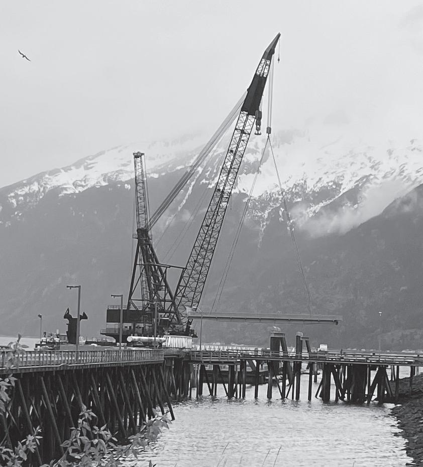
ically as Mayor Monica Carlson and her mom are struck by a bus in Washington, D.C. Skagway mourns their deaths.
2019-2024 – Skagway elects a new mayor, local writer Andrew Cremata, in a special election, and he immediately has to deal with the town’s housing crunch and other issues related to tourism growth, plus working with White Pass and other entities on the post-tidelands lease transition which will see Skagway operate its own port in 2023. In the meantime, the town is devastated economically by the COVID-19 pandemic in 2020. There are no cruise ships and the US-Canada border is closed to non-essential traffic. Economic relief comes in various ways to keep existing businesses from folding and most residents from leaving. Townspeople remain healthy but cautious. Skagway has around 20 cases over a 16-month period and no deaths. Masking becomes the norm for a year until things loosened up in spring 2021. Ships started to make their slow return later that summer. More came in 2022, and by 2023 the port was humming again at full capacity. Rockslide mitigation was necessary south of the Railroad Dock, causing a shifting of traffic patterns. The Municipality officially took
over managing the west side of the harbor and commenced a multi-million dollar Ore Dock replacement project. A new floating cruise dock arrived in early May 2024 to be put in service, and further improvements will be made to keep it as a multi-use port facility.
• Our official population is now over 1,000. More people want to live here, but housing remains a critical issue, as most here call themselves Skagwegians. However, there has been a much great awareness in recent years of our Tlingit history and traditions, including art installments, land recognition, and preservation of the language. So as you wander our streets and trails, remember that you tread as guests on the traditional lands of the Lkoot Kw’aan, to whom we are thankful. Gunalchéesh! – Jeff Brady, local historian
This timeline first appeared in the centennial edition of The Skagway News in 1997 and has been updated over the years. For an expanded version up to the present, see Brady’s book, “Skagway: City of the New Century” (Lynn Canal Publishing, 2018) or visit the history page at skagway.com.
Photos: Skagway Museum, KGRNHP, Brady collection
By Frank Norris Geographical Correspondent
What’s in a name? As the following glossary suggests, plenty. The place names that dot the landscape are living reminders of who has been before us, along with some of their attitudes, legends and whimsy. You’ll soon find that the people who gave Skagway its (mostly European) names were a lively, humorous and patriotic bunch.
AB Mountain - This is the large mountain located just north of Skagway. As you may know, the Arctic Brotherhood Hall, one of the town’s most prominent buildings, is located on Broadway between Second and Third. When the A.B. Hall was constructed in the spring of 1899, a workman on the roof noted that the snow on the south slope of the mountain showed the letters “AB.” Deep, narrow gullies on the mountain retain snow for up to a month longer than the surrounding area. Using a little imagination, observers today can witness this for themselves between April and June.
Chilkoot Pass - The Chilkoots, a branch of the Tlingit Nation, used this pass as a trading route for hundreds of years before whites entered the area. Russians heard rumors about the pass during the 19th century, but not until the 1870s, when miner George Holt sneaked through, did Europeans begin using it. Frederick Schwatka, who took an expedition over the pass in 1883, called it Perrier Pass, and others called it Dyea Pass or (mistakenly) Chilkat Pass. Abandoned after 1900, except by occasional hunting parties, the pass reopened as a recreational trail in 1961 and is maintained by U.S. and Canada park services.
Dewey Lakes/Twin Dewey Peaks -Skagway emerged from a homestead to a full-blown city during the 1890s, a time of American history known primarily for the Klondike Gold Rush and the Spanish American War. Popular as the gold rush was, the coming of the war in April 1898 pushed the rush off the front pages of the world’s newspapers. Nowhere was the patriotism of the war felt more vividly than in Skagway. When Admiral George Dewey’s fleet smashed the Spanish at Manila on May 1, the town responded by naming several lakes and mountains (elevation 5,300-6,300 feet) in his honor. They are accessible by a trail system east of town.
Dyea/Taiya - This Tlingit word has had a whole host of spellings, including Dyaytahk. Even its meaning is somewhat disputed; while most suggest it means “to pack or to load,” other say it means “place to look down to.” Both are appropriate enough. Dyea, on the Taiya River, was the rival town to Skagway -a rough-and-tumble port where miners got off the Inside Passage ships and started the long trail up the Chilkoot Pass.
Face Mountain - When surveyors came through the area in 1898, this peak west of Skagway was named Parsons Peak. Locals, however, preferred to call it The Sphinx, Gnome Mountain or, more often, Face Mountain. Sure enough, those who look at it from below may be able to recognize the etched features of a human face. Elevation is 6,600 feet.
Glacier Station, Laughton Glacier
This site of an old station, 14 miles up the
White Pass Railroad from Skagway, was one of several stations along the route south of White Pass. It is named for Laughton Glacier, just three miles east of the station and named for John Laughton, a commander of the U.S. forces in Cuba during the Spanish American War.
Heart Mountain/Sawtooth Range - The huge ridge five miles north of Skagway and east of the U.S. border station is known as either Heart Mountain or Sawtooth Mountain. The latter name comes logically enough from the serrated appearance of the ridge. Heart Mountain is so named because of a large heart-shaped patch on the south slope, which supports no trees.
Kern’s Castle - One of the most successful early businessmen in Skagway was jeweler Peter Kern. Shortly after the rush, he built a mountain retreat in the woods above Lower Dewey Lake. It operated only a few years, burning down in a 1912 forest fire. Only a few rock walls and metal fragments remain.
Kirmse’s Clock - Visitors will notice another bit of Kern’s handiwork -- the pocket watch clock on the mountain wall at the east end of Fourth Avenue, first painted during the gold rush, and now maintained by Kirmse’s Curios, which bought out their competitor and changed the advertisement.
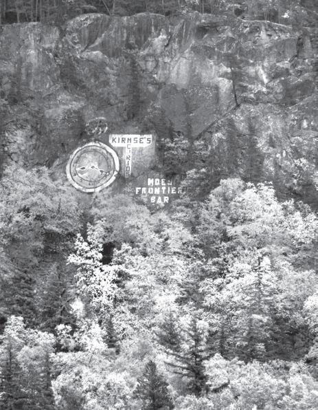
Liarsville - This spot two miles north of Skagway is now site of the Tent City show. During the gold rush it was a large, impromptu campsite, the last place to stop before the rugged climb up White Pass. During the early part of the stampede, scores of reporters descended on Skagway, eager to gather accounts of trail conditions. Not wishing to hike it themselves, however, they collected here. Returning stampeders, of course, were free to say whatever they liked, or whatever they felt the reporters wanted to hear.
Mount Carmack - This peak north of A.B. Mountain is the highest in the Skagway area
with an elevation of 6,605 feet. It was named for George Washington Carmack, co-discoverer of the Klondike gold. Carmack knew the area well, having crossed the Chilkoot as early as 1887.
Mount Harding - President Warren G. Harding was the first and only president to visit Skagway. He arrived July 11, 1923 on board the U.S. Navy vessel Henderson and remained long enough to give a speech at the Pullen House and to be initiated into the Arctic Brotherhood. Harding died three weeks later in San Francisco. The following July 4, local resident George Rapuzzi climbed the peak across the bay from Skagway and raised a flag on its summit while members of the Skagway Alpine Club officially named the mountain in Harding’s honor. It’s also known as “Witch Mountain” for the image of a witch on a broomstick below the glacier in summer.
Sheep Camp - This gold rush town was the largest along the Chilkoot Trail between Dyea and Lake Lindeman. It was named in the late 1880s because of the mountain sheep (actually goats) overlooking the area. A temporary campsite until the mid-1890s, it exploded into prominence in late 1897 and by April 1898 had a floating population of 8,000. It “ghosted” in spring, 1899.
Skaguay, Skagway - Few have agreed on how the town’s name should be spelled, or what the name means. Originally a Tlingit word, it has been variously spelled Shgagwéi, Skaguay, Schkague, Shkagway, Skagua, Schkawai and even Cquque. Most suggest that it means “home of the north wind,” but others say it means “spirit of the cruel wind,” “end of the salt water,” or “rough water.” Still others, using supposedly authentic sources, suggest it means “lady relieving herself on a rock” or “sound a sled runner makes when it breaks loose from the snow and ice.” The town erupted from a homestead to a full-size city during the winter of 1897-98, witnessed the building of the railroad from 1898-1900, and has been here ever since.
Smuggler’s Cove - This small bay, onehalf mile west of town, is presently a city park. Sixty years ago a homestead existed there. Many think its name dates back to the Prohibition era, but its name actually came into existence decades earlier. During the gold rush, the importation of liquor into Alaska was prohibited, and with customs agents situated in Skagway-Dyea, the cove was doubtless a popular place to land illegal cargo.
White Pass - This pass was known to the Natives before whites began to encroach into the area, but it was ignored in favor of the nearby Chilkoot Pass. The first known traverse of White Pass took place in June 1887 when Capt. Moore and Tlingit guide Skookum Jim ascended it as part of the William Ogilvie expedition. The pass was named for Thomas White, Canada’s Interior Minister and Ogilvie’s superior.
Frank Norris has a doctorate in geography and is a retired National Park Service historian from Santa Fe, New Mexico. He formerly worked at Klondike Gold Rush NHP in Skagway and as the Alaska region historian in Anchorage. His books include “Garden City of Alaska” and “The Chilkoot Trail.”
By Andrew Cremata Fishing Correspondent
For first time visitors, Skagway might seem but a narrow valley, hemmed in by mountains, snow and ice. Yet, there are a great many hidden things that lie just beyond what is readily seen. There are narrow coves where families of otters drift lazily on the surf at the first light of day. Bald eagles scan wide expanses of sandy flats that reveal themselves with the ebbing tide. A short walk through the woods can reveal a hidden lake where mysterious ripples appear on the surface, a clue as to what might reside beneath.
These are the places where pristine image of Alaska, sold in the brochures and on the Internet, come alive and resonate with some innate part within. It is an opportunity to reconnect with something lost amidst the daily drudgery of work, traffic and routine. It is, no doubt, one of the reasons so many people cruise or drive to Alaska for vacation, and it is also the reason why so many native Alaskans love to go fishing.
Skagway locals have unlimited access to wild places where salmon teem by the thousands and trophy trout are always one cast away. For the visitor with limited time to explore, the options might be fewer. However, what makes Skagway unique in Southeast is that the wilderness lies just beyond the periphery, and much of it holds lakes, streams and fish.
Two of only a handful of lakes
holding brook trout in the entire state of Alaska can be found in Skagway. Both Lower and Upper Dewey Lakes were stocked with the hearty, colorful fish in the early 1980s. Lower Lake, as the locals call it, is a moderately steep 30-minute hike from downtown and its quiet waters are host to an array of natural wonders. Upper Lake is for the more serious hiker, with a strong legs and a lot of extra time.
A short drive to Dyea will reveal the Taiya River, a great place to stalk Dolly Varden in the spring. Further along is the Dyea Flats, where sloughs meander through high grass, alpine lupine and wild purple irises. In the summer these sloughs fill with salmon and become something out of a fly fisherman’s Alaska daydream. Not far away is Lost Lake, so named for its difficulty to locate, but a place where the perseverant are rewarded. This is a spot that seems almost primeval, where blueberries grow thick in the fall and rainbow trout are eager to strike throughout the spring, summer and fall.
Along the Klondike Highway to the north are an uncountable number of places to wet a line. As the road traverses a narrow slice of British Columbia en route to the Yukon Territory, every single roadside turnout is a potential spot to catch world-class grayling and lake trout. Anywhere along this road is an opportunity for isolation, peace and the unrivaled beauty of sheer mountainsides
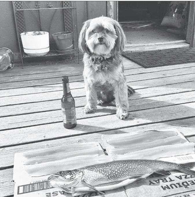
by
framing deep glacial lakes. There are many other places to fish among the throngs of tourists and hustle of the summer season.
Many of these places can be quite productive. But for someone desiring a more authentic Alaskan experience, or the adventurous angler who seeks more than a notch on the handle of his rod, the chance to experience something unforgettable is not far from where the cruise ships dock.
Grab a trail map or ask a local Skagwegian for advice on the best place to fish during your visit. The locals take their fishing seriously,
but they’re a friendly sort. If you ask nice you might just find your own little slice of fishing paradise.
And don’t forget to buy a license.
Andrew Cremata’s award-winning column runs monthly each summer in The Skagway News. His book, “Fish This!” is popular in fish circles and the subject of constant bar conversation.
By Gretchen Wehmhoff
Standing next to the Skagway News Depot, I watched a family of ravens teach their offspring the tricks of ravenhood. Today’s lesson covered how to hang onto a utility wire.
A younger bird kept moving in on the parent, who cawed for it to pick its own wire. After a minute or so of testing mom or dad, the fledgling took the leap to the wire a foot away. It made contact at first, until it couldn’t keep its balance. The bird struggled to get its feet secure around the wire, but slipped and swung around in circles, much like a child spinning on their knees on bars on the playground. It found its balance again, trying to hang onto the much narrower wire, then spun forward and found itself hanging upside down, wings awry with not many choices but to let go. It dropped and rolled mid fall, catching the wind to fly to the roof across the street where the rest of the family watched.
Life around the boardwalk never lets me down.
Sitting on the bench underneath the stairs to the news office has become a highlight for me. I love conversations. Almost everyone passing by has a story to chat over. I’ve met many locals, people from hot parts of the Lower 48 who came to cool off and families
on reunion voyages.
There is a solid sense of peace in this town. People say “hey” as they walk by and Athena has received an abundance of attention as tourists and locals alike stop to scratch her behind the ears and talk about the dogs they left at home.
I love the wind, the rain, the sun and the people here. Next week my husband will arrive to work for six weeks and I hope he finds the same peace I do.
I’ve enjoyed getting to know locals over the winter, on Facebook, and in passing. Now I get to see everyone doing their summer routine and it is exciting. Even walking down the sidewalk, excitement can surprise you.
A few days ago I took Athena out to do her duty, then headed back to the boardwalk, carrying a clear plastic bag of her business. As I came close to Tayia Fine Arts, I saw Katie setting up for the day, the door open for business. At the same moment, a group of tourists hovered near the Mascot Saloon. For a split second I weighed my choices -- say hi to Katie with a bag of poop, or get to the trash can before the visitors met up with me.
It only takes a moment for your dog to read your intentions. Mine chose to visit Katie while I made the move to head for the trash can.
I floundered over Athena in a dramatic roll. Katie saw me fall and later said it was in slow motion, like I knew I was going down. When you get to a certain age, you learn awareness of the fall. Don’t put out your hands (avoid broken wrists), tuck your head and try to roll to your butt, which in my case, gives me the most protection.
I must have called out in surprise because I found myself lying on the boardwalk surrounded by a dozen cruise visitors and Katie. A woman offered her hands, but I was afraid I’d pull her down with me. So, in a not-so-graceful move, I pointed my rear end up towards our guests and walked my way up with my hands. The helpful woman straightened the front of me, and as I turned around, Katie gently pulled my hair out of my face. Concerned faces were everywhere. I’m pretty sure Athena was getting equal attention. I smiled and said thanks. It was at that moment I realized something was missing.
The bag of poop.
I looked around the ground between people’s feet, trying not to call attention to the fact that I was missing the very thing I was trying to hide before I met them. My eyes landed on it. It had flown into the street, just off the boardwalk. Suddenly, smart shoes and an
The area known as the Golden Circle (Skagway-Whitehorse-Dawson-Haines) is becoming a popular destination for the adventure racer. These are the big ones:
Buckwheat International Ski Classic – Usually held on the second Saturday in March at Log Cabin, B.C. on the Klondike Highway, this is billed as an event for the “lazy, the infirmed and the few who are fast.” There is a 5K kids event and 10K, 20K and 50K races that draw Olympian cross-country skiers and aid station groupies. Great party afterwards in Skagway for the 400 hearty souls. Visit the race website: www.buckwheatskiclassic.com, registration begins in January. Check site for ski conditions or call the Mountain Shop, 907-983-2544.
Duff’s Skagway Marathon, Half Marathon and Walking Half Marathon
This 26-mile run in June climbs multiple hills tracings its way through pristine Southeast Alaskan fjord coastline, a glacially-carved valley, an enchanting Sitka Spruce wood, over the Taiya River trestle bridge and up West Creek Valley for a spectacular view of West Creek Glacier and breathtaking mountain peaks. Kluane to Chilkat Bike Relay – This popular 160-mile bike relay from Haines Junction, Yukon to Haines, Alaska draws up to 1,200 people in teams of one, two, four or eight. The race is held the third Saturday in June. To register online visit www.kcibr.com or call 867-334-6871.
Yukon River Quest – Born out of the successful Dyea to Dawson centennial races, this paddling marathon begins in late June. Up to 125 teams from all over the world paddle 444 miles on the mighty Yukon, making it a true “Race to the Midnight Sun.” See info and register at www.yukonriverquest.com.
Klondike Trail of ‘98 Road Relay – About 1,500 runners take off from downtown Skagway in teams of 10 on the Friday after Labor Day and run through the night to Whitehorse. Sound nuts? It is -- but it’s a great rush. Visit www.klondikeroadrelay.com or call 867-668-4236.
elegant dress took commanding steps off the boardwalk, missed the bag by inches, and the owner of the shoes greeted the group of good Samaritans on the other side of our small pod. It was Cooper, trying to retain her “Madame” walking tour that I had accidentally hijacked.
“You ought to put some ice on that knee, Gretchen,” she confidently advised.
With that she led her group of clients down the alley like the pied piper.
By this time Melinda had made it down the stairs to see what had happened. Denise and Billi had stepped out of their storefronts to check on the commotion -- or laughter. I was sure I would be sore the next day, but there was some slapstick humor in it all.
As I turned to talk to Melinda, the woman from the tour group who first offered help came up to me.
“I believe this belongs to you,” she grinned. She handed me the bag of dog poop, holding it carefully with her thumb and forefinger. I think she saw the humor as well -- I think.
Gretchen Wehmhoff is publisher of The Skagway News.
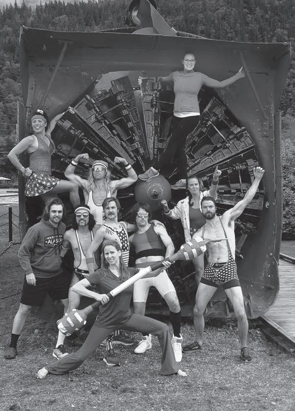


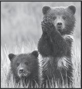
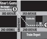


Authentically renovated turn of the century buildings bring the excitement of the Gold Rush era back to life.
• Friendly shopkeepers and towns people to serve you
• Locally crafted treasures and creations, and delectable food to please your palate!
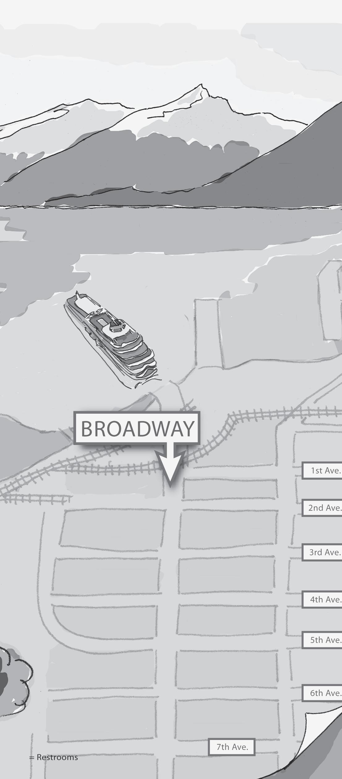
By Vern V. Hirsch & Jeff Brady Editor’s Note:
The South Klondike Highway is not only the most scenic route to the Yukon and Interior Alaska, it also is a vital commercial link. Drivers touring this highway will encounter trucks hauling various commodities and large buses. Also watch for bicycle tours and sightseers. Drive safely and enjoy the ride.
Mile 0.0 • FERRY TERMINAL. Head north to historic Broadway, Centennial Park, the Klondike National Historic Park and city of Skagway visitor centers. Turn right or go straight to RV parks. To head out of town, take Broadway until the Whitehorse sign, turn left on 1st Ave one block to State Street, where a right turn begins the route to the Klondike Highway.
0.2 • CENTENNIAL PARK & ROTARY PLOW No. 1. Follow the row of mountain ash trees, planted by Skagway Garden Club in the 1980s, to the intersection of 1st and Broadway and Centennial Park, dedicated in 1997. The park’s focal point is the bronze statue of a Tlingit packer leading a gold seeker up the trail. It was sculpted by Chuck Buchanan of Carcross. Cenntennial Park contains signs directing pedestrians to docks and monuments such as the Skagway National Historic Site, the first NWMP post in the north, the SS Princess Sophia and the pack animals on the Dead Horse Trail. Rotary Snow Plow No. 1 is on display here. Built in 1898 and restored in 1996, the historic plow is sometimes used in spring to open the line.
1.2 • WP&YR SHOPS. Highway curves west past rail yard where the rolling stock are serviced.
1.4 • GOLD RUSH CEMETERY JUNCTION/SKAGWAY RIVER. Just before the Skagway River highway bridge and footbridge, a turnoff on right northbound follows river and railroad tracks to old cemetery. Among those buried there are desperado Soapy Smith and town hero Frank Reid. A short trail leads from cemetery to Reid Falls. Guide book available in town.
1.5-1.7 • SEVEN PASTURES PARK / DEDMAN STAGE / KLONDIKE HWY Just past the bridge leads to Skagway’s softball/soccer fields and outdoor Dedman Stage on land known as Seven Pastures. A tenth of a mile further on the right is another popular local attraction, the historic Klondike Gold Dredge that was brought back to Skagway in
1999-2000 and reassembled along side the river for tours. It formerly worked on the Sixty Mile River near Dawson City, Yukon.
2.1 • DYEA JUNCTION. Eight-mile mostly gravel road leads to historic Dyea, Skagway’s rival city during the gold rush and head of the CHILKOOT TRAIL. In 1898, Dyea was a city of 10,000, but it folded soon after the railroad was constructed from Skagway to Lake Bennett. Nothing is left of the town except the remains of a wharf, some foundations, a few propped up buildings and the SLIDE CEMETERY, where more than 40 persons were buried after the Palm Sunday Avalanche on the trail in 1898.
ADVISORY: Use extreme caution when driving the narrow Dyea Road. Observe the speed limit, and pull off in turnouts to allow oncoming traffic to pass.
2.5 • LIARSVILLE ROAD. Road to right just as you head up the hill went to area where reporters camped to get their news from packers who got off the trail here, hence the name. Now leads to major tourist attraction.
4.4 • BLACK LAKE. The old White Pass Trail followed around the east side of this small lake.
5.2 • HISTORIC DISPLAY. Turnout allows view of railroad and the remains of the BRACKETT WAGON ROAD on the east side of the canyon. George Brackett, a former mayor of Minneapolis, constructed the road in the autumn of 1897. It served as a toll road between Skagway and White Pass City before he sold out to the railroad in 1898.
6.0 • PORCUPINE CREEK. Turnout and small waterfall, just before Skagway’s garbage incinerator.
7.0 • U.S. CUSTOMS & IMMIGRATION BORDER STATION. Open 7 a.m. to 11 p.m. (Alaska time). All persons entering the U.S. from Canada must report here. Passports required.
7.2 • PITCHFORK FALLS. The most photographed falls on the highway tumbles down the mountain from Goat Lake, under the railroad tracks, and down to the Skagway River gorge. Pipeline to right of falls draws water from the lake to a power plant below the highway, supplying hydroelectric power to Skagway and Haines.
8.8 • HISTORIC DISPLAY. The White Pass Trail and White Pass City are in the valley below. White Pass City was a tent city that sprang up on the East fork of the river at the base of Tunnel and
Mine Mountains and Dead Horse Gulch.
10.0 • BRIDAL VEIL FALLS. Falls at turnout tumble down from hanging glaciers on Mt. Cleveland.
10.8 • CAPT. MOORE BRIDGE. A parking area to the right gives you a view of the original 1977 highway bridge, named for Skagway’s founder. The single-end support span 180 feet above Moore Creek was unique for its time. The bridge was replaced in 2019 with a massive concrete culvert and bridge that you now cross over the gorge.
11.3 • SKAGWAY VALLEY. Large turnout with spectacular view of Moore Bridge, Mt. Cleveland Glacier and the Sawtooth Range. Nature displays.
14.0 • SUMMIT. Just before the border, highway tops out at 3,290 feet above sea level. Displays on International Borderlands.
14.4 • WECOME TO ALASKA SIGN & KLONDIKE GOLD RUSH MONUMENT. Turnout just before border affords beautiful view of valley behind sign and monuments.
14.5 • INTERNATIONAL BORDER FALLS, B.C. Falls can be viewed from a turnout just past the border sign on the left. After crossing into Canada, road dips into the moonscape-like summit lake country of British Columbia. During spring of 2004, “The Big White” was filmed up here in the snow. Change your clocks. Alaska is on Alaska Time, while B.C./Yukon are on Pacific Time.
16.3 • SUMMIT LAKE. Series of turnouts allows view of lake and WP&YR summit at the south end. A popular snowmachining and backcountry ski area in the winter and spring (note Yukon Avalanche Association info. signs along this stretch), the area also is good for summer hikes. The small “pothole lakes” are warm enough for swimming or wading on hot days. Rest rooms at first turnout to east after border looking over lake.
22.2 • FRASER, B.C. & CANADA CUSTOMS. Open 7 a.m. - 11 p.m. (Alaska time). All persons entering Canada from the
U.S. must stop and report. Highway follows railroad. Old water tower is last one standing on the railroad. Turnout just past Customs features display on the Yukon and B.C. View of Bernard Lake.
26.5 • TEEPEE VALLEY. Turnout and view west of Teepee Valley, where the Fantail Trail led to the Atlin rush of 1899. Also known to some as “Tormented Valley.”
27.0 • LOG CABIN. Highway crosses railroad tracks. Parking area and displays about adjacent Chilkoot Trail National Historic Site. Log Cabin was named for a way station on the White Pass Trail between the summit and Lake Lindeman. As the gold rush developed, a small town of 20 frame buildings sprang up. This was the point of collection for customs duties after crossing into Canada. When the railroad pushed through here, a depot and freight warehouse were constructed. After the gold rush, the town crumbled and became a flag stop and section house. Great cross-country skiing. The Buckwheat Ski Classic is run here on the Log Cabin Ski Trails every March.
30.0 • TUTSHI RIVER & FALLS • GORGE SUSPENSION BRIDGE. Highway follows turbulent Tutshi down a gully and into a marsh before reaching the lake. This is a popular recreational area for expert whitewater kayakers and rafting groups. The Gorge Bridge attraction opened here in 2006.
35.0 • TUTSHI LAKE. Beginning of a beautiful stretch of highway that runs along the west side of the lake (pronounced “Too Shy”) for about 10 miles.
39.6 • TUTSHI PICNIC AREA. Short road to right to picnic area and boat landing.
45.0 • Road rises to high point between Lakes Tutshi and Tagish and passes site of a 1980s stamp mill for the Venus mines that never operated.
48.5 • WINDY ARM, TAGISH LAKE. This long, narrow, windy body of water is an arm of Tagish Lake which stretches toward Carcross and then horseshoes around the mountains toward Ben-My-Chree, 50 miles
away. OK fishing for lake trout and grayling.
49.5 • B.C.-YUKON BORDER PULLOUT. Highway swings down to Windy Arm and crosses into the Yukon Territory. Watch for sheep on the hillside.
51.5 • VENUS MINE. The remains of a stamp mill and boat house along Windy Arm can be viewed from the side of the road. The small mill operated for only six months in 1910 before the mine shut down. Venus was most active between 1900 and 1910. Hard rock gold and other minerals were mined from the mountain shafts visible above. A few unsuccessful attempts have been made over the years to revive the mine. More modern evidence can be seen over the next two miles, including the foundation of another mill and a filled-in tailings pond. Don’t pick berries in this area, as they are tainted with arsenic.
56.5 • CONRAD CITY CAMPGROUND. Highway turns uphill over “Big Thing Creek” and passes an old tram tower. At top of hill a road to the right leads to the old townsite of Conrad City. Conrad, in the shadow of the mountain of the same name, had a population of about 3,000 during its heyday. It serviced three mines in the area. The old tram line can be seen from the road running up the back side of Montana Mountain to the west. Only a couple of cabins and dock ruins remain from the old town.
58.7 • BOVE ISLAND. This island at the north end of Windy Arm, was named by U.S. Army explorer Lt. Fredrick Schwatka for a fellow lieutenant in the Italian navy. It was a menace for boatmen heading to the Klondike. Excellent view to the east of Lime Mountain and Tagish Lake.
65.0 • NARES LAKE. Bridge spans narrows between Lakes Nares and Bennett. Carcross and WP&YR bridge to left.
65.2 • CARCROSS. Road to the left leads to Carcross, which has a population of about 250 residents. Formerly known as Caribou Crossing for the caribou that forded the narrows, the town grew and thrived during the gold rush and was the site of the driving of the golden spike completing the railroad on July 29, 1900. The Carcross Visitor Center is in a new building on the left as you enter the town, and is at the gateway to the new Carcross Commons development that includes the restored Skookum Jim house and various shops and eateries. Other attractions include the old WP&YR Depot, and a display set
in the remains of the sternwheeler “Tutshi,” which burned in 1990. The sternwheeler used to ply the lakes between Carcross and BenMy-Chree, a once-popular resort and garden spot. The tiny locomotive next to the rail depot is the “Duchess,” which ran on a $2 shuttle railroad on land between Tagish and Atlin Lakes, between connecting steamboats. Other historic structures include Matthew Watson’s Store, the old RCMP Barracks, and the Caribou Hotel, which is being restored.
65.3 • MONTANA. Just past Carcross turnoff: gas station, store, diner, laundromat & RV park. Last services before Skagway or Alaska Highway. Carcross Tagish First Nation band complex by the lake.
65.8 • TAGISH ROAD JUNCTION. Turn right to go to Tagish (21 miles), Jake’s Corner (34 miles), and Atlin (95 miles). Straight ahead is Whitehorse (45 miles). Either will connect with the Alaska Highway.
66.6 • CARCROSS DESERT. Affectionately known as the “World’s Smallest Desert.” Nice view of Mt. Caribou behind the sand dunes.
67.0 • CARIBOU CROSSING. Popular Yukon attraction, formerly called Frontierland.
72.5 • SPIRIT & EMERALD LAKES. Highway splits these two beautiful lakes that are favorite stops for Skagway travelers. Lodge has canoes. From the turnout on the hill above Emerald Lake you can photograph one of the Yukon’s most stunning vistas. The lake’s shallow, sandy bottom gives it a color and beauty that’s unsurpassed in the North.
80.5 • LEWIS LAKE. Road left goes one mile to a lake that was accidentally drained during railroad construction and caused a flood. The lake never quite recovered. Tread this area carefully.
85.0 • BEAR CREEK/ MOUNT LORNE TRAIL. Just before crossing the creek, there is a parking area to left for the 5K hiking trail to Mount Lorne. Trailhead is across the highway.
86.5 • ROBINSON/ANNIE LAKE. Road leads to remains of Robinson, a town that sprang up around a railroad siding following a nearby gold discovery between 1909 and 1915. Rest rooms. A half mile later is Annie Lake Road, which continues another 10 miles to Annie Lake and the Wheaton River.
94.6 • KOOKATSOON LAKE. Popular day use picnic area and swimming hole.
98.0 • ALASKA HIGHWAY
JUNCTION. Distance to Whitehorse is 12 miles to the left. Gas stations toward town on the highway. Campgrounds to the south and north. Whitehorse, a full-service city of 25,000, is capital of the Yukon. Attractions include the restored Riverboat SS Klondike, Yukon Visitor Center, and McBride Museum downtown. Along the highway are the Beringia Center and Yukon Transportation Museum. Eight miles west of Whitehorse is the junction for the North Klondike Highway 2 to Dawson City and the Klondike gold.
The late Vern Hirsch was state engineer on the Alaska side during its construction. He guid-
ed Brady up the new road in 1978 and pointed out its features. Please! DO NOT
The Alaskan makes a great souvenir. If you don’t take it home with you,
Please pass it on or recycle.

Carcross 65 miles 1.5 hours
Whitehorse 110 miles 2.5 hours
Atlin 150 miles 4 hours
Dawson City 435 miles 9 hours
Haines 360 miles 8 hours
Fairbanks 710 miles 18 hours
Denali Park 830 miles 22 hours
Anchorage 830 miles 20 hours
Seattle 1819 miles 3 days
Chicago 3202 miles 6 days
Miami 4818 miles 9 days
* Times include stops for meals, pie
“The eye catches the movement. The mountain is alive. There is a continuous moving train; they are perceptible only by their movement, just as ants are.... They are human beings, but never did men look so small.”
— Tappan Adney, reporting for Harper’s Weekly, September 1897 University of Washington photo
By Jeff Brady
The above description by our gold rush colleague more than a century ago paints the image that he saw as he approached the Scales, looking up to the summit of the Chilkoot Pass. The long line of some 40,000 men and women, captured in many photographs, continued for another year.
The history of that incredible journey is preserved today by the park services of the United States and Canada. One can still hike the 33-mile Chilkoot Trail, which begins at Dyea and ends at Lake Bennett.
Hiking the Chilkoot is something the former editor of this sheet does at least once every five years to “help bring Skagway back into its historical perspective, and to preserve the sanity.” And believe it, the latter is a tall order. The trail is not only good therapy -- an escape from the hustle and bustle of the Skagway metropolis -- it’s an enriching experience that perfectly blends history and beautiful scenery.
The Chilkoot, selected as Alaska’s first U.S. Millennium Trail, is a museum of the Klondike Gold Rush. And like most museums, one is allowed to observe, but not touch. If caught taking an artifact, the penalties are stiff. But
what’s different about this museum is how participants go through it -- retracing history with a heavy pack on their backs. The best way is to plan ahead, be prepared and take it slow.
Trail information can be secured at the Chilkoot Trail Center in the restored Boss Bakery Building on Broadway between 5th and 6th. It is open daily 8 a.m. to 5 p.m. Those hiking the entire trail must obtain a backcountry permit and pay a registration fee and reservation fee. For permit pricing information, stop by the Trail Center or call 1-800-6610486 for reservations.
Local shuttles can pick up hikers by the Trail Center and drive them over the nine-mile road to Dyea (best to travel in a group to save money). The trailhead is to the right, just before the road crosses the Taiya River bridge. The trail is well-maintained and historical photograph trail markers help interested parties compare the views of 1897-98 with the ones seen today.
When undertaking an inaugural Chilkoot, it’s best to take four to five days and absorb it all. This hiking correspondent, a veteran of more than a dozen Chilkoot missions, recommends camping stops at Finnegan’s Point or Canyon City (glacier views, shelter and ruins), Sheep Camp (shelter, ruins and ghosts), Happy Camp (cooking shelter and sharing summit stories) and Bare Loon Lake (swimming) on the first trip. For a faster three-day hike, plan camping stops at Pleasant Camp (nice tent sites), Happy Camp or Deep Lake
YOKYYWDCDHFGOZSLOQFLXRKYNVMPQZ IOXLWZKPULQFIYUJWQUSNQGGFZWUQZ KAVQORUKEHRBSIUIQWEEXWMPBESLKZ EOODTNBWGJAKRMYVWMWABUULCAMLAW TEJQDLDXHWBWRITERSWTMHYNMBAERV RSPDKXLIQSKAGWAYNEWSCCFQSZLNTD AAANTIGIKGMBMZYNXYLQWJRTQPLPIJ IDLNUSOHBEMZJEJYCLIBESGKSXBOSO NQDAKGNFRRGHLOWERDEWEYLAKEONTK SJMUSUSVLBAOQKVQRMQKXNGJDHADSK YCFZFKRWSUURLOTRXANVKGAUIITUEA GALIQYAUGLDOYDONXVISCUNKASHYIM MLKICWPMBEYVOJRRGSMLPGTDDTAEBC URFAHYOOAGICLCDUEJKTRTQZQORHEQ EDTQTEETERXDQWNPSDZAAOGUERBZAW WXRNIALHYSIWLPIMBHOMGIAGFYOARQ XRONAUNISCJNNEKRBINCPWYDSLRHSP ASDFRKCICKSCEWZUBBIAKNAADXJDBE SFEWDZHHAOAORHHLWROUTIRYROCVIE VUNGJXUUCPPGAUIITQOUQIYKRICMVF ULVWQUMOBGOTWPIGTWGATQOVDIVKKR MQEMEIWSHAOIEAYSHEEADMRNMGVEVB GDRUSEWTELYLNRYSEWPCHWVFAYVERI SAGSUALGACPAFTSMMSAADZAAWLXQRI VILIFQPEFNTYMQCEUIHYSTTYTVPAUW MYACTIZYXPKFTEKNJSTIXSGVDNHARO KRCIXASFKJHJWCALTGEHPIVARONXRH MVIARWTPDJCKPTQFCEDUYSOYBZCELK ANENKLONDIKEYVALYWIWMUFVWUEKUG ZIRSYCQGDDYEABLVJLVIQUJCDHIKGI
KlondikeGoldRushNationalParkLowerDeweyLake
(good water and berry picking) and either Lindeman (shelters and tent museum) or Bennett (old church, depot and interpretive exhibits). Don’t miss the little tent museum at Lindeman. Inside, visitors will receive a certificate naming them as one of the 2,000 or more who hiked the Chilkoot this year.
At trail’s end, adventurers will have sore feet and a need for a shower. But the discomfort is worth it, and hikers will probably want to do the Chilkoot again some time, and take along more friends. And if they’re made of the same stuff as this retired editor, they may keep coming back until they have their ton of gear packed over the pass.
Due to repairs to flood-damaged sections on the U.S. side, the trail will be open only to Mile 4 in 2023, or you may hike the Canadian portion from Bennett to the summit.
Jeff Brady is an author/historian, editor/publisher and bookstore owner who writes from Dyea.
Alaska Marine Highway
Artists
Bears
Broadway Dock
Cruise Ships
Denver Glacier
Dyea
Helicopters
History
Klondike
Library
Lower Dewey Lake
Musicians
Nakhu Bay
Ore Dock
Pullen Pond
Railroad Dock
Skagway Museum
Skagway News
Skagway River
Small Boar Harbor
Soapy Smith
Taiya River
Trains
White Pass
Writers
Yakatania Point


Hanousek Park
119. Trail to Dewey Lakes, Icy Lake, Upper Reid Falls, Sturgill’s Landing (maps at visitor centers)
121. Footbridge across Skagway River to Yakutania Point Park, Smuggler’s Cove & AB Mtn. Trail.
VISITOR CENTERS & INFO.
21. Klondike Gold Rush National Historical Park Visitor Center exhibits, theater, restrooms
31. Muni. of Skagway Visitor Center - A.B. Hall
49. The Pantheon - Jr. Ranger Activity Center (NPS)
87. Chilkoot Trail Center
91. Skagway Chamber of Commerce office
109. Skagway Public Library
117. Taiya Inlet Watershed Council & Skagway Tribal Center (11th & Broadway)
EMERGENCY & MEDICAL SERVICES
DIAL 911 FOR EMERGENCY
116. Skagway Police and Fire/EMS/SAR depts. in Skagway Public Safety Building (18th & State)
117. Dahl Memorial Clinic (14th and Broadway)
MUSEUMS & EXHIBITS
18. Jeff. Smiths Parlor Museum (NPS)
21. Klondike Gold Rush Museum (by visitor center)
33. Corrington History Alaska Scrimshaw Museum (southside of old Golden North Hotel)
37. Mascot Saloon exhibit (NPS)
52. First Bloom Native Plants Garden (NPS)
85. William & Ben Moore Cabin & Homestead (NPS)
100. Skagway Museum & Archives / McCabe Bldg.
120 Friends of the Klondike Corridor - Rapuzzi House
HOTELS, MOTELS, B&BS, RV PARKS
54. Morning Wood Hotel
RESTAURANTS & FOOD
9. Skagway Fish Company
29. The Red Onion Saloon
42. Klondike Doughboy
43. Glacial Coffeehouse
70. Kone Kompany
78. Lucy’s Bakery
97. The Sittin’ Sasquatch
BARS - CLUBS - LIQUOR STORES
MARIJUANA RETAILER
27. Alaska Liquor Store
29. The Red Onion Saloon
33a. Remedy Shoppe
103. Olivia’s Bistro at the Skagway Inn
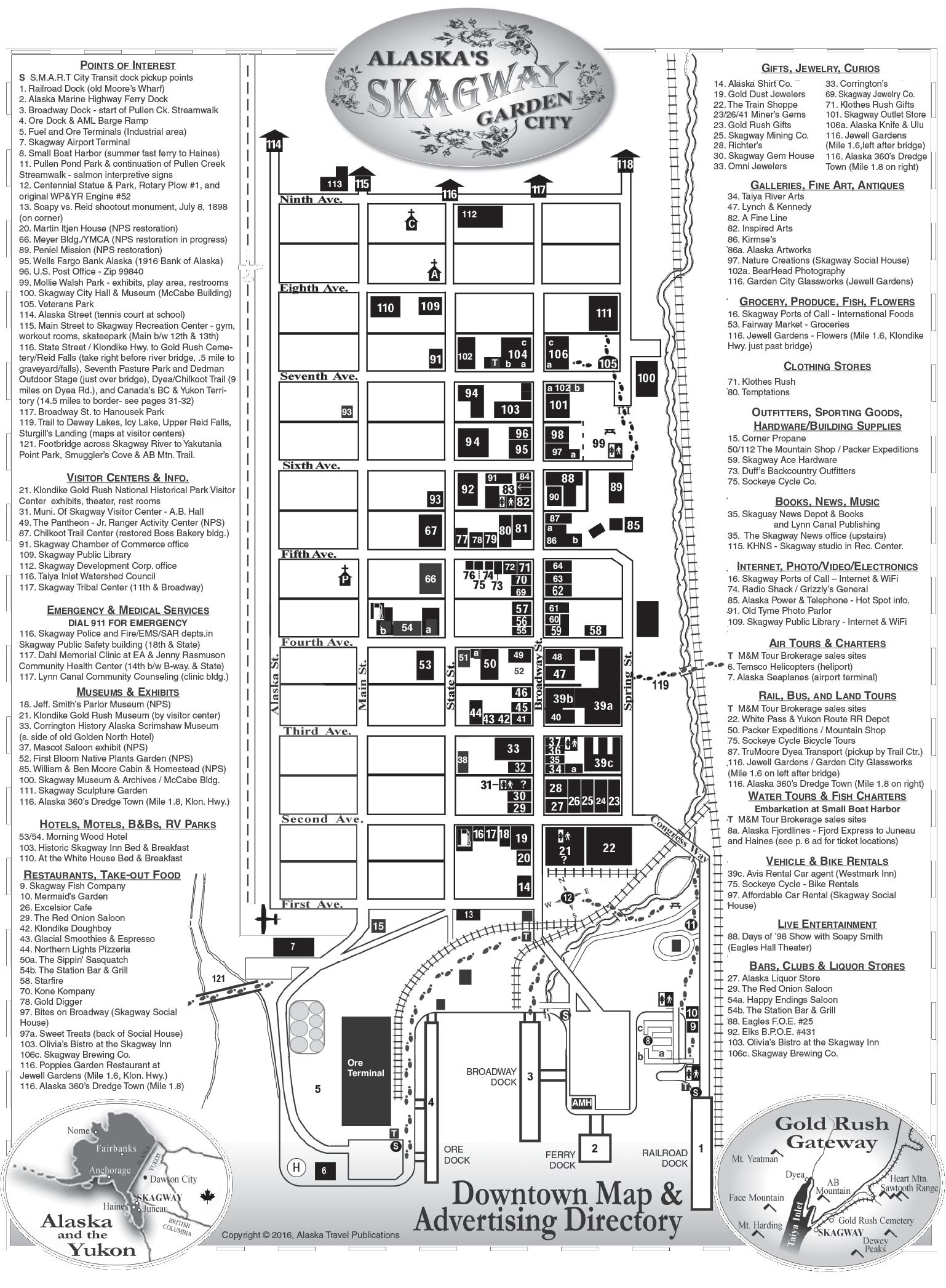
Please don’t feed the wildlife.
