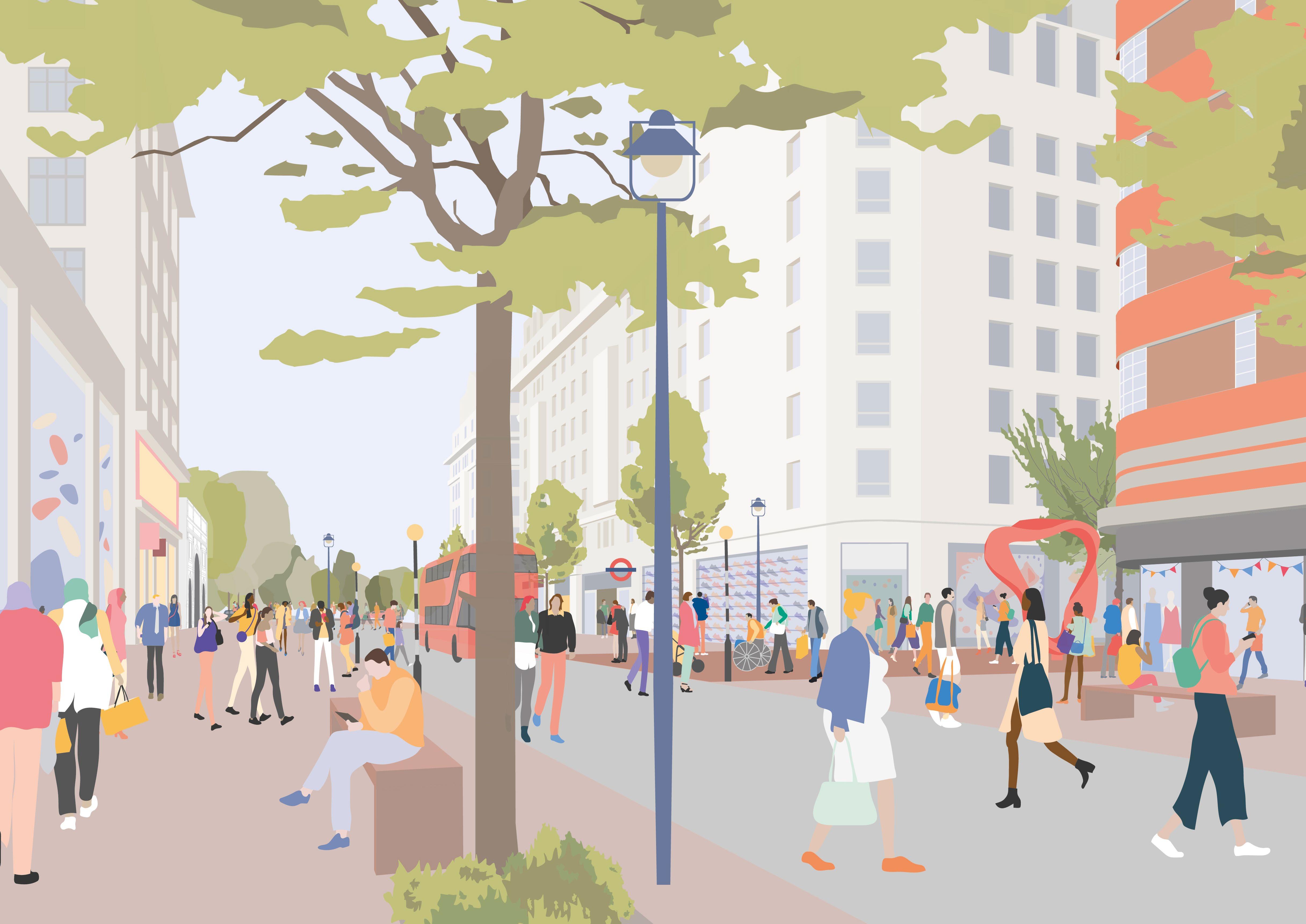
Marble Arch and its surroundings should be a high-quality, safe, civic space to use and to travel through. Changes to the public realm should be progressed to reflect its profile and role as a gateway between Oxford Street, Hyde Park and Edgware Road. Such valuable open space in the heart of the city should provide a healthier environment for the many people who visit this London landmark and pass by, as well as creating a fitting environment for events and the setting of its listed national monument.
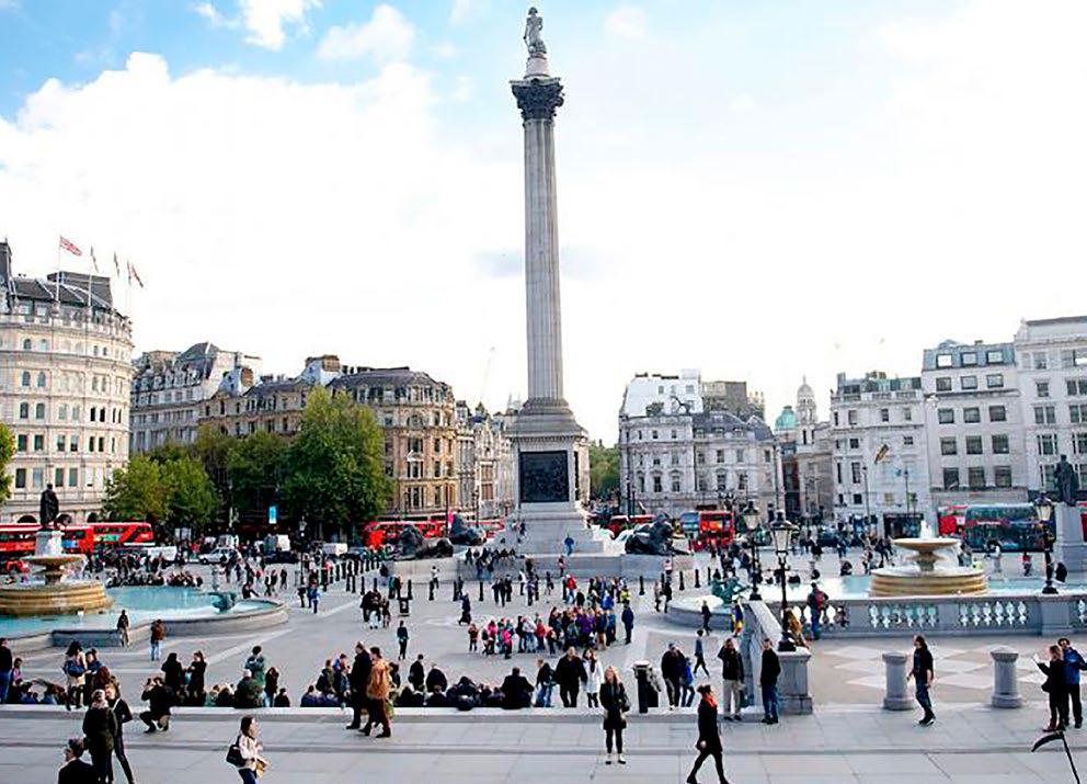
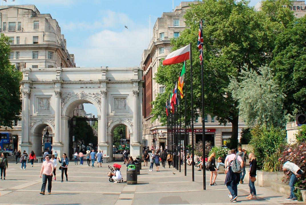
Despite Marble Arch’s prominent position and large areas of public space –comparable in size to Trafalgar Square – the monument is currently isolated and the spaces around it are limited in their use.
Many visions and plans have been drawn up for the Marble Arch area over several decades, which have largely failed to come to fruition. The public realm and road system has seen relatively few major changes since the 1960s, when the existing layout was introduced. The dominance of the Inner Ring Road at Marble Arch, and its crucial role in London’s Strategic Road Network, presents a complex context in which to achieve improvements for the public realm. However, a phased, incremental approach to improvements could provide a pragmatic and realistic way forward. Many interventions could be delivered individually as funding and political support come forward. Changes should be planned and considered together, to build up a holistic and ambitious long-term transformation.
At a time when projects are being implemented to improve safety and air quality around London, and aspirations are being championed for the area as a whole, this is a timely opportunity to capitalise on the latent potential of Marble Arch as an anchor and gateway to Oxford Street. Stakeholders should work to create a highquality civic space for London at Marble Arch, to accommodate the 2.2 million people visiting Marble Arch every year.
Publica and traffic consultants Norman Rourke Pryme (NRP) have worked in close collaboration with The Portman Estate and Marble Arch London BID, to investigate the opportunities for change. In our studies, spaces in the Marble Arch area have been considered as sites on their own merits, as well as together, in order to maximise both their individual and collective potential. Options for the phasing of change and construction have been investigated. This report illustrates our findings and sets out a pragmatic, holistic approach to delivering meaningful improvements at Marble Arch. These improvements would be achieved through traffic operation changes allied to public realm enhancements to radically transform the user experience.
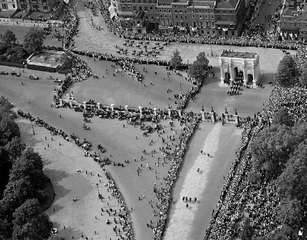
Homecoming Parade of the Prince of Wales, 1922
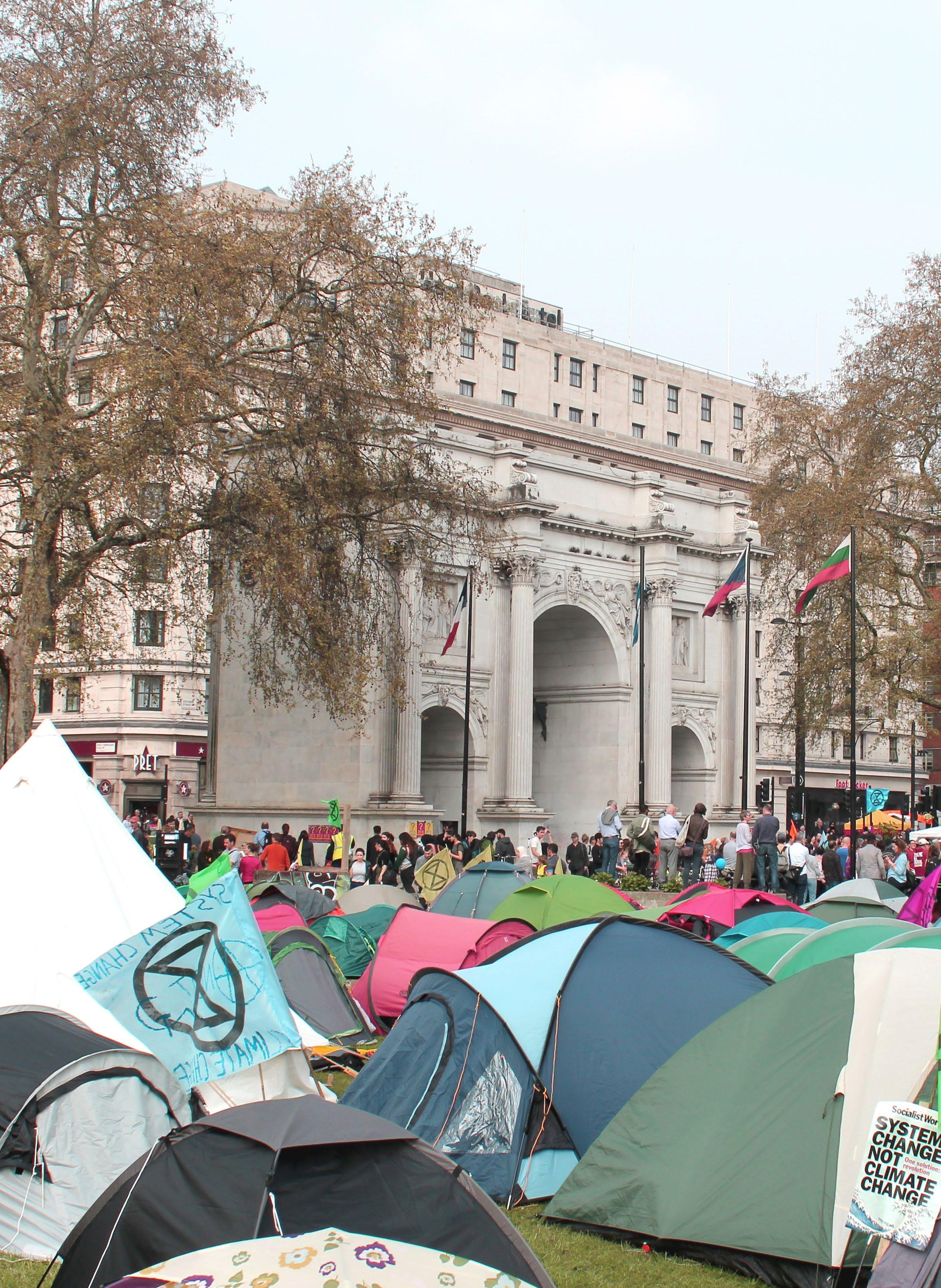
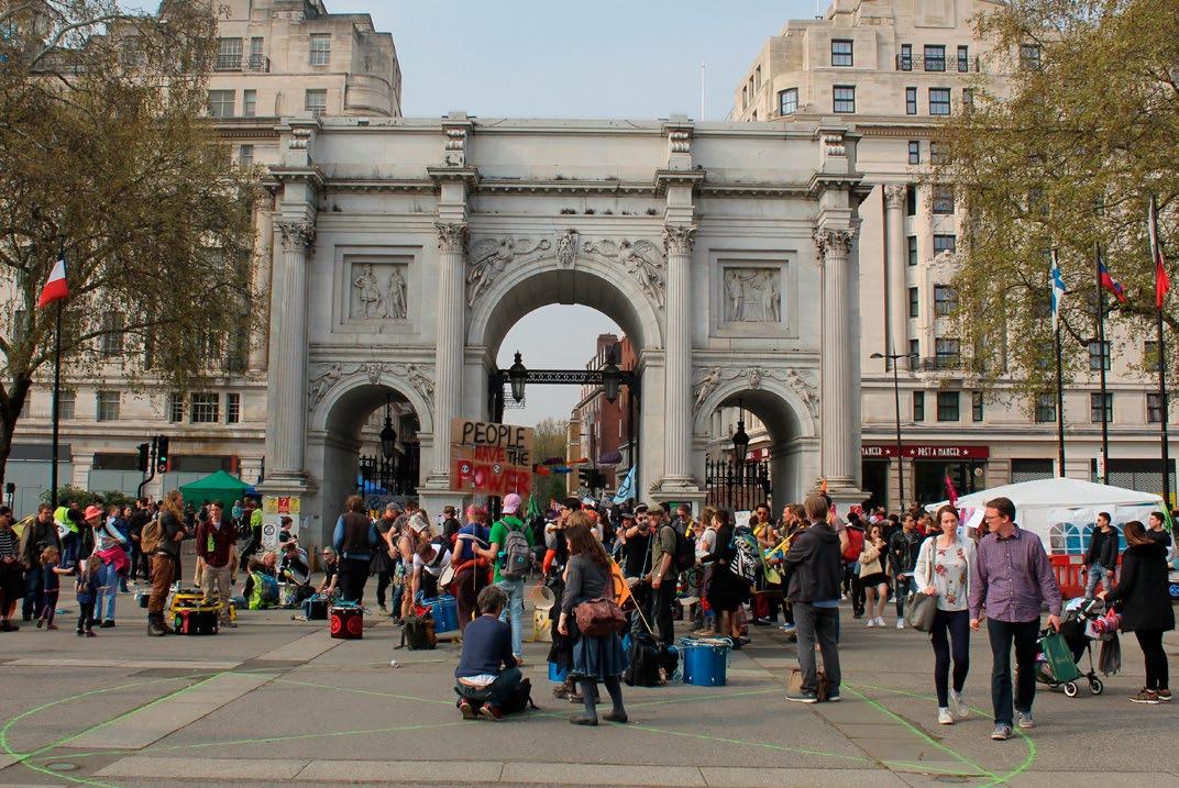
Extinction Rebellion protests, April 2019
Strategic objectives
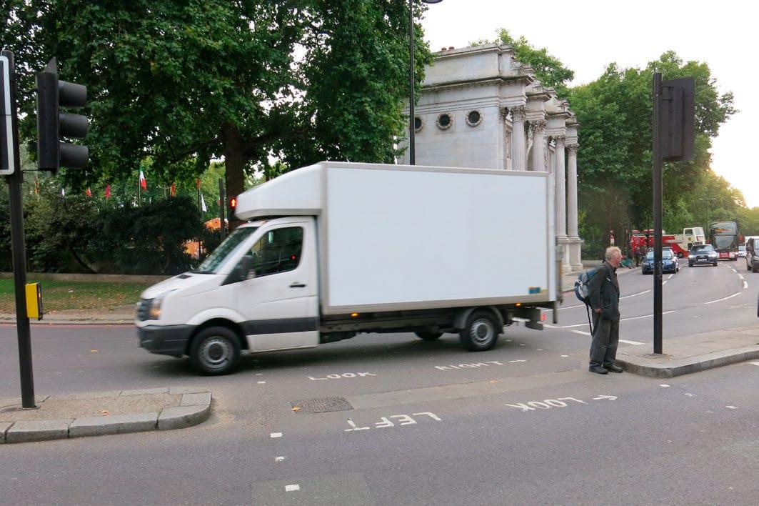
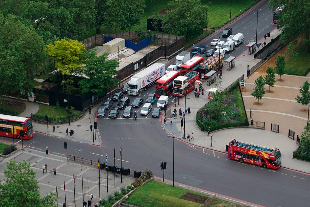
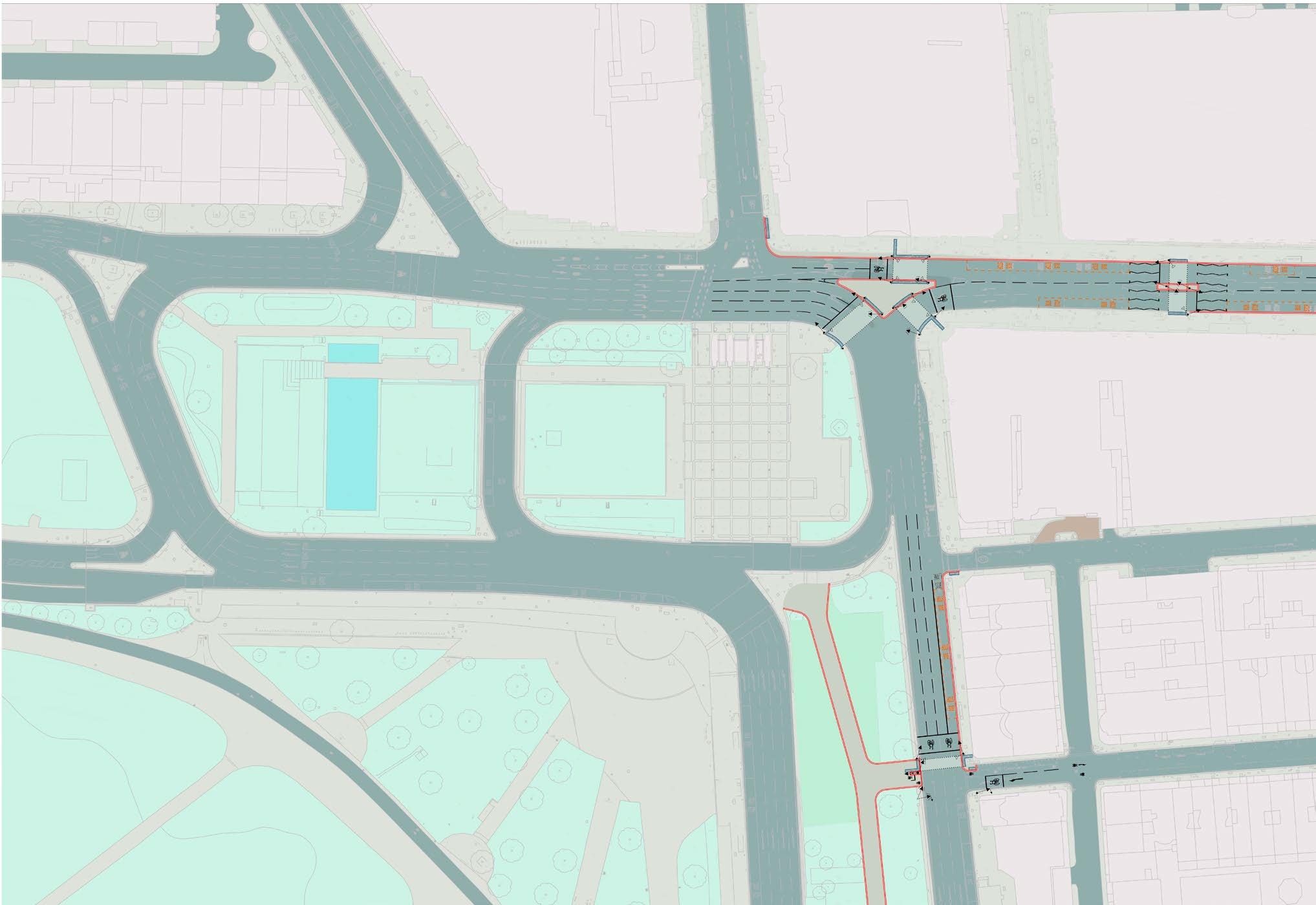
The current road arrangement at Marble Arch circulates all traffic around a large gyratory system. The Oxford Street corner of the Marble Arch gyratory brings high volumes of traffic alongside Marble Arch Underground station and the western end of Oxford Street itself, which are busy with pedestrians, retail, hotel, residential and business activities. The routing of this traffic causes safety issues with significant severance between Oxford Street and Hyde Park and also generates a high level of emissions at a point of significant sensitivity and high pedestrian footfall.
This report sets out a proposed scheme for Marble Arch which alters the movement of traffic while maintaining the connectivity of the Inner Ring Road. This change would mean that traffic is largely removed from close proximity to the Arch itself and the area at the western end of Oxford Street, which is most sensitive in terms of safety and air quality impact. This would significantly improve access between Hyde Park, Oxford Street, Edgware Road and the Underground station entrances.
The proposed designs would mean that pedestrians moving from Oxford Street to Hyde Park, or vice versa, would cross only one crossing over a main road instead of the current minimum of four separate crossings over 14 lanes of traffic to make this journey.
Objectives
• Creation of a high-quality, civic public space for London
• Improved road safety and drive towards Vision Zero
• Creation of an accessible and healthier environment with improved air quality
• Creation of a safer public realm, with improved walking and cycling connections
• Improved arrival experience, better bus connections and Underground access, step-free to ticket hall
• Activated spaces with improved amenity, natural surveillance and better management
Current traffic flows directly past Marble Arch
Projected
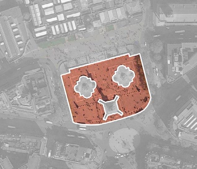
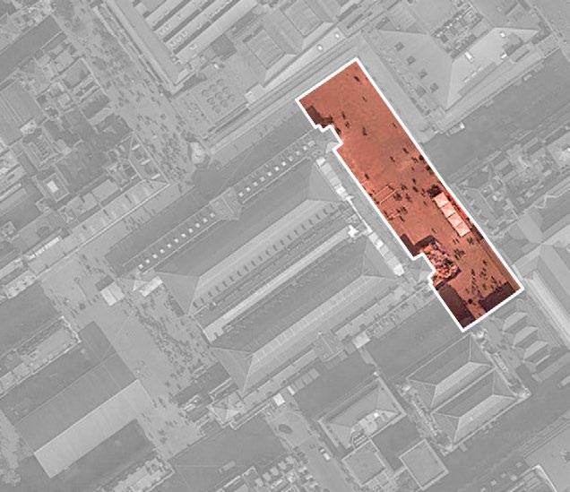
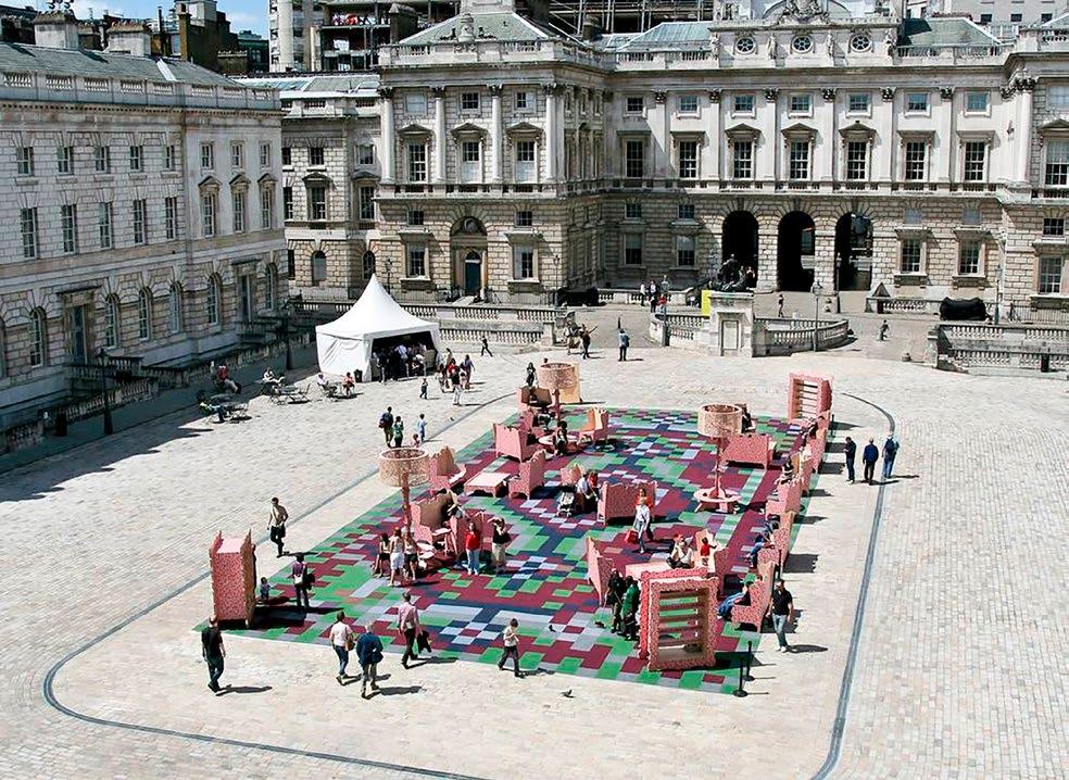
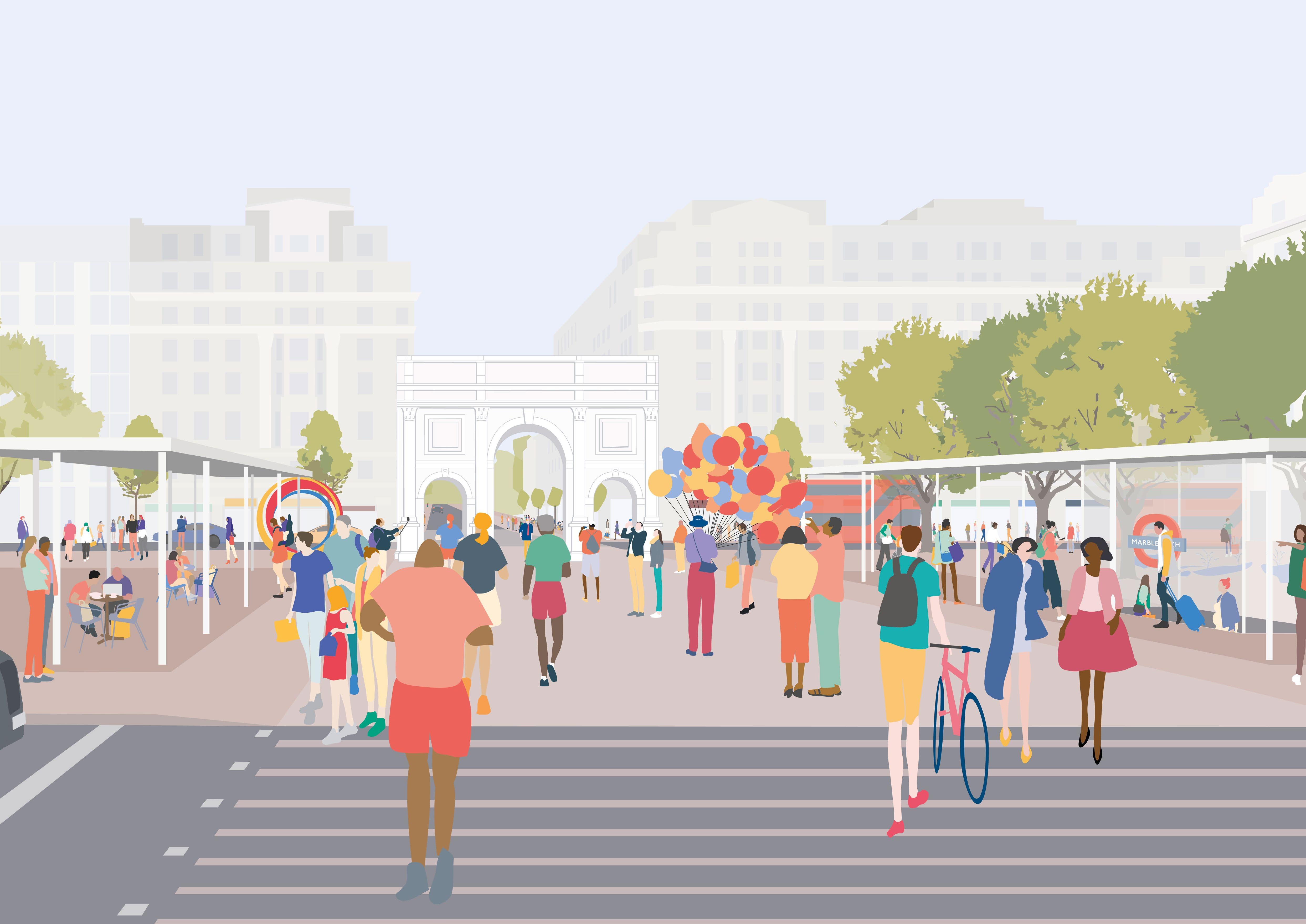
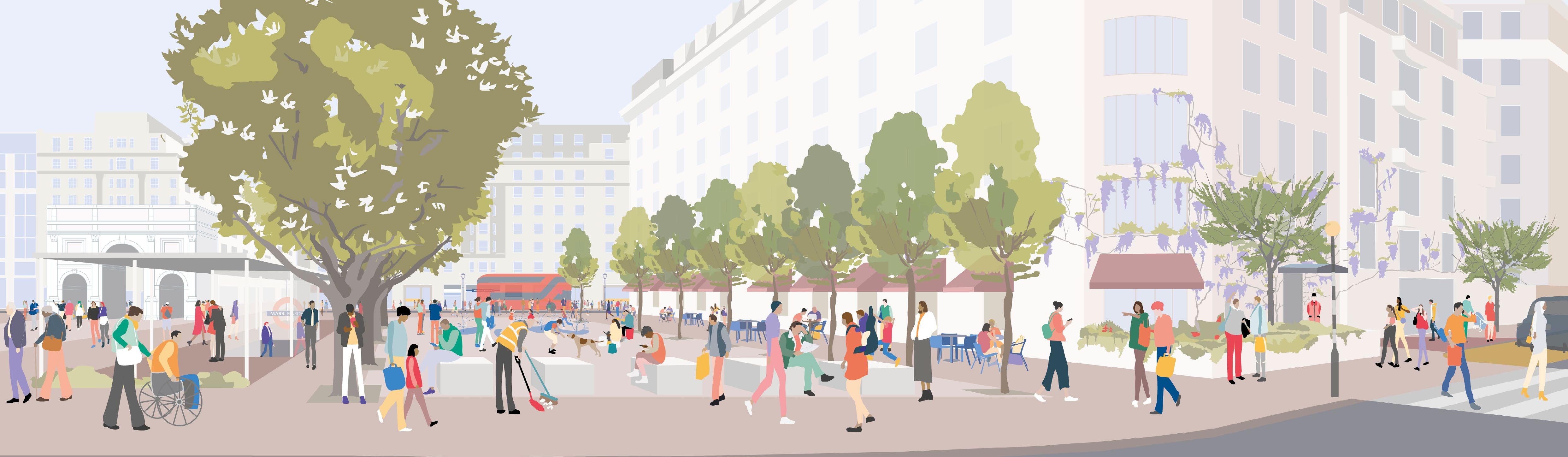
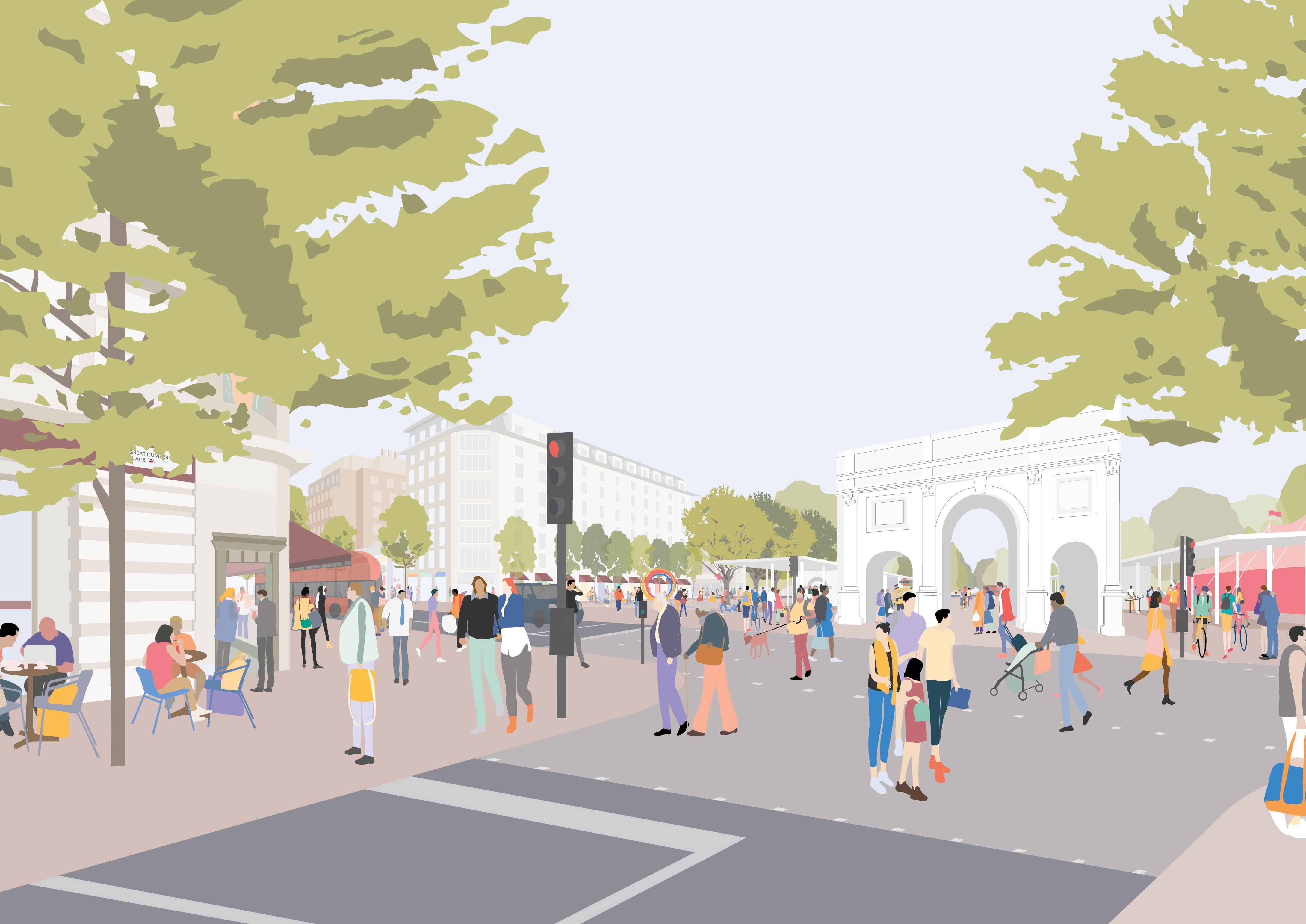
An expansive civic space
The proposed public realm interventions at Marble Arch would help reinstate a key public space within Central London. The potential unlocked through traffic changes releases the opportunity for this space to act simultaneously as a civic space for gathering at the monument, a new piazza with seating, tree planting and amenities, and an extended programmable event space to accommodate seasonal uses.
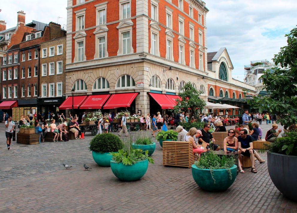
Marble Arch is a location of local, regional, national and global significance. The Marble Arch island is comparable in scale with some of London’s best known and most intensively used civic spaces. These examples illustrate the potential for activity and programmes that could take place in a space of this scale and significance, given the right conditions, design and setting.
2
8
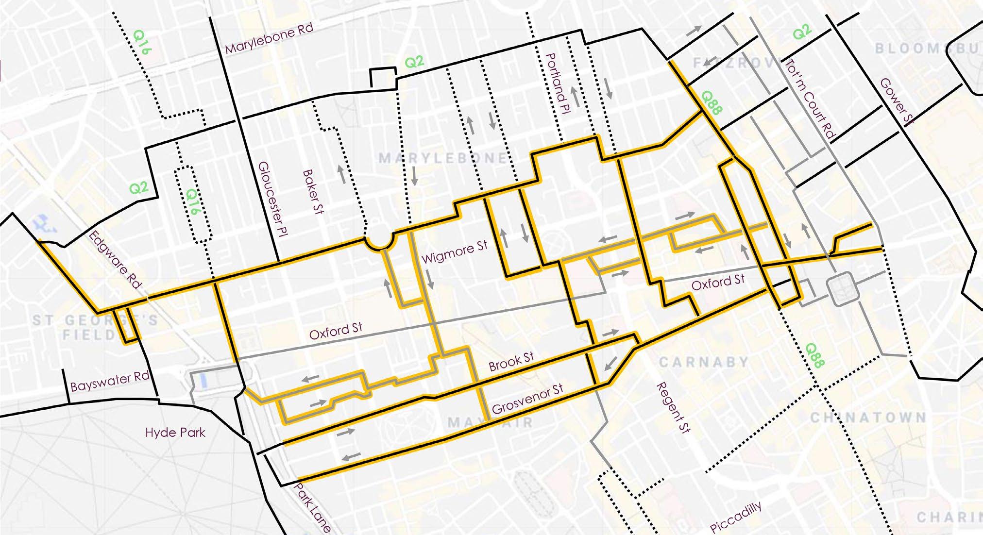
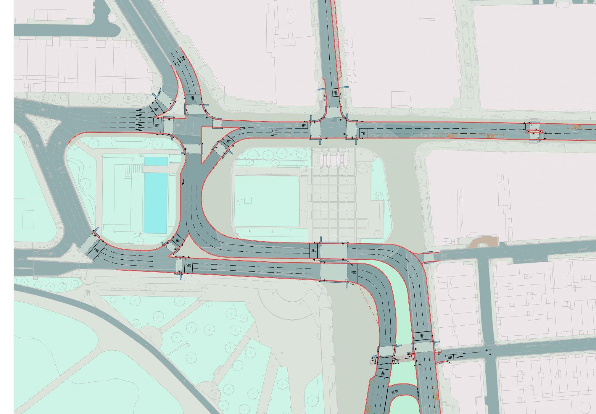
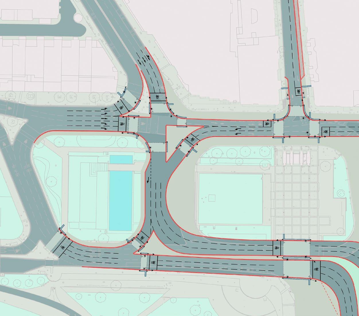
Proposed traffic alterations
A Inner Ring Road realignment of southbound traffic through Tyburn Way
B Realignment of Park Lane northbound carriageway
C New bus turning and amenity at Park Lane
D Widened footways on Oxford Street at Marble Arch Underground station
E New crossings and entrance from Hyde Park to the western island
F Widened footways and improved crossings at Edgware Road and Bayswater Road junction
G Improved pedestrian crossings and cycle connections from Hyde Park into the West End
Where is Marble Arch?
What was Marble Arch?
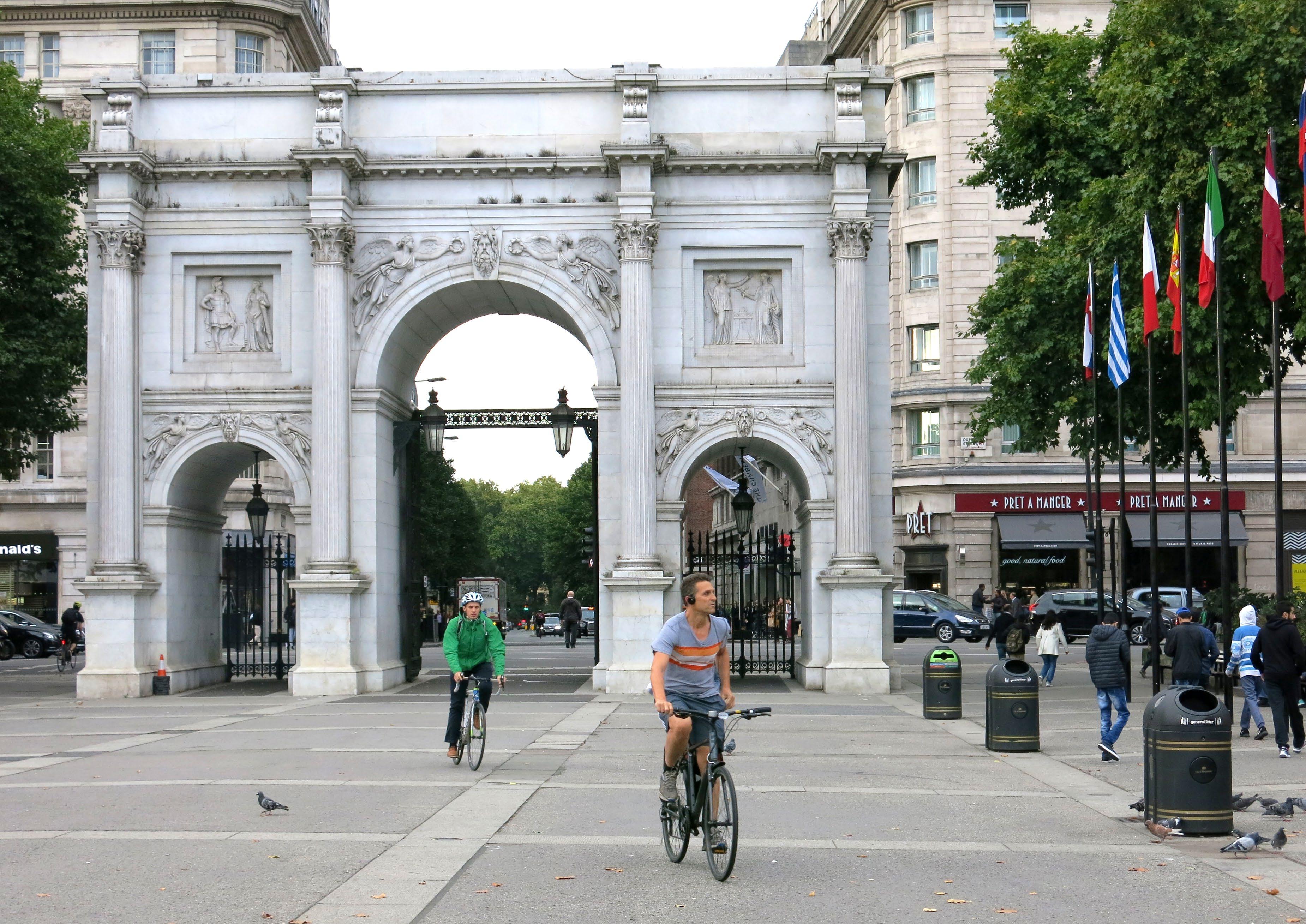
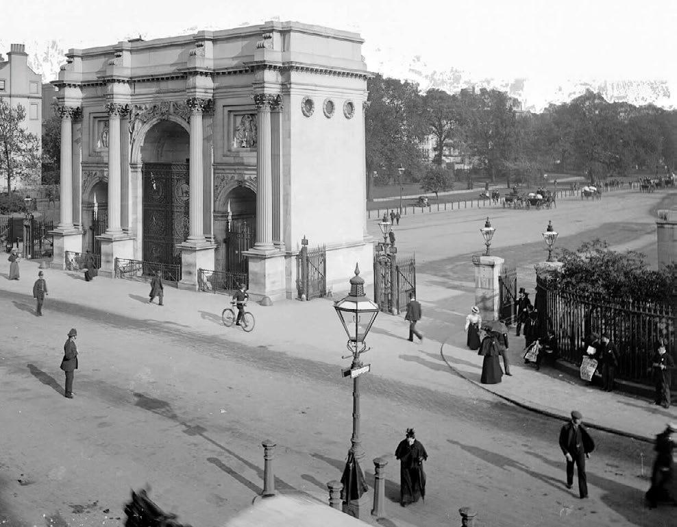
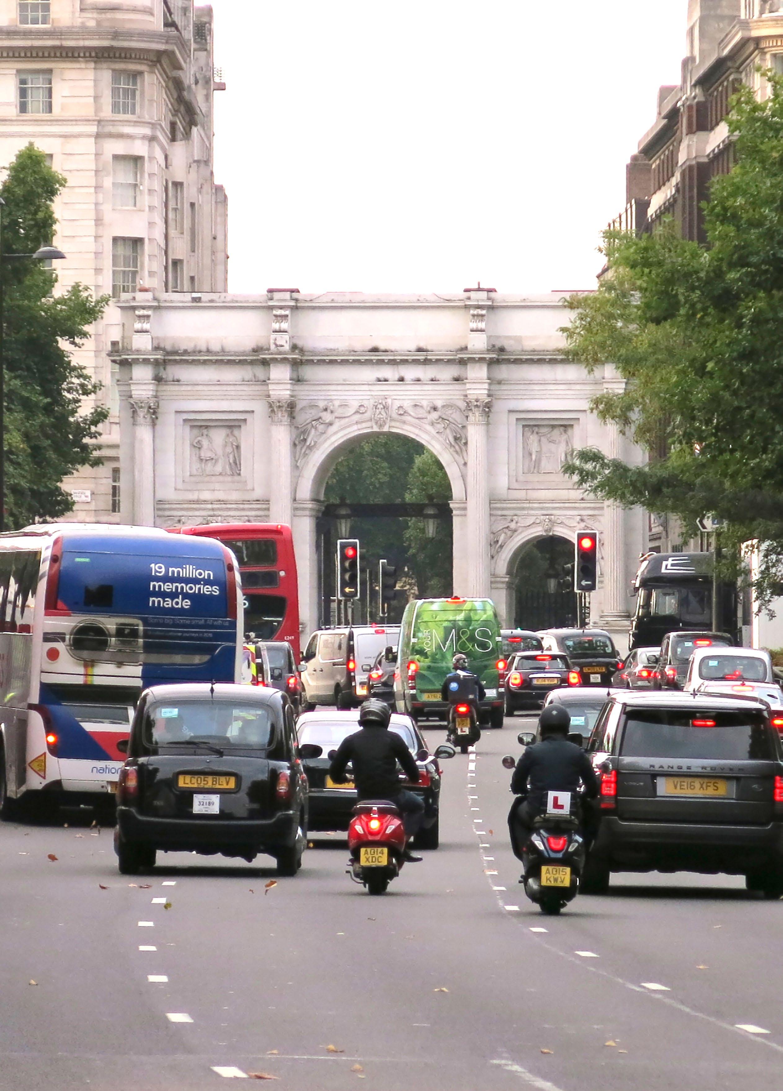
Marble Arch was designed by John Nash in 1828 as the gateway to Buckingham Palace. It was later moved to its current location, as an entrance to Hyde Park for the Great Exhibition of 1851. Road alterations in the twentieth century severed the Arch from the park and the layout of these roads have remained largely unchanged since the 1960s. The historic monument now stands marooned close to heavy traffic.
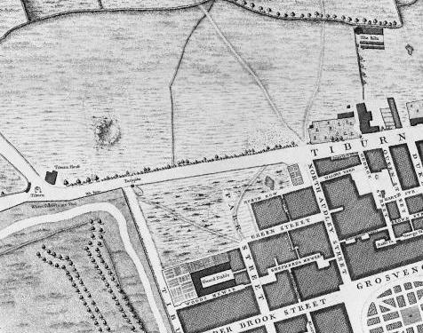
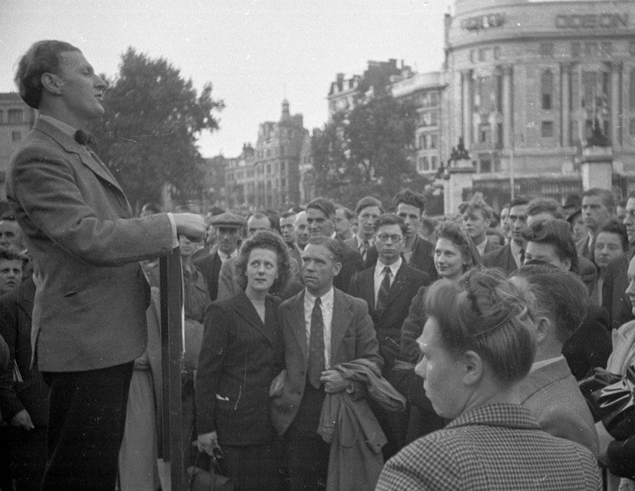
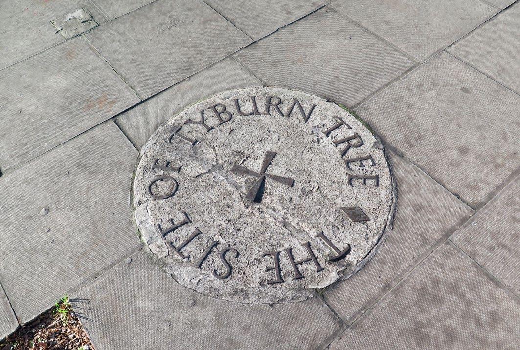
Historically at the junction between Tyburn Road (Oxford Street) and Tyburn Lane (Park Lane), the Tyburn Tree was a place for state executions. Today, a plaque on the ground at the junction of Marble Arch and Edgware Road commemorates the Tyburn Tree gallows. When at the gallows, those convicted were given the opportunity to address the audience, often leading to theological debate. This history of public speaking led to the establishment of Speakers’ Corner as a gathering place for protest. In 1872 The Royal Parks and Gardens Regulation Act designated the north east corner of Hyde Park as a public space for free speech, which famously continues today. In the twenty-first century Marble Arch and Speakers’ Corner continue to be important sites on the map of London.
EDGWARE RO AD MARYLEBONE
BAKER STREET
MARYLEBONE RO AD
MARBLE ARCH
HYDE PARK
PARK LANE
MAYFAIR
BAYS WATER
Map showing the Tyburn Road in 1746
Satirical poet Michael Clifton, 1948 Marble Arch c.1900
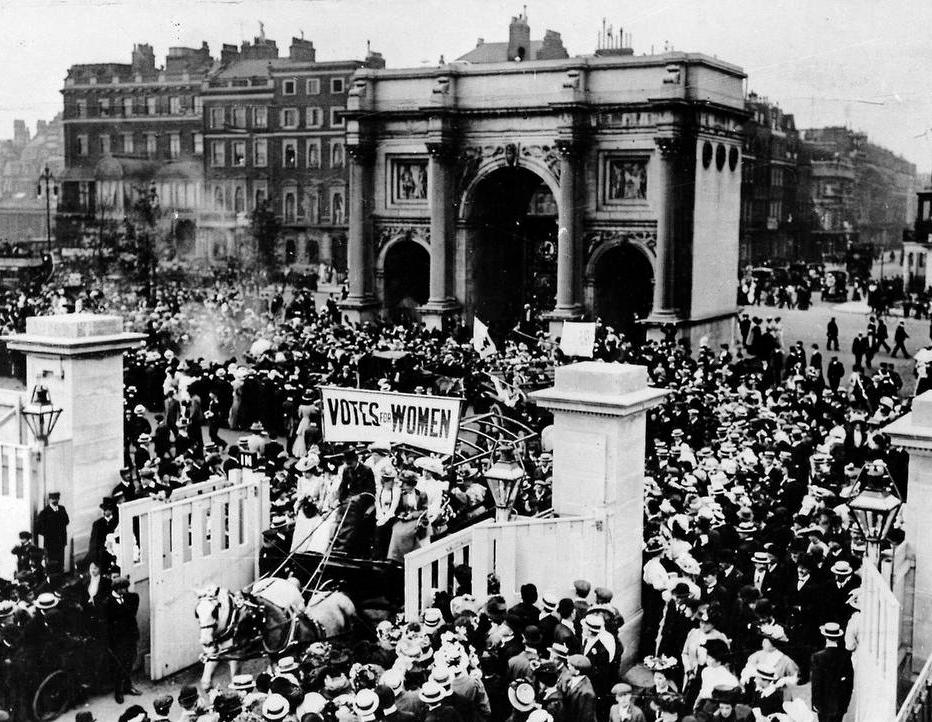
Suffragettes walking through Marble Arch, June 1908
What is Marble Arch?
With an annual footfall of 2.2 million, Marble Arch remains high on the list of places to visit in Central London, given equal significance to the Royal Albert Hall and Buckingham Palace in maps most used by local and international visitors. Whilst a world-renowned visitor attraction with a Grade I listed structure and an Underground station to its name, Marble Arch also serves an important function within London’s transport network as a junction on the Inner Ring Road and as a bus, coach and cycling route.
What are the best things about Marble Arch?
Publica carried out a perceptions study in March 2018. 100 people were asked what they thought of the site. From this analysis the public saw the best things about Marble Arch as its location, the park and historical assets. ‘Hyde Park ’ was the most frequently used word in the ‘best thing’ category.
Marble Arch Perceptions Study, March 2018
What are the worst things about Marble Arch?
Barriers to pedestrian movement, crossings and routes
When asked to pick out the ‘worst’ thing about Marble Arch, ‘traffic’ was stated most frequently in Publica’s study of March 2018. From this analysis it is clear that those visiting or passing through Marble Arch on foot recognise the detrimental impact of the road layout on this important site.
Marble Arch Perceptions Study, March 2018
OXFORD
EDGWAREROAD
The pedestrian route from Marble Arch Underground station to Hyde park is severely hampered by the current road layout.
To walk from Marble Arch Underground station to Hyde Park, people must tackle:
Issues at Marble Arch
Pedestrians have to cross seven lanes of traffic just to get from Marble Arch island to Oxford Street
No direct pedestrian crossing exists from Marble Arch island to Speakers’ Corner
The Underground exit from the station to Marble Arch island is under-utilised
Pavements along Park Lane are narrow but heavily utilised by bus users and passers-by
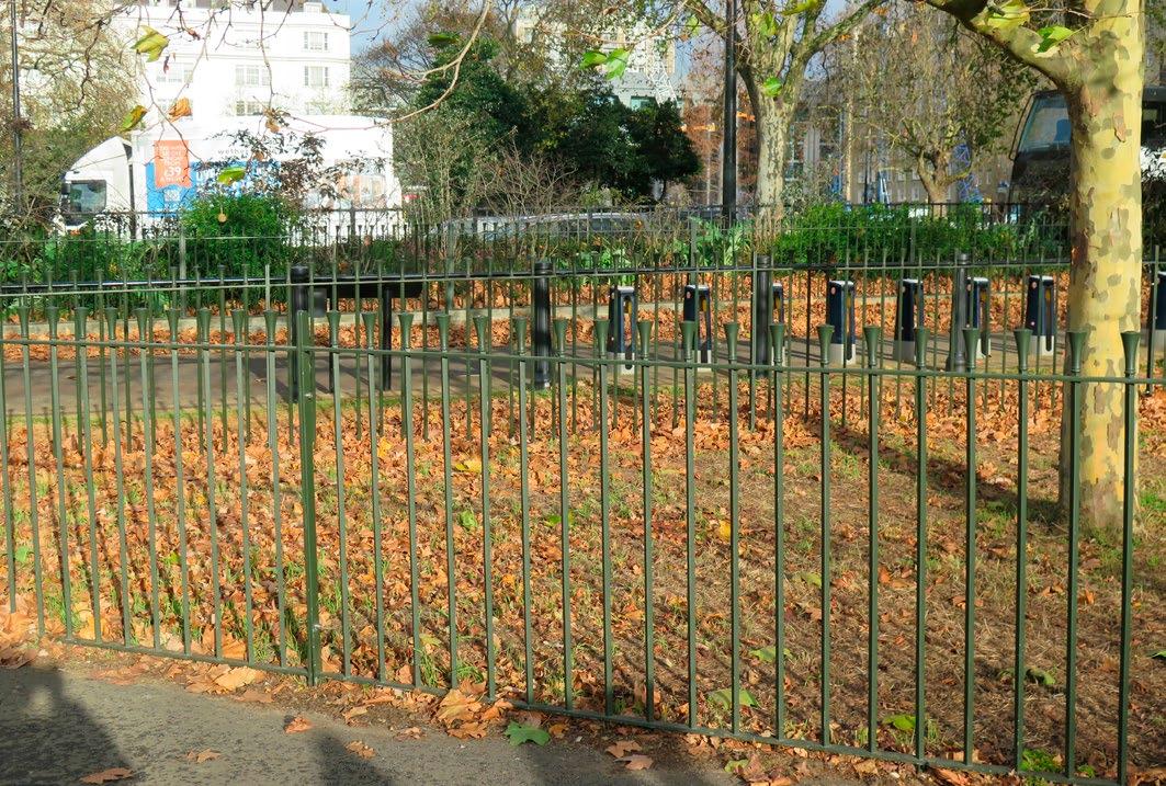
Railings and shrubs shield the park from the road, but obstruct views and further disconnect Hyde Park from Marble Arch and Oxford Street
Numerous bus stands at Speakers’ Corner block visibility to Marble Arch and Hyde Park
Opportunities at Marble Arch
and beautiful structure, a pleasure to pass by and admire
High quality and well-used cycling connections from Marble Arch through Speakers’ Corner and into Hyde Park are close by
The public space at Marble Arch can host sizable events in a central location, for example the Marble Arch
as well as offering day to day opportunities for rest, relaxation and public life
The Tyburn Tree commemorative plaque is found on a traffic island at the junction of Edgware Road and Marble Arch
Green space, public art and water fountains constitute a diverse range of public amenity on the western island, but are not often visited
Marble Arch is an extraordinary landmark
Marble Arch island is a go-to civic space for public expression
Theatre,
How did you get to Marble Arch today?
Respondents’ means of arrival
* Where participants had travelled to Marble Arch using multiple modes of transport, (e.g. Underground to Hyde Park corner and then walked) the last mode of transport that the participant had used was recorded.
Existing pedestrian crossing flows
As part of this study, data was collected on existing pedestrian crossing movements at Marble Arch. The drawing above shows pedestrian movement expressed as a bandwidth (thicker lines indicate higher pedestrian flow). The figures clearly illustrate that the vast majority of pedestrian movements that currently take place are between the Underground station, Oxford Street and Hyde Park. Crossings over Edgware Road are heavily utilised in the evening rush hour. Other crossings arranged around Marble Arch are utilised at lower volumes.
This information has been used to inform the design and option development process for the proposals in this report. All options which have been developed seek to significantly improve the crossing facilities provided for key movements, while also maintaining safe and direct crossings at locations which are less well utilised.
Marble Arch Perceptions Study, March 2018
OXFORD STREET
EDGWAREROAD
HYDE PARK
Arch monument
pedestrian flow
Existing cycling network and movements
The demand for cycling through Marble Arch is considered severely suppressed by the uncomfortable and intimidating level of traffic priority. Therefore, measures to reduce traffic dominance, provide better connections and reduce conflict between cyclists and traffic would be likely to encourage significantly increased cycling activity at Marble Arch and promote cycling growth across the area. Marble Arch stands within a relatively under-developed network of cycling routes and largely traffic dominated streets. Currently cyclists tend to take a variety of routes through Marble Arch, including on carriageway and using the toucan crossings and shared footways which are provided. There are options to bypass Marble Arch including Stanhope Gate over Bayswater Road to the west, and Brook Gate/Grosvenor Gate over Park Lane to the south.
The largest local movement of cyclists is between Great Cumberland Place and Hyde Park, which utilises the toucan crossings and dedicated cycle signals. Other movements are generally made on-carriageway in relatively low numbers. All options that have been developed look to achieve cycling growth to a greater or lesser extent, and most have sub-options to provide separated or segregated cycling routes through the public space.
Existing cycle network
Formal cycle way
Informal cycle way Streets used by cyclists
Future cycling network and movements
It is likely that the network of cycling routes around Marble Arch will be significantly improved in the future by a series of schemes being brought forward by Westminster City Council and Transport for London. The future cycling network will be much denser with more, higher quality routes available for cyclists to use. It is expected that this will encourage more cycling in the area of Marble Arch and will alter patterns of movement. In particular, it is likely that Great Cumberland Place will become increasingly attractive as a way to move from Hyde Park to join the eastwest route proposed by Westminster City Council to connect Upper Berkeley Street with Torrington Place in the east. Also, a do-minimum scheme for Marble Arch that has been developed for the Oxford Street District project would provide a new cycling connection from Marble Arch to Green Street and thereby provide the missing crossing facility over the eastern side of Park Lane. The likely changes in cycling demand as a result of the proposed network changes have been considered throughout the option development process for Marble Arch.
Future cycle network
Formal cycle way
Informal cycle way
Future cycle way
Potential future cycle way
Road safety
Analysis of 5 years of collision records show 294 recorded casualties within the Marble Arch study area in this time period. The predominant casualty types were cyclists, pedestrians, motorcyclists and bus passengers with pedestrians and cyclists being the most common casualties recorded with serious injuries. In traffic terms, the Marble Arch gyratory is regarded as a collection of intersections. For this reason, Marble Arch as a site has previously not qualified for the Better Junctions scheme, as accidents recorded at each intersection didn’t add up to the required figure. If Marble Arch was regarded as a single major junction on the road network, the number of casualties would exceed the requirement to qualify as a dangerous junction, with the associated need for change.
The combined total of road traffic accidents within the Marble Arch area is very significant and there is an opportunity to achieve large accident savings by implementing changes that address the current risks in the road layout.
The location with the highest number of pedestrian accidents is the north east corner of Marble Arch (at Great Cumberland Place and Oxford Street). Measures to address pedestrian safety in this location are therefore likely to provide a significant reduction in pedestrian casualties. A significant proportion of cycling casualties have been recorded on the north side of Marble Arch between Edgware Road and Oxford street. Therefore, improvements to cycling safety or alternative attractive routes for cyclists would likely provide a reduction in cycling casualties.
In general, the layout of Marble Arch prioritises vehicular traffic and suffers relatively high speeds through points of potential conflict with vulnerable road users. Therefore, options that reduce traffic priority and/or reduce traffic volumes at key conflict points with pedestrians and cyclists would reduce the frequency and severity of road traffic accidents with the study area. This approach forms a key component of the options which have been developed.
Accidents locations (2012 – 2017)
DRIVE
Marble Arch monument
collision
The main island at Marble Arch is a well visited, large open space on the doorstep of Oxford Street. However, it is currently isolated, under-utilised and lacking in animation and definition.
This site has great potential to become a democratic and civic space of importance for London with integrated, purpose-built infrastructure to enable a range of events to take place. This potential was successfully tested in the winter of 2018 when Marble Arch hosted the Marble Arch Theatre for a series of months, bringing night time activity to the site.
A more considered framing and enclosure of the space south of the Arch would enhance the views to this listed national monument and better complement its scale and position. An extension or elegant redesign of the existing Underground entrance pavilion, mirrored by a complementary structure to the west of the Arch, could accommodate a range of uses (such as tourist information or cafés) while emphasising and framing the axial view of Marble Arch.
Located directly to the east of Marble Arch, is northern Park Lane in its current condition as a busy arterial road. This site is not thought of as a space in its own right currently. However, this stretch of the famous address framed by elegant buildings, holds great potential. The realignment of the Inner Ring Road to the south and west of Marble Arch through Tyburn Way could unlock additional opportunities including direct pedestrian crossings to the north and south of the Arch, a continuous pedestrian connection between Marble Arch and Oxford Street, and a new public piazza with seating and tree planting to the east of the Arch, framed by the handsome existing architecture and active uses.
Public realm improvements unlocked through traffic changes at Marble Arch
• New material treatment at Marble Arch to emphasise historic axis between Park Lane and Great Cumberland Place through the Arch
• Closure of junction with Park Lane to create a safer and uninterrupted pedestrian connection between Marble Arch and Oxford Street
• Creation of single direct pedestrian crossing between Marble Arch and Hyde Park
• Enlarged and relocated pedestrian crossings between Oxford Street, north side of Underground Station principal exit and Marble Arch
• Improved crossings and connections for cyclists
• Upgrade of existing Tyburn Way pedestrian crossing to a controlled crossing with pedestrian phase
• Upgrade of the Underground entrances onto Park Lane and in front of Marble Arch, to provide greater accessibility, legibility and usage (step-free access to ticket hall)
• Extension/redesign of existing pavilion structure to frame Marble Arch and provide covered space and seating area as well as improved Underground station access
• New pavilion structure on the western side of Marble Arch piazza to mirror the eastern pavilion and frame the monument
• Introduction of café, ticket sales, tourist information or other uses within the pavilion structures
• New seating and street furniture, and increased provision of cycle parking around Marble Arch
• Introduction of integrated HVM measures and upgraded lighting
• Establishing new programmable events space to the east of Marble Arch related to a new pavilion structure (which could itself accommodate ancillary uses and infrastructure for events)
• Succession strategy for trees to bring greenery, provide clear views and an improved townscape setting for the Arch
• Tree planting between Underground entrance and Marriott Hotel to create a green public space
• New tree planting and greenery on Marble Arch island to act as green buffer between public spaces and traffic
• Relocation of bus stands at Tyburn Way and Speakers’ Corner, and relocation of stands along Park Lane
• Activation of frontages facing the new public space (e.g. Marriott Hotel) to encourage activity to spill out onto the new southwest facing terrace area
• Activation-led approach to street management and ASB control
new welcoming piazza connecting Marble Arch, Oxford Street and Park Lane, to the west of the monument
Improved pedestrian connections to/from Marble Arch, Oxford Street, Edgware Road and Great Cumberland Place
Gateway to Oxford Street
Westminster City Council (WCC) is currently working on improving the setting of the Oxford Street District and improvements to Oxford Street itself, aiming to tackle poor air quality, safety issues and congestion. This presents a timely opportunity for neighbouring stakeholders to work together in order to ensure a holistic, joined up network of interventions and improvements to re-instate Marble Arch as a gateway to one of the world’s leading retail districts and a western anchor to Oxford Street and connection to Hyde Park.
Aligned with WCC’s plans for an improved pedestrian environment on Oxford Street, traffic changes at Marble Arch could offer an opportunity for an enhanced pedestrian experience through footway widening, de-cluttering, rationalised well-designed street furniture, lighting and tree planting.
The western most section of Oxford Street under-performs neighbouring parts of the street. Its retailing environment is deteriorating, with the risk that it becomes disconnected from forecast regeneration elsewhere. Marble Arch station does not currently perform to its potential on the network, leaving Bond Street and Oxford Street stations under strain.
If the quality of the public realm on the western part of Oxford Street does not keep pace with other areas, this could further exacerbate the risk of missing out on latent opportunities for economic growth and social benefits. Reinforcing Marble Arch’s role as a gateway to Oxford Street, with integrated proposals for roads and the public realm, would help to ensure an economic revival for this high profile area, create the appropriate anchor for the endto-end experience of Oxford Street, and maximise the contribution of this site to the improvement of the district, for the use of Londoners, for the city’s reputation and visitor experiences.
Public realm improvements unlocked through traffic changes at Oxford Street
• A significant reduction in traffic volumes at the entry point to Oxford Street and its connection to Marble Arch station and Marble Arch itself
• Improved safety and better air quality at the entry point to Oxford Street, through changed traffic routes and more separation of high pedestrian flows from vehicles
• Widened footway outside Marble Arch Underground station on Oxford Street to improve arrival experience and safety
• Improved connectivity between Oxford Street and Hyde Park through a single, direct pedestrian crossing
• Increased footway widths through reduction of carriageway, aligned with Oxford Street District wider area plans
• Relocation of pedestrian crossings to Great Cumberland Place
• Increased width and duration of pedestrian crossings along Oxford Street
• Upgrade of footway and carriageway material treatments on Oxford Street in accordance with Oxford Street District material palette, connecting into Marble Arch
• Tree planting along Oxford Street at the approaches to Marble Arch
• Relocation of bus stops to facilitate pedestrian movement close to Marble Arch
• New street furniture to declutter footways and provide additional seating and bins
• Introduction of safety measures including hostile vehicle mitigation (HVM) as required, integrated with tree planting and street furniture wherever possible
• Upgraded lighting
• Improvement and greening of Great Cumberland Place, Old Quebec Street and North Row to create an enhanced network of smaller spaces around Marble Arch
Western
Island
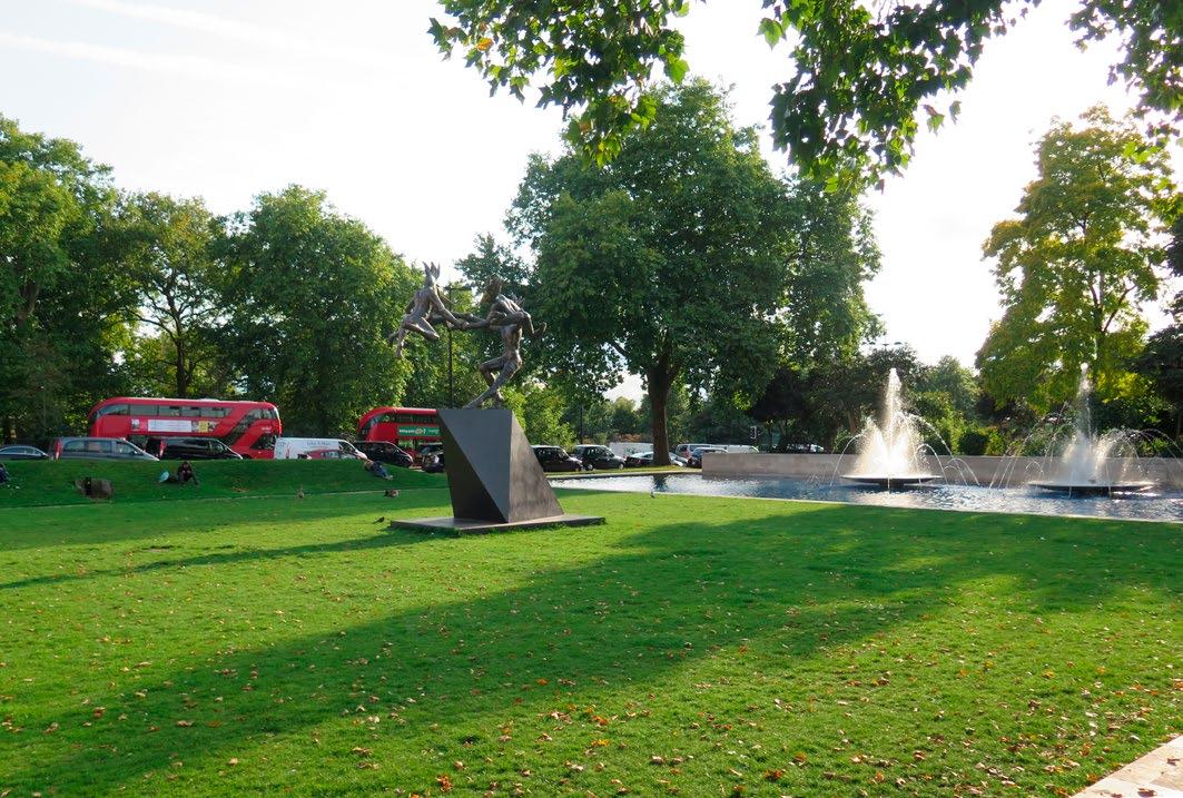
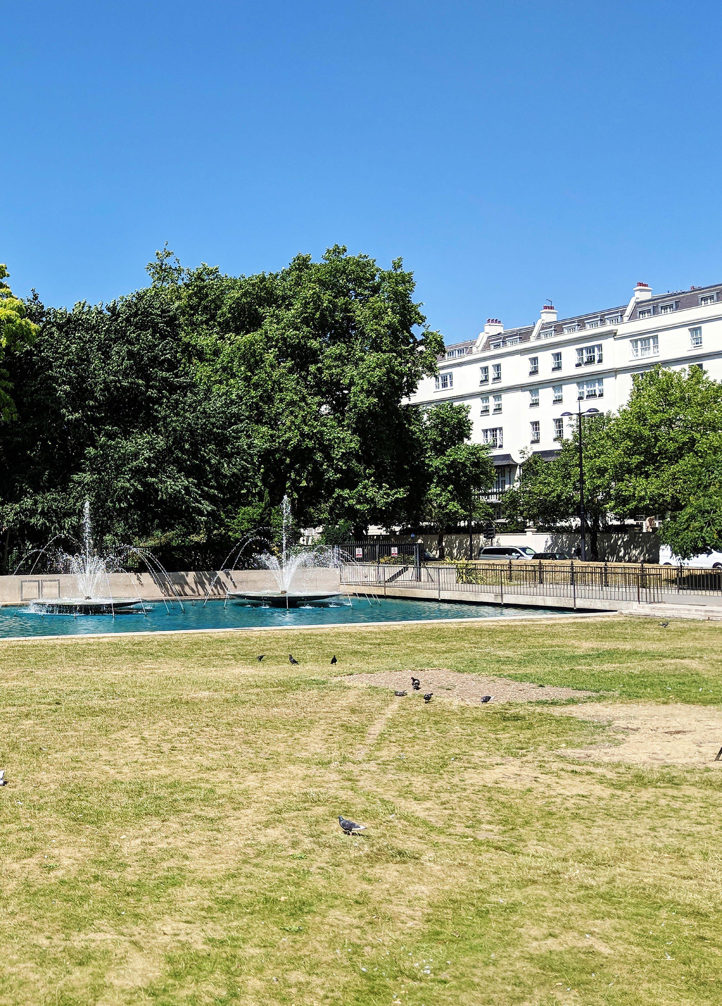
The western island at Marble Arch provides a green space with mid twentieth century landscaping and water features. However, this space is disconnected from its surroundings, lacks a function and is rarely used by the general public, being so close to the more significant spaces of Hyde Park.
If the island was reimagined as part of holistic improvements around Marble Arch it could be used for a host of functions and be better connected as a space to move through for the users of Hyde Park, Oxford Street and surrounding residential areas. Existing features such as the fountains, pools and the sunken space could be refurbished and imaginatively adapted to become the features of a new environment if desired.
The eastern island at Marble Arch is currently used for sculptures and pop up installations (for example during recent London Fashion weeks). There is an opportunity for temporary events and major art installations to be located on the western island in future, and for other uses to be tested on this landscape, making use of the high profile location and visibility to pedestrians and drivers, visitors and Londoners.
Public realm improvements unlocked through traffic changes could include:
• Upgrade of existing Tyburn Way pedestrian crossing to a controlled crossing to improve safe access
• Upgraded lighting, signage and W/C facilities
• New planting around perimeter of the island to act as a buffer between green, open space and surrounding traffic to reduce the impact of noise and pollution
• Relocation of sculpture sites from Marble Arch island to the western island to provide an improved setting for major art pieces
• A programmed series of large scale art installation or events
Edgware Road to Marble Arch
As ideas for Marble Arch are progressed, and proposals for the Oxford Street District are being developed by Westminster City Council, it will be crucial to ensure that connections between Marble Arch and Edgware Road are carefully considered.
Developments currently under construction will re-establish a continuous frontage at the corner of Edgware Road to Marble Arch.
The proposals for the public realm and roads in this report would bring a better pedestrian experience from Oxford Street right up to Edgware Road, re-establishing a great corner in the city. Improvements to crossings, footway widening and a new setting of the Tyburn Cross monument would also help reestablish the important connection from Marble Arch island to Edgware Road. Easier connections to/ from Edgware Road could attract a greater number of people in Marble Arch and Oxford Street District to visit the hight street. An increase in footfall numbers would bring much needed economic benefits.
Public realm improvements unlocked through traffic changes
• Improved pedestrian connectivity between Edgware Road and Hyde Park through improved crossings to Marble Arch and the western island
• Improvements to pedestrian connectivity and public space from Edgware Road to Oxford Street through footway widening, aligned with the Oxford Street District Place Strategy
• Relocation and enhanced setting of the historic Tyburn Cross at the southern end of Edgware Road
• Relocation of bus stops
• Tree planting along Edgware Road on the approaches to Marble Arch
• Upgraded lighting
Speakers’ Corner and Northern Park Lane
Homecoming Parade of the Prince of Wales, 1922
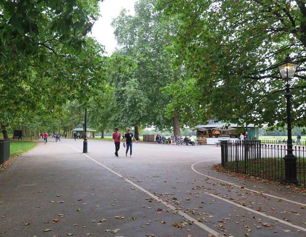
The connection into the park from Speakers’ Corner
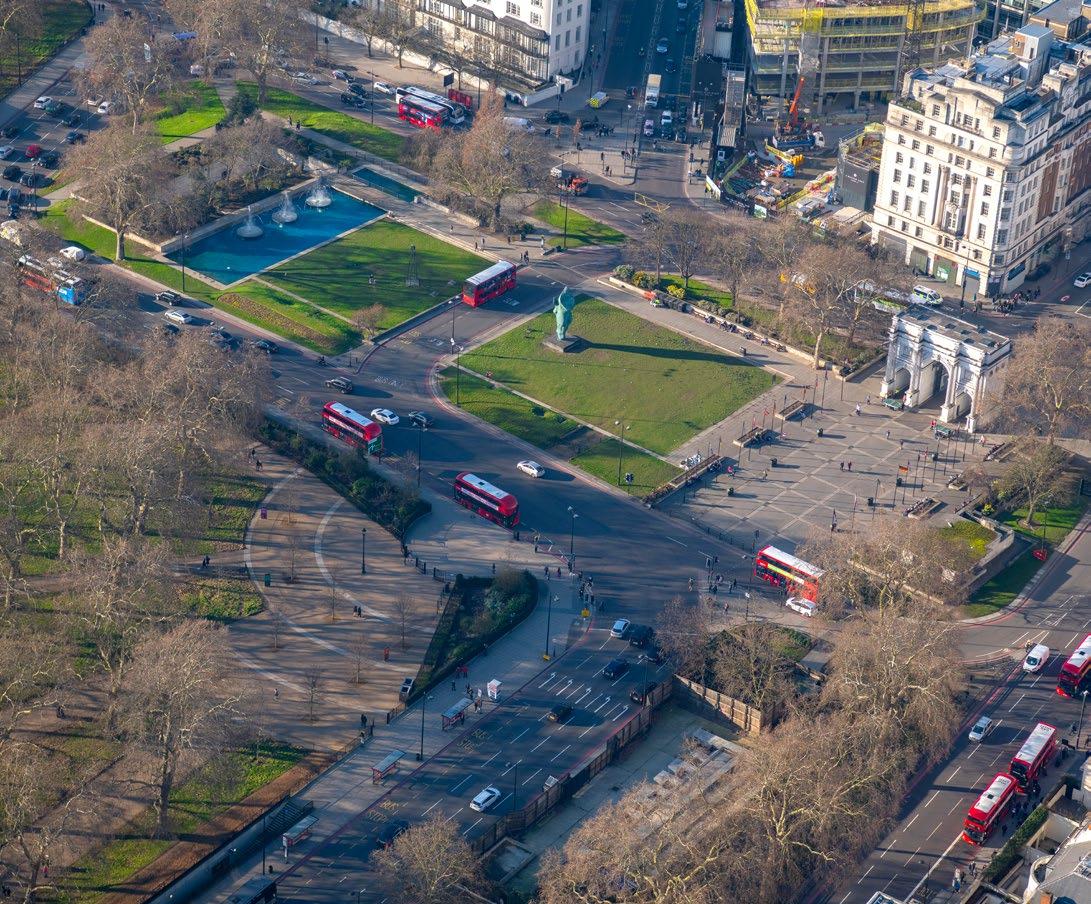
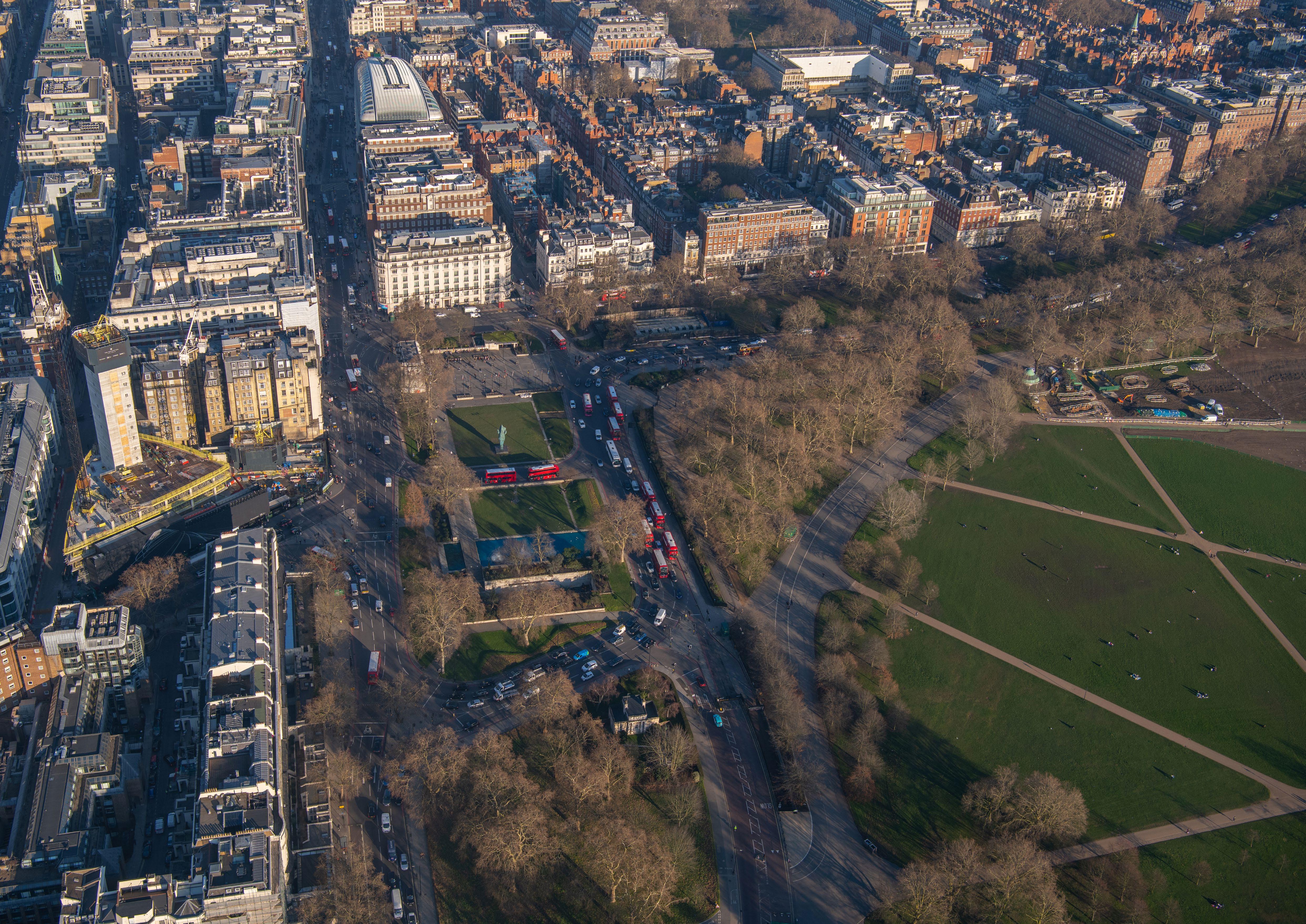
Aerial view of Speakers’ Corner and Park Lane Jason Hawkes, 2019
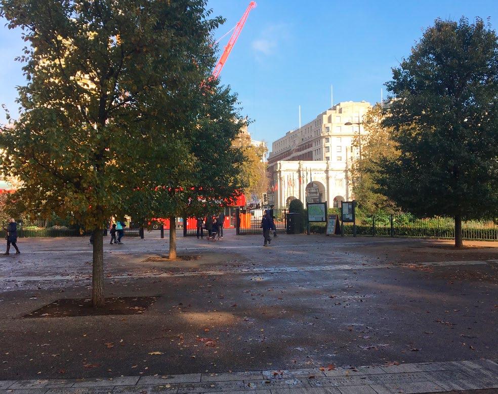
The view and connection from Speakers’ Corner to Marble Arch is compromised by railings, bus stands and other objects
Speakers’ Corner
Hyde Park is perhaps London’s most famous open space and provides an invaluable amenity for residents, workers and visitors in the Marble Arch area. Nevertheless, connections into the park are challenging, it can feel cut-off from the city close by, and many spaces around it are under-utilised and disconnected from it, far from fulfilling the potential for the area.
A shift eastward of Park Lane’s carriageway at its northern end could restore the historic view and axis between the park and Marble Arch and improve pedestrian accessibility between the park and Oxford Street.
In parallel to public realm improvements, new sightlines and crossings, the many railings that currently delay the sense of arrival into Hyde Park could be rationalised to provide more immediate access to green space. Speakers’ Corner could be emphasised through an improved setting, with the potential introduction of a public art commission to celebrate its significance and a new paved public space at the corner itself.
Public realm improvements unlocked through traffic changes
• Creation of new space in Hyde Park restoring the Marble Arch processional route and axial view, including a new direct crossing in line with Marble Arch
• Continuation of paving and tree planting to link new space with the existing landscaping of the park
• New pedestrian crossings from Speakers’ Corner to the western island, to facilitate a new pedestrian route
• Improved cycle routes around and through this area of Hyde Park, connecting to Marble Arch, Oxford Street, into Marylebone and Mayfair
• Removal of railings and barriers within the northern corner of Hyde Park
• Further emphasis on Speakers’ Corner, for example through a public art commission
• Rationalise and redesign information boards, bins and cycle racks
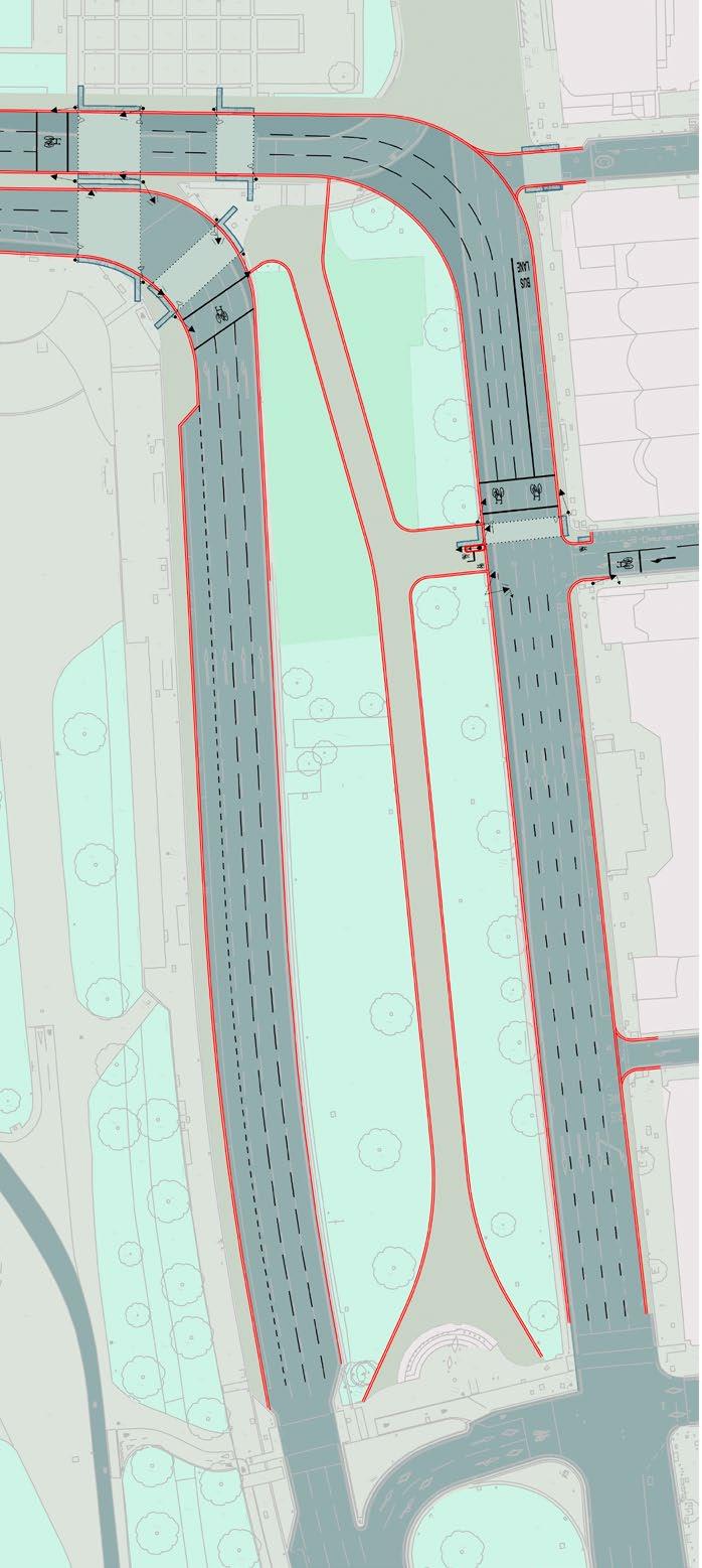
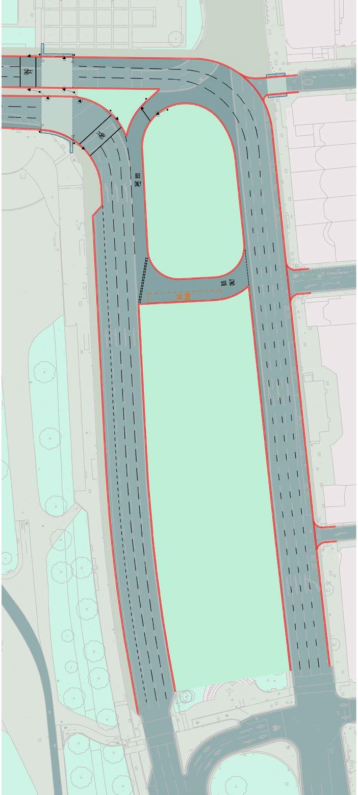
Northern Park Lane
In its current condition, the Inner Ring Road has a detrimental impact on Park Lane and the whole Marble Arch area. The existing road configuration at the north end of Park Lane splits north and southbound traffic, rendering the large tree-lined space between unusable, and exacerbating the sense of distance and severance created by the roads. Limited footway widths are provided along Park Lane on the eastern Mayfair side, where bus stops in particular are often overcrowded.
Local stakeholders groups are investigating ways to improve Park Lane as a whole. The ideas suggested here should be integrated with any wider project that may come into fruition and be timed to align well with other changes to the road further south.
A realignment of the northbound stretch of Park Lane between Upper Brook Street and North Row would allow for the historic axial view and route between Marble Arch and Hyde Park to be re-established as a remarkable pedestrian route. Without compromising the traffic capacity of the Inner Ring Road, this approach to consolidating road alignments could reduce the under-utilised median strip to a minimum width, while keeping valuable mature trees.
A review of the Inner Ring Road alignment would also enable bus stops and stands to be relocated where most appropriate. Materials should be upgraded to better facilitate pedestrian movement and improve the pedestrian, cyclist and bus user experience.
Public realm improvements unlocked through traffic changes
• Realignment of northbound section of Park Lane between Upper Brook Street and North Row to bring carriageways closer together, with a reduced median strip still defined by existing mature trees
• Clear definition of Speakers’ Corner as a space in line with the view to Marble Arch including a new direct crossing
• Tree planting and greening in North Row
• Improvements at Brook Gate to accommodate a two-way cycle route and a better defined pedestrian entrance to Mayfair
• Pedestrian footways to be given a continuous material treatment, and raised crossings at all side road junctions, to emphasise pedestrian priority and continuity
• Relocation of bus stands from Tyburn Way to Park Lane’s median strip, allowing a quick turn-around
• Reconfigured and rationalised two-way cycle crossings at Green Street and Brook Gate
• Upgraded lighting and street furniture
Traffic Options Study
Project scope and design options
A number of different options for the operation of the transport network around Marble Arch have been identified, developed and assessed. Several previous studies have been undertaken to examine the potential to reconfigure traffic arrangements at Marble Arch. These studies were reviewed, and the conclusions considered as part of the option identification process for this study.
The options that have been identified range from relatively minor changes to the existing layout, to full scale realignment of the road network through the study area. Many have sub-options and variations which have not been included in this report for the sake of simplicity. The table below provides a summary of all options identified and assessed.
Each option has been assessed against a range of quantitative and qualitative criteria to assist with the identification of a preferred layout option. The transport criteria used for this assessment are listed below and scoring of each option is detailed on page 80 of this report.
• Area of usable public space
• Pedestrian comfort and permeability
• Cycling comfort, connectivity and usability
• Road safety
• Traffic network resilience
• Traffic reassignment
• Bus accessibility and interchange
• Underground rail accessibility
• Initial cost estimate (Included for reference but not part of overall scoring assessment)
• Show-stopper (Issue or issue that would render this option undeliverable)
The transport criteria closely align with Healthy Streets indicators and Transport for London’s (TfL) outcomes expectations for the scheme. The traffic network resilience and traffic reassignment criteria have been assessed using a combination of capacity calculations and LinSig traffic modelling. This modelling analysis has used data derived from TfL’s strategic future base traffic modelling predictions for Marble Arch and current proposals for future bus operation which predicted a slight reduction in traffic and buses at this location by 2021.
Traffic options tested within this study
Option Description Detailed in this report
OSD Proposals Localised proposals developed for the Oxford Street District p.64
Tyburn Way closure Closure of Tyburn Way to traffic
Option 1A
Option 1B
Option 1C
Option 1D
Option 1E
Option 2A
Option 2B
Peninsularisation of Marble Arch island p.66
Peninsularisation of Marble Arch island
+ Segregated cycling A
Peninsularisation of Marble Arch island
+ Segregated cycling B
Peninsularisation of Marble Arch island
+ Segregated cycling C
Peninsularisation of Marble Arch island
+ Segregated cycling D
Peninsularisation of both islands
+ Banned turns p.68
Peninsularisation of both islands
+ Banned turns
+ Bus and cycle only links
Option 2C Peninsularisation of both islands
+ Banned turns
+ North Carriage Drive closure
Option 3A
Option 3B
Peninsularisation of both islands p.70
Peninsularisation of both islands
+ Segregated cycling
+ North Carriage Drive closure
Option 4A Realignment of Inner Ring Road p.72
Option 4B Realignment of Inner Ring Road
+ Segregated cycling
Option 5
Peninsularisation of Marble Arch island
+ Merge with Western Island p.74
EDGWARE ROAD
Over the past few years, designs have been developed by TfL and WCC as part of the Oxford Street project to address specific issues at the western end of Oxford Street. These designs represent a potential “Do Minimum” Scheme for roads around Marble Arch, which would likely be introduced in the absence of a more transformational Marble Arch scheme.
This proposal would provide footway widening on the north side of Oxford Street in the vicinity of the Marble Arch Underground station entrance. It would also create a new pedestrian and parallel cycle crossing over the east side of Park Lane at the junction with Green Street. This crossing would provide the missing pedestrian and cycling connection over the east side of Park Lane which is a current barrier to pedestrian and cycling movement.
OXFORD STREET
HYDE PARK PARK LANE
EDGWARE ROAD
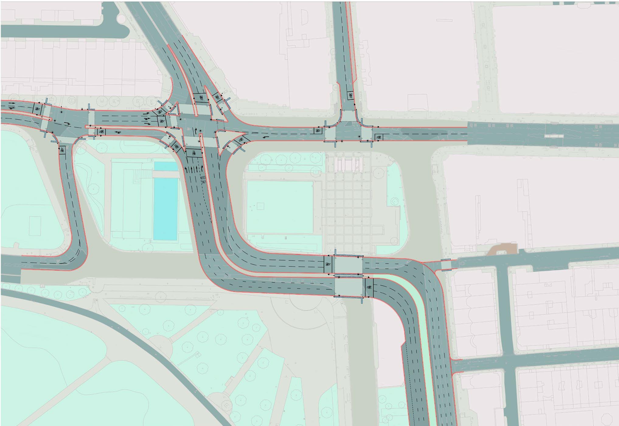
In this study a more ambitious set of traffic options have been developed that could create a transformational scheme at Marble Arch. One option tested in the study by NRP, working closely with Publica, would retain a traffic gyratory system on the west side of Marble Arch but removes the gyratory from the east side. This option (1) has the following transport benefits:
• All traffic and bus movements retained – no need for traffic to use adjacent streets
• Oxford Street is extended as a simple two-way road up to Edgware Road with significantly widened footways and improved crossings. This addresses key issues of overcrowding, severance, air pollution and safety.
• The walking and cycling connection to and from Hyde Park is simplified to a single pedestrian and cycle crossing (crossing 6 traffic lanes vs. the current 14)
• Pedestrian access to and from Marble Arch Underground station is significantly improved
• Shared cycle crossings are provided throughout with shared pedestrian and cycle spaces
• There would be a range of options for bus standing and all bus routes could be retained at Marble Arch
Option 1 may have the following drawbacks:
• The severance/use of the western island is not addressed (beyond better pedestrian connections)
A number of sub-options have been developed for Option 1 that provide alternative arrangements, which may be preferred as the scheme is developed. Sub options include:
• Provision of a segregated and separately signalled cycling route from Hyde Park to Great Cumberland Place via the western or eastern islands
• Realignment of the west side of Park Lane, at its northern end, to provide enhanced pedestrian movement into and out of Hyde Park
• Closure of North Carriage Drive
Option 1 has been selected for further development based on the initial appraisal exercise. Therefore the design option and scoring presented here reflects the more advanced status of the Option 1 design relative to some of the other subsequent options.
* Public realm scoring factored by 1/4.5 to equalise weighting with transport. See pages 80 – 81 for detailed scoring.
Marble Arch Option 2 – Realignment
EDGWARE ROAD
Option 2 investigated in this study would remove the gyratory system completely from Marble Arch. A cross-roads design is provided at the Edgware Road corner, but this requires the banning of some turning movements to operate. The turns that would be banned all have less than 100 vehicle movements per hour. The following benefits would be provided:
• Access to North Carriage Drive is maintained via a junction with Bayswater Road. However, there could be an option to close this
• The walking and cycling connection to and from Hyde Park is simplified to a single pedestrian and cycle crossing (crossing 6 traffic lanes vs. the current 14)
• Pedestrian access to and from Marble Arch Underground station is very significantly improved
• Shared cycle crossings are provided throughout with shared pedestrian and cycle spaces
• There would be a range of options for bus standing at Marble Arch
• The severance of the western island is addressed by removing the traffic carriageway on its south side, connecting this space to Hyde Park
Option 2 has the following drawbacks:
• The banning of several traffic movements at Marble Arch will mean that some traffic routes may need to use alternative adjacent streets. However, it is possible that this would be balanced by existing rat-running vehicles choosing re-divert to Marble Arch
• Some bus routes would need to be realigned as the turns required at Marble Arch would not be provided
A number of sub-options have been developed for Option 2 that provide alternative arrangements which may be preferred as the scheme is developed:
• The busy crossing over the bottom of Edgware road would be worsened from two to three crossing phases
• Provision of a segregated and separately signalled cycling route from Hyde Park to Great Cumberland Place via the western or eastern islands
• Realignment of the west side of Park Lane, at its northern end to provide enhanced pedestrian movement into and out of Hyde Park
• Bus and cycle only movements permitted through otherwise closed sections to allow all bus movements to be retained at Marble Arch
• Closure of North Carriage Drive
* Public realm scoring factored by 1/4.5 to equalise weighting with transport. See pages 80 – 81 for detailed scoring.
Option 3 – Closure of North Carriage Drive
Option 3 is related in many ways to the Option 2 investigation. This option removes the gyratory system completely from Marble Arch. A cross-roads design is provided and this arrangement retains the majority of traffic turns, with a few exceptions. As a result of retaining the majority of turns, a larger footprint junction is required at the Edgware Road corner in comparison to Option 2. The following benefits would be provided:
• Access to North Carriage Drive is maintained via a junction with Bayswater Road. However, there could be an option to close this
• The walking and cycling connection to and from Hyde Park is simplified to a single pedestrian and cycle crossing (crossing 6 traffic lanes vs. the current 14)
• Pedestrian access to and from Marble Arch Underground station is significantly improved
• Shared cycle crossings are provided throughout with shared pedestrian and cycle spaces
• There would be a range of options for bus standing at Marble Arch
• The busy crossing over Edgware Road would be improved by becoming a single phase straightover crossing
• The severance of the western island is addressed by removing the traffic carriageway on its south side
Option 3 has the following drawbacks:
• The banning of several traffic movements at Marble Arch will mean that some traffic routes may need to use alternative adjacent streets. However, it is possible that this would be balanced by existing rat-running vehicles choosing to re-divert to Marble Arch
• Some bus routes would need to be realigned as the turns required at Marble Arch would not be provided
• The junction of Edgware Road and Oxford Street would require more space than Options 1 or 2
A number of sub-options have been developed for Option 2 that provide alternative arrangements which may be preferred as the scheme is developed:
• Provision of a segregated and separately signalled cycling route from Hyde Park to Great Cumberland Place via the western or eastern islands
• Realignment of the west side of Park Lane, at its northern end, to provide enhanced pedestrian movement into and out of Hyde Park
• Closure of North Carriage Drive
* Public realm scoring factored by 1/4.5 to equalise weighting with transport. See pages 80 – 81 for detailed scoring.
Marble Arch Option 4 – Major realignment
EDGWARE ROAD
A fourth approach to road alignments has also been investigated. Option 4 removes the gyratory system completely from Marble Arch. The scheme would provide a carriageway aligned from Park Lane to Bayswater Road with a large signal-controlled T-junction at Edgware Road. Similar turning bans would be required as with Option 3. The following benefits could be provided:
• Problems of severance are generally addressed
• The square metre areas of new public realm are maximised
• The walking and cycling connection to and from Hyde Park is simplified to a single pedestrian and cycle crossing (crossing 6 traffic lanes vs. the current 14)
• Pedestrian access to and from Marble Arch Underground station is significantly improved
• Shared cycle crossings are provided throughout with shared pedestrian and cycle spaces
• There would be a range of options for bus standing at Marble Arch
• The busy crossing over Edgware Road would be improved by becoming a single phase straightover crossing
Option 4 has the following drawbacks:
• The configuration of new public realm does not necessarily align with areas of most usable value and interest
• The option relies on the closure of North Carriage Drive
• The junction itself would require a large footprint with a high number of traffic lanes
• The banning of several traffic movements at Marble Arch will mean that some traffic routes may need to use alternative adjacent streets. However, it is possible that this would be balanced by existing rat-running vehicles choosing re-divert to Marble Arch
• Some bus routes would need to be realigned as the turns required at Marble Arch would not be provided
• The option is likely to be relatively expensive due to the considerable carriageway realignment
• It would not be possible to preserve the pond area on the western island
A number of sub-options have been developed for Option 4 that provide alternative arrangements which may be preferred as the scheme is developed:
• Provision of a segregated and separately signalled cycling route from Hyde Park to Great Cumberland Place via the western or eastern islands
• Realignment of the west side of Park Lane, at its northern end, to provide enhanced pedestrian movement into and out of Hyde Park
• Closure of North Carriage Drive
* Public realm scoring factored by 1/4.5 to equalise weighting with transport. See pages 80 – 81 for detailed scoring.
Marble Arch
Option 5 – Realignment through Cumberland Gate
A further traffic layout has been explored, aiming to reconnect the western island to Marble Arch island. Option 5 removes the gyratory system completely from Marble Arch by diverting the Inner Ring Road around the current perimeter of the traffic gyratory meaning that both of the current traffic islands would become contiguous with the footway on the south side of Oxford Street. The scheme option design has been developed to preserve the existing public realm infrastructure of the western island. This means that although significant carriageway enlargement has been provided on the west side of the scheme, this has been limited to retain an appropriate area of public realm within the island area. The following benefits could be provided:
• Problems of severance are significantly addressed
• The areas of new public realm are maximised
• The walking and cycling connection to and from Hyde Park is simplified to a single pedestrian and cycle crossing (crossing 6 traffic lanes vs. the current 14)
• Pedestrian access to and from Marble Arch Underground station is significantly improved
• Shared cycle crossings are provided throughout with shared pedestrian and cycle spaces
• There could be a range of options for bus standing at Marble Arch
Option 5 has the following drawbacks:
• The option relies on the closure of North Carriage Drive (or a potential option to retain as a left-in, left-out access)
• There would be two major junctions in a staggered arrangement. This arrangement would operate with significant risk of queueing and blocking, meaning that it would need to be operated with a suitable level of resilience and contingency
• Even with the enlarged carriageway area, the proposed junction of Bayswater Road with the new Inner Ring Road alignment would operate at approximately 140% saturation based on predicted future levels of traffic demand. Therefore this option is only feasible under a scenario where traffic demand is significantly reduced
• The banning of several traffic movements at Marble Arch will mean that some traffic routes may need to use alternative adjacent streets
• Some bus routes would need to be realigned as the turns required at Marble Arch would not be provided (Oxford Street to Edgware Road and Bayswater Road to Park Lane)
• The option is likely to be relatively expensive due to the considerable carriageway realignment
It is not recommended that this option should be taken forward unless there is a feasible strategy to significantly reduce traffic demand on the Inner Ring Road without unacceptable impacts to sensitive residential and commercial areas.
* Public realm scoring factored by 1/4.5 to equalise weighting with transport. See pages 80 – 81 for detailed scoring.
Northern Park Lane options
In tandem with investigations of the options around the Marble Arch gyratory, especially the re-routing of the southbound Inner Ring Road traffic through Tyburn Way, NRP have looked into possibilities for changes to the northern end of the Park Lane dual-carriageway. There are a variety of options for Park Lane that offer different benefits at varied costs, which could be allied to as transformation at Marble Arch for maximum benefits. After analysing and scoring this study, Option 1 for the Marble Arch gyratory, coupled with Option D for Park Lane are the preferred arrangements proposed in this report.
Provide new pedestrian and cycle connection from Marble Arch to Green Street as per the Oxford Street District design proposals.
This option is considered to be a do-minimum enhancement that would provide missing pedestrian and cycling connections.
Bus only gyratory with existing Park Lane alignments.
This option introduces a small bus gyratory allowing routes to be terminated without needing to use the roads around Marble Arch to turn. This may provide potential bus journey time benefits.
Park Lane two-way on the west side with access and bus only on the east side.
This option offers the potential to tie into a future scheme which would look to minimise traffic movement on the east side of Park Lane along hotel frontages to Mayfair. This could be facilitated by providing twoway traffic operation on the west side of Park Lane.
Bus only gyratory with enhanced Park Lane alignment.
The introduction of a bus gyratory allows routes to be terminated without needing to use the roads around Marble Arch. The shift of the western side of Park Lane, at its northern end, means that a better aligned pedestrian crossing can be provided between Hyde Park and The Arch, a key aim of the proposals to improve the Marble Arch area. This may also provide potential bus journey time benefits.
Public transport
Marble Arch functions as a Public Transport Hub within the Central London Bus, Coach and Underground Rail Network. Following the introduction of the Elizabeth Line, it is expected that TfL will alter a number of bus services, in particular those that serve Oxford Street. This means that the proposed scheme in this study has been designed to work with future bus route arrangements.
Future base public transport summary
Existing public transport
Existing issues:
• Constrained footway and access into London Underground entrances and at bus stop locations creating poor environment for passengers at street level.
• Poor interchange between some services – many lanes of traffic to cross to move between bus stops, Underground rail and tourist bus stops. Access to destinations similarly poor.
• Traffic congestion – particularly on Oxford Street leads to journey time impacts for buses.
• Overcrowding at north Underground entrance due to under-utilisation of two southern entrances. Poor legibility and visually blocked.
Proposed public transport
The preferred scheme, option 1 at the Marble Arch gyratory and option D at Park Lane, is likely to have the following significant benefits for public transport passengers and operation:
• Significantly addresses constrained footways at Underground station entrances.
• Addresses constrained footways at bus stops.
• Significantly improves interchange by reducing the number of traffic lanes that need to be crossed to move between stops and station entrances. Providing pedestrian crossings on all desire lines. Improving access from stops to destinations.
• Provides increased traffic capacity for strategic roads, that will reduce traffic congestion and improve journey time reliability (subject to detailed traffic modelling analysis).
• Maintains all movements undertaken by buses and coaches and provides adequate space to accommodate stopping and standing facilities.
• Reduces congestion at north Underground entrance by improving two southern entrances. Step-free access to Underground ticket hall at Marble Arch Underground station.
Transport benefit scoring
5
* The impact on traffic capacity would mean that significant impacts to bus journey times and increased traffic congestion and reassignment to local streets would be expected unless the level of traffic demand on the Inner Ring Road and Bayswater Road was to be reduced by approximately 30%.
Public realm scoring factored by 1/4.5 to equalise weighting with transport.
Aerial photograph by Jason Hawkes
Proposal for Marble Arch
Proposal for Marble Arch
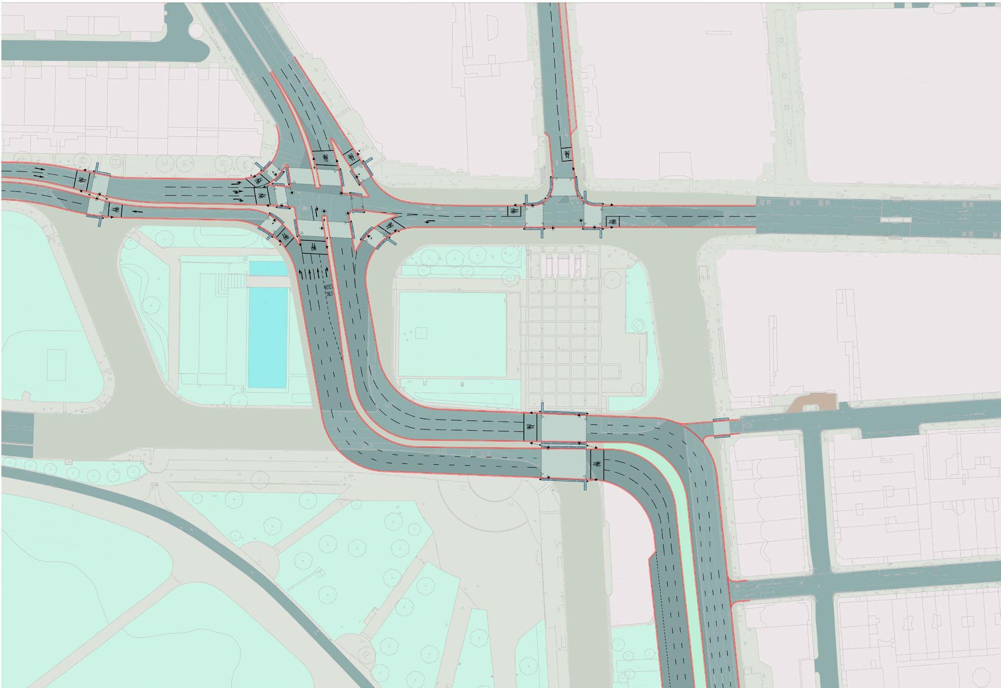
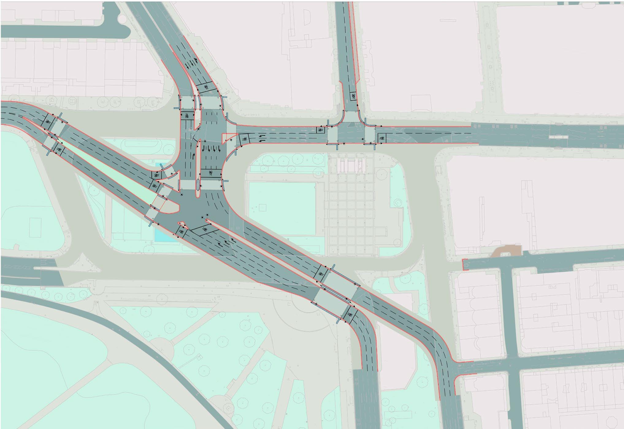
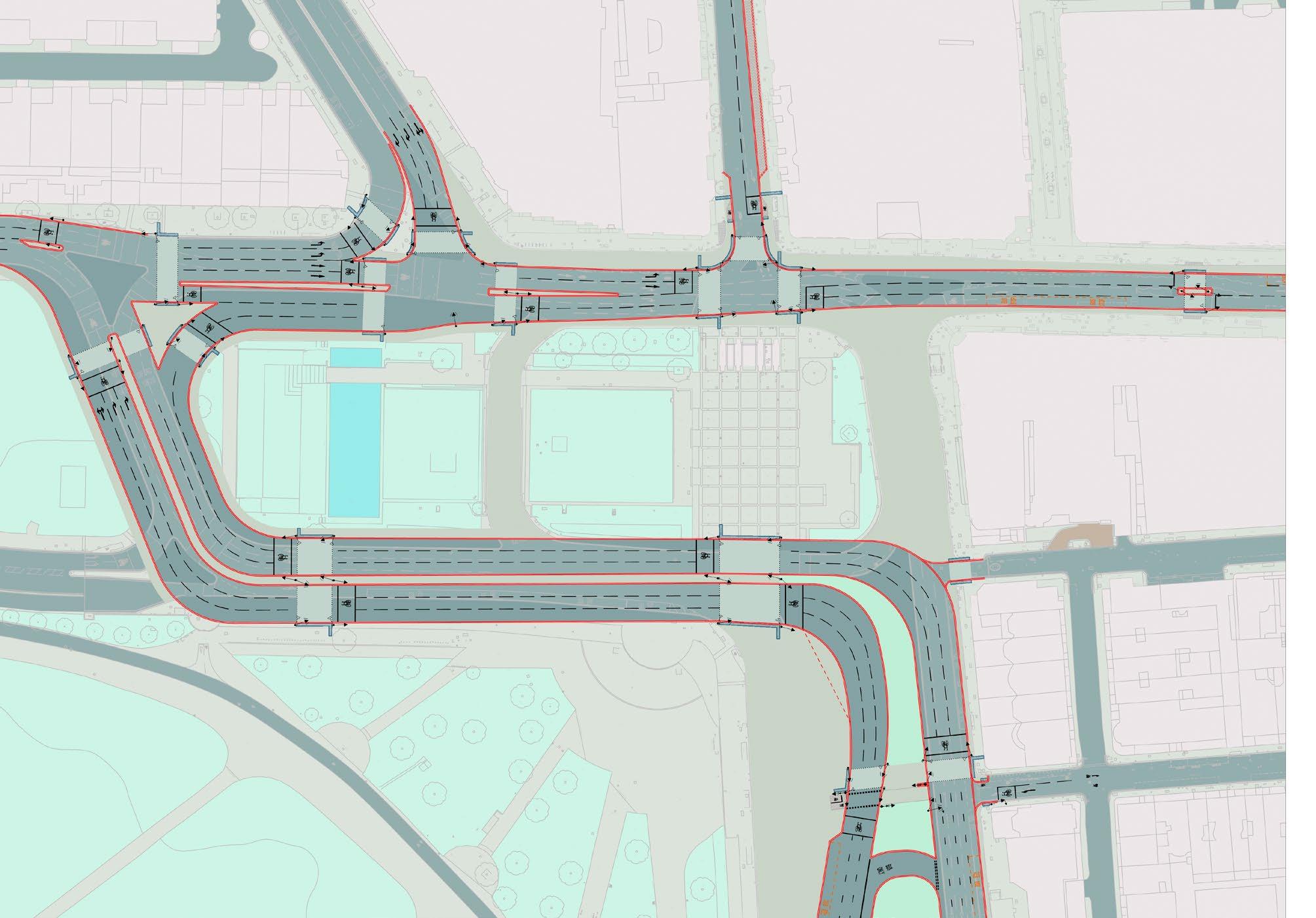
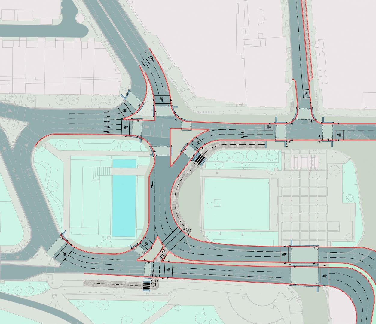
A recommended concept design proposal has been identified for the road layout at Marble Arch, based on analysis of the traffic options appraised along with the identification and mitigation of issues. The proposed project is based on traffic Option 1, with further development and refinement. This layout would allow progression of a host of ideas for the activation, greening, better connection, design and use of the spaces that would be created.
Key transport benefits of the proposed traffic layout are:
• All traffic and bus movements retained – no need for traffic to use adjacent streets.
• Oxford Street is extended as a simple two-way road up to Edgware Road, with significantly widened footways and improved crossings.
• Key issues of overcrowding, severance, air pollution and safety at the western end of Oxford Street and the junction directly in front of Marble Arch Underground station are addressed.
• The public space on the eastern side of Marble Arch is maximised, linked directly to Oxford Street and the Arch itself.
• The walking and cycling connection to and from Hyde Park is simplified to a single pedestrian and cycle crossing (crossing 6 traffic lanes vs. the current 14 lanes and 4 crossings).
• Pedestrian access to and from Marble Arch Underground station is very significantly improved at all entrances. A more even distribution between entrances is expected.
• Shared cycle crossings are provided throughout, along with shared pedestrian and cycle spaces.
• The proposed bus gyratory arrangement at the northern end of Park Lane would provide the opportunity for some routes to see improved journey times and will provide resilience for operation. There would be a range of options for bus standing and all bus routes could be retained at Marble Arch.
• The walking and cycling connection from Hyde Park to Green Street would be significantly enhanced.
• Provision of a segregated and separately signalled cycling route from Hyde Park to Great Cumberland Place via the west or east islands could be further considered.
The proposed traffic layout has the following drawbacks:
• The severance/use of the western island is not addressed (beyond better pedestrian connections).
The proposed traffic layout has been tested using LinSig traffic modelling software against a traffic flow scenario derived from TfL’s predicted 2021 traffic flows and bus proposals. This modelling assessment demonstrates that the proposed scheme would be expected to operate with similar or improved levels of traffic saturation and resilience to the current gyratory arrangement.
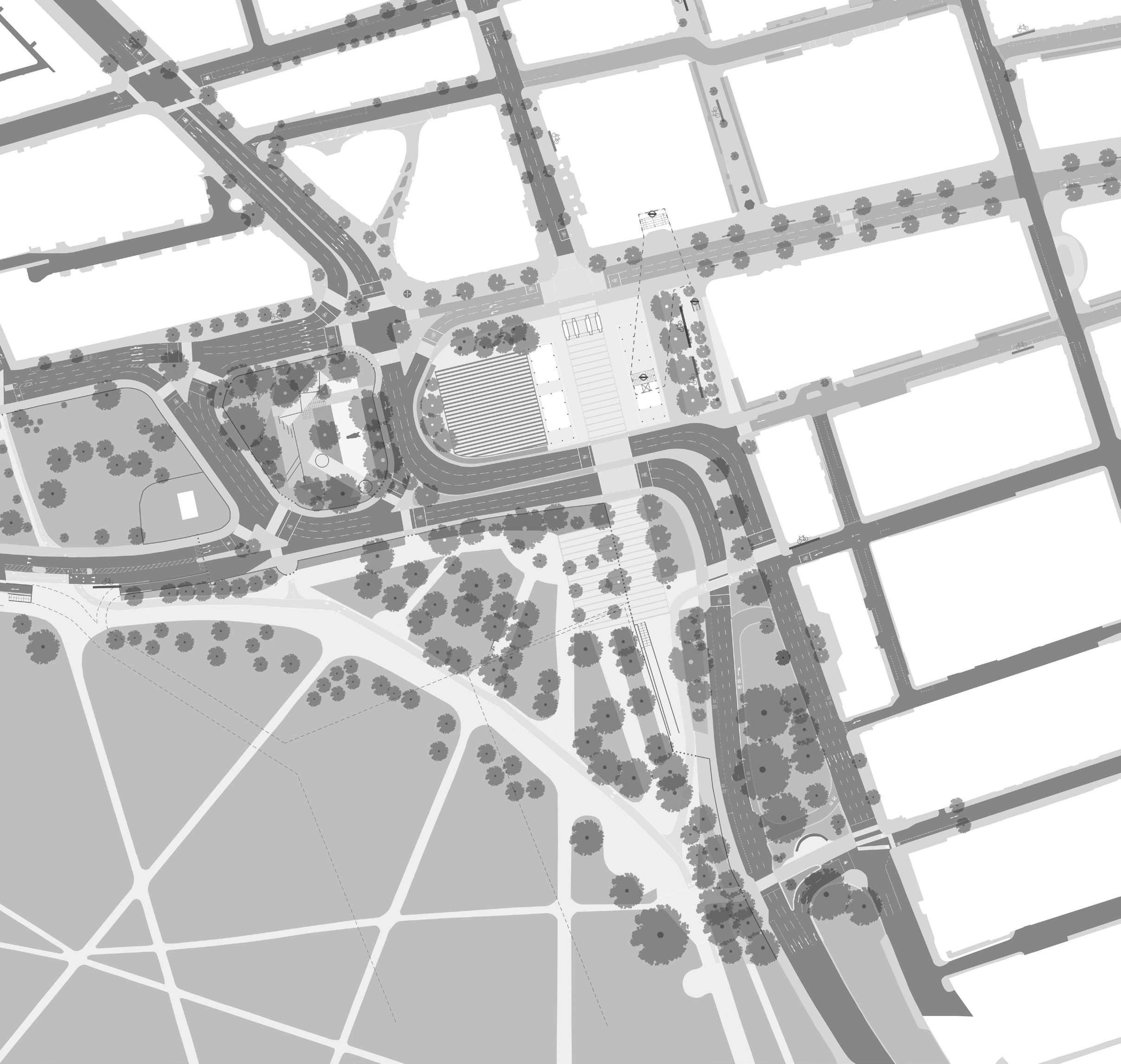
The incredible potential of the varied spaces around Marble Arch that could be unlocked by this traffic layout have been described in the chapter Public Realm Proposals, on pages 39 to 59 of this report.
Potential additional cycle infrastructure
Proposal for Marble Arch GLA principles
Relevant strategies/aims/objectives Place Strategy principles
No one to be killed in or by a London bus by 2030, and for all deaths and serious injuries from road collisions to be eliminated from London’s streets by 2041
• Significant road safety benefits by addressing the current key problem areas around Marble Arch and the western end of Oxford Street. Further enhances Oxford Street safety improvements being delivered by The City of Westminster where currently an average of 1 fatal road traffic accident is recorded per year
Walking Action Plan
Plan for inner London highlights measures that can help in Central London, by:
Arch proposal
Relevant strategies/aims/objectives Place Strategy principles Marble Arch proposal
• Significant road safety benefits expected
1 Active, inclusive and safe travel
• Scheme designed with the objective of encouraging walking and cycling, and providing improved connectivity for buses. Location currently very intimidating to move through for visually impaired or mobility impaired. The proposed scheme would radically improve this by reducing conflict with vehicles
2 Making more efficient use of the street network
3 Improving air quality and the environment
• Currently a huge amount of space is given to facilitate traffic movement. The proposed scheme would provide sufficient capacity for traffic and buses while allowing space to be repurposed as public realm greatly improving the efficiency of the use of space
• Reduced traffic volumes predicted. Strategic traffic modelling is expected to demonstrate that traffic on local roads frequented by residents and visitors would reduce resulting in improved air quality at the most critical locations. The Inner Ring Road would effectively be moved west away from the densest areas of pedestrian activity on Oxford Street and around Marble Arch Underground station
4
3
2
1
Creating attractive places to improve the experience of walking, and inspiring people to walk more
Tackling barriers to walking, including overcrowded and cluttered pavements
Facilitating interchange with public transport by improving dispersal from stations
Promoting walking as an alternative to crowded public transport and private vehicle use
• Significantly improved access to dramatically enhanced public realm space in landmark location. Ease of walking connections to Hyde Park dramatically improved
• Wider and decluttered footways at all key locations, transformed quality of pedestrian crossing provision
• Footway areas around congested access points to Marble Arch station directly improved
• Walking connections between Marble Arch station, Hyde Park, Edgware Road and Oxford Street radically improved
• Access between bus stops and points of passenger demand significantly improved
• Significantly improved conditions for walking through improvements to footway area, crossing provision, connectivity, comfort and walking environment at key landmark location
Proposal for Marble Arch
Outcomes Marble Arch outcome priorities
Increased cycling
• Bus priority measure should also be considered along Bayswater Road Mayor’s Transport
• Improved cycle provision through the Marble Arch area to provide a safe link to the planned and existing cycle network, providing for N – S and E – W cycle movements
1 Active
• Investigate increased cycle parking and cycle hire provision within the local area to encourage mode shift
Increased walking
• Safe and direct crossings that provide for pedestrian desire lines, particularly focused on the link with Hyde Park
• Improved walking environment and pedestrian comfort levels
• Urban realm improvements
2 Safe Road danger reduction and reduced collisions
• Reduced speeds with implementation of 20mph on Marble Arch and reduced speeds on Park Lane by 2024
• Investigate measures to improve cycle and pedestrian safety particularly at crossings
3 Green Air quality
• The introduction of ULEZ in 2019 should significantly improve air quality in the local area. However, other measures should be investigated to reduce PM10 and NOX pollutants in the area
Green infrastructure
• Identify opportunities to deliver street level green infrastructure including sustainable drainage systems (SuDs)
More efficient car and freight movements
4 Efficient
• Road space reallocation to support more walking, cycling and buses and reduce the dominance of motorised traffic
• Investigate measures to reduce car dependency in the local area including promotion of car clubs
Improve interchange experience
1 Connected
• Investigate and improve interchange experience. This includes improving awareness of (through improved wayfinding) and access to bus stops and Marble Arch London Underground Station
2 Accessible Accessible and affordable
• Undertake further investigation of bus stop and stand provision for buses, commuter and tourist coaches. Bus stops and stands along Tyburn Way and Cumberland Gate should be protected
3 Quality Quicker and more reliable bus journeys
• Maintain and improve bus journey times. Consideration should be given to bus priority measures along the eastern half of Marble Arch connecting Park Lane with Edgware Road. This section forms part of the central London bus grid
Proposal for Marble Arch TfL Healthy Streets principles
Healthy Streets
Accessibility for pedestrians from all walks of life • Significant footway widening and decluttering
• Creates opportunity to provide accessible Underground station access
• Vastly improved pedestrian crossings and connections from Marble Arch Underground to Hyde Park
Ease of crossing
3 Shade and shelter
• Oxford Street to Hyde Park via one single phase crossing
• Opportunities for new trees
• Proposal for new covered public space/event space 4 Places to stop
• New public realm with enhanced seating and dwelling space
5 Not too noisy
6 People choose to walk or cycle
• Public space separated from traffic of the inner ring road
• Very significant improvements for walking and cycling. New cycling connections, increased cycle parking provision 7 People feel safe
• New public space would be open and visible
• Significant road safety benefits achievable
8 There are things to see and do
9 People feel relaxed
Clean air
• New designed public realm with space for events, designed for activation and appropriate activities
• New designed public space at the end of Oxford Street providing a respite opportunity for shoppers, tourists, visitors and local residents
• Reduced traffic volumes predicted. Strategic traffic modelling is expected to demonstrate that traffic on local roads frequented by residents and visitors would reduce resulting in improved air quality at the most critical locations. The Inner Ring Road would effectively be moved west away from the densest areas of pedestrian activity on Oxford Street and around Marble Arch Underground station
TfL
Proposal for Marble Arch
Proposal for Marble Arch Key
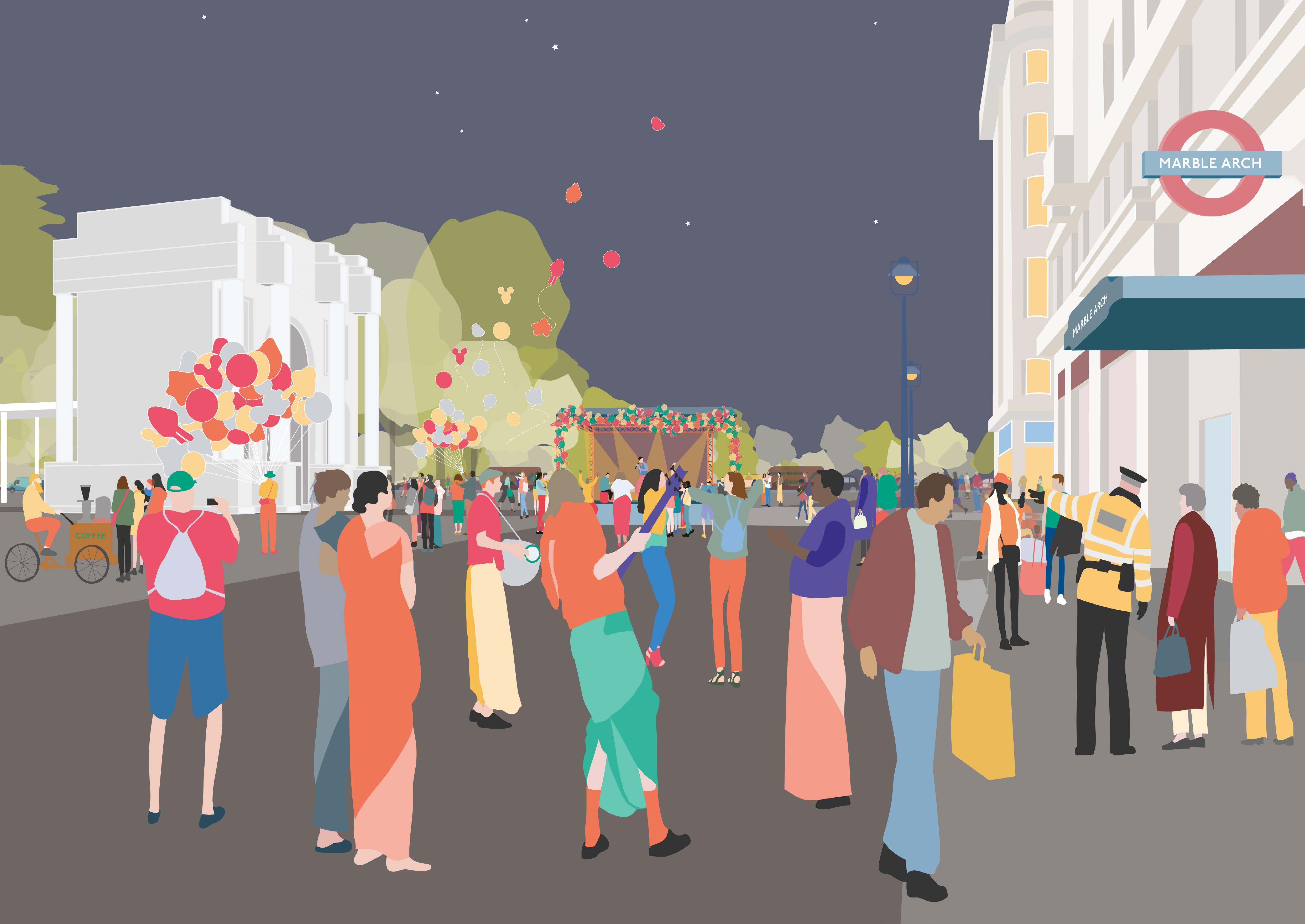
Looking west from Oxford Street, an event at Marble Arch
This report has set out an investigation and a proposal for how to improve the public realm at Marble Arch for the benefit of its immediate neighbourhood and all those who visit or pass through. By changing the road layout at Marble Arch, through a pragmatic redesign and rerouting of selected connections, clear benefits can be realised for safety, air quality, health and wellbeing, pedestrian and cycle movement, bus and Underground use – while also creating a valuable set of high quality, activated and interlinked public spaces. The holistic proposal for Marble Arch, its traffic layout and individual design ideas would unlock the potential.
This report is intended to spark further discussion and action by local and city level stakeholders. The ideas shown within this document are illustrative proposals to demonstrate spatial and programmatic possibilities. All proposals will require further sponsorship and support to come to reality. Design development, feasibility testing, approvals and engagement with a range of stakeholders will be necessary before they can be implemented.
Consensus and support needs to be progressed and championed among local stakeholders. WCC councillors and officers, landowners and key resident and business groups, WCC highways, public realm, heritage, tree officers and events management teams, Marble Arch London BID, The Royal Parks, The Portman Estate, Grosvenor, The Crown Estate, New West End Company, Mayfair Neighbourhood Forum, The Hyde Park Estate Association, The Marylebone Forum, Marylebone Association are all key to the success of improvements at Marble Arch.
The next steps are for WCC, the GLA and TfL, Royal Parks, English Heritage, Historic England and local champions to take up the opportunity to improve this landmark site, historic asset and sizeable area of open space. Further steps following this study could include:
• Design and implementation of public improvements on site, independent of traffic changes
• A full traffic modelling study to test the impact of the proposal for the area’s road network
• Improvements to the setting of the Marble Arch monument through new paving, landscaping and lighting
• Improvements to the eastern pavilion building and Underground access
• An economic impact study to assess the potential benefits of holistic improvements within the Marble Arch area and traffic changes
• Further brief definition and design development for individual ideas and changes
• Feasibility testing of incremental improvements
• Safety audits to highlight the imperative for particular interventions
• Investigation of bus routing and turn-around benefits and design implications
• Investigation of air quality benefits and design implications for the proposal
• Momentum and support from departments at TfL, the GLA, other governing bodies and statutory stakeholders is key to progressing this project, including the Mayor of London’s office, London Underground, TfL surface transport teams (buses, roads, walking and cycling), Historic England and GLA Events for London team
All design and transport planning work for this document was undertaken in 2019 and therefore reflects specific conditions at this time.
This document is printed on paper certified in accordance with the FSC® (Forest Stewardship Council®) and is recyclable and acid-free. Pureprint Ltd is FSC certified and ISO 14001 certified showing that it is committed to all round excellence and improving environmental performance is an important part of this strategy. Pureprint Ltd aims to reduce at source the effect its operations have on the environment and is committed to continual improvement, prevention of pollution and compliance with any legislation or industry standards. Pureprint Ltd is a Carbon / Neutral® Printing Company.
All drawings and photographs contained within this document are presented for information purposes. Publica retains all intellectual property (IP) rights and copyright associated with the work, as set out in Publica’s terms and conditions. Further publication or use of images will require copyright usage approval and a license for any third party images.
Contact Publica for further information. Terms and conditions are available at publica.co.uk/publica_termsandconditions.pdf