HOME PLACE
BLUM PLACE
HIRSCHFIELD PLACE
CULTURAL LANDSCAPE REPORT


JUNE 2022


HIRSCHFIELD PLACE
CULTURAL LANDSCAPE REPORT
JUNE 2022
Preservation Texas
Bassett Farms Conservancy Kosse, Texas www.bassettfarms.org
MIG, Inc. Portland, Oregon www.migcom.com
Publication Credits: Information in this report may be copied and used with the condition that credit is given to authors and other contributors. The primary authors meet the criteria set by The Secretary of the Interior’s Standards for the Treatment of Historic Properties for qualified professionals, as outlined in Appendix A of the Guide to Cultural Landscape Reports: Contents, Process and Techniques. Appropriate citations and bibliographic credits should be made for each use. Photographs and graphics may not be reproduced without the permission of the sources noted in the captions.
Acknowledgements: This project was generously supported through grants from The Still Water Foundation and the Texas Historical Commission.
The authors would like to thank Julie McGilvray, a Historical Landscape Architect with the National Park Service, who was instrumental in getting this project initiated, and the Preservation Texas Bassett Farms Conservancy Committee members (noted below) who provided valuable guidance.
In addition, the authors are grateful for input received during an October 2021 workshop from Tony Crosby, former chair of the Bassett Farms Committee and former NPS preservation architect; Dixie Hoover, Bassett Farms Committee; Kate Johnson, Chair, Bassett Farms Committee; Laura Lehmons, Kosse Heritage Society; Sarah McReynolds, Site Manager, Old Fort Parker; Karen Partin, President, Kosse Heritage Society; Tim Partin, Rancher, Bassett Farms ranching tenant; Alysha Richardson, Site Manager, Sam Bell Maxey House; Andrea Roberts, Professor, Texas A&M and founder of Texas Freedom Colony project; Ron Siebler, Preservation Texas board member; Mary Strickland, Bassett Farms Committee; Evan Thompson, Preservation Texas Executive Director; Brooks Valls, Mayor of Kosse, Texas; and Linda Valls, Kosse resident.
Cover: Looking southeast at the recently restored Bassett House at Home Place (Preservation Texas 2022)
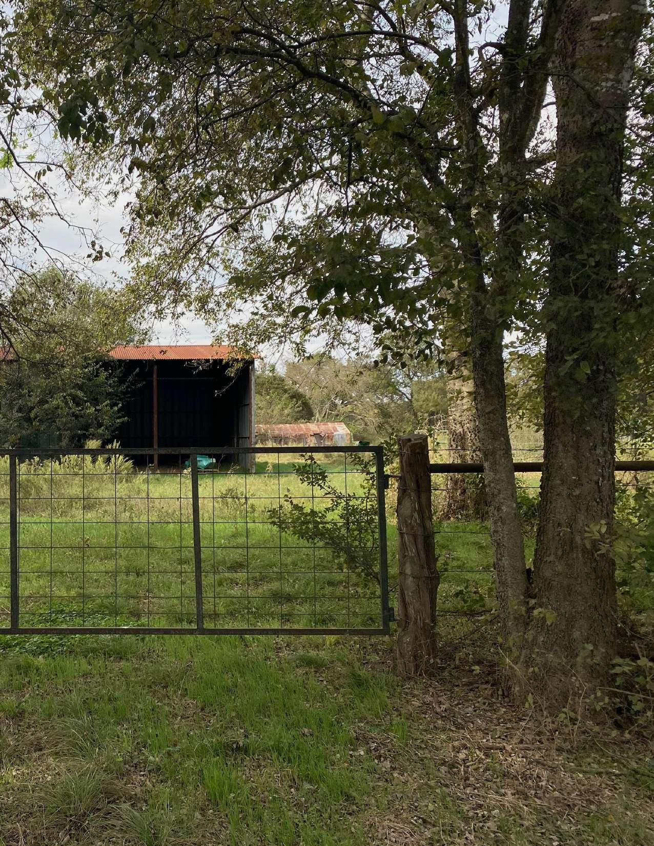 Metal Pole Barn with the Wood Pole Barn in the background and a gate, fence, and remnant access road in the foreground at Home Place (MIG 2021)
SETTING AND CONTEXT
CULTURAL LANDSCAPE REPORT PURPOSE AND METHODS
Bassett Farms Conservancy, (“Bassett Farms”) includes 2,349 acres in Limestone and Falls Counties, Texas, divided into four discontiguous parcels of 1,768, 416, 149.5, and 13.6 acres. Bassett Farms is located three miles northwest of Kosse, a small town (population 450) that was laid out in 1870 when it became the temporary terminus of the newly constructed Houston and Texas Central Railroad. The focus of this Cultural Landscape Report (CLR) is the landscape associated with the Home Place, Blum Place, and Hirshfeld Farm, and their associated pastures that are located within Parcel 1. Other tracts and parcels that are owned by the Bassett Farms Conservancy will be addressed in future planning reports.
Bassett Farms was assembled by the Bassett family over a forty-five-year period between 1871 and 1915 by both Henry Bassett (18171888), who made the initial purchase of the 160-acre Home Place in 1871, and his widow, Hattie Ford (Pope) Bassett (1851-1936), who purchased the last original tract in 1915 from the heirs of Martha Green, widow of AfricanAmerican Union veteran Robert Green. In 2012, following the death of Henry Bassett’s last surviving granddaughter in 2010, the property was bequeathed to Preservation Texas for longterm preservation, conservation, and educational purposes.
As an intact cultural landscape in this region of Texas, Bassett Farms presents the opportunity to share its history with visitors from near and far, so that they may understand and appreciate the successes, trials, and tribulations of the Bassett family over three generations, from 1871, through the 1970s, as well as that of
the Bassett family’s tenant farmers, and the residents of the Hopewell Freedom Colony. This landscape is known as Bassett Farms, but it is more complex than the collection of buildings that remain on site. Like all rural agricultural cultural landscapes, Bassett Farms was dynamic throughout its history. As needs arose, and economies evolved, the house at Home Place was built and modified, as were the garage, barn, and outbuildings. Some acreage was reserved for cattle grazing, while other areas were planted, primarily in cotton. As a rural agricultural landscape, it was especially vulnerable to the ebb and flow of local, regional, and national economic trends, as well as the predictability, and unpredictability, of seasonal weather patterns, drought, and temperature fluctuations.
During the same period, Hopewell Freedom Colony was the home for emancipated slaves after the Civil War, many of whom worked at Bassett Farm. Hopewell, like other Freedom Colonies across the south and areas of the mid-west, also evolved over time, as there were changing needs for families just freed from the yoke of slavery yet burdened with second class citizenship. Notably, children from Hopewell and the Bassett Home Place often played together, while their parents worked side by side in the fields or fulfilling the domestic needs in the Bassett House. This was a demanding life and recognizing that fact helps us all to comprehend what it took to secure, settle, and maintain this landscape, regardless of one’s station in life. Today, Bassett Farm and Hopewell Freedom Colony are both under the ownership – and protection – of Preservation Texas, the statewide non-profit organization dedicated to preserving these buildings and landscapes, and telling their stories together, as they were intertwined communities.
Bassett Farms is now prepared for a major cultural landscape preservation and rehabilitation planning effort. Excellent work has been underway for some time on building documentation, analysis and restoration, and new information about the structures is regularly revealed through investigation, documentation, and subsequent repairs. The Bassett Farms Cultural Landscape Report (CLR) provides the guidance and direction for the next phase of this major preservation effort.
The Bassett Farms Cultural Landscape Report provides treatment recommendations for the cultural landscape resources to address changes in the landscape since the period of significance, improve the overall condition of the cultural landscape, and recommend treatments in coordination with the goals of the Conservancy and Preservation Texas. The treatment recommendations are designed to support Conservancy objectives, provide a treatment framework to assure the long-term stewardship of the cultural landscape, and minimize the loss of critical character defining landscape features by providing sound, systematic management guidance consistent with Preservation Texas objectives.
The Bassett Farms Cultural Landscape Report:
• Broadens the understanding of extant landscape characteristics and features and their relationship to the period of significance (1871-1970s);
• Ensures that planning and design efforts reflect state and national guidelines, including The Secretary of the Interior’s Standards for the Treatment of Historic Properties with Guidelines for the Treatment of Cultural Landscapes; and
• Develops a series of plans and graphic images depicting the landscape as it developed over time, with a focus on the historic period, that will serve programmatic, planning and design efforts and enhance the Conservancy’s interpretation and educational aspirations and materials into the future.
The CLR is organized in three sections.
• Section One of the Cultural Landscape Report includes a comprehensive site history.
• Section Two includes documentation of existing conditions, and a summary of analysis and evaluation of cultural landscape features.
• Section Three provides treatment recommendations for preservation and rehabilitation of significant resources in coordination with Preservation Texas objectives, potential operations, landscape maintenance needs, and a range of site access opportunities. It also considers potential uses for public access to Bassett Farms, including, but not limited to, harvest fairs, summer educational programs, concerts, and other events.
The CLR cultural landscape documentation, analysis and treatment recommendations are based on well-established standards of the National Park Service. These standards include thirteen cultural landscape characteristics and their associated features, and the ways in which they interact, with the intent of gaining and providing a comprehensive understanding of the cultural landscape as it is today, from its largest characteristic (overall spatial organization) to its most intimate features (small scale features.)
The CLR also engages established knowledge about natural systems, such as topography, soils,
native and invasive plant species, wildlife, and hydrological systems. Including information about the natural systems and features analysis is essential to gaining a comprehensive understanding of how and why the cultural landscape developed as it did, as is evident in the historical description, below.
Of the thirteen cultural landscape characteristics established by the NPS, nine are included in the CLR to deepen our understanding of this place. They are:
• natural systems: processes and features in nature influencing historical development or use
• spatial organization: the historical, threedimensional arrangements of physical form
• land use: historical activities that influenced development or modification
• buildings and structures: historical constructed forms and edifices
• views and vistas: historical range of vision, both broad and discrete
• vegetation: patterns of human-influence plants, both native and introduced.
• circulation: historical systems for human movement
• constructed water features: historical constructed form for water retention and conveyance
• small scale features: discrete historical elements that provide detail and diversity
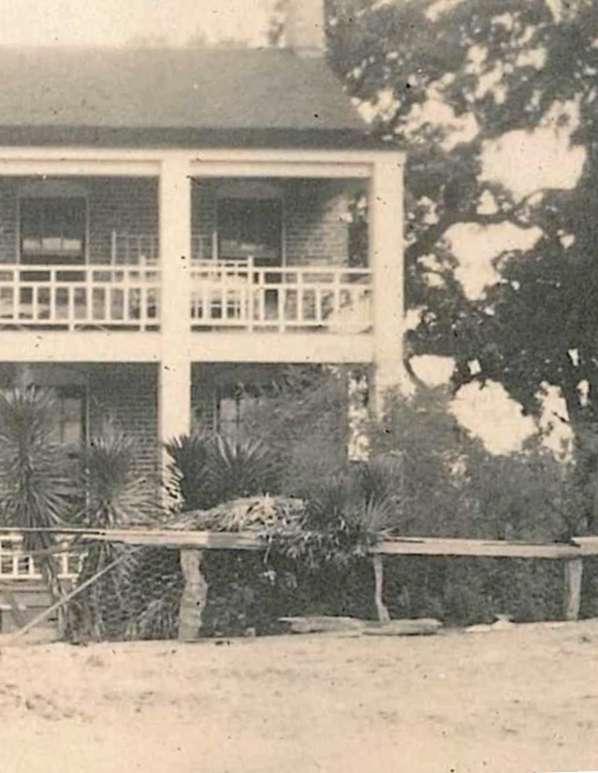 Portion of circa 1916 photo of the Bassett House and ornamental vegetation that flanked its eastern side (Preservation Texas archives)
OVERVIEW
HOME PLACE
BLUM PLACE
HIRSCHFIELD PLACE


This Bassett Farms Site History has been made possible by a grant from The Still Water Foundation. Preservation Texas is grateful for the Foundation's continuing support for historic preservation in Texas.
As Preservation Texas undertook detailed planning for Bassett Farms in 2012, which began with a study of the historic Bassett House and its outbuildings, it was still searching for an unknown number of underfed Hereford cattle in the mesquite thickets along Sulphur Creek. Consultants with expertise in land conservation and ranch management were called in for guidance as the organization began to adjust to its new role as the owner of a large, historic Central Texas ranch. Early on, the board recognized the enormous educational and environmental value of the land that had made it possible for the Bassetts to develop and sustain a 2,400-acre property for three generations. The need to balance historic and natural values were underscored by guiding principles for stewardship proposed in the Fall of 2012:
● All activities and practices are designed to represent or model an integrated approach to land and water, historical, cultural, and archaeological stewardship;
● Agriculture, conservation, preservation, and restoration are in balance. Each is defined in its own system and then integrated with the others to bring about a holistic outcome;
● All practices will have a focus of integrating the community and educating the generations;
● Anticipate and plan for emerging issues; and
● Those who came before are honored through the standards upheld today.
While Preservation Texas worked diligently to become familiar with the property's historic resources, archives, and collections, these guiding principles were kept in mind as it took a conservative "do no harm" approach to the landscape. Input from the Dixon Water Foundation about the use of cattle to maintain and sustain grasses and forbs through intensive rotational grazing and the availability of resources from the Texas Parks and Wildlife Department's private lands program to restore native prairies provided the organization with sustainable models for land management. Yet as important as these natural resource-focused programs are, they seemed disconnected from Preservation Texas's traditional emphasis on the preservation of historic buildings by credentialed architects.
It was through a collaboration that began in 2017 with the National Park Service's Julie McGilvray to raise awareness of the remarkable, endangered mid-century modern house, Ship on the Desert, at Guadalupe Mountains National Park, that Preservation Texas was introduced to the idea of cultural landscapes as a management tool for large-scale land areas. The application of a cultural landscape framework to Bassett Farms
through which to integrate historic and natural resource management seemed to offer the preservation-oriented approach Preservation Texas had been looking for. The board of directors quickly embraced the language of cultural landscapes that could integrate and balance the sometimes competing ideas of historic preservation, natural resource conservation, public interpretation, agricultural management, and sustainable development.
With this new focus on understanding Bassett Farms as a cultural landscape, funding was secured from the Texas Historical Commission and the Still Water Foundation to produce this site history in support of a cultural landscape report to guide the organization in its stewardship of this complex site.
Evan R. Thompson, Executive Director San Marcos,Texas
August 2021
1.1 Bassett family and friends pose on a wooden gate along the Kosse-Marlin Road at Bassett Farms, circa 1920.
1.2 An aerial satellite map of the four discontiguous parcels of nearly 2,400 acres in two counties that comprise Bassett Farms, 2013.
1.3 A group of children gathered in front of the Bassett House, c. 1920.
1.4 The c. 1950 wooden pole barn on the Bassett Home Place in July 1992.
1.5 Map of the post oak savannah ecoregion.
1.6 Map of the Sulphur Creek watershed.
1.7 Map of wetlands and surface water at Bassett Farms.
1.8 Rural Falls County, c. 1930.
1.9 Reconstruction of a typical beehive-shaped hut at Caddo Mounds State Historic Site.
1.10 "Mapa Original de Texas por El Ciduadano Estevan F. Austin," 1829.
1.11 Map of the Camino Real.
1.12 Map of the sparsely settled northeastern New Spain in the late 18th century.
1.13 Map of Texas in 1835.
1.14 "Map of Texas with Parts of Adjoining States," 1835.
1.15 Sarah Pillow League, surveyed in 1835, with the area that later became Bassett Farms to the north and east.
1.16 Fort Parker, reconstructed in 1936 and again in the 1960s, on the site of the original Fort.
1.17 Map of Robertson's Colony made at Franklin, Texas in June and July 1839.
1.18 Map of Texas by William Bollaert, c. 1840.
1.19 Map of Texas by Arrowsmith, 1841.
1.20 "Corrected Plot of the Western Part of Limestone County, Texas," 1847.
1.21 "Pressler's Map of the State of Texas," 1857.
1.22 Asher & Adams Map of Texas, 1871.
1.23 A typical newspaper advertisement for the Houston and Central Railroad appeared in Galveston on November 26, 1870.
1.24 Logan's Railway Directory, 1873.
1.25 An illustration from Washburn & Moen Manufacturing Company's 1876 promotional booklet, Barb Fence: Its Utility, Efficiency and Economy.
1.26 Map of cotton production by county in Texas in 1909.
1.27 The largest of the Home Place stock tanks was constructed before 1939.
Bassett Farms Conservancy (“Bassett Farms”) consists of 2,349 acres in Limestone and Falls Counties, Texas.1 The property is divided into four discontiguous parcels of 1,768, 416, 149.5, and 13.6 acres. Bassett Farms was assembled by the Bassett family over a forty-five year period between 1871 and 1915 by Henry Bassett (18171888), who made the initial purchase of the 160-acre Home Place in 1871, and his widow Hattie Ford (Pope) Bassett (1851-1936) who purchased the final tract in 1915 from the heirs of Martha Green, widow of AfricanAmerican Union veteran Robert Green. In 2012, following the death of Henry Bassett's last surviving granddaughter in 2010, the property was bequeathed to Preservation Texas for long-term preservation, conservation, and educational purposes.
Bassett Farms is located three miles northwest of Kosse, a small town (population 450) that was laid out in 1870 and became the temporary terminus of the under-construction Houston and Texas Central Railroad. This new
1 Bassett Farms is bisected by the Falls and Limestone County line. From 1837 to 1846, the entire property was located in Robertson County. In 1846, the creation of Limestone County included all of Bassett Farms. Falls County was created in 1850, with the county line being drawn through the middle of Bassett Farms. The county boundaries have not changed since that time.

railroad would connect Houston to Dallas, opening up a large area of inland Texas to agricultural and commercial development by providing direct access for crops and livestock to Texas's port cities on the Gulf of Mexico. Connecticut-born Henry Bassett was one of thousands of new settlers populating the Texas frontier during Reconstruction, but unlike most, came with the capital to invest in real estate and otherwise "speculate and make the most money."2 The land that became Bassett Farms would be used to grow cotton, graze cattle, and explore for oil and gas. The wealth the family gained through its stewardship enabled the third (and last) generation of Bassetts to attend private Dallas schools in the 1920s, become debutantes in the 1930s, and marry doctors. At the heart of the family's identity, however, was Bassett Farms and the memories it held of three generations of Bassetts living in the Bassett House in the early 1900s.
In the 1960s, recognizing that the family line would come to an end with the childless third generation, the Bassetts began discussing the long-term preservation of the property as an ideal place to tell the story of early Texas farm and ranch life. Investments were made to "improve" the house, and over the next four decades, the Dallas granddaughters would steward the property from afar, seeking to develop its resources to reinvest in the maintenance and operation of the farm. However, over time, as the fields became overgrazed, they became increasingly thick with mesquite, honey locusts, and other species that transformed the landscape into something of a wilderness. And as the Bassetts aged, so too did the farm's buildings, and where once there was a thriving community populated with dozens of tenant farmers and families dependent on the Bassetts and their land for their meager livelihood, the Bassett House stood empty.
Mrs. Willie Ford (Bassett) Sparkman, the last of the Bassetts, nurtured ideas of a house museum paradoxically filled with personal collections of china and silver accumulated during her long life in Dallas. Her husband, Dr. Robert Sparkman, a surgeon, bibliophile, and friend of many of the leading Texas cultural figures of the mid20th century, cast doubt on any such enterprise. He summarized the challenges of Bassett Farms in a short list:3
● Unfavorable location to attract visitors
● Security
● Unreliable electrical supply
● Unimproved roads
● Lack of appeal for responsible employees - boredom
● Theft and vandalism
● Home for caretaker
● Administration - trustees? ownership?
The Sparkmans debated their options but Mrs. Sparkman's vision of preserving Bassett Farms to memorialize a way of life that had been otherwise lost prevailed in her bequest of the property to Preservation Texas.
Fortunately, the family's foresight to preserve family papers and photographs makes it possible to begin to reconstruct the complex story of Bassett Farms. While the Bassett family and their triumphs, trials, and tragedies anchor this story, the forgotten history of the Hopewell Freedom Colony has re-emerged through a study of the history of the Bassett property. The Bassett story is now inextricably linked to the formerly enslaved men and women and their families who worked as neighbors, tenants, and employees of the Bassetts for a century. As Mrs. Sparkman remembered decades later:
At the turn of the century, the Bassetts had many farmhands, and in fact, housed as many as forty families on the property. Annual celebrations such as Juneteenth were great festivities with barbecues, baseball games, and preaching. At Christmas, the family gave gifts to everyone housed on the farm, and decorated the main house with trees in every room. Birthdays at the Bassett home were special occasions with all the children in town invited for games, cake, and ice cream … one child visiting relatives in town was invited to the party. She had no money for a gift, but brought a box with fresh, juicy plums that were enjoyed by all.4
The history of Bassett Farms reveals at its core that life at Bassett Farms was a life lived outdoors. There are no family photographs taken indoors. Rather, the evidence reveals that nearly 150 years of work, recreation, and memory were and remain outdoors and inseparable from the land. Preservation Texas's vision for the property has evolved from Mrs. Sparkman's original idea of a house museum to take a wider view of the site's layers of

diversity, complexity, and change. This written narrative provides an important documentary foundation for understanding Bassett Farms and the unwritten legacy of its people that can be traced in the cultural landscape they left behind.

Bassett Farms is located at the western edge of the post oak savannah ecoregion where it meets the rich soils of the blackland prairie.5 The post oak savannah ecoregion features irregular plains that were originally covered in part by denser vegetation “in contrast to the more open prairie-type regions to the north, south, and west, and the pine forests to the east.”6 As at Bassett Farms, the modern land cover in this ecoregion “is a mix of post oak woods, improved pasture, and rangeland, with some invasive mesquite… A thick understory of yaupon and eastern red cedar occurs in some parts…”7 Forested areas include blackjack oak and black hickory with an understory that includes American beautyberry, all of which can be found at Bassett Farms.
Bassett Farms lies a few miles east of the Blue Ridge region of eastern Falls County. This area was settled in the 1840s primarily by families from Tennessee. The Blue Ridge is an elevation that rises 75 to 100 feet above Big Creek to its west and then descends gently eastward toward the Little Brazos River. Bassett Farms is located in the watershed of the Little Brazos and the property is more-or-less bisected by Sulphur Creek, which flows from northeast to southwest across the property before emptying into the Little Brazos. The Little Brazos forms a portion of the western boundary of the farm. Early deeds refer to most of the parcels that comprise Bassett Farms as being on the "headwaters of the Little Brazos," a seasonal stream that rises in southwestern Limestone County,
5 Historically, the post oak savannah ecoregion consisted of native bunch grasses, forbs, and scattered groupings of trees, principally post oaks, with forested riparian areas along creeks and rivers. Natural and man-induced wildfire coupled with bison grazing were essential elements in maintaining this ecosystem.

6 Ecoregions of Texas, 2007, p. 66-68. See https://texashistory.unt.edu/ark:/67531/metapth640838
7 Ecoregions of Texas, 2007, p. 66-68. See https://texashistory.unt.edu/ark:/67531/metapth640838
flowing parallel to the Brazos River through Falls and Robertson counties until it reaches the Brazos in Brazos County.
Riparian areas along the Little Brazos and Sulphur Creek and its tributaries have long been recognized for their timber and game resources. However, the Little Brazos and Sulphur Creek are typical intermittent Central Texas streams that depend on the area's average 38 inches of annual rainfall for their flow.8 Sometimes this rainfall comes in dramatic and unexpected torrents. While loss of life and structures through catastrophic flood events have not been recorded at Bassett Farms, dramatic weather events have been documented in the Kosse area as having an impact on its people, livestock, and crops impacts that are felt in the region today. The impact to Bassett Farms is on streambank erosion and the washing out of stream crossings.
As early as 1840, the Little Brazos was described as a "small, sluggish stream"9 and in 1860 it was "dry as a bone, except the inexhaustible holes."10 Extreme spring rainfall in May 1866 flooded the river: "the Little Brazos was a mile and a half wide in some places, and most of the streams had swollen till they were difficult to cross, and in some places, were impassable."11 It was because of torrential rains during a 48-hour period in April 1885 that the

"Little Brazos … together with innumerable smaller streams … have all risen rapidly and are overflowing."12 One of the worst floods in the Kosse area occurred in early July 1899:
Never in the history of this county has as much rain fallen as it has for the past week. It rained for seventy-two hours, with but few intermissions of ten minutes each. The crops on the lowlands and bottoms are from three to ten feet underwater, and have remained so since Wednesday last. They are entirely ruined. All the bridges throughout the county are gone. The roads are impassable. Several families had to be rescued from their homes to prevent their drowning. Numbers of horses, cattle, and hogs were drowned. No trains since last Wednesday. Railroad bridges wrecked and roadbed washed up. No telegraph communication. Fully three feet of water has fallen.13
While sudden, intense rainfall could be damaging to crops and infrastructure, heavy rainfall was generally welcomed when it tempered drought and provided needed water for crops and cattle. In April 1904, a "heavy rain fell throughout this [Kosse] section last night. All water courses, stock tanks, and cisterns are full. It is very beneficial to all growing crops…"14 Similarly, heavy rainfall in January 1939 was welcomed in Kosse because it "provided sufficient stock water, also preventing small grain from drying."15
Less frequent, but sometimes more destructive, were the effects of hurricanes and tornadoes, particularly in the spring. On May 2, 1871, what was termed a 'hurricane' "passed through a portion of the country near the northern terminus of the Central Railroad [Kosse]... Farm houses were blown down, and several frail dwellings and also the shed which served for a railroad depot in Kosse, were prostrated."16 On May 11, 1930, "a terrific wind and rain storm of cyclonic proportions, struck here [Kosse] about 8:00 [p.m.]... coming from the southwest… Barns, garages, outhouses, brick flues, were reported blown down…"17 On May 19, 1955, a tornado touched down and damaged the farm of M. A. Gunter, three miles northwest of Kosse, with a funnel cloud that was likely visible from Bassett Farms.18
Conversely, long periods of drought could have devastating impacts. As early as 1831, settlers recorded a severe drought in the Brazos Valley of Central Texas.19 In 1871, despite the May "hurricane," as the hot summer dragged on the Kosse area was "suffering for rain. In all Central Texas the cry is for water. At Bryan, Calvert, Bremond, Kosse, Groesbeck, Fairfield, and Corsicana, cisterns are a played out institution. Luckily for us, our springs hold good."20 Invariably, droughts were broken with torrential rains, as was the case on August 18, 1933 when a two
12 "Weather," Times-Picayune (New Orleans), April 24, 1885, page 8.
13 "Kosse," Bryan Eagle, July 6, 1899, page 11.
14 "Kosse, Limestone County, Texas," Houston Post, April 23, 1904, page 7.
15 "Conditions of Farms at Kosse Improve," Mexia Weekly Herald, January 13, 1939, page 5.
16 "Storm - Destruction of Property," Houston Daily Union, May 4, 1871.
17 Mexia Weekly Herald, May 16, 1930, page 7.
18 Waco Tribune, May 20, 1955, page 1.
19 Baker. A History of Robertson County, Texas, page 52.
20 Austin-American Statesman, August 5, 1871, page 1.
month drought in Kosse was broken "with a rainfall of 3.63 inches, accompanied with torrents of rain and damaging winds in some sections."21
Natural springs were much more abundant in the past and a critical source of water. Two historical springs are documented at Bassett Farms: Henry Bassett's spring, almost certainly at the site of his brick well on the Bassett Home Place, and the "Sulphur Spring" that was located on a 10-acre tract of the Hirshfield Farm acquired by Jay Bassett in 1897 and later transferred to his mother and brother in 1903. Henry Bassett referred to his farm as "Sulphur Spring Plantation," sometimes shortened to just "Sulphur Spring." Associated wetland areas adjacent to springs, seeps, stock tanks, and creeks are present as well. They perform important functions for "nutrient cycling, flood flow alteration, sediment stabilization, and providing plant and animal habitat." The value of these wetlands were not appreciated in the past when such areas were seen instead as obstacles to productive farming and grazing uses.
The area around Kosse is generally noted for its "temperate and healthful climate characterized by long summers … tempered, however, by southern breezes which blow most of the time. Winters are "short with periodic cold waves lasting a few days… in some winters severe sudden north winds called 'northers' are accompanied by freezing weather during January and February."22 Settlers long remembered a particularly severe winter in 1841-42, when

the Brazos River's flooded bottomlands froze.23 Otherwise, a typical year would see the last frost on March 9th, with the first frost on November 20th, for a frost-free season of 256 days.24
The corresponding architectural responses to climate are clearly expressed at Bassett Farms, particularly at the Bassett Home Place. The Bassett House is built on a slightly elevated position near, but not too near, the Bassett Branch of Sulphur Creek that supplied the family with water. A one-story porch, later replaced by a screened, two-story porch, provided summer shade and a place to sleep. Oriented to the south, the house was positioned to capture prevailing breezes, and large trees grew up on its west side to help keep the brick house cool. These basic principles of location, form, and orientation being driven by topography and climate were typical of rural farmsteads in the region, including the tenant houses at Bassett Farms.
While structures can offer shelter and protection for people, livestock, and material goods, they afford no respite for crops in the field. Of particular note was the grasshopper invasion of 1877. In September, "the sky was again darkened for two or three days," said R. A. McAllister, who lived just north of the Blue Ridge community of Stranger in the community of Odds. "They were in great droves and destroyed the grain and damaged the bark of the trees, they left their eggs and the next spring they hatched out and the gardens were ruined from them. When they grew wings, they left."25

The long history of human settlement in Central Texas has been documented at the Gault Site, eighty miles southwest of Bassett Farms, dating back 13,000 years.26 Closer to Bassett Farms, recent archaeological reports from Limestone County note that few excavations have been conducted in the region documenting Pre-Late Archaic people (before 2000 B.C.). A regional study of private collections and excavated sites in 2011 documented Clovis, Folsom, and Midland artifacts in Limestone County, generally found in low areas in the floodplains of the major streams. During the Late Archaic and Woodland period (2000 B.C. to 800 A.D.), excavations have revealed base camps in riverine settings with subsistence resource processing and extraction sites in the uplands. Settlement patterns in the region changed during the Late Prehistoric period (800 A.D. to 1650 A.D.) with increasingly sedentary behavior.27
In more recent history, the region was populated by Wichita Indians who moved southward around 1700 to inhabit the area between the Brazos and Trinity Rivers. Subtribes included the Waco, Tehuacana, and Kichai. The Wichita survived on buffalo meat and cultivated vegetables (maize, squash, melons, beans, peas, and pumpkins) while also gathering fruits, nuts, berries, and seeds. The Wichita lived in hide tipis when out on hunts but in beehive-shaped structures made of grass in more permanent villages. During the 18th century, Tonkawa Indians were also reported in the region, north of the Camino Real between the Colorado and Trinity Rivers.28
27 National Register of Historic Places Eligibility Testing of Sites 41LT172 and 41LT354 in Luminant's Kosse Mine, Limestone, Texas, Atkins North America, 2012, pages 6-7.


Texas was a sparsely settled northern frontier province of New Spain where European settlement was limited to short-lived efforts to establish missions and presidios. Transportation routes between Mexico and Louisiana consisted of a network of trails known as the Camino Real de los Tejas ("Camino Real"). Cutting across Texas from southwest to northeast in 1795, its crossings of the Brazos and Trinity Rivers became important landmarks for travelers and settlers well into the 19th century. Importantly, the Camino Real facilitated the movement of people and goods through the region, while serving as a boundary for colonization and political subdivisions.29 Although the road was rough and routes shifted based on changing weather conditions, during all periods, the Spanish, Mexican, and Texan governments regulated the Camino Real and other roads and related river crossings; the Republic of Texas required each land district to provide road maintenance and some counties used prisoners and enslaved men.30
29 It has been noted that "the development of secondary, non-governmental road networks" have "received little attention from researchers" and "were used as vital connections" between towns, ranches, and markets. A Texas Legacy, page 37.
30 A Texas Legacy, page 38
The Camino Real was influenced by the environment. The route stayed south of the post oak savannah region in which Bassett Farms is located, as the post oak savannah was “a natural barrier that delayed early travelers on their way eastward.”31 The post oak savannah region to the north of the Camino Real was a principal hunting ground for indigenous populations.32 Descriptions of the region in the late 17th and 18th century can be summarized as follows: apart from the major rivers (Brazos and Trinity), the area was interlaced with running streams that divided open woodlands from open, level plains with oaks, cottonwoods, hackberries, sycamores, pecans, and grapevines. Explorers traveling just south of Bassett Farms in what is now Robertson County noted the presence of Spanish cattle, bison, alligator, and puma, with nuisance fleas and ticks. Densely wooded areas included thorny trees that were likely mesquites and honey locusts.33
The earliest attempt at settlement in this frontier area was made in 1774 near the crossing of the Camino Real on the west bank of the Trinity River, about 65 miles southeast of Bassett Farms. It was known as Nuestra Señora del Pilar de Bucareli ("Bucareli") and it had a typical Spanish plaza, church, guardhouse, twenty residences of hewn wood, and numerous huts. The short-lived settlement failed as a result of an epidemic in 1777 and Comanche raids in 1778, and its settlers retreated to the east to Nacogdoches.34
31 A Texas Legacy, page 39, citing Gould 1969.
32 Conversation with archeologist Al McGraw, October 2020.
33 "The Natural Setting Encountered: The Sceneic Landscape," by Elizabeth A. Robbins in A Texas Legacy. Pages 263-264, "Robertson County."
34 "Bucareli," Handbook of Texas Online, Texas State Historical Association.

From 1821 to 1836, the area that is now Bassett Farms was located in the Mexican state of Coahuila y Tejas Initially, Tejas formed one of five departments in the state with its capital in San Antonio. Later, additional departments were created including the Department of Brazos in March 1834 with its capital at San Felipe de Austin which would have included what is now Bassett Farms.

The Mexican government sought to increase settlement in its frontier regions to provide a buffer against French and American settlements to the east through the Empresario system. Large areas of land were granted to an Empresario who agreed to settle a certain number of families within a certain period of time, for which the Empresario would be rewarded with additional land. The area between the Brazos and Trinity Rivers north of the Camino Real was granted to the Nashville Company in 1825 (later known as Robertson’s Colony). Sterling Clack Robertson (1785-1842) clashed with Stephen F. Austin and Samuel May Williams who secured a grant for the same area on February 25, 1831. 35
35 For boundaries of the Austin & Williams land grant, see General Land Office Map #93836 (1833), "Texas" and Map #93853 (1835) "A New Map of Texas with the Contiguous American and Mexican States."

The ongoing legal disputes deterred settlement but were resolved when the contract for settlement was again awarded to Robertson in 1834. Robertson was to recruit 800 families who were to receive one labor (177.1 acres) of land; ranch families would receive an additional sitio or league (4,428.4 acres); single men were to receive one fourth league (1,107.1 acres). Robertson opened a land office at what he called Sarahville de Viesca, located on the west bank of the Brazos River near the falls for which Falls County would later be named.
The first titles were issued from Viesca beginning on October 20, 1834. One of those titles was for a league of land issued to Sarah Pillow on March 20, 1835. The Sarah Pillow League forms the western boundary of Bassett Farms. The league was surveyed by E. L. R. Wheelock prior to issuance of the grant and the accompanying grant identifies what is now known as Sulphur Creek as “Wheelock’s Creek” and what is now known as the Little Brazos River as “Harland" or "Harlin's" Creek. At six varas wide (16.66 feet), the creek supported a riparian zone 234 varas wide (650 feet) before entering what was described as prairie.36

No grant of land was awarded for the property that is now Bassett Farms during this early period because the coming of the Texas Revolution (October 2, 1835 to April 21, 1836) resulted in the closure of the land office at Viesca on November 13, 1835. The land office closure and the subsequent Comanche raid on Fort Parker (about 20 miles north of Bassett Farms) that killed numerous settlers on May 19, 1836, generally discouraged settlement in the region for several years after the Texas Revolution.

Texas won its independence from Mexico in 1836 and its transition into the independent Republic of Texas began. In 1837, Robertson County was created with boundaries similar to those of the earlier Robertson’s

Colony. Surveyors in the new Robertson County established a frontier outpost on Mud Creek where a community developed around their outpost that became the county seat, Old Franklin. Settlement remained sparse, as fears of attacks by native tribes persisted. One such early settlement was Springfield (1838), which would later serve as the initial seat of Limestone County. In 1839, a frontier company of minute men was formed to protect settlers. In that same year, the Marlin and Morgan families were attacked near the Brazos about 15 miles northwest of Bassett Farms, and in 1841, Major Heard was killed at what is now known as Heard’s Prairie, about ten miles southeast of Bassett Farms, while on a scouting trip from Franklin to Parker’s Fort with eight other men.
Land grants in this unsettled frontier were issued under the laws of the Republic of Texas to reward families who emigrated to the Republic and men who served in the Texas Revolution. Several of these grants covered Bassett Farms, but the property was not settled and these earliest land grants were later forfeited.37
The earliest known Republic-era map depicting settlement in the area that is now Bassett Farms is the “Map of Robertson’s Colony” drafted by A. W. Cook and “made at Franklin June & July 1839.”38 The Little Brazos River is depicted with a notation that “this vacancy is surveyed but not correctly.” The only road depicted on the map is the “San Antonio Road, or Road from Bexar to Nacogdoches” well south of Bassett Farms. Just to the north of Bassett Farms, a vacant area was labeled as “rich muskeet prairies.”
Republic-era descriptions of the area were printed in 1840 and 1841. In 1840, Moore noted that “dense forests extend ... between the Brazos and Little Brazos; but most of [Robertson] county consists of prairies diversified with numerous post oak groves... The soil between the Brazos and Little Brazos is astonishingly fertile, and yields crops of corn, cotton and potatoes, unexcelled by those of any other section of the republic..."
37 One land grant was to Elijah Collard (320 acres), surveyed on December 16, 1845, centered on what later became the Bassett Home Place. Boundary references included post oaks (4", 8", 20", and 24" diameter), an elm (8" diameter), and a pin oak (12" diameter). Other grants covering Bassett Farms that were later abandoned were made to Marlin Kingsley Snell, Samuel Givens Evitts, J. L. Brady, and Thomas Mitchell.
38 Texas General Land Office Map #4656.

In 1841, William Kennedy described the area in his Texas: The Rise, Progress and Prospects of the Republic of Texas as follows:
The Little Brazos runs parallel with the main stream of the Brazos for about seventy miles… Rich timbered bottoms cover the space between the two rivers, but east of the Little Brazos, the prairie and wooded upland approach to the margin of the stream, affording the most eligible locations, while the bottoms furnish timber with an unbounded range for cattle and hogs.
These descriptions were published at the time that settlement was beginning to return to the area. A critical step was the establishment of the Torrey Brothers Trading Post in 1843 at the behest of Texas President Sam Houston. The Post was located about 25 miles north of Bassett Farms along Tehuacana Creek on the east side of the Brazos River. The trading post managed relations with area tribes and provided a sense of protection for new settlers in the area. It was near the Torrey Post that representatives of the Republic of Texas would regularly meet with tribal chiefs; a peace treaty signed there in 1844 provided regional stability.

The Torrey Brothers Trading Post encouraged the development of trading networks, dealing principally in deer, beaver, and bear hides. Goods would be transported to and from the Texas coast by way of ox-carts along unlocated trails east and west of the Brazos River, as the river itself was not navigable as far north as the Post. An early map of the region drawn by Stephen F. Austin in 1827 shows the location of the Camino de los Huecos a San Felipe de Austin, a road linking the Hueco (Waco) Indian village site on the Brazos River with Austin’s capital of San Felipe further south along the Brazos; this camino might have later served as Torrey’s ox cart road.

Other road networks existed, one of which linked Torrey's post with the small settlement of Alto or "Alta" Springs just a mile south of Bassett Farms. A letter in the Indian Papers of Texas 1844-1845 dated May 12, 1845 makes reference to “the path from the [Trading House] to Alta Springs.” Alto Springs was settled by Dr. David Seeley in 1844; a post office and stage stop was established shortly thereafter. A path from Torrey’s Post to Alto Springs would have passed through or very near to Bassett Farms.
Apart from these early primitive trails, the lack of transportation networks meant that crops had little value unless used locally, whereas cattle could be driven to points south (and later north) by land. Consequently, early settlers
to the open range during the Republic era were principally interested in raising cattle and horses, with farming limited to subsistence needs.

After Texas became a state in 1845, settlement began to increase at a greater rate. In the late 1840s, the Blue Ridge region west of Bassett Farms was settled by stock-raisers and small farmers principally from Tennessee. In the 1850s, several farmers moved to the region with enslaved men and women, but in general, 1850s agriculture in the immediate vicinity of Bassett Farms made only limited use of enslaved labor. This is in contrast to large plantation operations that were developed in the 1840s and 1850s further west in Falls County along the Brazos River bottoms by Churchill Jones and in northern Limestone County by the Ethan and Logan Stroud.
Oral histories collected during the Depression included that of Mattie (Keyser) Hunnicut. She was interviewed in 1936 and shared that most of the early Blue Ridge settlers lived self-sufficiently in log houses. Later, the northern part of the Blue Ridge settlement took the name of Stranger. She explained:
The Stranger community on the Ridge can be seen for miles from the Waco-Marlin state highway. In fair weather, there is always a deep blue atmosphere over it, hence the name of Blue Ridge… You may stand on the Ridge and look westward where you can see the broad valley as it abruptly drops down below you with a ravine between the Ridge and the valley. In the fall of the year cotton pickers can be seen swinging to and fro, gathering the fleecy staple. Tall trees, sloping hill and beautiful prairies form a never-to-be forgotten picture…”
East of Bassett Farms, a small community developed in the 1850s on Duck Creek called Eutaw, serving as a small commercial area for farmers and ranchers until the coming of the railroad in 1870 when the town’s residents moved 1.5 miles west into the new town of Kosse. Stage routes connected Franklin, Eutaw, Alto Springs and other small communities with more populous areas to the south. Mail routes were also established that connected Franklin to Springfield, the county seat of the newly formed (1846) Limestone County, close to the old Parker’s Fort. Another route passed through Alto Springs, suggesting another trail or road that crossed east-west through or near to Bassett Farms.
During the late antebellum period in 1857 a surveyor wrote a letter to the Southern Intelligencer newspaper (Austin) describing the area around Bassett Farms:
This morning we traveled to Alto Springs in Limestone County, which is a fine rolling country, well wooded, but not so well watered, but wells can be dug and water can be had. The country where we are now is like that north of Austin, but better land… The 27th [of April 1857] … our route lay through a country called the blue ridge, from the beautiful divide it makes between the Brazos and other streams, and also from its healthy locality. The country here is very

thickly settled, and some fine large farms are to be seen. The Spring wheat looks well. The people appear to have plenty of every article of consumption…
Settlement was given encouragement in the 1850s by a new state law passed in 1852 requiring those who had received early land grants as far back as the 1830s to file them with the General Land Office no later than August 31, 1853; otherwise, the grants would be forfeited and the land would be regranted. As a result, land that had been tied up but otherwise unsettled for decades was opened up for settlement. Most of the land that is now Bassett Farms had been held up in this way. The new owners of land at Bassett Farms were John G. Walker, who lived elsewhere and held his land for more than a decade, and Dr. Augustine Owen, who immediately sold his property to longer-term speculators. One such speculator was B. J. Chambers (1817-1895), a surveyor who in 1855 and 1856 purchased nearly 900 acres in Falls and Limestone Counties from Dr. Owen, much of which would later become part of Bassett Farms. Chambers only began selling his holdings in 1869 after the projected route of the Houston & Texas Central Railroad had become known, which would run about three miles southeast of Bassett Farms, dramatically raising property values.
Antebellum-era settlers to the frontiers of Falls and Limestone counties used the open prairie to raise cattle and horses. The prairie provided a nutritious supply of native grasses: bluestem, grama, and buffalo or "curly mesquite" grass. In 1840, Moore's Map and Description of Texas helped to reinforce the mythos of the Texas frontier stockman, which was established early in Texas culture:
There is probably no class of men upon the globe who can live more independently or with less care and labour than the herdsmen of Texas. Their herds of cattle feed out upon the prairies or in the wooded bottoms during the whole year and require almost as little attention as the wild deer. The herdsmen drive them into their pens once a year, and brand the calves in order to distinguish them from their neighbors.39
In 1850 in Limestone County, 8,638 acres were improved and 326,374 acres were grazed. Of the 279 farms in the county, only 603 bales of cotton were produced. There were 13,294 beef cattle; cattle sold from $2 to $5 per head. As late as 1879, almost a decade after the coming of the railroad, cattle was still being driven to market along public roads and trails.40 However, for the most part stockmen eagerly took advantage of rail transport when it became available. R.A. McAllister remembered his father in the 1860s as "a stock man. We did not raise cotton… The cattle were taken to Marlin, after the Houston & Texas Central Railroad was built from Houston to Waco, and shipped to the markets. Before that time, the men would go together and drive their cattle up the trails to the market as in Abilene and Kansas City."41
As the Comanche were pushed further north and west out of the region and the frontier became more settled by the 1850s, cotton production expanded from the southeast coastal regions inland into the alluvial soils along the
39 Moore, Map and Description of Texas, page 9.
40 Walter, History of Limestone County, 127.
41 Oral History of R. A. McAllister, Library of Congress.
Brazos River and other streams. These larger-scale operations were owned by Texas planters who introduced slavery into the mid-Brazos Valley as they opened the Brazos bottomlands to cotton planting. Yet outside of these rich bottomlands, the prairies and post oak savannas of eastern Falls County and southwestern Limestone County, stock raising persisted until a decade after the Civil War until the arrival of barbed wire about 1876.
The handful of early settlers along the Blue Ridge who brought a small number of slaves with them in the 1850s to cultivate cotton did not compare to the extent of major planters such as Churchill Jones on the Brazos or the Stroud family on the Navasota, with their thousands of acres and hundreds of slaves. By 1860, Falls County had 504 farms and a population of 1,716 slaves, comprising 47 percent of the total population. While cotton was significant, it did not dominate the county's agriculture. In 1860, the county's sheep ranches produced 17,500 pounds of wool and 26,310 cattle grazed the open range..42
The establishment of Bassett Farms in February 1871 and the settlement of the Town of Kosse on the new Houston & Texas Central Railroad are inseparable. This new railroad brought Henry Bassett to Kosse at a time when the new city was the terminus of the line. The Houston & Texas Central would make it possible for the Bassetts, their tenants, and their neighbors to purchase goods from and ship their farm products to coastal markets and to otherwise participate in the economic life of the state and country. With a direct link from Kosse to Houston by rail and from there to Galveston, New Orleans and other Gulf ports, agriculture on a commercial scale was now possible.
The Kosse townsite was surveyed in late summer 1870 to become a depot town on the Houston & Texas Central Railroad and was later incorporated by the Texas legislature in May 1871. For six months, from October 1870 to April 1871, Kosse was the terminus of the railroad as it was being constructed to link Galveston and Houston to Dallas and the Red River. On August 6, 1870, the Bremond Central Texan reported that the “Central Railroad Company have [sic] completed the survey of the future town of Kosse, ten miles distant [from Bremond], the whole area comprising two hundred acres. Business lots are held at $400 for inside lots, and $500 for corner lots again fixing a bait for the unwary, which will be sugar coated as usual.” Lot sales began immediately; for example, a deed for Lot 8 in Block 7 to M. L. Jackson for $600 gold was dated August 8, 1870.
By August 19, 1870, the Galveston Tri-Weekly News noted that the construction train was about five miles north of Bremond, half-way to Kosse. Later in August, merchants were in Houston buying goods to sell in Kosse even before the track was completed. “It … bids fair to be a large town, even before the track is laid to that point.” The Houston & Texas Central had struggled to accommodate the massive demand for cargo capacity, both on the ground in its new railroad towns but also on the rails themselves. As a result, major backlogs of goods sat on both ends of the line. To avoid this in Kosse it was announced in September 1870 that “in order to obviate the trouble that occurs in opening each station, we have concluded to put up temporary buildings [in Kosse] and lease them to commission merchants…” The backlog was, however, unavoidable; a Galveston merchant took out an advertisement to apologize for circumstances out of his control resulting in goods sitting out in the sun waiting for shipment inland.
During this terminus period in late 1870, Kosse became a “mushroom” town of nearly 3,000 residents and 600 hastily-constructed mostly temporary buildings. The Houston & Texas Central provided a route for

immigration inland to the Texas frontier. Land promoters circulated promotional materials throughout the United States and Europe in an effort to draw settlement to the region. Increased population, stimulated by the development of new towns along the railway, would in turn increase the profitability of the railroads through increased passenger and freight traffic. Increased population would also lead to increased agricultural production. The Handbook of Texas noted that "the number of farms in Texas rose from about 61,000 in 1870 to 174,000 in 1880 and 350,000 in 1900."43
Stage routes connected the Kosse terminus to points west, north and east, and the new town served as the primary point of immigration to inland Texas. So many people passed through Kosse in late 1870 that a newspaper editor pleaded for an immigration officer to be posted there. The post office in Kosse also handled over 1,000 pieces of mail daily on account of its being a funnel for mail to and from the frontier, to say nothing of the bales of cotton, hides, and other goods delivered to Kosse from much of north central Texas for shipment down the new rail line to the Gulf ports. The town was named for civil engineer Theodore Kosse, an employee of the Houston & Texas Central who had “laid out every mile of this road from Houston, and [had] devoted all his time to it for sixteen years” before quitting in August 1870 for failure of the railroad to make good on debts owed to local residents along the line who provided labor and material for the construction of the road.
The temporary yet large-scale nature of development in Kosse was reflected in the scale of the depot itself: it was 600 feet long. The flimsy structure was blown down in the “hurricane” that struck Kosse on May 2, 1871, several weeks after Groesbeck, seventeen miles north, had become the new terminus. On November 10, 1870, The Galveston Daily News reported that a new telegraph office had been opened at Kosse “the present terminus of the Central Railroad” which was “good news for many of our [Galveston] merchants, as the business with the new town of Kosse is quite large.” The telegraph was followed by the Enterprise, a Calvert newspaper that moved to Kosse in December and was noted for being “Democratic in politics, and a well-edited and neatly-printed journal.”
The train schedule changed on November 14th such that northbound trains leaving Houston at 10:30 A.M. would reach the terminus at Kosse at 8:20 P.M. Southbound trains leaving Kosse at 6:15 A.M. arrived in Houston at 4 P.M. The Houston & Texas Central wanted to show off as much of the trip as possible in daylight so as to promote the opportunities for development along its route. But Kosse's six month terminus period ended as abruptly as it began. On April 3, 1871, the Houston & Texas Central advertised that “PASSENGER TRAINS will leave Houston daily, (Sundays excepted,) at 11 A.M. and 8:15 P.M., reaching Groesbeck, the present terminus, at 10.20 P.M. and 12 M[idnight].” with stage connections “at Kosse for Waco.”
A regional history published in 1893 reflected that “the terminus periods of Kosse and Groesbeck were characterized by all the influx of what may be called ‘portable terminus merchants,’ who moved as the terminus moved, eager to supply the great trade that gravitated to it for scores and scores of miles in all directions. This brought a motley and mixed population along with it, so that in both places, while the terminus feature lasted, they were cities overgrown and unwieldy to be sure, but cities nevertheless… Motley as much of it seemed at the time, it was also mixed in large proportion with men of enterprising mold, many of whom are now prominent commercial and social leaders in these places… As soon as the terminus feature was removed from Kosse and Groesbeck they became small towns of a size fitted to supply the country back of them…”
By contrast, just two years after Kosse’s frenetic birth as a terminus town, Logan’s Railway Business Directory described Kosse in 1873 as a town of “about 200 inhabitants and is doing little business. When it was the terminus it was a thriving place, now its glory has faded. Cattle constitute the bulk of shipments from here.”

The arrival of the railroad in the region in 1871 brought diverse waves of new settlers seeking opportunities to farm rather than ranch, bringing diverse cultures, practices, and traditions to the region around Bassett Farms. This included Germans around Otto and Perry in northern Falls County and Westphalia in western Falls County, Italians around Highbank in central Falls County, and Poles around Bremond in Robertson County. Black and white families from the war-ravaged South also came to Texas through much of the 1870s and 1880s to settle new farms on the blackland prairie. Once barbed wire arrived about 1876, "the free range played out and the whole country was turned into farming," said George Ogden:
The first car load of wire came to Marlin … and the rail-road agent had a hard time getting any one to take the agency. After a long parley he finally induced Mr. Barclay, of the firm of Barclay Hardware Company, to take the agency. He refused to have anything to do with the wire unless the railroad company bore the expense, but in a week the first car had been sold and four more cars were asked for, after this the wire was sold faster than it could be delivered. The first car reached Marlin ... and I bought three spools from this car and used it for water gaps to hold my cattle.44
Barbed wire was a major development impacting rural land use and the rural economy. Invented in 1873, "barb wire" patents had been consolidated by the Washburn & Moen Manufacturing Company by 1876. This same
44 Oral History of George Ogden, McLennan County, Texas, District 8, File No. 240, page 10. Library of Congress. Ogden states that the first carload came in 1879, but it was likely several years earlier based on other news accounts.

year, a demonstration of barbed wire at the Alamo in San Antonio was said to have helped popularize its use, and a publication by the company extolled its virtues while illustrating its idealized installation and use.
Journalists and travelers exploring Central Texas by rail reported to Texans (and to East Coast newspapers) that these newly opened interior lands were "splendid country for corn and cotton."45 Despite periodic droughts and floods, the area's soils were productive, with cotton becoming the leading cash crop and corn an important staple for feeding people and livestock. Local agricultural news focused on little else:
● 1879: "Farmers east of Kosse say the cotton crop is flattering, while the corn crop is cut short. On Blue Ridge crops, both corn and cotton, are fair. We think enough will be made in this portion of the country for home use."46

● 1881: "Crops are suffering very much here at present for want of rain. The corn crop will probably be cut off; the cotton, however, is looking fine, and with rain soon will be a very large crop."47
● 1885: "Cotton is coming in well; receipts for this season show 100 per cent increase over last year. Our town [Kosse] has received and sold more goods up to this fall than any time since it was a railroad terminus."48
The growth in cotton production between 1880 and 1930 was also matched with population growth. In Falls County, the number of farms grew from 2,492 (1880) to 6,014 (1930), while the population grew from 16,238 to 38,771, more than double the 2020 Falls County population of 16,968. Cotton bales increased from 12,495 in 1880 to 61,989 in 1930, the highest ever in Falls County.49 By 1930, 73.8 percent of farmland in Falls County was devoted to cotton, and 15.2 percent was used to grow corn.
45 "Letter from Kosse," Houston Daily Union, 15 December 1870.
46 "Limestone," Galveston Daily News, 26 May 1877, page 4.
47 "Fairview Springs, Texas," Topeka Weekly Times, 25 July 1881, page 2.
48 Fort Worth Daily Gazette, 4 November 1885, page 6.
49 Falls County, TSHA Handbook.
Limestone County historian Doris Hollis Pemberton documented that cotton production was labor-intensive, relying heavily on Black labor. She noted that in 1912, Limestone County was the leading county for cotton production in Texas, and that:
profits were made owing to the prodigious labor of seasoned field hands… They could predict the weather by looking and listening to the descriptions of the skies, by the feelings in their bodies, and the activities of the animals and foul. The wet lands and mild climate bred malaria… Cotton choppers' hands were calloused. Their feet and legs were often wet. Working from sunrise to sunset cotton pickers' hands and clothes were wet with cool dew that hung on the pods and thick leaves of the cotton until about dinnertime… Their bodies became distorted and stooped. Their knees were sore and painful from the back-breaking work in the hot sun...51
Pemberton also investigated the kind of cotton grown in Limestone County. She found that between 1850 to 1900, "the leading kinds of cotton grown by Limestone County farmers were the Mexican big boll type and its successor, the Texas big boll type. At the turn of the century, many farmers were growing the Texas storm-proof type." In the early 20th century, farmers experimented with the Lankart, Rowden, and Mebane types.52
50 Soil Survey of Falls County, Texas, 1932, p.5.
51 Pemberton, Juneteenth at Comanche Crossing, 25.
52 Pemberton, Juneteenth at Comanche Crossing, 26.
The expansion of cotton farming and the elimination of the open range with barbed wire came at the expense of stock raising. The cattle, sheep, and horse raising that supported the economic life of the earliest settlers in the region all but vanished. By 1930 the Falls County Soil Survey reported that "there are no large ranches or livestock farms in the county."53 In Limestone County, the number of cattle fell to 19,236 in 1920 and 18,929 in 1930, as hay acreage and rangeland continued to be converted to cotton production.54 The total domination of farming over ranching was also reflected in these 1930 statistics: 89.5 percent of Falls County was in farms, of an average size of 70.9 acres. Similarly, 78 percent of Limestone County was in farms, with 257,932 acres in cotton.55

Apart from cotton, a small amount of truck farming was carried on, principally potatoes, sweet potatoes, and watermelon. As noted in the Soil Survey of Falls County (1932), "the agriculture has always been more especially concerned with the production of cotton as a cash crop and the growing of feed crops … to provide for the local and home requirements of the farm livestock."56 Market gardening in 1930 also included pecans; there were 8,930 bearing pecan trees in 1929, producing nearly 60,000 pounds of nuts. Other produce included peaches, pears, plums, grapes, and berries; dark soils were favorable for onions, cabbage, garlic, and similar plants.57
53 Soil Survey of Falls County, p. 7.
54 "Bassett Family Home Place," RTHL nomination, p. 3.
55 "Bassett Family Home Place," RTHL nomination, p. 3.
56 Soil Survey of Falls County, p. 4-5.
57 Soil Survey of Falls County, p. 6.
Cotton peaked in 1929. But change came quickly as the price of cotton fell and concerns about erosion and depletion of the "exhausted" soil grew. As Mrs. Bassett noted in the fall of 1931:
We made a good cotton crop, but the price was so low it did not amount to much. We will have to keep on trying, and trust in the Lord for guidance. I never heard so much cry of hard times in my life. No business doing. The cotton law past [sic] by the Legislature will make it hard on the poor class of people and negroes for another year.58
Mrs. Bassett makes reference to the Texas Cotton Acreage Control Law, passed on September 22, 1931, that restricted the amount of cotton planted in 1932 and 1933 to no more than 30% of that planted in 1931, and prohibited planting cotton on the same plot of land for two successive years after 1933. A lawsuit filed in neighboring Robertson County in 1932 resulted in the declaration of the law as unconstitutional and consequently null and void, a decision upheld by the 10th Circuit Court of Appeals in March 1932.
President Franklin Roosevelt signed the Agricultural Adjustment Act into law on May 12, 1933. Its goal was to reduce crop surpluses, raise commodity prices, and support struggling farmers. The program directly impacted Limestone County farmers like the Bassetts and their tenants. In 1933, a total of 3,795 Limestone County farmers, who had planted 190,618 acres of cotton, contracted with the U.S. Department of Agriculture to plow up 69,746 acres or approximately 36.5 percent. Only 35 farmers in the county refused to participate. In exchange, farm owners would receive a total of $736,85759 but many of the neediest tenants and sharecroppers received nothing.
The federal program required that cotton crops had to be fully destroyed to receive a payout; young plants could be plowed under, while more mature stalks could be cut through. Texas A&M offered suggestions to farmers for replacement crops to enhance a shortage of feed, including grain sorghums for forage, sudan grass for grazing and hay, red top sorghum for hay or bundled forage, cowpeas for hay or forage, millet for hay and stock beets for succulent feed. It was also suggested that seed could be planted between rows of cotton before the cotton was destroyed to ensure that a crop would have enough time to grow.60 As a consequence of the 1933 plow-up, that year's harvest was the lowest in Texas since 1922.61 The Extension Service at Texas A&M reported that as a result of federal payouts of $42 million in Texas, "old debts and back taxes" were paid off, with some money going into "purchase and repair of farm machinery … many farmers report that the cotton program has put them in the best financial position they have had since 1928 or 1929."62
With respect to Bassett Farms, Mrs. Sparkman, Henry Bassett's granddaughter, wrote in 1989:
58 HF Bassett to Fred and Gladys Glass, 30 October 1931. Glass papers, UT Arlington.
59 "Limestone Farmers to Get $736,857 from Federal Fund," Mexia Weekly Herald, 21 July 1933.
60 "Tells How to Make Use of Cutover Lands," Mexia Weekly Herald, 28 July 1933, p7
61 "Texas Cotton Crop Shortest Since in 1932," Mexia Weekly Herald, 11 August 1933, p8.
62 "Farmers Feel Better After Forty MIllion," Mexia Weekly Herald, 1 December 1933, p6.
Sixty or more years ago (1929), most of Bassett Farm was planted in cotton by tenant farmers. Fields were kept clean and clear of weed and brush. But cotton production ended when the conservation program was instituted. No improvements have been made in the fields since that time and they are now overgrown heavily with mesquite trees and weeds.63
The oncoming Depression, coupled with the federal programs aimed at reducing farm production, led to a decrease in the number of farms in Limestone County from 6,081 in 1930 to 3,427 in 1940. The county's population also fell during the same period from 39,497 to 33,781.64 By 1950, farm tenancy dropped in Limestone County to 40 percent, with the average farm size rising to nearly 200 acres. Former cotton acreage was converted to improved pasturage for livestock grazing. Cotton acreage further declined from 118,776 in 1949, to 8,300 acres in 1977 that produced a mere 1,400 bales of cotton.65
Through the 1940s and 1950s, limited cotton production continued at a small scale at Bassett Farms. In 1960, the Old Ocean Pipeline Company documented a field in cultivation on the Vann Place; the Bassetts produced a photograph of one of the granddaughters sitting there in a cotton field. Aerial photographs also suggest areas of carefully cultivated fields and even a new tenant house in the 1950s, and receipts and canceled checks document the continued improvement of tenant houses during the same period.
Eventually, however, cotton production did come to an end at Bassett Farms, and Mrs. Sparkman noted that between 1969 and 1989, only 62 acres at Bassett Farms were under cultivation for hay, consisting of three plots (35, 15, and 12 acres). Half of the remaining land was leased for grazing at $10 per acre and the other half was retained for the Bassett's own herd of polled Hereford cattle.66 Cattle grazing had once again became the dominant agricultural land use in the Kosse region. The Bassetts regularly purchased registered bulls and routinely sold cattle at auctions such as the one in Groesbeck. Receipts show thousands of dollars earned at sales annually through much of the 1950s and 1960s. Ranchers like the Bassetts invested in planting Johnson grass and numerous variants in order to improve the quality of the food supply for cattle.
After the death of Willie Ford Bassett in 1967, his daughters continued to manage the herd from Dallas, a challenge that by the early 1990s had become difficult to continue. A lack of on-site management and expertise left the herd was left to inbreed, wander, and otherwise struggle on increasingly overgrazed and unproductive pastures. Neighboring ranchar Ronald Stone lamented that the once-carefully managed ranch land at Bassett Farms was regularly patrolled by vultures in search of the latest fallen cow.
As cattle returned in large numbers at Bassett Farms in the mid-20th century, with a herd well in excess of 200 head of cattle, the Bassetts focused on securing the supply of water for their livestock through building stock
63 Sparkman tax protest, 1989, Bassett Archive.
64 "Bassett Family Home Place," RTHL nomination, p. 4.
65 Pemberton, Juneteenth at Comanche Crossing, p. 26.
66 "Condition and Use of Land in Bassett Farm Property," 1989, Bassett Archive.
ponds, known as "tanks." To guide ranchers, in 1940 the USDA published Stock-Water Developments: Wells, Springs, and Ponds 67 It differentiates between natural stock-water supplies (springs, streams, and lakes) and constructed water supplies (wells, artificial reservoirs, and ditches). Springs and wells were often fed by underground sources, while streams and reservoirs were generally supplied by surface water.68 The average daily consumption needs per head of cattle is between 10 to 12 gallons, depending on the season and local conditions.69
At Bassett Farms, at least twenty stock tanks were built by forming an earthen dam using soil excavated from to form a basin; the dams restricted the flow of runoff water through pastures during major rainfall events that would otherwise have flowed directly into Sulphur Creek or the Little Brazos River. In addition to providing water for livestock, these tanks were stocked with fish, provided habitat for waterfowl, attracted game, and could also be used to fight fires. An article in the Mexia Weekly Ledger in 1940 encouraged stabilizing farm pond spillways with Bermuda grass and fencing the ponds to prevent livestock from trampling, damaging, and contaminating ponds; pipes through the dams to feed troughs were thought to be the best way to water.70 In 1949, a USDA publication recommended watersheds of 10 to 30 acres as ideal for individual stock tanks, adding that "the watershed should be covered with grass or ungrazed trees and shrubs … [and] free from any source of contamination."71
The major 1950s drought led to a second phase of post-cotton tank construction. In 1957, the Kerrville Times noted that "thousands of small impoundments have been created by putting dams across small dry stream beds within the state during the last several years."72 A July 1957 Farm Pond Survey found 342,000 ponds, averaging less than eight years old.73 In the 1960s, land management and soil conservation experts were recommending the careful dispersal of stock tanks across a ranch so as to encourage rotational grazing and discourage overgrazing.
67 Farmers Bulletin No. 1859. UNT Digital Library.
68 Stock-Water Supplies, page 4.
69 Stock-Water Supplies, page 5.
70 "Value of Farm Ponds Realized by Farmers," Meixa Weekly Ledger, 1 March 1940, p3
71 Atkinson, Walter S. How to Build a Farm Pond. USDA Leaflet No. 259 (1949), p. 2.
72 Kerrville Times, 24 August 1957, p21.
73 "Lots of Farm Ponds in State," Lubbock Evening Journal, 3 December 1958, p22

 Evan R. Thompson
The Bassett Home Place consists of 160 acres acquired by Henry Bassett in 1871 and an additional 16 acre wedge of land acquired from J.E. Vann in 1883. The Home Place is located almost entirely in Limestone County, Texas; the Limestone-Falls county line runs north-south through the far western portion of the Home Place.
The lands out of which the Home Place tract was created by 1869 had been granted in the 1850s to John G. Walker (northern portion) and Dr. Augustine Owen (southern portion). Surveyor and speculator B.J. Chambers acquired most of the Walker and Owen lands and sold a smaller 160-acre parcel to Sidney M. Jones who in turn sold it to Henry Bassett.
Sidney M. Jones Ownership (1869-1871)
Sidney M. Jones (1832-1901) was born in Georgia and settled near the Eutaw community, east of present-day Kosse, in Limestone County before the Civil War. He deserted the Confederate Army and later became one of the leading white Republicans in the county. Jones purchased 160 acres from B. J. Chambers on October 8, 1869 for $800 gold. The deed referenced the southeast corner of the property as being 250 varas east of Jones's house and 500 varas north of the Sulphur Spring; this is the approximate location of the present 1875 Bassett House.
The presence of a house on the site at the time of Jones's 1869 purchase suggests that he (or someone) had been living on the property prior to that time.1 That same year, Jones was taxed in Limestone County on 160 acres ($640), 100 horses ($2,620), 20 cattle ($80), and miscellaneous property ($140) for a total value of $3,480.2 The following year the tax list omitted his real property, but included 100 horses ($2,500), 12 cattle ($48), and miscellaneous property ($215) for a total value of $2,763.3
On May 19, 1870, Jones took his oath as Limestone County Sheriff and three days later on May 22nd he took his oath as Justice of the Peace for Limestone County, Precinct 4.4 In the 1870 census taken in June, the 37-year-old Jones was recorded as a "planter" living with his wife, Eura, and three children Annie, Albert, and Robert, and two others (Columbus Bragg, age 11, and Ben Hammonds, 22, a planter born in Mississippi). He owned real estate valued at $1,600 and sizable personal property valued at $6,850.5 The agriculture census of 1870 noted that he owned 20 horses, 4 mules, 50 cattle and 100 swine. His 65 improved acres produced 600 bushels of corn.6 In 1871, Jones became a central figure in the aftermath of the murder of D. C. Applewhite (first cousin and brother-in-law of Hattie Ford (Pope) Bassett), an event that triggered the declaration of martial law in Limestone County. He also provided testimony about the contested Congressional election of 1871.
1 Jones was taxed on property elsewhere in Limestone County in 1868 and likely did not move onto the property until 1869.
2 1869 Limestone County Tax list, page 15 (image 18)
3 1870 Limestone County Tax list, page 16 (image 17)
4 Texas, U.S., Bonds and Oaths of Office, 1846–1920
5 1870 US Population Schedule, 48th District of West Texas, Limestone Co., Texas.
6 1870 US Agriculture Schedule, 48th District of West Texas, Limestone Co., Texas.
The house that Jones lived in does not survive but was probably of a simple frontier type common to the region. Most early frontier houses in Falls, Limestone, and Robertson counties were of log construction. Surviving examples include the c. 1840 Cavitt log cabin in Wheelock (Robertson Co.); the c. 1840s Morgan Cabin, currently displayed at the Mayborn Museum at Baylor University in Waco; the c. 1860 Morrell Cabin, moved from the Blue Ridge west of Bassett Farms to the Old Settlers reunion grounds east of the Brazos River in 1936 (Falls Co.); and the Mordecai Yell Cabin, presently at Old Fort Parker Restoration (Limestone Co.).

In a conversation Ronald Stone in 2019, a rancher who purchased the Dean property adjacent to Bassett Farms in the 1960s and still lives on his "Sulphur Creek Ranch," he described the old Dean house on that property as being constructed of hewed oak log sills with studs notched and inserted into the sills held in place with wooden pegs and a dirt floor. A kitchen had been added to the back porch, and the porch was "like a hall."7

The metes and bounds of the 1869 and 1871 deeds locate the Jones house in the vicinity of the present Bassett House. The 65 improved acres that Jones used for growing corn in 1870 were probably on the opposite side of the branch in what would have been relative flat and open prairie, bounded on the south by the original route of the old Kosse-Marlin Road.
was not available locally until about 1876. During Jones's ownership (1869-1871), the Kosse-Marlin road followed the boundaries of his property (yellow); it was later (1950s) altered to
Owing to a lack of readily available stone, the typical fencing in the area prior to the arrival of barbed wire c. 1876 was known as a "Virginia" or "worm" fence and constructed of local oak, cedar, or elm. An early 20th century photograph of a rural Falls County farm shows the survival of one of these early worm fences used to protect farmsteads and fields of crops from cattle and horses on the open range in the mid-19th century. A natural alternative in the late 1860s was to plant a bois d'arc hedge. This tree created a thick, thorny hedge; bois d'arc trees can be found scattered throughout Bassett Farms.8 One early Limestone County settler recalled that "one rancher had about 20 acres of corn unfenced. Asked how he kept the cattle out of the corn he replied that he had 5 good dogs who made a cattle proof fence."9

Other structures that Jones would likely have constructed in addition to his house, if not already on the site, were a barn, a smokehouse, a kitchen, and a cistern to collect rainwater. No physical evidence of these structures have yet been found.
The road in front of the Jones ranch would have been a narrow track that provided access for local landowners, becoming the main Kosse-Marlin Road after 1870. Prior to 1870 and the settlement of Kosse, the major east-west route was the stage road linking Marlin to Eutaw via Alto Springs, approximately 1.5 miles south. The principal pre-1870 north-south route, linking Alto Springs to the Limestone County seat of Springfield, was southeast of the Jones ranch.

Henry Caleb Bassett (1817-1888) was born in Connecticut, where he married and had a son. In the 1840s, he settled in Iowa where he married again and had three sons. He spent time in Michigan, later living on his own in Mexico, New York, and Quebec. He had not divorced either wife, and it is unlikely that either one knew of his other family. He worked as a contractor, and in Lyons, Iowa he drafted and notarized land titles as a Justice of the Peace. He also served on a committee overseeing the construction of a new school. Family stories indicate that he supervised bridge construction in Cuba, although no documentary evidence of this has been located.
By 1870, Henry was one of many northern investors who settled in Texas. He first made his way to Grimes County (where there is no record that he ever owned any real estate) and later went to Kosse early in 1871 to invest in real estate. He had no experience as a farmer or rancher. On February 16, 1871 he paid $2,000 in gold for the 160-acre tract from Sidney M. Jones that would become known as the Bassett Home Place.

Later that month, in February 1871, he would purchase a separate, discontiguous tract of 185 acres that would later become the core of what was known as the Bassett's "Town Place," owing to its location adjacent to the town of Kosse. The Town Place would grow to 395 acres. Henry probably lived in the Jones house for the next several years until construction of the Bassett House was completed c. 1875, after which the Jones house is thought to have survived as an outbuilding for a number of years behind the Bassett House.


Throughout his years on the Home Placea, Henry Bassett referred to it as his "Sulphur Spring Plantation" and "Sulphur Spring." A visitor to the farm in 1877 recalled that he talked about the commercial prospects for his spring. A brick well constructed along the branch of Sulphur Creek west of the Bassett House was probably built on top of the spring; it retains water even in times of drought, and the creek bed adjacent to the well is consistently wet even during long periods of dry weather.
In 1872, Henry Bassett was taxed on his two tracts of land and one horse; he owned no other livestock. By 1873, he was taxed on his 160-acre Home Place ($1,600), his 185 acres Town Place ($600), 2 horses ($60), and he had acquired 2 cattle ($10) and 2 mules ($120). Unfortunately, tax lists between 1874 and 1882 have been lost. The tax lists do not record crop production, and no other records survive to indicate what crops, if any, he grew, until the 1880 agricultural census. In 1880, 100 acres were being tilled and 215 acres were unimproved and likely used for livestock grazing, timber, and game. He spent $100 on fencing materials in 1879, and had hired five Black men at a total cost of $25 to provide farm labor. He owned five horses, two mules, seven dairy cows, a herd of 14 cattle, 31 sheep, and poultry numbering 116. He farmed 50 acres in corn, producing 1,200 bushels, and 50 acres in cotton, producing 11 bales. His dairy cows supported production of 150 pounds of butter.
The 1880 agricultural census reveals that Bassett had a peach orchard with 100 fruit-bearing trees. Peaches were introduced to the area by W. J. Tacker, a Tennessee native born in 1818. He settled in neighboring Freestone County, about 15 miles south of Fairfield, and grew peaches from seeds he collected from what was called a "White English" tree in Cherokee County, Texas. This variety was later sold as seedlings by nurseries such as Enterprise Nurseries in Tyler through the efforts of Frances Bowlen Bond, Tacker's son-in-law, who renamed the variety the "Tacker" seedling. It was thought that "everyone" in the vicinity grew this variety of peach.10
In the early 1870s, Bassett wrote letters home to his first wife, Harriet (Shelton) Basset (1817-1895), and son Francis Henry Bassett (1845-1922) expressing his enthusiasm for Kosse. His first wife recalled that "during the year 1873 [Henry] wrote me from Kosse Limestone County Texas from that time forward he wrote me that he liked Kosse very much and could never content himself to live in Bridgeport…"11 His son similarly recalled that his father's letters conveyed his satisfaction with Kosse and on "April 12th, 1874 he wrote me a letter which I still have wherein he wants me to come down and take charge of his business, gave me a description of his farm and to be sure and bring mother with me."12 It was at about this time that Henry cut off all communication with his Connecticut family. On July 23, 1874, instead of arranging for his family to move to Kosse, he married his third wife, Hattie Ford (Pope) Bassett. The local newspaper reported:
10 "Noted Peach of Bi-Stone Came In From Tennessee," Mexia Daily News, 29 June 1955, page 1. See also Powell, Harold G., "The Chinese Cling Group of Peaches," Delaware College Agricultural Experiment Station, page 29: "Tacker … Mr. F. B. Bond, Mexia, Texas, writes of it [1901] … we consider it the most valuable of clings for this locality for its time of ripening, Sept. 1st" and "it is said to be 'white to the seed, size extra large, a regular bearer.'"
11 Affidavit of Harriet Bassett, November 30, 1889, Bassett Archive.
12 Affidavit of Francis H. Bassett, November 30, 1889, Bassett Archive.
Mr. Henry Bassett, a young gentleman from Canada, took Miss Hattie Pope, a blooming blushing bride home under his own vine and fig tree growing near Sulphur Springs.13
Henry Bassett’s third wife, Hattie Ford Pope, was born in Marion County, Mississippi in 1851, the youngest child of Jacob Pope (c. 1815-1860) and his wife Nancy Lee (c. 1815-1865). Jacob and Nancy were married in Marion County on December 24, 1836 by William Fortenberry, where they remained until the 1850s when the family moved to Bossier Parish, Louisiana. Jacob died in 1860; his eldest son, Rufus Pope, died in service as a Confederate scout in Virginia 1862.14 Three years later, Hattie Ford's mother died in 1865, leaving her an orphan at the age 14. The circumstances of her living arrangements are not entirely clear, but Hattie Ford remained in Bossier Parish until 1868 where she attended Fillmore Academy. Her brother-in-law and first cousin, D. C. Applewhite, wrote to her from Texas on April 17, 1866: “I want you to continue at school at Fillmore until next year, and then I will see if I can’t send you where you can graduate.” She remained at Fillmore with her younger brother, Albert Willis "Bud" Pope, who was two years older.
Hattie Ford’s sister Eliza (Pope) Applewhite later encouraged her to move to Texas with her brother. She wrote to her on February 21, 1868: “I do not wish to part you and [Bud].” She was living in Bryan, Brazos County, Texas, and she suggested that both Hattie and Bud move to Texas. On March 7, 1868, she wrote to 16-year-old
Hattie Ford: “There is a bright future here for you… I have some nice friends here that I think you would like very much… I think that Bud can make a great deal more here than in Bossier. The land is very good and rents cheap if he wishes to farm he could go in with some good man and make a plenty for himself.”15 The first evidence of Hattie’s move to Texas is a letter written to her at a Bryan, Texas address on February 14, 1869 from a Bossier Parish friend, Mollie Busby. A series of social invitations in Calvert and Bremond form 1868 and 1869 suggest that Hattie moved with her sister to Calvert and later Bremond in Robertson County, Texas. Her brother Bud would also move to Texas, eventually settling on a farm near Kosse.
Hattie Ford was very close to her sister Eliza’s husband, their first cousin, Dewitt Clinton "D.C" or "De" Applewhite. De had an auction business, and had been traveling when on September 30, 1871 he was murdered in Groesbeck, Limestone County by a black Special Policeman. Republican Governor Edmund J. Davis appointed Special Policemen to oversee the upcoming October 1871 election, and Limestone County was considered to be "as shamelessly a disloyal community as was ever placed upon this earth."16 The murder sparked outrage among the former Confederate population, intimidating Republicans from coming to the polls, threatening the lives of the county's Black residents, and otherwise causing enough unrest for Governor Davis to declare martial law in the county on October 9, 1871, a critical moment in Texas's Reconstruction era history. One of the few white Republicans in the county testified to the chaos by making a special trip to inform the
13 Transcription, Bassett Archive. Reference to Canada may validate family remembrances that Henry lived for a time in Montreal, Quebec, possibly during much of the Civil War.
14 Several letters written by Rufus Pope to his sister Hattie Ford Pope are in the Bassett Archive.
15 Letters from D.C. and Eliza (Pope) Applewhite to Hattie Ford Pope, Bassett Archive.
16 Crouch, Barry A. and Donaly E. Brice. The Governor's Hounds, page 96.
Despite the social and political turmoil of Reconstruction, the Kosse area continued to develop and grow, and Henry Bassett committed himself to a more permanent legacy: his house. Newly married, Bassett began construction of a two-story brick house to replace the Jones house as his primary residence. Bassett's granddaughter, Mrs. Sparkman, recalled that the house had been completed in time for her uncle Jay Bassett's birth in 1875. The influence of Henry's wife Hattie Ford, who was raised in an agricultural slave-owning family in rural Mississippi and Louisiana, can be inferred.
The location they selected near the old Jones house is on a slight elevation, 400 feet east of the branch of Sulphur Creek that served as a water supply and set back 200 feet from the Kosse-Marlin Road. This road, the Falls County portion of which was laid out in the late 1860s, was extended after 1870 into the new town of Kosse and served as the primary route until 1952 between it and Marlin, the Falls County seat.
Unlike later tenant houses that were generally built close to the road to maximize the area available for cultivation, the Bassett House's position set back from the road was both practical and aesthetic. From a practical perspective, the location of the house emphasized privacy and minimized the impact of the dirt and noise generated by what was then a well-traveled, unimproved thoroughfare. Aesthetically, the house's position afforded travelers a broad prospect of the house that reinforced a sense of grandeur and, to a lesser extent, somewhat exaggerated its width and height while downplaying its single-room depth. The open space at the front of the house also sent a message that the Bassetts could afford to "waste" otherwise arable land by taking it out of agricultural production.
At the time the Bassett House was constructed, Bassett only owned 345 acres, a small fraction of what Bassett Farms would eventually encompass. The construction of a comparatively large, two-story brick house on the Texas frontier was a reflection of the capital that Bassett brought to Texas and his desire to establish a permanent seat after years of wandering across North America, rather than an indication of his success as a Limestone County farmer and rancher.

In scale, materials, and form, if not in detail, the Bassett House fits near the top of the relatively narrow scope of "elite" country housing in the region. The construction of elite housing was driven largely by the arrival of the slave-owning planter class in the 1850s. Where early stockmen lived in simple log houses and spent much of their time on far-flung grazing lands, planters had more complex architectural and social requirements: (1) a farmstead that met the need to house and feed the families of slaves as well as their own families; (2) agricultural buildings to support their cotton farming and to shelter the animals that powered equipment; and (3) a desire to impress and convey social status.
The sequence of construction laid out by the largest slave owner in Falls County in 1853, Churchill Jones, who lived about 20 miles west of Bassett Farms on the west side of the Brazos River, reflected a deliberate and phased approach to site development at the highest level. He wrote from Mississippi in a letter to his overseer, George:
James said as soon as he got back he was going to employ a white man and go to work on the cabins for my family. Tell him I want him to have very little to do with employing white men. They do not earn anything… I wrote to James some time back that I wanted cabins put up for us to go in first, and build [a house] after I get there. Two cabins 18 feet square, 12 feet apart, covered under one roof with rib poles 3 feet broad nailed on 6 pny. nails…
P.S… I have confidence in your judgment, in that you commenced last winter [1852] to make the negroes fix up in their houses and keep clean… I will give a description again of such houses as I want James to have put up for us to go in when we get there. Two split log pens of post oak 18 feet square, 12 feet apart, bodies 10 or 11 feet high between floors, hewed down a little outside and inside if they can do it, topped off with nice straight rib poles under one roof covered with 3 foot boards nailed on with 6 pny. nails -- chimneys of split logs above the mantle piece and then split sticks and mud to the top fire place, logged so as to rock up inside above the mantle pieces. The two pens floored above and below but not the passage between. Kitchen and servant houses the same way. Smoke house as large as it can be made, body 17 or 18 feet high, and logs to hang on every two feet after the first 7. In covering with 3 foot board you show one foot. These houses must not be put on the ground where I will want my dwelling house. Put a few feet back in the rear to one end, near enough for the kitchen and business houses. I think the chimneys of the houses should be set East and West. I mean of the double house, though I will leave it to your judgment. It requires a good deal of care about arranging the houses of a lot to be convenient, especially kitchen and smoke houses. There is a good deal of taste and judgment in arranging the house of a lot with proper order and convenience so as to appear well. First lay off the lot, and then plan how the houses ought to be set. Stick the stakes where my main dwelling house will be, and then go on to arrange how you will set the houses I have named above to be built first.19
In Limestone County, one of the finest antebellum houses was Pleasant Retreat on the Navasota River, constructed in 1855 for Logan A. Stroud (1814-1911). Stroud was the largest slave owner in Limestone County and his house was documented by Ernest A. Connally for the Historic American Buildings Survey in 1942 before its demolition in 1944. In assessing the house years later in 1998, Connally wrote:

Pleasant Retreat can be counted as an informative example of the second generation of domestic building in the historical development of Limestone County and eastern central Texas. It represents the ideals of Greek Revival architecture pragmatically adapted to pioneer conditions. The house was a type that existed all across the lower South. Its ultimate extension into central Texas occurred mainly in the last decade of the ante-bellum period, when it also reached its westernmost limit…
The front of the house was dominated by the central tetrastyle portico, the principal feature of the building, with its four box columns… Corresponding to the columns were pilasters where the portico joined the house and at the corners of the building. The entrance portal consisted of a single-leaf door surrounded by sidelights and transom lights…
Formal landscape treatment was limited to two pairs of cedars symmetrically placed with respect to the portico, a standard arrangement in the lower South. A broad lawn on the entrance side was clipped by grazing sheep.20
Connally expanded on this idea of Texas frontier classicism in a 1952 article for the Journal of the Society of Architectural Historians. He noted that "the restrictions of frontier conditions produced a pervading simplicity" and that "square-columned houses, which because of their obvious simplicity, abounded in a frontier society that was innately practical, yet determinedly classical."21 Such houses were typically planned around a central hall, with an ell extending the living space along one side, with a portico or porch on the front facade. Masonry versions could be kept cool with "solid shields of masonry" on the east and west walls.
The Bassett House, oriented to the south to capture prevailing southern breezes, is a post-Civil War house that follows the southern classical mode familiar to Hattie Ford, but with a variation likely derived from Bassett's origins in New England and the upper midwest. In plan, the central hall with primary living spaces arranged on either side, is typical of early 19th century classical architecture north and south. In form, the single room depth of the house, two-stories tall, reflects the northern and midwestern I-house form. The construction of a front porch (rather than a portico) supported by simple box columns is a practical, Southern adaptation to the I-house influenced by the local climate. The Bassett House's hybrid form and plan is a very late, regionally-influenced expression of Greek Revival style, with its strongest stylistic cues most clearly expressed in the single-leaf door with sidelights and transom lights reminiscent of those built twenty years earlier at Pleasant Retreat.

Other country houses built for prosperous farmers and ranchers during the Reconstruction Era in Falls and Limestone counties are more purely in the southern classic form than the Bassett House. The single-story Forbes House, built c. 1870 on the site of an earlier log dwelling three miles west of the Bassett House in Stranger, closely resembles Pleasant Retreat with its central, tetrastyle portico, corner pilasters, and central entrance (double-leaf) with sidelights and transom lights. Dr. Forbes, educated in New Orleans, was also an inventor and in later years proprietor of a successful cotton gin of his own invention.

Another important post-bellum example of an elite farmhouse in Falls County is the unlocated Jones-Battle House, last photographed in 1981 after its relocation. The single story brick house, like the Bassett House, dispenses with the narrow portico in favor of the more utilitarian full-facade porch, supported by square columns.

A number of frame houses built between 1865 and 1880 in and near Kosse were built in the I-house form with simple detailing.


What distinguishes the Bassett House from its Reconstruction-era peers is that it is the only known example of a two-story farmhouse constructed of brick. The only regional precedent for two-story brick houses were urban examples in Waco. Brick was an expensive material, deliberately chosen for both permanence and to reinforce Bassett's social standing through architecture. The brick he used could have come from one of three sources.

First, and most probable, is that the clay was sourced from a streambed or creekbank on the property or on a nearby property, and that the bricks were fired on the site. Again, Bassett's experience as a builder would have provided him with the knowledge to undertake brick production under his own direction, using unskilled labor to dig and cart the clay and otherwise perform the tasks necessary to form, cure, stack, and move the bricks around the property. The extensive use of brick for not just the house but also for a dairy, cistern, and well lends some

weight to this theory, considering the crudeness of the unimproved road from Kosse and the difficulty in transporting such a large quantity it would have presented favoring on-site brickmaking.
Another possibility would have been for Bassett to arrange for the shipment of the bricks to Kosse by rail after which they would have been transported to the building site by the wagonload. Bassett's experience as a contractor would have made the coordination of a complicated rural building exercise less of a challenge than for others in the area. Estimating the quantity of brick needed, arranging its shipment, and having the capital needed to acquire and transport an expensive building material was well within Bassett's capabilities. Brick was not manufactured locally on a commercial scale until 1877, but brick was being used to construct commercial buildings in Kosse as early as November 1873, when the Galveston Daily News reported that "Kosse is improving. Several substantial brick storehouses are in course of erection…"22 One of those stores was likely Col. M. L. Jackson's large, two-story brick building that was built for $6,000, a 25'x125' structure said to be "the finest brick store on the Central Railroad."23
The third possible source of bricks could have been the local brick factory. This would require the date of the house's construction to be pushed back to at least 1877, when the Kosse Fire Brick and Tile Company was established on a 250-acre site east of town. The Kosse area had been recognized since the 1850s as having an excellent supply of kaolin to its east, between Headsville and Oletha. Early pottery making facilities were the first "industry" in southern Limestone County, such as the one established by Alberry Johnson at what became known as "Pottersville."24 Later, in the spring of 1877, J. W. Dillon and others in Kosse "organized a fire proof brick and tile manufacturing company, and are now prepared to furnish an article which will compare favorably with any Northern or European importations, and at a largely reduced cost."25 The bricks produced by the company in Kosse were shipped to customers as far away as Illinois. Bricks from the Kosse factory were also used extensively in town to construct commercial buildings between 1878 and its closure in the mid-1880s. One of its distinctive products, a light-colored hexagonal tile, has been found in various locations around the Bassett House grounds.26
23 "From Kosse," The Galveston Daily News, September 12, 1874 (Sat.), p1; digital image, Newspapers.com
24 The tall smokestack from the shop's kiln survives. A number of pieces produced by this facility are in the collection of the Museum of Fine Arts, Houston.
25 "Limestone County," Galveston Daily News, May 26, 1877, page 4.
26 Specimens of Kosse brick and a brick [stamp/mould] can be seen at the Limestone County Museum presently located in Groesbeck. Approximately three dozen bricks of different makes and eras have been collected on the Bassett property.
As originally constructed, the house was approximately 42'x18', with two square rooms flanking a 9' central hall. A narrow staircase accessed two bedrooms upstairs; the original staircase was removed about 1956. Interior finishing was plain, with wood floors, simple baseboards, and plain, four-paneled doors. Original fireplace mantels were altered (west parlor) and replaced (east parlor) in 1956. Six-over-six window sashes appear to have not been protected by exterior shutters. Perhaps to keep the house cool, the east and west gable ends had a single opening on each floor on the south side of the chimneys. Upstairs at the rear is evidence of a single window in both bedrooms.

In the 1880s, a two-room brick ell measuring 28 feet long and 16 feet wide at back of the house on its west side created a file of rooms: parlor, dining room, and kitchen. The two rooms were divided by a wooden partition wall. The ell almost certainly replaced an earlier frame kitchen in the same location; evidence suggests that it was attached to the house, perhaps by an open, covered breezeway. Reflecting changing tastes and market conditions, the windows in the ell are larger than those in the older portion of the house and are made of two-lite sashes. Both the dining room and kitchen had exterior doors on the east facade accessing a porch which served as an extension of the front hall. An end chimney on the north gable end provided a heat source for cooking; a brick flue for a cooking stove survives in the northwest corner of the kitchen attic.

Closely associated with the kitchen and located adjacent to it is a brick outbuilding, identified by the family as a dairy. Its awkwardly close position relative to the present kitchen suggests that it predates the ell. Cut nails in the dairy's framing indicate a pre-1890 date of construction. The building is eight feet square with an extended roof creating a 6'x8' covered area at its front with an uneven brick floor. The brick walls of the dairy are two bricks wide, 6'2" tall with a later parge coat exterior finish. Wood nailing blocks set into the interior masonry provided a means by which to fasten wood shelving to the walls. The roof was covered by a single layer of wood shingles, and louvered openings would have allowed air to circulate through the building. The size of the dairy would have been adequate for the quantity of butter produced on the Bassett Farm. The thick brick walls would have kept the building cool; the interior shelves would have provided the space to store dairy products.

The Dallas Herald extolled the virtues of Texas as a dairying state:
All the world wants butter, all the world buys butter, and Texas is the place to make butter… With the rich Mesquite and Buffalo grasses indigenous to our soil Texas ought to and can surpass any State in the Union in producing milk
and butter. The pasturage will keep the cattle fat all the year round and there is therefore no expense for winterfeeding, nor in our mild and equable climate for winter housing. Let every farm have its pastures and the gentle, patient, milch cows of the right breed and let the production of milk and butter be one of the industries of farm life, and Texas will in a few years surpass New York or any other state in the quality and quantity of her cheese and butter.27
The Bassetts were among those to engage in dairying. In 1880, there were eight milk cows at the Bassett Farm, and in 1879 a quantity of 150 pounds of butter was produced.28 The production of butter exceeded family uses and was intended for export and sale.29 In 1887, Galveston grocer J. P. Boone wrote to Mrs. Bassett about her butter shipments, noting that there was some confusion on account of some of her buckets having her husband's name on them.30 In 1889, Mrs. Bassett purchased a balance churn for more efficient production.31 Yet as late as the 1920s, a photograph documents the use of a hand-held butter churn at Bassett Farm.
27 "Queen Crumple," The Dallas Herald, 25 March 1880, page 4.
28 1880 US agricultural census.
29 In 1880, two of the Bassett's neighbors in the Hopewell Freedom Colony were producing butter in significant quantities. William Moton kept three milk cows and produced 100 pounds of butter, while Henry Jefferson kept three milk cows and produced 48 pounds of butter. Another neighbor, J. E. Vann, owned seven milk cows but did not report butter production.

30 Receipt, Bassett Archive.
31 Receipt, Bassett Archive.
Behind the ell and adjacent to the dairy, Bassett constructed a massive underground bell-shaped brick cistern, estimated to be at least 12 to 15 feet deep.32 The cistern was fed by water collected by gutters on the Bassett House ell which was then carried through a shallow brick trough just below ground level.
A square, frame building was constructed above the cistern, which probably covered a hand-operated pump that would provide the family with water for domestic purposes. The building might have also served as a laundry. The building was weatherboarded and covered with a wood shingle roof. A single-leaf door on the south facade was accessed by a wooden step, as the structure was elevated on brick piers. The Bassetts drank cistern water into the 1960s.
32 Preliminary archaeology conducted in November 2017 identified its size and location, but no excavation into the cistern was undertaken.

No farm or ranch operation could function without a barn. The large barn Bassett built was located northwest of the house and was a large, English-style barn, with a wide center aisle open on its long front (east) and rear (west) facades. This English barn was later expanded, taking on southern characteristics including a shed or leanto on its southern side to house equipment. Later, an extension to the north provided additional space, but there is no evidence of its layout or plan.

Along the branch of Sulphur Creek to the west of the house, Bassett constructed a hand-dug, brick-lined cylindrical well with an interior diameter of 32 inches and a depth of 20 feet. At the end of a dry summer, in September 2017, the well contained 12 feet of standing water or 835 gallons; it was not tested for the rate of replenishment. Above grade, the exterior of the well was covered in a parge coat. When it was first dug, the branch of Sulphur Creek on which it sits was likely further west than it is today. The large diameter of the well and brick lining identify it as being hand-dug, as driven or drilled wells are typically not more than eight or ten inches in diameter and lined with metal casings. Water would have been drawn from the well by a bucket-rope-pulley system. The sulphuric content of the water would have made it unsuitable for domestic use and instead this water would have been used for agricultural purposes.33

By 1871, the road in front of the Bassett Home Place had evolved into the primary route between Kosse and Marlin. Once Kosse became the terminus of the Houston & Texas Central Railroad, newspapers advertised stage routes leading to and from Kosse from all directions west, north, and east. The western stage route to Marlin and points west would have shifted from the old Alto Springs road as a result. Despite its local if not regional importance, the Kosse-Marlin road was unimproved, and travelers would have encountered two bodies of water between Kosse and the Bassett House: Tucker Creek and Sulphur Creek. Just beyond the house, the road crossed the Home Place branch of Sulphur Creek. All three creek crossings, which would have been served by simple plank crossings, are in Limestone County. Unfortunately, a series of county courthouse fires makes it difficult to gather evidence about the road's development.

In 1880, Henry Bassett reported to the U.S. census taker that he had spent $100 on fencing materials in 1879. This fencing material would have been barbed wire, which was available in the area by 1876. Bassett hadn't acquired any new land in 1879, suggesting that the fencing was being used to patch or improve existing fences or to create new, internal divisions within his property.

Within a matter of months in 1880 and 1881, Henry Bassett acquired 306 acres in two adjacent tracts in Falls and Limestone Counties from Barzillai Jefferson "B. J." Chambers. Located across from the Bassett Home Place, the northern boundary of the Pasture was the old Kosse-Marlin Road. The purchase was significant as it was the first of many Bassett family land transactions that expanded the family's holdings around the Home Place first acquired in 1871. The Pasture was needed for Bassett's growing number of horses and cattle, and was never cultivated. Its close proximity to the Bassett's farmstead and access to Sulphur Creek, which runs across the Pasture's southern edge, provided an ideal location for grazing. The property also functioned as a buffer between the Bassett Home Place and the Hopewell Freedom Colony to its south.

Acquisition of the property in 1880 is intertwined with that year's U.S. presidential election. B. J. Chambers, the property's owner, was the Vice Presidential candidate for the Greenback Party. In July 1880, he was severely injured by a fall from the train platform at Kosse. He was in town to speak at a political barbecue at nearby Fairview Springs, and Henry Bassett was almost certainly among the 1,500 who attended. Chambers convalesced in Kosse for several weeks and Bassett probably met with Chambers to discuss the purchase of an initial 100-acre tract across from the Bassett House. On August 24, 1880, Chambers sold 100 acres to Bassett for $50 in cash and a note for $450 payable on November 1, 1880.34 Bassett purchased a second, adjacent tract of 206 acres for $618 cash on January 28, 1881.35
34 Deed, B. J. and H. A. Chambers to Henry Bassett, 24 August 1880, Bassett Archive.
35 Deed, B. J. and H. A. Chambers to Henry Bassett, 28 January 1881, Bassett Archive.
On December 1, 1882, the Bassetts sold the southernmost twelve acre portion of the 206-acre tract, bounded on the north by Sulphur Creek, to the Rev. Henry Jefferson, a founder of the Hopewell Freedom Colony, for $92 in cash and a note for $182 at 12% interest. Jefferson's son, Anderson, already owned an adjacent 28-acre tract. After the Rev. Jefferson's death in 1889, his widow struggled to make payments on the outstanding debt and transferred title to her sons Jack and Anderson on July 25, 1896. Jack and Anderson were unable to pay the notes held by Mrs. Bassett against the land, which included a portion of the original 1882 purchase price. In exchange for cancelling and surrendering the notes, Mrs. Bassett took title to the twelve acre lot on March 9, 1898 "and enclosed [the] same by fences," thereby reincorporating it back into the Pasture.36
In 1883, Henry Bassett acquired a 16-acre wedge of land from his neighbor to the west, J. E. Vann. The trianglepieced property was formed when the road (present day CR 244) was laid out at an angle, separating it from the remainder of Vann's 322 acres. The property was incorporated into Bassett's improved Home Place acreage; his widow would acquire the remaining 306 acres in 1892.37 36


Mrs. Bassett's early years in Texas were spent as a teacher; she met Henry Bassett while working as a school teacher in Kosse.38 Perhaps this experience, and her growing family, influenced her husband to pay for the construction of a school house on one acre across from the Bassett Home Place. The school was built by a local carpenter, Thomas M. Meek, and completed in September 1885.39
Bassett then deeded the one acre school site to Limestone County in November 1885 "for the use and public benefit of the public school in the Bassett Community."40 In 1897, the Groesbeck Journal reported that the Bassett


38 Hattie Pope was licensed to teach in Falls County on 27 September 1873 and in Limestone County on 1 March 1874. Certificates, Bassett Archive.
39 Receipt, 11 September 1885, Bassett Archive.
40 Limestone County Deed Book R:323, 12 November 1885, Henry Bassett to L. B. Cobb, County Judge.
School had 10 male and 4 female students. As one of the smallest of over 130 schools in Limestone County, it was allocated a mere $63 in funding. In 1906, the Kosse Independent School District greatly expanded its boundaries to include the Bassett Home Place.41 In 1918, after the "land [had] long been abandoned by said School Community," the one acre lot was deeded back to Mrs. Bassett by Limestone County.42

After Henry Bassett's death in 1888, his estate was challenged by his Connecticut wife who successfully established that she was his first and only lawful wife and was thus entitled to ownership of Bassett's Texas properties. However, not wanting to hold Texas land, she settled her claims with Henry's Texas wife, Hattie Ford, with acceptance of a cash payment.
At age 39, Hattie Ford Bassett was now set to become one of Limestone County's leading women cotton landlords. With her land titles secure, she made improvements to the adjacent Blum Place with the construction of a new tenant house [See Part 3: The Blum Place] in 1890. In 1891, she acquired the neighboring Mathis Place, a 290 acre tract in Falls County adjoining the Home Place to the north. The following year, she purchased the remaining 306 acres of the Vann Place in Falls County that adjoined the Home Place to the west. The combined acreage of the Blum, Mathis, and Vann places, all of which were put into cotton production, was 845½ acres. With the 395 acres of the Town Place and over 300 acres in the Cassiday Survey in cultivation as well, by the spring of 1893 her cotton empire had grown to over 1,500 acres. It would continue to expand in both Limestone and Falls County, and by 1917 her Limestone County holdings alone made her the 17th richest taxpayer in the county and its richest woman.43
The increase in cotton production on the Bassett property required the construction of a new building by about 1895, the cottonseed shed, a remarkable survivor and thought to be one of only very few such structures to survive
43 Groesbeck Journal
in Texas, if not the south.44 As such, it is "a key location for recording agricultural history."45 It was originally located closer to the Bassett House, but moved for construction of the garage about 1955.

As noted by Dr. Evelyn Montgomery:
For sharecroppers and tenant farmers, cotton cultivation was a yearly gamble and a constant struggle… Clearly the seed stored in this outbuilding meant different things to different people associated with the Bassett Farmstead. Good agriculturists would always view seed saved from the previous year's crops as frugal and practical… The owner could see the shed as piled with future profit.
The laborers who gathered there to receive their allotment at planting time were entering into debt. Provision of seed, tools and possibly the mule that pulled the plow was part of the landowner's contribution to the growing effort. The contribution would be paid back at the end of a successful year, or added to the growing debt at the end of a poor year.46
Clad in 1"x12" vertical board-and-batten siding, the cottonseed shed measures twelve feet by twelve feet at its base, with a later lean-to at the rear. It is proportioned with an emphasis on height to enable its contents to flow downward with gravity. An opening on the east wall allowed for seed to be added to the building from the top. Inside, the floor consists of 1"x12" planks that run from front to back, and the same 1"x12" lumber was used to line the interior surface of the four walls. These interior planks protected the exterior from outward pressure and reduced the stress on the framing. With an interior volume of approximately 850 cubic feet, the structure would
44 E-mail correspondence, Texas Historical Commission SHPO and other SHPOs in cotton states.
45 Siebler and Montgomery, 3.
46 Siebler and Montgomery, 3.
have held up to ten tons of weight on account of the when filled with the heavy, oil-laden cottonseed to just below the opening on the east wall.47

While Hattie Ford maximized acreage for cotton production, she retained the Pasture solely for livestock grazing. The 306-acre tract was also important for her tenants and neighbors, who paid her to use the Pasture for grazing. This was a valuable community resource, enabling her neighbors and tenants to grow more cotton on their small plots by moving livestock off of their property. A surviving journal from 1891 records those who made use of her Pasture and their payments.

While some paid her in cash, others bartered domestic service. Hattie Ford recorded that Rena Jones paid her grazing debts by cleaning the Bassett House, washing, and ironing.
Hattie Ford's relationship with her neighbors, particularly her Black neighbors on the south side of the Pasture in the Hopewell Freedom Colony, was complex. She relied on them for farm and domestic labor while they relied on her for loans. Established as early as 1870, the Hopewell Freedom Colony and its associated church, cemetery, school, and lodge hall was founded by Black landowners but included Black tenants on her own property among those who participated in its institutions.

In the late 1890s and early 1900s, a younger generation of Black farmers sought new opportunities elsewhere. The Oklahoma Territory drew a number of Hopewell's families, and Hattie Ford had the resources to acquire their farmsteads when they were ready to sell. Beginning in 1898 with the foreclosure of the Jefferson family's debts on a 12-acre tract she and her husband sold to them in 1882, over the next seventeen years she would come to own the original Freedom Colony farms of Anderson Jefferson, Henry Jefferson, William Moton, Edmund Taylor, and Robert Green as they died or moved away, totaling about 200 acres. Averaging about 40 acres each, these farms were interlaced with washes feeding into Sulphur Creek and did not offer the wide open spaces of her larger acquisitions. Regardless, she rented them to additional tenants, making use of existing structures and making minimal improvements where needed.
By the early 1900s, more than forty families are said to have been living at Bassett Farms. Despite her growing wealth in land, she remained frugal, and improvements to her home and farmstead were minimal. A number of new utilitarian structures were added by about 1900, including a storage shed, at least two small barns, and a carriage house. The storage shed is the only one of these buildings that survive. Its purpose is unclear, but its small size and sturdy form lends itself to a number of possibilities, and was likely used for different purposes over time.

The Curing Shed measures 12'2" x 14'3" and is 13'6" tall. It is constructed using a technique called box framing, which relies on the exterior sheathing to provide structural support instead of wall studs. In this case, the 1"x12" board siding is nailed at each end ot the top and bottom sills. A door centered on the south gable end provides access to the building, and on the east side a three foot by two foot hatch provides exterior access. The floor joists were supported by dry-stacked brick piers. Most of the nails used in its construction are round or wire nails; recycled building materials incorporated into the structure are of earlier date, some of which retain 19th century square or "cut" nails.48
Modest changes to the Bassett House c. 1900 included the addition of lamp fixtures manufactured by the Angle Lamp Co. in every room. Lamps manufactured by The Angle Lamp Co. were being advertised in Brownsville as early as 1898.49 They were in place by 1903, when it was reported that Mrs. Bassett hosted a wedding at her "country residence" and that the "parlors of the Bassett home were brilliantly lighted…"50 In the yard just east of the house are the remnants of a metal tank associated with a later acetylene generator.
In 1903, Hattie Ford's oldest son, Jay, was deeply in debt to his mother and deeded to her his legal interest in the Bassett property as well as title to the 90-acre Hirshfield Farm that he had purchased in 1897 from the estate of John S. Hirshfield. Jay was married with twin daughters and had been involved in a range of financial adventures that included prospecting for gold in New Mexico and selling bicycles in Kosse. Popular and outgoing, he was elected Mayor of Kosse by 1905 and was serving as Mayor when he was killed with shotgun upstairs in the Bassett

48 Siebler and Montgomery, page 9.
49 Brownsville Herald, 6 April 1898, page 2.
50 "A Surprise Wedding," Belleville (Kan.) Telescope, 7 August 1903, page 1, reporting on the wedding of a Kansas resident who had gotten married on a trip to Kosse.
House in 1907. It was reported as an accident, although some have speculated that his death, which occurred on his 32nd birthday, was intentional.
With Hattie Ford Bassett's middle son having died at age 12 in 1892, her youngest son, Willie Ford Bassett, now 22, would be left as sole the heir to Bassett Farms and become actively engaged in its management for the next sixty years until his death in 1967. While the Bassetts continued to manage their cotton tenants through the next 25 years, Willie Ford took a particular interest in livestock, purchasing pedigreed polled Hereford cattle and Poland China pigs. This probably led to the extension of the barn more than once.

In order to more efficiently provide water for agricultural use, the Bassetts installed a windmill and elevated water tank at the old brick well on the Sulphur Creek branch.

The windmill replaced the original bucket and pulley system and was probably manufactured by the Aermotor Company, which supplied countless Texas farms and ranches with a means to harness wind power.


Elevated water tanks allowed for a gravity-fed water distribution system. These structures were found throughout central Texas and in an emergency would also supply water for fire suppression. A network of metal pipes moved the water to the farmstead where it could be used by livestock. Later, after electricity arrived c. 1935, an electric pump was installed in a small corrugated metal pump house.


Hattie Ford had special interests of her own: her garden, her chickens, and her turkeys. Her garden was probably located on a slightly elevated terrace on the eastern side of the front yard of the Bassett House. She wrote frequently about it in family letters:
● April 17, 1919 to Irys Bassett: "Our garden is just fine. I took off forty little chickens this morning, but the hawks are so bad they catch them every day. I have just lost my good luck. I don't think I am going to raise my turkeys either."

● June 30, 1926 to Fred Glass: "I have a nice garden and a big bunch of turkeys."
● August 2, 1926 to Gladys and Fred Glass: "My turkeys came up so I had to stop and feed them and I did not get to finish my letter."
● June 13, 1927 to Gladys and Fred Glass: "We had such a nice rain this morning [and] it looked like we were going to get a storm, but we just got a nice rain. The crops look nice in here. The month of May was dry and farmers had a good time to work out their crops, on our place every thing looks promising. I have about sixty little turkeys and lots of little chickens, and a fine garden."
● April 19, 1928 to Gladys and Fred Glass: "We just have the nicest garden and [more] little chicken[s] but Willie does all of that now."
● May 11, 1931 to Gladys and Fred Glass: "We hav'nt any crops it stays so cold but our garden is so nice."
● April 17, 1932 to Gladys and Fred Glass: "We are having some dry weather, farming seems at a stand still. It rained so much in the spring they couldn't plow and when it quit, they plowed the land too wet and it broke up in big clods, then the freeze came and killed what corn was up and lots of the oats, killed our garden every thing but the onions. Willie broke it up again and planted and it is real pretty now… I have forty five little turkeys."
● June 5, 1932 to Gladys and Fred Glass: "We have a wonderful garden but the crop is sorry. I haven't many little chickens either."
● June 19, 1932 to Gladys & Fred Glass: "Everything at home is getting along nicely, we have a nice garden and the crop is good, if we can get any thing for it that is the trouble."
In 1916, a series of canceled checks for lumber culminating in the purchase of a porch swing document the date of construction of a new two-story porch on the Bassett House. After forty years, the original one-story porch appeared worn by sun and rain, with buckled decking. Willie Ford was married with three children living in the house, and a two-story porch would provide room for a large second-story sleeping porch. The second story porch would also help to shade the upstairs bedrooms in the house. Screens were later added c. 1920.
Photographs from the late 1910s and early 1920s provide rich visual documentation, although they are largely focused on people rather than the structures and features behind them. One of the first observations is the lack of vegetation in front of the house. A photograph taken from the upper level of the porch looking south across the front yard reveals a relatively barren landscape to a cultivated field. To the west (right), the area with the corral is screened by trees.

Photographs taken from the west side of the house at the rear show the side yard in use as a chicken yard in the early 1920s. A bell has been installed at the top of the cistern building.


About 1920, a white, wooden (probably cypress) square picket fence was installed across the front of the house and extending some distance to the west toward the barn in a straight line. The fence served to reinforce a separation between the front yard, which would have been accessible to visitors, and the more private domestic area beyond. The fence expressed a sense of refinement; its value is reflected in that the Bassetts kept the pickets after it was dismantled for unknown reasons before 1942.

In the early 1920s, at least one new outbuilding was constructed, and two of the buildings received modifications. The new structure was built about 1920 at the front of the house on the west side. The building differed from other buildings in its exterior finish: shingles. The modest craftsman-inspired building might have served as a farm office to provide a space for the Bassetts to conduct their farming, ranching, and oil prospecting business and to meet with visitors on related business in a private space away from the house.


The Dairy, likely built at the same time as the original house c. 1875, was modified in the 1930s with installation of windows at the front and rear, perhaps replacing earlier wooden louvers. The purpose of these 1930s windows, one of which retains a Lustraglass label from the American Window Glass Company, seems to suggest its possible conversion to a playhouse.

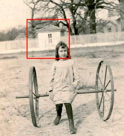
Another building that received a new use around this time was "Shed C." The interior of the building was lined with newspaper, one of which dated to May 30, 1932. This was at a time when the region suffered through a deep agricultural depression, and the shed may have been used as a bunkhouse. The paper would have helped to cut down on drafts in the uninsulated building. Patched siding at the rear also suggests the possibility that the shed was fitted with a window.
The first commercially successful oil field in Texas was developed at Corsicana, about 60 miles north of Bassett Farms, in 1894. The discovery of a major oil field at Spindletop in the upper Gulf Coast region of Texas in 1901, which produced 17.5 million barrels of oil in 1902, launched a period of investment, discovery, and development that had significant impacts on the Texas economy. The potential for wealth that could be earned through subsurface minerals, rather than above-ground grazing and planting, drew independent oil explorers, known as "wildcatters," to various parts of the state in search of "the next Spindeltop."51
As early as 1918, the Bassetts were being solicited to lease their land for oil and gas exploration.52 It wasn't until wildcatter A. E. Humphreys came to Limestone County that oil prospects at Bassett Farm began to rise. In 1920, wildcatter Humphreys discovered a new oil field near Mexia in northwestern Limestone County. By 1921, an offset well drilled by Humphreys was producing 4,000 barrels per day, and the Mexia oil boom was born. By the end of 1921, 6.1 million barrels of oil had been produced in the field as oil companies struggled to build the infrastructure necessary to store and transport the oil. The field was located along the Woodbine Fault-Line in the Mexia Fault Zone.53 This zone, extending into Falls County, became the focus of exploration by Humphreys in the Kosse area in 1922. Late in the year, a test well proved to be a major success, producing enormous quantities of oil for [two weeks] until it suddenly went dry.
The discovery of oil near Kosse by Humphreys at his Humphreys-Jones well took place on property adjacent to Bassett Farms. Humphreys signed a lease with the Bassetts to drill an offset well, known as Humphreys-Bassett No. 1, on the Bassett's 395-acre Town Place. Although neither of the two Bassett wells drilled in 1922 became producers, the value of their various oil leases that year still exceeded $100,000.
51 Olien, Roger M. "Oil and Gas Industry," TSHA Handbook
52 Oil and Gas Lease, unsigned, between A. J. Culbertson and Mrs. H. F. Bassett, 8 October 1918, Bassett Archive.
53 Smith, Julia Cauble. "Woodbine Fault-Line Fields," TSHA Handbook.
News of the "Kosse gusher" drew tens of thousands to Kosse to see the well, while many came to make their fortune. The Fort Worth Record-Telegram reported that "a new town is springing up one and a half miles west of Kosse. A spur track will be built to it and business is keen in realty property."54 Where just one derrick was to be found at the Humphreys-Jones site, once oil came in, it was reported that within two weeks "almost a dozen derricks may be seen."55

54 "New Town is Springing Up Mile West of Kosse," Fort Worth Record Telegram, 26 August 1922, page 5.
55 Houston Post, 3 September 1922, page 9.

The population of Kosse ballooned almost overnight from several hundred to nearly 20,000. Kosse went through three mayors in three days as it struggled to manage the ensuing chaos of investors, prospectors, and oil field workers seeking their fortunes. Roads were jammed with vehicles heading to Kosse to see the gusher, and Falls County undertook improvements to the Kosse-Marlin Road. A tent city emerged around the Humphreys-Jones well. But just as suddenly as it emerged from underground, the Jones well dried up. The Bassett well became the center of the oil world for several months as Humphreys drilled, but it did not become a producer. Remnants of above-ground earthen berms built to hold oil remain on the Town Place.

Another test well was drilled by wildcatter Dick B. Mason on the Bassett's Blum Place and was known as the Mason-Kosse Syndicate No. 1. [See Part 3: The Blum Place].
Subsequent efforts to discover oil continued with the Pandem Oil Company's major test well on "the branch" of Sulphur Creek on the Blum Place in 1926-7. The Bassett family's oil lease revenue for 1926 totaled $146,645.56
Despite the new wealth the Bassetts earned in the 1920s, apart from the construction of the probable farm office, they made no improvements to the house or grounds during the decade. At the time of Hattie Ford Bassett's death at the age of 85 in 1936, the Bassett Home Place largely resembled what it had looked like forty years earlier.


The death of Hattie Ford Bassett during Texas’s centennial year, 1936, marked the end of an era in the Bassett family. Willie Ford Bassett (1885-1967), the youngest and only surviving child of Henry and Hattie Ford Bassett, was the sole heir to the Bassett Farm. By the time he inherited the property, he was already managing its operations. In the 1930 U.S. census, his mother was listed as a stock farmer, and Willie Ford was recorded as the "manager" of the stock farm. It is of note that they chose not to represent themselves as cotton farmers, despite the extent of the cotton farming that they oversaw on their extensive acreage. Perhaps the Bassett's early 20thcentury livestock experience made it much easier for the family to transition from a predominantly cotton tenant farming business to a predominantly livestock business during the 1930s. This transition was, perhaps, symbolically represented by the accidental burning of the large old barn in the fall of 1936.

It was in the fall of 1936 that the large old barn burned to the ground. This expansive wood-framed structure northwest of the house provided a visual anchor within the farmstead and also represented the scale of agricultural operations at Bassett Farms. Expanded over the years, the barn had become more artifact than necessity, and its replacement was much smaller.


In the 1939 and 1940 aerial photographs of the Bassett Home Place, the western half of the property appears to have recently been used to grow cotton. The newly-constructed stock tank suggests that the transition to grazing cattle was underway. A fence likely defined the abrupt and sharp transition between these former cotton fields and the thickly vegetated riparian areas along the Sulphur Creek branches. The Bassett House was partially surrounded on the north and west by thick vegetation, with open fields to the west and to the south across the Kosse-Marlin Road.
By 1942, the wooden picket fence that stretched across the front of the Bassett House had been removed and had been replaced by a border of rocks, likely extracted from creek beds.

Electricity came to Bassett Farm by 1949. For some time prior to this, power was generated using a “Model S” carbide pit generator manufactured by Colt. Carbide pellets would be dropped into a tank of water that could generate acetylene gas. A portion of the tank is visible above ground northeast of the house in the rear yard. The arrival of electricity was celebrated with new appliances. In a letter from Willie Ford Sparkman to her parents on April 30, 1949, she wrote from her home in Dallas:
We have been looking around at some electric fans. There are surely some nice ones, and they will help a whole lot at home. I declare, I am so proud of the electricity, and the stove and ice box are going to be simply wonderful. I can hardly wait for you to get them in the house … I will be ready for some nice home made ice cream. Is your little fig barrel about empty?

An aerial photograph taken on December 9, 1952 reveals few changes to the overall landscape of the Home Place since 1940. Along the southern edge, the Kosse-Marlin Road remains unchanged. The western portion of the Home Place still appears to be divided into the same northern and southern sections that were visible in 1939 and 1940. There is minimal vegetation intruding in the pastures, and the straight fenceline between these grazing pastures and the riparian areas to the east remains in place.

A 1955 aerial, somewhat clearer than the 1952 aerial, shows the emergence of small mesquite trees and other small woody vegetation throughout the western half of the property. The southwest corner of the Home Place has been cut by a new road bed with a new bridge over the Sulphur Creek branch, eliminating the sharp corner.

The 1955 aerial documents the location of most of the early, surviving outbuildings. The large barn that burned in 1936 has been replaced by a smaller wood-framed barn with a corral on its north and west sides. The barn likely stored hay for feeding cattle. A direct route from the road to the barn has emerged, making it easy to back up a truck with an attached trailer loaded with cattle to the corral, or to load up a flatbed with hay to take out to the fields. The garden is still clearly defined with a buffer of vegetation on its west side. Evidence of an older corral on the south side of the road that would have served the Pasture is evident. Several unidentified structures can be seen behind the Bassett House; some of them may have been relocated from the area where the garage would be built sometime after 1955.

By 1965, mesquite, honey locust, and other woody species flourished throughout the open fields. A north/south division between the western half of the Home Place is still evident. A small pasture at the southeast corner of the Home Place is being cultivated for hay. A new stock tank has been constructed in the riparian area behind the Bassett Farmstead.

The U.S. Geological Survey's 1965 Kosse West topographical map more clearly demonstrates the extent to which woodland cover had encroached into former cotton fields in the western half of the Home Place. The map

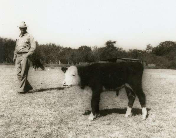
highlighted the Bassett House (dark black rectangle) as well was five related outbuildings. The new stock tank behind the Bassett House is also shown.

Considerable changes took place between 1955
1965
1. The house was overhauled with a new two-story porch on the front (south) facade and a new two-story bathroom tower was built at the rear. A newspaper dated September 29, 1955 was founded beneath the kitchen linoleum. Interior paneling was likely installed at this time in the west parlor, dining room, and kitchen.
2. The garage was constructed at the rear of the Bassett House to its northwest.
4. A stock tank was constructed immediately behind the Bassett Farmstead.
5. The wooden pole barn was constructed in the field to the west of the Bassett House.

6. A barn was constructed on the south side of LCR 668.
By the early 1960s, all three daughters of Willie Ford and Lula (Harper) Bassett were living in Dallas and were at the center of the city's social life. The eldest, Zelma Bassett, was married to Dr. Ramsey Moore, the leading society pediatrician. Daughter Willie Ford Bassett was married to a surgeon, Dr. Robert Sparkman. The youngest, Hattie

Ford Bassett, was unmarried. Correspondence from the Bassett daughters, none of whom had children, to their parents in Kosse reflect their close relationship with frequent travel between Kosse and Dallas, as well as their increasing influence on the management of the Bassett Farm.
Zelma was the most directly involved in the Farm and was actively engaged in the Polled Hereford cattle breeding operation. She owned her own cattle separately from those of her father. Zelma also oversaw significant changes to the Bassett House. In a letter to her parents on August 20, 1964, she wrote:57
The man, Mr. Austin Bryan, said that he would get started on the house right away - next week. We are going to repair the walls, and foundation first, so it will not disturb you all. He is going to use some of the porch lumber, but I told him to have them take it up easy, so we could use whatever was left over to build sheds and things. The porch will be bricked and so pretty. That will be done after the brick and foundation are fixed. You let me know if I can do anything to help with it. How are your cantaloupes, tomatoes and peaches holding out?
In an undated letter from Willie Ford Sparkman to her parents, probably soon after the completion of the renovations, she wrote:58
I think the house is so pretty and I am so happy the way it has turned out. The porches are so wide and they go with the house just right. Pop looked so cute sitting out there waiting for us to come home.
In 1967, Willie Ford Bassett died at the age of 82. Two years later, his widow, Lula, died, and the property was left to their three daughters equally. It was during this time that they began to discuss the future of the preservation of the Bassett Farm while continuing to manage the cattle operation. Zelma also spearheaded efforts to exploit the property's mineral resources, and directly managed the Farm's accounts and expenses from her home in Dallas. The Bassetts, particularly Zelma and Willie Ford, would make regular trips to the Bassett Farm to pay farm hands such as B. D. "Uncle Beady" Jones.
In 1970, the Home Place was connected to the local water utility, Tri-County Special Utility District. The water supply line approaches the property from the west along the south side of the road; two meters are located on the south edge of the lawn on the north side of the road. Water lines were laid around the perimeter of the lawn, with hose bibs installed along the south, west, and east sides of the lawn. Several more are located near the Bassett House, some with a cast quail handle. There is also a hose bib at the southeast corner of the hay barn. The installation of these water lines on July 11, 1970 probably coincided with the abandonment of the use of the cistern, the well, and the creek-side pumps that had supplied water for use on the Home Place for one hundred years.

It was probably around this time that approximately 1,100 linear feet of metal fencing was installed to enclose approximately 1.6 acres surrounding the Bassett House.59 The fence consists of metal posts and metal pickets welded on two rails; the posts support sections of fence that vary from 6 to 10 feet in length with the majority being 9 feet. The metal posts are set in concrete although many are loose.
● The west section is approximately 240 feet long. A pedestrian gate is located about midway of the total length.
● The south section is slightly longer and is approximately 280 feet long, with a cattle guard and main entry gate flanked by pedestrian gates. The east gate is functional; the west gate is welded shut.
● The east section is approximately 150 feet long consisting of fifteen 10-foot sections. Between this east fence and another 90 foot section on the same north-south axis is a short 40-foot east-west section. The 90 foot north-south section that terminates at the northeast corner of the yard has a pedestrian gate and three loose posts immediately north of the gate.

● The remainder of the fence at the north boundary of the yard consists of an additional 230 feet in three sections. There are two pedestrian gates and an ungated cattle guard.60
The introduction of numerous water spigots around the Bassett House yard made it possible to easily water newly planted flower bulbs and small ornamental trees. Willie Ford Sparkman would cut many of these flowers to decorate her home in Dallas. Trees that were introduced along the fenceline that survived until at least 2012 were predominantly crape myrtles, pomegranates, cherry laurels, pears, and quinces.61
On August 7, 1972, Zelma Moore opened a Bassett Farm checking account at First National Bank in Dallas, with its first major deposits being two bonus consideration checks totaling $25,417.50 from Southern Union Production Company for their lease of an interest in the Town Place. Among the purchases made were a car ($3,202.90) and pick-up ($3,064.86) from Friendly Chevrolet and a $500 donation to the “Hopewell Baptist Church of Kosse, Texas.” The records of this Dallas bank account from 1972 to 1983 provide a partial record of ranch activities and improvements; records of another farm account, kept at a bank in Kosse, have not yet been located. Typical farm-related expenses included:

● December 1972: $7,250 to Boyd Industries [of Boyd, Texas], manufacturer of cattle feeders
● September 1977: $55.58 to Sears for barn paint
● April 1980: $450 payment for hay planting
● April 1981: $3,361 to Mr. Novak for hay planting and Bremond Feed & Fertilizer Co.
● May 1981: $5,000 for tractor and shredder
● May 1981: $574.77 to Craddock Lumber Co. for “farm lumber”
● June & July 1981: Checks to Wildcat Construction Co. for “Fence around back barns $1,800;” “bulldozing, fence repairs & materials, $2,101.25” and $5,579.50; “corral repaired and fences, $1,432.55” and additional fence repair checks for $213, $635.52, $646.75, $830.50, $253, and $1,051.25, $1,143.25, and $1,063.25.
● December 1982: $570 for ten 14-foot panels for working cattle and chute repairs
● January 1983: $563.80 for corral repairs, $195 for Prince Place fence repairs, $195 for additional fence repairs, and $438 for five metal hay feeders
● February 1983: $328 for fence repairs and $295 for fence repairs on the Irwin Place
● March 1983: $550 to John Alexander for coastal sprigs and planting 25 acres
● September 1983: $3,000 for 2,000 square hay bales
The revenue from oil leases in the 1970s also likely provided the cash necessary to construct several new metal metal structures, all of which were completed before 1981. These were the 50'x30' hay barn, the 30'x30' equipment shed, and a smaller 40'x30' barn by the road. Each of these buildings replaced earlier wooden structures and were built to serve the needs of a cattle operation with limited hay production, as well as maintenance of the yard around the Bassett House.


In 1975, Hattie Ford Bassett died, and Zelma and Willie Ford became partners in the operation of Bassett Farms, with Zelma continuing to negotiate oil leases and manage the sale of cattle and the payment of ranch hands. On August 25, 1980, Zelma deposited a check for $105,508.50 from Trend Resources for a new natural gas lease. One year later, on August 26, 1981, she deposited a second check in the same amount from Trend Resources. This company built a natural gas well and tank in the Pasture, serviced by an improved road and a bridge over Sulphur Creek. These were likely constructed in 1980 and these features appear on the 1981 aerial of Bassett Farms.


During this same time, in 1980, Zelma Moore recorded that there were 476 head of cattle at Bassett Farms and identified the pastures in which they grazed:62

*Town
*discontiguous parcels that are not the subject of this study
62 Handwritten note with 1972-1983 checking account records. Bassett Archive.
Few physical improvements were made to the property between 1981 and 2010. A small new stock tank was constructed at the southwest corner of the Home Place after 1981 in the former roadbed of the Kosse-Marlin Road, and a tin-roofed covered storage area was added at the rear of the garage. As Zelma and Willie Ford got older, the frequency of their visits to the farm decreased and they increasingly relied upon ranch hands.63

The most significant change to the landscape occurred between 2004 and 2008 when extensive clearing was undertaken behind the Bassett farmstead's outbuildings. Presumably this was an attempt to expand areas available for grazing adjacent to the farmstead. Some of the area north of the pond had previously been open pasture as late as 1955, but had become overgrown by 2004.
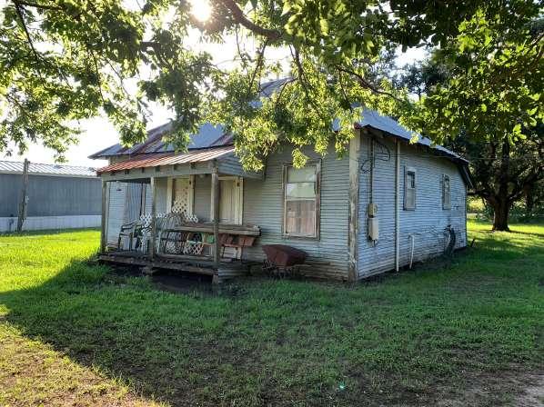
After Mrs. Sparkman's death in 2010, extensive survey, assessment, and maintenance work, as well as some changes to site features, were undertaken, particularly after the 2012 property transfer to Preservation Texas.
2011
The entire property was surveyed by Kling Engineering, including a detailed topographical survey of the area around the Bassett House.


2012
Students from the University of Texas at San Antonio made measured drawings and plans of the structures on the Bassett Farmstead, including the Bassett House, dairy, cottonseed shed, storage shed, wooden pole barn, and three metal pole barns (Attachment A). Sparks Engineering provided a structural assessment of the Bassett House (Attachment B). Catherine O'Connor of the landscape architecture firm Co'design documented and assessed the landscape around the Bassett House (Attachment C). She made preliminary recommendations for improving site drainage around the house. Scott Felton, a Waco banker, rancher and McLennan county judge, was retained to undertake an agricultural assessment of Bassett Farms (Attachment D). A conservation assessment was also prepared by former Texas Parks and Wildlife staff member Carolyn Vogel (Attachment E).
2013
Preservation Texas retained a local firm to clear approximately 15' width along the property's perimeter fence lines. A security system was installed in the Bassett House by Dedmon Security. A simple wooden fence was added at the property entrance with a new gate by grazing tenants Tim and Karen Partin. Fencing around several outbuildings was removed and a new wooden plank fence was added to the north and northeast perimeter of the farmstead. The history of the Bassett House and its contents was prepared by board members Lynn Vogt and Margarita Araiza (Attachment F). The Austin-based historic preservation architecture firm VOH was retained to prepare plans for stabilization of the Bassett House.
2014
The tree survey was updated and recommendations for tree removal were made by Austin Tree Specialists (Attachments G, H). A successful application for Recorded Texas Historic Landmark designation was made to the Texas Historical Commission prepared by board member Rick Mitchell. Plans for the restoration of the front porch were amended by VOH upon discovery of historic photographs of the porch (Attachment I).
2015
Students from Texas Tech University in Lubbock under the direction of Dr. Elizabeth Louden completed a historic structure report for the Bassett House (Attachment J). A short video was produced by Mark Birnbaum of Dallas (https://vimeo.com/169148634)
2016
Selective tree removal was undertaken based on recommendations of Austin Tree Specialists. Diseased and damaged trees were limbed. Board member Tony Crosby prepared an updated conditions assessment of the Bassett House and outbuildings (Attachment K).
2017
A board workshop developed ideas for the use of Bassett Farms (Attachment L). The land was reappraised for its current market value (Attachment M). Ron Siebler and Evelyn Montgomery prepared a historic structures report for the Bassett farmstead outbuildings (Attachment N). Texas Historical Commission volunteers undertake preliminary excavation of several site features around the Bassett House with a focus on locating the underground cistern. Plumbing to the Bassett House was detached and work began on conversion of the garage to serve as two apartments.
2018
Grazing on the Bassett Home Place is terminated and the property is removed from local tax rolls. The use of the corral behind the barn was ended and its function moved to former corrals across the Kosse-Marlin road. The Texas Conservation Corps completed a proposal for a trail linking the Bassett Farmstead to the two Bassett Home Place ponds. (Attachment O). The garage project was completed. A septic tank was installed behind the garage.
2019
Board member Tony Crosby completed a mothballing plan for the Bassett House in January (Attachment P). Students from the UT School of Architecture completed an analysis of the materials (wood, stucco, mortar) in the Bassett House and outbuildings (Attachment Q). The mothballing plan was implemented in May and a historic marker dedication event took place at the Bassett House in June. Electricity was added to the hay barn, the dirt floor was graded and covered in gravel; new closing mechanisms were welded to the four barn doors and a gutter system was installed.
2020
PT hosted the Texas Cultural Landscapes Symposium in Waco which included a field trip to the Bassett Home Place. Students from the UT School of Architecture (landscape architecture) completed a studio program at Bassett Farms that was curtailed by the pandemic. PT extended a 2019 agreement with Texas Parks and Wildlife to restore native grasses and forbs to areas at the Bassett Home Place; the project was later postponed and subsequently canceled; can be renewed based on recommendations of the CLR. (Attachment R).
2021
A major freeze in February damages vegetation. Work began on the exterior restoration of the Bassett House in October (Attachment S), as well as restoration of the Cottonseed Shed and Curing Shed. Preservation Texas acquires the former Kosse City Hall at 103 North Narcissus Street in Kosse as a future Bassett Farms Visitor Center.
2022
Work continues on the exterior of the Bassett House. The Cottonseed Shed and Curing Shed projects are completed. Work begins on the restoration of the former Kosse City Hall.
 Evan R. Thompson
The Blum Place is located entirely in Limestone County and consists of 249.5 acres bisected by the Bassett Branch of Sulphur Creek. The southern portion of the Blum Place was originally part of a 640-acre tract granted by the State of Texas in 1854 to Dr. Augustine Owen, a son-in-law of the largest slave owner in Limestone County, Ethan Stroud.1 Dr. Owen is not known to have lived on the property and sold his 640 acres to B. J. Chambers in 1856. The northern portion of the property was owned by John G. Walker, who sold to Chambers as well. The use of both halves of the Blum Place during the Chambers period of ownership (1856 to 1870) is not known but was most probably leased for grazing, perhaps to neighboring property owner Sidney M. Jones who had an extensive horse-breeding operation.
B.J. Chambers sold 367.5 acres to cattle rancher John J. Norris2 in March 1870 for $1,900 in gold plus a note for $362.21 payable six months later.3 The timing of this land sale coincided with the construction of the Houston & Texas Central Railway, which was to come within a few miles of the property, greatly enhancing its value.

1 The Stroud Plantation was located southwest of present-day Mexia. The Stroud House (demolished) was documented for HABS by Ernest Connally in the 1930s, and was the site in Limestone County where slaves were informed of their emancipation in 1865.
2 Norris was born in Georgia in 1816; he migrated to Texas, settling in Robertson County by 1860. He and his wife Rebecca (Bishop) Norris had eight children. In 1860 he owned $2,660 worth of real estate, $5,765 of personal property, and three slaves: one male (28), one female (21), and one male child (7 months). Norris's own children in 1860, ages 19 to 3, were all born in Georgia, suggesting he arrived around 1858. His post office address was Eutaw, just east of present-day Kosse. In 1870, despite his large-scale stock-raising he was recorded as a "planter" in Limestone County, and was still living in the county in 1880 as a farmer.
3 Deed, B. J. Chambers to John Norris, Bassett Archive.
Norris's ranching operation was significant and diverse, and included a number of large, discontiguous parcels. He likely lived elsewhere and only purchased the Chambers property to expand his grazing capacity. The June 1870 agricultural census shows Norris as the owner of a total of 100 improved acres and 747 unimproved acres in Limestone County valued at $2,540. On his properties were 17 horses, 3 mules, 2 working oxen, 2,000 cattle, 50 sheep, and 50 swine; he produced 300 bushels of Indian corn.4 By 1872, he owned nearly 2,000 acres, but tax records show a reduced herd of 400 cattle.5
Barbed wire made its appearance in the area by 1876, which made it possible to subdivide the open range into smaller farms.6 Norris died about 1880; perhaps in ill health, anticipating his death, and recognizing the value to be gained by subdividing his property, he sold a 132-acre portion in the John Walker survey to a 40-year-old Louisiana-born Black farmer, Ben Johnson, in October 1880, and a 117.5-acre portion in the Reinhardt survey to Lewellen & M. H. Robinson in January 1881.7
Johnson's acquisition was structured in three annual payments of $528; he probably defaulted, as the first of the three promissory notes only shows record of a payment of $115.02 on October 18, 1881.8 Johnson sold to Hyman Blum for $10 and "other valuable consideration" on February 23, 1883.9
The Robinsons sold out to Blum for $100 two days earlier on February 21, 1883. It seems probable that the Robinsons were also in debt to Norris, and the coordinated transactions suggest that Norris sought out Blum's Kosse-based attorney, Capt. Elisha Hall, to liquidate the outstanding debt on both parcels to Blum who then foreclosed on them.
In 1884, Hyman Blum sold both tracts to his Leon and H. Blum Land Company for $2,775.10 Hyman and his cousin Leon conducted a thriving Galveston-based business known as "Leon & H. Blum." The Galveston-based importers, merchants, and investors also had offices in New York, Boston, and Paris; they served the Southwestern U.S., Indian Territory, and Mexico, and also engaged in real estate speculation through their land company.11
4 The 1870 population census shows three Black residents in the J.J. Norris household: Jennie Norris (35, b. Virginia), Peter Norris (11) and Simon Norris (9), both born in Texas. Jennie and Peter were likely two of the three slaves Norris owned in 1860.
5 1872 tax list for Limestone County, Precinct No. 5.
6 Oral History of George Ogden, File No. 240, Image 10, Library of Congress.
7 Deed, John Norris to L & M H Robinson, 8 January 1881, Limestone County Deed Book M:211.
8 Deed, John Norris to Ben Johnson, 16 October 1880, Bassett Archive.
9 Deed, Ben Johnson to Hyman Blum, 23 February 1883, Bassett Archive.
10 Deed, Hyman Blum to The Leon and H. Blum Land Co., 5 July 1884, Bassett Archive.
11 The company's earnings exceeded $1 million in 1870; by 1887 they employed 125 clerks and 30 traveling salesmen. The firm failed during the 1890s depression. See Kleiner, Diana J. "Leon and H. Blum," Handbook of Texas (online), Texas State Historical Association.
The Blums would rent the two farms on the Blum Place to tenant farmers for the next few years. Their Land Company eventually agreed to sell the entire 249.5-acre property to Henry Bassett in a single transaction in August 1887 for $2,500. Payment was to be $1,500 cash with a promissory note of $1,000 due January 1, 1888 at an interest rate of 10 percent, secured by a vendor's lien and a deed of trust.12 A letter from the Land Company informed Bassett that they had instructed their Kosse attorney, Capt. Hall, to forward to him the rents collected in 1887 "less costs of improvements and his commission."13 The Land Company posthumously released Bassett from his debt in July 1888.14
The 1887 "improvements" were a new barbed wire fence as documented by two receipts. One receipt from J. L. Markham's dry goods store in Kosse totaled $34.43 for 506 pounds of wire, 30 pounds of nails, 6 pounds of staples, a pair of hinges, and the cost of cleaning out a well. A second receipt documented payment of $16.45 for lumber to A. Woods, a Kosse dealer in "lumber, shingles, doors, sash, blinds, window glass, etc."15
Within months of acquiring the property, Bassett leased the southern 101.6-acre portion of the property ("south of the branch") to J. B. Dearman for one year at $3 per acre beginning on December 18, 1887.16 Dearman was to "have the privilege of pasturing the timber branch" but was "to [keep] up the fence on [the] south side of said Branch … Bassett to furnish wire to put up said fence..." and Dearman "to do all the work."
The 1887 Dearman lease included "all the buildings on the land," including a one acre house lot. This pre-1887 house and outbuildings probably relate to the surviving cluster of collapsed structures (house, outbuilding, and barn) on the property that were later associated with Prince and Gracie Washington.
Undated field notes and an accompanying map document the 101.6 acres of "plow land" leased by Dearman, presumably dating from 1887.17 The surveyor's map associated with the field notes depicts an irregular boundary where the "timber branch" was located and thus where the fence was to have been maintained.18
12 Deed, The Leon and H. Blum Land Company to Henry Bassett, 26 August 1887. Bassett Archive.
13 Letter from The Leon and H. Blum Land Company to Henry Bassett, 7 September 1887, Bassett Archive.
14 Release, Leon & H. Blum to Henry Bassett, 26 July 1888, Bassett Archive.
15 Receipts, Bassett Archive.
16 Lease from Henry Bassett to J. B. Dearman, 18 December 1887. Bassett Archive.
17 "Field Notes of Field Where Mr. Dearman Lives;" includes verbal boundary description and associated surveyor's map.
18 The 1940 Limestone County highway map indicates the presence of a dwelling at what would be the northwest corner of the Prince Place fronting on the abandoned county road. In 1926, it was clear that the Prince Place was divided into two separate farmsteads: those of Peter Jackson and Tom Wright.
Henry Bassett died in the summer of 1888, and his widow, Hattie Ford Bassett, became embroiled in legal issues with Bassett's first wife in Connecticut about land titles. Once these legal issues were resolved and her title to the property quieted, she engaged Kosse-based builder and contractor J. G. Barrow in the fall of 1890 to construct a house for $650 and a well for $10, and to provide a stove flue for $6.00.19 For the next forty years, Blum Place was continuously cultivated in at least two sections as cotton farms by numerous tenant farmers into the 1930s.
19 Receipt, 1 December 1890, Bassett Archive. The receipt was kept with papers related to the Blum Place..

The Blum Place and Oil Exploration (1920s)
The Blum Place was the site of two wildcat oil wells drilled during the 1920s heydey of oil exploration around Kosse.
The first test well, the Mason-Kosse Syndicate's Bassett No. 1, was drilled in 1922 on the Blum Place. Mason sold a controlling interest to Transcontinental, and the well was abandoned in 1923. Maps show this well site to be at the far southeast corner of the tract, but this may not be accurate based on aerial photographic evidence of a possible well site slightly further to the west.
The second test well, Pandem Oil Company's H.F. Bassett No. 1, was drilled several years later in 1926 and gained notoriety through extensive newspaper coverage. Drilling began August 20, 1926 for what was said to be the deepest test well ever drilled in East Central Texas20 by the time it was abandoned on October 7, 1927 at 6,049 feet. In a letter to her grandson-in-law Fred Glass on June 30, 1926, Hattie Ford wrote:
There is some little activity in the oil business. A Houston firm started drilling in the Sam [Fannin] Place. There is another company from Okla.[homa] wanting to lease some out here where we live and promise to put a well down somewhere on the home place. I think we will lease to them and try again. If I succeed in getting any thing my little grand babies will share it with me.

Hattie Ford later wrote on August 2, 1926 to her granddaughter Gladys Glass:
20 "The Pandem-Bassett test at Kosse still holds the district record for depth. It was carried well below the 6,000-foot mark." See "Test Suspended at Depth of 6,002," Fort Worth Star-Telegram, 17 October 1928, page 2.
… the oil men has [sic] begun to haul out stuff for the derrick.21 They are going to put it up just north of the Mason well on the branch between Uncle Peter[‘]s and Mr. Wright[’s]. They have promised to go five thousand and five hundred feet deep. If there is any oil there I suppose they will reach it. However I am not building any air castles, but only hope they may find it, and if they do I want to tell you it will be something for us all.22
The branch referred to in Hattie Ford's letter is the branch of Sulphur Creek that had been referenced some forty years earlier in the 1887 Dearman lease, and her letter indicates that the 1926 tenants were "Uncle Peter" Jackson23 and Tom Wright.24

21 The drilling contractors were "Brandon and McCamey." See "Efforts Are Being Made Secure Paying Well From Trinity," Corsicana Daily Sun, 8 July 1927, page 2.
22 Letter from Mrs. H. F. Bassett to Fred and Gladys (Bassett) Glass, 2 August 1926. Glass Papers, UT Arlington, transcribed by Evan R. Thompson, see "Letters from Mrs. Hattie Ford (Pope) Bassett, 1912-1932, p.4. In 1930, Peter Jackson, 64, an African-American farmer born in Alabama, was enumerated in the census immediately after Mrs. H. F. Bassett. Jackson was living with his wife Julia, 64, and daughter Evelyn, 19. Tom Wright, a white farmer, was 44 years old, born in Texas, living with his wife Elsie, 33, and daughters Mildred, 16, and Elsie F., 6.
23 In the 1930 census (7 April 1930), Peter Jackson and his wife Julia are enumerated immediately after the Bassett household. Peter is 64, Black, born in Texas of Alabama parents, married at age 20. He was renting a cotton farm. His wife, Julia, 64, born in Texas of Louisiana parents and a divorced daughter Evelyne, 19, was living with him. By 1940, Julia Jackson was widowed and living in the town of Kosse with her daughter, Evelyn Alexander, and grandson, Leodis D. Ross.
24 In 1930, Tom Wright was a white farmer age 44 born in Texas about 1886; his wife, Elsie, 33, and daughters Mildred, 16, and Elsie, 6 were living with them. He rented a cotton farm and was recorded in the census four households away from the Bassetts.
In that same year, 1926, a 123-foot steel and wood derrick was constructed. Drilling was done using rotary tools to 3,800 feet, after which cable tools were to be used.25 As drilling continued into late April 1927, it was reported that a showing of oil was made at 4,600 feet and that "six 1,000 barrel tanks have been ordered to the well and two of them are to be set up immediately."26 Drilling continued until October, when the test came to an end. The showing of oil made by the test did not merit further exploration.27
The last known tenants on the Blum Place were Prince and Gracie Washington who lived south of "the branch" in a house that has since collapsed. It was during their tenancy that the property became known as the "Prince Place" rather than the Blum Place. In 1930, Prince and Gracie, both 49 years old, were listed in the census as cotton farmers living on a rented parcel near the Bassetts. They probably moved into the house rented to the Jacksons after Peter Jackson died in the 1930s. Prince died in 1949 and was buried at Hopewell Cemetery; his wife Gracie is buried there as well. A utility pole stands adjacent to the Washington farmstead; the Bassetts made payments on the Washington's utility bills and social security while they lived out their lives on the property.
25 "Kosse Oil Field is Reviving Interest," Waco News-Tribune, 20 August 1926, page 3.

26 "Much Interest Manifested Here Kosse Operation; Pandem-Bassett No. 1 Expected to be Good Producer by Oil Fraternity," Corsicana Daily Sun, 23 April 1927, page 2.
27 "Deepest Test in East Texas Near Kosse is Given Up After 6,049 Feet," Fort Worth Star-Telegram, 9 October 1927, page 39.
The Blum Place cotton farms and the 1920s well sites would have been accessed by a public Limestone County road that traced the boundary between the Blum Place and the Bassett Home Place. This road was later abandoned as a public road and incorporated into the Bassett Farms by the mid-20th century. At least two creek crossings would have been needed as part of this road, but no evidence survives of any bridges or low-water crossings.
The Blum Place has been used for cattle grazing since the 1930s, when cotton growing was curtailed by federal programs. The transition to grazing required the construction of two stock tanks on the Blum Place adjacent to "the branch." The first was constructed behind the Washington farmstead before 1939 while the Washingtons were still living on the property. The second tank was constructed toward the eastern end of the tract by the early 1960s, probably as a supplemental water source in response to the intense Texas drought of the 1950s. Interestingly, bricks and broken ceramics have been found from time to time in the vicinity of this later pond.
Some above-ground features of the Prince and Gracie Washington Farmstead site survive. The house is a collapsed ruin. At its rear are the remains of an outbuilding, possibly a smokehouse. A barnyard gate and fence posts are in place, as well as scattered remains of the barn. A hand-dug brick well survives to the east of the house.

Aerial photographs are available from 1939, 1940, 1952, 1955, 1965, and 1981. The Blum Place is highlighted on each of these maps below.

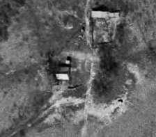
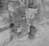


 Evan R. Thompson
The Hirshfeld Farm1 consisted of 90 acres in three tracts: 10 acres known as the "Sulphur Spring" in the Reinhardt] survey, the "Moseley Homestead" tract of 60 acres in the northeast corner of the Memucan Hunt survey which are a part of this study, and a discontiguous 20 acres in the far northwest corner of the Memucan Hunt survey which are not. The southern boundary of the Sulphur Spring tract adjoined the 60-acre Mosley Homestead tract. The discontiguous 20-acre tract is bounded by the Bassett's Pasture on its north and west and by the Hopewell Freedom Colony on its east and south. All three tracts were acquired by Jay C. Bassett on May 27, 1897 from the estate of John S. Hirshfield (1829-1877). Bassett in turn deeded the 90 acres to his mother, Hattie Ford Bassett, and brother, Willie Ford Bassett, in 1903, to settle outstanding debts to them.
A ten acre tract of the Hirshfield Farm, fronting the Kosse-Marlin Road across from the Bassett Home Place, was explicitly referred to as "the Sulphur Spring tract." Sulphur Creek flows through this tract of land that was sold
1 W. F. Bassett referred to the property as "The Hirshfield Farm" in an unsigned, undated offer to sell thirty acres of the property to W. R. Wilkin of Kosse, a deal which was never completed. Bassett Archive.

The next year, as the Houston & Texas Central Railroad approached the area, the Turners sold this same tract of land for an astonishing $1,000, or $100 per acre, to John S. Hirshfield, a merchant and pioneer settler of Fort Worth.3 The significant value placed on the Sulphur Spring tract in 1870 suggests that there were recreational improvements on the site, but no documentary records, photographs, or physical evidence has been located.
The development of railroads in Texas in the late 19th century created opportunities for the commercial development of above-ground springs and well-fed mineral water pools in central Texas as resorts.4 Examples in the vicinity of Bassett Farms included Fairview Springs (Falls County), 2.5 miles southeast and Wootan Wells (Robertson County), 12 miles south. In the early 1900s, the nearby Falls County seat of Marlin developed as a hot mineral water resort that marketed itself as the "Carlsbad of the United States," becoming the spring training home for the New York Giants baseball team in the 1910s and site of one of the first Hilton Hotels in the 1920s.
Historically, springs were gathering places for indigenous people, and as such a likely area for archaeological resources to survive. With European settlement, springs continued to be significant gathering places, often for political rallies and religious camp meetings, sometimes drawing thousands. In July 1880, a political barbecue at Fairview Springs on Tucker Creek gathered 1,500 attendees and featured speeches by candidates for statewide and federal offices. A special omnibus owned by a Kosse hotel proprietor brought several of the visiting political dignitaries to the site accompanied by a band.5 In 1881, an out-of-state visitor from Kansas described Fairview Springs as:
… beautifully situated on the east bank of Tucker creek, about two miles from the point where it enters the Little Brazos river, with nice shaded grounds running back from the springs, covering about twenty acres which has been very artistically arranged by Mr. Pamplin, the overseer and proprietor of the Springs, with cottages, lawns, croquet grounds, etc., furnishing many pleasant hours for the gay crowds that you see stopping here through the season. His bathing arrangements are also handsomely arranged, and afford ample accommodation for all who come. As the hour has come for a party of which I have the honor of being a member, to start out to the [Little Brazos] river with rod and gun for an afternoon's sport..."6
2 Deed, Bassett Archive.
3 Deed, Bassett Archive.
4 For more background on the development of springs as spas and resorts in Texas, see Valenza, Janet Mace. Taking the Waters in Texas: Springs, Spas, and Fountains of Youth. Austin: UT Press, 2000.
5 "Grand Political Rally," The Galveston Daily News, 9 July 1880, page 1.
6 "Fairview Springs, Texas," Topeka Weekly Times, 29 July 1881, page 7.
Perhaps the potential of the Sulphur Spring on the Hirshfield Farm was ultimately eclipsed by Fairview Springs. Future archaeological work might provide evidence of improvements on the Sulphur Spring tract.
After 1903, when the property was transferred to Hattie Ford Bassett, the Sulphur Spring Tract was incorporated into the Bassett Pasture and used for grazing. Later, between 1939 and 1952, a stock tank was constructed just north of Sulphur Creek to support this land use.
The Moseley Homestead
A portion of the Hirshfield Farm was, for a brief period, the Moseley Homestead. On May 14, 1869, William J. Moseley (1834-1901)7 acquired two tracts of land totaling 80 acres in the Memucan Hunt Survey from Alexander Beaton for $320. Moseley declared it his homestead. One year later, with Kosse area land values rising, William J.
7 In 1870, William J. Mosely, 34, born in Tennessee, planter; wife Mary E., 30, born in Texas; household included George B., 11, and Harriet S., born in March 1870. The census was taken after he sold his property to Hirshfield, as the agricultural census shows Mosely as the owner of 200 unimproved acres, 1 horse, 10 working cattle, and no other livestock.

and Mary E. Moseley sold the two tracts on May 23, 1870 to John S. Hirshfield (1829-1877) for $1,200. Hirshfield and his estate held the property for 27 years. On May 27, 1897, the heirs of John S. Hirshfield sold the Moseley parcels to J. C. Bassett for $10 per acre.8
During the Hirshfield family's ownership from 1870 to 1897, the property was likely leased as a cotton farm, making use of whatever improvements might have been made by the Moseleys. The Hirshfields were absentee owners who lived in Fort Worth. There is no record of the family ever having lived on the property.
Sulphur Creek cut across the northern boundary of the Mosely Homestead tract which would have provided a source of water for whatever house and outbuildings were associated with the Moselys. Whether the Bassetts in turn leased the 60-acre Moseley Homestead tract as a cotton farm after 1903 or incorporated it into the Pasture is unclear. By the mid 20th-century, the Moseley Homestead tract was used for cattle grazing. Between 1965 and 1981, a stock tank was constructed along its eastern property line.

Bassett Farms Cultural Landscape Report: Section One: Site History - The Hirshfield Farm

Bassett Farms Cultural Landscape Report: Section One: Site History - The Hirshfield Farm

Bassett Farms Cultural Landscape Report: Section One: Site History - The Hirshfield Farm

Bassett Farms Cultural Landscape Report: Section One: Site History - The Hirshfield Farm

Spatial Organization
Hay Fields
Concrete Bridge
Constructed Water Features
Stock Tank
Well Cistern
Windmill (approximate)
Views and Vistas
Views or Vistas
Small Scale Features
Cattle Related Feature
Stock Fence (approximate)
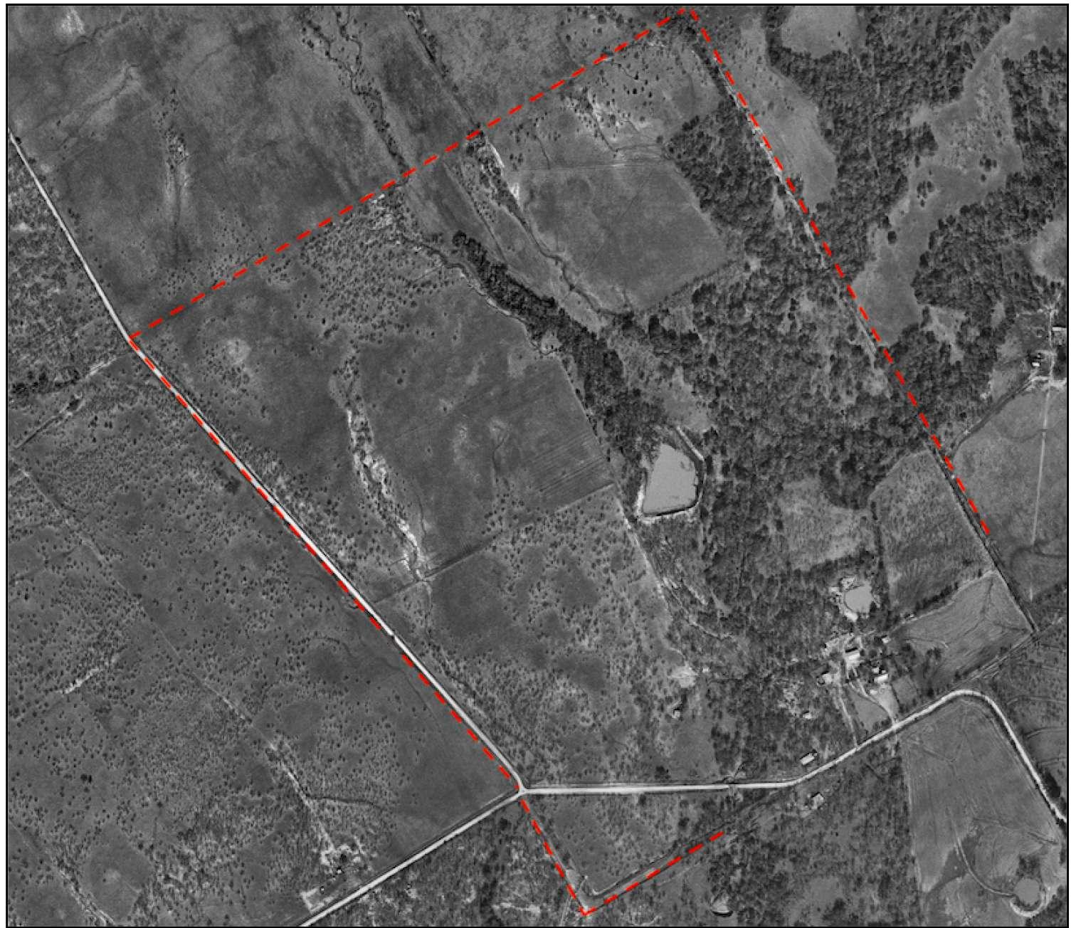
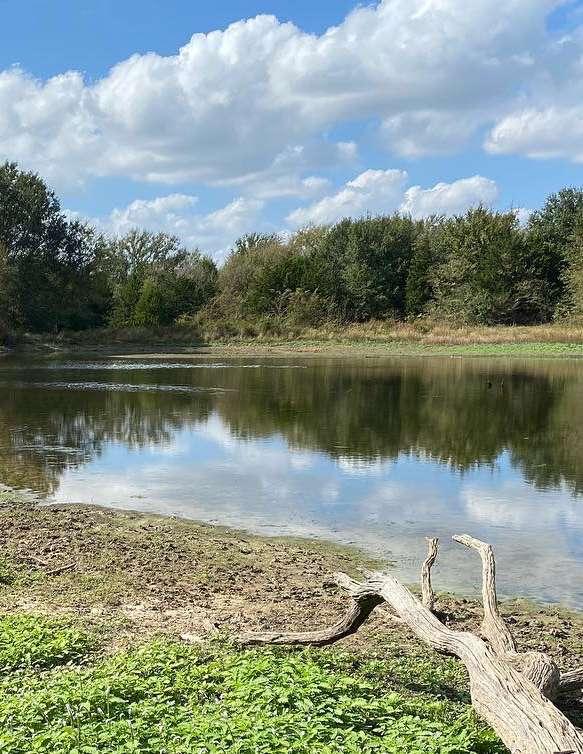 One of the stock tanks at Home Place (MIG 2021)
INTRODUCTION
STATEMENT OF SIGNIFICANCE
CHARACTER-DEFINING FEATURES ANALYSIS
NATURAL SYSTEMS
SPATIAL ORGANIZATION
LAND USE
CIRCULATION
VEGETATION
BUILDINGS & STRUCTURES
CONSTRUCTED WATER FEATURES
VIEWS & VISTAS
SMALL-SCALE FEATURES
This section analyzes and evaluates the characterdefining features of the Bassett Farms landscape that is the subject of this report according to the National Register of Historic Places criteria and the methodology outlined in A Guide to Cultural Landscape Reports: Contents, Process and Techniques. The content is divided into two parts.
The first part evaluates the landscape’s significance and integrity. The evaluation looks at the overall cultural landscape and ties what is extant with its historic development to determine how this landscape conveys or represents significant historic local, regional, and/or national events and trends.
The second part of this chapter analyzes extant landscape characteristics and features by comparing their existing conditions documented in 2021 with what is documented, or otherwise understood, about their historic condition during the period of significance. This analysis is organized by landscape characteristics which are defined as “the tangible and intangible aspects of [a place] which have either influenced the history of the development of the landscape or are products of its development.”1
For each landscape characteristic a summary of what is known about its character, development, and condition during the historic period is summarized. Primary features associated with each characteristic are then described in terms of their existing condition and evaluated whether they contribute or do not contribute to the cultural landscape’s character.
In cases where a feature could be categorized under more than one landscape characteristic, it was included with the characteristic that
1 Jeffrey Killion and Gretchen Hilyard, National Park Service Cultural Landscapes Inventory Professional Procedures Guide, 2009
provided the best way of understanding its relationship to the overall cultural landscape. Cross references are included in the narrative to provide clarity.
Bassett Farms is significant in the history of Falls and Limestone Counties, Texas, and the development of this region as a multi-faceted rural agricultural landscape. From 1871, when the land was first acquired, through 1967 when the last member of the Bassett family managed and lived permanently on the property, the history and evolution of this landscape reflects the larger patterns of regional history. In so many ways, the daily, seasonal, and yearly life at Bassett Farms tells the story of cattle-raising, cotton growing, tenant farming and post-Civil War freedom colonies. But it is also the history of settling and securing a demanding landscape, and constructing, repairing, and often moving farm structures as needs evolved in response to changing times. It is the story of the brick house at Home Place and the Hopewell freedom colony, farm structures, fences for cattle pastures, water tanks carved into the ground, and ways to move through this landscape. It is the story of county and town politics, but also of cotton farming, personal decisions, and the relationship among European-descended settlers, originally from Connecticut, and freed slaves building their Reconstruction-era lives and communities. It was a way of life that occurred throughout Texas and across the South, a complex history that has endured for over 150 years.
To determine the significance of any resource in this country’s history, it must possess integrity of location, design, setting, materials, workmanship, feeling, and/or association, and be:
a) associated with events that have made a significant contribution to the broad patterns of our history; or
b) associated with the lives of significant persons in or past; or
c) embody the distinctive characteristics of a type, period, or method of construction, or that represent the work of a master, or that possess high artistic values, or that represent a significant and distinguishable entity whose components may lack individual distinction; or
d) have yielded or may be likely to yield, information important in history or prehistory.
Bassett Farms meets all these criteria as a significant cultural landscape.
Settling central Texas in the 19th century was a difficult and demanding task. This was a pattern throughout much of the mid-section of the country, as land was settled both before and after statehood, and the trials and tribulations of building a life on this land were faced directly. The need to settle was accompanied by land division and road construction. The need for movement of both people, goods and livestock brought the arrival of the railroad, and a permanence to human structure on the landscape. This pattern of land development, played out in Limestone and Falls Counties, is clear and visible in the Bassett farm landscape today.
Bassett Farms lies a few miles east of the Blue Ridge region of eastern Falls County. This area was settled in the 1840s mostly by families from Tennessee. The Blue Ridge rises 75 to 100 feet to the east above Big Creek and then gently descends eastward toward the Little Brazos River.
Bassett Farms is in the Little Brazos watershed and the property is more-or-less bisected by Sulphur Creek, which flows from northeast to southwest across Bassett Farms, eventually emptying into the Little Brazos, which forms a portion of the western boundary of the farm. Early deeds refer to most of the parcels that comprise Bassett Farms as being on the “headwaters of the Little Brazos.” The Little Brazos rises in southwestern Limestone County, owing parallel to the Brazos River through Falls and Robertson counties until it reaches the Brazos in Brazos County.
The area can have challenging and forceful climate and weather patterns. As was prevalent among successful farms in the region, the human and development responses to this are evident at Bassett Farms, particularly at the Bassett Home Place. The Bassett House is built on a slightly elevated position near, but not too near, the branch of Sulphur Creek that supplied water through its spring. A one-story porch, later replaced by a screened, two-story porch, provided summer shade and shelter and a place to sleep. Oriented to the south, the house was positioned to capture breezes, and large trees grew up on its west side to help keep the house cool. These basic principles of location, form, and orientation were typical of rural farmsteads in the region, including the tenant houses at Bassett Farms.
This pattern of regional response to natural features also played out in the selection of land sections for cotton growing or cattle grazing, as well as the site for gas and oil exploration. It also includes the excavated stock tanks for cattle, still present in this landscape today. It is a broad pattern in American land settlement history throughout the country’s mid-section and is clear at Bassett Farms.
Henry Bassett and the Bassett family played an important personal and occupational role in the development of this landscape. Bassett was one of thousands of 19th century settlers, arriving with sufficient capital to invest in real estate, graze cattle, grow cotton and eventually explore for oil and gas. An interesting character, Henry Bassett moved from Connecticut to Iowa and eventually to Grimes County, TX, and then to Kosse where he eventually settled. Bassett continued to acquire tracts of land in the area. Unlike many incomers to Texas in this period, Bassett settled, built a house of brick, and established a home and life that sustained for three generations.
Following Bassett’s death in 1889, ownership and responsibility for the property and its operation went to his widow Hattie Ford Bassett. At age 39, she became one of Limestone County’s leading women cotton landlords. She continued to acquire additional acreage as it became available and added new structures to the landscape to support the expanding cotton operations. Cotton farming was always a gamble, threatened by weather patterns, pest infestation, and the national market. Yet Hattie Ford Bassett and Bassett Farm endured, as she added land for both cotton and cattle grazing.
Importantly, Hattie Ford Bassett also developed a complex relationship with the neighbors at Hopewell Freedom Colony, a relationship often of mutual need and support, whether for domestic help or loans. As noted in Bassett Farms history “At the turn of the century, the Bassetts had many farmhands, and in fact, housed as many as forty families on the property. Annual celebrations such as Juneteenth were great festivities with barbecues, baseball games, and preaching. At Christmas, the family gave gifts to everyone housed on the farm and decorated the main house with trees in every room. Birthdays at the Bassett home were special
occasions with all the children in town invited for games, cake, and ice cream ... one child visiting relatives in town was invited to the party. She had no money for a gift, but brought a box with fresh, juicy plums that were enjoyed by all.”
The multiple generations of the family were central in the development of this Texas region and its connections to the larger area.
The landscape of Bassett Farm and Hopewell Freedom Colony is marked by distinctive, yet increasingly common in its day, land divisions. It was a life lived in the landscape, shaped by the land settlement patterns at all scales. Notably, there are no know family photographs taken in the house. Regionally, towns grew in response to economic opportunities, whether it was cattle grazing, cotton farming, or oil and gas speculation. As with the Bassett Farm landscape, many times it was all these endeavors. In many cases, as is true in this landscape, the early settlements were followed by or came after the railroad, as it reached across the broad expanse of the American west, mid-west and south. In Texas, the early railroad alignment was primarily positioned to transport people and products from Houston to Dallas.
This was accompanied by roads leading from one town to another, enabling the movement of goods and services. Bassett Farm was positioned on the main road from Kosse towards towns to the west. Undoubtedly, the farm was passed daily by travelers, local farmers, and other residents. It was a central point in the landscape, as the orientation of the main house reflects its position facing the road, but not so close as to impede travel, or be affected by others as they passed by.
The land settlement pattern benefitted from a relatively flat terrain, away from mountains and deep valleys. It very much relied on division of this broad expanse of the continent based on the
section system, dating to 1785 but refined in 1851, as reflected in the property boundaries and orientation at Bassett Farm.
Following the establishment of the Republic of Texas (1836-1845), and despite threats to life and property, land grants were issued to reward families who emigrated to the Republic and those who served in the Texas Revolution. Several of these grants covered Bassett Farms but were later abandoned, and regranted in the 1850s.
The earliest settlement-era map depicting the area that is now Bassett Farms is the “Map of Robertson’s Colony” drafted by A. W. Cook and “made at Franklin June & July 1839.” The unlabeled outlines of the John W. Cassiday survey, a portion of which is part of Bassett Farms, is depicted along with the Little Brazos River and a notation that “this vacancy is surveyed but not correctly.” The only road depicted on the map is the “San Antonio Road, or Road from Bexar to Nacogdoches” well south of Bassett Farms. Just to the north of Bassett Farms, a vacant area was labeled as “rich muskeet prairies.”
After Texas became a state in 1845, settlement began to increase at a greater rate. In the late 1840s, the Blue Ridge region west of Bassett Farms was settled by stock-raisers and small farmers principally from Tennessee. In the 1850s, several farmers moved to the region with slaves, but in general, 1850s agriculture in the immediate vicinity of Bassett Farms made only limited use of enslaved labor. This contrasts with large plantation operations that were developed in the 1840s and 1850s further west in Falls County along the Brazos River bottoms by Churchill Jones and in northern Limestone County by the Stroud family.
The typical pattern across this region supported establishment of Bassett Farm, as well as other settlements in the area. As a surviving example
of this pattern, Bassett Farms is significant and noteworthy in that it embodies and displays both the broad patterns and the smallest details of the decades of land development history. Gradual at first, yet later more substantial and rooted, the visible history at Bassett Farms is a surviving example of what life was like for many early settlers. Later, of course, Bassett Farms was more substantial than other farms in the immediate vicinity, yet its early, tentative history shares origins with those in the region.
Bassett Farms is also closely linked to Reconstruction Era establishment of freedom colonies. Hattie Ford’s relationship with her neighbors, particularly her Black neighbors on the south side of the Pasture in the Hopewell Freedom Colony, was complex. She relied on them for farm and domestic labor, while they relied on her for loans. Established as early as 1870, the Hopewell Freedom Colony and its associated church, cemetery, school, and lodge hall was founded by Black landowners. Participants in the Hopewell institutions (for example church, school, and lodge) included black tenant farmers on Bassett property. In this way, Hopewell Freedom Colony in essence served as a home location for the local AfricanAmerican community, whether or not they lived at Hopewell.
In the late 1890s and early 1900s, a younger generation of Black farmers sought new opportunities elsewhere. The Oklahoma Territory drew several Hopewell’s families, and Hattie Ford had the resources to acquire their farmsteads when they were ready to sell. Beginning in 1898, with the foreclosure of the Jefferson family’s debts on a 12-acre tract Hattie Ford and her husband sold to them in 1882, and continuing over the next seventeen years, Hattie Ford would come to own the original Freedom Colony farms of Anderson Jefferson, Henry Jefferson, William Moton, Edmund Taylor, and Robert Green as they died or moved
away, totaling about 200 acres. Averaging about 40 acres each, these farms were interlaced with washes feeding into Sulphur Creek and did not offer the wide-open spaces of her larger acquisitions. Regardless, she rented them to additional tenants, making use of existing structures and making minimal improvements where needed.
This mutually supportive relationship between the Bassetts and Hopewell Freedom Colony residents were important, as is evident in records and surviving family photographs from the period, some of which show Bassett children and Hopewell Freedom Colony children playing together at Home Place. It many ways, it is indicative of the Bassett’s relationship to the land and the human and natural context.
Agricultural landscapes, like Bassett Farms, inevitably leave remnants of their history below the surface of the ground. These may be tools, agricultural implements, dishware, horse harnesses, animal bones, or structural remains indicating where walls were and are no longer. As the physical rehabilitation work at Bassett Farm has advanced in the past few years, evidence of these historical memories has been unearthed, indicating the potential to reveal more. It is a landscape that was settled, used, and modified over time.
As a surviving and substantial visual record of the broad patterns of land settlement as well as the intricate details of development, Bassett Farms is a significant cultural landscape in the history of the region and of Texas. It reveals the way this landscape was settled and used on a daily, seasonal, or yearly basis. This cultural landscape tells the story of early settlers, the Reconstruction Era Freedom Colonies, and the ups and downs of this life from the mid-19th century through the mid-20th century. It is the record of the aspiration and challenges to establish a life – a good life – in a time and context that were never easy, yet clearly rewarding in many ways, and over time.
Natural Systems and Features are the natural aspects that have influenced the development and physical form of a landscape. Geologic and hydrologic features will be covered in this section. Features associated with topography and vegetation are included in subsequent sections.
The primary natural system that defines Bassett Farms is the watershed, featuring springs, creeks, and rivers. Additional natural systems that existed during the historic period include geology and flora, but they have degraded over time due to the intensive farming and grazing practices that have dominated local land use for the past 150 years.
Bassett Farms is in the Brazos River Basin, within the Little Brazos River watershed. The Little Brazos rises in Limestone County before flowing southwest into the Brazos River in Brazos County.2 In the 1830s, the Little Brazos River was described as being about 16 feet wide with a riparian area that was 650 feet wide.3 It forms a portion of the western boundary of Bassett Farms.
The Little Brazos is spring fed and increases in flow as it nears the Brazos River. It was sometimes described as sluggish or dry in the late 1800s but was subject to flooding during periods of heavy rainfall. While major floods could be damaging to crops and infrastructure
2 Preservation Texas. Overview, 9.
3 Preservation Texas. Overview, 18
such as bridges, rainfall was generally welcomed at Bassett Farms because it tempered periodic drought and long, dry summers.4
Bassett Farms is bisected by spring-fed Sulphur Creek, which flows into the Little Brazos. The creek provided a source of water for irrigation and cattle on the farm, and the Bassett family located their home near the north branch. The Bassett family built wells throughout the property for themselves and for their tenants that drew from Sulphur Creek and associated springs, though the sulphuric content of the water made it unsuitable for drinking and it was used for agricultural or other types of domestic uses instead.5
The wells retained water even during times of drought. Wetland areas adjacent to the springs and creeks provided plant and animal habitat but were also seen as obstacles to farming and grazing by farmers in the past due to drainage and flooding issues.6
Sulphur Spring is located at the south end of the historic pasture area, near the Hirshfield Farm boundary. In addition to feeding Sulphur Creek, providing water for farm operations, and recreational opportunities to the residents on Bassett Farms, Sulphur Spring was a potential gathering place for indigenous people in the area and may contain archaeological resources from the pre-historic and historic periods.7
The terrain along the Little Brazos River watershed is relatively flat and provided ideal conditions for agricultural uses. Though high in clay content, Henry Bassett found the soils to provide productive farming conditions, especially since he was able to produce throughout the long, hot, and dry summers using water from
4 Preservation Texas. Overview, 10.
5 Preservation Texas. Home Place, 24.
6 Preservation Texas. Overview, 9.
7 Preservation Texas. Hirshfield Farm, 2.
the springs, creeks, and rivers located on the property.
Bassett Farms is located at the western edge of the post oak savannah ecoregion. The ecoregion historically featured native bunch grasses and forbs among groupings of trees, primarily post oaks (Quercus stellata), cottonwoods (Populus sp.), hackberries (Celtis occidentalis), sycamores (Platanus occidentalis), and pecans (Carya illinoisensis). The native landscape offered a transition between the open prairie regions to the north, west, and south, and the pine forests to the east. The native grasses that attracted early cattle herders for its grazing opportunities included bluestem (Andropogon sp.), grama (Bouteloua sp.), and curly mesquite grass (Hilaria belangeri).8
Densely wooded riparian corridors threaded the landscape and included “thorny trees” that were likely mesquite (Prosopis sp.) or honey locust (Gleditsia triacanthos).9 The riparian areas along the branches of the Little Brazos and Sulphur Creek extended up to 260-feet-wide before the land was converted to cultivation. 10 They provided timber and game to the Bassett family and tenants, as well as shade for grazing cattle.
The Little Brazos and Sulphur Creek have helped maintain the farm in its present condition. The local sources of fresh water offered respite from the region’s dry weather, allowing for year-round farm and livestock operations. However, a series of flood events and other extreme weather over the past two centuries has impacted the land via continued streambank erosion throughout the riparian corridors.
The locations of many of the historic springs at Home Place are either unknown or have dried up. Three extant springs are documented at Bassett Farms: Henry Bassett’s spring at Home Place, a well at the former tenant homestead site at Blum Place, and Sulphur Spring that was located on a 10-acre tract of the Hirshfield Farm.”11
In addition to the streambank erosion, intensive farming practices that focused on cash crops like cotton during the early 20th century and heavy grazing into the mid-twentieth century exasperated soil depletion.12 In the early days of the environmental movement in the 1960s, land management and soil conservation experts were recommending the dispersal of stock tanks (see: Constructed Water Features) across ranches to encourage a rotational grazing system that would cycle herds through a property and avoid overgrazing.
Most of the native vegetation has been lost due to cultivation. Farming and grazing practices also allowed for the introduction of invasive shrubs and trees into the natural system. A select number of former crop fields have been replanted with native forbs and grasses as part of a prairie restoration effort. See Vegetation for additional information on the existing flora at Bassett Farms.
The riparian corridors maintain a dense a canopy along the banks of the Little Brazos and Sulphur Creek where the native flora remained less effected by the intensive farming and grazing that occurred between the last 19th century and now.
11 Preservation Texas. Overview, 11.
12 Preservation Texas. Overview, 34.
Natural Systems


 Upper and lower left: Sulphur Creek (MIG 2021)
Upper: Invasive vegetation in former agricultural and grazing areas (MIG 2021)

Lower: Invasive vegetation in former agricultural and grazing areas (MIG 2021)

Bassett Farms Cultural Landscape Report | Section Two: Landscape Characteristics Analysis & Evaluation
Upper: Stand of native post oak trees (MIG 2021)

Lower: Riparian corridor (MIG 2021)

The three-dimensional organization of physical forms and visual associations in the landscape, including the articulation of ground, vertical, and overhead planes that define and create spaces.
Settlement and surveying of the area around Kosse began as early as the 1850s by a speculator named B.J. Chambers. He began selling parcels in 1869 after the projected route for the Central Railroad expansion became known and local property values skyrocketed.13
Kosse was incorporated in 1871, and a bustling depot town was established during the six-month period in which it served as the terminus for the Houston & Texas Central Railroad while the route was being extended to Dallas.14
During the same period as Kosse’s incorporation, Henry Bassett emigrated to Texas and acquired 160 acres (Home Place) in Limestone County to establish a farm. He expanded west into Falls County after purchasing additional acreage from a neighbor.
After the initial building boom in Kosse calmed and the terminus for the railroad relocated, Henry Bassett was able to expand south of Home Place in 1880-1881. The land was located across the historic Kosse-Marlin Road and has been continually used as pasture for the Bassett cattle and horse herds, ideal for grazing due to its location along the southern branch of Sulphur Creek. The pasture was located between Bassett Farms and the adjacent Hopewell Freedom Colony.15
13 Preservation Texas. Overview, 25.
14 Preservation Texas. Overview, 26.
15 Preservation Texas. Home Place, 27.
Henry Bassett expanded the farm acre by acre until his death in 1889. Afterwards, his widow, Hattie Basset, continued to acquire neighboring farms and became a prominent local landowner. She expanded Bassett Farms through the acquisition of Blum Place to the east, and Mathis and Vann Places to the west and north during the 1890s, and Hirshfield Farm in 1903.16 She continued to expand her land holdings during the first two decades of the 20th century by purchasing several parcels that were part of Hopewell Freedom Colony to the south after residents moved away, and eventually became the richest woman in Limestone County due to her cotton empire. This period of expansion saw Bassett Farms grow into one of the largest farming operations in the region.
Throughout her management of Bassett Farms, Hattie Bassett maintained an open lawn or entry yard in front of the Bassett Farmhouse, a garden to the east side of the front yard, and a chicken and turkey yard along the west façade of Bassett House. These areas were not put into cotton production and were separated from the farm operations by a fence and distinct vegetation. The size and openness of the front yard at Home Place signaled the prominence of Bassett Farms in the area. Barns, garages, and sheds that supported farm operations were sited behind the farmhouse away from the main road or were screened from public view by vegetation.
Neighboring farmsteads acquired by Henry and Hattie Basset, as well as homes and wells constructed by the Bassett Family for the purposes of leasing to tenants, were located throughout the Bassett property. They were leased to tenant farmers who managed lands within Bassett Farms.
16 Preservation Texas. Hirshfield Farm, 1.
Unlike the Bassett domestic core, tenant homesteads were typically compact and located immediately adjacent to the road, so as not to ‘waste’ any land that could be put into production. Ideally, they were located near a branch of Sulphur Creek or a spring so that tenants could easily access water for domestic and agricultural use. The homesteads were accessed via farm roads that typically connected to the Kosse-Marlin Road.
Bassett Farms
The spatial organization of Bassett Farms has not changed since the end of the historic period. The boundaries and organization of the farm stabilized during Hattie Bassett’s management of the property and was maintained by the tenants, her son, and granddaughters through the 1970s.
Bassett Farms remains connected to the town of Kosse via county roads. Home Place is the heart of the property and is undergoing active rehabilitation, while the former agricultural and grazing lands lie largely abandoned since the Bassetts themselves and many of the tenants relocated after the historic period. Though many of the agricultural lands are not used as intensively as they were during Hattie Bassett’s management, the land divisions of these areas are generally intact.
The large lawn in front of Bassett Farmhouse is extant and continues to mark the historical importance of the home. An ornamental metal fence, installed by Hattie Bassett’s granddaughters, delineates the domestic core area.
Where extant, the tenant farms are in disrepair since Bassett Farms has reduced operations. Many have been demolished or are in ruin. The sites are identified by road traces, wells, and other infrastructure that indicates former habitation.
The principal activities in the landscape that have formed, shaped, or organized the landscape as a result of human interaction.
The land use patterns during the historic period at Bassett Farms were cyclical. Beginning with open ranges and ending with stock raising, the most common historic thread is livestock.
Early settlers in Limestone and Falls Counties focused on raising cattle and horses, and farming was limited to subsistence needs. Before the railroad arrived, the lack of transportation networks meant that crops had little commercial value, whereas cattle could be driven over land, and the native grasslands and available water systems provided excellent sustenance for the animals.17
Cattle herding and grazing took the form of the “open range”. Cattle were driven by herdsmen once a year to their pens for branding to distinguish them from their neighbors but otherwise roamed the land.18 When Bassett Farms was established in 1871, stock raising was its principal operations and it remained so for the remainder of Henry Bassett’s life. Wood fencing separated the open range from the Bassett’s residence (see Small-Scale Features) and kept the animals from entering the domestic core at Bassett Home Place.
When barbed wire was patented and introduced in the region, the economic focus of Falls and Limestone counties shifted from cattle to crop farming. Landowners were able to maintain and
17 Preservation Texas. Overview, 23, 25.
18 Preservation Texas. Overview, 25.
control smaller herds within partitioned pastures and converted much of their rangeland to cotton or hay fields.19
After Henry’s death, Hattie Bassett expanded Bassett farms to the west, north, and east (Vann, Mathis, and Blum Places respectively) and put former pastures into cotton production, managed largely by tenant farmers. Cotton production in east Texas began losing value as a cash crop during the depression when the price dropped, and federal policies and incentives turned farmers away from cotton growing. Yet cotton production continued at Bassett Farms until Hattie Bassett’s death in 1936. The practice continued in limited form for some years after but was finally abandoned under Willie Ford Bassett’s tenure (Hattie Bassett’s son) in the 1960s, and the land was gradually returned to pastures.
In 1922, oil was discovered on land adjacent to Bassett Farms, resulting in a mini-oil boom and temporary increase in population in and around Kosse. Exploratory wells were drilled at the Bassett’s Town Place in 1922 and at Blum Place in 1926. While the wells resulted in income via oil leases, none became big producers, and they were eventually abandoned by the family.
When Hattie Bassett died, Willie Ford Bassett began phasing out cotton production and expanded the farm’s cattle and pig stock operations. Under Willie’s management, the farm transitioned back to a predominantly livestock-based business, and most of the land at Bassett Farms, Blum Place, and Hirshfield Farm was returned to grazing.
19 Preservation Texas. Overview, 33.
During Henry and Hattie Bassett’s shared tenure in the 1870s-80s, butter churning was a source of income for the Bassetts. Butter was produced for the family and excess product was shipped to Galveston via the Central Railroad.20 Hattie maintained this practice throughout her life.
She also maintained a large garden and a flock of turkeys within the domestic core, separate from the cattle and cotton operations on the farm. The Bassett House remained the primary family residence through Willie Ford Bassett’s life.
Pockets of domestic life dotted the landscape throughout Bassett Farms in the form of small residential clusters occupied by tenant farmers and ranchers who leased land from the Bassett family. While Home Place maintained clear boundaries between farm life and domestic life in the form of the front lawn and other vegetation and fencing patterns, tenant homesteads were typically tucked away along farms roads and sited immediately adjacent to the edge of, or even within, the fields or pasture. Yet each homestead included a residence and a few domestic outbuildings or structures such as an outhouse, and a well or pump house.
Willie Ford Bassett was the last Bassett to permanently reside at Bassett Farms. When he died in 1967, his daughters managed the farm remotely by leasing most of the land to ranchers for grazing while maintaining only a small herd of their own. Grazing continues at Blum Place and Hirshfield Farm through rental agreements.
Willie Ford Bassett’s daughters continued to negotiate oil and gas leases at Bassett Farms after their father’s death. A natural gas well and tank was installed in the pasture area south of the Kosse-Marlin Road around 1980 and is serviced by a farm road with a bridge over Sulphur Creek.
No physical evidence remains of the former oil wells at Blum Place.
Willie Ford Bassett’s daughters inherited Bassett Farms after his death. They did not live at the farm but visited Home Place occasionally to retreat from urban life in Dallas. As a result, domestic life at Home Place transitioned to weekend farming or hobby farming. Most of the farm outbuildings at Home Place were abandoned as they were no longer required for operational purposes.
After Willie Ford Bassett’s death, tenants continued to live and work at Bassett Farms. As farm operations dwindled so did care and maintenance for the tenant homesteads. Former tenant residences within Blum Place were eventually abandoned, and then either demolished or allowed to fall into ruin. Only minor physical remnants of domestic life remain extant.
Since 2012, Preservation Texas has begun to rehabilitate buildings and structures at Home Place for new use. Those activities are also serving as a launching point for educational opportunities focused on the history of the place and conservation practices.
Bassett Farms Cultural Landscape Report | Section Two: Landscape Characteristics Analysis & Evaluation

Land Use
Upper: Pasture area with cattle (MIG 2021)
Lower: Pasture area with fencing (MIG 2021)

Upper left: Ruin on tenant site (MIG 2021)

Upper right: Well on tenant site (MIG 2021)
Lower: Fencing on tenant site (MIG 2021)


The spaces, features, and applied material finishes which constitute systems of movement in a landscape.
Due to its large size, circulation is a critical component in the management, use, and physical development of Bassett Farms.
Railroad
When the Central Railroad established a terminus station in Kosse in 1871, it resulted in a mini population boom and Kosse functioned as a temporary frontier town, providing access to populations and goods to its north, west, and east. When the line was expanded and Kosse was no longer the terminus, the population settled into a small town with a post office and depot that served local counties. Stockmen used the railroad to transport cattle to market, constituting the bulk of the continued railroad economy in the town.21
Henry Bassett arrived in Kosse right after the local railroad was established. The railroad made it possible for the Bassetts and their tenants to purchase and ship farm products to coastal markets. The rail line connected Kosse to Houston and from there to Galveston, New Orleans, and other major gulf ports, facilitating commercial agriculture.22
Before and immediately after the railroad arrived in Kosse, stage roads were used to connect the town to more populous communities. Henry Bassett built the Bassett Farmhouse 200 feet from a stage route that was later improved as a regional transportation route between the towns of Kosse and Marlin (the county seat of
21 Preservation Texas. Overview, 30.
22 Preservation Texas. Overview, 26.
Falls County) and became known as the KosseMarlin Road, roughly aligned with present day Limestone County Road 666/Falls County Road 243. 23
The Kosse-Marlin Road was well-traveled but remained largely unimproved until the 20th century. It crossed the branch of Sulphur Creek near the Bassett House and a bridge of wood planks was constructed.24 A similarly maintained and traveled road aligning with current day County Road 244 was laid out around 1883, bisecting a neighboring farm.25
The Kosse oil boom of 1922 resulted in another period of increased traffic to and from the town, and Falls County undertook additional improvements to the Kosse-Marlin Road.26 In the early 1950s, it was re-directed at a diagonal across the southwest portion of Home Place, and a new concrete bridge was constructed over Sulphur Creek.27
When State Highway 7 opened in 1952, the Kosse-Marlin Road saw a significant reduction in traffic.
A loop driveway can be seen in aerial views of Home Place in aerial photographs from the 1940s. It originated at the Kosse-Marlin Road and created a circle drive in the yard in front of Bassett House before looping back to the original entry point. Another informal drive can be seen leading from the Kosse-Marlin Road, slightly to the west of the entry drive, around the rear of Bassett House towards the barn and other rear outbuildings.28 The loop drive appears to connect to the informal drive around 1955, eventually losing its loop formation.
23 Preservation Texas. Home Place, 10.
24 Preservation Texas. Home Place, 25.
25 Preservation Texas. Home Place, 27.
26 Preservation Texas. Home Place, 48.
27 Preservation Texas. Home Place, 55.
28 Preservation Texas. Home Place, 54-55.
The tenant farms, stock ponds, and oil wells located throughout Bassett Farms would have been accessed by farm roads. Unlike the state highway system or the County Roads, farm roads were maintained by the property owners and tenants and are not formal roads.29 Some were paved in gravel, while others were comprised of compacted soil and resembled two-track paths. Most were accessed via the Kosse-Marlin Road or County Road 244.
The well-traveled farm roads often traced historic parcel boundaries or fence lines that separated pastures. Others cut directly across fields or pastures to reach their destination and only evolved into farm roads through continual use.
The original wood plank bridge was built over Sulphur Creek along the Kosse-Marlin Road during the 19th century railroad boom in Kosse, when the road provided an important connection to populations to the west. The bridge was improved several times as travel increased along the county road, including during the mini oil boom of the 1920s.
Additional modest wood plank bridges were built along farm roads within Bassett Farms to provide crossings over the branches of Sulphur Creek.
All the historic character-defining circulation features at Bassett Farms remain extant in a limited or altered capacity.
The railroad tracks remain extant in Kosse.
Present day Limestone County Road 666/ Falls County Road 243 and County Road 244 continue to serve local populations in the region and are integrated with the state highway and interstate systems.
The Kosse-Marlin Road is the primary route of access for reaching Home Place.
The entry drive that looped through the front yard in the 20th century and then connected to the informal rear yard access drive was abandoned around the time metal fencing was installed around the house, around 1970, as the west edge of the fence follows the now prominent rear access driveway. The rear access road now functions as the primary driveway for Home Place. Its wider than many of the farm roads, but still not a formal two-lane road, though it can accommodate vehicular traffic going both directions. It consists of compacted soil and gravel.
The farm roads are fewer than they were during the historic period but continue to be used to traverse the property and provide access to stock ponds and tenant home sites. They are one-lane wide and primarily compacted soil, though some contain portions of compacted gravel as well. One farm road is extant connecting Home Place to the former tenant homestead site at Blum Place and continuing on to a stock pond. Other farm roads are visible through the pastures south of the Kosse-Marlin Road. The farm road that leads through the pasture to a former well site at Hirshfield Farm contains a washed-out plank
bridge. Many other former farm road alignments are grown over, but often demarcated by rows of trees or broken fence lines.
The historic wood bridge along present day Limestone County Road 666 (historic MarlinKosse Road) was replaced with a concrete bridge at an unknown date.
The wood plank bridges that were built over Sulphur Creek along the farm roads have not been maintained are largely non-extant, limiting vehicular access to perimeter areas of the farm. One wood plank bridge remains in dilapidated condition near the southern boundary of Hirshfield Farm.
Circulation
Upper left: Kosse-Marlin Road (MIG 2021)
Upper right: County Road 243 (MIG 2021)


Lower: Home Place Entry Drive (MIG 2021)

Circulation
Upper left: Example of loose gravel farm road (MIG 2021)
Upper right: Example of mow-cleared farm road in Riparian area (MIG 2021)
Lower: Example of mow-cleared farm road in former pasture and cultivation area (MIG 2021)


Circulation
Upper: Gate installed along fence line to facilitate circulation via farm roads between pasture areas (MIG 2021)

Lower: Washed out bridge over Sulphur Creek (MIG 2021)

Circulation
Upper: Washed out bridge over Sulphur Creek (MIG 2021)
Lower: Wood remnants of historic-era bridge over Sulphur Creek on the Kosse-Marlin Road (MIG 2021)


Deciduous and evergreen trees, shrubs, vines, ground covers and herbaceous plants, and plant communities, whether indigenous or introduced in the landscape.
Bassett Farms is an agricultural landscape and as such, vegetation tends to mirror land use, following the same cyclical pattern described earlier in Land Use.
During its initial establishment, Bassett Farms maintained the open grass and woodlands that was characteristic of early stock herding operations in the region. Before the introduction of barbed wire fencing changed the landscape (see Small Scale Features), rows of bois d’arc were planted on the open range to protect crops or other areas from cattle. This line of trees created a thick, thorny hedge that was difficult to bypass.30
The soil east of the Little Brazos River proved fertile, and Henry Bassett was able to establish crops.31 He farmed 50 acres of corn and 50 acres of cotton and managed a peach orchard with 100 trees. He and Hattie also kept cattle, dairy cows, and poultry, as market farming in the region was minimal. Where it existed, the primary crops included potatoes, sweet potatoes, watermelon, pecans, peaches, pears, plums, grapes, and berries.32
The arrival of barbed wire in 1876 helped farmers maintain both stock and crops. Farms in and near Kosse were able to increase their output of cash crops, and as Bassett Farms expanded in size cotton production became its primary commercial operation. Limestone County
30 Preservation Texas. Home Place, 3.
31 Preservation Texas. Overview, 21.
32 Preservation Texas. Overview, 33.
was the leading producer of cotton in Texas in 1912 and reached its peak around 1930.33 Varieties of cotton grown included Mexican big boll, its successor Texas big boll, and Texas storm-proof types. Farmers in the 20th century also experimented with Lankart, Rowden, and Mebane types. 34 The only areas of Bassett Farms that were never used for cotton production include the domestic core at Home Place, and the 306-acre pasture directly across the KosseMarlin Road from Home Place that was acquired by Henry Bassett in 1880 and used continuously through the 1960s to grow hay for the Bassett family’s cattle.35
Hattie Bassett and most of the tenant farmers cultivated cotton well into the 1930s. However, as the value of cotton decreased, and after Hattie Bassett’s death in 1936, Willie Ford Bassett began experimenting with other types of agricultural income, including converting a parcel west of Home Place to corn production. Ultimately, he decided to focus on expanding Bassett Farm’s cattle and pig stock and much of the former cotton fields were converted to pasture and/or hay production. As the farm returned to grazing in the 1940s, the Bassett Family installed stock tanks throughout the property. Bermuda grass was used to stabilize the stock pond spillways.
Hattie Bassett and later Willie Ford Bassett maintained a large kitchen garden on a slightly elevated terrace on the eastern side of the front yard of Bassett House.36 Though Willie Ford Bassett eventually let the garden fall into neglect, a letter from his daughter in 1964 indicates he was still growing small-batch crops (including cantaloupes, tomatoes, and peaches) either in the garden or elsewhere on the property.
33 Preservation Texas. Overview, 31-32.
34 Preservation Texas. Overview, 32.
35 Preservation Texas. Homeplace, 27.
36 Preservation Texas. Home Place, 39.
The area around Bassett House was either maintained or planted with specimen trees to provide visual framing and/or screening and provide shade to keep the residence cool during the long Texas summers. Rows or groupings of post oaks and pecan trees were maintained along the sides and rear of Bassett House, while rows of trees were also planted along the fence lines and roads near Home Place. An open lawn area was maintained in front Bassett House. In addition to the post oaks and pecans, some tree species that were likely planted in the domestic area during the historic period based on what is extant today include: Siberian elm (Ulmus pumila), Arizona ash (Fraxinus velatina), live oak (Quercus virginiana), blackjack oak (Quercus marilandica), mulberry (Morus sp.), and hackberry.
Few major interventions have taken place in the agricultural areas of Bassett Farms since the historic period; rather, the lands have been largely abandoned and a mix of native and invasive flora has begun to creep back into the formerly grazed and cultivated landscape. The notable exception is that 150 acres of former crop landscapes have been planted with native forbs and grasses to restore native habitat through a partnership with Texas Parks and Wildlife, and some areas are grazed through a rental agreement.37
Small trees and shrubs begin to appear in the pasture areas near Home Place based on a 1952 aerial photograph and expanded in the area through the 1970s. A combination of overgrazing and general neglect led to a proliferation of woody species in the formerly cultivated areas. Remnants of bois d’arc hedges are located throughout Bassett Farms, delineating early pastures and property lines.38
37 Bassett Farms Conservancy. Site History. n.d.
38 Preservation Texas. Home Place, 3.
The riparian corridors and woodlands have also expanded into the formerly open range and cotton fields, with trees that include a mix of native post oak woods including blackjack oak and black hickory (Carya texana), and invasive mesquite and honey locusts. The understory includes yaupon (Ilex vomitoria), eastern red cedar (Juniperus virginiana), and American beautyberry (Calicarpa americana).39
Hattie Bassett’s kitchen garden is no longer extant, though the area remains largely clear and functions as an extension of the lawn in front of Bassett House. The groupings and rows of mature post oak and pecan trees around Bassett House and throughout the Home Place date to the historic period or reflect historic vegetation patterns.40 However, trees and other shrubs began crowding the domestic core at Home Place during Willie Ford Bassett’s tenure as farm manager and changed the spatial organization and views/vistas of the residence towards the end of and after the historic period.
The most dramatic changes in the vegetation within Home Place took place at the end and after the historic period, when Willie Ford’s daughters began to use the house as a weekend retreat and expanded the ornamental plantings in the domestic core. When Zelma Bassett (Willie Ford’s oldest daughter) oversaw the construction of a new porch at the Bassett House in 1964, she also planted flower beds in front of the house. In the 1970s, when metal fencing and water utilities were installed at the farmstead, Willie Ford Sparkman (Willie Ford Bassett’s second daughter) oversaw the planting of the flowering trees along the road and driveway, included crepe myrtles, pomegranates, cherry laurels, pears, and quinces.41
39 Preservation Texas. Overview, 8.
40 Preservation Texas. Home Place, 43.
41 Preservation Texas. Home Place, 64.
Bassett Farms Cultural Landscape Report | Section Two: Landscape Characteristics Analysis & Evaluation


Upper: Former agricultural and grazing areas (MIG 2021)
Lower: Former agricultural and grazing areas (MIG 2021)
Upper: Location of Hattie Bassett’s garden during the historic period (MIG 2021)

Lower: Lawn area in front of Bassett House (MIG 2021)

Bassett Farms Cultural Landscape Report | Section Two: Landscape Characteristics Analysis & Evaluation
Vegetation
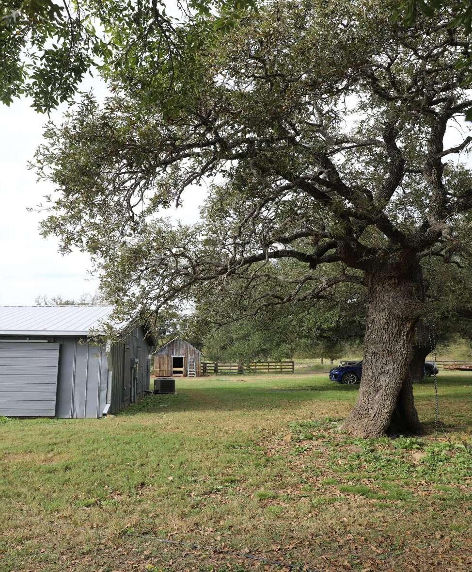 Specimen tree near Bassett House (MIG 2021)

 Left: Fallen Bois D’arc fruit (MIG 2021)
A building, such as a house, barn, church, hotel, or similar construction, is created principally to shelter any form of human activity. The term “structure” is used to distinguish from buildings those functional constructions made usually for purposes other than creating human shelter.
The buildings and structures at Bassett Farms comprise a mix of residential and operational buildings. The operational buildings reflect the agricultural land use on the property and are vernacular in style, evolving based on their functional qualities within the commercial context of the farm. The Bassett House is notable for its reflection of prominence and wealth of the family and the classical revival architectural style.
Henry Bassett oversaw the construction of the Bassett House c. 1875. He selected a site approximately 400 feet east of the north branch of Sulphur Creek and set back 200 feet from the Kosse-Marlin Road.42 The two-story brick house featured a one-story front porch that spanned the width of its south façade, overlooking the front lawn towards the road. The porch columns and entry system expressed Greek Revival influences.
The relatively expensive brick construction material and classical style elements at the primary façade departed from the traditional log cabins in the region and is attributed to the influence of the Mrs. Hattie Ford Bassett, who had grown up in a slave-owning family on an agricultural plantation in Mississippi.43
Bassett House was designed to capture seasonal breezes and large trees were planted along its west and rear sides to help keep the house cool.
42 Preservation Texas. Home Place, 10.
43 Preservation Texas. Home Place, 9.
These basic principles of form and orientation were typical of rural farmsteads in the region, including in the siting and construction of the tenant houses associated with Bassett Farms.44
Serving as the primary Bassett family residence for the almost 100-year period of significance, Bassett House underwent several periods of alteration and improvement during the historic period. The changes reflect updates in available technology, a growing family, and the priorities of the primary caretaker tasked with managing the domestic core at Home Place. A two-room brick ell was added to rear of the Bassett house in the 1880s, likely replacing an earlier kitchen wing in the same location. An exterior porch extended the house’s front hall along the east edge of the ell.45 After Henry’s death in 1889, Hattie oversaw several changes to the Bassett House including the installation of modern lamp fixtures around 1900, a new two-story porch with porch swing around 1916, and the enclosure of the second story of the porch as a screened in sleeping porch around 1920.46 She also installed a white picket fence around the residence during this period.
Electricity and new appliances were installed at the Bassett House under Willie Ford Bassett’s tenure prior to 1949.47 Additional improvements occurred between in the following decades, including a new two-story porch and a new twostory bathroom addition at the east end of the rear façade of the front mass. Interior paneling was also likely installed during this period.
Zelda Bassett, Willie Ford’s oldest daughter continued to improve the house in the 1960s while she resided in Dallas. She hired a
44 Preservation Texas. Overview, 11-12.
45 Preservation Texas. Home Place, 19.
46 Preservation Texas. Home Place, 40.
47 The date electricity arrived at Bassett Farms is unknown and may have occurred as early as 1935. It is known to have existed on site by 1949 when the family installed new electrical appliances at Bassett House. Preservation Texas. Home Place, 38, 53.
contractor to repair the foundation and the walls of Bassett House and oversaw the construction of a stepped brick patio and brick central pathway in front of the porch.
A collection of farm outbuildings was clustered within Home Place. They supported farm operations and were located behind the Bassett House or to its east near the banks of Sulphur Creek. They were shielded from view so as not to infringe upon the prominent siting of the Bassett House. The outbuildings have gone through several phases of style and function, depending on the operational needs of the farm and the families living there.
During the 1870s and 1880s, Henry Bassett used brick to construct a dairy building immediately behind Bassett House, where the family kept a couple of dairy cows and churned butter; the underground cistern to collect rainwater with a wood pump house on top of it (see Constructed Water Features); and brick wells along Sulphur Creek at both Home Place and Blum Place.48 The location of the dairy and the cistern so close to the house indicate they may have been constructed before the rear kitchen ell was added.
The bricks used by Henry appear to have been manufactured locally. In 1877 a brick and tile company opened in Kosse. The bricks produced at the Kosse factory were used extensively to build out the commercial center in town until the factory closed in the 1880s. A light colored hexagonal tile, known to have been produced at the Kosse factory, has been found in various locations around the Bassett House, among a host of different brick types and styles.49
Multiple generations of barns have been constructed at Bassett Farms. The original barn, built by Henry Bassett in the 1870s or 1880s, was located behind Bassett House to the northwest and was a wood barn built in the English style organized along a central aisle. The original barn was expanded over the years, with a shed on its southern side for equipment storage and another extension to the north.50 It was destroyed in a fire in 1936, and a smaller wood frame hay barn was built at the same location.
Two additional wood barns, smaller in scale, were added to Home Place by Hattie Bassett around 1900 as farm operations were expanding rapidly through land acquisition. Two more wood barns were built by Willie Ford Bassett around 1950s in the wooded pasture west of Bassett House, near the banks of Sulphur Creek, and in the pasture south of Kosse-Marlin Road.
Revenue from oil leases in the 1970s saw the construction of several metal farm outbuildings where former wood buildings were failing, including a replacement hay barn o the site of the original barn and the small barn west of Bassett House, constructed by Willie Ford Bassett, near the road.
The Bassett cottonseed shed was constructed around 1895 when Hattie Bassett was expanding the farms cotton production exponentially. The building was used to store cottonseed from the previous year’s crop. A wood framed shed with vertical board-and-batten siding under a steep end-gabled roof, the building was tall and narrow with an opening towards the top of one wall that allowed for seed to be added to the top of the pile stored at the interior. Interior wall planks were used to protect the building’s structure from outward pressure and reduce 50 Preservation Texas. Home Place, 23.
stress on the framing. Given its dimensions, it’s estimated that the structure could hold up to ten tons of weight in cottonseed. A lean-to shed was added to the cottonseed at an unknown date, but was removed in 2021 when the cottonseed shed was restored. Tenant farmers would visit homeplace to purchase or borrow cottonseed from the Bassett family. Originally located closer to the Bassett House, the cottonseed shed was relocated to the perimeter of Home Place to accommodate the construction of the garage in 1955.51
Hattie Bassett added what is thought to be a curing shed and a carriage house (location unknown) to Home Place around 1900.
During the 1920s, Hattie Bassett constructed a new building on the west side of the front yard that had wood shingle siding. It’s unconfirmed how the Bassett family used the building, but it’s possible it served as a farm office.
The windmill was replaced with a corrugated pump house near the Basset House well after electricity was extended to the property between ca.1935 and 1949.52
The domestic core at Home Place was expanded when the garage was constructed in its current location in 1955.53 Some farm outbuildings were removed to accommodate the garage, while others, such as the cottonseed shed, were relocated to the perimeter of the yard.
When Blum Place was sold to Henry Bassett in 1887, two tenant farms were included in the
51 Preservation Texas. Home Place, 30-31.
52 Preservation Texas. Home Place, 38.
53 Preservation Texas. Home Place, 31.
acquisition. Receipts from that year also included substantial building materials for barbed wire fencing and other tenant improvements.
One of the tenant homesteads is represented by a cluster of collapsed buildings and structures along the farm road that leads to the stock tank at Blum Place today. As with most tenant homesteads at Bassett Farms, the complex likely included a house, an outhouse, a barn, and a smokehouse.54
Upon the death of her husband in 1888, Hattie Bassett continued to acquire land and grow cotton production. As her landholdings grew, Hattie oversaw the construction of new tenant homes to rent to farm laborers or the improvement of existing facilities.55 She had a new tenant home constructed, including a new well, at Blum Place in 1890.56 Unlike the Bassett residence, tenant complexes were typically built close to the road to maximize the area available for cultivation. At the turn of the 20th century Bassett Farms housed as many as forty tenant families on the property.57 Tenant houses were built and maintained through the 1950s.
Henry and Hattie Bassett oversaw the construction of a school on one acre south of Home Place in 1885, within the pasture tract acquired for the Bassett cattle and horse herds. Bassett Farms was incorporated into the Kosse Independent School District during the early 20th century and the school was abandoned by 1918. The school building is non-extant.
The oil boom of the 1920 saw the drilling of several oil wells at Bassett family properties,
54 Preservation Texas. Blum Place, 4.
55 Preservation Texas. Home Place, 34.
56 Preservation Texas. Blum Place, 5.
57 Preservation Texas. Overview, 6.
including within the cotton fields and pastures at Blum Place. Derricks were built atop the well.
The general number and arrangement of buildings and structures at Home Place stabilized in the 1960s, although several wood outbuildings dating to the historic period were replaced with metal buildings in the 1970s.
The last permanent resident of Bassett House was Willie Ford Bassett. After his death in 1967, his daughters visited the house but did not live there.
Bassett House was mothballed in 2019, and work was begun on interior and exteriors renovation in 2021. 58 The two-story porch was restored to early 20th century conditions, and the stepped brick patio at the front of the house was removed.
Several of the 19th century brick buildings and structures built by Henry Bassett remain intact at Bassett Farms. In additional to the main Bassett residence (Bassett House), two wells, the cistern at Bassett House, and the dairy building are representative of this early phase of development.
The dairy has been altered since its initial use as a dairy, though these alterations likely occurred during the historic period. The building appears to have been used as storage or as a play house for Bassett children.
The metal barns installed in the 1970s are intact. Electricity has been extended to the hay barn, 58 Preservation Texas. Home Place, 73.
the floor has been paved with gravel, and a gutter system was installed.59
Only one wood pole barn remains intact in the wooded field west of Bassett House.
The cottonseed shed built around 1895 was relocated during the historic period but remains extant. It was rehabilitated in 2021. The structure is thought to be one of the last surviving structures of its kind in Texas.
The curing shed built around 1900 was relocated during the historic period but remains extant. It was rehabilitated, at the same time the cottonseed shed was restored, in 2021 and together they represent the period of heavy cotton production overseen by Hattie Bassett during the early part of the 20th century.
The corrugated metal pump house near the brick well at Bassett House is extant but nonfunctional.
The ca. 1950s garage was converted to two apartments in 2018 and septic was installed.60
Tenants remained at Bassett Farms after Willie Ford Bassett’s death, though numbers dwindled as farm operations waned. The former tenant homesteads at Blum Place are nearly non-extant, but are demarcated by wells, farm road traces, and other remains of farm-related infrastructure.
Tenant homes and outbuildings are extant in other areas of the extended acreage of Bassett
59 Preservation Texas. Home Place, 73. 60 Preservation Texas. Home Place, 73.
Farms Conservancy, but are not the subject of this CLR. They will be addressed in future reports.
Most of the above ground oil wells infrastructure, such as derricks, were temporary in nature and do not remain intact at Bassett Farms. However, gas leases remained lucrative through the 1970s and allowed the Bassett granddaughters to upgrade farm outbuildings at Home Place. An additional natural gas well was installed in the south pasture around 1981 and is accessed via an unimproved road.
Bassett Farms Cultural Landscape Report
| Section Two: Landscape Characteristics Analysis & Evaluation
Buildings and Structures
Upper: Bassett House after recent porch restoration (Preservation Texas 2022)


Bassett Farms Cultural Landscape Report | Section Two: Landscape Characteristics Analysis & Evaluation
Buildings and Structures
Upper: Metal Pole Barn (MIG 2021)

Lower: Metal Hay Barn (MIG 2021)

Buildings and Structures
Upper: Wood Pole Barn (MIG 2021)


Lower left: Cottonseed Shed (Preservation Texas 2022)
Lower right: Shed C (Preservation Texas 2022)
Bassett Farms Cultural Landscape Report | Section Two: Landscape Characteristics Analysis & Evaluation

Buildings and Structures
Upper: Equipment Shed (MIG 2021)
Lower: Garage Apartments (MIG 2021)

Buildings and Structures
Upper: Ruin of tenant farm building or structure at Blum Place (MIG 2021)

Lower: Example of standing tenant building at Town Place on Parcel 4 (MIG 2021)

Historical constructed forms for water retention and conveyance for utilitarian and/or aesthetic functions, typically occurring as part of a larger system.
Constructed water features at Bassett Farm are generally divided into two categories of use: agricultural (ie: irrigation or stock tanks) and domestic use. See Natural Systems for the rivers, creeks, and springs that characterize the landscape. The following features are listed in the general chronological order in which they were installed on the property.
Along Sulphur Creek to the northwest of Bassett House, Henry Bassett built a brick-lined cylindrical well with a diameter of 32 inches and a depth of 20 feet. Initially, water was drawn via a bucket-rope-pulley system. The sulphuric content of the water made it unsuitable for domestic use, but appropriate for agricultural uses.61 Similar wells are found near tenant homestead sites in Blum Place and Hirschfield Place.
In the 1890s, the Bassetts installed a windmill and gravity-fed elevated water tank near the brick well at Home Place to replace the bucket and pulley system. This allowed them to be more efficient in distributing water to livestock and for other agricultural uses.62 When electricity arrived at Bassett Farms perhaps as early as 1935, an electric pump was installed in a small, corrugated metal pump house at the well site.
An underground bell-shaped brick cistern was
61 Preservation Texas. Home Place, 24.
62 Preservation Texas. Home Place, 36-37.
located directly behind the Bassett House to collect and provide drinking water for the Bassett family. The cistern is estimated to be between 12 and 15 feet deep and was fed by water collected via gutters on the Bassett House rear addition and then carried through a shallow brick trough just below ground before emptying into the cistern.63
A square frame building was constructed over the cistern that likely housed a water pump; A bell tower was affixed to the roof. The cistern provided the Bassett family with water through the 1960s.64 Dates of construction for the cistern and pump house are unknown, but both are identified in photos taken of the property in the 1920s and it’s possible they date to Henry Bassett’s tenure as farm manager due to his preference for constructing brick features throughout the farm.
The return of stock to Bassett Farms during the 1940s led the Bassetts to construct at least twenty stock tanks throughout the property. The large stock tank at the north end of Home Place was installed around 1939 within former cotton fields and reflects the transition that took place at the farm after Hattie Bassett’s death. As Willie Ford Bassett continued to transition land from cotton production back to grazing, he installed new stock tanks through the 1960s. The midsize stock tank installed within Sulphur Creek’s riparian area immediately behind the domestic core of Home Place was built around 1965.65
Stock tanks were formed by creating an earthen dam to restrict the flow of runoff water during major rainfall events that would otherwise have flowed into Sulphur Creek or the Little Brazos River. In addition to providing water for livestock, these ponds were stocked with fish and provided habitat for waterfowl, attracted game, and could also be used to fight fires. Typically, stock tanks were
63 Preservation Texas. Home Place, 21.
64 Preservation Texas. Home Place, 21.
65 Preservation Texas. Home Place, 57.
EXISTING CONDITION
Stock Tanks
Updated Irrigation and Water Distribution System


66 Preservation Texas. Overview, 36.
67 Preservation Texas. Home Place, 7.
68 Preservation Texas. Home Place, 37.
69 Preservation Texas. Home Place, 62.
Constructed Water Features Upper left: Irrigation system installed after the historic period at Home Place (MIG 2021)Upper left: Well site in Home Place (MIG 2021)
Upper right: Well site in Blum Place (MIG 2021)
Lower: Corrugated metal pump house in Home Place near site of former windmill (Preservation Texas)


Constructed Water Features
Upper: Example of stock pond in Home Place (MIG 2021)

Lower: Example of stock pond in Blum Place (MIG 2021)

The prospect afforded by a range of vision in the landscape, conferred by the composition of other landscapes characteristics and associated features. Views and vistas are distinguished as follows. Views are the expansive and/or panoramic prospect of a broad range of vision which may be naturally occurring or deliberately contrived. Vistas are the controlled prospect of a discrete, linear range of vision, which is deliberately contrived.
The intentional siting of Bassett House set-back from the Kosse-Marlin Road emphasized privacy and minimized the impact of the dirt and noise generated by the well-traveled but unimproved road.
The house’s position also afforded passers-by a broad prospect of the house that reinforced a sense of grandeur associated with the prominent Bassett family. The front yard created by the depth of the set-back also reinforced that image by indicating that the family could afford to remove the land from active agricultural use.70 Vegetation and small-scale features were kept to a minimum in the front yard during the historic period to maintain the vista.
The view to and from Bassett House remains largely open and somewhat unobstructed, with the exception of a tree line that crowds the north edge of the historic Kosse-Marlin Road alignment. The lawn area remains open and largely free of vegetation and small-scale features.
Views and Vistas
Upper: View from second floor of the Bassett House to County Road (MIG 2021)

Lower: View from County Road towards the Bassett House (MIG 2021)

The elements which provide detail and diversity for both functional needs and aesthetic concerns in the landscape.
Before barbed wire was introduced in east Texas, “Virginia” or “snake” fences (stacked timber posts, often arranged in a zig-zag line) were typically used to separate domestic areas and crops from the open range. The fences were constructed of local oak, cedar, or elm, but were time and labor-intensive to build and maintain. It’s unknown how heavily Henry Bassett relied on this fence type during the early years of Bassett Farms, but it’s likely that he constructed primitive versions of wood fencing to protect the acres he dedicated to corn, cotton, and the peach orchard from his cattle. Bois d’arc hedges were also used for this purpose (see Vegetation).71
When barbed wire was introduced about 1876, the relatively inexpensive material immediately gained popularity among large-scale farms and ranches as a means of controlling cattle herds. Ultimately, barbed wire led to the end of open ranges for cattle grazing in east Texas, opening the door for a transition to cotton production.72
Henry and Hattie Bassett adopted a combination of wood and barbed wire fencing to delineate pasture from crop production throughout Bassett Farms. A fence of wood posts and barbed wire was also installed along the Kosse-Marlin Road to keep cattle from trampling through Home Place. The Bassett’s also built a fence of wood planks and wire mesh with a metal gate to enclose the core domestic building sand structures at Home Place and contain Hattie Bassett’s poultry flocks. It was updated with
71 Preservation Texas. Home Place, 3.
72 Preservation Texas. Overview, 26.
wood picket fencing around 1920.73 The picket fence was removed around 1942 and replaced with a border of small rocks.
In the 20th century, utilitarian stock fences, usually a mix of wood posts and barbed wire, were continuously constructed and maintained throughout Bassett Farms to facilitate grazing rotation and keep cattle out of hay fields, as well as around the stock ponds to prevent livestock from trampling, damaging, and contaminating the ponds. Gates were installed along the fence lines to facilitate entry and circulation between pastures for both vehicles and grazing rotation.
Function and economy were prime drivers of the fences constructed throughout the historic period contributing to small variations in styles based on the methods of construction and materials available at the time. As is typical of agricultural landscapes spanning several decades and multiple generations, there is not one consistent fence type that was used.
Corrals and other livestock-related infrastructure were installed throughout Bassett Farms by Willie Ford Bassett as he transitioned the farm from cotton production back to stock raising in the 1940s and 1950s. Corrals are evident in the 1950s aerials along the north and west (rear) edges of the barn and within the pasture area south of Kosse-Marlin Road. Cattle guards were installed along the fence lines at Home Place to keep the cattle from wandering up to the Bassett House. Troughs and other feeding containers were likely located throughout the farm as herds were rotated through the pastures. A cattle wash was located in the pasture across Kosse-Marlin Road from the Bassett House.
Several types of hybrid fencing remain in use at Bassett Farms. The first is simple barbed wire fence lines supported via wood posts or t-posts (often a mix of the two as posts are repaired or replaced over time). This fence type is found in the pasture areas that used to house the grazing and farming functions on the farm. Wood slat fencing, sometimes with wire mesh overlays, is also located in and around the farm buildings at Home Place.
The southern end of Home Place was enclosed in continuous ornamental metal fencing around 1970. The metal posts are set in concrete although many are loose. The wood picket fence around the domestic core was removed, although the historic alignment is marked with a row of white stones and ornamental beds put in place by Willie Ford Bassett’s daughters.
Around 2013, a simple wooden fence was added at the Home Place entrance with a new gate. Combination fencing around several of the farm outbuildings behind Bassett House was removed and new wooden plank fencing was added to the north and northeast perimeter of the domestic core.74
Corrals, cattle guards, wild boar traps, and other varied livestock-related features are located throughout the landscape at Bassett Farms. These features are less prevalent than they were during the historic period due to the reduction in operations but continue to illustrate the former agricultural function of the property. These types of features were relocated and improved regularly while the farm was in operation. Though deteriorated, a remnant of the cattle 74 Preservation Texas. Home Place, 72.
wash remains in the pasture located across Kosse-Marlin Road from the Bassett House. It’s understood that the wild boar traps were added after the historic period.
In 2013, Preservation Texas retained a local firm to install a security system at Bassett House, and in 2019 a historic marker was installed near the entrance gate along the Kosse-Marlin Road.75 75
Small Scale Features
Upper: Example of post and barbed-wire fencing (MIG 2021)
Lower: Example of post and barbed-wire fencing in Home Place (MIG 2021)


Small Scale Features
Upper: Example of ornamental fencing around Bassett House (MIG 2021)

Lower: Example of wood fencing in Home Place (MIG 2021)

Small Scale Features
Upper: Example of cattle corral in Home Place (MIG 2021)

Lower: Example of cattle guard in Home Place (MIG 2021)

Small Scale Features
Upper: Example of wild boar trap in Blum Place (MIG 2021)

Lower: Historical marker at Home Place (MIG 2021)

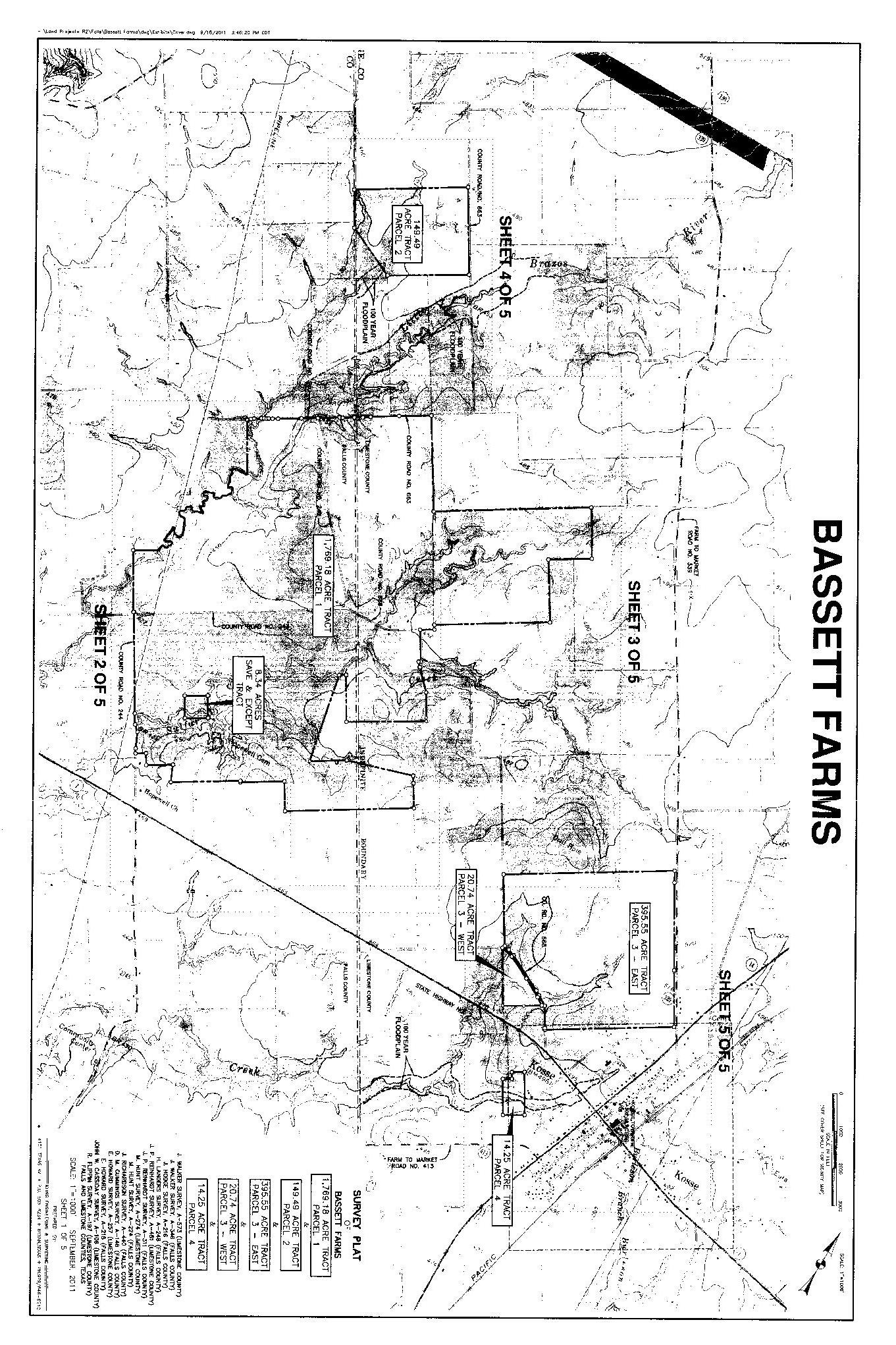


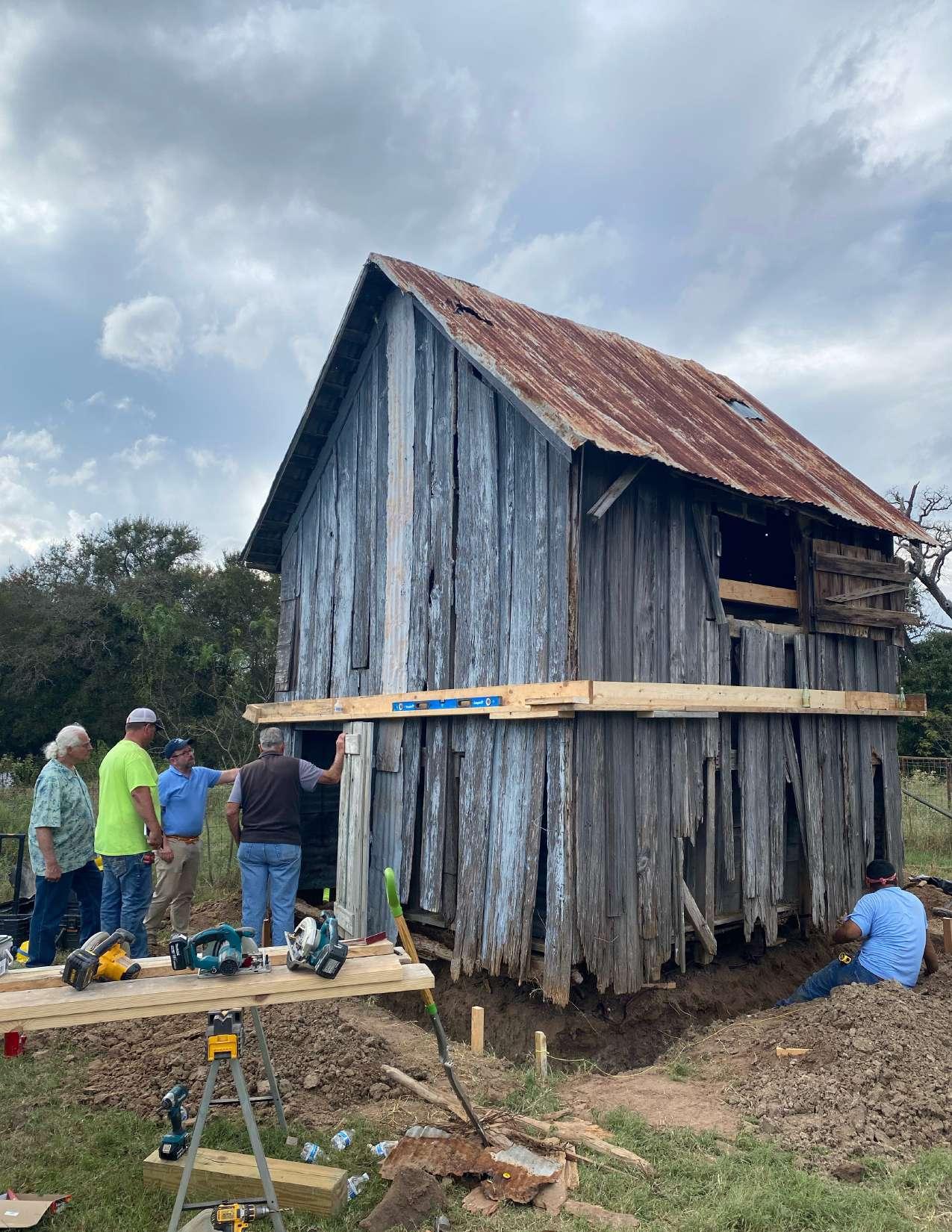 The Cottonseed Shed as it underwent restoration in October 2021 (MIG 2021)
INTRODUCTION
TREATMENT PHILOSOPHY
TREATMENT FRAMEWORK
TREATMENT RECOMMENDATIONS
NATURAL SYSTEMS
SPATIAL ORGANIZATION
LAND USE
CIRCULATION
VEGETATION
BUILDINGS & STRUCTURES
CONSTRUCTED WATER FEATURES
VIEWS & VISTAS
SMALL-SCALE FEATURES
This section presents preservation treatment guidelines and recommendations for the short- and long-term planning, design, and management of the Bassett Farms cultural landscape. Inherent is the objective of preserving the character-defining features from the period of significance (1871-1967) that convey the vernacular and designed landscape’s historic significance and integrity. These preservation treatment and design guidelines address the landscapes associated with Home Place, Blum Place, and Hirshfield Farm. Other landscapes that are part of the Bassett Farms Conservancy properties, including the Hopewell Freedom Colony, will be addressed in future planning documents.
This chapter contains three sections that provide different levels of guidance which will be useful at various times during the cultural landscape preservation treatment implementation and management process. They are:
1. Treatment Philosophy outlines the high-level vision and goals for managing the landscape as a cultural resource, including the intent of the primary treatment and specific considerations for long-term planning and management. This section is useful when larger scale or longer-term decisions are being considered for the future of Bassett Farms or when opportunities and issues arise that are not directly addressed in the Preservation Treatment and Guidelines
2. Treatment Approach identifies the primary treatment approach (rehabilitation), why it was chosen to
guide cultural landscape preservation decisions and lists the established standards for that approach as codified in The Secretary of the Interior’s Standards for the Treatment of Historic Properties with Guidelines for Cultural Landscapes.
3. Preservation Treatment and Design Guidelines identifies opportunities for compatible physical site changes, programming, and maintenance that reflect the rehabilitation treatment approach, vision, and goals for the site’s continued use. Recommendations address site issues that have been articulated by Preservation Texas and its partners, including programming, operations and maintenance, visitor experience, and climate change.
During the period of significance (18711967) Bassett Farms served as the heart of a community of people that lived closely with the landscape that supported their livelihoods and life experiences. Echoes of that heartbeat remain and are gaining strength with Preservation Texas’s purchase and management of the Bassett Farms Conservancy. Bassett Farms served its immediate community in the past; Bassett Farms Conservancy will serve the local, regional, and national community in the future with a vision that includes making Bassett Farms a center for learning, education, and events that highlight and reveal the unique layers of history this place possesses. The stories are local but tap into national trends and events that upon revelation help connect the American story to this landscape.
Preservation, Conservation, Education. Bassett Farms will be developed as the largest preservation and conservation skills training center in the country.1
This large, historic rural landscape will be conserved, its historic resources preserved, and its diverse history studied, interpreted, and shared as part of a wide-ranging educational program in support of Preservation Texas’ mission.2
characterize the layered history of human use, centered on domestic life, agricultural use, seeking and acting on new opportunities, and confronting challenges.
Goal 2: Provide flexibility that allows modest degrees of change to address contemporary needs and activities while staying true to the historic character of the cultural landscape.
Goal 3: Balance the preservation of historic, cultural, and natural resources which combined tell the wider story of this landscape since time immemorial.
Goal 4: Seek opportunities to reveal the interconnected nature of the landscape to the people, and the people to each other, in making a life here: the triumphs and the tragedies.
Goal 5: Seek opportunities to frame national stories and events through the lives of the people who lived and worked at Bassett Farms, and the events that shaped this cultural landscape.
Goal 6: Illuminate the methods and practices of cultural landscape preservation using Bassett Farms as an outdoor classroom and laboratory to help fulfill the mission of Bassett Farms Conservancy “Cultivating the Field of Preservation.”
Goal 1: When and where possible maintain and prioritize historic uses of Bassett Farms which
1 https://www.bassettfarms.org/
2 https://www.bassettfarms.org/about
There are four primary treatment approaches for cultural landscapes. Generally, the amount of physical intervention allowed in a landscape increases from the preservation treatment, through rehabilitation and restoration to the reconstruction treatment.3 The level of documentation and knowledge needed to support these treatments also increases between preservation and reconstruction. The treatment approaches include:4
• Preservation: the act or process of applying measures necessary to sustain the existing form, integrity, and material of a historic property. Includes initial stabilization work, where necessary, as well as ongoing preservation maintenance and repair of historic materials and features.
• Rehabilitation: the act or process of making possible a compatible use for a property through repair, alterations, and additions while preserving those portions or features which convey its historical, cultural, or architectural values.
• Restoration: the act or process of accurately depicting the form, features, and character of a property as it appeared at a particular period by removing features from other periods in its history and reconstructing missing features from the restoration period.
• Reconstruction: the act or process of depicting, by means of new construction, the form, features, and detailing of a non-surviving site, landscape building,
3 Page, Robert, Cathy Gilbert, and Susan Dolan. A Guide to Cultural Landscape Reports, 82.
4 Definitions excerpted from The Secretary of the Interior’s Standards for the Treatment of Historic Properties, 1995.
structure, or object for the purpose of replicating its appearance at a specific period and in its historic location.
Rehabilitation is the recommended treatment approach for the Bassett Farms cultural landscape. This treatment supports the goal of preserving the historic character of the agricultural and domestic landscape while allowing for modest needed changes to support the educational mission of Preservation Texas for this property. Rehabilitation also supports key activities such as preservation and conservation education, historical research and education, appropriately scaled and conceived public visitation and events, creative arts residencies, and fundraising activities.
The intent of the primary treatment approach is to maintain the landscape’s character as close as possible to its condition at the height of historic use and activity as possible, allowing for some degree of change to address contemporary needs. While it is not the vision of Preservation Texas nor this cultural landscape report to bring back all historic activities and use, the goal is to infuse the landscape with more life and active management reflective of the stewardship of the Bassett Family and their tenants.
While much has changed and evolved at Bassett Farms during the period of significance (18711967), the location, setting, feeling, association, and design of the core facilities still reflect the essence of the property at the end of its period of significance.
The established baseline standards for a rehabilitation approach as outlined in The Secretary of the Interior’s Standards for the Treatment of Historic Properties with Guidelines for the Treatment of Cultural Landscapes are listed below. All decisions about future changes to the design or management of Bassett Farms should follow these standards at a minimum. The Preservation Treatment Recommendations and Design Guidelines that follow are meant to build upon these baseline standards.
1. A property will be used as it was historically or be given a new use that requires minimal change to its distinctive materials, features, spaces, and spatial relationships.
2. The historic character of a property will be retained and preserved. The removal of distinctive materials or alteration of features, spaces, and spatial relationships that characterize a property will be avoided.
3. Each property will be recognized as a physical record of its time, place, and use. Changes that create a false sense of historical development, such as adding conjectural features or elements from other historic properties, will not be undertaken.
4. Changes to a property that have acquired historic significance in their own right shall be retained and preserved.
5. Distinctive materials, features, finishes, and construction techniques or examples of craftsmanship that characterize a property will be preserved.
6. Deteriorated historic features will be
repaired rather than replaced. Where the severity of deterioration requires replacement of a distinctive feature, the new feature will match the old in design, color, texture, and, where possible, materials. Replacement of missing features will be substantiated by documentary and physical evidence.
7. Chemical or physical treatments, if appropriate, will be undertaken using the gentlest means possible. Treatments that cause damage to historic materials will not be used.
8. Archeological resources will be protected and preserved in place. If such resources must be disturbed, mitigation measures will be undertaken.
9. New additions, exterior alterations, or related new construction will not destroy historic materials, features, and spatial relationships that characterize the property. The new work will be differentiated from the old and will be compatible with the historic materials, features, size, scale and proportion, and massing to protect the integrity of the property and its environment.
10. New additions and adjacent or related new construction will be undertaken in a such a manner that, if removed in the future, the essential form and integrity of the historic property and its environment would be unimpaired.
Preservation treatment recommendations highlight ways in which Preservation Texas and its partners can effectively preserve the historic character while addressing current and future modifications by providing guidelines and specific preservation treatment recommendations that reflect the selected treatment approaches for a cultural landscape.
This is a guiding document, intended to support the decision-making and planning process, while allowing for more detailed discussions related to the implementation of recommendations once funding is identified. Both short- and long-term recommendations for planning and management are included.
Treatment recommendations and design guidelines for the cultural landscape are organized by the same landscape characteristics that were used to organize the analysis and evaluation of landscape characteristics and features in Section II. The content of Section II, namely the historic character summary for each landscape characteristic, provides a baseline or touchstone for these recommendations and will be a valuable resource as they are implemented.
The narrative is supported by an annotated Treatment Plan and precedent images. Not every landscape characteristic or feature identified in Section II includes treatment recommendations or design guidelines.
• Natural Systems
• Spatial Organization
• Land Use
• Circulation
• Vegetation
• Buildings and Structures
• Constructed Water Features
• Views and Vistas
• Small-scale Features
This landscape’s natural systems are one of the primary reasons that Bassett Farms was established and then thrived for generations, and these systems supported lifeways of cultures that preceded historic period ownership. Their full relationship to humans and wildlife should be incorporated into their future management and interpretation to ensure their longevity and health.
Prioritize managing natural systems to support their ecological health and their role in supporting the ecological health of desired fauna species by working with partnering non-profits and public agencies, such as Texas Parks & Wildlife, Dixon Water Foundation, and the Lady Bird Johnson Wildflower Center.
• Complete ecological surveys prior to developing a management strategy. Priority areas include the riparian corridors and stock tanks.
Restore the health and functionality of Sulphur Creek, including the riparian habitat that surrounds and supports its health, to halt erosion and flooding, bank degradation, and improve water quality. Priority should be given to the area behind Home Place between the small and large stock tanks, where the riparian area has been cleared over the past 25 years.
This work could be done in conjunction with partnering agencies, such as the United States Department of Agriculture, Texas Parks and Wildlife, Brazos River Authority, and/or Texas State Soil & Water Conservation Board, that are focused on restoring the Little Brazos and Brazos Rivers watersheds through Watershed Protection Plans (WPP). See related recommendation for historic wells under Constructed Water Features and fence lines along riparian corridors under Small-Scale Features.
Develop a plan to ensure the regeneration of native trees, shrubs, and forbs in select areas. This will likely include several different approaches, depending on the condition of the plants targeted for regeneration. For example,
• Some native prairie plants have been replanted, but cyclical maintenance is needed to ensure they can continue to thrive and are not impacted by invasive plants or grazing. This could include cyclical prescribed burns that mimic the fire management utilized by Native Americans and the pre-fire suppression regime associated with the prairie landscape. Texas Parks and Wildlife should be consulted for best practices and procedures (which are listed on their website), in addition to technical experts at the Lady Bird Johnson Wildflower Center.
• Young shrubs and trees may have been impacted by years of grazing and the next generation not able to effectively establish itself.
• In areas where grazing will not continue, monitor the status of native plant regeneration, and manage those areas to encourage the health of the next generation. In some cases, temporary protection measures may be needed for trees and shrubs that are impacted by wildlife and adjacent plant crowding.
• In areas where grazing will continue, but native trees are desired, protection measures should be implemented to ensure the trees are able to grow. These measures could include designating smaller exclusion zones within a pasture by using easily movable and removable electric fences. See related recommendations under Land Use.
Remove invasive plants from prairie restoration zones utilizing best management practices, which may include mechanical removal of woody species or limited use of herbicides. Herbicides are not generally encouraged unless there are no other options for prairie restoration. For example, at Sand Creek Massacre National Historic Site a cyclable but limited use of herbicides was required to restore the native prairie habitats and allow for native vegetation to re-establish. Their methods can be used as a model. Technical experts at the Lady Bird Johnson Wildflower Center could also be consulted.
Complete soil surveys for selected areas within the landscape prior to completing any vegetation plantings or restoration work to ensure that the species that are being planted will thrive. The soils have been degraded due to intensive farming and heavy grazing practices, so the goal is to work towards soil repair and regeneration. The Texas State Soil & Water Conservation Board will be a critical partner.
Consider hosting an annual bioblitz event where the community is led by experts in the sighting and documenting of fauna and flora species in the landscape. The knowledge gained from these events can help shape future restoration activities to attract, retain or control desired flora and fauna populations. This could help guide the recommendation listed above for regenerating native plant species.
as planning and development of facilities and events moves forward and mitigate those impacts to preserve the quiet natural sounds that are a characteristic of this landscape. At Bassett Farms the calls of frogs, birds, and cows signify a rural farm landscape, while vehicles on packed earth or gravel, conversation over the television or radio, music, or the clang of dishes signify the
domestic core. Identification of these intangible characteristics will help preserve sounds typical of the historic period and prevent or mitigate impacts of discordant contemporary sounds to the historic setting. For example, the Denali National Park and Preserve implemented a soundscape monitoring program to monitor the level of impact flight traffic and snowmachines had in the park.5
5 Central Alaska Inventory and Monitoring Network: https://www.nps.gov/im/cakn/sounds.htm
Top: Prescribed burns are an excellent way to reduce wildfire fuel loads, encourage native grass and forbs to thrive, and reduce non-native woody vegetation. They should be completed on a cyclical seasonal schedule.

(Texas Parks and Wildflie)
Bottom: More formal examples of tree protection infrastructure would be more appropriate near the historic core of Home Place. These would stay in place until the tree can withstand any impacts from grazing cattle.
(Designer Metal)

Top: While there are many forms of tree protection, something sturdy, but minimal in its materials and form like the one shown here, is appropriate for a majority of the pastures. (Government of Western Australia)

Bottom: Participants of all ages can be engaged in a Bioblitz where they are guided on what species to look for, and how to document their presence over a brief, but intensive period of time. (National Geographic, Keene Haywood)

Preserve the spatial organization, while also revealing some of the less visible ways the cultural landscape was organized.
Nominate the property for listing in the National Register of Historic Places as a rural historic district. The nomination should include all the Bassett Farms Conservancy land holdings, not just those addressed in this CLR.
Rehabilitate the domestic core by re-establishing the historic entry drive for pedestrian use, maintaining the landscape’s open lawn area in front of the house and setback from the Kosse-Marlin Road, and maintaining or restoring trees that were planted to frame and shade the house and shield outbuildings from view. As part of this rehabilitation consider compatible domestic uses on the east and west side of the house that reflect those undertaken by the Bassett family (i.e. ornamental vegetation, the large kitchen garden and poultry yard, or water collection and butter churning) during the period of significance. These areas could be used to support functions inside the house, much as they did during the historic period, even though the uses have changed. See related recommendations under Circulation, Vegetation, and Small-scale Features.
Restore or represent the spatial organization of the tenant farms and other buildings or clusters outside of Home Place by considering the sites of missing buildings as locations for any new buildings (for residences, classrooms, storage). For example, if a new classroom or lab is needed, the former schoolhouse site should be considered. The scale of the new building should be consistent with the one that was present during the historic period. Undertake
archeological investigations prior to construction to serve as a learning opportunity and to prevent any damage to archeological resources. Other options include marking the corners of buildings with ghost structures or permanent or temporary posts, mowing the outline of the building footprint, or restoring and/or preserving in situ the ruins that remain. See related recommendations under Circulation and Buildings and Structures.
Restore the historic arrangement of agricultural land at Blum Place and Hirshfield Farm through careful selection of areas that should return to prairie, grazing, or crop production based on an examination of historic aerial photographs and other evidence that dates to the period of significance.
The long duration of the period of significance provides some flexibility in proposed use. It is generally recommended to base decisions about the arrangement of agricultural land on the condition of Bassett Farms during its height of diversity of uses, such as towards the end of Hattie Bassett’s life when her son was managing the transition from cotton to ranching and both uses were represented on the property.
• Where possible, known historic circulation routes, fence alignments, and tree breaks or bois d’arc should be used to reinforce or restore historic land divisions, including pasture and field size. For example, if a large field was historically sub-divided by fencing for grazing it would be appropriate to restore the historic fence alignment to facilitate a desired use in that area.
• If subdivision of a field or pasture that was historically open is desired for maintenance or management purposes, temporary fencing is recommended. Avoid establishing new farm roads or tree
lines that give the appearance of dating to the historic period. The historic scale of these spaces is important to maintain to provide a sense of both the expansive and profitable nature of the Bassett Farm operations as well as the technological limitations of the time.
Preserve or restore as many historic land uses as possible, while considering the addition of new compatible uses that reinvigorate the landscape while preserving its historic character.
Establish some new uses of the property that provide financial support without impacting the cultural landscape character. For example,
• introduce facilities for practical and theoretical training in preservation, agriculture, conservation trades.
• introduce facilities for the use of Bassett Farms as a retreat center that can support scholars, professionals, artists, etc. who are inspired by the history, natural resources, and preservation training opportunities. See related recommendation under Spatial Organization.
• develop a program for filming location rentals with clear parameters for the location and use guidelines for production and staging areas.
• establish a research library that can support historians, preservationists, and students that is formed from the current collections and archival materials holdings.
Continue or re-establish historic uses where feasible, in support of the Bassett Farms mission and goals, which can aid in educating the public about Bassett Farms and its historic significance. For example,
• Continue grazing cattle or other livestock through leases or cooperative agreements but utilize methods that meet conservation goals, such as rotational grazing. Preservation Texas may also choose to build and maintain a small herd of cattle for educational or interpretive programs. Integrate a small pasture near the Bassett House into the rotation as a demonstration pasture for educational events and consider having historic livestock breeds.
• Consider planting part of the acreage in cotton or any other crop that was planted historically; and consider planting a domestic garden near the Bassett House. See related recommendations under Vegetation.
• Prioritize hosting public events and celebrations that illustrate a historic connection with the cultural landscape such as the Juneteenth Celebration, the annual baseball game, and harvest celebrations.
• Maintain and explore opportunities for temporary or seasonal residences to represent historic residential uses, such as what the garage apartments currently provide.
Avoid
uses
gloss over
social history of Bassett Farms and environs. Bassett Farms is intended to provide a place for education related to the agricultural history of east Texas, the lives of the property’s former inhabitants, and cultural and natural resources preservation. This broad vision and associated goals cannot be accomplished without acknowledging the foundational history of enslavement and segregation or indigenous genocide in the United States. In order to meet these goals, Bassett Farms should avoid hosting events that ignore these histories. For example, the property should not be rented for celebratory events like weddings or class reunions unless a direct connection to the cultural landscape is established.6
6 For example, if a descendent from one of the residents of the Hopewell Freedom Colony or a former tenant wanted to hold a wedding or related family event on the property, their direct connection to the historic landscape provides a nexus with the past.
new
that
the
Top: While this is a more formal example of marking a missing building, this concept can be translated to Bassett Farms using more rustic materials to mark the location and scale of missing buildings which will help restore a sense of the spatial relationships of the tenant farms. (Archeological Institute of America)

Bottom: While there are many examples of compatible uses for farm and ranch buildings, this shows an example of one being converted for studio and gallery space. A field laboratory would be a similar use. (Chalk Hill Residency)

Top: Larger open barns, such as the Metal Hay Barn at Home Place, can host versatile uses, such as informal and formal celebrations and events. The scale and type of gathering should match the scale of the building being used and the staqging needed on site to support it.

Bottom: Field documentation of cultural landscape features can support educational goals for the Bassett Farms Conservancy and increase knowledge of the location and condition of extant features. (Preservation Maryland)

How, where, and when people moved through the landscape and the connections that the road and path network created between the people who lived and worked here is critical to understanding the inter-related and inter-dependent nature of this place.
Prioritize restoring historic circulation networks and related infrastructure, such as historic fence lines, that provide links between properties with an emphasis on the connections that tenant farmers and employees used to move from their homes to Home Place. The type and intensity of the methods for restoring the historic circulation will be dependent on condition and use. For example,
• If a road that connected a tenant farmer’s home to the Bassett House is in good condition and slated for continued use, then the restoration effort will likely require minimal effort and should be completed so that approved vehicles can continue its use.
• If a historic road that connected the Hopewell Community to Bassett Farms has been lost or portions of it are lost and it will be used for pedestrian connections, then restore the alignment and width to match the historic conditions as best as possible for that lighter use.
• If the historic road includes bridges that have been lost or damaged, then assess the condition and historic character and, if sufficient material or documentation exists, use the rehabilitation approach to repair or rebuild the bridge. The range of options will be to restore a historic bridge to its historic condition if it’s needed for pedestrian use to constructing a new
bridge that is compatible, but distinct from the historic bridge. A simple wood plank bridge might meet pedestrian trail needs, although reinforcement may be required to accommodate contemporary accessibility requirements and vehicular traffic along certain roads and trails. See related recommendations under Spatial Organization.
Restore the loop entry drive so that it matches the historic drive, in terms of width and materials, as closely as possible given what can be deduced from oral histories and historic photographs. If historic materials are not known, then a low-impact soil binder or decomposed granite mixed with soil is recommended.
Develop a small accessible parking area within the Home Place domestic core for staff and guests with mobility and health limitations. The small parking area should use similar materials to those used for the entry drive while meeting outdoor accessibility standards of a firm and stable surface with minimal slope.
Develop a medium sized parking area on the outskirts of the Home Place domestic core to accommodate regular staff and guests, and small and medium-sized events. The parking area should use similar materials to those used for the entry drive and accessible parking area.
Maintain a pasture area outside the Home Place domestic core to provide parking for larger events. These parking areas will not have any typical parking area infrastructure. As such, parking attendants should be used whenever needed to direct and control parking and vehicular movement. If the location is a far distance from the event location, then consider providing a shuttle service between the parking area and the event site.
Establish and regularly maintain a loop trail or trail network that connects the Home Place domestic core with points of interest. The loop trail should follow historic road traces, fence lines, natural land contours, or property lines whenever possible with new trail segments being limited to those that are needed to provide connections. Related to this recommendation is the restoration of historic circulation infrastructure such as bridges that have been lost or severely damaged.
• Determining primary points of interest will be critical to the realization of a trail plan. Points of interest may include historic features like the windmill or stock ponds associated with the operation of Bassett Farms, or natural features such as the flora and fauna. The terrain will guide the level of desired intervention. For example, an unimproved trail network along the riparian corridor around Sulphur Creek would provide a shady and isolated area for bird watching.
• Similarly, improved trails with guard rails can be used to guide visitors through culturally or naturally sensitive areas like the Sulphur Spring site. Contemporary fencing with minimal profiles such as a steel rope balustrade along the path or around a viewing area will help limit unwanted interactions between visitors and the landscape. This type of contemporary intervention is best located away from the domestic core to minimize its visual impact.
Maintain contact with Limestone and Falls Counties planning and transportation agencies to ensure the preservation of the county roads character including their historic alignment, width, material, and profile. If road work or maintenance is needed, encourage the counties to follow rehabilitation standards.
Top: Medium sized parking areas can be designed with an integral approach to existing or added landscape features such as a tree grove, like the one here at Middleton Place in South Carolina, that help blend contemporary needs with the cultural landscape’s character. (Mike Goad)

Bottom: Overflow parking areas are well suited for unused pastures. These work best when people are hired to direct traffic or when removable traffic cones and ropes are used to mark parking locations. (M. McClintock)

This map shows potential interpretive trail routes at Home Place, including two creek crossings. It was prepared by the Texas Conservation Corps and adapted by MIG to comply with the trail recommendations included in thsi CLR. (TCC, MIG, 2022)
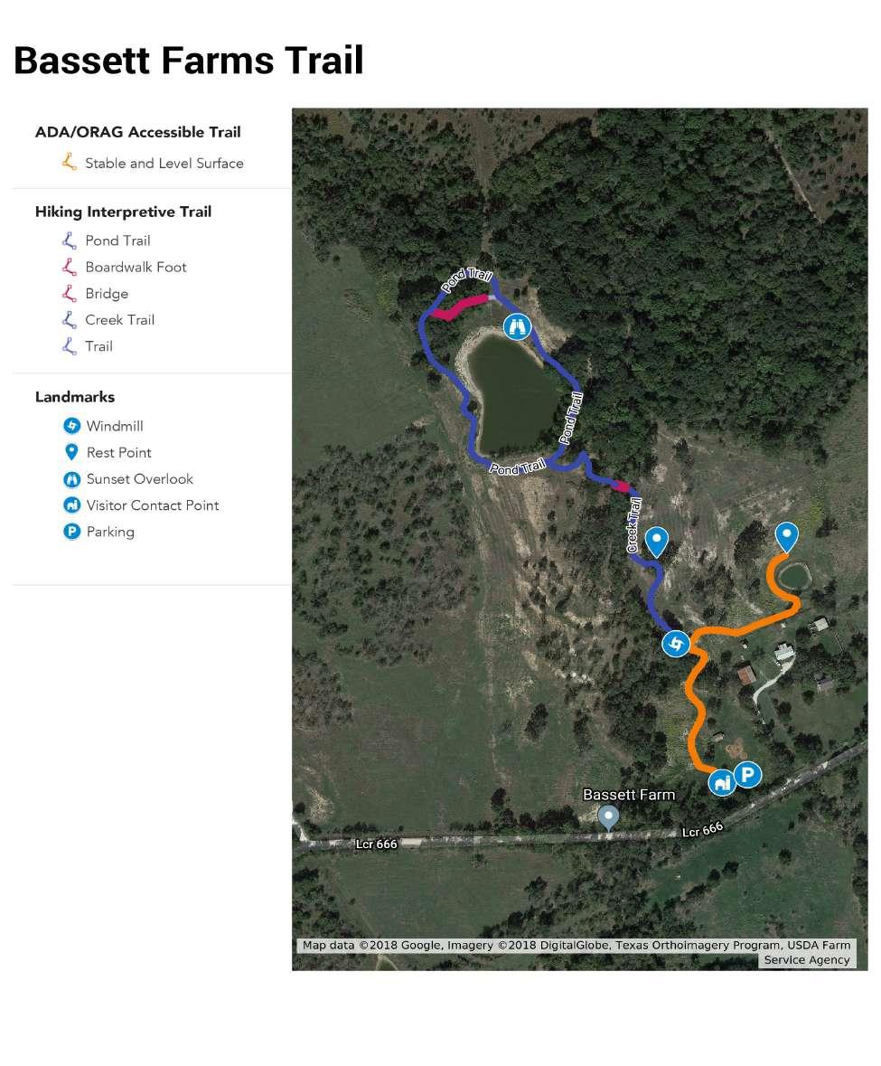
Ornamental and agricultural vegetation represents the active living and working aspects of this cultural landscape. It represents both the prosperity and hard work of creating a life in this place.
Consider re-establishing domestic gardens near Bassett House to show the scale and type of smaller scale agriculture that was present. While a full-scale kitchen garden could be restored on the east side of the front yard, this is not necessary. Re-establishing the scale of the garden, but with plants that require less maintenance would work as would establishing a smaller garden plot of more care intensive plants. What plants are grown could also reflect the Bassett’s historic use of selling agricultural products. For example, instead of selling cotton seed the domestic garden could support an annual or biannual plant sale. The direction should be dictated by the educational mission of the site and how this might support other activities, both educational and event oriented. For example, some of the food could be used for catering events. In all cases, consider potential impacts of climate change on vegetation viability.
Maintain or re-establish ornamental plants around the Bassett House to reflect those that were present during the height of the farm’s use. This may include fewer varieties and numbers of plants given that many ornamental plants were added after the period of significance.
Consider restoring a section of bois d’arc that were planted to protect crops or other areas from cattle prior to the invention of barbed wire. In addition to restoring a distinctive early feature of the historic landscape, bois d’arc often provide important habitat for small mammals and birds. It’s long-term care would also provide cyclical training opportunities for this type of cultural landscape feature.
Consider establishing an orchard to reflect the historic orchard of 100 peaches that existed during the historic period. The range of options include establishing the single species peach orchard in its historic location and scale to establishing a smaller orchard of multiple historic or contemporary varieties of other stone fruits to reflect the presence of the orchard. In addition to reflecting a historic landscape feature, this will provide cyclical training opportunities for this type of cultural landscape feature.
The orchard should be located close to Home Place for easy management, visitor access, and education or interpretation. Potential sites include the zone between the existing driveway and Sulphur Creek south of the brick well, the cleared areas immediately north of the tree line that demarcates the domestic core at Home Place (adjacent to the small stock pond), or either of the former fields/pastures located immediately east and northeast of Bassett House.
. The scale and materials (namely plant varieties) will be dependent on multiple factors. For example, working with a local grower may provide a good partnership and the crop types would be dictated by the farmer’s market options. This could include contemporary crops, or heirloom varieties of plants grown during the historic period could be grown to ensure the species themselves remain in production. In addition to crops grown for food, plants grown for herbal medicines, flower trade, nursery stock, and/or other plant-based commodities can be considered. This recommendation can also strengthen the commercial ties between the Conservancy and local farmers, adding to local support for this venture.
Locations for re-establishing crops should be selected based on desired function, growing requirements, management needs, and scale. For example, if an experimental or high-maintenance crop is selected, such as a pollinator or heirloom species, it should be located on a relatively small field close to the domestic core to monitor and manage its health and be accessible to visitors for educational or interpretive purposes. Potential sites include the former pastures and fields directly west of the north branch of Sulphur Creek along County Road 243, the former pasture south of Kosse-Marlin Road, or the former pastures and fields immediately east and northeast of Bassett House. Intensive farm crops managed through leases, such as cotton, hay, or corn, may be more appropriately located in larger fields further from the core of public services.
All decisions about locations for the reestablishment of crops, gardens, and bois d’arc should be based on historic documentation and analysis. See related recommendation under Spatial Organization.
Establish a plan to remove invasive vegetation that includes cyclical maintenance to keep it at bay. The removal will likely be a multi-year effort and the maintenance will likely need cyclical attention, though the effort typically recedes as maintenance continues. When possible, avoid use of chemicals that might negatively impact the soil and below ground resources. See related recommendations under Natural Systems.

 Top: Restoring lost vegetation types, such as the peach orchard, can provide a fuller picture of the productive landscape and provide training opportunities for how to maintain cultural landscape features such as pruning and harvesting techniques. (Natural Resources Conservation Service)
Bottom: The Sauer-Beckmann Farm, with an interpreted 19the century kitchen garden adjacent to the main house, at the Lyndon B. Johnson State Park and Historic Site. (Texas Parks and Wildlife)
Top: Restoring lost vegetation types, such as the peach orchard, can provide a fuller picture of the productive landscape and provide training opportunities for how to maintain cultural landscape features such as pruning and harvesting techniques. (Natural Resources Conservation Service)
Bottom: The Sauer-Beckmann Farm, with an interpreted 19the century kitchen garden adjacent to the main house, at the Lyndon B. Johnson State Park and Historic Site. (Texas Parks and Wildlife)
The buildings and their clustered development highlights central areas of intensive activities within Bassett Farms. While other reports and studies will focus on the buildings themselves, this focus of the recommendations here are on preserving or restoring those nodes. See related recommendations under Spatial Organization.
Prioritize the use of existing buildings for adaptation for new uses, such as classrooms, laboratories, residences, exhibit spaces, etc. that support the mission and vision of Bassett Farms Conservancy. The reuse of contributing buildings should use a rehabilitation approach for their adaptation and be informed by historic documentation and research. More flexibility is allowed in alterations to non-contributing buildings, such as the metal barns, so long as the alterations do not impact the arrangement, scale, or historic materials at Home Place. See Existing Conditions Plan Detail for an illustration of contributing and noncontributing buildings
Restore, rehabilitate, or preserve the tenant farm clusters at Bassett Farms. The recommended treatment for each cluster depends on existing conditions. If a site is in ruins, consider stabilization and preservation of the buildings combined with educational interpretative goals. If the buildings are still standing but in extremely poor condition, then consider full restoration with adequate historic research and documentation to guide the effort. In both circumstances, rehabilitation of characteristic landscape features like fences, circulation, and vegetation should also be prioritized to increase legibility and understanding of the cluster. If no ruins or other physical evidence remains and a new building is needed apply rehabilitation standards to
buildings that follow the established historic arrangement patterns and are compatible but distinct from historic buildings. See related recommendation under Spatial Organization.
Avoid reconstruction as a treatment for the former tenant farm clusters where sufficient historical documentation does not exist. Alternatives treatment include “ghost structures” or contemporary markings or memorials.
If reconstruction of non-extant historic buildings or structures is desired, apply the Secretary of the Interior’s Standards for Reconstruction. This approach requires that sufficient historical documentation exists to reconstruct an accurate representation of the building or structure and avoid historical error.7 If only partial documentation exists, reconstruction of that component of the building plus interpretation is an acceptable treatment. For example, if historic photos and descriptions are available for the exterior of a building but there is a lack of known information about the interior, then only the exterior should be reconstructed while the interior of the building should be contemporary with onsite interpretation that describes this process. It’s important to note that the bar is high in terms of documentation to meet the standards for reconstruction.
• Opportunities for reconstruction will need to be identified based on available and quality of research but may include the former cistern pump house and wood barn/s at Home Place.
7 The Secretary of the Interior’s Standards for Reconstruction can be found on the National Park Services website: https://www.nps.gov/tps/standards.htm
Sensitively locate, design, and build new buildings for new uses if no historic buildings can be adapted for the proposed use. Some considerations include:
• No new buildings should be larger than the largest existing barn and all should be subservient in scale, location, and building material to the main house.
• No new buildings should be added to the domestic core of Home Place. If a new building is needed in that area, then consider rebuilding an existing building that was rebuilt or substantially modified after the historic period. See related recommendations under Spatial Organization.
Assess any infrastructure needs, such as septic, electricity, etc. to help determine the carrying capacity of the site before embarking on substantial projects.
Develop detailed preservation, restoration, or rehabilitation plans for the contributing buildings and structures in consultation with historic architects or applicable consultants while exploring the educational opportunities that the full process of those endeavors provides.
• Opportunities for preservation, restoration, and rehabilitation include the underground brick cistern, the brick well, and the corrugated metal pump house near the well at Home Place. One or more of these features may require consultation with an archaeologist as they are connected to below ground water systems. Preservation is the recommended treatment for the cistern, while rehabilitation may be a viable treatment for the pump house. Treatment of the brick well should be determined based on intended use and functionality. See related recommendation under Constructed Water Features.
Capturing and harnessing water for the domestic and agricultural uses of the property were critical to its function and viability as a home and economic enterprise. The infrastructure associated with harnessing water spans from the invisible to the highly visible.
Evaluate the viability of restoring one or all the historic wells, especially if the springs that supported them are still functioning. This could include restoring the windmill or pump house that was part of that infrastructure. See related recommendations under Natural Systems.
. The type and level of rehabilitation will depend on their current condition and planned use. For example, stock tanks that remain in use for grazing livestock will need to be rehabilitated for that use and those that will be adapted to support wildlife habitat or as landscape amenities for guests will be rehabilitated for that use. In the second example, water quality and riparian edge restoration will likely be needed in many cases. In all cases, the location, scale, and structural components of the stock tank should be preserved as best as possible to ensure the legibility of this critical historic landscape feature remains.
The view to the Bassett House and from it to the road was a distinctive element of this landscape and the Bassett family’s relationship to the property and the community.
Prioritize the restoration and future management of the view to and from the Bassett House and Kosse-Marlin Road. Some vegetation clearing will be needed to restore the viewshed and that configuration should be maintained with no new plantings in areas where plants did not exist during most of the historic period. This may also include replanting trees adjacent to the house that shielded from view the various outbuildings behind the house. Though most of the buildings are in similar locations to those present during the historic period, some are new or have changed so locations for new plantings should reflect the current building locations. Though views were possible from a section of the road, the prime viewpoint exists at the center of the historic entry road near where it intersected the county road.
Intentional tree lines (such as those along the north edge of the domestic core between Bassett House and the outbuildings) and mature specimen trees existed at Home Place during the period of significance. Clearing should focus on mid-sized trees, shrubs, and brush. Opportunities for clearing include:
• The fence alignments along both edges of the Historic Kosse-Marlin Road in front of Bassett House.
• The full width of the front yard at Bassett House between the driveway and the edge of the former kitchen garden site.
• The east and west yards at Bassett House.
views and vistas may be identified and managed to improve sightlines and visitor use. Consideration should be made to ensure these views don’t impact or detract from historic viewsheds.
Contemporary
Small-scale features are often overlooked, but collectively they often provide defining character details within a cultural landscape. If too many are lost then those critical details are lost, and if too many contemporary small-scale features are added they can overwhelm the character of the property as a whole.
Maintain and preserve as many historic fence alignments as possible. For example,
• If a particular alignment is no longer actively used, then maintain its location only.
• If a fence alignment is still used, but its historic type no longer meets the current use then explore rehabilitation options for that fence. For example, historic photos show a wood post and barbed wire fence demarcating the property line along County Road 666 in front of Home Place where the non-historic metal ornamental fence is currently aligned.8
• If a historic fence meets its current use, then complete regular maintenance to ensure that remains the case.
• Seek grant funding from the United States Department of Agriculture to repair and maintain existing fences along the riparian corridors.
8 Basset Farms Conservancy: Historic Photographs, 40.
Maintain and preserve as many distinctive historic fence types that remain. This will likely require a survey of the different fence types around Bassett Farms, which can be incorporated into a preservation education workshop or partnering student education program. Note that the ornamental metal fence at Home Place was installed after the period of significance and is not considered historic.
Restore the historic wood fencing in the domestic core and remove the metal fence that was added after the period of significance to help rehabilitate a historic feature and the core’s spatial organization. This will also facilitate better informal pedestrian flow around the through the domestic core.
Prioritize restoration of known but non-extant fence alignments wherever possible when siting new fencing. Unless extraordinary circumstances arise, all new fences should be minimal and contemporary in appearance and be easily movable and removable. For example, temporary vv fencing has been used very effectively to control cattle in the historic ranches of Point Reyes National Seashore when the historic alignments and fences don’t meet current herd management needs. See related recommendation about trails and fence types under Circulation.
Continue to maintain and preserve cattle related infrastructure such as cattle guards, corrals, and the cattle wash (or dipping vat). While this is especially important for those features that remain in use, those that are not in use should follow similar guidelines as established earlier for historic fences. Restoration of the cattle wash could be considered if it’s feasible.
An exception to this recommendation includes the cattle guards along the non-historic ornamental fence line at Home Place. These features were installed after the period of significance and present a hazard to pedestrians visiting the Bassett House. The cattle guards may be removed and stored or moved to areas of the farm where cattle historically ranged.
Continue to institute a less is more approach for signage at Home Place than is typically present in cultural landscapes adapted for contemporary uses. For example,
• Use temporary interpretive signage that can be easily installed and removed for events.
• Develop a wayfinding signage plan that uses a minimal amount of discrete signage focused on navigation to critical facilities such as the site, parking on the site, and restrooms.
• For any other interpretive or wayfinding needs, use staff or volunteers to disseminate information, or develop digital or tactile methods for individual self-guided use.
• Permanent or more visually prominent signage can be used with more frequency and is more appropriate in the outlying areas of Bassett Farms that will not be regularly staffed.
Site all contemporary infrastructure in the least visible locations possible. This includes security elements, utilities, etc.
Design and install a minimal amount of lighting that is needed for regular evening and night use and safety.
• The light fixtures should be dark sky compliant, be sited in the least visible locations possible, and utilize any existing infrastructure to avoid new additions to the landscape.
• Using non-contributing buildings or landscape features would be the first choice, and negative impacts to any contributing building or landscape feature should be avoided.
• All lighting should be designed so that it can be turned on only when needed, and that it remains off when not needed. Motion sensors can be used in places to provide safety and security lighting where regular movement occurs by staff and guests during nighttime hours.
Top: Any new lighting should be compatible, yet distinct from what is known to have existed during the historic period. Within agricutlrual landscapes lighting is often affixed to buidlings. This is appropriate if installation causes no irreperable damage to historic building fabric. (Steel Lighting Co)


Bottom Left: Simple contemporary light fixtures can be added in necessary locations. (Trex Lighting)
Bottom Right: Corten steel is a simple, durable material that evokes both a contemporary and rustic agricultural character and could be used for visitor orientation signage. (Gnee Steels)

Top: Another example of corten steel used for a sign that is scaled to be seen from the road for use with vehicular traffic. This could be used to note the visitor entrance from the Kosse-Marlin Road. (Strootman Landscape Architecture/Harry Cock)

Bottom: Electric fencing is ideally suited for managing livestock in historic pastures due to its minimal appearance which fades into the background, and the ease of moving it within larger pasture areas to manage grazing animals. (Wellscroft)

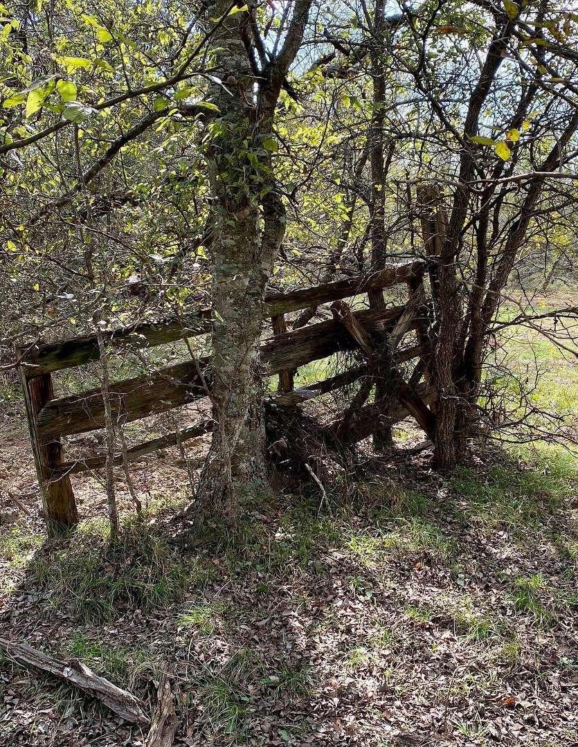 Remnant gate on one of the former tenant farms at Blum Place (MIG 2021)
McClelland, Linda Flint, J. Timothy Keller, Genevieve Keller, and Robert Z. Melnick. National Register Bulletin: Guidelines for Evaluating and Documenting Rural Historic Landscapes. Washington, D.C.: US Department of the Interior, 1990.
National Park Service. Central Alaska Inventory & Monitoring Network: Soundscapes. https://www.nps.gov/im/cakn/sounds. htm. Accessed May 2020.
National Park Service. The Secretary of the Interior’s Standards for the Treatment of Historic Properties and the Guidelines for the Treatment of Cultural Landscapes. 1996.
National Park Service. National Register Bulletin: How to Apply the National Register Criteria for Evaluation. Washington, D.C.: National Park Service, National Register of Historic Places, 1997.
Page, Robert R., Cathy A. Gilbert, and Susan A. Dolan. A Guide to Cultural Landscape Reports; Contents, Processes, and Techniques. Washington, DC: US Department of the Interior, 1998.
Bassett Farms Conservancy. https://www. bassettfarms.org, n.d.
Thompson, Evan R (Compiled and arranged by). Bassett Farms Conservancy: Historic Photographs. October 2021.
Thompson, Evan R. Bassett Farms Site History, Part One: General Overview DRAFT. October 2021.
Thompson, Evan R. Bassett Farms Site History, Part Two: Bassett Home Place DRAFT. October 2021.
Thompson, Evan R. Bassett Farms Site History, Part Three: The Blum Place DRAFT. October 2021.
Thompson, Evan R. Bassett Farms Site History, Part Four: The Hirshfield Farm DRAFT. October 2021.
Note to Reviewers: If there are other terms that you feel would be beneficial to add to this appendix please let us know.
Character-Defining Features (see Landscape Features)
Conifer
A conifer is a plant that produces cones as seeds. Conifers are primarily evergreen, but there are deciduous varieties as well.
Cultural Resources
Cultural resources include districts, sites, buildings, structures, or objects generally older than 50 years and considered to be important to a culture, subculture, or community for scientific, traditional, religious, or other reasons. They include prehistoric resources, historic-era resources, cultural landscapes, and traditional cultural properties.
Cultural Landscape
A cultural landscape is defined as a geographic area (including both cultural and natural resources and the wildlife therein) associated with a historic event, activity, or person or exhibiting other cultural or aesthetic values.
Deciduous
A deciduous plant is one that sheds its leaves or needles in the fall and remains dormant during the winter months before re-emerging in the spring.
Evergreen
An evergreen plant is one that retains its leaves or needles throughout the entire year. Evergreen plants can have either leaves or needles.
Historic District (often abbreviated to district)
A historic district is a geographically definable area, urban or rural, possessing a significant concentration, linkage, or continuity of sites, landscapes, structures, or objects, united by past events or aesthetically by plan or physical developments.
Historic Period (see Period of Significance)
Historic Property (sometimes shortened to Property)
A historic property is the umbrella term for one of the five types of resources that can be listed in the National Register of Historic Places: historic buildings, districts, sites, structures, and objects. Cultural landscapes are typically recognized as districts or sites.
Historic Site
A landscape significant for its association with a historic event, activity, or person.
Historic Vernacular Landscape
A landscape whose use, construction, or physical layout reflects endemic traditions, customs, beliefs, or values; expresses cultural values, social behavior, and individual actions over time, is manifested in physical features and materials and their interrelationships, including patterns of spatial organization, land use, circulation, vegetation, structures, and objects. It is a landscape whose physical, biological, and cultural features reflect the customs and everyday lives of people.
Integrity (also referred to as historical integrity)
Integrity is the authenticity of a cultural landscape’s historic identity evidenced by the survival of physical characteristics that existed during its historic or prehistoric period. It refers to the ability of a historic place to convey its significance. It’s also defined as the extent to which a cultural landscape retains its historic appearance.
Landscape Characteristics
Landscape characteristics include tangible and intangible aspects of a landscape from the historic period(s); these aspects individually and collectively give a landscape its historic character and aid in the understanding of its cultural importance. Landscape characteristics range from large-scale patterns and relationships to site details and materials. The characteristics are categories under which individual associated features can be grouped. For example, the landscape characteristic, vegetation, may include such features as a specimen tree, hedgerow, woodlot, and perennial bed.
Landscape Features (also referred to as Character-Defining Features)
Landscape features are prominent or distinctive elements of a cultural landscape. In a cultural landscape, individual features are grouped under broader categories of landscape characteristics. For example, such features as ravines, valleys, wetlands, and cliffs are grouped under the landscape characteristic, “natural systems and features.”
The period of significance, also referred to as the historic period, is the length of time when a property was associated with important events, activities, or person(s), or attained the characteristics that qualify it for listing in the National Register of Historic Places.
Preservation
Preservation is the act or process of applying measures necessary to sustain the existing form, integrity, and materials of an historic property. Work, including preliminary measures to protect and stabilize the property, generally focuses upon the ongoing maintenance and repair of historic materials and features rather than extensive replacement and new construction. New exterior additions are not within the scope of this treatment; however, the limited and sensitive upgrading of mechanical, electrical, and plumbing systems and other code-required work to make properties functional is appropriate within a preservation project.
Preservation Maintenance
Preservation maintenance is the action taken to mitigate wear and deterioration of a cultural landscape without altering its historic character by protecting its condition, repairing when its condition warrants with the least degree of intervention including limited replacement in kind, replacing an entire feature in kind when the level of deterioration or damage of materials precludes repair, and stabilizing to protect damaged materials or features from additional damage.
Rehabilitation is the act or process of making possible a compatible use for a property through repair, alterations, and additions while preserving those portions or features that convey its historical, cultural, or architectural values.
Restoration
Restoration is the act or process of accurately depicting the form, features, and character of a property as it appeared at a particular period of time by means of the removal of features from other periods in its history and reconstruction of missing features from the restoration period. The limited and sensitive upgrading of mechanical, electrical, and plumbing systems and other coderequired work to make properties functional is appropriate within a restoration project.
Reconstruction
Reconstruction is the act or process of depicting, by means of new construction, the form, features, and detailing of a non-surviving site, landscape, building, structure, or object for the purpose of replicating its appearance at a specific period of time and in its historic location.
Significance (also referred to as historical significance)
Significance is the meaning or value ascribed to a structure, landscape, object, or site based on the National Register of Historic Places criteria for evaluation. It normally stems from a combination of association and integrity.
Treatment (also referred to as preservation treatment)
Treatment is the preservation strategy and actions for the long-term care and management of a cultural landscape including preservation, rehabilitation, restoration, and reconstruction.