+91 9691400600 prerana..nt.afbe23@anu.edu.in www.linkedin.com/in/prerana-n-t-a85209a8/

+91 9691400600 prerana..nt.afbe23@anu.edu.in www.linkedin.com/in/prerana-n-t-a85209a8/
PostGraduateDiploma/ FellowshipinSustainability&BuiltEnvironment
Anant Fellowship, Anant National University Sept ‘23 - Sept ’24
BachelorinArchitecture
Nitte School of Architecture, Bangalore Jul ‘16 - Aug ’21
HigherSecondarySchool
Kendriya Vidyalaya Hebbal, Bangalore May ‘14 - Jun ‘16
ProjectManager, K-MUSE
Kalinga Institute of Social Sciences
Oct 2024 - Mar 2025
ArCauseCatalyst
Ethos Foundation, Arcause Vertical
Dec 2022 - Apr 2023
EditorialWriter
Rethinking the Future
Sept 2022 - Jan 2023
JuniorArchitect
SalzburgGlobalFellow
Salzburg Global Seminar July 2024
OutstandingAcademicPerformance-9CGPA Fellowship in Sustainability & Built Environment Nov 2024
BestOutgoingStudentoftheYear Indian Institute of Architects: Jun 2022
BestOutgoingStudentoftheYear-8CGPA Bachelors in Architecture, VTU Apr 2022
NominationforNationalAwardsfor ExcellenceinArchitecturalThesis Bachelors in Architecture, VTU Dec 2021
VTUFinancialAssistance: BestInnovativeProjects Bachelors in Architecture, VTU Sept 2021
2024 |Anant National University
International Symposium: Architecture for all
Sustainable Heritage Development 2024 |IGRMS
The Role of Design in Racial Equity 2024 |GBRI
2023 | IIHS, Bangalore
The Art & Science of Economic Policy
2021 | Ar. Apurva Bose Dutta
Studio Verge, Bangalore
Sept 2021 - Aug 2022
ProfessionalTraining(IXSemester)
Feb 2021 - May 2021 COLLAGE Architecture Studio
StudentIntern(VSemester)
Think Happy Everyday
Jan 2019 - Feb 2019
AutoCAD DraftingI Modeling
Rhinoceros SketchUp AdvancedAdvancedintmd
Enscape Rendering Lumion AdvancedAdvanced
Photoshop Presentation
Illustrator InDesign Advancedintmdintmd
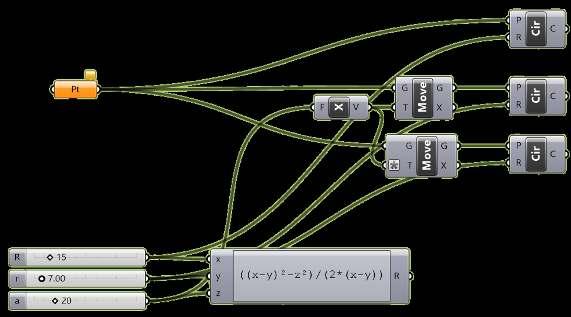
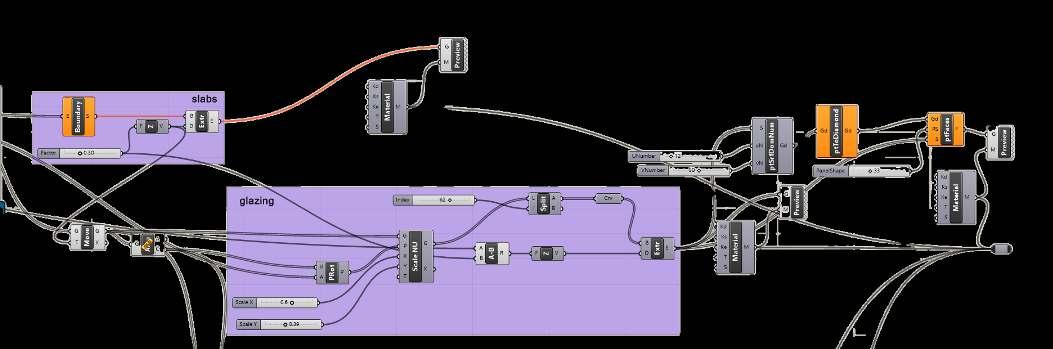
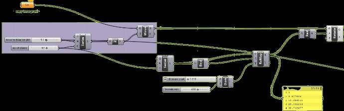
Grasshopper Computation Beginner
QGIS Mapping& SpatialAnalysis Intermediate
AcademicExcellenceCashPrize-9.6CGPA by GAIL India Matriculation English I Hindi I Kannada
Dr.AmareswarGalla UNESCO Chair on Inclusive Museums and Sustainable Heritage Development. a.galla@yahoo.com.au
DeepakSrinivasan Founder, Studio Cosmicloud Deep.srin@gmail.com
Ar.GitaBalakrishnan Founder, Ethos & Ethos Foundation gita@ethosempowers.com
2020 | DigitalFUTURES
Introduction to Parametric Modelling
2019 | DesignURU 2.0,
Urban Design Foreword
2018 | Laurie Baker Centre Writing Architecture
Ar.PriyamwadaSingh Founder, Common Ground Practice Architects priyamwada@cgp-nynd.com
languages

Anant Fellowship X Singapore Water Week ‘24 UrbanOpenSpaces Live Action Project 02 Anant Fellowship X AUDA Sanhati
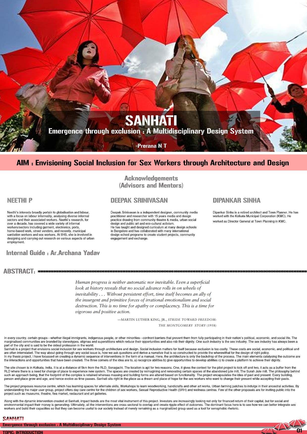
Emergence Through Exclusion
Bachelor’s in Architecture Thesis
Semester VII
Studio Verge

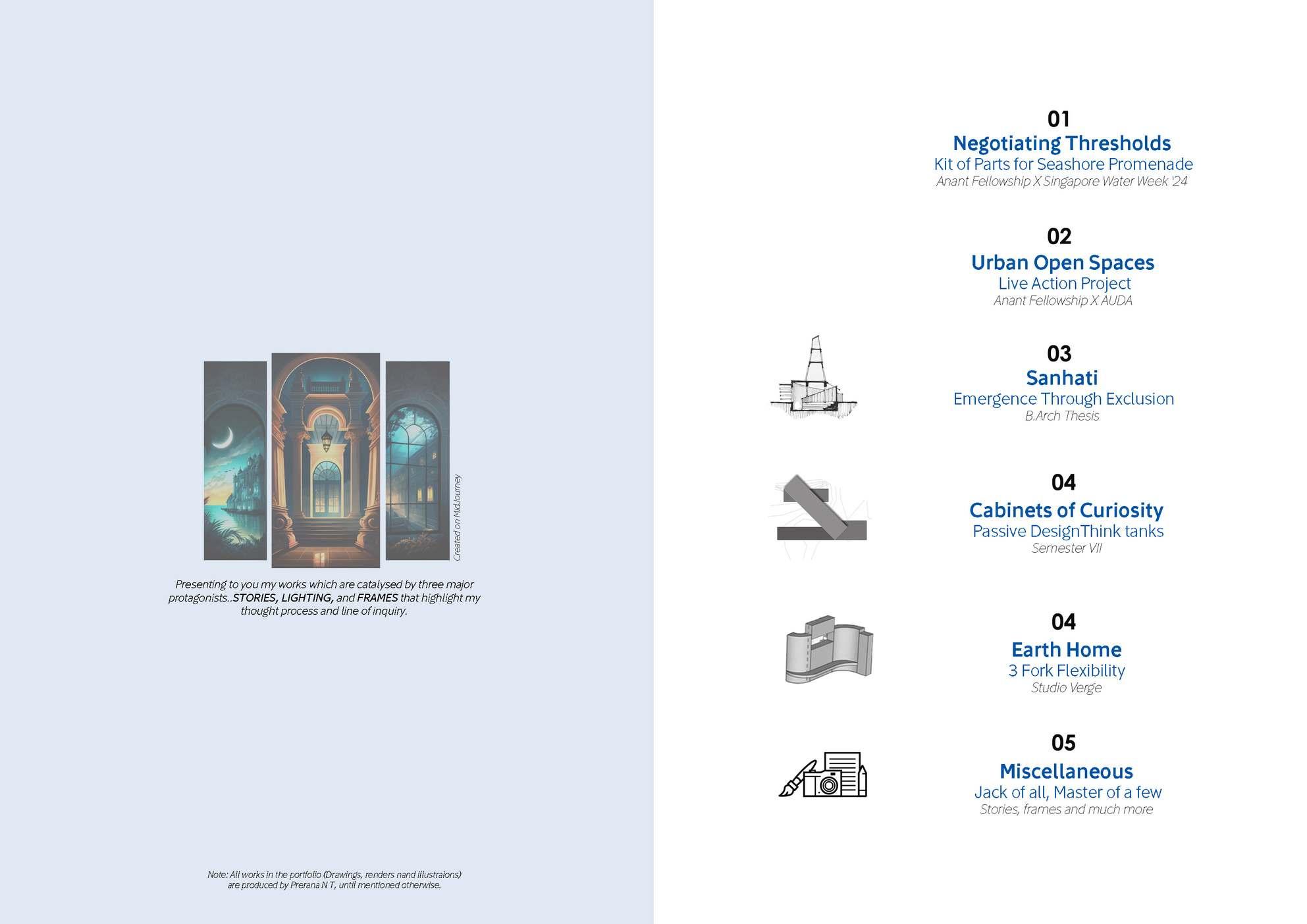
Jack of All, Master of a few
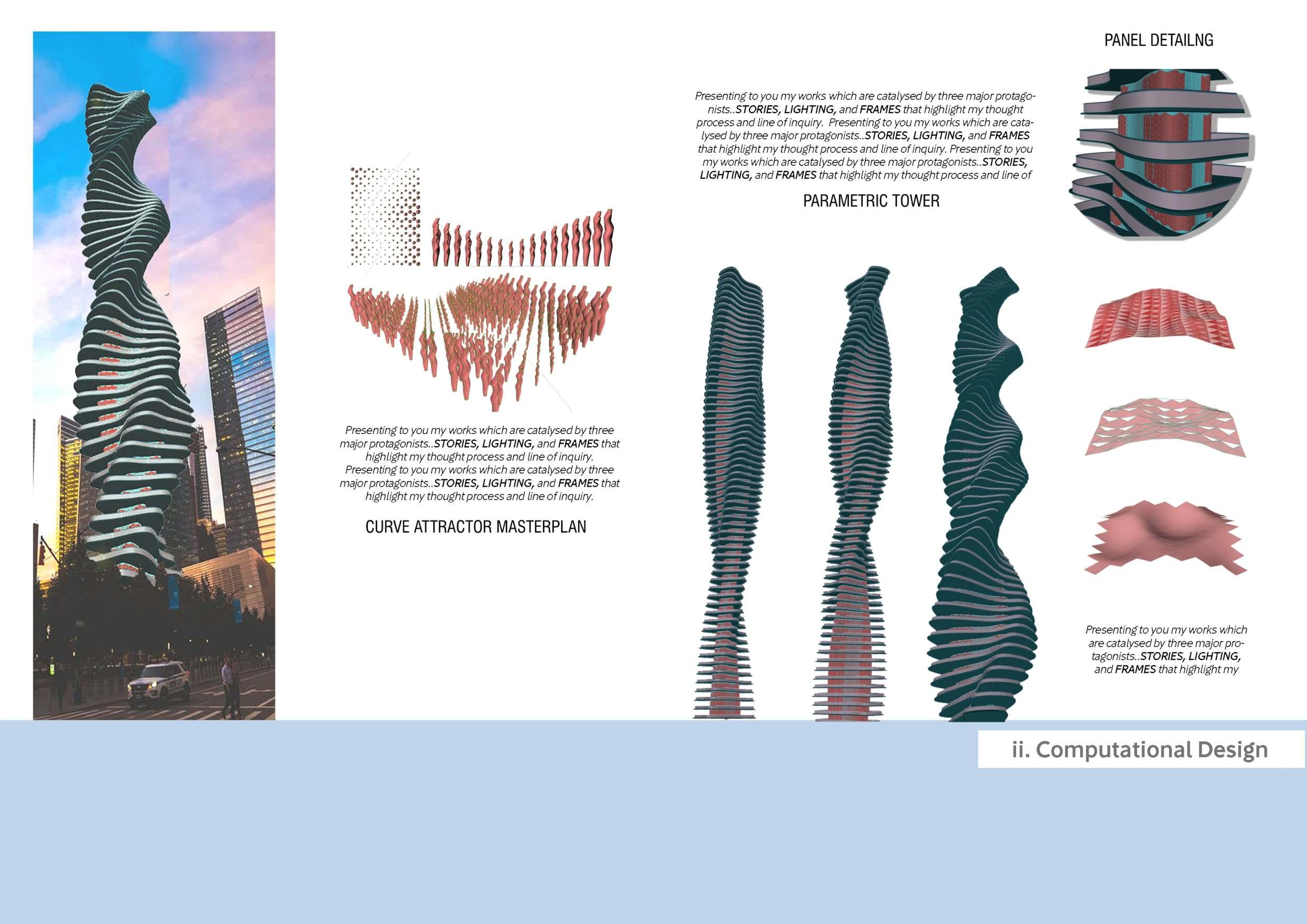
Architecture journalism, Computational Design, Salzburg Global Seminar, Illustrations, Photography
MODULE: Unbuilding Architecture
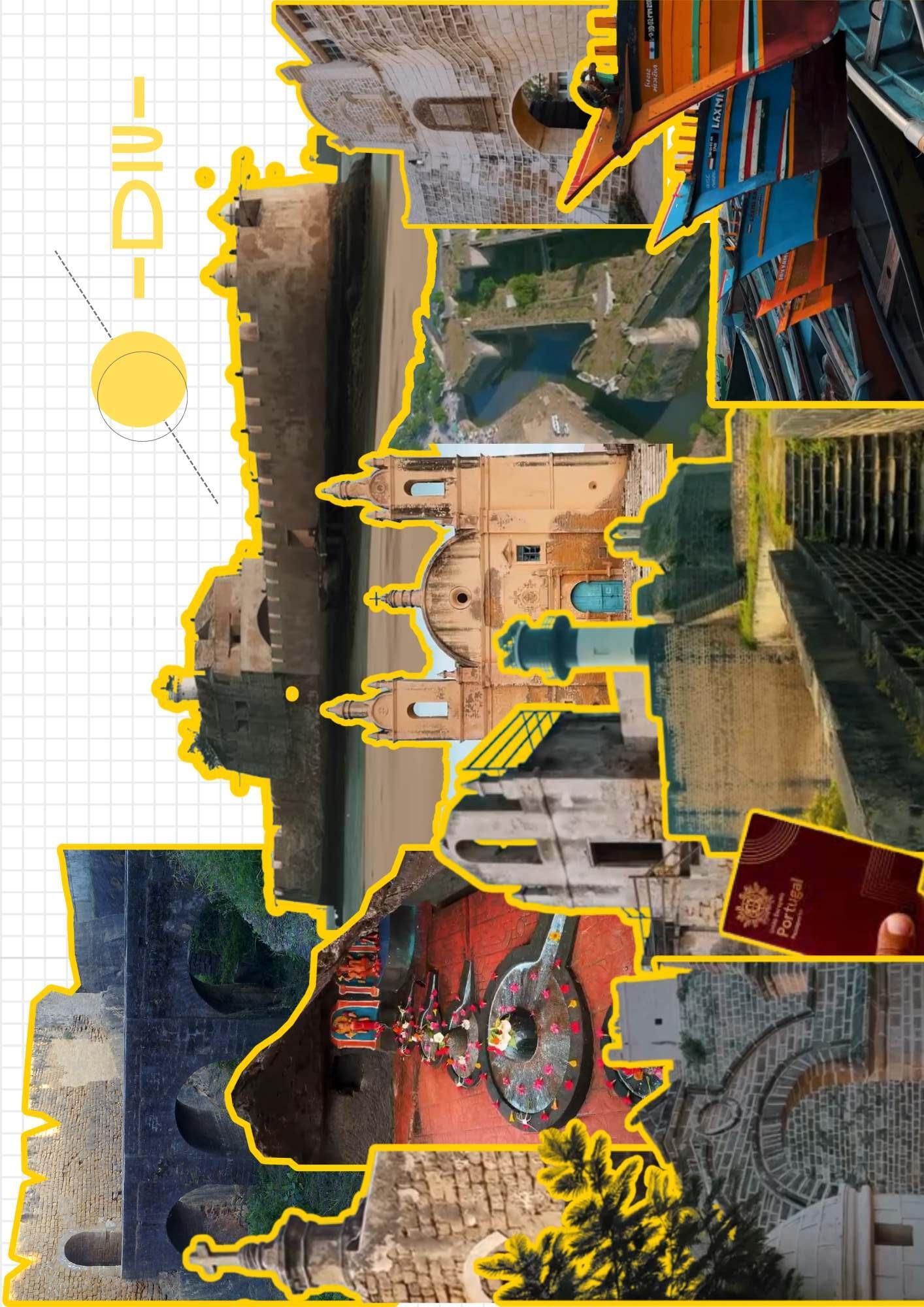
Kit of Parts for the Seashore Promenade
Anant Fellowship X Singapore Water Week ‘24
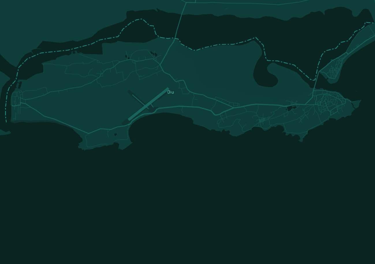
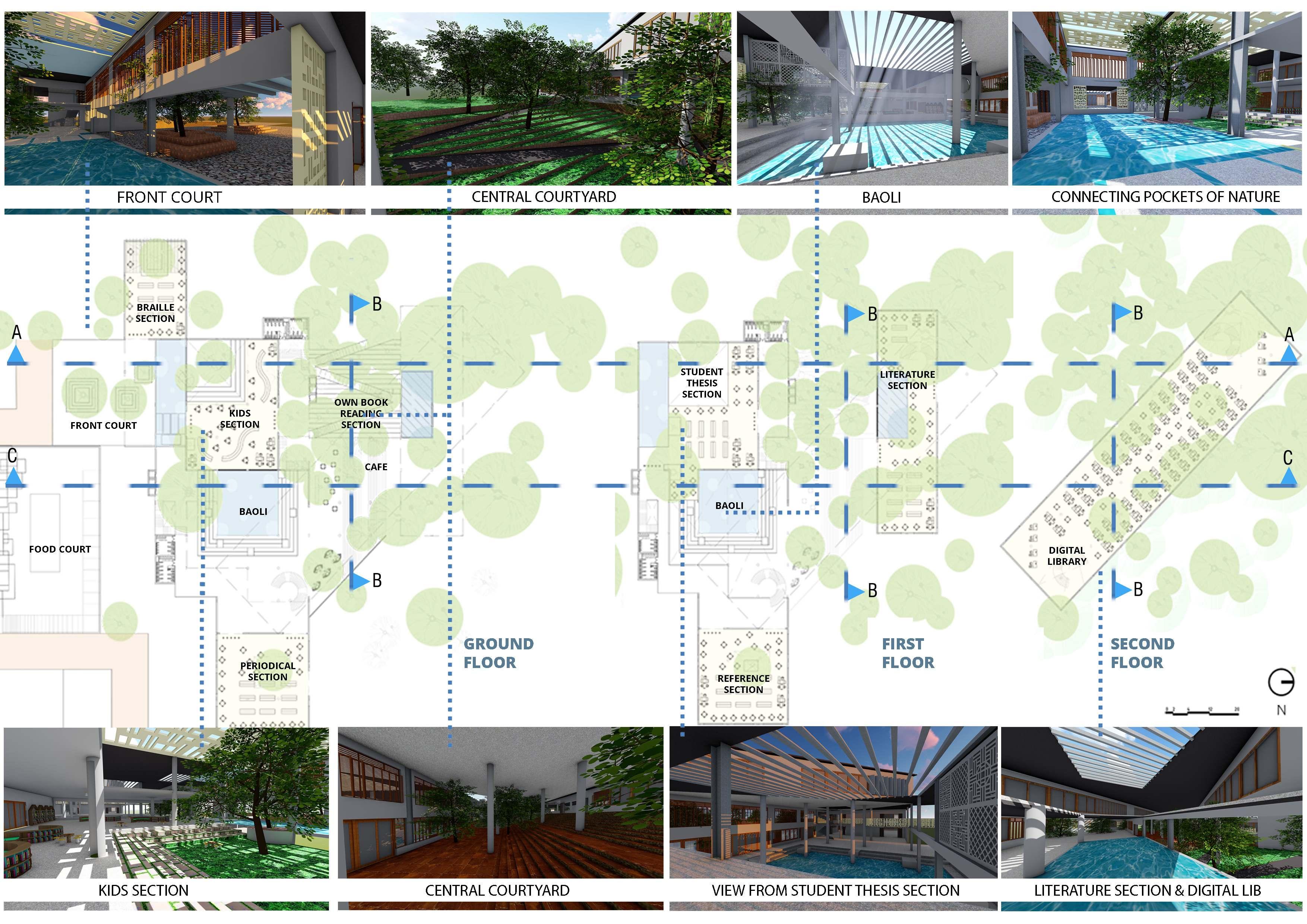
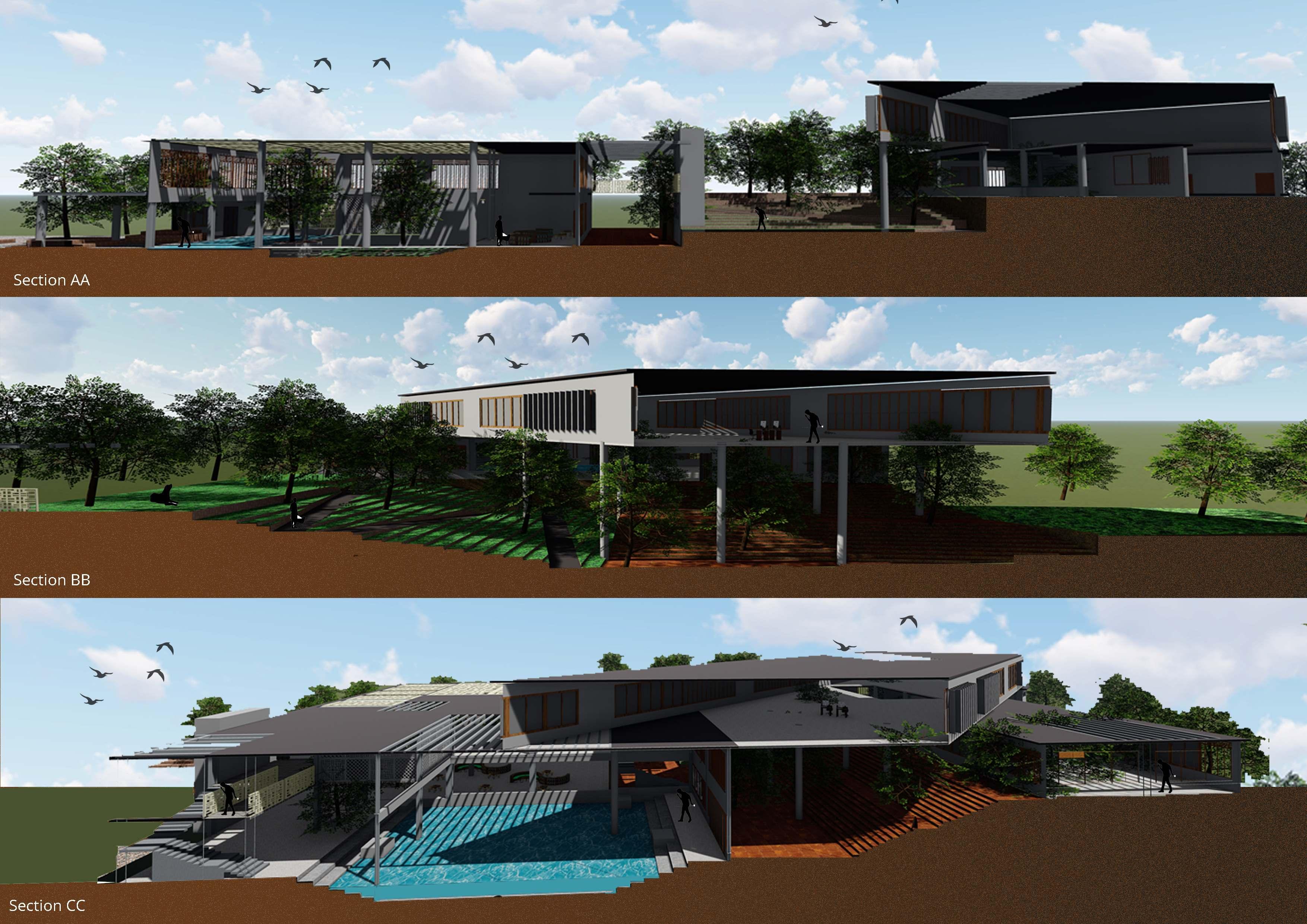
Unbuilding Architecture explores multi-use spaces that integrate built and unbuilt environments for efficiency, collaboration, and sustainability. Focusing on Diu, an island facing water scarcity and resource dependence, the module addresses climate resilience through site-specific strategies. Students analyze its architecture within India’s development framework, proposing culturally rooted, sustainable solutions.
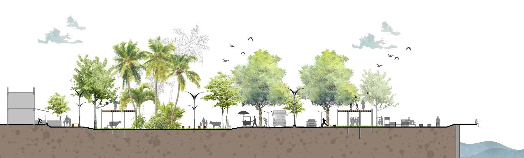
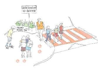
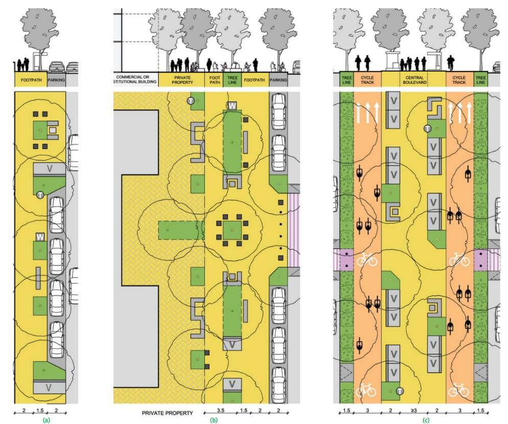
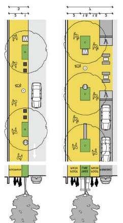
Building on the module’s focus, Negotiating thresholds is one of the proposals that focussed on interventions specifically addressed Diu’s resident community, particularly the livelihood of women, children, and local ecology, given the men’s inclination toward maritime occupations. Diu-Fort Road, dominated by built structures, lacked organic spaces for flora, fauna, and social interaction.
To counter this, the proposal introduced clusters of shaded parks and green islands as ecological and social nodes. These spaces integrate nature into the urban fabric, enhancing biodiversity, recreation, and quality of life. Designed for adaptability, these islands range from simple seating areas to functional spaces with kiosks, drinking water, public toilets, and small stores, generating employment for women while maintaining urban cleanliness. Over time, these eco-spots can expand and be thematically developed based on site-specific needs.
Software Used: AutoCAD, PSD, SketchUp, GIS
The aim was to look at interventions that very specifically focused on the currentresidentcommunityof Diu. Since the men of Diu were very inclined to move for merchant navy, sea-men roles, and fishery, The intent focused on the livelihoodofwomen,children,andfloraandfauna.
In the main city, the Diu-Fort Road looked very built-specific and did not have enough space for flora/fauna or any kind of organic development. Hence looked at creating clusters of shaded parks and greenislands that act as nodes for local flora and fauna. These green islands will provide recreational areas to the residents, promote biodiversity, and serve as ecologicalspots, integrating nature into the urban fabric and enhancing the quality of life for residents.
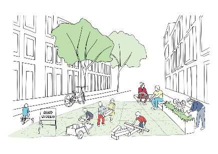
These islands can be concrete to having a few street furniture, a couple of kiosks alternatingwithacombination of drinking water, public toilets, changing rooms, and a few stores. This will generaterevenue,andworkoptionsforthe women and also help maintain the cleanliness of the urban fabric. Eventually, these eco spots can also be thematized. They can start with clusters of 5m by 5m and can include certain elements to very specific facilities that the site context demands. 01 02 03
Visitor‘sZone
Sculpture Garden
Restrooms / DW
Kiosks
Gallery / Panel board
Water spouts
Refreshment huts
Amphitheatre
CulturalZone
Book & Branch
Restrooms / DW
Play cubicle
Shops
Community Kitchen
Urban Farm
RecreationalZone
Restrooms / DW
Flea Market
Performance area
Food Court
Fishing Decks
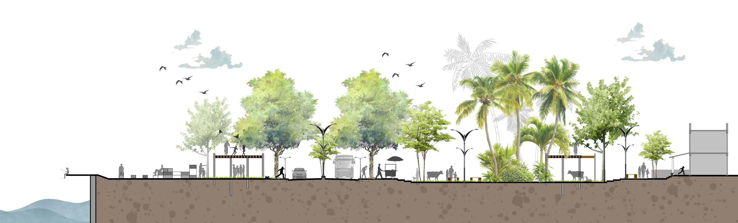
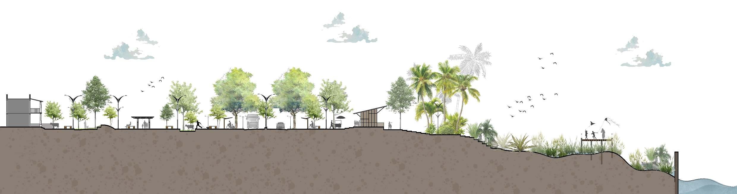
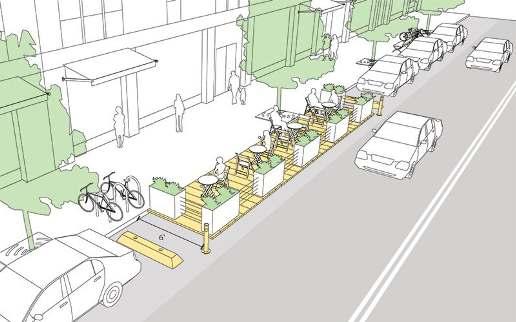
6 activation zones were picked at regular intervals through the stretch on Diu fort Road, based on the existing built forms and their relevancetothecontextofthesite.
Followed by programs that contributetothearea.
Community wedding area
MemorialZone
Restrooms / DW
Mini Amphitheatre
Gallery
Ticket Counters
Boat Ride Decks
Refreshment huts
Seva Kendra
YouthZone
How to do nothing kiosks
Toilets / DW
Mobile Library Cafes
Water spouts
Exercise circuit
HeritageZone
Flea Market

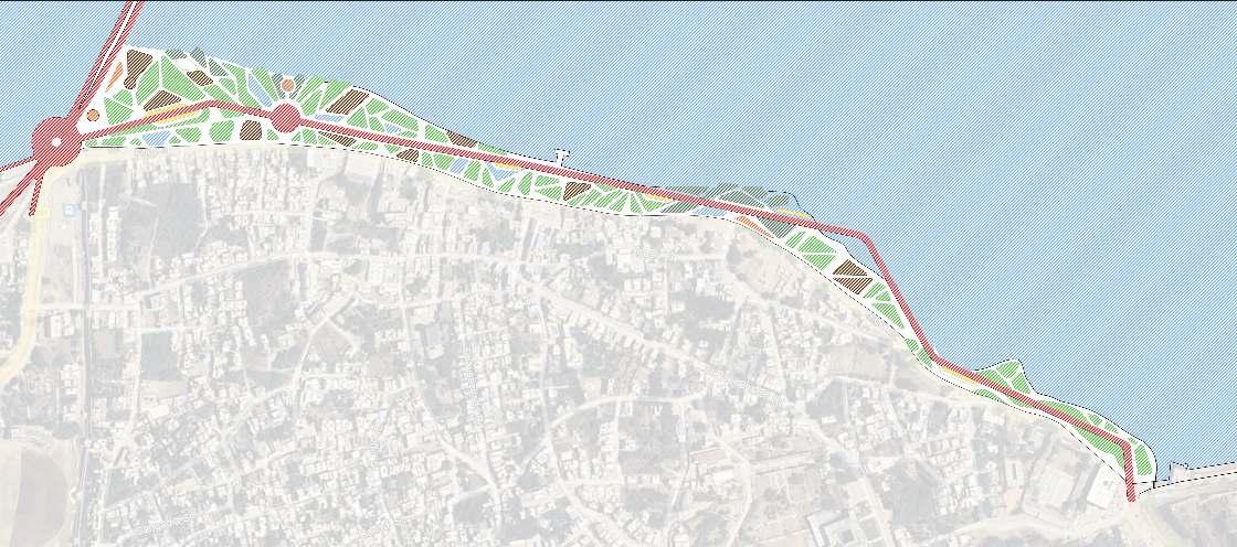
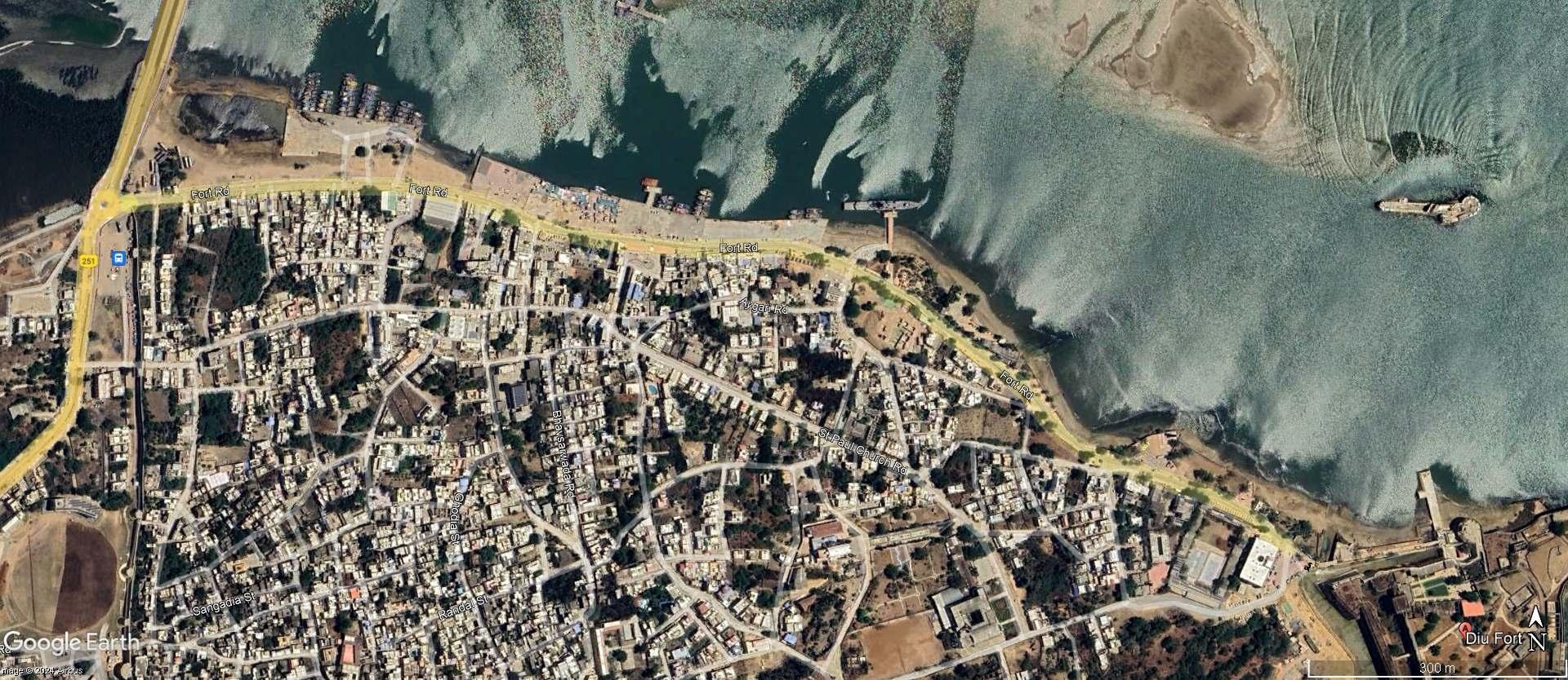
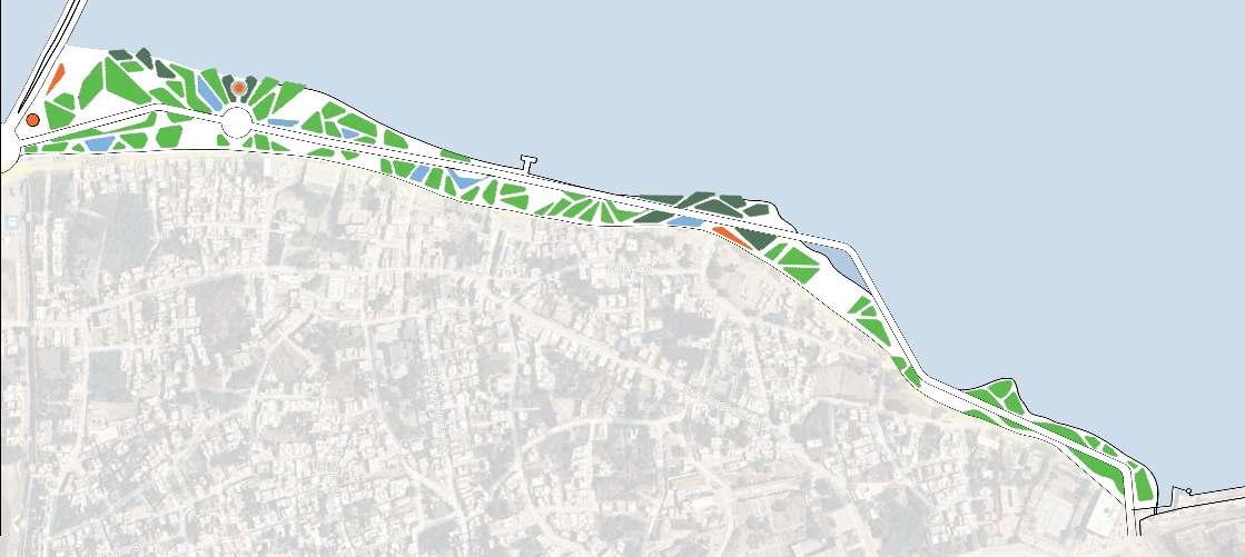
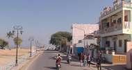
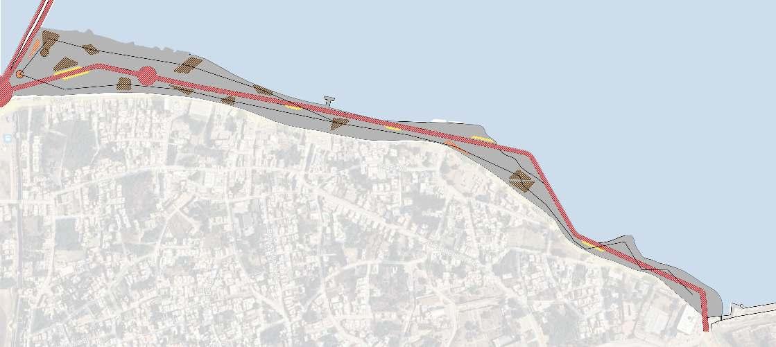
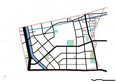
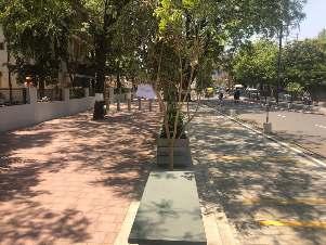
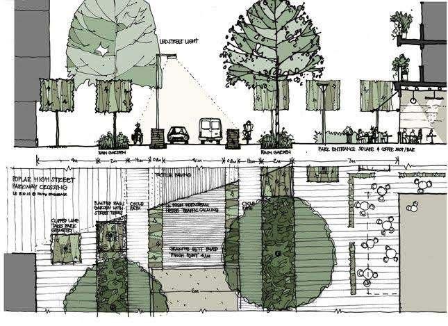
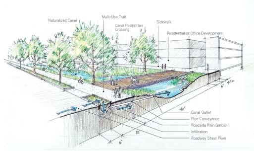
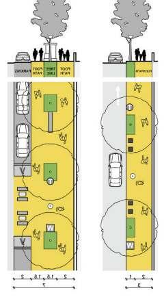
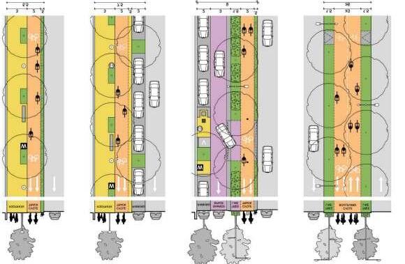
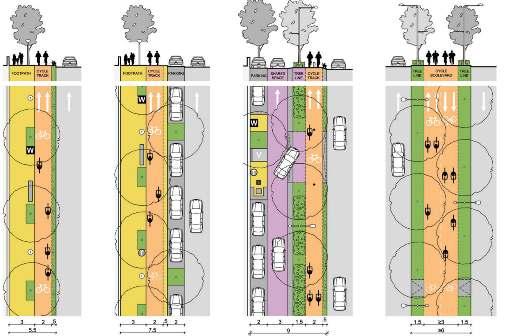
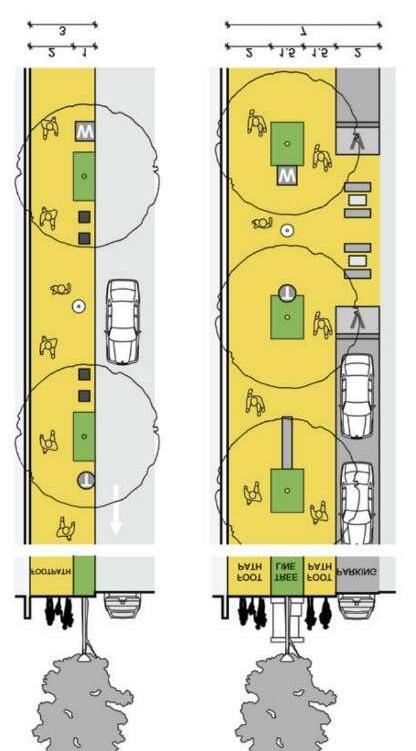
The site chosen is 1.5km stretch from the Diu bus stop till the Diu Road. While designing the landscaping and the amenities, the existing thresholds were reimagined. An attempt to create an experience for both the residents as well as the tourists with defined paths for movement, ecological zones and how the existing streets open up to the masterplan were looked in detail.
Specific effort in incorporating as many as blue-green zones to create a micro climate with least built but optimizing the value of unbuilt to a site such as the seashore promenade. These blue-green zones eventually become sprawl areas for the biodiversity of the native land.
Legend
Green Islands
Vehicular Access
Retention Ponds
Activity Swatches
EV Bike /Cycle/ Golf Cart Parking
Bio Swales/Coral Reef areas


Live Action Projecr
Anant Fellowship X AUDA
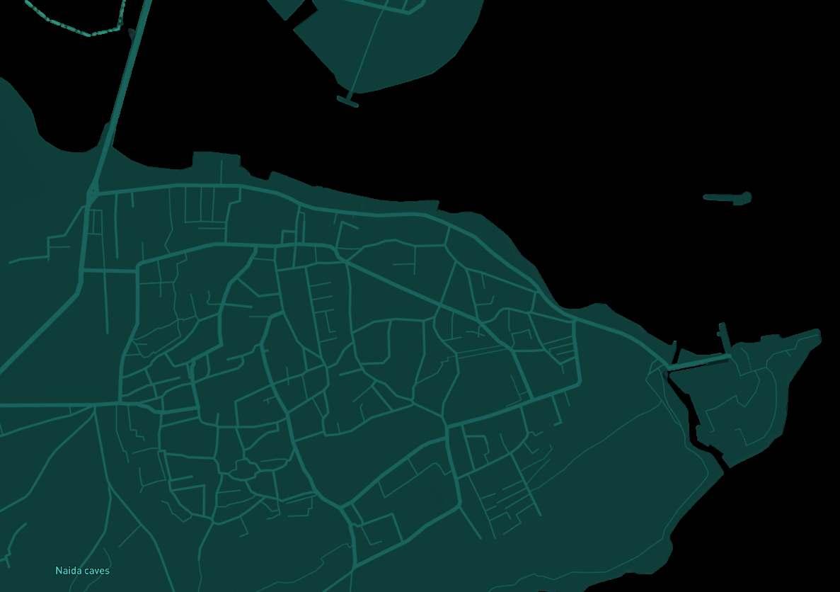
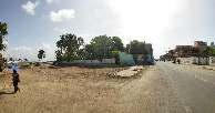
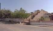
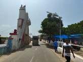
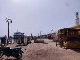
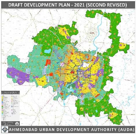
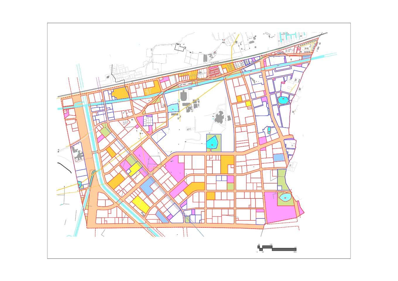
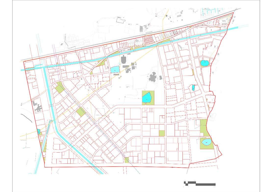
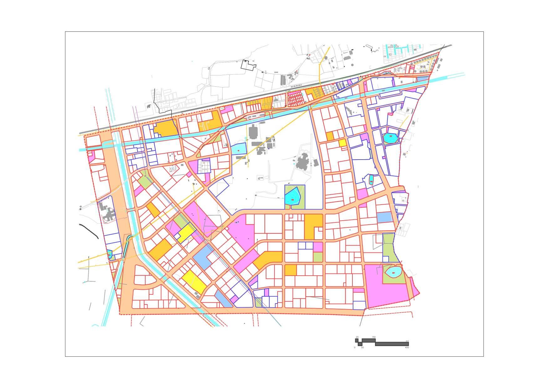
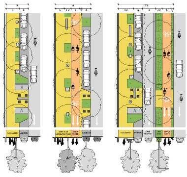
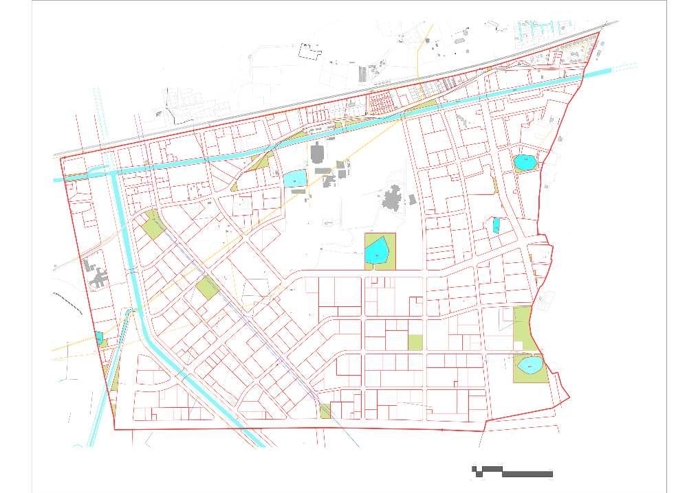
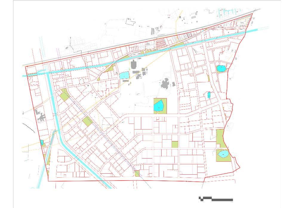
Gujarat as been celebrated for its Town planning (TP Scheme) development system that has contributed to the fast and adaptive development of Ahmedabad. However the land resource based mapping misses out on the ecological and topographical factors of planning. This leads to creating plans that do not take in to account the contour levels making the street designs unsustainable. This project studies the TP Scheme of Godhavi-Manipur 429 and creating street designs that can be adopted as a “Model Scheme” to be tested and applied to other TP Schemes of Ahmedabad. It also observes the behavioral and cultural context required for designing streets and open spaces in Ahmedabad by conducting the ethnographic study of prominent streets and community spaces. The vision was to create designs with ecology as a resource, to create a microclimate for the area through the integrated green infrastructure keeping in mind the contour levels. The project outcomes includes the design and policy interventions to take the project in phased-wise manner.
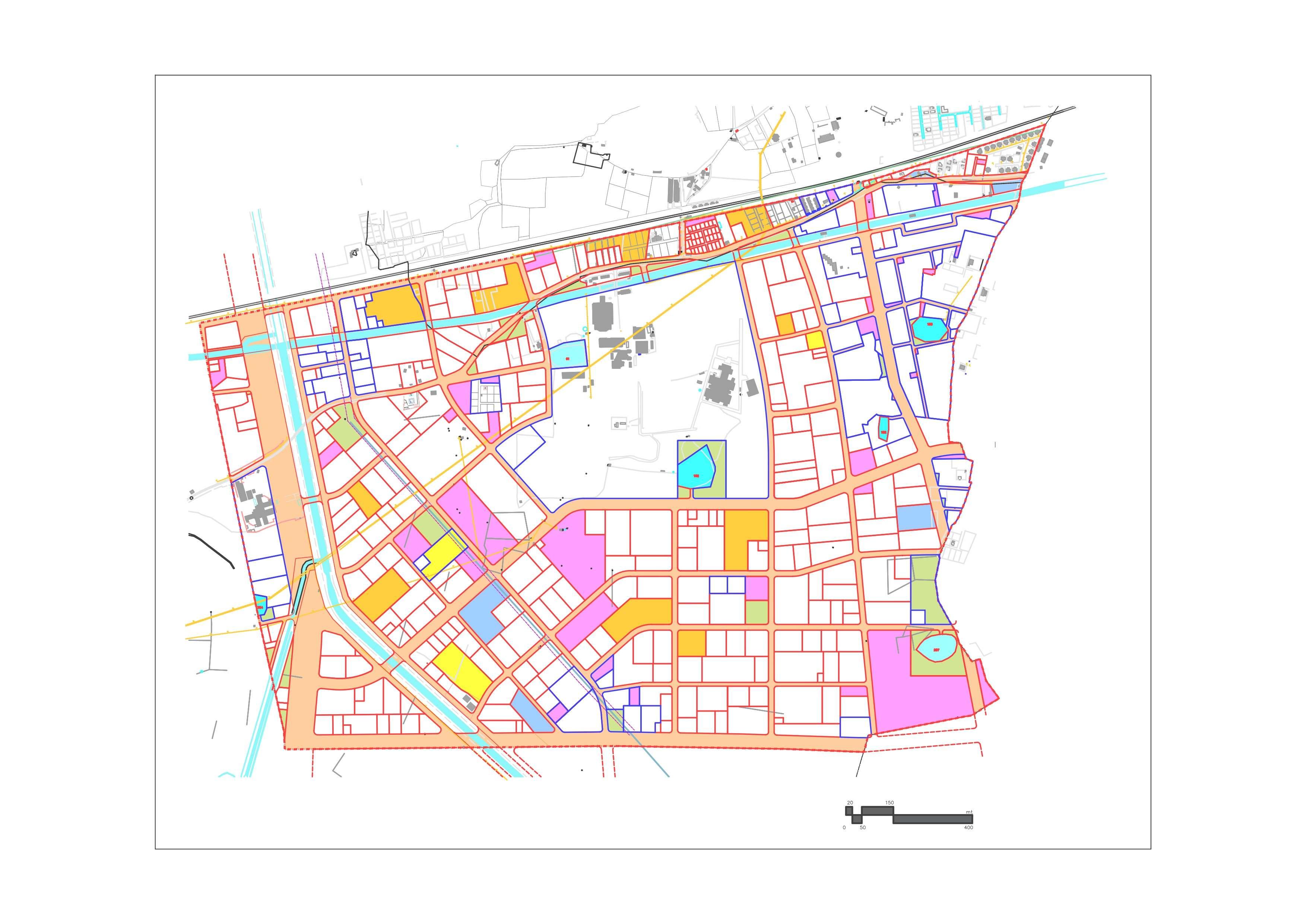
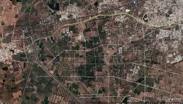
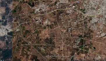
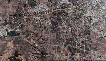
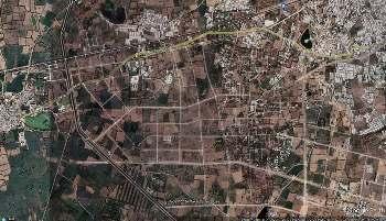
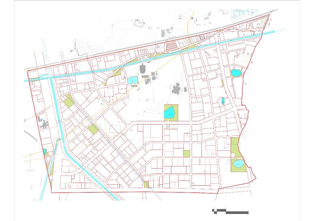
The Godhavi-Manipur Town Planning Scheme area, which covers an area of approximately 3.72 sqkms is being developed by the AUDA as a model scheme in the western part of Ahmedabad.
The aim is to develop a scheme that addresses urban issues of lowering carbon footprint while providing green spaces for the residents and visitors coming to the various institutional and recreational areas in the surroundings.

OBJECTIVES:
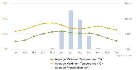
The site analysis focused majorly on understanding the climatic conditions of the TP scheme area. The analysis shows that the tree cover in the area is decreasing on a fast pace with the amount of built infrastructure expanding rapidly. The climate is very erratic with harsh summers peaking at an average of 46 degree, winters falling as low as an average of 7 degrees and average annual rainfall up to 20cm.

To create design elements that can be replicated in other TP scheme
To work on the development of streets and open spaces of Manipur-Godhavi Town Planning scheme.
To create a micro climate that compliment the bluegreen zones.
HYPOTHESIS:
Community interaction spaces as a part of Town Planning can use the existing ecology as a resource to create a microclimate. This approach can be adapted to other sites based on their existing ecology.

Through the series of images, one can map the timeline of the growth in terms of infrastructure, built (vs) Unbuilt, and lastly how the spaces have transformed according to the road network and the neighbourhood.

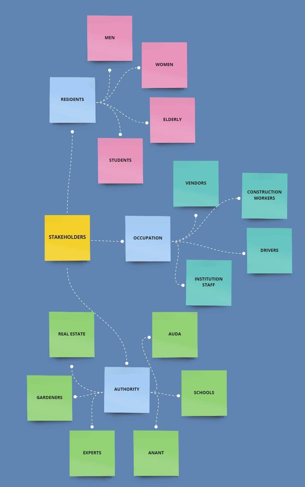
The stakeholders are looked as the current stakeholders as well as potential stakeholders of the area, as the area has not been fully occupied. In the light of this circumstance, interviews of stakeholders of similar sites in Ahmedabad were observed, and interviewed. The interviews were semistructured with an aim to understand their perspective of the space and how the ecology plays a role in their day-to-day functioning.


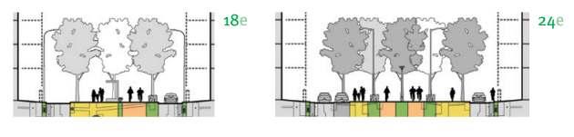
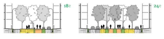
Howwouldmedianplayarole inshadeandtreecover?
Native trees like Siris (Albizia lebbeck), Peepal (Ficus religiosa), and rain tree (Samanea saman) have good cover. Having these trees just on the sides of the roads is not enough. If you use the median to plant trees it will provide more green cover and shade.
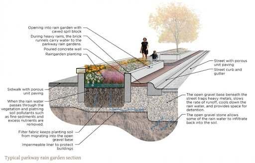
Howtomitigatelocal flooding?
Percolation wells or Khambhati Kuva is a very effective traditional method. By installing them outside the lakes, it can decrease and reduce the frequency and intensity of local flooding.
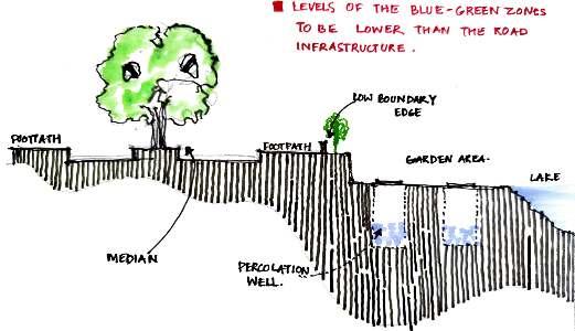
Why should the blue-green spaces be at a lower level incomparisontootherinfrastructures?
So that during monsoon the water can flow into these depressions. If these blue-green zone are built with percolation wells, the excess water can flow into them. Thus the blue-green zones will act like a sponge for the area.
What model works best for gardens?
A Public Private Partneship works best for the gardens. Sky city garden is one such such example where the partnership between builders and gardens is seen effective.


Whyarealcovesimportant?

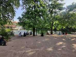
People look for privacy even in public spaces. Be it groups of elderly people sitting after morning walks or couples who come during the afternoon time. They prefer to sit in spaces that are open yet have some privacy.
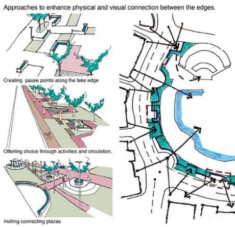
Whypitchtheboundaryofthelakeandnot it’sbase?
Shouldgardenshavewalls?
When a public space has boundary walls, it restricts the movement of the public to freely enter the garden space and thus it decreases footfall. With efficient placement of openings, we will be able to create an open garden .
Because the lake edges get eroded with rainfall and becomes unstable. So it is important to give the lake a boundary for the safety of people and the lake in itself. We use concrete because it is more stable than rock boulders. However we do not concretize the base, so the water can seep into the ground water.
How can pocket spaces have a functionofleisure?
in India people don’t seek outside to go for leisure specifically. So pocket spaces have to be designed in such a way that it allows people to effortlessly use it as a leisure space.
Whoarethemajorbenefittersofparksand gardenspace?
Women, elderly and children are the people who are benefitted most by gardens and parks because most of them donot have much other places to interact with others.
What is the major gap seen in currentroaddevelopment?
In India, we unfortunately plan urban design without understanding the levels and contours of the area. This often ends up with the roads being the water channels during monsoon. In order to stop this from happening we have to plan using the topography of the site.
Does concepts like Urban Commons work in contexts ofAhmedabad
The pols in Ahmedabad are a perfect example of Urban commons that has been in existence for a long time.
What is the future of planning: Ecology as a resourcevslanduseplanning
Existing models of planning has been towards land use management but now it is time for shift in planning towards ecology as a resource to mitigate the extreme climatic challenges that are being experienced by habitants on Planet Earth.
How does usage of space convert from daytonight?
The market stalls that are present in the night at Law Garden are used by food vendors in the morning as seating spaces. The stalls are on a raised platform where the customers can sit with their breakfast. We only sell food till afternoon and clean up the space for the evening markets.

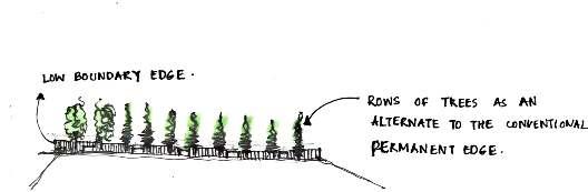
How do you feel about the height of boundarywalls?
Currently in the garden, one side is walled up and the other side is a low wall. The wall was necessary because we often faced trouble of livestock encroaching through the low wall and destroying the saplings.
What difficulties are faced in the maintainanceofgardenspaces?
There is lack of proper water draining. The water gets stagnant and does not seep into the ground during monsoon.
The data collected from the stakeholders as well as panel interviews can be inferred into these central problems:
To design with ecology as a resource
To mitigate extreme fluctuations in climate through design of open spaces
To plan open spaces using levels and contours
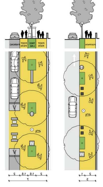
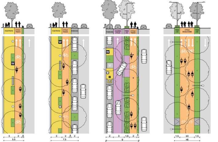
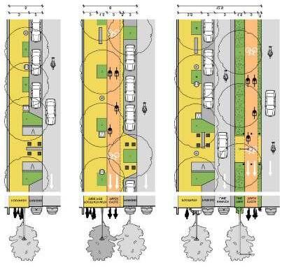
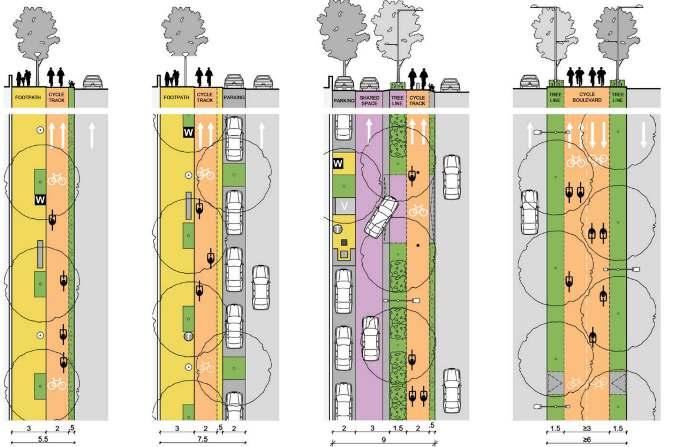
The central focus area being sustaining a micro-climate in the scheme area, the following are the 3 intervention areas chosen:

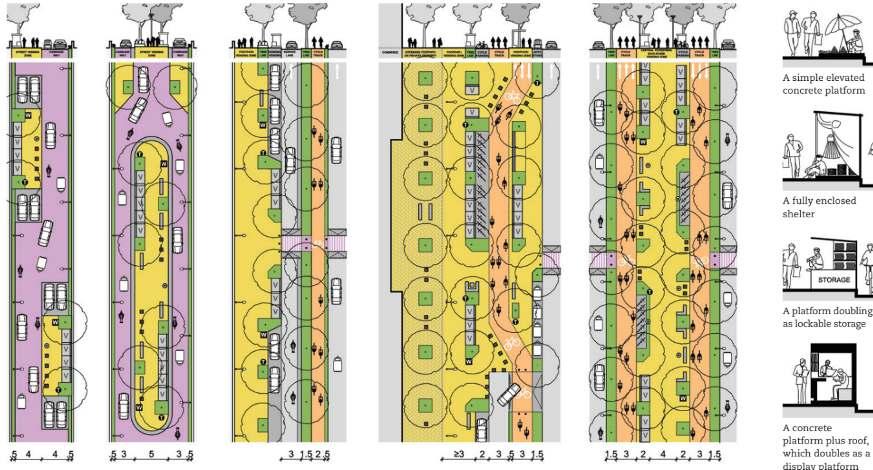
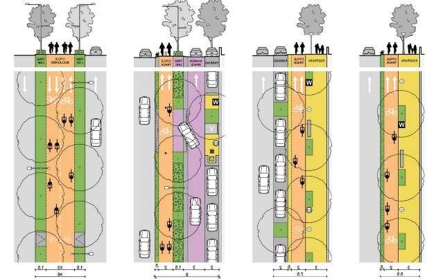
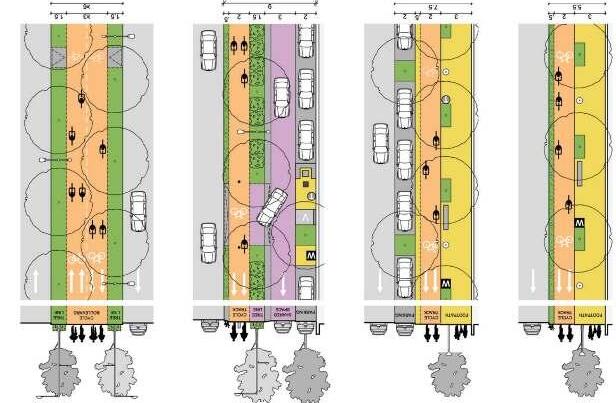
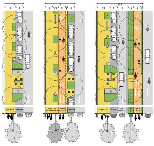
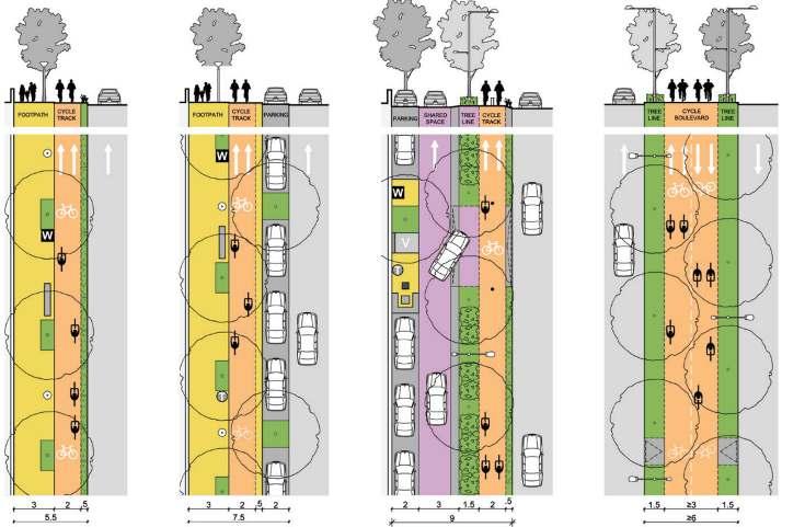
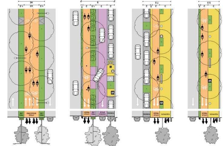
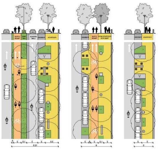
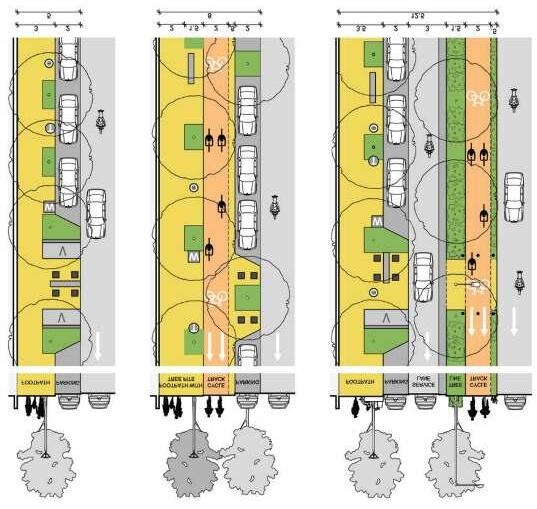
Streets & Pocket spaces
How to provide tree cover and use the streets as a public interaction space.

How to retain water in lakes during summers, prevent from flooding during monsoons

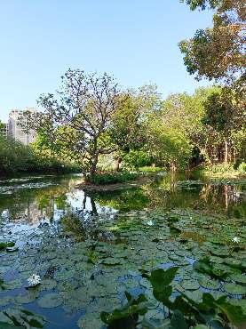
How can open garden be designed focused on maximum biodiversity retention of the area
FocusAreas:
Selection of Landscape species, foliage. Universal Design Street Furnitures
Pocket Spaces and Edges
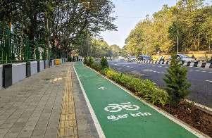
Pedestrian Friendly Cycle Tracks
DesignAmbitions:
FocusAreas:
Bioswales Flood mitigation Retaining biodiversity Safegaurding/ conserving lakes in sustainable ways.
DesignAmbitions:
FocusAreas:
Open and Accessible Gardgens
Public Private partnership models
Urban Forest
Multifaceted spaces : Time of clock


DesignAmbitions:
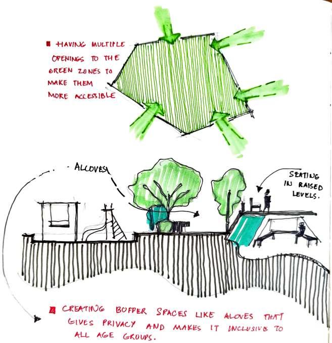
Having multiple openings to the green zones to make them more accessible.
Creating Buffer spaces like alcoves that gives privacy and makes it inclusive to all age groups.
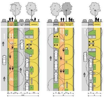
LEGEND
Primary Axes
Secondary Axes
Secondary Node
Primary Node
LEGEND
BRTS + All vehicle Access
Only Vehicular Access
Only Pedestrian Access
*Please note all the footpaths are inclusive of cycle tracks.
There is no footpath available for pedestrians Ethnographic Observation March 17 2024 Godhavi Manipur Field observation
There are Cycling enthusiasts in Godhavi
Women do not feel safe in the night
Garden Spaces are occupied by couples in the afternoon.
Lakes function better if near a Temple
AUDA Sports Complex is not open for public use
Garden Spaces are occupied by couples in the afternoon.
Ethnographic Observations April 02 2024 Godhavi Manipur Field observation
Interview with AUDA sports Complex
Unstructured Interview April 15 2024 Near AUDA Sports Complex Players of AUDA Complex Field Observation
Ethnographic Observation May 03 2024 Chandola Lake Canal Garden
Ethnographic Observations May 01 2024 Shela Lake,Ghuma Lake, Field observation Secondary data- research papers
Unstructured Interview April 15 2024 Near AUDA Sports Complex Security of AUDA Sports ComplexRamji - 8160977365 Field Observation
Ethnographic Observation May 03 2024 Chandola Lake Canal Garden Gardeners and maintenance people Mohan, DalSukh Bhai 9998855297 News Clippings, Observations, Social norm
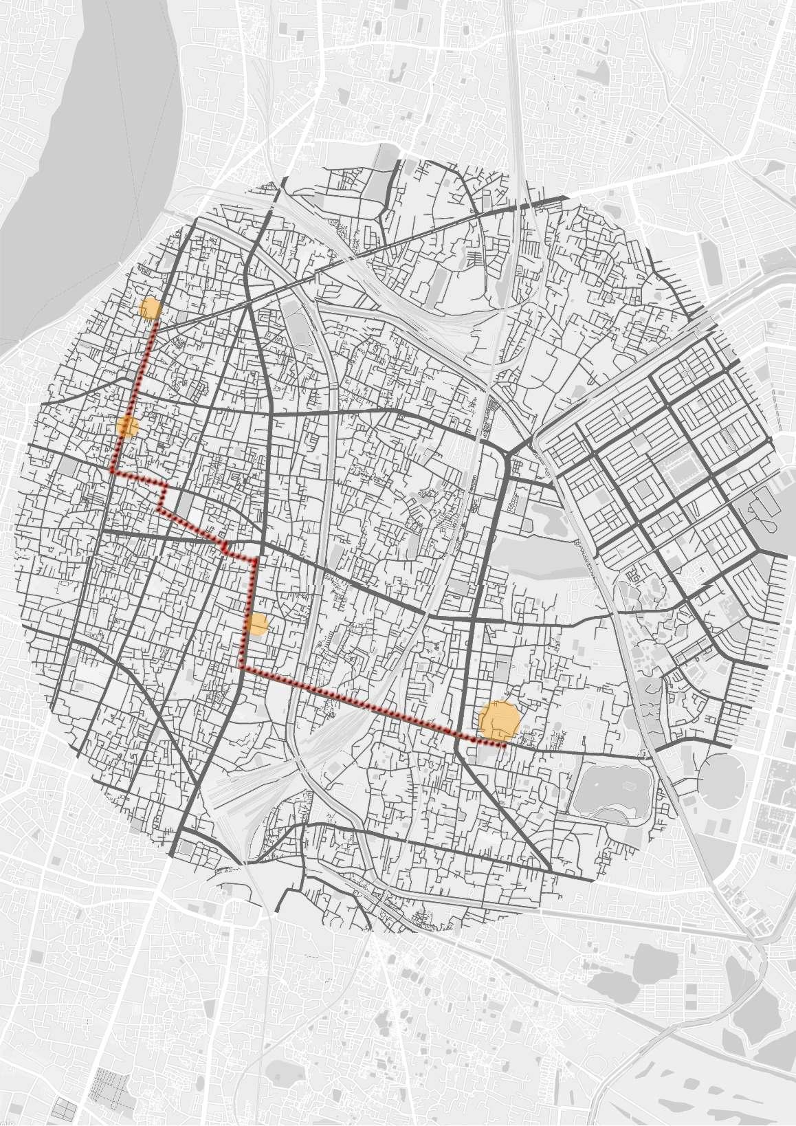
Existing canal
Main road connecting Sanand and Ghuma
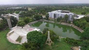
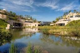
Anant National University
Underpass connecting to Manipur
Student and Staff housing
Existing eateries nearby
2.7km from Ghuma BRTS
36m road
Connecting to Krishna Shelby Hospital
Shangri La Gated Society
SI parking space
Anant National University main entrance
Anant x AUDA Lake
EWS Housing
AUDA complex
36m road
Garden Space
Lake
Kavisha Builders
Social infrastructure nearby
VIP Road
AUDA sports Complex
3.2km from Ghuma BRTS
2.6km from Zydus International
(via VIP Road)
INTERVENTIONS
Khao Gali (over the closed canal)
Semi-Pedestrian zone
Yulu and mybyk zones
Street furniture with charging ports
Shaded canopy
Green-Grey infrastructure for vendors
Stores and Kiosks
Public parking facility
Sports Outlets
Health Eateries
Urban Farm kiosks
Animal crossing zone
Outdoor play and learn areas
Raised pedestrian pathways
Cycle paths within pedestrian walkway
Animal Crossing zone
Urban Forest
Public parking facility
Pet friendly streets/parks
Sports outlets
Kiosks and stores
Public parking facility
Yulu/Mybyk zones
Surface Markers
Storm Water Drain + Cisterns
Segregation bins
Tree Swings
Planter Boxes
Retractable Bollards Sandpits
Drinking Water dispensers
Artistic crosswalks
Percolation wells
Bioswales
Animal and Bird
Feeding zones
Cycle stands
Street lights
Board game-embedded Furniture
Roadside parking
Parklet
Curb Extension
Bio-Compost bin setups
Footpath lighting
Footpath
Bus shelter
Walkable Tree pits
Vending Machines
Kinetic foot pads
Signages
Auto Rickshaw stand
Toilet cubicles
Cycle tracks
Drinking water facility
Splash Pads
Rain Gardens
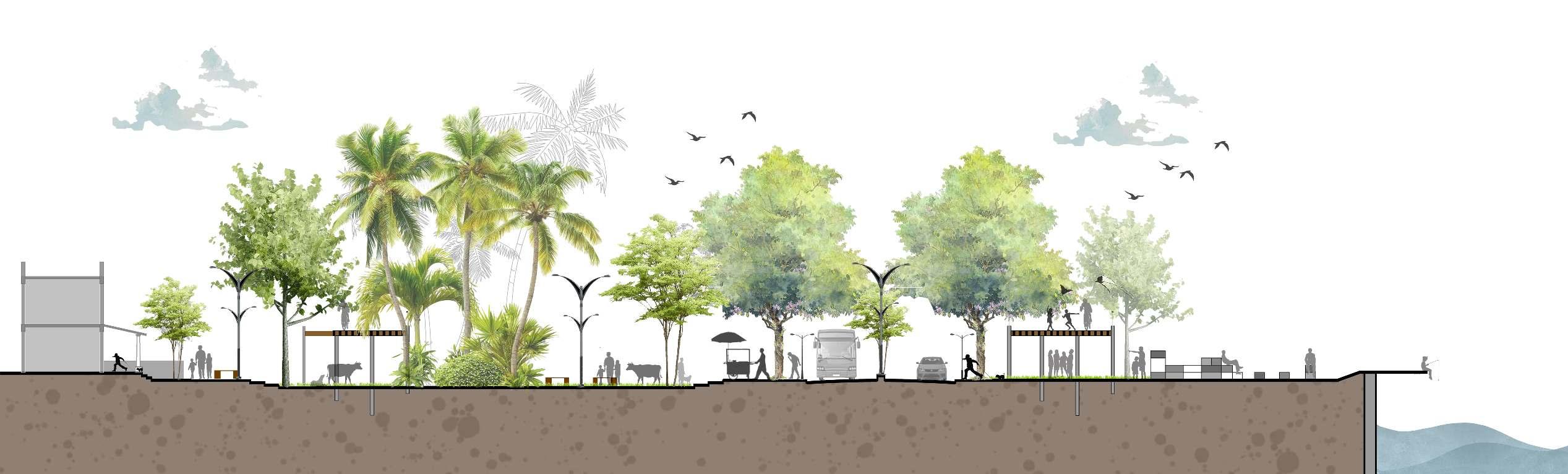
Extended street, Blurring Boundaries

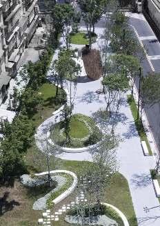
The site prioritizes to create a garden extension that blurs into the street with undefined edges, seamlessly integrating elements to foster community interactions and a fluid, connected space for everyone.
The site prioritizes street parking and parklets for the future university entrance, offering convenient student drop-off points and engaging spaces for kids and parents to relax while waiting.
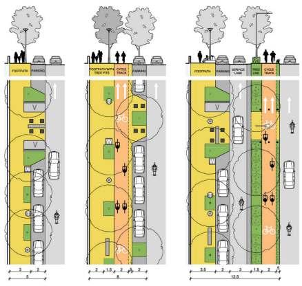
The site prioritizes a Khao Galiinspired spill-out space for students over the covered canal, featuring pedestrian-only hangout spots with charging docks and canopies, perfect for relaxation and socializing.

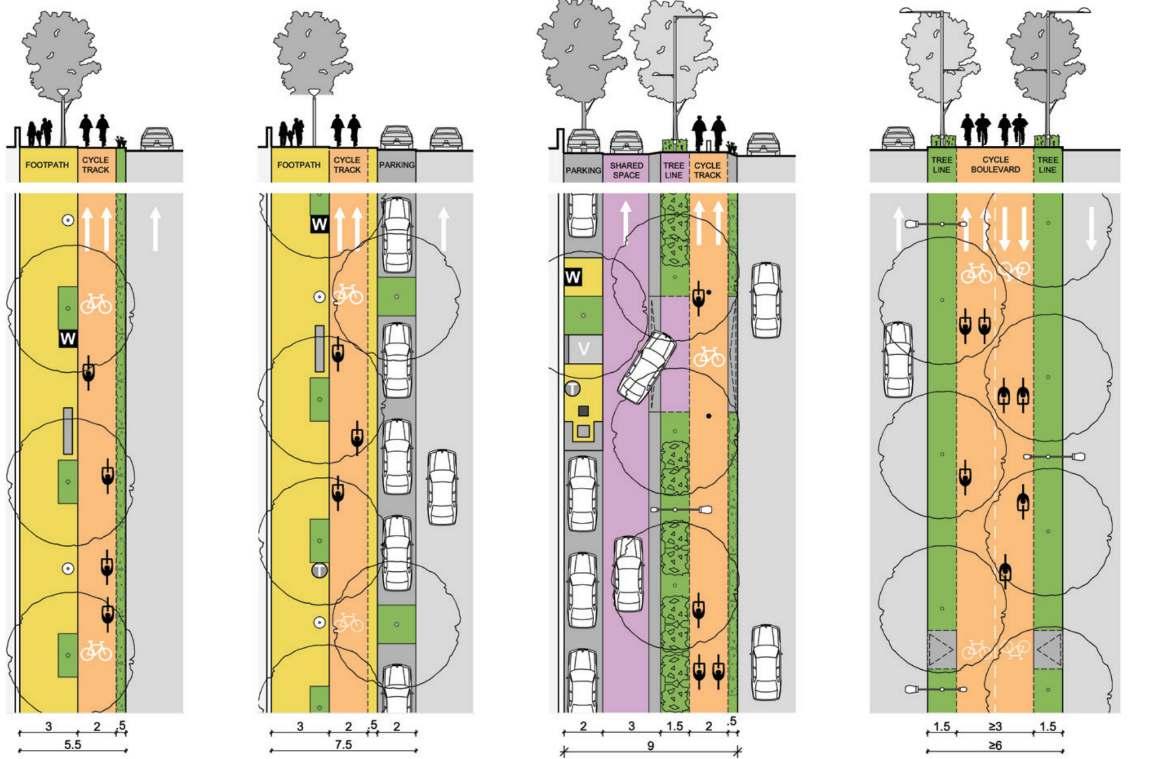

The site prioritizes a tree-covered median extending into a cycle boulevard, expanding pedestrian spaces and pocket areas while maintaining a 7m carriageway, emphasizing people over vehicles.
The project faced time limitations, which can be addressed through phase-wise planning. The initial phase includes site analysis, case studies, research, and the first draft of street section plans.
The next phase will focus on detailed recommendations for the Lakes and Garden spaces in the TP Scheme, along with policy suggestions for blue-green zones. The final phase will involve a cost-benefit analysis and Environmental Impact Assessment comparing Ecologybased vs. Land Resource-based TP Scheme Planning to assess the viability of piloting.
Bachelor’s in Architecture Thesis
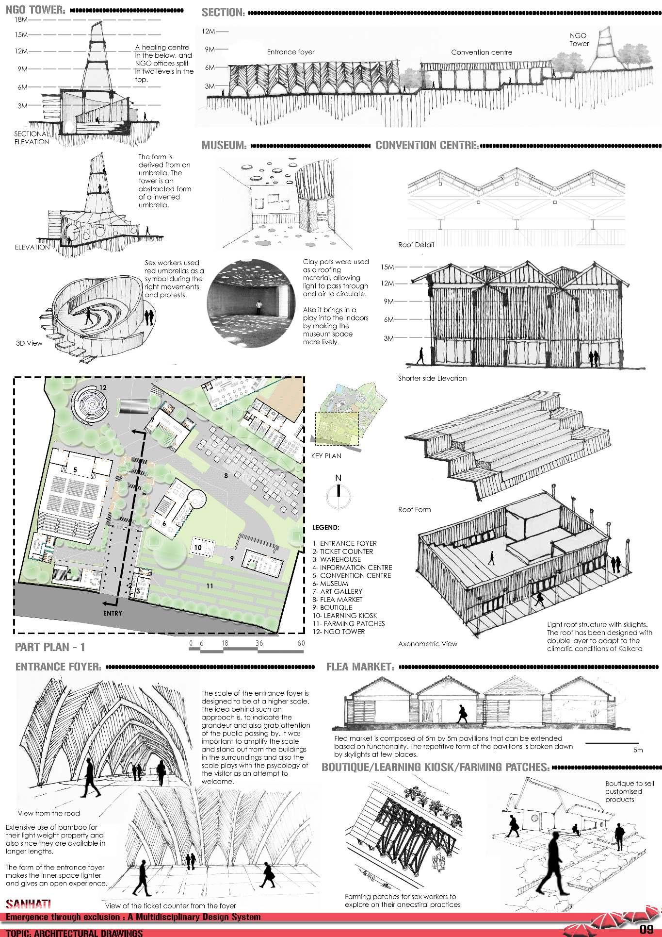
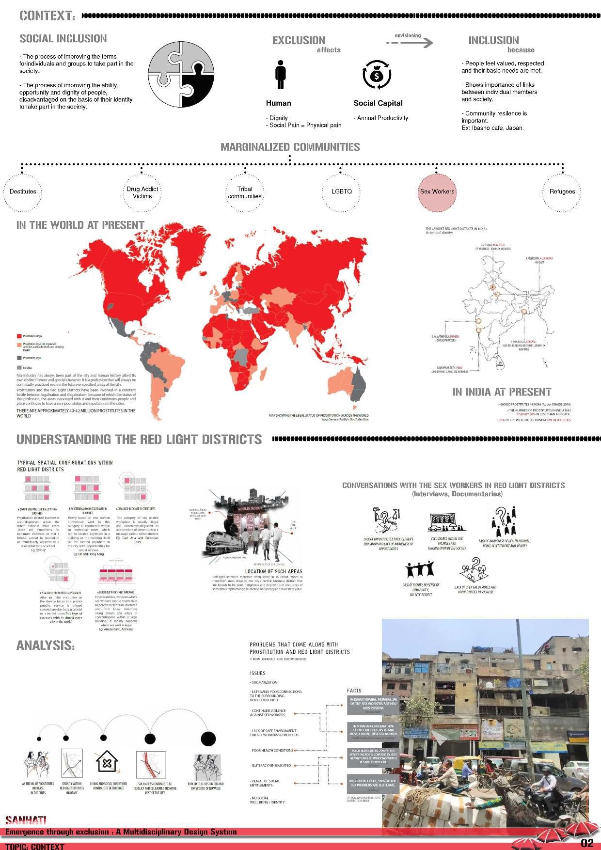
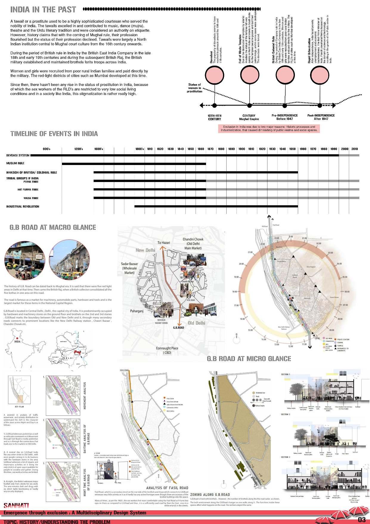
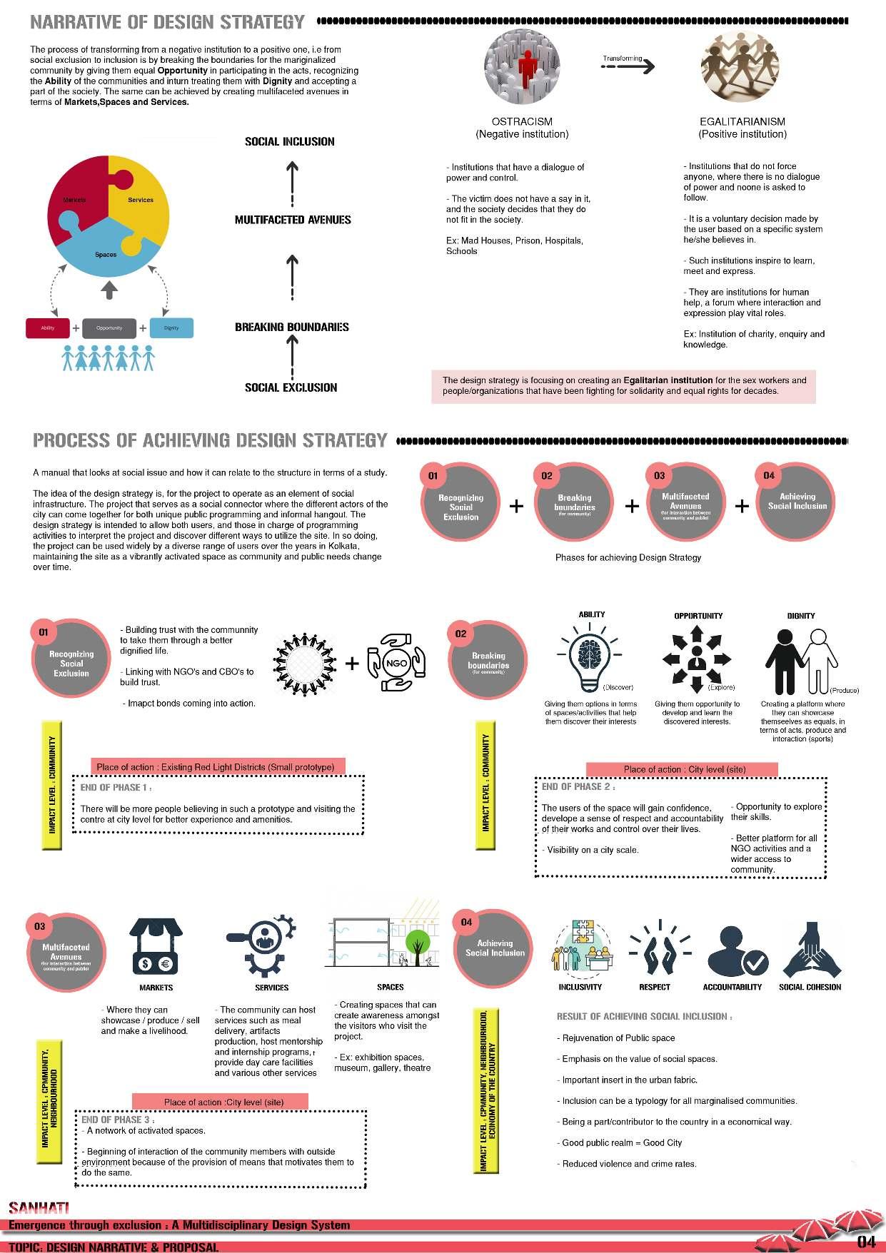
The project focuses on developing a design manual that serves as a guide for creating a dynamic sequence of interventions aimed at fostering social inclusion for marginalized communities, particularly sex workers. In this process, architecture becomes a supportive framework, while the core drivers of change are the interactions, opportunities, and community empowerment facilitated by the design.
Rather than imposing existing empowerment models, this approach emphasizes recognizing, enhancing, and showcasing the inherent abilities of the community, allowing them to reclaim their identity, dignity, and rightful place in society. Social inclusion matters for itself because exclusion is too costly. These costs are social, economic, and political and are often interrelated. The way about going through any social issue is, how we ask questions and derive a narrative that is so constructed to provide the wherewithal for the design of the right policy.
The three corners of the idea are to -
a) recognize abilities
b) create avenues to develop their abilities
c) create a platform to showcase their abilities and hence gain dignity.
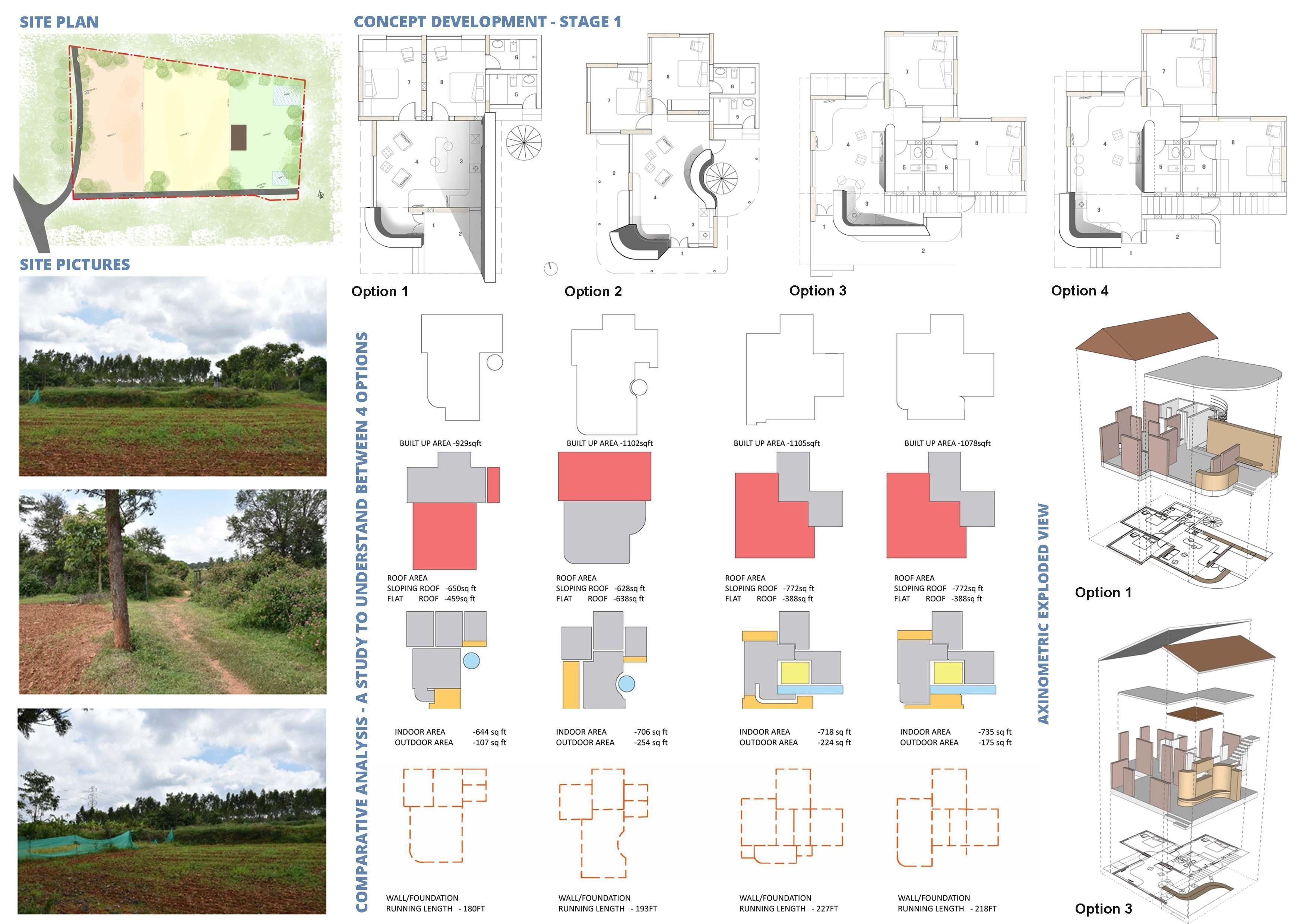
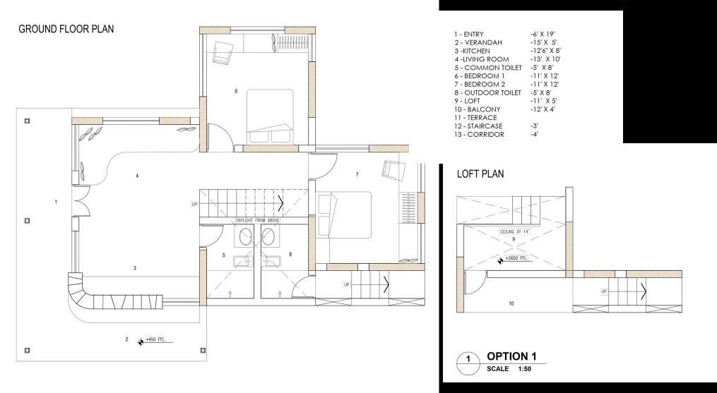
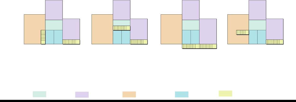
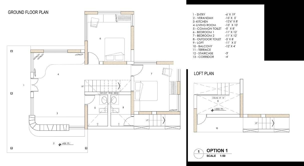
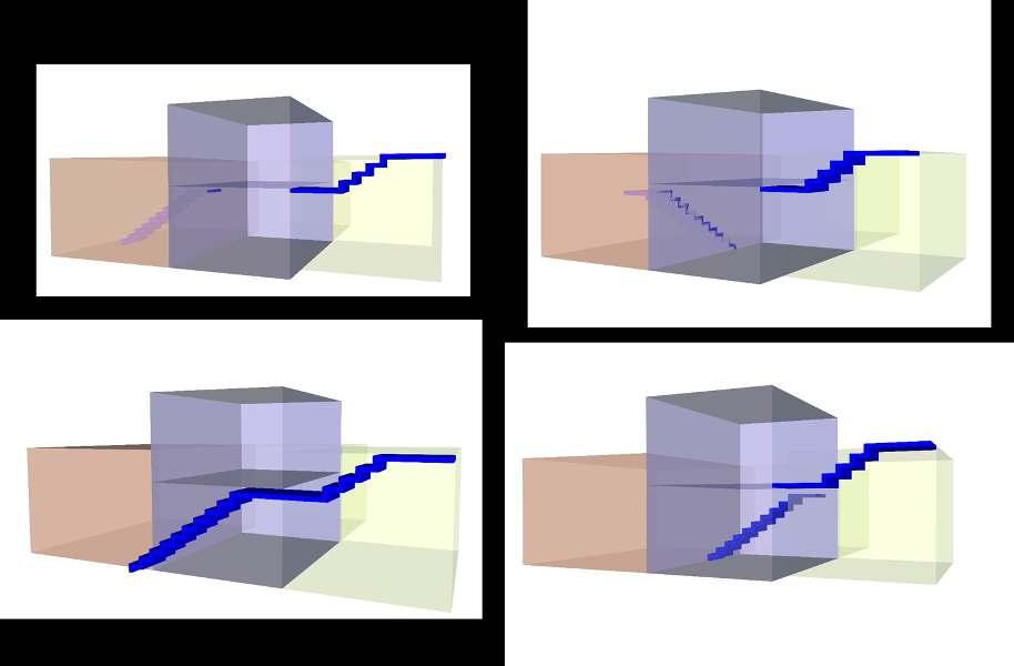
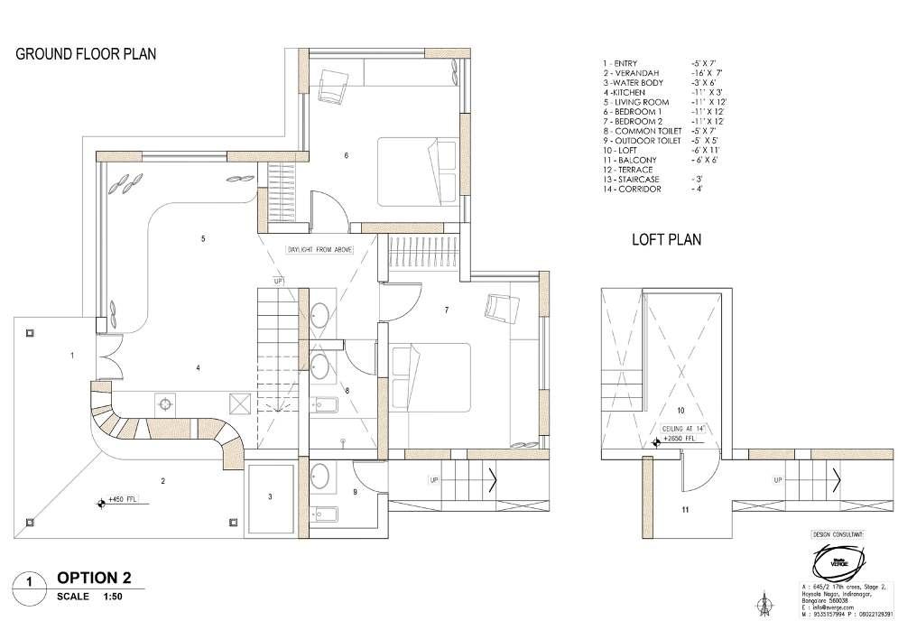
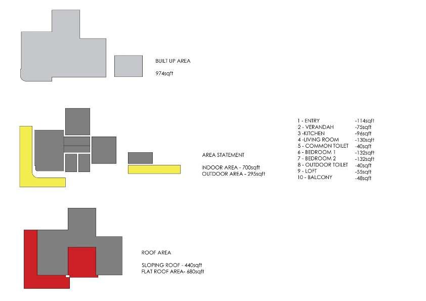
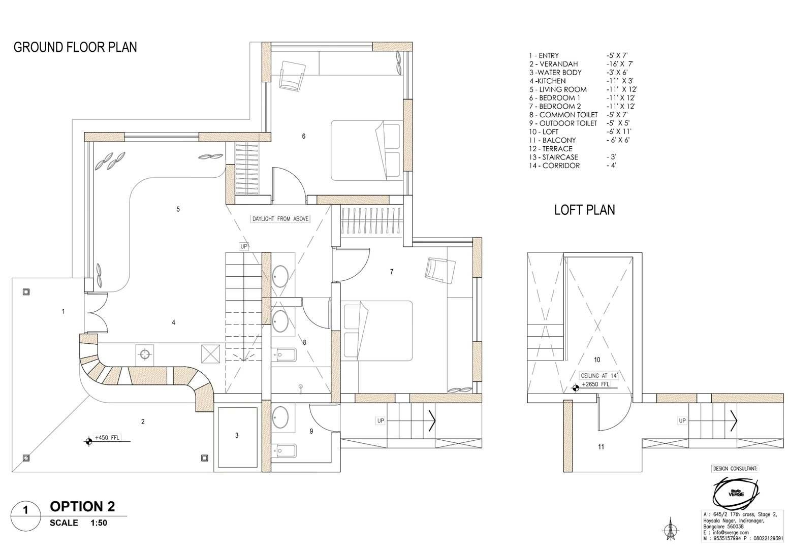
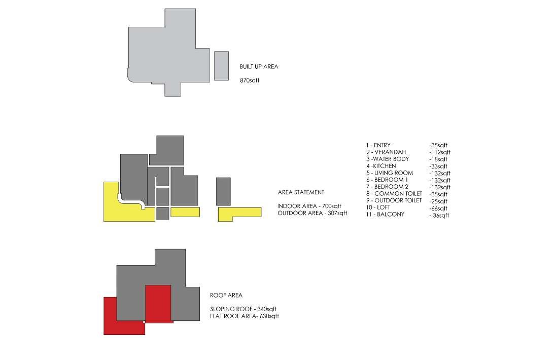
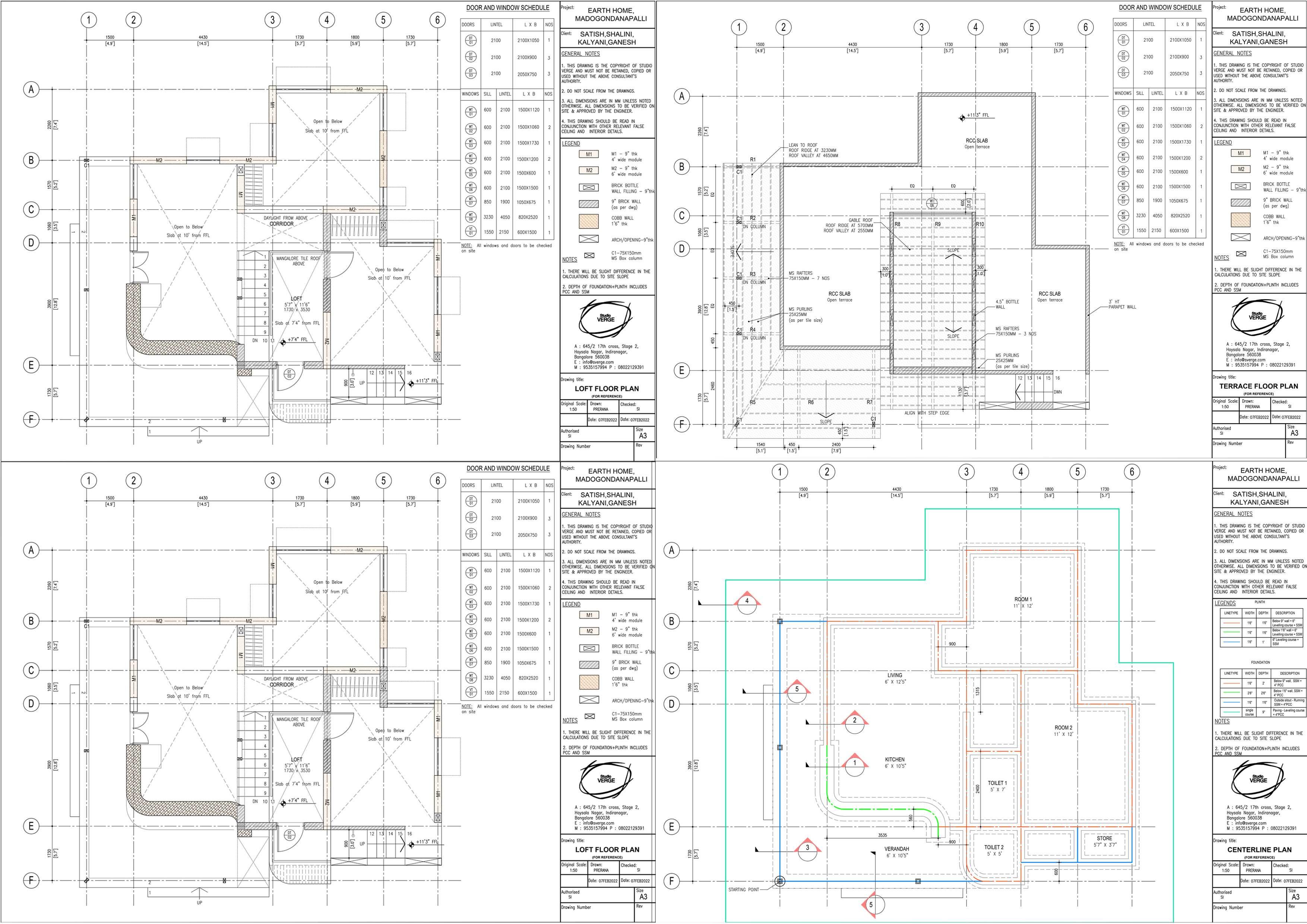
Building-Site Relationship
3 Fork Plan
Extended Views on west & North
Each room with its own unique View & Privacy
Obstruct Views on S / SE (Caretaker / Water tank)
Entry, Staircase, Toilets to screen views
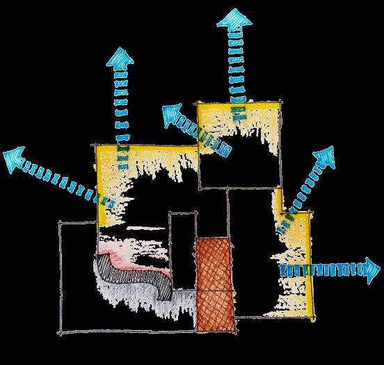
Sun / Wind / Rain
Shading S/W from harsh sun
Verandah, Stairs, Toilets, Cobb Wall & Kitchen
SW breeze funneled through Cobb wall funnels

SW rain protection of Cobb with Verandah
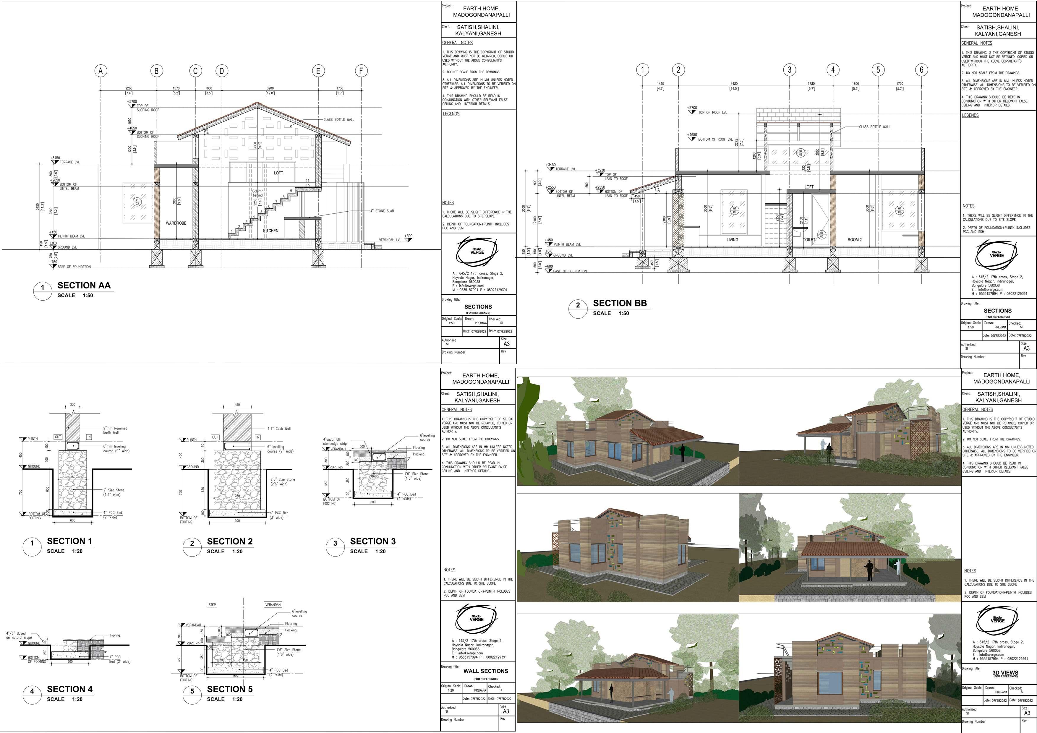
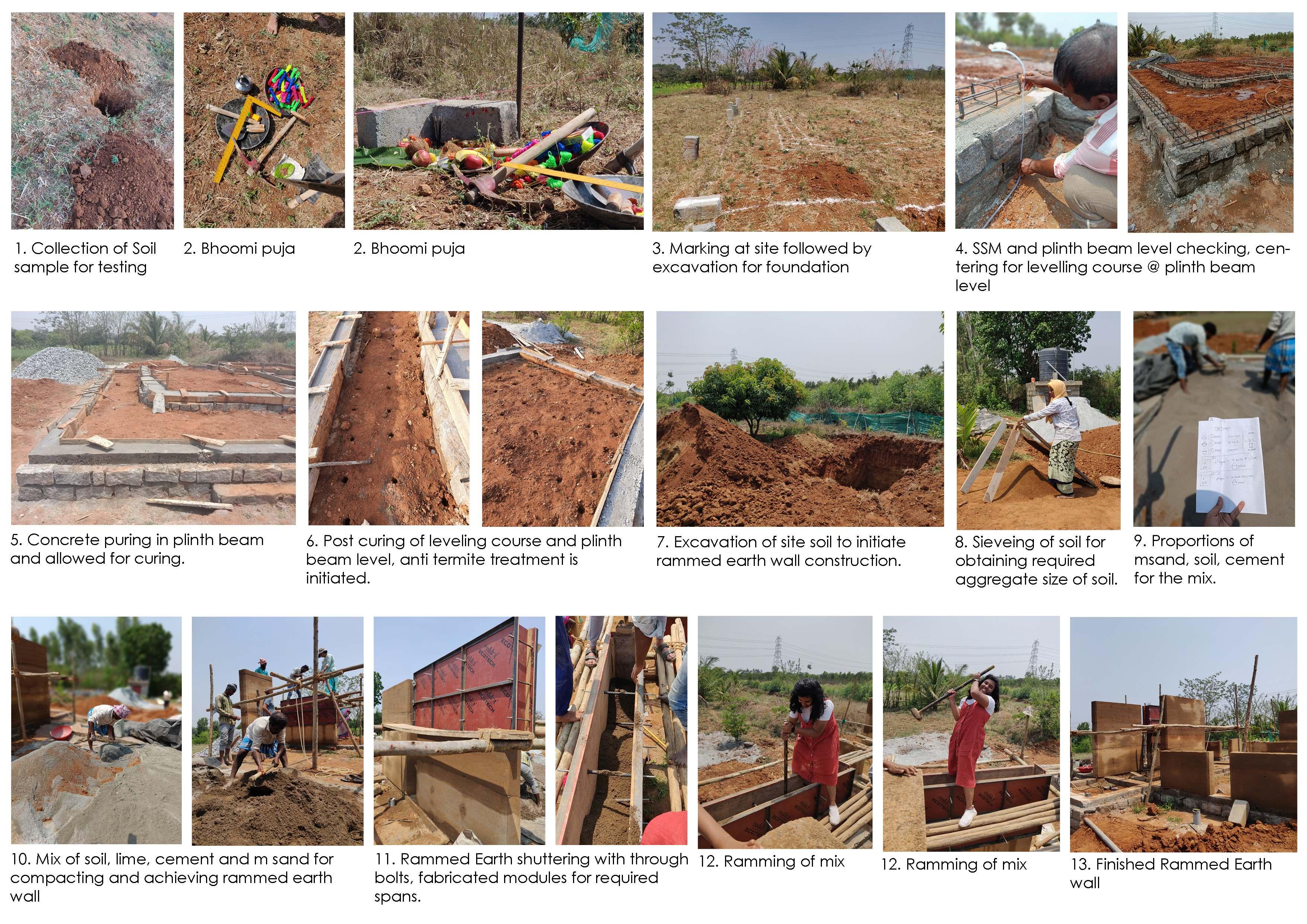
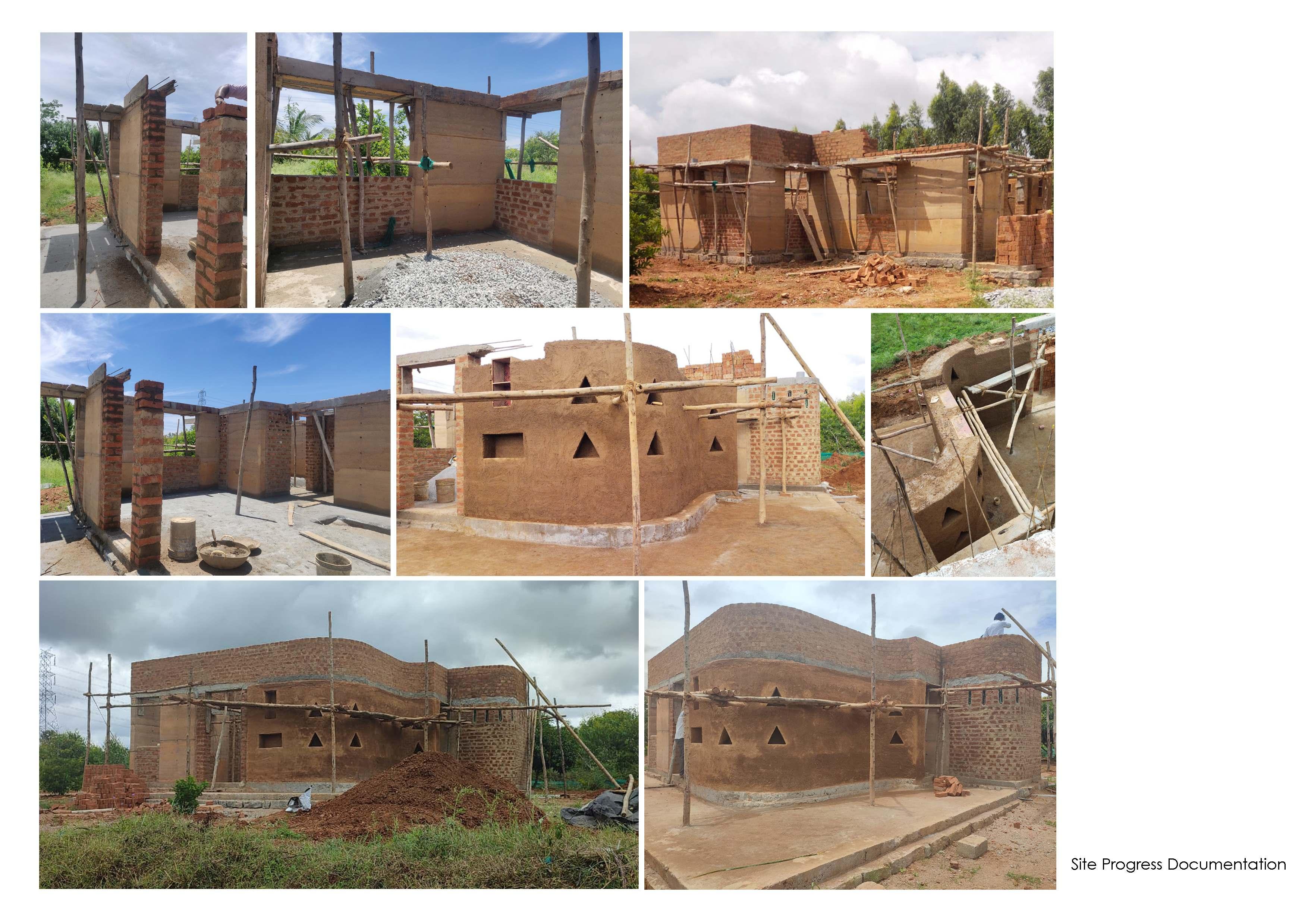
Verge Bangalore, IN LOCATION: Hyderabad
i. Architectural Writing
ii. Computational Design
iii. Salzburg Global Seminar
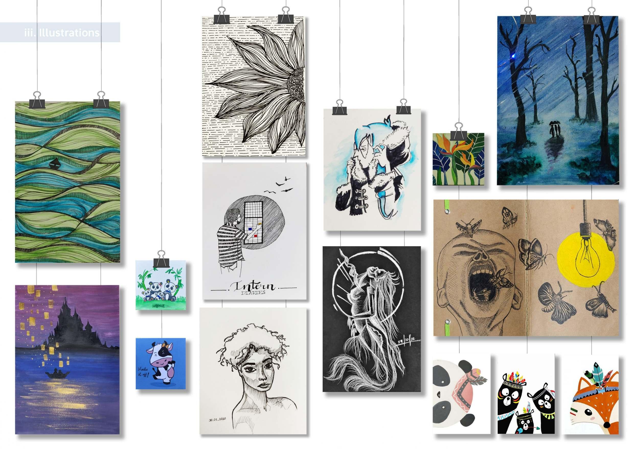
iv. Illustrations
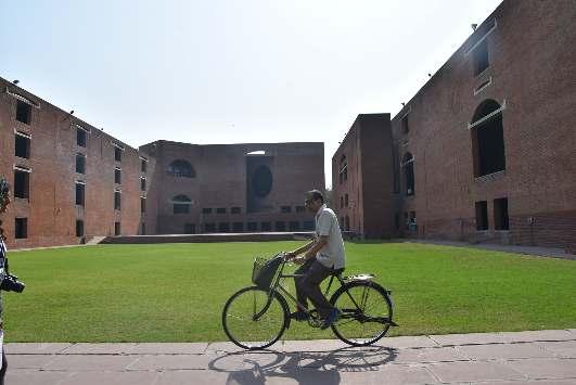
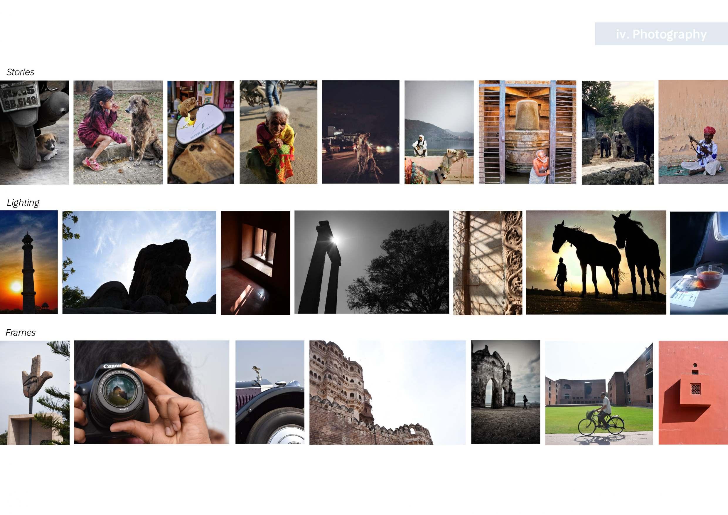
v. Photography
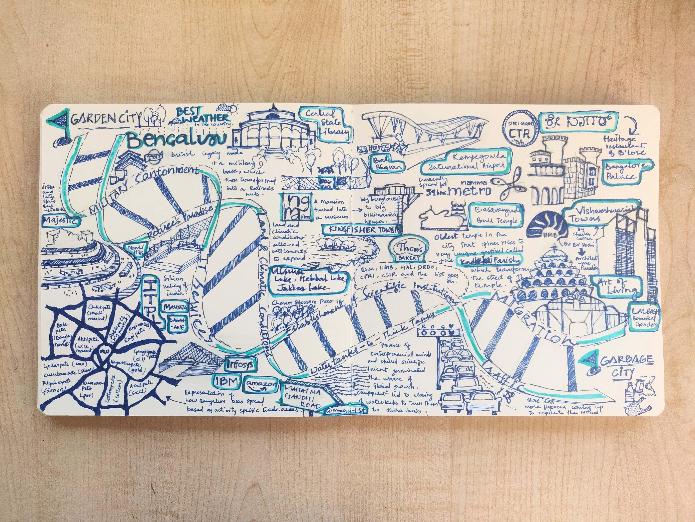
vi. Visual Storytelling
The 2024 Salzburg Academy on Media & Global Change asked how we could find belonging in an age of machines through envisioning media practices and pedagogies that emphasize care and meaningful connections around and through media.

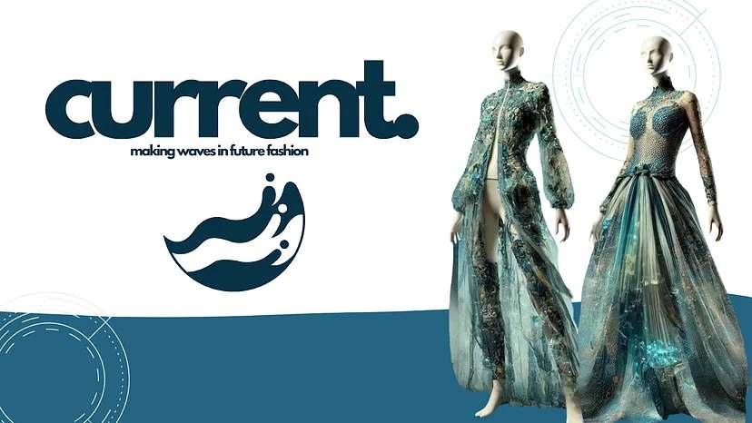
To the question, of envision the role of media in fashion and lifestyle in the year 2074, Current.magazine emerged.
Current Magazine is a pioneering platform dedicated to redefining fashion and lifestyle by prioritizing inclusivity, sustainability, care, and a sense of belonging. Launched as a guide to navigate the complexities of modern living, the magazine blends style with purpose.

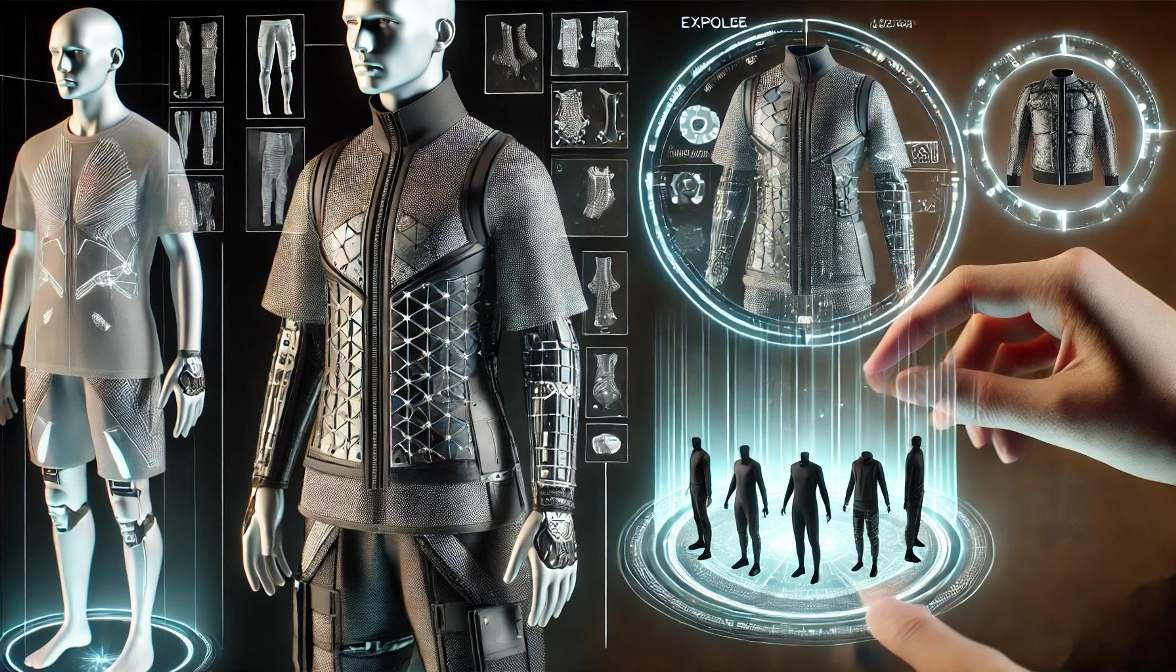
Scientists develop two products, called Drip and Drop. Drip is a fabric, used mostly for clothing, that utilizes the deep sea kelp to morph and change according to the user’s necessities. Combined with Drop, a device that connects to a user’s brain to read waves and interact with the modern world, citizens save money on clothing and no longer on all of the resources needed for cell phones/laptops. People now see articles and almost all media through holograms projected from the Drop.
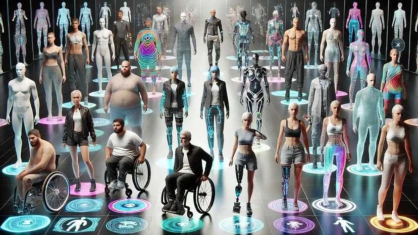
The clothing morphs into different body sizes and types, it also gives an option of modularity that helps not only in customised fashion choices, but also in disability.

To know more forms of media explored, and how the magazine evolved over 50 years from 2024 with the timeline, ScantheQR X