Metro Accessibility Plan | Road safety, Report, Exhibition, Site Analysis | Blog Writing
Urban Mobility Champions Fellowship | 3 Months
YLAC (Young Leaders for Active Citizenship) Worked With Jhatkaa.org, Bangalore
Enhanced Public Transport Infrastructure | Cycle School Campaigns at Delhi and Researched Sustainable Mobility for Specially-abled People in Bangalore | Content for Digital Marketing
Urban Design Intern | 2 Months
DULT (Directorate of Urban Land Transport), Bangalore
Sustainable Mobility Accords (SuMA) | Designed Safe access for Specially-abled People and Placemaking along Rajakaluve, Connected with communities in J.P. Nagar
Architect | 1 Year 11 Months
Cubic Design Studio, Pune
Commercial and Residential Projects | Client Meetings
Architecture Intern | 4 Months
HSA (Hiten Sethi & Associates ), Navi Mumbai
Worked on Architectural and Interior Projects | Handled Different Projects Simultaneously
ACHIEVEMENT
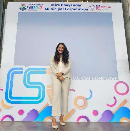
Government Experience | Collaboration with the Hon Commissioner on the Mira Bhayandar Development Initiative
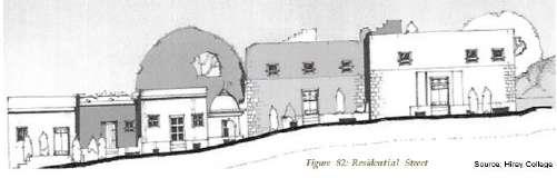
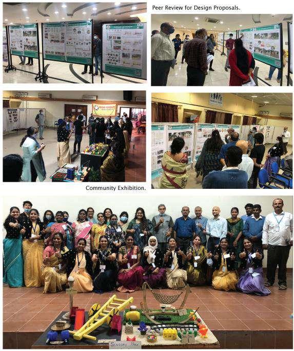
Namma Raste Exhibition | Exhibited The Metro Accessibility Proposal
Designuru : Short Film on Bangalore | Engaged in the Production of a Film with fellow Architects and Designers
Audit for Walkable Malleshwaram | Street Walkability Analysis with Sensing Local
Urban Corridors of Pune Camp Area | Collaborated with Ar Khushru Irani and Studied Urban Corridors
Pune Biennale | Worked with Artists and Designers on Urban Themes and Community Engagement Initiatives
National Service Scheme | Contributed to Rural School Development, Wall Art Projects, Environmental Projects
EDUCATION
Masters Of Architecture In Urban Design | R V College Of Architecture, Bangalore, Karnataka, India
Bachelor In Architecture | B V D U College Of Architecture, Pune, Maharashtra, India
Architecture | Planning | Urban Design
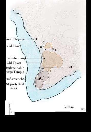
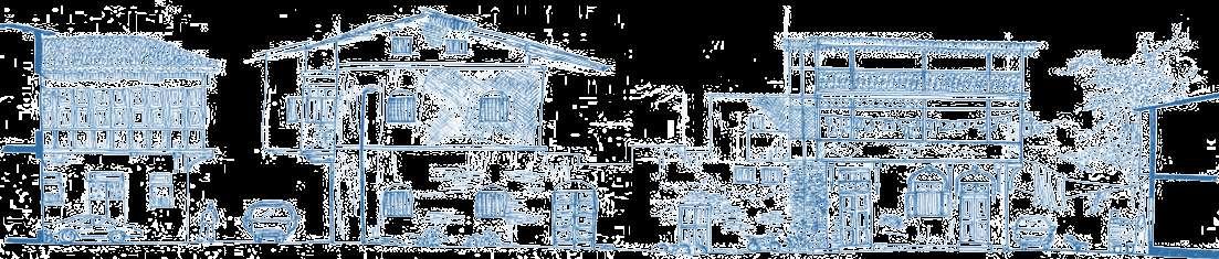
Exploring Identity Of Place Through The Lens Of Cultural Heritage, Paithan, Maharashtra
M Arch in Urban Design | Urban Design Thesis
In Street On Street - Basavanagudi, Conservancy Lane, Study - The Element Of Surprise
M.Arch in Urban Design | Urban Studio Semester I
Cultural Rhythm Of Communities - Shravanbelagola, Karnataka
M.Arch in Urban Design | Urban Studio Semester II
Future City – Barrier-Free Future City
M.Arch in Urban Design | Urban Studio Semester III
Infinity Beach Resort Diveagar, Maharashtra
Bachelor’s in Architecture | Architecture Thesis
Architecture and Interior Project
HAS (Hiten Sethi & Associates), Navi Mumbai | Internship
Urban Corridors of Pune Cantonment Area
Urban Corridor Study Summer Workshop | Competition
DULT (Directorate of Urban Land Transport), Bangalore | Internship
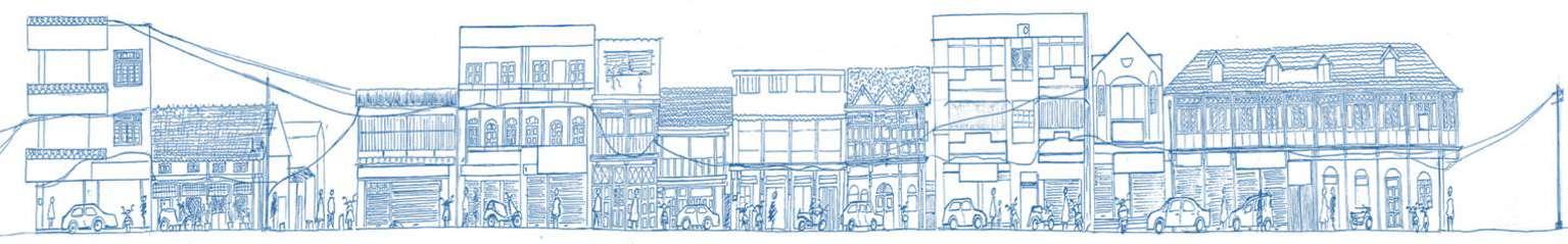
Metro
The
EXPLORING THE IDENTITY OF PLACE THROUGH THE LENS OF CULTURAL HERITAGE
M.Arch in Urban Design | Urban Design Thesis
Exploring Identity Of Place Through The Lens Of Cultural Heritage - The Case 0f Paithan, Maharashtra
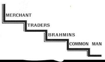
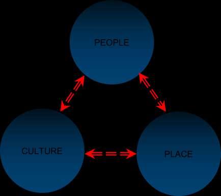
India, a country with a momentous ethnicity and as a geographical, politico-cultural entity has been interacting with the outside world throughout history. The history of cities is the account of their constantly changing form. of additions and subtractions in the organization Cultural heritage plays an important role in creating and enhancing social-cultural towns which enhance the quality of life and the well-being of individuals and their communities It inspires citizens to participate in public life It continues diversity and intercultural dialogue by contributing to a stronger sense of belonging, memories, experience of place in a wider community which enhance a better understanding between peoples.
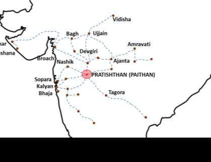
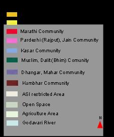
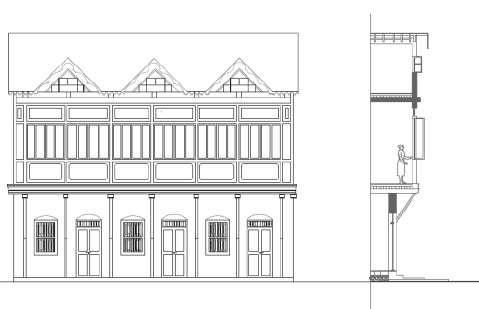
Paithan's distinct architectural and cultural heritage was enriched by different dynasties which ruled Paithan over a period of time starting from Satvahanas to the Nizam These rulers brought with them their own culture, region and architectural styles which eventually blended with the original flavors' of Paithan to form its secular architecture
The intent is to understand the formation of spatial patterns of settlements, the development of networks, the distribution of land use, and their interdependence to increase the social, political, cultural, religious, economic, and tourist aspects. Heritage creates a sense of identity and security by connecting our past, present, and future. The goal is to preserve this ancient town with heritage and cultural identities, as well as to conserve cultural heritage and craft
Urban Design Issues
• Due to rapid transformations Cities getting homogenized
• Cities and towns leading to loss of meanings, associations, attachments, memories and identities
• Relation between physical environment, cultural heritage and place identity has been neglected
• Lack of economic potential
• Migration of Communities involved in Art and Craft
Need
• Preserving an ancient town with heritage and cultural identities
• Conservation of cultural heritage and craft
Aim :
The study aims at documenting Place-Identity with the case of Paithan and identify elements in the built fabric that continue to add to the sense of Place-Identity across age groups and preserve the uniqueness of place
And focus on how it can be source of employment, economic growth, and innovation and contributing to city sustainability. At the neighborhood level, creating networks to form an opportunities for those who are often socially and economically excluded.
URBAN SYSTEM
Settlement : Stages Of Evolution
Egalitarian Societies
Agricultural City
Growing City
Urbanization in India is a complex and dynamic layering of imposition, assimilation, amalgamation, variation and re-interpretation of values as a result of diverse cultural influences In the urban process Activity systems, the localization of space, inhabitation of space and personalization of space play an important part in it’s structuring
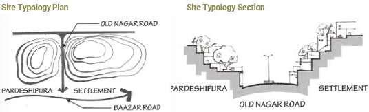
Existing Community Settlement
Bazar road
Residential Area Chowk
Nathgalli Entrance
Baazar Road
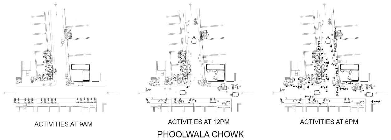
Activity Mapping Of Town Local Issues
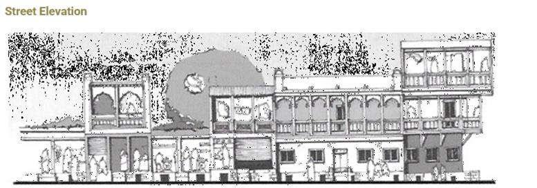
A map represents the most popular access points and locations that people frequent
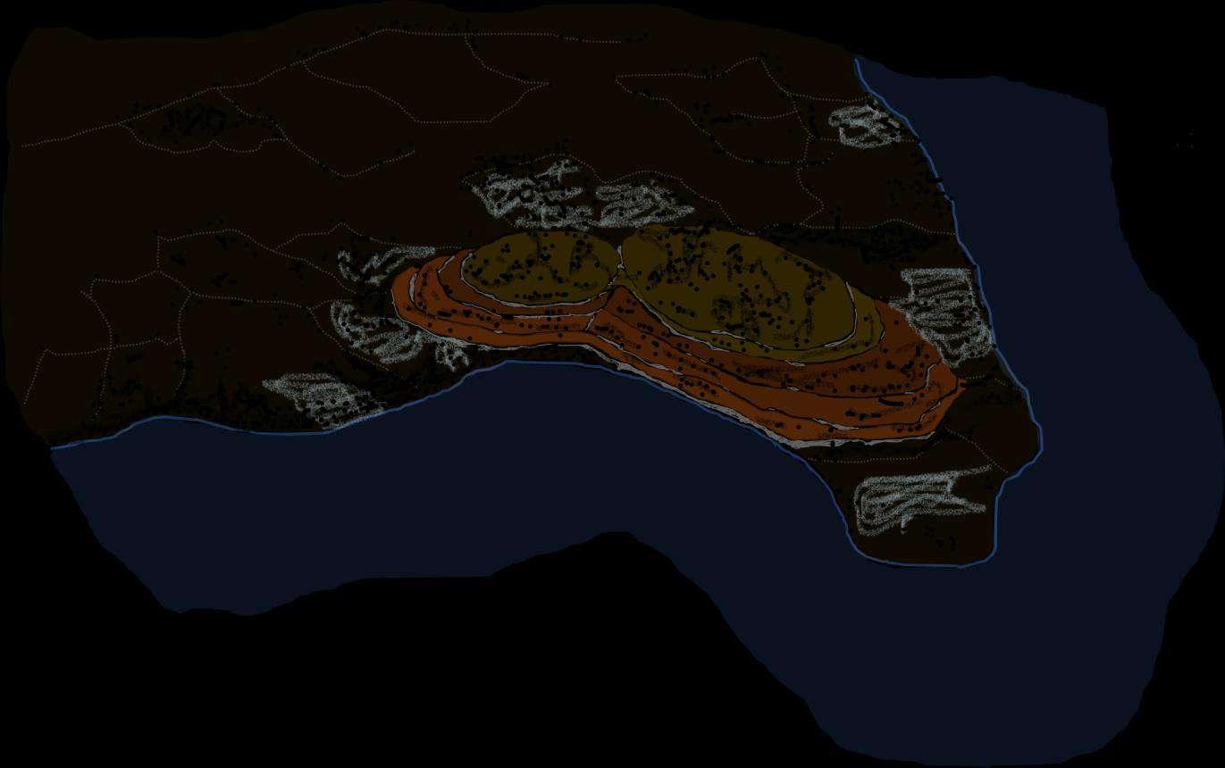
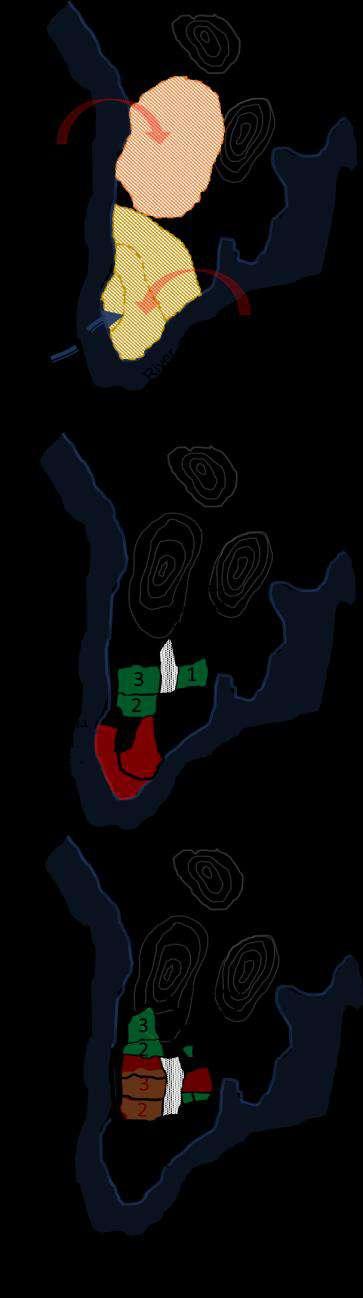
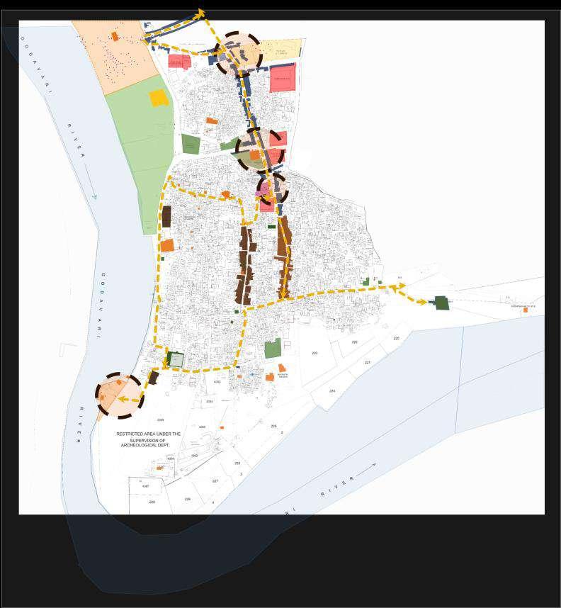
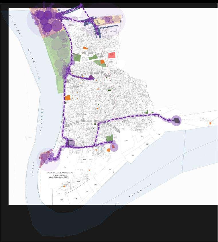
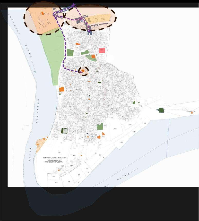
Additionally, it highlights the street with historic architecture It portrays the heritage of the dying Paithan The main gathering site is adjacent to the bus stop, which is the main intersection in Paithan The second gathering area is at Shivaji Chowk, which is on a commercial street Ghats are a significant component of Paithan
Some people frequent Naag Ghat as well as the temples that have adapted into the sociocultural intersection of Paithan Locals lack decent access to the river's edge and public places in this area
Everyday Ritual _ 10th Rituals Pilgrimage Paithan On Festivals Day
On the tenth day of the death ritual, people travel to Paithan to perform pooja at Nath Ghat People are travelling from the nearby area, primarily from Aurangabad Every day, thousands of people visit for this ceremony These pilgrims travel there by bus or own vehicle, and they are located close to Nath Ghat
This practice is also carried out in the Godavari River, which limits people from connecting with nature at the river's edge
People are drying their clothes on the crowded Ghat while engaging in these rituals This restricts locals from using the Nath ghat as a gathering area
Pilgrimage Heat Mapping
Lack of connection between people and River edge The Open spaces are underutilized due to limited activities happening around open spaces Lack of maintenance of gardens Lack of maintenance of Heritage Locals are demanding Ghats
Eknath Shrashti Pilgrimage Mapping
This heat map demonstrates where people are concentrated and where tourists go the most As a result, both the Nath temple and certain other landmarks are visited by pilgrims, although not all of them We can tell that the locals and Pilgrims were not particularly interlinked However, the River's margin plays a crucial role in this
During festivals, pilgrims travel to Paithan for visiting Nath Mandir to offer prayers People visit for a single day, bath in the Godavari River, and then depart Temporary shops move closer to Nath Mandir during festival times, boosting Paithan's economy The absence of activity on the route leading to other landmarks in Paithan prevents pilgrims from going there
A festival known as Eknath Sashti is performed on the day that Sant Eknath left his body in the River Godavari and entered into Jala Samadhi in Paithan Those who wish to participate in this occasion go from all of Maharashtra and northern Karnataka Visitors come to shortages, which creates temporary jobs for people and boosts the economy Pilgrims go to the Nath Temple, River, Ghat, and other important landmarks in Paithan The majority of pilgrims' movement occurs near the river's edge People are now just attending for one or two days instead of the usual 3 to 7 days of the celebration Here we can see the loss of place identity There aren't any tourist attractions that allow visitors to remain longer
Town losing its identity:
The need to provide a ground in reconnecting urban design proposals with their cultural context should initiated by the need to promote the spatially expressed localism in the urban built environments as one of the elements of an urban identity This need is largely due to the currently operative highly standardised planning system, which undermine the diversity of cultures
• Lack Of Connection Between Nature And People
• Horizontal Movement Pattern Are Not Strongly Established
• Underutilized Community Spaces
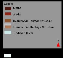
• Heritage Structures Are In A Dilapidated State And Are Being Looked For Redevelopment To New Uses
• Lack Of Amenities For Tourists Hence Leading To Short Term Visits
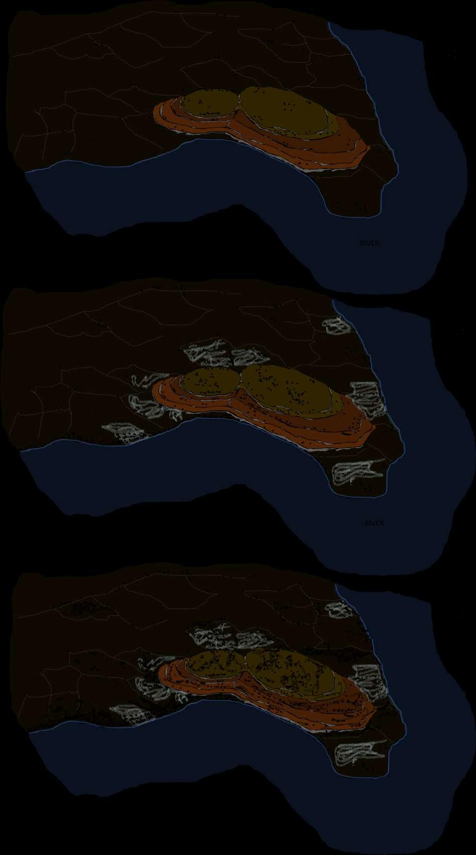
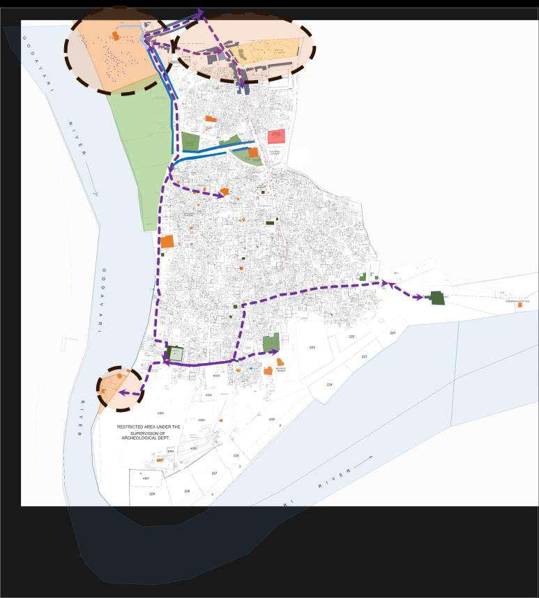
STRATEGY MAPPING
• riverfront redevelopment - by providing activities near open spaces and river edges enhancing the connection of people to nature.
• enhanced connections between locals and tourists by horizontal connections through community and temple places which will lead to the town’s economic growth
• redevelopment of streetscape - providing activities near open spaces and enhancing the green network by providing trees and community spaces
• grade community spaces - providing new amenities near junctions (food shops, street furniture. tourist infrastructure
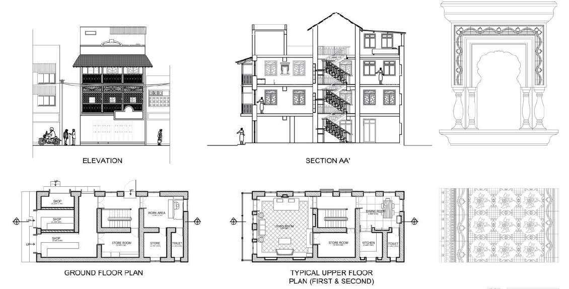
• repurposing of heritage buildings.
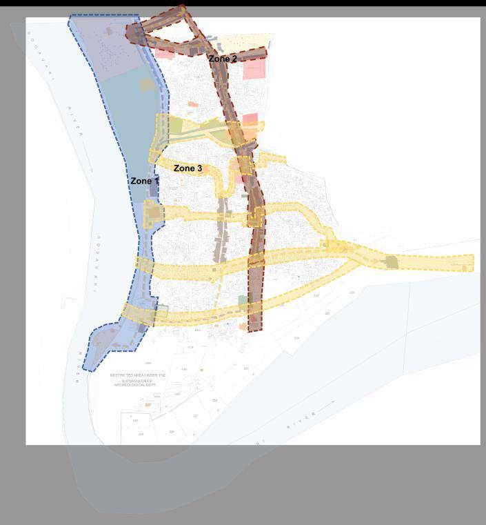
DESIGN
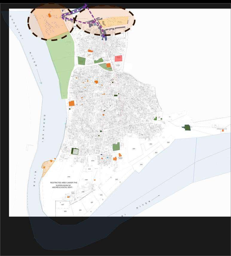
Design Intervention Zone
Zone 1
• Riverfront redevelopment - by providing activities near open spaces and river edge enhancing the connection of people to nature.
• Redevelopment of streetscape - providing activities near open spaces and enhancing green network by providing trees and community spaces.
3
Zone 2
• Grade community spaces - providing new aminities near junctions (food shops, street furniture tourist infrastructure
• Repurposing of heritage buildings
• Coverting delaplated structures for tourist stay and restorants
• and creating gathering spaces.
Enhanced connections between locals and tourists by horizontal connections through community and temple places which will lead to the economic growth of the town
Zone
IN STREET ON STREET - BASAVANAGUDI, CONSERVANCY LANE, STUDY
THE ELEMENT OF SURPRISE
M.Arch in Urban Design | Urban Studio Semester I
The Studio explores both the character (tangible and intangible parameters/ factors) of the street and attempts to construct an overarching premise within which the selected streets can be thematically compared It examines the transformation of each street; analyses its responsiveness within the larger urban context and identifies the forces determining changes within the street and its impact on local, precinct and city scales in the future. In conclusion, it attempts to resolve the issues through key design interventions by building proposals that will help people find new ways to engage with the street and strengthen the public realm. Our group studied Conservancy Lane, Basavanagudi and Jayanagar. We studied how this place transformed and documented it Understood the role of conservancy lane in this place and found the issues of the same and further made a project on it
The Element Of Surprise :
The intent of the design is to improve the connectivity between people and public spaces with the conservation of nature and culture. Which will contribute to economic growth. This would increase walkability in the conservancy lane and Dead Ends will act like a welcoming street. The dead ends which once created insecure spaces, now seem more safe to traverse through
DESIGN STRATEGIES
• Use of Public Areas
• Connection between streets and open spaces
• Vegetation
• Interaction of communities
• Permeable
Open Space is a celebration of life and its challenges. We help make life a celebration, specially for those whom such celebration seems distant and human rights remains a dream The celebration of life is a fundamental human right that we endorse.
Issues
• Less use of Public Areas
• No Proper Connection between streets and open spaces
• Less Permeable
• Less Vegetation
• Less Interaction of communities
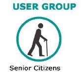
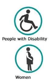
User Groups
• student
• Office people
• Senior citizens
• Children
• Residence
• Visitors
• People who do Awareness
Objectives
• Connection between streets
• Interaction of communities
• Increase Permeable
• Metro to open space connection
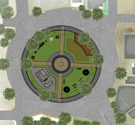
Section Armugam Circle
DESIGN OF ARMUGAM CIRCLE
School And Park Connection at Armugam Circle
Connecting School To M.N. Roa Park
DESIGN OF CAFE PARK
Open Space is a celebration of life and its challenges We help make life a celebration, specially for those whom such celebration seems distant and human rights remains a dream The celebration of life is a fundamental human right that we endorse
• Connection between streets and open spaces
• Interaction of communities
• Permeable
DESIGN OF 2 STREETS
• Connection between streets
• Interaction of communities
• Increase Permeable
• Metro to open space connection
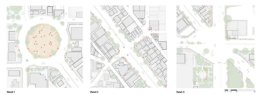
Streets Identification:
Walkable
• Reason to walk
• Safe Walk
• Comfortable Walk
• Interesting Walk
• Connectivity
These are the connections between spaces and places, as well as being spaces themselves.
Conservancy Lane 1
Conservancy Lane Connecting Other Lanes And Cafe
DESIGN OF MAIN STREET
Patalamma Temple Road Views
Cafe Park Near Armugam Circle
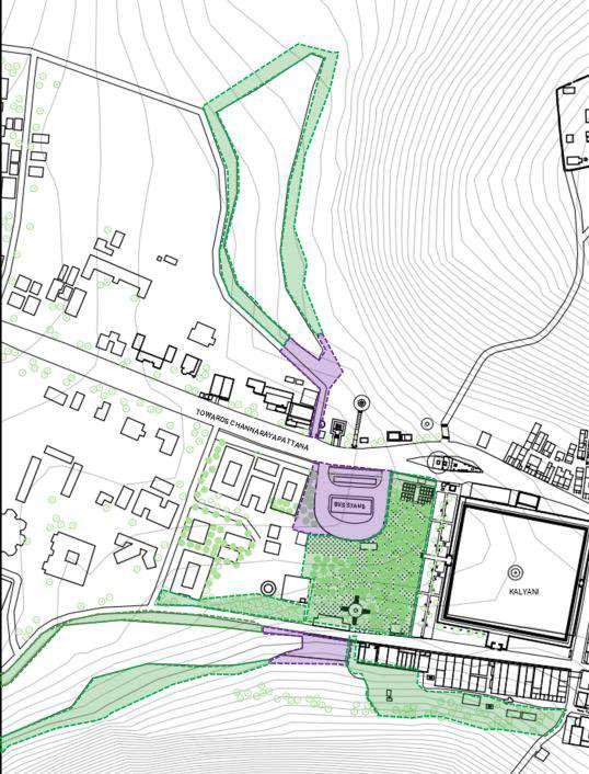
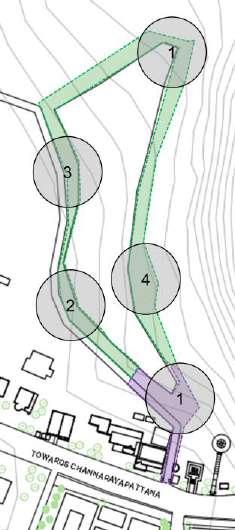
CULTURAL RHYTHM OF COMMUNITIES SHRAVANBELAGOLA, KARNATAKA
M.Arch in Urban Design | Urban Studio Semester II
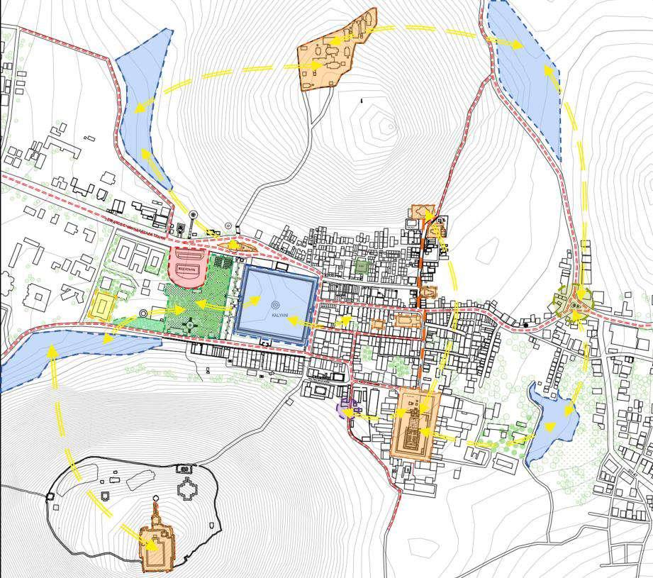
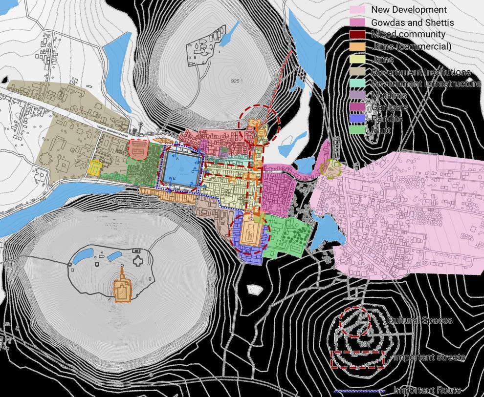
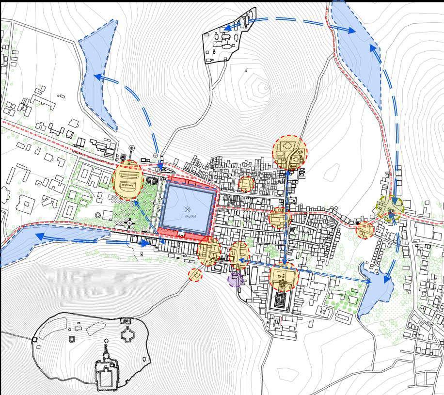
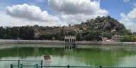
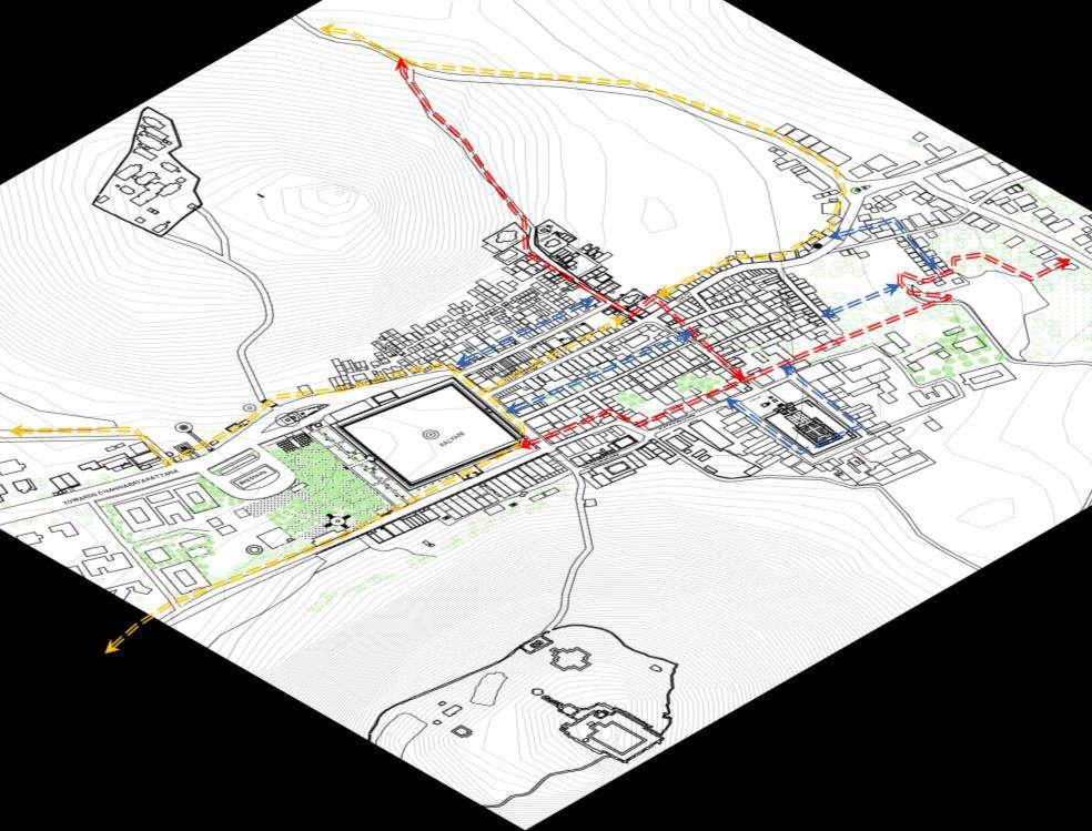
The idea was to study the Pilgrim Cities of India - Shravanabelagola and comprehend the urban form and culture, as well as how the religious nature and belief system of the people is reflected in the structure of the city and architecture. The way such towns are influenced by nature, mythology, and modern development practices dominates their characteristics. Localization of space, inhabitation of space, and personalization of space all play essential roles in the construction of urban process activity systems Shravanbelagola is influenced by Jainism and was also renowned as the seat of Jain education, which can provide valuable insight into a place's live character and how people interact with it Shravanabelagola is renowned for the Mahamastakabhisheka, a Jain religious festival that takes place every 12 years. The manner in which this society established sacred landscapes, settlements, and architecture was impacted by land and nature. A mix of traditional architecture and Jain belief system has transformed this location into a Jain and state level tourism destination The concept is the result of an extensive studio study of the town The intention of the design is to provide an engaging environment for various user groups and connect them with a green slide to bring urban activities closer to nature Connecting Lakes with People promotes the significance of nature in everyday life by creating cultural gathering places in urban areas that encourage pilgrims and tourists to spend more time with nature.
Observations :
Shravanbelagola has Jainism influence on the city.
Jain Practices influence on urban spaces. Interaction between people and spaces depends on culture of town, different communities have different occupations.
Issue :
Lack of connection between people and open spaces.
Lack of cultural gathering spaces.
Lack of connection of cultural spaces to natural spaces.
Lack of connectivity between people and streets
Lack of spaces for kids and women
Communities are settled separately and because of that interaction between different community people is less. Even different communities have different occupations It led to less communication and less exchange of knowledge happens
Conclusion :
Communities are settled separately and because of that interaction between different community people is less Even different communities have different occupations. It led to less communication and less exchange of knowledge happens.
Strategy:
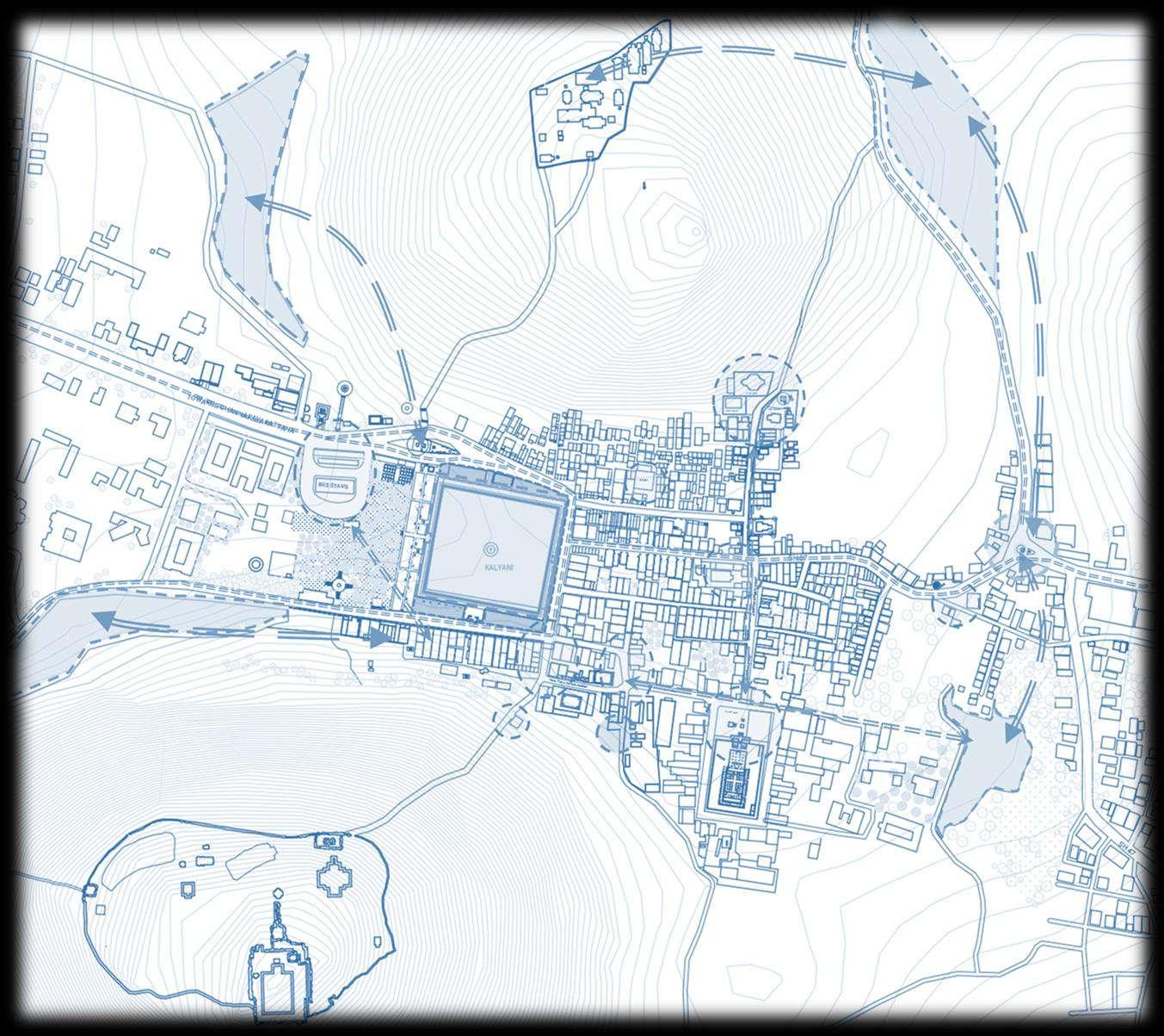
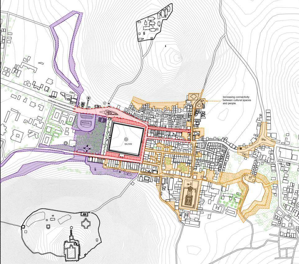
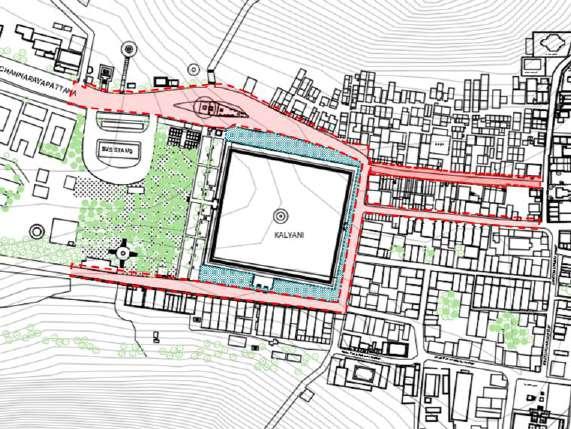
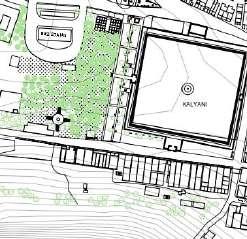
Increasing connection between Kalyani and people.
Making gathering spaces more active.
Theater Culture - Bringing back Connecting Bus stop area to Park/garden. Further connecting parks to streets and people
Increasing Hotels (reg resto, street food) Giving Identities to small hotels | Bhojanalayas.
Making people realise communication is the power of Living.
Connecting Lakes with people brings back the importance of nature in life by creating cultural gathering space
Shravanbelagola has Jainism influence on the city. Jain Practices influence on urban spaces. Interaction between people and spaces depends on culture of town, different communities have different occupations.
VISION : To Connect Cultural Places With People With Respect To Nature
Placing Steps after Kalyani walls, and Decreasing heights of the compound wall , adding jali for a better view. People will connect to kalyani with the help of this design.
Making gathering spaces more active.
Relocating Bus Stop and adding Cultural Hub over there.
Increasing Hotels (reg resto, street food)
Giving Identities to small hotels | Bhojanalayas
Connecting Lakes with people bring back the importance of nature in life by creating cultural gathering space.
Stakeholders:
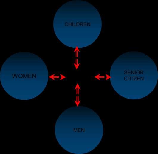
Citizen
• Women
• Children
• Men
• Senior Citizens
Street Vendors
Shopkeeper
Gardener
Pourkarmikas (road cleaners)
Travellers
Hassan District, GoK
Land Owners
Malha Grampanchayat
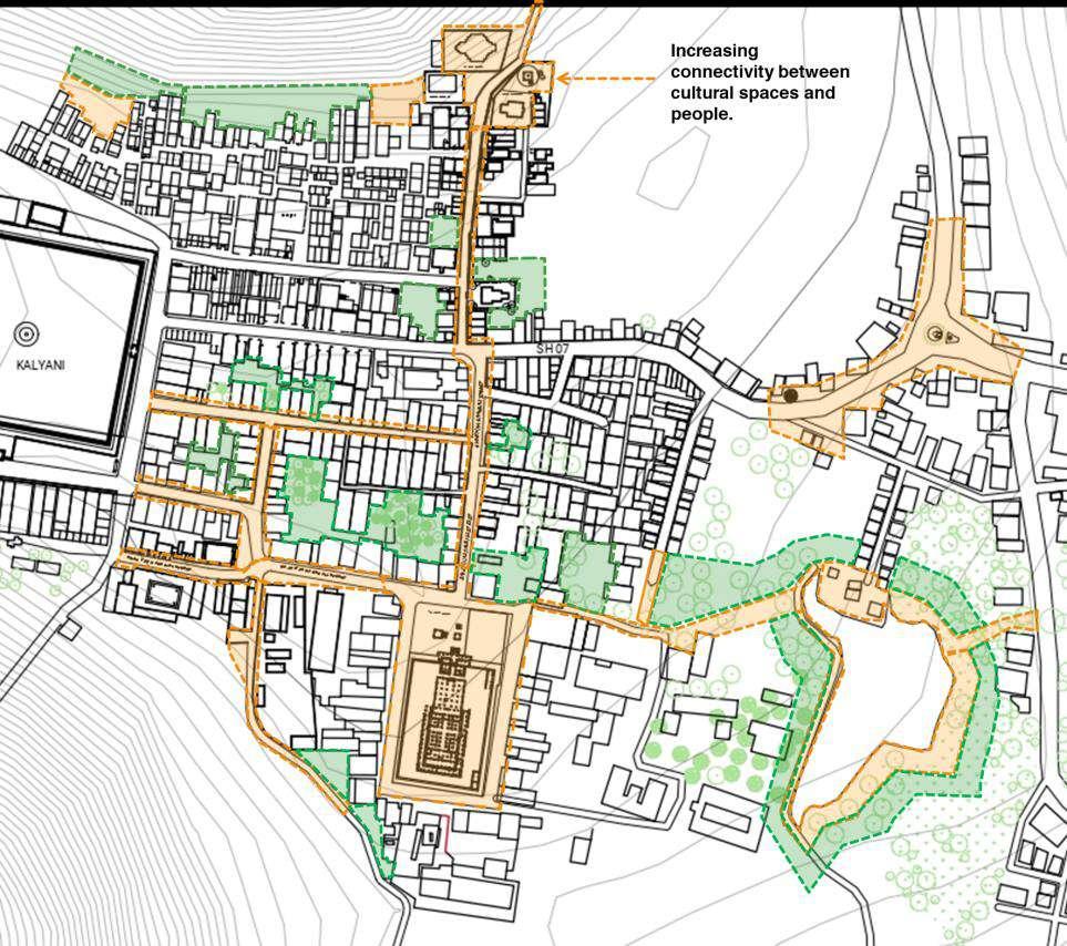
Area of Intervention :
Providoing road axis from matha till lake for better connectivity of natur and people.
Lake as Cultural place for women and kid specially
Program :
• Adding Katte's in front of houses
• Adding Water pump.
• Introduction of Religious Marker
• Design Policies for Cultural streets
• Development around Kalyani
• Reconnecting Cultural space
• Redesign Busstop
• Reconnect Lake
Cultural Zone includes intervention zone of 1.Residencial streets and 2.cultural small spaces and 3.small open spaces.
4.Tree Katte (Entry of town
5.Connection of lake to nearby roads
The connectivity between people and culture in this town is very high. People respect and value this place The idea is to increase the connection between people and spaces And increase interaction between different communities.
Policies in Residencial areas : Policy for old cultural street and Street facad to retain the culturwe of the town. The Architecture of shravanbelagola should be protected for that the type of houses will be kept same.
More than G + 2 Structures not allowed. Sloping roof is assential.
Plint should be minimum 0.45 M and maximum 0.6 M.
Coloums which are in exterior should match to architecture of town.
Bridge on Lake .
People should cross the from one side of lake to other side of the lake. It will increase the relationship between nature and people. different communities will com,e together and can have different events near lake which keeps people connected.
Increasing connectivity between cultural spaces and people.
Reducing the gap between different user groups and places or spaces is necessary which we understand from the study of Shravanabelagola
Children need play ground and place for the exploration of different skills. Women need places where they can come together and interact with different people.
Providing one leveled footpath, No encroachment allowed.
Traditional Roof, Sloping roof
Seating in front of shops
Marking of Vander areas with paint
Adding Steps welcome people to visit near kalyani and communicate with different people.
Adding Step Structure for vendors in market street so that it can use by different users
When verdors are not there people can use that as seating space
Adding Steps welcomes people to visit Kalyani and communicate with different people. Footpaths and seating on the side where near shops can give a better axis to public It will provide seating to vendors and it might give indirect boundary to vendors
Footpath near Kalyani which has width of 4M , providing seating for women which also near by market, mandir and food stalls like pani puri, vada paav
Here women communication will increase and exchange of knowing will happen.
Vindegiri hills side Kalyani border has a parking area, adding it with sating same as in front of basadi to connect people traditionally.
Providing this type of seating shows the importance of the architecture of Shravanabelagola
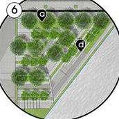
The integration of tree forms into the rhythmical space concepts of the green public space and the water
Different local trees near lake can attract people from town and adding medicinal and flower trees can give rise to it.
Nature Zone includes intervention zone of 1.onnecting road to main commercial street
2.Bus Stop and 3 Big Cultural open spaces
4 Lake surrounding
The main concept is creating an interactive space for different users.
Making two different level parts and connecting them by a green slide to bring urban activities closer to nature
Enhancing green ground area and covering outer boundary with trees.
By providing Wooden Bridge that goes inside the lake, people can connect more with the place And adding different levels by steps can follow the topography of the place.
Seating inside lake boundary for good interaction with lake. Wooden Structure will merge in nature and will not disturb the surrounding.
View near Lake
Section
Section
Section
Section
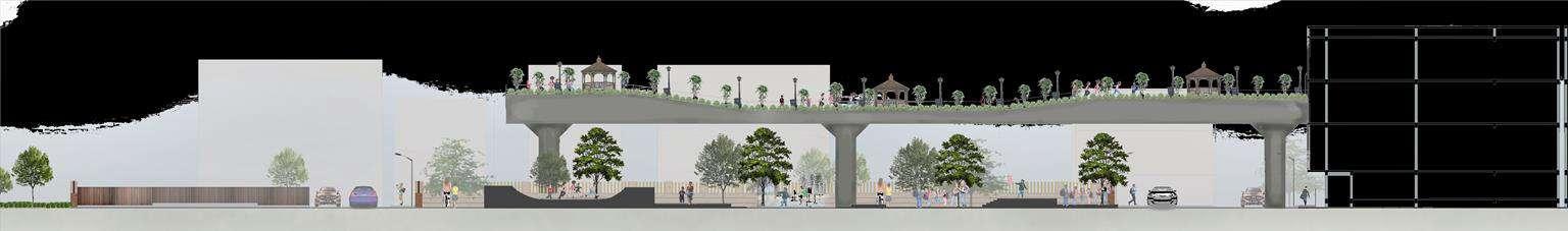
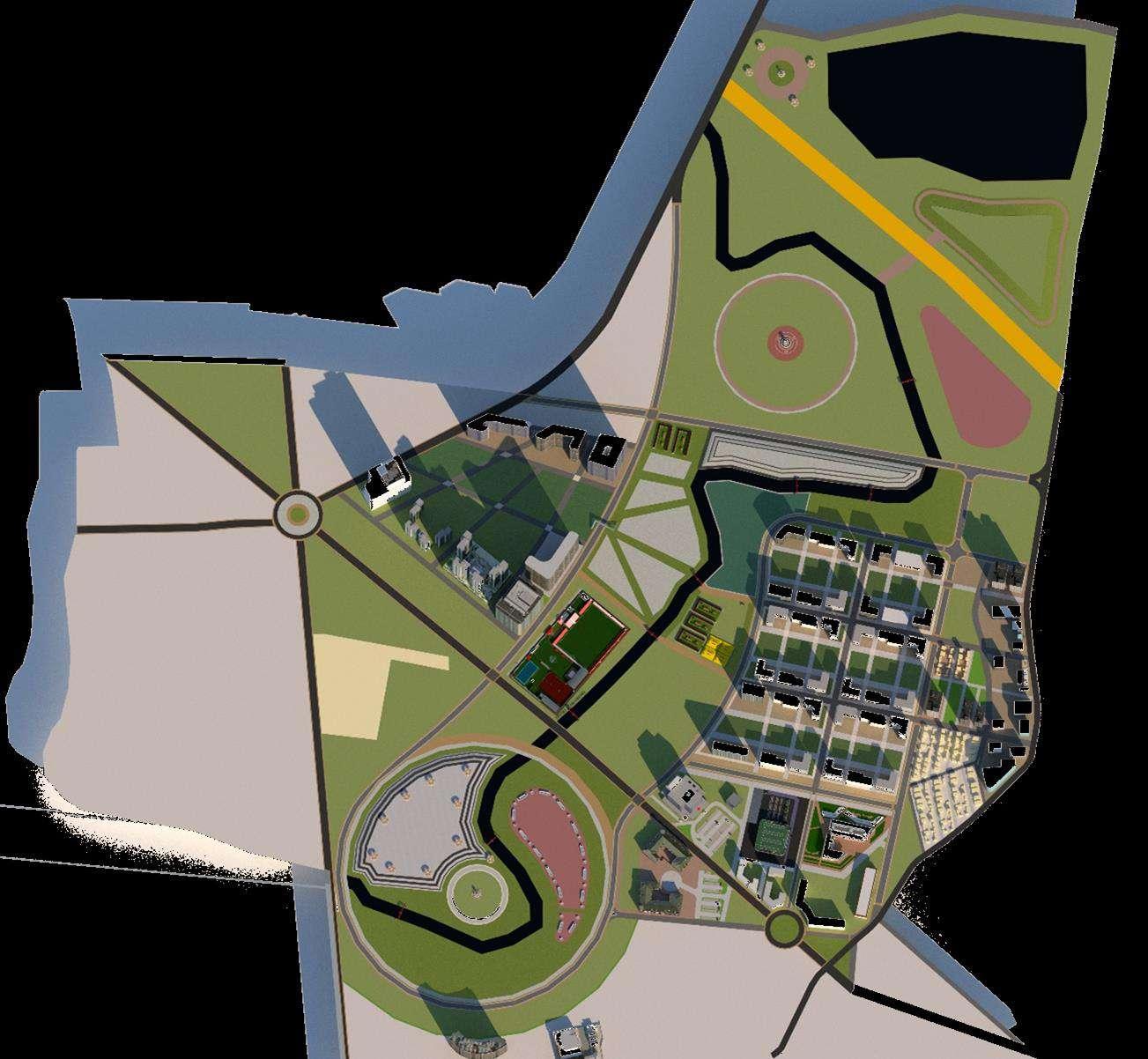
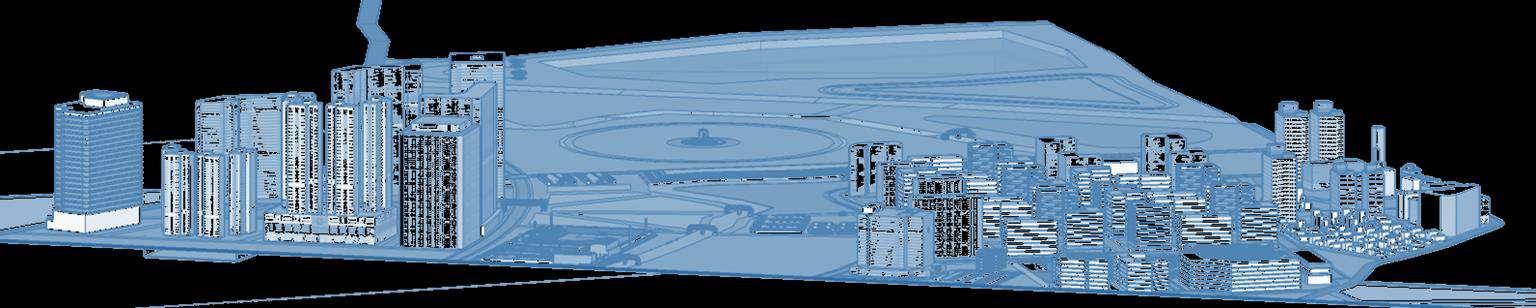
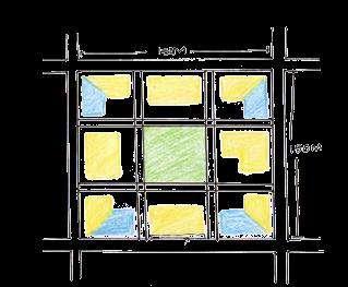
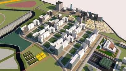
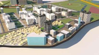
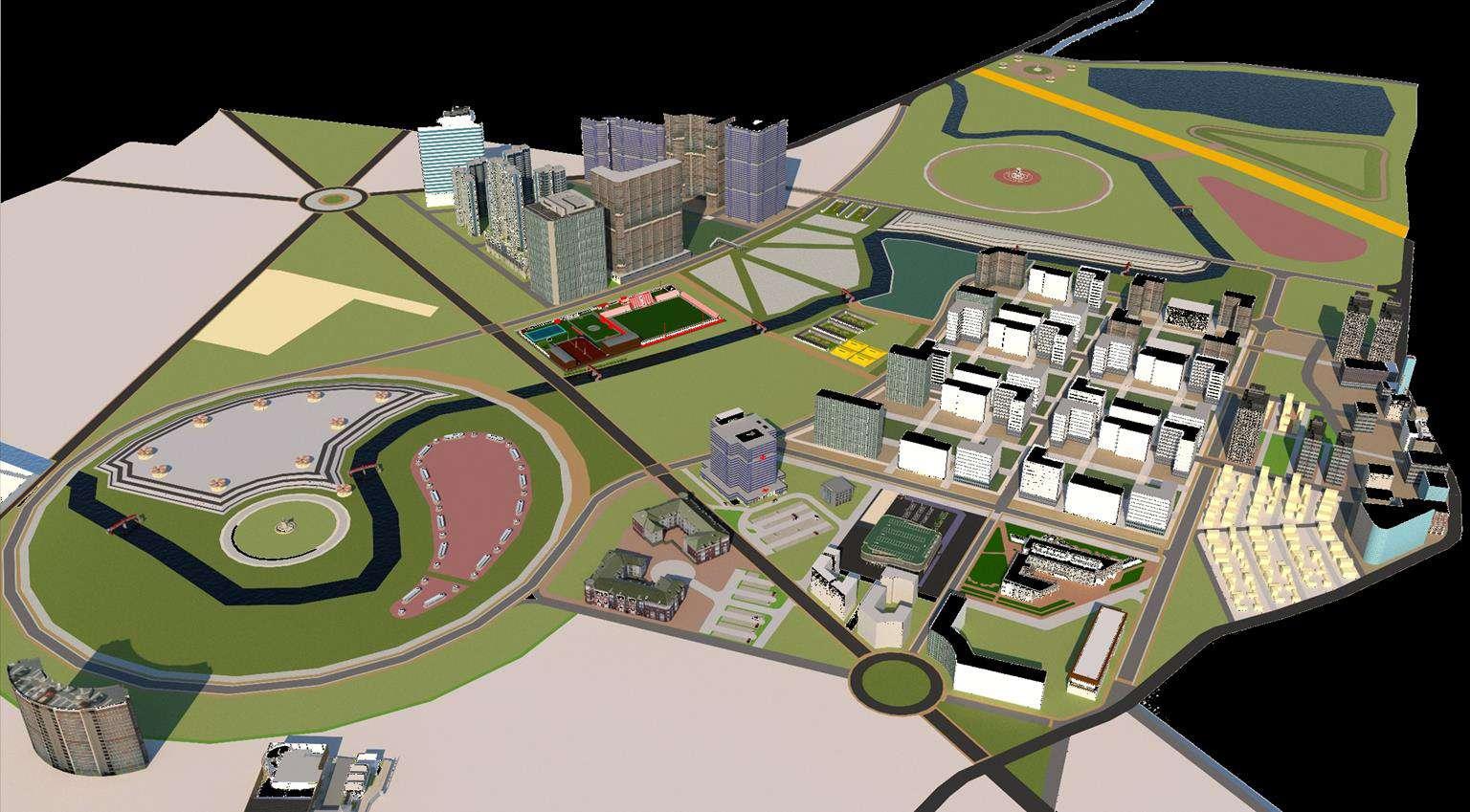
FUTURE CITY – BARRIER-FREE FUTURE CITY
M.Arch in Urban Design | Urban Studio Semester III
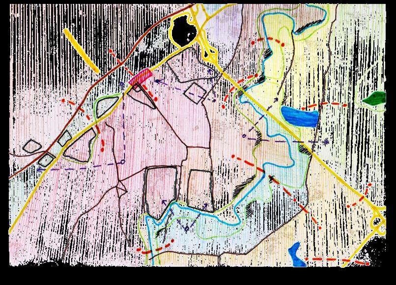
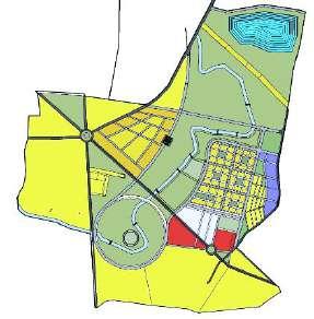
The studio's purpose was to develop a future city that will assist people, nature, and culture to stay tied and valued. A Barrier-free City is one that ensures that people are connected without regard to cultural, architectural, economic, public space, or language barriers. Bangalore's metro area population in 2021 was 12,765,000, a 3.55% rise from 2020, raising tensions between natives and immigrants Bangalore Mysore has an old connection As a result, development along Mysore Road is constant Due to which the development along Mysore Road is constant Which includes many institutes and universities and big parcel lands This site also includes Vrishabhavathi River and Lakes. Nice Road and Mysore Road acts like barrier which is dividing place into 4 different areas.
The aim is to build a location that connects people, places, urban forms, nature, and built environments to create a barrier-free environment. Public spaces are urban areas' living rooms, gardens, and corridors They boost the development and desirability of a community by extending small living areas and offering locations for social interaction and economic activities
FUTURE CITY INTRODUCTION
A City which ensure to connect people without cultural, architectural, economical, Public space and Language Barrier The place which connections between People, Place, Urban Form, Nature and Built to Create a Barrier Free Environment
Public Spaces make Cities more People-Oriented Public spaces are the living rooms, gardens and corridors of urban areas They serve to extend small living spaces and providing areas for social interaction and economic activities, which improves the development and desirability of a community.
URBAN DESIGN ISSUES
Lack of Connectivity : City network, Transportation connectivity, Educational Institutes connections to Residence, Connections between Nature to People, Open Space Network, Economy, Resources.
Lack of Accessibility : Easy accessibility to Nature, Pedestrian Accessibility, Healthy lifestyle, Accessibility to different opportunities, Daily Needs, Entertainment
Physical Barrier : Big Land Parcels, Railway line, Natural barrier, institutional barrier, Lack of Access
Visual Barrier : Big Land Parcels, Bridge, River Edge
Social Barrier : Lack of access to social spaces, Lack of interactive spaces, Socio-Cultural Spaces
VISION
Commercial
Mutation Corridor
Shopping , Food
Market
Residential
Residential (Mixed)
Residential (Main) Row House
Institution
Universities
College
School
Religious Place
Health Institutes
Hospital
Open Space
Public Space
Semi-public Space URBAN
Restructuring the place by enhancing connections between People, Place, Urban Form, Nature and Built to Create a Barrier Free Environment
URBAN DESIGN STRATEGIES
Integrating Transport Connection: Last Mile Connectivity
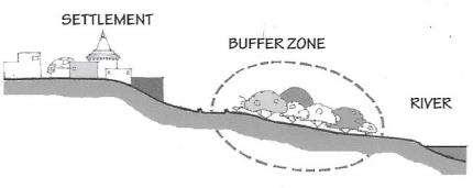
Preserve Green Blue Corridor : Buffer Zone at water edge, Introduce No Development Zone, Preserve Green Spaces, Improve Accessibility
Temporal Use of Open Space : Shared open space
Connecting Public Spaces : Give Preference to Mixed-use Development
Buffer zone at the edge of the road: Introducing policy for 10% commercial area in front of big Parcel of Land
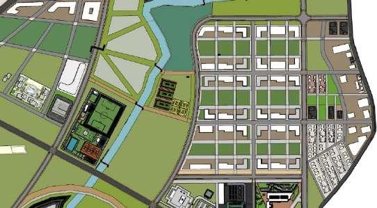
URBAN DESIGN STRUCTURE PLAN
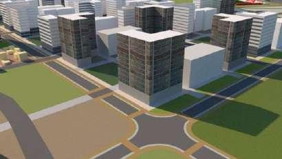
DESIGN
Barrier-free means taking the first steps towards greenifying the city on a bigger scale. By building the framework for a green unity where there is room for inclusive identity and growth.
Block Design :
Crossing :
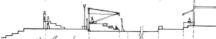
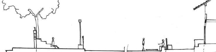
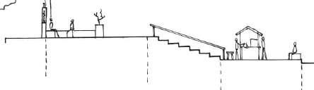
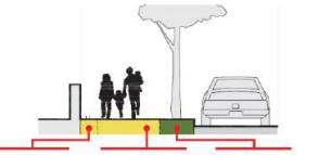
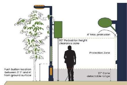
At grade pedestrian crossings are to be provided at all intersections as large number of pedestrians cross the street at intersections
Safe pedestrian road crossings shall be provided also on streets with flyovers and underpasses.
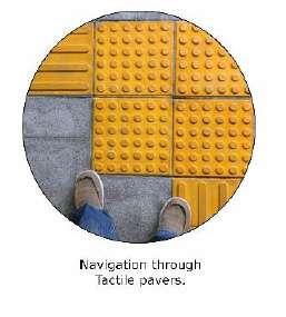
To ensure pedestrian safety and convenience, crossings should be designed for Specially abled with navigating tactile pavers, zebra crossing, Signs, Traffic signal pole, etc
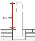
Bollard :
• Provided on footpath at strategic locations in the vicinity of road junctions. Railings should also be provided It would prevent vehicle movement on footpath near junctions Reflective radium tape fitted on it to make it easily visible in the dark.
• Rounded Edges
• Seating Bollard at needed locations.
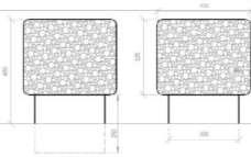
Detail Area Layout : Residential and Commercial area Junction
Building Zone
Block Design
area near Main Road
Roads are not merely functional conduits from point A to point B They serve as green boulevards adorned with rain gardens that cleanse the air and enrich the streets with birdsong and the jovial ambiance of cafes. Bicycle lanes encourage healthier transportation choices and accommodate sustainable enterprises such as bike repair shops.
By providing adequate space and water to plants and trees, ecosystems thrive naturally, reducing maintenance costs and mitigating water damage while preserving biodiversity
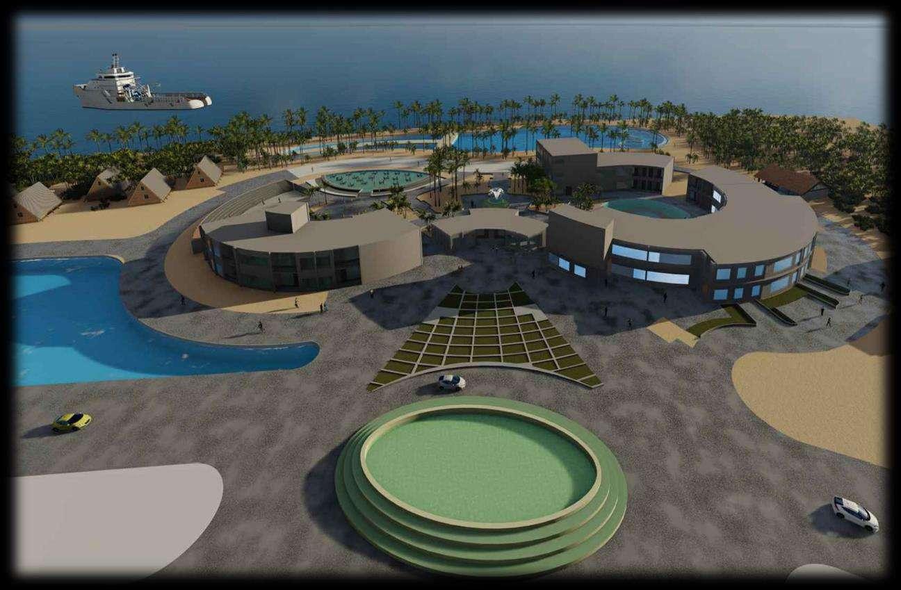
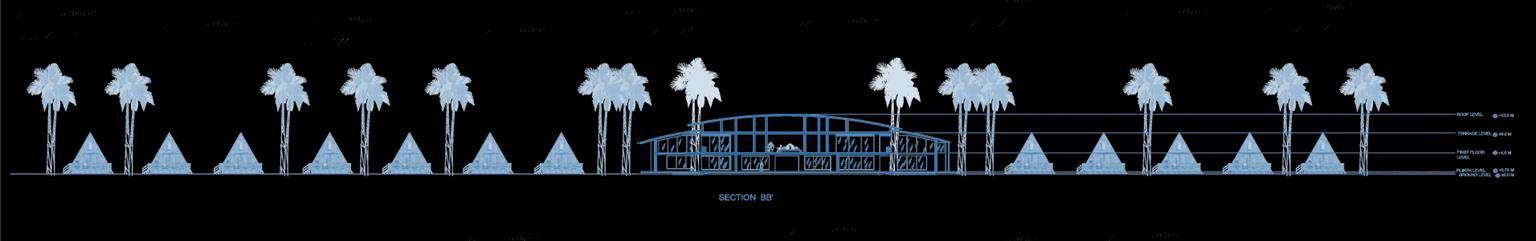
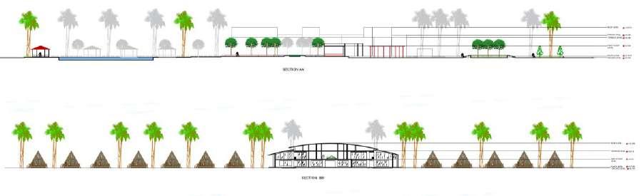
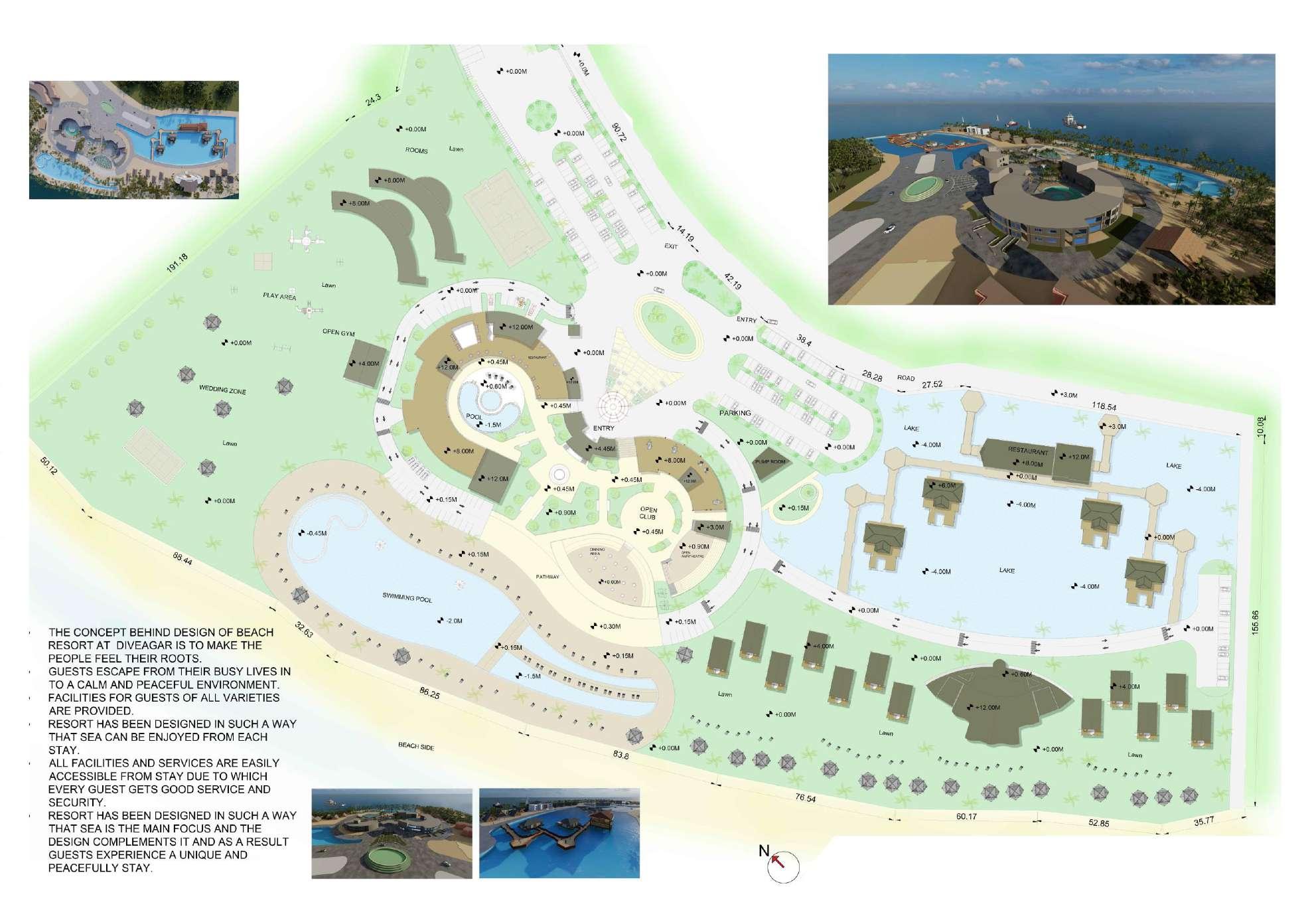
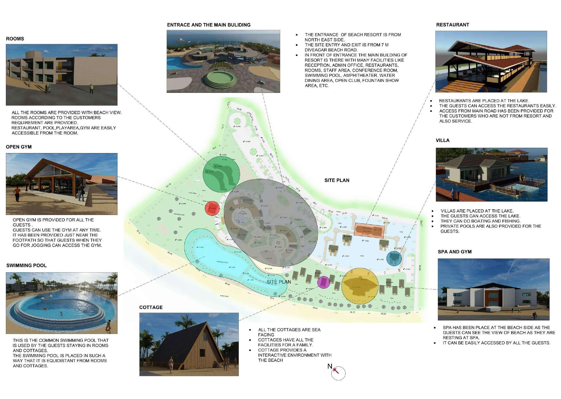
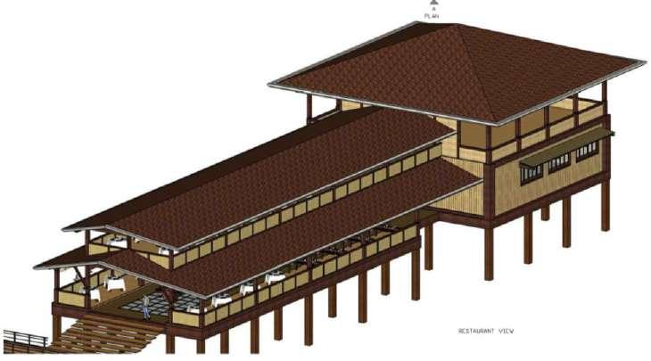
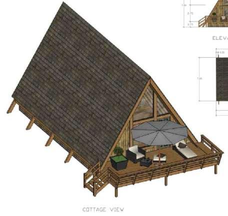
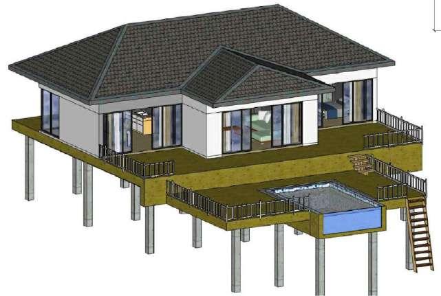
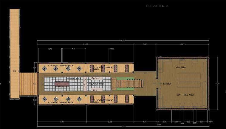
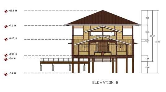
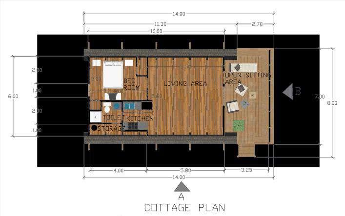
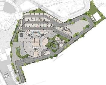
INFINITY BEACH RESORT DIVEAGAR, MAHARASHTRA
Bachelor’s in Architecture | Architecture Thesis
Diveagar is a village located in Raigad District in Maharashtra approximately 170kms from south of Mumbai. This region includes a fishing settlement, a beach, a temple and local business in coconut and beetlenut tree farming and tourism such as restaurants, cottages, rentals etc. It has a golden Ganesha idol which once attracted tourists, is now stolen. A comparison with Alibaug, its 4km long beach has potential to cater to tourism exponentially. But it is not as well developed with tourism infrastructure as in Alibaug.
The aim of this project was to attract more tourists, provide better services, and boost the economy of the surrounding areas The programme includes the development of a resort with 5-star services as well as a gathering place for various occasions Since the environmental circumstances are extreme, and to shed more light on the community, vernacular style and materials have been used
During my internship, I worked on projects with critical aspects such as interactive space planning, functionality, sustainability, energy efficiency, and safety.
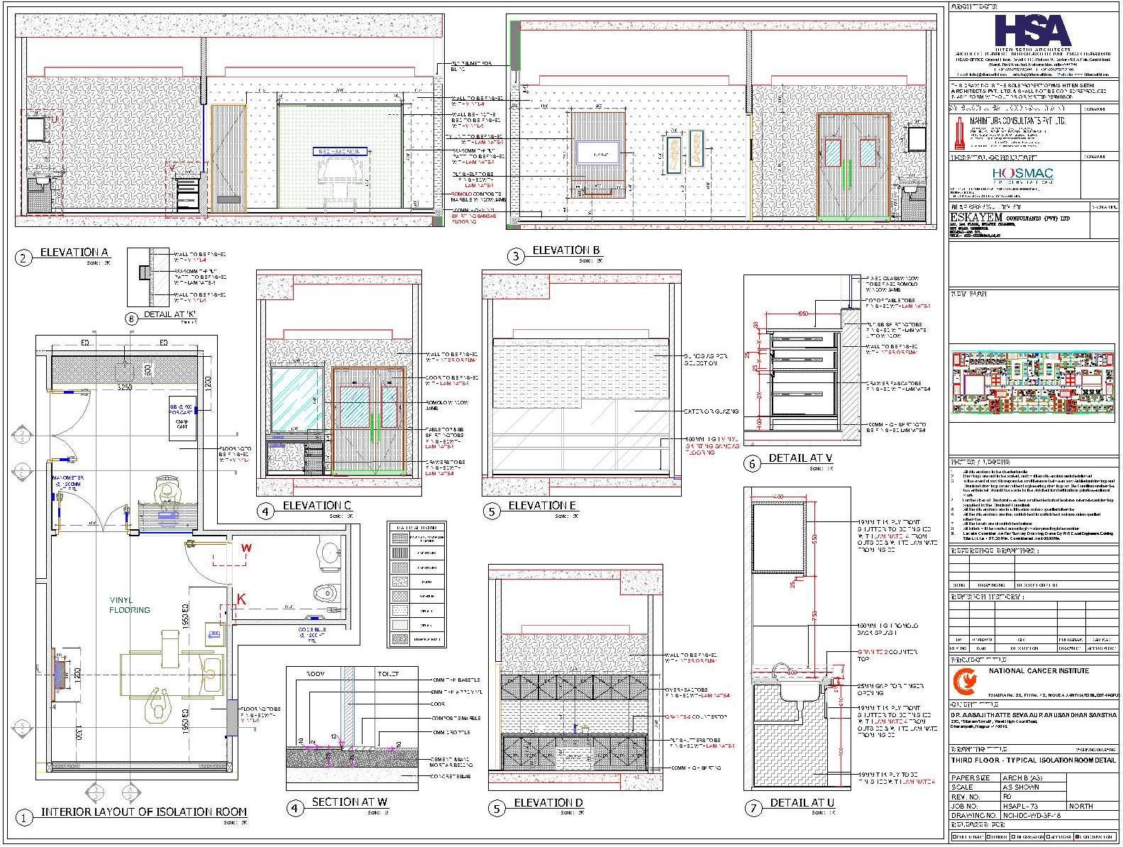
A majority of experience gained in the internship was through intense work in interior design with a team of 2 architects and 4 interior designers. The work included material selection, sectional and elevational details, false ceiling, furniture layout, 3D visualization and many other aspects for varied genres of projects such as National Cancer Centre, Nagpur, Working spaces, L&T Apartments, Renovations, etc
A learning from this was developing moods for different spaces by the right choice of materials, colors, furnishings, talking to clients regarding designs, and working closely with the labourers and artists, vendors and consultants.
Projects:
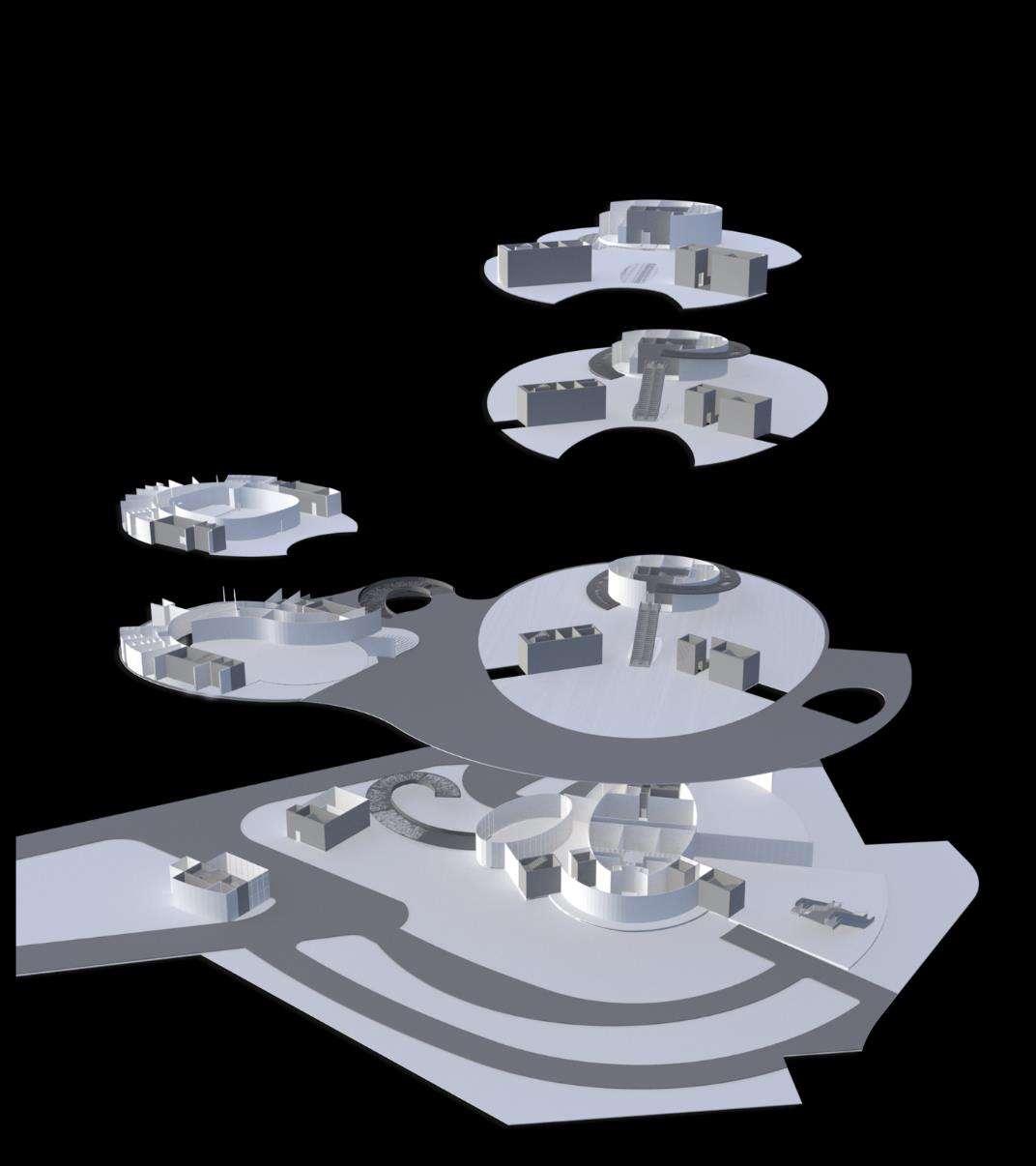
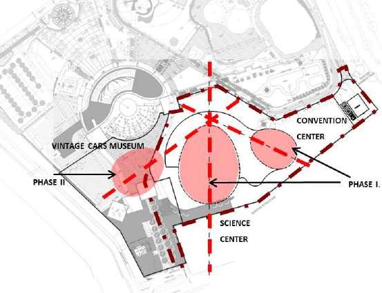
• Museum Island at wonder’s Park
• Theme-based development of playgrounds in Navi Mumbai (site visit & data collection of 17 gardens)
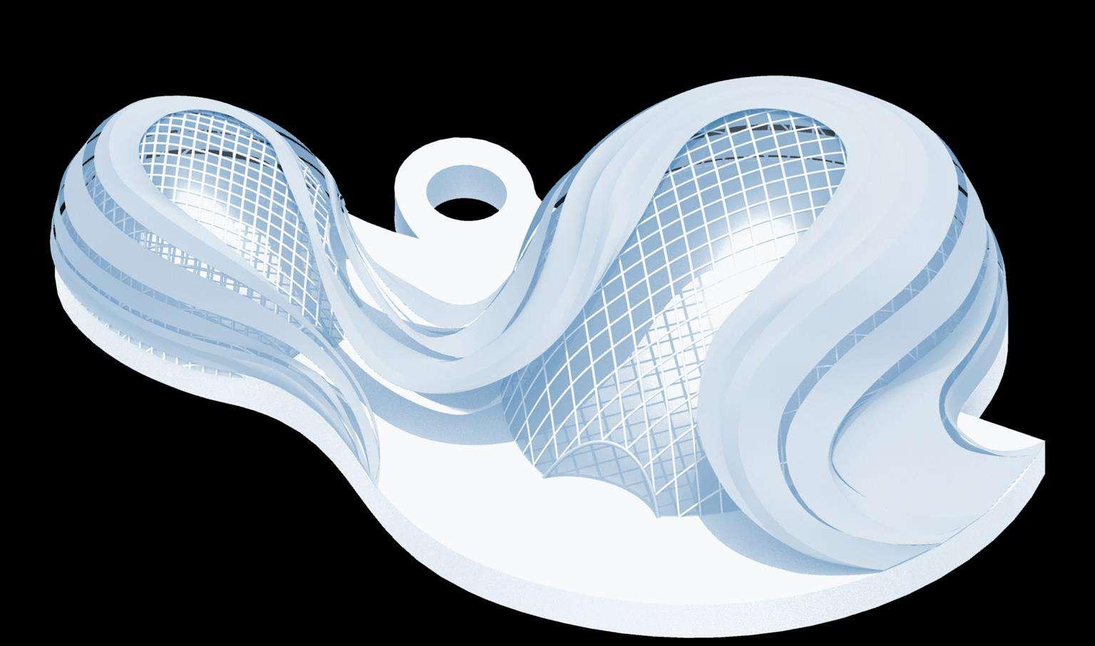
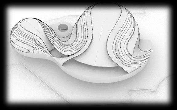
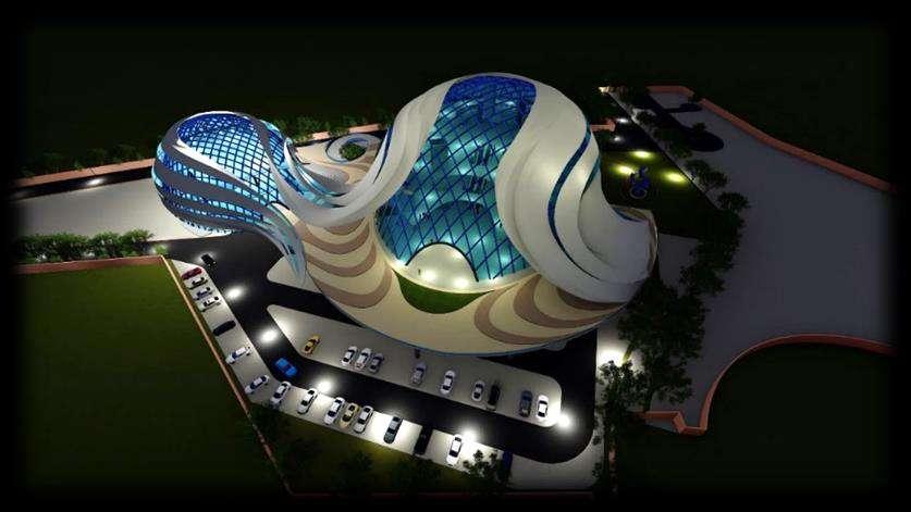
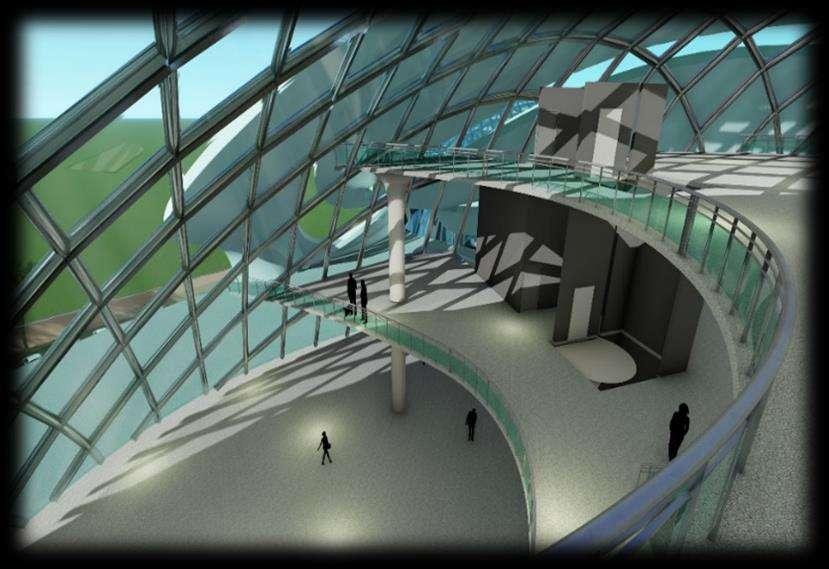
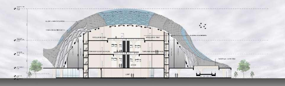
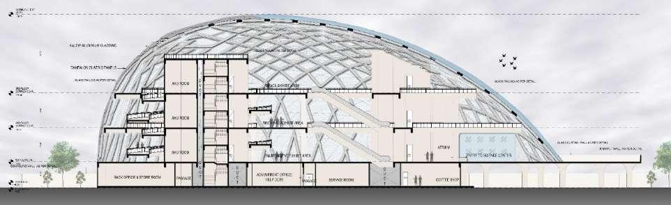
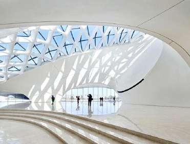
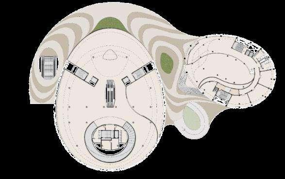
The conceptual Form is derived from the shape of ellipsoid. We developed a diagrid structural system that acts as a complete frame to achieve a large column less space in the last level The lowers levels have independent structural systems in both blocks. Further, we created the skin which is wrapped on the structural shell as a cladding material.
The cladding material is a combination of the translucent part and the opaque part The translucent part allows natural light to enter into the exhibit areas.
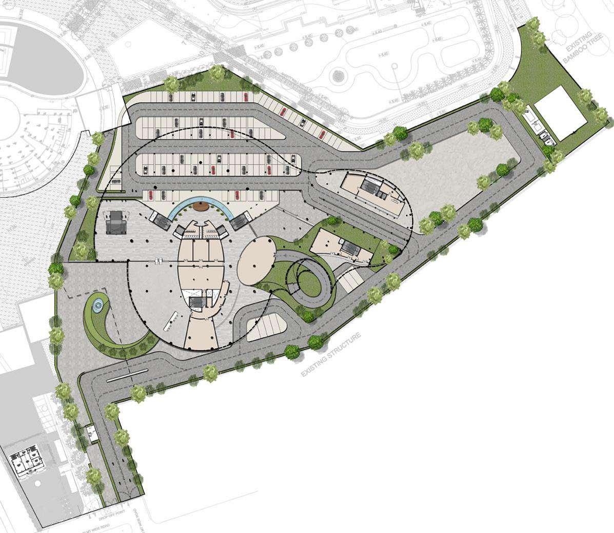
Geometrical Composition: The orientation of the structure is such that the front is visible from the main roads and wonderspark. There is view of Wonders park from podium level of science
Top View Of Skin
Design Approach: Visual Connectivity
DESIGN APPROACH : SPACE PLANNING
Geometrical Composition: The geometrical composition of the Science Center & Convention Center are in response of the viewpoints towards the Wonders Park & existing Urban context
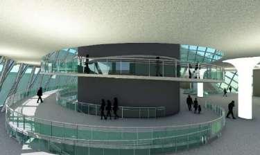
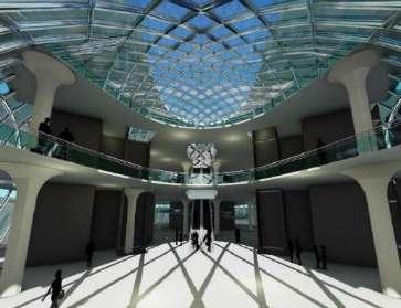
Architectural Details : Entrance Lobby
Architectural Details : Atrium
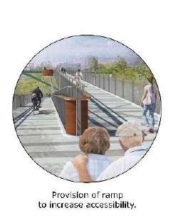
Architectural Details : Ramps
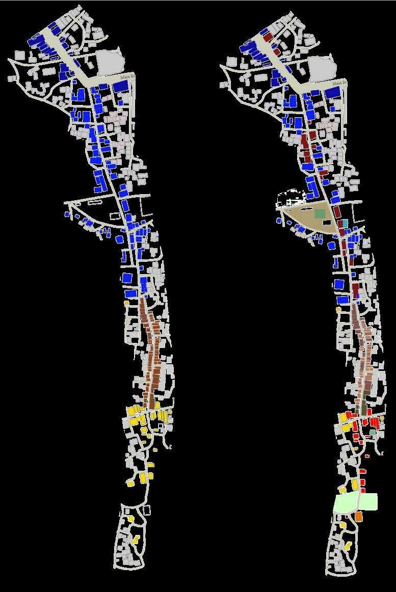
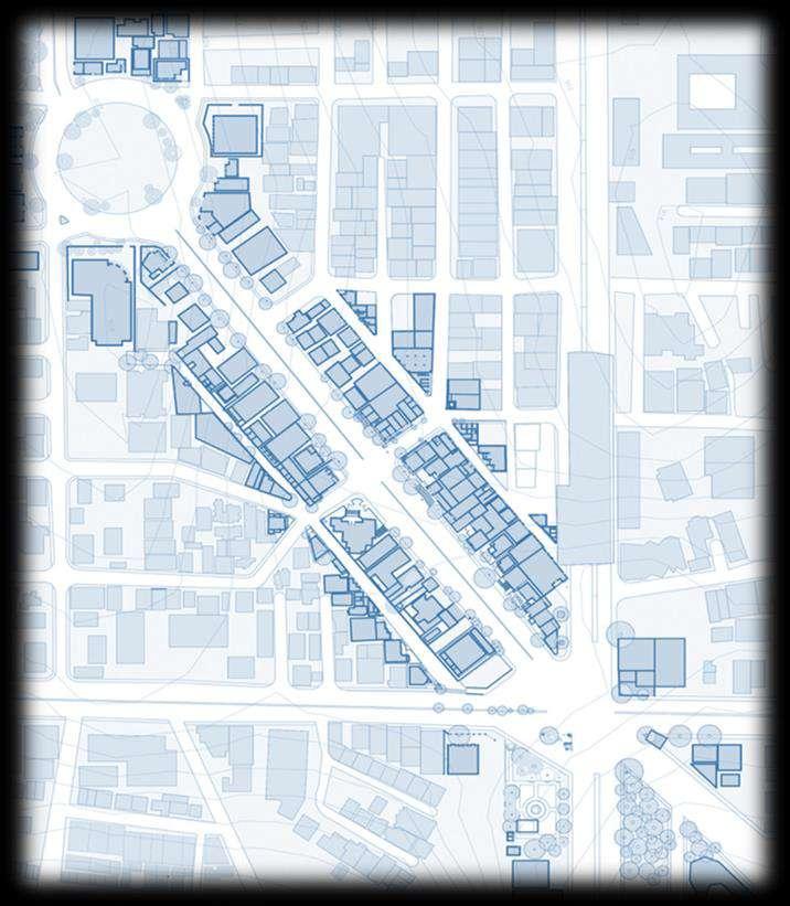
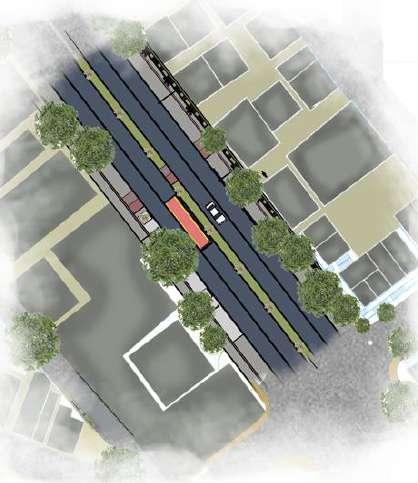
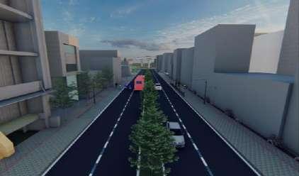
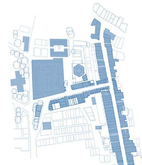
URBAN CORRIDOR STUDY: CANTONMENT AREA, PUNE
Urban Corridor Study Summer Workshop | Competition
This workshop introduced to the Public Realm of the Pune Cantonment with reference to streets, alley ways, public courts and markets, all within the context of heritage buildings which are struggling to survive the tide of rapid social and economic change. Through on-site study of identified areas and buildings, institutions, living practices and community interactions within the Camp area, we were able to document and evolve methodologies to address key issues challenging the place and its architecture The Workshop extended over a period of 10 days and the students of Bharati Vidyapeeth College of Architecture, Pune and Mumbai were involved and it was Headed by Ar. Khushru Irani from Pune.
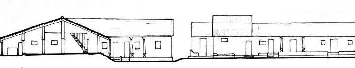
The four primary streets running north- south and more or less parallel to each other were laid and were named as East Street, Main Street, Centre Street and the West Street These four streets were intersected by Narrow roads in East- west direction In between these roads there was a network of narrow lanes The largest of the four was called ‘Main Street’, (now Mahatma Gandhi Road)was lined by residential buildings and shops To the east of Main Street was named as‘East Street’forming eastern boundary of bazaar where the majority of the European stores, churches and Public buildings were located. The eastern side of East Street directly interfaced with the cantonment lands. To the west of Main Street lay the two remaining longitudinal roads, Centre Street and West Street which was the westernmost of the Sadar Bazar major roads)
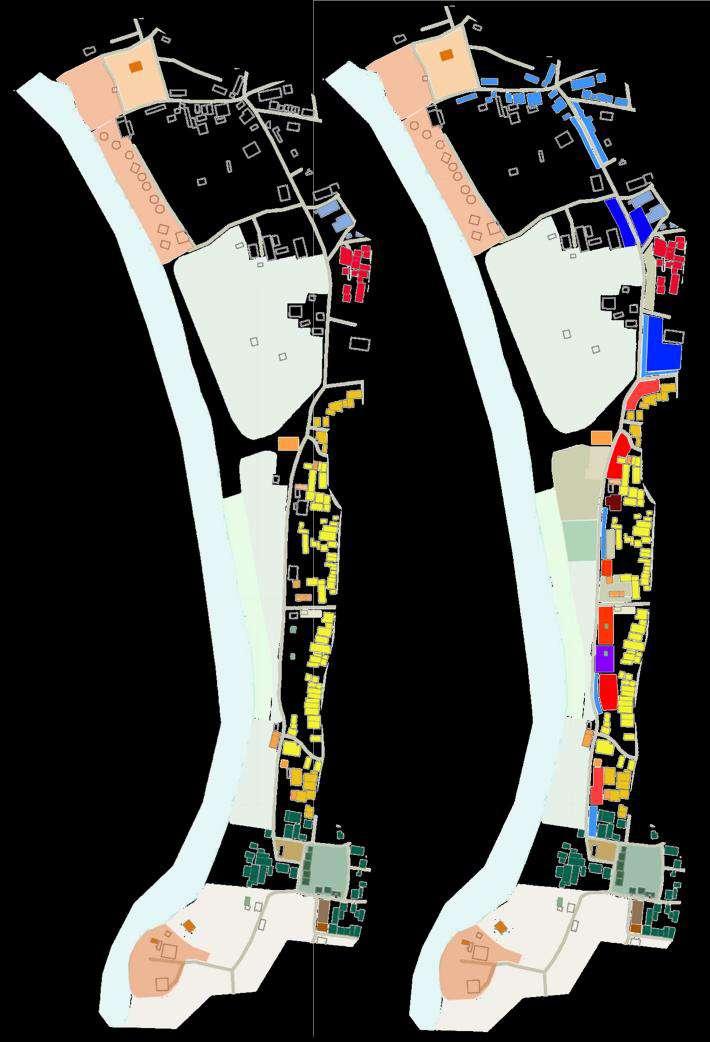
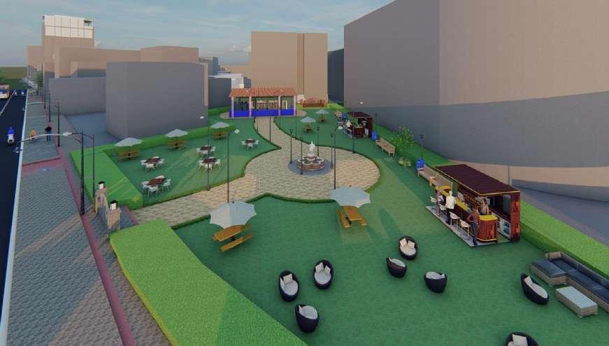
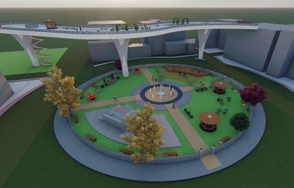
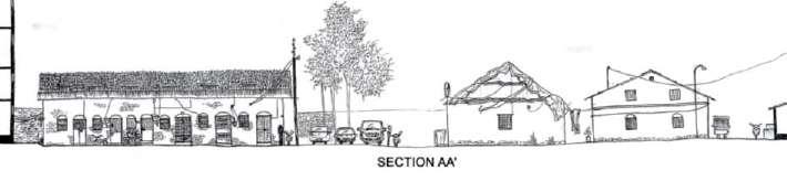
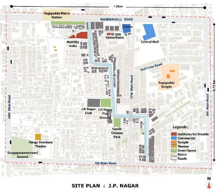
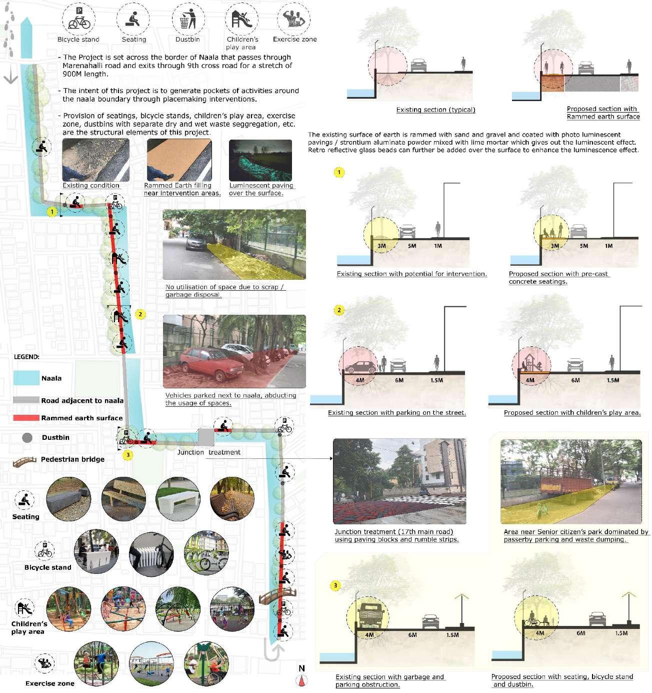
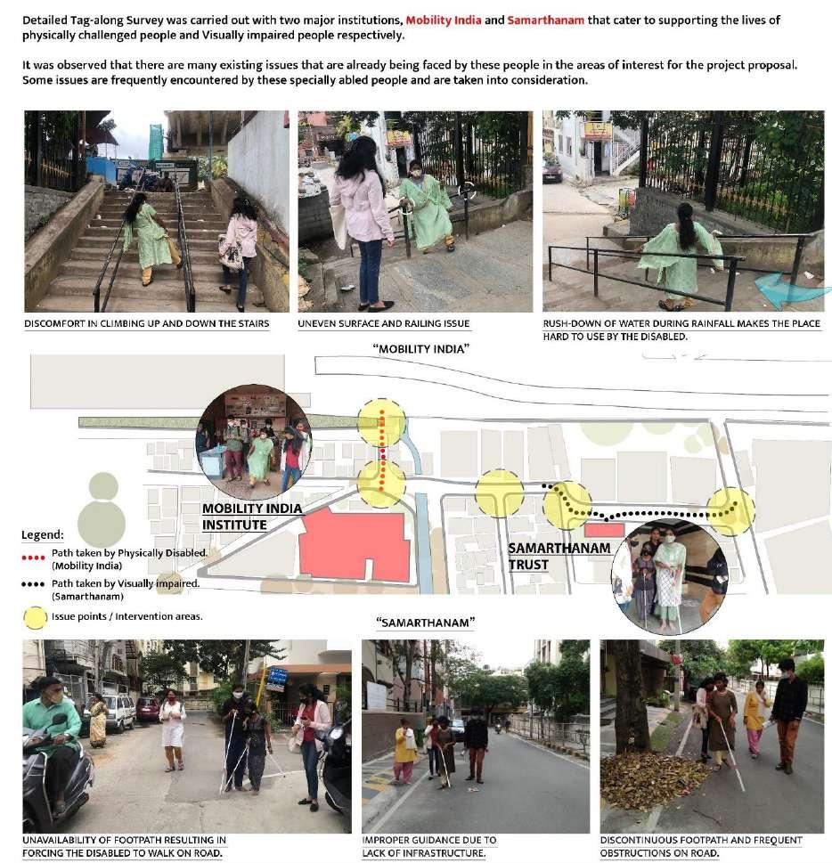
SUSTAINABLE MOBILITY ACCORDS (SUMA) PLANNING WITH PEOPLE, J.P. NAGAR
Directorate of Urban Land Transport, Bangalore | Internship
KNMTA and DULT are working with selected communities for SuMA Cohort 2020-21.
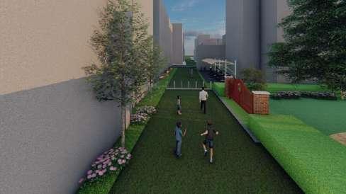
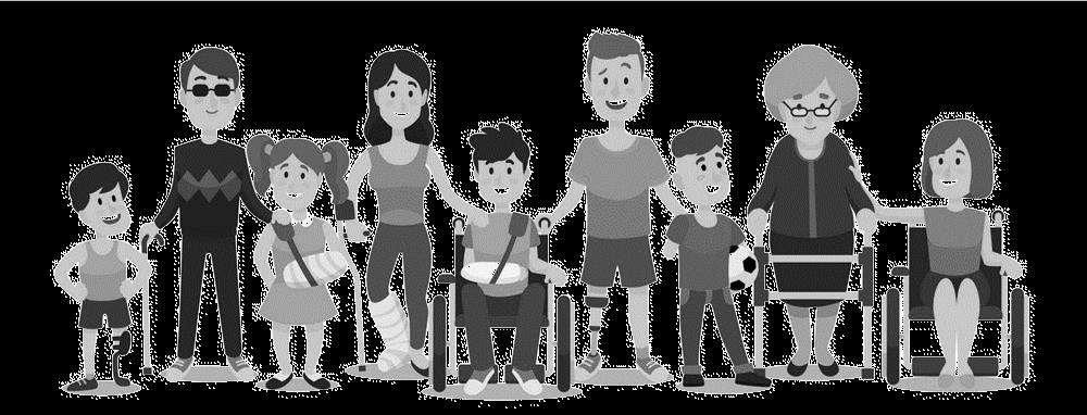
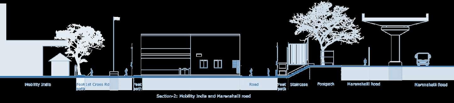
To engage communities at the neighbourhood level to further spread awareness on benefits of sustainable modes of transport like walking, cycling and public transport To support the community to formulate specific goals and action plans for transforming itself into a sustainable neighbourhood, by providing necessary support in the form of capacity building, assistance in showing measurable impact on ground. During internship I designed Safe access for Specially-abled People and Placemaking along Rajakaluve, Connected with communities in J.P. Nagar.
Project 01: Safe Access For Specially Abled
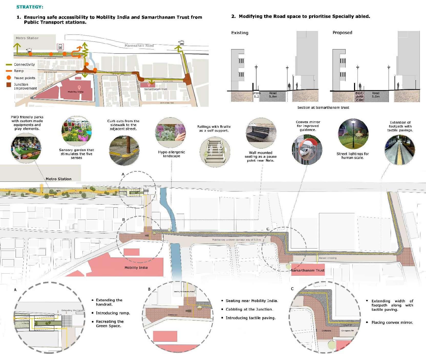
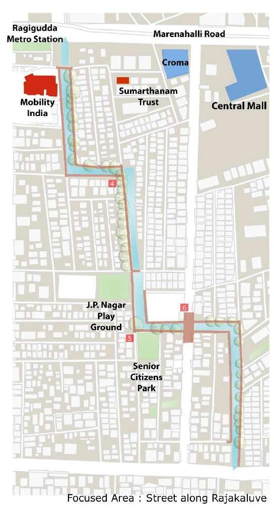
JP Nagar is home to two institutions that work with physically and visually challenged persons Mobility India and Samarthanam are also within 150m of the upcoming metro station at Ragigudda
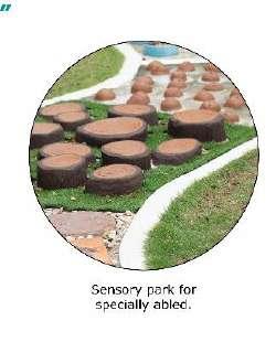
Project 02: Placemaking Along Rajakaluve
A rajakaluve runs from North to South of the site. Interventions have been taken up to improve the walking experience and quality of space along the drain edge.
SAFE ACCESS FOR PEOPLE WITH DISABILITY
Intent :
To ensure ease of access to PWD and other Disadvantaged groups.
Objectives :
Making movement corridors universally accessible
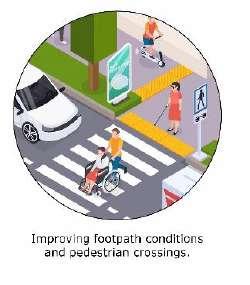
Improving footpath conditions and Safe crossing for PWD
Ramp access to negotiate level difference
Reducing vehicular movement on
1st crossroad
Strategy:
1. Ensuring safe accessibility to Smarthanam Trust and Mobility India from Public Transport Stations.
2. Modifying the road space to prioritise PWDs
PLACEMAKING ALONG RAJAKALUVE
A rajakaluve runs from North to South of the site Intervention have been taken up to improve the walking experience and quality of space along the drain edge.
Site Visit : Place understanding through the lens of Specially able people
Exhibition: First exhibition to commissioner Second Exhibition to J P Nagar Community and people
JP Nagar is home to two institutions that work with physically and visually challenged persons. Mobility India and Samarthanam are also within 150m of the upcoming metro station at Ragigudda.
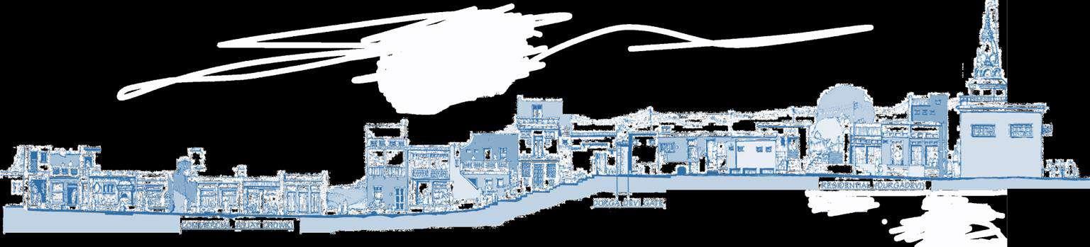
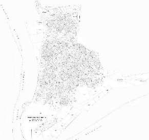
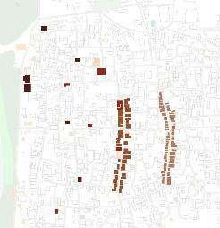
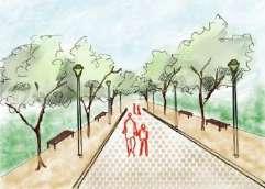
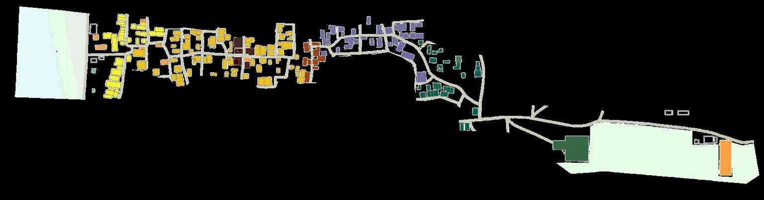
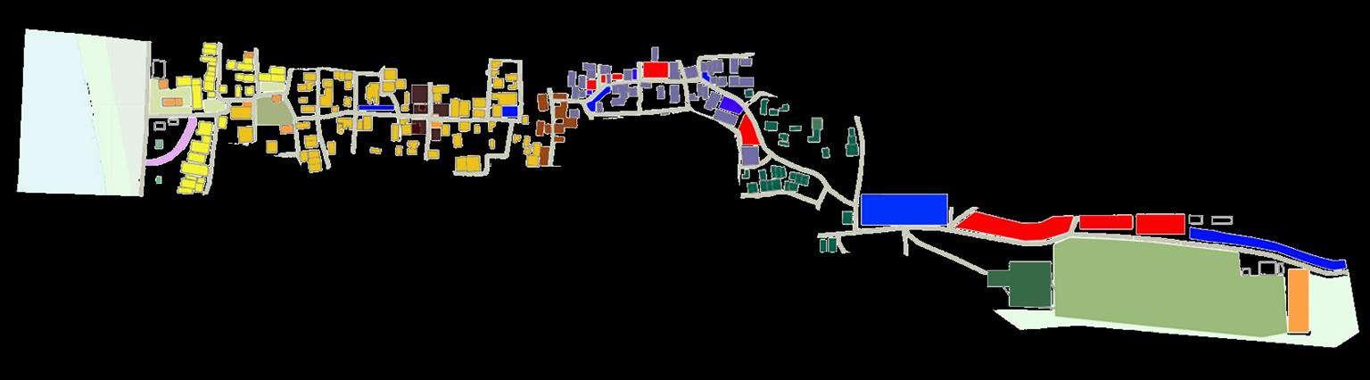
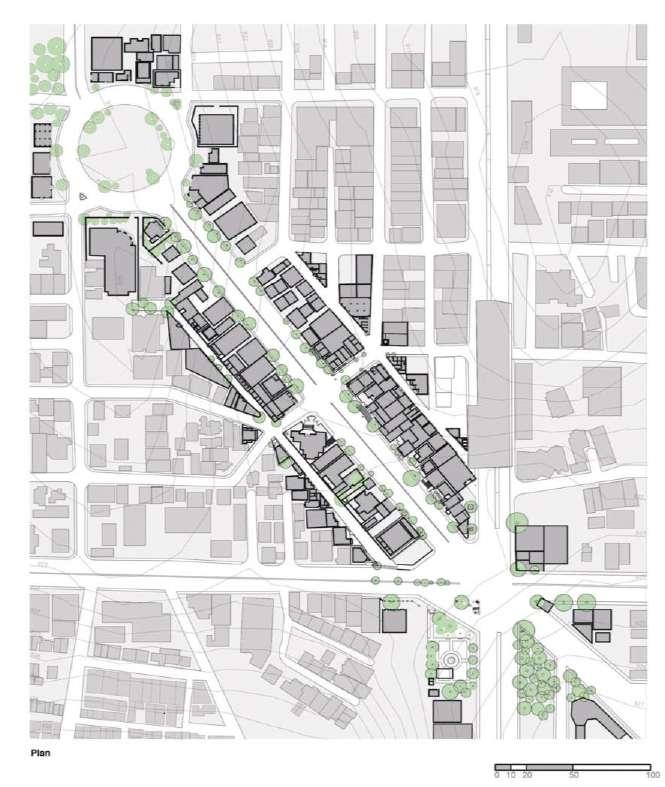
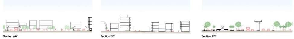
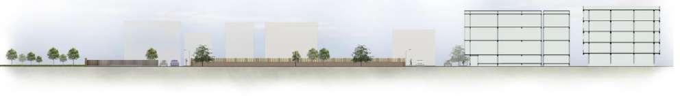
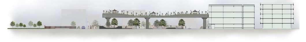
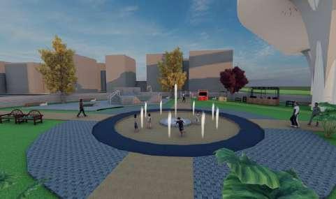
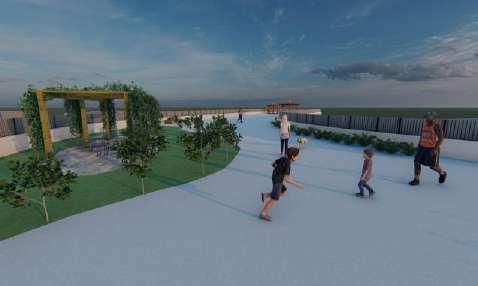
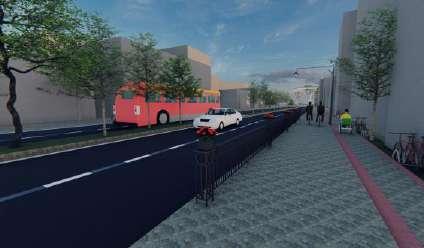
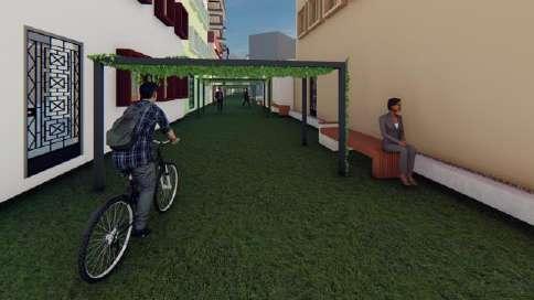
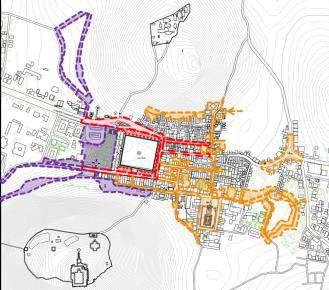
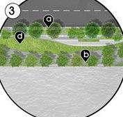
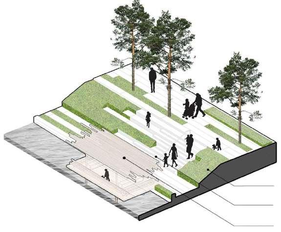
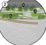
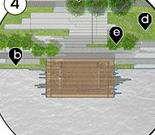
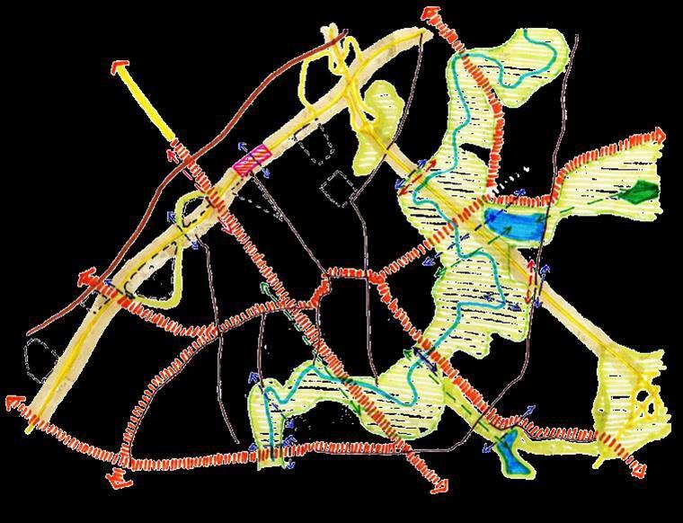
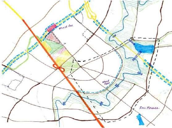
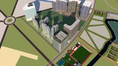
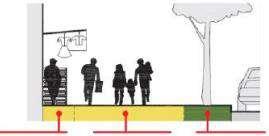
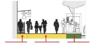
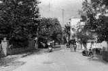
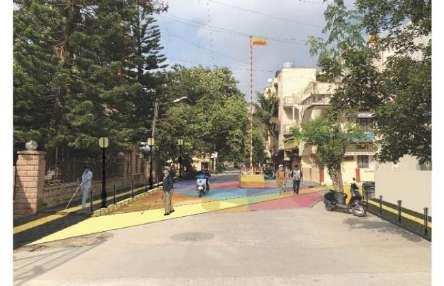
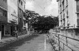
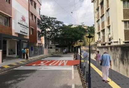
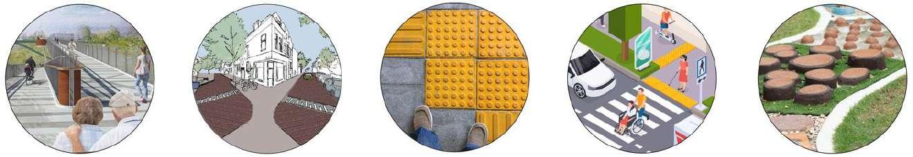
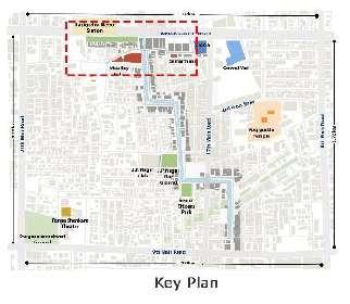
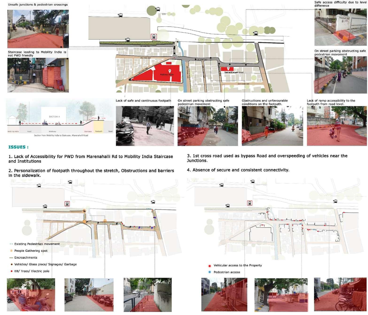
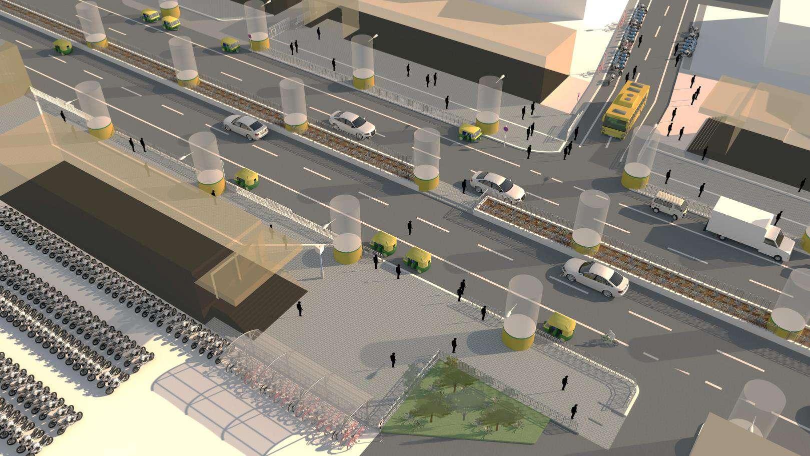
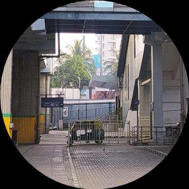
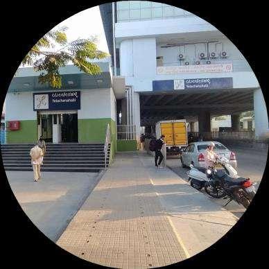
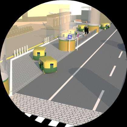
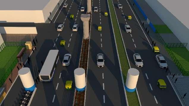
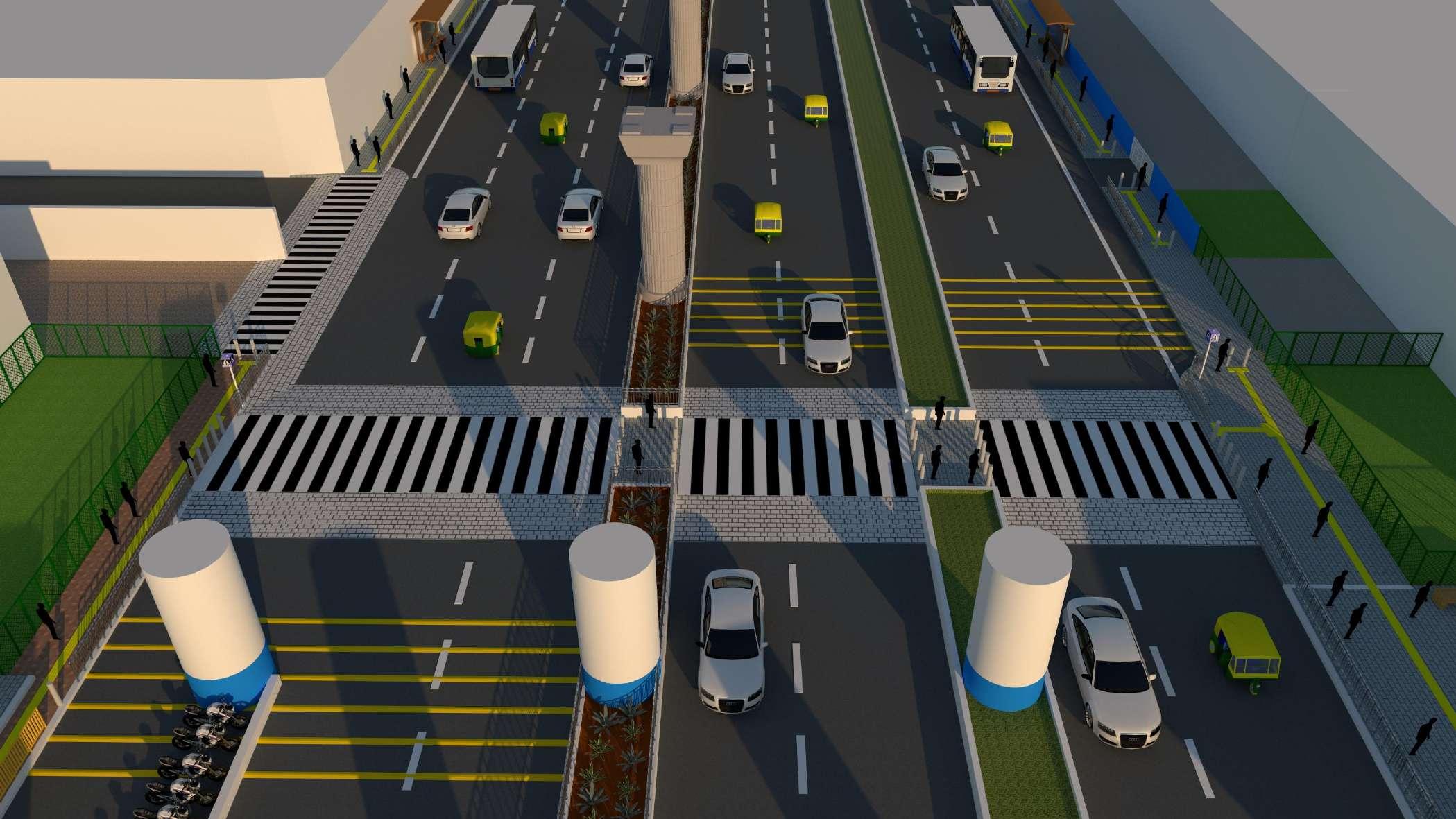
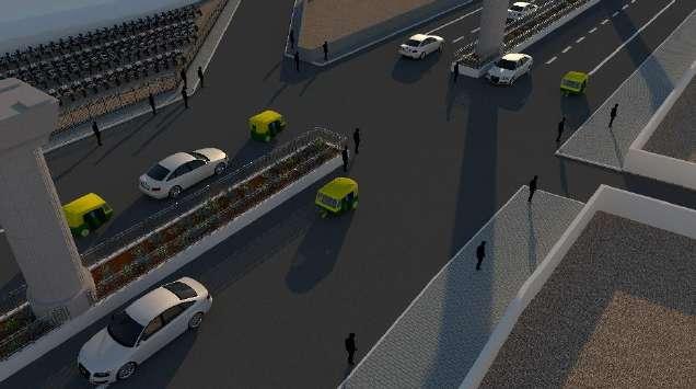
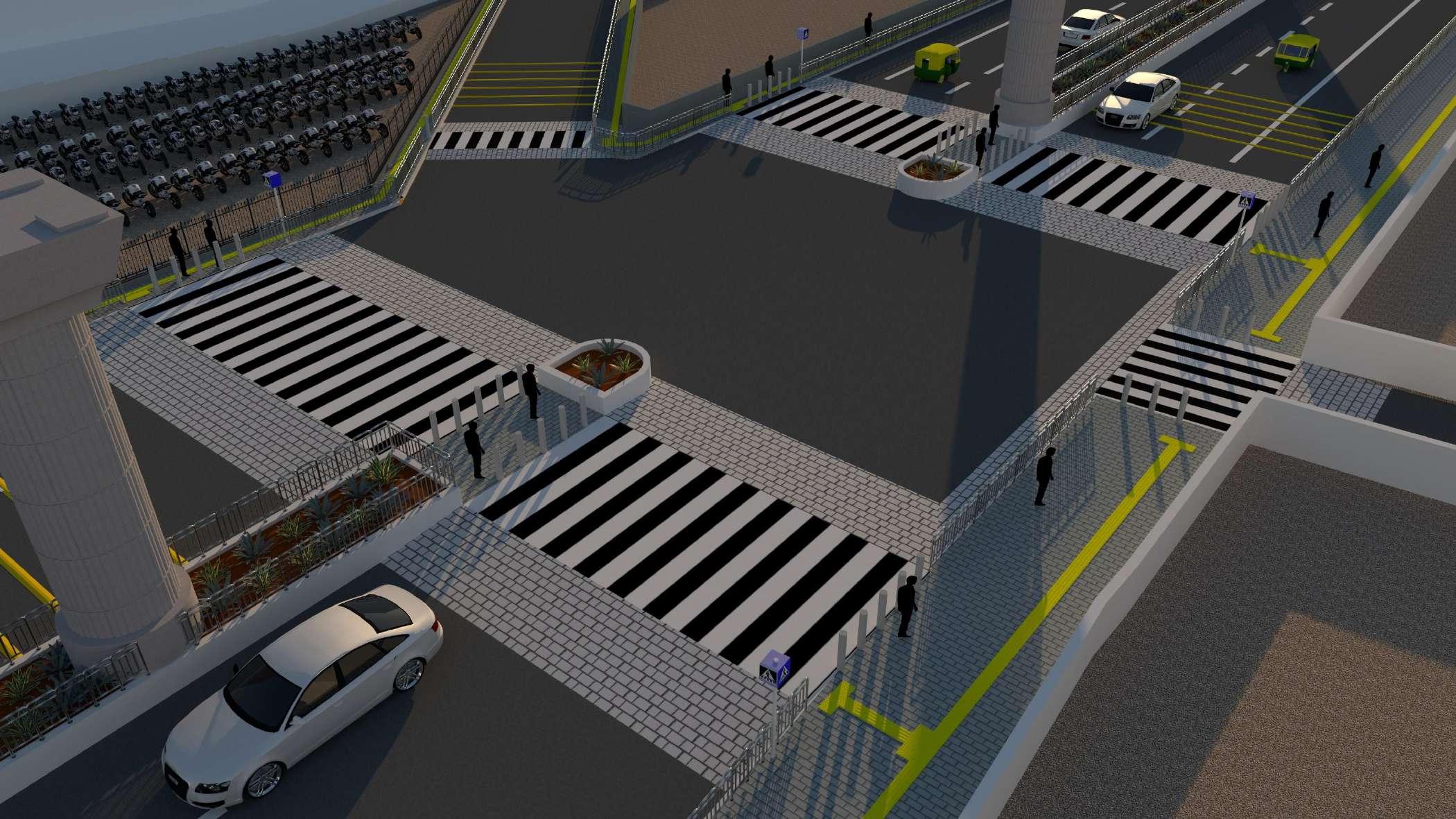
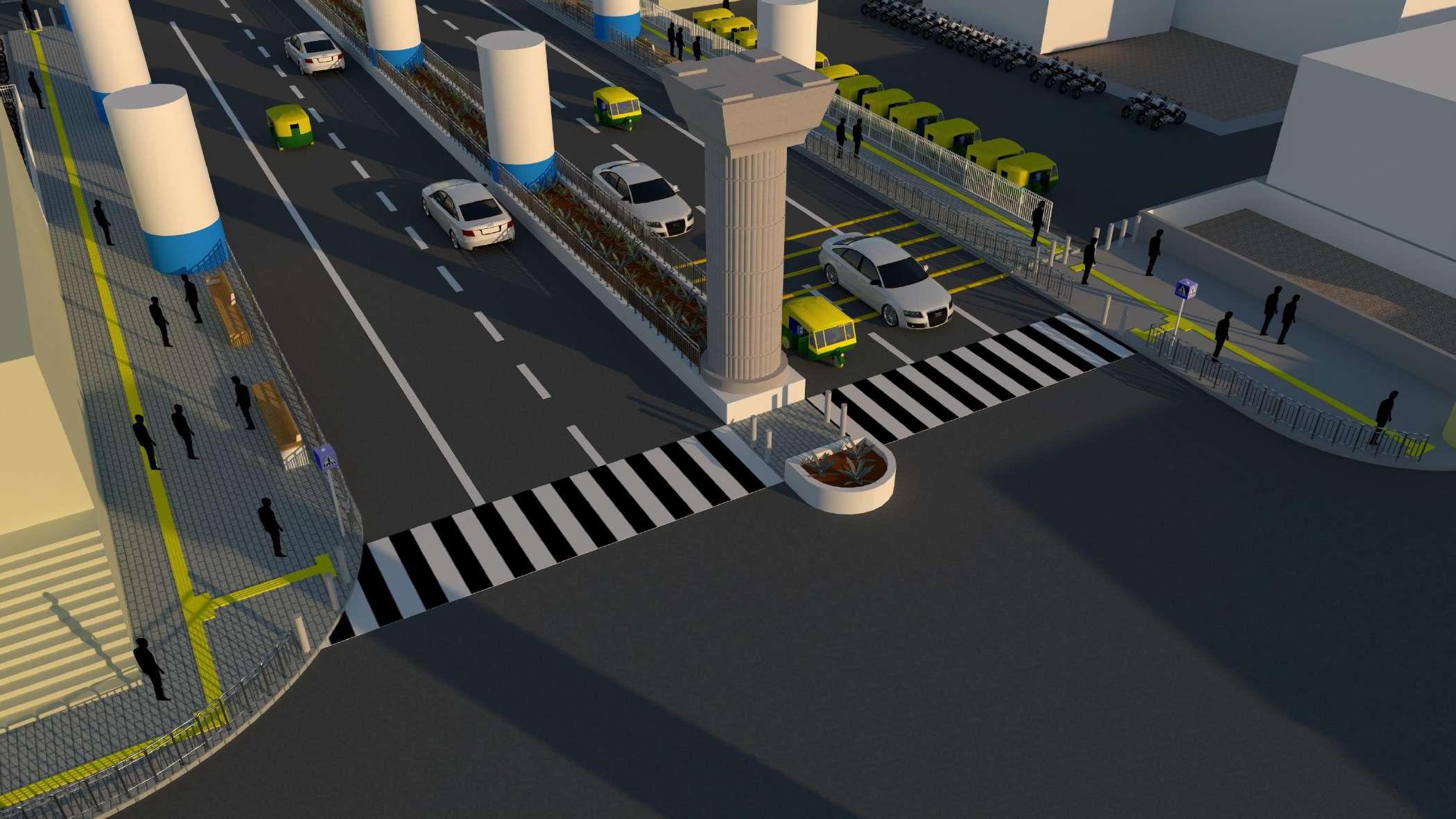
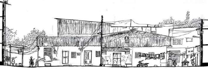
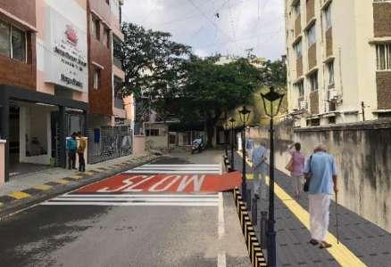
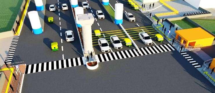
METRO AREA ACCESSIBILITY PLAN, YELACHENAHALLI, BANGALORE
The Mobility Agenda Foundation | Namma Raste Exhibition
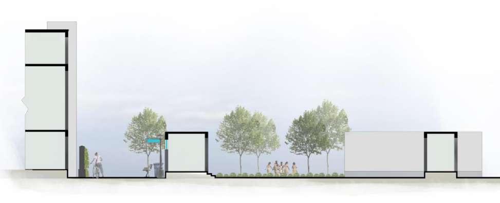
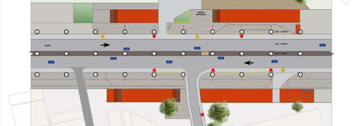
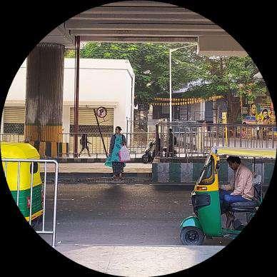
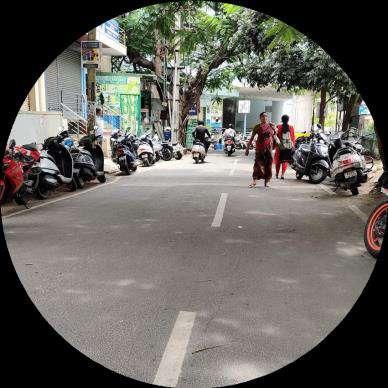
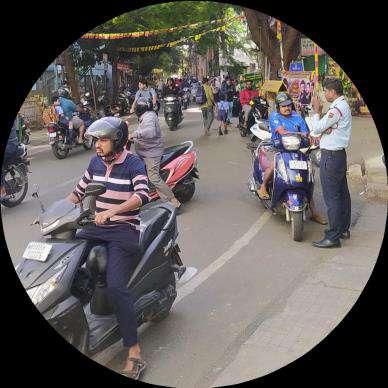
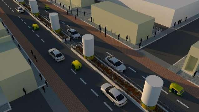
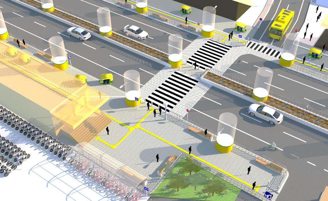
Yelachenahalli, located on the Green Line's North-South corridor on Kanakapura Road, features an elevated metro station. This densely developed neighborhood includes malls, high-rises, schools, restaurants, and shops within a 1km radius, leading to significant metro use by school children The surrounding area mainly consists of residential and commercial properties along with industries, temples, parks, and a lake However, the accessibility to key locations such as the JKV School on the east side of the station poses safety concerns for children and the elderly due to on-street and footpath parking. Moreover, there is a lack of continuous footpaths connecting the station to adjacent bus stops and landmarks. As part of this project, I conducted comprehensive site visits to assess the current conditions and identify key areas for improvement. My responsibilities included site analysis, planning, designing, and setting the strategy and detailed design for the accessibility plan I also worked extensively on 3D modeling, rendering, and the complete start-to-end planning process This holistic approach aimed to enhance the safety and connectivity of the Yelachenahalli metro area, making it more accessible for all residents and visitors.
Overview
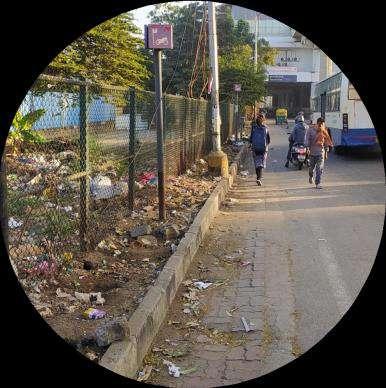
Yelachenahalli has an elevated metro station on the North- South corridor in the Green Line located on Kanakapura Road. This neighborhood is densely developed with malls and high-rise structures. Several schools, restaurants, and shops are located within 1km radius of the station, leading to a higher % of school children using the metro. The surrounding land use mostly consists of residential and commercial areas along main streets, with industries and temples, public parks and lake. The access to JKV School on the east side of station is unsafe for children and elderly because of on-street and footpath parking. There is no continuous footpath connecting the station to adjacent bus stops and landmarks.
Key Issues
Pedestrian Crossing:
No Zebra crossing
Not conspicuous
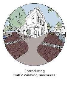
No speed breaker/ traffic calming measures
No signages
Line of sight blocked by pillars in median while crossing
Parking:
Present only on one side of metro
High parking turnover rate (1.5-2)
On-Street and footpath parking
Unsafe for pedestrians especially school kids and elderly
Street Design and Utilization:
Drop on-off points blocked by gates
Drop off done directly on road or pedestrian crossing
No footpaths continuity on road after metro station
No Tactile Paving
Lack of Ramps
Lack of Street Furniture
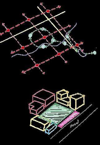
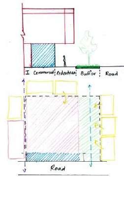
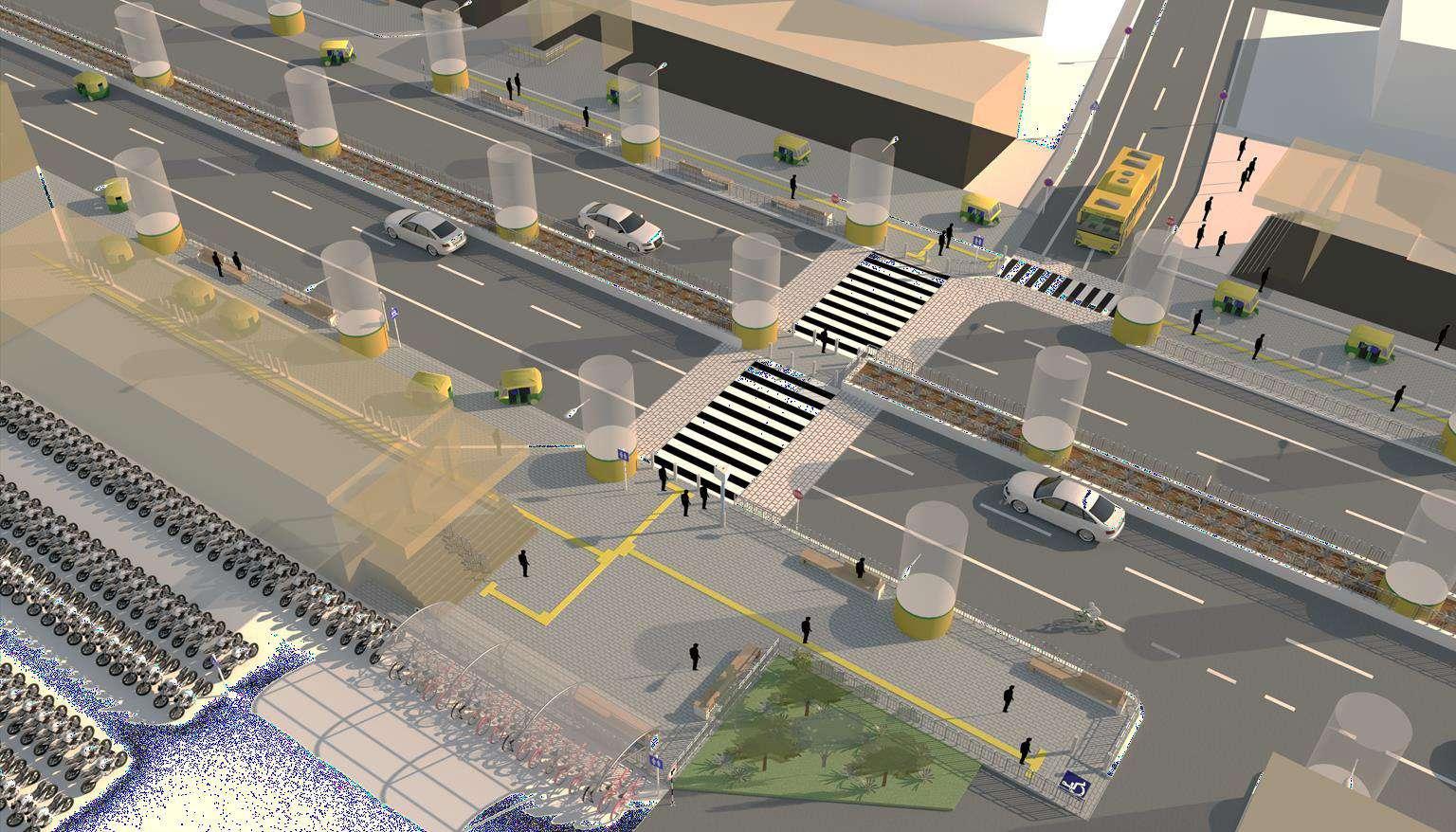
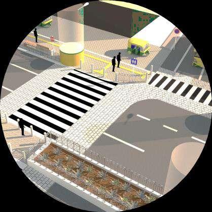
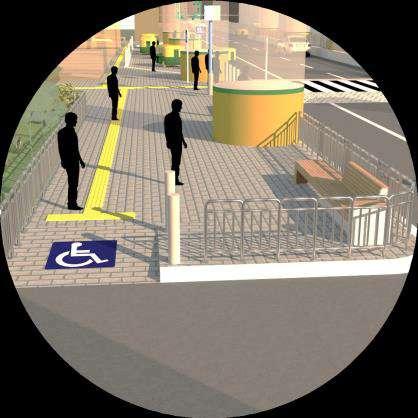
Study Framework
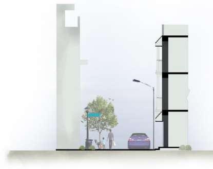
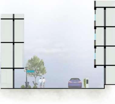
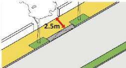
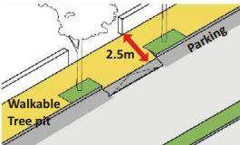
Pedestrian Safety
Raised footpaths
Barriers between Fast moving traffic and pedestrians
Line of sight for vehicles and pedestrians
Safe pedestrian crossing with refuge Islands
Ample Street lighting
Pedestrian Comfort
Ramps and Tactile paving for all paths
Continuous footpaths to nearby major destinations
Tree Cover, street furniture
Multi utility zones, Street vending areas
Water booths, Toilets
Visible & Conspicuous Signages
Speed limits, stop /yield sign, U-turn
Pedestrian crossing, Drop on-off signs
Signs to amenities like bus stops, toilets, water booth, lifts, gathering spots, parking
Directions to entrances, lifts and nearby landmarks