prarthana ulaganathan selected architectural works
table of contents.
exploration of the area. It expresses how scenario of the area.
Reconnecting the interconnected Landscape project 01. 02.
Re-pairing the industrial grid Urban design project
Saldum memorial Heritage project Connecting the urban commons
landscape project
curriculum vitae.
CONTACT INFORMATION
EDUCATION
Email Address prarthanaulaganathan@gmail.com
Piacenza, Italy
WORK EXPERIENCE SKILLS
2021- 2024 2020
2015 - 2020 Sustainable Architecture and Landscape Design (110/110)
Politecnico di Milano
Greening the Economy - Sustainable cities Lund University (Online course)
Bachelor of Architecture
Anna University
DESIGN COMPETITIONS
Oct-Nov 2023 Intern 2021 Architect
Dec-Apr 2019 Intern
July-Oct 2019 Intern
Studio Elementare Milan, Italy
Feel & Bari Chennai, India
Design consortium Ldt International Colombo, Sri Lanka
Design Realm Chennai, India
2019 2018 Space for thoughts Second Place
Vertical design studio Second Place
LANGUAGES KNOWN
AutoCad
Sketchup
Photoshop
Archicad
Adobe Illustrator
Vray Render
Engine
Lumion
Twinmotion
QGIS
English | Expert
Italian | Beginner
Tamil | Native
Telugu | Native
Hindi | Expert
Abode Indesign Revit Rhino
Reconnecting the interconnected 01
Academic / Urban Landscape / Chennai, India
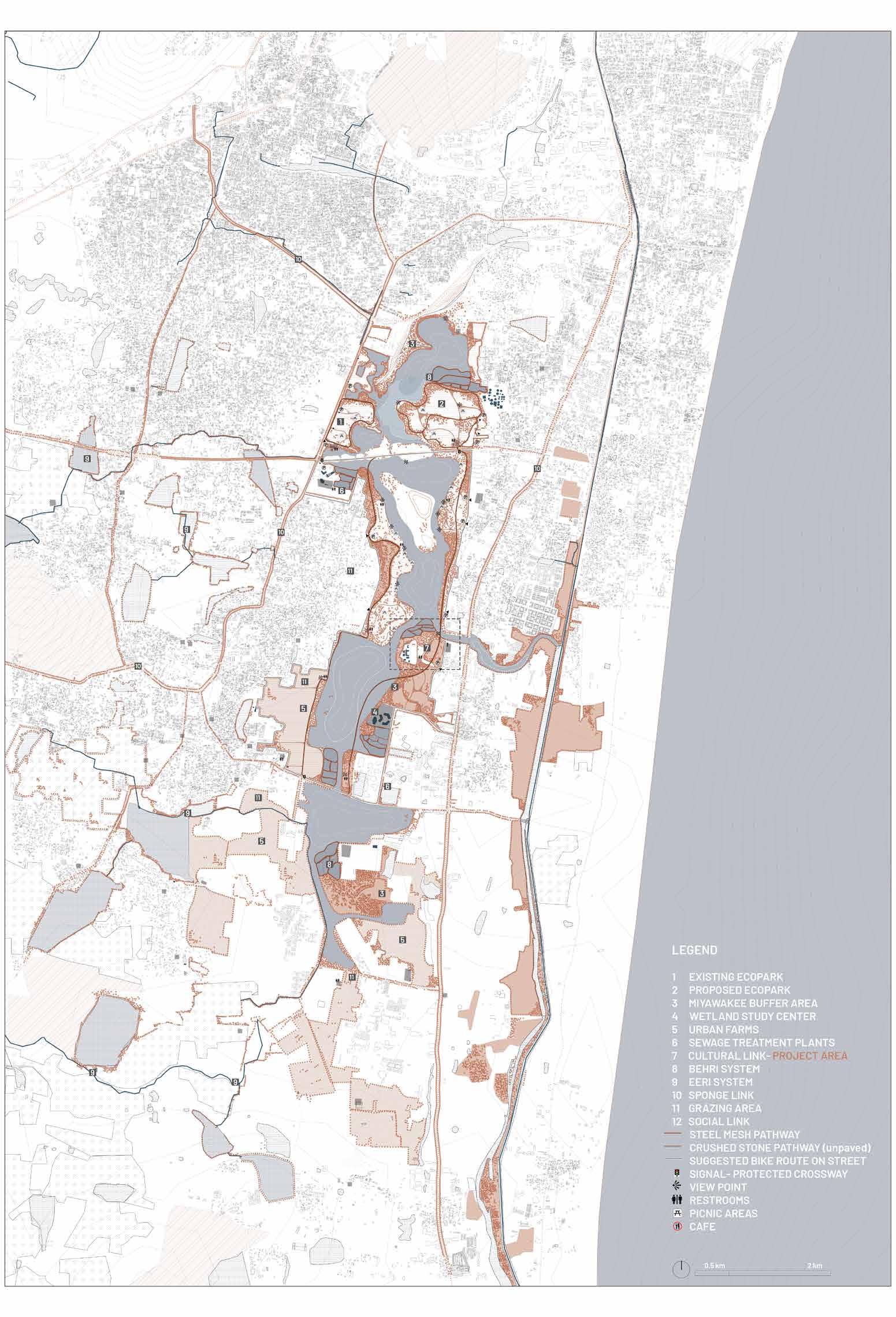
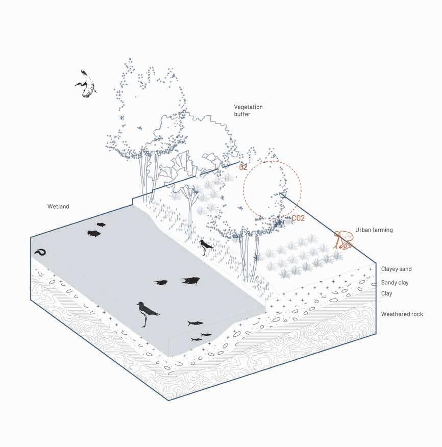
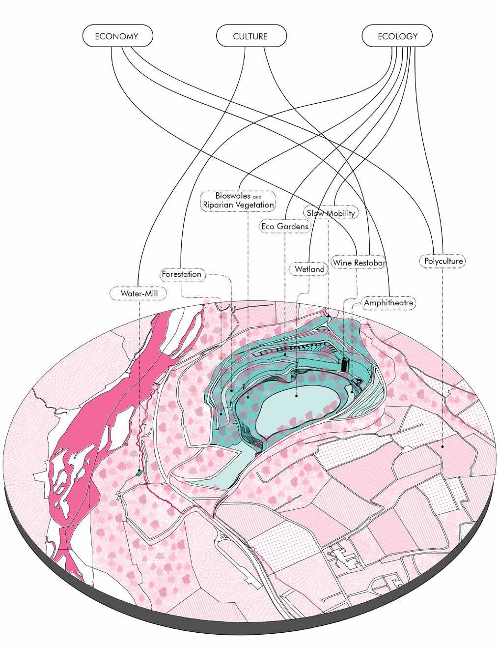
Located about 20 kilometers south of Chennai, the Pallikaranai Marshland is a freshwater and partly saline wetland that supports rich biodiversity and plays a crucial role in flood control for the city. Despite its ecological importance, it faces numerous human-induced threats. The degradation of the marshland poses a severe threat to its ecosystem. Wetlands are common property resources, and it is crucial to halt this destructive trend to prevent further ecological damage. There is hope for recovery, but immediate action is required to stop the degradation and restore Pallikaranai Marshland to its former ecological health.
The project proposes leveraging sociocultural networks for environmental transformation and restoration, recognizing social and cultural capital as the critical link between economic goals and environmental capacities. The initiative aims to restore the Pallikaranai marshland as a flood sink by creating water retention regions, enhancing its ability to retain water and form a protective green edge against floods. This approach will also establish Pallikaranai as a carbon sink, utilizing ecological and economic principles to ensure long-term sustainability.
To prevent this marshland from futher degradation multiple stategies have been put into place to ensure revitalization and requalification of this important ecological hotspot.
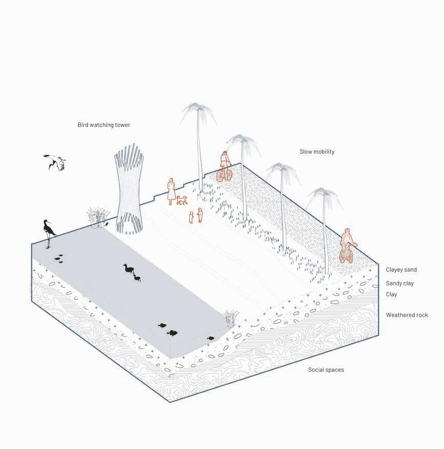
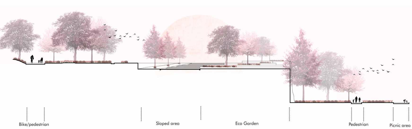
The social link , The pathways weave together transformative and steward spaces, enriching the essence of the area’s functionality. Revitalizing the marshland will revive the exquisite fauna of the region, fostering a renewed connection between users and with the nature.
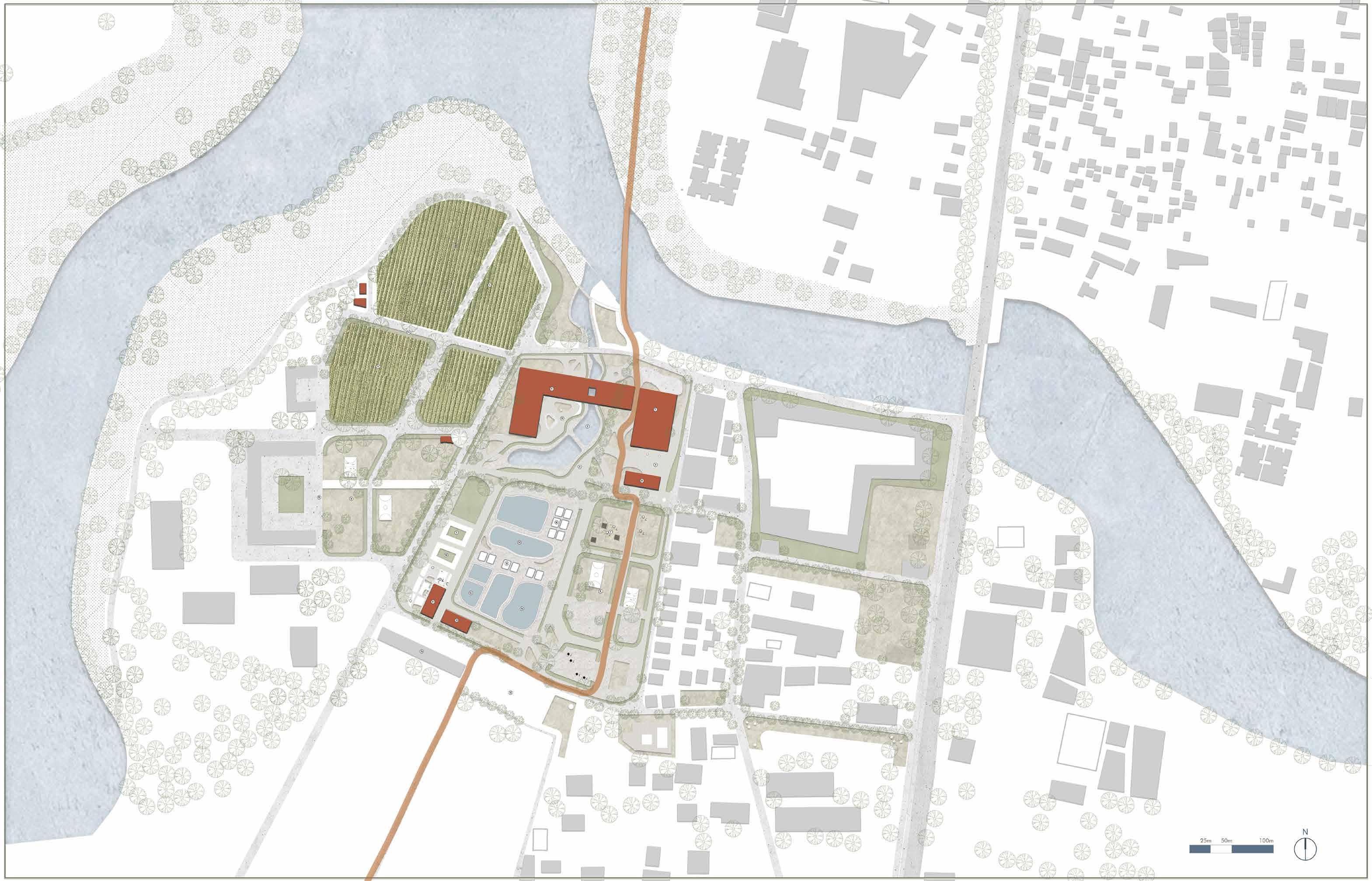
Masterplan
Map showcasing pathway and bheris around the pallikaranai marshland
Isometric
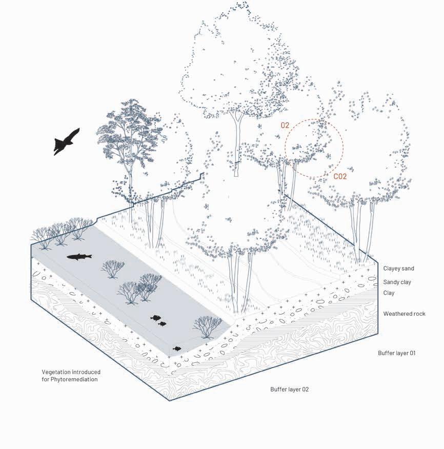
The different types of edges used along the wetland
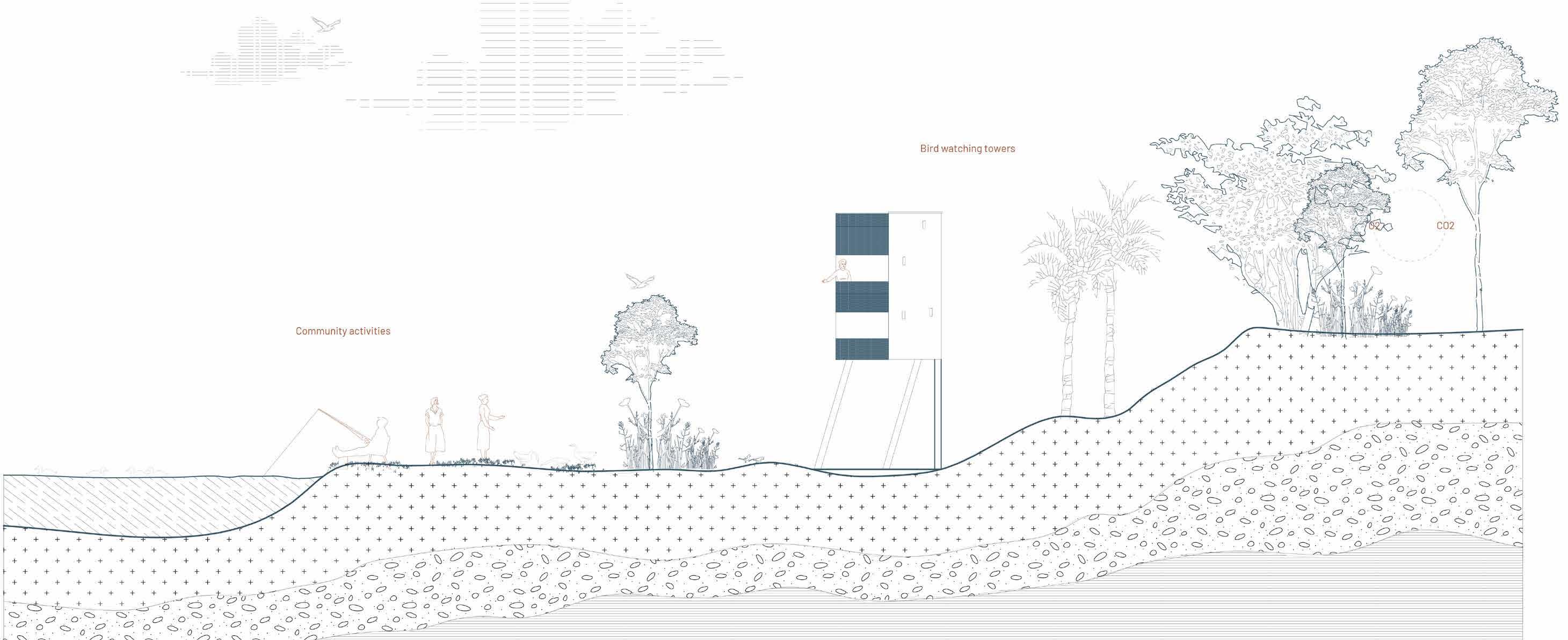
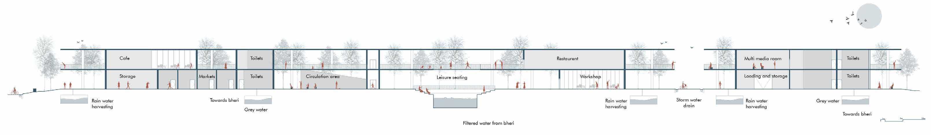
Section
The edges are treated and a new porous landscape is proposed
Okkiam Maduvu played a crucial role in flood prevention due to its capacity to absorb excess rainwater and its strategic location for draining water away from vulnerable areas. This demonstrates its resilience, making it an ideal area to implement our water conservation and management strategies.
However, the site faces several challenges, including disconnection from the local community, unprotected edges, and neglected zones that need to be reconnected with the surrounding ecology and hydrology. Our proposal aims to create an integrated matrix involving actors, protectors, and stewards to establish robust social, economic, and cultural connections. By doing so, we seek to restore the lost linkage between hydrology and ecology through active cultural engagement.
Section
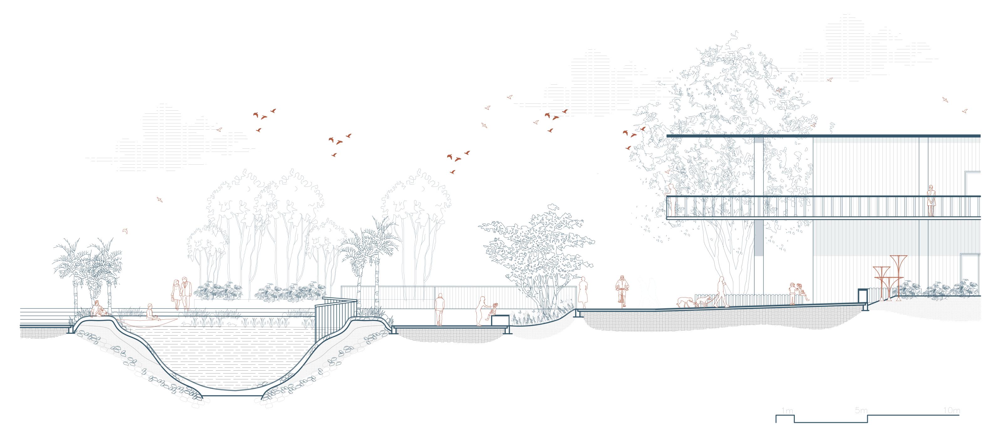
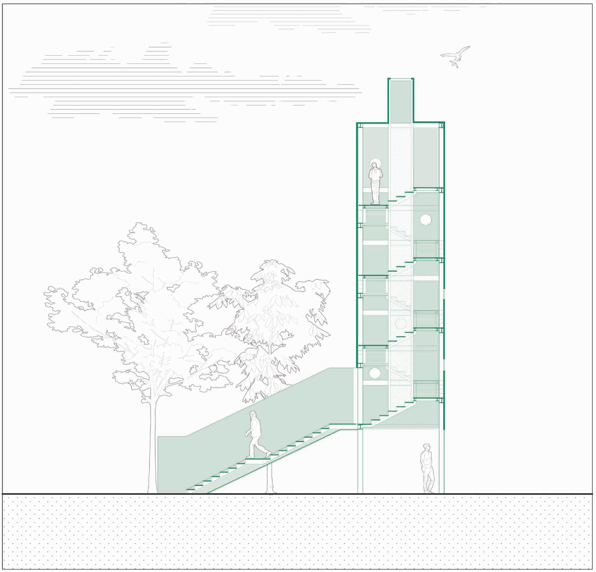
Section showing the relationship between the built form and its surrounding landscape
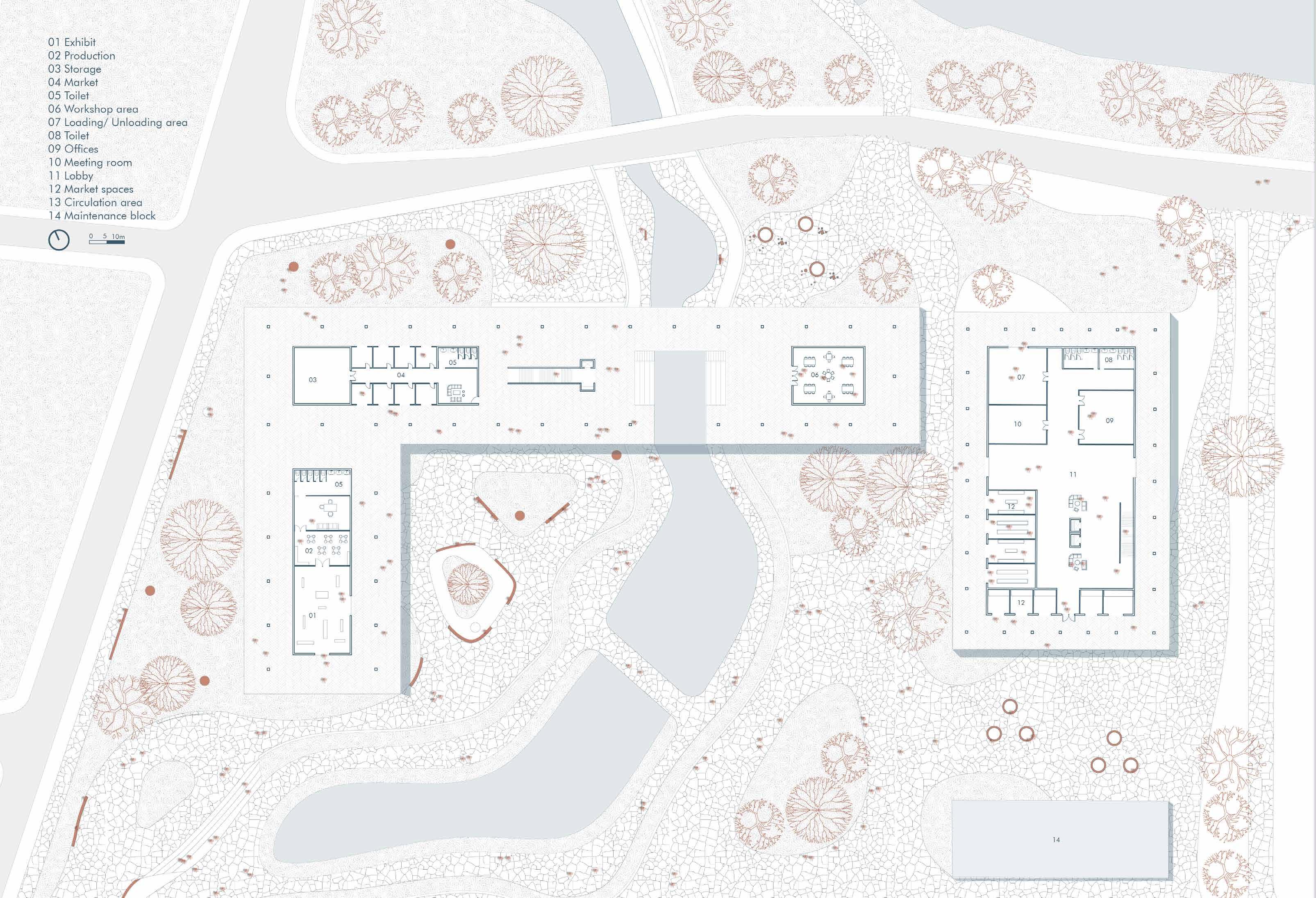
Floor plan showing the socio-cultural center with the surrounding landscape
Ground floor plan
Illustrations showing the socio cultural center
Sections showcasing the working of the architecture along with the landscape
Section AA’
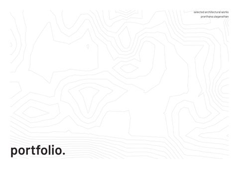
Re-pairing the industrial grid 02
Creating a mixed-use typology where activities are intergrated Industrial urbanization which will contribute to the local economic growth and development
Increased access to goods and services
Creating social equity by introducing new public spaces This urban project aims to create a vibrant and sustainable mixeduse development that combines residential, industrial, and civic functions within a cohesive urban environment. The development will provide a harmonious blend of living spaces, industrial facilities, and civic buildings to enhance the quality of life for residents, promote economic growth, and foster community engagement.
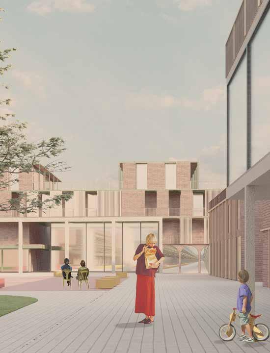
View
The view of the buildings from the courtyard
Academic / Urban design / Barcelona, Spain
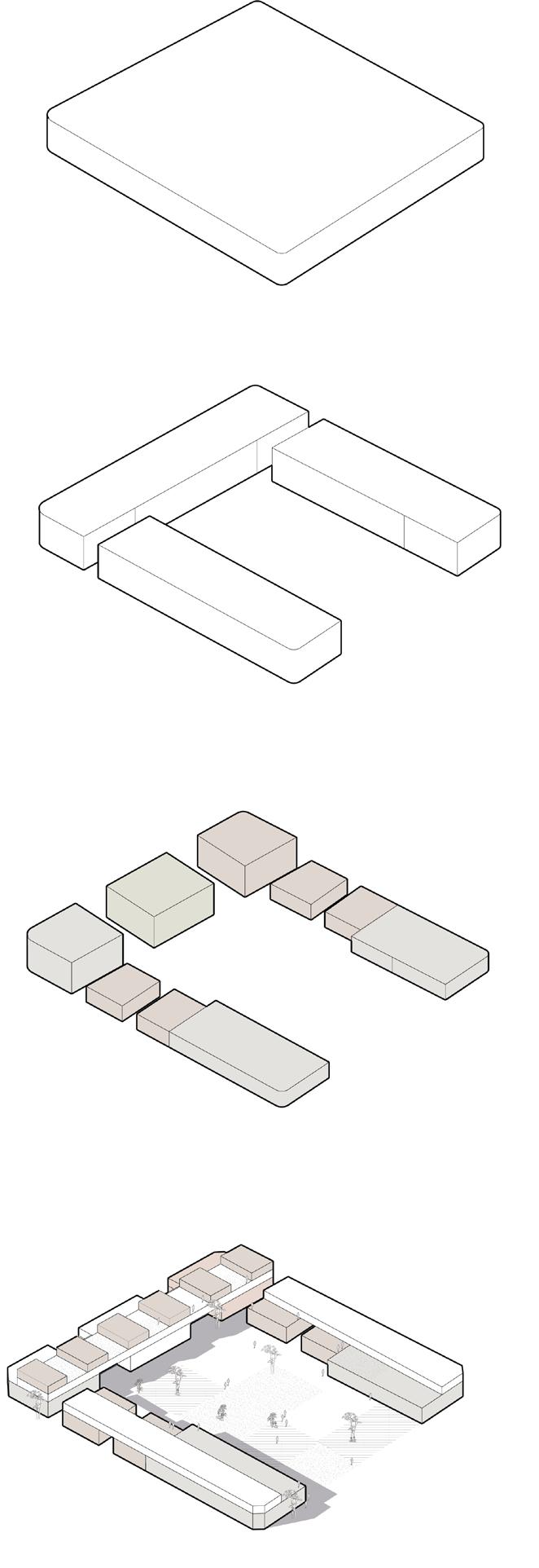
Built form
the exisiting monotonous industrial fabric
Splitting the form
mixing the newley introduced typologies together
Puncturing the volumes
solid void massing
Creating new typologies
Intergrating landscape with the buit form
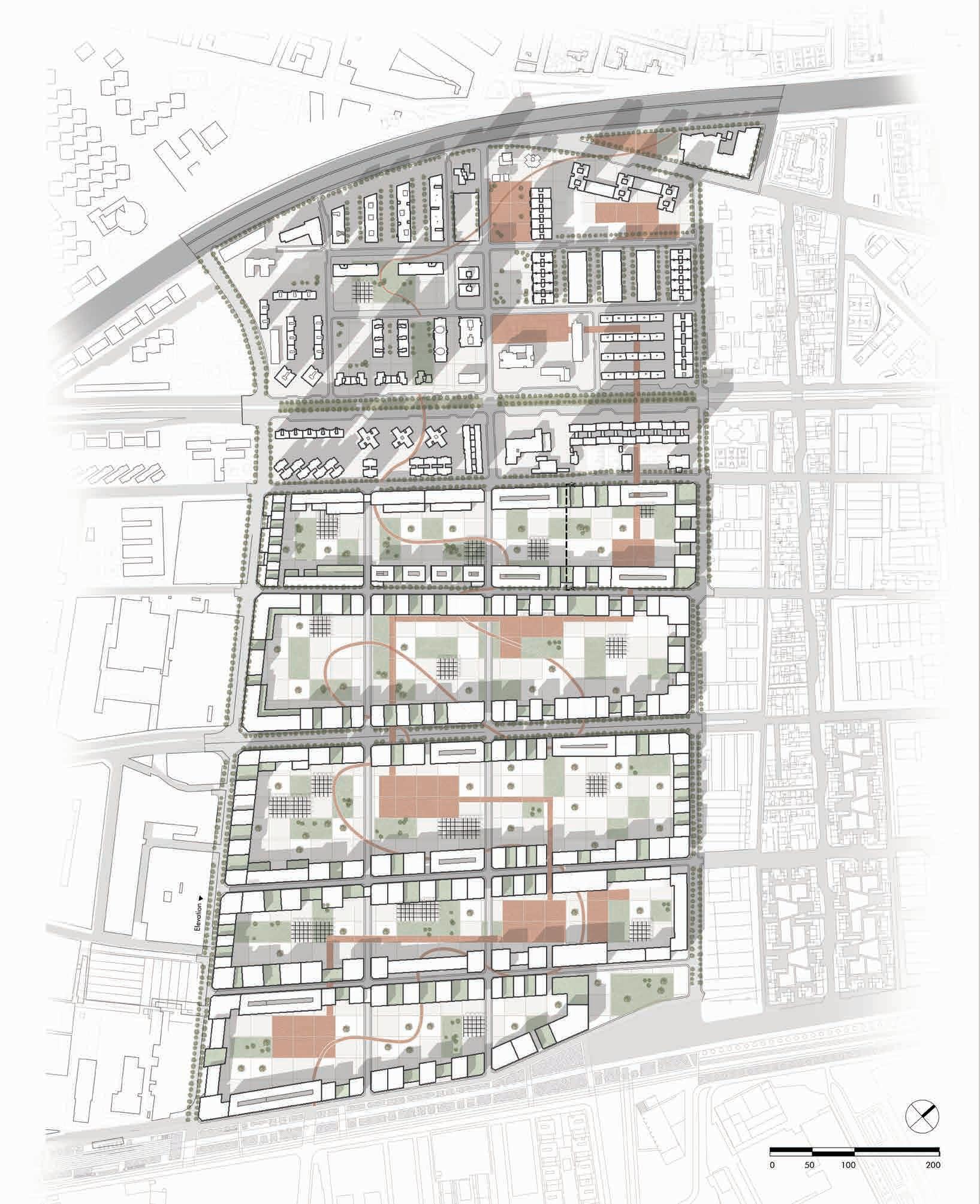
Masterplan
The master plan displays a synergic relationship between industries, commercial and residential buildings.
Elevation and Section
These drawings show the mixed typology that is introduced into the industrial grid.
This ground floor plan shows the synergic relationship between the different typologies and the public space
Saldum Memorial 03
Academic / Heritage / Serbia, Saldum
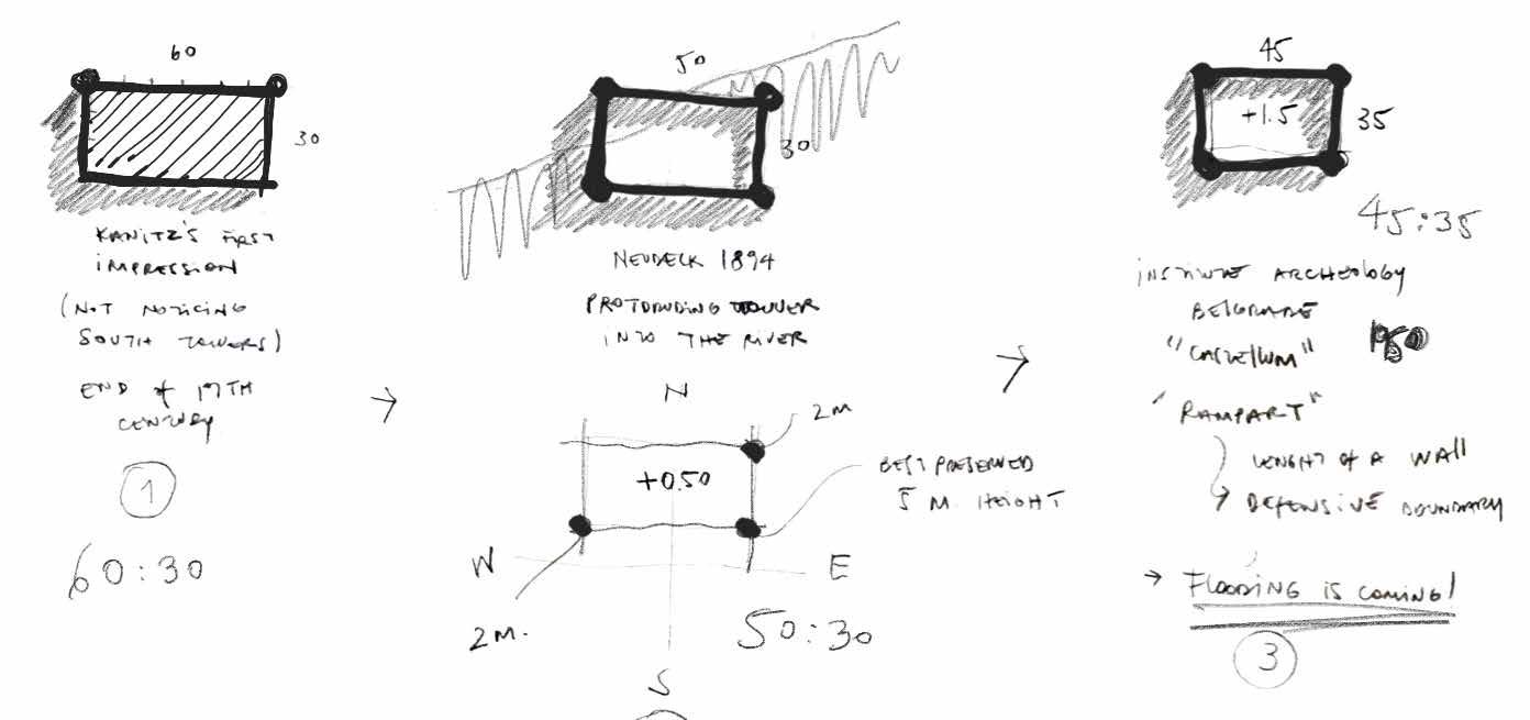
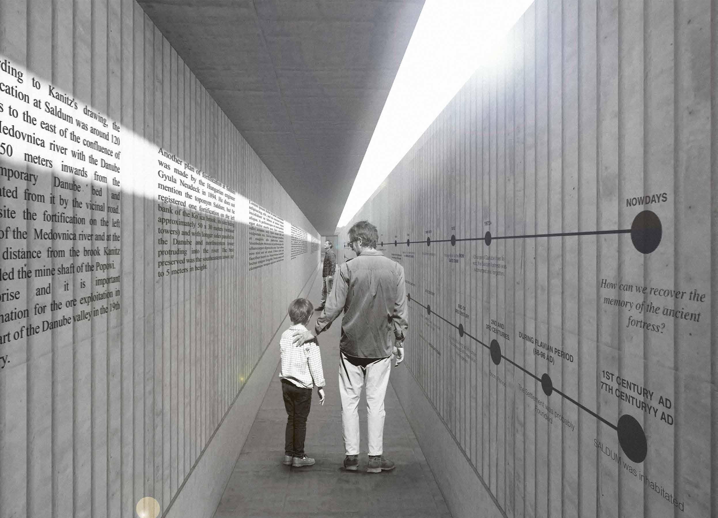
The main aim of this project is to bring back the lost cultural and historical significance of the roman limes in Serbia.
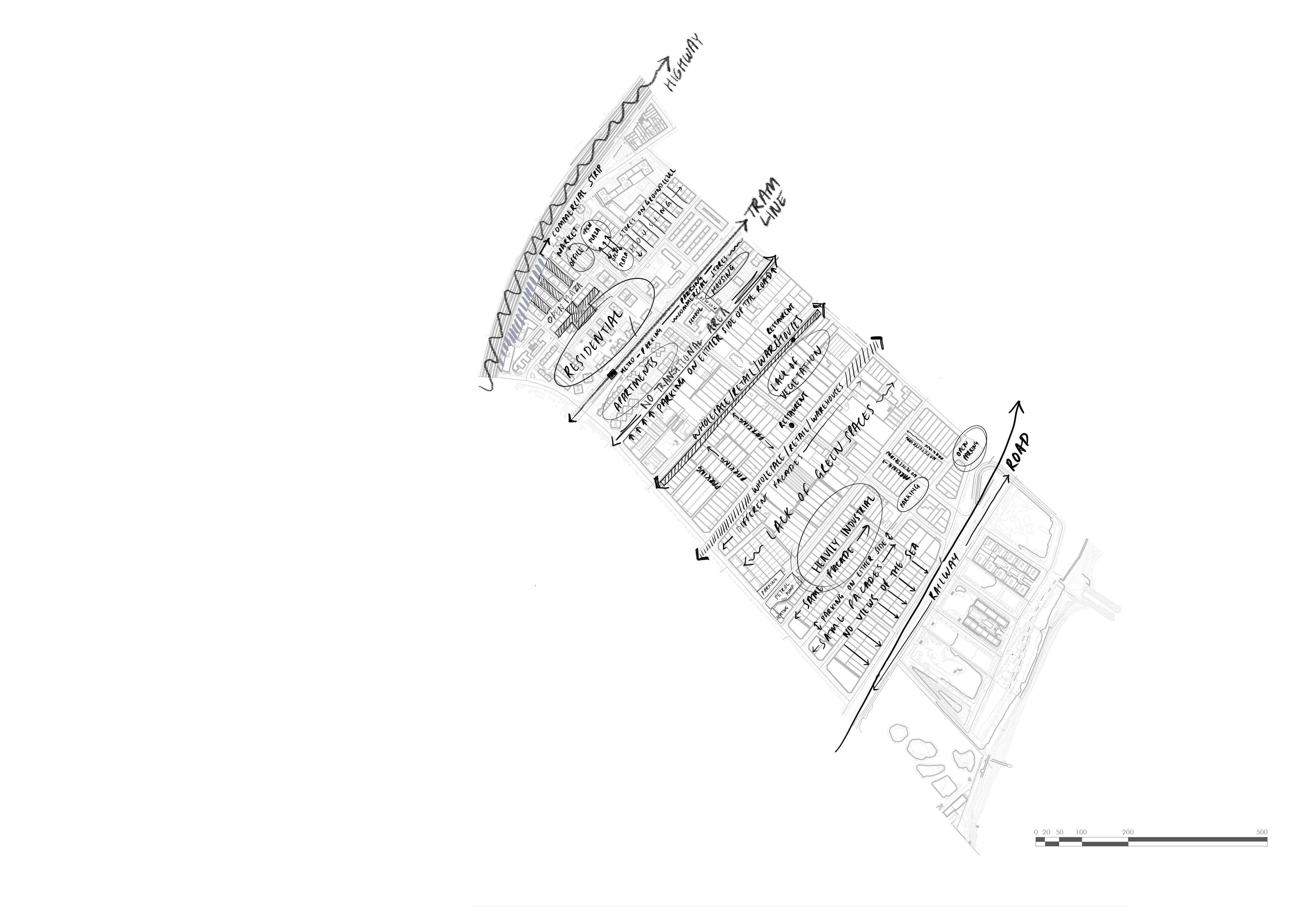
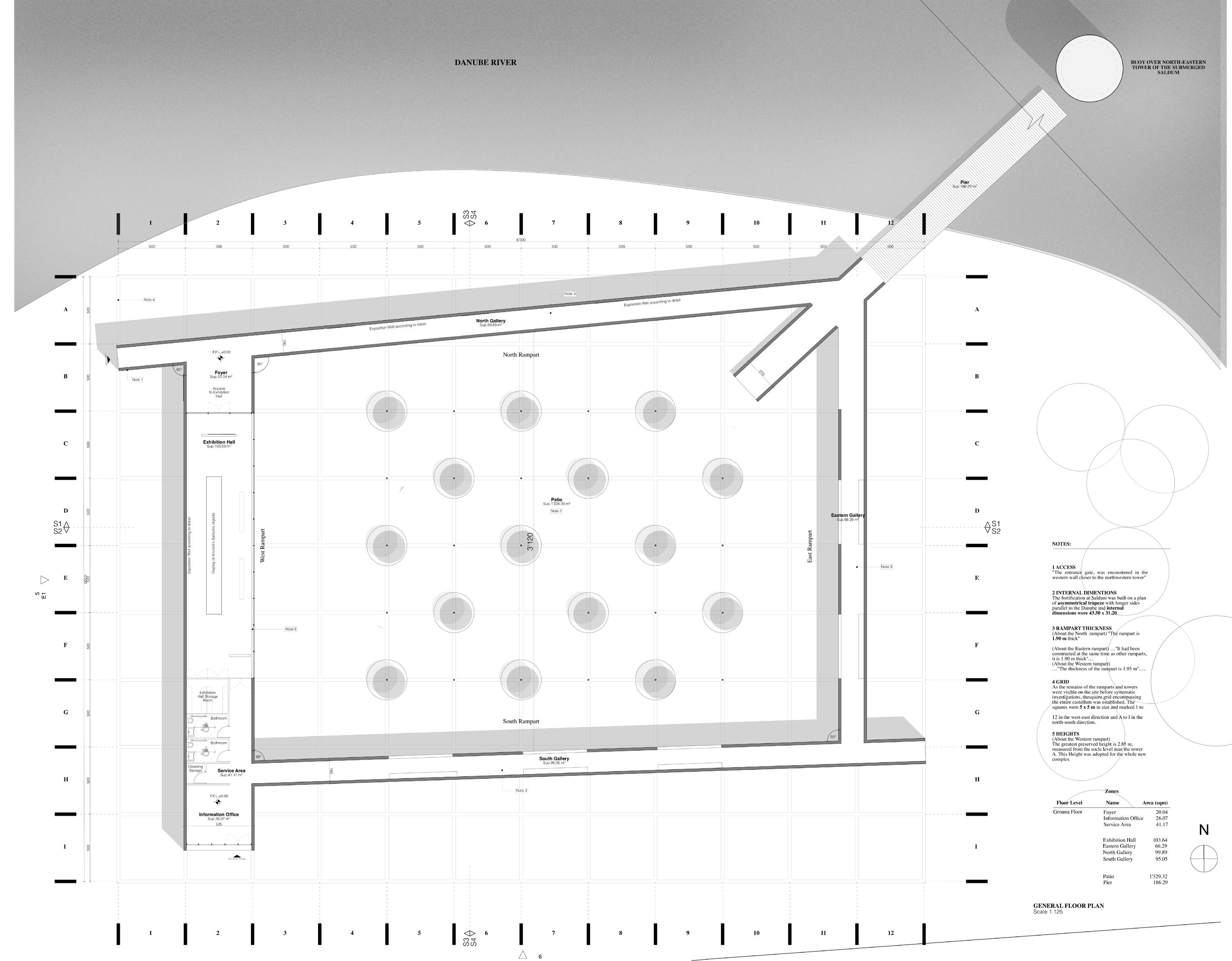
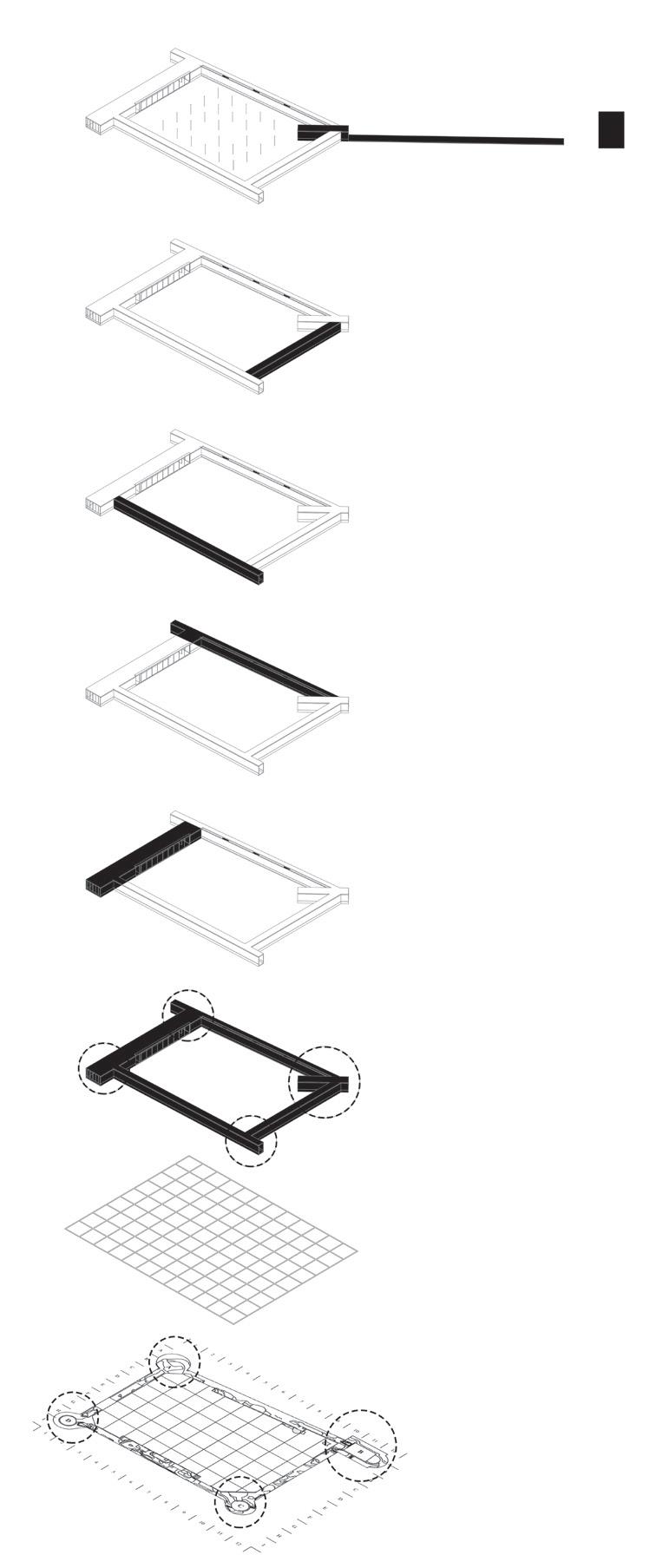
The fortification on Saldum in Serbia was an asymmetrical trapeze with longer sides parallel to the Danube and its internal dimensions were 43.50 x 31.20 m. This project is inspired by the elements that composed the ancient Roman fortress. It is a deconstructed version of the fort. re arranged on a 5x5m grid. It consists of a central courtyard that is enclosed by 4 Ramparts that represent the 4 walls of the ancient fort. Each of these Ramparts tries to evoke a different experience for the user.
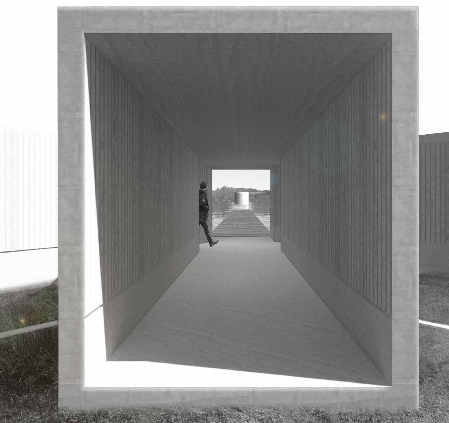
North Rampart
The framed view of the bouy from the corridor
Design concept
The main elements that inspired the design is derived from the ancient fortress that is currently submerged underwater
What are the main elements that inspired our design?
The Towers
THE TOWERS
The fortress is marked by four towers.
The new pavillion consists of a central courtyard that is enclosed by four Ramparts that represent the Four walls of the ancient fort. Each of these Ramparts tries to evoke a different experience for the user.
The Walls
THE WALLS
Walls of 1.90 m encompass the fortress.
The inner space/ Grid
THE INNER SPACE / GRID
The square grid encompassing the entire castellum is 5x5m.
North Rampart Reminiscing
West RampartRecollecting
East RampartRemembering
South RampartRecreating
This is one of the entry corridors that is deliberately given an enclosed feeling with a narrow skyline along its axis. This is to give the users a feeling of being submerged. This passage opens with a framed view of the Bouy which is placed in the location of one of the submerged piers of the old fortress.
Rampart
Axonometric view of the four ramparts
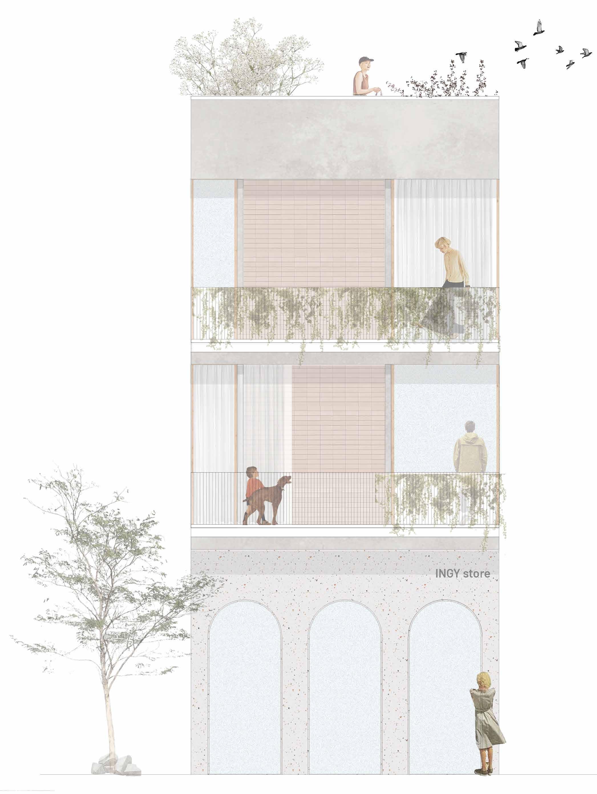
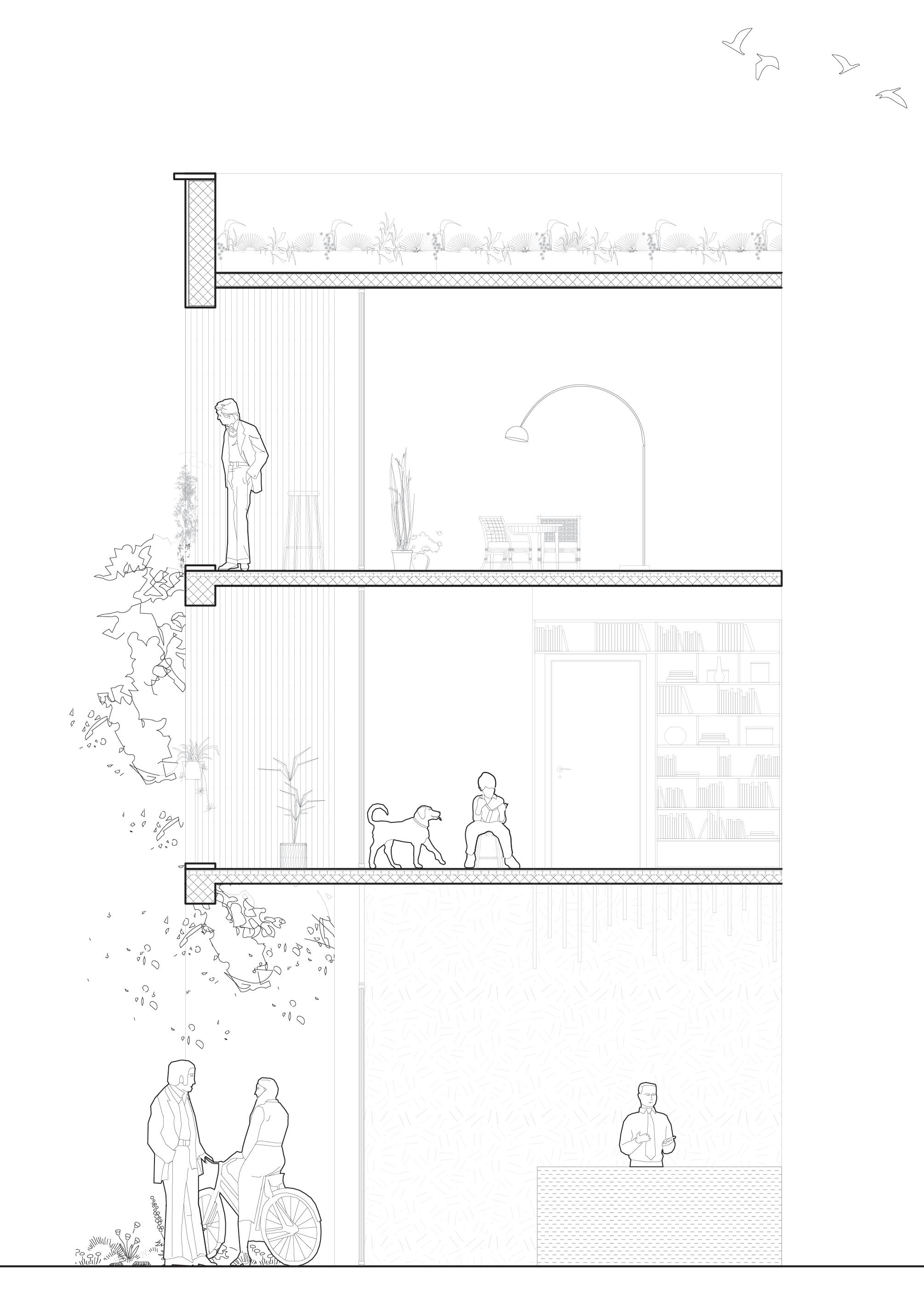
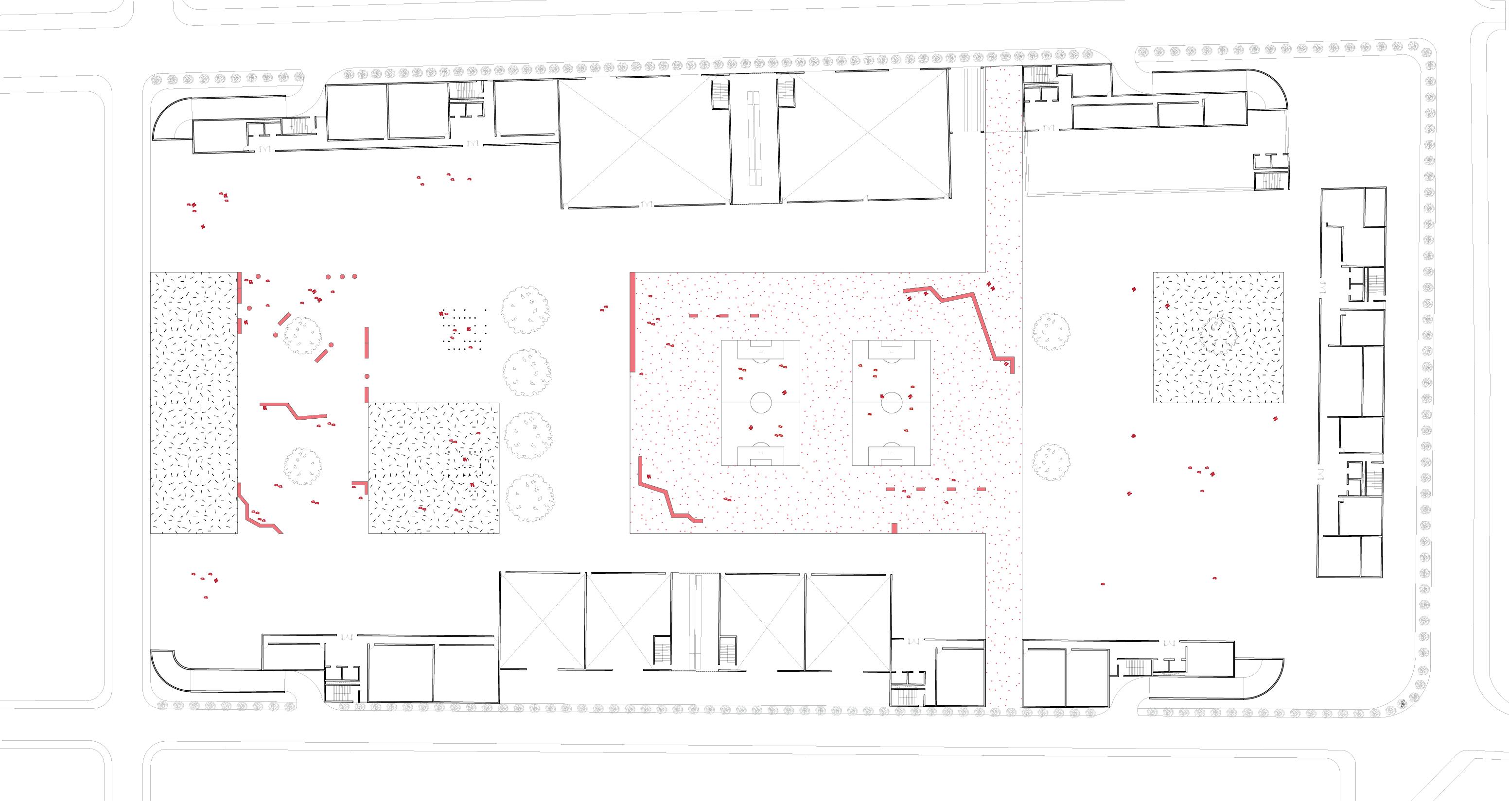
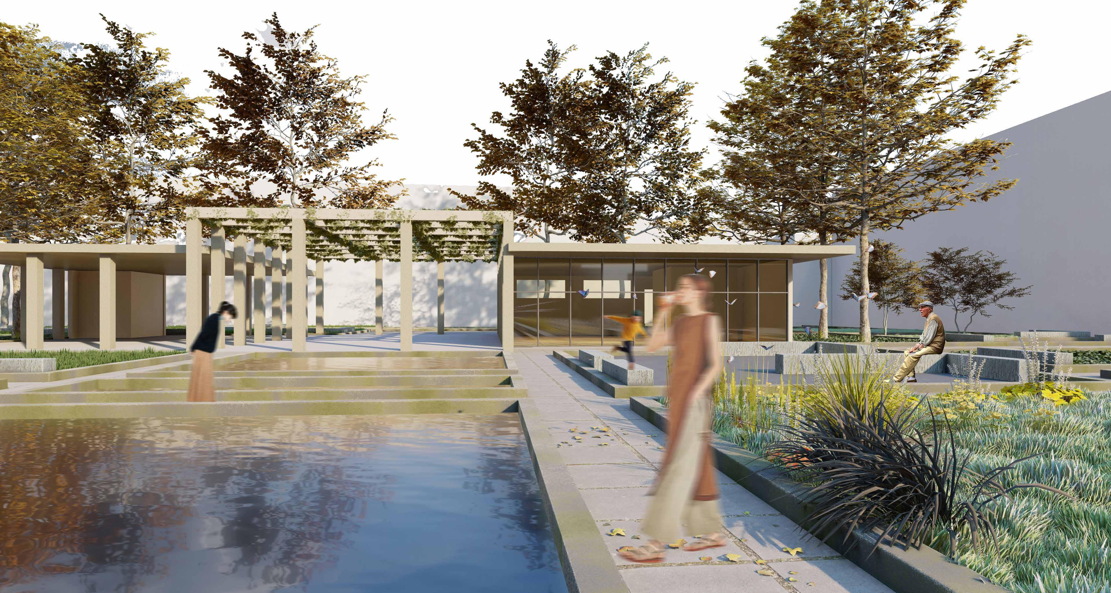
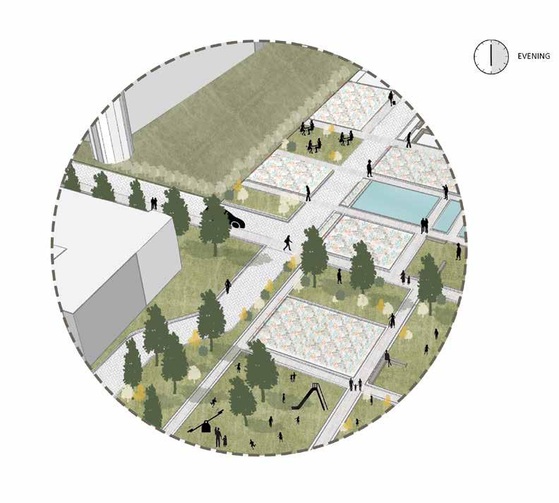
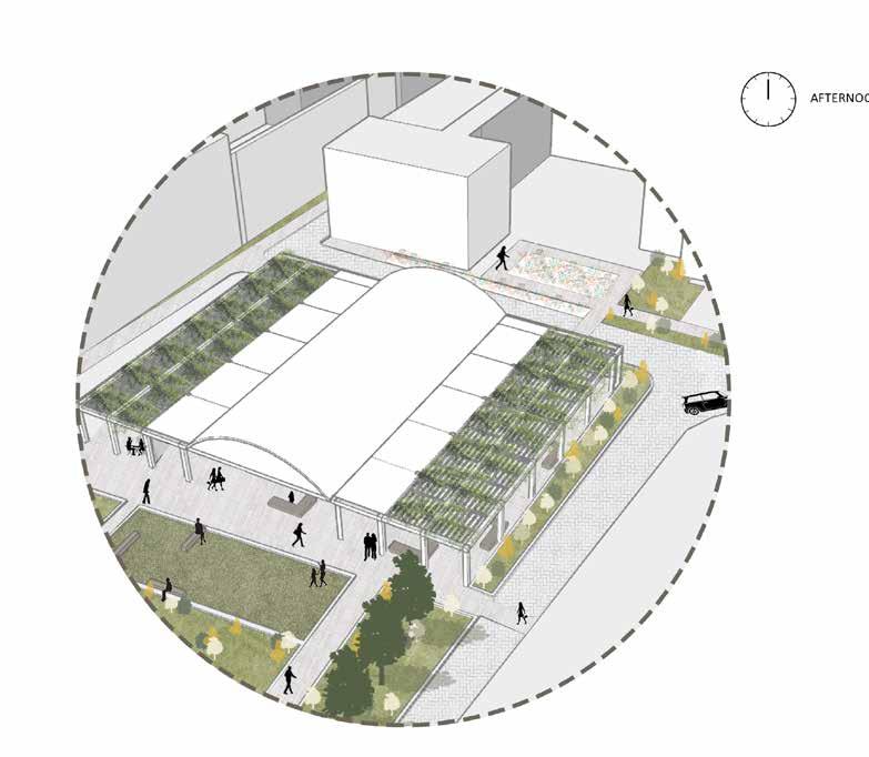
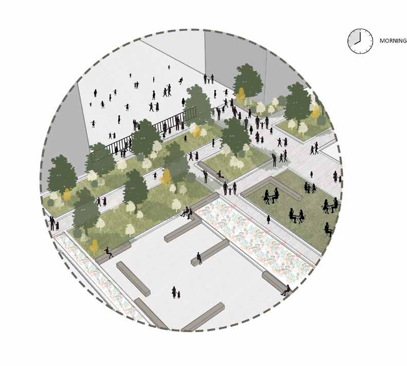
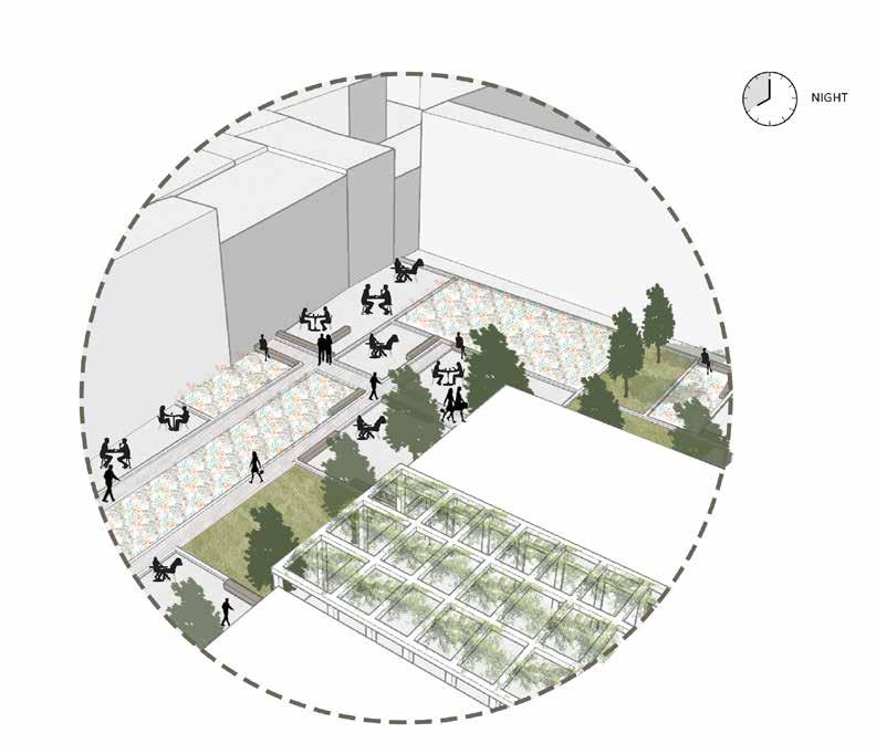
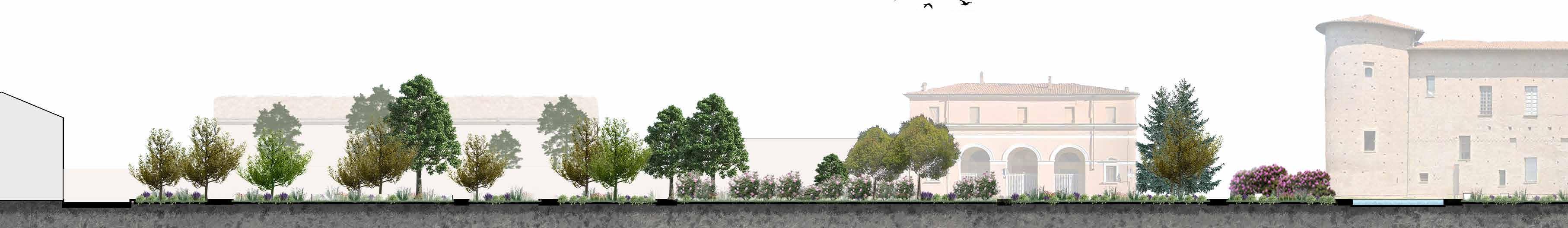
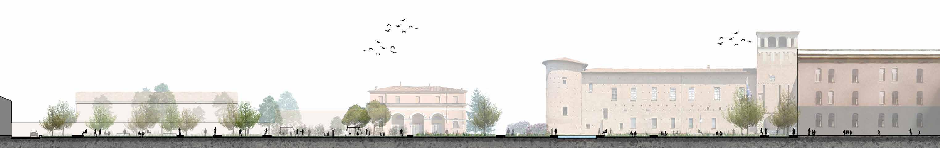
Connecting the urban commons 04
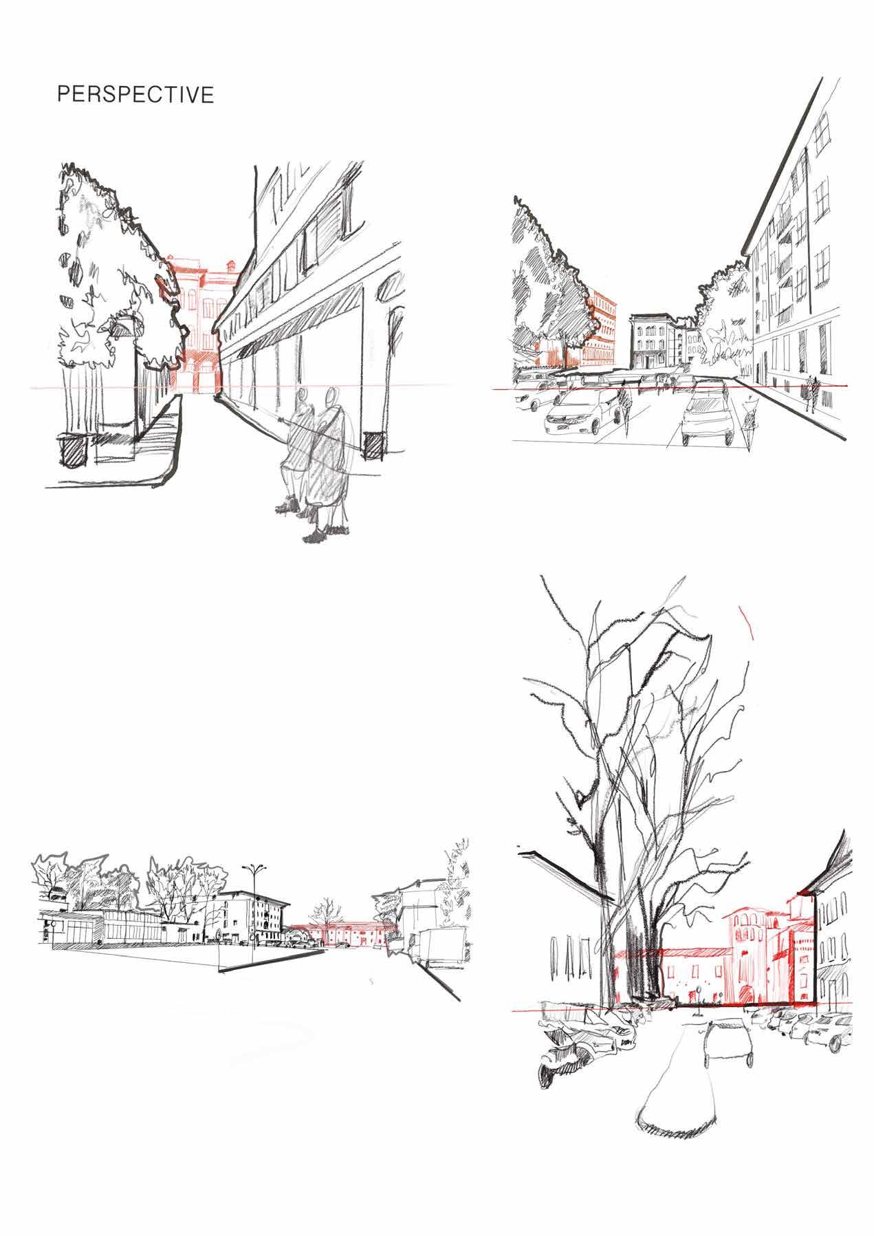
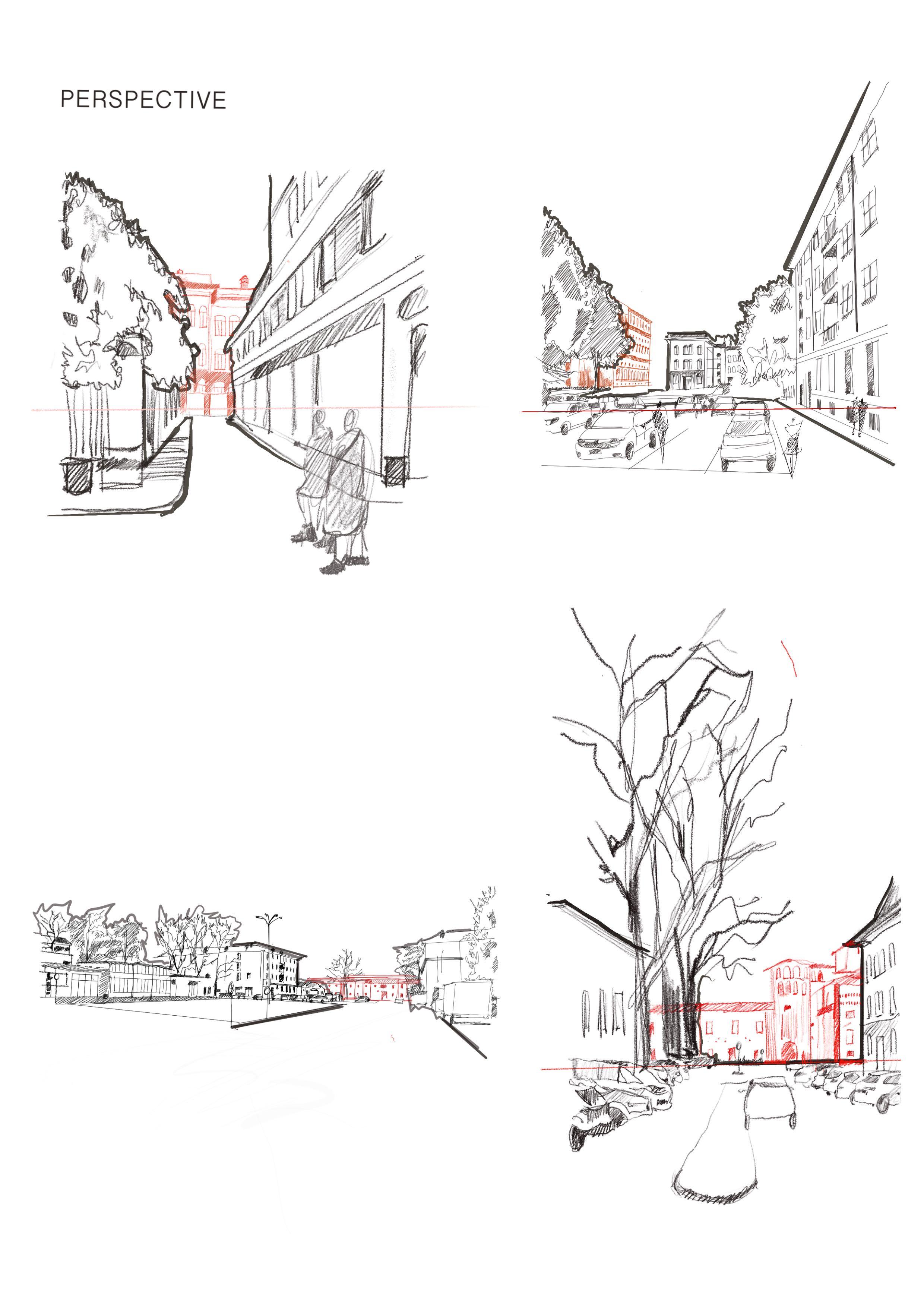
Academic / Urban Landscape / Piacenza, Italy
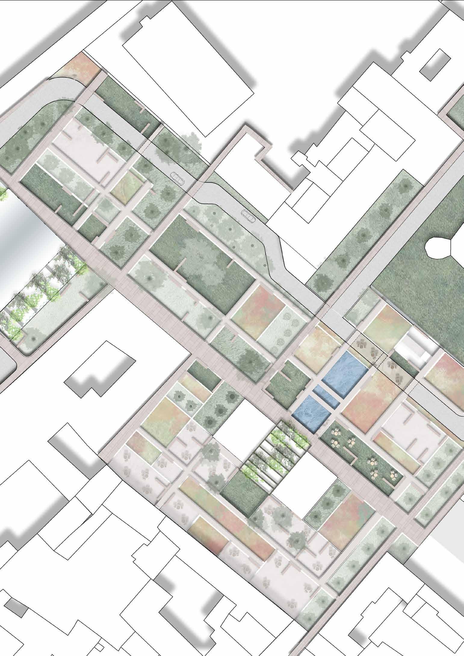
The ex bus station in Piacenza, Italy is revitalized by turning it into a Community Center. The existing building structure is to be kept and the middle part of the roof is to be taken down to turn it to an open space. This change enhances the view of Palazzo Farnese to the users. The pergola will have the climbers to make it a shaded area. The other rooms are imagined to be study/work center for students.
Site plan
Map illlustrating the master plan with the proposed landscape
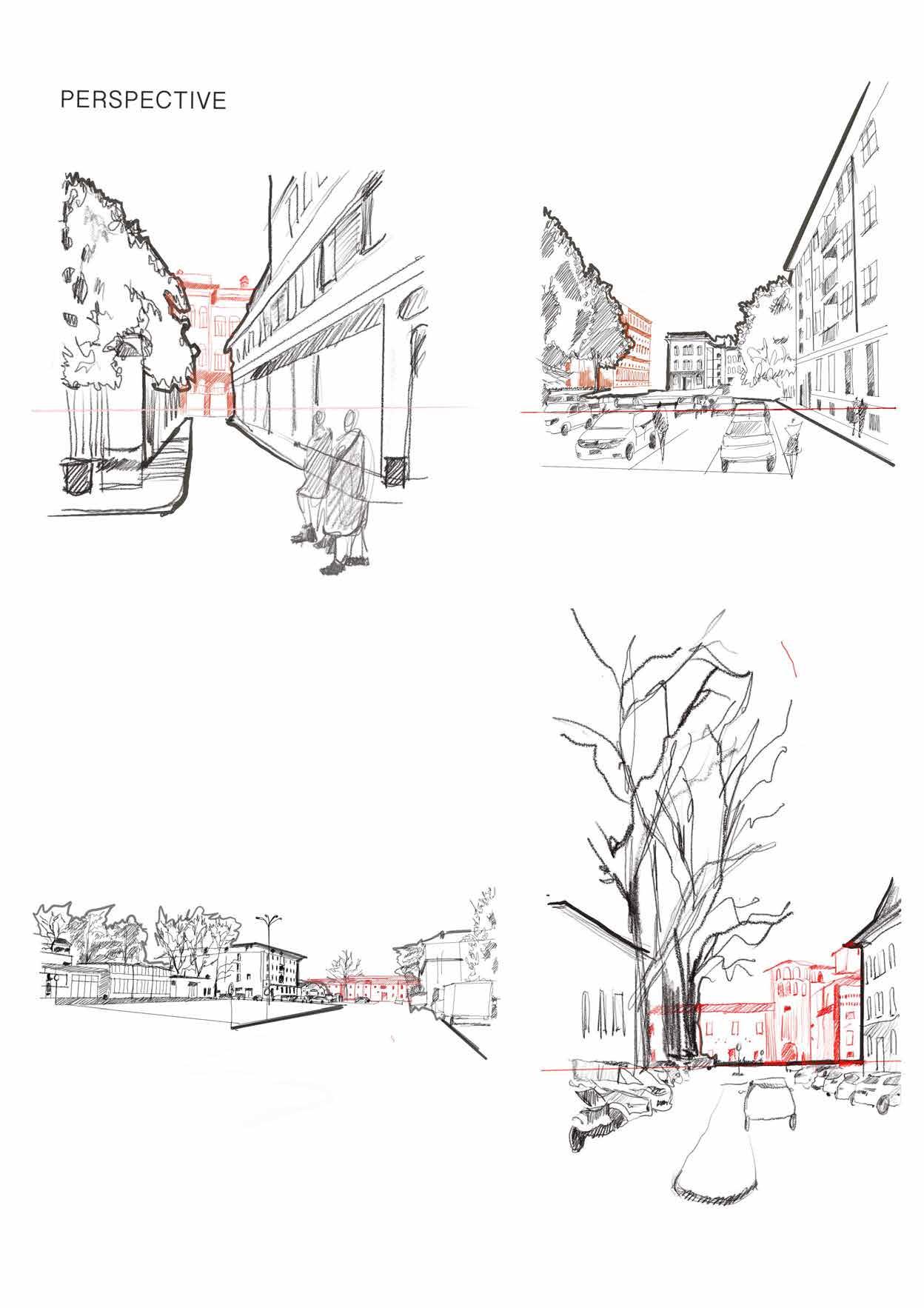
On the right you can see the shadow analysis of the site during the winter and summer months.
Below is a series of skecthes that visullay represent the elements that act as a visual barrier/helper for the pallazzo farnese.
View of the piazza with the repurposed bus station
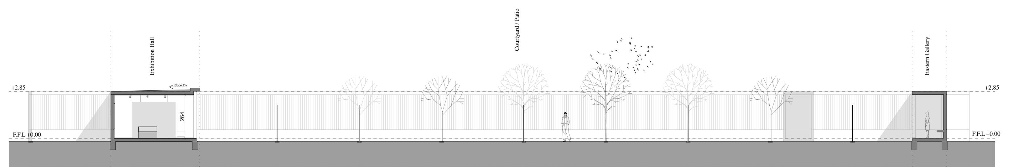
Section
Sections showing the site after introducing new vegetation
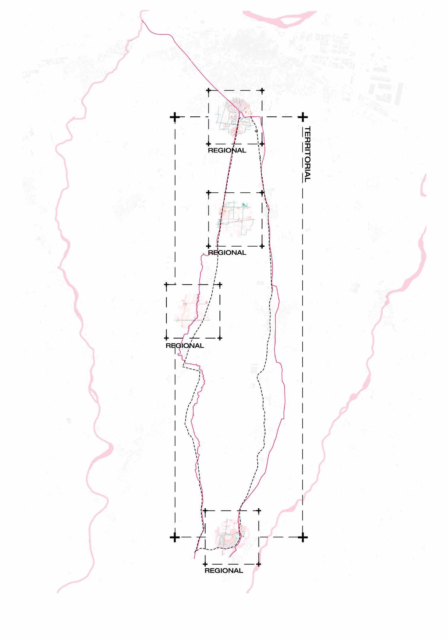
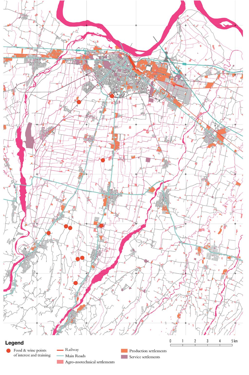
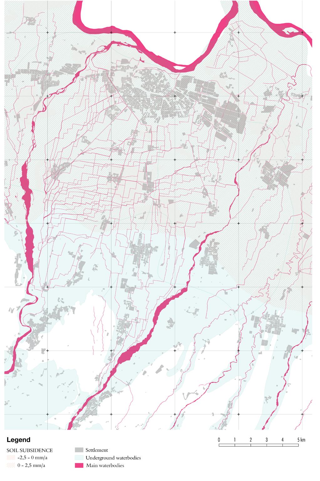
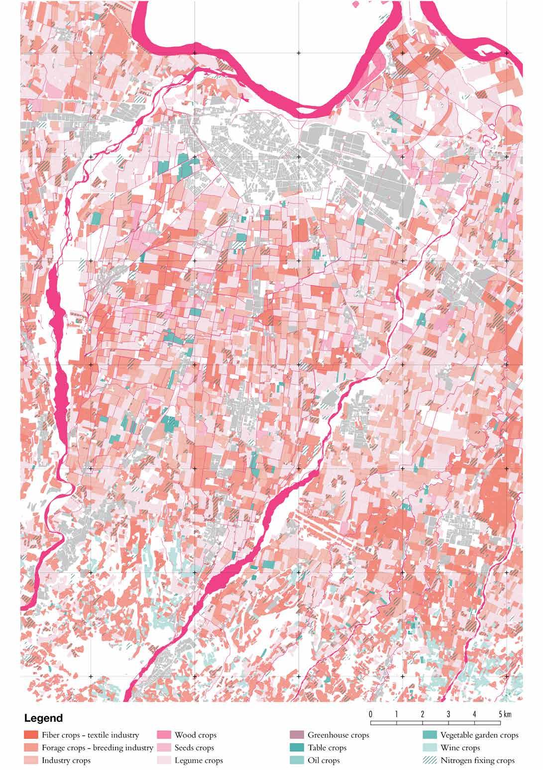
Re-engaging Patterns 05
Academic / Urban Landscape / Piacenza, Italy
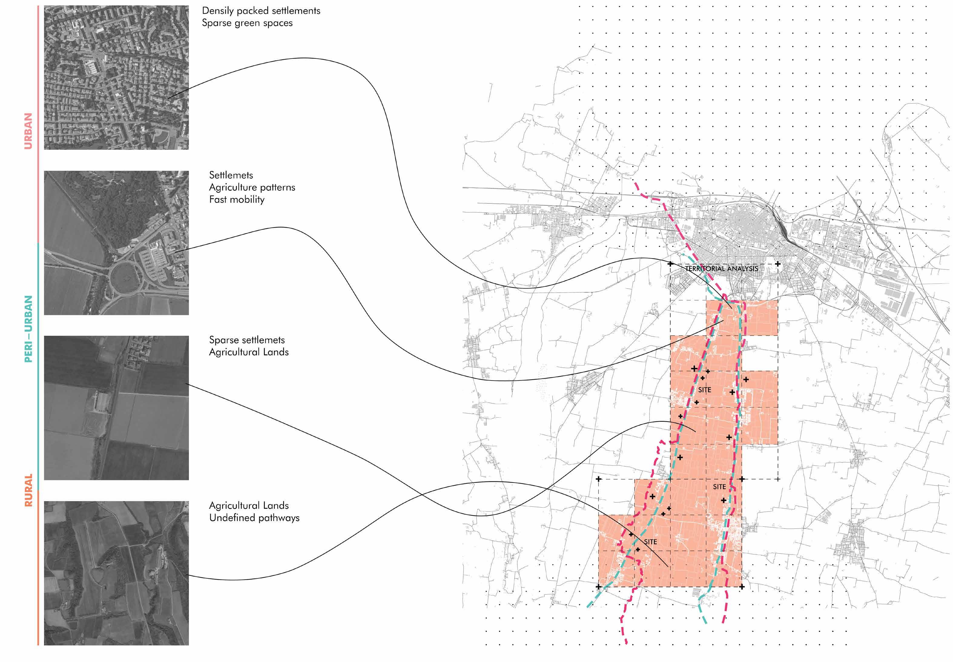
The context analyzed is the one of the province of Piacenza: an extremely complex reality, rich in important diversities and valuable local elements that are intertwined in a delicate balance of patterns between a city - that is preparing to face the new challenges of the future - and a peri-urban and rural provincial rich in potential to be developed and exploited. The need to face for the future of the province of Piacenza is to design a more sustainable and resilient reality to allow its territory to resist and change in response to the new needs of the future, in which are priotized not only the demands of the society, but also the well-being of its citizens and the environment. In this context, after a careful analysis of the palimpsest and of the actors that compose it, is developed the eco-compatible redesign project of the infrastructural connections and the landscape areas they cross, to imagine a future in which mobility and agricultural system can be reviewed in a more sustainable way and establish an example of reconnection not only with the provincial and rural territory, but also between users and the landscape.
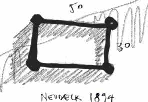
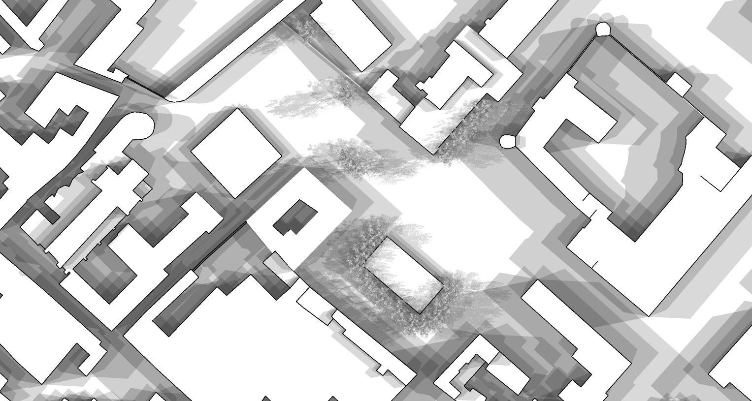
Mapping
Landscape analysis of the Cremona district
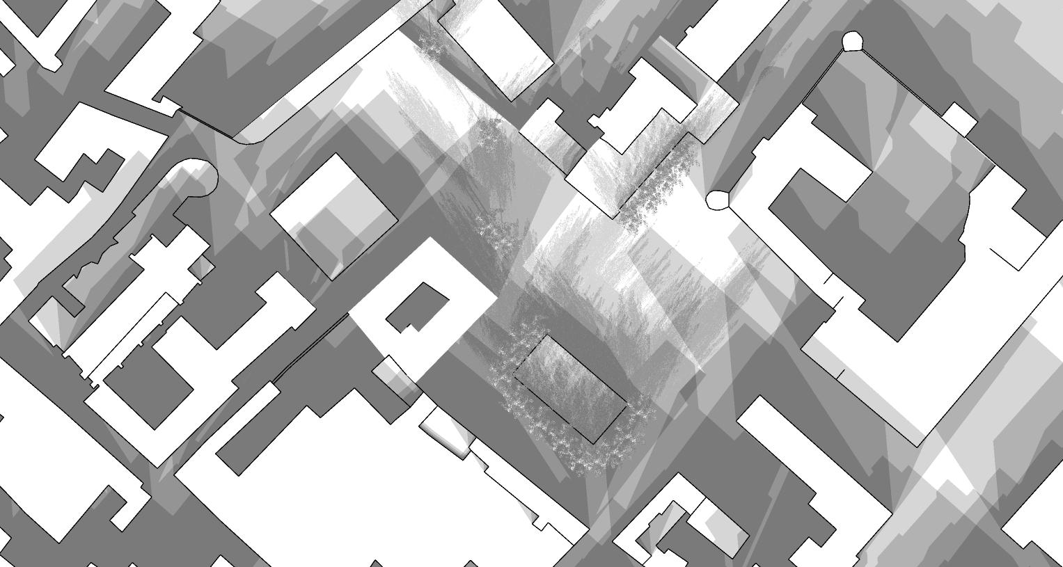
Mapping
Territorial anaysis of Infrastructure and settlemets
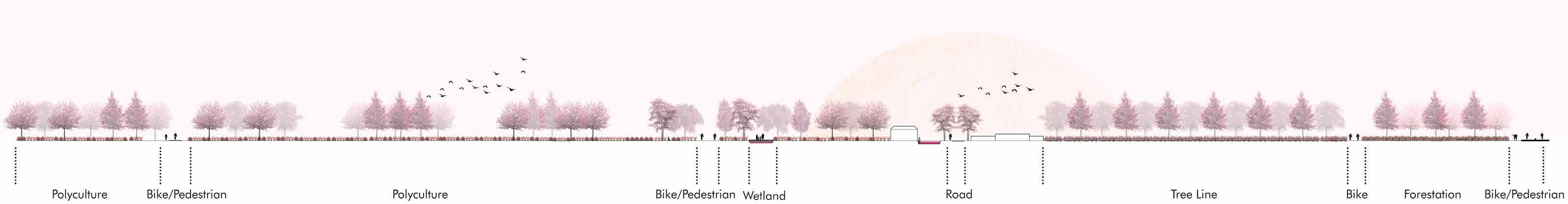
Section
Sections showing the site after the interventions
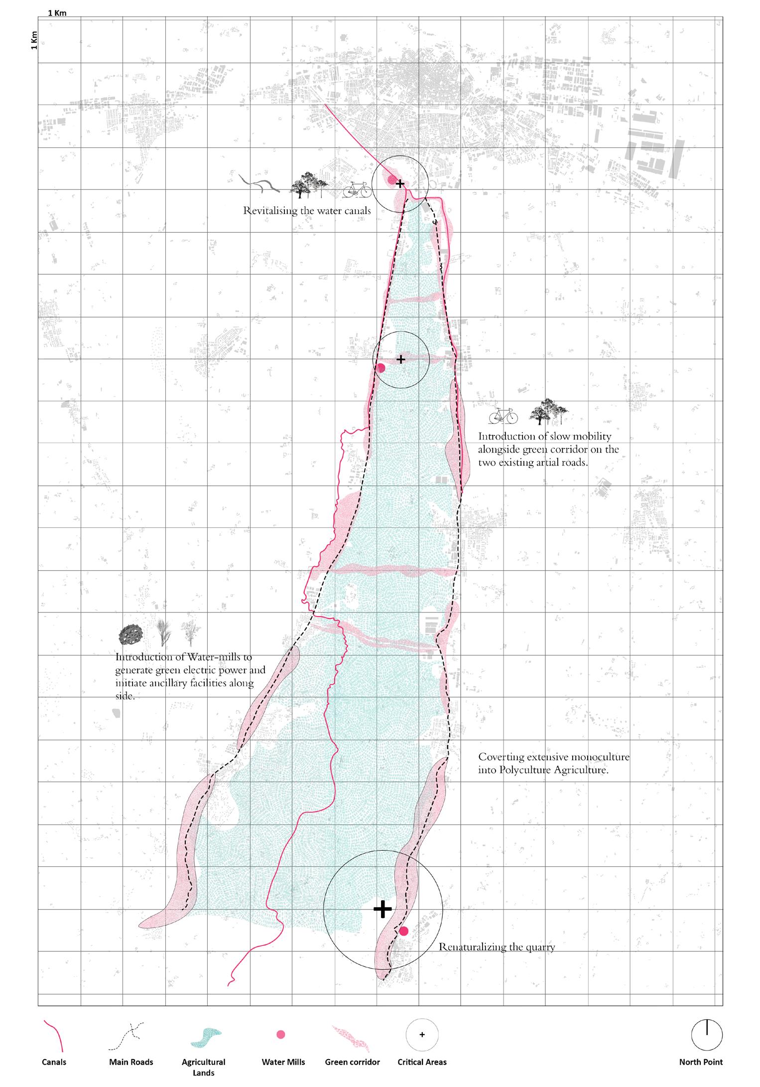
Mapping
Territorial anaysis of Water systems
Mapping
Territorial anaysis of Agriculture
The proposal aims to redefine and enhance mobility across the territory by seamlessly connecting the urban, peri-urban, and rural areas along the north-south axis, starting from the city of Piacenza. By reimagining the way key infrastructures traverse these landscapes, the project seeks to create a fluid and integrated
network that supports sustainable movement and development. This approach not only addresses the challenges identified in the analysis but also envisions a future where Piacenza emerges as an innovative and eco-compatible hub, fostering balanced growth and connectivity across diverse environments.
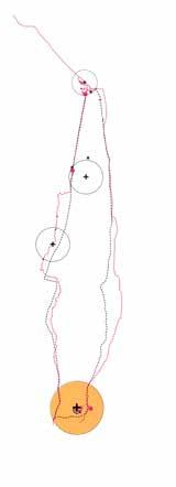
Master plan
Highlighting all the points of development
Zone 4
Plan of zone 4, point of intervention
Section
Sections showing the site after the interventions
Professional work 06
In my previous work as an architecture professional, I had the privilege of contributing to a diverse range of projects that showcased my passion for innovative design and meticulous attention to detail.
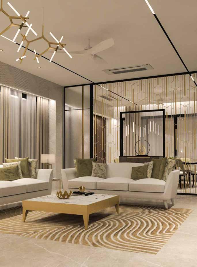
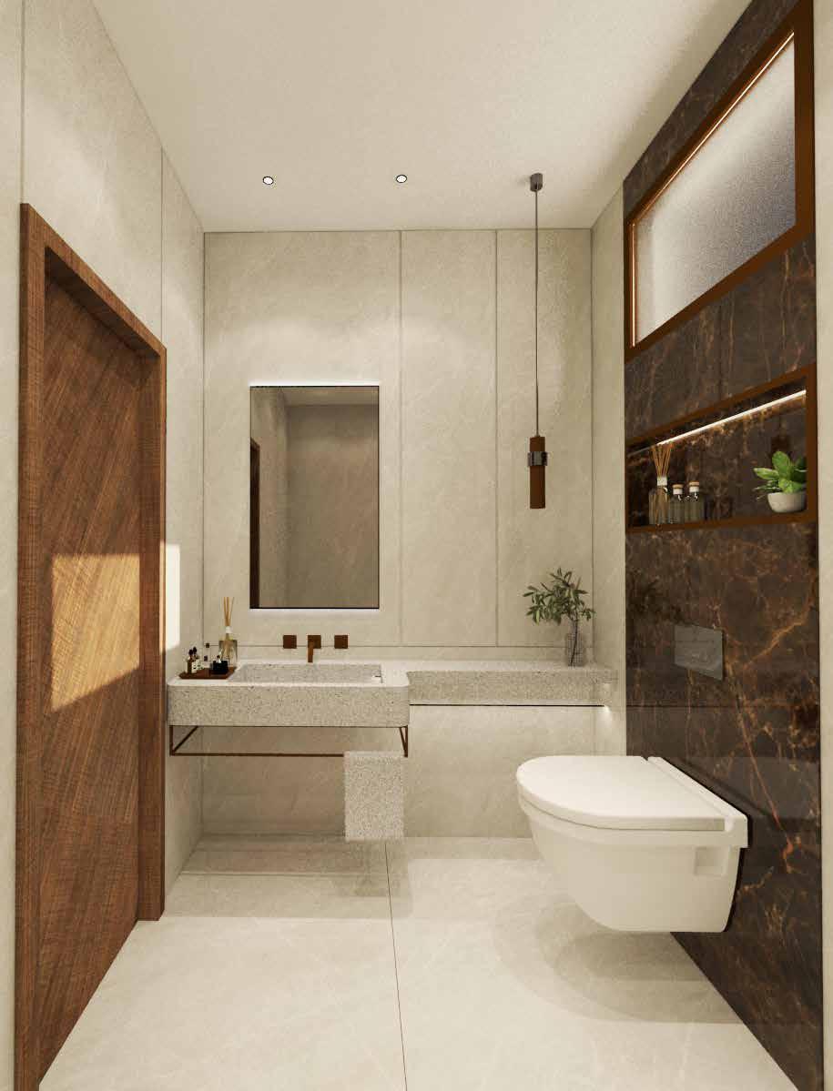
The core design concept revolved around creating a space that not only met the practical needs of its inhabitants but also established a strong connection with its natural surroundings. The design team aimed to strike a balance between aesthetics and functionality, ensuring that every element of the interior was meticulously planned and executed.
As an architect, I have contributed to a wide range of projects, focusing on both working drawings and renderings. My experience spans the entire project lifecycle, from ideation to execution, providing me with a comprehensive understanding of the architectural process. I have developed detailed working drawings that serve as essential guides for construction, ensuring precision and compliance with design standards. Additionally, I have created compelling renderings to effectively communicate design concepts to clients and stakeholders. By collaborating with multidisciplinary teams, I have honed my ability to translate creative visions into practical and sustainable architectural solutions, ensuring each project meets both aesthetic and functional requirements.
I contributed to the technical final drawings and renders for this residential project, ensuring precision and attention to detail in the design execution. Additionally, I assisted with client meetings, helping to translate their vision into practical solutions, and participated in site work to oversee implementation and coordination. My role combined technical expertise with hands-on experience, contributing to the project's successful realization.
Miscellaneous 07
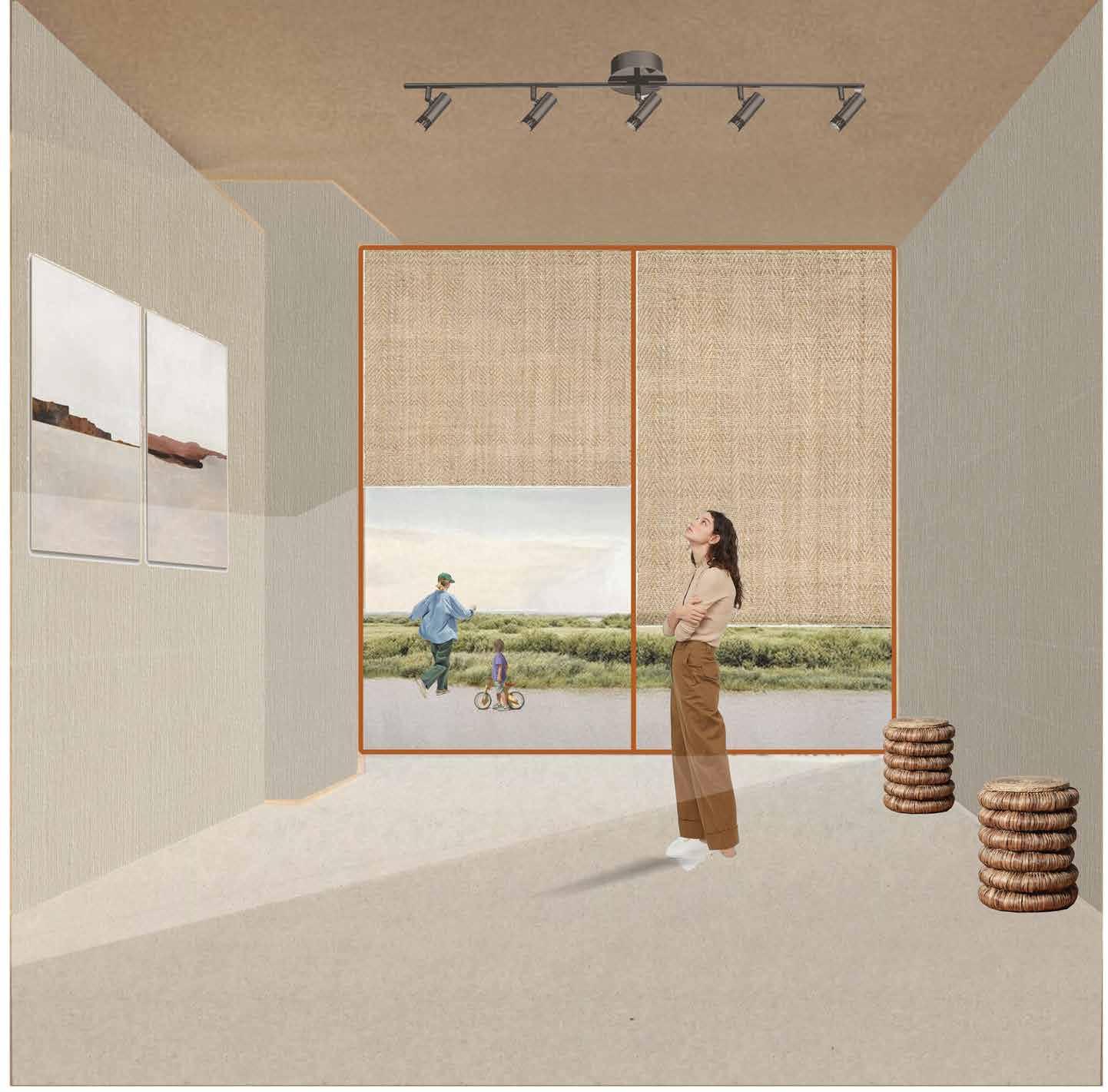
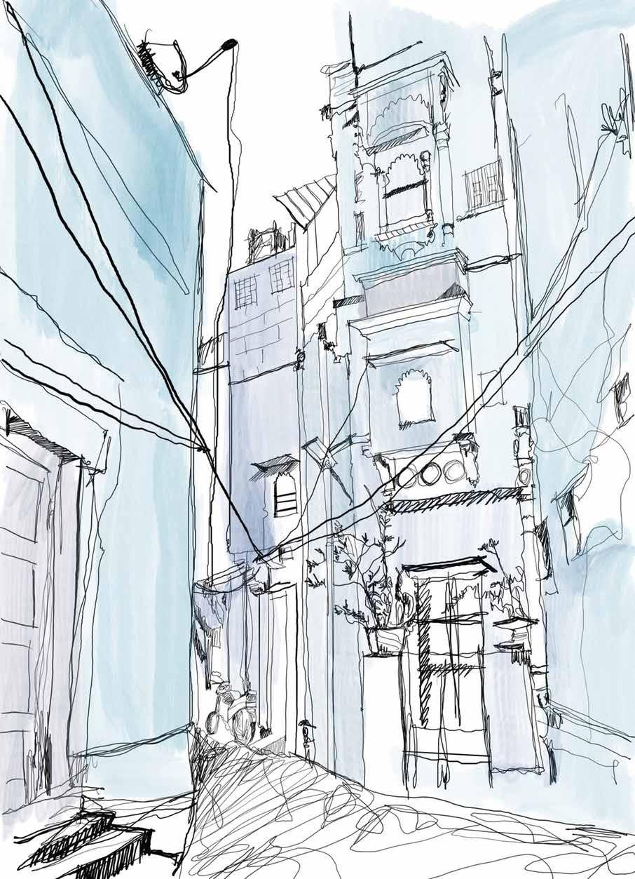
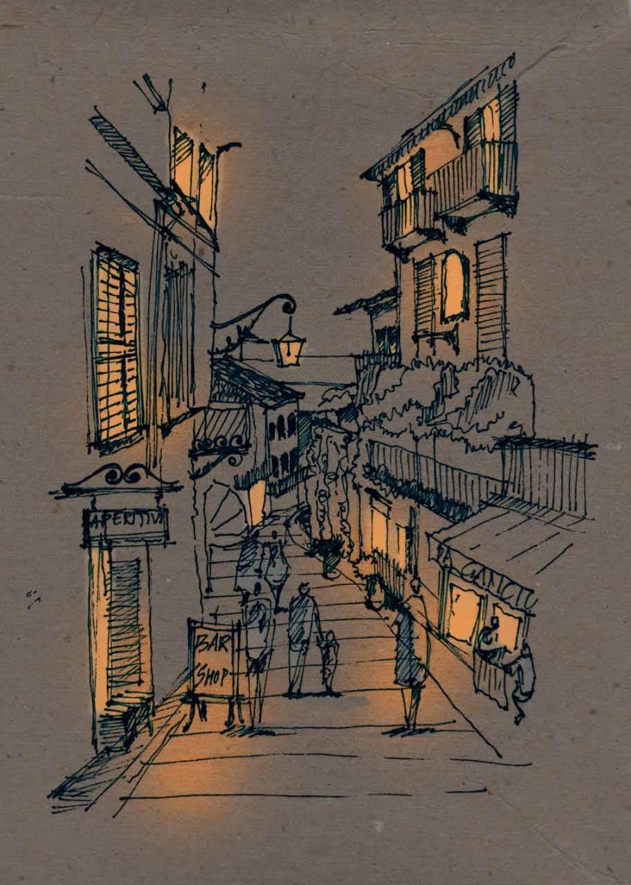
Sketches / Renders
Here is a collection of a few hand sketches and renders.
Whether it’s solving initial design difficulties or working through concepts and specifics, architectural sketches are all about communicating ideas. It aids in the communication of ideas, the demonstration of functionality, the visualization of user flow, and the illustration of anything that involves interaction.