portfolio urban design + architecture SELECTED WORKS | B.ARCH + M.ARCH
Prashitha Selvakumar
I am an Urban Design post-graduate aspiring for opportunities and challenges that keep me in a process of self-evaluation and development. With a strong background in architecture and urban design, my emphasis is on creating context-responsive and sustainable urban spaces and programs. My design philosophy revolves around fostering social inclusivity and environmental responsibility.


Hi,
Prashitha
prashitha.selvakumar@gmail.com | Mumbai, India
my name is
+91-9619762413 |
professional experience
Modi Srivastava
and
Associates, Vadodara | Architecture Intern
Jun 2021 - Nov 2021
Worked on residential and commercial projects, prepared working drawings for civil and interior works and generated 3D views on Trimble SketchUp at all stages from conceptualization to execution; also conducted meetings, site visits and material selections with clients
L&T Technology Services, Mumbai Architecture Intern
May 2018
Assisted the Architecture and Civil Engineering Team for preparation of Autodesk AutoCAD drawings and Autodesk Revit 3D Modelling
license and certification education
Licensed Architect Council of Architecture (COA), India Registration No. : CA/2023/167117
Master of Architecture - Urban Design
Kamla Raheja Vidyanidhi Institute for Architecture & Environmental Studies (KRVIA), Mumbai Mumbai University
Bachelor of Architecture
Dr. Bhanuben Nanavati College of Architecture (BNCA), Pune Savitribai Phule Pune University | CGPA 9.24
Senior Secondary School
R.N. Podar School, Mumbai (CBSE) | 85.4%
Secondary School
D.A.V. Public School, Thane (CBSE) | 93.4%
technical skills
Drafting: Autodesk AutoCAD, Autodesk Revit
Geographic Information Systems: QGIS
Modelling: Trimble Sketchup, Rhinoceros 3D
Rendering: Lumion, V-Ray
Graphics: Adobe Photoshop, Adobe InDesign
other skills
languages
Nov 2022 - Apr 2024 Aug 2017 - May 2022 Apr 2015 - Mar 2017 Apr 2013 - Mar 2015
Photography Graphic Design Physical Model Making Research
Writing
English | Hindi | Tamil | Marathi
and
01 02 03 04 05
Rethinking Urban Resilience in Coastal Cities MASTERPLANNING + URBAN DESIGN GUIDELINES
Regenerating Local Economy through Anchor Institutions STRUCTURE PLAN + INSTITUTIONAL SPINE DESIGN
Reviving Lost Spaces and Identiy CAMPUS PLANNING + URBAN INSERT
Redefining the Historic City Core STREET AND POCKETS REDESIGN + URBAN INSERT
Reimagining Post-Human Landscapes REPRESENTATION STUDIO 06 Photography
contents
p1 00 p9 p13 p17 p21 p23
rethinking urban resilience in coastal cities 01
M. ARCH SEMESTER IV THESIS
SITE LOCATION: PANAJI, INDIA
PROJECT SCOPE: MASTERPLANNING + URBAN DESIGN GUIDELINES
GUIDE: AR. MANOJ PARMAR
what is the need for urban resilience?
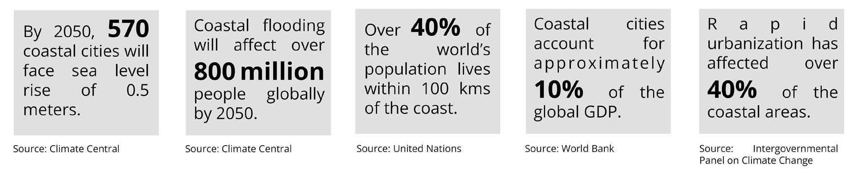
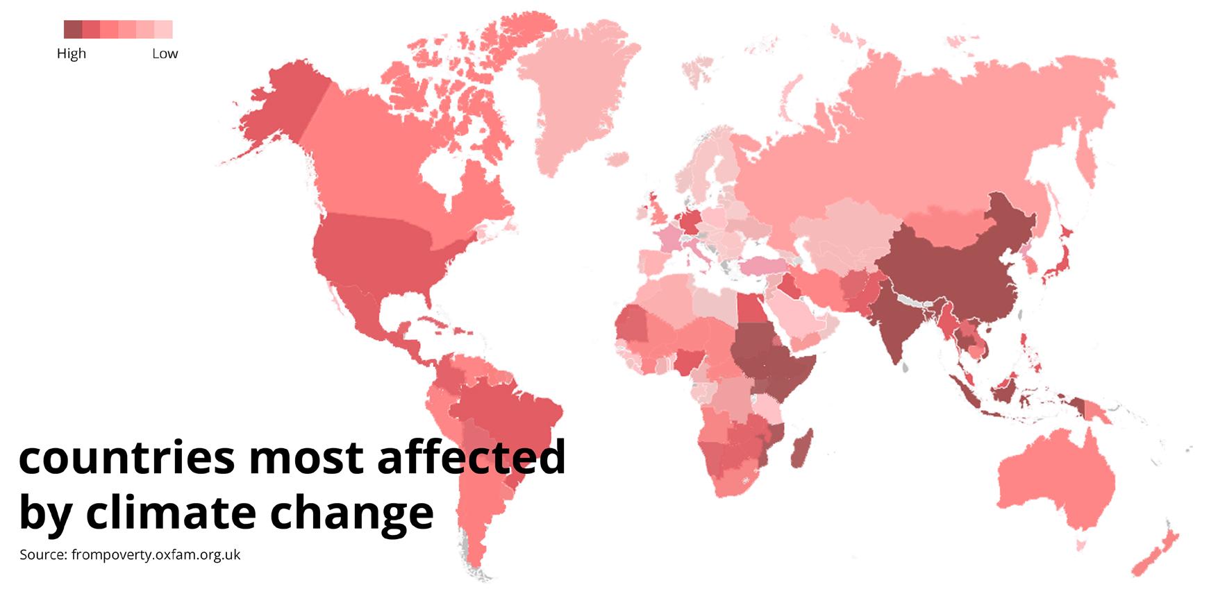
Around the world, coastal cities exhibit a great degree of heterogeneity in their environments, urban form, connectivity and socio-economic activities, owing to their unique geographical features. These areas are particularly vulnerable to climate change and environmental challenges such as sea-level rise, flooding, extreme weather conditions, and coastal erosion and have a significant impact on the urban form and mobility patterns in coastal cities. Moreover, rapid urbanisation, intensification of and changes in land use place growing pressure on the sensitive coastal environment. However, there is limited understanding of the interaction between urban and coastal systems. This thesis aims to improve urban resilience, and overall sustainability in coastal cities by reducing vulnerabilities and strengthening existing networks through a comprehensive resilience assessment framework and implementation strategies.
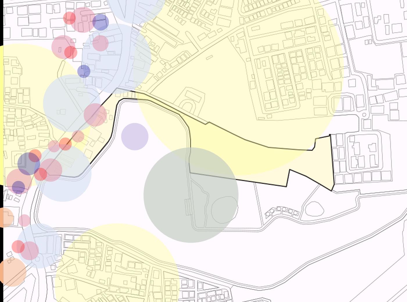
1
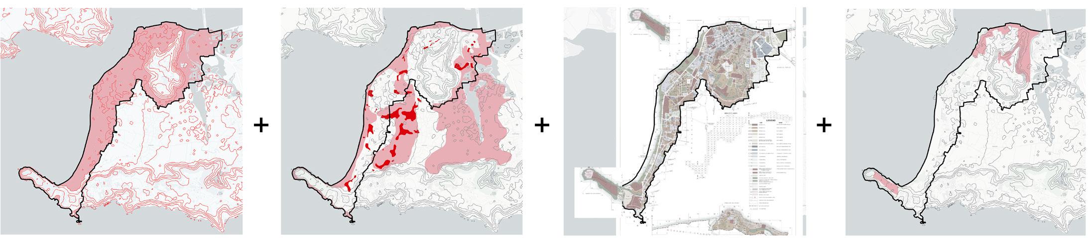
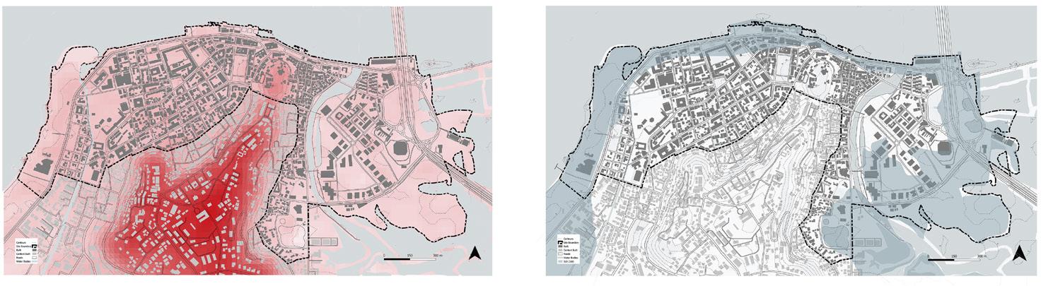
Low Elevation Coastal Zone (LCEZ)
= site delineation
Predicted SLR (2100) and current Flooding Risk Zones
Mixed-use Development Heritage and Conservation Zone
criteria
site selection
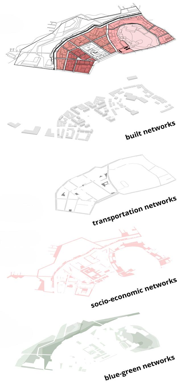
Site Context and Major Landmarks 2
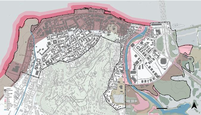
increased coastal vulnerability due to panaji’s land reclamations
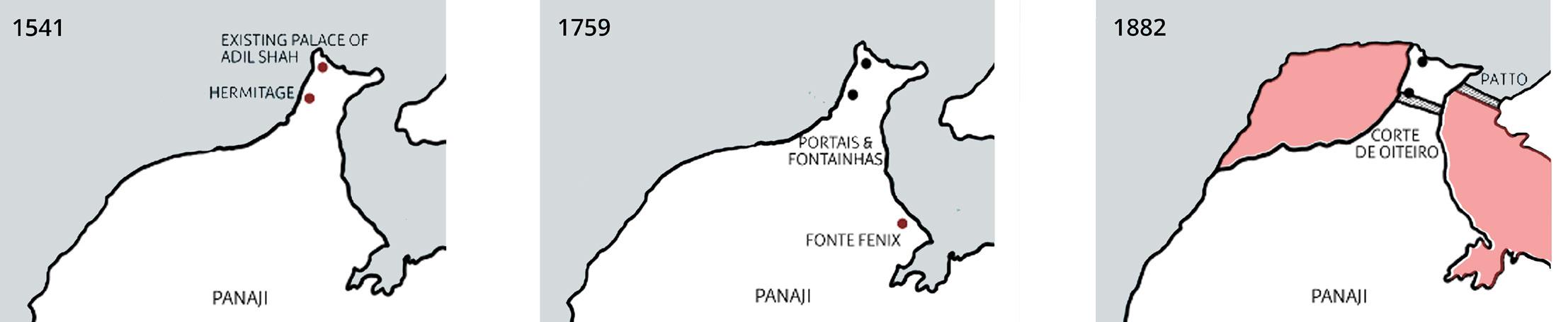
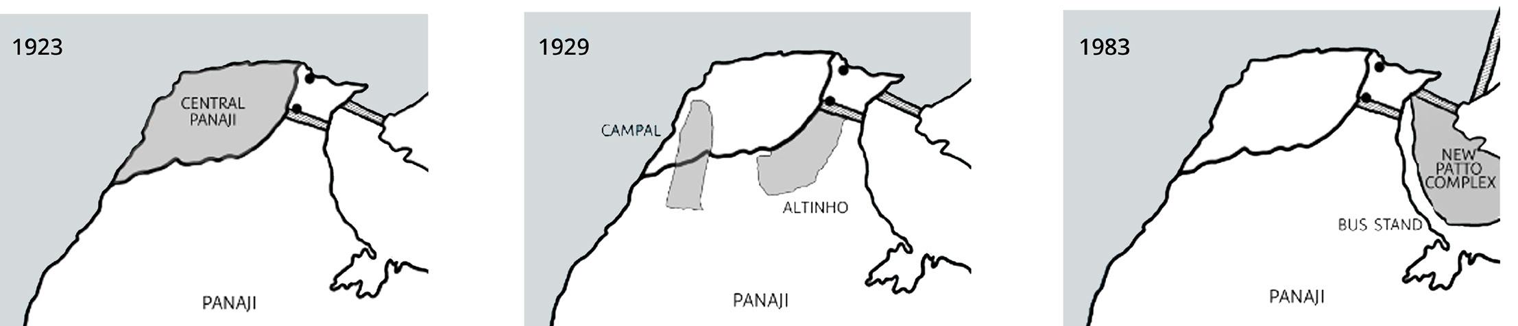
While land reclamations have facilitated urban growth and economic development in Panaji, they have also increased the city’s vulnerability to coastal hazards and environmental degradation. The loss of natural buffers like mangroves and wetlands has reduced the city’s ability to absorb and dissipate wave energy, leaving reclaimed areas more susceptible to damage during extreme weather.


Strengths
1. Well-preserved historic buildings
2. Potential for tourism
3. Presence of green spaces and parks
Vulnerabilities
1. Susceptibility to flooding
2. Limited amenities for tourits and residents Strengths
1. Potential for waterfront development
2. Natural habitats (mangroves) provide resilience and support biodiversity
Vulnerabilities
1. Flooding and coastal erosion
2. Pollution from run-off waste disposal, and boat traffic
Strengths
1. Economic hub with commercial activities and employment opportunities
2. Good connectivity and access to services
Vulnerabilities
1. Traffic congestion and limited parking
2. Lack of green spaces leading to UHI
3. Lack of communal spaces
3
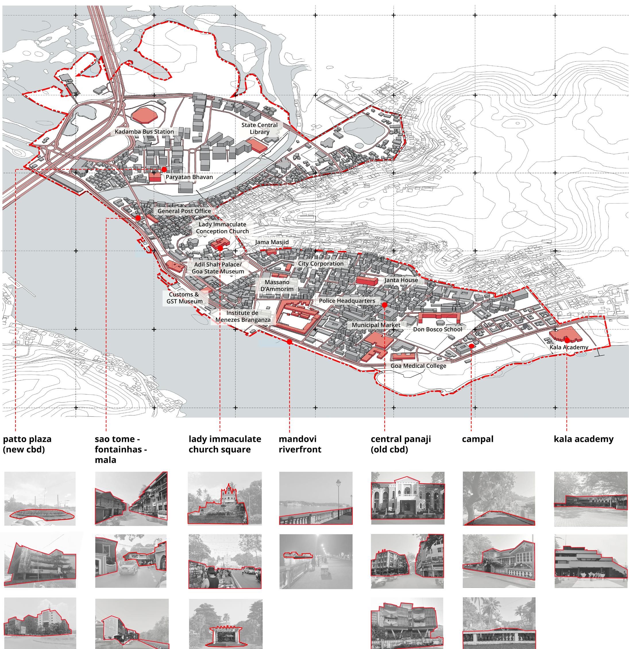
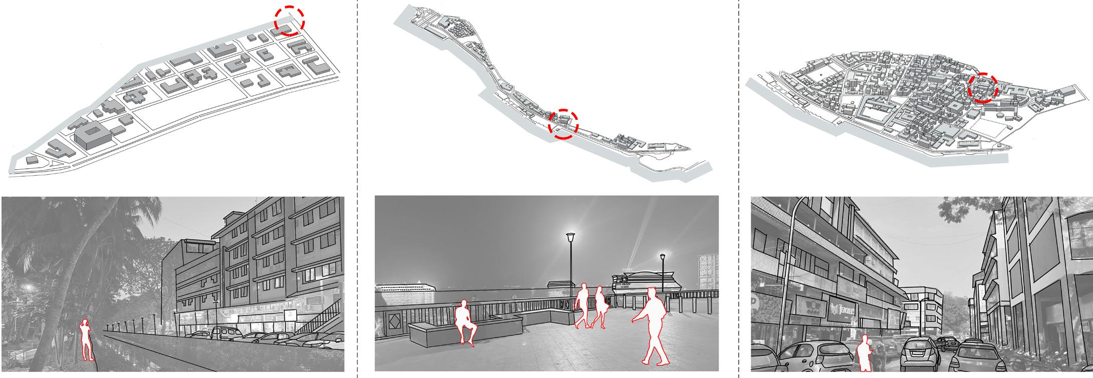
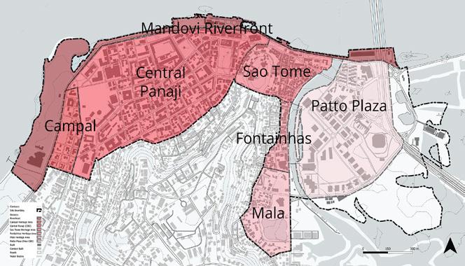
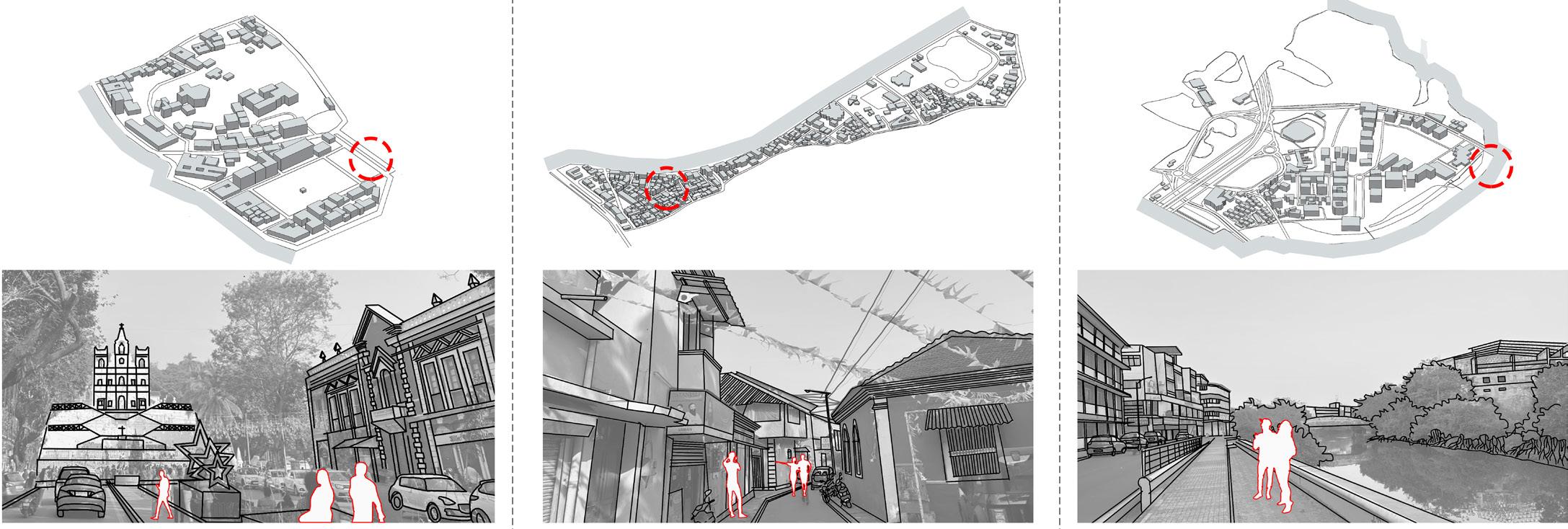
campal heritage area mandovi riverfront central panaji (old cbd) neighbourhood characteristics stakeholders on site Residents Tourists Business Owners Street Vendors Office Employees Workers Students Fishermen NGOs Associations Private Developers City Corporation (Source: panaji.org)
site analysis
Terrain
Predicted Sea Level Rise (2100) Urban Fabric and Neighbourhoods
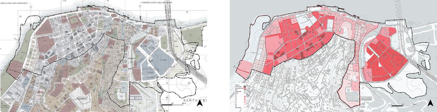
Proposed Land Use (as per Panaji DP 2031) FSI Distribution
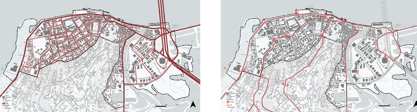
Street Hierarchy
church square
Public Transportation
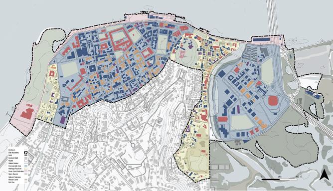
Building Use
Open Spaces and Natural Features
fontainhas heritage area patto plaza (new cbd)
Strengths
1. Cultural and religious significance
2. Community gathering space for social and cultural events
Vulnerabilities
1. Limited amenities and infrastructrue for visitors and residents
2. Overcrowding during festivals
Strengths
1. Architectural heritage, cultural diversity
2. Heritage tourism contributing to local economy
Vulnerabilities
1. Degradation of historic structures
2. Gentrification and displacement of local communities
Strengths
1. Commercial and administrative hub
2. Accessibility and connectivity to major transportation links
Vulnerabilities
1. Maximum vulnerability to flooding
2. Lack of public and recreation spaces
3. Pedestrian safety issues
4
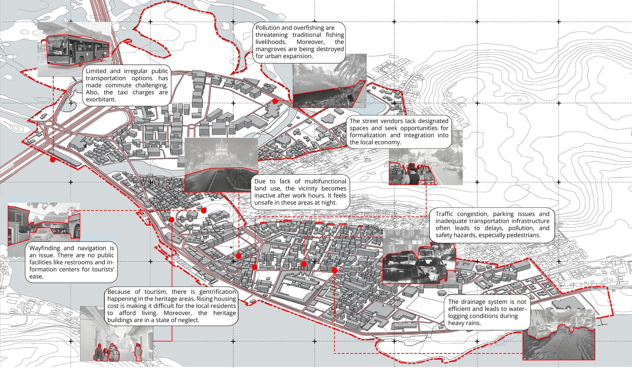
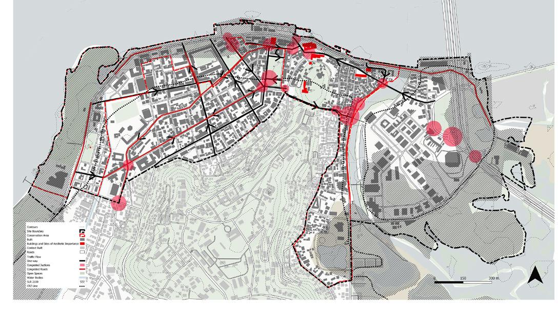
what is the existing state of urban resilience in panaji?
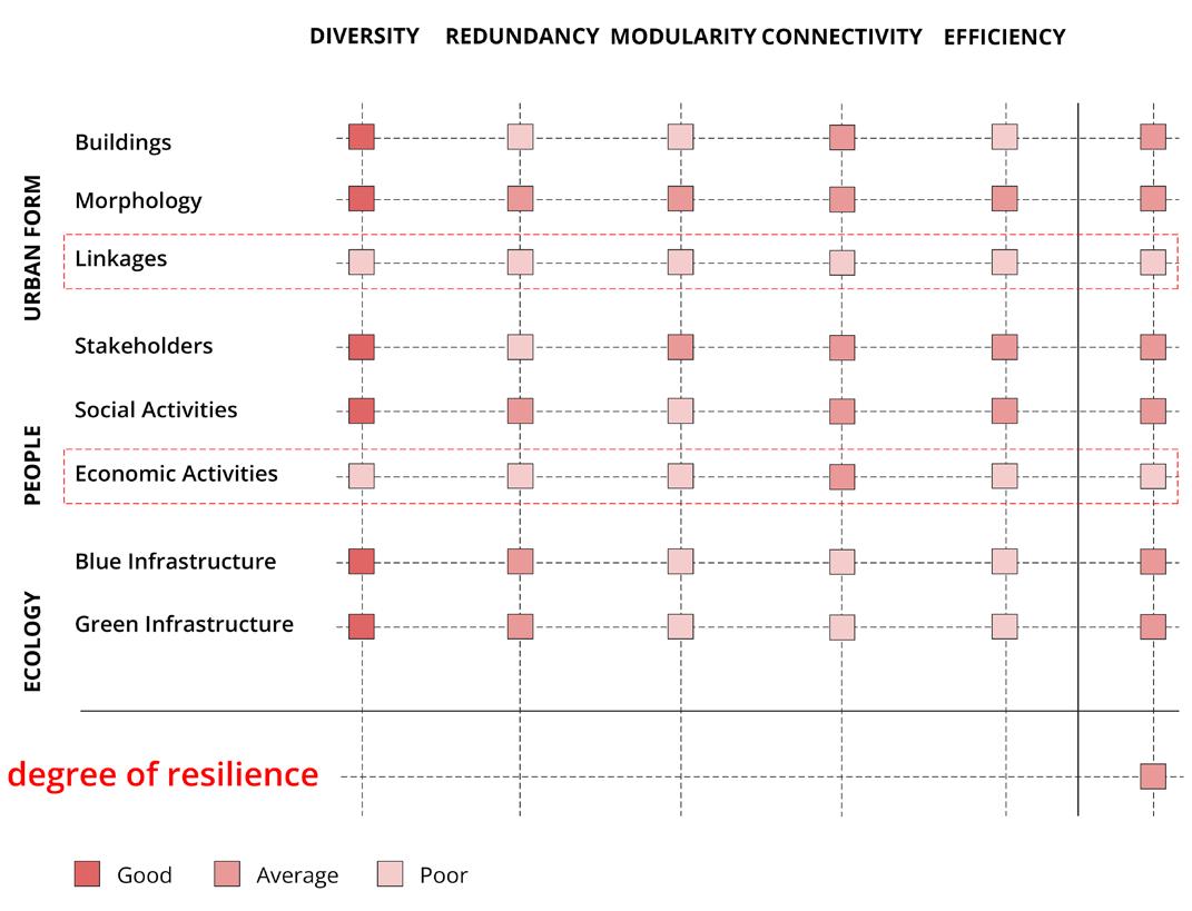
site vulnerabilities
scales of intervention
spatial scales
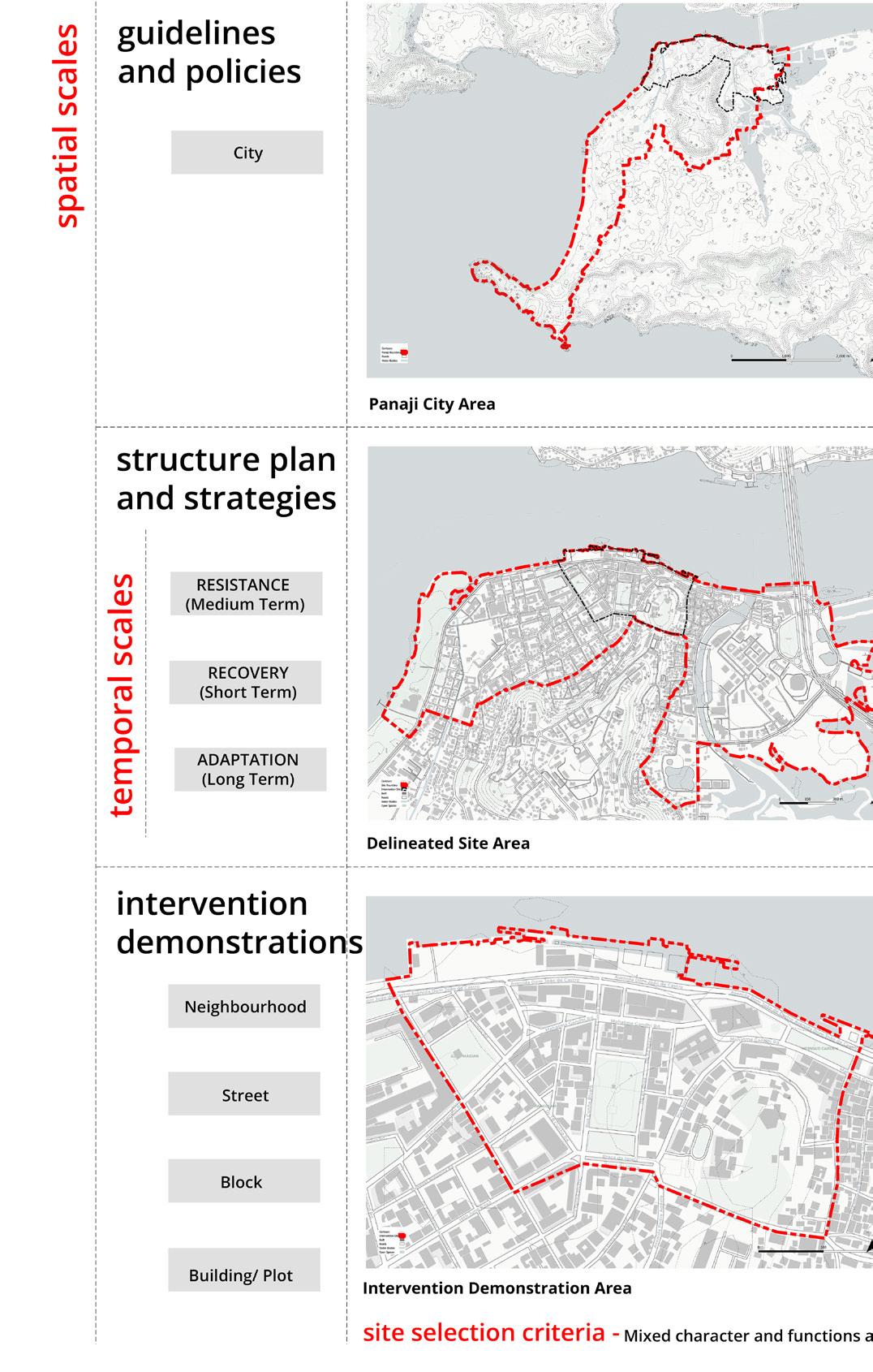
Panaji City Area
temporal scales
Delineated Site Area
Intervention
Demonstration Area
site selection criteria
5 issues identified
how to enhance urban resilience?
urban resilience x strengthening networks
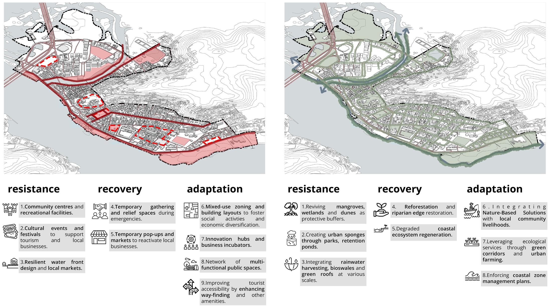
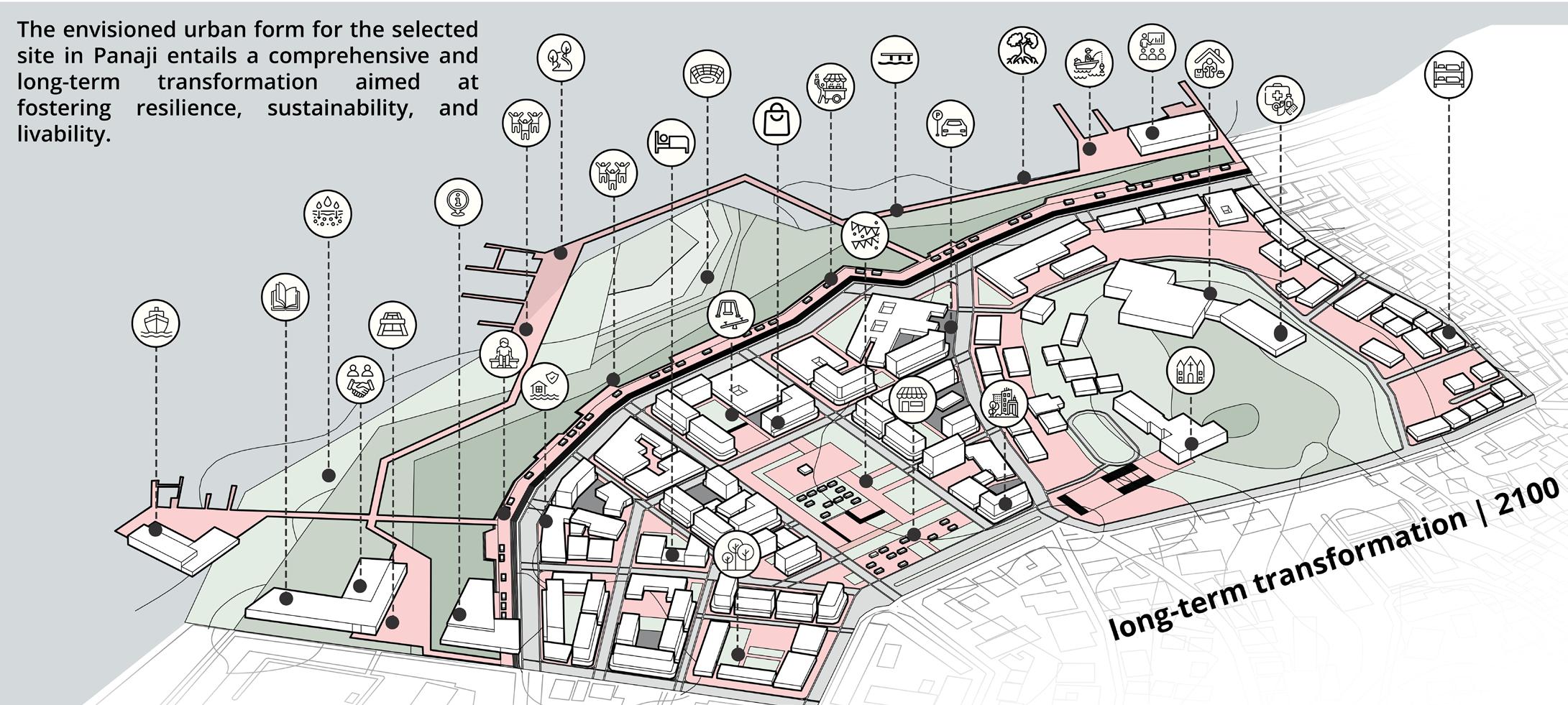
The vision is to reinforce Panaji’s urban systems against environmental and socio-economic dimensions wiith robust networks. Through a combination of spatial strategies and community engagement, this project aims to build urban resilience at three stages:
resistance (preparation before disruption) recovery (response after disruption) adaptation (resilience development to disruption)
built and utility networks
transportation networks
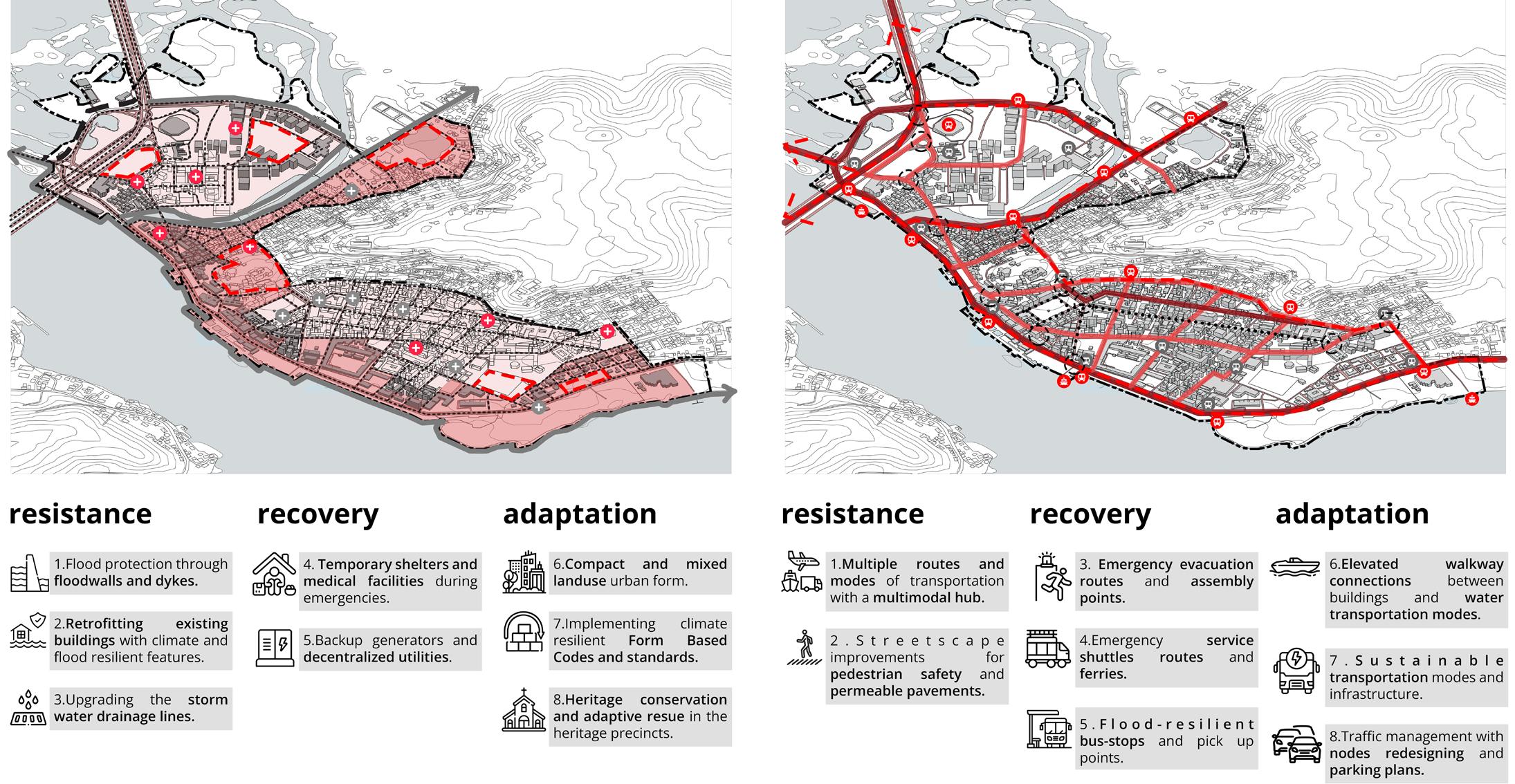
socio-economic networks
blue-green networks
6
reconnect to riverfront
reconfigure urban blocks
redistribute FSI
retreat from water edge
revive heritage identity
reuse existing built stock redevlop CBD area
reroute traffic flow
regulate parking reactivate streets
reestablish community networks
reclaim streets and public spaces
regenerate economy
restore natural ecosystems retain and percolate stormwater built networks
7
site strategies proposed site transformation
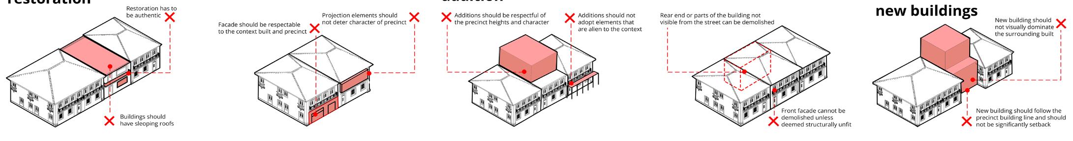
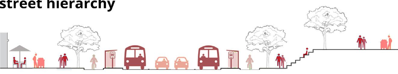
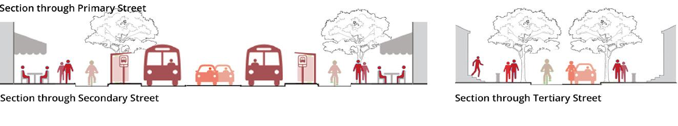
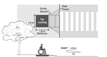
Height restrictions Building Setbacks Ground Coverage and FSI Mixed-use Zoning Frontages Restoration Alteration Addition Demolition Reconstruction/ New Buildings Heritage Buildings transportation networks Primary Street Secondary Street Tertiary Street Universal Accessibility Parking
socio-economic and public realm networks
8
Signages Emergency Retreat Business Incubators, Skill Development Social Amenities Economic Amenities
and
Corner
Event
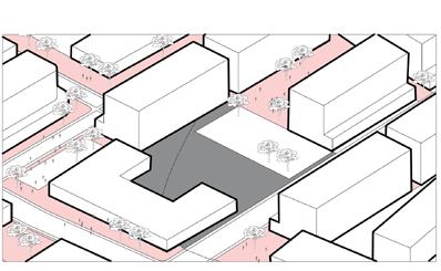
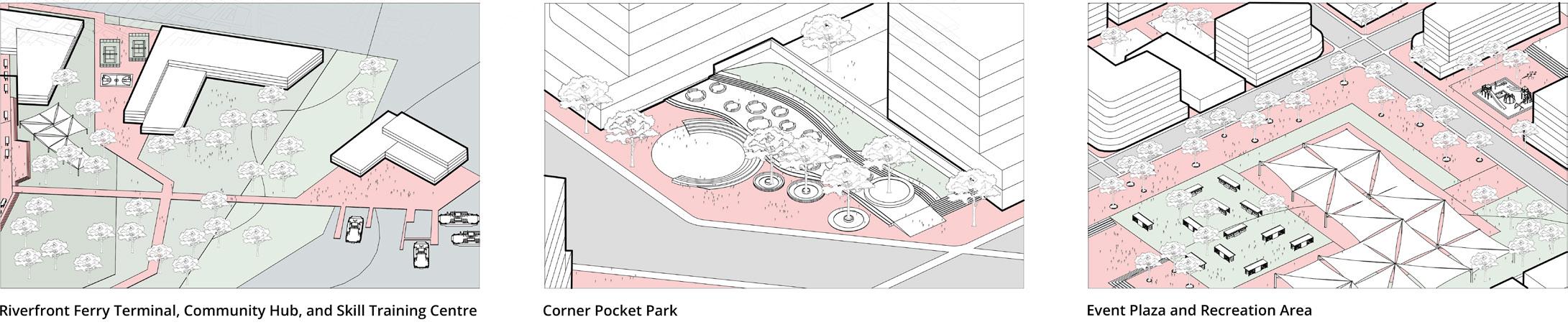
Area Waterfront Setbacks Mangrove Buffer Tree Canopy Stormwater Management Green Spaces blue-green networks what can be the tools of implementation?
Riverfront Ferry Terminal, Community Hub,
Skill Training Centre
Pocket Park
Plaza and Recreation
how did the resettlement affect the displaced people?
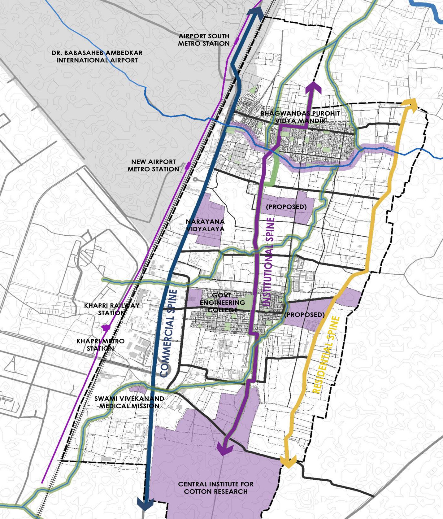
regenerating local economy through anchor institutions
M. ARCH SEMESTER III STUDIO
SITE LOCATION: NAGPUR, INDIA
PROJECT SCOPE: STRUCTURE PLAN + INSTITUTIONAL SPINE DESIGN
GUIDES: AR. VIKRAM PAWAR, AR. KETAKI TARE
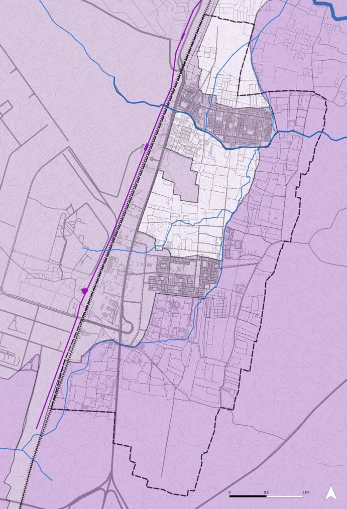
With the widening of the Wardha Road and the new Samruddhi Mahamarg, the southern peripheral area of Nagpur started developing. MIHAN (MultiModel International Passenger and Cargo Hub Airport at Nagpur) was proposed in 2006 and the process of land aquisition started. Agricultural land from 8 villages was acquired and the occupants are in the process of being resettled on the eastern side of the metro line along with compensations based on land holdings. The PAPs have been rehabilitated to the New Khapri and Chinchbhavan area. Predominantly a residential area, the area witnessed major transformations in the housing typologies due to the upcoming developments. The resettlement and failure to fulfill compensation by the MIHAN authorities has resulted in the loss of livelihood and unemployment.
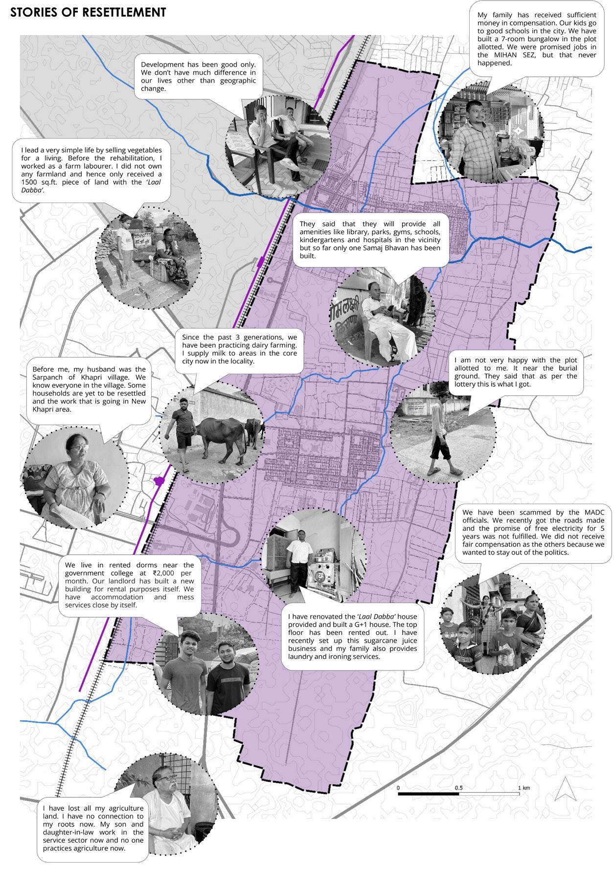
However, the presence and upcoming of institutions in the area has been neglected. This projects aims at leveraging these anchor instittutions to regenerate local economy.
02
9
Stories of Resettlement
jurisdiction boundaries and administrative authority discrepancies
Jurisdiction Boundaries within the Site
REGIONAL PLAN (NMRDA)
CITY DEVELOPMENT PLAN (NMC)
METROPOLITAN AREA DEVELOPMENT PLAN (NMRDA-NIT)
MIHAN MASTER PLAN (MADC)
NO LOCAL AREA MASTER PLAN
proposed structure plan
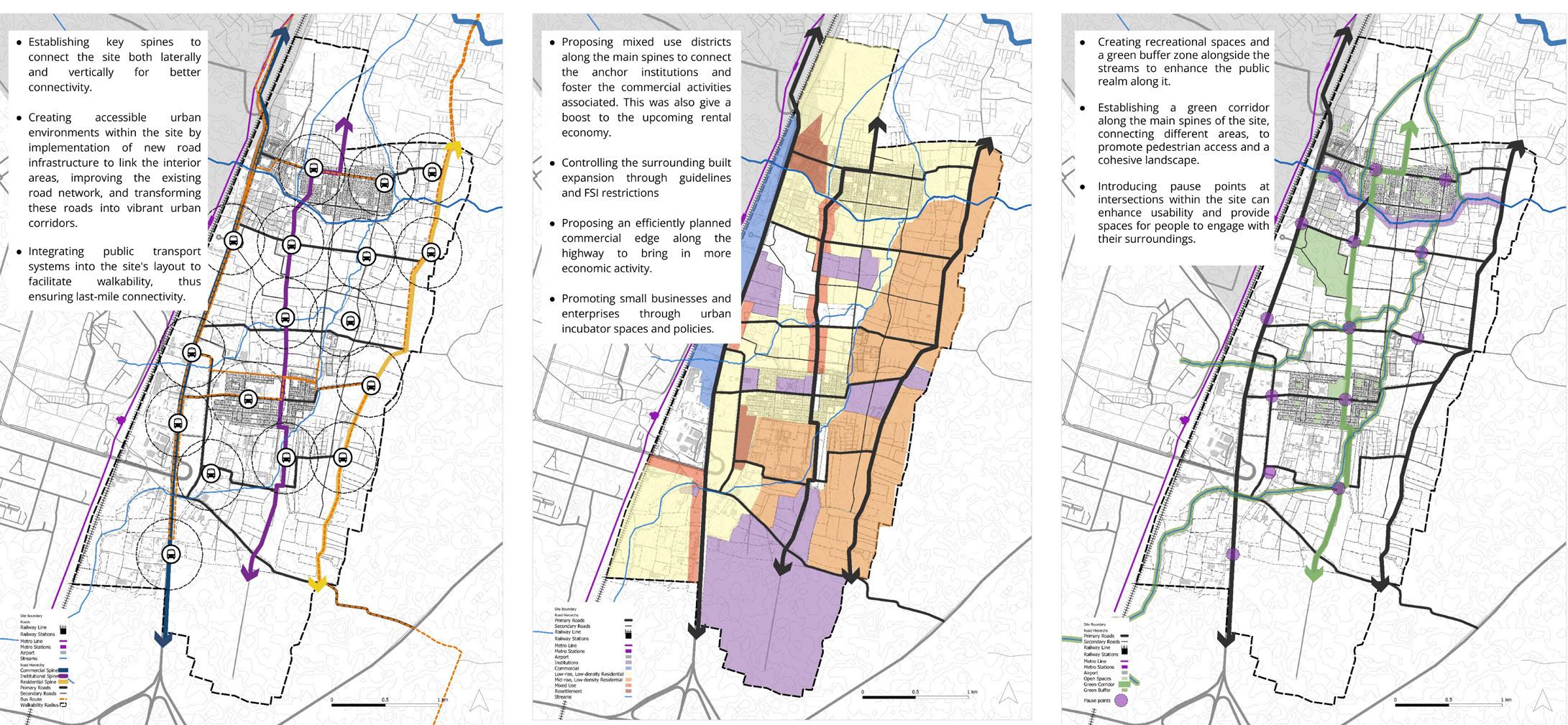
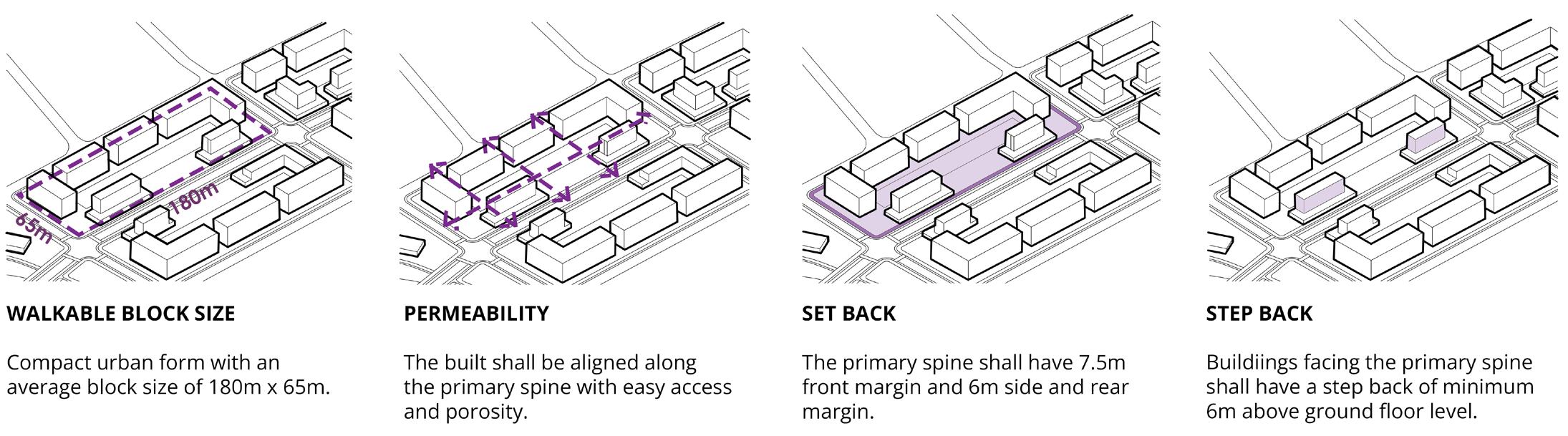
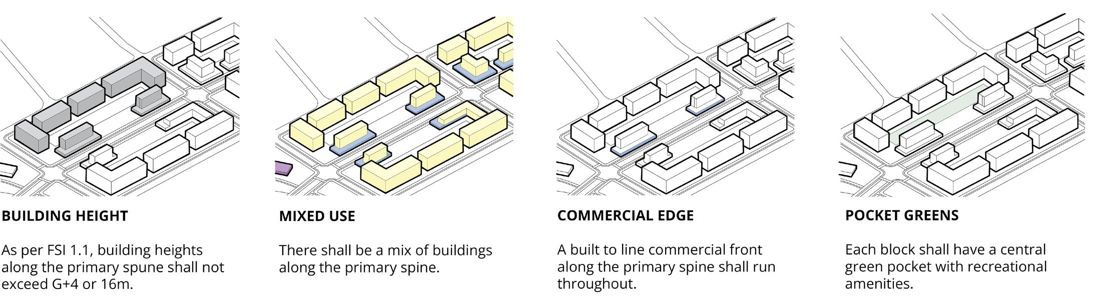
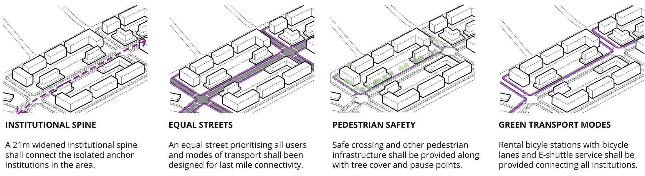
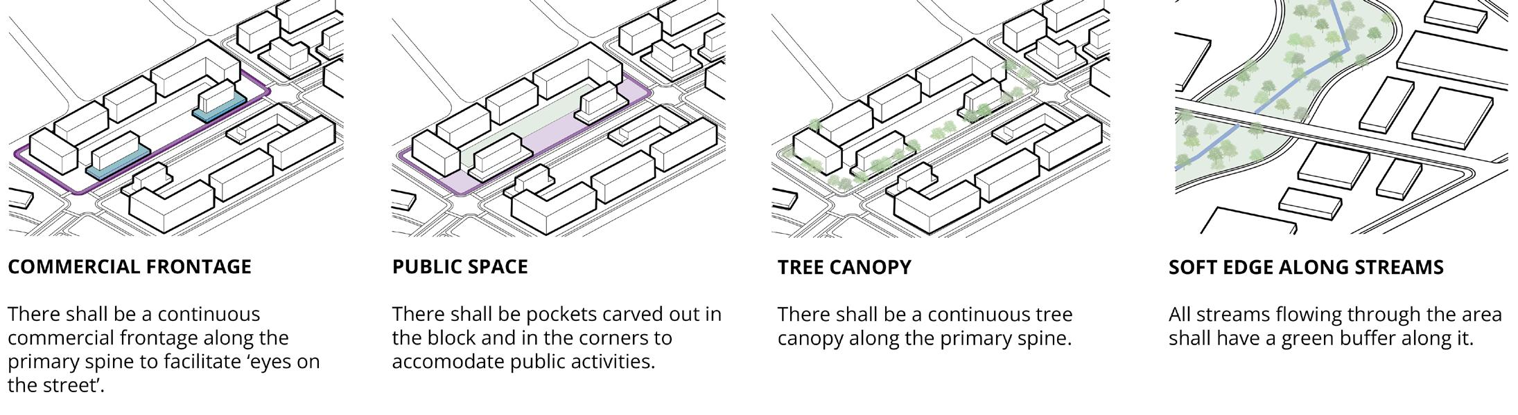
The aim is to create a neighbourhood that connects anchor institutions through a public realm framework that is driven by economic opportunities, and promotes entrepreneurship and community collaboration. The project also proposes creating an open space network with last mile connectivity, and built form that offers people with a number of housing options.
connectivity built zoning public realm and ecology
10
MADC NMC NMRDA
how to leverage institutions as drivers of development?
anchor institutions proposed land use and zoning
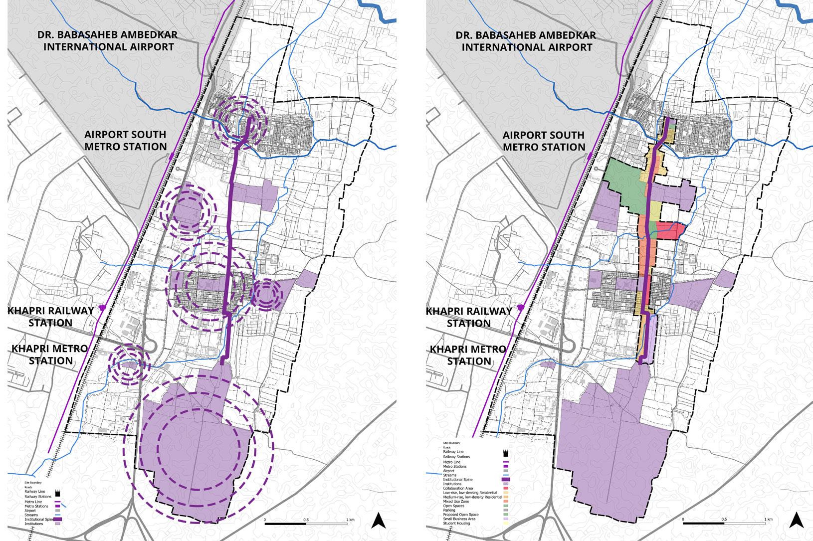
built form
Low-rise, low-density
Residential
NDZ Open Space
Collaboration Area
Mixed-use
Enterprise Area
Small Business Area
Medium-rise, low-density
Residential
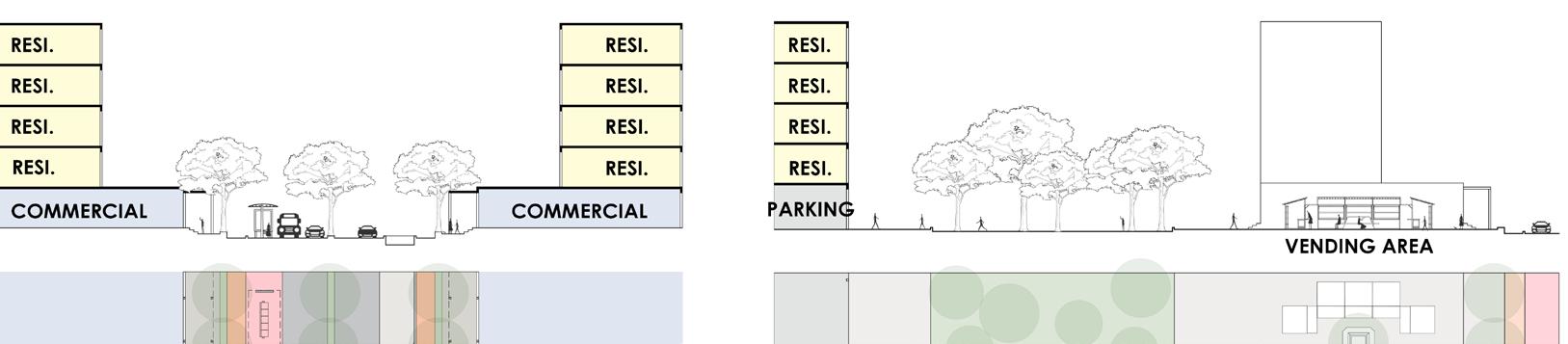
(L-R) Typical section through Institutional Spine and Built, Proposed section through Institutional Spine and Built
11
Central Institute for Cotton Research, Nagpur Govt. College of Engineering
Narayana Vidyalayam Bhagwandas
Vidya
Swami Vivekanada Medical Mission
Royal
Gondwana Public School
Purohit’s
Mandir

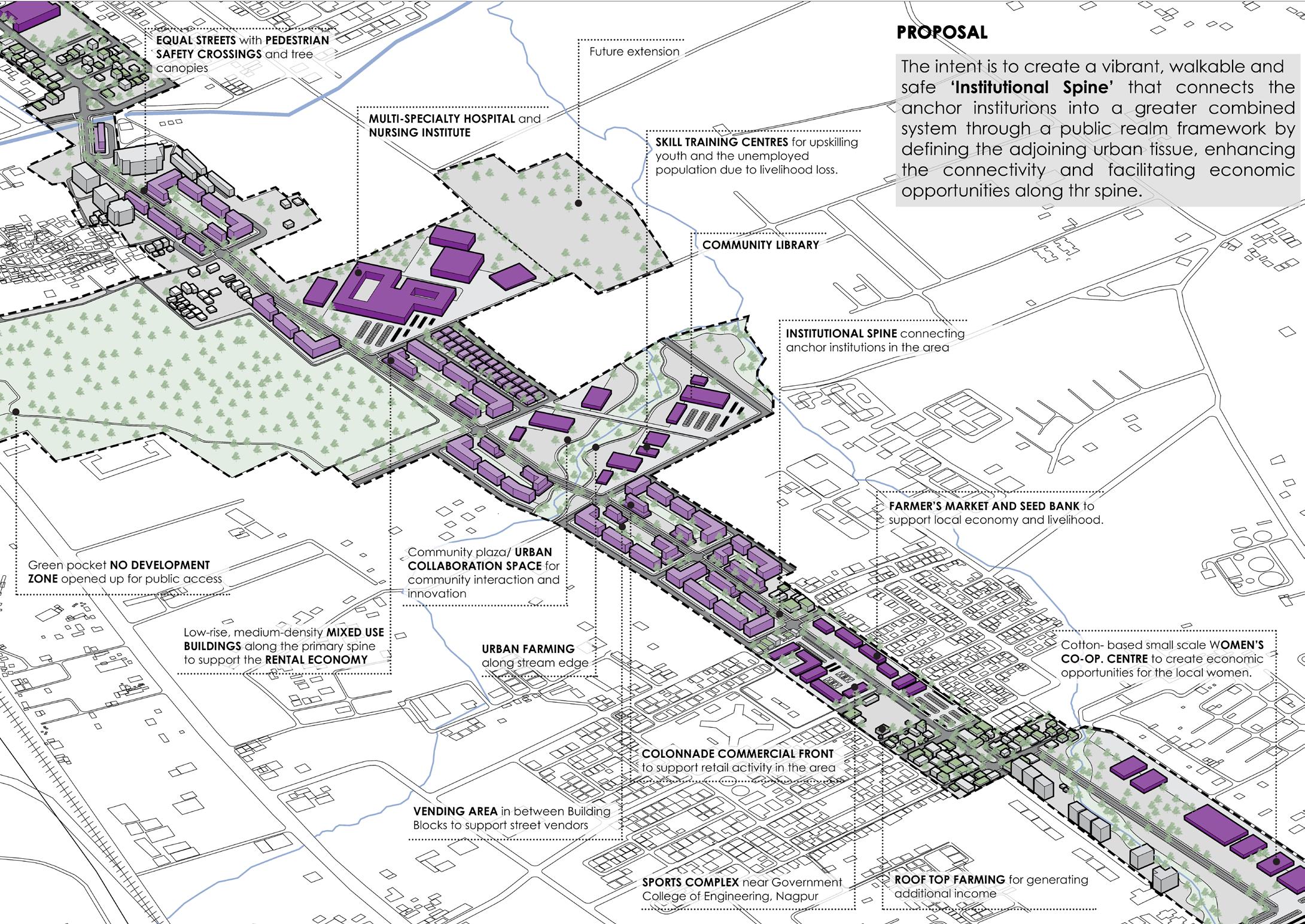
public realm
12
connectivity
proposed institutional spine
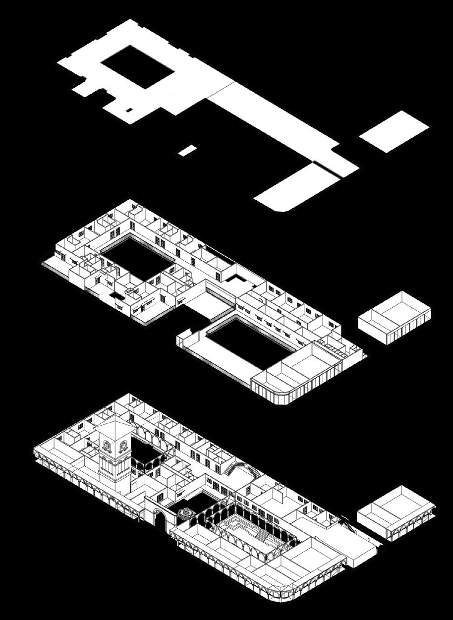
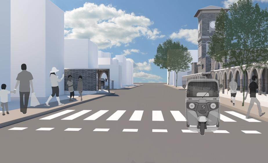
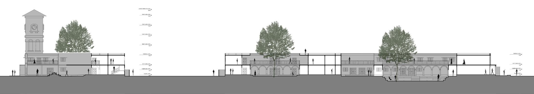
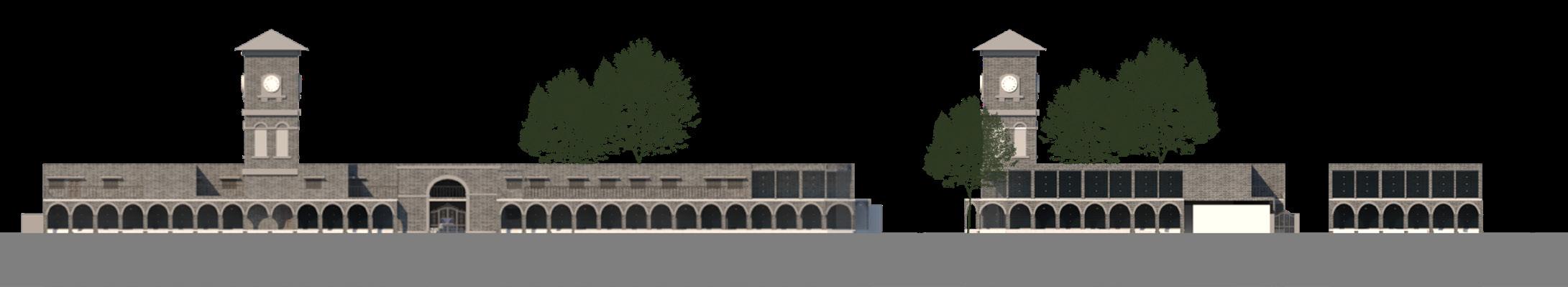
reviving lost spaces and identity 03
B. ARCH SEMESTER X THESIS
SITE LOCATION: VADODARA, INDIA
PROJECT SCOPE: CAMPUS PLANNING + URBAN INSERT
GUIDE: AR. NILIMA DHAMAL
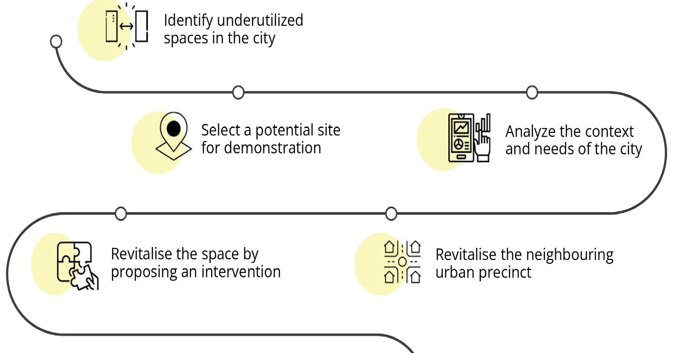
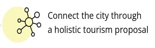
be developed as a
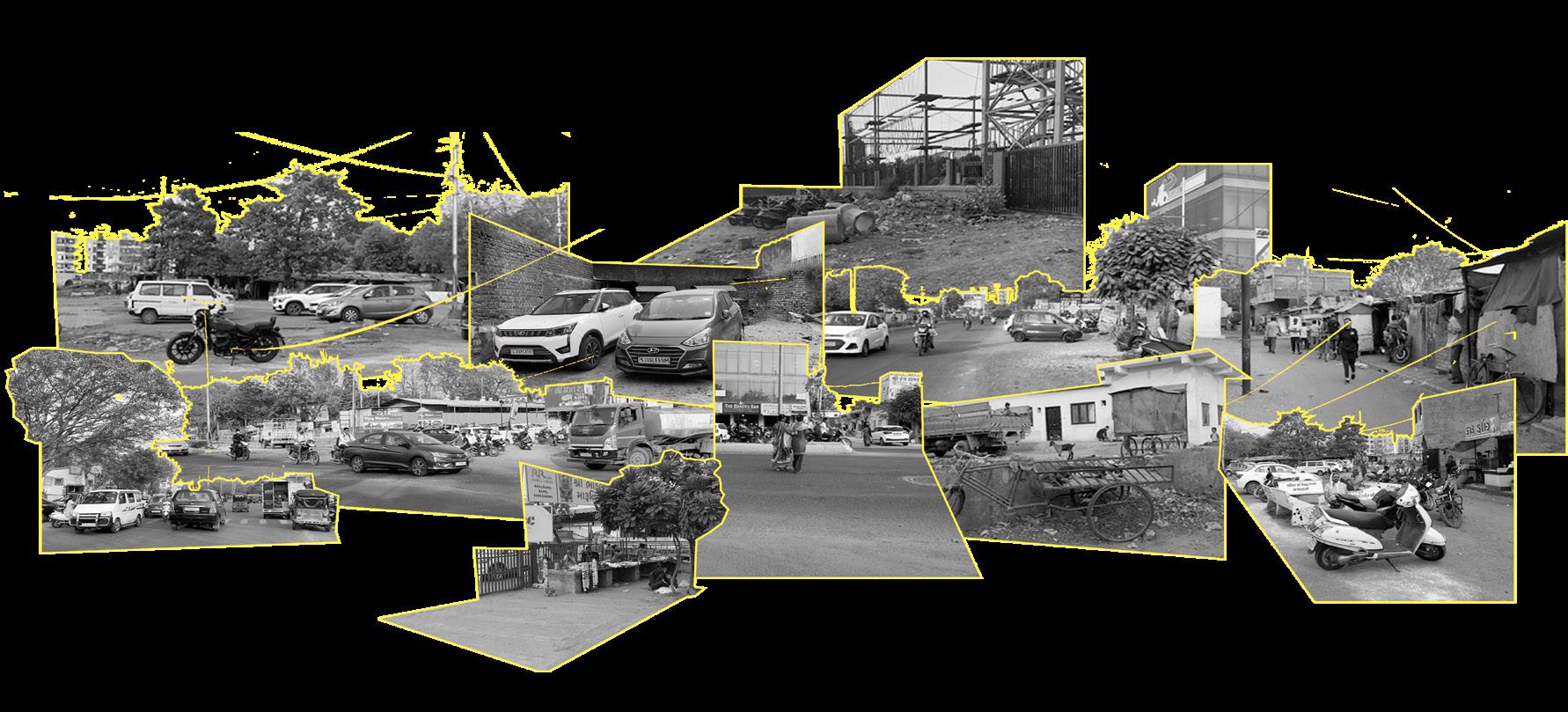
Despite the large number of heritage places and Vadodara as the cultural capital of Gujarat, it has not been promoted as it should have been. Existing circuits are proposed only for the overall and central Gujarat. Vadodara does not have a special place. Vadodara is forced not only to find a solution for the decline in cultural identity and pollution of the waterbodies, but to respond to pressures of growing population and urban growth by unlocking the remaining undeveloped lost spaces and regaining a vital access of the public to an important natural asset of the waterfront. The population of Vadodara city has grown at a fast rate since 1951. But after 1981 the city area (VMC limit) has not increased. This exerted pressure on existing land resource, and ponds and streams became the soft targets and were reclaimed to accommodate rising population. Hence, the main objective of the project is not only to find a solution for the decline in cultural identity and pollution of the waterbodies but to respond to pressures of growing population and urban growth by unlocking the remaining undeveloped lost spaces and regaining a vital access of the public to an important natural asset of the waterfront.
13
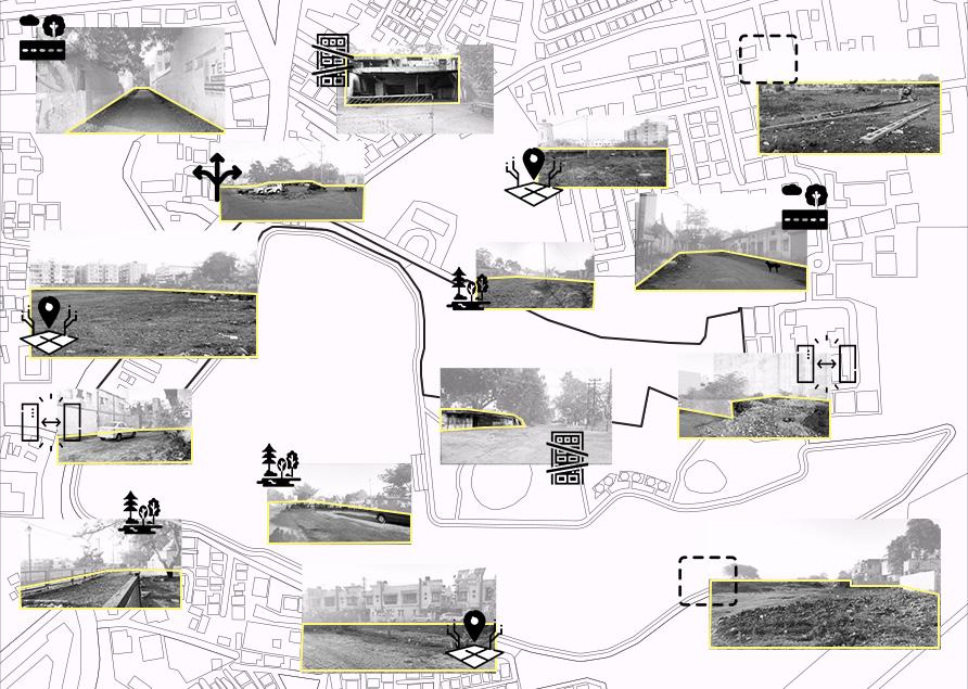
UNDEFINED
LOST SPACES INACTIVE
LACK OF IDENTITY STREETVENDORS GARBAGE DUMPING UNSAFE ROAD CROSSINGS ENCROACHMENTS ALONG THE LAKES SLUMS ON STREET PARKING CONGESTED JUNCTIONS NO COMMUNITY SPACES
how can vadodara
tourist hotspot by reclaiming the city’s lost spaces?
ROAD EDGES
STREETS

categorizing the nature of lost spaces user groups on site Tourism Magnet
New Identity to the City Community Gathering
Employment Generation


proposed socio-cultural insert


14 a process-based
approach
using art and culture as a medium to being people together
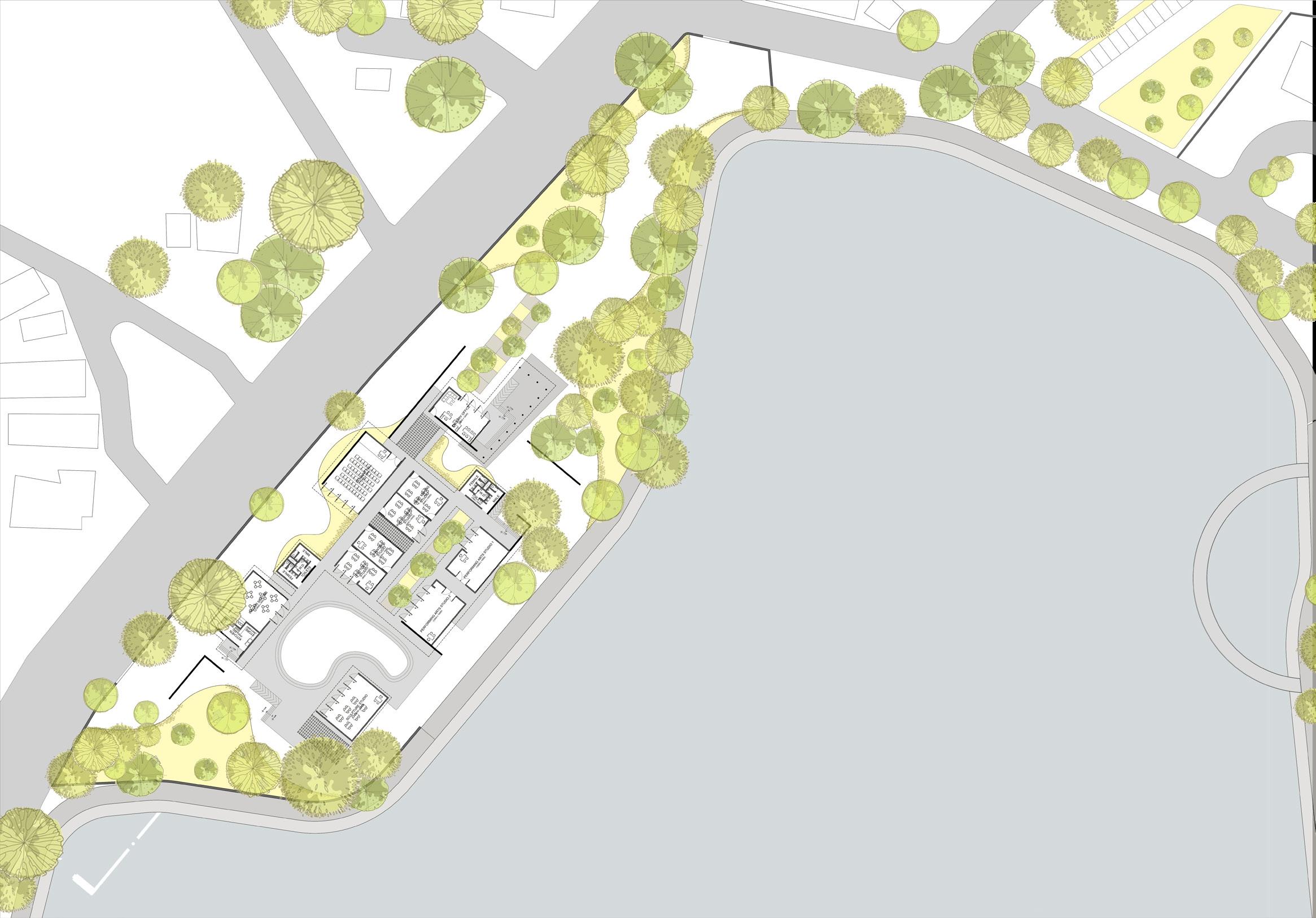
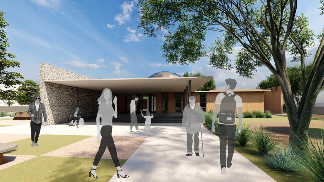
LEARNING CENTRE
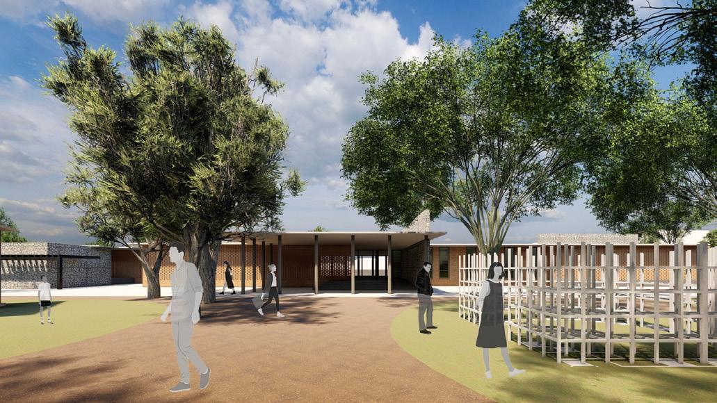
Learning Centre Barrels’ Pavilion Library Cafeteria Outdoor Seating 15
+ VIEWING DECK
AMPHITHEATRE
HARNI LAKE
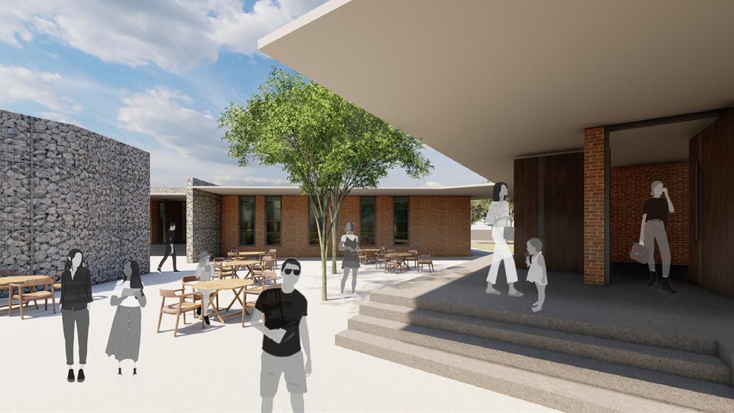
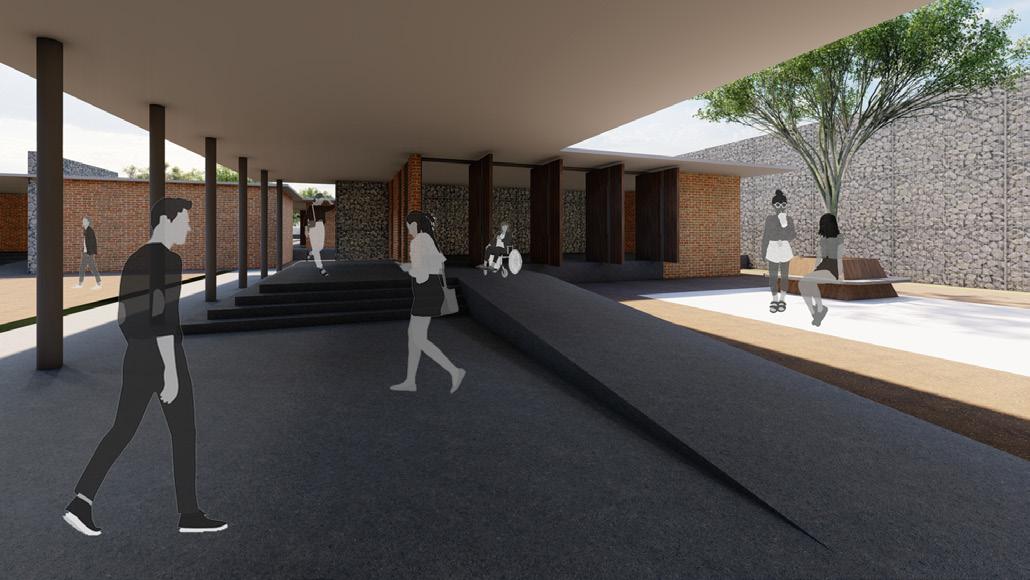
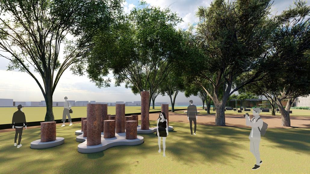
The aim is to create a public space that celebrates the city and its people by stimulating the cultural identity. The proposal looks at initiating a dialogue between the local community and tourists through art as a catalyst. The built has a very porous connect along with the existing landscape, keeping the site visually open and encourages free movement. The context-responsive design features explorative spaces and allows people to have temporal activities amidst the existing biodiversity. The main aspects of the design are sustainability, accessibility, physical form, functional and spatial needs of the program.
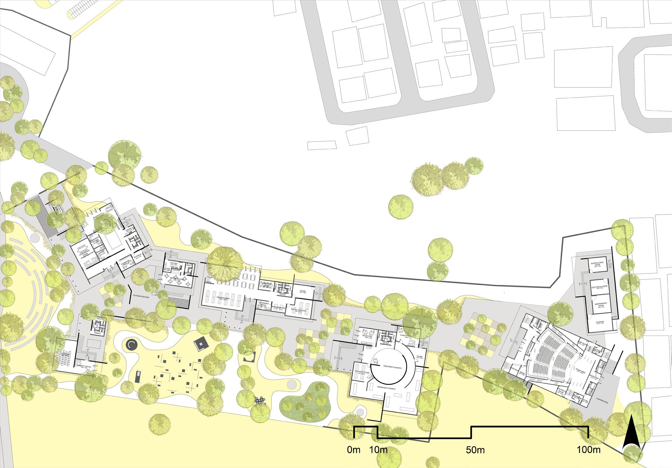
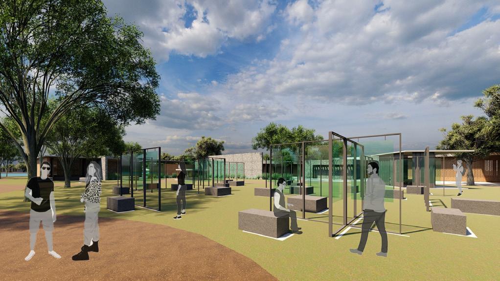
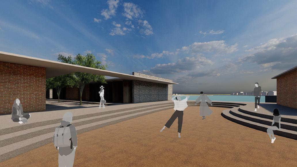
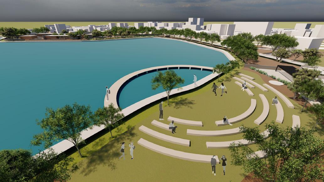
Outdoor courtyard seating Amphitheatre and Lake Viewing Deck Outdoor Exhibition Area Gallery
16
ADMINBLOCK +CAFETERIA
AREA LIBRARY GALLERY AUDITORIUM SERVICES OUTDOOR EXHIBITIONS + PAVILIONS SCULPTURE PARK
CABINSECURITY
BRIEFING
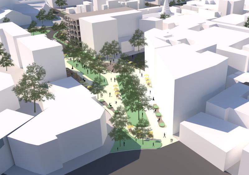
how can the city core be decongested and be made more user-inclusive through placemaking?
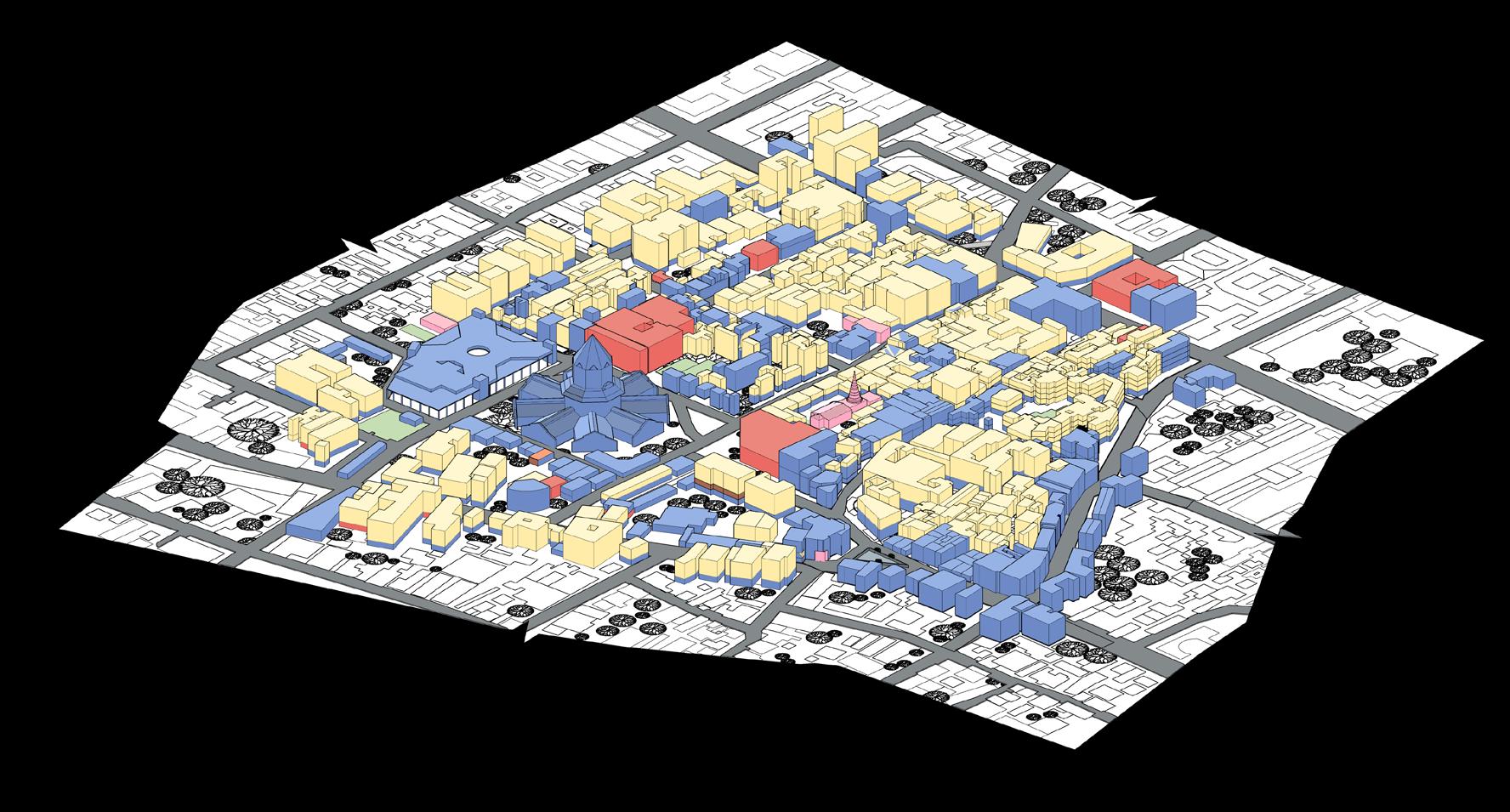
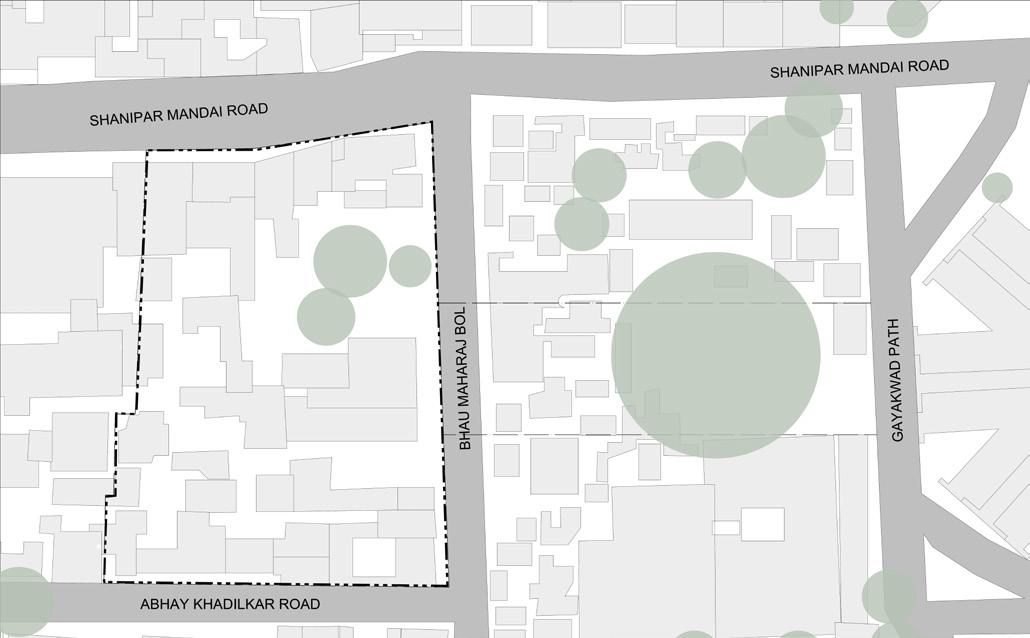
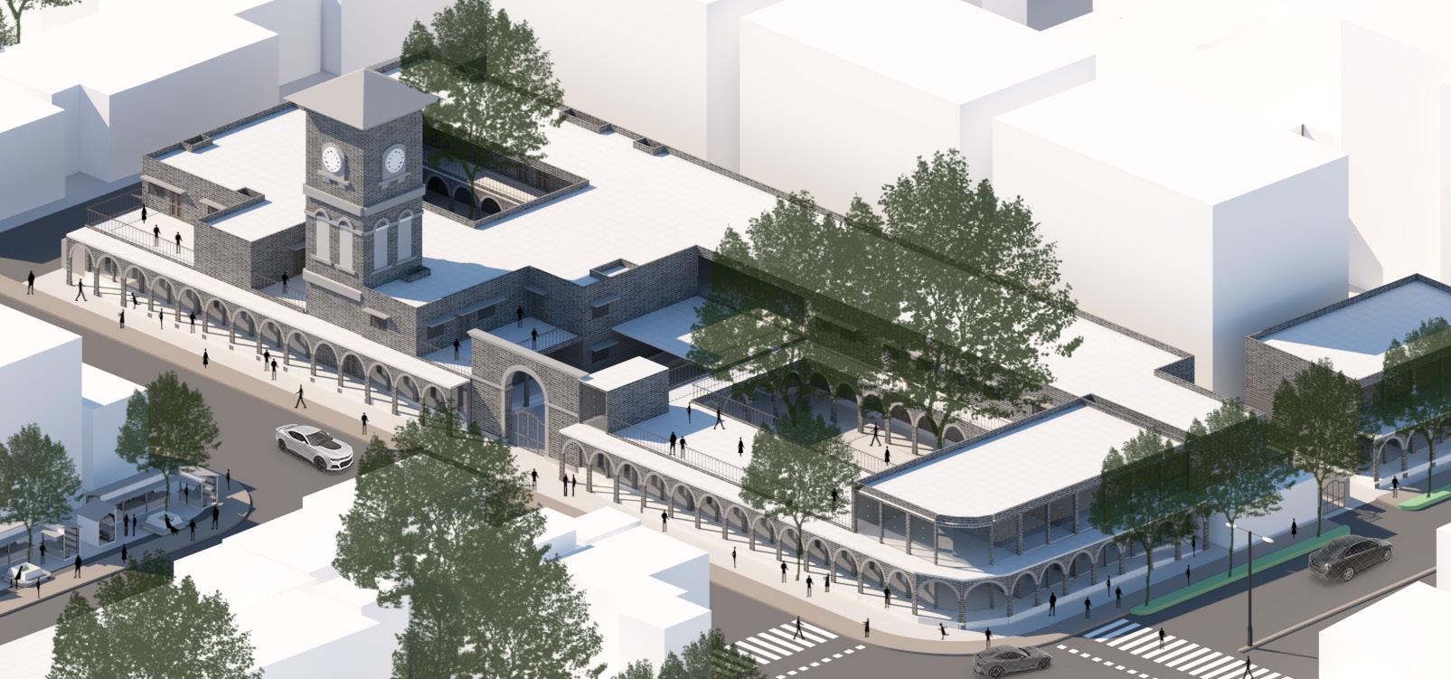
redefining the historic city core
B. ARCH SEMESTER VIII STUDIO
SITE LOCATION: HISTORIC CITY CORE (MANDAI AREA), PUNE, INDIA
PROJECT SCOPE: STREET AND POCKETS DESIGN + URBAN INSERT GUIDE: AR. NEETI TRIVEDI
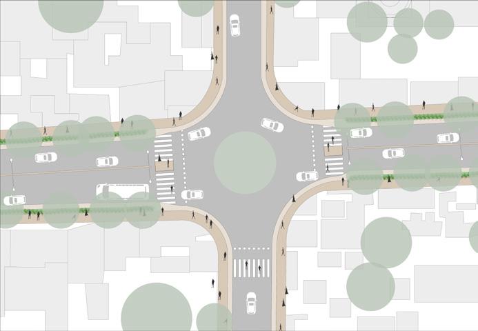
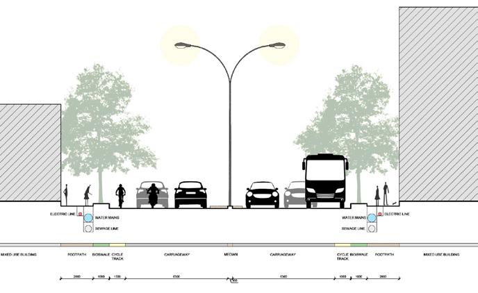
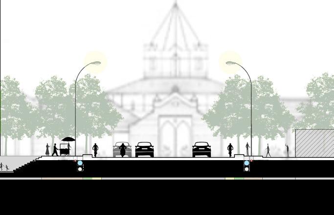
The site, historic city core of Pune houses the biggest retail market of the city consisting of three primary roads - Shanipar-Mandai Road, Bajirao Road, and Chhatrapati Shivaji Maharaj Road. The Tulsibaug Area is a congested area with a number of markets ranging from vegetable markets, ladies’ shopping lanes, and utensils market. Being a mixed-use area, people find all necessary items in the vicinity. The project looks at redefining the area by connecting the three major hotspots of the site - Mandai, Tulsibaug Ram Mandir, and the (upcoming) Metro Station, and redesiging the roads and corner pockets for an enhanced and safe user experience. The proposal focuses at decongestion of the dense area considering the needs of various user groups by providing breathing pockets through place-making within walkable distances.
SHANIPAR TEMPLE
JILBHYA MARUTI TEMPLE
VISHRAMBAUG WADA
TULSI BAUG RAM TEMPLE
TULSI BAUG PRECINCT
Site Context and Land-use
user groups on site


04
17
NEW MANDAI
MAHATMA PHULE MANDAI
SATISH MISAL PARKING LOT
BABU GHENU PARKING LOT
Pedestrians Residents Shoppers Shopkeepers Street Vendors Tourists
design principles and placemaking initiatives

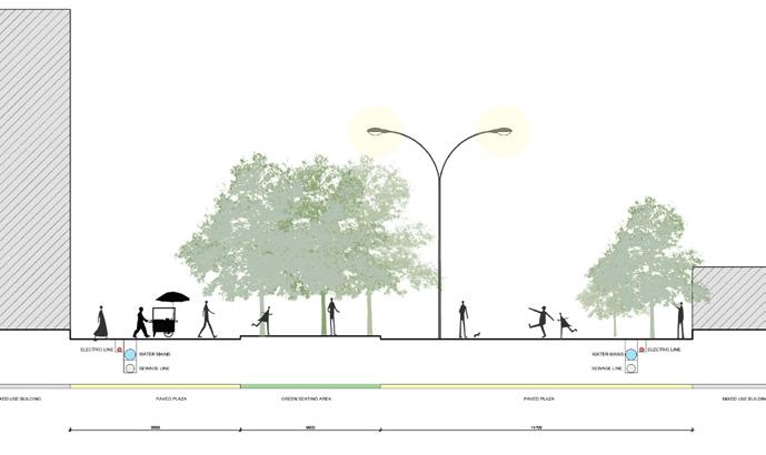
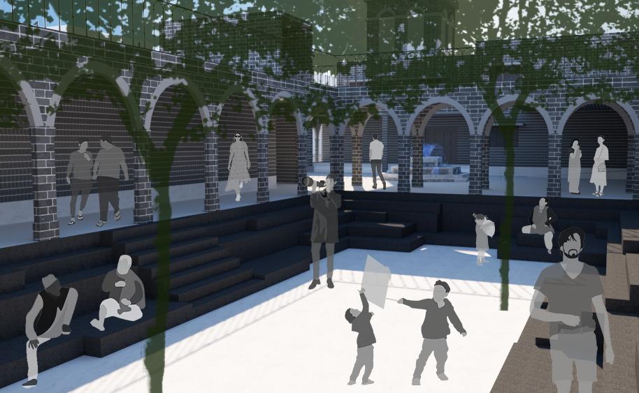
CONNECTION – 1 Sunken Community Plaza
connecting the three main hotspots of the site –Mandai, Tulsi Baug, Ram Mandir, and the upcoming metro station in addition to redesigning the parking building
CONNECTION – 1 Sunken Community Plaza


CONNECTION – 1. Sunken Community Plaza connecting the three main hotspots of the site –Mandai, Tulsi Baug, Ram Mandir, and the upcoming metro station in addition to redesigning the parking building.
CONNECTION – 1 Sunken Community Plaza connecting the three main hotspots of the site –Mandai, Tulsi Baug, Ram Mandir, and the upcoming metro station in addition to redesigning the parking building
CONNECTION – 1 Sunken Community Plaza
connecting the three main hotspots of the site –Mandai, Tulsi Baug, Ram Mandir, and the upcoming metro station in addition to redesigning the parking building
CIRCULATION – 1,2 Redesigning roads and important nodes for better traffic regulation and an enhanced pedestrian experience Betterdesigned roads and transportation network will encourage use of public transport
CONNECTION – 1 Sunken Community Plaza
CIRCULATION – 1,2 Redesigning roads and important nodes for better traffic regulation and an enhanced pedestrian experience Betterdesigned roads and transportation network will encourage use of public transport
CIRCULATION – 1,2. Redesigning roads and important nodes for better traffic regulation and an enhanced pedestrian experience. Better-designed roads and transportation network will encourage use of public transport.
connecting the three main hotspots of the site –Mandai, Tulsi Baug, Ram Mandir, and the upcoming metro station in addition to redesigning the parking building
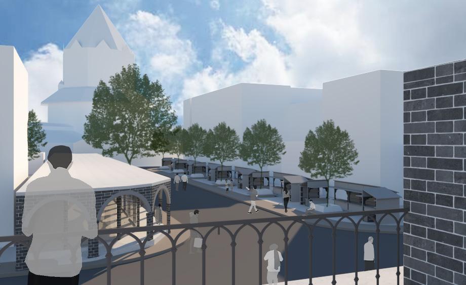
NATURE – 2, 3 The roads have been dotted with tree canopies for shade over the footpaths and green zones have been created as breathable pockets in the dense urban grain
CIRCULATION – 1,2 Redesigning roads and important nodes for better traffic regulation and an enhanced pedestrian experience Betterdesigned roads and transportation network will encourage use of public transport
NATURE – 2 3 The roads have been dotted with tree canopies for shade over the footpaths and green zones have been created as breathable pockets in the dense urban grain
NATURE – 2,3. The roads have been dotted with tree canopies for shade over the footpaths and green zones have been created as breathable pockets in the dense urban grain.
NATURE – 2, 3 The roads have been dotted with tree canopies for shade over the footpaths and green zones have been created as breathable pockets in the dense urban grain
COMMUNITY – 1, 3,4, 5,6 Green open spaces and plazas have been created to act as gathering spaces/ pause points and enhance community bonding Model proposals for better provisions for all stakeholders have been considered
COMMUNITY – 1, 3,4, 5,6 Green open spaces and plazas have been created to act as gathering spaces/ pause points and enhance community bonding Model proposals for better provisions for all stakeholders have been considered
COMMUNITY – 1,3,4,5,6. Green open spaces and plazas have been created to act as gathering spaces/ pause points and enhance community bonding. Model proposals for better provisions for all stakeholders have been considered.
PRESERVATION – 4 5 7 Elevational control regulations have been thought of for any renovation work or new construction Old, neglected structures are under adaptive reuse as rooftop cafes and libraries Model building typologies will also adhere to the local architectural vocabulary
COMMUNITY – 1, 3,4, 5,6 Green open spaces and plazas have been created to act as gathering spaces/ pause points and enhance community bonding Model proposals for better provisions for all stakeholders have been considered
PRESERVATION – 4 5 7 Elevational control regulations have been thought of for any renovation work or new construction Old, neglected structures are under adaptive reuse as rooftop cafes and libraries Model building typologies will also adhere to the local architectural vocabulary
PRESERVATION – 4 5 7 Elevational control regulations have been thought of for any renovation work or new construction Old, neglected structures are under adaptive reuse as rooftop cafes and libraries Model building typologies will also adhere to the local architectural vocabulary
PRESERVATION – 4, 5,7 Elevational control regulations have been thought of for any renovation work or new construction Old, neglected structures are under adaptive reuse as rooftop cafes and libraries Model building typologies will also adhere to the local architectural vocabulary
PRESERVATION – 4, 5,7 Elevational control regulations have been thought of for any renovation work or new construction Old, neglected structures are under adaptive reuse as rooftop cafes and libraries Model building typologies will also adhere to the local architectural vocabulary
PRESERVATION – 4,5,7. Elevational control regulations have been thought of for any renovation work or new construction. Old, neglected structures are under adaptive reuse as rooftop cafes and libraries. Model building typologies will also adhere to the local architectural vocabulary.
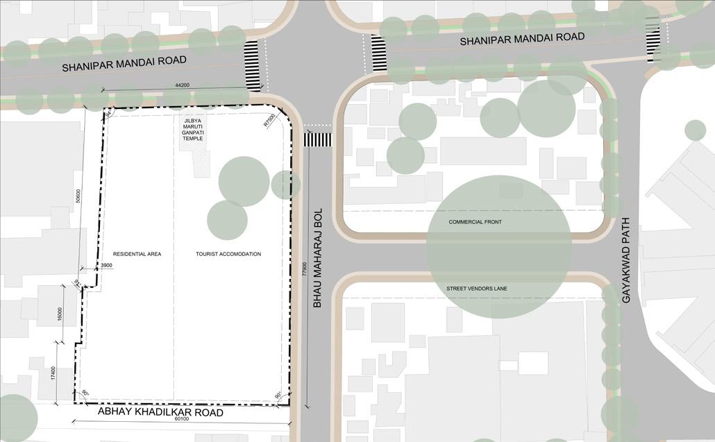
Proposed Masterplan
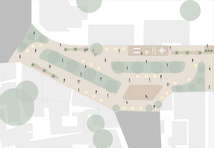
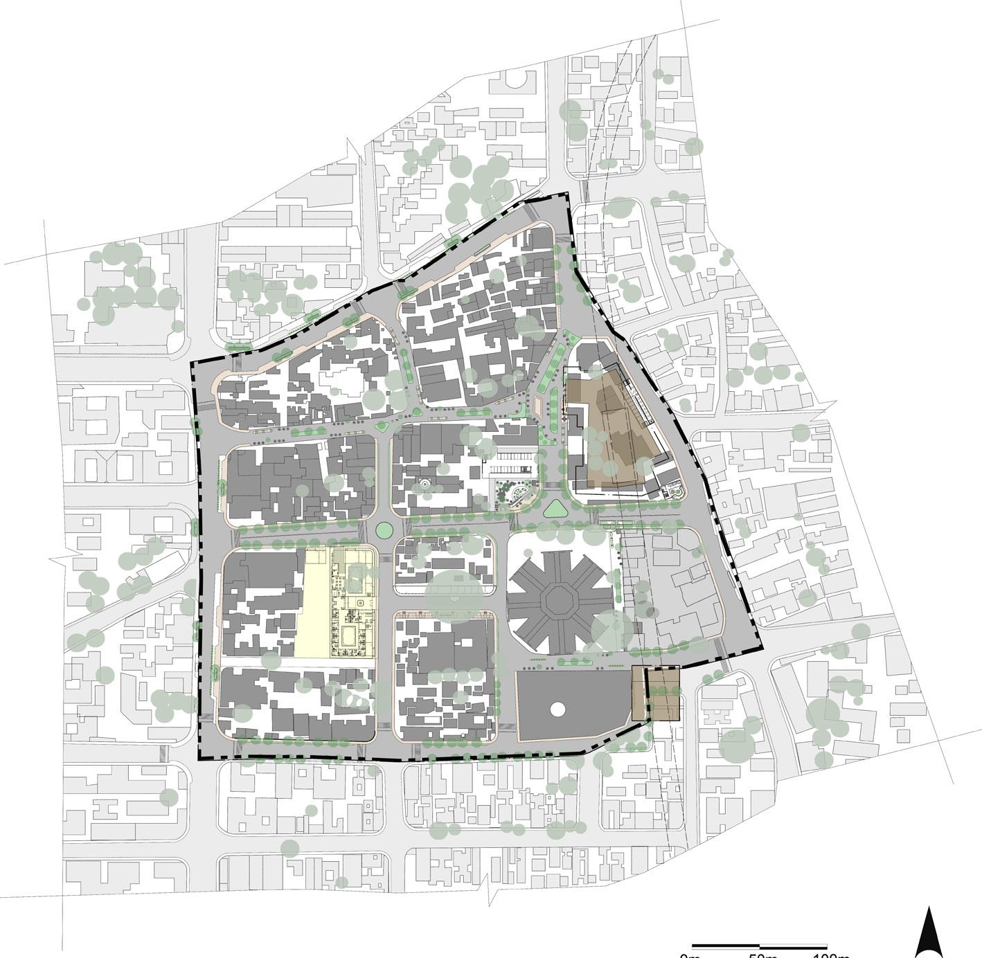
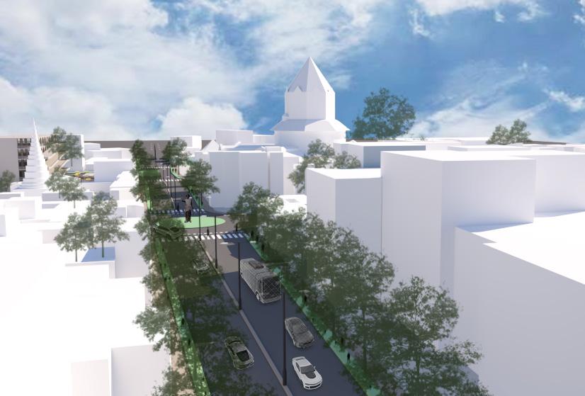

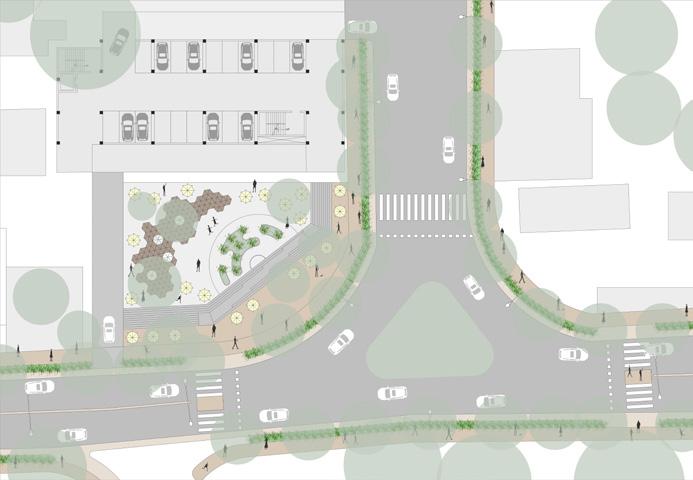
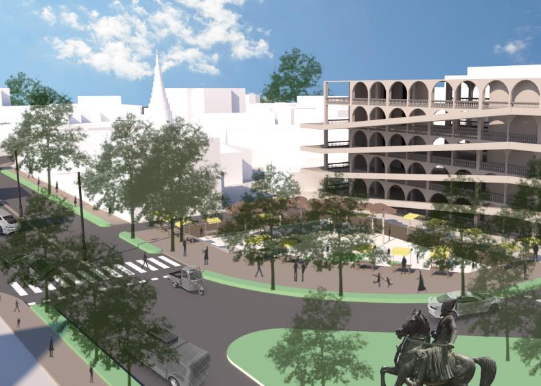
Proposed Shanipar Mandai RoadBhau Maharaj Bol Junction Details 18
ROADS BUILT PROPOSED METRO STATION VEGETATION Mahatma Phule Mandai Junction and Sunken Plaza Details Pedestrian Plaza outside Proposed Metro Station Details 5 2 6 7 1 4 3
7
2 1
how can tourists get to experience ‘living like a local’?
 Vendor Lane connecting the Accomodation to Mahatma Phule Mandai
Way towards the Tourist Accomodation along Bhau Maharaj Bol
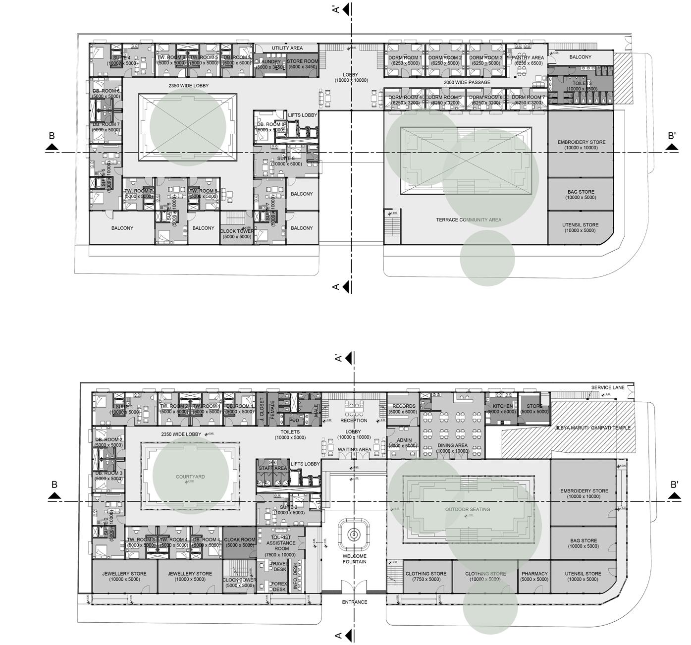
Floor Plans
Existing Site Built
Vendor Lane connecting the Accomodation to Mahatma Phule Mandai
Way towards the Tourist Accomodation along Bhau Maharaj Bol
Floor Plans
Existing Site Built
19
Proposed Site and Vendor Lane carved out after Demolition
Exploded View
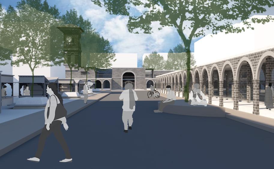
an urban oasis for the locals and tourists
The intervention looks at redeveloping a clustered area and proposing a tourist accommodation ( + redesigning the commercial front) in close vicinity to Mahatma Phule Mandai. The aim is to provide a lodging facility with all requirements for visitors, better community bonding areas for residents and a more efficient commercial front with provisions for street vendors as well. This proposal will also enhance spatial experience and visual character of the core area through a vernacular approach. The current trend is to turn away from the tourist trap, and instead opt for experiences that let a tourist to ‘live like a local’.
 Indoor Courtyard Gathering Space
View of Mahatama Phule Mandai and the Vendor Lane from the Tourist Accomodation
Tourist Accomodation and Redesigned Commercial Front
Sections and Elevations
Indoor Courtyard Gathering Space
View of Mahatama Phule Mandai and the Vendor Lane from the Tourist Accomodation
Tourist Accomodation and Redesigned Commercial Front
Sections and Elevations
20 SECTION A-A’ SECTION B-B’ FRONT ELEVATION SIDE ELEVATION
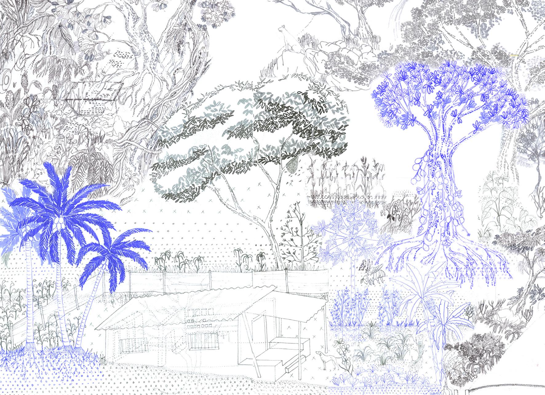
how does a post-human lens challenge conventional notions of urbanity and cartographic representations?
reimagining post-human landscapes
M. ARCH SEMESTER I STUDIOW
SITE LOCATION: AAREY FOREST, MUMBAI, INDIA
PROJECT SCOPE: SPATIAL REPRESENTATION
GUIDES: AR. ROHAN SHIVKUMAR, AR. AINSLEY LEWIS
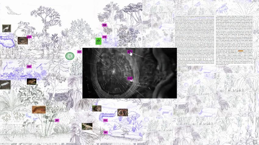
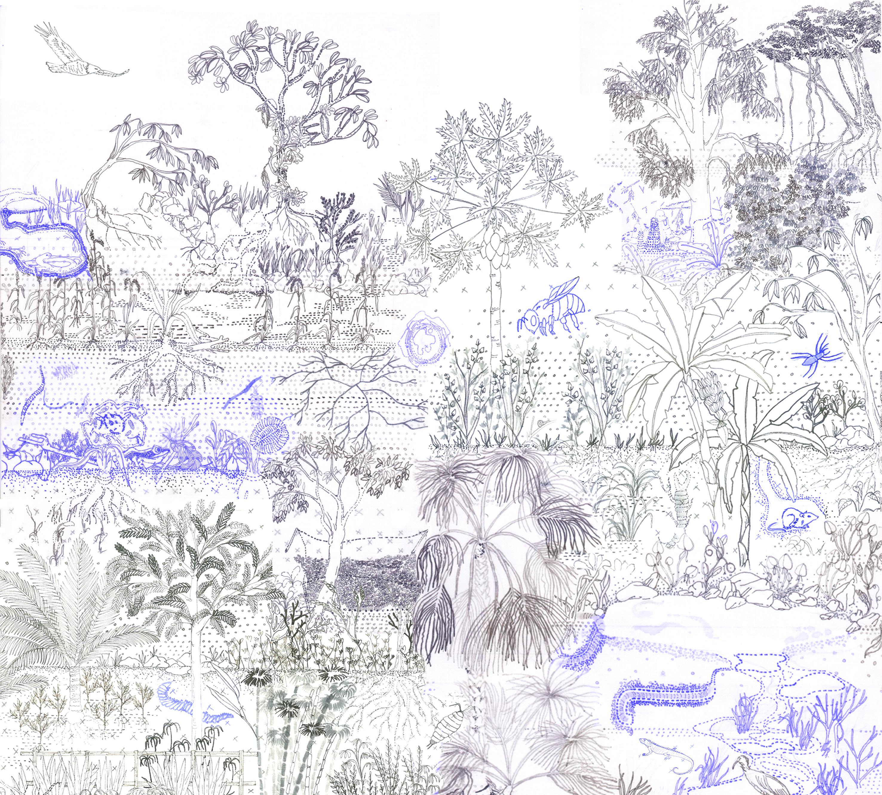
Urbanity is always assessed and represented from the human gaze, a posthuman lens allows for decentering the gaze and dissolving the cartographic imagination of a map to understand food dependencies and ecologies within the urban realm. The Aarey forest, a demarcated green zone in the development plan of Mumbai is a site of contestation between the indigenous communities that reside here, the state and other actors like the dairy owners, the migrant communities, the real estate lobby and the environmentalists, in the city of Mumbai that challenge the notions of food. We do these by drawing out a deep section from the rock strata to the inhabited sky drawn along a 1.6km transect that passes through the forest, the dairy farms, fodder and paddy fields, infrastructures of waste and transport, gardens and wadis, the spatialities produced by indigenous religiosity and the padas as sites of indigenous and migrant inhabitation along Aarey. This transect becomes the site of establishing the sensoriums that more-than-human agencies produce and get shaped by. The logic of adjacencies and dependencies forms the structure of the transect that gets layered with seasons, cyclical and geological time where the scales and the gaze shift to understand more-than-human agencies in Aarey. Composition illustrating Stories of Fruiting
05
21
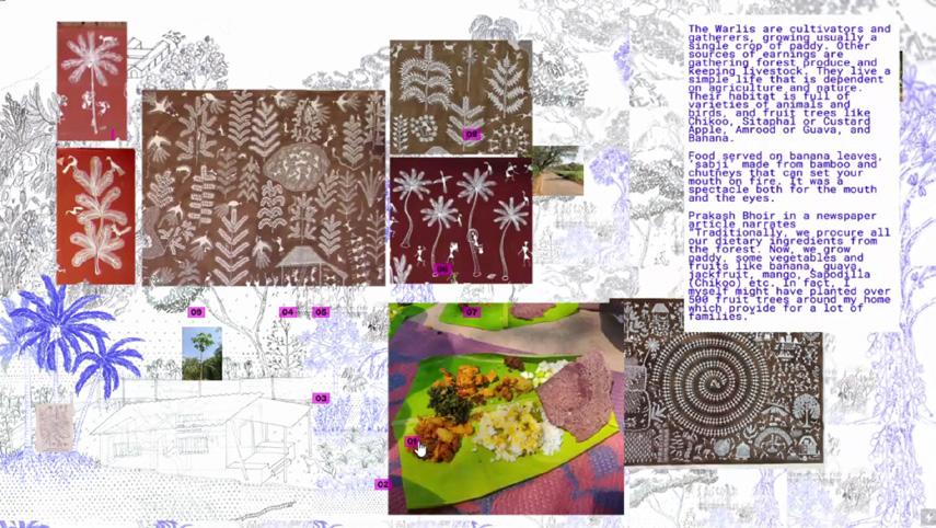
Snippets from an experimental swatch of the Post-Human Landscape with Annotations
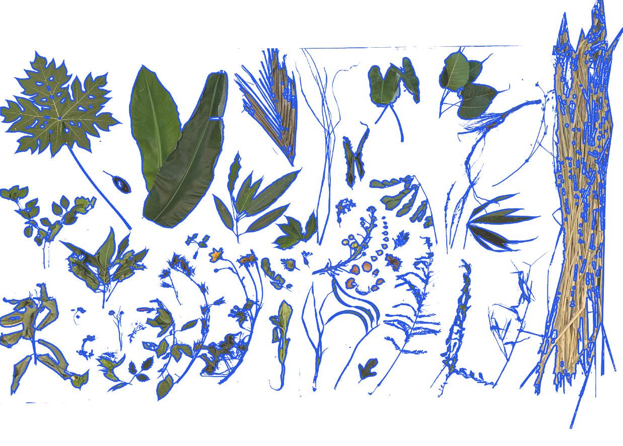
Specimens sourced from Aarey Forest
Composition illustrating Ecologies of Soil Beings
22
23
photography 06
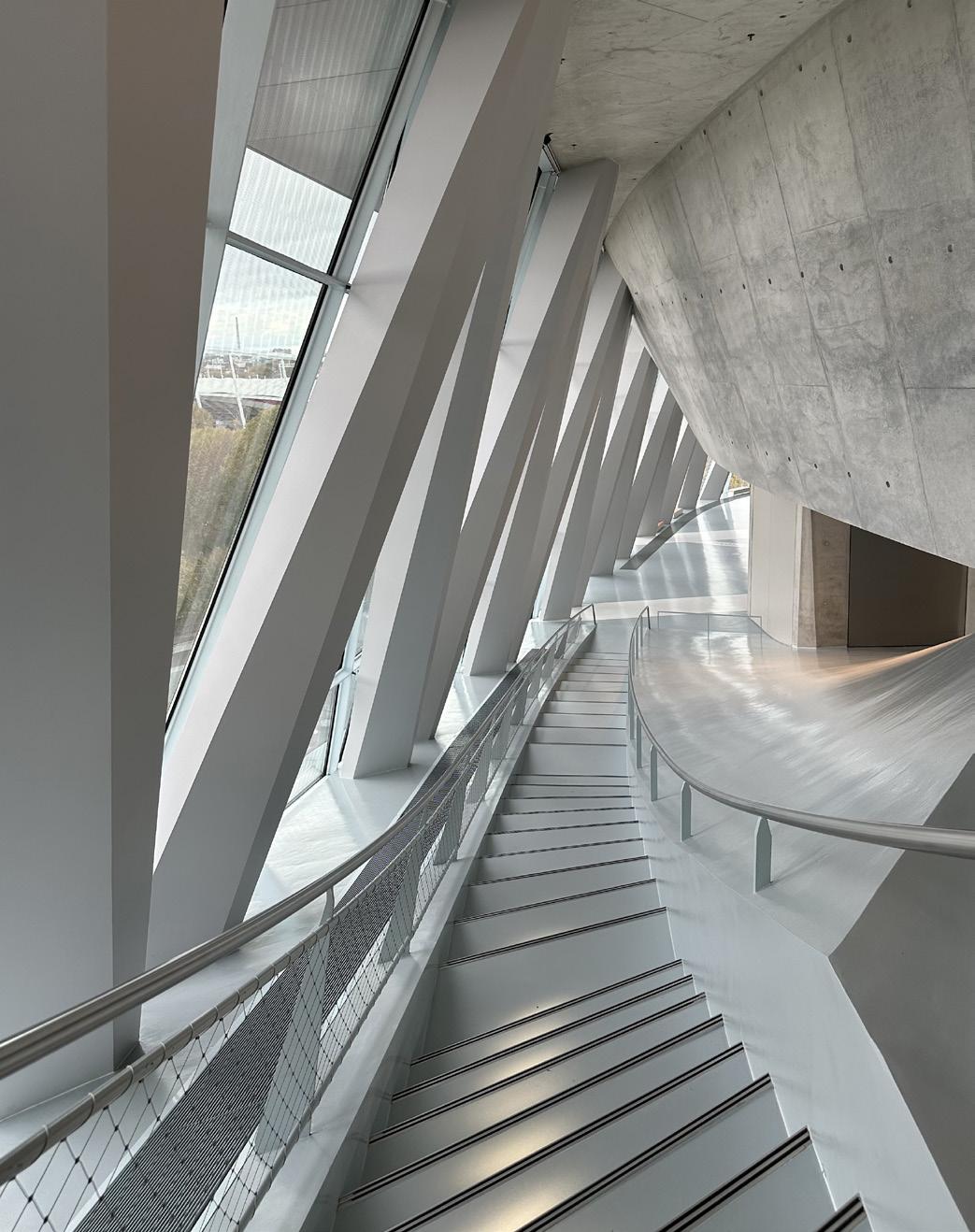
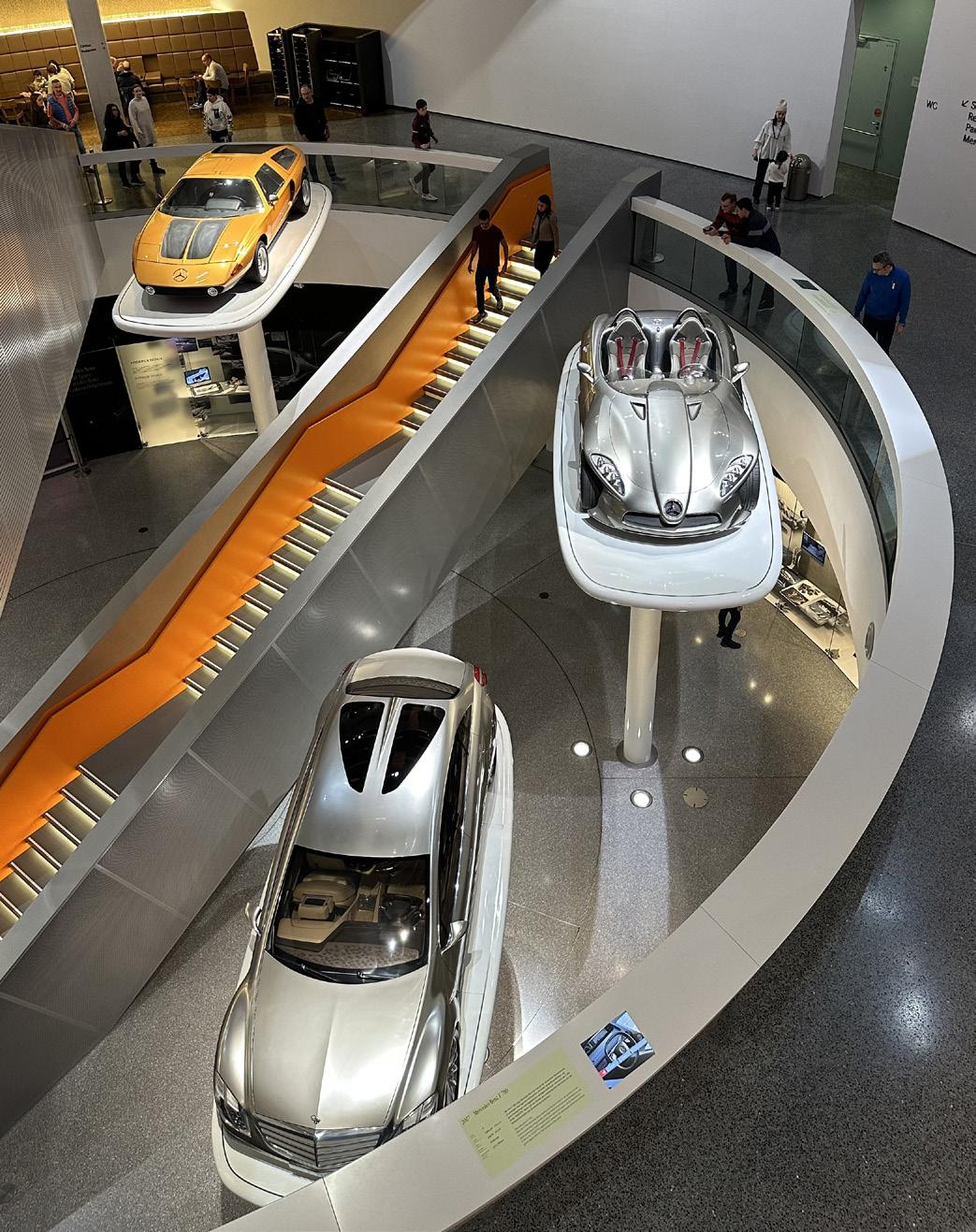
Mercedes-Benz Museum, Stuttgart, Germany
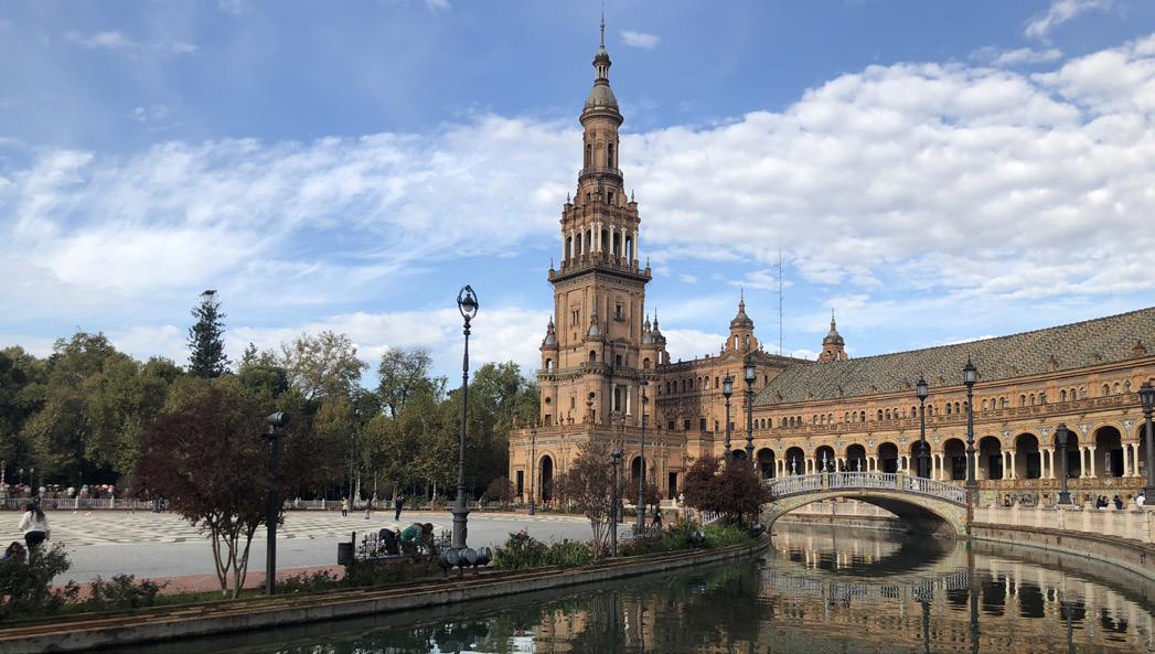
Plaza de España, Seville, Spain
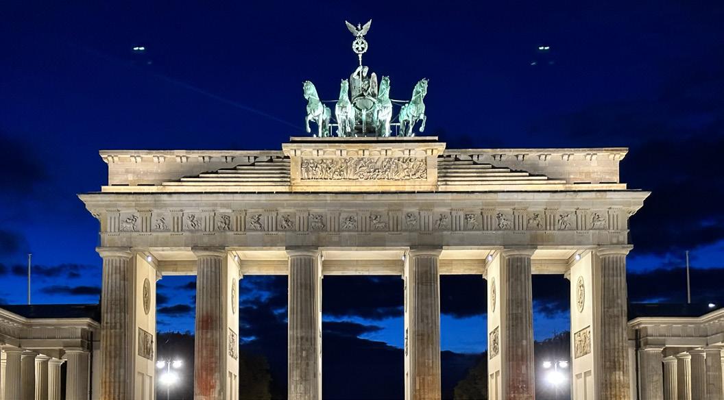
Brandenburg Gate, Berlin, Germany
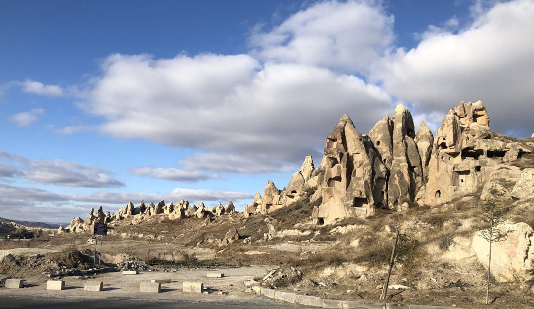
Rock Formations of Cappadocia, Turkey
Mies van der Rohe Pavilion, Barcelona, Spain
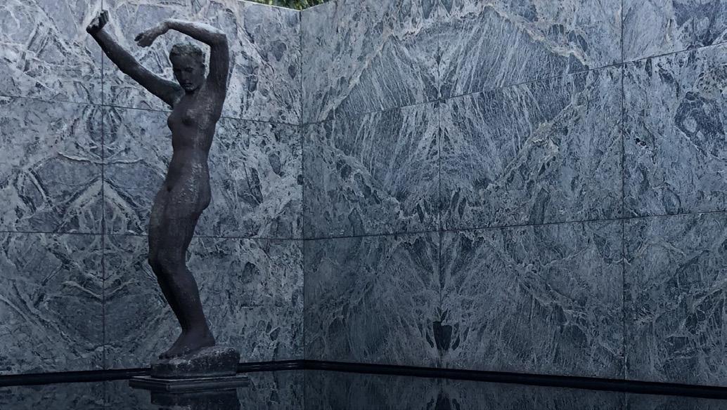
Mercedes-Benz Museum, Stuttgart, Germany
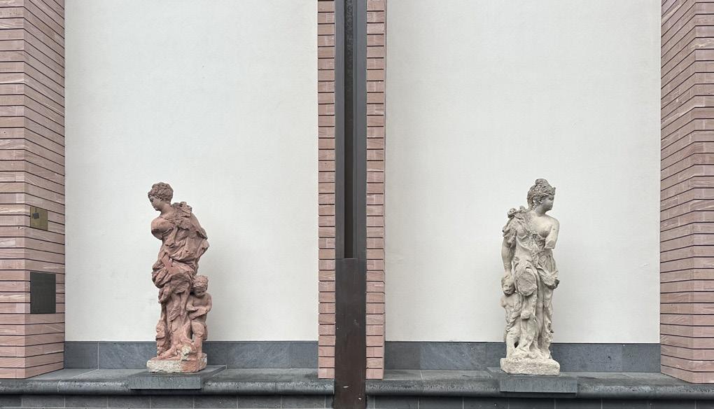
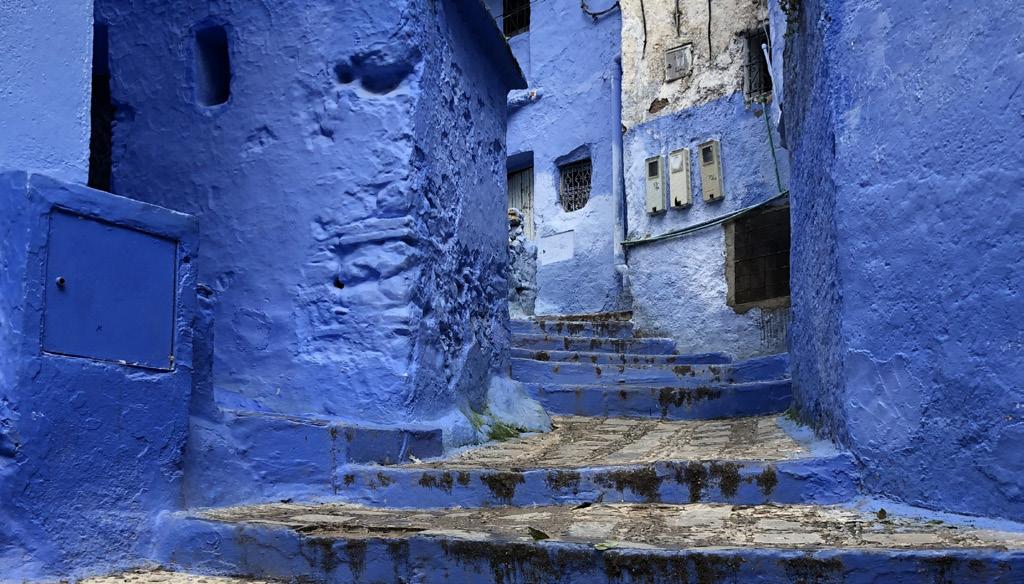
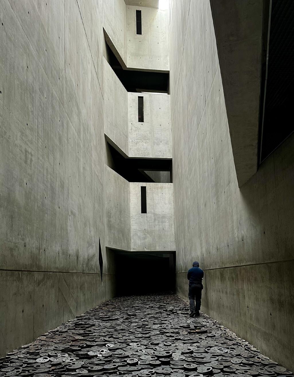
24
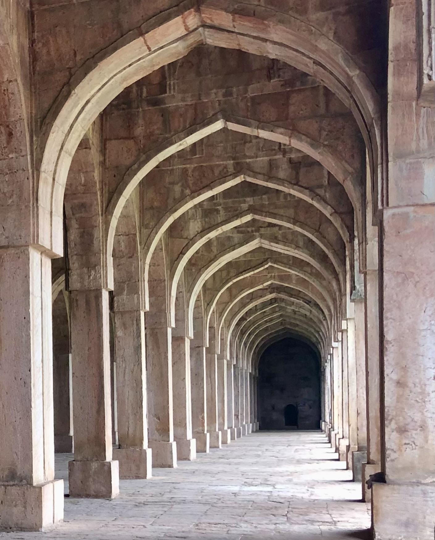
Jami Masjid, Mandu, India
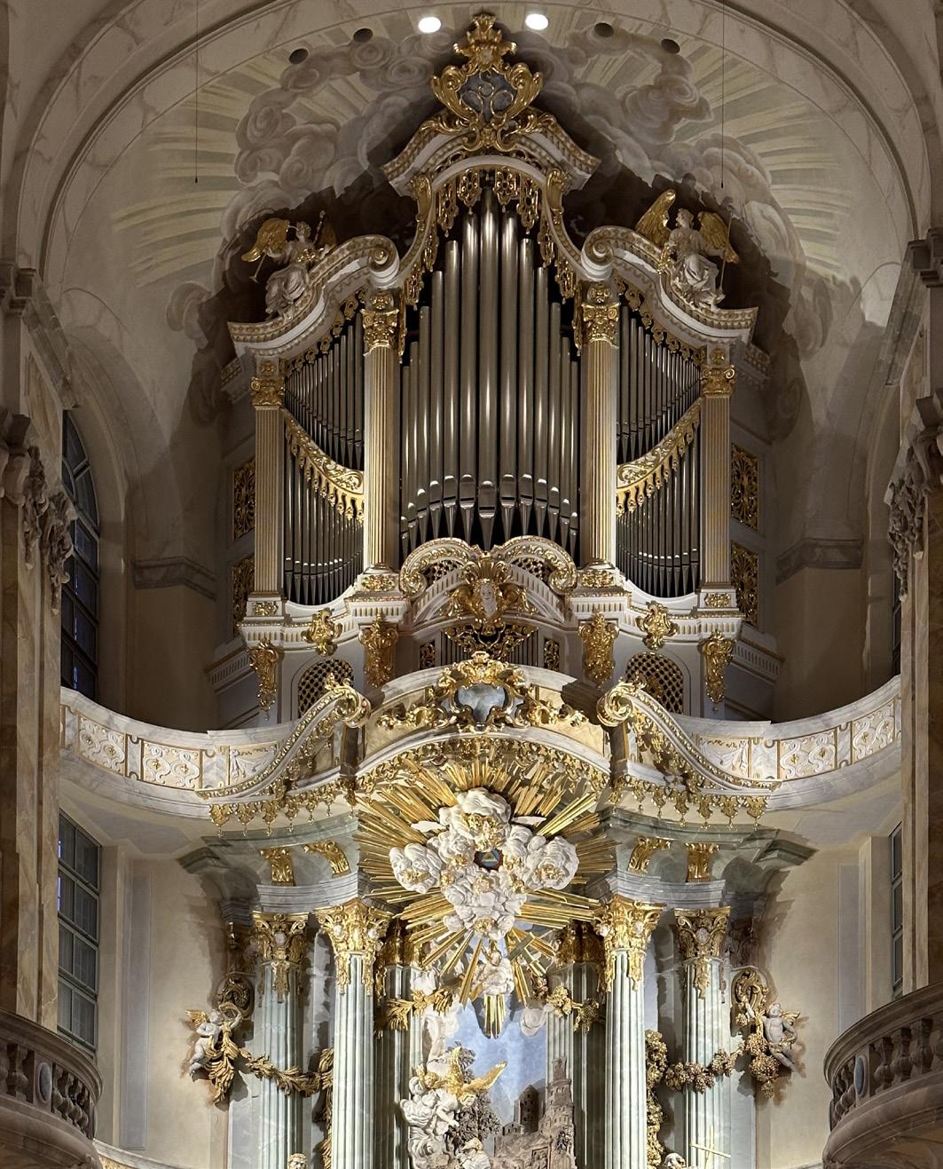
Frauenkirche, Dresden, Germany
Historical Museum, Frankfurt, Germany
Blue Alleys of Chefchaouen, Morocco
Jewish Museum, Berlin, Germany
Thank You!