URBAN DESIGN PORTFOLIO
Ar. PRAJAKTA N.BARDE

ABOUT ME
As an Urban Designer, I craft people-first environments rooted in sustainability, inclusivity, and interaction. Inspired by Jane Jacobs, William Whyte, and Jan Gehl, I believe the smallest urban moments shape the deepest human connections. By blending strategy with experimentation, my aim is to design vibrant, responsive spaces that promote wellbeing, spark engagement, and make cities truly livable.
CONTACT


Universitätstrasse 5/406-5, 03046 Cottbus, Germany
+4915752138304
prajaktabarde2013@gmail.com
www.linkedin.com/in/ar-prajaktabarde-90ba361aa
SOFTWARE SKILLS
DRAFTING SOFTWARES
3D MODELLING
AutoCAD 2D
Autodesk Revit
Allplan
Sketchup
Rhino Grasshopper
3DS Max
RENDERING & PRESENTATION
Photoshop
Lumion
3DS Max with V-Ray
InDesign
Illustrator
MS OFFICE
MS Word
MS PPT
MS Excel
PROFESSIONAL EXPERIENCE
June 2024-Present
• Participated in designing building extentions.
PROFESSIONAL SKILLS
Efficient Under Pressure Time Management
• Team Work
• Problem Solving
• Critical Analysis Decision Making
LANGUAGES
• Marathi (Mother Toungue)
• Hindi (Mother Toungue)
• English (Proficient)
• German (Intermediate)
December 2018April 2019
• Participated in making fire safety plans according to the norms.
• Participated in creating Govt. Drawings.
Sanat Mehta and Associates
MHC GmbH, Hotel zur Bleiche Intern Architect Architect
• Produced presentations, graphical models and renderings for urban and building projects
• Produced construction drawings, municipal drawings, Bill of Quantities
• Participated in designing Urban Landscape, Architectural and Interior projects
Renowned Architects Intern
• Produced construction drawings and municipal drawings
• Participated in creating drawings for governmental and residential projects May 2017
EDUCATION
Master in Urban Design, M.Sc. Brandenburgische Technische Universität Cottbus-Senftenberg, 2021-2023
Bachelor of Architecture, B. Arch. Dr. Baliram Hiray College of Architecture, Mumbai University, 2015-2020
Higher Secondary, Science stream
PACE Junior College, Maharashtra State Board, India, 2013-2015
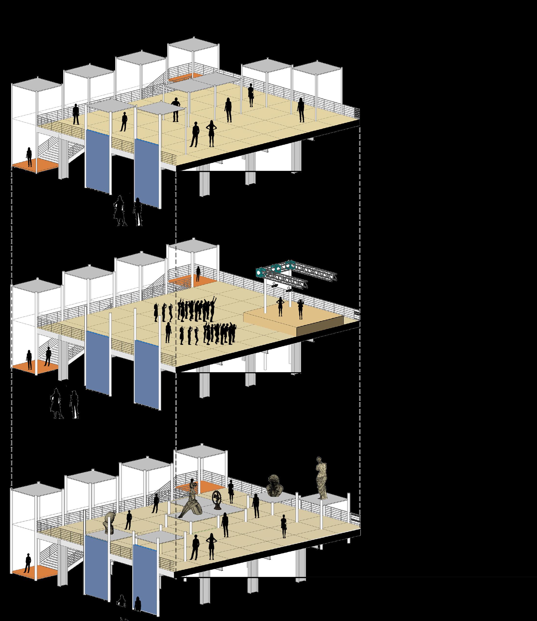
01. TOWARDS PEOPLE’S SQUARE
Behavioral Mapping and Redesigning a Public Square (Berlin, Germany)
02. THROUGH THE CITY SPINE
Urban Design and Rehabilitation (Frankfurt-Oder, Germany)
03. PRIME MINISTER HOUSING FOR ALL SCHEME
Housing for All - Town Planning (Vasai, Mumbai, India)
PROJECT 1
BEHAVIORAL MAPPING AND REDESIGNING PUBLIC SQUARE
TOWARDS PEOPLE’S SQUARE
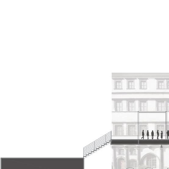
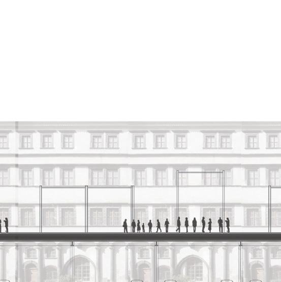
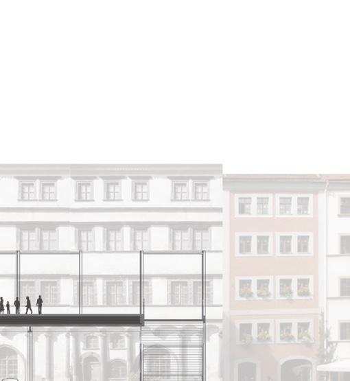
In this project, Public behavioral patterns are analysed to generate design concepts for Frankfurter Tor Square, aiming to elevate urban social life.
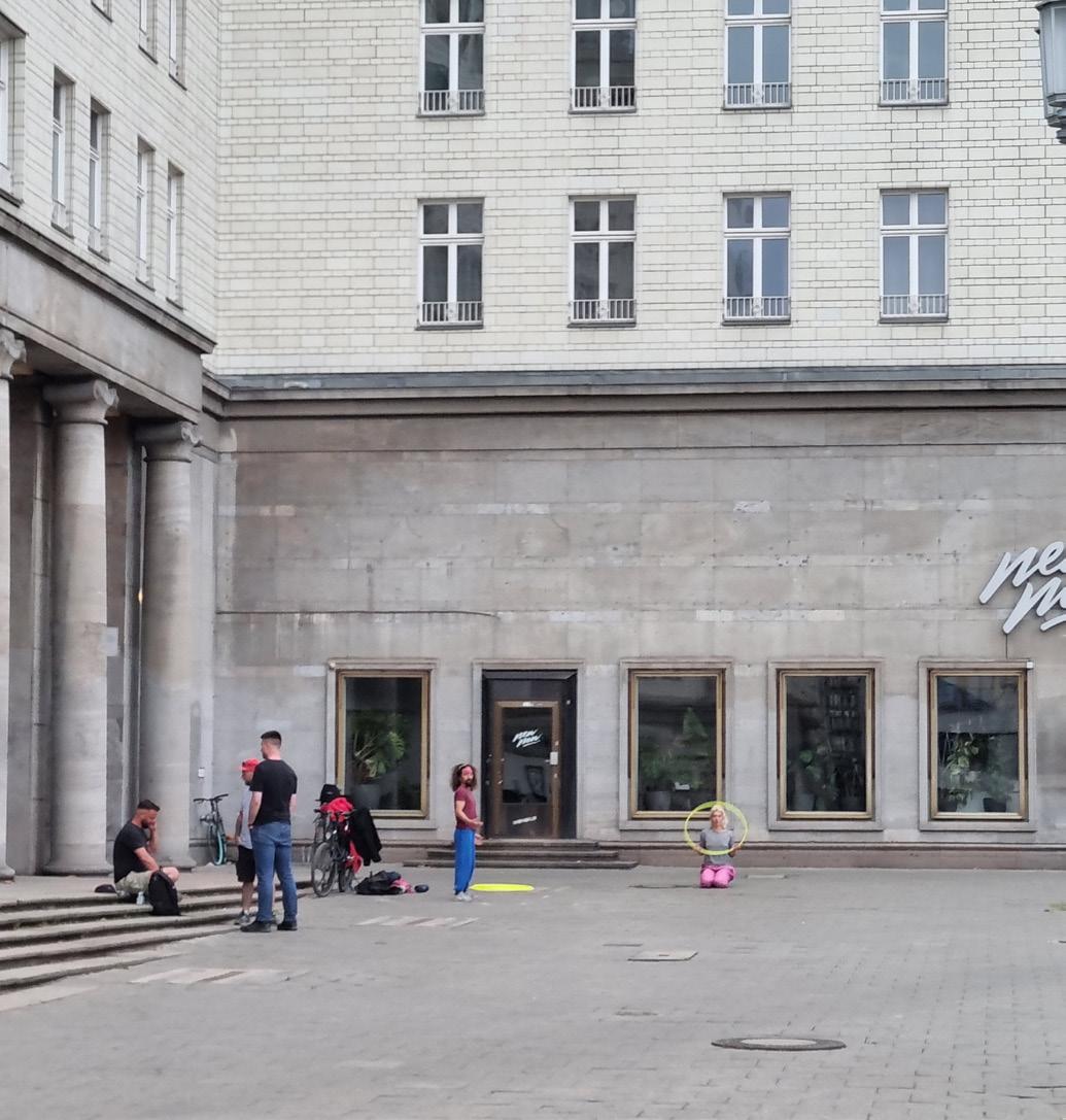
This project is based on public life studies to understand the behavioral pattern of people and how people use public spaces. With a clear understanding of the original purpose behind the design of the open spaces at Frankfurter Tor in Berlin, goal of the project is to conduct a thorough analysis of current usage of the square and observe the behavioral pattern of people. The aim is to redesign the urban landscape in a manner that promotes existing usage patterns, thereby enhancing circulation and the functionality of the square.
Project info
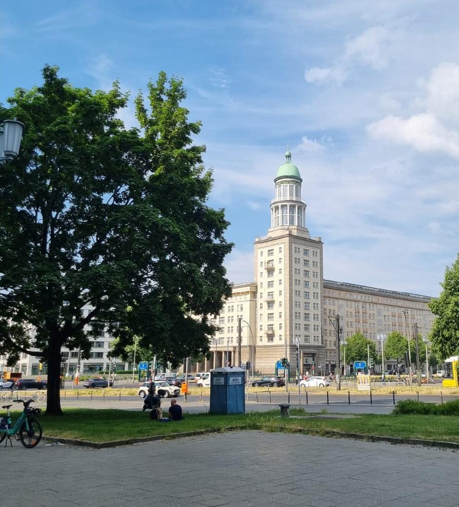
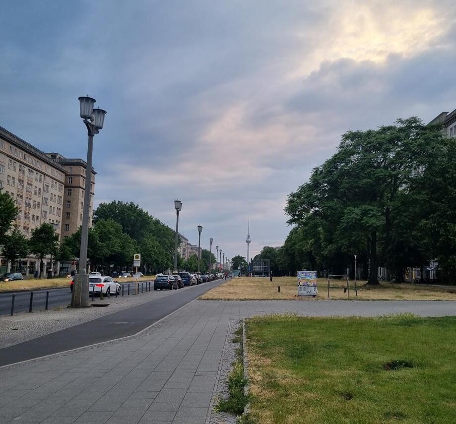
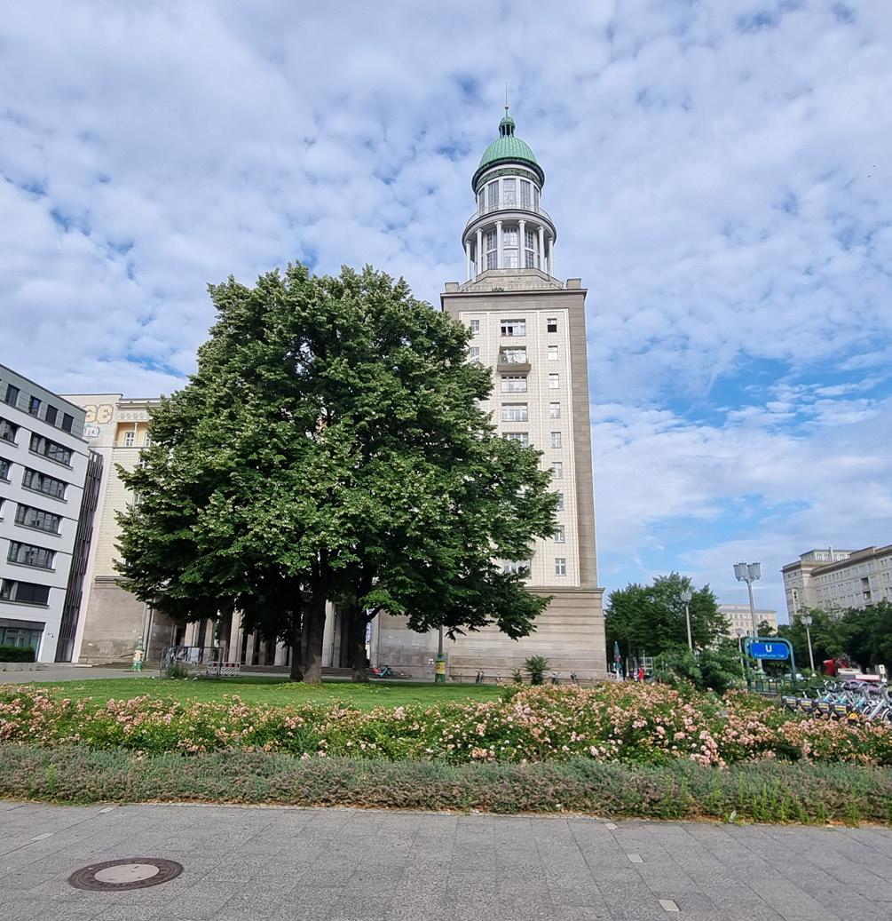
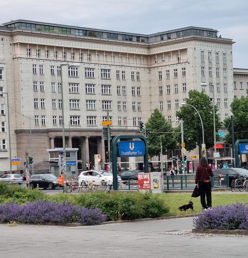
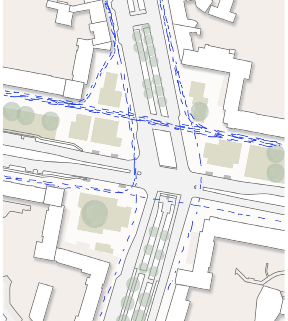
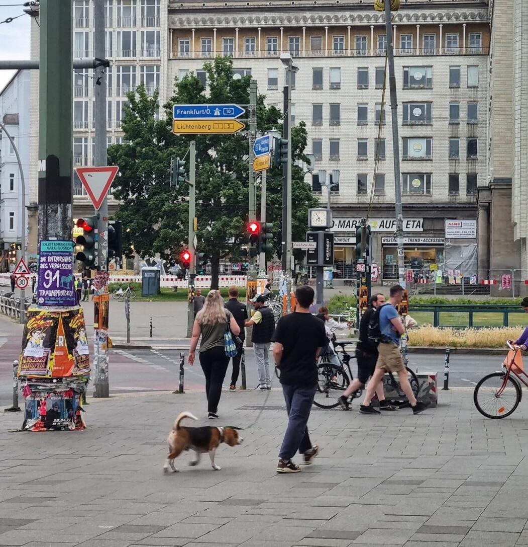
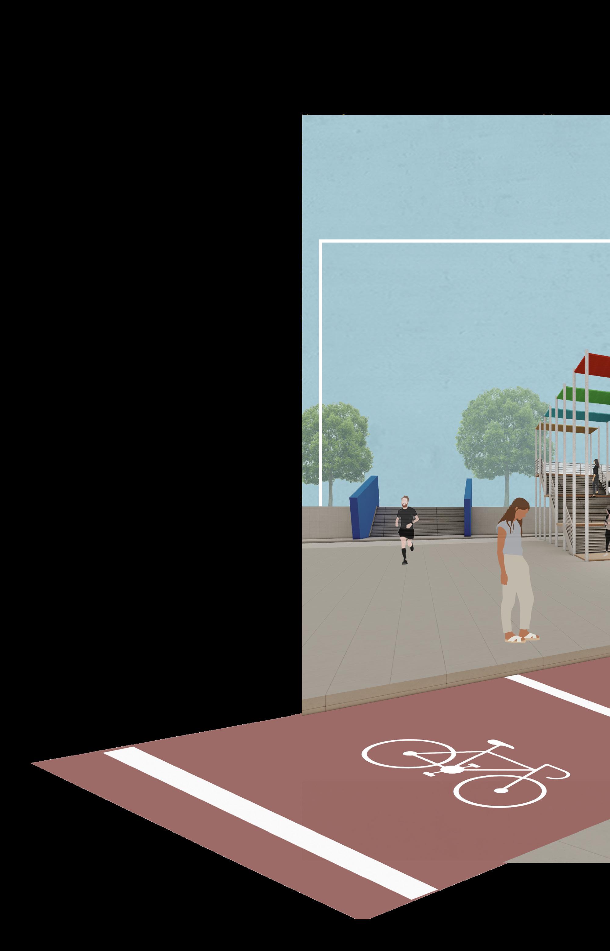
Located at the intersection of Warschauer Strasse and Karl Marx Allee in Berlin, Frankfurter Tor Square is a crucial transportation hub, boasting an underground U-Bahn station and a tram stop.
4 Ha. area is selected to further study and redesign the open spaces at the square.
Vision
The vision for Frankfurter Tor Square is to transform it into a people-focused, inclusive, and vibrant public space that responds to contemporary urban life while enriching user experience.
1. Design interventions respond to behavioral patterns and evolving user needs.
2. A mix of spaces and activities encourages interaction and diversity of use.
3. The monumental Soviet-era scale is reimagined at a more human eye and accessible scale.
4. The square’s historical identity is preserved and woven into the new design.
Approach


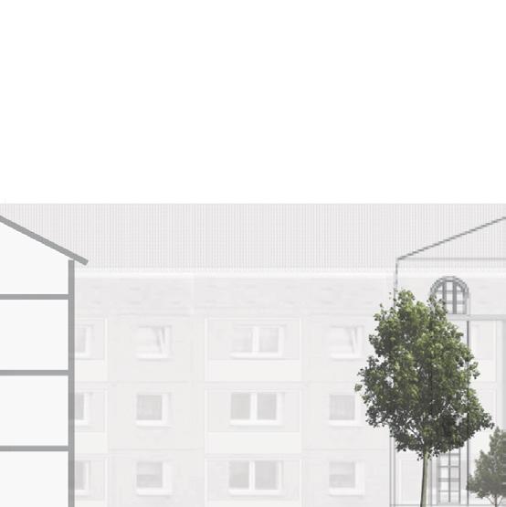
Situated in Berlin’s Friedrichshain district, the site is located at a prime location surrounded by Restaurants, clubs, shopping centers, historic places bustling with leisure activities and tourism.

Historic Stalinallee
Bersarinsplatzv Historic East Side Wall
Restaurants & Clubs - Restaurants & Clubs
Venue
Shopping Complex
Frankfurter Allee
Karl-Marx Allee Towards Alexanderplatz
Commercial
Frankfurter
Warschauer Strasse
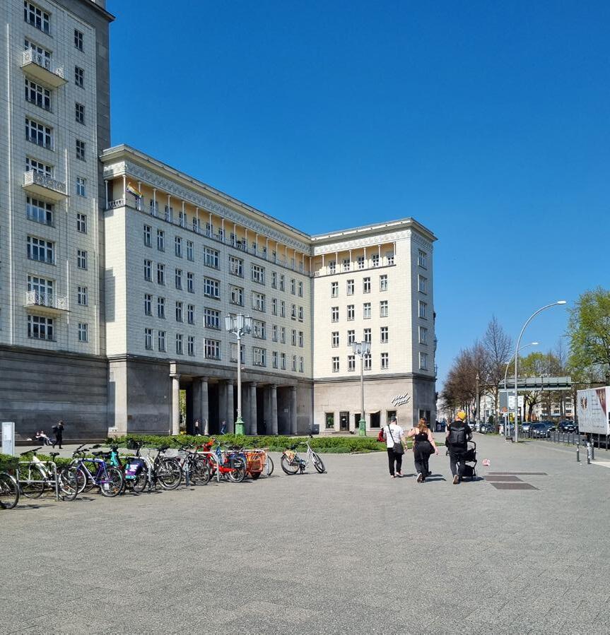


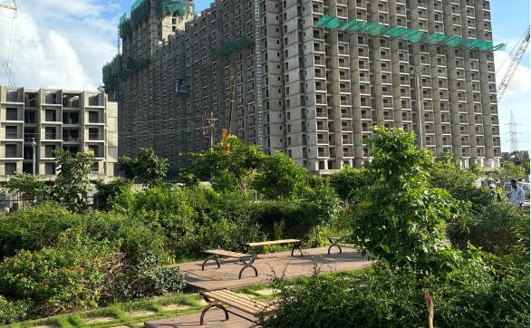
The site comprises of huge green open spaces, designed in ‘Socialist Modern’ style. The square was designed to host political demonstration and parades in Soviet Dictatorship with huge open spaces that were based on 16 principals of Urban Design.
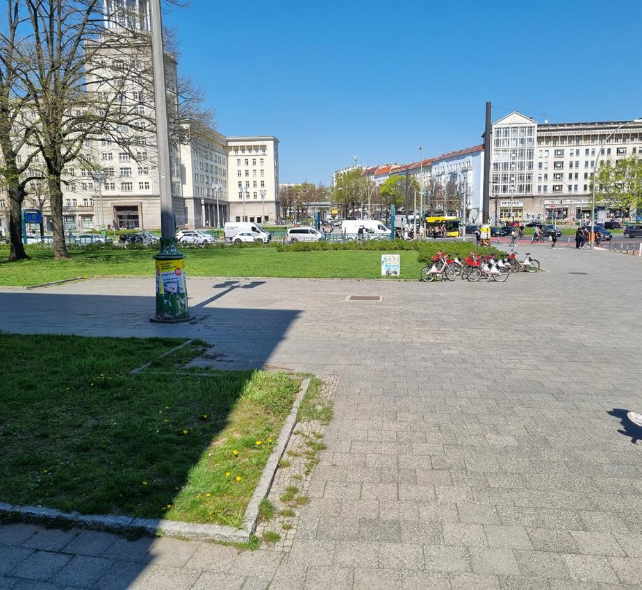
However, after the collapse of the East German Government, use of this square was drastically changed. The open square became an underutilised urban spaces appearing to be an abandoned square, due to lack of infrastructure.
Spacial Analysis of Existing Square, Ill. by Author
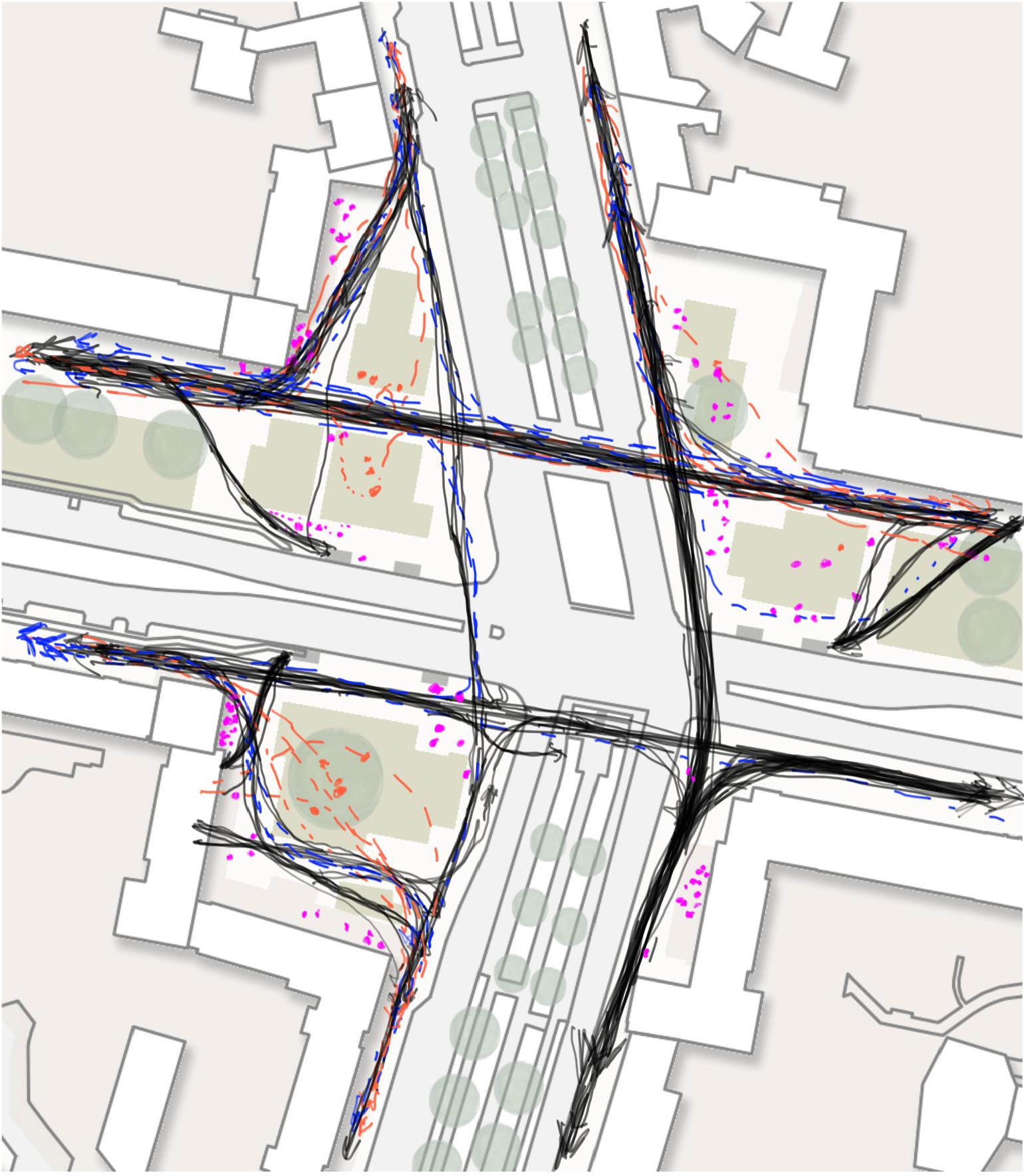
LOGICAL ANALYSIS
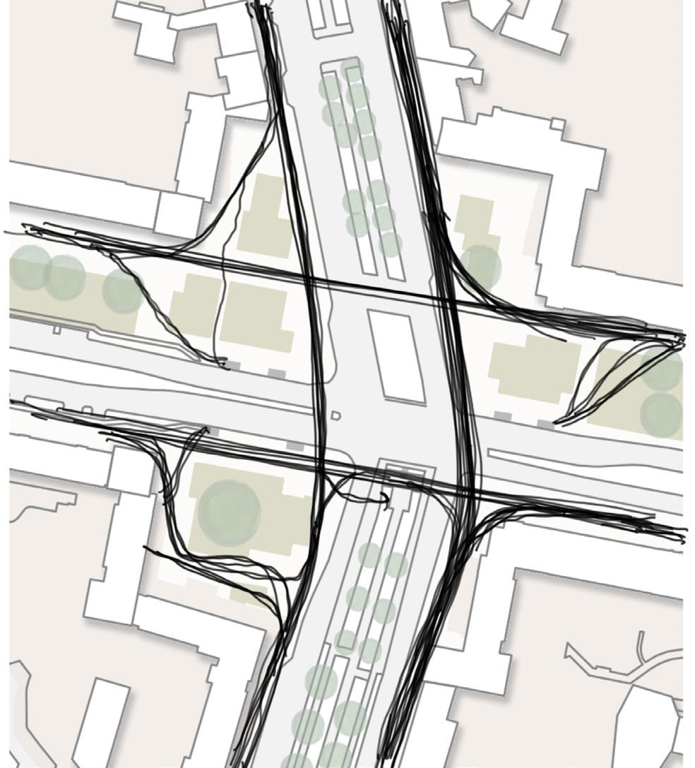
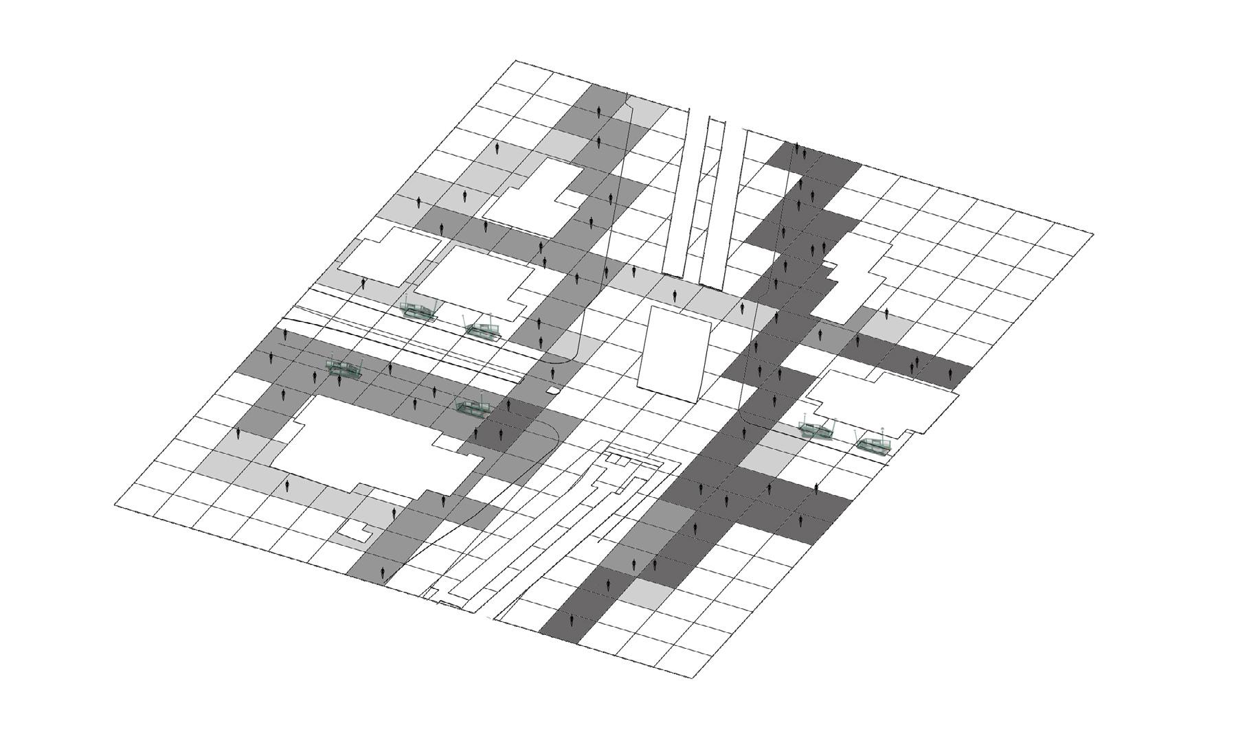
Axial Map Analysis
An axial map in space syntax analysis helps visualize pedestrian connectivity and spatial integration within urban environments.
At Frankfurter Tor Square, the analysis reveals that most activity is concentrated around transportation nodes, while the surrounding green spaces remain largely underutilized. Local Axial Analysis, Ill. by Author, Ref. : Hillier, B. and Hanson, J., 1984. ‘The Social Logic of Space.’
Warschauer Strasse Integration Map Analysis
Local Integration Analysis, Ill. by Author, Ref. : Hillier, B. and Hanson, J., 1984. ‘The Social Logic of Space.’
An integration map shows how easily a location can be accessed from others, reflecting its spatial integration. Highly integrated spaces are more connected and tend to attract greater pedestrian flow, while less integrated areas are more isolated.
At Frankfurter Tor Square, integration values are mostly moderate to low, indicating limited accessibility to the open and green spaces. This suggests a weaker spatial connection within the broader urban context.
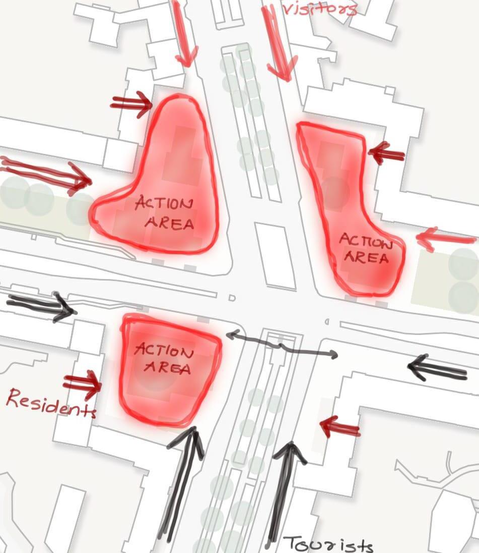
Joggers
Jogging was observed as one of the major activities at the Frankfurter Tor Square. People come for jogging on the square almost all the times of the day. The records show that the main jogging path follows the green open spaces along Karl Marx Allee.
People who Stay
Most of the people gather throuout the day on the steps and seating areas near buildings, while the second most frequented spots are the U-Bahn station exits. Open spaces are typically occupied by groups or couples relaxing, whereas individuals near the station exits are often alone, either waiting or taking a break.
Dog Walkers
Another major activity that can be observed at the square is Dog Walking. People predominantly utilize open spaces with their dogs during the evening hours. These areas serve as recreational zones where individuals engage in play with their pets and unwind within the green spaces.
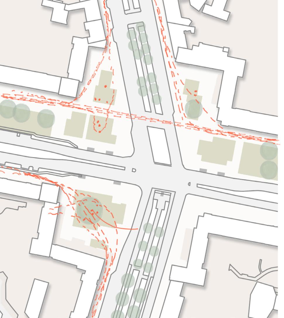
Pedestrians
The study of the lines of movement across the frankfurter Tor clearly indicates the dominant movement pattern. Major pedestrian activities on the square are related to the transport activity. The movements of pedestrians determine the pace and rhythm of activities in the square.
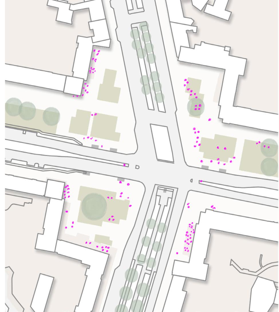
QUALITATIVE ANALYSIS
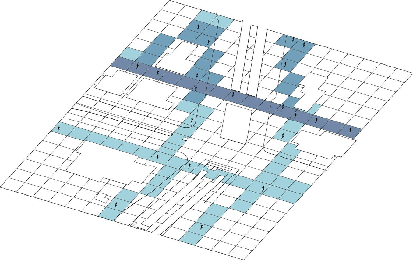
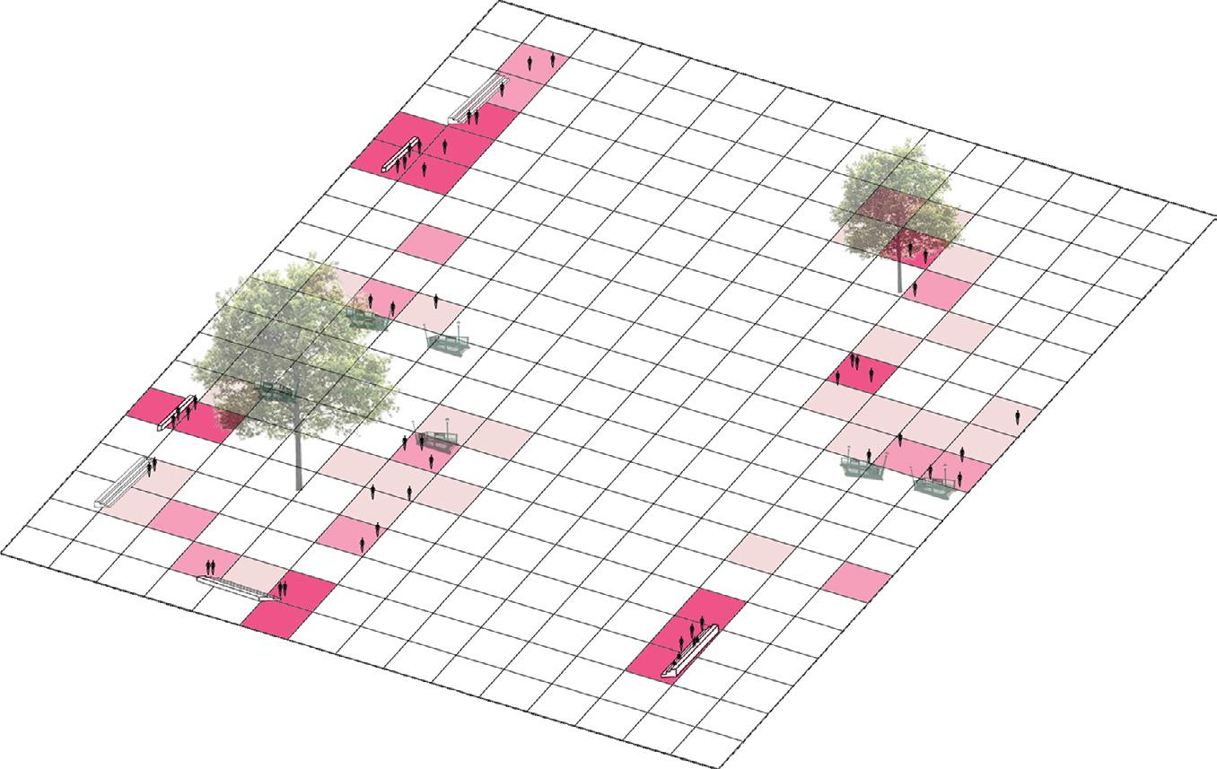

Stationary people
Study area
Pedestrian Flux
Dog walkers
Joggers
QUANTITATIVE ANALYSIS
Activity Mapping
To prioritize the target audience in design solutions, it was essential to analyze behavioral patterns at Frankfurter Tor Square, particularly by examining the number of individuals engaged in various activities within the space.
During the site survey, several key activities were identified, including walking, jogging, sitting, dog walking, and touristic activities such as group discussions, photography, and relaxation in green spaces. These activities and movement patterns were manually recorded on both weekdays and weekends between 6:00 and 00:00. Given the thesis’s primary focus on pedestrian dynamics, both pedestrian movement and stationary activities were further observed in detail.
weekdays pedestrians stationry people joggers dog walkers people with children tourists
06:00 08:00 10:00 12:00 14:00 16:00 18:00 20:00 22:00 00:00
weekends
06:00 08:00 10:00 12:00 14:00 16:00 18:00 20:00 22:00 00:00
06:00 08:00 10:00 12:00 14:00 16:00 18:00 20:00 22:00 00:00
pedestrians - weekdays Single Pair of 2 Group
pedestrians - weekends Single Pair of 2 Group
06:00 08:00 10:00 12:00 14:00 16:00 18:00 20:00 22:00 00:00
stationary - weekdays single Pair of 2 Group
06:00 08:00 10:00 12:00 14:00 16:00 18:00 20:00 22:00 00:00
stationary - weekends Single Pair of 2 Group
06:00 08:00 10:00 12:00 14:00 16:00 18:00 20:00 22:00 00:00
Analysis Methodology
The qualitative and quantitative analysis of the square was conducted through systematic observations from 6:00 AM to 12:00 AM during the months of May, June, and July. This study examined spatial usage, activity patterns, and behavioral dynamics to assess the impact of the existing design on public interaction and urban life.
Constraints at the Frankfurter Tor Square
1. Underutilized Green Spaces – The expansive green areas in the square appear inactive and underused, creating a sense of neglect.
2. Inactive Facades – The square is enclosed by buildings, but inactive ground floors create uninviting edges and reduce vibrancy, especially around the periphery.
3. Limited User Comfort and Accessibility – Inadequate urban amenities, seatings, and shading elements result in a suboptimal user experience, reducing the square’s appeal as a place for prolonged engagement.
4. Lack of active Zones – While sporadic recreational and social activities occur throughout the day, the square lacks dedicated infrastructure to support and encourage diverse urban functions.
5. Newly Adapted Uses – Once meant for large political gatherings, the square now functions mainly as a transit route, with most users simply passing through to reach the U-Bahn.
inconvenience for Pedestrians and
Joggers
Unused Green Open Spaces
Adapted Use of Open Spaces
User Dynamics and Potential of Frankfurter Tor Square
Frankfurter Tor Square mainly serves nearby residents but occasionally attracts diverse users due to nearby recreational amenities. The spatial character of the square transforms dynamically with the presence of street performances, live music, and informal social gatherings, such as children pausing to interact. These open spaces hold significant potential for improving the microclimate. Strategic interventions aimed at enhancing usability and engagement could strengthen socio-cultural interactions, fostering a more vibrant and inclusive public realm.
Inactive Fcades
Behavioral Pettern Map on the Square, Ill. by Author
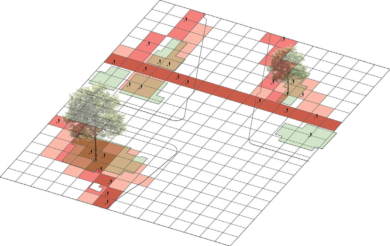
Urban Design Objective
Project Strategy
The design strategy for Frankfurter Tor focuses on preserving its historical character while enhancing vibrancy to attract visitors. By creating an inviting and accessible public space, the redesign promotes social interaction and comfort, ensuring a dynamic urban environment that balances heritage with modern urban life.
The objective of the design is to create an inclusive and adaptive public realm at Frankfurter Tor Square that responds to the needs and behaviors of its users. By integrating thoughtfully designed spatial elements, the square will facilitate diverse activities, including relaxation, social interaction, artistic expression, and movement.
The design aims to enhance the daily experience of residents, workers, and visitors by providing flexible and engaging spaces that support both individual and collective use. Additionally, it will strengthen the square’s cultural and historical significance, allowing tourists to appreciate its architectural and urban heritage while contributing to a vibrant and dynamic urban environment.
Action Plan on the Square, Ill. by Author
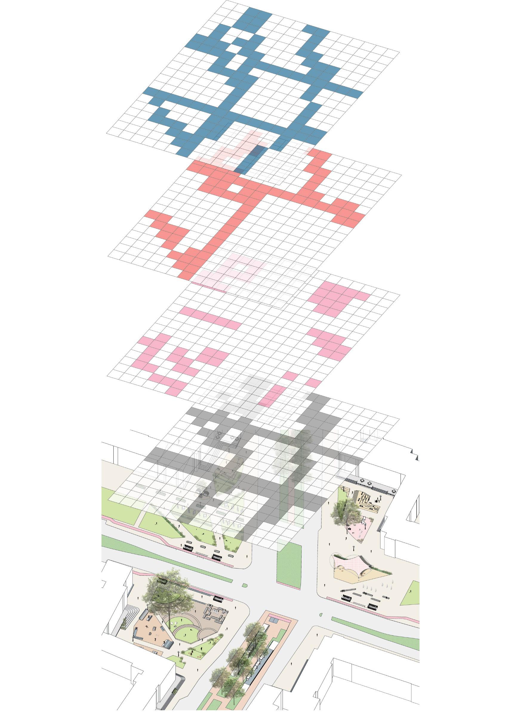
Project Guidelines
The design guidelines are developed based on a comprehensive site analysis to enhance functionality and user experience. The proposal aims to support and strengthen existing activities by providing appropriate infrastructure and spatial interventions.
The pedestrian axis is defined through Space Syntax analysis and the most frequently traveled paths. To enhance user comfort, large green spaces are divided into smaller, human-scaled areas, each designed to accommodate observed activities and interactions. These pockets are strategically designed to accommodate current activities, fostering a comfortable, engaging, and adaptable public realm.
HISTORICAL IMPORTANCE
SOCIO-CULTURAL RECREATIONAL LIESURE
INTERACTIVE TRANSITION
ART
FOCUS CREATIVE HEALTH
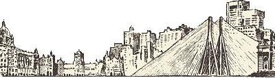
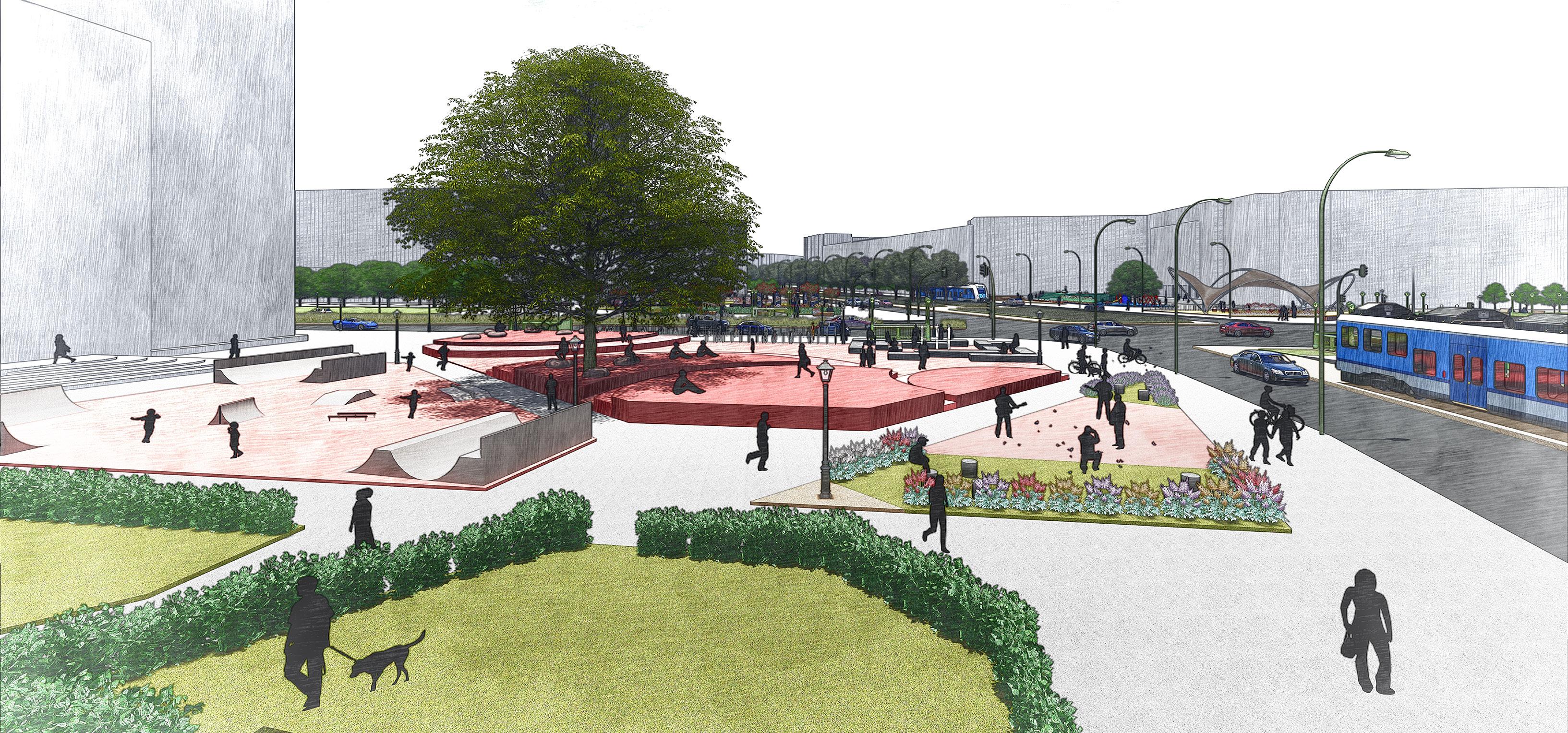
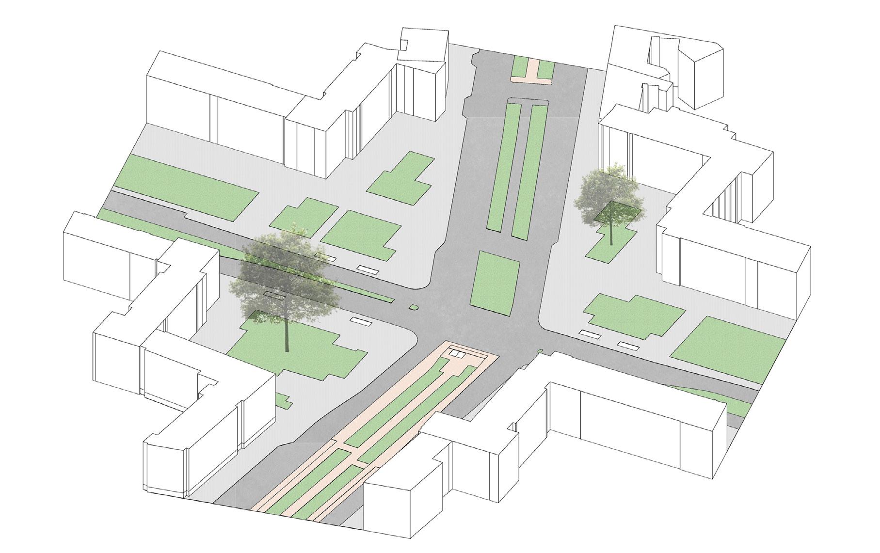
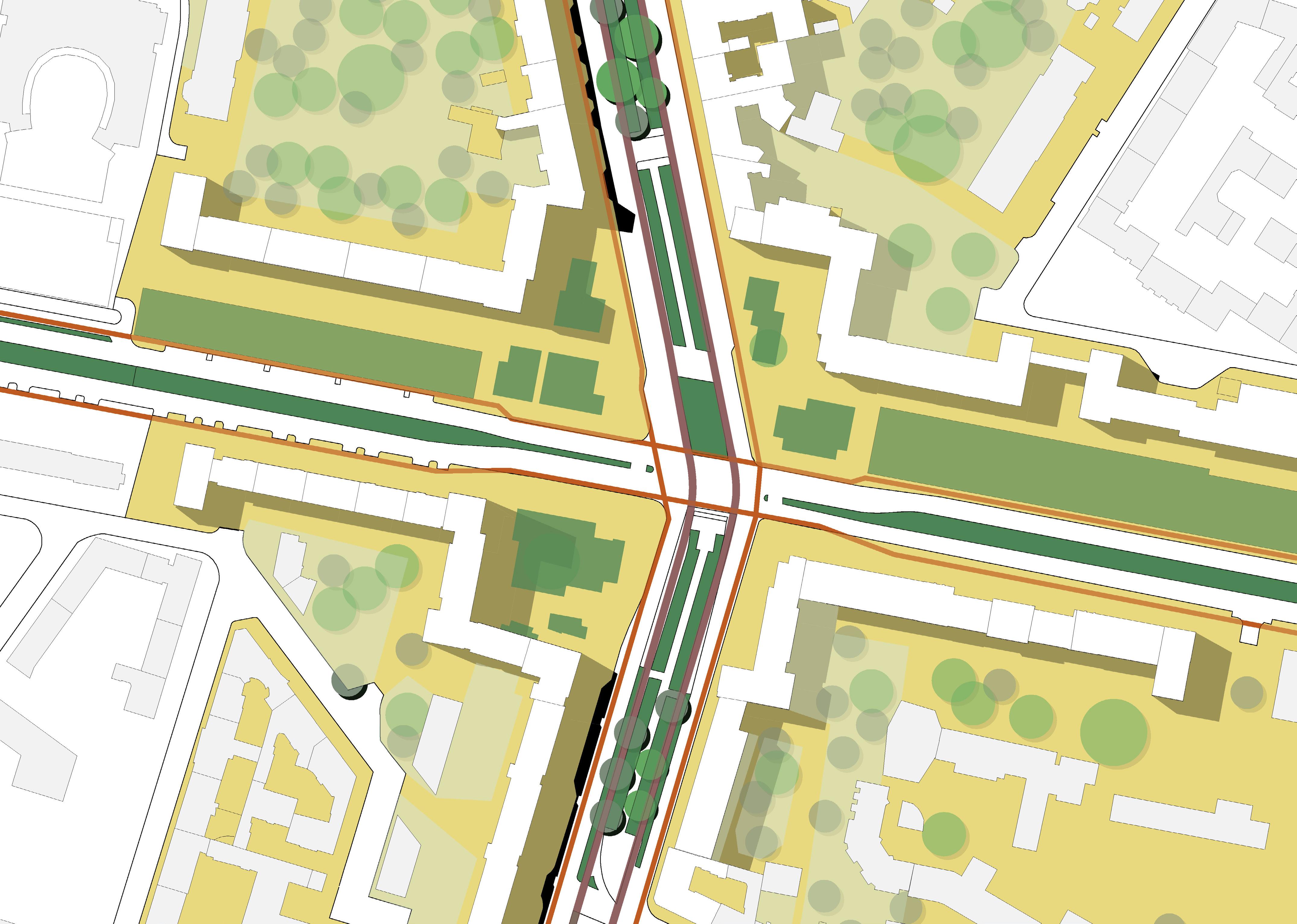
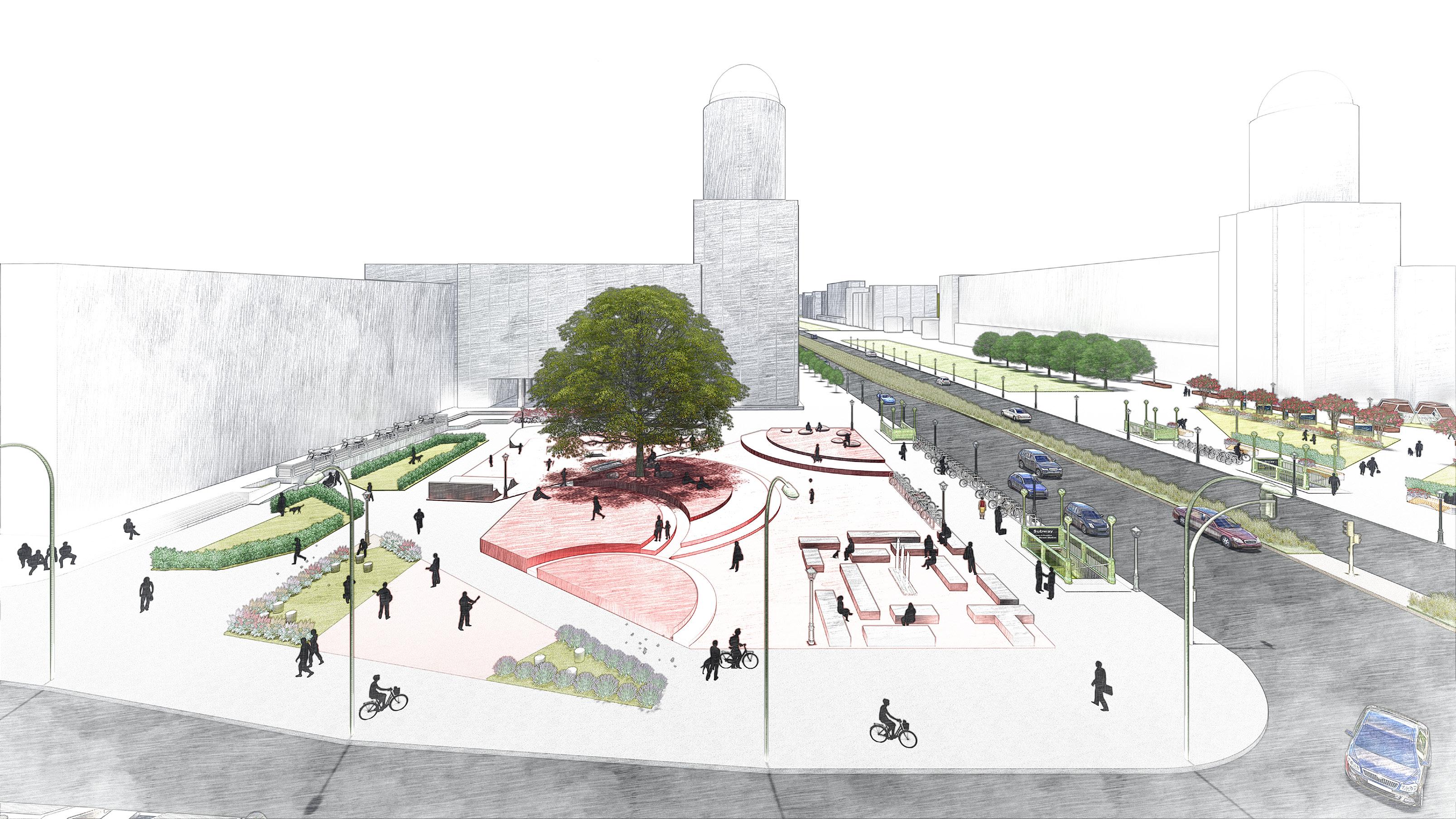
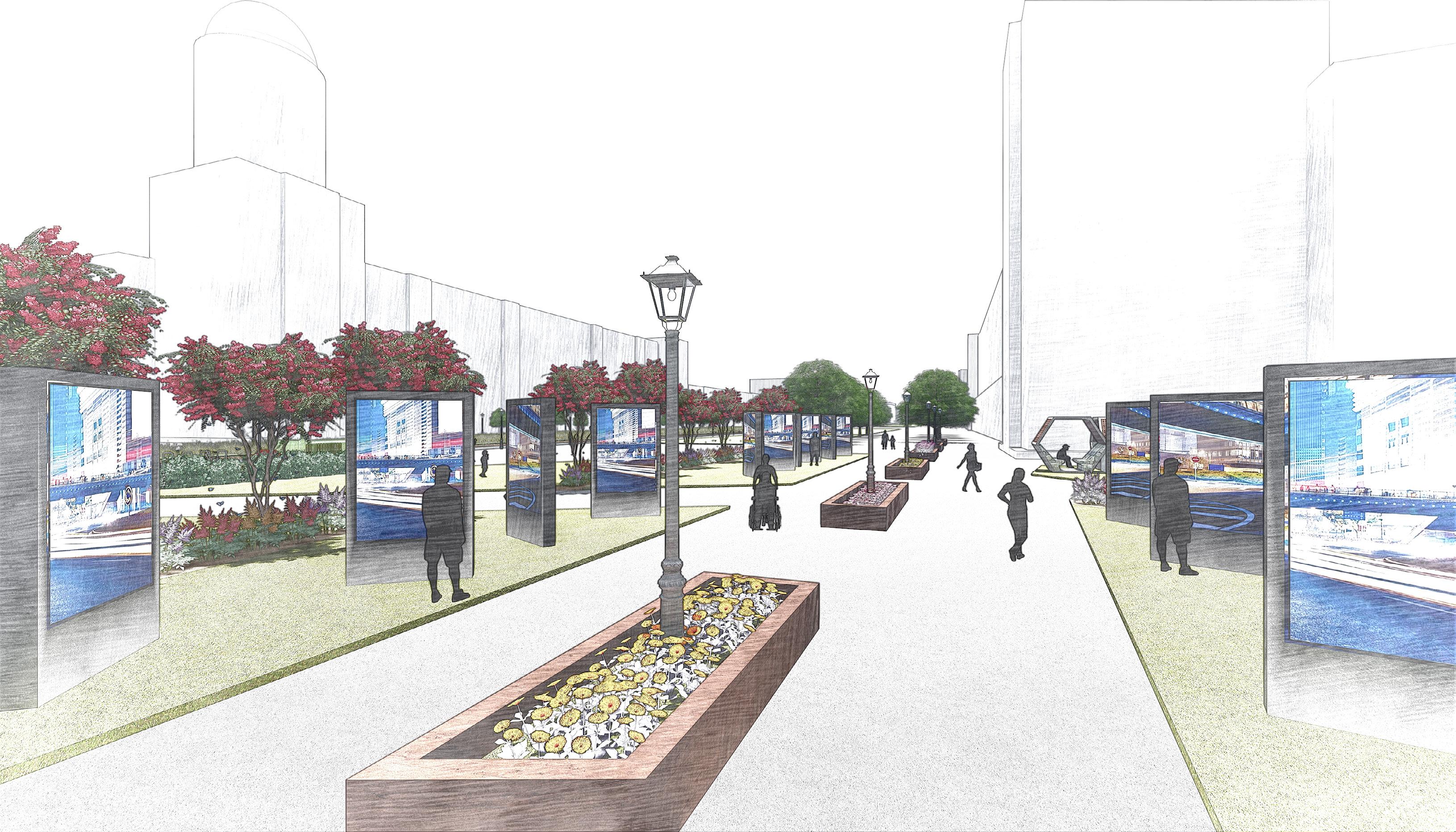
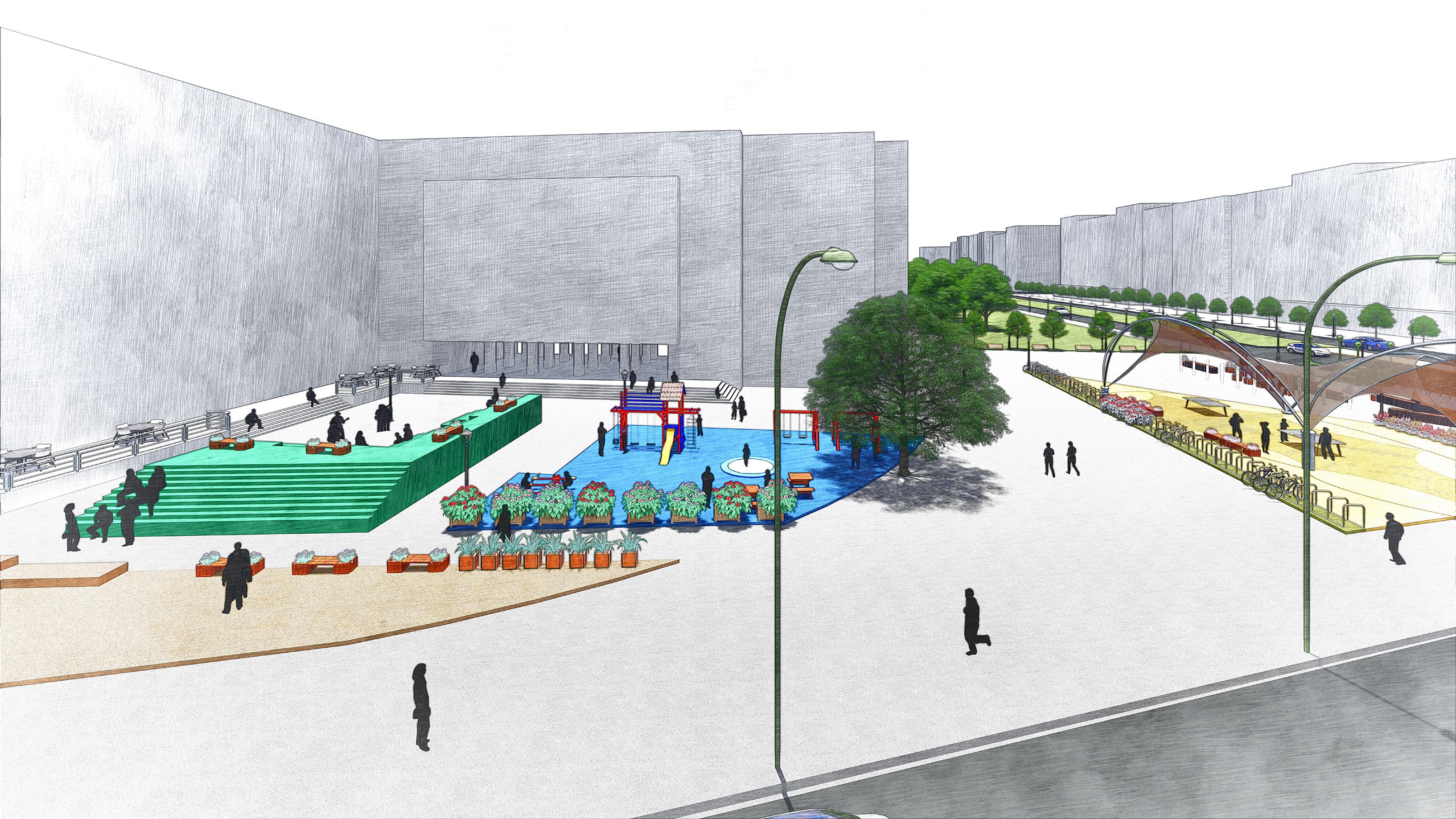
Proposed Masterplan, Ill. by Author
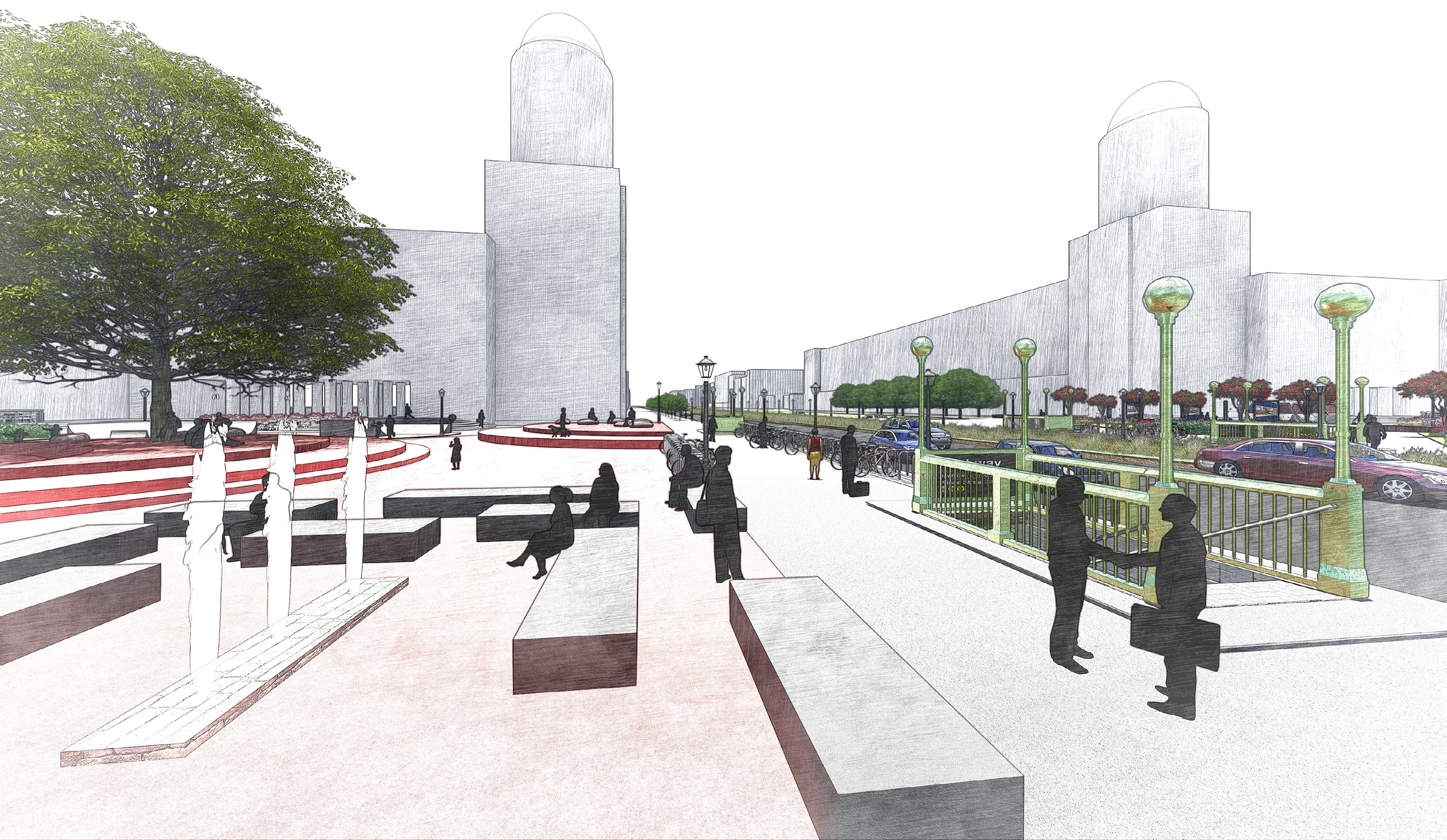
While designing Frankfurter Tor Square, functionality, inclusivity, and user experience were prioritised. Zoning is based on observed activities, ensuring diverse and engaging spaces. Seating areas, performance zones, playgrounds, green spaces, and a skating area enhance usability. Interactive ground elements further promote engagement, creating a vibrant and dynamic urban environment.
Warschauer Strasse


Proposed Frankfurter Tor Square, Ill. by Author
Key Zones


Frankfurter allee
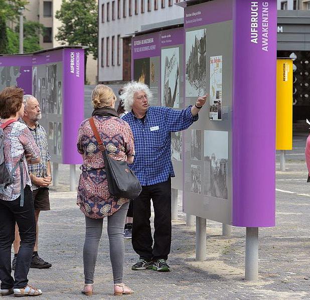
The Past Pathway – Showcasing the historical evolution of Friedrichshain.
Vibe Venue – A dynamic space for street performances and cultural expression.
Joyful Junction – A dedicated play area for children. Harmony Heaven – A relaxing space with fountains near the train station.
Der Pauseplatz – A resting area for short breaks.
Der Brunnenhafen – A designated waiting spot at the train station entrance.
The Gathering Grove – A social hub for evening gatherings. Rolling Ground – A skating zone for children.
The Pong Spot – An open-air table tennis court. Inetractive Ground Floors – Restaurants and Art Gallery.
The Past Pathway
The Pong Spot
Joyful Junction
Vibe Venue
der Pausenplatz
The Gathering Grove Rolling Grounds der Brunnenhafen
Harmony Heaven
Reflections
A study of public life at Frankfurter Tor highlights how spatial design influences behavioral pattern in urban spaces. The built environment shapes movement, interaction, and usability, necessitating a humancentered approach to design.
Designing Frankfurter Tor Square in response to observed behavioral patterns presents a strategic approach to addressing existing spatial challenges. While the proposed interventions are anticipated to enhance user experience, their effectiveness must be validated through iterative public life studies. Continuous assessment is essential to ensure that design solutions align with the evolving needs of the community.
This project serves as an initial step in emphasizing the significance of public life studies within urban design. Understanding human-scale interactions in built environments is fundamental to fostering inclusive, dynamic, and resilient urban spaces.
Urban areas must be continuously analyzed to enhance residents’ quality of life. Placing people at the center of the design process is essential to creating inclusive, livable, and human-centric cities—truly designing “Cities for People.”

Study area
Pedestrian Flux
Dog walkers
Stationary people
Joggers
PROJECT 2
URBAN DESIGN AND REHABILITATION
THROUGH THE CITY SPINE
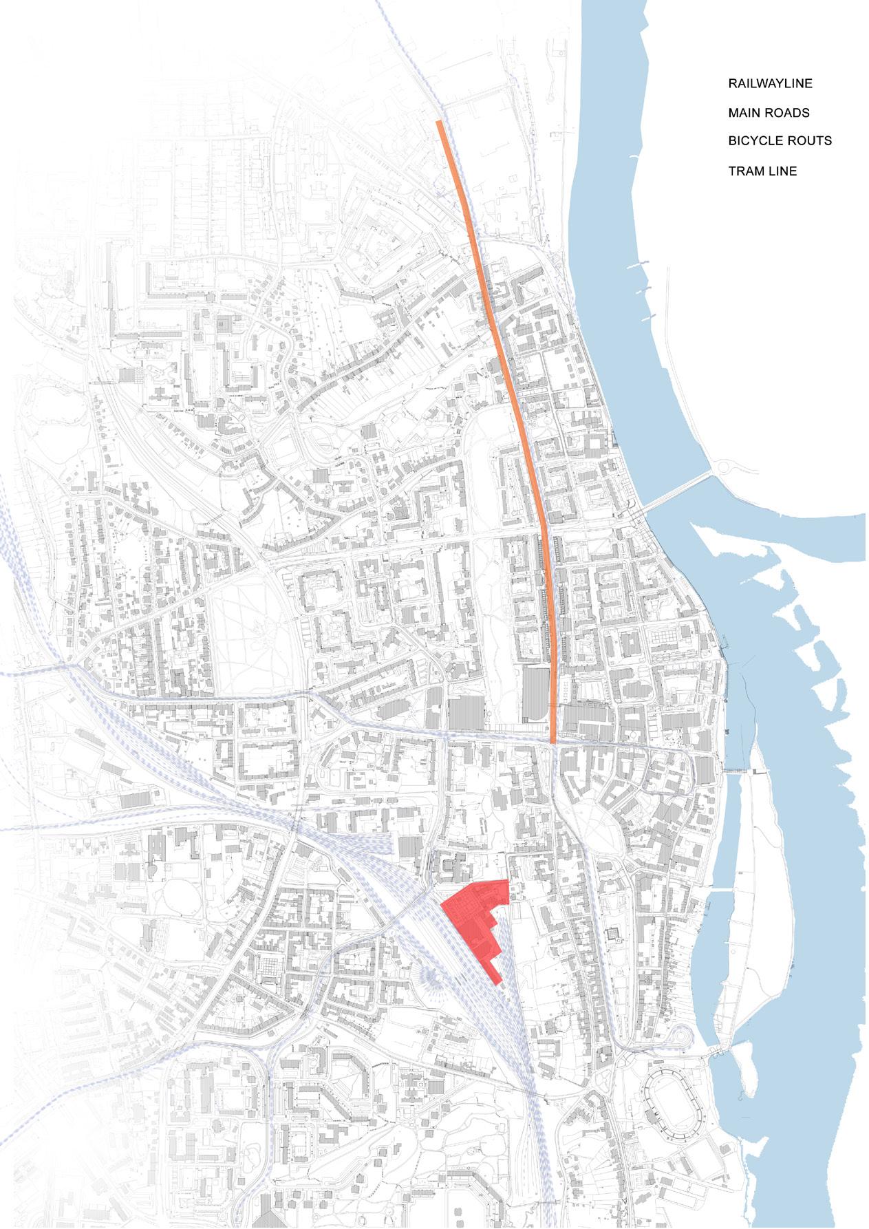
The city Center of Frankfurt (Oder) is redesigned addressing current Gentrification of the town and future opportunities to restore its vibrancy and urban life.
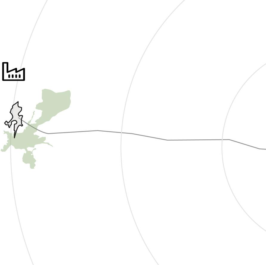
Frankfurt (Oder), a German city on the German-Polish border, had semiconduction industry which led to population boom in the city. But with the collapse of the industry, the city is facing the problem of Urban Shrinkage. With the new construction of Tesla Gigafactory near the city, there rises an opportunity to regain the lost population of the Frankfurt (Oder) city.

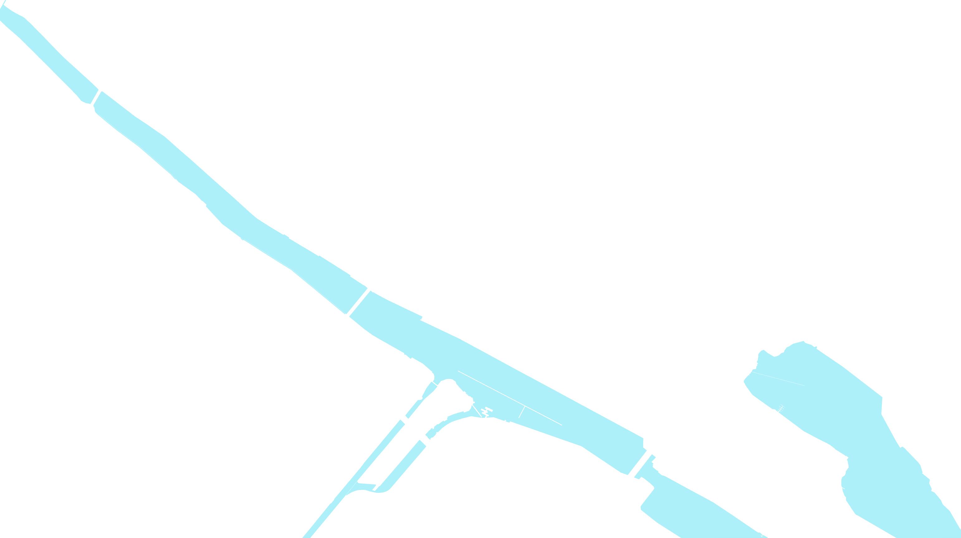
The city has had strong relationship with the river Oder but the riverfront has vastly been underutilised and underdesigned in the course of urban planning which still remains a point of connection with its twin city of Slubice, Poland. Approach of this project is to highlight already-existing pivotal spaces in the city to create inetractive spaces and attract people to the center of the city.
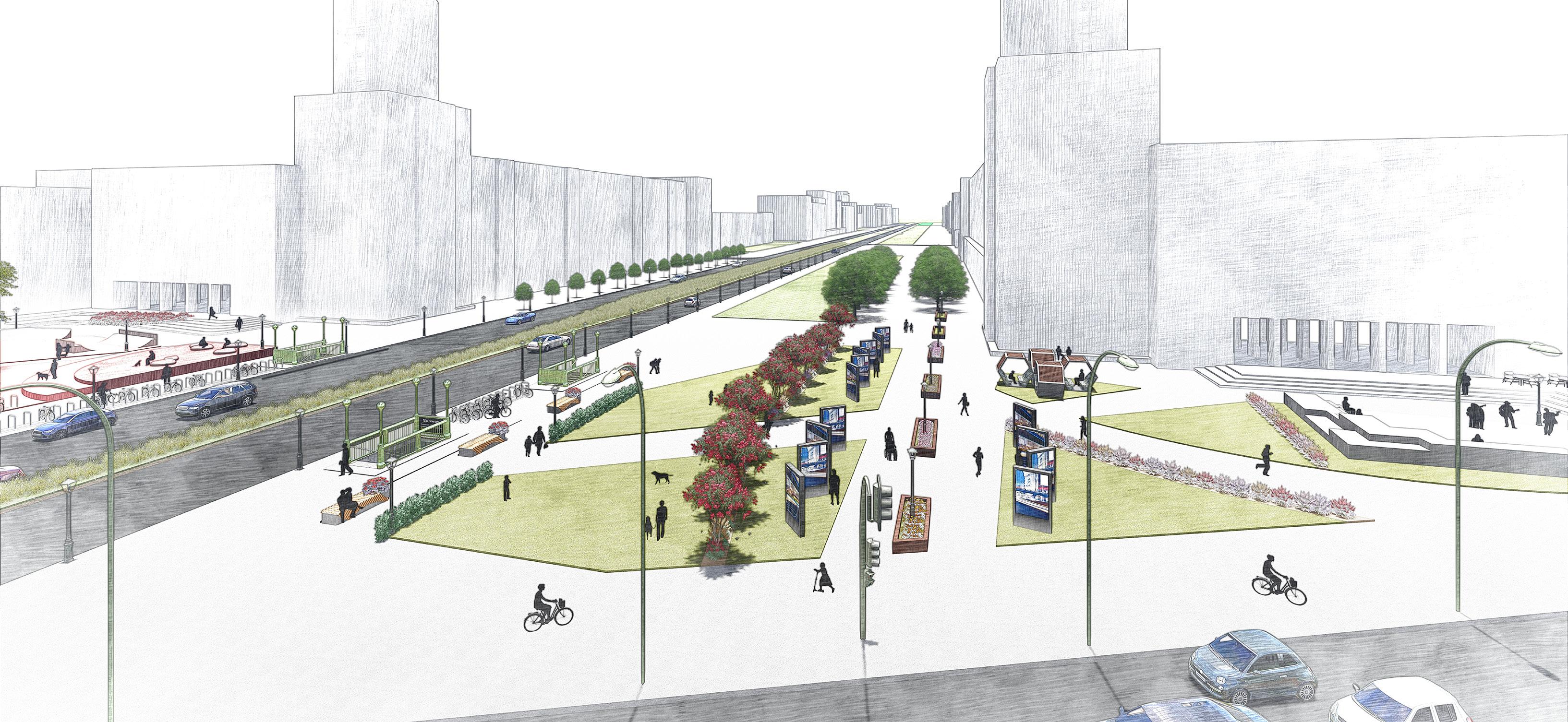
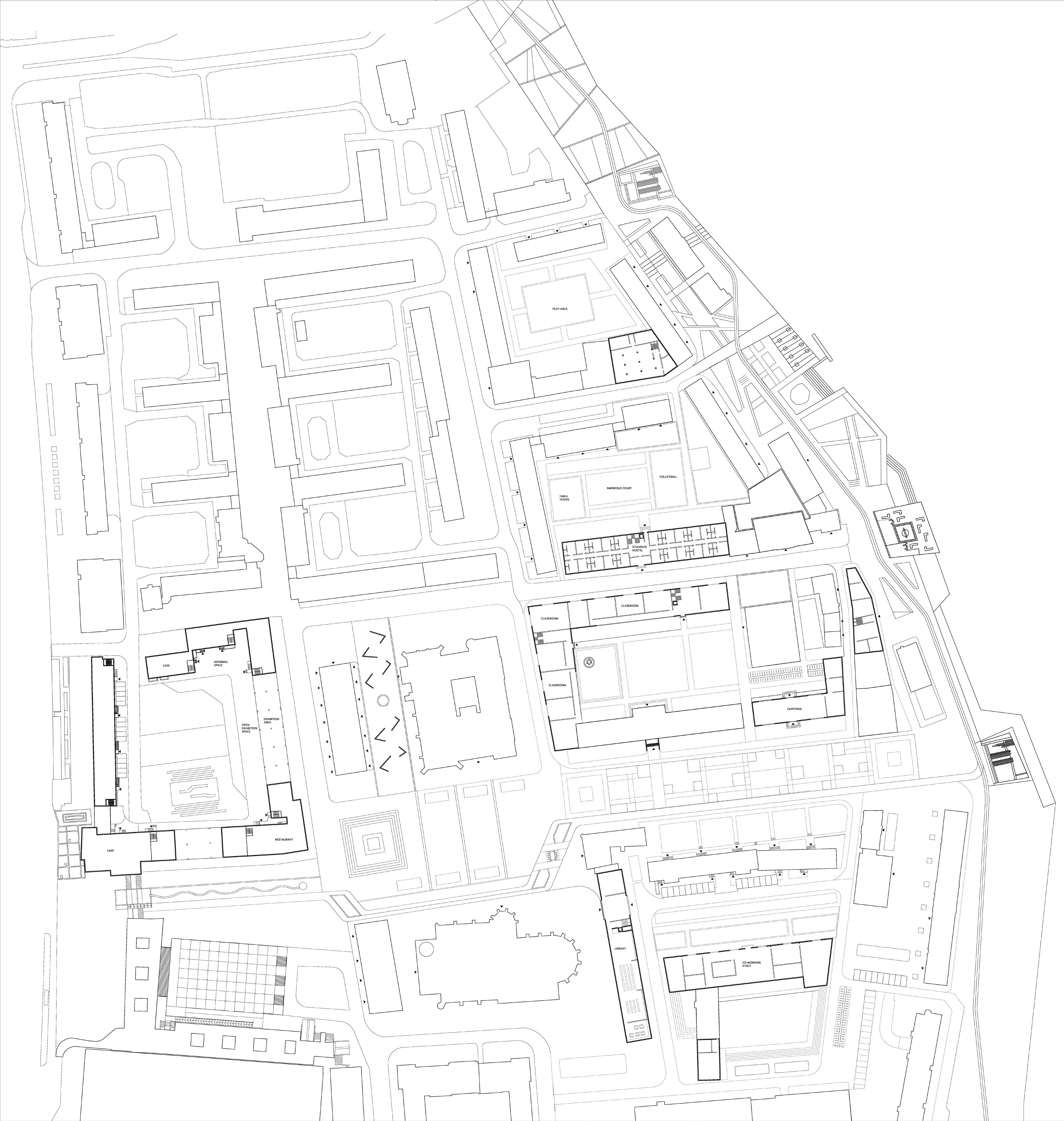
Project
info
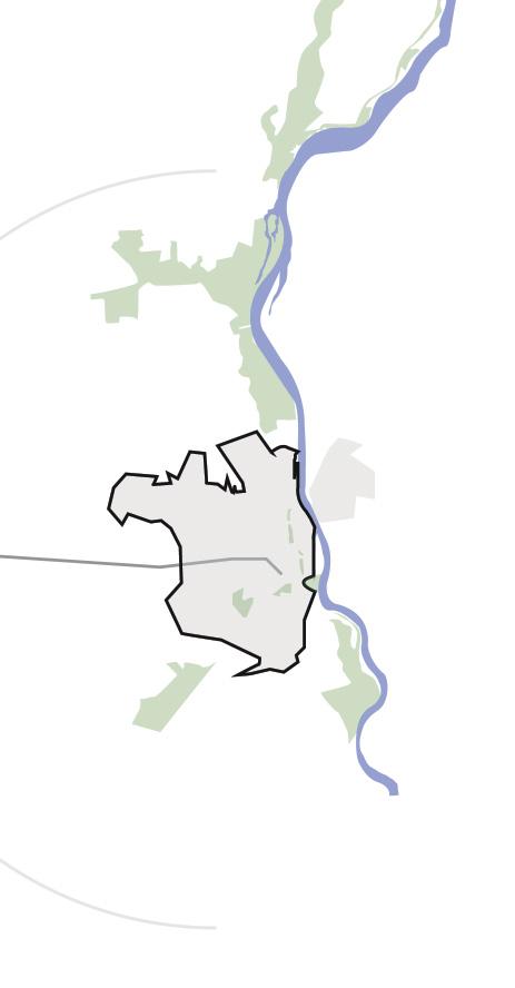
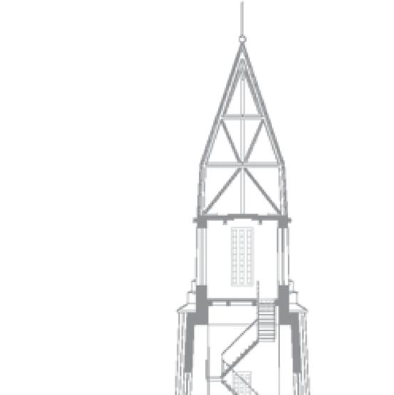
The project site is located at the city center of the old town of Frankfurt Oder. The central plaza surrounded by the church and the town hall connects further to the riverfornt.
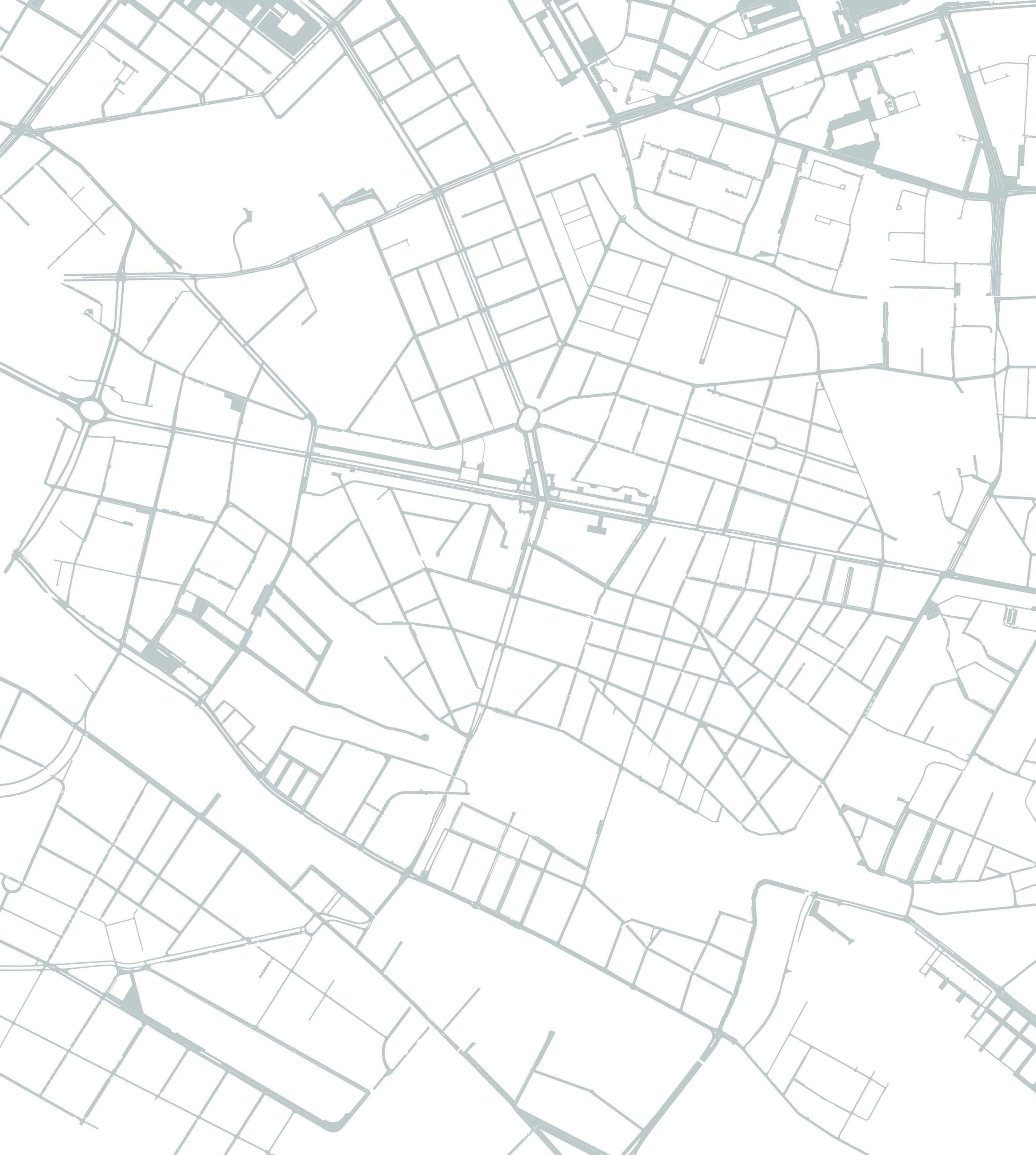
The study area extends across the entire old town of Frankfurt Oder.

(Oder)
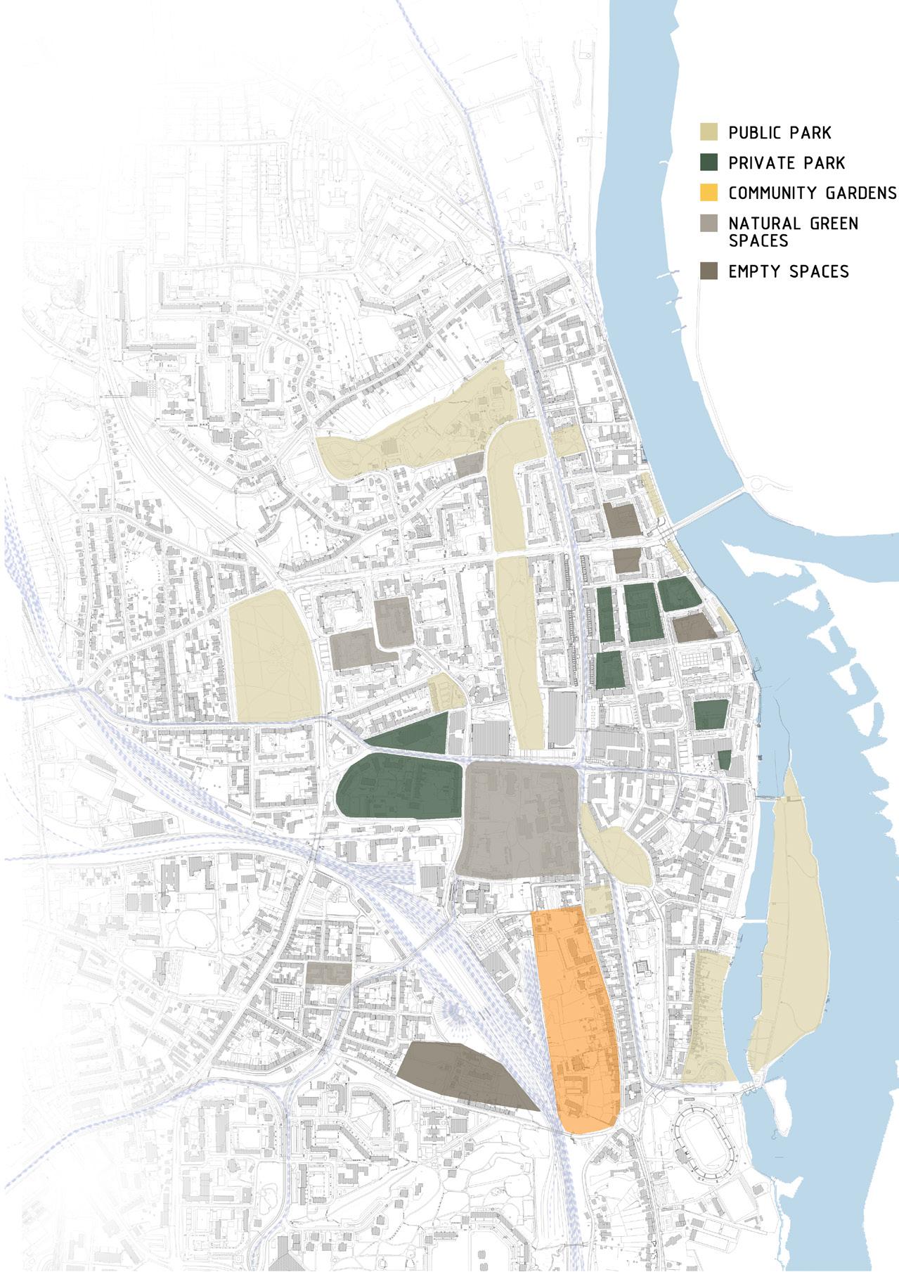
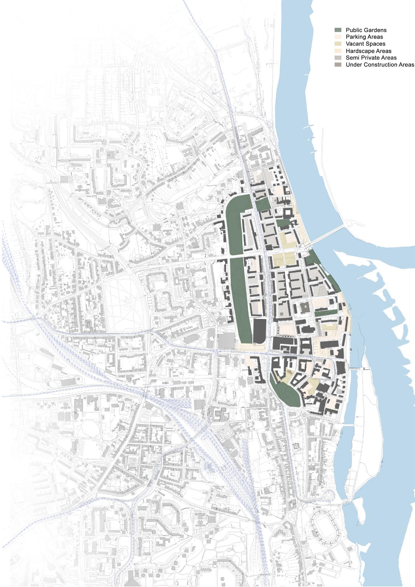


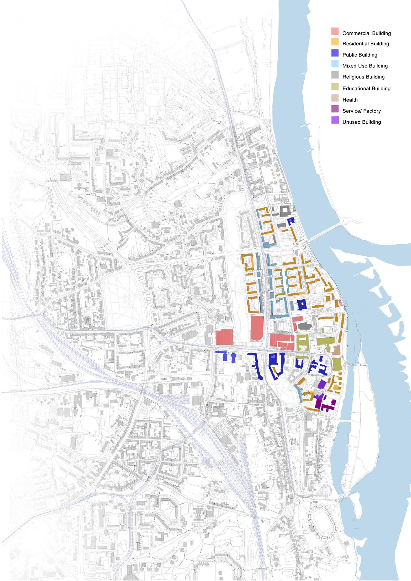
Upon detailed study on and around the historic core, it was observed that the city center is perforated with the vacant lots thus the dwingling activities and the density. The city center’s vacant lots and lack of mixed-use spaces weaken density and activity. Green spaces and parking areas dominate but lack social and functional integration, reflecting post-socialist urban challenges.
Trasportation Analysis Map
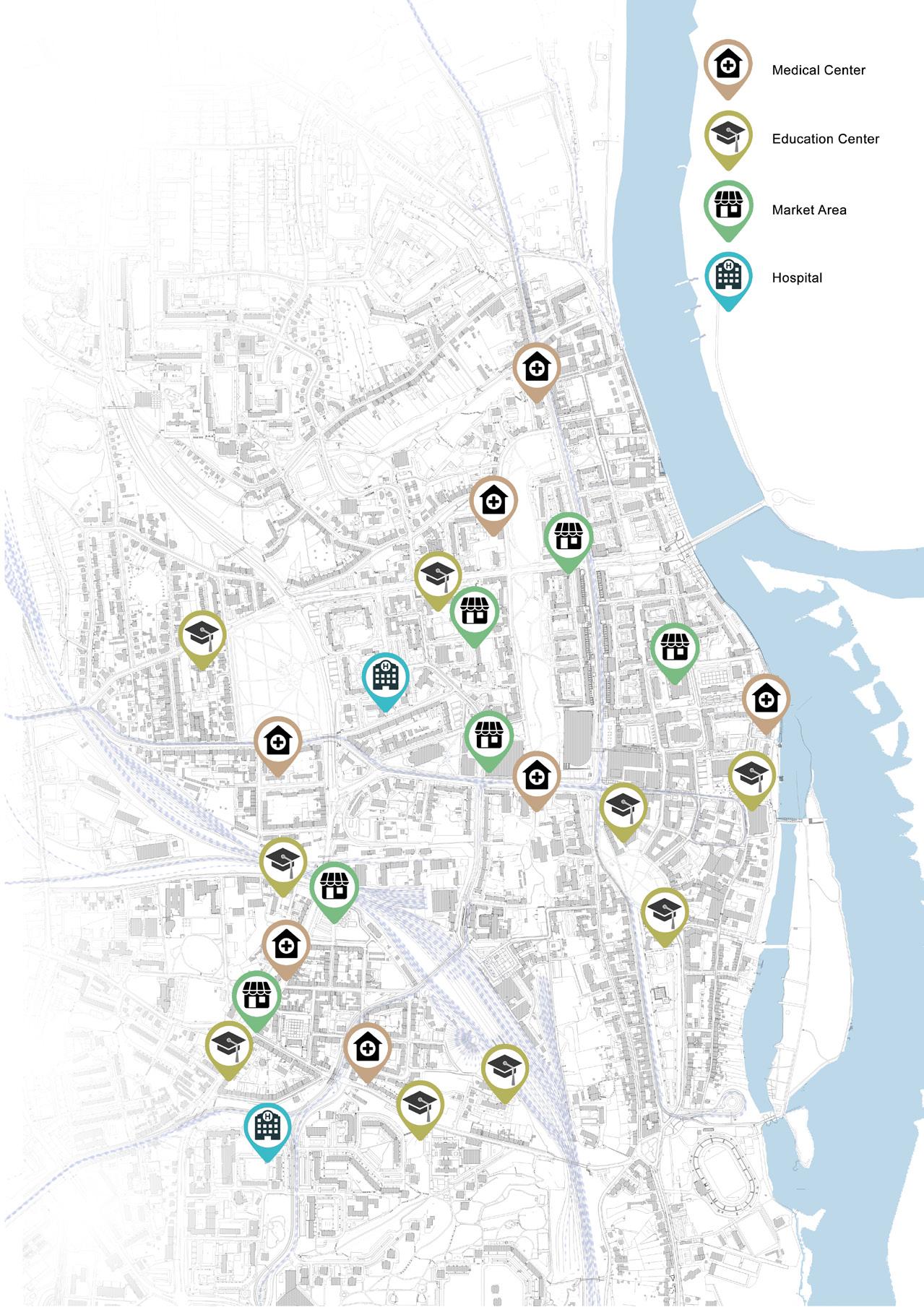
Social Infrastrucxture Map
Open Space Analysis Map
Public Open Space Map
Basic Typology Map
Proposed Concept, Ill. by Author
The analytical framework must incapsulate the prospect rising around the city with possible new impulses in conjuction with the new Tesla Gigafactory at Greunheid near Berlin. This assessment focuses on developing analytical frameworks that identify and explore the key issues and potentials within the historic urban core of the city.
Design Approach
The design approach focuses on attracting the different user groups within the city center with the addition of new layer of functions. These functions combine to create a dynamic communal city center with an increase in the visual connection between users and different spaces.
Proposed Intervention Concept, Ill. by Author
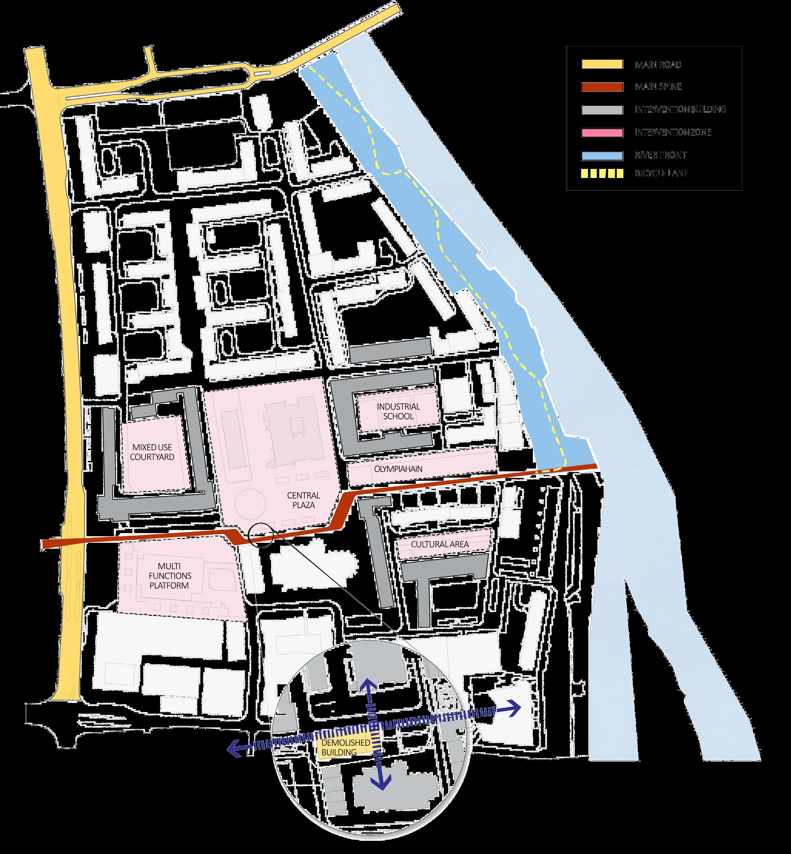
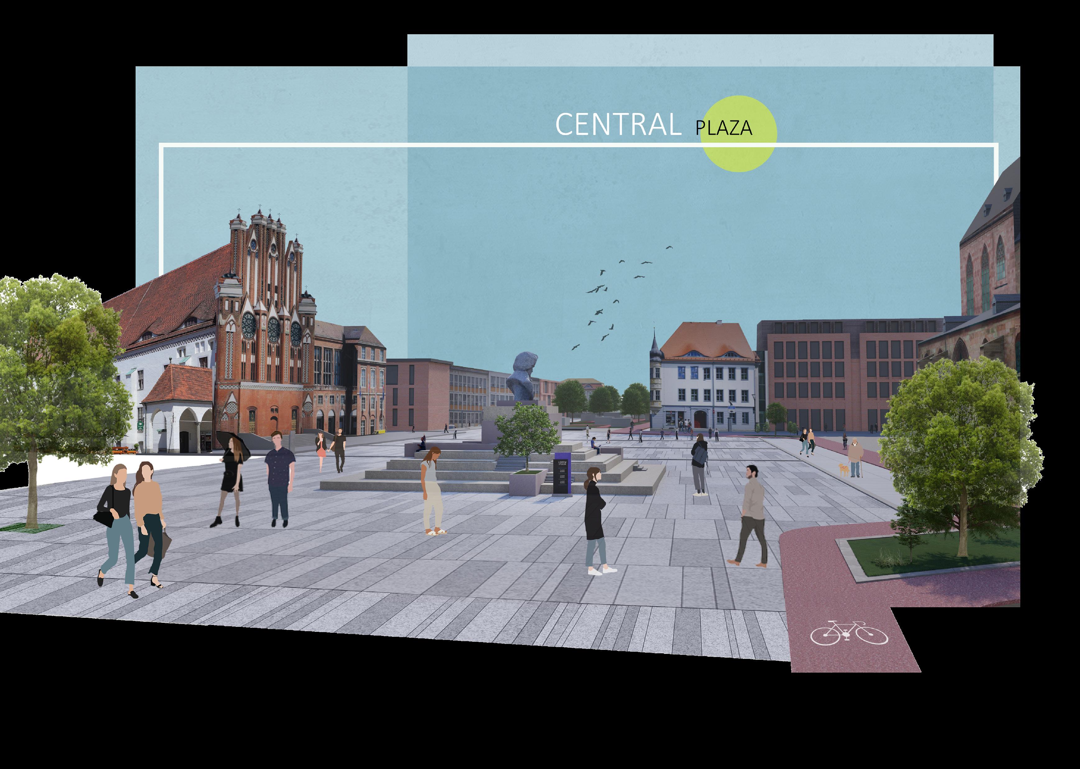
Design Concept
The Spine, the cultural boulevard, connects different spaces taking users from main street to the riverfront through the new central plaza. The user experiences the different character of spaces along this spine which ecnhances the city identity.
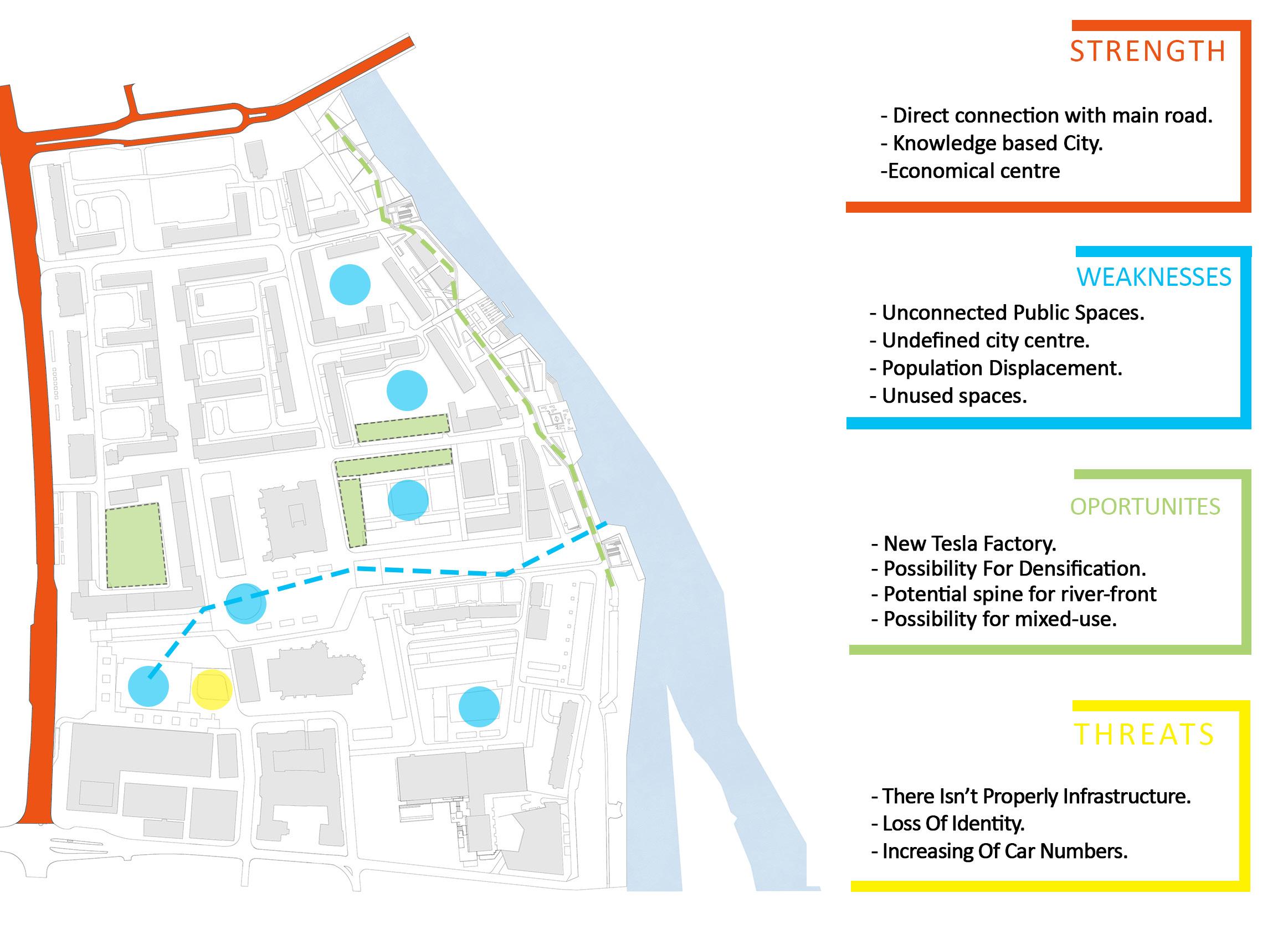
SWOT Analysis, Ill. by Author
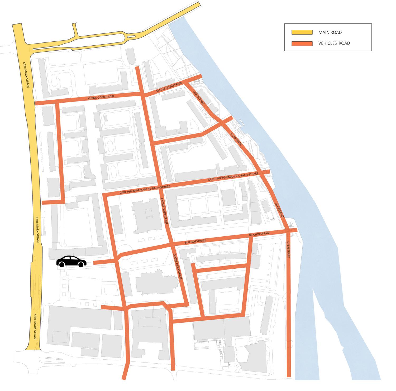
Existing Traffic Map
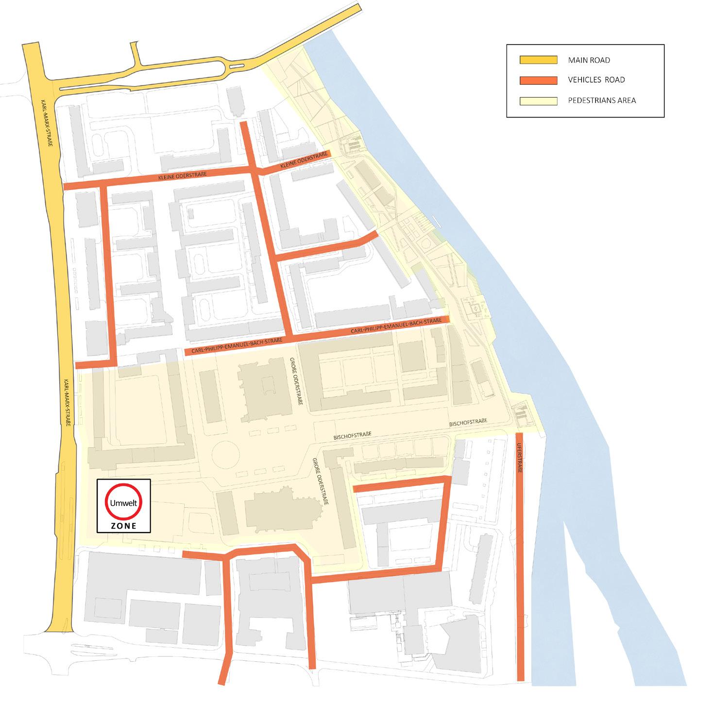
Conceptual Map
Proposed circulation Map
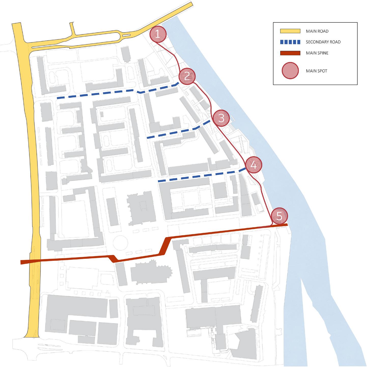


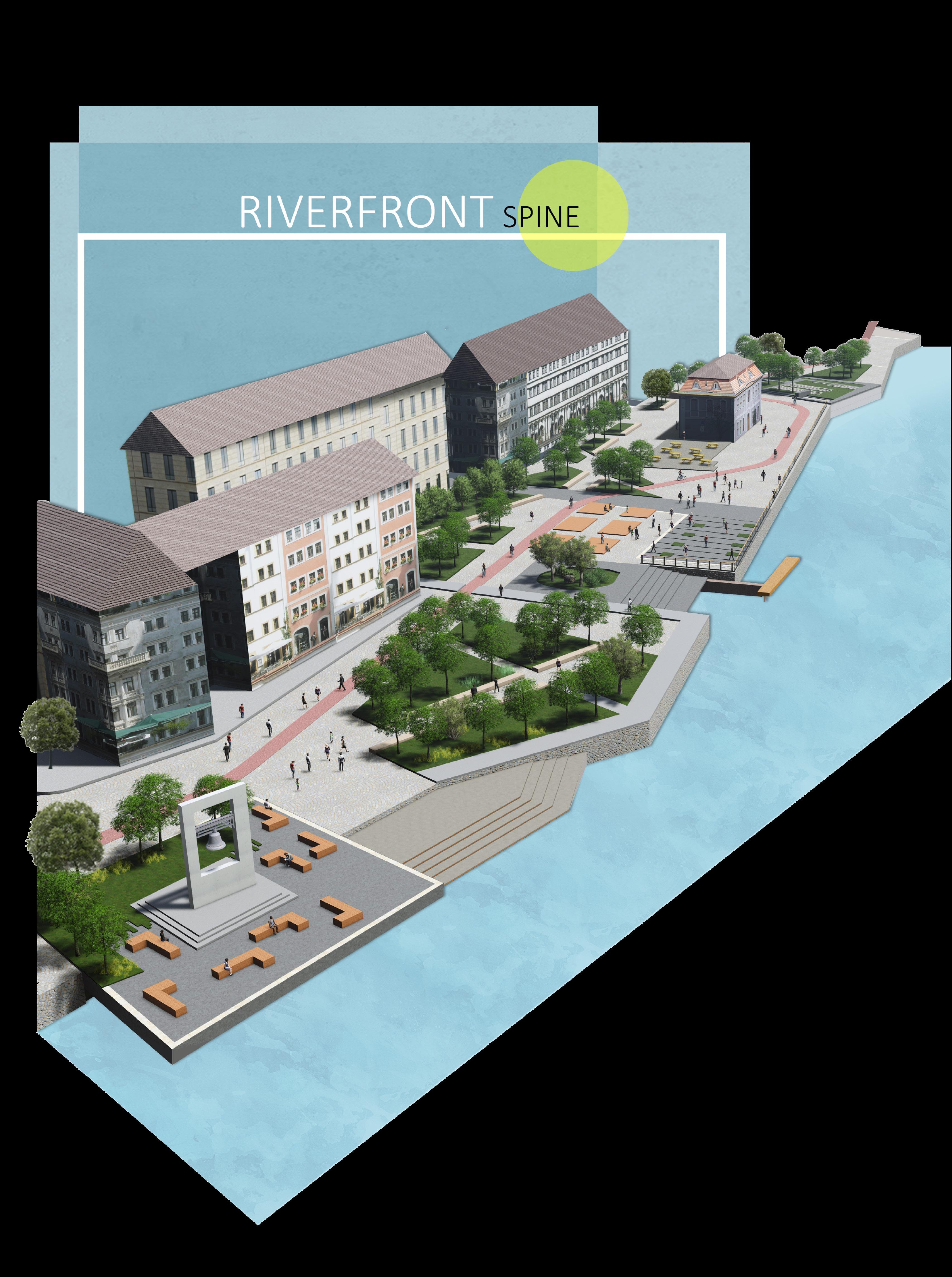
The City Spine
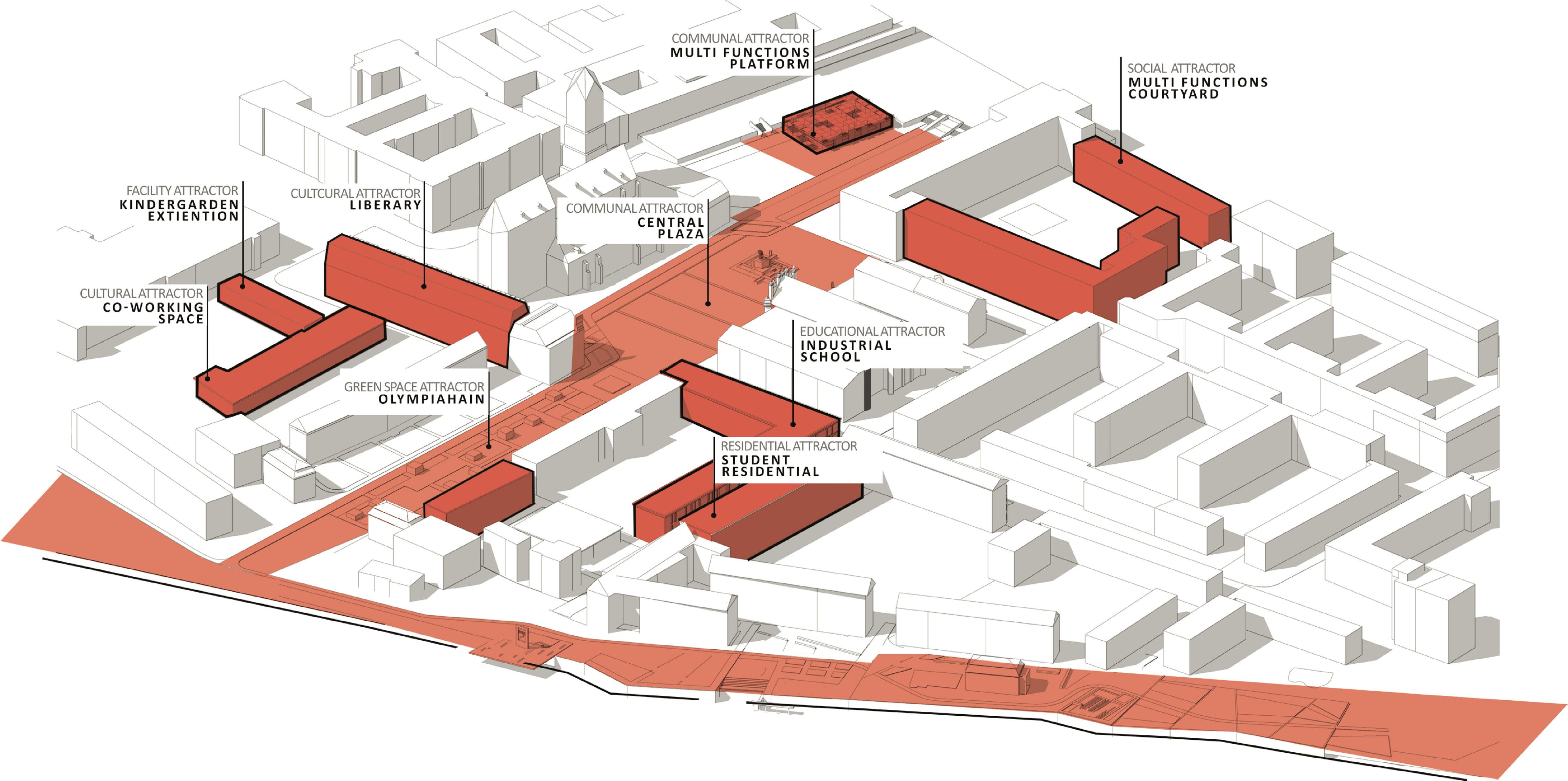
Key Points
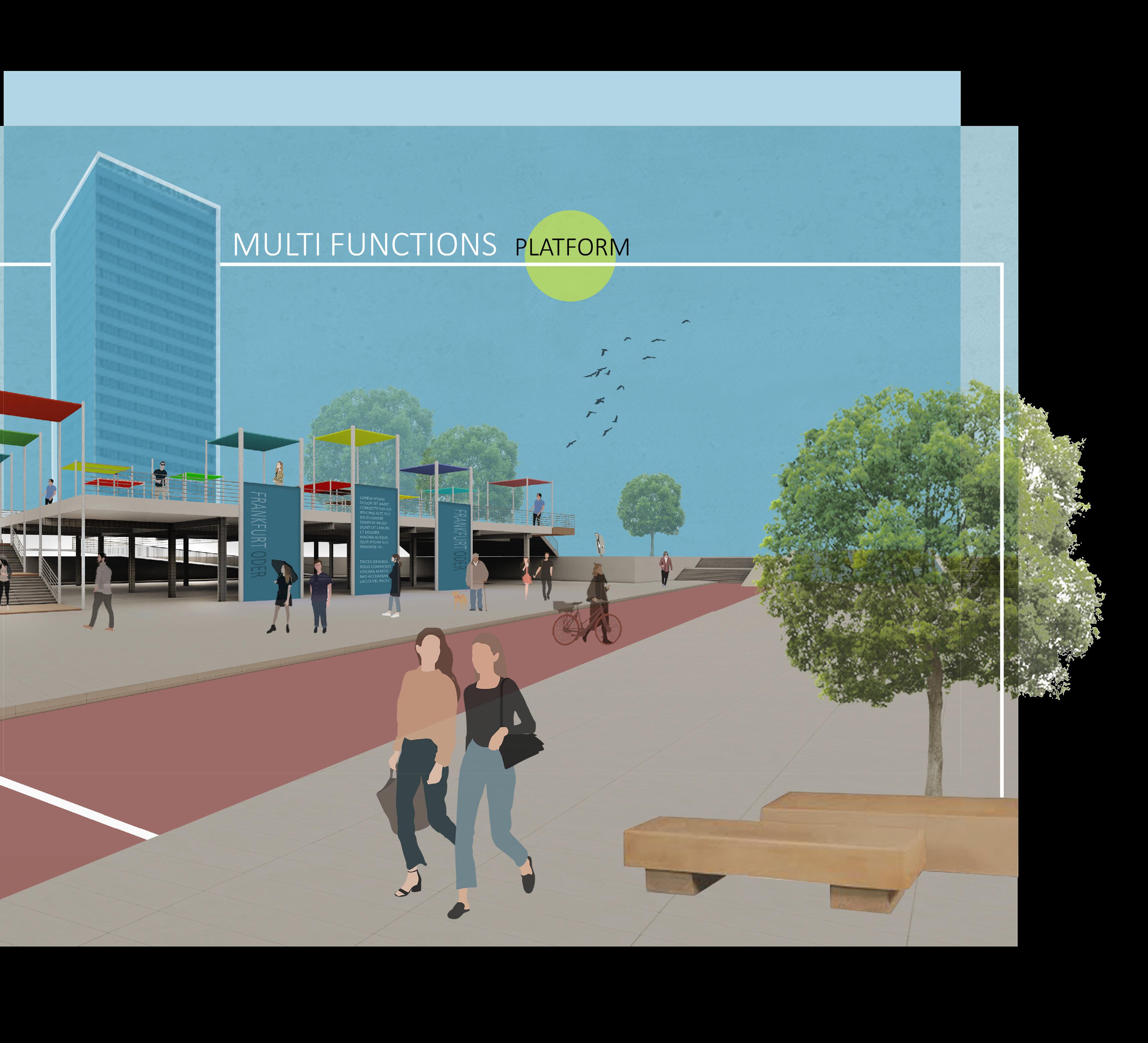
1. Temporal activty Hub: A multifunctional platform over huge parking space
2. Open Exhibition: To exhibit the rich history of the city to the tourists and new comers in the city
3. Central Plaza: The cetral spot for gatherings to attract people and densify city center
4. Library: To promote history of the city and attract students to the city center
5. Olympia Park: The existing socialist park is redesigned that conncets the central square to the riverfront
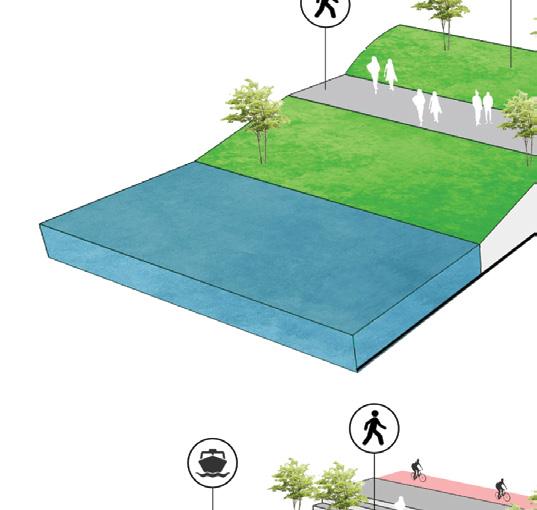
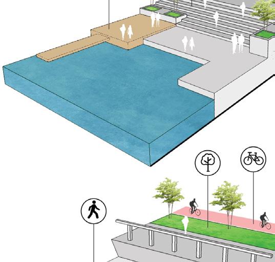
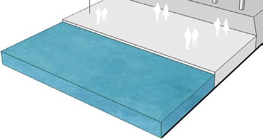
6. Riverfront: To connect people to the river that the city is based on

Design Plan,
by Author


Location of Frankfurt (Oder)Frankfurt
(Oder) as a River-City has an immense potential to use its waterfront as a public open space that motivates the residents to socially interact with the river.
Relationaship Between the city and the River
The Oder river is a strong element that leads all the social activities which the design process worked on.
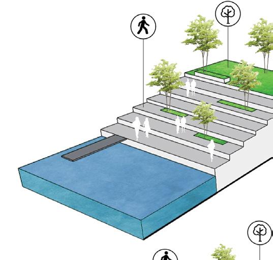
Design Proposal
The design relies on creating the five main spots through the riverfront providing the users with different landscape elements.
Design Elements
Local Markets
Providing the users in every main spots with different elements like the existing landmarks, steps gathering area and water sport area. Temporal Functions
To address the challenges of gentrification in the city center, a strategic approach is adopted to attract people and encourage engagement with the area’s rich history and landscape. A thoughtfully designed recreational riverfront will strengthen the connection between the community and the river, fostering a deeper sense of place. The Spine will serve as a vital link, seamlessly integrating the city center with the riverfront, enhancing accessibility, and revitalizing urban life.
PROJECT 3
HOUSING FOR ALL - TOWN PLANNING
PRADHANMANTRY AWAS
YOJANA (PMAY)
A self-sustaining cIty is designed with affordable housing, public amenities and public spaces.
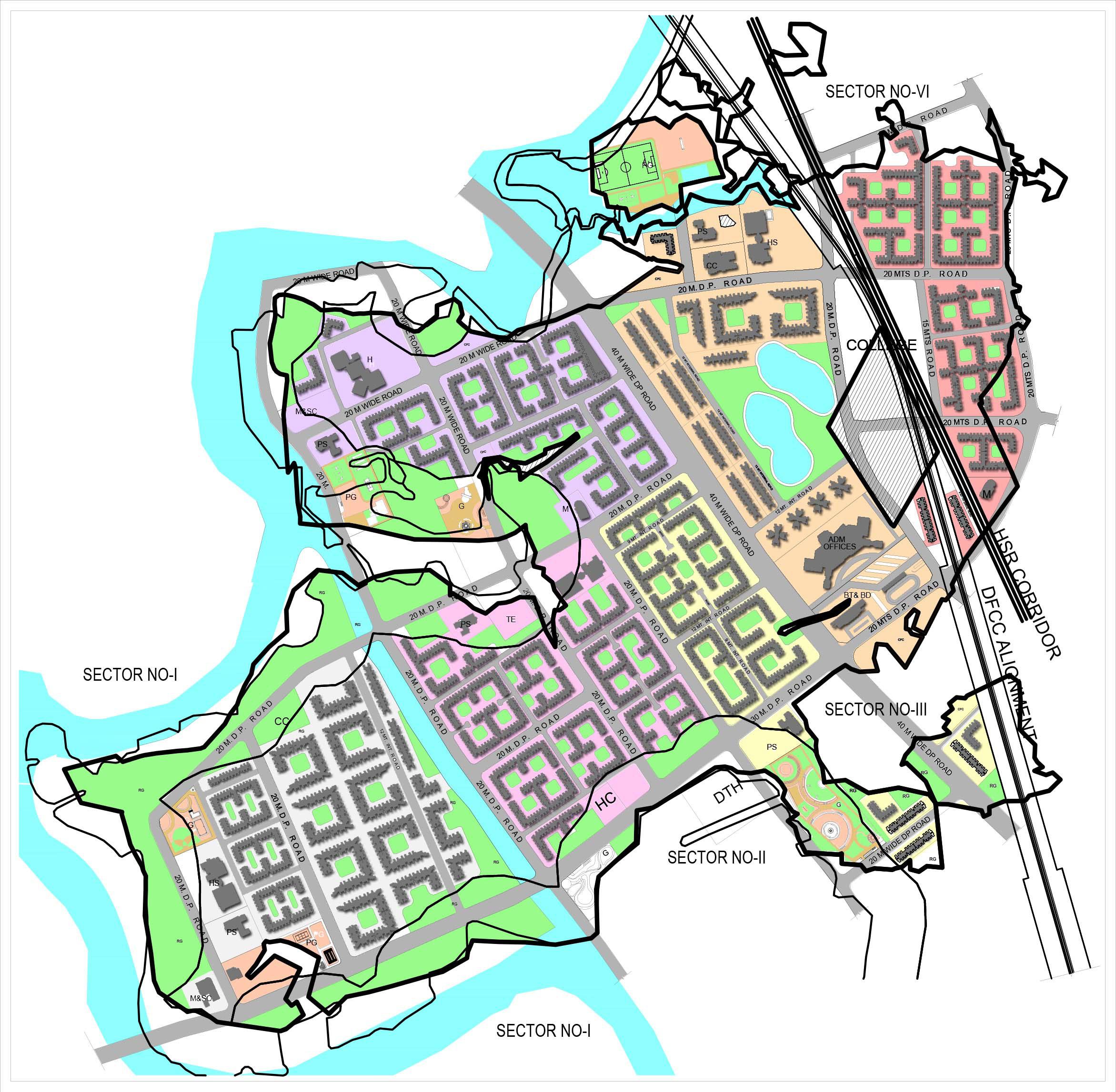
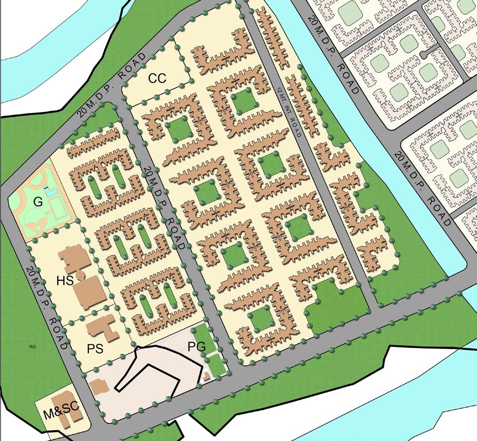
This project is developed under the ‘Housing for All’ initiative launched by Honorable Prime Minister Narendra Modi in 2015, aimed at promoting affordable living without compromising planning and construction quality. Suraksha Smart City, located in Vasai near Mumbai, spans approximately 415 acres of open land, including an abandoned stone quarry.
The primary challenge was to design a self-sustaining urban environment equipped with essential sectors, including education, administration, healthcare, commerce, and recreation, catering specifically to the Economically Weaker Section (EWS) and Low-Income Group (LIG). The project integrates comprehensive infrastructure and urban planning strategies to ensure inclusivity, functionality, and long-term sustainability.
Project Information
Name of the project: Suraksha Samrt City.
Project Location: Rajawali, Vasai, Palghar District, Maharashta, India.
Gross Plot area of Proposed Project: 16,64,798Sq.M.
Proposed Tenements:
i. 147 Buildings with 50,328 nos. flats for EWS
ii. 43 buildings with 20,128nos. flats for LIG
Concept
Suraksha Smart City integrates the five fundamental elements of nature—Earth, Water, Wind, Fire, and Light—into distinct yet connected urban phases. This design fosters balance, sustainability, and wellbeing while merging natural principles with modern urban planning.
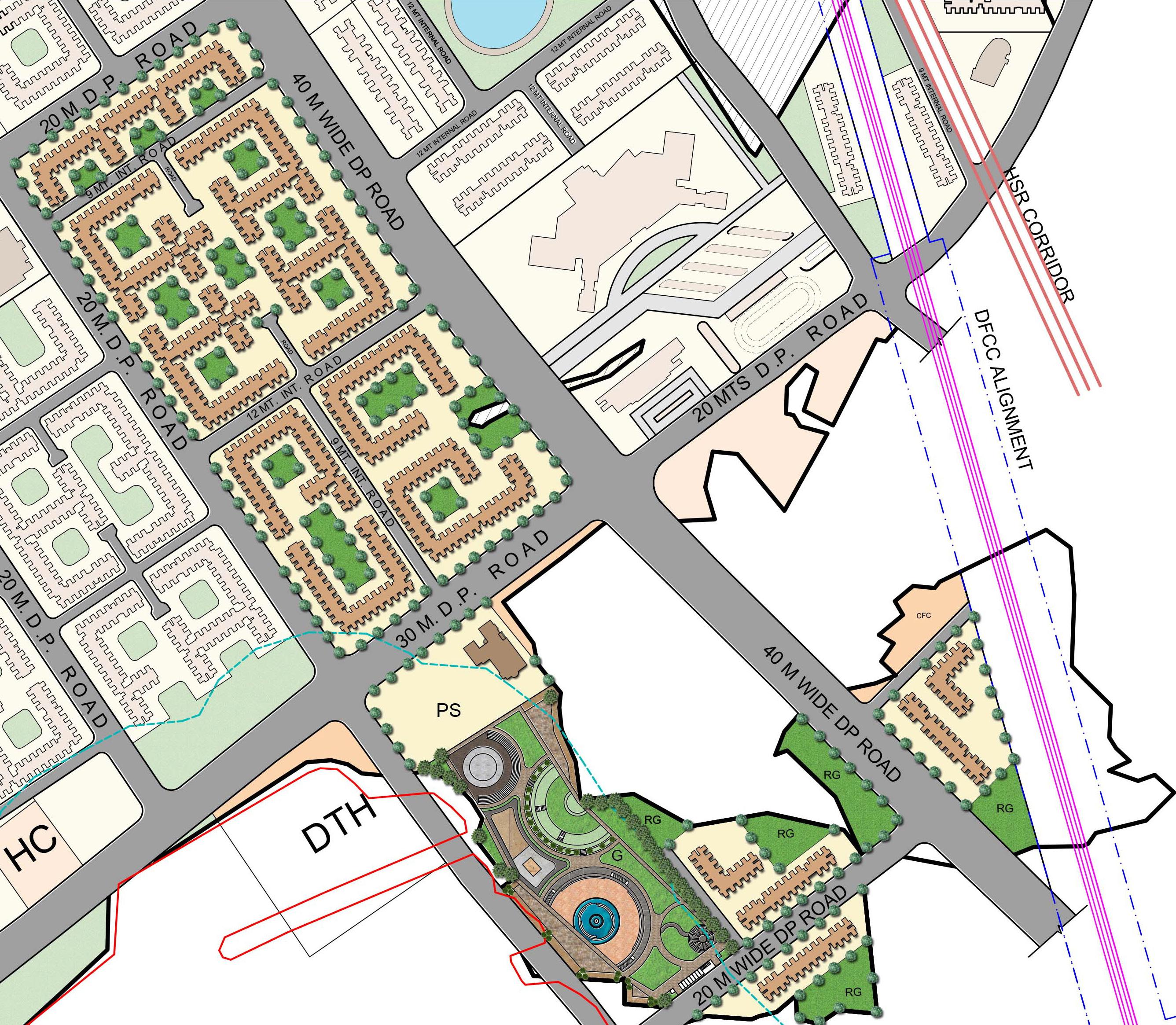
Conceptual Masterplan
Key Points
1. Water: The Water Phase fosters a restorative urban environment, promoting wellbeing, focus, and positivity through thoughtful design.
2. Fire: The Light Phase symbolizes knowledge and clarity, creating an environment that fosters learning, innovation, and enlightened urban living.
3. Wind: The Wind Phase creates an inspiring environment that energizes growth, happiness, and prosperity through thoughtful urban design.
4. Earth: Earth Phase blends stability with innovation, providing a solid foundation for growth and progress through thoughtful urban design.
5. Light: The Light Phase embodies knowledge and clarity, creating an environment that fosters learning, innovation, and enlightened urban living.

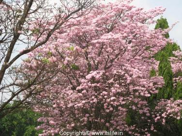

SECTOR 1 (WHITE TRUMPET) LIGHT
About the Tree
Botanical name : Tabebuia roseoalba
Height: 7- 16 M.
Flowering time:
January - April
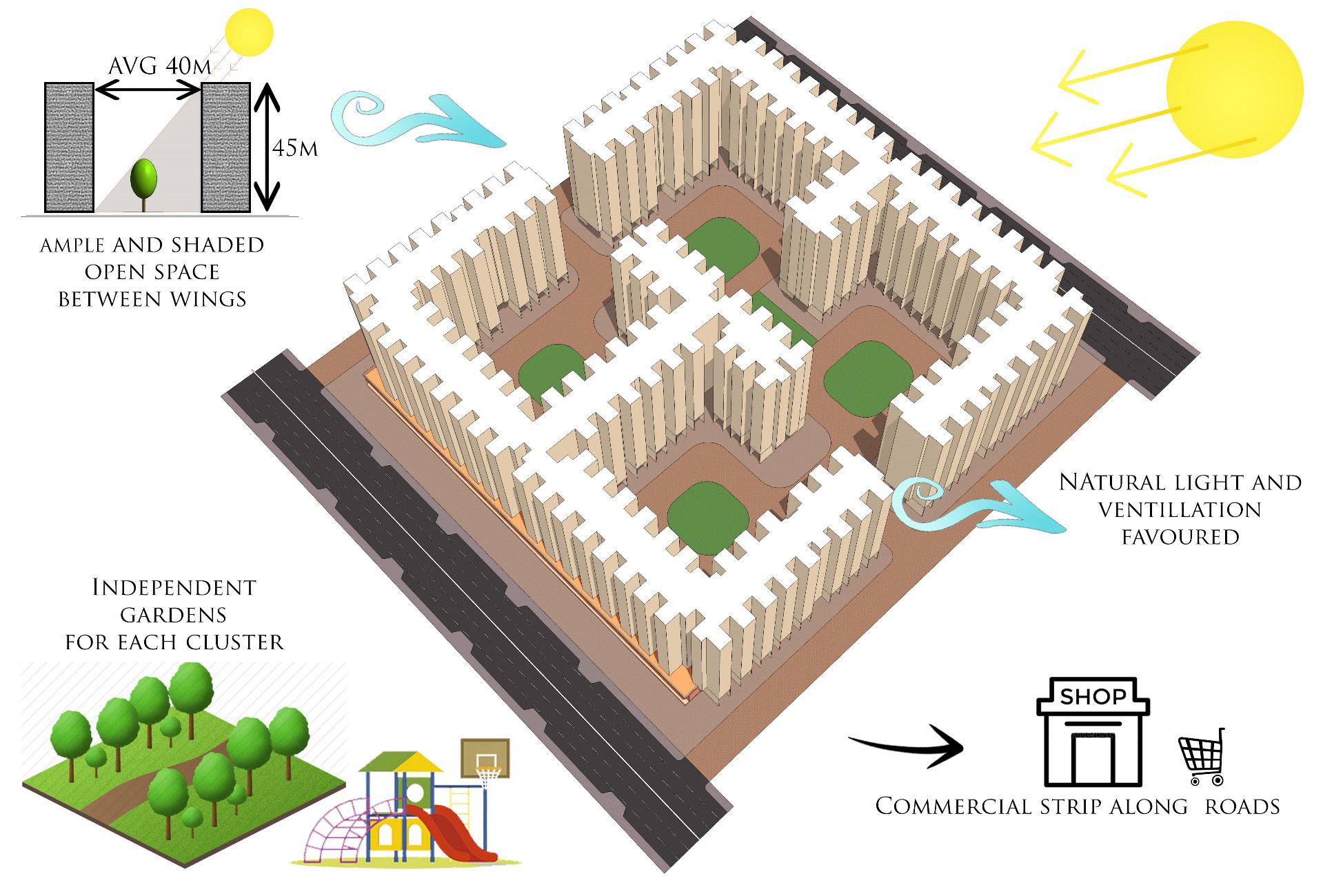
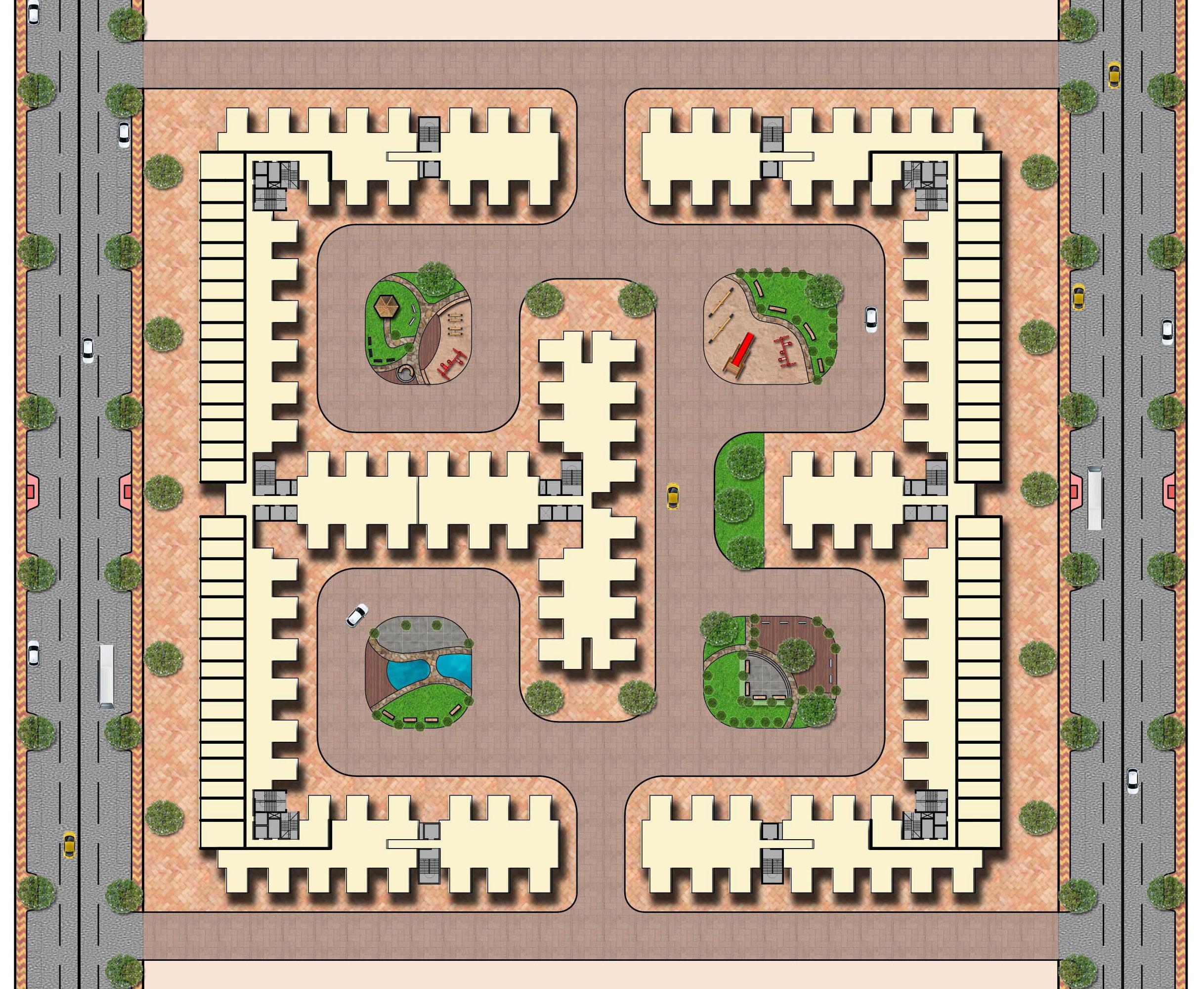
This sector integrates EWS residential buildings with essential community amenities, including a playground, high school, primary school, and garden, fostering a balanced and livable environment.
SECTOR 2 (BASANT RANI) LIGHT
About the Tree
Botanical name : Tabebuia rosea
Height: 20-25 M.
Flowering time:
December - March
This sector, primarily consisting of LIG residential buildings, includes a garden, high school, and primary school, ensuring a well-equipped and livable community.
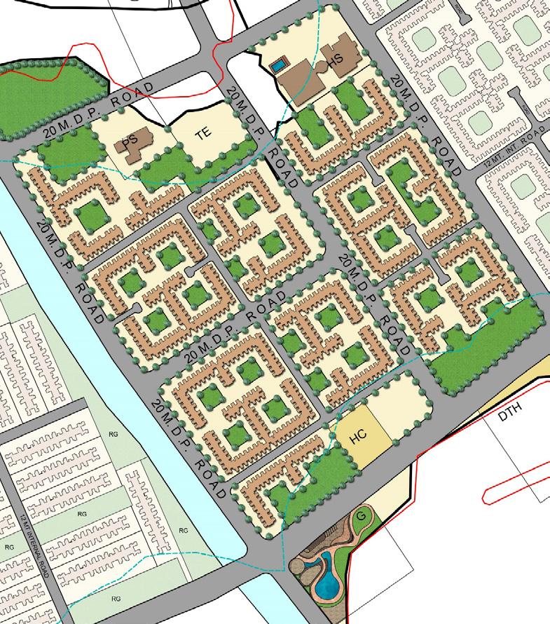
SECTOR 3 (AMALTAS) WIND
About the Tree
Botanical name: Cassia fistula
Height: 5- 15 M.
Flowering time: March - July
This sector is primarily designated for LIG residential buildings, complemented by a recreational garden to enhance community wellbeing.
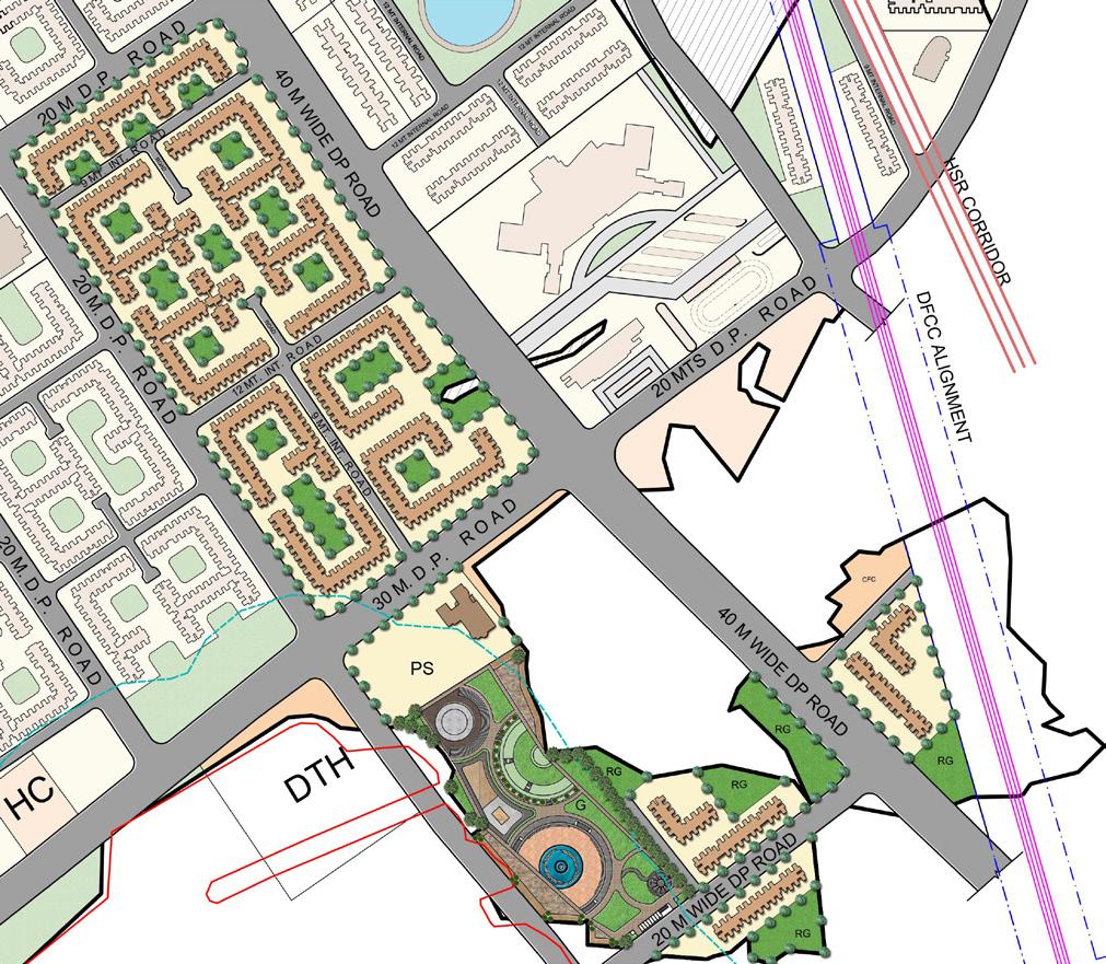


SECTOR 4 (NEEL MOHAR) EARTH
About the Tree
Botanical name:
Jacaranda mimosifolia
Height: upto 20 M.
Flowering time:
March - July
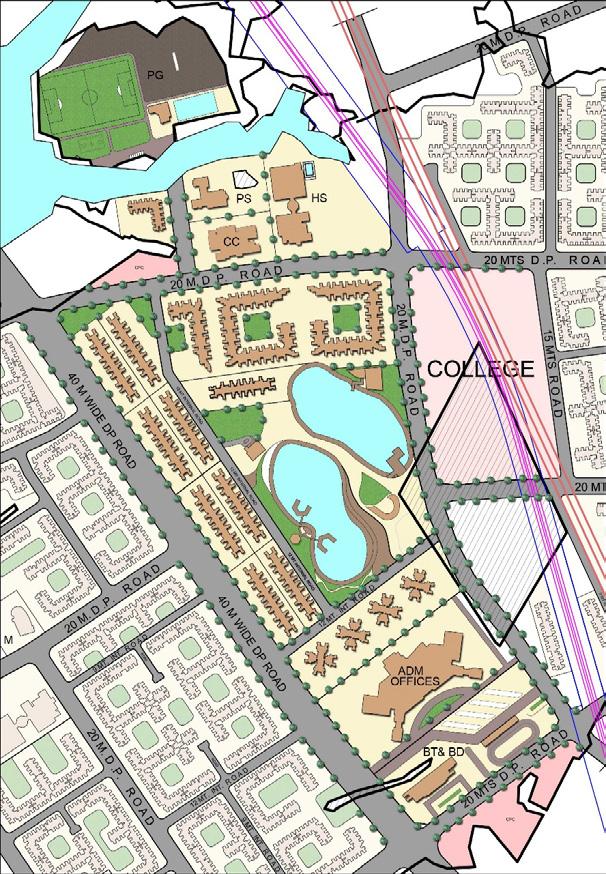
This sector, primarily accommodating LIG residential buildings, also includes a hospital, playground, garden, and administrative facilities, ensuring comprehensive community infrastructure.
SECTOR 5 (GULMOHAR) WATER SECTOR 6 (PALAS) FIRE
About the Tree
Botanical name:
Jacaranda mimosifolia
Height: upto 20 M.
Flowering time:
March - July
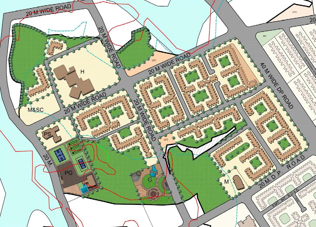
This sector primarily consists of a quarry area, alongside EWS residential buildings and administrative facilities.
About the Tree
Botanical name: Buttea monosperma
Height: 6-12 M.
Flowering time:
January -March
This smallest sector is traversed by a national railway line, featuring a large designated plot for a college alongside LIG residential buildings.
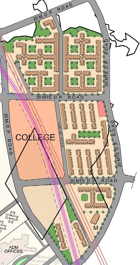
The Light Phase at Suraksha Smart City symbolizes illumination, knowledge, and growth. By dispelling darkness, it fosters clarity and inspiration through thoughtful design and innovative lighting. This phase empowers residents to explore new opportunities and embrace a brighter, more fulfilling future.

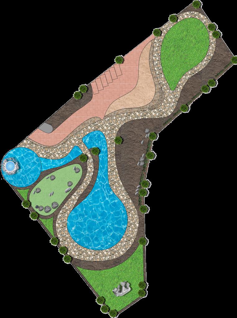
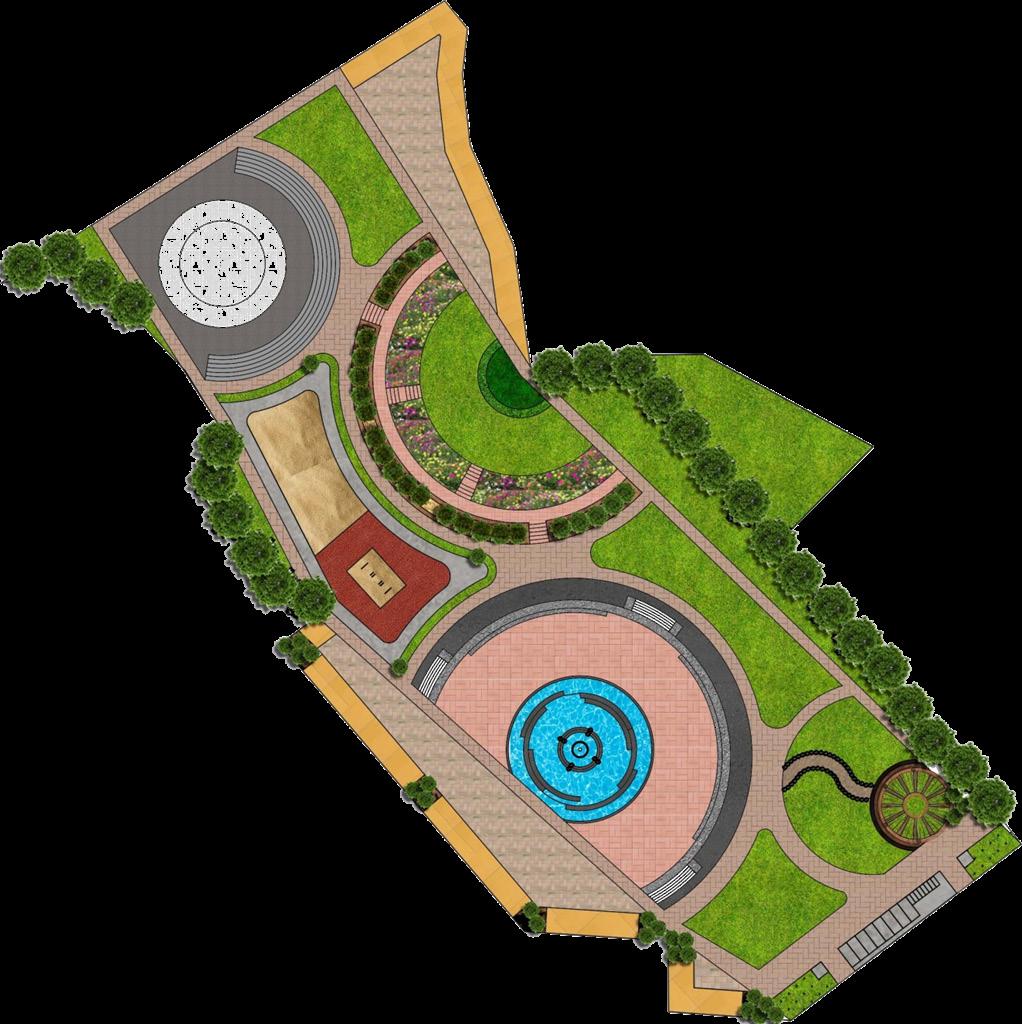
The Zen garden is designed to embody free flow, integrating essential infrastructure to enhance social interaction. A nearby water body reinforces this concept, complemented by stone fountains, sculptures, and walkways.


Garden Reservation- Rock Garden
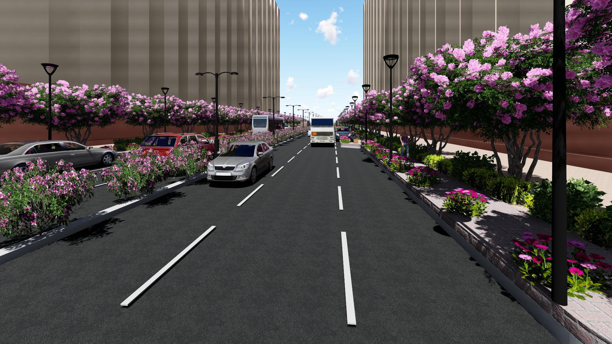
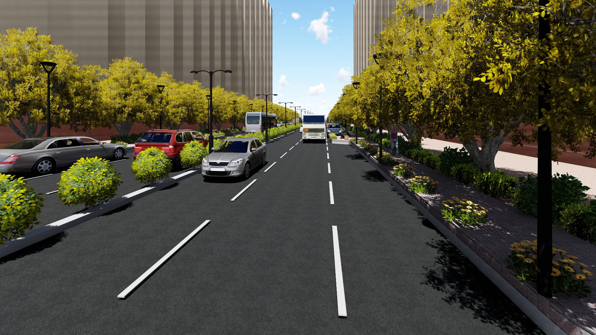
Typical View of Street in Sector 2
The Wind Phase at Suraksha Smart City embodies the vitality of air, fostering progress and well-being. Inspired by wind propelling a sailboat, its design integrates open spaces and dynamic landscapes to inspire prosperity, resilience, and harmony in an interconnected urban environment.

The contemporary garden fosters serenity and public engagement, integrating an amphitheater, gazebo, and music fountain to support yoga, meditation, and social gatherings.
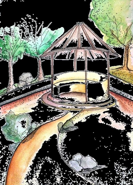
Garden Reservation
Typical View of Street in Sector 3