HOUSING STRATEGY
comprehensive parks
space strategy is essential
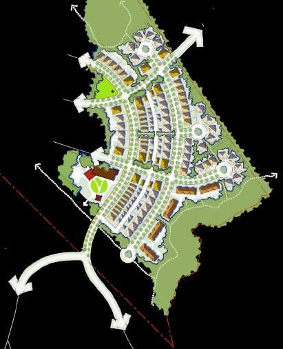
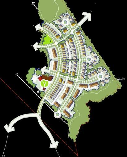
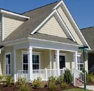
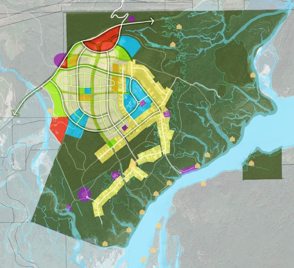
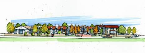
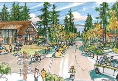
The Sproat Lake Village concept proposes a diversity of housing as a fundamental aspect of how we live together. A range of types – mixed within every neighbourhood – brings us together in all life stages.
Developed the Sproat Lake Village Concept Plan that is reflective of the site’s unique qualities and opportunities: access requirements,
TODAY AND TOMORROW: UNDERSTANDING OUR NEED
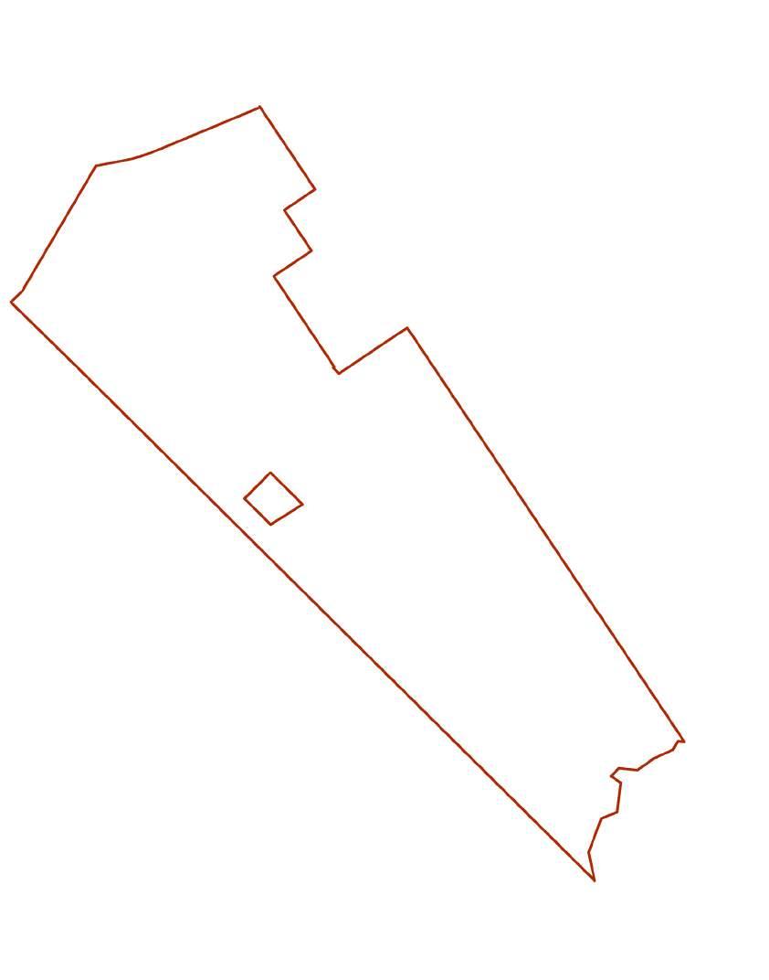
Revized rezoning extents
Proposed · June 13, 2023
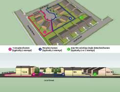
The vast majority of homes within the Sproat Lake community are characterized as owner, single-detached households ~90 percent) with ~75 percent 3 or more bedrooms according to the 2021 Housing Needs Report.
DIVERSITY OF HOUSING
Detailed
Servicing Plan and Parcel Layout Options
New housing at Sproat Lake must help address community needs through increased diversity and affordability, inclusive of individuals, families of varying life stages and means.
VILLAGE RESIDENTIAL
consider CDA boundary adjustmen et er to A ea D e tor)
existing CDA boundary
ALR
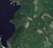
Sproat Lake Provincial Park
ENVIRONMENTAL FEATURES


market farmers
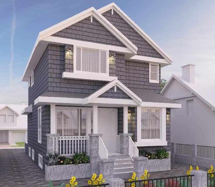
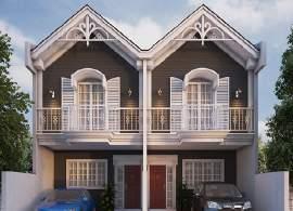
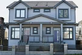
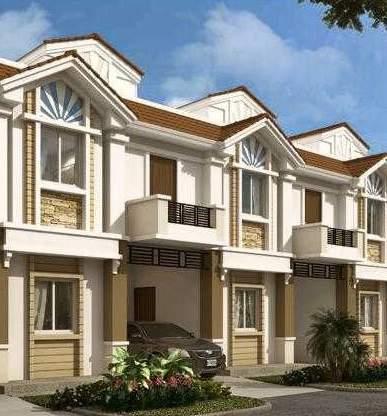
Within a diversity of types, an emphasis on ground-orientated designs (e.g. ‘everyone with a front door’) maintains a strong sense of neighbourliness and close connection to the outdoors. A range of low density types are proposed: from larger lots overlooking the lake, to more compact lots, housing clusters and duplexes designed for greater affordability. A range of more compact and more affordable housing types are also proposed in the form of groundoriented multi-family dwellings (e.g. ‘plexes,’ and townhomes) – support more compact and affordable housing types and tenures (e.g. rental and ownership).
NEIGHBOURHOOD MIXED USE
Phase 1B
Phase 1 Servicing
septic north of the hwy for west side (in order to stay clear of the lake)
Sproat Lake Provincial Park
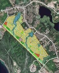
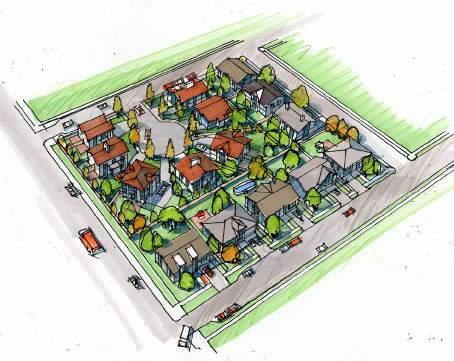
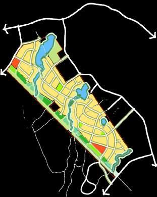
Housing Concept Plan
While the ‘community heart’ will provide many destination amenities, pocket neighbourhoods will include central spaces for social gathering.
ALR
EXPLORING COMPLETE COMMUNITY
Phase 1A septic to be moved away from the lake (JEA to confirm)
existing Sproat Lake Community Association building & use area marina program, seeking ec dev partnership with Hupačasath
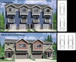
Typical - fee simple
Single detached homes are accessed via street front driveways.
4.4 acres (3.6 UPA)
+ 2 unit (0.5 ac) density bonus
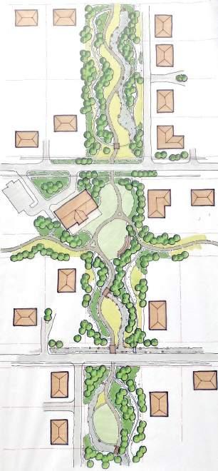
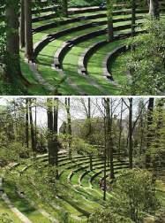
Community benefits of the Parks and Open Space strategy include walkability, connection to nature and a healthy lifestyle. A well-designed system also helps the community stay resilient by enhancing green infrastructure and improving water quality.
PHASED IMPLEMENTATION

THE RIGHT MIX
While the strategy proposes a high-level comprehensive plan for the open space network, an incremental approach to park and trail dedication is anticipated. Trails and park improvements are built out as development progresses. This allows for efficient use of resources, provides opportunities for community engagement, and ensures that residents’ access to open space is maximized as development occurs.
In addition to the ACRD’s Housing Needs Report, our approach is also informed by a Market Study, completed to better understand local market conditions.
Potential
» on site septic (sufficient distance from lake)
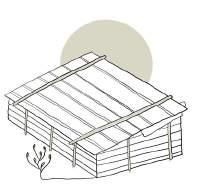
» housing arranged in clusters (per sketches below)
The PARKS & OPEN SPACE STRATEGY m -W
Anticipating a balanced offering of single-unit, duplex and multiunit dwellings, specific types and mixes will be determined prior to individual development phases. Where feasible, pocket neighbourhood designs will accommodate a mix of types and tenures.
visit www.couverdon.com for more information – share your ideas – and sign up for project updates
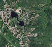
Sproat Lake
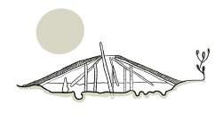
Housing cluster concepts 16-unit ‘clusters’ with dedicated sanitary disposal area (shaded in light green).
Bare land strata
Single detached homes and garages are arranged around a central green and accessed via shared driveways.
4.3 acres (3.7 UPA)
+ 4 units (1 ac) density bonus
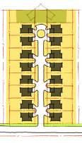
Typical townhomes
Townhomes are serviced via a central driveway with larger individual rear yards.
2.8 acres (5.7 UPA)
+ 8+ units (1.1 ac) density bonus
What strategy

VILLAGE
existing CDA boundary


lifestyle, a P m n y e m & S n e y em M p n S o L k u e d n d e oca n
life S ud A a S eam C n e P o D e S am Ce e e a e F p H h Wa Ma P s e Ep eme D n g M n m g s o ow R pa a DPA We Ma e Fo s O F e H ba e u ±

parks and open spaces will be dedicated incrementally in accordance with associated development phases
Sproat Lake OCP’s goals include that development should “offer residents a m m & v E m M u o a S u S m C P D e e m C L d a W a P E e e a e M n m S o w R p n D A We d M o s O H c ± M n D -W
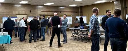
Community Open House
Sproat River
e m n y am & e e E o em M a p S o a C u e o a d e
u A a e m C n n o D e S e m Ce e e a o p a H g W Ma o s b e p em a D a n g M m S g o F o R p n DPA We n M u e o s O d o H a e u ±
ALR
Central green townhomes

M m w Dw

Townhomes front onto a common green. Homes are accessed via laneways with paired garages.
2.8 acres (5.7 UPA)
+ 8+units (1.1 ac) density bonus
01 URBAN DESIGN & MASTER PLANNING
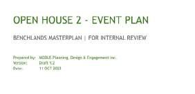
BENCHLANDS
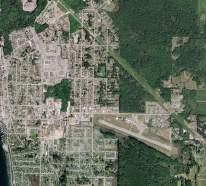
POWELL RIVER
SPROAT LAKE
24 24% 34 33% 44 43% Residential units by type DUPLEX LARGE SINGLE DETACHED 18M FRONTAGE TYPICAL SINGLE DETACHED 15M FRONTAGE TOWNHOMES COMPACT SINGLE DETACHED 10M FRONTAGE 30 24% 24 19% 14 11% 28 23% 28 23% Residential units by type DUPLEX LARGE SINGLE DETACHED 18M FRONTAGE TYPICAL SINGLE DETACHED 15M FRONTAGE TOWNHOMES CONDO 48 24% 58 30% 18 9% 21 11% 23 12% 28 14% Residential units by type DUPLEX LARGE SINGLE DETACHED 18M FRONTAGE TYPICAL SINGLE DETACHED 15M FRONTAGE COMPACT SINGLE DETACHED 10M FRONTAGE McGuffieCreek McGuffieCreek McGuffieCreek to Complex Way to Complex Way to Complex Way to Manson Ave to Manson Ave to Manson Ave
URBAN DESIGNER, MODUS PLANNING, DESIGN & ENGAGEMENT INC.
+ 8+units (1.1 ac) density bonus density bonus + 4 units (1 ac) density bonus
LakeshoreRd Col Ash
C e n t r a l L
Pacific Rim Hwy Pacific Rim Hwy
Ma n
ak e Rd
SPROAT LAKE VILLAGE
healthy
good quality of
A small number of neighbourhood-scale mixed-use sites are also proposed, including opportunities for more intensive residential forms (e.g. apartments) to support tourist accommodation, more affordable options and/or staff housing. and affordable YOUR IDEAS Community visit www.couverdon.com for more information – share your ideas – and sign up for project updates
creating vibrant
community, promoting health and wellness, and preserving
A
and open
for a
and sustainable
natural resources for future generations.
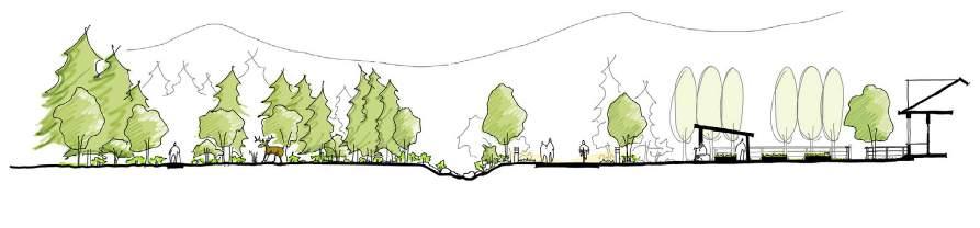
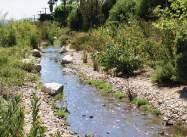
A number of known “environmentally sensitive areas” (ESAs) exist, including wetlands and streams that are important fish habitat. Undisturbed waterfront areas are also important places for biodiversity. These have been identified and mapped to form the basis for the parks and open space strategy.
A COHESIVE PARK (ECO)SYSTEM
There is an opportunity to expand, strengthen and protect a network of parks and open spaces as integral to the Village concept. With environmental features as the starting point for site planning, networks of natural and recreational systems are designed to connect to and respect each other.
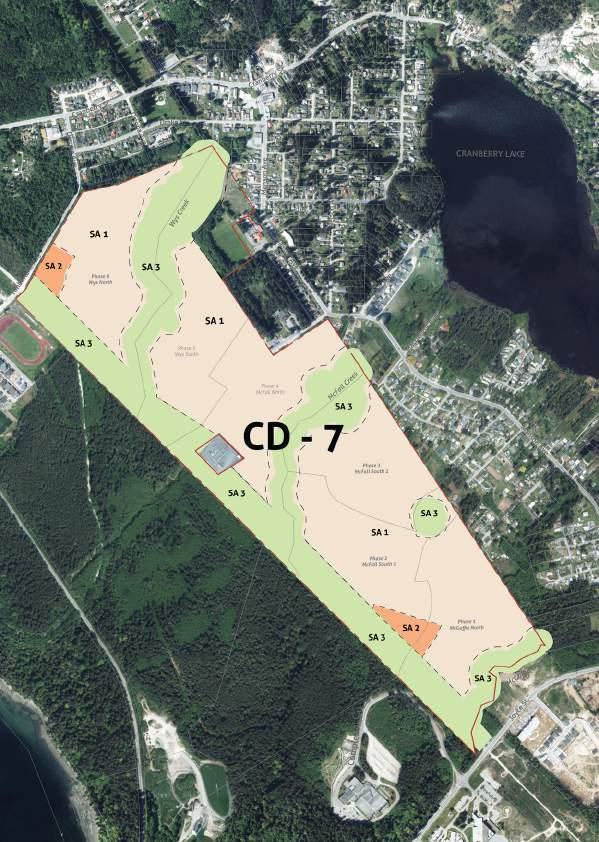
Servicing & Phasing Concept Plan
Roles & Responsibilities
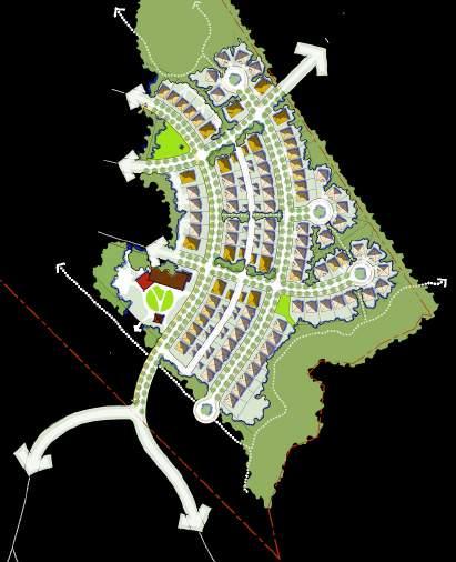
COMMUNITY MASTERPLAN
URBAN DESIGNER, MODUS PLANNING, DESIGN & ENGAGEMENT INC., VANCOUVER, BC
Roles & Responsibilities
Assisted in creation of the concept plan for Tl’ó x e:ylt te wáyeles which is grounded in Sts’ailes culture, connections to lands and water, and providing spaces and services to support community well-being.

Cultural Greenway
The Cultural Greenway – as a central and defining feature of the masterplan – provides dedicated space to connect community destinations with specific and significant cultural value.
This 50 metre greenway runs north-south through the centre of the neighbourhood lands and provides four key functions:
The Cultural Greenway – as a central and defining feature of the masterplan – provides dedicated space to connect community destinations with specific and significant cultural value.
CULTURAL GREENWAY
CULTURAL CONNECTION
The
cultural trails – screened for the privacy of new spirit dancers – weave along the forested edges
RECREATION & TRAVEL
Assisted in designing 50 metre greenway that runs north-south through the centre of the neighbourhood lands and provides four key functions:
A walking/cycling ‘main trail’ moves through the central, linear clearing
CULTURAL CONNECTION
FOREST GARDENS & HABITAT
Chehalis Rd. SachemRd.
MorrisValleyRd. School Rd. LhemqwathelRd. Leon Rd. FirehallRd. HÌqelem (Harrison River)
cultural trails – screened for the privacy of new spirit dancers – weave along the forested edges
Cultivated areas and clearings for a diversity of plants and animals
RECREATION & TRAVEL
WATER MANAGEMENT
A walking/cycling ‘main trail’ moves through the central, linear clearing
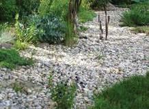
Vegetated swales and dry creek-beds capture, store and filter rainwater
FOREST GARDENS & HABITAT
Cultivated areas and clearings for a diversity of plants and animals
WATER MANAGEMENT
Vegetated swales and dry creek-beds capture, store and filter rainwater
Street Design
Speqwolh (mouth of Chehalis River)
Sts’ailes Concept Plan - Legend
Commercial Centre
Wastewater Treatment Plant
Community Hall
Youth Centre
School Expansion
Community Longhouse
Child & Family Services & Resource Homes
Telmexw Awtexw Healing Centre

Ancient Village Sites


Greenways & Spirit Trails
Trails
Roads
Parcel Boundaries
Intensive Residential Administrative Boundary
Spaces
Sustainable Stewardship Area
Waterways, Sloughs and Streams


01 URBAN
STS’AILES
DESIGN & MASTER PLANNING
2023 CULTURE LAND & WATER INFRASTRUCTURE & MOBILITY LAND USE, FACILITIES & HOUSING for wáyeles Masterplan
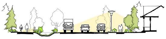
32 DRAFT FOR INTERNAL REVIEW NOVEMBER 3 2023 20m ROW (typical) 20m ROW (typical) COMMERCIAL COLLECTOR 20m ROW (typical) bioswale two-lane traffic bioswale walking path walking path bioswale two-lane traffic street parking + landscape walking path residential edge (fronting condition) residential edge (fronting condition) residential edge (fronting condition) buffered edge (typical) multi-use path street lighting STREET DESIGN ARTERIAL STREETS Morris Valley Road traverses the western and northern boundaries of IR5 and functions as an arterial road, linking Sts’ailes territory to the larger region (and including traffic volumes from Sasquatch Mountain Resort). A cross section is not depicted here as community development does not propose a fronting condition. COMMERCIAL COLLECTOR STREETS The commercial collector street organizes economic development lands along convenient “loop” road while establishing a clear and visible boundary to the community lands and residential areas beyond. The alignment of the intersection with Hemlock Valley Road provides high visibility and opportunity for future commercial uses. bioswale two-lane traffic street parking storefront sidewalk landscape buffer landscape buffer landscape buffer multi-use path pedestrian lighting pedestrian lighting street lighting mixed-use commercial building (fronting condition) NEIGHBOURHOOD COLLECTOR LOCAL STREET
20m ROW (typical) multi-use path trail for new spirit dancers wildlife corridor (varies) stormwater management gathering space (varies) CULTURAL GREENWAY 50m ROW (typical) COMMUNITY GREENWAY GREENWAYS Designed as pedestrian “rights of way” to compliment 33 DRAFT FOR INTERNAL REVIEW NOVEMBER 3 2023 residential edge (fronting condition varies) residential edge (fronting condition varies) multi-use path bioswale (varies) seating area 20m ROW (typical) multi-use path trail for new spirit dancers wildlife corridor (varies) stormwater management gathering space (varies) CULTURAL GREENWAY 50m ROW (typical) COMMUNITY GREENWAY GREENWAYS Designed as pedestrian “rights of way” to compliment the street network, greenways offer dedicated, safe and comfortable spaces for community members to travel, gather and connect. CULTURAL GREENWAY (single-fronting) The Cultural Greenway forms a central North-South linkage through the community and dedicates significant space for multi-use pathway circulation, separated (e.g. visually screened) trail networks for new spirit dances, community gathering spaces as well as habitat (wildlife corridor) and stormwater management. COMMUNITY GREENWAY (double-fronting) Intersecting the Cultural Greenway (at the proposed location of the Community Longhouse), the Community Greenway forms a central West-East linkage through the community. Stretching from the community picnic campground (on the Chehalis River) it continues through the new neighbourhood lands – with residential frontages and leads to the Community Hall. Commercial Use
Residential Community Use
Cultural Areas
Parks & Open
Compact
Destination
Nature
1 2 3 4 5 7 6 8 2 1 6 7 4 5 8 3
25 DRAFT FOR INTERNAL REVIEW NOVEMBER 3 2023
This 50 metre greenway runs north-south through the centre of the neighbourhood lands and provides four key functions: CULTURAL CONNECTION cultural trails screened for the privacy of new spirit dancers – weave along the forested edges RECREATION & TRAVEL A walking/cycling ‘main trail’ moves through the central, linear clearing FOREST GARDENS & HABITAT Cultivated areas and clearings for a diversity of plants and animals WATER MANAGEMENT Vegetated swales and dry creek-beds capture, store and filter rainwater K O LEGEND TL’Ó XE:YLT TE WÁYELES MASTER PLAN Long House Long House Ceremonial Area Manicured Lawn D Native Meadow Grass Playground or Art Display Green Infrastructure G Multi-use Trail 3.0 meters H Spirt Trail 1.0 mteers Bridge & Feature Long House Parking Lot Long House Outdoor Patio M Typical 20.0m Road & Sidewalks N Asymentrical Street O Lane & Front Facing Homes Side Yard Facing Homes Greenways Master Plan Concept C M A N D G G F H D D F H H H E O A K O LEGEND TL’Ó XE:YLT TE WÁYELES MASTER PLAN A Long House B Long House Ceremonial Area C Manicured Lawn D Native Meadow Grass Playground or Art Display Green Infrastructure G Multi-use Trail 3.0 meters H Spirt Trail 1.0 mteers Bridge & Feature Long House Parking Lot K Long House Outdoor Patio M Typical 20.0m Road & Sidewalks N Asymentrical Street O Lane & Front Facing Homes Side Yard Facing Homes Greenways Master Plan Concept P P C M A N P P P B D G G F F H D D H H H O A K O TL’Ó XE:YLT TE WÁYELES MASTER PLAN G - Multi-use Trail 3.0 meters H Spirt Trail - 1.0 mteers Bridge & Feature Long House Parking Lot K - Long House Outdoor Patio M - Typical 20.0m Road & Sidewalks N Asymentrical Street O Lane & Front Facing Homes P Side Yard Facing Homes Greenways Master Plan Concept P P C M A N P P P B D G G G F F D D F H H H F E O in revision 25 DRAFT FOR INTERNAL REVIEW NOVEMBER 3 2023
Cultural Greenway – as a central and defining feature of the masterplan – provides dedicated space to connect community destinations with specific and significant cultural value.
A K O
XE:YLT TE WÁYELES MASTER PLAN E - Playground or Art F - Green Infrastructure G - Multi-use Trail - 3.0 H - Spirt Trail - 1.0 mteers I Bridge & Feature J - Long House Parking K Long House Outdoor M Typical 20.0m Road N - Asymentrical Street O - Lane & Front Facing P - Side Yard Facing Homes Greenways Master Plan Concept P P C M A N P P P B D G G G F I F H D D F H H H F E O A K O LEGEND A Long House B Long House Ceremonial Area C Manicured Lawn D - Native Meadow Grass E Playground or Art Display F - Green Infrastructure G - Multi-use Trail - 3.0 meters H - Spirt Trail - 1.0 mteers I Bridge & Feature J Long House Parking Lot K Long House Outdoor Patio M Typical 20.0m Road & Sidewalks N - Asymentrical Street O - Lane & Front Facing Homes P - Side Yard Facing Homes P P C M A N P P P B D G G G F I F F H D D F H H H F E O A K J TL’Ó XE:YLT TE WÁYELES MASTER PLAN Greenways Master Plan Concept P C A N P P P B G G I I F D D F H H F E O in revision
TL’Ó
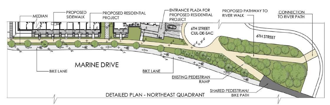
MARINE TAYLOR WAY PUBLIC REALM REPORT
URBAN FORUM ASSOCIATE, VANCOUVER, BC
Intersections Insights through sections
Roles &
Developed concept plans, detailed plans for each quadrant and sections for Marine-Taylorway public realm report in West Vancouver. Concept plans included detailed long-term public realm improvement plan, mobility plan, potential public art plan, bicycle and pedestrian network plan and public open space plan. Assisted in creating and formarting overall public realm report.
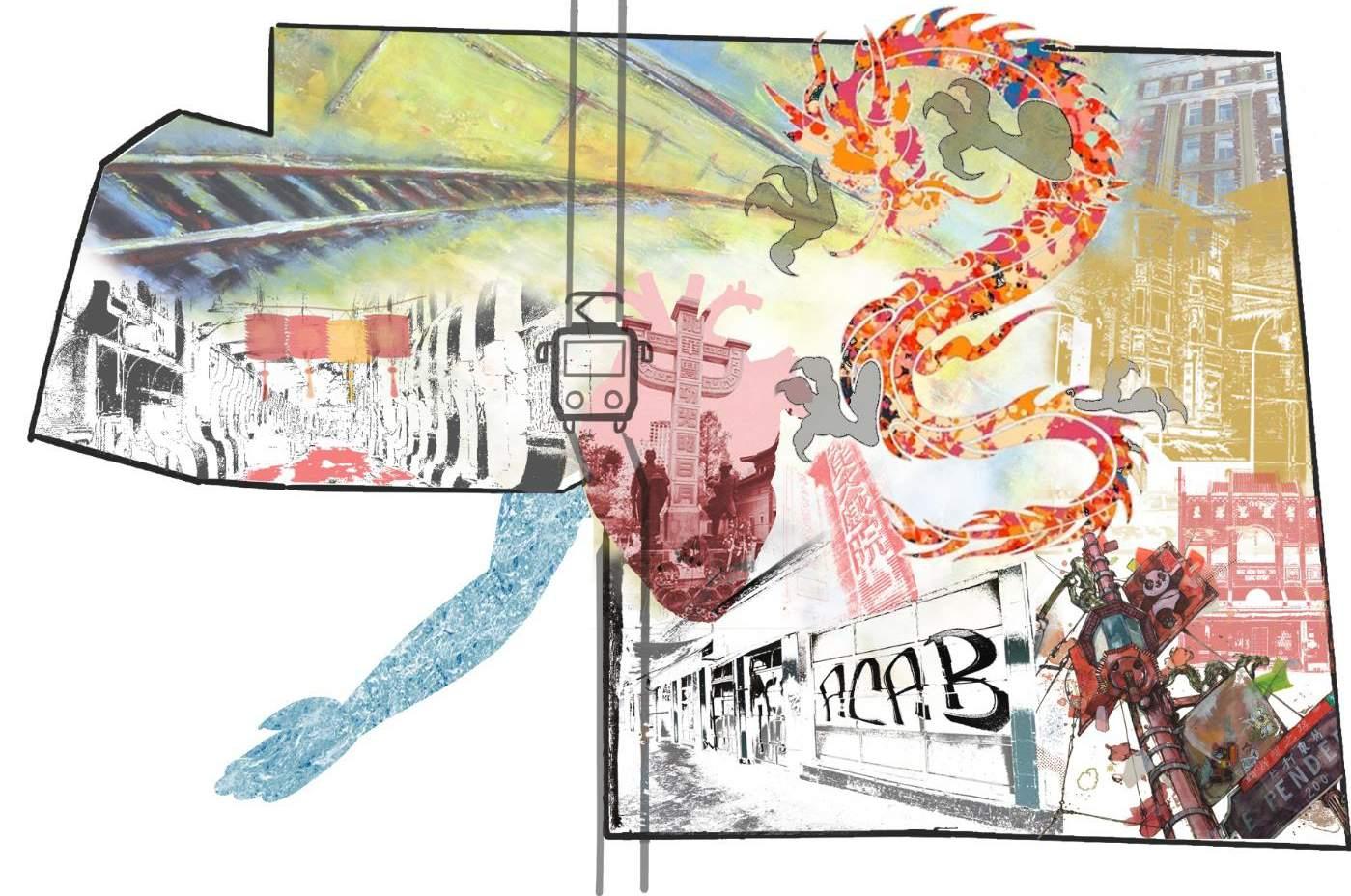
BLOCK BETWEEN KEEFER AND PENDER STREET, CHINATOWN (UBC SALA, MASTER’S OF URBAN DESIGN, VANCOUVER, BC)
Concept Plan
As a part of the studio exercise, the design challenge focused on reinventing the unique identity of Chinatown Vancouver. The site I chose as a part of my intervention is located between Keefer street and Pender Street. The location is chosen as a potential site because of lease number of heritage buildings and new developments. The idea behind designing this block is to bring back the historic characteristics of Chinatown to allow the 25 foot urban fabric pattern. Focusing on the major and minor concerns of Chinatown, such as need for adequate open spaces, mixed use typology, social housing, gathering spaces, heritage retention and laneway activation this new plan creates plenty of future opportunities. It brings back the lost cultural heritage character of Chinatown by responding and blending in the subsequent present day context.
01 URBAN DESIGN & MASTER PLANNING
ADAPTIVE GROUNDFLOOR COU R T DRAY ADAPTIVEINT ER N A L ESUERECAPS MAXIMIZING SHOPFRONTAGES PUBLIC ORIENTEDSPACES COLLABORATIVE SPACES ENHANCING PERMEABILITY
Responsibilities
Long Term Public Realm Improvement Plan


Roles & Responsibilities
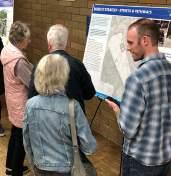
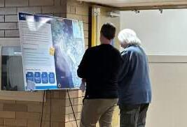
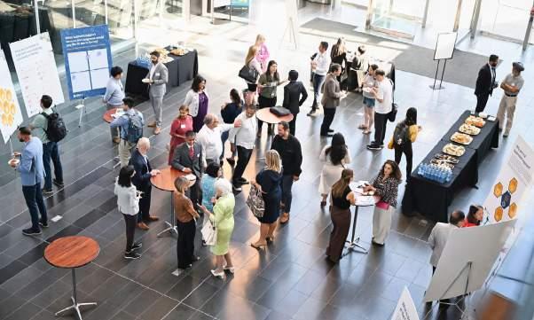
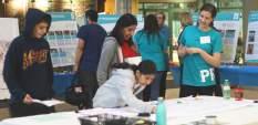
played a key role in designing and preparing two rounds of open house boards, creating visually compelling materials to convey project information. Additionally, facilitated online surveys, leveraging digital platforms to gather valuable input from the community. The development of an Event Facilitation Guide allowed for seamless coordination during community events, ensuring effective communication. Engaging the community was further enhanced through the creation of Communication & Outreach Materials, designed to convey project updates and information. Lastly, compiled comprehensive Engagement Summaries, distilling feedback and insights gathered during community interactions, contributing to the overall project development process
NOTICE OF PUBLIC OPEN HOUSE


SUMMARY OF FEEDBACK TO DATE
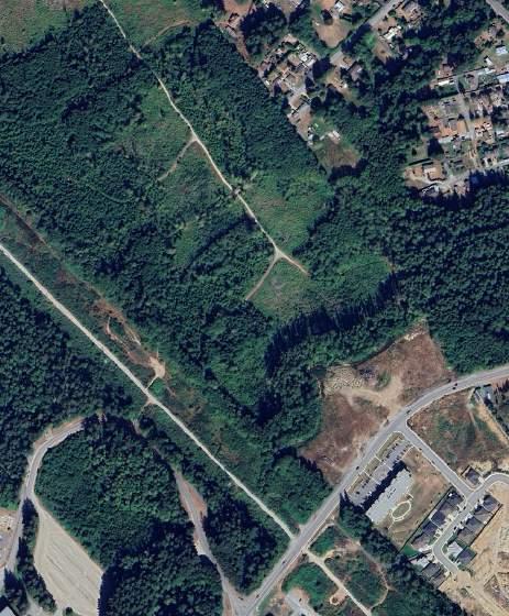
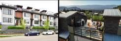
POWELL RIVER BENCHLANDS
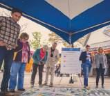
In early Spring, Couverdon began community engagement in Powell River as a part of their early exploration of neighbourhood development opportunities on the “Benchlands.”
Engagement to date has included an in-person open house (April 25th) and public survey (online and paper), an online webinar and an open comment form (available via the project website).
Concurrent to public consultation, the project team is engaging with City of Powell River staff and Tla’amin Nation to incorporate their input as the process proceeds.

4


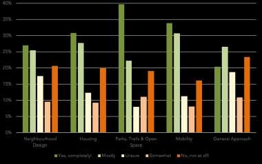
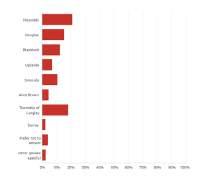
SUMMARY OF QUANTITATIVE ANALYSIS
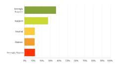
Feedback was collected on a range of ideas (e.g. “strategies” and “approaches”) presented to the community. The graph below illustrates the summary of the level of support, at a glance.

KEY TAKEAWAYS FROM QUALITATIVE FEEDBACK
Qualitative feedback was provided by participants – through all modes of engagement – for both the strategies as well as the engagement process. Consolidated key takeaways are included here below to inform the planning process ahead:
Build on the strong sense of community in Powell River. We heard that Powell River is increasingly becoming a popular destination for young families as it provides access to recreation, outdoor pursuits, music and culture.
Include diverse housing options to accommodate different lifestyles and household types.
Include a mix of residential and small-scale commercial spaces to promote walkability and social connection.
Enhance green space and trail connectivity to promote an active lifestyle and social well-being.
Focus on environmental protection and climate change mitigation efforts on the site.
Consider impacts to neighbours and manage vehicular traffic effectively.
Continue to engage community members in a transparent process in subsequent planning phases.

COMMENT FORM
Public Open House
Thank you for participating in our second phase of engagement for the Powell River Benchlands.
As you make your way through the information (e.g. poster boards), please use this survey to share your thoughts. Your feedback will inform ongoing planning and design for the future of the Benchlands.
Survey responses will be summarized in a “What We Heard” report and will be shared on the project website (powellriverbenchlands.com).
If you would prefer not to share personal information, please proceed to the questions following this section.
Name: ____________________________________________
Email Address: ____________________________________ Sign me up for Powell River Benchlands updates!
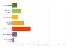
How did you hear about the open house?
Print Ad Radio Web (e.g. Facebook, Instagram, Ad) Word of mouth
Other____________
Are you a resident of the City of Powell River?
Yes, current resident (Please specify neighbourhood _________________) No, former resident No, prospective resident No (Please specify municipality _________________)
This step of the engagement process builds on what we heard from you about the strategies in Phase 1. Concepts were created based on what we heard and the following questions intend to garner your feedback on the Benchlands concepts as they currently stand.
This comment form has two parts General Concepts and the Phase One Concept. The general concepts are intended to get a sense of how well we integrated feedback from the first round of engagement. Phase One Concept dives deeper into the details of design and the vision for the next three years.
The following questions reference information presented at the public open house on Oct 25, 2023. Feel free to refer back to them as you go through the comment form.
PART 1 | GENERAL CONCEPTS
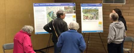
PARKS, TRAILS AND OPEN SPACE CONCEPT
POWELL RIVER BENCHLANDS
During the first round of engagement, we heard that preserving natural habitats and corridors including the Coastal Douglas Fir ecosystem are important. We also heard desire to maintain and improve connectivity throughout the neighbourhood by various means including walking, hiking, and cycling. This concept features the conservation of riparian areas, enhancement of existing green and open spaces as well as creation of network of interconnected pathways and greenways
How well do you think community feedback has been integrated into the Parks, Trails and Open Space Concept?
○ Well integrated
○ Somewhat integrated
○ Okay amount
○ Poorly integrated
○ Not integrated at all
Please tell us why:
MOBILITY CONCEPT
Please indicate your level of support for the Parks, Trails and Open Space Concept.
○ Strongly Support
○ Support
○ Neutral
○ Oppose
○ Strongly Oppose
During the first round of engagement, we heard that improving accessibility to active forms of transportation is a top priority. This includes sidewalks or corridors for pedestrians, paths for cyclists, and an enhanced public transportation network, while keeping in mind connections to existing networks to neighbouring assets such as the Powell River Recreational Complex, Pole Line Trail, and Brooks School. Through a detailed traffic analysis, this concept features a connected design to enhance transportation infrastructure and pedestrian accessibility
How well do you think community feedback has been integrated into the Mobility Concept?
Please indicate your level of support for the Mobility Concept.
○ Well integrated
○ Somewhat integrated
○ Okay amount
○ Poorly integrated
○ Not integrated at all
Please tell us why:
○ Strongly Support
○ Support
○ Neutral
○ Oppose
○ Strongly Oppose


02 ENGAGEMENT & FACILITATION POWELL RIVER BENCHLANDS URBAN DESIGNER, MODUS
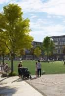
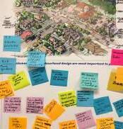
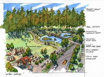
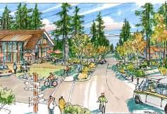
visit powellriverbenchlands.com for more information share your ideas – and sign up for project updates POWELL RIVER BENCHLANDS WELCOME Find someone with name tag you have any questions need any assistance. We are here help. 3 Grab some sticky notes and pen to make comments and provide input along the way. We appreciate your feedback. 2 Enjoy self-guided tour of the background information strategies. Let know you have any questions. 1 Couverdon Real Estate is seeking to engage the Powell River community as part of their early exploration of neighbourhood development opportunities on the ‘Benchlands.’ The ~250-acre property occupies a strategic location in the heart of Powell River and has the potential to meet many of the community objectives related to housing, parks and trails and enhancement of natural areas. We believe community development can be powerful force that supports community health, prosperity and sustainability. We’re keen to hear what’s on your mind. Join us for seat the centre table to fill out survey (or take rest). Thank you for your time 4 The purpose of this event is to: host local community members for an in-person information sharing event; share our early understanding and approach to site planning; receive feedback from local community members; and better understand opportunities for the Benchlands. Enjoy the event in 4 simple steps: Salish Sea City of Powell River Tla’amin Nation Tla’amin Nation qathet Regional District Study Area THE BENCHLANDS N qathet Regional District AREA B Salish Sea The City of Powell River Tla’amin Nation Tla’amin Nation BENCHLANDS refer detail qathet Regional District WHERE DO YOU LIVE? PLEASE PLACE A DOT ON THE MAP Cranberry Lake Powell Lake WILDWOOD TOWNSITE CRANBERRY WESTVIEW POWELL RIVER BENCHLANDS IMAGINE... What elements of park open space design are most important to you? Artist’s illustration neighbourhood park (and connections to natural areas) as imagined within the Benchlands. YOUR IDEAS
PLANNING, DESIGN & ENGAGEMENT INC., VANCOUVER, BC
POWELL RIVER BENCHLANDS
SURVEY RESPONSES 76 OPEN HOUSE PARTICIPANTS 140 COMMENTS/EMAILS FROM THE WEBSITE
WEBINAR PARTICIPANTS
8
POWELL RIVER BENCHLANDS Open House Comment Form October 2023
BENCHLANDS
POWELL RIVER
RIVER BENCHLANDS Open House Comment Form October
POWELL
2023
Cranberry Lake RECREATIONAL COMPLEX WESTVIEW TOWNSITE BENCHLANDS CRANBERRY Salish Sea MarineAve JoyceAve MansonAve CranberrySt Millennium Park ~ ~ ~ ~ Timberlane Ave HELP US SHAPE THE FUTURE OF THE BENCHLANDS Learn more by visiting www.powellriverbenchlands.com RSVP and join us at the event.
N E F R AT O M R A Q M T mm 1 INTRODUCTION R m mm m m mw m m w - M M W w m - m m m m m o w 5 1 U O F O N O 2 m m - m m m m p m m m 2 V T P MO N w C m m 3 AT E O AT O
Comment forms for in-person and online surveys
Facilitation Guide
Event
Insight into the Open House Boards
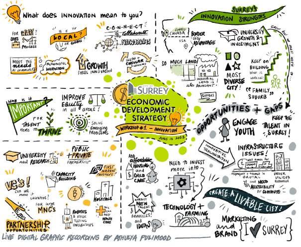
SURREY ECONOMIC STRATEGY
URBAN DESIGNER, MODUS PLANNING, DESIGN & ENGAGEMENT INC., VANCOUVER, BC
Roles & Responsibilities

economic strategy, The City of Surrey is seeking support for the planning and execution of three targeted engagement sessions with members of Surrey’s business community to understand challenges and opportunities related to local business vibrancy and support, Surrey’s innovation ecosystem, and industrial land and manufacturing.
THE CHALLENGE As part of the refresh of the City’s economic strategy, The City of Surrey is seeking support for the planning and execution of three targeted engagement sessions with members of Surrey’s business community to understand challenges and opportunities related to local business vibrancy and support, Surrey’s innovation ecosystem, and industrial land and manufacturing.
THE RESPONSE MODUS supported the City with this strategy update that included research and engagements with the business community in Surrey. Three targeted engagement sessions with members of Surrey’s business community were organized to help understand the challenges and opportunities related to Surrey’s innovation ecosystem, industrial land and manufacturing and local business vibrancy and support. Workshop sessions gave stakeholders an opportunity to engage in dialogue on themes that emerged from previous stakeholder engagement and surveys that occurred prior to the Economic Strategy engagement process. MODUS facilitated three workshop sessions, each focusing on a particular theme and a specific set of stakeholders.
THE RESPONSE MODUS supported the City with this strategy update that included research and engagements with the business community in Surrey. Three targeted engagement sessions with members of Surrey’s business community were organized to help understand the challenges and opportunities related to Surrey’s innovation ecosystem, industrial land and manufacturing and local business vibrancy and support. Workshop sessions gave stakeholders an opportunity to engage in dialogue on themes that emerged from previous stakeholder engagement and surveys that occurred prior to the Economic Strategy engagement process. MODUS facilitated three workshop sessions, each focusing on a particular theme and a specific set of stakeholders.
PROJECT DURATION: 2023
As a part of MODUS, I supported the City with the strategy update that included research and engagements with the business community in Surrey. Three targeted engagement sessions with members of Surrey’s business community were organized to help understand the challenges and opportunities related to Surrey’s innovation ecosystem, industrial land and manufacturing and local business vibrancy and support.
co-creating deep green, just, healthy communities
co-creating deep green, just, healthy communities
SURREY ECONOMIC STRATEGYTEGY
SURREY ECONOMIC STRATEGYTEGY
CITY OF LANGLEY ONLINE SURVEYS
URBAN DESIGNER, MODUS PLANNING, DESIGN & ENGAGEMENT INC., VANCOUVER, BC
Langley City Townhome & Plex-Home Survey
Langley City Zoning By-law Update Survey


CLIENT:
PROJECT DURATION: 2023
CLIENT:
Stephen Wu, Economic Development Manager, City of Surrey swu@surrey.ca 604-591-4333
SERVICES: Engagement

Stephen Wu, Economic Development Manager, City of Surrey swu@surrey.ca 604-591-4333
SERVICES: Engagement
Live digital graphic recording at one of the engagement sessions
Live digital graphic recording at one of the engagement sessions
Roles & Responsibilities
I assisted in the creation of an online survey that engaged approximately 600 residents of the City of Langley. The survey was conducted using SurveyMonkey. It included questions on how to best integrate new townhomes and plez-homes into existing neighbourhood. Key topics explored were good neighbour design, parking & transportation, and green space & landscaping.
Roles & Responsibilities
assisted in the creation of an online survey that engaged approximately 515 residents of the City of langley. In 2021, Langley City updated the OCP following the zoning bylaw updates that will regulate how land, buildings, and other structures are used. The survey included questions on Zoning updates and new uses such as carriage homes, amenities, open spaces, child care and cannabis retail, and parking requirements in new developments.
02 ENGAGEMENT & FACILITATION
Surrey Economic Strategy Open House Investment Readiness and Attraction What is investment readiness? An investment-ready city has the necessary attributes, conditions, and opportunities that make it attractive and viable for potential investors. This includes factors such as stable and favorable economic environment, robust infrastructure, access to skilled labor, supportive government policies, diverse range of industries, and a strong potential for growth and return on investment. In essence, an investment-ready city offers competitive landscape for investors to allocate their capital and expect favorable outcomes. Supportive Government Policies Modern Infrastructure Access to Skilled Labour Available Development Sites Stable Economic Environment Investment Readiness Diversified Industries What business support services and programs would you like to see in Surrey? Write your ideas on sticky notes and place them below. Data and Market Insights Talent and Workforce Other Ideas? What is missing? What are some types of businesses that could be successful but are missing in each town centre? Write your ideas on sticky notes and place them below. WHALLEY/ CITY CENTRE GUILDFORD FLEETWOOD CLOVERDALE NEWTON SOUTH SURREY THE CHALLENGE As part of the refresh of the City’s
#207 - 55 East Cordova Street | Vancouver, BC V6A 0A5 | +1.604.736.7755 | thinkmodus.ca from insight to impact
#207 - 55 East Cordova Street | Vancouver, BC V6A 0A5 | +1.604.736.7755 | thinkmodus.ca from insight to impact
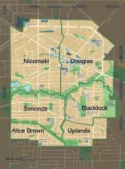
Suite 400 - 509 Richards Street, Vancouver, V6B 2Z6 +1 604 736 7755 http://www.thinkmodus.ca hello@thinkmodus.ca LANGLEY CITY ZONING BYLAW UPDATE DRAFT SURVEY Survey Introduction On November 22, 2021, ollowing extensive public and stakeholder consultation, Langley City Council adopted new Official Community Plan (OCP). The updated OCP provides vision for the community, including policies hat relate to Langley’s housing, transportation, culture, economy, and climate. The next step making the OCP vision reality is to update the Zoning Bylaw based on zoning and urban design best practices, and ensure best represents the expectations of current and future Langley City residents. Zoning Bylaws are legal documents that regulate how land, buildings, and other structures may be used They include rules for the design of buildings (e.g. height, setbacks, lot coverage, etc.), parking requirements, amenity spaces, and more. You can view Langley City’s current Zoning Bylaw here [insert link]. To start off, please read the following documents that provide important information about the proposed changes Langley City’s Zoning Bylaw Discussion Paper 1: New Zones & New Uses [insert link] Discussion Paper Parking [insert link] You are encouraged to refer to the documents while answering the following questions. Please note that pending Homes for People Action Plan” Provincial legislation permitting additional units on single detached home lots will be reviewed and addressed early 2024, separate but parallel process to this Zoning Bylaw Update once the technical details are provided to and reviewed by the City. This survey will take approximately minutes to complete. Please complete one survey per person There are wo parts this survey Zoning Updates & New Uses – these are the proposed new regulations related arriage homes, single detached homes, amenities & open spaces, child care, and cannabis retail. Parking – these are the proposed new regulations related to parking requirements in new developments. 2024/01/22 Page of 11 14) What are your thoughts on this approach parking requirements? (open text box Also, in order to ensure the new Zoning Bylaw responding to evolving technologies consumer preferences and affordabil ty challenges the City proposing these new approaches Requiring more lectric ehicle (EV) charging stations new buildings Permitting car-share vehicles (e.g. Modo, Evo, etc.) new buildings near SkyTrain; Updating bike parking requirements new buildings near SkyTrain and Further educing parking requirements for new below market rental buildings within minute walk of SkyTrain. The Provincial ero- mission ehicles Act, passed in 2019 and amended 2023 requires automakers meet ZEV sales targets reaching 26 new light duty vehicles sales 202 90 2030, and 100% by 2040 There are no EV charging requirements in the current Zoning Bylaw. Do you support requiring higher percentage of EV parking paces new developments and the remainder to wired for future installation of EV chargers? Strongly support 2024/01/22 Page 10 of 11 a) Nicomekl b) Douglas c) Blacklock d) Uplands e) Simonds Alice Brown g) Township of Langley h) Surrey Othe Prefer not answer 28) Which is your age bracket? (check one) 2024/01/22 Page of 11 Part Zoning Update New Uses The OCP allows larger single detached lots to have garden suite. garden suite -storey building located the backyard. However, the configuration of some lots may not be suitable for garden suites and the owner might prefer carriage home instead. carriage home suite above detached garage the backyard accessed by driveway by lane creating -storey building. Currently, carriage homes are not allowed in Langley City’s Zoning Bylaw. Figure 1. Carriage Home (Left) vs. Garden Suite (Right) Wh garden uites are allowed, would you support the option building carriage home instead? Strongly support b) Support Neutral d) Oppose e) Strongly oppose Tell us why. (open text box) New single detached homes in the ity and region tend be taller and large than they were previous decades any now feature flat roofs and bigger footprints. This reflec trend of new houses 'maxing out' the permitted height, lot coverage and setbacks existing zones response to this trend, some cities have updated their single-detached home zon to reduce building proportions. This is often done by limiting the size of upper floor areas or 'footprints' (i.e. 10 20% reductions and adjusting maximum height The City is considering changes to reduce the size new homes in these ways so they better integrate with existing neighbourhoods. Please note that decisions made on this topic may be impacted by forthcoming provincial legislation which will be reviewed and addressed early 2024, as separa te but parallel process to this Zoning Bylaw Update.
LANGLEY GROUND ORIENTED BEST PRACTICES GUIDE
URBAN DESIGNER, MODUS PLANNING, DESIGN & ENGAGEMENT INC., VANCOUVER, BC

POWELL RIVER BENCHLANDS REZONING APPLICATION
URBAN DESIGNER, MODUS PLANNING, DESIGN & ENGAGEMENT INC., VANCOUVER, BC


Created the Best Practices Guide for the City of Langley based on the feedback recieved from residents through an online survey. The best practices guide serves as a valuable resource and a tool for fostering a broader range of housing, sustainable development, enhancing quality of life, and creating cohesive and vibrant neighborhoods for Langley City residents.
Roles & Responsibilities Roles & Responsibilities
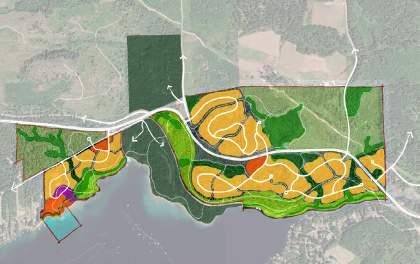
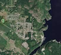
Co-created the Local Area Plan for Powell river Benchlands based on the feedback received from the City of Powell river Staff and a couple of public engagements with the Powell River community. The Local Area Plan serves as a neighbourhood specific policy framework for neighbourhood design, housing, parks and open spaces, mobility, infrastructure servicning and development phasing.
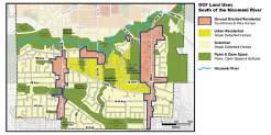
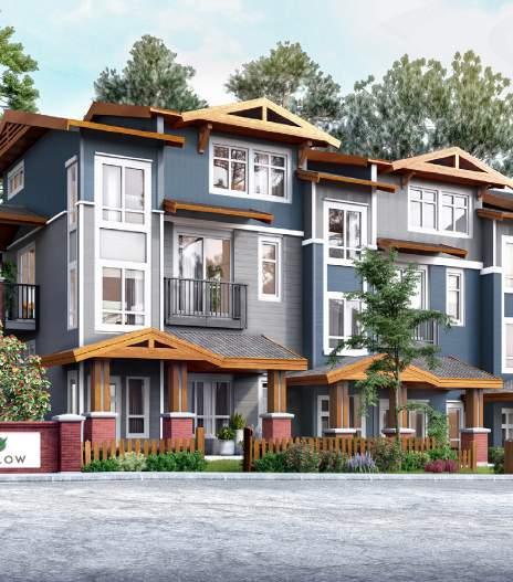
03 REPORT WRITING & PROPOSAL DEVELOPMENT CITY OF LANGLEY Townhome & Plex-Home Best Practices Guide July 2023 14 City of Langley Townhome and Plex-Home Best Practices Guide July 2023 3.2 ROOFTOP STYLES Rooftop styles are an important feature of townhome and plex-home designs. Peaked roofs are more traditional and reflect the design of most single detached homes in the City. Flat roofs present more modern look and create opportunities for more outdoor space through rooftop patios. Understanding preferences on this is crucial to encouraging building designs that align with the character of the surrounding neighbourhood but also meet the needs and expectations of future residents. Best practice guidelines for rooftop styles include: Prioritize peaked roof designs. Flat roofs are generally supported where rooftop patios are incorporated, and where nearby single detached homes have flat or low pitch roofs. Encourage range of peaked roof designs, including those that reflect nearby single detached homes. Use reflective or cool roofing materials that help reduce the urban heat island effect and improve energy efficiency. A nice mix of different home types and not a cookie cutter design is very important for overall look and character. 22 City of Langley Townhome and Plex-Home Best Practices Guide July 2023 Scenario 3 Plex-Homes 9m plex-homes (typically storeys) 9m plex-homes (typically storeys) 11m plex-homes (typically storeys) arterial street max 9m single detached homes (typically or storeys) 6m backyard setback incorporate landscaping features/ fencing within backyard setback to protect privacy Plex-Homes cul-de-sac 9m height July 2023 City of Langley Townhome and Plex-Home Best Practices Guide Introduction Integrating Townhomes & Plex-Homes in Langley City Over the next few decades, Langley City is anticipating significant population growth. According to the Official Community Plan (OCP), the current population of the City is expected to grow by 48% by 2050. Acknowledging this growth projection and the need for more housing options, the OCP envisions “Ground Oriented Residential” land use areas allowing for townhomes and plexhomes (duplex, triplex and fourplex) along major corridors such as 200 Street and 208 Street. The intention is to create a wider variety of housing types south of the Nicomekl River, including additional family-friendly housing options near schools. A survey provided residents with an opportunity to have their say on how to best integrate townhomes and plex-homes into primarily single detached neighbourhoods. Questions asked in the survey were reflective of the following categories that have helped organize this best practices guide: Good Neighbourhood Design Parking and Transportation Green space and Landscaping The feedback received from residents helped create this best practices guide, which in turn will shape the actual design of future townhomes and plex-homes when they come forward to Council for approval. This best practice guide serves as valuable resource for effectively addressing various development considerations and concerns raised by residents. The guidelines within are anticipated to be integrated into Langley City’s Development Permit Areas and Zoning Bylaw and will help refine the design guidelines for “Ground Oriented Residential’’ areas south of the Nicomekl River. Ultimately, this best practice guide serves as tool for fostering broader range of housing, sustainable development, enhancing quality of life, and creating cohesive and vibrant neighborhoods for Langley City residents. POWELL RIVER BENCHLANDS LOCAL AREA PLAN REZONING APPLICATION LOCAL AREA PLAN December 22nd, 2023 POWELL RIVER BENCHLANDS POWELL RIVER BENCHLANDS LOCAL AREA PLAN REZONING APPLICATION INTRODUCTION The Benchlands Local Area Plan (LAP) area is located in the qathet Regional District (qRD), within the municipal boundary of the City of Powell River in the Cranberry Lake neighbourhood. The Tla’amin People named Cranberry Lake, χaʔaji (Xah ah jee) for the wild cranberries which grew in the lake. The LAP area surrounded by the residential edges of Joyce, Timberlane/Dover and Manson Avenues and is connected to the Townsite neighbourhood to the northwest and the Westview neighbourhood to the south. few blocks to the northeast is th Cranberry Lake commercial area. The western boundary of the site is formed by a BC Hydro Right of Way (transmission lines) with Millennium Park and the Powell River Recreation complex to the southwest; and Brooks School, Henderson Elementary and Timberlane Park to the northwest. Wys, McFall, and McGufffie Creeks further define the site by creating three distinct ‘rooms’. These features pose challenges related to transportation planning and circulation, as well as unique opportunities to connect residential areas with nature. With its strategic location in the heart of Powell River, the Benchlands well positioned to meet many community objectives related to housing, parks and trails and conservation of natural areas. Community development of the Benchlands can be powerful force that supports the long term health, prosperity and sustainability of Powell River. LOCAL AREA PLAN & COMPREHENSIVE DEVELOPMENT ZONE In order to guide future decision-making and offer direction to property owners, developers, future residents and visitors, the Benchlands Local Area Plan will establish vision and direction for how this area will be built over time. Acting as link between the city’s broader goals for Powell River as reflected within the Official Community Plan – and the specific requirements of the Benchlands, the Local Area Plan serves as neighbourhood-specific policy framework for neighbourhood design housing, parks & open space, mobility, infrastructure servicing and development phasing. The Comprehensive Development Zone (CD Zone) like standard zones – regulates what can be built on a parcel of land. It can identify specific locations for parks, open space, neighbourhood commercial and residential uses while allowing for flexible range of housing types. It responds more effectively to opportunities for long-term investment in and commitment to community building: major public park dedications are negotiated up front; infrastructure servicing is pre- designed to accommodate community expansion; and logical phases of development progress according to measurable servicing thresholds. With flexibility built into the masterplan and regulating zoning, good mix achievable with flexibility to change over time. As the city’s housing market evolves, this reduces the “time to market” of development in the Benchlands and expedites the delivery of much needed housing. The first phases of development are intended to respond to current market demand in order to ensure overall development feasibility. Extension of right-sized infrastructure will lay the groundwork for housing densification into the future. POWELL RIVER BENCHLANDS LOCAL AREA PLAN & REZONING APPLICATION HIGHWAY 101 MARINE AVENUE DUNCAN STREET NOOTKA STREET CRANBERRY STREET STREET TAKU STREET WESTVIEW AVENUE MOWAT AVENUE TIMBERLANE AVENUE SKEENA STREET ALBERNI STREET STREET STREET COMPLEX ROAD POPLARSTREET CROWN AVENUE HASLAM STREET QUEENS AVENUE STREET WALNUTSTREET ABBOTSFORD STREET OAK STREET STREET WILLINGDON CEDAR STREET SYCAMORE STREET RICHMOND STREET WHARF STREET LUND STREET MARINE AVENUE MANSON AVENUE DUNCAN LOMBARDY STREET JOYCE AVENUE MalaspinaStrait Cranberry Lake Powell Lake Municipal Boundary Teeshohsum (Tla'amin IR1) Comox Ferry TexadaIslandFerry Bylaw 2370, 2014 Schedule B LAND USE DESIGNATIONS Land Use Designations Parks, Schools & Green Space Millsite Industrial Employment Centre Uptown Mixed Use Mixed Use Commercial/Residential Urban Residential Medium Density Urban Residential Low Density Urban Residential Single Family Suburban Residential Agriculture Resource Waterfront Commercial/Industrial Water Special Policy Areas Airport Lands, National Historic District Special Study Area Schedule Amendments Bylaw Number Adoption Date Ewing Courtenay Parsons Ct Mitchell Burton Ewing Kennedy Birch Bulkley Laurel Hazel Irvine Gilbert Edgehill Artaban Dogwood EvansAve KiwanisAve Elm Capilano Borden Larch Butedale Crofton FurnessAve TatlowSt Hamber Dini McGregor Cedar ParkAve Fraser PoplarSt McGuffieAve Columbia Lois AspenAve Abbotsford AbbotsfordSt Nass Skeena Crown Burnaby QueensAve Allen Timberlane Ave Haslam Drake Barnet Dieppe JoyceAve Powell Lake Cranberry Lake NT C1 C1 C2 C2 RM3 RM1 RM3 R2 C3 RM2 R2 RM3 RM3 RM3 RM3 NT NT NT MC MC C3 C3 C2 C2 C2 C1 A2 R2 PK PK PK RM4 RM1 C1 C1 C1 C1 C1 C1 RM1 PK NT PK CP RM3 PK PK NT PK NT NT PK NT NT PK RM1 M1 RM2 RM3 R4 A1 CD3 RM1 R4 R4 R4 R3 R2 NT NT A2 A1 RM3 RM3 RM3 RM3 RM3 RM3 R2 R2 RA1 PK NT NT PK NT PK PK NT PK NT PK M3 M1 M1 C5 C3 C3 C2 C2 C2 MX MX A2 A2 A2 A1 A1 A1 A1 R1 A1 PK RA1 RM1 CD1 M1 CD2 CD4 A2 A2 A2 R1 A2 W1 W1 ² Bylaw 2100, 2006 Schedule A Kennedy Ortona Timberlane Ave Cro NT PK RM1 C2 RM3 RM1 R2 RM3 RM3 R2 NT PK A2 A2 Cranberry Inset Powell Lake C1 C1 MC C1 C1 MC C1 R3 R3 RM3 RM3 PK NT NT MC MC M3 C2 C1 A2 PK M1 A2 Townsite Inset LAND USE CONTEXT & PROPOSED AMENDMENTS Current and future land use at the Benchlands is governed by the City of Powell River Sustainable Official Community Plan and Zoning Bylaws. The following provides summary overview of current designations and regulations and briefly characterizes proposed amendments as detailed within the Benchlands LAP and CD Zone. OFFICIAL COMMUNITY PLAN The Sustainable Official Community Plan (SOCP) is the City of Powell River’s roadmap for the community’s future over a period of 15 to 20 years. It establishes objectives and policies to achieve goals in the areas of land use, natural environment, community life, infrastructure, and the local economy. In terms of land use, the current SOCP establishes growth management goals and designates future land uses to achieve those goals. The Powell River Sustainable Official Community Plan (2014) identifies the Benchlands as a site for “Urban Residential Low density”, “Employment Centre” and “Parks, Schools & Green Space.” ZONING The Zoning Bylaw implements the Sustainable Official Community Plan by regulating the location and uses on land, the size of parcels created by subdivision and their density. The Zoning Bylaw includes the Benchlands primarily under the A2 “Large Lot Rural” zone, which permits low density residential, natural resources and agricultural uses. A portion of the northeast corner of the Benchlands is zoned R2 “Single and Two Family Residential”, which intended for intended for single and two family or duplex dwellings. Wys Creek McFall Creek Millennium Park Trails Cranberry Lake Lower Millennium Park Willingdon Beach Park Rec Centre Timberlane Park D.A.Evans Park Scout Hill Park McGuffie Creek FIGURE 4 | MIXED-USE (ILLUSTRATIVE CONCEPT) Opportunity sites for commercial activity are held across the LAP to preserve future opportunity for local neighbourhood services (e.g. small scale retail) within the Benchlands. This blending of residential and commercial uses supports the activity within the Cranberry commercial area and offers residents convenient access to essential services, shops, and eateries within walking distance (illustrated 400m). N Straight of Georgia MCGUFFIE CREEK NEIGHBOURHOOD NODE WYS CREEK NEIGHBOURHOOD NODE 400m Walking Circle
ENGAGEMENT SUMMARIES
URBAN DESIGNER, MODUS PLANNING, DESIGN & ENGAGEMENT INC., VANCOUVER, BC


PROPOSAL DEVELOPMENT
URBAN DESIGNER, MODUS PLANNING, DESIGN & ENGAGEMENT INC., VANCOUVER, BC


& Responsibilities
Undertook an engagement analysis for approximately 620 responses received through an online survey. A survey provided residents with an opportunity to have their say on how to best integrate townhomes and plex-homes into primarily single detached neighbourhoods. Created an engagement summary report analyzing both the quantitative and qualitative feedback which in turn helped create the best practices guide for townhomes and plex-homes in Langley City.
Undertook an engagement analysis for approximately 515 responses received through an online survey. After the adoption of a new Official Community Plan by the City of Langley, there is a need to update the zoning bylaw based on zoning and urban design best practices. The insights gathered from the survey will serve as a foundation for refining and updating the zoning bylaw to effectively mirror the aspirations and needs of the Langley City


& Responsibilities
As an urban and architectural designer, I bring extensive experience in proposal development, seamlessly blending creativity with practicality. have successfully crafted proposals that harmonize aesthetics, functionality, and community needs. My proficiency in conceptualizing and articulating design visions has contributed to several winning proposals. I have a handful of experience in assisting in formulating compelling proposals that resonate with both clients and stakeholders.
03 REPORT WRITING & PROPOSAL DEVELOPMENT
Engagement Summary C Y OF ANGLEY TOWNHOMES AND PLEX-HOMES SURVEY uly 12th 2023 draft v Langley City lex-Homes & Townhomes Survey Engagement Summary u e R s H w y n u b u e Of the survey respondents who selected ‘Other’ many heard about the survey through newspaper articles like Langley Advanced Times and the Fraser Valley Current. Others found out about through City staff and the City website/e-newsletter. Langley City lex-Homes Townhomes Survey Engagement Summary w 2 Many respondents supported the prohibition of rooftop patios and balconies as privacy important to residents. Residents were concerned about their private outdoor space being visible from the rooftop patios and the balconies of adjacent developments. Some suggested incorporating creative architectural designs maximize privacy while still allowing for outdoor spaces like these. Single detached homeowners see privacy as fundamental concern that should be protected. O o The comments highlight the diverse perspectives on rooftop patios and balconies. Some argue that these amenities provide much-needed outdoor space, especially for those in multi-family homes and townhouses. Many residents advocated for the inclusion more green spaces per home/residence, suggesting that rooftop patios are not provided, alternative options, such as yard spaces, should be considered. o Many respondents emphasized the importance considering the potential noise pollution and congestion caused by higher density living. The impacts of amplified noise levels from rooftop activities were viewed as disruptive factors that could impact the peaceful atmosphere and quality life in these neighbourhoods. D Many participants raised concerns about increased density in their neighbourhoods, and worried about the need for greater parking and transit options. They also raised concerns about its impact on the character, privacy, and noise levels of existing neighbourhoods. While some residents were favour of higher density and increased building heights, others stress the importance respecting privacy, preserving green spaces, and maintaining the balance between single-detached homes and higher density housing. 1 Many respondents suggested designing patios and balconies way that provides outdoor access while respecting the privacy of surrounding homes. Overall, was deemed important to strike balance between providing outdoor spaces for residents, regardless of the housing type, while considering the impact on existing neighbours. 4 Langley City lex-Homes Townhomes Survey Engagement Summary What We Heard K y a e wa Based on the analysis, the following themes emerged and will be considered when drafting the Best Practices Guide. C Privacy was major concern for residents in particular with outdoor spaces being visible from adjacent developments Architectural design, fencing, landscaping and height limitations were all common suggestions to maintain the privacy of residents. R R Many participants favored peaked roofs for their traditional look, which aligns with the design of most single detached homes in existing neighbourhoods. Sideby-side or double garages were preferred by most respondents for their convenience and ease of use. The preference for both peaked roofs and double car garages seems indicate the desire to maintain the character and feel of neighbourhood N R O M E N Improved pedestrian and cycling infrastructure was the top preference for respondents followed by raffic calming measures and expanded public transit amenitie addition increased parking, enhanced road infrastructure and improved safety measure (i.e. crosswalk lighting were suggested to address increasing population and alleviate congestion H M E H The majority of respondents supported stepping own plex-home and townhome heights adjacent to single detached homes. Privacy, visual continuity, and prevention of overshadowing neighboring properties were the most common reasons provided A majority of respondents were favour of larger ackyard setbacks. Access to green space was primary concern, with respondents emphasizing its importance for mental well-being, environmental health, and community. In addition, itigating noise transfer and increasing privacy were also mentioned as benefits of increased distance between singledetached and multi-family properties. G C Considered an important aspect of neighbourhood design greenspace is highly valued by residents. mple greenspace important and desire to preserve and enhance within residential developments was expressed ENGAGEMENT SUMMARY C y o Lang e Zon ng By aw Upda e Su vey January 03, 2024 D Wh We Hea d F om W c W p a m g m a w m ● m % ● % 2 % ● a % ● m ● B w % p % ● n Z w U m mm Wha We Hea d Ke Ta e wa s T h w d e e B w P N w s n n n p s R w h u g o b A m e e N Z W o o m e o d u e w - m m e F M D H A E R e m m g C T a a w a m m G E P G e p n d m R u e a mm N D O O G R d a h C m n e o m P N w a k n p c R w h u g w A m h e p n e w g p w u p w o w - e e m m L Z w U m mm g u a n w o W -B n h wd n w h n e h n m Integrated Urban Development e o n o n s a b p h s a m s % o n g p w g e m e w % o w e h h m S g S m SUNSHINE COAST REGIONAL DISTRICT RFP 235002 January 2024 PROPOSAL Official Community Plan & Zoning Bylaw Comprehensive Review SHAPING TOMORROW TOGETHER Submitted Edward Porter, Senior Designer Principal MODUS Planning, Design Engagement Inc. EQUITABLE PLANNING, DESIGN ENGAGEMENT The Sunshine Coast facing challenges that the core social equity. Service workers and seasonal employees are finding increasingly difficult to find affordable and suitable housing, certain groups feel excluded from decision-making processes, and key populations are more likely be impacted the effects climate change (i.e. natural hazards and extreme weather events) and the necessary changes reduce greenhouse gas emissions (i.e. transition to green economy and renewable energy sources). Addressing equity starts beginning project. We’ll create an Equity, Engagement and Communications Plan that identifies equity-priority groups and centres equity throughout our public consultation efforts. We’ve also included Gender Based Analysis Plus (GBA Plus) expert as part of our team to advise matters related equity and review our policies and regulations. 1.3 Equity Framework Across BC, communities are experiencing growing inequiti access and power. considered analysis. implementation section document includes Equity An equity framework developed early on development the CVRD’s Official Community Plan the Electoral Areas. Sunshine Coast Regional District Official Community Plan Zoning Bylaw Comprehensive Review MODUS well known for its interactive and fun engagement activities. Our IAP2 trained team members will ensure our roadshow events, workshops, forums leave residents and community groups feeling confident our ability develop documents that reflect their needs and desires. addition to our expertise engagement, we’re pairing up again with Hot Neon, outstanding video producers and animators, develop educational videos that are sure impress and inform event the most difficult of audiences. Overall, we understand the SCRD’s OCP Zoning Bylaw review requires deep local knowledge, strong appreciation for community and collaboration, and clear appetite curiosity and innovation. MODUS known engaging and interactive public events that take advantage innovative tools and media. Sunshine Coast Regional District Official Community Plan Zoning Bylaw Comprehensive Review CITY OF MISSION RPF 2023-014 December 2023 Official Community Plan Update SHAPING TOMORROW TOGETHER Reasons to Work with Us INSIGHTS We get know your community We use the most recent and reliable community data to inform our processes and develop policy options, but we also know that your community has important insights share. design opportunities for everyone share their local knowledge and wisdom., We bring unbiased, meaningful, creative engagement processes allow diverse perspectives be clearly heard. INTEGRATION We harmonize diverse needs We can translate complex needs into clear, actionable recommendations because practice engagement, planning, and urban design together. We facilitate conversations between government, educators, community organizations, citizens, board members, subject matter experts, and host Nations show people who run and design our organizations, cities and towns what everyone’s ideal future looks like. EXPERIENCE We bring decades collective practice We see the challenges and opportunities project from both sides fence because help organizations navigate change, governments design policy, and land developers shape buildings and neighbourhoods. We’re here guide your community’s vision with insights learned collaborating with 60+ organizations over years MODUS and decades tough successful projects in our respective careers. EQUITY We make room at the table We’re committed listening and learning how honour everyone’s needs. Because believe diversity our biggest strength. We connect with community organizations that serve and represent priority-equity groups and we strive remove many barriers to engagement possible, all residents can participate our processes. IMPACT Our plans get supported and implemented Defining community’s future big responsibility, one that take very seriously. We tailor our approach your needs and carefully manage the entire process, keeping your team focused and informed. When you need thorough, defensible process and plan that supported by both the community and its leaders, we’re your people. Mission Official Community Plan Update TECHNICAL PROPOSAL Our Project Understanding You are on mission to make jobs, housing, and public places for all. We create plans that get supported and implemented. We understand your goals this project are Update your 2015 OCP Create document that succinct, accessible for all residents, and flexible Guide the City’s transition complete community Meet the requirements the Mission Complete Community Assessment grant 21 Submitted By: Quixada Moore-Vissing, Engagement Lead Modus Planning Design Engagement Inc. 207 55 East Cordova Vancouver, V6A 0A5 +1 604 736 7755 http://thinkmodus.ca METRO VANCOUVER SCHOOL AND YOUTH LEADERSHIP PROGRAM CONSULTING SERVICES METRO VANCOUVER REGIONAL DISTRICT REQUEST FOR QUALIFICATIONS NO. 23-060 School and Youth Leadership Program Consulting Services EXECUTIVE SUMMARY We are excited about the opportunity to work with Metro Vancouver seeks develop K-12 School and Youth Leadership (Education) Programs. We understand that Metro Vancouver seeking K-12 curriculum development, workshops for youth and teachers, program development, and communication and engagement services. We incorporate innovative education techniques deliver meaningful engagement. With recognition that climate action will require deep collaboration across sectors, we approach our educational content in interdisciplinary ways, bringing together lessons that integrate science, social studies, law, health, and research. We value hands-on, experiential learning. public engagement specialists, we activate range tools ensure creative, fun learning experiences. Our team offers content expertise youth participation and children’s rights, and sustainability and climate change. We place deep value on JEDI approaches our work ensure inclusive and equitable learning experiences. We are familiar with the BC Curriculum and tying learning standards to our work. For this submission, we are partnering with Petit Architects and Arts Umbrella, who are specialists in sustainable architecture and urban design and arts-based education. the following sections, outline our team’s qualifications and experience, where we have provided some information about our strengths and approach. We also provide several project examples that demonstrate some of the breadth our experience particular, relating to climate action and K-12 education. Additionally, we give an overview our team and attach CV’s that include more detail about our individual qualifications well as select project experience show you more about the projects that we are most passionate about. Should you need any more information about the team MODUS and the work we’re passionate about, we would be delighted to answer questions meet with staff Metro Vancouver. When 9am-5 pm, August 12, 2024* Note: Wear comfortable clothes as we will be engaging movement and group work. *International Youth Day Where TBD through youth-led decision Leadership and Facilitation Skills Civic Education About Different Ways To Get Your Voice Heard in Councils and Policy Planning Session for Local Climate Action Share Your Voice, Lead Your Community, Save Your Earth Workshop for Youth to Learn Leadership Environmental Sustainability We know young people can have powerful influence on climate action today that will impact their future environment. How do you get your voice heard? How can you take action to make change now? Come to this day long workshop to learn the following: How Build Youth-Led Councils How Can Teachers Support Greater Youth Action for Sustainability? A Workshop for Teachers on Supporting Youth Action for Sustainability Come to this full-day workshop to learn the following: When 9am-5 pm, August 12, 2024* Note: Wear comfortable clothes will engaging in movement and group work. *International Youth Day Where Metro Vancouver Secondary School Submitted By: Robert Barrs, Principal Modus Planning Design & Engagement Inc. 207 55 East Cordova Vancouver, BC V6A 0A5 +1 604 736 7755 http://thinkmodus.ca OFFICIAL COMMUNITY PLAN (OCP) PUBLIC ENGAGEMENT PROGRAM CITY OF SALMON ARM FP2023-61 OCP Public Engagement Program City of Salmon Arm We make special efforts to reach the Seldom Heard. We observe that many engagement processes overrepresent certain groups and underrepresent others. We know that certain populations face more barriers public participation than others, and work reduce barriers and seek out input from diverse participants, particularly the ‘seldom-heard’. We have extensive experience designing targeted engagements increase the participation specific underrepresented groups such as: youth, seniors, peoples with disabilities, multi-cultural residents, low-income residents and Indigenous people. We recently helped TransLink develop inclusion and diversity engagement strategy and supported the City Surrey with their award-winning Parks, Recreation Culture Strategic Plan (IAP2 2018 Core Values Award for Respect for Diversity, Inclusion and Culture). We have local presence. Our team routinely works partnership with municipal staff teams and community representatives formal committees or groups. Our approach to design thoughtful process work closely with these organizations, aiming fully utilize the different types expertise and input that group members can bring the project. Specific Salmon Arm and the Regional District North Okanagan, have colleagues Sorrento and Vernon with local knowledge of the region. We use fun, creative engagement techniques. We routinely engage the public and non-technical stakeholders and are skilled at “translating” policy topics, trade-offs, and strategies into plain and accessible language. We integrate highly visual materials that display information way that is engaging, informative, and easy understand. We have developed robust toolkit of fun and interactive techniques draw ‘information in’ during the engagement process. Techniques include surveys, workshops and interactive open houses, “walkabout maps,” kitchen table conversation kits, TheatreSports, and Pecha Kucha events. We also ensure that ‘information out’ happens throughout the engagement process with variety print and online communications, videos, and infographics. We work with our clients provide clear and concise communications materials (in print and digital) share key messages, questions and other project-related content during the engagement process. We understand how reach out Indigenous Communities as part of OCP processes. We work with Indigenous communities to understand their history engagement, enhance and build upon strengths and mobilize community assets designing and delivering engagement processes. MODUS staff engaging with youth participants during the Surrey Parks and Rec Master Plan. 18 Official Community Plan (OCP) Public Engagement Program PROPOSED WORKPLAN The following pages present proposed methodology project, outlining our engagement approach for community and technical staff input throughout the process. It’s important note that the directives presented here will re-evaluated with the City Salmon Arm and regularly throughout the project to respond the feedback and needs staff, steering committee and community members. Refer Appendix for detailed cost breakdown. OVERVIEW From our extensive experience working on long-range municipal plans, we know that the dynamics the project often change, and we are prepared proactively accommodate and responsive any variations. Below we provide high level sketch of the proposed process, followed more detailed methodology. Oct Dec 2023 January June 2024 GETTING STARTED PHASE EMERGING THEMES PHASE THE PLAN PHASE FINALIZING THE PLAN PHASE August Nov 2024 December Jan 2025 PHASE captures the pre-planning work essential project success, allowing us confirm the work and adapt the work plan, develop customized Engagement Communications Strategy and prepare for public and stakeholder engagement launch. PHASE explores the community’s visions and priorities for the future. With issues identification completed, guidance from staff and Steering Committee, and robust strategy for engagement place, we will reveal emerging themes and conduct series engagement activities gather public and stakeholder feedback, way that offers mix of in-person and online opportunities, both broad and targeted. Engagement this phase will consist celebratory and exploratory futures fair, public pop-ups at key community locations, public survey and online ideas space, as well as targeted conversations with equity-deserving groups and key stakeholders. This phase ends with an Interim Report that will be presented the Steering Committee and Council, and inform the Draft OCP and Phase engagement. PHASE is about testing policy options and directions with community stakeholders and the public staff develop the first draft the OCP. Through testing, we will help move from exploring emerging themes to establishing emerging concepts. We will host public open house events and second round online engagement, including survey and webinar, and stakeholder workshops. We will offer self-directed workbooks way facilitate community-led discussions among friends and neighbours and gather valuable feedback on more complex policy options and topics. Following engagement, we will update our summary report to capture everything that we’ve heard to date and assess the effectiveness the program. PHASE is about supporting Salmon Arm staff in making final adjustments to the OCP. We will finalize mapping and document layout offer user friendly layout the final Plan. Once the revised OCP adopted, the project concluded and we can celebrate together for job well done! Official Community Plan (OCP) Public Engagement Program INNOVATION Engaging Underrepresented Groups Our experience tells us that broad and diverse representation engagement processes leads better results. Plans that fail to include differing perspectives will be blind unintended consequences plan’s outcomes community. you’ve identified the RFP, the greatest challenge the OCP review will supporting the community meaningfully participate the process. We applaud you for acknowledging that many barriers participation exist, whether be lack of time, awareness, socioeconomic educational. our approach, we’ve sought break down these barriers recruiting community organizations that work with underrepresented populations and to engage way that works best for them.These organizations typically will already have built trust with their communities, critical barrier engaging with government, and understand their community’s needs make the conversation accessible, safe and culturally appropriate. Digital Engagement MODUS has completed number comprehensive Public Engagement Toolkits for municipalities across and Alberta. We will bring many of the freshly updated resources and concepts our valuable portfolio tools, techniques and approaches to the project ensure engagement fun, meaningful and accessible for all community members. Our team also recognized leader effective, strategic digital engagement and we have developed Digital Engagement Toolkit and Suppliers List from which we can draw on for this project. We are happy to also train City staff on topics project design, tool selection, facilitation, data analysis and reporting out, that of interest an additional scope work. Gamifying Engagement 2021 MODUS collaborated with UBC graduate planning student to conduct research about how we might integrate elements gameplay (e.g., goals, rules, points, storytelling) into engagement processes. ‘gamifying’ engagement, we can activate intrinsic motivation amongst community members, leading increased civic participation. Playful and gamified engagement processes can provide many benefits, including: Moving beyond the usual suspects, broadening the reach. Promoting self-expression, encouraging alternative ways of expressing feedback. Bridging differences, providing fun and relaxed atmosphere topics that are sometimes divisive. MODUS staff hosted workshops Gamification CIP and PIBC’s National Planning Conference and the IAP2 North American Conference last year. Community Ambassadors We are experienced in organizing Community Ambassador programs and working with residents share information the project and encourage community participation. We believe there opportunity recruit local part-time project ambassadors, preferably youth or other equitydeserving community members (e.g., newcomers, Indigenous populations, people with disabilities, people experiencing homelessness, etc.). We can develop and deliver training session for ambassadors community engagement and facilitation order develop new skills. User Friendly Summary Guides Our team has extensive experience translating technical planning concepts into visual, user friendly materials for non-technical audiences. We develop ‘snapshot’ versions technical planning documents that are easy read and share with the public. These short, accessible guides help build understanding plan policy, how responds to community input, and what will look like ‘on the ground’ for citizens. This helps to build understanding and elicit more meaningful feedback into processes ensure plans are well-supported and implementable. We give special consideration to icons, information hierarchies, white space, colour, and plain language create plans that are clear and relevant. We aim to create user friendly materials that improve comprehension and help strengthen connections between communities and governments.
community.
Roles & Responsibilities
Roles
Roles
City of Langley Townhomes & Plex-homes
City of Langley Zoning Bylaw Update
SCRD Official Community Plan & Zoning Bylaw Update
City of Salmon Arm OCP Public Engagement Program
City of Mission Official Community Plan
Metro Vancouver School & Youth Leadership Program
RESTORATION OF CAPITOL COMPLEX, CHANDIGARH
ARCHITECT, ABHA NARAIN LAMBAH ASSOCIATES, MUMBAI, INDIA
Roles & Responsibilities
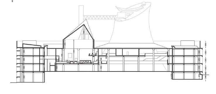
Ever since the Corbusier’s Capitol Complex has got the UNESCO heritage status, the authorities started paying attention towards it. In 2016, Abha Narain Lambah Associates were selected to do the restoration work and conserve Le Corbusier’s Capital Complex. I had the unique opportunity to contribute to the renovation of Le Corbusier’s iconic Capitol Complex in Chandigarh. My primary responsibility involved meticulously creating detailed measuring drawings for the entire complex. This intricate task required precision and attention to detail to accurately capture the existing conditions of the buildings and their surroundings.
In addition to generating measuring drawings, I played a crucial role in documenting major repairs within the plan, elevation, and section drawings. This involved carefully identifying and detailing the necessary repairs and improvements required for the preservation and enhancement of the architectural integrity of the Capitol Complex.
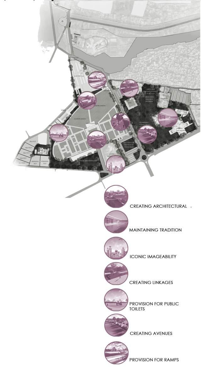
REDEVELOPMENT OF DUSSEHRA MAIDAN, RAJASTHAN
ARCHITECT, ABHA NARAIN LAMBAH ASSOCIATES, MUMBAI, INDIA

Rajasthan: Sense of Place
Roles & Responsibilities
In the development of the conceptual plan for Kota Dussehra Ground, my responsibilities included generating innovative ideas, contributing to spatial planning and design, integrating cultural elements, and documenting the plan. played a key role in shaping the vision for the project, ensuring it aligned with the cultural significance of the site while meeting the diverse needs of the community. The projects aimed to be a central urban space; urban lung for the city and enhance the existing cultural flare prevailing since generations.
04 HERITAGE &
CONSERVATION
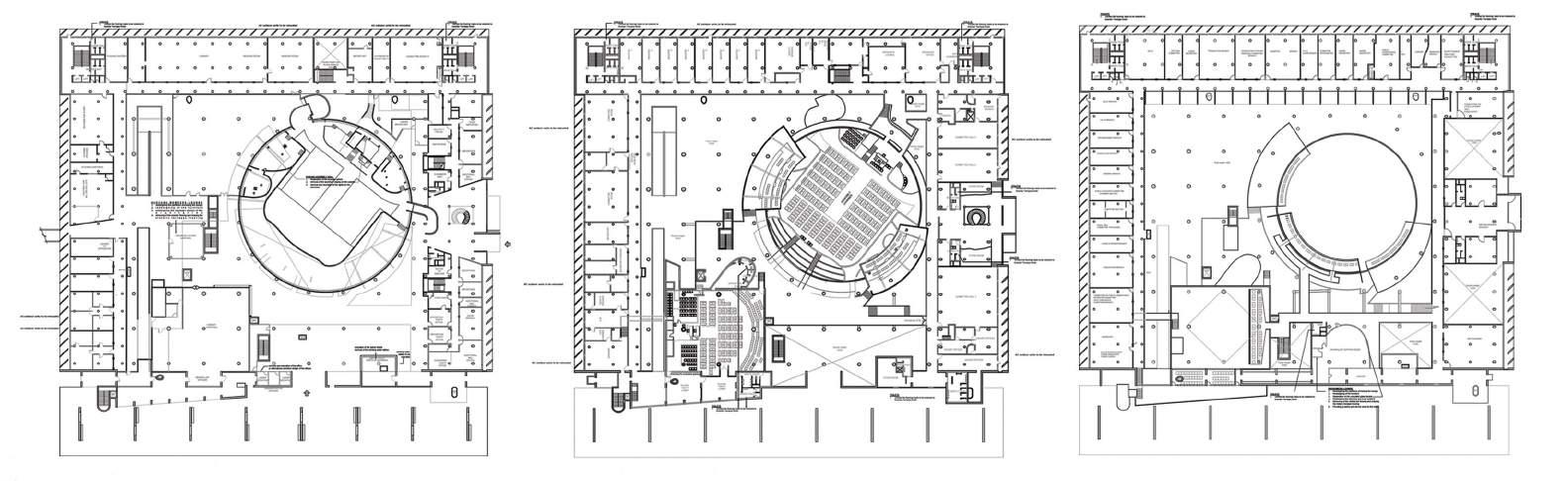
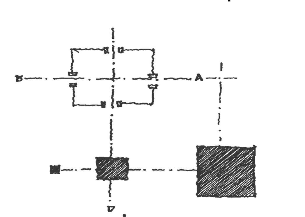
First Floor Plan
Second Floor Plan
Third Floor Plan
Axial Planning
Urban Green
Nodes & Junctions
Celebrating
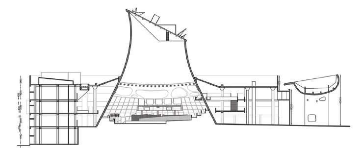
Section through the Assembly Hall
triangulated
Section
through the
structure