


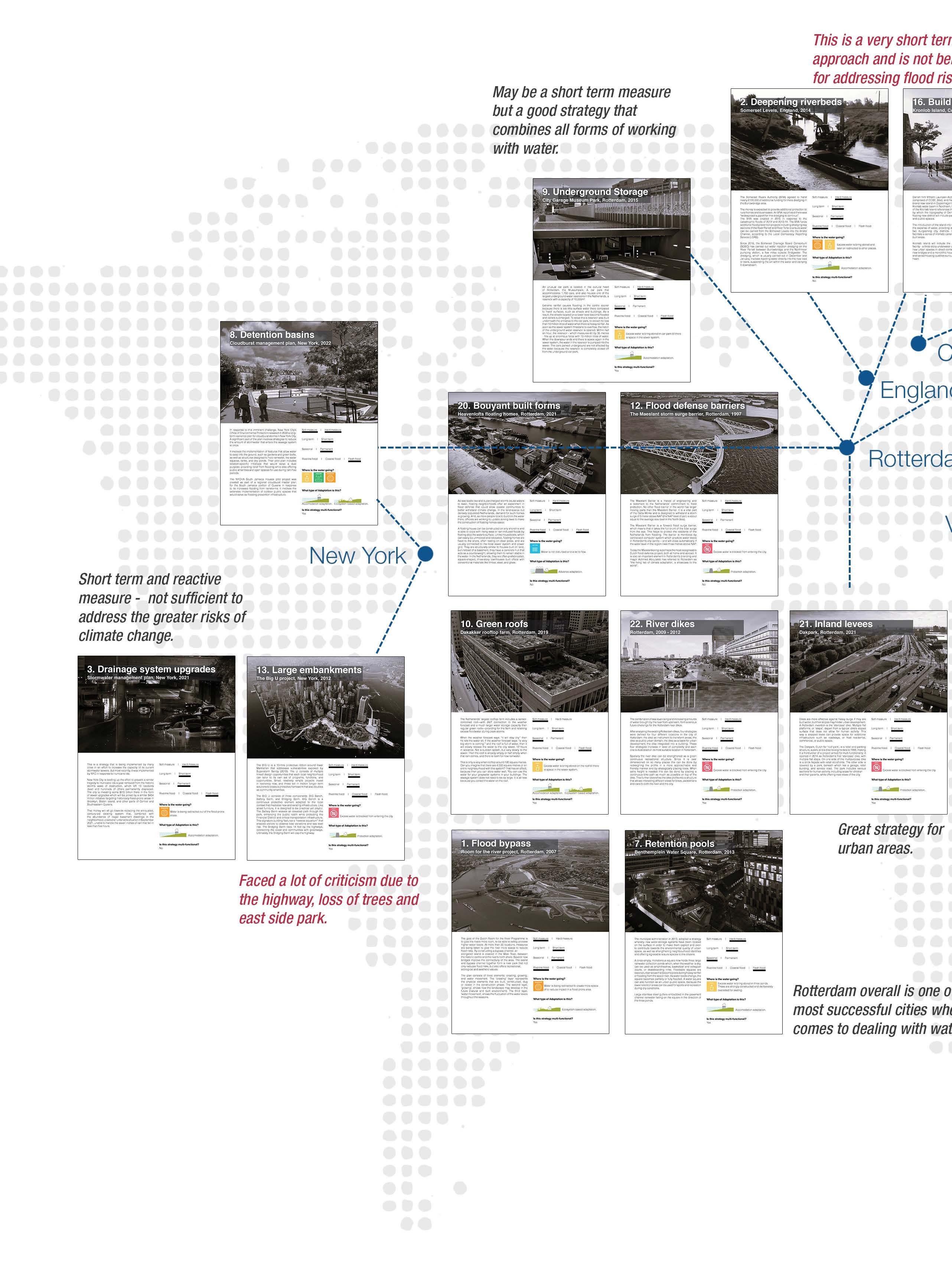
Many of the approaches that are truly long-term are very large scale and top-town, and they do not address intricate built environments that characterize so many coastal cities today.
How can we create room for water in hyper dense city centers that have minimum open socio-economic importance and how can this approach serve a greater civic purpose and
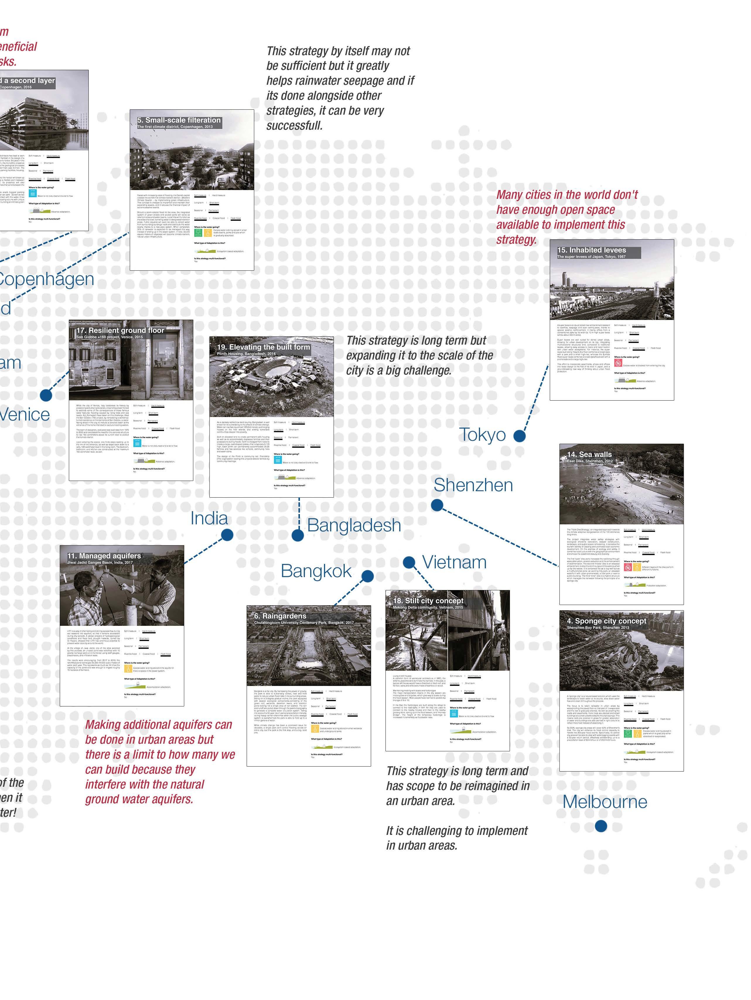
address the challenges of hyper-dense and open space, while retaining their and become long-term for the city?
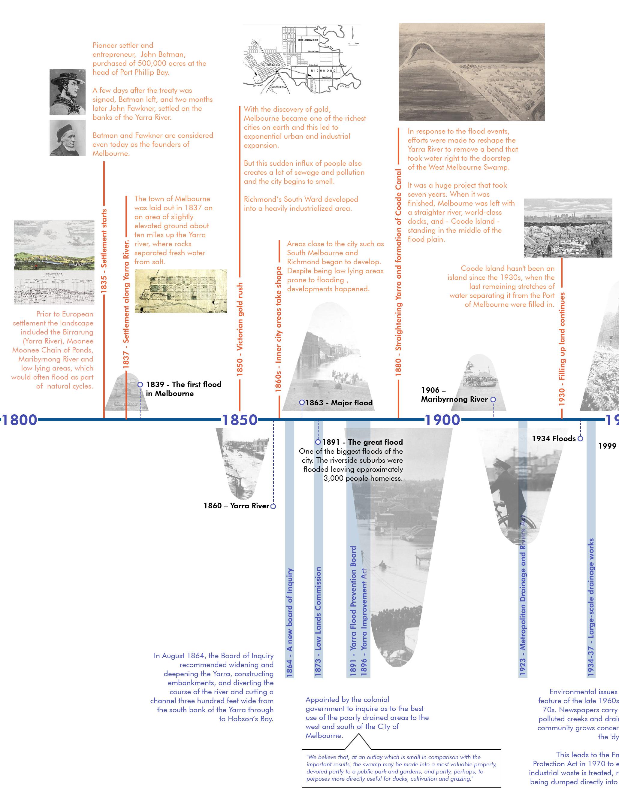
We shouldn’t be surprised that Melbourne’s inner west floods. It’s always been a swamp. (Australian Broadcasting Corporation, 6 Jan 2023, Melbourne Water)
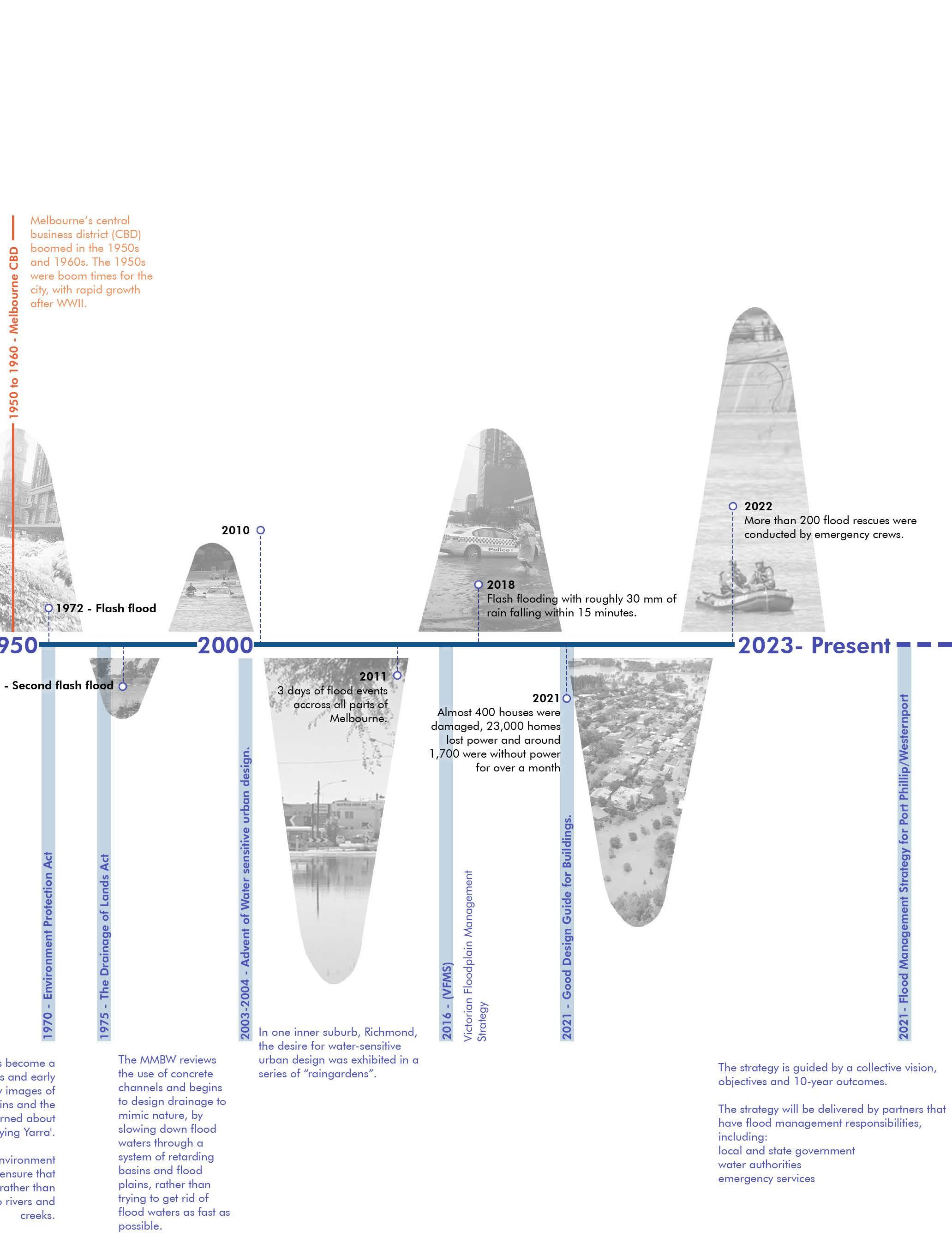
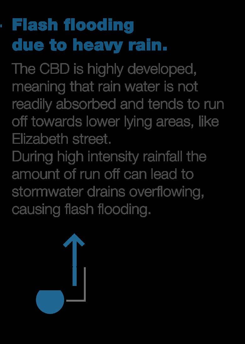
For thousands of years inner Melbourne was part of a fertile wetland whose most striking features were the Yarra River and a large blue saltwater lagoon. Like many coastal cities of the world, urban development came at the expense of this swamp that was gradually filled and reclaimed over the years for construction. Melbourne CBD, the main economic hub of the city sits on this wetland today. William creek is now Elizabeth Street, the busiest throughfare in downtown.
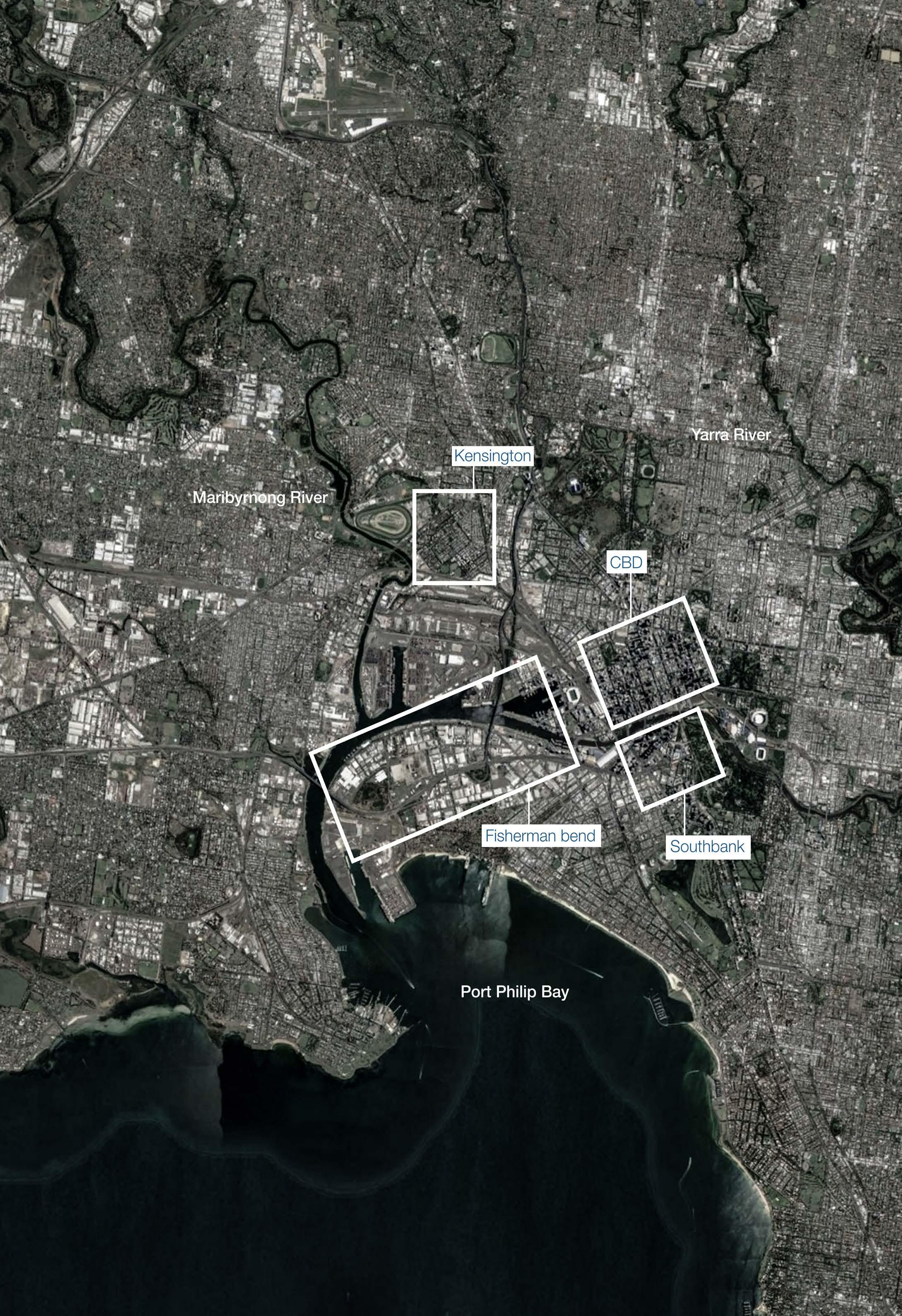
Greater Melbourne area - Risk prone areas
Elizabeth Street is the lowest point in the CBD and is built on top of what was historically a natural creek. Since 1884 the Elizabeth underground drain has collected stormwater from Cariton and the CBD and released it into the Yarra River, which is influenced by the ocean tide.
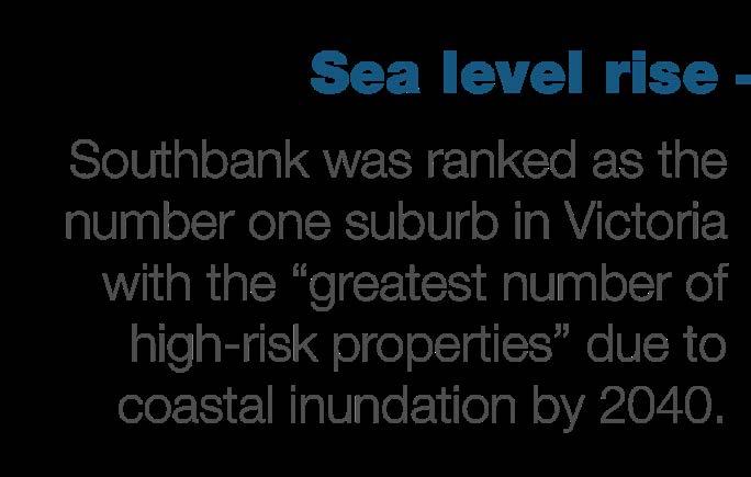
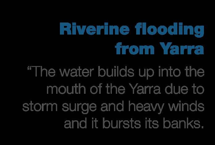
Southbank stretches along the banks of the Yarra River from St Kilda Road to Clarendon Street, accommodating one of Melbourne’s primary business centres. Areas of Southbank are at risk of flooding from both high water levels in the Yarra River as well as flash flooding.
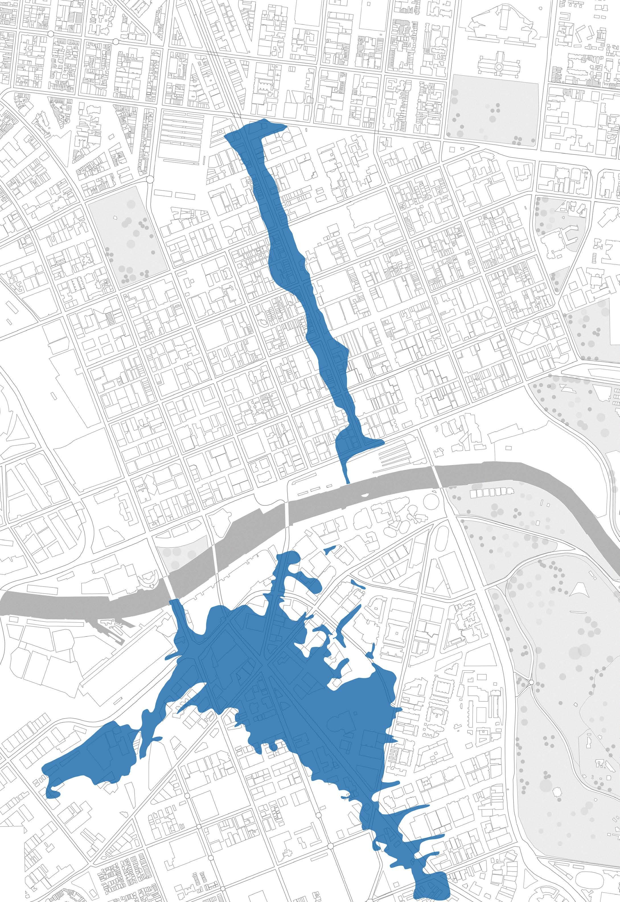
Melbourne CBD and Southbank area (1 in 100 year flood extents)


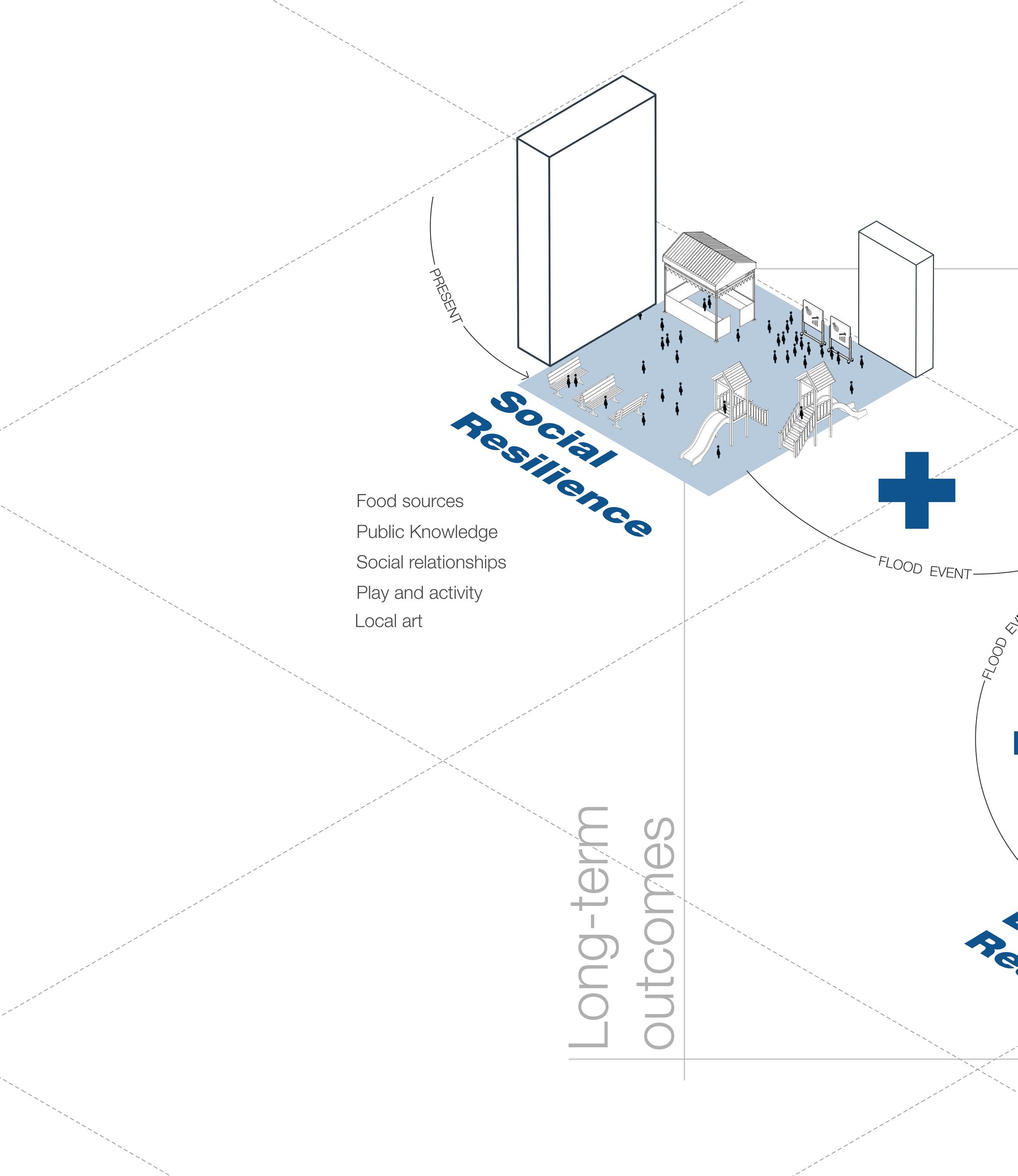
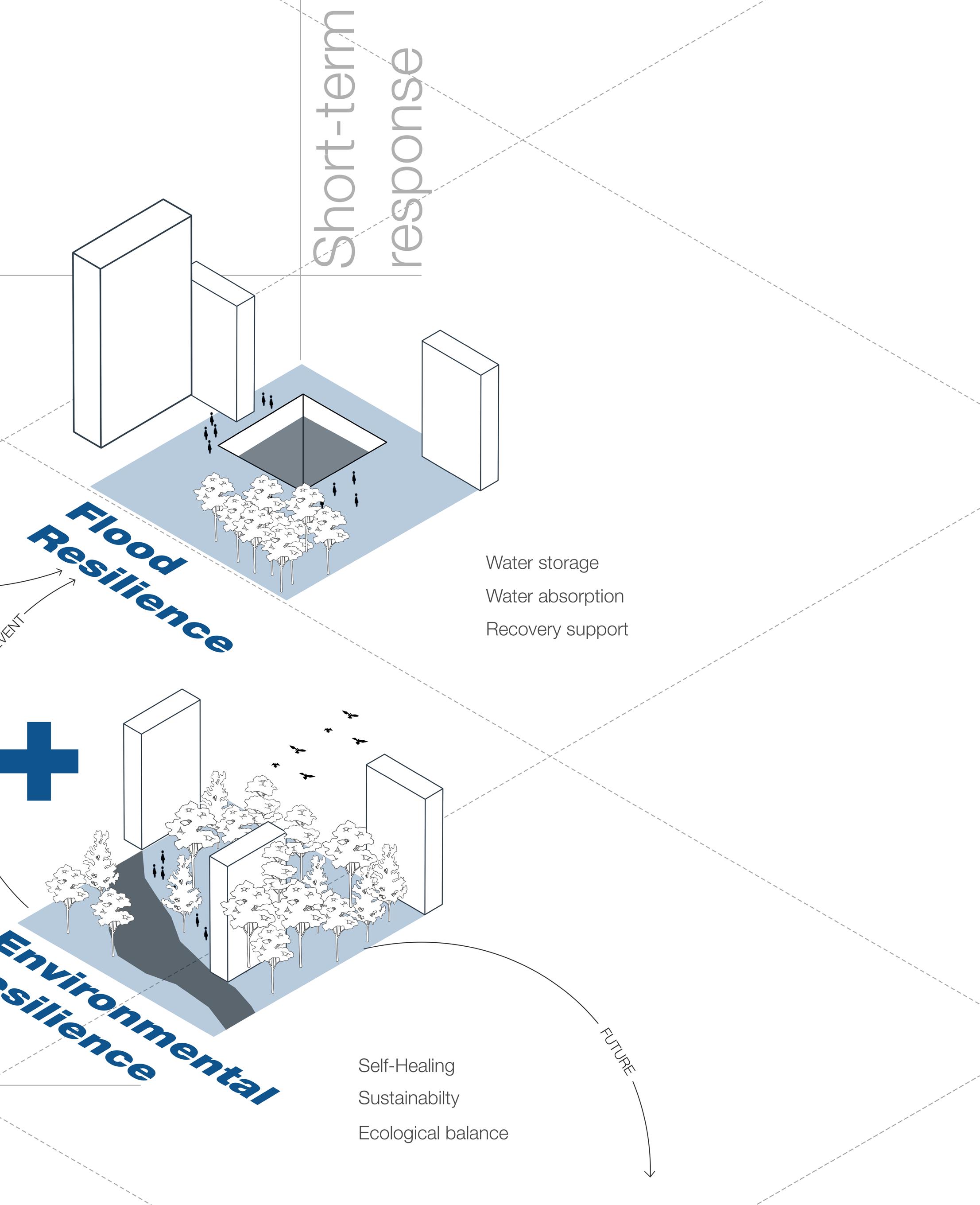
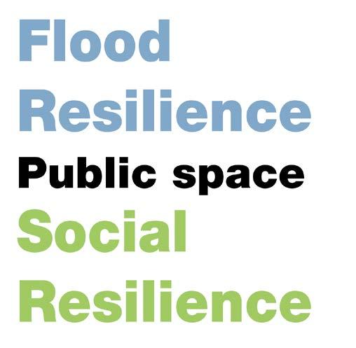
The Design idea or “new idea of resiliency”, involves responding to floods, but, includes two very important components called “Social resilience” and “Environmental resilience” in addition as part of the overall scheme to address the short-term and long-term challenges of the city.
The proposed solution involves a multi-functional network plan that reimagines city infrastructure to accommodate flood mitigation, social cohesion, and environmental sustainability.
This holistic approach aims to retrofit existing infrastructure both above and below ground, transforming it into an interconnected system capable of responding to floods while fostering civic engagement and environmental stewardship.
The Goal
Ultimately, the project envisions a cityscape where flood resilience serves as a catalyst for positive social and environmental change, promoting the well-being of both the city and its inhabitants.
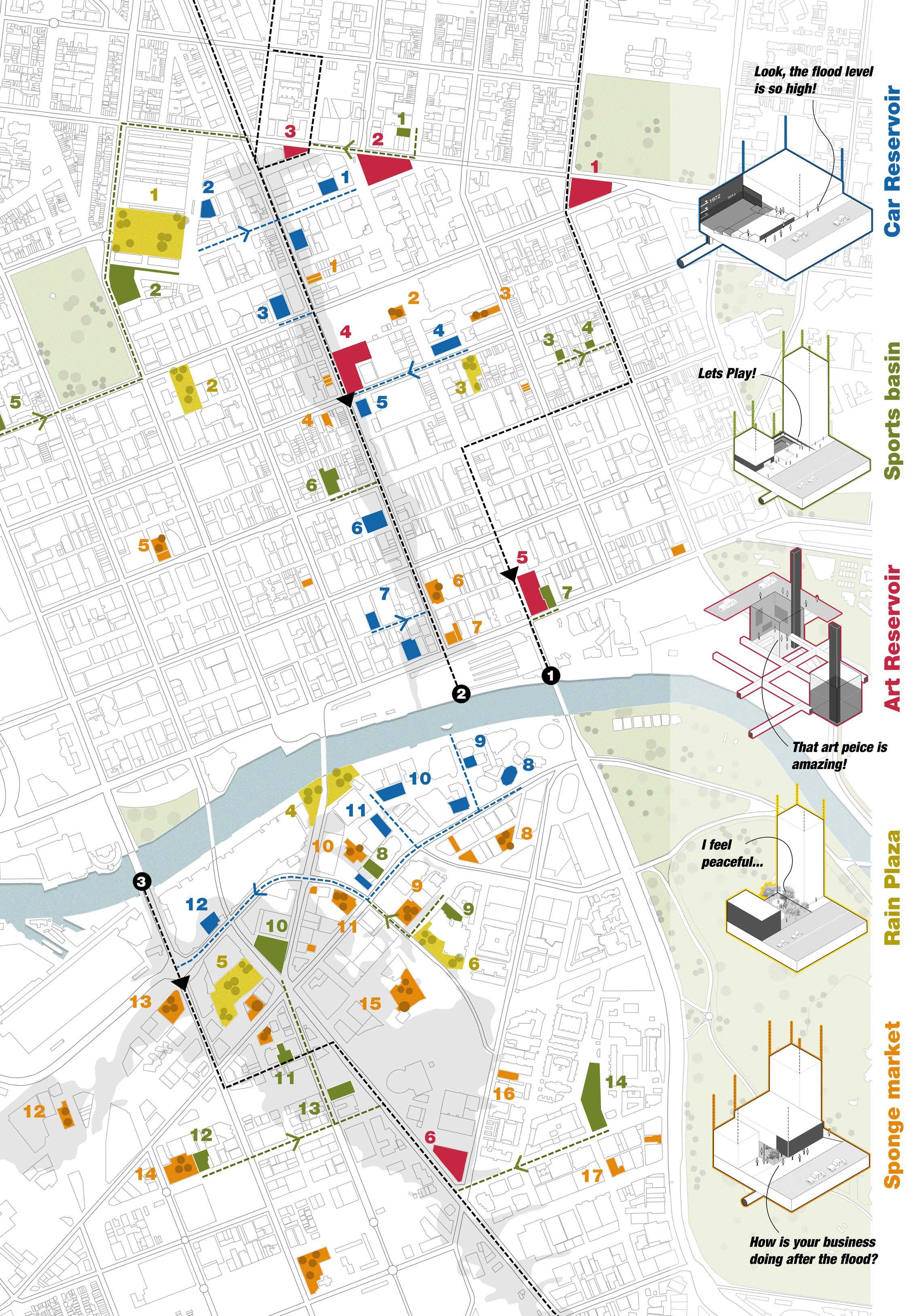
The final resiliency plan of the city is a result of an overlap of different retrofits integrated at different pockets of the city and different scales that work as part of a unified system. The selected strategies complement each other to create an urban design system that welcomes water and benefits the city.
The strategies are compared based on feasibility, like how easy would it be to convert a space, extent, like is it spread-out in the city or limited, the flood response, meaning how quickly can the strategy respond to floods and lastly the ratio of flood v/s social v/s environmental resilience.
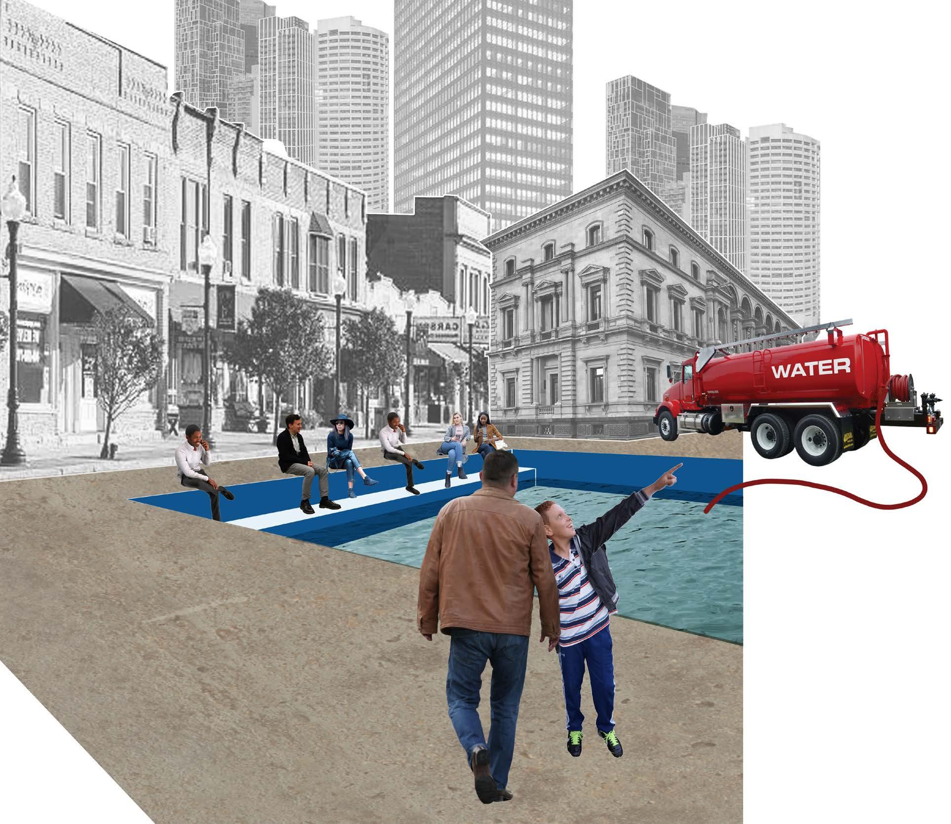
The retrofit can be designed to take a public space for example a basement car park, modifying the space for holding water, and also including ways of addressing the social or cultural needs of the people and city, like increasing awareness.
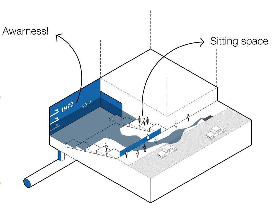
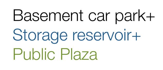
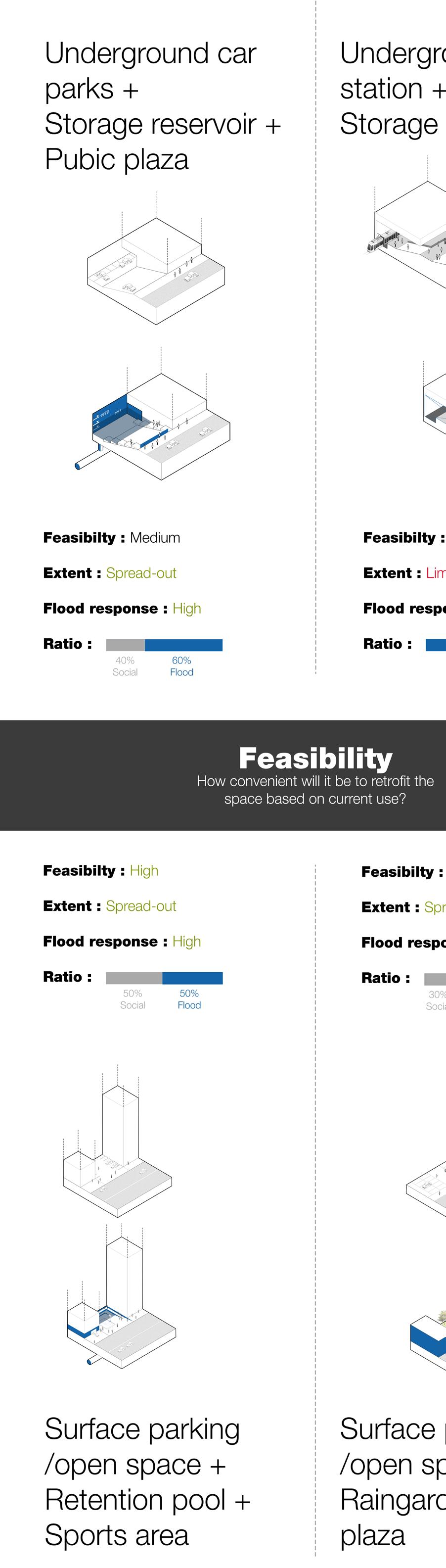
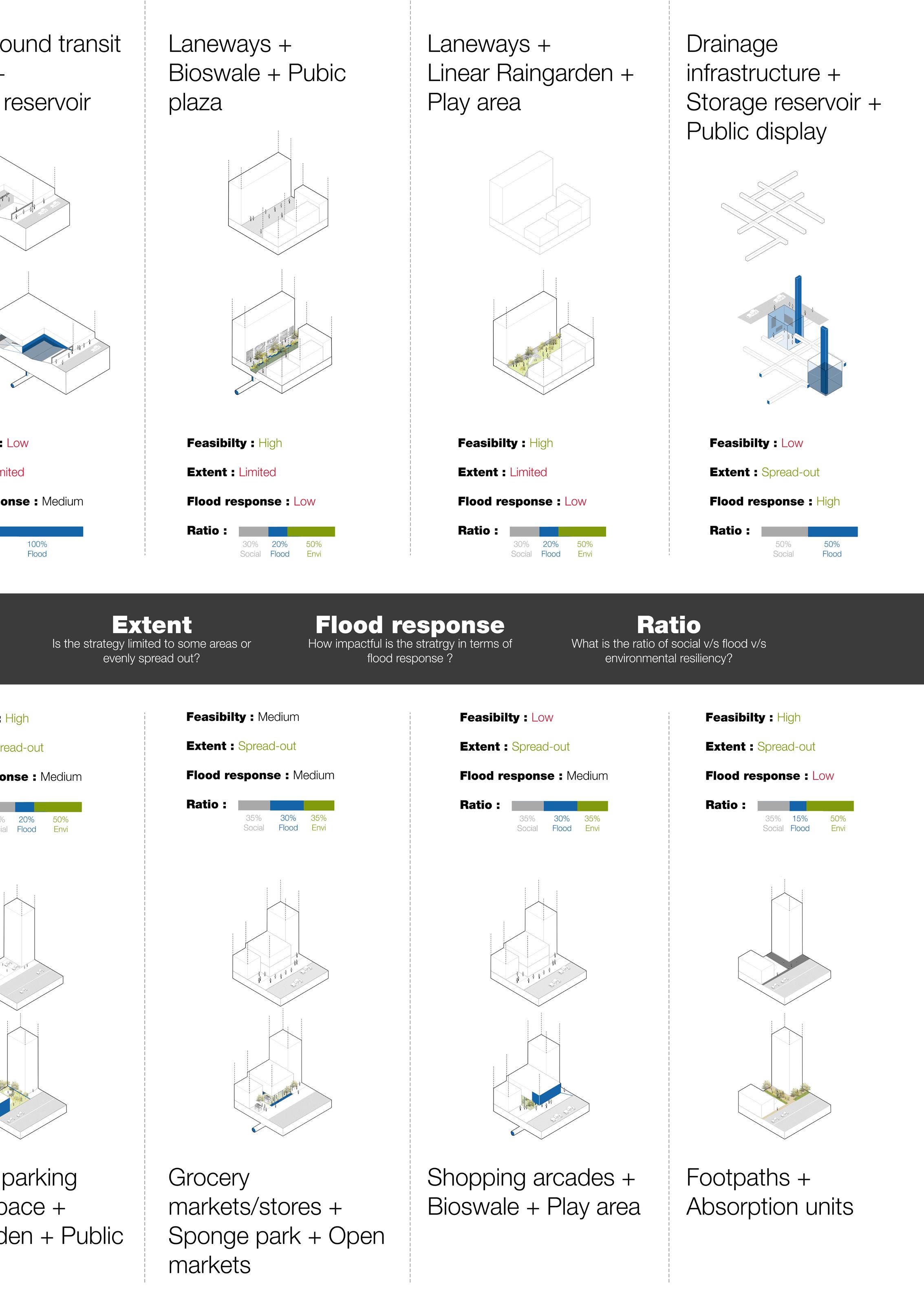
The first strategy that can be implemented is the car reservoirs. These are storage systems that also double as informative plaza spaces.
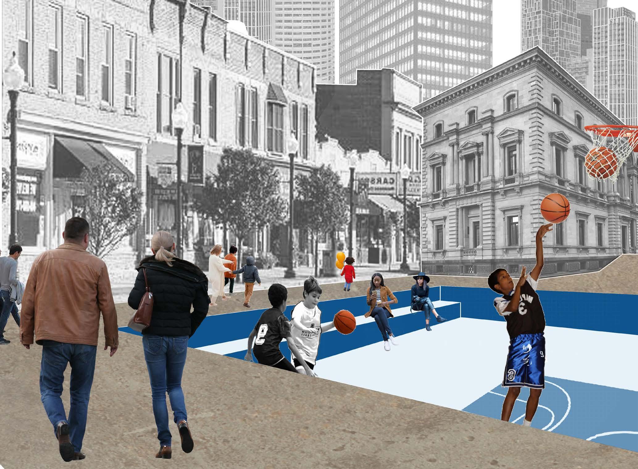
This is followed by the sports basins which are retrofitted parking lots to create detention basins that can host sports facilities for the public. These two systems being close to the ground can be the first systems to be activated in case of floods.
The third strategy that overlaps is the art reservoir that can act as a back up storage space in case of severe flood events. And on normal days, these underground volumes on public sites can be places to celebrate art and culture of the city.
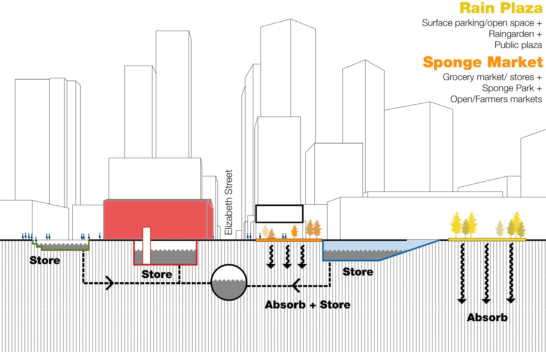
These storage systems are supported by absorption systems like the rain plaza that is built similarly on parking space on the ground to create that porosity through these small distributed pockets in the city.
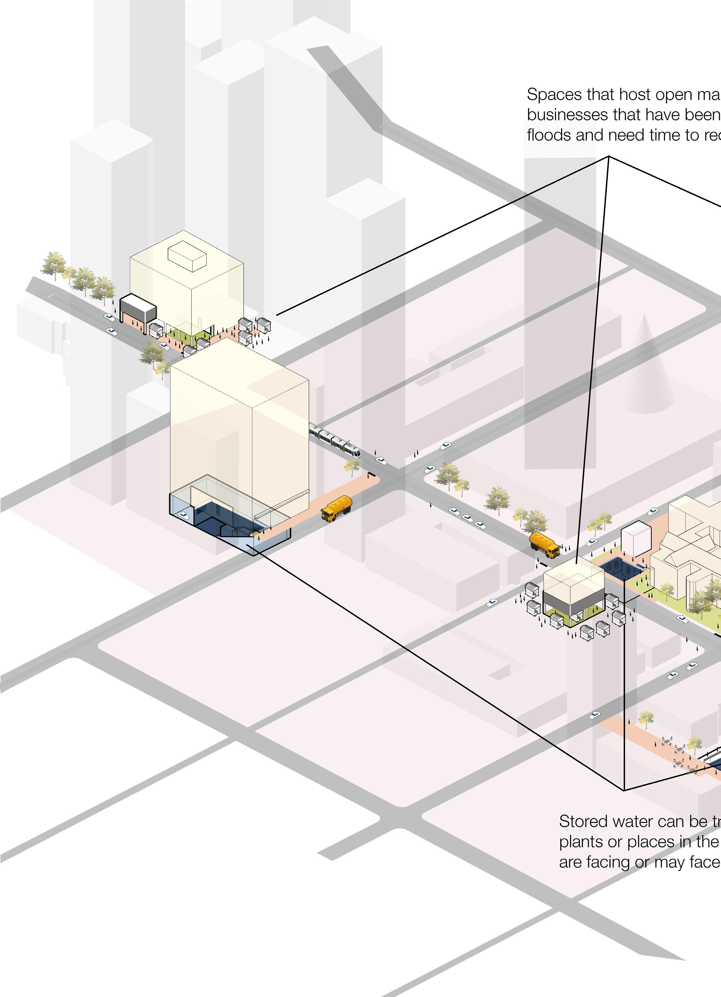
The sponge market is about using grocery markets and shifting them on the first floor to create an open ground that can host open markets for affected businesses and protect the food systems of the city during floods.
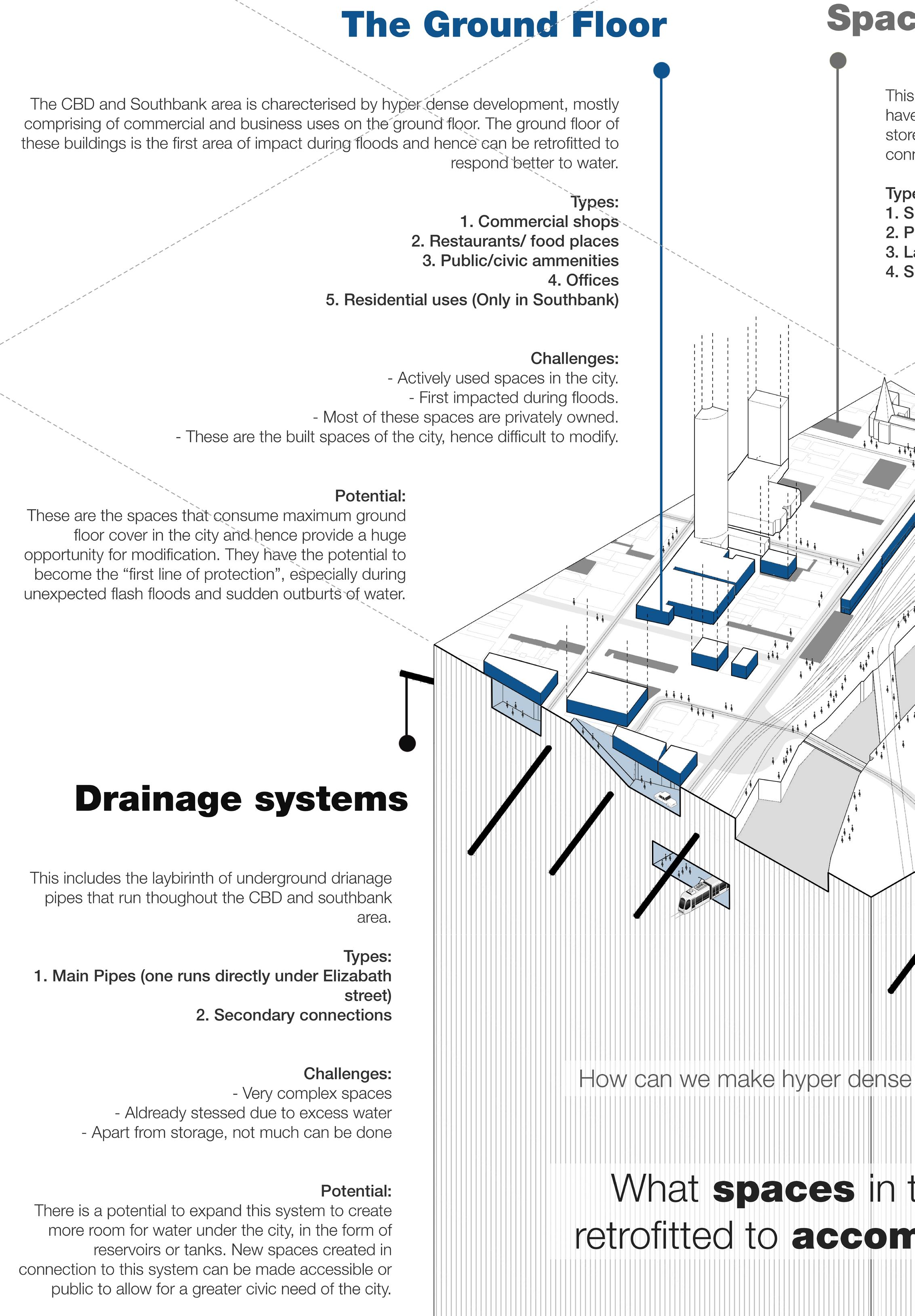
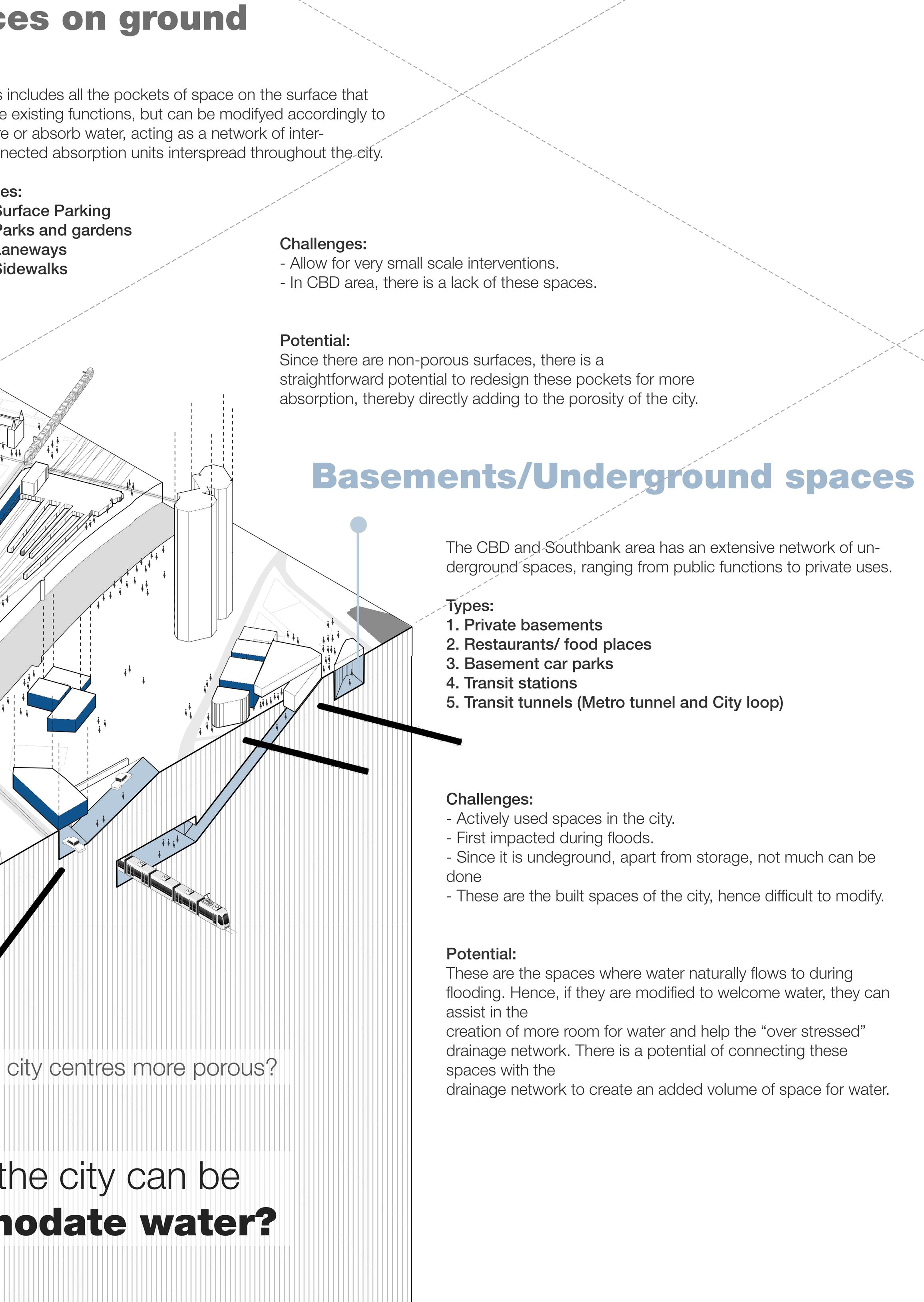
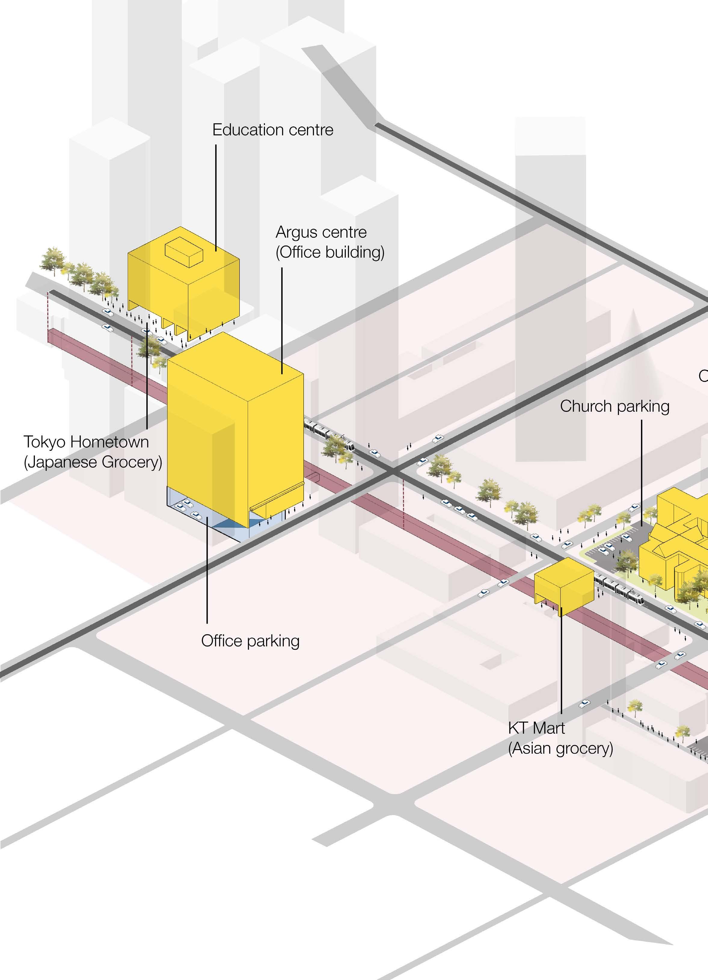
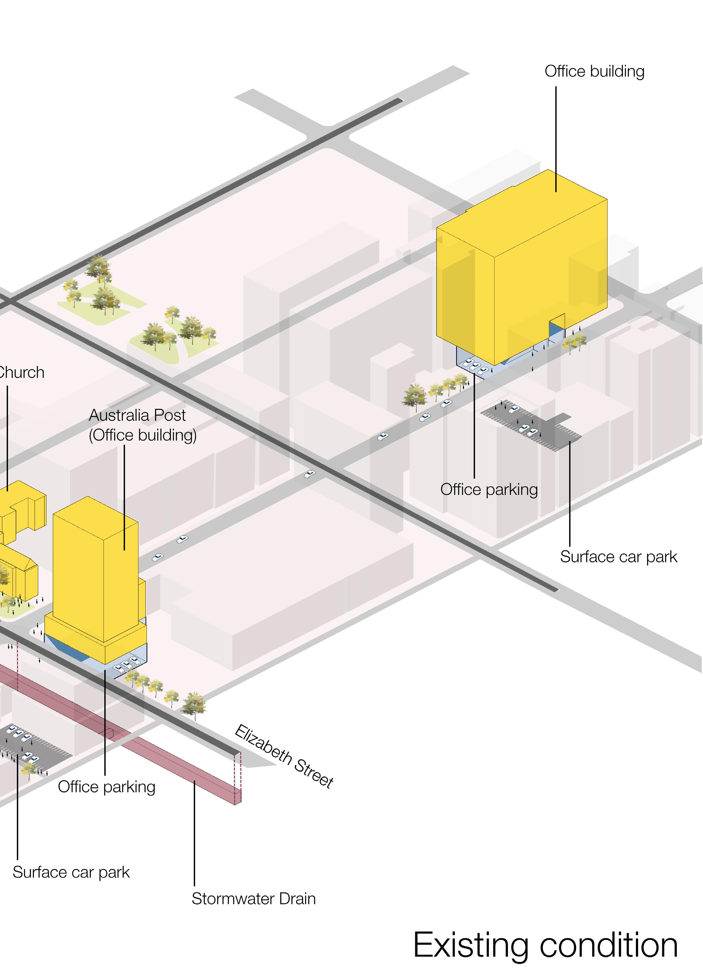
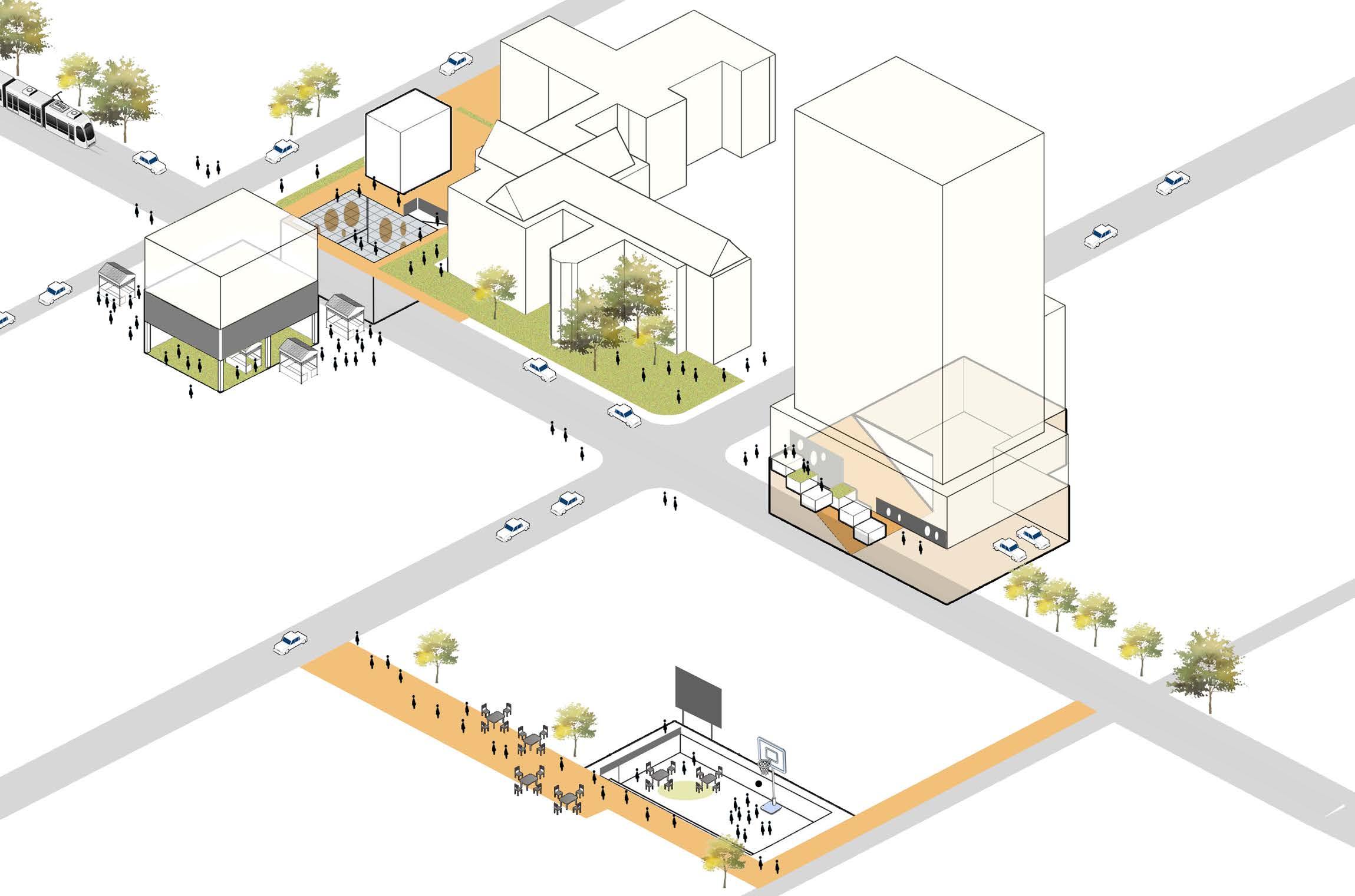
This isometric view is taken from a section of the Resiliency Plan to show the working of the strategies in existing urban conditions. It represents a typical view of the overall plan in CBD and Southbank.
The existing conditions include carparks that are mostly located underneath office buildings and the other spaces include surface parking, Local Asian grocery stores and a church, representing a public site. These are the spaces in the city fabric where the retrofit can be applied.
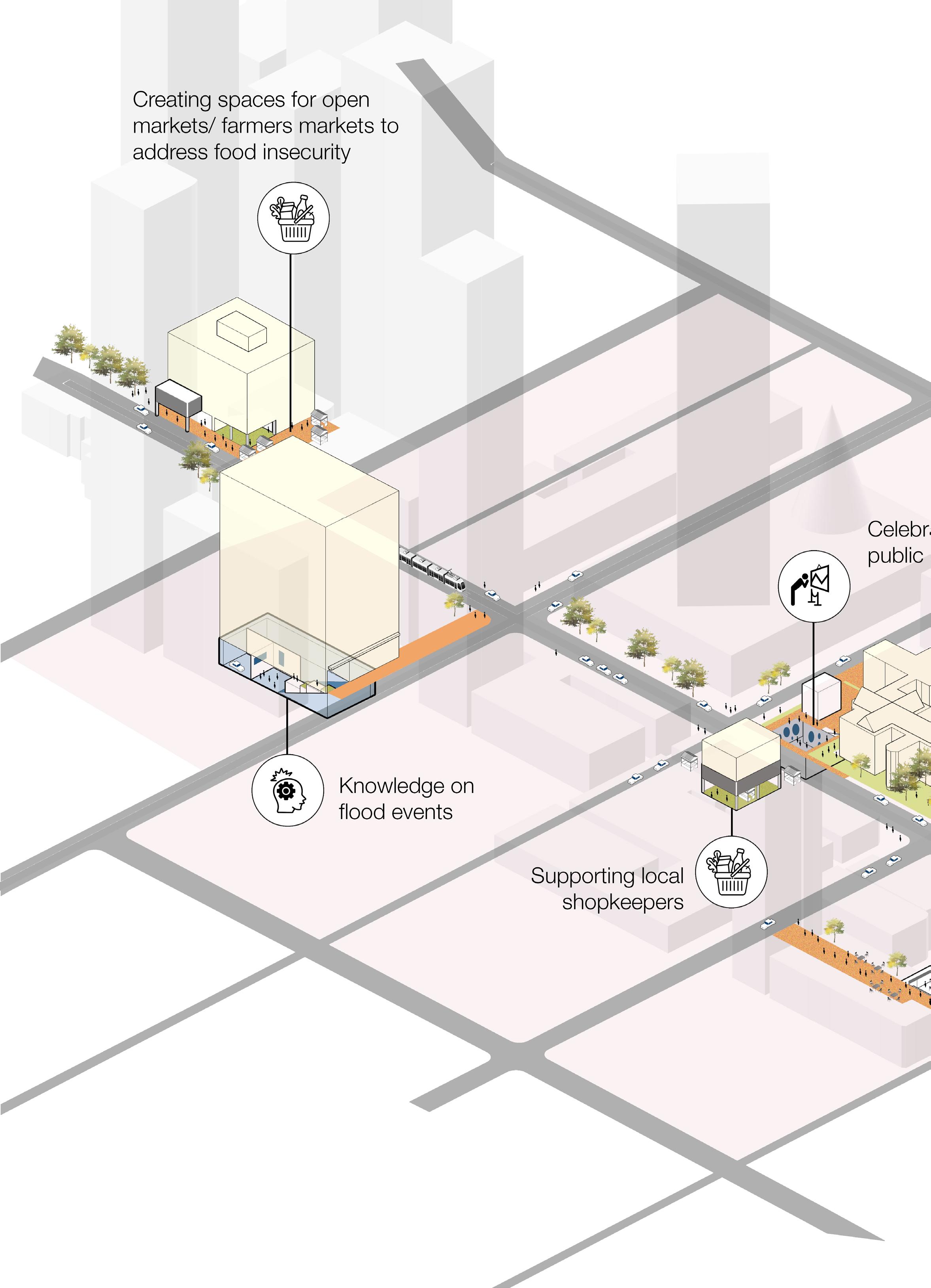
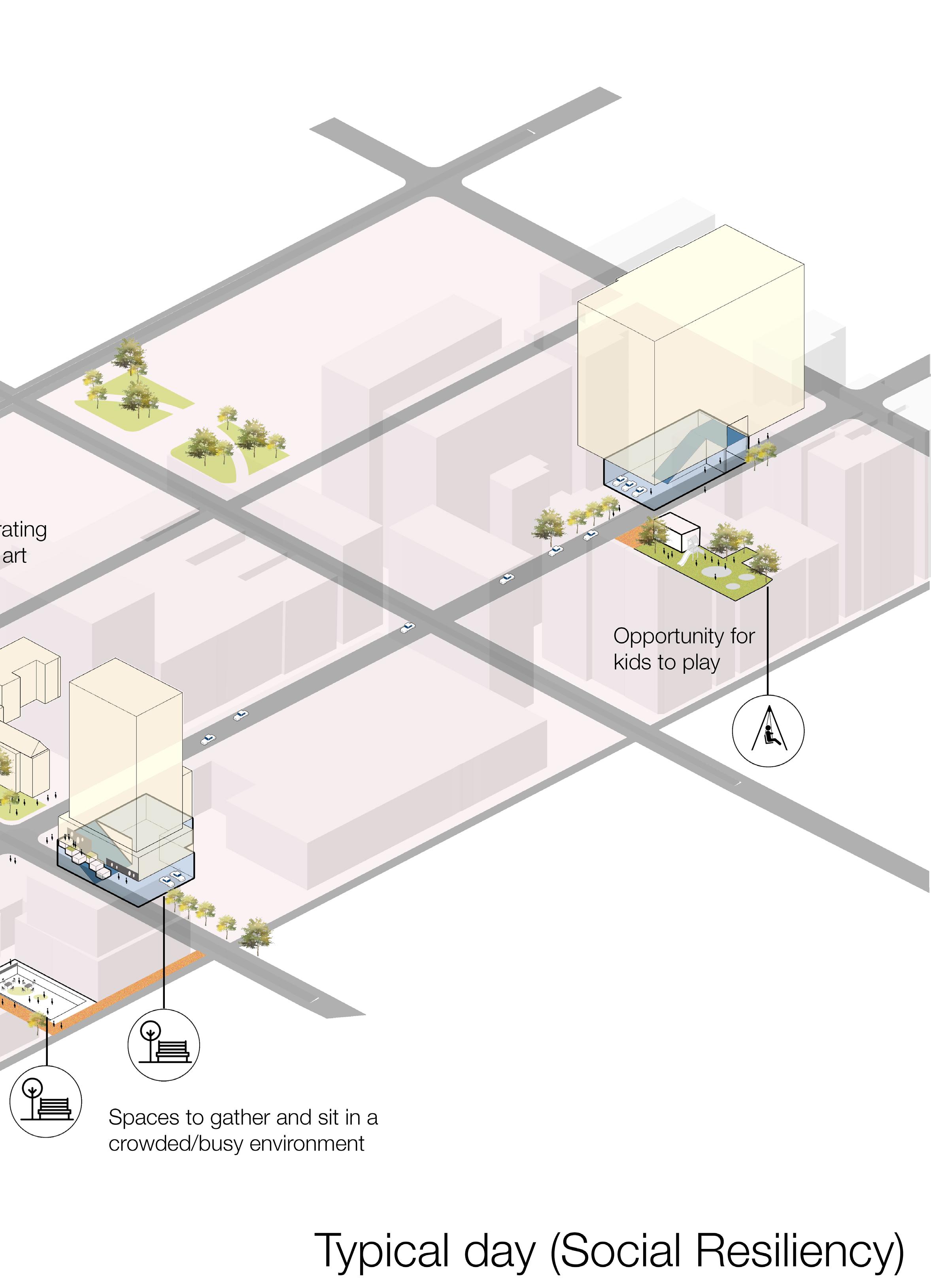
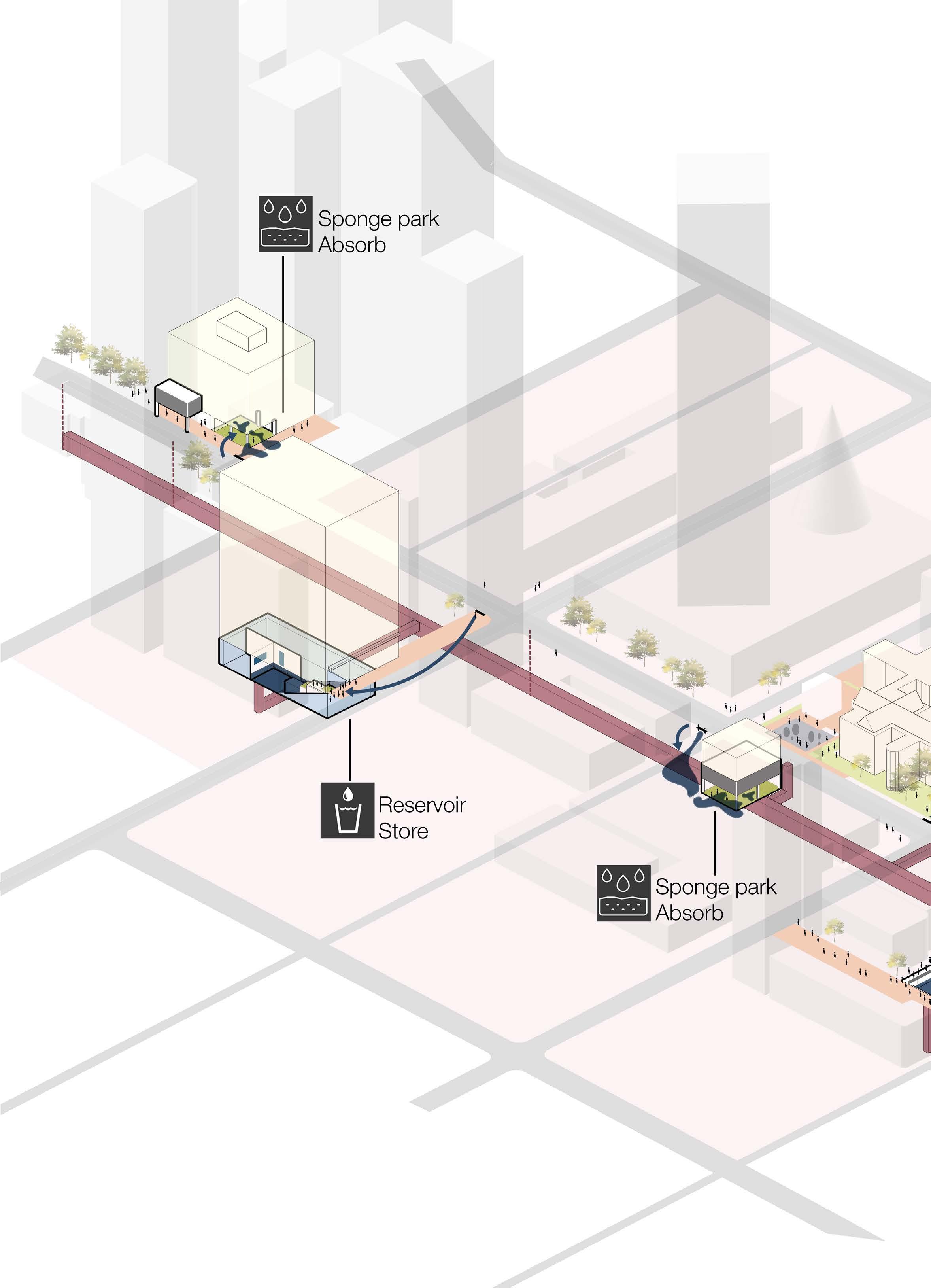
After the application of the retrofit, this is how the spaces are enhancing the social resiliency of the city on a typical day. There is an existing drain along Elizabeth Street and the design proposes new underground connections so that all the strategies can work as a whole.
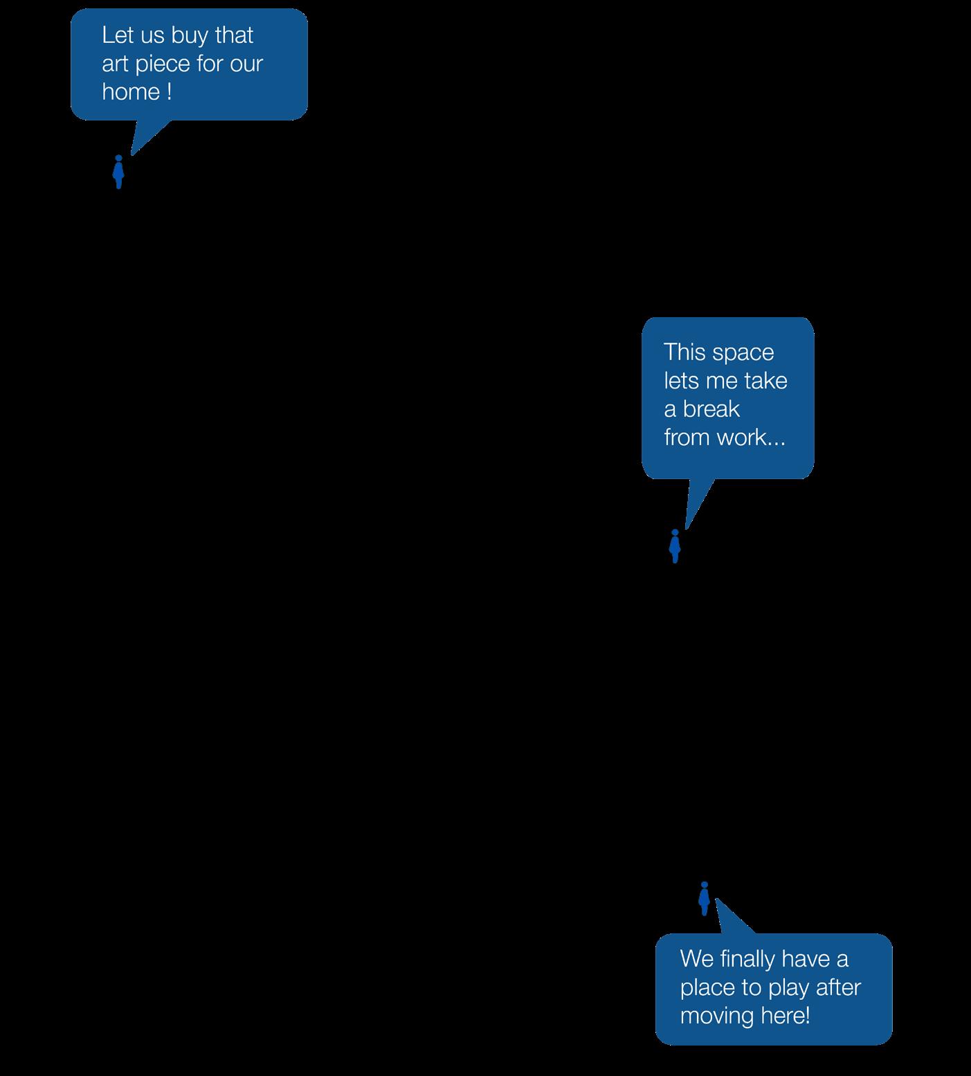
The spaces on a typical day can serve various civic purposes and act as vibrant spaces to relax, hang-out and spend time. Some spaces can support local art and craft and help local businesses.
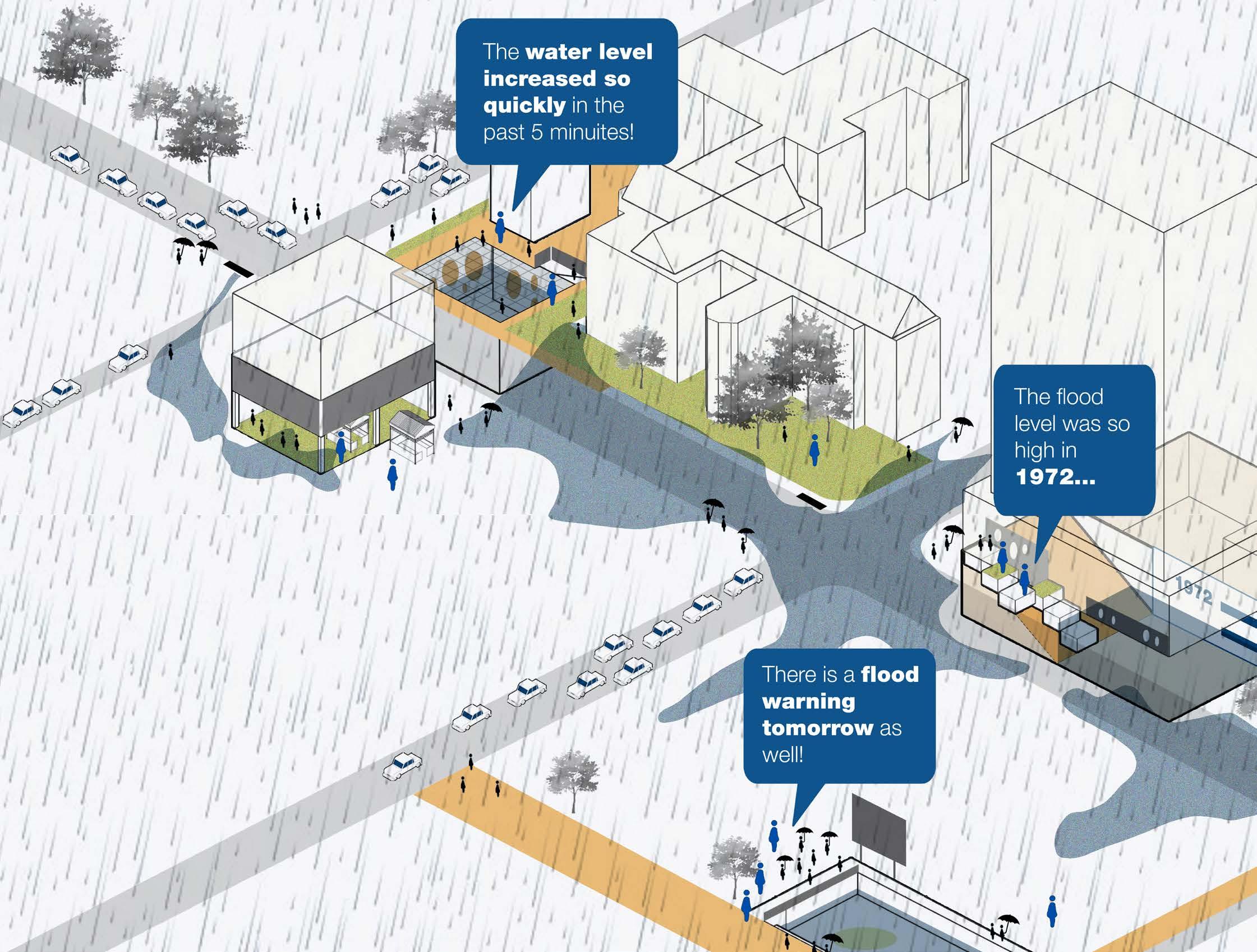
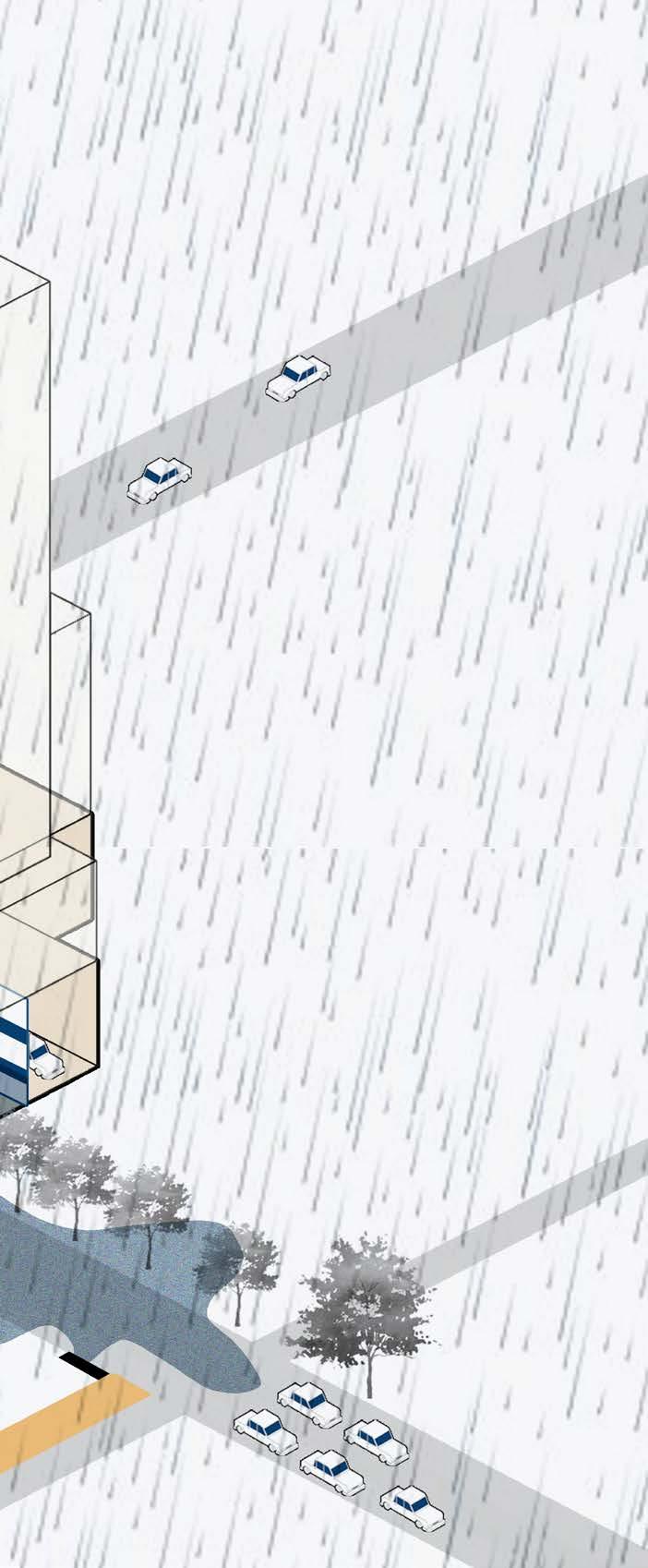
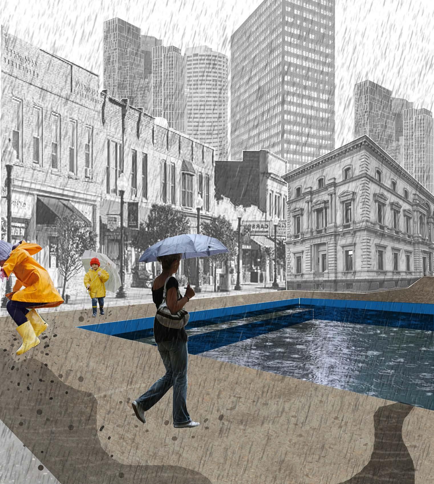
This shows how the strategies respond to a sudden flood. Some facilities store the water and the parks assist by absorbing excess water. Some spaces are still usable and aim to bring awareness to people. It is a way of making the consequences of flooding visible to the public. If the intensity of the flood increases, the network activates backup storage spaces like the underground exhibition.
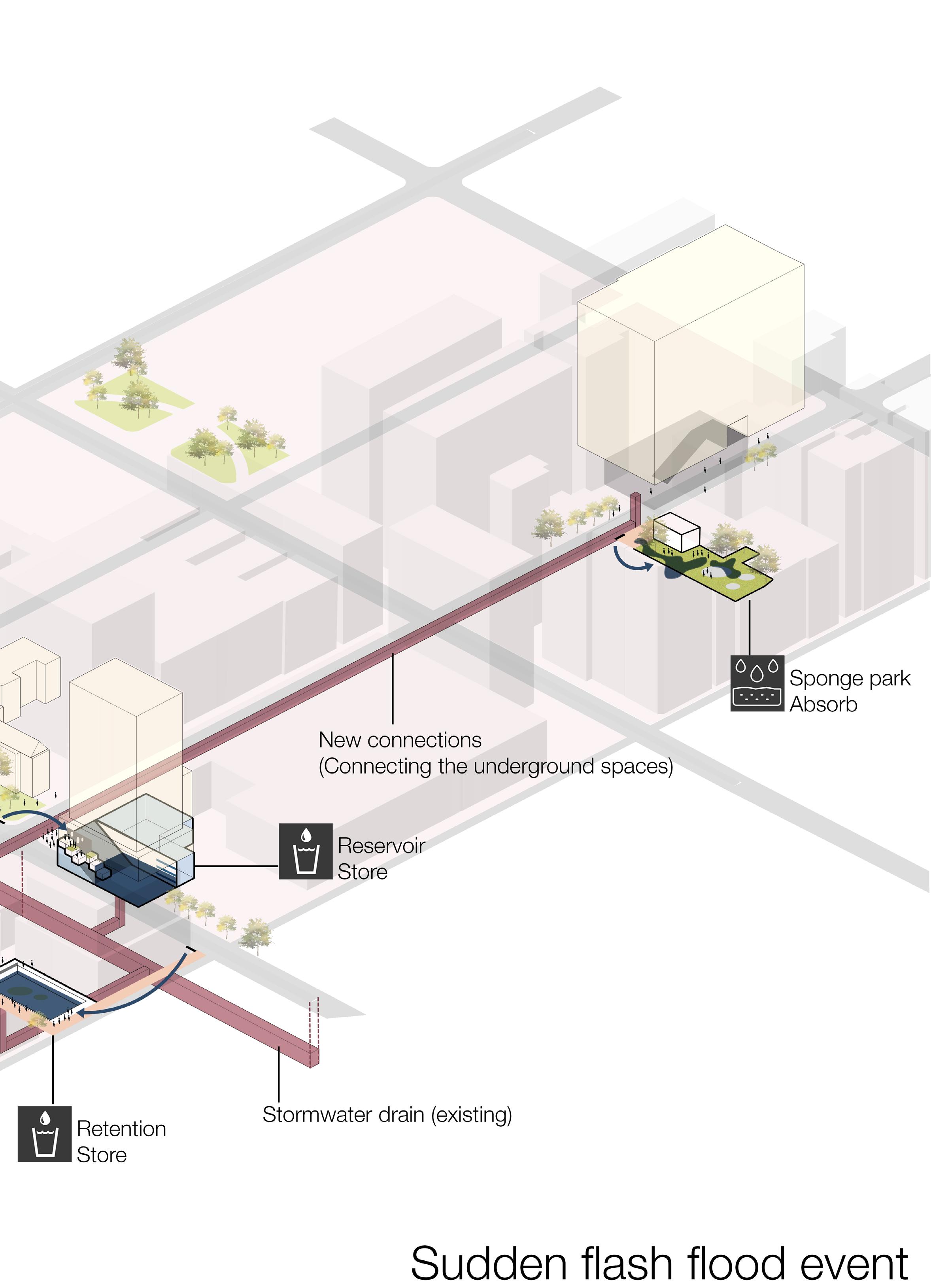
Scenario 2- Severe flash flood
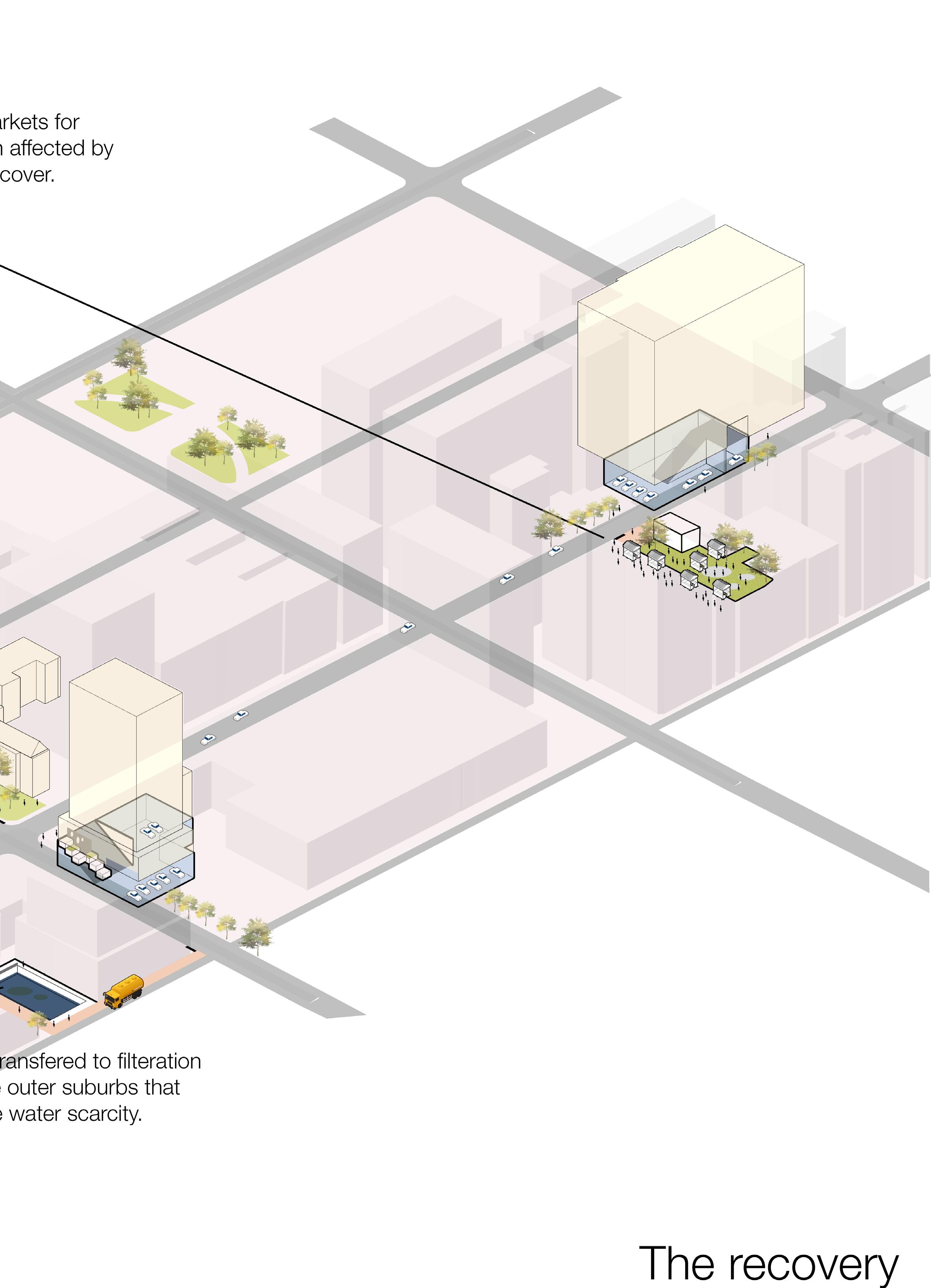
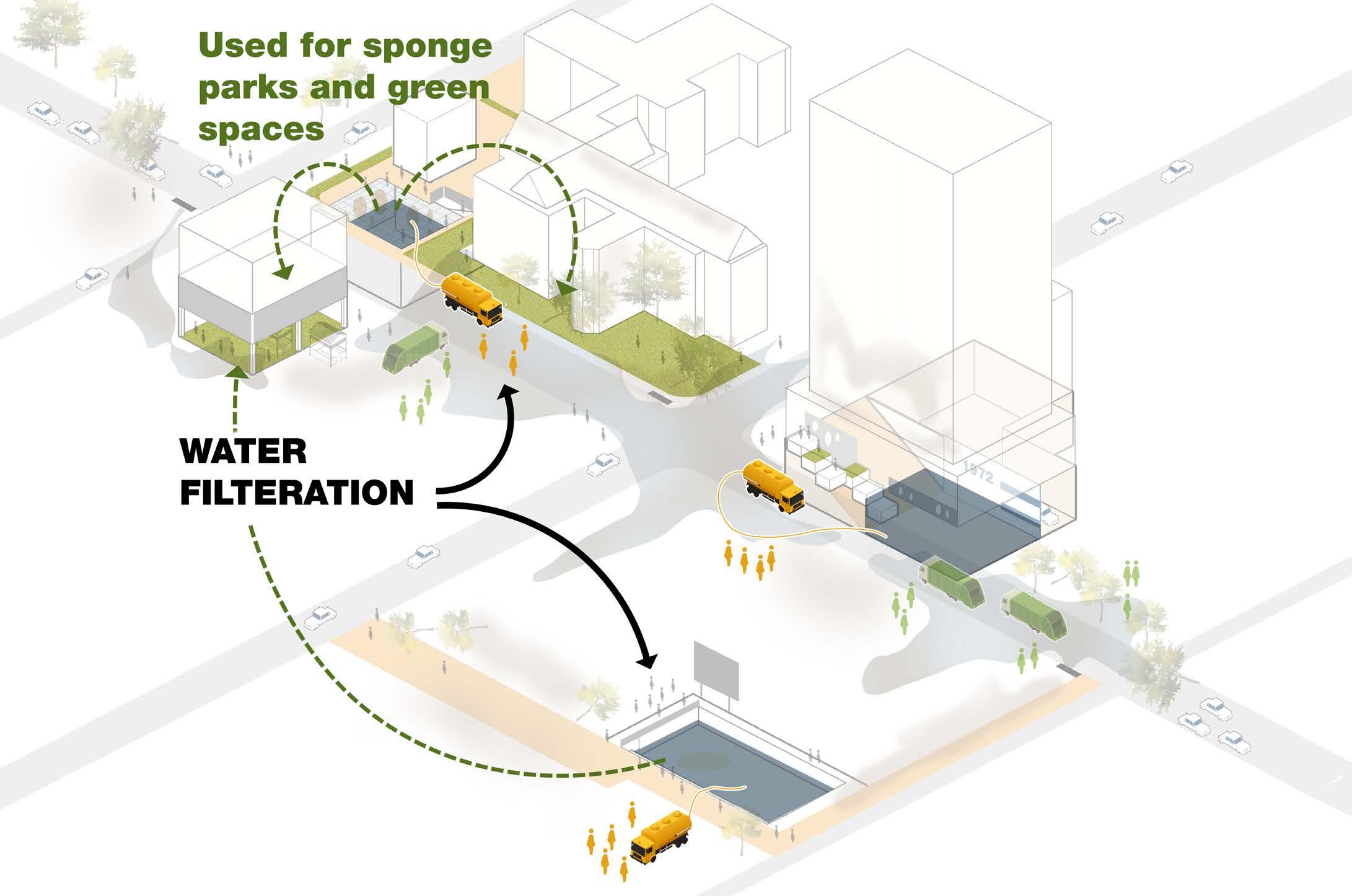
After the flood, the sponge parks can be sites for hosting open markets for affected businesses and food supply. Water from the storage facilities can be transported to the suburbs or filtered to support the ecology of the sponge parks.
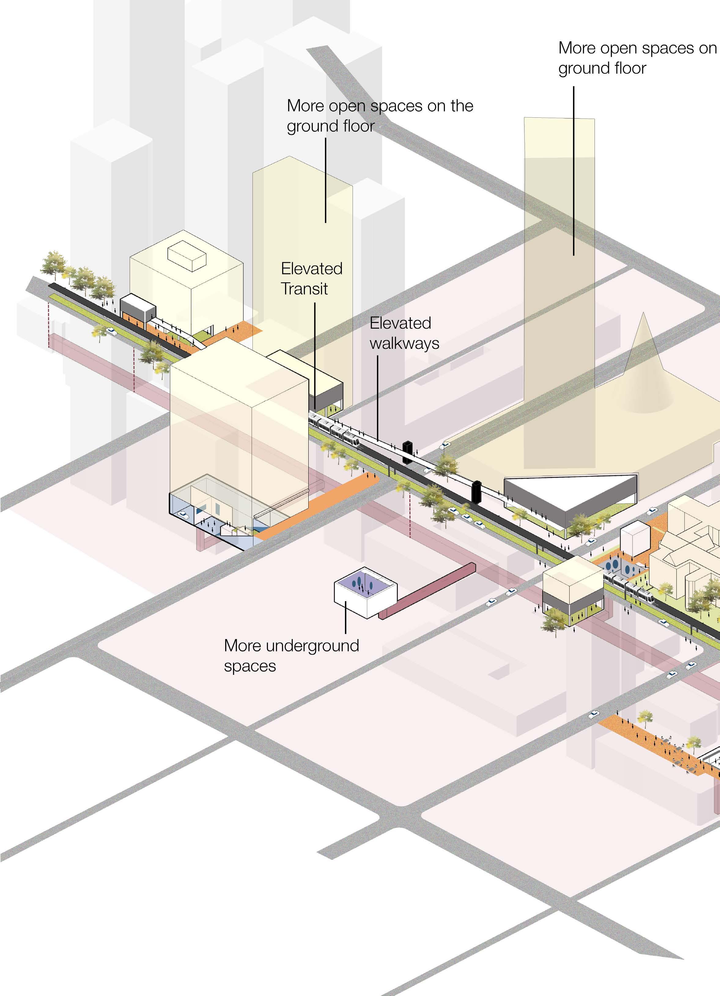
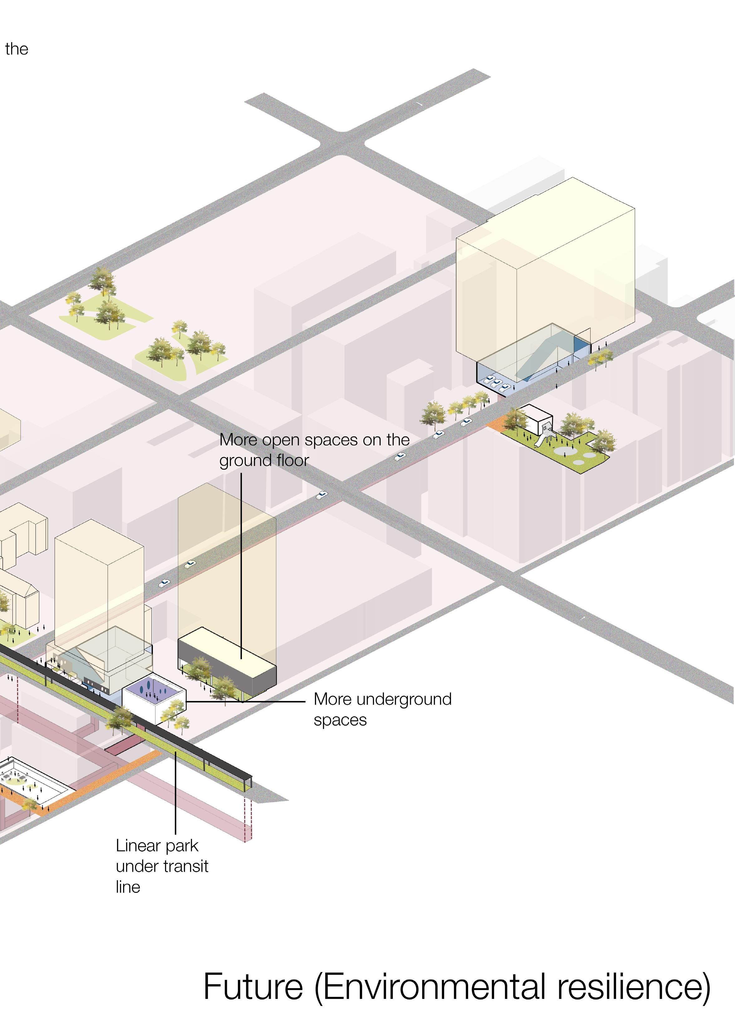
Ultimately in the future, the network supports environmental resiliency by an expansion of the porous green spaces and elevated facilities like walkways and transit to allow the functioning of the city even during floods. There can also be an expansion of the underground facilities.
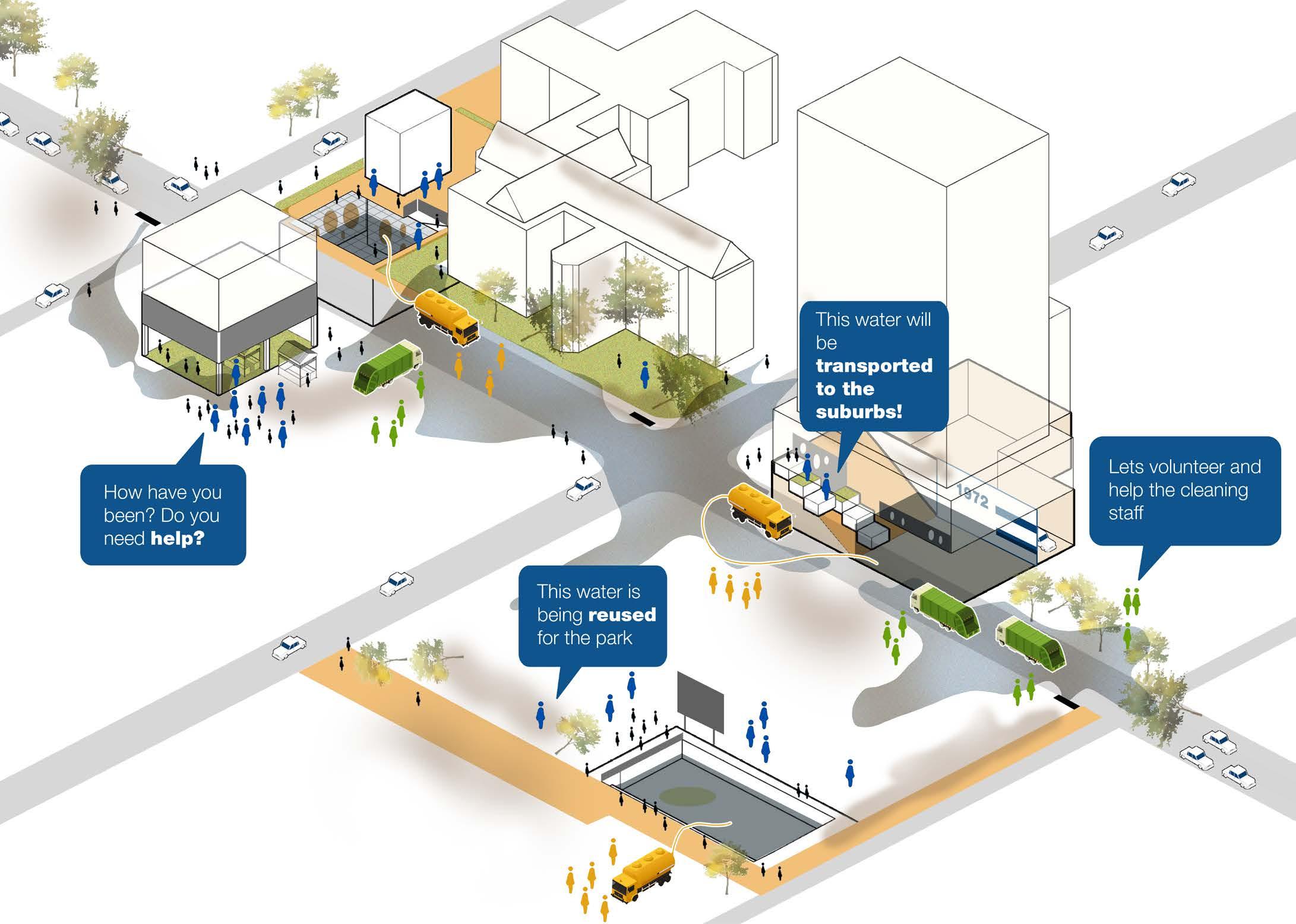
Scenario 3- Recovery after floods

Thank you :)
Mahima Patel