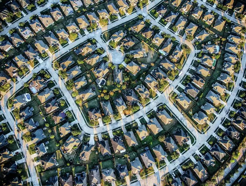
Neighborhood District OAK HILLS
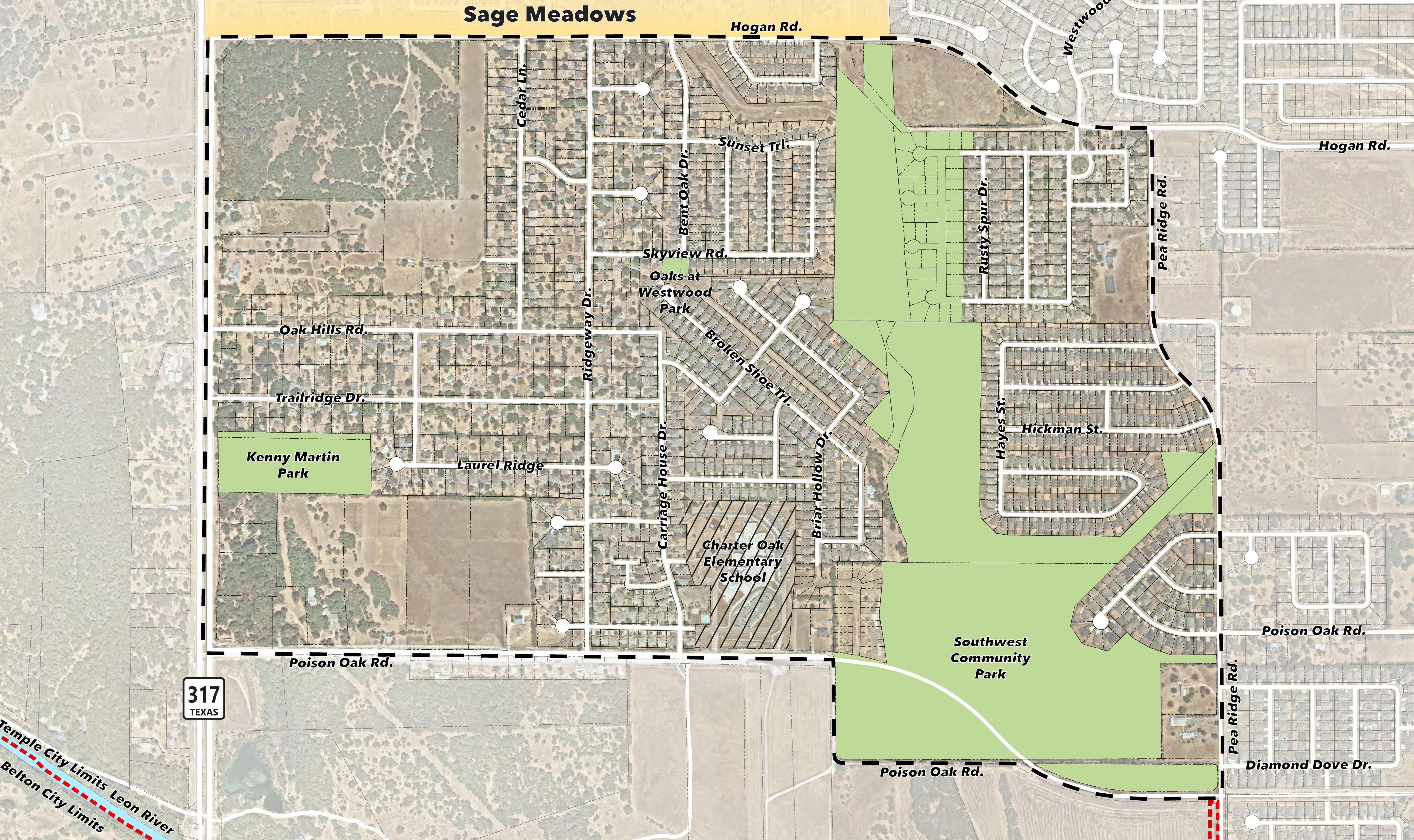
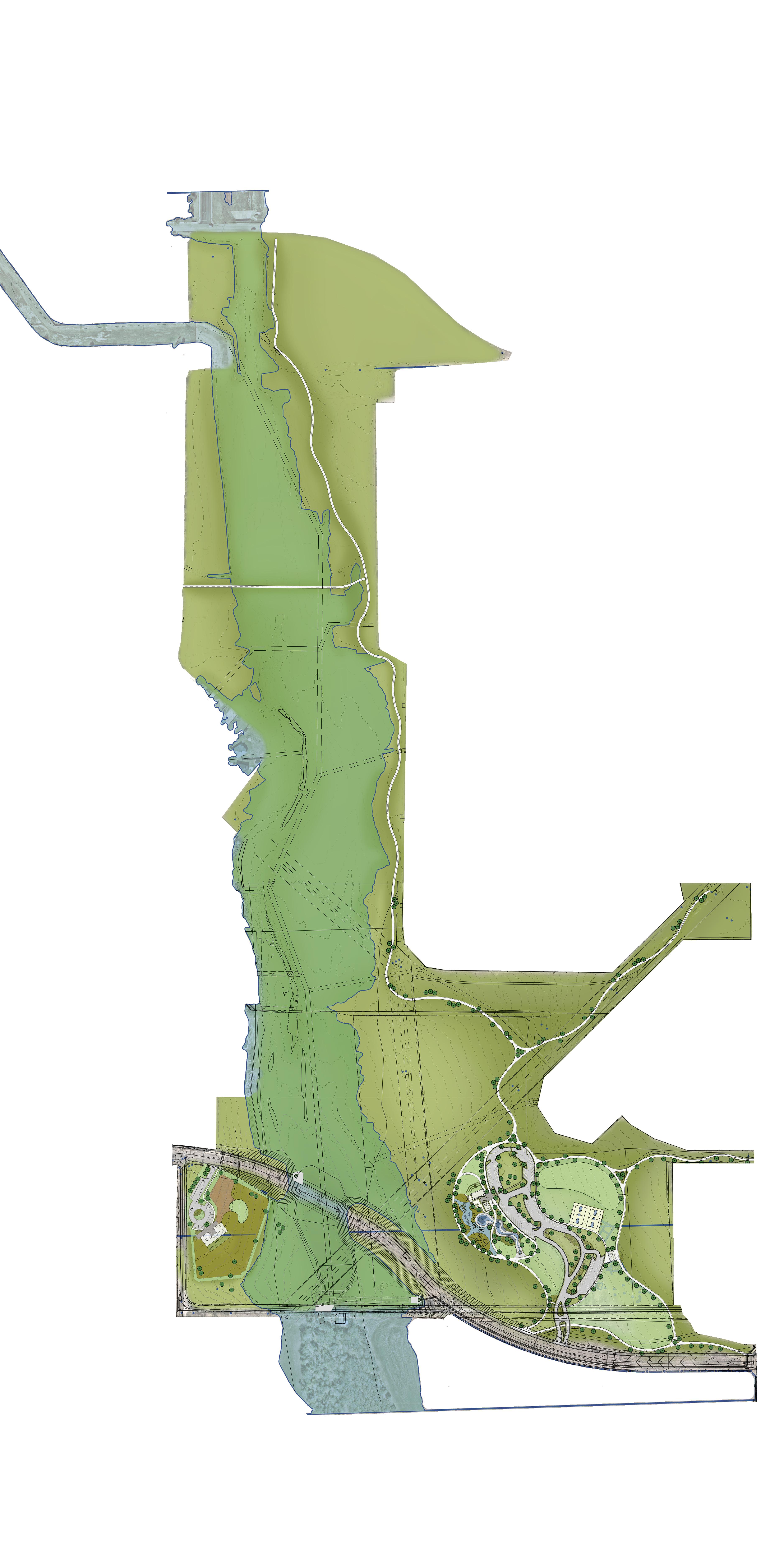
The Oak Hills Neighborhood is located in the far west area of Temple, off Highway 317, just south of West Adams Avenue (FM2305). This area of the community used to be Temple’s best-kept secret. For many years, it was considered in the “outskirts of town,” but recent development along West Adams has made it feel much closer to the community’s core. Rapid growth has also added to the look and feel of the neighborhood, including many new homes built alongside more well-established parts of the neighborhood. The neighborhood still contains much undeveloped land that will soon boast more new homes and neighborhood services. The availability of land has also provided an excellent opportunity for the new Southwest Community Park, which is currently in design. Residents will be able to enjoy walking trails, playgrounds, and open spaces very soon. The parks, schools, housing, shopping, and dining options along West Adams have made this area popular for young families, increasing the area’s popularity. Temple’s best-kept secret will become the next hottest topic as the area grows.
The City of Temple is dedicated to fostering cohesive, distinct, vibrant, safe, and attractive neighborhoods where citizens take pride in and are engaged with their community. The work of the City’s Neighborhood Planning Team will accomplish these objectives.
Through a process of collaboration and communication, the City’s Neighborhood Planning Team will strive to ensure continued improvements to Temple’s neighborhoods, and access to a wide variety of safe, accessible, and affordable housing types.
Working alongside residents in each neighborhood, our mission is to identify neighborhood concerns, values, vision, and goals. Through this process, the City will develop long-range plans for each Neighborhood Planning District to include:
• City Capital Improvement Projects
• Private Investment & Economic Development Opportunities
• Community Development Block Grant Projects
The emphasis of the mission will be to improve the quality of life in each neighborhood while increasing access to affordable housing.
The Oak Hills Neighborhood is one of 24 planning districts within the City of Temple. Each district plan has a similar planning process intended to complement the City’s Comprehensive Plan with a more focused effort at the neighborhood level. This plan looks at the existing conditions and engages residents to derive genuine information and direction from the neighborhood. While using best practices for planning, the results of each plan define specific recommendations that are unique to each district.
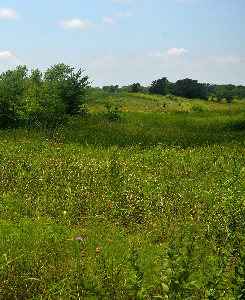
The land designated for Southwest Community Park is a definitive element that takes up much of the planned area. This ecoregion is that of the Texas Black Land Prairie, characterized by tall grasses, wildflowers, and scattered oaks. These elements are what give Oak Hills its character and identity.
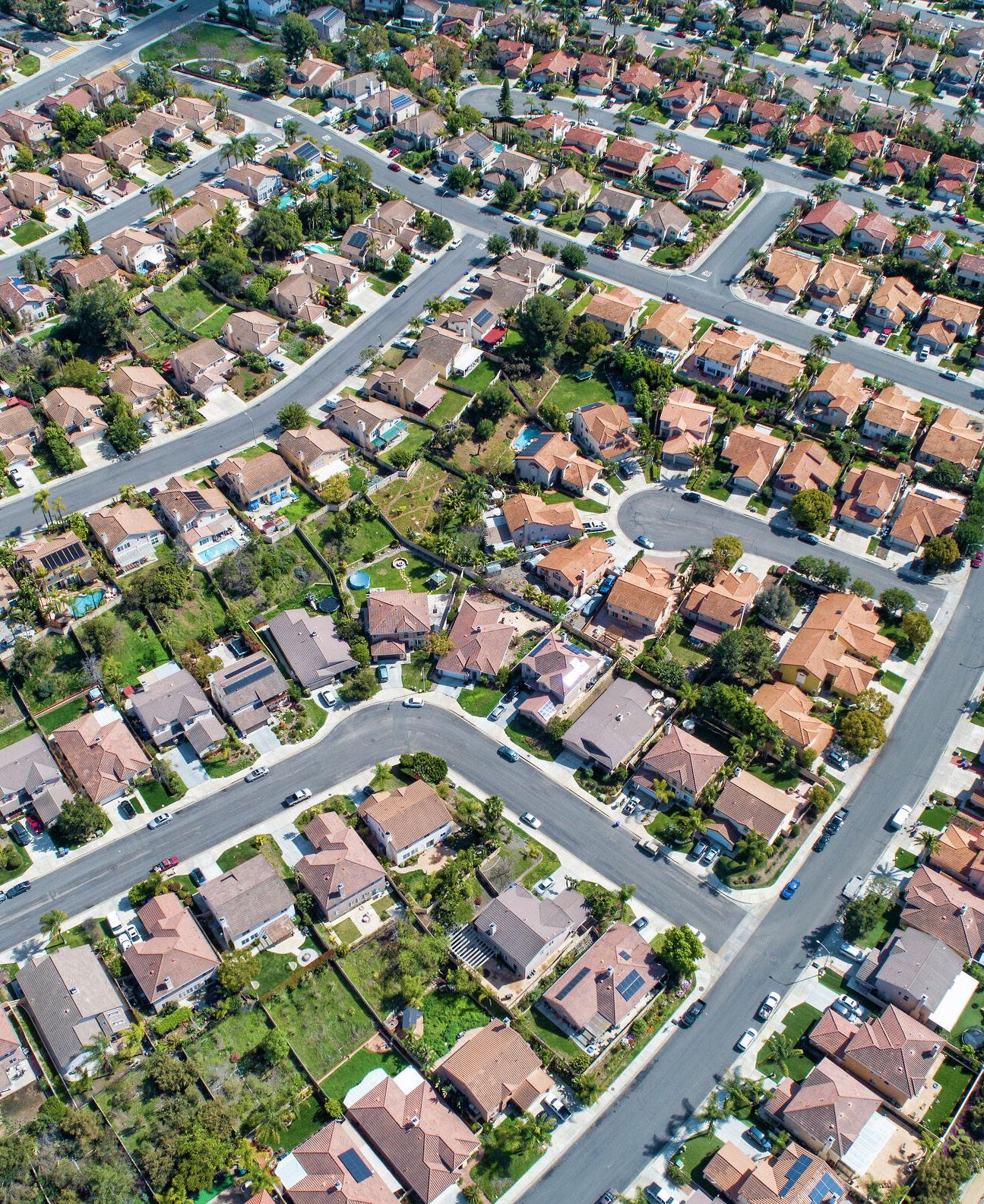
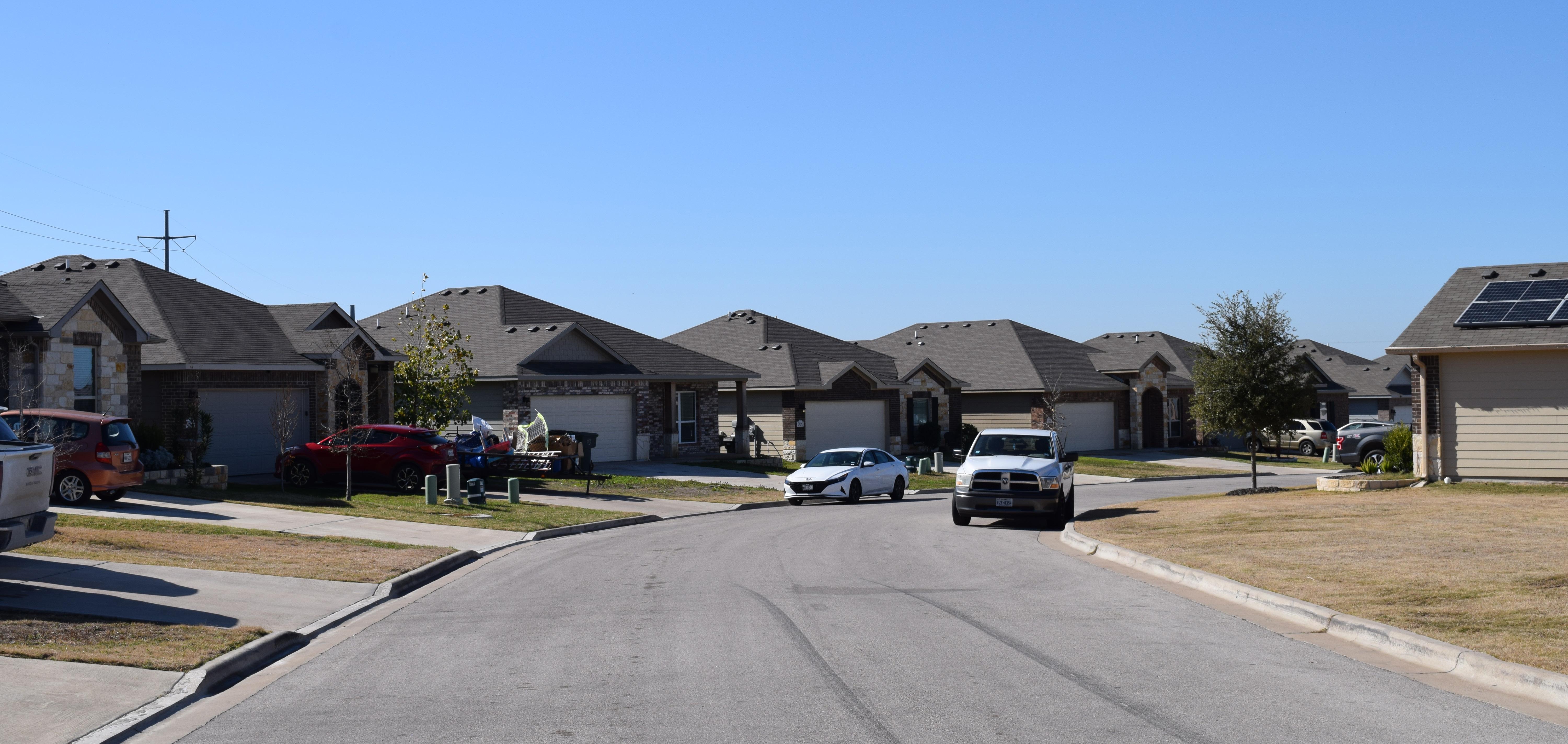
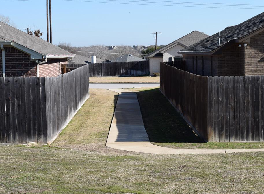
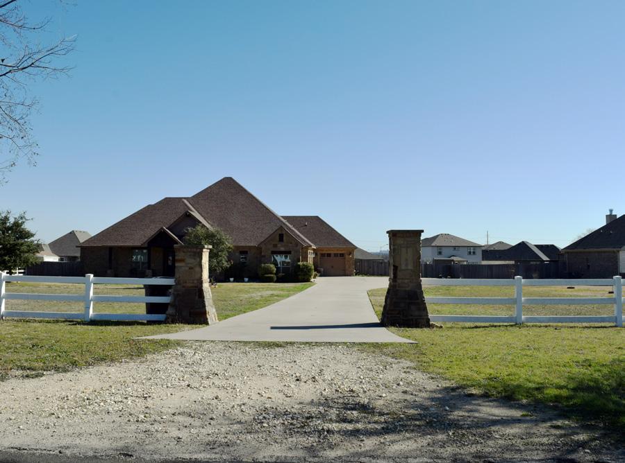
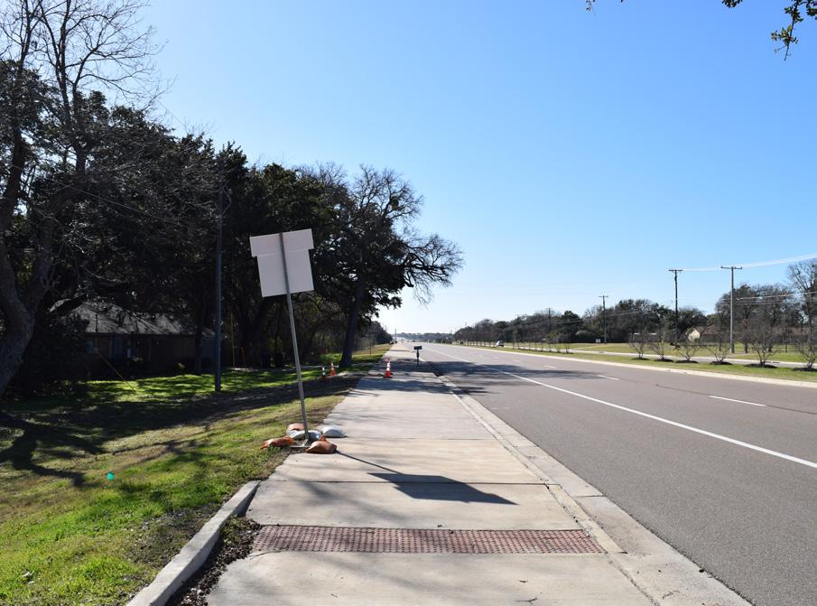
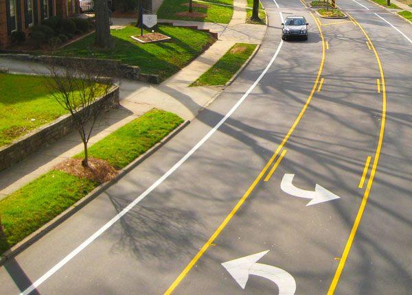
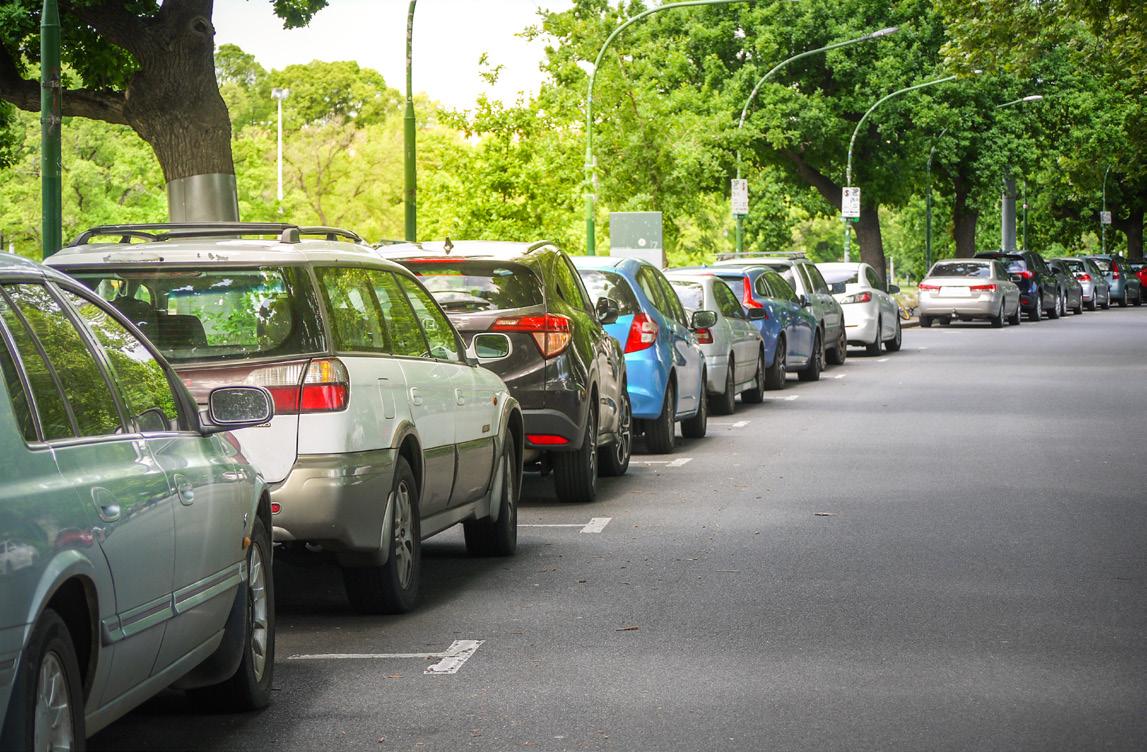
The plan area has developed in a typical suburban style that is very car-dependent. This development style prioritizes automobile infrastructure over sidewalk infrastructure. This car dominance is evident in the design of expansive driveways and the front façades of many houses within the neighborhood.
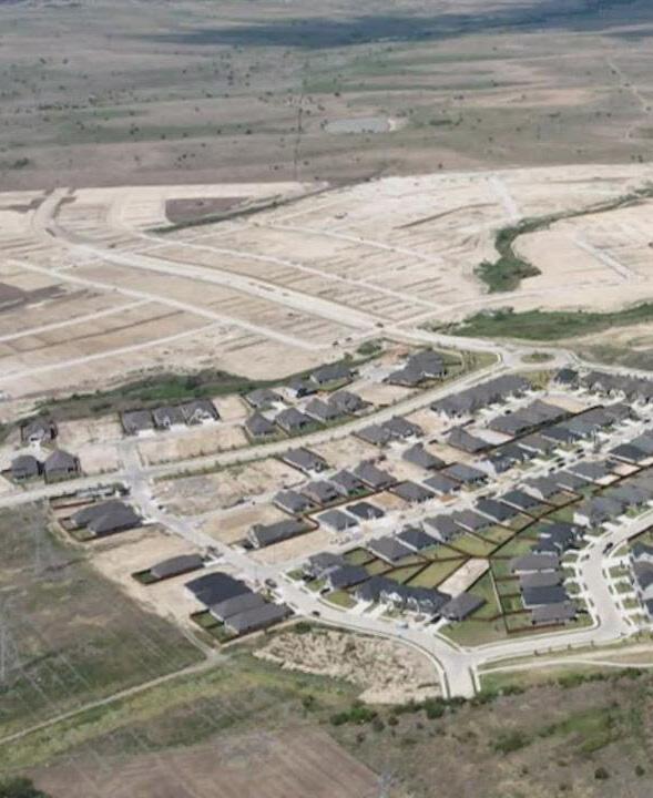
The Oak Hills Neighborhood is still maturing as it has yet to reach its full potential. Currently, Oak Hills is dominated by housing and is deprived of other land uses such as commercial. The west side of Temple is poised for future development due to its location bridging the gap between Temple and Belton.
COMPLETE THE NEIGHBORHOOD DEVELOP PARKS & OPEN SPACE
OVERCOME THE STORMWATER

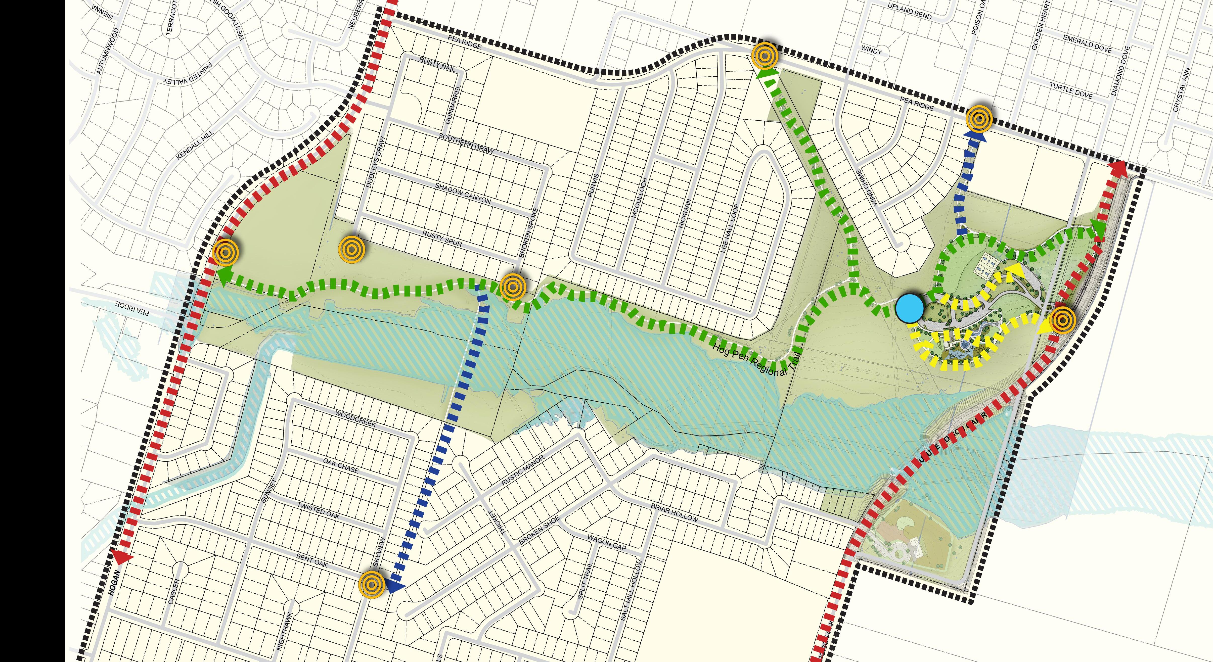
• Commit to regional trails connecting Pepper Creek Trail to surrounding neighborhoods.
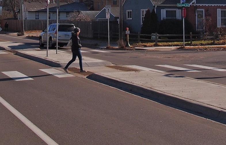
• Add sidewalk infrastructure and enhance pedestrian crossings along roads that lead to high-traffic intersections.
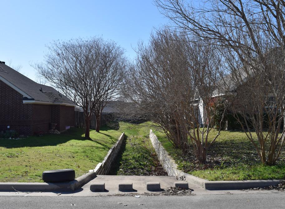
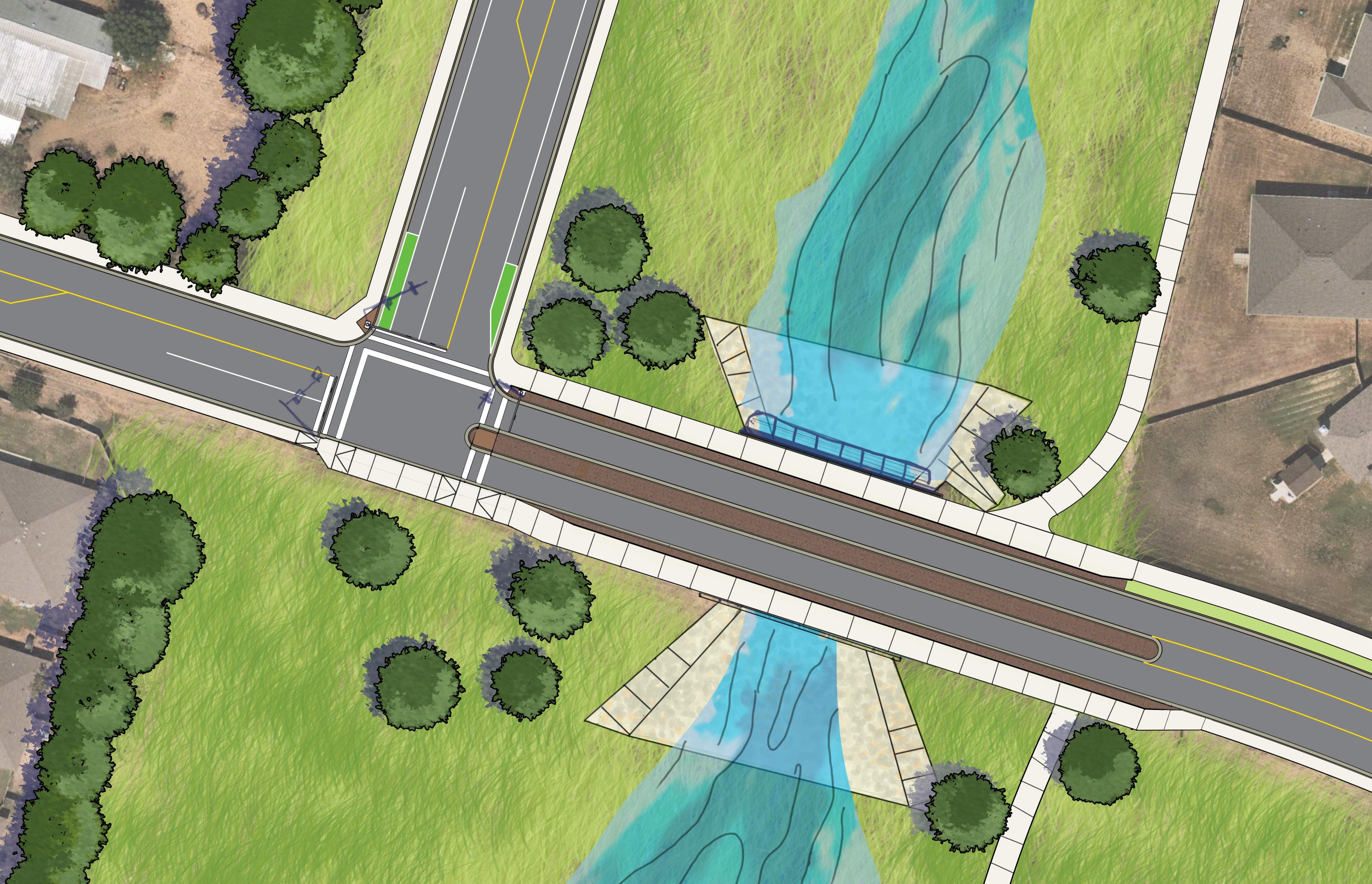
• Provide a pedestrian crossing over Hog Pen Creek to connect the school and neighborhoods east and west of the creek.
• Provide opportunities for different land uses such as neighborhood services, commercial, and restaurants. These different land uses complement existing and future housing developments by meeting the needs of residents within a closer vicinity.
• Implement access management principles along HWY 317 to better control traffic flow and reduce the neighborhood residents’ reliance on it to reach other destinations within the plan area.
• Provide engineering solutions to respond to adjacent residential housing.
• Mitigate floodwater hazards created around the floodplain.
• Ensure park amenities are easily accessible to all.
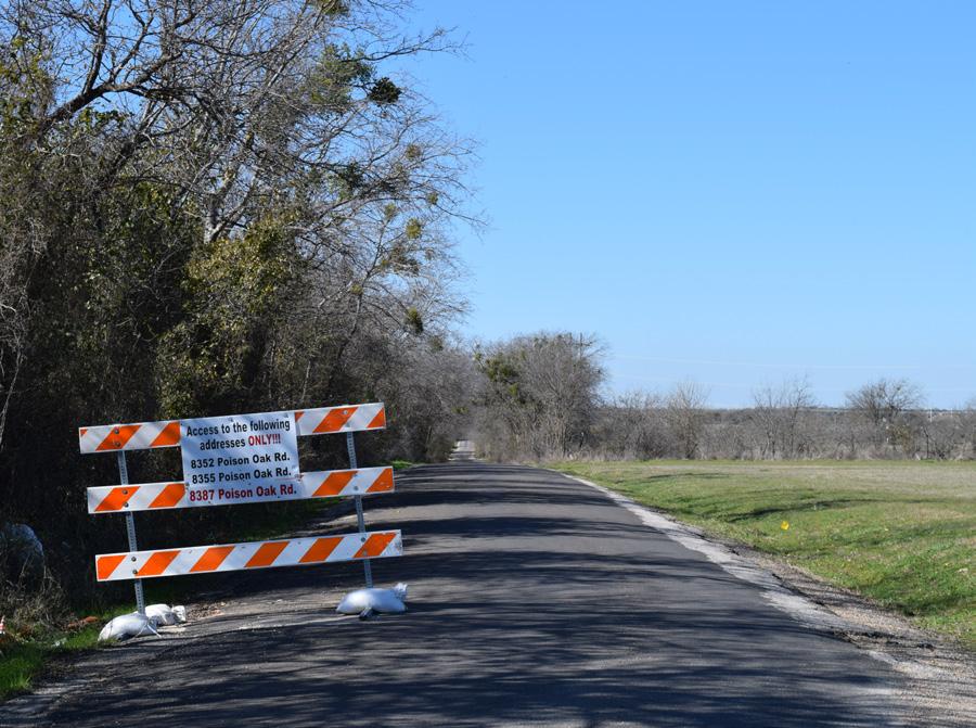
• Completion of street infrastructure improvements to the roads that determine the extent of the plan area (Poison Oak Rd., Pea Ridge Rd., Hogan Rd., and HWY 317).
• Make sure the new neighborhood name and identity of Oak Hills reflects the overall character of the neighborhood.
This planning effort is intended to complement the focus areas and initiatives laid forth in Temple By Design, the 2020 Comprehensive Master Plan. The strategic considerations identified above highlight critical features of the plan area that are intended to help guide unique recommendations for the Oak Hills Neighborhood. These resulting recommendations will be compiled into an Action Plan, which includes references to the specific Comprehensive Plan Initiatives they intend to help realize. This planning effort consists of a public engagement and visioning process to determine recommendations for corresponding capital improvement projects.
A look into the demographics helps to frame the characteristics of the plan area’s population. This information guides recommendations for policies and changes to the built environment. This information is derived from the American Community Survey 2017-2021 5-year using Esri’s Community Analyst software that aggregates multiple block groups that comprise the plan area. This gives us the most accurate information for the defined area and helps tell the story of the plan area demographics.


$80,575


2020 or later
2010 to 2019
2000 to 2009
1990 to 1999
1980 to 1989
1970 to 1979
1960 to 1969
1950 to 1959
1940 to 1949
1939 or earlier


*The ACS recorded 0 people walking to work
The following are a few summary conclusions derived from reviewing the demographics within the plan area:
• The Oak Hills Neighborhood is not very diverse with 78.9% identifying as White, 10.9% as Black, and 19.5% of Hispanic Origin.
• The largest age cohort is 35-39 years of age, and the second largest age cohort is those under the age of 5 years old. This attributes to a slightly younger median age for the neighborhood at 32.2. Texas as a whole has a 34.8 median age.
• More than 98% of the population 25 years and older has an educational level at or above a high school diploma/GED. The majority of this population over the age of 25 has attained an educational level of some college or an associate’s degree.
• Median household income is almost $14,000 higher than that of the State of Texas at $67,000. 14.8% of households live below the poverty line which is slightly higher than the 11.5% of Americans living below the poverty line.
• The Educational Services, Healthcare, and Social Assistance industries employ the most neighborhood residents by far at 35.3%. The next largest industries employing residents are transportation, warehousing, and utilities, which account for 13.4% of the total.
• Approximately 1/3 of the housing stock is renter-occupied and 2/3 of the housing stock is owneroccupied housing.
• While 10.8% of households do not have access to a vehicle, most of the workforce commutes via personal automobile while the rest of the workforce predominately works from home.
DEMOGRAPHIC TAKEAWAYS
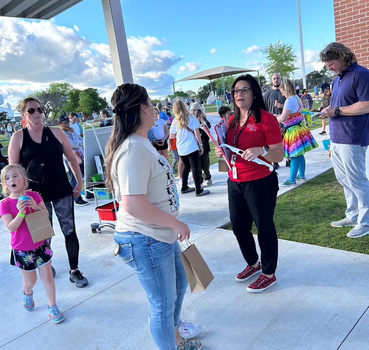
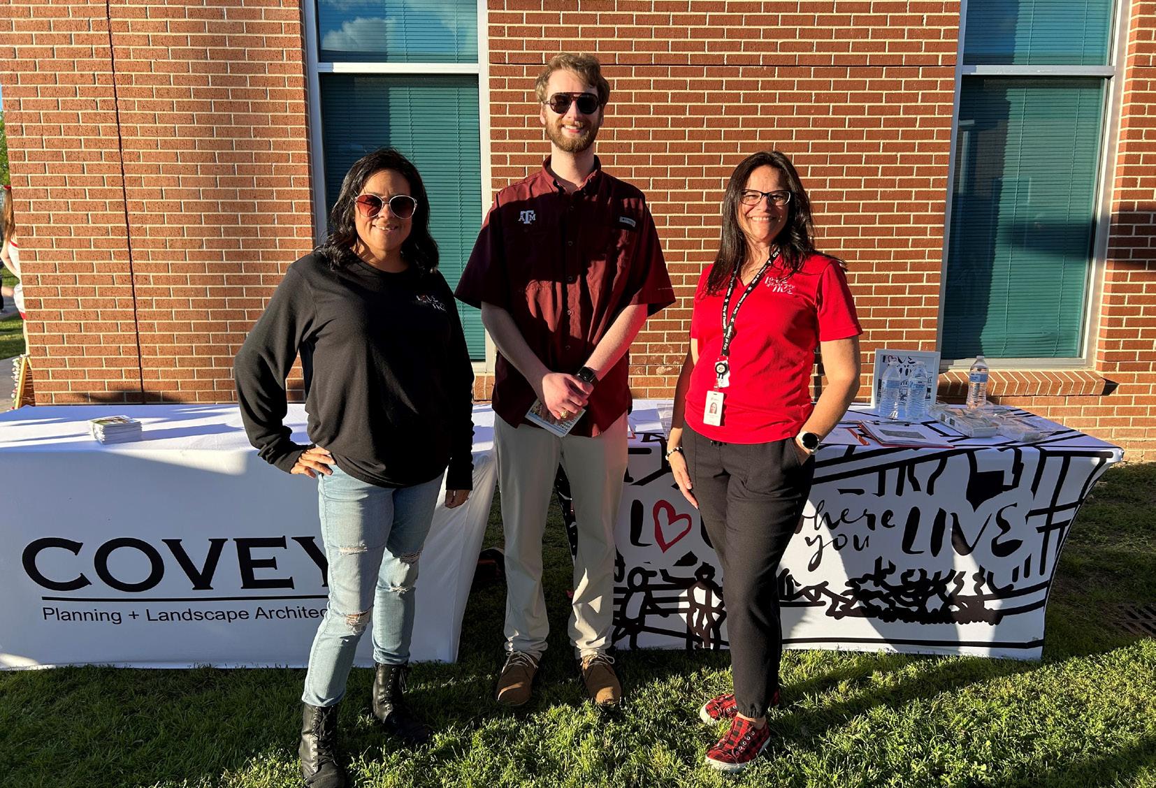
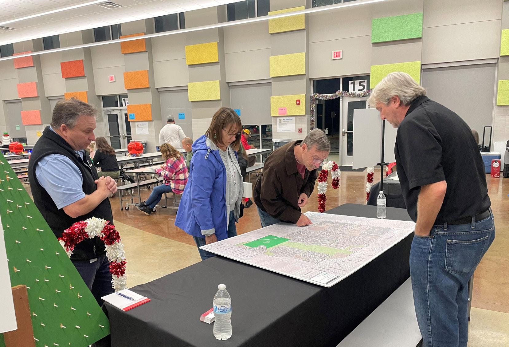
The Neighborhood Planning Team was challenged to develop a community engagement method so that crucial feedback could be gathered from the residents of the Oak Hills Neighborhood. The City Staff conducted events to engage with and inform the area residents of the planning effort. As part of that outreach, residents were invited to a public open house where input was solicited. They were also asked to complete a longer online survey. The results of the outreach efforts are highlighted on the following pages.
What is the biggest strength of the plan area?
What is the biggest weakness of the plan area?


Which name best fits the neighborhood district?


Rate the following land uses on their importance to the Oak Hills Neighborhood District (1–Unimportant, 5 – Most Important).


The following are a few summary conclusions derived from reviewing the online survey responses:
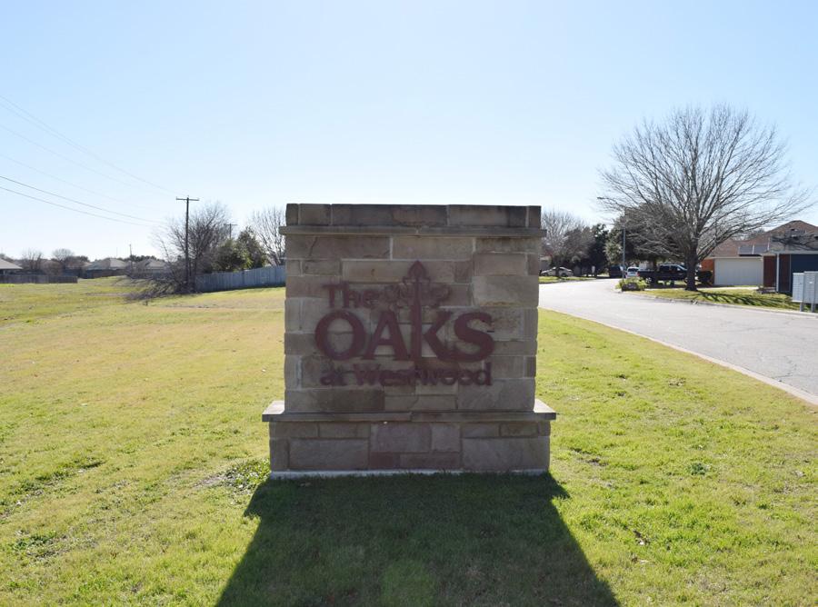
• The residents of Oaks at Westwood decided that the name Oak Hills was a better fit for the neighborhood.
• Some of the neighborhood’s biggest strengths are the school and the sense of community. The most significant area for improvement is infrastructure like roads and sidewalks.
• Most residents said they would prefer to walk or bike if they used an alternative form of transportation.
• With the HOP point-to-point curbside service, 82% of neighborhood residents said they would not use the new service.
• Transportation and pedestrian improvements that residents want to see are more sidewalks, bike lanes, and street lights.
• The neighborhood residents expressed a desire for more restaurants, grocery stores, and retail.
• The residents expressed that the road conditions should be considered a weakness and a high priority in this neighrborhood.
• Park improvements, trails, and public safety were also noted as being high importance within this neighrborhood. Items such as pedestrian lighting and traffic calming has been noted as an effective resolution.
• Drainage was also noted as an important issue with the residents.
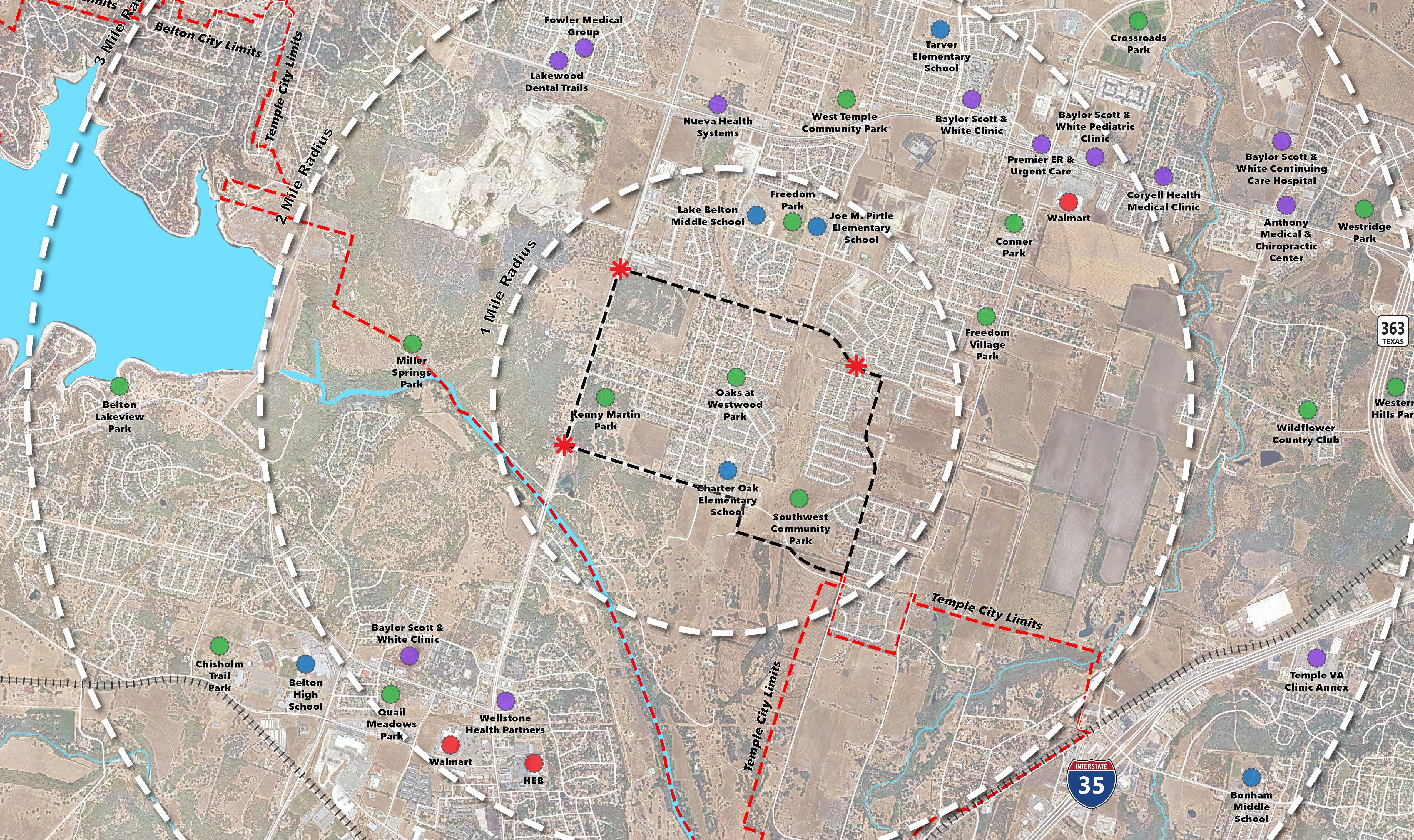
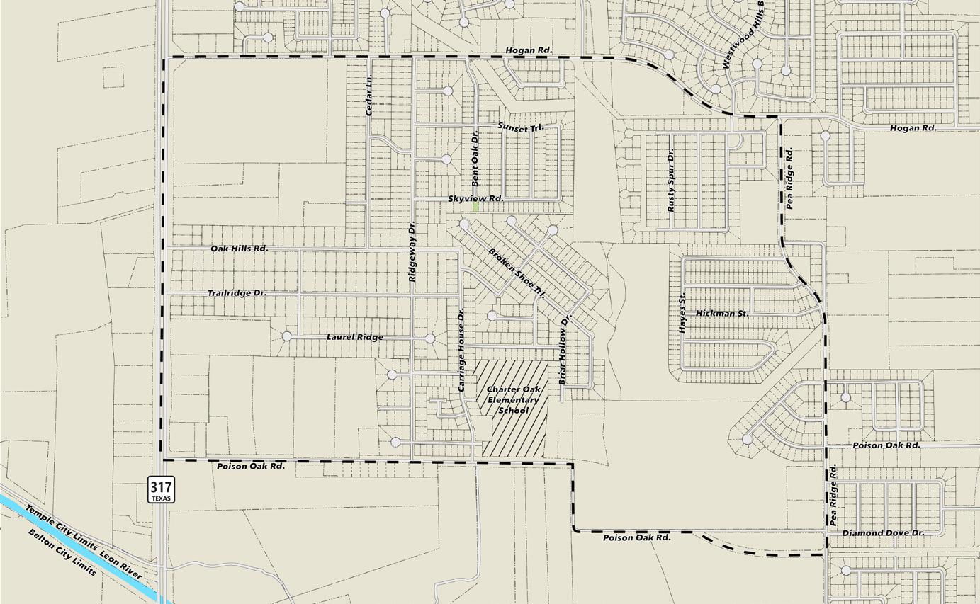
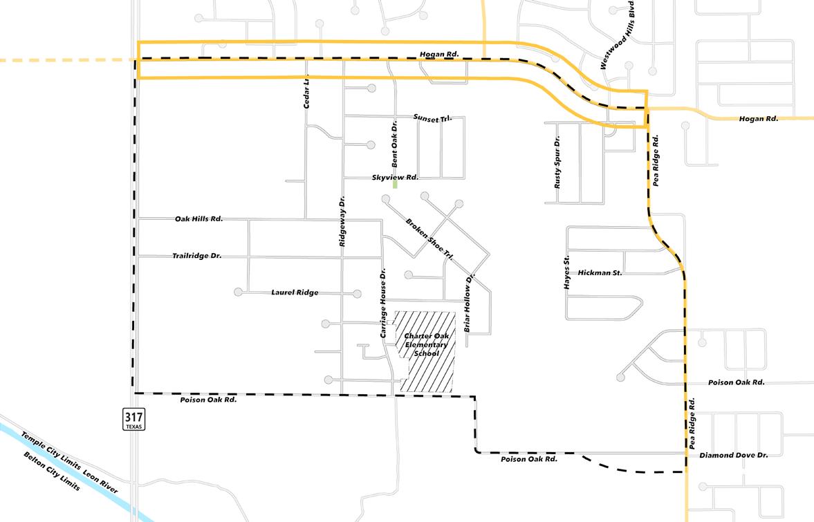
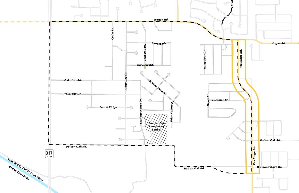
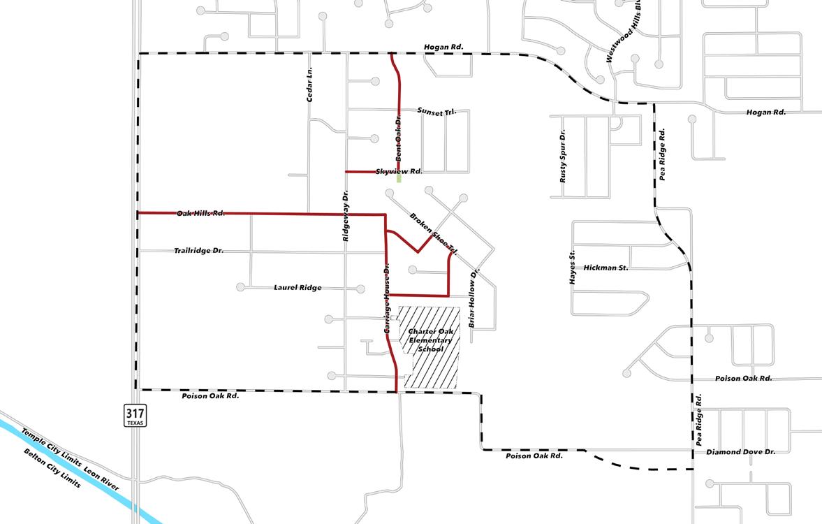
This exhibit provides a regional context for the plan area as well as important destinations such as schools, grocery, and parks & open space.
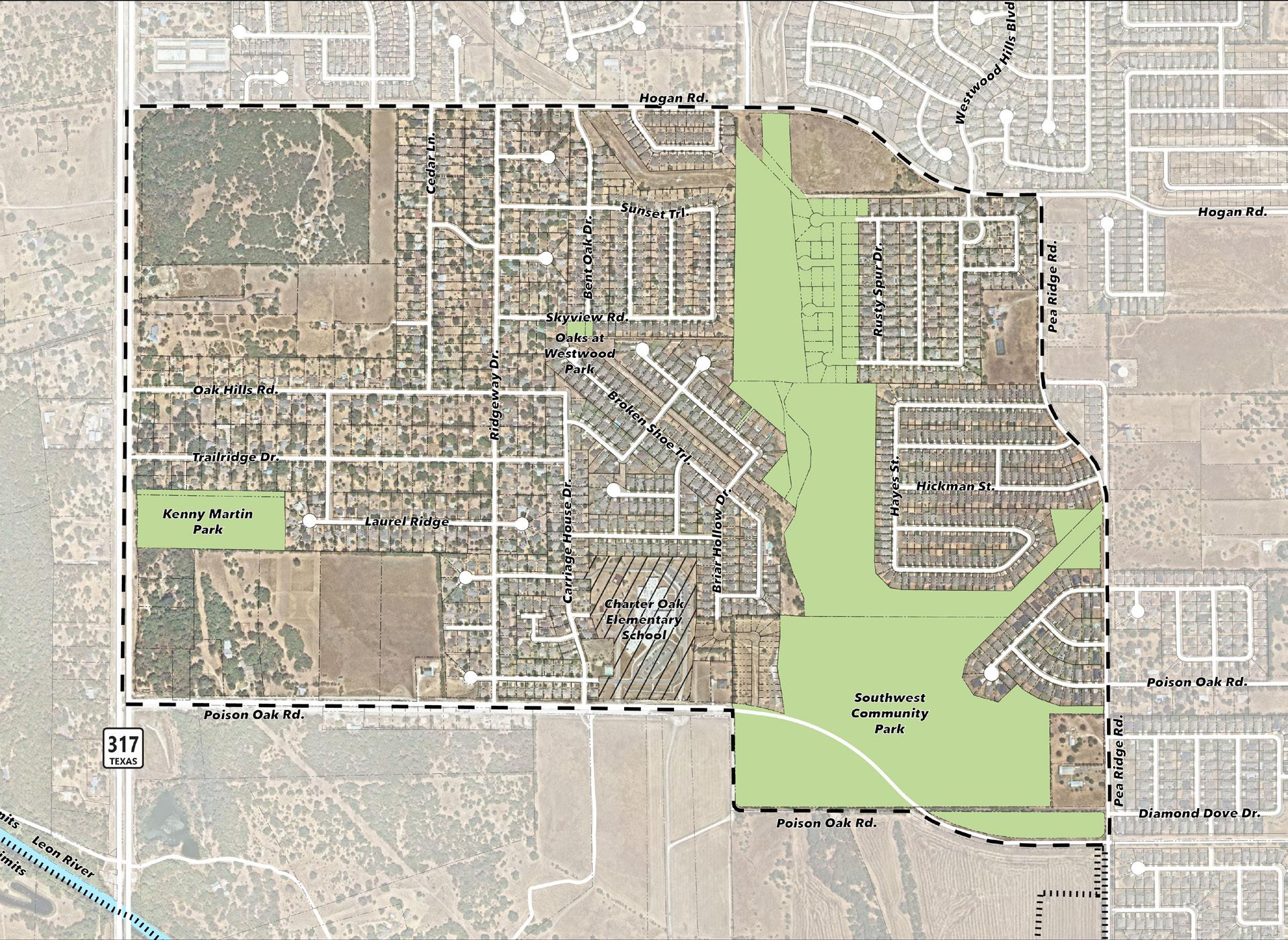
This exhibit shows the plan area boundaries and important points of interest.
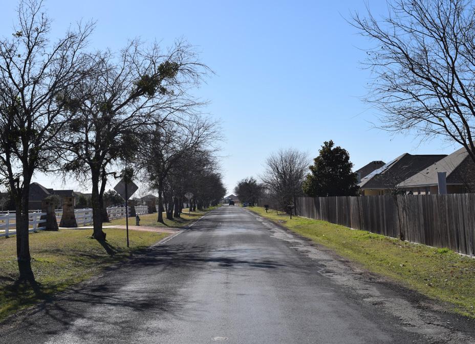
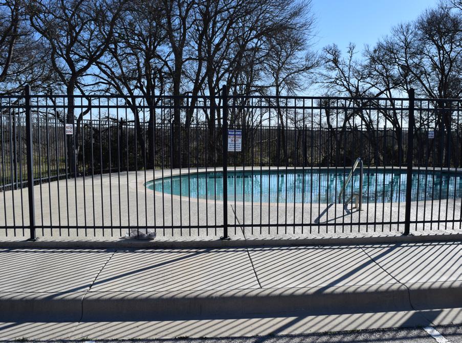
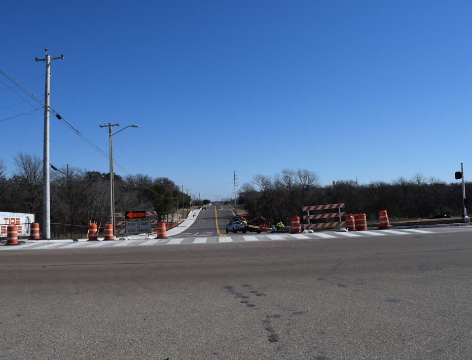
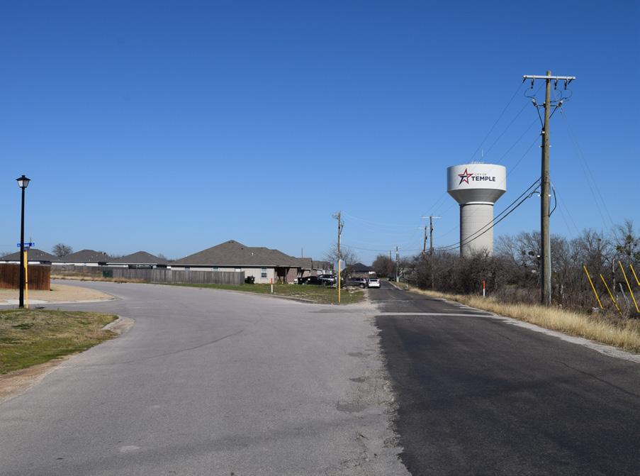
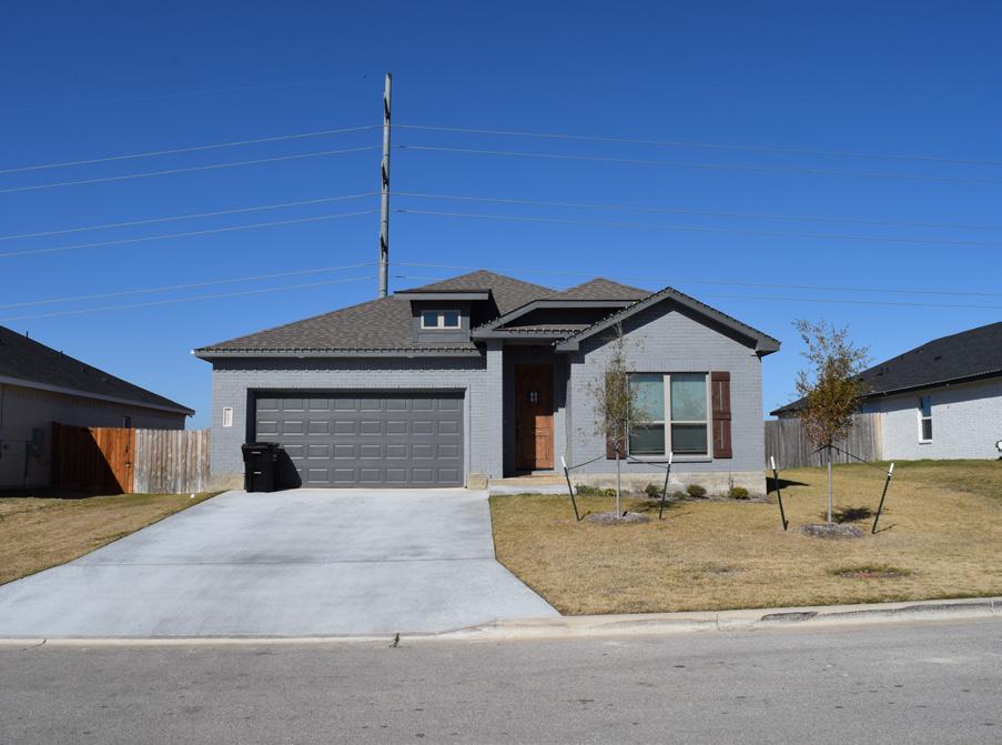
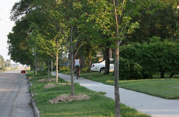
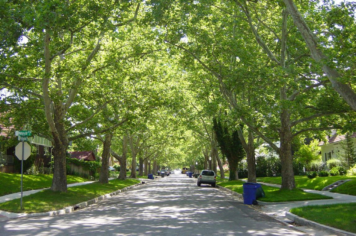
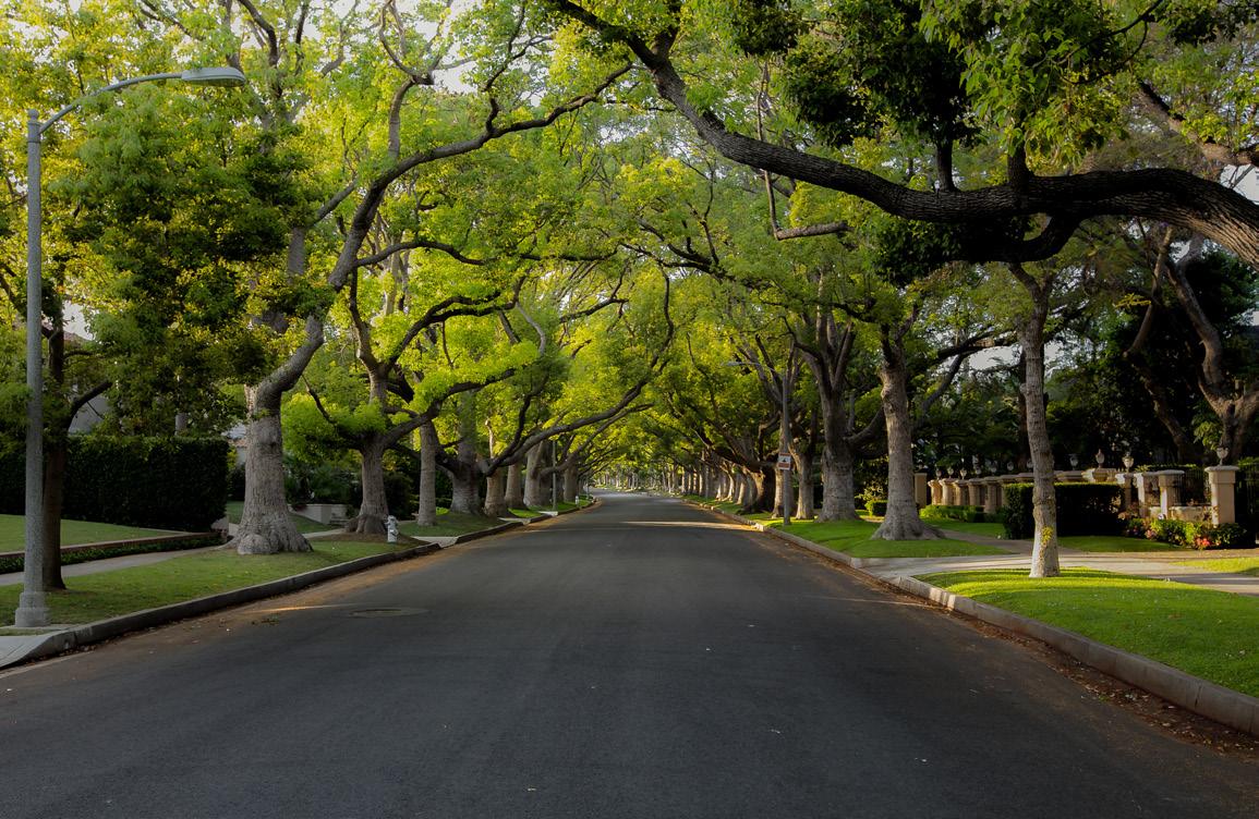
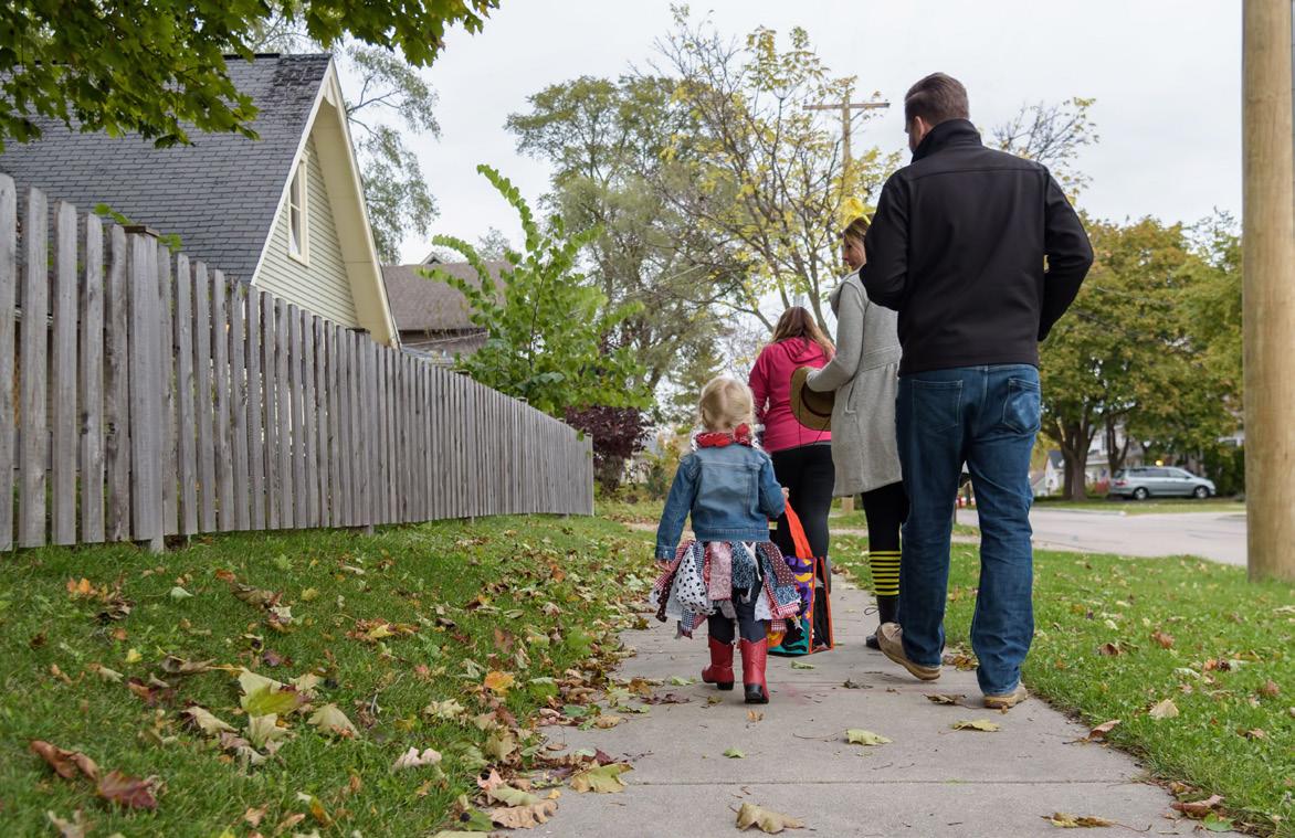
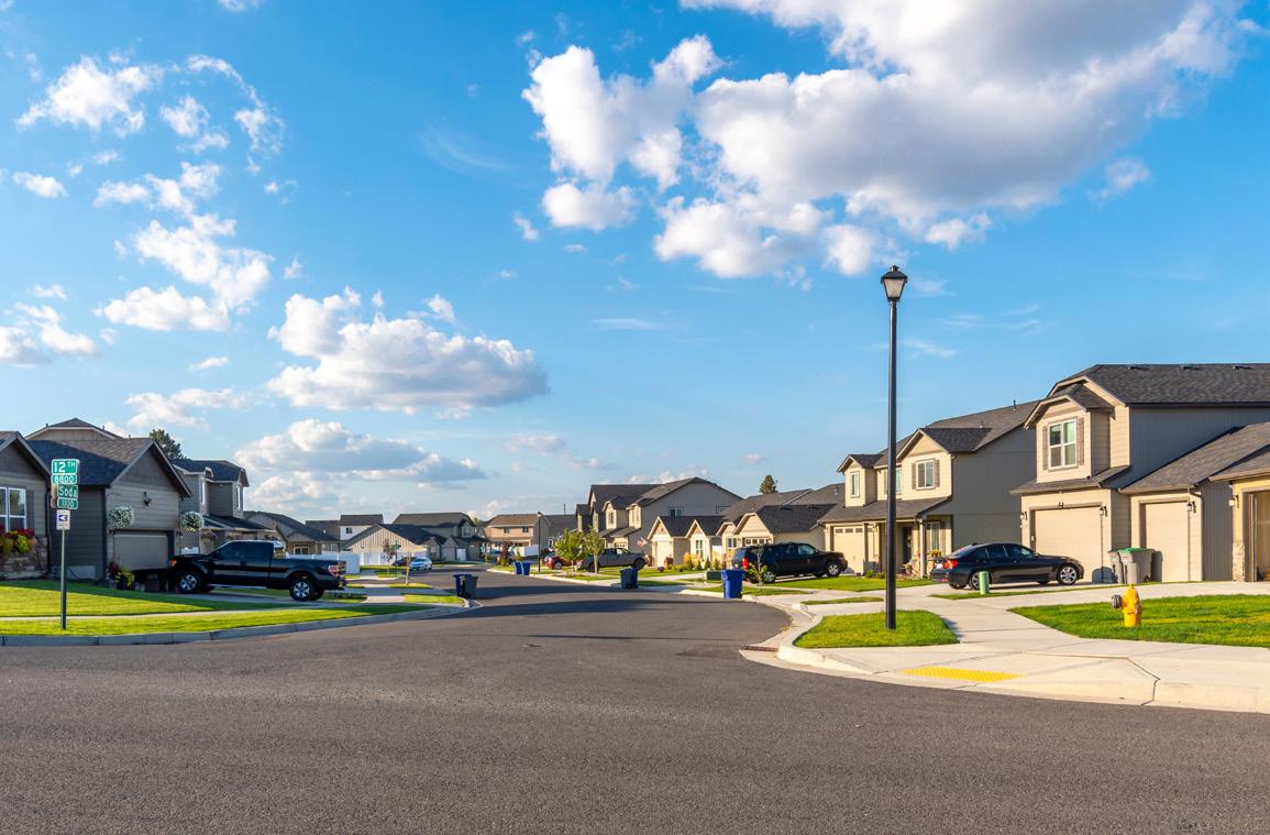
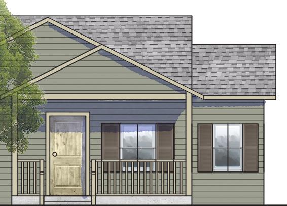
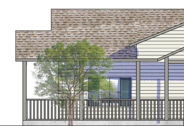
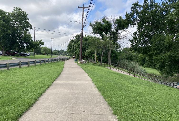
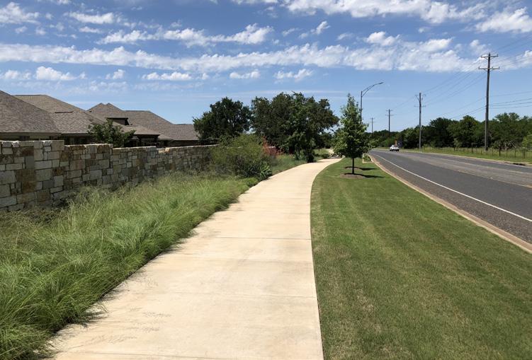
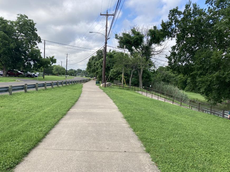
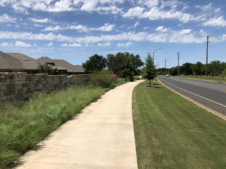
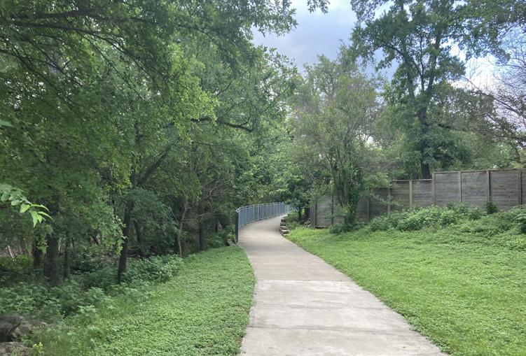
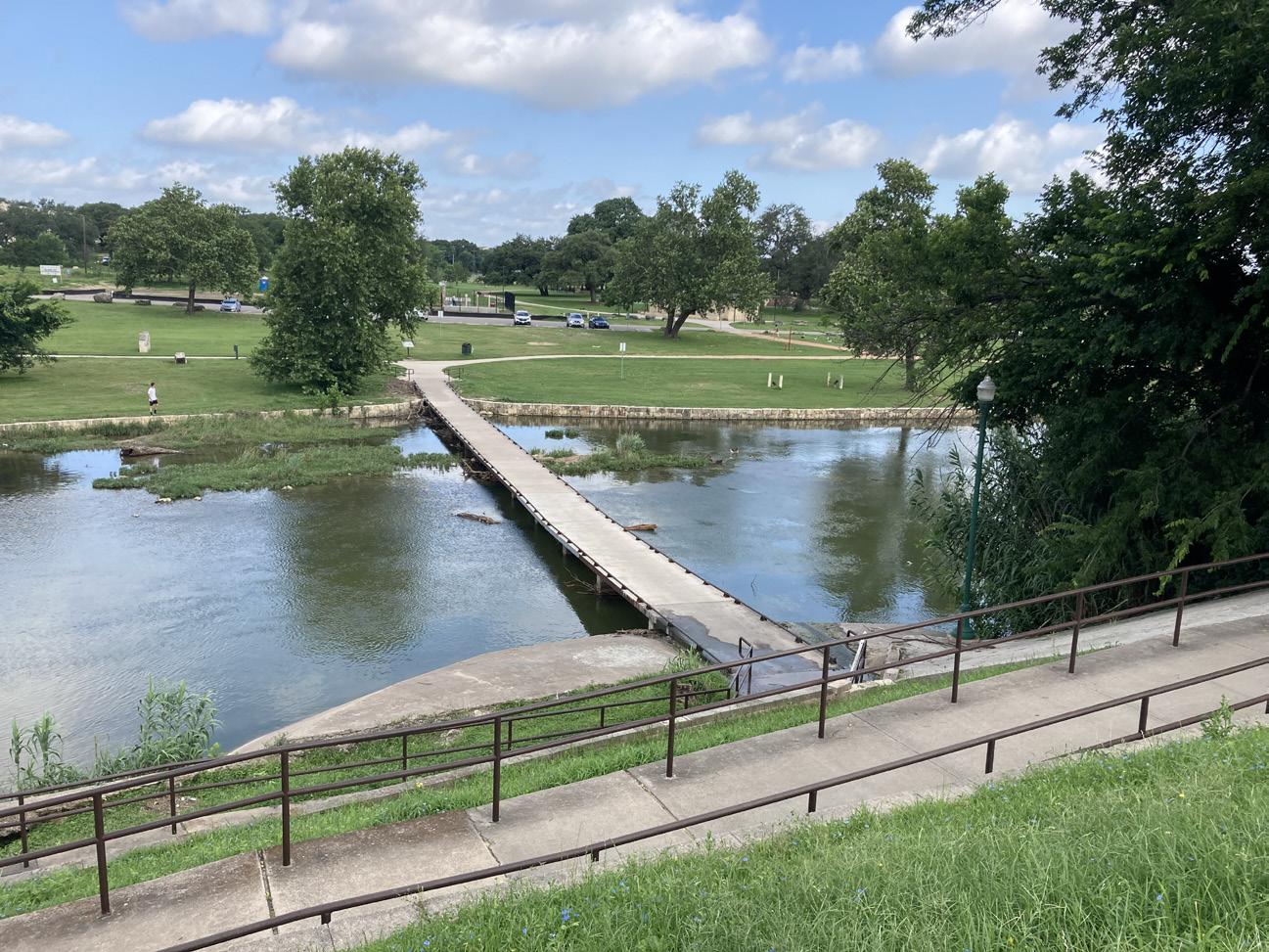
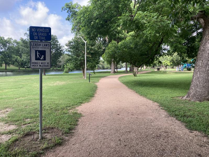
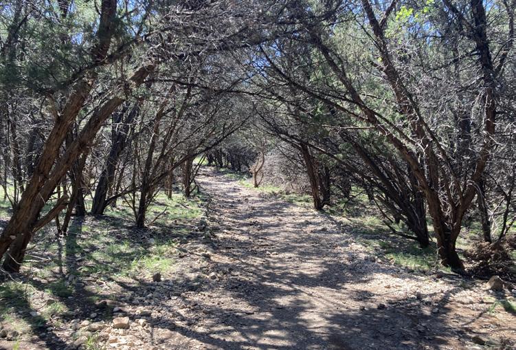
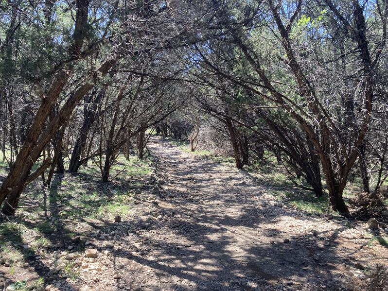
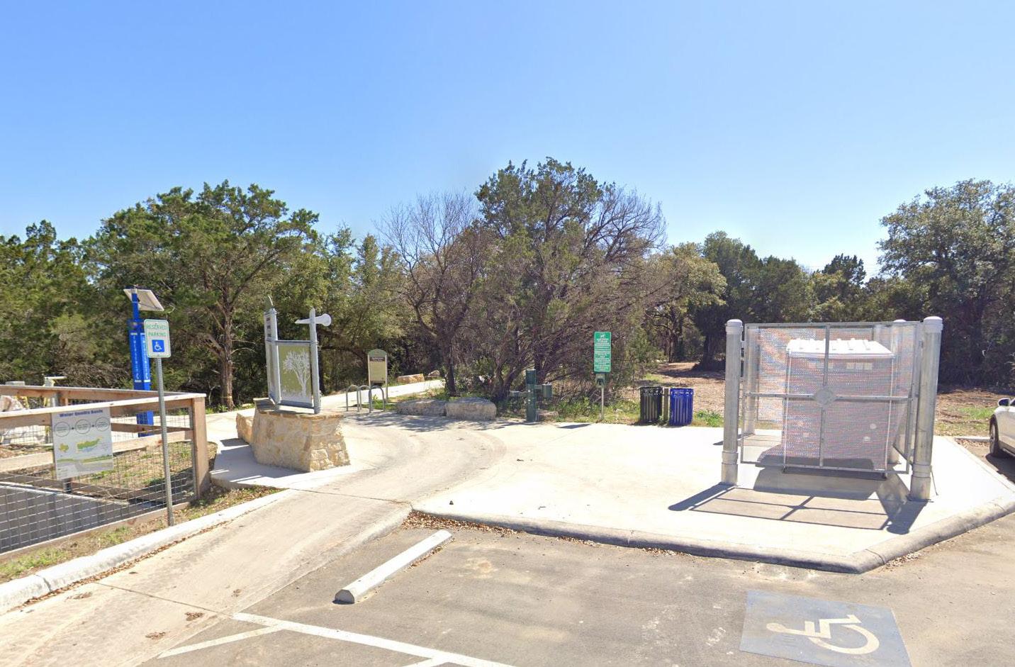
The images displayed are taken from the Oak Hills Neighborhood Plan area. They provide context for the character of the neighborhood’s built environment. The photos were selected to show neighborhood assets, concerns, opportunities, conditions, and other points of attention.

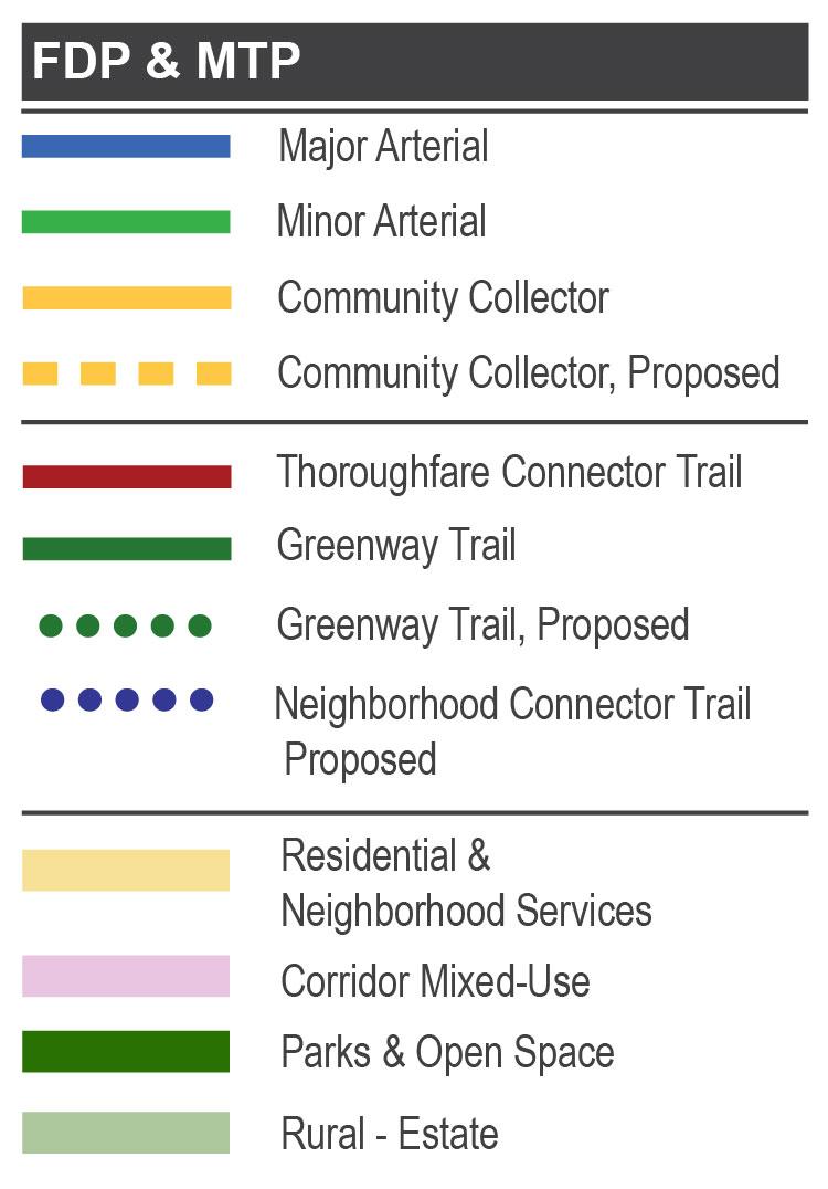
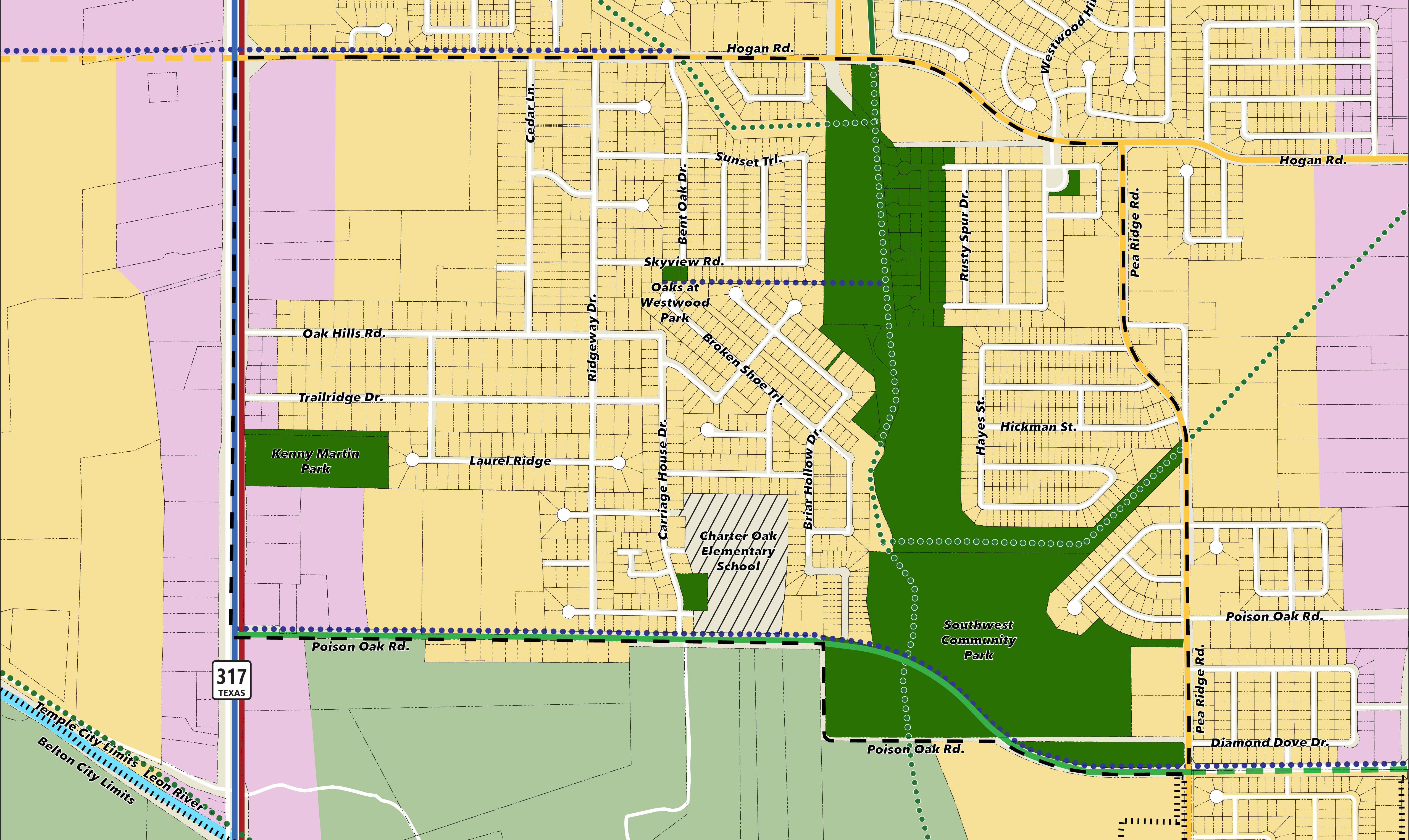
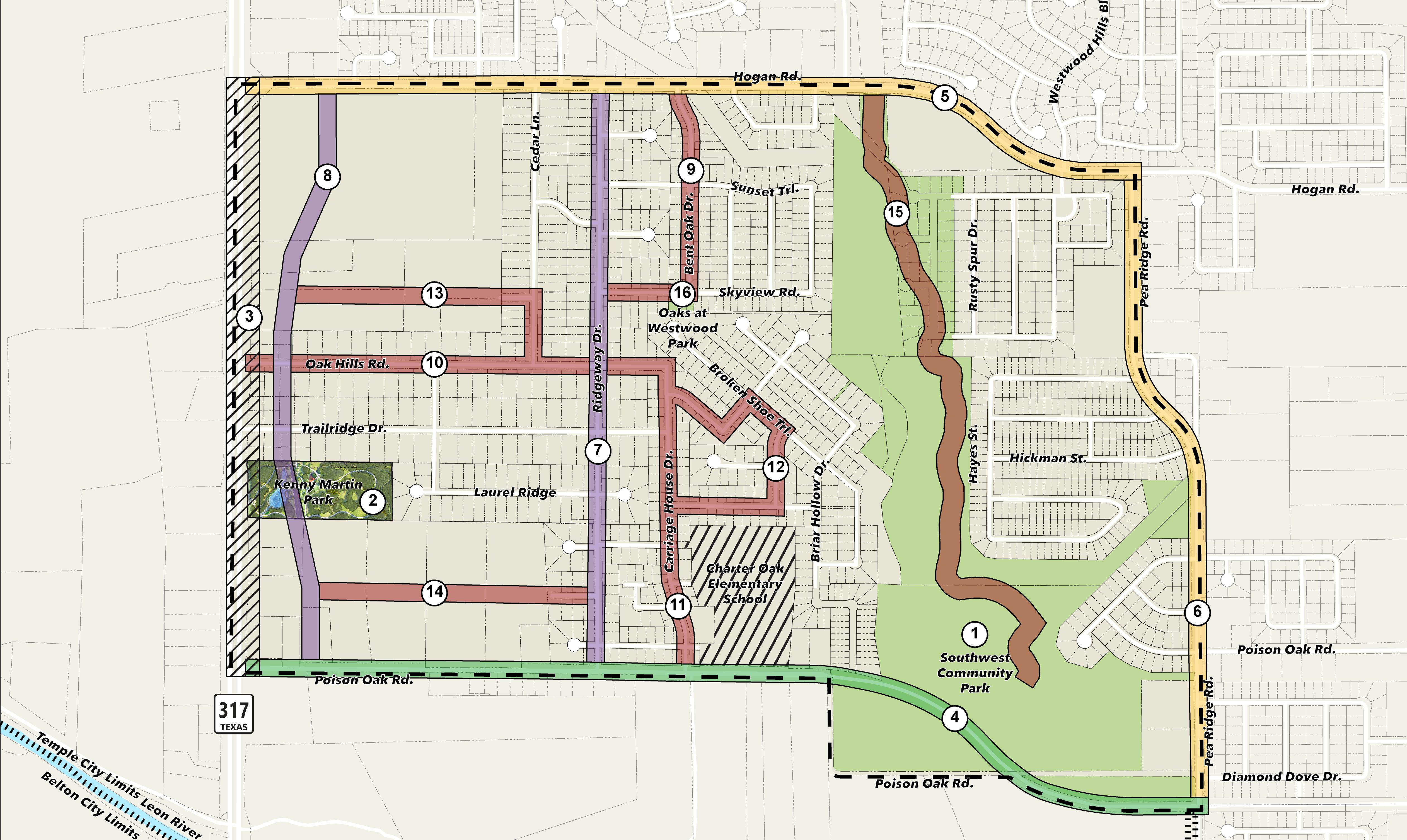
This exhibit shows the Future Development Plan and Major Thoroughfare Plan for the Oak Hills Neighborhood from the 2020 Comprehensive Plan.
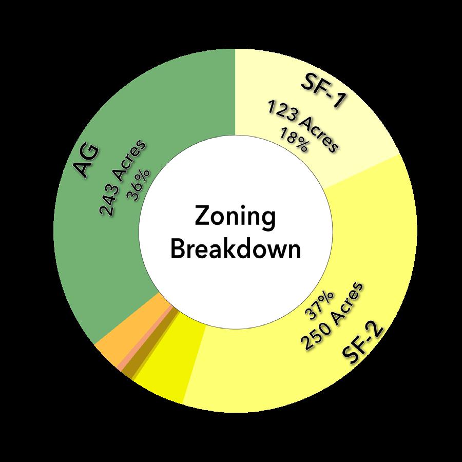
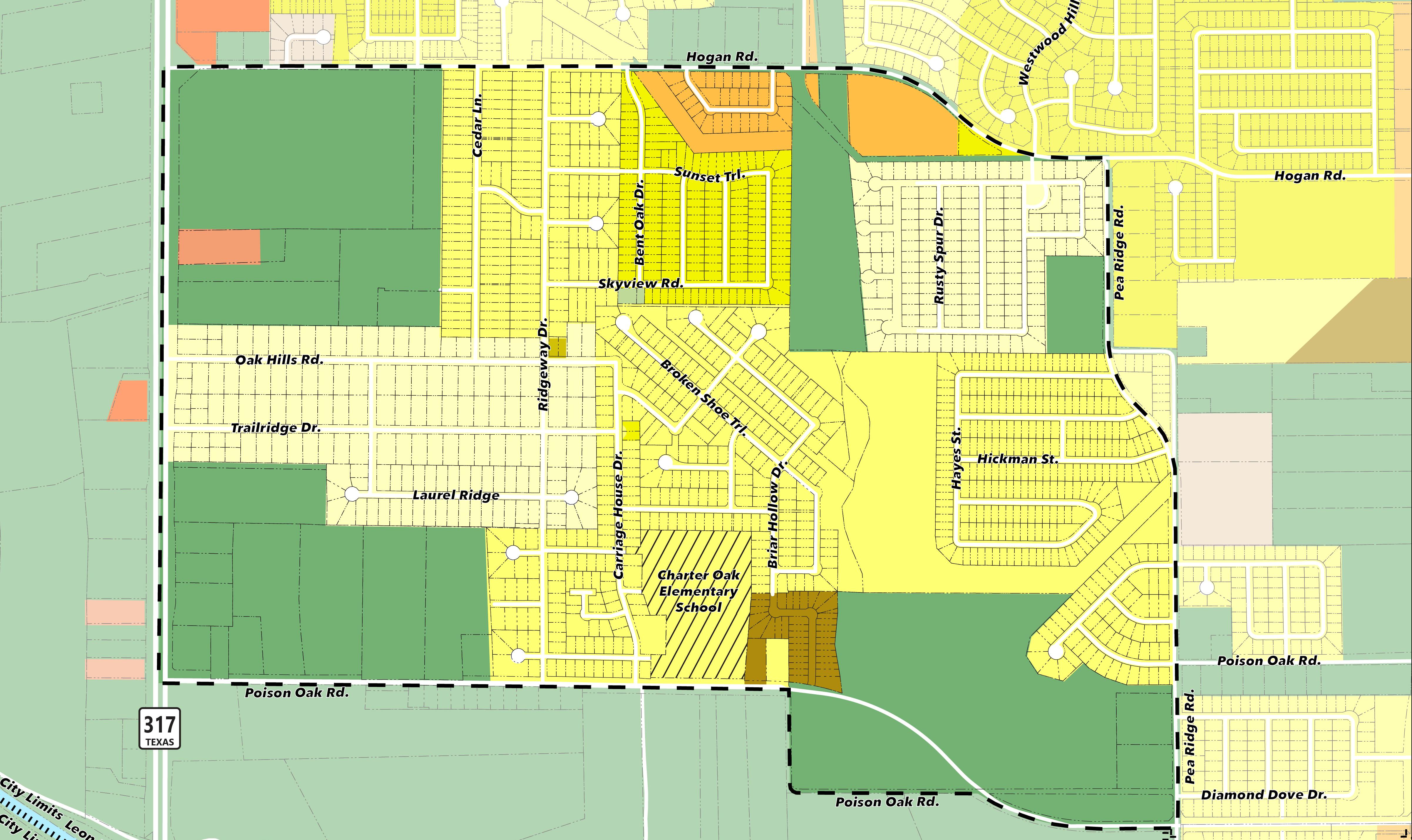
This exhibit shows the location and breakdown for
D
F
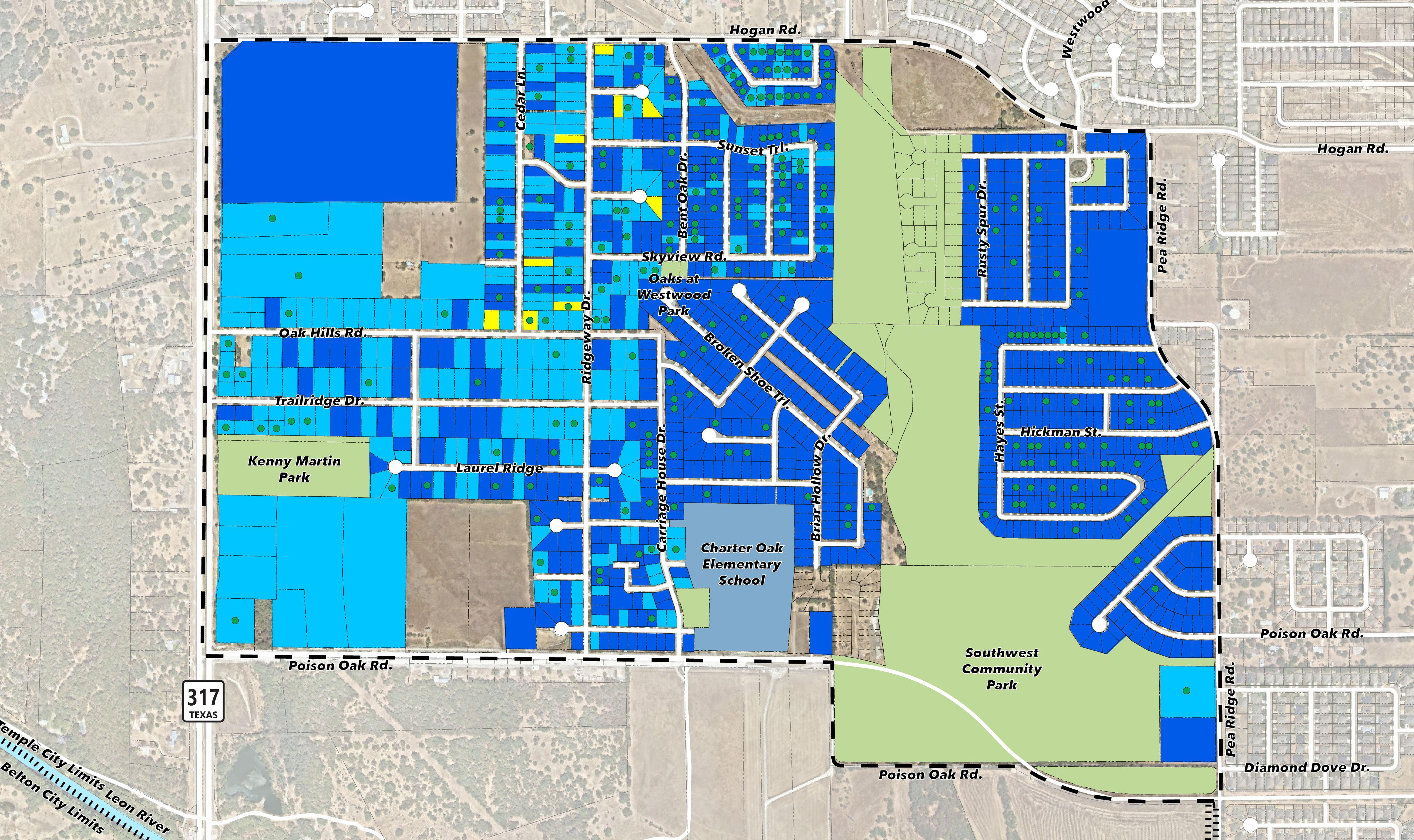
This exhibit shows the conditions of properties in the neighborhood and provides an overview of residential structure health.
A
PROPERTY CONDITIONS
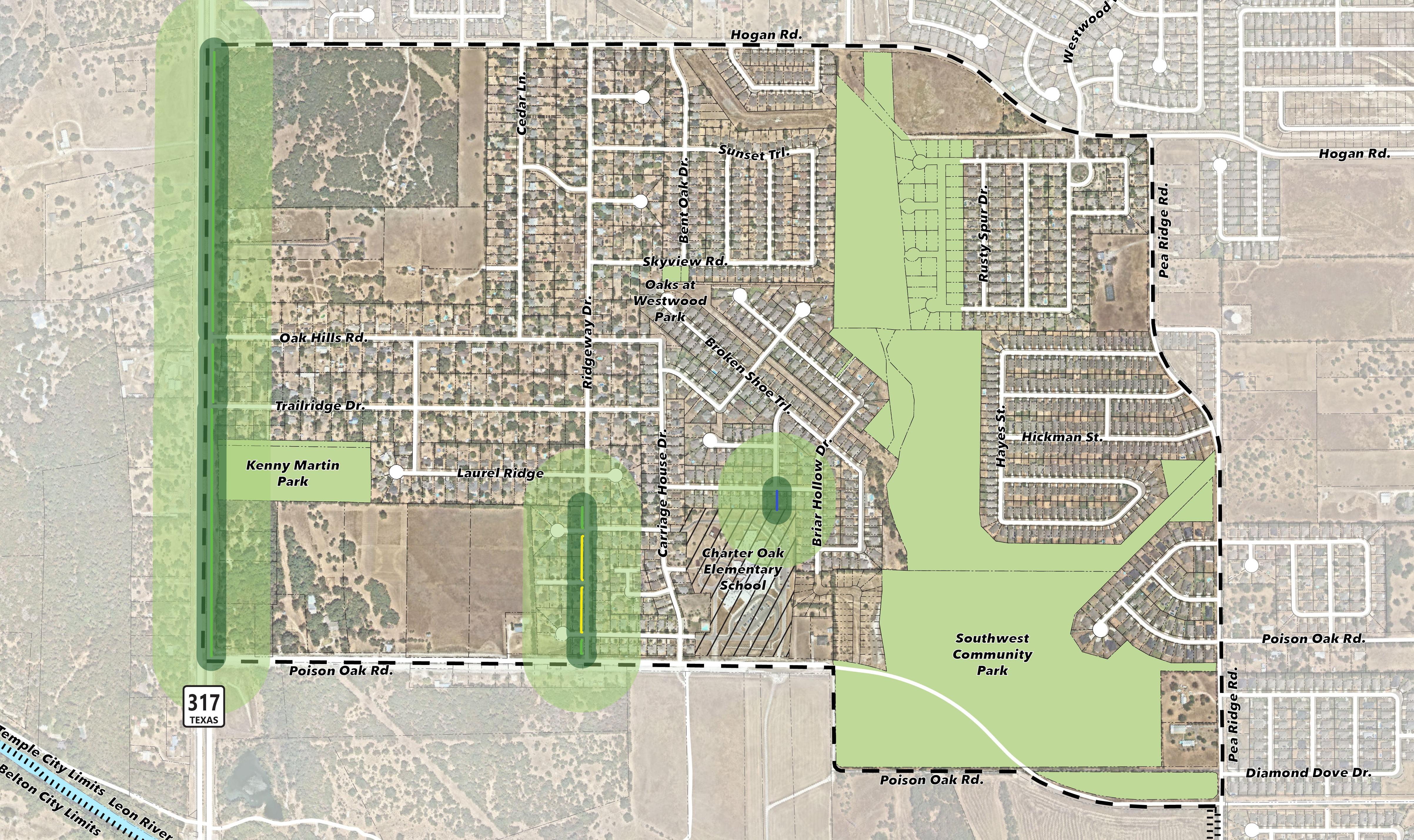
This exhibit shows the existing pedestrian infrastructure and how it currently serves the Oak Hills Neighborhood properties.
Key pedestrian routes for neighborhood residents to nearby destinations. Emphasis establishing continuous sidewalks along these streets.
Encourage pedestrian connection over Hog Pen Creek to improve east-west travel Consider
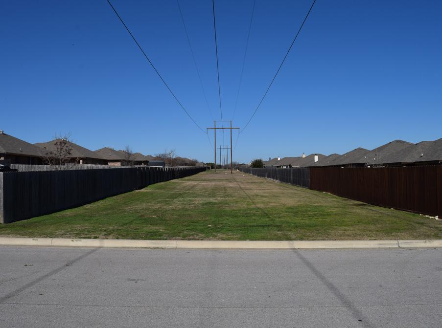
Overhead utility corridor provides opportunity for community park
Carriage House Drive and Surrey Drive Intersection
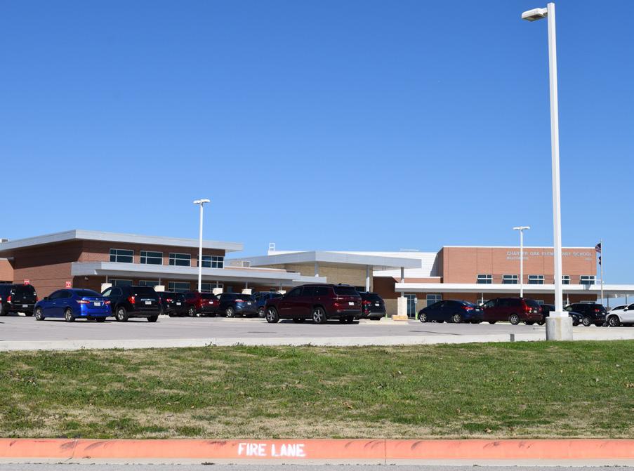
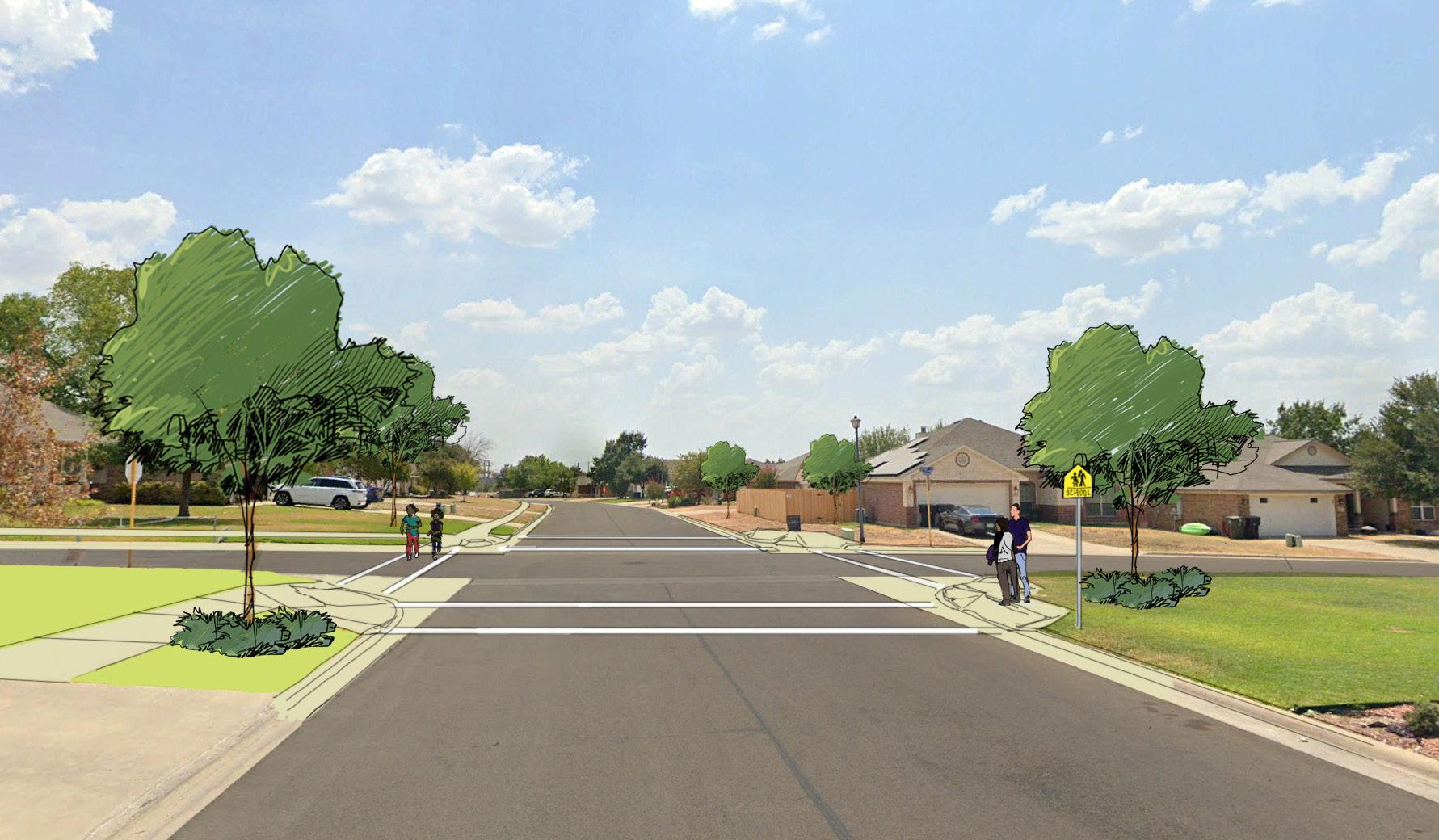
Carriage House Drive, while currently missing sidewalks, provides a direct pedestrian route for neighborhood residents to access Charter Oak Elementary School. Improving pedestrian infrastructure on this street should be a high priority. The Surrey Drive intersection along Carriage House Drive would be ideal for intersection improvements, such as striping and signage to indicate the connection to the school.

• Intersection enhancements are intended to improve safety for neighborhood pedestrian access to the Charter Oaks Elementary School.
• Crosswalks should be delineated with markings to increase visibility at crosswalk zones.
• Consider crossing flags or pedestrian-activated signals in exceptionally high volume or hazardous intersections.
This exhibit builds upon the direction of Temple’s Comprehensive Plan in refining the Major Thoroughfare Plan (MTP) to meet the needs of the Oak Hills Neighborhood.
The following are the key takeaways:
• Add both a new street that parallels Hwy 317 and Ridgeway Drive as Neighborhood Collectors.
• Ensure sidewalk additions to the streets with the plan designation of pedestrian connector.
• Ensure pedestrian connections are extended into any future development in the western portions of the plan area.
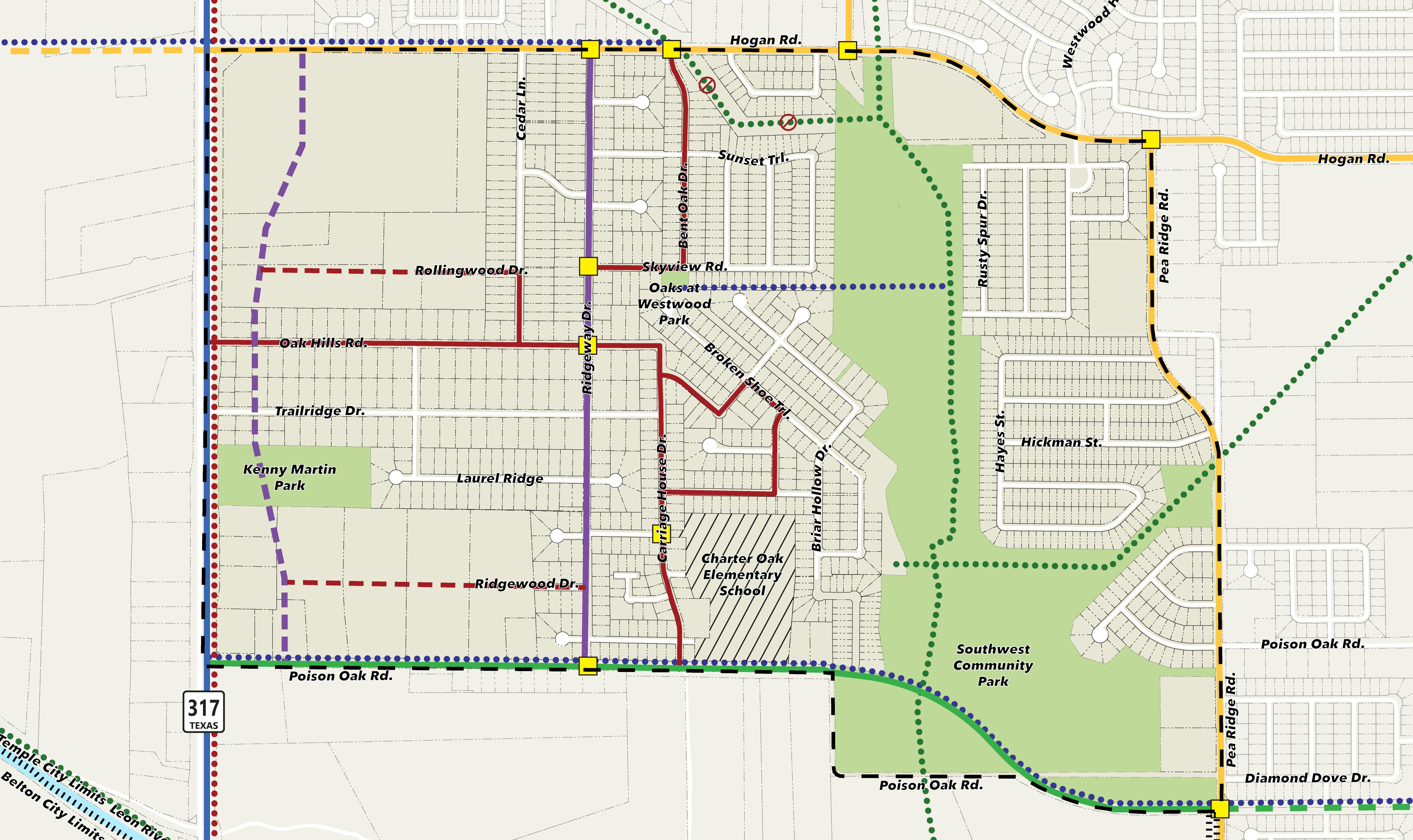
• Remove portion of Greenway Trail south of Hogan Road to Hog Pen Creek from the trails plan.
• Change classification of trail that runs northeast from Southwest Community Park from Neighborhood connector Trail to Greenway Trail.
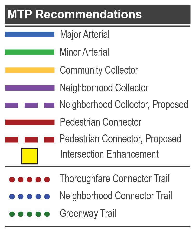
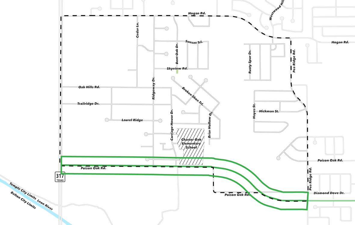


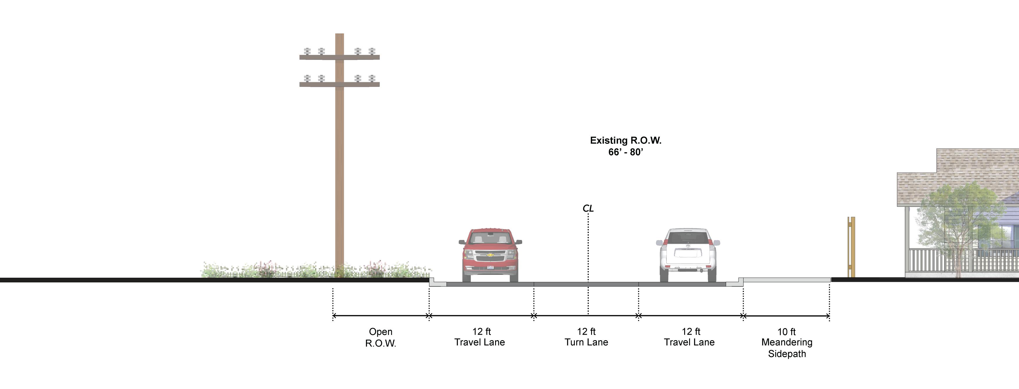
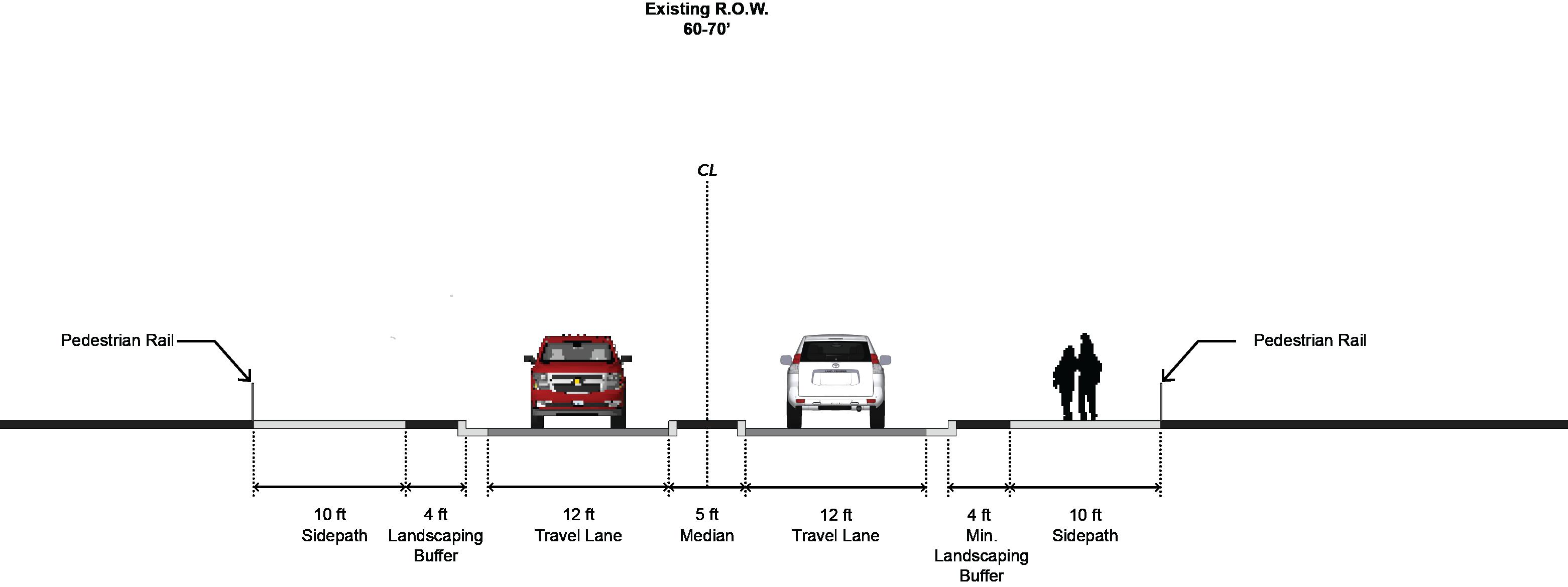
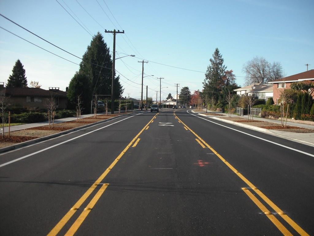
Poison Oak Road is a minor arterial that is currently being rebuilt. The new road features a median that becomes a turn lane when applicable. A total of four travel lanes will be added, with two travel lanes in each direction. The road also includes a sidepath at the back of the curb. A significant change to Poison Oak Road is the removal of two 90-degree turns, opting for more gradual curves. Because of this change, the intersection of Poison Oak Road and Pea Ridge Road has been shifted further south.
• Four travel lanes
• Ten-foot sidepath along back of curb
• Median or turn lane where applicable
• Intersection with Pea Ridge Road shifted south
• Removal of sharp turns for gradual curves
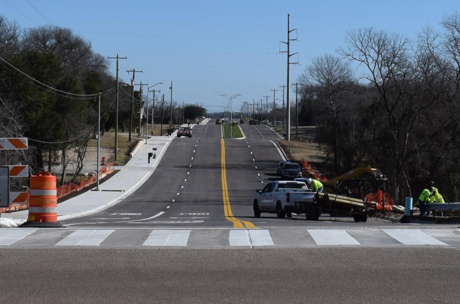
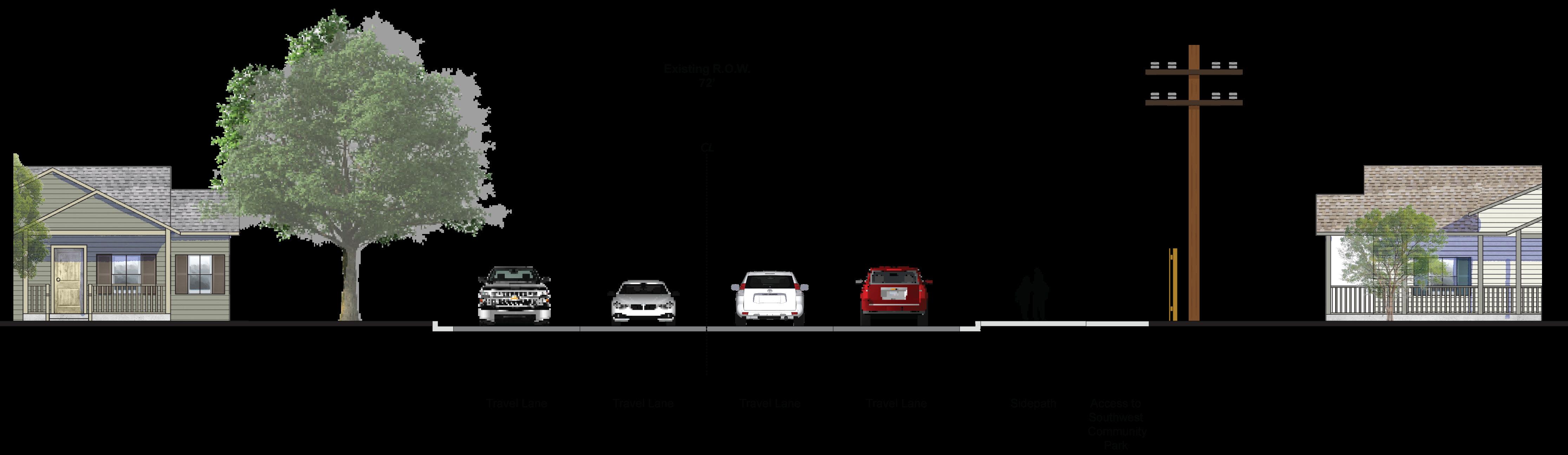
This street cross-section shows the existing conditions of Hogan Road between two intersections of Pea Ridge Road. This segment has curb and gutter on both sides of the road. This section of Hogan Road includes two travel lanes with a center turn lane and a sidepath that is placed back of curb. Additionally, overhead utilities run along one side of the road.
Key Characteristics:
• Two travel lanes
• Center Turn Lane
• Sidepath
• Overhead utilities on one side of road
Major Arterial
Minor Arterial
Community Collector
Neighborhood Collector
Pedestrian Connector
This stretch of road will include two travel lanes and a stamped median. A median is preferred over a continuous turn lane to better control traffic crossing Hogan Road. The road will include a ten-foot sidepathand create a landscaping buffer to improve pedestrian safety. As part of the Southwest Community Park Trail System, a trail is proposed to connect from the Southwest Community Park to the Hog Pen Creek Trail. Connection to the Trail should be accessed from the sidepath proposed in the cross section and should be a minimum of six-feet in width.
• Two travel lanes
• Median to control and improve cross traffic
• Ten-foot sidepath on both sides
• Landscape buffer between sidewalk and travel/parking lanes to provide more protection for pedestrians
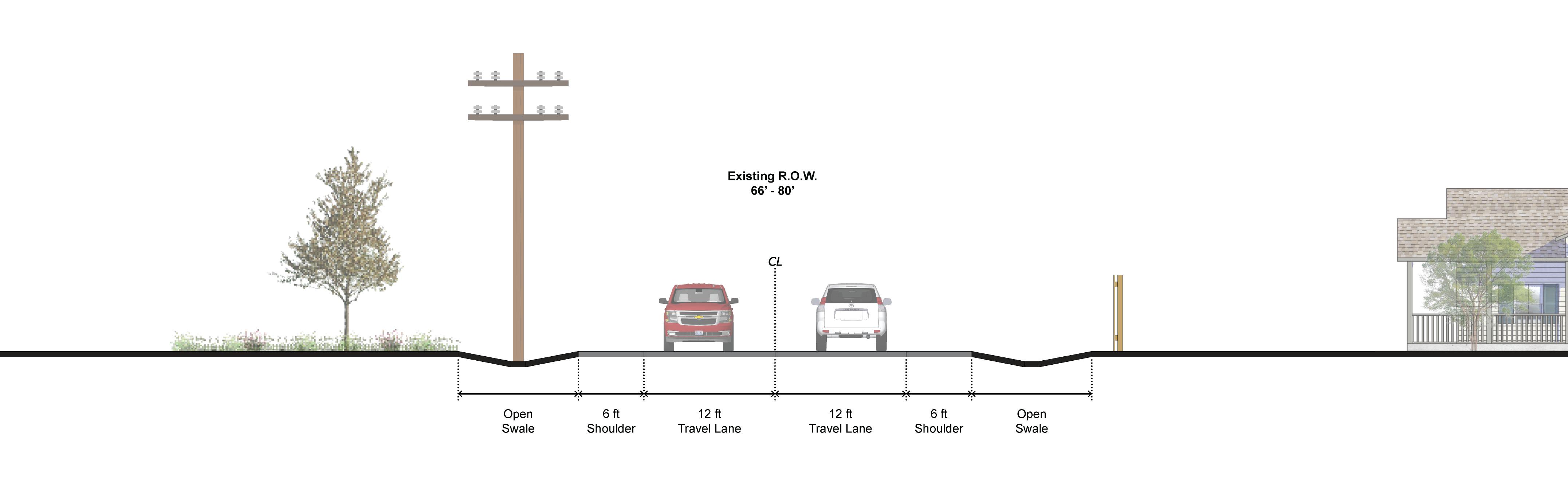
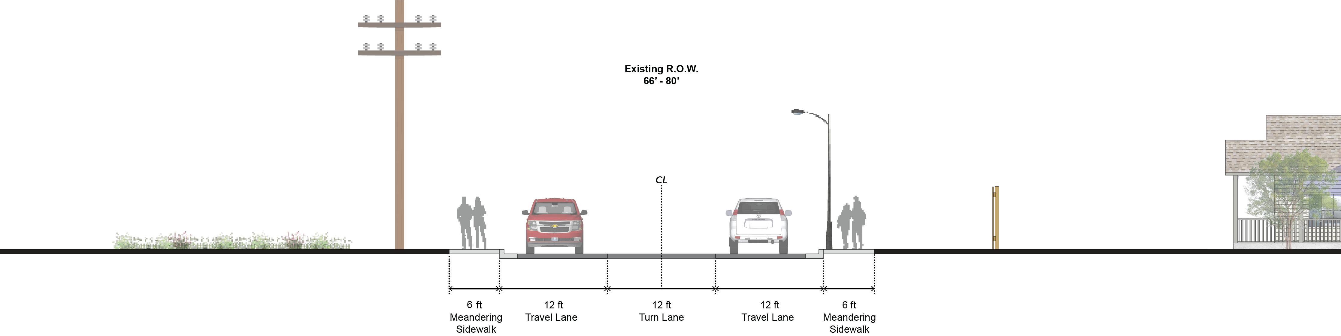
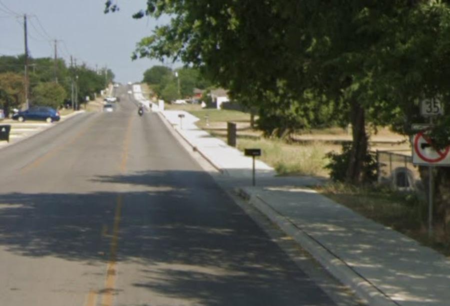
The street cross-sections show the existing conditions (above) and proposed (below) improvements. This stretch of road currently includes two travel lanes each bordered by a six-foot shoulder and open swales. Suggested improvements to this stretch of road include meandering sidewalks on either side and a center turn lane.The sixfoot sidewalk will meander to avoid overhead utilities and improve pedestrian safety.
• Two travel lanes (proposed & existing)
• Center turn lane (proposed)
• Sidewalk facilities on both sides (proposed)


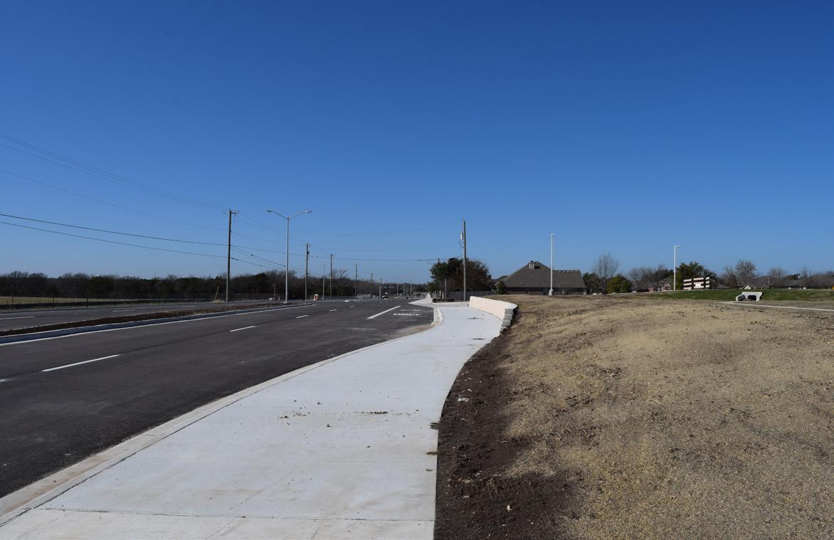
Pea Ridge Road (Existing Conditions)
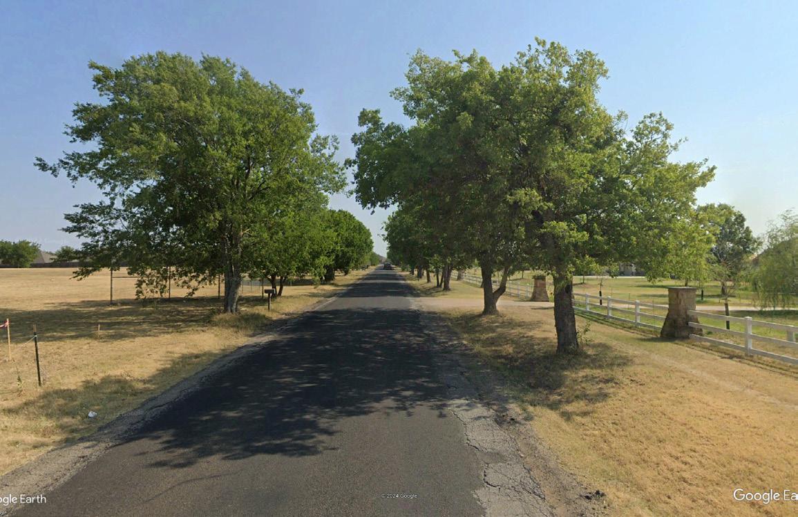
This street cross-section shows the existing conditions of Pea Ridge Road between Hogan Road and Guffey Lane. This segment fronts a strip of estate-style homes on oneacre lots. Along the east side of the road is a decorative fence shared by these estate-style homes. This section is currently under construction and will include two travel lanes, a center turn lane, and a sidewalk on each side.


Key Characteristics:
• Two travel lanes
• Center turn lane
• Currently under construction


Major Arterial
Minor Arterial
Community Collector
Neighborhood Collector
Pedestrian Connector

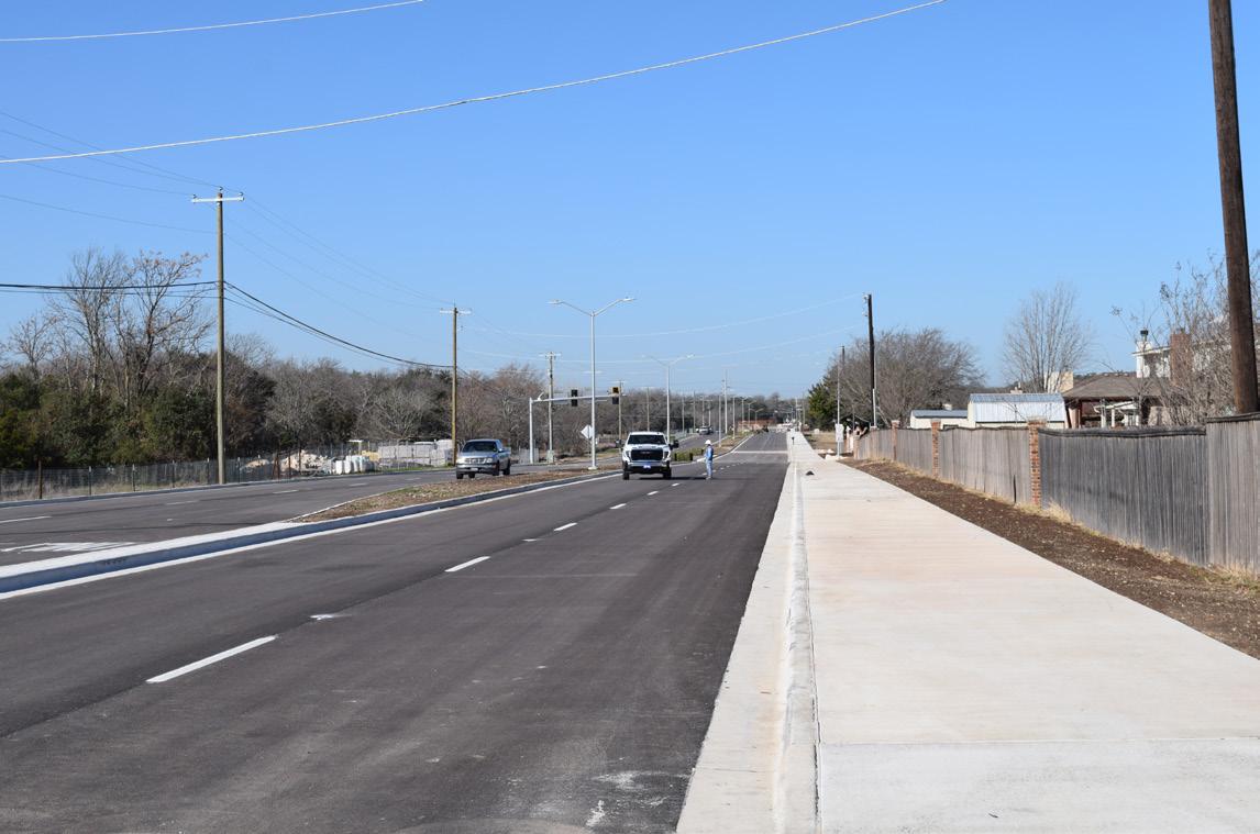
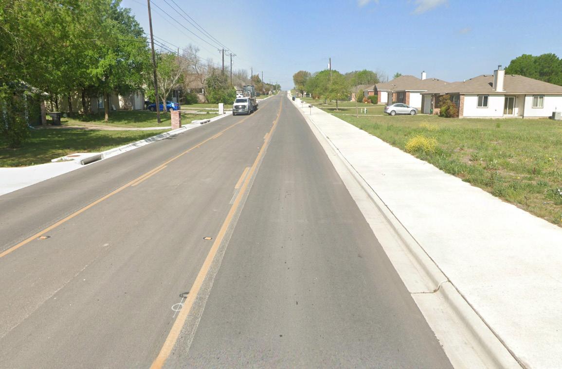
This street cross-section shows the recommended changes to Pea Ridge Road. The road expansion would allow for two standard-size travel lanes, a turn lane, and a sidewalk on both sides of the road. The addition of the sidewalk on the west side allows for connectivity to the proposed Greenway Trail and Southwest Community Park. Lighting should respond to existing trees and be in conformance with the lighting plan.
Key Characteristics:
• Two travel lanes
• Center turn lane
• Sidewalk facilities on both sides
• Continious traffic flow
• Connectivity to trail systems
• Striping for Lane Delineation


Ridgeway Dr
Ridgeway Drive is a continuous north–south neighborhood collector that provides access to residences within the plan area. Connecting Hogan Road to Poison Oak Road, it serves as a key internal route. To discourage high-speed cut-through traffic, the addition of on-street parking on one side is recommended.

• Two travel lanes
• Parking on one side of the road as allowed by existing paving section
• Sidewalks on west side of road only as drainage inlets are located on the east side of the road
• Planting buffer between sidewalk and travel/parking lanes to provide more protection for pedestrians


Community Collector
Neighborhood Collector
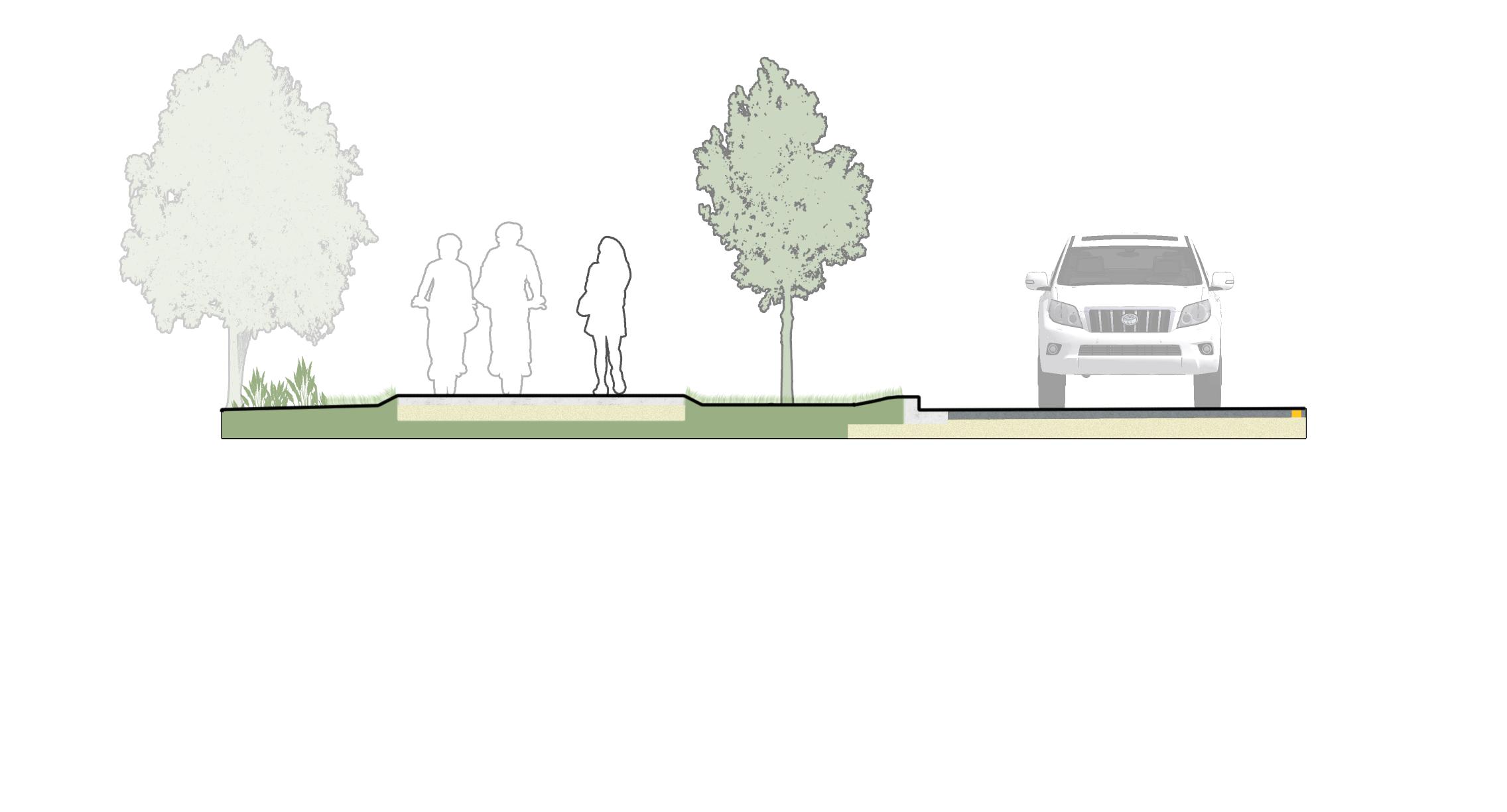
The pedestrian connectors are a network of roads running through the neighborhood’s residential core. These roads connect users to the arterial and collector streets within the plan area. Pedestrian safety can be improved by placing sidewalks on both sides of the road and adding a planting buffer to separate pedestrians from automobile traffic.
• Two travel lanes
Pedestrian Connector PEDESTRIAN
• Sidewalks on both sides of the road for improved walkability
• Small planting buffers to separate pedestrians from automobile traffic
• Improve pedestrian routes through the neighborhood to Charter Oak Elementary School
• Parking on one side of the road (left or right)
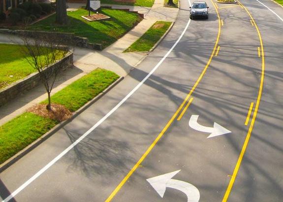
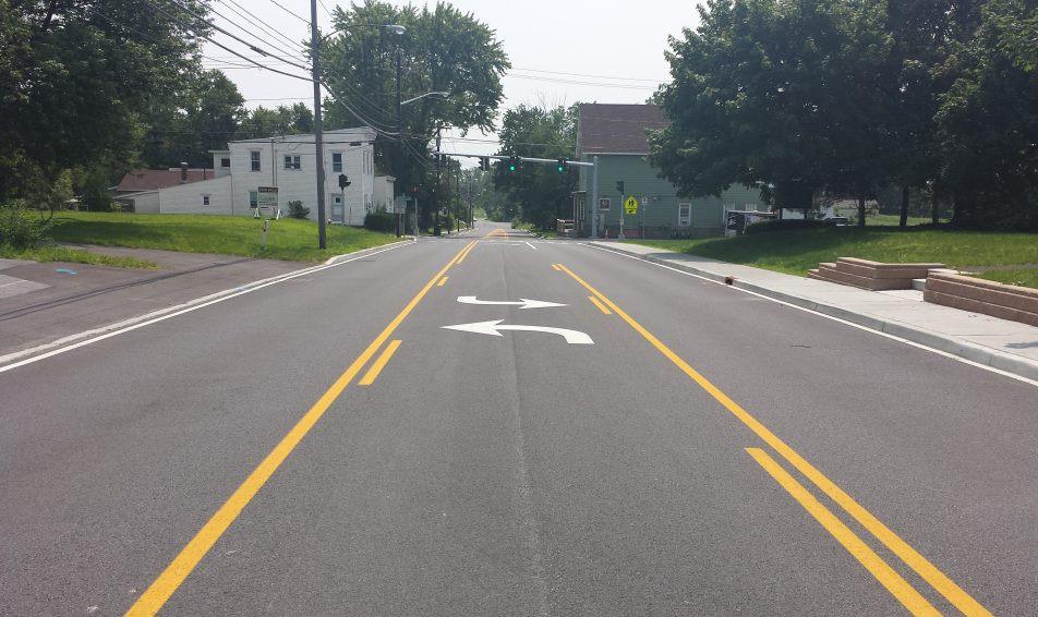
Intersection enhancements are intended to be located where vehicular and pedestrian traffic is the most concentrated within a neighborhood. As one would suspect, these locations should be aligned with the street hierarchy of the Major Thoroughfare Plan. Arterials and collectors predicate a need for guiding vehicles and pedestrians alike to controlled and uncontrolled crossings. The plan’s identification of pedestrian connectivity is a means for the city to better manage its resources for sidewalk infrastructure, as these routes will have a higher presence of pedestrians. Within the interior of the Oak Hills Neighborhood, where neighborhood collectors and pedestrian connectors cross, there is a need to communicate with drivers and pedestrians about the crossing location.
Intersection Enhancement Recommendations
• Streets should consider painted/striped crosswalks and pedestrian crossing signage.
• Pedestrian-activated beacons should be used on streets with a community collector or greater thoroughfare classification.
• Stop signs may be appropriate at the most heavily trafficked intersections or where vehicular speeding is prevalent.
• Crossing flags may be appropriate for routes that are vital corridors for students.
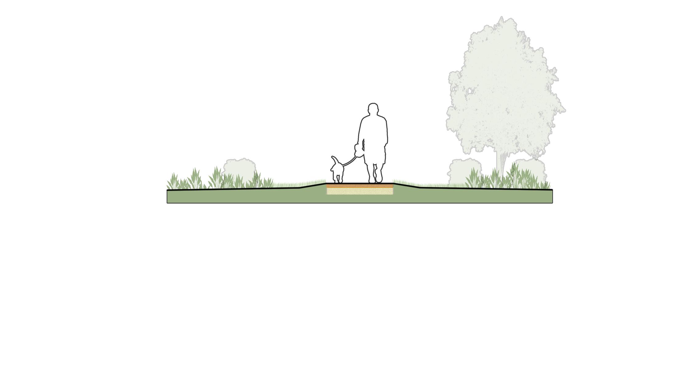
1 Planting Strip
Waterlines located in the street R.O.W. should be placed in an unprogrammed area or beneath the sidewalk rather than under the street. Pipe size can vary, but should not encroach on the tree’s critical root zone.
Planting strips of 6’ or greater are needed to give a street tree proper growing conditions. If planting strips are 4’ or less, remove street trees.
The stormwater pipe should be placed underneath the curb and gutter in the street R.O.W. Pipe size can vary, but should not encroach on the tree’s critical root zone.
Wastewater is primarily found both in the rear of properties and within the street R.O.W. in the Oak Hills Neighborhood. If wastewater lines are to be located in street R.O.W. they should be placed in an unprogrammed area or beneath the sidewalk as opposed to under the street. Pipe size can vary, but should not encroach on the tree’s critical root zone.
5 Common Trench
Electric, telecommunications, and other overhead utilities connections are found along the alley or rear of property. The trench should preferably be located in a public utility easement adjacent to, but outside of the R.O.W.
6 Tree, Sign, and Light Spacing
Decorative street lights should have a 30’ buffer from any shade tree planting. After the 30’ buffer, trees should be evenly spaced from the center of the trunk in the remaining space between light poles. Sight triangles for sign visibility should be adhered to when planting street trees.


Oak Hills is a developed neighborhood and its utility infrastructure is established. The absence of alleys in the neighborhood may require overhead utilities to be located within the street R.O.W., while street tree plantings and other infrastructure should respond accordingly. The diagram below provides some direction on how to assign the placement of utilities within the context of the street R.O.W. spacing and programming.
Overhead Utilities
If utilities cannot be placed in a trench, ornamental trees are an acceptable alternative to large shade trees for maintaining street trees. These trees should not exceed 15’ mature height. Overhead utilities should be consolidated on one side of the road where possible.
Current plans are in development which may differ from these recommendations. This plan document still recommends signalized intersections, a stamped concrete median, and a side path along Hogan Road in order to protect pedestrian traffic in the future.
Pedestrian Activated Signals
RD
Floodplain Detention
Floodplain Detention
RD
Hog Pen Trail
A protected sidepath should be considered adjacent to Hogan Rd
Hog Pen Trail
Key Considerations: Signalized Intersection. The application of a signalized intersection should be considered to help with safety concerns for pedestrians as the trail corridor provides important connectivity within Temple.
Low Maintenance Median. The stamped concrete median is intended to be a low maintenance beautification element leading to a signalized intersection.
Hogan Road Sidepath. Utilizing the Hogan Road sidepath as a means to access Pea Ridge Road further strengthens the connectivity to the adjoining neighborhoods.
Hogan Road Sidepath
A Hawk Beacon allows for pedestrian activation of crossing signal
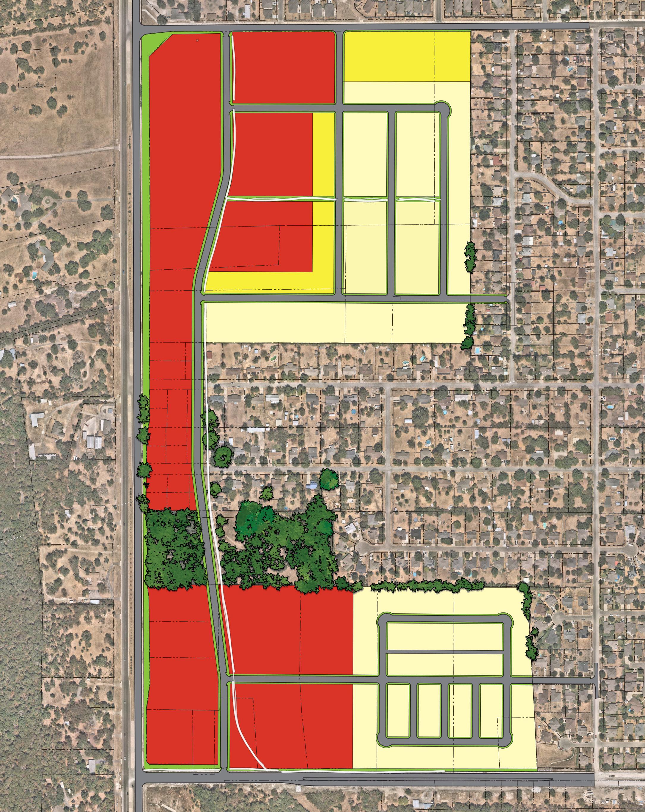
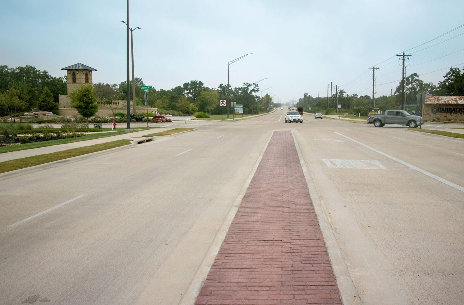
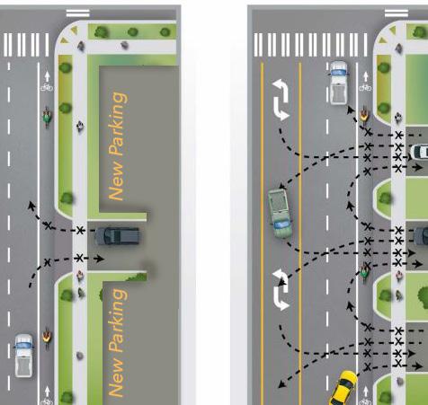
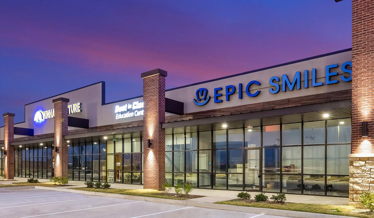
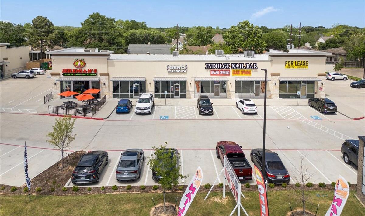
The addition of commercial property within the Oak Hills Neighborhood District is key to making the neighborhood complete. Currently, residents must travel to West Adams Avenue or North Belton for goods and services. While this portion of the plan area is currently comprised of large estate lots or small farms, it will undoubtedly feel pressure to develop. Establishing appropriate connections and access principles at this stage will contribute to maintaining functional and orderly growth that residents will appreciate upon final build-out.
Corridor Commercial The properties fronting HWY 317 are an excellent location for commercial businesses. Since the neighborhood lacks retail, grocery, dining, and personal service establishments, future development in this area can help address these missing components. This area should be developed to allow circulation patterns that don’t require neighborhood residents to travel on HWY 317 to access these businesses.
HWY 317 Slip Street The proposed neighborhood collector street provides a complete north-south route through the commercial development. This road enables the redevelopment of some of the smaller residential lots fronting HWY 317 into more functional commercial spaces.
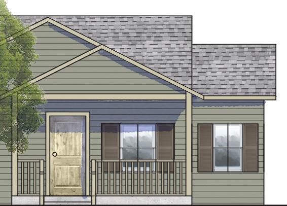
Mix of Single-family Considering a mix of single-family housing types increases the plan area’s housing options and affordability. The use of smaller alley-supported lots is intended to increase housing units, bearing in mind that an increase in units would generate more support for the neighborhood-serving commercial.
The HWY 317 Corridor is a critical growth area for the City of Temple, serving as a key connector and development driver. A corridor plan can be used to guide coordinated, sustainable development and ensure infrastructure, land use, and mobility improvements align with the community’s vision. A plan will identify current conditions, challenges, and opportunities, and provide recommendations for land use, transportation, utilities, natural features, and urban design. The outcome will be a clear, actionable roadmap to support strategic investment, enhance connectivity, and foster a vibrant, well-planned corridor.
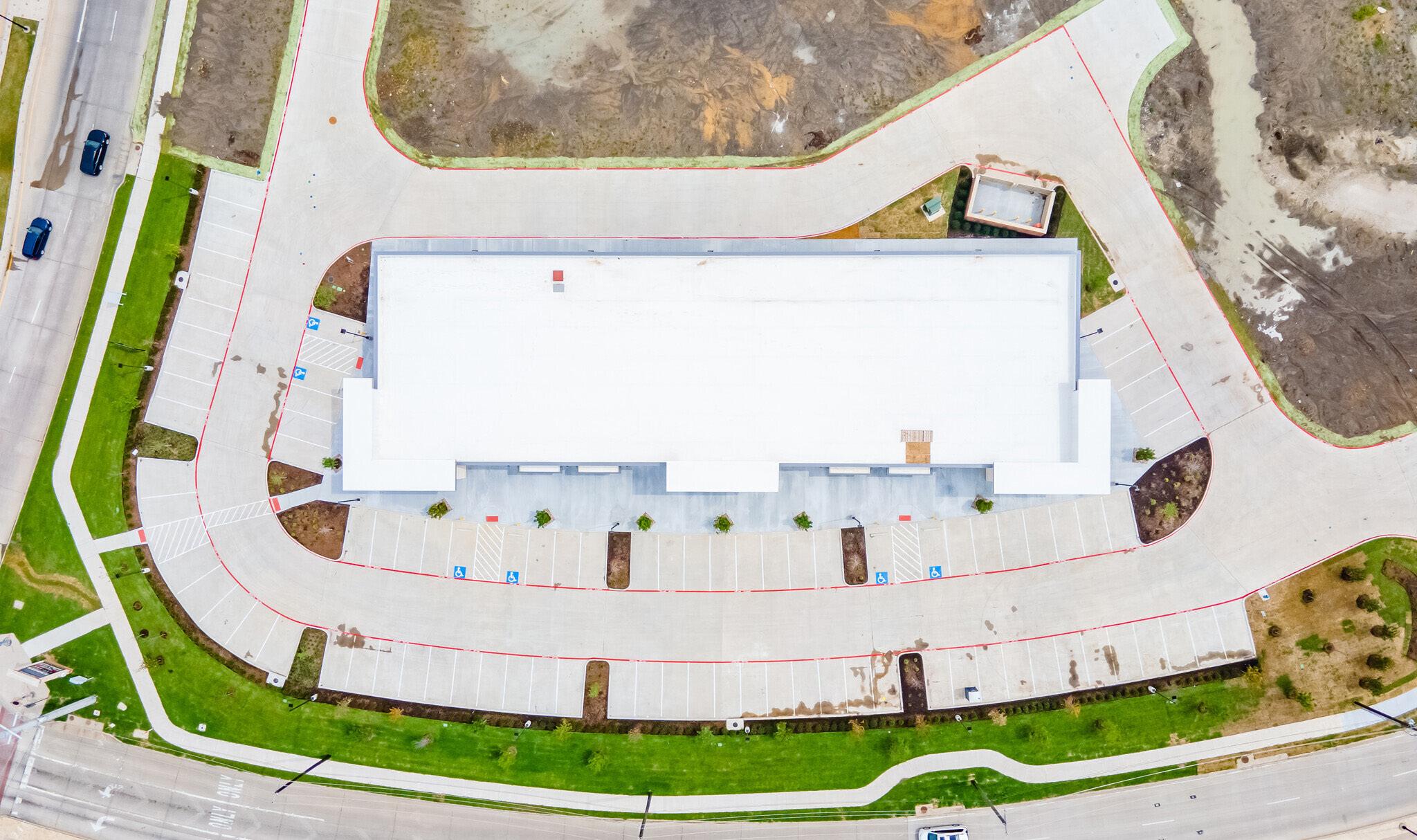
Cross Access Easements/Driveway Consolidation
Reducing the number of driveways may seem counterintuitive to improving access, but in many cases, it does. A simplified and efficient parking lot layout reduces conflict points and increases certainty for drivers, resulting in an improved experience with ingress and egress to the site.
• Improved safety for vehicles and pedestrians
• Better utilization of parking lots for parking
• Improved traffic flow
With a lack of big-chain and small grocery options in the area, a neighborhood grocery store or market could be a great asset. In addition to grocery stores, providing restaurants and outdoor dining options allows West Temple residents to have their needs met without having to travel as far.
• Address lack of close access to grocery
• Dining/Outdoor dining
The most commercially developed land in West Temple is located along W Adams Ave. Currently, there is little development along HWY 317. As a major arterial through West Temple, the HWY 317 corridor allows for mixed-use development as indicated in the Future Land Use Map. This is intended to help meet the needs of residents within the neighborhood and surrounding area. Providing shopping and neighborhood services along this corridor should reduce the travel time for the residents to access these services.
• Provide commercial options closer to home
• Commercial & neighborhood services
Shared driveways and access provide better connectivity between businesses and the neighborhood while reducing reliance on major arterials. Reducing the number of driveways along HWY 317 will improve safety by reducing the number of conflict points. Parking should be a one-drive aisle. Connections to the new neighborhood collector to the rear are important to allow residents to access the shopping center without having to use HWY 317.
• Reduce conflict points
• Improve connectivity between sites
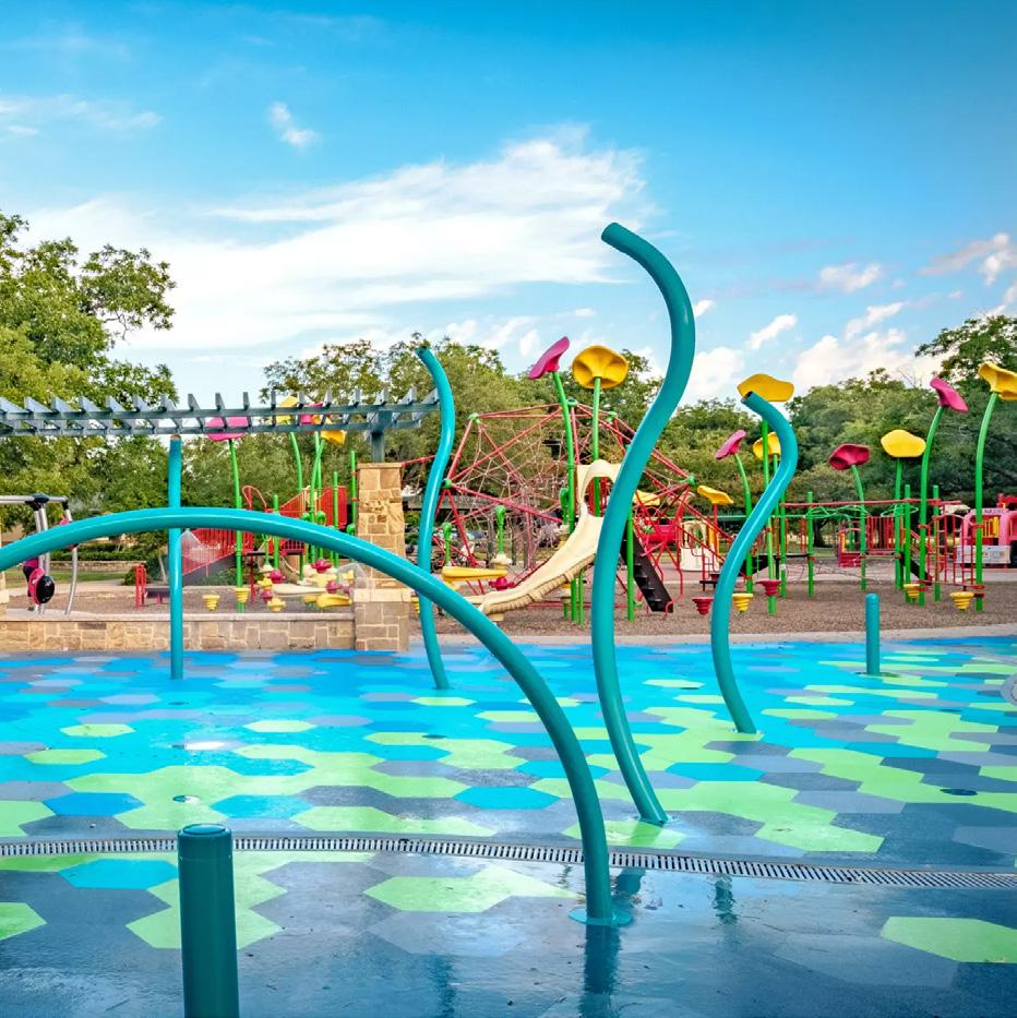
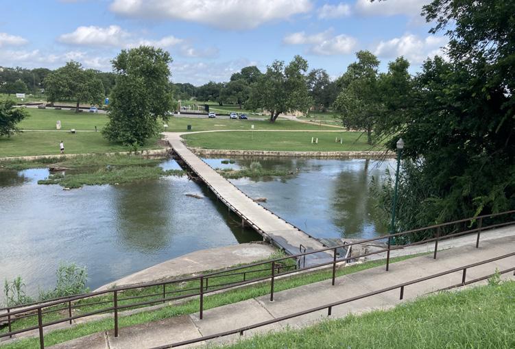
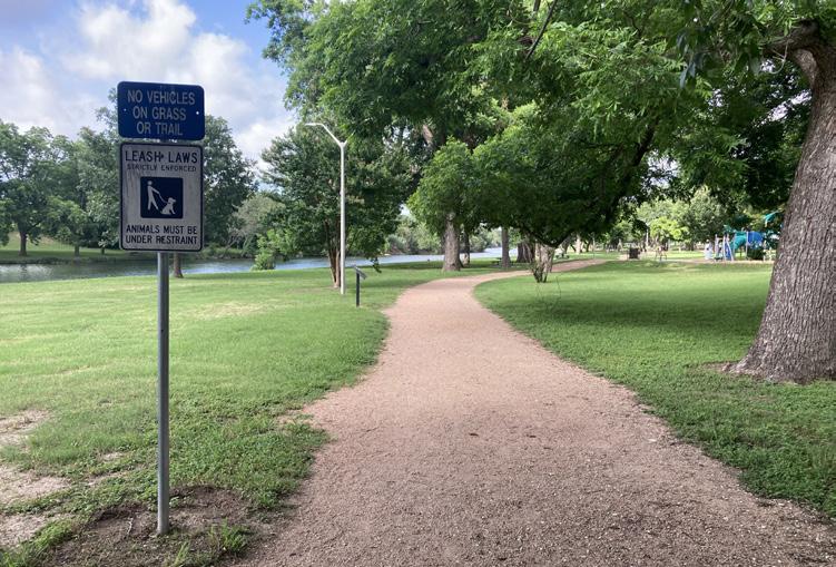
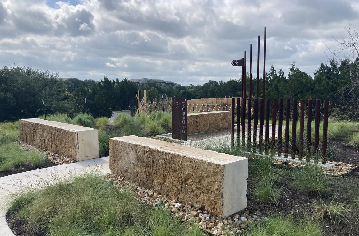
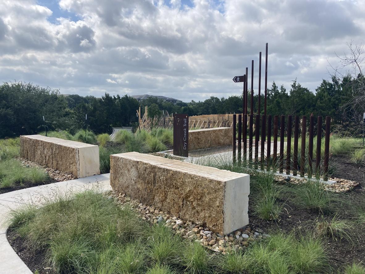
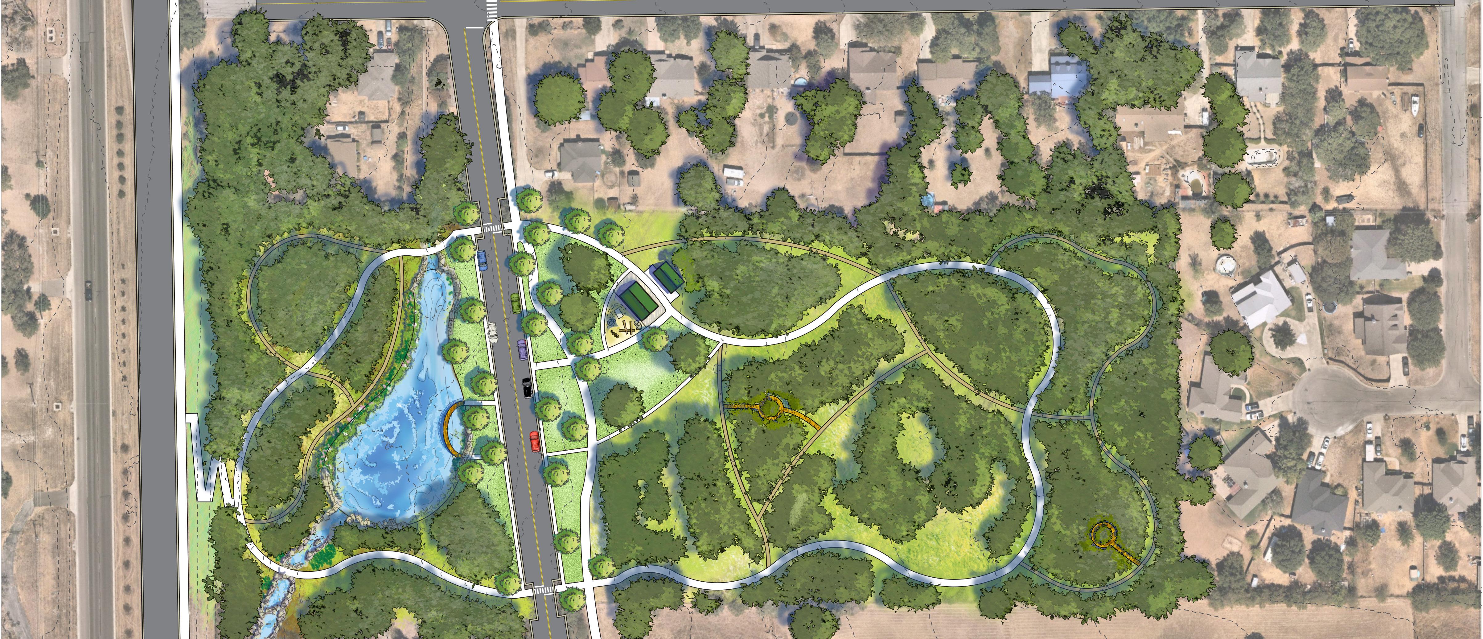
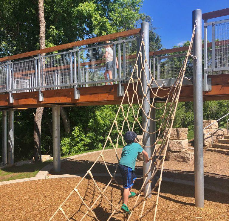
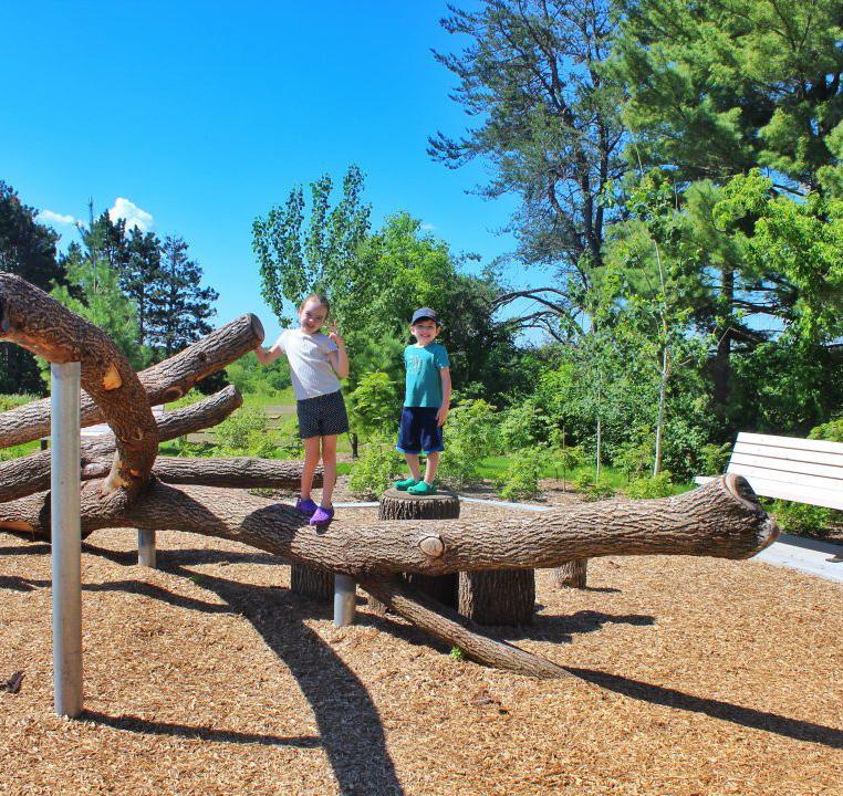
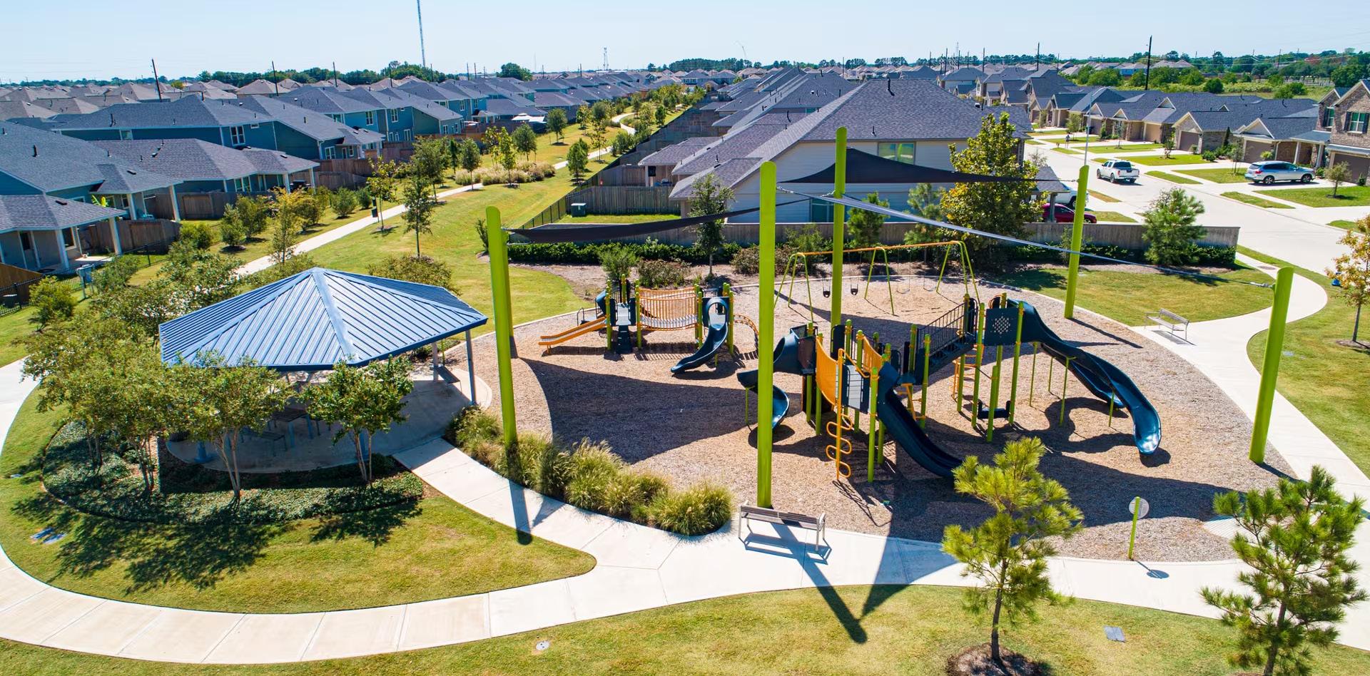
Parks within the Neighborhood The neighborhood is fortunate to be home to a diverse and vibrant network of parks, including a neighborhood park, a community park, and a regional park—each thoughtfully designed to serve different needs and interests. This rich variety of green spaces not only enhances the character of the area but also provides residents of all ages with opportunities to connect with nature, stay active, and build community. Having all three park types within one neighborhood is a rare and unique advantage, offering unparalleled flexibility for recreation, programming, and events—ranging from small, intimate gatherings to large-scale community festivals and regional tournaments. This creates opportunities to attract visitors, support local businesses, foster environmental stewardship, and encourage intergenerational connections in ways few neighborhoods can match. The presence of such a robust and accessible park system is truly one of the neighborhood’s greatest assets. Looking ahead, several exciting improvements are planned to ensure these parks continue to support the city’s vision and residents’ aspirations for a high quality of life, recreation, and well-being.
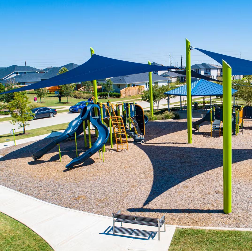
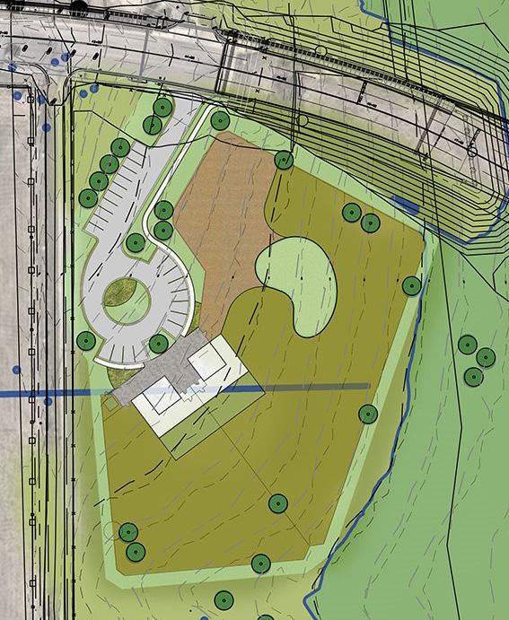
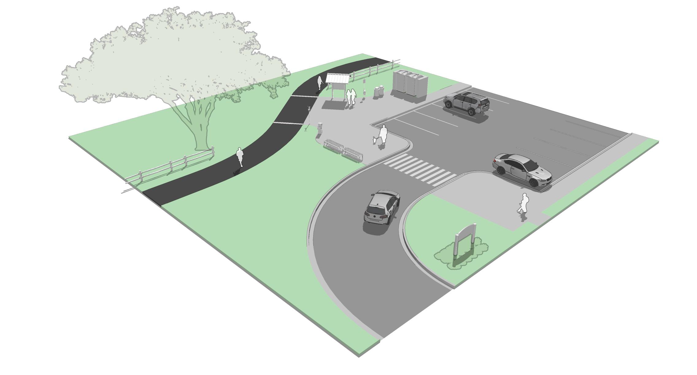
Southwest Community Park
Southwest Community Park is intended to not only provide diverse amenities but to also offer programing that reaches a larger population. This project will be regionally connected through the trail system, provide ample parking, and host the following amenities for people to use for both recreation and leisure activities. Key features include:

Regional Park
Regional parks are destination-oriented spaces serving a wider population across the city or even beyond. These parks typically feature expansive natural areas, specialized recreational facilities, and opportunities for environmental education and stewardship.
Key Programming:
• Extensive trail networks for hiking, biking, and nature walks
• Large-scale sports complexes or aquatic centers
• Nature preserves, wetlands, or wildlife observation areas
• Environmental education centers or interpretive signage
• Large event spaces for citywide festivals and concerts
• Picnic groves and group rental areas
• Volunteer programs and stewardship initiatives
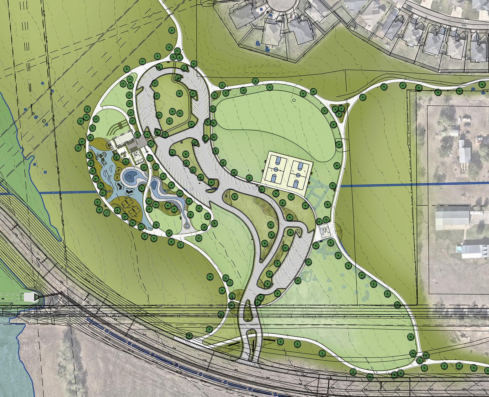
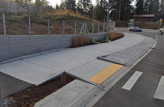
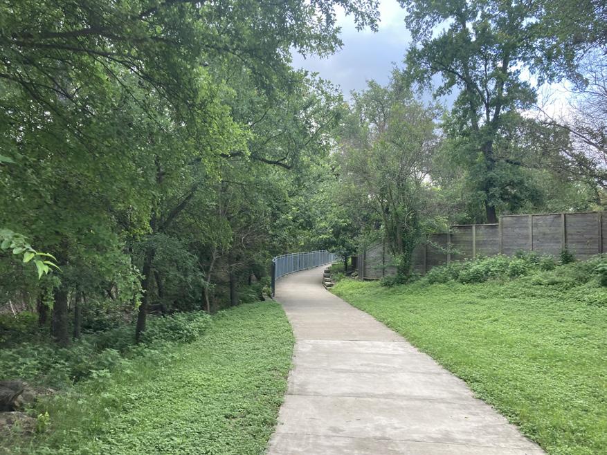
The trail system consists of three separate sub-groups of trails, each serving different purposes and design intents to meet the needs of various user groups. Understanding the various trail types helps neighborhood residents know how they are connected to the City’s trail system and helps them understand the decision-making process behind the trail’s functionality and design. This is important for the Oak Hills Neighborhood, as access to the future Southwest Community Park will be framed within these sub-groups of trails.

Pathway
• Sidepaths should be located along roadways classified as arterials or collectors.
• Sidepaths should be set at a minimum width of 10’ per federal guidance.
Roadway Separation
• Provide a roadway separation buffer of 5’ minimum width from edge of roadway sub-base infrastructure to edge of pathway.
Pathway
• Shared use paths should be located along creek or utility corridors.
• Provide a 2’ minimum shoulder off both edges of shared use path.
• Shared use paths should be constructed of concrete if located in low areas prone to flooding.
• Neighborhood connector trails are similar to greenway trails, but should be 8’ in width, as its role it to connect residents to a greenway trail.
Elements
• Path elements should include bench seating, waste receptacles, directional signage, mile markers, and shade trees.
Pathway
• Interior park trails should loop upon themselves, connect to park amenities, tie into the greater trail network, and provide access to surrounding developments.
• Provide a 2’ minimum planting buffer along each edge of pathway.
• Interior park trails may be constructed of aggregate material that can be compacted, like decomposed granite, and transition to concrete or asphalt when approaching areas of transition or high traffic or in flood-prone areas.
Access to the trail system should be context-sensitive to meet the needs of the different user types. The placement of trailheads and the neighborhood integration of trail access should purposefully reduce conflict around trail use. Trailheads should avoid being placed in locations that would increase vehicular traffic within the neighborhood. Meanwhile, trail access points should be strategically limited to prevent outsiders from using them as starting points.
Pathway
• Located within parks or on stand-alone properties large enough to accommodate desired programming
• Provide community or regional access to trails
• Off-street parking is necessary to accommodate trail users, with the number of provided parking spaces determined on a case-by-case basis, but corresponding to the number of trail users and proximity to other trailheads.
• Programming should include signage, a trail information kiosk, seating, and waste receptacles.
• Additional programming may include pet waste station, bike repair station, restroom facility, drinking fountain, and an emergency call box.
• Restrooms may be portable in a stand-alone trailhead property or a permanent structure.
• Located within neighborhoods connecting to existing sidewalks
• This connection point should occur in the common space of a development with a recommended minimum corridor width of 20’.
• Provide local or neighborhood access to trail
• Additional parking should not be provided at these locations to avoid excess vehicle traffic in neighborhoods.
• Programming should be limited to seating, waste receptacles, and trail signage.
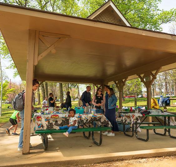
Community Park
Community parks are larger and more diverse in amenities, designed to serve multiple neighborhoods. They support both organized and informal recreation, offering facilities that accommodate group activities, youth programs, and intergenerational use.
Key Programming:
• Multi-use sports fields (e.g., soccer, baseball, softball)
• Outdoor basketball or tennis courts
• Large playgrounds with inclusive and adaptive features
• Group picnic shelters with barbecue stations
• Amphitheater or stage area for performance
• Restroom facilities and parking access
• Fitness stations or exercise loops
• Community classes and events (e.g., yoga in the park, cultural festivals)
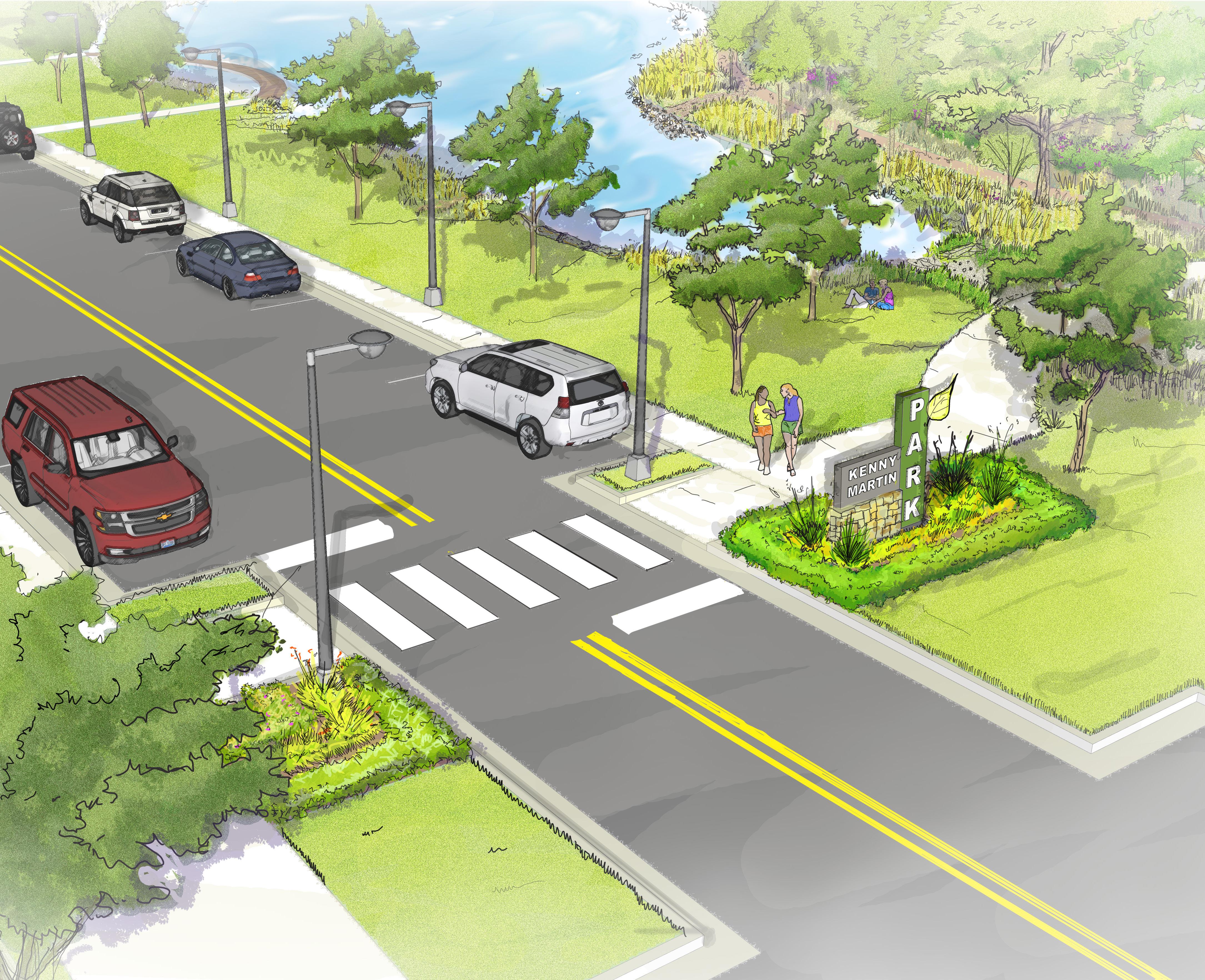
The Kenny Martin Park monument uses scale and color to announce the park to visitors. It is intended to be set back from the road to ensure pedestrian visibility at the crossing but placed close enough to the road that its scale will contribute to promoting a threshold experience for vehicular traffic.


Incorporating a through street within Kenny Martin Park can be done safely and effectively without compromising the park’s functionality. Using traffic calming principles is critical to successfully integrating the street into the park. Traffic calming is accomplished within the park by developing a distinct sense of arrival. Design elements contributing to that sense of arrival are bulb-outs to narrow the street, pronounced street crossing markings, street lighting, and a significant park monument sign. Combined, these elements communicate with drivers to slow down as they enter a new environment. Additionally, having a maintained park edge adjacent to the street will improve driver visibility, helping with clear site lines in the park for increased passive surveillance.
Access and Parking. Currently, the only public road that Kenny Martin Park is adjacent to is Hwy 317. Hwy 317 is a less-than-ideal street for providing access to a neighborhood park. Instead, a new road with on-street parking would improve overall connectivity, promote traffic calming, and be a more cost-efficient parking strategy.
Playground and Picnic Shelter. The playground and picnic shelter are intended to be a hub for information and gatherings at Kenny Martin Park. A kiosk will provide a narrative on the park’s conservation practices and environmental features and a map of the trail routes found within the park. Additionally, a restroom should be added as a complimentary park feature.
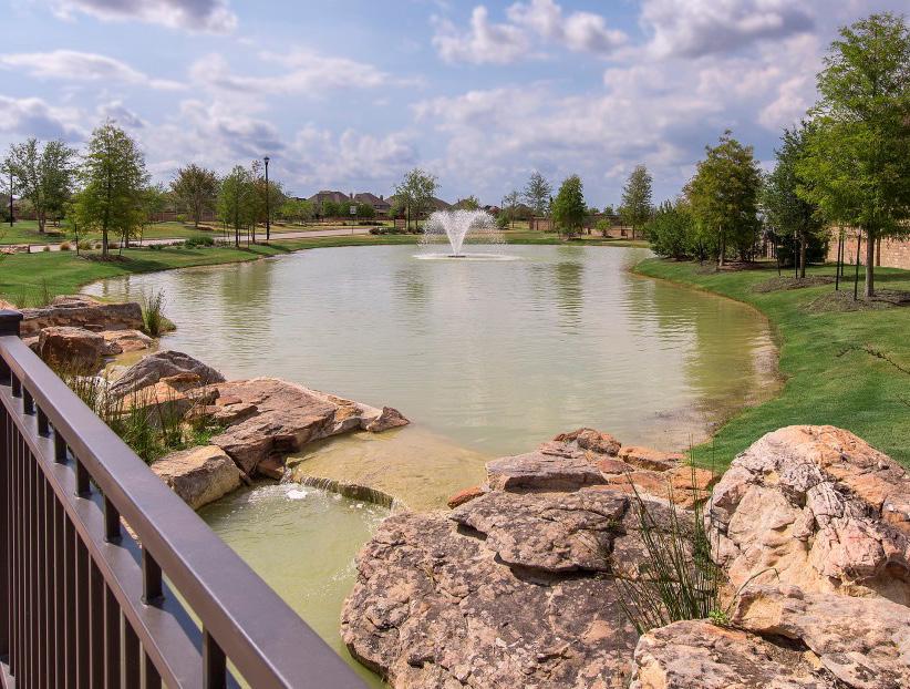
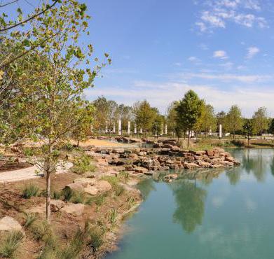
Amenity Pond. A pond feature is intended to provide interest and additional habitat while contributing to the area’s drainage infrastructure. An overlook feature at the pond edge, along with seating around the pond area’s perimeter, will help engage the space. Beyond the initial conceptual design of the park, further review or integration of the pond as a drainage facility will be needed.
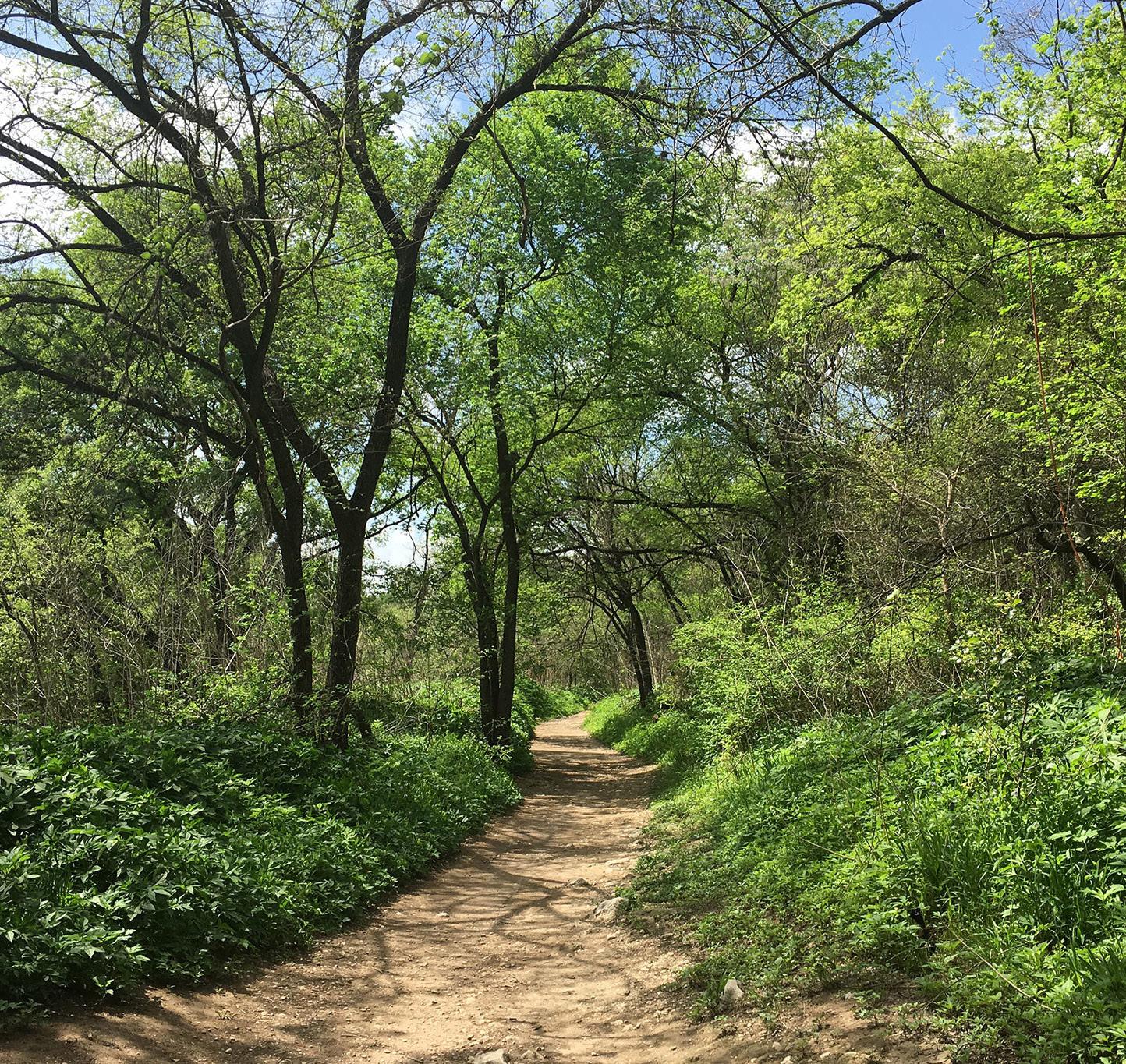
Interior Park Trails. Two distinct trail types would serve Kenny Martin Park. One is a 6-8 foot long concrete trail that would provide a paved surface suitable for all conditions. The other is a crushed stone or wood chip trail 4-5 feet in width. Combined, these trails are intended to provide a series of paths to experience the park, leading to the park’s signature tree canopy boardwalk structures.
Kenny Martin Park is intended to embrace passive recreation opportunities as part of its programming. Passive recreation refers to utilizing the existing natural environment to provide opportunities for recreation and leisure. The primary element of the park would be the looping concrete trail, which would tie all the park elements together. This looping trail would be ADA
accessible, making the park useable for people of all abilities. Additional experiences can be found along the unpaved trails, which exhibit reduced construction impact, allowing better integration with the natural environment. The park is intended to have three distinct ecological zones: forest, meadow, and riparian. Each zone would provide opportunities for learning about both the plants and animals that comprise the zones.
Kenny Martin Park is intended to fully embrace the natural environment’s character. Improvements, such as the amenity (detention/retention) pond, complement the site’s existing character and add to the park’s educational value. More subtle, earth-tone colors should be selected for added structures, and natural materials should be used when possible.
• Natural materials in construction such as stone and wood.
• Learning opportunities found throughout the park.
• Seating should be found along both the paved loop trails and natural trails.

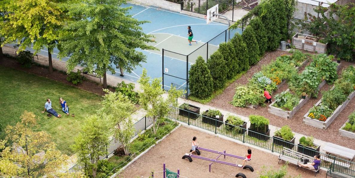
Neighborhood Park
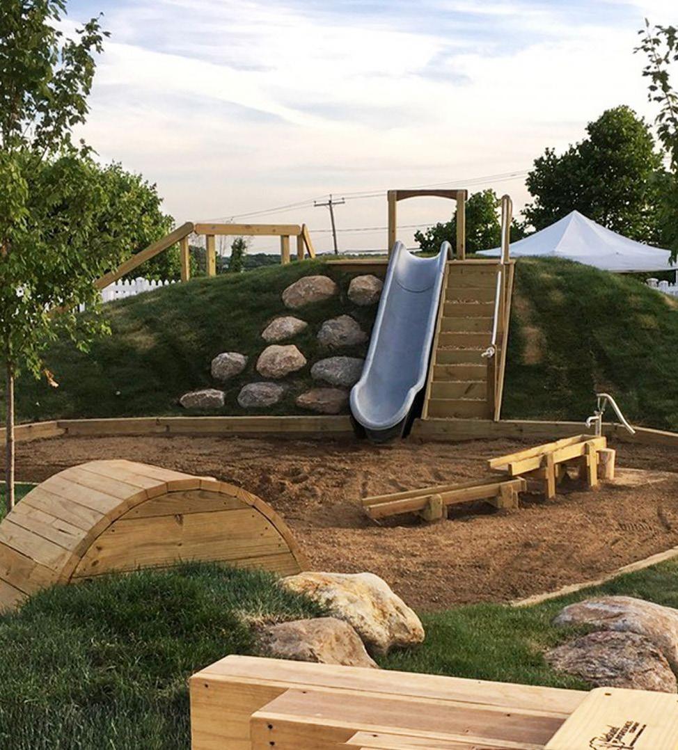
Neighborhood parks are smaller-scale parks intended to serve the immediate residential area within walking distance. They provide accessible, family-friendly spaces for everyday recreation and relaxation, fostering a strong sense of community and belonging.
Key Programming:
• Playground equipment for various age groups
• Shaded picnic areas and benches
• Small open lawn areas for informal play
• Walking paths or loop trails
• Community gardens or pollinator gardens
• Dog-friendly areas or pet waste stations
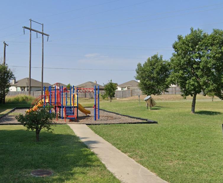
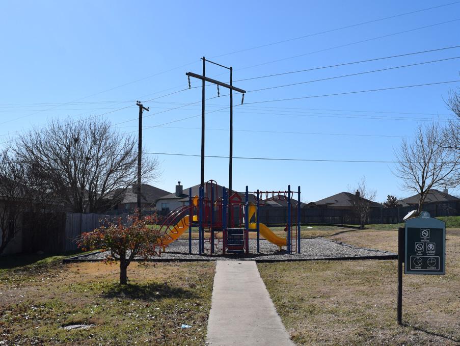
The Oaks at Westwood Park serves as an important neighborhood gathering space and provides a foundation for recreation close to home. While it currently offers a playground, there is significant opportunity to enhance its role as a true community hub. By thoughtfully adding features that support comfort, accessibility, and connectivity, the park can better meet the diverse needs of residents and become a more welcoming destination for all.
Program Improvements:
• Shade structures
• Playground Renovation
• Benches and seating areas
• Accessible pathways
• Connection to Hog Pen Regional Trail
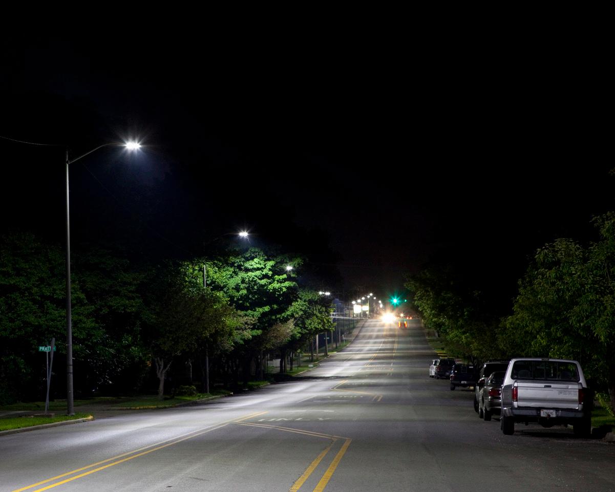
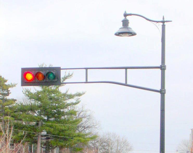
The General Street Zones are the pedestrian and vehicular corridors of the neighborhood. These streets see the largest portions of vehicular and pedestrian traffic both in and out of the neighborhood. As such, these corridors should have ample lighting and maintain high operating standards, while not overpowering residential properties.
Lighting Notes:
Lamp Size 15,000 Lumens, 150 Watts
Spacing 120’ poles staggered
*Average Foot-candles 0.6
*Information informed by Highway Illumination Manual, Texas Department of Transportation, 2018
Recommended application of dark sky fixtures that minimize glare while reducing light trespass and sky glow.
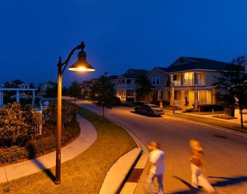
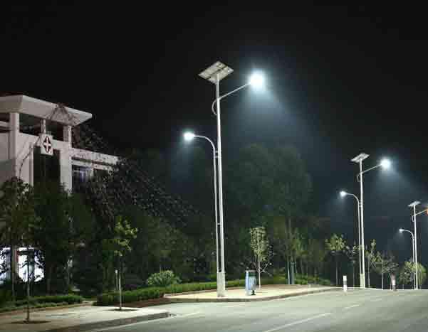
The Neighborhood Zone is the primary single-family residential portion of the plan area. This zone needs to balance lighting for safety concerns while maintaining residential privacy.
Lighting Notes:
Lamp Size 9,500 Lumens, 100 Watts
Minimum Spacing 150’ poles staggered
*Average Foot-candles 0.4
*Information informed by Highway Illumination Manual, Texas Department of Transportation, 2018
Recommended application of dark sky fixtures that minimize glare while reducing light trespass and sky glow.
The Intersection Zone highlights key pedestrian crossings. The traffic associated with these areas requires an increase in lighting to ensure both pedestrian and vehicular safety.
Lighting Notes:
Lamp Size 30,000 Lumens, 250 Watts
Spacing 1 light pole at each respective corner, 4 total.
*Average Foot-candles 2.0
*Information informed by Highway Illumination Manual, Texas Department of Transportation, 2018
Recommended application of dark sky fixtures that minimize glare while reducing light trespass and sky glow.
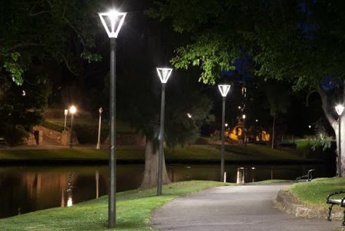
The Park Zone is intended to be a highly visible and active linkage. The lighting should be pedestrian scaled and well lit as to encourage extended use.
Lighting Notes:
Spacing 90’
Average Foot-candles 0.65
Recommended application of dark sky fixtures that minimize glare while reducing light trespass and sky glow.
The use of Backlight, Uplight, and Glare (BUG) ratings should be considered for business or commercial properties to promote dark sky principles and reduce off-site lighting impact on adjacent properties, especially near a residential neighborhood.
The Oak Hills name for the neighborhood originated as part of this planning exercise. Establishing the neighborhood’s brand was a process that included significant input from the City’s planning team, who attempted to capture the spirit of the neighborhood in graphic form. Below illustrates the concept development of the Oak Hills brand.
Some of these branding designs pull inspiration from an existing monument sign in the Bent Oak Drive and Hogan Road neighborhood that incorporates an oak leaf into its design. Following a similar theme, besides oak leaves, some branding options include oak trees and acorns. Furthermore, a few designs embrace a hill element to emphasize the change of the neighborhood’s name from The Oaks at Westwood to The Oak Hills Neighborhood.
STREET SIGN TOPPERS


ElidoInitials Regular
MILLER TEXT BOLD
Espiritu Regular
Minion Variable Concept Medium
Lulo One Bold
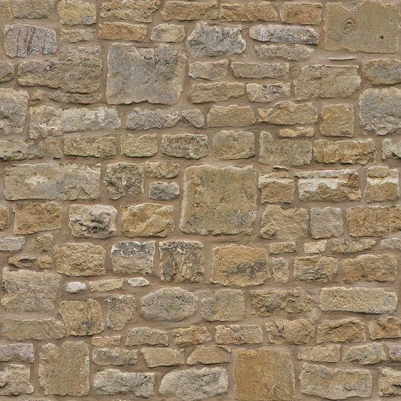
Limestone is chosen as the primary material for the monument signs to complement the neighborhood’s existing character. The horizontal monument will act as the primary gateway to the neighborhood where possible. However, the vertical monument can act as a primary gateway entrance due to space constraints in the right-of-way. Two vertical monument designs are provided below. One is a more traditional option while the other is a more modernized option. This modernized option can easily be applied to the horizontal monument as well.


Existing monument signs for subdivisions within the Oak Hills Neighborhood can elect to incorporate elements of the new Oak Hills Neighborhood branding. The example above illustrates how this retrofit can be made to the existing Carriage
This section of the plan summarizes the recommendations derived from the project findings in the Oak Hills Neighborhood Action Plan. These actions follow the direction in the City’s Strategic Plan and Temple By Design, 2020 Comprehensive Master Plan. Those plans organize the actions by focusing on smart growth, public safety, places and spaces, and high-performing organizations. The recommendations in the Action Plan will reference the respective Comprehensive Plan initiative they help to realize. The Action Plan will identify the implementation method, priority, and department involvement.
DD.1 HWY 317, Coordinate with upcoming corridor plan. Evaluate land uses and signage to ensure corridor beautification efforts are considered.
and Thoroughfares
ST.1 Poison Oak Road. Complete the design and construct improvements for the remainder of the Poison Oak Corridor through the plan area.
ST.2 Hogan Road. Complete the design and construct improvements for the remainder of Hogan Road that is still two lanes. This includes the extension of the existing side path on the northern side of Hogan Road.
ST.3 Pea Ridge Road. Complete construction of improvements
Pea Ridge Road.
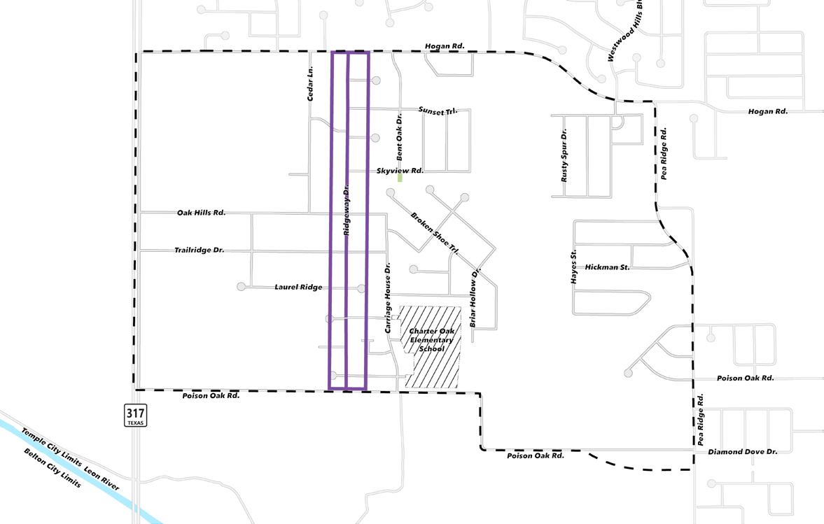
ST.4 Ridgeway Drive. Plan, design, and construct improvements and/or enhancements to corridor. Sidewalk placement may be best focused on the west side of the street due to existing drainage facilities. Intersection improvements
promote traffic calming.
ST.5 New Neighborhood Collector. Add new neighborhood collector that parallels Hwy 317 to the Major Thoroughfare Plan. Plan, design, and construct improvements and/ or enhancements to corridor that won’t be accomplished through private development. Intersection improvements should promote traffic calming.
ST.6 Pedestrian Connectors. Construct sidewalks along Bent Oak Drive, Skyview Road, Oak Hills Drive, Carriage House Drive, Thicket Trail, Broken Shoe Trail, Briar Hollow Drive, Salt Mill Hollow Drive, and Cedar Lane Drive. Additionally, construct sidewalk along Ridge Wood Drive and Rollingwood Drive at the time when they are extended as part of new development.
ST.7 Tree Program. Conduct inventory and evaluate existing trees in the neighborhood to establish tree replacement recommendations/plan at the block level. Encourage new street trees and street tree replacement as needed throughout the plan area. Include review of street trees to ensure limbs do not impede ingress and egress of emergency and city vehicles. Consider ordinance revisions to assist in this program. Consider tree placement and maintenance requirements of the tree species as to promote resiliency to extreme weather and drought.
ST.8
Prioritize construction of new sidewalks to make connections and fill connectivity gaps within the neighborhood. Once complete, implement a sidewalk condition evaluation on a 5-year cycle to assess for ADA compliance and connectivity. Schedule repairs and additions through the CIP plan or identify funding through other programs. Utilize public works sidewalk crew for repairs and sections of replacement/infill projects.
IS.2 Encourage the burying of overhead utilities to improve neighborhood resiliency. This is to be evaluated on a caseby- case base, preferably at the block level.
D.1 Evaluate problematic drainage areas and localized flooding within the neighborhood. Specific attention should be given to Ridgeway Drive, Casler Circle, and Sunset Trail.
PT.1 Southwest Community Park. Design and build park and trails connections. Better integrate stormwater facilities into the park where possible. Consider incorporating the ability to host food trucks within the park.
PT.2 Kenny Martin Park. Design and construct Kenny Martin Park to be a neighborhood park with a commitment to conservation principles and a setting for learning about the natural environment.
PT.3 Hog Pen Creek Trail Connection. Design and Construct a trail that connects Hog Pen Creek, Hogan Rd., and Southwest Community Park. This should be a 10ft wide sidepath.
PT.4 Oaks at Westwood Park. Design and Construct shade structures, benches, seating areas, accesible pathways, and connection to Hog P. Renovate existing playground.
EG.1 Planning and City Administration should explore regulatory options to better align commercial development along HWY 317 to serve nearby residential. This is intended to increase retail and personal service tax revenue in southwest portion of Temple
The following list of projects was derived from the concepting and recommendations formulated as part of the planning process. The projects identified correlate with the actions found in the Oak Hills Neighborhood Action Plan. Projects may be a single action or a combination of actions. The opinion of the probable cost was developed uniquely for each project and includes the cost of construction, contingency, land/right-of-way acquisition, and professional services. Action prioritization in regard to project implementation should be followed; however, if circumstances arise that increase the urgency or cost savings for the realization of the project, deviations from the recommended action priority are appropriate.
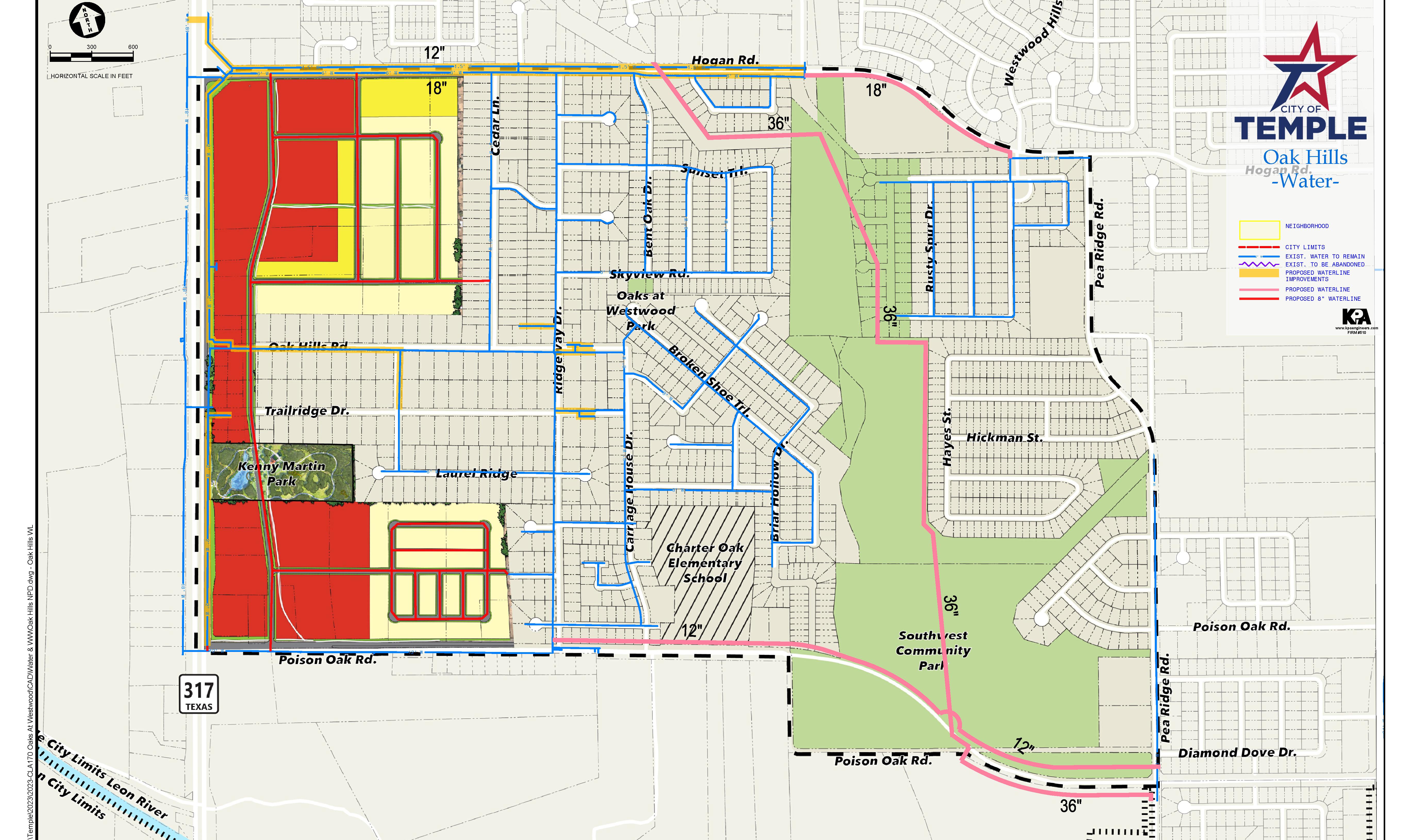
The water lines identified in this exhibit provide recommended locations and capacity to serve the neighborhood district.
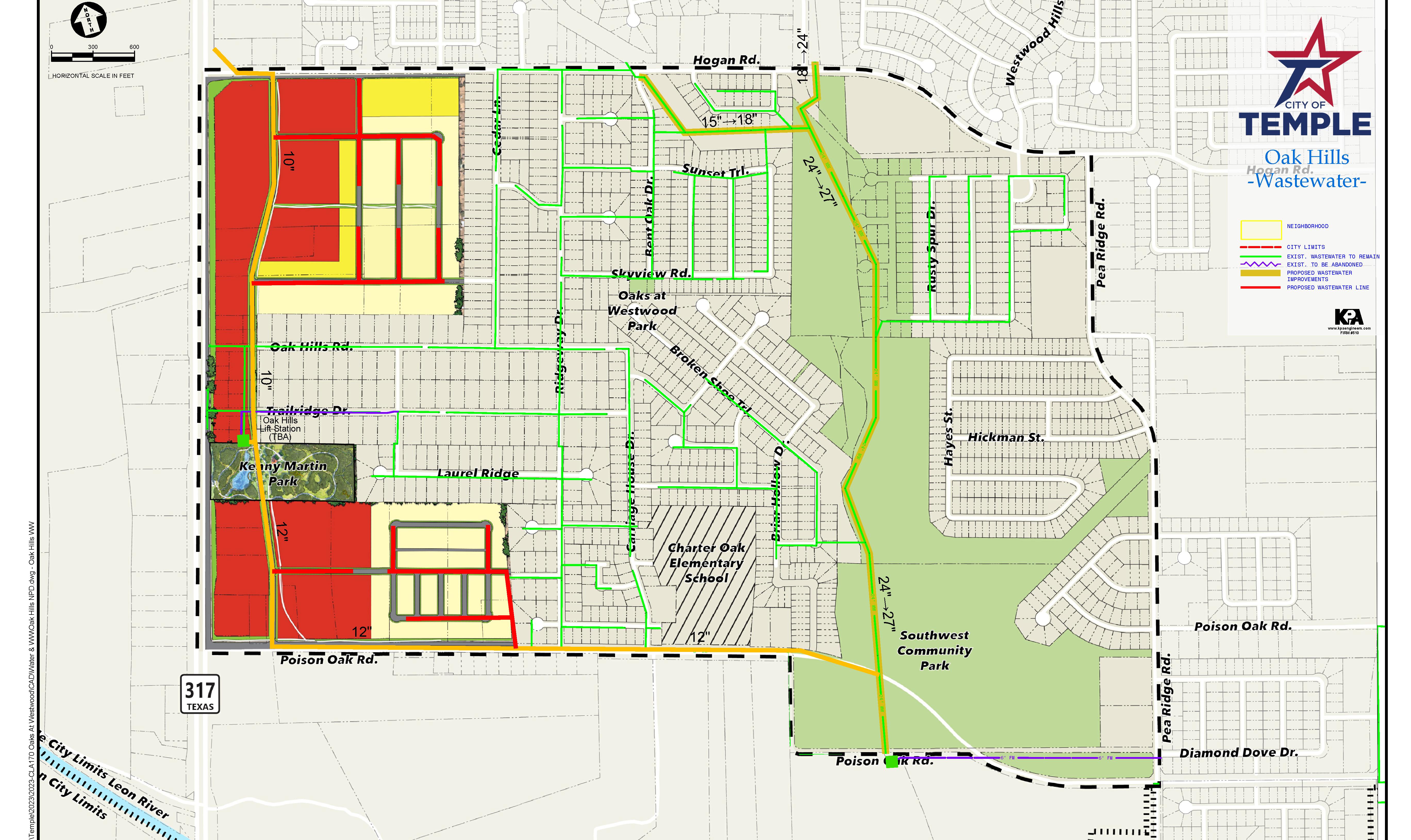
The wastewater lines identified in this exhibit provide recommended locations and capacity to serve the neighborhood district.