

BIG BASIN REIMAGINING

Facilities Management Plan

REDWOODS STATE PARK
PREPARED
BY:
CALIFORNIA STATE PARKS
Santa Cruz District
Chris Spohrer, District Superintendent
Will Fourt, Senior Planner
Garret Hammack, Park and Recreation Specialist
CONSULTANTS
PlaceWorks
Isabelle Minn, Principal
Jesse Jones, Associate Principal
Logan Woodruff, Associate
Leo DiPierro, GIS Project Planner
Crystal Arellano-Garibay, Landscape Designer
Joe Sison, Planner
Mithun
Sherwood Design Engineers
Fehr & Peers
Jim Martin
Amy Morris

CALIFORNIA STATE PARKS MISSION
To provide for the health, inspiration and education of the people of California by helping to preserve the state’s extraordinary biological diversity, protecting its most valued natural and cultural resources, and creating opportunities for high-quality outdoor recreation.
Chapter 1: Introduction
Planning Area
Planning
Park Classification and Park Purpose
Planning Objectives
Planning
Chapter 2: Parkwide Design
Appendices
A
B
C
D
Introduction Chapter 1
The Big Basin Facilities Management Plan (BBFMP) is the park plan to guide future rebuilding of recreational, administrative, and operational facilities and to restore public access at Big Basin Redwoods State Park (BBRSP) after the 2020 CZU fire, which destroyed or damaged nearly all former facilities. The development of the BBFMP builds upon the Reimagining Big Basin Vision Summary1 (2022), the Big Basin Redwoods State Park General Plan and EIR2 (2013), and the Big Basin Redwoods State Park Cornerstone Document3 (2023).
BBRSP is California’s oldest state park, established in 1902 through land purchase and donation. Originally called the California Redwood Park and consisting of 3,800 acres, BBRSP is now more than 18,000 acres in the Santa Cruz Mountains, within 60 miles of major metropolitan centers in the San Francisco Bay Area and Santa Clara Valley.
1 The Reimagining Big Basin Visioning Process was conducted 2021-2022 and brought together insights from the public, stakeholders, and Tribal representatives together in a high-level vision and set of guiding principles to inform planning decisions for rebuilding of facilities at the Park.
2 The Big Basin Redwoods State Park General Plan and EIR was completed in 2013. It is the foundational planning document for long-term planning at the Park and includes a complete Environmental Impact Report.
3 The Big Basin Redwoods State Park Cornerstone Document was completed in 2023 and incorporates insights from the Reimagining Big Basin Vision Summary and the affects of the 2020 CZU fire that substantiate relevant revisions and updates to the Park’s General Plan.
At the heart of the park is the redwood grove that inspired admirers to form the Sempervirens Club and advocate for the creation of a state park.
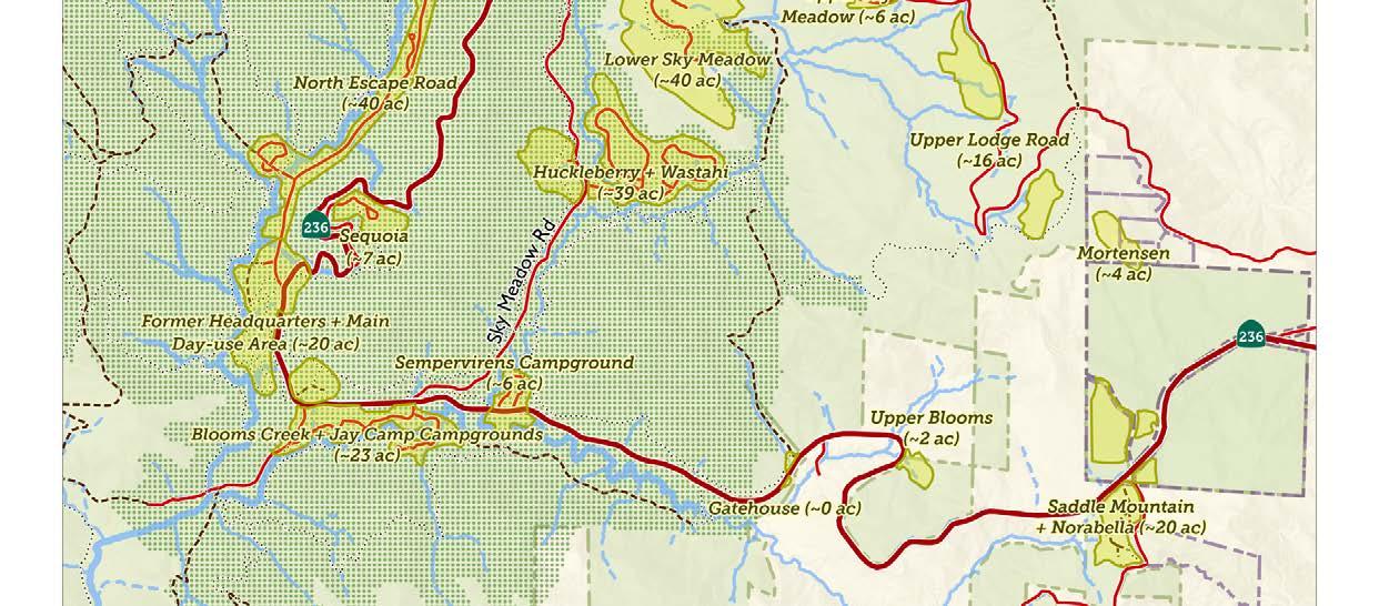
The vast park includes coastal areas at Rancho Del Oso (RDO) and the Theodore J. Hoover Natural Preserve at the mouth of Waddell Creek, as well as the West Waddell Creek State Wilderness. The BBFMP focuses specifically on a planning area (Figure 1.1) along California State Highway 236 (Big Basin Way) and Sky Meadow Road, where the majority of pre-fire facilities were located.
Muwekma Ohlone and Amah Mutsun Tribal Band, whose members past, present, and future hold cultural ties to the Santa Cruz Mountains and have and continue to play a critical role in the stewardship of the lands that now encompass BBRSP.
Figure 1.1: Planning Area



Planning Purpose
The BBFMP will be used by California State Parks management, staff, and park partners to provide recommendations for proposed facilities and help streamline final design and environmental review. It will also include the development of conceptual design alternatives to evaluate distinctive strategies for site configuration and use. The alternatives reflect analysis of opportunity sites and their capacity balanced with an understanding of visitor services and operational needs as summarized in the Basis of Design, as well as feedback received from the community and multiple project working groups.
The BBFMP is accompanied by an environmental document (Appendix A) that demonstrates that the proposed facilities are in compliance with the BBRSP General Plan (2013). Together, this BBFMP and its associated environmental document, will serve to streamline environmental review processes and expedite funding and implementation for rebuilding facilities and restoring public access to the park in a way that is aligned with environmental regulations and planning objectives described in the following pages. These planning objectives emerge from a set of eight guiding principles (Figure 1.2) that were developed during the Reimagining Big Basin Visioning Process.




Prioritize Forest Health
Provide Equitable, Diverse, and Evocative Visitor Experiences
Diversify Transportation and Access Opportunities
Practice Land Stewardship
Include Indigenous Perspective
Foster Landscape Connectivity
Design with Reverence and Resilience
Engage the Park Community and Build Partnerships
Figure 1.2: Guiding Principles
Park Classification
Big Basin Redwoods State Park is classified by State Park and Recreation Commission as a State Park1 as described in California Public Resources Code (PRC). The State Park also includes classified sub-units within its boundaries, including Rancho Del Oso sub-unit, West Waddell Creek State Wilderness,2 and Theodore J . Hoover Natural Preserve.3
Park Purpose
A Declaration of Purpose4 describes the purpose of a park and is the broadest statement of management goals designed to fulfill the vision for the park. The 2013 General Plan revised the previous Declaration of Purpose statement from 1964 to assure that the current park ownership and its resources, which have greatly expanded beyond the original park ownership, are encompassed. Following the transformative effects of the CZU fire, further revisions were needed and are presented in the Revised Declaration of Purpose (BBRSP Cornerstone Document, 2023) below:
The purpose of Big Basin Redwoods State Park, which was established in 1902 as the first park unit of what is now the California State Park System and recognized as a catalyst in the emergence of the American Conservation Movement, is to protect, restore and perpetuate the outstanding coast redwood forests of the Santa Cruz Mountains and their unique resiliency to fire, including the Waddell creek watershed and surrounding watersheds, and recognize these resources for their educational and recreational value . While established in the early 20th century, the park and its scenic landscape was inhabited and utilized by California Native American tribes who managed it for generations prior to European settlement. The park offers an opportunity to appreciate their legacy and learn from the Native American forestry management practice. Many significant cultural resources burned in the 2020 CZU Fire, including those built by the Civilian Conservation Corps during the development of the park in the 1930s, will be remembered in images, as well as with preserved remnants of the structures. The regeneration of the redwood forest following the CZU Fire provides educational opportunities related to the role of fire in the landscape and the resilience of redwood forests. The park’s wilderness characteristics and the outstanding scenic qualities of the old growth redwoods, canyon streams and waterfalls, and ridge top ocean vistas extending beyond the coastal resources at Rancho del Oso, together with its cultural history, high-quality recreation and opportunities for the inspiration, enlightenment, and enjoyment of current and future park visitors, make Big Basin Redwoods State Park one of California’s premier parks.
1 See PRC 5019 .53 <https://leginfo .legislature .ca .gov/faces/codes_ displaySection .xhtml?lawCode=PRC§ionNum=5019 .53 .> for full description of ‘State Park’
2 See PRC 5019 .68 <https://leginfo .legislature .ca .gov/faces/codes_ displaySection .xhtml?lawCode=PRC§ionNum=5019 .68 .> for full description of ‘State Wilderness’.
3 See PRC 5019 .71 <https://leginfo .legislature .ca .gov/faces/codes_
4 A Declaration of Purpose for each state park is required by PRC, Section 5002 .2(b), “…setting forth specific long-range management objectives for the park consistent with the park’s classification . . .”
Planning Objectives
Prioritize Forest Health
• Structures and facilities will be sited and designed to allow forest stewardship projects to occur in priority areas and to increase forest resiliency in a changing climate.
• Structures and utilities will be sited and designed to minimize development within old growth redwood forest areas, to minimize fuel contributions from structures, and to minimize the need to remove hazard trees within old growth areas.
• Structures, parking, developed areas, and trails will be sited and designed to minimize paving and soil compaction and to allow natural ecological processes to occur.
Provide Equitable, Diverse, and Evocative Visitor Experiences
• Park facilities will strive to support pre-fire visitation for day-use, trail access, and overnight use while managing visitor use for other project goals.
• The park will provide diverse camping and overnight experiences, as well as a variety of day-use facilities and will have quality support amenities, programs, and activities that support day-use and overnight experiences.
• Park facilities will be inviting and inclusive to diverse future California communities and educational and interpretive materials will include a variety of languages and perspectives.
Diversify Transportation and Access Opportunities
• Maximize the efficiency of use, experience quality, and access equity to Big Basin by travel modes that are alternatives to lowoccupancy private vehicles.
• Maximize park access opportunities for lower-income and underrepresented communities, and park visitors without access to a vehicle.
• Minimize vehicle congestion getting to the park, and pedestrian congestion and crowding within the park.
Practice Land Stewardship
• Facilities will be sited and designed to allow effective long-term maintenance to create sustainable park recreational access for future generations.
• Park facilities will be sited and designed to consider future stewardship activities and to enable active forest management, including Indigenous practices in the context of changing climatic conditions
• The park will include adequate facilities needed for active stewardship activities, including spike camps for stewardship corps, stewardship training facilities, operation and maintenance facilities and permanent and seasonal staff housing.
Include Indigenous Perspectives
• Facilities and recreational amenities will be sited and designed with input and consultation with Indigenous leaders and representatives.
• The siting and design of facilities will include considerations that ensure that all interpretive and educational materials incorporate an Indigenous perspective
• Park facilities will provide ceremonial space for cultural use by Indigenous groups and individuals.
Foster Landscape Connectivity
• Park facilities will allow future connections to surrounding parks and recreation areas to provide regional recreational opportunities.
• Developed park areas will be sited and designed to promote continuous and connected areas of important habitats and to avoid fragmentation
• Planning of facilities will incorporate considerations for a collaborative and regional approach to forest management that engages landowners and land management agencies of nearby properties.
Design with Reverence and Resilience
• Structures and facilities will be sited and constructed to be resilient to hazards that will become more frequent and intense with climate change including severe winter storms, drought, and high-severity fire.
• All developed park amenities are aesthetically designed to create experiences that reference the historic character of Big Basin with reverence to the park’s natural landscape and history.
• Developed park facilities are planned to minimize carbon emissions associated with park visitation and operation and maintenance, are designed with sustainable materials, and incorporate renewable energy production when feasible.
Engage the Park Community and Build Partnerships
• Park plans reflect public values and feedback, and the priorities expressed by the community and stakeholders during the facilities planning process, particularly reflecting the voices of under-represented communities.
• Park plans can be implemented with strong support from partners.
• Park facilities can be constructed in phases to provide the envisioned recreational experiences with available funds.
Planning Context and Process
Despite its devastating effects for BBRSP and the surrounding community, the CZU fire prompted a need to revisit the vision for the future of the park, which has created an opportunity to build greater resilience and inclusion into the park’s design.
The engagement process for the Big Basin Redwoods State Park Facilities Management Plan has been exceptionally robust, spanning multiple years and designed to center historically underrepresented communities while reaching a broad spectrum of stakeholders. Engagement has included over a dozen focus groups and one-on-one meetings, innovative tools like multilingual hiking workbooks and an interactive StoryMap survey, public open houses, and on-site pop-ups at community events. A Community Grant Program empowered trusted local organizations to lead park-based experiences with over 200 participants, while dedicated tribal engagement meetings helped shape plans for a Mixed Tribal Use space. In total, thousands of voices—ranging from longtime visitors and environmental advocates to Indigenous leaders and Saddle Mountain neighbors—have meaningfully contributed to shaping the BBFMP. The engagement process and emerging insights are summarized in Appendix D.
In addition to this engagement process. there has been rigorous technical analysis by a consultant team expert in landscape architecture, architecture, civil engineering, biological resources, climate adaption/ resiliency, and transportation engineering.
Guided and informed by California State Parks experts and district staff, the design concepts and planning approaches presented in the BBFMP were developed through an iterative process (Figure 1.3) that infused community input together with technical analysis, district staff interviews, and other inputs to produce a conceptual design for the rebuilding of facilities at BBRSP. In addition to the BBFMP, other planning processes will support projects and management protocol to support forest health and roadway and trail connectivity (Figure 1.4).
The Basis of Design (Appendix B) was a critical step in the BBFMP planning process. It included robust community and stakeholder engagement, an extensive existing conditions assessment, identification of opportunities and constraints, and development of key design approaches to support planning objectives.
The Summary of Design Alternatives (Appendix C) offers a window into the iterative design process for different programs and facility types that were considered as potential design solutions to meet planning objectives. The Preferred Alternative presented in this BBFMP is a further iteration of the best ideas presented there, as determined by evaluation criteria.
General Plan Amendment
The 2013 Big Basin Redwoods State Park General Plan and Environmental Impact Report is the park’s long-term planning foundation. As part of this Facilities Management Plan, simultaneous amendments to the General Plan and a Supplemental EIR (Appendix A) are proposed to clarify text for consistency with proposed facilities, address changed circumstances from the 2020 CZU Fire and expand the park boundary to include parcels the Department is acquiring. With the General Plan amendments, all proposed facilities in the BBFMP are consistent with the recommendations in the General Plan. For the Old Growth Area, there is some additional explanation regarding General Plan consistency in that section in Chapter 3 (page 84).
The names in the General Plan differ from the BBFMP in the following ways, which are considered synonymous:
• The General Plan uses Park Headquarters; the BBFMP uses Main Day-Use area.
• The General Plan uses the Park Headquarters and Sky Meadow planning area; the BBFMP uses zone names Old Growth Area, Overnight Area, and Upper Sky Meadow Area within this General Plan planning area.
Cornerstone Document Consistency
The 2023 Big Basin Redwoods State Park Cornerstone Document is intended to be a companion to the General Plan focusing on strategic next steps for planning at BBRSP to implement the General Plan with the changed conditions after the 2020 CZU Fire. The Cornerstone revisits topics of the General Plan such as the Declaration of Purpose, Sense of Place and Interpretive Themes. The BBFMP is consistent with the topics revisited in the Cornerstone and fulfills one of the document’s three highest priorities, which is to complete a Facilities Management Plan.
Figure 1.3: BBFMP Planning Phases
BASIS OF DESIGN DOCUMENT
Stakeholder Engagement Phase #1
STAGE I BASIS OF DESIGN
DRAFT DESIGN ALTERNATIVES Alternatives Development
Stakeholder Engagement Phase #2
STAGE II DESIGN ALTERNATIVES
ONGOING ENVIRONMENTAL REVIEW
ROADS AND TRAILS MANAGEMENT PLAN AND FOREST STEWARDSHIP PROJECTS
DRAFT PROJECT SUMMARY FACILITIES MANAGEMENT PLAN
Draft Project Summary Development
Stakeholder Engagement Phase #3
STAGE III PROJECT SUMMARY AND FACILITIES MANAGEMENT PLAN
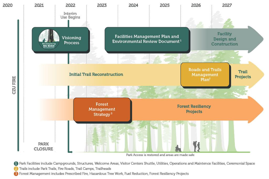
Figure 1.4: Related Planning
Parkwide Facilities Chapter 2
Through an iterative design process including incorporation of community, stakeholder, and Tribal input alongside technical assessments, this chapter presents the plan for rebuilding parkwide facilities at Big Basin Redwoods State Park (BBRSP).
The diagram in Figure 2.1 provides an overview of planned park facilities throughout the planning area. Chapter 4 includes a more comprehensive and detailed description of facilities and programs at each site, including site plans and other illustrations.
This chapter includes three sections which describe the parkwide approach to key topics:
Climate Adaptation and Restoration
Day-Use Facilities and Interpretation
Overnight Facilities
Circulation and Shuttle Program
Aesthetics, Design Character, and Sustainability
Park Operations, Safety, and Staff Housing
Park Utilities
Key


Figure 2.1: Planned Facilities


Climate Adaptation and Restoration
The BBFMP includes facility planning, design, and management protocol that respond to changing conditions and increased environmental hazards as a result of climate change. This section outlines the park-wide strategy for climate adaptation and restoration, focusing on:
• Active Stewardship for Forest Health and Fire Resilience
• Hydrologic Restoration
• Climate Change Hazards and Adaptations
• Old Growth Restoration Projects
• Greenhouse Gas Emissions Reduction


Active Stewardship for Forest Health and Fire Resilience
An active stewardship approach to natural resource management is critical to improving forest health and increasing resilience to future wildfires. A key goal of this approach is to ensure that facilities within BBRSP are designed and sited to support prescribed fire operations, minimizing burnable infrastructure (e.g., split rail fencing, wooden bridges, buildings) that would require protection and ensuring that access and control lines align with facility plans. In locations where pile burning is used as the preferred prescribed fire technique, as opposed to broadcast burning, some minimal wooden structures such as split rail fence and picnic tables may be acceptable. Facilities in areas designated for prescribed burns should be designed and constructed with fire-resistant materials and sited to allow fire to move safely through or around them, reducing barriers to effective stewardship.
The total treatment footprint in BBRSP is roughly 10,439 acres, encompassing both prescribed burn units and additional fieldverified treatment units. These findings, along with other critical stewardship considerations—including monitoring methods, roadside treatments, and manual treatment area expansion—are summarized in the Forest Management Strategy Report for Big Basin, Año Nuevo, and Butano State Parks (August 2024). The following broad stewardship strategies serve to guide sitespecific implementation of fire-resilient facilities. Key considerations include:
Siting for Prescribed Fire Compatibility
New and existing facilities should be sited and designed to support prescribed burns by minimizing combustible infrastructure and allowing for fire management activities.
Construction with Fire-Resilient Materials
Buildings and infrastructure should use fire-resistant materials (e.g., metal roofing, concrete or ignition-resistant siding, emberresistant vents) to enhance durability in fireprone areas.
Defensible Space Around Buildings
Clear zones should be maintained around structures to reduce fuel loads and limit fire spread. This includes vegetation management, proper spacing of trees, and removal of ladder fuels.
Fire Water Infrastructure
Hydrants, water storage tanks, and other firefighting water sources should be incorporated into facility planning to support suppression efforts.
Roadside Treatments
Regular roadside treatments will be conducted throughout the park, as outlined in the Forest Management Strategy (FMS). These efforts focus on clearing dead and dying trees within 50–100 feet of roads and trails to reduce fuel loads, improve visibility, and enhance connectivity between treatment units. While relevant to facility planning, these treatments will be planned and implemented through separate initiatives. Data collection systems will be developed to track conditions at designated plots and sites, informing adaptive management strategies.
Prescribed Burn Units
Defined burn units will be maintained and managed to facilitate safe and effective prescribed burns, supporting long-term ecosystem health and fuel reduction.

Hydrologic Restoration
The main river system in the park is Waddell Creek. Of the 17,000 acres that encompass the Waddell Creek watershed, approximately 80 percent of it lies within the boundaries of BBRSP. Waddell Creek flows all the way to the Pacific Ocean, meeting the sea at Waddell Beach. This watershed is situated on a geology defined by sedimentarymudstone and sandstone, relatively poor producers of groundwater. However, Sequoia roots are able to maintain soil moisture by growing their roots laterally and in the top 1-2 meters of soil. Previous studies within BBRSP have shown that soil moisture is the most important factor in the density and distribution of redwoods. Thus, the health of the redwoods, and by extension the park’s greater ecosystem, is vulnerable to soil compaction, hardscape features, and channelized surface runoff. These conditions negatively impact soil moisture retention and should be prominent considerations in facility design and development.
The natural and historic hydrological regime of the redwood forest has been iteratively modified to support park facilities since the early twentieth century through channelization, culverts, and diversion around facility sites. The facilities proposed in the BBFMP seek to restore predevelopment hydrological systems to the extent possible, while maintaining visitor access to key sites through the following projects:
• Deploy hydrological improvement projects in the Main Day-Use Area (MDU) and Redwood Loop Trail to increase groundwater retainage and support naturally occurring and expanded meadow habitat. These projects are particularly important to support forest health as extended periods of drought are projected due to climate change.
• Design campground roadways and overnight facilities at Little Basin in a way that supports increased channel area and removal of drainage ditches, restoring a more natural hydrologic process.
• Pre-fire operations and maintenance facilities at Rogers Road were enabled by stream diversion. As the site is reimagined for a new use, there is an opportunity to restore a more natural hydrologic regime.
• The namesake of the Sky Meadow Campground previously housed a group camp. The BBFMP redesigns the site to expand and protect the meadow and wetland habitat.
• Increase in-stream wood in Opal and Blooms Creeks to help retain floodwater, improve groundwater exchange, and stabilize channels. Using downed trees from the fire, relocating wood from floodplains, and removing hazardous standing trees can support stream health without risking infrastructure. Studies show that adding wood can restore natural flow, enhance aquatic habitat, and boost summer water levels.

Climate Change Hazards and Adaptations
In addition to the restoration of natural hydrological processes and wildfire resilience protocol, climate change adaptations, hazard mitigation protocol, and sensitive resource avoidance has influenced the siting, design, and management of park facilities in this Plan. The selection of facility sites and subsequent site plans for each are responsive to considerations studied and mapped by the California State Parks Natural Resources Division and are summarized herein:
GEOLOGIC AND NATURAL HAZARD AVOIDANCE
Slope Stability and Landslide Risk
Climate change is expected to increase the frequency and severity of landslides due to shifting precipitation patterns and increased wildfire activity. Facilities avoid placement on steep slopes, historical landslide areas, and locations where soil stability may be compromised by vegetation loss or infrastructure development. Site selection considers hydrogeomorphic processes, including erosion, water infiltration, and temperature fluctuations affecting soil cohesion.
Flooding and Fluvial Processes
Extreme precipitation events will likely become more frequent, increasing risks of flooding and storm-related damage to infrastructure. Facilities are sited outside of floodplains to the greatest extent possible. Fluvial processes are preserved to the greatest extent possible, avoiding modifications such as channelization that could exacerbate flooding risks. Where development in flood-prone areas is unavoidable, structures should be elevated and designed with flood-resistant materials. Stormwater infrastructure, including culverts and drainage systems, should be sized for the highest expected flow volumes based on climate projections.
Drought and Water Supply Resilience
Increasing temperatures and prolonged dry periods will lead to higher evapotranspiration rates, reducing soil moisture and stressing water-dependent ecosystems. Facilities that require water infrastructure are only developed where sustainable water sources exist. Collection and use of rainwater from rootops and water-efficient plumbing should be prioritized to reduce dependency on limited water resources.
Pest Infestation and Forest Health
Warmer temperatures and extended drought periods will heighten susceptibility to pest infestations, particularly in stressed trees. Forest management strategies should integrate pest monitoring and removal programs to reduce infestations and prevent excessive tree mortality. Invasive pest spread should be controlled through firewood transport regulations and proactive ecosystem management.

Old Growth Restoration Projects
The health of the Old Growth redwood forest and the diverse species that it supports is of paramount importance. The BBFMP removes the majority of pre-fire uses along Blooms Creek, including the removal of all overnight facilities at Sempervirens Campground, Blooms Creek Campground, Jay Camp. Additionally, the developed footprint of facilities at the Main Day-Use Area (MDU)is significantly reduced and uses along North Escape Road and Opal Creek are substantially minimized. Of all potential design alternatives that were considered during the planning process, the final BBFMP provides the greatest opportunity for facility removal and restoration projects. Specific restoration areas are discussed further in Chapter 4.
The following is a list of restoration project types and best practices for the removal of former facilities and infrastructure:
Preservation of Old-Growth Redwood Forests: Old-growth coastal redwoods are more resistant to climate change impacts and disturbances compared to secondgrowth forests. Facilities are sited to avoid disturbance of these critical ecosystems, prioritizing conservation efforts that maintain biodiversity and forest connectivity. Specifically, the BBFMP addresses concerns of soil compaction by reducing the disturbed footprint in the old-growth forest.
Riparian Corridor Protection: Vegetation along waterways plays a crucial role in regulating hydrological cycles and supporting biodiversity. Facilities maintain a buffer from waterways and restoration efforts should prioritize reestablishing native vegetation to enhance water retention and reduce erosion.
Wildlife Habitat Connectivity: Climate change will drive shifts in species distributions, making habitat connectivity essential for long-term ecological resilience. Infrastructure minimizes habitat fragmentation and avoids obstructing critical wildlife movement corridors. Culverts and bridges should be designed to accommodate both aquatic and terrestrial species movement.
Removal of Paved Roadways: The removal of paved roadways in sensitive ecological areas is a key component of the restoration strategy at Big Basin. Many roads built prior to modern conservation planning have contributed to soil compaction, habitat fragmentation, and hydrological disruptions. The restoration process will prioritize decompaction of soil, removal of impervious surfaces, and re-establishment of native vegetation. Additionally, natural drainage features will be restored to ensure proper water flow and reduce erosion risks. Where feasible, select roadways may be converted into trails, providing low-impact access while minimizing environmental disturbance.
Removal of Campground Infrastructure: The removal of outdated campground infrastructure will allow for the restoration of natural areas and the re-establishment of native plants. This process involves dismantling built structures, rehabilitating compacted soils, and removing utilities that disrupt natural processes. Fire rings, picnic tables, restroom facilities, and parking areas will be removed in decommissioned sites, with efforts focused on returning the land to its original ecological function. Interpretive signage, natural fencing, and barriers may be used in some areas to prevent off-trail use while restoration efforts take place.
Road to Trail Conversions: In some cases, instead of full road removal, select roads will be repurposed as multi-use trails, allowing for continued visitor access while reducing maintenance costs and ecological impact. This conversion process includes narrowing road corridors, improving trail surfaces with natural materials, native plant reestablishment, and removing unnecessary culverts and drainage systems. Converting roads into trails supports low-impact recreation, enhances wildlife connectivity, and provides opportunities for interpretive experiences that highlight the park’s evolving restoration efforts.
Greenhouse Gas Emissions Reduction
The BBFMP proposes several design features and strategies that can lower the greenhouse gas (GHG) emissions associated with operating the park. These features also improve energy efficiency, indoor and outdoor air quality, traffic congestion, and forest health. The project team prepared a GHG emissions inventory of park operations during pre-fire conditions (2019) and during post-fire operations after implementation of the BBFMP. When the BBFMP and its recommendations are fully implemented, GHG emissions from park operations will have reduced by approximately 28 percent compared to pre-fire conditions. The implementation of the park shuttle, onsite renewable energy generation, electrification of the park operations fleet, and the expansion of the sanitary sewage system are the main design features and programs driving the reduction in GHG emissions.
The proposed shuttle program will improve air quality in the park and result in lowered GHG emission from passenger vehicles. Specifically, the Scott’s Valley Bus line will replace an estimated approximately 4,000 vehicle trips to the park during peak weekends, lowering emissions from visitor vehicles by approximately 3 percent. While the electricity use at the park will increase due to the conversion of previously gaspowered appliances to electric appliances and the introduction of electrical vehicle (EV) charging stations, GHG emissions from buildings and facilities remain low (less than 1 percent of park emissions). The BBFMP also proposes onsite renewable energy generation through solar panels, which should supply about 78 percent of the park’s needed electricity, further reducing emissions and improving energy resilience.
2.2a Annual Park Operations GHG Emissions by Sector
Figure
Big Basin State Park plans to transition its light-duty park operations vehicles to electric models. When the full light-duty fleet is transitioned to EVs, GHG emissions from the park fleet will decrease by approximately 90 percent, even accounting for increased emissions from more diesel-fueled fire engines stationed at the park. Finally, the BBFMP proposes expanding the sanitary sewer system to areas of the park previously using septic tanks for wastewater processing. The project team assumed a 20 percent expansion of the sanitary sewer system and therefore a 20 percent increase in the volume of wastewater treated at the park’s wastewater treatment plant. This correlates to a 25 percent reduction in GHG emissions from wastewater processing. Implementing the water conservation measures in the BBFMP will further reduce emissions from water and wastewater operations.
Figure 2.2b Annual Park Operations GHG Emissions Net Percent Change
MTCO2e is metric tons of carbon dioxide equivalent, a standard unit for measuring GHG emissions. A metric ton is equal to 1,000 kilograms, or 2,204.6 pounds.
Day-Use Facilities & Interpretation
While restoration projects and the protection of sensitive resources in the context of climate change are essential at BBRSP, a co-important guiding principle of providing evocative nature experiences and visitor access is also addressed in the BBFMP.
This section outlines a parkwide approach to:
• Interpretative facilities and day-use areas
• Inclusive, welcoming, and accessible facilities
• Technology
• Art


Lower


Ramada
Walk-in Picnic Area
Interpretive Facilities
Park facilities will facilitate the unifying parkwide interpretive theme, which was re-examined in the aftermath of the CZU fire. In the MDU, interpretive facilities will be installed to tell the story of the visitor facilities built in the 1930s by the Civilian Conservation Corps (CCC), which stood tall for nearly 90 years before being reduced to their foundations. At Little Basin, planned facilities will tell the story of millennia of habitation by the Quiroste and Cotoni Ohlone tribes, their forced removal, and their long overdue return as stewards and cultural ambassadors.
The newly imagined Overnight Area will co-locate interpretive and educational facilities alongside the park’s main overnight facilities. The Overnight Area will include both facilities such as an amphitheater and host a significant amount of interpretive programming. The Saddle Mountain Hub will similarly be a major center for interpretation at the park, hosting the park’s new visitor center. The newly imagined visitor center will be a prominent destination at Big Basin, with dedicated exhibition space to interpret Big Basin’s past, present, and future.
Throughout the park, such as in the Old Growth Areas, interpretive facilities will focus more on ongoing restoration efforts. These include low impact interpretive panels that can effectively communicate the significance of the restoration efforts, complementing interpretive programs and activities.
Inclusive, Welcoming, and Accessible Facilities
Creating inclusive and welcoming facilities is a core priority for the redevelopment of Big Basin Redwoods State Park. Engagement efforts through the Reimagining Big Basin Vision Process and Facilities Management Plan surfaced a range of specific design ideas and programmatic elements to help ensure that all visitors regardless of background, ability, or experience level can feel a sense of belonging and connection in the park. Key recommendations include the addition of friends and family campsites for mid-sized gatherings, a dedicated campsite for FamCamp® supported by shared gear through Outdoors Collective Initiative, and the establishment of a gear lending library at the park store to help lessen financial and logistical barriers to participation.
Visitors also expressed a strong desire for clear wayfinding signage to help firsttime users feel oriented and confident in the park, as well as multilingual park information and bilingual signage in English and Spanish. An inclusive visitor experience also means integrating accessible shuttle and bus service, with clear schedules and supportive infrastructure, to better serve those without private transportation. Lastly, inclusive storytelling will be reflected through interpretive and educational signage that uplifts diverse histories, cultures, and relationships with the land, helping all visitors see themselves reflected in the park experience.
All rebuilt facilities at BBRSP will adhere to the standards put forward in the California State Parks Accessibility Guidelines
Inclusive facilities are a critical prerequisite to providing equitable, diverse, and evocative visitor experiences. Providing such experiences was a principle that emerged from the Reimagining Big Basin Vision Process, completed in 2022. This commitment demands going beyond complying with ADA-standards and siting, designing, and constructing facilities with universal design principles in mind.


Art
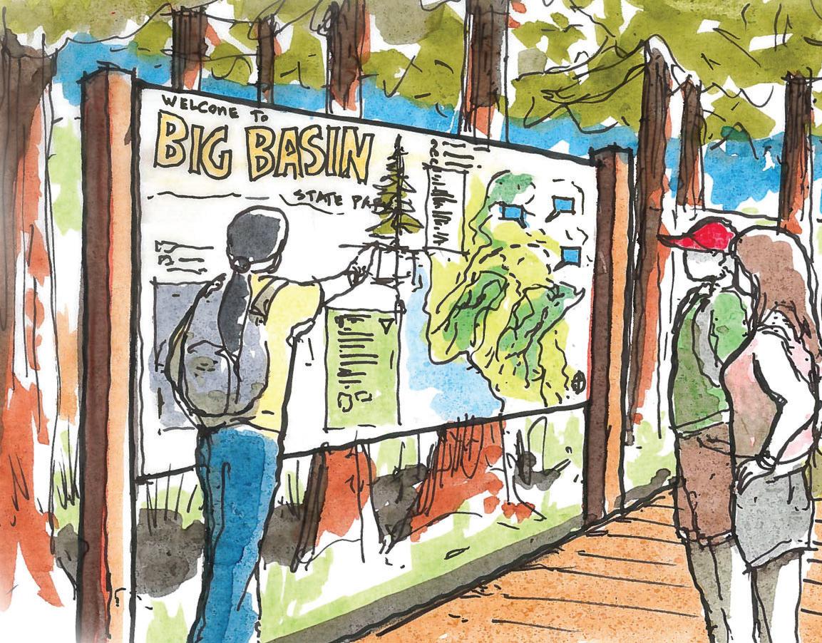
The design of future facilities at BBRSP will incorporate areas that enable permanent and temporary art exhibits and programs in areas such as rebuilt structures and outdoor facilities, the redwood loop trail and Main Day Use area, and the Saddle Mountain Area. These initiatives will aim to provide a space for diverse communities to feel welcome in the park and to share stories of connection to the forest. Event facilities, such as a restoration of the rustic amphitheater in the MDU and Campfire Center along Sky Meadow Road, will provide venues for performance arts in addition to interpretive programs and other events. These efforts fit into art-related initiatives, such as Arts in California Parks, which aims to integrate art installations and cultural programming within state and local parks. Such initiatives align with broader State initiatives, such as Outdoor Access for All and California State Park’s Reexamining Our Past initiative, which collectively aim to make natural spaces more accessible and enjoyable for all Californians.

Above: Visitors enjoy a piece from the 2024 “Big Basin Art About” exhibit, which invited artists to participate in a collaborative camping and artmaking program informed by Big Basin’s history, ecology, and the devastating impacts of the 2020 CZU fire. The works celebrate the park’s resilience, cultural heritage, and ecological restoration.
Technology
Big Basin’s vision for the future carefully balances the desire for a rustic, technology-free retreat with the thoughtful incorporation of technology to enhance visitor experiences and park operations. Technology will be used in ways that align with the park’s core mission and respect the natural, immersive environment visitors cherish. The following should be considered in evaluating the integration of technology in facilities management planning.
Wayfinding. Technology will play a critical role in ensuring visitors can navigate the park safely and efficiently. Digital tools and app-based navigation are becoming more popular, especially for younger park visitors. Since cell reception will not be available in many areas of the park, downloadable maps for use offline should be made available.
Emergency Response. Emergency response systems, such as strategically placed emergency call boxes and emergency broadcast systems, will enhance safety in areas where cell phone service is limited.
Visitor Use Management. To improve visitor access and reduce congestion, technology will be used to provide information through dynamic park signage and other means to visitors about available day-use parking reservations, current availability of dayuse parking spaces in different parts of the park, shuttle schedules, and other visitor information.
Interpretive Programs and Facilities. Interpretive facilities, including the Saddle Mountain Visitor Center and the Main DayUse Redwood Ecology Interpretive Center, will be equipped with digital infrastructure to support the development of technologyenhanced exhibits and programs. While specific decisions about interpretive programs will be addressed in a future Interpretation Master Plan, future exhibits may incorporate digital and virtual elements, such as Augmented Reality (AR) and Virtual Reality (VR). These technologies could provide visitors with immersive ways to learn about Big Basin’s unique ecosystems, cultural history, and conservation efforts. The appropriate use of screens, audio, and interactive displays will be carefully considered to ensure they enhance, rather than detract from, the visitor experience.
Connectivity and Access. Wi-Fi access will be available near key park facilities to support these systems, but coverage will remain limited to key visitor destinations and operations locations in ways that facilitate communication, reservations, park operations, and educational activities. However, cell phone coverage may not be available throughout the park, encouraging visitors to disconnect and fully engage with the natural surroundings.
Visitor Circulation & Shuttle Program
An overarching goal of the Big Basin Facilities Management Plan is to minimize vehicular traffic in the Old Growth Area and reduce the amount of space dedicated to roadway circulation and surface parking while supporting the same level of visitation to BBRSP before the CZU fire.
This section describes the site planning and circulation strategies to accomplish this goal, including:
• Visitor Use Management
• Parking
• Visitor Orientation
• Hiker, Cyclist, and Equestrian Circulation and Roadway Safety
• Shuttle Program
These strategies are summarized to the right in Figure 2.4.


Visitor Use Management
Maintaining visitor access to BBRSP will vary between peak and off-peak seasons, as well as between weekdays and weekends. The General Plan establishes an adaptive management framework for managing and monitoring visitor use, including desired outcomes, indicators, and monitoring outcomes in Table 4-1. These indicators will be updated in the future according to a Visitor Use Management Report for Big Basin completed by Oregon State University in 2024 and according to future needs at the park, and key indicators and thresholds will be monitored to ensure that visitor use is managed towards desired conditions and outcomes. During highdemand periods at the MDU, parking will be limited and Parks may use strategies to best manage available parking including day-use parking reservation systems, incentives for carpooling, time limits to MDU parking and other strategies described in this section.
To ensure equitable access while minimizing surface parking and vehicular circulation in sensitive ecological areas, the park will rely on internal and external shuttle programs, described in the following pages. During lower-demand periods, a sufficient number of parking stalls may be available at the MDU without requiring reservations. The following strategies will be deployed during highdemand periods:
Timed Parking Reservations. The park may use a timed parking reservation system that could include designated arrival times and/or limits on the length of parking to more efficiently use the available parking spaces for visitors. At Saddle Mountain, 150 parking stalls will be designated for visitors taking a shuttle to the MDU. To achieve an efficient turnover rate of approximately 1.5 vehicles per stall per day, the timed parking reservation system would accommodate an average parking dwell time of six hours, ensuring a steady flow of visitors throughout the day. At the MDU, 75 parking stalls will be available, and to maximize access, a similar timed parking reservation system may be implemented with an expected turnover rate of 2.5 vehicles per stall per day. This system would allow visitors an average parking dwell time of 2.5 hours, helping to distribute demand more evenly.
Dynamic Signage and Traffic Management. To prevent unnecessary congestion, digital or manually updated signage will be deployed when parking lots reach capacity. These signs will clearly indicate availability status and direct visitors to any other available parking or shuttle options or to other parks. Outside the park in locations such as along Highway 236 in Boulder Creek, at Highway 9 at Saratoga Gap, and other locations, visitors will see dynamic signage before driving all the way to the park.
Parking Regulations and Enforcement. To maintain adherence to parking regulations, enforcement will be necessary. Timed entry compliance will be monitored, and adjustments to timing windows will be made based on real-time field conditions. Roadside parking is strictly prohibited and will be actively enforced to maintain safety and protect ecological areas. A strong enforcement presence will help establish a culture of compliance among visitors.
Public Communication and Information. The success of any parking management strategy relies on public awareness and understanding. Roadway and parking signage will include clear and informative messaging, directing visitors to official sources for up-to-date park access information. Online and printed materials will provide concise details about peakperiod visitation, reservation requirements, and alternative transportation options to ensure visitors are well-prepared before arriving at the park.
Monitoring and Adaptive Management. Regular data collection and monitoring will be critical to optimizing visitor access. Key metrics such as average parking dwell times, vehicle occupancy rates, and the number of arrivals without reservations will be tracked to inform future decisions. Reservation policies and parking regulations will be adjusted based on real-time visitor trends to improve overall efficiency and enhance the visitor experience.
By implementing these strategies, Big Basin Redwoods State Park will ensure sustainable visitor access, reduce congestion, and protect sensitive ecological areas while continuing to provide a high-quality experience for all visitors.
Parking
To accommodate a large number of vehicles outside of the Old Growth Area, the following table summarizes the numbers of planned visitor parking stalls throughout the park.
Parking LocationParking TypeTotal Stalls (approx.)
EV Stalls (approx.)
ADA Stalls (approx.)
Saddle Mountain Shuttle parking150254
Main Day-Use Area
Gatehouse
Short-term parking2462
Medium-term parking75163
School and bus tour parking30n/a
Gazos picnic area parking3402
Equestrian trailer parking301
Sequoia Camp Group camp parking4004
Lower Sky Meadow Cabin parking7603
Camp store parking1002
Campfire center parking20202
Friend and family sites parking3506
Car camping sites parking14206
Wastahi Trail camper parking2544
Upper Sky Meadow Cabin + walk-in/bike-in parking5483
Huckleberry Walk-in/bike-in parking1662
Car camping sites parking10006
RV camping site parking1402
Rogers Road Group camp and cabins parking2742
Little Basin Tribal Cultural Stewardship Center 2442
Camp store parking622
Tribal use area parking 3042
Car camping parking6804
Friends and family site parking3006
Group camp parking4003
Total1,0469973
Visitor Orientation
Big Basin Redwoods State Park holds generations of memories for individuals and families who have visited the park over the years. It is both a destination of international appeal, welcoming many first-time visitors to California who seek to experience its renowned redwood forests, and a treasure for local communities and neighbors. For those local communities that may have not yet had the chance to immerse themselves in the redwoods, the park has a profound opportunity to deliver an evocative nature experience and serve as a gateway to the outdoors.
Wayfinding signage along park entry roads, at key park areas, at shuttle boarding areas, and along park trails and fire roads, is essential to orient time visitors and create a welcoming and inclusive park experience for future Californians. To ensure all visitors are effectively oriented to Big Basin’s evolving facilities and experiences, the following key locations will serve as visitor contact points:
Saddle Mountain Visitor Center. As the primary gateway to BBRSP, the Saddle Mountain Visitor Center will provide essential information about the park’s resources and facilities. Visitors can obtain guidance from staff at the center, the park store, and the parking kiosk. Roadway signage along Highway 236 will direct visitors to this location for information.
Main Day-Use Area. Once housing the former headquarters of the park, the Main Day-Use (MDU) Area is at the heart of the park’s historic core and the Old Growth Area. During low-demand periods, the MDU Parking Kiosk will often be the first point of contact for visitors. Staff will direct guests to the Redwood Ecology Interpretive Center for further information about the park.
Redwood Ecology Interpretive Center. Located at the trailhead of the Redwood Loop Trail, this small but essential facility will provide day-use visitors with key information about the park’s ecology, resources, and available experiences.
Sky Meadow Road Kiosk This roadway kiosk will serve as the primary gateway and checkin point for overnight visitors. Campers will verify their reservations here before being directed to the Sky Meadow Camp Store for additional orientation.
Sky Meadow Camp Store. Operated by a concessionaire, the Sky Meadow Camp Store will provide further orientation and resources for campers.
Little Basin Kiosk and Camp Store. The adjacent kiosk and store at Little Basin will offer visitors the necessary information to navigate this area of the park.
Scott’s Valley Transit Center. Some visitors will arrive via SCMetro or by shuttle from potential parking and shuttle boarding areas along the way such as in Boulder Creek. To support these transit users, bus stops along this route should include signage with essential information about visiting the park.
On-Board Shuttle Orientation. Visitors traveling to Big Basin by public transit may benefit from an on-board shuttle orientation, providing key details about park access, facilities, and available experiences.
Northern Welcome Vista. For visitors arriving from the north via Waterman Gap, a welcome area with signage and vista may be placed at or near the intersection of Highway 236 and China Grade to help orient and inform them upon arrival.

Hiker, Cyclist, and Equestrian Circulation and Roadway Safety
To support the goal of reducing vehicle trips within the park while increasing connectivity among key destinations via hiking and biking routes, the forthcoming Big Basin Redwoods State Park Road and Trails Management Plan (RTMP) will explore changes to trail use along key segments. Additionally, the RTMP will assess opportunities for new trail connections and change in use of key trail segment connections between the Saddle Mountain Gateway, the MDU, and Little Basin to encourage non-motorized transportation, including cyclist access on trails between primary park use areas, and to provide equestrian trail connections to the proposed equestrian parking area at the Gatehouse.
In addition to these forthcoming plans, this BBFMP recommends the following measures to improve pedestrian and cyclist safety while promoting non-vehicular travel in the park.
Highway 236. Ideally, all park locations will be linked by trails and shared-use paths, enabling visitors to walk or bike between key areas without relying on motorized travel along SR 236. Where off-street routes are not feasible, the use of paved shoulders and designated bike lanes should be considered, requiring additional roadway width on SR 236.
Paved shoulders on SR 236 can be enhanced with visual and tactile separation to create functional space for bicyclists and pedestrians. Visual separation methods may include colored or contrasting pavement and enhanced longitudinal markings such as wide solid white lines or buffer areas. Tactile separation may include edge line rumble strips designed to be tolerable for cyclists. A paved shoulder should be at least four feet wide, plus an additional buffer.
Bike Lanes. Bike lanes provide an exclusive space for cyclists and are designated by pavement markings and signage. They run parallel to motor vehicle travel lanes in the same direction as traffic. The minimum width for a bike lane, not including curb and gutter, is four feet, with a preferred minimum 1.5-foot striped buffer to enhance safety.
Traffic Calming. To slow vehicle speeds and enhance safety for all visitors, traffic calming strategies may be implemented on parkowned roadways and on SR 236, particularly as drivers approach the park from both directions, as well as at driveways and crossings within the park.
Potential measures include speed feedback signs, SLOW or speed limit pavement markings, and speed reduction markings such as longitudinal stripes, which use a series of white rectangular markings to
create the illusion of increased speed and a narrower lane. Rumble strips, speed humps, and speed tables may be applicable within the park, though their use on SR 236 may be limited. Additional strategies include chokers or curb extensions at crosswalks, median islands at pedestrian crossings, mini roundabouts at intersections, and lateral shifts that realign otherwise straight travel paths to encourage slower driving.
Monitoring. Periodic sight distance checks should be conducted to ensure vegetation, parked vehicles, or other objects do not obstruct visibility at driveway exits. Additionally, new speed surveys on SR 236 could help justify reductions in speed limits where necessary to improve safety.
Shared Routes. For low-volume, lowspeed internal park roads that provide access to campgrounds, staff residential areas, or other developed sections of the park without serving as through-routes for motor vehicles, the park could consider implementing yield roadways or bicycle boulevards. Yield roadways allow for shared use among pedestrians, cyclists, and motor vehicles within the same slow-speed travel area, supporting bidirectional vehicle movement without lane markings. Bicycle boulevards prioritize cyclists on low-speed, low-volume roads shared with motor vehicle traffic, creating safer and more accessible routes for non-motorized travel.
Bike Share. A bike share program in the park could provide access to visitors to cycle in between primary park areas and in places where bicycles are allowed. Such a program could improve the appeal of the shuttle and bus programs, allowing for visitors to access more of the park without a personal vehicle than they otherwise would.

Shuttle Program
To support visitor access to the MDU during periods of high demand, a shuttle program is planned to reduce vehicle congestion and improve access. The shuttle program includes three shuttle services that are designed to connect key access points, including park-and-ride locations, parking areas, campgrounds, and transit hubs.
The Saddle Mountain Shuttle serves as the primary internal connection between the Saddle Mountain parking area and the MDU Area, helping to manage peak visitor volumes.
The Camper Shuttle provides transportation for overnight visitors staying at campgrounds, ensuring they have reliable access to park amenities while minimizing vehicle trips.
The Scott’s Valley Bus, operated in coordination with SCMetro, offers an external connection for visitors arriving via public transit.
Enhanced Bus Service on Peak Weekends
State Parks is exploring the possibility of enhanced bus service on peak weekends. This will include additional buses serving Big Basin from the Scotts Valley Transit Center and locations between there and the park when visitation levels exceed available parking at the park. Visitors could park at the Scotts Valley Transit Center, or ride transit and transfer to the Big Basin bus. Riders could also board in Boulder Creek or potentially other locations along the route.
If a site becomes available in downtown Boulder Creek, State Parks will seek to partner in developing a small visitor parking and information center in Boulder Creek with a connection to the Metro Big Basin bus to the park.
Shuttle Program
Each shuttle service has been designed with specific ridership needs, operating schedules, and fleet requirements in mind. The following table summarizes the key characteristics of each route, including operating times, shuttle stops, projected ridership, fleet size, headways, and associated costs. It is important to note that the table projects operational levels needed to meet similar pre-fire visitation levels. Shuttle program usage will be monitored and adjusted according to ridership, demand, and future funding.
Operating Times
Shuttle Stops
10 hours per day (8 AM–6 PM) on weekend/holiday days year-round.
Ridership
Saddle Mountain parking, Gatehouse, Sky Meadow Road, Main Day-Use Area.
~56,000 annually, peaking at 608 riders on summer weekends.
10 hours per day on 134 days per year, including weekends/holidays April–October and summer weekdays.
Operates during peak periods, aligned with SCMetro schedules (5 trips per day on weekends year round, 12 trips per day on summer weekends and holidays).
Lower Sky Meadow, Huckleberry, Sky Meadow Road, Main Day-Use Area. Scott’s Valley Transit Center, Boulder Creek, Saddle Mountain Visitor Center, Main Day-Use Area.
~41,000 annually, peaking at 306 riders on summer weekends.
Headways
Fleet Size & Type
14–28 minutes, depending on demand.
16–31 minutes, depending on demand.
Expected to support ~430 additional visitors per day on peak weekends.
Based on SCMetro schedule (5 trips per day). Summer weekends anticipated to be under 1 hour ) depending on final number of busses).
Two 32-passenger vehicles, plus one spare (electric preferred).
Two 14-passenger vehicles, plus one spare (electric preferred).
To be determined and operated by SCMetro.
Saddle Mountain Shuttle Camper Shuttle Scott’s Valley Bus
Overnight Facilities
The wide range of overnight facilities that will be provided at BBRSP is directly responsive to public and stakeholder input about the diversity of needs and preferences for all visitors to feel welcome and comfortable during an overnight stay the park. This section outlines the camping facility types that are provided:
• Car Camping
• Walk-in/Bike-in Camping
• Group Camping (larger sites for 20-50 people)
• Friends and Family Camping (Small group sites for 12-20 people)
• RV Camping
• Hard-sided Cabins
• Tent Cabins
• Trail Camps
Campground design will follow applicable standards from the National Park Service Campground Design Guidelines as well as the California State Parks Accessibility Guidelines.
Additionally, this section provides context and facility implications for following the California State Parks Crumb Clean Campaign.


Camping Facility Types
Car Camping
Car camping offers a convenient and accessible way to experience the outdoors, allowing visitors to drive directly to their campsite. These sites are designed to accommodate a range of vehicles, from compact cars to camper vans, providing level parking pads adjacent to tent areas. Each site typically includes a fire ring, picnic table, and a designated tent pad, offering a balance between comfort and a traditional camping experience. Located within well-planned loops, car camping sites offer easy access to restrooms, potable water, and park amenities while maintaining a natural setting through careful site spacing.
Walk-in/Bike-in Camping
For those seeking a more secluded and immersive experience, walk-in and bikein campsites provide a peaceful retreat away from vehicle traffic. Located a short distance from designated parking or biking areas, these sites require campers to transport their gear by foot or bike. They are ideal for cyclists touring the park or visitors looking for a quieter, more natural camping setting. These sites feature small, well-defined tent pads, access to food storage lockers, and nearby bike racks or repair stations. Designed with minimal environmental impact, walk-in/bike-in campsites encourage low-impact recreation while maintaining access to basic amenities like restrooms and potable water.
Group Camping (20-50+ people)
Designed for large gatherings, group camping areas accommodate organized groups, educational programs, and family reunions. These sites feature multiple tent pads, communal picnic areas, and a shared fire ring, allowing for group bonding and collective outdoor experiences. Located away from standard campsites to reduce noise conflicts, these areas provide ample space for group activities and shared meals. Restroom and in some cases shower facilities (not at Sequoia), including vault or comfort stations, are positioned within reasonable walking distance.
Friends and Family Camping (12-20 people)
These small-group campsites offer a more intimate alternative to full-scale group camping, catering to extended families or small friend groups. They provide multiple tent sites within a shared space, complete with a communal picnic area for socializing. Positioned away from main campground loops, these sites offer privacy and a quieter atmosphere, making them an ideal choice for families or groups looking to enjoy nature together while maintaining a sense of community.
RV Camping
For visitors traveling with recreational vehicles (RVs), RV campsites provide the necessary infrastructure for a comfortable stay in nature. These sites accommodate RVs up to 27 feet or trailers up to 24 feet in length, but may not provide water, electrical, and wastewater hookups. Designed to balance convenience with outdoor recreation, these sites are located within paved loops at Huckleberry Campground. Nearby amenities include restroom and shower facilities, as well as designated dump stations for waste disposal.
Hard-Sided Cabins
For those who prefer a more structured overnight experience, hard-sided cabins provide a balance between rustic camping and modern comfort. These small, enclosed structures offer sleeping bunks, a table, and basic furnishings. Each cabin has dedicated parking space and an accessible path leading to communal facilities such as restrooms and camp kitchens.
Tent Cabins
Tent cabins offer a hybrid camping experience, combining the open-air feel of tent camping with the structural benefits of a cabin. These canvas structures, built on elevated platforms, provide shelter from the elements and includes a raised sleeping area, screened windows, and secure food storage. Tent cabins provide an excellent option for visitors who want a ‘camping lite’ or ‘glamping’ experience without the hassle of setting up a tent.
Trail Camps
For those seeking a backcountry adventure, trail camps offer a primitive, off-the-grid experience. While there are several trail camps throughout BBRSP, there is only one within the BBFMP planning area, located on North Escape Road. These more remote sites are accessible only by hiking, horseback, or bicycle, encouraging visitors to engage in self-sufficient camping. Each site features a designated tent area, nearby vault toilet, and food storage lockers to promote responsible backcountry use. Trail camps emphasize low-impact recreation, with minimal permanent infrastructure to maintain the park’s wilderness character.
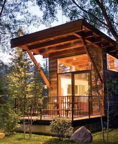
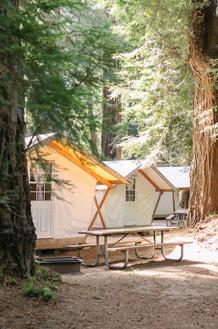
A range of cabin types will be considered.

Crumb Clean Campaign
KEEPING WILDLIFE WILD
The Crumb Clean Campaign is a California State Parks initiative that focuses on preventing wild animals from accessing human food, helping to keep wildlife wild. The campaign’s namesake is a nod to how even crumbs matter in the context of wildlife protection.
While there are many reasons to limit the access of wildlife to human food, a primary reason is to protect the marbled murrelet, a federally threatened seabird that nests in the trees of old growth forests, including the coast redwoods of BBRSP. An icon of the conservation movement, the marbled murrelet has faced significant population decline due to predation by Steller’s jays and other corvids, including crows and ravens, who prey on marbled murrelet eggs and chicks.
Corvid populations are aided in part by easy access to human food, which was increasingly the case in campgrounds at Big Basin and beyond. In such areas, corvid populations have been known to reach very high densities, creating significant pressure on marbled murrelet populations.
In response to these developments, California State Parks initiated the Crumb Clean Campaign. In the years since its inception, the campaign has yielded significant progress in reducing Steller’s jay and other corvid densities in areas where marbled murrelets nest. The campaign is built on the “Three E’s”: Engineering, Education, and Enforcement, which work together to provide the infrastructure, awareness, and compliance needed to keep wildlife wild.
IMPLICATIONS FOR FACILITY PLANNING
Despite the success of the campaign thus far, continued implementation and enforcement is required to ensure the ongoing success of the campaign. As BBRSP rebuilds its visitor and overnight facilities, adhering to the principles and guidelines of the Crumb Clean Campaign is paramount. The facility guidelines below will help to ensure that new facilities protect wildlife without compromising on visitor experience.
Dishwash Stations
Dishwash stations, attached to restrooms and connected to sewer where possible, should be located at all campgrounds and in some picnic areas as needed to limit potential food sources, to make it easy for visitors to clean dishes of food. Include instructional “How to Wash Dishes” signage at each station.
Secure Food Lockers at All Campgrounds
Wildlife-proof food lockers should be installed at all campgrounds and in some picnic areas as needed to limit potential food sources. Visitors should be instructed to keep all food items in the food locker when not actively in use. Install educational signage on each locker reminding visitors of Crumb Clean practices.
Secure Wildlife-Proof Dumpsters and Recycling
Wildlife-proof dumpsters and recycling should be located at all campgrounds and in some picnic areas as needed to limit potential food sources.
Grated Water Spigots
Install grates at all water spigots to prevent food scraps from reaching wildlife.
Visitor Orientation
All campers will watch a crumb clean video and sign a commitment to crumb clean camping. Park staff will enforce policies throughout their stay.
Informative Signage
Educational signage about crumb clean camping and picnicking will be prominently installed at all overnight and day-use areas, as well as all park literature and maps. This includes signage at picnic tables, campground entrances, and dishwashing areas.

PARKWIDE APPROACH TO
Aesthetics, Design Character, and Sustainability
Designed with reverence and resilience in mind, visitorserving facilities at Big Basin Redwoods State Park will reflect a commitment to beauty, durability, and environmental responsibility. Reimagined buildings will celebrate the park’s natural and cultural legacy while embracing sustainable and climate-resilient design strategies. This section outlines the vision for creating a unified aesthetic that is welcoming, timeless, and deeply rooted in place.
This section includes descriptions of the following topics:
Aesthetics and Architectural Character
Materiality and Site-Responsive Design
Sustainable Design
Climate Resilient Design Practices
Aesthetics and Architectural Character
There is a wide range of visitor-serving facilities that will be rebuilt as a part of this plan, yet each must uphold a unified architectural vision that is both evocative and resilient. The primary visitor contact buildings at Saddle Mountain and at the MDU should be a welcoming and inspiring touchpoint one that respects the storied history of Big Basin while embracing innovative design. Each facility is an opportunity to express a “Sense of Place” that reflects the natural characteristics and historical narrative of the Park.
To achieve this, architectural style must be deliberate and refined. Buildings should be designed with a clear commitment to sustainable and resilient practices, while also evoking a deep emotional connection between visitors and the natural landscape. The design language should articulate simplicity and elegance, favoring clean lines, low-profile forms, and materials that harmonize with the surrounding environment.
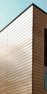
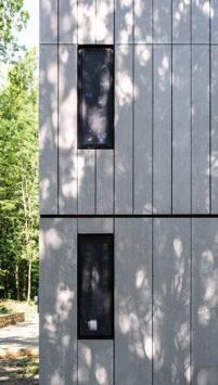
Building materials and form must be carefully considered to balance historical reverence with contemporary functionality. For instance, the use of locally sourced natural materials—such as weathered wood, native stone, and metal accents— can create a tactile connection to Big Basin’s past while ensuring that structures meet modern performance standards for fire resistance, durability, and energy efficiency.
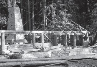
strong stone elements anchor a light structure
big public porch welcoming visitors
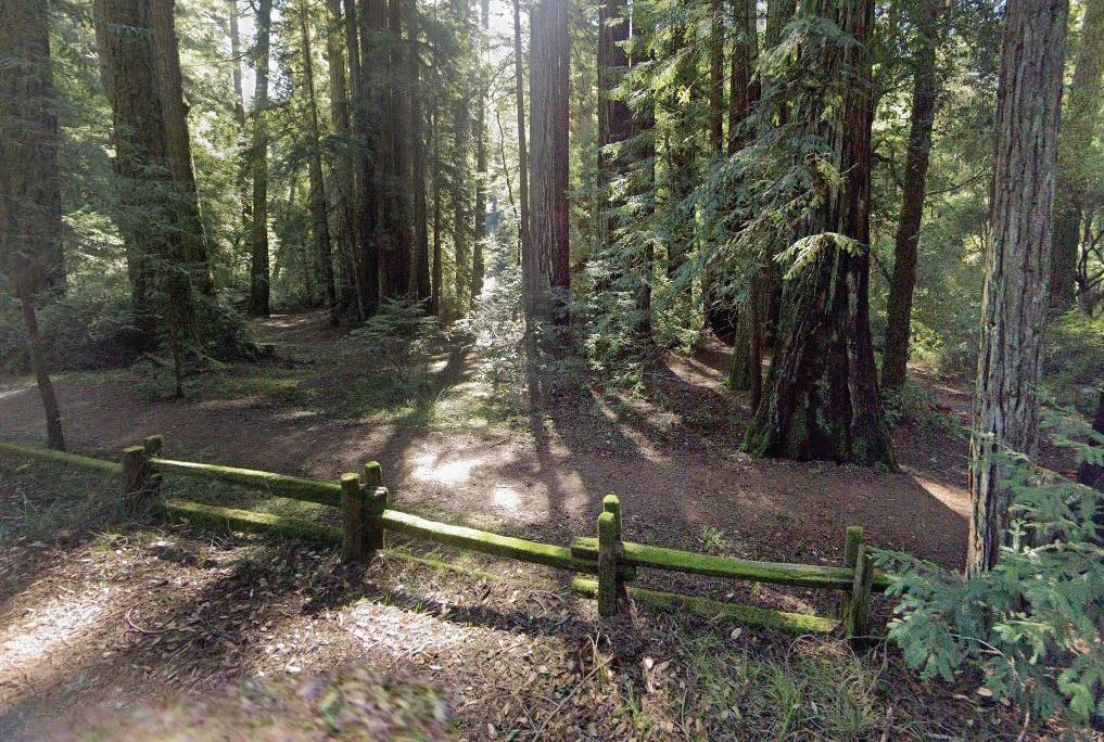
familiar and historical split wood railing fences
stone masonry plinths that create gathering spaces
truss and heavy timber frame structure
medium-pitch textured roofs

buildings that carve out spacious openings from the surrounding landscape
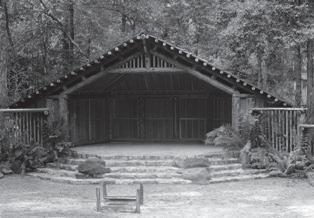

Reverence for the Past
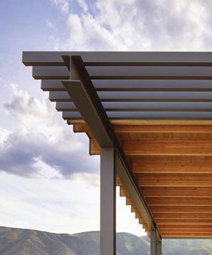
Modern reference to the historic vernacular of Big Basin will be an important hallmark in the rebuilding of the Park. The CCC era of construction can never be replicated, and so new building materials and form should be carefully considered as contemporary interpretations that emulate texture, pattern, materials, and form. A design ethos of modern bioregionalism, rather than historicism, can lead to new facilities which feel both ‘of this place’ and timeless.
Details such as exposed timber framing, stone plinths, and custom metalwork can further reinforce an architectural character that is both contextually sensitive and forward-thinking.
New structures will not simply replicate past forms and materiality but rather reinterpret historical elements through a modern lens to ensure that every visitor-serving facility supports functional and programmatic needs while also honoring the Park’s natural landscapes that hold cherished memories for generations of Big Basin visitors.
Additional considerations for rebuilding in respect and reverence to history, ecology, and landscape and described in the Basis of Design.

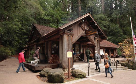
expressed timber and log structure
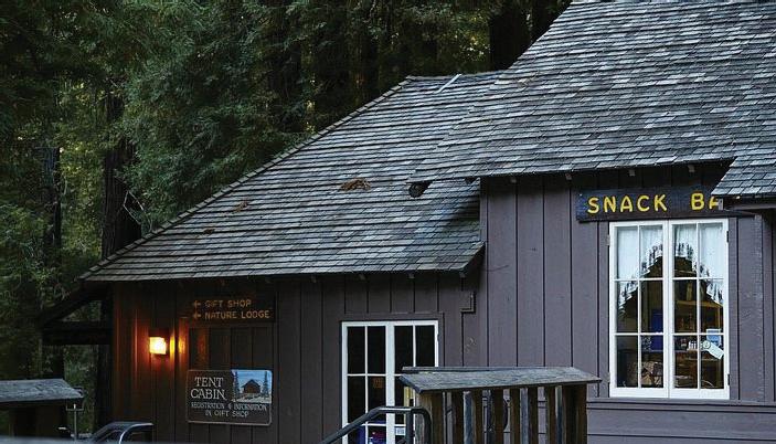


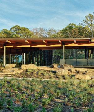

pitched wood shingle roofs
textured wood siding
stone foundations and steps
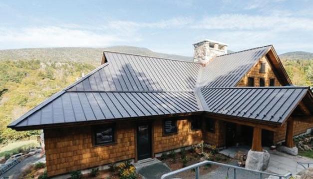
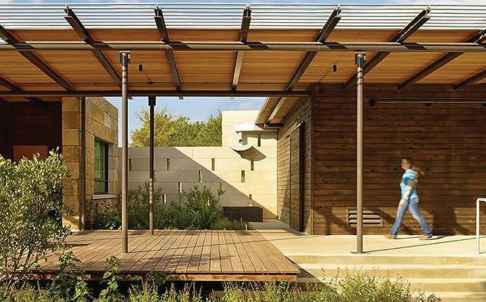
expressed steel and mass timber
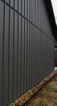
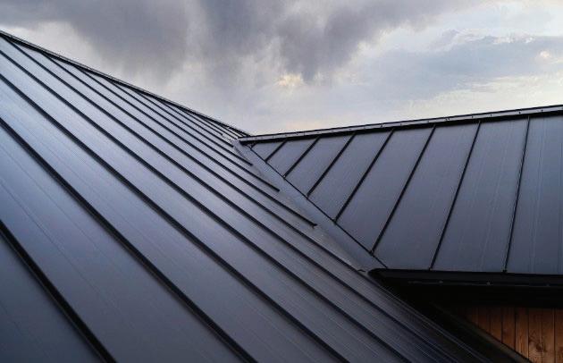
pitched metal roofs
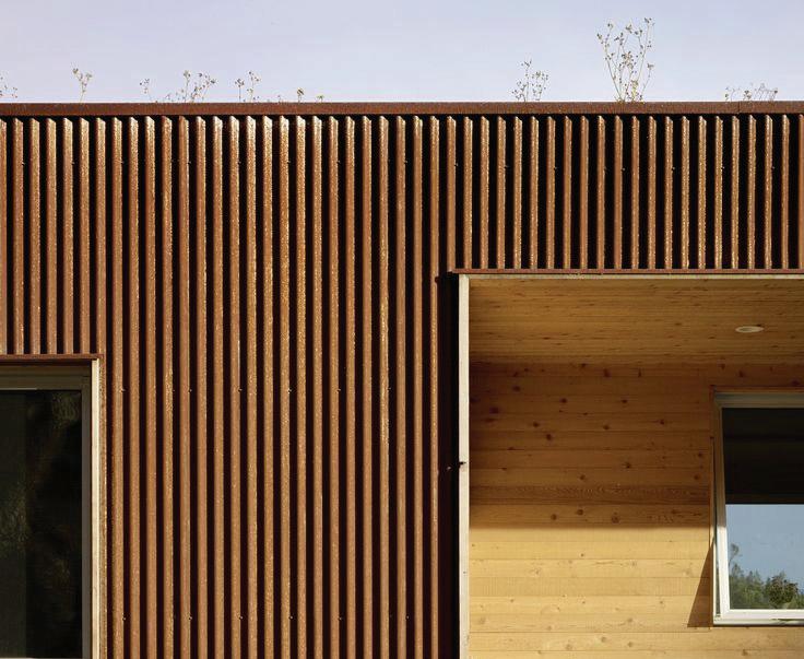
textured fiber cement siding
stone plinths, steps and elements

Materiality and Site Responsive Design
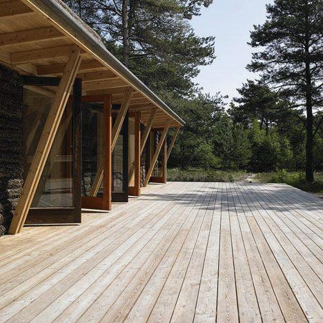
Park facilities will incorporate design elements, materials, and craft that results in a unifying parkwide look and feel. While each site and facilities type will be uniquely designed and purpose-built to best respond to site conditions and programmatic needs, aesthetic principles shall guide the design.
All developed park amenities shall be aesthetically designed to create experiences that reference the historic character of Big Basin with reverence to the park’s natural landscape and history.
Design decisions for materials shall consider wildfire resistance, durability, and environmental sustainability. Materials should have a low embodied energy and be chosen for their ability to age gracefully, developing patinas that resonate with the landscape’s natural evolution. In parallel, building forms should be responsive to site-specific conditions to minimize visual disruption and help structures integrate seamlessly into their settings. Design of new facilities should feel ‘of this place’ by harmonizing natural color palettes with landscapes and imbuing biophilia with texture and pattern.
Design of park facilities should embody the same vigor and spirit of the mission while evoking forward-thinking theories, producing meaningful places and spaces worthy of preservation by future generations.




Sustainable Design
All rebuilt facilities at BBRSP will adhere to the standards put forward in the California State Parks Guidelines. Sustainable design principles are a critical pre-requisite to providing high-performing, comfortable, durable, safe, and meaningful visitor experiences. Developed park facilities are planned to minimize carbon emissions associated with park visitation and operation and maintenance, are designed with sustainable materials, and incorporate renewable energy production when feasible.
This commitment demands going beyond complying with CalGreen code standards and into the exploration of regenerative and zero carbon design and construction. The outcome of these principles will create facilities that have healthy indoor air quality, are acoustically and thermally comfortable, are easy and cost effective to operate, and are built to last. ‘Green building’ features also introduce opportunities for education and interpretation. Such features should be highlighted in interpretive signage and programming, emphasizing the importance of building materials, technology, and sustainable design in environmental stewardship and conservation.
Reduce Operational Carbon of Facilities:
To reduce GHG emissions associated with building design, a focus on energy efficiency, renewable energy integration, sustainable materials, and minimizing embodied carbon across the building’s lifecycle, from design to demolition, is imperative. Simple, proven methods of passive design have the greatest impact on long-term reduction of operational carbon and the energy needed to operate a building. Structure-level approaches include
thoughtful solar orientation, enhanced building envelope, airtightness, continuous insulation,high performance windows with shading, and natural daylighting. Sitelevel approaches include heat-island effect mitigation and orientation to optimize natural breezes. In addition to ‘passive’ architectural systems, design of facilities shall incorporate energy-efficient building measures in HVAC, mechanical, electrical and plumbing systems. Heat recovery ventilation and on-site renewable energy should also be incorporated.
Low Embodied Carbon Materials: In addition to reducing operational carbon, a focus on low-carbon materials is needed. Selecting appropriate structure, envelope, wall assemblies and finish materials offers the greatest area of embodied carbon reduction. Avoiding the use of redlist chemicals of concern and petrochemical based products that pose dangers to visitors and the surrounding environment in favor of biobased, rapidly renewable and recycled and reclaimed materials is imperative. Careful planning strategies, such as developing full building Life Cycle Analysis (LCA) models during design, can help mitigate carbon emissions and reduce material waste across multiple categories (e.g., transportation, construction, maintenance, etc.) and life cycle stages.
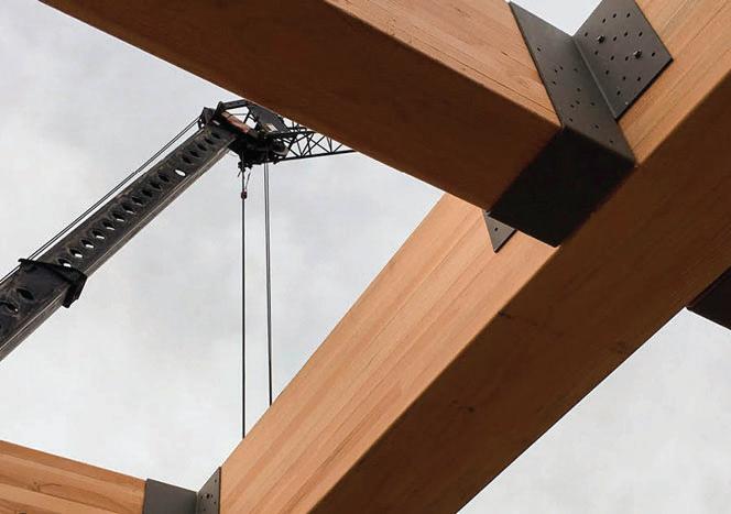
Prefabrication: The design process shall explore and evaluate the merit of prefabricated construction systems and delivery methods for a range of facilities at Big Basin. These can include mass timber, flat-pack framing, prefab plumbing pods and volumetric modular systems.




Climate Resilient Design Practices
Big Basin’s vision for the future carefully balances the desire for a rustic retreat with the need for future-thinking climate resilience strategies. To ensure facilities can function amidst shocks and stressors, it is important to incorporate climate-resilient construction technology. Climate-resilient building design integrates strategies to withstand and adapt to climate-related impacts, ensuring long-term safety, functionality, and sustainability.
Excellent Building Envelope. Developing excellent building envelopes will ensure high performance of facilities in a wide range of settings. This is achieved through high-performance insulation, airtight construction, durable and moisture-resistant materials, reflective or green roofing, and operable shading systems to optimize energy efficiency, manage heat and moisture.
Future Proofing Building Systems. Futureproofing building systems requires designing adaptable, energy-efficient mechanical, electrical, and plumbing systems that can handle extreme weather, reduce carbon emissions, integrate renewable energy, and maintain functionality during grid disruptions or climate-related events.
Wildfire Resistant Building Materials and Detailing. Wildfire-resistant building materials and detailing are critical factors in whether a structure can withstand a fire. Non-combustible roofing, ignition-resistant siding (like fiber cement or metal), tempered glass windows, ember-resistant vents, and sealed eaves and joints, help prevent ember intrusion and can better withstand direct flame or radiant heat exposure.
Wildfire Smoke Filtering HVAC. A wildfirefiltering HVAC system uses high-efficiency filters (like MERV 13 or higher), airtight ductwork, and controlled ventilation to remove smoke, particulate matter, and harmful pollutants from indoor air during wildfire events, maintaining healthy indoor air quality.
Renewable Energy Microgrids. Climateresilient microgrids can ensure that critical facilities are able to operate independently from the main grid during outages. These localized energy systems integrate renewable energy sources, battery storage, and smart controls to ensure reliable, lowcarbon power in the face of climate-related disruptions.
Water Capture and Reuse Systems. Water capture and reuse systems collect rainwater or greywater, treat it as needed, and redistribute it for non-potable uses like irrigation, toilet flushing, or cooling, reducing demand on municipal supplies and enhancing resilience during droughts or water shortages.
Intentional Site Design To Mitigate Risk. Site design that mitigates wildfire risk should be the default approach in the park. Such designs feature defensible space zones, fireresistant landscaping, strategic placement of structures, non-combustible materials, and adequate access for emergency services to reduce fuel loads and slow the spread of fire near buildings.
Community and Family Serving Resilience Hub Centers. Resilience hubs are trusted, community-based facilities equipped to provide support before, during, and after emergencies by providing resources like power, clean air, water, shelter, and information to visitors and first responders.

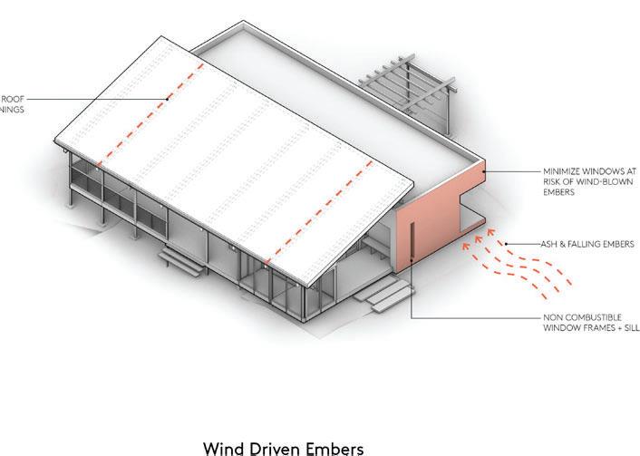
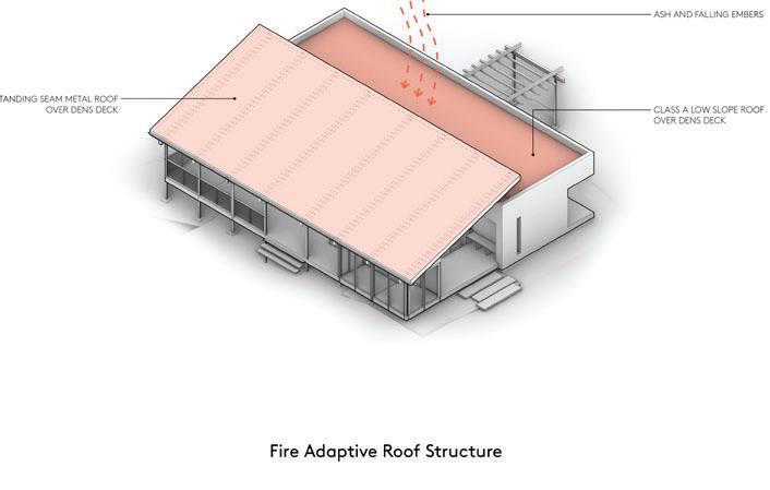
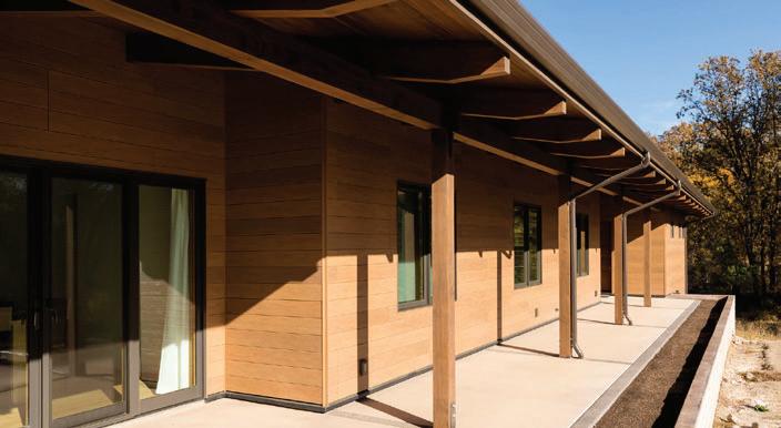
Operations, Safety, and Staff Housing
The redevelopment of Operations & Maintenance (O&M) facilities and staff housing at BBRSP reflects a commitment to efficiency, resilience, and community-oriented infrastructure. The new facilities will enhance park operations, improve emergency response capabilities, and create a sustainable living environment for staff and their families.
This section includes description of the following items:
Operations & Maintenance Facilities
Life Safety and Evacuation Considerations
Staff Residential Experience


Operations and Maintenance Facilities
Historically, the O&M facilities at Big Basin were built incrementally over decades, resulting in inefficiencies in maintenance, storage, and emergency response. The 2020 CZU Lightning Complex Fire destroyed these structures, creating an opportunity to rebuild with a strategic, long-term vision for park management. The BBFMP will centralize operations at Saddle Mountain, where primary storage and workshop buildings will be co-located with yard space, secure vehicle parking, and administrative offices within the visitor center. This consolidation will improve the efficiency of daily park operations by reducing travel time between dispersed facilities and ensuring staff have access to the necessary tools and resources in one location.
A secondary operational site at Lower Sky Meadow will include a small staff building with a break room, providing essential support for field operations. Additional maintenance storage closets may be integrated with other campground or visitor facilities.
Concessionaire
State Parks will work with a concessionaire to operate appropriate facilities such as the park stores, visitor cabins, and Little Basin and to provide quality outdoor recreational experiences for park visitors. Concessionaires will have different responsibilities depending on the facility type and need. In the past, concessionaires have performed maintenance, staffed stores, and supported in facility reservations and security.
Staff Residential Experience
The redevelopment of staff housing at Norabella and Little Basin will provide diverse living accommodations tailored to both long-term and seasonal employees. The BBFMP includes eight single-family homes and sixteen multi-family units at Norabella, ensuring a mix of independent and shared living spaces. Little Basin will feature three duplexes, offering flexible housing options. Designed with community, sustainability, and staff well-being in mind, these residences will provide high-quality, functional environments that support park employees.
Shared amenities such as play structures, barbecue areas, and communal gathering spaces will foster a sense of connection among staff. Housing options will reflect the diverse needs of employees—families will have larger homes near other families, promoting a supportive community, while seasonal and short-term staff will be accommodated in smaller, communityoriented units that emphasize social engagement.
No matter the typology, all staff residences will be designed and built with fire safety in mind. This includes constructing with fire resistant materials, incorporating defensible space, and developing effective maintenance strategies and practices.
Looking ahead, additional housing opportunities may be explored near Saddle Mountain, including potential sites such as Mortensen, Heyl, and Rose. Future projects will be evaluated based on staffing needs and environmental sustainability, ensuring that the park’s housing strategy remains adaptable and forward-thinking.
Life Safety and Evacuation
Given the park’s remote location and history of wildfires, infrastructure at Big Basin must be designed to withstand and function during multiple emergency scenarios, including wildfires (both structural and wildland), earthquakes, major transportation accidents, and severe weather events. To enhance emergency preparedness and response, park roadways will be improved to ensure reliable ingress and egress. These improvements will strengthen connectivity to main evacuation routes, ensuring staff and visitors can exit safely in an emergency.
In addition to road enhancements, an early warning system will be installed throughout the park, providing real-time alerts to staff and visitors. Directional emergency evacuation signage will be integrated into park wayfinding systems, offering clear guidance during emergency situations. These efforts will be complemented by fireresistant infrastructure, including backup power generators, fire hydrants with proper water pressure, and hazardous waste disposal stations.
The park’s life safety approach will be guided by best practices outlined in the Big Basin Emergency Response and Evacuation Plan (2024) and the Basis of Design (2024), ensuring that all critical infrastructure is built with long-term resilience and performance in mind.
Key Roadway improvement projects included in Big Basin Emergency Response and Evacuation Plan include:
Pine Mountain Fire Road and Tanbark Loop. Maintain as one-way evacuation route with 12-foot width and reroute or pave sections with grade over 20 percent. Improving other one-way evacuation routes to Little Basin such as Little Basin Truck Trail may be considered as an alternative to improving and maintaining Pine Mountain and Tanbark Loops.
Little Basin Road. Collaborate with Santa Cruz County Public Works to expand roadway width and incorporate pullouts where feasible.
Lodge Road. Collaborate with Santa Cruz County Public Works to repair slips and stabilize slopes where feasible. Maintain 12-foot width from Upper Sky Meadow to Park boundary for emergency access and evacuation route.
Sky Meadow Road. Expand roadway width to 20 feet where feasible or provide turnouts where feasible for two-way vehicular traffic to Upper Sky Meadow.
Internal Campground Roadways. New and existing internal campground roadways at Sky Meadow, Huckleberry, and Little Basin will be built or improved to meet evacuation standards wherever feasible.
PARKWIDE APPROACH TO
Utilties
Nearly all utility systems were destroyed in the CZU Fire. This section describes how each of the following utility systems will be rebuilt:
Water
Wastewater
Electrical
Telecommunications
(P) DOMESTIC WATER DISTRIBUTION SYSTEM
(P) FIRE WATER LINE
(P) SANITARY SEWER LINE
(P) SANITARY SEWER FORCE MAIN LINE
(E) WELL
(P) WATER STORAGE TANK
RESERVOIR
(E) WATER TREATMENT PLANT (WTP)
(P) WATER MAIN FLOW DIRECTION
(P) SEWER MAIN/SSFM FLOW DIRECTION
(E) LIFT STATION
(P) LIFT STATION
(P) PUMP STATION
CONNECTION TO (P) DOMESTIC WATER DISTRIBUTION SYSTEM
CONNECTION TO (P) SANITARY SEWER SYSTEM
(P) COMBINATION OF GRAVITY FLOW SEWER TO ON-SITE WASTEWATER TREATMENT SYSTEM (OWTS)
(P) OTWS
(P) VAULT RESTROOMS
(P) EV CHARGERS
(P) SOLAR
(P) WWTP TO BE CONSTRUCTED


E RESTORED OR OCATION MAY BE WATER STORAGE
ROGERS ROAD
ROGERSROAD


UPPER SKY MEADOW


BLOOMS CREEK + JAYS CAMPGROUNDS


UPPER LODGE ROAD


SKYMEADOW TERRACE/ LOWER SKY MEADOW
SEMPERVIRENS


LODGE ROAD
(E) WELL, REQUIRES WATER QUALITY TREATMENT
GATEHOUSE


Water
The park’s water treatment plant will be reconstructed and water storage and distribution network rebuilt to serve all areas in the park that had water service before the fire. The water distribution will be extended to Saddle Mountain and Norabella properties and to Upper Lodge Road. Water storage and flow rates will be designed in coordination with State Fire Marshal to ensure adequate fire protection. Rainwater capture, storage and use as non-potable water for toilet flushing and irrigation may be considered at key sites such as Saddle Mountain during site design. The wells at Mortensen and Potter may be used to provide for fire water storage at these locations to serve Upper Lodge Road and Saddle Mountain, respectively.
Wastewater
The park’s wastewater treatment plant on Hihn Hammond Road will be redesigned and rebuilt. The sanitary sewer network throughout the park will be repaired, replaced where needed, and added to, in order to provide wastewater connections to Main Day Use, the overnight areas, and Rogers Road. Some sites will have vault toilets, including North Escape, Sequoia Group Camp, Gatehouse, and Upper Lodge Road. Onsite wastewater treatment systems will be repaired or reinstalled at Little Basin, Saddle Mountain and Norabella, and Upper Sky Meadow. Greywater systems will be considered during site design in key locations such as Saddle Mountain.
Electrical
All sites with power in the park will connect to PG&E’s underground power network installed after the fire. Power will serve all sites in the Facilities Plan except North Escape, Sequoia Group Camp and Upper Lodge Road. Solar will be considered and installed where appropriate on rooftops and over parking areas throughout the park. Electric vehicle charging stations will be installed throughout the park.
Telecommunications
A central telecommunications hub will be installed at Saddle Mountain and underground telecommunications lines will be installed from Saddle Mountain throughout the park to provide future opportunities for connectivity to all park buildings and utility systems.
Chapter 3 Site Plans
This chapter includes site plans, facility tables, and narrative descriptions for each of the sites with planned facilities within the planning area. The site plans presented are conceptual and are intended to spatially illustrate the level of facilities planned at each location. Individual facilities may be sited differently within each site and other layout changes may occur as site plans are further refined in the design process. The sites are divided into five zones with one or several sites in each zone (with the exception of Little Basin):
Saddle Mountain Area
•Saddle Mountain
•Norabella
•Gatehouse
•Upper Blooms
Old Growth Area
•Main Day-Use Area (MDU Area)
•Redwood Loop Trail
•Sequioa Group Camp
•North Escape Road
•Jay Camp
•Blooms Creek Campground
•Sempervirens Campground
Overnight Area
•Lower Sky Meadow Campground
•Sky Meadow Terrace
•Huckleberry Campground
•Wastashi Campground
Upper Sky Meadow Area
•Upper Sky Meadow
•Rogers Road
•Upper Lodge Road
•Mortensen
Little Basin
Little Basin
Saddle Mountain Overnight Area Upper Sky Meadow Area
Old Growth Area
Saddle Mountain Area
The Saddle Mountain Welcome Area, collectively made of the Saddle Mountain, Norabella, and Gatehouse sites, will be a center of activity at Big Basin Redwoods State Park (BBRSP). Aspirations for the site include the primary visitor center, the primary concessionaire facility, and the primary operations and administrative hub. Furthermore, Saddle Mountain will serve as a key connective site, with frequent shuttle service bringing visitors to and from the area. A great deal of planning, facility construction, and access improvements will be needed to ensure that the Saddle Mountain Welcome Area can realize this vision. These considerations are explored in the following pages.


Saddle Mountain
DESCRIPTION OF FACILITIES
Saddle Mountain and the adjacent Norabella sites carry significant design importance. Saddle Mountain carries the highest concentration of program areas, including the primary visitor center, the primary concessionaire facility, and the primary operations and administrative hub. Saddle Mountain will also handle the highest density of people at any given time. Many of these occupants will be transient: visitors passing through and boarding the shuttle, State Park staff checking in during a day of work at the park, or stewardship groups gathering prior to their stay. Saddle Mountain will also have the largest amount of new construction area across multiple buildings and numerous programmed site areas.
As such, Saddle Mountain must be highperforming across multiple categories. The site must be able to handle high amounts of vehicular and pedestrian traffic for both visitors and staff alike. Separating pedestrian and vehicular circulation will ensure a safe and operational Saddle Mountain. The site will also have multiple sides; it will be visitor-facing as well as operationsfacing, and these two program needs must be carefully and thoughtfully separated, most of the time, but in a few instances, thoughtfully integrated. Resource and utility goals are also complex: a high amount of water storage for potable and fire-fighting use across two large cisterns is required; stormwater runoff quality and large rain event mitigation must be designed into the plan; there are on-site power-generation goals such as solar arrays on buildings and over parking; all waste must be stored in septic tanks and/or leach fields, which must be easily maintained for decades; and it is important to keep the possibility open for
an entirely combustion-free building system design, alongside numerous electric vehicle charging stands. With all these requirements, multi-benefit design strategies have been and must continue to be used to satisfy the various needs.
Perhaps the most important ambition of the Saddle Mountain site is to become an inspiring and identifying entry into the oldest California State Park. The primary site organizing principle is to maximize meadow restoration while working with the sloping topography to create a series of north-south zones. At the west and lowest side of the site, meadow restoration is largest and grading is configured for a gentle slope to ensure a healthy natural landscape that can act as a long stormwater quality enhancement mechanism. The visitor buildings are oriented facing this restored meadow with a large, public, “front porch” that functions both as a generous circulation route from the parking to the shuttle, as well as an apron for gathering and relaxing in front of the visitor center and concessionaire services. Behind these buildings, a spine of existing redwood trees and natural grade change helps define a separation between visitor and staff uses. At the east and most uphill area, the operations yard and buildings tuck into the topography, with Little Basin Road behind.
Multiple experiential goals have guided the primary site design. For visitors arriving from Highway 236, the design aims to minimize views of parking and built structure, emphasizing the sweeping meadow view. A smaller restored meadow area along the highway offers an opportunity for a highlyvisible and memorable sign as well as emphasizing a good-neighbor, landscapeforward presence. Organizing the site as a series of steps with the topography minimizes grading and the need for retaining slopes, and optimizes overall site cut/fill balance.
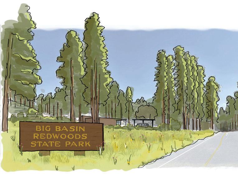
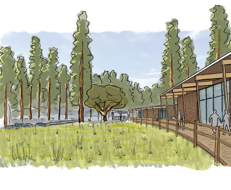

Arrival from Highway 236 reveals a sweeping view of the restored meadow, designed to minimize visibility of parking and built structures. This landscape-first entry experience sets the tone for Big Basin’s renewed identity—welcoming, natural, and inspiring.
The visitor-facing “front porch” anchors the site’s public realm—connecting the main visitor center, camp store, bistro,, and shuttle stop through an inviting meadow-side corridor. This generous space supports wayfinding, gathering, and interpretation while embracing the site’s topography and natural beauty.
The shuttle stop at Saddle Mountain marks the transition from park immersion back to the outside world. Nestled under legacy trees and framed by new visitor facilities, this area balances functionality with a memorable, reflective departure point.
The meadow and “front porch” offer an expansive area for outdoor interpretation, pedestrian circulation, relaxing and gathering, comfortable shuttle queueing, and opportunity for further programming in the future. The southern building, or the main visitor center, includes the information desk, indoor interpretation/exhibition, and a gathering classroom on the first floor. On a partial second level, directly connected to the information desk below, will be the main administrative office. The building negotiates the grade such that the first level opens westward to the visitor porch, while the second level will open eastward to staff parking and staff outdoor area, with connection to the operations buildings. Stairs and an elevator will connect the levels. Between the visitor center and the concessionaire building, next to the indoor classroom, is an amphitheater opportunity that further takes advantage of the grade and makes use of the wide open view to the restored meadow. The concessionaire building is closest to the shuttle queuing and turn-around area, offering visitors an opportunity to grab some supplies before journeying into the park, or grab a snack and souvenir before heading home after their visit.
The Saddle Mountain Hub must be able to serve as a launching pad for hikers, pedestrians, and other trail users who wish to explore the park outside a vehicle. More planning is needed to identify and design desired trail connections between Saddle Mountain and the MDU, as well as between Saddle Mountain and the Norabella property to facilitate these experiences.
The operations and maintenance buildings are warehouse-type structures, and their intended uses are listed below. A large, working yard with substantial CSP vehicle parking is required, as well as ample turnaround space for large trucks. The yard will likely need a security perimeter, and these perimeter will inevitably be visible to visitors. This perimeter should be carefully designed to blend in with the landscape, be aesthetically calm and pleasing, and should avoid signaling intense security concerns
While specifics of the Saddle Mountain site plan will continue to evolve, the primary site drivers offer a flexible framework for a highly functional and naturally inspiring Big Basin hub. These site drivers include a large, restored meadow to the west, a large visitor porch overlooking this meadow, and operations areas to the east separated by topography and redwood trees. A design overlay is to save some specific, large oak and redwood trees; these trees should be given appropriate clearance from buildings to survive construction and not present a future fire hazard. Additional details that must be carefully studied include fire defensible space, exact locations of bioretention and leach field areas, opportunities for solar power production, and a comprehensive grading/retaining study. The long-term health of the restored meadow, as a primary site driver, must also be carefully considered and prioritized.
PARKING
In terms of parking, approximately 24 shortterm parking stalls will be available for those making a quick stop at the visitor center or concessionaire. Visitors taking advantage of the shuttle program will use longer-term parking, for which 150 stalls will be provided in the southern part of the site, away from the highway. Further studies will be conducted to determine the most efficient parking configuration that minimizes disturbance and best supports a welcoming and intuitive arrival experience.
Two potential parking scenarios will be explored, both of which will require substantial grading and retaining:
FUTURE OPPORTUNITIES
CSP will continue to consider opportunities for acquiring easements or acquisition of additional properties in the Saddle Mountain area if available from willing sellers, to accommodate facilities development, additional public shuttle parking, park housing, highway or trail improvements and/or to ensure long-term compatibility between park-related activities, resource protection, and adjacent land uses.
TERRACED PARKING SCHEMESTRUCTURED PARKING SCHEME








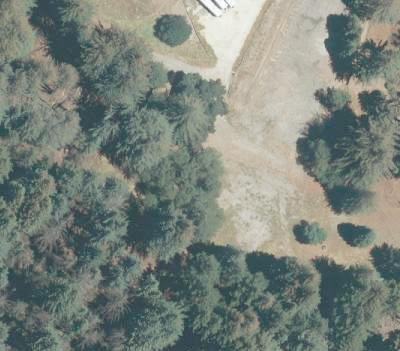


A series of parking terraces would make use of grade by winding uphill, and offering informal paths between the parking and to the visitor porch. Diagonal stalls would allow a one-way drive aisle, minimizing asphalt required and ensuring vehicular circulation clarity for visitors.






1-Story Parking Structure




A single-story parking structure embedded in the hillside with a portion of the first floor underground would provide an efficient parking facility. Grading and landscaped screening would be integrated into the design to minimize visual impacts. The structured parking facility would reduce the total footprint of the parking area.
Saddle Mountain Hub
Shuttle Parking - Approximately 150 longterm shuttle parking spots will allow visitors to park at Saddle Mountain and explore the rest of the park via Shuttle, bike, or on foot. During the peak seasons, reservations may be required to park in one of these spots.
Main Visitor Center - The Main Visitor Center will be a state-of-the-art facility with nearly 3,000 sq ft of exhibition space. The visitor center, which will be in a multi-use building along with administrative spaces, will face a large meadow and feature a large ‘front porch’ to enhance visitor circulation and provide visitors a space to gather.
Operations and Maintenance Hub - Staff facility for storage and use by park staff.
Park Store, Gear Lending Library, and Big Basin Bistro - Multi-use structure with concessions, gear lending library, and park store.
Meadow Restoration - Restored meadow adjacent to the visitor center and park store with interpretive panels.
Shuttle and Bus Boarding - Passenger loading zone for park shuttles and Metro busses.
Off Highway Queuing for Parking Check-In - Staffed kiosk for checking in visitors and controlling parking reservations.
Shuttle Charging - Designated area for park shuttle charging and storage.
Short-Term Parking - Approximately 24 short-term parking spaces to allow for brief or spontaneous exploration of Saddle Mountain.
Left-Turn Lane - West-bound traffic along Highway 236 enters Saddle Mountain via left-turn lane, allowing for through traffic to continue with minimal interruption.

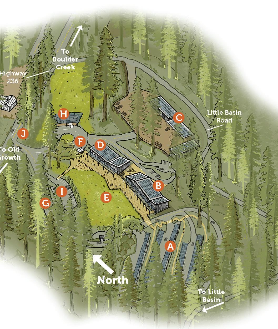
Norabella
DESCRIPTION OF FACILITIES
The Norabella site is composed of two sites divided by Highway 236. Both sites will be completely staff facing, with no visitorserving structures or facilities and public access only to be through future road and trail connections to be considered in the RTMP.
Norabella North will be a cluster of staff housing, with multiple residential typologies - including single-family homes and apartments - providing housing for both seasonal and permanent staff. This mixed approach recognizes that different staff will have different needs when it comes to housing. At the same time, co-locating these facilities in one area increases density and reduces impact area per unit of housing. A staff community amenity will also be built, creating a common, shared space for staff members to gather. Alternative housing locations on Norabella North and surrounding properties may be considered if a more desirable location is found during the design process that can provide the specified amount of staff housing while meeting project goals.
At Norabella South, the site may be used in the future to provide additional staff parking for administrative, operations, and maintenance purposes and may include covered vehicle parking and EV charging stations. A future trail connection through Norabella South will connect visitors from Saddle Mountain to the Norabella property and will be considered in the RTMP.
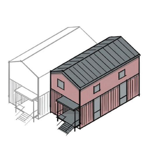
POTENTIAL HOUSING TYPOLOGY:
Two-Story Single Family Home. Threebedroom walk-up homes with the flexibility for duplex or row-house use. Ideal for permanent staff, with top-floor bedrooms, fire-resilient base, and steel stoops. Repeatable form supports varied site densities and a cohesive staff housing community.
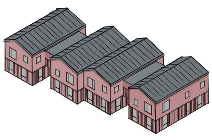
POTENTIAL HOUSING TYPOLOGY:
Two-Story Stacked Flats. Compact onebedroom apartments stacked vertically with exterior stairs between buildings. Designed for seasonal or permanent staff, this typology supports higher density with minimal site impact. Features include fibercement siding, fire-resilient detailing, and forest-friendly colors.
Gatehouse
DESCRIPTION OF FACILITIES
The Gatehouse site is an area along Highway 236 between Saddle Mountain and the Old Growth Area, east of the intersection of Big Basin Way and Sky Meadow Road. This site is designed to provide easy access for horse trailer parking with immediate equestrian trail access. A shuttle stop will provide shuttle access for visitors seeking to access trails at Gatehouse. A vault toilet, potable water supply, and horse trough provide support for those on longer hikes. New trail connections will be further explored in the Roads and Trails Management Plan and pedestrian safety improvements like advance notice signage will support safe travel across Highway 236.
Saddle Mountain Program Description
New trail connections (Eastridge Trail)
Old Growth Area
The Old Growth Area is made up of the North Escape Road, Blooms Creek Campground, Jay Camp, Sempervirens Campground, Sequoia Group Camp, Redwood Loop Trail, and Main Day-Use Area (MDU). Extensive camping and cabin facilities were located here prior to the 2020 CZU fire and most will be relocated to the Overnight Area to protect sensitive ecosystems in the Old Growth. Group camping will continue at Sequoia campground and there will be a new trail camp on North Escape Road. The MDU Area will continue to be a hub of activity near the Redwood Loop Trail with interpretation of former facilities there.
GENERAL PLAN CONSISTENCY
The proposed facilities in this section are consistent with the General Plan recommendations for Park Headquarters area (the Park Headquarters as referred to in the General Plan is synonymous with the Main Day-Use Area as referred to in the BBFMP). The BBFMP program includes limited recreational amenities that are designed to create an ecologically sensitive hub of day use activity that are significantly reduced from the footprint of historic buildings at the time of the 2013 General Plan. Proposed structures and facilities may be rebuilt in differing locations from pre-fire structures and facilities within the Main Day-Use Area, may be combined for space efficiency, may be smaller overall, and will no longer be historic structures. Rebuilding as envisioned in the BBFMP is consistent with the intent of the General Plan recommendations for maintaining recreational structures and visitor access to the old growth forest and limiting new building construction, including the recommendations of limiting and restricting new development in the old growth beyond the footprint of historic development at the time of the General Plan. That policy was aimed at preventing additional new building in the old Park Headquarters, and the buildings proposed in the BBFMP are not new buildings; they are smaller replacements for the destroyed buildings. With implementation of the BBFMP there will be less square footage of buildings in the Main Day-Use area as compared to the historic buildings at the time of the General Plan in the Park Headquarters area.


Blooms Creek + Jay Campgrounds
Restoration
Sempervirens Walk-in Picnic Areas
~2 Group Campsites
Sequoia
Main Day-Use Area
DESCRIPTION OF FACILITIES
The MDU Area, located in the heart of the old-growth redwood forest, will serve as an ecologically sensitive hub for day use activities. This design reduces the developed footprint of the former park headquarters to prioritize the preservation of the ancient forest while offering visitors a central gathering space and engage in a wide range of activities. Limited parking will be available by reservation to support accessibility needs, but most visitors will arrive via a shuttle system. The MDU shuttle stop is designed to provide a unique and memorable sense of arrival to Big Basin’s old-growth core. Former facility sites will be memorialized with reverence and interpretive areas. These re-envisioned areas will honor the park’s history while aligning with ecological restoration goals. A small indoor interpretation center will be complemented by a larger covered outdoor pavilion that may include both permanent and temporary exhibits. Restrooms and picnic areas are included.
VISITOR EXPERIENCE AND INTERPRETIVE OPPORTUNITIES
Visitors will enjoy a blend of familiar experiences, such as the iconic Redwood Loop Trail and key features like the Auto Tree, alongside new and evocative opportunities that foster connections between the forest and welcome all visitors. Spaces throughout the park will connect visitors to the park’s transformation and ecological significance. Former facility sites, including the historic park headquarters, will serve as interpretive landmarks that tell the story of Big Basin’s evolution and resilience. Educational programs and exhibits will focus on topics such as hydrology, forest succession, and sustainable park management. To enrich the visitor experience, these programs will be complemented by art initiatives, including temporary installations and creative works that evoke memories and honor the park’s legacy.
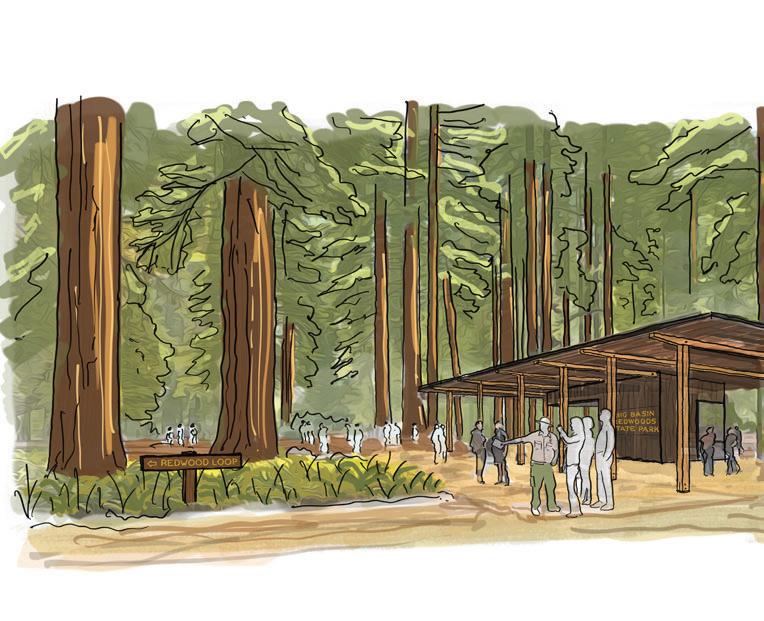
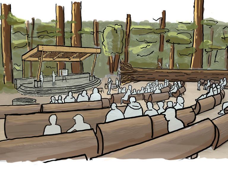
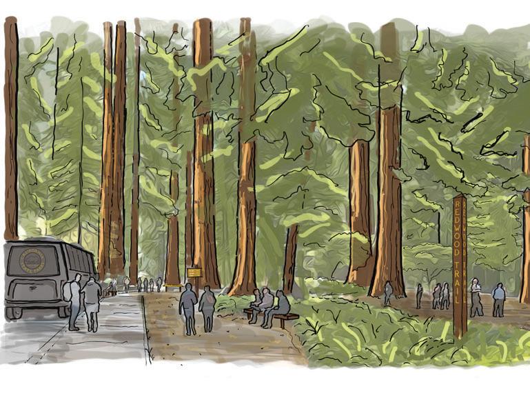
The arrival point in the old-growth forest includes the Redwood Ecology Interpretive Center, featuring outdoor exhibits under a covered pavilion. This is the first interpretive touchpoint for visitors arriving by shuttle into Big Basin’s core.
The historic amphitheater is reimagined with fire-resistant materials and salvaged log remnants as a gathering and program space nestled among the redwoods. The space offers opportunities for quiet reflection, educational programs, and as a venue for special events.
Set beneath towering redwoods, the shuttle stop offers visitors direct access to iconic trails and dozens of day-hiking options, launching immersive experiences into the heart of Big Basin’s old-growth forest.
Main Day-Use Area
Hydrological ReconnectionReconnection of previously diverted streams to enhance and retain water flow.
Trails Camps and Reservable Group
Picnic - Walk-in only trail campsites and reservable group picnic sites along North Escape Road, adjacent to several restoration projects.
Auto Tree Viewing Platform -
Accessible platform for visitors to view iconic ‘Auto-Tree’.
Former Headquarters Steps
Interpretive Site - The only surviving component of the Civilian Conservation Corps built former headquarters building, the stone steps are both a monument to the parks past and a reminder of the importance of protecting the park’s future.
Reservable Day Use Parking -
Approximately 75 reservable parking spots for day-users, conveniently adjacent to dozens of hiking trails and visitor facilities.
Expanded Meadow and Boardwalk
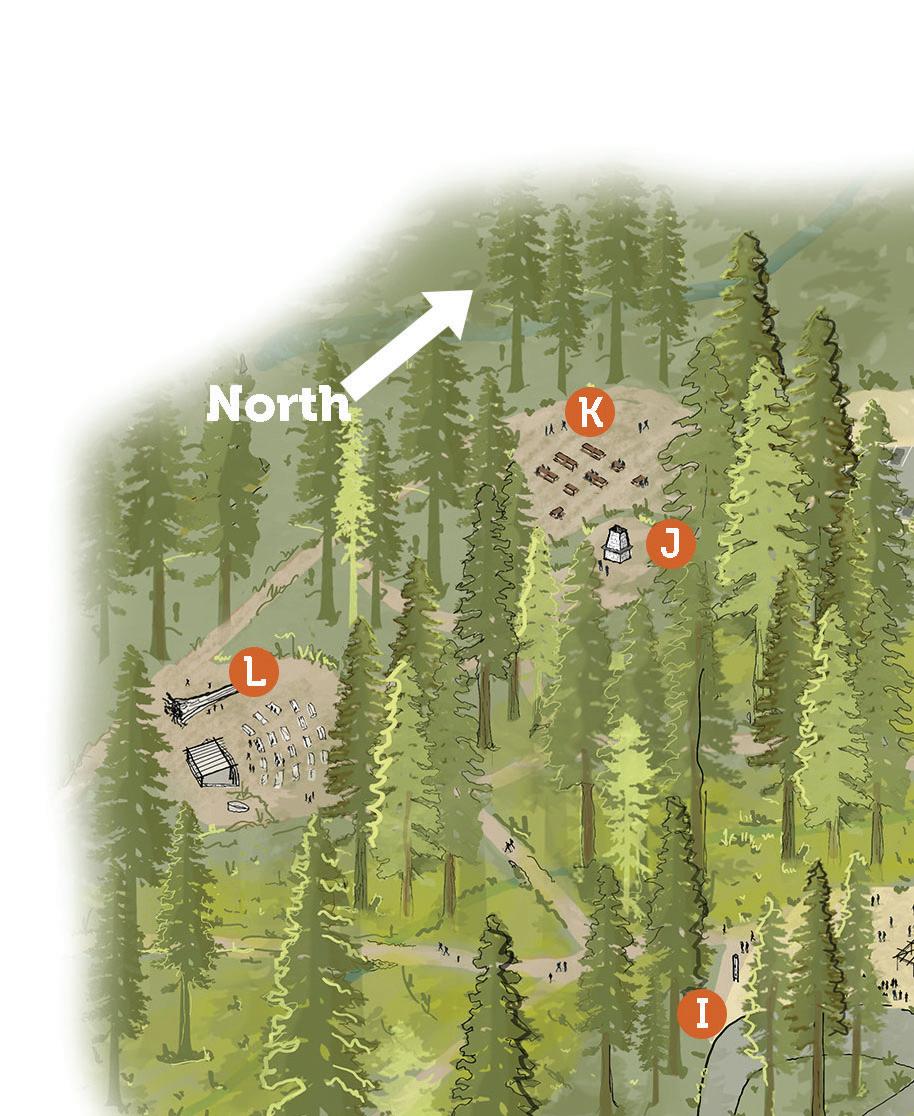
- Elevated boardwalk improves accessibility and connectivity from Redwood Ecology Interpretive Center to day-use parking while simultaneously protecting restored meadow.
Additional Restrooms - Restrooms with flushing toilets adjacent to dayuse parking for accommodating larger crowds.
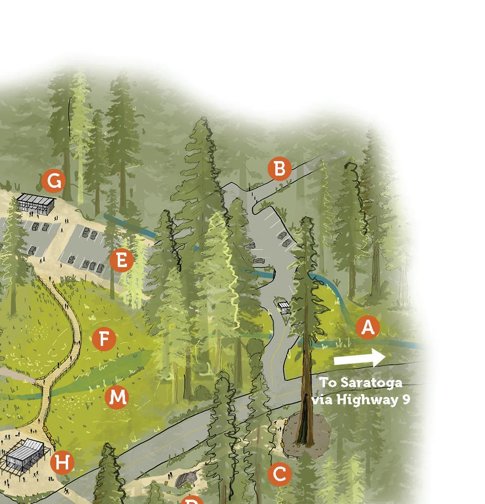
Redwood Ecology Interpretive Center - Covered and staffed outdoor exhibit and interpretive space with rotating art exhibits, serving also as a visitor-staff touchpoint for park information.
Shuttle Arrival - Loading zone for park shuttle Shuttle service connects the Old Growth Core to Saddle Mountain, Little Basin, and the Overnight Areas.
Former Lodge Reflection AreaDestroyed in the CZU Fire, the site of the former Big Basin lodge remains with little but the stone chimney to echo memories from the past. A quiet place for reflection and contemplation, the reflection area invites visitors to contemplate Big Basin’s past and the continuing fight for its future.
Picnic Area - Day use picnic area with tables for visitors to relax, eat, and hydrate.
Old Growth Amphitheater - Updated amphitheater with redwood seating, that survived the CZU fire, reimagined with fire-proofing materials, continues to serve as an area for programs, events, and gatherings.

Hydrological Restoration -
Restoration of streams to improve water flow and increase flood resilience, contributing to the overall health of Old Growth ecosystem.
North Escape Road
DESCRIPTION OF FACILITIES
North Escape Road parallels Highway 236 and serves as an important access road, facilitating increased operations, management, and emergency access to the park’s northern recreation facilities. Drive-in reservation-only picnic sites with vault toilets will be available to day-use visitors, potentially alleviating over-use concerns in the park’s MDU Area. East and west parking lots will accommodate approximately 10 and 24 parking spaces respectively. The road will have limited access north of its intersection with Gazos Creek Road, preserving the tranquil and undeveloped character of the park’s north-western landscape, which features some of the park’s most celebrated trails, including the Skyline-to-the-Sea Trail and North Escape Trail. A trail camp with water will be located approximately 0.75 miles beyond the road’s southern access gate. Several restoration efforts will take place alongside North Escape Road, including the removal of spur roads and firepits. Walk-in campgrounds, day-use parking and picnic areas will be designed for minimal impact, and included only if compatible with the primary focus of the area - the protection and restoration of redwood habitat.
VISITOR EXPERIENCE AND INTERPRETIVE OPPORTUNITIES
North Escape Road and the surrounding site will continue to serve operations and recreation at Big Basin. The park’s iconic through trail, the Skyline to the Sea Trail, will continue to foster connections between visitors and the dramatic landscape characteristic of Big Basin and the broader Santa Cruz Mountains. The proximity of restoration efforts to trail camps and picnic sites will emphasize the resilience of the park’s ecosystems and highlight the commitment of California State Parks to ensuring resilient facilities and visitor accommodations for future visitors. The new North Escape Road will illustrate that Big Basin continues to offer a diverse range of recreation opportunities, both for the seasoned visitor aspiring for a multi-day outing and the first-timer looking to enjoy the park from the comfort of a vehicle.
Jay Camp
DESCRIPTION OF FACILITIES
Jay Camp is located on the Northern side of Highway 236 and less than half a mile from the Historic Park Headquarters and Visitor Center and directly adjacent to Blooms Creek Campground. Many facilities were lost in the fire. Jay Camp will be undergoing significant restoration efforts primarily aimed at removing road pavement, former buildings, and damaged camp facilities. Possible utility infrastructure, including a potable water pump, will be built.
VISITOR EXPERIENCE AND INTERPRETIVE OPPORTUNITIES
Visitor experience and interpretive opportunities will remain limited over the course of the restorative efforts at Jay Camp. However, the restoration will serve as poignant example of park staff implementing the objectives outlined in the Reimagining Big Basin Vision Plan, in which forest health and recovery is prioritized, even if that means removing formerly used facilities.
Blooms Creek Campground
DESCRIPTION OF FACILITIES
Blooms Creek Campground, adjacent to Jay Camp and on the Southern side of Highway 236 will similarly be undergoing significant restoration efforts. These restoration efforts will include removing infrastructure pavement from the former campground and converting former campsites to dry walk/bike-in group picnic sites. Some of these removal efforts will also involve replacing the existing road with an ADA accessible trail. The trail will allow for service vehicles to access important infrastructure facilities such as the sewer. In addition to restoration, access to the Blooms Creek sites and surrounding trails will be improved by improved pedestrian infrastructure and the installation of two shuttle stops that will connect visitors to the MDU Area and sites on the eastern half of the park. Blooms Creek will still enjoy a high degree of trail connectivity to the rest of the park, notably a newly aligned ADA accessible Redwood Loop Trail Connector
VISITOR EXPERIENCE AND INTERPRETIVE OPPORTUNITIES
The newly accessible Redwood Loop Trail Connector demonstrates BBRSP’s ongoing commitment to upholding the principles of accessibility that emerged from the Reimagining Big Basin Vision project. Increased accessibility means that more visitors will have the opportunity to explore areas of the park beyond the more highly developed MDU Area. The installation of shuttle stops at the end of the ADA accessible trail allows for quick and efficient transportation to and from the MDU Area for even greater accessibility. Visitors will get to experience restoration efforts in close proximity. Walk in picnic areas will serve day users, particularly those exploring the park spontaneously without previous reservations. These walk/bike-in sites will help to continue the tradition of Blooms Creek as a place of gathering, celebration, and rejuvenation amongst the redwoods.
Sempervirens Campground
DESCRIPTION OF FACILITIES
Sempervirens Campground is located South of Sky Meadow Road and split roughly in half by Highway 236. Like Jay Creek and Blooms Creek, Sempervirens Campground will undergo a dramatic change in facilities, as the site undergoes significant restoration efforts. Restoration efforts will include the removal of pavement and former campsites, which will have important hydrological impacts. Existing trails in the site will be maintained and new trail connections will be considered where they are consistent with the values of forest regeneration. Possible utility infrastructure, including a potable water pump, will be built.
VISITOR EXPERIENCE AND INTERPRETIVE OPPORTUNITIES
Few sites in BBRSP will experience a more dramatic change in visitor experience than Sempervirens campground, which will have limited visitor experience opportunities compared to its pre-fire days. Given the removal of existing campground infrastructure, this area will be primarily a day use site, with opportunities for hiking on established trails and exploring new trail connections. Despite an overall reduction in visitor use, the restoration efforts at Sempervirens campground present an important exciting opportunity to showcase to the public the necessary steps and desired outcomes related to safeguarding and regenerating forest health.
Sequoia Campground
DESCRIPTION OF FACILITIES
Sequoia Campground will retain much of its facilities from its pre-fire design. This includes two group campsites, each with the capacity to hold 50 people. The potential for such a large gathering will necessitate two gravel parking lots with a combined capacity of up to 40 cars. Minor changes include replacing two combination toilets with two vault toilets, each with two stalls.
VISITOR EXPERIENCE AND INTERPRETIVE OPPORTUNITIES
The primitive character of many of Big Basin’s campgrounds was a celebrated characteristic of the park. The former Sky Meadow Group Camps is an example of a site that prioritized a rustic park experience. The Sequoia Campground will follow this trajectory, with more primitive overnight facilities. No power, septic, or showers will be available at the site.
North Escape Road Program Description
Former Campgrounds Program Description
Sequoia Program Description
Main Day-Use Program Description
Overnight Area
The Overnight Area includes Lower Sky Meadow, Huckleberry Campground, and Wastahi Campground. The area’s visitor experience will be anchored by its two large overnight campground sites: Lower Sky Meadow and Huckleberry Campground. Together, the two sites will accommodate a wide variety of user experiences. Nearly 140 car camping sites, almost two miles of new trails, and several new interpretive facilities are just some of the planned visitor facilities at these sites. The campsites at Wastahi and a portion of the parking area will be removed and restored to old growth redwood forest habitat, and a portion of the parking area will be maintained and converted into an overnight parking area for trail camp users.
Overnight Area
Lower Sky Meadow


~71 Car Camping Sites

Restoration


~37 Cabins


~25 Trail Camp Parking Spaces

~ 7 Friends and Family Sites


~50 Car Camping Sites


~8 Walk-in Camp Sites
~14 RV Sites


Restoration


Campfire Center


Visitor Contact Building


~30 Parking Spaces


Satellite Operations & Maintenance Facility
Wastahi
Huckleberry
Lower Sky Meadow
DESCRIPTION OF FACILITIES
As the name suggests, the Overnight Area will be house the park’s primary accommodations for overnight visitors. Lower Sky Meadow will be the largest campground in the park, with a plethora of overnight and visitor-serving facilities. These include car campsites, walk/bike-in tent cabins, group campsites, and hard-sided cabins. New parking lots will be installed to accommodate visitors using the cabins and group camps, while the car campsites will include space for 2 cars each. Several sites will be designated as ADA accessible. In anticipation for a large and diverse visitor base with differing levels of comfortability in the outdoors, comfort stations will be the standard restroom on site, with three combination comfort stations (shower and flush toilet) providing further visitor accommodations. An interpretive center and indoor concession building with cabin check-in and social space and an outdoor amphitheater/campfire center will be co-located at the campground. New trails will be built in and around the campground to connect the sites and offer multiple recreation opportunities at differing levels. Lower Sky Meadow plans include road removal and expansion of the natural wetland meadow area, a designated stormwater retention area, and the potential for solar power installations in the campground’s north side.
VISITOR EXPERIENCE AND INTERPRETIVE OPPORTUNITIES
Lower Sky Meadow is poised to become one of the centers of activity in the new BBRSP, with comfortable and developed facilities in close proximity to many of the park’s iconic attractions. The campground will be a short hike from Sempervirens Falls thanks to a newly constructed trail that will extend all the way to the new Indoor Interpretive Center, which will allow for year-round interpretive programming to share the history and future of California’s oldest State Park. The campground will also be located within and near old growth redwoods, bringing visitors as close as possible to these majestic trees. Furthermore, large gathering spaces such as the amphitheater will accommodate large groups for celebrations, educational events, and more. Visitors could spend much of their visit within the campground and experience much of what makes BBRSP so special.
Huckleberry
DESCRIPTION OF FACILITIES
Huckleberry campground is the second prominent campground in the Overnight Area after Lower Sky Meadow. It will accommodate car campsites, walk in sites, and RV sites. While the campground lacks the interpretive facilities within the Lower Sky Meadow campground, it still promises comfortable overnight accommodations with 5 comfort stations and 2 combo stations for a ratio of 7 campsites to 1 comfort station (restroom), an improvement from previous numbers. The campground will be well connected by trail to other areas of the park, including Lower Sky Meadow via a shortened trail connection that goes over the existing ridge. Other trails include the existing Shadowbrook Trail which connects to Union Creek.
VISITOR EXPERIENCE AND INTERPRETIVE OPPORTUNITIES
Huckleberry campground, along with Lower Sky Meadow will serve as the main overnight areas for the park and thus play an important role in facilitating longer and more enduring visitor experiences and recreational opportunities. The campground is centrally located in the opportunity area encompassed within the BBFMP, and thus offers fantastic connectivity to other areas of the park. The campground will also accommodate a diverse range of visitors, both those seeking RV accommodation, car accommodation, and walk-in accommodations.
Wastahi
DESCRIPTION OF FACILITIES
Wastahi campground once hosted 26 walk/ bike-in campsites and several associated visitor facilities. The site previously experienced water flows during storms and it sits below an area identified as potential landslide deposits. This reality encourages facility siting that will be less impacted by drainage and potential land flow. Therefore, constructed facilities will be minimal and include parking lot with space for approximately 25 cars. The parking lot will also house a comfort station with maintenance storage. The parking lot will allow for overnight parking for trail campers accessing the trail camps throughout the park via the Sequoia Trail.
VISITOR EXPERIENCE AND INTERPRETIVE OPPORTUNITIES
The removal of the former campsites signals a change in the desired visitor experience of the Wastahi site. Like many of the opportunity areas throughout the park, Wastahi will undergo extensive restoration efforts aimed at improving forest health and hydrological flows.
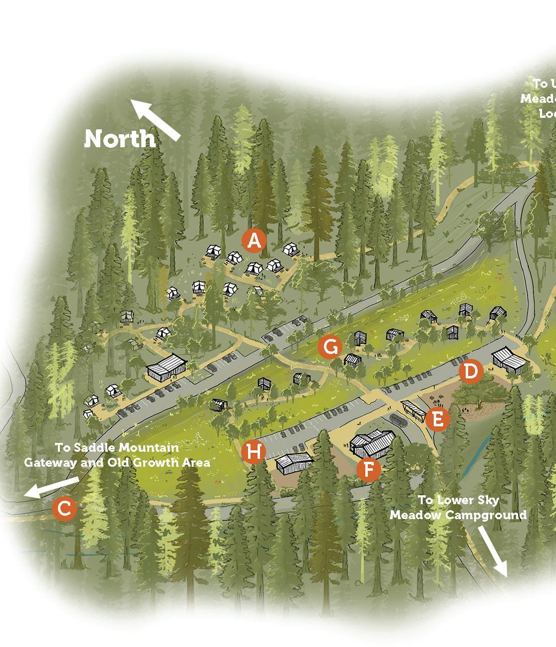
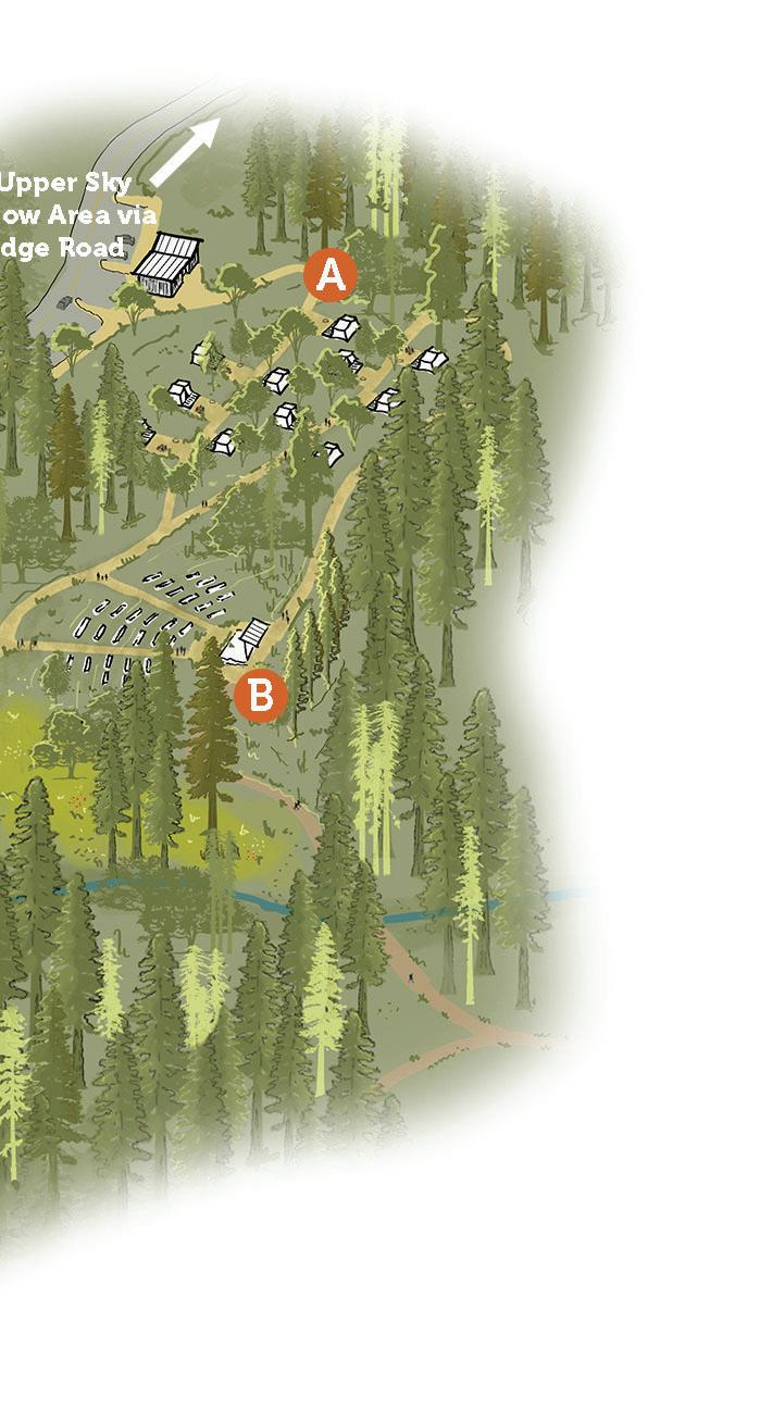
Sky Meadow Landing
Tent Cabins - Canvas tent cabins.
Campfire Center - Newly constructed venue for programs and events.
Roadway to Lower Sky MeadowImproved two-way road connecting Sky Meadow Landing to the Lower Sky Meadow campground, allowing for vehicular connectivity to and from the largest campground at the park.
Program Gathering Space for Junior Rangers - Gathering space for Junior Ranger programs to begin and end Junior Ranger activities, adjacent to the parking lot and shuttle stop for easy drop off and pick up.
Shuttle Stop - Passenger loading zone and shuttle stop for Sky Meadow landing, connecting visitors to other areas of the park.
Camp Store and Cabin Check-In - Camp store selling food and camp essentials, serving also as a check-in area for guests with cabin reservations.
Hard-Sided Cabins - Hard-sided cabins offering a more comfortable outdoor experience.
Campground Maintenance Building - Staff facility for storage and use by park staff for maintenance.
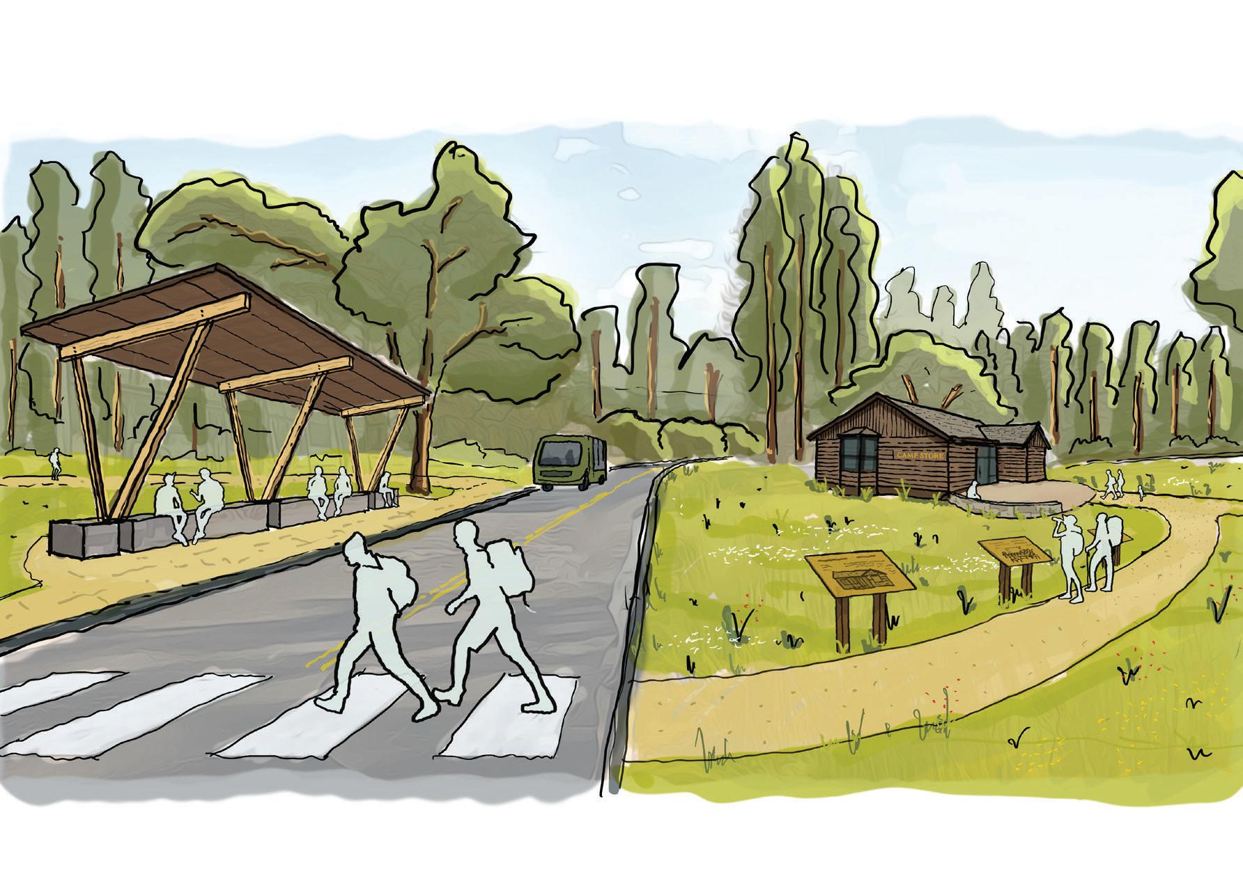
The proposed Sky Meadow campgrounds will be connected to other areas of the park via a shuttle system, offering convenient access to and from the park’s main campgrounds.
In addition to overnight facilities, Sky Meadow Landing will include a new campfire center that can host a wide range of programs and events.
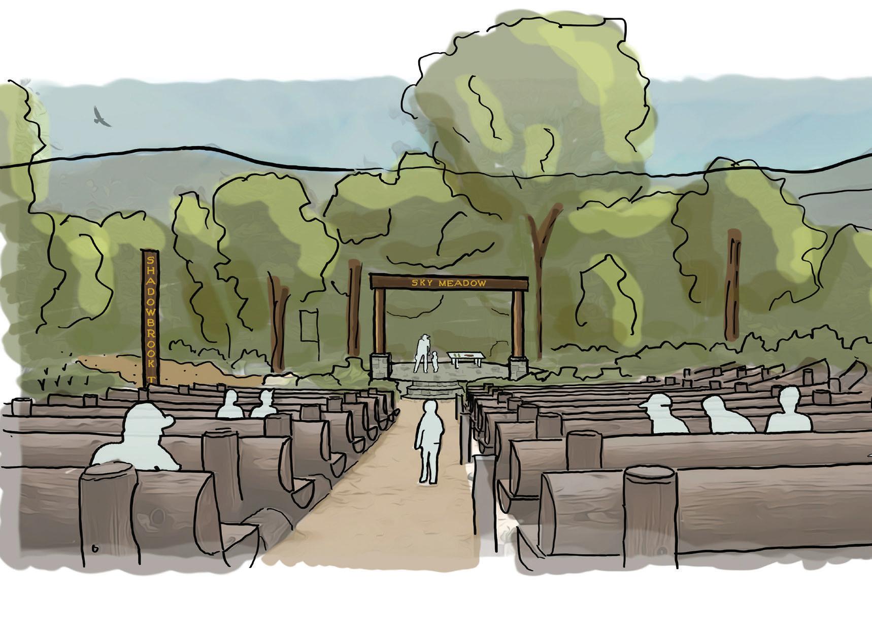


Overnight Area













Overnight Area Program Description*
*Does not include Sky Meadow Landing; see next page
Sky Meadow Landing Program Description
Upper Sky Meadow Area
The Upper Sky Meadow Area of BBRSP encompasses a significant portion of the project area. Sky Meadow and Rogers Road will be two visitor serving sites within the Upper Sky Meadow Area that offer a distinct visitor experience from the other areas of the park. Compared to other areas of the park, development and construction within this area will be less intense. However, the relatively remote character of this area of the park makes the integrity of the planned visitor facilities all the more important. Mortensen, Rose, and Heyl sites are also located in the Upper Sky Meadow Area, but specific facilities are not proposed in this FMP. Future planning for park housing and trail uses may be suitable for these properties pending improved driveway access.


Public Restroom with


~8 Walk-in
Water ~20 Walk-in Campsites Upper Lodge Road
Upper Sky Meadow Area


Upper Sky Meadow
DESCRIPTION OF FACILITIES
Upper Sky Meadow was formerly a work camp for the Civilian Conservation Corps (CCC) and more recently was used as a site for staff residences. The current plan now envisions Upper Sky Meadow as a walk/ bike-in only campground with 8 campsites served by 1 combination bathroom. As the name suggests, the campground will overlook a meadow that will undergo ecological restoration. Approximately 54 parking stalls will be built as Lodge Road terminates, providing up to 2 parking spaces per campsite. This parking lot will serve both Upper Sky Meadow and Upper Lodge Road campground. Situated in the backcountry, accessing other areas of the park from this site must be done on foot or via bike. No vehicular access will be permitted beyond the Rogers Road trailhead. In addition to overnight facilities, several interpretive facilities aimed at highlighting the CCCs’ history on the site will be constructed, including the restoration of steps constructed by CCC into the hillside. These steps will double as both necessary infrastructure, connecting visitors from the meadow to the northern walk/bike-in sites, but also as an interpretive object for reflection.
VISITOR EXPERIENCE AND INTERPRETIVE OPPORTUNITIES
Upper Sky Meadow will offer a visitor experience characteristic of backcountry adventure, with limited facilities beyond the combination comfort station and walkin campsites. Visitors looking for a more private, secluded, and primitive camping experience will enjoy the trip from the parking lot to their campsite, though for that very same reason, these campsites present accessibility considerations for certain visitors. In addition to the backcountry quality of the site, another potential draw for the site will be the newly installed CCC interpretive signage and landmarks. For those visitors interested in this particular era of the park’s history, Upper Sky Meadow will offer a provocative and memorable opportunity to learn and experience the enduring legacy of the CCC in Big Basin, whose influence at the park is far-reaching.

The proposed Upper Sky Meadow Area offers a scenic, quiet, and isolated setting, allowing visitors to escape the busier areas of the park. Upon arriving at the trailhead, visitors will hike along Upper Lodge Road to rustic walk-in campsites.
Rogers Road
DESCRIPTION OF FACILITIES
Rogers Road, a relatively remote and flat site, will be a prominent event site within the park. Given its history as a formerly developed site, it is mostly clear of sensitive resources, vegetation, and trees. Approximately 30,000 square feet of Event Meadow and Group Camp will offer a private group space away from the busier sections of the park. There are nine event cabins that will serve longer stays, alongside a combination bathroom with showers and flushable toilets. Two gravel parking lots, one on the east and one on the west side of the site, will accommodate a total of 27 cars. These facilities will demand creative utilities engineering, and infrastructure will be constructed to bring water from Sky Meadow Road to the relevant facilities and dispose of wastewater generated at the site.
VISITOR EXPERIENCE AND INTERPRETIVE OPPORTUNITIES
Rogers Road will primarily serve large groups and events looking to take advantage of the site’s relative isolation from busier areas of the park. Dedicated event spaces like the event ramada, event meadow, and event cabins make Rogers Road a perfect place for multiday events such as weddings, overnight educational trips, or multi-day scientific field expeditions. Visitors will still enjoy connectivity to other areas of the park via fire roads, but will be relatively further than other areas of the park.
Upper Lodge Road
DESCRIPTION OF FACILITIES
Upper Lodge Road overnight facilities, located in the backcountry of BBRSP, will be accessible only by foot or bike. The designated parking lot will be just before the access gate at the end of Upper Lodge Road. This parking lot will also service the Upper Sky Meadow campgrounds and CCC interpretation facilities. From this lot, new walk/bike campsites, each with a tent pad, picnic table, food locker, and fire ring, will provide visitors with a genuine backcountry experience. The campsites will be spread across 4 2,000 sq. ft. sites, each increasing in distance from the trailhead to enhance the feeling of solitude and privacy. Potable water and vault toilets will provide a basic level of accommodation at these sites. While Upper Lodge Road will be closed to non-operations vehicles, the road will be improved where possible to serve as a secondary emergency egress. New trails will be planned in between the parking area and campsites as an alternative to walking into campsites on the road.
VISITOR EXPERIENCE AND INTERPRETIVE OPPORTUNITIES
Upper Lodge Road, similar to Upper Sky Meadow and to a lesser extent North Escape Road, will provide a truly immersive backcountry overnight experience for visitors seeking to experience Big Basin’s less developed areas. The walk/bike-in campsites will offer greater seclusion and privacy compared to campgrounds in the Overnight Area. At the same time, the East Ridge Trail, which intersects Upper Lodge Road near the park’s eastern boundary, will provide a connection to other areas of the park for those able to take on longer hike, including the Overnight Area, Blooms Creek, and the MDU Area.
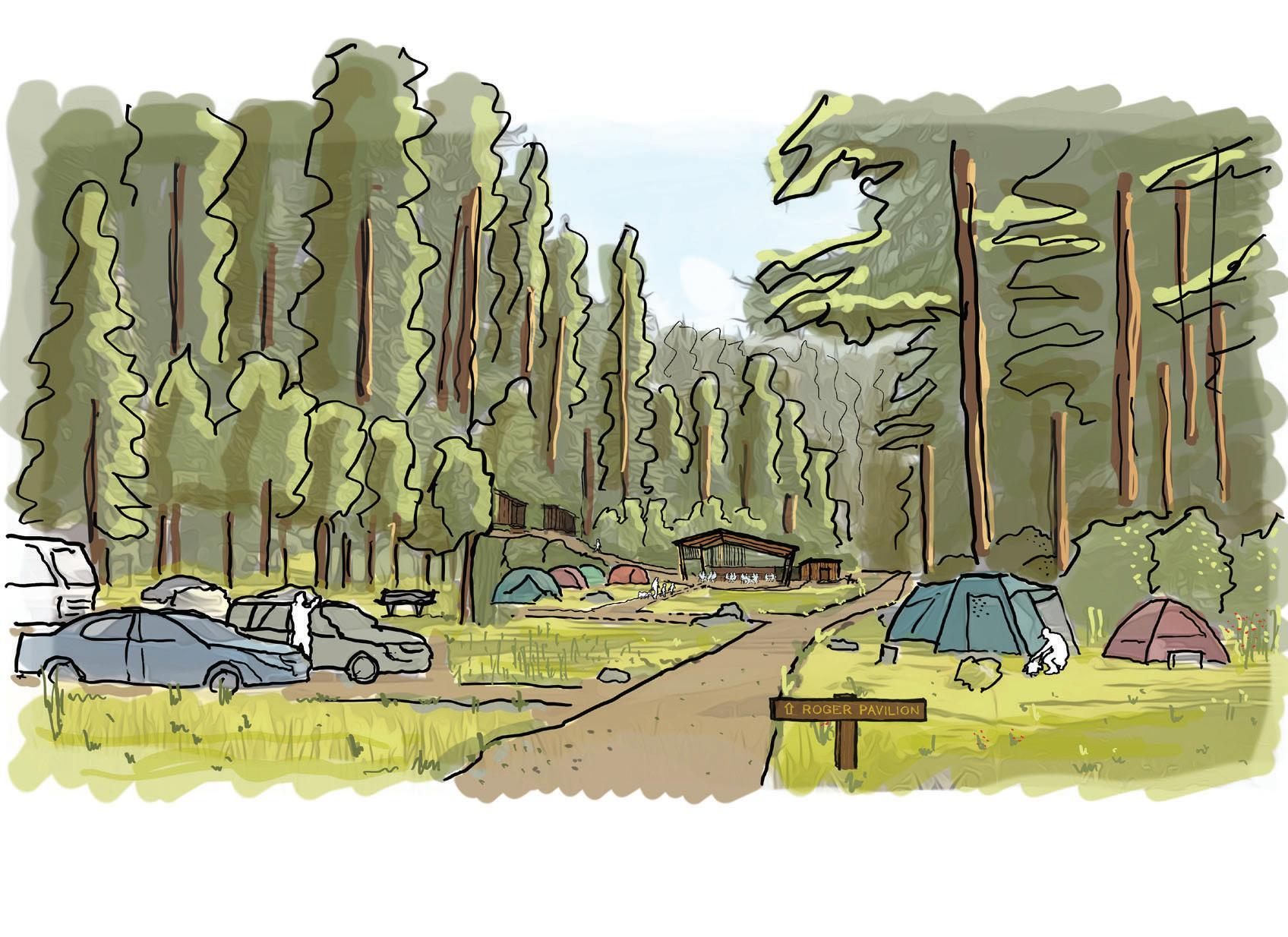
The proposed Rogers Road campground will include facilities to accomodate larger groups.
Rogers Road Program Description
Upper Sky Meadow Program Description Upper Lodge Road Program Description


Upper Sky Meadow














































Little Basin
DESCRIPTION OF FACILITIES
Little Basin is a unique area of BBRSP for several reasons. First, it has the largest flat area of any of the opportunity sites. It is also the most isolated opportunity area given the steep slopes it is surrounded by. Finally, since it is outside the old growth redwood forest, its vegetation communities are less sensitive than other locations in the park. These factors made it well-suited to accommodating large scale events and group camping, for which it was quite popular. These facilities, however, were lost in the CZU fire.
Reestablishing Little Basin as an area with high visitor use capacity is a primary goal of the planning process. The site will feature 34 car camping sites, 12 tent cabins, 6 friends and family campsites, and 2 large group campsites. Each of these overnight facilities will have adequate parking spaces. To serve this large overnight community, a 2,000 sq. ft. store will be built to sell essential camp supplies while doubling as an operations and management storage space. Given the relative isolation of this area of the park, planning for emergency vehicle and emergency evacuation routes is paramount. In addition to these overnight facilities, Little Basin will house a number of tribal and cultural facilities that will honor the millennia long connection that Indigenous people have had with the land. These include a cultural center with interpretive exhibition space, outdoor work space, opportunities for future collaboration with Indigenous groups to create spaces for sweat lodge, dance corral, campfire ring, a group camp for tribal use, and an ethnobotanical native plant propagation area.


VISITOR EXPERIENCE AND INTERPRETIVE OPPORTUNITIES
The desire to maintain Little Basin’s status as a hub of visitor activity, one that can accommodate large and small groups with different overnight facility offerings is a throughline that connects the pre-fire visitor experience to the post-fire visitor experience at Little Basin. Visitors will continue to enjoy the developed campground and its extensive visitor services and accommodations.
MIXED TRIBAL USE SPACE
New experiences such as the cultural interpretation space will continue to elevate California State Park’s commitment to honoring native stories. These interpretive sites are particularly important given the importance of empowering tribal communities, the original stewards of the land. Part of this commitment, however, is recognizing that the public at large should not be invited into all spaces on the site, since several of the planned facilities are for tribal use only. Thoughtful interpretive programming will communicate this nuance and ensure the safe practice of tribal traditions.
COLLABORATIVE PLANNING
California State Parks is committed to empowering tribal communities throughout the design and planning phase at Little Basin. As such, California State Parrks will consult, collaborate, and work with Indigenous groups to:
• Design the site and its facilities, including the concessionaire, kiosk, and camping areas. Additionally, Indigenous groups will be involved in planning potential road removal and expansion of restoration areas for ecological and cultural landscape benefit.
• Work with Indigenous groups on the management of cultural sites.

• Include some of the housing developed at Little Basin in an eventual operating agreement with an Indigenous organization to support operation of the cultural center and mixed Tribal use area.
• Complete additional study and assessments of cultural resources.
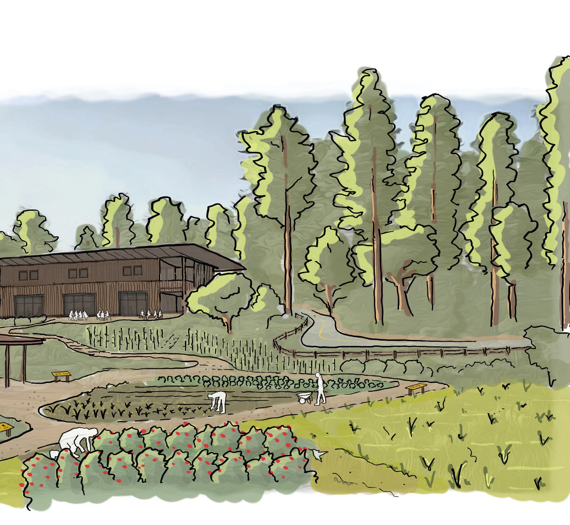
A cultural center and mixed Tribal use area is proposed at Little Basin for Indigenous groups to highlight culture, complete restoration work and practice cultural activities.
Little Basin
Ramada and Communal Kitchen - A structure for hosting Tribal and public events and gatherings.
Tribal interpretive Landscape - Little Basin will host a mixed Tribal use area that will highlight the connection that the Tribes have with the lands of Big Basin Redwoods State Park. An interpretive trail will overlook a restored wetland and a cultural burn zone with interpretation panels sharing the importance of Tribal ecological knowledge and stewardship practices.
Shared Use Cabins - Six shared-use cabins will provide a comfortable overnight experience. The cabins will be used by Tribal members and will sometimes be available to the public. Along with the other buildings in Little Basin and the park, will incorporate wildfire resistant strategies.
Tribal Cultural Stewardship Center - A Tribal and cultural stewardship center will be a space to highlight Tribal cultural stewardship of the Little Basin landscape and throughout the park. The center will also provide workspace and shared lodging for conservation corps work crews completing stewardship work in the park.
Check-in and Camp Store - A dual-purpose building, this building will host both a camp store and campground check-in services.
Wetland Restoration - The restoration will include nearly 15 acres of wetland and hydrological restoration.
Hydrological Restoration ProjectsHydrological restoration efforts including the removal of an existing dam and the restoration of a former reservoir will improve hydrology at the site.
Tribal Use Only Group Camp - Group campground for Tribal use only.


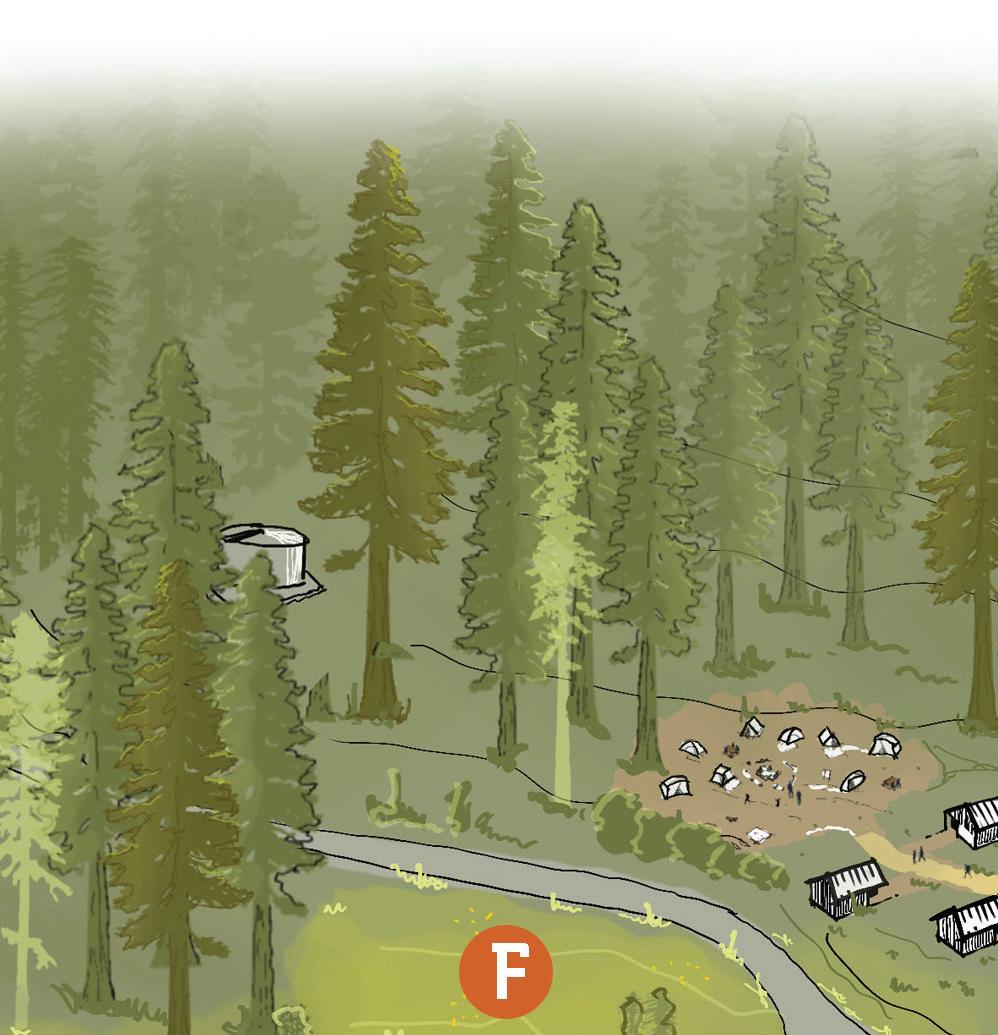

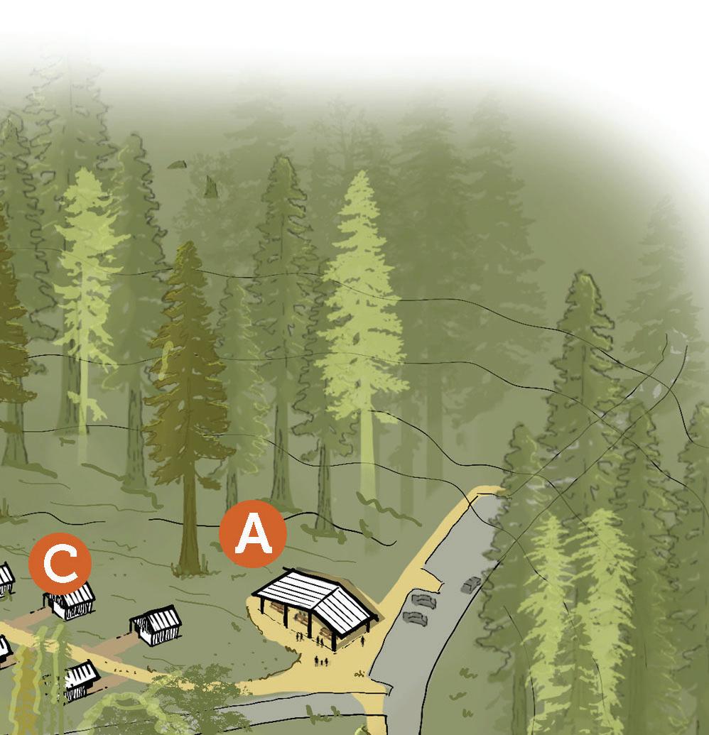
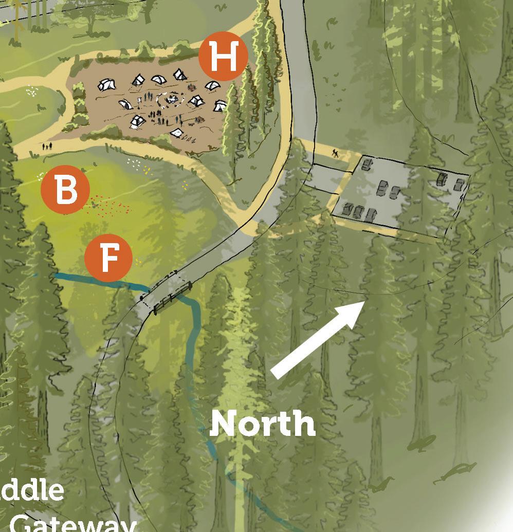

Little Basin Program Description
Implementation Chapter 4
This chapter outlines the strategic approach to executing the Big Basin Redwoods State Park Facilities Management Plan (BBFMP). It establishes a high-level framework for prioritizing, funding, and executing projects that will rebuild and enhance park infrastructure, improve visitor access, experiences, and safety, and restore and protect sensitive ecosystems. This chapter includes:
• Prioritization and Phasing Strategy – Identifies qualitative criteria for ranking projects and lists high-priority project types necessary for reopening and long-term park sustainability. This section also outlines a phased approach for implementation, ensuring realistic progression and alignment with funding availability.
• Funding and Programming Partnerships – Describes collaborative efforts with government agencies, nonprofits, and community organizations to support the park’s restoration.
Prioritization Strategy
Projects included in the BBFMP should be qualitatively evaluated on their urgency and impact on the following:
• Operational Necessity – Essential facilities needed to support park staff and emergency response.
• Ecological Benefit– Areas where restoration, fire resilience, and hydrological improvement projects have substantial impact.
• Visitor Safety and Access – Ensuring safe and equitable access to the park, including shuttle infrastructure, road improvements, and parking.
• Visitor Experience – Projects that support diverse and evocative nature experiences and enhance interpretative and recreational opportunities.
• Financial Feasibility – Projects that are funded or likely to secure funding are prioritized for earlier implementation.
Highest-Priority Project Types
The following project types are of the highest priority for early implementation due to their essential role in park operations, accessibility, and safety:
Rebuild Parkwide Utility Systems: Upgrades to water and wastewater systems to support visitor use, fire suppression, and ecosystem health.
Emergency Access and Wildfire Resilience:
Improving roadways needed for park access and emergency evacuation routes, firebreaks, and communication infrastructure, including the installation of an early warning system and real-time evacuation messaging across the park.
Restoration of Decommissioned Campgrounds: Removal of pre-fire camping facilities at Blooms Creek, Sempervirens, and Jay Camp to allow for forest regrowth, watershed recovery, and habitat restoration in accordance with ecological resilience best practices.
Visitor Center and Interpretation Hubs:
Establishing a new primary visitor center at Saddle Mountain and the Redwood Ecology Interpretive Center at MDU featuring educational exhibits and interactive displays on fire ecology and redwood conservation.
Re-establishment of Trail Network: Rebuilding pre-fire trail network and with the guidance of the forthcoming Roads and Trails Management Plan explore multi-use and accessibility enhancements to improve connectivity between key visitor areas.
Shuttle Facilities to Accommodate
Pre-fire Visitation: Development of a 150-stall shuttle parking area at Saddle Mountain and a welcoming shuttle arrival location in the Main Day-Use Area to reduce private vehicle use in the Old Growth Area and accommodate pre-fire visitation to the Redwood Loop Trail.
Overnight Zone: Development of a wide range of camping options as supportive camping facilities to restore overnight use in a way that provides evocative, diverse, and accessible experiences, while minimizing the intensity of uses in the most ecologically sensitive areas.
Phasing Strategy
The following pages present a series of exhibits that list core projects in each of the park zones in three distinct phases:
Phase 1: Immediate Implementation
Phase 2: Core Park Operations
Phase 3: Longer-Term Enhancements
Generally, projects that appear in earlier phases align with higher-priority projects; however phases also consider logical construction timing, efficiency, and limiting disturbance to ecological systems, visitor experiences, neighbors, and park operations.
The exhibits show all projects within one of the five park zones for a particular phase. Within the exhibit, there are projects listed, and occasionally grouped together into boxes, which notates the assumption of concurrent construction.
This chapter presents a generalized and simplified phasing strategy. The timing, grouping and implementation of the specific projects in each phase will depend on available funding, project readiness including permitting and environmental review, staff capacity, internal approval of funding and projects, coordination with supporting partners, and other factors.
IMMEDIATE IMPLEMENTATION
Building on recovery efforts and interim protocols after the CZU fire, this phase restores core infrastructure so basic park functions can resume safely. Priorities include repairing water and wastewater systems, improving park roads (including Lodge Road) for visitor access and emergency response, reestablishing emergency-response infrastructure, and delivering early access upgrades such as shuttle stops and rebuilding the pre-fire trail network.
At Saddle Mountain, shuttle parking will be developed alongside a visitor center and a concessionaire-operated park store and gear-lending library. In the Main Day-Use Area, the Redwood Ecology Interpretive Center will provide visitor engagement and educational opportunities. To enable overnight stays, Huckleberry campground facilities will be rebuilt with modernized, sustainable, and accessible infrastructure. Finally, restoration work in Old Growth Areas will improve ecological health and create new interpretation opportunities.
Old Growth Area
Phase 2
CORE PARK OPERATIONS
During this phase, additional visitor-serving facilities and overnight accommodations at both the core Overnight Area and beyond will be reestablished to support a broader range of recreational activities and camping experiences. This includes campsites, cabins, and supportive campground facilities at the Lower Sky Meadow Area and overnight and interpretive facilities at Little Basin. The Little Basin Stewardship and Cultural Center will be established to honor Indigenous stewardship and promote traditional ecological knowledge. At the same time, connectivity between key areas of the park will increase as a new shuttle stop at Gatehouse and improved trail connectivity will increase options for one-way hikes. The expanded shuttle system will have the added benefit of reducing traffic congestion and minimizing environmental impact.
Phase 3
LONGER-TERM ENHANCEMENTS
The final phase will focus on expanding recreational opportunities and cultural programming. In the Upper Sky Meadow Area, enhancements will include Upper Sky Meadow parking, the Rogers Road Ramada, walk-in campsites at Upper Sky Meadow and Upper Lodge, Rogers Road cabins, and a group camp with restrooms. At Gatehouse, equestrian facilities will be established. The Saddle Mountain to MDU/Little Basin Trail Connection will improve park connectivity. At Little Basin, a range of tribal facilities, including those for overnight use, will be developed. Ongoing landscape restoration efforts and implementation of the Forest Management Strategy will continue to ensure the long-term ecological resilience of the park.
detailed cost estimates are included for each site on page 121

Cost Estimate by Zone
The following table illustrates a preliminary cost estimate for all projects included in the BBFMP by zone and phase.
Estimated Site Improvement Costs
Site
Phase 1 Phase 2 Phase 3 Parkwide Saddle Mountain*
Estimated site improvements costs are for planning purposes only and do not reflect detailed construction drawings or site measurements. The total anticipated costs include a 25% contingency, anticipated escalation cost of approximately 4% per year; and softs costs for the project, including costs for design, permitting, supplemental technical studies, and construction management, totaling approximately 20% of construction costs.
*Does not include Saddle to Main Day Use/Little Basin Trail Connection
Funding and Programming Partnerships
Successful implementation of the BBFMP will rely on nurturing both funding and programming partnerships with many agency and nonprofit partners. BBRSP has a rich history of being supported by these partners, and their active engagement in projects that rebuild facilities in the park as a part of the BBFMP will be essential. The tables below that follow highlight key partners, briefly describe their historic role in supporting the park, and suggest ways that they can support BBFMP implementation.
Partner
Friends of Santa Cruz State Parks
Sempervirens Fund
Historic/ Current Role Future/Ongoing
Co-management partner and provided funding and staffing support post-CZU fire.
Instrumental in the founding of Big Basin Redwoods State Park, protected 36,000+ acres of redwoods, and led land acquisition efforts.
Save the Redwoods League
Amah Mutsun Land Trust
Mountain Parks Foundation
Parks California
Programming Partners
(e.g. Disabled Hikers, Community Bridges, Saved by Nature, Latino Outdoors)
Santa Cruz Metro
Facilitated post-fire recovery and helped develop a Forest Management Strategy.
Stewarded Indigenous lands, partnered on conservation easements.
Provided funding and support for interpretation and public engagement.
Supported accessibility initiatives and equity-driven park planning and programming.
Provided essential services and outreach to underserved communities.
Operated seasonal transit service to Big Basin.
Role
Continue co-management and park operations, communications, fundraising, and volunteer mobilization for park improvements.
Continue funding forest restoration, climate resilience, and land stewardship.
Support forest management, habitat restoration, and fundraising for long-term sustainability.
Expand cultural education, ecological restoration, TEK integration, and collaborate on development of cultural facilities and landscapes
Enhance visitor education programs and fundraising for cultural initiatives.
Continue investments in community engagement and arts and cultural programming.
Expand equitable access programs, advocate for more inclusive facilities, and continue education outreach.
Expand public transportation access to improve sustainable visitor mobility.
Friends of Santa Cruz State Parks
Sempervirens Fund
Save the Redwoods League
Amah Mutsun Land Trust
Mountain Parks Foundation
Parks California
Programming Partners
Santa Cruz Metro

Funding and Grant Opportunities
The following agencies offer grant funding opportunities that may be relevant to supporting the implementation of the BBFMP. The grants listed are ongoing public agency grants that were available at the time of writing. The grants are for public agencies pursuing projects in, broadly, conservation, resource management, water access, and climate adaption in resiliency. Given the diversity of future projects at BBRSP entailed by the BBFMP, a wide range of funding opportunities should be explored. While this is not a comprehensive list of funding sources for projects relating to the BBFMP, the grants identified provide a good starting point for identifying ongoing funding opportunities.
CALIFORNIA DEPARTMENT OF FISH AND WILDLIFE
The California Department of Fish and Wildlife is a California State agency under the California Natural Resources Agency. With a history tracing back to the late nineteenth century, the Department of Fish and Wildlife manages and protects California’s wildlife and native ecosystems for the benefit of Californians. The department manages for recreational, commercial, scientific, and educational uses.
Wildlife Corridors – Nature-Based Solutions: This grant aims to support projects that promote ecosystem connectivity, a goal that overlaps with various restoration efforts outlined in the BBFMP.
Proposition 68 Rivers and Streams Grant Program: Funded by Proposition 68, this grant supports river and stream restoration and protection, similar to planned efforts at BBRSP.
Addressing Climate Impacts: This grant supports projects that address degrading water and habitat conditions due to climate change, which the loss of valuable habitat in BBRSP may qualify for.
Proposition 1 Watershed Restoration Grant Program: Funded by Proposition 1, this act funds initiatives that implement water protection, conservation, and restoration, overlapping considerably with the sustainability goals of the BBFMP.
Drought Emergency: This grant provides funding in support of restoration and protection projects that enhance resiliency of aquatic and riparian habitat and river channels.
Wetlands and Mountain Meadows Restoration – Nature-Based Solutions: This grant provides funding for mountain meadows and non-coastal wetlands restoration, which the restoration efforts at BBRSP may qualify for.
STATE WATER RESOURCES CONTROL BOARD
The State Water Resources Control Board is a five-member board founded with the original mandate to balance all uses of California’s water resources. To this end, the board allocates water rights, adjudicates water right disputes, develops statewide water protection plans, and establishes water quality standards. The board oversees nine Regional Water Quality Control Boards that operate in California’s main watersheds.
Proposition 68 - Water Recycling: With funding from Proposition 68, this grant supports water recycling projects to promote the beneficial use of treated municipal wastewater to augment fresh water supplies.
Proposition 1 - Water Recycling: With funding from Proposition 1, this grant supports water recycling projects to promote the beneficial use of treated municipal wastewater to augment fresh water supplies.
Drinking Water State Revolving Fund Planning: This grant supports infrastructure projects needed to achieve or maintain compliance with the Safe Drinking Water Act, which BBRSP may undergo.
Water Recycling Funding Program –Construction Grant: This grant supports the construction of water recycling projects that offset or augment state or local fresh water supplies, such as treatment facilities, pumping facilities, and groundwater recharge facilities, all projects identified in the BBFMP.
Clean Water State Revolving Fund Program - Water/Energy Audit: This grant funds audits to identify potentially inefficient water or energy use by public agencies, which may help ensure BBRSP meets its various energy and water goals.
Water Recycling Funding ProgramPlanning Grant: This grant supports the planning of water recycling projects that offset or augment state or local fresh water supplies, which overlaps with potential future planning needs of BBRSP.
WILDLIFE CONSERVATION BOARD
The Wildlife Conservation Board is a state grant-making agency founded via legislation in 1947. The seven-member board administers nearly 20 programs across the state and works in partnership with tribes, conservation organizations, and government organizations to safeguard California’s biological diversity and wild spaces.
Stream Flow Enhancement: This grant funds projects that enhance streamflow for the benefit of fish and wildlife, projects that the BBFMP identifies in numerous areas of the park.
Climate Adaption and Resiliency: This grant funds projects that protect and restore ecosystems to increase resilience and adapt to climate change, such as the future and ongoing efforts at BBRSP.
Habitat Enhancement and Restoration:
This grant funds a wide range of restoration efforts that enhance fish and wildlife resources, efforts that are similar to those outlined in the BBFMP.
Public Access: This grant aims at providing planning and implementation support for projects that provide public benefits and provide access to natural and wild areas of California, such as BBRSP.
Riparian Habitat Conservation: This grant supports projects that improve riparian habitats throughout California, which may include riparian habitats in BBRSP.
Wildlife Corridor and Fish Passage: This grant supports projects that involve planning or implementation of transportation or water resources infrastructure to improve passage for fish or wildlife.
Forest Conservation: This grant supports planning, acquisition, and restoration projects in California’s forests, such as the redwood forests found in BBRSP.
Regional Conservation Investment
Strategies: This grant provides funding for the development of Regional Conservation Investment Strategy programs and plans, which may be of interest to future planning at BBRSP.
CALIFORNIA INFRASTRUCTURE AND ECONOMIC DEVELOPMENT BANK
The California Infrastructure and Economic Development Bank (IBank) is a State-owned and operated financial institution with the purpose of aiding the development and financing of infrastructure projects throughout California. In recent decades, IBank has expanded its operations to include climate financing. In FY 2023-2024, IBank issued $1.4 billion in loans and bonds to local governments, small businesses, and corporations.
Infrastructure State Resolving Fund Program: The ISRF Program issues loans to local governments and nonprofits sponsored by public agencies to improve public infrastructure, including outdoor recreational, mitigation, and power facilities identified in the BBFMP.
CALIFORNIA DEPARTMENT OF WATER RESOURCES
Established in 1956 by the California State Legislature, the Department of Water Resources has the broad mission of protecting, conserving, developing, and managing California’s water supply. Their work includes, but is not limited to, overseeing the State Water Project, which provides water to nearly 27 million Californians, restoring the SacramentoSan Joaquin Delta, and supporting local governments and communities via grants and technical assistance.
County Drought Resilience Planning Assistance Program: This program offers funding for work that establishes drought/ water shortage emergency responses, and long-term mitigation plans for domestic wells and state water systems, similar to those identified in the BBFMP.
COASTAL CONSERVANCY
The Coastal Conservancy is a nonregulatory State agency that works to protect coastal resources along the California Coast and in the San Francisco Bay Area. The Conservancy is responsible for implementing statewide and regional resource plans, providing technical assistance and grant funding to local communities, and advocating for the protection of California’s coast.
Explore the Coast Overnight: This grant supports projects that advance the Coastal Community’s goal of increasing opportunities for all Californians to stay overnight at and near the California coast, which BBRSP’s western boundary extends to.
Coastal Conservancy Grant: The Coastal Conservancy funds a wide range of projects along the California Coast to increase availability of beaches, parks, and trails for the public and to restore natural lands and wildlife habitats, such as the protected areas of BBRSP.
CALFIRE
The California Department of Forestry and Fire Protection (CALFIRE) is a State department dedicated to fire prevention, protection, and stewardship across 31 million acres of California’s wildland. The department also provides emergency services in 36 of the state’s 58 counties in partnership with local governments.
Wildfire Prevention Program: CALFIRE’s Wildfire Prevention Grants Program offers funding for wildfire prevention projects in and around threatened communities, with covered activities similar to those being explored as part of the BBFMP.


