PINE BARRENS TRIBUNE www.pinebarrenstribune.com Bass River
Medford
Medford Lakes
Pemberton
@PineBarrensNews
Pemberton Borough
Shamong
facebook.com/pinebarrenstribune
Southampton
Tabernacle
Southeastern Burlington County's News Leader
Vol. 1- No. 15
Tabernacle Township Approves Additional Park Improvements
Washington
Woodland
December 10-16, 2016
13 Minutes of Horror In The Sky NTSB Releases Preliminary Report on Plane Crash
By Monica Hollenbeck For the Pine Barrens Tribune
TABERNACLE–Picnic table shelters and more baseball dugout shelters are coming to Tabernacle’s parks. The Township Committee approved a resolution at the Nov. 28 meeting to begin Phase Two of the Municipal Park Development Program. As part of the program, the township will install picnic table shelters at Prickett’s Mill and Patty Bowker parks. Baseball dugout shelters will also be installed at the four remaining fields in Patty Bowker Park that were not completed during Phase One of the project. Douglas A. Cramer, who serves as both the township administrator and director of public works, said residents have expressed concern over the lack of shelter at the township’s playgrounds and said the baseball director was eager to have the rest of the dugout shelters completed as well. Phase One of the project provided bleachers consistent with the Americans with Disabilities Act at all the baseball fields in both parks. Phase One also provided dugout shelters for the three fields at Pickett’s Mill Park and the two lighted fields at Patty Bowker Park. Mayor Stephen Lee IV also introduced Tabernacle’s new Superintendent of Schools, Glenn Robbins, at the meeting. Robbins grew up in Shamong and graduated from Shawnee High School. Lee said that Robbins is nationally recognized and a great asset to the township. “You want to talk about a rock star when it comes to running schools, this guy is it,” Lee said. Robbins spoke to the committee about some of his plans for Tabernacle’s schools, including internet access for every student and his desire to work together with the committee on common projects. “My goal is to team up with you and collaborate and move forward to make a true effort to do everything we can to better this town,” Robbins said. Robbins just joined the school district on Nov. 1, replacing interim Superintendent Dr. John Sherry, who has held the position since March. In other news, the committee postponed the vote on a resolution that would approve the township’s facility use agreement with the Tabernacle Athletic Association (TAA) until the
IMPROVEMENTS>>>PAGE 5
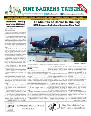
PHOTO BY RAY REEDER A Ryan Navion A landing at the 2010 annual fly-in at Smoketown Airport in Pennsylvania. By Douglas D. Melegari Staff Writer
BASS RIVER–The National Traffic Safety Board (NTSB) has released a preliminary report detailing some of the circumstances which led to a fatal plane crash last month in Bass River State Forest. A Ryan Navion A aircraft assigned Federal Aviation Administration (FAA) civilian registration number N4976K was substantially damaged when it impacted wooded terrain. The aircraft crashed near the New Gretna section of Bass River Twp. at approximately 7:02 p.m. on Nov. 19. The pilot, William Lindley, 75, of Beachwood was fatally injured during the impact. The flight originated from Hummel Field in Saluda, Va. and took off at approximately 5:30 p.m. The flight proceeded on a relatively direct course until approximately 6:49 p.m., when it encountered the leading edge of a cold front. During the following 13 minutes, the flight completed numerous course deviations.
“The aircraft deviated from the flight path,” said Keith Holloway, a spokesman for the NTSB. “Instead of going in a straight line, it circled to the left and then to the right.” The aircraft circled to the left three times and to the right two times prior to impact, according to a preliminary review of FAA radar data. NTSB investigators are trying to determine whether the pilot was incapacitated during the final 13 minutes of the flight. A debris path was observed by investigators beginning with freshly cut tree branches and a section of the right stabilizer tip and right elevator of the aircraft. The debris path extended approximately 420 feet on a magnetic heading of north to the main wreckage. The right and left flaps, left wingtip, left aileron, and cabin roof were located about 340 feet along the debris path. The right aileron and left stabilizer tip were located about 390 feet along the debris path. The main wreckage was inverted at the end of the debris path with both wings
separated. The right main landing gear and nose landing gear remained attached to the airframe and were observed in the extended positon. The left main landing gear had separated and the landing gear tire was located next to the main wreckage. The empennage and rudder remained attached to the airframe. The pilot held a private pilot certificate with a rating for airplane single-engine land. He did not possess an instrument rating. "He was not rated to use instruments," Holloway said. Civilians in the United States are permitted to fly an aircraft without an instrument rating if there is sufficient visibility. At night, this is known as “night visual meteorological conditions”. Pilots can use instruments to their benefit during times of poor weather conditions, especially when there is low visibility. The NTSB has determined that “night visual meteorological conditions” prevailed
CRASH>>>PAGE 5
Now Direct Mailed to Over 2,250 Homes in LeisureTowne
****ECRWSS**** LOCAL POSTAL CUSTOMER