PORTFOLIO
SOIL BANK
New York, New York
Prof. Ivi Diamantopoulou, 2024
THE LOOP
Elba, Italy
Prof. Olivia Gori, 2024
SALT SHED
Brooklyn, New York
Prof. Marie Stargala, 2023
37 CHAMBERS ST
New York, New York
Prof. Rocio Crosetto-Brizzio, 2023
SOIL BANK
New York, New York
Prof. Ivi Diamantopoulou, 2024
In collaboration with Safiyyah Subhan-Khan and Lillie Waddell
Our project is divided into three acts, each exploring a different narrative of soil in NYC.
ACT 1: We were given the task to collect soil samples from a Neighborhood in NYC, so I chose Hudson Yards. This drawing reflects the various soil types I collected ranging from polluted roadside soil to engineered “smart” soil from Hudson Public Park. The drawing reflects a gradient from “dirty” to “clean” as one moves upward.
ACT 2: This diptych shows the evolution of Hudson Yards from a train yard into an elevated public park. The complex systems above the train yard include a rainwater collection tank for irrigation, a ventilation system with 15 high-power fans for fresh air, and concrete cooling slabs to maintain optimal conditions for the plants.
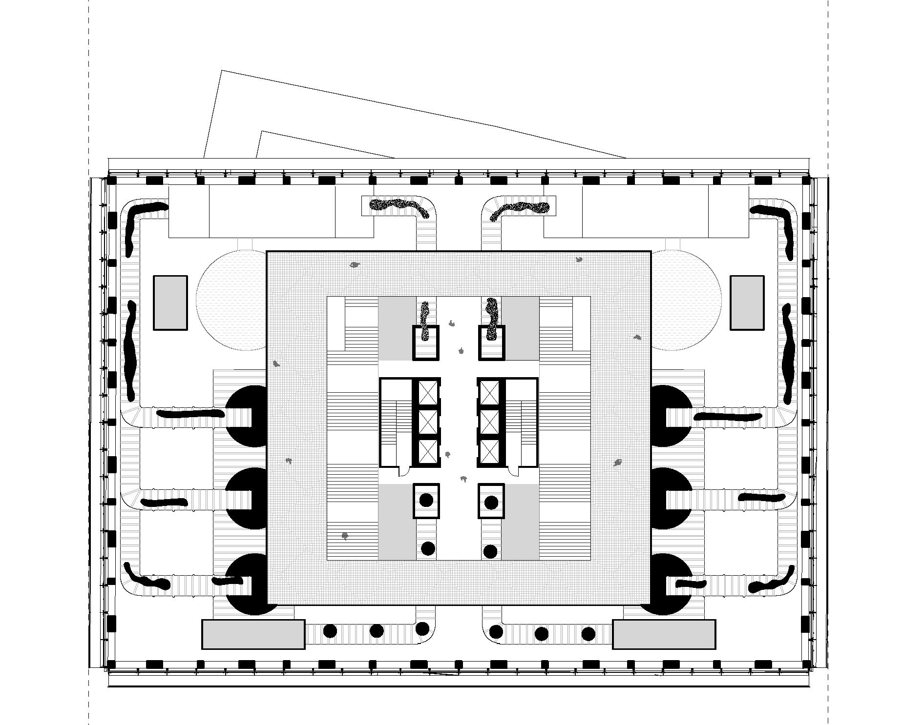
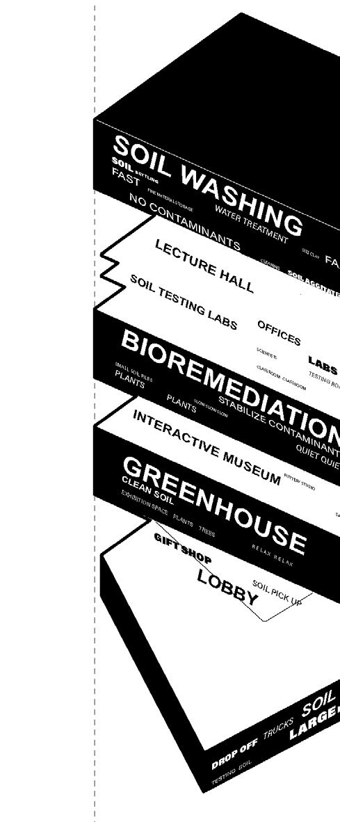
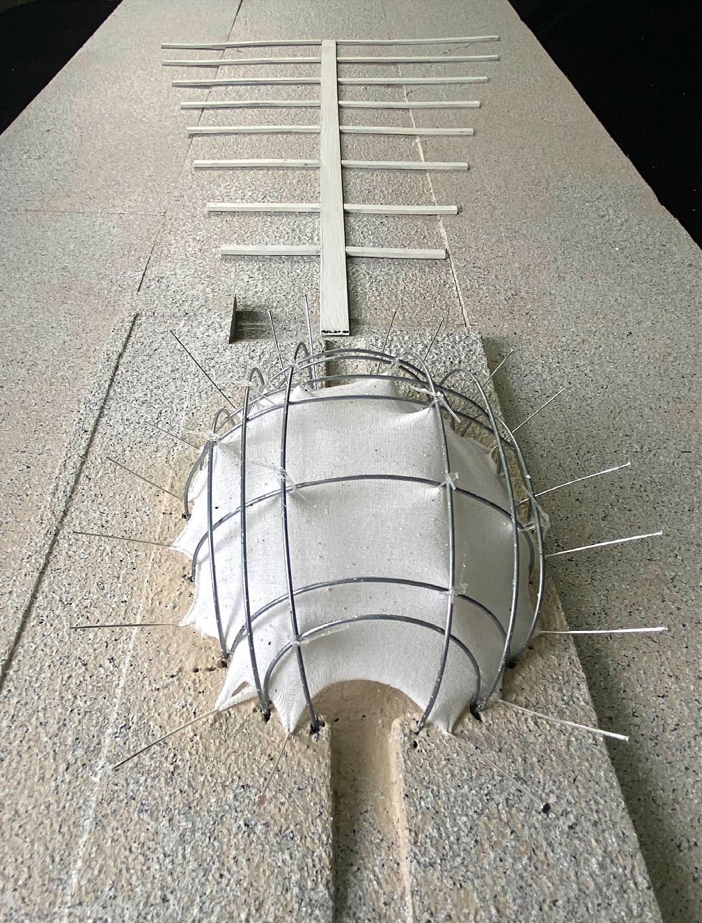
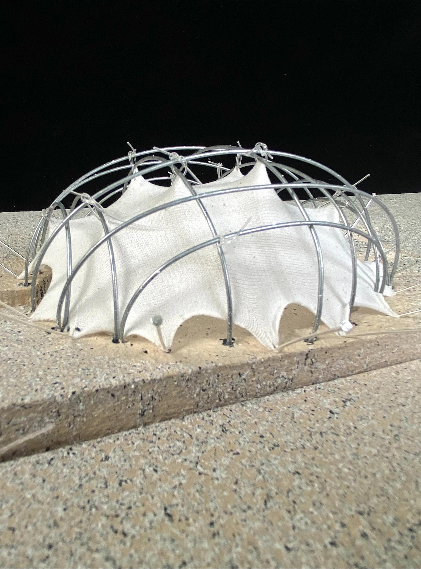
ACT 3: Our soil bank is designed to accept soil with varying properties, including contaminated soil, and distribute it for both internal use within the building and external use back to the city. We work in tandem with the Clean Soil Bank, taking in the soil they reject. As a result, we handle soil of all types, sizes, and scales.
Our 3 project objectives are:
1. To filter and clean the soil through two processes: Soil Washing and Bioremediation
2. To create engaging spaces for interaction
3. To reconnect New Yorkers with the soil around them

Act 1: Soil Gradiant Drawing
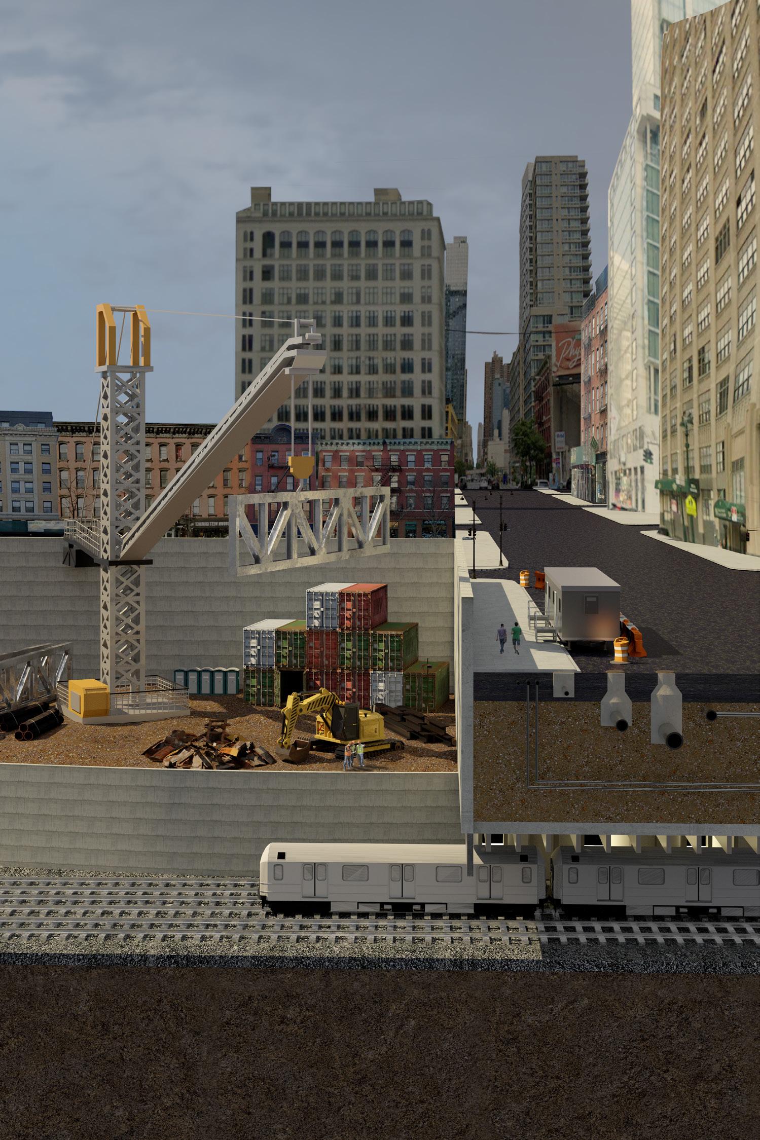
Act 2: Hudson Yards before
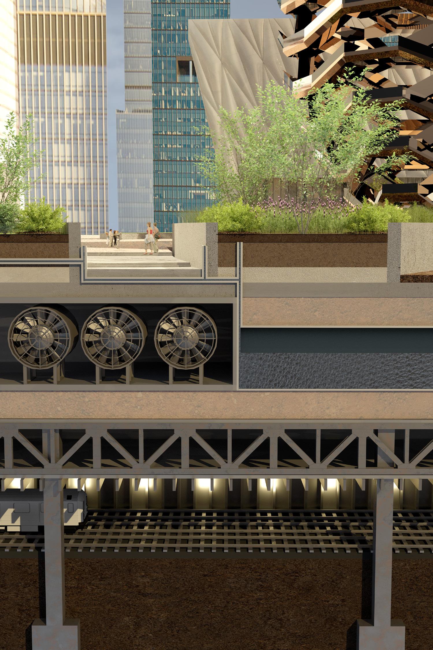
Act
2: Hudson Yards today
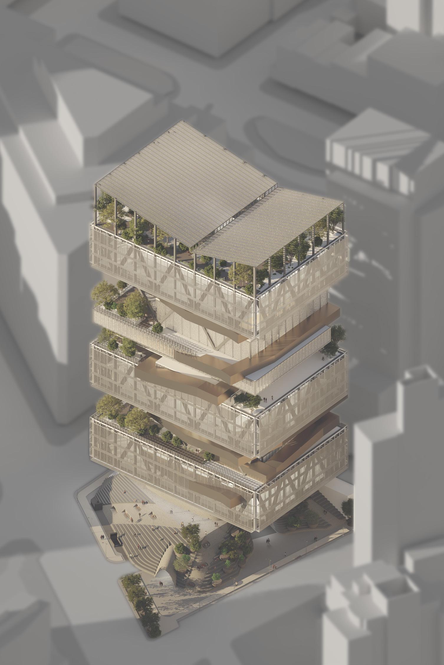
Act 3: V-RAY Rhino Render Axon
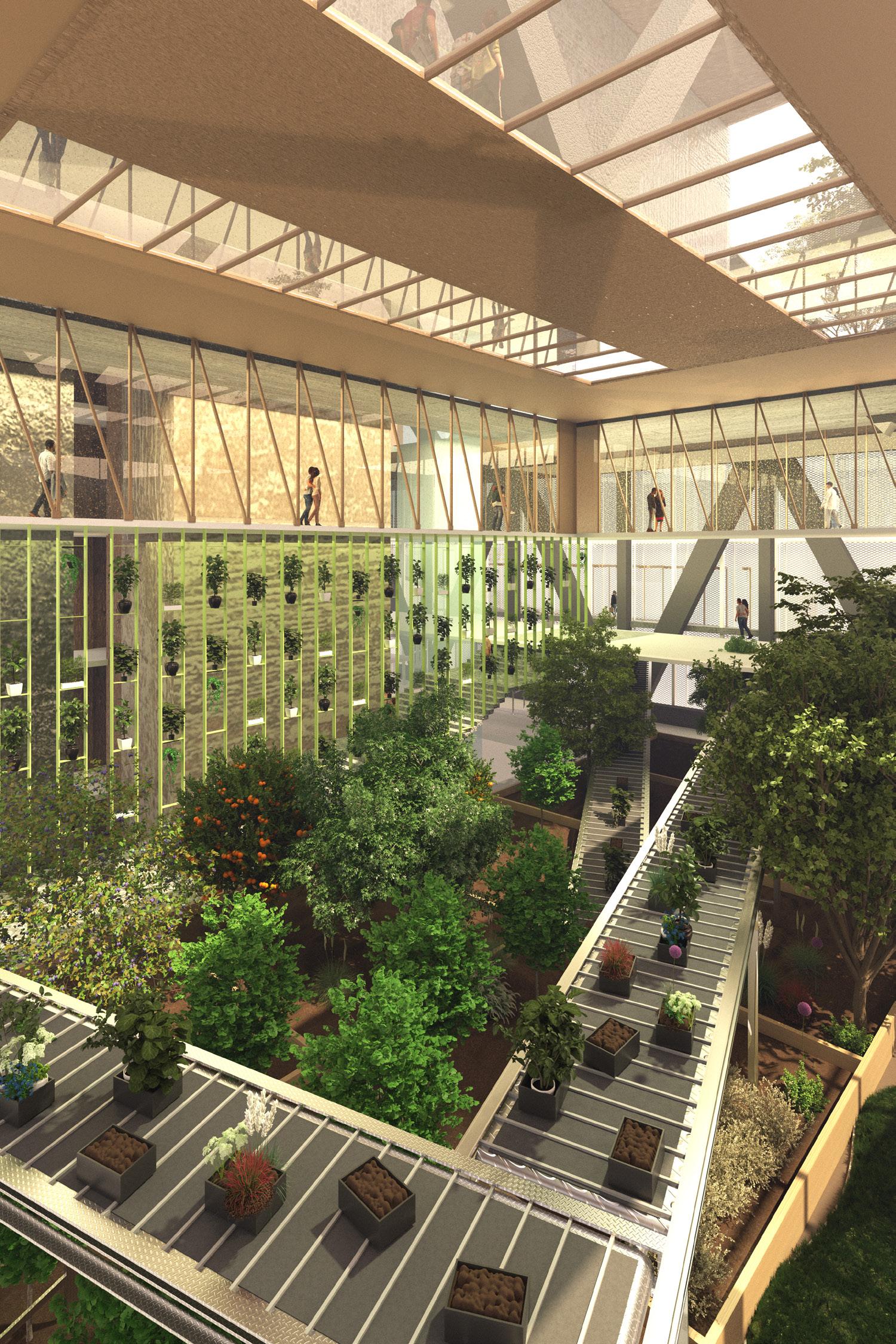
Act 3: V-RAY Rhino Render of Greenhouse


Soil Washing Circulation

There are two decontamination techniques used to treat soil:
1. Soil Washing
2. Bioremediation
Soil enters through the base of the building where it is tested for contaminants and sorted by size. Larger piles of more contaminated soil are lifted to the top floor of the building by soil elevators where they undergo the soil washing process. Here, the particles are washed in a solution to separate contaminants, forming sludge. The sludge is then transferred to settling tanks where the contaminants float to the surface, leaving clean soil behind. This clean soil is then brought back down the opposite soil elevator where it is moved to the ground floor for redistribution to the city.
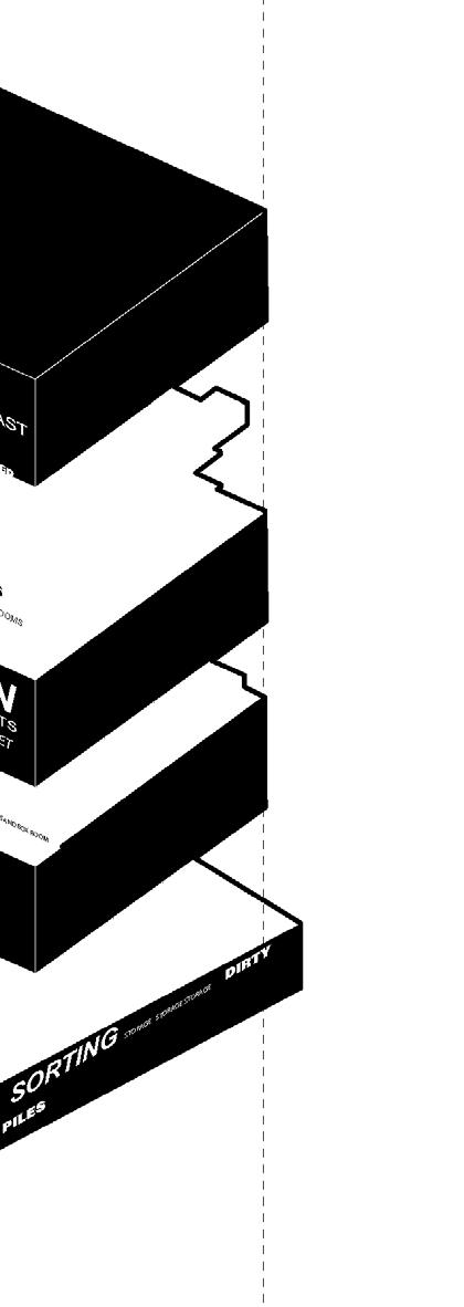
The smaller, less contaminated soil piles are lifted to the bioremediation floor. Here, the soil is spread across plant beds where hyperaccumulators absorb and stabilize contaminants. These plants release enzymes through their roots to break down the contaminants, making the soil safe for reuse. Once the soil is clean, it is ready for redistribution to various engagement rooms in the building and available for purchase by the community on the ground floor.
Axon
Taxtonomy Axon

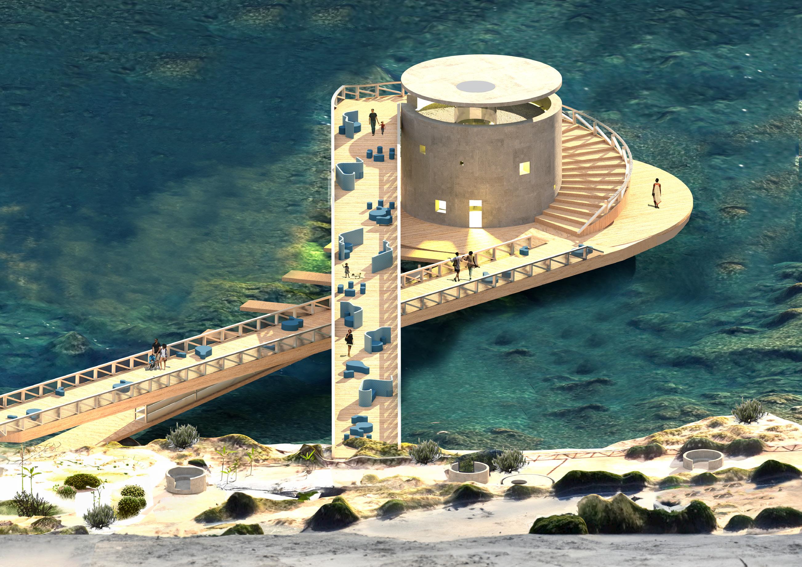
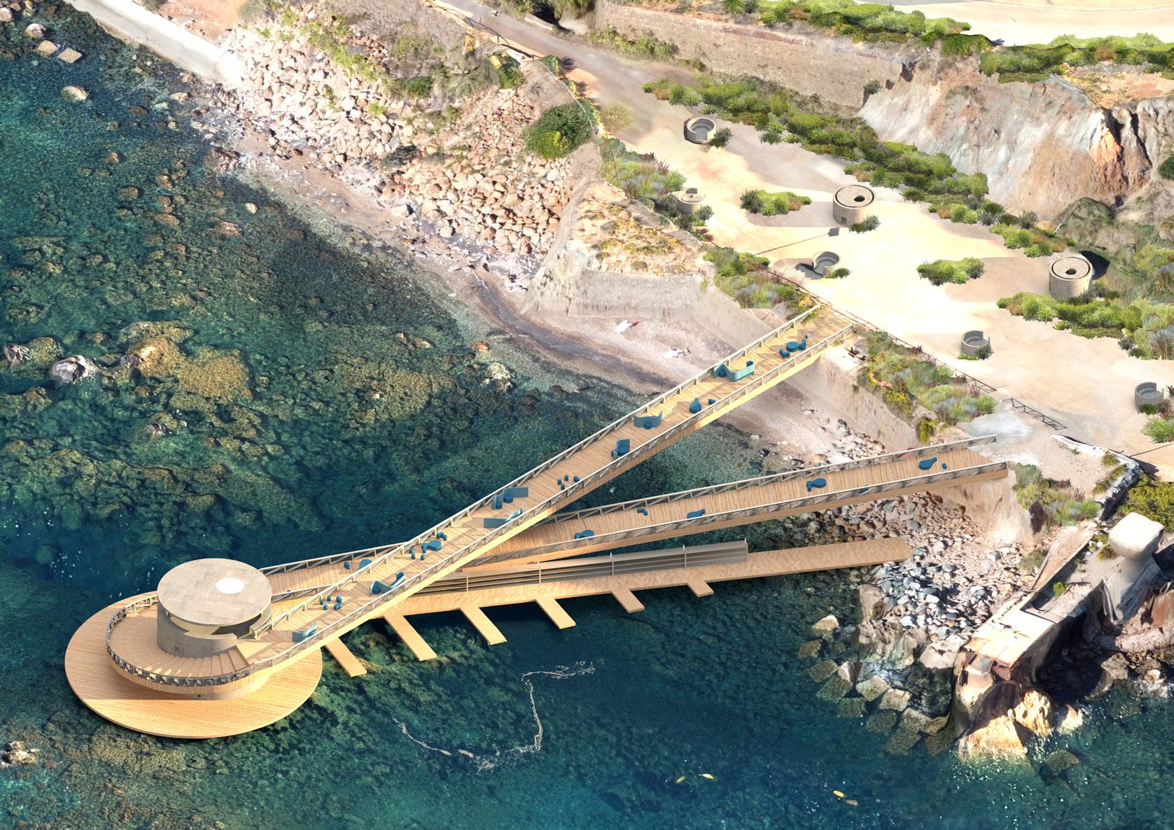
THE LOOP
Elba, Italy
Prof. Olivia Gori, 2024
In collaboration with: Sarah Whittle and Sarah Crawford
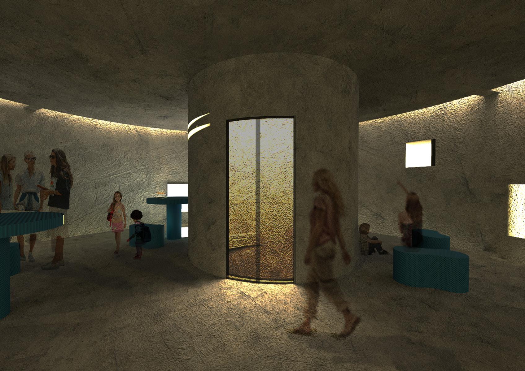
The project began with the study of the Macchia Mediterranean vegetation on Elba, recognizing its importance on the island and the challenges it faces from tourism, wildlife, and wildfires. Our goal was to reclaim the site with this vegetation while designing a three-tiered system along the coastline that connects the macchia’s natural structure to the public infrastructure. Through discussions with Rio Marina’s residents, we discovered a significant gap: while the town has an elementary and middle school, there is no nearby high school. As a result, students have to take a 40-minute bus ride to the opposite end of the island followed by a boat trip to another island to attend high school. Our program addresses this by serving as both a hub for students and a pier for their transportation to and from school. This is not limited just to students but rather opens itself up not only to the town of Rio Marina but also to the surrounding island as a whole.
Beginning our design, we focused on several main design goals
1. Lack of activities for teenagers and younger age groups
2. Access to high school across the island
3, No Infrastructure that allows direct access to the water
In terms of how we informed our design through these findings, we focused on two primary objectives: to maintain this tiered layering system, and to plug in our design to the pre-existing infrastructure. The simplest way to do this was to establish a “loop” that connects the existing walkway on the left and returns to the pathway on the right. This loop creates an uninterrupted connection to the site, while also providing adequate program throughout the pier.
V-RAY Rhino Render
Macchia Composite Drawing

Macchia Layering Diagram
“LOOP” Layering Diagram

V-RAY Rhino Render
V-RAY Rhino Render
Furniture Diagram Geometric
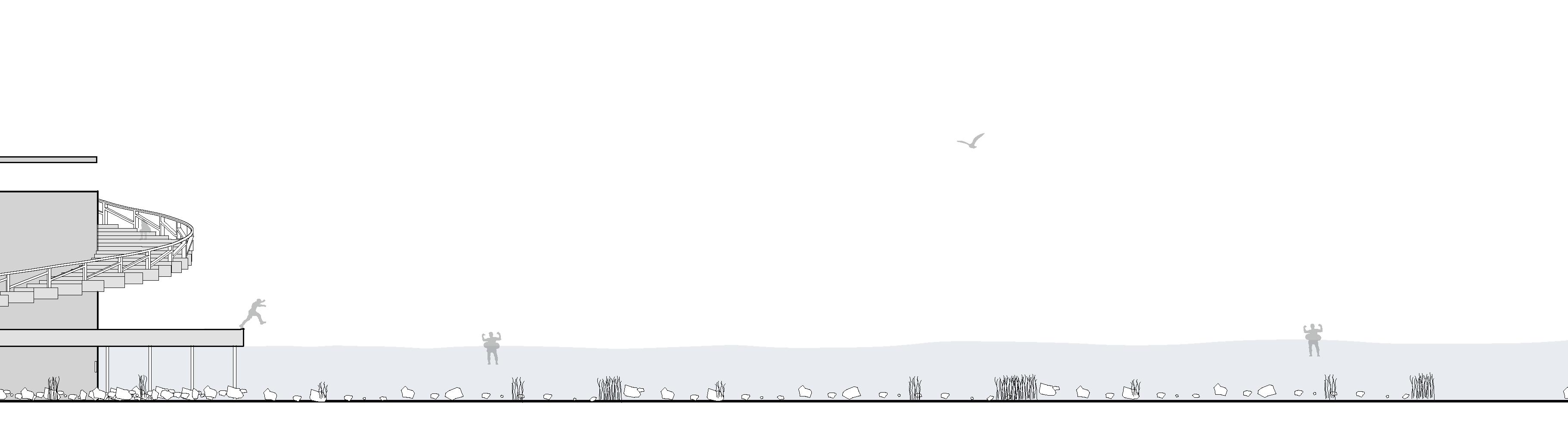
The furniture features circular seating and dividers created by tangent lines. These five movable and adjustable groupings allow for flexible use, accommodating both larger gatherings and smaller or solo seating along the pier.
The pier’s path and organization by following geometric logic ensured a natural flow path

Logic Section Perspective
organization was determined and tangent lines. This path on the pier.
The student hub contrasts the open, bright exterior by providing a heavier, darker experience inside for spaces for students to study and gather.
Longitudinal Elevation
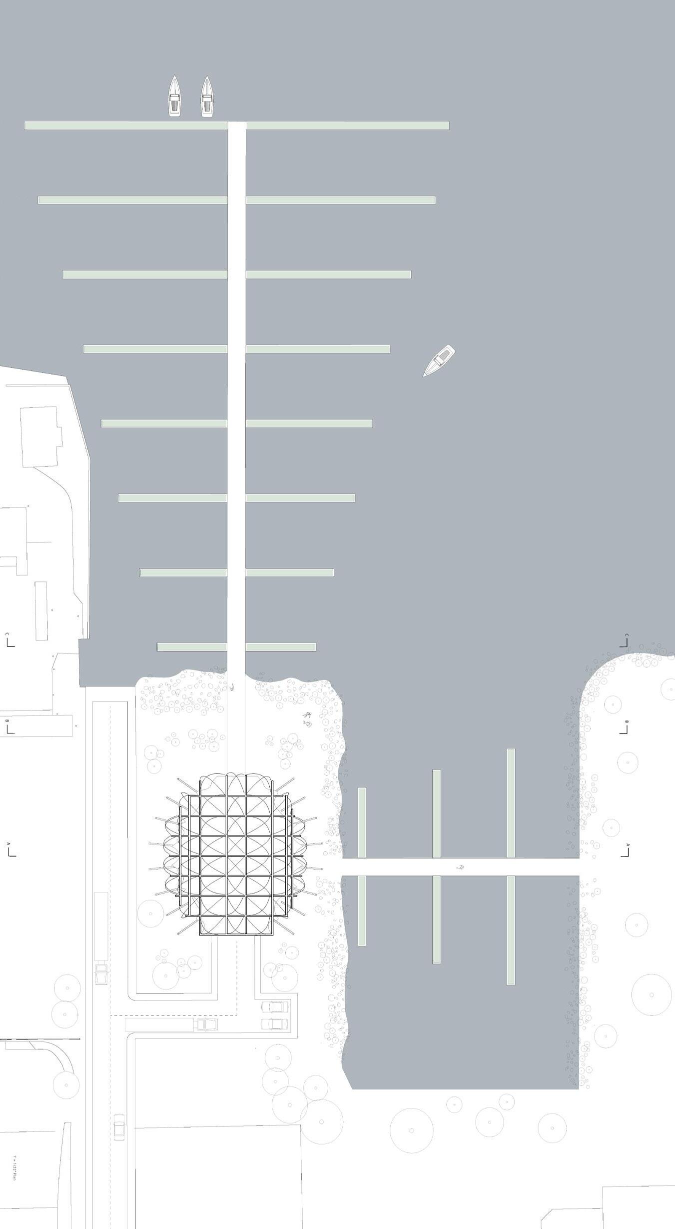
SALT SHED
Brooklyn, NY
Prof. Marie Stargala, 2023
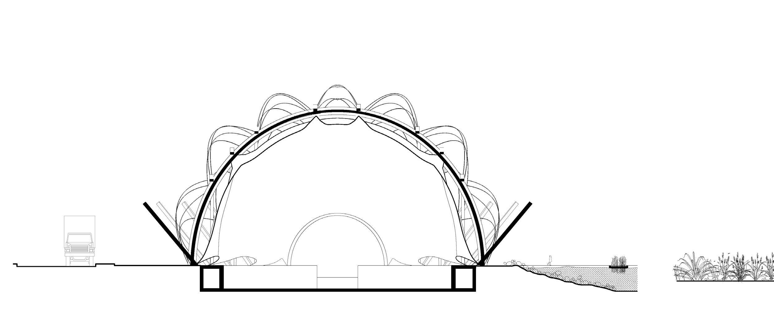
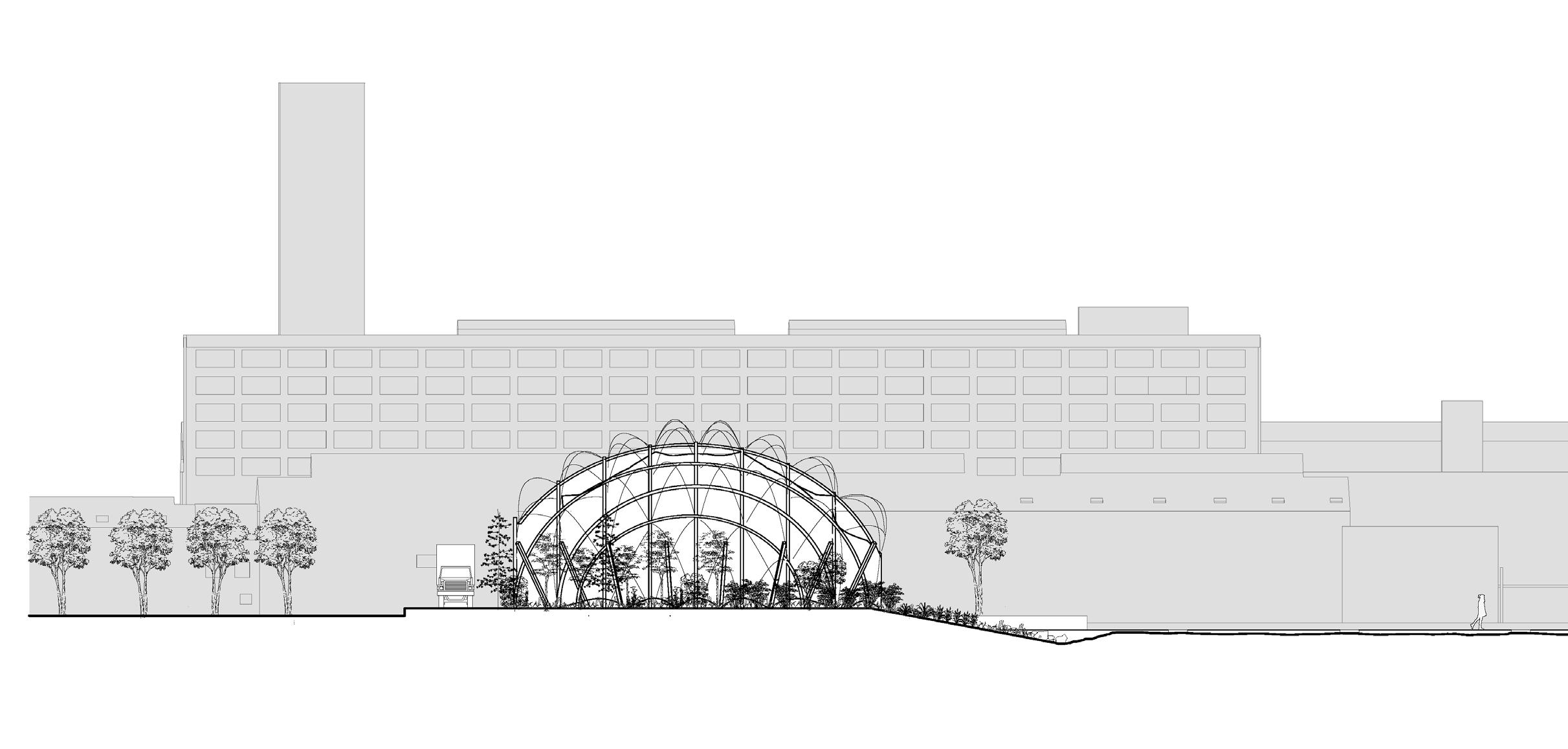
Before urbanization, Brooklyn was a vast oak-grown forest full of flourishing plants and species. This project juxtaposes the idea of nonhumans and human infrastructure. After delving into the context of this pier in Brooklyn, I was enamored with the idea of bringing back native plants and species to this site to create a greener, friendlier approach to this industrial neighborhood of Brooklyn. There is a black-and-white relationship between the city and the landscape, so that boundary was blended by combining an industrial salt shed with a dense green environment.

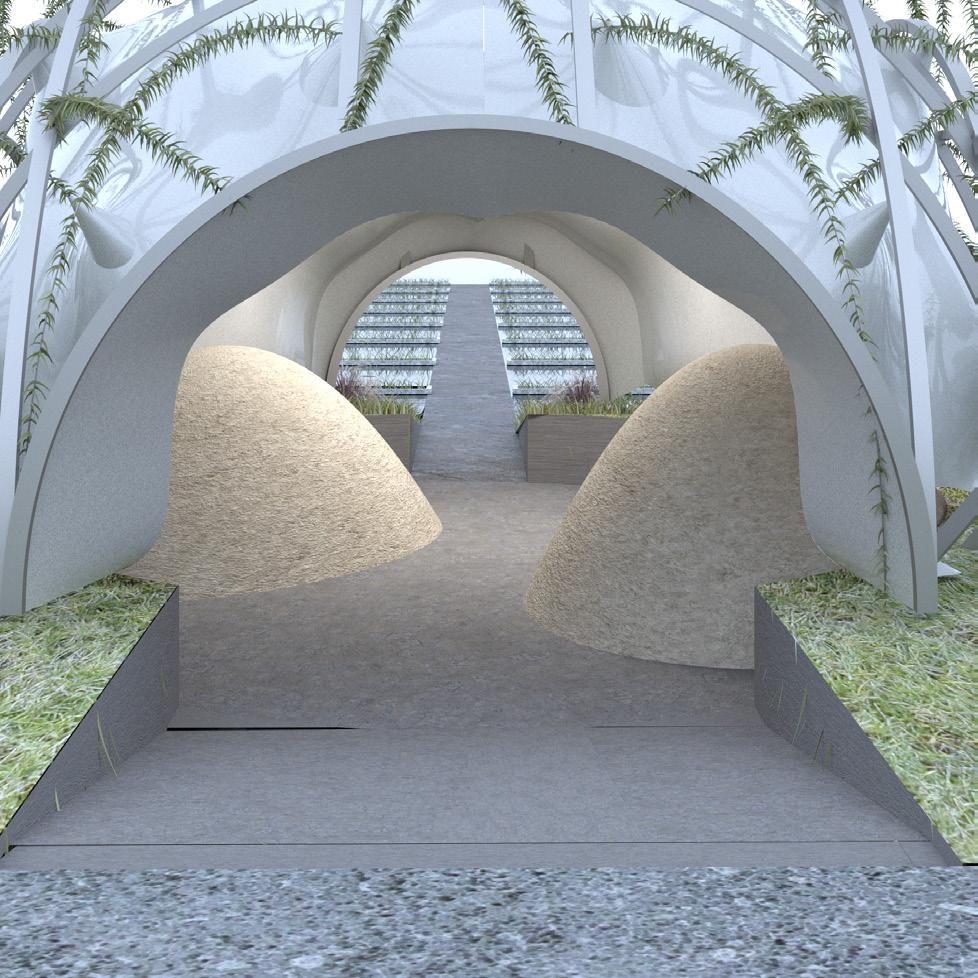
V-RAY Rhino Render
A
Also tasked with constructing a pier plants that have been proven successful the water. These include mustard plants, plants are flanking the sides of the pier and called phytoremediation to clean up soil, to blend the industrial site with the environment corridor that could expand along Brooklyn’s
Section
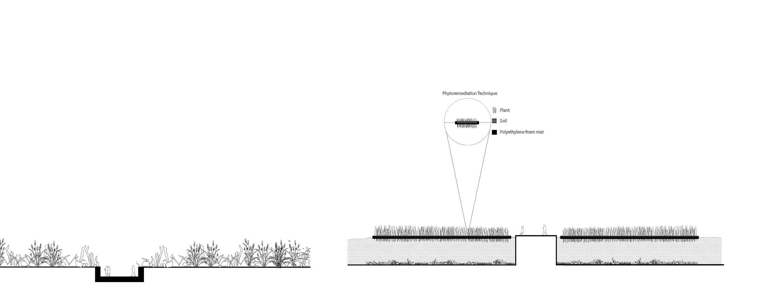
relevant to our design, I researched at hyperaccumulating contaminants in pigweed, and alpine pennycress. These and use a decontamination technique water, and air. Overall, the project aims environment and create a start to a green Brooklyn’s edge.

Longitudinal Elevation
Section B
Section C
Section C 1’= 1/16”
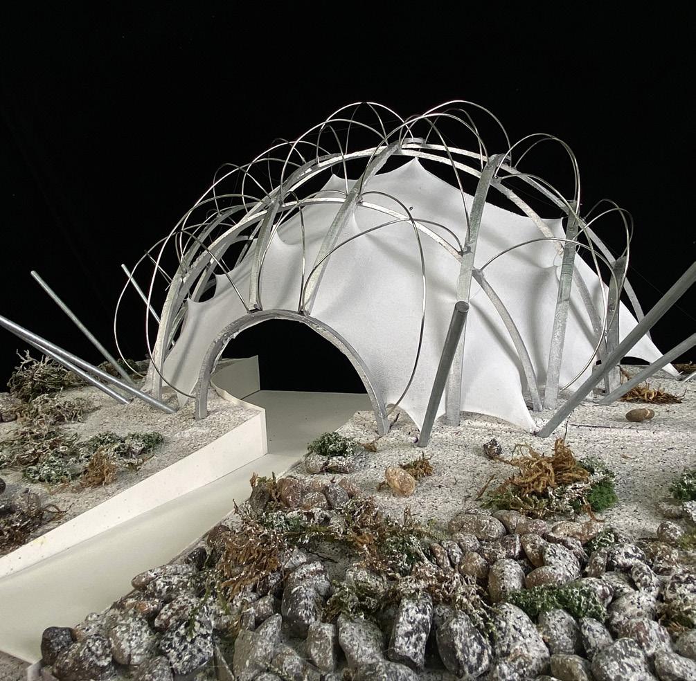
Model Photo
Model Photo
V-RAY Rhino Render Model Photo
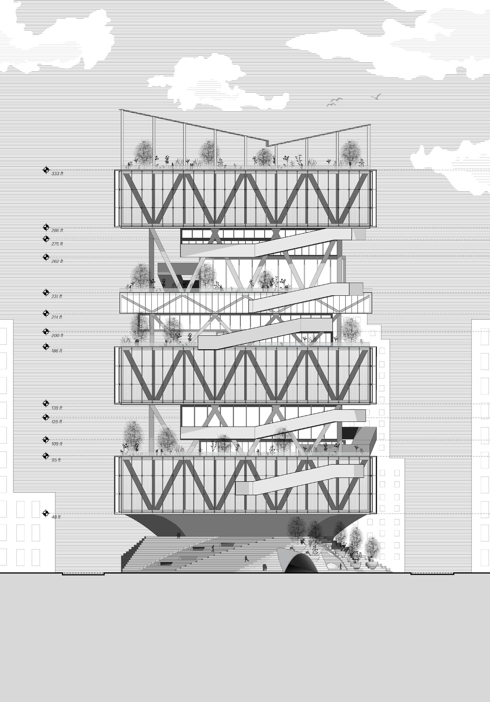
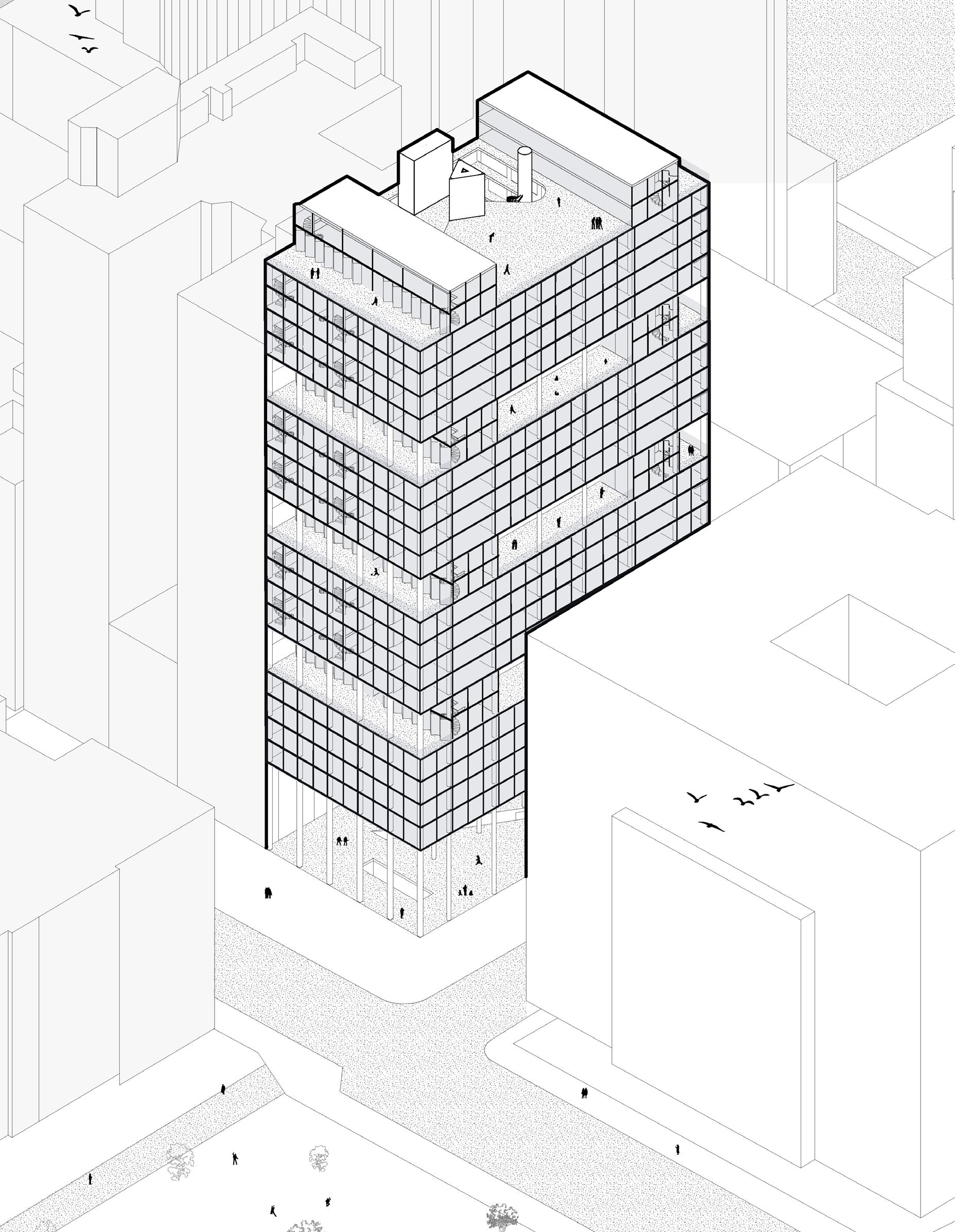
37 CHAMBERS ST
New York, New York
The site is located in the financial district of NYC, surrounded mainly by commercial establishments and the nearby Pace University, with City Hall Park at its core. The project is designed to cater to both the local student population and the working community in the area. A key aspect of the design is the use of organic shapes to guide users up and through the building. For instance, the circular staircases enhance the viewing experience, allowing users to better appreciate their surroundings as they move through the space. Another important element of the design is the incorporation of voids to improve ventilation and allow natural light to penetrate the building.
Prof. Rocio Crosetto-Brizzio, 2023
Axon


The building is organized in a systematic way by alternating “packages” between section and plan.
Ground Floor Plan
Student Dorms Typical Floor Plan
Package 1: Typical Floor Plan 1
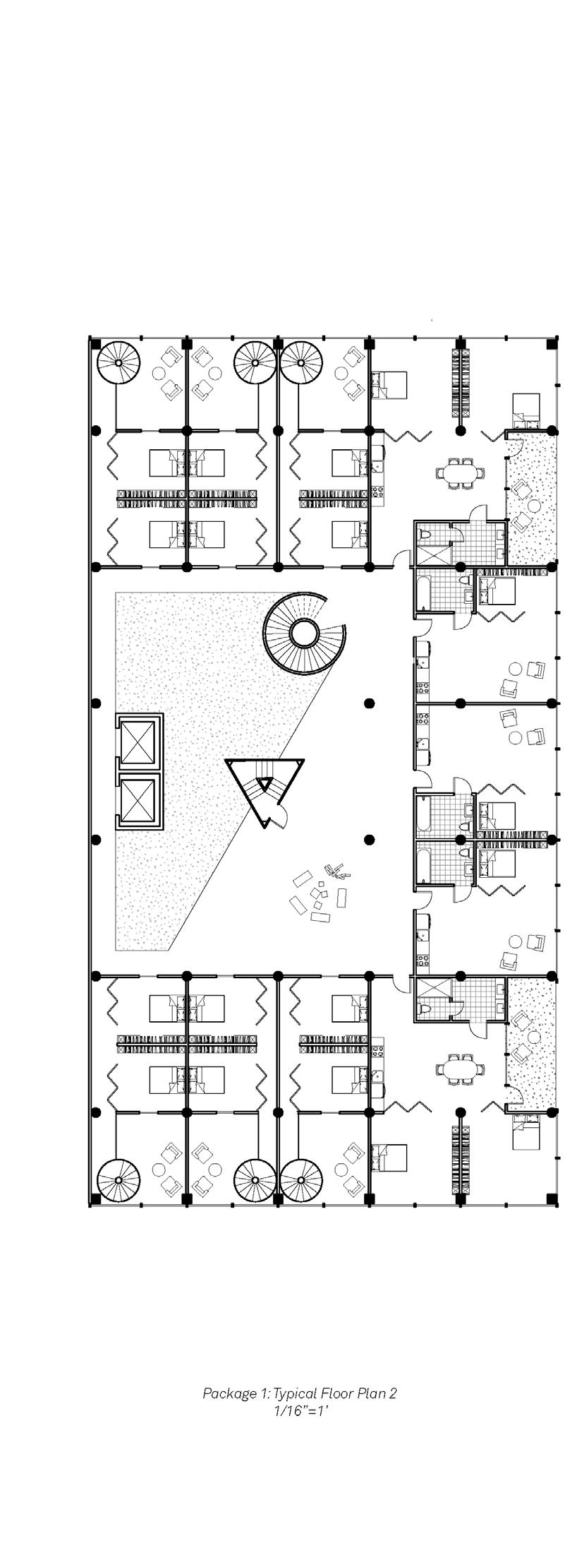

Package 1: Typical Floor Plan 2
Package 2: Typical Floor Plan 1
Package 2: Typical Floor Plan 2
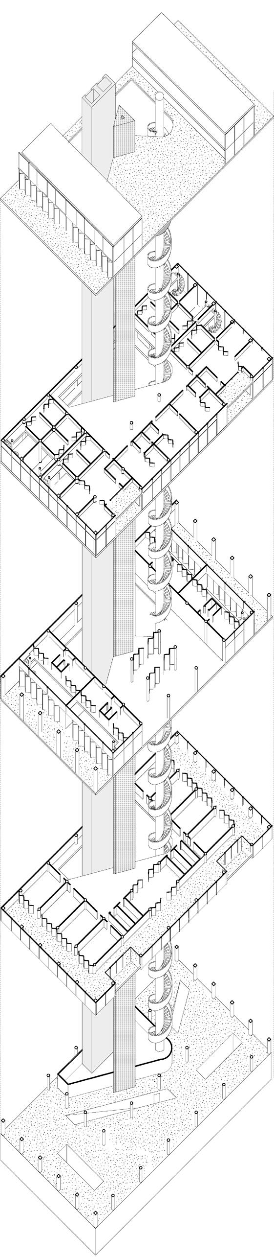
Roof
- Reception area for Museum
- Conference area
- Rentable event space
Floors: 6-9, 11-14, 16-19
- Package 1: Typical Floor Plan
Floors: 5, 10, 15, 20
- Package 2: Typical Floor Plan
Floors: 1-4
- Pace University Student Dorms
Ground Floor
- Public exterior space
- Entrance to Underground Museum
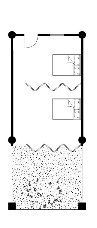
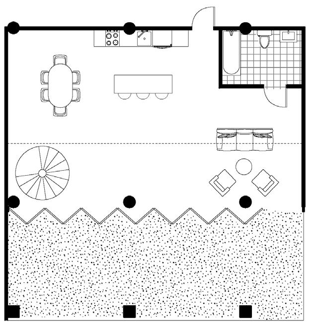
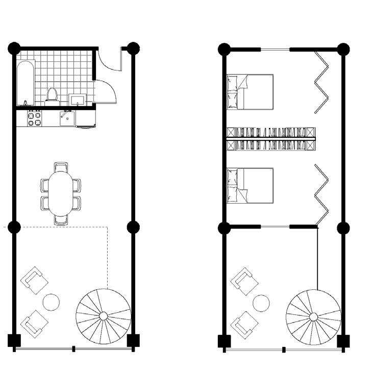
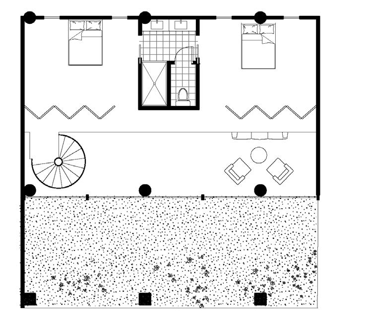
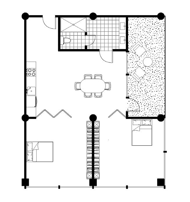

Pace University Student Dorms
Two-bedroom Loft
Two-bedroom with balcony
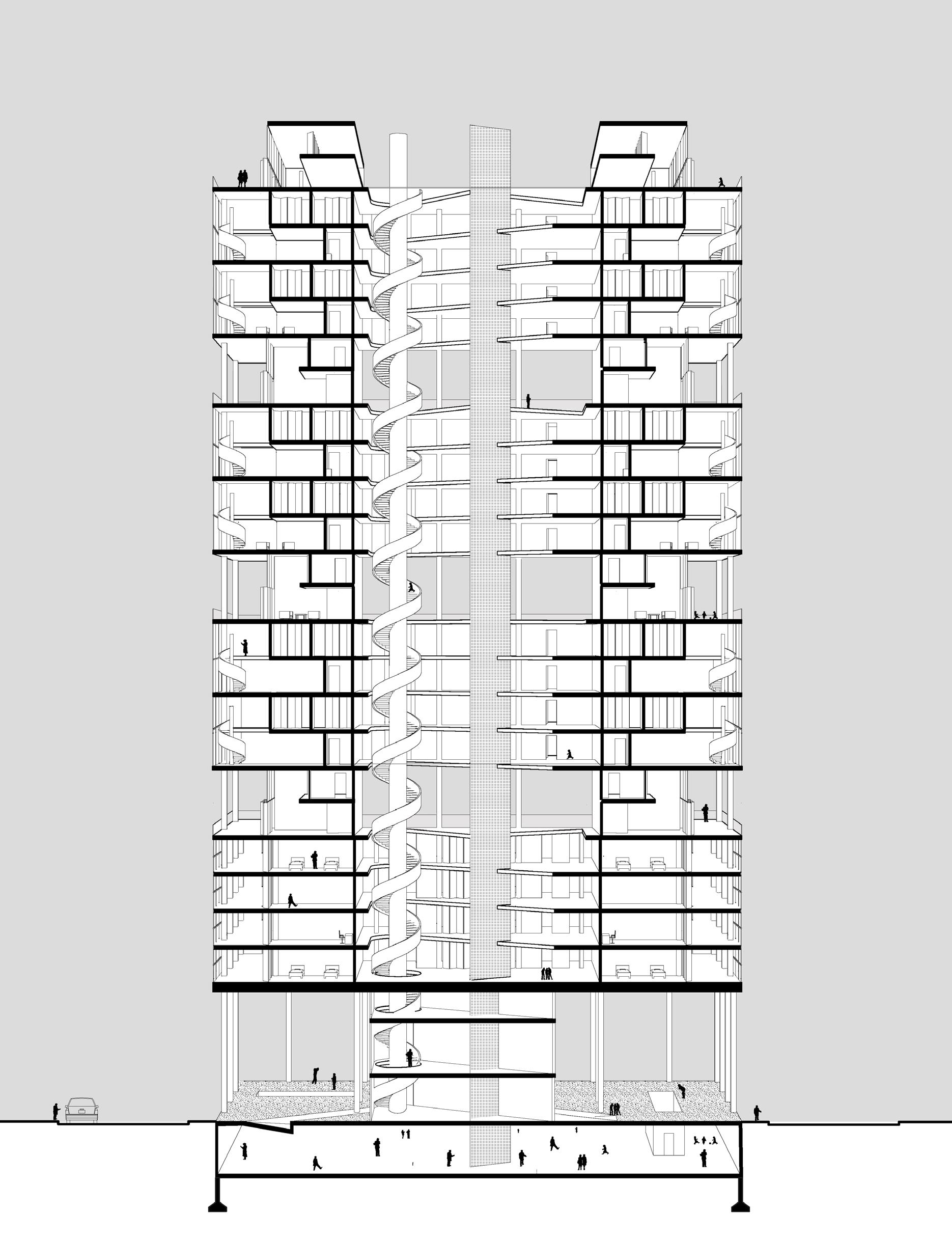
Section Perspective


Images
Collage
Syracuse University
School of Architecture
B.Arch Class of 2026
Tel: 973-309-3935
E-mail: pmcgarry@syr.edu
PEYTON MCGARRY