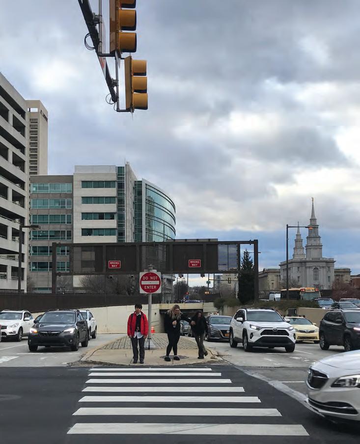
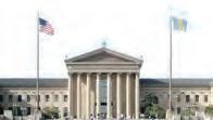
RECONNECTING COMMUNITIES
VINE STREET CORRIDOR
CPLN 7600 Urban Design Capstone Studio Spring 2023

TABLE OF CONTENTS The Corridor Plan Studio Background 1 67 5 Individual Area Plans Museum South Historical Context 6 68 96 119 157 173 207 231 255 11 19 23 28 59 62
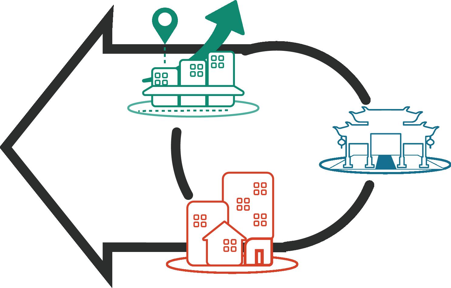
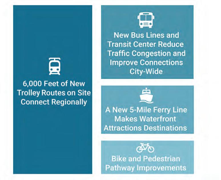
Lives Here Today? The Vision: Highway to Boulevard Building the Plan The Systems Corridor By the Numbers Dividing the Corridor Logan Fair and Square Broad & Vine Reshaping the Rail Park Reconnect: Chinatown Chinatown Eastward Haven Old City Business Corridor Adaptive Industrial Ecosystem
Who
STUDIO BACKGROUND
1
WHO WE ARE
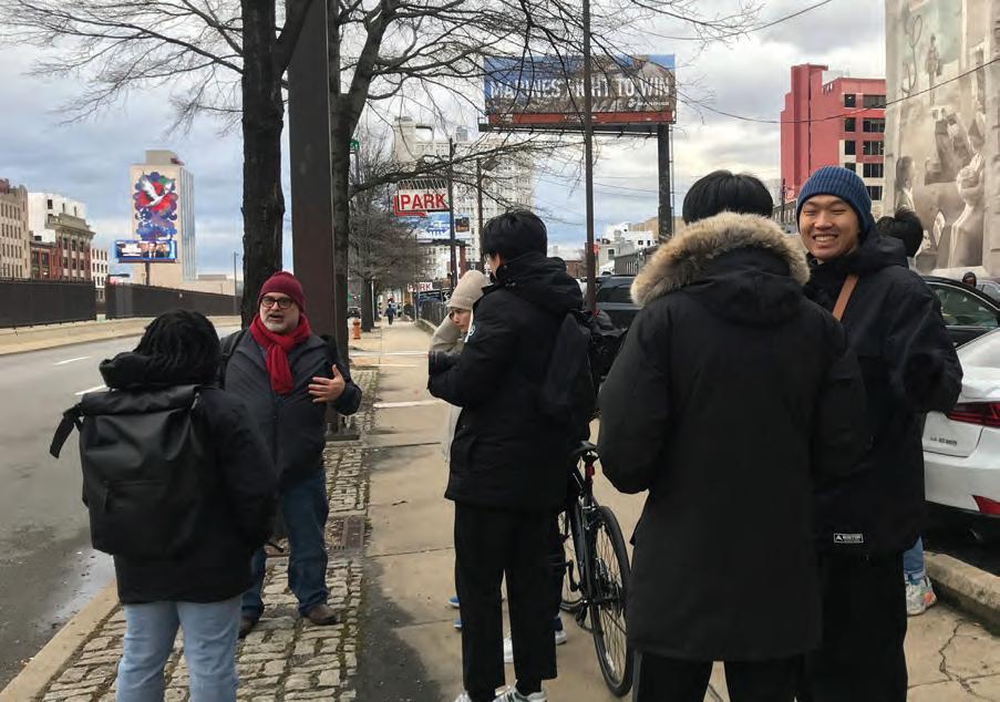
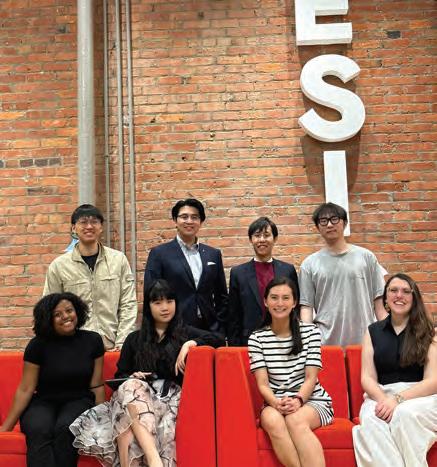
2
Nando
Danielle
Landscape Architecture
Helen
Jie
Architecture Environmental Science Historic Preservation Urban Planning MCP StudentsUrban Design Concentration 11
Micale
Lake
Kylee Pierce Yan Wang Yuchen Wang Diyi Zhang Zihan (Joann) Zhao Makayla Davis David Wangkyu Kim
Lea Changhao (Chauncy) Li
Li Eliza Nobles
RECONNECTING COMMUNITIES PILOT PROGRAM
Our studio prompt takes inspiration from the Reconnecting Communities Pilot Program, which is a federal program that strives to reconnect communities previously cut off from economic opportunities due to transportation infrastructure.
Philadelphia is one of 45 cities that have been awarded planning and capital construction grants through this program. Through this studio, we had the opportunity to meet with people who provided insight into the process and philosophy behind it.
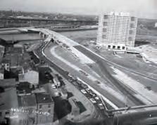
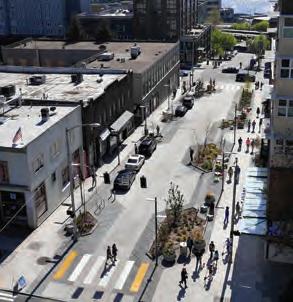
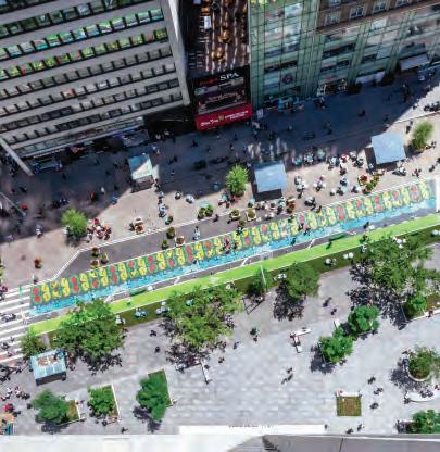
 Source: Mark Henniger, Imagic Digital
STUDIO TIMELINE
4
JANUARY FEBRUARY APRIL MAY MARCH
Conditions and Precedents Design Workshop and OTIS Meetings CCD Presentation PCDC Meeting DAG Showcase Design Workshop Meeting Site Analysis Review Review #1 Review #2 Final Review Studio Presentation Studio Meeting with City Agencies & Community Organizations Two Visions Corridor and Area Plan Development Final Design Development
Existing
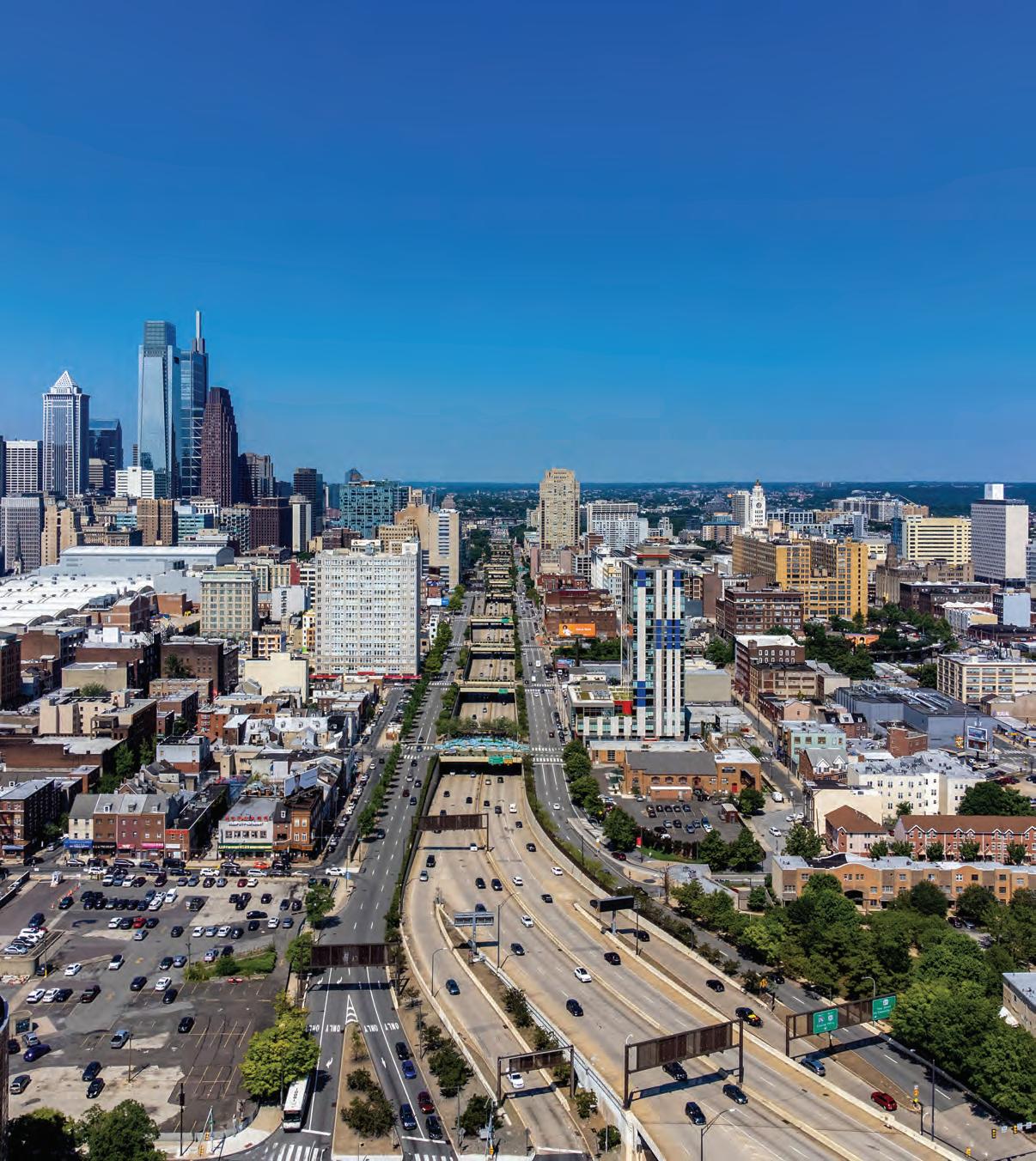
THE CORRIDOR PLAN
5
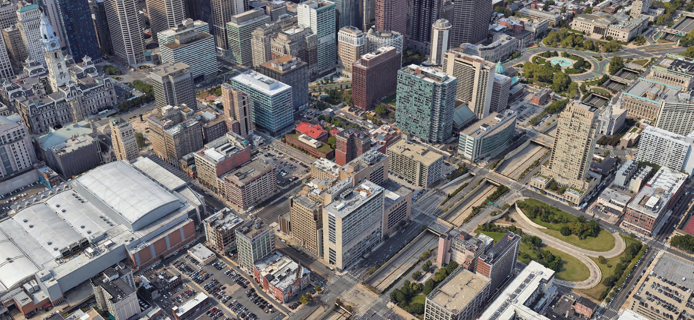
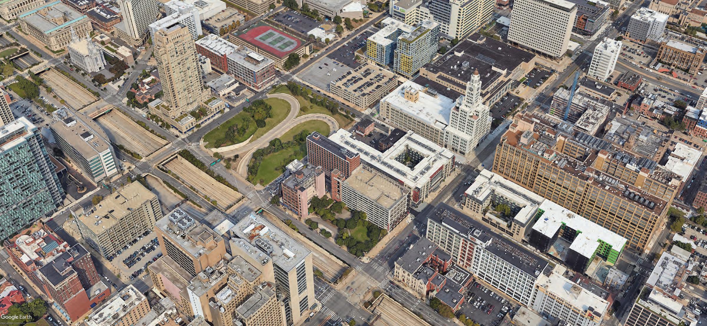
HISTORICAL CONTEXT
6
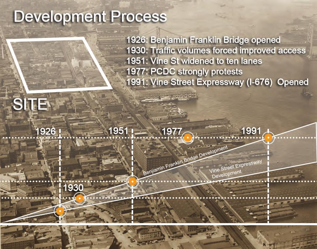
VINE STREET
Image: Jacques Gréber (1919); Fairmount Parkway Association (1907); Historical Society of Pennsylvania (1936)
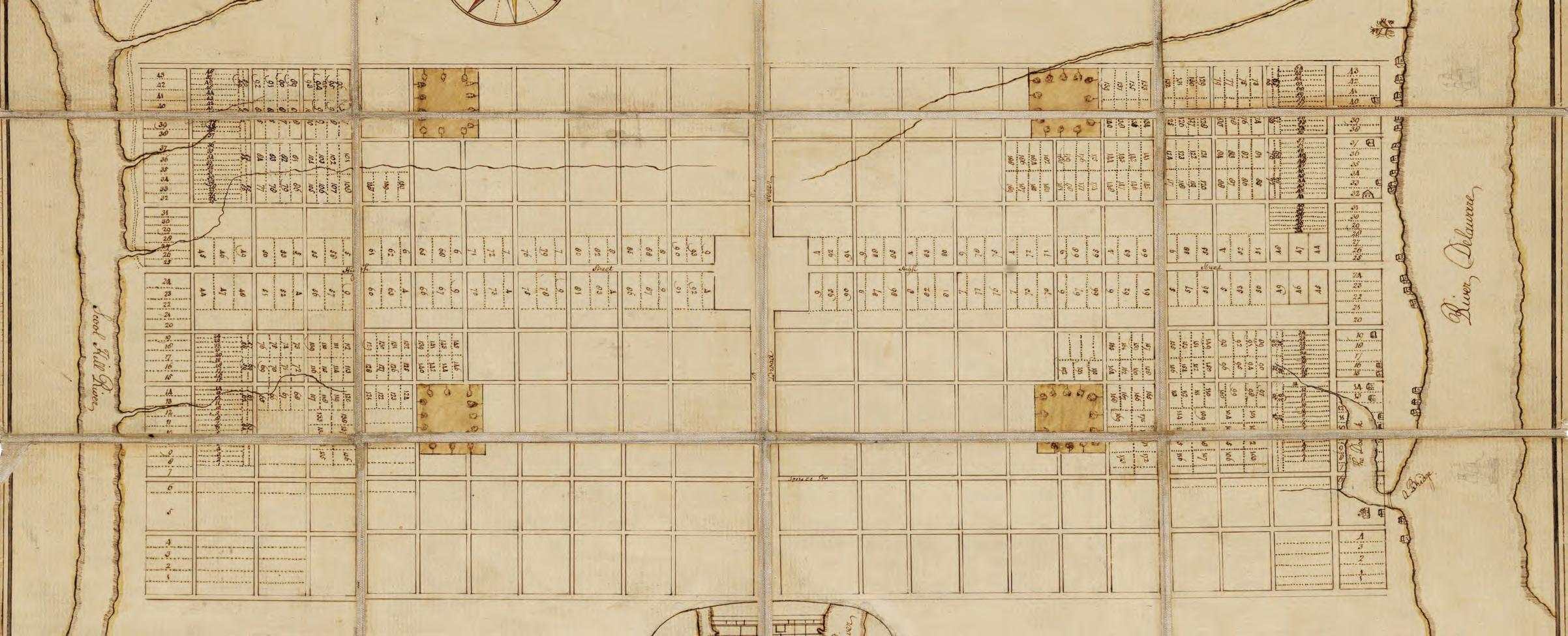
Source: Thomas Holme, “A Portraiture of the City of Philadelphia” (1962)
As early as 1682, William Penn and Thomas Holme envision Vine Street as a 50-foot right-of-way and the city’s northern boundary.
7
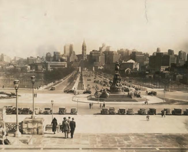
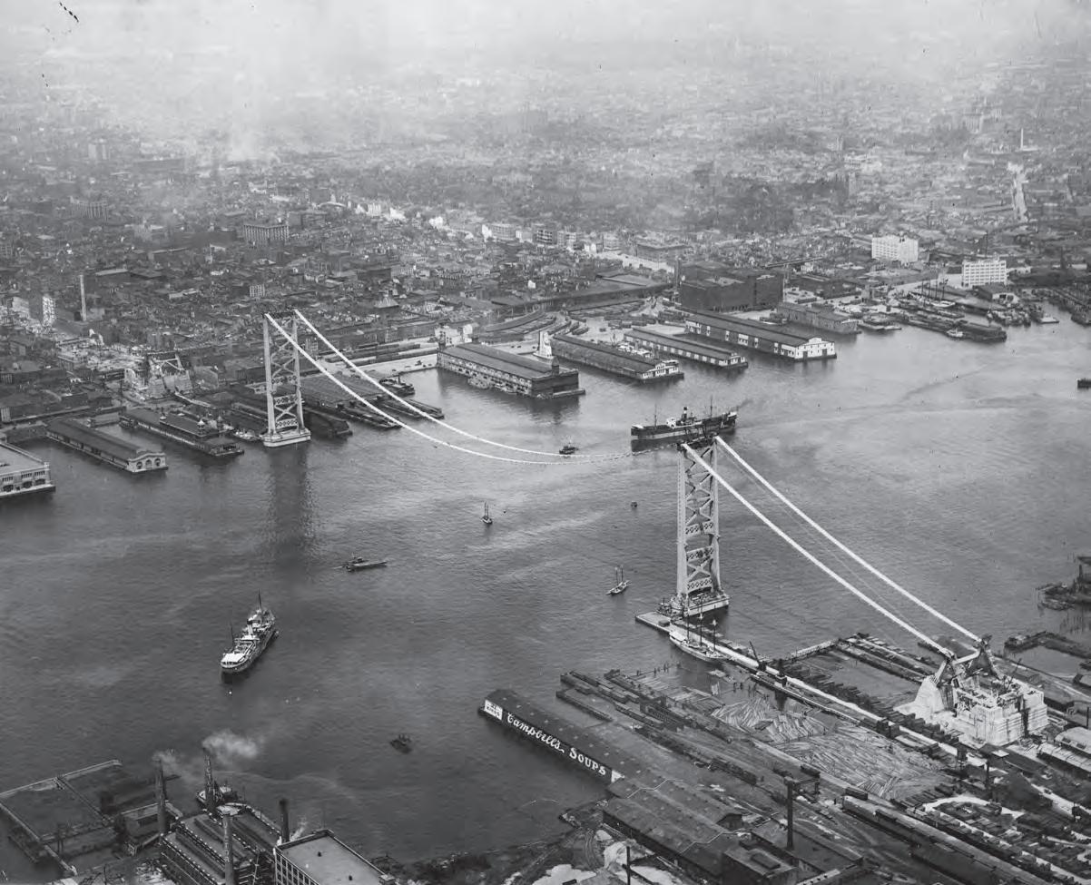
Source: Historical Society of Pennsylvania (1936); Aero Service Corp (1924)
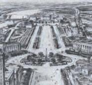
In 1918, the Benjamin Franklin Parkway officially opens to traffic on the west side, and eight years later, the Benjamin Franklin Bridge is completed on the east side.
8
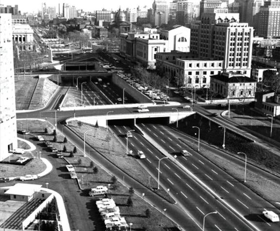
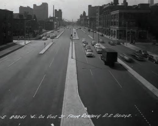
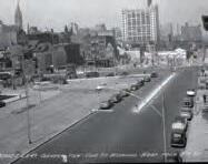
Source: Fred R. Twers (1951); Office of the City Representative (1961)
In 1951, the Vine Street roadway is expanded to ten lanes, and by 1960, the first section of the Vine Street Expressway opens from the Schuylkill Expressway to 17th Street.
9
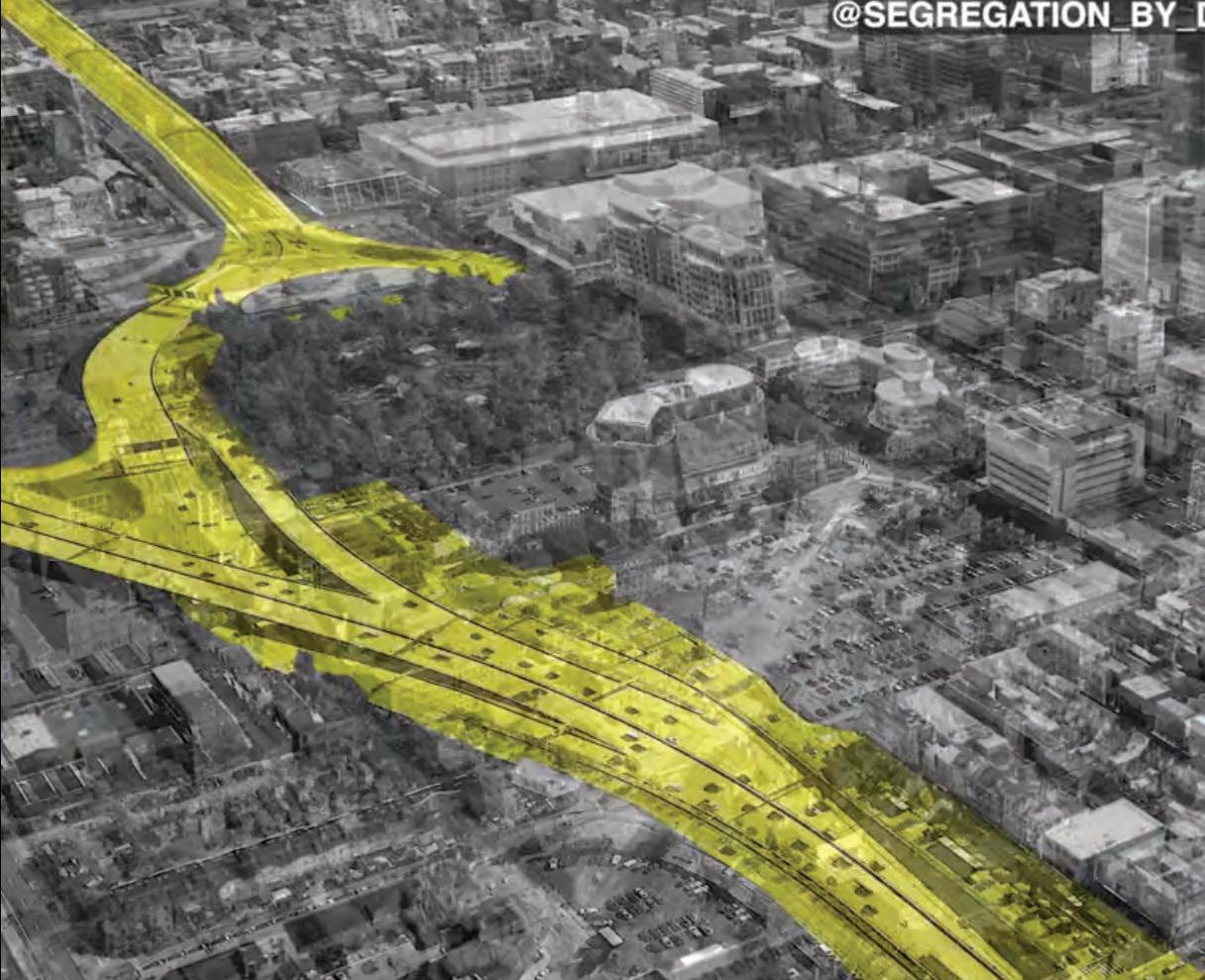
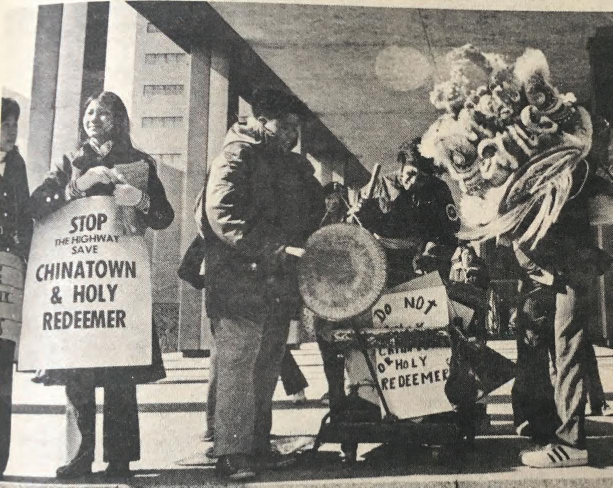
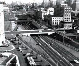
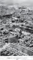
Source: Robert Halvey (1973); @segregation_by_design
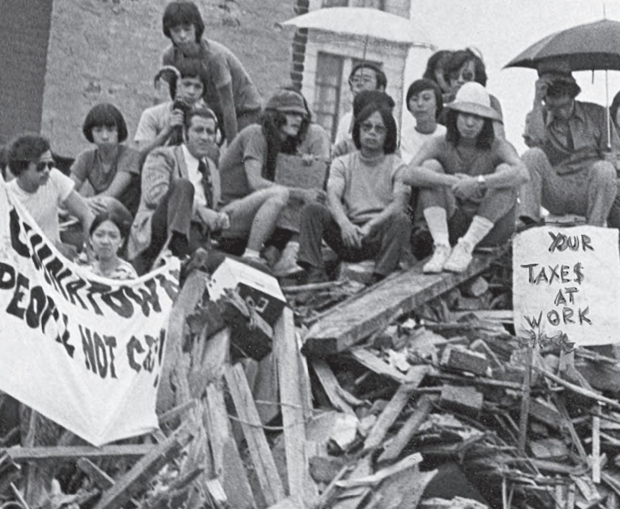
In 1966, plans for Vine Street Expressway expansion are unveiled, receiving community backlash. Ultimately, a modified version of the highway is constructed, saving the Holy Redeemer Church.
10
WHO LIVES HERE TODAY?
11
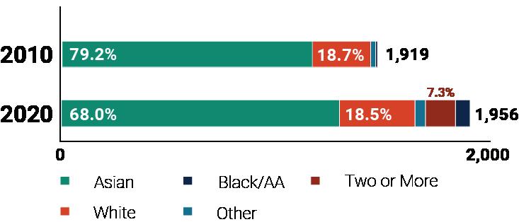
Source: 2010 - 2020 US Decennial Census
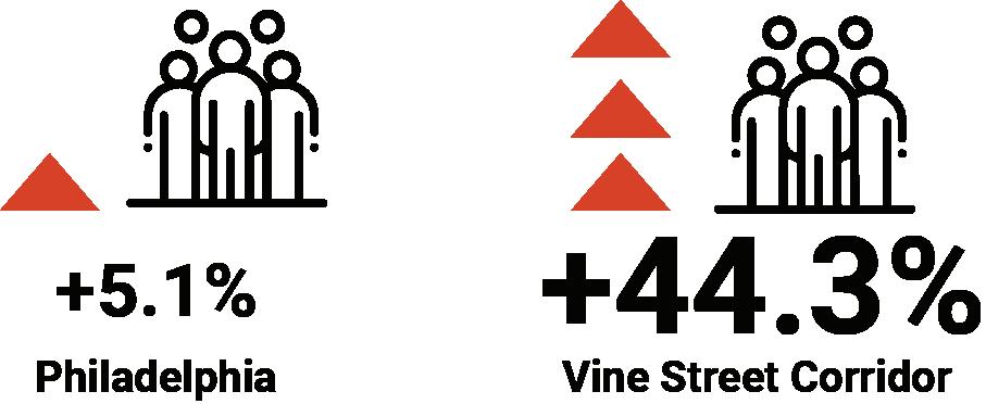
POPULATION & RACE
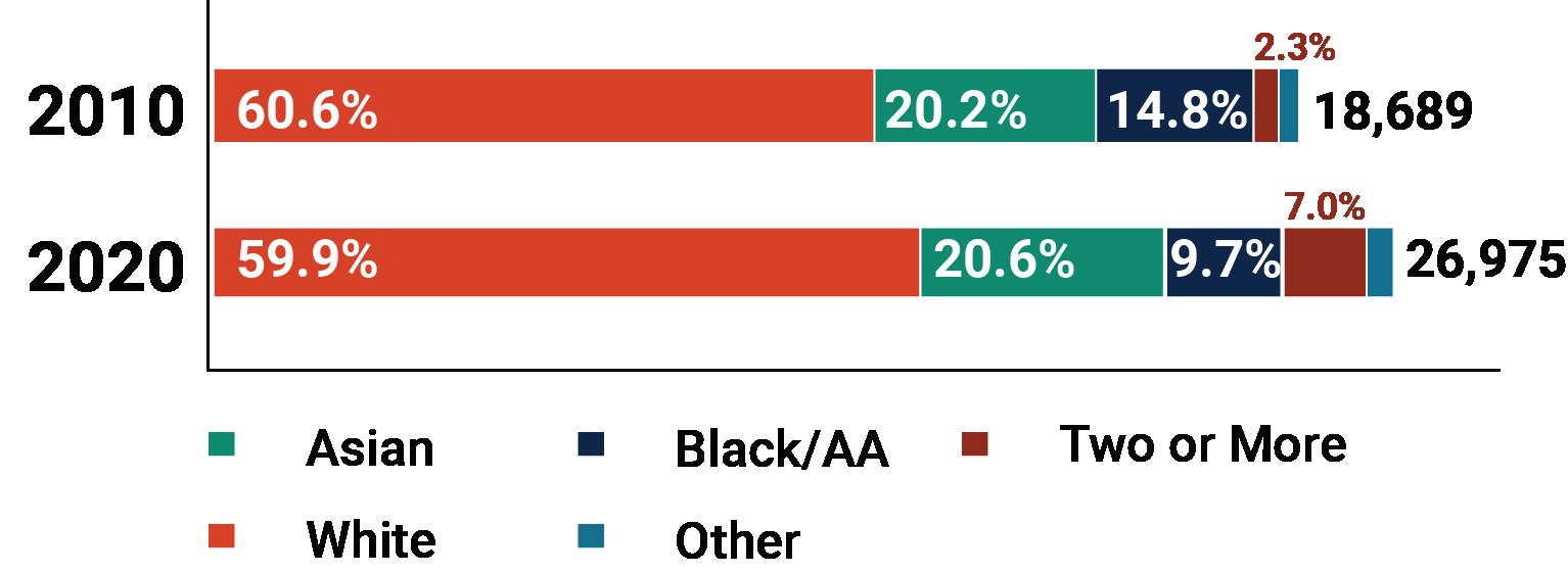
Population along the Corridor has seen an increase in the past ten years, but demographic share has remained largely the same.
12
19,099 commute in
272 work here
4,804 commute out
INFLOW / OUTFLOW
Despite the high volume of movement in and out of the Corridor, most people who work near Vine Street do not live in the area.
13
Source: 2019 OnTheMap
EMPLOYMENT DESTINATIONS
61.8% of residents are employed outside of the Vine Street Corridor area.
Source: 2019 OnTheMap
Residents of Corridor
Job Destination (Within Corridor)
Job Destination (Outside Corridor)
14
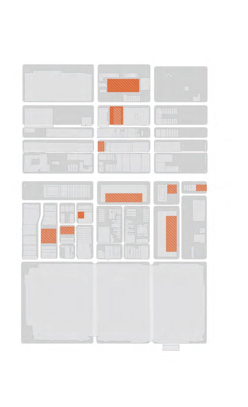
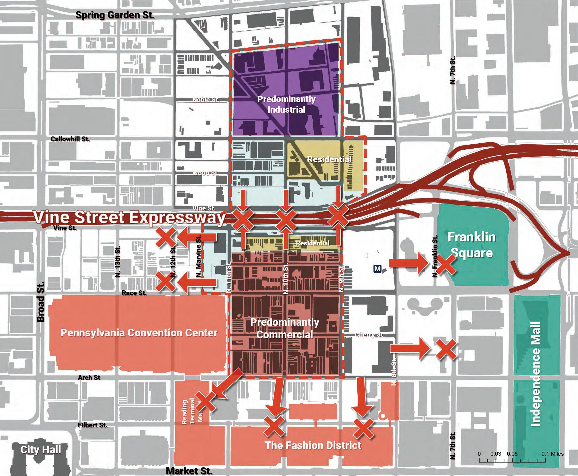
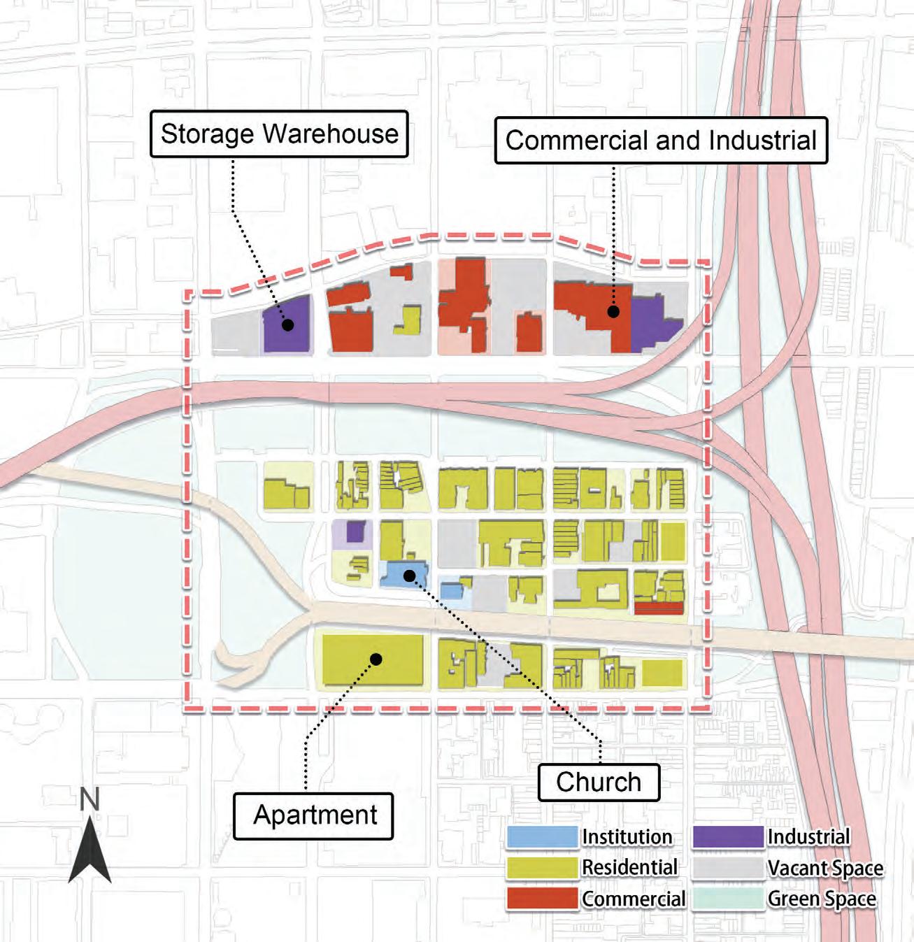
POTENTIAL DEVELOPMENT SITES
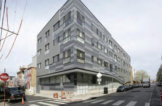
There are many opportunities adjacent to the Vine Street Expressway to redevelop existing parking lots and consolidate existing building uses.
Parking lots
Vacant buildings
Existing building uses that could be relocated
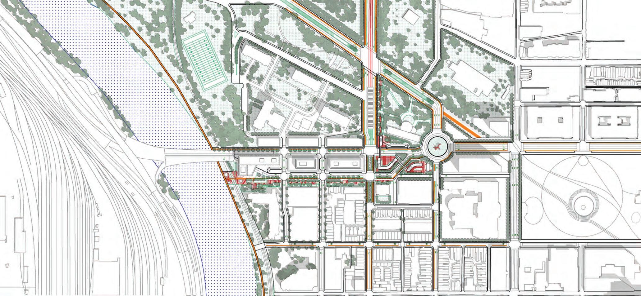
Permitted/under construction developments
15
Gift of Life buildings
There is a disproportionate impact of poverty along certain areas of the Corridor, such as Chinatown.
16
POVERTY & OTHER PRESSURES Source: 2019 American Community Survey 597 - 972 0 - 150 2020 Households Under Poverty Line (~$26,000) 973 - 1967 151 - 349 350 - 596
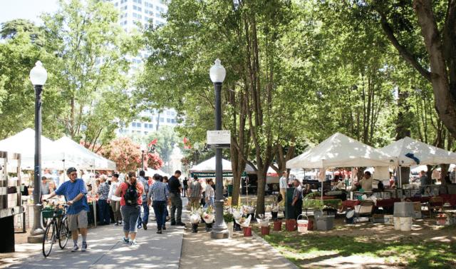
NEIGHBORHOOD IDENTITY

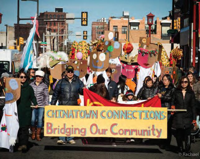
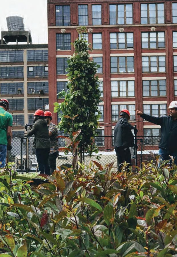
The Corridor is home to multiple unique neighborhoods that are supported by associations and community groups that are pivotal in shaping the identity of the area.
17
Source: Rachel Warriner - whyy.org
Source: Curbed Philly
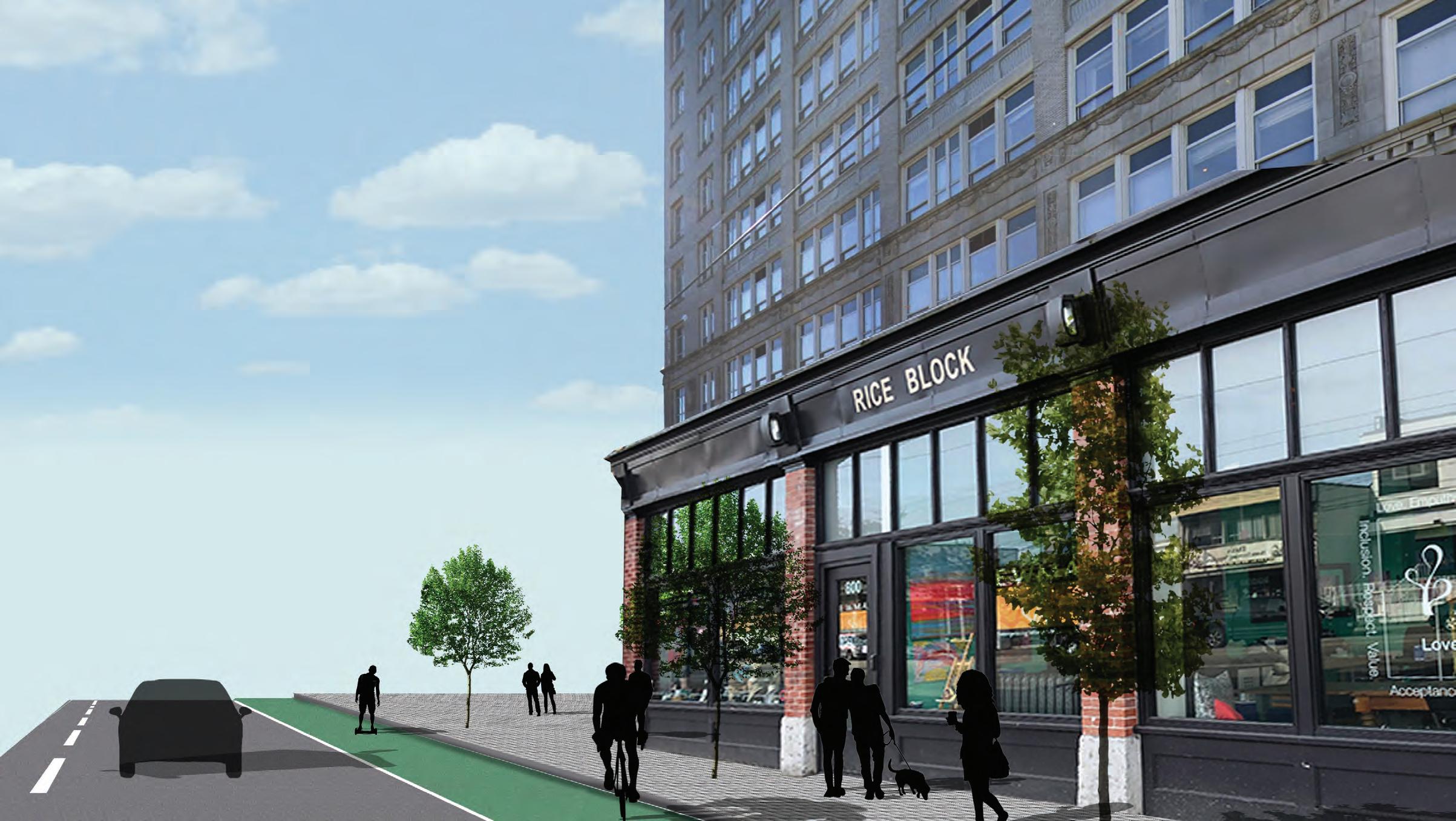
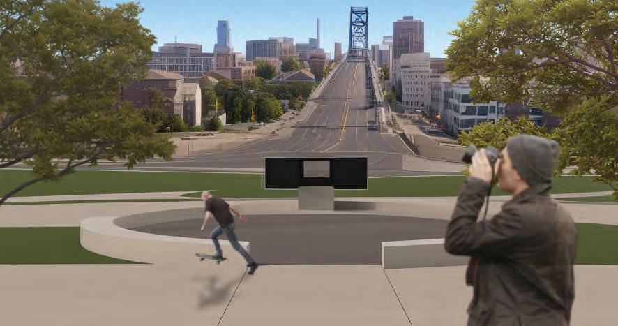
THE FUTURE OF THE VINE STREET EXPRESSWAY
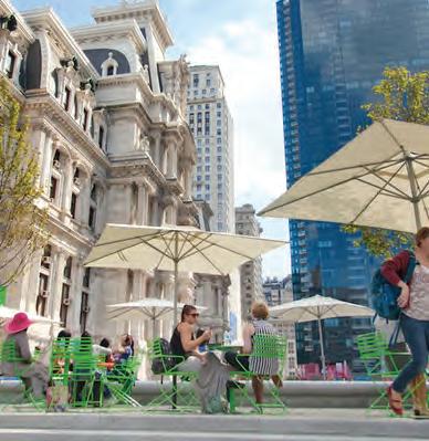
As the City plans for new ways to reconnect neighborhoods like Chinatown that have been impacted by the Expressway, our studio has the opportunity to envision a radically different Vine Street Corridor and propose thought-provoking alternatives beyond what is possible through the Reconnecting Communities Pilot Program.
18
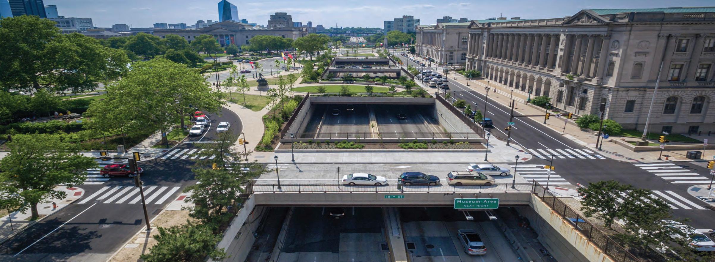
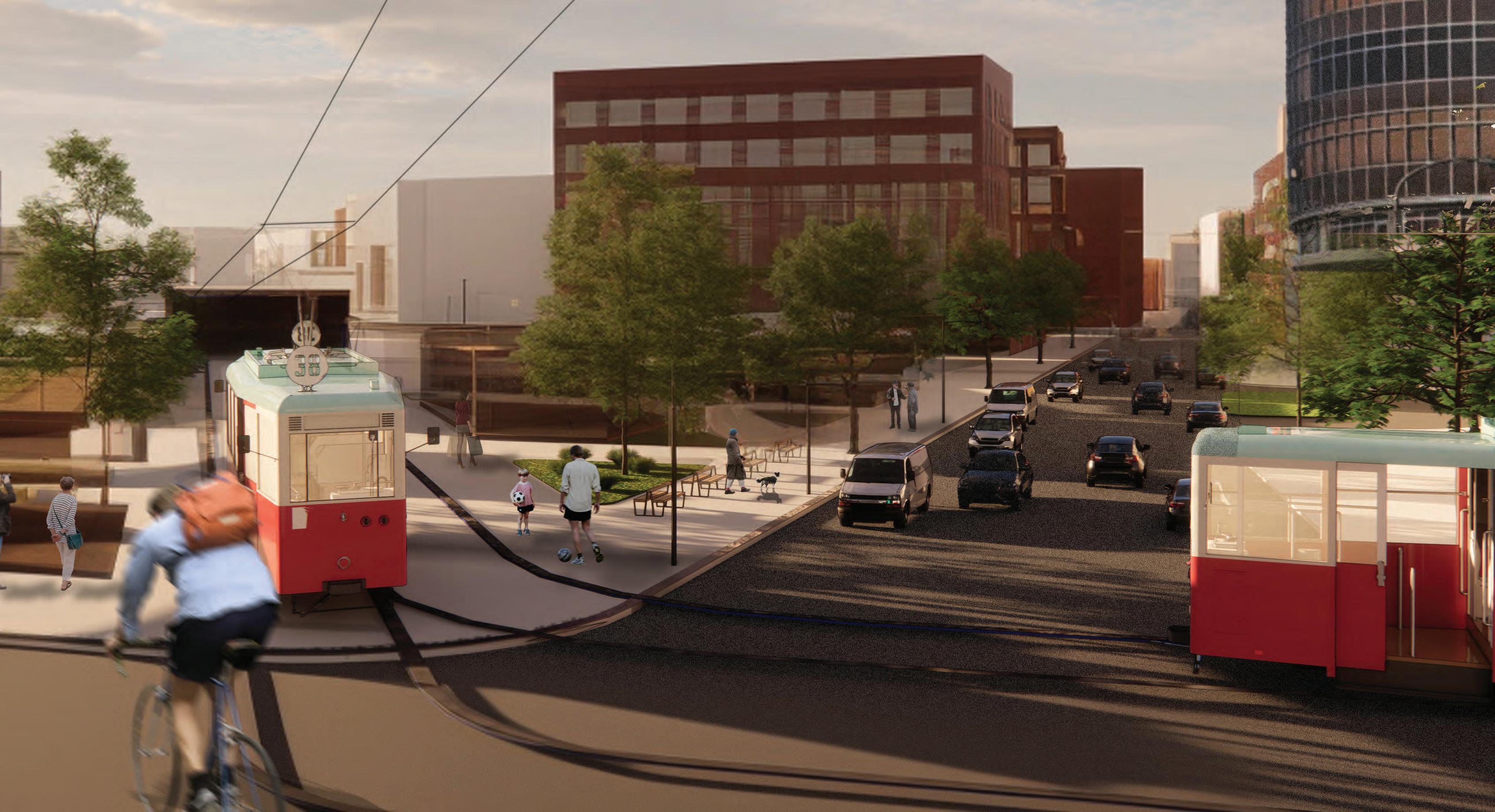
Source: Pennoni
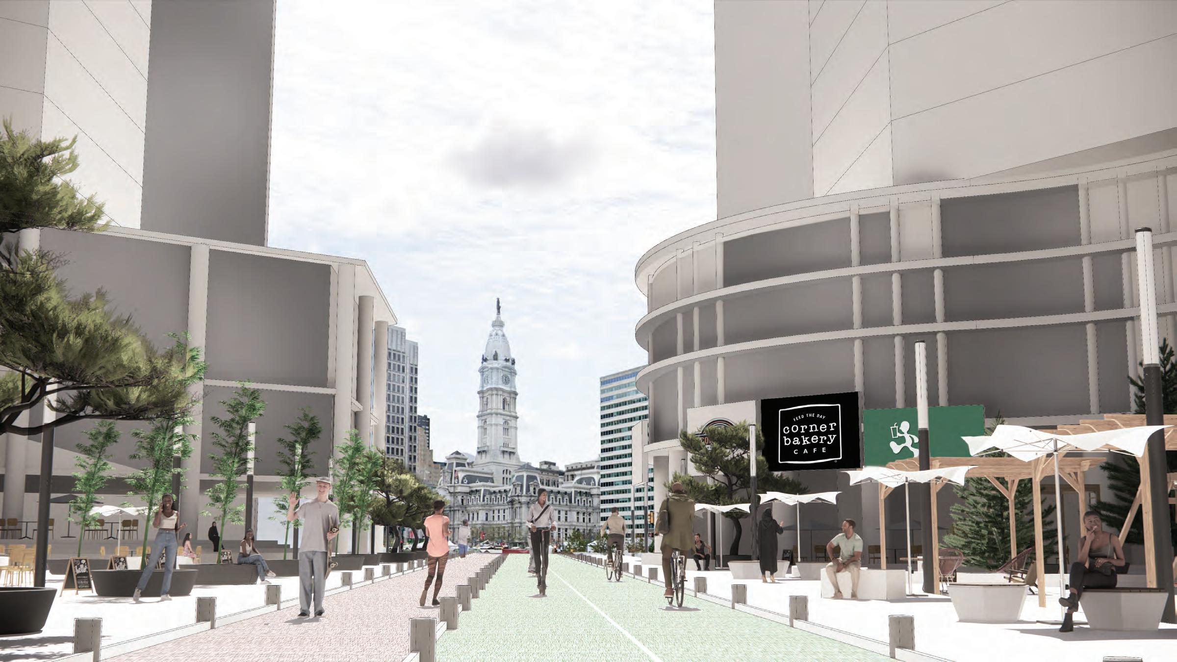
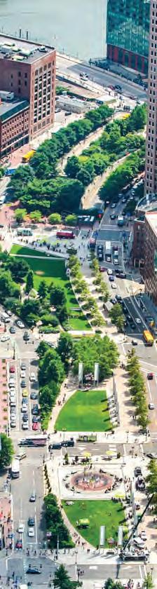
THE VISION HIGHWAY TO BOULEVARD
19
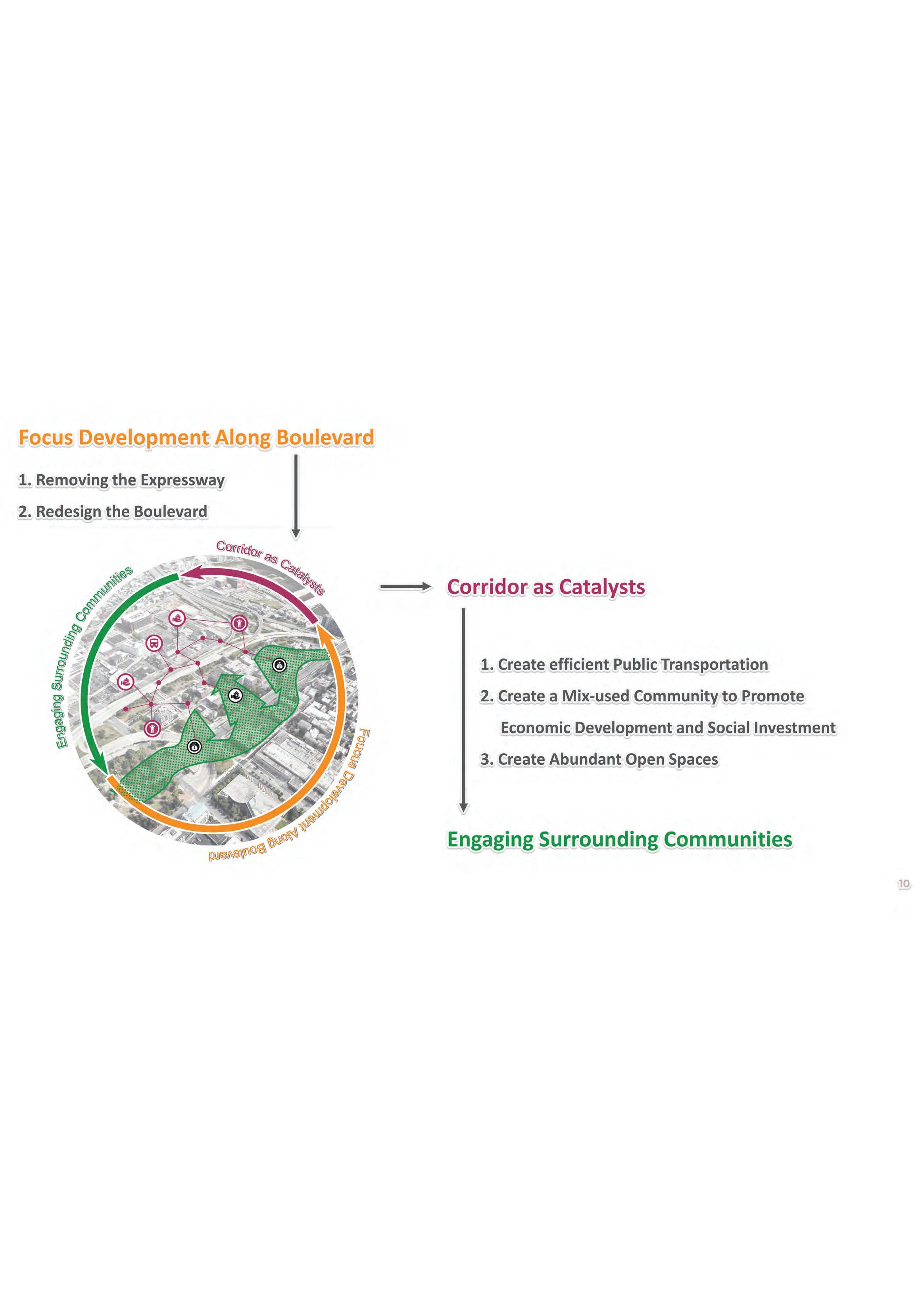
STRATEGIES & GOALS
Restored grid connections
Community-driven public-private partnerships
Enhanced cultural artery
Contextual and interactive experiences
Comfortable multimodal streetscapes
Celebration of cultural and historical diversity
Resilient and accessible community health
20
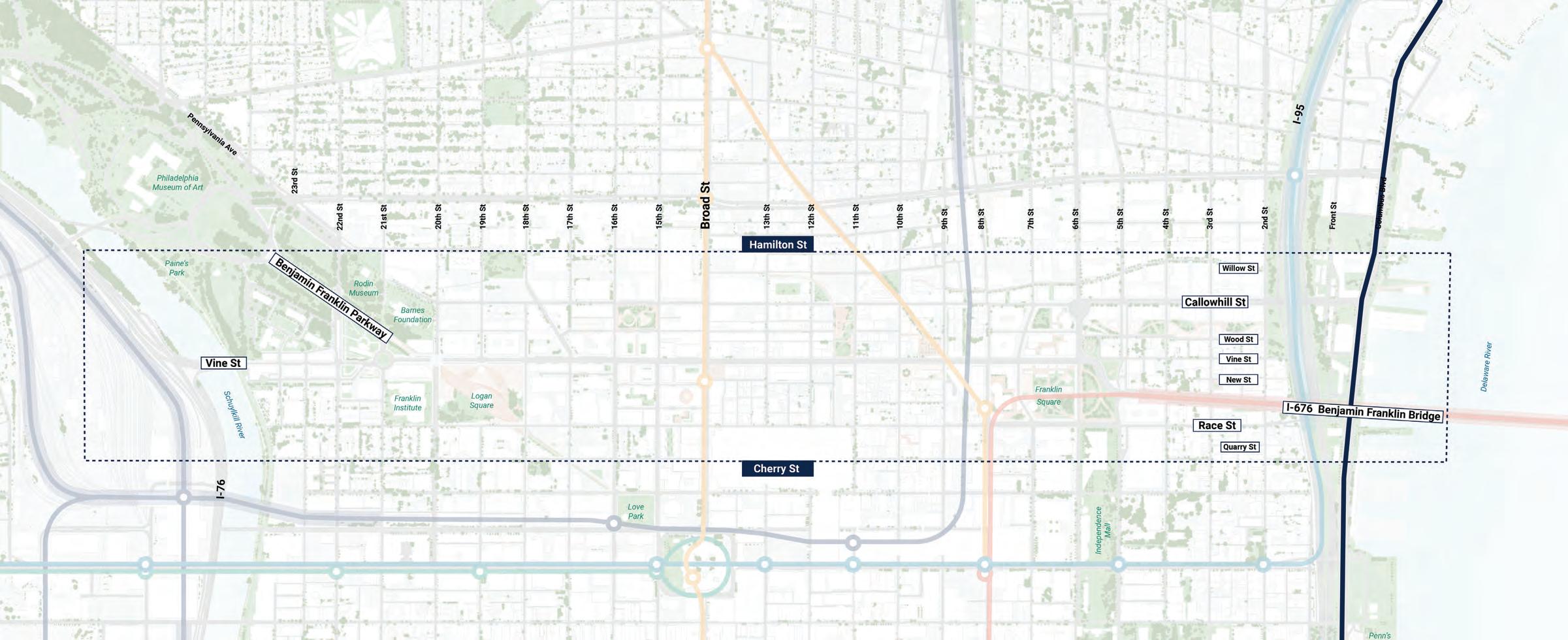
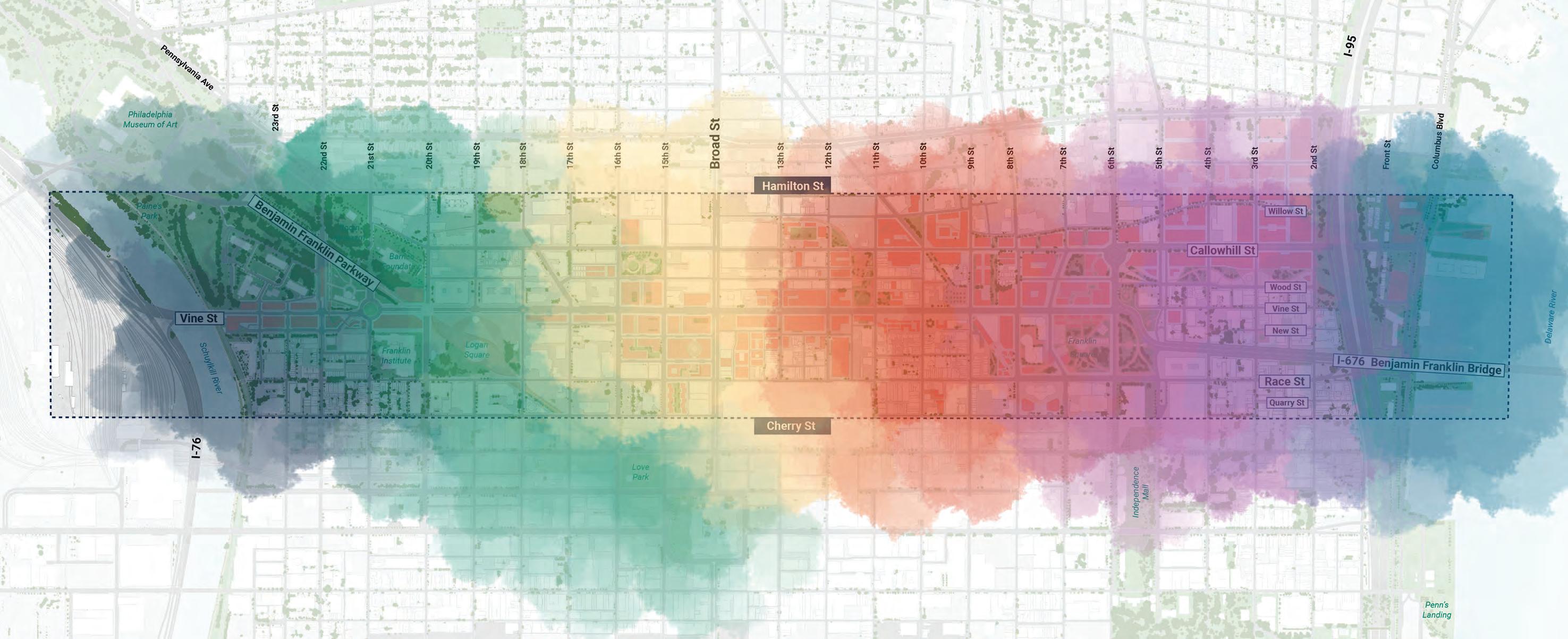
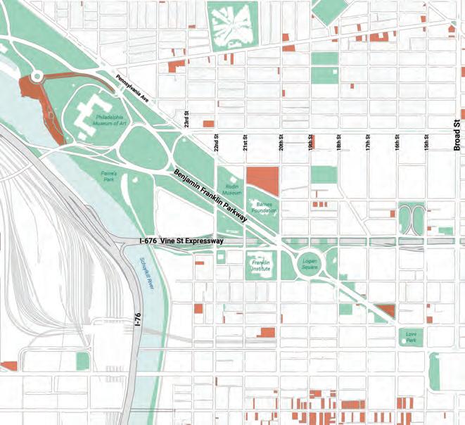
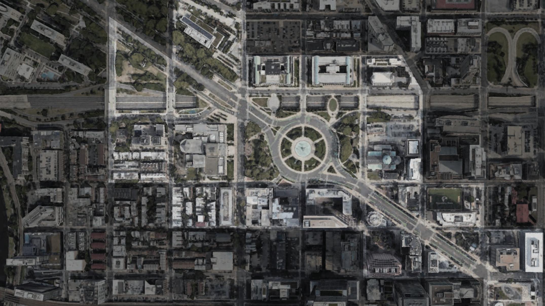
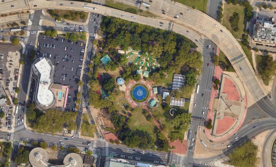
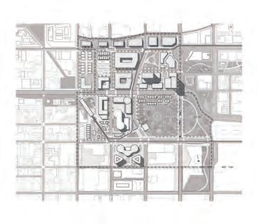
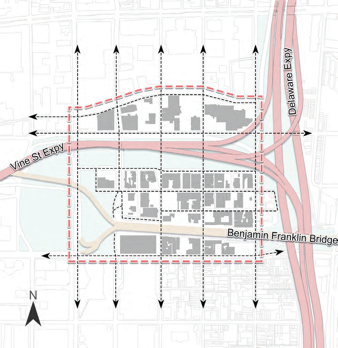
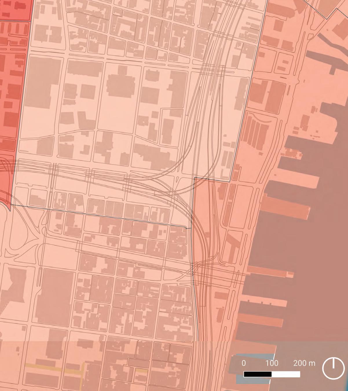
EXISTING CONDITIONS
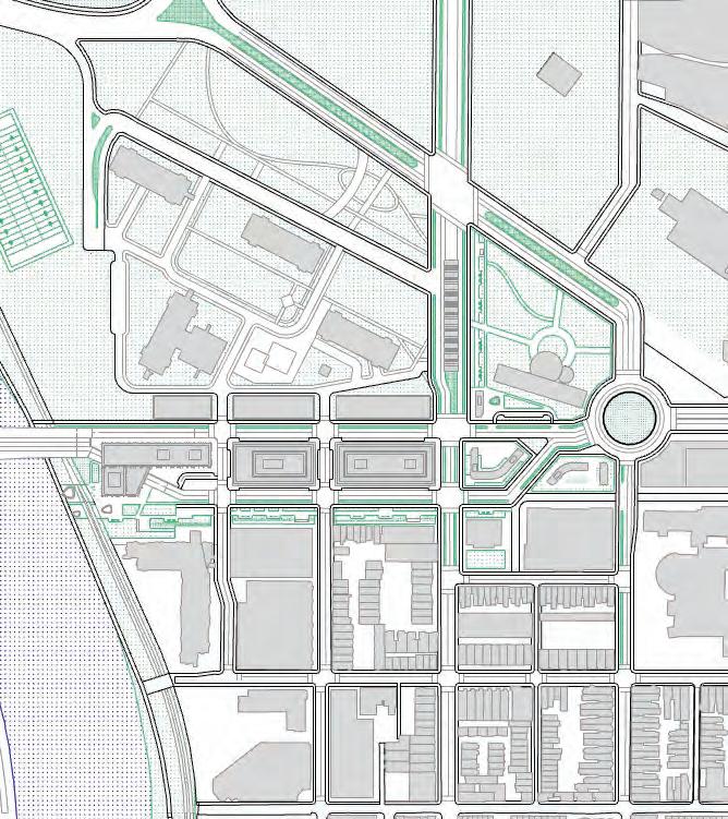
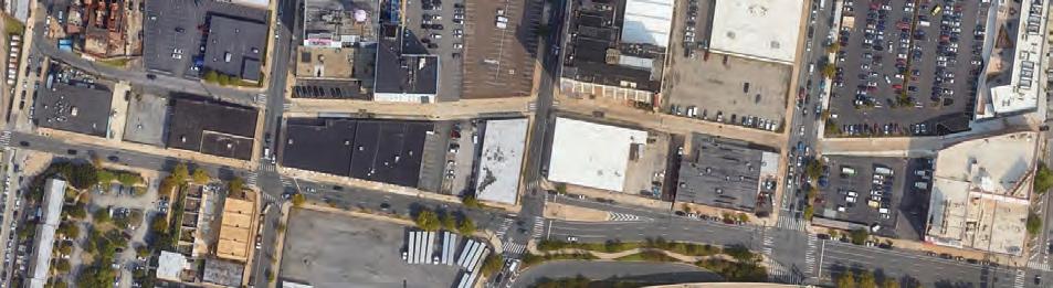
21
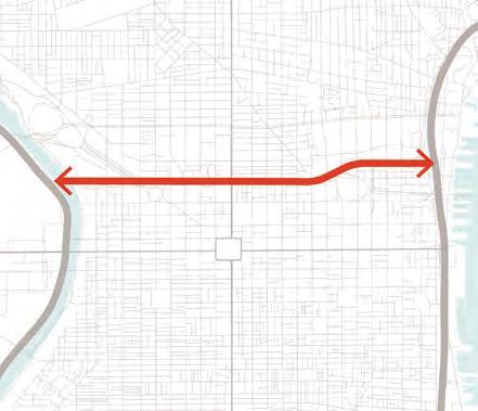
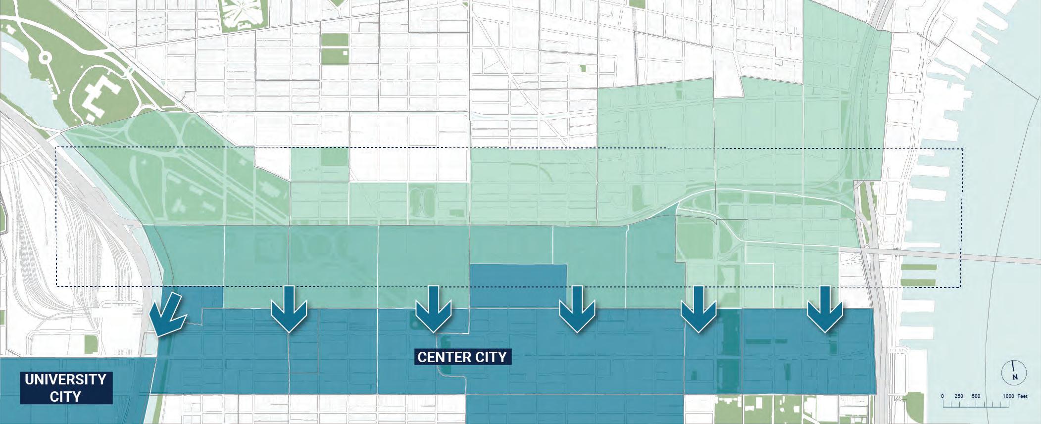
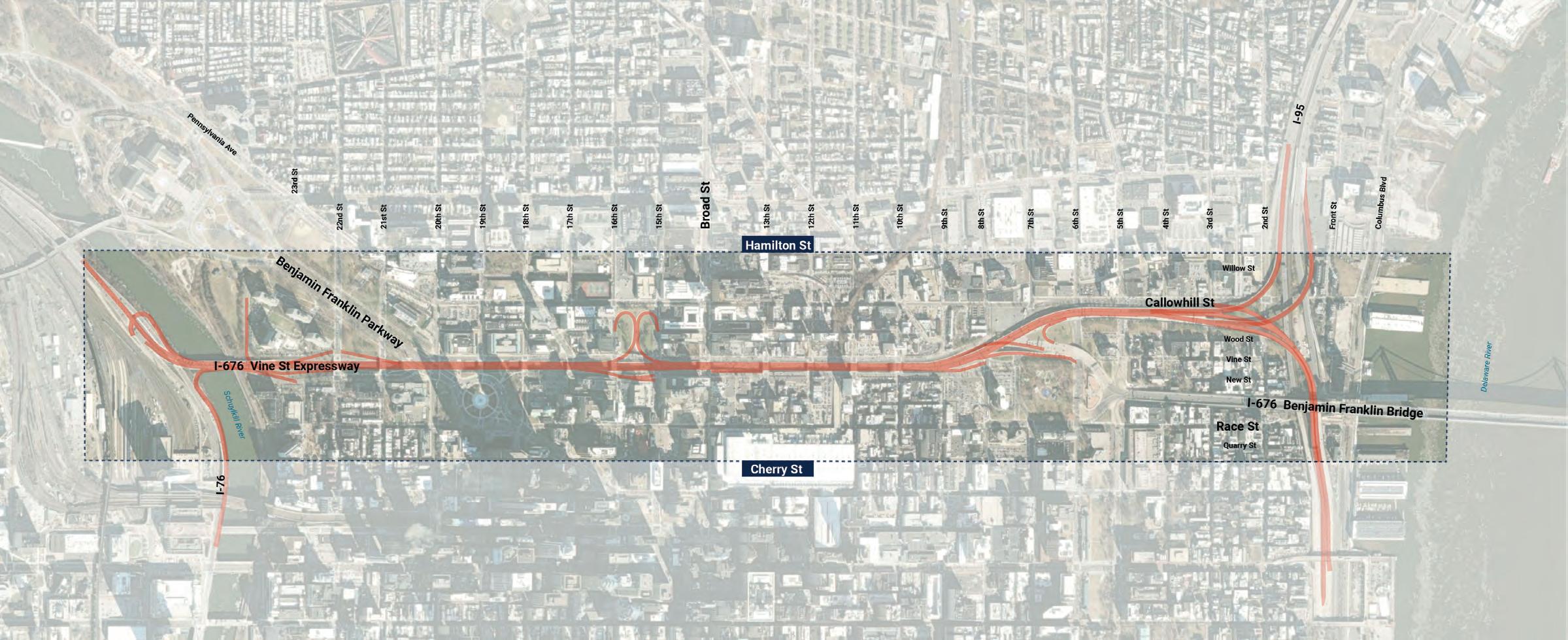
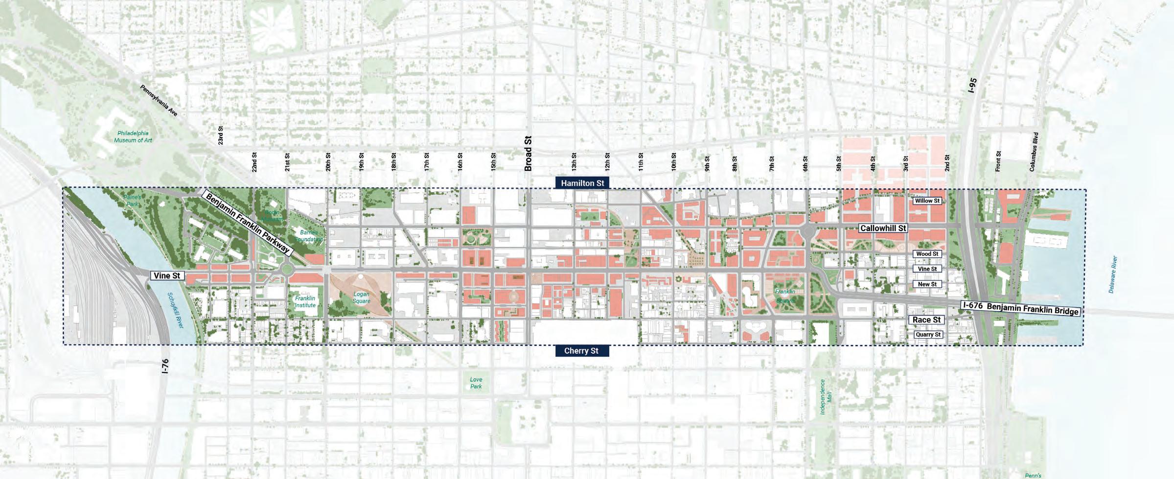
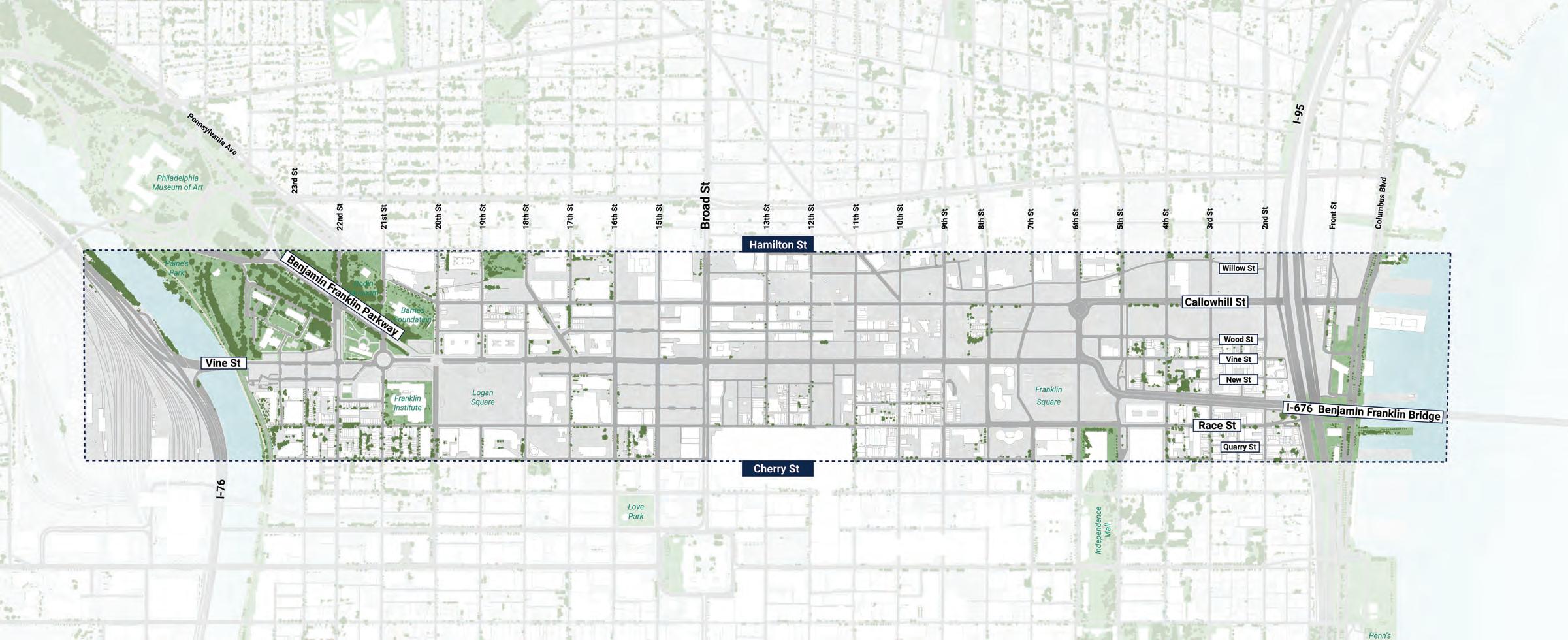
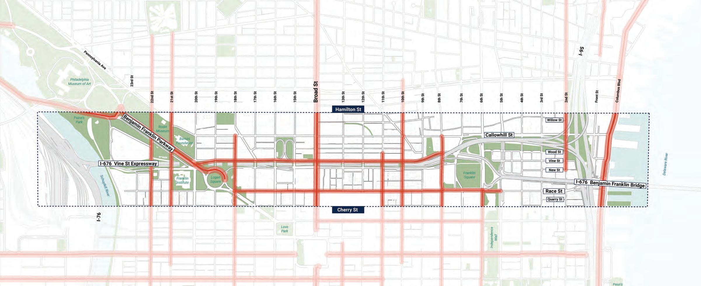
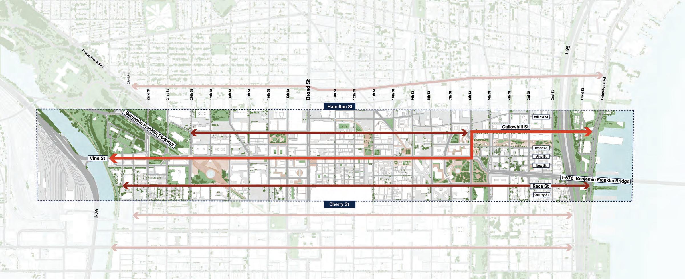
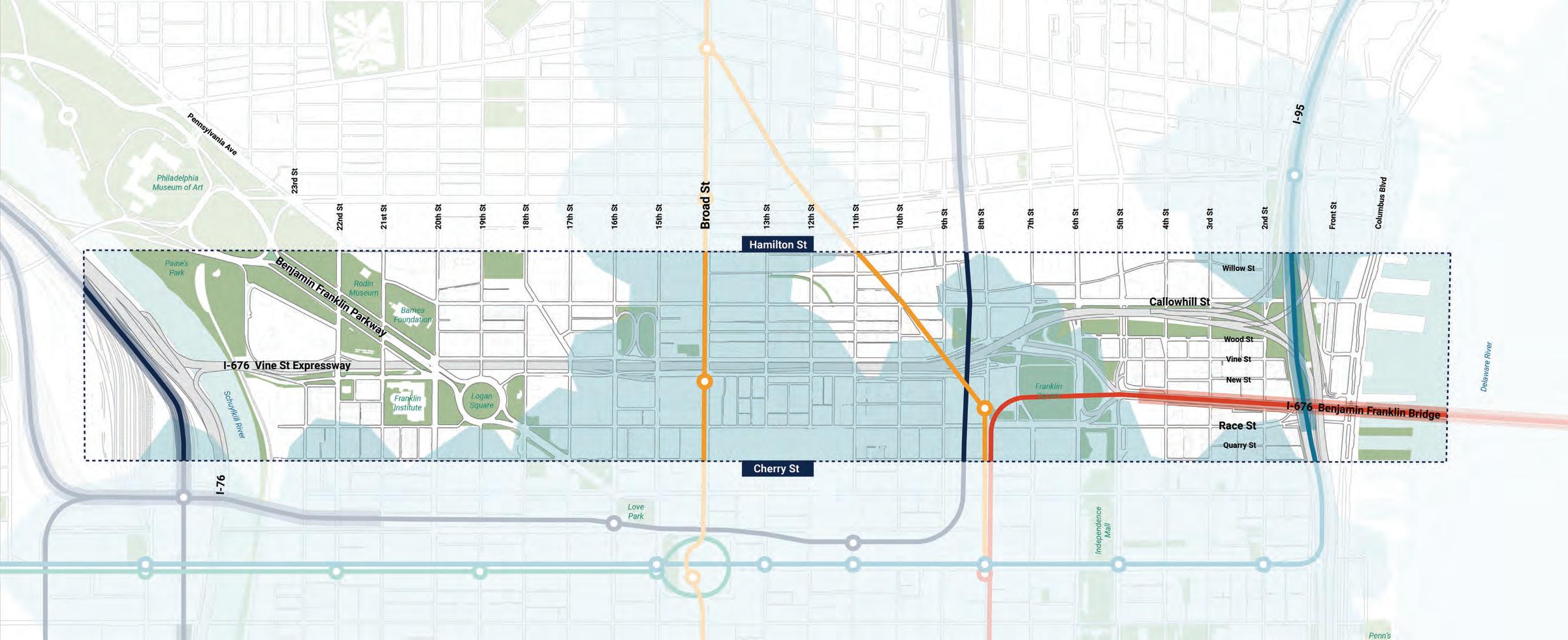
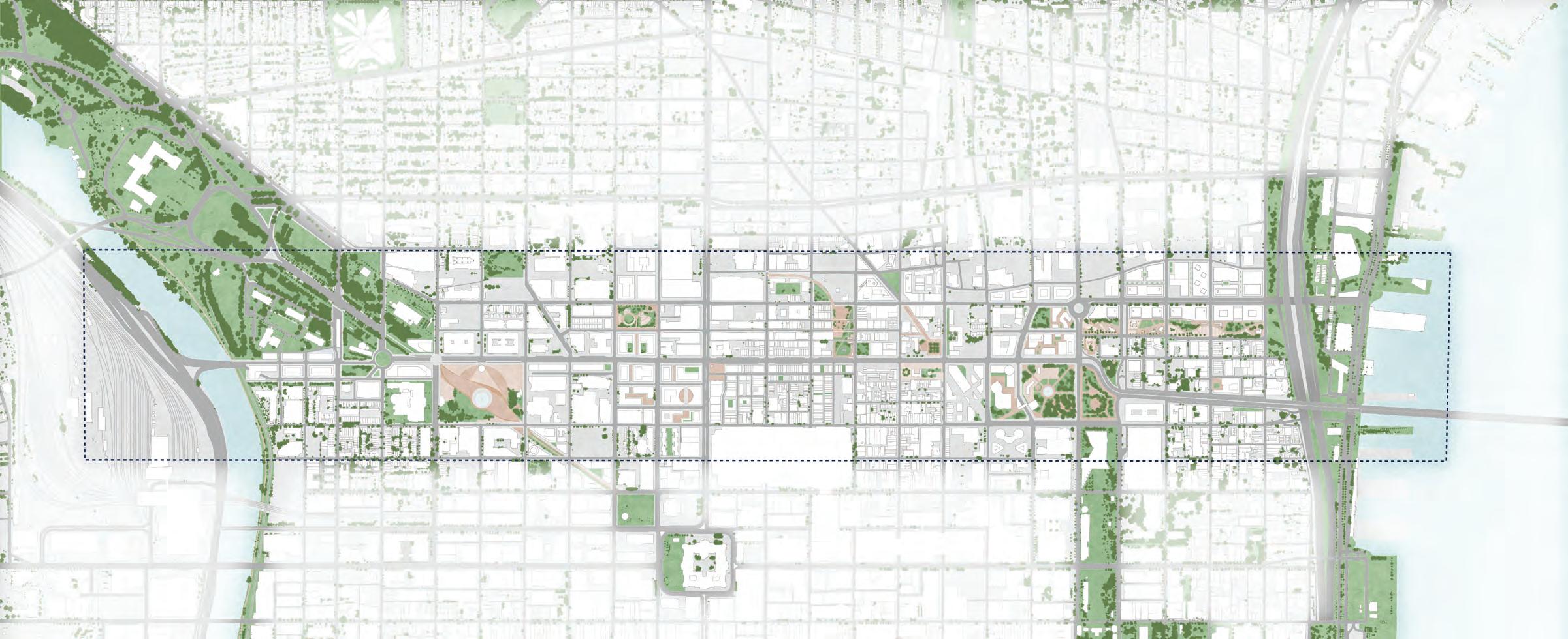
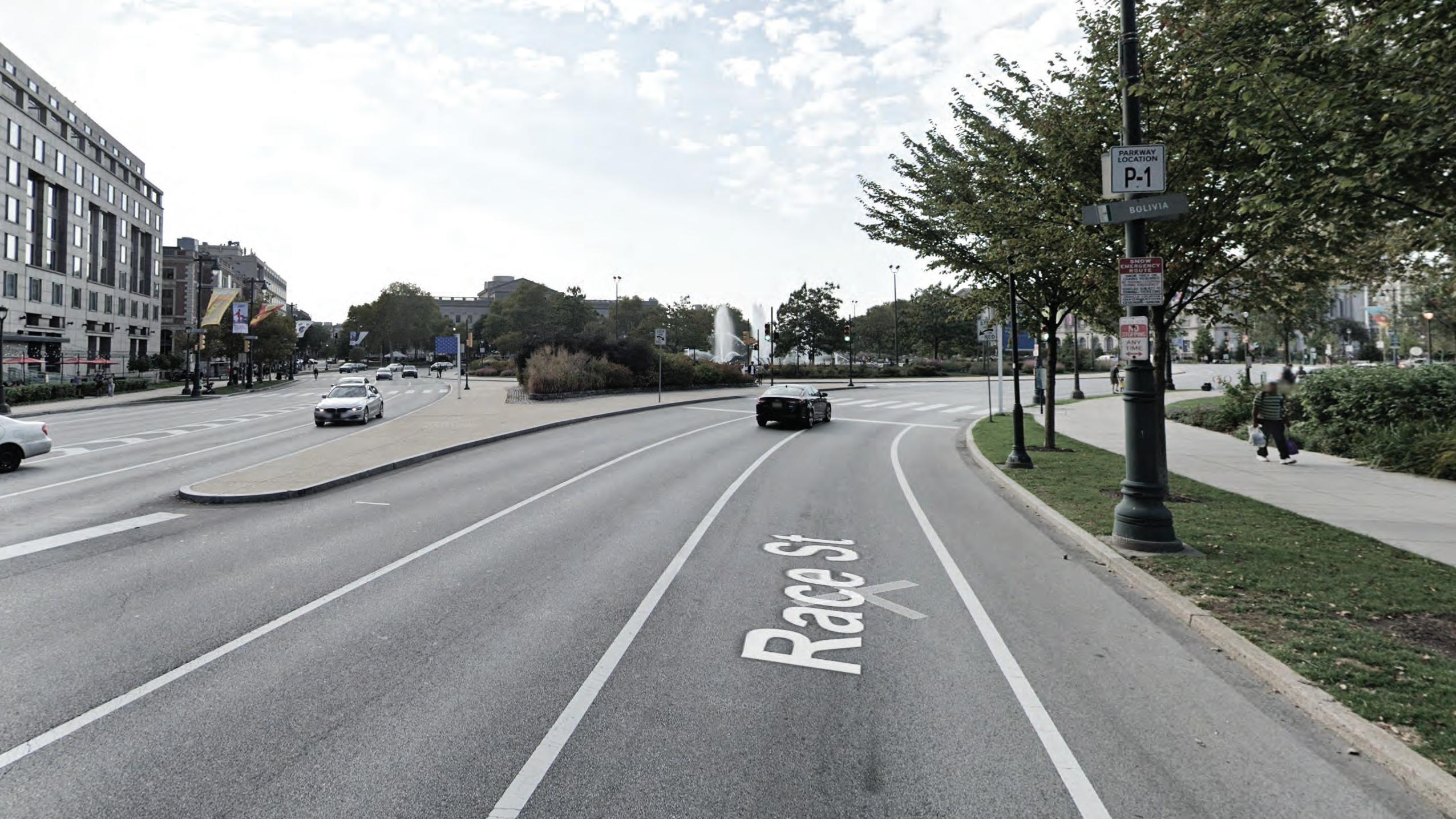
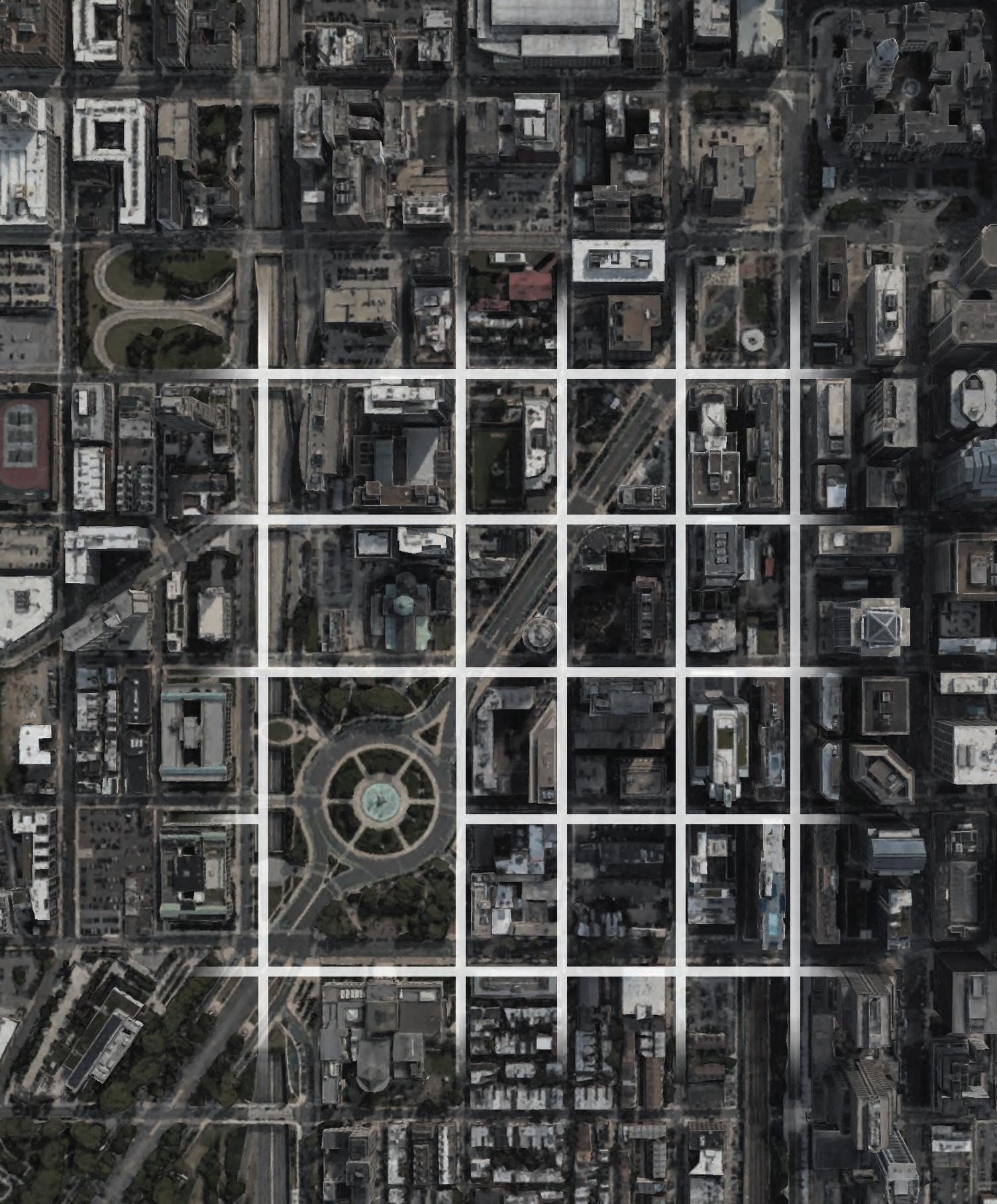
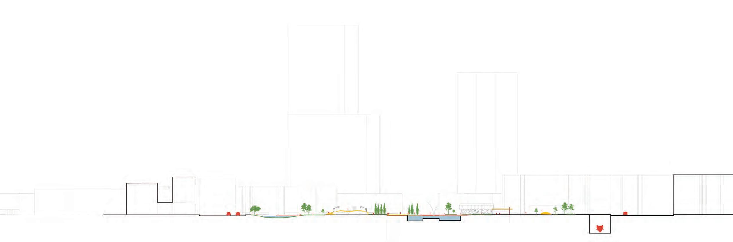
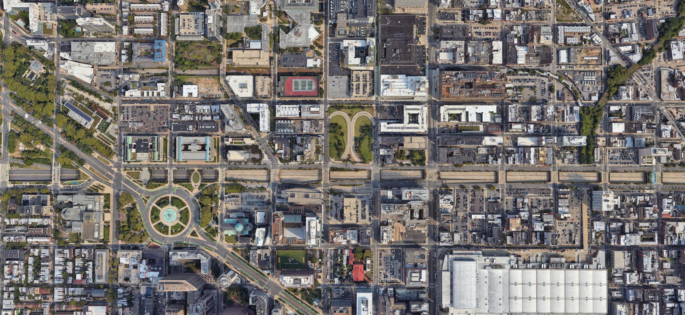
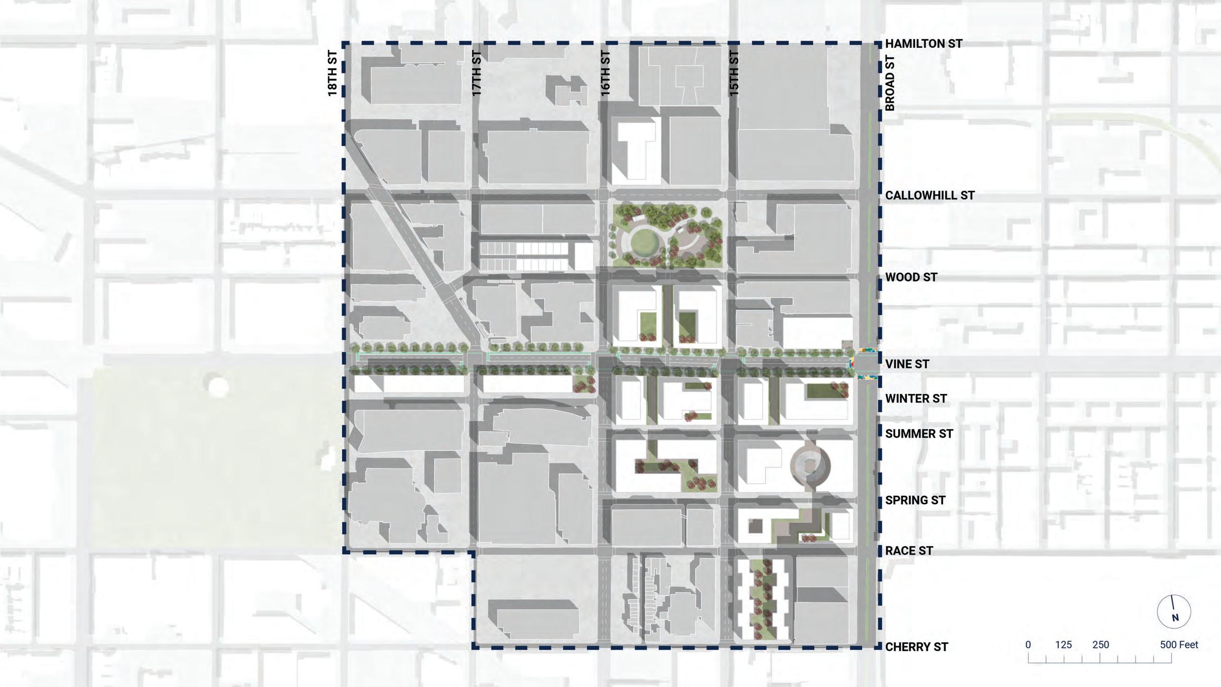
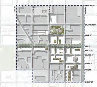
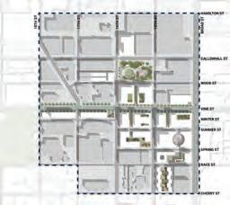
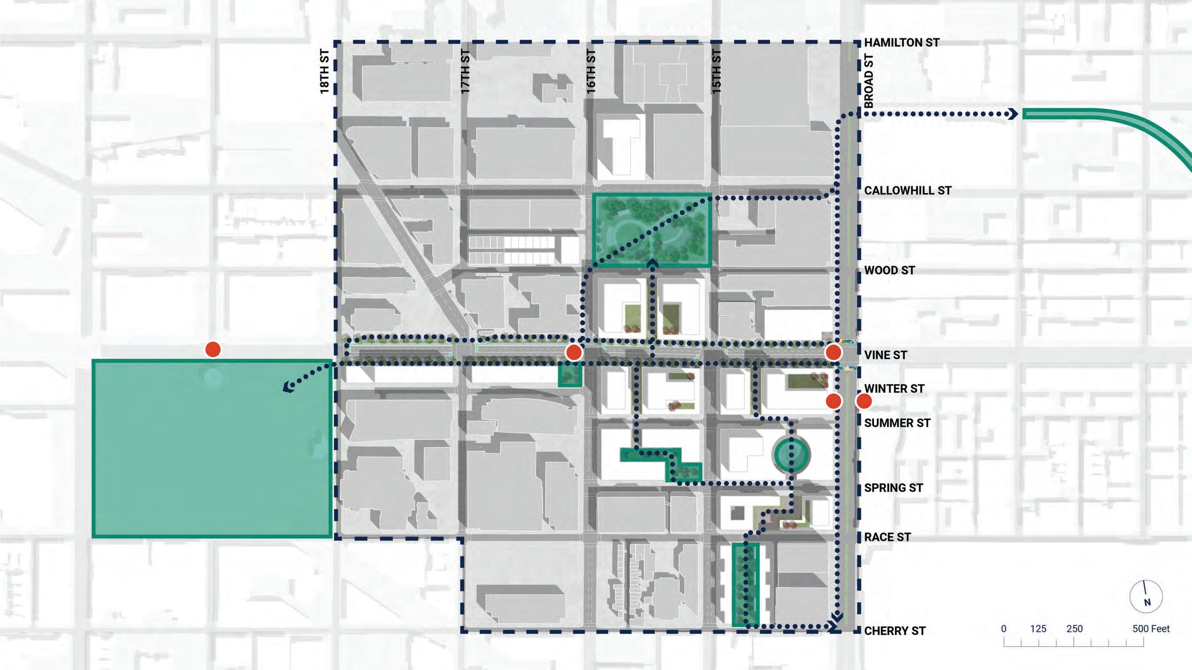
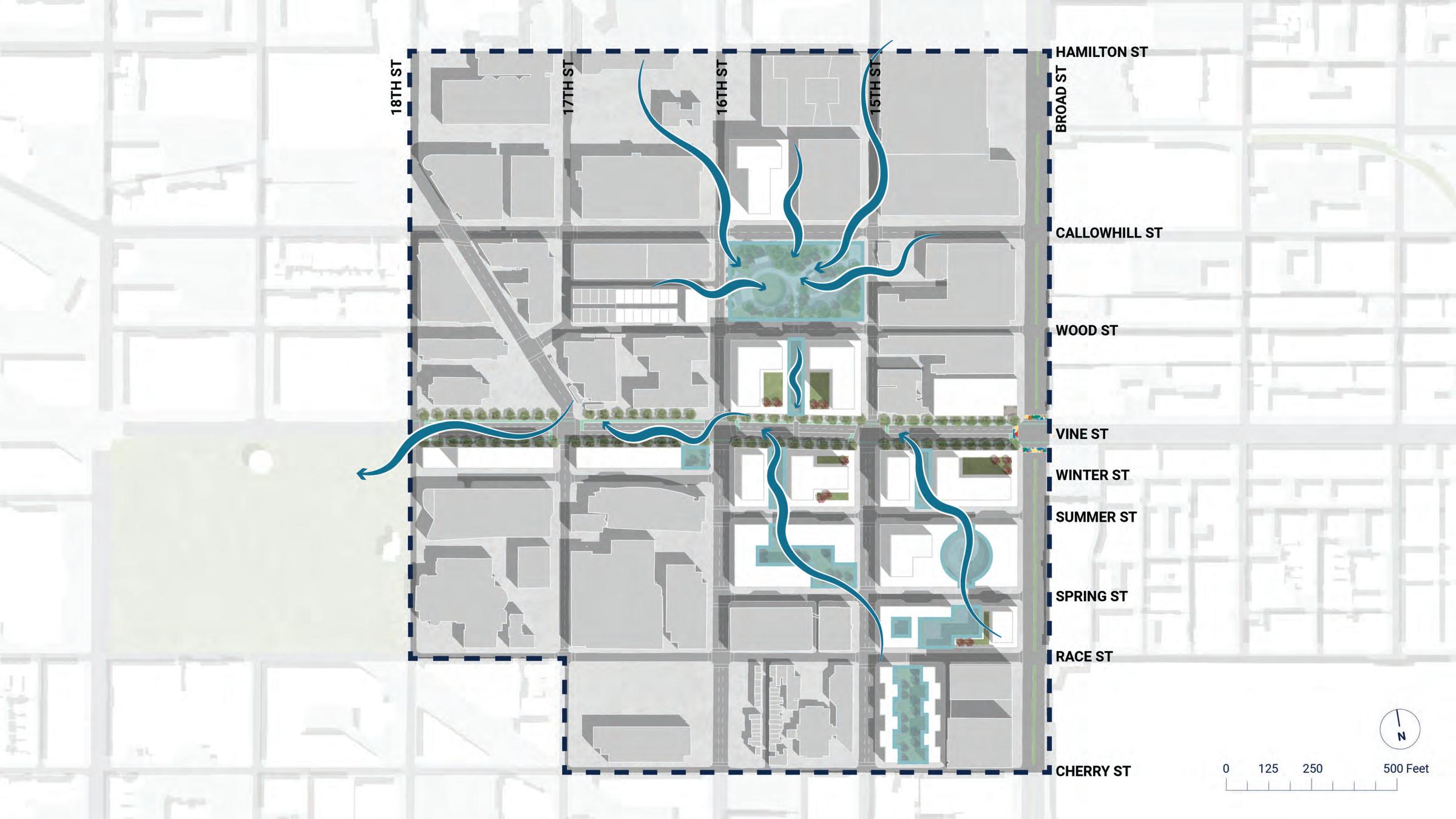
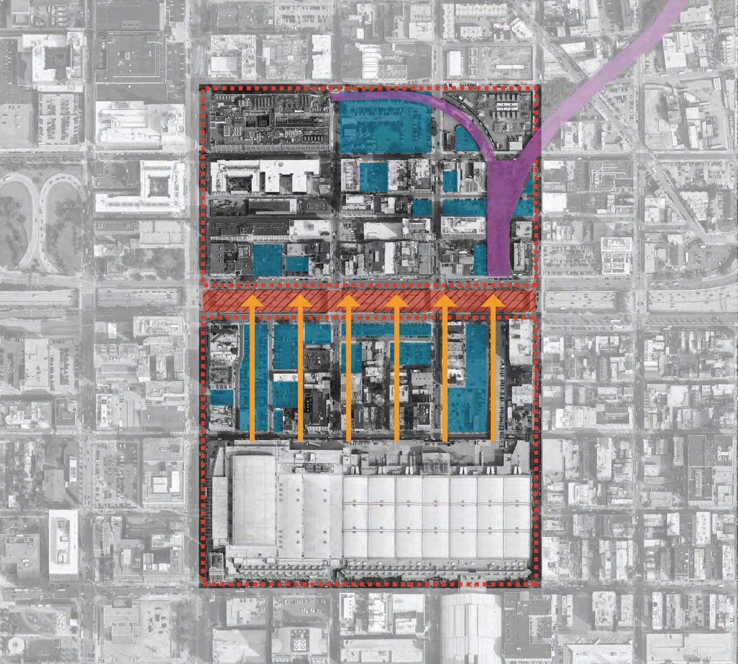
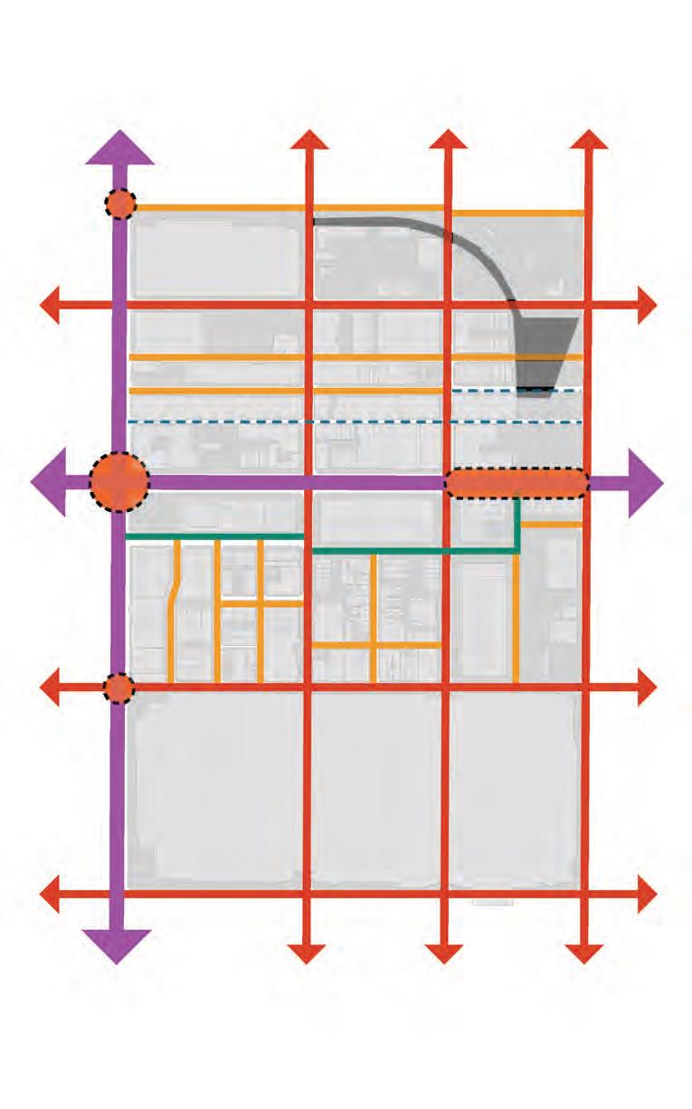
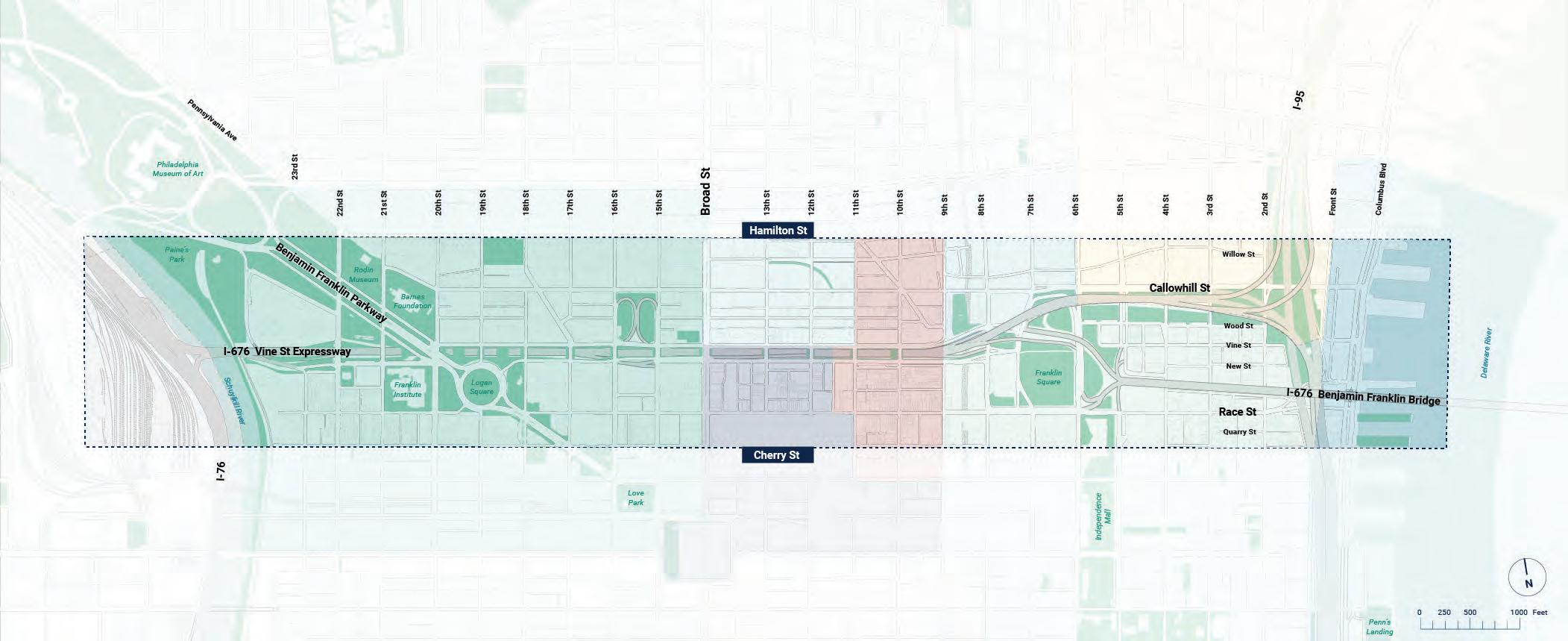
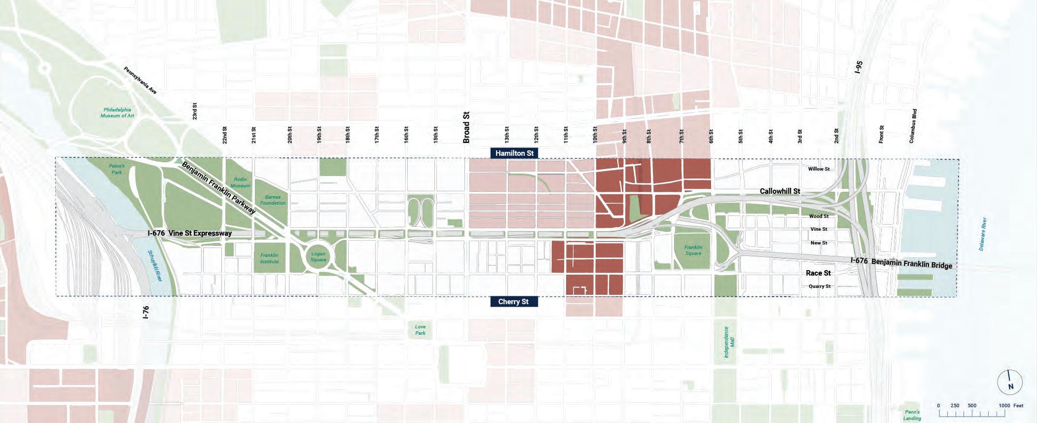
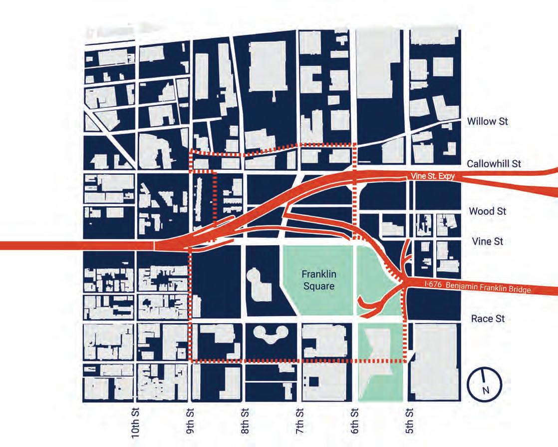
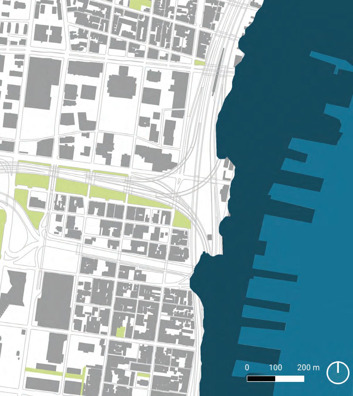
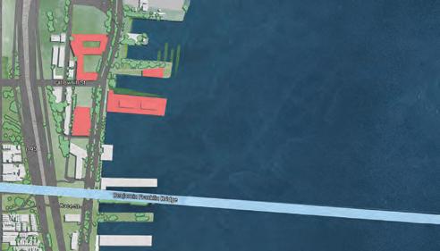
The map above shows the study area for the Corridor Plan, stretching from Hamilton Street to Cherry Street and from the Schuylkill River to the Delaware River.
2505001000 0 Feet N
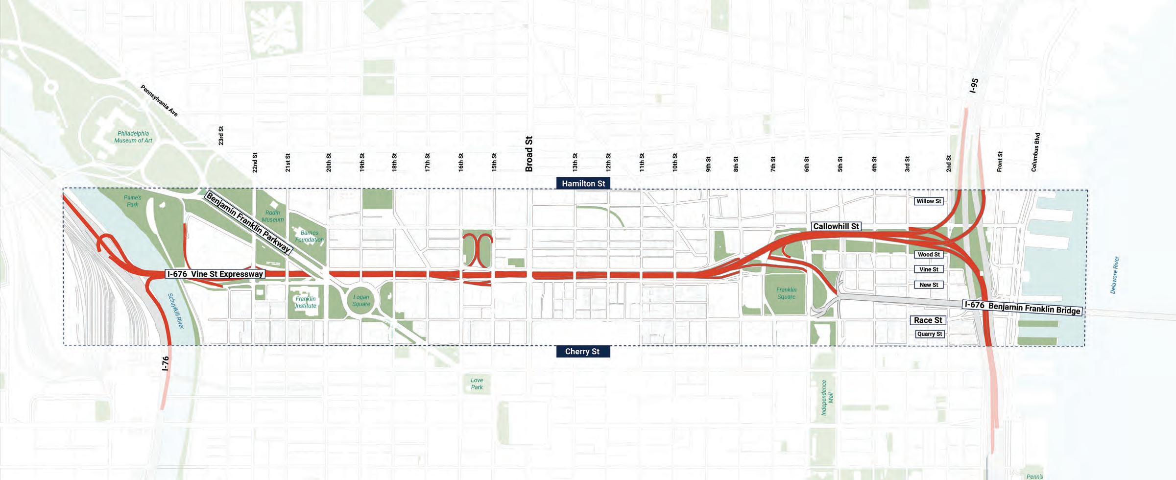
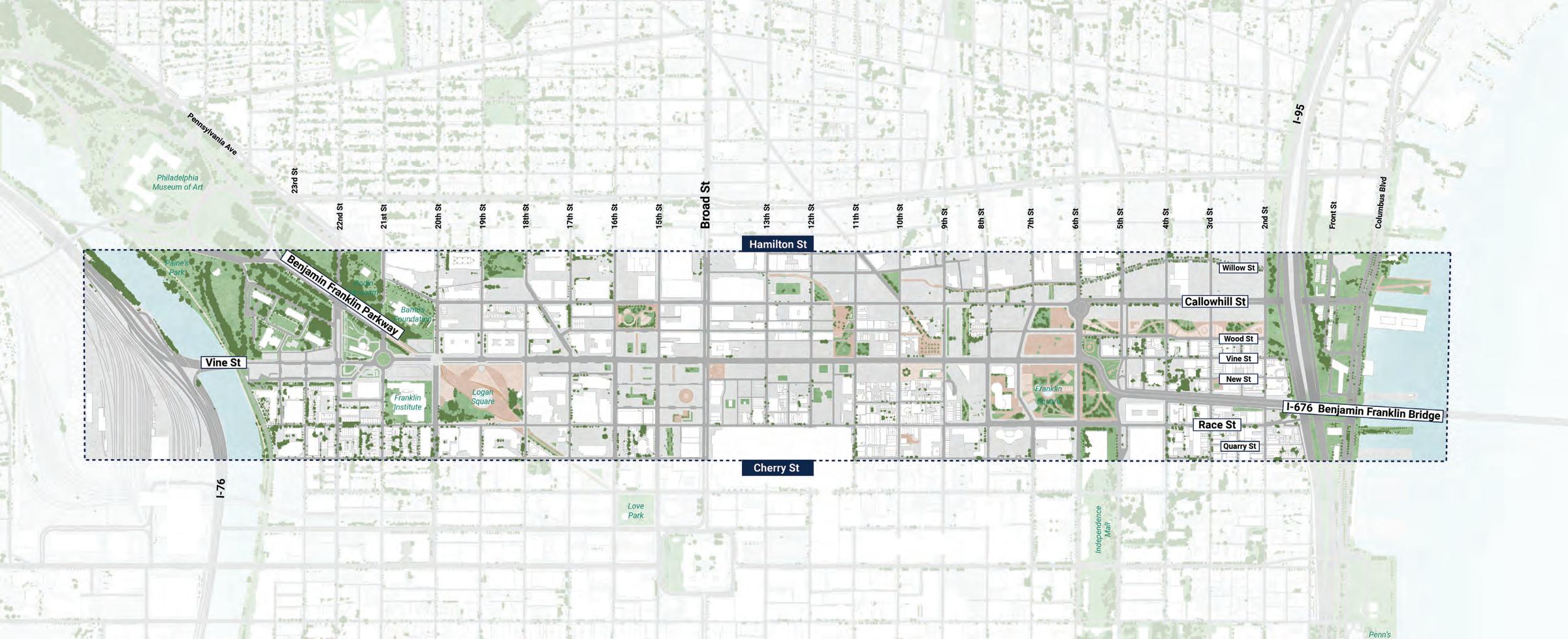
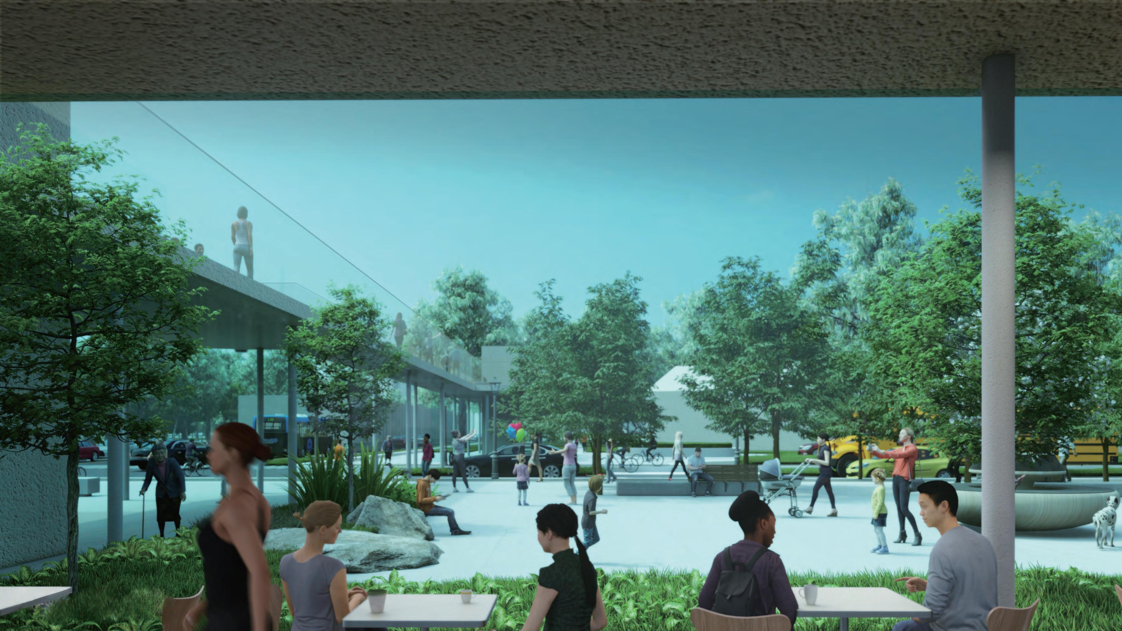
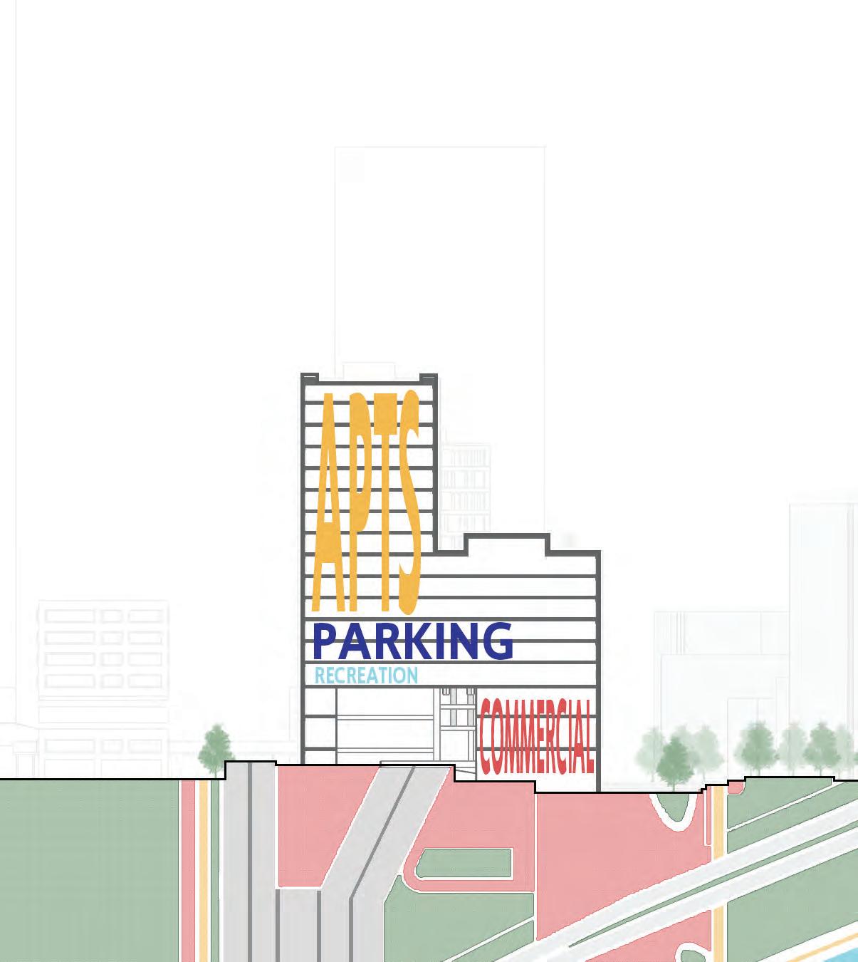
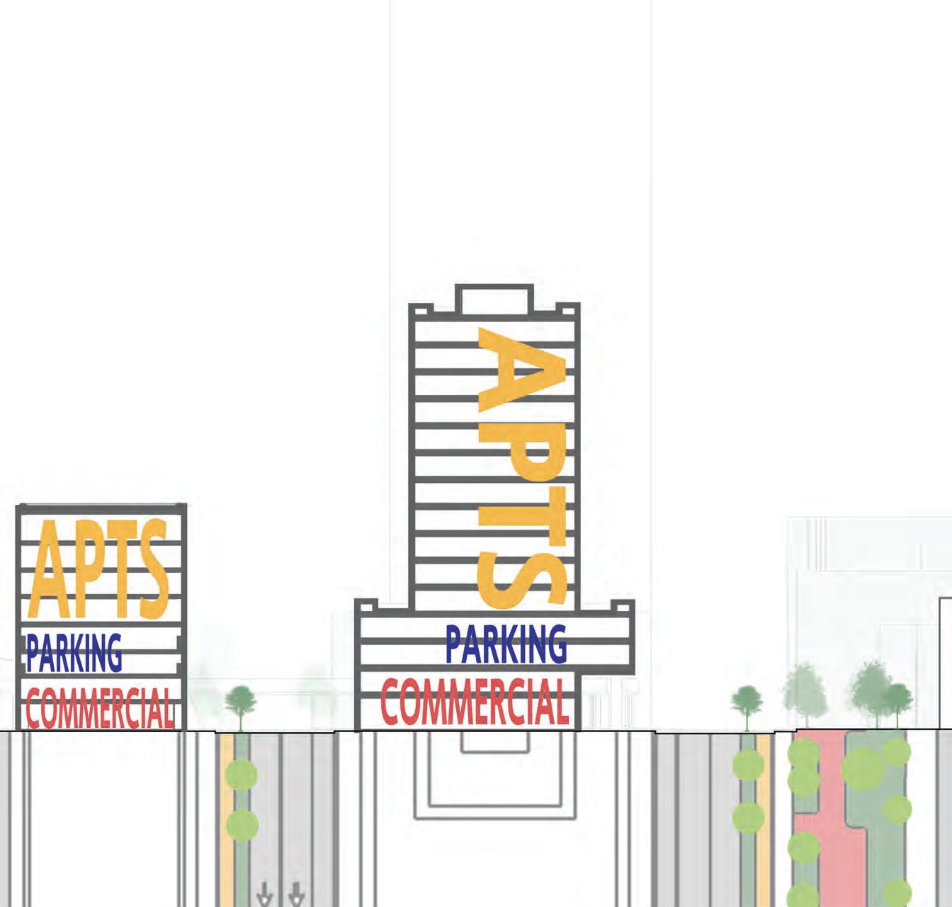
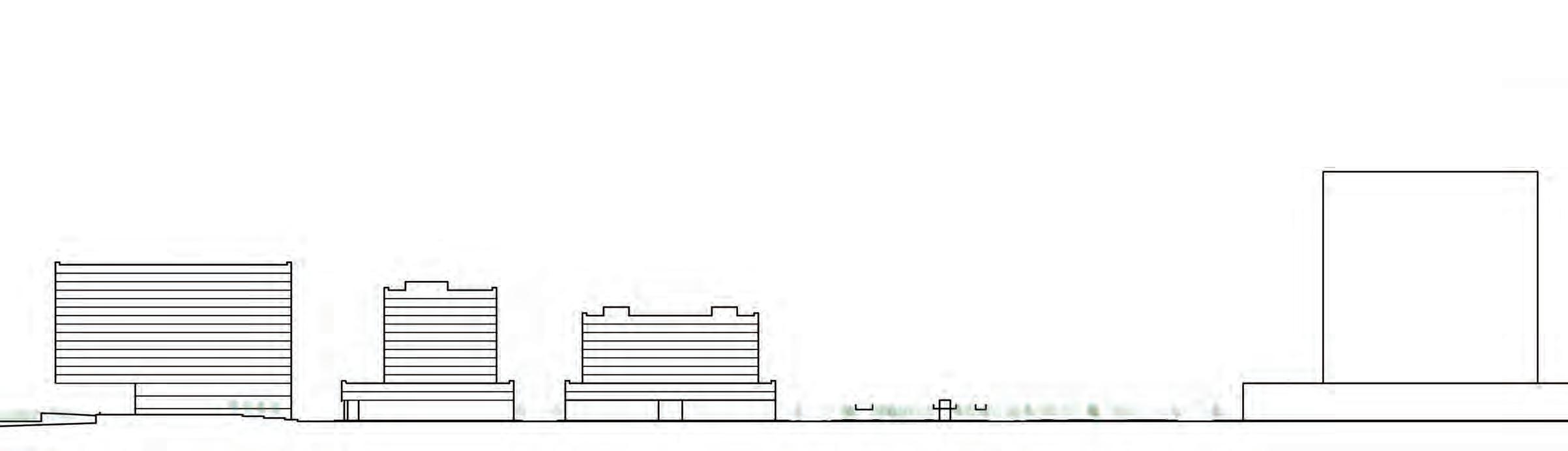
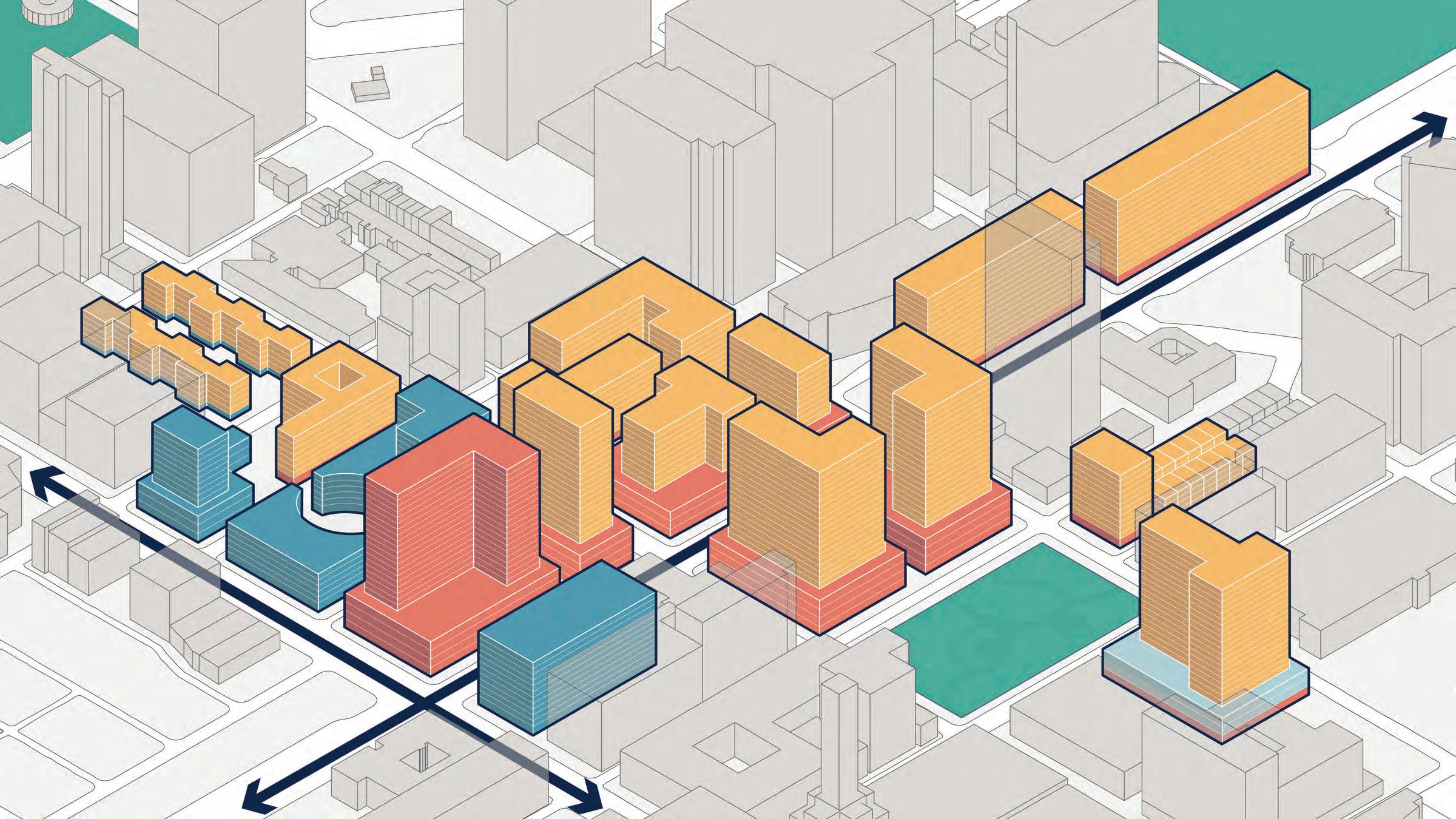
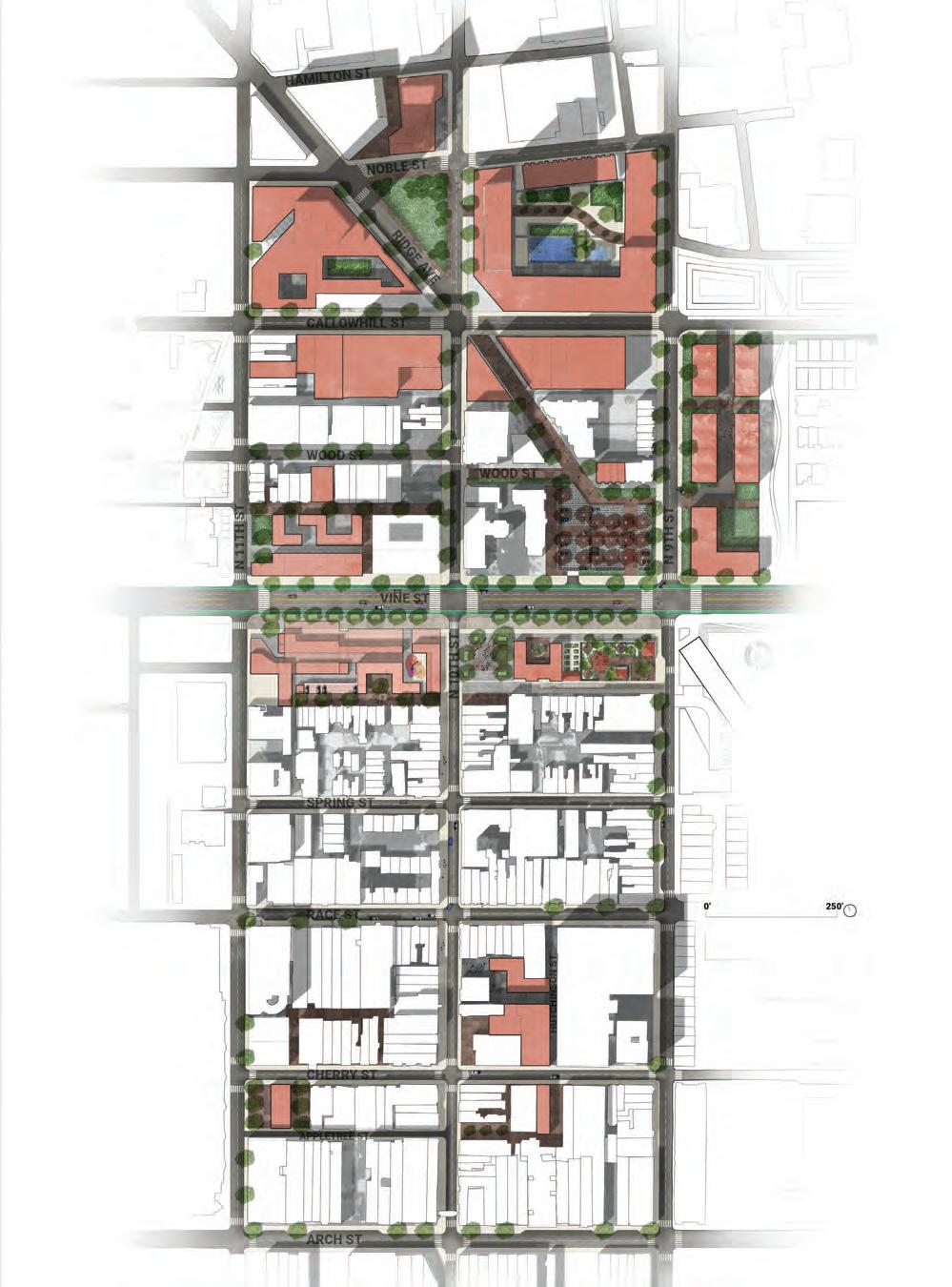
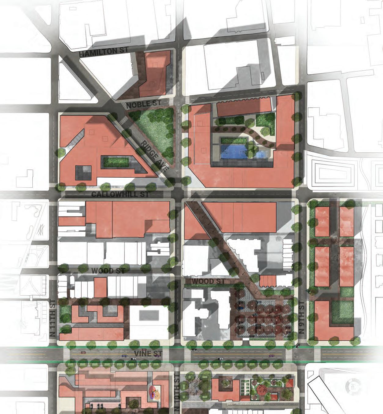
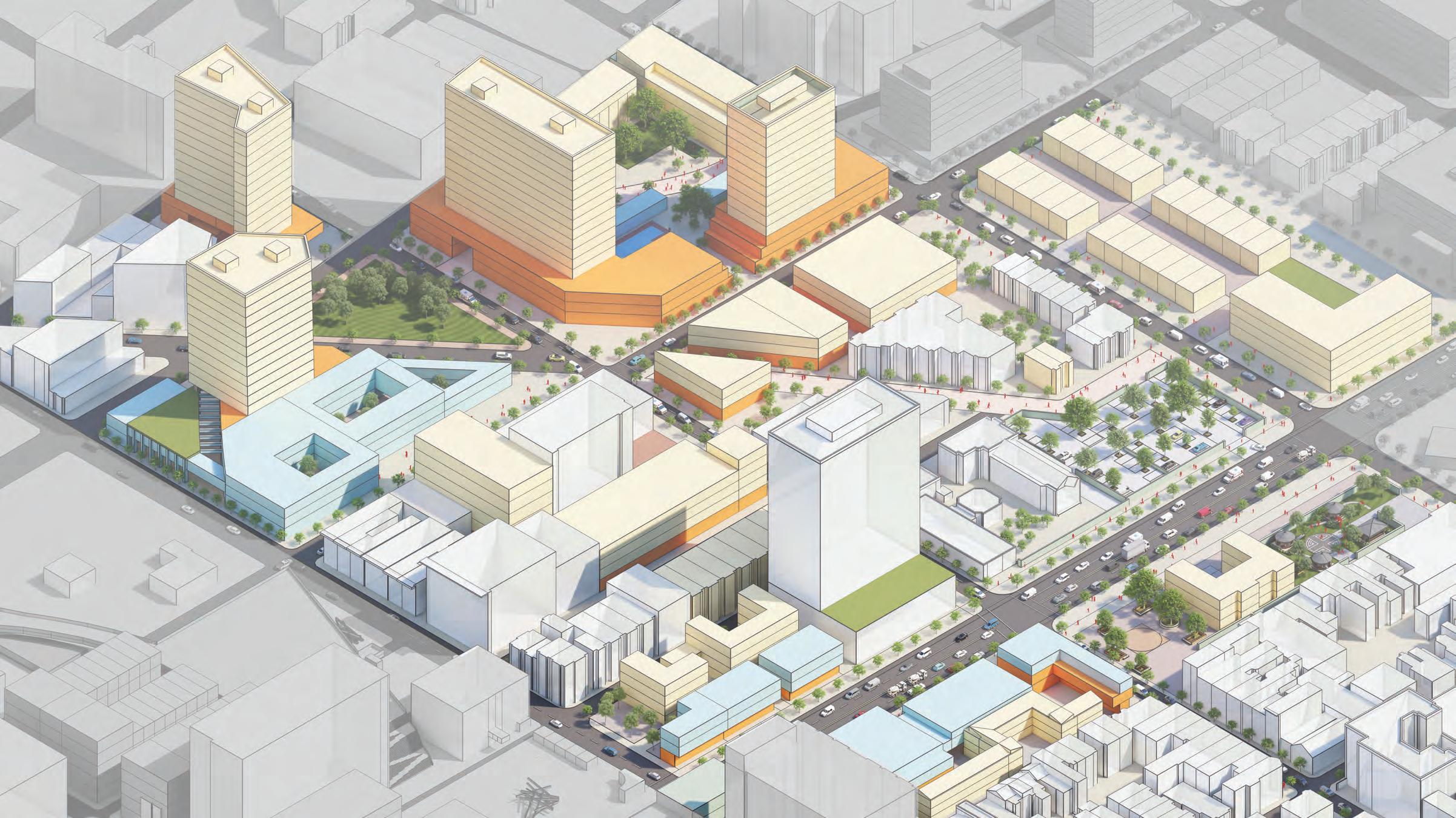
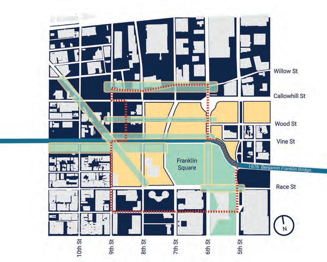
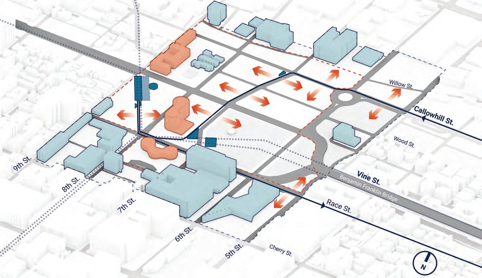
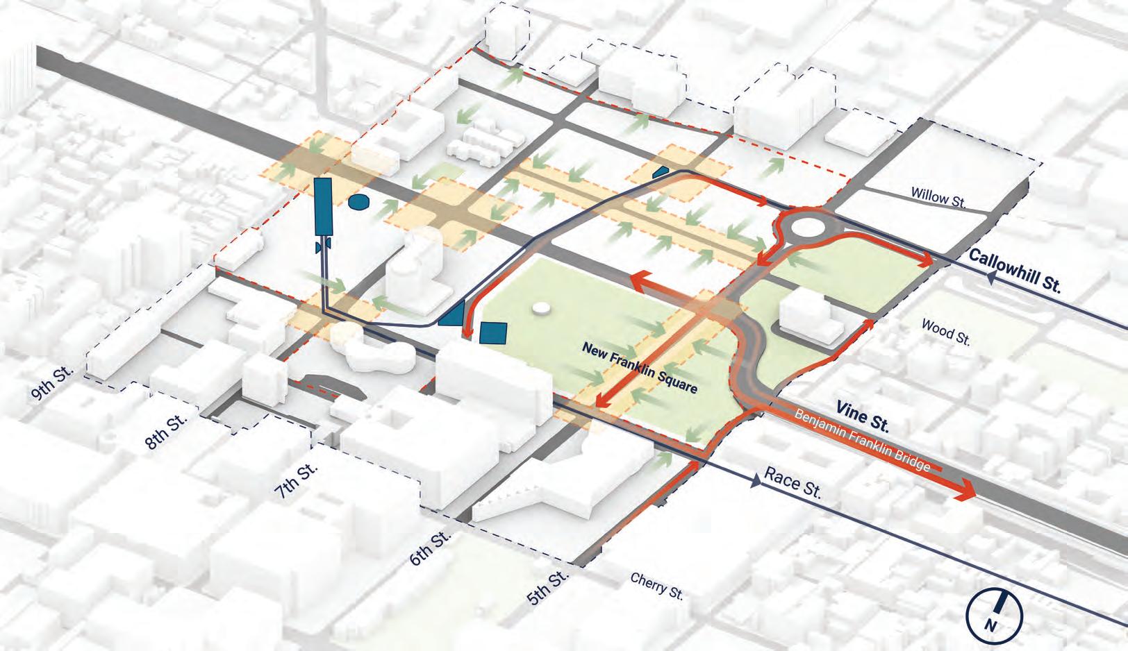
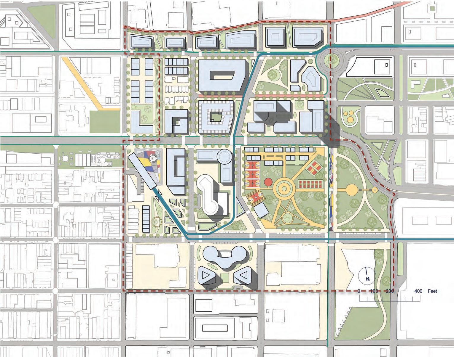
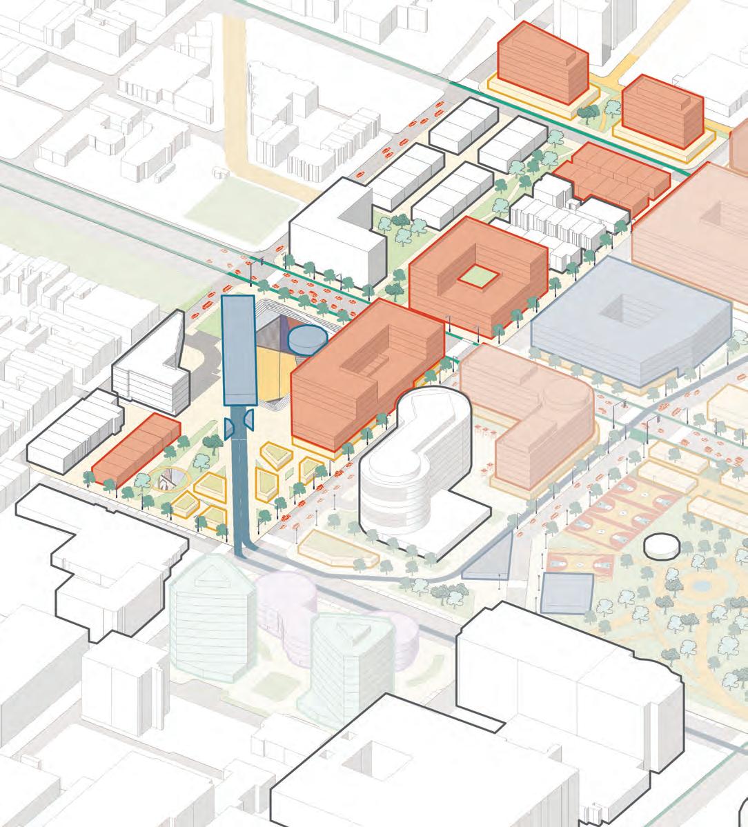
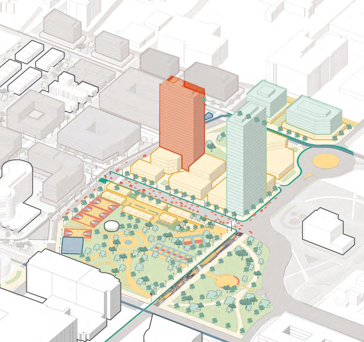
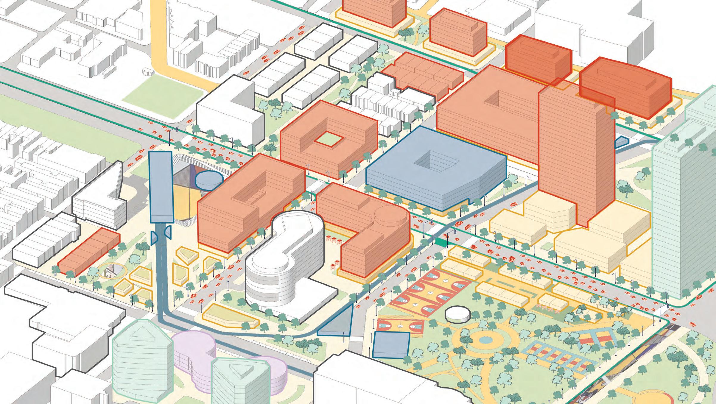
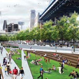
MASTERPLAN
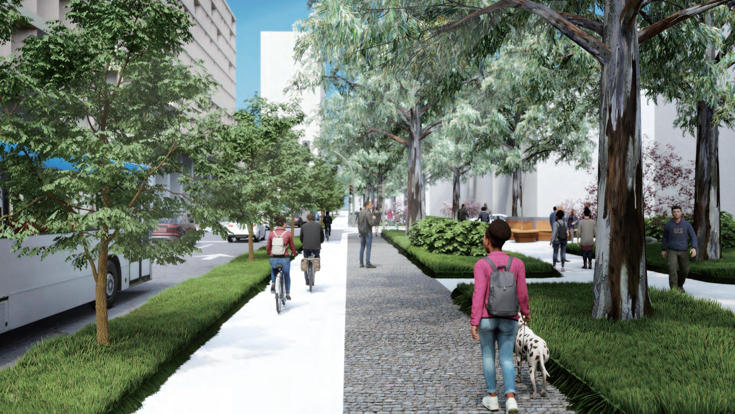
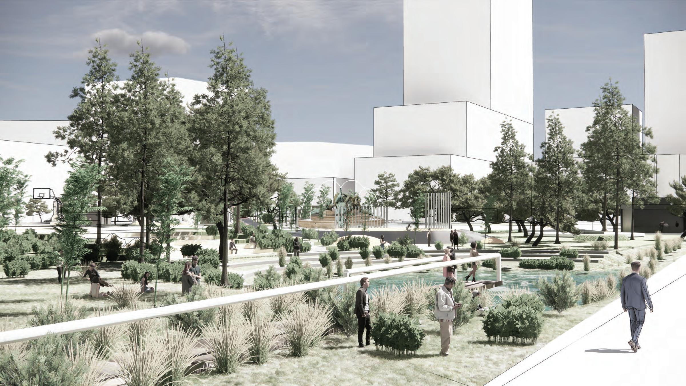
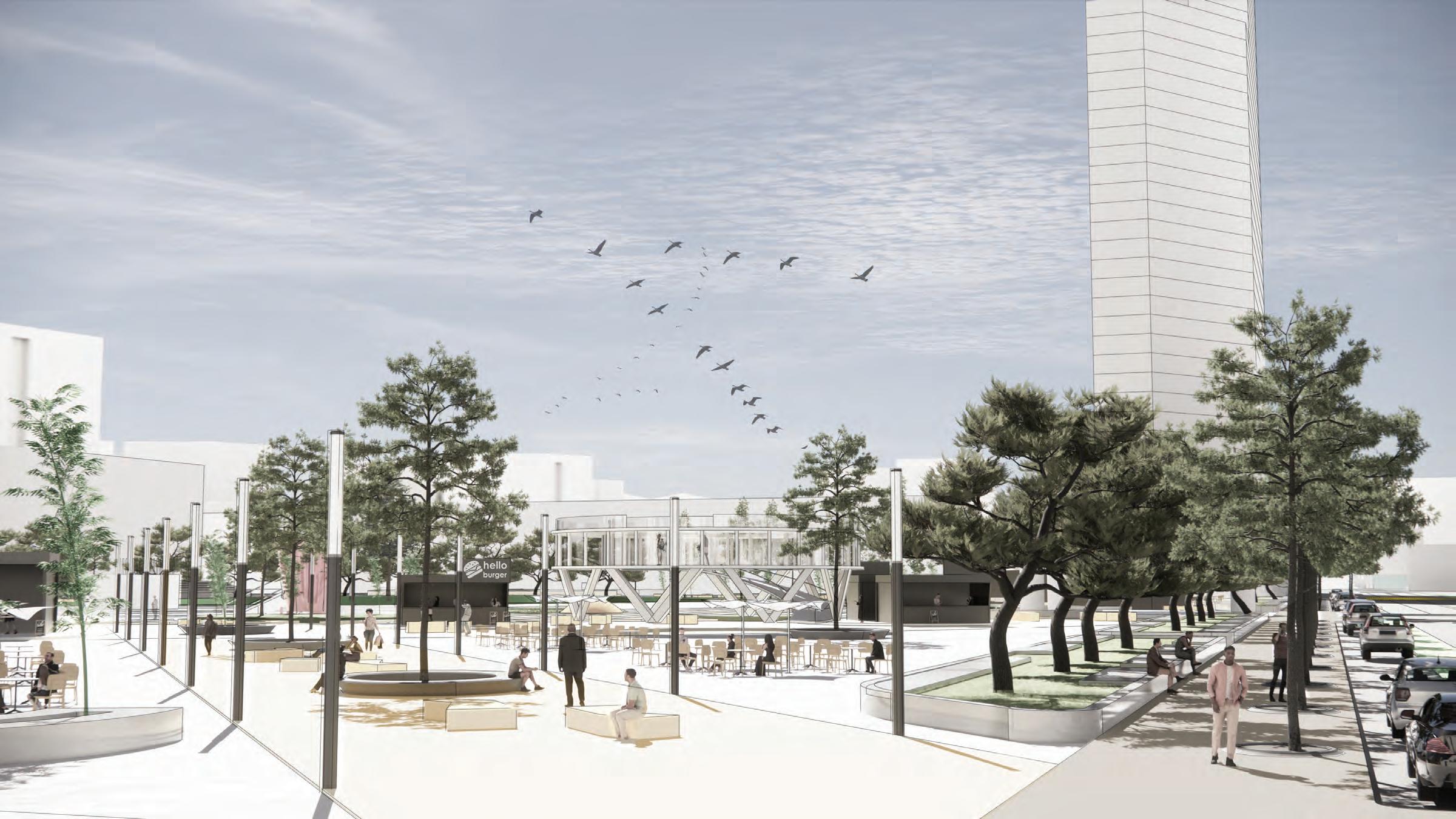
The Highway to Boulevard vision for the Corridor mends the rift created by the Expressway by recentering open space and development onto Vine Street and improving multimodal connections.
22
2505001000 0 Feet N
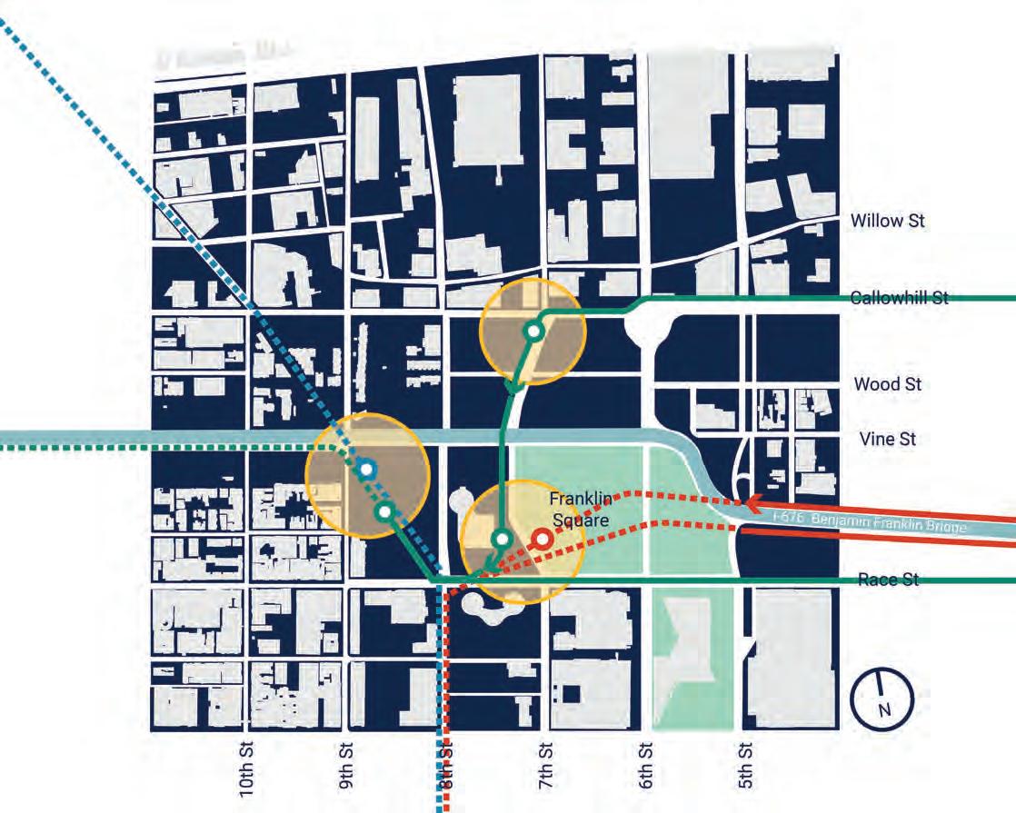
BUILDING THE PLAN
How did we get here?
23
EXISTING CONDITIONS
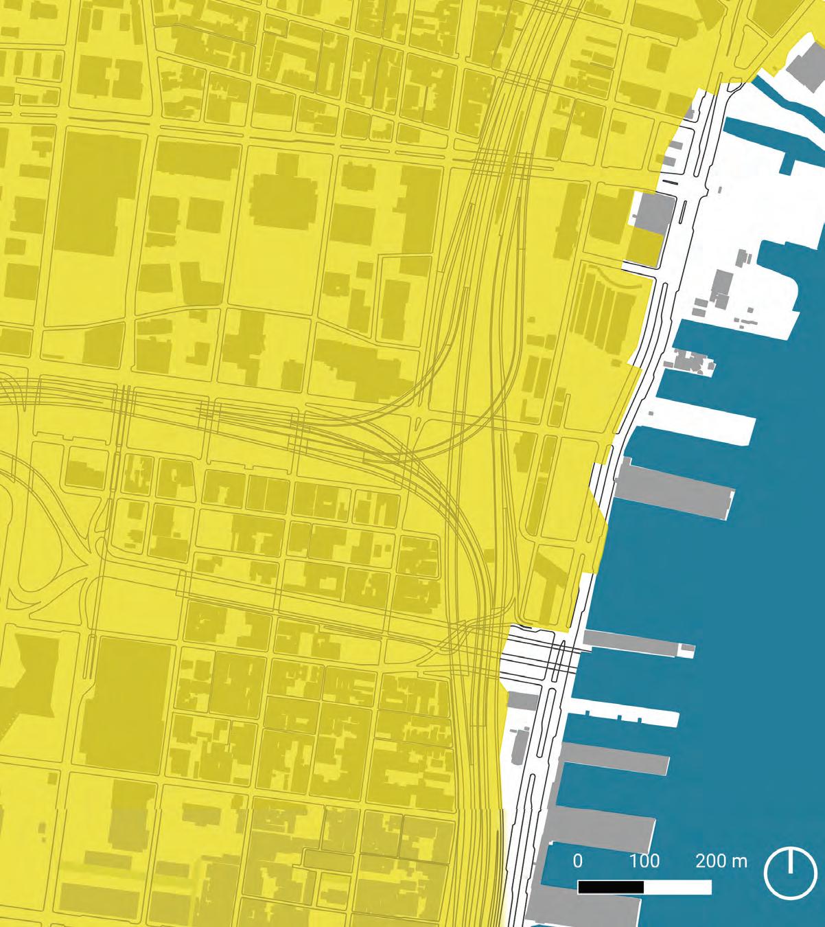
We first identified existing park, street, and development constraints surrounding the Vine Street Expressway.
24
2505001000 0 Feet N
NEW STREETS & BLOCKS
The next step was to reconnect the grid and provide a new boulevard in the footprint of the former Expressway.
25
2505001000 0 Feet N
NEW OPEN SPACE
26
New plazas and parks are layered on top of the restored grid and are distributed along the Corridor.
2505001000 0 Feet N
NEW BUILDINGS
Finally, new buildings are brought onto the new development areas, resulting in a radically different Vine Street Corridor.
27
2505001000 0 Feet N
THE SYSTEMS
28
1. STREET NETWORK
2. MULTIMODAL NETWORK
3. GREEN NETWORK
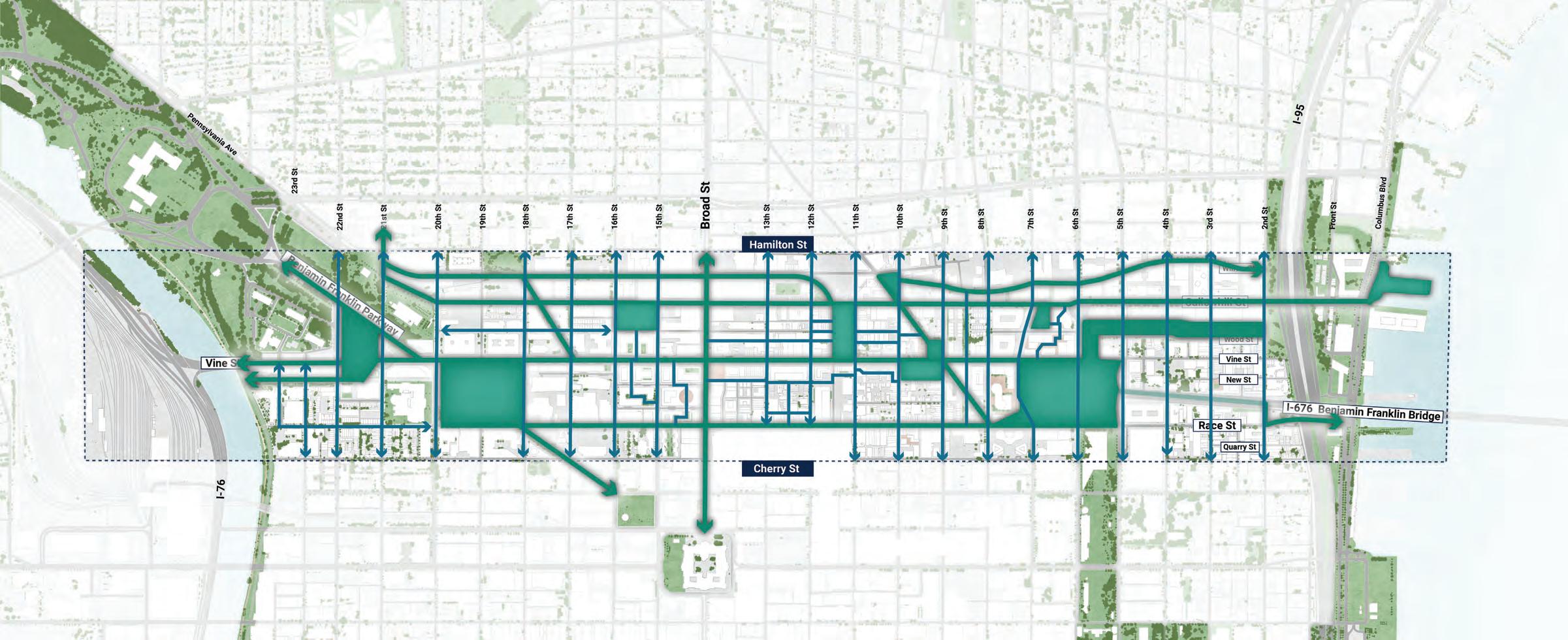
STREET NETWORK
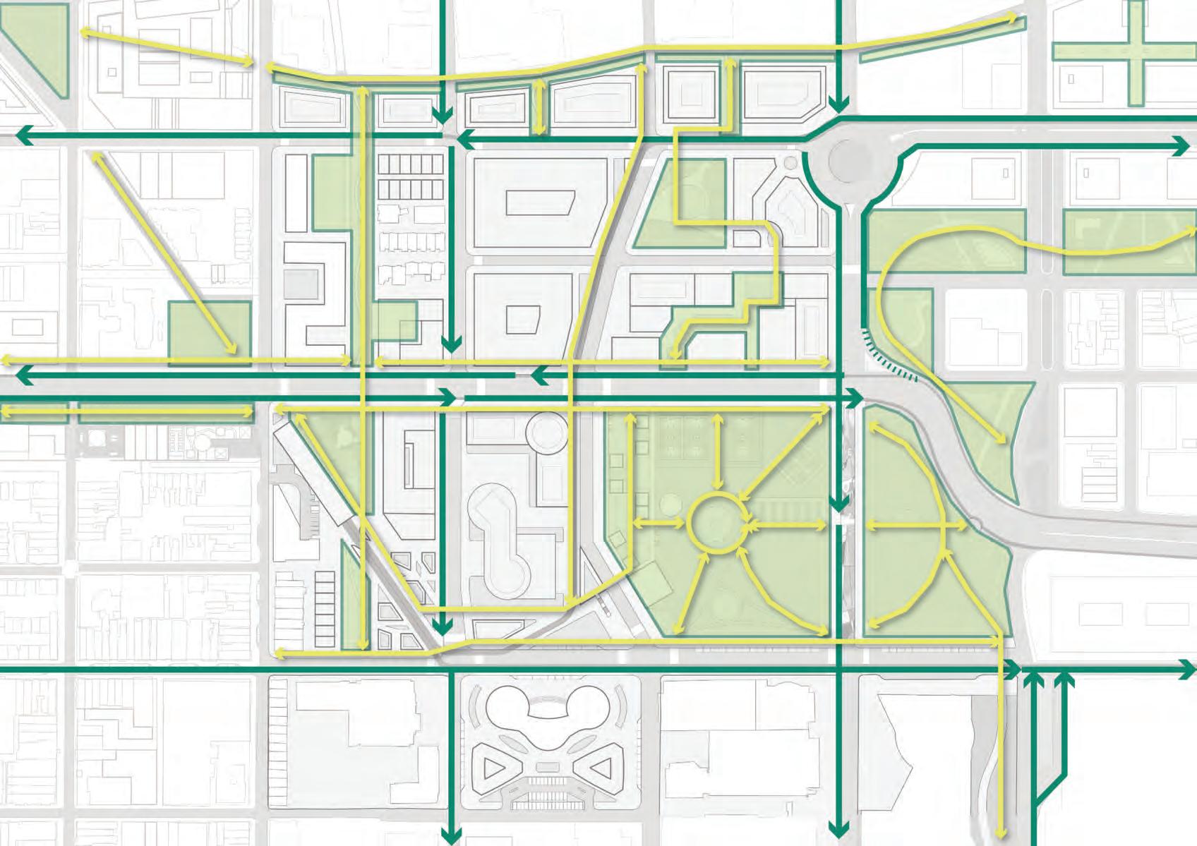
Restores lost grid connections and redistributes traffic throughout the Corridor, reducing the need for the existing high-capacity Expressway
29
PEDESTRIAN CONDITIONS
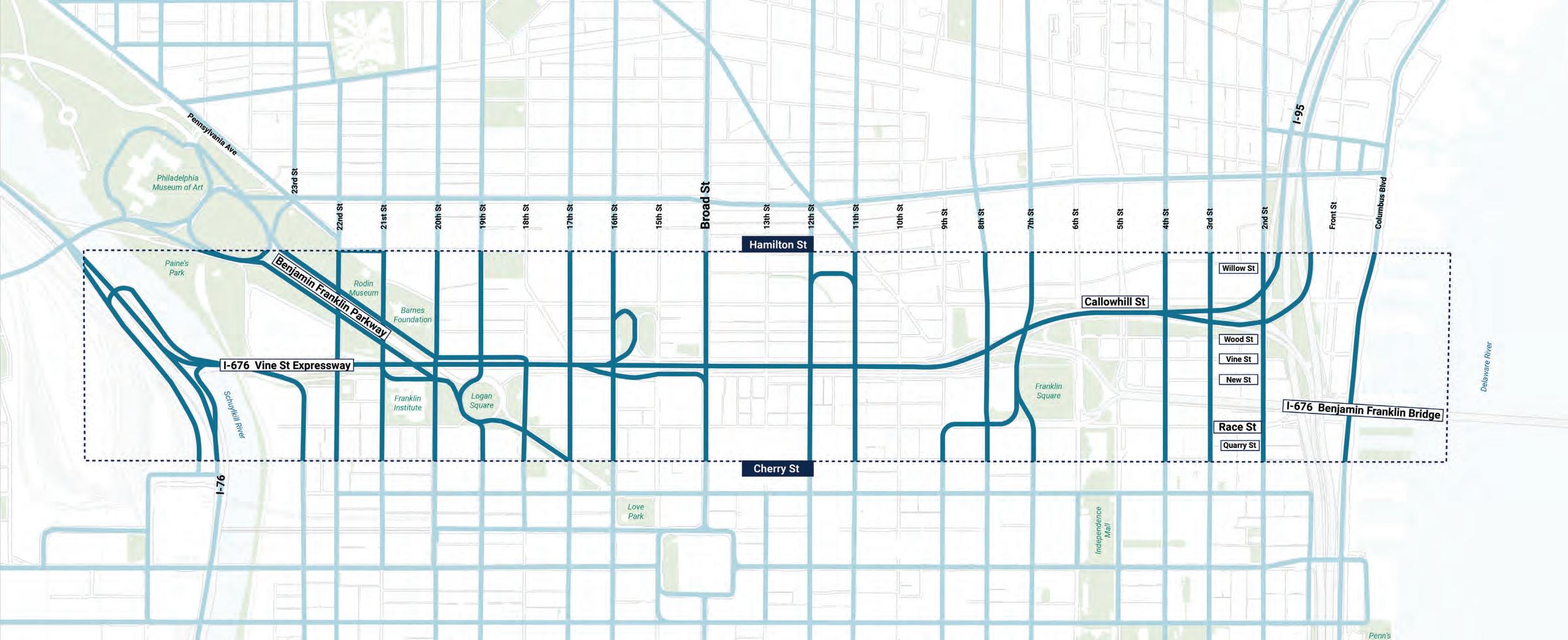
The existing conditions around the Vine Street Expressway are very unwelcome to pedestrians who often have to navigate busy intersections and dark underpasses.
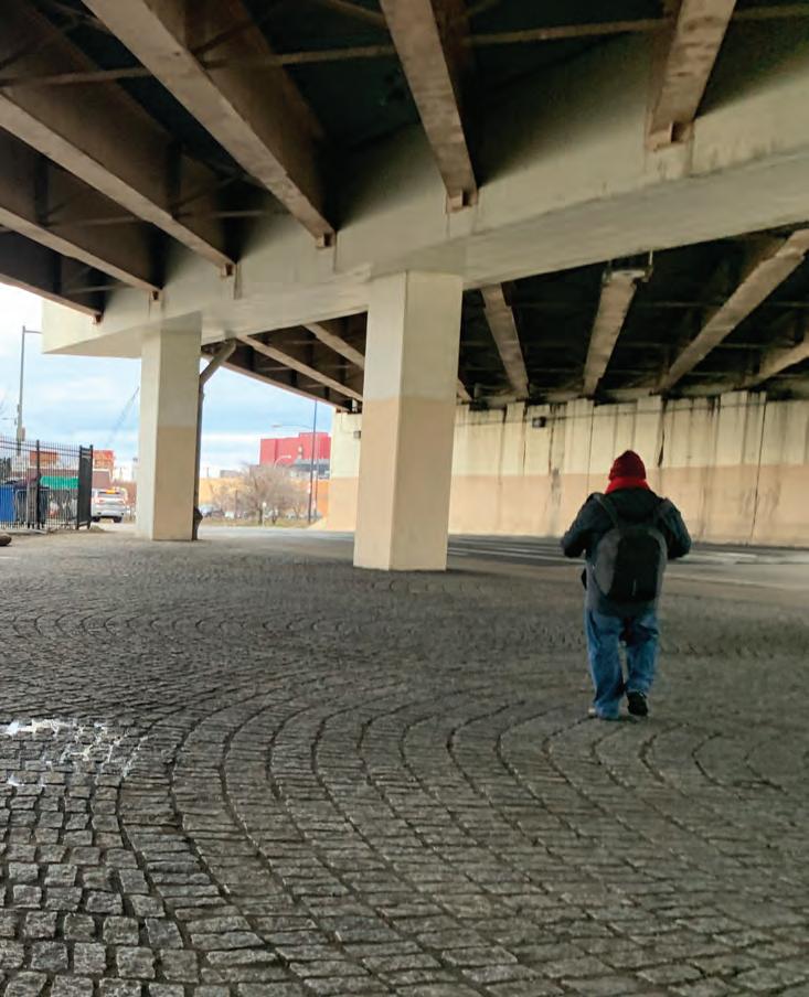
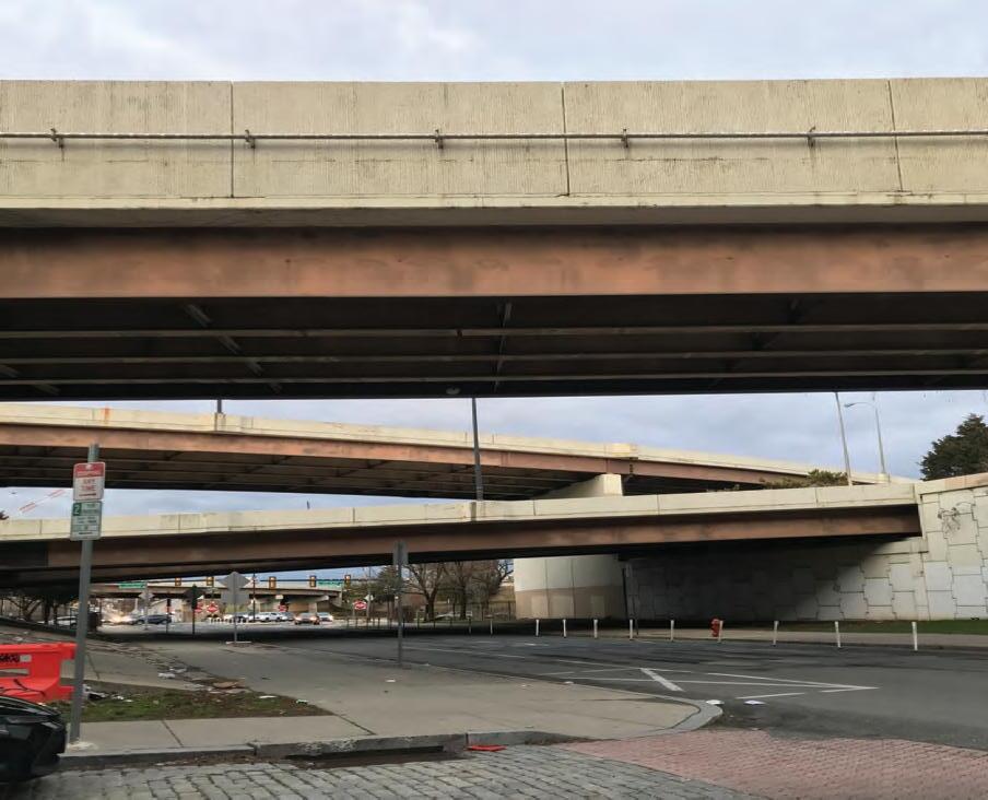
30
15th Street 7th Street 2nd Street
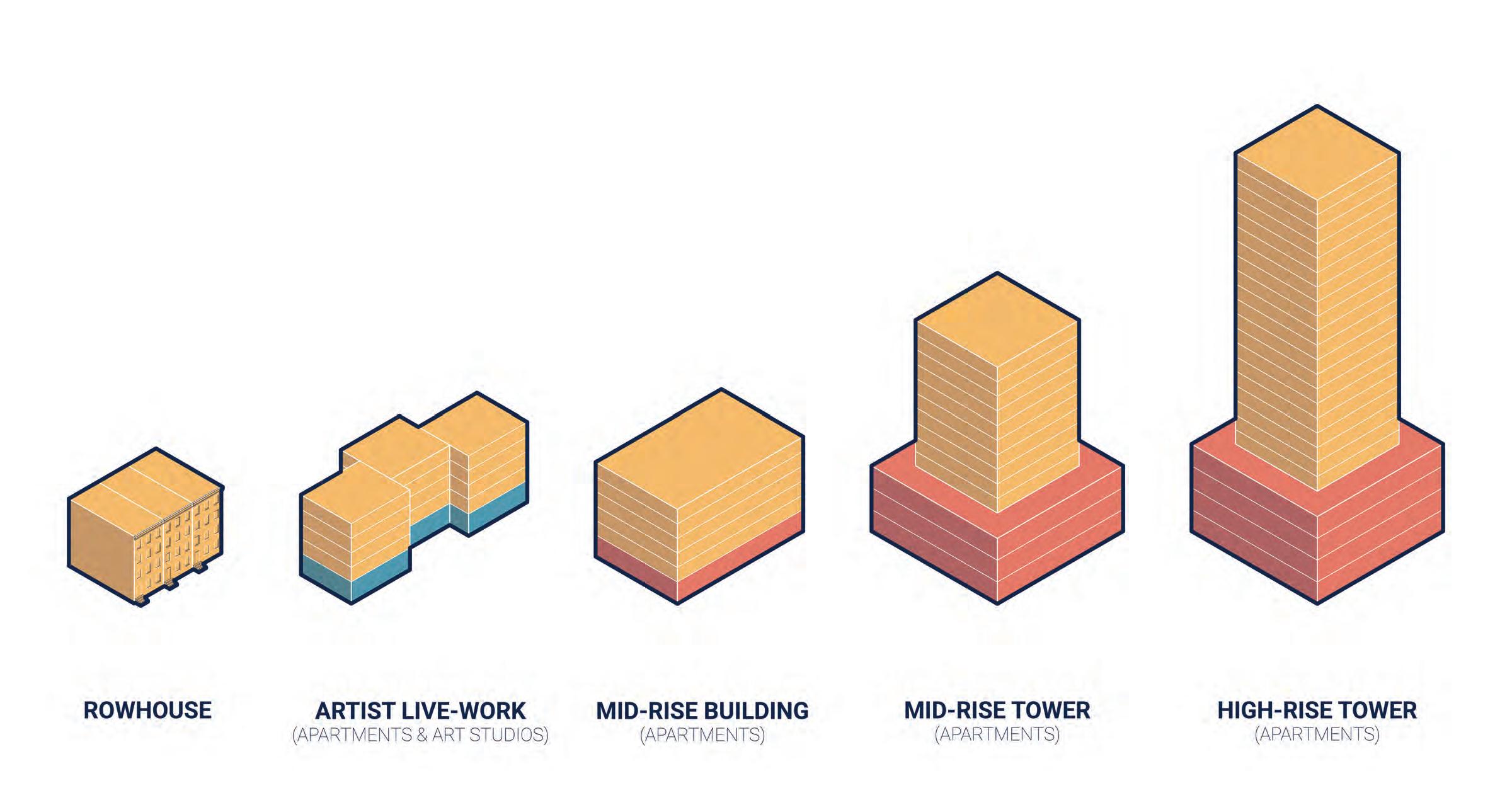
Source: Public Realm Studio
Source: Public Realm Studio
Source: Public Realm Studio
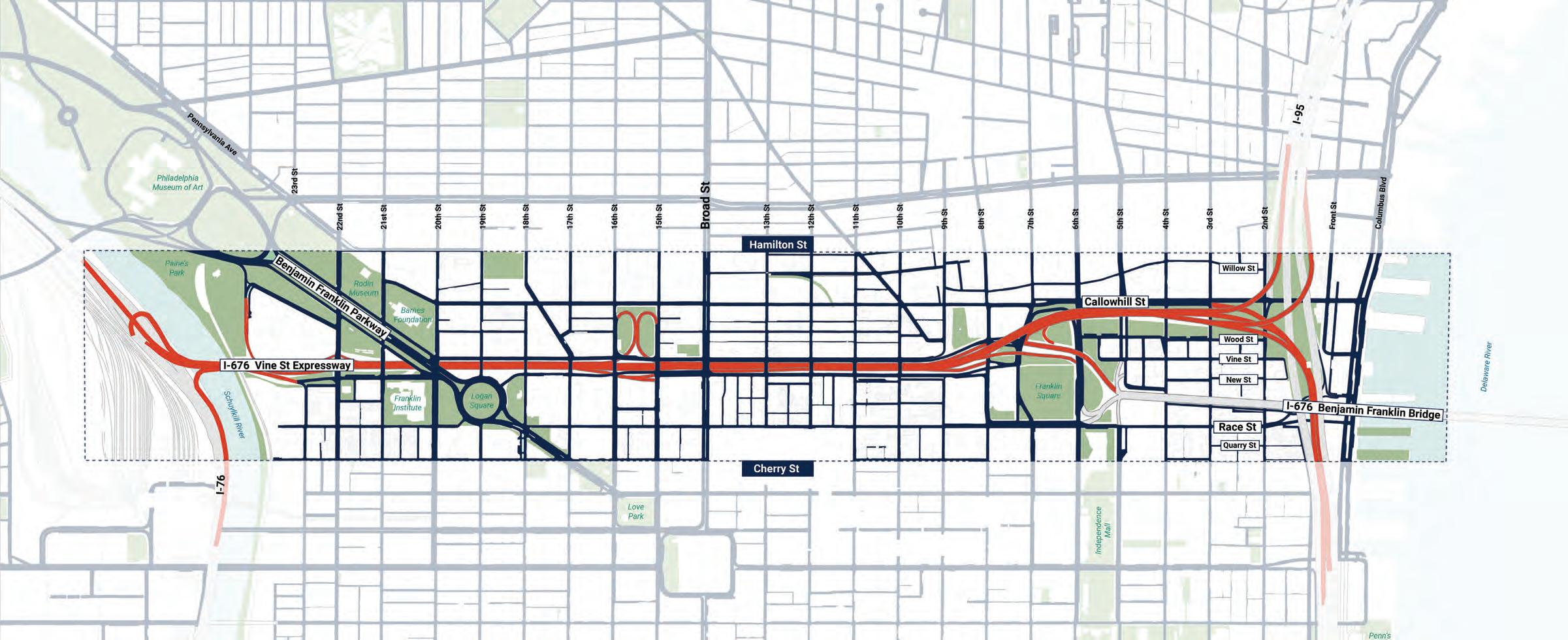
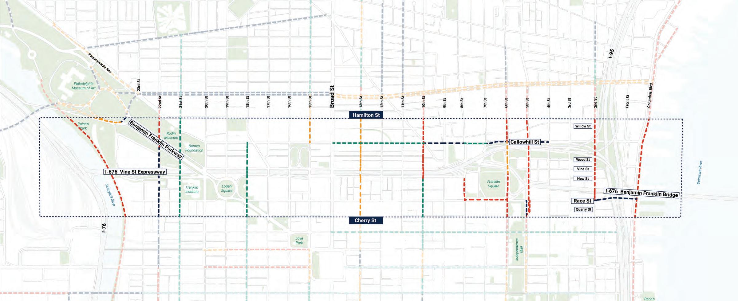
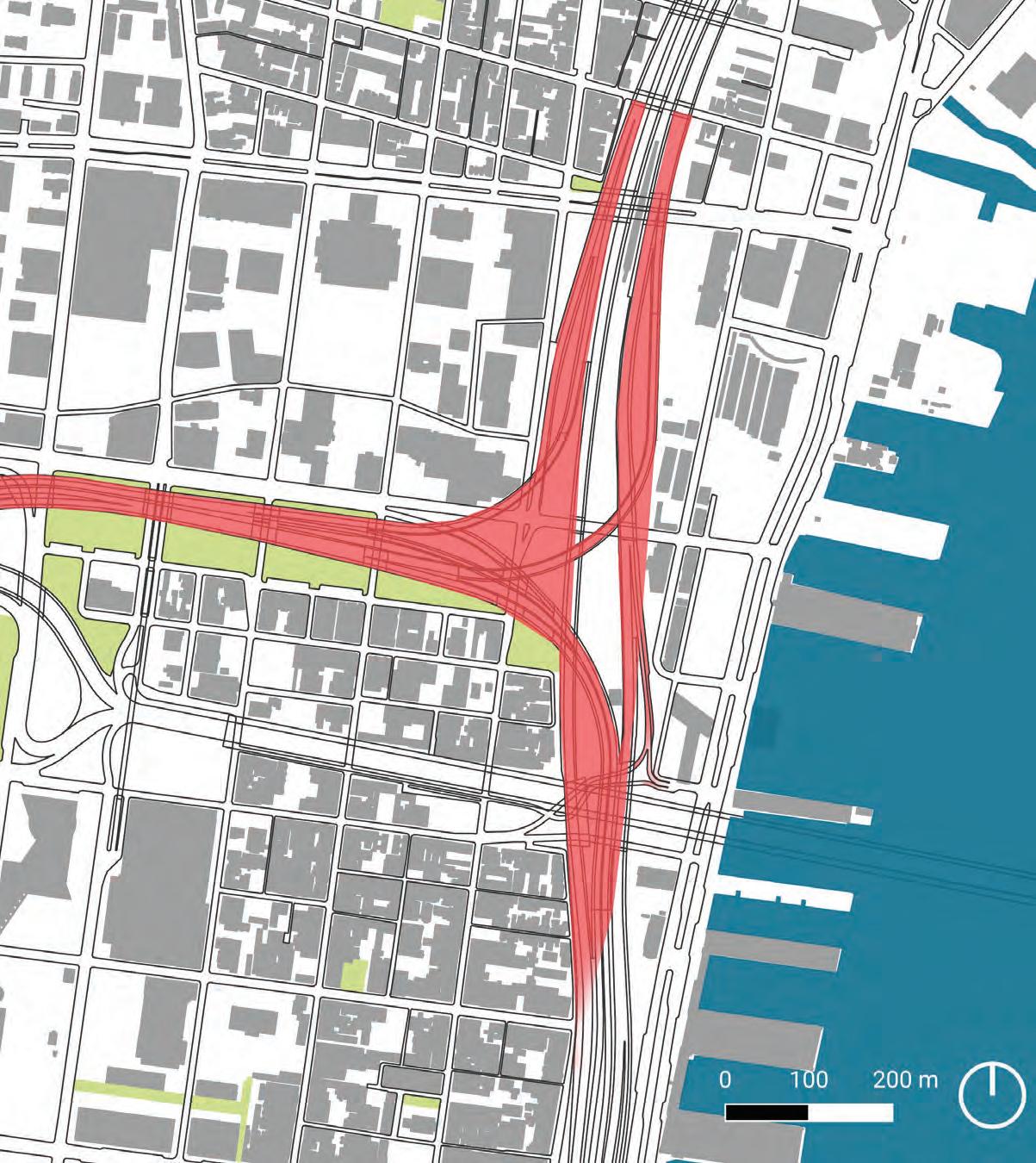
HIGH-INJURY NETWORK
Thirteen roads within the Corridor are part of the High-Injury Network (the 12% of Philadelphia’s roads where 80% of traffic deaths and serious injuries occur).
31 High Injury Network Road High Injury Network Buffer
2505001000 0 Feet N
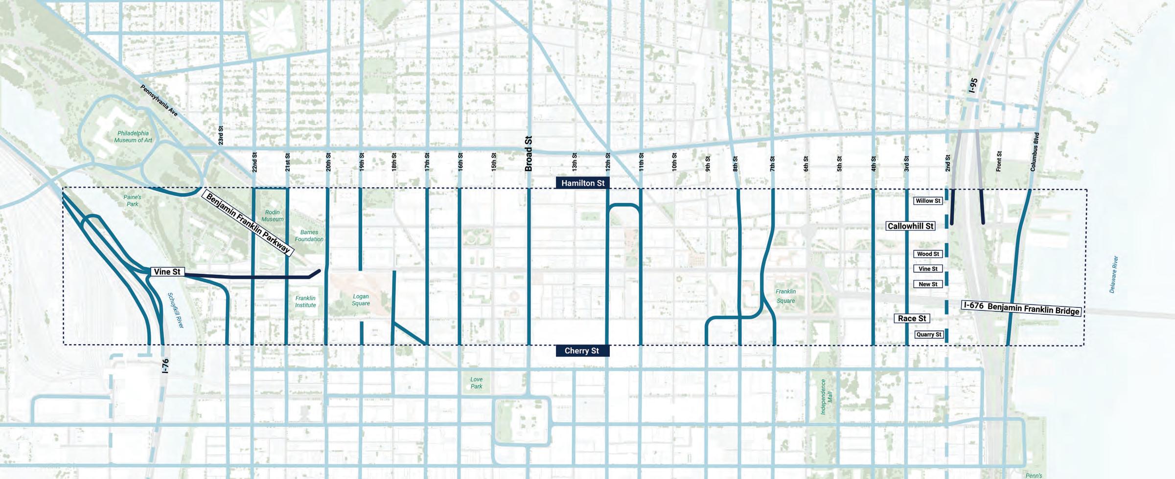
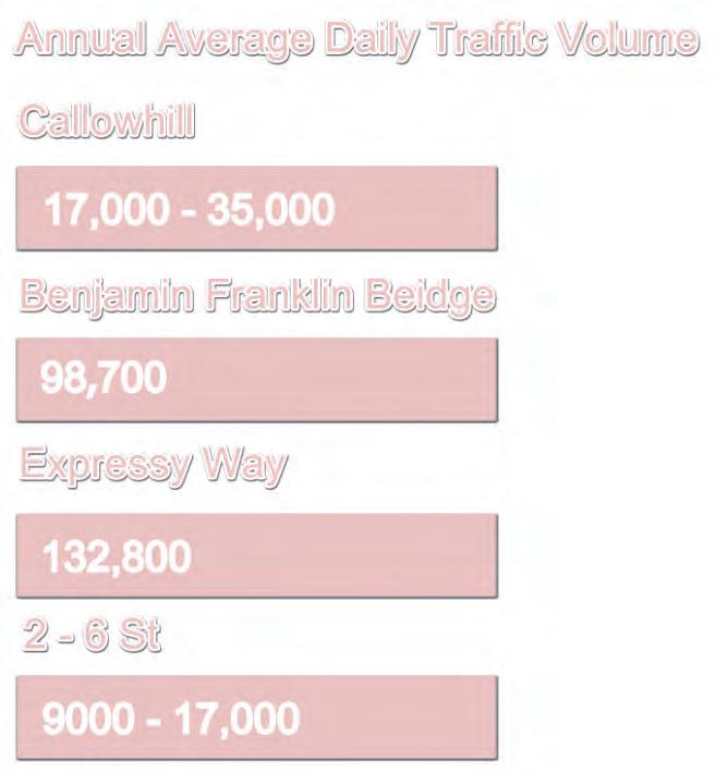
DAILY TRAFFIC VOLUME
Large traffic volumes that flow through the Corridor are some of the main contributors to these unsafe conditions.
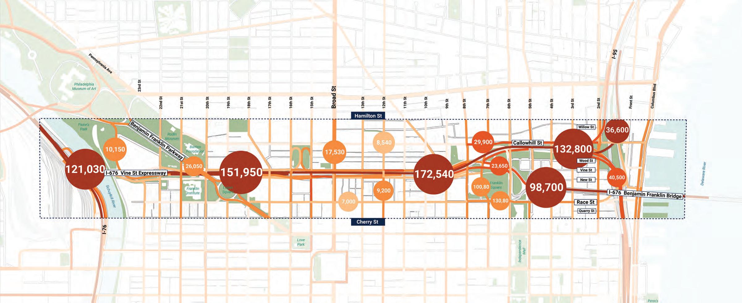
32 Annual Average Daily Traffic Volume 0 - 4,000 9,000 - 17,000 4,000 - 9,000 17,000 - 35,000 35,000 - 164,000
2505001000 0 Feet N Source: PennDOT
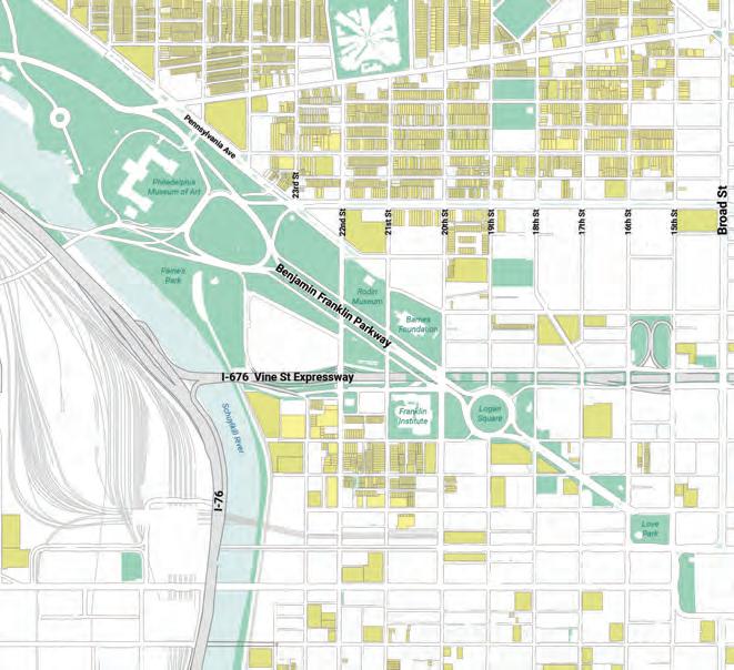
EXISTING CITY GRID
Philadelphia has a strong grid network of streets, but the Expressway interrupts many of the north-south connections.
Existing City Grid
33
Vine Street Expressway
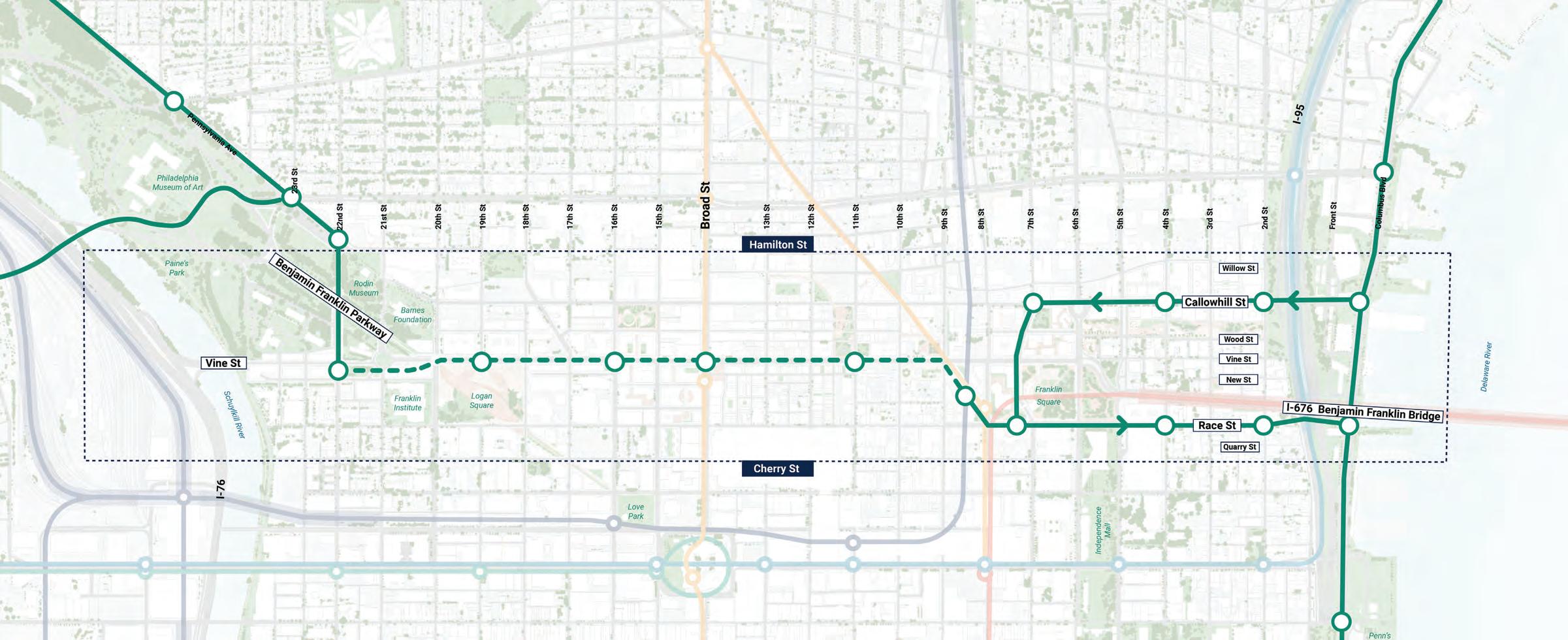
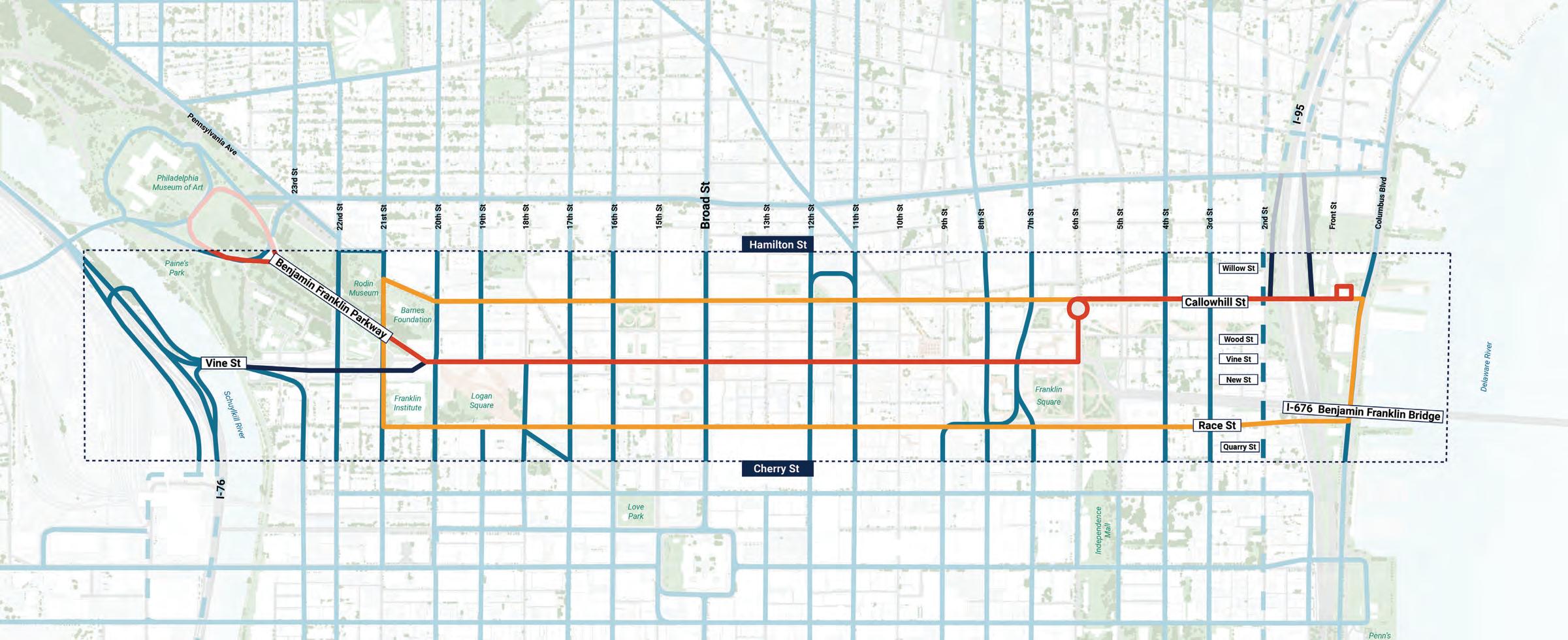
VINE STREET/CALLOWHILL STREET CORRIDOR
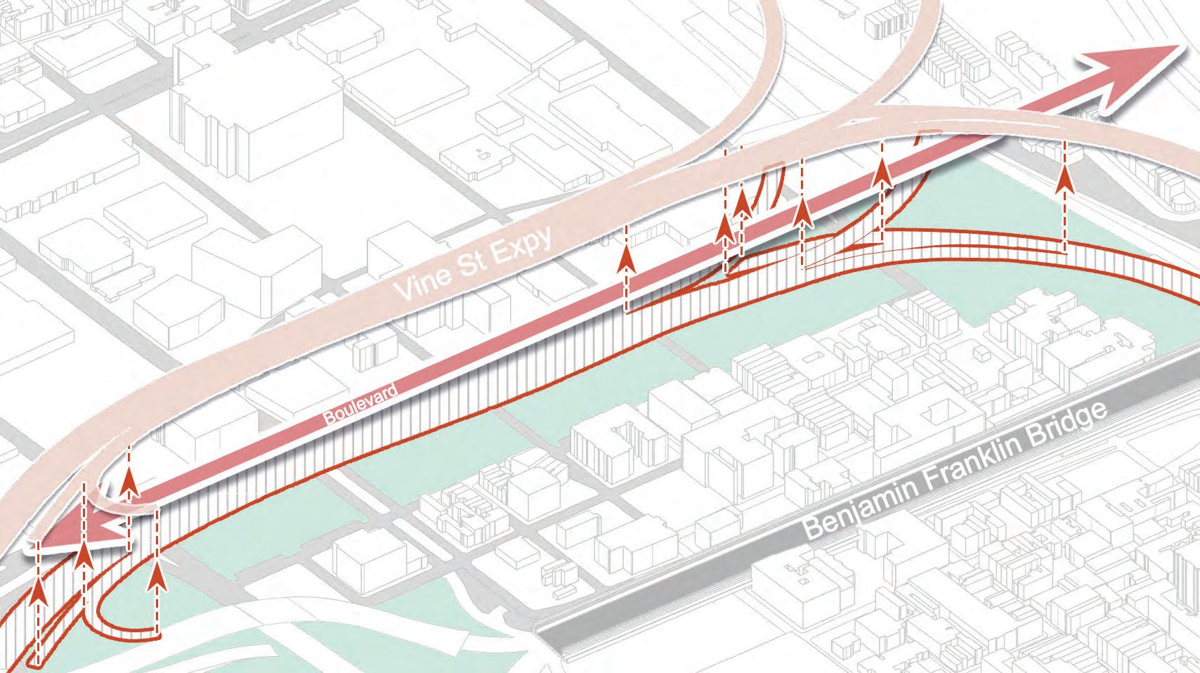
The Highway to Boulevard proposal restores the grid through a new Vine Street/ Callowhill Street connector and distributes traffic through other east-west connections.
New Corridor Secondary Streets
34
2505001000 0 Feet N
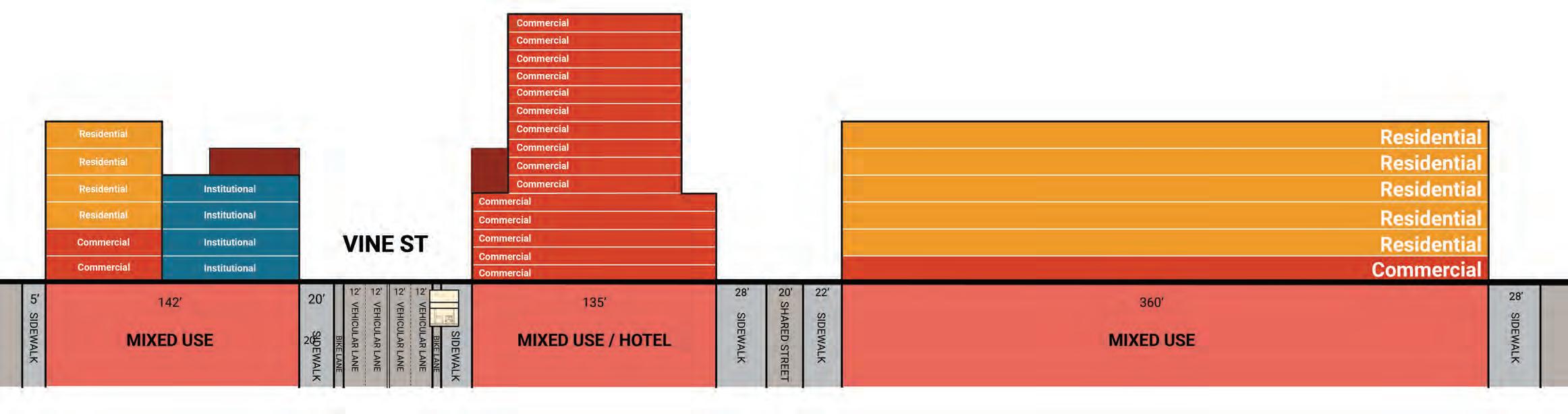
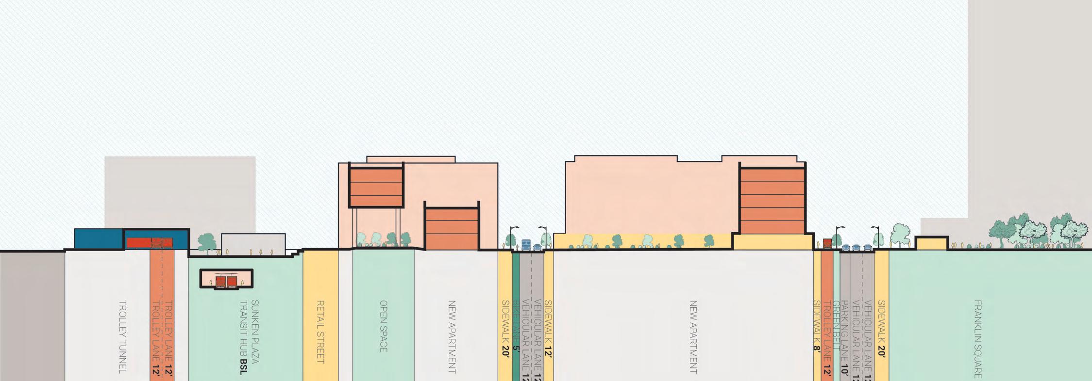
VINE STREET SECTION - BEFORE
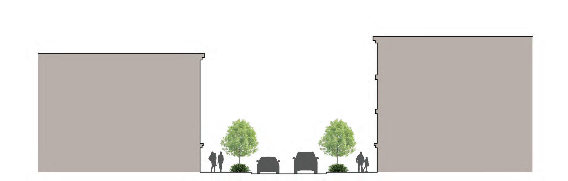
The current Expressway creates a large chasm in the urban fabric, and this division is further exacerbated by the wide frontage roads.
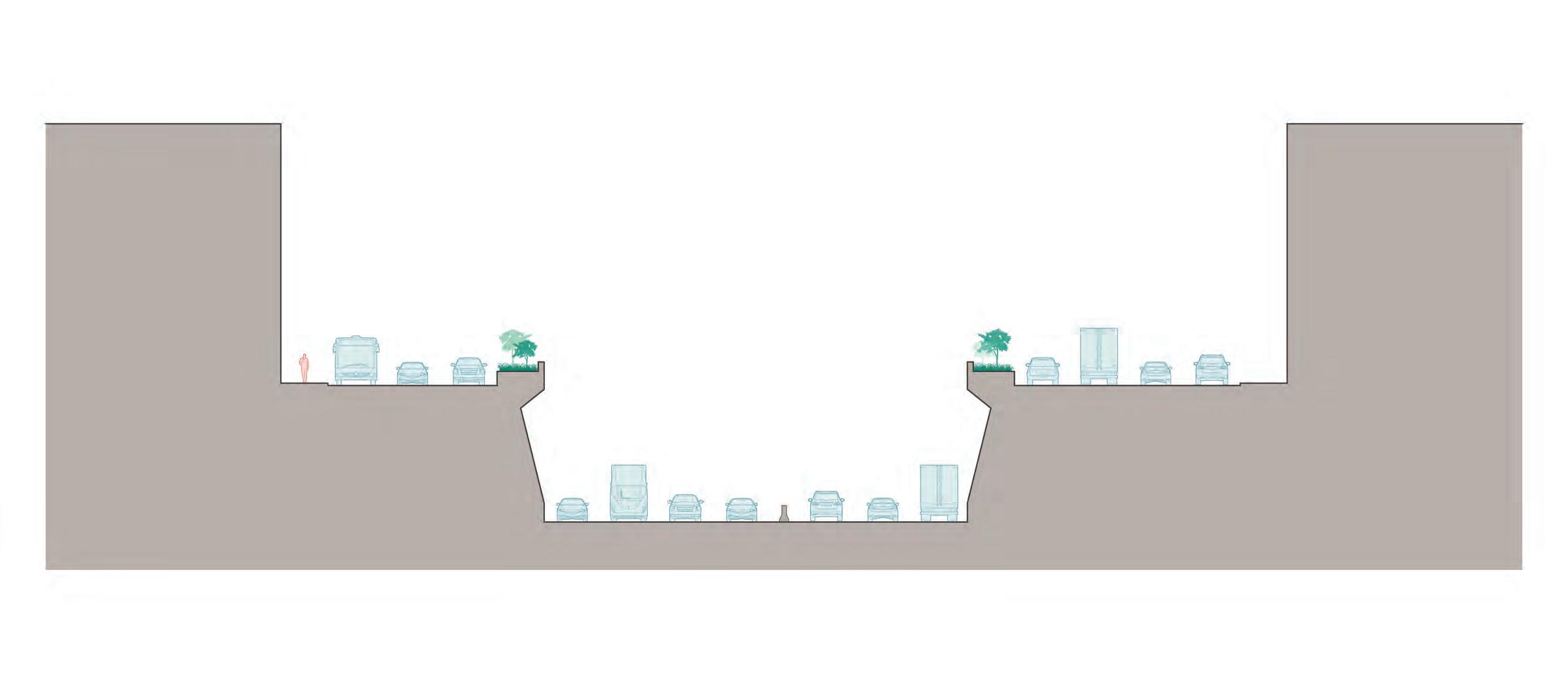
35 Expressway Frontage Road Frontage Road 87’ - 130’ 6’-9’ 6’-9’
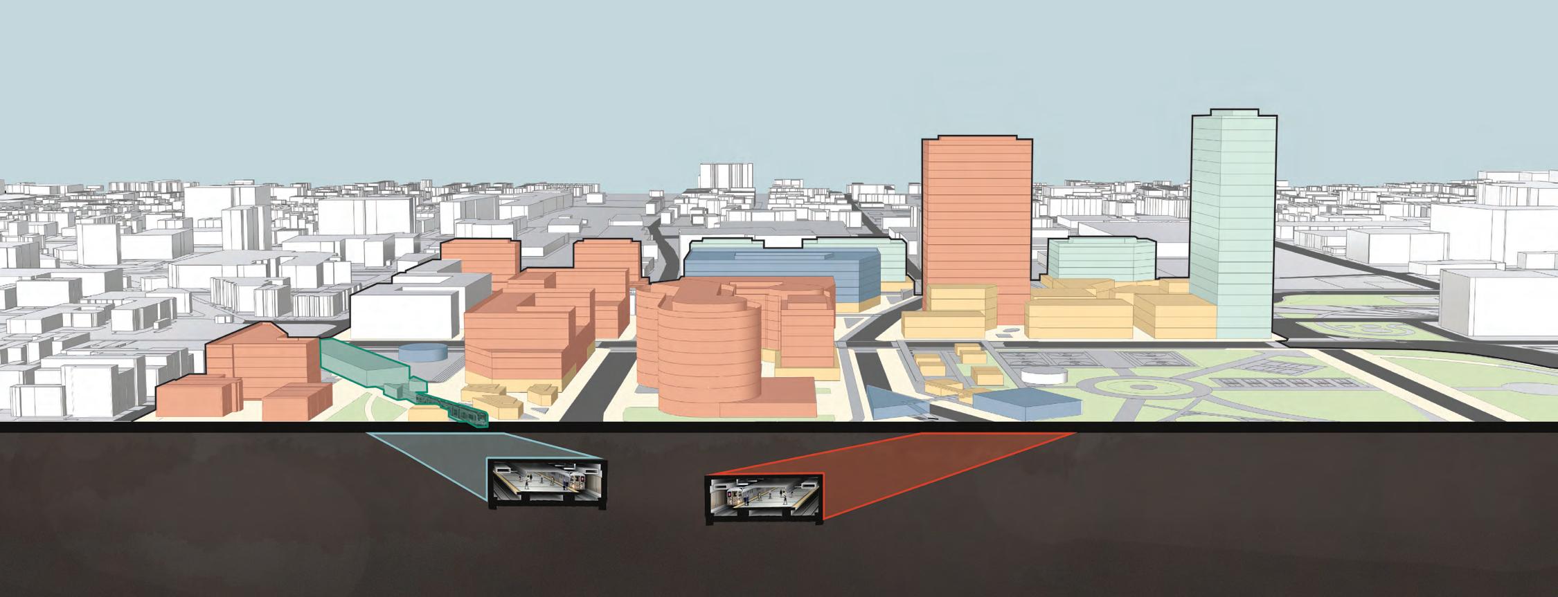
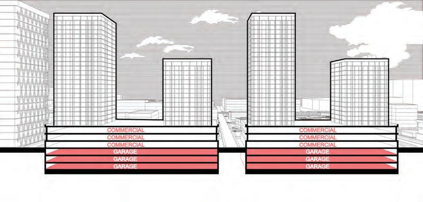
Former Expressway
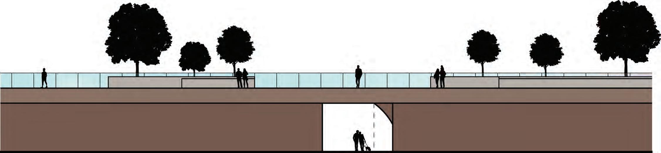
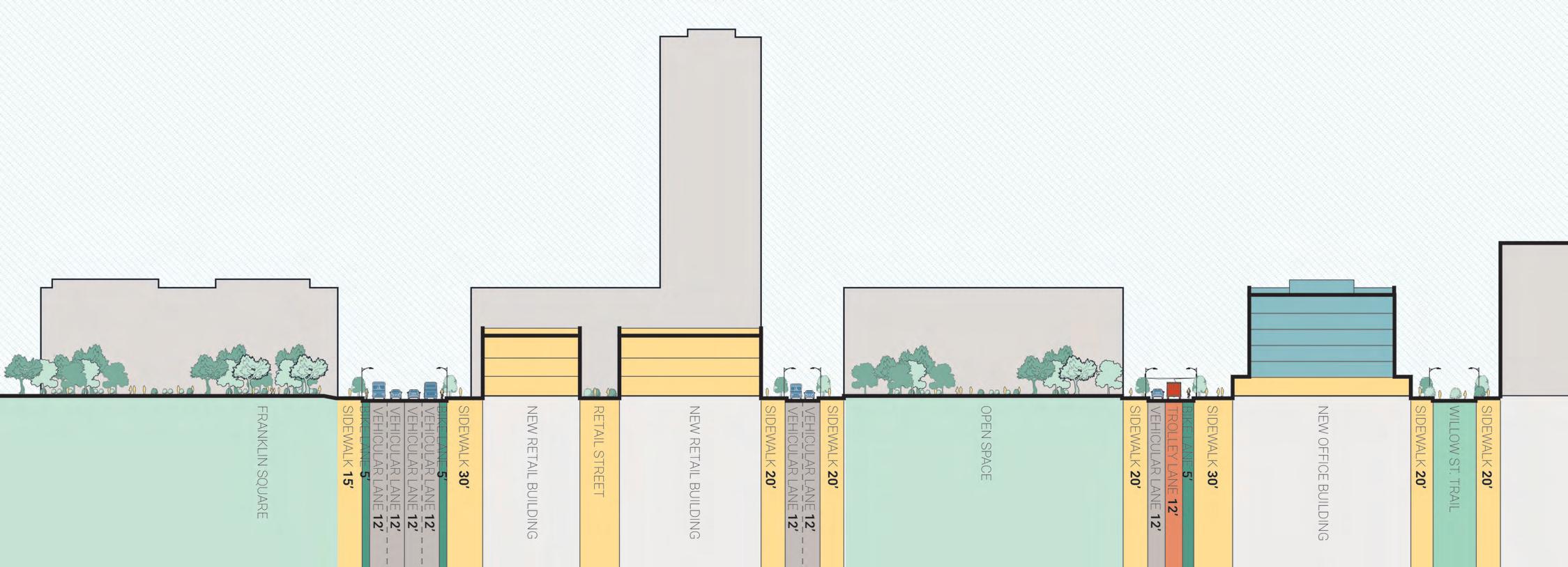
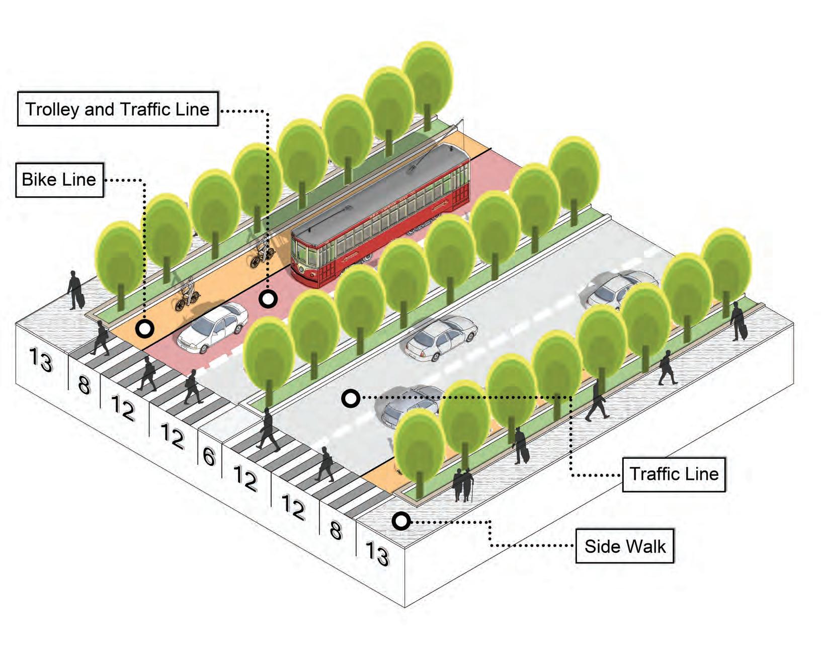
VINE STREET SECTION - AFTER
With a significantly narrowed roadway, the Corridor can gain an entire new block of publicly-owned land that can spur economic development and provide opportunities to create affordable housing.
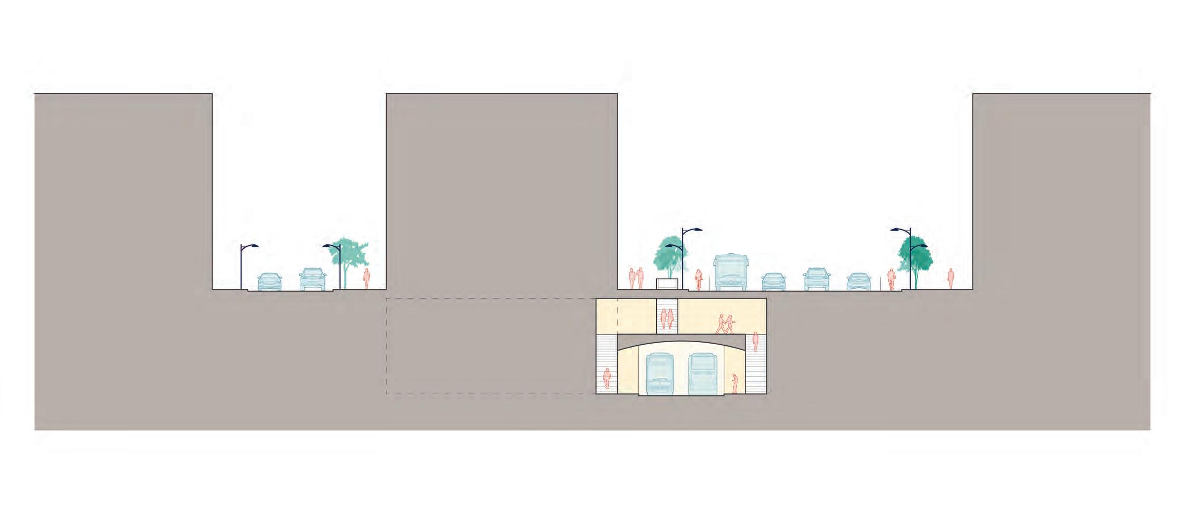
36
New Trolley New
Parking Garage
Winter Street
Vine Street New Development Block
New Development Block
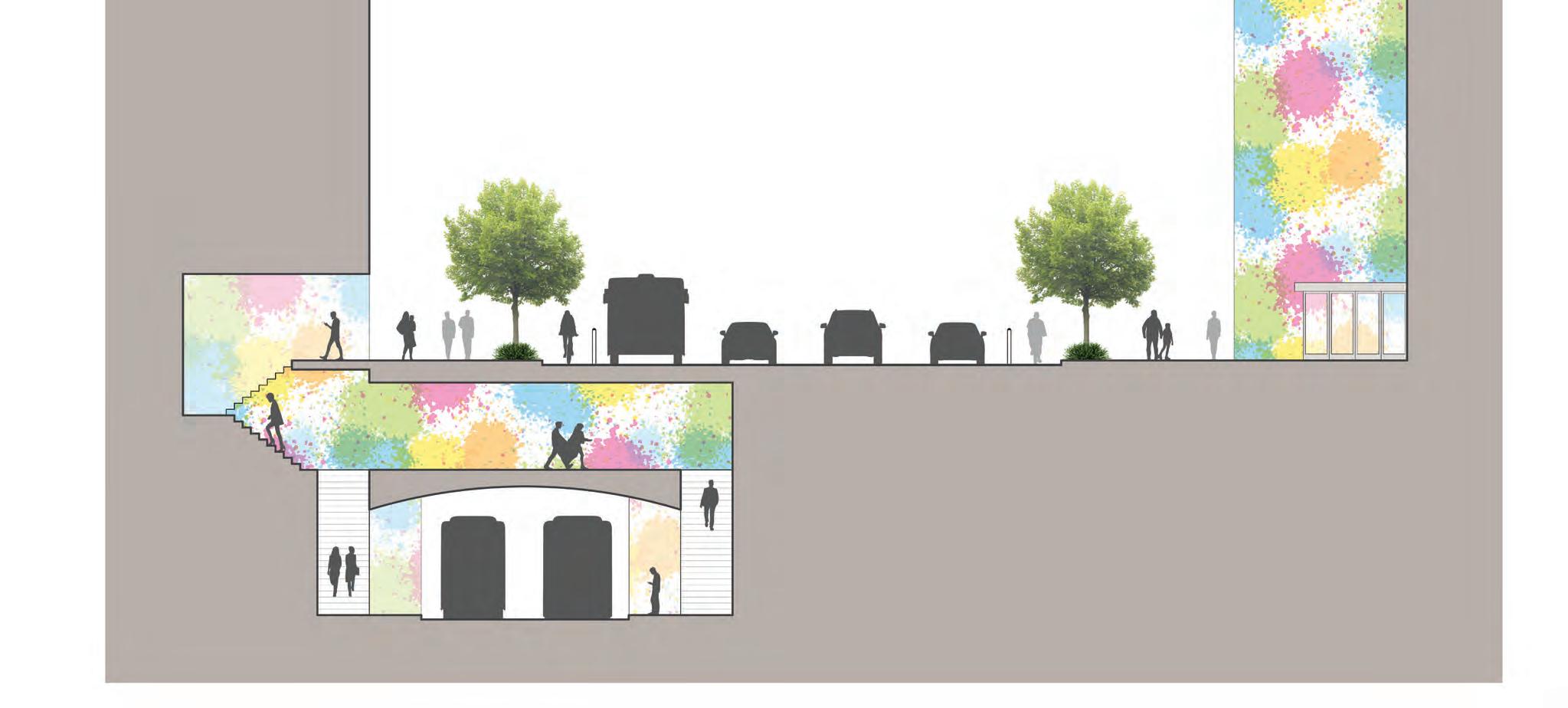
VINE STREET SECTION - AFTER
The proposed plan also takes advantage of the depressed area by introducing a new underground trolley and parking garage.
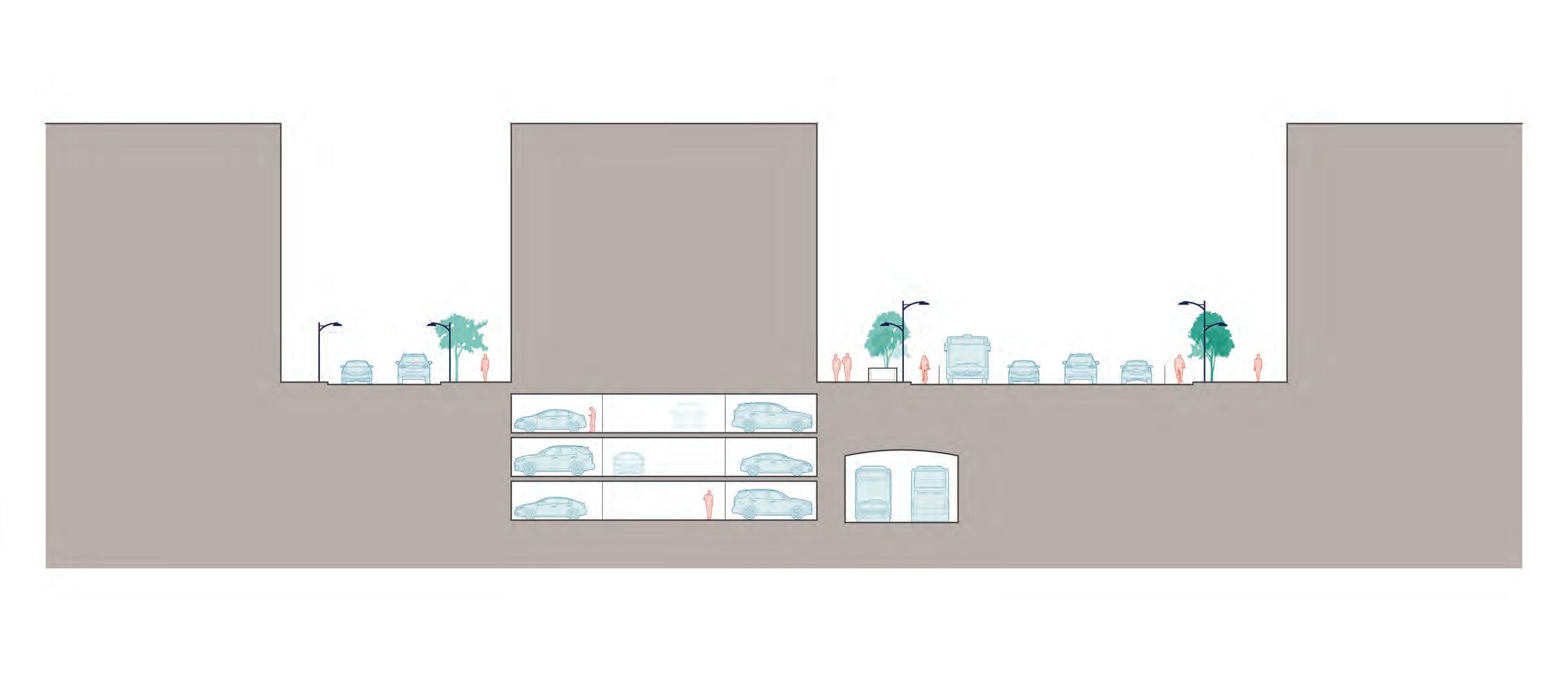
37
New Trolley New Parking Garage Former Expressway
Winter Street Vine Street
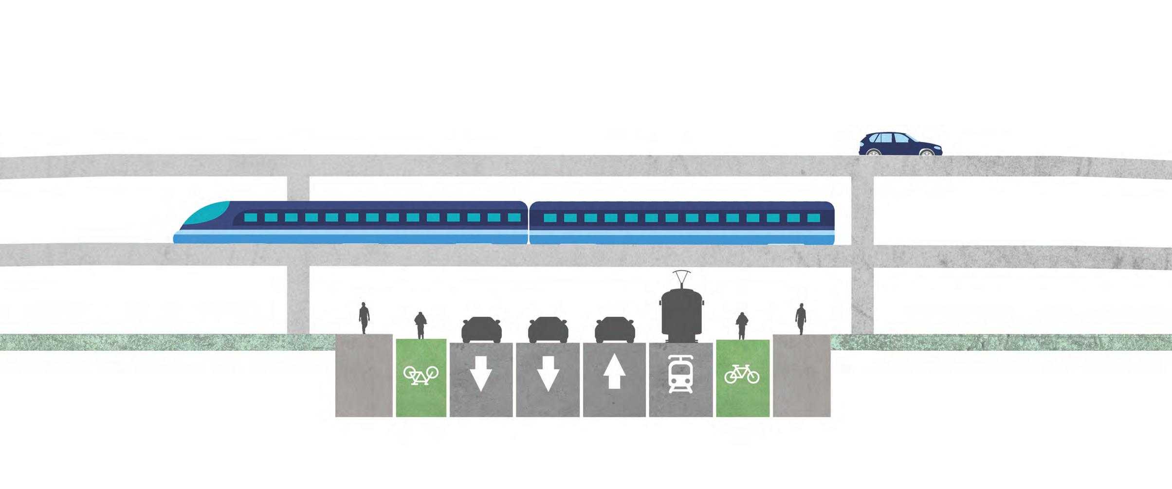
VINE STREET SECTION - AFTER
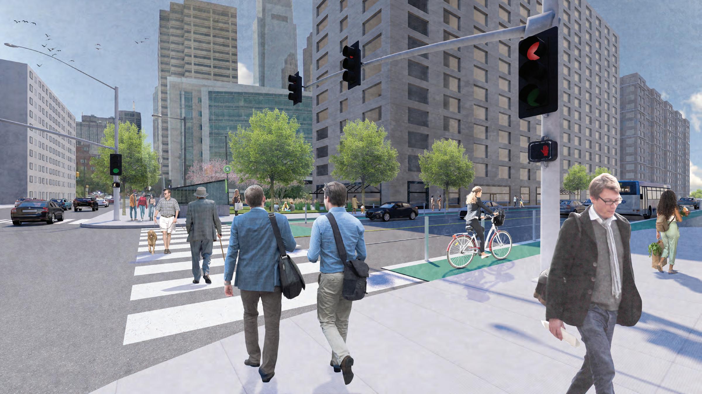
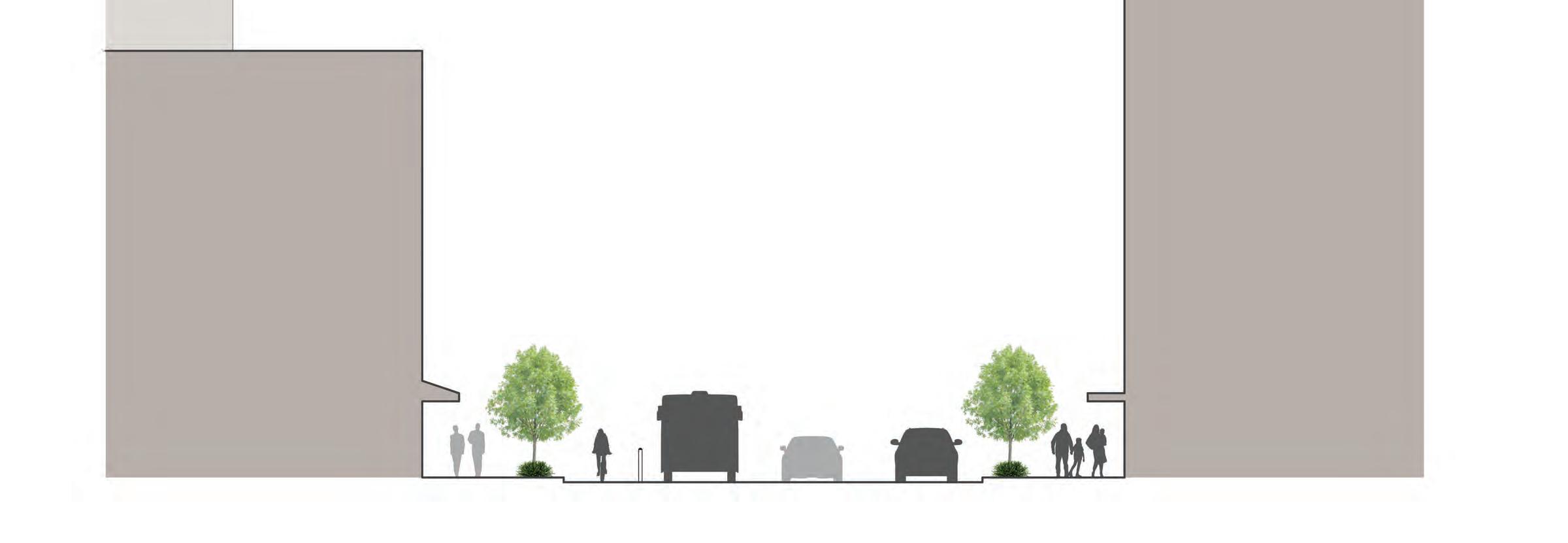
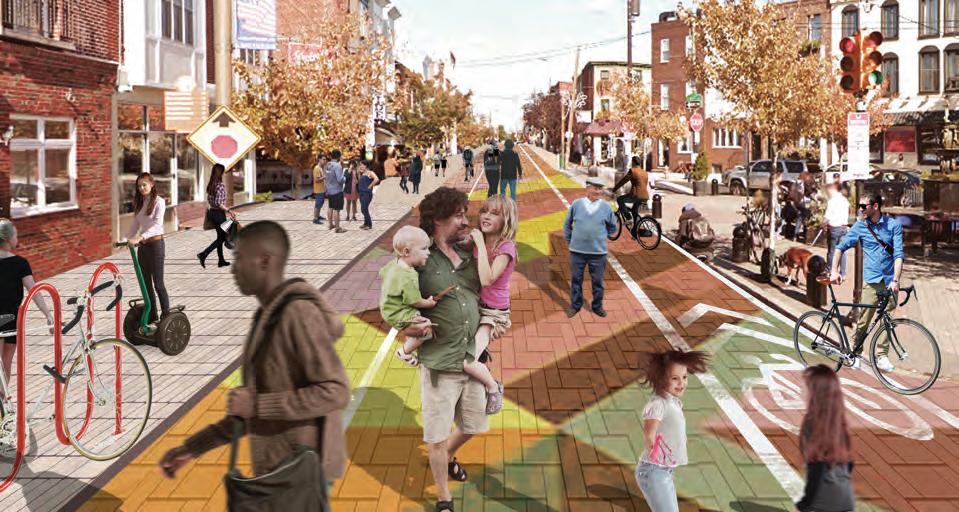
The new roadway will consist of two travel lanes and a bike lane in each direction, providing space for pedestrians, cyclists, transit riders, and drivers to create a multimodal corridor.
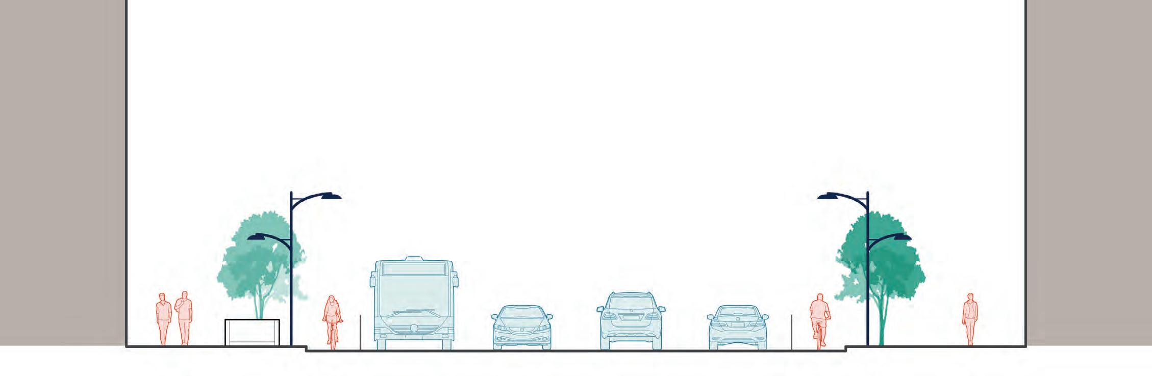
38 20’ Sidewalk 6’ 6’ 12’ 12’ 12’ 12’ 20’ Sidewalk 60’ Roadway
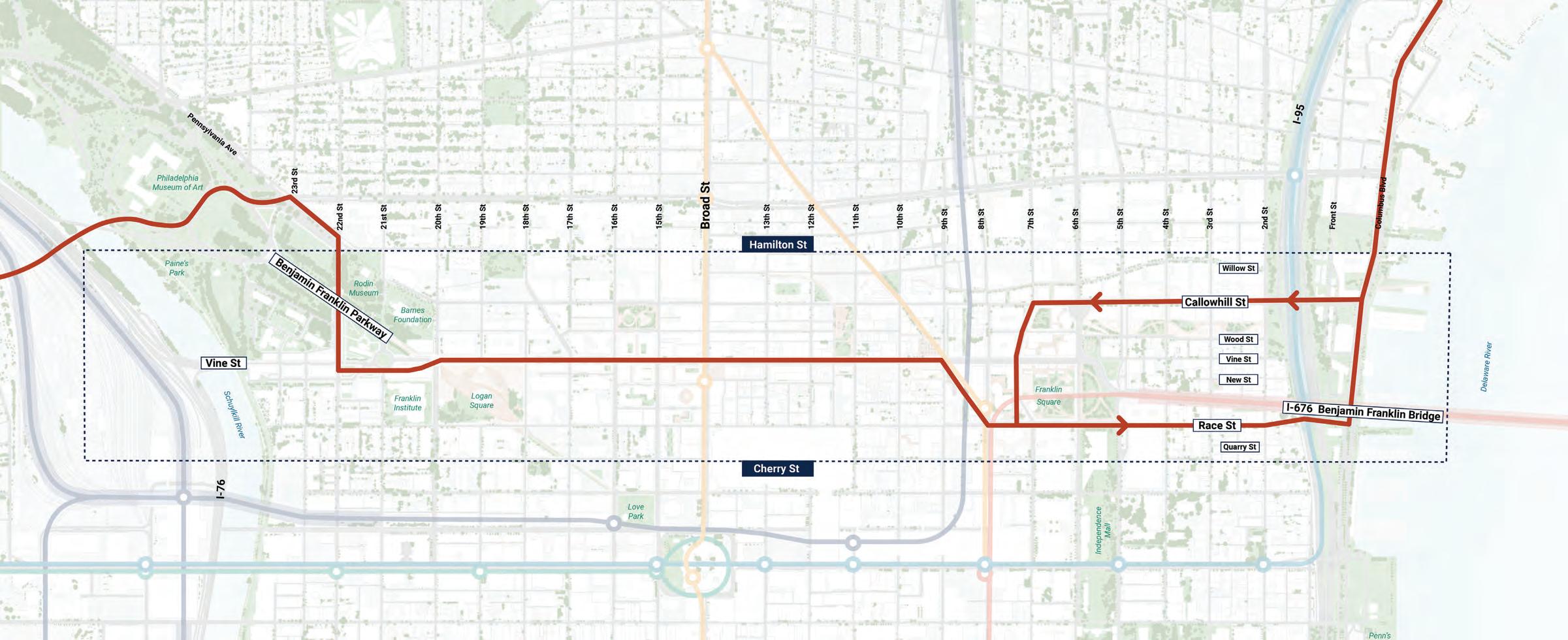
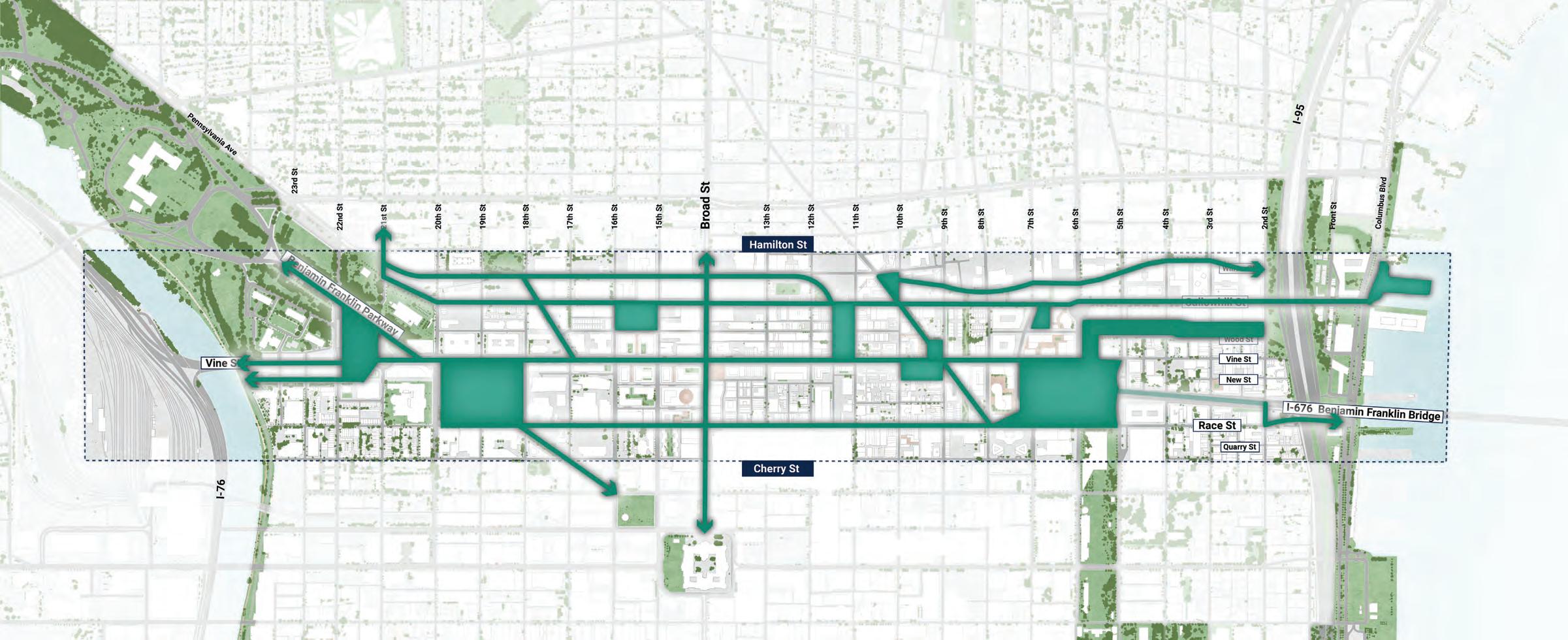
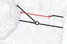
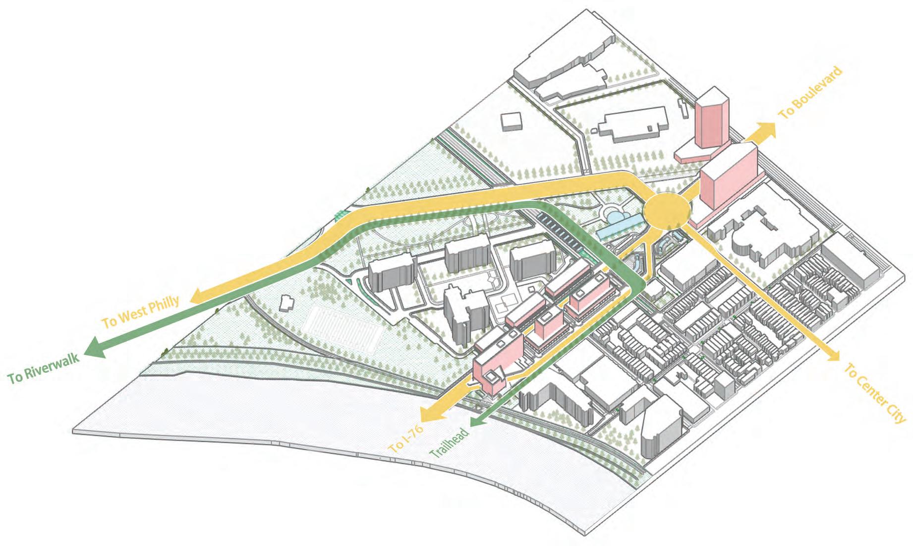
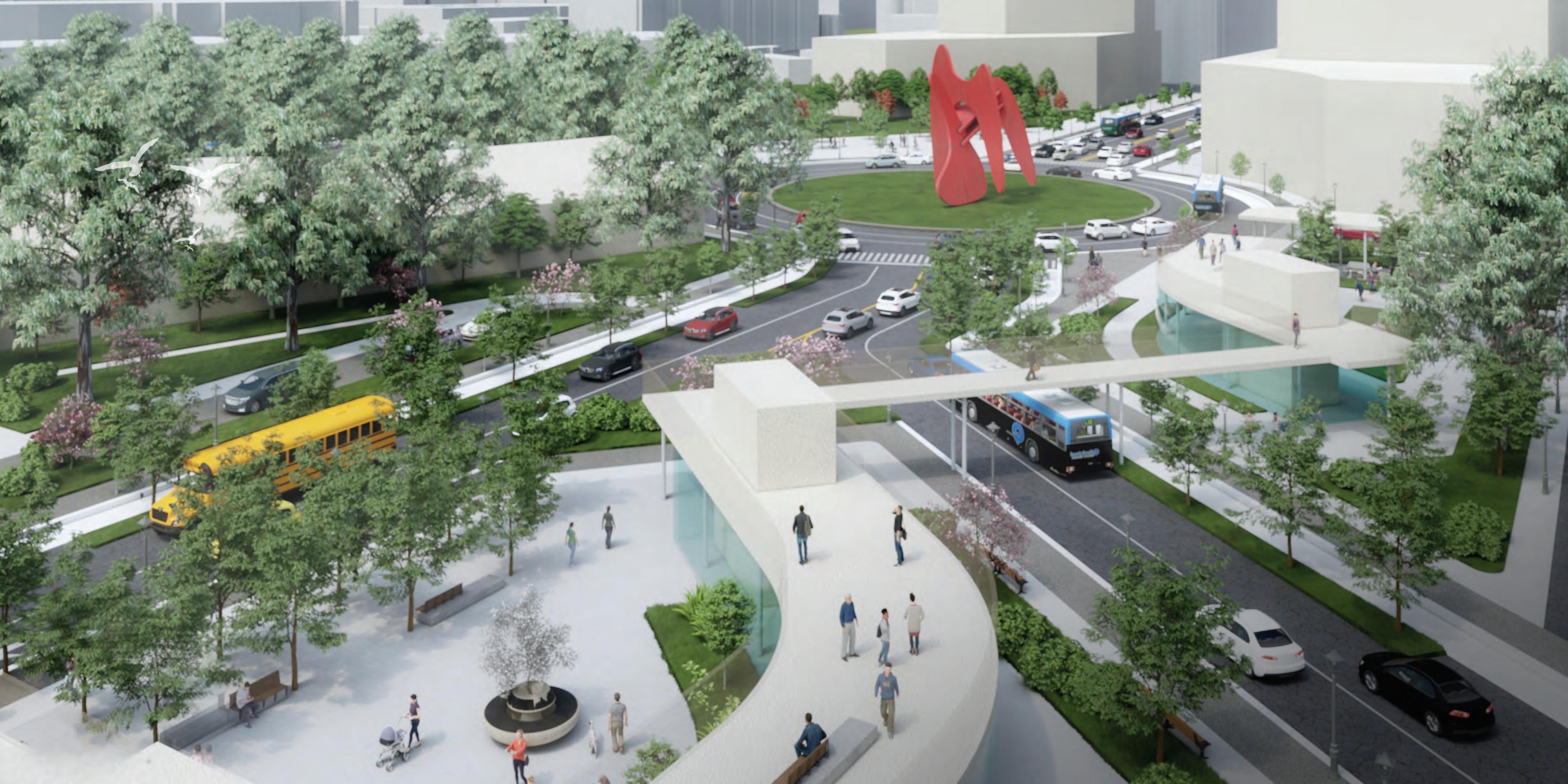
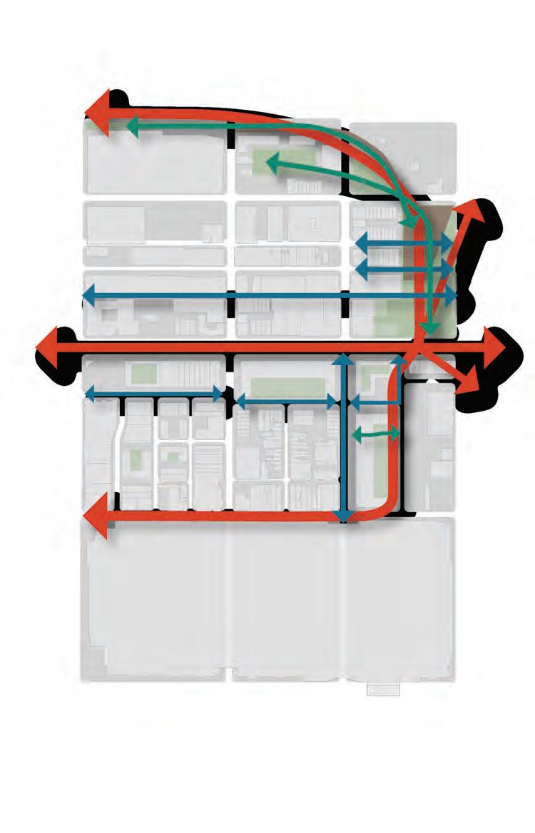
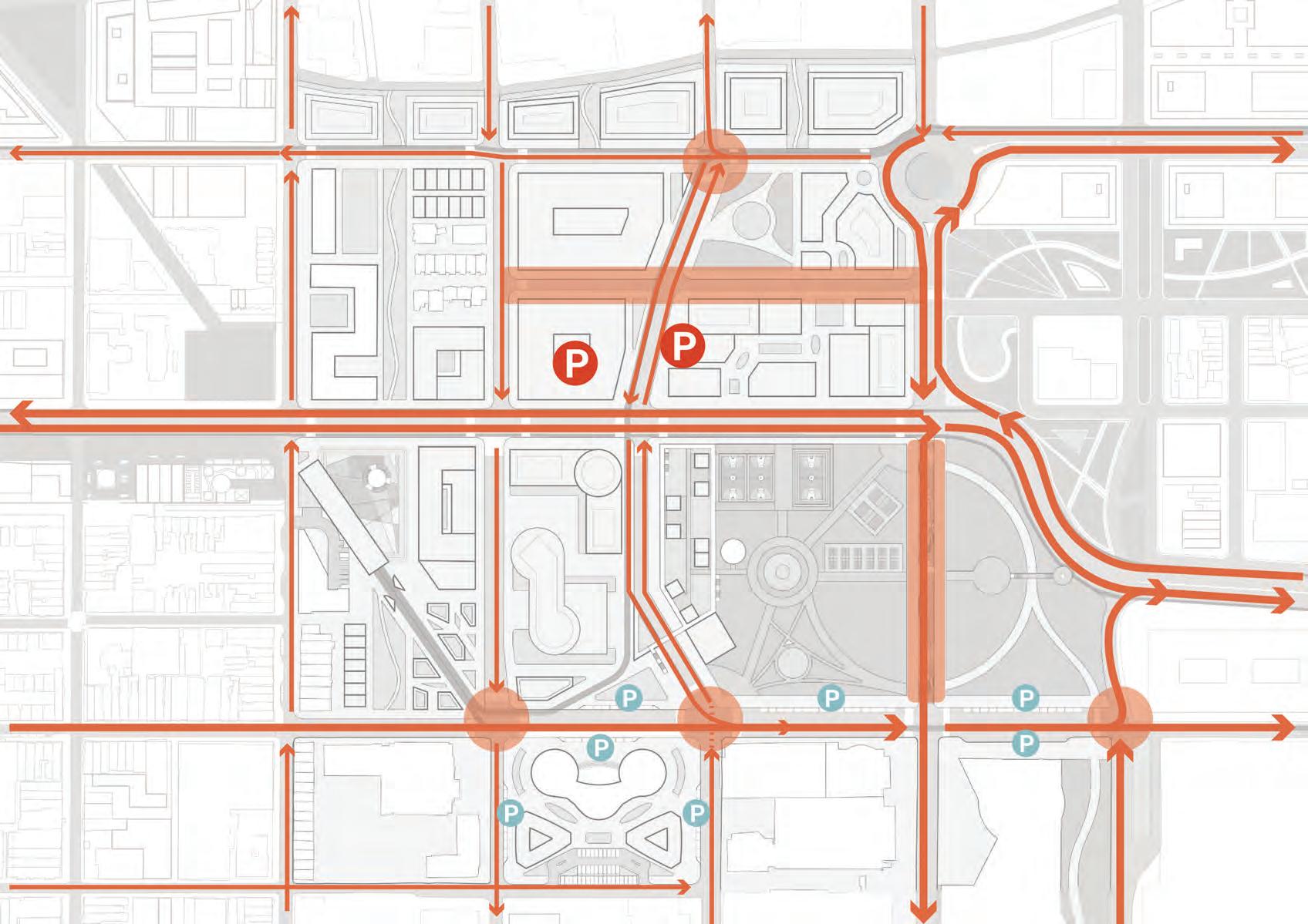
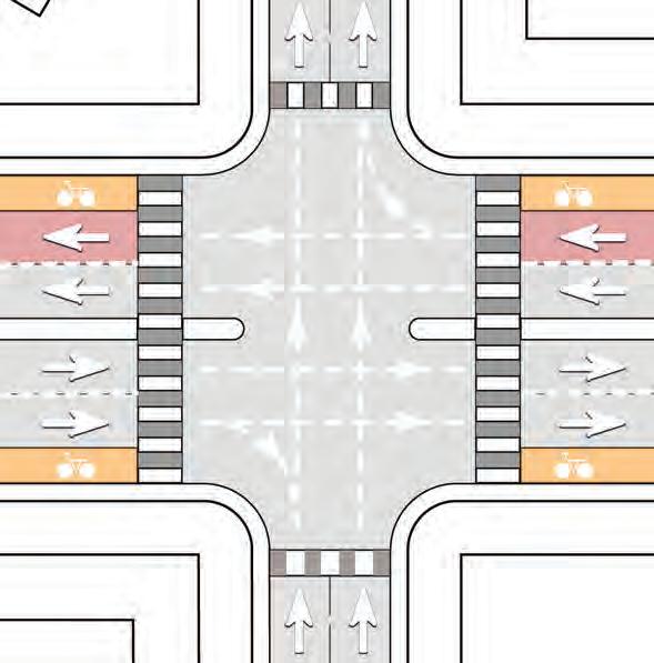
WEST TRAFFIC DISTRIBUTION
Split Vine Street off of I-76 to reduce crossing distances for pedestrians and increase north-south access
Roundabout to simplify complex intersection at 21st Street and Vine Street
Modify I-76 interchange between Vine Street and JFK Boulevard to distribute traffic volumes into Center City
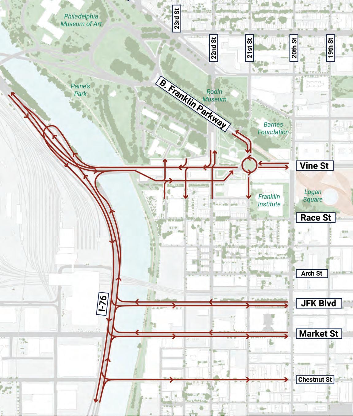
39 1 2 3
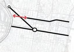
EAST TRAFFIC DISTRIBUTION
Redesign of I-95 on/off-ramps at Callowhill Street
Realign Benjamin Franklin Bridge access points to Vine, Race, 5th, and 6th Streets and egress points at 4th, 5th, and 6th Streets
Roundabout at 6th Street and Callowhill to absorb traffic from the Bridge and I-95
Use existing grid connections to distribute traffic volumes within Center City and Delaware Avenue/South Christopher Columbus Boulevard to access the I-95 interchanges within 1.5 miles to the north and south
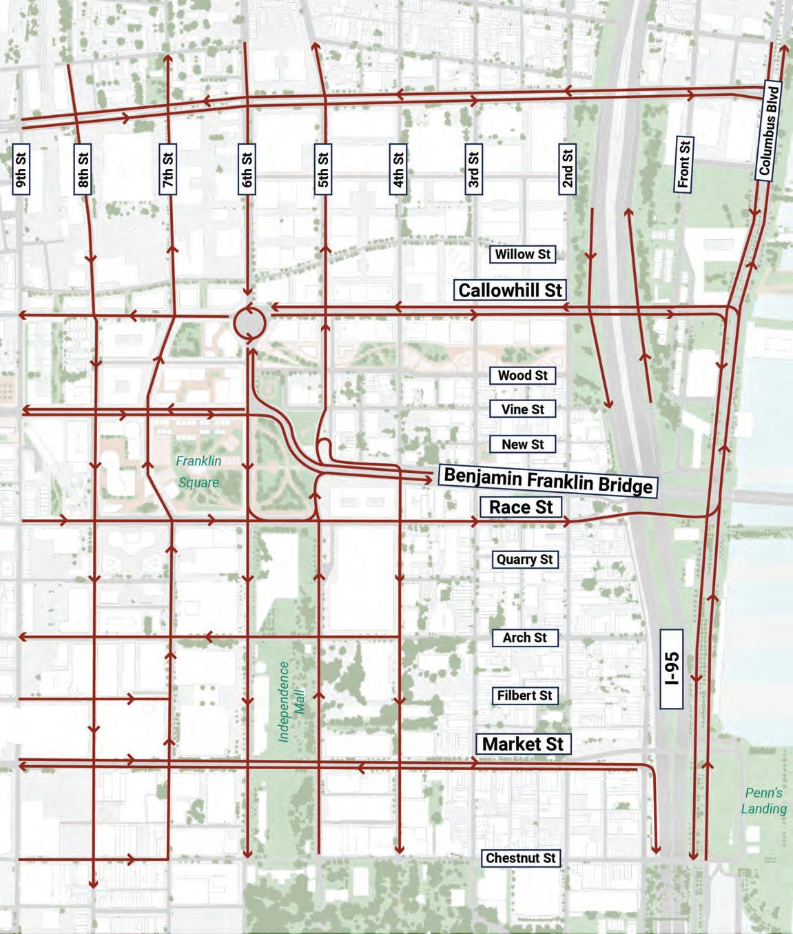
1 2 3 4
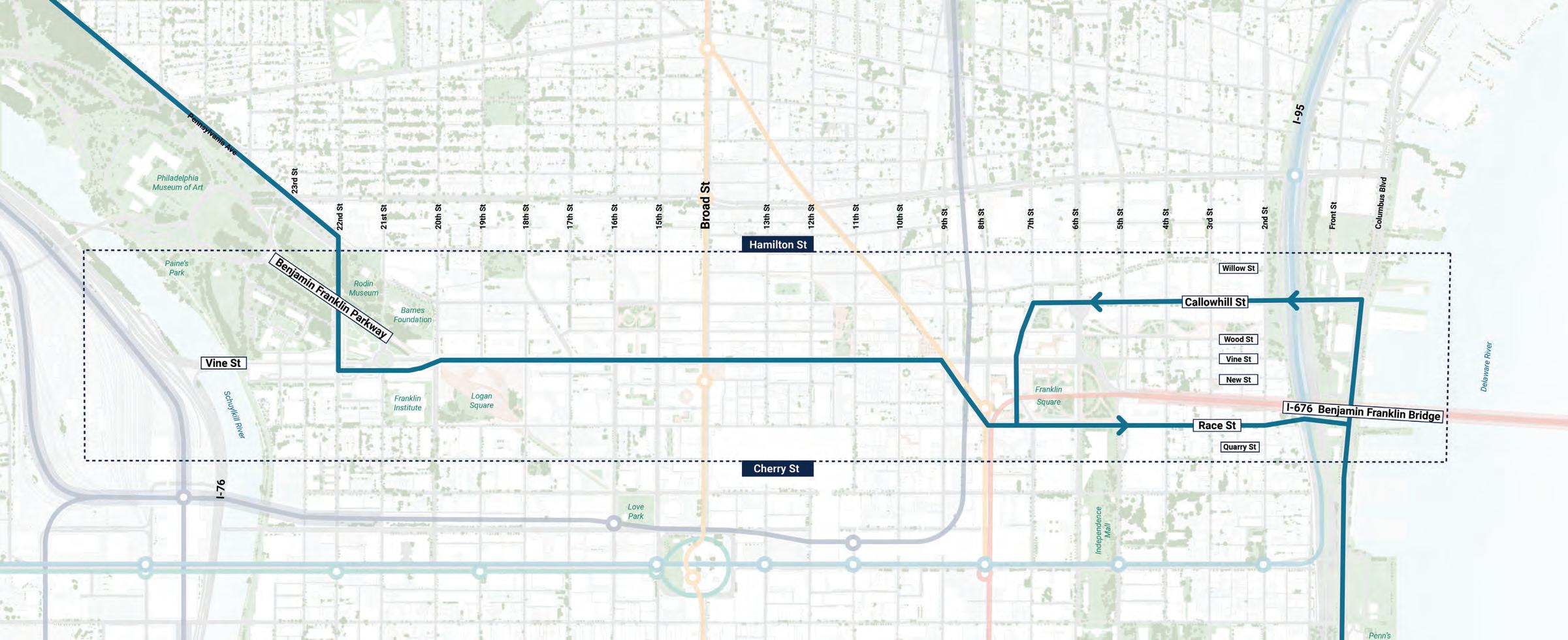
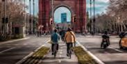
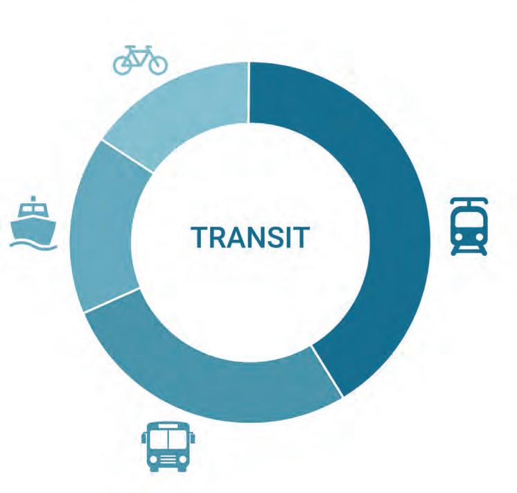
MULTIMODAL NETWORK
Encourages a shift away from cars towards transit by enhancing mobility along the Corridor through rail, bus, and bike networks
41
2505001000
RAIL NETWORK - EXISTING
The existing rail network concentrates along Market Street and Broad Street with limited east-west rail connections.
Rail Lines
Stations
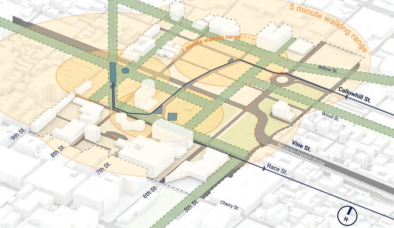
5-Minute Walkshed
42
0 Feet N
RAIL NETWORK - PROPOSED
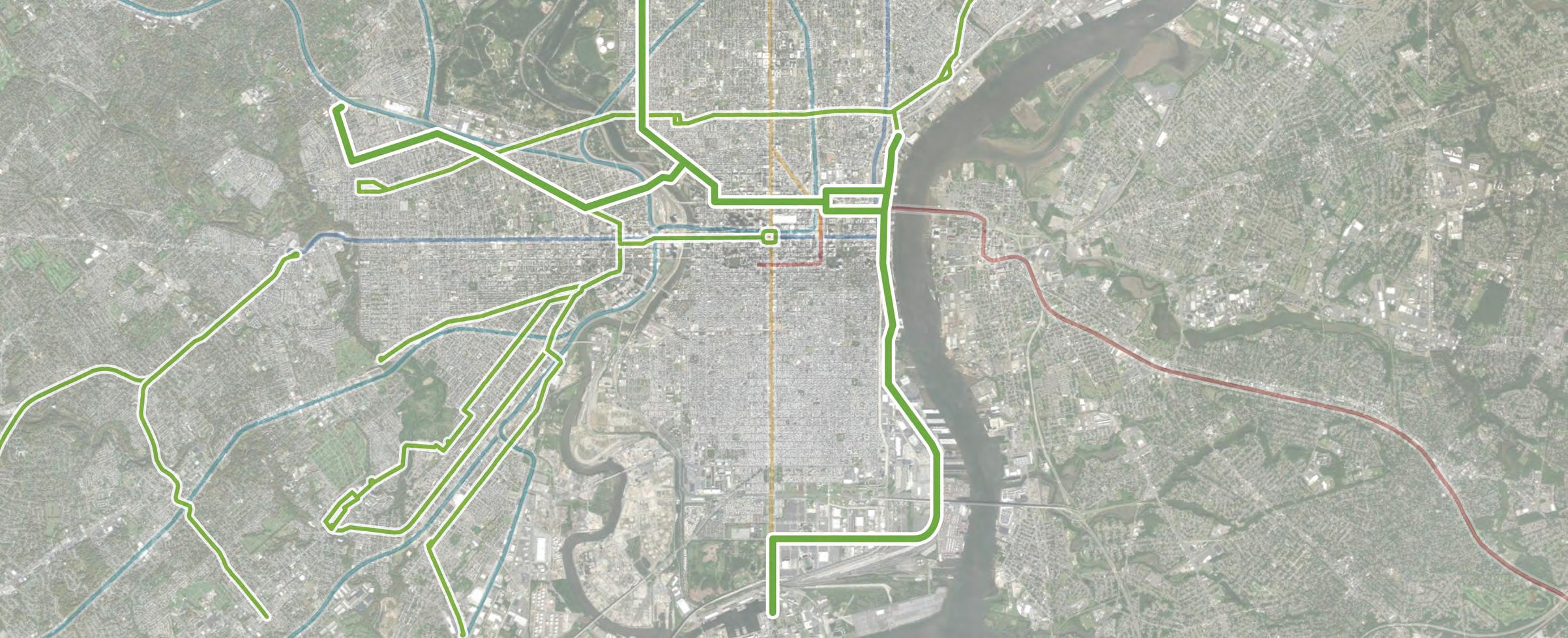
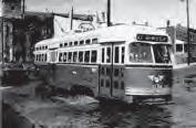
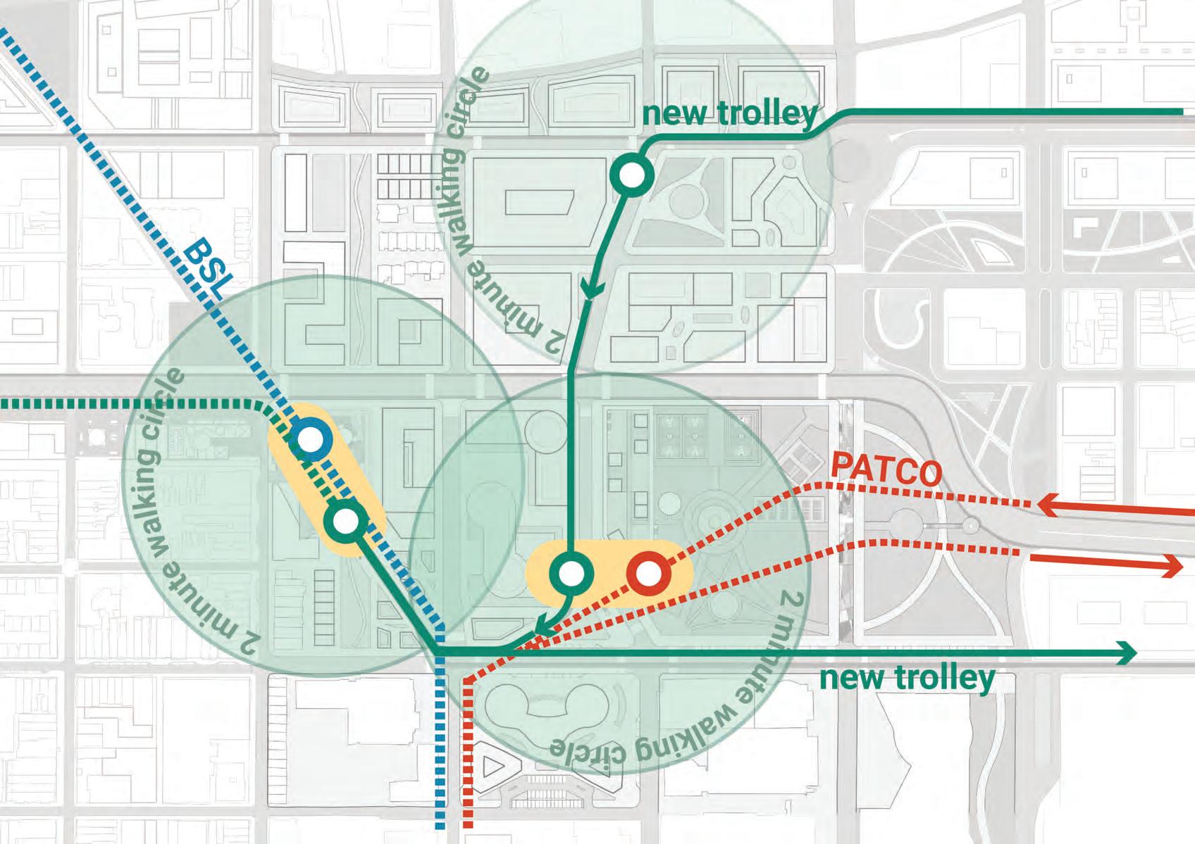
New trolley routes will fill in these some of theses gaps, continuing Philadelphia’s long and unique history of trolley lines.
43
2505001000 0 Feet N BROAD &VINE 11TH 16TH 19TH/LOGAN SQUARE 22ND RODIN EAKINS FAIRMOUNT 7TH 7TH 8TH 4TH 4TH 2ND 2ND CALLOWHILL SPRING GARDEN RACE PENN’S LANDING
Trolley Stop
Trolley Stop
Below-Grade
At-Grade
2505001000 N
The first route will connect over to West Philadelphia north of Market Street and up to Girard Avenue, linking up to an existing trolley route.
Route #1
44
RAIL NETWORK - PROPOSED 0 Feet
RAIL NETWORK - PROPOSED
The second route will provide new connections northwest to Strawberry Mansion and south to the Navy Yard.
Route #2
45
0 Feet N
2505001000
2505001000 N
The third route will run along Delaware Avenue/Columbus Boulevard, serving different waterfront destinations.
Route #3
46
RAIL NETWORK - PROPOSED 0 Feet
RAIL NETWORK - REGIONAL
The existing regional rail network covers a lot of Philadelphia, but there are still gaps in coverage, especially in South Philadelphia, away from the BSL.
Market-Frankford Line (MFL)
Broad Street Line (BSL)
Trolley Lines
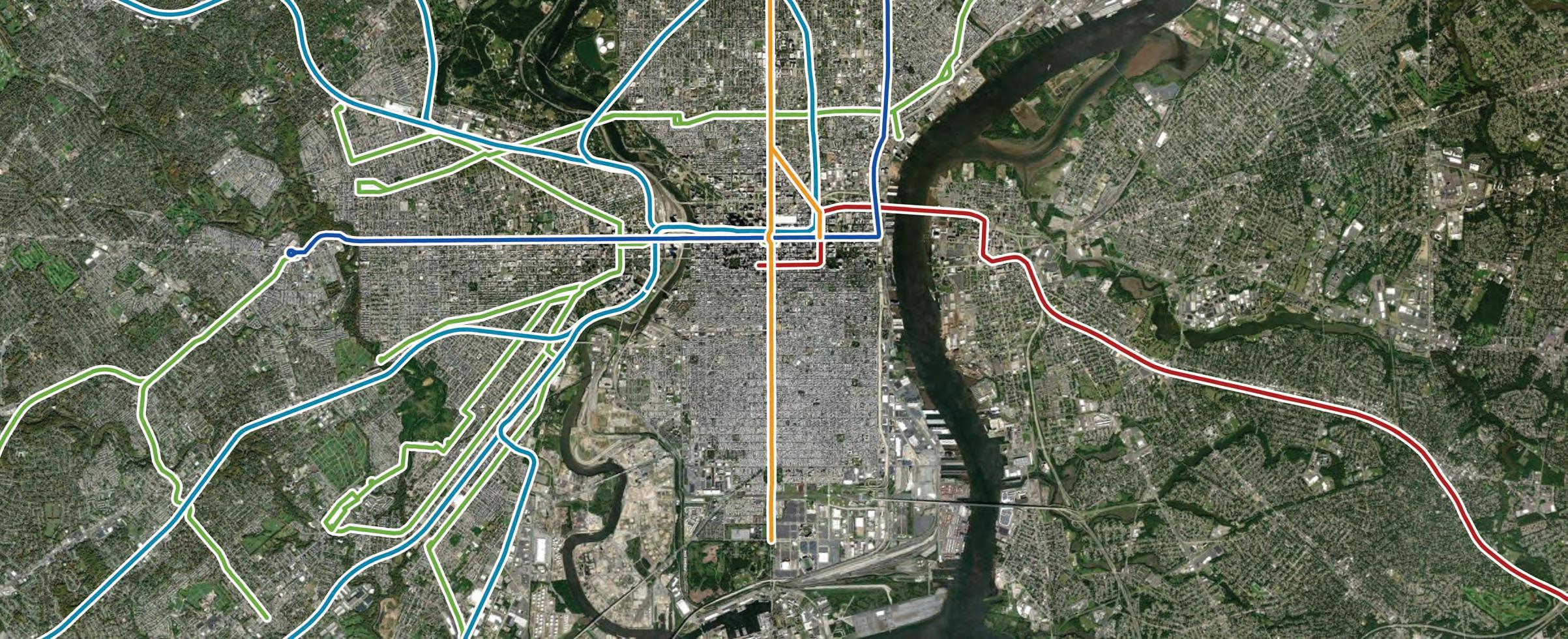
Regional Rail Lines
PATCO Line
47
WESTPHILADELPHIA
RAIL NETWORK - REGIONAL
The new trolley line will fill in some of those gaps while also linking back into existing routes.
Market-Frankford Line (MFL)
Broad Street Line (BSL)
Trolley Lines
Regional Rail Lines
PATCO Line
48
GIRARD
MANSION STRAWBERRY
AVE
BUS NETWORK - EXISTING
Many Philadelphians rely on the bus network for their daily commutes, but east-west routes are lacking within the Corridor.
49
2505001000 0 Feet N Bus Route
BUS NETWORK - PROPOSED
With the removal of the Expressway, the only east-west routes that run along Vine Street will have disrupted service at 20th Street and at the I-95 interchange.
50 Route
Revolution
Routes
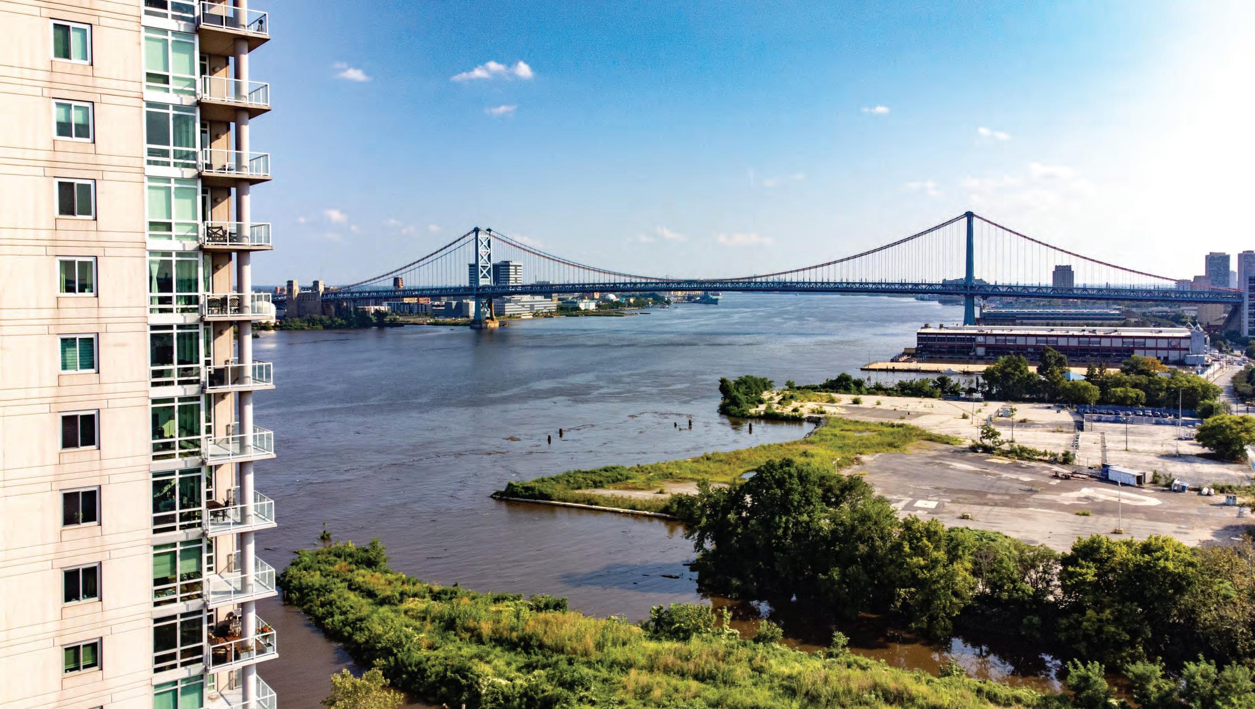
Deviations
Impacted
2505001000 0 Feet N Bus Route
2505001000
BUS NETWORK - PROPOSED
The new bus network proposes two routes within the corridor to remedy those existing route deviations and provide additional bus coverage.
Vine St Corridor Line
Vine St Circulator
51
0 Feet N
2505001000
BIKE NETWORK - EXISTING
The existing bike network is scattered and provides few separated bike facilities.
Existing Sharrow
Existing Separated
Existing Conventional
Existing Paint Buffered
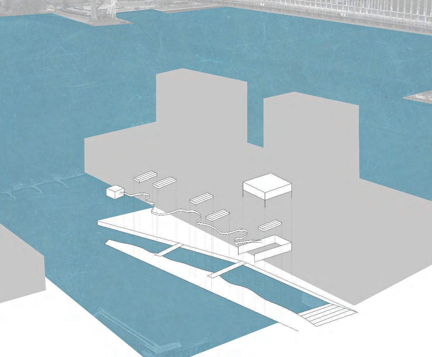
52
0 Feet N
2505001000 0
BIKE NETWORK - PROPOSED
New separated bike lanes will be provided along Vine Street, as well as other new east-west bike facilities.
New Sharrow
Existing Sharrow
Existing Separated
New Separated
Existing Conventional
Existing Paint Buffered
53
Feet N
GREEN NETWORK
Provides new destinations along the Corridor with enhanced pedestrian connections between them
54
GREEN NETWORK - EXISTING
Some areas along the Corridor, including Chinatown, have less access to park space.
Greater than a 5-minute walk to parks
55
0 Feet N
2505001000
GREEN NETWORK - PROPOSED
The proposed green network focuses on filling in those gaps and creating a comprehensive network of green space across the Corridor.
56
2505001000 0 Feet N
GREEN NETWORK - PROPOSED
Formal parks will create nodes of green space, which will be connected together by major green streets with enhanced stormwater management.
New Parks & Major Green Streets
57
0 Feet N
2505001000
GREEN NETWORK - PROPOSED
Resilient green grid connections will strengthen the network, largely along north-south streets, with smaller connections through pedestrian walkways.
New Parks & Major Green Streets
Resilient Green Grid Connections
58
0 Feet N
2505001000
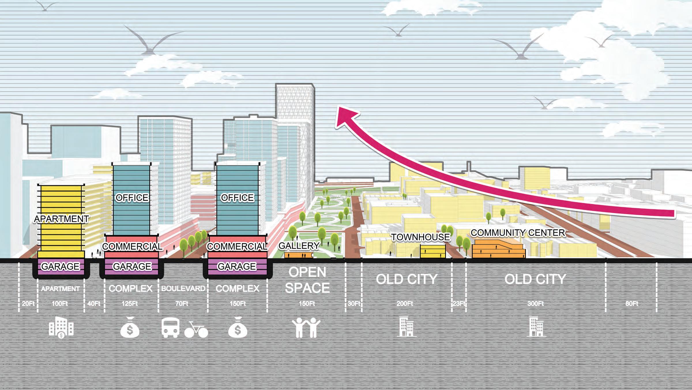
CORRIDOR BY THE NUMBERS
59
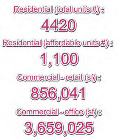
DEVELOPMENT ESTIMATES RESIDENTIAL
16,700
TOTAL UNITS
2,830,000 RETAIL SF
6,100
AFFORDABLE UNITS
5,550,000 OFFICE SF
44 PARK ACRES
8,300
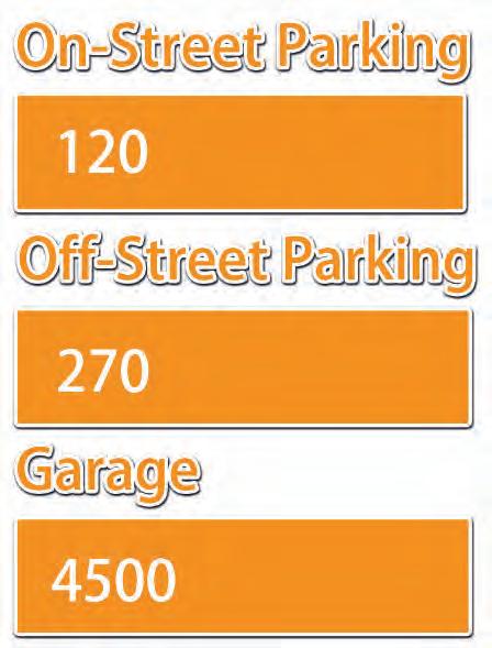
PUBLIC PARKING SPACES
60
COMMERCIAL PARKS PARKING
4 MUSEUMS
62 ART GALLERIES / STUDIO SPACES
10
COMMUNITY CENTERS
2 SCHOOLS
61
CIVIC / CULTURAL
DEVELOPMENT NUMBERS
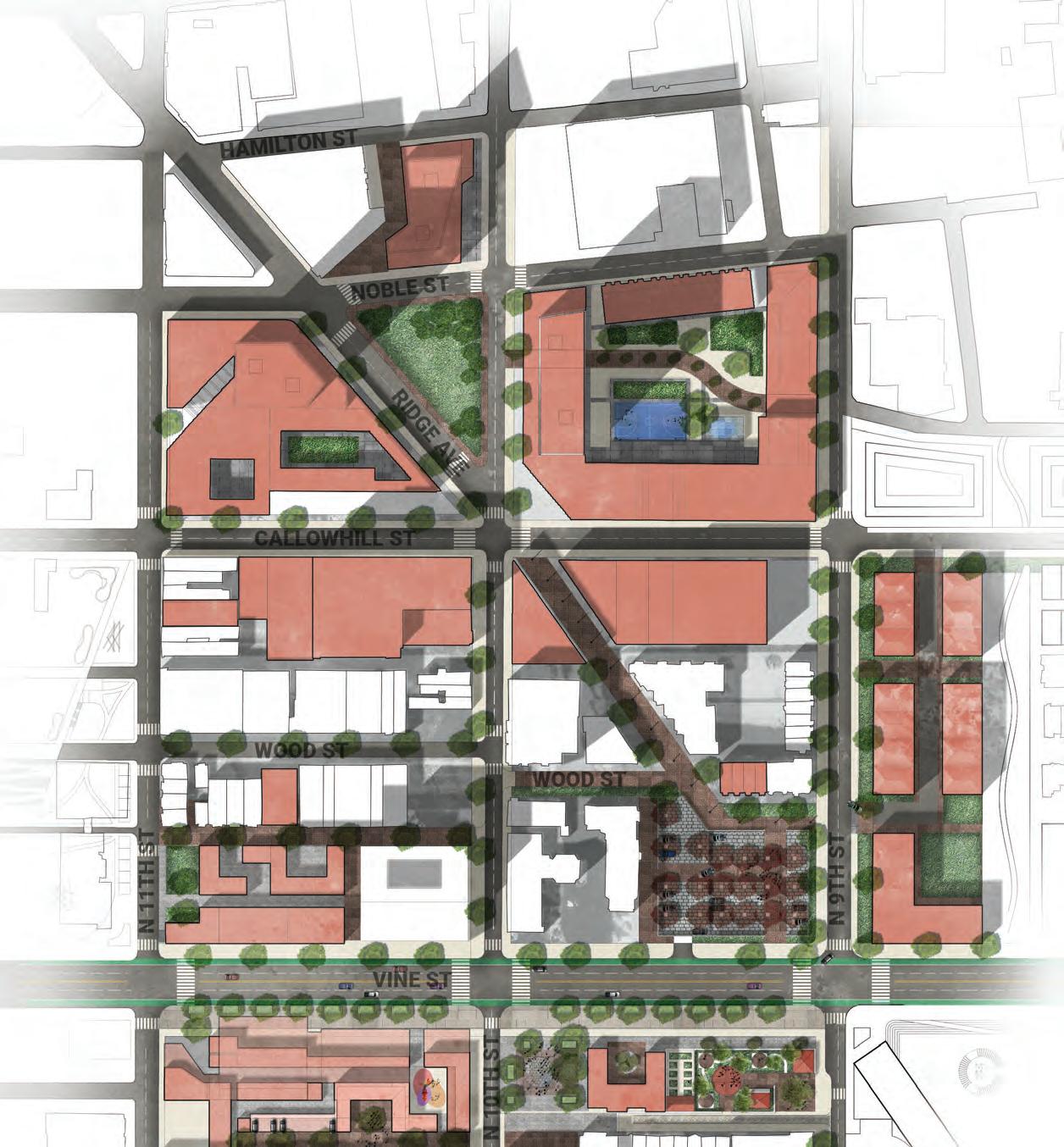
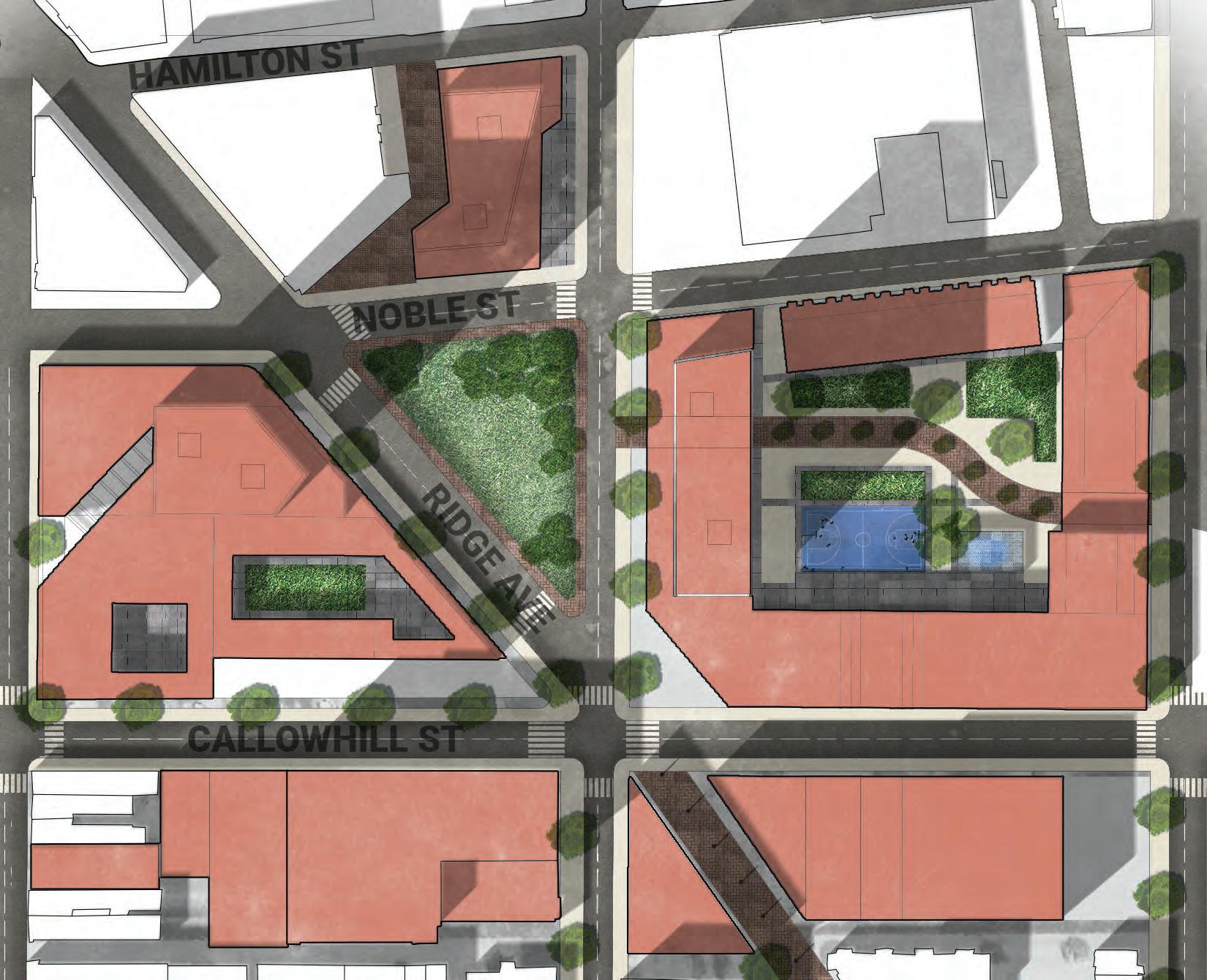
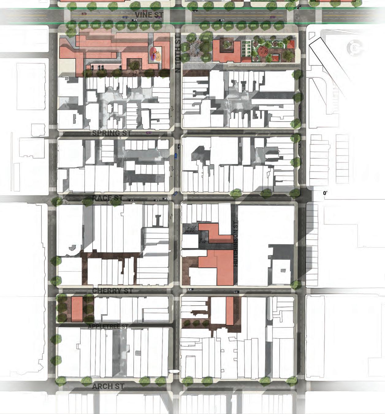
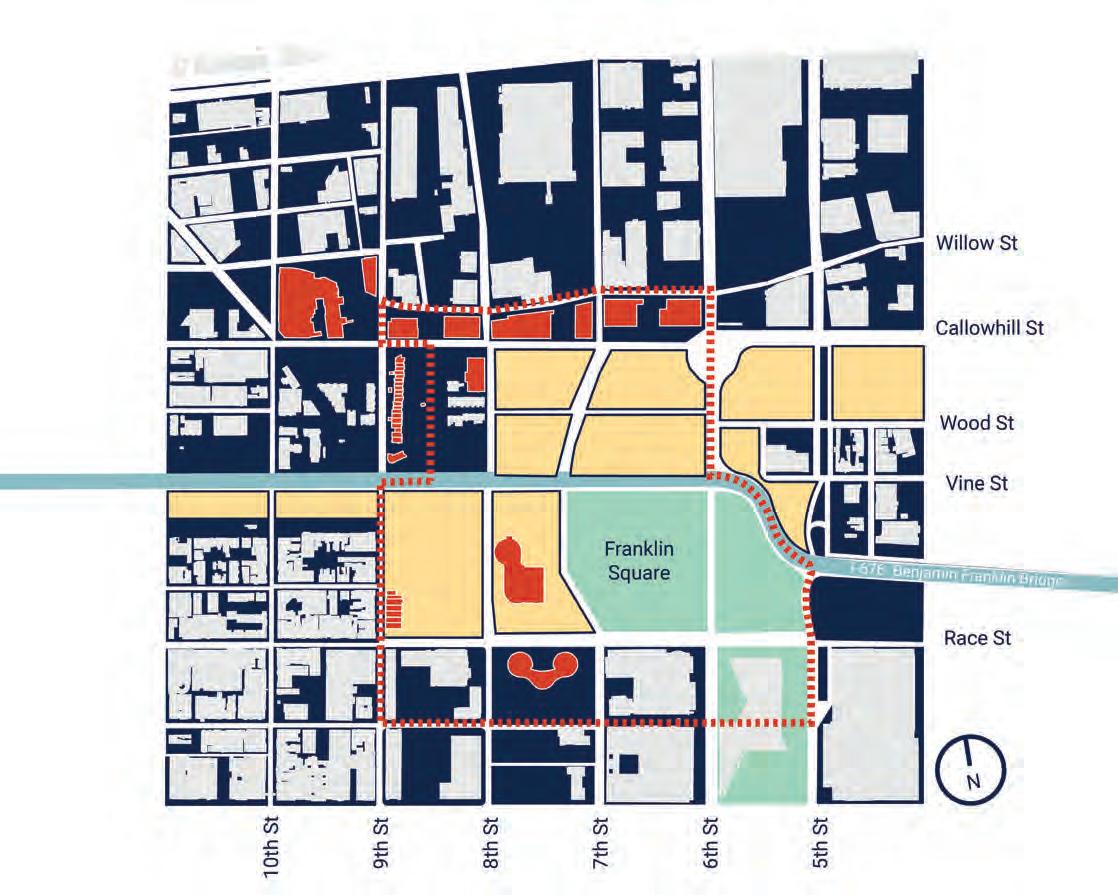
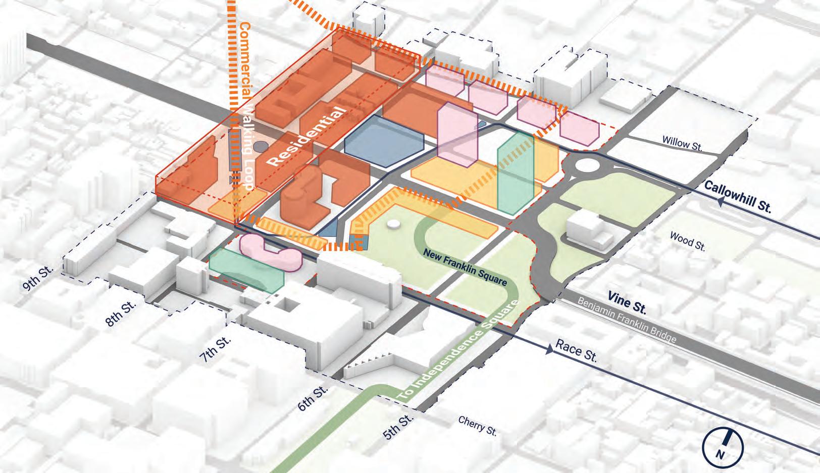
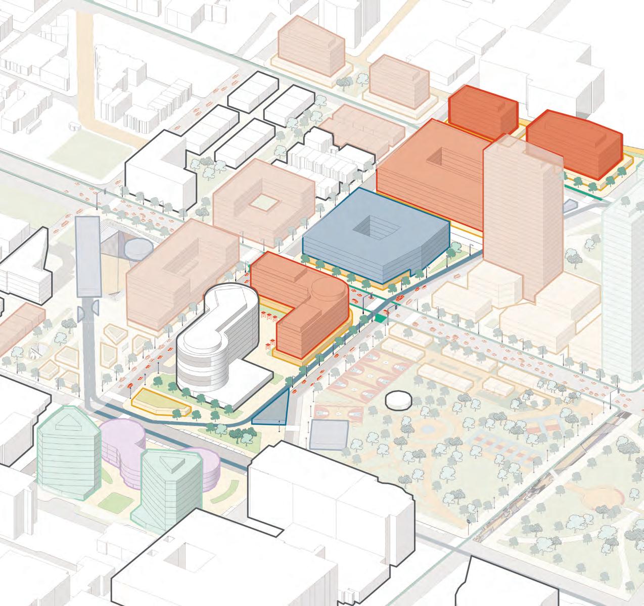
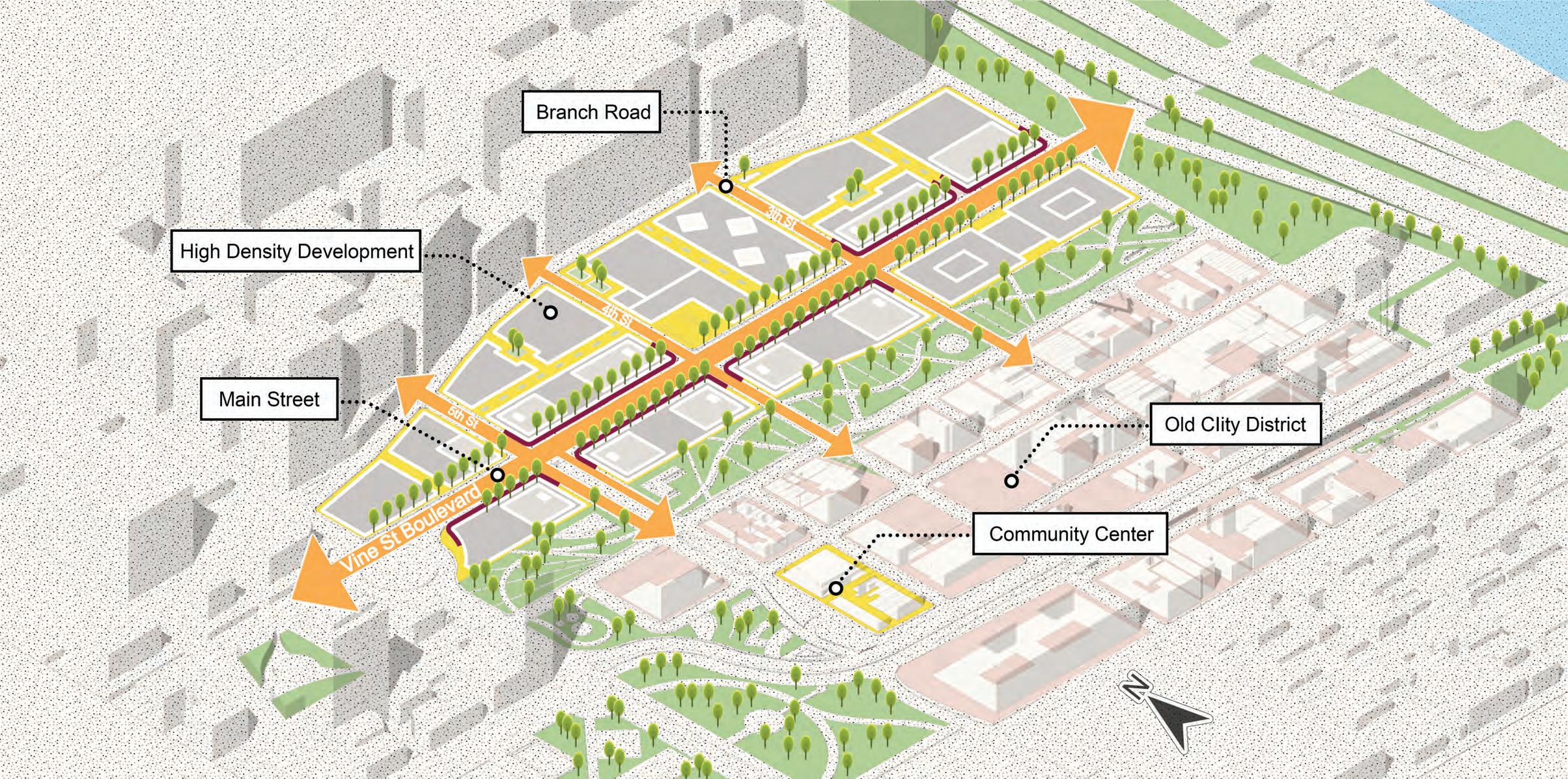
DIVIDING THE CORRIDOR
62
CULTURAL DISTRICTS
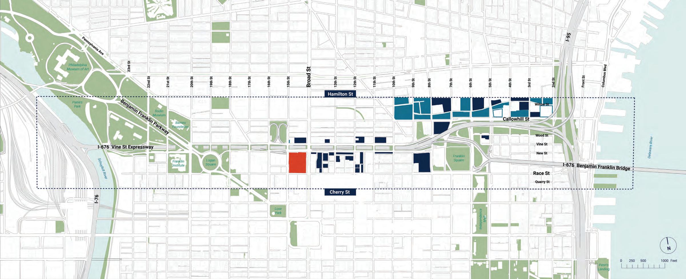
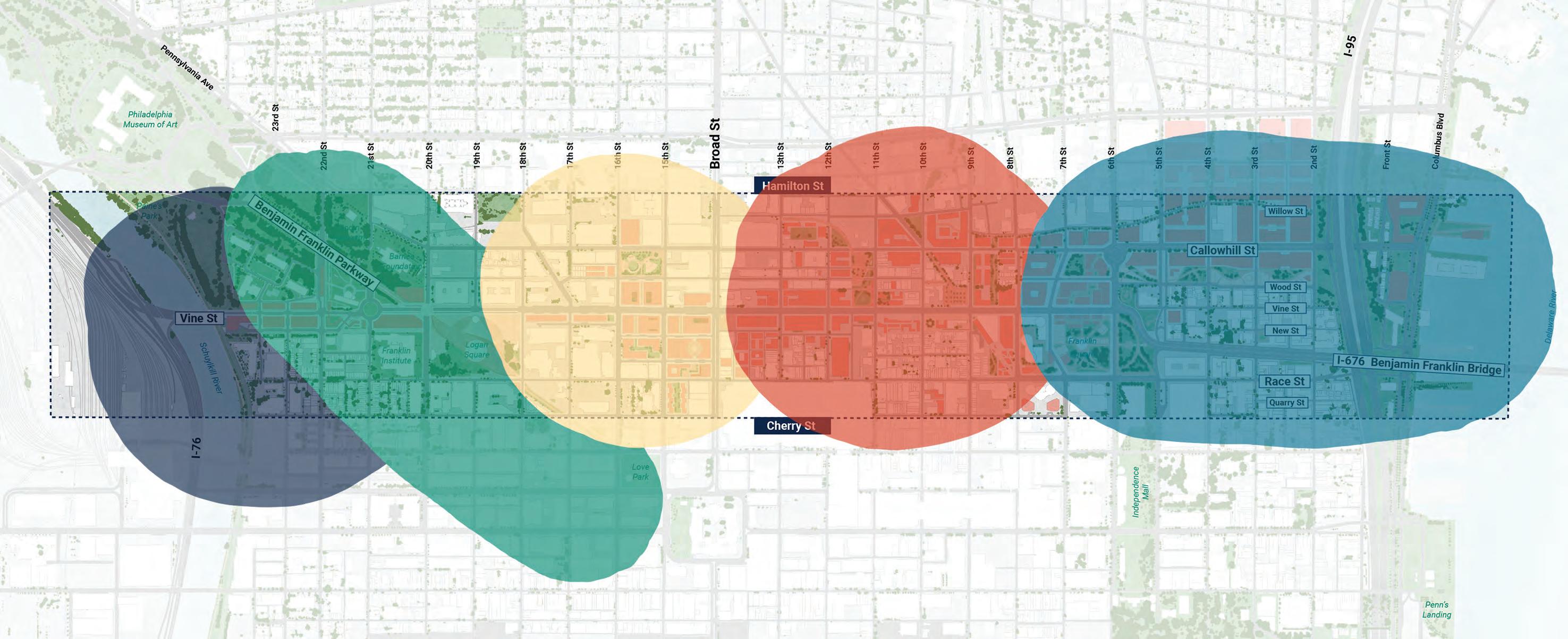
Our studio identified five key cultural districts along the Corridor, based on land use, density, architectural character, and community landmarks.
63
MUSEUM SOUTH
PARKWAY CHINATOWN FRANKLIN EAST ARTS NORTH
0 Feet N
2505001000
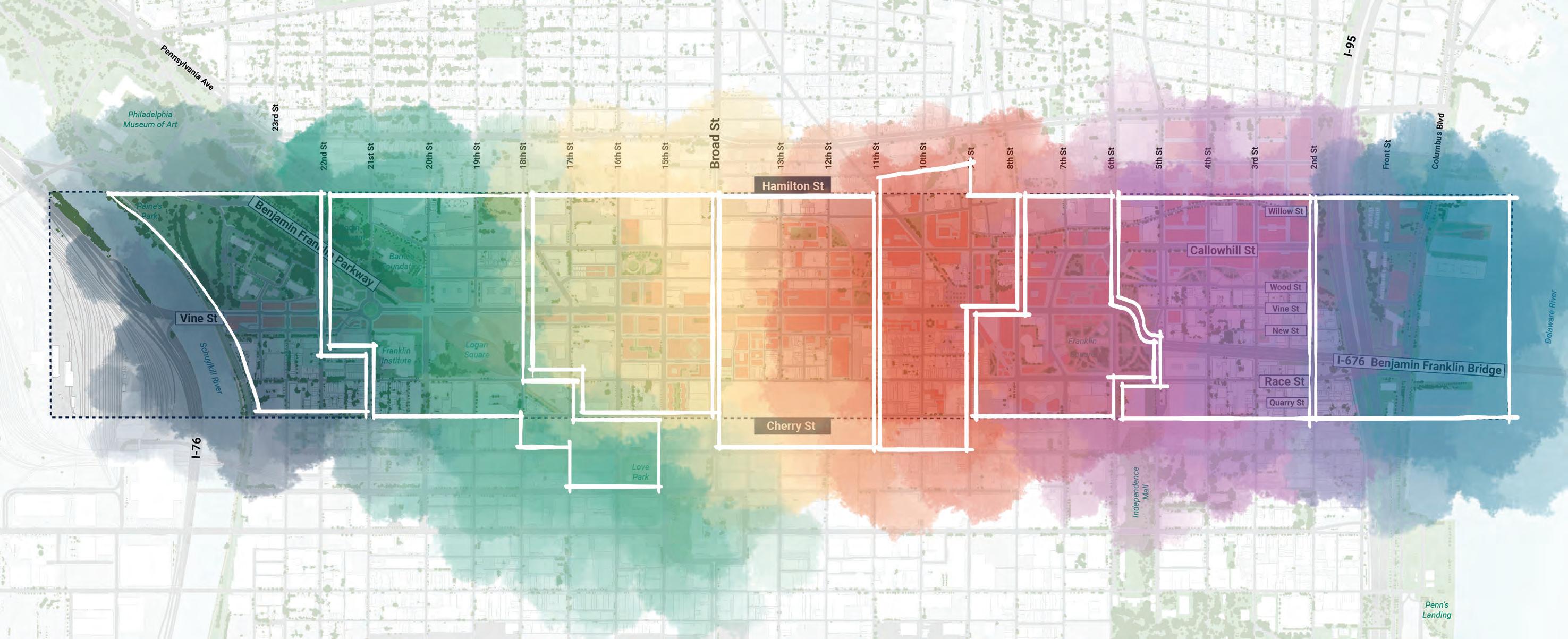
CULTURAL DISTRICTS
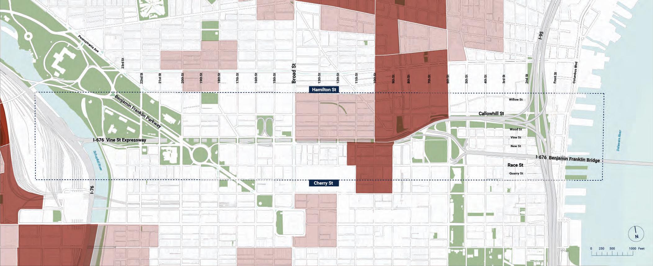
However, the boundaries of these districts are blended and blurred with features of each district connecting to and interacting with each other.
64
2505001000 0 Feet N
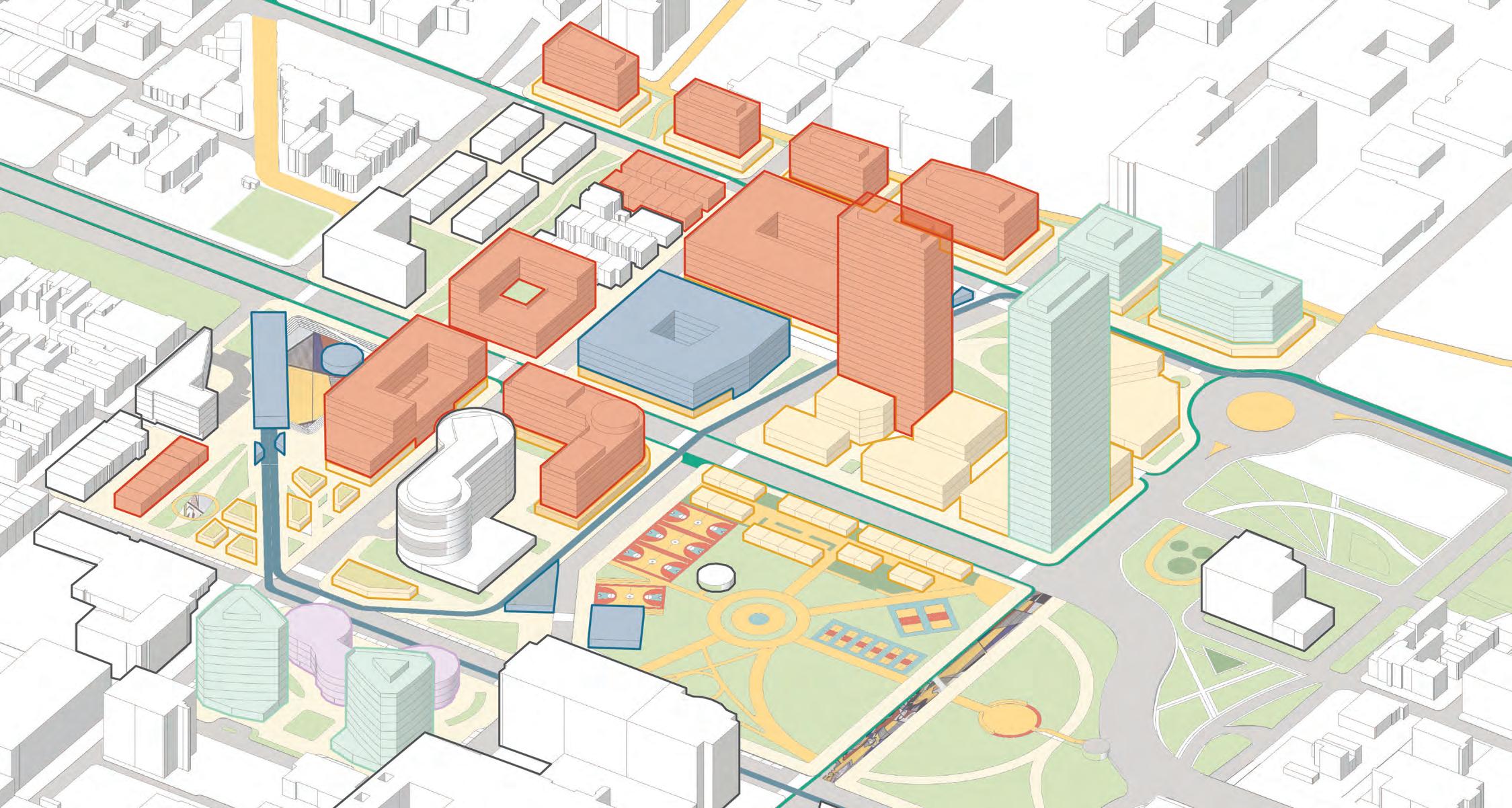
INDIVIDUAL AREA PLANS
Like puzzle pieces, we split the five districts into smaller area plans that deal with neighborhood-scale development and interventions.
65
0 Feet N
2505001000
MUSEUM SOUTH
INDIVIDUAL AREA PLANS
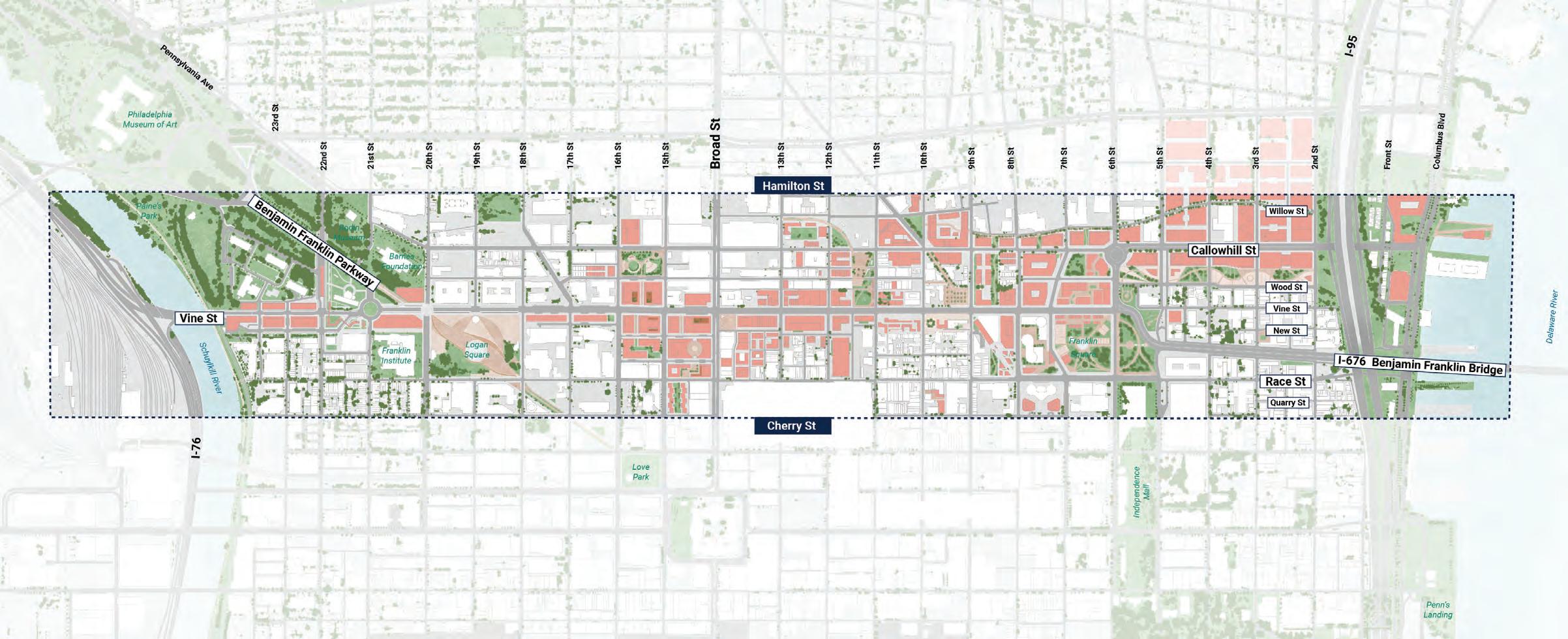
66
2505001000 0 Feet N
BROAD
RESHAPING THE
PARK
CHINATOWN OLD CITY BUSINESS CORRIDOR
EASTWARD HAVEN ADAPTIVE INDUSTRIAL ECOSYSTEM
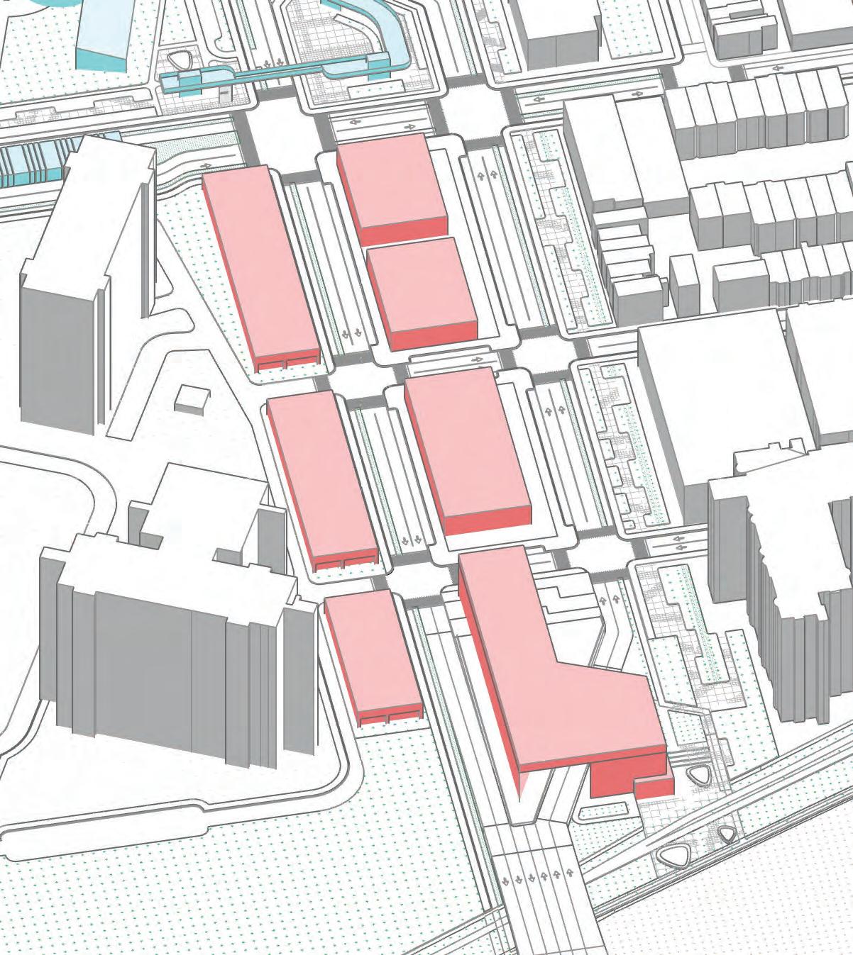
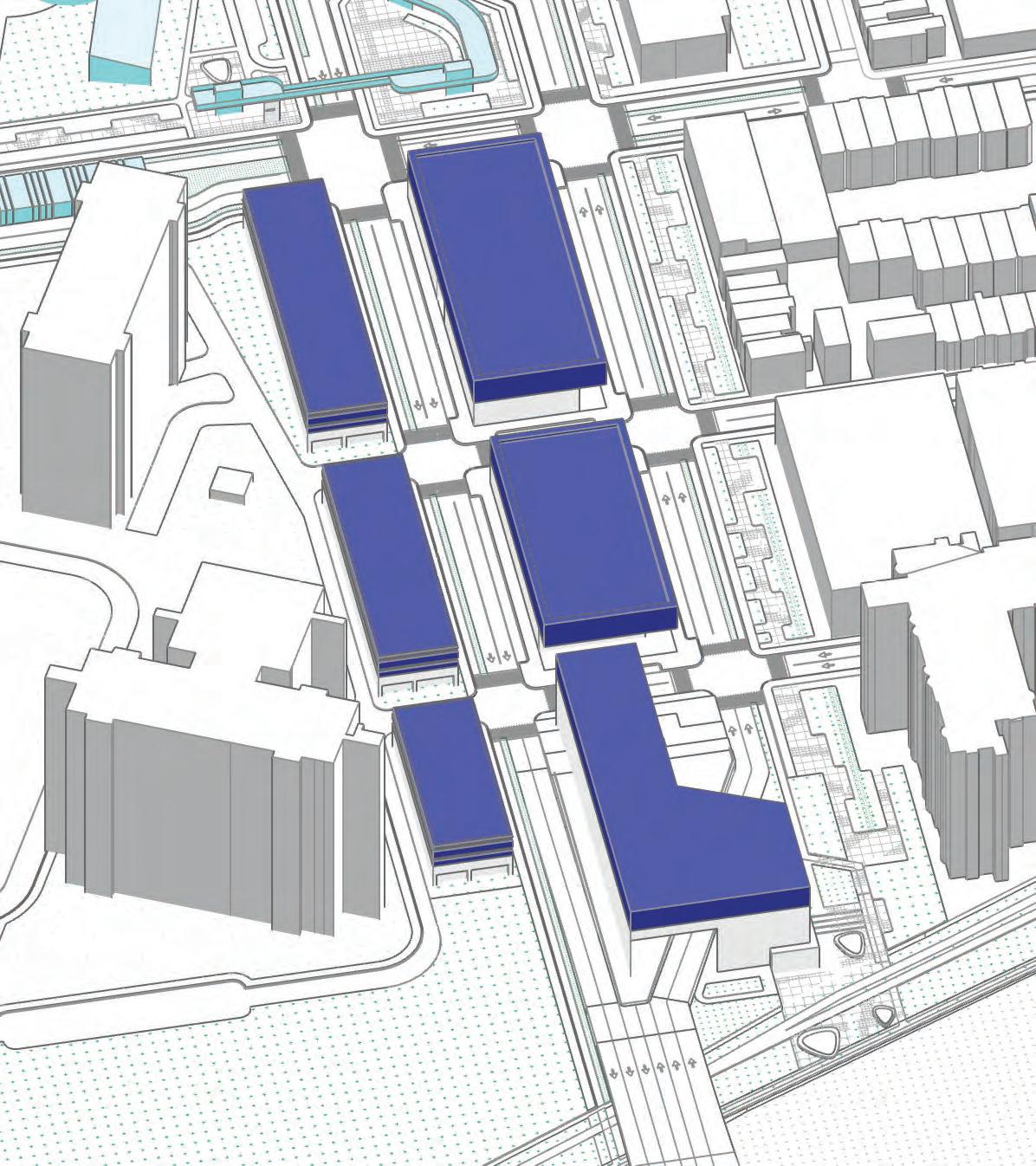
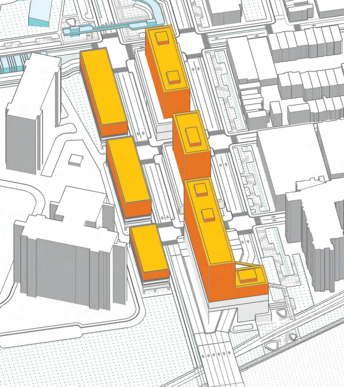
The final map results in eight different individual area plans that suppor t the Highway to Boulevard vision. FAIR AND SQUARE
& VINE
RAIL
RECONNECT:
CHINATOWN
LOGAN
INDIVIDUAL AREA PLANS
67
MUSEUM SOUTH COMMUNITY PLAN
68
Changhao (Chauncy) Li
69
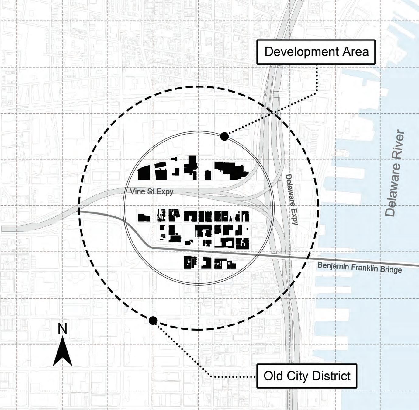
LOCATION 76 SchuylkillRive Market St BenjaminFranklinPkwy N Broad St Areas in Philadelphia 95 95 N 76
Museum South, which covers 2.4 million ft², is situated on the west side of the entrance to our CORRIDOR.
Vine St Amtrak Station City Hall Philadelphia Museum of Art
TIMELINE
Benjamin Franklin Pkwy officially opened in 1918 as one of the region’s first major thoroughfares. The construction of Vine St Expressway in the 1960s played a key role in the growth of Philadelphia. However, the presence of the Vine St Expressway tunnel made walking between Center City and the Museum Area difficult.

1682
1951
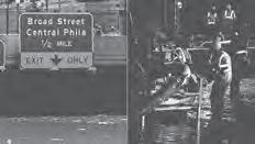
In the early 2000s, the tunnel began experiencing recurring flooding incidents during heavy rain, with the most severe occurring in 2011 and 2021. Despite these challenges, the Vine St Expressway remains an essential transportation artery, and efforts are ongoing to address the flooding issues and ensure its continued safe operation.


1918

1960
70
William Penn and Thomas Holme envision Vine Street as a 50-foot right-of-way and the citys northern boundary
The Fairmount Parkway, known today as the Benjamin Franklin Parkway, officially opens to traffic.
The first section of the Vine Street Expressway opens from the Schuylkill Expressway to 17th Street.
The Vine Street roadway is expanded to ten lanes, in anticipation of the expressway linking the Schuylkill Expressway to I-95.
The remnants of Hurricane Ida in 2021 caused historic flooding in the Philadelphia region.
2021
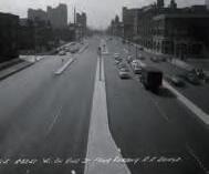
TRAFFIC
• Today, Benjamin Franklin Pkwy and Vine St are two of the busiest streets in the region, with a high volume of daily traffic. According to the Pennsylvania Department of Transportation’s Traffic Volume Maps, Benjamin Franklin Pkwy has an average daily trip count of 16,000, while Vine St sees around 133,000 daily trips.
• In addition to these major thoroughfares, the nearby I-76 highway also sees a significant volume of daily traffic, with an average daily trip count of 135,000. These roads play a crucial role in connecting Philadelphia with other parts of the region, as well as supporting local commerce and transportation needs.
71
Amtrak Station City Hall
Philadelphia Museum of Art Vine
St I-76
Benjamin Franklin Pkwy
WHO’S AROUND
The site is situated south of Center City and west of University City, making it an attractive location for community development.
72
Hamilton St Cherry St 21st St 22nd St Center City University City BenjaminFranklinParkway I-676 Vine St Expressway Schuykill River
WHO’S AROUND
Source: opendataphilly.org
Source: opendataphilly.org

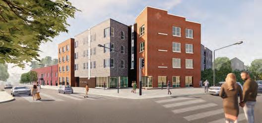
Looking towards the future, the development of mixed-use apartments on the site could be a key draw for both the residential areas to the north and the waterfront communities, providing much-needed housing options and contributing to the overall livability and vitality of the area.
73
Residential Commercial Mixed Residential Low Residential High Residential Medium Commercial Consumer
THE PLAN
74
RE-ENGAGE
Human-Scale Motorized Vehicle Network
ECOLOGICAL
Rain Garden Corridors Leading to the Riverwalk
DEVELOPMENT
Vibrant Riverfront Residential Area with Green and Active Spaces
FRAMEWORK
75
76
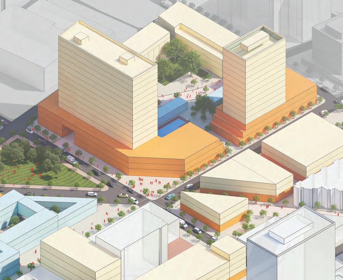
Feet N 2 13 12 1 3 1 4 5 5 5 5 11 9 7 6 8 5 5 10 1 4 1 5 2 6 11 12 13 7 9 8 10 3 Mid-Rise Building High-Rise Building High-Rise Building High-Rise Building Bus Station Trolley Stop Museum Trolley Exit Building Community Rain Garden Traffic Circle Winter Street Plaza Race St Riverwalk Entrance Entrance Plaza 0 200 400
MASTERPLAN
RE-ENGAGE
77
NEIGHBORHOOD REDEVELOPMENT
• Under the corridor project, it is crucial to improve the pedestrian-friendliness of the Museum Area and Center City. To achieve this, filling in the I-676 tunnel and redeveloping the street-level community is essential. This effort not only helps to improve the area’s flood resilience but also changes the street environment and experience in Museum South.
EFFICIENT NETWORK
• Under the corridor project, the new transportation infrastructure prioritizes pedestrian-friendliness and ecological resilience over traffic capacity compared to the previous tunnel. Therefore, strategies are being implemented to improve traffic efficiency, such as converting two-way streets to one-way streets
• In addition, a new roundabout is being designed on the east side of the area to converge traffic, improving the flow of vehicles while also creating a safer environment for pedestrians and bicyclists.
Neighborhood
Boulevard Secondary Multimodal
CALDER GARDENS
RE-ENGAGE
EFFICIENT
New museum dedicated to the work of sculptor Alexander Calder.
Pavilion and Bridge re-engage the museum area and corridor
The Roundabout will connect traffic from Vine St and Ben Franklin Parkway
PUBLIC TRANSIT CENTER
• Under the corridor project, the underground trolley system will be brought to the surface at 21st Street via a street-level transit building. Additionally, the trolley rapid traffic line and bus transit network from 22nd to 20th Streets will be improved to reduce traffic congestion, enhance urban accessibility, lower tailpipe emissions and air pollution, protect the city environment and residents’ health, and promote social equity.
T
B B
B B B B
T Bus Station Trolley Station Trolley Line
B
RECREATION
Comfortable atmosphere & Wellequipped facilities
PUBLIC TRANSIT
Trolley & Bus Rapid Transit Network
ECOLOGICAL
83
CONNECTING
• To improve ecological resilience and enhance the community environment, Museum South will be connected by a green corridor along Winter St, 21st St, and Benjamin Franklin Pkwy. Additionally, there will be an open plaza in front of Calder Garden for community residents and visitors to enjoy.
• These green spaces will help to reduce stormwater runoff. The open plaza will also serve as a gathering space for community events, enhancing the vibrancy and social cohesion of the area.
TRAILHEAD
Supports Riverwalk
WALKABLE
The pedestrian network leads to the Riverwalk
85
SEPARATING CYCLING AND VEHICLES
• In addition, the green corridor will include bike lanes that will not only enhance bicycle safety, but also reduce stormwater runoff. The sustainable and safe bike network will enhance Philadelphia’s low-carbon transportation experience and promote a healthier and more active lifestyle for all residents.
Bike Line
SAFETY
Bike Lane Separated from the vehicle road by a rain garden.
SUSTAINABILITY
 Corridor with rain garden.
DEVELOPMENT
88
COMMERCIAL
• The community will feature a Retail & Entertainment complex spanning 172,000 square feet. The environment of the community will be engaging, walkable, inclusive, and vibrant, creating a welcoming and lively atmosphere for residents and visitors alike.
• This development will not only create new economic opportunities for the area but also enhance the overall vibrancy and sense of community in Museum South.
PARKING
• The newly developed parking facilities will include 600 spaces, including public parking and street parking. These parking options will help to improve accessibility and convenience for residents and visitors, while also reducing the reliance on private vehicles and promoting sustainable transportation options.
RESIDENTIAL
The newly developed apartment complex will feature 480 units, including 50 affordable housing units. This development will not only create new housing opportunities for residents but also promote affordability and social equity in Museum South.
•
The corridor project aims to create a more sustainable, walkable, and inclusive community that benefits all residents. By prioritizing green infrastructure, sustainable transportation, and community engagement, the project seeks to promote economic opportunities, reduce housing insecurity, and create a more vibrant and resilient community. With a mix of market-rate and affordable housing options, as well as new retail and entertainment opportunities, the project aims to create a more diverse and accessible community that reflects the needs and aspirations of all residents.
TRAILHEAD SECTION
• Corridor Entrance
• Traffic Diversion
• Accessible
• Engaging
• Inviting
Sidewalk and Open space
Bike Lane
Vehicle Lane
Green Space
24ft 24ft
NEIGHBORHOOD SECTION
• Sustainable • Engaging
• Walkable • Inclusive • Vibrant
Sidewalk and Open space
Bike Lane
Vehicle Lane
Green Space
34ft 11ft 8ft 12ft 34ft 11ft 50ft 30ft
95 Museum South|Winter St Open Space|Logan Square 330ft 240ft 285ft 24ft 24ft 48ft 410ft VINE ST SECTION
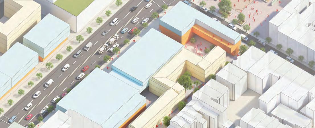
LOGAN FAIR AND SQUARE
A LOGAN SQUARE ENJOYED BY EVERYONE
Jie Li and Yan Wang
96
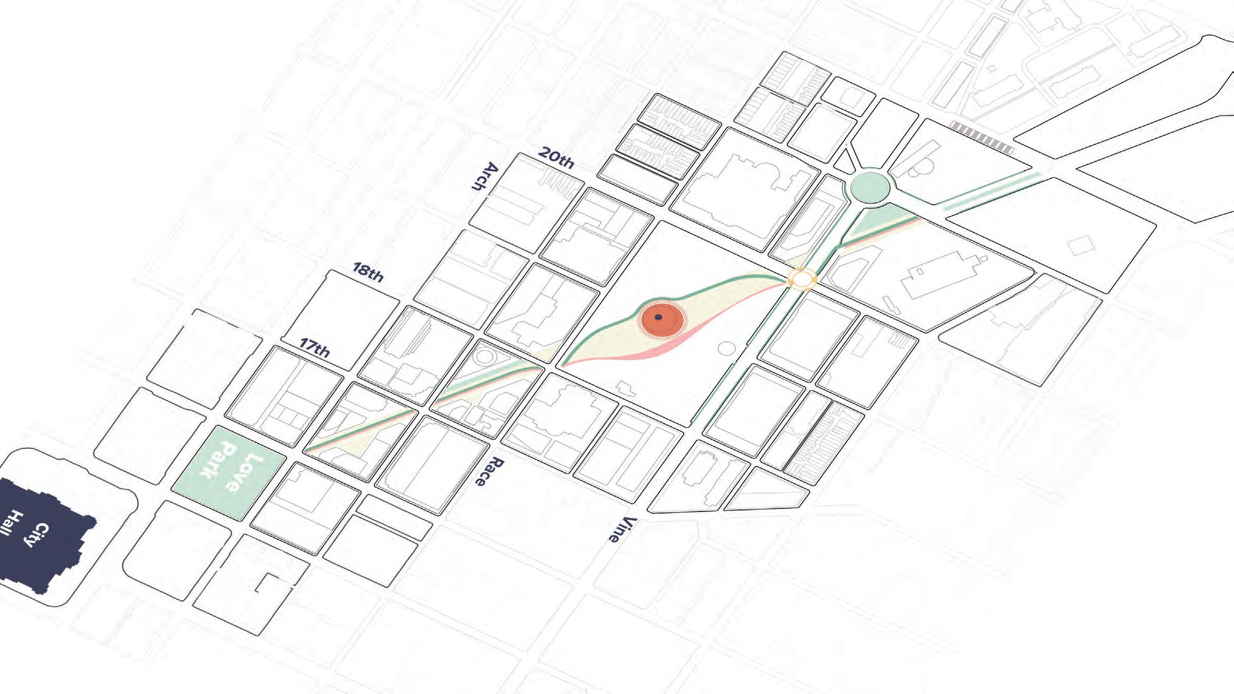
LOGAN CIRCLE & RACE ST
NOW
Monumental + auto-driven
Around Logan Circle are primarily institutional uses. Large spaces for automobiles have fragmented the blocks for development and activities, and makes the environment more hostile to pedestrians.
THREE BIG IDEAS
#1 Solve Circulation
#2 Make Space#3 Make Community
by reinforcing the grid enjoyed by everyone housing, commerce, and more

NaturalHistoryMuseum + 210 + 330 + 120 + 65
#1 SOLVE CIRCULATION
100
CURRENT
Problematic intersection once Vine St Expressway brought to the grade
The current circulation system prioritizes automobile traffic, fragmenting blocks and creating difficult intersections.
101
City Hall
Love Park Logan Circle
21st 20th 18th 17th 16th
0 500’
Museum of Art
Vine Race Cherry
Vine St
USE THE GRID
Spread tra c into city grid
We devised a traffic circle to diffuse traffic into the grid, effectively stopping automobile traffic of the Parkway at 21st St
102 Love Park City Hall
21st 20th 18th 17th 16th
Museum of Art
Vine
0 500’
Race Cherry Arch
Vine St
PUBLIC SPACE RECLAIMED
Unchanged
Circular creative crossing
Civic
Improved crossing
Commercial
Public space
Green space
Bike Path
Running Path
Vine St
Vine
103 Love Park City Hall
of Art 18th 17th 16th
Museum
0 500’
Race Cherry
PUBLIC SPACE DEVELOPED
Unchanged
Circular creative crossing

Civic
Improved crossing
Commercial
Public space
Green space
Bike Path
Running Path
Vine St
104 City Hall
0 500’
Museum of Art
#2 MAKE SPACE
105
106 210 Units 43k non-residential 210 Units 33k non-residential 328 Units 158k non-residential 111 Units 96k non-residential Arch St Multi-family Multi-family 16th St Topo/Garden Corridor Commercial Bike path Running path Outdoor Dinning
REMAKE PARKWAY
SOUTHEAST OF LOGAN SQUARE
Running path
City Hall
Residential development
Bike path
Public space
Sculpture
108
Public Space Commercial Ecological Family Commercial Edges
Programmed
Programmed
Space
1. Create inner surface2. Organize public space Civic Edges Commercially
Family-oriented
Ecological Public
REMAKE LOGAN
REMAKE LOGAN
3. “Bubble” programming4. Voilà
Lawn
Shops Sport
Rain garden
REMAKE LOGAN
Bubbles
Ecological

Bubbles
FamilyOriented
Bubbles

Co ee StandShop Dining Fair Vegetated Seating Lawn PatchTree Patch Stormwater Management Skate ParkGame Playground Sports Multi-use Pond
Commercial Service
REMAKE LOGAN
Water
Public space
Green space
Bike Path
Running Path
Family-Oriented “Bubbles”
Commercial Service “Bubbles”
Ecological “Bubbles”
Trolley Entrance
View View
SOUTHWEST LOGAN SQUARE
Family-oriented programs
 Logan Square statue & pond
Skate park
Storm management
Race Street
Logan Square statue & pond
Skate park
Storm management
Race Street
NORTHEAST LOGAN SQUARE
Vine Boulevard
Commercial Pavilions Public space
#3 MAKE COMMUNITY
114
DEVELOPMENT OPPORTUNITIES

Parcels reclaimed from the circulation reshuffle provide opportunities for commercial and residential development
Already proposed Our proposal
DEVELOPMENT OPPORTUNITIES
Commercial spaces in proximity to City Hall and alongside nice public space will be an economic driver
~300k sf Commercial
~300k sf Flex
~750 Parking spaces
55k sf 86k sf 70k sf 48k sf 16k sf 21k sf 530 spaces 215 spaces
ADDED HOUSING
1,720 housing units are added to Philadelphia’s housing stock, in which 30% can be for affordable housing
~1,720 units
AfricanAmericanMuseum Library FranklinInstitute NaturalHistoryMuseum CalderGarden BarnesFoundation + 670 + 210 + 330 + 120 + 65 + 340

0 300’ Buildings 1 3 4 24 9 8 6 5 7 15 9 10 11 12 13 14 1 Commercial Residential Institutional Places 1 Statue & Pond 2 3 SW: Eco & Family Quarter 4,5, 7,9 Storm Management 6 Public, Commercial, & Recreation Quarters African American Museum Parkway Central Library 8 Sisters Park & Cafe Academy of Natural Sciences (Museum) Cathedral Basilica Cathedral Place Proposal Trolley Station Welcome 10 11 12 13 14 15 Franklin Institute Proposed Public Space Water Public space Green space Bike Path Running Path Commercial Service “Bubbles” Family-Oriented “Bubbles” Ecological “Bubbles”
Entrance PLAN
Trolley
BROAD & VINE REIMAGINING DOWNTOWN LIVING
119
Helen Lea and Kylee Pierce
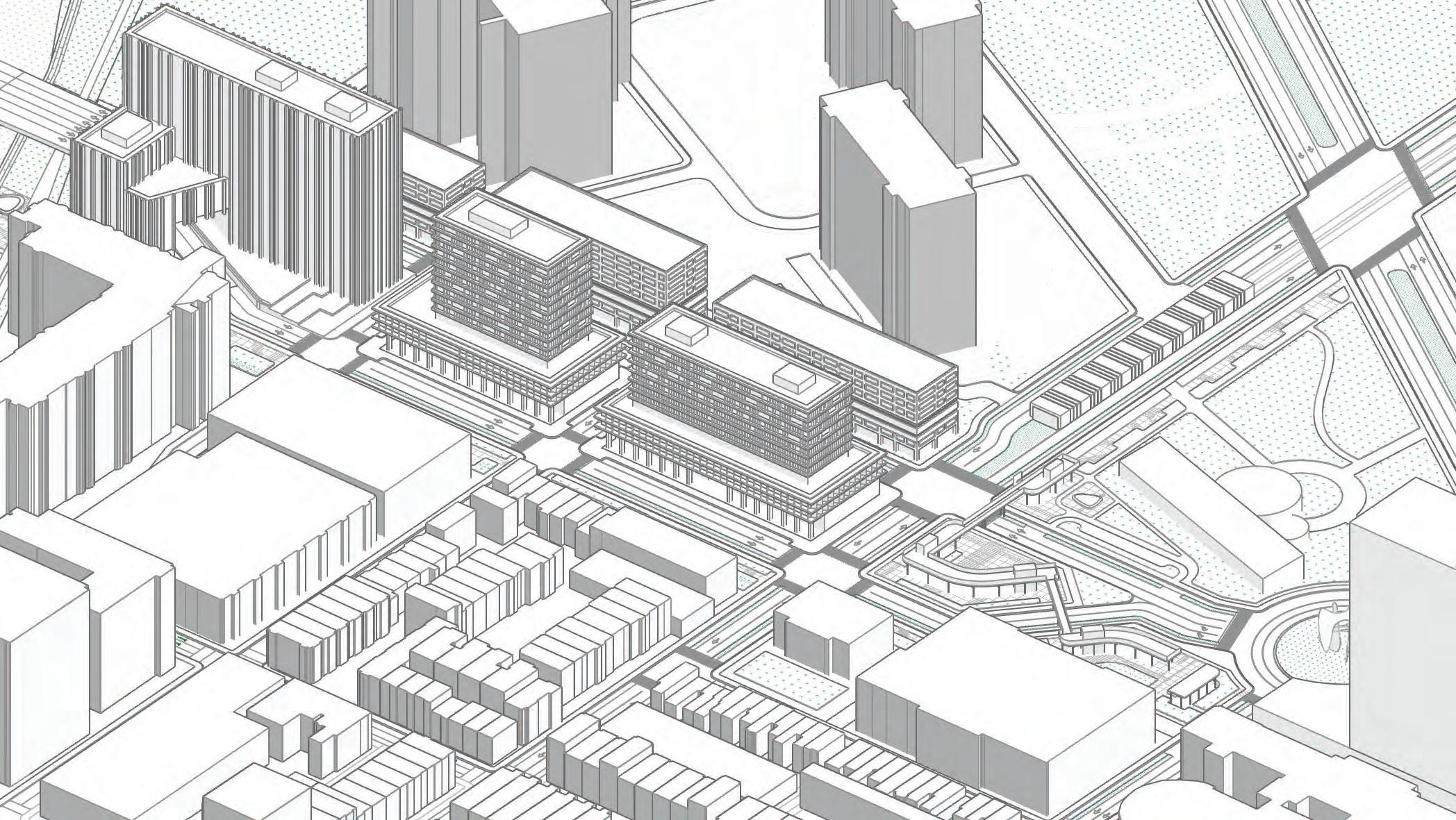
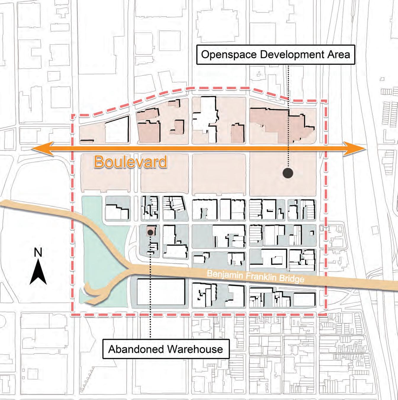
The Broad & Vine site is an area of transition between Logan Square and the Convention Center district.
EXISTING CONDITIONS
120
HAMILTON ST
18TH
VINE ST
CHERRY ST BROAD ST
ST
There are many anchors and institutions within the neighborhood, covering a range of different uses for different ages.
ANCHORS & INSTITUTIONS
121
Community College of Philadelphia
School District of Philadelphia
Pennsylvania Academy of Fine Arts
Friends Center
VINE ST
HAMILTON ST
CHERRY ST
BROAD ST 18TH ST
Education Religion Arts Senior Living
Fountain View Senior Living
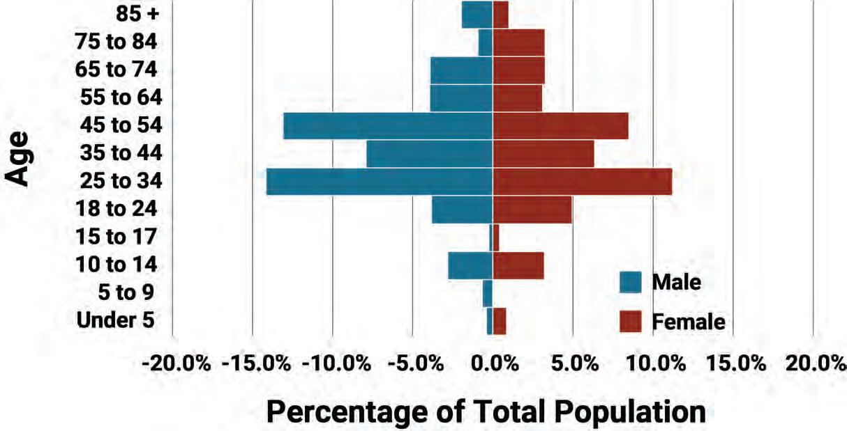
WHO LIVES HERE?
122
BROAD &
UNDER 18
18 TO 34
65+
PHILADELPHIA
Population: 4,782 56% 2% 22% 29% 25% 14%
VINE
YEARS
YEARS
YEARS
Total
WHO LIVES HERE?
Total Population: 4,782
LIVING ALONE MEDIAN HOUSEHOLD INCOME
54%
$73,970
37%
$49,127
123
BROAD & VINE PHILADELPHIA
The area south of Vine Street includes many highrise buildings, matching the core Center City density, as well as some mid-rise buildings and scattered parking lots.
BROADSTREET
EXISTING TYPOLOGIES - SOUTH OF VINE
VINESTREET
124
BROAD VINE
VINESTREET BROADSTREET
North of Vine Street includes more midrise buildings and the on- and off-ramps to the Expressway. Overall, the site lacks a cohesive neighborhood identity, which poses a unique opportunity to reimagine what downtown living could look like for Philadelphia.
EXISTING TYPOLOGIES - NORTH OF VINE
125
BROAD VINE
BROAD
ARTS ON BROAD STREET
Arts Venue VINE ST N
This project aims to take advantage of the existing arts and culture in the city and extend the Avenue of the Arts north of Market Street, with PAFA as a main arts anchor institution.
126
Site Area Arts Education ST
There are several opportunity sites within the neighborhood, which can be split into publiclyowned and privately-owned.
Publicly-owned parcels include areas where the expressway is currently located and a parking garage owned by PennDOT.
Privately-owned parcels are underutilized sites that could be redeveloped as a result of development on the publiclyowned sites.
OPPORTUNITY SITES
127
HAMILTON ST
Public Ownership Private Ownership
CHERRY ST
BROAD ST
18TH ST
Together, the publicly and privately-owned parcels result in a large contiguous area of potential redevelopment that can redefine the neighborhood and create a new identity for it.
OPPORTUNITY SITES
Contiguous Opportunity Sites
128
HAMILTON ST
CHERRY ST
BROAD ST
18TH ST
STATE STREET, CHICAGO
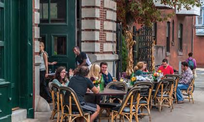
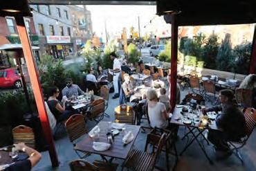
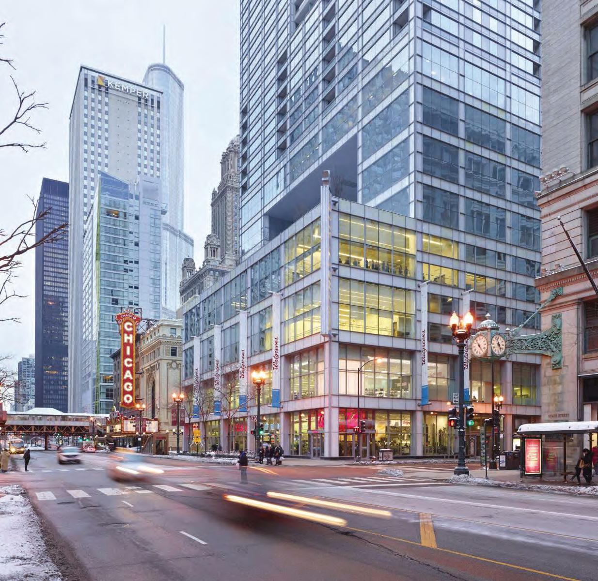
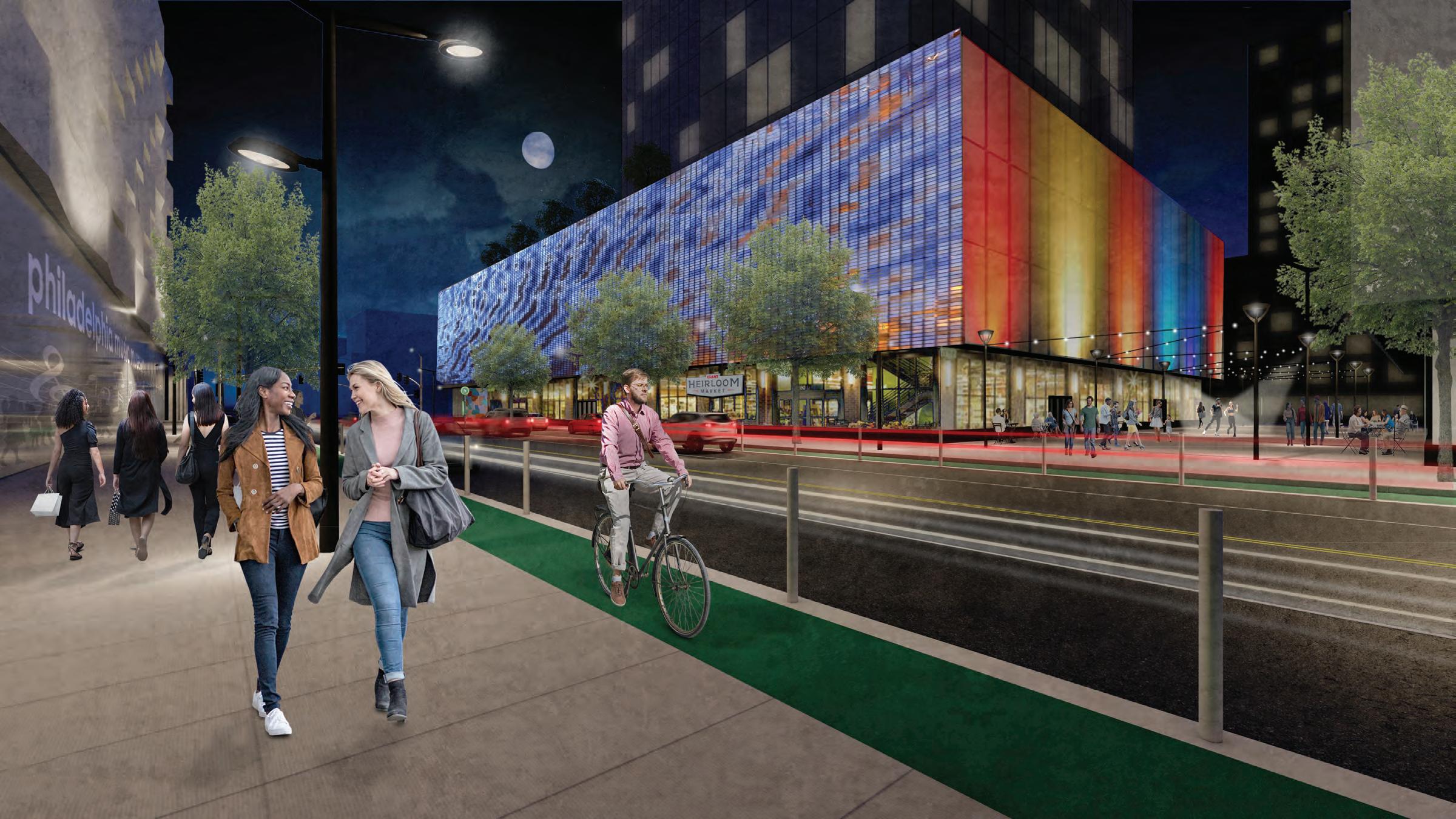
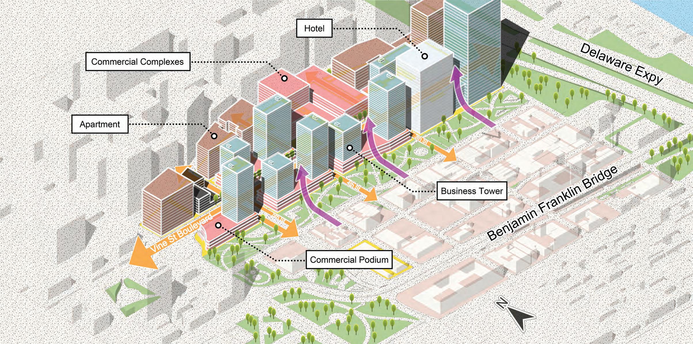
Based on this analysis, we started to develop an idea of what the Broad and Vine area has the potential to become. Along with the need for housing, community development, and multimodal connections, this is the first point along the corridor as we move east where the potential of Vine Street as a high-volume commercial corridor can be realized.
Looking at precedents like State Street in Chicago, we thought about how to bring arts, transportation, and community into one cohesive plan, leading us to our guiding vision.
129
Image: Chicago Loop Alliance
CONCEPT & GOALS
Broad + Vine is an intergenerational community that bridges across income and age to foster connections from people to people and from people to place.
130
GOALS
Affordability Accessibility Health Sustainability Arts & Culture
Use the abundance of public land to create development that caters to a wider range of household types and incomes.
Use transit and walkable street typologies to promote connectivity within and beyond the Broad and Vine neighborhood.
Minimize environmental health disparities, such as the historic impact of the Vine Street Expressway on pollution, traffic safety, and flooding.
Develop resilient environmental, economic, and social systems that support the neighborhood today and carry it through the long-term.
Rebrand the area and connect it to other cultural hubs of Philly, such as Logan Square, Chinatown, and Avenue of the Arts, to create a vibrant destination.
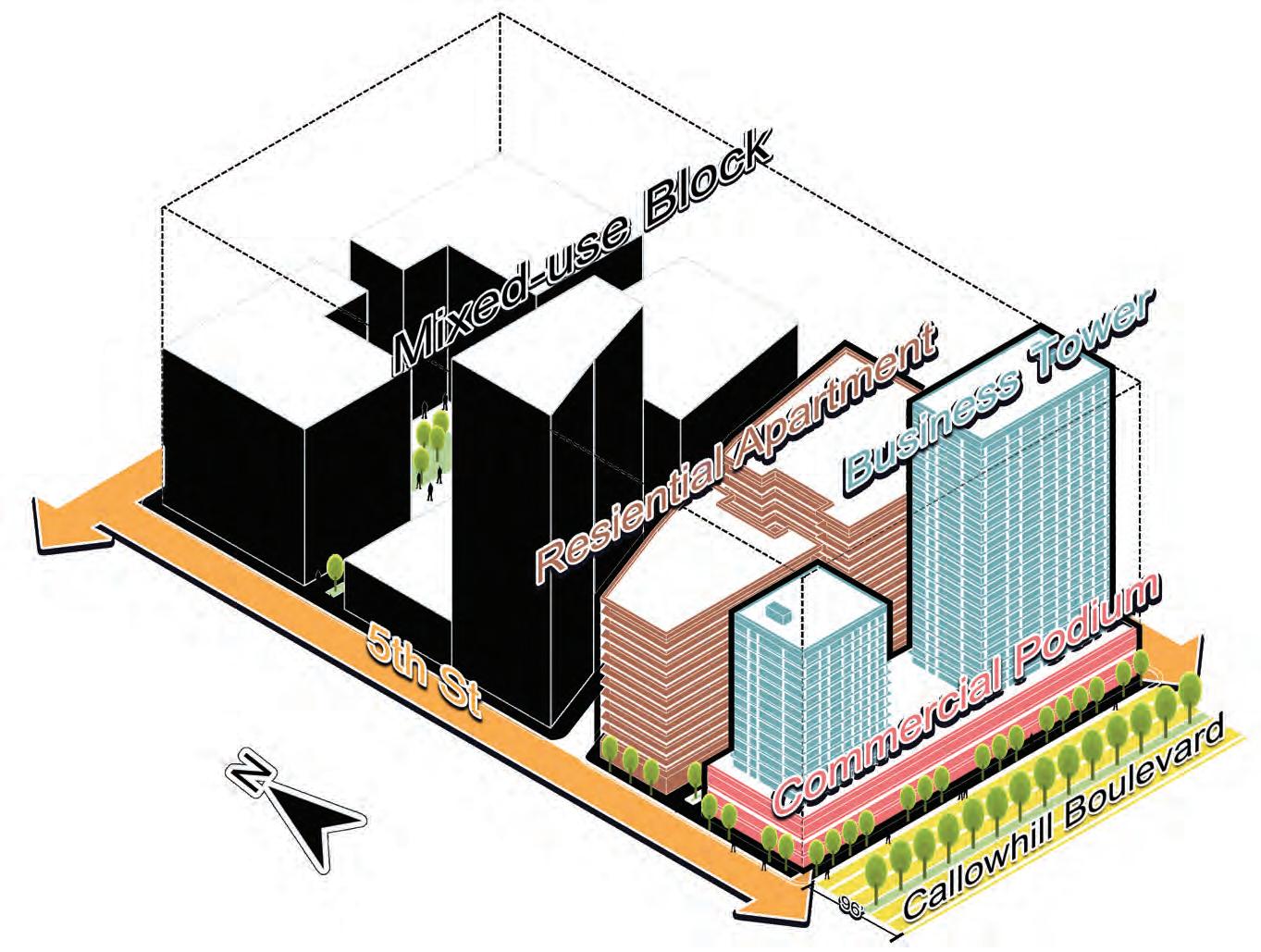
131
SITE PLAN
Developable area
This plan features high value infill, new park space, and enhanced walkability, all coming together to create a neighborhood that caters to a wide range of Philadelphians.
 Logan Square
Rail Park
Pennsylvania Convention Center
Logan Square
Rail Park
Pennsylvania Convention Center
ZONES
This area begins the transition from the institutional character of Logan Square and the museum district into a high-density commercial corridor.
TRANSITION
Mixed-use buildings
New plaza
Logan Square Rail Park
Pennsylvania Convention Center CIVIC-COMMERCIAL
Trolley Station
Trolley Station New plaza Mixed-income housing
ZONES
Apartments
Wood Street Park
This second zone is where most of the publicly owned land is located, and thus is a hotspot for new housing. There are a variety of typologies, which helps blend into the existing urban fabric and pedestrian walkways connect the blocks from north to south.
RESIDENTIAL CORE
Rowhouses
Apartments
Trolley Station
Mixed-use
Mixed-use
Apartments
Park
Logan Square Rail
Pennsylvania Convention Center
Neighborhood-serving retail
Residential courtyards
Cafes
ZONES
The final zone focuses on transitioning from a quieter residential core to the important Broad Street frontage on the east side of the area. Building on the anchor of PAFA in the southeast, this is where most of the arts and culture uses are located. A new museum at Broad and Vine provides a “stepping stone” from the rich culture of Chinatown to the major museums of Logan Square and the parkway.
Logan Square
Rail Park
Pennsylvania Convention Center
ARTS CAMPUS Museum
PAFA Campus Extensions and “Plaza in the Round”
Artist Live-Work and outdoor gallery
PAFA
Mixed-use Student housing
Trolley Station
Flex-use stage
360-degree screens
Built-in seating
HOUSING TYPOLOGIES
RESIDENTIAL COMMERCIAL ARTIST STUDIO
Because the neighborhood has a range of scales, several housing typologies are used to complement these existing scales and architectural character.
139
PROGRAMMING & DENSITY
BROADSTREET
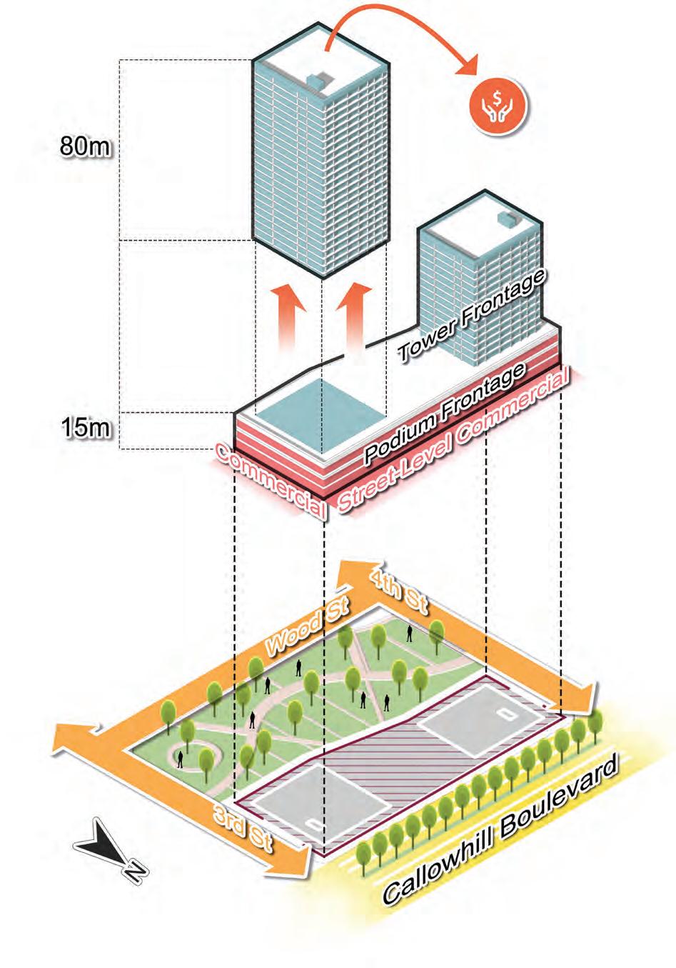
Higher densities and mixed uses concentrate along Vine Street, with a new museum to anchor the Broad & Vine intersection.
VINESTREET
RESIDENTIAL COMMERCIAL ARTS & CULTURE PARKING PARK
SITE SECTION
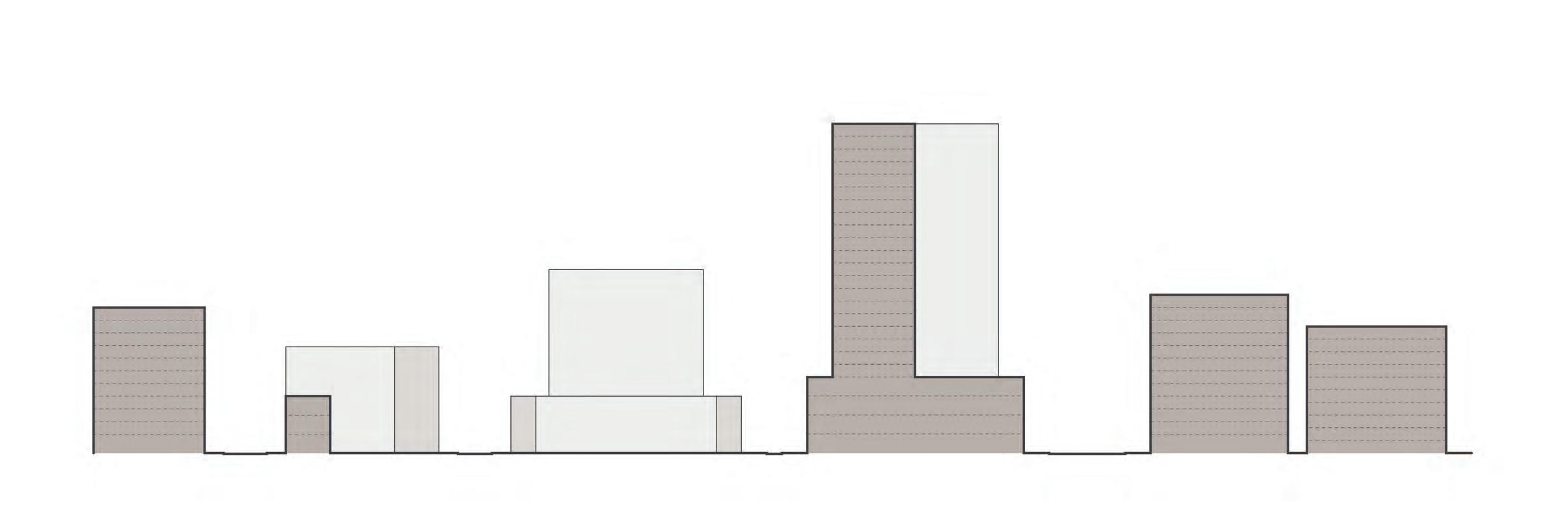
Building densities ramp up to Vine Street and then step back down as you move north and south to complement existing building heights.
141
Museum Existing Parking Garage Existing Parking Garage Commercial Building New Arts Building Student Housing VINE ST SUMMER ST RACE ST SPRING ST
MOBILITY HIERARCHY
Boulevard
Secondary Multimodal Service
Neighborhood
Pedestrian
The Mobility Hierarchy includes five levels of streets that have different widths and lane configurations to provide appropriate space for drivers, pedestrians, cyclists, and transit riders.
 Logan Square
Rail Park
Pennsylvania Convention Center
Logan Square
Rail Park
Pennsylvania Convention Center
BOULEVARD
For the high-capacity boulevard of Vine Street, a new underground trolley line will work together with bus routes and bike lanes above it to create a multimodal network. The new trolley station will provide an opportunity for neighborhood branding that indicates a sense of arrival.
143
12’ 6’ 6’ 12’ 12’ 12’ 60’ Roadway 20’ Sidewalk 20’ Sidewalk
SECONDARY MULTIMODAL
Secondary multimodal streets accommodate bus, bikes, and personal cars while providing a pleasant experience for pedestrians with wide sidewalks and increased greenery.
144
8’ 12’ 12’ 12’ 44’ Roadway 15’ Sidewalk 15’ Sidewalk
SERVICE
Service streets provide loading access for the new buildings with a more pleasant pedestrian experience than a typical service alley.

20’
Flexible Sidewalk/ Loading Zone
12’ 8’ 12’ Roadway 20’
Flexible Sidewalk/ Loading Zone
145
NEIGHBORHOOD
Neighborhood streets are typically a smaller scale with multiple rowhouses and provide a more intimate setting for residents.
146
12’ Travel Lane 10’ Parking Lane 15’ Sidewalk 15’ Sidewalk
PEDESTRIAN WALKWAY
Pedestrian walkways occur between buildings and increase north-south connectivity, bringing back a Philadelphia scale into the new large development blocks.

40’
Pedestrian Walkway
147
GREEN SPACE NETWORK
Green Space
Trolley/Subway Stop
Pedestrian Connections
The green space network is an important part of making Broad and Vine accessible, healthy, and sustainable. The small courtyards and plazas connect to the assets of Logan Square and the Rail Park on either side of the neighborhood.
 LOGAN SQUARE
RAIL PARK
WOOD STREET PARK
Pennsylvania Convention Center
LOGAN SQUARE
RAIL PARK
WOOD STREET PARK
Pennsylvania Convention Center
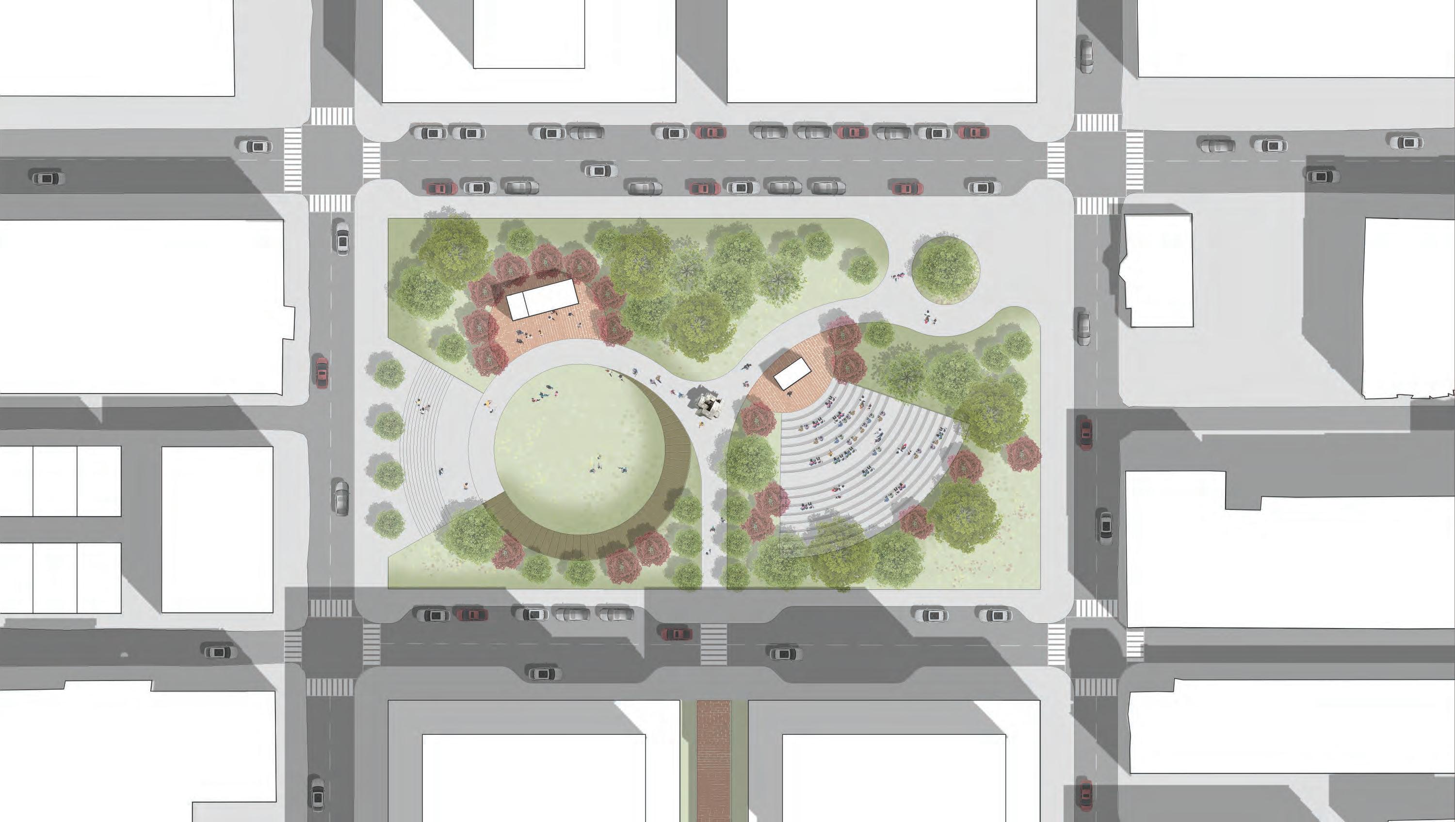
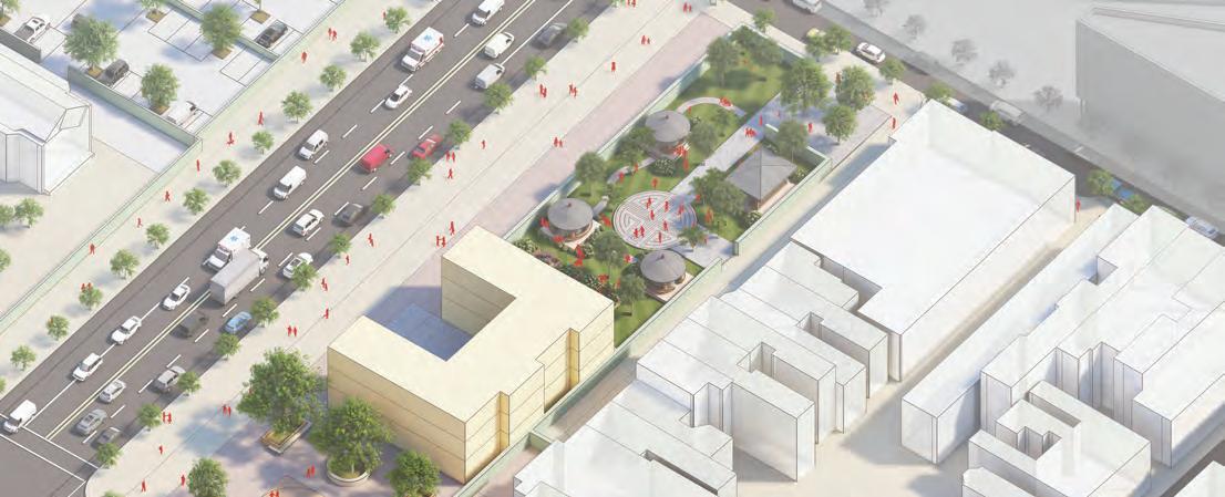
WOOD STREET PARK
The new Wood Street park is the keystone of the green network in the Broad and Vine Area. It is located where these onand off-ramps exist today, but with the removal of the Vine Street Expressway, they will no longer be needed.
149
WOOD STREET PARK
The northern half of the ramps site can be redesigned into a neighborhood park, as there are buildings on all four sides of the block.
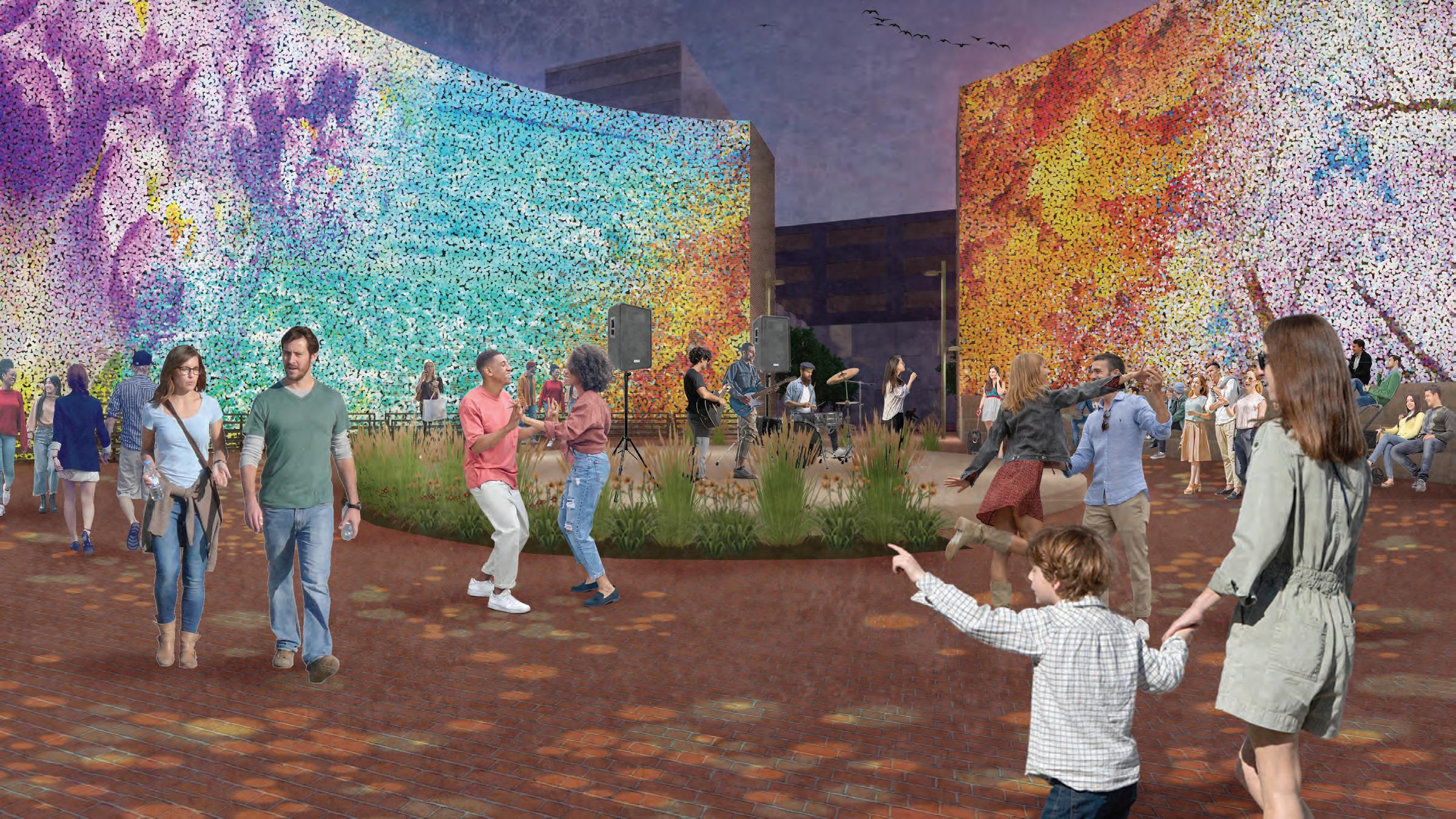
To support intergenerational living, the park features flexible outdoor spaces that can be used as classrooms for school field trips or arts performances, recreation space, or venues for community gatherings. The park also utilizes the depressed landform to serve as a detention basin for stormwater runoff.
 Amphitheater
Boardwalk
Outdoor classroom
Stage
Flex-use Lawn
Amphitheater
Boardwalk
Outdoor classroom
Stage
Flex-use Lawn
TANNER SPRINGS PARK, PORTLAND
Tanner Springs Park in Portland can serve as a precedent for this design, as it handles significant grade change in creative ways and allows space for recreation and stormwater management.
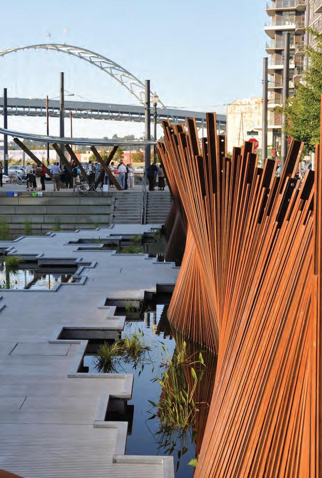

151
Image: gardenvisit.com
Image: Portland Parks Foundation
STORM WATER MANAGEMENT
Each of the new parks, plazas, and courtyards would be designed to maximize permeability through landscape beds and permeable pavers. Each of these spaces acts like a sponge, diverting some of the runoff that flows towards Vine Street.
 Permeable Area
Stormwater Flow WOOD STREET PARK
Logan Square
Rail Park
Pennsylvania Convention Center
DEVELOPMENT ESTIMATES
The Broad and Vine plan proposes a significant amount new housing, representing a 75% increase compared to the current housing stock.
2,325
The plan provides a large number of affordable units as well, to ensure that people of all incomes have access to these new amenities and transit connections.
965
680
680
153
MARKET-RATE TOTAL HOUSING UNITS LOW/VERY-LOW INCOME (30-80%
EXTREMELY LOW-INCOME
AMI)
(<30% AMI)
DEVELOPMENT ESTIMATES
The new housing is supported by new commercial, arts, and park spaces. This helps the area meet the goal of economic sustainability. Since a lot of these new spaces are on public land, there is also the opportunity to creates equitable access to office space for small businesses, startups, and artists.
154 COMMERCIAL PARK SPACE ARTS & CULTURE
TOTAL SF
RETAIL SF
TOTAL ACREAGE
OFFICE SF
870,000
390,000
2
860,000
ECONOMIC IMPACT ESTIMATES
TOTAL = 4,860 NEW JOBS
Based on a net square foot per worker formula, the site will be able to accommodate almost 5,000 new jobs. This creates the potential for more people to live and work in the area, and overall creates a great economic stimulus for Center City.
155
COMMERCIAL
890 RETAIL JOBS* 130 JOBS*
3,440 OFFICE JOBS*
RESIDENTIAL ARTS & CULTURE *Retail = 200-400 NSF/worker, Office = 200 NSF/worker *Residential = 15,000 NSF/worker *Museum = 200 jobs, PAFA Extension = 200 jobs
400 JOBS*
A place for people to thrive...
...full of new opportunities...
...celebrating the arts
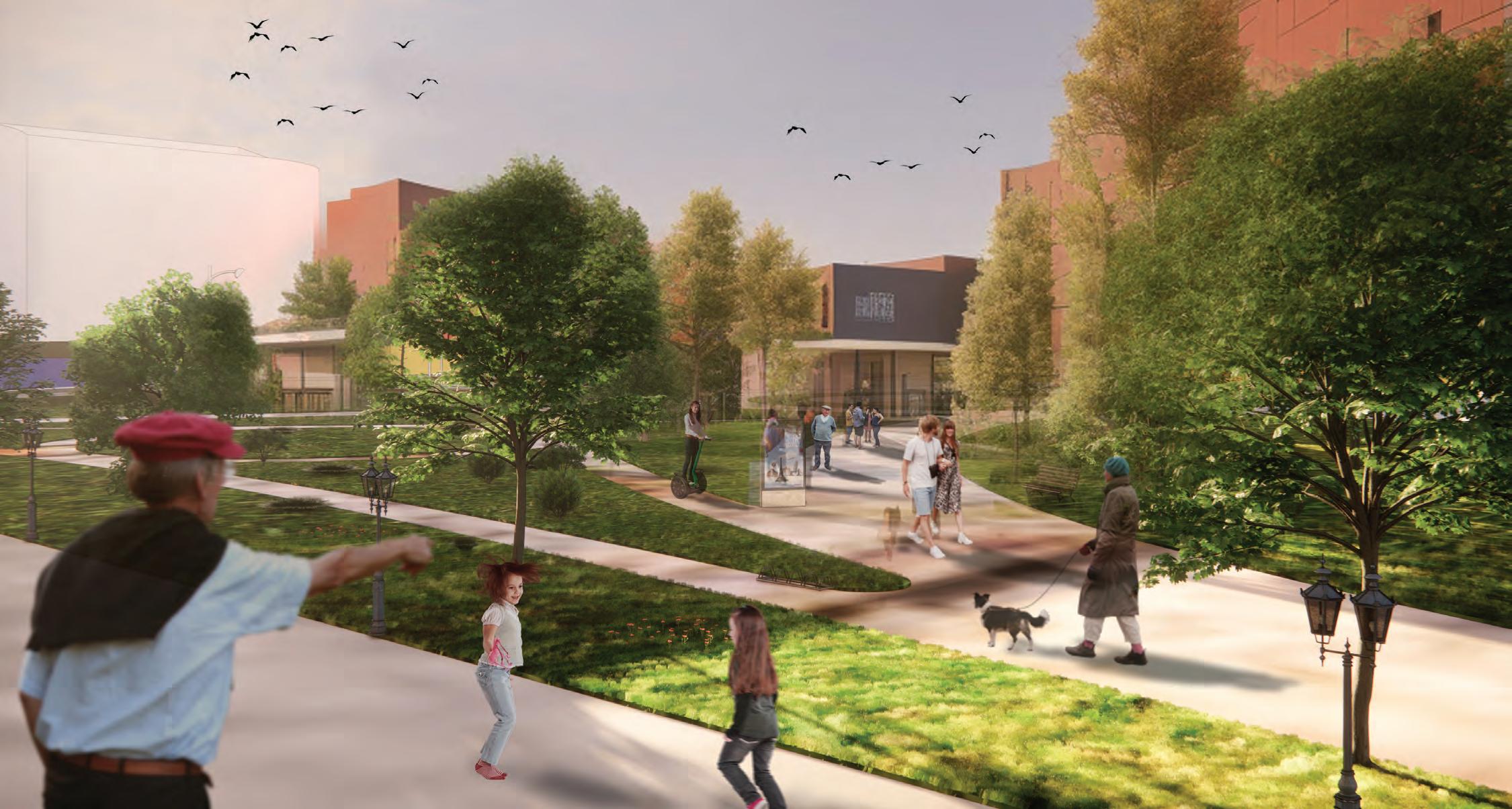
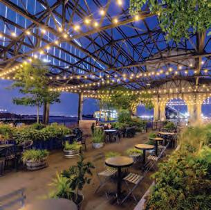
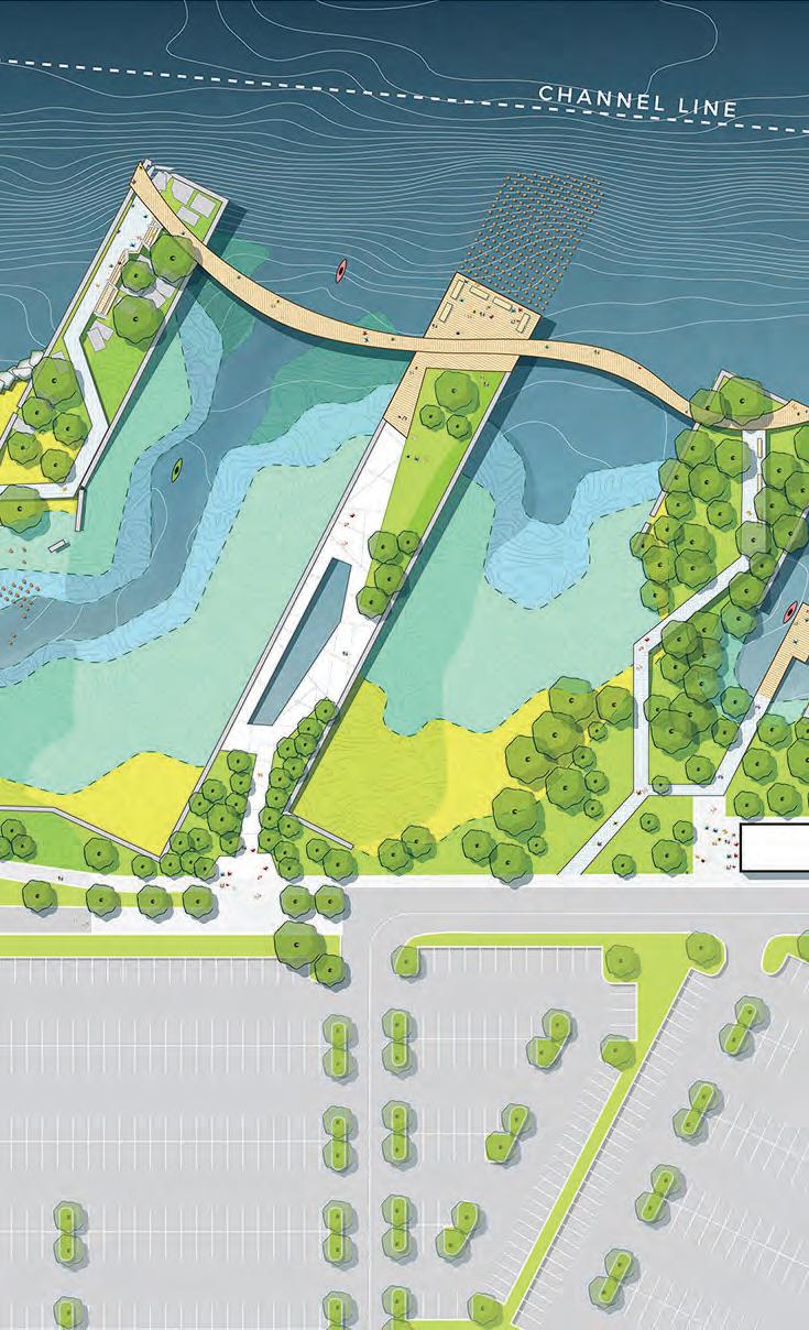
RESHAPING THE RAIL PARK
Makayla Davis
157
LOCATION
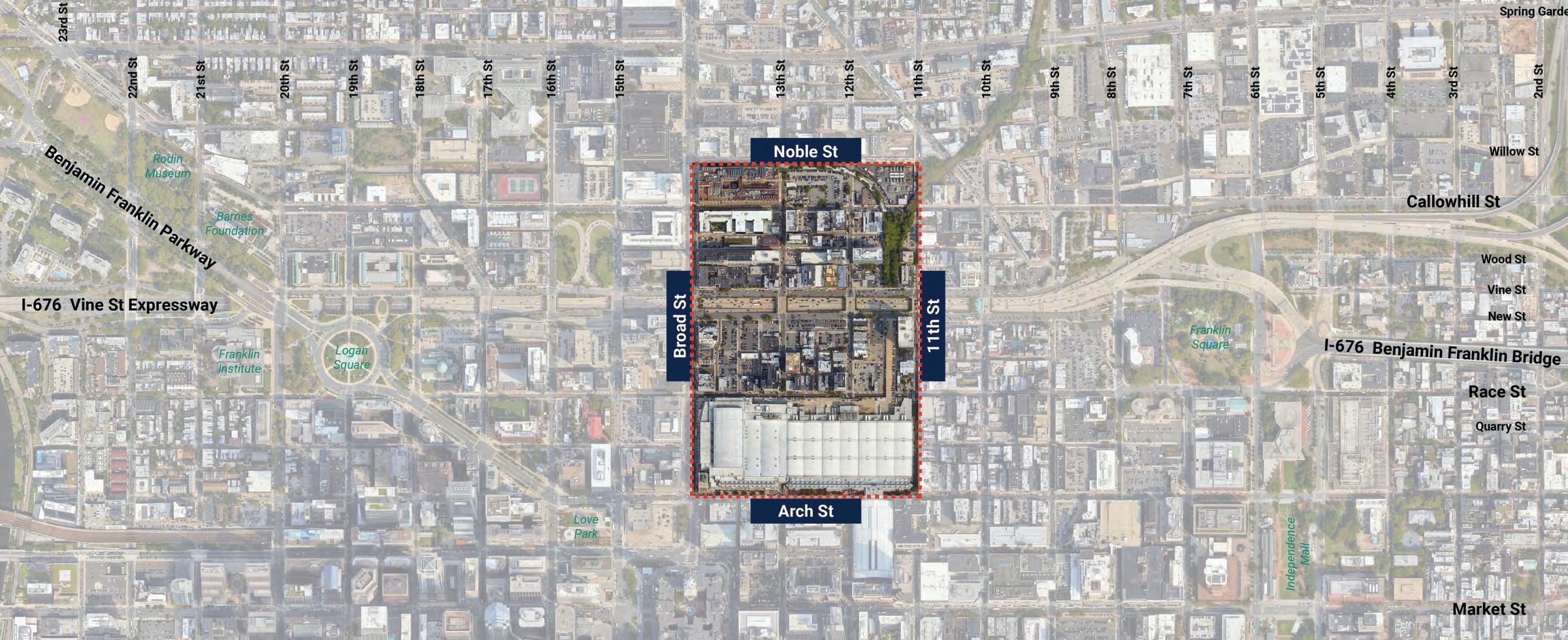
Centrally located along the Vine Street Corridor, the Rail Park neighborhood stretches from Noble Street in the north to Arch Street in the south and from Broad Street on the west side to 11th Street on the east side.
158
Source: High Line Network
KEY ANCHORS
Source: Hoang An Tran, Visit Philadelphia
Source: Tutor Perini Affiliates
The neighborhood surrounding the Rail Park has a range of community anchors that bring a lively cultural presence to visitors and existing residents alike. With key institutions like Asian Arts Initiative and the Pennsylvania Convention Center, the area’s existing assets create a prime opportunity to enhance its cultural presence.
159
WHY REDESIGN THE RAIL PARK?
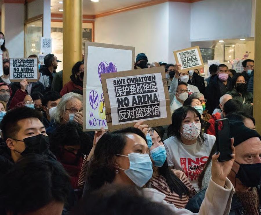
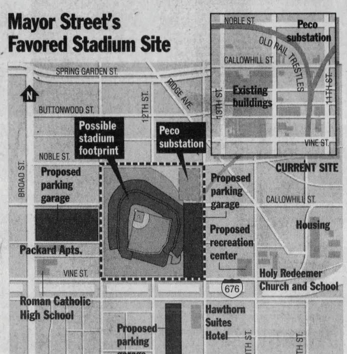
Historically, Chinatown has faced adversities as a result of the imposition of unchecked development in an around the neighborhood, driving displacement. Today, the neighborhood still faces these challenges, as it remains physically divided, and the proposed 76ers arena threatens the existing population. Given the historical presence of this area along the corridor, this project presents a great opportunity to reimagine the way that development like the Rail Park can serve the existing population while bringing in new visitors.
160
KEY ISSUES TO ADDRESS
Neighborhood Continuity
Accessibility
Parking Lots
Taking the neighborhood’s location, cultural assets, and history into account, this proposal focuses on neighborhood continuity, asset accessibility, and programming the undeveloped spaces that are currently used as parking lots.
GOALS & STRATEGIES
Increase accessibility
Create community conscious development
Bridge Center City north of Vine
This project’s design strategies are centered around shifting the Rail Park into a more useable, accessible space. In order to better serve the Chinatown community, this project creates community conscious development that extends the Center City district further north.
Blend Arts & Culture Corridor with Chinatown
North - South Connections
Mixed Use Hubs and Programmed
Outdoor Space
By pulling visitors into programmed spaces further north, the Vine Street can evolve into a continuous connector that makes the neighborhood feel pedestrian-friendly.
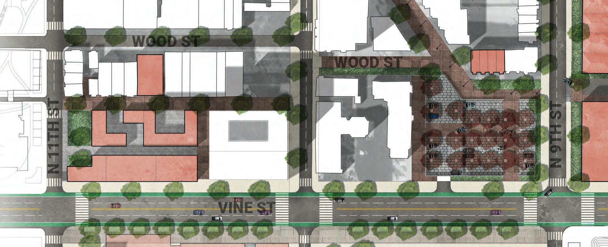
Reshaping the Rail Park aims to unify the neighborhood’s identities by bridging uses north and south of Vine and building more accessible, pedestrian-oriented neighborhood amenities that serve both visitors and the existing community.
162
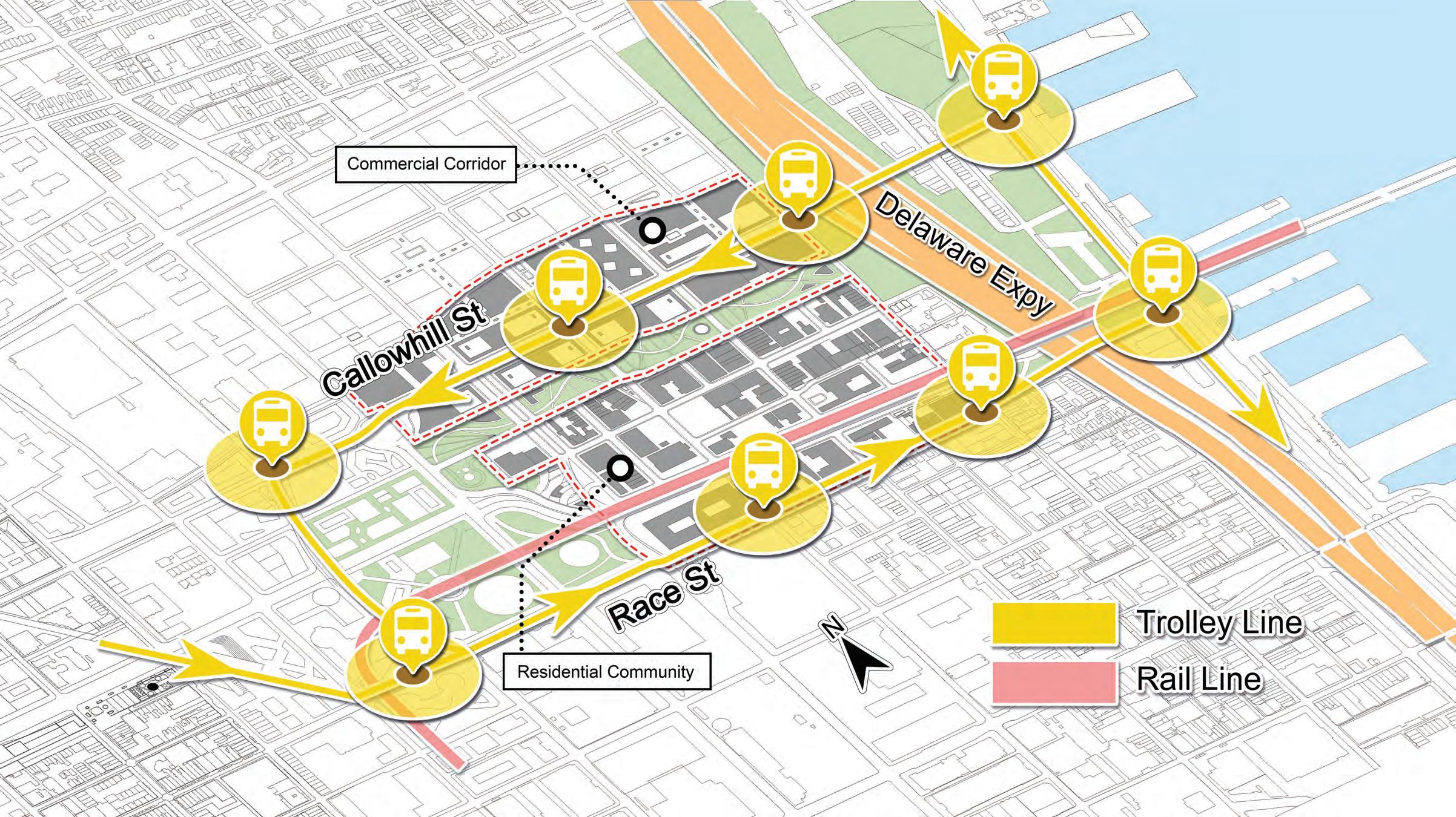
SITE PLAN & PRECEDENTS
The site plan removes the undeveloped portion of the Rail Park viaduct and opens up the southern part for programmable park space, effectively scaling down the Rail Park. The plan blends a range of scales for each element, creating hubs for commercial and mixed use spaces and designed outdoor spaces. Traffic is intentionally slowed at key locations and shifted to “shared streets” to create a pedestrianfriendly neighborhoods that connects to the underground trolley line.
163
Seasonal Park Programming (Source: Dilworth Park, OLIN)
Doyers Seasonal Street
(Source: NYC DOT)
East Market Philadelphia (Source: East Market)
Broadway Seasonal Street (Source: NYC DOT)
0’ 200’ 100’ N
Bell Street Park Shared Streets (Source: NACTO)
MASSING
VINEST

New Constructions
A range of building uses and typologies amass together to form a continuous neighborhood.
Rehabilitated Buildings
Existing Buildings
164
SITE PLAN NORTH
North of Vine focuses on drawing visitors into the Rail Park and transforming existing buildings. There are distinct areas of programmed activity and pocketed private space in the northern housing complex.
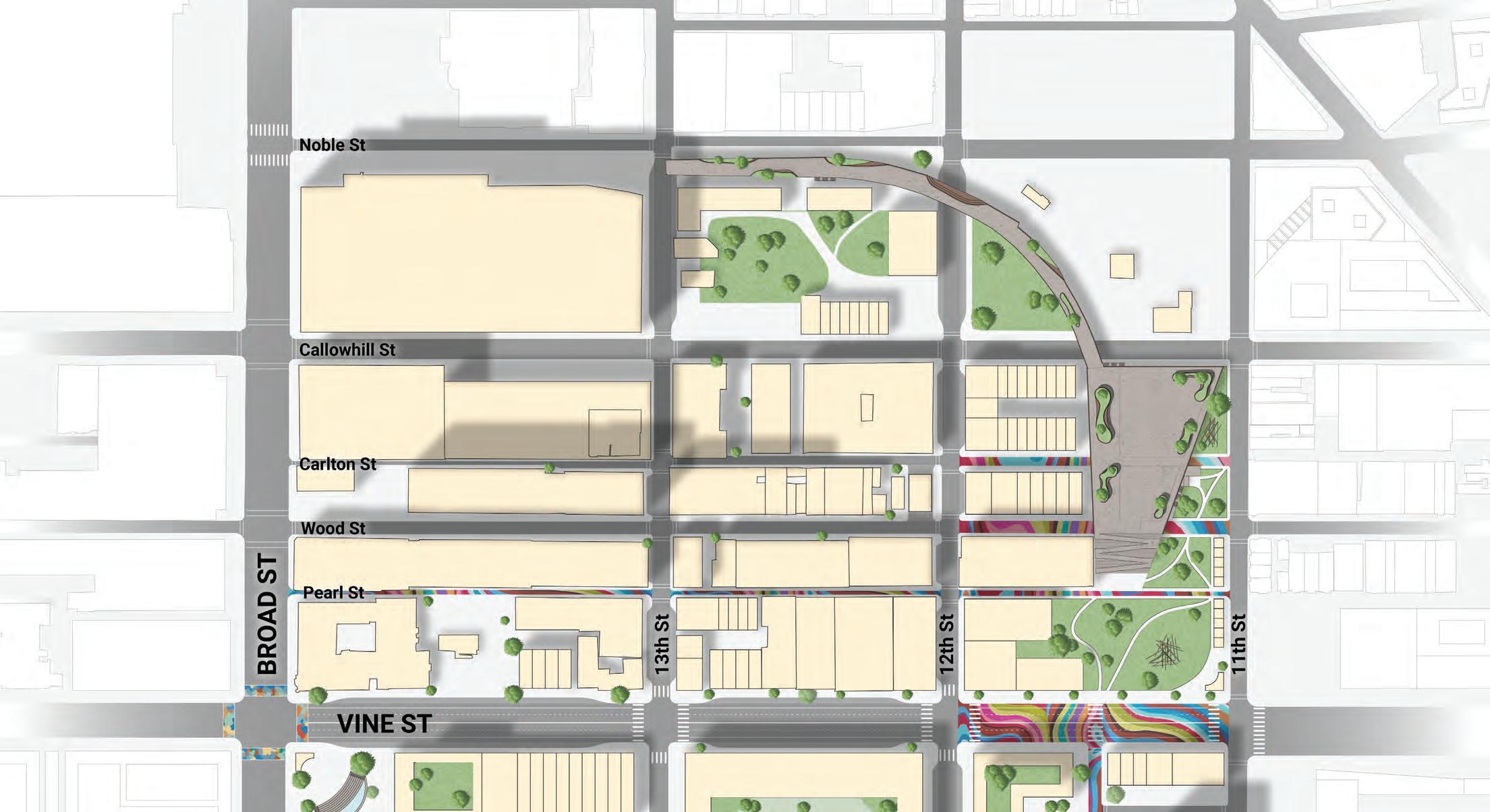
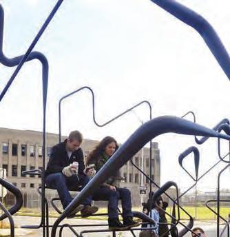
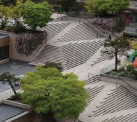
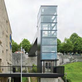
The Rail Park features design details that repurpose elements of the pre-existing rail line. It includes more accessible stairways, a “stramp,” and an elevator for physical accessibility.
165
Housing Complex
Mixed Use
Gas Station
Rail Park
Performance Venue
Mixed Use
Parking Deck
0’ 200’ 100’ N
Slowed Traffic
Play Pavilion (Source: Univ of Michigan)
Glass elevator (Source: Vaumm Architecture & Urbanism)
Robson Square (Source: The Universal Design Project)
RAIL PARK SECTION
Park planters
(Source: ML Design)
At grade, the Rail Park is a solid structure with pedestrian and shared streets that penetrate on the east-west streets. Above grade, the elevated Rail Park features interactive planters with seating and an open park design that can be programmed into an event space
166
NORTH HOUSING COMPLEX SECTION
The housing complex at the northern edge of the site features distinct zones of programming. Privatized by the surrounding residential and mixed use development, the interior plaza creates a micro-development for local residents and a view of the Rail Park on the northern side.
Overall, the neighborhood interventions include about 4 acres of park space, 5,000 residential units (2,000 affordable units), 160,000 sq. ft. of commercial office space, and 330,000 sq. ft. of commercial space.
167
SITE PLAN SOUTH
South of Vine focuses on shared streets and activating space on the northern edge of Center City. The design redevelops the pre-existing parking lots in a style that responds to Center City development. Implementing mixed use in these spaces, a shared street jogs just south of Vine Street to connect the new development to the green spaces. Vine Street on the block between 11th and 12th Streets features different pavers and a street tattoo to intentionally slow traffic and pull visitors into the Rail Park.
168
Apartments
New Housing Hotel
Pennsylvania Convention Center
Use
Use Mixed Use Hotel 0’ 200’ 100’ N East Market Philadelphia (Source: East Market) Nassau Seasonal Street (Source: NYC DOT) Bell Street Park Shared Streets (Source: Hewitt)
Mixed
Mixed
Slowed Traffic
STREET TYPOLOGIES CIRCULATION
This diagram represents the range of street typologies that pedestrians and vehicles can move throughout at grade.
Slowed traffic zones
Boulevard
Secondary multimodal
Service
Shared streets
Pedestrian only
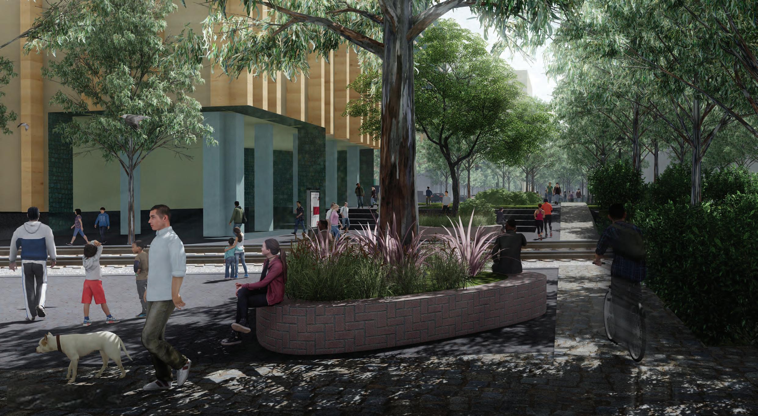
This circulation diagram shows the multiplicity of scales that pedestrians can move through, overlaid with the overall strategy to connect to the sites on either side of the neighborhood.
Circulation strategy
Greenway
Shared streets
169
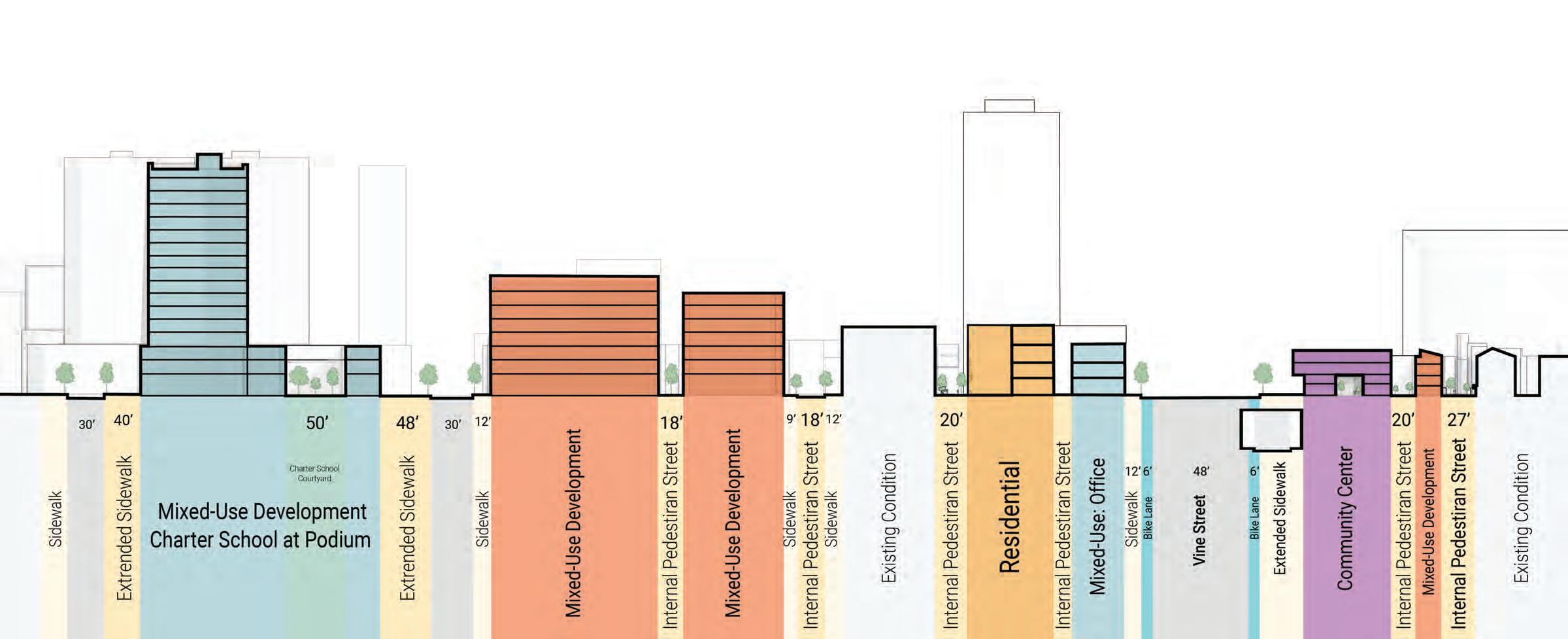
VINE STREET SECTION
This section shows how the proposed trolley runs underground in the former highway’s tunnel, creating another mode of transit through the corridor. At grade, Vine Street is padded with mixed use development -- a hotel on the southern side and the Chinese Christian Church, relocated slightly west to accommodate the new Rail Park development. Further from Vine Street is the pocketed shared street that creates east-west connections throughout the entire site.
170
Convention Center
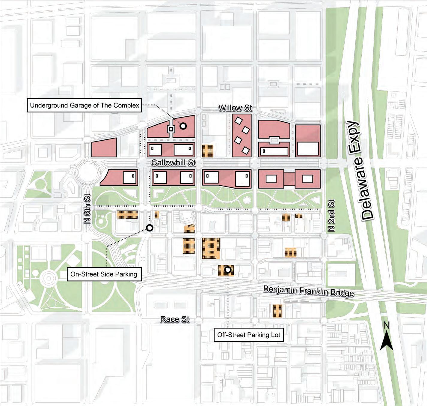
PARKING
This diagram shows the locations of planned parking underground and within structures.
This diagram of the mixed use building typology shows the parking deck wedged in the rear of the structure with residential units in the front and commercial/office space on the lower level.
171
Convention Center
Vine Street becomes a more open and accessible hub, bridging Center City, Chinatown, and the Arts & Culture Corridor to the neighborhood.
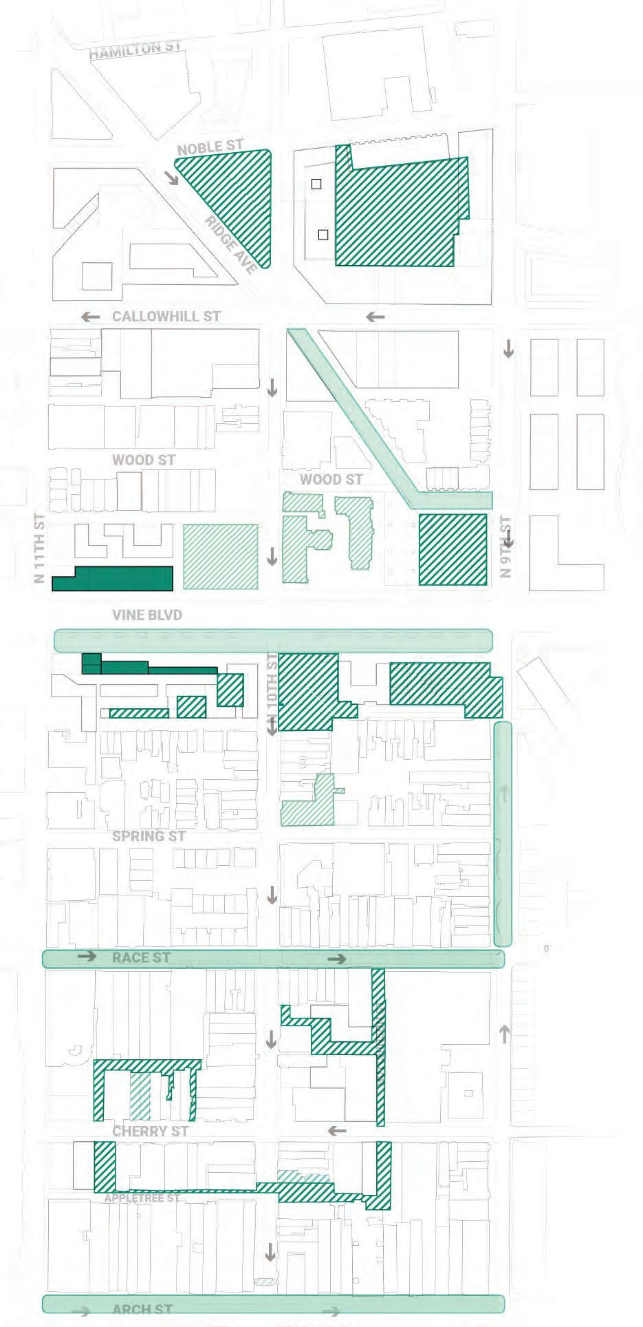
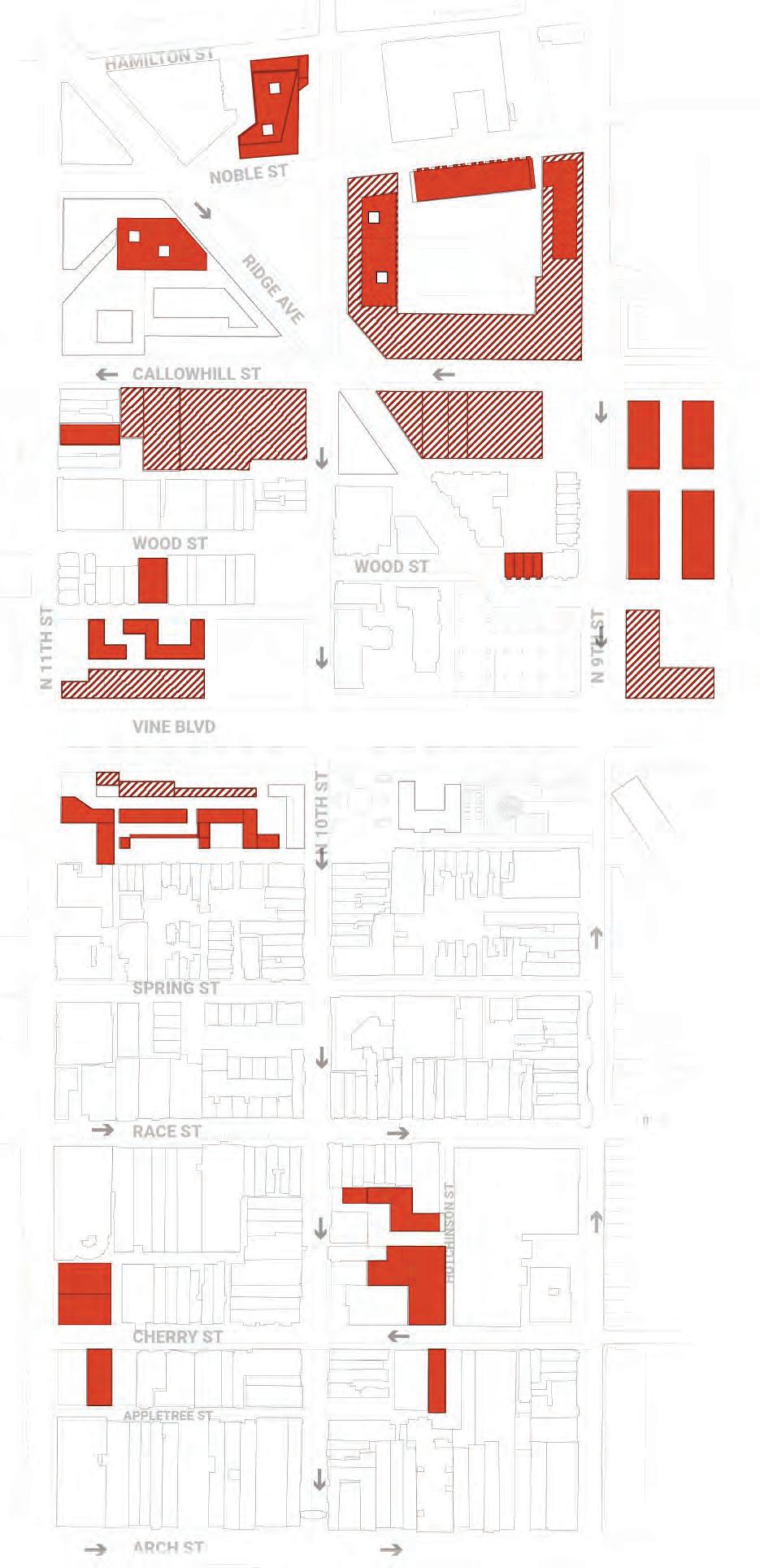
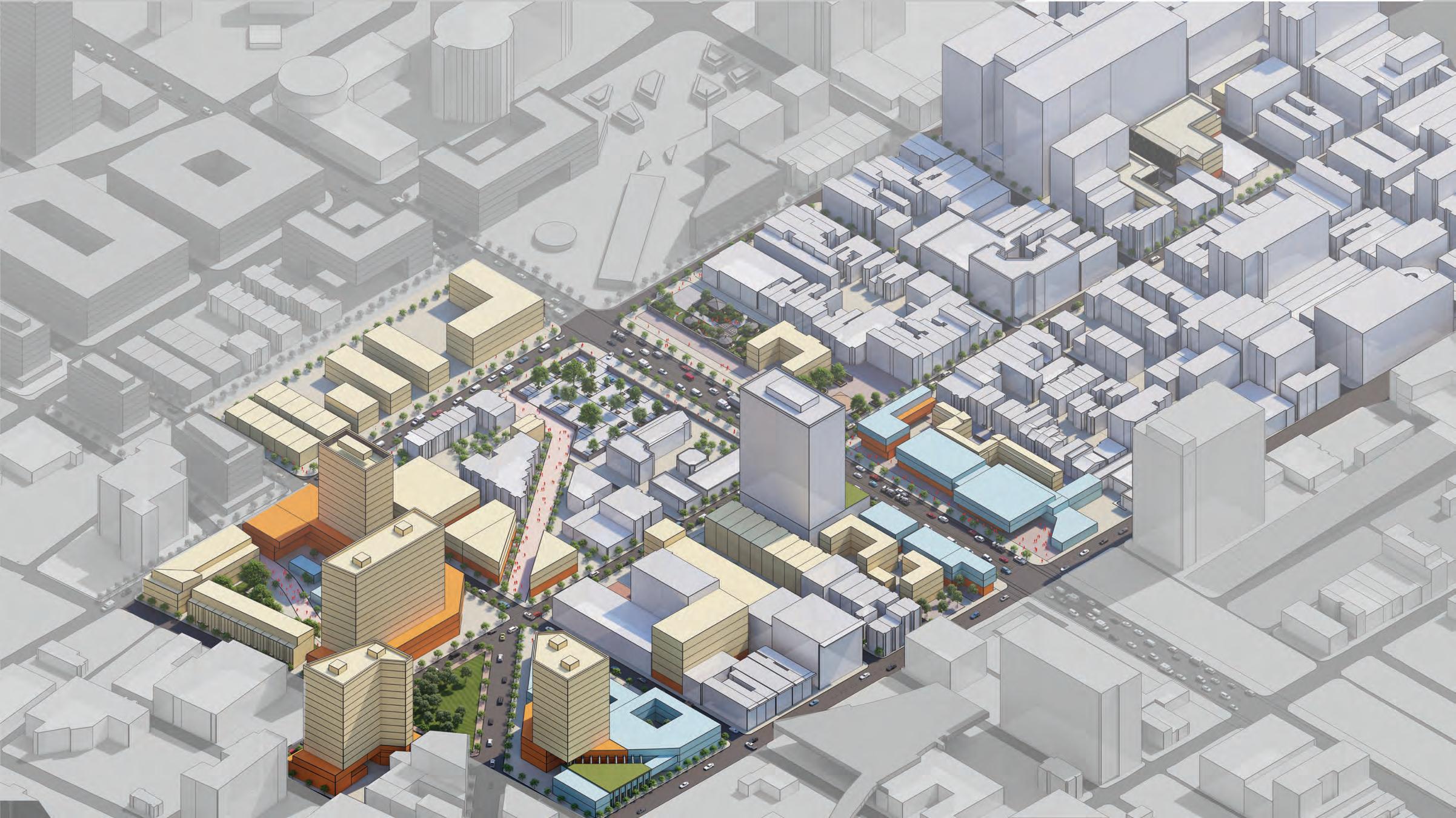
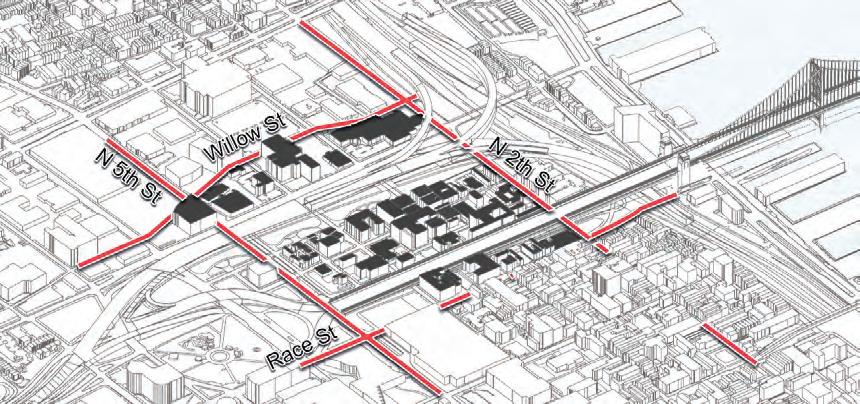
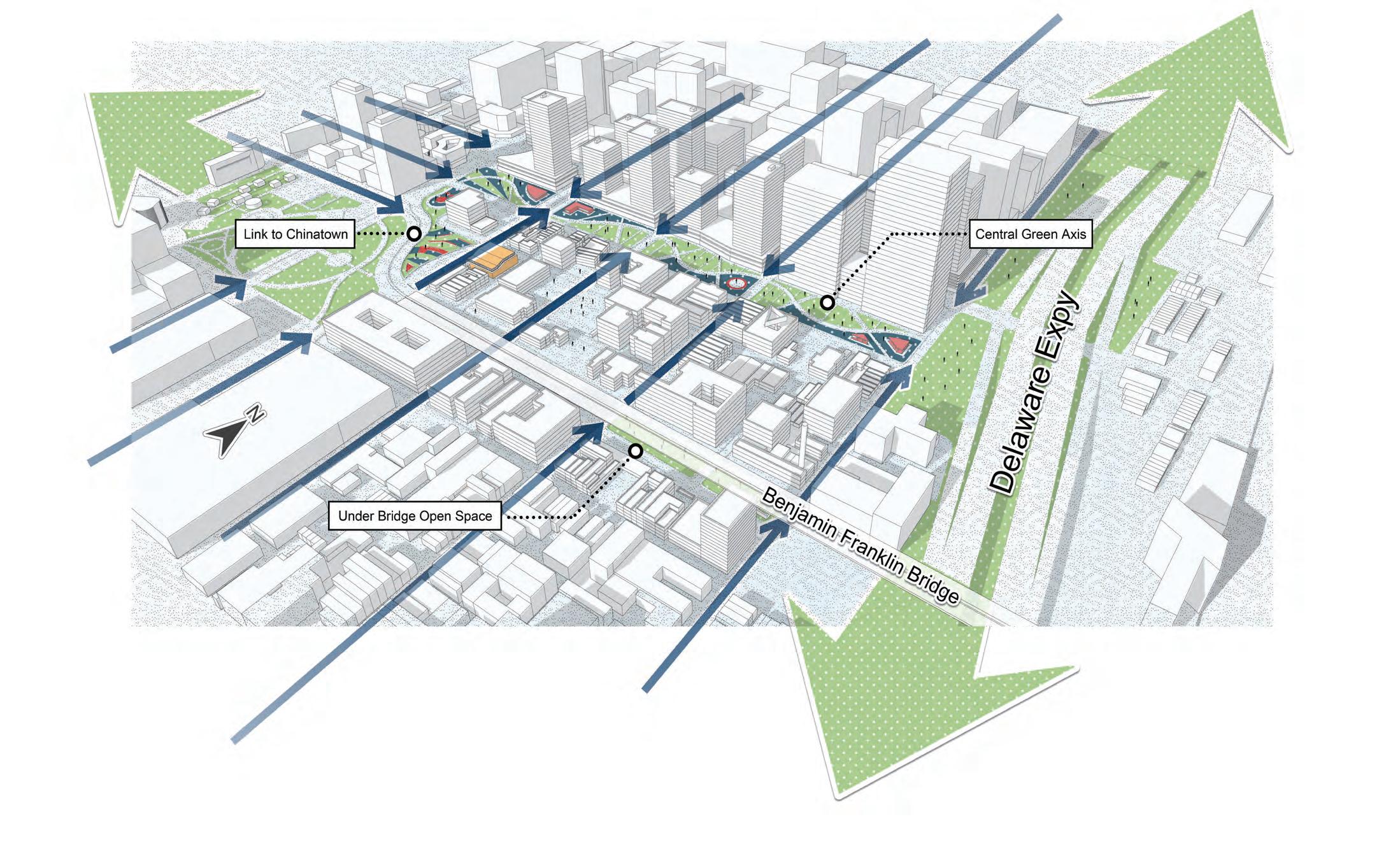
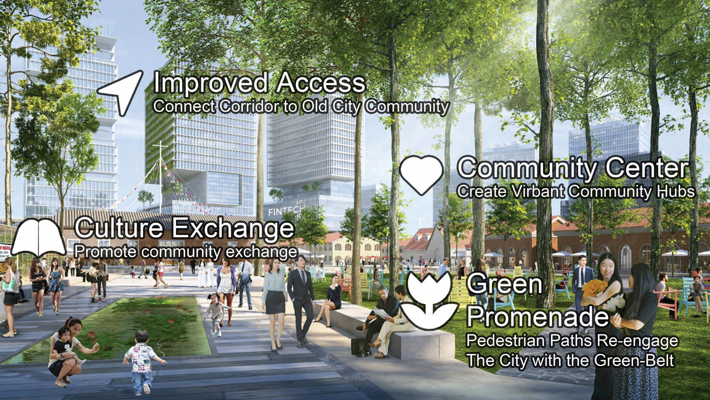
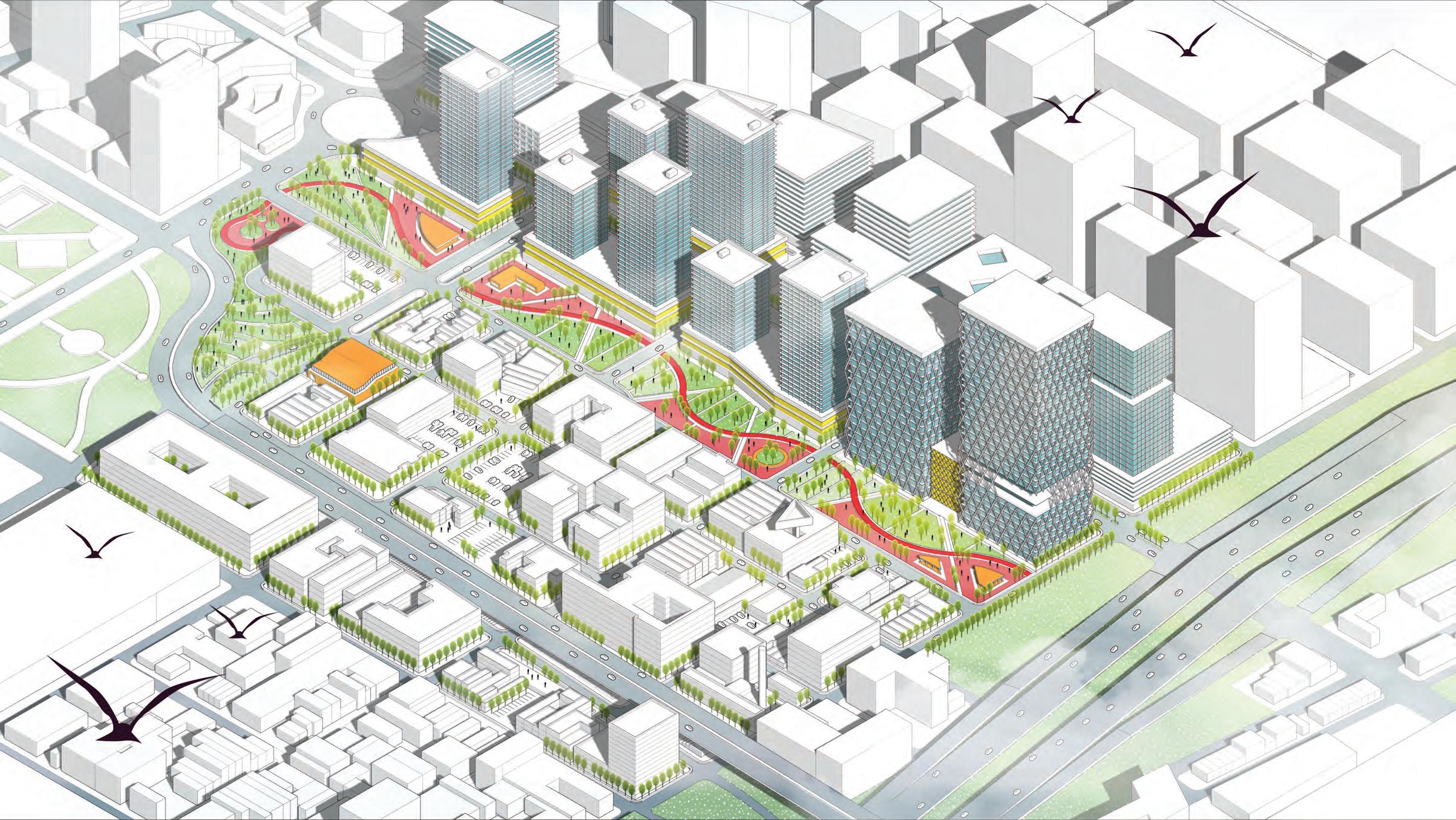
RECONNECT: CHINATOWN
IMAGINING A CONNECTED CHINATOWN
David Wangkyu Kim and Diyi Zhang
173
Source: Unsplash
Source: Unsplash
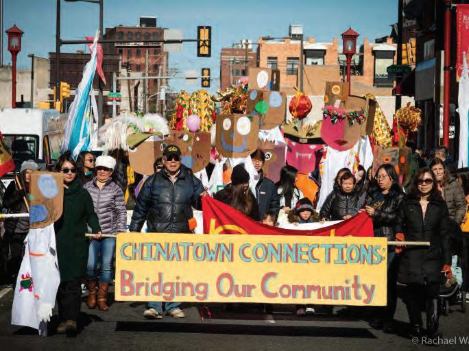
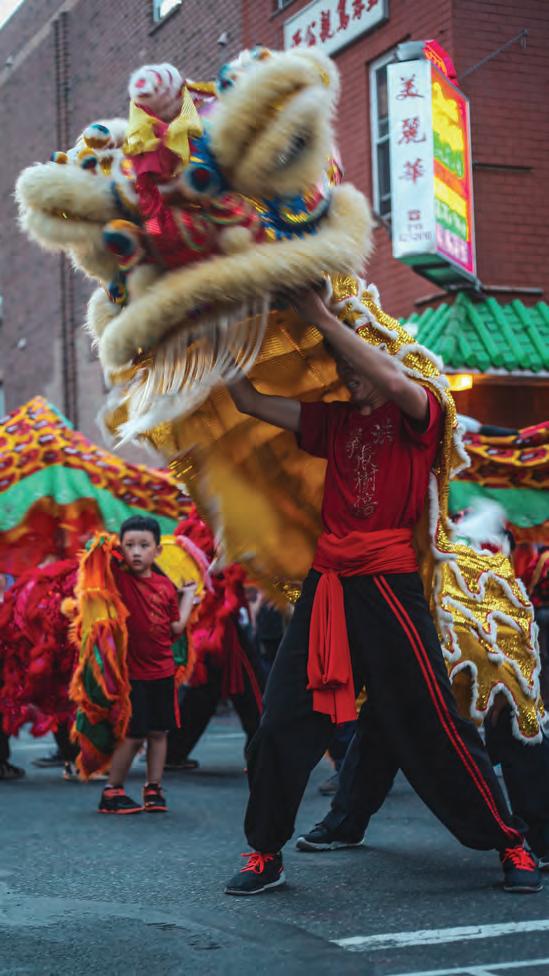
INTRODUCING CHINATOWN
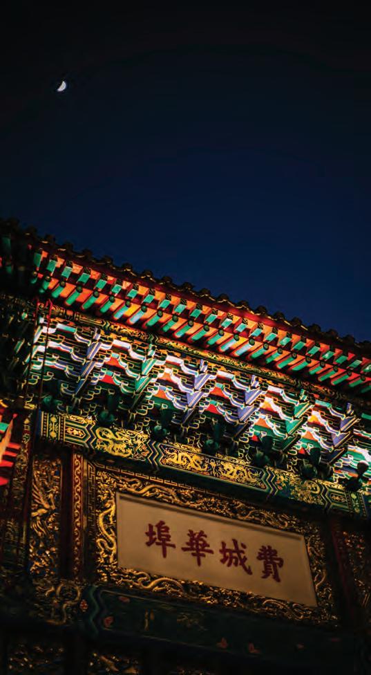
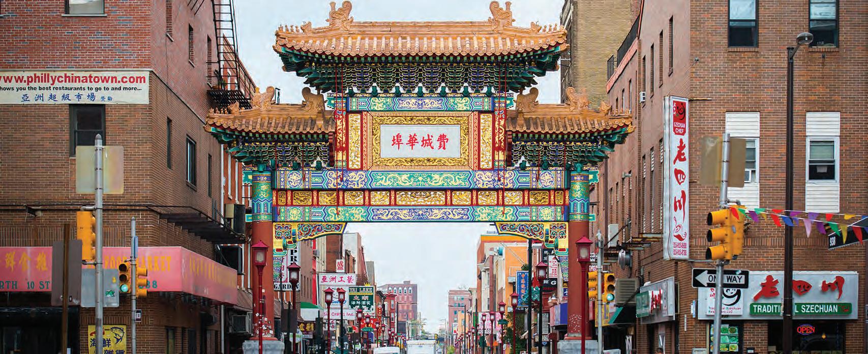
A vibrant neighborhood located within the extents of Center City. The neighborhood acts as cultural hub for many residents throughout Philadelphia.
Source: Rachel Warriner | WHYY.ORG
174
175
Source: OpenDataPhilly
LOCATION
Callowhill Chinatown Chinatown North Old City Northern Liberties Riverfront Center City Logan Square
Located north of Center City, adjacent to the neighborhoods of Callowhill and Old City.
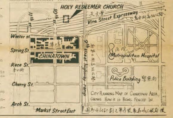
A HISTORY OF DISCONNECTION
Chinatown throughout the history of the city has faced many challenges as Philadelphia grew and densified; the community was often underrepresented in large scale city inter ventions.
176
CHINATOWN POPULATION
Population remains largely the same from 2010 to 2020, with the majority of residents being of Asian descent.
177
Image Source: S Spitzer | DiscoverPHL
Source: 2020: Decennial Census
THE VINE STREET DIVIDE
The current expressway acts as a dangerous crossing as well as a physical barrier that separates Chinatown into two.
City-wide demand for housing and aging population creates a unique environment due to lack of physical space to develop.
Chinatown remains as one of
areas along the corridor that has higher levels of poverty.
179
ECONOMIC DISPARITY Source: 2021 American Community Survey 597 - 972 0 - 150 2020 Households Under Poverty Line (~$26,000) 973 - 1967 151 - 349 350 - 596
the few
Source: 2021: American Community Survey
AGING IN PLACE RESIDENTS
The neighborhood is home to a large aging population, and its evidence can be seen through multiple senior-focused residential developments.
Source: Whyy.org | WRT | Pennrose
180
THE PLAN
PROPOSED INTERVENTIONS FOR CHINATOWN
181
OUR GOALS

182
Source: Unsplash
183
CHINATOWN GATEWAY
SITE PROGRAM CHINATOWN-NORTH SQUARE
PLAZA
SITE PROGRAM

CHINATOWN-NORTH SQUARE
HOLY REDEEMER + RIDGE AVE RE-DESIGN
CHINATOWN
GATEWAY PLAZA
CHINATOWN
ALLEY REDESIGN
184
SITE PROGRAM
CHINATOWN-NORTH SQUARE
AFFORDABLE HOUSING + MIXEDUSE RESIDENCES
CHINATOWN
GATEWAY PLAZA
CHINATOWN
ALLEY REDESIGN
185
SITE PLAN
Our series of interventions hopes to create new neighborhood and cultural nodes that take advantage of the new space left by the former expressway.
Spaces are designed with Chinatown residents in mind, providing programmed space for both Old and Young.
North Chinatown sees an influx of new residential and commercial mixed-use to address increased access along Callowhill Street.
186
SITE PLAN - CHINATOWN NORTH
With the removal of the expressway, Callowhill Street becomes an opportunity for improved, community focused developments.
Connections across Vine Boulevard are strengthened with sequences of public spaces and commercial mixed use.
187
0’ 250’ 100’
ARTS-CULTURAL CHARTER SCHOOL
Mixed block of school + residential Rail viaduct is removed
RESIDENTIAL TOWERS/ PLAZA
Mixed use space with internal community spaces
RIDGE AVE RE-DESIGN
Pedestrian only street; connects to New Holy Redeemer Plaza
SITE PROGRAM - CHINATOWN NORTH

Chinatown-North Square is designed as an anchor and gateway to Chinatown from the North.

188
PCDC Holy Redeemer Parking + Plaza Arts Cultural Charter School + Residential Tower Mixed Use + Residential Tower Residential Tower Mixed Use Mixed-Use + Parking Garage Mixed Use
Affordable Housing Re-Design Residential Apartments
THE NORTH VINE CROSSING
The blocks located directly North of Vine Street sees density in the form of commercial frontages, as well as mixed-use residential programs.
189
Use + Residences
Mixed
0’ 100’ 50’
Holy
Redeemer Plaza
CHINATOWN NORTH SQUARE
Chinatown-North Square is designed as an anchor and gateway to Chinatown when approaching from the North seeing higher density mixed use towers with community-based ground level programming.
190
Mixed-Use/Residential Towers Mixed-Use Residential Tower Parking Garage School + Residential Towers 0’ 100’ 50’
SITE SECTION - CHINATOWN NORTH
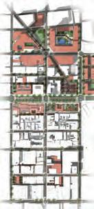
Most high rise interventions are matched to the scale of the existing Crane building, with ample space for flexible programs within the block.
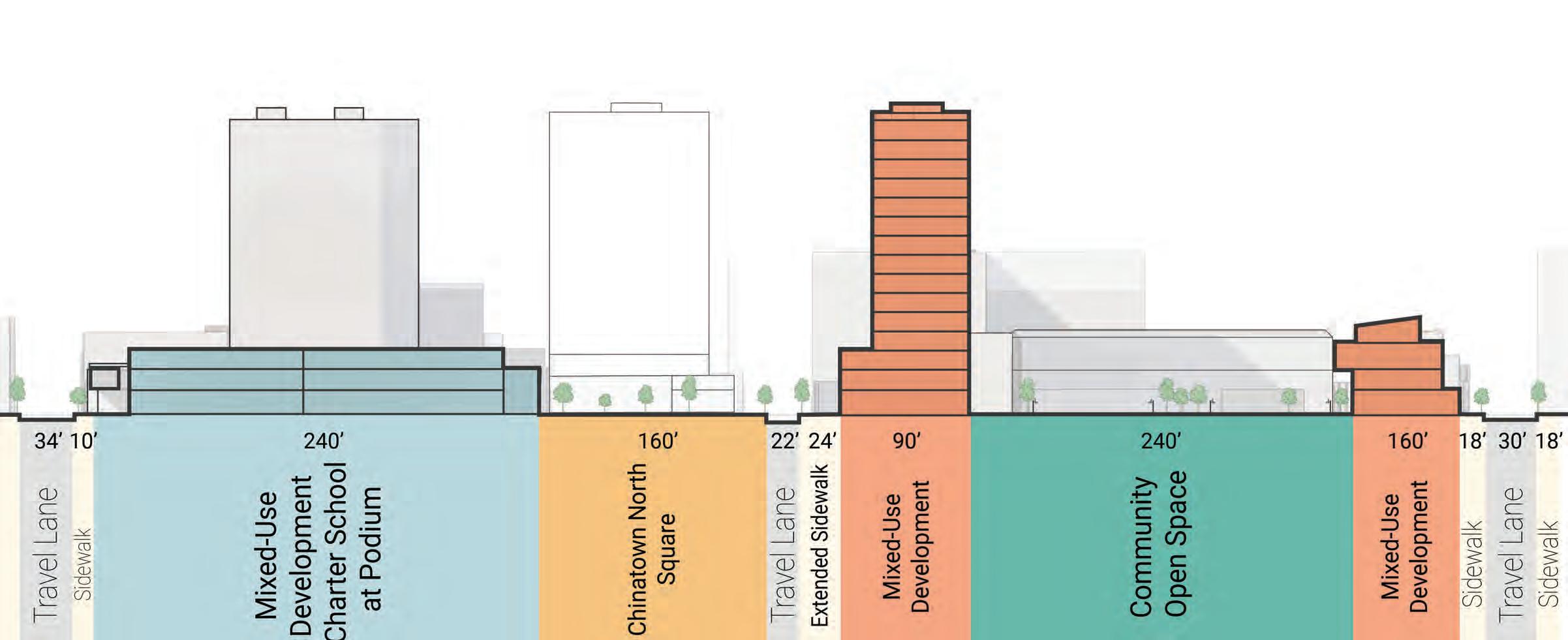
191
CHINATOWN NORTH - REDEEMER PLAZA & AFFORDABLE HOUSING
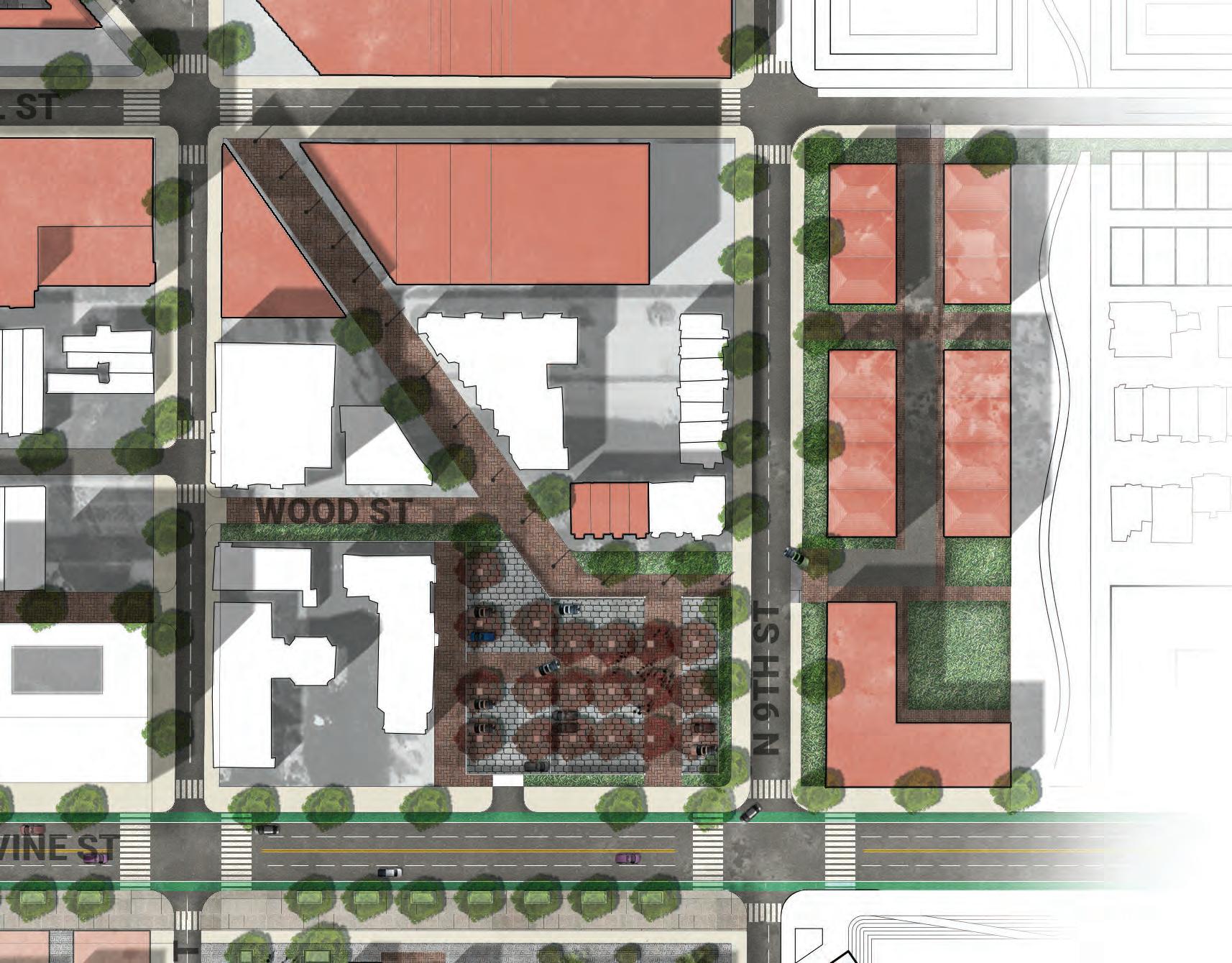
Addressing the chronic need for housing in the city, the new interventions seek to densify existing affordable housing on site and introduce public spaces for residents.
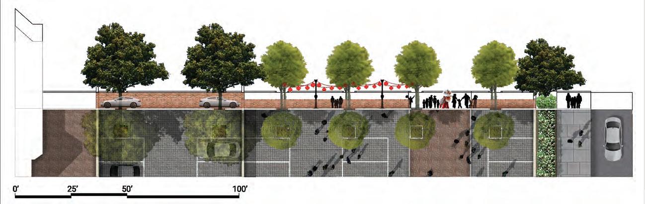
192
0’ 100’ 50’
SITE 3D AXON - CHINATOWN NORTH
N10thSt N11thSt CallowhillSt N9thSt
193
VineStreet
SITE PLAN - CHINATOWN SOUTH
With an already established vibrant mix of restaurants and markets, the focus was to find locations that could amplify Chinatowns history and culture.
Winter Street is removed to extend the existing parcels to make room to develop Chinatown-focused programs along Vine Street.
194
0’ 250’ 100’
ARTS-CULTURAL CHARTER SCHOOL
Mixed block of school + residential Rail viaduct is removed
ALLEY DEVELOPMENTS/ MIXED USE
Mixed use space with internal community spaces
COMMUNITY/ CULTURE SPACE
Pedestrian only-connects to proposed Holy Redeemer Plaza
SITE PROGRAM - CHINATOWN SOUTH
Chinatown South sees interventions to strengthen way-finding and public space access.
195
Use
Streetscape Improvement Streetscape Improvement Future Senior Housing Site
Peace Garden AlleyMixed Use Mixed Use Mixed
Gateway Plaza Gateway Complex
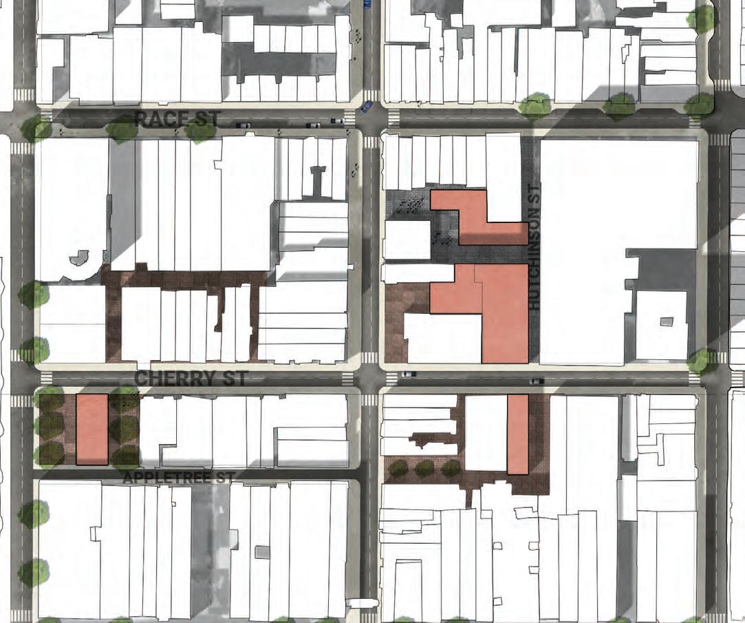
SITE 3D AXON - CHINATOWN SOUTH

VineStreet
N10thSt NHutchinsonSt N11thSt N9thSt
SpringSt RaceSt CherrySt
196
CHINATOWN SOUTH - GATEWAY BLOCKS
The blocks directly south of Vine Boulevard are re-imagined into culturally dense public spaces and community facilities.
197
0’ 250’ 100’
Gateway Plaza Gateway Complex
CULTURAL CONNECTIONS ALONG THE CORRIDOR
The blocks directly south of Vine Boulevard are re-imagined into culturally dense public spaces and community facilities.
198
0’ 100’ 50’
The new Peace Plaza serves as the main gateway from the new Vine Boulevard, preserving important murals and providing public spaces.
CHINATOWN SOUTH - RE-THINKING ALLEY SPACE
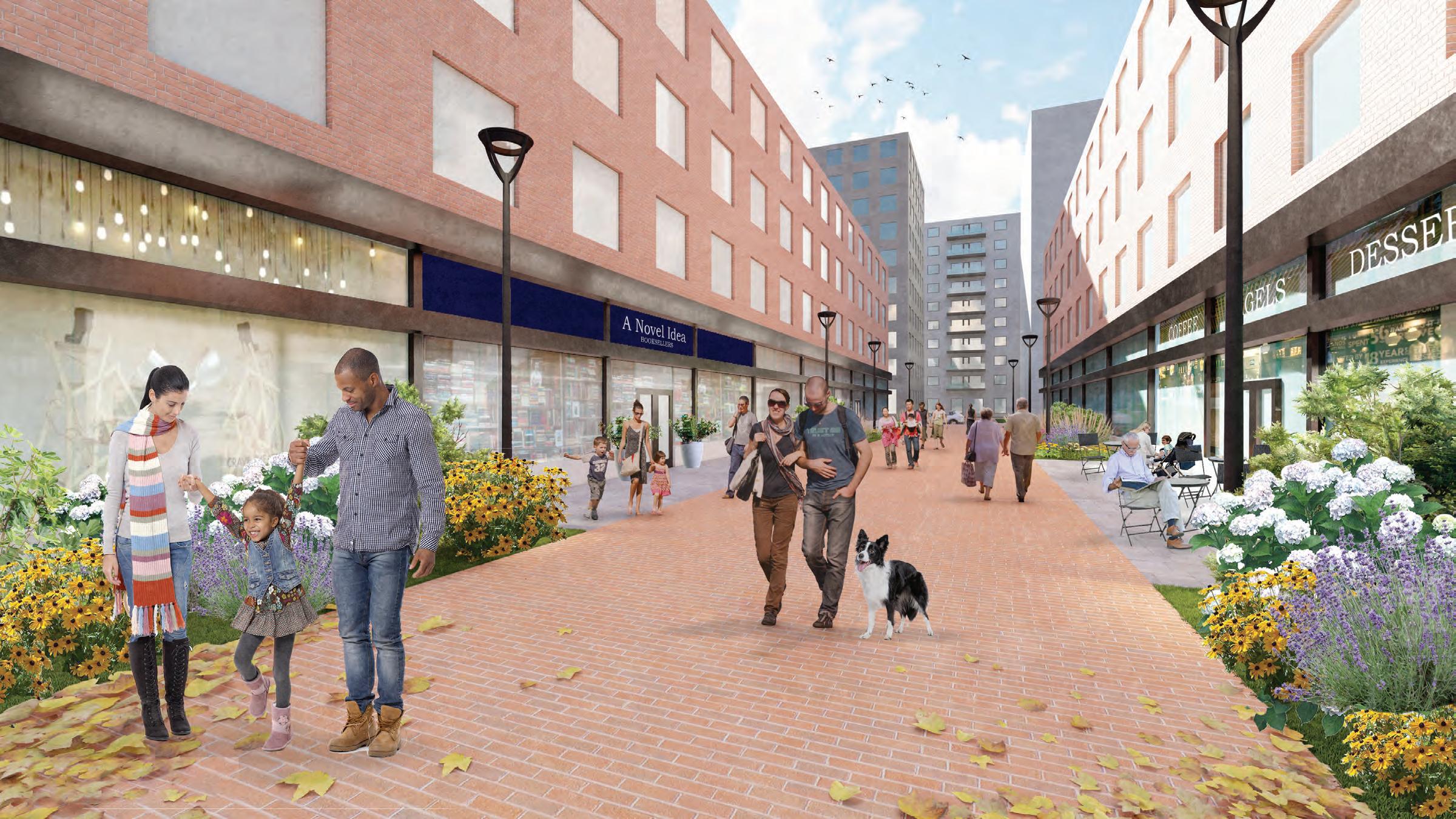
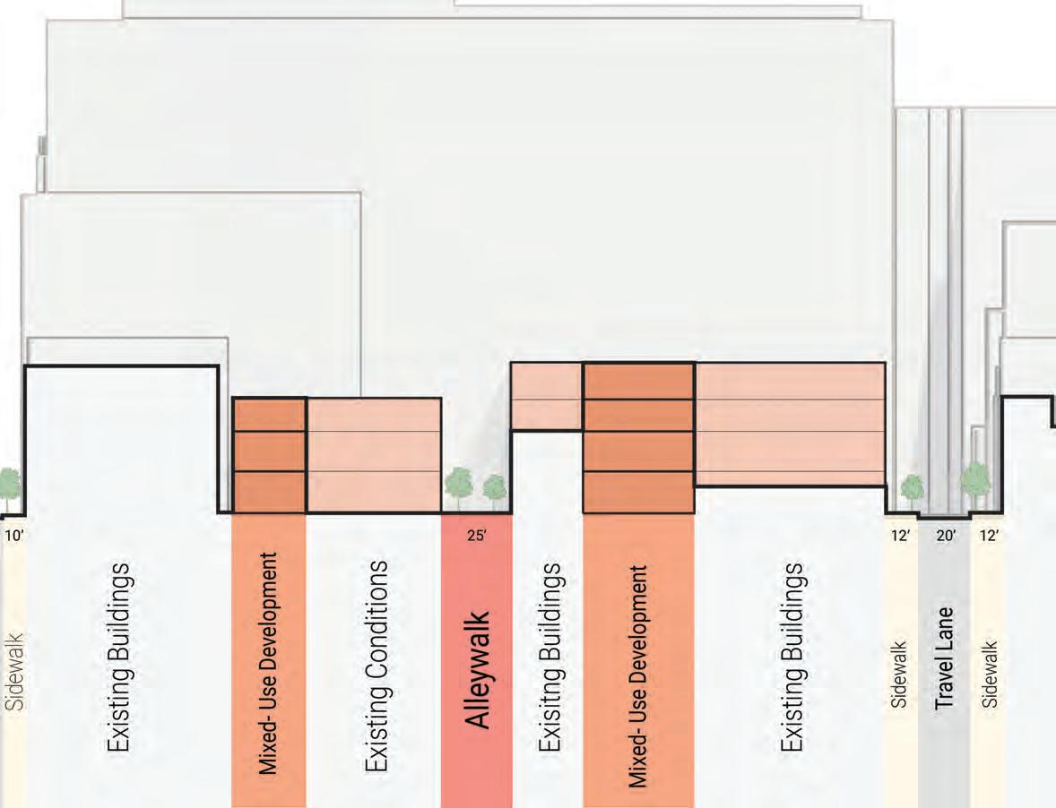
Underutilized alley spaces throughout Chinatown South serve as opportunities for intimate scale interventions to improve the public realm of Chinatown.
199
0’ 100’ 50’
CHINATOWN SOUTH - RE-THINKING ALLEY SPACE
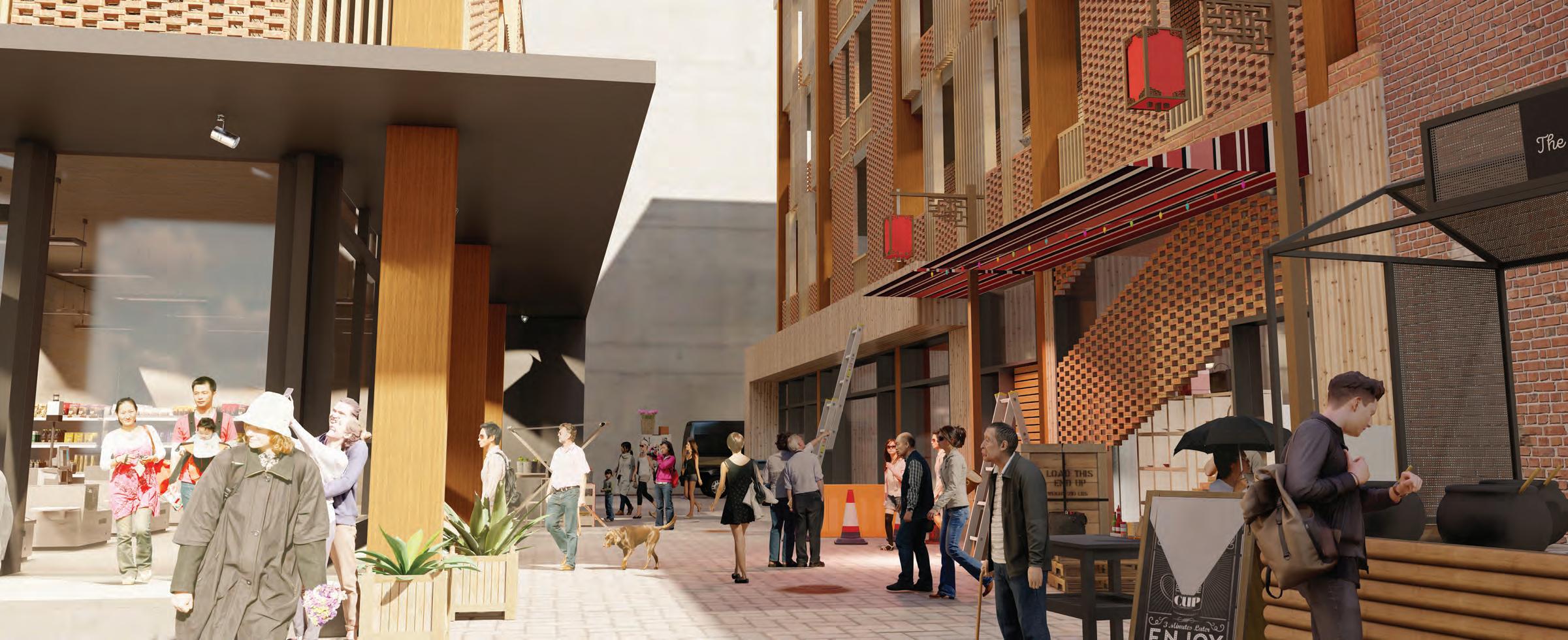
The new Chinatown Alleyways offer more opportunities for businesses and housing alike, creating comfortable human scale streetscapes for visitors and residents alike.
200
CHINATOWN SOUTH - A PLACE FOR THE COMMUNITY
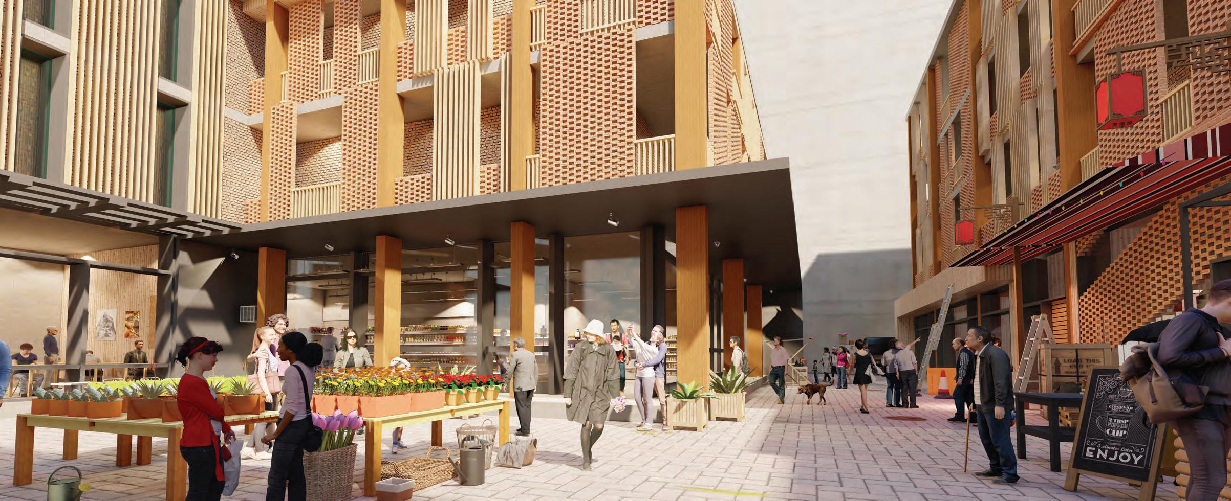
Plaza spaces within provide access for load and unloading, but are flexible for community-based programming.
201
CHINATOWN SOUTH - A PLACE FOR THE COMMUNITY
Materiality and design are matched with the fabric and scale of Philadelphia and existing Chinatown to make for a vibrant, cultural aesthetic.
202
SITE SECTION - CHINATOWN SOUTH
Chinatown South sees the interventions match the existing height and scale of buildings within the neighborhood. Spaces are opened up as alleys are re-imagined into pedestrian spaces.
203
SITE SECTION - CHINATOWN NORTH, VINE ST, AND SOUTH
The overall scale of interventions can be seen here increasing from south to north to gradually match the scale of North Square.
204
SITE SECTION - CHINATOWN NORTH, VINE ST, AND SOUTH
Cutting through the center of Chinatown North, along N. 10th Street, the Ridge Avenue walk can be seen opening up the blocks for pedestrian circulation.
205
The approach to design and materiality is informed by a deep appreciation for the existing fabric and scale of Philadelphia and Chinatown.
SITE 3D AXON
We recognize the importance of preserving the historic character of the area while also providing a fresh and contemporary aesthetic that reflects the vibrant cultural identity of the community.
206
CHINATOWN EASTWARD HAVEN TO RECONNECT, RETHINK, AND REDEFINE
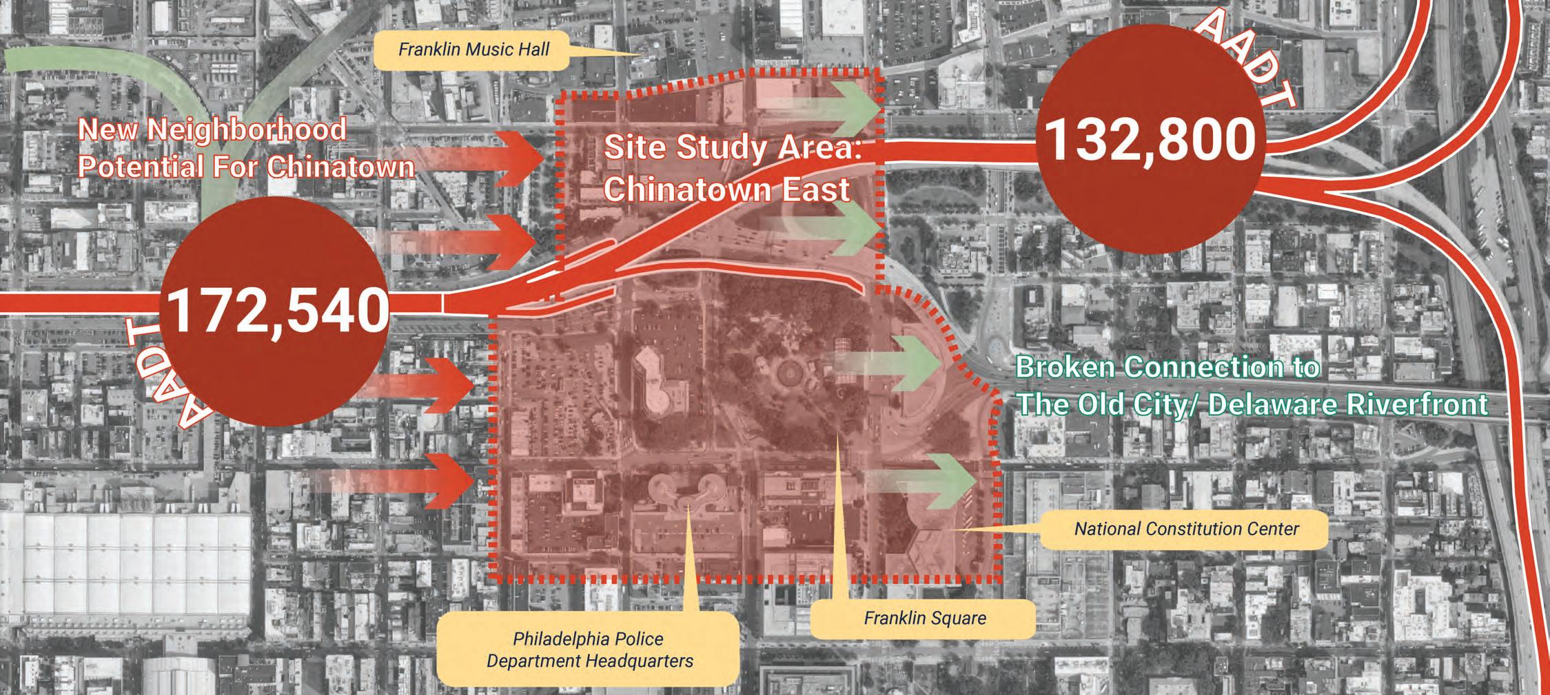
207
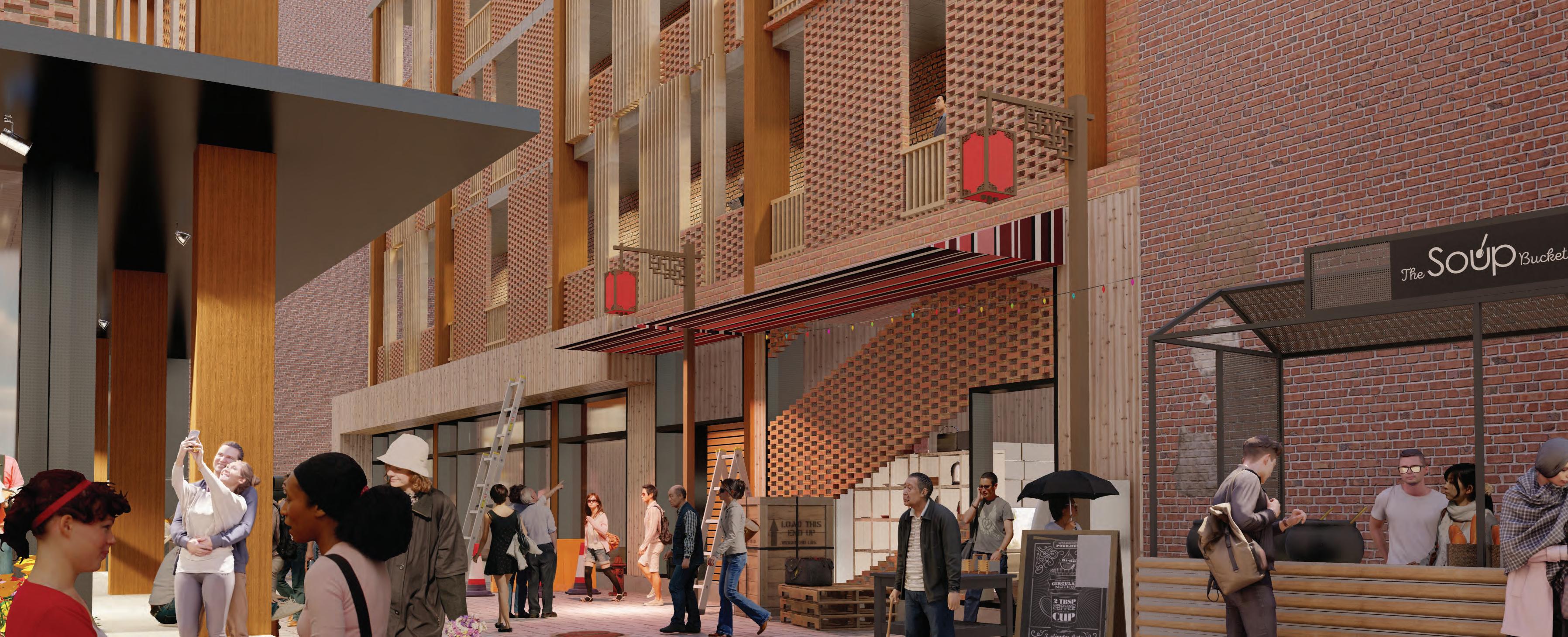
Zihan (Joann) Zhao
EXISTING CONDITION
This site locates between 9th Street and 6th Street, bordering Philadelphia’s Chinatown on the west and Philadelphia’s eastern gateway - Benjamin Franklin Bridge. With so many resources surrounding it, This site should be a transition that connects Chinatown to the Old City and Delaware Riverfront. However, the connection is now broken because this area is where the highway lifted to connect to I95 and Benjamin Franklin Bridge. In other words, this neighborhood should be the busiest section of the entire Vine Street Expressway. After we remove the expressway, what does a new Chinatown eastern haven need if there’s no expressway?
208

209 TRANSPORTATION ORIENTED DEVELOPMENT COMMUNITY SCALE WALK BIKE PRIVATE VEHICLE PUBLIC TRANSIT PARK & RIDE REGIONAL TRANSIT REGIONAL SCALE CITY SCALE P LIFESTYLE LOGISTIC COMMUTE RESIDENTIAL TRAVELING TRANSIT HUB AFFORDABLE HOUSING GREEN CORRIDOR COMMERCIAL GATEWAY DEVELOPMENT
RANSIT ORIENTED
T
EFFICIENT FUNCTIONAL VALUABLE
Vine St. Expy
After we remove the expressway...
Over 45% of the lands within the study area have the potential to rebuild a new Chinatown TOD community.
210
Parcel Activated Buildings to Be Rethought
Original Green Space
After integrating the three public transit lines, there will be five stations in total, and 4 of them will have the potential to build new transit hubs.
The new pedestrian trails will connect all the public transit hubs and be covered by their service area.
211
Parcel Activated
BSL PATCO Trolley Transit Hubs Reconnected Pedestrian Trails
Scheme generation


A. Integrate Public Transportation
Trolley’s impact on the Streetscape
Transit Hubs
Preserved Buildings
New Buildings
NEW URBAN CONTEXT CREATED BY THE NEW TRANSIT SYSTEM
The new trolley rails above ground can also create a new streetscape.
212
PUBLIC TRANSIT REGIONAL TRANSIT
The “Stitch”
New Vehicular Lanes

Transit Hubs
Traffic Calming Design
THE “STITCH”
By re-planning the traffic system and appropriately increasing the traffic calming design, “sew up” the previously broken community connections.

213
PRIVATE VEHICLE PARK & RIDE P
B. Integrate Motor Transportation Scheme generation
Scheme generation
C. Biking and Walking Experience
Service Area for surrounding community
Transit Hubs
Continuous Pedestrian Corridor
CONNECT BLOCKS AND EXTEND
TO
SURROUNDING COMMUNITIES
Creating a continuous walking experience can greatly enhance the development value of the surrounding parcels.
214
WALK
BIKE
Office Retail Transportation Residence Cultural
COMMERCIAL CORRIDORS -
CORE RESIDENTIAL AREAS - OTHER
FACILITIES
Continuous trails bring continuous commercial potential and attract more people to live nearby. Besides, the trail can also extend to the Chinatown north plaza on the west and the independence National Historical Park.
215
D. Dense up the area! Scheme generation
216 AXONOMETRIC Office Retail Transportation Residence Cultural 778 New Units/ 371 Affordable units 444, 200 sqft. New Retail 542,420 sqft. New Office 3 New Transit Hubs New Development CallowhillSt. VineSt. 5thSt. 6thSt. 7thSt. 8thSt. 9thSt. RaceSt.
The new developments will bring about 6 acres of continuous new open green space to the community, which is equivalent to a new Franklin Square.
217
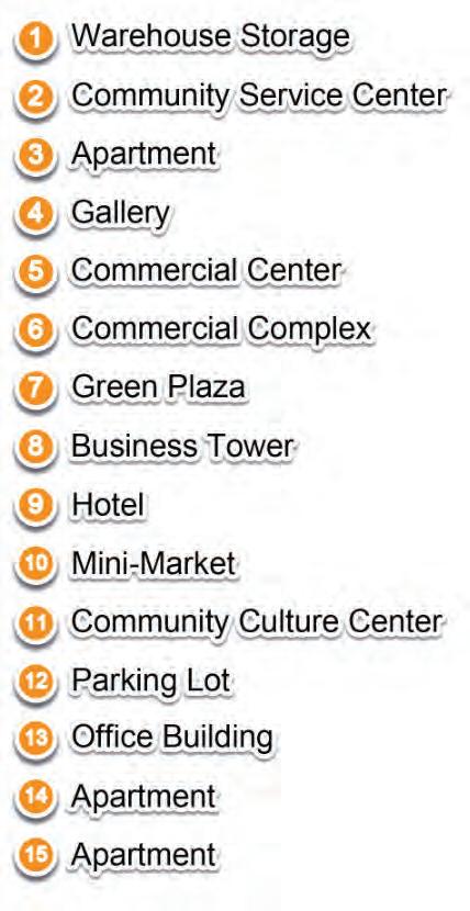
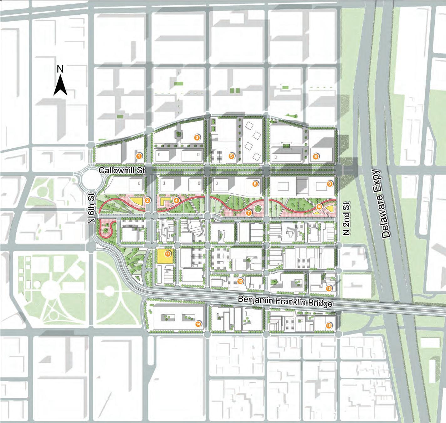
1 2 7 8 9 10 14 26 24 25 27 30 29 31 28 32 33 34 13 12 11 15 16 17 18 19 20 21 22 23 3 4 5 6 1 Apartment 2 Apartment 3 Apartment 4 Apartment 5 Office Building 6 Office Building 7 Row Houses 8 Condominium Complex 9 Mixed-use Building 10 Mixed-use Parking Building 11 Community Park 12 Retail Street 13 Hotel/ Residence Tower 14 Shopping Center 15 Office Tower 16 Trolley Station: Chinatown 17 BSL Subway Station 18 Transit Hub Sunken Plaza 19 Apartment 20 Trolley Rail Park Retail Street 21 Condominium Complex 22 Condominium Complex 23 Trolley Rail Park Retail 24 Trolley Station: Franklin Square 25 PATCO Station: Franklin Square 26 FS Farmer’s Market 27 FS Basketball Courts 28 FS Flower Fields 29 FS Badminton Courts 30 FS Volleyball Courts 31 Memorial Sculpture Park 32 Roundhouse: Cultural Center 33 Twin Office Buildings 34 Trolley Station: Callowhill & 7th St. Callowhill St. Vine St. 5th St. 6th St. 7th St. 8th St. 9th St. Benjamin Franklin Bridge Wood St. Spring St. Race St. Cherry St.
Buildings
SITE PLAN
New
Bikers in Chinatown: Food Delivery!
Festival Event Space
Community Scale: Bike & Walk
Bike Lane
Pedestrian-friendly Street
Open Spaces/ Green Walks
On a community scale, the new bike and walk system will give Chinatown people more access to the central open space - the new Franklin Square.
218
Vine St.
Callowhill St.
Race St.
N
Benjamin Franklin Bridge
980
New Public Parking Spaces
Street Parking + Parking Building
City & Regional Scale:
Private Vehicle/ Park & Ride
Vehicular Lane
Traffic Calming Design
Parking Building
Street Parking
To Center City
After re-planning, we integrated many original undeveloped parking spaces into the centralized parking building of the commercial complex on the first floor.
To The Riverside and I95
219
P P
N
Railway Track + Landscape Design
Trolley: Tourism Potential
City & Regional Scale:
Public Transit
Trolley/Subway/PATCO Station
Transit Hub
2 Minute Walking Range
The service area of the 3 new transit hubs can almost cover the site.
220
N
VineSt.
Community Linear Park
9thSt.
Housing Typology in Core Residential Area
8thSt.
PART 1: Core residential area
Affordable Housing
Row Houses
Youth Apartments
Core Residential Area: A Convivial New Chinatown
Surrounding the existing residential fabric of the area and the new transit hubs, we hope to create a culturally rich and diverse community. It will attract more young people to Chinatown in the future.
221
Trolley Rail Park Retail Street
Transit Hub
Sunken Plaza
NEWTROLLEY
222
Section A-A: Transit Hubs PATCO
A A
FRANKLIN SQUARE BSLSUBWAY
The trolley trails can form an interesting community landscape as well as bring vitality to business and tourism.
223
Activated residential auxiliary space
PedestrianizedWillowSt.
8thSt.
Parking + Public Transit New Twin Office Buildings
VineSt.
7thSt.
New Round House: African American Arts Gallery
New Proposal: Pedestrianize Willow Street
PART 2: Transition Area
Willow street is a narrow street on the north of this site. Most of the space on either side of Willow Street now consists of vacant or parking lots. As a motor vehicle street, Willow Street does not bear the traffic it should have. Therefore, we transformed Willow Street into a continuous walking trail connecting Chinatown’s north plaza and Delaware Riverside.
224
Willow St.
225
Sunken Plaza 8th Street 7th Street B B
Section B-B: New Green Open Spaces Interacting with The New Transit System
The new developments make Franklin Square accessible in all directions. It will not be surrounded by the highway walls, but will expand to the surrounding communities.
226
PART 3: New Square, New Gateway
New Programming for a new Franklin Square
227
New Shopping Center/ Urban Complex
New Community Fields/ Courts
Rental Studios
New Statue Plaza
Farmers’ Market
New Chinese Lantern Festival Event Space
Extra Sports Courts & Fields
228
Callowhill St. Willow Walk C C
Vine St. Wood St.
Section C-C: Pedestrianized Willow St. & New Trolley Lane on The Callowhill St.
The monumental landscape design reshaped the original Bolt of Lightning sculpture, making this sculpture and the entire Chinatown TOD design a future landmark for Philadelphia.
229
This TOD design not only considers how to increase the value, increase the density, of the land, but also emphasizes how to create a warm, active, and sustainable community of residential, office, and commercial throughout the transportation system of various scales.
OLD CITY BUSINESS CORRIDOR
MIXED-USE COMMUNITY
Yuchen Wang
231
SITE ANALYSIS
LOCATION, HISTORY, ZONING, TRAFFIC
232
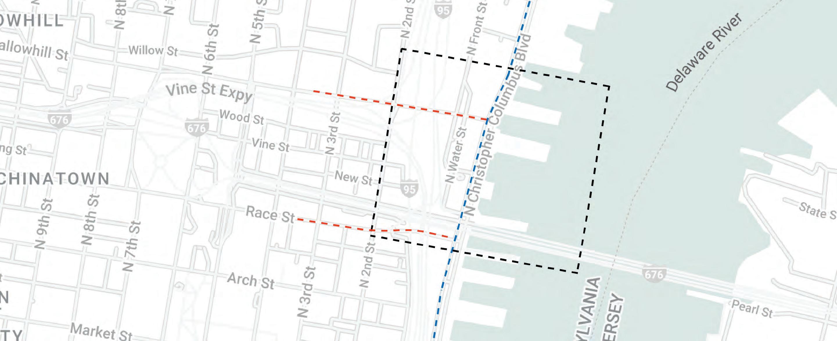
LOCATION
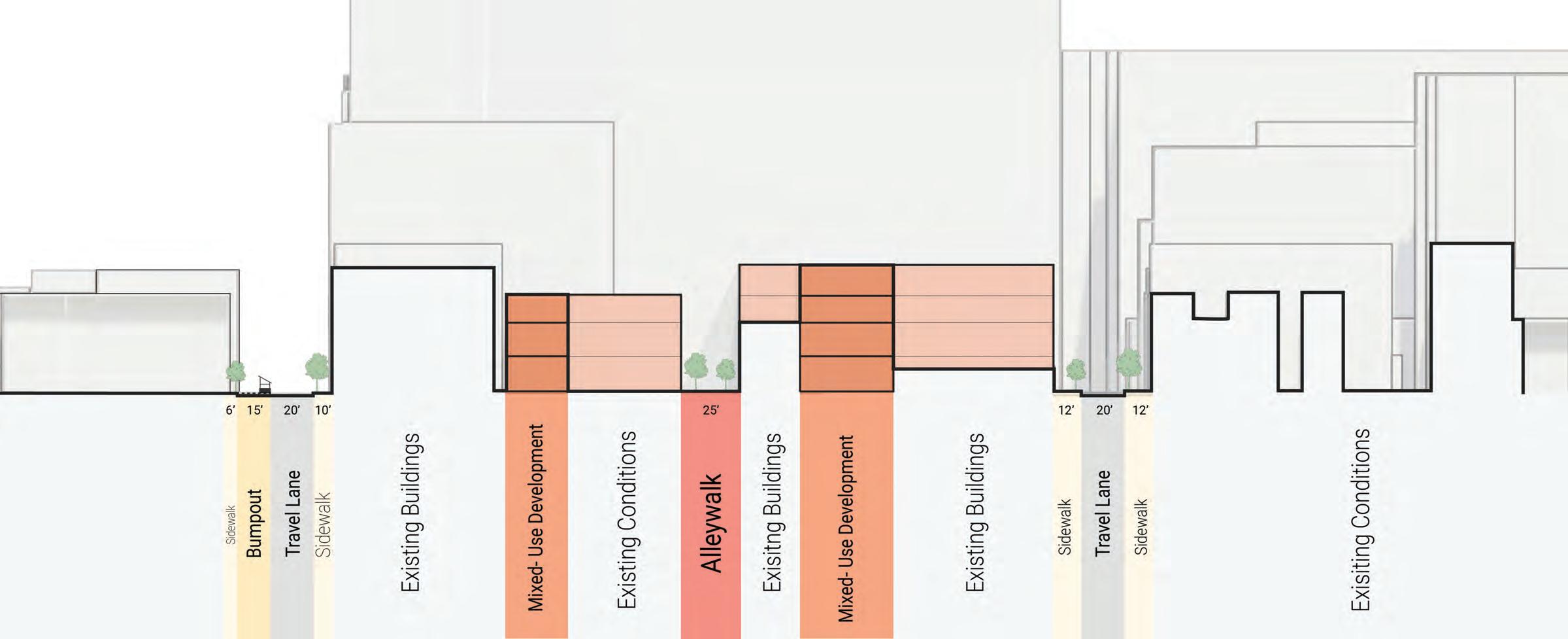
• The site is located on the east side of our corridor, surrounded by Willow St on the north, Race St on the South, N 6th St on the west, and N 2nd St to the east.
• The area includes the old city, which is crossed by the Delaware Expressway and the Benjamin Franklin Bridge.
0 200 400 800Ft
HISTORY
• From the Delaware River up toward Walnut and 3rd Streets, the city’s wholesale food hub was well into the mid-20th century when the food distribution center was built in South Philadelphia.
• As a neighborhood close to the bridge, it was once an important commercial district.
• The figure shows a clear grid layout for the neighborhoods near the docks, which consist of large warehouses.
234 234
The Central Delaware Waterfront in the 1920s
ZONING
• The expressway cut the site, and there have some low-quality commercials with a large area of vacant space and parking lots on the north side of the Expy Besides, there are also two warehouses and the building density is very low. About the south side of the Expy, where is the old city community, almost all of the buildings here is for residential and the construction density is higher than the north side of the Expy.
0 200 400 800Ft
TRAFFIC
• The huge traffic flow provides a great potential for the development.
0 200 400 800Ft
STRATEGIES AND DESIGN
DEVELOPMENT POTENTIAL, TRANSPORTATION, BUILDING LAYOUT, OPEN SPACE
237
REMOVAL OF EXPRESSWAY
DEVELOPMENT POTENTIAL
• With the Expy’s removal, a large amount of vacant space is available for development. The building density along both sides of the highway is low and the development potential is high. About the Old City, with its good quality and high density of buildings, is mainly used as a preservation area.
Development Area Area Reserved Area 0 200 400 800Ft
STRATEGIES
0 200 400 800Ft
PLAN
CREATE EFFICIENT PUBLIC TRANSPORTATION
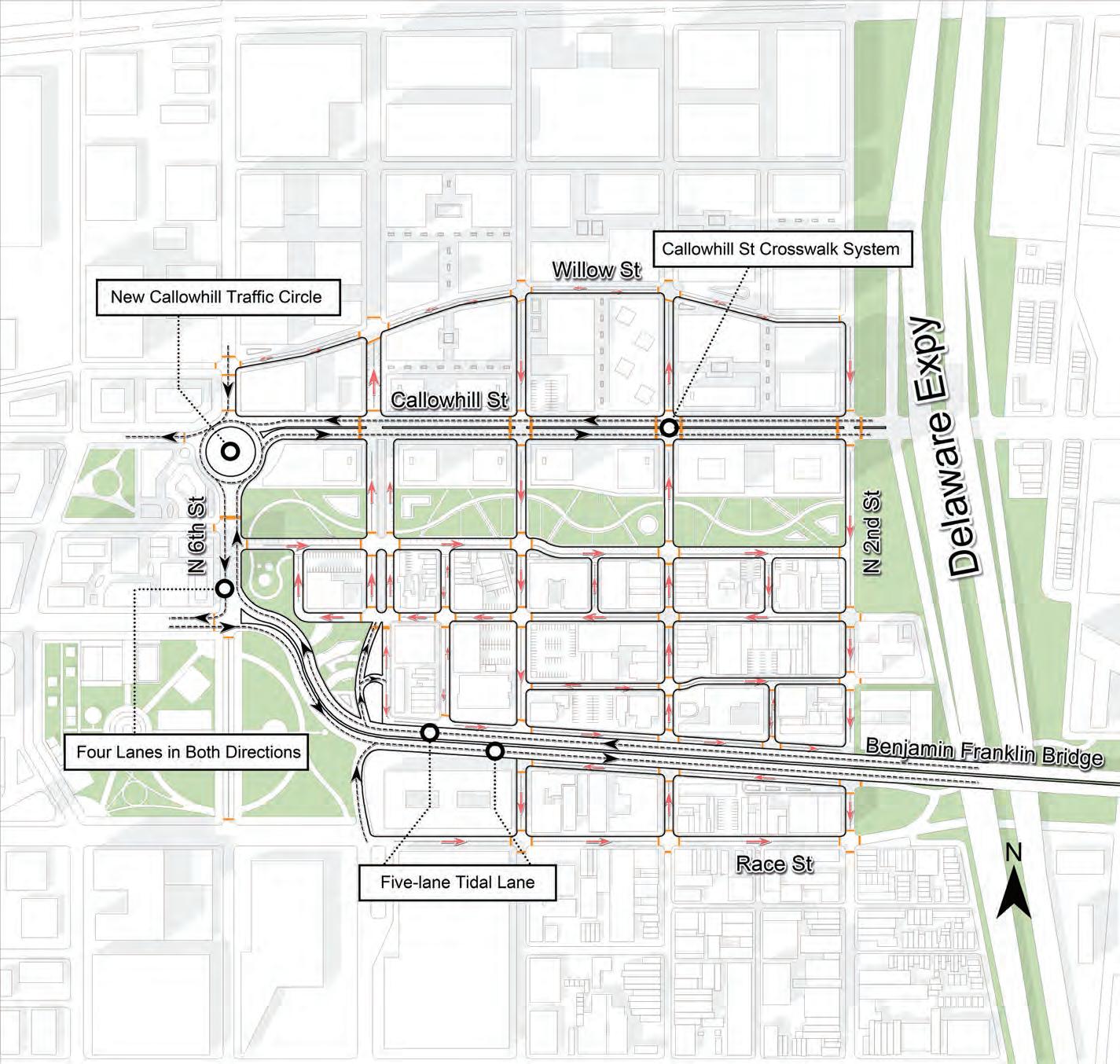
ROAD PLAN
• The Callowhill St from a one-way street to a two-way street, and add a traffic circle on the south side to help organize traffic better.
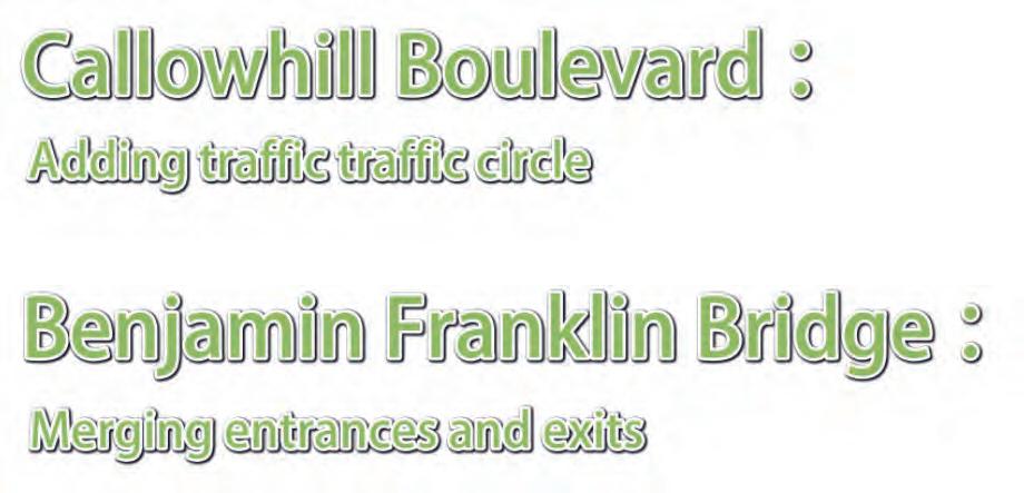
• The main exit and entrance of the Benjamin Franklin Bridge at 6 St were combined. The combined entrance and exit direct traffic coming off the bridge to the traffic circle on the north side, which slows down traffic to the grid.
0 200 400 800Ft
CREATE EFFICIENT PUBLIC TRANSPORTATION
• Infill a large number of underground garages.
• Add on-street parking between Old Town and the boulevard.
PARKING 0 200 400 800Ft
CREATE EFFICIENT PUBLIC TRANSPORTATION
PUBLIC TRANSPORTATION
The trolley line runs from east to west along the river and crosses the site along Callowhill St, then connects south to Race St, and crosses the site from west to east along Race St.
CREATE EFFICIENT PUBLIC TRANSPORTATION
STREET LAYOUT
246 Increase density on both sides of Vine St Boulevard by inserting buildings in the vacant space.
CREATE A MIXED-USE COMMUNITY CREATE HIGH-DENSITY CORRIDOR
CREATE A MIXED-USE COMMUNITY CORRIDOR LAYOUT
Raising the building height to increase the floor area ratio and adding multi-purpose buildings to make the site more functional.
247
CREATE A MIXED-USE COMMUNITY INFILL STRATEGIES
 Commercial development along the street, with office towers placed above the podium. Add apartments behind the complex.
CREATE A MIXED-USE COMMUNITY SECTION
The community will be a dynamic center of activity, providing modern workspaces that cater to diverse businesses. The integration of apartment buildings within the office block will offer convenient housing options for the workforce, creating a live-workplay environment that promotes community interaction and inclusivity.
CREATE A MIXED-USE COMMUNIT Y CONNECTIVITY OF GREEN SPACES
The park within the redevelopment plan will be a green loop, offering a much-needed respite from the urban environment.
250
CREATE A MIXED-USE COMMUNITY GREEN BELT
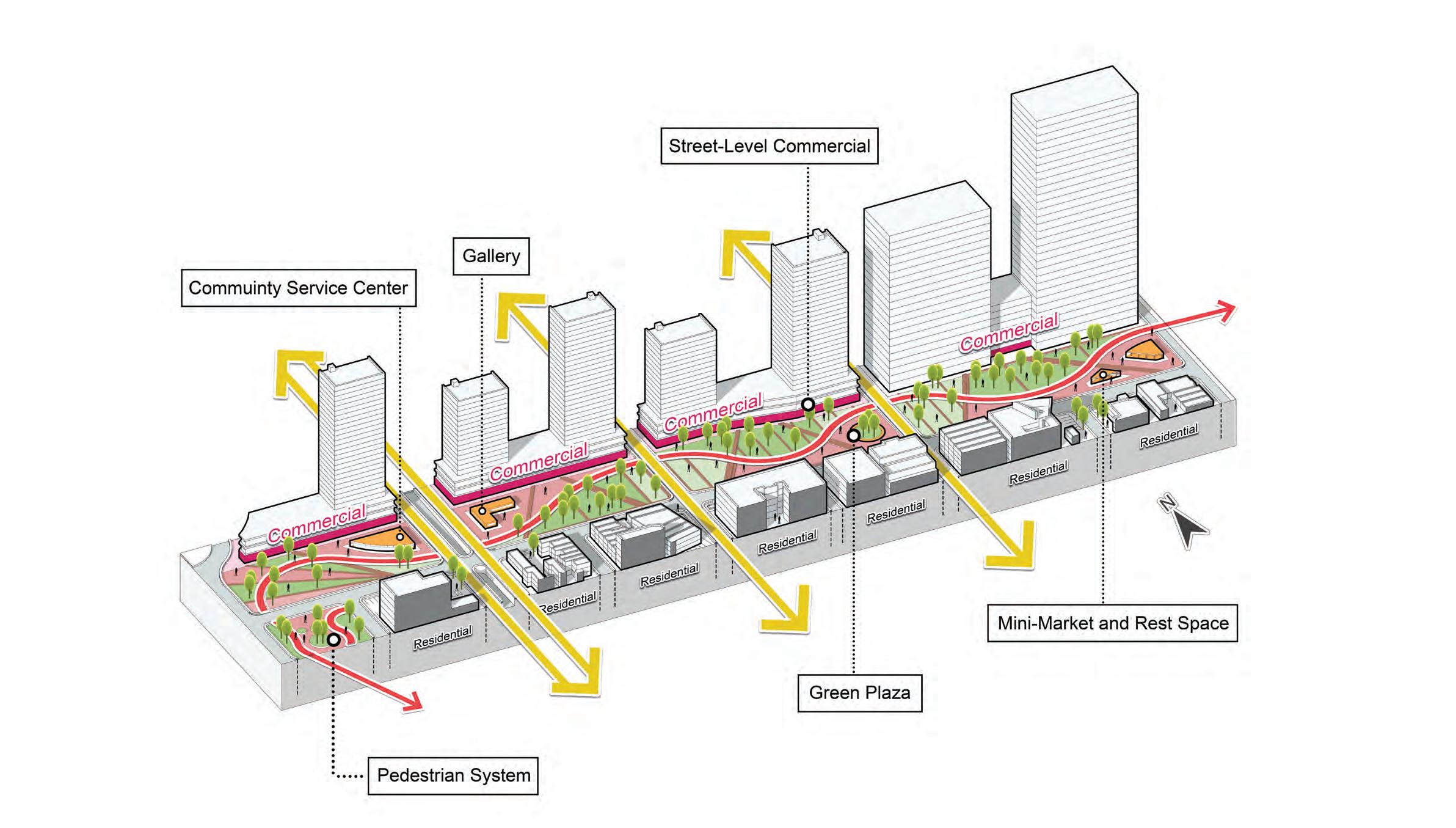
The pedestrian system in the green loop connects the old city to the corridor and links the whole district to the Delaware Riverfront.
The facilities here include the community service center, small gallery, mini-market, and small construction providing rest space.
ENGAGING COMMUNITIES
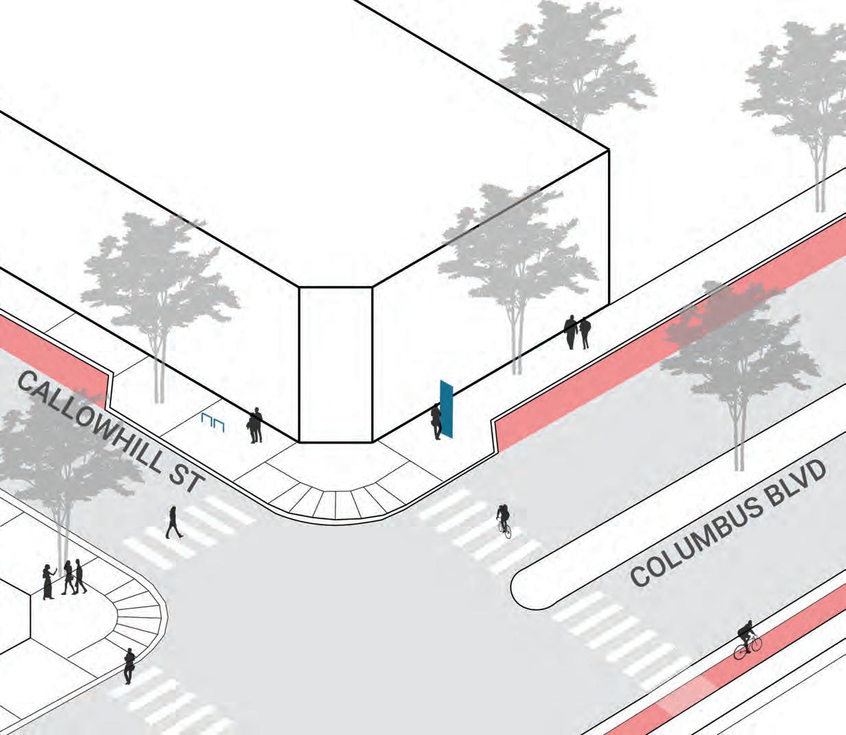
CALLOWHILL BOULEVARD
 Source: Ho Chi Minh City Innovation District , Sasaki
ENGAGING COMMUNITIES
GREEN BELT
 Source: Ho Chi Minh City Innovation District, Sasaki
AERIAL VIEW
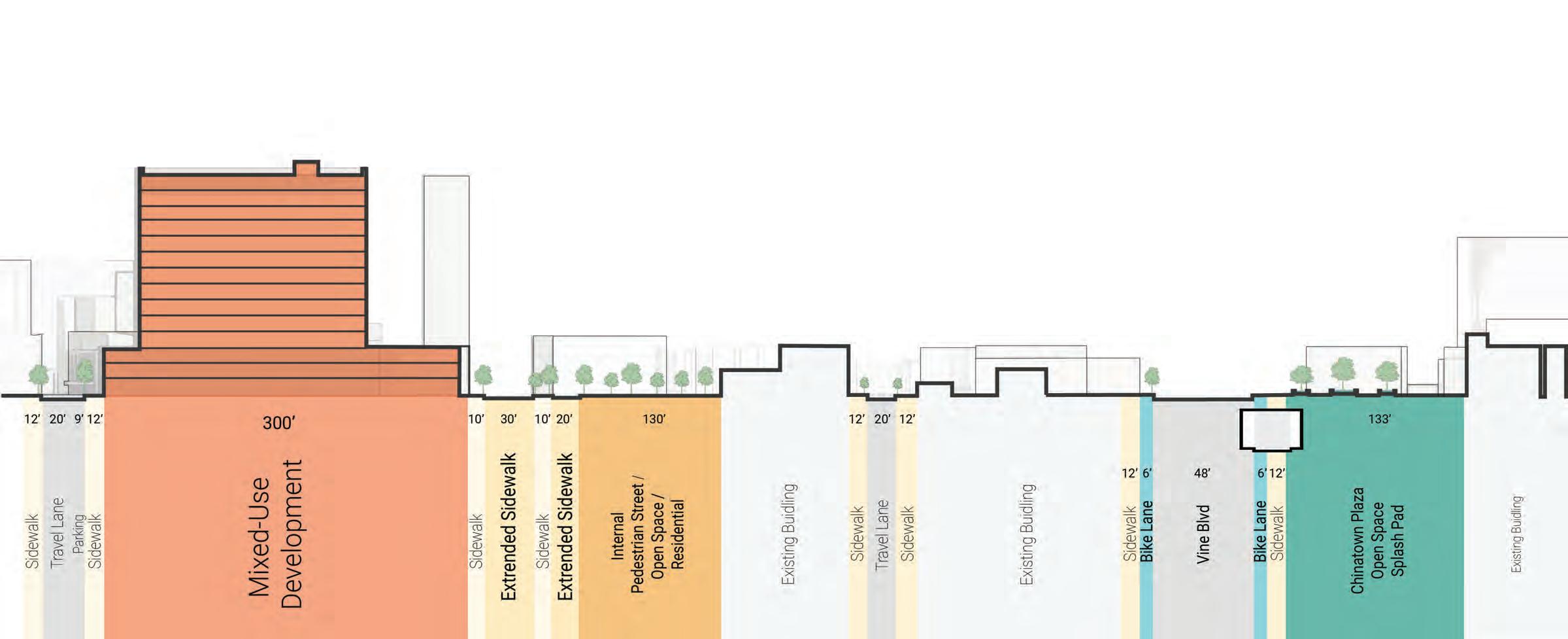
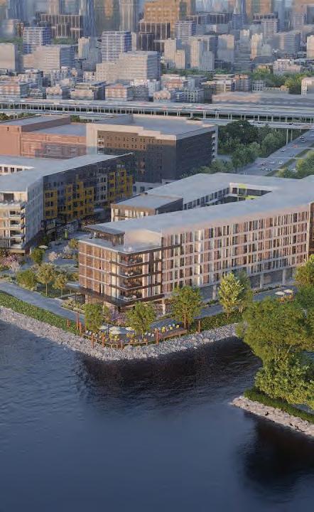
ADAPTIVE INDUSTRIAL ECOSYSTEM
255
Eliza Nobles
Source: Mark Henninger/Imagic Digital
SITE CONTEXT
257
LOCATION
The site includes I-95, Callowhill Street, Race Street, Christopher Columbus Boulevard, and the Delaware Waterfront.
258
INSTITUTIONAL CONTEXT
The area of focus includes important cultural resources and connections to nearby neighborhoods with historical and artistic initiatives including Old City, South Philly, Northern Liberties, and Camden.
259
ENVIRONMENTAL CONTEXT:
STORM SURGE
• Increasing potential for riverine flooding and storm surge
• Water quality is a critical consideration
• Sea level in the Delaware Bay will rise an additional two to five feet
NOAA Cat. 4 Storm Surge
ENVIRONMENTAL CONTEXT: COMBINED SEWER OVERFLOW
• The area is served by the combined sewer area, which means runoff during rain events leads to the release of unfiltered sewage into the river
• Climate change will lead to more extreme storm events
PWD CSO Area
ENVIRONMENTAL CONTEXT: HEAT AND AIR QUALITY
• Heat is an increasing health risk in urban areas
• The site’s proximity to the I-95 highway increases exposures to air pollution and heat for visitors and inhabitants
• Temperature-sensitive vehicle pollutants like ozone will become an even greater health concern with climate change
OpenDataPhilly Heat Scores
ENVIRONMENTAL CONTEXT: INEFFICIENT USE OF LAND
• The I-95 highway and Vine Street ramps take up a significant amount of space on the site, limiting the available land for other uses and contributing to the fragmentation of the urban fabric.
264
Durst Mixed-Use / Apartment Building Festival Pier Redevelopment Penn’s Landing Park I-95 Cap and Development South Philadelphia Pier Improvements
FUTURE AREA DEVELOPMENTS
PROPOSAL
265
GOALS
1. Transform the stagnant waterfront into a bustling destination for humans, flora, and fauna
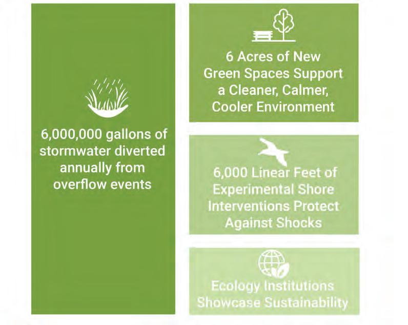
2. Create a sustainable and resilient shoreline that protects the city from environmental shocks
3. Establish an immersive and interconnected node where visitors can walk, cycle, and glide across the region
4. Support a symbiotic and adaptive ecosystem that can thrive in a changing environment
5. Inspire visitors to learn about urban ecology and environmental stewardship through a living laboratory
266
Mixed-Use Artist
Living and Galleries
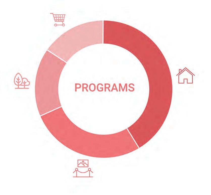
Ferry Stop and Waterfront Monument
Bus, Trolley, and Ferry Transit Center
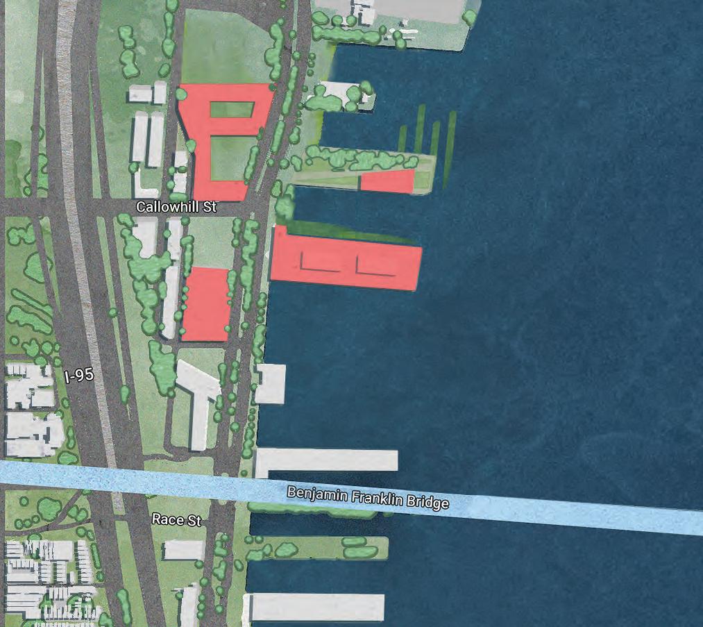
Mixed-Use Residential
Mixed-Use Residential
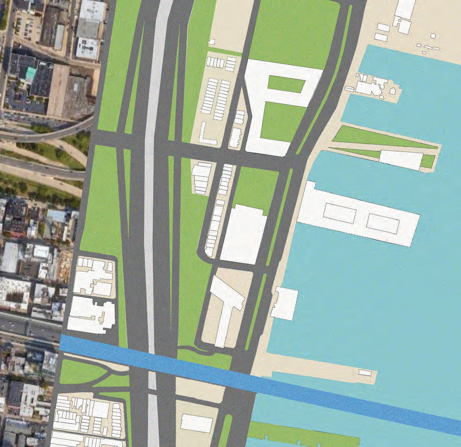
40% 27% 18% 15%
Ferry Line
Bus and Trolley Route
Transit Stops
Onshore and Offshore Climate Interventions
New Green Pier Leads to Ferry and Eco Sights
Experimental Aquatic Research Landscape
Vacant Spaces Become Usable GSI
Expanded Highway Buffer Shields Noise Pollution and Air Pollution
RE-IMAGINING I-95
Current Road Conditions

270
Proposed
Callowhill Street
CALLOWHILL TRANSIT SECTION
As I-95 becomes more compact, the highway lanes elevate to reveal a safer and more open crossing typology over Callowhill Street.
271
I-95 MFL
FLOATING WATERFRONT LABORATORY
272
BIKE AND PEDESTRIAN IMPROVEMENTS
273
275
