


Columbia Avenue to Lehigh Avenue Extension & Neighborhood Connections March 2024
Acknowledgments
Thank you to the over 400 people who responded to surveys and attended public meetings to help shape this study. The public feedback provided through this planning initiative will inform the implementation of the next phase of the Delaware River Trail.
Many thanks to the stakeholders who provide their expertise to guide the future of the Delaware River Trail.
Key Stakeholders
William Penn Foundation
Rails-to-Trails Conservancy
City of Philadelphia, OTIS
Philadelphia Department of Streets
Philadelphia Water Department
Philadelphia City Planning Commission
Delaware Valley Regional Planning Commission
PennDOT 6-0
Mark A. Squilla, 1st Council District
State Representative Mary Isaacson
State Representative Joseph Hohenstein
Lubert-Adler
Concordia Group
Consolidated Railroad Corporation
DRWC Staff
Joe Forkin, President Lizzie Woods, Senior Vice President, Strategic Planning and Real Estate Development
Chris Dougherty, AICP Director of Design & Construction
Karen Thompson, AICP Director of Planning, Policy, and Engagement
Consultant Team
NV5: Planning, Landscape Architecture, Civil Engineering
Connect the Dots: Public Engagement
All photos in this master plan are credited to NV5 unless otherwise indicated.


Project Introduction .......................................... Existing Conditions ........................................... Stakeholder Engagement ................................... Public Engagement ........................................... Proposed Concepts ........................................... Material & Design Approach ............................... Implementation & Cost Estimates ........................ 5 15 37 45 61 91 105
Table of Contents


Project Introduction
5
Project Introduction
The Delaware River Waterfront Corporation (DRWC), a nonprofit organization, works to design, develop, program and maintain public amenities along the central Delaware River Waterfront in Philadelphia. This report represents the next step in a long history of planned and constructed riverfront improvements, and envisions an extension to the Delaware River Trail (DRT) north between Penn Treaty Park in Fishtown and Lehigh Avenue in Olde Richmond, inclusive of connections to the future Graffiti Pier Park, the future Richmond Industrial Trail and reaching to the Riverwards neighborhoods directly west of I-95. This DRT extension will serve as a vital community resource linking neighborhoods to the open spaces, parks, businesses, and amenities along the Delaware River, and is the next step in many years of riverfront planning and development undertaken by DRWC.
The Delaware River Trail is a scenic multimodal trail and active transportation route that stretches along Philadelphia’s Central Delaware River waterfront and improves accessibility to a variety of parks, businesses, residences, and public attractions. The trail increases safety for all modes of travel and all ages and abilities with clear separation from motorists. This transformative project is not merely a trail but is also a placemaking component and private development catalyst that is helping to revitalize and activate Philadelphia’s Delaware River waterfront.
As shown in the Project Context Map, 3.3 miles of the DRT in DRWC's jurisdiction have been constructed to date, stretching from Pier 68 in South Philadelphia to Penn Treaty Park in Fishtown, inclusive of an interim trail between Washington Avenue and Tasker Street. The project scope area for this extension is depicted in red on the Project Context Map and will continue the trail north to Lehigh Avenue. The ultimate vision for the trail is to meet the Riverfront North Partnership's (RNP) Port Richmond Trail at Allegheny Avenue. RNP is currently working with the city to complete the Delaware River Trail between Allegheny Avenue and the Bucks County line in the next several years. The scope of work for this study includes developing short and long-term conceptual trail alignments; identifying optimal Connector Streets to safely and comfortably connect the Riverward communities to the
DRT and the river; identifying potential areas for new parks or placemaking opportunities; identifying opportunity areas for public art; recommending materials; developing phasing and cost estimates; and engaging and incorporating feedback from stakeholders and the public.
Project Context Map
This report also examines the Richmond Industrial Trail's (RIT) easternmost half-mile as it approaches the DRT in Olde Richmond. Major components of this section of the RIT include an access ramp and elevated crossing at Aramingo Avenue and a connection to the DRT near Richmond Street.


DRTdevelopmentnorth ofAlleghenyAvenue isledbytheRiverfront NorthPartnership
Introduction
Project
1/2 mile 1 mile 0 Delaware River Trail / Columbia To Lehigh Extension Alignment and Conceptual Access Study 6
Project History
The Delaware River Trail (DRT) is a significant element of the Master Plan for the Central Delaware which was adopted by the Philadelphia City Planning Commission in March 2012. As illustrated in the Project Flow Path on page 9 this study is the most recent effort that emerged from the original plan.
The Master Plan for the Central Delaware examined a six-mile stretch of the Delaware River waterfront between Oregon Avenue and Allegheny Avenue, which is part of the jurisdiction of the DRWC. The Master Plan laid out a vision for a significant waterfront trail, connecting mixed use development, public parks every half mile, and other civic spaces. The Master Plan also laid out the concept of connector streets, which were to be east-west aligned streets perpendicular to the river that would see an enhanced bicycle and pedestrian connectivity and streetscape, and would help to lessen the physical and psychological effects of the barrier caused by Interstate 95.
One of the recommendations of the Master Plan was the completion of trail design guidelines. In 2013, DRWC published the Delaware River Trail Preliminary Design Report which outlined the location, typical sections, and material palettes for the proposed Delaware River Trail between Pier 68 and Lehigh Avenue. The trail was to be on off-road trail between Pier 68 and
Washington Avenue in Pennsport, along Columbus Boulevard, Delaware Avenue, and Penn Street between Washington Avenue and Rivers Casino, and off-road again along and north of Rivers Casino up to Lehigh Avenue. The trail alignment between Lehigh Avenue and Allegheny Avenue was not studied at the time. This report serves as an update to the previous 2013 planning efforts to reflect the current opportunities and constraints between Penn Treaty Park and Lehigh Avenue.


The Master Plan for the Central Delaware identified potential connector streets, parks and open spaces with trail linkages, and development potential. Image Credit: Master Plan for the Central Delaware, 2012


Project Introduction
Delaware River Trail / Columbia To Lehigh Extension Alignment and Conceptual Access Study 7

Penn Street Trail was the first constructed pilot segment of the Delaware River Trail, located between Spring Garden Street and Ellen Street. Delaware River Trail / Columbia To Lehigh Extension Alignment and Conceptual Access Study 8
2020-2022 2018-2020 2018-2019 2013 2012-2013 2012
Master Plan for Central Delaware Approved by City
Delaware River Trail (DRT) Preliminary Design
Penn Street Trail
Constructed (the DRT pilot project)
The 2013 report culminated in the design and construction of the pilot segment of the DRT between Spring Garden Street and Ellen Street. This pilot project set the high bar for the design of the DRT, which carried through into the final design and construction of subsequent sections. In 2016, a segment was opened to the public behind Rivers Casino. Another segment between Pier 68 and Tasker Street opened in 2019 in South Philadelphia, and a segment through Penn Treaty Park opened in 2020. The 2-mile ‘onroad’ segment finished construction in 2022 and has enjoyed high use and many accolades. In August of 2023, the trail counter installed on the DRT at Spruce Street Harbor Park recorded over 52,000 cyclists and pedestrians for that month alone. There are now about 3.3 miles of trail between Pier 68 in Pennsport and Penn Treaty Park in Fishtown. Since the completion of the Master Plan, several connector streets have also been completed or are in the design phase.
In 2018, the Rails to Trails Conservancy (RTC) completed an initial feasibility study of the Richmond Industrial Trail (RIT), which would run parallel to Conrail's Richmond Industrial Track across Kensington and Fairhill from the DRT at Lehigh Avenue to North American Street. This study was performed with assistance from DRWC and other neighborhood stakeholders and City agencies.
In 2023, the Battery, an adaptive-reuse development in the former Delaware Generating Plant, opened to the public and will include a short segment of trail along its riverfront bulkhead. Also in 2023, PennDOT substantially
DRT South Constructed (near Mifflin Street)
DRT North Constructed (at Penn Treaty Park)
DRT On-Road Constructed (between Washington Ave. and Spring Garden St.)
completed the GR4 phase of the I-95 Revive project, which marks the complete reconstruction of Interstate 95 between Frankford Avenue and Clearfield Street. As a part of this massive reconstruction effort, PennDOT constructed a multi-use path below the I-95 viaduct between Aramingo Avenue, York Street, and Lehigh Avenue.
Another new riverfront development is Northbank, which consists of approximately 350 occupied homes and over 800 total planned homes along the Delaware River between Dyott Street and Cumberland Street. The developer of Northbank has built portions of the DRT and will deed other portions to the DRWC.
Abutting the planned final alignment for the DRT is the future Graffiti Pier Park. Planning and engagement for this culturally rich waterfront park began in late summer of 2019 and is ongoing. The NV5 team coordinated with Studio Zewde, who is leading the design of the park, to integrate the DRT, the park, and the Connector Street that will serve both assets.
While there has been much progress in the last ten years along the Delaware River in the Riverwards, there remain some constraints. Two major riverfront parcels between The Battery and Northbank remain undeveloped, and a timeline for any development is unknown. A major goal of this report is to document both long- and short-term solutions to be able to close the gap in the Delaware River Trail as soon as feasible.
2023
DRT Extension: Columbia Ave. to Lehigh Ave. Preliminary Planning & Engagement
Next Steps
DRWC, Fundraising, Detailed Design & Permitting, and Construction
Building on the momentum of the recently completed on-road segment along Columbus Boulevard between Washington Avenue and Spring Garden Street, and in keeping with the current and planned developments along this stretch of the river, DRWC retained the services of NV5 to complete the current study to extend the DRT further north. This study for the DRT Extension kicked off in late 2022. NV5 and DRWC met with a number of public agencies, stakeholders and the public prior to articulating a proposed design. After design ideas were documented, additional meetings with public agencies and stakeholders were held, as well as another round of public engagement. Summaries of the team’s findings can be found in later chapters of this report.
After this study concludes, likely next steps include: property acquisitions by DRWC; fundraising; detailed design and permitting; and ultimately construction. It is likely that design and construction will take a phased approach due to available funding. Recommendations for phasing are presented in a later chapter and have been informed by the community engagement effort.
HERE!
WE ARE
Property Acquisitions by
Delaware River Trail / Columbia To Lehigh Extension Alignment and Conceptual Access Study 9
Project Flow Path
The Delaware River Trail in Context
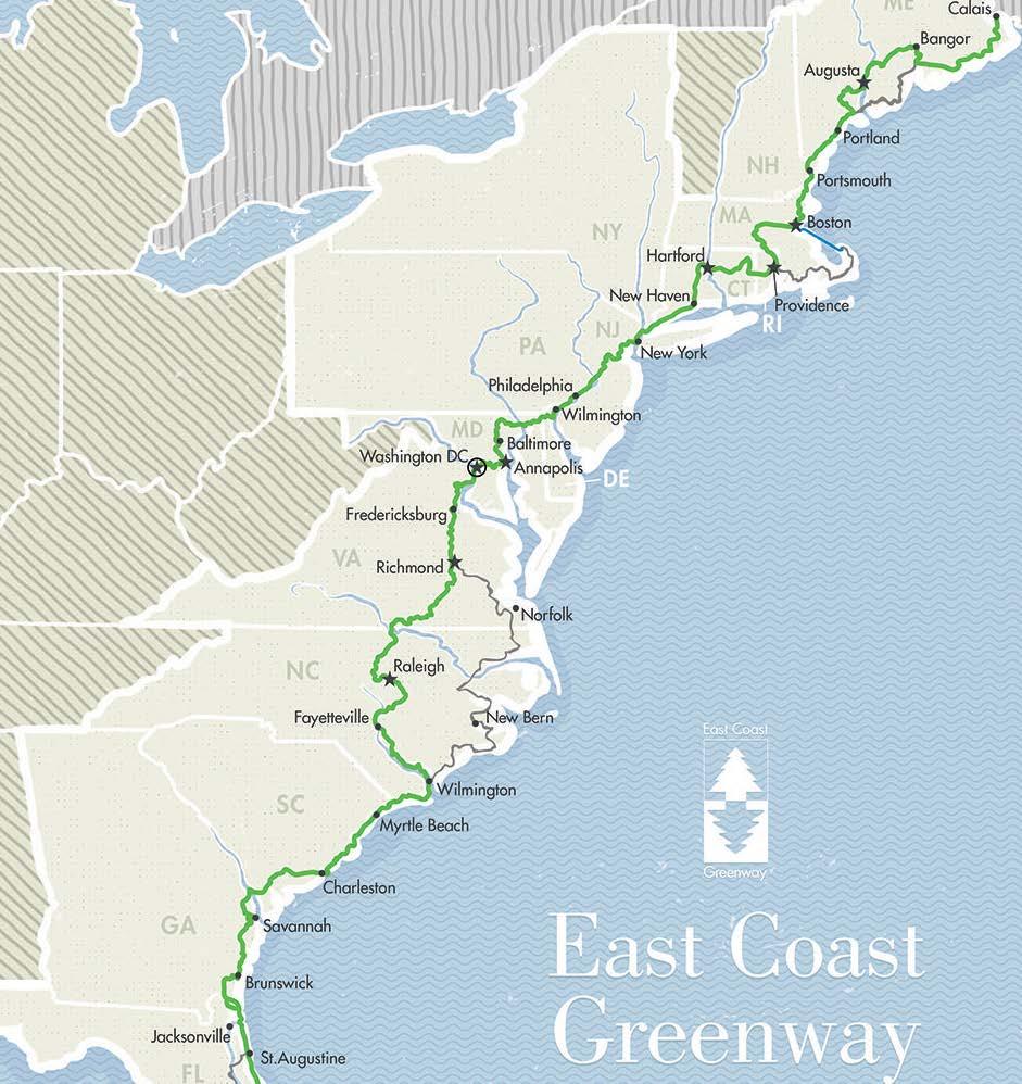
The DRT is a part of two major trail networks. The entirety of the completed and planned DRT is a part of the Circuit Trails which is the name of the trail network in the nine-county greater Philadelphia region. As of 2023, over 370 miles of the planned 800+ mile network are completed. The DRT north of Spring Garden Street is a part of the East Coast Greenway (ECG). The ECG will be a 3,000+ mile long continuous trail between Key West, Florida to the Canadian border at Calais, Maine. The ECG is considered the urban counterpart to the Appalachian Trail. The City of Philadelphia, DRWC, and other partners are actively building out the entirety of the ECG within the city limits.
The DRT will make several connections to other city and regional trails. The future Spring Garden Connector, which will be an on-road connection of the East Coast Greenway, will contain protected bicycle lanes and be the eastwest connector with another major trail within the city, the Schuylkill River Trail (and also serve as a portion of the ECG). At Allegheny Avenue, the DRT will continue north under the guidance of Riverfront North Partnership. And at Lehigh Avenue, it is envisioned that the Richmond Industrial Trail will tie into the DRT. A portion of this study examines the eastern terminus of the Richmond Industrial Trail at the DRT.
TRAIL NETWORK STATUS 2021
COMPLETED IN 2021 UNDER CONSTRUCTION IN DESIGN IN PLANNING OTHER PROPOSED EXISTING TRAILS PARKS WATER In In Under Construction
2011-2021
Project Introduction Image Credit: Philadelphia Trail Master Plan Update, 2022 Delaware River Trail / Columbia To Lehigh Extension Alignment and Conceptual Access Study 10 Richmond Industrial Trail (RIT) Delaware River Trail (DRT) Spring Garden Connector

Richmond Industrial Trail
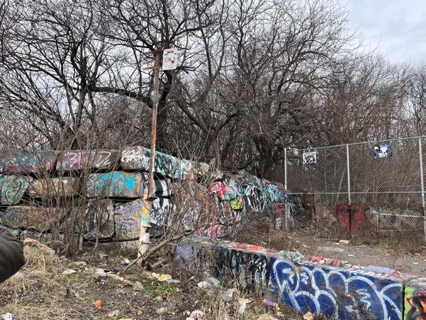
At its peak in the 1870s, the Richmond Branch of the Reading Railroad was once the world’s most active coal transport line . This railroad, now owned by Conrail and known as the Richmond Industrial Track, is an active rail line that serves industrial clients along Allegheny Avenue and Delaware Avenue in Port Richmond. Conrail owns much of the property along the rail line between Lehigh Avenue and Somerset Street, as well as a former rail yard that once ran south to Cumberland Street to present day Graffiti Pier.
In 2013, the Philadelphia City Planning Commission (PCPC) identified this corridor, then known as the Lehigh Viaduct, as a potential city trail in its Philadelphia Trail Master Plan. In 2015, the PCPC Riverwards District Plan further refined the concept of a park and trail along unused sections of the Richmond Industrial Track, with the goal of connecting neighborhoods in the middle of the city down to the riverfront. This concept was advanced in a 2018 feasibility study by the Rails-to-Trails Conservancy (RTC) that examined the now-named Richmond Industrial Trail (RIT) between American Street and the Delaware River Trail. RTC’s work on the RIT, in coordination with area community organizations is summarized on the project website for the RIT.
This study will examine the eastern terminus of the Richmond Industrial Trail and a potential trail and at-grade connection point at Aramingo Avenue.
Project Introduction
Delaware River Trail / Columbia To Lehigh Extension Alignment and Conceptual Access Study 11
Image Credit: Philadelphia Atlas, 1910 Historic Map

Project Introduction Delaware River Trail / Columbia To Lehigh Extension Alignment and Conceptual Access Study 12
Study Goals
Develop a Conceptual Trail Corridor
This study will establish alignments for new segments of the Delaware River Trail between Columbia Avenue and Lehigh Avenue, inclusive of interim and final planned trail segments. The trail design will be rooted in an All Ages and Abilities ethos, to make accessing the river and the DRT as safe and welcoming as possible for all users. The trail will serve as a transportation and recreational amenity, with design and material selections informed by the already-built sections of the DRT. Hardscaping, site furnishings and planting improvements will be conceptually designed, and key nodes for gathering and locations for public art will be identified. The design will balance stakeholder input and coordinate with multiple public agencies, and will consider interactions beyond the trail corridor, including at planned park spaces like the future Graffiti Pier Park. The design will create linkages to the Richmond Industrial Trail to build an integrated network. The design will be deeply informed by community and stakeholder input, with feedback gained from community meetings, stakeholder meetings, and online interaction tools.
Identify Optimal Connector Streets
Equally important as determining where the DRT will be placed is understanding how residents will access the trail. I-95 and highspeed streets create a major barrier to residents accessing the trail and riverfront amenities. This study will determine the priority connections between the DRT and the riverward neighborhoods and set the stage for future connector street projects where residents will be able to safely and intuitively walk, bike, drive, or transit down to the riverfront.
Recommend Design Materials and Approaches
The study collects recommendations for material palettes, planting approaches, and design elements for the next segments of the DRT. Materials and furnishing recommendations will balance continuity with the constructed DRT’s design language, with an understanding that this project context offers unique constraints and opportunities. NV5 will identify opportunities for native plantings including riparian plantings, trail edge plantings, native shade trees, and areas appropriate for lawn. The study will also make preliminary recommendations for living shoreline installations, as a way to increase habitat and improve ecology at the river’s edge.
Identify Areas for New Parks or Placemaking Opportunities
In keeping with a goal of the Master Plan for the Central Delaware, this study seeks to identify locations along the river where Connector Streets can lead to park spaces or to placemaking opportunities along the DRT.
Develop Phasing and Order-of-Magnitude Cost Estimates
With input from stakeholders and the community, this study will identify near-, middle-, and long-term projects, along with a high-level understanding of the cost to construct each area. This recommended phasing and cost analysis will help DRWC plan and fundraise, in order to move toward construction.
Prioritize Interim and Final Planned Trail Alignments
This study identifies both interim and final planned routes for the DRT. This phased approach allows for a continuous connection north to Allegheny Avenue as soon as it is feasible, while also working towards the long-term vision for a cohesive and thoughtful multimodal path at the river’s edge. Through a phased approach, the Delaware River Trail can grow with the current and planned development of the riverfront.
Identify Areas for New Public Art
DRWC is committed to integrating public art and art programming on the riverfront. In 2018, DRWC completed the Delaware River Waterfront Arts Program report. While the report did not specifically call out locations within the DRT Extension study area, it makes clear the importance of integrating art into new projects. This study will seek to identify key moments within the proposed design that would be excellent opportunities for public art installations.
Engage and Incorporate Feedback from Stakeholders and the Public
An urban multimodal trail such as the DRT necessarily involves a great number of stakeholders, inclusive of city and state agencies, public transportation providers, utilities, adjacent property owners, non-profit organizations, community development corporations, and the many residents that may use the future trail. This study will collect input and feedback from as many voices as possible through an engagement process that is inclusive, equitable and accessible. All input will be documented, summarized, and synthesized into the study report.
Project Introduction
Delaware River Trail / Columbia To Lehigh Extension Alignment and Conceptual Access Study 13
 Image Credit: Rocco Avallone

Existing Conditions
15
Existing Conditions
The project study area is a landscape currently undergoing rapid transformation. Formerly a significant nexus of riverfront industry, large waterfront lots dominate the river’s edge. Remaining industrial uses abut vacant or underutilized spaces and piers, which share space with rapidly growing mixed-use developments. Interstate 95, a significant barrier between the Riverwards communities and the riverfront, is undergoing its own changes, as PennDOT's Girard Avenue Interchange (GIR) project nears completion for the project sections within the study area. The wide, high-speed roadways of Delaware Avenue and Richmond Street reinforce the barrier created by the elevated I-95, dividing the waterfront from the neighborhoods. Local roads serving large vacant waterfront parcels are in severely degraded condition.
Identifying clear, intuitive connections for the community underneath I-95 to the river is a key component of this study. Today, as the GIR project in this area winds down, the spaces under I-95 are not yet being regularly stewarded. DRWC has plans to take over the management of these spaces, which will help improve the existing issues of litter and safety. For the moment, the spaces under I-95 are not welcoming for the community and do not provide clear connections to the waterfront. It is important to note, that efforts to improve other existing issues relating to the unhoused population, crime, drug use, and other illicit activity will require resources beyond DRWC.
Along the river, in addition to the new mixed use developments at the Battery and Northbank, a significant new park space will also define the riverfront in this area of the city, helping to meet the 2012 Masterplan's goal of a public park every quarter mile. DRWC is currently in the process of designing Graffiti Pier Park, a new park that formalizes the cultural and historic significance of this unique post-industrial space.
The existing conditions presented in this chapter should be viewed as a snapshot in time. Future phases of trail design will need to take stock of any new conditions and make adjustments to the design as required.

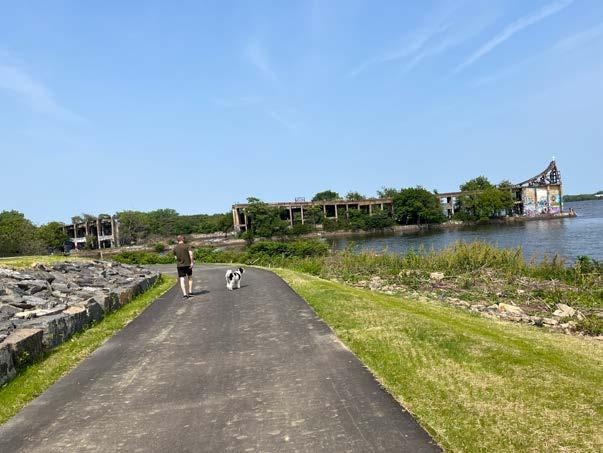
 Looking north from the Battery development (under construction during this study), Beach Street is visible to the left, as well as Interstate 95.
Existing Conditions Delaware River Trail / Columbia To Lehigh Extension Alignment and Conceptual Access Study 16
Looking north towards the Northbank Development (under construction during this study) and the future Graffiti Pier Park. Image Credits, Top and Bottom: Rocco Avallone


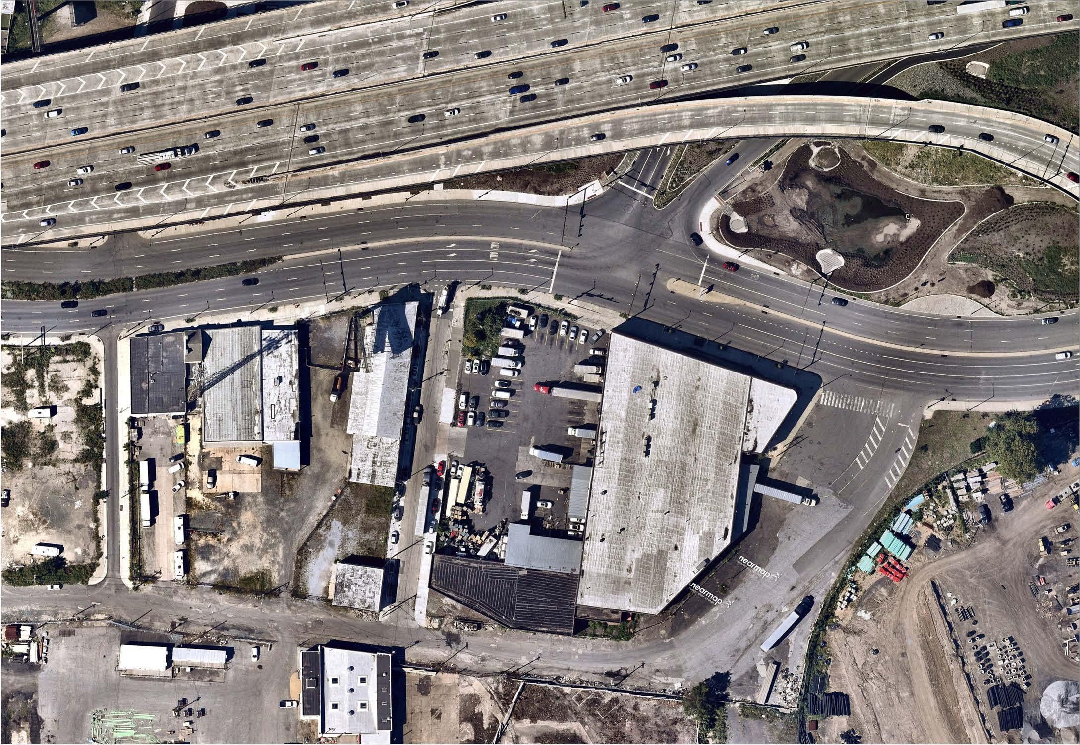
Delaware River Fishtown Olde Richmond Port Richmond Delaware River SHEET B SHEET A SHEET C SHEET D SHEET E SHEET F SHEET G SHEET H SHEET I 0 250’ North 500’ Future Delaware River Trail Future Graffiti Pier Park Penn Treaty Park Future Delaware River Trail Future IndustrialRichmond Trail Susquehanna Ave AramingoAve Norris St York St DyottSt RichmondSt Richmond St Cumberland St BeachSt Schirra Dr Cumberland St Huntingdon St Lehigh Ave Somerset St DelawareAve I-95 Girard Ave Beach St Thompson Ave Columbia Ave Palmer St Marlborough St Montgomery Ave Berks St Delaware Ave Existing Conditions Index Plan Delaware River Trail / Columbia To Lehigh Extension Alignment and Conceptual Access Study 17


Penn Treaty Park The Battery 1325 Beach St. Existing Conditions SHEET A Delaware River Trail / Columbia To Lehigh Extension Alignment and Conceptual Access Study 18 Delaware Ave Columbia Ave Delaware Ave Beach St 1 2 3 4 1 # 3 # 1 # 2 # 4
1401 Beach St.


Sheet A Existing Conditions
At the southern end of the study area, Columbia Avenue, a one-way street, leads east to the frontage of Penn Treaty Park, a heavily used and well-loved riverfront park in Fishtown. The segment of the DRT that traverses this park opened in 2020 and runs between Rivers Casino and the Battery development. As part of PennDOT’s GIR project, and in collaboration with DRWC, New Kensington CDC, and the Philadelphia Water Department, Columbia Avenue was designed and built as a connector street and includes pedestrian-scale lighting with integrated sculptural elements, rain gardens, street trees, and plantings. However, the Delaware Avenue crossing is wide and is a candidate for targeted safety improvements (Images 1 and 2).
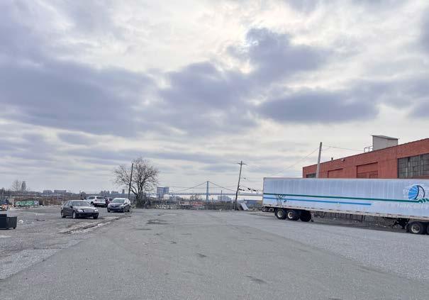
Beach Street within this area was partially resurfaced in winter 2023. Prior to that, the roadway was in extremely poor condition for cyclists (Images 3 and 6). A portion of Beach Street along the frontage of the Battery property was repaved in fall 2023 (Image 7).
The Battery represents a transformative, adaptive reuse of the former PECO Delaware Power Station, which was originally constructed in 1917 in the Beaux-Arts style of architecture. The Battery renovation, undertaken by the developer Lubert-Adler, neared completion during the course of this study and is a mixed-use development. The DRT was constructed through the parcel by the developer and runs between the main building and relic industrial structures that were maintained (Image 4). The connection between the constructed trail in Penn Treaty Park and the Battery trail will need to address a grade change between the two parcels, as well as large existing trees and flooding issues within the park. Across Beach Street from the Battery, an existing office building and an operational PECO generating station stretch along the roadway (Images 5, 6, and 7). Traffic volumes and pedestrian/ cyclist safety at Palmer Street, currently a two-way street, will need to be carefully considered as the Battery becomes fully operational and occupied. At this time, there are no plans to create a signalized intersection at Palmer Street and Delaware Avenue. To date, the city and PennDOT have raised concerns to signalize the Delaware Avenue and Palmer Street intersection for various reasons. A few concerns raised include the close proximity of the Columbia Avenue's signalized intersection to the Palmer Street intersection, and the grade change between the northbound and southbound lanes which would make a new left turn lane on the southbound side challenging. PWD green infrastructure that exists within that median poses a further challenge to removing the median to create a left turn lane.
Existing Conditions Scale: 1” =80’ 0 40’ North 80’ Delaware River Trail / Columbia To Lehigh Extension Alignment and Conceptual Access Study 19 Palmer St Beach St 5 6 7 # 5 # 6 # 7


The Battery Anderson Parcel 1501 Beach St. Existing Conditions SHEET B Delaware River Trail / Columbia To Lehigh Extension Alignment and Conceptual Access Study 20 Beach St Berks St 1 2 # 1 # 2


Sheet B Existing Conditions
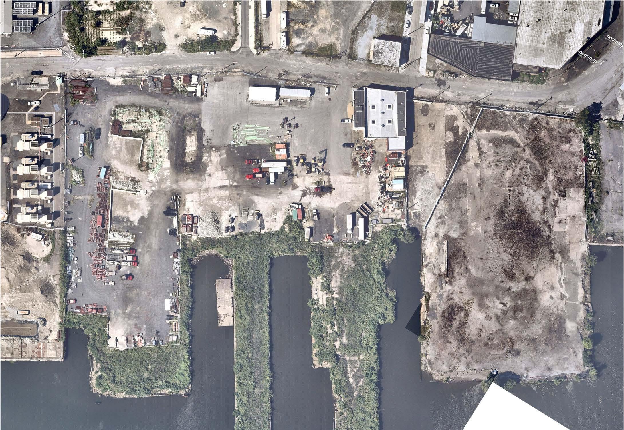
The future of the riverfront at the two large parcels shown on this plan is currently unknown, as DRWC does not yet have a timeframe for acquisition or obtainment of a permanent easement along the waterfront. The Anderson parcel, inclusive of three piers, is currently used by James J. Anderson Construction as storage for construction materials and equipment. The Glasgow parcel includes one large pier and is currently unused (Image 4).
Berks Street between Delaware Avenue and Beach Street is a narrow, two-way street running between a PECO-owned lot on one side and a lot supporting light industrial on the other (Image 1). Future traffic volumes on this street will also need to be carefully observed as development along the river continues.
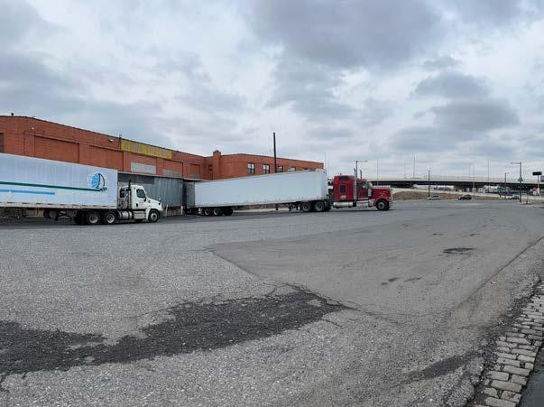
Susquehanna Avenue is a two-way street with enough existing width to allow cyclists to return from the future DRT to their neighborhoods on the other side of I-95. East of Susquehanna Avenue is a parcel occupied by Kawa Trading Corporation, a food and drink wholesale and distribution company. This parcel features a large, heavily used loading dock off Dyott Street (Image 3), which is what Beach Street becomes as it rounds the corner toward Richmond Street. Beach Street and Dyott Street are in poor condition for cycling throughout this area (Images 2, 3, and 5).
Glasgow
Beach St. Kawa Trading Co. 1701-37 N. Delaware Ave.
Parcel 1701-25
Existing Conditions Scale: 1” =80’ 0 40’ North 80’ Delaware River Trail / Columbia To Lehigh Extension Alignment and Conceptual Access Study 21 Beach St Susquehanna Ave DyottSt 3 4 5 # 3 # 4 # 5


Existing Conditions 1609-13 N. Delaware Ave. 1615 N. Delaware Ave. Interstate-95 Anderson Parcel 1501 Beach St. SHEET C Delaware River Trail / Columbia To Lehigh Extension Alignment and Conceptual Access Study 22 Beach St Delaware Ave Berks St Susquehanna Ave 2 3 4 # 1 # 3 # 4 # 2


Sheet C Existing Conditions
Discussed in the Sheet B Existing Conditions section, the entirety of the Kawa Trading parcel (1701-37 N. Delaware Ave.) can be seen here (Images 3, 4, 6, and 7). It is situated at a critical point between the community and the river and represents the need to balance existing industrial uses with recreational activity and mixed-use development along urban riverfronts.
The Aramingo Avenue and Richmond Street intersection is a key intersection within this study and represents the longest crossing distances for pedestrians and cyclists across Richmond Street (Image 1). When the trail is constructed, it will be critical that this intersection is as safe as possible for the community. Spatial constraints near I-95 include existing green stormwater infrastructure installed for the I-95 project (Image 5).
Under I-95 at Susquehanna Avenue, there is an opportunity to create an intuitive visual connection between the community and the river – the pedestrian area is very wide and may lend itself to pedestrian-scale improvements that will make the connection more welcoming and comfortable (Image 2).
Dyott Street is a very wide street that blends into the loading dock for Kawa Trading (1701-37 N. Delaware Ave.) giving the impression of a large expanse of asphalt between Richmond Street and the river (Images 7 and 8).
Additional photos of Susquehanna Avenue are shown. Currently, cars park on the sidewalk on both sides of the street (Images 3 and 4).
Existing Conditions Kawa Trading Co. 1701-37 N. Delaware Ave. Northbank Phase II Development 2001 Richmond St. Interstate-95 Exit Ramp Glasgow Parcel 1701-25 Beach St. Scale: 1” =80’ 0 40’ North 80’ Delaware River Trail / Columbia To Lehigh Extension Alignment and Conceptual Access Study 23 DyottSt Beach St Richmond St AramingoAve 1 5 6 8 7 # 5 # 6 # 8 # 7


Northbank Phase II Development 2001 Richmond St. Existing Conditions SHEET D Delaware River Trail / Columbia To Lehigh Extension Alignment and Conceptual Access Study 24 1 2 3 5 4 # 1 # 2 # 3 # 5 # 4
Northbank Phase I Development
2001 Beach St.


Sheet D Existing Conditions
Dyott Street was built over what was once a waterbody known as Gunner’s Run, which later became the Aramingo Canal. A functioning Philadelphia Water Department (PWD) combined sewer overflow (CSO) was built at the point where the Aramingo Canal once met the Delaware River. The small area of land over the CSO is publicly owned. Being situated at this critical point in the future DRT and its connection to the community, this land could be a logical location for a potential future park (Image 3). Today, the land is unused, but PWD access to service the CSO would need to be maintained.
To the east of the CSO coming off Dyott Street sits Northbank Phase II, under construction throughout the course of this study, which is a mixed-use development by D3 Development and the Concordia Group. The development will consist of over 800 units; a blend of single-family townhomes and multifamily buildings. As a part of development, the DRT through this parcel will be constructed by the developers between the new buildings and the river. In addition, due to soil contamination in the area, the developer is also providing a 2’ deep cap over the contaminated soil to meet environmental regulations. Views along the trail in this area will be spectacular (Images 1, 4 and 6), and there is potential for a new pier park at the pier furthest south (Pier 75), according to a pier assessment commissioned by the developer (Image 5).
Northbank Phase II is a part of the Adaire Elementary School catchment. While Adaire Elementary is only 0.6 miles away from Northbank, the barrier of Delaware Avenue will make it difficult for future residents to walk or bike to school.
The Northbank parcels hold historic significance as the location of the William Cramp and Sons Shipyard (which closed after WWII) and prior to that, as the location of the Dyottville Glass Works, amongst other industrial uses of the 19th century. Between and somewhat protected by the industrial piers, there may be opportunity for living shoreline installations given that there are no existing bulkhead walls and river velocities within this area between the piers, are lower than along other edge lines of the river. These are some of the very few shorelines within the study area where bulkhead walls are not present.
DRWC is currently in the process of acquiring site control for the DRT through the Northbank developments.
Existing Conditions Scale: 1” =80’ 0 40’ North 80’ Delaware River Trail / Columbia To Lehigh Extension Alignment and Conceptual Access Study 25 Shirra Dr BeachSt NorthbankPl Pettyview Ln 7 6 8 # 6 # 7 # 8


Existing Conditions Fishtown Crossing 2401 Aramingo Avenue I-95 Trail SHEET E Delaware River Trail / Columbia To Lehigh Extension Alignment and Conceptual Access Study 26 AramingoAve York St 1 4 3 2 # 2 # 4 # 3 # 1
Sheet E Existing Conditions
Aramingo Avenue is a wide roadway that creates a divide through the Olde Richmond neighborhood. It features large intersections, high traffic volumes during peak hour, and fast vehicular speeds during other times of the day. York Street has unprotected bicycle lanes, but these bicycle lanes disappear upon the approach of the intersection at Aramingo Avenue, creating confusion for where cyclists should be.
While the new I-95 Trail has been constructed to allow cyclists and pedestrians to access the trail from the southwest corner of the York Street intersection, there are no pavement markings or signage to guide cyclists and pedestrians to and from this new facility (Images 3 and 4). Additionally, the I-95 multi-use trail ends a far distance from the street corner, making it difficult for cyclists and pedestrians to see the trail from the western side of the wide intersection. In addition, the multi-use trail abruptly becomes a concrete sidewalk in the existing condition (Image 3). The trail's shoulder also narrows to a degree where a desired landscape buffer could not be provided, and instead a row of yellow bollards was installed between the trail and the curb line of Aramingo Avenue (Image 4).
At Cumberland Street, the city has recently installed speed tables to slow down traffic between Aramingo Avenue and Richmond Street. The adjacent retail center owner replaced the southern sidewalk and trees.
Existing Conditions IGA Scale: 1” =80’ 0 40’ North 80’ Delaware River Trail / Columbia To Lehigh Extension Alignment and Conceptual Access Study 27 MoyerSt Aramingo Ave Cumberland St 5 # 5


Northbank Phase I Development 2001 Beach St. 2225 Richmond St Existing Conditions SHEET F Delaware River Trail / Columbia To Lehigh Extension Alignment and Conceptual Access Study 28 Richmond St RichmondSt BeachSt 1 2 # 1 # 2 # 3


Sheet F Existing Conditions
Along Richmond Street between Shirra Drive and Cumberland Street, existing industrial and warehouse uses dominate. On the opposite side of Beach Street (Images 1 and 2), the Northbank Phase I development, by D3 Development and the Concordia Group, moved toward construction completion over the course of this study. Comprised of over 380 single family townhomes and over 50 duplexes, this large development overlooks the river and abuts the future Graffiti Pier Park, at the eastern terminus of Cumberland Street. Cumberland Street is a wide two-way street and, like Dyott Street, abuts a large industrial loading area, resulting in a large expanse of asphalt between Richmond Street and the river (Images 4, 5, and 7). The existing, unofficial entrance to Graffiti Pier is accessed from Cumberland Street through an opening in a large concrete block wall (Images 6 and 7). The pier, which DRWC is currently negotiating with Conrail to purchase, is part of a large 200-acre riverfront parcel owned by Conrail, but which has been largely unused for many decades, aside from active areas at the northern end of the property. The future DRT will need to navigate between the Northbank Phase I driveway at Beach Street, the entrance to the future Graffiti Pier Park and Cumberland Street to provide the community with a safe, intuitive, and welcoming connection to the riverfront. Crossing distances across both Cumberland Street and Richmond Street are long and feel unsafe, given the high speeds along Richmond Street (Images 3 and 4).
Northbank Phase I Development 2001 Beach St.
Existing Conditions Future Graffiti Pier Park Scale: 1” =80’ 0 40’ North 80’ Delaware River Trail / Columbia To Lehigh Extension Alignment and Conceptual Access Study 29 Cumberland St Richmond St BeachSt 7 5 6 4 3 # 5 # 7 # 6 # 4


Northbank Phase I Development 2001 Beach St. Delaware River Trail (Built by Developer) Existing Conditions SHEET G Delaware River Trail / Columbia To Lehigh Extension Alignment and Conceptual Access Study 30 SedgeviewWalk NorthbankPl Pierview Ln 1 2 3 # 1 #2 #3


Sheet G Existing Conditions
The riverfront east of Northbank Phase I provides amazing views of the city to the south and of Graffiti Pier to the north (Images 1 through 6). In addition, the shoreline here slopes down to the river, without bulkhead walls, providing opportunity for living shorelines and for getting closer to the water (Images 1, 3, 5 and 7). However, slopes are steep in this area, and will need to be studied in greater detail during future design phases. The Northbank Phase I development includes interesting terraced seating and steps (Image 2) that lead down to the DRT, which was constructed as a condition of development. As noted previously, DRWC is in the process of acquiring site control for the DRT through this parcel.
Existing Conditions Future Graffiti Pier Park Scale: 1” =80’ 0 40’ North 80’ Delaware River Trail / Columbia To Lehigh Extension Alignment and Conceptual Access Study 31
Pierview Ln Pierview Ln 7 6 5 4 #4 #5 # 7 # 6
NorthbankPl


Existing Conditions Interstate-95 Conrail 2801 Richmond St SHEET H Delaware River Trail / Columbia To Lehigh Extension Alignment and Conceptual Access Study 32 Richmond St Salmon St Tilton St Emery St Lehigh Ave 1 2 3 4 # 1 # 3 # 2 # 4


Sheet H Existing Conditions
At the Lehigh Avenue and Richmond Street intersection, the trail constructed under I-95 as part of the GIR project ends abruptly without a clear indication of where cyclists are meant to safely continue (Image 3). There is also a clear need for safety improvements for cyclists travelling north of Lehigh Avenue along Richmond Street (Image 4). Along Lehigh Avenue, existing pedestrian spaces under I-95 are wide and may provide opportunities for pedestrian-scale improvements that can make these spaces more inviting and comfortable (Image 2).
Under I-95, north of Lehigh Avenue, the grade begins climbing up to meet the elevation on the large Conrail property along the river (Image 5). There is an existing unused Conrail bridge (Image 6) over Richmond Street that connects to the Conrail property. At this time, this existing bridge cannot be considered for use by the trail network, as enticing as it appears as a possible connection between the DRT and the future planned Richmond Industrial Trail (RIT).
Existing Conditions
Interstate-95 Conrail Conrail 2801 Richmond St Scale: 1” =80’ 0 40’ North 80’ Delaware River Trail / Columbia To Lehigh Extension Alignment and Conceptual Access Study 33 5 6 # 5 # 6


Existing Conditions SHEET I Delaware River Trail / Columbia To Lehigh Extension Alignment and Conceptual Access Study 34 Aramingo Ave Lehigh Ave Cione Playground St Anne Cemetary Cedar St # 1 # 2 # 3 1 2 3


Sheet I Existing Conditions
The intersection of Aramingo Avenue and Lehigh Avenue is a busy intersection with high volumes of turning traffic. Both streets have unprotected bicycle lanes and are a part of the city's Vision Zero High Injury Network (HIN).
Cione Playground, a large neighborhood playground and recreation space, is located at the southwest corner of the intersection.


While the active Conrail Richmond Industrial Track rail lines are located several hundred feet to the north of the intersection, an abandoned outlying rail spur lies on the southern part of Conrail's right-of-way. It is this line that is envisioned as a part of the future Richmond Industrial Trail (Image 5).
Existing Conditions
Image Credits (both pages): Philadelphia Atlas Scale: 1” =40’ 0 20’ North 40’ Delaware River Trail / Columbia To Lehigh Extension Alignment and Conceptual Access Study 35 Dollar Plus Party Fair Building AveAramingo Lehigh Ave Gaul St # 4 # 5 4 5


Stakeholder Engagement
37

Stakeholder Engagement
The design of the Delaware River Trail and its connections involves coordination with a number of stakeholders, inclusive of city and state agencies, public transportation providers, utilities, adjacent property owners, other non-profit organizations and community development corporations. This section summarizes the conversations and coordination with these entities by the planning team. The public engagement effort, which was conducted in conjunction with the stakeholder engagement process, is summarized in the Public Engagement chapter, starting on page 45.
Stakeholder Engagement Delaware River Trail / Columbia To Lehigh Extension Alignment and Conceptual Access Study 38

FISHTOWN WALK, BIKE, & ROLL: TRANSPORTATION SAFETY OPEN HOUSE
SUMMER 2023 Office of Transportation, Infrastructure, and Sustainability
» Where are the traffic safety concerns in Fishtown?
» What streets and intersections could benefit from traffic safety improvements?
» What changes would make walking, biking, and taking transit more comfortable?
• Delaware River Trail expansion & access from the neighborhood
• Safe Routes to School
• Indego bikeshare opportunities
• Neighborhood Bikeways City staff will share information and gather your feedback about:
• Vision Zero & Traffic Calming Tools


Philadelphia Streets Department and the Office of Transportation, Infrastructure, and Sustainability (OTIS)
NV5 and DRWC met with Streets and OTIS several times over the course of the study to coordinate on planned projects by both entities and to gather input on proposed designs within public rights of way. Conceptual plans were also submitted for review and comment. In general, the Streets Department and OTIS were supportive of the project, and offered specific information as follows:
• There are planned pedestrian improvements to Susquehanna Ave. and/or Berks Street, likely by 2026.
• OTIS is conducting a Fishtown Bikeways Study in the second half of 2023 that would be coordinated with this study.
• OTIS was receptive to proposed safety improvements shown by the design team for key intersections. These improvements are shown in the ‘Proposed Concepts’ chapter, and include median refuge islands, corner wedges, and curb bumpouts.
• There is consensus that the intersection at Aramingo Avenue and Richmond Street needs more pedestrian-friendly improvements.

For this discussion, we’ll look at the area bounded roughly by Front Street, York Street, Delaware Avenue, and Laurel Street.
Fishtown Recreation Center 1235 E Palmer Street Thursday, June 29th 7PM to 8:30PM
WE NEED YOUR INPUT! Co-sponsored by the Delaware River Waterfront Corporation, Fishtown Neighbors Association & Fishtown District BID


Questions? Reach out! otis@phila.gov
Image Credits: PHL OTIS
• Regarding NV5’s suggestion about changing traffic direction on Berks Street east of Girard Avenue, any requested changes in traffic flow would require a traffic study, and to go in front of City Council. The city will also need to consider any future developments.
• Streets and OTIS offered specific design feedback on the conceptual plans, which has been studied and incorporated as needed into the recommendations of this report.
Stakeholder Engagement Delaware River Trail / Columbia To Lehigh Extension Alignment and Conceptual Access Study 39

Pennsylvania Department of Transportation (PennDOT)
NV5 and DRWC met with PennDOT twice during the course of the study and submitted proposed conceptual plans for review and comment. Given that Interstate 95 spans over connections between the community and the riverfront, and that Delaware Avenue, Aramingo Avenue, and Richmond Street are state routes, PennDOT is a critical stakeholder in the outcome of this study. Significant sections of PennDOT’s Girard Avenue Interchange (GIR) project that fall within the area of this study were completed in early 2023.
Key points that arose during discussion include:
• Due to its deteriorating state from the construction of the GIR project, PennDOT will be undertaking a full-depth reconstruction of Beach Street between Columbia Avenue and Berks Street, including sidewalks, and ultimately, green stormwater infrastructure. The reconstruction could potentially extend to Susquehanna Avenue.
• Berks Street may ultimately be widened to accommodate two-way traffic, and will likely become a signalized intersection at Delaware Avenue.
• It is not likely that Palmer Street at Delaware Avenue will become a signalized intersection at this time and is not a candidate for a DRT Connector Street.
• PennDOT will be studying the double left lanes at Aramingo Avenue to determine if both are needed.
• The GIR interchange surface streets were laid out to accommodate projected future traffic volumes, not necessarily current volumes.
• PennDOT is open to the design team’s approach to the Beach Street cross section and key intersection improvements.
• PennDOT was generally supportive of proposed aesthetic and lighting treatments under Interstate 95 that were presented by the DRWC planning team. PennDOT is supportive of murals, and notes that the GIR project included some spaces set aside for murals. It was noted that it may be beneficial to have a joint meeting amongst PennDOT, Mural Arts and DRWC in the future.

 Image Credits: PennDOT, 95revive.com
Stakeholder Engagement Delaware River Trail / Columbia To Lehigh Extension Alignment and Conceptual Access Study 40

Philadelphia Water Department
NV5 met with PWD to review the project and to determine if PWD is aware of any planned stormwater projects within the study area that may impact the proposed trail. Key points that arose during discussion include:
• A proposed park or trailhead over the Dyott Street outfall would be acceptable since only park improvements (no building structures) would be proposed over the outfall itself. PWD does not own this parcel, but has an easement through it for the sewer outfall. PWD does not currently have plans to replace or upgrade the outfall at this time.
• PWD’s Linear Asset Planning (LAP) team noted locations within the project area for potential future water and sewer replacement projects, which could happen in conjunction with construction projects for the trail or connector streets.
• Locations of opportunity areas for green stormwater infrastructure (GSI) were shared with the team by PWD's Green Stormwater & Stream Design Unit. The GSI opportunity areas shared include:
• Along Delaware Avenue north median of intersection of Delaware Avenue and Columbia Avenue
• Beach Street between Columbia Avenue and Berks Street
• South side of York Street directly west of York Street and Aramingo Avenue intersection
• Western side of Aramingo Avenue directly north of the York Street and Aramingo Avenue intersection
• It was noted by PWD that the GSI opportunities along Beach Street would be constructed by PennDOT as a mitigation for future I-95 improvements.

Southeastern Pennsylvania Transportation Authority (SEPTA)
SEPTA has a number of bus and Route 15 trolley stops within the project study area. Key points that arose during discussion include:
• At the Cumberland and Richmond Street intersection, this segment of Route 15 was built for SEPTA by PennDOT, as part of the GIR project. The design occurred prior to the current Trolley Modernization project. A full corridor study for Route 15 is planned, but that will be several years away. There may be a trolley stop at this intersection in the future, but it is difficult to say where the platforms would be at this early stage.
• On the north side of the Lehigh Avenue and Richmond Street intersection, SEPTA does not anticipate that a surfacemounted barrier protecting the bike lanes will be an issue as long as the barriers do not interfere with trolley loading. The future new trolley dimensions will not be greater than the existing trolleys.
• It was agreed that the proposed trail design does not negatively impact any existing transit stops.

Rails-To-Trails Conservancy (RTC)
RTC has been advocating to bring the Richmond Industrial Trail (RIT) to life over the last several years. RTC worked with DRWC to examine a connection between the RIT and the DRT as a part of this study, as well as a conceptual vision to reach the RIT from street level at the critical intersection of Lehigh and Aramingo Avenues. RTC’s work on the RIT, in coordination with area community organizations is summarized on the project website for the RIT. As the RIT planning and design progresses, it will be critical to continue to engage the communities around Lehigh Avenue, especially the disadvantaged populations to the north.
While this study investigated the RIT connections near the DRT and at Aramingo Avenue, more investigations on the RIT are needed, specifically to determine the structural feasibility of the current bridge and retaining wall structures.
Stakeholder Engagement Delaware River Trail / Columbia To Lehigh Extension Alignment and Conceptual Access Study 41
NV5 and DRWC also met with the following organizations to coordinate on the project and receive feedback:

East Coast Greenway (ECG)
The East Coast Greenway Alliance, a national non-profit, leads the development of the East Coast Greenway (ECG), a walking and biking route stretching 3,000 miles from Maine to Florida. Once constructed, this portion of the DRT will become a key part of the ECG route in Philadelphia. NV5 and DRWC met with ECG to review the project.

Delaware Valley Regional Planning Commission (DVRPC)
DVRPC is the federally designated Metropolitan Planning Organization for the Philadelphia region. One of DVRPC’s goals is to improve the region’s multimodal transportation network, inclusive of multimodal trails like the DRT. DVRPC is also a partner of the Circuit Trails Coalition. The Circuit Trails are an envisioned 800-mile trail network in and around the Philadelphia region. The DRT is designated as a part of the Circuit Trails network.
Concordia and D3 Development Group
This project study area abuts Northbank Phases 1 and 2, luxury rowhome housing development on the riverfront between Dyott Street and Cumberland Street. These entities were supportive of the project, and see the DRT as an amenity for their residents. A 50’ wide easement has been set-aside for the DRT along the riverfront. Image
Stakeholder Engagement Delaware River Trail / Columbia To Lehigh Extension Alignment and Conceptual Access Study 42
Credit: East Coast Greenway


DRWC,
in coordination with RTC, also held a series of meetings and conversations around the first phase of the Richmond Industrial Trail (RIT).
DRWC wants to acknowledge the diligent work community development corporations (CDCs) are doing to positively influence general neighborhood livability, to counteract the impacts of low affordable housing supply and the opioid epidemic, and to design and build high quality public spaces. DRWC spoke with New Kensington Community Development Corporation (NKCDC), Impact Services Corporation, and HACE. Key points that arose during discussions include:
• Gentrification pressures are a concern in this area of the city, including within the Kensington, Harrowgate, and Fairhill communities.
• Any further planning needs to accomplish two goals—first to emphasize that any standalone trail segment will be part of a larger trail network and to look at adjacent land uses to create neighborhood access to the RIT. NKCDC and HACE have both invested in community spaces adjacent to the Viaduct that could ultimately provide connections to the future RIT.
• More community outreach is needed, especially west of Aramingo Avenue, in neighborhoods such as Kensington and Harrowgate. Communicating project goals and timelines clearly at civic groups like Somerset Neighbors for Better Living, which Impact Services could facilitate, will break down perceptions that the future trail is not intended for the local community.
• Successful precedent exists for acquiring land from Conrail for the purpose of creating community assets, which become mutually beneficial for community and the railroad. Examples include: NKCDC’s pursuits in the purchase of a Jasper Street parcel; HACE’s purchase to create the Railyard Park; and DRWC’s in-progress purchase for Graffiti Pier.
• To prevent capital investments in recreational spaces from falling into disrepair, a strategy of sharing maintenance responsibility will be important. Parties may include CDCs, non-profit organizations, and city government. Another idea is to create a public space management curriculum geared to residents. A program such as this could build strong community ownership of public spaces, alleviate burdens on CDCs and grow local knowledge to sustain neighborhood assets. Building a park management curriculum will not only grow local stewardship and technical knowhow but provide a springboard for those looking to acquire green jobs in tree care and horticulture, green stormwater infrastructure maintenance, and landscape design.
Stakeholder Engagement Delaware River Trail / Columbia To Lehigh Extension Alignment and Conceptual Access Study 43
Gurney Street Trail along the Contrail line in the Fairhill neighborhood of Philadelphia, with art by Marta Sanchez Image Credit: HACE


Public Engagement
45
Engagement Approach
This study’s approach was centered on an inclusive, equitable and accessible community engagement process. Developed in collaboration with Connect the Dots, the engagement approach included both in-person and online interaction mediums to offer multiple avenues for the public to give feedback on the project. A wide range of informational and interactive media types encouraged more types of community feedback. This considered community engagement approach also included activities for children at in-person events, to support family attendance. In addition, Spanish-language translation of key materials was also provided.
These community inputs informed the outcome of this effort by providing a high-level understanding of user types, preferred activities and priorities, and detailed input on specific safety challenges. Establishing these community engagement communication corridors will support project understanding and encourage community ownership as the next phase of the Delaware River Trail moves towards completion. Process
4/29/23
Listening & Information Gathering

•
•
•
•
•
10/14/23
Present Plan & Gather Input on Project Priorities
Public Engagement
Open House Public Meeting #1 Open House Public Meeting #2 Online Input Online Input Data Analysis and Report Finalization
Engagement
Public
Design Development Conceptual Corridor Study
10/6/2023 - Isaac Singleton, Real Estate Analyst & Developer
10/12/2023 - Impact Services Corporation
Color the Trail sheets gave children a means to express how they would like use the proposed riverfront Trail.
•
•
10/19/2023 - NKCDC – New Kensington Community Development Corporation
10/25/2023 - HACE Community Development Corporation
11/28/2023 - Fishtown Walk, Stroll Bike OTIS Event, Co-Sponsor Additional Community Outreach Additional Community Outreach
7/2023 - Fishtown Walk, Stroll, Bike OTIS Event, Co-Sponsor
•
7/17/2023 - Presentation to East Kensington Neighbors Association
7/25/2023 - Presentation to Olde Richmond Civic Association Delaware River Trail / Columbia To Lehigh Extension Alignment and Conceptual Access Study 46
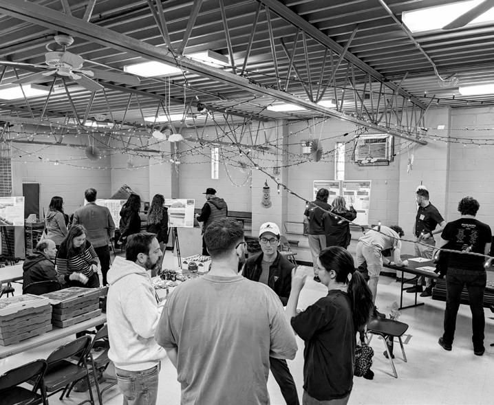
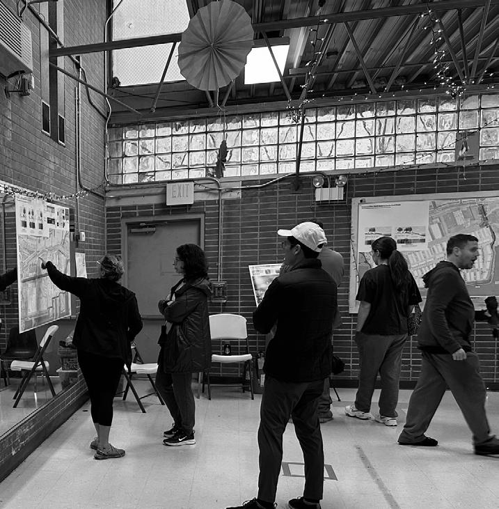
Open House – Public Meeting #1
The community input process kicked off with an Open House event. The Delaware River Trail Extension Open House event attracted 40+ attendees and was held on Saturday, April 29th from 2 PM to 4 PM at Bedrock Church in the Fishtown neighborhood of Philadelphia. The goals of the open house were to help attendees understand the project scope and to collect feedback on how they would access and use the riverfront trail, and what challenges and opportunities they perceived.
Attendees were asked to visit a series of stations, laid out in a “trail” formation. In keeping with the broad engagement approach, this meeting followed a multi-media approach. Drone footage of the study project scope helped attendees orient themselves and understand the project context. Additional videos and photography showcased the look and feel of the built portion of the DRT. Boards provided information about the proposed interim and final planned trail alignments, project context, potential connector streets, and potential safety improvements.
The meeting also provided many opportunities for attendees to share their opinions. One station asked attendees to indicate their preferred routes to access the trail, while another recorded preferences on methods to increase safety. A large-scale printed map helped attendees visualize the project scope while also providing space to suggest site-specific amenities and concerns. Comment cards allowed for anonymous project input, while a mad-libs style survey encouraged respondents to envision how they would like to access and use the trail. To engage the youngest attendees, a trail coloring station helped kids visualize their ideal day on the proposed Delaware River Trail extension.
Attendees were given flyers with QR codes which linked to the online survey, to enable them to provide even more detailed input, and had the opportunity to sign up for email updates from DRWC.


Public Engagement
Delaware River Trail / Columbia To Lehigh Extension Alignment and Conceptual Access Study 47
Clockwise from top left: Attendees review the drone video of the existing riverfront and surrounding context; a sample of the Mad-Libs style survey; participants providing feedback on the large map; detailed view of comments placed on the large map (over 65 responses were collected).
Online Input
In keeping with the multi-faceted engagement approach, participants had two initial opportunities for input through online mediums.
Online Mapping Tool
An online Wiki-map introduced the proposed interim and final planned trail alignments to participants, and allowed them to add site-specific comments. The Wiki-map also allowed participants to respond to each other’s comments, starting a dialogue on specific spatial design concerns and recommendations. Participants left over 40 comments. Comments were generally most focused on pedestrian and cyclist safety issues crossing Delaware Avenue and Richmond Street. The comment enlargements shown to the right give a flavor of the many comments received.
Online survey
A detailed online Google survey gathered data from participants including: how participants access the trail (whether by vehicle, on foot, or by bike); which routes they prefer to take to reach the waterfront; safety concerns; desired amenities; how they would use the trail; frequency of use; and who they would like to use the trail with, in addition to other data points. 347 people participated in the online survey. A Spanish language version of the survey was available, in addition to the English language version.


See the Findings section on page 50 for a thorough exploration of the online survey results. Public


Engagement
and
Delaware River Trail / Columbia To Lehigh Extension Alignment and Conceptual Access Study 48
The amenities map (right) received over 68 responses (enlargement shown on the left) from participants of the open house, and most comments fit within the categories of safety concerns, amenities,
programming.
Open House – Public Meeting #2
The planning team gathered the feedback from the first round of stakeholder and public engagement and integrated it into the conceptual trail design. The goal of the second public meeting was to share the planning study results with the community and to gather feedback on project priorities. Public Meeting #2 was held on Saturday, October 14th from 1 PM to 3 PM at Cione Recreation Center in the Olde Richmond neighborhood of Philadelphia. Approximately 20 attendees came to the meeting, with lower-than-expected turnout due to the cold and rainy weather.
Online Input- Prioritization Survey
In keeping with the goal of Public Meeting #2, a short online survey gathered data from participants to understand how they would like to prioritize project elements. The survey received 112 responses. A Spanish language version of the survey was available, in addition to the English language version. The Survey also included a final opportunity for participants to provide openended comments.
See the Findings section on page 50 for full prioritization survey results.
Columbia Ave to Lehigh Ave Extension Extensión de Av. Columbia a Av. Lehigh Public Open House Jornada de puertas abiertas
Saturday / Sábado
Oct 14 1-3 pm
During the meeting, attendees were asked to visit a series of stations in an open house format, similar to the first public meeting. Video and boards provided project context and an overview of the phase one engagement results. Color-rendered plans provided a developed view of the project design, indicating trail alignments, safety improvements, potential planting areas, potential new park and gathering spaces, opportunities for new public art and living shoreline improvements. Three perspective renderings visualized the potential improvements at key locations. Material, site furnishing and planting palette boards provided additional details about how the future DRT and connector streets could look and feel, while a project timeline illustrated the process towards final construction.
Learn what we’ve heard so far from the community & where we are in the project!
¡Conozca lo que hemos escuchado hasta ahora de la comunidad y dónde nos encontramos en el proyecto!


Attendees were asked to select their top three priority areas for improvements to help the design team understand which parts of the projects are most desired by the community. Attendees also had an opportunity to provide comments on any other aspects of the project and to sign up for email updates from DRWC.
Public Engagement
Free Pizza and Refreshments Pizza y Bebidas Gratis For More Info Visit / Para más información visita: https://tinyurl.com/59htdb2w
Cione Rec
Entrance through
en el centro
2600
at
Center 2600 Aramingo Ave
Playground
recreativo Cione
Av. Aramingo Entrada por Patio de juegos Includes Activities for Children Incluye actividades para niños
Delaware River Trail / Columbia To Lehigh Extension Alignment and Conceptual Access Study 49
Findings
activities and amenities they would like to see on the trail, and much more. This section provides an in-depth summary of the findings that emerged through the public engagement process.
Over 75% of respondents live near the future trail
Throughout engagement, survey respondents had the option to voluntarily provide demographic data, which helped give an understanding of the engagement effort’s reach. Respondents provided many data points on how and why they would use the trail, perceived safety issues, the types of Zip Code
Neighborhood Response Map
Note that the zip code and neighborhood counts above reflect online survey data only.

Less than 5 counts per Zipcode:
3 counts: 19107, 19145, 19104
2 counts: 19135, 19137, 19146, 19143, 19124
1 count: 19131, 19116, 19446, 19121, 08075, 19440, 19133, 19119, 08108, 19115, 19428, 19149, 19023, 08109, 19064, 19128, 19008, 19127, 19225, 08035
Delaware River Kensington 2 Respondents Frankford Creek East Kensington 28 Respondents Olde/South Kensington 9 Respondents Olde Richmond 67 Respondents Fishtown 117 Respondents Northern Liberties 7 Respondents Port Richmond 29 Respondents Project Focus Area North IndustrialFutureRichmond Trail KensingtonAve FrankfordAve RichmondSt AramingoAve AlleghenyAve TiogaSt SomersetSt I-95 Public Engagement
Zip Code Neighborhood Counts 19125 East Kensington/Fishtown 210 19134 Kensington/Port Richmond 32 19147 Queen Village/South Philly 16 19122 Olde Kensington/North Philly East 12 19123 Northern Liberties 9 19103 Center City West 8 19130 Fairmount 8 19148 South Philly 7 19106 Old City 6
Delaware River Trail / Columbia To Lehigh Extension Alignment and Conceptual Access Study 50


Nearly 95% of respondents would use active transportation to access the trail
1 response: Native American, Asian or Pacific Islander/White or Caucasian, Multiracial, White or Caucasian/Portuguese, Black or African American/White or Caucasian, Human, Arab, Asian or Pacific Islander/Black or African American/White or Caucasian
TOP CHOICE


Public Engagement
Age Gender
Access
Ethnicity
Activities
Image Credits, Top and Bottom: Matt Stanley for DRWC
Ethnicity Count: White or Caucasian 264 I prefer not to say 24 Asian or Pacific Islander 12 Latino or Hispanic 8 Latino or Hispanic, White or Caucasian 8 Black or African American 6 Asian or Pacific Islander, White or Caucasian 4 Native American, White or Caucasian 2 Delaware River Trail / Columbia To Lehigh Extension Alignment and Conceptual Access Study 51
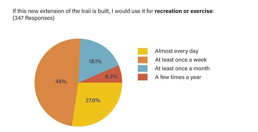
Over 75% of respondents would use the trail at least once a week, with 27% using it every day.


Most respondents in both in-person meetings and online expressed that they would like to bring young children to visit the trail. Multiple respondents felt strongly that safety improvements are necessary before they feel comfortable accessing and using the trail with kids.

"My kids and I would bike more, but the cross-city traffic is the worst. I need clear bike trails with minimum road crossings, and especially no interstate access-people always take those too fast."


Children were engaged as part of the community outreach process, to gather all perspectives and encourage a new generation of trail users.
Public Engagement
Frequency of Use Kids
Image Credit: Matt Stanley for DRWC
Delaware River Trail / Columbia To Lehigh Extension Alignment and Conceptual Access Study 52
Intersection Safety
Crossing Delaware Avenue and Richmond Street is a major barrier to accessing the Delaware River Trail. Attendees were asked about their comfort with crossing specific intersections on these roadways.


"Please prioritize making the Delaware River Trail as continuous, safe, and as easy to access as possible."
"The more protected lanes that exist and bridge the disconnect across Delaware Ave. the more likely people are to use the trail. Safety is #1, and everything else that follows is a wonderful bonus."
Public Engagement
SCARIEST INTERSECTION
Delaware River Trail / Columbia To Lehigh Extension Alignment and Conceptual Access Study 53
Analysis
In gathering open-ended write-in comments from in-person attendees and online results, patterns began to emerge. Open-ended respondent comments can be placed into four categories, which are shown below, along with the number of comments received within that category. In the following pages, that same categorization has been used to organize all feedback, whether from write-ins or from specific survey data questions.
Concerns
Issues or barriers to accessing or using the trail
(155 comments)
Amenities
Specific features or facilities users would like to see on the trail.
(158 comments)
Program
Activities users would be like to do on the trail (88 comments)
Connectivity
Questions or comments about trail linkages and trail alignments (34 comments)
Concerns Safety from Vehicular Traffic
The largest concern that emerged from the engagement process was for increased safety for pedestrians and cyclists and protection from vehicles. Participants were insistent about the importance of traffic calming and safety improvements along the connector streets to the DRT. Safety concerns primarily referenced the current need to cross highvolume and high-speed streets to access the waterfront. Concerns also included the speed of e-bikes and ATVs on the proposed trail. Respondents highlighted that their favorite aspect of the trail is having safe biking and walking access away from cars to the waterfront from their homes. Also related to traffic safety, many respondents favored clear bicycle/pedestrian separation.
The most frequent request from future trail users was for safer places to bike and walk.
“Clear signage about sharing the space, i.e. slower foot traffic keeping to the right, encouraging cyclists to announce they are passing, a bike repair station.”
“These days I work mostly from home but still commute [with] my daughter to daycare via bike. Getting to the existing trail isn’t a safe enough ride that I’d take her that way often.”


Q: What other amenities would you like to see along the Delaware River Trail extension?
A: “Anything that slows traffic on Delaware Ave.”
Engagement
Public
Delaware River Trail / Columbia To Lehigh Extension Alignment and Conceptual Access Study 54
Ideas for Improvements
The planning team introduced ideas for improvement or “interventions,” to help visitors access the Delaware River Trail. In-person attendees ranked those interventions as follows:
TOP CHOICE


#1
Leading Pedestrian Intervals
(23 responses)
This simple change to the traffic signal timing allows pedestrians to cross a few seconds before cars.
#2
Protected Medians (22 responses)
Curbed medians highlight where to expect crossing pedestrians and make the intersection feel smaller.
#3 Special Lighting
(5 responses)
Overhead/sidewalk lighting can act as wayfinding and make the walk from/to the trail extension more inviting.
#4 - TIED Wayfinding Signage
(5 responses)
Wayfinding helps people in the neighborhoods find the nearest connector street to access the DRT and amenities.
#4 - TIED Corner Wedges
(5 responses)
Concrete islands installed to discourage drivers to make the wide, fast turns, but still allow truck trailers to turn.
“Please, please, please for the love of god get the trash situation under control. There is garbage everywhere along Richmond street in Port Richmond and Olde Richmond. We need amenities or service teams to clean up our communities!”
Maintenance
Maintenance is another significant concern for many respondents. Respondents express that a well-maintained trail will encourage trail use. The most frequent maintenance concern is trash, with residents asking for litter receptacles that are frequently emptied. Some residents expressed concern about pet waste.
Personal Safety/Crime
“Making access to the trail by keeping the I-95 underpasses clean and lit is very important so people are not deterred from venturing from their neighborhoods to the trail.”
“I cannot express the importance of trash cans... make it easier for folks to walk their dogs and dispose of items appropriately.”
“Make sure that the casino, for instance, cannot just close the trail whenever they feel like it (as well as the other private entities through which the trail passes).”
“How are we going to prevent tent cities along the trail?”
“[I would like to see] a safe place for unhoused people to exist. No anti homeless architecture.”
"[I would like to see] security officers on bikes at least on weekends or high traffic times"
Personal Safety/Crime is also a major concern for many respondents. Multiple respondents would like to see security officers on bike at least on weekends or high traffic times. Many residents recommended lighting improvements for safety and some recommended cameras. Some respondents indicated that more vendor activity and shops would make them feel more comfortable using the waterfront. Residents recommended open lines of sight to avoid feeling isolated and enclosed. Many residents indicated a particularly unsafe feeling area is the underpasses under I-95. Residents express concern about drug use, loitering and illegal activities. Some residents express concern about unleashed dogs.
Privatization Concerns
Residents expressed some concerns about the interaction between the planned/in-progress developments and the trail. Some residents were concerned that private entities will close or block the trail or treat it as private property. Respondents want the trail to be fully open, as is the intention. Since much of the final planned trail alignment within the study area is located within easements on private property, careful design decisions will be important to ensure the public feels confident the trail is a public amenity for all to use.
Unhoused People
A few respondents expressed concerns about the unhoused people living in spaces near the trail or under I-95. Respondents were unclear who is responsible for maintaining the spaces under I-95 and expressed concern about drug use from some unhoused individuals. On the other hand, respondents also expressed a desire to avoid hostile architecture, and to consider a safe place for unhoused individuals to exist.
Public Engagement
Image Credits, Top to Bottom: City of San Gabriel, Google Earth, Tom Crane, MERJ, Google Earth
Delaware River Trail / Columbia To Lehigh Extension Alignment and Conceptual Access Study 55
Amenities
Respondents had the opportunity to select the amenities they would like to see along the proposed trail.
Lighting was the top-ranked trail amenity for respondents. Lighting improvements are recommended both along the trail, and at connector streets to improve access to the trail. Litter/ recycling receptacles were the second most popular amenity.
Lighting was the most selected user amenity
Restrooms were also a highly desired amenity. Many respondents made clear to note that well-maintained restrooms were important, and any built restrooms should include a plan for maintenance. Public restrooms align with the “All Ages and Abilities” design ethos by providing a vital service for all trail users that is frequently lacking in Philadelphia’s open spaces.
Seating was another top-ranked amenity, which is also a component of trail design for all ages and abilities. Many respondents felt seating could provide peaceful places to relax and rest.
While trees were not listed as an option in the Amenities question of the online survey, the desire for trees came up frequently in the open-ended responses. As on the built portions of the DRT, new trees are planned wherever possible on the future DRT.


“Bathrooms and trash cans that are regularly maintained!”
TOP CHOICE

“Trees, trees and more trees! This area lacks life, greenery and shade. Also a kids playground similar to Penn Treaty would be nice. And more trees!
Amenities Under the Cap
“Benches...we have elderly family members who we’d like to take for walks there.”


Bright Overhead Lighting Mural Opportunity Public Engagement
Additional Write-In Amenities (ranked by frequency): Trees, Bike Amenities, Playgrounds, Educational Signage, Amenities for Dogs/Dog Parks, Fitness Equipment, Sport Courts, Solar Panels
Image Credits, Top and Bottom: Matt Stanley for DRWC Image Credits, Left: Underground at Ink Block, Right: Downtown Evansville Indiana
Delaware River Trail / Columbia To Lehigh Extension Alignment and Conceptual Access Study 56
Program
Respondents weighed in on the types of programmatic activities they would like to be able to do on the trail. The most frequent request from respondents was that they would like to see the trail activated by vendorseither temporary pop-up or permanent shops. Respondents noted that food and drink vendors, like cafes or coffee shops, would encourage them to visit and stay longer on the trail. Some respondents specified they would like to see pop-up events, like a beer garden or food trucks. Vendors could be local businesses, to strengthen the connection to local neighborhoods.
River access was another significant programmatic request from respondents. Many respondents wanted river access to launch kayaks and canoes, while others indicated a desire for fishing, or simply sitting on a bench or swing with waterfront views.
Many respondents expressed a desire to connect with nature through the planned trail. They would like to see improved plantings, including native plants to support pollinators. Multiple respondents also highlighted trees as an important amenity, indicating the proposed trail corridor is in need of extensive greening. Some residents indicated they would like the proposed trail to be a venue for birdwatching.
Relating to natural areas, parks were also important to many respondents. Park amenities were popular selections, with many residents requesting playgrounds, play fields, and natural learning spaces.

“Additional nature paths (i.e. gravel, dirt), off of the main path surrounded by trees and plants.”
“Vendors like food carts or crafts from local/small business”

Connectivity
An overwhelming majority of survey and in-person respondents indicated support for the project’s goal to increase trail connectivity. Many respondents indicated a desire for a longer continuous trail along the Delaware River Waterfront, while many also indicated a desire to connect to the planned Richmond Industrial Trail project. Stakeholder engagement centered on the Richmond Industrial Trail is summarized on page 43.
“Connecting the river through a park on Lehigh viaduct [RIT] should be a top priority.”
“More public parks along the trail and family friendly amenities”
“Please work to have a continuous trail that’s peaceful along the Delaware... [I'd love] a continuous, quiet natural retreat that I can use to get a break from city life."
“I want more wide open spaces directly connected to the water like Penn Treaty...The Schuylkill has an abundance of places to spread out a blanket or hang a hammock, the Delaware doesn’t have as much”


“The [built]trail has been great and has changed how I bike around Philly... it is my first choice to take to go that direction.”
Public Engagement
TOP CHOICE
Image Credit: Parks on Tap
Image Credit: DRWC
Delaware
/
To
Extension Alignment and Conceptual Access Study 57
River Trail
Columbia
Lehigh
Prioritization
During Public Meeting #2 and in the online prioritization survey, participants were asked to consider which aspects of the proposed project are most critical, and to vote for their top three choices. This data is intended to let the design team understand which project components the community would like to see built first. In both the
in-person meeting and the online survey, participants indicated the creation of the Richmond Industrial Trail (RIT), and a ramp to access the RIT near the Lehigh/ Aramingo intersection, as their top priority, followed by safety improvements in the Aramingo Ave./Delaware Ave. intersection.


Both in-person meeting attendees and online survey respondents selected Option #6 as their priority improvement.


Palmer St Northbank Phase II Kawa Trading Corp. Future DRWC Park Glasgow Parcel To York St Interim Delaware River Trail Final Planned Delaware River Trail Richmond AramingoAve Beach St Street 24’ Sidewalk 12’ (10’ Alt.) Shared-Use Sidepath Trail 10’ Planting 4’ Buffer (2’ Alt.) Existing 50’ ROW Susquehanna Ave DyottSt Street 22’ Planting 4’ Shared-Use Sidepath Trail 11’ Planting 3’ Existing 50’ ROW Wider planting strip on east end of ROW. Curb line to be relocated to remove northbound bike lane and allow more space for sidepath, bike ramps added on either end. Dyott Street to be narrowed to a 36’ cartway. New driveway aprons on Richmond and Dyott Streets. New crosswalk to significantly shorten crossing distance at intersection. Median to be widened. Corner wedges to slow down turning passenger cars. Susquehanna Avenue pedestrian connector design encourages walking to Aramingo Ave. intersection. Northbank Phase II Kawa Trading Corp. Future DRWC Park Glasgow Parcel Anderson Parcel To York St Interim Delaware River Trail Final Planned Delaware River Trail Final Planned Delaware River Trail Potential Footpath Potential I-95 (above) Richmond St AramingoAve Shared-Use Trail Buffer (2’ Alt.) 1/8” =1’-0” 8’ DyottSt Berks St relocated to remove lane and allow more space for sidepath, bike ramps added on Dyott Street to be narrowed to a 36’ cartway. New driveway aprons on Richmond and Dyott Streets. New crosswalk to significantly shorten crossing distance at intersection. Median to be widened. Corner wedges to slow down turning passenger cars. Susquehanna Avenue pedestrian connector design encourages walking to Aramingo Ave. intersection. Columbia to Lehigh Extension Oct 14, 2023 / Open House #1 #2 #3 #4
Columbia Ave/Delaware Ave intersection Safety Improvements Aramingo Ave/Delaware Ave intersection improvements New Park at Dyott Waterfront
extension along Beach Street from Penn Treaty Park to Dyott St
Trail
Delaware River Trail / Columbia To Lehigh Extension Alignment and Conceptual Access Study 58


Richmond St Proposed Plan: Dyott Street to Cumberland Street Proposed Plan: Columbia Avenue to Dyott Street Proposed Plan: York Street Proposed Plan: Lehigh Avenue and Richmond Street Proposed Plan: Lehigh Avenue and Allegheny Avenue Index Plan Columbia Ave to Lehigh Ave Extension Extensión de Av. Columbia a Av. Lehigh Delaware River Delaware River Conrail Property Penn Treaty Park The Battery Northbank Phase II Northbank Phase Future Graffiti Pier Park Fishtown Crossing Shopping Center Fishtown Olde Richmond Port Richmond Future Delaware River Trail Existing Trail Future Delaware River Trail ExistingTrail ExistingTrail Existing Trail Future Delaware River Trail Future Delaware River Trail Future IndustrialRichmond Trail Girard Ave Susquehanna Ave AramingoAve Norris St York St DyottSt RichmondSt Richmond St Cumberland St BeachSt Schirra Dr Cumberland St Huntingdon St Lehigh Ave Somerset St DelawareAve I-95 Girard Ave Beach St Thompson Ave Columbia Ave Palmer St Marlborough St Montgomery Ave Berks St Delaware Ave TOP CHOICE #5 #6 #7 Cumberland St/Richmond St intersection improvements, Graffiti Pier Park connection Brighter, more colorful, and more obvious pedestrian route under I95 at Susquehanna St Connect to the future Richmond Industrial Trail Delaware River Trail / Columbia To Lehigh Extension Alignment and Conceptual Access Study 59


Proposed Concepts
61
Project Map
This larger project map shows the built, upcoming, planned interim and planned final Delaware River Trail corridors. The final planned route is the preferred optimal route for the trail corridor. This route follows the riverfront whenever possible. However, considering the realities of land ownership and access, this route requires coordination and acquisition, and represents a longer-term vision for the trail. In the shorter term of realizing the final trail vision, the planned interim trail corridor develops a protected, separated trail that works within street right-of-ways.
The proposed Delaware River Trail links to a network of built trails, including completed segments of the Delaware River Trail which currently ends at Penn Treaty Park. The proposed DRT also connects to a network of planned trails, including the Richmond Industrial Trail, running west towards the city.
Connector streets are specific streets that the community can use to access the Delaware River Trail, and which receive a higher level of design consideration since these streets will link to park spaces along the river. Interstate 95 and the Delaware Avenue and Richmond Street roadways create barriers that limit trail accessibility. Neighbors indicated feeling unsafe crossing in these areas, mostly because of dangerous high-speed vehicular traffic. Well-designed and clear connector streets, with improved intersections, create routes through these barriers. As part of this study, connector streets were reviewed to identify optimal candidates for investment and improvement.
Between the interim trail, final trail, and connector street improvements, the concept design developed here introduces a safer way for the community to access, use and enjoy the Delaware River waterfront.


Delaware River Fishtown Penn Treaty Park The Battery Northbank Phase II JJA Property Glasgow Property Future 15 Trolley Reactivation To Rivers Casino and Spring Garden Street Potential Future DRWC Park Penn Treaty HS Adaire Elementary Fishtown Recreation Center Hetzel Playground I-95trail ConnectingTrail Optimal Waterfront Possible Alignment I-95 Girard Ave Columbia Ave Eyre St Delaware Ave Oxford St Marlborough St Crease St Columbia Ave Oxford St Marlborough St Crease St Richmond St Allen St Delaware Ave Palmer St Girard Ave Palmer St Moyer St Flora St Earl St Wildey St Salmon St Marlborough St Beach St Palmer St Allen St Thompson St Thompson St Montgomery Ave Berks St Susquehanna Ave Norris St Moyer St Thompson St Montgomery Ave Berks St Wildey St AlmondSt Almond St Mercer St Fletcher St DyottSt Beach St Beach St Schirra Dr DauphinSt MercerSt Susquehanna Ave Berks St Moyer St Columbia Ave AramingoAve Aramingo Ave AramingoAve Wilt St Hewson St Schirra Ln Northbank
Proposed Concepts
Delaware River Trail / Columbia To Lehigh Extension Alignment and Conceptual Access Study 62


"I think any redesign must be focused on biking and walking as transportation as well as recreation. This should be a functional trail that helps you get around the city, not just a river promenade."

"This trail is so important to me, it give me hope to see the potential to continue momentum on the amazing progress made over the past few years."


Delaware River Olde Richmond Conrail Property Northbank Phase I Future Graffiti Pier Park Future 15 Trolley Reactivation Richmond Industrial TrailPotential Connector Trail Maritime Academy Charter School IGA CVS Fishtown Crossing Shopping Center I-95 Trail I-95 Trail I-95 Trail I-95Trail Future Delaware River Trail to Allegheny Avenue Final long-term trail route through Conrail property to be determined in the future pending development of parcel. There is no current timeline on this development. Port Richmond To StreetAmerican 0 75’ 150’ North 225’ Huntingdon St RichmondSt BeachSt York St AramingoAve Thompson St Salmon St Thompson St Mercer St Webb St Edgemont St Tilton St Emery St Albert St Sergeant St MoyerSt Aramingo Ave DauphinSt ThompsonSt MercerSt Lehigh Ave Somerset St I-95 Thompson St Richmond St Salmon St Edgemont St Tilton St Cumberland St Richmond St Cumberland St Seltzer St Schirra Ln SedgeviewWalk NorthbankPl
Pettyview
CabotSt Completed
Delaware River Trail
Route
Potential
Potential
Final
Delaware
On-Street
Proposed
Pettyview Ln
Ln
Mainline
Upcoming Delaware River Trail extension through private development
15 Trolley LEGEND Connector Streets Existing/Proposed Connector Trails
Intersection Improvements at Connector Streets
Interim Delaware River Trail
Planned
River Trail
Bike Lanes
Concepts
Delaware River Trail / Columbia To Lehigh Extension Alignment and Conceptual Access Study 63

Proposed Concepts
The following concepts present potential designs for the next segments of the Delaware River Trail. The plans and typical sections illustrate trail alignments and dimensions, hardscape elements, landscape improvements, pavement markings, and recreational amenities for the extent of the project area. The recommendations in this report are the outcome of extensive stakeholder and public engagement, analysis of existing and projected conditions, and best practices for an approach to trail design for all ages and abilities.
Given that this section of the urban waterfront is in a state of rapid development and change, any future design phases for the Delaware River Trail will need to assess any conditions that may have changed that will impact the conceptual designs indicated here.
Image Credit: Rocco Avallone
Delaware River Trail / Columbia To Lehigh Extension Alignment and Conceptual Access Study 64


Delaware River Penn Treaty Park The Battery Northbank Phase II Northbank Phase I Future Graffiti Pier Park Fishtown Crossing Shopping Center Fishtown Olde Richmond Port Richmond Delaware River SHEET B SHEET A SHEET C SHEET D SHEET E SHEET F SHEET G SHEET H SHEET J SHEET I 0 250’ North 500’ Future Delaware River Trail Future Delaware River Trail Future IndustrialRichmond Trail Susquehanna Ave AramingoAve Norris St York St DyottSt RichmondSt Richmond St Cumberland St BeachSt Schirra Dr Cumberland St Huntingdon St Lehigh Ave Somerset St DelawareAve I-95 Girard Ave Beach St Thompson Ave Columbia Ave Palmer St Marlborough St Montgomery Ave Berks St Delaware Ave Proposed Concepts Index Plan Delaware River Trail / Columbia To Lehigh Extension Alignment and Conceptual Access Study 65
Concept Sheet A
This concept plan shows the planned DRT from its current built northern terminus at Penn Treaty Park. In the park, the final planned trail corridor navigates a frequently flooded area with large mature trees and connects to a recently constructed trail segment between the Battery project and the
Section 1 Beach Street Between Columbia and Montgomery
waterfront. On Beach Street, the Interim Trail corridor provides a separated trail segment starting at Columbia Avenue. Safety improvements improve the Columbia Avenue and Delaware Avenue intersection for all users.

The interim trail improvements formalize Beach Street. Existing street curbs are shifted 2', to carve out an 11' shared-use sidepath trail. Planting buffers are introduced between the trail and street. Existing utility poles on the west side of Beach Street (left-hand side) are planned to remain. On the east side of Beach street (right-hand side), a planted buffer separates trail users from vehicular traffic.
Corner Wedge Examples


Corner Wedges are concrete islands installed to discourage drivers to make the wide, fast turns. They permit truck trailers to mount the curb turn when needed. Top image: Bend, Oregon. Bottom Image: Frankford Roundabout, Philadelphia Pennsylvania.
Image Credits, Top to Bottom: Google Earth, Philadelphia Atlas
Proposed Concepts Street 22’ Sidewalk 12’ (10’ Alt.) Planting 4’ Shared-Use Sidepath Trail 11’ Buffer 1’ (3’ Alt.) Existing 50’ ROW
1/8” =1’-0” 0 8’ 4’ Delaware River Trail / Columbia To Lehigh Extension Alignment and Conceptual Access Study 66 Beach St
Scale:
Median to be extended to protect crosswalk.

Corner wedges to be placed at these corners to slow automobile turns from southbound Delaware Avenue, while allowing truck turns and existing drainage patters to continue. See previous page for examples.
Existing Delaware River Trail to Rivers Casino and Race Street Pier
Shared-use sidepath to begin at intersection. Coordination to occur with Parks & Recreation on possible gateway entrance into park.
Existing spur trail to remain and tie-in to new Beach Street sidepath.
Section 1
See previous page
Delaware River Trail connection between Penn Treaty Park and The Battery to be completed by DRWC.
Note: Improvements on Battery property are by others.
SHEET B SHEET B
Concepts The Battery
St.
Penn Treaty Park Proposed
1325 Beach
Scale: 1” =80’ 0 40’ North 80’ Existing Delaware River Trail Interim Delaware River Trail Delaware River Trail / Columbia To Lehigh Extension Alignment and Conceptual Access Study 67
Columbia
Delaware
Palmer
Palmer
Beach St Beach St
SHEET A
Delaware Ave
Ave
Ave
St
St
Concept Sheet B
This concept plan shows the final planned DRT from the recently constructed trail segment between the Battery project and the waterfront. This final planned route includes footpaths to bring users closer the the river, and identifies a scenic location as a potential site for public art. The plan also
Section 2 Beach Street Between Montgomery and Dyott
shows connectivity to the potential future DRWC Park at Dyott Street (Dyott Park), explored in more detail on page 72 . Along Beach Street, a separated trail serves as the interim trail corridor. The plan formalizes the design of Beach and Dyott Streets, improving safety for all users.
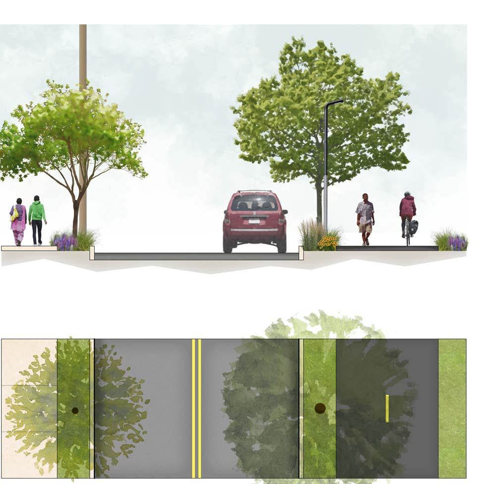
The interim trail improvements formalize Beach Street. Existing street curbs are shifted 2', to carve out an 11' shared use sidepath trail. Planting buffers are introduced on both sides of the street. Existing utility poles on the west side of Beach Street (left-hand side) are planned to remain, though PennDOT and the city may decide to have the power lines placed underground. On the east side of Beach street (right-hand side), a planted buffer separates trail users from vehicular traffic. The planting buffer between the trail and the eastern right of way line may ultimately become paving as it may interface with future buildings.
Proposed Concepts
Street 22’ Sidewalk 6’ Planting 4’ Shared-Use Sidepath Trail 11’ Planting 3’ Planting 4’ Existing 50’ ROW
Scale: 1/8” =1’-0” 0 8’ 4’ Delaware River Trail / Columbia To Lehigh Extension Alignment and Conceptual Access Study 68 Beach St

SHEET D SHEET D SHEET A SHEET C SHEET C SHEET C The Battery Potential Future DRWC Park Delaware River Proposed Concepts Anderson Parcel 1501 Beach St. Glasgow Parcel 1701-25 Beach St. Kawa Trading Co. 1701-37 N. Delaware Ave.
Scale: 1” =80’ 0 40’ North 80’ Final Planned Delaware River Trail Final Planned Delaware River Trail Potential Footpath Potential Footpath Interim Delaware River Trail Delaware River Trail / Columbia To Lehigh Extension Alignment and Conceptual Access Study 69 Berks St Beach St Beach St DyottSt Susquehanna Ave I-95 Trail Connector, see Sheet C on page 71 for more details. Cartway of Beach Street shifts by two feet in this area. See Section 2 on previous page. Section 2 See previous page Delaware River Trail on Anderson and Glasgow parcels to be constructed pending public site control or development; timeline unknown. Potential Location for Public Art
SHEET B
This concept plan shows the planned DRT at Beach Street, along with the trail connection across Delaware Avenue/Richmond Street to the existing multi-use trail parallel to Aramingo Avenue. Identified as the most unsafe intersection during the public engagement process, Aramingo Avenue is shown with a number of safety interventions, including corner wedges and
Susquehanna Ave Between Beach and Delaware
Existing 50’ ROW
Sidewalk 12’ (10’ Alt.)
Street 24’
Planting 4’
a widened median. The plan also explores a future signalized intersection at Berks Street and Delaware Avenue. Susquehanna Avenue is given street and trail improvements, and under the elevated I-95 a pedestrian corridor connects the trail to the neighborhood. See page 88 and 89 for a more extensive study of this space. The plan formalizes the design of Beach and
Shared-Use Sidepath Trail 10’
Sheet C Truck Turning Study
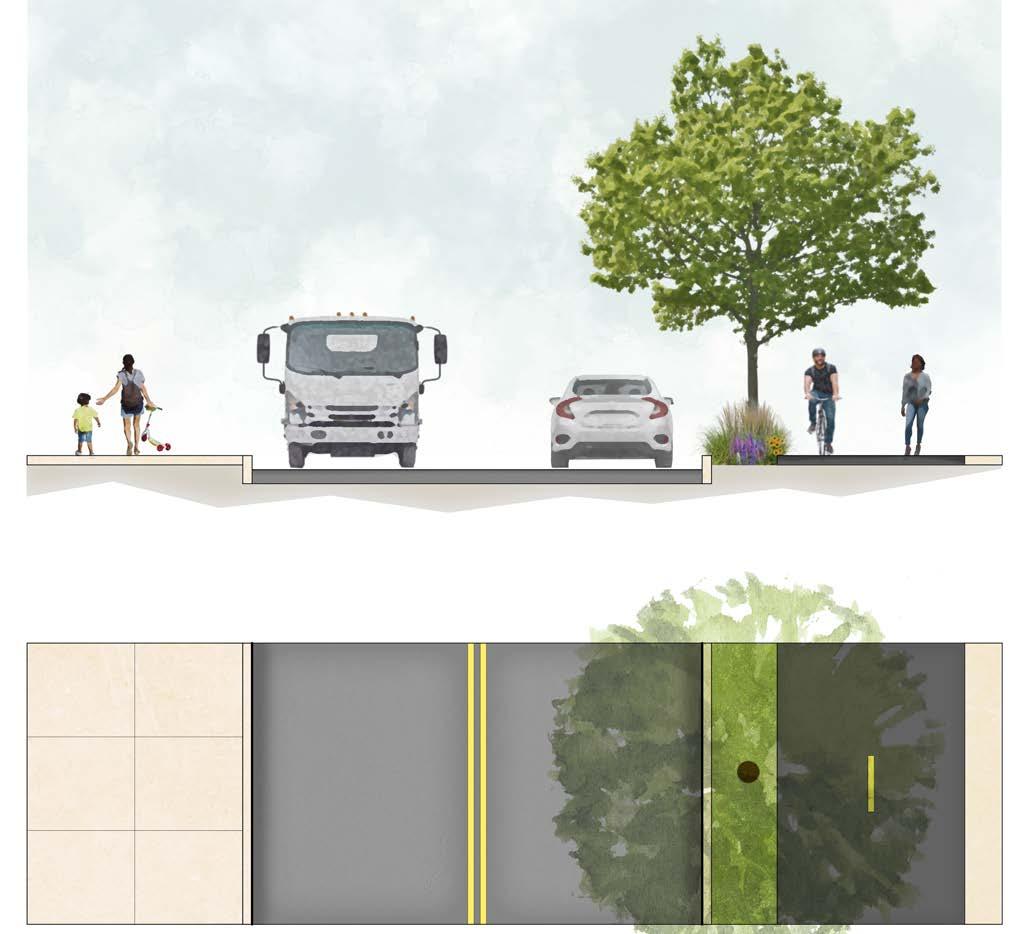
Buffer (2’ Alt.)
The interim trail improvements formalize Susquehanna Ave, and provide a connector to the I-95 Trail. The existing northern (right-hand side) street curb is shifted 2' south, to carve out a 10' shared use sidepath trail with a planting buffer. The existing southern curb and sidewalk remains in place.
Concept Sheet C Proposed Concepts
Dyott Streets, improving safety for all users. The plan also shows connectivity to the potential future DRWC Park at Dyott Street (Dyott Park), explored in more detail on page 72.

Scale: 1” =80’
0 80’ 40’ North
The safety features proposed at this intersection include a median island on the eastern side of the intersection and corner wedges on the northern legs of the intersection. The median refuge island significantly shortens the crossing distance for pedestrians crossing a wide Richmond Street, while the corner wedges serve as traffic calming of passenger cars turning from and onto Aramingo Avenue. To locate and maximize these safety features without impacting existing traffic operations, a turning analysis was performed. While passenger cars were used to design the corner wedges, a WB-67 truck was used to design the median island. The WB-67 was chosen to simulate delivery trucks driving south and turning left onto Richmond Street to head to the Kawa Trading Corporation facility (1701-37 N. Delaware Ave.).
Kawa Trading Corp. 1701-37 N. Delaware Ave. Section 3
Scale: 1/8” =1’-0”
Delaware
/ Columbia To Lehigh Extension Alignment and Conceptual Access Study 70
0 8’ 4’
River Trail
Susquehanna Ave Richmond St DyottSt AramingoAve

CFuture signalized intersection here by others. Berks Street between Delaware Avenue and Beach Street may be widened in the future to accommodate two-way vehicular traffic with onstreet bicycles. Traffic study should take place on Berks Street between Delaware Avenue and Girard Avenue to investigate a change to oneway westbound to allow for bicyclist one-way pair with Columbia Avenue.
Susquehanna Avenue pedestrian connector design encourages walking to Aramingo Ave. intersection. See Sheet J on page 89 for more details.
Section 3
See previous page I-95 Trail Connector
Curb line to be relocated to remove northbound bike lane and allow more space for sidepath. Bike ramps on either end allow bike lane users to continue journey.
Corner wedges to be placed on this side of intersection to slow down turning passenger cars.
New crosswalk to be added to significantly shorten crossing distance at intersection. Median to be widened to accommodate northbound double left turn.
Dyott Street to be narrowed to a 36’ cartway. New driveway aprons on Richmond and Dyott Streets will allow trucks with 53’ trailers to continue to use the 1701-37 N. Delaware Ave building loading dock. See turning template on previous page.
SHEET B SHEET B SHEET D Potential Future DRWC Park To York St Proposed Concepts 1609-13 N. Delaware Ave. 1615 N. Delaware Ave. Kawa Trading
N. Delaware Ave.
2001 Richmond St. Glasgow
1701-25 Beach St. Anderson
Co. 1701-37
Northbank Phase II Development
Parcel
Parcel 1501 Beach St. SHEET
Scale: 1” =80’ 0 40’ North 80’
Interim Delaware River Trail Delaware River Trail / Columbia To Lehigh Extension Alignment and Conceptual Access Study 71 Delaware Ave Berks St
Richmond St AramingoAve
St DyottSt
ExistingMulti-UseTrail
Susquehanna Ave
Beach
This concept plan connects the planned DRT at Beach Street to the portion of the trail already constructed as part of the Northbank development. The waterfront portion of the trail will includes pedestrian foot path that will bring visitors closer to the river. The design includes space for a potential new pier park between Beach Street, Dyott St, and the waterfront. The design also
includes a potential future DRWC Pier Park. The other piers in this area were assessed and deemed unsafe for park use. The trail and potential Pier Park here have views of the Ben Franklin Bridge to the south. This portion of the trail has potential for gathering spaces and public art installations. A birds-eye rendering of this area is on page 75.


The trail here has an opportunity to separate the share-use trail and a pedestrian foot path. This foot path brings visitors closer to the river. This is similar to Section 6 on page 82 . Added space and waterfront access offer opportunity for riparian and living shoreline plantings; see page 102
Concept Sheet D Proposed Concepts
Potential Future DRWC Park

Kawa Trading Corp. (1701-37 N. Delaware Ave.)
DRWC has identified a potential future park at the waterfront edge of Beach Street and Dyott Street. This future park (Dyott Park) is an ideal location for park programming on the waterfront. The park location aligns with the goals of the Master Plan for the Central Delaware (2012) to build a connected network of civic spaces, with parks located every half-mile along the waterfront connected by the Delaware River Trail. The Dyott Park location has excellent views of the Ben Franklin bridge to the south and lies at an important intersection of trail segments, making it a great candidate for a public art opportunity. This location was once where the Aramingo Canal met the Delaware River in the second half of the 19th Century. By 1902, the canal was removed and replaced with the current PWD combined sewer overflow, which will need to be considered during park design.
Footpath 6’ Planted Meadow 10’-20’ Planting 4’ Tidal Extent Distance TBD Shared-Use Trail 12’ Mean High Water Delaware River Living Shoreline Planting Area Lawn at Northbank Ph II Planting 6’ Section 4 Located East of Northbank Ph II on the Delaware Riverfront Mean Tide Level Mean Low Water
Potential Future DRWC Park
Northbank Phase II
Scale: 1/8” =1’-0” 0 8’ 4’ North Final Planned DRT
DRT
Delaware River Trail / Columbia To Lehigh Extension Alignment and Conceptual Access Study 72
Richmond
Final Planned
Interim DRT
Beach St DyottSt
St

SHEET B SHEET C SHEET G SHEET G SHEET B Potential Future DRWC Park Delaware River Potential Future DRWC Pier Park at Pier 75N Proposed Concepts Approximate DRWC Parcel Line Northbank Phase II Development 2001 Richmond St. Northbank Phase I Development 2001 Beach St. SHEET D Scale: 1” =80’ 0 40’ North 80’ Final Planned Delaware River Trail Existing Delaware River Trail FinalPlannedDelaware River Trail Delaware River Trail / Columbia To Lehigh Extension Alignment and Conceptual Access Study 73 Shirra Dr BeachSt NorthbankPl Pettyview Ln Section 4 See previous page Potential Location for Public Art

Pier 68, constructed by DRWC in 2015, is a precedent example for the way in which unused piers can be transformed into waterfront destinations, ideal for fishing, lounging, and enjoying the river.
Image Credit: DRWC for Visit Philadelphia

Race Street Pier, constructed by DRWC in 2011 on an unused former industrial pier, has become a beloved recreational amenity on the river, with plentiful shade and amazing views.
Image Credit: R Kennedy for Visit Philadelphia
"
[I would like to see] more trees for more hammocks by the river!"
"[I would like to see] arts installations, that give off the vibe of the area — such as a graffiti area, a boat area, a rail area, tie the theme to the neighborhood's history"
"Providing natural shade in these areas will make this area more inviting and reduce heat island effect."
"I really like the plan. Sticking as close to the river as possible is ideal, as this makes the ride much more pleasant... the optimal route would have as little interaction with cars and as little adjacency to stroads as possible."
"Build it faster. Plant lots o trees."
Delaware River Trail / Columbia To Lehigh Extension Alignment and Conceptual Access Study 74


1 2 3 5 7 8 9 10 4 6 1 2 3 3 3 4 5 6 7 8 9 10 10 Delaware River Fishtown Olde Richmond Port Richmond Index Plan Bird’s Eye View of the New Delaware River Trail Extension Looking South Riverfront Pedestrian Walk 12’ Wide Shared Use Path Living Shoreline Improvements Potential Future DRWC Park at Dyott St Potential Future DRWC Pier Park Interstate 95 Northbank Development The Battery Penn Treaty Park Pier in Unstable Condition; Potentially Seeded with Native Grasses and Wildflowers Proposed Concepts Delaware River Trail / Columbia To Lehigh Extension Alignment and Conceptual Access Study 75
Concept Sheet E
This concept plan indicates bicycle and pedestrian safety improvements at the Aramingo Avenue and York Street intersection. Modifications on York Street bring the existing bicycle lanes down to the intersection. Trail connectivity is improved with intuitive linkages to the built I-95 Trail. Curbprotected bicycle lanes will help to better channelize and buffer cyclists from the high volume of turning traffic on York Street. For eastbound cyclists, it is recommended that a bicycle signal be added due to the current right turn signal. Green pavement markings with arrow guidance show cyclists the counter-clockwise movements in the intersection to traverse between the on-road bike lanes and the I-95 Trail. The I-95 Trail approach would also be modified to provide a consistent buffer along the road and communicate the mixing zones with the same pavement materials as the rest of the system.

Proposed Concepts
Delaware River Trail / Columbia To Lehigh Extension Alignment and Conceptual Access Study 76
Bicycle lane pavement markings at 11th Street and Washington Avenue in South Philadelphia. Image Credit: Google Maps
Pavement Marking Example
Protected bike lane on south side of street also reduces cut-through traffic at gas station that avoids red light camera. Bicycle signal is recommended here due to right turn green/flashing yellow signal.

Add green pavement markings around intersection to guide cyclists to/from I-95 Trail and York/Aramingo bike lanes.
Pavement marking configuration to add parking protected bike lane on north side of street, with optional turning wedge at corner.
Trail to be relocated at intersection approach to maintain trail cross section/aesthetic, remove unsightly bollards, and encourage intuitive continuity.
IGA Planet
CVS
Scale: 1” =80’ 0 40’ North 80’
Delaware River Trail / Columbia To Lehigh Extension Alignment and Conceptual Access Study 77
MoyerSt
AramingoAve
HagertSt
Fitness
To Susquehanna Ave and Delaware River Trail Proposed Concepts Fishtown Crossing 2401 Aramingo Avenue SHEET E
I-95Trail
AramingoAve York St
Aramingo Ave EDauphinSt ThompsonSt MercerSt CabotSt York St
Cumberland St Cumberland St Thompson St
Webb St Edgemont St
Concept
This concept plan illustrates safer access across Richmond Street along Cumberland Street, while formalizing Cumberland Street as shown in Section 5 below. Access to the future Graffiti Pier Park, which is currently in design, is
Section 5
Cumberland Street Between Beach and Richmond
indicated from the DRT and from Cumberland Street. A planted buffer is shown between Northbank Phase I and the trail on the north side of the property.

A large right-of-way at Cumberland Street offers space for sidewalks, planting, parking, on-road bike lane, vehicular lanes, planting areas, and the shared-use trail. A planned PWD utility project will inform the possibility of a planted median. This design formalizes Cumberland Street, making it safer, shaded, and more pleasant for all users.
Sheet F Truck Turning Study

The safety features proposed at this intersection include extending the median island on the western leg of the intersection , as well as bumping the median curb on the north leg out towards the west. Extending the median refuge island significantly shortens the crossing distance for pedestrians crossing a wide Richmond Street. Bumping the median curb out on the northern leg serves dual purposes of shortening the crossing distance for pedestrians crossing Cumberland Street and slowing down southbound traffic on Cumberland as vehicles approach the intersection.
To locate and maximize these safety features without impacting existing traffic operations, a turning analysis was performed. The design vehicle for each turn was determined by assessing the same turn in the existing condition and designing for the largest truck that can currently make each maneuver. For the right turns from and onto Cumberland Street, a WB-40 truck was used. For southbound traffic turning left onto Richmond Street, a WB-50 was used. Lastly, for eastbound traffic turning left onto Cumberland Street, a WB-62 was used.
Street Lane 11’ Planting 10’ Shared-Use Sidepath Trail 12’ Bike Lane 5’ Street Median 10’ Street Lane 11’ Parking 7’ Buffer2’ Sidewalk 6’ Shoulder2’ Planting 4’ Planting +/- 13’
Sheet F Proposed Concepts
North
8’ 4’ Delaware River Trail / Columbia To Lehigh Extension Alignment and Conceptual Access Study 78 Cumberland St
Scale: 1” =80’ 0 80’ 40’
Scale: 1/8” =1’-0” 0
Richmond St Cumberland St
Extend existing planted median; inside northbound through lane transitions to left turn lane to match current conditions.

Pavement marking plan south of Cumberland as approved by Philadelphia Streets Department, ROW Log # 2020-9132 (to be installed by Concordia Group)
Section 5
See previous page
Median plantings dependent on PWD review due to interceptor in ROW.
SHEET G SHEET G
Entrance Proposed Concepts
F Scale: 1” =80’ 0 40’ North 80’
rail Delaware River Trail / Columbia To Lehigh Extension Alignment and Conceptual Access Study 79
Future Graffiti Pier Park Future Graffiti Pier Park
Northbank Phase I Development 2001 Beach St. 2225 Richmond St SHEET
I-95 Trail InterimDelawareRiverT
I-95 (above) Richmond St AveGirard RichmondSt BeachSt Cumberland St
The elevated I-95 roadway creates a significant barrier to accessing the Delaware River from the Riverwards communities. Bright, colorful, humanscale amenities will make a more comfortable path of travel from the neighborhood to the riverfront trail. Design interventions include color
East Cumberland Street Looking Towards the River below I-95 Proposed Concepts
through public art, improved and interesting lighting approaches, and site furnishings. The Cumberland Street and Richmond Street intersection will also undergo safety improvements. Wayfinding will clarify travel routes, and encourage neighbors to visit the nearby Graffiti Pier Park.

1 1 2 3 5 7 8 9 10 4 6 2 6 11
Delaware River Fishtown Olde Richmond Port Richmond Index Plan
Delaware River Trail / Columbia To Lehigh Extension Alignment and Conceptual Access Study 80


"The neighborhood is excited for improvements to Cumberland Street & Richmond Street (and eventually Graffiti Pier Park! ) improved lighting at the intersection of Cumberland & Richmond... will be key. It is very dark at night currently."
“I do think public art [and] murals would be lovely to see under I-95”
to Reduce
Distance
Ground Mural
to the Future
Park
on Cumberland Street Wayfinding Public Art Sculptural Seating Pole Lights Bright Overhead Lighting Mural Opportunity 2 3 5 7 8 9 10 4 6 1 11
Concepts
Curb Bumpout
Crossing
Raised Crosswalk
Trail Connects
Graffiti Pier
Planting Improvements
Proposed
Image Credit: PORT for DRWC
Image Credit: Streetmakers NL
Image Credit: Schreder
Image Credit: Downtown Evansville Indiana
Image Credit: Cleveland Public Square/Prismatica
Image Credit: Landscape Forms
Image Credit: WMB Studio
Image Credit: Underground at Ink Block
Delaware River Trail / Columbia To Lehigh Extension Alignment and Conceptual Access Study 81
Concept Sheet G
This concept plan connects the planned DRT to the portion of the trail already constructed as part of the Northbank development. The trail design will add plantings, including tree and perennial plants. Additionally a pedestrian foot path will bring visitors closer to the river. The existing riverbank in this area is relatively steep. Grading will need to be approached carefully to consider
existing grades. The trail here has excellent views of the future Graffiti Pier Park to the north and is an excellent location for a gathering node/seating area, or a potential location for public art. Public art could potentially relate to the future Graffiti Pier Park project. Scale: 1/8”
Mean High Water
Mean Tide Level
Mean Low Water

Similar to Section 4 on page 72 the trail here has an opportunity to separate the shared-use trail and a pedestrian foot path, which would bring visitors closer to the river. Added space and waterfront access offer opportunity for riparian and living shoreline plantings. Refer to the section on living shorelines, starting on page 102 . This space has a larger area for living shoreline plantings than shown on Section 4.
Living Shoreline Planted Area 20’-30’ Footpath 6’ Planted Slope 11’ Planted Meadow 10’-30’
Concrete Paving at Northbank Ph I
Extent Distance TBD Shared-Use Trail 12’ Delaware River
Existing
Tidal
Section 6 Located East of Northbank Ph I on the Delaware Riverfront
Proposed Concepts
0 8’ 4’ Delaware River Trail / Columbia To Lehigh Extension Alignment and Conceptual Access Study 82
=1’-0”

iR ev r T r a i l SHEET D SHEET F SHEET D SHEET F Future Graffiti Pier Park Delaware River Proposed Concepts Approximate DRWC Easement Line Northbank Phase I Development 2001 Beach St. SHEET G Scale: 1” =80’ 0 40’ North 80’ Existing Delaware River Trail I tn e r i m De laware Delaware River Trail / Columbia To Lehigh Extension Alignment and Conceptual Access Study 83 NorthbankPl Pettyview Ln Pettyview Ln Pettyview Ln Section 6 See previous page Potential Location for Public Art

Connecting the Richmond Industrial Trail and The Delaware River Trail
In keeping with the project goal to improve trail connectivity throughout the region, the Richmond Industrial Trail (RIT) will provide an important eastwest linkage to the planned Delaware River Trail. This conceptual design studies how trail users could access the RIT at Lehigh Avenue, below I-95. The existing I-95 trail terminates at the south side of Lehigh Avenue. This trail
Concept Sheet H Proposed

Both in-person meeting attendees and online survey respondents selected Option #6 as their priority improvement.


The DRT could connect to the RIT through the constructed I-95 trail, which bridges the space between Lehigh Avenue and Cumberland Street. connects with the DRT at Cumberland Street. To bridge the gap between the I-95 Trail and the planned RIT, a DRT segment could run from the Lehigh Avenue and Richmond Street intersection to the RIT corridor. Intersection and crosswalk improvements will enhance safety for trail users.


Northbank Phase II Northbank Phase I Olde Richmond Port Richmond Delaware River SHEET D SHEET G SHEET H SHEET I Richmond St Schirra Dr Huntingdon St Lehigh Ave Somerset St DelawareAve Thompson
Ave
Concepts
I-95 Trail Future IndustrialRichmond Trail Delaware River Trail / Columbia To Lehigh Extension Alignment and Conceptual Access Study 84
Protected Bike Lane from Lehigh to Cambria (both sides) to be discussed with SEPTA Transition point for bicyclists from onroad bicycle lanes to off-road path.

Raised crosswalk to highlight trail crossing
Two-stage turn box to be relocated within sidewalk to keep turning cyclists out of through bike lane.
Protected bicycle lanes and sidewalk continue to Cambria Street (not shown). Future tentative plans are to transition Delaware River Trail users to current Allen Street detour ramp, which would be closed to traffic, for eventual connection to the Port Richmond Trail at Allegheny Avenue.
Conrail Conrail
St
H Scale: 1” =80’ 0 40’ North 80’
P l a n n e d R i c h m o n d I n d u s t r a i l T r a i l Delaware River
/ Columbia To Lehigh Extension Alignment and Conceptual Access Study 85
Proposed Concepts
2801 Richmond
SHEET
I-95Trail
Trail
I-95 (above)
Richmond
Somerset
Seltzer
Salmon
I-95 (above)
Richmond
St
St
St
St
St Salmon St Tilton St Emery St Lehigh Ave
Accessing the Planned Richmond Industrial Trail at Lehigh Avenue and Aramingo Avenue
This study provides a preliminary vision to access the RIT from the Lehigh and Aramingo Avenue intersection. The design reclaims space from Aramingo Avenue to add a protected, separated two-way bike lane, a large, improved sidewalk, and new plantings. The intersection is made safer with a bump out, striping improvements and paving changes to indicate mixing zones. To get pedestrians and cyclists up onto the Richmond Industrial Trail, a concrete ramp offers ADA-compliant access. Further assessment of the existing structure is needed in future design phases. To alert people to the elevated RIT project, the ramp/wall surfaces could include murals or highly graphic wayfinding art.
Given the limitations of this planning study, the northwest corner of the intersection was not evaluated, though it is strongly recommended to remove the slip lane and allow for protected bike paths through a large traffic island.
Concept Sheet I Proposed
"I'd recommend that your priority should be extension of the core trail network and expansion of feeder trails like the RIT. The best thing you can do to make the trail successful for recreation and bike transit is to work towards the trail network being as extensive as possible."
“Connecting the river through a park on Lehigh viaduct [RIT] should be a top priority.”

"Extending the Richmond Industrial Trail up the Lehigh Viaduct would be so incredibly valuable for making the Delaware River accessible to folks up into the neighborhoods. I personally would love it if there were access at Frankford Avenue!"
Concepts
Image Credit: Google Streetview
Delaware River Trail / Columbia To Lehigh Extension Alignment and Conceptual Access Study 86


Proposed Concepts
I Rendered Elevation I Planned Richmond Industrial Trail (Elevated above Roadway) Planned Richmond Industrial Trail Rehabilitated Bridge Ramp to Richmond Industrial Trail Delaware River Trail / Columbia To Lehigh Extension Alignment and Conceptual Access Study 87 Aramingo Ave Lehigh Ave Dollar Plus Party Fair Building Scale: 1” =20’ North 0 20’ 40’
SHEET
Concept Sheet J
The elevated I-95 roadway creates a significant barrier to accessing the Delaware River. The recent I-95 improvements include interesting hardscape, wall finishes, and some trail connectivity, but the structure’s enclosure, lack of light, and inhospitable scale create a significant barrier for trail users. Survey and in-person public meeting participants noted perceived personal
J-J1
safety concerns under I-95 as a barrier to accessing the waterfront. Design interventions, including color, lighting, and art, can improve user experience and guide visitors towards the trail. A bright and clearly delineated path of travel from the neighborhood to the riverfront trail will make the experience traveling under I-95 more welcoming and comfortable.
Elevation At Susquehanna Avenue Below I-95, Looking Northwest Towards The Neighborhood: Day
“I do think public art / murals would be lovely to see under 95”
“The spaces under I-95 [are] so big and it have so much potential. It’s already well-paved and well-lit, it just needs to be activated so that the community can use it and it can be brought to life.”

J-J1
Elevation At Susquehanna Avenue: Night

NOTE: Existing flood lights below the I-95 structure are not shown; these path lights are intended to supplement and enhance existing lighting while emphasizing the trail.
Proposed Concepts
0 12’ 6’ 0 12’ 6’ Painted Concrete Path Site Furnishing Mural Pole Lighting Overhead Lighting, Typ. Opportunity to Light Mural
Overhead Lighting, Typ. Pole
Lighting
Delaware River Trail / Columbia To Lehigh Extension Alignment and Conceptual Access Study 88


Elevation J-J1 See previous page Scale: 1” =40’ 0 40’ 20’ North Painted Concrete Path Site Furnishings with Integrated Lighting Mural on Piers and Walls, Typ. Replace Cobble with Accessible Concrete Paving as Needed, typ. Pole Lighting Overhead Lighting I-95 Structure Overhead, Typ. Plan Enlargement At Susquehanna Avenue Below I-95 Proposed Concepts Image Credit: Forms + Surfaces Image Credit: VONN Lighting Image Credit: Underground at Ink Block Image Credit: WMB Studio Image Credit: BEGA Image Credit: Streetmakers NL Image Credit: Steer Davies Gleave, Trueform SHEET J Delaware River Trail / Columbia To Lehigh Extension Alignment and Conceptual Access Study 89 Delaware Ave Susquehanna Ave Wildey St


Material & Design Approach
91
Material & Design Approach
Material and site element selection will define the look and feel of the proposed trail. The recommended materials and site elements will provide continuity and familiarity with the constructed portions of the Delaware River Trail, while also introducing some new materials and element to celebrate the unique conditions of this trail context.
Material and Site Furnishing Trail Standards
Material and furnishing choices shown here are consistent with the Delaware River Trail standard, and will link the built portions of the trail to the proposed new segments.


“[I would like to see] as much lighting as possible"

Directional Indicator Strip Concrete Unit Pavers at Cyclist/Pedestrian Mixing Zones Cast Iron Detectable Warning Surface
Stone Fines Foot Paths
Bike Rack Solar Promenade Light
Wood Benches
& Design Approach
Litter
and Recycling Receptacles Large
Material
Delaware River Trail / Columbia To Lehigh Extension Alignment and Conceptual Access Study 92
Reconnecting with the River
Distinct nodes will offer various types of interaction with the River. Swings
Carefully sited swings give visitors a place to sit, relax, and have fun. These swing vistas create memorable, picture-ready experiences.


Piers and Overlooks
Whether for fishing or watching a sunrise, overlooks give visitors a chance to take in the view from above the river.


Living Shorelines and Rocky Beaches
Constructed nature-inspired waterfront edges give visitors a chance to get closer to the river, while improving habitat and flood resiliency.

Q: What other amenities would you like to see along the Delaware River Trail extension?
A: “Benches or swings close to river”
Material & Design Approach
Image Credit: Bill Curran Design
Image Credit: vtbohemian, flickr
Hunter’s Point South Waterfront Park Image Credit: Weiss/Manfredi Gowanus Canal Sponge Park Image Credit: DLAND Studio
Penn Treaty Park
Delaware River Trail / Columbia To Lehigh Extension Alignment and Conceptual Access Study 93
Special Features: Gathering Spaces and New Parks
Carefully selected furnishings and materials can be used to indicate gathering spaces or important points along the trail corridor.
Special Site Furnishing


Fun, brightly colored seating can provide memorable places to gather or relax.
Image Credits: Vestre (above, left and right)

Special Surfacing Material & Design Approach

Interactive play elements like these musical chimes could reference the riparian ecology.
Image Credit: Percussion Play

Sinuous forms reference the river, while creating intimate spaces for people.
Image Credit: Vestre

Storm-friendly permeable pavers increase resiliency and plan for the future.
Image Credit: Unilock

Cobble Paving
Delaware
Lehigh
Alignment and Conceptual Access Study 94
Image Credit: Vestre
River Trail / Columbia To
Extension
Referencing History
The Dyottville Glass Factory, a major glass manufacturing center active in the 1800s, was located to the north of today's Dyott Street. Recent I-95 Construction has unearthed archaeological remnants from the factory. This historical landscape could be used to inspire the landscape of the trail today, whether through public art or material choices.

Image Credit: Library of Congress

Image credit: Archeology Magazine (top and bottom)

Image credit: Luis Diaz Diaz, Arch Daily / Architecture NRA, Ensalada Works

Image credit: Archeology Magazine
Design features don’t necessarily need to be made of glass to reference the site’s history. Forms can provide inspiration as well - like this “Jacob’s Ladder” glass ornament found on-site. This could inspire artworks or even functional site elements, like a railing or screen.

Image credit: Jiménez y Bazán Arquitectos S.L.P.

Image credit: ArchDaily: Monumenta 2012 Daniel Buren
Transparent materials, like these transparent structures, could reference the site’s unique manufacturing history.
Image credit: mmcite

Material & Design Approach
“[I would like to see] educational signage about the history and nature of the River and neighborhoods the trail traverses”
Dyottville Kiln/Annealer
Delaware
/
Lehigh Extension Alignment and Conceptual Access Study 95
River Trail
Columbia To
Planting Concept
Plant selectionspecies guiding principles:
Aesthetic Impact
AllSeason Interest
Representative Planting Images
Constructed portions of the Delaware River Trail give an impression of the aesthetic impact that the proposed plantings will provide.


Native Plants
High in Habitat Value

"This area needs to be heavily beautified. The rest of the river trail on Columbus is looking really nice but this area up north looks very sad, un inviting and unsafe. But had so much potential!"


Material & Design Approach
Delaware River Trail / Columbia To Lehigh Extension Alignment and Conceptual Access Study 96
Seasonal Interest
Plant species are carefully selected to provide color and texture during all seasons. Beyond spring blooms, foliage, berries and bark can add unique visual features to the landscape.

Q: What other amenities would you like to see along the Delaware River Trail extension?
A: “ a lot of native plants for pollinators”


Ecological Value
As native plants are adapted to local environmental conditions, they are more resilient and require far less water than non-native species. Native plants also provide vital resources for local insects and animals, including pollinators.
Material & Design Approach
Credits: Adobe Stock Imagery
Image
Delaware River Trail / Columbia To Lehigh Extension Alignment and Conceptual Access Study 97
Tree Species Selections


Acer x freemani
Freeman’s Maple
40-60’ H/20-40’ W
Drought Tol.: Yes
Salt Tol.: Medium (Spray)
Flood Tol.: Yes
Zone: 5-8
Use: Moderately

Q: What other amenities would you like to see along the Delaware River Trail extension?
A: “MANY MANY TREES”


Gymnocladus dioica ‘Espresso’
Kentucky Coffee Tree
60-80’ H/40-55’ W
Drought Tol.: High
Salt Tol.: High (Spray)
Flood Tol.: No
Zone: 3-8
Use: Moderately

Betula nigra ‘Heritage’
Heritage River Birch
40-70’ H/40-60’ W
Drought Tol.: Yes
Salt Tol.: No
Flood Tol.: Medium
Zone: 4-9
Use: Sparingly, in larger beds further from the street


Liquidambar styraciflua ‘Rotundiloba’
Sweet Gum
60-70’ H/20-30’ W
Drought Tol.: Med
Salt Tol.: High (Spray, Soil)
Flood Tol.: Yes
Zone: 5-9
Use: Moderately

Catalpa speciosa Catalpa
40-70’ H/20-50’ W
Drought Tol.: Yes
Salt Tol.: Med (Spray/Soil)
Flood Tol.: Unknown
Zone: 4-8
Use: Sparingly
Material & Design Approach
Delaware River Trail / Columbia To Lehigh Extension Alignment and Conceptual Access Study 98


Ostrya virginiana
American Hop Hornbeam
25-40’ H/20-30’ W
Drought Tol.: High
Salt Tol.: Unknown
Flood Tol.: Med
Zone: 3-9
Use: Moderately


Quercus falcata
Southern Red Oak
60-80’ H/40-50’ W
Drought Tol.: High
Salt Tol.: Moderate (Spray)
Flood Tol.: No
Zone: 6-9
Use: Moderately (low availability)

Platanus x acerifolia bloodgood
Bloodgood London Planetree
75-100’ H/60-75’ W
Drought Tol.: Med
Salt Tol.: Low (Spray)
Flood Tol.: Yes
Zone: 4-8
Use: Sparingly


Quercus bicolor
Swamp White Oak
50-60’ H/W
Drought Tol.: Medium
Salt Tol.: Med. (Spray/Soil)
Flood Tol.: Yes
Zone: 3-8
Use: Frequently


Quercus imbricaria
Shingle Oak
40-60’ H/40-60’ W
Drought Tol.: High
Salt Tol.: Med. (Spray)
Flood Tol.: Unknown
Zone: 5-8
Use: Frequently
Material & Design Approach Delaware River Trail / Columbia To Lehigh Extension Alignment and Conceptual Access Study 99
Tree Species Selections


Nuttall Oak
60’ H/40’ W
Drought Tol.: High
Salt Tol.: None reported
Flood Tol.: Yes
Zone: 6-9
Use: Moderately (low availability)


Quercus phellos
Willow Oak
40-60’ H/30-40’ W
Drought Tol.: High
Salt Tol.: High (Spray)
Flood Tol.: Yes
Zone: 5-9
Use: Frequently


Quercus shumardii
Shumard Oak
40-60’ H/30-40’ W
Drought Tol.: High
Salt Tol.: Moderate
Flood Tol.: Yes
Zone: 5-9
Use: Moderately (low availability)


Quercus stellata
Post Oak
35-50’ H/35-50’ W
Drought Tol.: High
Salt Tol.: Unknown
Flood Tol.: No
Zone: 5-9
Use: Moderately


Taxodium distichum
Bald Cypress
50-70’ H/20-45’ W
Drought Tol.: Yes
Salt Tol.: Unknown
Flood Tol.: Yes
Zone: 4-9
Use: Sparingly
Quercus nutalli ‘Highpoint’ (Q. texana)
Material & Design Approach Delaware River Trail / Columbia To Lehigh Extension Alignment and Conceptual Access Study 100
Matrix Style Perennial Plantings: Selected Species

Panicum virgatum ‘Cape Breeze’ 24-30” H/18-24” W
Tolerant of: Drought, salt (med), poor soils

Eupatorium hysssopifolium 24-36” H/12-24” W
Bloom: white (late summer-autumn)
Tolerant of: drought, poor soils

Schizachyrium scoparium ‘Standing Ovation’ 36-48” H/12-18” W
Tolerant of: Drought, salt (med), alkaline soils

Sedum spurium ‘John Creech’ 3-6” H/Mat forming
Bloom: August-September
Tolerant of: drought, poor soils

Rudbeckia fulgida var. fulgida 24-30” H/12-24” W
Bloom: yellow (summer-fall)
Tolerant of: drought


Sporobolos heterolepis ‘Tara’ 24-36” H/W (18” Spacing); 12” tall without flowers
Tolerant of: drought, poor soils

Nassella tenuissima
18-24” H/W
Tolerant of: drought, salt, poor soils; cool season grass

Penstemon digitalis ‘Husker Red’
24-36” H/12-24” W
Blooms: April-June
Tolerant of: drought, poor soils, heat, salt

Muhlenbergia capillaris
24-36” H/W
Tolerant of: drought, poor soils, humidity

Callirhoe involucrata
Wine Cups
6-8” H/12-36” W
Tolerant of: drought

Liatris aspara 24-36” H/12-18” W
Blooms: August-October
Tolerant of: Drought, poor soils

Salvia nemerosa ‘Caradonna’
12-24’ H/W
Blooms: June-September
Tolerant of: drought, pollution, poor soils

Liatris aspara (Accent)
24-36” H/12-18” W
Blooms: August-October
Tolerant of: Drought, poor soils

Allium ‘Millenium’ 12-18” H/W
Bloom: Jully-August
Tolerant of: drought, poor soils

Andropogon virginicus 24-36” H/W

Achillea ‘Terracotta’ 30-36” H/24-30” W
Blooms: June-August
Tolerant of: Salt, drought, poor soils
Material & Design Approach
River Trail / Columbia To Lehigh Extension Alignment and Conceptual Access Study 101
Delaware
Living Shorelines
Why are living shorelines important?
When living shorelines are created, an important floodplain habitat is restored that works to improve the river’s water quality, provide habitat for fish, and increase plant and animal biodiversity along the shore while providing recreation opportunities for surrounding communities. Living shoreline habitats are increasingly rare as river-adjacent communities harden their shorelines in an effort to ward off erosion and flooding. While these hardened shorelines may appear strong, they are not as resilient as living shorelines against storms.

What is a living shoreline?
Utilizing natural materials like plants, sand, rock and timber to stabilize the river’s edge and prevent erosion, living shorelines create a dynamic and living connection between land and water. Living shorelines are an alternative to hardened shoreline structures like concrete bulkheads and flood walls. Although these hard structures may help manage erosion and flooding, they prevent people from accessing the river and disconnect terrestrial and aquatic ecosystems.
Why have a Living Shoreline here?
The Delaware River provides drinking water to more than 15 million people in Pennsylvania, is a migration route for hundreds of species of birds, and is home to more than four dozen species of fish within the river’s tidal range alone. (https://www.americanrivers.org/river/delaware-river/) By combining living shoreline designs with trail development along the Delaware River’s shoreline, this development can contribute to cleaner drinking water, the creation of important natural habitat, and establishment of access for Philadelphians to fish, paddle, and enjoy nature.
Two shoreline stretches along the Northbank development have been identified in this plan as potential candidates for living shoreline installations. These locations may offer enough space between the river’s edge and proposed development to develop a gradual transition between aquatic, tidal, and terrestrial habitats. However, these potential locations will need to be more fully evaluated at a later design stage.

K&T LIVING SHORELINE
-
CONCEPTUAL DESIGN
05/20/2020
A
living shoreline concept on the Delaware River along the K&T Trail in northeast Philadelphia
Material & Design Approach Delaware River Trail / Columbia To Lehigh Extension Alignment and Conceptual Access Study 102
Timber and Rootwads
Provide structure and armoring for the shoreline, helping to dissipate energy from waves caused by boats and storms while creating additional planting space for native vegetation
Rootwads are fallen trees without a canopy but with their root system, or root fan, in tact. The trunk of the tree is buried in the shoreline so the root fan can protect the shoreline against waves and debris.


Native Shoreline Plantings
Stabilize the slope, improve biodiversity, create habitat, and offer seasonal interest to trail users
Boulders & Stones
Contribute to slope stabilization and armor the shoreline against large debris washed on shore during storms
Aquatic Vegetation
Creates important aquatic habitat for fish and mussels by stabilizing sand and smaller soil particles

Aquatic vegetation collects and keeps small sediments in shallow shoreline areas, creating necessary habitat for freshwater mussels. These native shellfish are a food source to many other fish and animals and help to clean and filter the river’s water.
Footpath
A living shoreline along the Delaware River at Lardner’s Point in northeast Philadelphia with boulders and native plantings
tree trunk root fan
Shared-Use Sidepath Trail
Tidal Range High Water Low Water Delaware River Material & Design Approach
Delaware River Trail / Columbia To Lehigh Extension Alignment and Conceptual Access Study 103
Image Credit: Colorado Firecamp

Implementation & Cost Estimates
105
Project Areas


Potential Future DRWC Park Potential Future DRWC Pier Park at Pier 75N Delaware River Kawa Trading Corp. The Battery Penn Treaty Park Delaware Ave Berks St Susquehanna Ave Richmond St Beach St DyottSt AramingoAve Delaware Ave Columbia Ave Palmer St Beach St Area 1 Area 2 Area 3A Area 3 Area 4 Area 5 Area 6 Area 7
Implementation & Cost Estimates Area 8 Delaware River Trail / Columbia To Lehigh Extension Alignment and Conceptual Access Study 106


Northbank Phase II Northbank Phase I Delaware River Future Graffiti Pier Park Future Graffiti Pier Park Entrance Shirra Dr BeachSt NorthbankPl Pettyview Ln Cumberland St Richmond St Girard Ave Scale: 1” =160’ 0 160’ North 320’ IGA Fishtown Crossing Shopping Center Planet Fitness CVS I-95 (above) Richmond St Salmon St Tilton St Emery St Lehigh Ave AramingoAve York St MoyerSt EDauphinSt ThompsonSt CabotSt AramingoAve Cumberland St Thompson St Aramingo Ave IGA Fishtown Crossing Shopping Center Planet Fitness AramingoAve York St MoyerSt EDauphinSt ThompsonSt CabotSt Aramingo Ave 0 160’ North 320’ Area 7 Area 9 Area 10 Area 12 Area 11 Implementation & Cost Estimates To East Side of Emory Street Delaware River Trail / Columbia To Lehigh Extension Alignment and Conceptual Access Study 107
Implementation and Cost Estimates
This report concludes with a preliminary look at project implementation, based on adjacent planned projects and developments, potential near-term funding sources, engagement feedback received, and estimated construction costs. In the near-term, but contingent on successful fundraising and property acquisition efforts, DRWC anticipates constructing the Cumberland Street Connector, the Beach Street sidepath, and the riverfront trail at Northbank Phase II by the end of 2025. The remaining project areas would be prioritized post-2025, again contingent on successful fundraising and property acquisitions.
In the following pages, each project area is identified and outlined, with corresponding Opinions of Probable Cost, which are broad, order-ofmagnitude estimates to guide implementation planning and fundraising efforts.
Costs for all areas have been escalated to 2025 and assume prevailing wage labor rates.
The following estimates do not include:
• Property acquisition costs
• Professional design and permitting fees
• Escalation beyond 2025
• Cost for public art
• Overtime or premium work
• Bulkhead restorations beyond what is specified for Pier 75N
"General Conditions and Inspections" include engineering and inspection services that may be required by the city, as well as contractor mobilization and general conditions.
"Removals, Protections, and Site Preparation" includes demolition, maintenance and protection of traffic (MPT), and erosion and sedimentation control measures.
Area 1: Columbia Avenue/Delaware Avenue Intersection Improvements
Construction scope for this area includes safety improvements within the intersection, such as corner wedges, pavement markings, traffic signal improvements, new curb ramps, and an extended median in Delaware Avenue.
Area 1: Columbia Avenue/Delaware Avenue Intersection Improvements GENERAL CONDITIONS & INSPECTIONS 18,000 $ REMOVALS, PROTECTIONS, AND SITE PREP. 17,000 $ LIGHTING, SIGNALS & ELECTRICAL 30,000 $ PAVING 57,000 $ SIGNAGE AND PAVEMENT MARKINGS 14,000 $ Subtotal 136,000 $ Design Contingency20.00% 27,200 $ Contractor's Overhead & Profit10.00% 16,320 $ Construction Contingency10.00% 16,320 $ TOTAL 195,840 $
Implementation & Cost Estimates Delaware River Trail / Columbia To Lehigh Extension Alignment and Conceptual Access Study 108
Area 2: Trail Extension Along Beach Street from Penn Treaty Park to Dyott Street
This large area includes a new sidepath on Beach Street, separated from traffic with a planted landscape buffer. Improvements include solar lighting, pavement markings, and concrete unit pavers in mixing zones. Based on stakeholder engagement, it is assumed that PennDOT will be constructing all work within the Beach Street cartway between Columbia Avenue and Berks Street (including all intersections) as part of the GIR project – those costs are not included here. Improvements within the cartway north of Berks Street are included in this estimate.
Area 3: Aramingo Avenue/Delaware Avenue Intersection & Dyott Street Improvements
This project area includes intersection improvements, as well as street improvements on Dyott Street between Richmond Street and the planned DRT. Intersection improvements include corner wedges, new curb ramps, a wider pedestrian refuge median in Richmond Street, and traffic signal adjustments. The scope also includes extending the bike trail at the northwest corner of the intersection. The scope within Dyott Street includes a planted buffer between the 1701-37 N. Delaware Avenue building (currently occupied by Kawa Trading Corporation) loading dock and the sidewalk, new sidewalk and curb ramps, a narrowed cartway, new street curbs and roadway, streetscaping, driveways, and new pavement markings.
Area 3: Aramingo Avenue/Delaware Avenue Intersection & Dyott Street Improvements
Area 2: Trail Extension Along Beach Street from Penn Treaty Park to Dyott Street GENERAL CONDITIONS & INSPECTIONS 239,000 $ REMOVALS, PROTECTIONS, AND SITE PREP. 535,000 $ PAVING 838,000 $ LIGHTING, SIGNALS & ELECTRICAL 244,000 $ UTILITIES 116,000 $ SIGNAGE AND PAVEMENT MARKINGS 11,000 $ SITE FURNISHINGS 62,000 $ PLANTING 453,000 $ Subtotal 2,498,000 $ Design Contingency 20.00% 499,600 $ Contractor's Overhead & Profit 10.00% 299,760 $ Construction Contingency 10.00% 299,760 $ TOTAL 3,597,120 $ GENERAL CONDITIONS & INSPECTIONS 188,000 $ REMOVALS, PROTECTIONS, AND SITE PREP. 352,000 $ PAVING 748,000 $ LIGHTING & ELECTRICAL 276,000 $ UTILITIES 146,000 $ SIGNAGE AND PAVEMENT MARKINGS 23,000 $ SITE FURNISHINGS 22,000 $ PLANTING 252,000 $ Subtotal 2,007,000 $ Design Contingency 20.00% 401,400 $ Contractor's Overhead & Profit 10.00% 240,840 $ Construction Contingency 10.00% 240,840 $ TOTAL 2,890,080 $
Implementation & Cost Estimates Delaware River Trail / Columbia To Lehigh Extension Alignment and Conceptual Access Study 109
Area 3A: Aramingo Avenue Pedestrian Connector Under I-95
Construction scope includes installation of the improvements under I-95 that are depicted on pages 88 to 89 between Delaware Avenue and Wildey Street, and approximately aligned with Susquehanna Avenue. This includes special lighting in the structure, pedestrian scale pole lights, color coating on the pavement, and site furnishings.
Area 4: Susquehanna Avenue Trail Connector
This area includes a curb realignment on the east side of Richmond Street in front of 1701-37 N. Delaware Avenue (currently occupied by Kawa Trading Corporation), a narrowed cartway in Susquehanna Street, new curb, a sidepath and planted buffer, pavement markings, driveways and new curb ramps.
GENERAL CONDITIONS & INSPECTIONS 61,000 $ REMOVALS, PROTECTIONS, AND SITE PREP. 120,000 $ PAVING 208,000 $ LIGHTING, SIGNALS & ELECTRICAL 77,000 $ UTILITIES 80,000 $ SIGNAGE AND PAVEMENT MARKINGS 10,000 $ SITE FURNISHINGS 12,000 $ PLANTING 72,000 $ Subtotal 640,000 $ Design Contingency 20.00% 128,000 $ Contractor's Overhead & Profit 10.00% 76,800 $ Construction Contingency 10.00% 76,800 $ TOTAL 921,600 $ Area 4: Susquehanna Avenue Trail Connector GENERAL CONDITIONS & INSPECTIONS 100,000 $ REMOVALS, PROTECTIONS, AND SITE PREP. 126,000 $ PAVING 97,000 $ LIGHTING, SIGNALS & ELECTRICAL 749,000 $ SITE FURNISHINGS 32,000 $ Subtotal 1,104,000 $ Design Contingency 20.00% 220,800 $ Contractor's Overhead & Profit 10.00% 132,480 $ Construction Contingency 10.00% 132,480 $ TOTAL 1,589,760 $
Area 3A: Aramingo Avenue Pedestrian Connector Under I-95
Implementation & Cost Estimates Delaware River Trail / Columbia To Lehigh Extension Alignment and Conceptual Access Study 110
Area 5: Riverfront Trail at Anderson and Glasgow Parcels
Along the riverfront, this scope of work includes a new shared use trail, as well as pedestrian pathways made of stone fines. Due to the industrial uses on these sites, it is assumed that contaminated fill will need to be removed and replaced with clean fill. Structural repairs to piers or bulkhead walls are not included. Improvements in the centers of each pier are not included, but the potential footpaths and adjacent planting are included. Solar light poles and site furnishings are also included.
Area 6: Future Dyott Park
For the potential future park, a rough breakdown of paving and planting area was assumed, as well hard-wired specialty lighting and site furnishings. It is assumed that contaminated fill will need to be removed and replaced with clean fill within this area. Structural repairs to bulkhead walls are not included. Note that no restrooms or building structures are included, and no water, sewer, or other utility connections are included.
GENERAL CONDITIONS & INSPECTIONS 163,000 $ REMOVALS, PROTECTIONS, AND SITE PREP. 496,000 $ PAVING 306,000 $ LIGHTING, SIGNALS & ELECTRICAL 150,000 $ SIGNAGE AND PAVEMENT MARKINGS 2,000 $ SITE FURNISHINGS 164,000 $ PLANTING 513,000 $ Subtotal 1,794,000 $ Design Contingency 20.00% 358,800 $ Contractor's Overhead & Profit 10.00% 215,280 $ Construction Contingency 10.00% 215,280 $ TOTAL 2,583,360 $ Area 5: Riverfront Trail at Anderson and Glasgow Parcels GENERAL CONDITIONS & INSPECTIONS 159,000 $ REMOVALS, PROTECTIONS, AND SITE PREP. 393,000 $ PAVING 380,000 $ LIGHTING, SIGNALS & ELECTRICAL 124,000 $ SITE FURNISHINGS 328,000 $ PLANTING 362,000 $ Subtotal 1,746,000 $ Design Contingency 20.00% 349,200 $ Contractor's Overhead & Profit 10.00% 209,520 $ Construction Contingency 10.00% 209,520 $ TOTAL 2,514,240 $
6: Future Dyott Park
Area
Implementation & Cost Estimates Delaware River Trail / Columbia To Lehigh Extension Alignment and Conceptual Access Study 111
Area 7: Riverfront Trail at Northbank Phase I
For this segment of riverfront trail, it was assumed that contaminated fill was removed and replaced to a 2’ depth by the residential developer. New work includes the full trail improvements, planting, paving, solar lighting, site furnishings, stone fines sidepaths, and living shoreline improvements between the trail and the river. Structural repairs to bulkhead walls are not included.
Area 8: Potential Future DRWC Pier Park at Pier 75N
For this potential pier park, DRWC’s project at Pier 68 was used to derive costs, assuming a similar balance of planting and paving. In addition, the Northbank developer produced a report in 2021 that examined the state of this pier and recommended a set of repairs to bring it to a safe condition. That cost estimate, along with the Pier 68 derived costs, were escalated and included here. Bulkhead repair costs are based on the assumption the repairs are largely superficial (e.g. repairs to spalling concrete capping) and not structural deficiencies (e.g. replacing of timber decking, pier supports, or new sheet piling). This cost also assumes that soil remediation will not be required as was necessary for the Northbank Phase I and II developments.
APPROX. COST BASED ON PIER 68 CONSTRUCTION 963,000 $ BULKHEAD REPAIR 490,000 $ Subtotal 1,453,000 $ Design Contingency 20.00% 290,600 $ Contractor's Overhead & Profit 10.00% 174,360 $ Construction Contingency 10.00% 174,360 $ TOTAL 2,092,320 $ Area 8: Potential Future DRWC Pier Park at Pier 75N GENERAL CONDITIONS & INSPECTIONS 164,000 $ REMOVALS, PROTECTIONS, AND SITE PREP. 322,000 $ PAVING 418,000 $ LIGHTING, SIGNALS & ELECTRICAL 150,000 $ SIGNAGE AND PAVEMENT MARKINGS 2,000 $ SITE FURNISHINGS 108,000 $ PLANTING 640,000 $ Subtotal 1,804,000 $ Design Contingency 20.00% 360,800 $ Contractor's Overhead & Profit 10.00% 216,480 $ Construction Contingency 10.00% 216,480 $ TOTAL 2,597,760 $ Area 7: Riverfront Trail at Northbank Phase II
Delaware River Trail / Columbia To Lehigh Extension Alignment and Conceptual Access Study 112
Implementation & Cost Estimates
Area 9: Riverfront Trail at Northbank Phase I
At Northbank Phase I, the developer has already constructed the trail as a condition of development. This scope assumes the existing trail remains but will need to have pavement markings applied as needed. This scope also includes solar lighting, additional planting, site furnishings, living shoreline improvements, pedestrian footpaths, and a gathering space on the northeastern corner of Northbank Phase I that lies across from the future Graffiti Pier Park. It was assumed that contaminated fill was removed and replaced to a 2’ depth by the residential developer for the extents of this area.
Area 10: Cumberland Street Connector
This key area includes improvements below I-95 between Richmond Street and the eastern curb line of Emery Street, similar to those shown on pages 78 to 79. Note that the proposed plans do not illustrate the scope to Emery Street, but the construction cost includes this work. This area also includes raised crosswalks across Cumberland Street, an extended median for pedestrian refuge, traffic signal improvements, new curb ramps, streetscaping, new curbs, a planted median in Cumberland Street, construction of the trail, solar pole lights, site furnishings, and a new entrance to the future Graffiti Pier Park.
GENERAL CONDITIONS & INSPECTIONS 355,000 $ REMOVALS, PROTECTIONS, AND SITE PREP. 607,000 $ PAVING 1,143,000 $ LIGHTING, SIGNALS & ELECTRICAL 269,000 $ Specialty Lighting Under I-95 500,000 $ UTILITIES 137,000 $ SIGNAGE AND PAVEMENT MARKINGS 44,000 $ SITE FURNISHINGS 173,000 $ PLANTING 611,000 $ Subtotal 3,839,000 $ Design Contingency 20.00% 767,800 $ Contractor's Overhead & Profit 10.00% 460,680 $ Construction Contingency 10.00% 460,680 $ TOTAL 5,528,160 $ Area 10: Cumberland Street Connector GENERAL CONDITIONS & INSPECTIONS 170,000 $ REMOVALS, PROTECTIONS, AND SITE PREP. 318,000 $ PAVING 356,000 $ LIGHTING, SIGNALS & ELECTRICAL 177,000 $ SIGNAGE AND PAVEMENT MARKINGS 2,000 $ SITE FURNISHINGS 108,000 $ PLANTING 741,000 $ Subtotal 1,872,000 $ Design Contingency 20.00% 374,400 $ Contractor's Overhead & Profit 10.00% 224,640 $ Construction Contingency 10.00% 224,640 $ TOTAL 2,695,680 $ Area 9: Riverfront Trail at Northbank Phase I
Implementation & Cost Estimates Delaware River Trail / Columbia To Lehigh Extension Alignment and Conceptual Access Study 113
Area 11: York Street Safety Improvements
This area includes a trail extension, pavement markings in the street, a corner wedge, protected bike lanes, traffic signal upgrades, and new curb ramps.
Area 12: Lehigh Ave/Richmond St Safety Improvements and Connection to Planned Richmond Industrial Trail Pier 75N
This area includes a raised crosswalk across Lehigh Avenue, new pavement markings, traffic signal upgrades, a pedestrian refuge island in Richmond Street, and new curb ramps. This area also includes a connection under I-95 to the planned Richmond Trail. Scope for this work is similar to that shown on pages 88 to 89, including specialty lighting and color coated pavement. In addition, this area includes the installation of curb-protected bike lanes on both sides of Richmond Street from Lehigh Avenue north to Cambria Street. Note that the plan does not illustrate the curb protection all the way to Cambria Street, but this has been included in the cost estimate.
GENERAL CONDITIONS & INSPECTIONS 209,000 $ REMOVALS, PROTECTIONS, AND SITE PREP. 368,000 $ PAVING 547,000 $ LIGHTING, SIGNALS & ELECTRICAL 95,000 $ Specialty Lighting Under I-95 630,000 $ UTILITIES 72,000 $ SIGNAGE AND PAVEMENT MARKINGS 328,000 $ SITE FURNISHINGS 23,000 $ Subtotal 2,272,000 $ Design Contingency 20.00% 454,400 $ Contractor's Overhead & Profit 10.00% 272,640 $ Construction Contingency 10.00% 272,640 $ TOTAL 3,271,680 $ Area 12: Lehigh Ave/Richmond St Safety Improvements and Connection to Planned Richmond Industrial Trail GENERAL CONDITIONS & INSPECTIONS 35,000 $ REMOVALS, PROTECTIONS, AND SITE PREP. 76,000 $ PAVING 115,000 $ LIGHTING, SIGNALS & ELECTRICAL 20,000 $ SIGNAGE AND PAVEMENT MARKINGS 66,000 $ SITE FURNISHINGS 4,000 $ PLANTING 18,000 $ Subtotal 334,000 $ Design Contingency 20.00% 66,800 $ Contractor's Overhead & Profit 10.00% 40,080 $ Construction Contingency 10.00% 40,080 $ TOTAL 480,960 $ Area 11: York Street Safety Improvements
Implementation & Cost Estimates Delaware River Trail / Columbia To Lehigh Extension Alignment and Conceptual Access Study 114
Implementation and Cost Estimates:
the Planned Richmond Industrial Trail at Lehigh Avenue and Aramingo Avenue
This area includes the grade-separated structure for the future Richmond Industrial Trail over Aramingo Avenue, as well as an ADA-accessible ramp to street grade. Modifications also include at-grade improvements to sidewalks and adding a two-way protected bicycle lane to the intersection of Lehigh Avenue and Aramingo Avenue. Due to limited available information on the current state of the structures, a range of costs have been assigned. The low end costs assume that the existing abutments and wingwalls are in satisfactory shape, and that the existing girders would support a new deck and railings. The high end costs assume that the entire approaches, abutments, and bridge would need to be replaced.

Next Steps for the Planned Richmond Industrial Trail at Lehigh Avenue and Aramingo Avenue
It is recommended that a structural inspection take place to identify potential deficiencies or issues with the current structures. After the inspection report is published, a more detailed concept design can be performed that identifies the modifications and needs of the trail and access ramp. This concept plan will lead to a more detailed cost estimate which can be used to identify funding for preliminary and final design and construction.

LOW END HIGH END GENERAL CONDITIONS & INSPECTIONS 88,000 $ 88,000 $ REMOVALS, PROTECTIONS, AND SITE PREP. 503,000 $ 1,000,000 $ PAVING 184,000 $ 184,000 $ BRIDGE AND RAMP 1,100,000 $ 3,500,000 $ LIGHTING, SIGNALS & ELECTRICAL 117,000 $ 117,000 $ UTILITIES 16,000 $ 16,000 $ SIGNAGE AND PAVEMENT MARKINGS 31,000 $ 31,000 $ PLANTING 12,000 $ 12,000 $ Subtotal 2,051,000 $ 4,948,000 $ Design Contingency 20.00% 410,200 $ 989,600 $ Contractor's Overhead & Profit 10.00% 246,120 $ 593,760 $ Construction Contingency 10.00% 246,120 $ 593,760 $ TOTAL 2,953,440 $ 7,125,120 $ Planned Richmond Industrial Trail at Lehigh Avenue and Aramingo Avenue
Existing Infrastructure, Image Credit: Philadelphia Atlas Delaware River Trail / Columbia To Lehigh Extension Alignment and Conceptual Access Study 115 North 0 10’ 20’

Delaware River Trail / Columbia To Lehigh Extension Alignment and Conceptual Access Study 117
The photo above was taken at the ribbon cutting ceremony for the Delaware River Trail's 2-mile ‘on-road’ segment, completed in 2022. There are now approximately 3.3 miles of trail between Pier 68 in Pennsport and Penn Treaty Park in Fishtown.

