PENIEL ANIFOWOSHE Landscape Architecture Portfolio
pg 03 - 05
pg 06 - 09
Landscape Architecture encourages me to think holistically, observing how knowledge of a site’s social and historical context strengthens the impact of that design. This field inspires me to reinforce the interconnection between
pg 10 - 17
Within the field of landscape architecture, I am particularly interested in the access and development of green spaces, particularly for gr

pg 18 - 19
pg 20 - 21

CONTENTS About Me
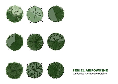
1. Sustainabilty Projects
2. Grading and Stormwater Management
3. Models spaces
4. Other Interests
Growing up in a metriopolitan city with different people from various back grounds, it became apparent that urban landscapes were usually developed and maintained, in areas with people of higher socioeconomic standing. In less economically developed areas, parks and other landscapes were ne page 3
Peniel Anifowoshe Landscape Architecture
CONTACT
penielanifowoshe@gmail.com
+1 (845) 522 7809
EDUCATION
The Pennsylvania State University
Bachelors in Landscape Architecture
TECHNICAL SKILLS
• Adobe Photoshop
• Adobe Illustrator
• AutoCAD
• ArcGIS
• InDesign
• Microsoft Office Suite
• Revit
• Sketchup
PROJECTS & COLLABORATIONS
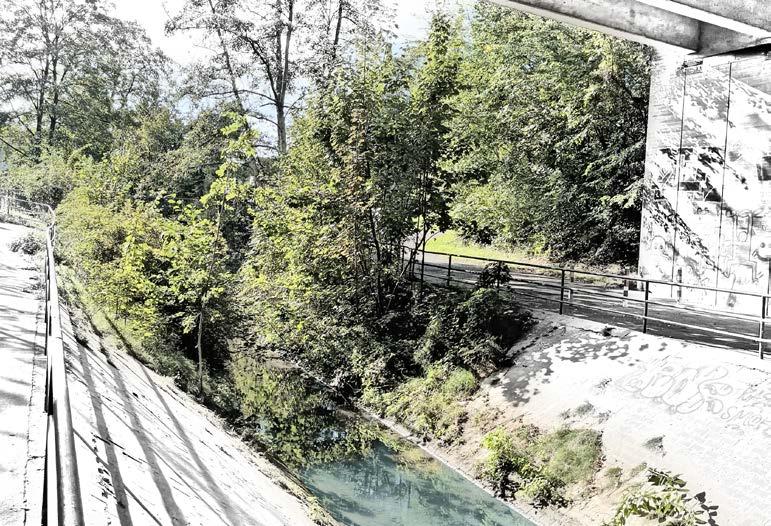
Gartenshau Design Competition, Baligen, Germany
September 2022 - November 2022
Winner - Landscape Architect Designer
• Redefine an existing bridge into a public space for the community.
• Create a new sustainable bridge design considering federal codes and safety laws.
Penn State Hampden, Campus Cancer Center, Harrisburg
January 2022 - May 2022
Landscape Architect Designer
• Propose a new freestanding outpatient cancer center combing sustainable architecture with biophillic garden designs.
• Strategize on convenient entry, drop-off and exit designs considering ambulance and service vehicles.
• Regrade the site to provide efficient drainage outlets and basins to accommodate storms and heavy rainfall.
Site Materials and Design Implementations, Shaver’s Creek
January 2022 - May 2022
Landscape Architect Designer
• Compile a 12-page construction document showing my plan design with proposed materials, planting and infrastructure.
• Develop detailed drawings depicting how each implementation and vegetation is manufactured and constructed on the site.
ArcGIS Spring Creek System Design
January 2019 - May 2019
Independent Designer & Team Member
• Identify key landscape issues and planning opportunities in the Spring Creek Watershed.
• Performed a systematic analysis of physical, social, cultural, and ecological system characteristics within the watershed.
• Compile, analyze, and present data pertaining to the development of a conservational and recreational design at a landscape-scale.
Redesign of Bartram’s North, Philadelphia
October 2019 - December 2019
Independent Designer
• Observe how proposed PIDC development and University of Pennsylvania’s campus expansions affects the user dynamics.
• Observe how the Schuykill River, adjacent to site, affects proposed design and examine the possible effects of climate change on the intertidal range and 100 year floodplain.
Design of Woodland Academy, Philadelphia
September 2018 - October 2018
Independent Designer
• Propose a design for a botanical garden in Philadelphia representing the city’s history.
• Study plants that were initially planted by John Bartram in the 18th century and examined their various roles in the ecosystem.
• Ensure that the landscape design and landforms would create learning experienced for the community.
WORK EXPERIENCE
Kimley-Horn
March 2023 - Present Landscape Architecture Analyst
• Contribute in urban and landscape design site plans with graphics and technical production.
• Collaborate with senior managers and other disciplines to solve problems.
• Study zoning laws and governmental regulations to provide feasible design solutions.
Jacobs Engineering
May 2021 - March 2023
Urban Development
• Build models using AutoCad and Sketchup, to represent the design concept.
• Strategize on irrigation techniques, using LandFX to create planting schedules.
• Use ArcGIS to observe data on a regional scale to pinpoint areas of concern.
• Refine renderings taking modifications and potential implementations into account.
• Supervise council meetings to liaise with the community and represent the team.
PAN African Nutrition Limited
July 2018 - Present CEO
• Strategise and observe the nutritional value in plants and shrubs to allow for more efficient extractionn and cultivation of nutrients.
• Co-organise site plans and placements for each vegetation to ensure a healthy foliage growth.
• Budget the transportation and sowing cost for the non-native imported plants.
Ato Architects Limited August 2016 - September 2016
Architectural Intern
• Provide qualitative and quantitative justification for design strategies for upcoming projects.
• Liaise with various teams on different site visit to observe how soils properties.
page 4 page 5
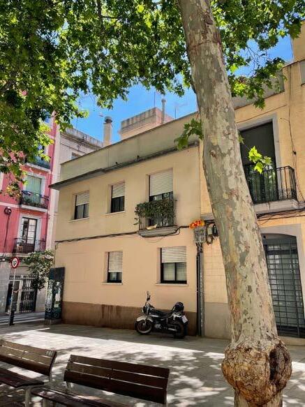
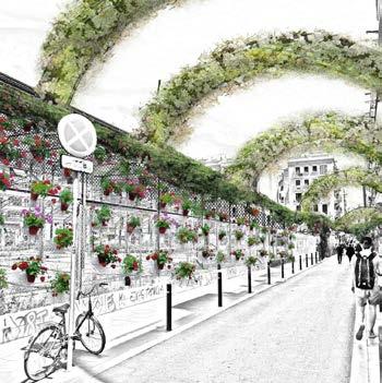
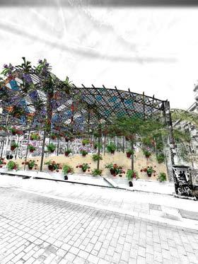
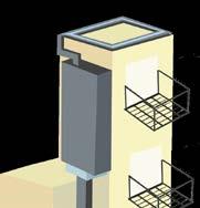
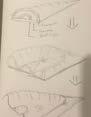
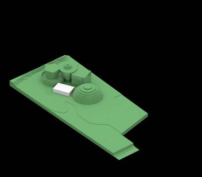
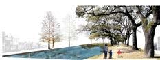
Gracia’s Balcony Community Site Design: Barcelona, Spain


Groundoutline


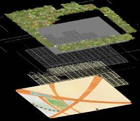


01 GRACIA’S BALCONY Peniel Anifowoshe LAND ARCH Undergraduate 02 Abaceria Market Penn State University Barcelona Architecture Center Design Studio SUMMER 2022 Ken Tamminga Miguel Roldán GRACIA’S BALCONY Peniel Anifowoshe LAND ARCH Undergraduate Above Ground Plan Ground Plan Vines Steel Net Abaceria Structure Lighting Ground Plan Water feature seating structure Seating Potted wooden chairs Pre-cast concerete seating Materials A g g r egatedlimes one dust P l a n ted Concrete Pavers P l a n ted BrickPavers SCALE 1:300m NORTH SCALE 1:300m NORTH Section Elevation Planting 80cm 30cm LARGEST POTS SMALLESTPOTS Lighting and Pyramidal English Oak Quercus robur ‘Fastigiata” 7 SCALE 1:300m 03 Abaceria Market Penn State University Barcelona Architecture Center Design Studio SUMMER 2022 Ken Tamminga Miguel Roldán GRACIA’S BALCONY Peniel Anifowoshe LAND ARCH Undergraduate 01 GRACIA’S BALCONY Peniel Anifowoshe LAND ARCH Undergraduate 04 Abaceria Market Penn State University Barcelona Architecture Center Design Studio SUMMER 2022 Ken Tamminga Miguel Roldán GRACIA’S BALCONY Peniel Anifowoshe LAND ARCH Undergraduate Pyramidal English Oak Quercus robur ‘Fastigiata” Perennial plants 30 Species Succulents 50 Species 4 Flowering woody plants 20 50 10 200 POTS Water mist 03 Abaceria Market Penn State University Barcelona Architecture Center Design Studio SUMMER 2022 Ken Tamminga Miguel Roldán GRACIA’S BALCONY Peniel Anifowoshe LAND ARCH Undergraduate Groundoutline Structural Axonometric Spatial Axonometric 04 Abaceria Market Penn State University Barcelona Architecture Center Design Studio SUMMER 2022 Ken Tamminga Miguel Roldán GRACIA’S BALCONY Peniel Anifowoshe LAND ARCH Undergraduate Section Elevation Planting 80cm 30cm LARGEST POTS Water Cistern Pyramidal English Oak Quercus robur ‘Fastigiata” 7 Perennial plants 30 Species 6 Succulents 50 Species 4 Flowering woody plants 20 Woody plants 50 Species 10 200 POTS Water mist 04 Abaceria Market Penn State University Barcelona Architecture Center Design Studio SUMMER 2022 Ken Tamminga Miguel Roldán GRACIA’S BALCONY Peniel Anifowoshe LAND ARCH Undergraduate Section Elevation Planting 80cm 30cm LARGEST POTS Water Cistern Pyramidal English Oak Quercus robur ‘Fastigiata” 7 Perennial plants 30 Species 6 Succulents 50 Species 4 Flowering woody plants 20 Woody plants 50 Species 10 200 POTS Water mist 03 Abaceria Market Penn State University Barcelona Architecture Center Design Studio SUMMER 2022 Ken Tamminga Miguel Roldán GRACIA’S BALCONY Peniel Anifowoshe LAND ARCH Undergraduate
Structural Axonometric Spatial Axonometric 01 GRACIA’S BALCONY Peniel Anifowoshe LAND ARCH Undergraduate
page 6 page 7
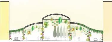
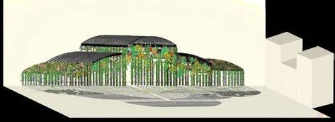
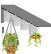
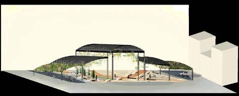
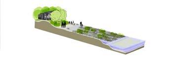
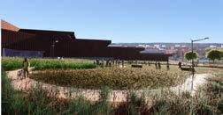
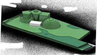
Grow & Flow
Winner of Gartenschau Design
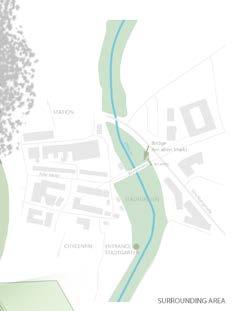
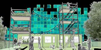
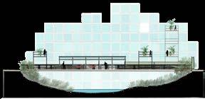
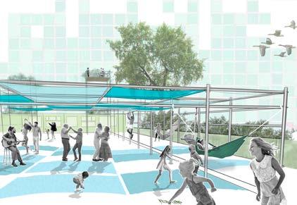
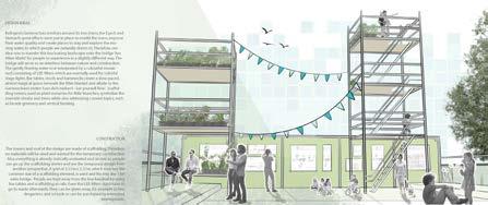
Competition: Baligen, Germany
page 8 page 9
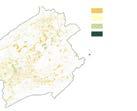
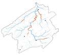
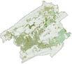
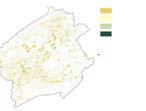
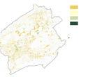
ArcGIS Spring Creek System Design
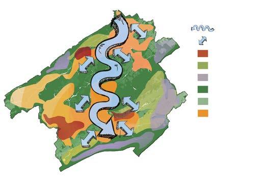

Floodplain and Flood Risk


The redevolpment of Spring Creek watershed
Existing
Peniel
Land
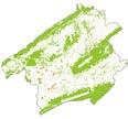
Existing open spaces
MountNittany
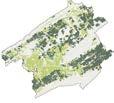
Forests
Accomodation Resoration
Rural, BELLEFONTE Proposed riparian
Geology

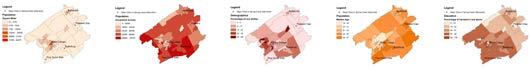
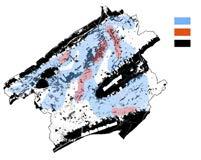
! ! ! Boa sbu g S a e Co ege P ne G ove M s ¯ Legend ! Ma o C es n
Mount Nittany divides two valleys of relatively equal (and even) elevation. Tussey Mountain and Bald Eagle Mountain flank the valley region to its southwest and northeast (respectively). These features define the drainage area for the Watershed. The general gradient for elevation across the Watershed follows the same direction as the water flow: south to north. It is along these higher order streams and around Bellefonte where elevation is lowest, as water exits the Watershed.
! ! B a b g B o e P e san Ga S e C g P e G o e M Legend M C e W s e p n C e Wa e e Ro k Types D m m n Q a z e S n o e S a e M eg n M S C W h R c y s D m L m e e ¯ 5 M e ! ! ! a u e n e n a C g G v M Legend M C Wa e B d F A u e p M e ±
Connection between vacant land and job opportunities
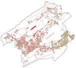
Proposed Land Use Development
Peniel Anifowoshe LARCH 216 & LARCH 256 5/05/20 0 1.5 3 4.5 6 North Miles
proposed land zoning
Existing stream flow
Vacant land
Agricultural and commericial business opportunites
1.5 3 4.5 6 Miles North
Vacant land
Transportation
Business opportunites Riparian buffer perspective 2


Based land development on
BELLEFONTE Low density Medium density High density 14


STATE
streams Impared streams

Unimpared streams Impared streams Existing aquifer Major cities
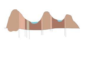
Gap 8 M es geology within the ridge and valley system and flooding are located nearly in the 26,720 46,250 481 12,562 7,445 5,000 10,000 15,000 20,000 25,000 30,000 35,000 40,000 45,000 50,000 Dolomite Limestone Quartzite Sandstone Shale Area (acres) Rock Types Rock Types that cover the Spring Creek Watershed ! ! ! ! ! Boa sbu g Be efon e P easan Gap S a e Co ege P ne G ove M s 7 M e Nittany Valley Mount Nittany Penns Valey Bald Eage Mountain Tussey Mountain Dolomite Shale Quartzite Limestone Diagramatic Section Displaying Geology Rock Types in The Spring Creek Watershed ! ! ! ! Boalsburg Bellefonte P easant Gap State College Synthesis Map ! ! ! ! Boa sbu g Be e on e P easan Gap S a e Co ege 26,720 46,250 481 12,562 7,445 5,000 10,000 15,000 20,000 25,000 30,000 35,000 40,000 45,000 50,000 Dolomite Limestone Quartzite Sandstone Shale Area (acres) Rock Types Rock Types that cover the Spring Creek Watershed ! ! ! ! ! Boa sburg Bellefonte Pleasant Gap State Co ege P ne Grove Mi s L d Diagramatic Section Displaying Geology Rock Types in The Spring Creek Watershed
riparian buffer near densely populated areas
High density development 1,405 acres (13.53 dwelling units per acre)
Suburban greenway Upland greenway Spring
Low density development 6,273 acres (3.18 dwelling units per acre)
Existing forests
Existing agricultural land
Existing development
Proposed aquifer (50 meters)
Proposed small-scale riparian
Main stream ow
Proposed 100 feet riparian


High density development, 1,405 acreas (13.53 dwelling units per acre)
Medium density development, 5,226 acres (3.89 dwelling units per acre)
proposed local agricultural development
AgLand Medium density development Riparian buffer Forested Areas Section elevation


Anifowoshe LARCH 216 & LARCH 256 6/05/20
land uses and zoning
use and stream impairment
Existing water quality and repairment from national geography society
agricultural land Commercial land Industrial land
Zoned,
Vacant lands
Unimpared
streams Highlands Major cities
Unimpared streams Impared
STATE COLLEGE PLEASANT GAP BOALSBURG
e most impaired streams in the Spring Creek watershed are in the valley. State College, the most populated city in the creek, is also located in the valley. Stormwater, agricultural and urban runo are the main pollutants in the watershed. Hence, the Creek’s impairment is a due to the various land uses surrounding it. In some cases, climate change could result to water impairment, leaving the in icted displaced. My design intent is to accommodate 200,000 climate refugees, while providing restoration to the Spring Creek watershed.
Primary housing types in SCW Vacant land uses Vacant structures Public/Semi-public Mixed uses Low density rural single lot family homes Medium density suburban homes High density townhomes Employment Agricultural and commerical businesses
RothRockStateForest suburban and commericial transportaton Exiting aquifers Proposed riparian bu ers perspective 1 PLEASANT GAP
BaldEagleRidge STATE COLLEGE BOALSBURG
! ! Bo sb g Be e o e P a an G p S a Co ge P ne G o e M s eg nd M C W W e h n C W e h n o d y e W e % A C n F o H w M m n ¯ 0 5 1 3 7 M e e e d a W W e B d T s W C F M n ¯ 5 5 7 M e B P e G p e C e e M s Legend M o C W B a o e A e D ed 3 ± ! ! P G e G egend C e e w C W 3 1 M ± B e a a C e G M Le end Sp M W d n D ed 0 6 M ±
For the geology and floodplain maps, we wanted to explore the different types of bedrock within the watershed and how that ties in with the terrain and water flow within the floodplain. We noticed more limestone and dolomite in the valleys, which are more porous when water reacts. These types of rocks will eventually start to erode due to precipitation, this will then create the underground caverns that store the groundwater in our watershed (causing sinkholes which are common the Spring Creek Watershed) On the ridges, we see more Sandstone and Shale which is more impervious and causes
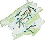
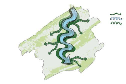
Community Site Planning: Spring Creek, PA
Legend
Proposed riparian buffer
Medium density development 5,226 acres (3.89 dwelling units per acre)
Refined conceptual plan
Connection between vacant land, job opportunities and transporation
Low density development 6,273 acres (3.18 dwelling units per acre)
Sp ng C eek Wa e shed Bounda y Elevat on Range ( t) 690-1 000 1 000-1 500 1 500-2 000 2 000-2 500 2 4 6 8 1 M es ! ! ! Boa sbu g S a e Co ege P ne G ove M s 0 3 6 1 5 M es ±
SE NW ¯ ! P ne G ove M s 0 3 6 1 5 M es ± page 10 page 11
Although mixed housing provides vitality, high density developments are more impervious and increase urban run-o However, SCW mostly has rural land and the sole development of low density housing would be ine ective. Hence, observed the importance of having riparian bu ers large and smaller streams, to decrease contamination. An aquifer was implaced near the most unimpared stream. Housing locations were determined based on their accessibilty to potential jobs and other parts of the watershed.
Riparian Greenway
Creek PLEASANT GAP
COLLEGE BOALSBURG
he Wa e shed
Appalachian Plateau Bald Eagle Valley Bald Eagle Mountain Mount Nittany Tussey Mountain Nittany Valley Penns Valley Sandstone Shale
Limestone Dolomite
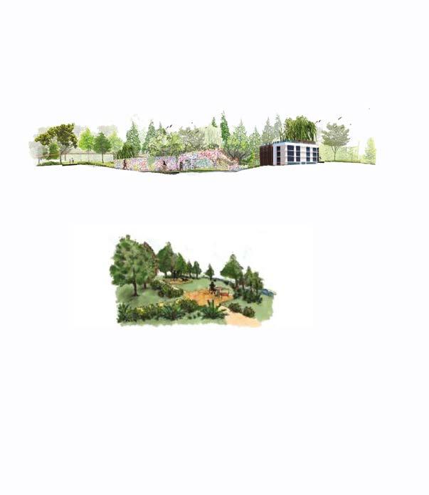
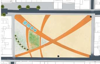
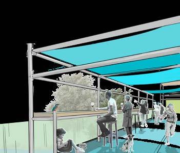
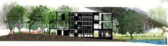
Redesign Runkle Halls at Penn State
Community Site Planning: State College, PA
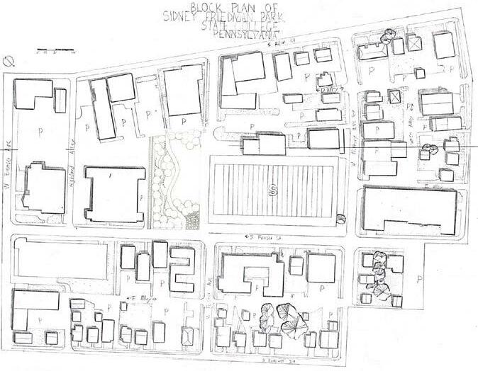
My design intent is to invite the community to experience nature, through the use of materials and vegetation distinct to this area.
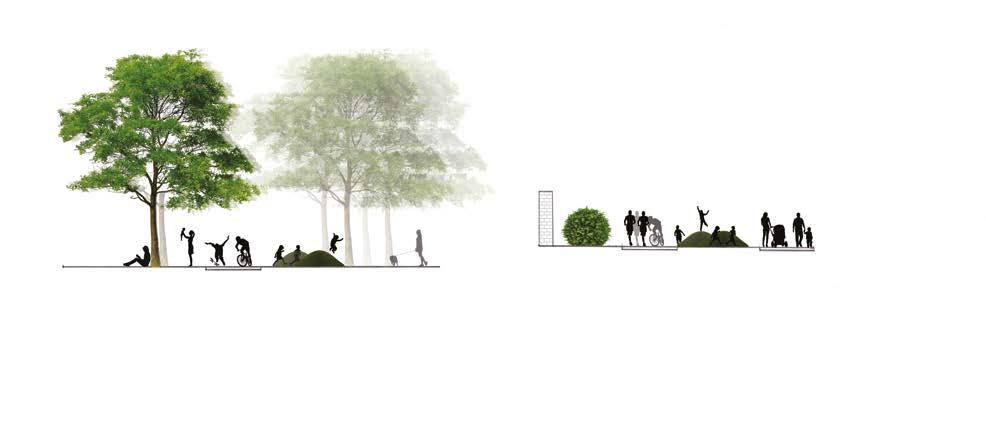
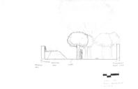
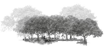
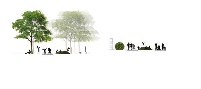
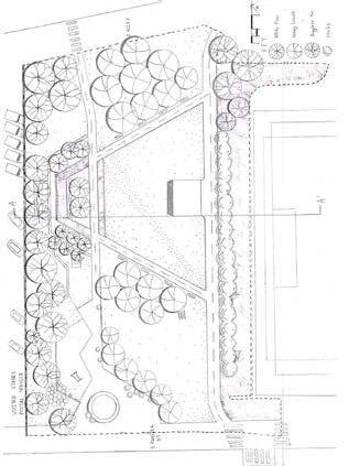
plan on solving seasonal issues of security, through the use of vegetation, a natural implementation which does not convey a sense of restriction to the community.
My goal was to create a whimsical experience, which got people directly through the site, whilst interacting with the space.
page 12 page 13
Grading Plans and Stormwater Managment

Community Site Design: Spring Creek, PA
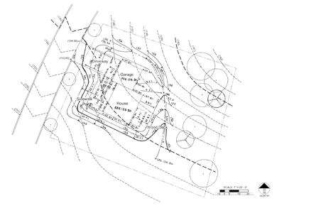
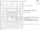
page 14 Project 1: GRADING LARCH 235: FALL 2018 Code: 102 11/10/19 LEGEND EXISTING CONTOUR PROPOSED CONTOUR CENTRELINE LOW POINT SWALE HIGH POINT SWALE FINISHED FLOOR ELEVATION EXISTING BUILGING PROPERTY LINE CURB 5TH CONTOUR BACKDOOR SPOT ELEVATION EXISTING VEGETATION PROPSED SLOPE LPS HPS FFE page 15 87°58'56" 786.99' S 116.36'43°09'53" C5 12°50'11"297.91' PRODUCED BY AN AUTODESK STUDENT VERSION PRODUCED BY AN AUTODESK STUDENT VERSION PRODUCED BY AN AUTODESK STUDENT VERSION PRODUCED BY AN AUTODESK STUDENT VERSION PRODUCED BY AN AUTODESK STUDENT VERSION PRODUCED BY AN AUTODESK STUDENT VERSION Project GRADING LARCH 235: FALL 2018 Code: 102 11/10/19 LEGEND EXISTING CONTOUR PROPOSED CONTOUR CENTRELINE LOW POINT SWALE HIGH POINT SWALE FINISHED FLOOR ELEVATION EXISTING BUILGING PROPERTY LINE CURB 5TH CONTOUR BACKDOOR SPOT ELEVATION EXISTING VEGETATION PROPSED SLOPE LPS HPS FFE PRODUCED BY AN AUTODESK STUDENT VERSION PRODUCED BY AN AUTODESK STUDENT VERSION ® PRODUCED BY AN AUTODESK STUDENT VERSION PRODUCED BY AN AUTODESK STUDENT VERSION PRODUCED BY AN AUTODESK STUDENT VERSION PRODUCED BY AN AUTODESK STUDENT VERSION
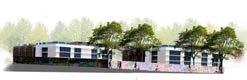
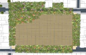
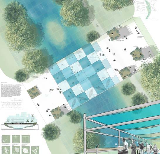
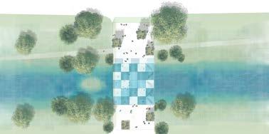
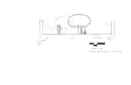
Millennium Science Complex Garden
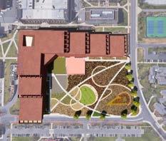

Community Site Planning: State College, PA


PRODUCED BY AN AUTODESK STUDENT VERSION PRODUCED BY AN AUTODESK STUDENT VERSION PRODUCED BY AN AUTODESK STUDENT VERSION PRODUCED BY AN AUTODESK STUDENT VERSION PRODUCED BY AN AUTODESK STUDENT VERSION PRODUCED BY AN AUTODESK STUDENT VERSION PRODUCED AN AUTODESK STUDENT VERSION PRODUCED AUTODESK STUDENT VERSION 1167 MILLENNIUM SCIENCE COMPLEX POB 0'-8 6'-4 5'-9" 6'-8 2'-4" 20'-3 12'-5 39'-5" Millennium Science University Park, Peniel Anifowoshe 1" 10' 11/04/2021 Treed Plaza Plan Above Ground Treed Plaza Plan Below Ground Treed Plaza Plan NORTH PRODUCED BY AN AUTODESK STUDENT VERSION PRODUCED BY AN AUTODESK STUDENT VERSION 1167 MILLENNIUM SCIENCE COMPLEX POB 5'-9" 19'-5 39'-5" Above Ground Treed Plaza Plan Below Ground Treed Plaza Plan NORTH PRODUCED BY AN AUTODESK STUDENT VERSION PRODUCED BY AN AUTODESK STUDENT VERSION
MILLENNIUM SCIENCE COMPLEX 12'-4 19'-5 20'-3 3'-11 39'-5" W Millennium Science Complex University Park, PA Peniel Anifowoshe 101 1" 10' 11/04/2021 Treed Plaza Plan NORTH PRODUCED BY AN AUTODESK STUDENT VERSION page 16 page 17
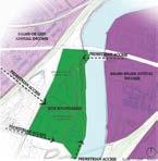
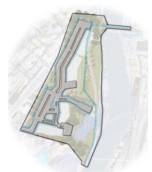
MASTER PLAN OF BARTRAM’S NORTH


Community Site Planning: Philadelphia, PA


I focused on the observation of the community and environmental conditions around the site. The main aim of this analysis is to get contextual information on the historical landmarks and people who have the most access. Is it my hope that my design would create a social hub which caters to the proposed development whilst representing the surrounding community.
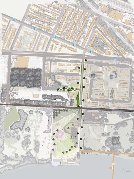
Allow the floodplain to enter the site and creating accessible wetlands, for the community to interact with the river,
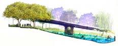
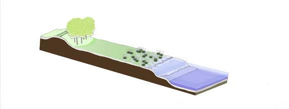
To link proposed future development with historical context and, through gardens and tree species. My main aim was to create safe spaces which are generally unaccessible to residents of this neighbourhood.
Tram stop Residential land Bike rental centre and green land spaces for relaxation 56th corridor
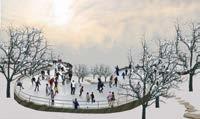
Talleyrand Wonderland Section B Talleyrand Wonderland Section b Talleyrand Wonderland Winter Concept a’ B’ Talleyrand Wonderland Summer Concept
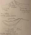
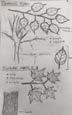
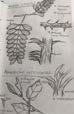
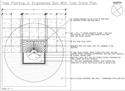
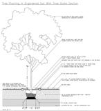
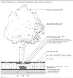
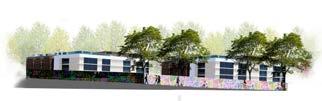
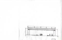
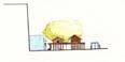
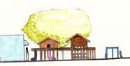
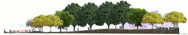
Section Schuykill River BuildingAcademyWoodland Section-Elevation LPS HPS HPS LPS 0’ 25’ 50’ 100’ 0’ 25’ 50’ 100’ 0’ 25’ 50’ 100’ Woodland Academy Building Peniel Anifowoshe Tool Phase 1 Axonometric Plan Ba ram s Garden Res den a Prope t es The Woodland Academy: For the People, By the People 20’ N 1/8’’ A A’ Design Intent: To creating strong contextual bond, linking site to its surroundings whilst making green versatile landscape Peniel Anifowoshe E’ F’ A A’ B B’ C’ D D’ G G’ Batram’s garden (The Wetland) Residential Land Playground Tuck Shop Woodland Academy Tree Speices Pine Oak (Quercus palustrus) Water Oak (Quercus nigra) Sweet pepperbush (Clethra alnifolia) River birch (Betula nigra) Honey locus (Glenditsia triacanthos) Red Dogwood (Cornus sericea) Pine Oak (Quercus palustrus) Japanese Maple (Acer Palmatum) Elderberry (Sambuscus canadensis) Red dogwood in summer vs winter Japanese Oak and Japanese Maple in autumn Wetmeadow view towards outdoor Art wall https://www.pinterest.com/ pin/60235713749663511/ https://www.pinterest.com/ pin/350154939760053949/ https://www.thetreecenter.com/complete-japanese-maple-guide/ https://dbaplanbpix.wordpress.com/ tag/dogwood/ 1/8’’ page 18 page 19
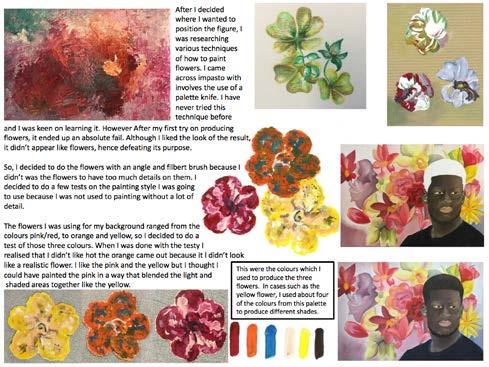
Other Interets


page 20 page 21