P O R TF O LI O ARCHITECTURE
By Paul Hermosillo
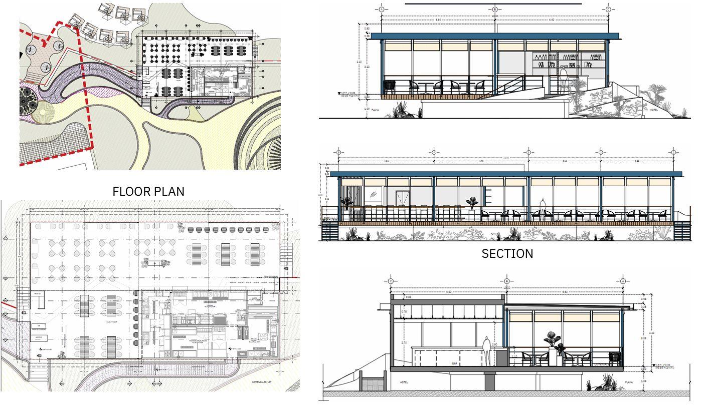
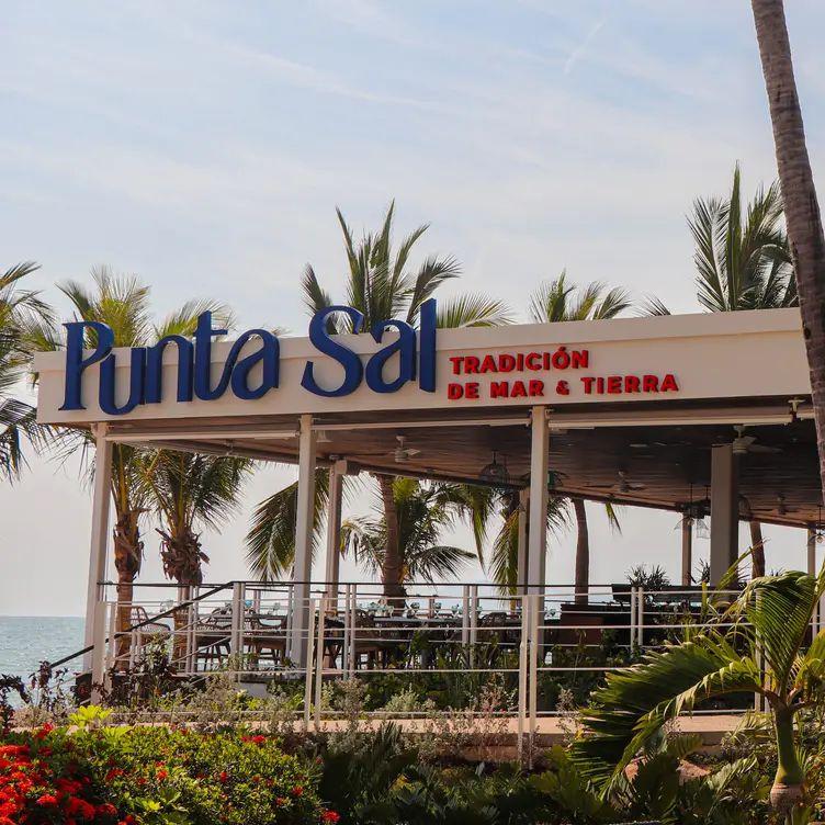
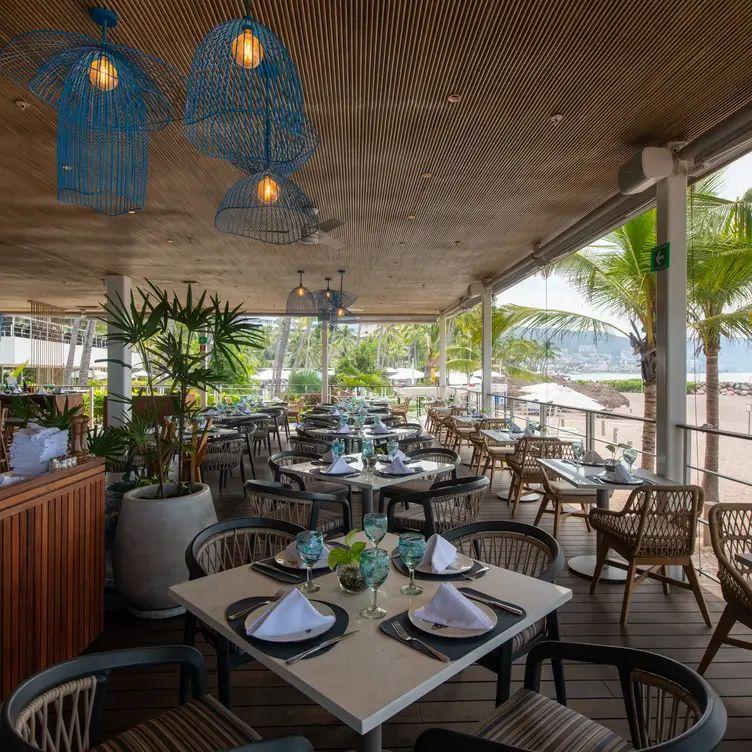
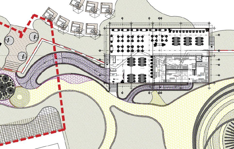
A DINING EXPERIENCE WHERE OCEAN VIEWS, SEA BREEZE, AND REFINED COASTAL FLAVORS COME TOGETHER IN PERFECTHARMONY.
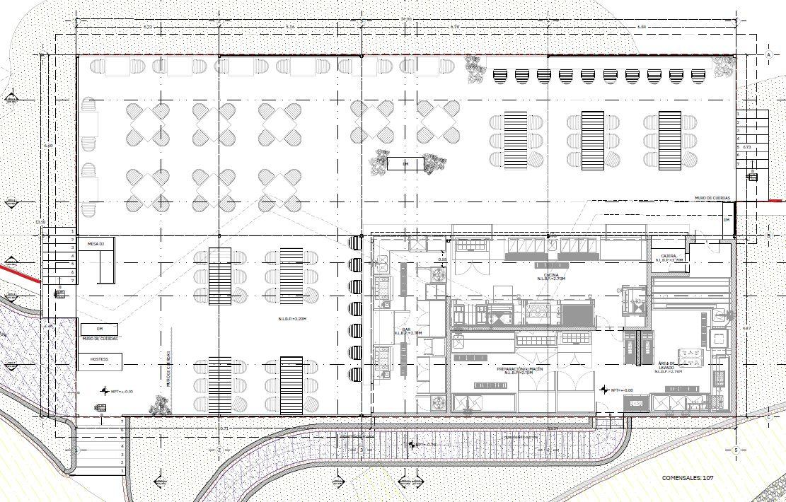
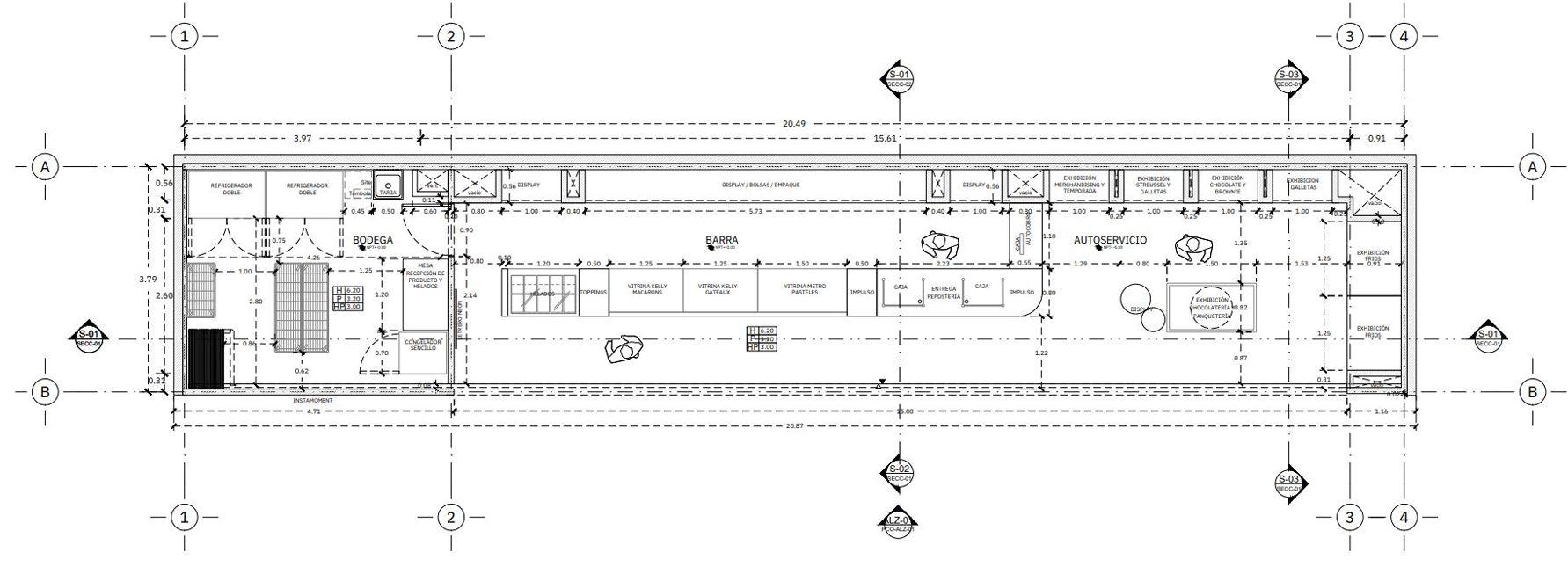
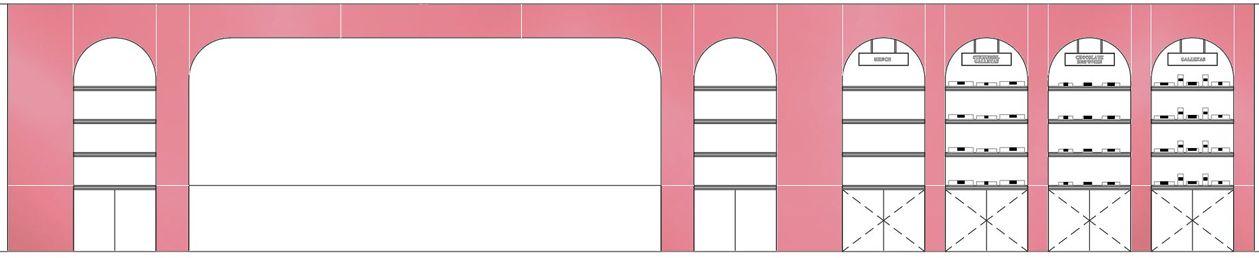
Paulette
Type of Project: Retail
Location: Guadalajara,Jalisco,México
Team: Estudio3.14
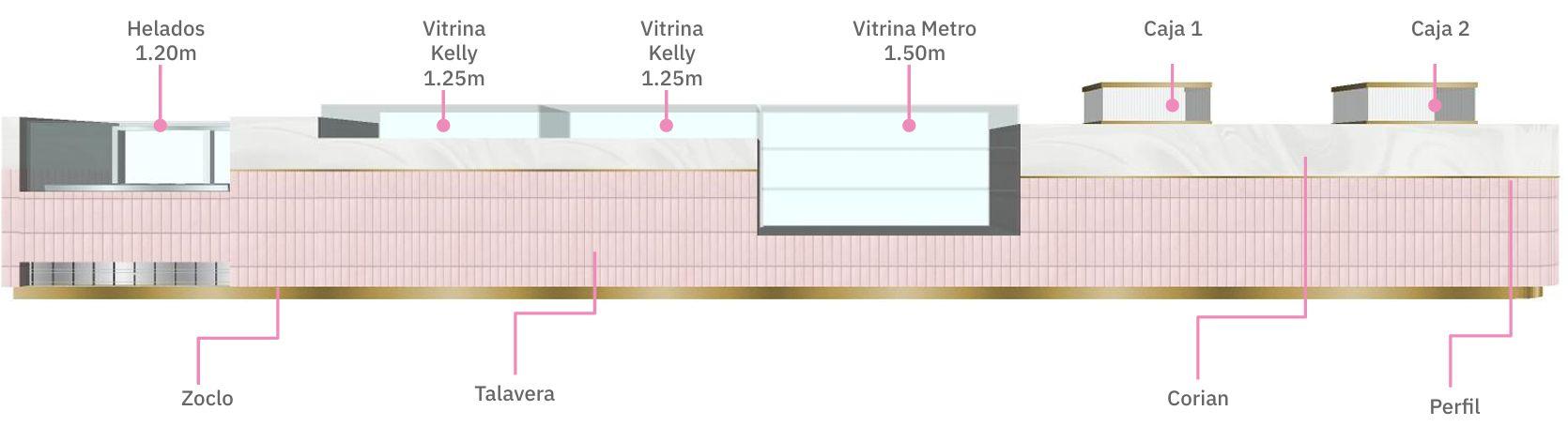
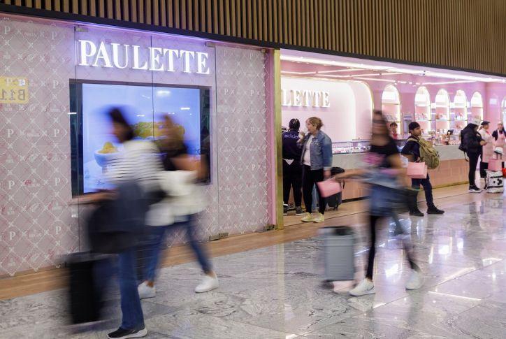
To celebrate 20 years since its founding, Paulee, a high-end bakery, has launched its first store inside Guadalajara InternationalAirport.Morethanjustaculinarystop,thespace is designed to deliver a refined, luminous, and elegant environment perfect for travelers seeking a premium experience.
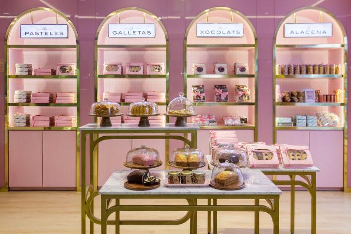
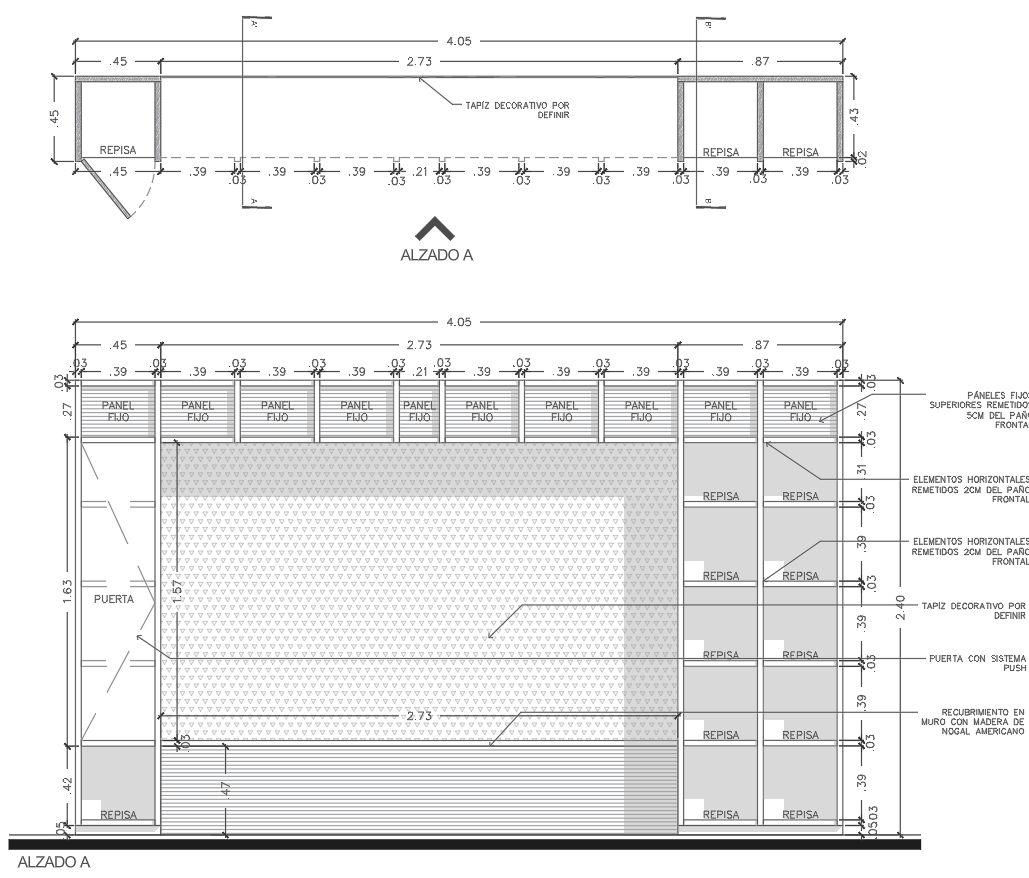
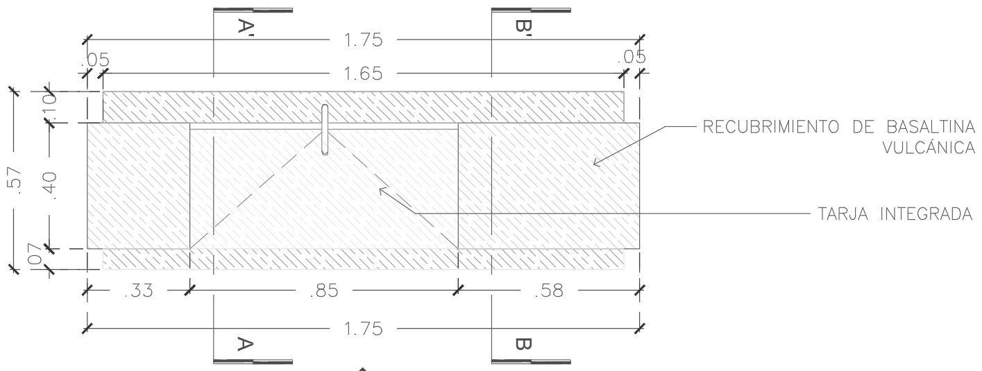
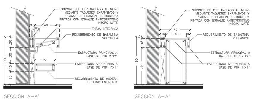
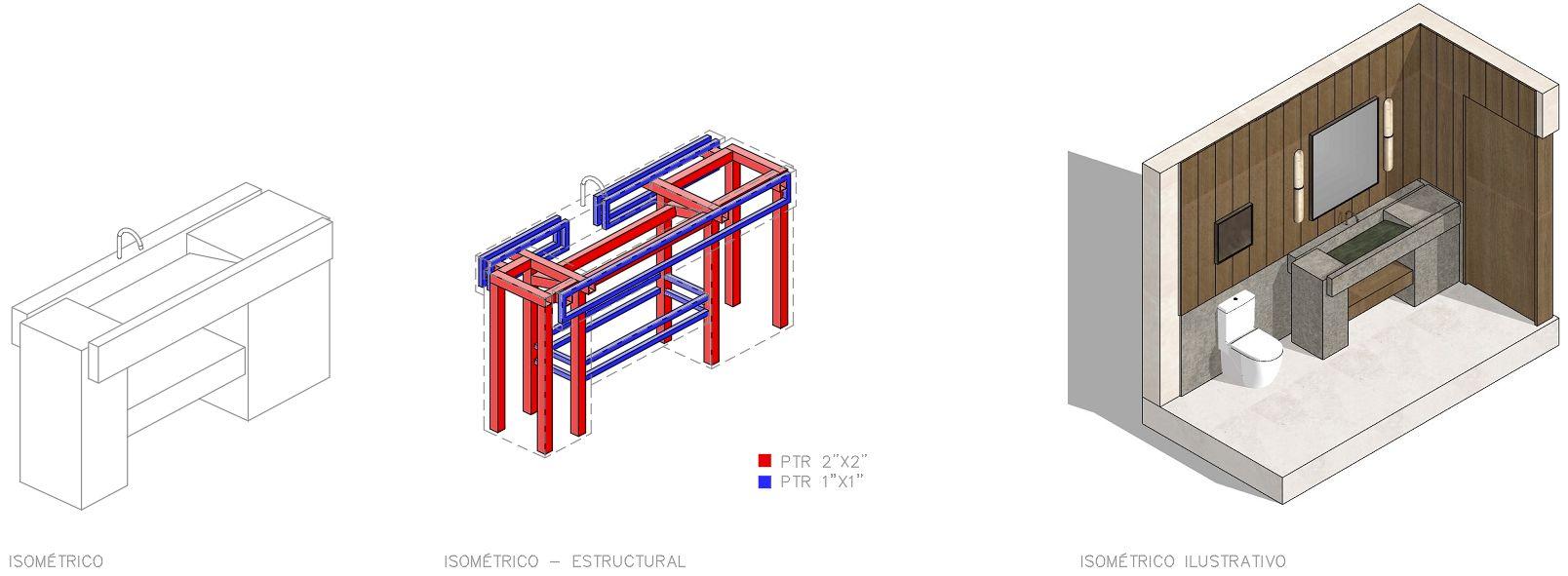
The bakery’s open shelving puts the spotlight on Paulee’s most iconic treats, while the interior design fuses soft golds, blush pinks, and deep Prussian blues. Key design features include a central pink Talavera showcase and an onyx-toned Corian countertop, enhanced by pink glass and white tiles—elements that embody Paulee’s signature style with a sleek,modernflair.
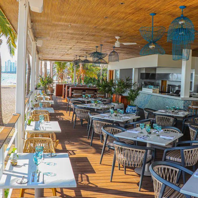
A FASTPACED AND ELEGANTCOMMERCIALSPACE ALONG THE INTERNATIONALWING OF GUADALAJARA´S AIRPORT.
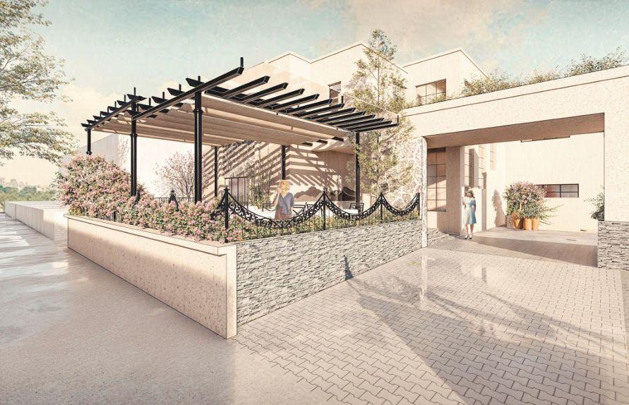
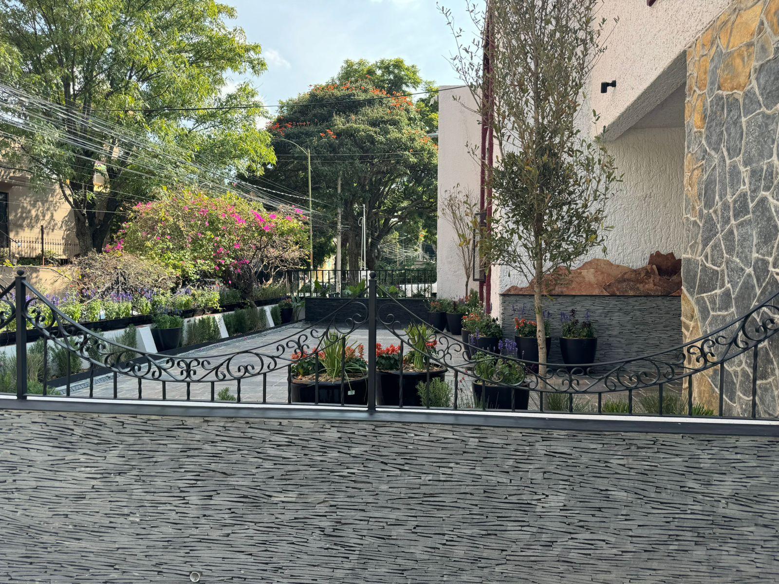
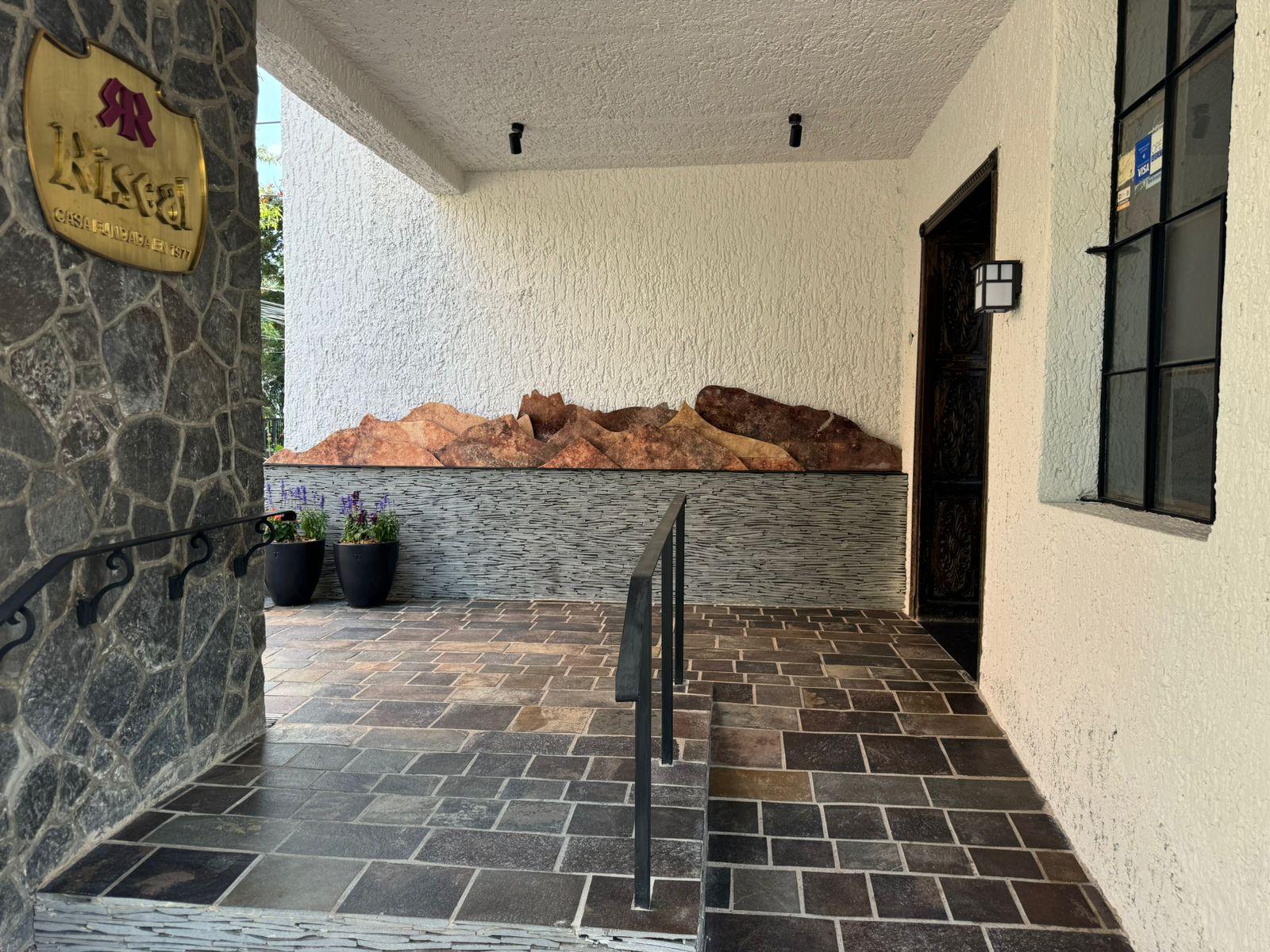
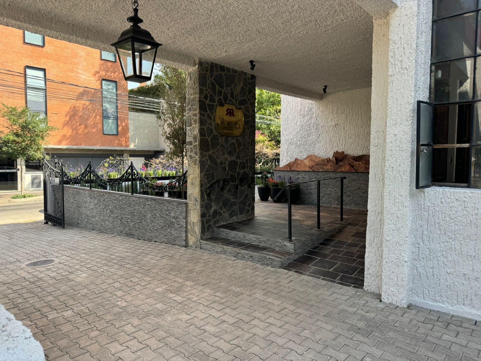
Riscal
Type of Project: Commercial
Location: Guadalajara,Jalisco,México
Team: Estudio3.14
The renovation of Riscal Restaurant begins in El Bierzo, a mining region where the landscape feels rugged, native, and quietly poetic. The goal is to embrace its beauty and authenticity through local materials and traditional building techniques,evokingtheessenceoftheplace.Theseelements reflect a rustic, almost primal character that endures and subtly blends with the passage of time and the surrounding environment.
A SMALLPIECE FROM ELBIERZO BROUGHTTO THE CHAOTIC YET
BEAUTIFULCITYOF GUADALAJARA, ITS MATERIALS AND GREENERYBLENDS WITH CITY'S LANDSCAPE
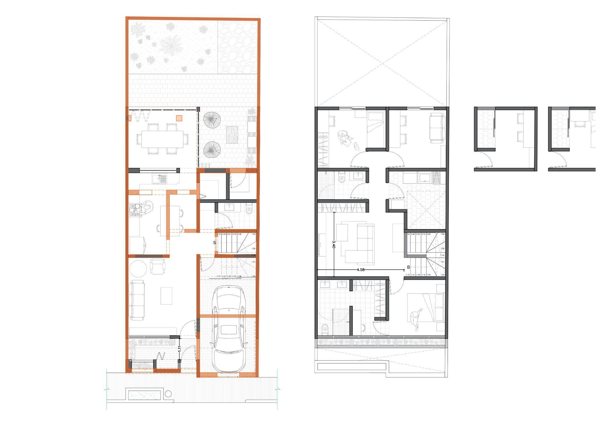
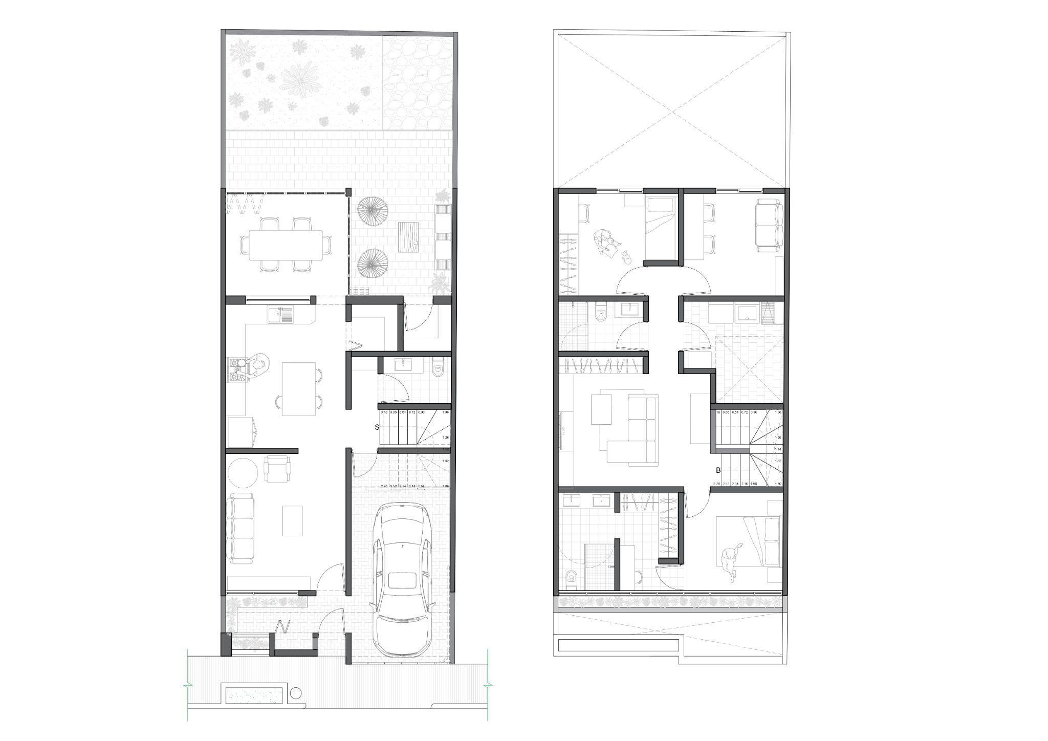
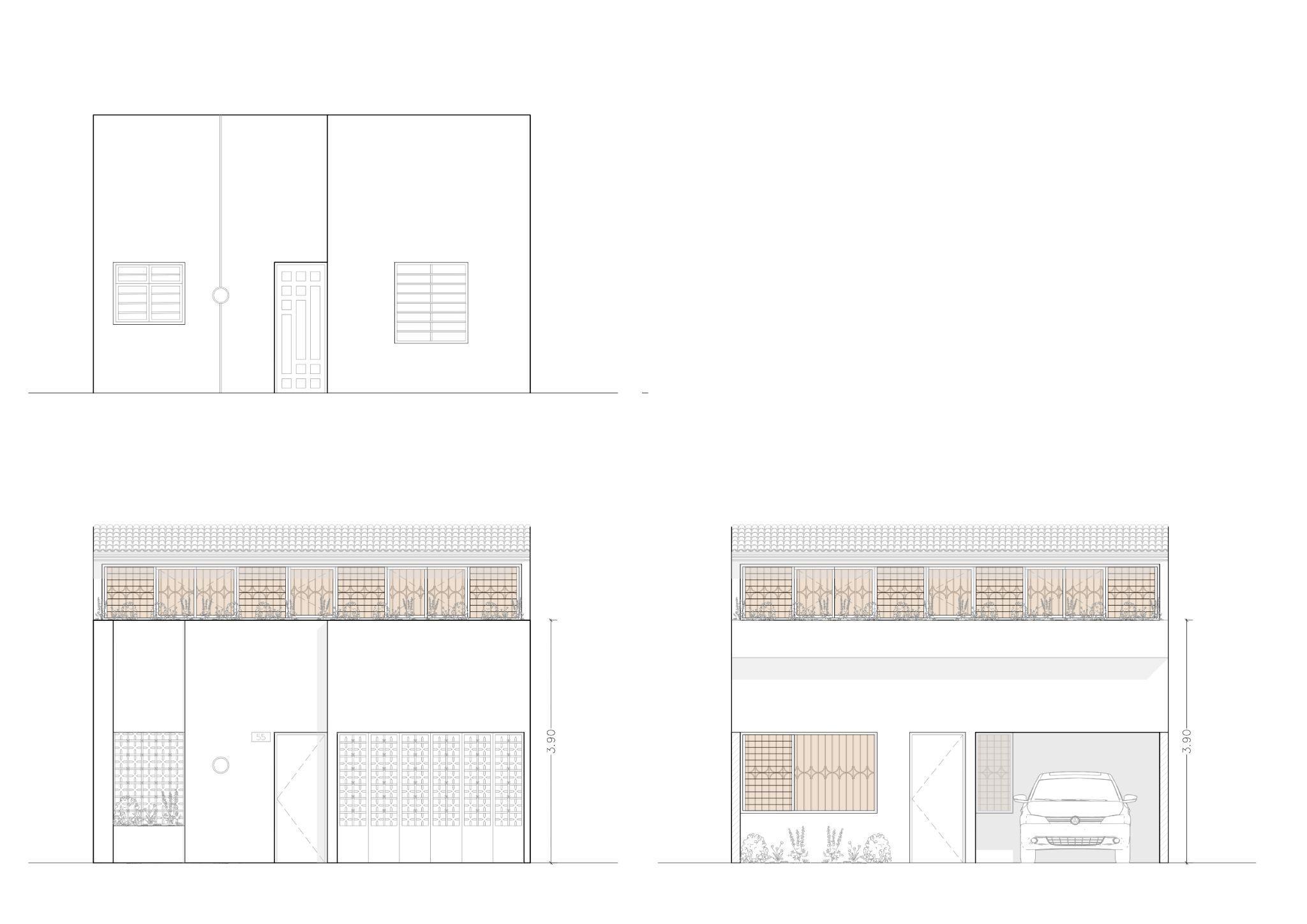
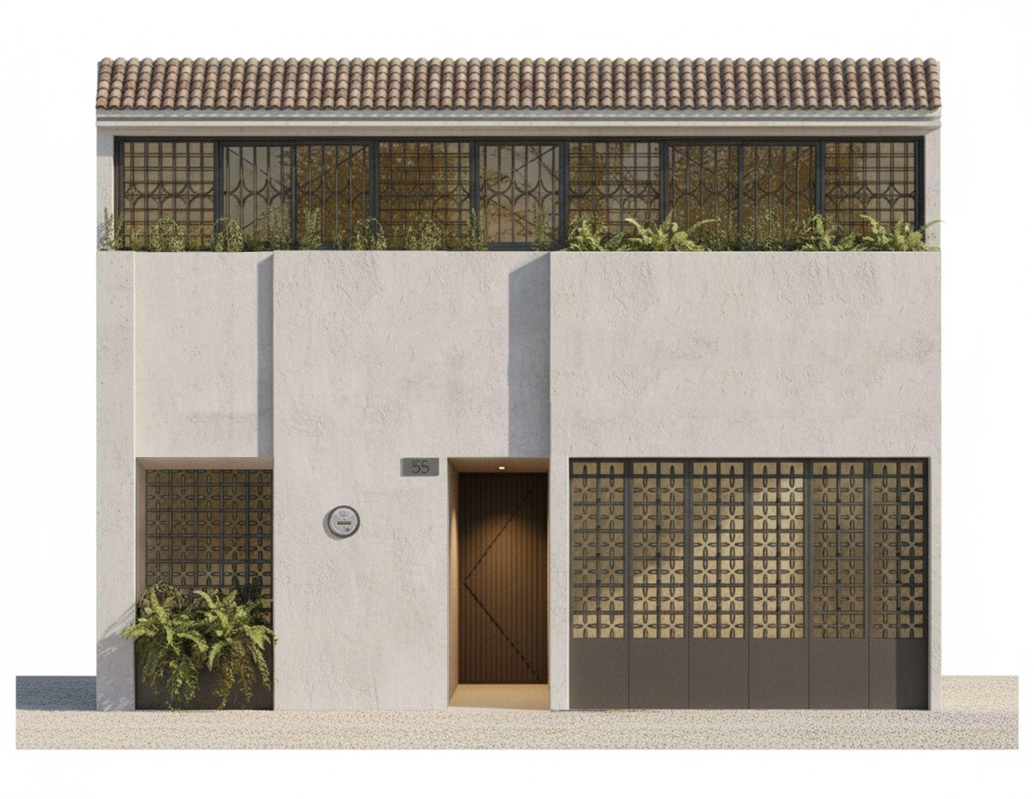
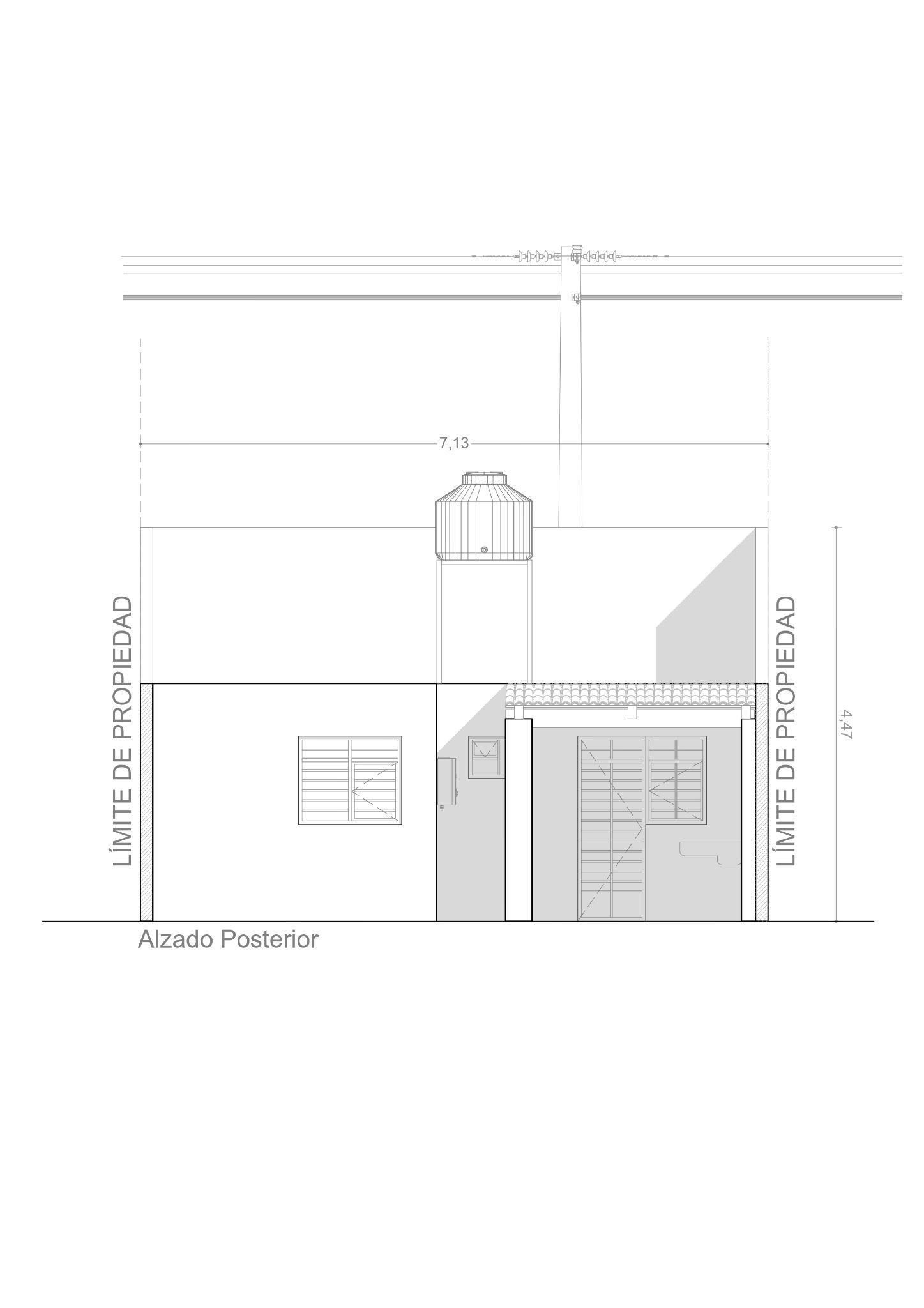
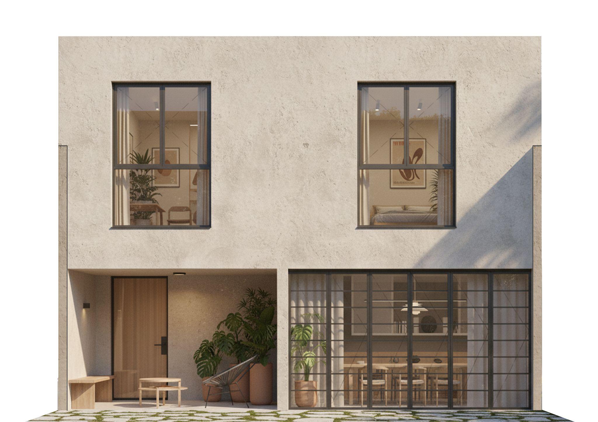
Architectural plan
Type of Project: Residential
Location: Guadalajara,Jalisco,Mexico
Team: Independentarchitect-Proota
Software: AutoCAD
This residential renovation project is designed to revitalize the home’s functionality for a young family. The primary objective is to reconfigure the existing layout, establishing all communal and utility spaces on the ground floor. This deliberate arrangement allows for the private and resting areas to be situated exclusively on the second level, thereby creating a completelysecludedandprivate environmentforthefamily.
Current state
Proposal
Current state
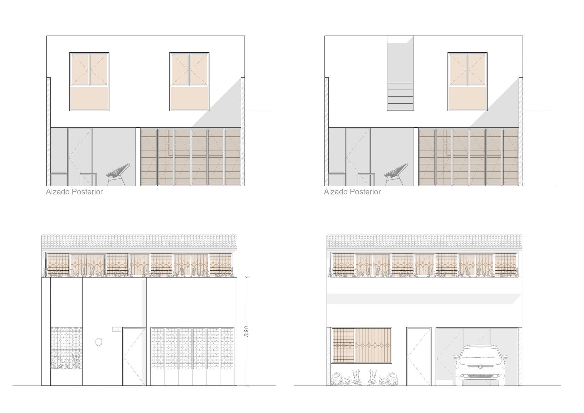
Proposal
Clinic
Type of Project: Commercial
Location: BajaCaliforniaSur,México
Team: Estudio3.14
This project aims to serve as a first contact medical clinic for the local population, which has been left aside by the government and investors, due to the increasing demand of high quality and exclusivecomfortservicesfortouristcomingfrom allovertheworld,speciallyfromtheUnitedStates ofAmericaandCanada.
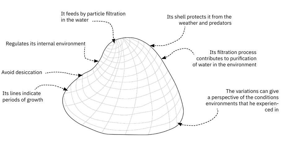
Due to the extreme conditions of the region, this project aims to imitate the clam´s survival system throughtheuseofpassivedesignstrategiessuch as the use of local materials with high thermal mass and naturally ventilate the interior with the use of an atrium and the prevailing winds by generatingachimneyeect.
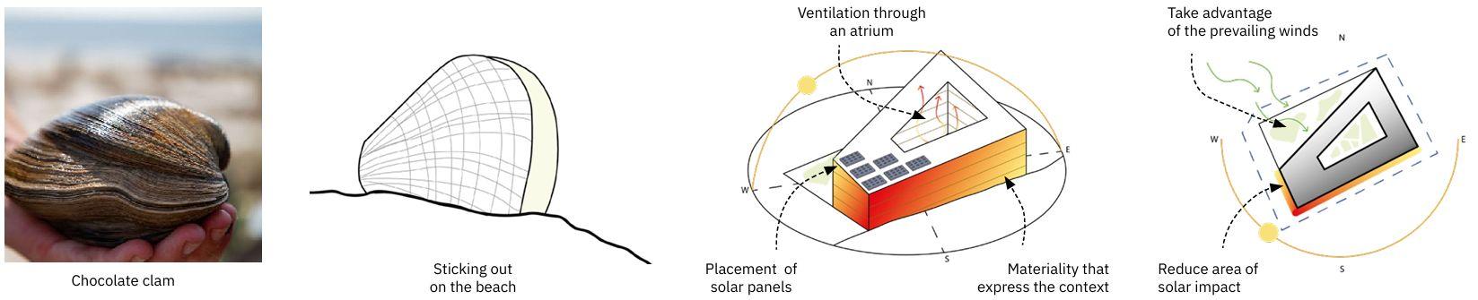
Interior design based on the local environment.
The inside of the building focuses on its users by providing a clean and safe atmosphere, represented by the colorand textures of the region and the interior of a clam.
The building opens itself to the inside rather than the outside.
Playground
Type of Project: Commercial/recreational
Location: Guadalajara,Jalisco,México
Team: Estudio3.14
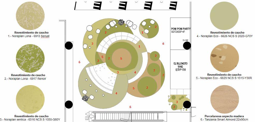
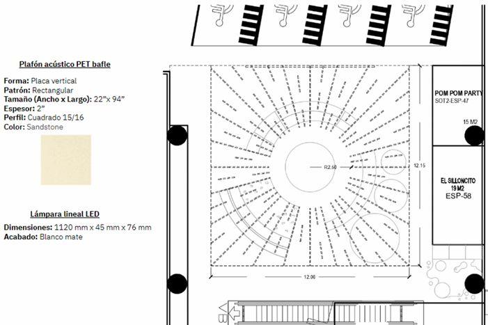
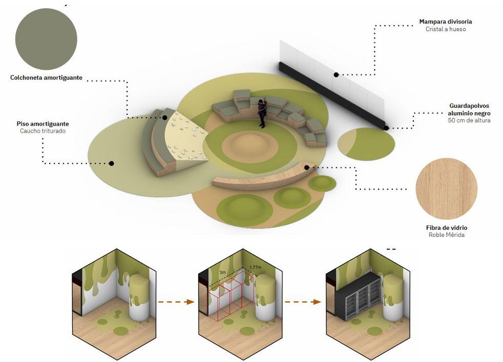
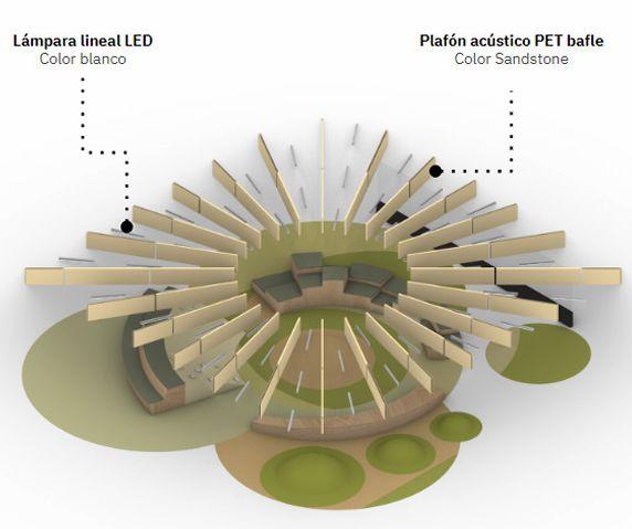
Within the parking area of Andares Mall lies a space where children aend karate classes, English lessons, visit hair salons, dentists, and participate in other activities. This created the need for a more playful and colorful environment where both kids and, especially, parents could spend their waitingtimeinacomfortableandenjoyablecommonarea.
To address this, soft padding and various play elements were introduceddesignednotonlytoentertainbutalsotofunction as seating. Given the location in a basement level parking garage,itbecameessentialtomitigatesoundreverberation.A playful ceiling design incorporating acoustic panels was implemented, blending seamlessly with the space while also actingasasoundbarriertoimprovetheoverallatmosphere.
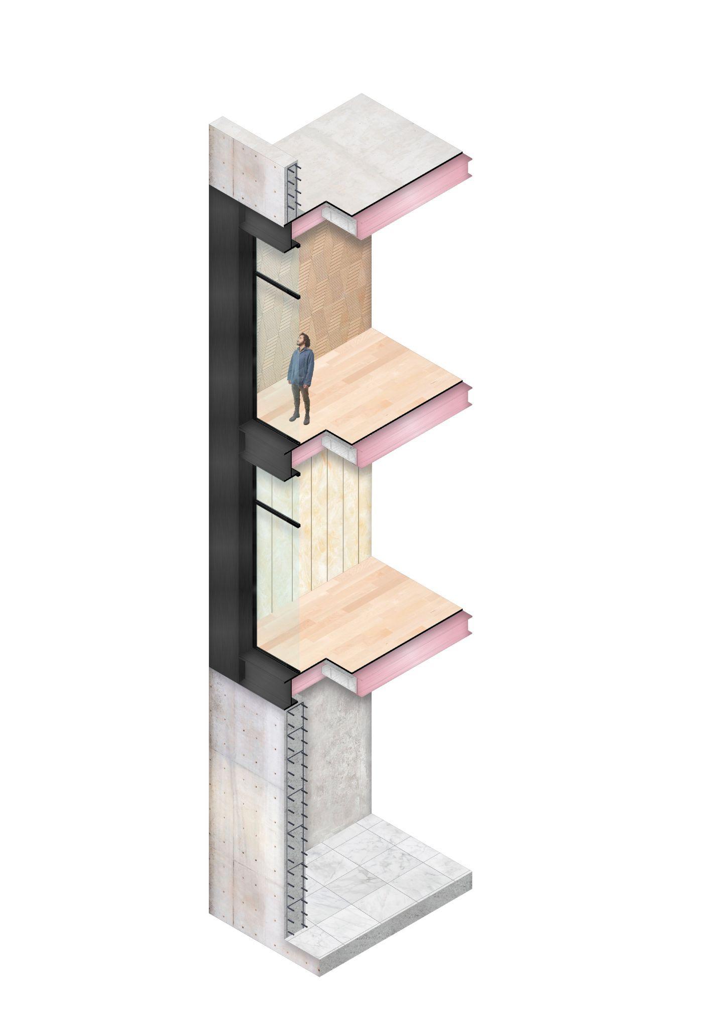
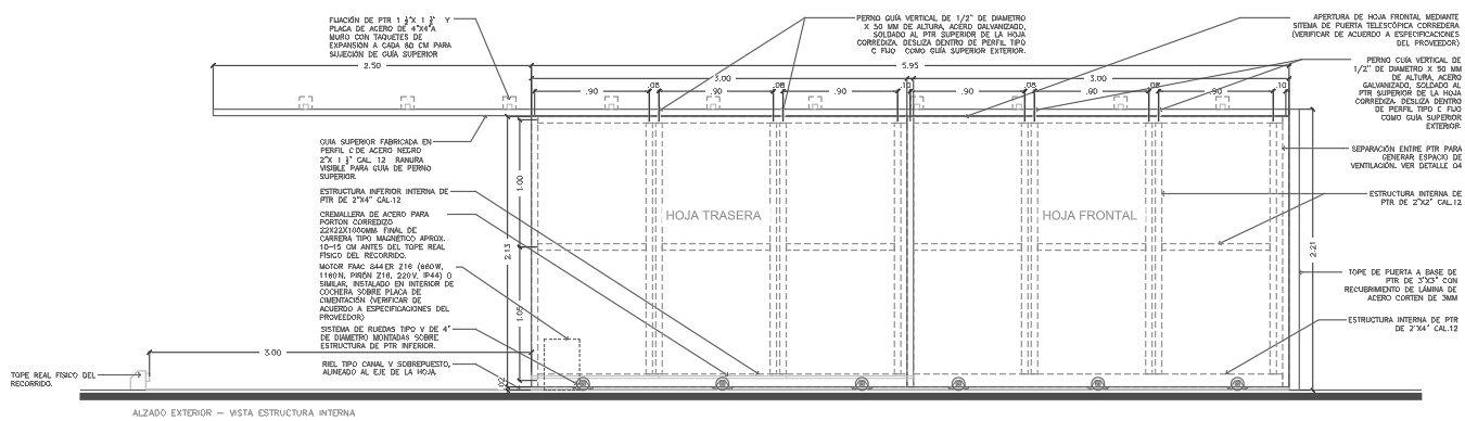
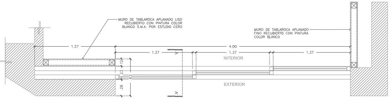
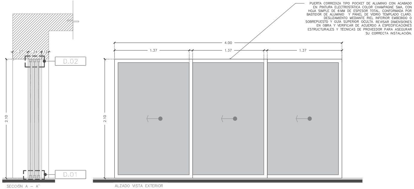
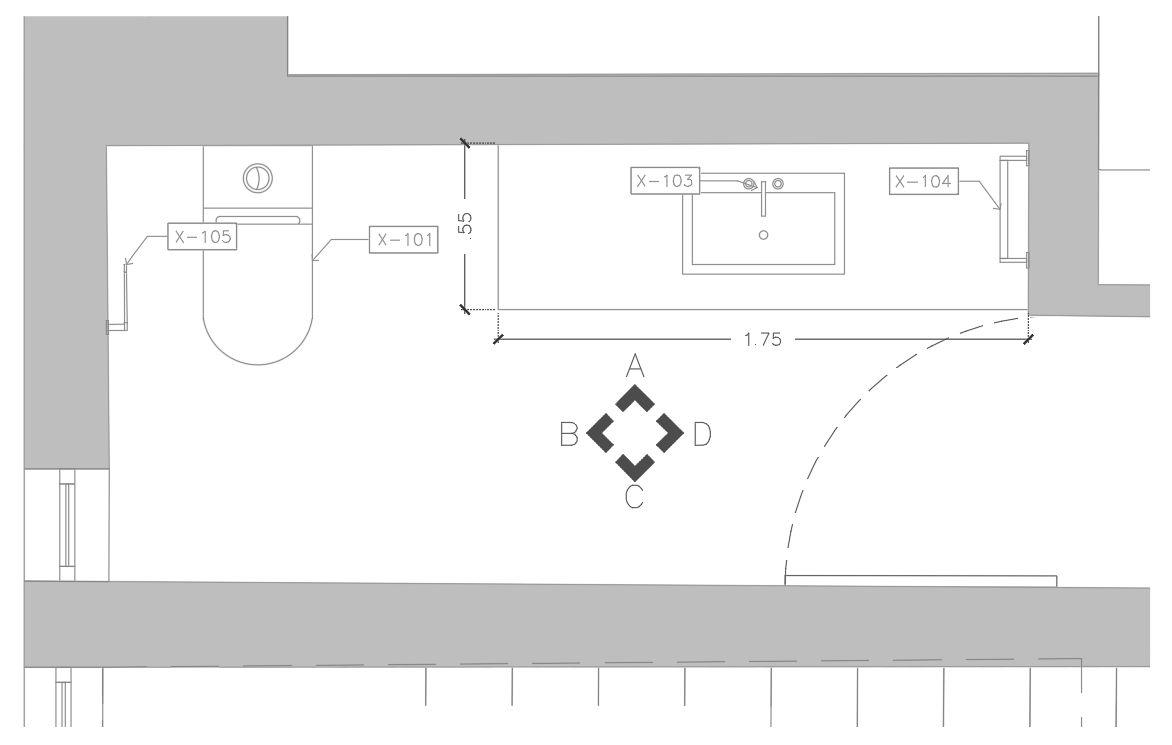
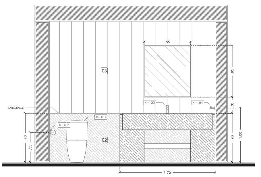
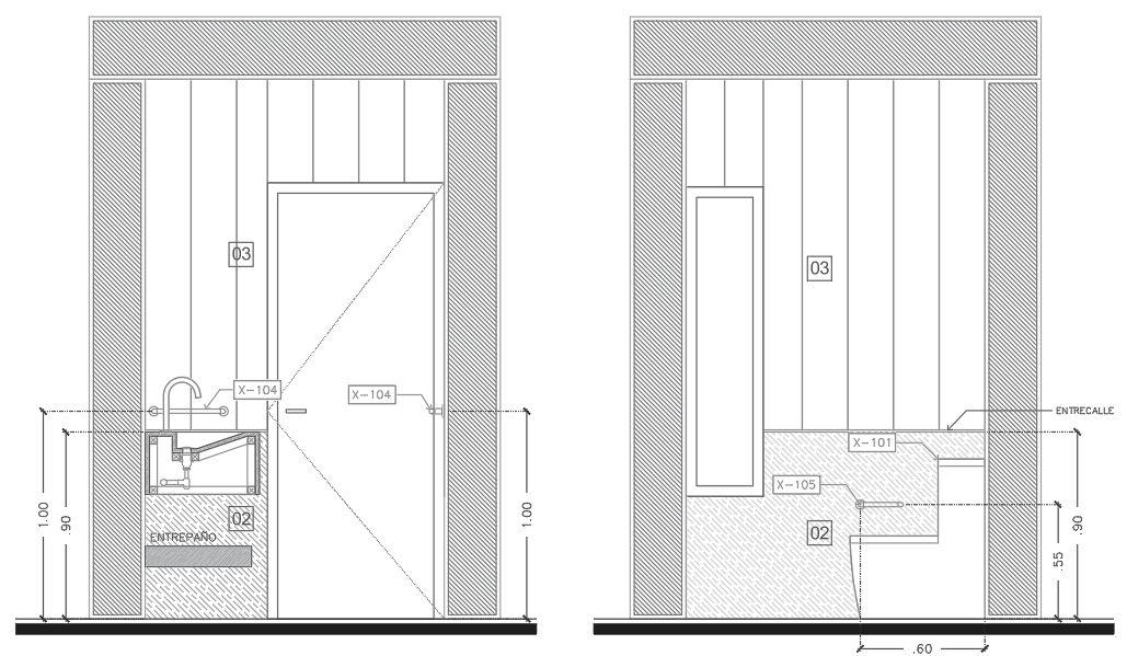
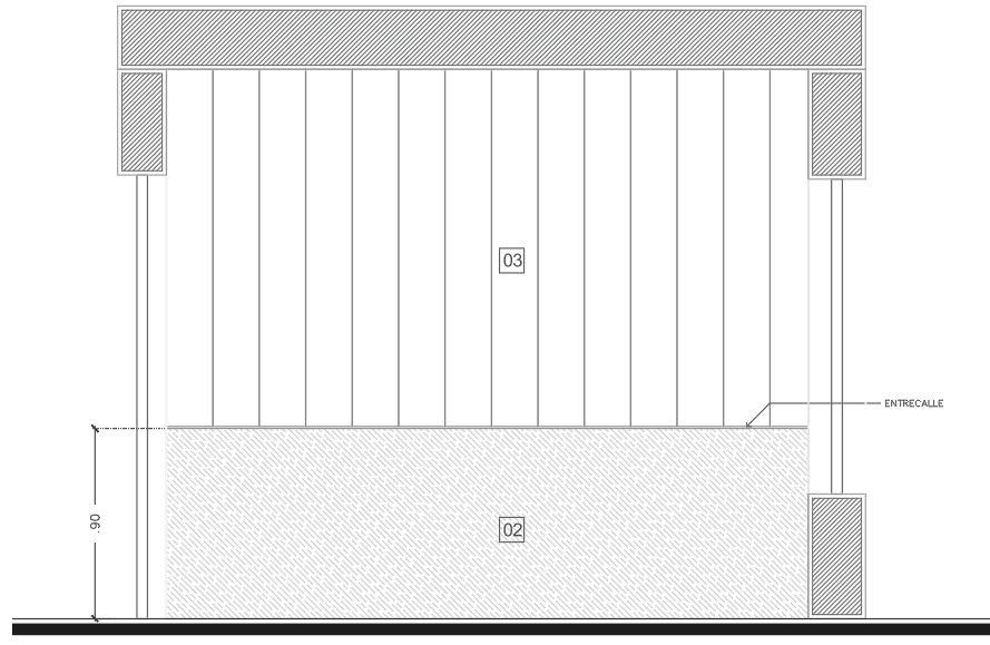
Construction plan set
Type of Project: Residential
Location: Guadalajara,Jalisco,Mexico
Team: IndependentArchitect-Proota
Software: AutoCAD

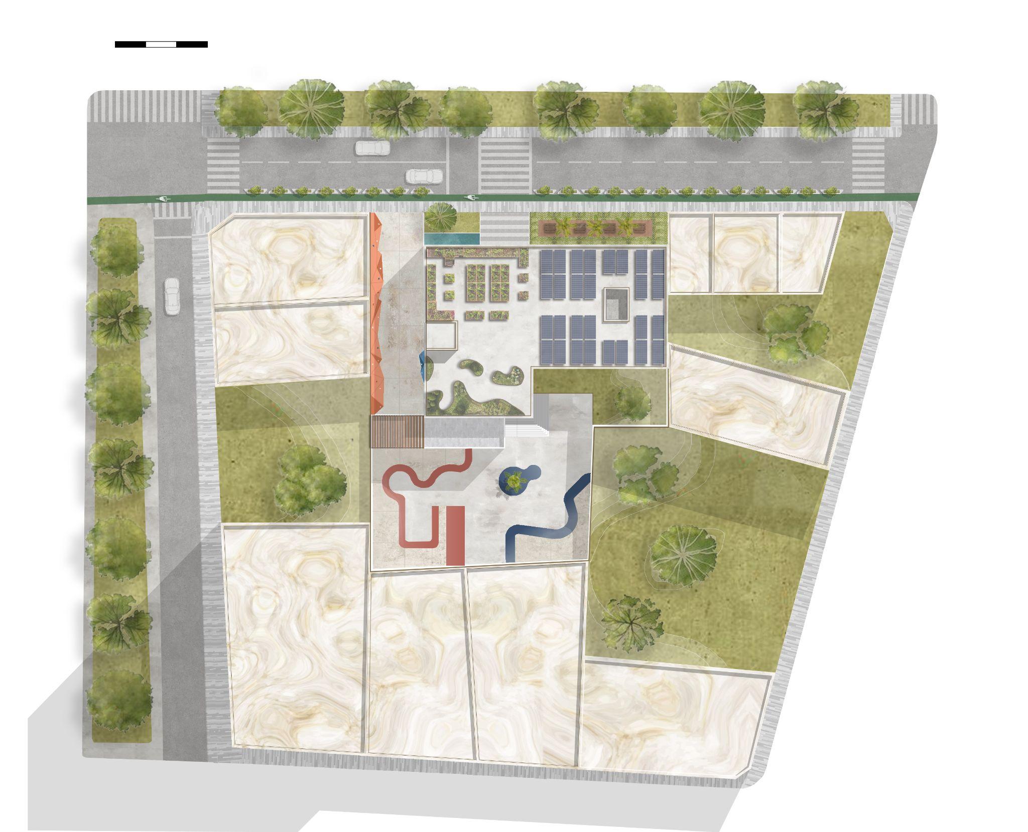
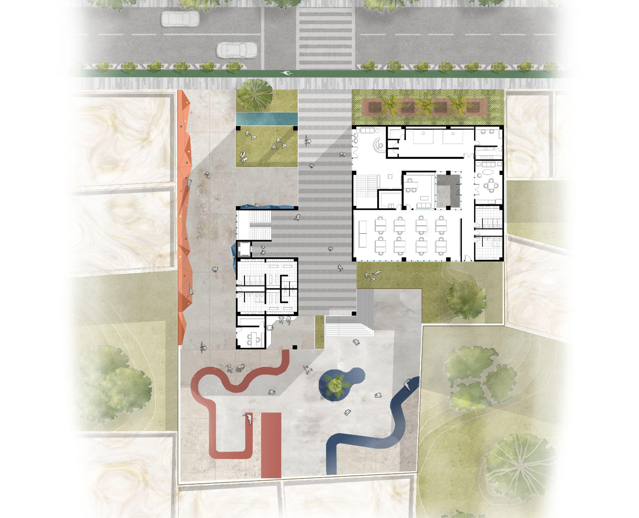
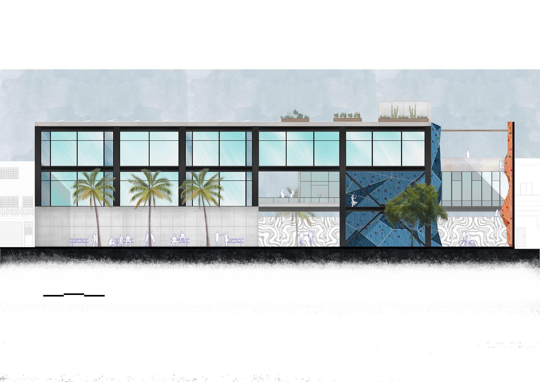
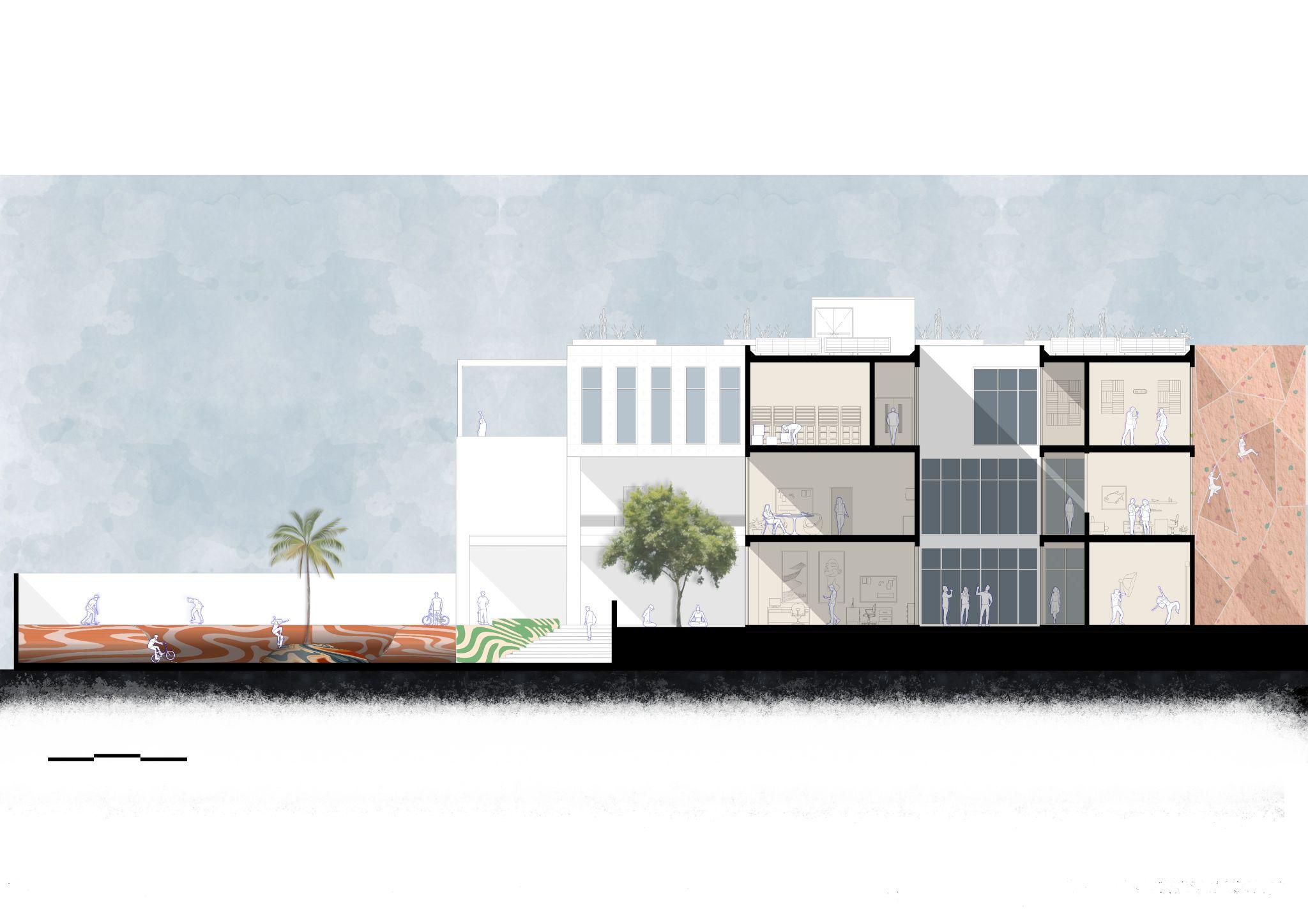
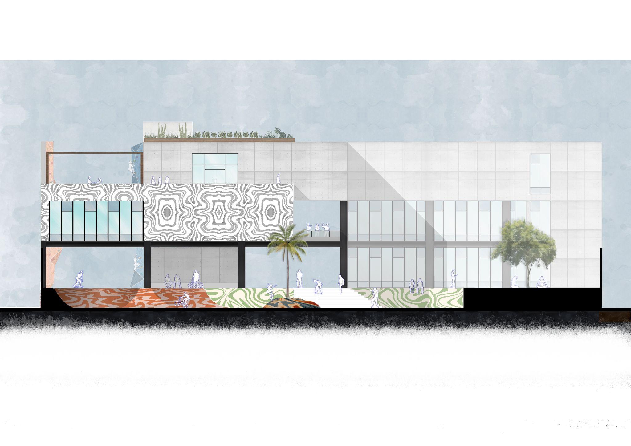
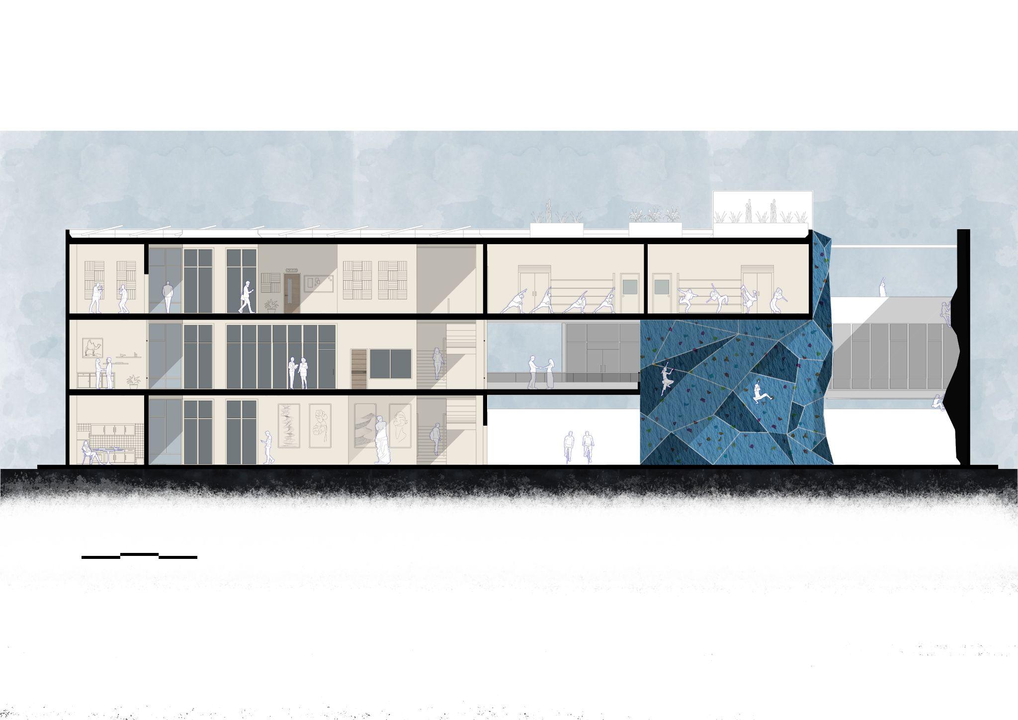
Youth Center
Type of Project: Institutional/Civicuse
Location: Guadalajara,Jalisco,México
Team: PaulH.
Within the current initiatives that promote the emergence of communities within the framework of cities, young people are not the object of particular consideration.Theurbanspaceandthemodifications it imposes aect individuals of dierent ages unequally.
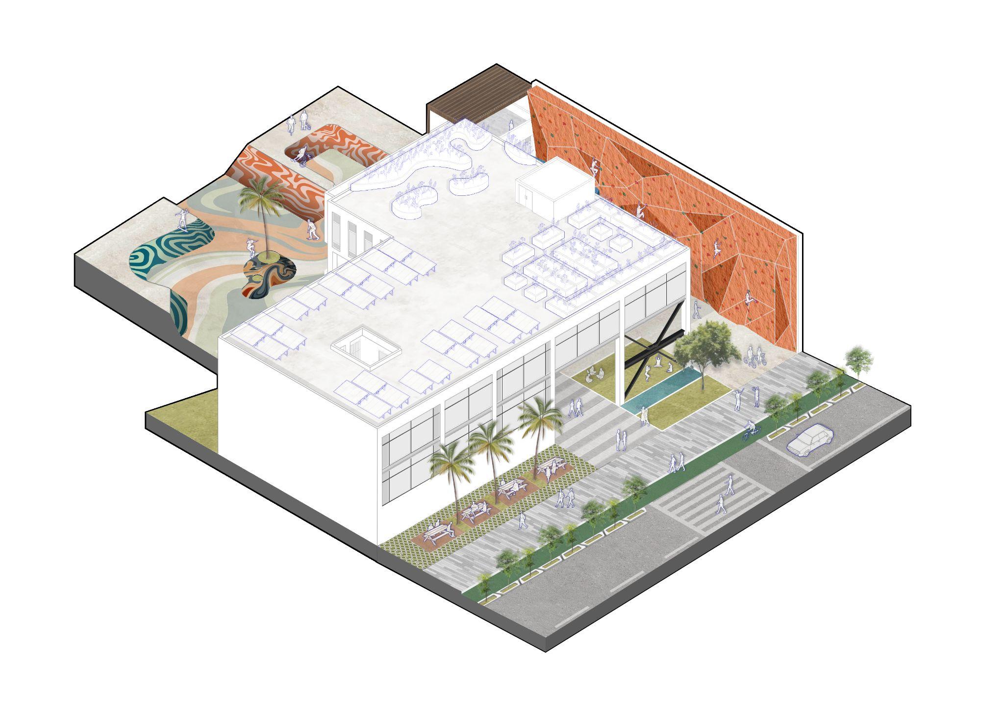
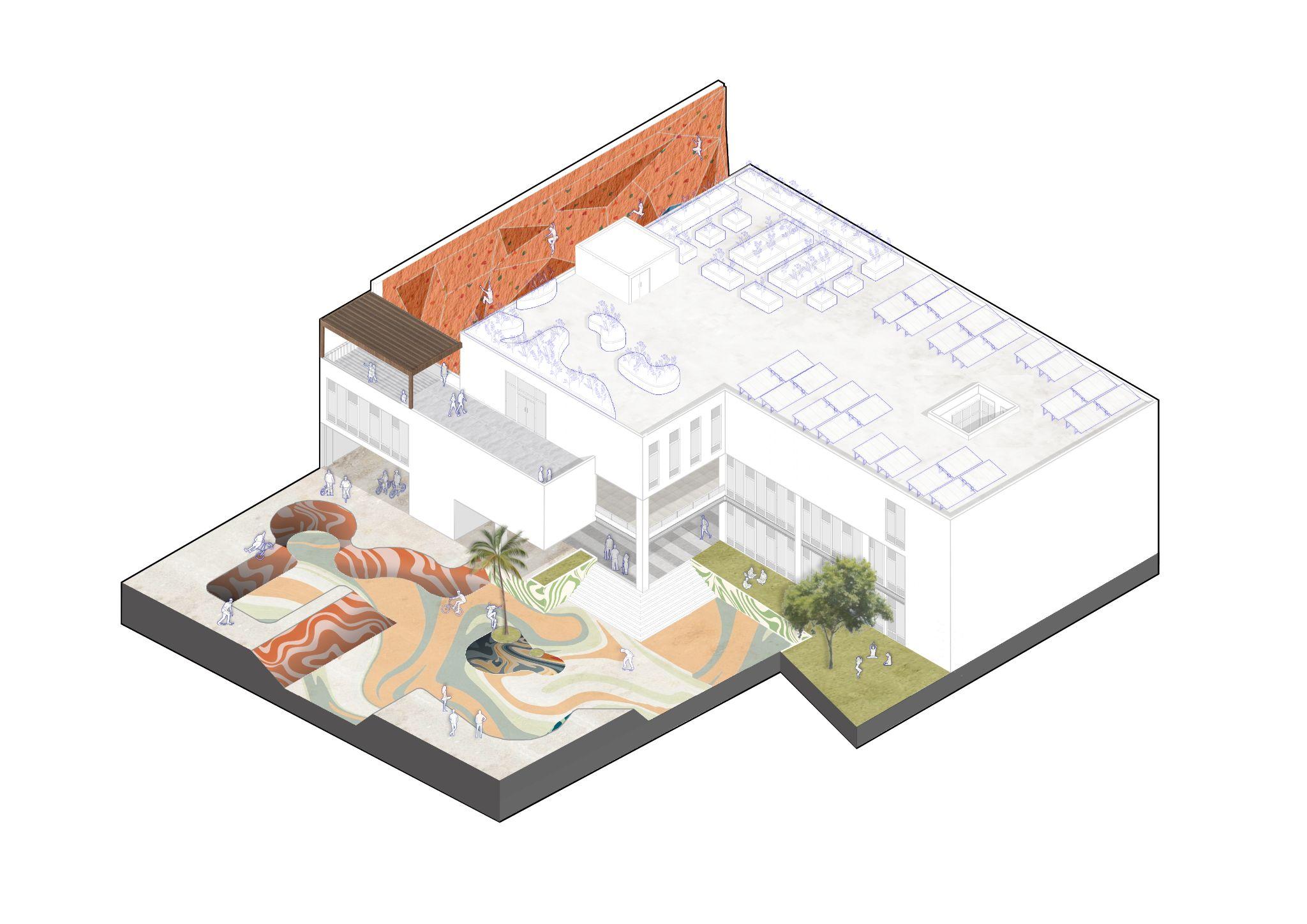
The creation of a space in which young people can identify and develop comfortably has the purpose of generating a place of coexistence and development thatpromotestheconnectionandcreationofasocial fabricinordertoreducethecrimerateinthearea.
This building is designed as a strategic spot to connectthecity,itaimstosupportyoungpeoplestay away from undesirable activities, by providing a safe andconstructiveenvironmentduringitsjourneys.
Density proposal
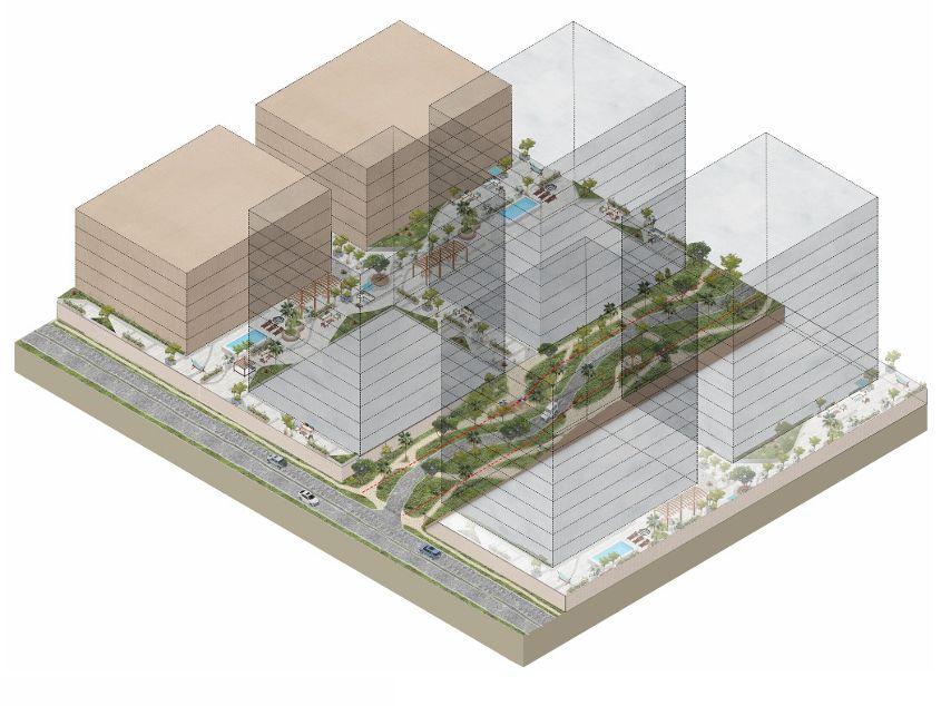
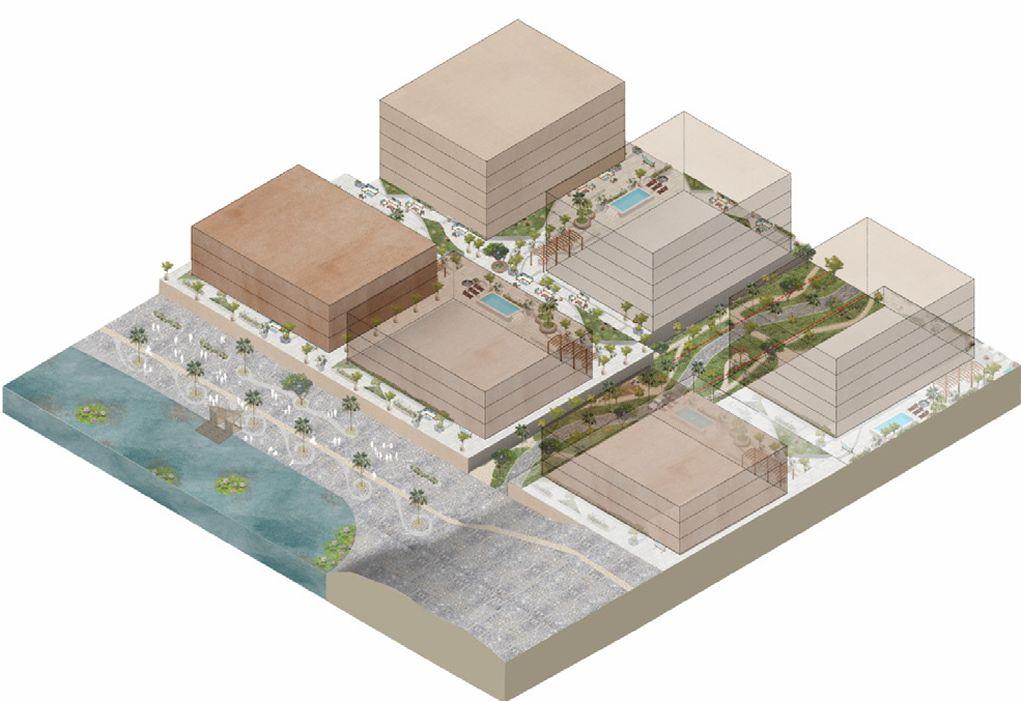
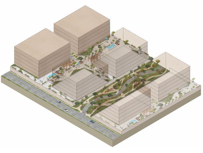
Type of Project: Urbanplanning
Location: México
Team: Estudio3.14
Asnewurbanexpansionsareproposed,itisessential to consider not only the space designated for habitation, but also the surrounding context. The integration of natural, recreational, and communal areas is undoubtedly a key factor in the long-term successofanydevelopment.
This proposal presents a series of density studies, illustrating how dierent approaches can shape the perceptionandqualityofspace.Highrise,largescale buildings may overwhelm an area, potentially leading to a less welcoming and disconnected environment. In contrast, lower density developments with fewer levels can foster a stronger sense of community, encourage social interaction, and promote a deeper sense of belonging. This, in turn, can support the preservationandgrowthoftheneighborhood’ssocial fabric.
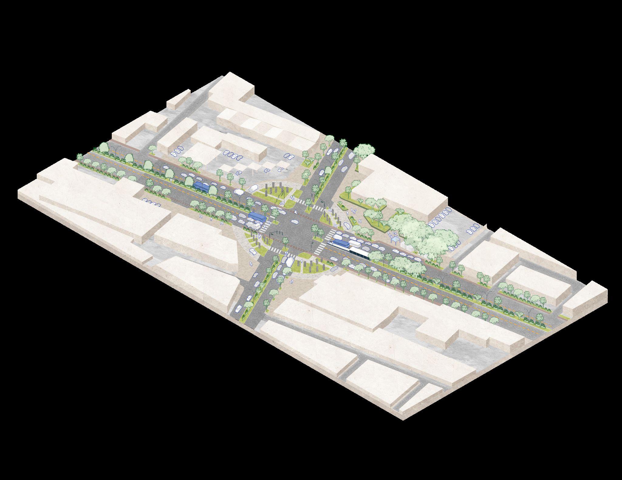
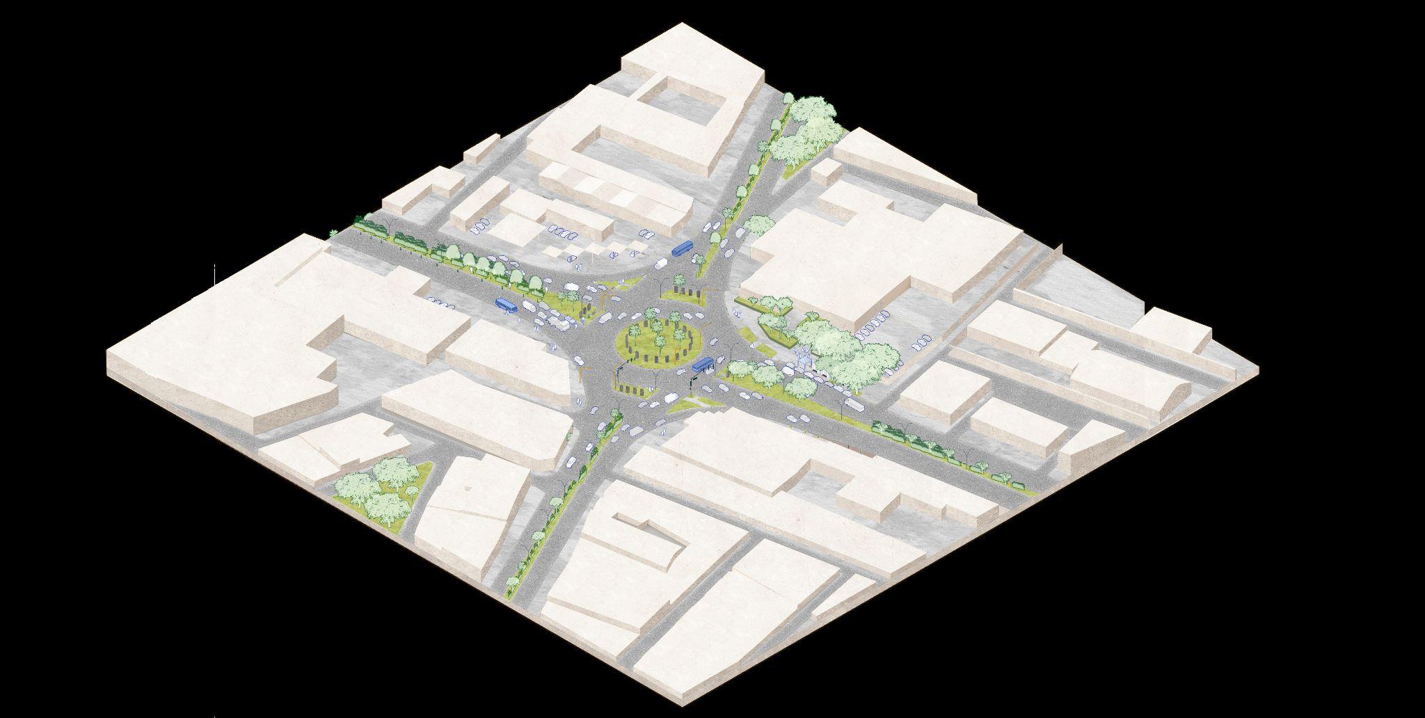
Worker´s roundabout
Type of Project: Urbanplanning
Location: Cancún,QuintanaRoo,México
Team: Estudio3.14
The roundabout located in the heart of Cancún has become not only an emblem of the city’s working class but also a key junction along one of its busiest avenues. Today, it is among themostheavilytraickedareasinthecity.Asacentralnode, the roundabout often results in vehicular congestion and posessignificantchallengesforpedestriancrossing.
To address these issues, the proposal aims to improve traic flow and enhance safety, while preserving the original design element of vertical pillars. A central bus lane is introduced to promote the use of public transportation, thereby reducing the number of private vehicles on the road. The roundabout itself is shifted outward, surrounding the perimeter of the intersection. This reconfiguration allows for a continuous circularflowonthesideswhileenablingmorecontrolled,linear movement for vehicles, whether turning or going straight, through a signal based system. The result is a more eicient andpedestrian-friendlyurbanspace.
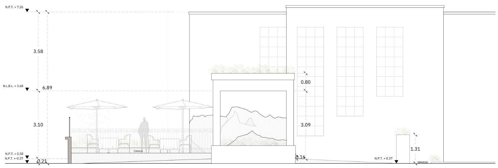
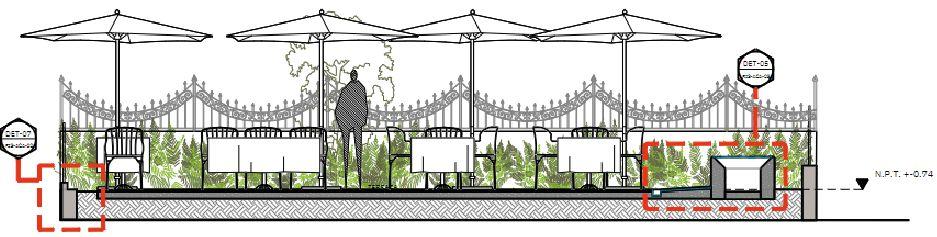
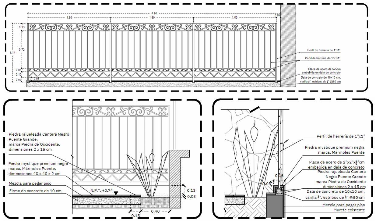
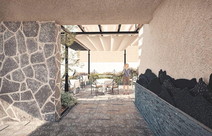
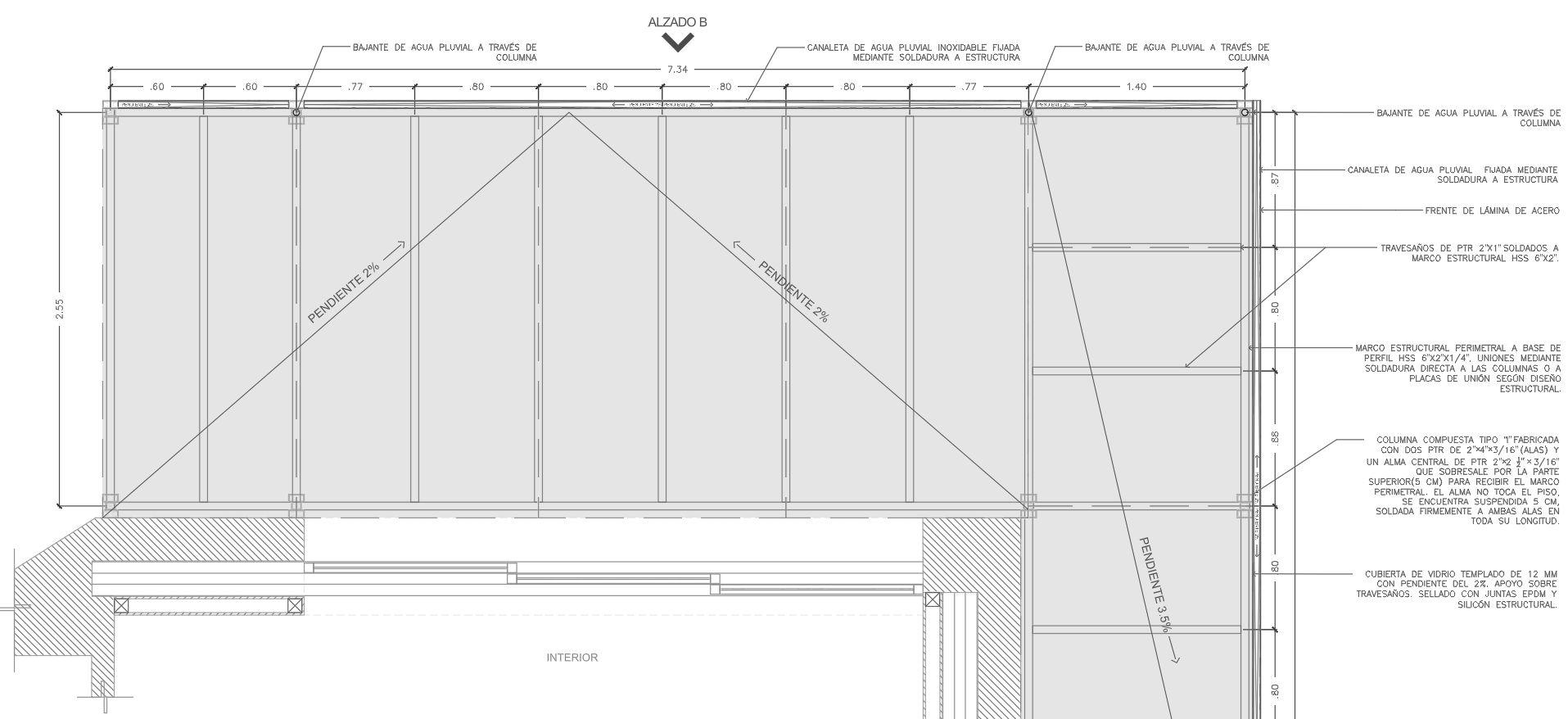
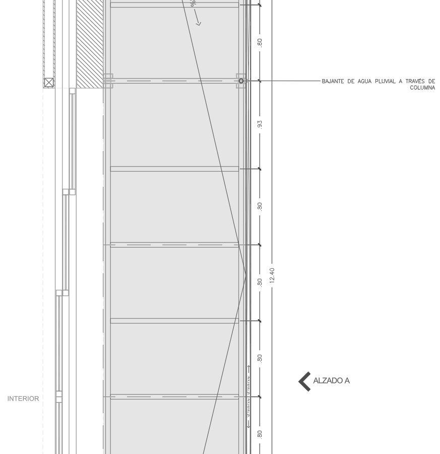
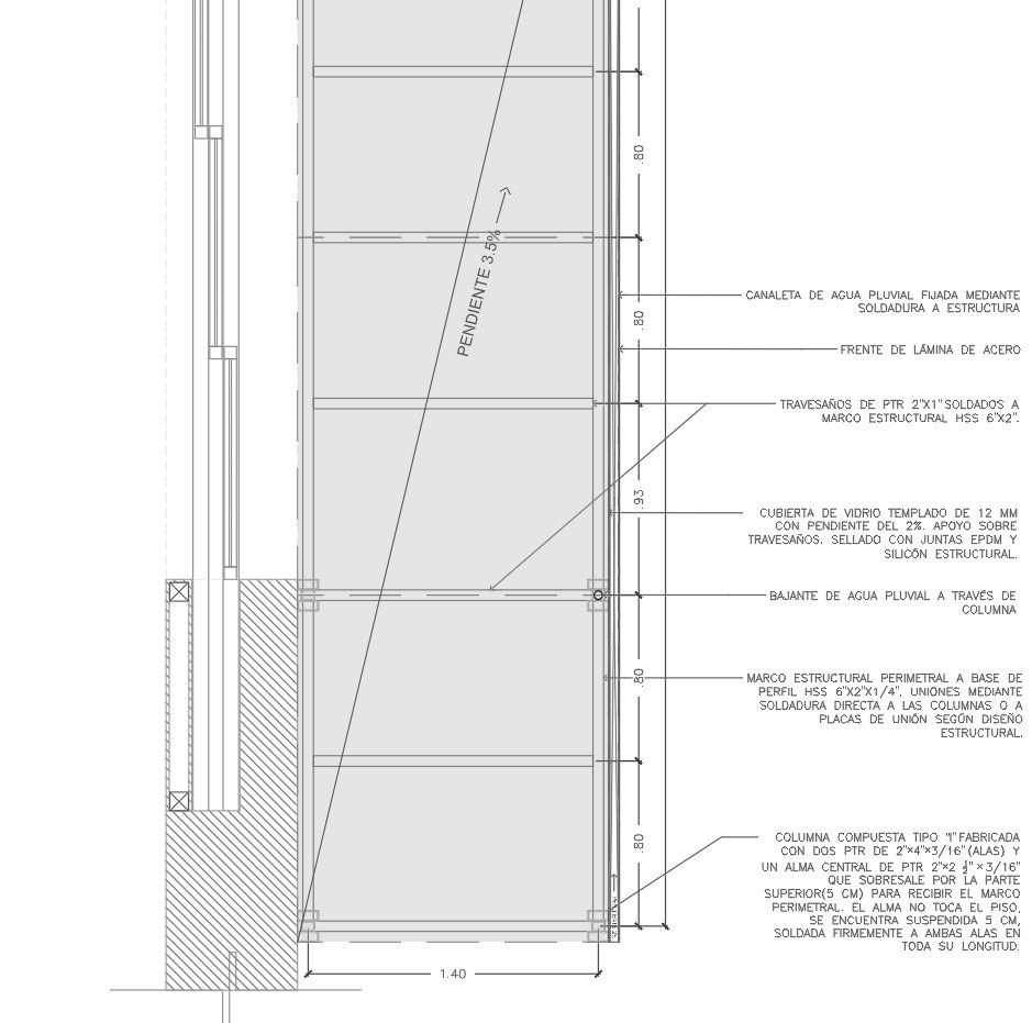
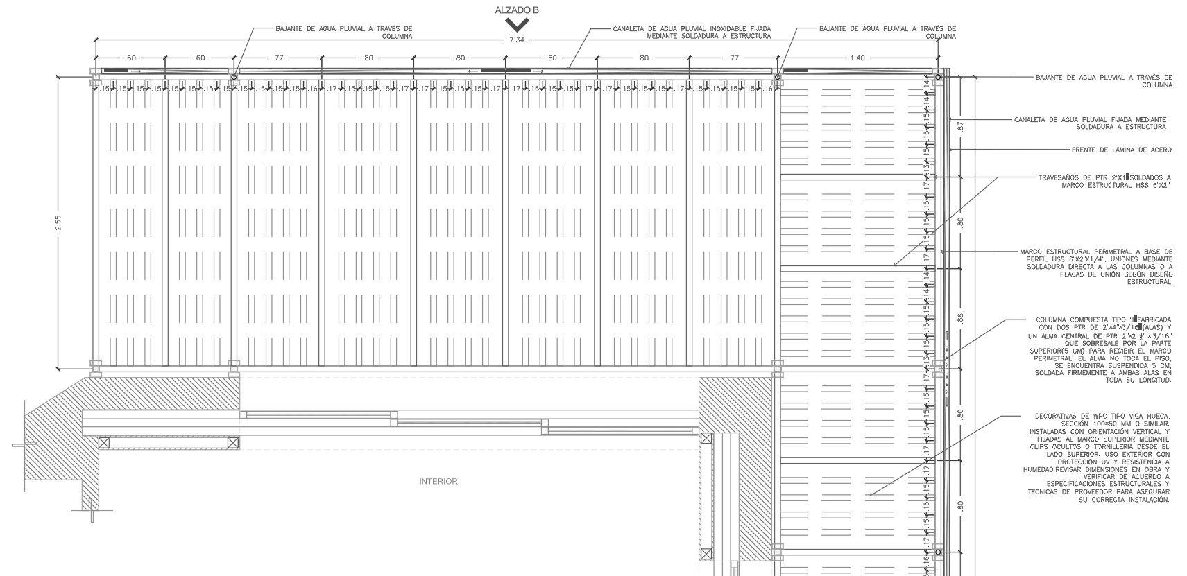
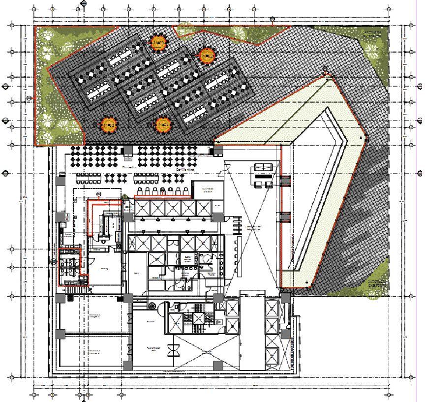
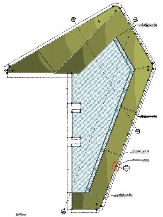
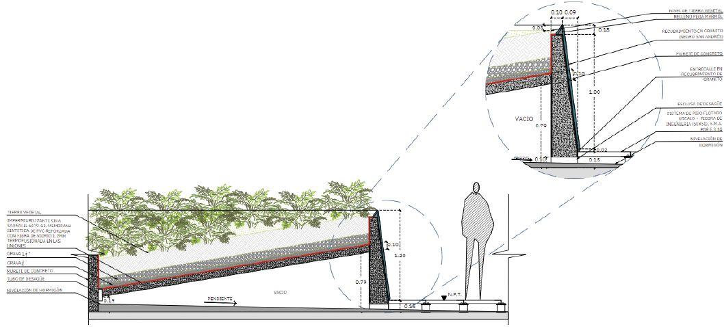
Terrace renovation
Type of Project: Commercial
Location: Guadalajara,Jalisco,Mexico
Team: Estudio3.14
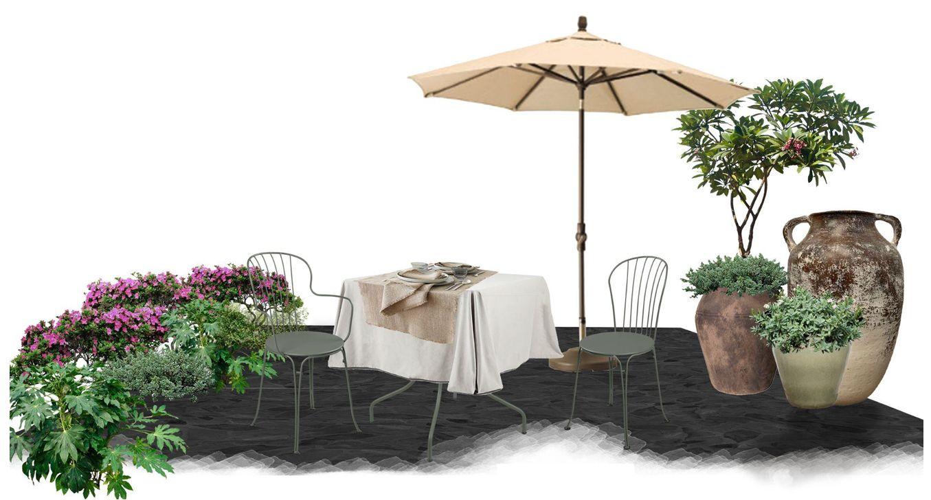
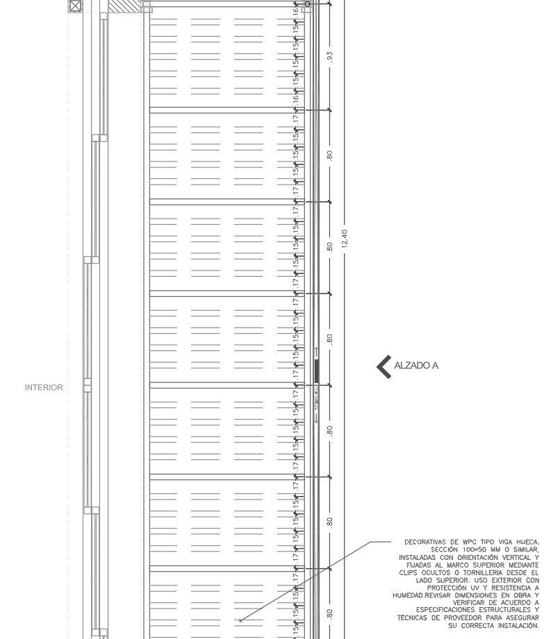
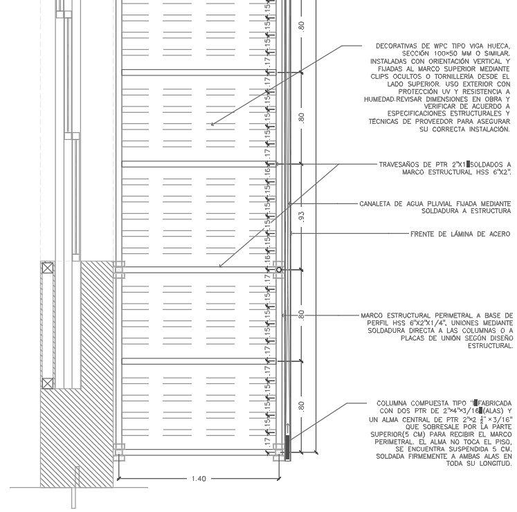
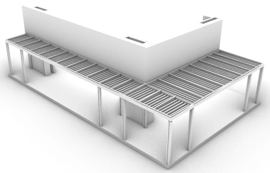
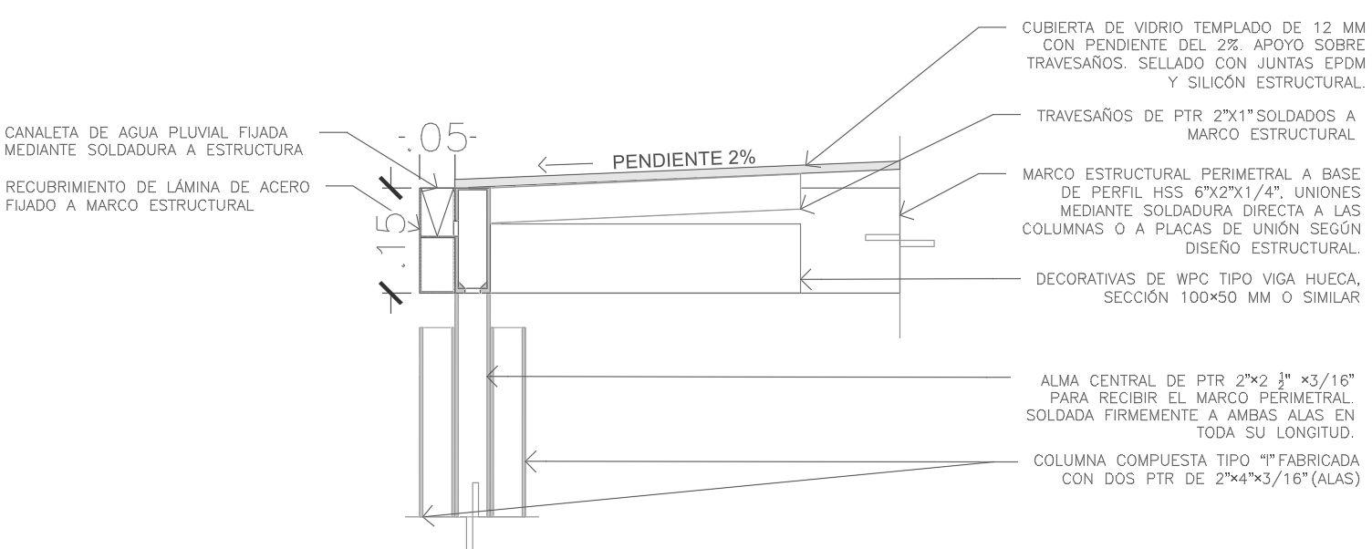
Thisprojectseekstotransformarooftopintoaterracewhere workers can enjoy their free time and connect with the outdoors during the workday. Thanks to a raised flooring system, a flat and functional surface is achieved without the needtomodifytheexistingroofslopes.
To enhance comfort and create a refreshing atmosphere, the design incorporates greenery and a water feature. Pergolas are strategically placed to provide essential shade over rest and dining areas, ensuring a more pleasant and usable space throughouttheday.
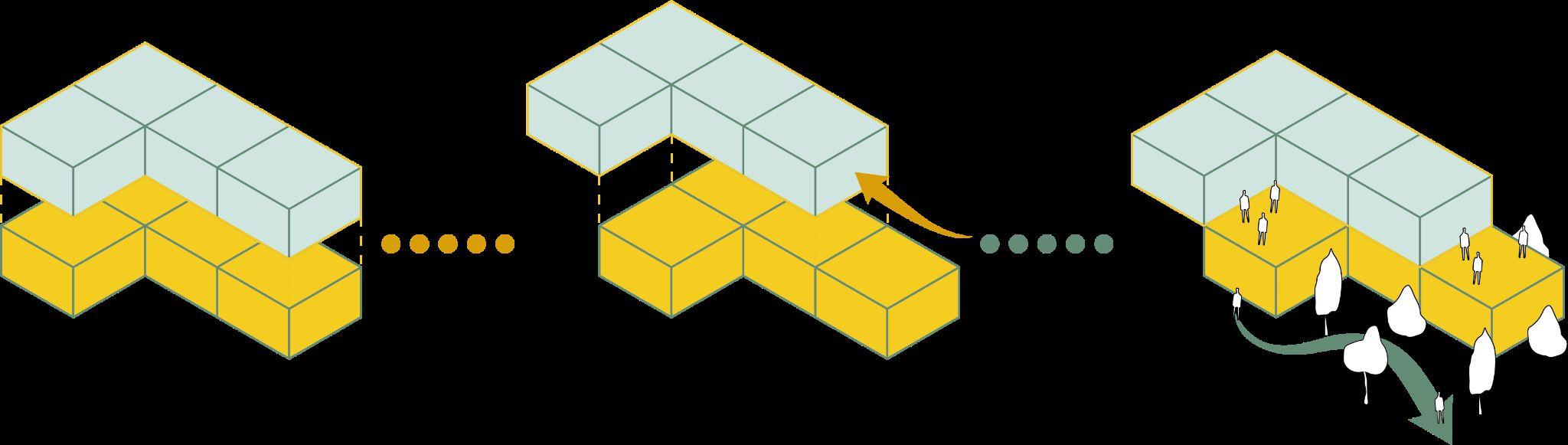
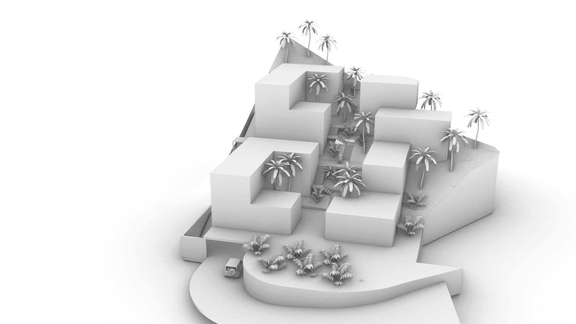
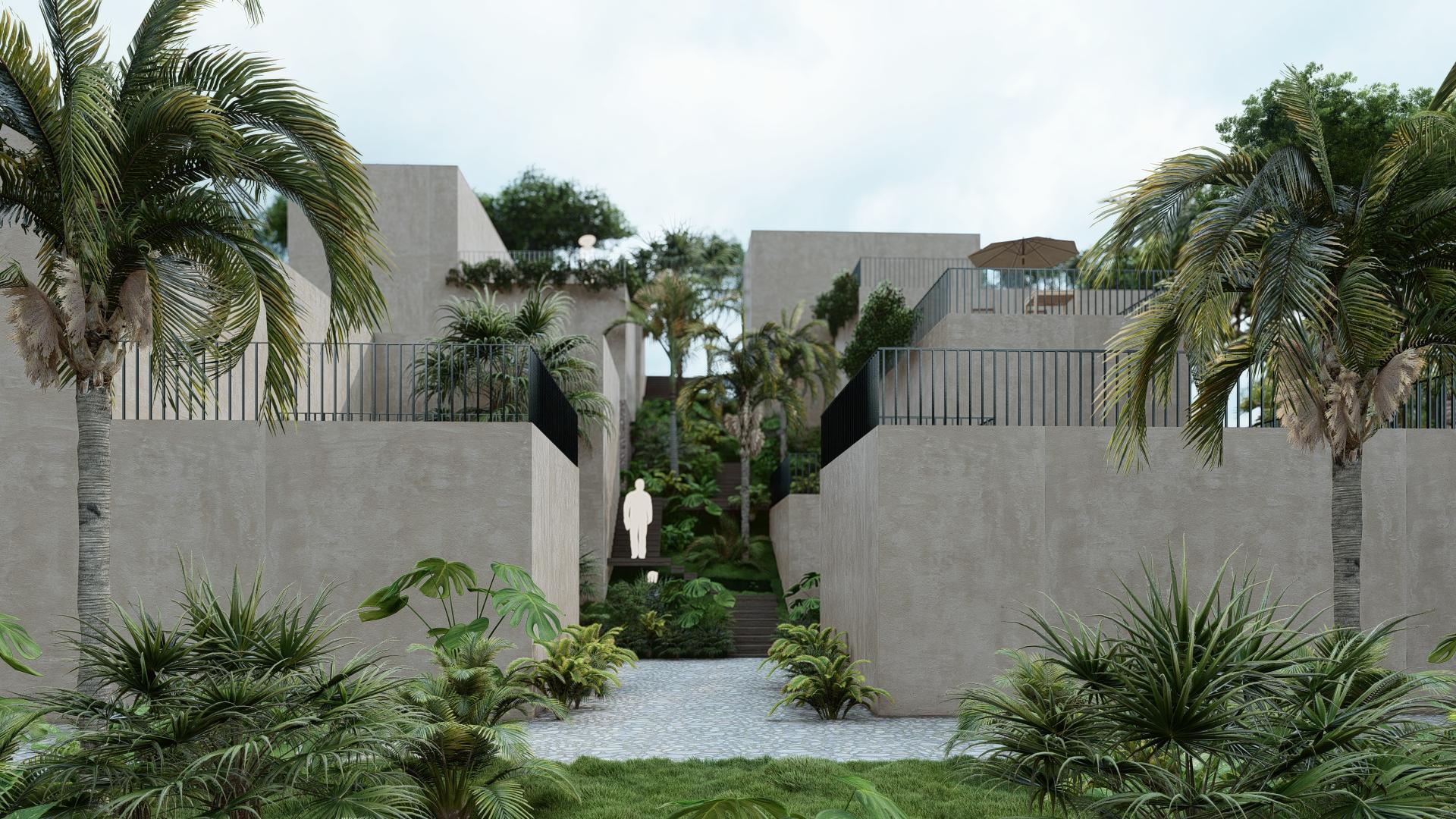
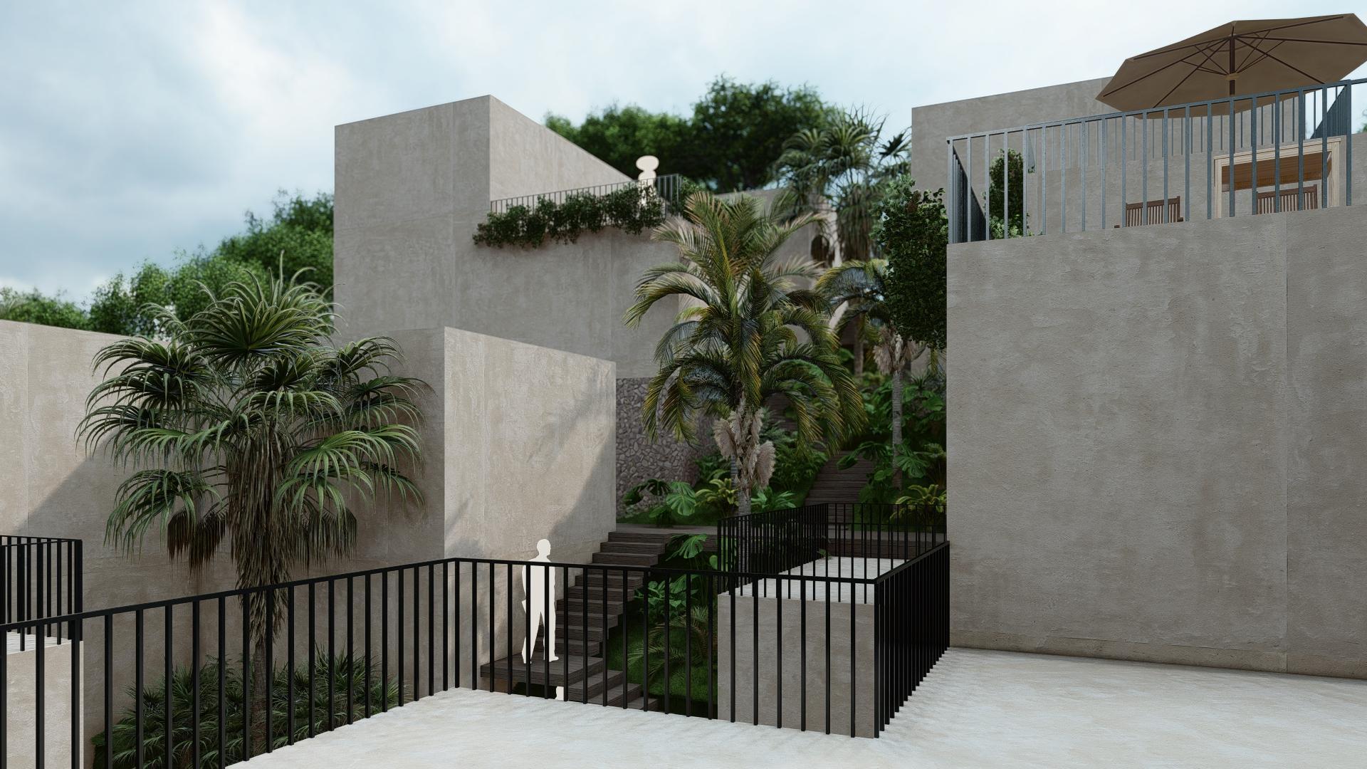
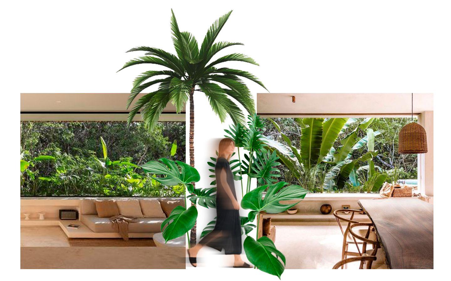
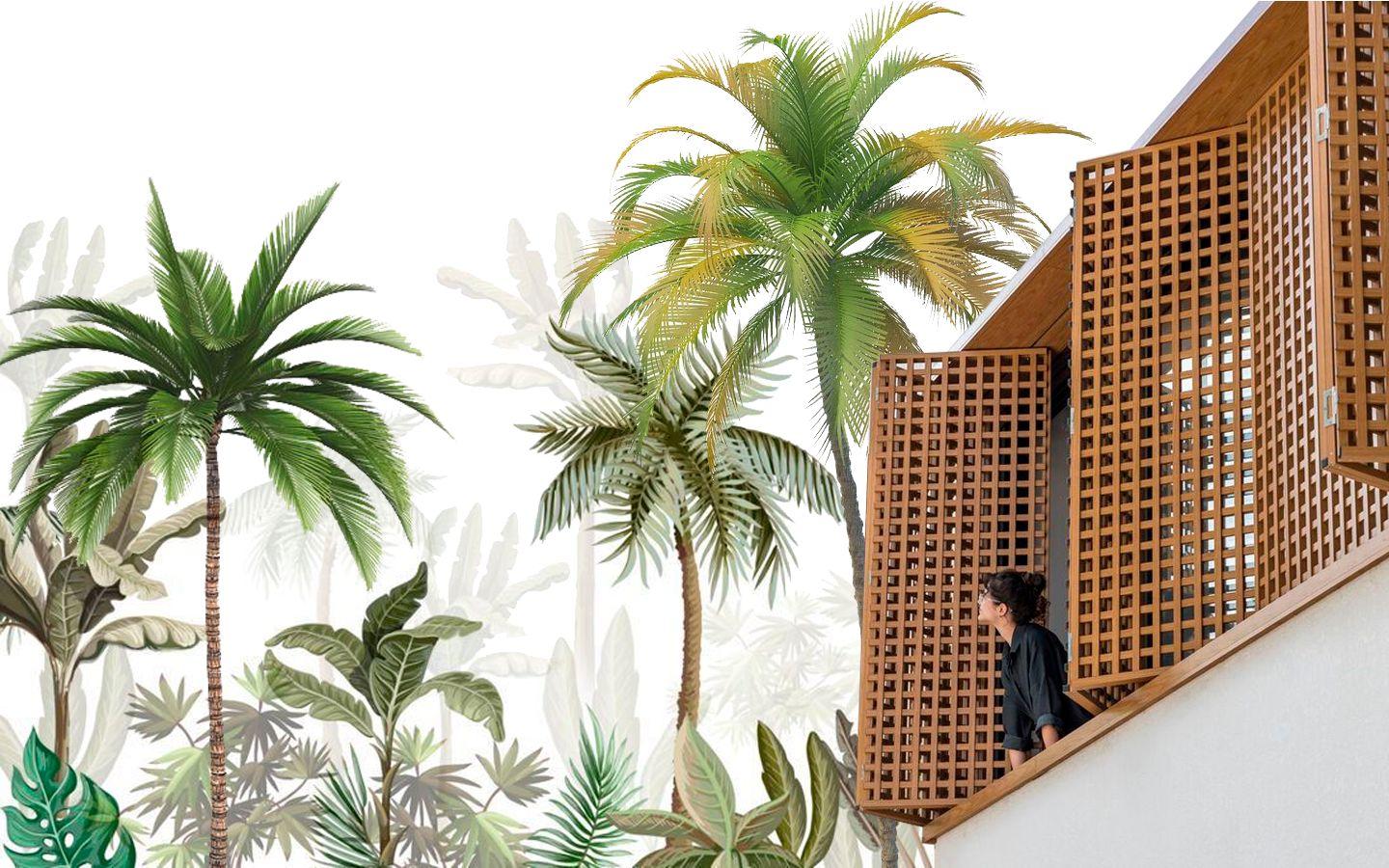
Selva Maku
Type of Project: Residential
Location: Sayulita,Nayarit,México
Team: Estudio3.14
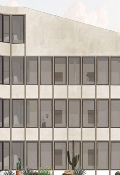
Located in Sayulita, just steps from the shoreline, this residential project is designed to prioritize nature, with human presence considered more as a guest within the landscape. The multi level complexadoptsanLshapedlayouttoadaptto natural terrain, generating a variety of patios and platforms that function as balconies, allowing the architecture to blend harmoniously with the surroundingenvironmentatdierentelevations.
Guests are invited to immerse themselves in the experience of being atop the jungle canopy, with viewsframedbynativevegetation.Everycornerof the project is crafted to integrate nature, oering a unique sense of connection to the local ecosystem.