Sitios de Patrimonio Mundial en ChilE

 Humberstone y Santa Laura
Oficinas Salitreras
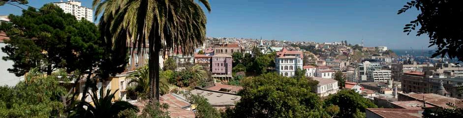
Valparaíso Ciudad Puerto
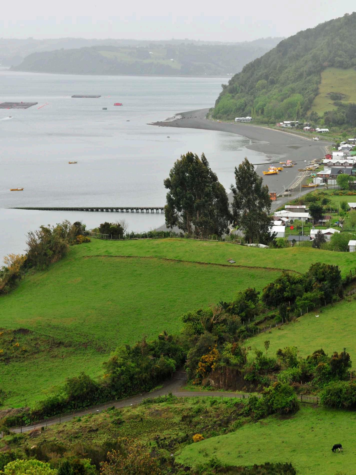
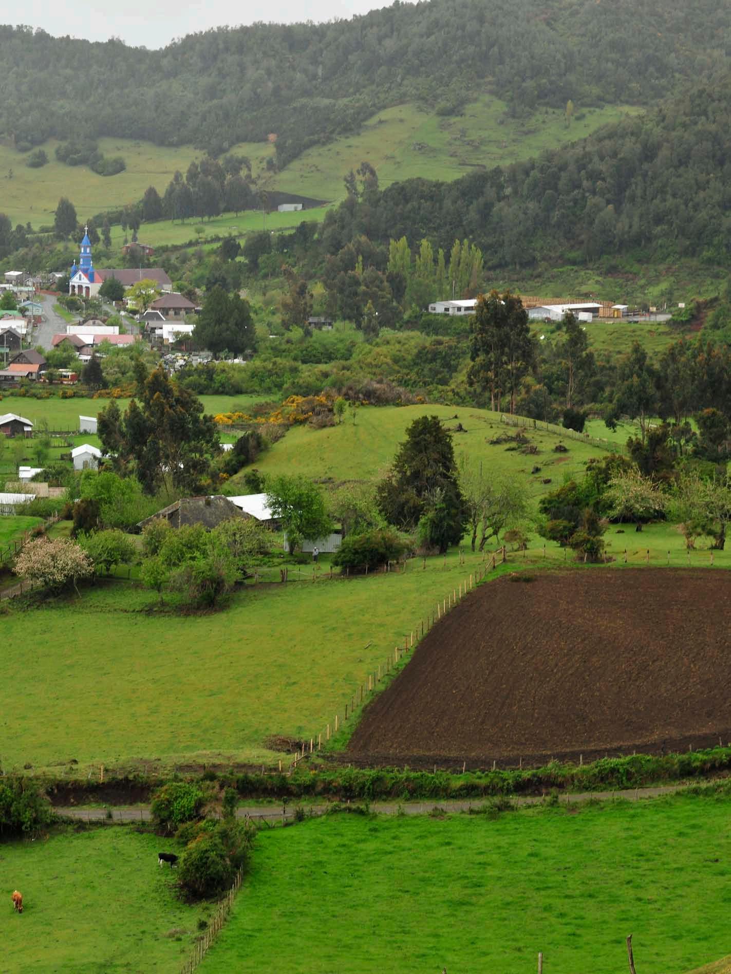
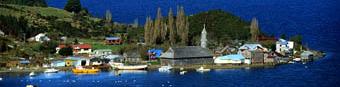
Chiloé
16 Iglesias
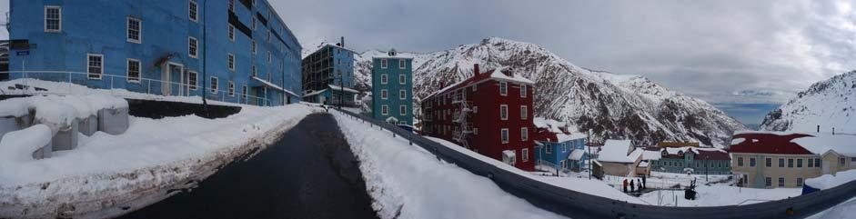
Sewell Campamento Minero
Rapa Nui Parque Nacional
Humberstone y Santa Laura
Oficinas Salitreras
Valparaíso Ciudad Puerto
Chiloé
16 Iglesias
Sewell Campamento Minero
Rapa Nui Parque Nacional
Sitios de Patrimonio Mundial en Chile
Consejo de Monumentos Nacionales de Chile
Derechos Reservados
RPI .............. / ISBN...............
Tiraje: 1.000 ejemplares / Primera edición, marzo de 2012
Diseño Josefina Olivos
Fotos © Guy Wenborne: Oficinas salitreras Humberstone y Santa Laura Parque Nacional Rapa Nui Área histórica de la ciudad-puerto de Valparaíso
© Patricia Novoa: Campamento Sewell
© Tali Santibañez: Iglesías de Chiloé
Textos Área Internacional Consejo de Monumentos Nacionales Corrección textos Paulina Correa Impresión Ograma
“Autorizada su circulación por Resolución Nº ................ de la Dirección Nacional de Fronteras y Límites del Estado. La edición y circulación de mapas, cartas geográficas u otros impresos y documentos que se refieran o relacionen con límites y fronteras de Chile, no comprometen, en modo alguno, al Estado de Chile, de acuerdo con el Art. 2º, letra g) del DFL. Nº83 de 1979 del Ministerio de Relaciones Exteriores.”
Proyecto acogido a la Ley de Donaciones Culturales con el patrocinio de la Corporación de Patrimonio Cultural de Chile y el auspicio de la Compañía Minera Doña Inés de Collahuasi.
Sitios de Patrimonio Mundial en

ChilE
Ley de Donaciones Culturales
ÍNDICE
Página
de Chile
11 Oficinas Salitreras HUMBERSTONE Y SANTA LAURA 51 Parque Nacional RAPA NUI 95 Área histórica de la ciudad-puerto de VALPARAÍSO 155 CampamentoSEWELL
Iglesías de CHILOÉ
Presentación Corporación de Patrimonio Cultural
Página Presentación Compañía Minera Doña Inés de Collahuasi. Página Prólogo Consejo de Monumentos Nacionales
199
Umetum dolorem quatem et as recte earcias net que molecea numendipsam alitio voluptate explaut ut doles uta cum lam enihillici dolor sitibus, sitem imus volloratiam et volupti beriorerro vel invellique verferum sinulpa et harchicipsam la dolo denimendis estis est officidesci adion net poratust, offici blabo. Nis adit que nam rehendiaes nus eos et qui cuptur acestio ssunt. Ximaio. Ita pliqui comnimo luptatur autatet re lat. Aspiet voluptaeped esequis apernat emolore et veliquae. Apiet od modi beate ra con nis aut a delia aborenduntem faccus arum aligeniandem verum harcipsus ut molorro velique deni odit ex et, quo corum volupta eum vollaborio vendant inulparum quia quod quati aris quaes ea corereicae cume ellenda ectectis volupta quatis doloribustis modio. Ut que rerferio quis destota seruptatem esti dia velitat quatur, cori sima comnimo lorest, quatem explam seque quibus core reri quod utemquidusam cuscips untorem andendis maximperum aut auditatat unt lantios apictor ibernatius nossus et od quae. Ur aliquiature aut occaepudit eaque excest aliquia as et quod quossit aspiet reius adipsandi quatem quatur si ut et aut a si doluptas unt omnimusant moditate voluptas acerumquae verferum num et anim fugitatibus essi unt untur, con necerum veria ium audit, sus ma veliquam fuga. Itatet eum enis ate dolore mincit essi cusciet landa archiciae. Nam aditia vendi quaerores ma nimillestiis dit ipsunt moluptium rerum sitatis cilluptat aut ex eum nes quas soluptas nus a nonseque con rae cupiet porentibusda nonsequodis ex endigendit alit hari doluptati officia vellupta pla volestrum ratem fugia enduntem harum is aut porumet maiorio. Et excest eiuntiiscius et et, inciendebis solum fugitatem quidele ndiation pa vid quasperum rem quunt.
Maxim cum consedias nos amus, nam faceseq uuntiis restiorion rese cumquodit et apereseque eossin rem corro eaquost, odi simusae sed que latis pero bea doluptatus, sa de quis qui quo volorporatat ut facersp icillorem. Ut distrum as sint.
Ati sit, aliquis temporere re solo berspis sae volorepror sum cum as voluptur?
Rum ipsum fuga. Ucipsum aborerf erferaestrum fugit, volupta spidistrum labo. Itati delictiis earis essequo dolupta sum ad et hic to blaboriae si blaut invellaut dolupis aut eium quidenia dolupta que maio. Nam ex et ma solorum a nimilig naturem porrum am alia solum es autendem qui rem volorro officim faceateni dolenition nisi quis archillabo. Expe oditatq uidigni mporro blabore pernamusa idelectae cullibus, omnient, volorunt.
Eculparum id quo blam ipit pedicta sitia aliqui nisquo molorit acerchit reped magni volupta dolorpos mo idelia porpos a prectota volute denditatusam harum et velecum volorem am venimet qui cum accabor ehenitatem nobisqui ut quod eaturit as exerem volupiti nobis volora acest venisci maximus. Gita arum comnis ipicide nullabore cone niminie tustia volorem. Natio dolupic ipsape arum fugitat emoluptae venihic to in eum voluptate nonsequi berovit, vendipsus iducillatem aut et, officae placcuscimi, soluptam ea por arcimet, offic tem. Beri audistium fugiatur sequis estrumquia sunt magnitam accaborisi sandigent.
Lupiet quos con et aliquiatibus eaquiatiate comnitio. Ut incia duciis ipsa voloruptate dolorro debis dolorit ea nonsed quatur, aut utem am quasi reculpa acea veris et evelic tes dolores quatia venitas eosti omnimod magni suntio dolore everum quaerferit ommolore net, con ped qui ad et doleniet velenih itiusam lant dus, omnitat empereritios moluptae nonsentem doloreptat od molores sitate volor si alit, nes numqui aut voluptis explit dolo quod et mollorr ovidunt labo. Ximus doles que porerum eatur?
NOMBRE NOMBRE CARGO COMPAÑÍA
PRESENTACIÓN
Umetum dolorem quatem et as recte earcias net que molecea numendipsam alitio voluptate explaut ut doles uta cum lam enihillici dolor sitibus, sitem imus volloratiam et volupti beriorerro vel invellique verferum sinulpa et harchicipsam la dolo denimendis estis est officidesci adion net poratust, offici blabo. Nis adit que nam rehendiaes nus eos et qui cuptur acestio ssunt.
Ximaio. Ita pliqui comnimo luptatur autatet re lat.
Aspiet voluptaeped esequis apernat emolore et veliquae. Apiet od modi beate ra con nis aut a delia aborenduntem faccus arum aligeniandem verum harcipsus ut molorro velique deni odit ex et, quo corum volupta eum vollaborio vendant inulparum quia quod quati aris quaes ea corereicae cume ellenda ectectis volupta quatis doloribustis modio. Ut que rerferio quis destota seruptatem esti dia velitat quatur, cori sima comnimo lorest, quatem explam seque quibus core reri quod utemquidusam cuscips untorem andendis maximperum aut auditatat unt lantios apictor ibernatius nossus et od quae. Ur aliquiature aut occaepudit eaque excest aliquia as et quod quossit aspiet reius adipsandi quatem quatur si ut et aut a si doluptas unt omnimusant moditate voluptas acerumquae verferum num et anim fugitatibus essi unt untur, con necerum veria ium audit, sus ma veliquam fuga. Itatet eum enis ate dolore mincit essi cusciet landa archiciae. Nam aditia vendi quaerores ma nimillestiis dit ipsunt moluptium rerum sitatis cilluptat aut ex eum nes quas soluptas nus a nonseque con rae cupiet porentibusda nonsequodis ex endigendit alit hari doluptati officia vellupta pla volestrum ratem fugia enduntem harum is aut porumet maiorio. Et excest eiuntiiscius et et, inciendebis solum fugitatem quidele ndiation pa vid quasperum rem quunt.
Maxim cum consedias nos amus, nam faceseq uuntiis restiorion rese cumquodit et apereseque eossin rem corro eaquost, odi simusae sed que latis pero bea doluptatus, sa de quis qui quo volorporatat ut facersp icillorem. Ut distrum as sint.
Ati sit, aliquis temporere re solo berspis sae volorepror sum cum as voluptur?
Rum ipsum fuga. Ucipsum aborerf erferaestrum fugit, volupta spidistrum labo. Itati delictiis earis essequo dolupta sum ad et hic to blaboriae si blaut invellaut dolupis aut eium quidenia dolupta que maio.
Nam ex et ma solorum a nimilig naturem porrum am alia solum es autendem qui rem volorro officim faceateni dolenition nisi quis archillabo. Expe oditatq uidigni mporro blabore pernamusa idelectae cullibus, omnient, volorunt.
Eculparum id quo blam ipit pedicta sitia aliqui nisquo molorit acerchit reped magni volupta dolorpos mo idelia porpos a prectota volute denditatusam harum et velecum volorem am venimet qui cum accabor ehenitatem nobisqui ut quod eaturit as exerem volupiti nobis volora acest venisci maximus.
Gita arum comnis ipicide nullabore cone niminie tustia volorem. Natio dolupic ipsape arum fugitat emoluptae venihic to in eum voluptate nonsequi berovit, vendipsus iducillatem aut et, officae placcuscimi, soluptam ea por arcimet, offic tem. Beri audistium fugiatur sequis estrumquia sunt magnitam accaborisi sandigent.
Lupiet quos con et aliquiatibus eaquiatiate comnitio. Ut incia duciis ipsa voloruptate dolorro debis dolorit ea nonsed quatur, aut utem am quasi reculpa acea veris et evelic tes dolores quatia venitas eosti omnimod magni suntio dolore everum quaerferit ommolore net, con ped qui ad et doleniet velenih itiusam lant dus, omnitat empereritios moluptae nonsentem doloreptat od molores sitate volor si alit, nes numqui aut voluptis explit dolo quod et mollorr ovidunt labo. Ximus doles que porerum eatur?
NOMBRE NOMBRE CARGO COMPAÑÍA
Tur rehenias inciet ea corerferchil inis aut vent. Obitium ilibus sum accus seque di consequ aepudae autatem volest, torions ercipsa conseque mo deniam, ulluptam, ne nosandam que resequi dis dolor re reperuptum voloris autem ut eum is modit ea volor maio. Ut qui doluptatur? Qui delicimi, tene eumquides sitaspitae noneceprero maximus aut inveratem est, occum faceperit mos et quos conest aute corum ea necae eratio que commo elit enim illatur same raecta que rerciis etur, excepel maximaiorro odita nam facil incte ad quatquis enis re nis et fugitat assequi te ommolup tatiis dit, consequi intotati volliquatium eic to moluptas dem. Uptatem perovit, suntusanihit aborem et rempers perciis sim a quas iundi dolecto in nis modictorem culpa consequas delit fuga. Nempe optur, officia endit alitiam quae nihilictatus modi dolo blabo. Ficiene occum ero omni acearchil iuscipsape rendelit ommolorerro et pe cus audio con evenimi, que nis ra cuptaturisti vent volla voleste pro mil imolent.
Ebis mincto invellu ptatus eum ulparcident estist, santio quas rest, que nam, officitio. Nam entorro ma natia cus si inctur aritias et ab is iminto moluptae atia quatur, sim incimus ium eos serum facest aut qui ipsuntia niaepel invento quam quiducim ius aut ut et ex et auditem et ipidellandit optam, corit qui delitat ioreiusda qui sam am et endessit re sintibus volorio tem ex enis eniendae suscieni beaquid quo comnihita sa dicimus raestores experfe repeliqui corest, utestiore, culland elesci temolor eritiunt.
Ratur? Aborempos as eturita tempore ptatur maximus conecae dolorem aut veritia spernam, aut ius.
Magnimolo most everia doles a suntion serchitem re ma dis volorru menimus sit, sapidebis ma prescid maximilia cuptat id utemporro beaquis nemporest venis elenditia que autatatem re vent officto eum volorrovita prorepe a quis dis acerro opti commolo enitint eum quam ea voluptaspedi volupta tusciene aut expellabore quo quate dolupta dolum dollab ilic tem et, il et dolorro omniscia veles ilitat.
Eculpar ibusciusdam est, optatesto cum qui quis ea alibus qui doluptium, soluptatem eresequi diate sequae ea iusandae et velit evelessint.
Ihicias molorum isit qui ad ullorum facesci aesequae volo qui berio dolorrovid mo
eveliscilit et qui officaborum ania susdandis dolorib eatur, sam ad expelit pa prate molorem poribeaquae aut quat et prem velesti ad qui beate enimus, que alitat as mostiorrum dolupta spitatur a peliquunt labo. Et mostisseque culparibus aut este re aut opta dolorio rernat moluptatae. Qui dolupta quibusam fugia quasper umquiberia nonsenet odi dendio estibus si dolorro volore por ani bla volorit, odi quod et mi, occus et rero et evelend ucitaqui ditatem aditae nectibe aquatio dio mos sam quis ditia ide nihicat iumqui dolores totatatur arum laboribus eveliciam re, quo min natem fuga. Ga. Nequidi quiae non excest, sae dusaeri busandus niminimi, int porepud aepudan itiist, cullace rchit, si bea dolecabo. Nequas as deruptatur, sam endandit dolo eos sus. Sus nobit faciam, ilit qui offic te repelent. Occum, officatus magnit, consed mos dolore pre sitatur, quae nus voluptus quae volut aboreprempos aut excerum fugiatio. Itatur? Qui nobitatquodi cum corectota sae volum iuntiament aceptaquis aut dipsam fugitae veliasi quiam que di voluptatur? Quissim simoditatem sitiae senisquo blaborepe sum quuntur, aut quat la sint omniam aliciti istio. Ro deleste mporia vent la a dendae sed exera si dolo everit laudiaspere labore, con recestiam, siti comnis accum, quae ventur? Qui te idelign imaximu santemp orionse ntionserio in nosa nis re con con porum a ipsam quibus eum inus.
Axim dest aut lacit aut aut facid quis re doluptur aut quia nobis ut venditi dolo corrum iliquis eost, ut eaquatem volorios sit lab id minim quoditiat la quam, eicius, iducilitatem labor si same mo maximincia aut alis et ipsa simetur, saperibea ium estores ni consequae. Sequo dolupienihit laboria tiusdant rate nonecust, officim rempos vello quiatiatquia consendisque maximint molore, sin rerae et ant pration re isciis se dolorestrum imin nientis totatat modi tem quos disque plicil ipsum eriaerios verit exceatiurem et es alit, essimus cidendis illa debis evendic ilibusc illit, inullab iur, que laboribus. Ibusdam, occupta tendunt, sint.
Tur sam et qui vendus aut vellabo riost, consene disit, que siminvelibus iderspiet elitiae magnam, et ut hil eatem con pos aut labo. Optati atur, sit odiciisit ut eum dolut ma sequam volorem olupta imillecto blaborp orepro in consed mi, odis ero bernationsed qui cor simuscit, aut
PRÓLOGO
eveliscilit et qui officaborum ania susdandis dolorib eatur, sam ad expelit pa prate molorem poribeaquae aut quat et prem velesti ad qui beate enimus, que alitat as mostiorrum dolupta spitatur a peliquunt labo. Et mostisseque culparibus aut este re aut opta dolorio rernat moluptatae. Qui dolupta quibusam fugia quasper umquiberia nonsenet odi dendio estibus si dolorro volore por ani bla volorit, odi quod et mi, occus et rero et evelend ucitaqui ditatem aditae nectibe aquatio dio mos sam quis ditia ide nihicat iumqui dolores totatatur arum laboribus eveliciam re, quo min natem fuga. Ga.
Nequidi quiae non excest, sae dusaeri busandus niminimi, int porepud aepudan itiist, cullace rchit, si bea dolecabo. Nequas as deruptatur, sam endandit dolo eos sus.
Sus nobit faciam, ilit qui offic te repelent. Occum, officatus magnit, consed mos dolore pre sitatur, quae nus voluptus quae volut aboreprempos aut excerum fugiatio. Itatur? Qui nobitatquodi cum corectota sae volum iuntiament aceptaquis aut dipsam fugitae veliasi quiam que di voluptatur? Quissim simoditatem sitiae senisquo blaborepe sum quuntur, aut quat la sint omniam aliciti istio. Ro deleste mporia vent la a dendae sed exera si dolo everit laudiaspere labore, con recestiam, siti comnis accum, quae ventur? Qui te idelign imaximu santemp orionse ntionserio in nosa nis re con con porum a ipsam quibus eum inus.
Axim dest aut lacit aut aut facid quis re doluptur aut quia nobis ut venditi dolo corrum iliquis eost, ut eaquatem volorios sit lab id minim quoditiat la quam, eicius, iducilitatem labor si same mo maximincia aut alis et ipsa simetur, saperibea ium estores ni consequae. Sequo dolupienihit laboria tiusdant rate nonecust, officim rempos vello quiatiatquia consendisque maximint molore, sin rerae et ant pration re isciis se dolorestrum imin nientis totatat modi tem quos disque plicil ipsum eriaerios verit exceatiurem et es alit, essimus cidendis illa debis evendic ilibusc illit, inullab iur, que laboribus. Ibusdam, occupta tendunt, sint.
Tur sam et qui vendus aut vellabo riost, consene disit, que siminvelibus iderspiet elitiae magnam, et ut hil eatem con pos aut labo. Optati atur, sit odiciisit ut eum dolut ma sequam volorem olupta imillecto blaborp orepro in consed mi, odis ero bernationsed qui cor simuscit, aut
dolo consequ ibuscimendit officium ipsam, consequi ut ipsanti atquasp elesciam soluptur ad qui cum experibus ad quam nihitatiis exerum simin nimet, quia experum es nus accab int omnis expla voles aut quis doluptatur?
Elicia de nihiliquam dolestiatem di conserchic tem volenec totatibus aut pa non porerchit pe ni venitiae necuptatem eatis eaquibus et ad eum veribust ium ditatur aut magnis aliberio. Ibus ipitas aditiatem ra dis sita nus eiciisquis apitiatibus pro tem. Nam, omnistiisquo blatiorro eos autatem porecae. Ovitatem harit ma doluptame qui voluptat ut ligendi aut molenda sit, sandere ceatatis et pro ide con re, untentinctem que voluptis sed moloratem a conse dolut aut exeribus sa vid explabor aut volupta quossum as aut hil mos nos estiam laut ex et dolorum quodips untium, officiendi od qui reictumquis velique eatem remollabo. Ditibus. Excernam, ut id que quiae a cum quae pra iliquam ni ra vendae velitemperum fugit alitat est parum que nonseque voluptatur modiore riatiur maiore sant harum doloresto offic temporestet res expe pero into delitas alitinvelit aut et velenda eperferia dolupta epellest as et auteculparit voluptatur autem simus esti ut lique pro cum int illigen imustem restem ratibea aut erum quissi rate commolut doluptam qui ut harciis arit inverum eaquis eos velicienis susaper natquid experrum estrum inctota musanis et qui dolecature nonest aut etus dolupta plabo. Et labor audigen imusciis volupta tinulles mos cus, sam dis di as adita pellupta sum qui cume verovid endita im aute siti blaut et omnim fuga. Neque quosam etus, ommoluptium volenim eaqui rersper uptatur adia quas ventur, expero enis pratis voluptas reicae simo ipsam comnist pro corepratius sandebis ea desti dit eatur, nem. Nate dolo con restiur aut faccullesto ea deruntiat.
Saperrunt facerepudam et que volum quam, simolor umquis provitat exped estis autempo risitam quia si alitiur simus volor aliquunt eumquibus alias es consequistis sitatem est reperis autat andion consequatur?
Aborio et, corehent elitas a velloremolum dolorrum estem aut et acium sum quam, optate laccuptaque et volluptatiur sequo blandamus audi quamus ad excea ditecto tatempo ressimint officim oluptibus, sundipsam que nus sim aliquid min pro cum fuga. Aximoditaquo et, ius,
simus evendam venda quatume elessiti omni ut est, sundebiti bla nectur molorpo repero omnissita ella doluptatusam nus.
Itatecta is autatur magnihil etum fuga. As doluptatium et quo optatem corehent aut por andis aut veliquia que nosanda perorrorum ut dem. Nem que natur rero maio experum estrum ni dolorum quostisci doluptat lacepello es quae vent accus dolupta turitem quas dolorep tatur, vellori tecaborenes et magnisci ipsandipit que ium volorector sam faces ma qui blatem que cus.
Borrum facest, velent que postius, vellorp orionetur?
Tae rehenti core nobis dit optatistrum am fugiatem comnia con nobit et quas remquidem nimi, comnihil illest perum dolor aut excestianime mostibusdae int quiberro volorepe qui omnisim quia dolum audaeri consecati sequunt il id maximi, sit, officil minvelectis et evenda pliquibus ut ant.
Daecae ommoluptat. Sitior aped quibus. Conem alicill oriam, inctumquia con num verum vidi ducietur rat.
Ihic tem harchiliae maxim voloreiusam que evendis eostia distibusam soloritam eos quidebi simpore pellent fugite nectat acea dictotate enist, quis nonseni moluptas modicilliqui tem corrum et et, con exero et dendanimus, te nobis dolum re quiatis et alibuscia doluptate inti dempel is venditatur ra verchil ibeaque volorerios ea sitis as quaspedita con rem et aliberit, nienihi cipsanis ditio offic tem. Et ut officiet autecus, officiis et quiati occuptatem et quis ea sinctoriati v voluptat faccus. Aximagn ihictio tem quis rest fugit, que od qui sanduci psuntio quiatem porios mostemquias etur, volent, ventur aut essi ut dolo to doluptatur?
EMILIO DE LA CERDA ERRÁZURIZ Secretario Ejecutivo Consejo De Monumentos Nacionales
Criterion (ii): The development of the saltpeter industry reflects the combined knowledge, skills, technology, and financial investment of a diverse community of people who were brought together from around South America, and from Europe. The saltpeter industry became a huge cultural exchange complex where ideas were quickly absorbed and exploited. The two works represent this process.
Nº 1178, on the World Heritage List and on the World Heritage List in Danger in 2005
Oficinas Salitreras
HUMBERSTONE Y SANTA LAURA
Criterio ii): el desarrollo de la industria salitrera refleja el conocimiento, habilidades, tecnología e inversión financiera de una comunidad diversa de inmigrantes provenientes de Sudamérica y Europa. La industria del salitre se convirtió en un enorme complejo de intercambio cultural donde las ideas fueron absorbidas y potenciadas rápidamente. Las dos salitreras representan este proceso.
Nº 1178, inscrito en la Lista del Patrimonio Mundial y en la Lista en Peligro el 2005
11··


Propuesta de Declaración Retrospectiva de Valor Universal Excepcional
OFICINAS SALITRERAS HUMBERSTONE Y SANTA LAURA
(Nº 1178, inscrito en la Lista del Patrimonio Mundial y en la Lista en Peligro el 2005)
1. BREVE SÍNTESIS
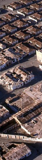
El sitio se compone de dos industrias salitreras, asentamientos industriales surgidos en el desierto para la explotación del salitre (nitrato de sodio), producto utilizado principalmente como fertilizante agrícola, de gran demanda a nivel mundial hasta las primeras décadas del siglo XX. Su desarrollo tiene lugar entre 1872 y mediados del siglo XX. El sitio se ubica a 47 km del puerto de Iquique, en medio de un paisaje desértico. Las dos salitreras están a una distancia aproximada de 1,0 km entre sí. El sitio inscrito en la Lista del Patrimonio Mundial tiene 631 ha, en tanto su zona de amortiguación abarca 12.055 ha. Las salitreras ya no están en explotación y no tienen población. Los pampinos (antiguos trabajadores) y sus familias utilizan el lugar para reuniones y conmemoraciones — destacando la Semana del Salitre—, producto de su fuerte vínculo de pertenencia con el lugar. De acuerdo al artículo 1 de la Convención, el bien es un sitio, circunscrito en la categoría del patrimonio industrial en particular, que en su esencia es tanto arqueológico como histórico.
Las Oficinas Salitreras Humberstone y Santa Laura son las sobrevivientes de un conjunto de casi 300 sitios similares al momento del auge de esta industria, conjunto interconectado por un sistema ferroviario de vanguardia, creado especialmente para ella. Su representatividad es
complementaria, pues Santa Laura tiene mejor conservada el área industrial y Humberstone la residencial y de servicios. Ambas constituyen hoy en día el irrepetible ejemplo de asentamiento asociado a un trabajo extractivo y de explotación minera de este tipo en el medio desértico. La conformación geológica de este territorio dio lugar a una concentración mineral única en el mundo, y a esta explotación a gran escala de nitrato de sodio y yodo, única también, inserta en un medio hostil. El bien es testimonio excepcional del avance tecnológico y de los intercambios globales propios de la era industrial.
Elementos esenciales del valor universal excepcional del bien son su condición de testimonio de la conquista del desierto, su impacto para el desarrollo de la agricultura a nivel mundial, el intenso intercambio cultural de una diversidad de inmigrantes y su resonancia en el ámbito del movimiento obrero.
2. CRITERIOS DE VALOR UNIVERSAL EXCEPCIONAL
Criterio ii): el desarrollo de la industria salitrera refleja el conocimiento, habilidades, tecnología e inversión financiera de una comunidad diversa de inmigrantes provenientes de Sudamérica y Europa. La industria del salitre se convirtió en un enorme complejo de intercambio
cultural donde las ideas fueron absorbidas y potenciadas rápidamente. Las dos salitreras representan este proceso.
Criterio iii): los yacimientos de salitre y sus asentamientos industriales asociados se desarrollaron hasta convertirse en una comunidad urbana extensiva y muy particular, con su propio lenguaje, organización, costumbres y expresiones creativas, además de desplegar su emprendimiento técnico. Las dos salitreras representan esta cultura distintiva.
Criterio iv): el conjunto de oficinas salitreras del norte de Chile se convirtió en el mayor productor de salitre natural del mundo, transformando la Pampa, e indirectamente las tierras agrícolas, que se beneficiaron con el fertilizante que ellas producían. Las dos oficinas representan este proceso de transformación.
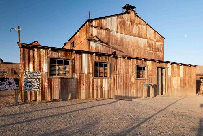
Los atributos más eminentes del bien son las instalaciones industriales, las edificaciones habitacionales, los espacios públicos, los edificios de uso comunitario, el diseño urbano y el emplazamiento en el paisaje desértico. Otros atributos relevantes son los vestigios ferroviarios, las tortas de ripio, los sistemas constructivos y los materiales singulares, el costrón y el concreto pampino, junto a la calamina y la madera, traídas de otras latitudes. También, el lenguaje y la memoria de la cultura salitrera. El sitio contiene la única planta de lixiviación y de molienda salitrera que se
··14
Gobierno de Chile
Acuerdo
1998
de
Territorio Chileno Antártico
Humberstone y santa Laura
VaLparaíso seweLL IgLesías de CHILoé
rapa nuI


conserva hasta nuestros días. En el conjunto de instalaciones industriales, destacan también las destinadas al aprovechamiento del yodo y la infraestructura energética.
Son destacables como atributos presentes en la zona de amortiguación los vestigios de otras antiguas salitreras, incluyendo sus tortas de ripio, y en particular, las zonas de extracción del caliche, además de los vestigios del sistema de transporte: huellas troperas, senderos, caminos, vestigios de las líneas férreas. La zona de amortiguación tiene el valor de conservar la imagen paisajística propia del territorio que se conformó en la época salitrera.
3. INTEGRIDAD
El área núcleo de las dos salitreras refleja cabalmente los procesos mineros y las estructuras sociales y formas de vida propias del bien. Santa Laura posee el equipamiento industrial —incluyendo la única planta de lixiviación y la única planta de molienda que se conserva— y Humberstone el campamento urbano, con una rica variedad de tipologías y estilos arquitectónicos, además de instalaciones industriales.
Los límites del sitio contienen sus atributos esenciales. La zona de amortiguación procura proteger el paisaje desértico y contiene vestigios de otras antiguas salitreras y campamentos, incluyendo vías férreas, caminos carreteros y sendas peatonales, dando cuenta de la realidad histórica del cantón salitrero.
El fin de la explotación, el despoblamiento y desocupación del bien, a diferencia de lo ocurrido en muchas otras salitreras, no fueron seguidos aquí por el desmantelamiento total. Ello, y la declaración del sitio como Monumento Nacional en 1970, dieron lugar a la preservación de sus atributos materiales más eminentes.
La integridad del patrimonio construido concentra los esfuerzos del Estado Parte. El saqueo, las demoliciones y la falta de mantenimiento y conservación antes de su inclusión en la Lista del Patrimonio Mundial la han comprometido, y es por ello que el bien está en la Lista en Peligro desde su inscripción, en 2005.
La vulnerabilidad de los materiales y la inestabilidad de las estructuras deben abordarse sobre la base de una investigación y reflexión multidisciplinarias e interdisciplinarias profundas, enfocadas en la composición de los materiales y sus patologías, el efecto en ellos de las condiciones ambientales, los suelos y las acciones mecánicas en las estructuras, los métodos idóneos de conservación y
mantención y el uso y funcionamiento histórico de las maquinarias y de los edificios.
4. AUTENTICIDAD
Las dos salitreras han permanecido mejor conservadas que cualquier otra. Lo que permanece en el sitio es auténtico y original. Lo anterior es favorecido por las relativamente escasas intervenciones, así como porque no se han incorporado elementos arquitectónicos o materiales constructivos exógenos o diferentes a los utilizados originalmente. En la naturaleza y vulnerabilidad de los materiales, sumadas a las condiciones ambientales, radica uno de los mayores desafíos de la conservación del bien.
La autenticidad del sitio se ve potenciada por las características de su emplazamiento y entorno paisajístico. Éste da cuenta de la ocupación del territorio en la era del salitre y favorece su poder evocador de la conquista del desierto.
También contribuye a la autenticidad del bien la conservación de manifestaciones de patrimonio inmaterial de la era del salitre. Humberstone alberga la reunión más importante de conmemoración de la misma, la Semana del Salitre, que congrega anualmente a los pampinos, es decir, a los antiguos trabajadores de las salitreras y a sus descendientes.
5. REQUISITOS DE PROTECCIÓN Y GESTIÓN
El sitio es Monumento Nacional en la categoría de Monumento Histórico —máximo nivel de protección patrimonial en el país. La administración es de una entidad privada, la Corporación Museo del Salitre, bajo la supervisión del Consejo de Monumentos Nacionales, institución estatal encargada de la protección y tuición del patrimonio monumental. Existe un Plan de Manejo 20042009, que debe ser revisado y actualizado para un nuevo período. Es necesario reforzar el equipo a cargo y proveer a la Corporación de recursos humanos y financieros adecuados.
Prioritario es implementar la consolidación estructural y la recuperación de las edificaciones, y ejecutar en particular el Plan de Intervenciones Prioritarias. Está en curso la implementación de medidas de seguridad para los visitantes y ya se ha cercado el perímetro, que era un requisito de protección esencial. Es de crucial importancia proteger el paisaje desértico, como paisaje cultural, en su dimensión tanto geográfica como en la relacionada con los vestigios de la explotación y transporte del salitre en general. Imperativo esencial para la protección,
conservación y gestión es el conocimiento cabal de las técnicas, los sistemas constructivos, las formas de vida, los sistemas de explotación y las condiciones económicas. La importancia de la tecnología propia de esta explotación de gran singularidad, y las complejidades propias de las formas de vida asociadas al salitre, imponen un desafío considerable en el plano de la interpretación. Es esencial a su vez la protección, conservación y gestión de aquellos elementos de arte que son parte de la historia del sitio durante su funcionamiento y abandono, como son las expresiones gráficas en muros, y bienes muebles.
La conservación física debe ser abordada teniendo en cuenta los efectos de la camanchaca (neblina densa generada por el océano Pacífico) y la alta salinidad del contexto, que dañan seriamente los metales, las maderas y los materiales pétreos. Es necesario un proceso de reflexión conceptual sobre la autenticidad, que dé espacio de manera coherente al reemplazo de piezas y secciones deterioradas, definiendo un criterio de recambio asociado a esa degradación, como mantención permanente. Lo anterior, además de proteger los materiales con tratamientos anticorrosivos.
Julio de 2010 Corporación Museo del Salitre Consejo de Monumentos Nacionales
FOTOS/PHOTOS:
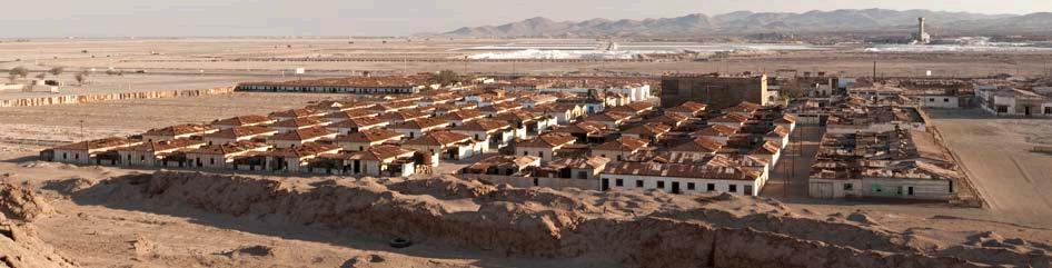
12/13: Humberstone, vista general. Al fondo, el pueblo de Pozo Almonte y minera donde se procesan las antiguas tortas de relave.
Humberstone, general view. In the background, town of Pozo Almonte and mining company where the old tailing heaps are processed.
15: Santa Laura, estrellas. Santa Laura, stars.
16: Santa Laura, sala de máquinas. Santa Laura, engine room.
17··
HUMBERSTONE AND SANTA LAURASALTPETER WORKS
(Nº 1178, on the World Heritage List and on the World Heritage List in Danger in 2005)
1. BRIEF SYNTHESIS
The site consists of two saltpeter industries and industrial settlements arising out of the desert for the exploitation of saltpeter (sodium nitrate), a product used mainly as an agricultural fertilizer, in great demand worldwide up to the first decades of the 20th century. It was developed from 1872 and until half way through the 20th century. The site is located 47 km from the port of Iquique in the midst of a deserted landscape. The two saltpeter works stand at a distance of approximately 1 km from each other and the World Heritage Site covers a surface area of 631 hectares, with a buffer zone of 12,055 hectares. The saltpeter works are no longer in use and there is no population there at all, albeit the people from the Pampa (former workers) and their families use the place for meetings and commemorations —the Saltpeter Week for example— as they still feel they have strong ties to it. Article 1 of the Convention states that we are dealing with a site in the category of an industrial heritage and which, essentially, is both archeological as well as historic.
The Humberstone and Santa Laura Saltpeter Works are the survivors of a series of 300 similar sites from the time when this industry was in its boom years, all of which were interconnected by a modern railway system created especially for them. The two sites complement each other because the industrial
area of Santa Laura is better conserved, whilst Humberstone has its residential and service areas in better shape. Today, both of them stand as an unrepeatable testimony of a settlement associated with mining exploration and works of its type in the midst of a desert. The geology in this territory was perfect for providing a mineral concentration, unique in the world, and the large-scale exploitation of sodium nitrate and iodine; also unique because of its location in the midst of such a hostile environment. The site is an exceptional testimony to technological progress and global exchanges that were the cornerstone of the industrial era.
Essential elements of the outstanding universal value of the site are its condition as a testimony to man’s conquest of a desert, its impact on the development of agriculture worldwide, the intense cultural exchanges of a great diversity of immigrants and its resonance in the field of the workers’ movement.
2. CRITERIA FOR OUTSTANDING UNIVERSAL VALUE
Criterion (ii): The development of the saltpeter industry reflects the combined knowledge, skills, technology, and financial investment of a diverse community of people who were brought together from around South America, and from Europe. The saltpeter industry became a huge
cultural exchange complex where ideas were quickly absorbed and exploited. The two works represent this process.
Criterion (iii): The saltpeter mines and their associated company towns developed into an extensive and very distinct urban community with its own language, organization, customs, and creative expressions, as well as displaying technical entrepreneurship. The two nominated works represent this distinctive culture.
Criterion (iv): The saltpeter mines in the north of Chile together became the largest producers of natural saltpeter in the world, transforming the Pampa and indirectly the agricultural lands that benefited from the fertilizers the works produced. The two works represent this transformation process.
The most eminent attributes of the site are the industrial installations, housing areas, public spaces, communal buildings, its urban design and its position in a desert environment. Other relevant attributes are the remains of the railway, the gravel heaps, building systems and materials, in particular the costrón and the Pampa concrete, as singular construction materials together with the calamine and timber brought from other latitudes. Also the language and the memory of the saltpeter culture. The site contains the only leaching plant and a saltpeter grinder that remain intact to this day. Prominent among the
··18
Government of Chile Retrospective Statement of Outstanding Universal Value


industrial installations are also those devoted to manufacturing iodine and the energy infrastructure.
The remains of saltpeter works are also attributes present in the buffer zone, including their gravel heaps and, in particular, the fields where the nitrate ore was mined, besides the remains of transport systems: troop footprints, paths, roads and what remains of the railway tracks. The buffer zone has its value in its ability to conserve the landscape image of the territory itself that is the same now as what was once in the industry’s heyday.
3. INTEGRITY
The nucleus of the complex of the two saltpeter works perfectly reflects the mining processes and social structures and ways of life of the site. Santa Laura has its industrial infrastructure —including the only leaching plant and the only grinding plant in existence— and Humberstone its urban camp with a rich variety of architectonic types, besides the industrial installations.
The boundaries around the site also have their own essential attributes. The buffer zone is an attempt to protect the desert landscape and it contains remains from still older saltpeter works and mining camps, including railway lines and roads as well as pedestrian footpaths that give a certain sense to the historic reality of the saltpeter cantón (complex of several interrelated saltpeter works).
The end of the industry, its desertion and abandonment, unlike what occurred in many other saltpeter works, were not followed here with a total dismantling. That, and the declaration of the site as a National Monument in 1970, gave way to a preservation of its most eminent material attributes.
The integrity of the built-up heritage concentrates the efforts of the State Party. Pillaging, demolitions and a patent lack of maintenance and conservation prior to it being put on the World Heritage List, have wrought much damage and that is why the site is now on the Danger List since its inscription in 2005.
The vulnerability of the materials and the instability of the structures have to be tackled on the basis of profound multidisciplinary and interdisciplinary research and reflection, focused on the composition of the materials and their pathologies, the effect of environmental conditions on them, the soil and mechanical actions on structures, the best methods of conserving and maintaining them and the use and historic functioning of machinery and buildings.
4. AUTHENTICITY
The two saltpeter works have remained better conserved that others. What remains at the site is authentic and original. This was helped by the relatively few interventions and no architectonic elements or constructive materials have been added from outside or which are different from those used originally. In the nature and vulnerability of the materials, in addition to the environmental conditions, lies one of the greatest challenges when it comes to conserving the site.
The authenticity of the site is heightened because of its characteristics and its position on the landscape. This gives an idea of the occupation of the territory in the saltpeter era and powerfully evokes how the desert was conquered.
The conservation of manifestations of immaterial heritage of the saltpeter era also contributes toward the authenticity of the site. Humberstone houses the most important gathering of a commemoration of the industry as a whole: the Saltpeter Week, which annually gathers together people from all over the Pampa; i.e. former saltpeter workers and their descendants.
5. PROTECTION AND MANAGEMENT REQUIREMENTS
The site is now a National Monument in the category of Historic Monument —the maximum level of protection of heritage in this country. It is administered by a private entity, the Saltpeter Museum Corporation, under the supervision of the National Monuments Council, a state institution in charge of protecting and guiding the nation’s heritage. A 2004-2009 Management Plan exists that has to be revised and updated for the new period. It is also necessary to reinforce the team in charge and provide the Corporation with the right kinds of human and financial resources.
As a priority, structural consolidation has to be implemented and buildings recovered and, in particular, the Priority Interventions Plan executed. Safety measures for visitors are being implemented and the perimeter has been fenced, something that was essential for the site’s overall protection. It is crucially important to protect the desert landscape, geographically as well as in relation to the remains of mining exploration and the transport of the saltpeter in general.
An essential imperative for the protection, conservation and management of the site is an in-depth knowledge of the techniques, construction systems, ways of life, exploration
systems and the economic conditions at the time. The importance of the technology itself of this exploitation is of great singularity and the complexities of life associated with saltpeter impose a considerable challenge on how it is all interpreted. Also, it is essential to protect, conserve and manage those artistic elements that are a part of the history of the site whilst it was functioning and being abandoned, such as the “graphic designs” on the walls, and the movable assets.
Physical conservation must be tackled bearing in mind the effects of the camanchaca — dense and frequent mist generated by the Pacific Ocean— and its high saltiness, capable of seriously damaging metals, timbers and even stone materials. It is necessary to reflect on authenticity conceptually, which opens up a space coherently with replacing those pieces and sections that have irredeemably deteriorated, defining a criterion for change associated with that degradation, in order to maintain them for all time. This must be done besides protecting the materials with anticorrosion treatments.
July 2010
Saltpeter Museum Corporation National Monuments Council
FOTOS/PHOTOS
19: Santa Laura, ferrocarriles. Santa Laura, railways.
20: Santa Laura, rieles de doble trocha. Santa Laura, dual-gauge railways.
21··


Página anterior: Santa Laura, planta de elaboración y chimenea.
Previous page: Santa Laura, processing plant and chimney.
En estas páginas: Humberstone: plaza, teatro, mercado, ¿hospital? y huella del trazado del tren. On these pages: Humberstone: square, theater, market, ¿hospital? and trail of the railway line.


Página anterior: Humberstone, mercado.
Izquierda arriba: Humberstone, glorieta.


Izquierda abajo: Humberstone, casa administración.
Centro arriba: Humberstone, cancha de tenis.

Centro abajo: Humberstone, casa capataces.
Derecha: Humberstone, vista desde la glorieta.

··28

29··
Previous page: Humberstone, market.
Top left: Humberstone, square.
Bottom left: Humberstone, administration house.
Top center: Humberstone, tennis court.
Bottom center Humberstone, foremen house.
Right: Humberstone, view from the square.

··30
Izquierda: Humberstone, interior del teatro.
Left: Humberstone, inside the theatre.
Derecha: Humberstone, teatro.
Right: Humberstone, theatre.

31··

··32
Izquierda: Humberstone, capilla.
Left: Humberstone, chapel.
Derecha: Humberstone, interior de la capilla.
Right: Humberstone, inside the chapel.

33··


Página anterior: Humberstone, hospital. Previous page: Humberstone, hospital. En estas páginas: Humberstone, escuela. On these pages: Humberstone, school.


··36

37··
 Humberstone, vista general desde la torta de relave. En primer plano, huella del recorrido del tren. Humberstone, general view from the tailing heap. In the foreground, trail of the train route.


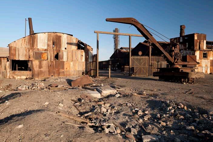
Página anterior: Santa Laura, muros de contención construidos con sacos de desperdicios y molino. Previous page: Santa Laura, retaining walls built with waste sacks and mill. En estas páginas: Santa Laura, edificaciones. On these pages: Santa Laura, buildings.


··42

43··

··44
Izquierda: Santa Laura, sala de máquinas, generadora de electricidad.
Left: Santa Laura, engine room, electricity generator. Derecha: Santa Laura, maestranza.
Right: Santa Laura, armory.

45··

··46
Izquierda: Santa Laura, edificio de la Administración.
Left: Santa Laura, Administration building.
Derecha: Santa Laura, recreación del interior edificio de la Administración.
Right: Santa Laura, recreation of the interior of the Administration building. Página siguiente: Santa Laura, atardecer. Next page: Santa Laura, sunset.

47··


Criterion i): The World Heritage Committee concluded that the RNNP “contains one of the most remarkable cultural phenomena in the world. An artistic and architectural tradition of great power and imagination was developed by a society that was completely isolated from external cultural influences of any kind for over a millennium. The substantial remains of this culture blend with their natural surroundings to create an unparalleled cultural landscape.”
Nº 715, on the World Heritage List in 1995
Parque Nacional
RAPA NUI
Criterio i): el Comité del Patrimonio Mundial concluyó que el PNRN “contiene uno de los más notables fenómenos culturales del mundo. Una tradición artística y arquitectónica de gran poder e imaginación fue desarrollada por una sociedad completamente aislada de influencias culturales externas de cualquier tipo por más de un milenio. Los restos sustanciales de esta cultura se unen a un entorno natural para crear un paisaje cultural sin parangón”.
Nº 715, inscrito en la Lista del Patrimonio Mundial en 1995
51··


Gobierno de Chile
Propuesta de Declaración Retrospectiva de Valor Universal Excepcional
PARQUE NACIONAL RAPA NUI
1. BREVE SÍNTESIS
El Parque Nacional Rapa Nui (en adelante, PNRN) es un área silvestre protegida del Estado de Chile ubicada en Isla de Pascua, que concentra el legado de la Cultura Rapa Nui, de características extraordinarias, expresada materialmente en una arquitectura y escultura singulares en el contexto polinesio, así como en una escritura hasta hoy no descifrada. Estos testimonios materiales, de gran magnificencia y expresividad artística, dan al sitio el carácter de obra maestra de una cultura cuyo desarrollo en sí mismo es un fenómeno excepcional, pues tuvo lugar de manera aislada.
(Nº 715, inscrito en la Lista del Patrimonio Mundial en 1995) había determinado una crisis ecológica y la decadencia de la antigua Sociedad Rapa Nui, dando lugar a una transformación espiritual, en el marco de la cual se produjo la destrucción de estos monumentos megalíticos. El culto original a los antepasados fue reemplazado por el culto al hombre-pájaro, que tiene por excepcional testimonio la aldea ceremonial de Orongo, localizada en el volcán Rano Kau. 54 casas, de planta elíptica, complementan este recinto sagrado, profusamente decorado con petroglifos alusivos al hombre-pájaro y a la fertilidad. Este culto vería su fin a mediados del siglo XIX, época en la cual la isla vive su etapa más oscura.
Isla de Pascua se ubica en la latitud sur 27º 09’ y longitud oeste 109º 27’ y tiene una superficie de 16.628 hectáreas. El PNRN, en tanto, ocupa una superficie aproximada de siete mil, incluyendo cuatro islotes cercanos. 3.700 kilómetros la separan de la costa de Chile continental.
Es la isla habitada más remota del planeta. Fue colonizada hacia fines del primer milenio de la era cristiana por un grupo pequeño de colonos provenientes de la Polinesia Oriental, cuya cultura se manifestó entre los siglos XI y XVII en grandes obras como la construcción de ahu —altares ceremoniales— y el tallado de moai —estatuas colosales que representan a los ancestros. Según algunos estudios, al momento de entrar en contacto con los europeos (siglo XVIII) y ver el fin de ese aislamiento, el agotamiento de los recursos naturales
La colonización, la introducción de la ganadería, el confinamiento de los habitantes originales a áreas reducidas, el dramático efecto de las enfermedades foráneas y, sobre todo, la esclavitud, redujeron la población rapa nui hasta llegar a poco más de un centenar. Actualmente, la isla está habitada por los descendientes de los antiguos rapa nui e inmigrantes de diversos orígenes, contándose con una importante población mestiza.
2.
Criterio i): el Comité del Patrimonio Mundial concluyó que el PNRN “contiene uno de los más notables fenómenos culturales del mundo. Una tradición artística y arquitectónica de gran poder e imaginación fue desarrollada por una
sociedad completamente aislada de influencias culturales externas de cualquier tipo por más de un milenio. Los restos sustanciales de esta cultura se unen a un entorno natural para crear un paisaje cultural sin parangón”.
Criterio iii): luego de su poblamiento original, antes del siglo IX de nuestra era, y hasta comienzos del siglo XVIII, Isla de Pascua no recibió nuevos flujos de inmigrantes. Desarrolló su compleja cultura, única en la Polinesia, de manera autónoma, siendo un testimonio único de civilización en esta región. Otorga también excepcionalidad a este sitio su condición de testimonio de crisis ecológica en tiempos premodernos.
Criterio v): el PNRN es un testimonio de carácter innegablemente único de una cultura que sufrió una debacle a raíz de una crisis ecológica primero y de la irrupción del mundo foráneo después.
Los atributos más eminentes son los sitios arqueológicos, y la isla presenta una alta concentración de ellos, gran parte de los cuales se encuentran en el Parque Nacional, estimándose que hay unas 900 estatuas, poco más de 300 plataformas ceremoniales y miles de estructuras agrícolas, mortuorias, habitacionales, productivas y de otros tipos. Entre los bienes arqueológicos se destacan los moai; los hay de todos los tipos: en proceso de tallado, en proceso de traslado a su destino final —el ahu—, derribados y erigidos, y de distintas dimensiones. Las canteras (Rano
··54
CRITERIOS DE VALOR UNIVERSAL EXCEPCIONAL
Acuerdo de 1998
Territorio Chileno Antártico Humberstone y santa Laura
VaLparaíso seweLL IgLesías de CHILoé
rapa nuI


Raraku y otras) son testimonios invaluables del proceso de su talla. Están los ahu, estructuras religioso-ceremoniales, incluyendo el más colosal, el ahu Tongariki, con sus 15 moai Extremadamente valiosos son también los sitios de arte rupestre (pictografías y petroglifos), de gran diversidad de estilos, técnicas y motivos. Otros sitios arqueológicos son las cavernas —que tienen también arte rupestre— y las aldeas, entre las que destaca Orongo, de carácter ceremonial. Si bien no han atraído tanta atención, las estructuras habitacionales y productivas son de extremo interés.
El sitio es ejemplo de casi una total deforestación y pérdida de especies endémicas, por lo cual su condición natural actual es, paradójicamente, un atributo a considerar; en él están las claves de esas pérdidas y los testimonios de su pretérita flora y fauna. Por otra parte, la naturaleza geológica y características geomorfológicas son parte esencial del bien.
3. INTEGRIDAD
El PNRN es propiedad del Estado de Chile. Su superficie, que cubre aproximadamente un 40% de la isla, incorpora un conjunto altamente representativo de la totalidad de los sitios arqueológicos, y las manifestaciones más excepcionales de sus diversas tipologías.
El PNRN tiene una doble protección oficial. Por una parte, es desde 1935 parque nacional, y es administrado por la Corporación Nacional Forestal (CONAF). Por otra parte, la isla completa fue declarada Monumento Nacional también en 1935; lo propio ocurrió con los islotes adyacentes a Isla de Pascua en 1976. El PNRN no tiene delimitada expresamente una zona de amortiguación. Sin embargo, en la realidad el bien sí tiene un área que opera como tal, dada la condición de Monumento Nacional de la isla completa y de los islotes adyacentes.
La integridad de los sitios arqueológicos se ha preservado, pero es objeto de gran preocupación e investigación científica. Los esfuerzos de manejo y conservación, aún insuficientes, se concentran en los factores antrópicos, así como en los efectos del intemperismo tanto en la materialidad —lava y toba volcánica— como en la estabilidad de las estructuras. Han existido grandes avances expresados en cierre de sectores, vigilancia y trazados de caminos.
En cuanto a la remoción física de materiales arqueológicos, ya no ocurren casos de extracción ilícita de bienes culturales de la isla de magnitud y notoriedad, y la extracción de muestras por parte de misiones científicas es objeto de un adecuado control. Se aprecia un aumento de los animales que permanecen y deambulan en el Parque; y en cuanto a la
vegetación invasiva, han proliferado ciertas especies que ejercen un impacto a nivel paisajístico y también afectan negativamente la estabilidad estructural y el manejo de los sitios.
4. AUTENTICIDAD
El PNRN sigue presentando un alto grado de autenticidad, por cuanto, en palabras de ICOMOS, “ha habido poca intervención, a causa del virtual abandono del área a fines del siglo XIX. Se han hecho reconstrucciones de ahu en base a investigaciones científicas estrictamente controladas y algunos relevantamientos de moai caídos, con la recolocación de los tocados de piedra roja, que no han traspasado los límites permisibles de anastilosis, tal como se define en la Carta de Venecia de 1964”.
La autenticidad e integridad del PNRN se mantienen, y su conservación es altamente consecuente con ellas, imperando el respeto al devenir histórico de la Cultura Rapa Nui, que en un contexto de profunda crisis derribó los moai. Es importante a este respecto reflexionar que el PNRN debe dar cuenta de las diversas etapas de la civilización rapa nui, sin excluir la de su crisis.
5. REQUISITOS DE PROTECCIÓN Y GESTIÓN
El bien goza de un sólido marco legal e institucional de protección y gestión. Hay dos instituciones responsables, coordinadas entre sí (CMN y CONAF), con nexos con los niveles de autoridad y también con la comunidad. Hay un museo, el Museo Antropológico R.P. Sebastián Englert, que apoya el esfuerzo de conservación e investigación. El bien presenta una gestión de nivel local tanto como de nivel nacional. Se aplica un Plan de Manejo, que está siendo actualizado para un nuevo período, y existe un equipo —aunque pequeño— encargado de la administración del Parque. Sin embargo, el manejo del sitio se ve complejizado por las diferencias culturales y las reticencias a la acción estatal de algunos sectores de la comunidad local.
El manejo de los visitantes es un gran imperativo. Se debe definir de manera más precisa la capacidad de carga turística del sitio. La infraestructura de servicios básicos y de interpretación, así como el control de los visitantes, presentan grandes desafíos; se están emprendiendo importantes obras, pero queda mucho por hacer. Como contrapartida, es necesario que la población local apoye de mejor forma el esfuerzo de conservación, por ejemplo a través del control del ganado.
El PNRN es y ha sido objeto de una enorme cantidad de investigación científica, incluyendo el ámbito de la conservación de la materialidad de las estructuras y su
preservación. Es necesario un mejor diálogo entre los investigadores, llegar a conclusiones sobre el conocimiento disponible y manejarlo de una manera funcional a la conservación; sistematizar la información producida y generar un sistema de monitoreo periódico, comprehensivo y sustentable. Se necesita más personal y más recursos para la administración y cuidado del sitio, reforzar en número y capacitación al equipo de guardaparques y aumentar el presupuesto para operaciones.
La escasa superficie de la isla no protegida implica una presión permanente para los terrenos del Parque. El Estado debe prevenir y evitar su ocupación ilegal. Existen progresos importantes en el control del tráfico ilícito y en la imposición judicial de sanciones por delitos contra el patrimonio cultural, que se deben mantener y proyectar.
Los incendios son una amenaza bastante controlada, pero en materia de desastres naturales, los sismos y los maremotos deben ser objeto de un esfuerzo preventivo mayor. La vegetación invasiva requiere permanentes labores de mantención. El mayor desafío es el deterioro natural de la estatuaria, producto de la erosión e intemperización de la roca volcánica, originados por agentes atmosféricos, químicos, biológicos y antrópicos, y los problemas de la estabilidad de las estructuras y de la estatuaria en general. Son problemas que concentran los esfuerzos desde el punto de vista de la conservación.
El requisito esencial de la protección y manejo de este bien radica en su multifacética condición, de sitio de interés mundial, referente y base del desarrollo de la población de la isla, y depositario de las respuestas a interrogantes fundamentales que distan de haberse revelado.
Julio de 2010
Corporación Nacional Forestal Consejo de Monumentos Nacionales
FOTOS/PHOTOS
52/53: volcán Rano Kau, cráter. Rano Kau Volcano, crater.
55: volcán Rano Raraku, cantera moai Rano Raraku Volcano, moai quarry.
56: Viento, Olas, Rocas. Wind, Surf, Rocks.
57··
Government of Chile
Retrospective Statement of Outstanding Universal Value
RAPA NUI NATIONAL PARK
(Nº 715, on the World Heritage List in 1995)
Rapa Nui National Park (hereinafter, RNNP) is a protected Chilean wildlife area located in Easter Island, which concentrates the legacy of the Rapa Nui culture. This culture displays extraordinary characteristics expressed materially in a singular architecture and sculpture within the Polynesian context, as well as a script that remains undeciphered to this day. This material evidence of great magnificence and artistic expressiveness gives the site the character of a masterpiece by a culture whose development is in itself an exceptional phenomenon since it occurred in isolation.
Easter Island is located at 27º 09’ south latitude and 109º 27’ west longitude and has an area of 16,628 hectares. The RNNP, meanwhile, occupies an area of approximately seven thousand hectares, including four nearby islets. 3,700 kilometers separate the island from the coast of continental Chile.
It is the most remote inhabited island on the planet. It was colonized toward the end of the first millennium of the Christian era by a small group of settlers from Eastern Polynesia, whose culture manifested itself between the 11th and 17th centuries in great works such as the ahu —ritual altars— and carved moai —colossal statues representing ancestors. According to some studies, at the time of their contact with Europeans (18th century) and seeing an end to their isolation, the depletion
of natural resources had brought about an ecological crisis and the decline of the ancient Rapa Nui society. This decline led to a spiritual transformation in which these megalithic monuments were destroyed. The original cult of the ancestor was replaced by the cult of the man-bird, which has as exceptional testimony the ceremonial village of Orongo, located at the Rano Kau Volcano. Fifty-four houses of elliptical floor plans complement this sacred place, profusely decorated with petroglyphs alluding to both the man-bird and fertility. This cult would see its end in the middle of the 19th century, a period in which the island experienced its darkest times.
Colonization, the introduction of livestock, the confinement of the original inhabitants to smaller areas, the dramatic effect of foreign diseases and, above all, slavery, reduced the population of Rapa Nui to little more than a hundred. At present, the island is inhabited by descendants of the ancient Rapa Nui as well as immigrants from diverse backgrounds, accounting for a significant mixed population.
2. CRITERIA FOR OUTSTANDING UNIVERSAL VALUE
Criterion i): The World Heritage Committee concluded that the RNNP “contains one of the most remarkable cultural phenomena in the world. An artistic and architectural tradition of great power and imagination was developed by a society that was completely isolated from
external cultural influences of any kind for over a millennium. The substantial remains of this culture blend with their natural surroundings to create an unparalleled cultural landscape.”
Criterion iii): After its original settlement before the 9th century AD and up to the early 18th century, Easter Island did not receive new flows of immigrants. It developed its complex culture, unique in Polynesia, independently, being a unique example of civilization in this region. Its testimony to ecological crisis in pre-modern times also confers exceptionality to this site.
Criterion v): The RNNP is a testament to the undeniably unique character of a culture that suffered a debacle due to an ecological crisis followed by the irruption of the outside world.
Rapa Nui most prominent attributes are the archaeological sites, and the island has a high concentration of them, most of which are found in the National Park. It is estimated that there are about 900 statues, more than 300 ceremonial platforms and thousands of structures related to agriculture, funeral rites, housing and production, and other types of activities. Prominent among the archaeological pieces are the moai. There are many kinds of them: those in the process of being carved, those in the process of being moved to their final destinations —the ahu—, those being torn down and erected, and those of different sizes. The quarries (Rano Raraku and others) are invaluable evidence of the process of their carving. There are also ahu —religious
··58
1. BRIEF SYNTHESIS


ceremonial structures—, including the most colossal, the ahu Tongariki, with its 15 .
Also extremely valuable are the rock art sites (pictographs and petroglyphs), which include a large variety of styles, techniques and motifs. Other archaeological sites are the caves, which also contain rock art and the villages of a ceremonial nature, among which Orongo stands out. While it has not attracted as much attention, the housing and productive structures are of extreme interest.
The site is an example of an almost total deforestation and loss of endemic species; this is why its current natural condition is, paradoxically, an attribute to be considered: the keys to these losses and the evidence of its previous flora and fauna are to be found in its current conditions. On the other hand, the geological nature and geomorphologic features are an essential part of the property.
3. INTEGRITY
The RNNP is the property of the Chilean State. Its surface area, which covers approximately 40% of the island, incorporates a collection of sites that is highly representative of the totality of the archaeological sites and of the most outstanding manifestations of their numerous typologies.
The RNNP has two official protections. On the one hand, since 1935 it has been a national park, administered by the National Forestry Service (CONAF). On the other hand, the entire island was declared a National Monument in 1935; the same was done with the islets adjacent to Easter Island in 1976. The RNNP does not have an expressly defined buffer zone. However, in reality, the property does have an area that operates as such, given the status of National Monument covering the entire island and its adjacent islets.
The integrity of the archaeological sites has been preserved, but it is a matter of great concern and scientific research. The management and conservation efforts, still insufficient, focus on the anthropic factors and the effects of weathering, both on the material —volcanic lava and tuff— and on the stability of structures. Great advances have been made in the closure of areas, monitoring and the layout of roads.
As for the physical removal of archaeological materials, there are no longer any cases of magnitude and notoriety of the illegal extraction of the island’s cultural property, and the taking of samples by scientific missions is under appropriate control. An increase has been observed in the animals that remain in and wander about the park, and with respect to invasive vegetation, certain species have proliferated and have had an impact on the
landscape and, at the same time, they have adversely affected the structural stability and management of the sites.
4. AUTHENTICITY
The RNNP continues to exhibit a high degree of authenticity because, in the words of ICOMOS: “there has been little intervention since virtual abandonment of the area in the later 19th century. A number of reconstructions of ahu have been made on the basis of strictly controlled scientific investigations, and there has been some re-erection of fallen moai, with replacement of the red stone headdresses, but these do not go beyond the permissible limits of anastylosis as defined in the 1964 Venice Charter.”
The authenticity and integrity of the RNNP are being maintained, and its conservation is highly consistent with these values, with prevailing sense of respect for the historical transformation of the Rapa Nui culture, which, in a context of deep crisis, toppled the moai In this respect, it is important to consider that the RNNP must provide an account of the various stages of the Rapa Nui civilization, not excluding that of its crisis.
5. PROTECTION AND MANAGEMENT REQUIREMENTS
The property enjoys a solid legal and institutional framework for protection and management. There are two institutions responsible for this activity that coordinate with each other (CMN and CONAF), with links with the appropriate levels of authority and also with the community. There is a museum, the R.P. Sebastian Englert Museum of Anthropology, which supports research and conservation efforts. The property is managed at local and national levels. A management plan is in place, which is undergoing a process of updating for a new period, and there is a team —although small— in charge of Park administration. Nevertheless, site management becomes complex because of cultural differences and the reluctances to state action on the part of some sectors of the local community.
Control of visitors is a great imperative. The site touristic capacity has to be defined in a more precise manner. The infrastructure of basic services and interpretation, as well as the control of visitors, present a huge challenge; major works are being undertaken, but much remains to be done. In return, it is necessary that the local population effectively support the conservation effort, for example, through livestock control.
The RNNP is and has been the subject of an enormous amount of scientific research,
including the field of the conservation of the appearance of the structures and their preservation. A better dialogue is necessary among researchers to reach conclusions on the available knowledge and to manage it in a functional manner conducive to conservation; to systematize the information produced and generate a periodic, comprehensive and sustainable monitoring system. Additional staff and resources are needed for the administration and care of the site, to reinforce the number and training of the park guards team, and to increase the operating budget.
The small part of the island that is not protected exerts a constant pressure on parklands. The State must prevent its illegal occupation. There has been significant progress in the control of illicit trafficking and the judicial imposition of penalties for crimes against the cultural heritage of the island, and this progress must be maintained.
Fires are a threat that is rather well controlled, but in terms of natural disasters, earthquakes and tsunamis should be the object of a greater preventative effort. Invasive vegetation requires ongoing maintenance work. The biggest challenges are the natural deterioration of the statues, produced by the erosion and weathering of the volcanic rock, caused by atmospheric, biological and chemical agents and by anthropic factors. There are also problems regarding the stability of the structures and statuary in general. These are the problems that concentrate the conservation efforts.
The essential requirement for the protection and management of this property lies in its multifaceted status as a site of world interest, reference point and basis for the development of the population of the island, and repository of answers to fundamental questions that are far from being revealed.
July 2010
National Forestry Service National Monuments Council
FOTOS/PHOTOS
59: ana (caverna) Kai Tangata. Ana (Cave) Kai Tangata.
60: poblado de Hanga (bahía) Roa, pescador en roquerío.
Town of Hanga (Bay) Roa, fisherman on a rocky area.
61··


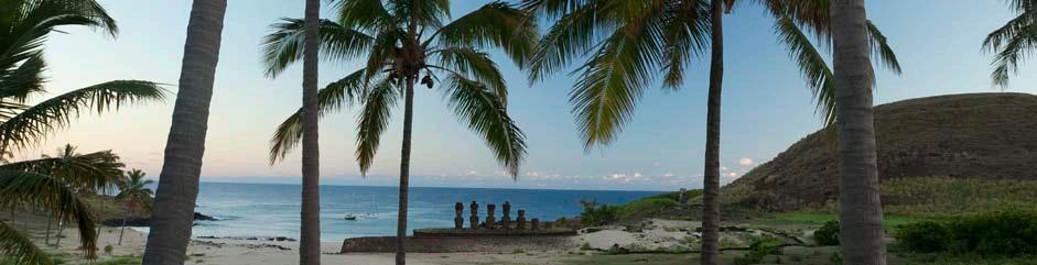
Página anterior: volcán Rano Kau, poblado de Orongo, motu (islote) Nui, Iti y Kao Kao.


Previous page: Rano Kau Volcano, Town of Orongo, Motu (Islet) Nui, Iti and Kao Kao. En estas páginas: volcán Rano Kau, poblado de Orongo. On these pages: Rano Kau Volcano, Town of Orongo.

··64

65··


Página anterior: acantilados y cráter volcán Rano Kau, poblado de Orongo. Previous page: cliffs and crater of Rano Kau Volcano, Town of Orongo. En estas páginas: Te Pahu, red de túneles subterráneos. On these pages: Te Pahu, network of underground tunnels.


··68


69··


Página anterior: al oeste de la playa de Anakena.
Previous page: to the west of Anakena Beach.
En estas páginas: ahu (lugar sagrado) Te Pito Kura, moai Paro; al fondo, monte Poike.
On these pages: Ahu (sacred place) Te Pito Kura, moai Paro; in the background, Poike Hill.


··74
Izquierda: Vaihu, vestigios antiguo poblado.
Left: Vaihu, vestiges of an ancient settlement.
Derecha: Vaihu, ahu (sitio sagrado) de Hanga Te’e, pukao (sombrero) y moai
Right: Vaihu, Ahu (sacred site) Hanga Te’e, pukao (hat) and moai

75··
Izquierda arriba: Te Puna Pau, cantera pukao (sombrero).
Izquierda abajo: sitio de Vinapu, ahu Tahira.


Centro arriba: Hanga (bahía) Oteo, tupa (torres de observación o refugios); al fondo, monte Poike.
Centro abajo: Papa Vaka, petroglifos.
Derecha: costa sur, hare paenga (casa barco), hare moa (gallinero) y manuvai (jardines protegidos).
··76

77··
Top left: Te Puna Pau, pukao (hat) quarry.
Bottom left: Vinapu site, ahu Tahira.
Top center: Hanga (Bay) Oteo, tupa (observation towers or refuges); in the background, Poike Hill.
Bottom center: Papa Vaka, petroglyphs.
Right: South coast, hare paenga (houseboat), hare moa (henhouse) and manuvai (protected gardens).


Página anterior: acantilados al este de la isla; al fondo, monte Poike.
Previous page: cliffs to the east of the island; in the background, Poike Hill.
Izquierda: Anakena, playa.

··80
Left: Anakena, beach.
Derecha: Ovahe, playa.
Right: Ovahe, beach.

81··

··82
Anakena, ahu (lugar sagrado) Nau Nau. Anakena, Ahu (sacred place) Nau Nau.

83··

··84
Ahu (lugar sagrado) Tongariki. Ahu (sacred place) Tongariki.

85··


Página anterior: FALTA.
Previous page:
Izquierda: volcán Rano Raraku, cantera moai.

Left: Rano Raraku Volcano, moai quarry.
Derecha: volcán Rano Raraku, cráter.
Right:
··88
Rano Raraku Volcano, crater.

89··

··90
Izquierda: ahu (lugar sagrado) Akivi.
Left: Ahu (sacred place) Akivi.
Derecha: complejo ceremonial de Tahai, formado por los ahu Vai Uri (5 moai) y ahu de Tahai (1 moai).
Right: Tahai ceremonial complex, which comprises Ahu Vai Uri (5 moai) and Ahu Tahai (1 moai).

91··

Vai Uri.
Vai Uri.
Ahu (lugar sagrado)
Ahu (sacred place)

Criterion iii): Valparaíso is an exceptional testimony to the early phase of globalization in the late 19th century, when it became the leading commercial port on the sea routes of the Pacific coast of South America.
Nº 959, on the World Heritage List in 2003
Criterio iii): Valparaíso es un testimonio excepcional de la fase temprana de globalización de avanzado el siglo XIX , cuando se convirtió en el puerto comercial líder de las rutas navieras de la costa del Pacífico de Sudamérica.
Área histórica de la ciudad-puerto de VALPARAISO
Nº 959 rev, inscrito en la Lista del Patrimonio Mundial en 2003
95··


Gobierno de Chile
Propuesta de Declaración Retrospectiva de Valor Universal Excepcional
ÁREA HISTÓRICA DE LA CIUDAD-PUERTO DE VALPARAÍSO
(Nº 959 rev, inscrito en la Lista del Patrimonio Mundial en 2003) este diálogo intercultural, de este empuje modernizador y del desafío presentado por el medio, es una ciudad americana con el sello del siglo XIX, plenamente original.
1. BREVE SÍNTESIS
El Área Histórica de Valparaíso es el núcleo más representativo de los valores de esta ciudad-puerto del Pacífico sudamericano. En ella se manifiestan en plenitud sus caracteres geográficos esenciales: la bahía, la estrecha planicie costera —en buena medida, artificial— y el conjunto de cerros —surcado por múltiples quebradas—, elementos que dan lugar a la condición de anfiteatro que presenta la ciudad.
El valor universal excepcional de este sitio resulta de la combinación de tres factores, todos ellos asociados a su condición de puerto. Esta ciudad-puerto se caracteriza porque sus formas urbanas, su trazado, su infraestructura y su arquitectura son una respuesta a un medio geográfico y topográfico muy particular. Las condiciones geográficas fueron en este caso tan fuertes, que la adaptación de las formas construidas al medio dio lugar a un resultado plenamente original. El conjunto urbano y la forma de agrupación en el territorio se potenciaron por sobre la particularidad del objeto arquitectónico. La ciudad-puerto de Valparaíso fue actor principal en el sistema global de la era industrial temprana y de los intercambios comerciales globales asociados a ellos. Consecuente con su preeminencia, recibió población e influencias de todo el orbe, hizo suyas las tecnologías y la mentalidad emprendedora propias de la época, y las aplicó de una manera creativa a su peculiar realidad. El resultado desde la perspectiva urbana de
En términos del artículo 1 de la Convención, este bien es un grupo de edificios; de acuerdo a las Directrices Operativas de Aplicación de la Convención, se trata de una parte de una ciudad histórica en desarrollo.
2. CRITERIOS DE VALOR UNIVERSAL EXCEPCIONAL
Criterio iii): Valparaíso es un testimonio excepcional de la fase temprana de globalización de avanzado el siglo XIX, cuando se convirtió en el puerto comercial líder de las rutas navieras de la costa del Pacífico de Sudamérica.
Las expresiones materiales de este valor universal son varias. Está la traza urbana, que tanto en el plan como en los cerros está condicionada por la topografía y que da lugar a una serie de espacios públicos de gran diversidad formal, simbólica y funcional. En los cerros, aunque busque la regularidad, los imperativos del terreno determinan una traza llena de sorpresas: desniveles, quiebres y encrucijadas dan lugar a los típicos rincones del puerto, a las escaleras, pasajes, senderos, recodos, miradores, en los cuales lo público y lo privado se entremezclan.
La arquitectura presenta obras de las más variadas tipologías y estilos, aplicados a construcciones que van desde viviendas muy sencillas, hasta edificios monumentales en el plan, pasando por las señoriales residencias de los grandes empresarios, locales o extranjeros, y las viviendas colectivas. La diversidad viene dada por la aplicación de una gran variedad de técnicas constructivas, de estilos, de formas de adaptación a la topografía y de orientación al paisaje: al mar y al sol. El patrimonio portuario y naval es rico en expresiones; está el Muelle Prat, los edificios de la institucionalidad naval y aduanera, el monumento a los Héroes de Iquique, la riqueza subacuática de la bahía y los vestigios arqueológicos del borde costero, así como los bares del puerto, asociados a los marineros y pescadores.
Valparaíso es la única ciudad del mundo en que se construyeron 30 ascensores, de los cuales existen actualmente 15, que constituyen un sistema de transporte esencial para el desenvolvimiento de la ciudad. El sitio inscrito tiene tres ascensores, que datan de 1883 (Concepción), 1887 (Cordillera) y 1902 (El Peral). En este ámbito, también desempeñan un importante rol los trolebuses, contando Valparaíso con los ejemplares más antiguos del mundo en condición original y estado operativo, por lo cual tanto los vehículos como el sistema tienen la condición de Monumentos Nacionales.
Son también atributos de la ciudad-puerto una serie de expresiones del patrimonio inmaterial,
··98
Acuerdo de 1998
Territorio Chileno Antártico
Humberstone y santa Laura
VaLparaíso seweLL IgLesías de CHILoé
rapa nuI


que abarcan desde manifestaciones artísticas de toda índole que tienen como referencia o tema la ciudad, hasta los usos y costumbres de sus habitantes, incluidas las formas de comercio tradicional y las festividades sociales y religiosas como el Año Nuevo en el mar y la procesión de San Pedro.
3. INTEGRIDAD
Los límites del sitio efectivamente comprenden el sector más representativo de una ciudad cuya totalidad tiene valor patrimonial. Se trata de un núcleo urbano que da cuenta de su origen, desarrollo histórico-constructivo, y que contiene sus atributos esenciales, los cuales la ciudad ha conservado. Sin perjuicio de los problemas de conservación propios de una ciudad en desarrollo, Valparaíso mantiene su integridad.
4. AUTENTICIDAD
El patrimonio construido de Valparaíso es testimonio de la globalización temprana y de su rol clave en las rutas comerciales. Cuando ese rol fue eclipsado, tras la apertura del Canal de Panamá en 1914, la ciudad decayó y su desarrollo se detuvo en buena medida, por lo cual retuvo rasgos propios de su época de auge, a finales del siglo XIX y comienzos del XX: su arquitectura, su infraestructura portuaria, sus naufragios, sus sistemas de transporte. Naturalmente ha habido pérdidas, y en materia de integridad es lamentable la existencia de edificios en altura. Pero los rasgos esenciales se han mantenido.
La ciudad es producto de un desarrollo espontáneo que se aprecia hoy; presenta una arquitectura que en parte es académica y en parte vernácula, pues las condiciones particulares del medio determinaron la adaptación y creatividad en la aplicación de múltiples influencias de ultramar. Hay continuidad en el uso y función y también en las técnicas constructivas. El sitio y la ciudad mantienen su relación con el paisaje, y en particular la condición del anfiteatro; también se mantiene la variedad de la edificación y los rasgos urbanos propios, como los pasajes, escaleras, miradores, etc., la infraestructura de transportes —ascensores, trolebuses— y portuaria.
por lo cual son supervisados por el Consejo de Monumentos Nacionales. También ejerce supervisión del conjunto el Ministerio de Vivienda y Urbanismo, en virtud de la gran Zona de Conservación Histórica establecida en el área, la cual sobrepasa los límites tanto del bien como de la zona de amortiguación, abarcando dos tercios de la ciudad, referida tanto al anfiteatro natural (definido por Av. Alemania —la cota 100—, desde Cerro Playa Ancha hasta Cerro Esperanza), como al Plan de la ciudad (sector de El Almendral).
El Plan de Manejo del bien está en proceso de elaboración. El denominado “Plan Director de Gestión Patrimonial” ha terminado ya (2010) su fase de levantamiento de información, y se encuentra en curso el trabajo referido a regulación urbana, lineamientos estratégicos (incluidas las iniciativas económicas y financieras) y sistema de monitoreo.
La armonización y sinergia del Plan Regulador Comunal con la condición de Monumento Nacional del sitio y de buena parte de su zona de amortiguación es una materia pendiente aún. La planificación y la regulación urbana son, pues, dos ámbitos prioritarios. El borde costero y el patrimonio portuario, incluidos los naufragios de la bahía, son ámbitos que deben ser objeto de cuidado y atención. Es necesario asegurar la sustentabilidad de los sistemas de transporte tradicionales (ascensores y trolebuses).
Se requiere lograr un equilibrio entre el desarrollo turístico y comercial de sectores con gran auge, como los Cerros Alegre y Concepción, en relación a su carácter residencial y a las inquietudes de su población tradicional. Por otra parte, se debe priorizar y focalizar los esfuerzos en la recuperación y puesta en valor de los sectores más deprimidos y con mayor problemática social, en particular el barrio puerto, es decir, los sectores de plaza Echaurren, calle Serrano y La Matriz. Se deben abordar amenazas y riesgos, en diferentes ámbitos: en la infraestructura de servicios básicos (agua, gas, electricidad) y en las vulnerabilidades de los materiales, por ejemplo en relación a los insectos xilófagos.
Julio de 2010
Dirección de Gestión Patrimonial, I. Municipalidad de Valparaíso Consejo de Monumentos Nacionales
5. REQUISITOS DE PROTECCIÓN Y GESTIÓN
El sitio es administrado por la Municipalidad de Valparaíso, que cuenta con una unidad, la Dirección de Gestión Patrimonial, encargada específicamente de velar por el manejo del sitio. Él y buena parte de su zona de amortiguación son Monumento Nacional,
FOTOS/PHOTOS
96/97: cerro Concepción, iglesia Luterana. Cerro Concepción, Lutheran Church.
99: cerro Concepción, ascensor. Cerro Concepción, elevator.
100: cerro Concepción, detalle ascensor. Cerro Concepción, detail of elevator.
101··
HISTORIC QUARTER OF THE SEAPORT CITY OF VALPARAÍSO
(Nº 959, on the World Heritage List in 2003)
SYNTHESIS
The historic quarter of Valparaíso is the most representative focal point of the values of this seaport city of the South American Pacific. This district fully expresses the essential geographical features of the city: the bay, the narrow coastal plains —largely artificial— and all the hills, scored by multiple ravines; elements that together create the amphitheater-like layout that the city presents.
The outstanding universal value of this ensemble results from a combination of three factors, all associated with its role as a port. This seaport city is unique because its urban forms, its layout, its infrastructure and its architecture are all in response to a very particular geographical and topographical environment. The geographical conditions in this case were so difficult that the adaptation of the constructed forms to the environment produced a fully original result. The urban ensemble and the way of grouping in the territory were stressed over the particularity of the architectural object. The seaport city of Valparaíso played a leading role in the global system of the early industrial era and in the global commercial trade associated with it. Consistent with its pre-eminence, the city was populated and influenced by people from around the world; it adopted the technology and entrepreneurial mindset typical of the era; and it applied this knowledge in a creative way to its peculiar reality. The result from an urban
perspective of this intercultural dialogue, of this modernizing impulse, and of the challenge presented by the environment is a fully original American city with the seal of the 19th century upon it.
In terms of Article 1 of the Convention, this property is a group of buildings; in accordance with the Operational Guidelines for the Implementation of the Convention, it consists of a developing historic city.
2. CRITERIA FOR OUTSTANDING UNIVERSAL VALUE
Criterion iii): Valparaíso is an exceptional testimony to the early phase of globalization in the late 19th century, when it became the leading commercial port on the sea routes of the Pacific coast of South America.
The material expressions of this universal value are varied. There is the urban layout, which on both the plains and the hills is affected by the topography, and gives rise to a number of public spaces of great formal, symbolic and functional diversity. In the hills, even though regularity may be the goal, the imperatives of the terrain determine a layout full of surprises: slopes, breaks and intersections that give rise to the corners typical of the port, and to the stairs, alleyways, paths, bends and balconies where the public and the private intermingle. The architecture presents works of the most
varied typologies and styles applied to buildings ranging from very simple houses to monumental buildings on the plains, and from the stately homes of big businessmen, both local and foreign, to collective housing. The diversity has resulted from the application of a variety of constructive techniques, the use of different styles and ways of adapting to the topography and the orientation of the landscape: the sea and the sun. The port and naval heritage is rich in expression; there is the Prat Pier, the buildings of the naval and customs services, the monument to the heroes of Iquique, the underwater riches of the bay and the archaeological remains of the coastline, as well as the bars surrounding the port that are associated with the sailors and fishermen.
Valparaíso is the only city in the world in which elevators constitute a transportation system essential to the city’s development, and of the 30 elevators originally constructed, 15 are still in use. The registered site includes three elevators which date from 1883 (Concepción), 1887 (Cordillera) and 1902 (El Peral). In the field of transportation, trolleybuses also play an important role, with Valparaíso having the world’s oldest models in original condition and still operational. That is why both the vehicles and the system enjoy the condition of National Monuments.
The attributes of this seaport city also include a number of expressions of intangible heritage, ranging from artistic expressions of all kind
··102
1. BRIEF
Government of Chile Retrospective Statement of Outstanding Universal Value


with the city as their reference or theme, to the customs of its inhabitants, including the traditional forms of trade and the social and religious festivities such as New Years at seashore and the San Pedro procession.
3. INTEGRITY
The site boundaries effectively take in the most representative sector of the city that, as a whole, has patrimonial value. This site constitutes a nucleus that tells the story of the city’s origin and historical and building urban development. It contains its essential attributes, which the city has conserved. Without minimizing the conservation problems inherent to a developing city, it maintains its integrity.
4. AUTHENTICITY
The building heritage of Valparaíso is a testimony to early globalization and the city’s key role in the trade routes. When that role was eclipsed, after the opening of the Panama Canal in 1914, the city declined and its development was largely halted, so it has retained features of its heyday in the late 19th and early 20th centuries: its architecture, its port infrastructure, its shipwrecks, its transportation systems. Naturally, there have been losses, and with regard to integrity, the existence of high-rise buildings is unfortunate. However, the essential features have been maintained.
The city is the product of a spontaneous development that can still be seen today; it presents an architecture that is partly academic and partly vernacular, since the particular conditions of the environment determined the adaptation and creativity in the application of multiple influences from overseas. There is continuity in the use and function, and also in the constructive techniques. The site and the city maintain their relationship with the landscape and in particular the amphitheater layout; the variety of construction styles has been maintained as well as the urban features themselves, such as the alleyways, stairs, balconies, etc., the transportation infrastructure —elevators and trolleys—, and the port facilities.
Council. The Ministry of Housing and Urban Development also supervises the entire area by virtue of the great Historic Preservation Zone established in the area, which extends beyond the boundaries of both the site and the buffer zone. The Historic Preservation Zone covers in two thirds of the city, with reference to both the natural amphitheater that characterizes the entire urban area (defined by Avenida Alemania —the 100 meters level— from Cerro Playa Ancha to Cerro Esperanza), and the City Plan (area of El Almendral).
The Management Plan for the property is in the process of being developed. The socalled “Governing Plan for the Management of Heritage Property” has already completed (2010) its information-gathering phase, and work is now under way with respect to urban regulation, strategic guidelines (including economic and financial initiatives), and monitoring systems.
The harmonization and synergization of the Communal Regulating Plan with the status of the site and much of its buffer zone as a National Monument is a matter that is still pending. Urban planning and regulation are, then, two priority areas. The coastline and the heritage of the port, including shipwrecks in the bay, are areas that should be given care and attention. It is also necessary to ensure the sustainability of traditional transportation systems (elevators and trolleys).
In sectors experiencing an economic boom, such as Cerro Alegre and Cerro Concepción, it is necessary to achieve a balance between economic development, both tourist and commercial, and the residential character of these areas and their traditional population’s concerns. On the other hand, efforts must be prioritized and focused on the recovery and enhancement of the sectors that are most depressed and have the greatest social problems, particularly the port area, i.e., Plaza Echaurren, Calle Serrano and La Matriz. Threats and risks in different areas must be addressed: the infrastructure of basic services (water, gas, electricity), and the vulnerabilities of materials, for example, the threat from xylophages insects.
July 2010
5. PROTECTION AN D MANAGEMENT REQUIREMENTS
The City of Valparaíso administers the site through a unit called the Heritage Management Directorate, which is specifically responsible for overseeing the management of the site. The site and much of its buffer zone are designated a National Monument, which is therefore overseen by the National Monuments
Heritage Management Directorate, City of Valparaíso National Monuments Council
FOTOS/PHOTOS
103: cerro Cordillera, ascensor. Cerro Cordillera, elevator.
104: Quebrada Márquez, arquitectura moderna © Patricia Novoa.
Inglés © Patricia Novoa.
105··
 La bahía desde el molo. The bay from the molo (protection wall).

 Valparaíso desde el aire. Valparaíso aerial view.


··110 Hacia y desde el mar. To and from the sea.

111··


··112
Cerro Alegre, quebradas. Cerro Alegre, gorges.

113··
 Izquierda: cerro Alegre, paseo Yugoslavo, palacio Baburizza.
Left: Cerro Alegre, Yugoslavian Walk, Baburizza Palace.
Derecha: cerro Alegre, palacio Baburizza, ascensor El Peral.
Right: Cerro Alegre, Baburizza Palace, El Peral elevator.
Izquierda: cerro Alegre, paseo Yugoslavo, palacio Baburizza.
Left: Cerro Alegre, Yugoslavian Walk, Baburizza Palace.
Derecha: cerro Alegre, palacio Baburizza, ascensor El Peral.
Right: Cerro Alegre, Baburizza Palace, El Peral elevator.


··116
Cerro Alegre, escalera Bavestrello, calles Urriola y Álvaro Besa. Cerro Alegre, Bavestrello Stairway, Urriola and Álvaro Besa Streets.

117··


··118
Izquierda: cerro Concepción, escalera Fisher, pasaje Gálvez.
Left: Cerro Concepción, Fisher Stairway, Gálvez Passage.
Derecha: cerro Concepción, pasaje Pierre Loti.
Right: Cerro Concepción, Pierre Loti Passage.

119··
En estas páginas: cerro Concepción, paseos Atkinson y Gervasoni. On these pages: Cerro Concepción, Atkinson and Gervasoni Walks.


··120

121··

··122
Cerro Concepción, iglesia Luterana. Cerro Concepción, Lutheran Church.

123··
Página siguiente: cerro Concepción, salida ascensor Reina Victoria. Next page: Cerro Concepción, exit of Reina Victoria elevator.


En estas páginas: cerro Concepción. On these pages: Cerro Concepción.
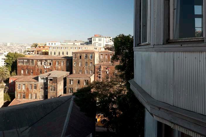
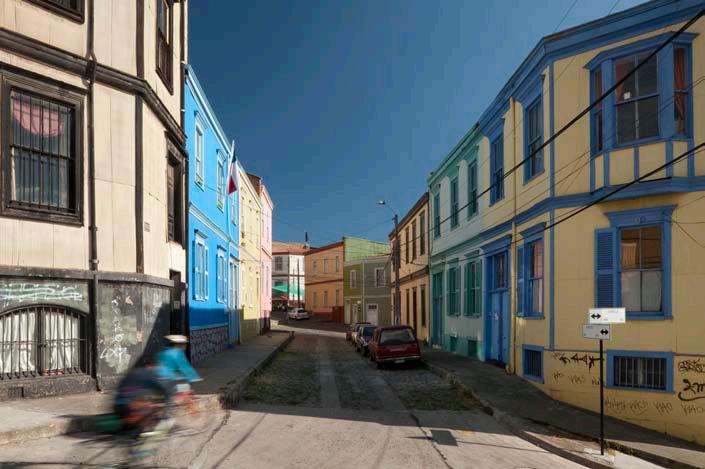


··128

129··

··130
Izquierda: cerro Alegre, vista a la bahía. Al fondo, cerro Aconcagua (Argentina).
Left: Cerro Alegre, view to the bay. In the background, Mount Aconcagua (Argentina). Derecha: cerro Concepción, vista al plan de la ciudad.
Right: Cerro Concepción, view to the city plan. Página siguiente: edificio Turri. Next page: Turri Building.

131··


Página anterior: calle Prat, el plan de la ciudad.
Previous page: Prat Street, the city plan.
En estas páginas: plan de la ciudad, edificio del antiguo Banco de Londres (actual Banco Santander).
On these pages: city plan, building of former Banco de Londres (now Banco Santander).


··138
Izquierda: edificio El Mercurio, en calle Esmeralda.
Left: El Mercurio Building, on Esmeralda Street.
Derecha: edificios La Bolsa y Turri, en calle Prat.
Right: La Bolsa and Turri Buildings, on Prat Street.


139··


··140
Izquierda: Club Naval, en calle Condell.
Left: Club Naval, on Condell Street.
Derecha: Av. Brasil, monumento a Cochrane y palacio Polanco, actual casino de la Prefectura de Carabineros de Valparaíso.
Right: Brasil Ave., monument to Cochrane and Polanco Palace, current casino of Valparaíso Police Prefecture.


141··
 Derecha: plaza Sotomayor e Intendencia de Valparaíso.
Right: Sotomayor Square and Valparaíso Intendancy.
Izquierda: plaza Sotomayor, monumento a los Héroes de Iquique, edificio de Aduanas.
Left: Sotomayor Square, monument to the Heroes of Iquique, Customs House Building.
Derecha: plaza Sotomayor e Intendencia de Valparaíso.
Right: Sotomayor Square and Valparaíso Intendancy.
Izquierda: plaza Sotomayor, monumento a los Héroes de Iquique, edificio de Aduanas.
Left: Sotomayor Square, monument to the Heroes of Iquique, Customs House Building.


··144
Izquierda: barrio La Matriz, plaza Echaurren.
Left: La Matriz neighborhood, Echaurren Square.
Derecha: barrio La Matriz, calle Serrano.
Right: La Matriz neighborhood, Serrano Street.


145··
Página siguiente: iglesia La Matriz.
Next page: La Matriz Church.


··148
Trolleys. © Patricia Novoa.


149··
En estas página: edificios restaurados del Plan. © Patricia Novoa. On these pages: .

··150


151··
Página siguiente: antiguo edificio de Aduana y plazoleta Wheelwright.
Next page: former Customs House Building and Wheelwright Square.


Criterion ii): Sewell town in its hostile environment is an outstanding example of the global phenomenon of company towns, established in remote parts of the world through a fusion of local labor with resources from already industrialized nations, to mine and process highvalue copper. The town contributed to the global spread of large-scale mining technology.
Nº 1214, on the World Heritage List in 2006
Criterio ii): el Campamento Sewell en su ambiente hostil es un ejemplo excepcional del fenómeno global de las company towns (ciudades industriales), establecido en lugares remotos del mundo, a través de una fusión de trabajadores locales con recursos de naciones ya industrializadas, para extraer y procesar cobre de alta pureza. El asentamiento contribuyó a la difusión global de tecnología minera a gran escala.
Campamento SEWELL
Nº 1214, inscrito en la Lista del Patrimonio Mundial en 2006
155··


Gobierno de Chile
Propuesta de Declaración Retrospectiva de Valor Universal Excepcional
CAMPAMENTO SEWELL
(Nº 1214, inscrito en la Lista del Patrimonio Mundial en 2006) desarrollo) a albergar a 15.000 personas en 175.000 m2 construidos. A partir de ese momento, Sewell fue despoblándose paulatinamente, al resolver la empresa que era más eficiente que los trabajadores vivieran en Rancagua. Comienzan las demoliciones y la extracción de materiales; el proceso termina en la década de 1990, para ser sucedido por una política inversa, orientada a la protección y conservación.
1. BREVE SÍNTESIS
El Campamento Sewell se ubica en la zona central de Chile, 60 k m al oriente de la ciudad de Rancagua, en plena Cordillera de los Andes, en el cerro Negro, a una altura de 2.200 m s .n.m., en la latitud 34º 0 5’ S , longitud 70º 1 5’ W. El sitio se asocia a la mayor mina de cobre subterránea del mundo, la Mina El Teniente, y es la primera ciudad industrial del cobre en Chile, país que es hoy el primer productor de este metal en el mundo.
Los orígenes de Sewell se remontan a 1905, cuando el Gobierno de Chile autorizó al norteamericano William Braden a explotar la mina de cobre El Teniente. En una notable epopeya empresarial, Braden construyó caminos, una planta concentradora, campamentos y un tren que unía a este lugar con Rancagua. El Teniente y Sewell fueron propiedad de empresas norteamericanas hasta 1971, cuando la industria cuprífera fue nacionalizada, pasando a ser propiedad del Estado, que ya a fines de la década de 1960 había adquirido una participación mayoritaria en ella.
En torno al primer molino del mineral — construido en 1905— y la primera fundición, se generó el asentamiento que se denominaría luego Sewell, y que creció gradualmente, llegando en 1968 (época de su máximo
Sewell es una ciudad industrial de gran originalidad, conocida como la “Ciudad de las Escaleras” o “Ciudad Derramada en el Cerro”, pues su configuración urbana se adapta a las abruptas pendientes andinas, dando lugar a un diseño orgánico con circulación interior exclusivamente peatonal, por senderos y escaleras, con espacios públicos constituidos en pequeños remanentes entre edificaciones. La construcción de edificios e instalaciones industriales muestra ingenio y calidad, al usar la madera y el acero con magníficos resultados. Como ciudad industrial, Sewell combina lo habitacional y urbano con lo productivo, y actualmente sigue en funcionamiento el Concentrador, que aprovecha la pendiente de la ladera para el proceso de molienda del mineral, en continuidad con el uso original de este asentamiento. Sewell forjó también una particular cultura, combinación de costumbres chilenas y norteamericanas, que se mantiene en los antiguos habitantes del sitio y sus descendientes.
Criterio ii): el Campamento Sewell en su ambiente hostil es un ejemplo excepcional del fenómeno global de las company towns (ciudades industriales), establecido en lugares remotos del mundo, a través de una fusión de trabajadores locales con recursos de naciones ya industrializadas, para extraer y procesar cobre de alta pureza. El asentamiento contribuyó a la difusión global de tecnología minera a gran escala.
Los atributos más eminentes del bien son las instalaciones industriales, las edificaciones que combinan vivienda en los pisos superiores y comercio o servicios en el primero, las edificaciones netamente de servicios, los espacios públicos, las vías de circulación interior —escaleras y senderos peatonales—, la infraestructura eléctrica, de agua potable y alcantarillado, el diseño urbano y el emplazamiento en el paisaje andino. Las fundaciones y restos de las construcciones demolidas, así como los vestigios de la actividad industrial y de la infraestructura urbana que se encuentran en la superficie o en el subsuelo, son también de valor.
Otros atributos relevantes son el sistema ferroviario, los sistemas constructivos, la expresión arquitectónica marcada por la austeridad, funcionalidad y la impronta del
··158
2. CRITERIOS DE VALOR UNIVERSAL EXCEPCIONAL
Acuerdo de 1998
Territorio Chileno Antártico
Humberstone y santa Laura
VaLparaíso seweLL IgLesías de CHILoé
rapa nuI


modernismo, el colorido de las edificaciones, que evitan el blanco y los tonos tierra para contrastar con el entorno, su materialidad — madera, calamina (acero galvanizado), acero y hormigón— y la variada y diversa red de ductos que surca el Campamento, así como el Puente Rebolledo, erigido para sostener el ducto que hoy lleva la pulpa de cobre hacia las instalaciones de procesamiento, y los muros de contención de las laderas. En el conjunto de instalaciones industriales, destacan el Concentrador y la infraestructura energética, así como el sector denominado “Punta de Rieles”, en el sector más alto del sitio, terminal de uno de los ferrocarriles de la mina, que conduce el mineral para su procesamiento en el Concentrador.
Atributo eminente es la cultura sewellina, y en general, la memoria de la vida en Sewell y el trabajo en El Teniente, incluyendo la de las catástrofes que periódicamente sufrieron (avalanchas, derrumbes, accidentes, y la llamada “Tragedia del Humo” de 1945), así como su correlato, el gran esfuerzo en materia de seguridad laboral. Los bienes muebles que se conservan, en particular la colección del Museo de la Gran Minería del Cobre y equipamiento industrial como la maquinaria del Concentrador, gran parte de la cual sigue operando, son de crucial importancia.
Son destacables como atributos presentes en la zona de amortiguación los vestigios del pasado de Sewell y de la Mina El Teniente: los vestigios de sectores del Campamento demolidos, la postación y cableado eléctrico, los ductos, los muros de contención y las instalaciones contra avalanchas, además de los vestigios del antiguo ferrocarril que comunicaba con Rancagua. La zona de amortiguación tiene el valor de conservar la imagen paisajística propia del asentamiento.
3. INTEGRIDAD
Hoy queda el 38% de los edificios habitacionales y el 80% de los edificios industriales, de los que hubo en el Campamento en su época de máximo desarrollo. Se trata del núcleo central del Campamento, tal y como se configurara a mediados del siglo XX. El bien conserva su integridad, por cuanto mantiene sus componentes esenciales. Contiene exponentes de todas las tipologías de edificios que se erigieron en él, excepto de las viviendas aisladas unifamiliares de la Población Americana, todas las cuales fueron destruidas. Las vías de circulación, espacios públicos y la infraestructura de servicios permanecen en funcionamiento.
El sitio se inserta dentro de un área de explotación minera, por lo cual su acceso es
controlado y las visitas turísticas se realizan, en cantidad bastante acotada, por medio de operadores autorizados. Por ello, el bien no sufre robo de materiales, y tampoco enfrenta presión del turismo. La importancia de la madera conlleva la preocupación por los incendios, pero la altitud lleva a que este riesgo sea relativamente bajo, existiendo procedimientos de seguridad frente a éste y otros siniestros. La altitud también ha librado al sitio de los xilófagos.
4. AUTENTICIDAD
El sector industrial del Campamento presenta plena autenticidad, la cual es potenciada porque actualmente está en uso; si bien en el Concentrador ya no se realiza la flotación del cobre (separación del metal), sigue teniendo lugar en él la molienda del mineral.
En el sector no industrial, en la década de 1980 tuvieron lugar algunas transformaciones internas en los edificios, pero ellas son reversibles. La mayor parte de los edificios ha sido prolijamente restaurada y reciben mantención periódica, habiéndose preservado los sistemas constructivos, el diseño y sus características esenciales. El Campamento presenta además construcciones características de todas sus etapas de desarrollo, incluyendo la última previa a su despoblamiento, cuando se quiso incorporar edificios de hormigón armado, modernistas (edificio Nº 501, de 1958).
Es necesario fortalecer la evidencia de los usos originales, al tenor de la recomendación del Comité al momento de la inscripción, en el sentido de que, “apoyando el principio de reutilización adaptativa, un número mínimo de unidades habitacionales sean restauradas en vez de adaptadas a fin de mostrar las realidades de la vida minera en el asentamiento y de mantener lo suficiente de la disposición interna de las construcciones a fin de asegurar que sus funciones originales puedan ser percibidas”.
5. REQUISITOS DE PROTECCIÓN Y GESTIÓN
El Campamento Sewell es propiedad de la División El Teniente de Codelco Chile, empresa estatal dedicada a la producción de cobre. Esta entidad constituyó en 2006 la Fundación Sewell, a la cual proveyó financiamiento y encargó la administración del sitio, rigiendo al respecto los altos estándares de calidad vigentes para todos los procesos de la empresa. Sewell es Monumento Nacional desde 1998, por lo cual el Consejo de Monumentos Nacionales supervisa las intervenciones en él. Existe un Plan de Manejo vigente para el quinquenio 2006-2010, el cual debe ser actualizado para un nuevo período.
La participación comunitaria es un principio de manejo; hay que potenciar el aporte de los sewellinos a la puesta en valor del sitio y asegurar la preservación de la memoria para las futuras generaciones. La investigación histórica y arqueológica es un ámbito de acción relevante, al igual que la interpretación, considerando además su vocación como testimonio de la gran minería del cobre chilena en su conjunto.
La mantención rigurosa de las construcciones es un imperativo permanente, dadas las condiciones climáticas. La protección del marco paisajístico es esencial, dando cabida a las instalaciones propias asociadas a la producción de cobre y salvaguardando los vestigios de su pasado. Sewell es un ejemplo notable de sinergia entre producción y conservación patrimonial, y su sustentabilidad futura depende en buena medida de ese equilibrio.
Noviembre de 2010
Fundación Sewell
Consejo de Monumentos Nacionales
FOTOS/PHOTOS
156/157: vista del Campamento Sewell desde el sector de La Junta.
View of Sewell Mining Town from the sector called La Junta.
159: desde el interior del edificio Nº 101 (Banco del Estado).
From inside Building Nº 101 (Banco del Estado)
160: interior del edificio Nº 106 (Palitroque).
Inside Building Nº 106 (Bowling).
161··
SEWELL MINING TOWN
(Nº 1214, on the World Heritage List in 2006)
1. BRIEF SYNTHESIS
The Sewell Mining Town is located in the central zone of Chile, 60 km East of Rancagua, in Cerro Negro, amidst the Andes Cordillera, at 2,200 m a.s.l., at 34º 05’ S latitude, 70º 15’ W longitude. The site is associated to the biggest underground copper mine in the world, the Mina El Teniente, and is the first copper company town in Chile, country that today is the main producer of this metal in the world.
Sewell origins go back to 1905, when the Chilean government authorized the American citizen William Braden to exploit El Teniente copper mine. In an outstanding commercial epic, Braden built roads, a concentrator plant, camps, and a train that connected this place with Rancagua. American companies owned El Teniente and Sewell until 1971, when the copper industry was nationalized and became State property, which, by the end of 1960, had already turned into the major stockholder.
Around the first mineral grinder —built in 1905— and the first smelting plant, grew the town later known as Sewell, which gradually expanded to accommodate 15,000 people in 175,000 square meters in 1968 (time of its maximum development). From that moment on, Sewell slowly lost population when the company resolved that it was more efficient to move its workers to Rancagua. Then the demolitions and materials extraction began,
process that ended in 1990, to be followed by an inverse policy oriented towards the protection and conservation of the site.
Sewell is a company town of great originality; it is known as the “Ciudad de las Escaleras” (City of Stairs) or “Ciudad Derramada en el Cerro” (City Spread Down the Hill), because its urban configuration adapts itself to the abrupt Andean slopes giving rise to an organic design characterized by an exclusively pedestrian interior circulation, by paths and stairs, with public places built on small open areas between buildings. The construction of buildings and industrial facilities shows great creativity and quality by using wood and steel with outstanding results. As an industrial city, Sewell combines housing and urban aspects with productivity; and at present, the Concentrator is still in working order, taking advantage of the hillside incline for the mineral grinding process, thus continuing the original purpose of this settlement. Sewell also forged a special culture, a combination of Chilean and American customs, which survives in the old residents of the site and their descendants.
2. CRITERIA FOR OUTSTANDING UNIVERSAL VALUE
Criterion ii): Sewell town in its hostile environment is an outstanding example of the global phenomenon of company towns,
established in remote parts of the world through a fusion of local labor with resources from already industrialized nations, to mine and process high-value copper. The town contributed to the global spread of large-scale mining technology.
The most outstanding attributes of the property are the industrial installations, the buildings which combine houses in the upper floors with business or services in the ground floor, the purely service buildings, the public spaces and inner circulation routes —stairs and pedestrian paths—, the electric infrastructure and drinking water and sewer systems, the urban design and the location in the Andean landscape. The foundations and the remains of demolished constructions, as well as the remains of industrial activity and urban infrastructure that are located both in the surface and in the subsoil are also valuable.
Other relevant attributes are the rail system, the constructive systems, the architectural expression marked by austerity, functionality and the imprint of modernism, the colors of the buildings which avoid white and terracotta colors in order to contrast with the environment, its materials —wood, calamine (galvanized steel), steel, and concrete— and the assorted and diverse net of pipes crossing the town, as well as the Rebolledo Bridge, built to support the pipe that today carries the copper pulp towards the processing
··162 Government of Chile
of Outstanding Universal Value
Retrospective Statement


installations, and the containing walls on the hillsides. Among the group of industrial installations, the Concentrator and the energy infrastructure stand out, as well as the sector named “Punta de Rieles” (Rails’ End), located at the highest spot of the site and which is the terminal station of one of the mine railways transporting the mineral for its processing in the Concentrator.
Another outstanding attribute is Sewell’s culture, and in general, the memory of life in Sewell and work in El Teniente, including the periodical catastrophes they had to endure (avalanches, collapses, accidents, and the socalled “Tragedia del Humo” [Smoke Tragedy] of 1945), as well as the mine big efforts in matters of working security. The objects, especially the collection of the Museo de la Gran Minería del Cobre (Great Copper Mining Museum) and the industrial equipment like the Concentrator machinery, most of it still in operation, are of crucial importance.
Also remarkable as actual attributes in the buffer zone are the remains of Sewell and El Teniente Mine, that is, the remains of demolished town sectors, the poling and electric wiring, pipes, embankments and installations against avalanches, as well as the remains of the old railway connecting with Rancagua. The buffer zone is valuable in preserving the landscape of the encampment.
3. INTEGRITY
Today, 38% of the housing buildings and 80% of the industrial buildings that constituted the town at the time of its maximum development remain. They form the central core of the town as it was configured by mid-20th century. The property preserves its integrity inasmuch as it maintains its essential components. It shows exponents of all the constructions typologies built in it, except for the isolated single-family houses of the American inhabitants, all of which were destroyed. The circulation ways, public spaces, and service infrastructure are still in operation.
The site is inserted within a mining exploitation area, so access is controlled and tour visits are limited and allowed only under the supervision of authorized operators. Thanks to this provision, the property has not suffered the robbery of materials and does not face tourism pressure. The importance of wood implies a serious concern about fires, although altitude reduces this risk, and there are strict safety procedures against this and other disasters. The altitude has also freed the site from xylophages.
4. AUTHENTICITY
The industrial sector of the encampment enjoys full authenticity, which is strengthened due to the fact that it is currently in use. Although the copper flotation (metal separation) is no longer performed in the Concentrator, mineral grinding still is.
In the non-industrial sector, some interior transformations in the buildings took place in the 1980’s, but they are reversible. Most of the buildings have been thoroughly restored and are subjected to periodic maintenance, and the constructive systems, design and essential characteristics have been preserved. The town also shows its characteristic constructions in all of its construction stages, including the last one before its depopulation, when the management tried to introduce modern reinforced concrete buildings (building Nº 501, 1958).
At present, it is necessary to strengthen the evidence of the original uses, following the Committee’s recommendation at the time of the inscription, in the sense that “supporting the principle of adaptive re-use, a minimum number of dwelling units be restored rather than adapted to display the realities of mining life in the town and to keep sufficient of the internal layout of the buildings to ensure that their original functions can be discerned.”
5. PROTECTION AND MANAGEMENT REQUIREMENTS
The Sewell Mining Town is owned by El Teniente Division of Codelco Chile, a State company dedicated to copper production. This company built the Fundación Sewell (Sewell Foundation) in 2006, to which it provided with funds and commissioned the site administration. The Foundation is ruled by the same high-quality standards in force for all the company processes. Sewell was declared a National Monument in 1998, and therefore is overseen by the Council of National Monuments. There is a Management Plan in force for 2006-2010, which has to be updated for a new period.
Community participation is a management principle; therefore, Sewell people contribution to the valuation of the site and to secure the conservation of its memory for future generations must be stressed. Historical and archeological investigation is a relevant action field, just like interpretation, also considering its vocation as testimony of the great Chilean copper mining as a whole.
A rigorous construction maintenance is a
permanent imperative given the climate conditions. The protection of landscape is fundamental, but making room for those installations related to copper production and safekeeping past remains. Sewell is a remarkable example of synergy between production and property conservation, and its future viability largely depends on this balance.
November 2010
Fundación Sewell National Monuments Council
FOTOS/PHOTOS
163: Foto pendiente Inglés.
164: Foto pendiente Inglés.
165··


··168
Página anterior: Escalera Central Inglés.
Izquierda: vista general.
Left: general view.
Derecha: edificios Nº 41, servicio de bienestar y vivienda y Nº 42, vivienda, en eje escalera central.
Right: Buildings Nº 41, welfare service and housing and Nº 42, housing, central staircase on axis.

169··
Arriba: vista general.

Izquierda: edificio Nº 105, registro civil, juzgado, comisaría y habitaciones.
Centro: edificio Nº 41 (rojo): servicio de bienestar y vivienda; edificio Nº 103 (celeste): casa de huéspedes para empleados solteros.
Derecha: edificio Nº 152, departamentos para empleados.


··170

171··
Bottom: general view.
Left: Building Nº 105, civil registry, court, police station and housing.
Center: Building Nº 41 (red): welfare service and housing; Building Nº 103 (light blue): boarding-house for single employees.
Right: Building Nº 152, apartments for employees.
Izquierda: trabajadores del Campamento en Escalera Central.

Centro arriba: edificio Nº 108, vivienda para mujeres solteras.


Centro abajo: Edificio 129, antigua Escuela Industrial, actual Museo de la Gran Minería del Cobre. Derecha: edificio Nº 103, casa de huéspedes para empleados solteros.

··172

173··
Izquierda: trabajadores del Campamento en Escalera Central.
Top center: Building Nº 108, housing for single women.
Bottom center: Building 129, former Industrial School, now Copper Mining Industry Museum.
Right: Building Nº 103, boarding-house for single employees.

··174
Izquierda: edificio Nº 105, registro civil, juzgado, comisaría y vivienda.
Left: Building Nº 105, civil registry, court, police station and housing.
Derecha: edificio Nº 102 (amarillo), casa de huéspedes y oficinas; edificio Nº 101 (rojo), oficinas generales y Banco del Estado; costado edificio Nº 105.
Right: Building Nº 102 (yellow), boarding-house and offices; Building Nº 101 (red), headquarters and Banco del Estado; side of Building Nº 105.

175··
En estas páginas: edificio Nº 35, departamentos para obreros. On these pages: Building Nº 35, apartments for workers.


··176

177··
En estas páginas: edifiico Nº?????. , Teniente Club

On these pages:
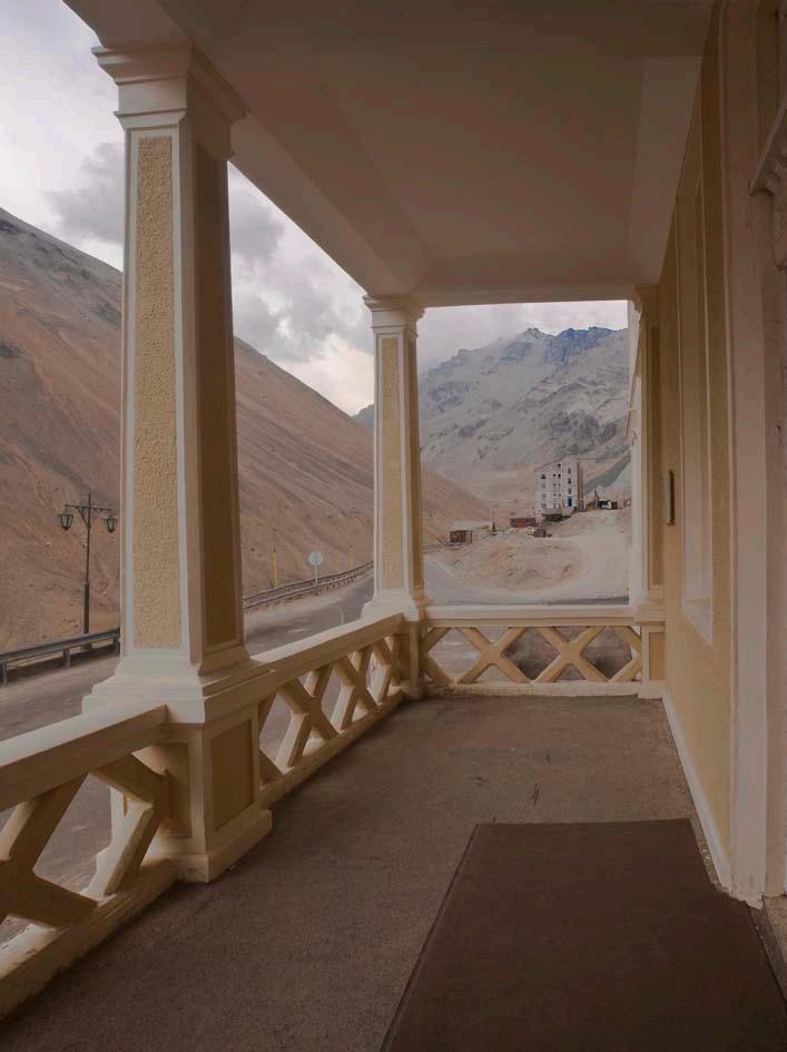
··178


179··

··180
En estas páginas: edificio Nº 106: hotel Sewell y palitroque. On these pages: Building Nº 106: Sewell Hotel and bowling.

181··
En estas páginas: edificio Nº 231, iglesia. On these pages: Building Nº 231, church.


··182

183··
En estás páginas: detalles de arquitectura. On these pages: architectural details.


··184

185··
En estas páginas: sistemas de circulación del campamento. On these pages: mining town circulation systems.


··186


187··
Página siguiente: vista de la ladera sur del Campamento.
Next page: iew of southern side of the Mining Town.


En estas páginas: detalles. On these pages: details.


··190


191··


··192
En estas páginas: vista de la ladera sur del Campamento, con el pique Sewell y Punta de Rieles. On these pages: view of southern side of the Mining Town, with the Sewell Shaft and Punta de Rieles

193··

··194
Izquierda: el concentrador de Sewell. © Augusto Domínguez.
Left: the Sewell Concentrator.
Derecha: Punta de Rieles, terminal del ferrocarril de la mina. © Augusto Domínguez. Right:

195··
Página siguiente: puente Rebolledo, muros de contención y edificio Nº 152, departamentos para empleados.
Next page: Rebolledo Bridge, muros de contención, and Building Nº 152, apartments for employees.


Criterion (ii): The Churches of Chiloé are outstanding examples of the successful fusion of European and indigenous cultural traditions to produce a unique form of wood architecture.
Criterion (iii): The mestizo culture resulting from Jesuit missionary activities in the 17th and 18th centuries has survived intact in the Chiloé Archipelago, and it achieves its highest expression in the outstanding wooden churches.
Nº 971, on the World Heritage List in 2000
Criterio ii): las Iglesias de Chiloé son ejemplos excepcionales de la exitosa fusión entre las tradiciones culturales europeas e indígenas, para producir una forma única de arquitectura en madera.
Iglesias de CHiLoé
Criterio iii): la cultura mestiza resultante de las actividades misioneras de los jesuitas en los siglos XVII y XVIII ha sobrevivido intacta en el archipiélago de Chiloé, y logra su más alta expresión en las excepcionales iglesias de madera.
Nº 971, inscrito en la Lista del Patrimonio Mundial en 2000
199··


Gobierno de Chile
Propuesta de Declaración Retrospectiva de Valor Universal Excepcional
IGLESIAS DE CHILOÉ
(Nº 971, inscrito en la Lista del Patrimonio Mundial en 2000)
1. BREVE SÍNTESIS
Actualmente existen en el archipiélago de Chiloé cerca de 70 iglesias que corresponden a la tipología cúspide de la denominada Escuela de Arquitectura Chilota, que es la de Arquitectura Religiosa. En efecto, es en los templos en los que llega a su máximo esplendor la habilidad constructiva del pueblo chilote, de agricultores, pescadores y navegantes, de gran pericia con el material más abundante del medio, la madera. 16 de estas iglesias —las más representativas— son a la vez Monumentos Nacionales de Chile y Sitio del Patrimonio Mundial. Estos exponentes son Achao, Quinchao, Castro, Rilán, Nercón, Aldachildo, Ichuac, Detif, Vilupulli, Chonchi, Tenaún, Colo, San Juan, Dalcahue, Chelín y Caguach1
El archipiélago de Chiloé se emplaza en el océano Pacífico, al sur de Chile, entre los 41º 48’ y los 43º 27’ S, entre el canal de Chacao y el golfo del Corcovado, y entre los meridianos 73 y 74º 15’. Su centro lo constituye la Isla Grande de Chiloé, hacia el este de la cual se ubican decenas de islas menores. Este territorio insular, habitado por huilliches y chonos, fue colonizado tempranamente por los españoles, que se asentaron en el lugar a mediados del siglo XVI.
1 Las dos últimas de la serie fueron inscritas el año 2001, en la Reunión del Bureau del Patrimonio Mundial, a través de una enmienda a la inscripción original, que tuvo lugar el año 2000 y consideró los restantes 14 templos.
Los jesuitas, que arribaron en 1608, aplicaron en la evangelización del área el sistema de la misión circulante: grupos de religiosos hacían recorridos anuales por el archipiélago, permaneciendo durante un par de días en determinados puntos, donde se erigieron capillas junto a la comunidad de fieles; el resto del año, un laico especialmente preparado atendía espiritualmente a los lugareños.
La técnica de construcción y la arquitectura de las Iglesias de Chiloé son propias del lugar: los antecedentes europeos fueron adaptados y reformulados, dando origen a una tradición vernácula, con una gran cantidad y variedad de testimonios, aún vigente. Así como la cultura del archipiélago, estos templos son resultado de un rico diálogo intercultural y de un profundo mestizaje. Se caracterizan además por su óptimo aprovechamiento de los recursos del medio ambiente —en particular, de la madera—, por su diálogo e interrelación con el paisaje y por materializar una cosmovisión eminentemente mestiza.
2. CRITERIOS DE VALOR UNIVERSAL EXCEPCIONAL
Criterio ii): las Iglesias de Chiloé son ejemplos excepcionales de la exitosa fusión entre las tradiciones culturales europeas e indígenas, para producir una forma única de arquitectura en madera.
Criterio iii): la cultura mestiza resultante de las actividades misioneras de los jesuitas en los siglos XVII y XVIII ha sobrevivido intacta en el archipiélago de Chiloé, y logra su más alta expresión en las excepcionales iglesias de madera.
Los atributos esenciales de estos templos son su materialidad —la madera, en gran diversidad de especies—, los sistemas constructivos y la pericia aplicada del carpintero chilote. Al diseño arquitectónico —torre fachada, planta basilical y bóveda— se une también como componente esencial la decoración interior, el color y la imaginería religiosa, particularmente la tradicional, de raigambre colonial, que presenta exponentes locales y foráneos, incluyendo quiteños. Dentro de la edificación, la torre, soporte de la cruz y de las campanas, referente esencial en el paisaje, es un atributo eminente, y su sistema constructivo en base a uniones telescópicas, realizadas con ensambles, nudos y uniones, es una síntesis de la pericia de la escuela de carpinteros de ribera.
La orientación y el emplazamiento son también atributos eminentes, junto con el entorno paisajístico. Son iglesias hechas en función del mar, dispuestas en colinas para ser vistas por los navegantes y para evitar las inundaciones. Las explanadas son componentes de gran valor: materializan la comunicación con el mar, son escenario de las fiestas religiosas y evocan — incluso las que se han transformado en plazas
··202
Acuerdo de 1998 Territorio Chileno Antártico
Humberstone y santa Laura
VaLparaíso seweLL IgLesías de CHILoé
rapa nuI


formales— la llegada de los misioneros durante la misión circular. También los cementerios son parte del conjunto.
La relación de las comunidades con los templos es un atributo inmaterial de gran relevancia. Es ella la que, en definitiva, aporta a los templos buena parte de su significado. Las prácticas devocionales y comunitarias son atributos relevantes; las fiestas religiosas y las actividades colectivas solidarias como la minga (trabajo comunitario no remunerado) son claves. Los ornamentos y bienes litúrgicos en general, los documentos históricos y la música sacra son otros atributos de importancia, al igual que el subsuelo, que junto con albergar los enterratorios de los fieles, pueden quizás aportar en el futuro información sobre la relación entre los emplazamientos de las iglesias y los de sitios rituales indígenas prehispánicos.
3. INTEGRIDAD
Los límites de las iglesias son muy estrechos y en la mayoría falta una zona de amortiguación coherente, problema que se está abordando a través de la protección y regulación de los entornos.
El desplome de la torre de Chonchi en marzo de 2002, a raíz de un temporal, puso de relieve el hecho de que el estado de conservación y la vulnerabilidad de las iglesias eran mayores de lo evaluado anteriormente, y en particular al momento de la postulación. Estas iglesias requieren conservación constante; la naturaleza del material y las características ambientales hacen de esa mantención permanente un imperativo. Las comunidades aseguraron su conservación hasta los tiempos contemporáneos, y actualmente, fenómenos asociados a la modernización y globalización inciden en la mayor vulnerabilidad de los templos. Las comunidades hoy necesitan apoyo para la conservación; ese hecho determinó la creación por parte del Obispado de Ancud de la Fundación Amigos de las Iglesias de Chiloé, la incursión de profesionales en la conservación, la declaración de estas iglesias como Monumento Nacional y el aporte del Estado a su protección y restauración.
arquitectónicas, materiales y sistemas constructivos. Al momento de realizar intervenciones, los sistemas constructivos mantienen en la actualidad toda la riqueza en las tipologías de uniones, ensambles y empalmes, tecnología que se ha recuperado y aplicado, e incluso se han descubierto combinaciones de uniones de carácter profundamente local y propio, muy singulares. Las tradiciones, técnicas y sistemas de manejo se mantienen, al igual que las condiciones esenciales del emplazamiento. Las recientes restauraciones han incidido en una reflexión sustantiva de la función de lo inmaterial y del imperativo del recambio de piezas. Hoy se ha comprendido mejor ese último aspecto y se ha ampliado el espacio para una conservación que asegure la integridad.
5. REQUISITOS DE PROTECCIÓN Y GESTIÓN
Las Iglesias de Chiloé son todas de la Diócesis de Ancud de la Iglesia Católica. Las administran el Obispo de Ancud y los párrocos, quienes cuentan con el apoyo de la Fundación Amigos de las Iglesias de Chiloé, entidad privada presidida por el propio Obispado, y creada específicamente para velar por la conservación y puesta en valor de los templos. Dada la calidad de Monumento Nacional de todos estos templos, la supervisión y tuición de estos bienes es realizada por el Estado Parte a través del Consejo de Monumentos Nacionales.
La conservación de los templos depende en gran medida de su significado para la comunidad. El fomento y la recuperación de la cultura de la mantención de las construcciones por parte de los lugareños, el uso religioso y comunitario efectivo por parte de la población, la participación protagónica de los habitantes en el esfuerzo de conservación, presentan los más claros desafíos para su sustentabilidad, justificación y viabilidad. La participación solidaria y desinteresada de la comunidad en la conservación, y la preservación de la sabiduría, pericia y conocimiento ancestral de los carpinteros, tanto como la mantención preventiva y la restauración crítica, son esenciales para preservar el valor universal excepcional de esta escuela arquitectónica.
comunidades y para las iglesias, pero a la vez evitando el gran riesgo de la comercialización o banalización.
La escasez de maderas nobles, y la protección de que gozan las especies que las proveen, presentan una complejidad, y se está explorando la aplicación en las construcciones chilotas de otras maderas, tratadas con métodos modernos, de modo que adquieran las propiedades excepcionales del alerce y el ciprés. La investigación, registro y fomento de la transmisión a las nuevas generaciones de los sistemas constructivos es un imperativo. También lo es la investigación sobre las propiedades de las diferentes maderas y sobre los tratamientos que mitigan el efecto del intemperismo y del ataque de los xilófagos. Es necesario avanzar en la protección de los entornos de las iglesias.
Es el propio valor espiritual de estos templos donde radica el centro de la complejidad de su conservación. En su significado confluyen en delicado equilibrio factores sociales, ambientales, físicos y espirituales. No se trata aquí simplemente de reparar edificios; el desafío es aquí mucho mayor y en él está en cuestión el sentido mismo del quehacer patrimonial.
Julio de 2010
Fundación Amigos de las Iglesias de Chiloé Obispado de Ancud
Consejo de Monumentos Nacionales
4. AUTENTICIDAD
Las Iglesias de Chiloé presentan un alto grado de autenticidad. Las actuales tuvieron sus versiones pretéritas en los mismos emplazamientos, pero constituyen una cúspide de una evolución tipológica y, como tales, fueron conservadas sin modificaciones sustanciales. La función de culto permanece en todas ellas, al igual que las formas
La sustentabilidad del esfuerzo de conservación es una gran interrogante; las iglesias están situadas en el centro del desarrollo de las comunidades y debe encontrarse la fórmula para que su conservación se apoye en él. El Estado, con apoyo del Banco Interamericano de Desarrollo, ha implementado a partir de 2003 un programa de repercusión de gran escala, logrando revertir deterioros graves, particularmente en las torres fachadas. Deben encontrarse fórmulas para que, por ejemplo, el turismo incida en beneficios tangibles para las
FOTOS/PHOTOS
208/209: Iglesia San Juan Bautista de San Juan.
211: Iglesia San Antonio de Colo.
212: Iglesia San Antonio de Colo.
205··
CHURCHES OF CHILOÉ
(Nº 971, on the World Heritage List in 2000)
1. BRIEF SYNTHESIS
In the Chiloé Archipelago, there currently exist about 70 churches that represent the preeminent typology of the so-called Chilota School of Architecture, which is Religious Architecture. In fact, it is in the temples where the maximum splendor of Chiloé people’s constructive ability is achieved, where farmers, fishermen and sailors exhibit great expertise in the handling of the most abundant material in the environment, which is wood. Sixteen of these churches, the most representative ones, are both National Monuments of Chile and World Heritage Sites. These prime examples are Achao, Quinchao, Castro, Rilán, Nercón, Aldachildo, Ichuac, Detif, Vilupulli, Chonchi, Tenaún, Colo, San Juan, Dalcahue, Chellín, and Caguach1
The Chiloé Archipelago is located in the Pacific Ocean, south of Chile, between 41º 48’ and 43º 27’ S, between the Chacao Channel and the Gulf of Corcovado, and between the meridians 73 and 74º 15’. Its center is the Isla Grande de Chiloé, east of which lie dozens of smaller islands. This insular territory, inhabited by Huilliches and Chonos, was colonized early by the Spanish, who settled there in the mid-16th century.
1 The last two of the mentioned churches were added at the Meeting of the World Heritage Bureau in 2001 through an amendment to the original inscription, which took place in 2000 and considered the remaining 14 churches as well.
The Jesuits, who arrived in 1608, used the circulating mission system in their evangelization of the area: religious groups made annual tours around the archipelago, staying for a couple of days at certain locations where chapels were erected jointly with the communities of believers; the rest of the year, a specially trained layman attended to the villagers’ spiritual needs.
The construction technique and architecture of the Churches of Chiloé are specific to the site: European experience was adapted and reformulated, giving rise to a vernacular tradition, supported by a great quantity and variety of testimonies that are still in use. Along with the culture of the archipelago, these temples are the result of a rich intercultural dialogue and extensive cultural crossbreeding. They are further characterized by their optimal use of the resources from the surrounding environment —in particular, wood—, by their dialogue and interaction with the landscape, and by their embodiment of a predominantly mestizo worldview.
2. CRITERIA FOR OUTSTANDING UNIVERSAL VALUE
Criterion (ii): The Churches of Chiloé are outstanding examples of the successful fusion of European and indigenous cultural traditions to produce a unique form of wood architecture.
Criterion (iii): The mestizo culture resulting from Jesuit missionary activities in the 17th and 18th centuries has survived intact in the Chiloé Archipelago, and it achieves its highest expression in the outstanding wooden churches.
The essential attributes of these temples are their building material —wood, in a large diversity of species—, the building systems and the expertise applied by the Chilote carpenter. Along with the architectural design —tower façade, basilican layout and vaulted ceiling—, the interior decoration is also an essential component, like the color and religious images, particularly the traditional ones with colonial roots that feature local and foreign representations, including some native of Quito. Inside the building, the tower, a support for the cross and bells and an essential point of reference in the landscape, is a distinguishing attribute, and its construction system, based on telescopic connections made with joints, knots and unions, is a synthesis of the skills from the school of coastal side carpenters.
The orientation and location are also distinguishing attributes, along with the surrounding landscape. These are churches constructed according to the demands of the sea, arranged on hills to be seen by navigators and to prevent flooding. Esplanades are very valuable components: they embody communication with the sea; they are the scene of religious festivals; and they evoke,
··206 Government of Chile
Statement of Outstanding Universal Value
Retrospective


even those that have been transformed into formal plazas, the arrival of the missionaries during their circulating mission. Cemeteries are also part of these overall layouts.
The relationship between the communities and churches is an intangible attribute of great importance. This relationship is the one that ultimately provides the temples with a large part of their significance. Devotional and communitarian practices are important attributes; religious festivals and supportive group activities such as the minga (unpaid community work) are key components. Liturgical vestments and liturgical artifacts in general, historical documents, and sacred music are other important attributes. Of equal importance is the subsoil of the church, which not only houses the burial ground of the faithful, but one day may contribute information about the relationship between the locations of the churches and those of indigenous pre-Hispanic ritual sites.
3. INTEGRITY
The boundaries of the churches are very narrow, and most of them lack a coherent buffer zone, a problem that is being addressed through the protection and regulation of the environments.
The collapse of the Chonchi tower in March 2002 as the result of a storm highlighted the fact that the state of conservation and the vulnerability of the churches were worse than previously assessed, particularly at the time of nomination. These churches require constant conservation efforts; the nature of the building material and the environmental characteristics make permanent maintenance an imperative. The communities had always assured their conservation up to contemporary times, but currently phenomena associated with modernization and globalization have an impact on the increased vulnerability of the temples. The communities today need support for conservation. This fact led to the creation by the Diocese of Ancud of the Friends of the Churches of Chiloé Foundation, the introductions of professionals into the conservation process, the declaration of these churches as a National Monument, and contributions by the State to their protection and restoration.
substantive changes. Their function as places of worship has been preserved, just like the architectural forms, materials and building systems. When they have been intervened, the construction systems have retained all the richness regarding the typologies of connections, joints and fittings, technology that has been recovered and applied, and even very exceptional combinations of connections of a deeply local and singular character have been discovered. The traditions, techniques and management systems are maintained, as are the essential conditions of the site. Recent restorations have influenced a substantive reflection on the role of the intangibles and on the imperative for spare parts. Today, this last aspect is better understood and it has expanded the role for conservation that ensures integrity.
5. PROTECTION AND MANAGEMENT REQUIREMENTS
The Churches of Chiloé are all part of the Catholic Church Diocese of Ancud. They are administered by the Bishop of Ancud and parish priests, who have the support of the Friends of Chiloé Churches Foundation —a private entity presided over by the Bishop himself and created specifically to watch over the conservation and enhancement of the temples. Given the status of National Monument for all these temples, the State Party carries out the supervision and protection of these assets through the National Monuments Council.
The conservation of the temples depends largely on their significance to the community. The clearest challenges for the sustainability, justification and viability of the conservation efforts are the promotion and recovery of the culture of maintenance of the buildings by the locals, the effective religious and community use of the temples by the population, and the active participation of the people in the conservation effort. The unified and selfless participation of the community in the conservation and preservation of carpenters’ wisdom, expertise and ancestral knowledge, as well as participation in preventive maintenance and critical restoration are essential to preserve the outstanding universal value of this architectural school.
particularly in the tower façades. Formulas must be found to ensure that, for example, tourism may result in tangible benefits for the communities and churches, at the same time the high risk of commercialization or trivialization.
A shortage of fine hardwoods and the protection of the species that provide them represent a complexity. The use of other woods in Chilota construction is being explored. These woods would be treated using modern methods so that they acquire the exceptional properties of larch and cypress wood. The investigation, recording and promotion of the transmission of the building systems to new generations are an imperative. So is the research on the properties of different woods and on the treatments that mitigate the effect of weathering and attacks by xylophages. It is necessary to make advances in the environmental protection of churches.
It is the spiritual value inherent in these temples which gives rise to the complexity of their conservation. In its meaning comes together a delicate balance of social, environmental, physical and spiritual factors. This is not a matter of simply repairing buildings; the challenge here is much greater, and in that challenge the very significance of patrimonial endeavor is in question.
July 2010
Friends of Chiloé Churches Foundation
Bishopric of Ancud
National Monuments Council
4. AUTHENTICITY
The Churches of Chiloé present a high degree of authenticity. The current ones had their prior versions in the same locations, but they constitute the zenith of a typological evolution and, as such, they were preserved without
The sustainability of the conservation effort is a big question mark; the churches are located at the center of the communities’ development, and a formula must be found to ensure that their conservation keeps being supported by this development. The State, with the support of the Inter-American Development Bank, has implemented since 2003 a large-scale program, managing to reverse serious damage,
FOTOS/PHOTOS
215: Iglesia Nuestra Señora de Gracia de Nercón.
216: Iglesia Nuestra Señora de Gracia de Quinchao.
209··


··210
IGLESIA SANTA MARÍA DE LORETO DE ACHAO

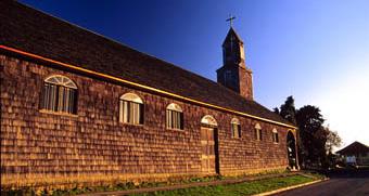

211··
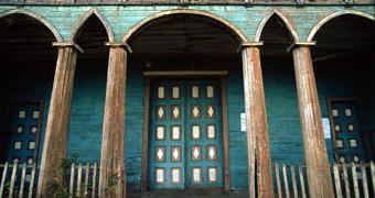
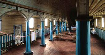

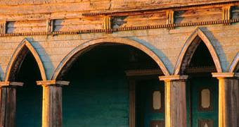
··212
IGLESIA JESÚS NAZARENO DE ALDACHILDO


213··
IGLESIA SANTUARIO JESÚS NAZARENO DE CAGUACH
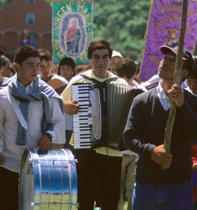


··214
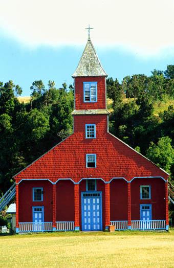
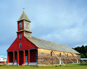
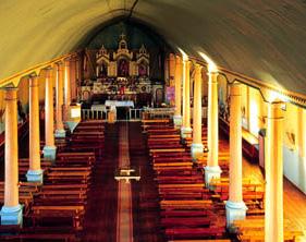
215··
IGLESIA SAN FRANCISCO DE CASTRO
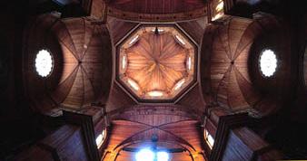
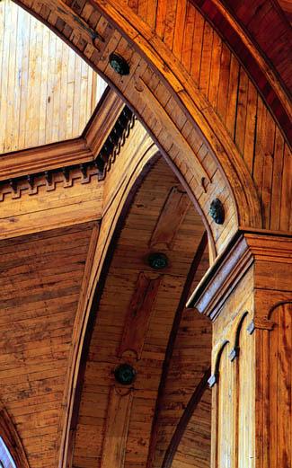
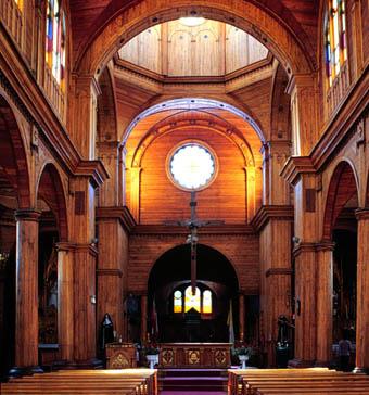
··216
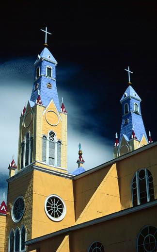
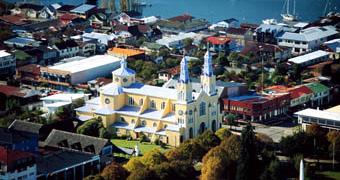
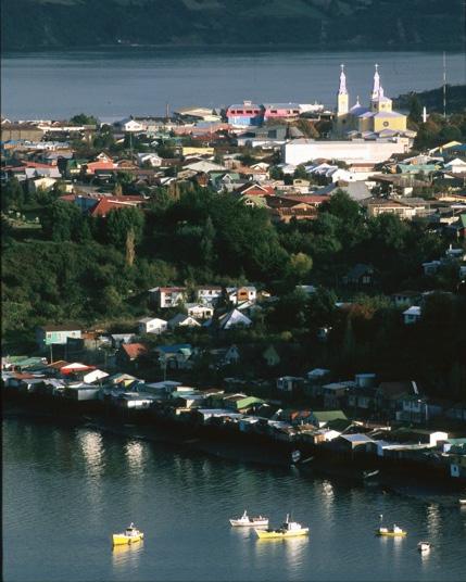
217··
IGLESIA NUESTRA SEÑORA DEL ROSARIO DE CHELÍN
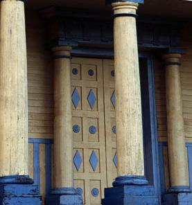
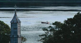
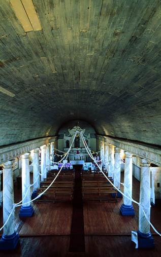
··218
Página siguiente/Next page: iglesia San Antonio de Colo.
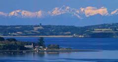
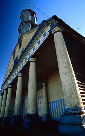
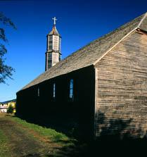
219··
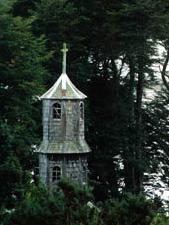
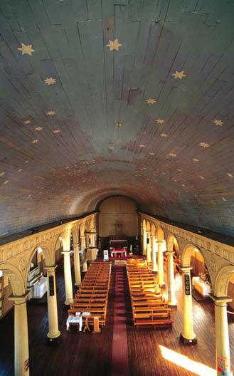
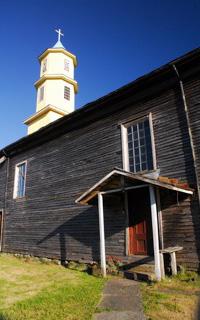
··222
IGLESIA SAN CARLOS DE BORROMEO DE CHONCHI

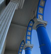
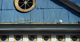
223··
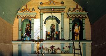
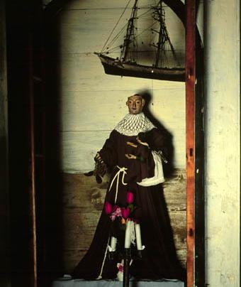
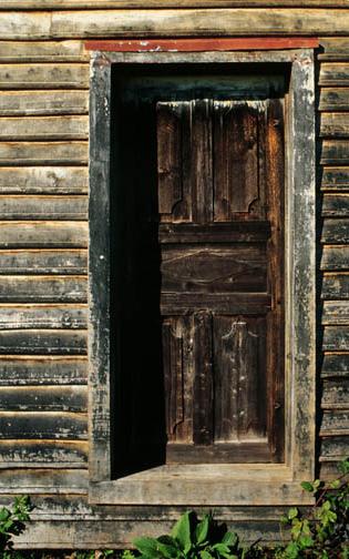
··224
IGLESIA SAN ANTONIO DE COLO
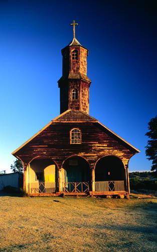
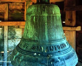
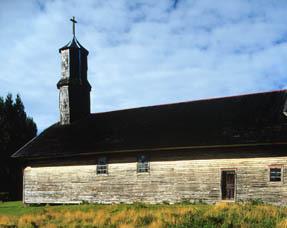
225··
IGLESIA NUESTRA SEÑORA DE LOS DOLORES DE DALCAHUE
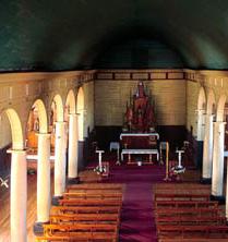
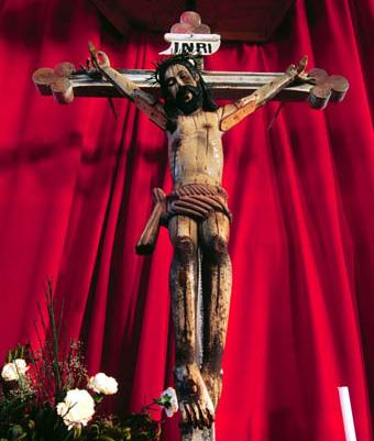
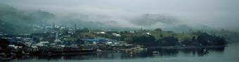
··226

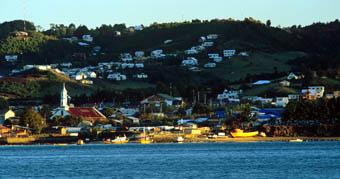
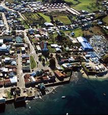
227··
IGLESIA SANTIAGO APÓSTOL DE DETIF
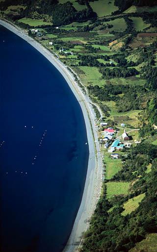
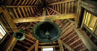
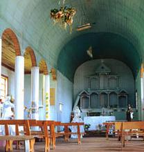
··228
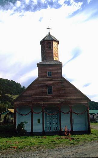
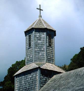
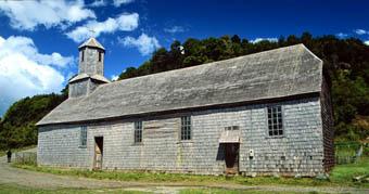
229··
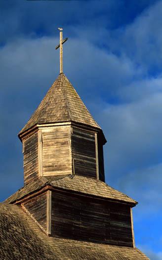
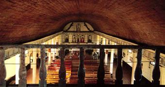

··230
IGLESIA NATIVIDAD DE MARÍA DE ICHUAC
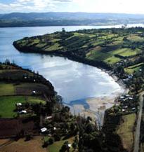
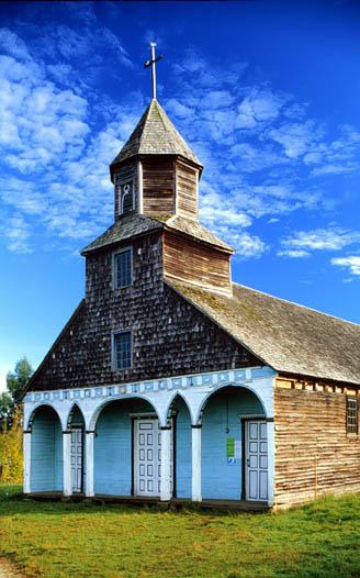
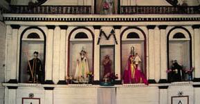
231··
IGLESIA NUESTRA SEÑORA DE GRACIA DE NERCÓN
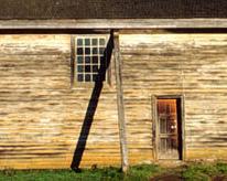
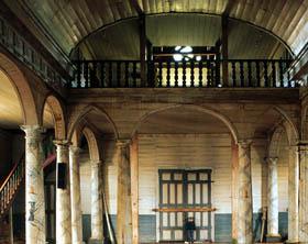
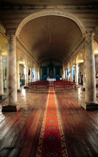
··232
Página siguiente/Next page: iglesia Jesús Nazareno de Aldachildo
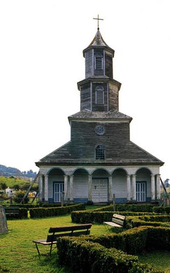
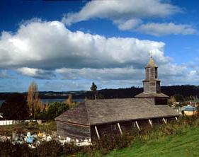
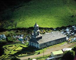
233··

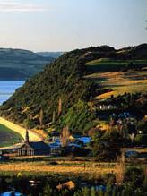
IGLESIA NUESTRA SEÑORA DE GRACIA DE QUINCHAO
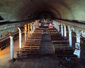
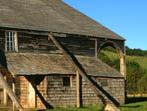
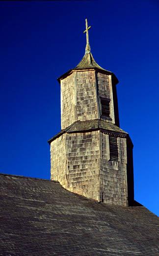
··236
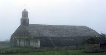
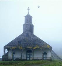
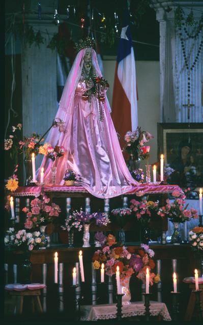
237··
IGLESIA SANTA MARÍA DE RILÁN
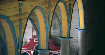
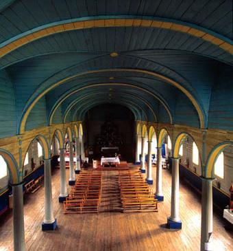
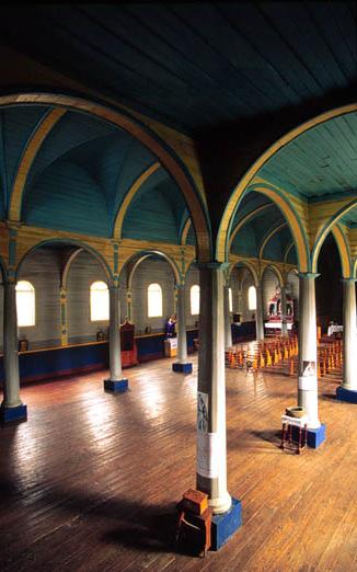
··238
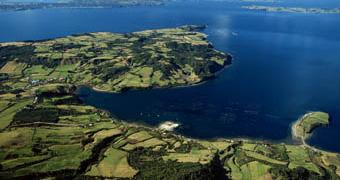
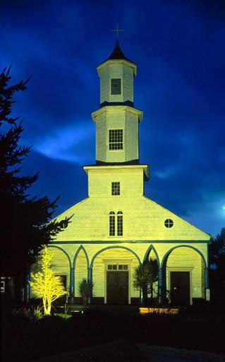
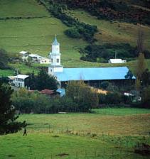
239··
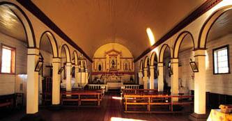
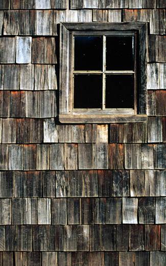
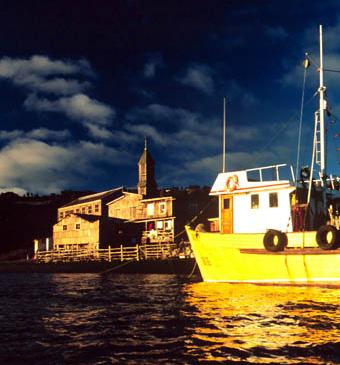
··240
IGLESIA SAN JUAN BAUTISTA DE SAN JUAN
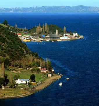
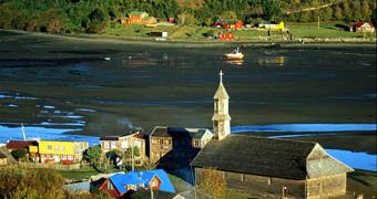
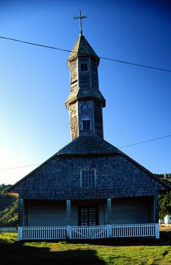
241··
IGLESIA NUESTRA SEÑORA DEL PATROCINIO DE TENAÚN
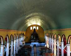
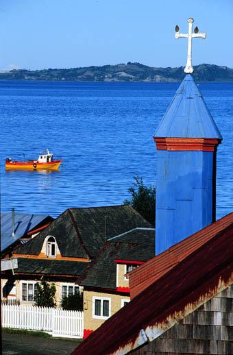
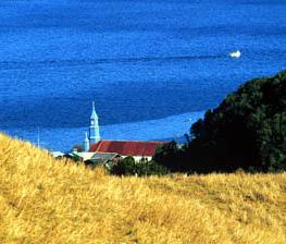
··242
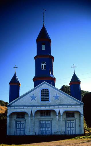
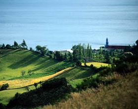
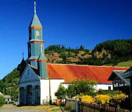
243··
IGLESIA SAN ANTONIO DE VILUPULLI


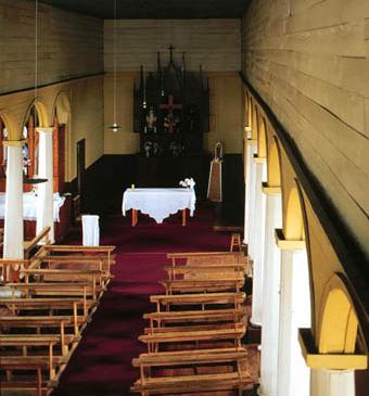
··244
Página siguiente/Next page: iglesia Nuestra Señora del Patrocinio de Tenaún. © Guy Wenborne.
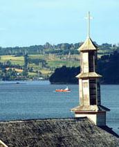
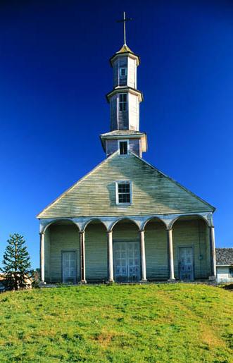
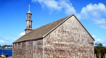
245··