Taking inspiration from OMA’s BLOX project in Copenhagen, Denmark, this studio aims to resolve a high degree of interconnection between hybrid programs within an urban setting. The chosen site for this studio is a car park located in a primarily residential neighborhood in the City of London, England. Upon knowing the location of the site, the first response of this studio was to perform an analysis of the neighborhood’s surrounding context, history, vernacular, and climate.
This area of London, much like many others, had achieved success through industry and exporting goods. Also typical of London neighborhoods, the area near the site experienced significant devastation during the Great Fire of 1666 and the bombings in both World War I and World War II. Despite the destruction, the public spirit surged and generated reconstruction efforts that allowed the entirety of London to pursue further prosperity and respond the contemporary conditions of the 21st Century.
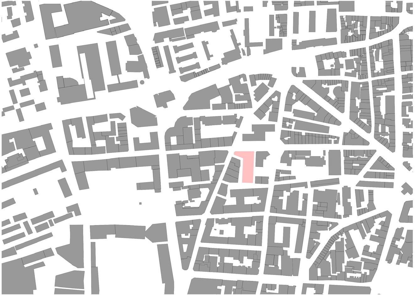
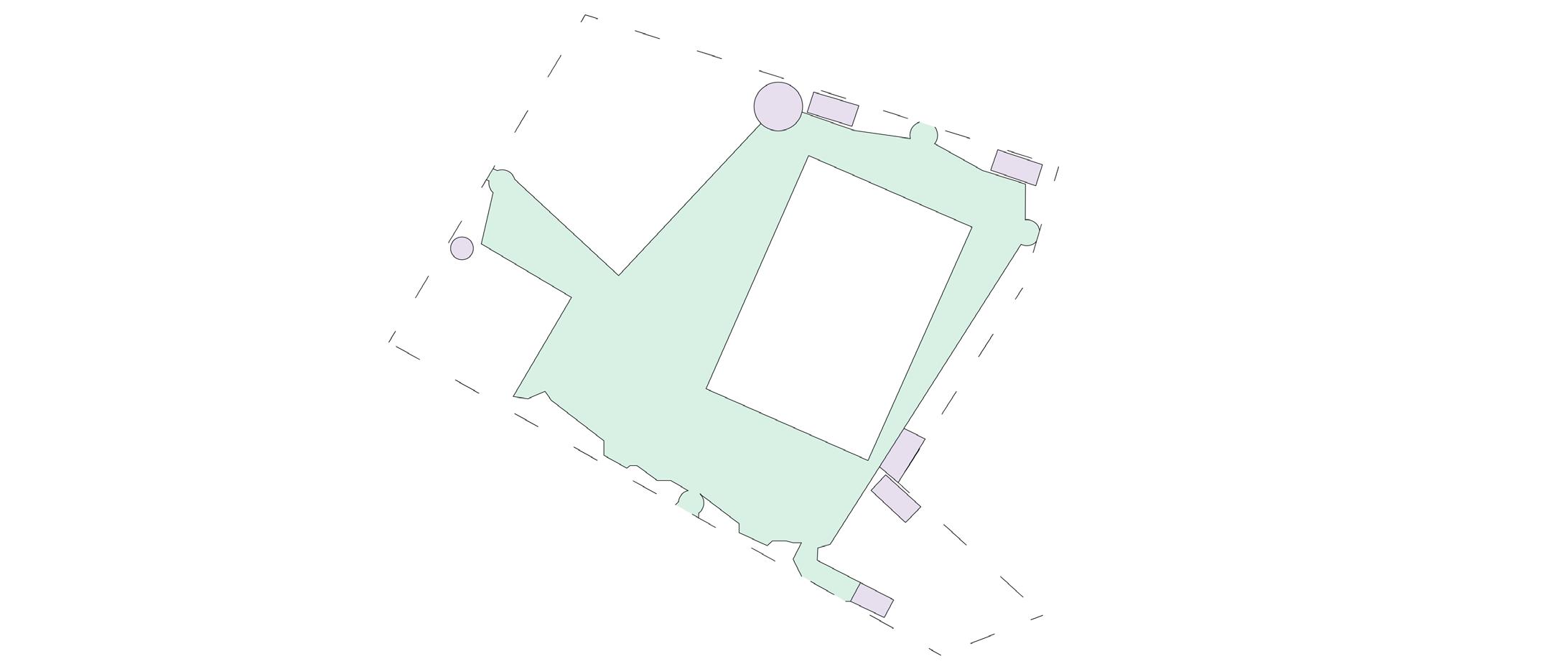
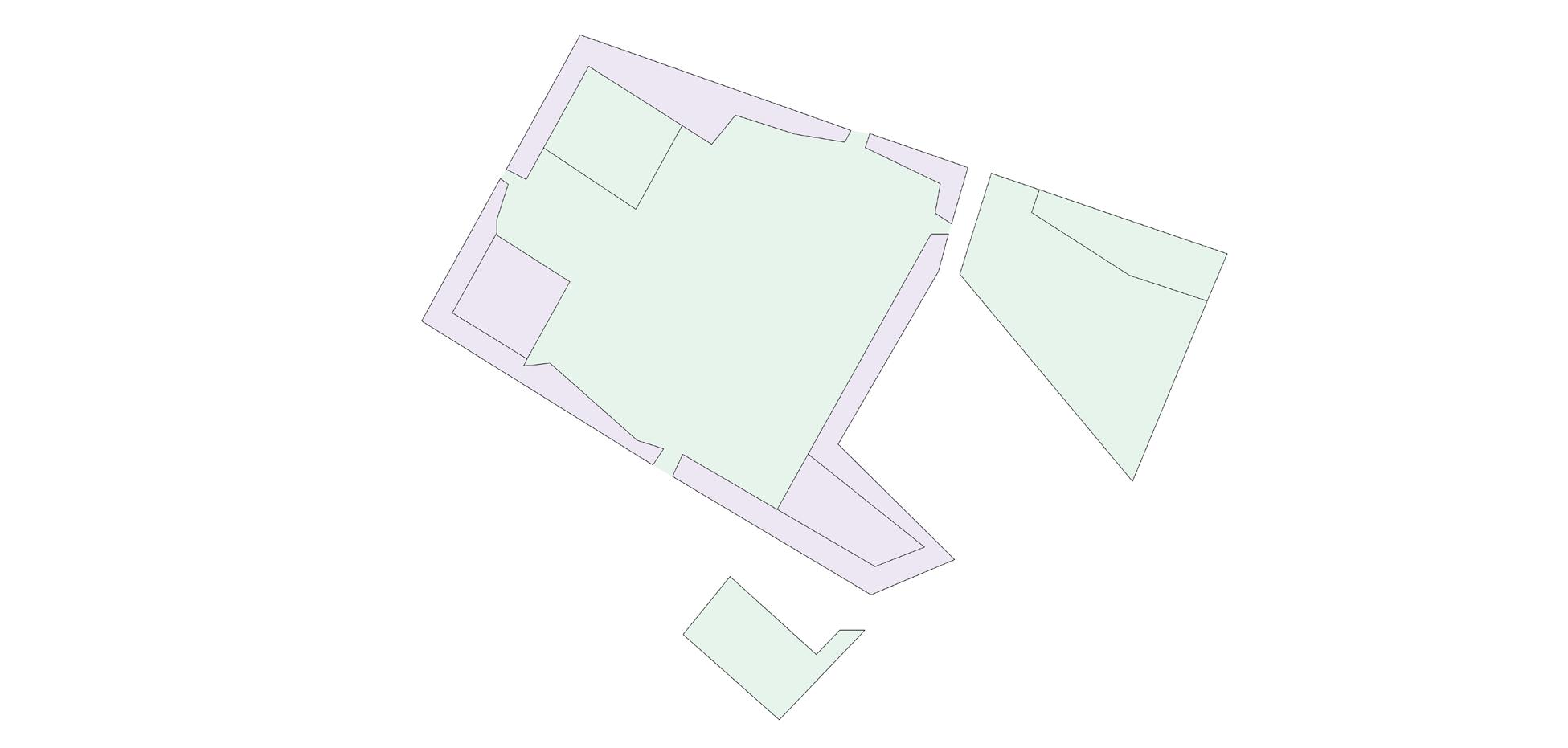
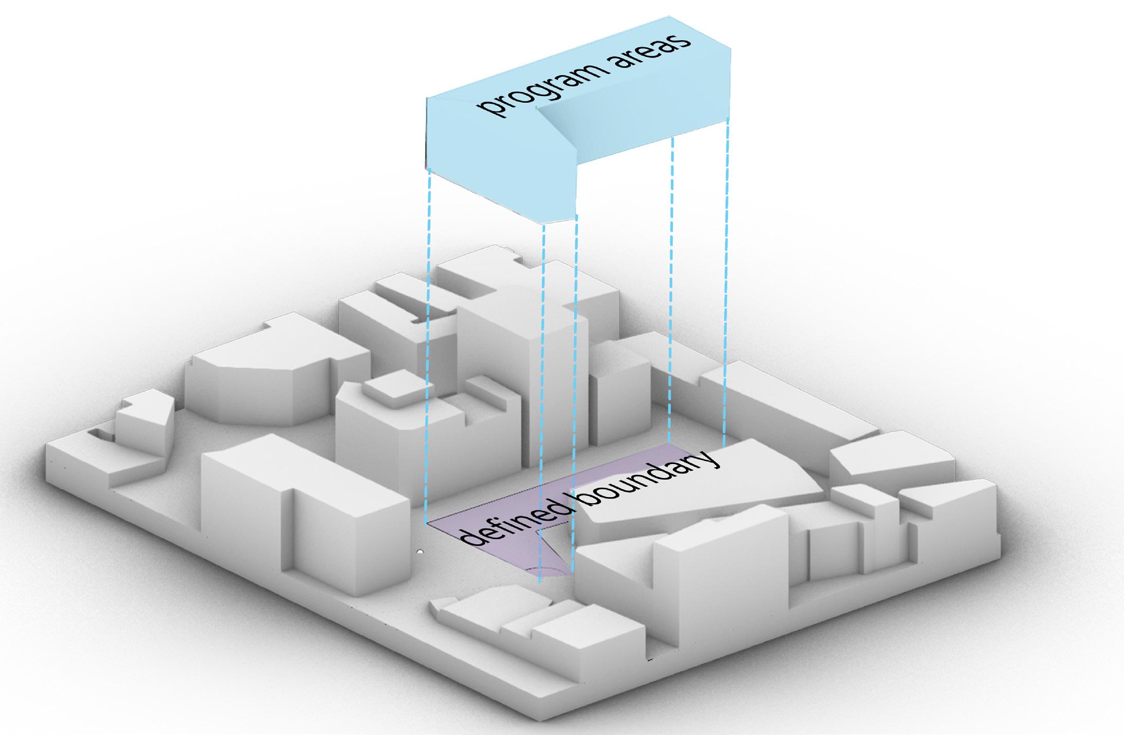
The site itself is an irregular shape with areas disconnected in elevation from its surrounding context. In efforts to respond to the context, climate, and urban history while simultaneously introducing a variety of building programs, this studio tested two compositional strategies on the given site. The first strategy tested the courtyard type, exploring the various ways the courtyard could organize spaces and promote the interactions of program. The second compositional strategy tested both the fragmented type and the compact type, experimenting with the relationships between primary and secondary program areas and analyzing the effects of those relationships on the building composition as a whole.
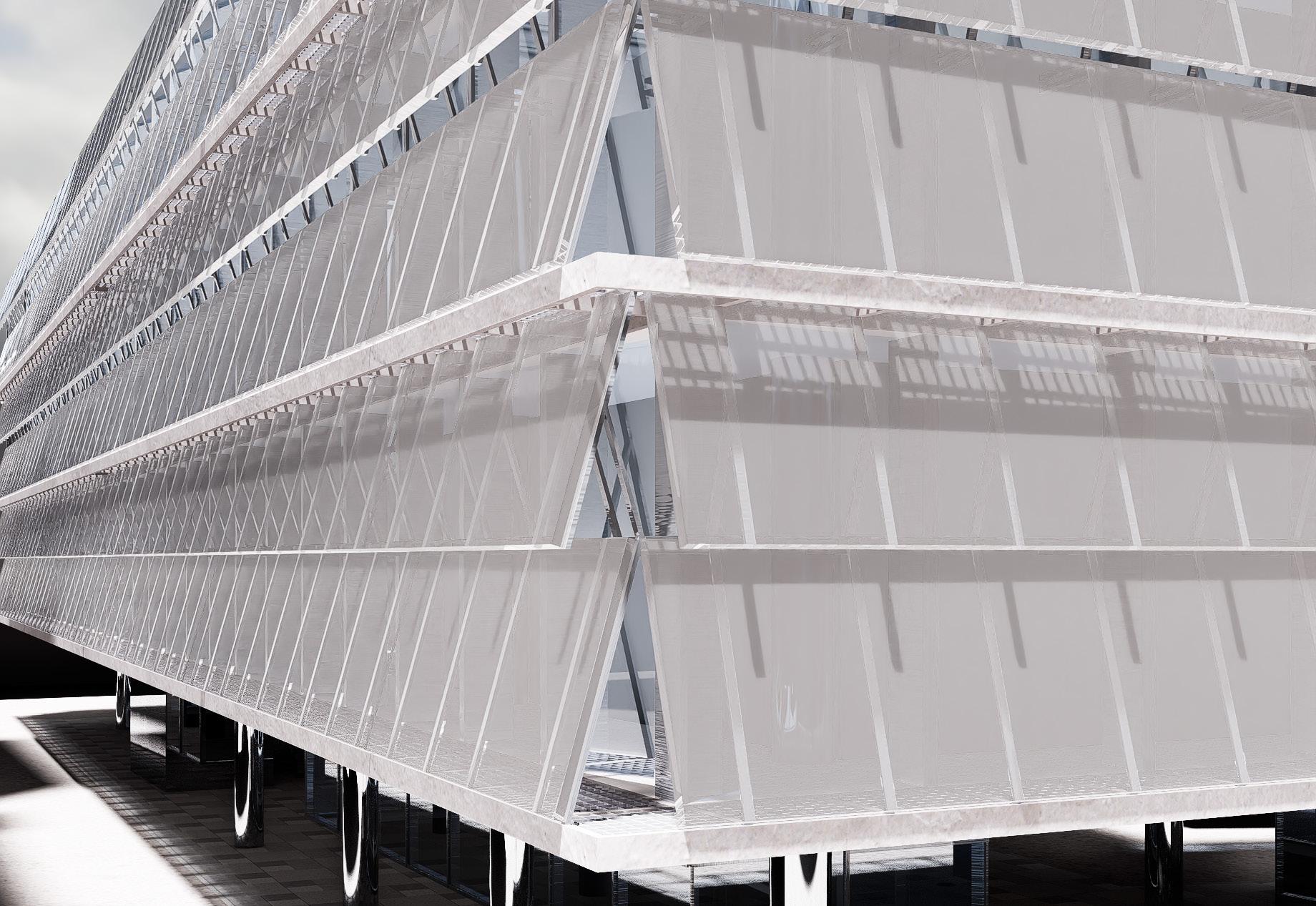
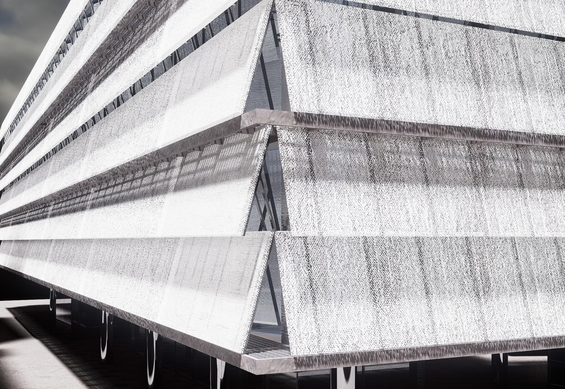
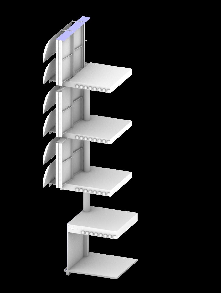
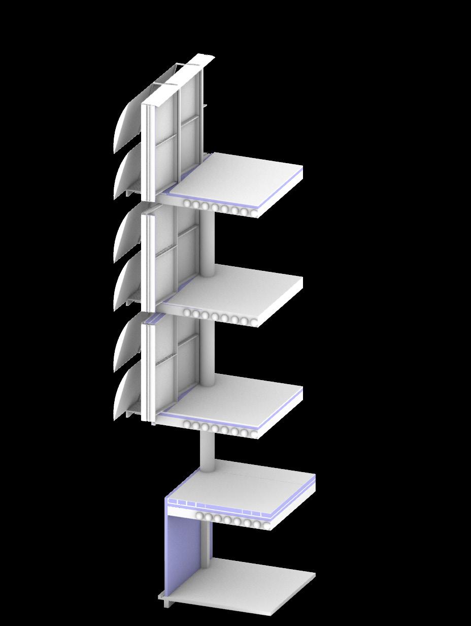
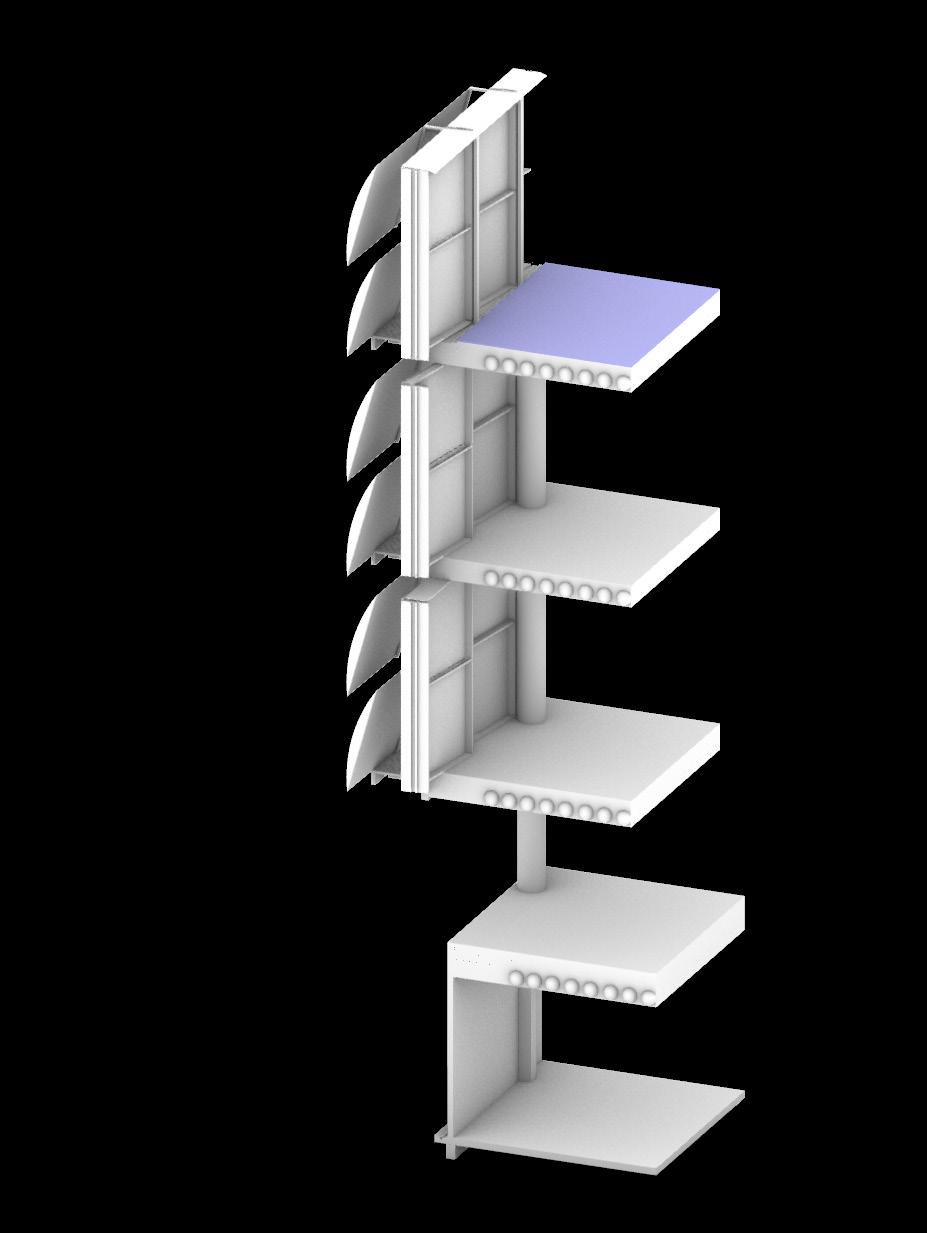
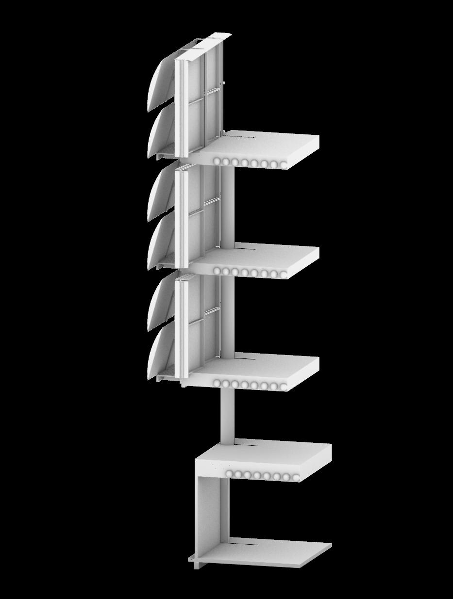
Once both compositional strategies were tested, one was picked to be further developed, which included a deeper study into the building’s facade and envelope in 2D and 3D. The 2D study addressed concerns such as structural capabilities, precise building assembly, and implications of material choice. The 3D Study worked in conjunction with the 2D study, while also serving as a tool for understanding how each element of the assembly, such as the insulating components or the moisture barriers, works within the envelope.
TABLE OF CONTENT:
A1_RESEARCH
A2_COMPOSITIONAL EXERCISE 1
A3_COMPOSITIONAL EXERCISE 2
A4_FINAL PROJECT
A1
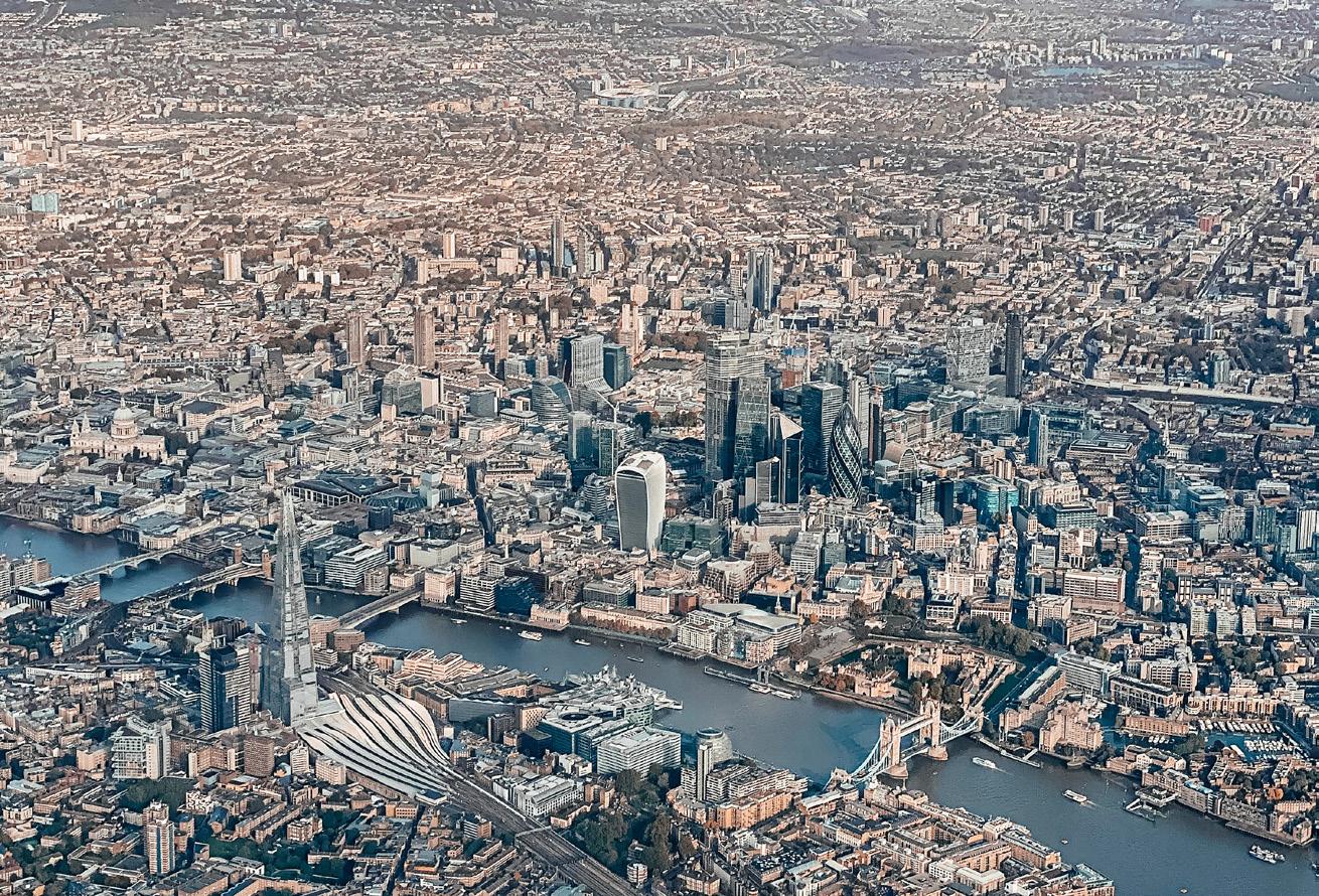
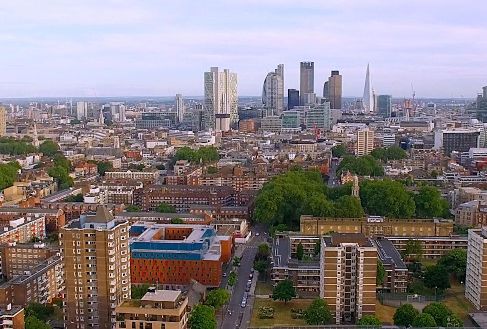
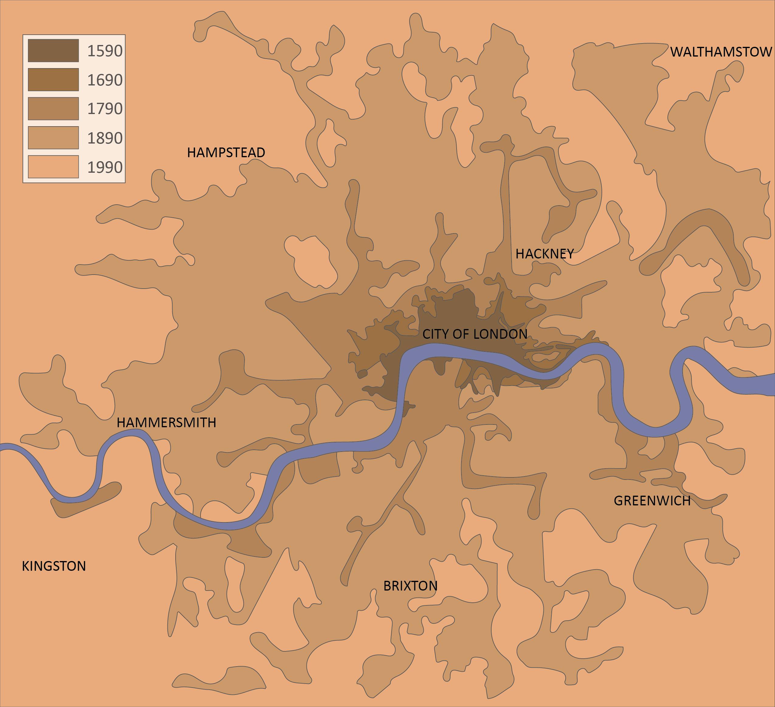
As London, England, grew, it expanded outward, growing from its medieval roots and developing along the Thames River. London experienced its most significant period of growth between 1660 and 1720. The city’s increasing importance to international trade sparked rapid urban development and population growth. The population of London increased from 120,000 in 1500 to 650,000 in 1700. As the population increased, the city could no longer function as a system of wooden buildings enclosed with walls. Large imports of brick and stone, materials that quickly became abundant resources and thus a more favorable option than wood, allowed for a large metropolis to develop and expand without the restrictions of walls. Without barriers, streets became larger and spaces for leisure could be included and promoted within the urban fabric. By 1730, London was a city of tightly-packed buildings and a dense configuration of theaters, parks, churches, and coffee houses.
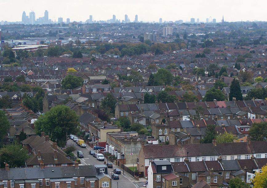
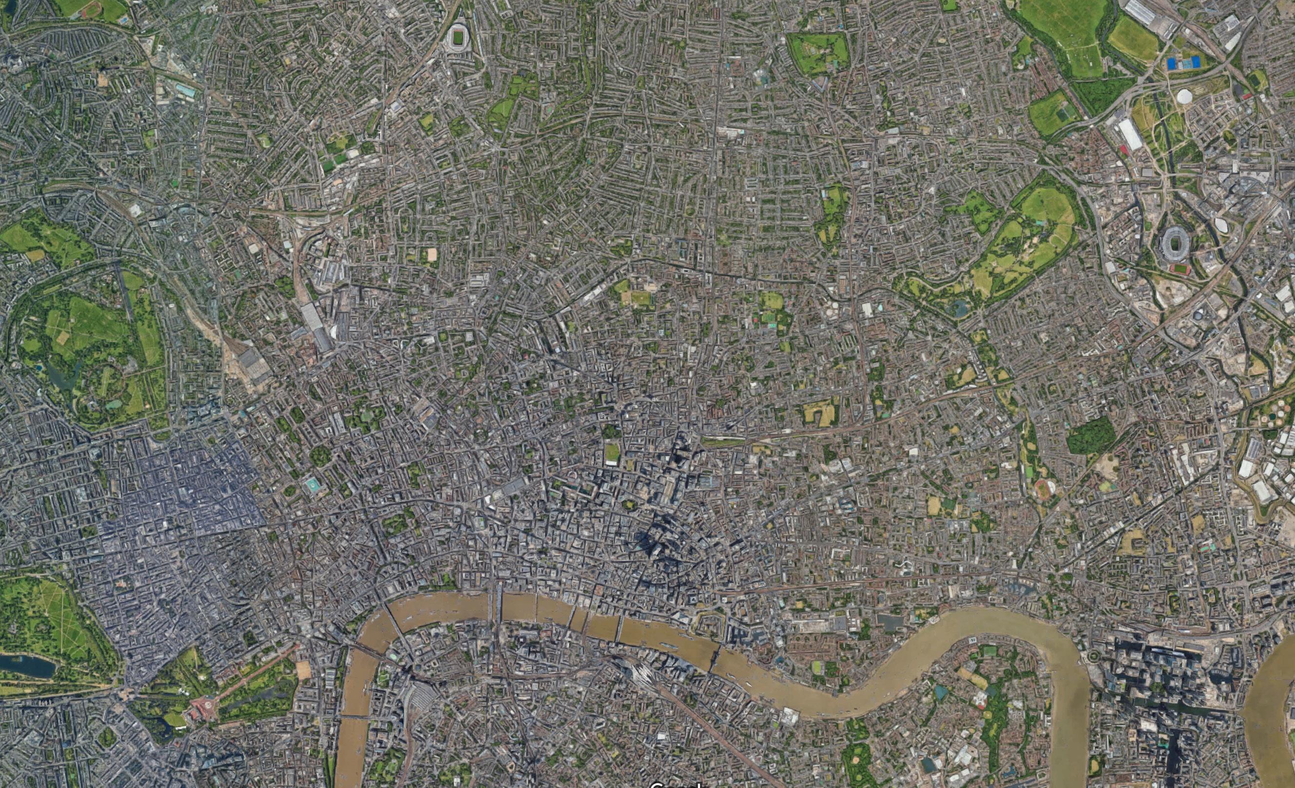
London is at its most dense surrounding the River Thames, where in the early 16th century, the city began its historical growth. Contemporarily at its central areas, London has neighborhoods that are more dense than 100,000 people per square kilometer, which translates to about 160,000 people per square mile. As you move further from the central boroughs, the city gets less dense and more rural or industrial.
Much of England is notorious for being cloudy and rainy; London isn’t terribly different. London is considered a mild temperate climate, which maintains a variety of humidty levels and relatively substantial temperature fluctuations throughout the year and the changing seasons. Yes, London has seasons!
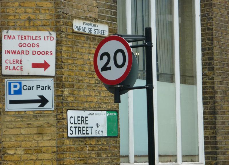
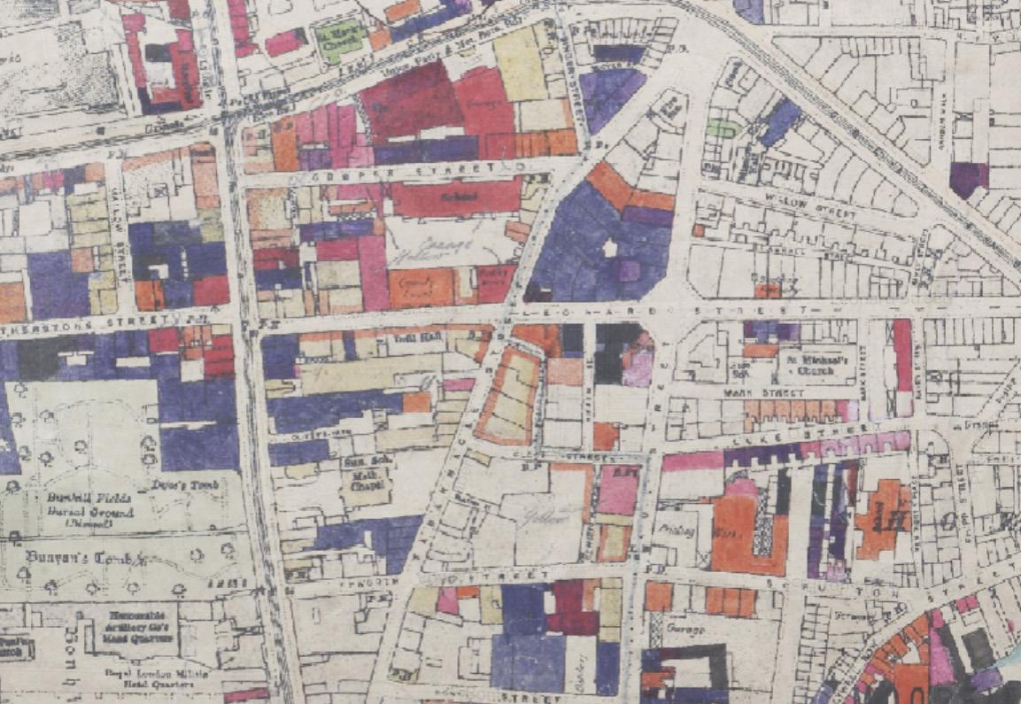
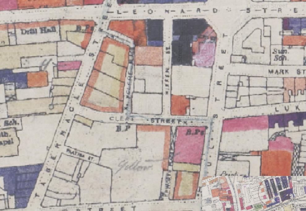
Hackney
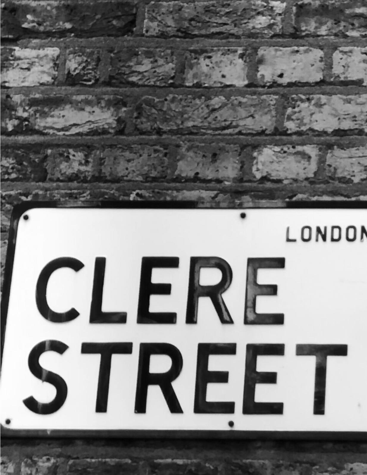
Clere Street
City of London
Ealing Enfield
Bromley
Barnet
THE CITY TODAY
Historical evolution of the city:
The growth of London, England, over time is typically categorized into four periods, which are the Early Modern Period, the Industrial Revolution, the Victorian Era, and Modernization. The Early Modern Period refers to the period of early development between the 16th and 18th Centuries, ranging from the beginning of the expansion outside its medieval core to when it began to develop sophisticated infrastructure, such as bridges and roads. During this period, the Great Fire of 1666 occurred, resulting in a change in building regulation and material choices, as well as wider streets. The Industrial Revolution occurred in the 18th and 19th Centuries, during which manufacturing industries flourished and new infrastructure, such as railways and canals, were developed.
Although beneficial for industry, the Industrial Revolution was significantly harmful to London’s population, resulting in overcrowding, poor living conditions, and the development of slums. Following the Industrial Revolution, the 19th Century Victorian Era aimed to reconcile the problems caused by industrialization. Reform efforts included the creation of public parks, development of sewage systems, and social housing initiatives, all of which attempted to address public health concerns.
During the 19th Century, the British Empire gained global significance, wealth, and power, which led to the creation of buildings constructed to represent the success and superiority of England. 20th Century London’s Modernization period resulted in the decentralization of London, prompted by the suburban sprawl and commuter access to the city by railway. The decentralization of London led to the growth of the middle class, which allowed the suburbs to sustain a less-dense, residential character than that of the city.
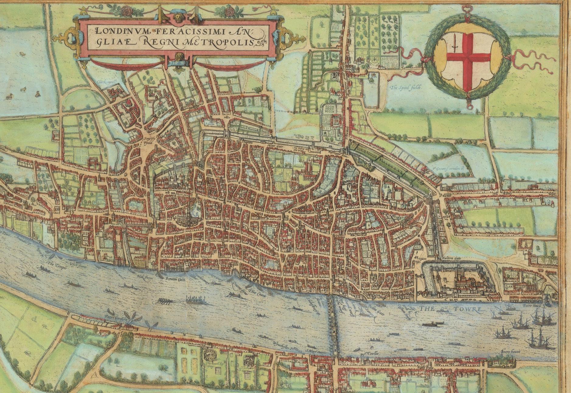
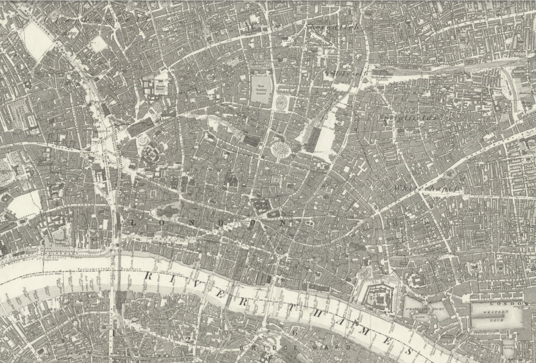
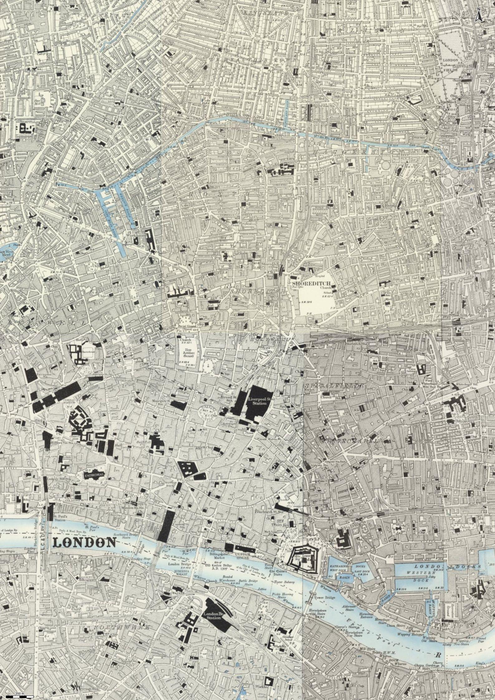
It can be seen in the maps pictured how the city changed from the late 16th century to the early 20th century. Originally organized relatively densly around the north side of the now bisecting river, towards a more decentralized organization.
Map from 1572
Map from 1850
Map from 1888-1915
Devistation and Reconstruction:
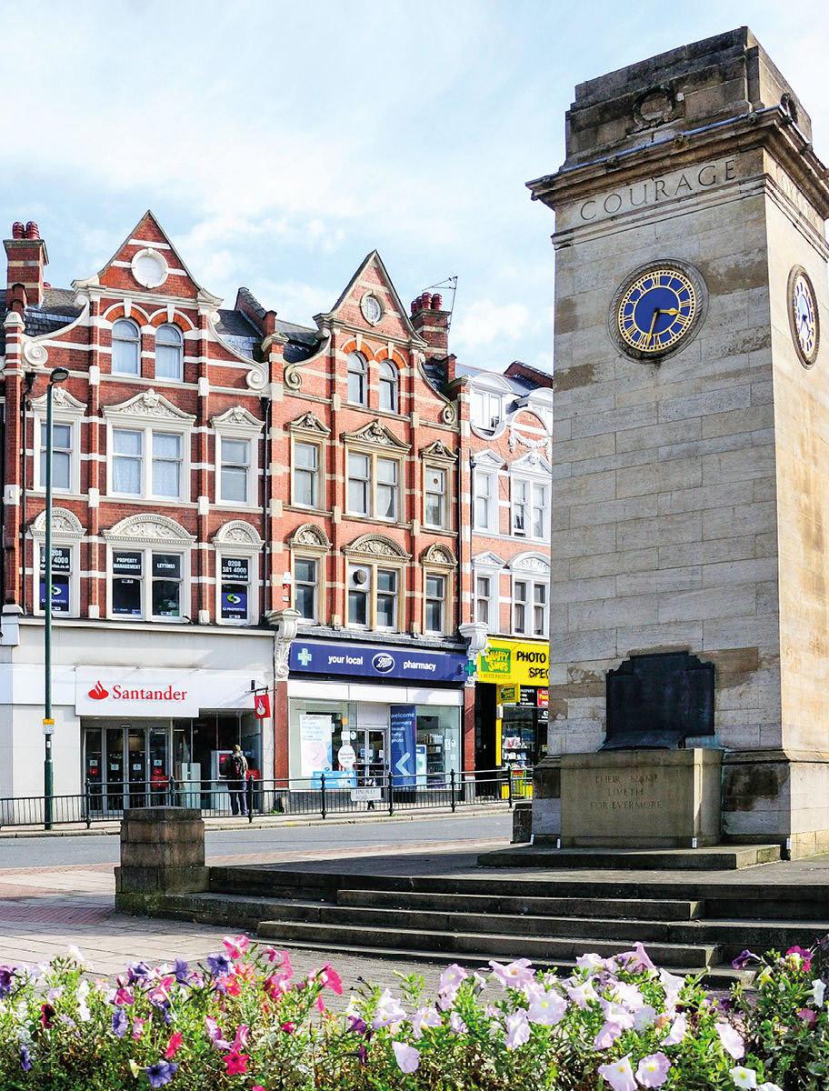
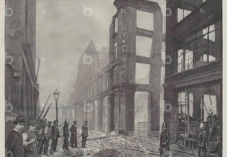
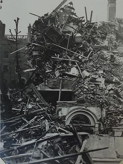
The 20th Century brought the plight of war to London, as the bombs of World War I and World War II severely damaged and destroyed much of the built environment throughout the boroughs. During WWI, London experienced localized bomb damage, which was devastating in certain areas but considered reconstructable. The loss of life in the Great War sparked the conception of memorials across the city, such as the Cenotaph by Edwin Lutyens, which became a significant gathering place for solemn remembrance. The Blitz of WWII, spanning over nearly a year, brought far more devastation and areas of total destruction than the bombings of WWI. With destruction came efforts of reconstruction and questioning of how to rebuild. Modern building technologies and new materials prompted indulgence in Modernism and Brutalism, creating a stark juxtaposition of what remained of the city’s historical urban fabric. Despite the devastation, some buildings withstood the damage from the bombings. These buildings became symbols of London’s resiliency and promoted the protection and conservation of the city’s historical buildings. Along with this newfound appreciation, Reconstruction also brought public housing initiatives in an attempt to resolve housing shortages that were amplified by wartime destruction.
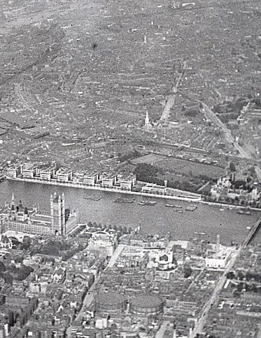
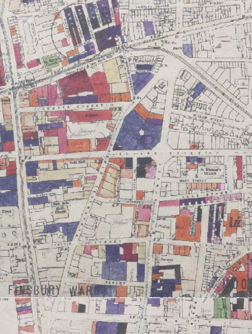
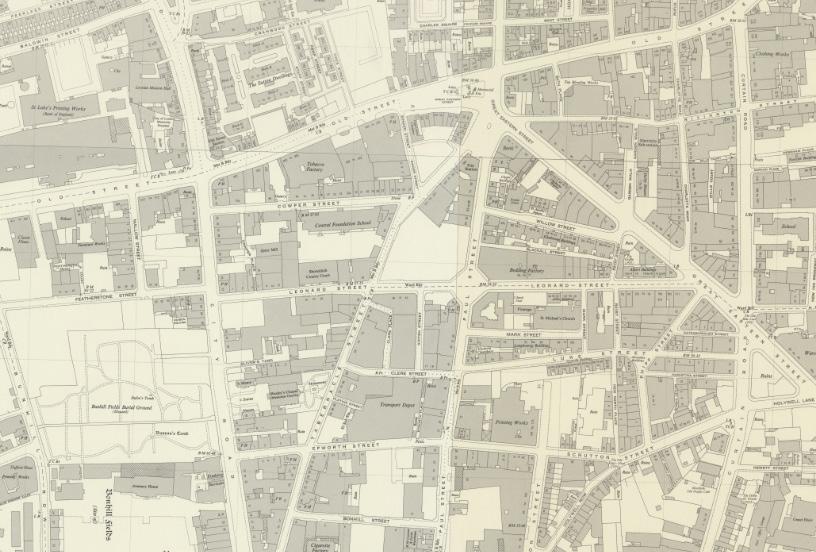
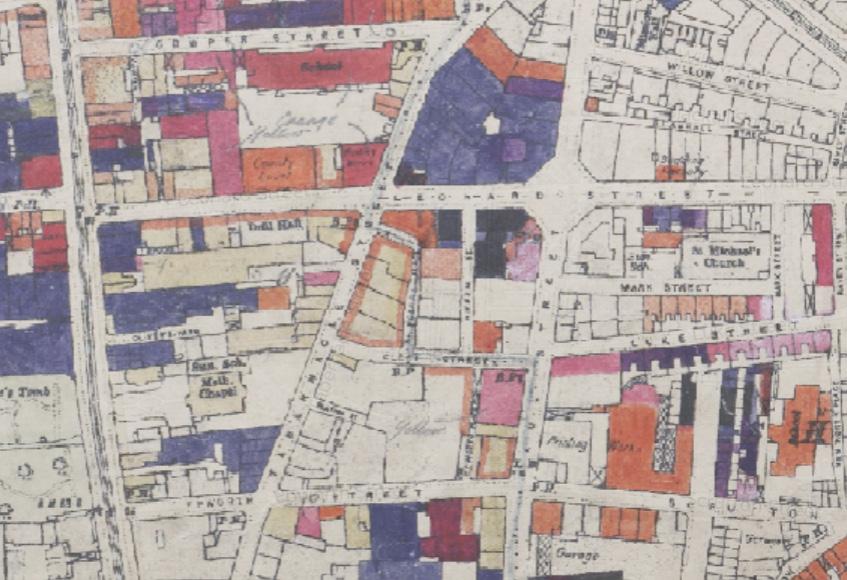
In Hackney, during the Blitz of WWII, 736 high explosive bombs and 21 parachute mines were dropped between October 1940 to June 1941. Our site and several areas within its surrounding blocks were deemed areas of total devastation and severe damage. Our site, specifically, suffered damage that has not been thoroughly addressed or repaired, despite the initiative taken on surrounding plots.
Bomb Destruction Maps
Great Fire
Newham
Chelsea Primrose Hill
Croydon
Greenwich and Westminster Camden
Neighborhoods:
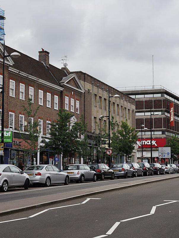
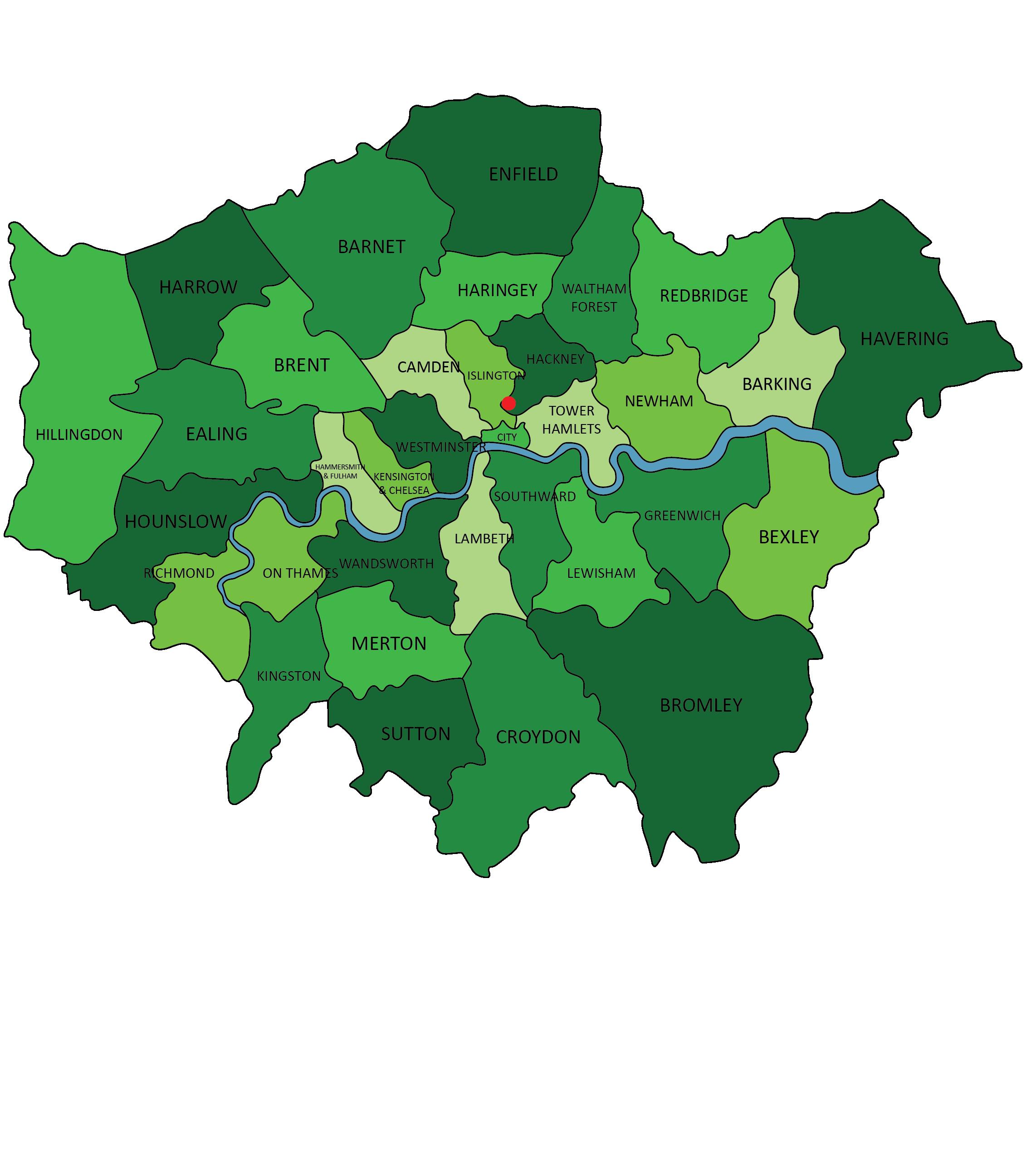
The Outer Boroughs of Bromley, Harrow, and Bexley for example, are mostly composed of residential neighborhoods, which are accompanied by supplemental infrastructure and commercial developments. The residential architecture is primarily a mixture of detached and semi-detached houses but also includes council houses, which are a government-funded housing option, and newer housing developments. The density of these neighborhoods is relatively low compared to that of the Central Boroughs, which is attracting city-dwellers seeking alternative lifestyles as the population continues to grow. The Outer Boroughs are home to high populations of families, elderly residents, and commuters.
The Inner-City Boroughs like Camden, Islington, and Tower Hamlets and others, have recognized the tension between historical architecture and modern development, and serve as areas of regeneration and historic preservation. These neighborhoods serve more diverse ethnic, socio-economic, and age group populations, which in turn promotes diversity of architectural style and building type. The demographics of the Inner-City Boroughs are also considerably more wealthy on average in comparison to the Outer Boroughs. Architecture typical of these neighborhoods includes Victorian terraces, post-war estates, converted industrial buildings, and modern developments.
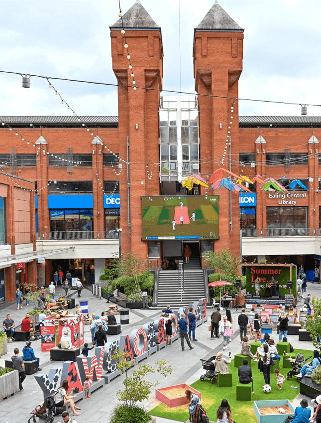
Shoreditch, located within the borough of Hackney, showcases a captivating blend of architectural styles and urban creativity. Its historic character is evident in the Georgian and Victorian buildings that line its streets, alongside remnants of its industrial past, repurposed into modern spaces like loft apartments and art galleries. The area’s vibrant street art and graffiti contribute to its unique aesthetic, while its innovative approach to adaptive reuse breathes new life into old structures. Shoreditch has become a hub for technology and creative industries, fostering the development of contemporary architectural projects that coexist harmoniously with its historical backdrop. Public spaces and placemaking initiatives enhance the community’s experience, making Shoreditch a dynamic and culturally rich destination where the past and present converge amidst a backdrop of urban creativity.
Outer Boroughs
Inner-City Boroughs
Central Boroughs
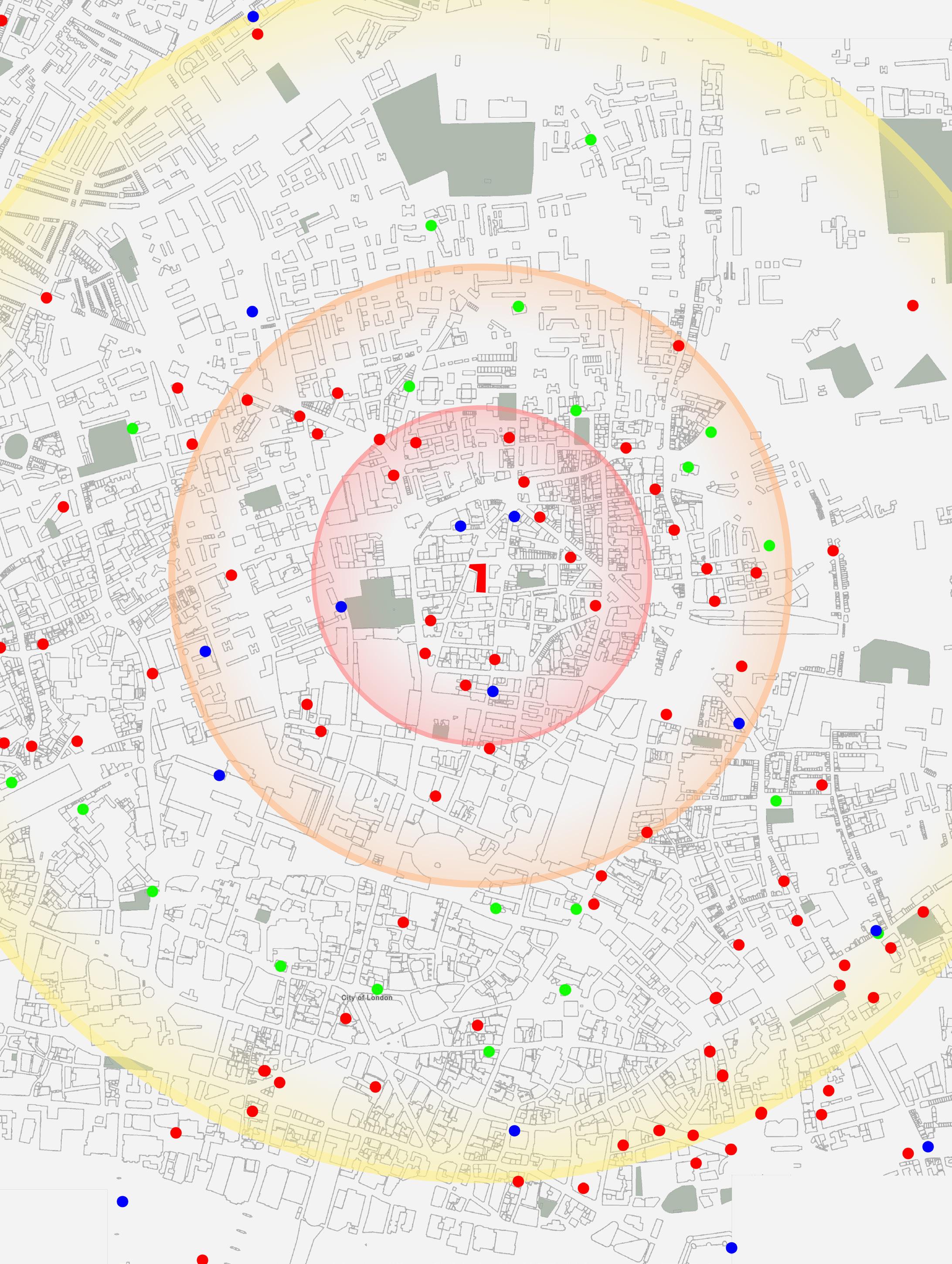
London is divided into boroughs, which are further classified by district. The site is located in the district of Hackney within the City of London borough. The City of London is part of the Inner London subgroup called the Central Activities Zone, and is near Camden, Greenwich, Hammersmith & Fulham, Islington, Kensington & Chelsea, Lambeth, Lewisham, Newham, Southwark, Tower Hamlets, Wandsworth, and Westminster.
Although close in proximity to each other, the various boroughs of London each have notable characteristics that play integral roles in the formation and continuation of their urban identity. The Central Boroughs of Westminster, Kensington and Chelsea, and the City of London are similar in their high densities with prioritization of businesses, government buildings, and cultural centers. These boroughs are characteristic of a juxtaposition between history and contemporary, serving as a home to many revered landmarks and historic buildings as well as skyscrapers. The architecture in the Central Boroughs showcases the historic Georgian and Victorian styles alongside the technological advancements of the 20th and 21st Centuries in more recent buildings. The juxtaposition creates constant tension between building new developments and preserving history.
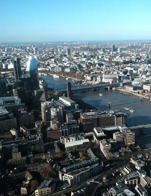
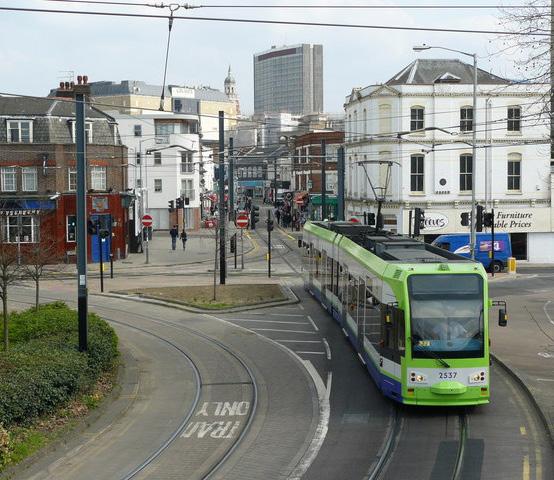
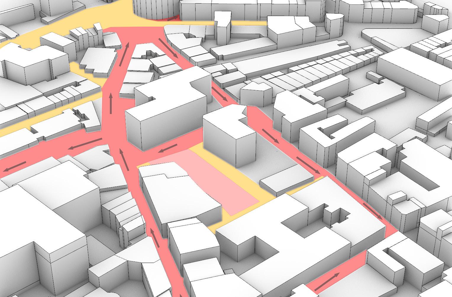
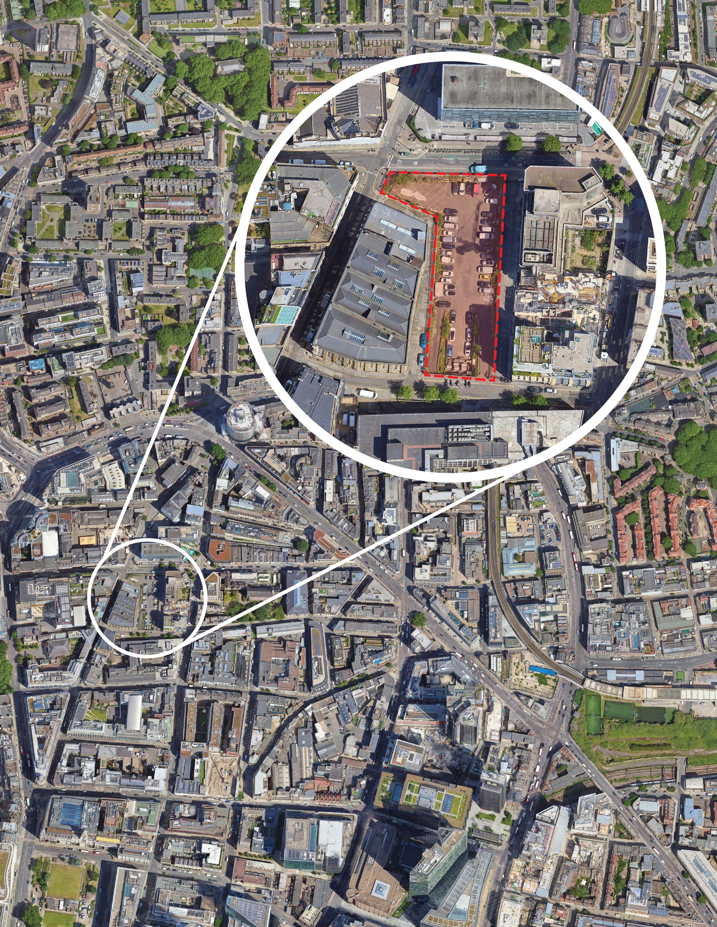
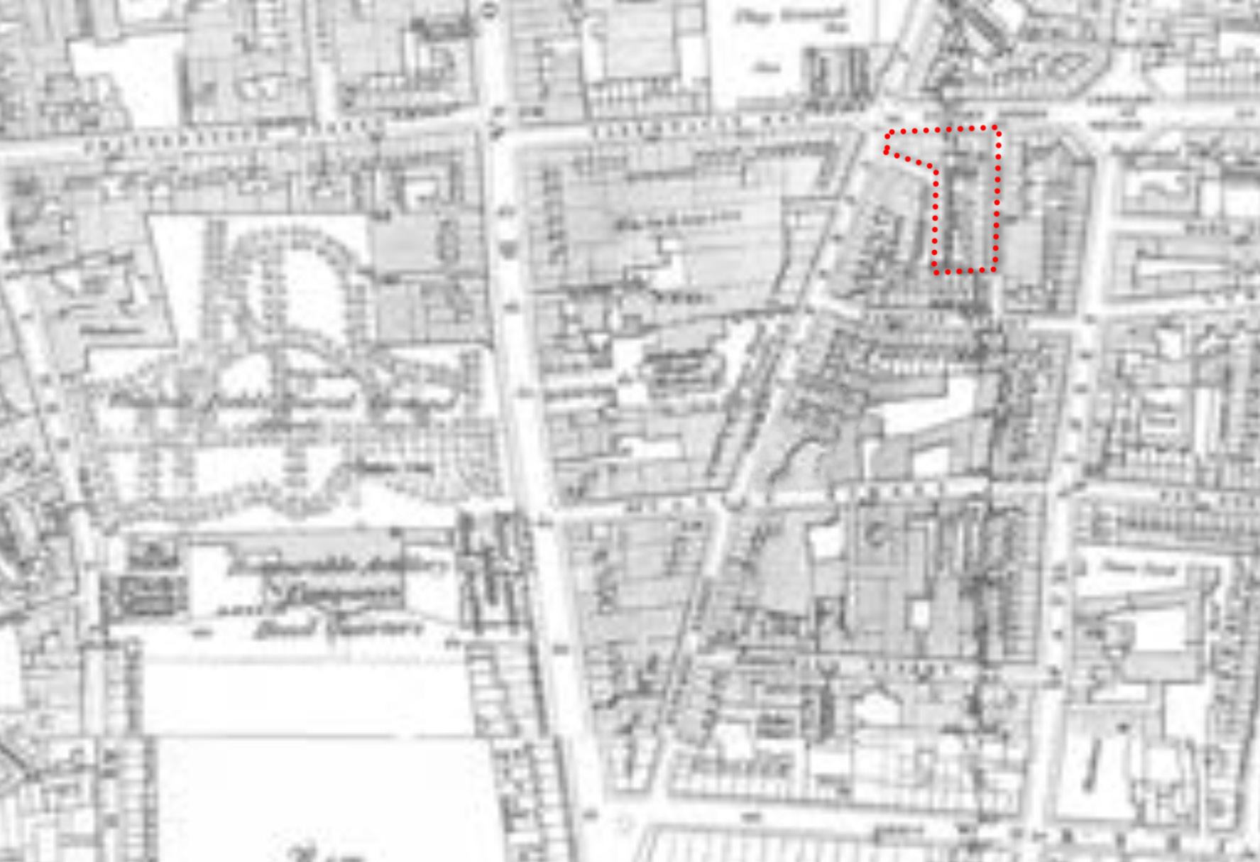
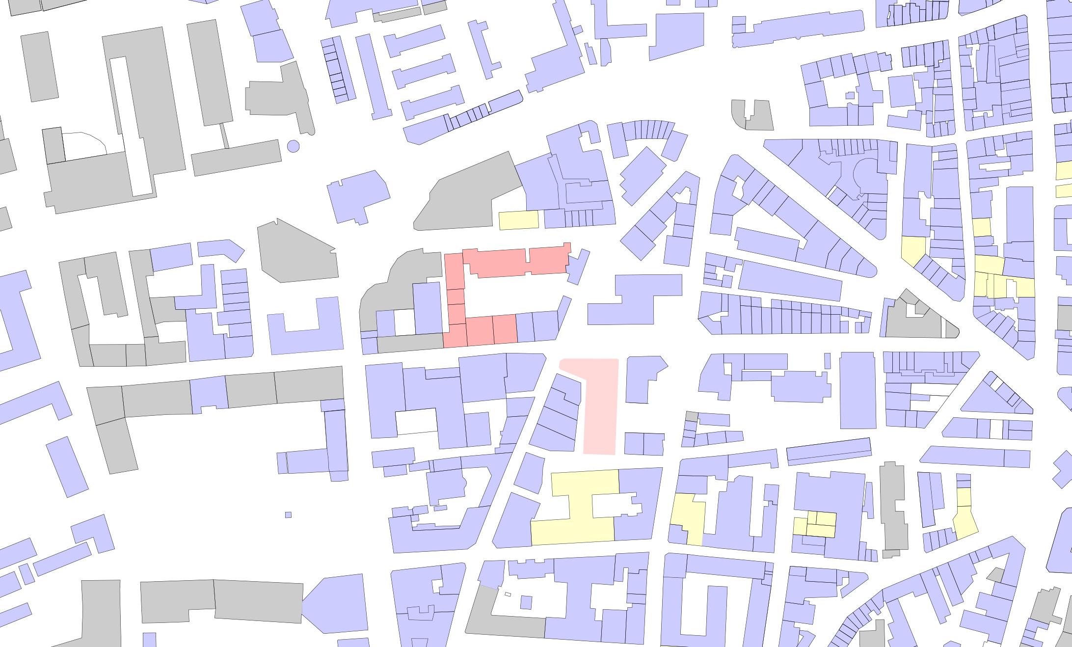
The proposed site is located in Shoreditch, which is part of the Hackney borough. It is surrounded by one-way roads, and intersected by two-way roads. There is a major road that runs through all of London about 500 feet from the site, as well as a few semi-major roads adjacent. Due to the density of the population in the area, the majority of the roads are minor side roads that help manage traffic.
London Boroughs
Site:
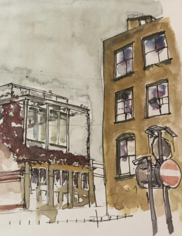
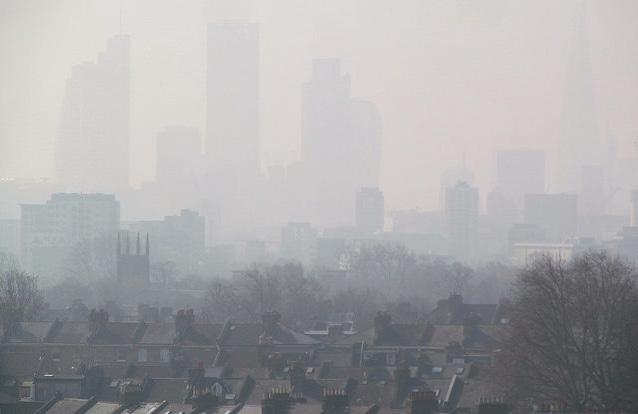
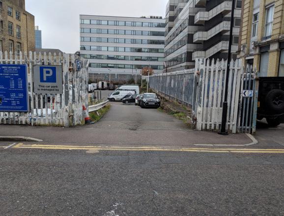
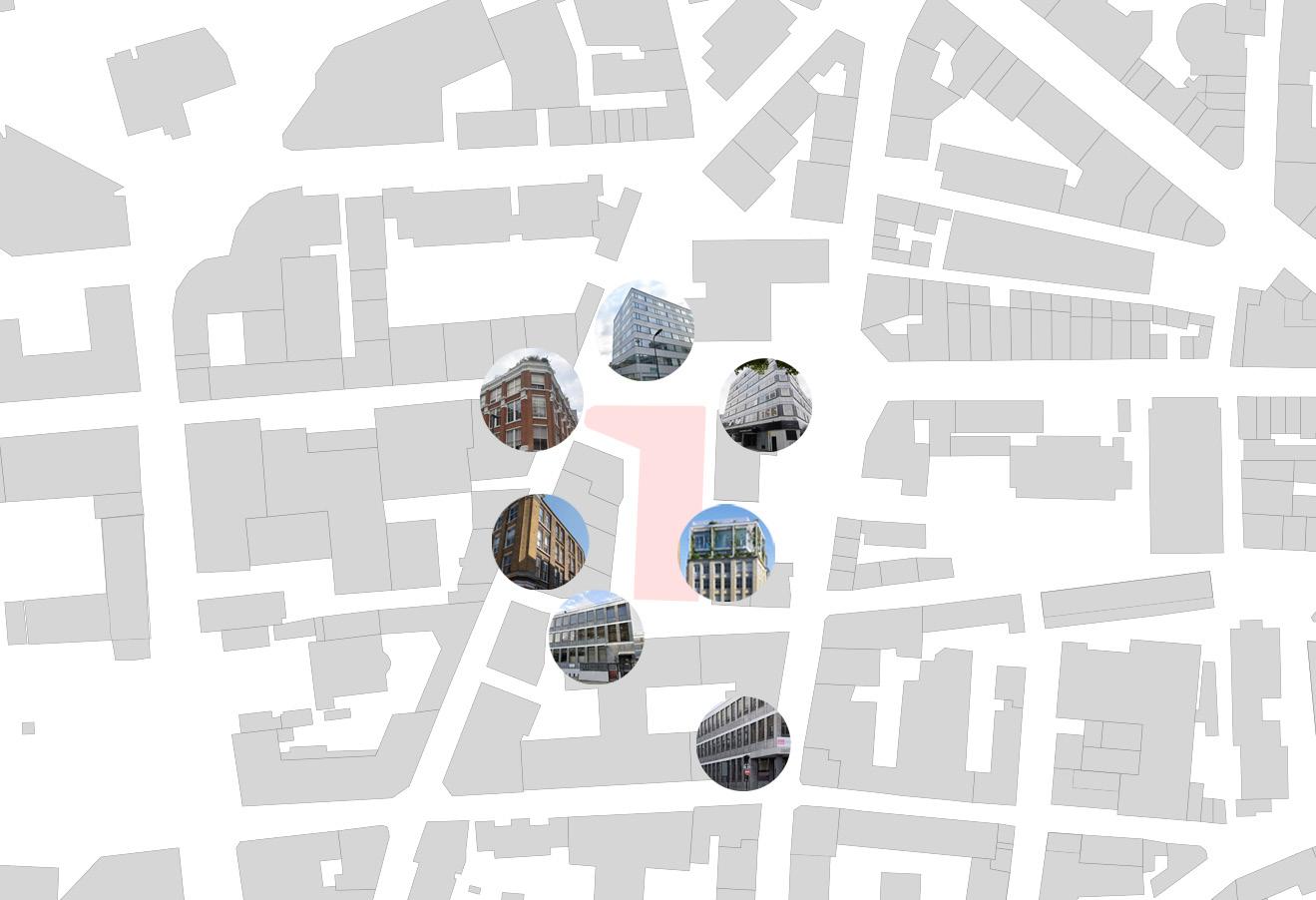
The site is located in Shoreditch, which is within the Hackney borough. The Shoreditch neighborhood is fairly wealthy compared to other neighborhoods with the primary occupations being managerial and administrative jobs. Many residents use public transport to commute to work due to the neighborhood’s proximity to public transportation access. Despite these statistics, the area of Shoreditch has a high crime rate as well as poor air quality compared to other neighborhoods, making the area difficult to reside comfortably in. Residents of the neighborhood describe conditions of gentrification and high living expenses driven by efforts to build new developments.
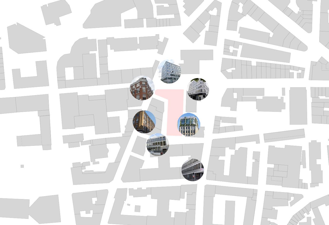
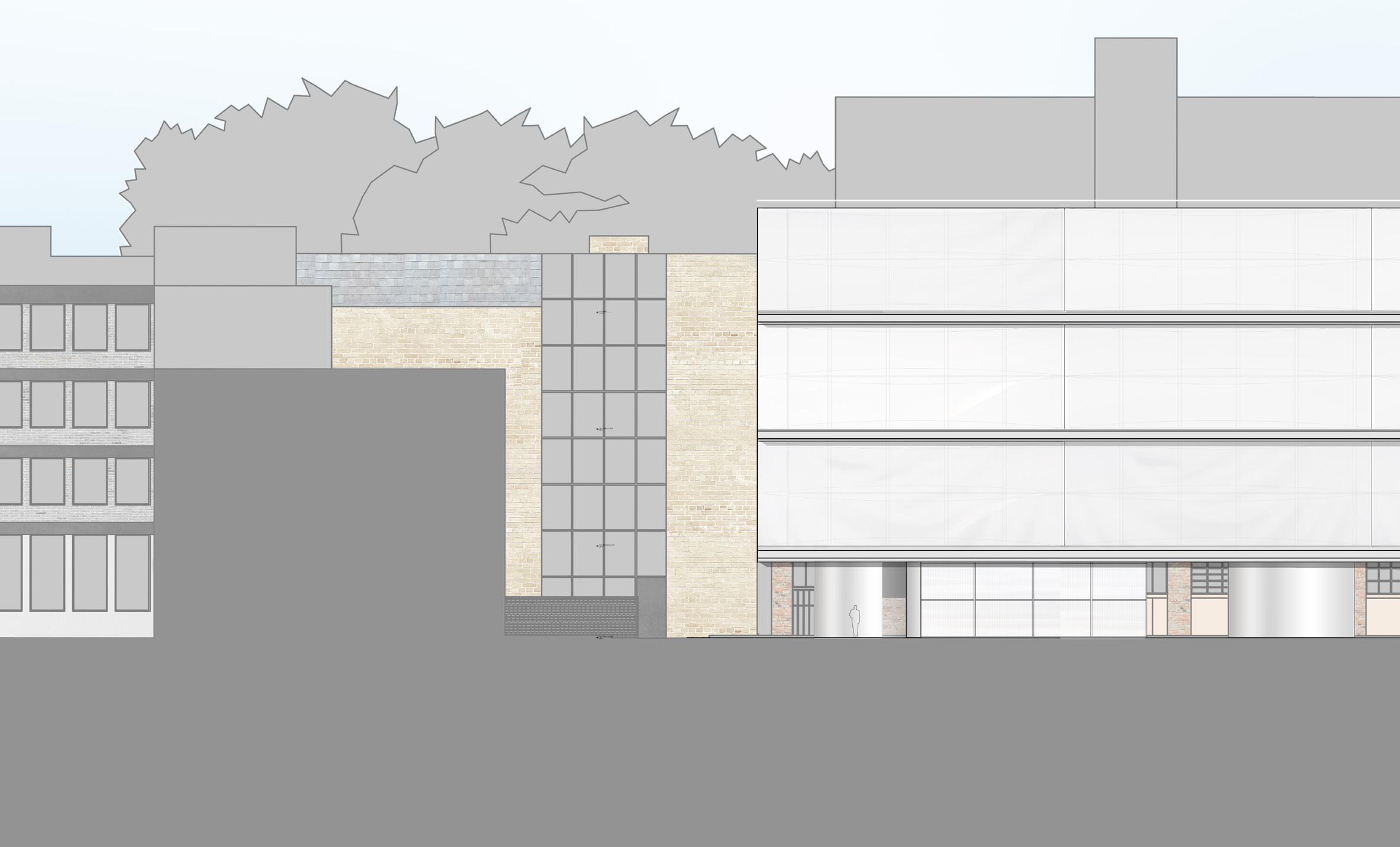
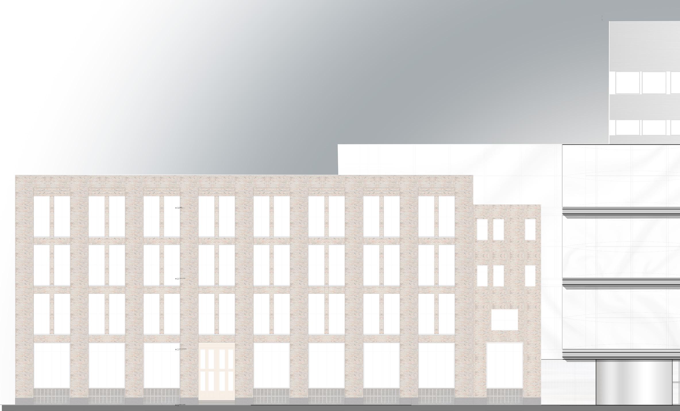
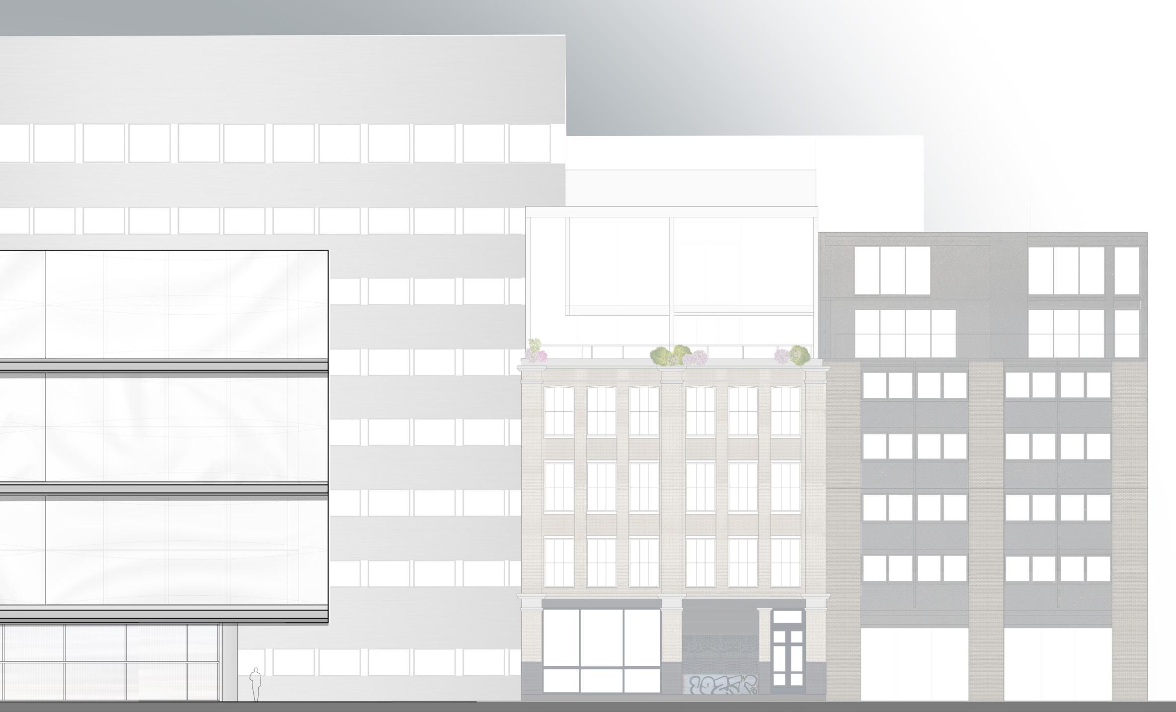
The site exits as a car park with 40 open spaces. It is described as an ideal area for parking on the northern side of the City of London, as it is in proximity to retail and restaurants, as well as universities and student facilities in the area. Surrounding the site are dense urban blocks with a diverse variety of building types and styles. The existing buildings in the surrounding blocks are a blend of modern, contemporary, late Victorian, Georgian, and Edwardian buildings, averaging five stories in height.
Because the site is sunken within its immediate surroundings, it immediately poses the issue of responding to rainwater and drainage issues. Similarly, this site is relatively small, which poses the challenge of vertical growth. Typical of the City of London, the site exists within a contextual tension between historical and modern. This tension poses the challenge of responding to both conditions, which, if successful, could possibly reconcile the architectural choices of both preservationists and modernists and thus respect the needs of both community groups.
Location within greater London
Historical evolution of the site:
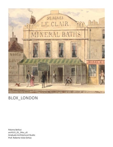
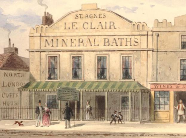
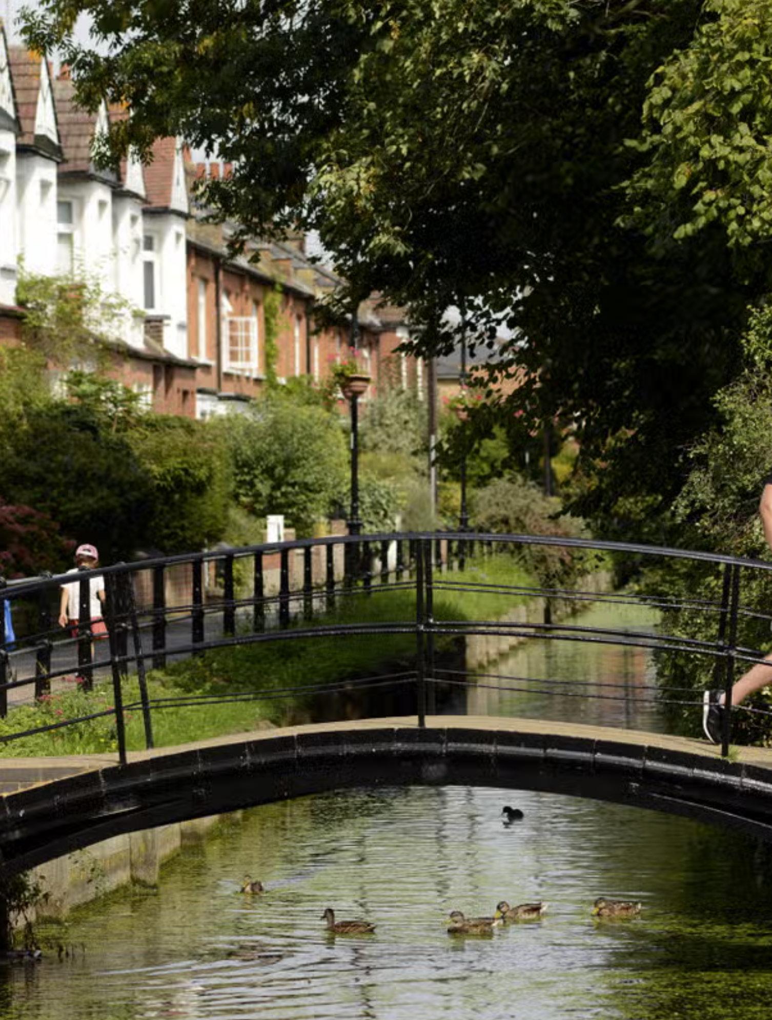
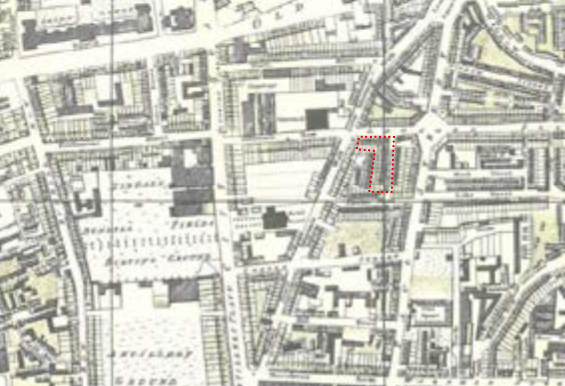
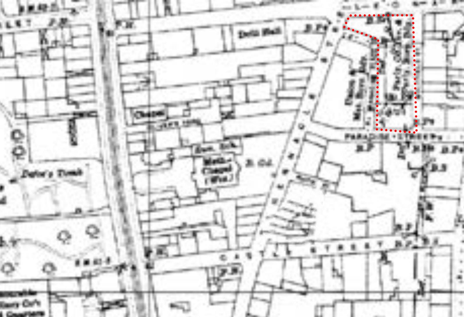
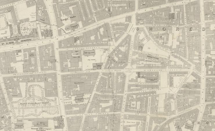
In the 16th Century, Shoreditch was an entertainment center, specifically catering to the Elizabethean Theatre. In the 21st Century, Shoreditch continues the tradition of entertainment in a less extravagant and more generic manner, housing many pubs and nightclubs. Prior to the development of the site, residents of Shoreditch congregated at the Well of St Agnes de Clere, a well believed to have medicinal powers. This gathering space was located just north of the site and served as the eventual namesake of the adjacent road. The name of this street was initially Paradise Street, changed in the 19th Century to prevent confusion with other streets of the same name.
After the 16th Century, Shoreditch was typical of London’s outward expansion trend, developing roads, buildings, and infrastructure over time. Artillery training grounds and farmland are historical testaments to Shoreditch’s working class. The 20th Century brought with it the plight of both World War I and World War II, in which London experienced a substantial amount of damage. The reconstruction of buildings and infrastructure was to be carried out in the modern style, aiming to rebuild in efforts to meet modern needs. In the late 20th Century, an influx of cultural centers and creativity incentives altered the neighborhood’s public image, creating the illusion of a posh and luxurious area. This was part of the reconstruction post world war two. Despite this regard, Shoreditch has a long and substantial history of gentrification, congestion, transportation delays, vehicular collisions, and poor air quality.
Map from 1815
Map from 1873
Map from 1916
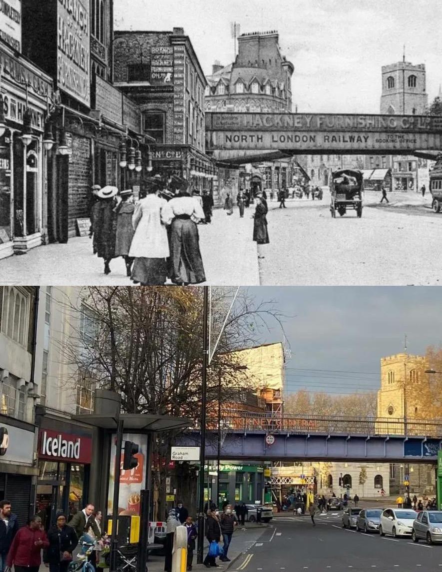
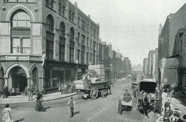
Historic Street View of Curtain Road (1896)
Site analysis:
Like many European cities, London experienced a gradual shift in architectural qualities that coincided with the cultural demands contemporary to each period of development. Early English architecture took influence from Italian precedent, a tradition of cultural inspiration that continues over time. In the 18th Century, Greek architecture became a significant inspiration for English architecture, which led to a period of decline in art and architecture, which was only exacerbated during the Napoleonic wars and the isolation of England. Lacking an architectural identity of its own after depending on styles of revival, London was confronted with modern demands, the most prominent of which was the demand for light. A new style is said to have been born in 1892, one which prioritizes light over style, scale, and architectural precedent. As a result, windows became larger and orders were treated more freely. One architectural element that withstood the test of time and modern demands was the pitched roof. Rooted in the Gothic style and used as a response to the northern climate, the English pitched roof continues to be a prominent feature among smaller-scale architecture.
Figure Ground
1/4 Mile
1/2 Mile 1 Mile
General climate:
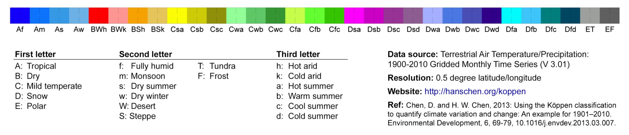
London, England, is known for its temperate and humid climate. More specifically, it is considered a Cfb climate when assigned to the Koppen Climate Classification system which works to define the different global regions through a series of climatic conditions. In this system, each letter represents a certain typology. The first letters are the most broad, as well as the most diverse; Tropical (hot and humid), Dry (arid), Snow / Polar (cold), temperate, area as a Mild Tropical (C) Fully Humid (f) area, with Warm Summers (b). The rest of the letters represent more season specific conditions for the region in question. The Koppen Climate Classification diagram for all of Earth’s climate regions is pictured to the right. Considering these conditions is incredibly important for designing architecture that functions and is comfortable for the human experience. London is in the northern hemisphere of Earth, around the midpoint between the pole and the equator. The geographical location has a direct influence on London, which experiences four seasons. The seasons come with interstitial periods of transition. Luckily, London isn’t terribly windy, but there are cold winters where it often gets cold enough to snow, and warm, humid summers that can be considerably discomforting. Generally, the spring and fall seasons are bearable, but not without careful spatial planning and design.
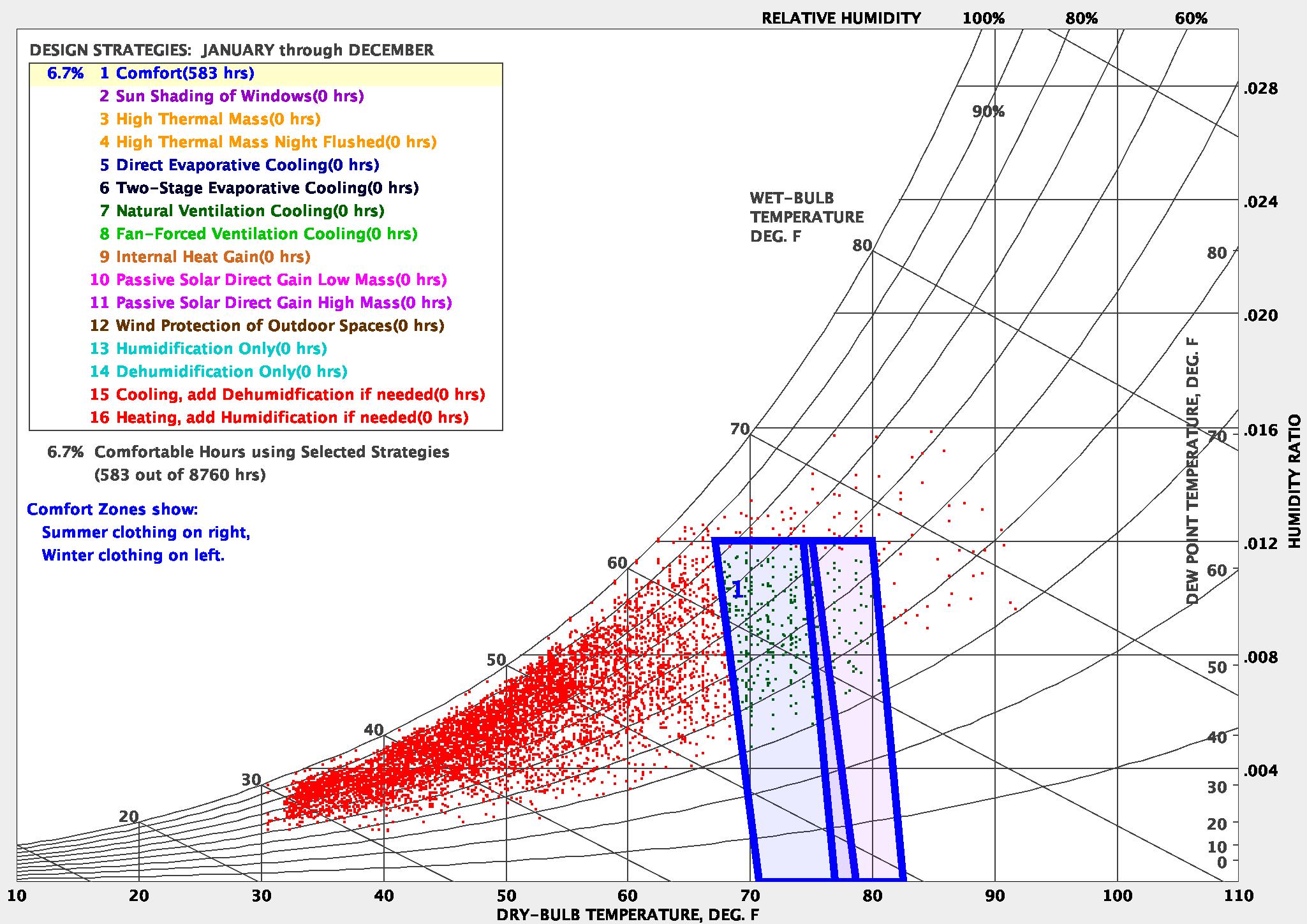
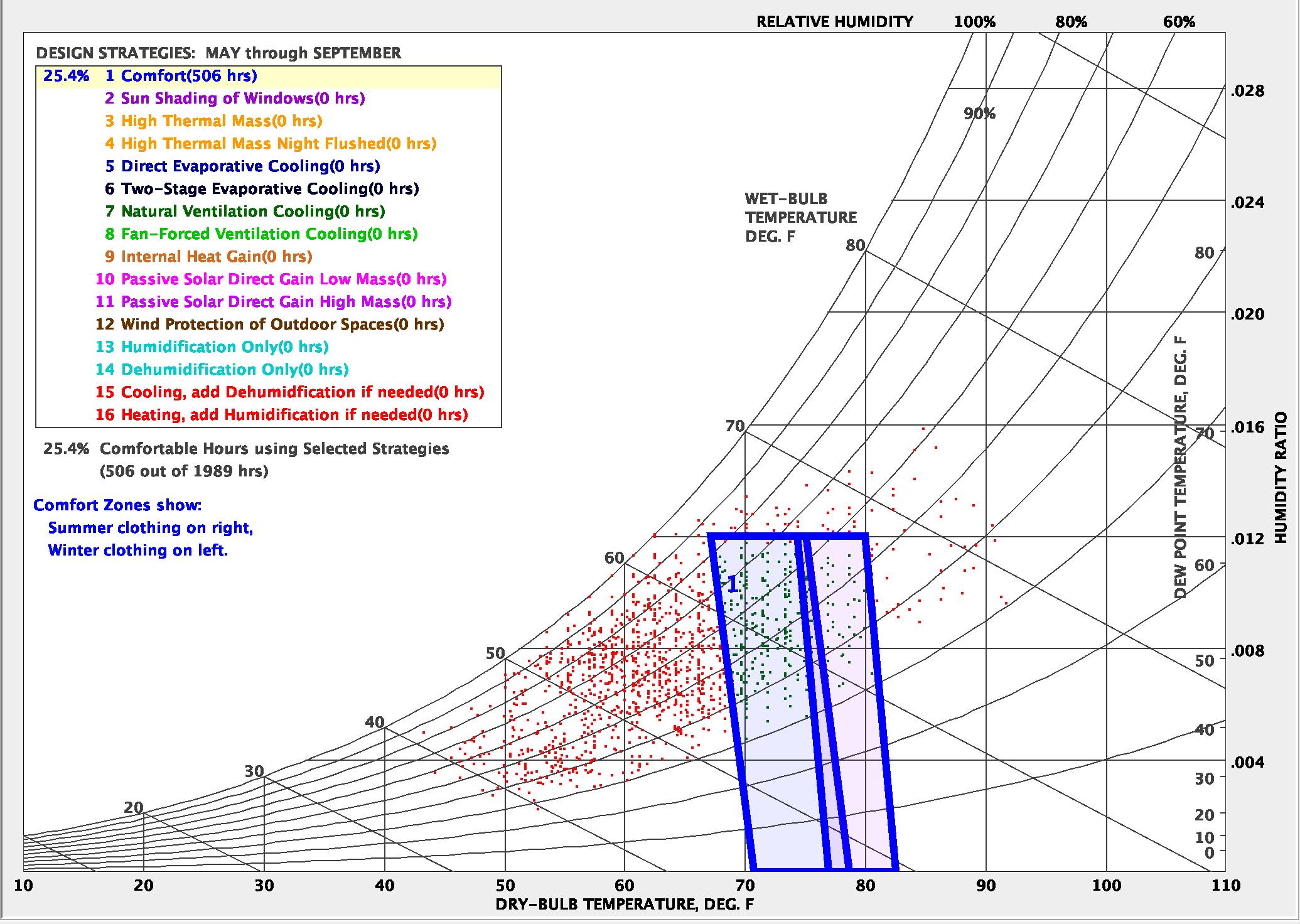
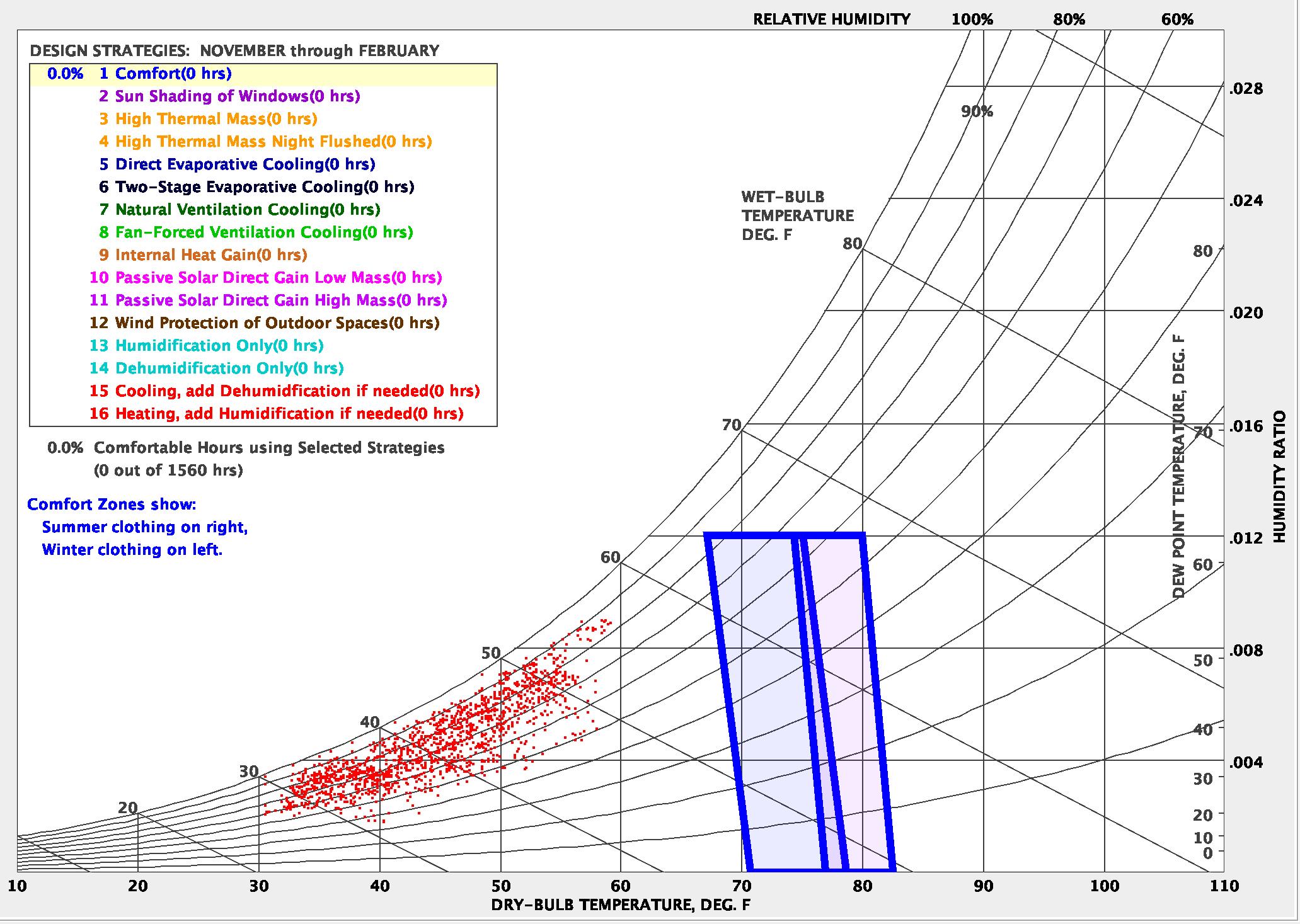
When looking at the psychrometric chart for the whole year, just under seven percent of the time people experience thermal comfort without any additional design conditions, which translates to just under 600 hours per year. This is a substantially small amount of time, but it must be considered that this takes into account all of the annual data. It can be misleading to only look at the yearly data because things like the cold of the night in the winter and the high solar radiation in the summer are not accurately accounted for and therefore skew the numbers. But it can still be recognized that there are climatic conditions in which to ignore would be a detriment to any design project.
People for all of time have been designing structures for the comfort of the human being. Whether it is a home, an apartment building, an office, a stadium, a plaza, a hut or cave, historically, climate has a huge influence on the form, function, and general thought that goes into any design that may need to accommodate the presence of a human population.
Koppen Climate Analysis
Climate information: Comfort
To generate the climate associated charts and diagrams, 2010 data was analyzed through Climate Consultant. We saw from the year long psychrometric chart that if the climate was not taken into consideration at all when designing, there would not be a lot of thermal comfort. Comparing the summer and winter operable hours can deliver a more accurate model of the climate which can help in understanding the needs of the area. It is clear that the winter has a higher need for design. The majority of the summer months contain thermally uncomfortable conditions, but the data points are much relatively close to the ideal comfort level. The winter months however, contain zero thermally comfortable conditions when there are no additional design features, and the data are further removed from the ideal comfort level. Looking at these charts reveals the importance of looking at smaller blocks of time to analyze data, because it can tell you more about how the conditions change. This is especially true for a Mild Temperate climate where there is a high level of seasonal variations.
The winter months require more attention when designing for thermal comfort. Strategies for preventing heat loss and increasing heat gain can improve these conditions drastically. Many of these strategies revolve around materiality choices as well as orientation to the sun, however it is important to keep the summer months in mind when making any of those decisions because if heat is captured and trapped in the winter, then in the summer it will be substantially more severe. More research can be done to evaluate the sun’s path in order to predict how much direct sunlight will enter a space versus how much of the sun will be blocked, casting a shadow.
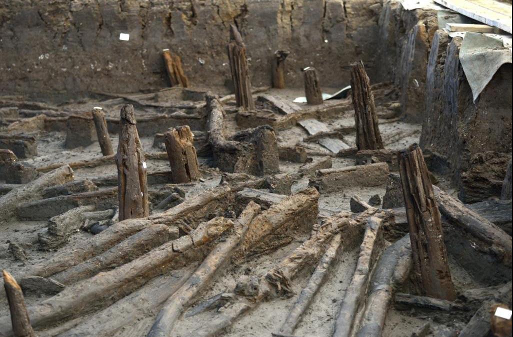
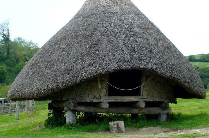
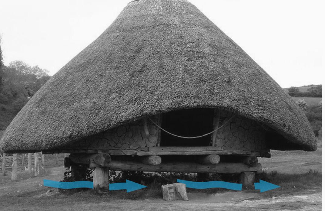
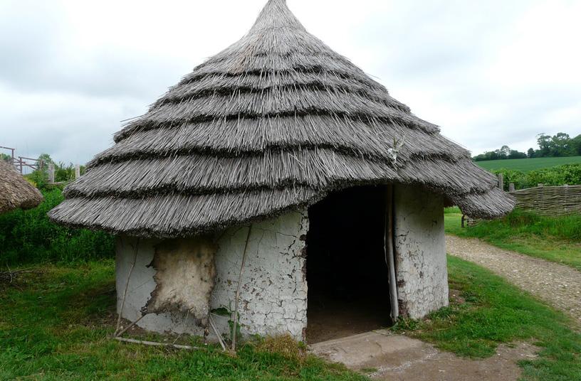
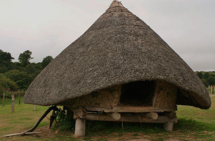
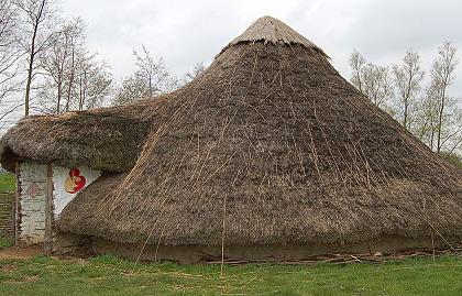
Stilthouses and elevated structures are an example of the early English architectural response to maintaining human comfort. Elevated buildings allow for less heat transfer from the ground, which helps regulate interior temperatures. This is especially significant in the winter months when there are virtually zero comfortable conditions and when maintaining heat is crucial to survival.
Stilthouses
Illustration of English Winter
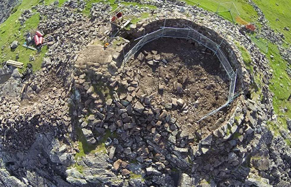
Roundhouse
Prehistoric Stilts
Summer, Operable Hours
Winter, Operable Hours
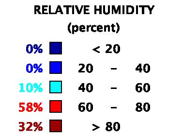
Climate information: Relative humidity
Relative humidity is an important concept to understand as a designer because it is entirely dependent on the temperature of the air. This is why psychrometric charts look exponential because 80 percent relative humidity in the winter is far less humid than 80 percent relative humidity in the summer. Humidity is about water in the atmosphere. Warm air has the capacity to hold more water because it is already considerably less dense than cool air, and the particles in the air are moving faster. There are a lot of strategies for reducing the humidity in the air that can be beneficial, and likewise, adding moisture to dry air can increase the thermal comfort in really dry conditions, but generally, warm humid air often feels warmer than warm dry air.
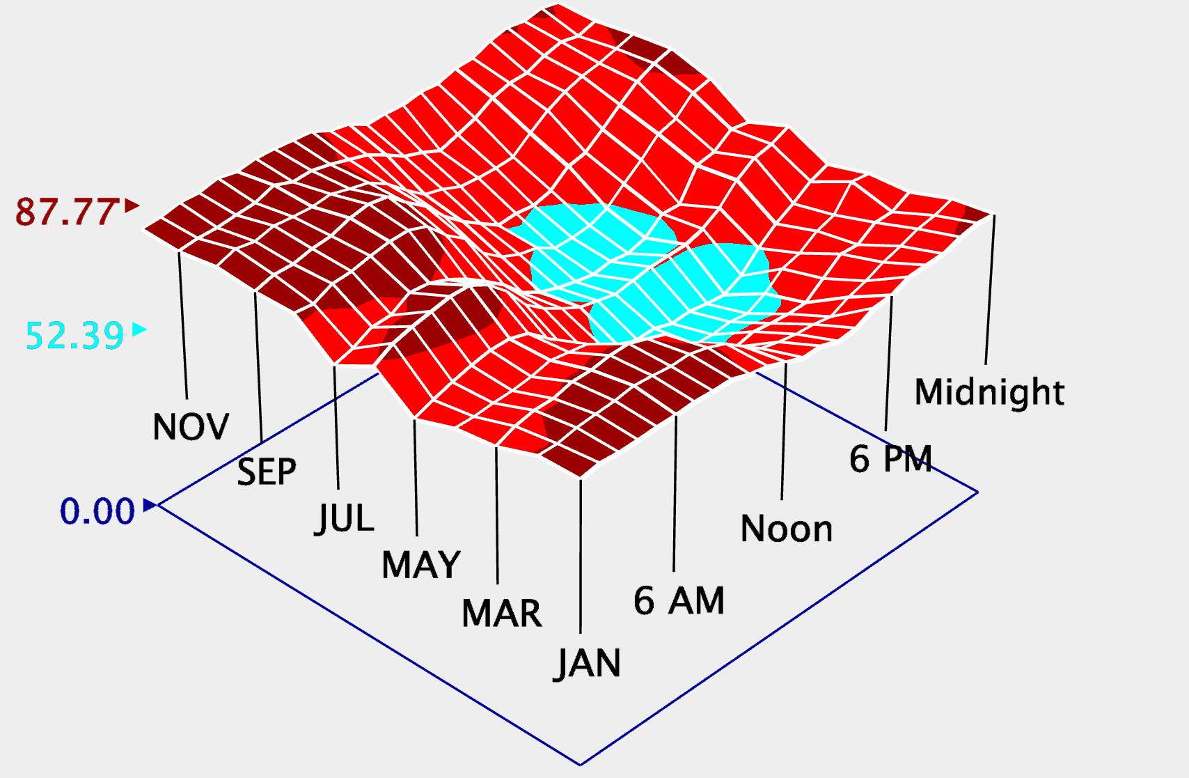
The relative humidity charts support the findings from the Koppen Climate Classification. London is most often humid, with monthly averages between 52 percent and 88 percent throughout the year. The moments with the lowest relative humidity occur around midday during March through July. This is peculiar since warmer air is able to hold more moisture. Relatively though, if the moisture levels in the air are somewhat consistent throughout the years and months, then as the air cools, the relative humidity will increase. This is exactly what we are seeing from this data. Not only do the winter months maintain a higher relative humidity average, but the mornings and nights also contain a higher relative humidity average. In other words, we
can deduce that the moisture levels in the air remain semi-consistent because of the inverse relationship between temperature and relative humidity. As temperature increases, relative humidity decreases. When looking at the daily averages, it is clear that the humidity levels are more consistent than they let on in the monthly chart. In terms of design, humidity might not be a top priority.
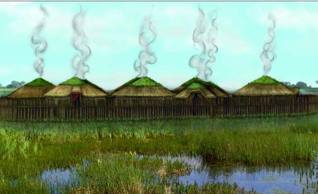
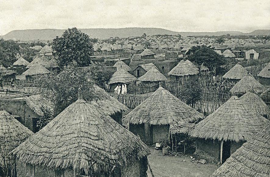
Because the air is usually quite saturated in London, there is a need for resilient materials. Thatching materials, such as reed or straw, which have a natural resistance to moisture, were typically used in prehistoric English buildings as a roofing structure. The practice of lighting fires within homes were a common way of mitigating the rotting, due to high relative humidity levels, of these roofs, as the fires helped dry the thatching. Elevating structures was another response to relative humidity concerns. Elevating would allow the structures to be subject to less moisture infiltration from the soil, as well as promoting a better airflow beneath the structure, aiding in natural ventilation and moisture dissipation.
Hearth within Roundhousde
Thatched Roofs
Ventilation beneath Elevated Roundhouse
Roof Thatching
Climate information: Solar radiation
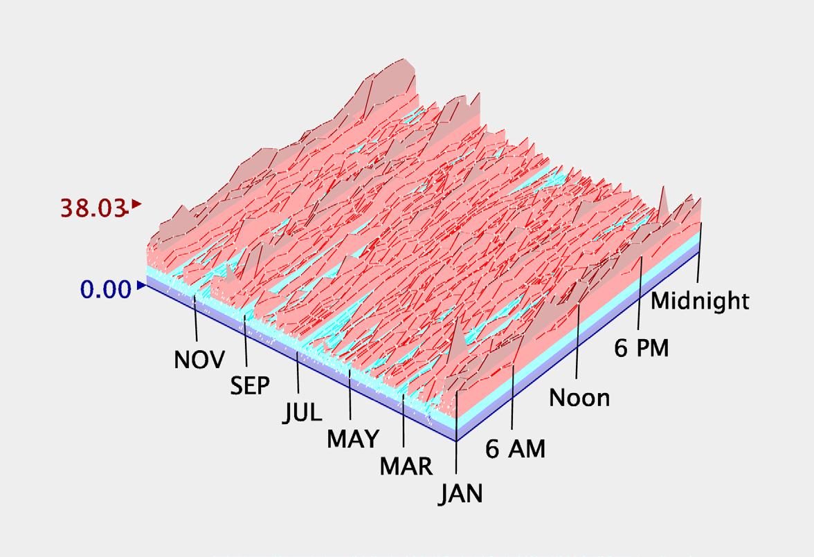
Solar radiation significantly impacts building design, serving as a fundamental element for creating comfortable, energyefficient spaces. It facilitates daylighting, allowing natural light to illuminate interiors and reduce reliance on artificial lighting. Moreover, solar radiation enables passive solar heating, wherein building materials absorb and store sunlight to enhance thermal comfort and decrease heating loads during colder seasons. However, effective solar shading strategies are crucial to mitigate excessive heat gain and glare, thereby optimizing indoor comfort and reducing cooling demands. Furthermore, solar radiation presents opportunities for renewable energy generation through photovoltaic panels and solar thermal systems, contributing to sustainability goals and reducing dependence on fossil fuels. Integrating solar-responsive design principles not only enhances building performance but also promotes occupant well-being by fostering connections to nature and optimizing natural light exposure.
The site’s level of solar insolation is relatively moderate compared to sunnier regions like southern Europe. The highest solar radiation occurs during the summer months, peaking in June and July, when daylight hours are longest and the sun is at its highest angle in the sky. During these peak months, daily solar radiation can average around 5 to 6 kWh/m². In contrast, winter
months see significantly lower levels of solar radiation, with December and January averaging only about 0.5 to 1 kWh/m² per day due to shorter daylight hours and the sun’s lower angle. Overall, London’s solar radiation is sufficient to support solar energy applications, although its potential is less than in regions closer to the equator.
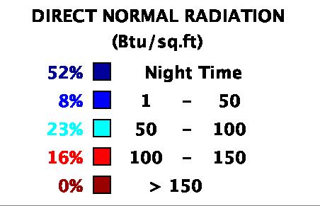
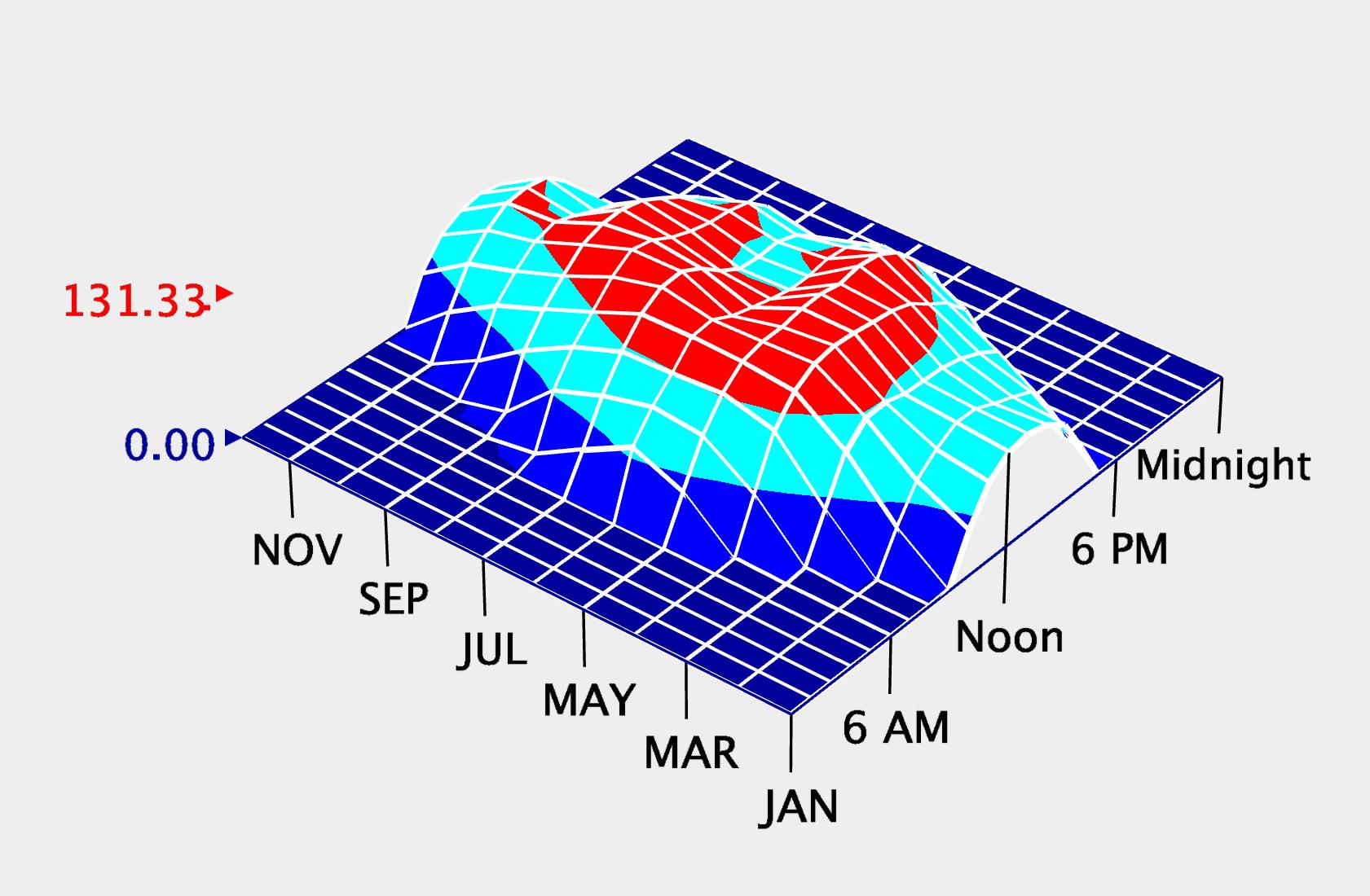
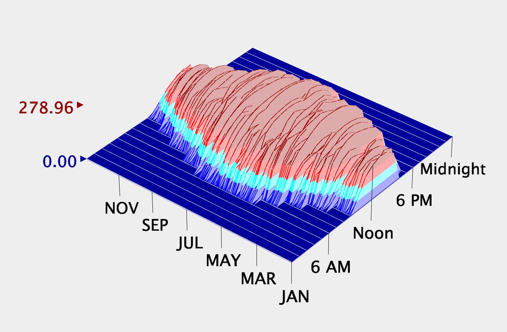
As seen in the 3D graphs, the site only receives between 100 and 150 btu/sq ft of direct solar radiation 16% of the time throughout the year on average. The majority of the day time receives between 50 and 100 btu/sq ft, averaging 26% of the year. This is mostly due to air pollution and the city’s thick cloud cover which both diffuse the solar rays.
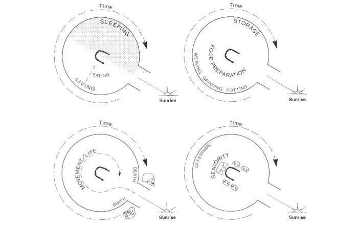
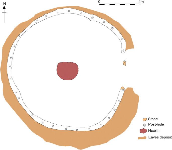
Roundhouses of the English Iron Age are exemplary of solar radiation strategies of early architecture particular to the northern climate. Amidst the varying degrees of solar radiation and frequent cloud coverage, early inhabitants of England oriented their houses to allow the maximum amount of daylight. Doors were typically placed on the east side to achieve this goal, as well as serve as symbolic significance by orienting one’s daily journey with the path of the sun.
English Solar Conditions
Roundhouse
Solar Orientation of Roundhouse
Roundhouses
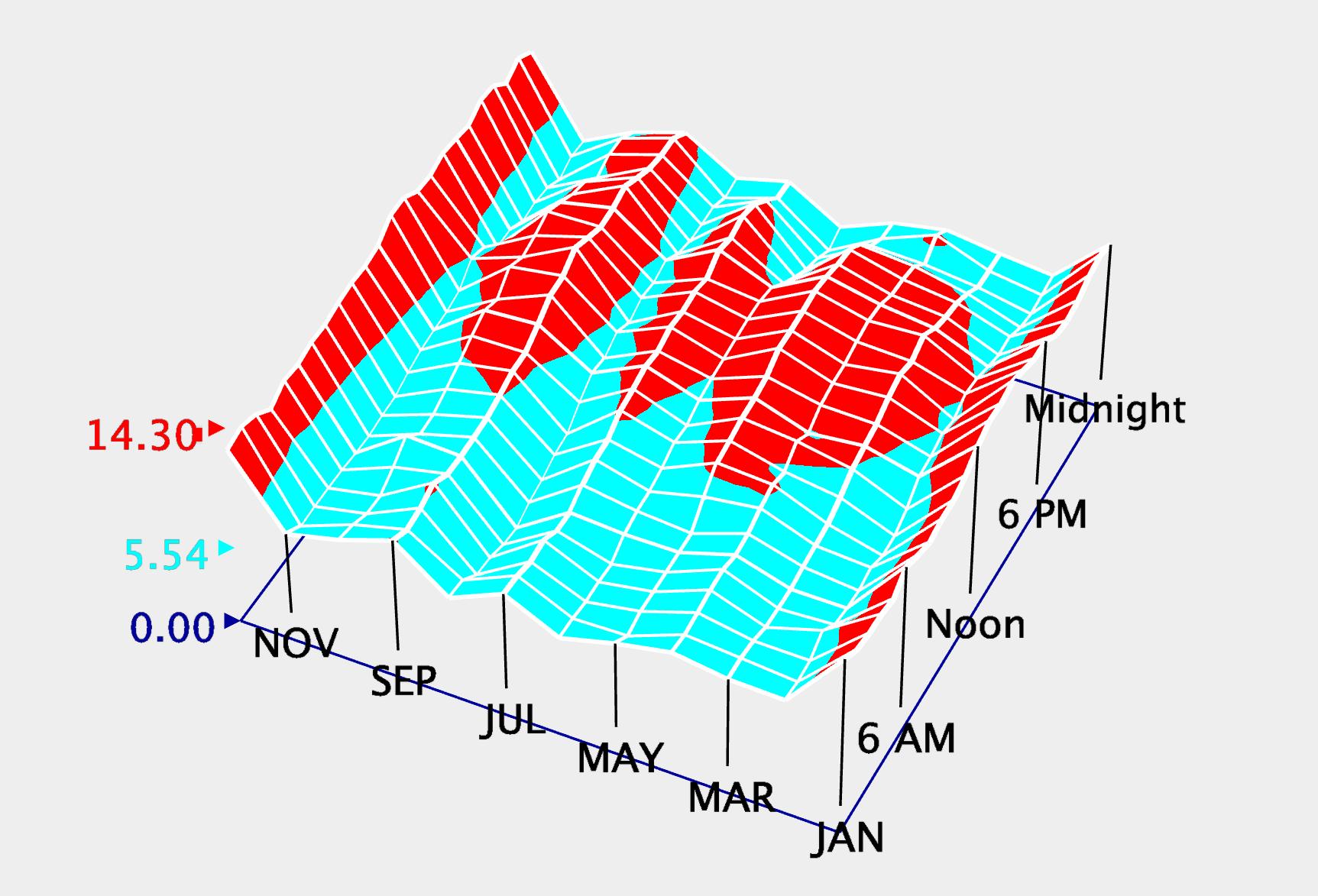
Wind is an incredible tool that cannot be ignored. Understanding where the wind comes from, how often, how strong it blows, and when it is most common versus most absent, are all factors that a designer should consider when considering strategies to combat a region’s climatic conditions. The wind direction influences the structure, and if it is strong enough, it can influence the overall form of a project too. In terms of temperature and regulating comfort for human beings, wind can be utilized. It was referred to previously as a tool, well, convection is a huge part of passive cooling because air in motion has a lot of properties that allow for the removal or transfer of heat to other areas, and best of all, wind is completely free, so long as you know how to capture it.
Looking at the charts, we can see that the wind is at its most aggressive during the winter months of December and January. Intuitively, this means we must block the wind, rather than accept or welcome it into a designed space since wind has cooling properties and it is most common in the winter months. The direction of the wind during these months is important to consider too; how can one block the wind, if they don’t know where it’s coming from in the first place – the last thing you want to do when you are trying to block the wind is funnel it and accidentally amplify it. From the wind rose chart we can see that the prevailing wind in London seems to be coming from the south west direction, and this direction also has the highest
average wind speeds too. Wind coming from the north also can have a relatively high velocity, but with an average monthly wind speed of about 15 miles per hour, London is considerably mild in terms of wind.
It is always important to keep air moving, stagnant air is not only uncomfortable but can sometimes be unhealthy. Good ventilation can help to allow air to move, regulating the temperature and the quality of the inside environment for whoever is in there.
Roundhouses of the English Iron Age are also configured to mitigate wind flow. The orientation of the door on the east side of the house allowed the south and southwestern areas, which experience prevailing winds, to be robust in assembly to withstand these natural forces. There is a Scots Gaelic saying that echoes the sentiment behind this siting, urging builders to have their “back to the wind, face to the sun.” The form of the Roundhouse also responds to wind concerns, as the plethora of interconnected points within the structure allow the home to be both strong and flexible. The round shape also allows wind to be deflected more easily than if the form were rectilinear. The roof of the Roundhouse, if it is round, also prevents wind destruction as the shape is less prone to wind planing.
Roundhouse Layout
Elevated Roundhouse
Roundhouse Ruins
South Wall
Wind Speeds Monthly
Wind Speeds Daily
The site is at a crossroads of historical and contemporary developments. It holds a generational tension between devastation and reconstruction, and, although symbolizing the resilience of London, has yet to respond architecturally to the cultural context that precedes and surrounds it. The proposed developments of the blocks around the site show the cultural desire to redevelop and revitalize this land, saturated with history and close in proximity to public transportation, community ammenities, and residential opportunities.
Physically, because the site is sunken relative to its adjacent streets and plots, this poses the practical issue of rainwater drainage. This condition also poses the challenge of connecting the site to the existing urban fabric, potentially posing the need for a welcoming public space at the ground level. This space could serve as a gathering space, paying homage to the site’s namesake, the mineral well that was a place for socialization. The small footprint of the site poses the challenge of fitting and organizing the programmatic needs of the project in an efficient manner. This condition poses the challenge of building vertically. There will need to be a balance of scale between this site, if built up vertically, and the surrounding context, which is primarily 4-6 stories tall. The surrounding context is also extensively diverse in architectural style, which I feel the building on our site will need to address.
It seems vitally important to respect the site in every possible dimension., as well as respecting the population the building will serve. It is clear that there are mixed feelings about the surrounding area of the site, as issues with gentrification are overshadowing the cultural centers in the neighborhood. It is clear that architecture cannot solve every social issue of the region, but it should try not to excasterbate or ignore the problems.
“A Nod to Gentrification” in Hackney
2 COMPOSITIONAL STRATEGY_1
Compositional analysis:
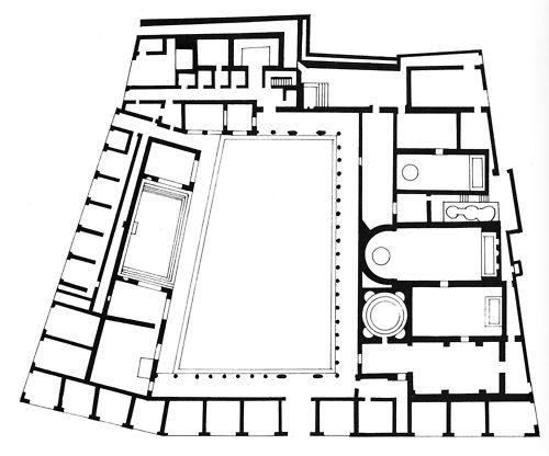
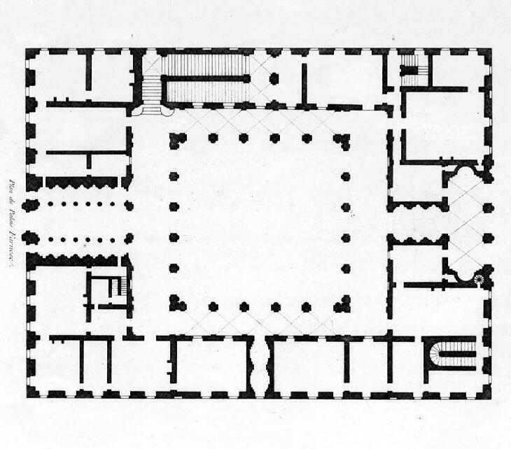
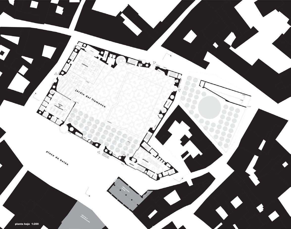
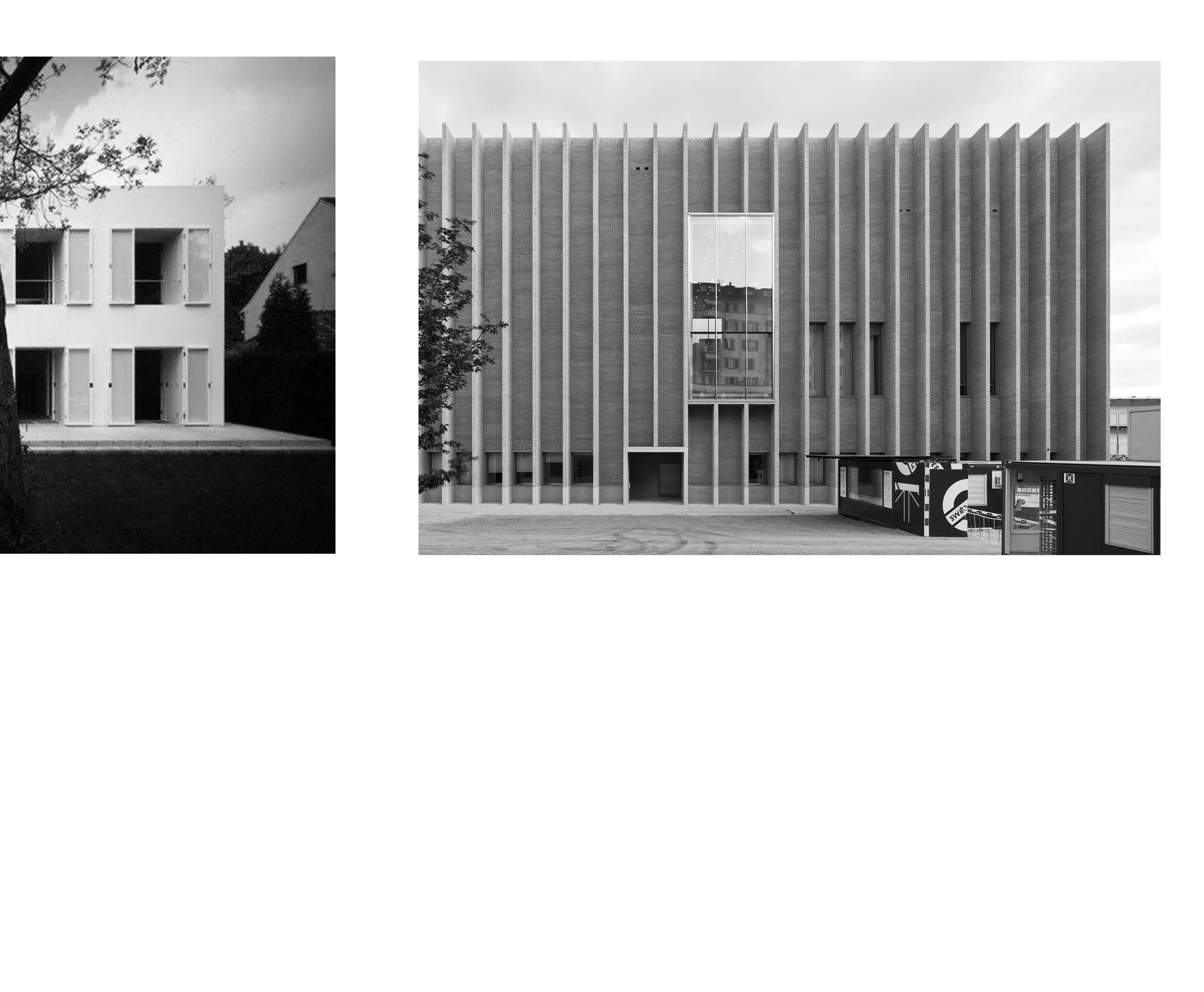
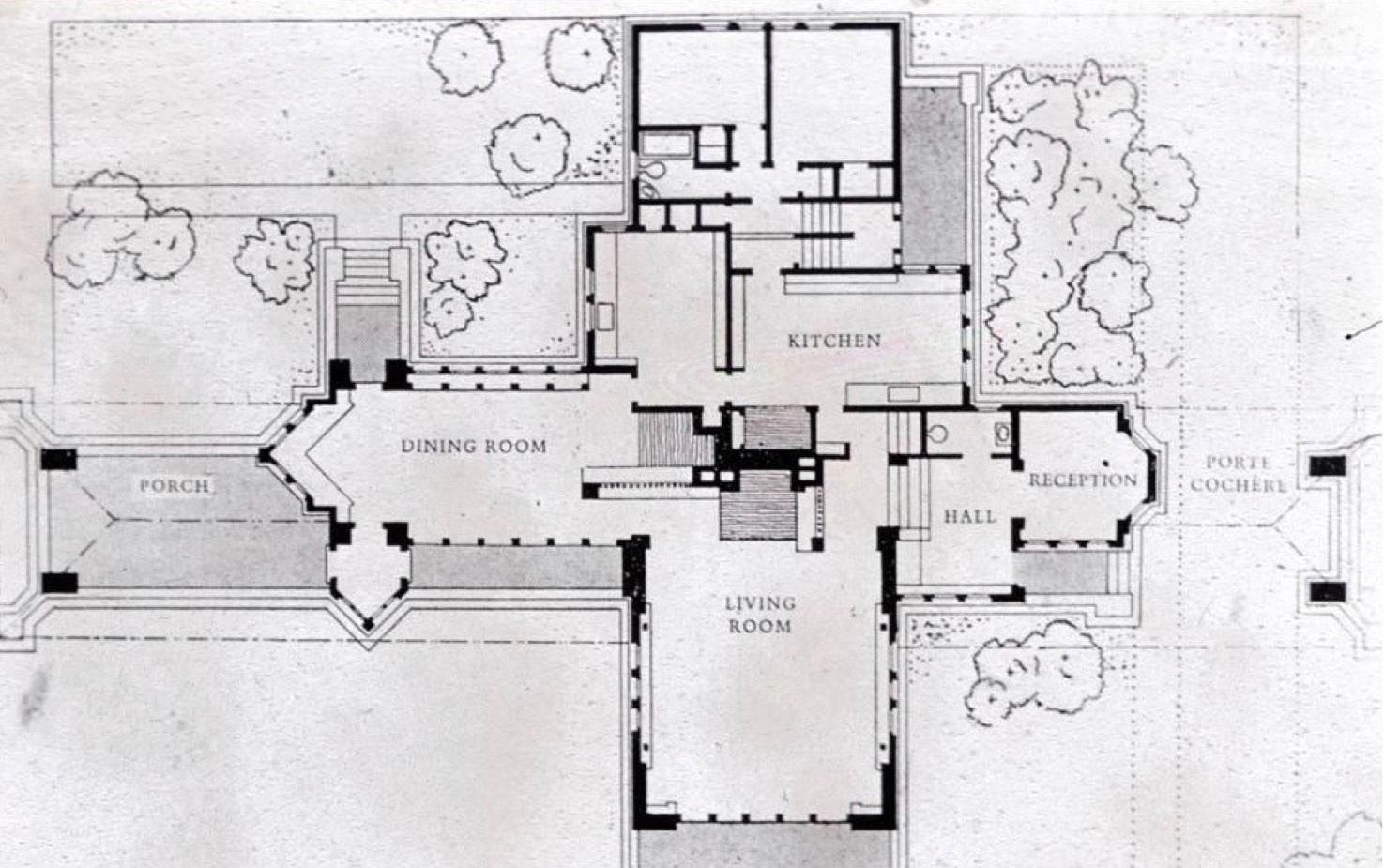
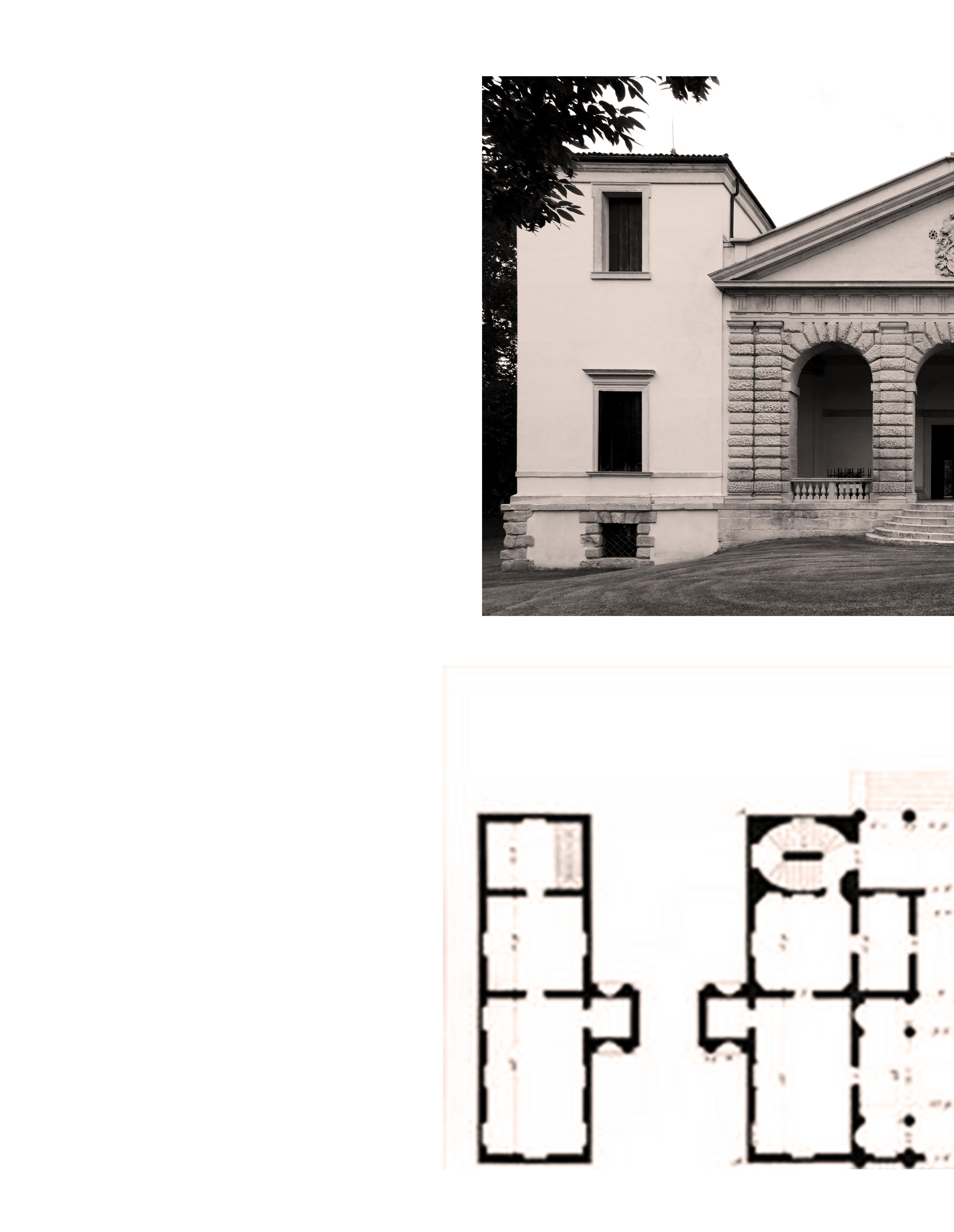
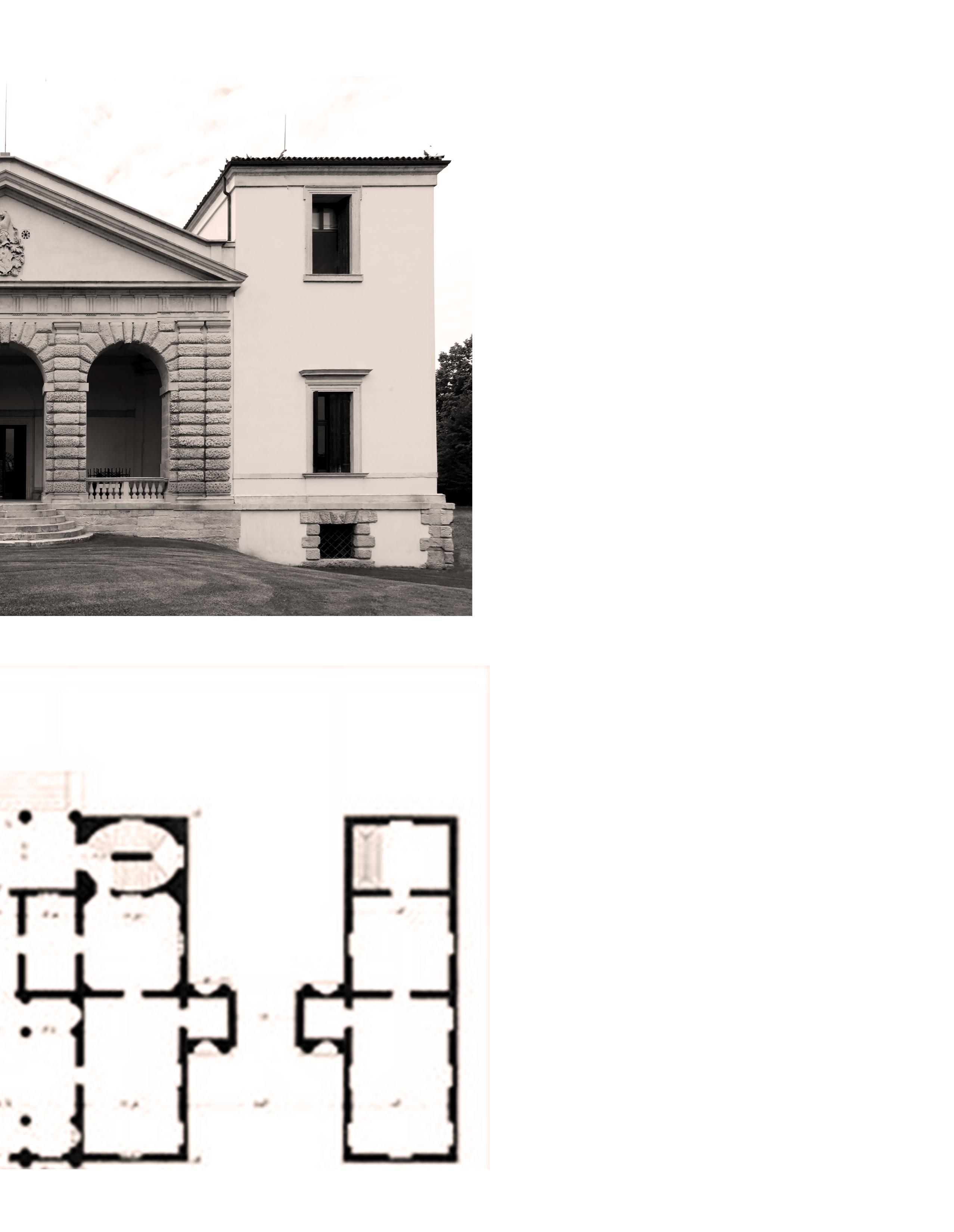
Herzog and de Meuron’s Ciudad del Flamenco project in Jarez de la Frontera, Spain, Josep Lluis Sert’s Sert House in Cambridge, Massachusetts, and John Utzon’s Utzon Center in Aalborg, Denmark, each use patios as a tool to compose and create dialogue between architectural spaces. Although the Ciudad del Flamenco and Utzon Center are designs of the 21st Century, ideas conceived in 2003 and 2008, respectively, they owe their roots to historical precedents of the eastern hemisphere, such as the Stabian Baths in Pompeii, or the Palazzo Farnese in Rome. The Sert House is also indebted to similar compositions, despite being built earlier in 1957 and outside of Europe. In the Sert House, Sert uses the courtyards as service spaces, the medium of which the dwelling spaces are brought light, air, and vegetation. The courtyards help organize these humanistic values into a modern, functionalist plan. Utzon uses a similar centralization of the courtyard among a functionalist plan in the Utzon Center. Utzon used the corridors as another functional element, adding an additional dimension of direction and clarity to the organization of the program. Herzog and de Meuron took a much more drastic approach with their courtyard in the Ciudad del Flamenco. By delegating the auxiliary program strictly to the perimeter of the building, Herzog and de Meuron freed the large interior space for a courtyard. This solid versus void relationship is a much more fluid approach to using the courtyard as an organizational tool but allows a clear spatial hierarchy to develop despite the irregularity of shape.
Studying these three projects together shows the connection of spatial conceptualization to organization, using the courtyard as the primary organizational tool. It is clear that each of these projects
is derived from the historical usage of patios in architecture. This relationship to precedent is also articulated in the usage of defined barriers within the projects. Early courtyards were often constructed as a safety precaution, using well-defined boundaries to aid in protection. Whether the boundaries serve as a zone for the auxiliary program, as seen in the Ciudad del Flamenco, create a fluid definition of space that allows for an expansive experience of space throughout the project, as seen in the Sert House, or create formalized programmatic zones attached to corridors, as seen in the Utzon Center, the boundaries in these projects are integral to their respective spatial composition schemes.
Plan, Stabian Baths, Pompeii
Plan, Palazzo Farnese
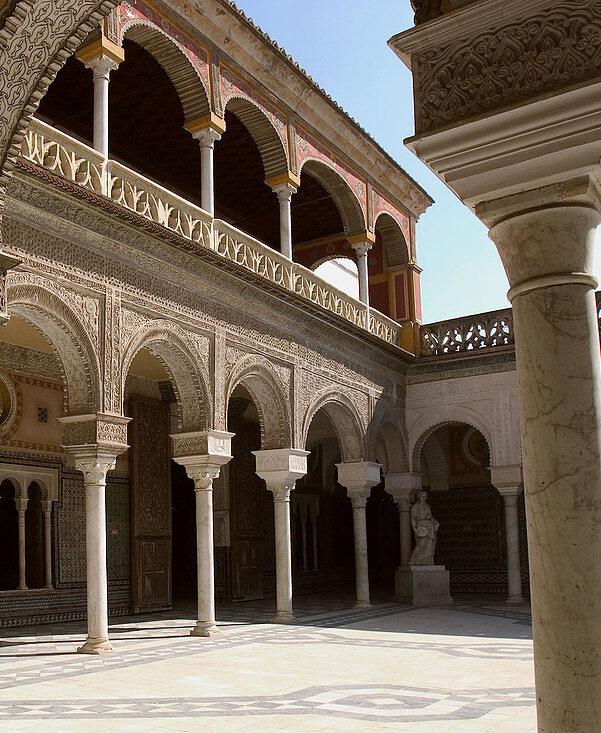
Courtyard , Casa de Pilatos, Seville, Spain, 1483
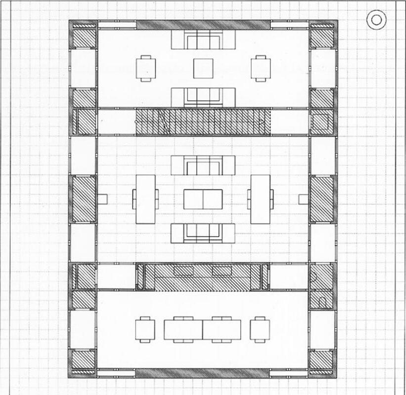
Plan, Sert House
Plan, Ciudad del Flamenco Plan, Utzon Center
Spatial definition
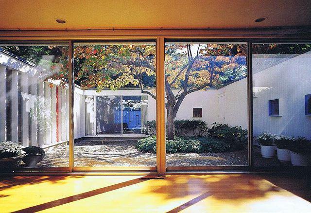
The Sert House is composed using a clear definition of site boundaries, indicated by the poche. The poche holds the auxiliary program and its irregularity in form responds to the surrounding urban context. The interior spaces are informed by the perimeter boundary, creating a solid and void relationship between the two elements. The exterior conditions, such as the courtyard outside of the primary building envelope, are in dialogue with the spatial structure of the building. This courtyard assumes the same spatial organization role as the interior courtyard, constructed using the leftover, void space defined by the program. Herzog and de Meuron took inspiration from typical Spanish urban blocks where gardens are formed using individual buildings as a perimeter condition. The strict perimeter dictates a determined occupation of rooms, which are mostly organized independently of the others. Although independent, each room is in direct dialogue with the courtyard, which is also a spatial trend in the Sert House. The Sert House, however, has a much more fluid occupation of rooms, as each room flows into the next, each in direct dialogue with one of the three courtyards. Like the Ciudad del Flamenco, the Sert House uses clearly defined boundaries to construct space. The thick perimeter walls create rigid rectilinear relationships amongst themselves but become permeable thresholds when two programmatic spaces are connected. The result is a large living space subdivided by these walls that creates opportunities for seeing across the entire project. The courtyards, and the boundaries that they conform to, create a blurred relationship between interior and exterior. Similarly, the exterior spaces, such as the stairs and terrace, in the Utzon Center blur the relationship between interior and exterior due to the lack of clear boundary and the presumed continuation of space. The programmatic spaces, however, are formed using clear boundaries, each attached to the corridor rather than being directly adjacent to the central courtyard. These spaces are highly formalized, and their arrangement is highly functional. Their form is directly connected to their respective roof forms, which creates a sense of independence and importance for each programmatic space. The occupation of these spaces is strictly organized with each main space having direct access to the corridor, equipped with auxiliary spaces that form a cellular composition of subdivided space. In all three projects, the courtyard and boundaries are essential in forming a clear spatial composition.
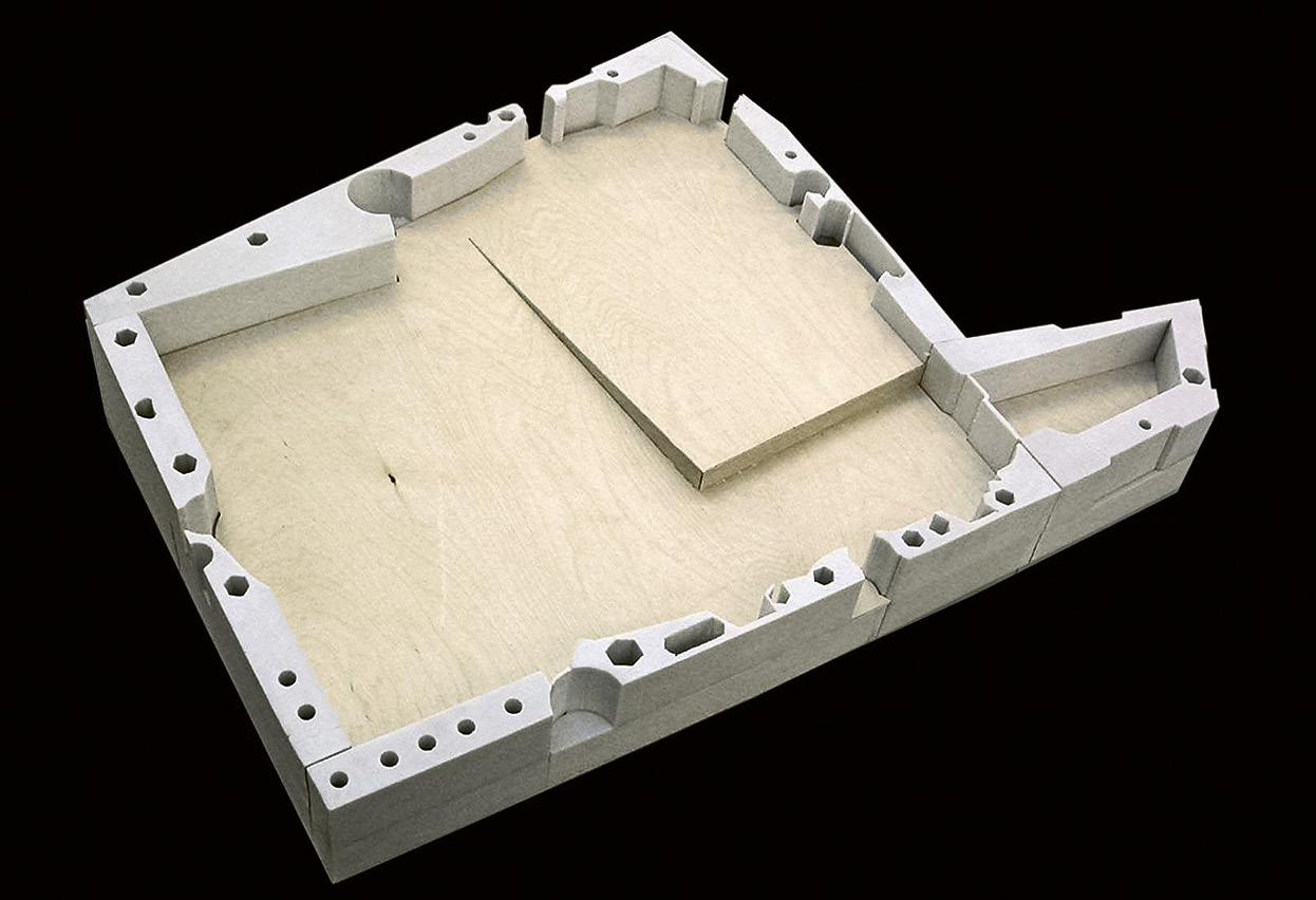
Physical Model of Ciudad del Flamenco
Interior Photograph of Sert House
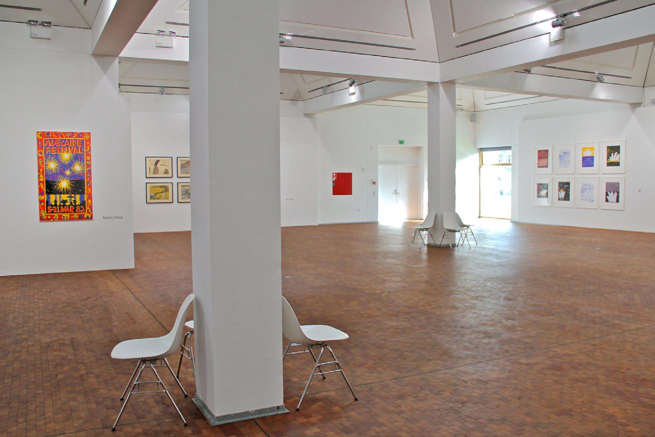
Interior Photograph of Utzon Center
courtyard formed using leftover space
defined boundaries / auxiliary program program defined by boundaries
defined space defined boundaries courtyards defined by boundaries
defined space defined boundaries
Sert House
Ciudad del Flamenco
Utzon Center
Movement
The solid and void relationship developed in the spatial composition of the Ciudad del Flamenco allows for an integrated movement pattern. The circulation is created by the leftover space on each floor of the building, as opposed to a corridor system. The transition between spaces is rigid and clearly defined by the perimeter condition that creates the auxiliary program. There is an implied cross-axis of movement that is interrupted by the large pond and the irregular form of the building. The thresholds between interior and exterior follow a similar form of ambiguity to the circulation pattern, as the entries are openings that seemingly blend into the surrounding context. The exterior courtyard furthers this idea of blurred continuity, as the interior program bleeds into the exterior conditions. The exterior experiences and perimeter features such as benches and fountains activate the outside of the building. These features promote the flow of movement despite the defined perimeter boundary. A similar flow of movement is established in the Sert House, as the circulation is similarly integrated within the interior spaces. However, unlike the Ciudad del Flamenco, the Sert House uses well-defined interior boundaries and a central, rectilinear courtyard to define spaces and patterns of movement. The courtyards in this project contribute to the blurred perception of interior and exterior, as the boundaries soften along the perimeters of the courtyards. These courtyards bring in light, air, sound, and vegetation that can be experienced throughout the project due to the fluid circulation pattern. A more rigid circulation pattern is defined in the Utzon Center. The corridors are the primary circulation zone, serving as an artery between the main programmatic spaces that are otherwise completely independent of each other. Similarly to the Sert House, the circulation pattern in the Utzon Center is organized by the central courtyard. Also like the Sert House, there are moments of continuity and direct relation of rooms, such as how the transitions between service areas and main spaces promote circulation directly from the main areas. Similarly to the Ciudad del Flamenco and the Sert House, the Utzon Center occasionally blurs the boundaries between interior and exterior conditions. The main programmatic spaces have clearly defined exterior boundaries, but the boundary softens at the primary circulation areas, such as the entry stairs. In all three projects, there is a reliance on the courtyard as the means or organizer of movement through space. The circulation in each project also contributes to the transitional relationship between interior and exterior, despite the formal use of defined boundaries.
Ciudad del Flamenco Exterior Render
Photograph of Central Courtyard in Sert House
Photograph of Couryard from Corridor of Utzon Center
horizontal movement vertical movement
horizontal movement vertical movement
horizontal movement vertical movement
Sert House
Ciudad del Flamenco
Utzon Center
Program organization
In the Ciudad del Flamenco, there is a clear form of uses created by the solid and void relationship. The perimeter poche houses the auxiliary program as well as the entrances and areas of vertical circulation. The expansive void space is filled with the courtyard and larger areas of the program that are informed by the perimeter conditions. The program of this building is atypical in geometric form, not conforming to any rectilinear or platonic shapes. The perimeter condition defines a zone of the auxiliary program, generating a subsequent hierarchy of importance. The organization of the auxiliary program on the perimeter suggests the importance of the centralized space. The massing of the building follows its program organization, as the perimeter walls are built up and the interior, in terms of massing, is conceptually left as open space. The Sert House massing also takes cues from the program organization, following the strict rectilinear arrangement of the program. Unlike the Ciudad de Flamenco, the program organization is not strictly defined by physical boundaries. The boundaries in the Sert House suggest a flow of space and program that is delegated primarily by the furniture in the house. If there were no furniture, the program organization would be much more ambiguous. The furniture, however, helps define the zones within the project, which are the courtyards, the living spaces, and the auxiliary spaces. Similarly to the Ciudad del Flamenco, the programmatic spaces each have access to a courtyard, whether centrally located or on the perimeter. This condition denies a hierarchical structure of the spaces, democratizing the composition using courtyards. Similarly, in the Utzon Center, the corridors are the means of denying a hierarchical structure of importance, as each main space has a direct connection to the corridor. The centralization of the courtyard, also seen in both the Ciudad del Flamenco and the Sert House, suggests that the courtyard is most important within the organization of the Utzon Center. The massing of the Utzon Center, specifically the roof forms, closely follows the organizational pattern of the program, as each main space has a roof system independent of its adjacent spaces. The roofs and their heights further develop a hierarchy of importance, as certain spaces are much taller and have much more exaggerated roof forms. The Utzon Center, Sert House, and Ciudad del Flamenco each rely on courtyards and physical boundaries to organize the program as well as develop a massing scheme that relates to the hierarchical importance of each programmatic space.
Physical Model of Ciudad del Flamenco (Ground Floor)
Physical Model of Sert House (Boundaries)
Aerial Photograph of Utzon Center
Sert House
Ciudad del Flamenco
Utzon Center
Preliminary strategy:
The neighborhood of Hackney has an innate resilience, plagued by disasters such as the Great Fire of 1666 and the Blitz bombings of WWII but maintaining an urban fabric that has shifted very little in identity and structure over time. Unlike the pattern of roads, infrastructure, and parcel footprints, the buildings in Hackney have failed to remain resilient. The most recent building on our site, for example, was demolished due to irreperable damage from WWII bombings. A resilient architecture that responds to the surrounding urban fabric and historical precedent has yet to exist on our site. However, the unchanging site context contains geometries and boundaries that inform an approach to our site that would begin to create a dialogue between the spaces on the site and the surrounding neighborhood. Surrounding the site, there is a wide variety of architecture, differing in usage, massing schemes, spatial construction, and the style of building. The Mineral Well of St. Agnes de Clere is an example of a space that used to exist in Hackney, located to the northeast of our site. Because of the common conception that the well had medicinal benefits, the space quickly became used for large gatherings and socialization. This well is also the namesake of Clere St., which is just south of the site. An inclusion of public gathering space on the site could serve as an homage to the history of the site and its surrounding neighborhood. This is especially significant, and seemingly much needed, due to the large number of residential developments around the site that lack community space. These developments are also raising concerns of the gentrification of Hackney, characterized with new developments that fail to increase the sense of comfort, safety, and sustainability of the neighborhood. Bringing community space to the site could tend to these concerns as well as reconnect the sunken
condition of the site to its urban context. To prevent making the same mistakes as contemporary developers, it is necessary for the project on the site to not be autonomous. Rather, the project should be in dialogue with its context, appealing to the collective memory of the neighborhood in past and present conditions. An example of appealing to the collective memory of the neighborhood is employed in this site strategy by the permeability of the eastern side of the site. This permeability is informed by London’s vernacular architecture dating back to the Iron Age, in which doorways were oriented to the east in efforts to capture the most daylight. This orientation would also imply a more defined and robust western boundary, effectively blocking prevailing winds. These boundary conditions reflect the symbolic concept of following the sun’s journey throughout the day, which is also an ancient English tradition.
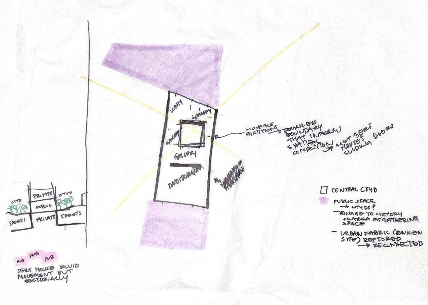
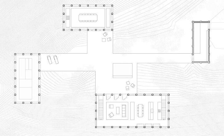
The preliminary site strategy follows the organizational ideas of the Sert House and applies these relationships to the London site. The site scheme takes cues from the surrounding geometries, using the angles of adjacent blocks to triangulate the location of a central courtyard. There are two additional courtyards at the north and south of the site, serving as public exterior space accesssible to the community. The perimeter courtyards also create a blurred boundary between interior and exterior, following the tradition of the Sert House. The interior space is organized around the central courtyard, and the proportions of that courtyard will inform the spatial configuration of the program.
Informed by
Scheme Informed by the Sert House
Scheme Informed by the Utzon Center
Scheme
the Ciudad del Flamenco
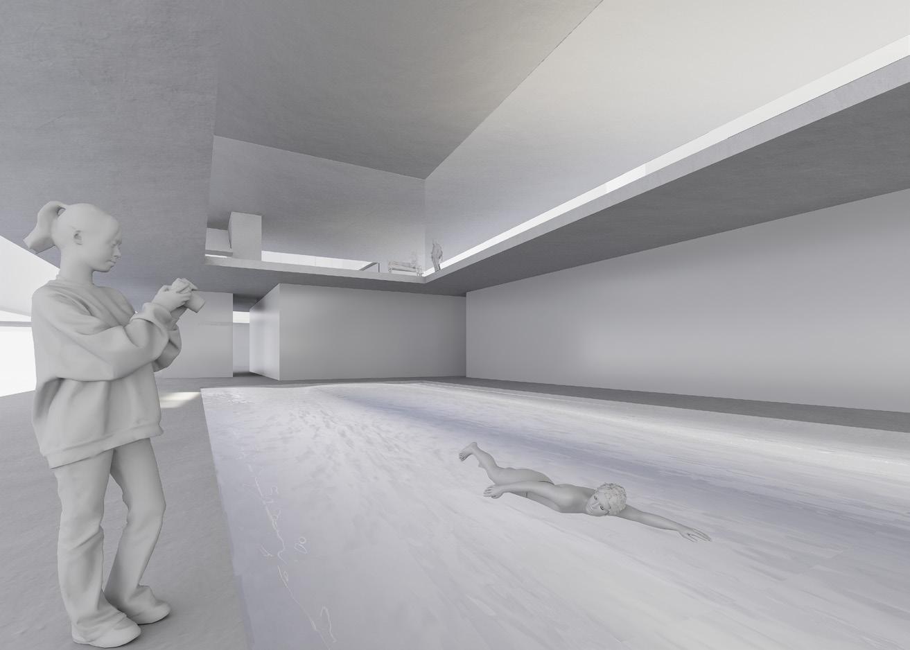
1 70004 lane. 25m pool. Water dimension 27'-11"x82'. Overall area approx. 1 40030C. Water area only. 1.5 feet deep. Overall area to be determined by design 10 1500shower, sink, toilet
2 1600Must have cubicles, showers and bathrooms 2 400
1 2500Open gym 2 2304Court size is 40'x20'. Min. clearance around court is 2'. Clg height min. 30ft clear
2 5001 male 1 female 1 150For injured athletes
1 250For equipment. Near sports and water program. If divided 2 of 300sft
1 182x6. 3ft clear. Could be packaged together with IT room
1 6000Can be split into different levels. Minimum clear height is 18ft. Minimum exhbition area 800ft 1 1000Informal for audiovisual and lectures. Could be incorporated into circulation areas.
8 1200Hourly leasable spaces for group study, working, etc..
2 1200Hourly leasable spaces for group study, working, etc..
1 200Adjancent to or combined with one of the electrical closets.
2 36(one for auditorium area. One for the rest of exhibition)
1 800Front desk, information area. Tickets for exhibits 1 350Open area. Lounge, kitchennette, desks, storage 2 3002 administrators offices (directors) 1 800300ft janitor/ Rest work area to support exhibition space 1 400 1 250 2900 32158
1.25(100/80). Assume 80% efficiency 40,197.50 The gross area efficiency is estimated to be high given that the detailed program includes a great portion of what constitutes gross program
The program of the Sert House is organized around the central courtyard. Though there is a degree of separation suggesting autonomy of each room, there is a fluidity of space that surrounds the courtyard. The program is further organized by zones, generally divided into service spaces and the spaces that they serve. The spatial zones of the Sert House conform to the proportions informed by the rectilinear perimeter and the square central courtyard.
One challenge of using the Sert House to inform the spatial and programmatic compositions of the London project is that the Sert House only holds one storey of program. Because of the small footprint of our site and the large square footage assigned, there is a need to build vertically. This poses the challenge of applying the relationships of the Sert House sectionally. Another challenge is applying the pure, geometric logic of the Sert House’s composition to the irregular geometries on the London site. One could conform the project to a pure geometry on the site and delegate the leftover footprint to public space, however, this approach seems to lack a sophisticated response to the urban fabric surrounding the site.
Proportions of the Sert House
Program Organization of Scheme
Sectional Relationship of Program
Final strategy:
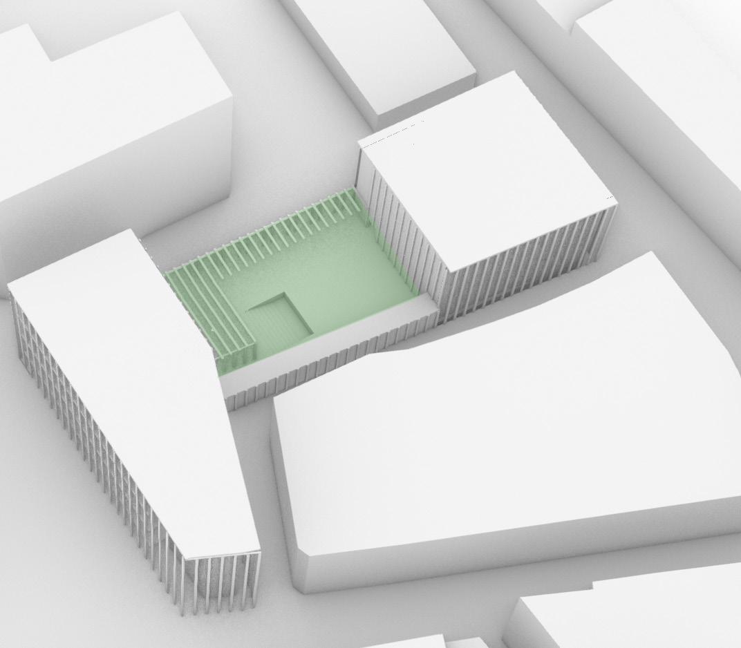
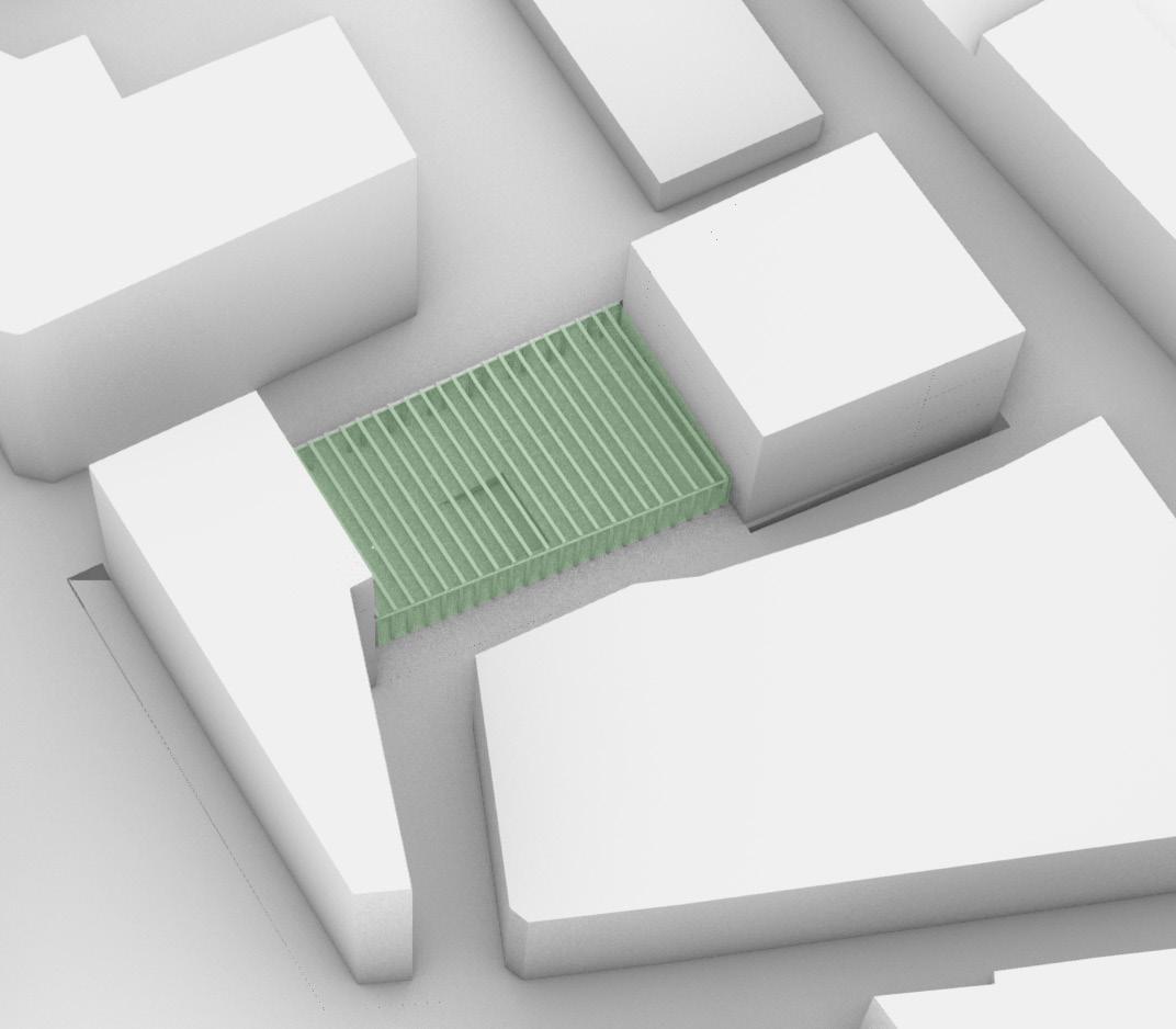
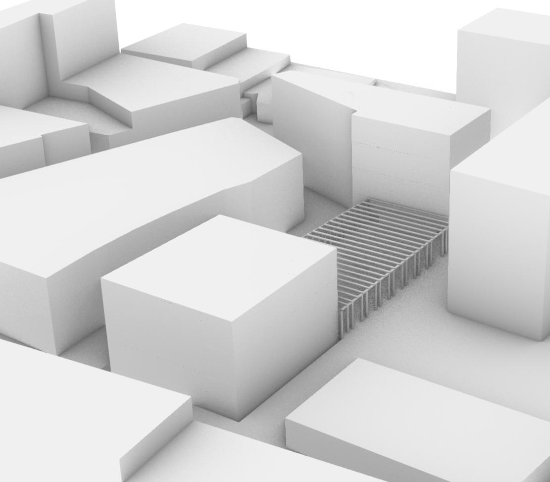
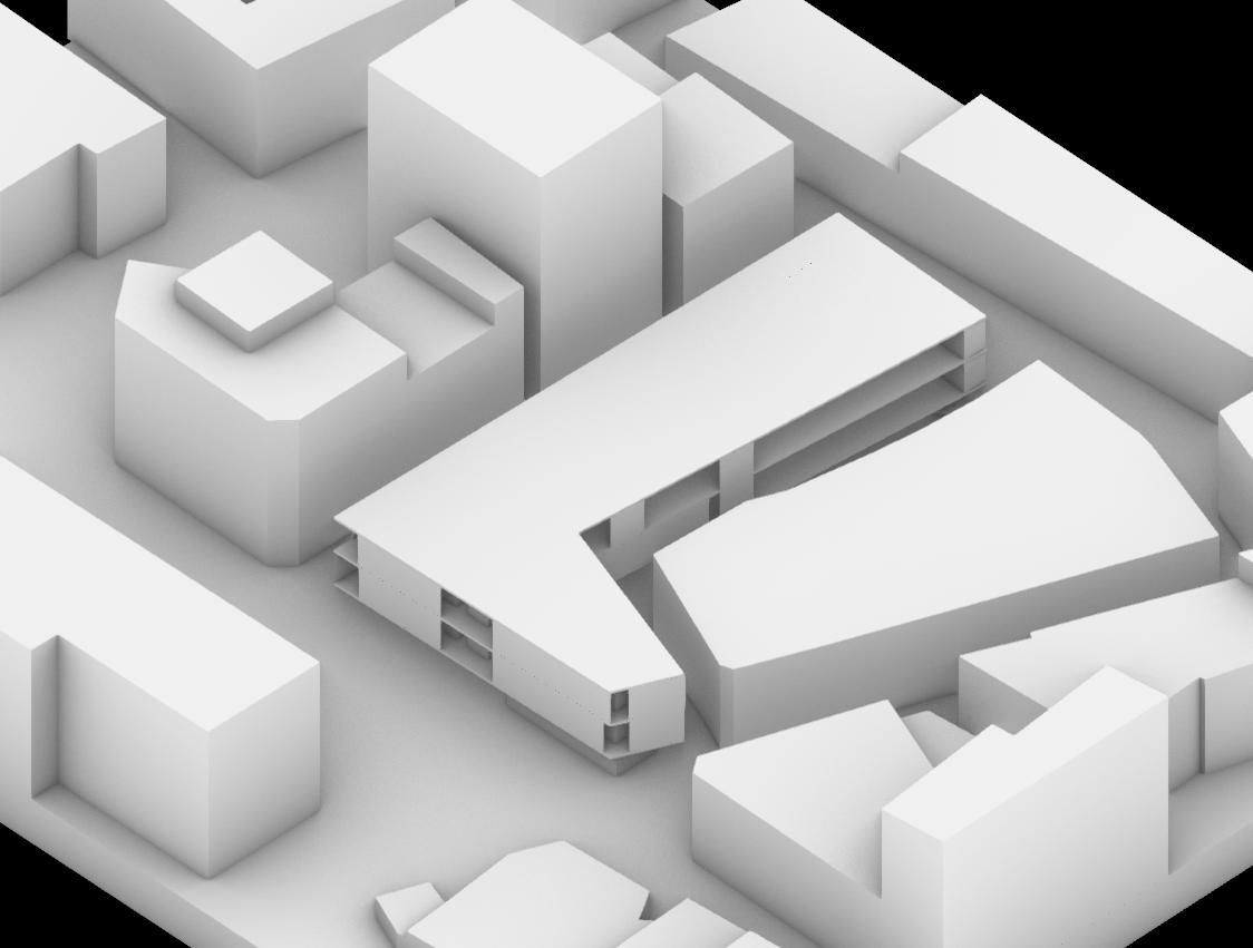
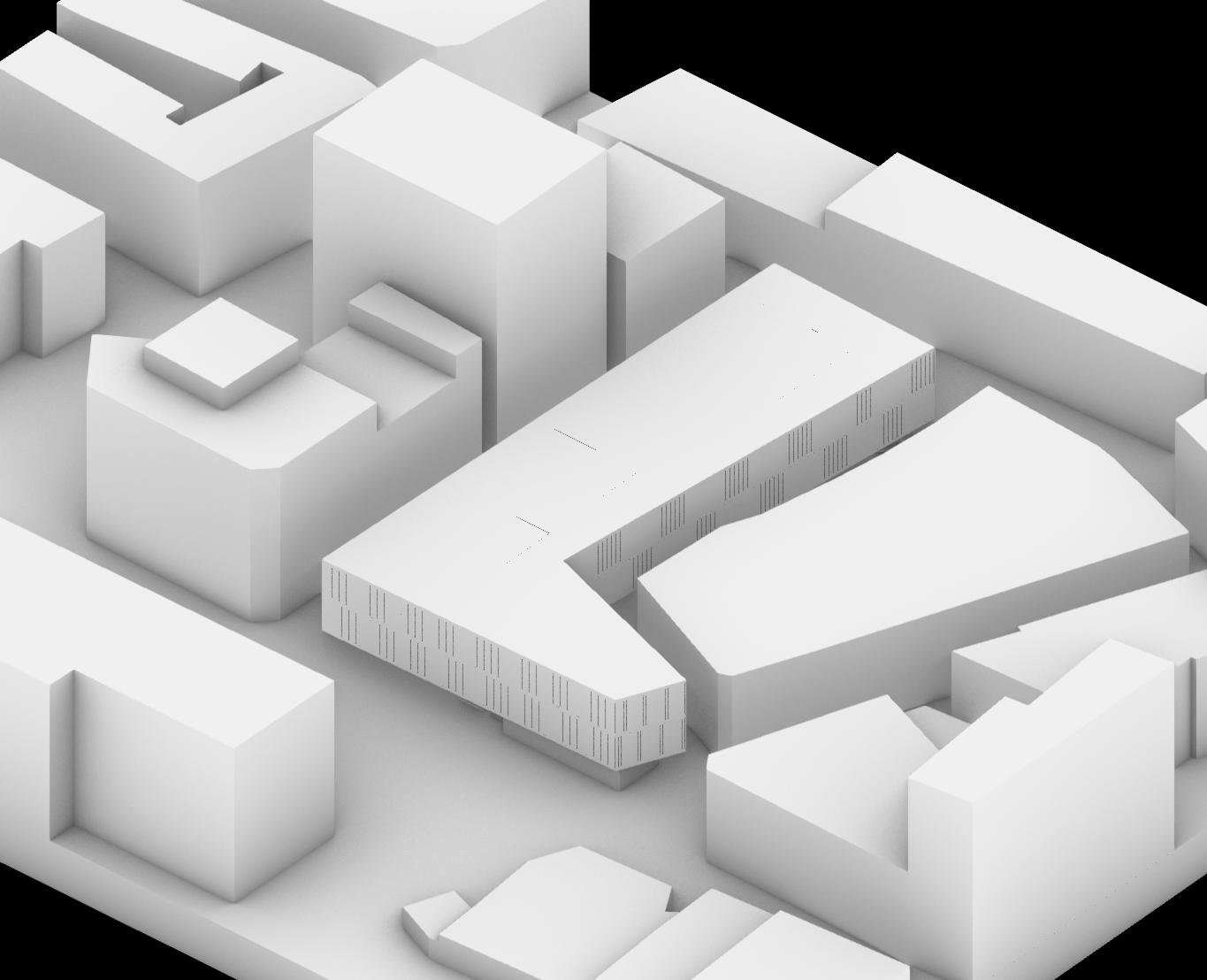
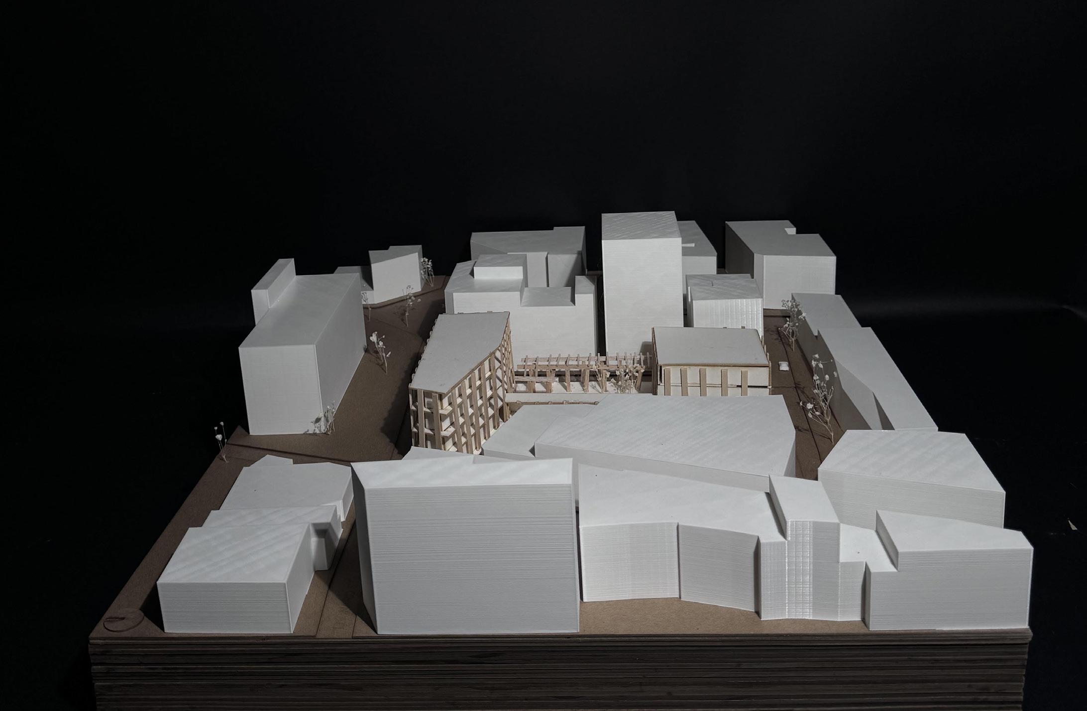
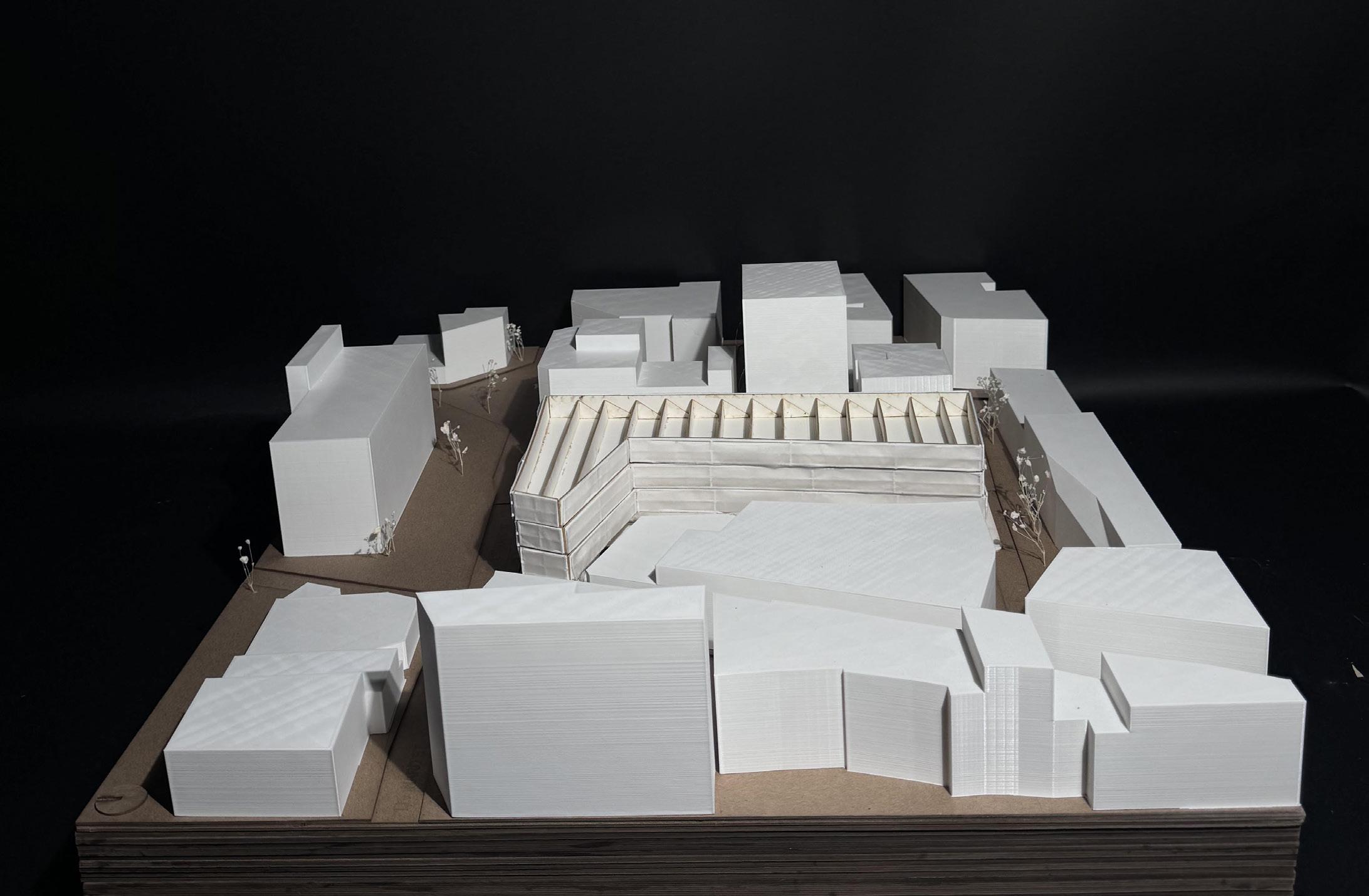
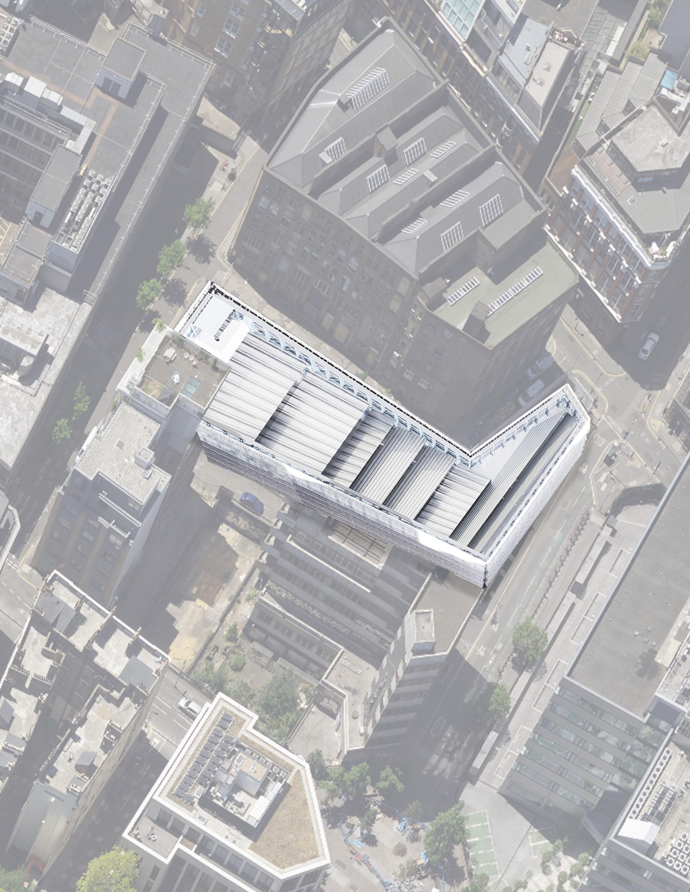
The neighborhood of Hackey, within the City of London, in London, England, holds a resilience that has withstood the test of time. The urban fabric and systems of infrastructure, such as roads, have remained significantly unchanged since the beginning of London’s expansion during the Roman occupation of England. The urban fabric has retained this quality despite the long duration of time and the destruction brought upon by both World War I and World War II. However, during the Blitz bombings of World War II, most of the buildings of Hackney were significantly damaged or altogether destroyed. This includes the building which stood on the plot of land north of Clere St. and south of Leonard St., which ultimately succumbed to demolition due to the sererity of damage. Since the destruction of this building, the plot between Clere St. and Leonard St. has yet to be redeveloped significantly and reconnected with its urban fabric.
To form a strong sense of connection between a building on this site and its urban fabric, the building should not be autonomous from its surroundings. The building should have an identity aligned with the values present within its context and not act independently or ignorantly. However, the building should discern itself from the uniformity of the generic architectural styles that populate the neighborhood. There are many buildings around the site that fail to connect significantly with their context or generate a dialogue with the history of the neighborhood.
The site strategy used in this proposal includes a careful definition of the site boundary informed by the resilient boundaries of the
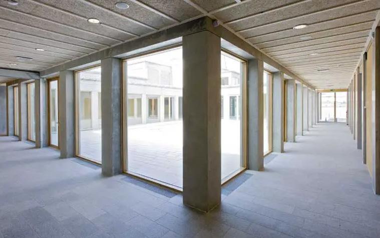
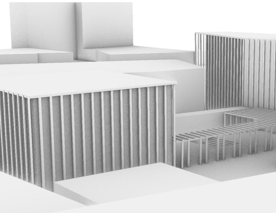
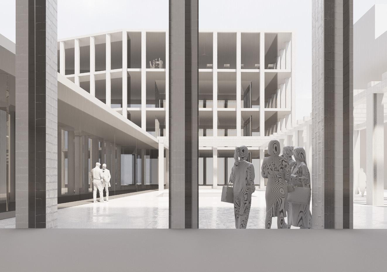
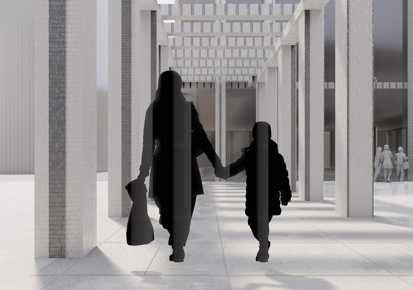
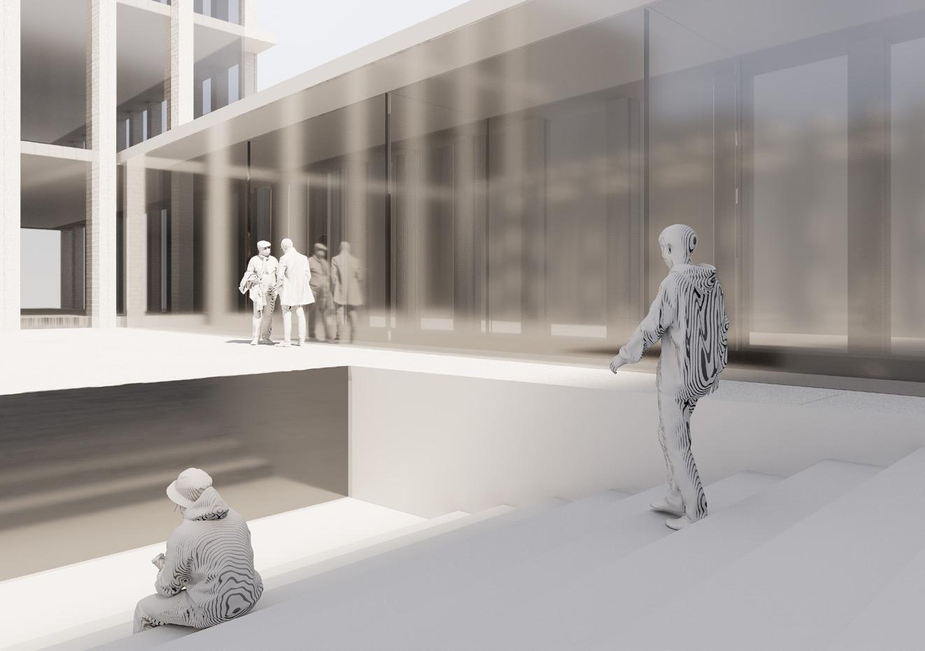
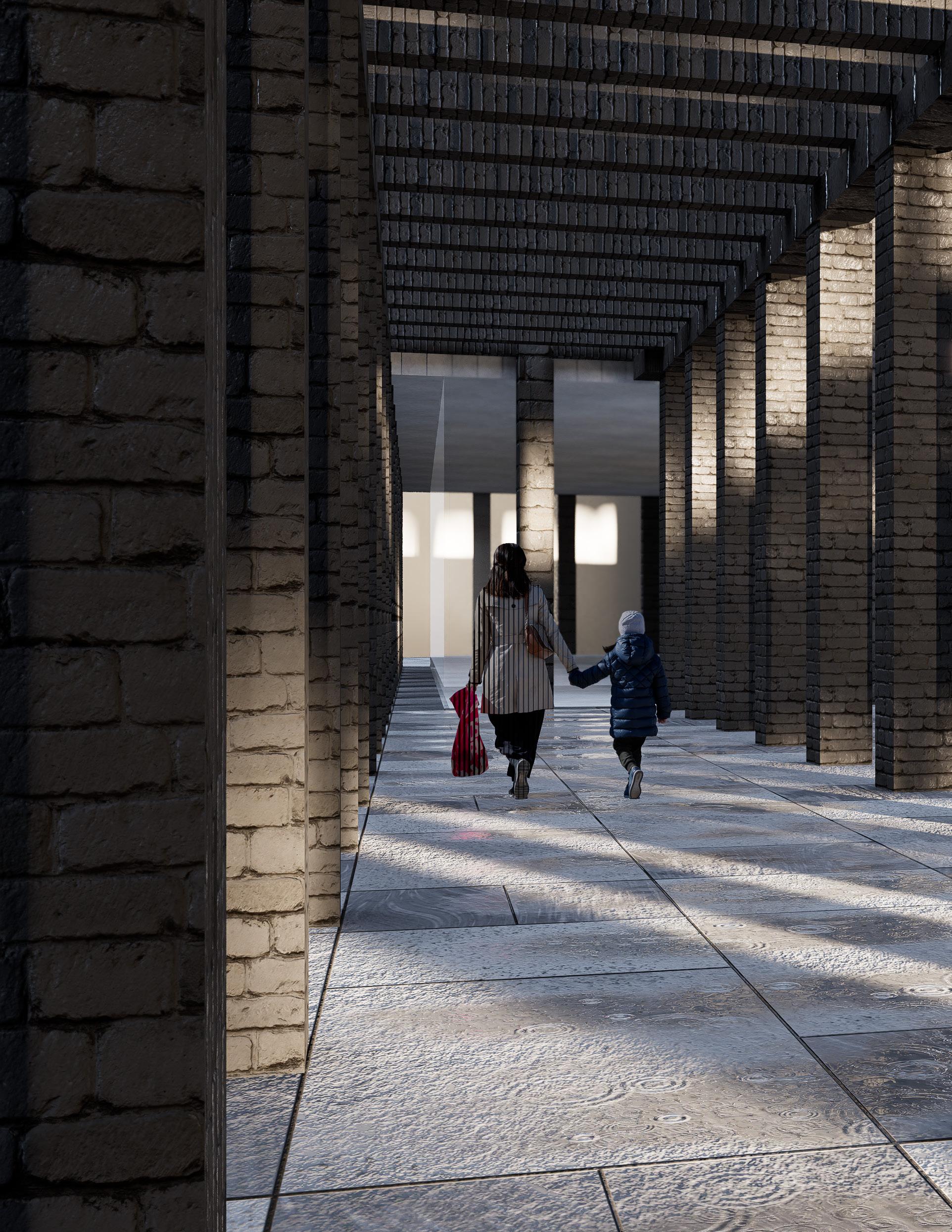
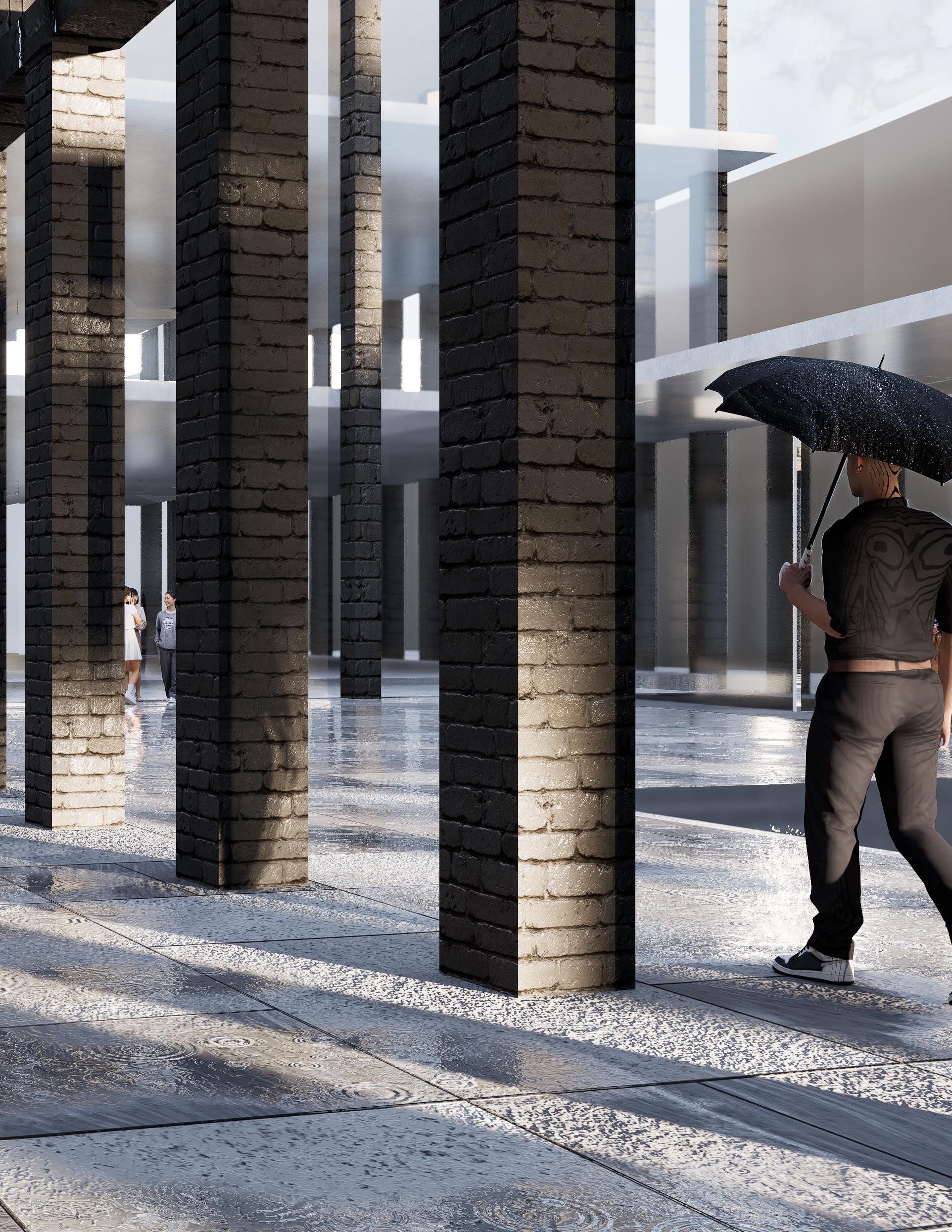
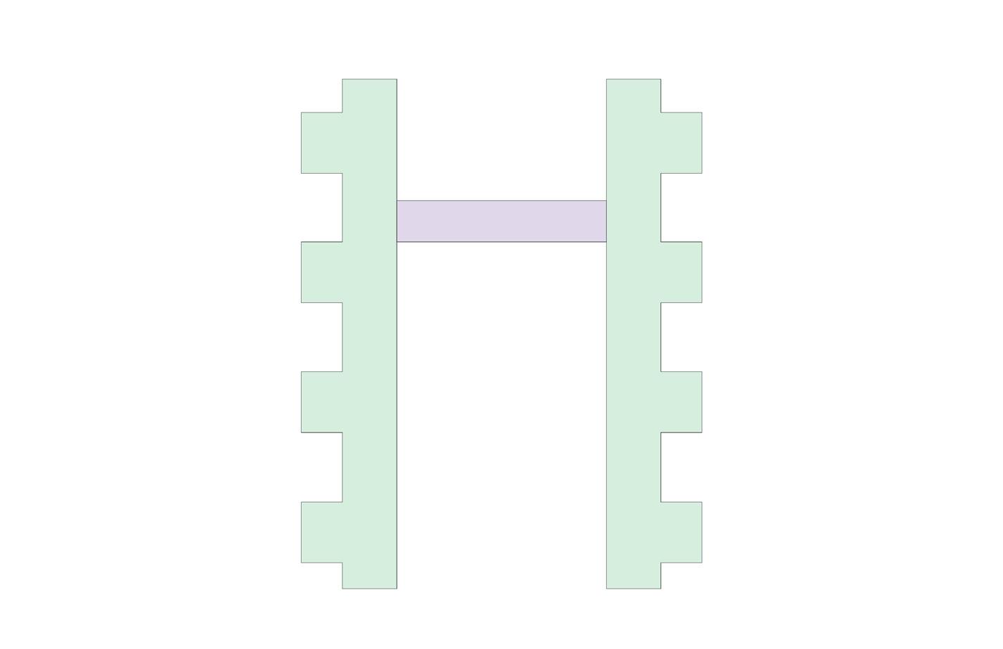
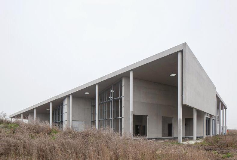
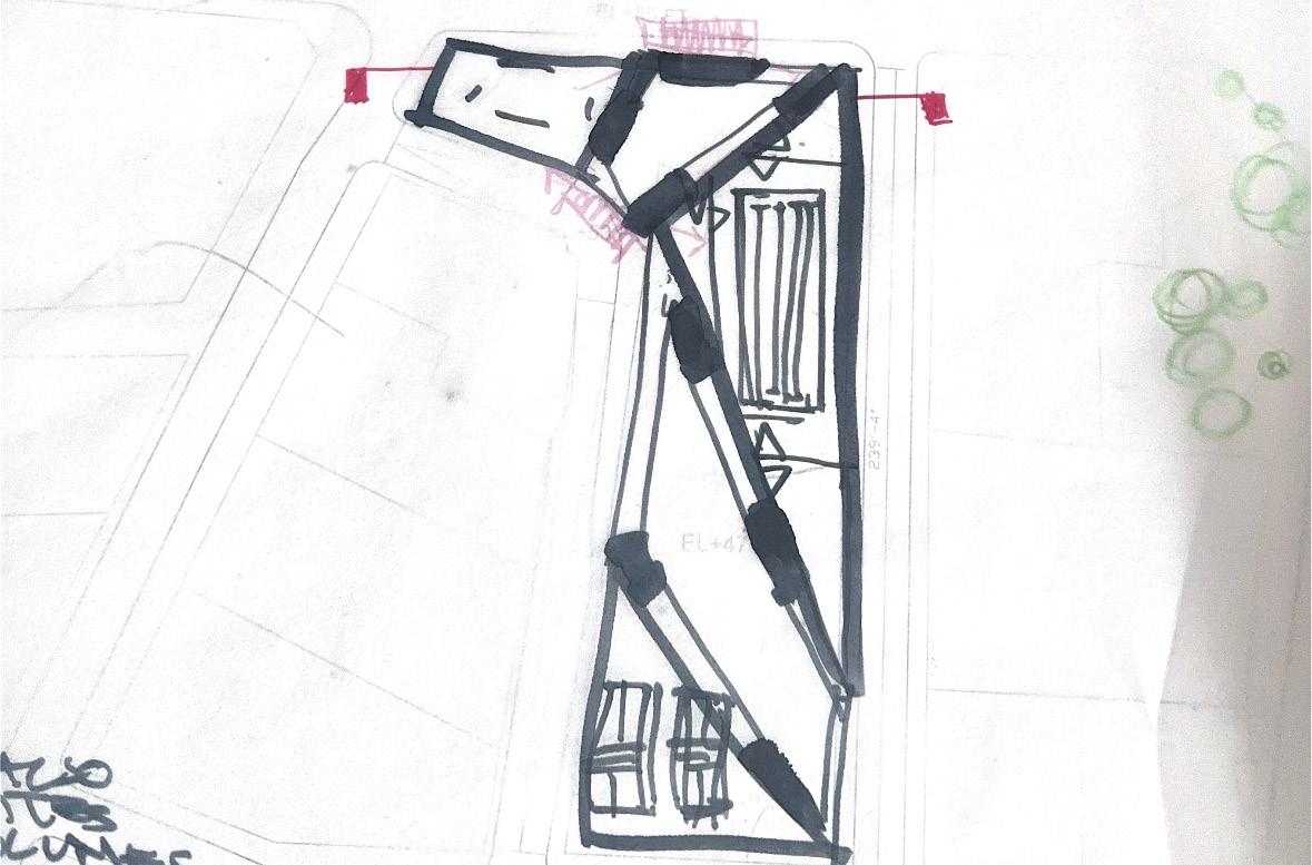
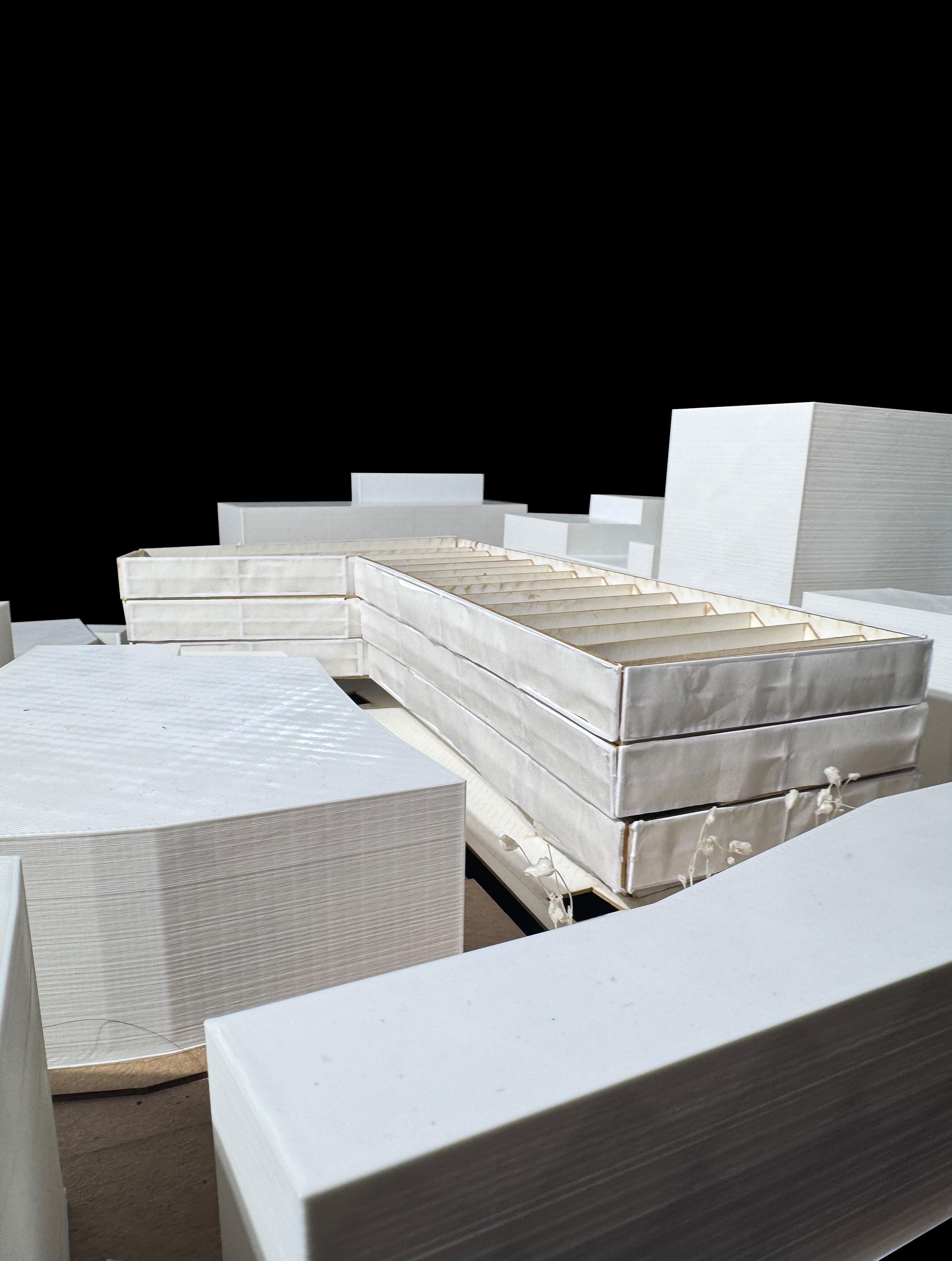
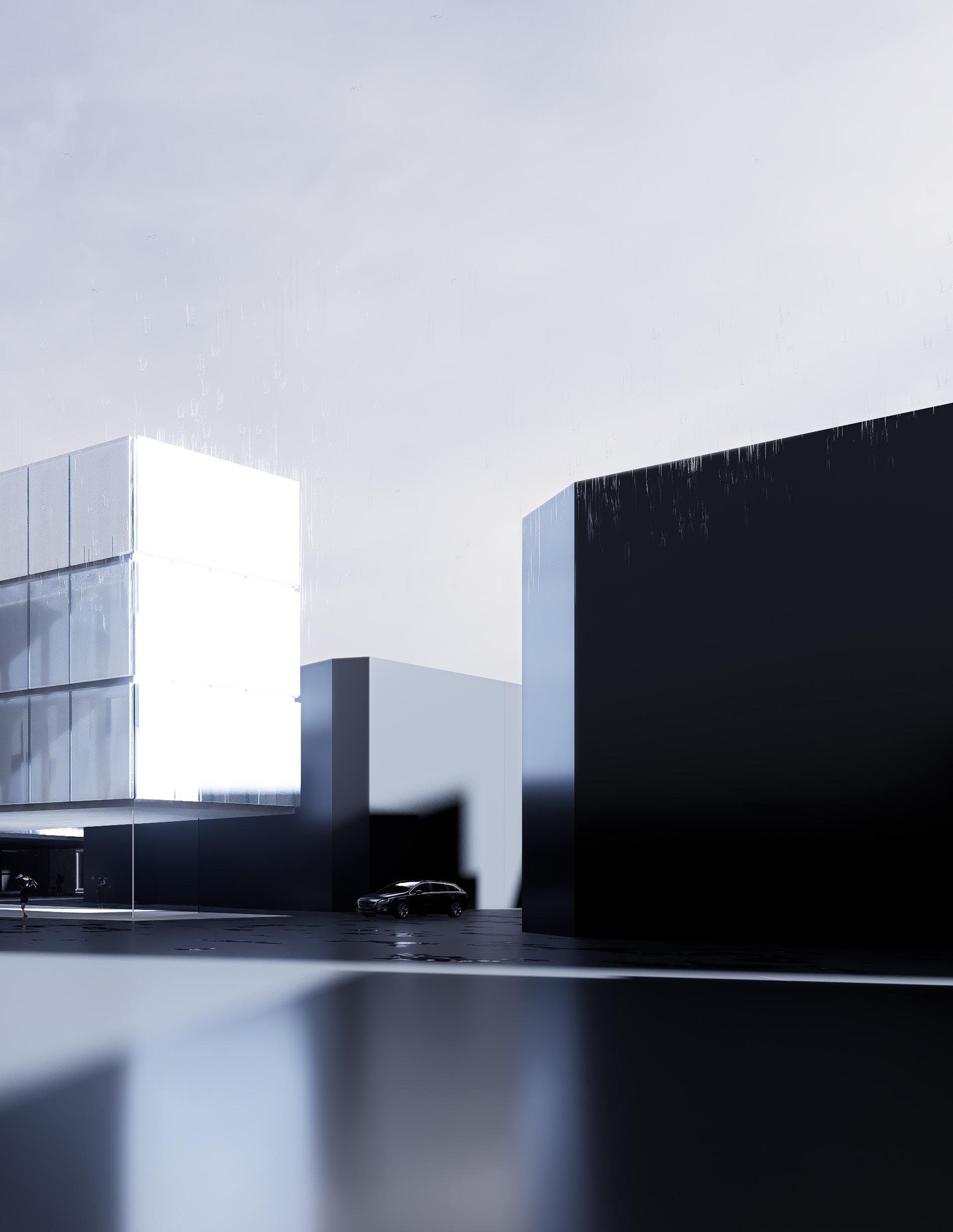
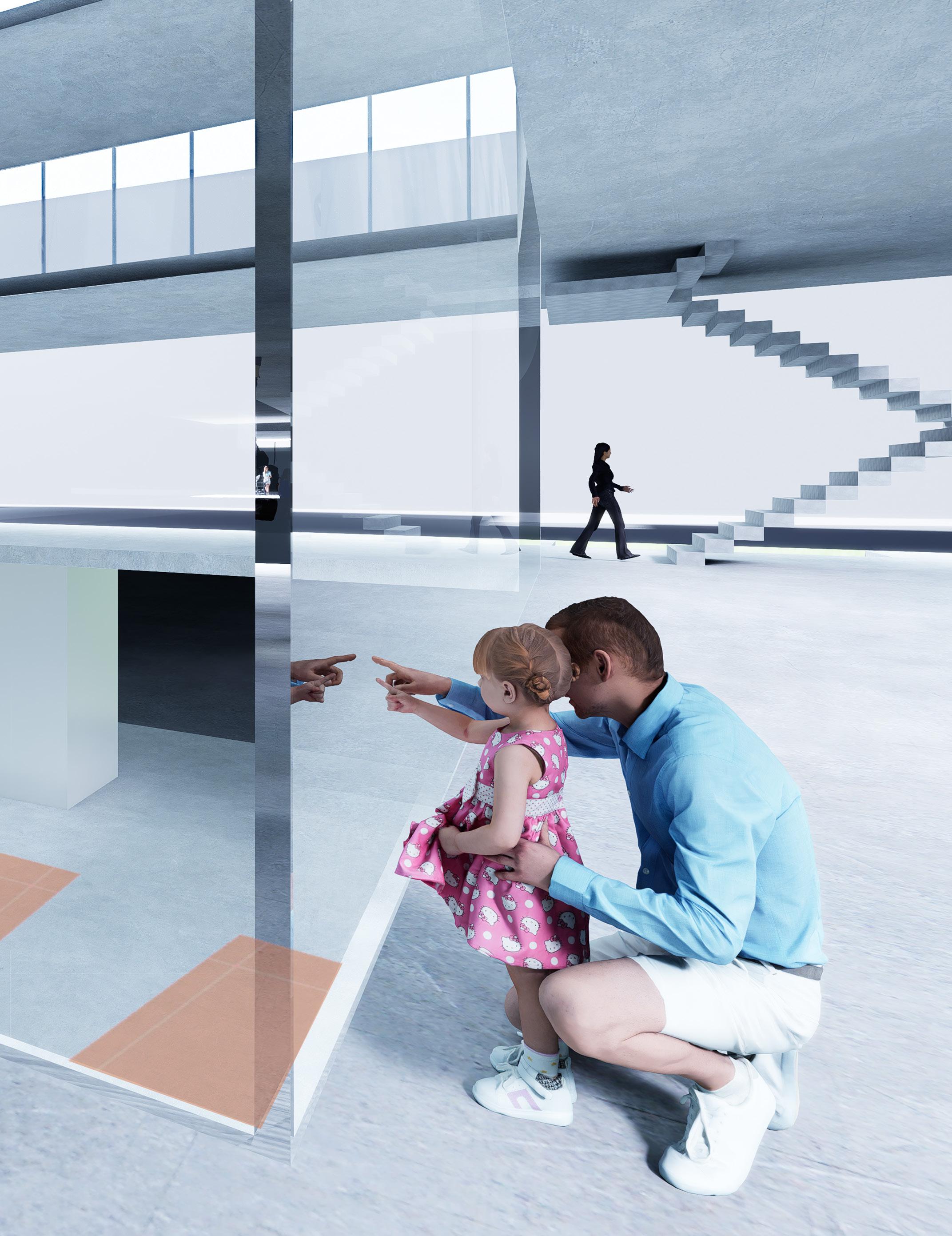
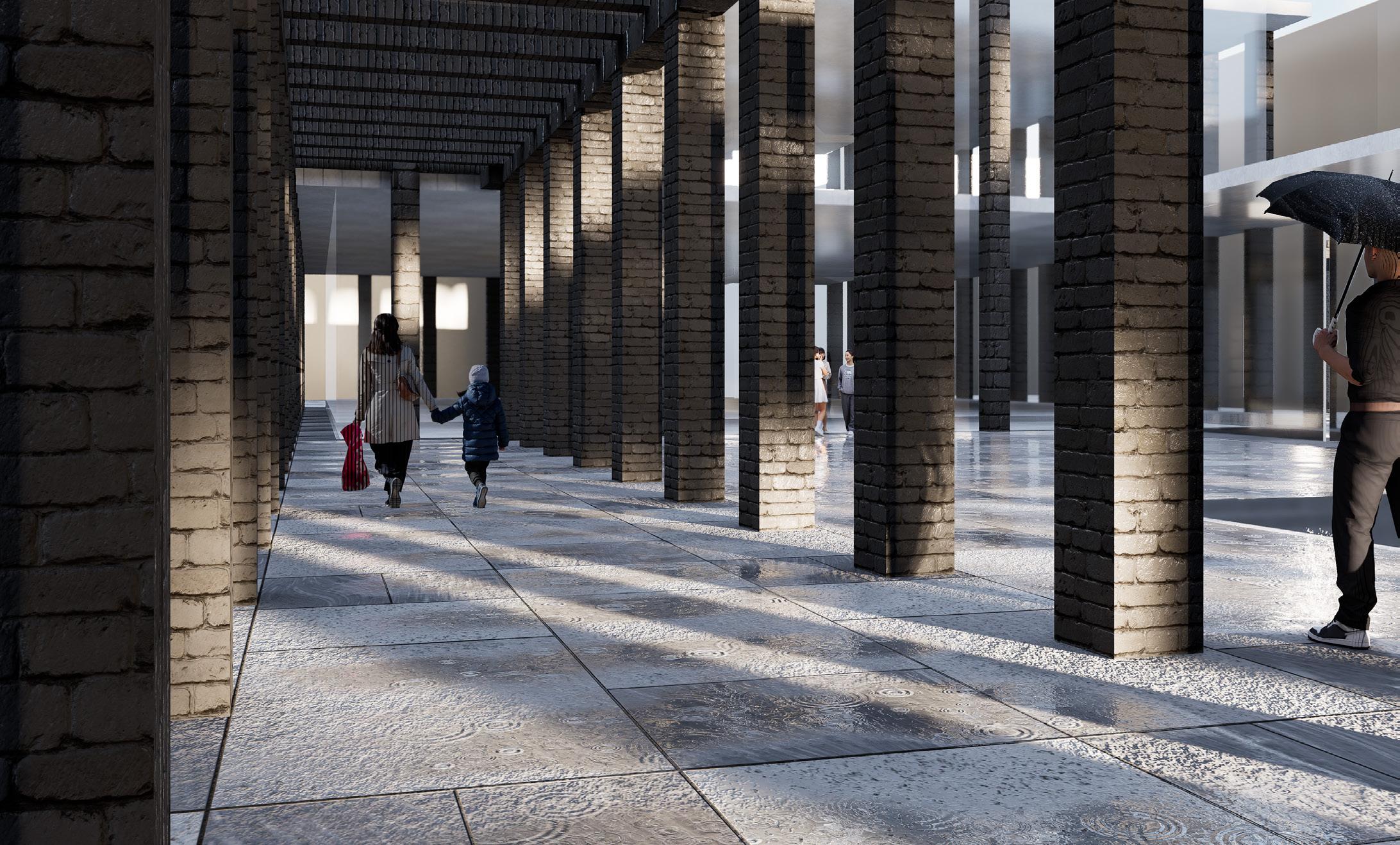
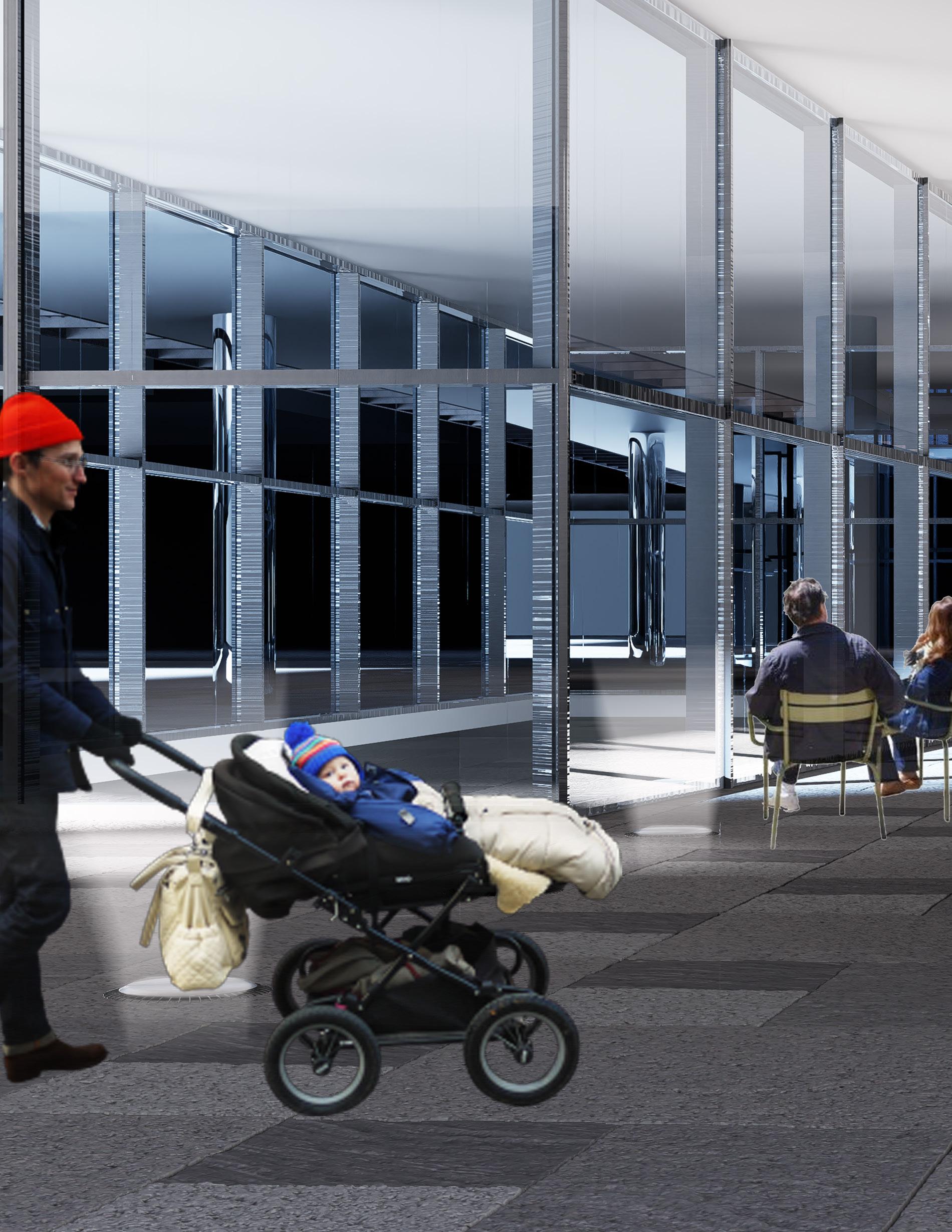
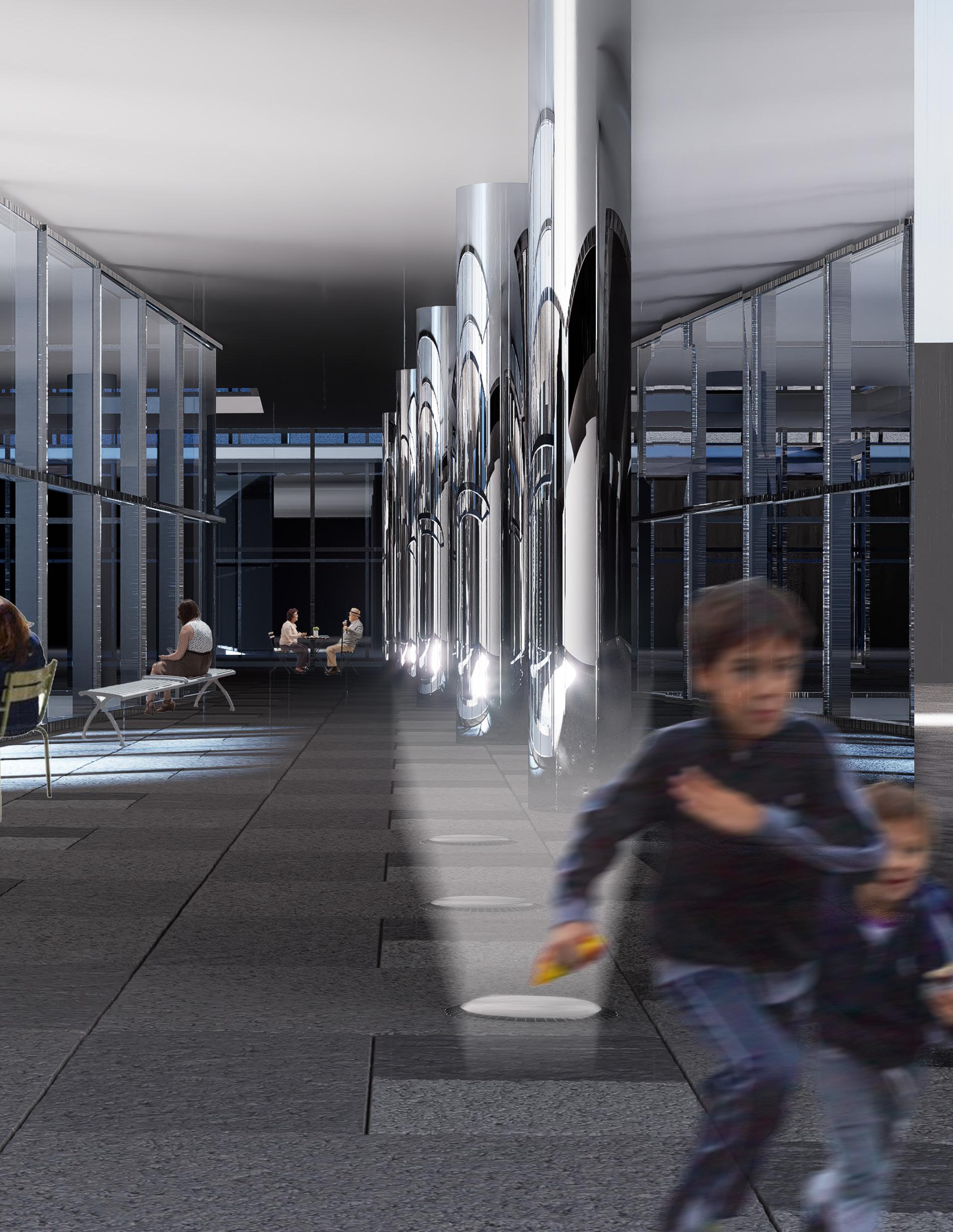
surrounding urban fabric. A series of columns defines the entire perimeter of the site, behaving as structural support for the building and a symbolic representation of the connection to the site and its history. The columns emphasize the vertical movement from the ground up, allowing for reflection upon the regeneration efforts that took place after World War II. At various moments, the columns form a colonnade, encouraging the public to walk the perimeter, experiencing the resiliency of the boundary for themselves and reminding them of the history of the site.
In other efforts to reconnect the proposed building to its urban fabric and the history of the neighborhood, the proposed project will delegate a generous amount of the site footprint to the public realm. The name of Clere St. is an homage to a historical public space adjacent to the space. Prioritizing public space on this site would not only continue the traditions of the early developers of this area but would also compensate for the lack of public space surrounding the site, which is a product of gentrification and architecture ignorant to public needs.
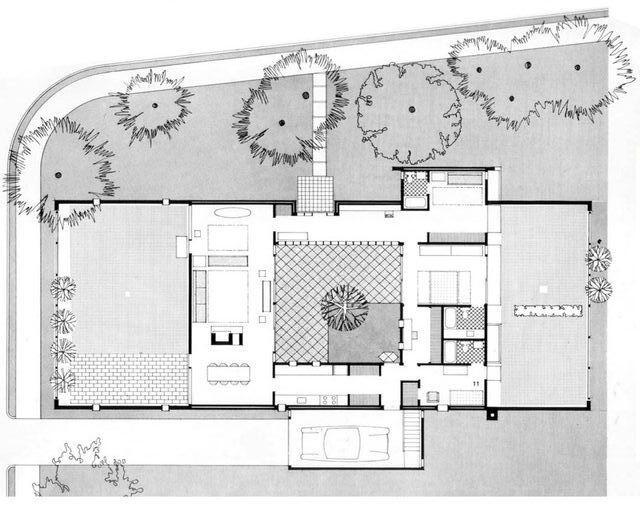
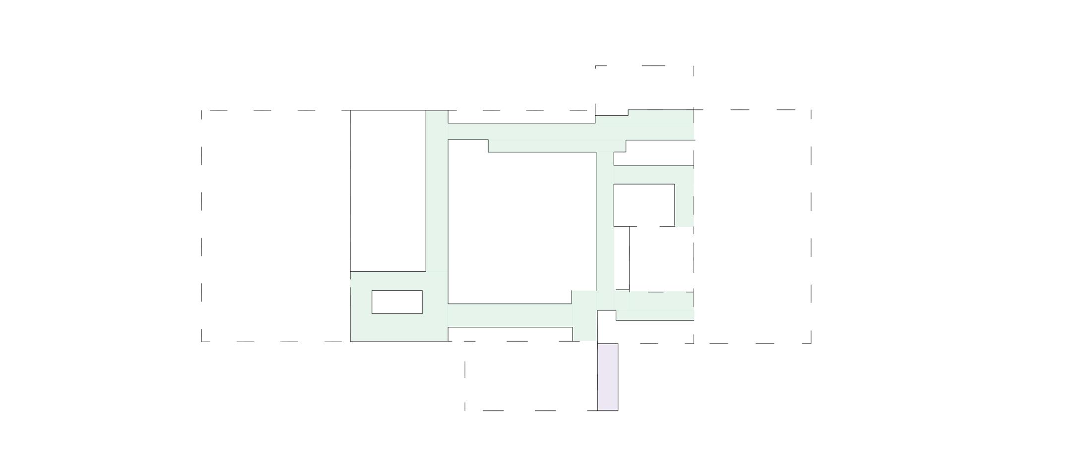
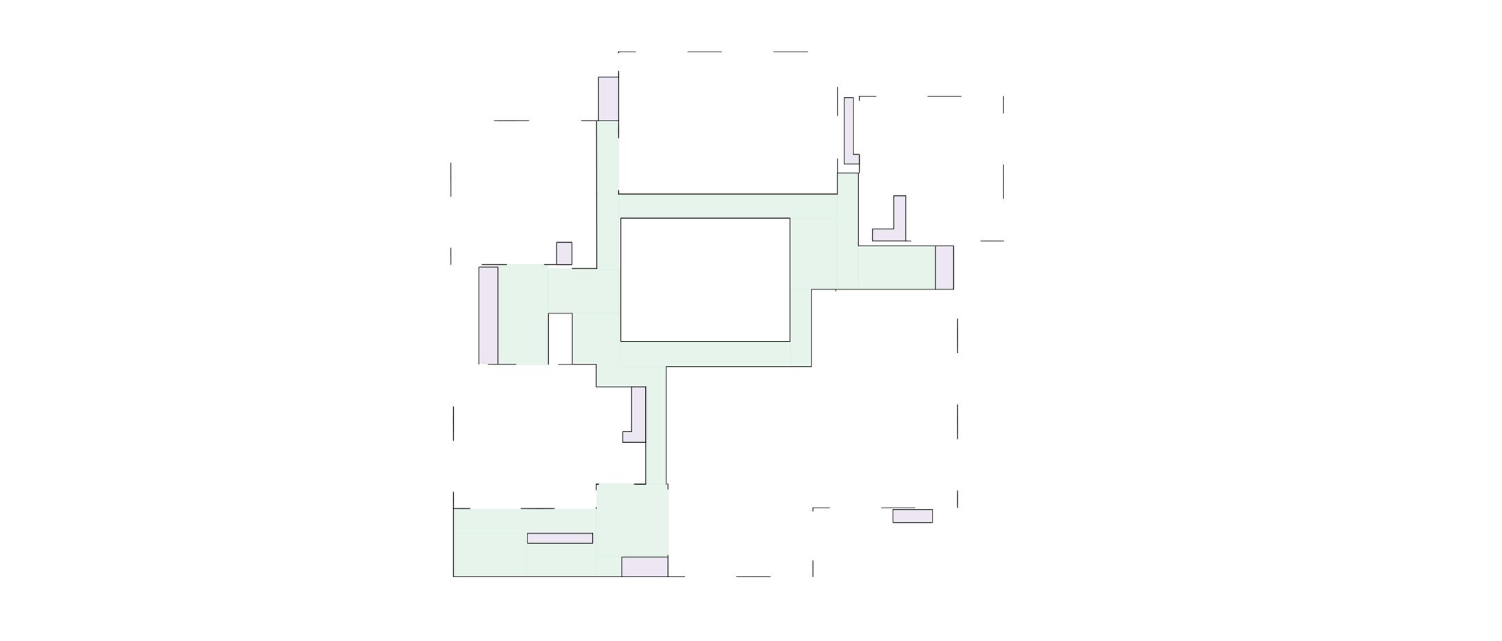
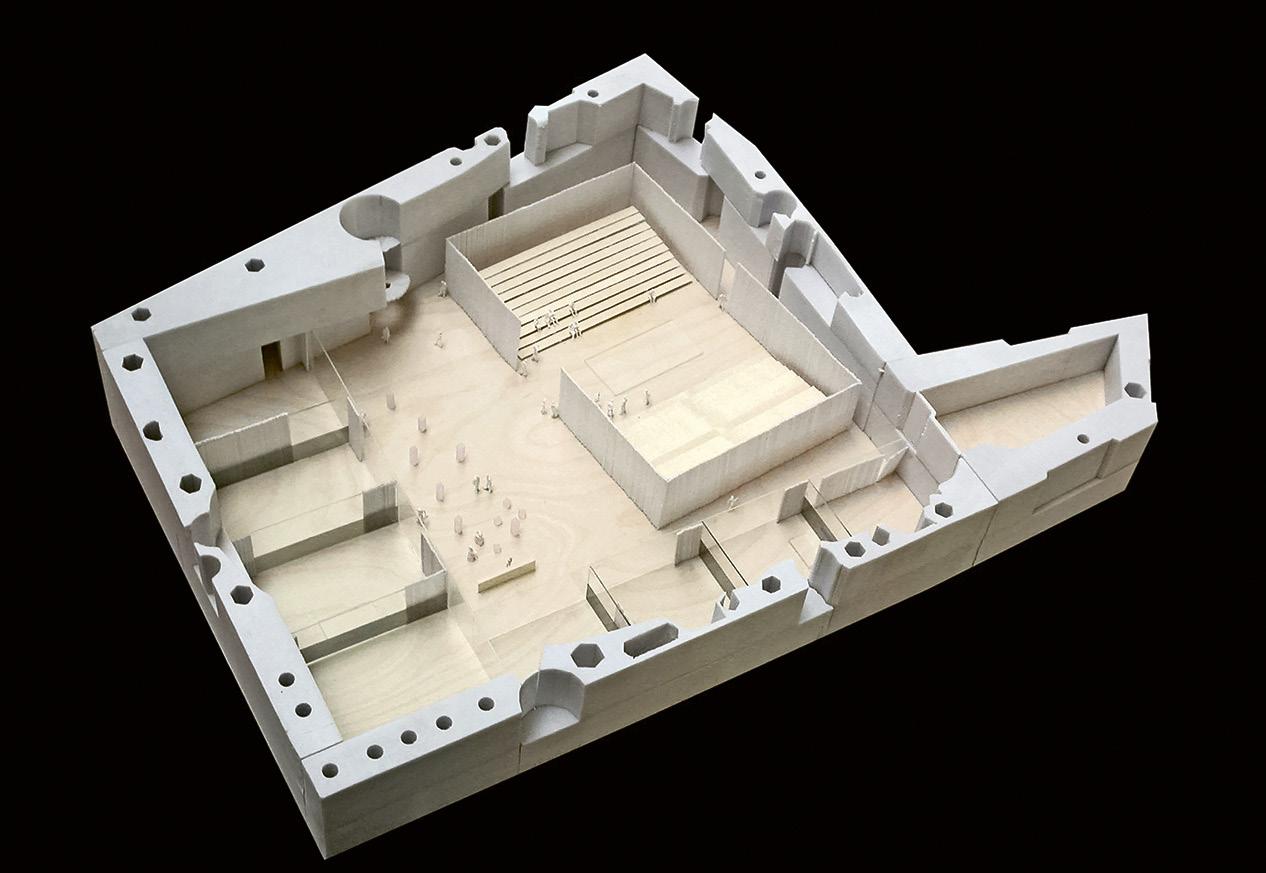
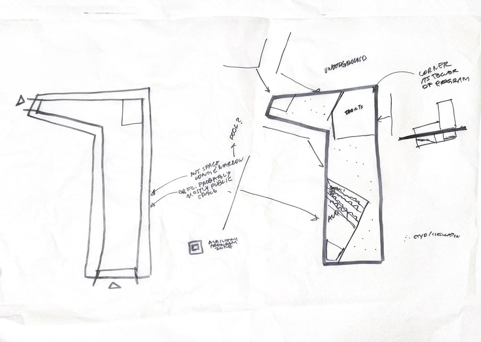
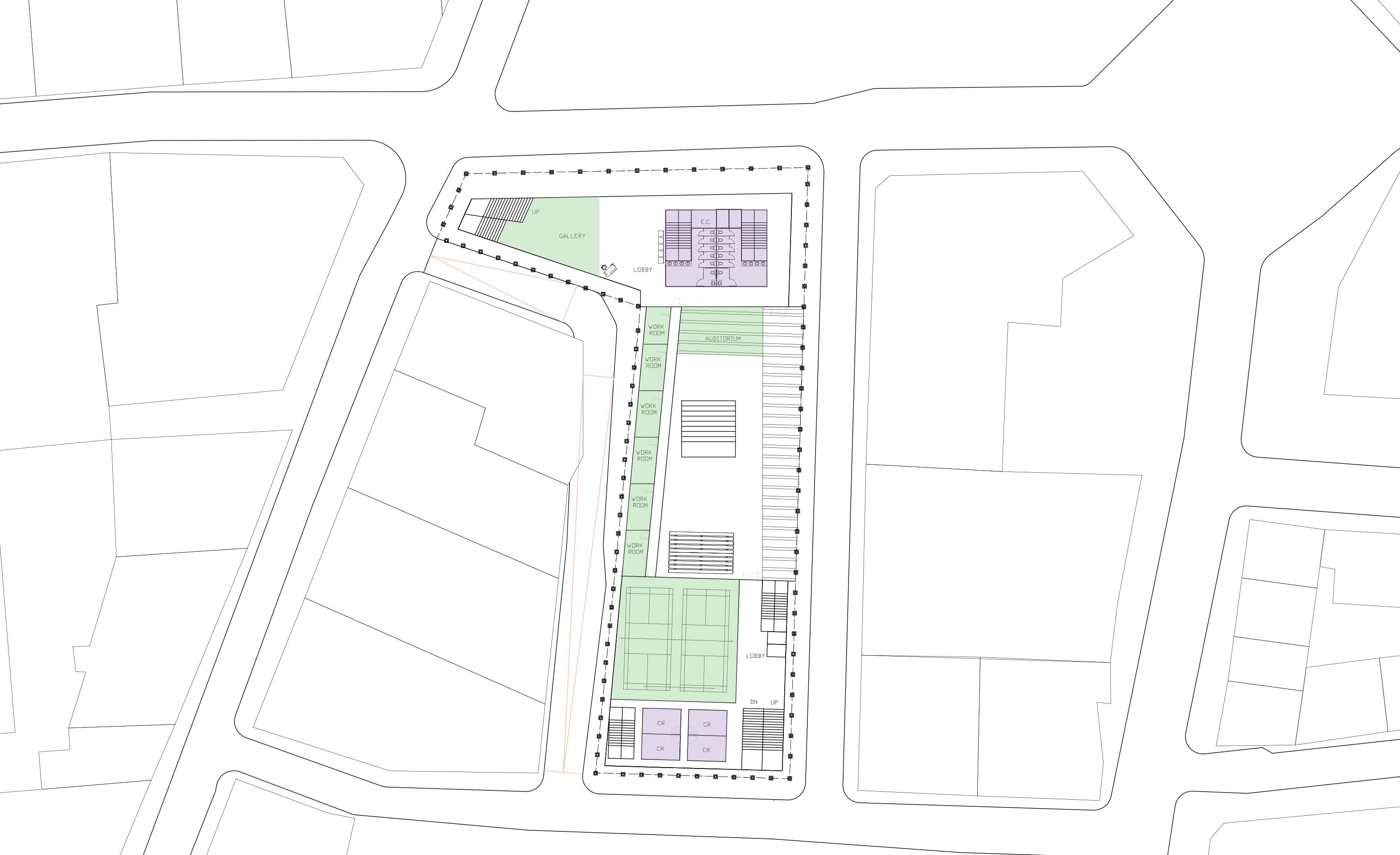
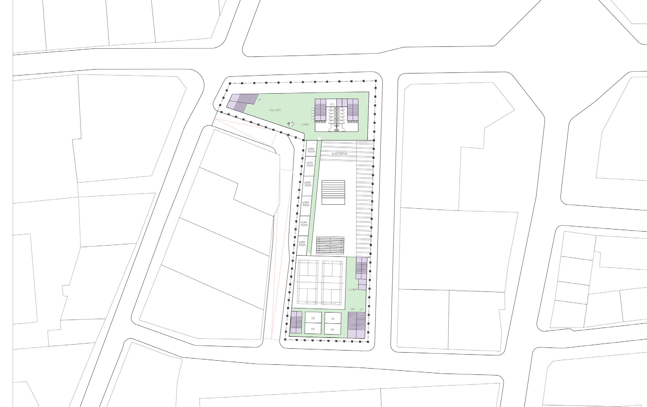
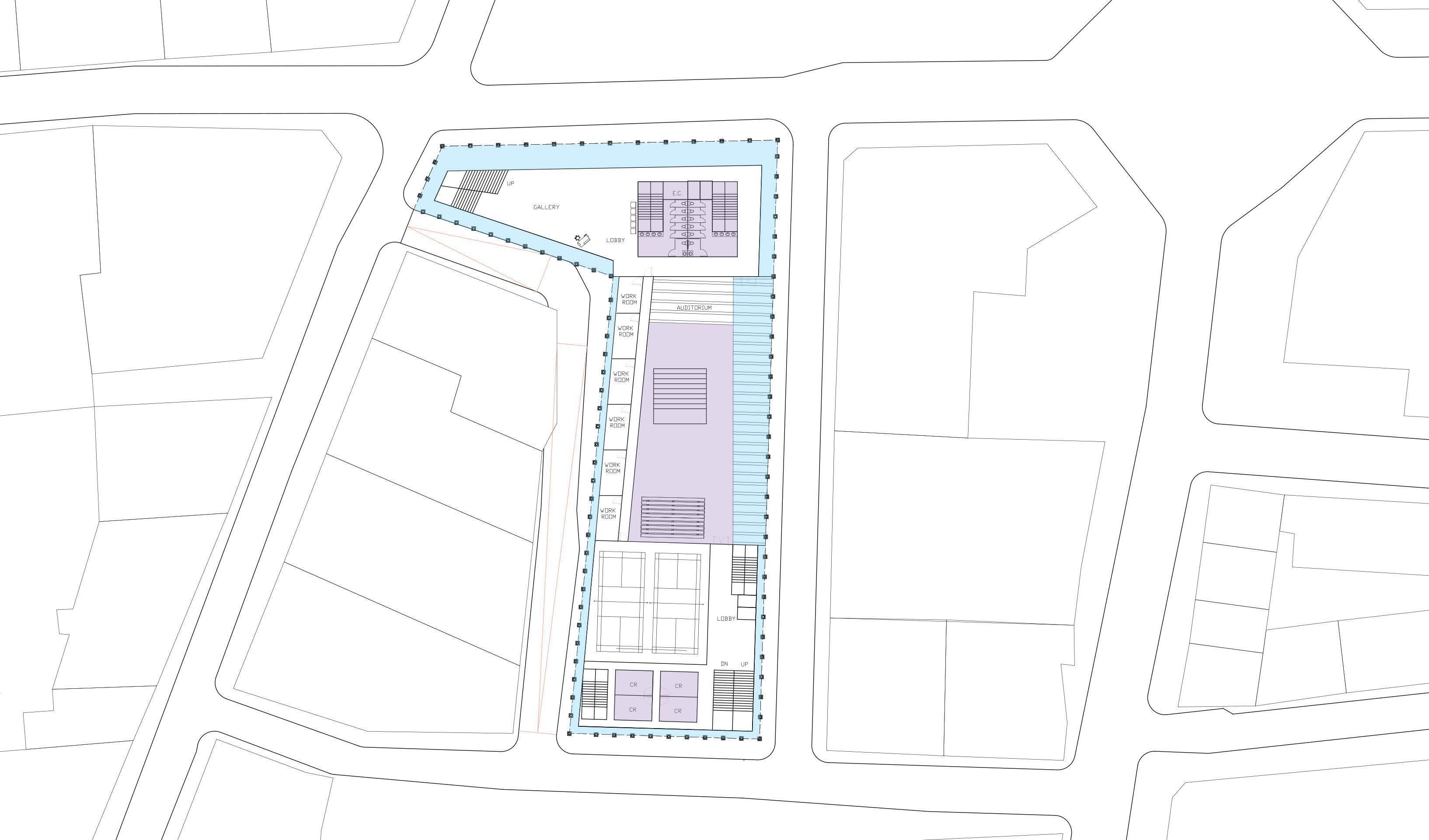
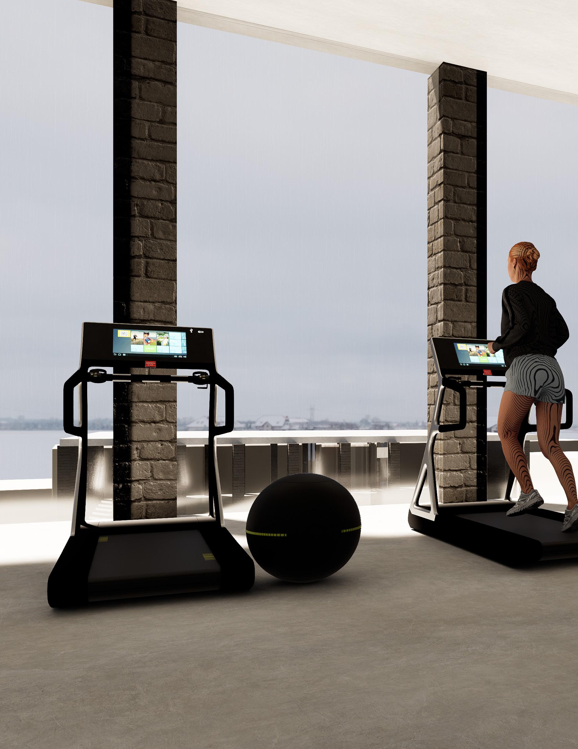
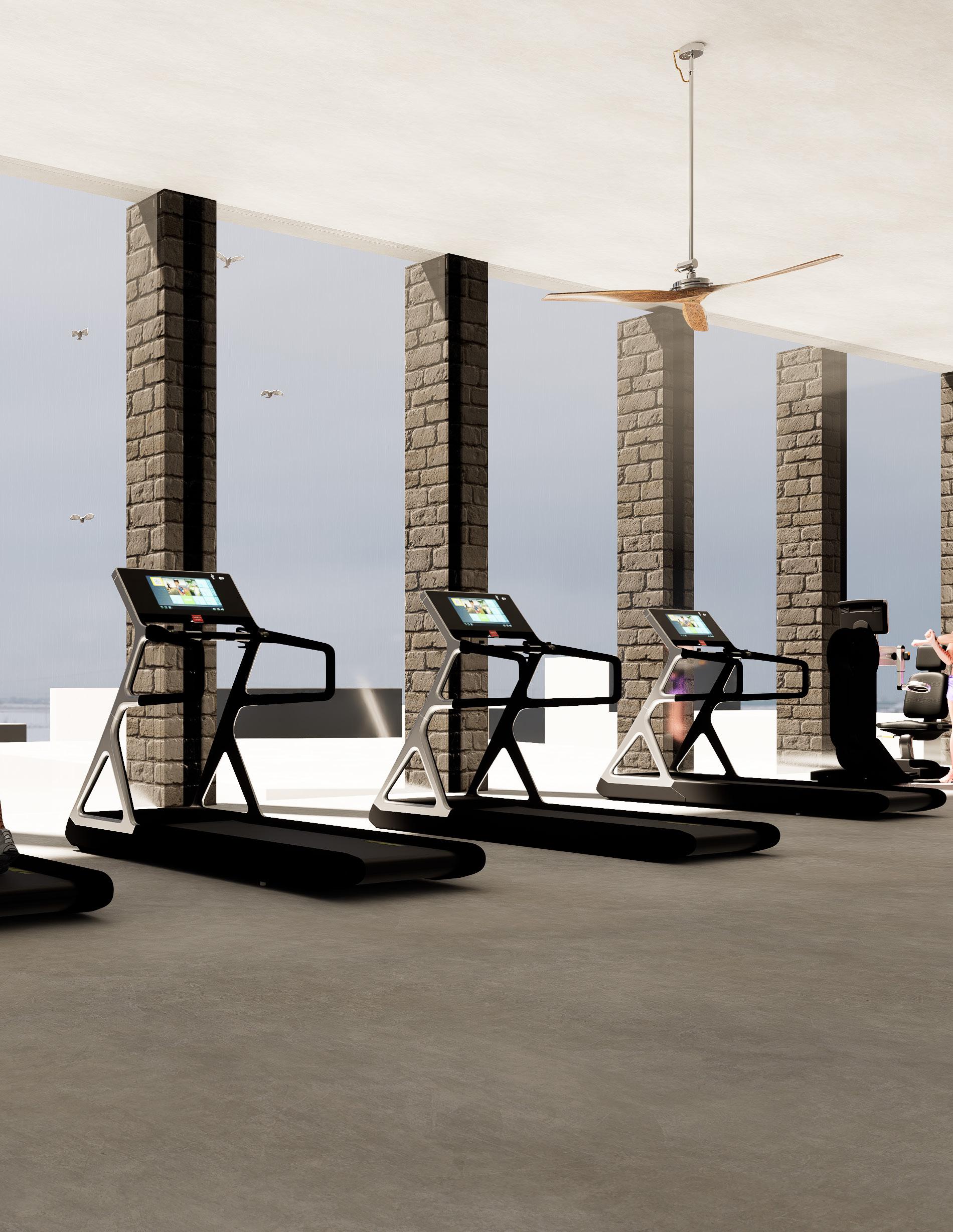
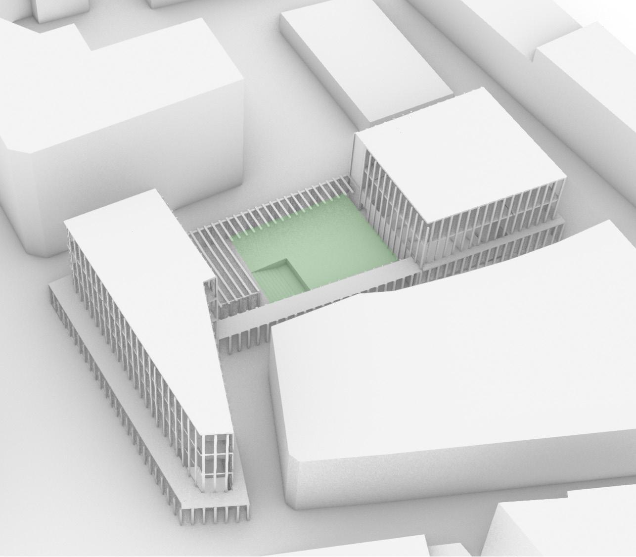
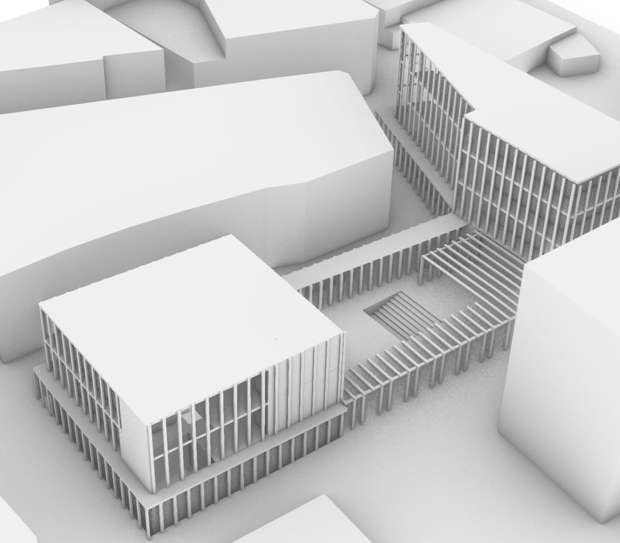
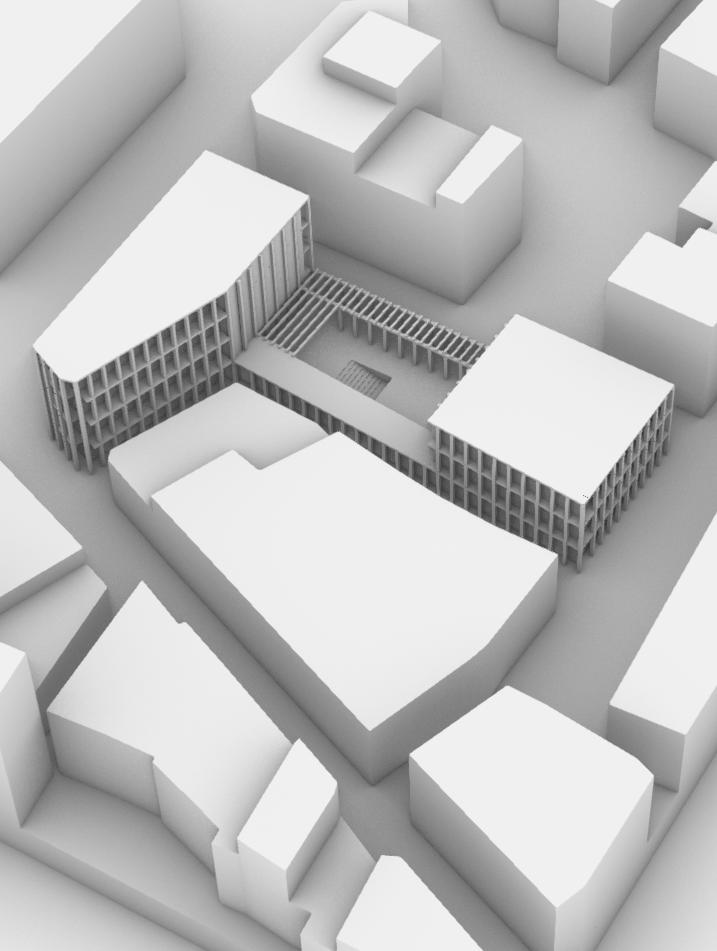
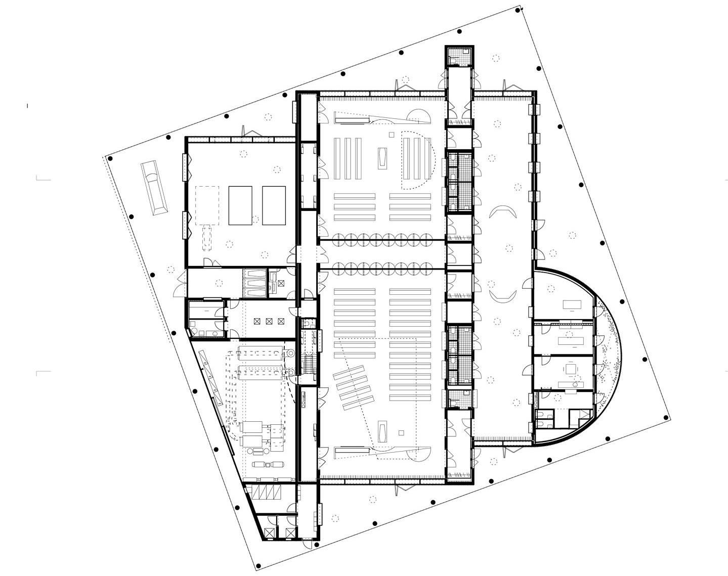
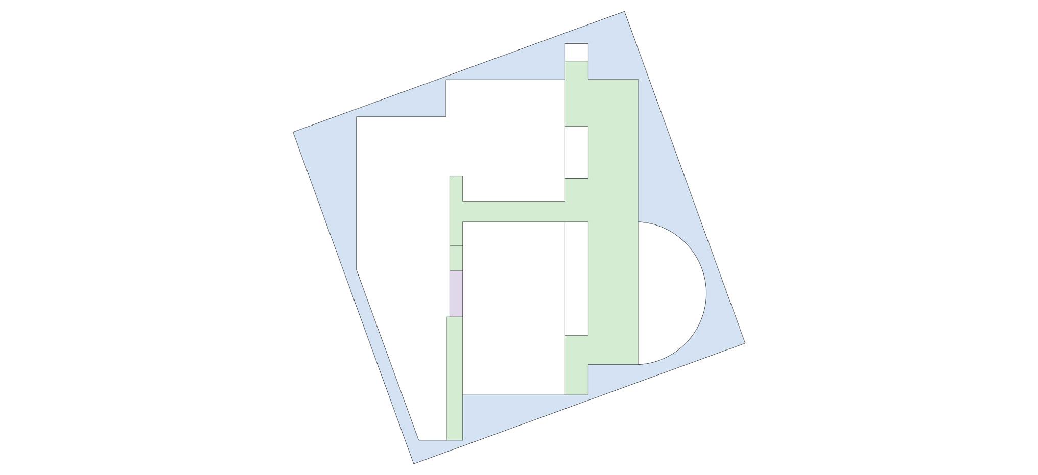
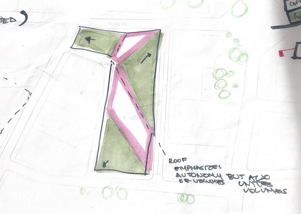
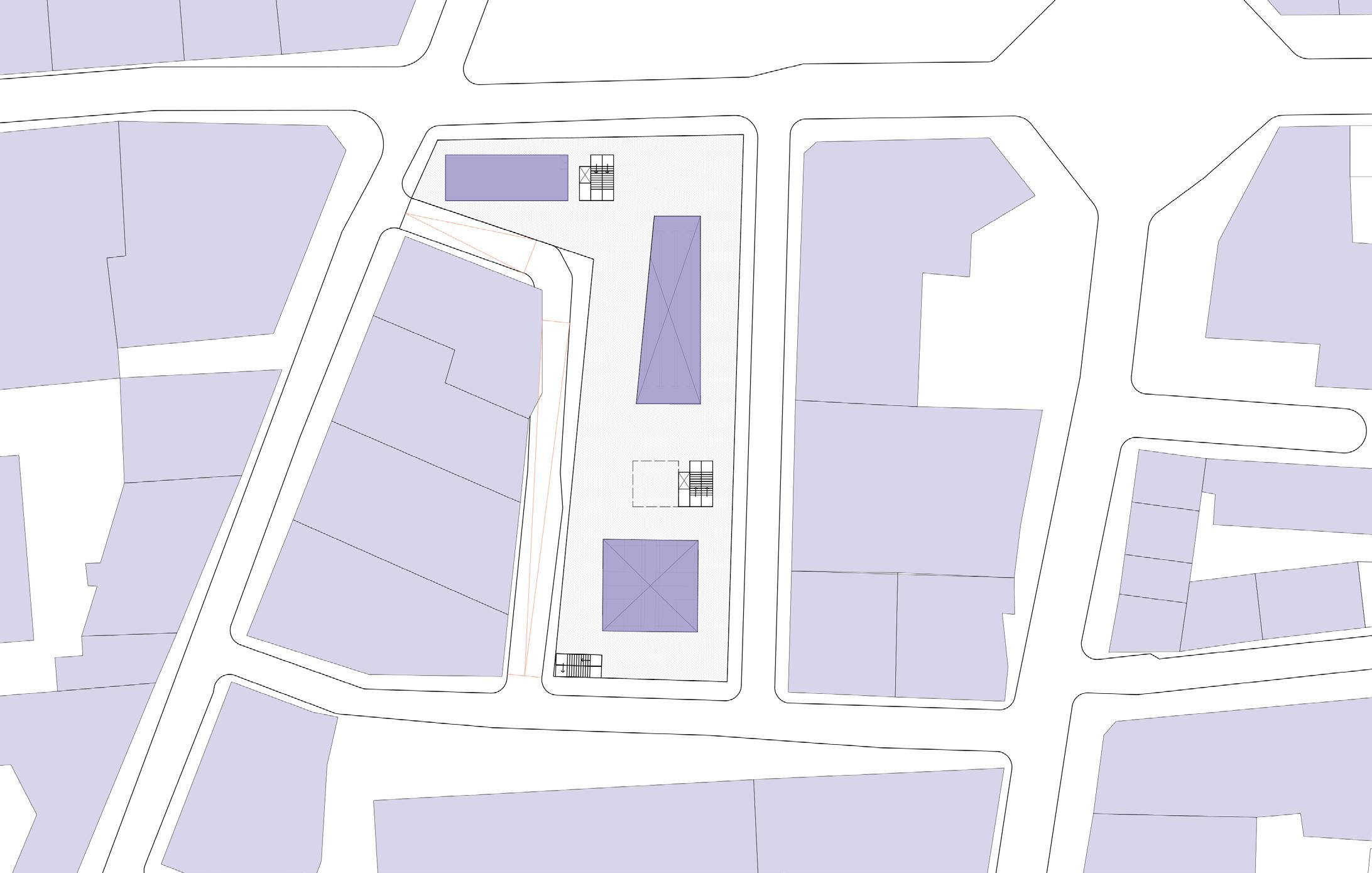
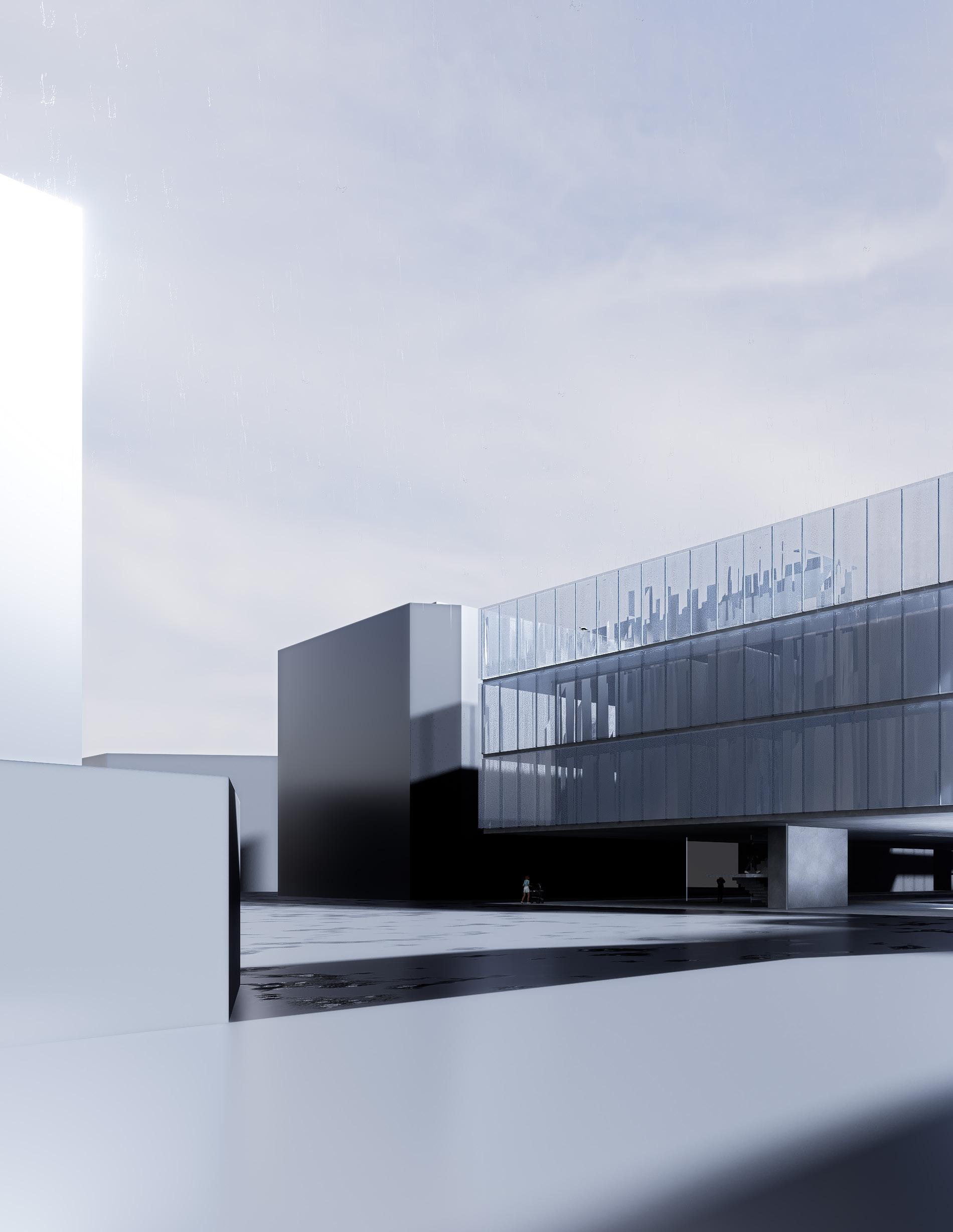
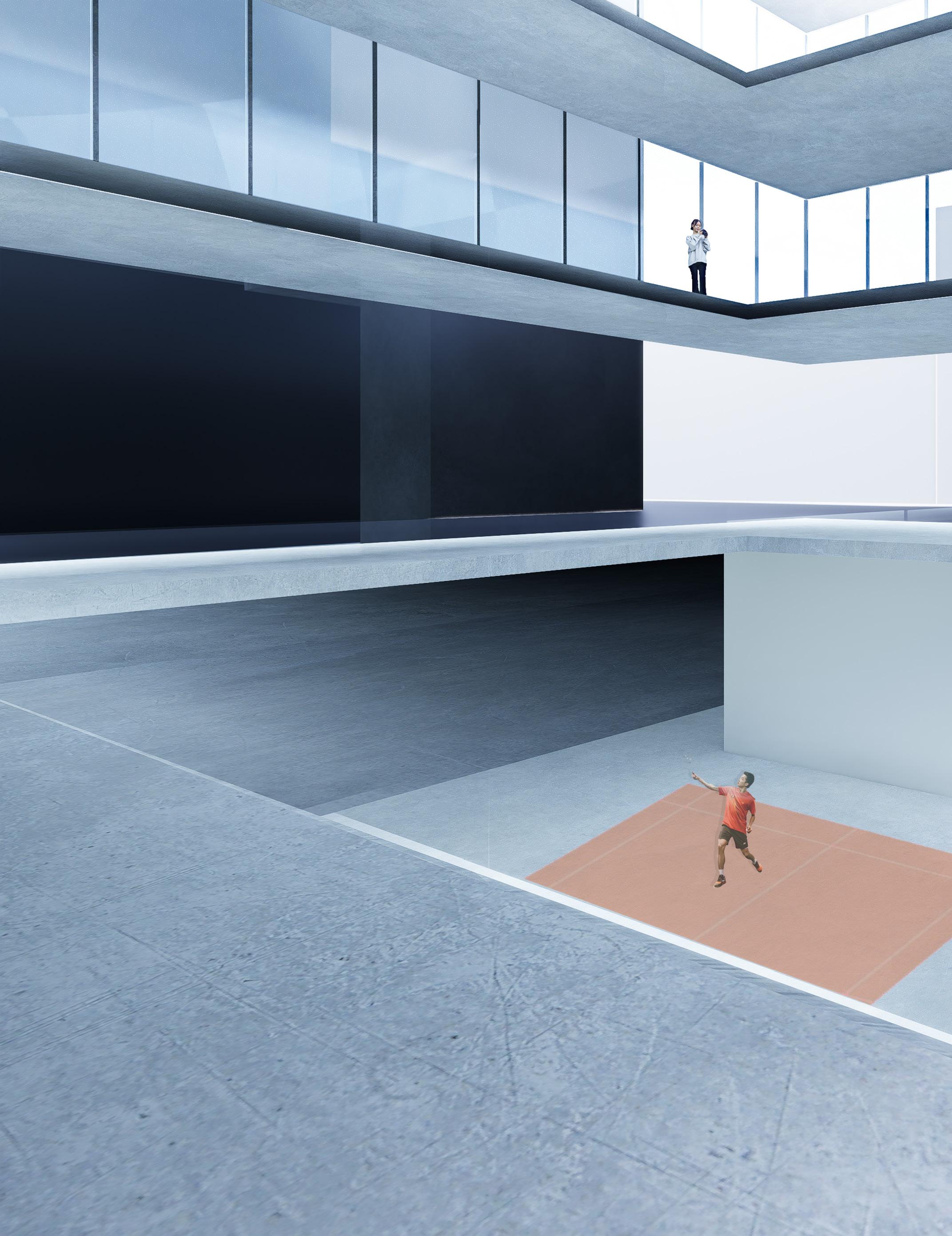
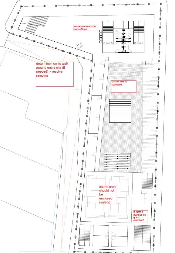
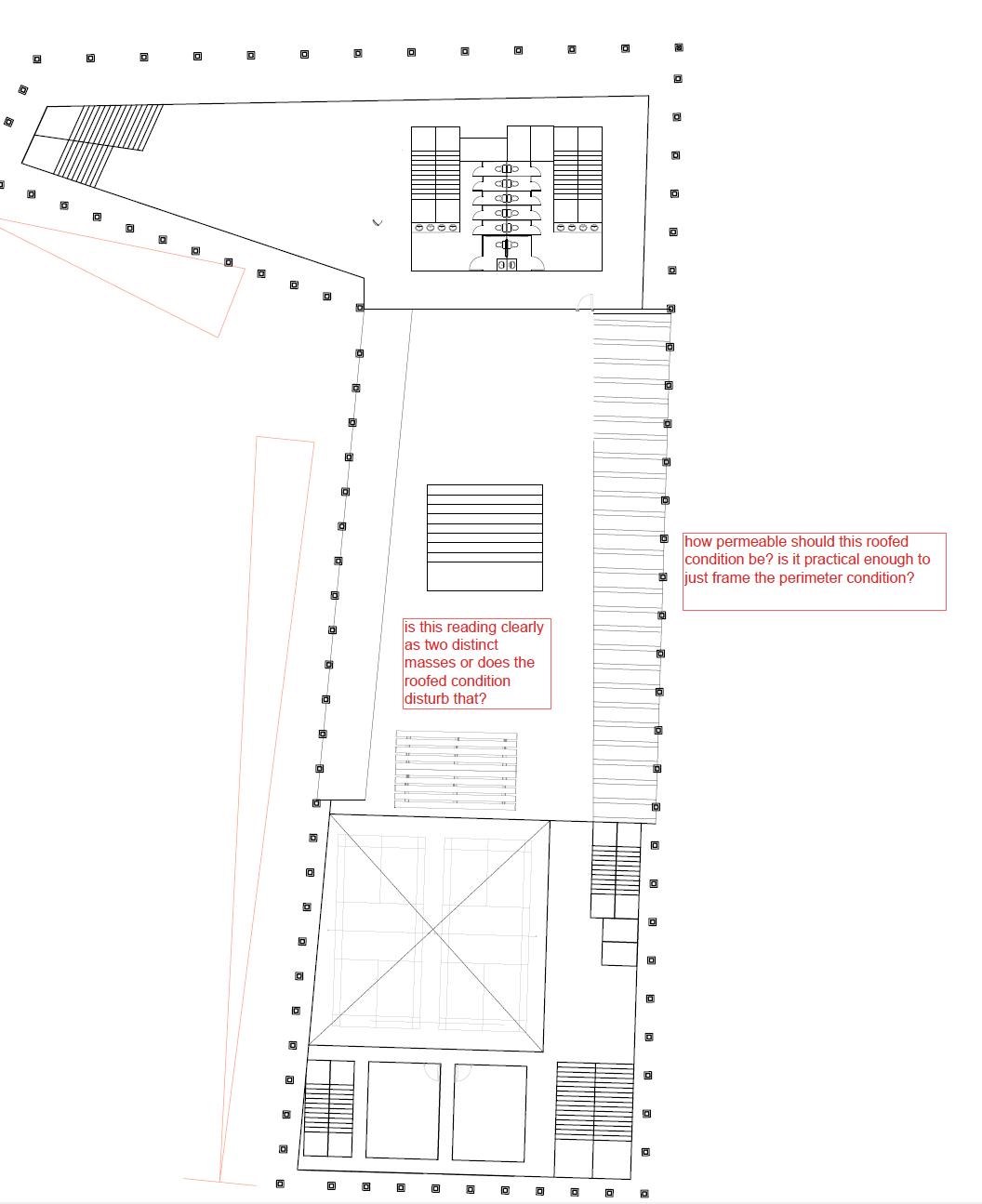
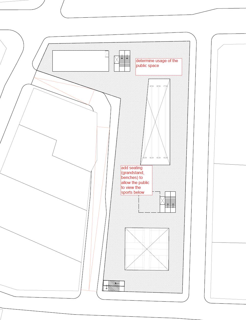
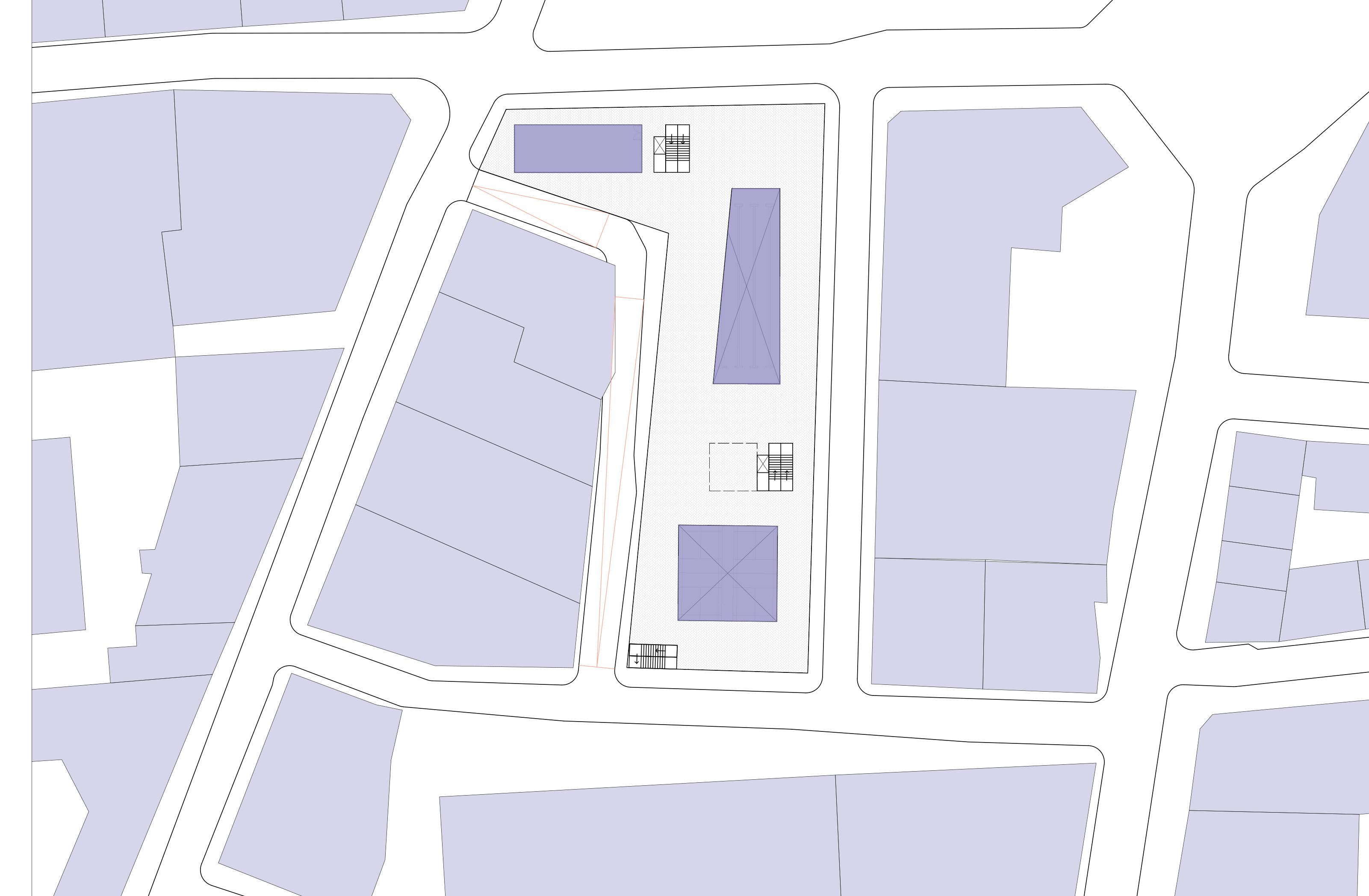
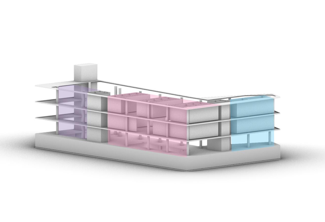
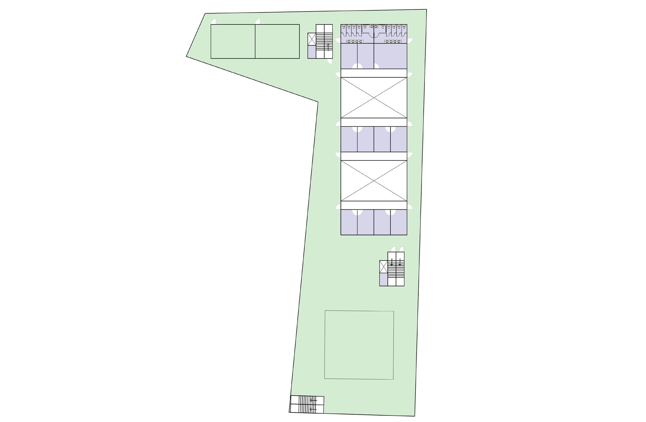
The main strategy used to prioritize public space is the courtyard. The central courtyard in the project proposal organizes the zones of program by usage, generating two volumes, one housing cultural and social program and the other housing sports program. The courtyard also serves to connect these two distinct volumes, creating areas where the public can gather, spectate, and circulate.
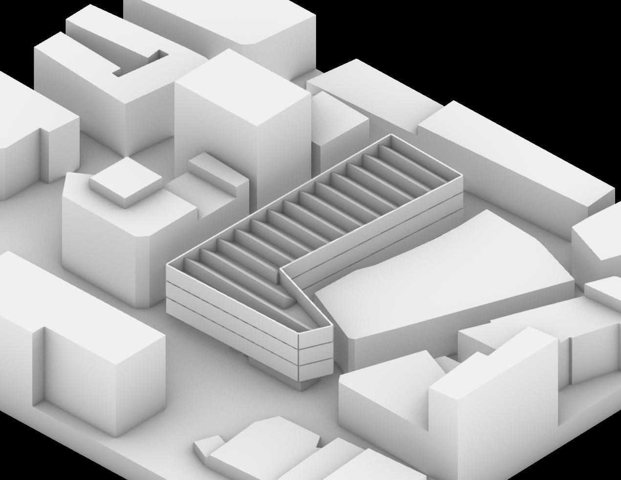
Site Strategy Diagram
Map of Blitz Bombing Damage in WWII
Map of Hackney Borough Post-WWII (ca. 1970)
Map of Hackney Borough Pre-WWII (ca. 1840)
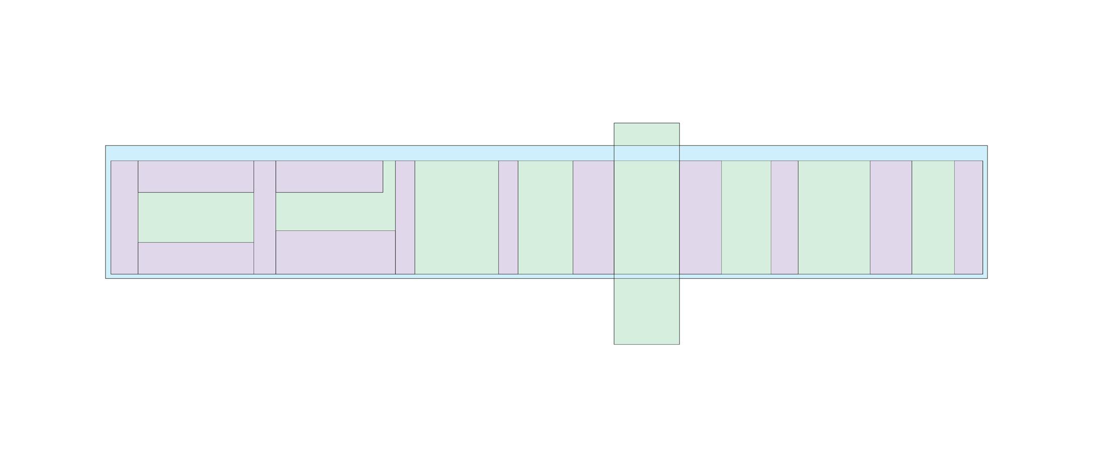
rectangular geometry quadrilateral geometry
Geometric Structure and Modulation
defined boundary rooms used to organize space
Spatial Definition
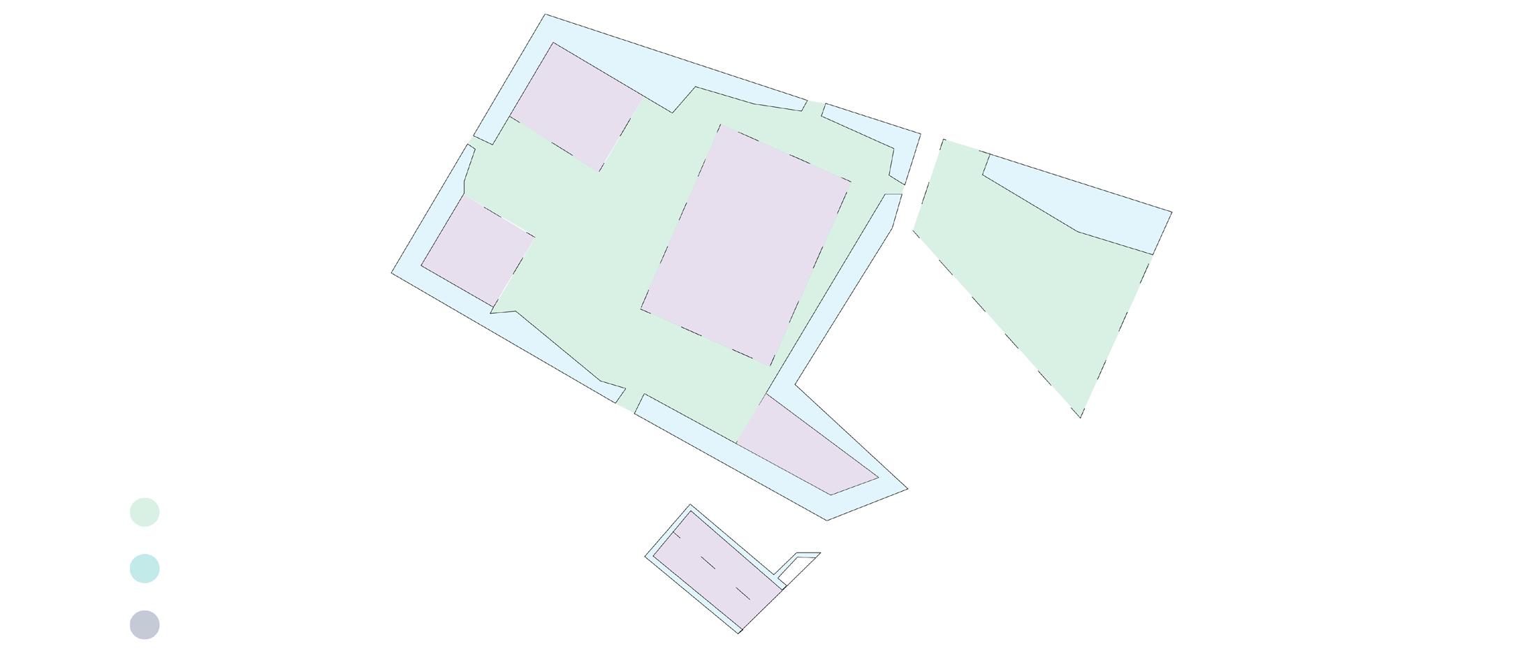
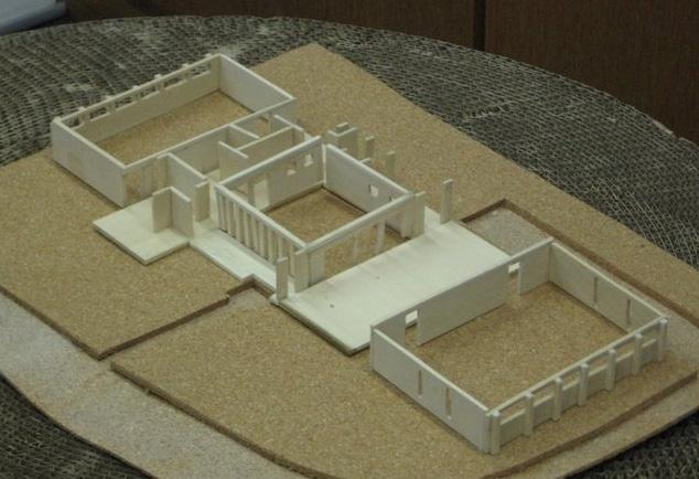
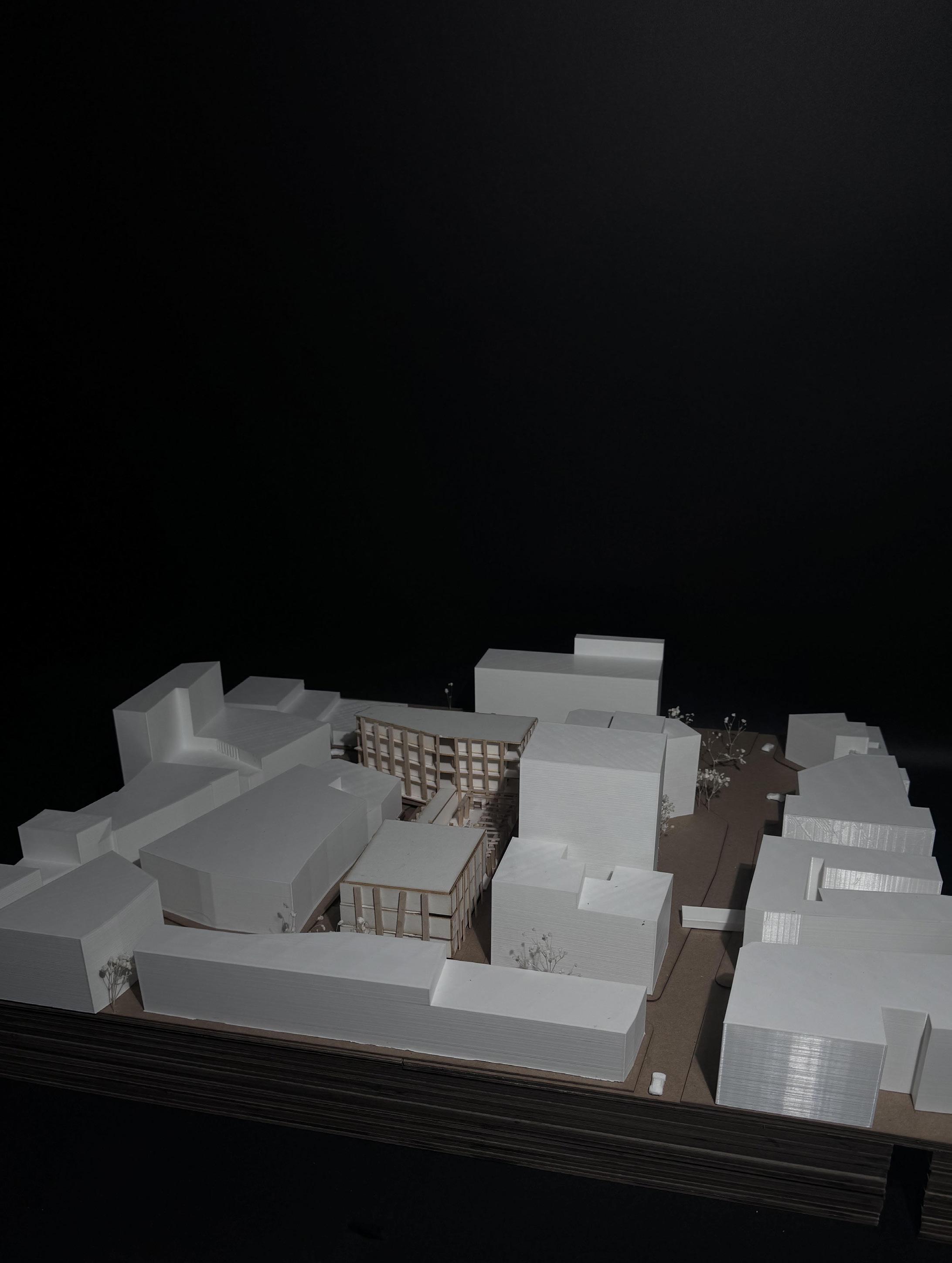
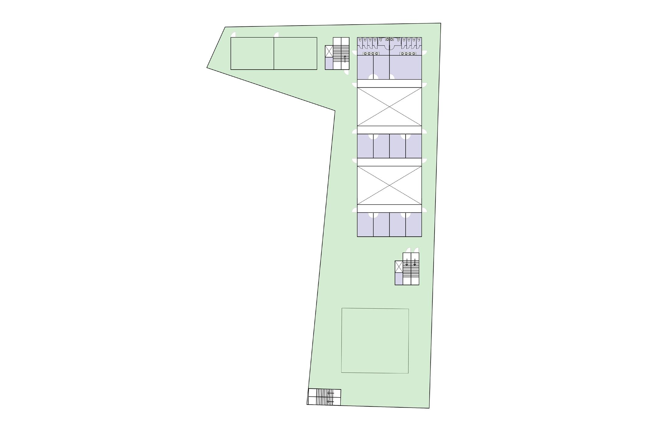
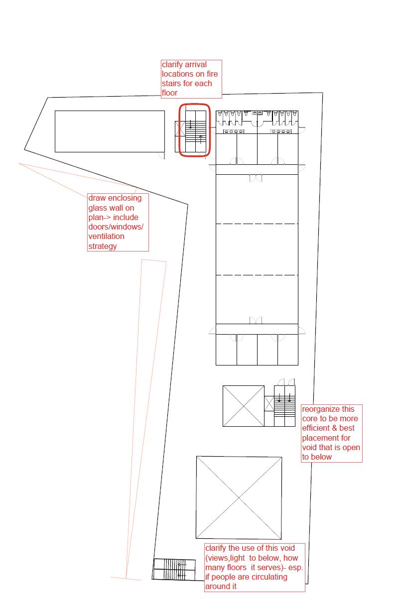
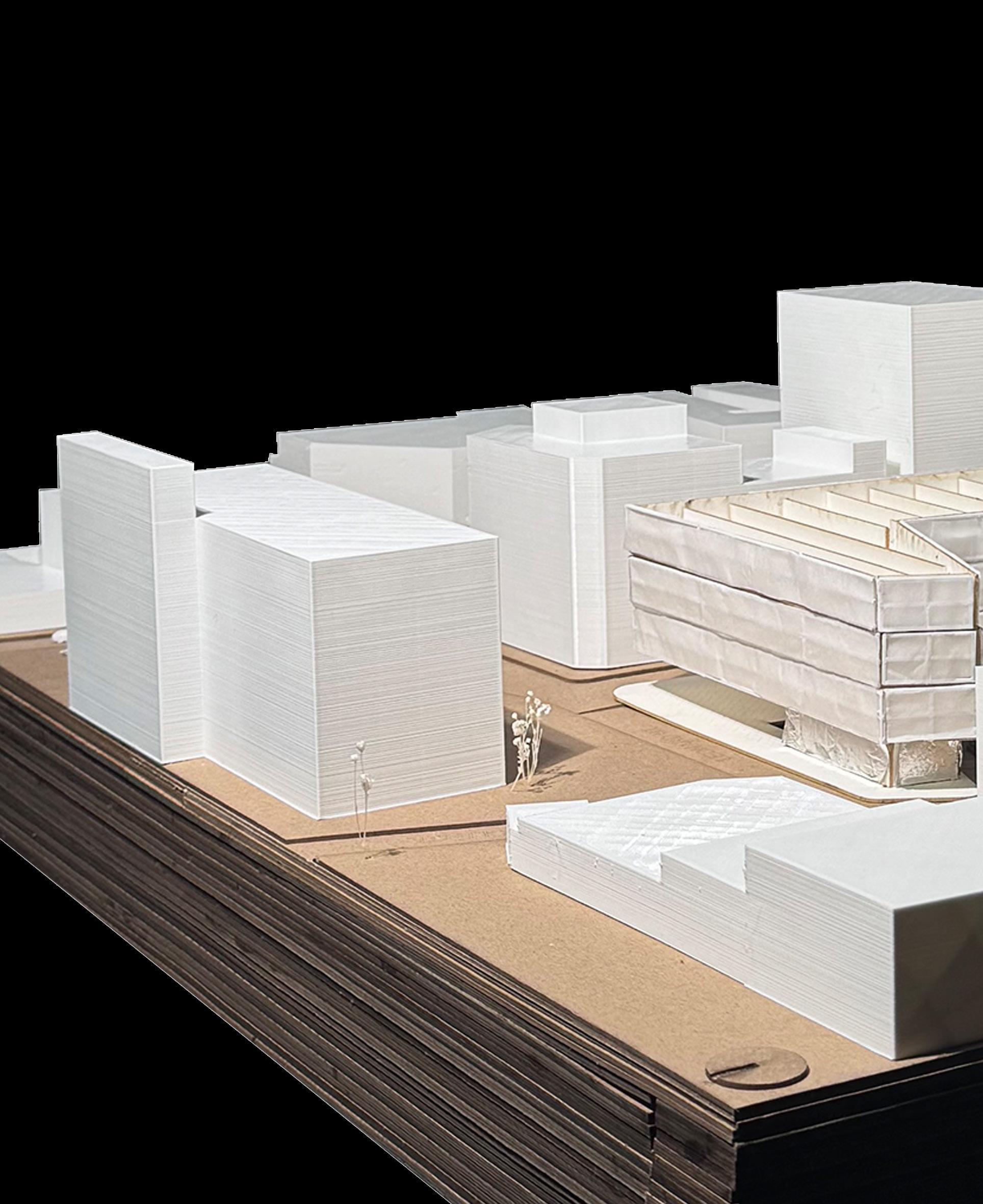
Massing Study 1: Courtyard
Massing Study 2: Courtyard
Massing Study 3: Courtyard
Massing Study 1
Massing Study 2
Massing Study 3
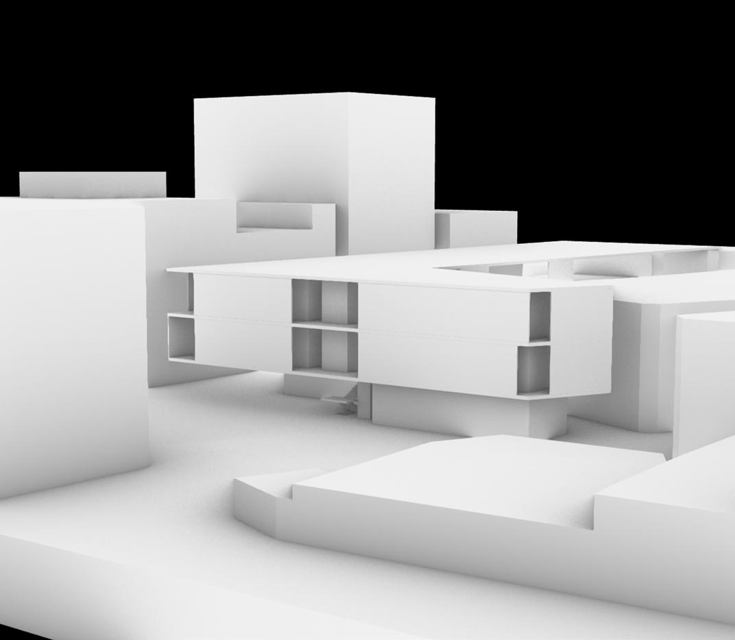
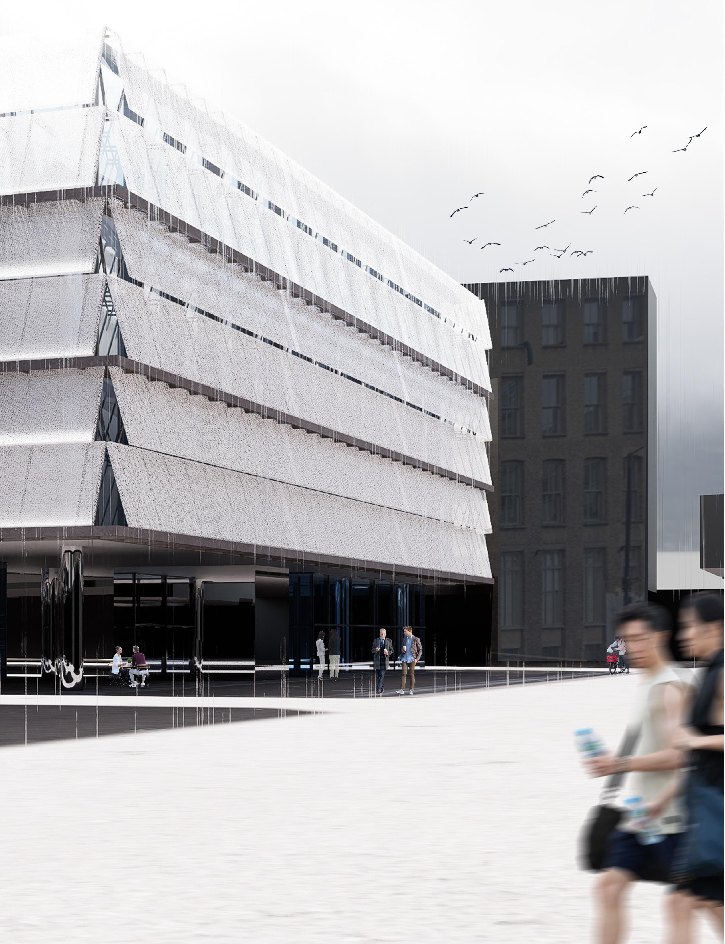
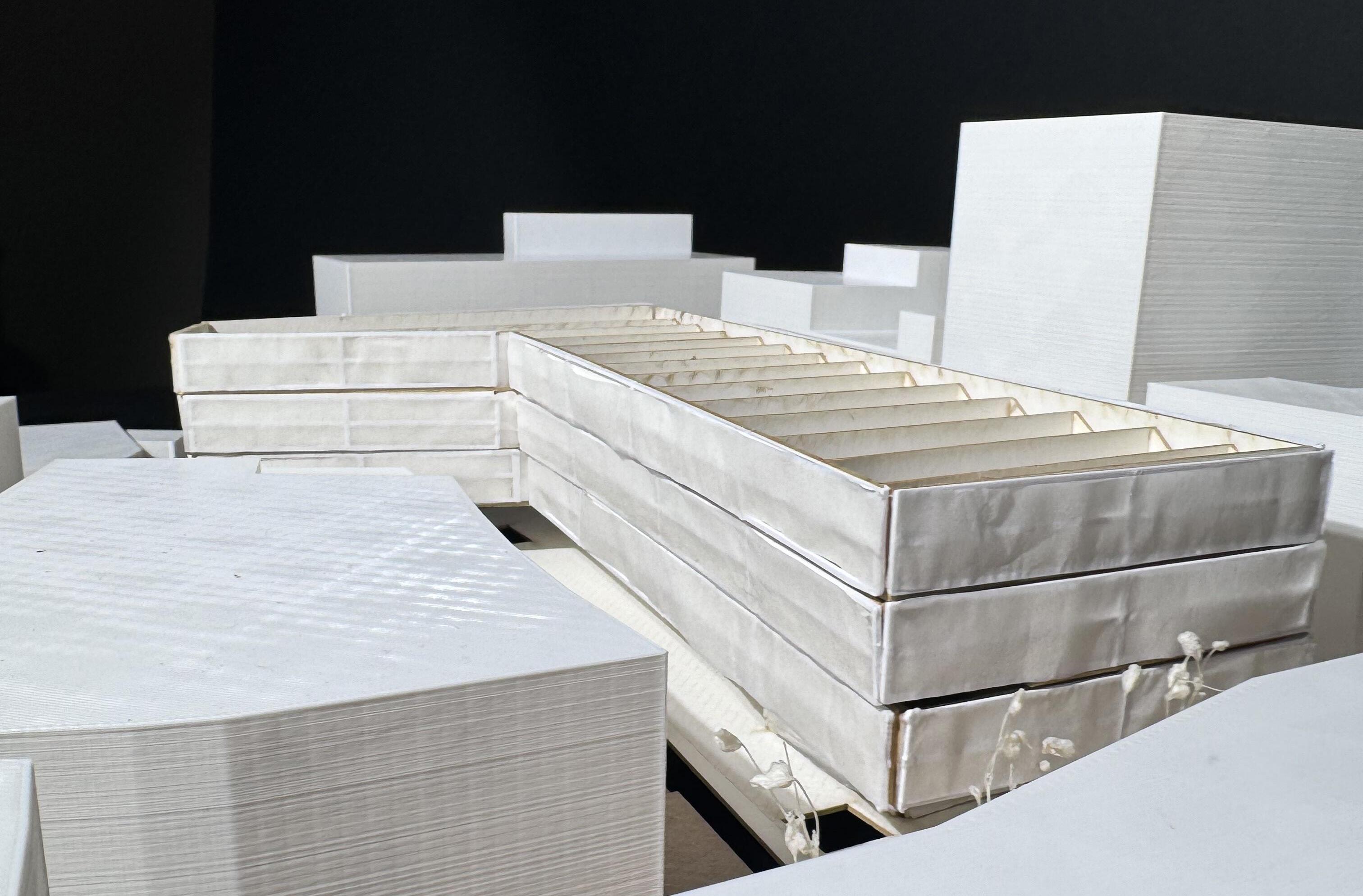
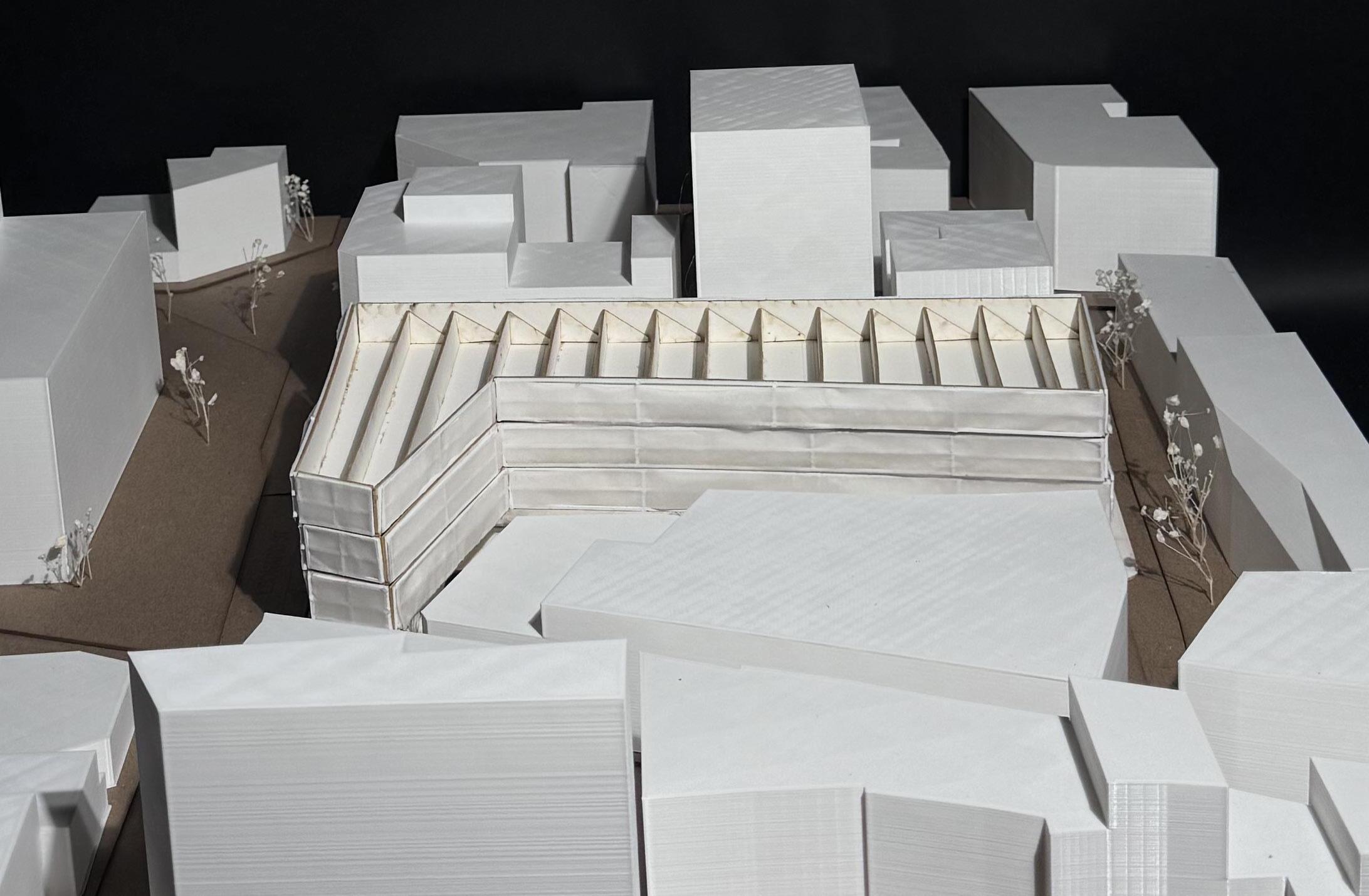
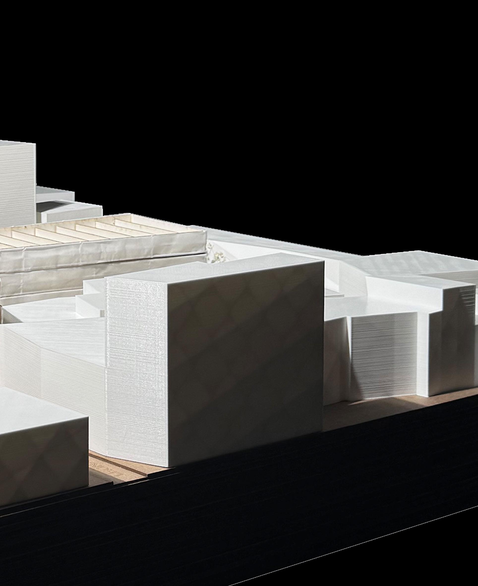
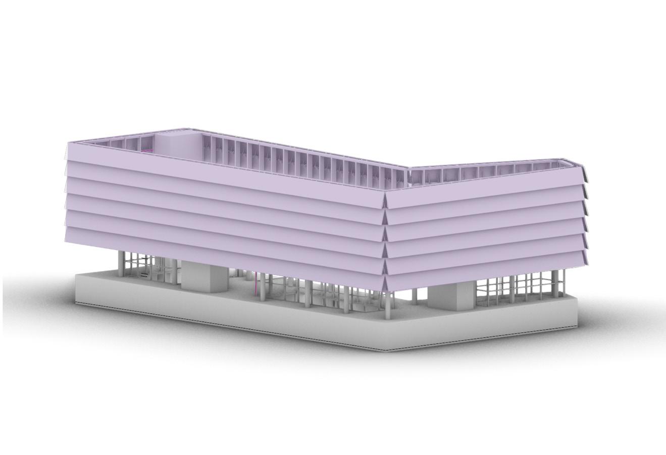
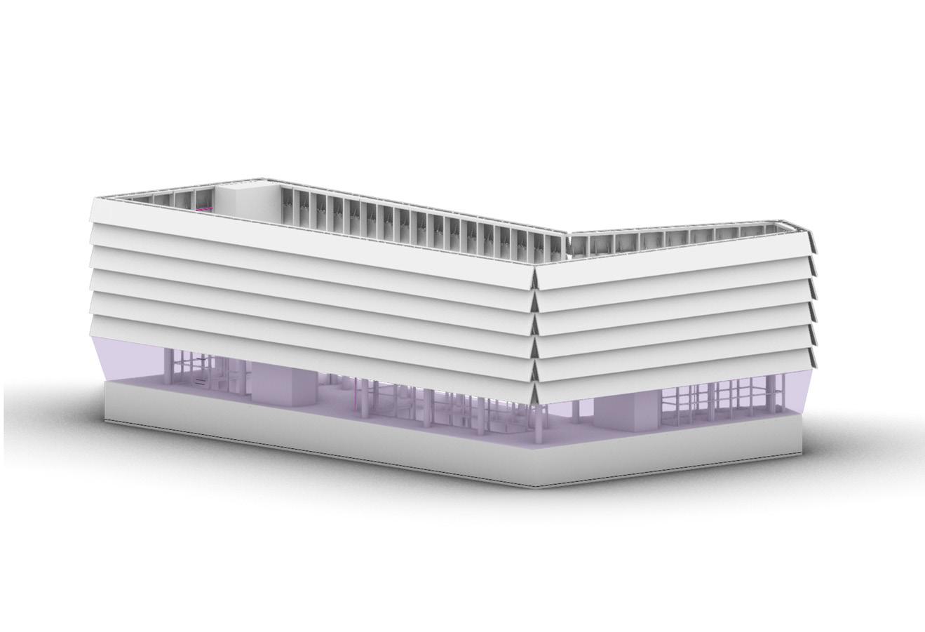
In each of the three massing options shown, there is a careful consideration of the role of the central courtyard, the emphasis of the two programmatic volumes, and the continuous language of the perimeter formalized by the colonnade. These studies are an exploration of devices used to generate dialogue within the project. The proposed site strategy encourages a dialogue between the courtyard and the volumes, the language of the facade and the building, and the building with the urban fabric. The final massing strategy is a synthesis of these ideas.
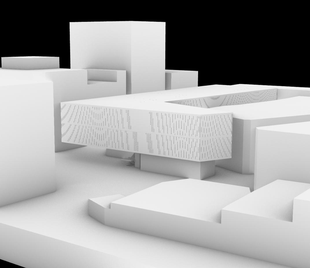
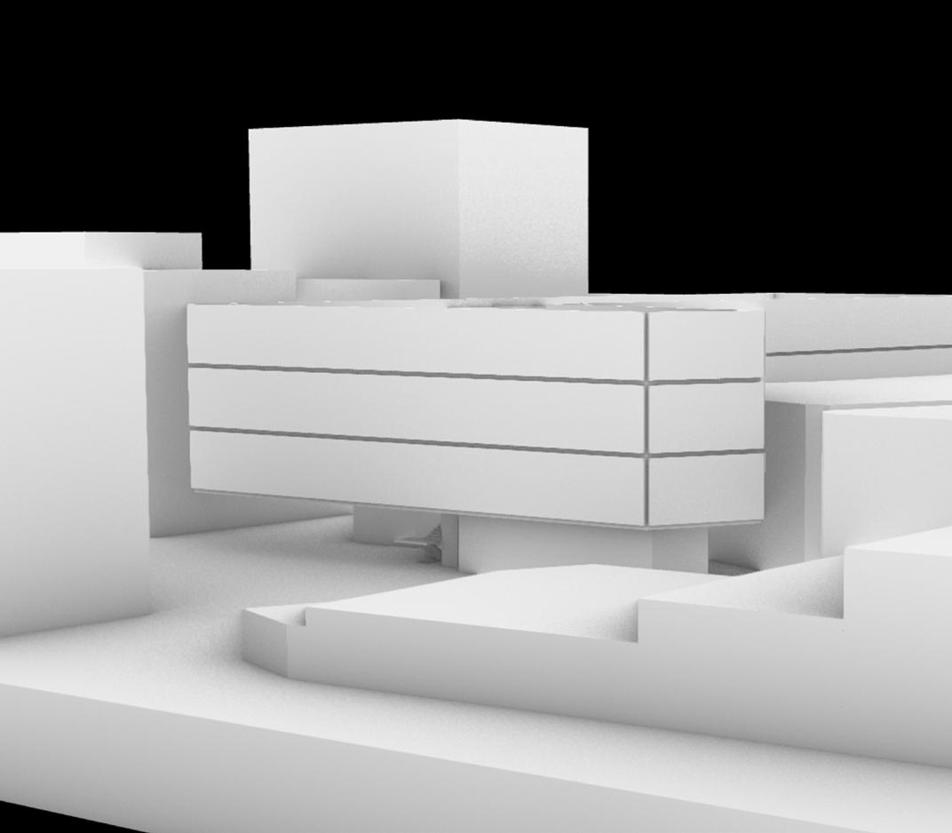
The final strategy allows the courtyard to house various programs, merging the public interest in the hybric program conditions within each volume. The covered condition in the courtyard is also a point of connection suggesting the continuity of the facade and allowing the massing and open space to be understood as a cohesive whole. The materiality of the columns also promotes the connectivity of the project.
The columns are structural steel cladded in claygate dark brick, both materials that were important to the rebuilding of London after the Blitz. The dark color is also symbolic of the ashes and destruction of the bombings. These columns allow the public to remember the devastation of the site by transcending the dark history into significant and sentimentally monumental architecture.
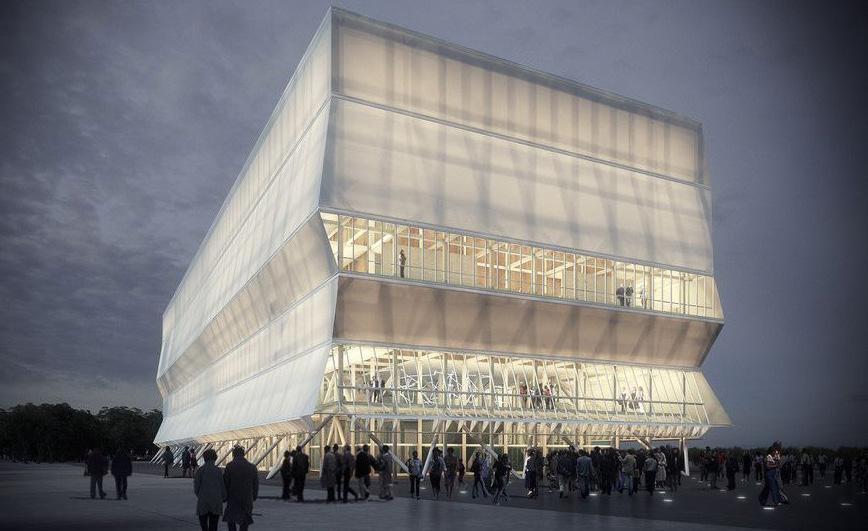
The semi-permeable boundary created by the colonnade on the north and east sides of the site generates a blurred relationship between interior and exterior conditions. This relationsip is also created by the use of glass as the primary material composing the programmatic volumes, which allows the interaction between most of the programmatic spaces with the central courtyard as well as the surrounding views of the neighboorhood. This blurred relationship is evocative of that in the Sert House by Josep Lluis Sert. In the Sert House, the blurred relationship between interior and exteirior conditions promotes the continuity of spaces. This continuity of space on the Clere St. site would further generate the connection between the building and the urban fabric.
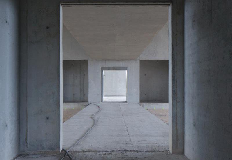
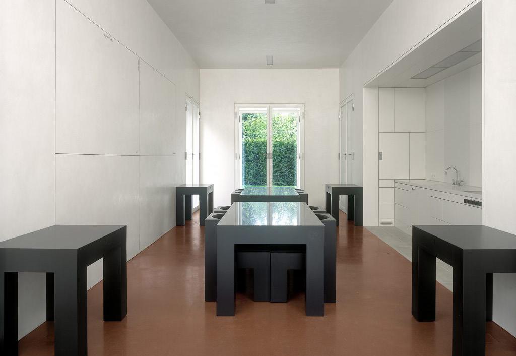
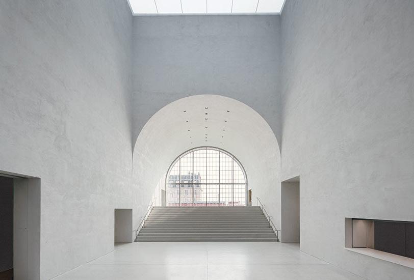
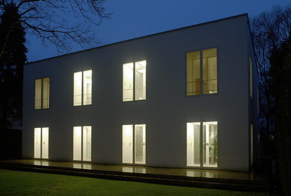
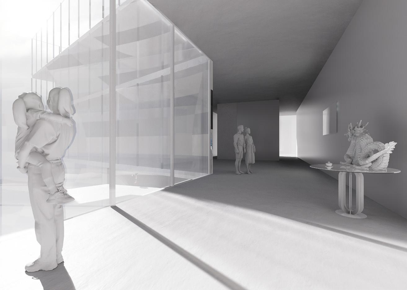
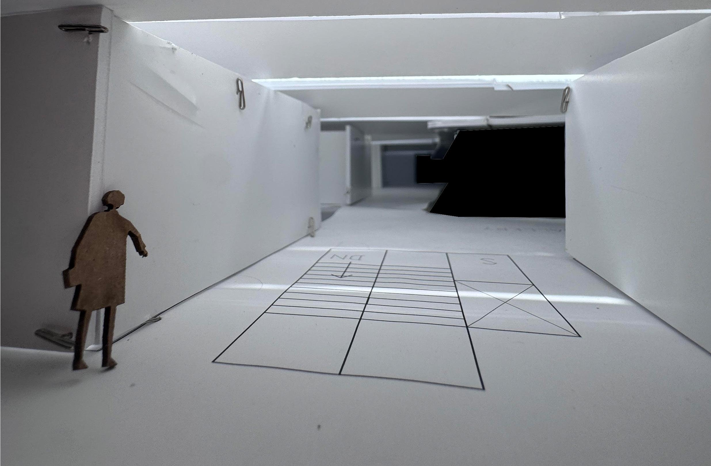
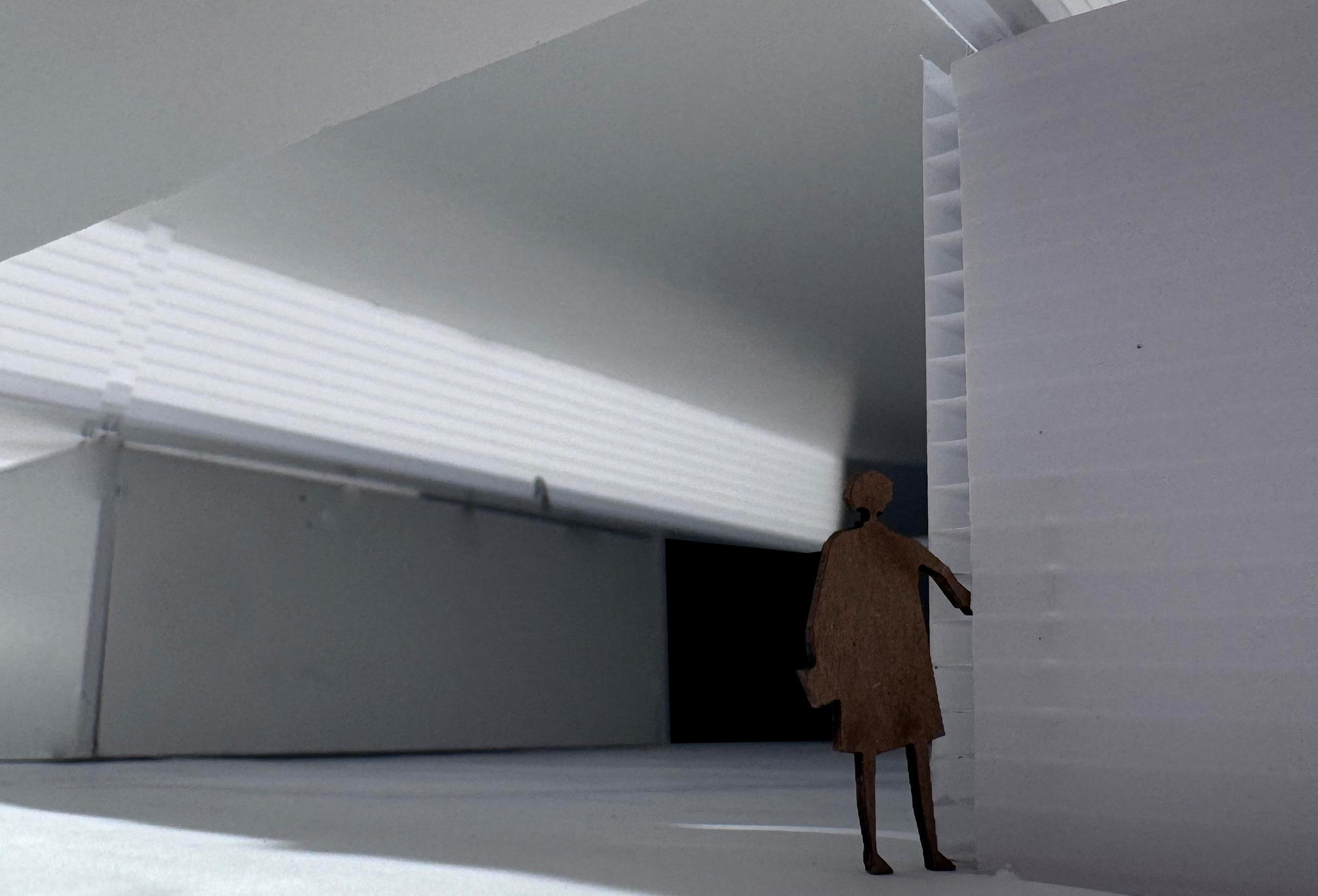
Vignette; View from Central Courtyard
Vignette; View from Covered Threshold
Vignette; View from Courts
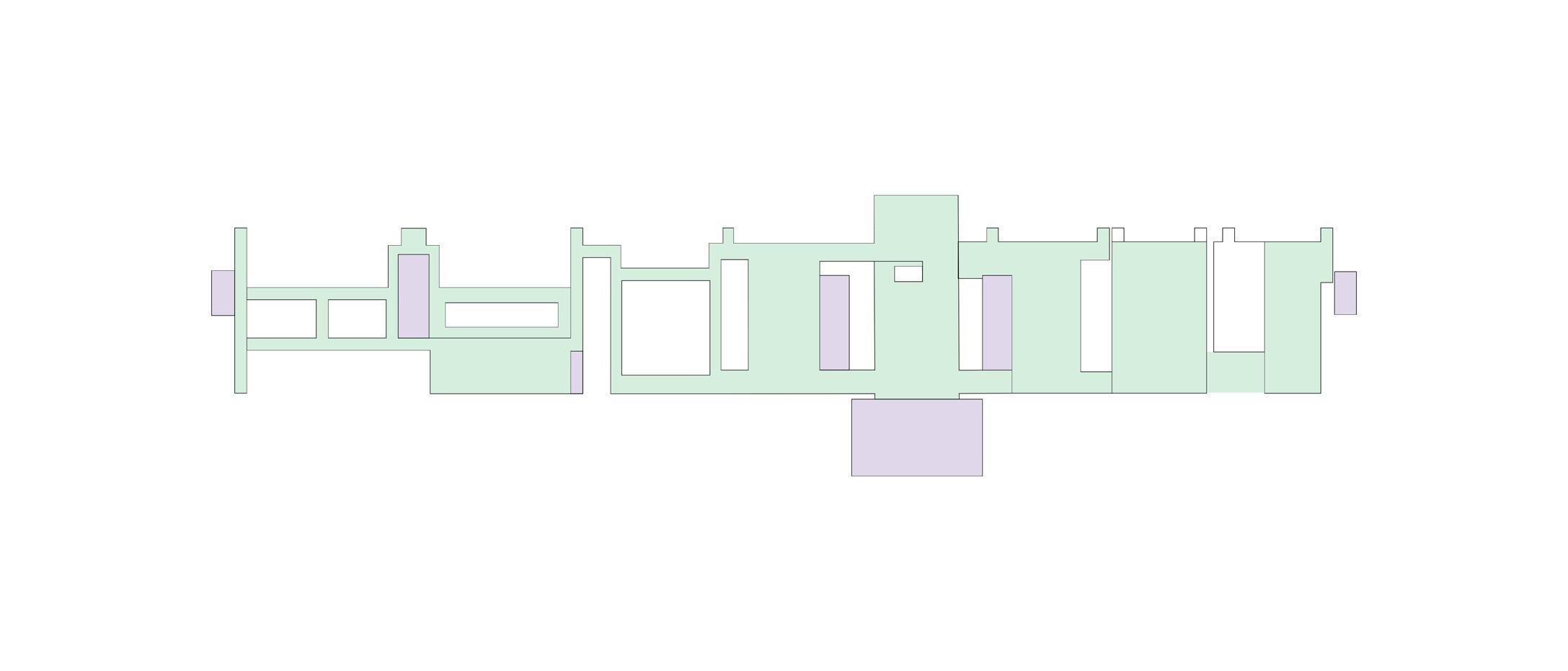
East Elevation
A3
Compositional analysis:
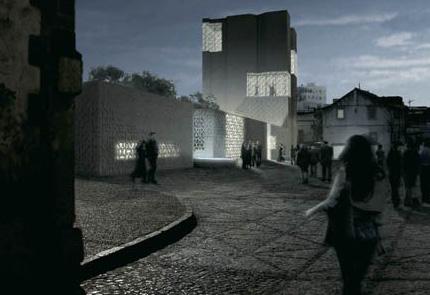
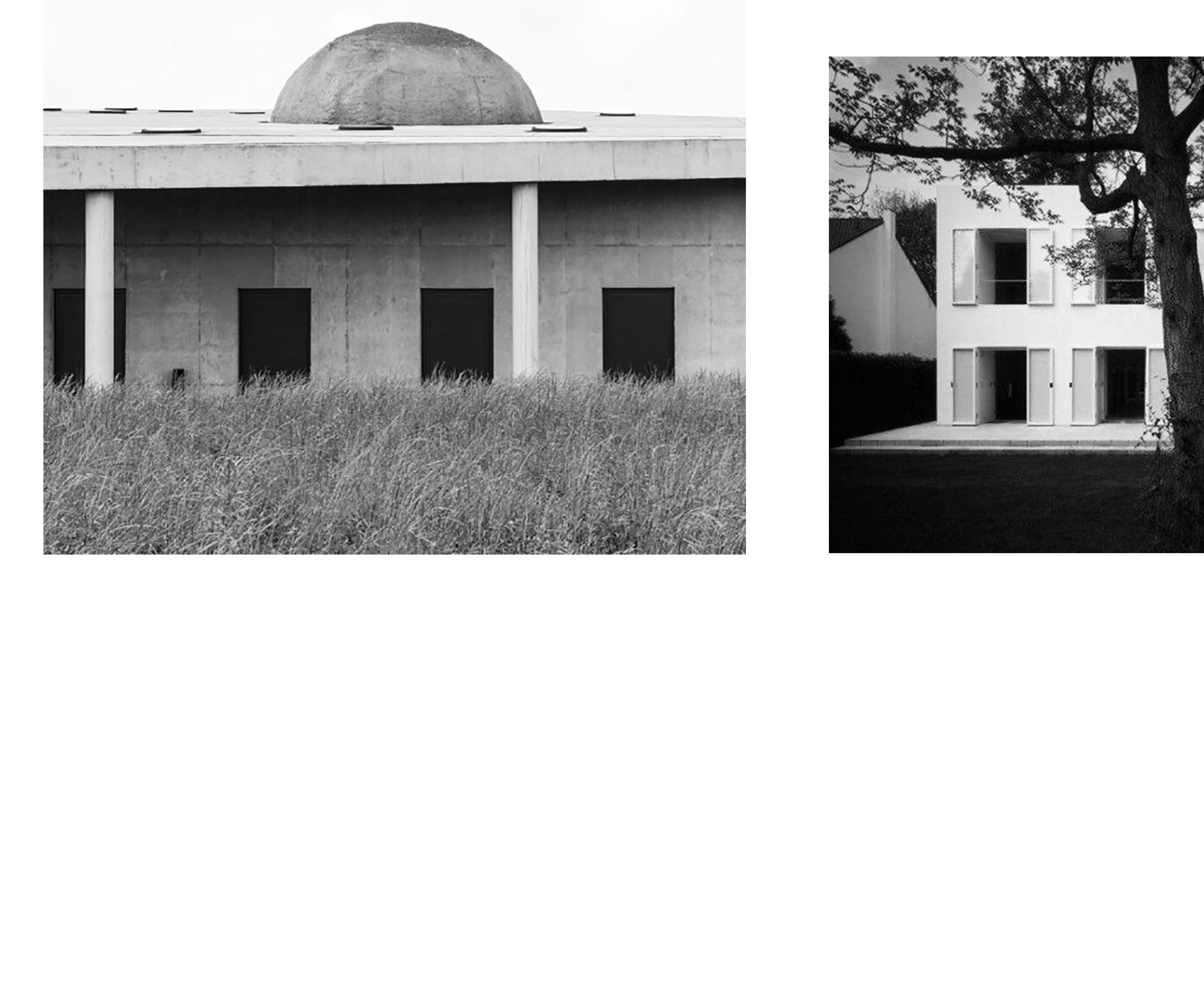
The Crematorium in Ostende by Office KGDVS (2021), the House without Qualities by Oswald Mathias Ungers (1995), and the Musee des Beaux Arts by Barozzi Veiga (2019) are projects emblematic of characteristics typical of fragmented and compact architectural plan types. As first seen in the Renaissance, the fragmented plan is a method of organization that unites various programs and forms in a singular language of continuity. A historical example of a fragmented plan is the plan of the Villa Pisani by Palladio (1727), in which three separate volumes comprise a singular building, united in elements such as formal massing, roofing strategy, and architectural style. Frank Lloyd Wright took cues from this strategy when organizing the plan for the Ward Willits House (1905). Similarly to the Villa Pisani, the Ward Willits House is composed of fragmented program elements pinwheeling around the central hearth. Despite the plan suggesting the autonomy of each space, the massing formalizes the organization in such a way that the distinct volumes are united by a singular roofing language. The roof is the device used to suggest that the building should be understood a singular composition, rather than a group of individual spaces. In the 21st Century, Barozzi Veiga used a fragmented plan to organize the Solo House (2014). Although the plan denotes each space as clearly defined and autonomous, the volumes are connected by the elevated platform, which generates a dialogue between spaces, uses, and movement. The massing formalizes the connection between volumes, as each of the four fragments is constructed using identical forms, generating identical relationships of light and shadow and solid and void. The Crematorium in Ostende, the House without Qualities, and the Musee des Beaux Arts each use the poche as a device to unite the varying programmatic
spaces. In each of these projects, elements such as circulation and auxiliary spaces, which are hierarchically small in importance but vital to a building’s functionality, are integrated into the zones of poche. Like the Villa Pisani, Ward Willits House, and Solo House, the Crematorium, House without Qualities, and Musee des Beaux Arts use massing to formalize a connection between the differing areas of the project. For example, this relationship is created in the roof of the Crematorium, which unites both the rectilinear and semicircular spaces as well as following the geometry of the site. In the House without Qualities, the massing articulates only the openings, but each opening is treated in the same straightforward, undecorated approach, generating a unified language of ambiguity and simplicity. Tuñon uses a similar strategy in the Stone House (2018). The Musee des Beaux Arts is similar in form to the House without Qualities, assuming the mass of a monolithic, simple rectangular prism but connected on the north facade by a language of masonry blinds. The Crematorium, House without Qualities, and the Musee des Beaux Arts also display characteristics of compact plans, as each project uses a pre-defined perimeter to fit a system of program and circulation. The compact condition enforces a high degree of efficiency in each project, which generates clear relationships between spatial definition, program organization, and zones of movement.
Plan, Solo House, Barozzi Vega (2014)
Plan, Ward Willits House, Frank Lloyd Wright (1905)
Stone House, Tuñon Arquitectos (2018)
Plan, House without Qualities in Cologne
Plan, Crematorium in Ostende
Plan, Musee Cantonal des Beaux Arts in Lausanne
Spatial definition
The Crematorium in Ostende by KGDVS has a very clear definition of boundaries. The exterior conditions are distinctively defined as separate from the interior boundaries, although there are moments, such as the semicircular office area, that blur the spatial disconnect between inside and outside. The interior spaces are clearly defined as formalized rooms and follow a cellular pattern with a predominantly linear arrangement. The interior boundaries are clearly defined, however, the columns and exterior space that compose the arcade suggest more fluidity and permeability outside the building. The roof line of the Crematorium follows the same geometric logic of the plan , allowing the roof slope to bisect the project. The rotated relationship between the massing and the floor plate informs the definition of the exterior space and allows the functionality of the arcade. This orientation also allows for spaces such as vehicle parking and offices to function outside the main program of the building. The interior occupation of the rooms follows a linear arrangement that allows for direct dialogue between the auxiliary and main spaces. Following a similar definition of boundaries within the site, the House without Qualities contains interior spaces that are clearly defined as formalized rooms. The occupation of these rooms is rigid, as the suggested rectilinear boundary cuts off any dialogue between the adjacent spaces. This spatial relationship is very different in comparison to the Sert House, which is characterized by a strong sense of spatial connectivity and fluidity throughout the project.
The Musee Cantonal des Beaux Art has a similar degree of spatial fluidity despite a clear definition of boundaries on the site. There are moments in the project where this clear definition is blurred, such as where the facade incorporates doorways. The interior spaces also have a less straightforward definition, as some rooms are clearly defined by boundaries and others flow into corridors and adjacent rooms. The dimensions of the corridors and other program elements is in direct dialogue with the spacing of the vertical facade elements. Dialogue is also created between the rooms of the Musee where different zones of usage seem to flow into each other. The main entry and auxiliary entrances also generate dialogue, connecting the interior program with the exterior urban fabric.
Interior View of Crematorium
Room within House without Qualities
View from Entry Hall in Musee des Beaux Arts
primary boundary
secondary boundary
tertiary boundary
defined space defined boundaries
defined space
primary boundary
secondary boundary
House without Qualities in Cologne
Crematorium in Ostende
Musee Cantonal des Beaux Arts in Lausanne
Movement
In the Crematorium in Ostende, there is a central corridor that facilitates movement through two adjacent corridors perpendicular to it, and, thus, through the spaces of the building. The transitions between spaces are defined by thresholds, which are integrated in linear compositions of service and circulation spaces. The vertical movement is integrated within one of these linear strips. The transitions between interior and exterior conditions are well-defined, and the primary connection between interior and exterior, located in the entry hall, is also clearly defined. The relationship between interior and exterior is blurred by the columns that compose the arcade, which create a semi-permeable perimeter. The relationship between the site geometry and the building’s geometry creates an area external program and circulation around the building. This geometric relationship and relative orientation directly impacts the perception of the building from the outside. It is dynamic in experience and movement, compared to a simple configuration of a square building offset inside a square site, where movement is straightforward and repetitive.
Movement within the House without Qualities is similarly clearly defined, however, completely dependent upon the interior rooms. The thresholds are clearly defined and repetitive, and the thresholds from interior to exterior are identical to the thresholds from interior room to room. This relationship suggests a formal ambiguity, but the movement within the building is very clear because of the clear definition of interior spaces. The movement of exterior conditions is separated from that of the exterior, as the exterior movement is left open, while the interior thresholds follow a clear, linear suggestion of movement and are controlled. The exterior spaces do not control the interior spaces, and the entire composition is devoid of hierarchy. However, there is a distinction between solid and void within the composition, as the main spaces and horizontal circulation compose the voids and auxiliary program and vertical circulation compose the solid.
In the Musee des Beaux Arts, there is a similar clarity in the flow of movement, although more fluid than in the other projects. Some of the transitions between spaces are clearly defined, while others are left more ambiguous. There is a clear zone of movement between the interior and exterior in the entry hall. The interior and exterior conditions, despite having separate patterns of movement, are in direct dialogue with each other, as the doorways are integrated into the facade and the facade dimensions align with the dimensions of corridors and auxiliary spaces. There is vertical movement in linear zones throughout the plan.
View from Central Corridor in Crematorium
View from Doorway in House without Qualities
View of Doorway in Musee des Beaux Arts
horizontal movement
vertical movement
external movement
horizontal movement
vertical movement
horizontal movement
vertical movement
House without Qualities in Cologne
Crematorium in Ostende
Musee Cantonal des Beaux Arts in Lausanne
Program organization
In the Crematorium in Ostende, there is a clear organization in terms of uses. The auxiliary service spaces are zoned in a series of linear strips. The office area is also in a separate zone composed of a semicircular space that is geometrically autonomous from the rest of the rectilinear composition. The program organization begins to denote a hierarchy, as the bigger spaces are those served and the smaller spaces are those of service. The smaller spaces are also integrated into the suggested boundaries of the project, which implies a lesser hierarchical degree of importance. The program organization is formalized in the massing of the building. For example, the zones of program, such as the main program spaces and the offices, are delegated different massing strategies, as seen in the rectilinear form of the primary building and the semicircular volume of the offices.
The House without Qualities follows an organizational strategy that is far more ambiguous than that of the Crematorium. There is no clear organization in terms of uses in the House without Qualities. If there were no furniture shown on the plan, each interior space would suggest the same hierarchical importance and could be used for any programmatic purpose. The services do, however, define particular zones of the building, as they create the boundary conditions. The massing formalizes this relationship, as the thick walls containing the services are the only form of defined massing in the building. The program organization and massing both assume a high degree of ambiguity. The Musee des Beaux Arts has a definition of auxiliary program in linear zones that is similar to both the Crematorium and House without Qualities. However, the larger spaces within the Musee are less organized in terms of usage. The area of program on the northeast of the building (the left side on the included diagram) is an area clearly defined by usage, but the degree of organization by usage gradually decreases toward the southwest of the building. The program organization relates to both the spatial definition and the hierarchical structure of the building. The program organization suggests the definition of spaces through the zones of usage. By delegating the auxiliary spaces to the long, narrow, linear strips, the plan frees the larger spaces for the primary program, such as gallery spaces. This also generates a hierarchical structure, as the service spaces are concealed and smaller compared to the larger programs spaces, suggesting that the auxiliary spaces are of less importance. The program organization is not formalized in the massing, as the massing is ambiguous and of a simple rectangular volume.
Exterior View of Crematorium
Exterior View of House without Qualities
Exterior View of Musee des Beaux Arts
House without Qualities in Cologne
Crematorium in Ostende
Musee Cantonal des Beaux Arts in Lausanne
Preliminary strategy:
The most significant characteristic of the Hackney neighborhood of London, England is its resilience over time. The urban fabric has remained largely unchanged despite the devastation caused by the bombings of World War I and World War II. The preliminary strategy responds directly to this resilient urban fabric, taking cues from the surrounding site geometries which inform the volumes of massing on the site. The preliminary strategy also responds to the lack of public space around the site, which is a result of residential developments and gentrification of the neighborhood. These two responses to the site anchor the approach, pushing for gestures that generate public space and do so in a way that honors the site itself, aiming to achieve a cultural significance greater than the mundane and repetitive architecture surrounding the site today.
Because this project would be the first building on the site since World War II, it is crucial that the building must be in dialogue with the site. Thus, the building must not be completely autonomous from its context. The dialogue between site and building is analagous to the dialogue between fragmented parts of a plan and the composition of a plan as a whole. The parts of the composition have a sense of autonomy, but are united as a whole. This relationship should be reflected by the volumes on the site, each serving individual programs but also contributing to the overall scheme of the project and relating to the context.
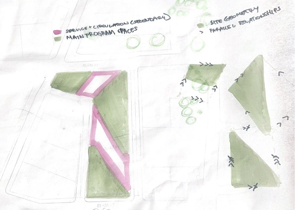
Spatially, the preliminary scheme is organized into formalized rooms which are informed by the site geometries and circulation corridors. These rooms and their relationships respective to each other should generate a public feel, and the main program spaces should have a high degree of public accessibility. The scheme uses the surrounding
site geometries to generate three volumes of program. These volumes are connected via perimeter circulation corridors, similarly to the organization used in the Crematorium in Ostende. The leftover space is used to create pockets of public space. These areas of public space unite the fragmented plan and establish a democratic hierarchy of program with each program volume having access to these public spaces. Another similarity to the Crematorium in this scheme is the adaptation of the hybrid program. As the Crematorium navigates the balance between practical and monumental program elements, this scheme uses the composition to unite the sports and cultural spaces. The public spaces in this preliminary scheme work similarly to the exterior arcade of the Crematorium, using a tilted geometric condition to generate public space.
In order to create a public, community site, the building must interact with the site in such a way that the project is approachable from the street. The building must also not feel exclusive, rather, it should welcome the public and suggest the communal usage of the building for cultural and recreational purposes. This is achieved in the preliminary strategy by creating direct paths to the most public areas and integrating open space into the overall schemes. There should be a clarity in the organization that suggests the public nature of the building and invites users into each space.
The main challenge of adapting a fragmented and compact plan on this site in London, England, is the ability to achieve both a continuity of composition and an autonomy of individual parts. The device s which unite the fragments in this preliminary strategy are the circulation corridors and the public spaces formed by leftover space. In a more conceptual manner, the fragments are connected to each
Program Organization and Geometries
Program in Relation to Volumes
other through their geometric forms. This relationship also connects the fragments to the surrounding context, generating a self-referential dialogue within the project composition as well as a dialogue between the project and the resilient urban fabric in which it is embedded.
Spatial Definition in Relation to Roof
In the Crematorium in Ostende, the program is organized in a manner in which the main spaces are supported by the secondary spaces. In a similar way, this preliminary scheme has clearly-defined geometries that determine the main spaces of the program. The size of the program spaces develops a hierarchy, establishing the greater importance of the larger spaces. The main spaces are served by a network of circulation corridors which are offset from the main volumes and generate connections between the main spaces. The primary spaces are centralized and defined, while the secondary spaces are dependent on and connected directly to the corridors. The fragmented parts of the program are united by areas of public space.
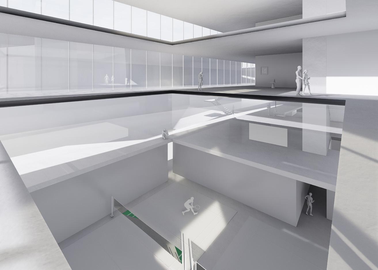
The preliminary site strategy uses a system of dynamic movement to circulate throughout the building and around the footprint of the site. This dynamic pattern of movement not only allows for the circulation between varying programs but also allows for the experiential correography following the geometries of the urban fabric that inform the definition of the spaces. As the users of the building navigate through the dynamic geometries of the corridors, they are following the cues of the resilient neighborhood surrounding them. The geometries of the program volumes, corridors, and public areas create moments in which the varying spaces of the project can visually interact with each other. For example, there are moments in the corridors where a user of the building can see across the corridor to the pool area, the public courtyard, and the auditorium. This visual connection creates moments of interaction between the hybrid program and contributes to the unity of the fragmented composition.
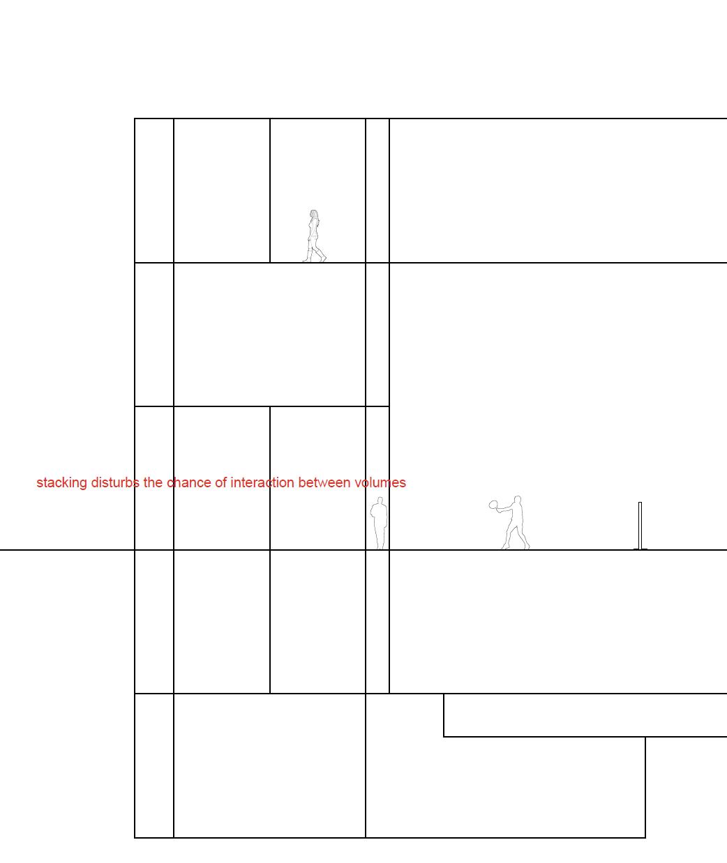
There are also moments in the project that express the relationship between hybrid program elements sectionally. For example, someone
could be exercising in the exercise room while also viewing a public event in the central courtyard. The dialogue between the circulation corridors and the public courtyards is also expressed sectionally. This dialogue serves as a reminder to the users of the building that the building is serving public needs, predominantly the need for public space, that is neglected in the surrounding neighborhood. As one moves from the ground floor to the second floor, he or she can interact with the public courtyards as well as with the main program spaces. Each space of this scheme, whether primary or auxiliary, should reinforce the idea of the building as having a public identity.
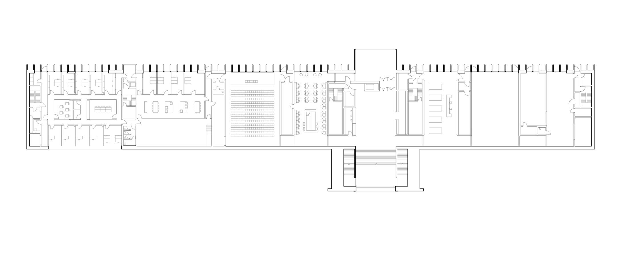
Transverse Section
Longitudinal Section
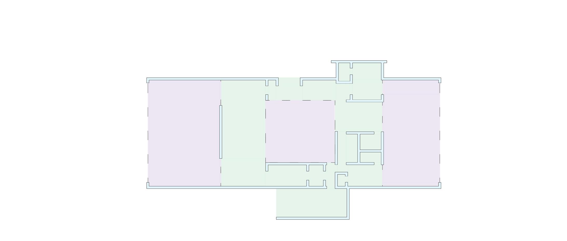
Second Floor Plan
Final strategy:
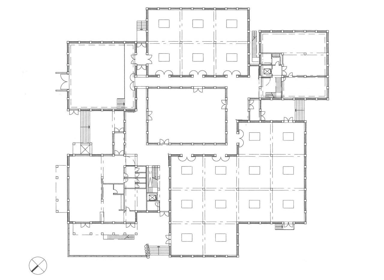
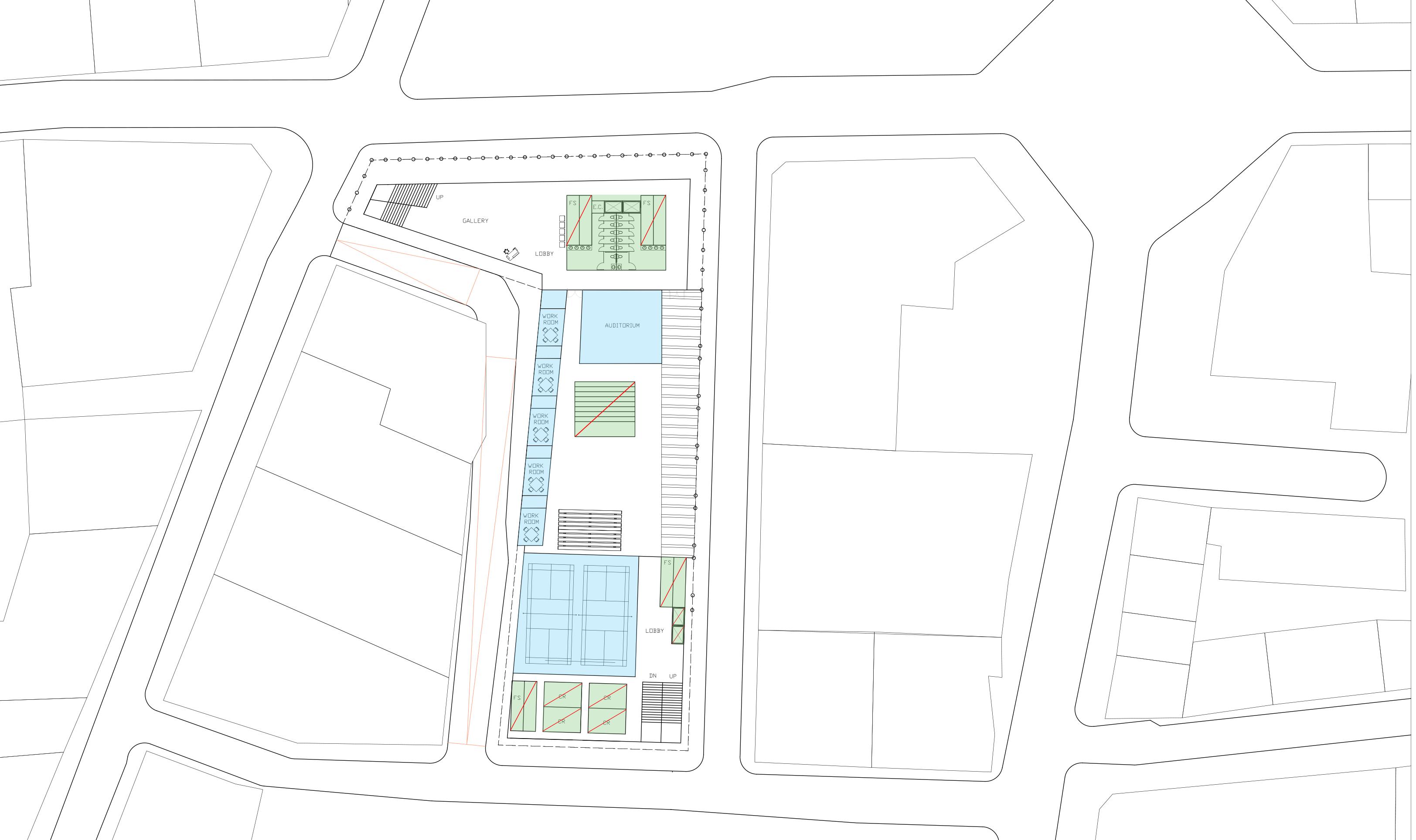
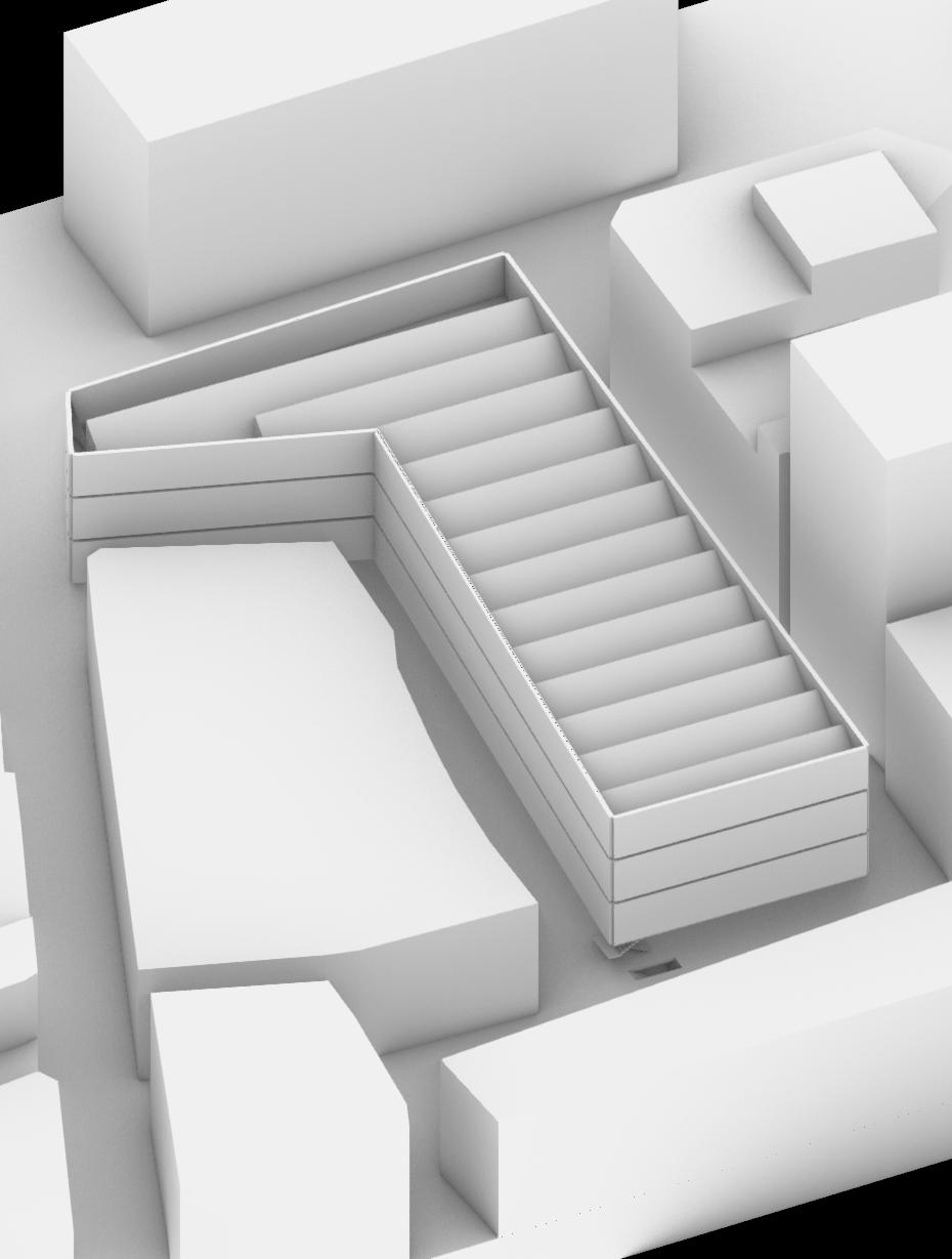
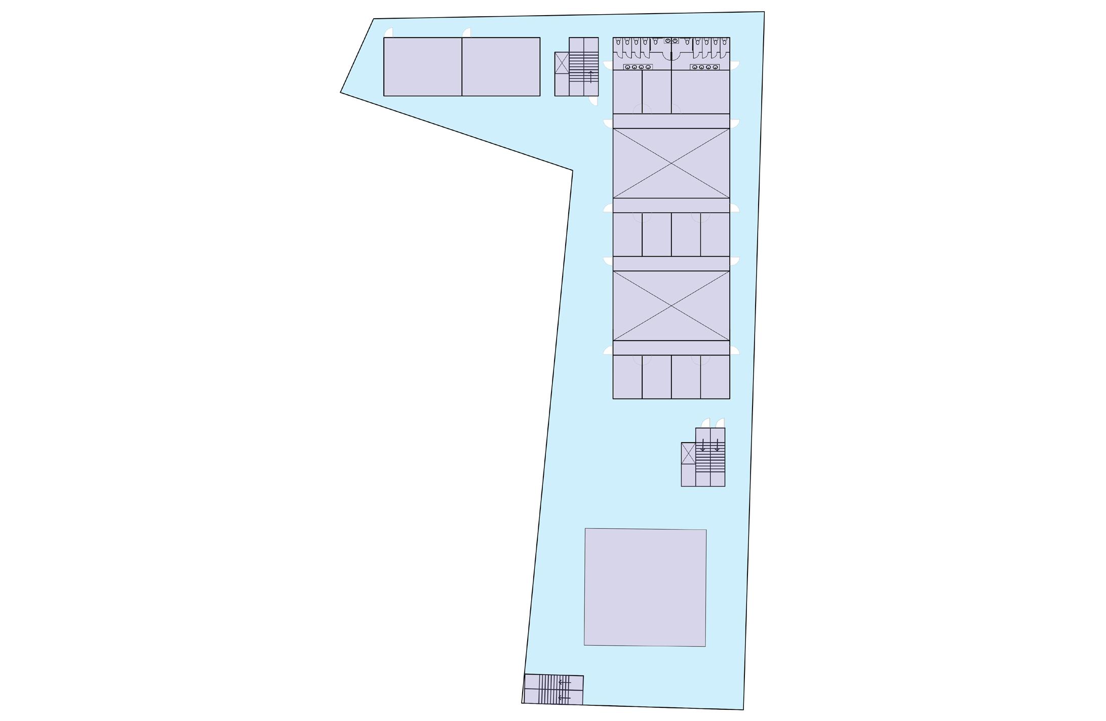
The final strategy uses the juxtaposition of fragmentation and unity to generate a public spatial gesture. Studying the surrounding context of the site proved a lack of public space in the immediate surroundings of Clere Street. This has promulgated issues such as gentrification and decreased the quality of the neighborhood of Hackney. The site strategy acknowledges this issue, freeing most of the ground floor from any program elements and returning the site footprint to the public. The areas of program on the ground floor are confined to three separate volumes, each containing different zones of usage. The northern-most volume contains social program such as the auditorium, and the other two voids contain the badminton courts and pool areas. Like the preliminary strategy, the plan is composed of fragmented parts each containing varying program spaces. The final scheme clarifies these parts into compact volumes, maximizing the efficiency of the program spaces while freeing as much of the ground plane as possible for public usage. The devices that unite these volume fragments include the building footprint and the materiality of the building. The freeing of the ground plane allows the first floor of the building to be understood as a void in its volumentric composition. The usage of the entire site footprint as the floor plates of the upper floors allows the volumes above the ground floor to be understood as solid in composition. This solid and void relationship reiterates the gesture of delegating the ground level to the public. This ground plane allows the public to interact with the volumes of program beneath, as well as having a high degree of versatility and allowing for a wide variety of public usage. The ground floor could accommodate events,
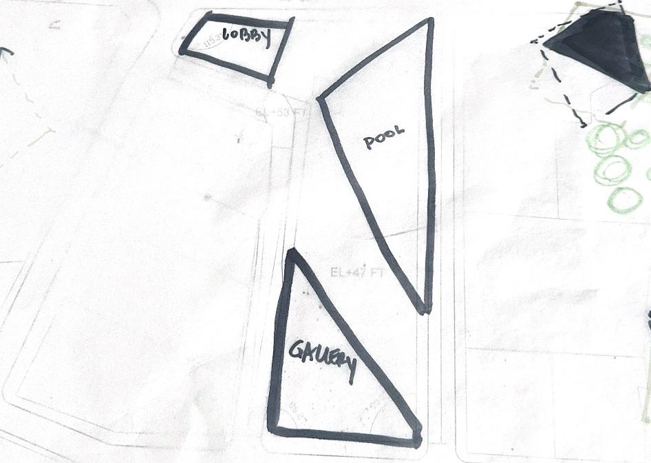
such as a catered function in support of an auditorium lecture, while also serving as a basic shelter from the constant rain in London. On the ground floor, the volume of the pool area is irregular in geometry, creating a gesture that guides the public through the open space and toward the middle of the site. The middle of the site is characterized by a public area in between the two sports volumes. The gesture created by the form of the pool area, thus, guides the public directly to an area of interaction between the hybrid programs. This dialogue of interaction is exaggerated by the opening to the gallery space above the center of the site. The interaction between program volumes and different public spaces, such as the gallery and the open space on the ground floor, contributes to the overall unity of the composition, in which the fragmented parts have autonomous identities but interact with each other in a significant and cohesive manner.
Geometric Structure and Modulation
defined boundary rooms used to organize space
Spatial Definition
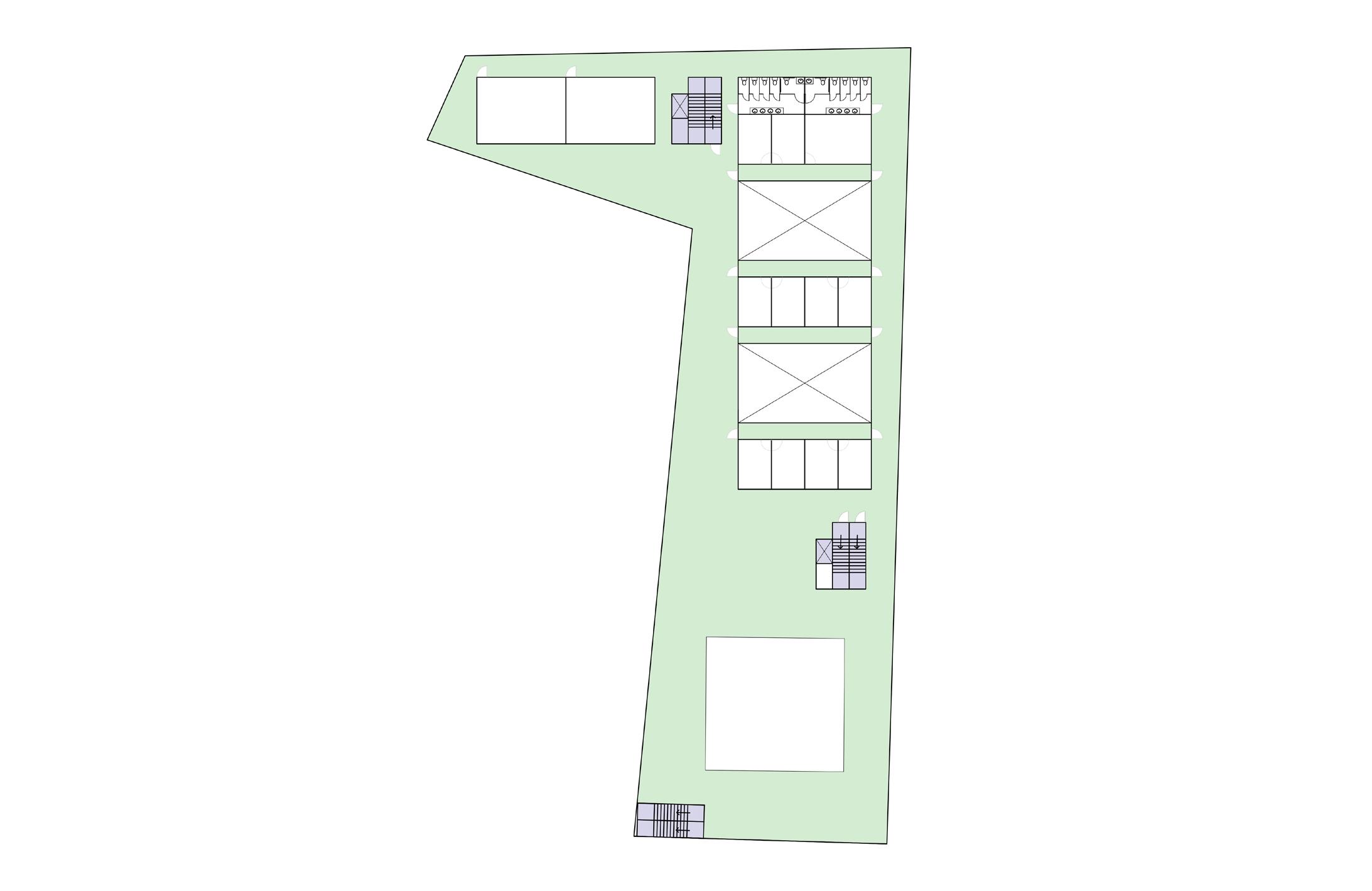
Massing Study 1
Massing Study 2 Massing
Massing Study 1
Massing Study 2
Massing Study
Three massing strategies were tested to explore the different ways of articulating the solid and void realtionships within the final scheme. In order to achieve a unity of composition despite the fragmented volumes, the final strategy must have a facade that promotes the legibility of the solid and void relationships.
The materiality of the building facade was the primary concern in the massing studies. The final scheme has a degree of autonomy that prevents the materiality of the project from being a direct means of connection to its context. The building is connected to the urban fabric surrounding the site in a more subtle manner than a scheme that would use a material like masonry to emulate the surrounding buildings. The building is in dialogue with its context through the definition of the site footprint, which is used as public space on the ground floor and as programmatic space on the upper floors. Thus, the materiality serves the purpose of connecting the fragmented parts to the whole composition, as well as connecting the spatial relationships of the volumes, not connecting the composition to the context.
The first massing scheme explored the relationship between the facade and interior space, expressing the relationship between open space and open facade and closed-off space and closed-off facade. Although articulating this relationship between spaces directly, this scheme did not clearly indicate the relationship between the upper floors to the open ground plane. The second massing study explored the usage of u-channel glass as a way to let light into the interior and express the upper volumes as a solid volume. The final massing strategy utilizes fabric panels fastened to an enclosed glass wall to create a facade system that expresses the solid and void realtionships of the project while also serving the climatory needs of Northern Europe. The fabric panels also allow the building to have an autonomy from its surroundings, breaking from the mundane and repetitive usage of masonry. Within this autonomy is a subtle hint to the history of England, as the fabric panels suggest the history of London’s textile industry that brought prosperity and notoriety to the place. The fabric panels also allow for a large amount of light transmission and work in conjunction with the sawtooth roof, which brings northern light to the interior spaces, to respond to the need for light. The third massing study also responds to ventilation needs, as the glass enclosure could provide opportunities for operable elements and reduce the need for active systems.
Vignette Depicting Badminton Courts and Gallery
Vignette Depicting Gallery
Vignette Depicting Pool Area
South Elevation
A4
Final project:
Summary:
Upon further investigation of the context surrounding the site, it became clear that repetition of the language, materiality, and styles used in the surrounding context would not generate a significant connection to the broader urban context of the neighborhood. This realization led to a more conceptual and less physical connection between the building and its site. In the first compositional exercise, the footprint of the site was physically defined using a colonnade, depicting a material connection rising from the ground and connecting to the two primary volumes of the building. The courtyard was used as a device to organize the two volumes, delegating a large portion of the site as public space between the two masses. This achieved the two goals established in the site strategy, which were: giving public space back to the neighborhood and establishing the resiliency of the urban fabric. In the second compositional strategy, these ideas were achieved by delegating the majority of the ground floor as public space and using only what was necessary for program space. In the second strategy, the resiliency of the urban fabric is established in that same gesture, where the ground floor is used as public space and the entire site footprint is defined and used as programmatic space in the upper floors. Within the second compositional strategy, there are a variety of solid and void relationships that echo the relationships between primary and secondary program areas as seen in the Crematorium in Ostend, the House without Qualities, and the Musee des Beaux Arts. In plan, the solid and void relationship is created by the three program volumes and the space surrounding them. On the ground floor, the open space, which is understood as the void, is used as public space and is organized by the program
volumes and structural cores. On the upper floors, the program volumes continue to define the void space, which is used as the gallery. This solid and void relationship established in plan promotes interaction between the hybrid programs, encouraging views and circulation between sports and cultural facilities. The relationship between solid and void is also established in elevation, in which the ground floor reads as a void and the upper floors read as solid. This relationship is expanded upon with materiality, as the facade panels wrap around the upper floors in such a way that creates a language of continuity and dissolves the hierarchy of what is behind each panel. On the ground floor, the structural elements are wrapped in reflective chrome finishes, reflecting the context and deflecting any sense of solid or permanence, allowing the entire ground floor to preserve its void condition. The Teatro Regional del Bio Bio uses materiality and elevational composition to establish solid and void relationships within a public building. This project also used the ground floor as a mechanism to draw the public into the building and interact with the program as well as the structure itself. A successful achievement in this precedent is the degree of autonomy established through materiality, form, and lighting. Despite this project’s location in Chile having vastly different conditions to the London climate and urban fabric, it is an example of a multi-dimensional public gesture created using solid and void relationships within architectural compositions.
In the first compositional exercise, the connection between the building and its surrounding context was clearly defined using materiality to define the perimeter of the site. The colonnade allowed for interaction with this materiality on the ground floor, however, the connection became less accessible on the higher levels of the building. On the ground floor, the courtyard and service cores were used as the devices of spatial organization. In this scheme, however, the gestures of interaction between programs were prioritized over creating clearly defined volumes or spaces. This condition posed issues such as how the central courtyard would be occupied, especially considering the climate of London. Because this area experiences a relatively low amount of sunlight and a lot of rain, it could be nice to have an area to enjoy the nicer weather when it happens. However, the entirely open courtyard could also pose issues for drainage and flooding, and could be considered mostly impractical in this climate. The large central courtyard also posed issues of building form. Because the courtyard occupies a large amount of the site, the building volumes needed to assume an exaggerated verticality to fit the program needs. This verticality seemed to detract from the human scale established in the courtyard and created a stacking effect with the program elements that limited interactions between the cultural and sports areas. The second compositional strategy was informed by similar ideas of spatial organization used in the first strategy. Both schemes use forms to define leftover space. In the first strategy, the courtyard and service cores defined the leftover space. In the second strategy, the programmatic volumes and circulation cores defined the leftover space. The spatial organization of the second strategy resulted in
materiality is being used as the device to connect the building to the site
a clarity of volumes that the first strategy was lacking. The clear definition of these volumes also allowed for a clear definition of leftover space, used as public space on the ground floor and exhibition space on the upper floors. This leftover space is organized in a way that allows for the versatility of both public space and gallery space with the opportunity to serve a variety of events and groups of people. The second scheme also had a more realistic response to the climate, using a layered facade as a device for environmental stewardship and as a gesture of autonomy. Unlike the first compositional strategy, the second strategy uses a conceptual connection between site and building, metaphorically weaving the fabric facade panels into the urban fabric. This gesture transcends the material connection between site and building into a multi-faceted connection that responds to more than a typical building style or physical connection. From afar, the building can be understood as an autonomous composition of abstracted solid and void relationships. As one approaches the project, the compositional whole is broken down into elements relating to the human scale, the experiential relationships of light and shadow, and the interaction between hybrid program spaces.
how strong is the connection between masonry and public spaces?
Conceptual narrative:
Place:
The site is located within the Hackney borough of the City of London in London, England. This area grew upon the northern expansion of London from the Thames River, which was integral to England’s trading industry, and, thus, integral to England’s economic success. London’s northern expansion was a result of its economic success. This expansion prompted improvements to the infrastructure and urban fabric, including the widening of roads, that attempted to accommodate for the large influx of people in the growing cities. Once these improvements were made, the urban fabric as a whole maintained a consistent identity, anchored upon the roads and parcels of land that carried from the history of the neighborhoods into the contemporary conditions of the 21st Century.
Between the establishment of the urban fabric and infrastructure during London’s first expansion and the 21st Century, London faced significant devastation in the World War I and World War II bombings. Despite a large number of buildings being completely destroyed and much of London being damaged, the urban fabric remained resilient. The streets which defined the parcels in the 1800s withstood the damage and continue to anchor the urban fabric today.
Unlike the resiliency of the roads and parcels, the buildings and public spaces surrounding the site have not been survived over time. As previously mentioned, many of the buildings surrounding the site were destroyed in war, including the building that was previously on the site itself. Since this building was destroyed, there has yet to be a significant building on this site. Currently, there is a conceptual and physical disconnection between the surrounding context and the site itself. There is also a disconnection between the site context and its history of public usage. The area surrounding the site was historically used as a public gathering space, but has since been replaced with buildings of a purely residential character. This lack of public space has perpetuated societal issues and allowed for gentrification of the area, disrupting the character of the urban community and reducing the interactions of the public.
Site Condition Today
Immediate Context
Blitz Bombing Damage of WWII
The building on the site could generate a connection to its context in such a way that gives public space back to the community while also establishing the resiliency of the surrounding urban fabric.
The building on the site must be autonomous. It must break from the mundane and repetitive character of the surrounding architecture that has yet to produce a significant connection between the context and the community. The building’s autonomous character should generate a connection to the context that transcends a physical connection. In the final scheme, this connection is articulated through the site footprint. On each level of the project, from the basement to the roof, the site footprint is defined. On the ground floor, the entire site footprint is defined as a public space, given back to the public. On the basement and upper floors, the site footprint is delegated as program space, given back to the program. The connection to the site is also achieved through the materiality. The fabric panels are a subtle homage to the textile industries of England, which are historically important to the success of the neighborhood of Hackney as well as the industrial character of the area. The choice of fabric was made in deliberate opposition to the previous material choice of masonry. It is clear that the masonry buildings around the site, though integral to the history of architecture in London, are generally not proving successful in the creation of socially significant architecture. The repetitive nature of masonry and historical building styles is without much connection to contemporary times, culture, and technology and has not been used with great purpose. This condition has resulted in the loss of public connection to masonry and calls for a material that responds more profoundly to the cultural and climatic needs of the site and its context.
In order to create a usable and versatile public space for the community, the final scheme delegates as much of the ground floor as public space as possible within the spatial limitations posed by the program regulations. The public space on the ground floor is meant to be used primarily as a circulation space, allowing the public to interact with each of the program volumes without a set choreography of movement. The ground floor space could accommodate events such as large lectures in the auditorium, introducing food vendors to serve the attendees and allowing the open space to be used as a prefunction or gathering area. The ground floor space could also serve as an impromptu viewing area for sports events, in which someone walking home from work could catch the last badminton match of the day while meandering through the ground floor space. When there are no events occurring, members of the community could use the lifted building condition as a refuge from the continuous rain.
1:20”-1’ Model in Site
1:20”-1’ Model in Site
Space:
The spatial conditions in this scheme are primarily informed by the relationships established in the Crematorium in Ostend, the House without Qualities, and the Musee des Beaux Arts. In these three precedents, there is a clearly defined organizational relationship between the primary and secondary program areas. The final scheme is informed by these relationships, and it uses the primary program areas and circulation cores to define the leftover circulation spaces. On the ground floor, the program volumes and the circulation cores define the public open space. On the basement level and on the upper floors, the program volumes and circulation cores define the gallery space. The sequence of movement is defined using the same organizational strategy as the spatial definition. The main program volumes define the leftover space, which is used as circulation space.
On the second and third floors, circulation space is incorporated into the main program volumes in the form of corridors, further organizing the spaces into primary and secondary usage. These circulation corridors are used as a module to rationalize the main spaces. The main spaces, such as the exercise room, are modulated in proportion to the circulation corridors. The skylight system follows this system of modulation, further rationalizing the scheme while also bringing diffused northern light into the gallery spaces and other areas of program.
The character of the spaces assumes a civic character from afar. This civic character is achieved by the composition of the building as a relationship of solids and voids. From afar, the upper floors of the building read as a singular solid, while the ground floor reads as a singular void. In elevation, the facade system continues beyond the
line of program, building up past the roof and enclosing the saw tooth system. This condition preserves the compositional relationship created by the floors below and allows the entire composition to read as one solid and one void. Beyond the elevational composition, there is a system of spatial interactions between the hybrid programs. This system is illustrated in the building section, which shows the variation of interactions that can occur between the sports and cultural spaces. The civic character of the building dissolves into a domestic scale as one approaches the project, as the parts of the building assume sentimentality to the human scale. This is achieved by the reveal of the floor slab and the service platform attached to it. The skeleton of the facade panels also contributes to the incorporation of the human scale, as it is proportioned to support the panels efficiently while also creating the illusion of having twice as many floors, each 9’ tall with a more residential appeal. The mullions used with the glass enclosure wall are aligned with the facade panel skeletons, continuing this illusion and incorporation of human scale throughout the many layers of the elevation.
3/16”-1’ Model Photo at Third Floor Gallery Skylight
3/16”- 1’ Model Photo at Ground Level
Program
The main role of the program in this context is to serve the needs of the community. The ground floor is intended to serve the needs of the public, acting as a versatile space that could range in usage as a casual viewing platform to a formal prefunction space. The basement is intended to serve the needs of the pool program, incorporating larger sports facilities and auxiliary rooms such as an emergency room and changing rooms. The upper floors are intended to serve the needs of both hybrid programs and promote interaction between sports and culture.
The site and its context call for public spaces and gathering spaces. The need for public space is a result of the predominantly residential character of the neighborhood, which lacks communal amenity spaces. The need for gathering spaces and cultural spaces is growing as the neighborhood tries to revitalize itself. The neighborhood surrounding the site has been trying to reintroduce art and culture, but has been criticized greatly due to complaints of gentrification and lack of inclusive community. Thus, it is important that the overall gesture of this building reads as public.
The clarity of a building’s programmatic organization and spatial definition is crucial in a successful public project. There should be a high degree of accessibility and ease of way-finding within the project to ensure the efficiency of the building. The final scheme uses a clear volumetric definition of program areas to organize the interior spaces of the upper floors and organize the open space on the ground floor. The northern volume contains the cultural program, such as the auditorium. The eastern volume contains the recreation program, such as the pool and the exercise room. The south volume contains the badminton program. On the ground floor, each of these three program volumes are encased in glass, encouraging public interaction. The east and south volumes, which house the sports program, are open to below on the ground floor, allowing the public to visually interact with the pool and courts below.
3/16”-1’ Model Photo at Badminton Courts
Materiality
In the final scheme, materiality was used as the main device to establish autonomy of the building on the site. It is clear that the usage of masonry would echo the construction of the contextual buildings near the site, however, it would not automatically produce a significant connection to the site. Therefore, the choice of materiality needed to echo a gesture of significance and conceptual connection instead of a physical connection. This connection also needed to address the issues presented by London’s climatic needs, and, therefore, integrate opportunities for daylighting as well as natural ventilation and rainwater drainage.
The final scheme utilizes a layered facade in response to the faceted climatic needs of the area in London, England. From inside to outside, the facade is comprised of angled insulated glass units, a system of operable panels integrated into the location of aluminum mullions, grated service platforms in precast concrete frames, aluminum facade skeletons, and semi-transparent fabric facade panels. The facade panels would allow light to enter the interior spaces in a manner controlled by the form of the fabric. The form of the fabric is informed by the form of the aluminum skeleton, which is angled in such a way that allows for outside air to flow into the operable panel if it is opened. The outside air could also flow up through the grates and into the interior, allowing for natural ventilation. The grates also serve as a service platform, on which the facade panels and skeleton could be maintained or replaced. The lightweight nature and semi-transparency of the facade refrains from the building composition feeling too heavy or constricting, especially on the ground floor.
Multiple facade panel types were tested to experiment with the possibilities that fabric panels offer. The characteristics tested include the permeability, shape, size, and type of fabric of the panels. The final scheme utilizes the gesture of fabric to conceptually connect to the site and its history. The final scheme uses the general form and semi-transparency of the fabric to incorporate light and shadow as well as displaying the role of the facade in promoting the composition of the project as a solid and void relationship.