Descriptive Geometry
A PORTFOLIO BY: OTLILE MAHLAELA
TABLE OF CONTENTS DESCRIPTIVE GEOMETRY PAGE 03 PAGE 02 PROJECT 0 PROJECT 1 PROJECT 2 INTRODUCTION 3 4 9 25

My name is Otlile Mahlaela, and I am a first-year architecture student at the University of the Witwatersrand. This portfolio serves the purpose of presenting and explaining the work I have done in the Descriptive Geometry module. This module has created a platform for me to enhance and improve my drawing, rendering, model-making and countless more skills needed of me in the architectural field.
This portfolio covers all work done within the module. Starting from Project 0 until the last Project 2. The portfolio layout follows a consistent pattern and navigation through each project is made easier by the clickable table of content. Each project is represented by a different colour and contains a brief explanation of the project at hand and how it was executed.
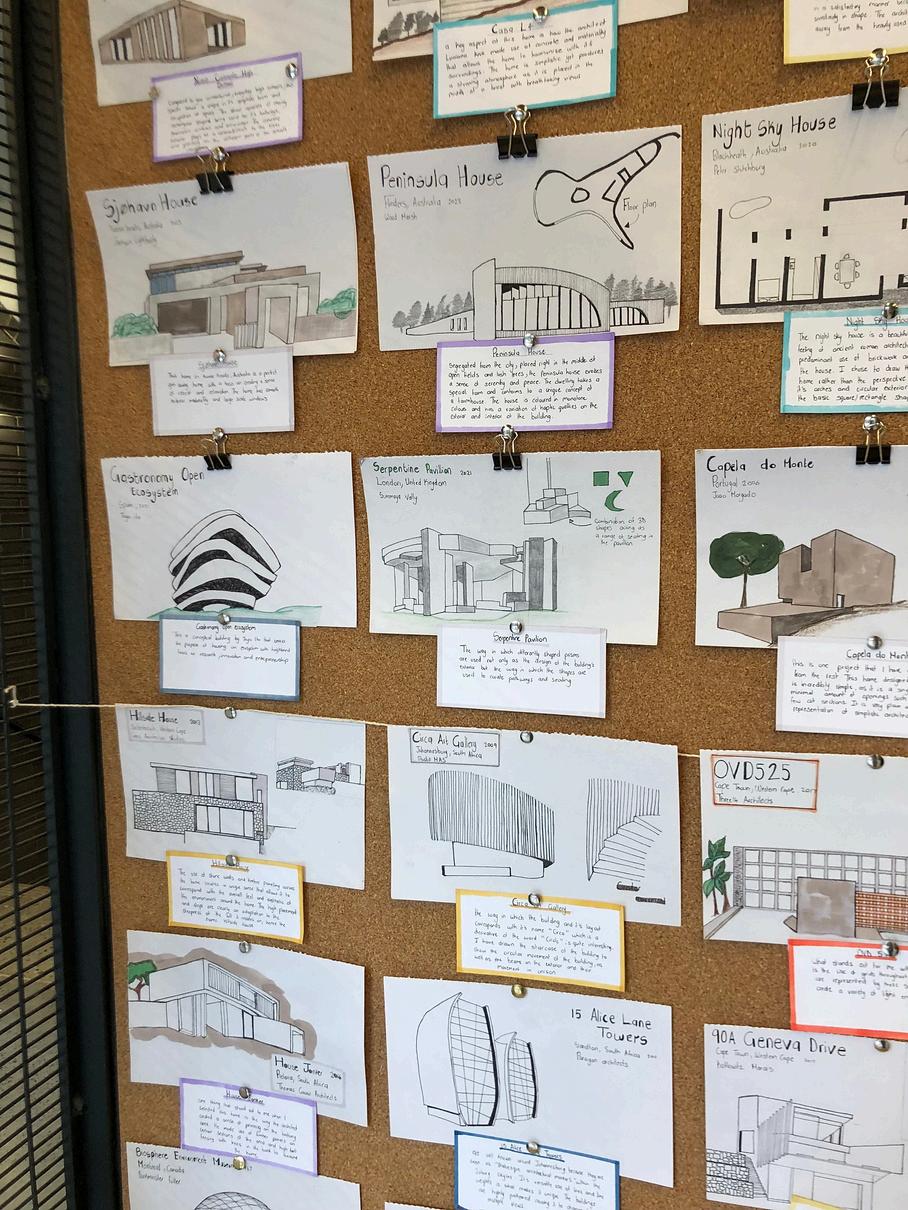
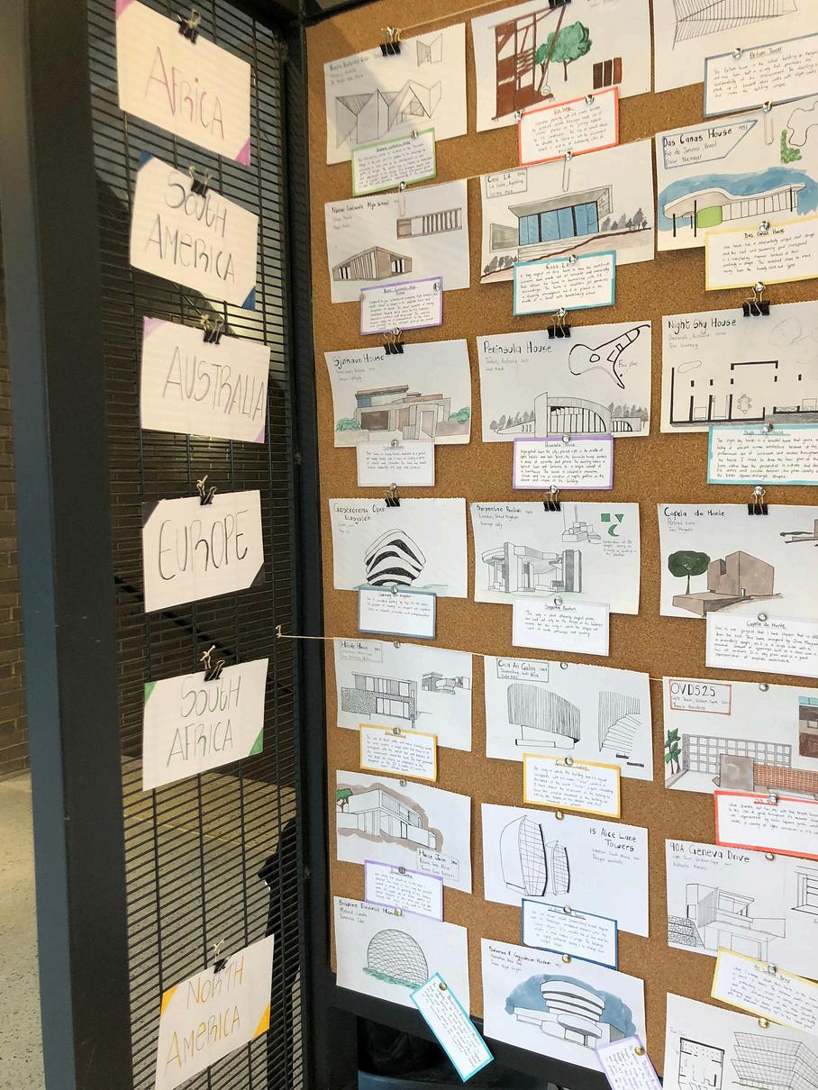
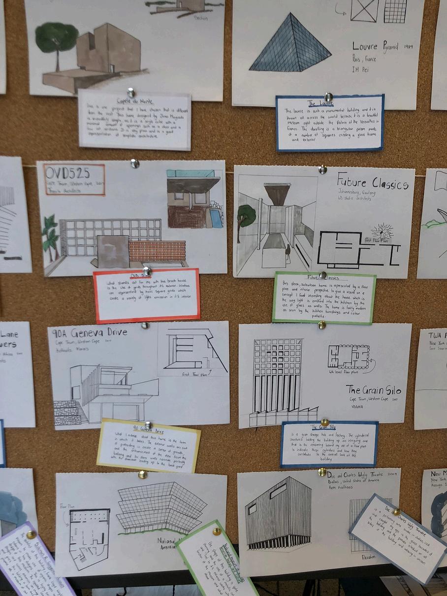
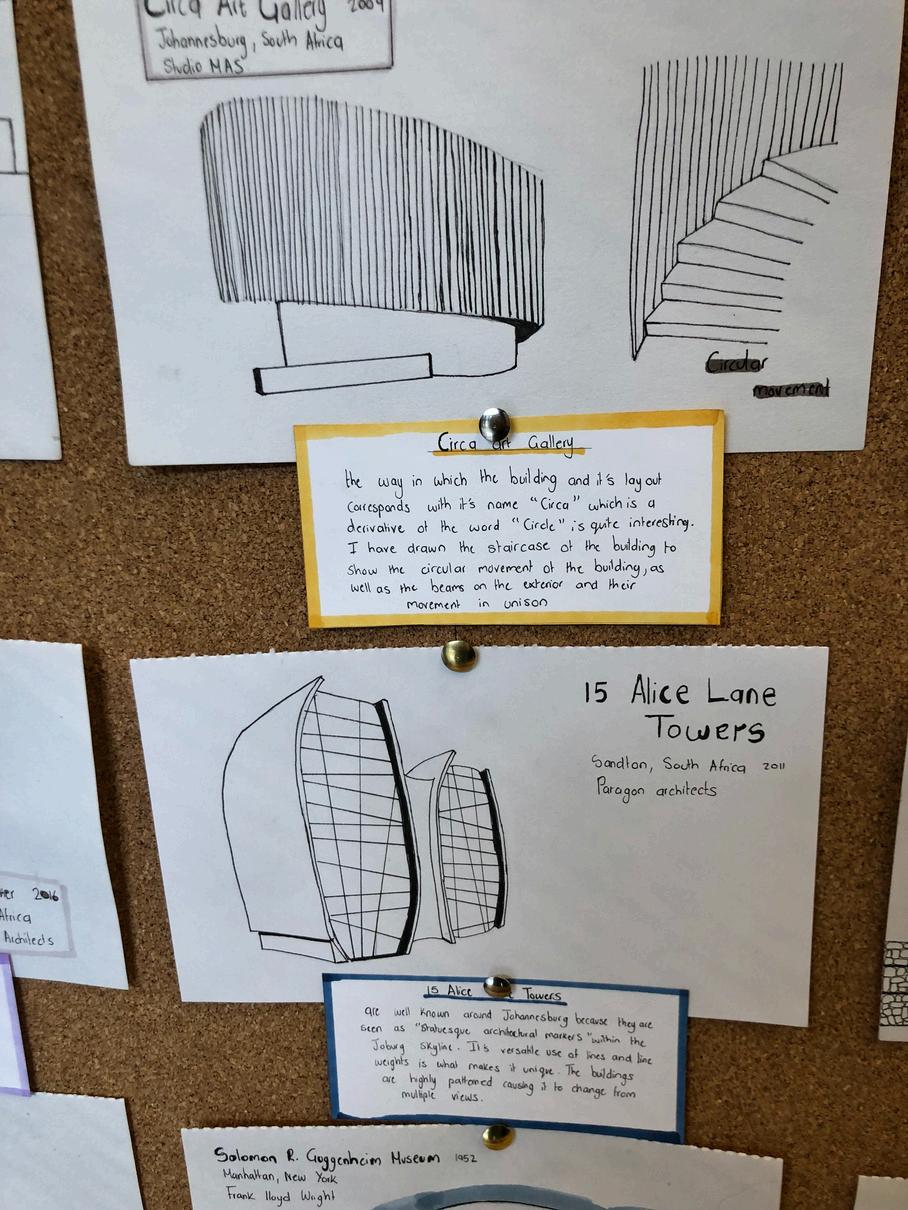
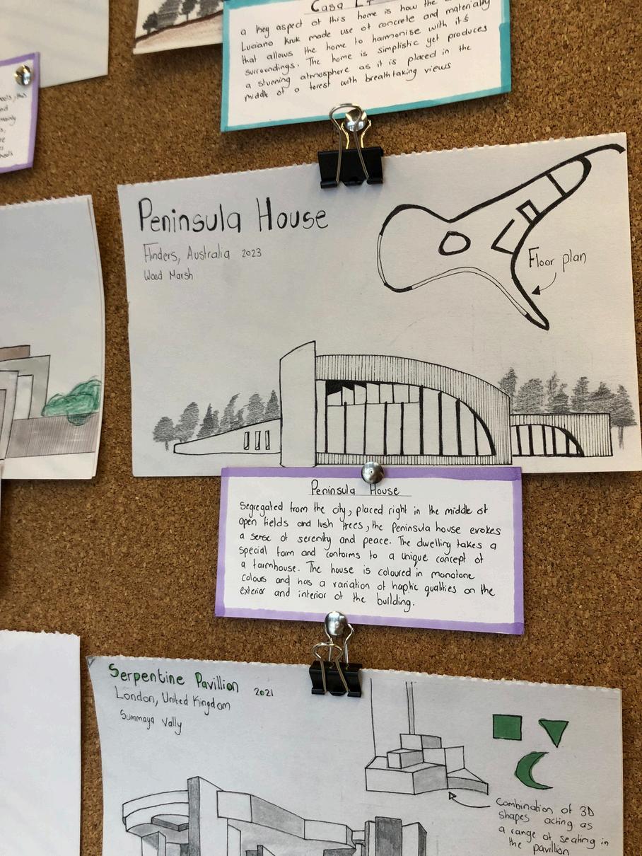
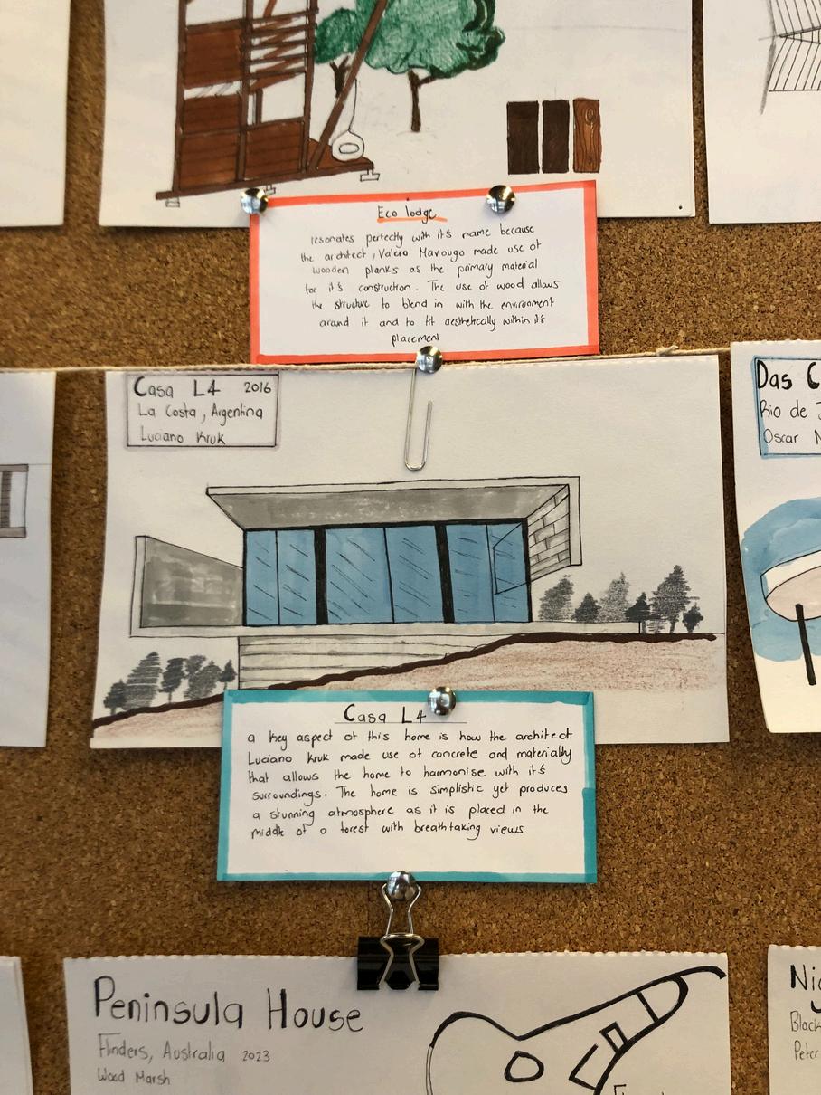
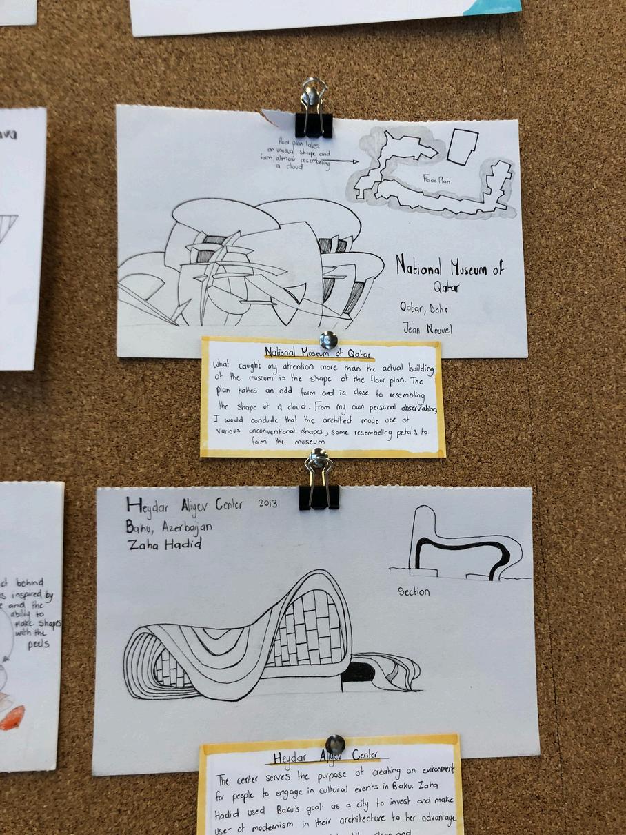
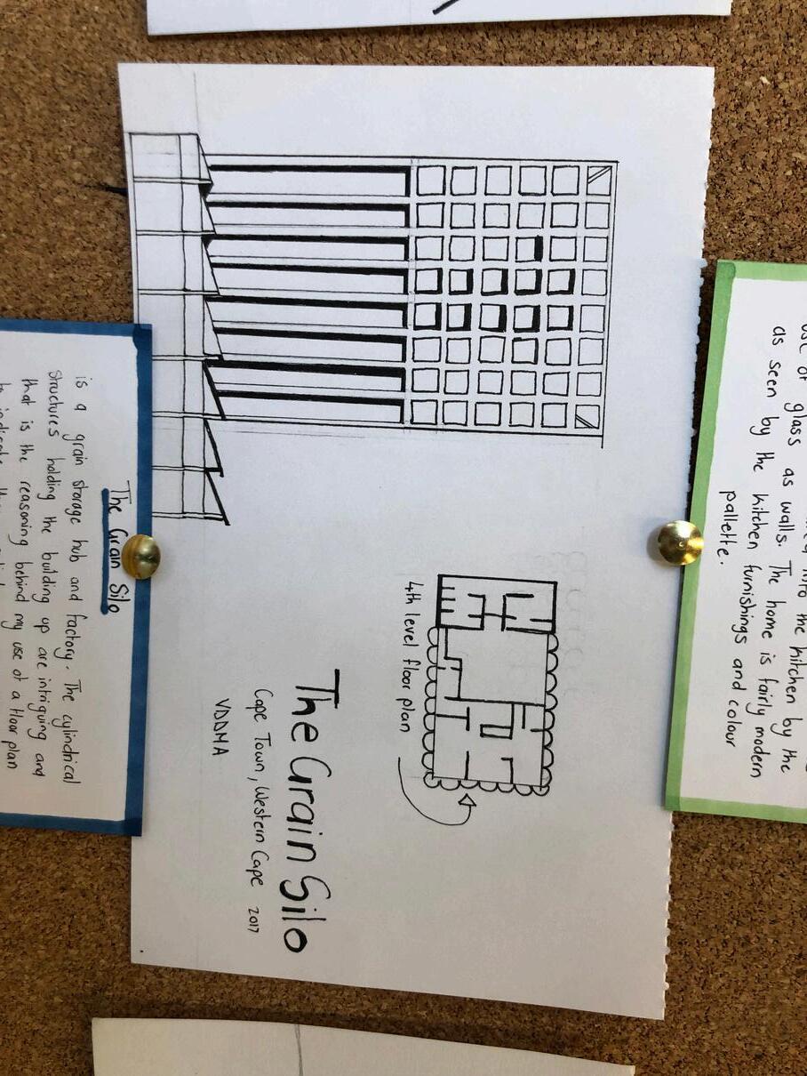
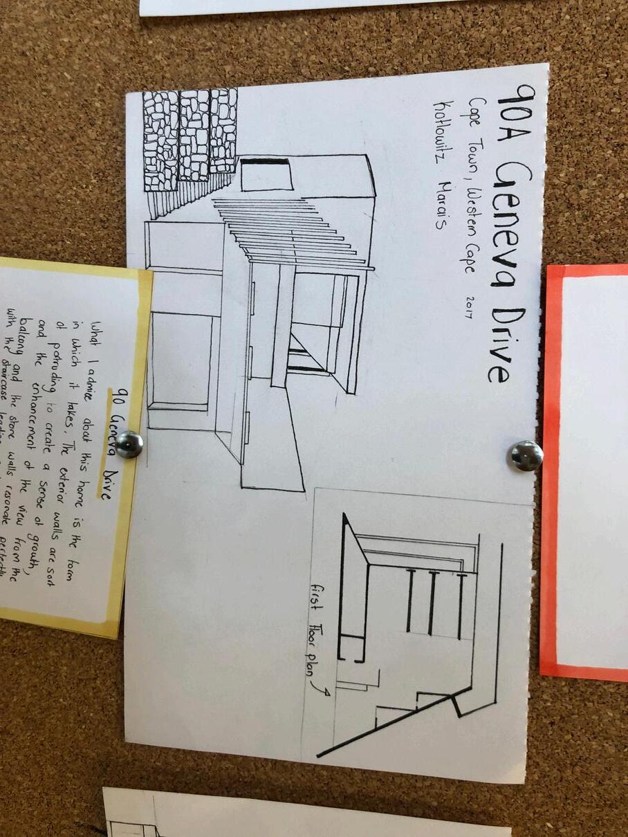
Project 50 is a compilation of 50 drawings of architectural structures and buildings across the world. I have made use of ink, copic and colour pencils to render each project in a way I believed each structure should be represented
Each drawing was completed on an A5 120 gsm paper
PIN UP PRESENTATION
PIN UP PRESENTATION CLOSE UPS
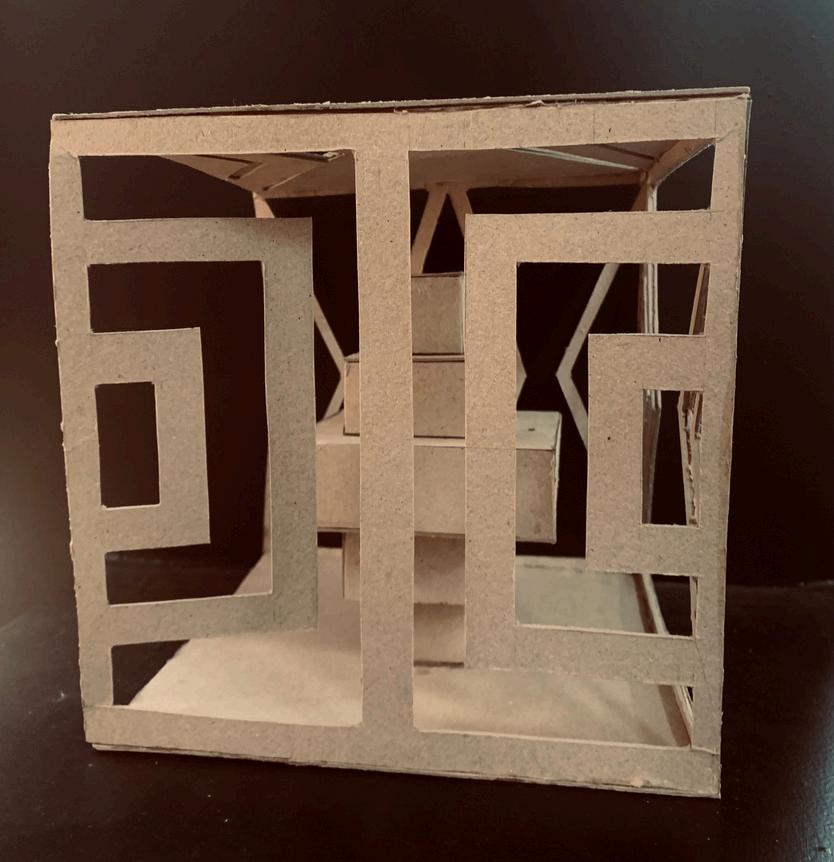
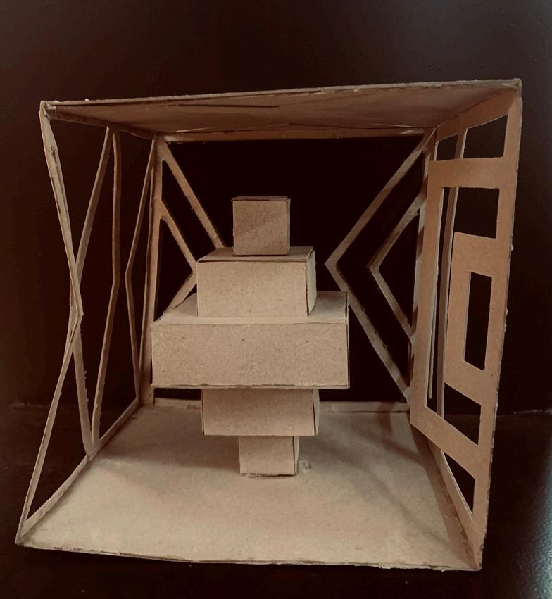
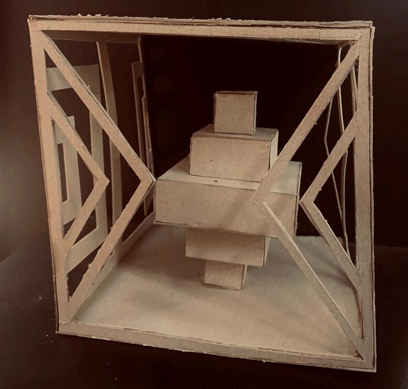
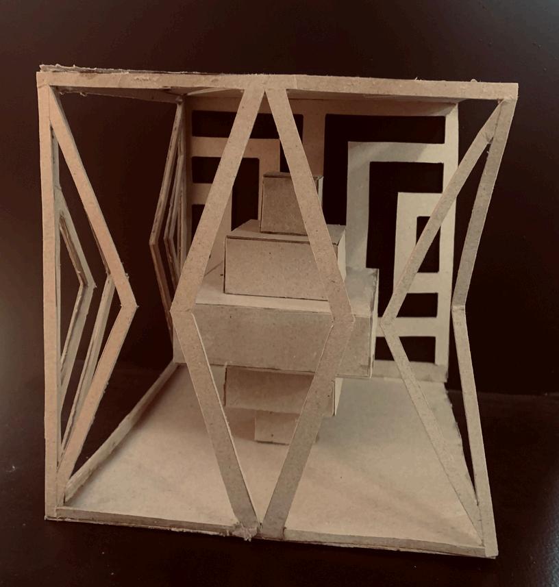
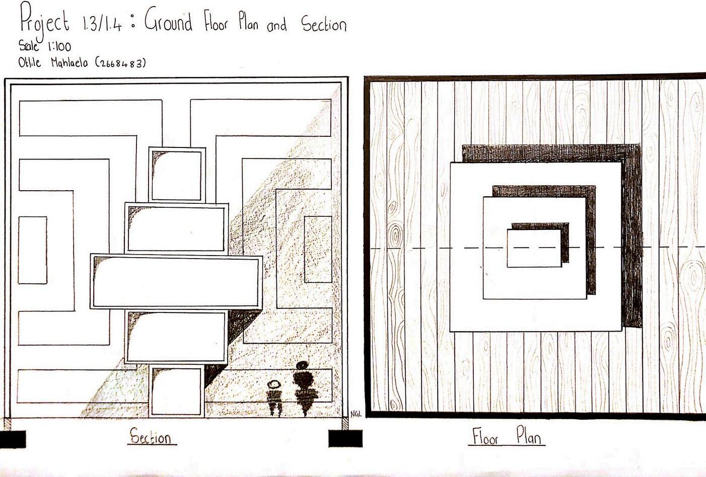
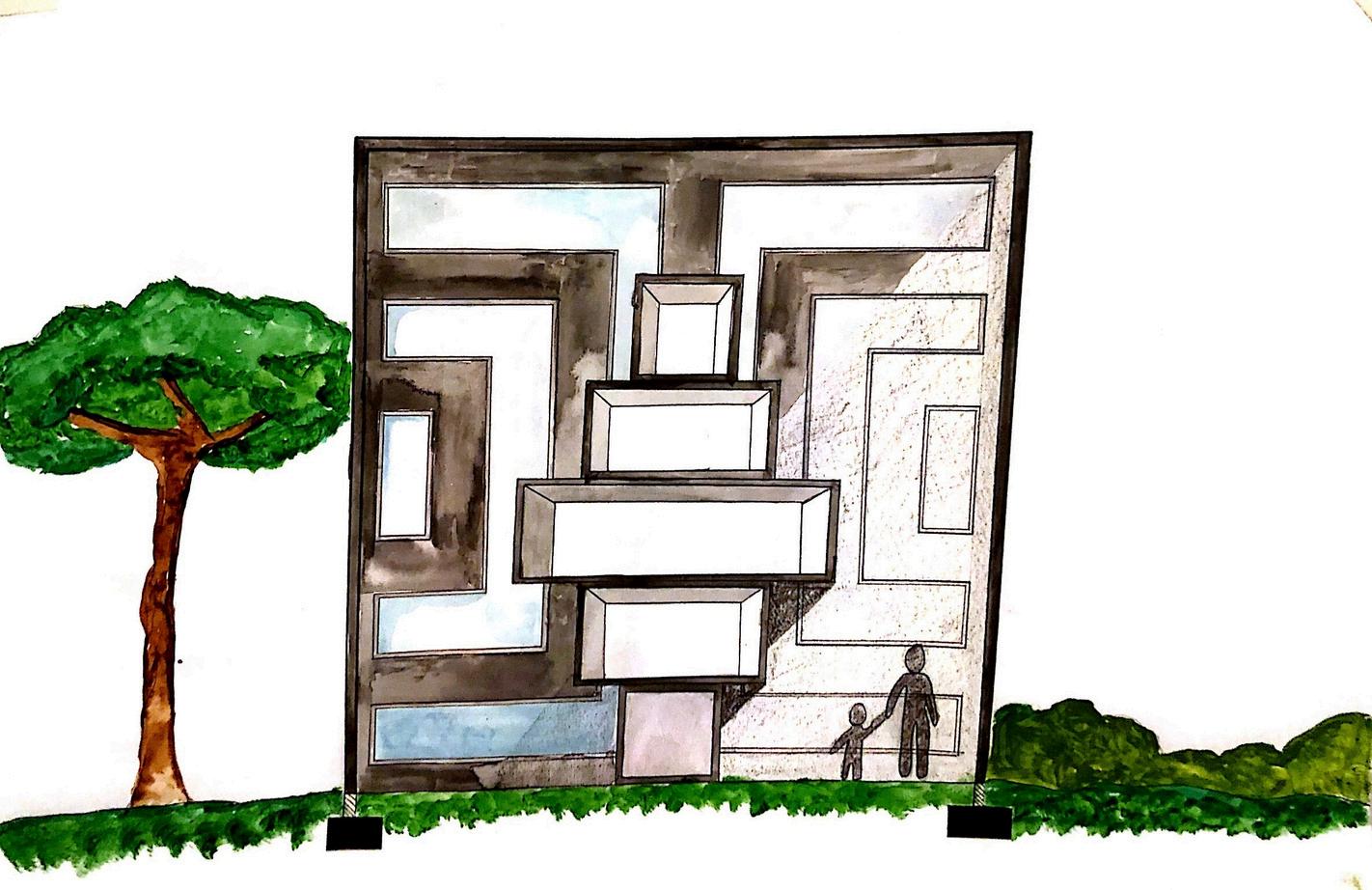
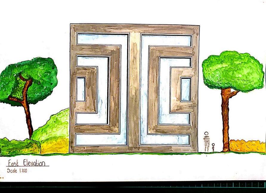
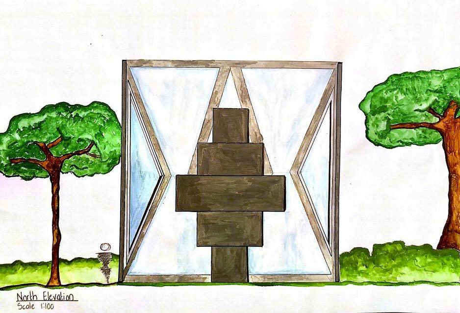
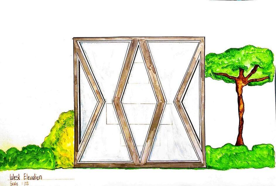
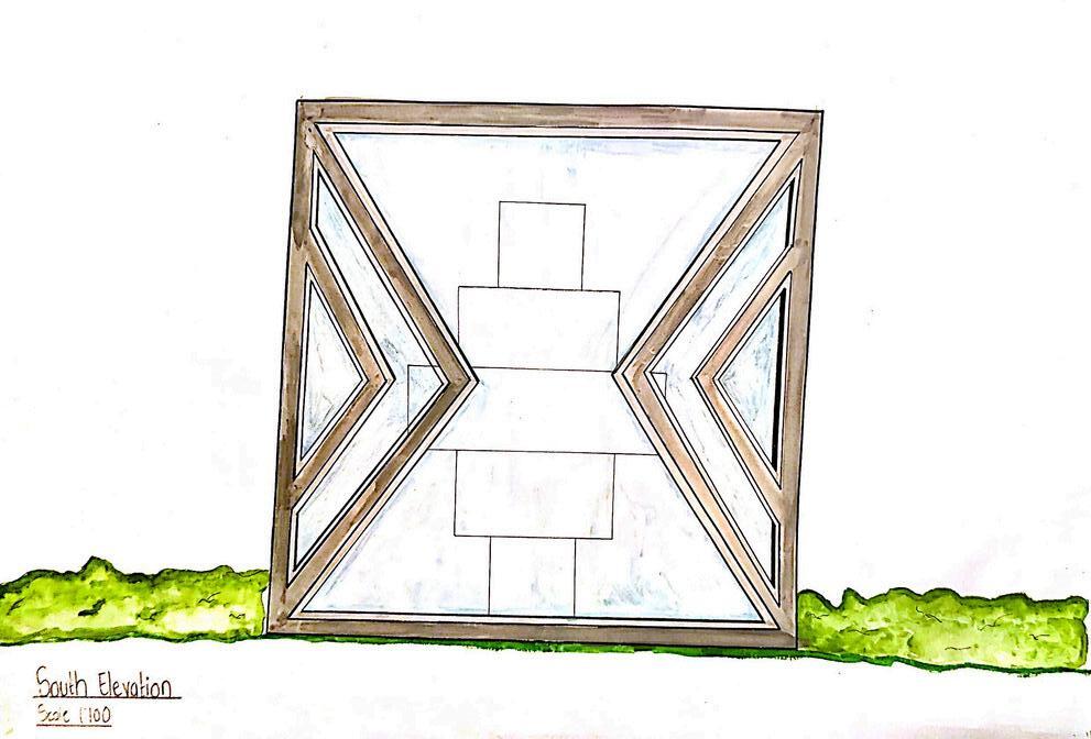
NDEBELE BOX
My Ndebele box is inspired by Ndebele pattern designer Esther Mahlangu. I envisioned the various forms that can be derived from her Ndebele patterns and applied that in the design and construction of my device. I have made use of intricate patterns as wall for my device and a set of rectangular prisms organised in a pattern similar to one of the designs I have used as inspiration by Esther. The set of rectangular prisms are placed in the middle of the box to add a structure that adds volume to the interior. This helped me achieve a focal point within the box that is surrounded by multiple walls carefully cut into various Ndebele Patterns.
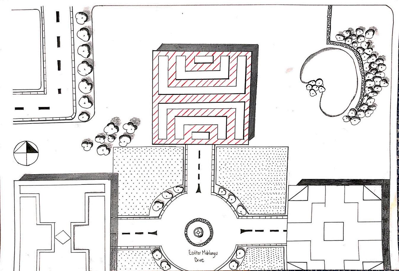
GA MATEBELE SCALE 1:100
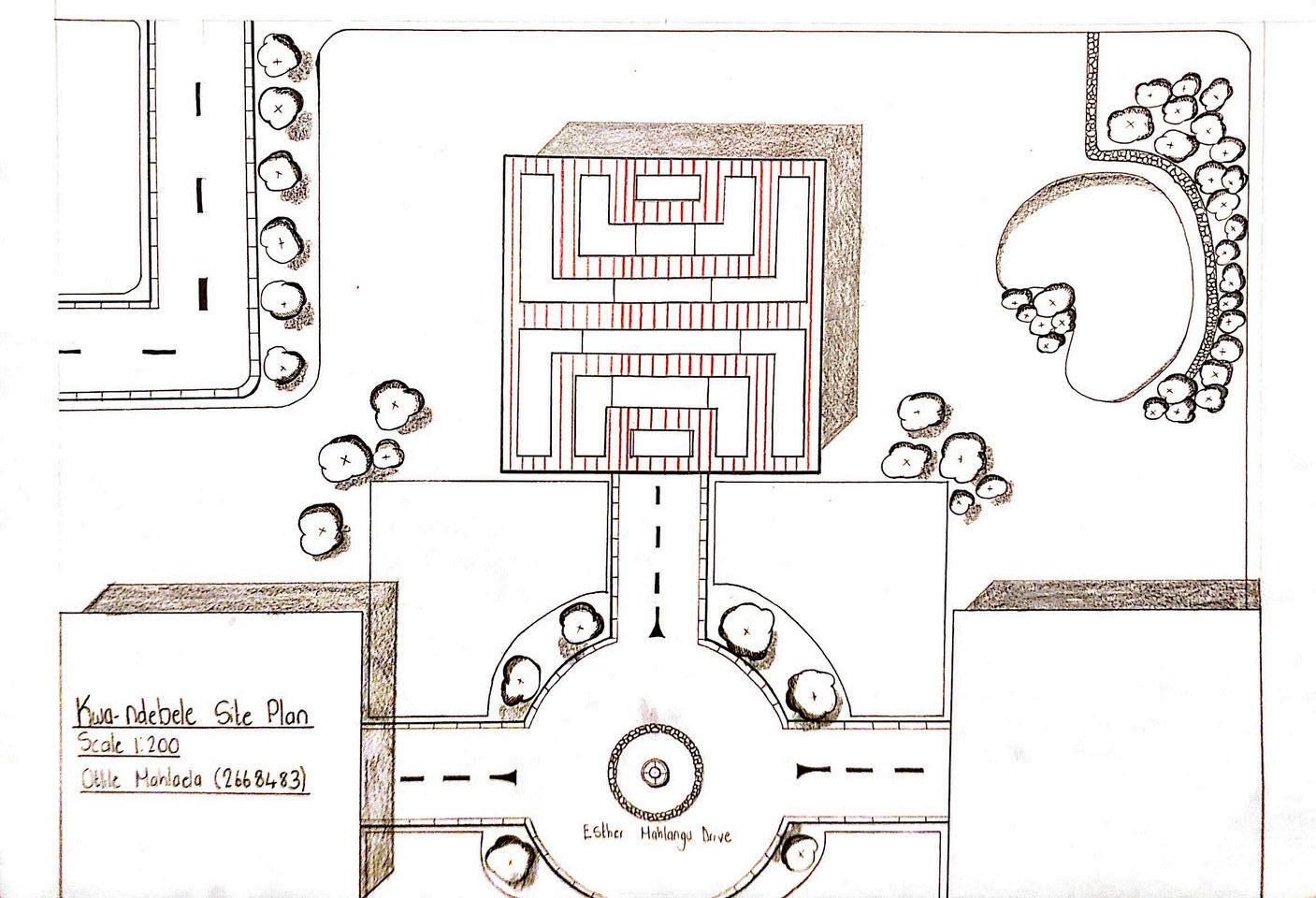
GA MATEBELE SCALE 1:100
Adjustments made:
Hatch pattern consists of angled lines
Patterns of neighbouring Ndebele boxes have been added
Fixed shaded areas
Dotted pattern added to represent front display gardens of each Ndebele box
GA MATEBELE SCALE 1:100
GA MATEBELE SCALE 1:100
Adjustments made:
Rendering with water colour paint
More human-like figures
Depth to show cut within element inside the box
GA MATEBELE SCALE 1:100
Hardwood floor is shown by the detailing of the planks
GA MATEBELE SCALE 1:100
RENDERED WITH WATERCOLOUR PAINT AND COPIC MARKERS
DRIFTING IN & OUT:
EXPOLRING THE LAYERS OF KURUMAN
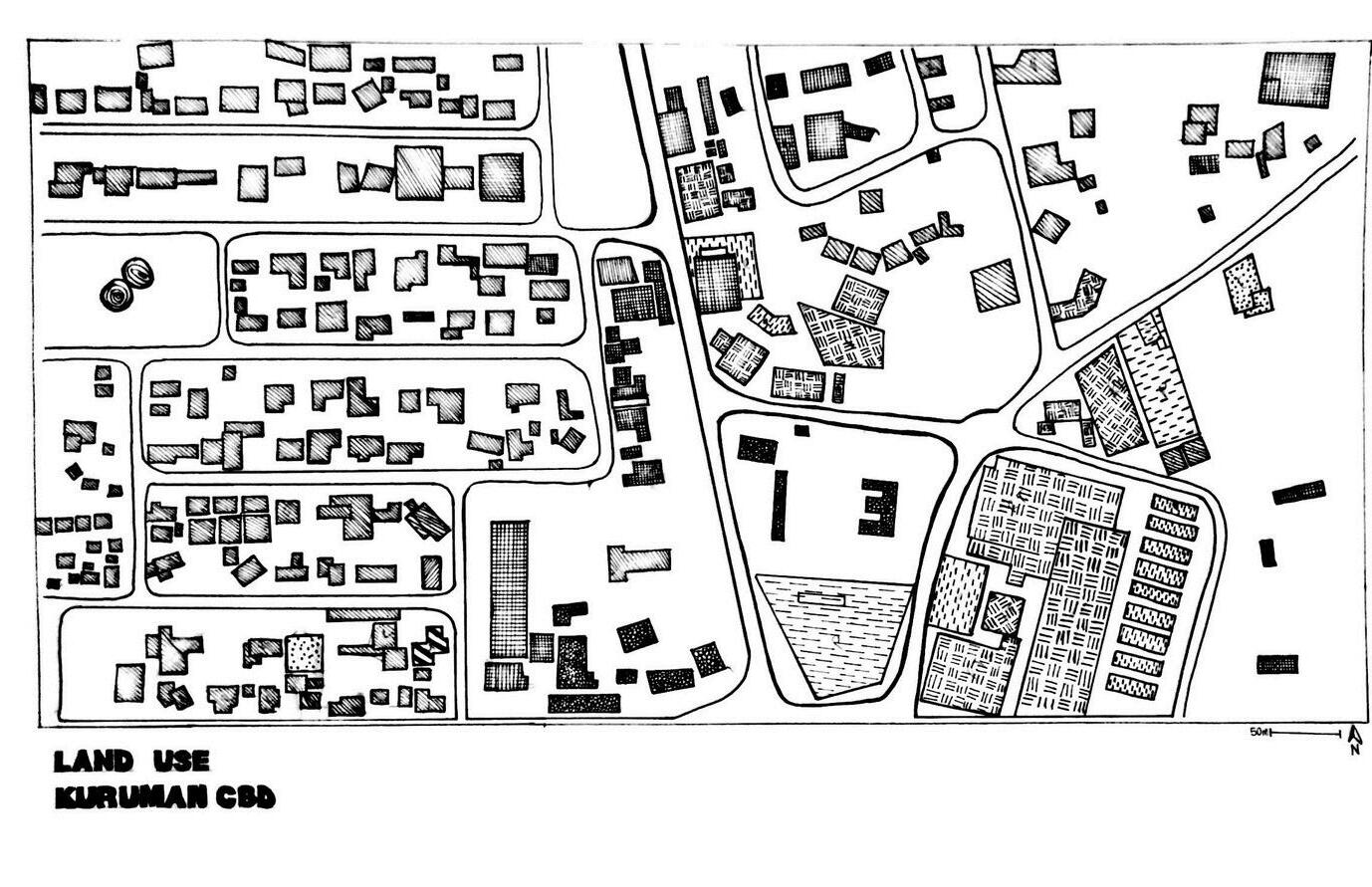
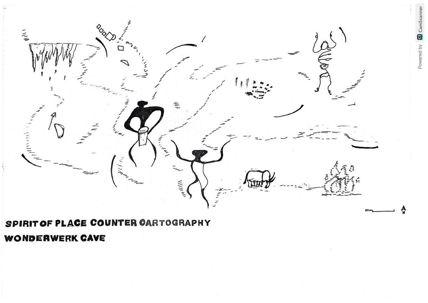
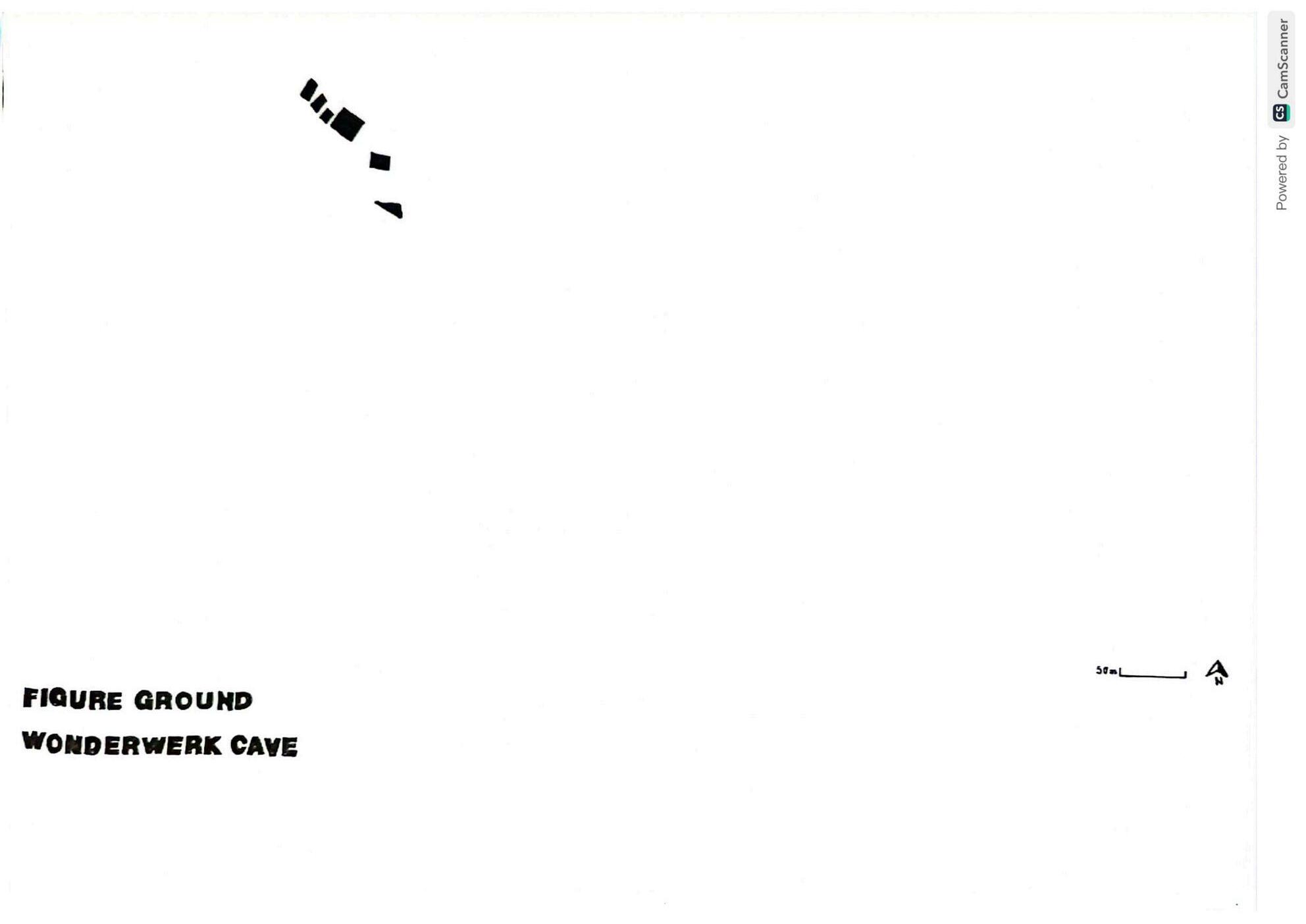
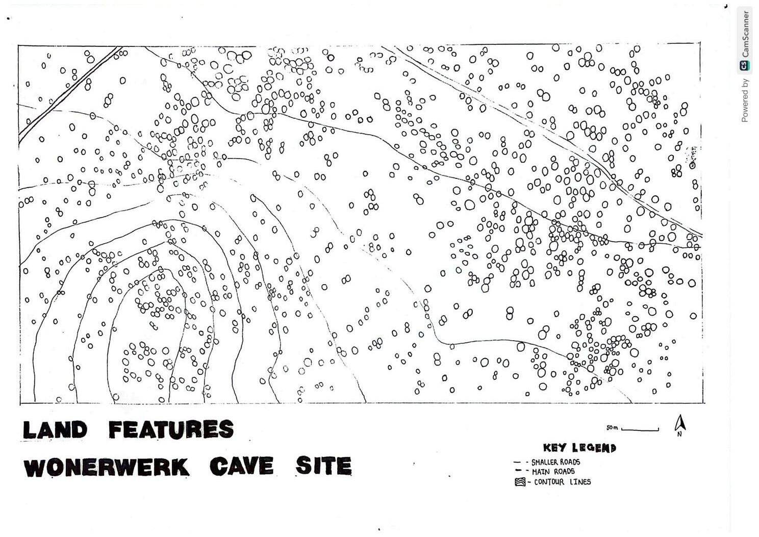
Drifting In & Out is a project with the aim of expanding our knowledge on the town of Kuruman, Northern Cape. Kuruman is the setting of Project 2 of Design and Theory and Project 2 of Descriptive Geometry
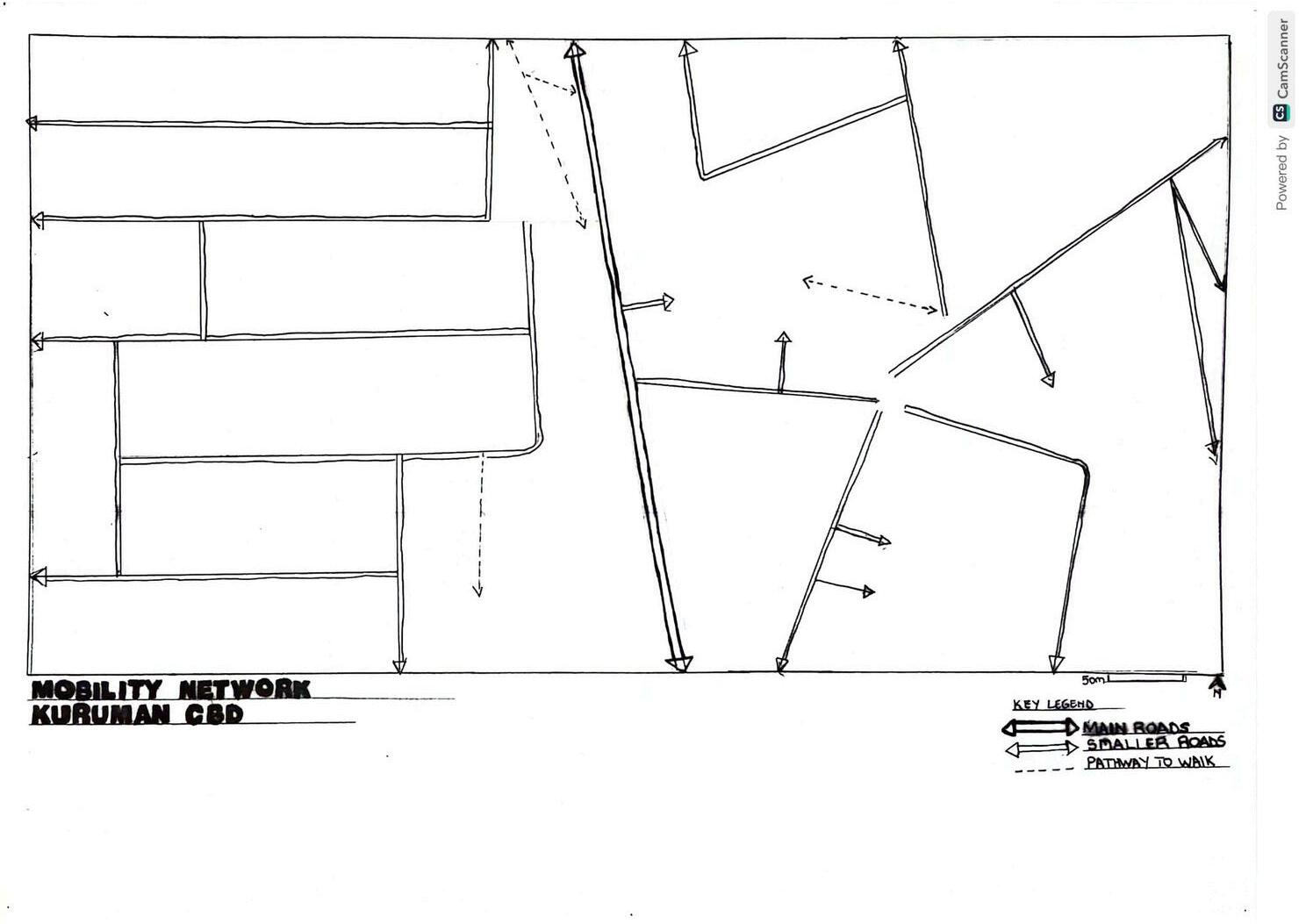
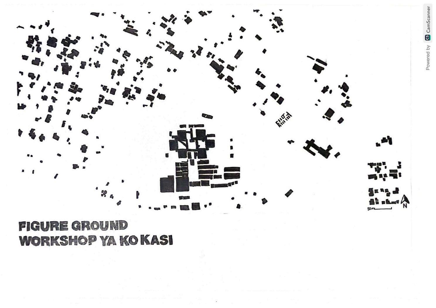
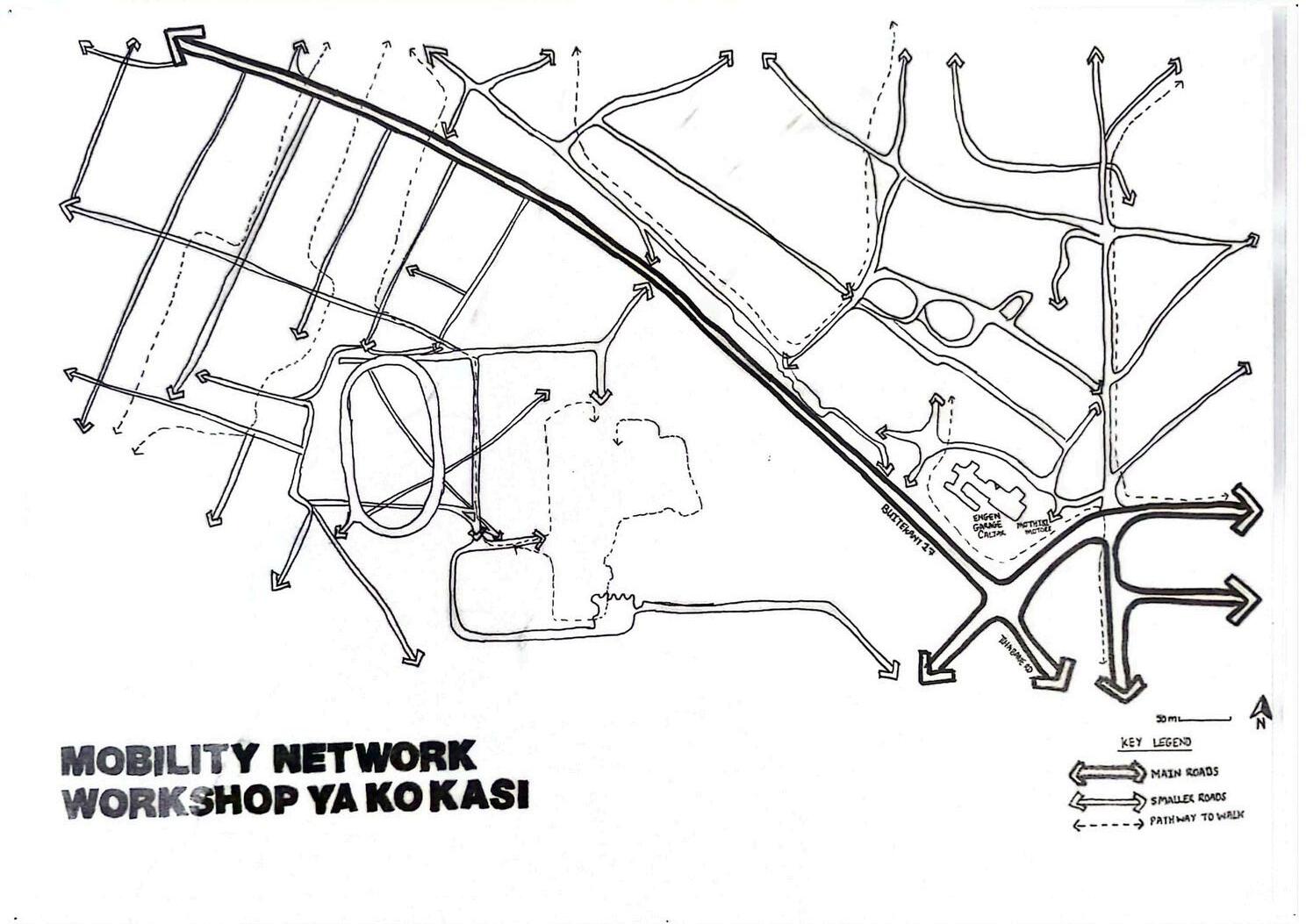
We were assigned to groups and given the task to create different kinds of maps depicting the areas we travelled to during our class trip to Kuruman. These included Kuruman CBD, Workshop Ko Kasi and the Wonderwerk Cave.
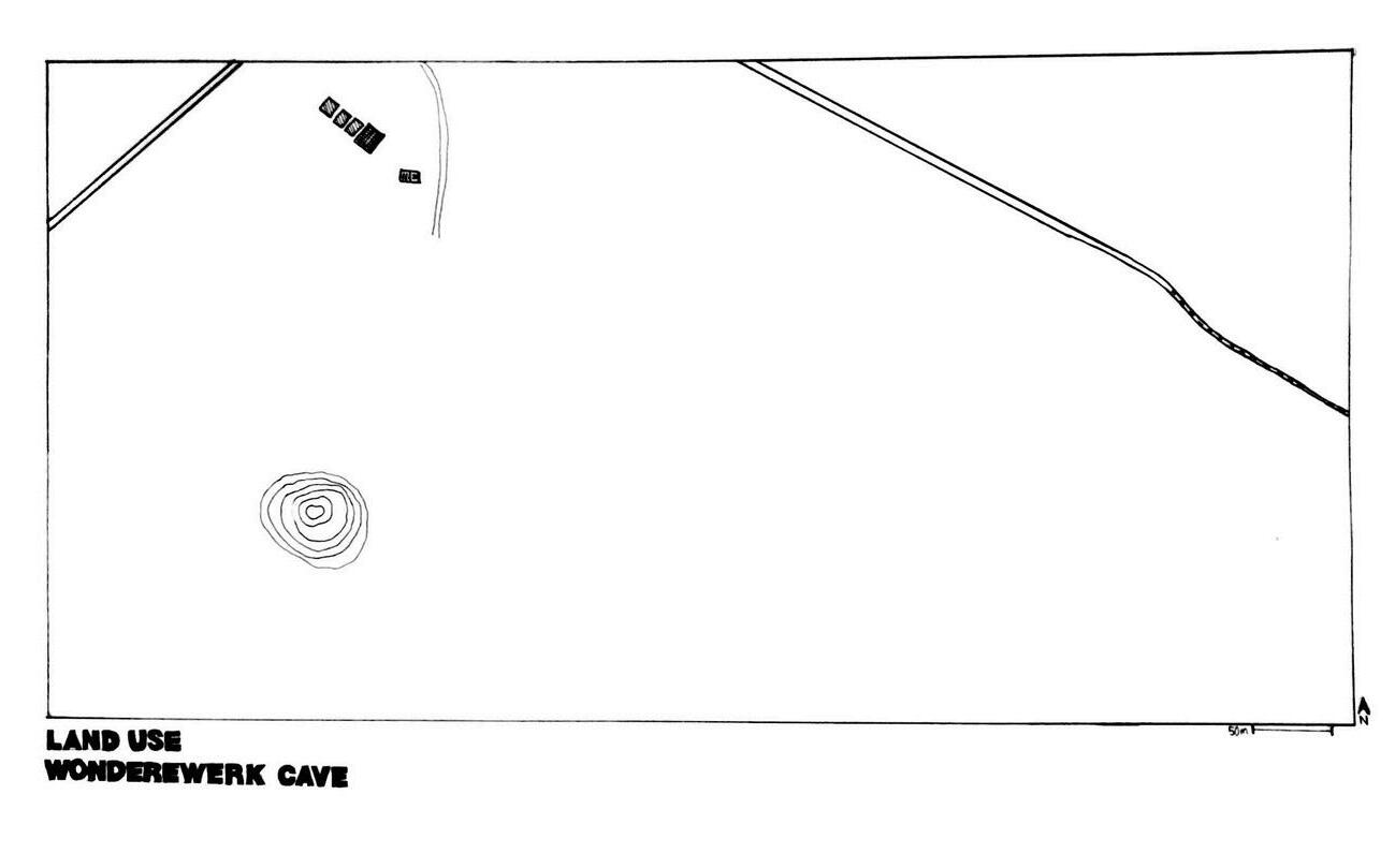
I was tasked with the Land Use maps for the Wonderwerk Cave and Kuruman CBD and I used hatching patterns to organise each portion of land and sort them according to what they are utilized for
Kuruman’s central business district is depicted by the land use map highlighting the various ways in which the land is utilised. Identified in the map are a vast amount of residential, retail, government, educational and business buildings and areas. This map indicates one main road alongside various residential roads
This land use map of the Wonderwerk Cave indicates a minimal amount of land utilisation, as the site is meant for preservation because of it’s important contribution to the evidence found on the development of human cognition during past epochs. Seen and indicated by the map using various hatch patterns are residential chalets, a reception area and bathroom facilities. The cave itself is represented by the section of contour lines. One tar road is shown by thick line weights whereas dirt roads are indicated by lighter line weights.
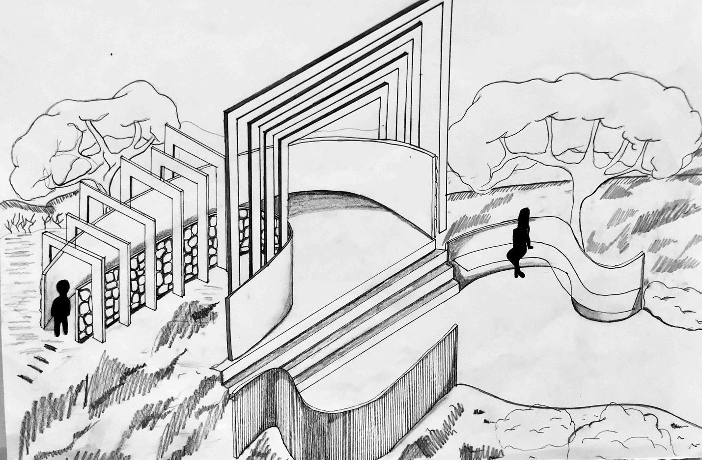
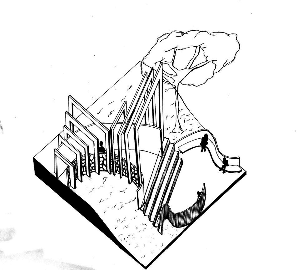
PERSPECTIVES TSA KGORO
This part of Project 2 was to draw and render perspective and axonometric views of our Kgoro Ya Kuruman models which were made to represent walking nodes along a walking path outside of the Wonderwerk Cave
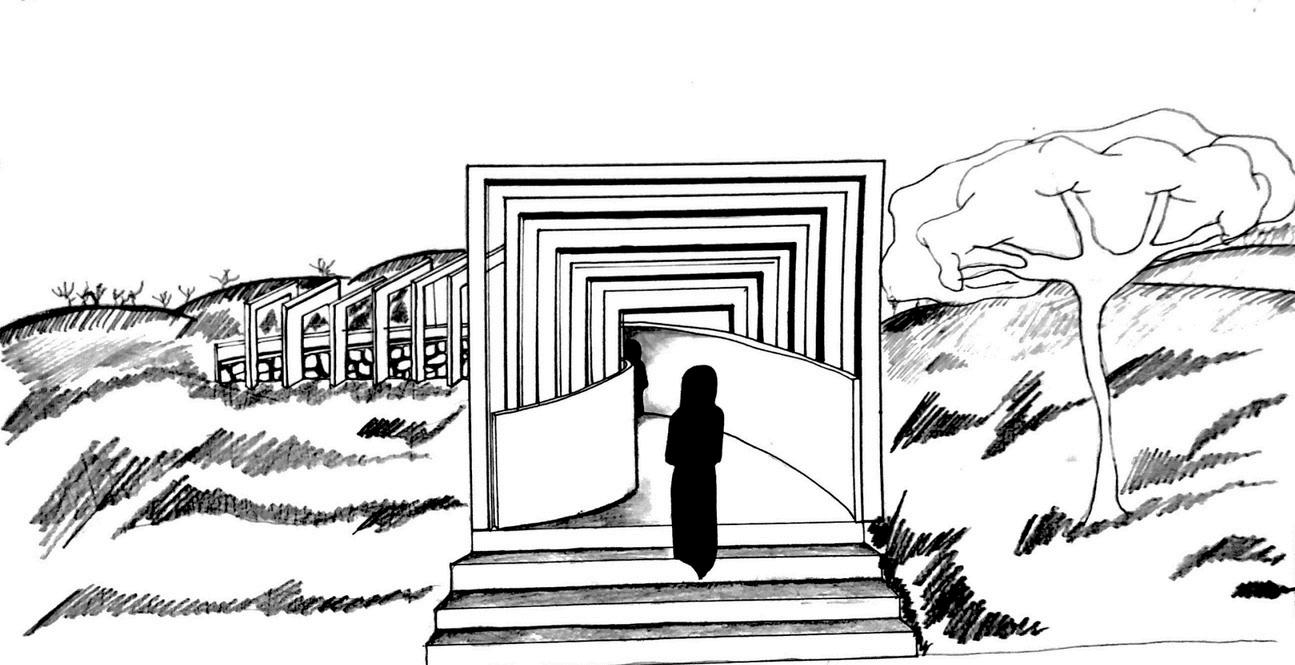
TWO POINT PERSPECTIVE